

Michael Telstad
-
Posts
137 -
Joined
-
Last visited
-
Days Won
51
Everything posted by Michael Telstad
-

Descend Burgundy Col without an axe?
Michael Telstad replied to DangGreenie's topic in Climber's Board
Climbed Clean Break yesterday as a carry over from Silverstar creek. We didn't encounter any snow at all and except for some nasty off route bushwacking on the descent it was pretty mellow. I'd highly recommend this over approaching from burgundy which I've heard is just as much effort as approaching from silverstar. Regarding the fire, it looked almost completely out and very under control. They threw a lot of resources at that thing and it looked like it worked. It's a stellar route and you should definitely get on it! -
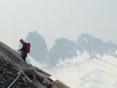
Trip: Nesakwatch Spires - SW ridge North spire Trip Date: 05/27/2018 Trip Report: Thanks to G-Spotter's Slesse Conditions report from two weeks ago, Tess and I were inspired to skip the Squamish crowds and go check out the Nesakwatch spires over the long (for us Americans) weekend. On Saturday morning we made the surprisingly easy drive in to the valley after nearly being sent to secondary for trying to take an apple over the border. Thanks to my mediocre off roading skills we almost got stuck twice in the first washout we hit along the road, but Zoe the 2011 forester pulled through. Not wanting to get stuck in the next real washout we opted for the road walk instead. The washout in question. From there the road is pretty manageable all the way to the actual bad washout. Which lasts for about a quarter mile and would need a pretty serious rig to navigate. There were fresh tire tracks so clearly it is not impossible. This new signage is pretty sweet, though i'm not sure it's totally necessary. After the road walking the trail pretty much just goes straight up. The trail was pretty much snow free up to the base of the rock wall at 5100ft. Tennies were really nice up to that point. Two guys were working on a new line on the rock wall below the spires. If anyone knows them I'm curious to hear how the route turned out. The snow made for very easy travel through the boulder fields. And it also made camping much much easier. The Bivy boulder is almost completely snow free but we didn't find it until we had already set up camp. So we used this boulder instead. The clouds gave quite the show on Saturday night, nothing beats this view. We woke up to grey skies and a cold wind so decided to wait a bit in hopes that things would warm up a bit And warm up it did. The splitter headwall cracks. Felt like easy 5.8 to me. Wish they had been longer. Summit! There was quite a bit of snow sticking around on the NE faces and some decided to rip loose from the ridge in the left of this picture. In order to avoid steep rotten snow on the standard descent we found a rap route down the S face. This particular station was a little cramped. There is still a lot of snow up there but that shouldn't discourage anyone from making the trek. Most of the easy routes appear to be holding a lot of snow but the steeper stuff like Dairyland looked to be in great shape. Go out and get it folks! Gear Notes: 2x .4-2 1x 3,4 nuts Boots & axe may be nice but no need for crampons Approach Notes: Tennies up to the rock wall (5100ft) Boots the rest of the way. Washouts at 2.3mi and 3.3mi depending on your vehicle.
-
Does anyone know if Ride of the Valkyries has seen any action in a while? Seeing that its a Hugh Herr FA has me wondering if it's a major sandbag. Or if the beta is to wear stilts with camhooks on the end and helium balloons tied around your ankles.
-
Seen a car with New Mexico plates at a trailhead?
Michael Telstad replied to dafna's topic in Climber's Board
Have you found out if your friend is OK? I climbed glacier the week after you posted this and found an abandoned tent on the approach. It was there on our way in, and on our way down, just sitting on the side of the trail in a dried up stream bed. -
I think I accidentally climbed this last weekend in an attempt to climb Winter solstice. I awkwardly traversed in left from the ledge on winter solstice proper, and climbed the first crack I got to. It had good (dirty) finger locks down low, then opened up to hands, then back down to rattly fingers. If this is your route it was fun, and with a little more traffic it would be a good 5.9ish alternative to both winter solstice and Midway.
-
I'm hoping to give it a go over memorial day weekend, based on the Approach/descent conditions you had while you were up there, is it worth bringing crampon compatible tennies and a light tool?
-
After reading the long winded comments about the approach to Dreamer on Mountain Project Tess and I decided to spend a misty northwest day scouting out the road and approach to the climb. As expected the mile or so beyond the 8 mile trailhead had some blow downs (Note that 8 mile trailhead is actually at the 6 mile point on the FS road). I brought a hand saw, axe and some loppers and made pretty quick work of these. That said the road is still pretty rough in a few spots on the way in so make sure you've got a car that can handle going through a streambed or two. We were in a Subaru Forester and questioned whether we would be able to get through a few of the rough patches. IMG_0367 by michael t, on Flickr[/img] [img:left]IMG_0370 by michael t, on Flickr[/img] We cleared the road of blowdowns to mile 7 where the road widens slightly before a small creek comes in and is eroding the road pretty quickly. You could go a bit further but there is a deep sandy mud puddle 5 minute walk in that I wouldn't want to get stuck in and you lose the ability to turn your car around. The logging road quickly turns into more of a streambed (particularly at this time of year) but if you follow your nose you'll find yourself on a beautiful little climbers trail through the forest. Neat to see some old mining hardware in place way up here. IMG_0374 by michael t, on Flickr IMG_0375 by michael t, on Flickr There is a rope handline set up to help facilitate the copper creek crossing but honestly a set of poles is probably more useful but we appreciated the handline to let us know we were in the right spot. A trail/path of least resistance is slightly downstream of where we crossed the creek. Follow a couple cairns through the boulders towards a beautiful waterfall. There are a ton of wild roses in this section right around the base of the waterfall which was pretty prickly, so we lopped a rough path from the boulders to the falls to spare the poor soul who decides to wear shorts on this approach. 004 by michael t, on Flickr (The rope across the stream) 008 by michael t, on Flickr (Clearing a path through the pricklies) DSC_0383 by michael t, on Flickr (The buttress in sight!) 005 by michael t, on Flickr (Red webbing and a cairn marks the alder tunnel. We also replaced some of the faded pink tape with new orange tape.) To the right of the base of the waterfall someone has some red tubular webbing which is still there marking the base of the tunnel through the slide alder. There is also a bit of flagging marking the way. I imagine people have a harder time finding this later in the season when there is vegetation growing every which way. We found it pretty straightforward because everything was still budding/snow had just melted off maybe last week. Slide alder tunnel is pretty much a highway as long as you are prepared to just climb through on your hands and knees. We did run into one spot that was impossible to get through with backpacks on so brought the saw out for a quick trip (but don't worry plenty of adventure schwack still there). 003 by michael t, on Flickr (Tess doing work on the slide alder) IMG_0406 by michael t, on Flickr (Some pink tape marking the tunnel) After the tunnel we hit snow. We went up to the top of the snow but this section starts to get pretty steep muddy and wet and we didn't feel super comfortable going much further through the steep brush and snow without an an ice axe or at least a sturdier set of poles (those Ultra light BD Carbon Z poles don't really cut it on snow). From our turnaround point we had a fantastic view of the route. Once the snow is gone and the slabs dry, you can most likely just scramble straight from here to the base of the climb. 006 by michael t, on Flickr (Tess making her way up the snow) IMG_0411 by michael t, on Flickr (Me trying not to punch through the thin hollow snow over slab) IMG_0926 copy by michael t, on Flickr (Rough route overlay from our turnaround point) Would love to get confirmation that the the normal approach route just continues straight from this point through the avy chute. Is there actually a little trail that would normally appear to get to the base of the rock if there wasn't snow or is it just some stiff veggie belaying up and down from the area above this snow. Hope this helps anyone trying to get out there soon!

