


Devin27
-
Posts
144 -
Joined
-
Last visited
Content Type
Profiles
Forums
Events
Posts posted by Devin27
-
-
Bump
-
bump
-
Hi All,
Selling my wife's Black Diamond Women's Shiva Randonee Boots. Used for backcountry skiing with an alpine touring set up. They are BD size 25, which equates to between an 8 and 8.5 Women's
Check out the BD sizing chart below. There were worn once and were just too small for my wife.
See the REI website below for info on the boots. Paid Almost $500 for these boots 2 months ago.
Asking $300
Located in Bothell, WA. Can meet anywhere between Seattle and Everett, WA. Local prefered, but will ship at your expense and using paypal.
http://www.rei.com/product/775396/black-diamond-shiva-randonee-boots-womens-20102011
-
There are plenty of one day climbs out there, depending on how far you are willing to drive and how far you are willing to hike.
Many of the 1 day climbs involve scrambling and snow, as opposed to rock and glacier climbing. A few of my favorites
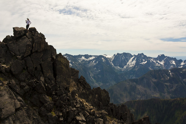
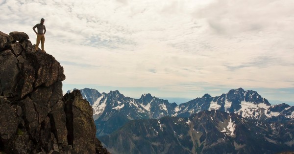
Sahale
Mt Maude
Cashmere
Dragontail
Colchuck
Cannon
Snoqualmie Mountain, Silver Peak, Guye Peak and pretty much anything else around Snoqualmie Pass is always a fun, nearby climb
-
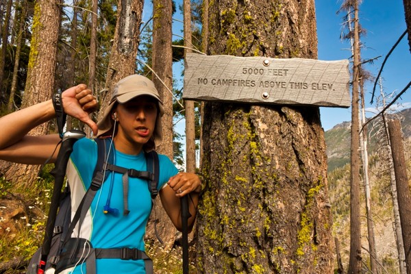
To anyone hiking switchback peak (AKA Cooney Peak) in the Chelan Sawtooths. Please bring a 1.5 inch PVC pipe cap with you, as one of the caps on the summit register is broken and the register will likely be gone during the next rain.
-
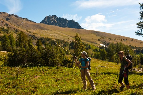
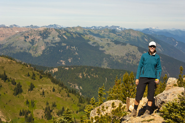
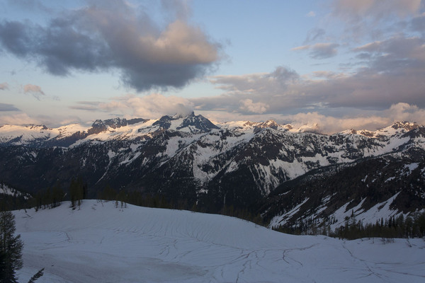
Trip: Cashmere Mountain 8-21-2011 - Windy Pass
Date: 8/26/2011
Trip Report:
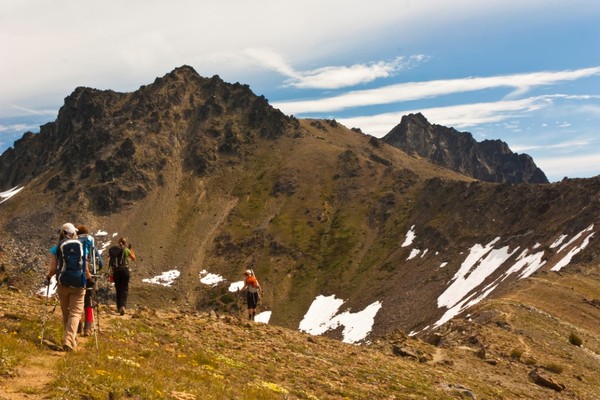
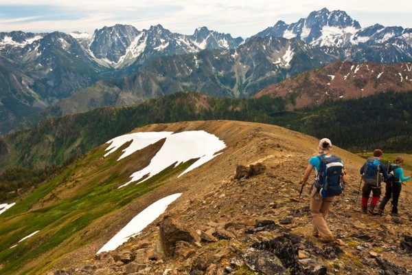
This past weekend we day climbed Cashmere Mountain in the Enchantment Area. We will be back in the core Enchantments in Larch season, but this was a good warm up and taste of things to come.
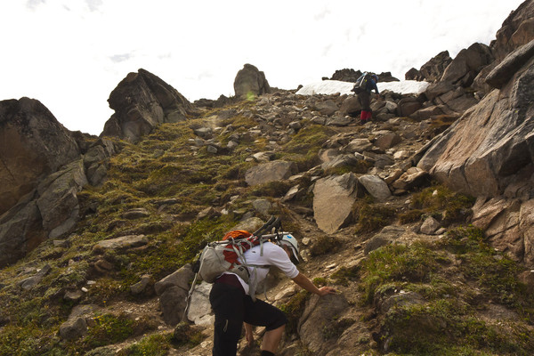
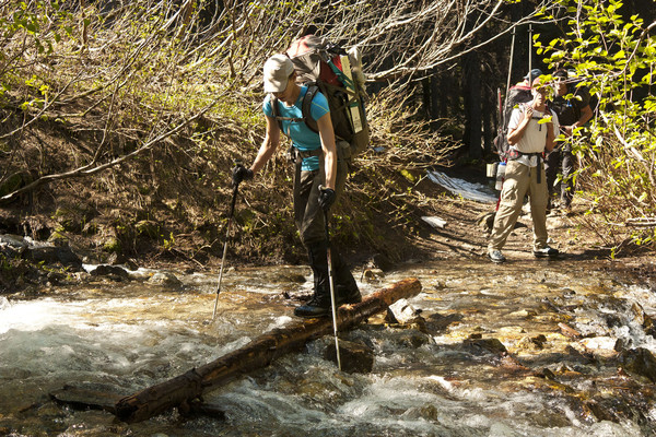
Left Seattle at 4am and were heading up the Eightmile lake trail at 7am. The trail to eightmile lake was relatively flat, which meant we had wasted 3 or so miles gaining only about 1000 ft. The trail up to Caroline and Little Caroline lakes was dry, hot and buggy, bring lots of water. We got eaten alive as we stopped for water at Caroline Lake and horseflies followed and conitnued to attack everytime we stopped. With the bugs driving us along, we made good time to Windy Pass. We had read about the climbers path leading directly up the ridge, but decided to just stick with the trail to avoid tedious bushwhacking.
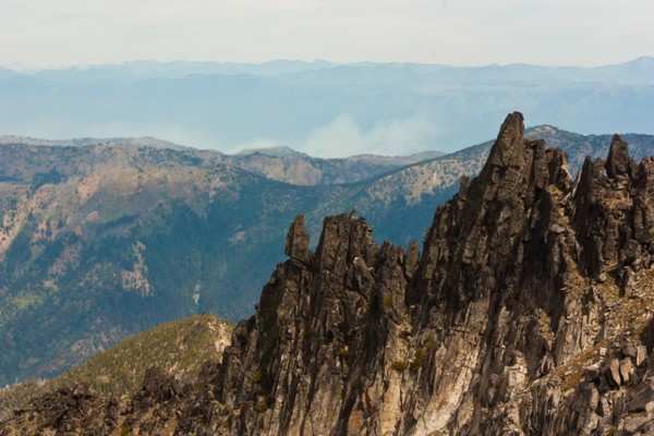
From Windy pass, it was an easy trail up to the summit block of Cashmere. Once on rocks, we traversed around to the climbers left until we crossed over the North ridge. There we found the easy class 3 gully to the summit. We had to cross 3 small snow fields on the traverse, but they had nice steps kicked in. They have a interesting run out that I wouldn't want to fall down without an axe so I used mine, but you could get by without it.
At the summit, we discovered there was a recent hatching of flying ants and the summit was literally covered in thousands of them. I stayed only long enough for a photo and to discover the summit register was gone. The PVC pipe was there, but broken open and there was no log at all.
On the decent we decided to follow the climbers trail down the ridge on the direct route to the lakes. This trail disappears half way down the ridge. At this point we decided to try and take the path of least resistance to rejoin the trail to the West. This turned out to no be such a good plan, as we ended up in waist deep field of flowers and then in a marsh. I think we could, and maybe should, have followed the ridge all the way down to the lake. Hopefully someone familiar with this decent can add more.
The hike out was long and buggy, but not too hot with the setting sun. Back at the trailhead by 7pm for brauts and beer in Leavenworth.
Leave Seattle 4:30am
Trailhead 7:00am
Eight Mile Lake 8:10am
Windy Pass 11:00am
Summit 1:20pm
Cars- 7:00pm
Car to Car- 12 hours
17.6 Miles round Trip
5600 ft Elevation
Photos!!!
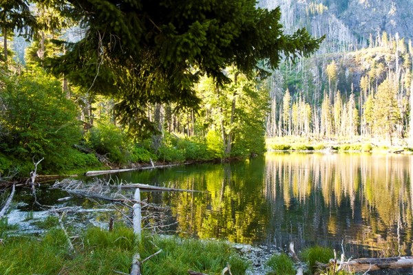
Eightmile Lake and out first battle with the bugs
Up the dry trail to Caroline lake
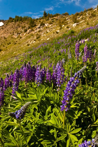
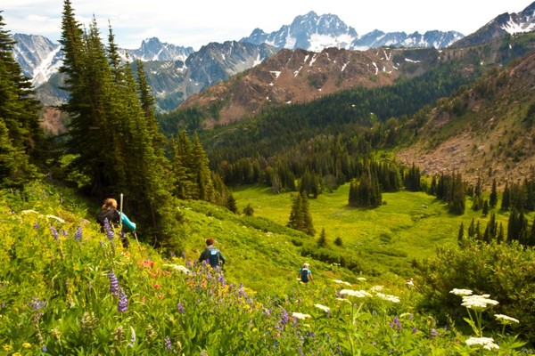
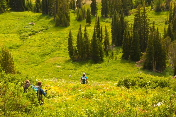
The wildflower are out in full force
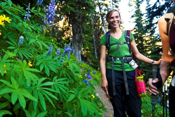
Robin hiking down to Caroline lake
First views of the summit of Cashmere
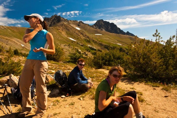
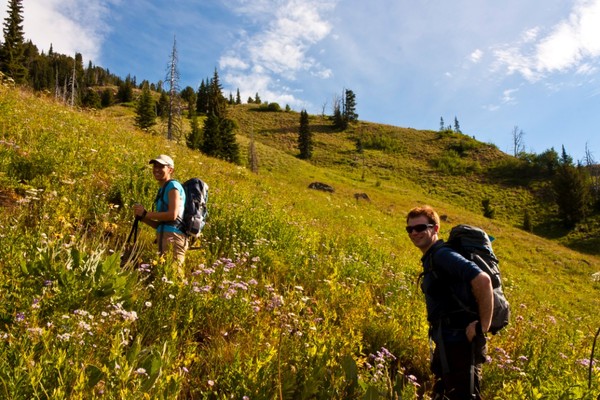
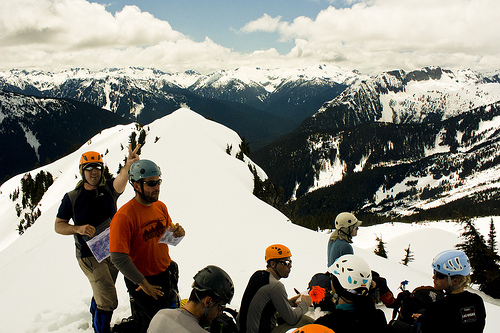
Danika and Robin taking a break at Windy pass
Aubrey at Windy Pass
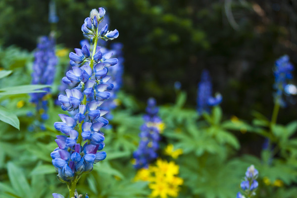
More flowers
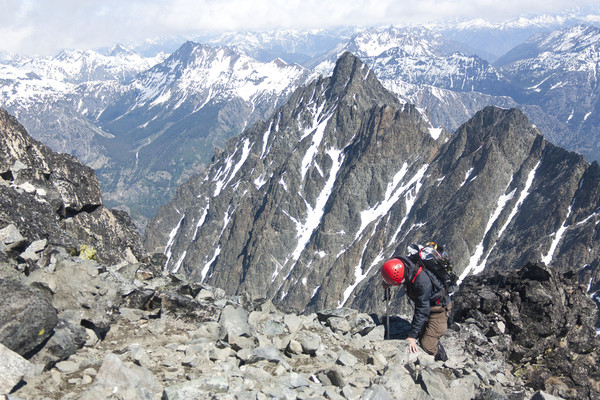
Heading along the ridge
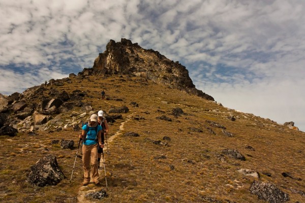
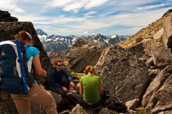
Taking a break to enjoy the view of Rainier

Crossing the snow fields below the summit block
Class 3 gully on the far side of the north ridge
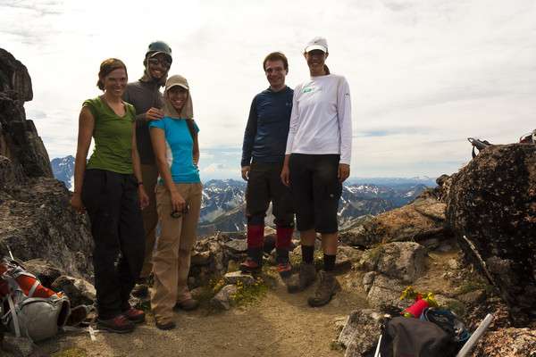
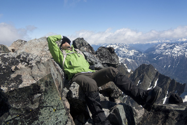
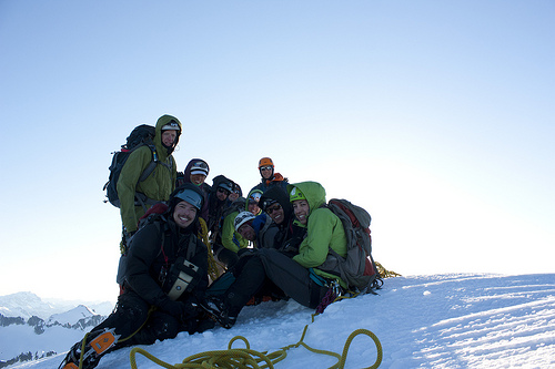
Group summit shot
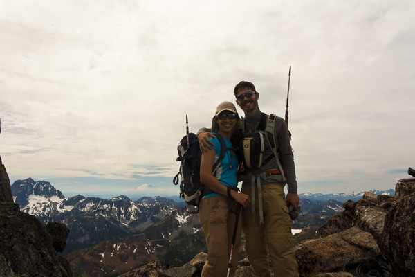
Me and Danika at the summit
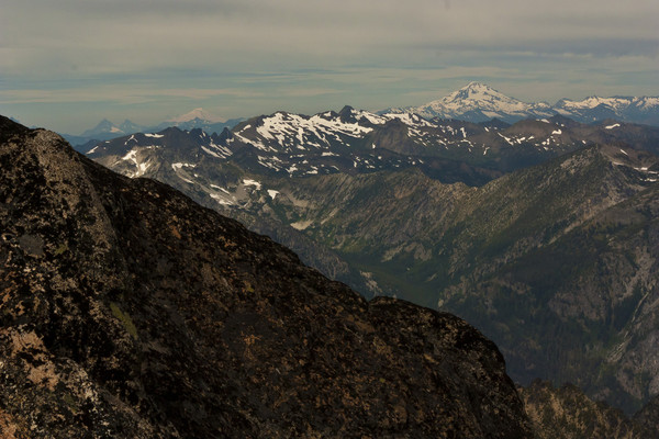
Glacier Peak in the distance, next time maybe
Aubrey at the summit
Me on the summit, being attacked by flying ants
Our ridge decent
Heading through the meadows on our misguided decent
Sorry flowers
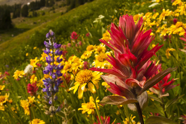
Did give me the best flower shots of the trip though
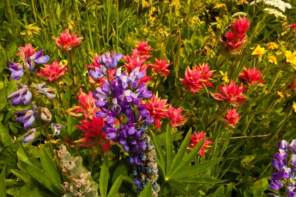
More wildflowers
Long and tiring decent
Gear Notes:
Ice axe (used for 2 minutes across snow field), Mountaineering boots (Carried, but never used, Day hikers are fine)
BUG SPRAY(Used all that we had and it wasnt enough!!!!)
Approach Notes:
Trail is clear and easy all the way to the summit area. 3 small snow patches near the base of the summit, but easy to cross and will likely be gone soon.
-
Thanks all. You were spot on. Bugs were pretty aggressive and seemed to like the taste of our bug spray. Snow was not an issue at all. 2 or 3 small snow fields near the summit which were easily crossed with no problems. They could be avoided all together if you stay on the rock while traversing to the ridge. I'll post a full TR when I finish going through my photos
-
Hi all,
Planning on heading that way this weekend for a day climb and wanted to see if anyone had been out there lately.
How much snow is on the peak and how long till you encountered it?
Ice axe, crampons? Stream crossings?
Thanks,
Devin
-
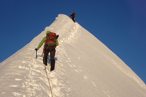
Trip: Sahale Peak - Sahale Arm
Date: 7/23/2011
Trip Report:
Photos to follow when I get 5 free minutes to download them.
Our original plan was an overnight at Sahale Glaicer camp to tackle 3 Bugler top 100, Sahale, Buckner and Horseshoe (I have no idea why Horseshoe makes the list, but its there). The plan however fell apart when all the permits were snatched up early in the day by a certain large climbing group that will remain nameless.
We decided a day trip up Sahale Arm would still be fun, and we would decide on our destination once we got there.
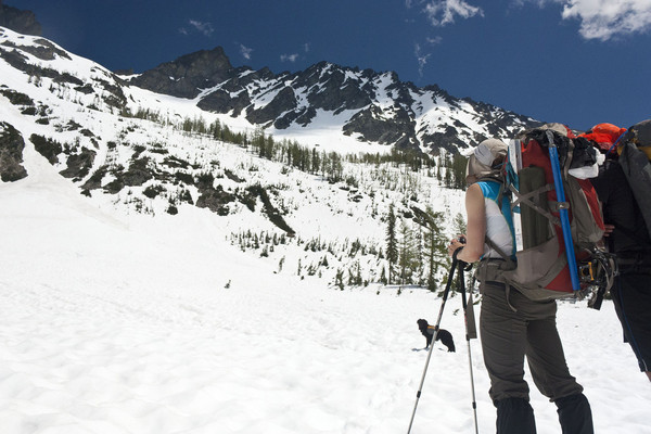
The hike up to cascade pass and the arm was uneventful. Snow starts on the pass around 1000 ft up, but it was easy travel. We moved very quickly up to the pass and up the arm. The snow on the arm was broken up here and there with meadows and rock piles starting to come back out, but there is still a lot of snow and it doesn't seem to be going anywhere too fast. We followed a goats tracks the whole way up, but never did find him.
Once at the "glacier" we decided that Buckner was out of our reach today and so we headed up Sahale. Great snow again made for quick travel. We headed up the right side of the glacier basin to avoid the reported (but not seen) crevasse that can open in the center of the glacier. We did not bother to rope up, given the lack of crevasses reported on this glacier. There were several other groups on the route and no one else roped up.
There is snow all the way to the summit block. Once there, we choose a path on the left side of the ridge, because the right side was taken by a team that was setting up a fixed line. Do not take the farthest left route, because this ends about 15 ft from the summit with a tricky move and poor holds. The best route is slightly to the right of the northwest ridge. The climbers on the right route called it low class 5 terrain, but it looked more like class 4 to me.
No sign of any register at the summit. Some quick photos and we had to get moving as the afternoon groups were catching up and there wasn't much room at the summit. There is a nice Rap station with ring near the Northwest ridge. Snow was perfect to plunge down and we were back at the pass in no time.
The same cant be said for getting from the pass to the car, which seemed to take forever. We also had to constantly pass the day hiker tourist crowd, many of whom were surprisingly displeased about moving aside for fast groups. O the joys of hiking in a popular area
Gear Notes:
Ice axe, Crampons (didnt need), Rope (used for summit block handline when I got off route, and rappel), Harness
Approach Notes:
I'll get the times off my camera
-
There was a waterfall about 400 feet above our camp on the route to Seven Fingered Jack that was accessible.
I do have the GPS file, but I havent had a chance to get it off my GPS yet. I will try and remember tonight.
We came in from the Phelps Creek Trail Head off US2, so we didnt need to go through Holden.
-
Cool photos
Was thinking of heading there this weekend to tag Sahale, Buckner(south side) and Horseshoe.
How was the traverse across Horseshoe basin on your way back to Sahale Glacier? Is the snow pretty consolidated?
-
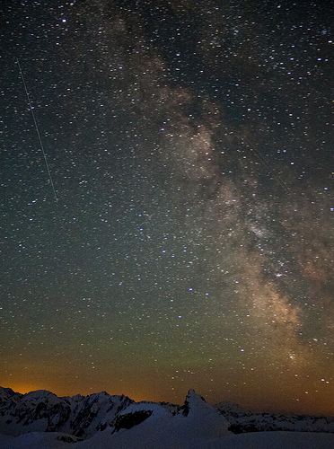
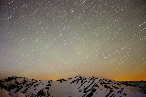
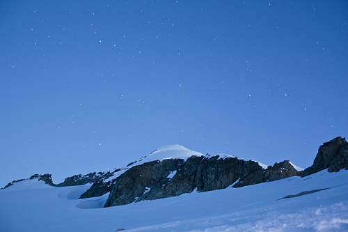
Scenic
Milky Way over Glacier Peak
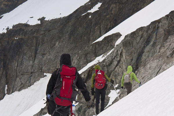
Alpine
Climbing the ridge to Mount Fernow
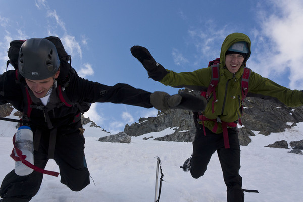
Humor
Watch the last step
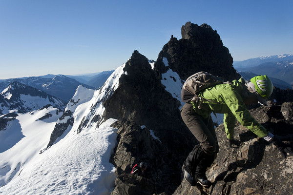
Cragging
Climbing the summit block of Seven Fingered Jack
-
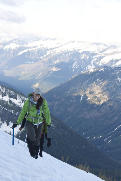
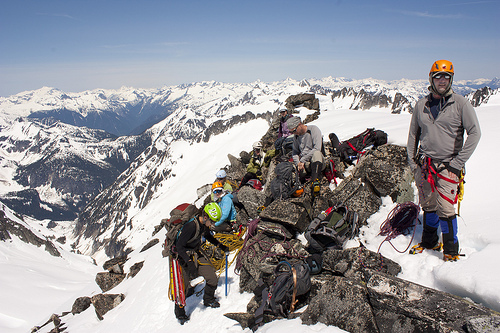
Trip: Mount Fernow and Seven Fingered Jack - Phelps Creek trail to the Leroy Creek Basin
Date: 7/3/2011
Trip Report:
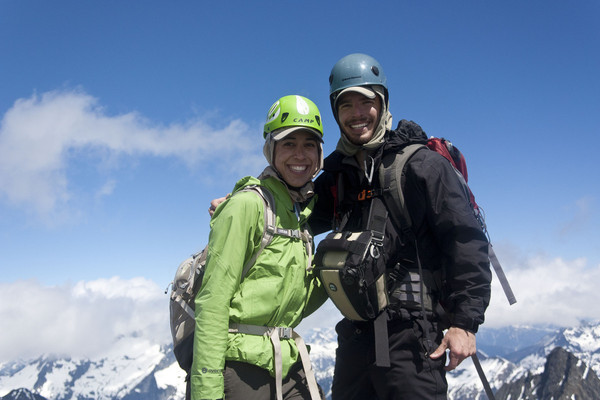
After marching up the conga line of the DC route up Rainier last weekend, we decided to avoid the volcanoes and find some mountain solitude for our 4th of July weekend in the Entiat Range. The team comprised of 5 Boealps members- Ken, Dustin, Jeff, Danika and I; and our canine companion Indy.
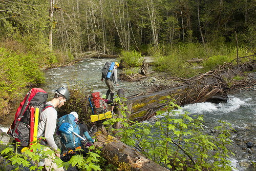
We began at the Phelps Creek Trailhead after a very long drive on the Chiwawa River Road. The hike along the Phelps Creek Trail to the Leroy Creek turn off featured about 7 or 8 creek crossings and a decent amount of snow. The creeks are moving fast because of the snow melt and several do not have any logs to cross on, so be careful and be prepared to get a little wet.
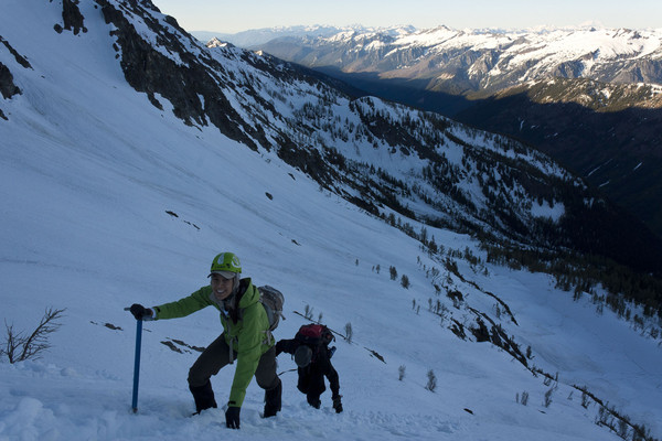
The turn off up Leroy Creek Basin is clearly marked and gains elevation quickly. We reached complete snow cover around the 5,000 ft mark and made camp on a small mound at about 6,400 ft below the approach to Seven Fingered Jack. Our original goal of making the summit of Seven Finger Jack that afternoon was supplanted by relaxing in the sun at camp and getting some sleep for Fernow the next day.
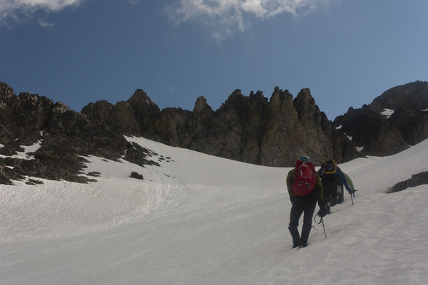
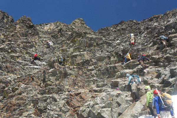
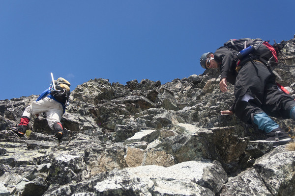
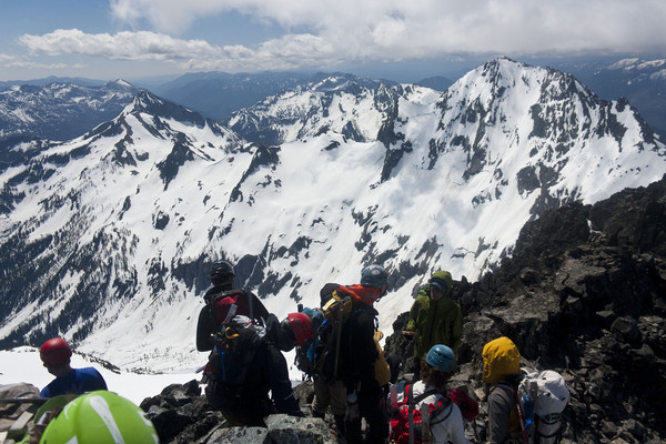
An early start brought with it some route finding misadventures. We first went up the col to the climbers left of 7FJ with the hopes of traversing the highline above the cliffs to the main gully up Fernow. Unfortunately the traverse was steep, had a dangerously short run out and dead ended in a steep narrow gully with no way across, so we pulled back and headed down the ridge line from the 7FJ col and descended down to the remnants of the glacier in the valley below. From there the route finding is easy, though you will have to gain back all that elevation and then some. Luckily we had some great steps already put in by a team of 7 just ahead of us, so we made great time getting to the summit block. When we reached the rock scramble, we discovered the group ahead of us was another Boealps group. We ascended the easy rock scramble together and enjoyed the summit of Mount Fernow and the great views. A word of caution, the scrambling is easy class 2/3, but the rock is very loose and several rock falls were caused by climbers as they scrambled the route. The snow was great for glissading down to the valley below Fernow, but not so fun on the 1,500 ft climb back up to the ridgeline. We had wanted to hit 7FJ that day as well, but the extra extra drop into the basin and climb out lead us to split our group as Dustin and Jeff went with the other team to summit 7FJ, while Ken, Danika and I returned to camp with plans to summit in the morning. The other group made the summit of 7FJ and made great time back to camp, however they were not fast enough to save Dustin’s hostess cherry pie, which was eaten; wrapper and all; by a very sneaky pup.
A cold night brought hard snow the next morning and made for a quick crampon ascent to the rock of 7FJ. This brought more route finding misadventures as we followed the steps of some lost climbers to the wrong finger twice. If you find yourself climbing anything more difficult than easy class 2, you are in the wrong spot. There were also a large amount of mysterious large animal footprints all around the snow on the traverse to the summit. I would hazard a guess at black bear, given the shape of the prints and number of toes. I have no idea why a bear would be up there but it was too large and had to many toes to be a dog.. We were treated on the summit to stunning views of Glacier, as well as Rainier, Baker and everything in between. Unfortunately, despite an hour spent relaxing on the summit, the hard icy snow that made our ascent quick and easy turned against. This made it impossible to plunge step or glissade safely for most of the steep descent from the summit and forced us to crampon most of the way down. The hike out from camp was uneventful, as the snow had softened up in the afternoon sun. The rapid pace of snow melt was obvious as more and more of the landscape is uncovered.
Gear Notes:
Crampons, Ice Axe, Trekking poles (great for stream crossings), helmet (loose rock)
Approach Notes:
Fast creeks and plenty of snow
Photos!!!!!
I hit my limit, so there a 5 more to be posted tomorrow
Crossing one of the small creeks on the Phelpes creek trail

Crossing Leroy creek
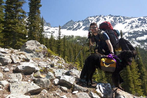
Indy the Mountain Dog
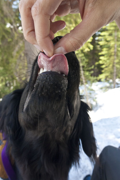
Nom Nom Nom
Looking up at one of our goals, 7FJ
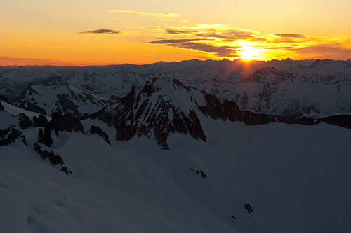
Alpen Glow over the mountains
Heading up the ridge to drop into the basin below Fernow
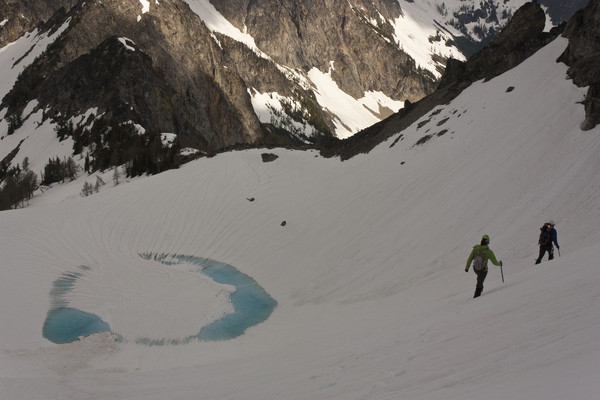
Dropping into the first basin with an ice lake below
Traversing to the col
Watch your step
Heading up the gully to Mount Fernow
Boealps goes scrambling. We found the another Boealps team
Scramble time
At the Summit of Mount Fernow
Summit Shot
Nap time
Heading back down. Copper Mountain I believe in the background
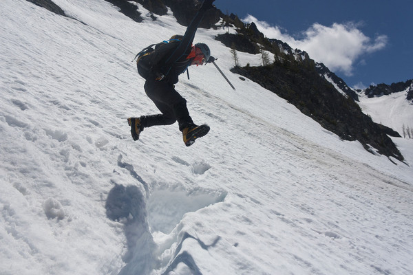
Jump for it!!!!

Glacier in the Alpen glow on our way up 7FJ
Up we go
More photos to come, including our mystery animal tracks
-
We were at Camp Muir preparing dinner and ropes for the next days ascent when the ice fall happened. The whole camp was covered in dust from the cloud it caused. I'm still cleaning dust off my gear.
Nice photos, great vantage point
-
How far back is the snow on the road? Tons of road walking?
-
Snow shoes: I wish I had them late in the days when the snow was getting soft and we were postholing like crazy, but unless they were airdropped they wouldnt have been worth the weight. We might have used them twice the entire 3 days.
-
so no major issues on the bergschrund?
I assume the summit block, which is normally a rock pitch is snow covered and a moderate snow climb
-
Trip: Eldorado and Kliwatti - The easy way
Date: 6/3/2011
Trip Report:
My first post on the forum.
Boealps Basic Climbing Class Grad Climb.
We turned the standard overnight for the Boeing alpine club grad climb into a 3 day so we could hit Kliwatti as well as our original goal of Eldorado.
About 30 yards back down the road from the parking lot was the O so fun wet log crossing
There is a very distinct boot path leading past a few blowdowns, but nothing that gave us any trouble. Our first crossing of the boulder field was quick and painless. Snow still covered most of the boulders and ice bridges were soild.
There is a very nice waterfall right before the ridge for water fill up. Hop over the ridge around 6200 ft for the rough creek basin and the glacier assent.
We couldnt tell where the glacier began, so we roped up here and continued up Rough Creek Basin and the glacier. The weather was overcast and it was early in the day, so snow was firm and crampons were not needed. No open crevasses the we could see, though small slides and rockfall were pretty common off the right ridge.
We hit the Eldorado Plateu after gaining 5,500 ft in 7 hours and set up camp on the ridge. The clouds were starting to clear and turned into a beautiful night for star gazing.
Milky way
Stars over Forbidden Peak
We slept in a bit and woke up around 6am for our hike over to Kliwatti. The snow on the glacier for the walk over was fantastic. Crampons were needed and held great with no posting. This would not last for the walk back, but first we have finish the climb. There is almost no elevation change to get over to the peak, which was nice after the gain yesterday.
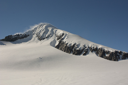
After some contemplation of the route, we climbed up the couluier and ascended the summit ridge to the top of Kilwatti. The top was still well covered in snow as you can see, but we found the summit register and signed in. This peak isnt climbed much and the register was pretty empty. Our trip leader had no trouble finding his entry from 2007.
The walk back to our camp was long and miserable. The nice hard ice had now melted in the cloudless sun to become a wet mushy mix. After much thigh deep postholing, we made it back to camp and made an early night.
Stars over Eldorado
On Sunday we made a 4am start so we could watch the sunrise and be back down in town for lunch. We watched sun come into the vallery as we climbed the last 1700ft of the summit ridge to the top of Eldorado. The ascent up the knife edge ridge was intense, but there was a nice frozen boot path. The top is full of cornices, so be cautious.
We couldnt have picked a better weekend for this trip. You could see everything from the summit, Rainier, the Olympics, Baker, Glacier, it was fantastic.
The hike back down was uneventful except the hot weekend had turned the boulderfield into a dangerous mix of rocks and unstable snow bridges.
Overall it was a fantastic weekend in the North Cascades. Cant wait to get back out there again.
Devin
Gear Notes:
Glacier travel gear, ice axe, crampons (for cold morning ice), pickets for the Eldorado summit
Approach Notes:
Good bootpath and no major obstructions. Log crossing is in good shape.
FS: Black Diamond Factor Men's Randonee Boots
in The Yard Sale
Posted · Edited by Devin27
Selling my Black Diamond Factor Randonee Ski boots. Awesome ski boots for some backcountry adventure. Bought these last year and used them twice, only selling because I havent used them since and need the cash.
Asking $300, but will entertain reasonable offers
Prefer Local but will ship at buyers expense. Located in Bothell, WA with frequent trips to Seattle and Everett.
Mondo size 27, which is about a Men's size 9
Currently on sale at REI for $420. Save some money and buy these good as new boots
From REI website
http://www.rei.com/product/775397/black-diamond-factor-randonee-boots-mens-0910
The stiffest boots in the Black Diamond line, the Black Diamond Factor randonee boots let you enjoy a backcountry tour one day and a trip to the resort the next.
Triax Pro Pebax® frames are made with high torsional stiffness, providing maximum lateral power transfer to drive fat skis and progressive alpinelike flex for downhills
Thermoformable liners allow for a long-lasting, custom fit and use a Black Diamond proprietary foam to maintain longevity and warmth
Boa Lacing System provides a precise and personalized fit that is simple to adjust with the turn of a dial; Boa holds laces tight and secure
Ski/walk switch is hassle free with a simple on/off toggle; ski mode locks you into a forward lean position that can be set at 14°, 18° or 22°
Boots are built with an overlap cuff design, which produces a natural progressive flex and ankle articulation to drive and steer skis as well as absorb terrain
4 micro-adjustable buckles and a power strap close the boot comfortably and securely around the foot and leg
Equipped with ISO alpine DIN outsole blocks with non-slip soles; compatible with Black Diamond alpine touring outsole blocks, sold separately