


bellows
-
Posts
214 -
Joined
-
Last visited
-
Days Won
16
Content Type
Profiles
Forums
Events
Posts posted by bellows
-
-
Trip: Mt Challenger - Easy Ridge / Perfect Pass
Date: 7/24/2016
Trip Report:
Mt Challenger via Easy Ridge and Perfect Pass is not exactly easy but overall it's a rather perfect climb full of typical north cascade challenge®s.
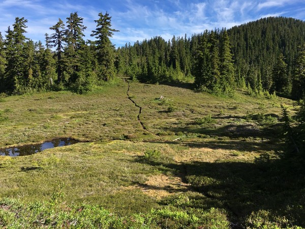
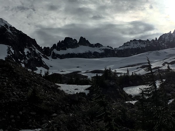
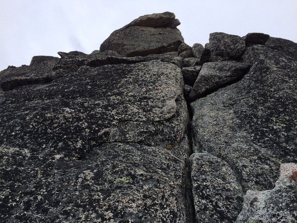
Brian and I left the trailhead just before 10 on Saturday morning after getting overnight permits at the ranger station in Glacier. Protip: despite the website saying otherwise, apparently you can self register during off hours for certain backcountry camping zones in NOCA, including Easy Ridge. Had we known this we would have been on the trail a bit earlier. No worries though, cloudy skies kept temps cool and our pace quick. 11 miles to the Chilliwack crossing, an easy ford, then an exceptionally good abandoned trail up several thousand feet to Easy Ridge.
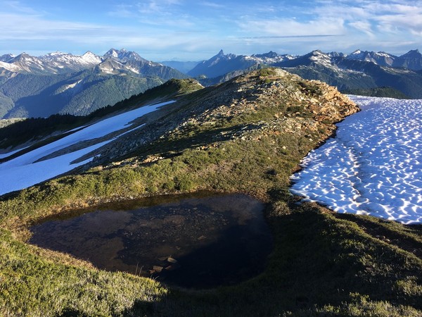
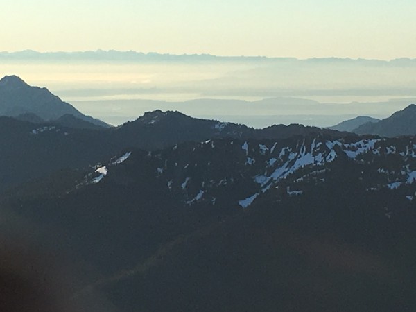
Views were mostly obscured, dampening our spirits a bit and wondering if we were going to get the typical bad picket weather while the rest of the state was bluebird. We met a trio of climbers on Easy Peak who had suffered that scenario the same day.
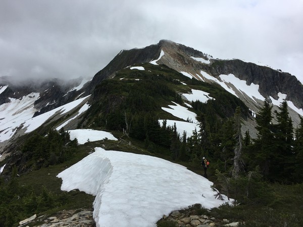
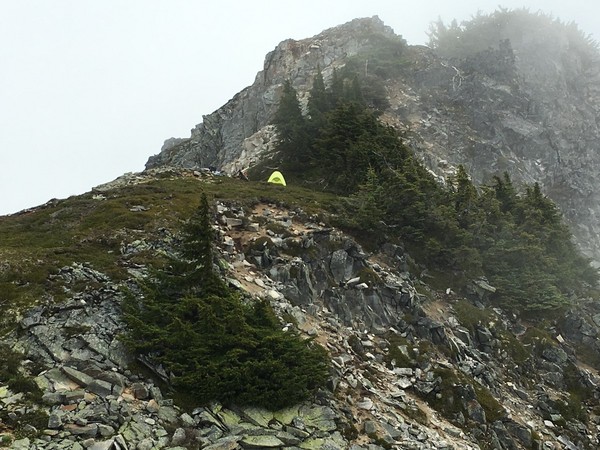
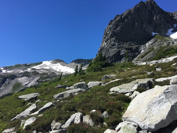
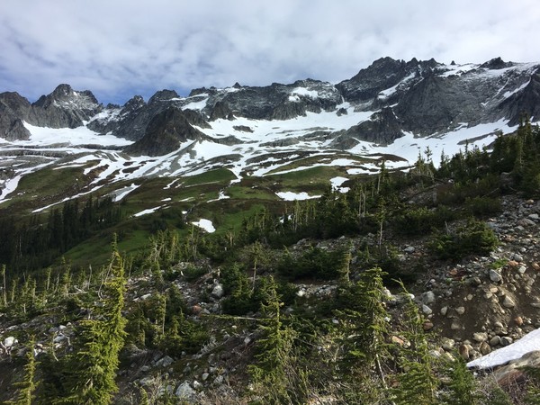
We traversed the long ridge and made camp in the early evening at the lowest spot in the ridge between Easy Peak and Whatcom Peak.
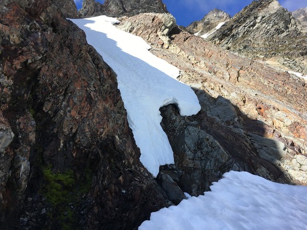
Sunday morning we woke up at dawn and dropped down to the "Perfect Impasse", a deep narrow gorge with a potential 4th scramble route around the top. In the early morning light the downsloping scramble looked exposed, slimy, and definitely x-rated. Possessing more fitness than boldness, we shrugged our shoulders and dropped down 800' to the easy walk across.
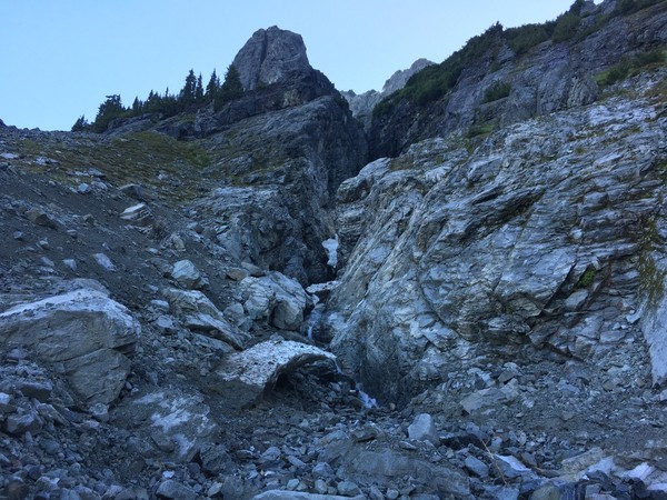
A steep jungle schwack and some scrambling on the far side of the gorge took us up to heather meadows and then talus and slabs up to Perfect Pass. Overall the added detour probably only took us an extra hour and a half.
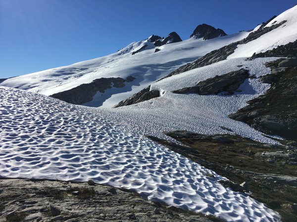
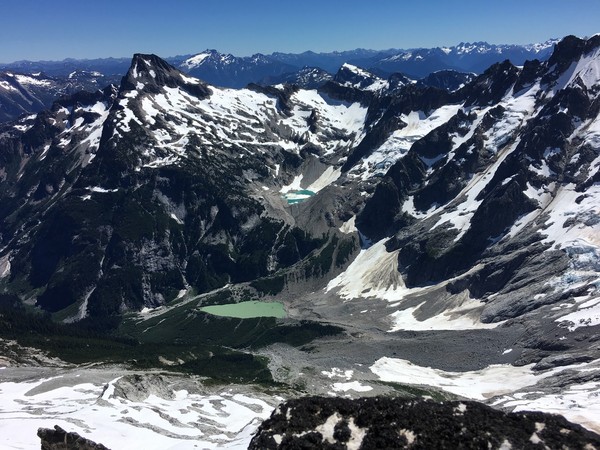
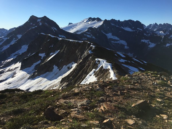
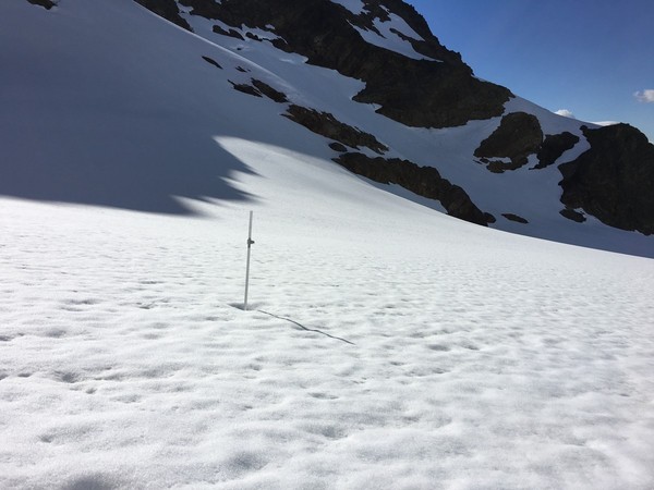
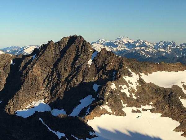
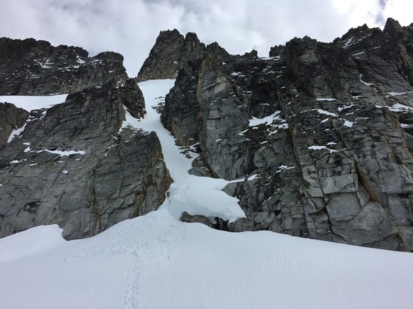
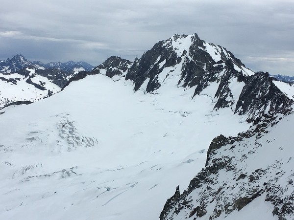
From the pass, a long rising traverse took us across the extensive Challenger Glacier.
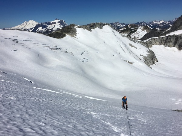
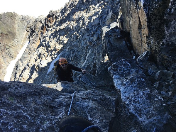
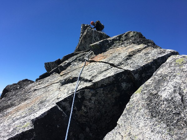
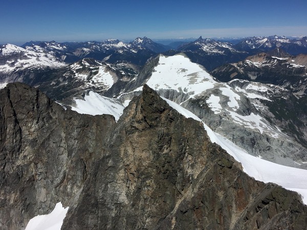
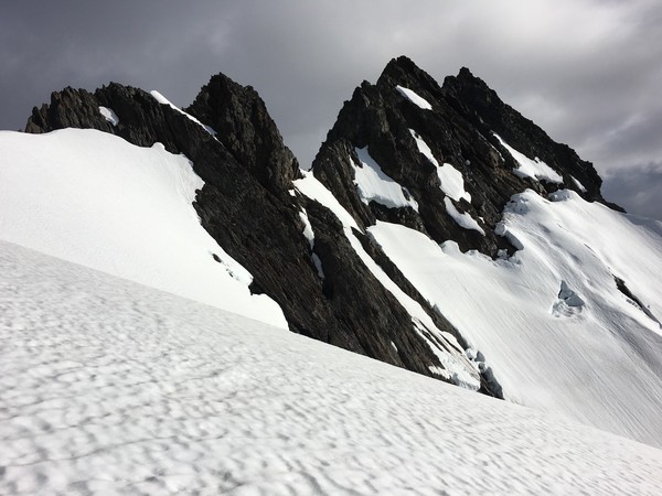
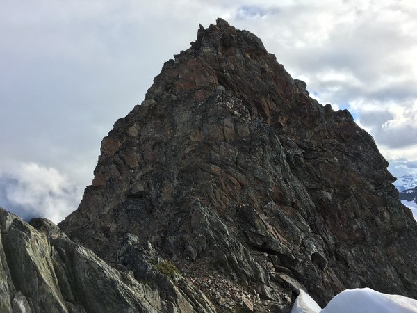
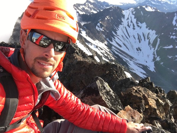
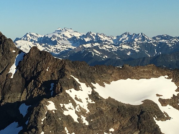
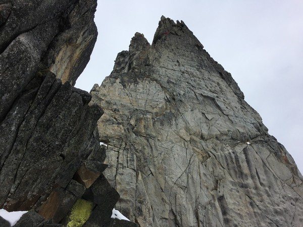
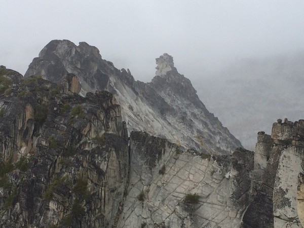
We then made a u-turn and headed up towards the peak which is hidden from view. Don't aim for the visible false western summit. The bergshrund was easily passed on climbers left via steep snow up to a snow arete before the rocky summit. A short overstated 5.7 rock pitch with 5 fixed pieces for protection led us to the wildly exposed and remote summit.
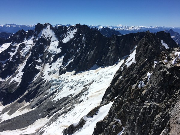
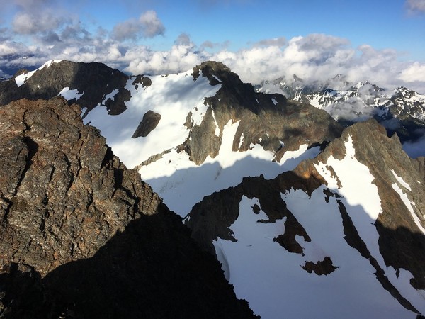
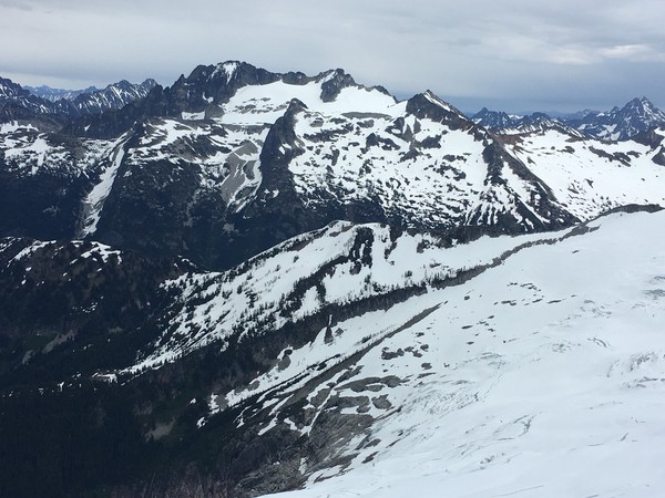
Where we were rewarded with amazing views in all directions including Fury, Luna Cirque, and looking back at Easy Ridge with Whatcom Peak close by
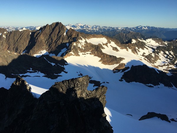
Reversing the route and we were back to Perfect Pass 6 hours after leaving it. Dropping down from the pass we realized we were basically committed to doing the drop down again since we had skipped the impasse bypass in the morning. So close yet so far.
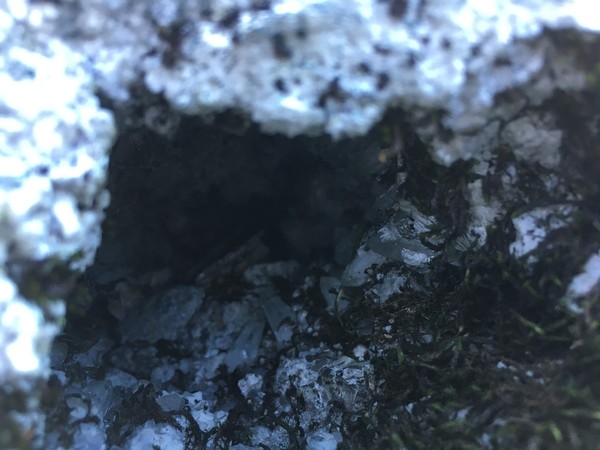
On the slog back up talus I saw a rock with a cool pocket of large crystals. My rockhound father would be impressed!
Back at camp after a long but beautiful 14 hour day we were rewarded with a nice sunset lighting up the pickets

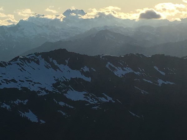
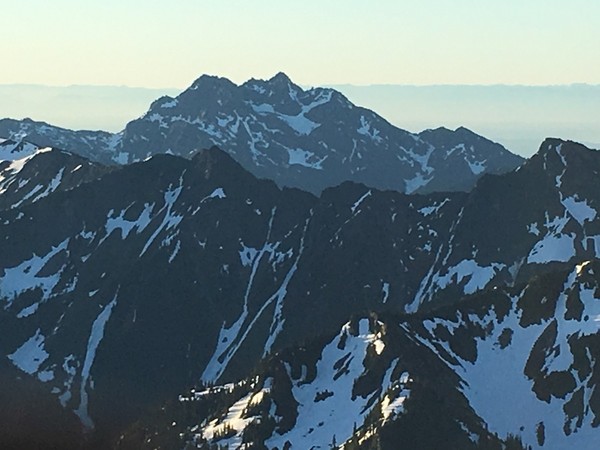
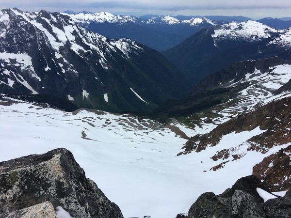
Monday we woke up and traversed Easy Ridge with much better views than two days earlier.
And settled into a looong walk out.
Overall a highly rewarding trip. Miles are long, but a light pack, good weather, and great partner made for a very satisfying climb!
Gear Notes:
We brought a few nuts but didn't use them.
Approach Notes:
Hannegan Pass. If you miss the turnoff for Easy Ridge then you're REALLY not paying attention, it's super obvious.
-
Very cool. Thanks for shedding some light on what looks like an awesome and relatively unknown area.
-
Cool! As a climber and a Patriots fan I recognized the name.
I climbed Denali three years ago with my wife for our honeymoon. Least romantic honeymoon ever... at times our three person Trango tent didn't seem big enough for the two of us. But it was an amazing trip that I look back fondly upon. Your pictures bring back good memories, thanks for posting!
-
Good stuff. I was up there about a month ago and missed the same turn up the "small watercourse" and found myself in the same steep slider alder junk wondering what the hell I was doing and fighting my instinct to bail. Eventually regaining the climbers trail a few hundred feet and a few hundred swears later.
On the way down, following the actual trail and spotting my error I tried to place some stones across the wrong way to help steer people correctly. I guess I shoulda placed more, but glad to know there have been other bastards suffering that schwack.
-
Excellent pics. Like Pucker said, don't sell yourself short. It's a big mountain and a proud accomplishment!
Nice duffel bag. Are you related to a former NFL player?

-
Any trip report from Marc-Andre. Reading his winter solo of Slesse then following it up with his first TR of Cheam Peak is mind blowing:
http://cascadeclimbers.com/forum/ubbthreads.php?ubb=showflat&Number=1137036
http://cascadeclimbers.com/forum/ubbthreads.php?ubb=showflat&Number=800493
I also really like Josh Lewis's trip reports. He tells good stories and his youthful enthusiasm is inspiring.
JasonG's trip reports for pictures of places I need to add to my ever expanding list.
-
It was definitely a lot of mileage but didn't feel like a slog due to a light pack and relatively good trail all the way up to the basin.
Oly, I scrambled the standard east ridge of the West Peak. Klenke has some great beta on summitpost that gives blow by blow descriptions of the ridge. He calls it class 4 with some low 5th moves which I think is more accurate that the guidebook "class 3". Then again, I'm new to the Olympics so that might just be the way it is. It's loose enough that it'd be kinda hard to protect for the leader.
And heck yeah, I'm up for some more easterly adventures from westerly Seattle! The Needles look pretty interesting...
-
That's a nice pic of the Anderson massif and good shot of the snow on the east/southeast face that I took on my way down. I ended up climbing the West Peak on Saturday and Mt Anderson proper on Sunday with a bivy at Flypaper Pass. TR posted!
-
Great pics! If I knew my Olympic mountains better I might have been able to get a pic of Mt Lena from Mount Anderson on Sunday morning, but alas I only recognize the more obvious peaks at this point in my explorations.
-
Trip: Mount Anderson - West Peak and Namesake Standards
Date: 6/26/2016
Trip Report:
This past weekend I had a two day hall pass to get out in the mountains. After half-heartedly reaching out for partners, I realized what I really wanted to do was spend a solitary night in a remote alpine setting somewhere. Better yet, somewhere I didn't know very well. Enter Mount Anderson, the hydrographic apex of the Olympics, and a long way from any road. Saturday morning found me at the end of that road, at least what was drivable.
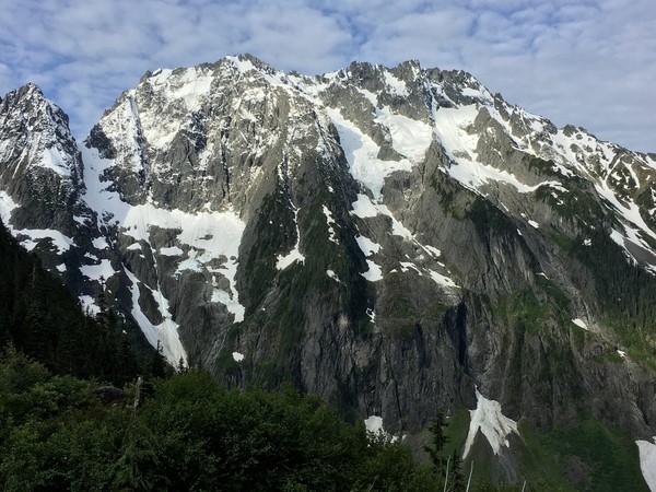
I left my truck a little after 8:00 and biked 5.5 miles up the abandoned Dosewallips River Road. From there a nice 10.5 mile gradually ascending hike through lush forest led to Anderson Pass. Another couple hours up a climbers trail towards the Anderson Glacier and I finally caught my first good view of the massif:
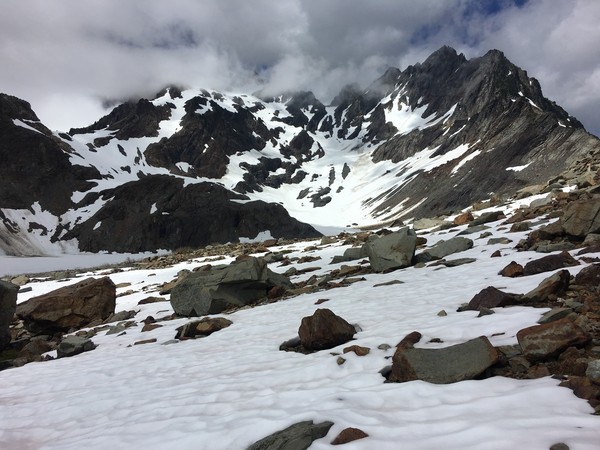
The Anderson Glacier is apparently a shell of its former self, with one consequence being that the steep snow finger leading to Flypaper Pass is melting out quicker every year. There was already a small bergshrund at the bottom of the finger which forced me out to the right on easy rock for 20' or so:
Then back onto the snow finger and up to Flypaper Pass. It was almost 5:00 by the time I got to the pass but I was feeling good and there was plenty of daylight so after a short rest and dropping my bivy gear I dropped ~400' down the Eel Glacier where I came across a monitoring station:
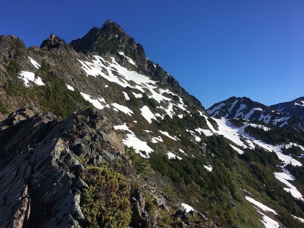
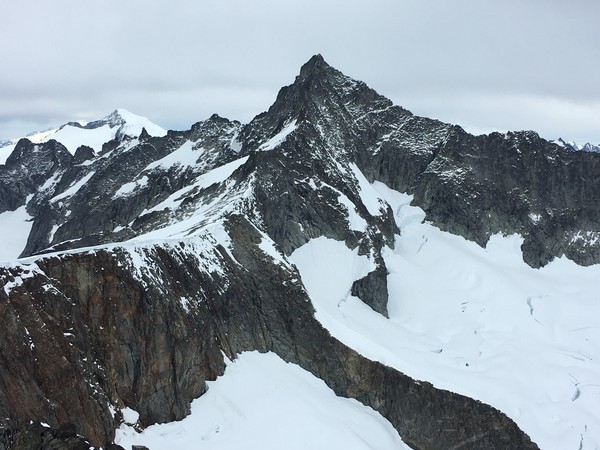
Then traversed west towards the taller West Peak before heading up to a notch in the minor north rib. The view of the summit from this notch:
Originally I planned to do the steep snow traverse, but once I saw it and realized it had been baking in the sun and with perched hangfire above, I opted for the "class 3" ridge route. Calling it class 3 is a stretch, it felt waaay more exciting with incredible exposure and horrendously loose rock. Over a couple bumps and a false summit:
And on to the true summit of West Peak for a selfie:
Looking back towards Mt Anderson proper and Flypaper Pass:
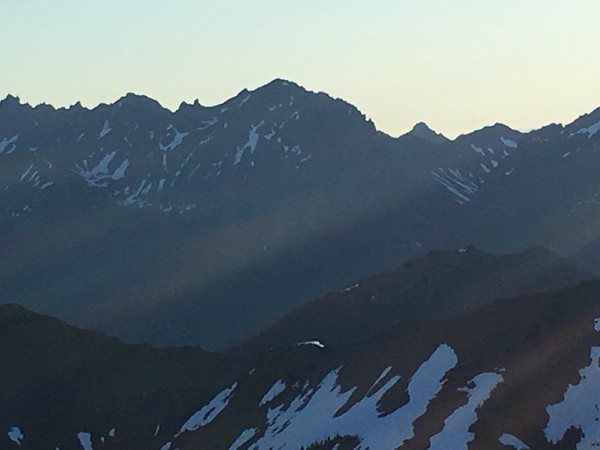
Longer views of the rest of the Olympics were mostly obscured by clouds:
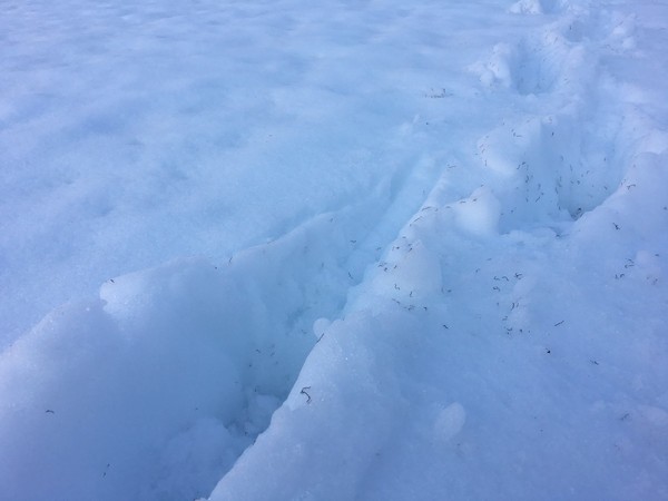
On my way back to my bivy I came across TONS of glacier worms that had appeared in my footsteps from a few hours earlier:
Back at Flypaper Pass by 9:00PM where I made camp, watched the sunset, and let the RPMs from the west peak scramble wind down. If a remote alpine bivy is the kinda thing that makes your soul sing, this place was hard to beat.
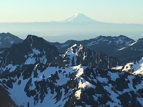
Sunday morning I woke up with the sun, packed my kit, and again dropped 400' down onto the Eel before traversing east towards the shorter namesake Mt Anderson. An hour plus later and I was on top with spectacular cloudless views in all directions:
Hellooo Seattle:
Mount Anderson West Peak (7365') from namesake Mount Anderson (7321'):
Longer view:
The backside of the Brothers:
Mt Olympus:
Some big volcano:
Buncha stuff I don't recognize:
To complete my adventure, and since I was already carrying my kit, I dropped down the southeast face and somewhat followed route 3 down from the guidebook:
I eventually picked my way down to a pair of small lakes, then up over a ridge and back to the Anderson Glacier basin and hike & bike home.
The Olympics once again impressed me. I need to do more trips starting and ending like this:
Gear Notes:
Ice axe, crampons & mountaineering boots plus trail runners. I also brought an avy probe and a couple aerial photos of a late season Eel Glacier for crevasse management. The upper glacier towards Mt Anderson proper has some legit cracks.
Approach Notes:
Bring a bike for the road.
-
 1
1
-
-
Hey oly, you ever been up Anderson and/or West Peak? I'm looking at heading there over the weekend if you got any interest. I'm in West Seattle too!
-
Upward directional anchor at the bottom of each pitch, rope fixed to anchor with the rest stacked in my pack, tied in with a series of loops on clove hitches which I would release and reset as I got to the end of each loop, placing protection as I went along. Anchor at the top of each pitch and rap/downclimb to clean & reascend with a microtraxion.
-
-
FWIW I think Goode (or Storm King or Black?) is on the far right in this picture taken yesterday 6/20:
Last Friday/Saturday dropped a fair amount of snow at high elevation that was still hanging around on ledges as of yesterday making low angle fourth/fifth class climbing a little spicy. Not sure I'd want to do a couple thousand feet of it.
-
Trip: Sharkfin Tower - Southeast Ridge
Date: 6/20/2016
Trip Report:
Yesterday I celebrated my 39th trip around the sun by ditching work and heading to the North Cascades. An alpine start from Seattle had me feeling old but some coffee and a pretty sunrise driving north had me feeling young again. In reality I guess I'm starting to fall somewhere in between.
The road is still closed at the Eldorado trailhead so there are a few extra miles of road walking to warm up on before crashing up the overgrown climbers trail. Stream crossings were casual. Views in Boston Basin were stellar as always:
A large group of 12 climbers left a nice boot pack up towards the Quien Sabe Glacier. From there the obvious gully to Sharkfin was obvious:
A guide and client were near the top of the route by the time I tied into my rope solo. Snow on the initial low fifth pitch made things a little spicy. The next arete pitch was dry, super fun, and exceptionally clean:
More snow on the final low fifth pitch let me to the top and stellar 360 degree views of Forbidden, Logan, Buckner, and everything in between:
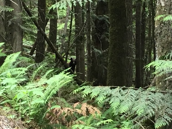
Some down climbing and two raps got me back to the snow and a long hike back to the truck. I accidentally upped the difficulty level of this trip by forgetting my food bag at home (!!!) and was bonking pretty hard on the road walk out. Thankfully I didn't have to outrun this guy:
On the bright side leaving my food at home left me with a huge appetite for a big birthday dinner with my wife at Din Tai Fung in Seattle. Perfect start to my next trip around the sun!
Gear Notes:
Small rack, aluminum crampons and a whippet worked for me.
Approach Notes:
Access gulley is all snow but the moat at the bottom is melting quickly and may require some rock scrambling in the near future.
-
Nice work Jeff and crew! You've been crushing this year. Nice pics and nice line.
-
Jens, any photos from Banks? Your description doesn't seem to match the description in the other thread of "nearly as good as ...past several years".
Not sure where to put my money but it seemed a touch too warm on the east side. We checked out a couple Ellensburg areas Sunday and found nothing. Salvaged the day by getting some late afternoon laps on the reliable Kiddie Cliff at Alpental:
Todd Anderson, FYI Franklin Falls is one of the more popular hikes in the Seattle vicinity and trip reports pop up almost daily on the WTA site. Check it out for recent pictures: http://www.wta.org/go-hiking/hikes/franklin-falls
-
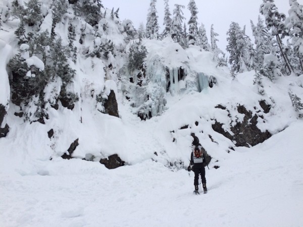
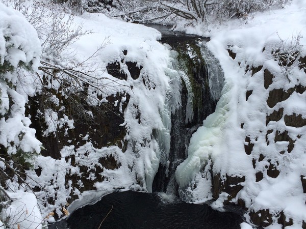
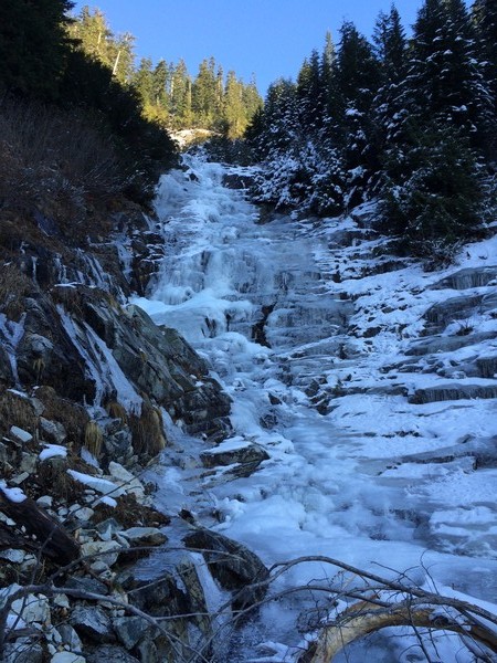
Happy New Year! Fugs Falls was good yesterday. Enjoy it while it lasts:

-
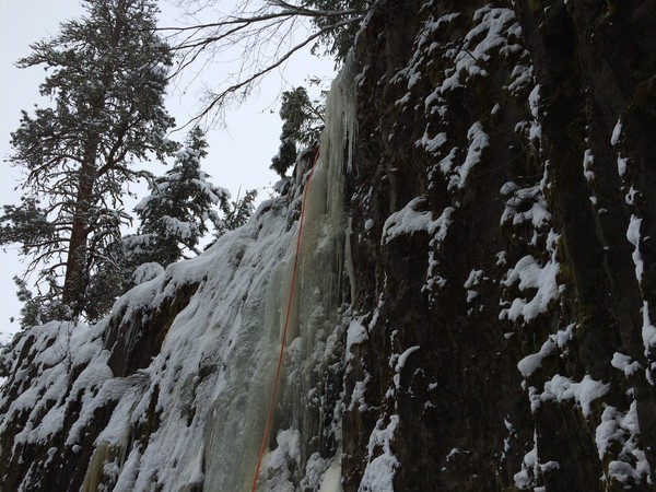
Tis the season. Temps are low. Forecast is promising. Time for a catch-all Washington State ice conditions thread! I’ll start…
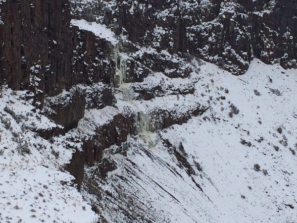
Austin Eats It (Umptanum Falls area) is short but sweet and was in good shape Sunday:
Umptanum Falls itself was decidedly not in:
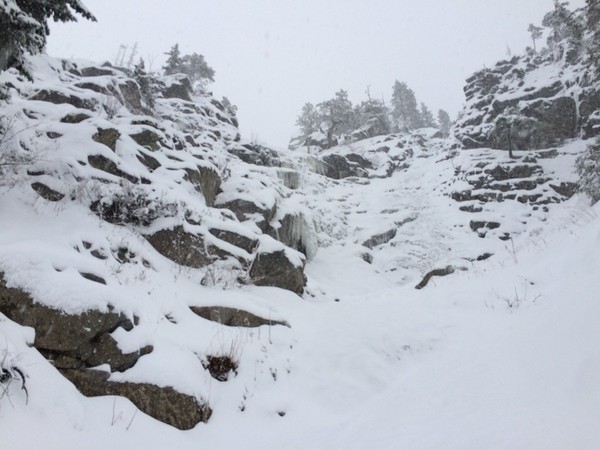
Frenchmans Falls also not in as of Saturday. Lots of flowing water at the top:

Fugs Falls was a bit better but still pretty thin & wet on top. Could be okay by the coming weekend:
Smart people are skiing right now. Ice climbers are not necessarily smart people though. Who else has firsthand reports of ice out there???
-
Sent you a pm calford. I checked out Vantage this morning. Frenchmans is mostly water with spray ice on the sides and at the bottom. Fugs is looking a little better but still too wet. Needs more time with colder temps.
-
Jacob, check out the "West Coast Ice" group on facebook for Lillooet conditions. There are several recent reports from the area. And the forecast looks good up there with temps below freezing thru the weekend. Good luck, happy hunting!
-
The Goatee up the Snow Creek Trail was in ok condition on Saturday and is high enough in elevation that it might just survive the warm wet weather this week. Pitch one funky snice/ice. Pitch two mostly snow. Pitch three 30m of fun WI3 making it worth(?) the hike for eager climbers. Beware of sluffs coming down from the gully on lookers right.
Millennium Wall #2 also looked in but we didn’t climb it. In retrospect it may have been a better option to run laps on Millennium rather than schwack up and off the Goatee.
-
If you're really jonesing, there's a pitch and a half of climbable ice in the Practice Gully at Alpental. It's an easy low commitment trip and good dawn patrol option. I snuck it in yesterday afternoon in four hours round trip from Seattle.
-
Trip: Temple Ridge - The Temple
Date: 9/19/2015
Trip Report:
Mount Temple is a long way to go for a couple 5.6 moves but the views are enchanting and the company was second to none.
All the beta you need here. Pay attention to the 4th class traverse to the right from the talus field above Nada Lake. From there roughly follow the creek to its headwaters below The Temple taking the path of least resistance. There’s occasionally a rough climbers trail but I found it hard (and not necessary) to stay on.
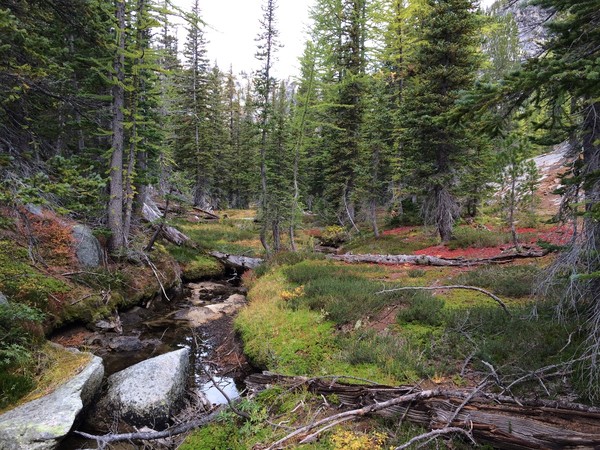
Following the creek thru Temple Canyon.
Mount Temple on the left. Stack Crag on the right. There was zero snow below the col, which added a little fifth class chimney on the way up and a rappel on the way down.
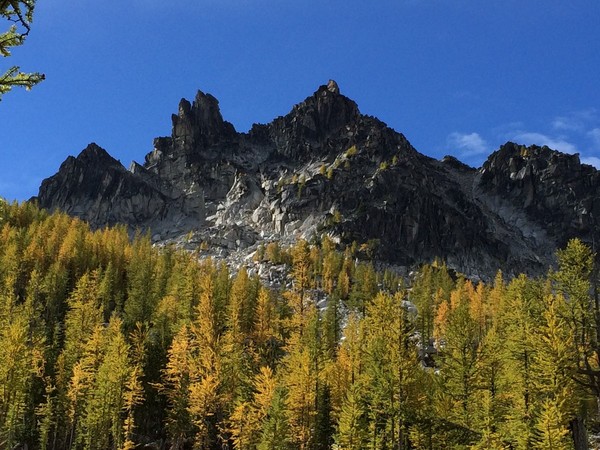
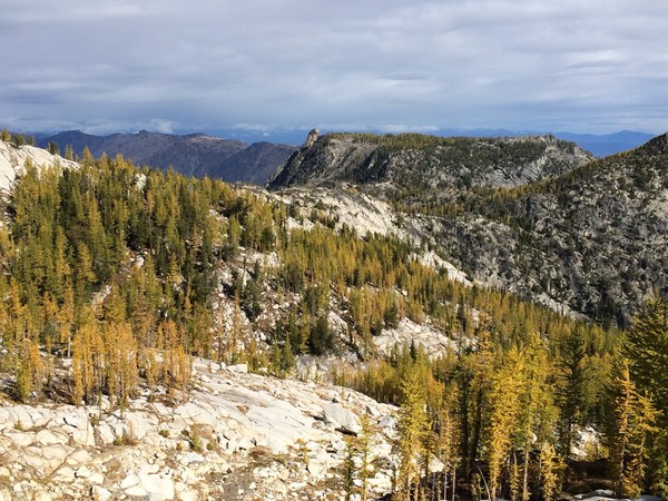
Looking out towards Edwards Mesa. Larches are just starting to turn.
View from the col to the summit. The 5.6 crux slab is just out of view due to foreshortening. It is (not really) protected by a manky 1/4" bolt. You might be able to fiddle some small gear off to the left of the slab.
Weather moved in right when I topped out, raining a little and stealing some of my views. Prusik was visible briefly, then overtaken by clouds.
A single steep 30m rap got me back down. Beware of the rope eating hole beneath the crux slab.
I hiked in and out the same day. Just under 12 hours car to car at a consistent but relaxed pace. Beats playing the permit lotto, but it would be a beautiful place to spend a couple nights and climb several of the other Cashmere Crags along the ridge.
[TR] East Fury - Standard 7/25/2016
in North Cascades
Posted
Dude, that's off the hook! Well, technically I guess Leor is "off_the_hook" but you're off the hook too! Inspiring, I'm way impressed. Nice job.