


elliottwill
-
Posts
92 -
Joined
-
Last visited
Content Type
Profiles
Forums
Events
Posts posted by elliottwill
-
-
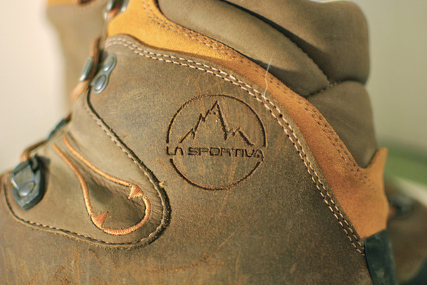
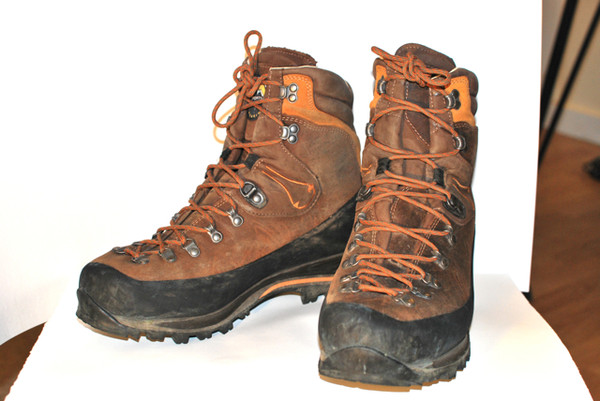
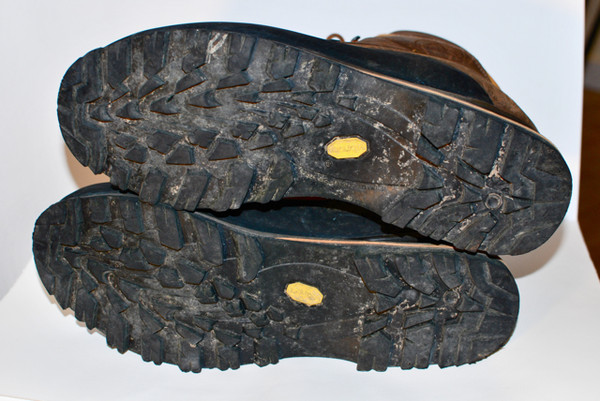
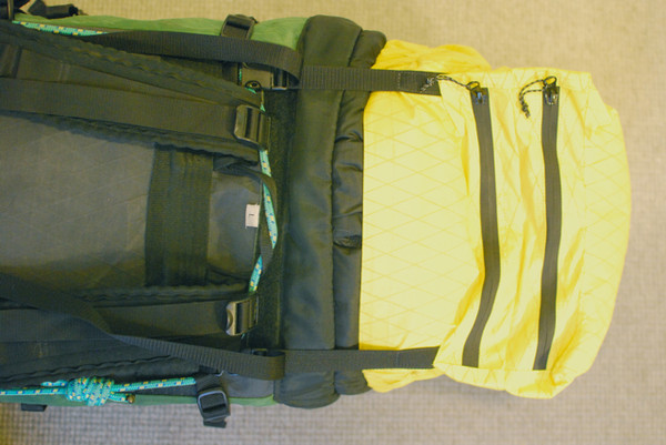
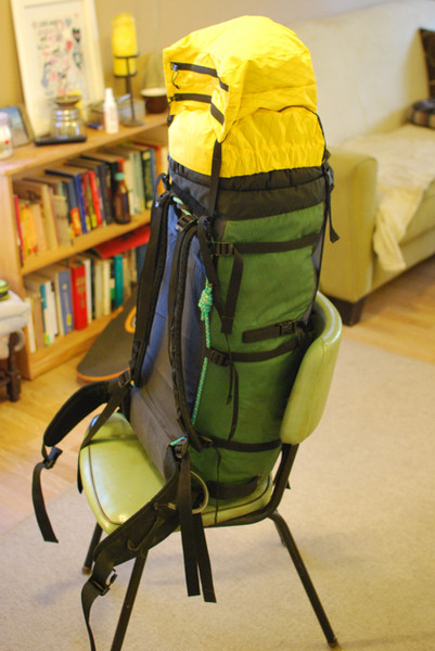
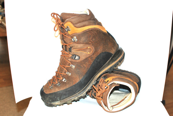
Hi all,
—La Sportiva Pamirs, 47. Probably less than 30 miles on them. They don't fit my feet.
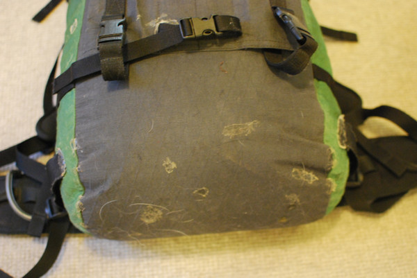
Make an offer on either. Pack was over $200 if I remember and boots are $299 at REI.
Thanks!
-
Thanks!
-
Yeah, this and December are the only months I'm home from school in CA, so gotta go for it while I'm here. Great thing about September is that even if the climb's a bust, the berrypicking's great!
-
MW— thanks! I'm surprised the approach dissuades people; we kept saying on the way in that even if we didn't make it up the Traleika, at least we got to hike through some beautiful country.
On our recon day we saw I think 4 serac avalanches pummel the approach, and as we rushed up the morning of the climb, found that the debris area was much wider and took longer to rush through than we thought. I think your lower route is probably the smarter one.
Definitely we were lucky with the warm temps and break in the clouds for our getaway. The only long climb I'd done before this was Pioneer Peak there along the highway, so I was a little bit freaked out as we headed down. My partner tried to get a photo on the summit but couldn't because I was literally towing him downhill. Anyway, that was a sweet face you guys explored; I hope more people get to check out the solitude in that area. Hope we get back there soon.
Much thanks to Jan, Anne & Camp Denali for the unexpected showers, dinner and ride out.
-
Success. Thanks again for the info. NPS didn't want to let us in because "the climbing season ended in July." Just posted a TR.
-
Trip: Mt. Silverthrone - West Face direct couloir
Date: 9/4/2011
Trip Report:
Hi all,
Thanks in part to your helpful suggestions we walked in 30 miles from Wonder Lake to climb a new route on Mt. Silverthrone's 4000' west face, following a couloir Joe Puryear and Mark Westman attempted in 1997 before turning back in bad weather. They later made the first ascent of the face via a different couloir and followed the north ridge to the summit. The 'new' route takes a straight line from the glacier to the summit, and descends the north ridge.
[img:center]https://lh4.googleusercontent.com/-VQHqoOYxPM8/TmuwKsnmrvI/AAAAAAAABXc/5GJci0enPEg/s512/IMG_0759.JPG[/img]
We left camp on the Traleika at 6am and hurried through the runout zone of the seracs at the head of the glacier's east fork, where the route begins. The climbing was uninterrupted 50 to 60 degree snow and ice, which we simulclimbed with pickets and ice screws. We weren't faster than the weather and lost visibility in the afternoon, but continued up to escape. One of us was sick from altitude and recovering from a 30' fall off a knife-edge ridge we wandered onto somewhere on the face below the summit, so we moved slowly. We topped out in a whiteout and storm at 7pm. We dug a snow cave at 13,100-something feet, 10 or 20 yards south of the summit, and waited there until morning, listening to the wind and unsure whether we would be able to leave. At 6am the wind and blowing snow was still bad but visibility had improved so we hurried down the north ridge. The easy descending ended at Peak 11,270 and we simulclimbed down the steep ridge, arriving sometime around 12pm at the descent gully noted in Puryear's book.
Full story in photos at Picasa .
Gear Notes:
four alpine ice tools
four ice screws
three pickets
60m 8mm rope
shovel
stove
foam pads
Approach Notes:
1 day driving, etc., from Wasilla.
2 days to McGonagall Pass.
1 day to the head of the Traleika. We camped on the medial moraine, 3 miles from the route.
10 hrs up, 6 hrs down (not counting hiking to and from camp; we could have camped closer but liked the moraine).
-
Nobody wants to part with theirs? Is that 'cause the tool is awesome or because nobody bought one in the first place?
-
Thanks. Emailed a couple questions.
-
Yes! Thanks so much. I feel a lot better about wandering in there out of season, now that we have some good info. Now just have to dry a lot of salmon and bake a lot of cookies. Will let you know how it goes. Again, really appreciate the advice.
-
Still have the boots?
-
Confused. Sliders and Triggers are different. I got the yellow slider for my Matrix Lights.
-
No, I don't know much about it at all. I grew up on the other side of the Susitna north of Talkeetna and was always more interested in walking in than flying. I think we'll take 4 tools, 4 screws, and 2 pickets, then. From your description, it sounds like we'll have pretty good going across the glacier up to the cirque, then 1K+' of dirt, 4K' of snow & ice, up to 60 degrees, then a ridge walk to the summit (assuming we get that far). Then cautious downclimbing or rappelling off v-threads to the dirt? Sounds fun— even if the climb is a bust, at least we get some good tundra hiking, scenery and peace and quiet.
-
Great info! I'm more optimistic. Other thing we've been wondering is tools. I've heard two ice tools, and I've heard a tool and a mountain axe. I'm inclined toward the former, especially late in the season. Any reason to favor the less technical combo?
-
-
Thanks!
-
I searched and searched on here but didn't find much info. A friend and I have 2 weeks off at the end of August and wanted to hike in and climb something from Wonder Lake. Silverthrone's west face looks/sounds cool but I've heard that the crevasses are horrible getting up there, and I expect they'd be even worse late in the season. Has anyone been up there in the fall, or on the west face of Silverthrone at any time, or wants to recommend something better in the area?
-
I'll be in Seattle / Tacoma Wednesday night through Saturday night, then driving to Sacramento. Looking for strap bindings— needs to fit hikers, snowboard boots, etc.
Altimeter should be under $60 because that's what they cost new on Campmor.com
-
...for Shasta & snowfields. Contacts, Neves, Air Techs, G10s— whatever you've got. Steel or aluminum. Needs to have strap bindings. Thanks!
-
Hmm.. maybe some Horns are in store! Thanks for the tip.
-
I have a pair of Grivel Tech Wings (Takoon predecessor). Cascade picks, adze and hammer. Pinkie rest is cut off one (planned to add a Horn); other still has it, with a homemade plastic pinkie-rest epoxied on (instead of adding a Horn).
I'd like to get leashless tools and I'm curious if someone out there more alpine-oriented wants them, via trade or +cash.
Or has some leashless tools they'd like to sell.
They are in AK and will be there until March 16 when I get home.
Thanks!
-
Why selling the tools? Just didn't like them?
-
Why selling the tools? Just didn't like them?
-
Are they out there?
-
Hi all,
Looking to buy Grivel Horns off someone.
Thanks!
La Sportiva Pamir boots
in The Yard Sale
Posted
Hi Jimmy,
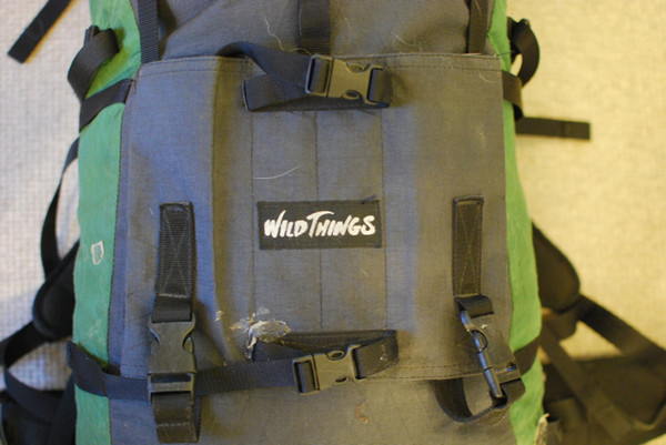
$75, and it comes with a free pack. I bought mine from WT for $25. At that time they said it was the last one, since the Andinistas now use a different size buckle.