Le Piston
-
Posts
540 -
Joined
-
Last visited
Content Type
Profiles
Forums
Events
Posts posted by Le Piston
-
-
I myself shoot Nikon DSLR, but I have friends who shoot Canon who have gotten great pictures with the 50 mm f/1.8 "nifty fifty" for a cost a little over $100. The choice of lens depends on so many factors...but for me I often choose based on weight (use an "all-in-one" type of lens like an 18-200mm) and terrain (technical climb) vs. primary photographic trip where I'll take multiple lenses (wide angle prime, mid-range zoom, telephoto and tripod etc. You can often go to a camera store and try lenses out. Hope that helps.
-
Gaiters, Black Prophet, Viper ice tools have been sold.
-
Nice work and great pictures. Too bad you didn't have better weather, but it seems to be fairly common up there. When I was there last summer it rained 5 days out of 7...one of the reasons I only did the scramble route on Temple.
-
Sammamish isn't really out of the way for me. I mostly wanted you to look the tent over first and make sure it's what you want. I want both sides to be satisfied!
-
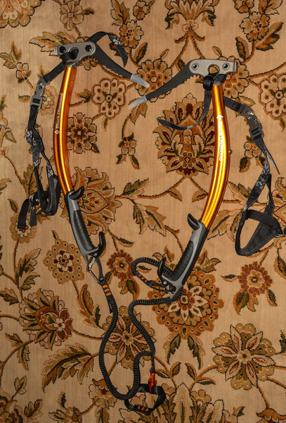
Would these do the trick or too new for you? BD Vipers never used. $300 for the pair including leashes
-
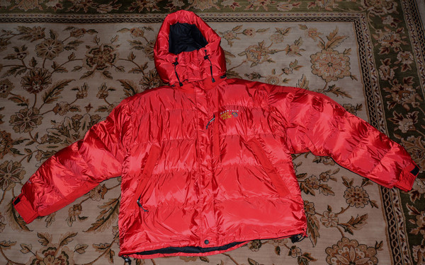
Mountain Hardwear Subzero Parka Size XL never used $100.
 Black Diamond Viper Ice Tools (hammer) never used. New cost $239 each. $300 for the pair including two Android leashes and Spinner leash.Black Diamond X-15 curved shaft ice hammer $20.
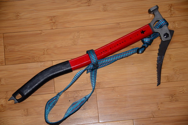 Black Diamond Black Prophet Ice Hammer $20
 Sierra Designs Summit 4 Season Single Wall 2 Person Tent with vestibule $125.
 Mountain Hardwear Ascent Gaiters Size L $15.
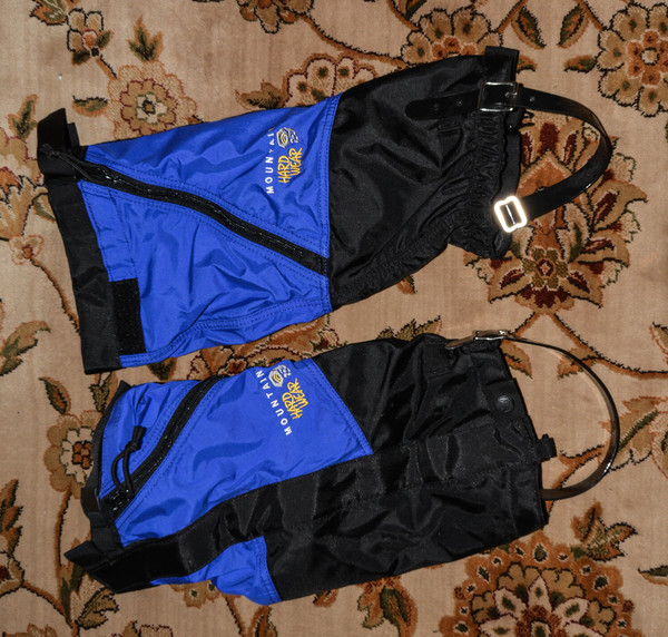 Koflach Viva Soft Climbing Boots Size 11 US $40.
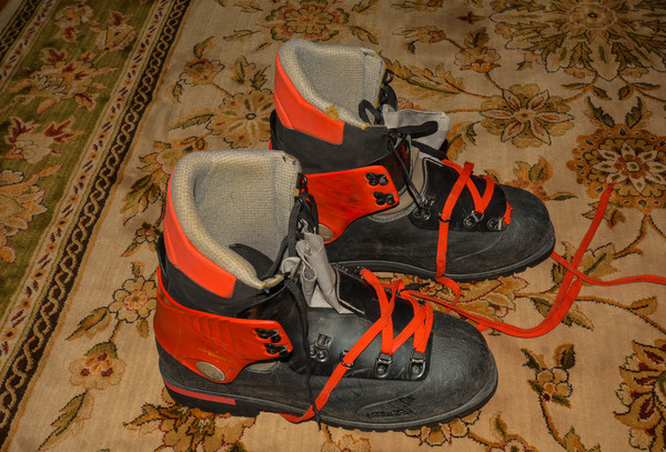 Scarpa Inverno Climbing Boots Size 9 US $30.
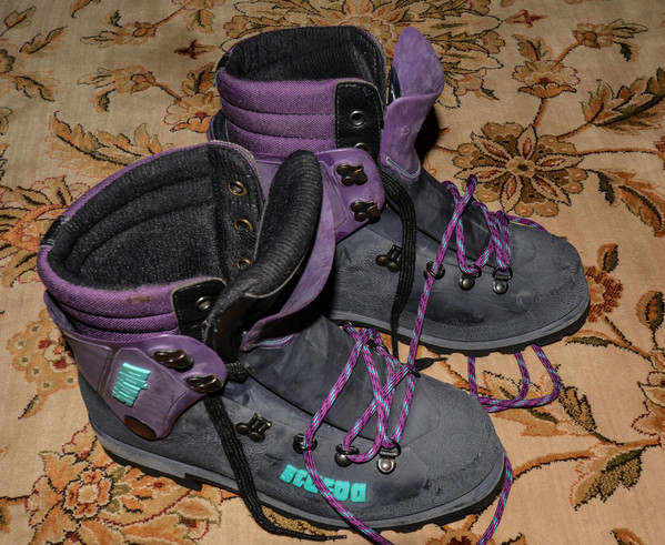 Seattle Tacoma area only please. I'm happy to meet and let you look at the gear if you're interested.
 -
I was very sad to hear this news. I had climbed with Pat a couple of times (most recently Mt. Cruiser). I feel so bad for his partner and long-time friend who was with him. He was a great guy...he'll be missed!
-
For those that like the Firstlight, but want more room, consider the Skylight. It's more room, more stable, and still in the budget range. It's around 4 lbs. I've gotten good service from mine. My climbing partner with the Eldorado always wants me to bring it instead of his tent.
-
Not hard to do, but fun and great scenery...Southwest couloir of South Early Winters Spire, Sahale Peak, Magic, and Pinnacle all come to mind.
-
Very cool Steph. Thanks for setting this up. I didn't know if people here were also aware of the mountain-forecast.com site which gives forecasts at various elevations of 11200 mountains around the world. It's not comprehensive, but a helpful complement to NOAA and this site.
-
Great pictures. I hope you attempt it in the future with better snow conditions...it's a cool climb. Jason G is right, the summit isn't the best bivy spot. There is a ledge at the base of the west ridge that is pretty nice though.
-
Much appreciated. I love it up there! I hope you can get to do more up there...it's so beautiful and not too far away.
-
Thanks Jason. We saw a couple coming from the SE slope route when we were on the summit. It looks like it would have been easier coming down and taken us right to camp.
-
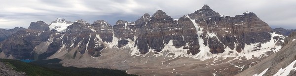
Trip: Clark Mountain - Walrus Glacier
Date: 9/1/2013
Trip Report:
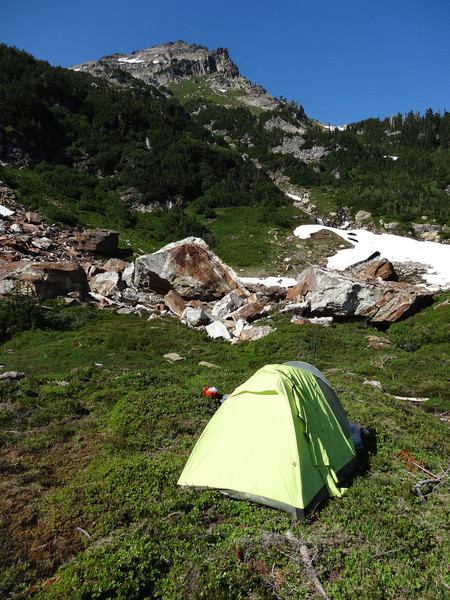
I had been smitten with Clark last summer when climbing Fortress and Chiwawa, and had no trouble talking my friend Rod into giving it a go even with his partially healed broken ribs. The weather forecast was favorable for the weekend, so off we went. We chowed down at our favorite breakfast spot on Highway 2, the 59er Café and headed for the White River Trailhead.
 The trail is the nicest, flattest approach trail I've ever been on. If someone would brush it out, it would also be the driest. At about 4 miles and a whopping 400 feet elevation gain, we turned off on the Boulder Creek trail. Rod, who hates icy river/creek fords, was happy that the water was low and Boulder Creek could be crossed without a ford. The ford though was infested with biting flies, so I didn't appreciate it as much. We found a nice camp in a basin below Boulder Pass, about 5000 feet elevation. Sunday morning we headed up over the pass to a basin on the east side of Clark. We scrambled up a heather and scree ridge to about 7000 feet and got our first sight of the Walrus Glacier.
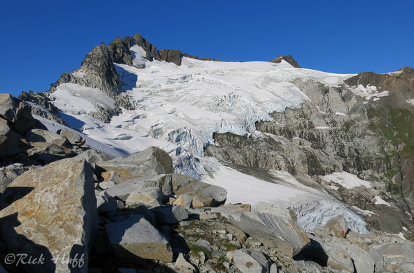 It looked pretty chopped up, so we roped up and started looking for a way through.
 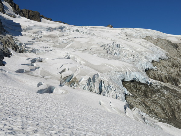 Fortunately, we found tracks from one of the other three parties (that we know of) that were climbing Clark this weekend. The route in early summer is supposed to stay left on the lower glacier, but we had to weave quite a bit to avoid the bigger crevasses.
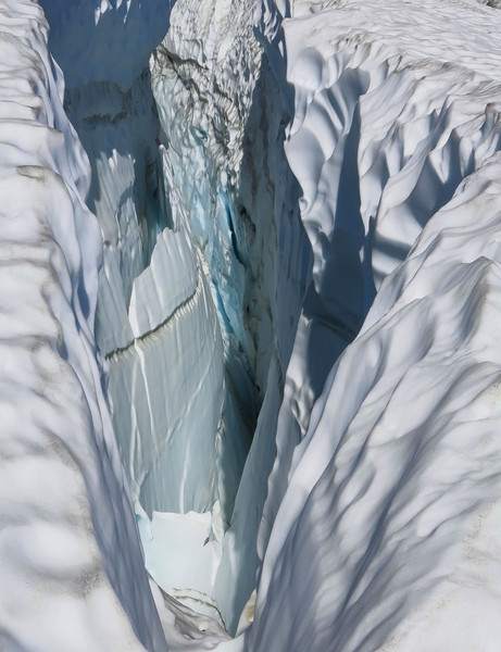 There were a couple snow bridges that were getting pretty thin and my guess is won't last another week. One spot was a bit of a knife edge that we belayed on the way out.
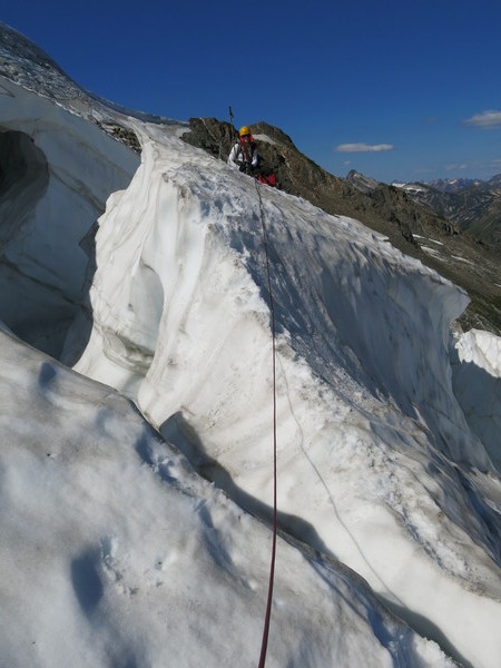 Once out of the lower glacier, it was smooth sailing to the col at 8000 feet. We scrambled down some class 3 rock to a snowfield and headed for a ridge on the south face, where easy scree (class 2) took us to the summit.
 The views were fabulous, with Glacier Peak dominant. We enjoyed our traditional summit chocolate bar and thought about heading over to climb Luahna.
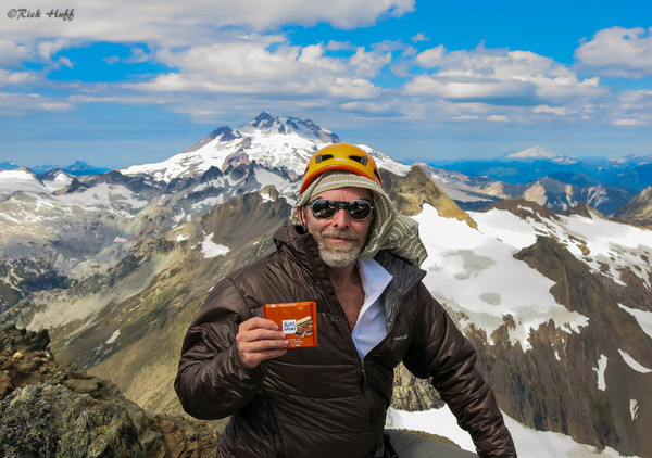 If we had been familiar with the Southeast Slope approach route, we might have continued on, but we were the only party silly enough to go back down the Walrus glacier.
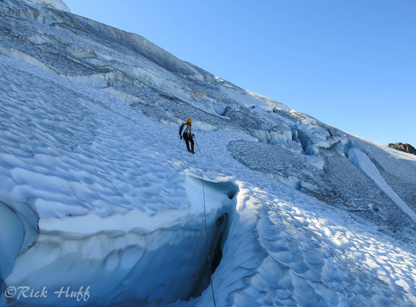 It was a little stressful in a couple of spots, but at least we got to see some interesting seracs.
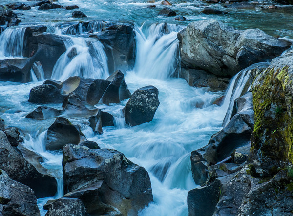
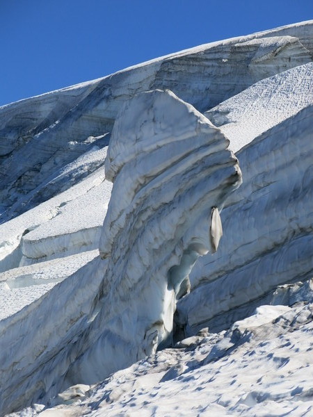 We were glad to get off the glacier and begin the walk back to camp. Besides the gorgeous scenery, one bonus was the delicious wild blueberries along the trail. This was a fun climb, but a bit more work than we expected with the Walrus glacier so broken up.
Gear Notes:
Glacier gear. We were glad to have a picket. Bring rain pants...the dew on the vegetation will soak you in the morning. Flies and mosquitos still out and hungry!
Approach Notes:
Very straight forward as described. Super nice trail, just needs some brushing out.
-
Wow! That was a brilliant climb and super cool TR. Thanks for sharing guys!
-
Great pictures and TR. Thanks for the stoke!
-
Nice work! You get hardman points for that trip. Thanks for sharing.
-
There's a little more beta in Alpine Select by Kevin McLane. I always had my eye on Mt. Rexford, but never made it up there. Nice pictures...like to see more. Thanks for sharing!
-
Like ARBrandon and genepires have wisely stated, it depends on how warm you sleep and the conditions you are in. Another brand to consider is Montbell. They make a UL Super Spiral Down Hugger #3 bag for $299 that might work for you. My own search brought me to the Feathered Friends Merlin UL. 30 degree rating. 900+ fill, 1 lb. 7 oz. for $385. Best summer bag I've ever used. Good luck with your choice!
-
Trip: Uto, Temple, and Eiffel - multiple
Date: 7/21/2013
Trip Report:
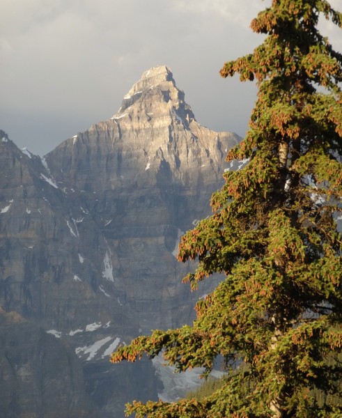
Since my partner couldn't do our weeklong Pickets trip, I decided to head up to Canada to enjoy a bit of peak bagging. The first peak on the list was Eiffel (10,118 feet). I thought my trip was over on the first day as they weren't allowing anyone up the trail without at least four people in the group.
 The park wardens are serious about this due to bear activity. I saw a pair of climbers getting a ticket on my way out from Temple three days later. $5000 max fine...ouch! I was fortunate enough to run into a friendly group of Alpine Club of Canada members going up to do Eiffel.
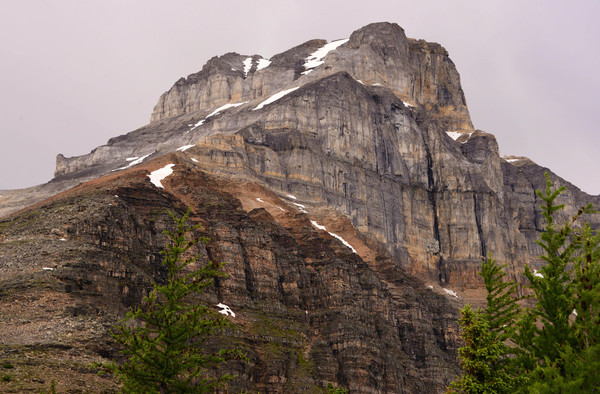 It's mostly a hike until about 9500 feet when you hit some 3-4th class gullies and a chimney (or an optional small snow field). This was made more sporting by rain and thunder. The summit cairn and my ice axe were humming...time to scram. The rock was a bit slick coming down.
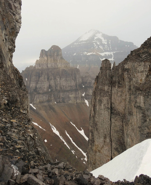
 I did some exploring and photography the next two days, hoping the weather would improve.
 It's a very beautiful area between Lake Louise and Jasper.
 After a wet hike up to Lake Agness and the Plain of Six Glaciers Friday, I was hoping the weather would improve.
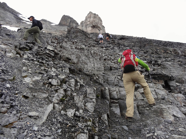
 Saturday dawn was clear and I showed up at the Moraine Lake trailhead at 6:30 a.m. hoping to tag along with another group. I was lucky again and ran into a guy named Shafiq wanting to do Mt. Temple and a group going up Wenkchemna Pass. At the trail fork Shafiq and I headed up to Sentinel Pass to start the SW ridge of Temple.
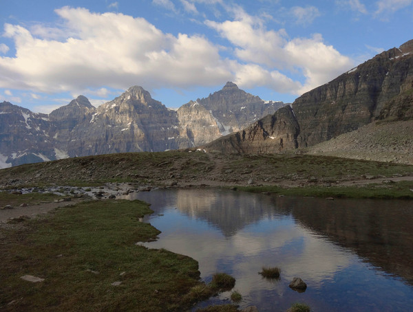 It's mostly a scree scramble with a couple of 4th class moves.
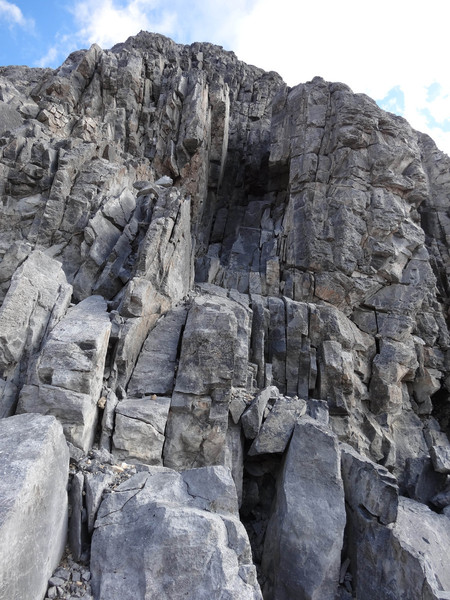 The route is pretty easy to follow between boot pack and cairns. It stuck pretty close to the ridge crest. It is a good conditioner at 11,624 feet with great views.
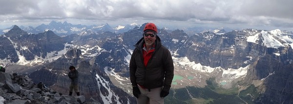
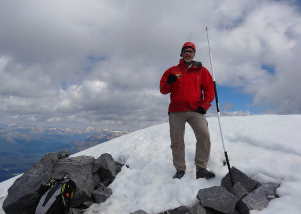 After the long hike out, I contacted my friend and professional guide Larry Dolecki to see if he was available to climb anything while the weather held. He could only spare one day, so he proposed we do Mt. Sir Donald car-to-car on Sunday. I drove back over Rogers Pass and rolled into the Illecillewaet at sundown and scored the last open spot. We met at about 4:00 a.m. at the parking lot. I had only gotten about 3 hours sleep and was still tired from Temple the previous day, and there was showers forecasted in the afternoon...so I decided Uto Peak was a safer bet. It has the same approach and shares a col with Sir Donald's NW ridge. I was feeling gassed by the time we got to the col, but once on rock started feeling better. The rock is really nice and blocky quartzite, so we simulclimbed the SE ridge.
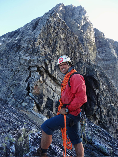 We kept mostly to the ridge crest or slightly left of it. There were a couple awkward off-widths, but mostly very fun lower 5th class rock. The weather held up and we relaxed on the summit...with the traditional Ritter Sport reward.
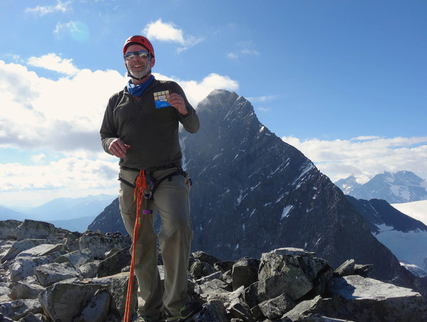

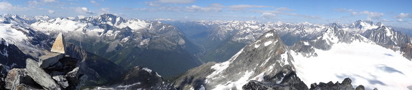 We downclimbed most of the ridge with a few rappels on the steeper parts. It was a long hike out, but the views...especially of Mt. Sir Donald were inspiring. Larry said we'll do that next time I'm up and more rested. It looks like a great route.
Gear Notes:
Eiffel and Temple are scrambles mostly on rock and scree...no axes needed. Poles were handy at times. For Uto we had helmets, 60m rope, a small rack (didn't use), and plenty of slings. Plenty of rap stations and horns to sling.
Approach Notes:
Eiffel south ridge/face: Moraine Lake trailhead just past the canoe dock. Take the Larch Valley trail. Just past the fork for Wenkchemna Pass trail is an unmarked trail descending to a creek and up the south ridge of Eiffel. Temple southwest ridge: Same approach as for Eiffel, but continue up to Sentinel Pass. Then just follow the trail/cairns staying mostly on the ridge crest. Uto Southeast Ridge: Nice trail to Uto-Sir Donald Col. One snow field to traverse. With poles and approach shoes, not too bad. If it was icy I'd want an axe.
-
Thanks for the inspiration. Just did Uto SE ridge sunday. A really fun climb. I'm glad we went back down the same way and avoided the choss. It was some of the nicest downclimbing I've done in Canada...especially after doing Temple the day before.
-
Nice work and sweet pictures! Thanks for sharing...again.
-
Another vote for Ruth and Hannegan. I did Ruth solo last July...it has a great view of Nooksack Cirque and the North Cascades.
-
WTB: Your Old Sport Climbing Gear
in The Yard Sale
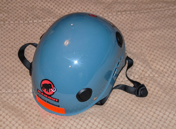
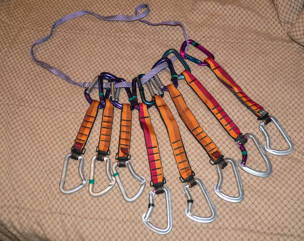
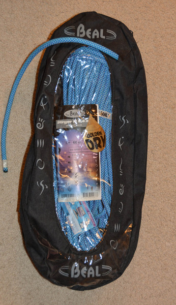
Posted
For $100 I'll provide you with an unused rope (Beal Stinger III still in the bag), Black Diamond Half Dome helmet, and eight Petzl quickdraws. See attatched photos. Plenty of life left in this gear. Let me know if you're interested.