


dietcookie
-
Posts
30 -
Joined
-
Last visited
Content Type
Profiles
Forums
Events
Everything posted by dietcookie
-
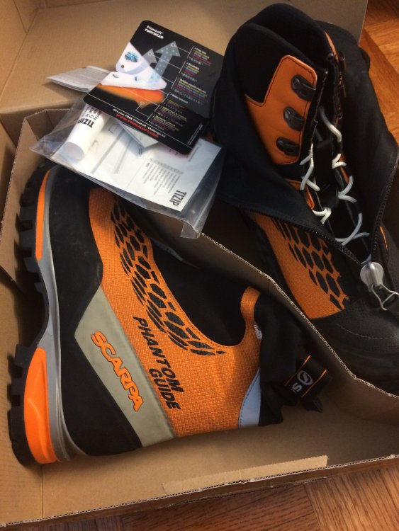
Used them once last summer in Peru for one climb. Dirt marks on the black trimming but otherwise practically brand new. Don't need them in California much so trying to get rid of them. Looking for $350 shipped.... Reply back or PM me. Thanks!
-
[TR] Forbidden - W and NW ridges 8/9/2011
dietcookie replied to Val Zephyr's topic in North Cascades
Thanks for the info. My buddy may not be comfortable with steep snow, I'll plan on bringing two short pickets. Can the walls of the couloir take rock pro? Also, as for rapping down the wall, it's gained by walking past the couloir on the ridge while descending correct? -
[TR] Forbidden - W and NW ridges 8/9/2011
dietcookie replied to Val Zephyr's topic in North Cascades
Thanks for the TR, I'm planning on climbing the West Ridge next week. Hopefully the couloir and bridge stay somewhat "in". Would a standard axe suffice for the couloir or maybe one tool? -
Anyone have any recent info/conditions for the approach? More concerned about the entrance and general condition of the couloir if anything. Sounds like the Northern Cascades are under much above average snow for this time of the year http://www.nps.gov/noca/planyourvisit/trail-conditions.htm Don't want to bring any additional gear if there is no schrund to deal with. Thanks guys.
-
We are planning on doing the approach to illumination saddle Mon 3/16 and climbing it super early tuesday morning. Atmos forecast seems to project Hood getting the tail end of it during that time, NOAA seems to think chance of showers mostly cloudy. We'll see what happens!
-
I'll throw the shoes in the car at least. I'm hoping the weather stays semi-stable as the forecast indicates for the next week.
-
The rime mushroom sounds sweet. Maybe we will run into it unless the chunk runs into us. I guess I have one more question, snowshoes or posthole? I don't ski (i'm bummed..) but I would rather leave the shoes at home. I can see them being useful up to the approach to illumination saddle but thats about it.
-
Sounds good guys.
-
Anyone have a scan of the route from Oregon High or a picture with the route drawn out? Seems like there are a ton of variations on the route but i'm still unclear where exactly you start and where the exit is. I keep coming across people confusing leutholds and reid together. Thanks guys.
-
SOLD:Tools, Crampons, and 3 screws THANKS CC!
dietcookie replied to sicboater's topic in The Yard Sale
Sent you a PM. -
Perfect, exactly what I want to hear. Me and a buddy are flying in tomorrow night and starting our hike (no bikes unfortunately) in on friday. We plan on climbing Eldorado as well, see you there! thanks again for info.
-
Anyone know where the snowline is at in and around cascade river/pass area? I'd rather not pack the showshoes. Thanks
-
Too small and insignificant to rope up? Seems like all the TRs i've read did not have one mention of rope in it.
-
From where the road is damaged, is it snowed in most of the way? I'll be there end of this month, and would rather not pack snowshoes if I don't have to.
-
several miles and 3500 foot gain if memory serves me. but that's if you camp on snow / leave no trace which should be easy early season. sweet, sounds like it should be doable from where the road is jacked (mile 12 or so?). probably no chance in hell its gonna be fixed up by the end of this month huh? i'm flying in the 28th.
-
how far in is the hike to a reasonable camp for eldorado from the actual trailhead?
-
Picket Range end of May/June am I stupid?
dietcookie replied to dietcookie's topic in Climber's Board
Again, be careful heading up to a volcano in bad weather. You can do it in a whiteout, but things can get pretty crazy with strong winds and snow and all that good stuff. Lots of people have died on them because they ignored the weather. Easier climbs on smaller mountains (like some on Baker HW) can be a lot of fun in bad weather. Any suggestions on the smaller guys that would be fun? Goatboy: Mt. Fury, looks fucking bad ass. Thats it. I have to be there. This whole time I was looking at the various goods in the Pickets but I just sat here for an hour going through info on Fury. I think I have made my choice -
Picket Range end of May/June am I stupid?
dietcookie replied to dietcookie's topic in Climber's Board
Yeah we figured that some if not most of the trail heads we want to start out of will be inaccessible. We first planned this trip for the end of March, we were expecting to add miles to any approach. I have my mind set on the Pickets, I guess if the weather is good once we are up there then we are there. If not, either any of the volcanoes or some goods along mt baker highway. If the weather is crappy for sure, then i'm down to suffer with a shorter approach. -
Picket Range end of May/June am I stupid?
dietcookie replied to dietcookie's topic in Climber's Board
Thanks for the breakdown Stefan. I could just tick off Adam's Glacier route which I attempted last year if anything. I'm going to hope the NW keeps getting snow, i'd rather slog up snow than scree and brush any day. Thanks for all the suggestions so far. This time period will be the only time we can really get into the PNW and I really wanted to do some real mountaineering stuff, you know snow, glaciers, cool views all the goods. We get all that here in the sierras, except for the glaciers. -
Picket Range end of May/June am I stupid?
dietcookie replied to dietcookie's topic in Climber's Board
Ptarmigan looks awesome, I don't have access to a topo at the moment, but from what I can remember its near the pickets somewhat correct? So if the pickets are getting bad weather, then I might as well not go near the northern cascades... typically at that time of the year in the northern cascades in the higher elevations does bad weather typically bring snow, rain or a combo of both? -
Picket Range end of May/June am I stupid?
dietcookie replied to dietcookie's topic in Climber's Board
Thanks for the suggestions. I just read something along the lines of some dudes from that link.. "Parties have been known to spend days wrestling the brush to travel just a few miles down one of those valleys. " That sounds pretty shitty if this will be one of the only trips i'll be able to go on for the year. But If this is a heavy snow year and some of the brush is covered in snow, i'd be willing to suffer. The Ptarmigan Traverse (or part of it) would look pretty fun around that time of the year. -
A buddy and I are flying out to WA in hopes of climbing something, anything at all. Initial plans were Rainier but I'd like to explore some actual ranges, not a big volcano. If weather doesn't cooperate, then we will settle with Rainier, Adams or Baker. I've been eying the Picket Range. Long approaches, cross country travel etc etc in the Sierras make me think I *might* be able to handle it. I understand that the typical visitation period is in the middle of the summer since the chances of being rained out are too great otherwise. With about 5 days we can dedicate to being out there, will it be worth it??
-
Planning on heading up to Rainier next April or so, of course depending on the winter's snowpack but typically what approach/trailhead is most accessible around that time of the year? short bike rides?
-
[TR] Southern WA Cascades - Mt Adams, Adams Glacier 7/23/2007
dietcookie replied to mrd's topic in Southern WA Cascades
I may dabble along the edge of the glacier and the North Face, get a little taste of both. What are the temps looking like lately? Pretty cool? -
[TR] Southern WA Cascades - Mt Adams, Adams Glacier 7/23/2007
dietcookie replied to mrd's topic in Southern WA Cascades
Pictures look better then reality. Once the clouds opened for a few hours afternoon, there was a pretty strong creak running down North Face near Adams Glacier causing huge rock falls to the lower part of the middle glacier. Usually this face looks very inviting with nice ice coverage, but not this time. In fact, the glacier on the pictures looks like very accessible with many places through, but once you are closer the view is different, blocked by ice blocks or big crevasses. Unlike majority of people, I'm usually a very late starter. In this case, however, I would recommend getting on the slope, perhaps, at first light, not for the strict safety reason but to have longer day in case of a need of exploring alternatives. I did not have that luxury. Anyway, let me know how your tip was. I was planning on staying at lake 7505 and getting up around 1am, traverse across the glacier and up the face. I might just skip the lake and stay right at the bottom of the face/glacier instead to get a better look in the daytime before I summit.
