


Bosterson
-
Posts
334 -
Joined
-
Last visited
-
Days Won
1
Content Type
Profiles
Forums
Events
Posts posted by Bosterson
-
-
Further economic analysis:
GNI per capita based on purchasing power parity (PPP). PPP GNI is gross national income (GNI) converted to international dollars using purchasing power parity rates. An international dollar has the same purchasing power over GNI as a U.S. dollar has in the United States.In other words, GNI/capita = national average income. Converted to international dollars using PPP, it is a measurement of how much quality of life a national average income can buy in that nation compared to the US.
For Nepal, the 2012 national average income is the equivalent of $2,190 per year in the US. (Keep in mind that in 2012, the US poverty line for a single individual was $11,170 per year. If you're married, it goes up to $15,000, and if you also have a couple of kids, it goes up to at least $23,000.)
Thus, if Sherpas are being paid 7x the national average for Nepal, they are earning the equivalent of someone in the US who earns $15,330 per year. That person is not necessarily starving, but they're not living very well either....
-
More context:
[The indexed Human Development Index] captures the HDI of the average person in society, which is less than the aggregate HDI when there is inequality in the distribution of health, education and income. Under perfect equality, the HDI and IHDI are equal; the greater the difference between the two, the greater the inequality. In that sense, "the IHDI is the actual level of human development (taking into account inequality), while the HDI can be viewed as an index of the potential human development that could be achieved if there is no inequality."For 2012:
----- ---
1) Norway ----- .955 --- .894
16) US ----- .937 --- .821
18) France ----- .893 --- .812
19) UK ----- .875 --- .802
109) Nepal ----- .463 --- .304
Can we just acknowledge that there are important economic differences besides adjusting for the relative value of different currencies? Sherpas making "7x the national average" are not literally making the "equivalent of $300,000 per year." They are not buying mansions (let alone suburban homes) and sports cars or SUVs. GDP/capita in Nepal is US $1300 vs $57,000 in this country. Their literacy rate is 48% and they have an average lifespan of 66.8 years, vs 78.6 here. And if you think unemployment is high in the US, be thankful we're still in the single digits - it's 46% in Nepal.
This is not to knock what Pat wrote, just that people are fixating on the money itself. Can we agree that Nepal is a much poorer country, not just in terms of the value of its money, but in terms of its infrastructure and opportunity for the average person, than countries in the west?
Also, to amend what Pat wrote, the Sherpas are making these demands of the Nepalese government, not of the guiding companies. Pat's compensation figure is also too large. As of last year, Sherpa families currently get 1 million Nepalese Rupees from the government if a Sherpa dies on Everest. This = US $10,392, according to Google. The Sherpas are asking that it be raised to 2 million NR. As noted by a Sherpa writer in the Financial Times, the 1M NR amount is barely enough to cover the deceased's funeral.
(I also realize Pat's figure is from a blog. I found the $10,000 figure in National Geographic, Wikipedia, and Krakauer's New Yorker article.)
-
For the foreign climbers, to go home now will mean forfeiting most or all of the fifty to ninety thousand dollars they have spent to be guided up Everest. For the Sherpas who make the guided ascents possible, however, to quit now, after only a few weeks’ wages, will be an even greater economic sacrifice, relatively speaking.
This quote doesn't help your argument that the sherpa are not paid fairly. relatively.
I used that quote from the Krakauer article because it's discussing the fact that the Sherpas are not quitting - they're going on strike, forgoing wages for a labor rights issue. That said, all the quote literally implies is that the people who pay to get guided up Everest are waaaay richer than Sherpas, relatively speaking. It's not saying that $5000 for a Sherpa is worth more than $50-90k in a western country, it's saying that rich western clients are more easily able to forego a huge amount of money in a wealthy western country than a Sherpa is able to forego a much smaller amount of money in a poor country. In other words, it's saying that the Sherpas are still barely scraping by, as one season could make or break them.
I don't think that guiding companies are trying to "screw over" the Sherpas - quite the reverse, actually, since look how many companies stepped up and cancelled their seasons (which will affect their business, their reputations, and their bottom lines) when the the Sherpas went on strike.
That said, this is still an issue of rich people operating in a poor country, and the labor tangle that entails. Don't think that Sherpas are crossing the Khumbu Icefall dozens of times because they "love climbing" and it's a "good job" - they need the money.
-
Please reread my post. I put in that quote as a reference to the quality of the news coverage. There is a complicated and important discussion to be had regarding the labor issues at stake here. The news, however, has boiled it down to "the Sherpas quit" and have proceeded to quote a bunch of Westerners whining about it, as well as repeatedly noting that they may not get their money back. The question of why the Sherpas were doing more dangerous work for less pay in the first place, and whether that should be perpetuated, is not really being covered now that the Sherpas have walked out.
To be fair, that one article was extremely idiotic and I was sounding off. Some of the previous coverage has been better.
This is the real crux of the issue:
“We had a historic accident, and now we’ve got a historic moment, where we could close down the whole season,” [british expedition leader] Mr. Crampton said. “I feel like I’m doing something I should have done a long time ago.”Also crucial is the issue of how global warming is affecting mountaineering.
A few years ago, ClimateWire interviewed a Sherpa who had participated in Sir Edmund Hillary's historic expedition and, upon returning to Base Camp in 2011, was shocked by how much had changed since 1953. He predicted the end of snow on Everest within the next few decades.And the most comprehensive analysis I've seen so far was provided by, natch, Jon Krakauer.
For the foreign climbers, to go home now will mean forfeiting most or all of the fifty to ninety thousand dollars they have spent to be guided up Everest. For the Sherpas who make the guided ascents possible, however, to quit now, after only a few weeks’ wages, will be an even greater economic sacrifice, relatively speaking. -
"Maoist??"
-
Is anyone else extremely mind@#$%ed by the absurd rhetoric being spewed out regarding the Sherpa strike on Everest? It's bad enough that Sherpas are treated like porters, that they don't make purchasing-power-adjusted wages relative to western guides, that they do the vast majority of dangerous work (ferrying loads back and forth through the Khumbu Icefall, fixing all the ropes in advance of climbing season), but now the very legitimate labor issue at the heart of this is being sidelined in the media in favor of the litany of whining from western "climbers" who are disappointed they won't get to be led by the hand up the mountain?
“I can’t help but feel that I have let everyone down,” wrote Kent Stewart, an American climber, in a blog post. “If I don’t ever make it to the top of Everest, I’m afraid there will always be a hole in my life, and frankly, that worries me.” -
As of 3/22/14: snow above Palmer is shot through with ice up to below Crater Rock. From there on, snow is a mixture of harder and consolidated (good for daggering) and 4-6 in of dry sugar that wants to slide. Everyone ended up downclimbing about 1/3 of the Old Chute before you could turn around and heel plunge back down to the Hogsback. The sunny weather is releasing some layered slabs around the Old Chute and West Crater Rim area. Super cold before sunrise, in the teens.
-
-
Paypal accepted. Pick up in Portland with cash and I'll knock a few dollars off the price.
Five.Ten Copperhead climbing shoes - US 9
Bought used on here, tried out once in the gym, way too big and can't justify keeping them. Practically new. Should've figured out my 5.10 size first!!

$50 shipped


La Sportiva Crossover GTX trail runners - men's 43.5
Bought off Geartrade (no returns). It's basically a C-Lite with GTX and a little zippered gaiter. Inexplicably these run about 1/2-1 size smaller than my other Sportiva trail runners?? They were "used" on Geartrade but look new. I never took them out of the house.
$80 shipped

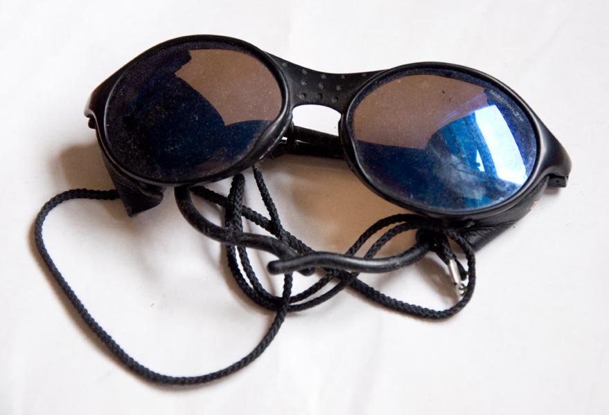
Julbo glacier glasses
The basic ones, non polarized. Used, scuffed, etc. Work fine, just never fit my face.
$25 shipped
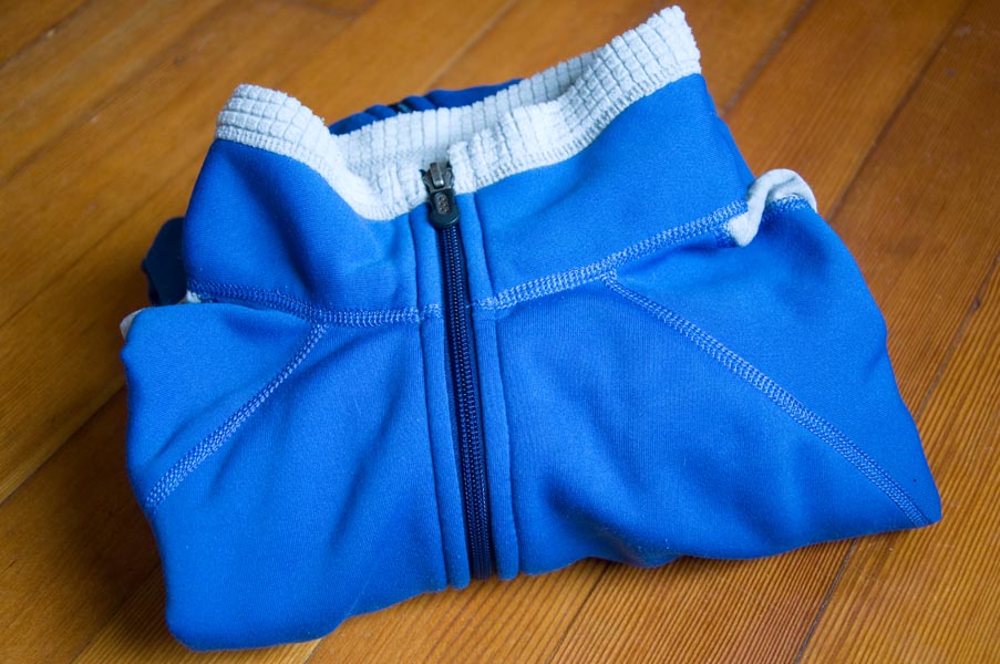
Patagonia Chas jacket - men's medium
Casual fleece jacket made of power stretch and R1. Great condition, I just never wear it.
$30 shipped
-
PM sent on Sabretooths.
-
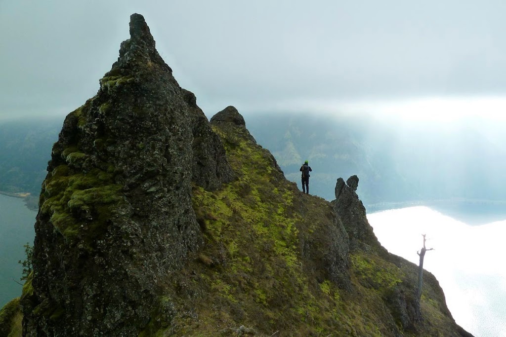
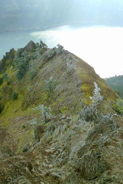
Trip: Dog Mountain - Dog Spine
Date: 1/18/2014
Trip Report:
A little bit of Gorge landscaping, dedicated to my buddy Billy who wished he could come along.
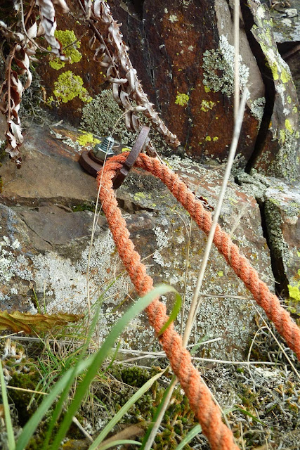
Ended up too far east and missed Helser's Direct. Climbed Dog Rock despite freezing wind. Barely a climbing route, with two 1/4" bolts on rusty hangers, walk across a five foot ledge, turn a corner and do a move over your head to the summit. I placed a #9 stopper in a crack to protect the last move. Four faded slings from two solid(er) bolts make an anchor with two rap rings. It's pretty dumb, but so is climbing.
After that, fun ridge scrambling. Some misc bolts and fixed pins found on the hillside with rotting orange hardware store "rope" tied through them. Exposed but easy 3rd class - no reason to use any of that pro. Frosty up top, so we bailed off the right towards the end and followed the hill up into the trees. Dumb fun.


Gear Notes:
Helmet and gaiters. Leave the axe and gear at home.
Approach Notes:
http://cascadeclimbers.com/forum/ubbthreads.php?ubb=showflat&Number=1099627
-
Bumping this. Anyone got a shell to sell?
-
My girlfriend needs a new climbing shell, and since it 'tis the gifting season...
Needs to have a helmet compatible hood, not insulated, good weather resistance. She's a women's medium, arms a little on the long side, says Marmot fits well I think...
Thanks!

-
I was hoping to do a 4 day backpacking/scramble trip up in Glacier Peak Wilderness over Labor Day Weekend (see below), but my car was stolen a few weeks ago, so I'm a bit SOL. I'm up for any kind of backpacking, scrambling, or climbing during that period and just want to get outside over the holiday. Located in Portland, have gas money, car was unfortunately found stripped for parts...

Original idea if people are interested, otherwise open to invites.
I'm looking for a partner or two for a possible 4 day trip from Friday, Sept 30 - Mon, Aug 2 in the Glacier Peak Wilderness. I'm not 100% on the itinerary yet, but please see this trip report to 1) have your mind totally blown, and 2) get an idea of what this would entail. The Hanging Gardens and Bannock Lakes would be the ideal goal, though I'm not sure they're reachable from the south, and I haven't figured out an alternate entry point yet. But basically, let's see as much of that area as possible in 4 days, hopefully with some scrambling on the side. We'd leave Thursday the 29th after work and bivy at the trailhead for a Friday morning start. Mileage might be 40-50, depending on how much side scrambling we do. A bit of off trail will presumably be required, and comfort with rocky peak scrambling would be helpful. Sound fun? Let me know! -
Edit: never mind.
-
Nice work guys!
We knew they were either much faster than us or they would never make it.
Yeah, we should have started a little earlier to make up for sluggishness from lack of sleep. The bushwhack up the north fork of Milk Creek also wasted some time with routefinding in the dark. The snow softened really quickly once the sun hit it, so it was good to turn around when we did. A really nice day out there, though.
-
I'm unclear, is this tree climbing or landscaping?
Dirt scrabbling? (I think GCC calls this "Gorge Adventuring;" you've gotta make your own fun.)
I did find a super solid hand jam between two trees though...
-
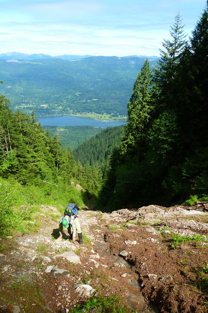
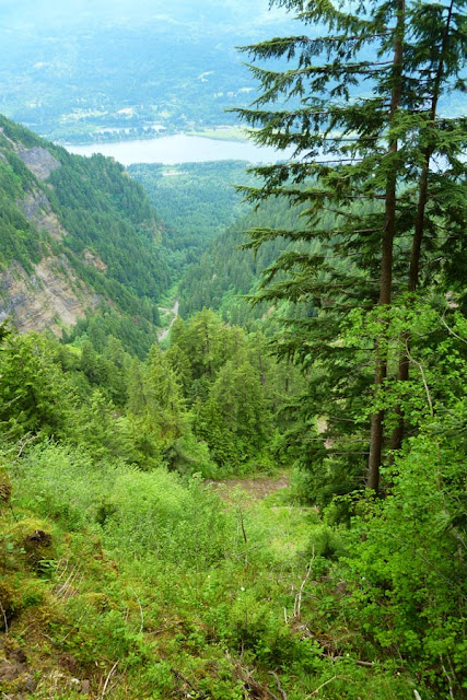
Trip: Nesmith area - Patagonian Trade Route
Date: 6/7/2013
Trip Report:
From Tim Olson's Gorge Classic Climbs:
The Patagonian Trade Route is a shocking line of super classic proportion...The extreme isolation, the raw exposure, the towering forest topped cliffs, and the lack of quality rock, all combine to give you an enduring, vibrant experience.
Ben and I have been ticking off various scramble routes in the Yeon area - the NE Buttress, the NW Ridge, Katanai Rock - and wanted to spend a long day getting after one of the harder routes in GCC. PTR is described as "extreme risk," with long creek drainages to climb, bushwhacking, and sketchy 5th class leading. We took a standard 50m rope, slings, biners, and helmets. The route goes up Tumalt Creek from Dodson, right east of the Ainsworth Exit off the frontage road.
Eventually it splits, and you jump up onto the small ridge in the middle.

We followed the ridge up through some thick brush until it popped out into another drainage. The book says to go up a few hundred feet and then ascend a small, thin ridgelette to climber's right that requires some 4th class roped brush scrambling. We instead kept straight up the gully and skipped the ridgelette.
This required a slightly sketchy traverse at the top of the gully to go over to the top of the ridgelette, where the rest of the "hard" climbing begins. There are crazy landslides all over this rugged area.
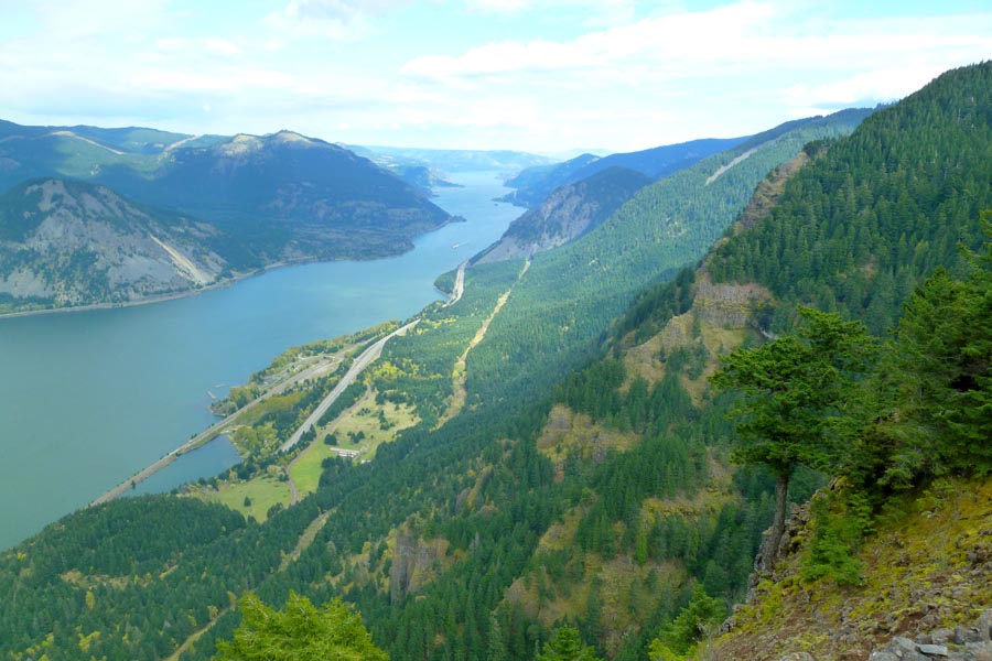
View west towards Yeon Mountain.

We geared up.
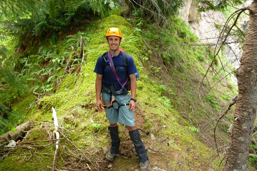
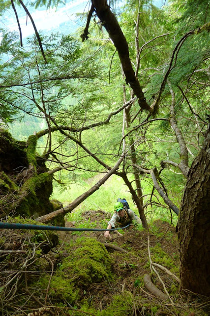
From the flat top of the ridgelette, we ascended some steep, loose ground until we hit a rock headwall. It looked like a good, easy way up, but the rock was atrocious - part dirt, super loose. So, following the route description, we traversed left (east) across a narrow shelf that required one very sketchy downstep with poor moss hands. This was pitch 1, protected at the sketchy step by slinging some brush. At the end of the shelf (70 ft?), I set up a belay on two trees and brought Ben across.
View down into the gully, the ridgelette (midground trees), and Tumalt Creek way below.
Pitch 2 climbed straight uphill and was fairly straightforward and well protected by hitching slings to trees and some sturdy, buried roots. The crux, as described in GCC, is a stem between a tree and a semi-loose rock wall - transferring your weight out of the stem and onto the so-so rock is balancy. (Ben accomplished it by shoving his hand deep into the dirt and making a fist jam?) Above the stem there's a little shelf with some trees, and since I was running out of slings, I built an anchor and brought Ben up.
I sent him onward for P3, which went straight to the rim of the flat Nesmith plateau. It's probably not necessary to rope up, as the climbing from here on is easy and a bit more solid, but a fall would not be good, and there's one exposed rocky corner to turn immediately after the shelf I was belaying on.
Looking uphill above that corner, easy, soft ground.

Looking to my right.
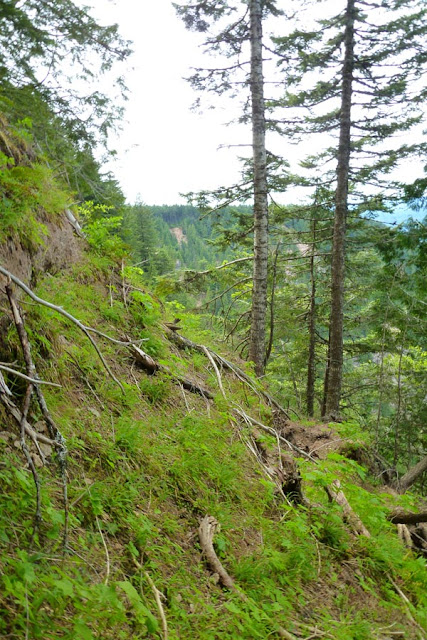
The "summit."

From here, we followed the rim uphill to the summit of Nesmith. En route we passed some amazing landslides. Getting close to the edge is a little unnerving, since the edge is basically a moss and tree root cornice...
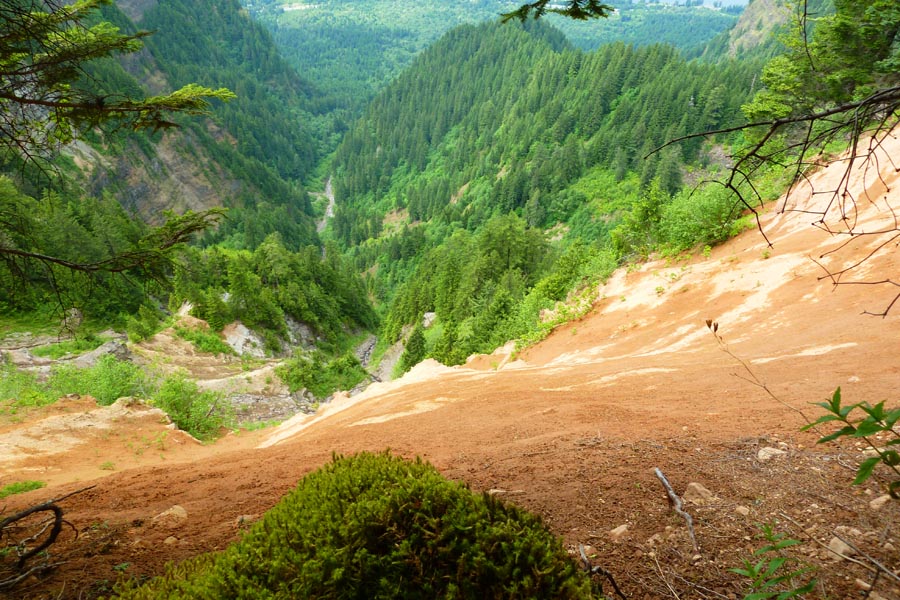
This view shows the approximate upper portion of PTR, from the traverse over to the ridgelette and up to the top.
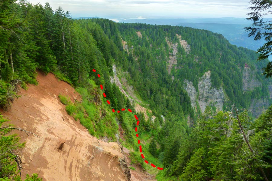
In sum, the route is approximately 3000 ft of approach up a series of drainages, ridges, and gullies to a couple of pitches of slightly sketchy and decently exposed dirt, moss, and tree climbing. Most of it is pretty easy to protect with hitched slings, and it never felt overly dangerous.
GCC says the FA was in 1999, and they mention a possible left exit that looks like it may have gotten destroyed by one of the big landslides, so I'm curious if anyone else has done this and how much traffic it sees.
Gear Notes:
GCC recommends all kinds of pro, but I wouldn't trust any of the rock to hold any kind of gear. Hitch slings to trees and roots - three 24" and five 48", plus some bigger webbing to make anchors around trees.
Approach Notes:
Tumalt Creek drainage
-
Trip: Indian Point - Shooting Gallery
Date: 4/17/2013
Trip Report:
A bit of nonsense from Gorge Classic Climbs.
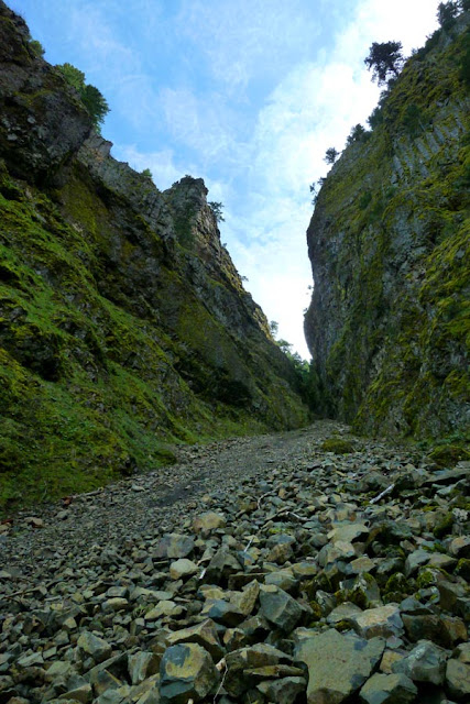


The roof is a few rocks solidly wedged between the gully walls. There's around five feet between them and a little bump below that you can stand on. We had no rock protection, but if you did, you might be able to place something in the rocks in the roof - they seem solid. The solution to this obstacle ended up being a chimney between the two walls, underclinging the rock roof, and while stemming, reaching up around the left side of the block to grab a solid tree branch that's buried in rocks and dirt. Once there, you can walk your feet up the wall until you're sitting on the block. I was hesitant to commit to this move as the left wall was wet, but it turned out to be pretty easy. After surmounting the roof, you can hitch some slings to the solid tree branch for other people to grab or use as an aider. (You might be able to do this from below the roof if you're tall.)
After surmounting the roof, I hauled my pack up, and then climbed the upper gully. There are no pictures of this, because my partner was under the roof to stay out of the way of any rocks I might dislodge (and dislodge I did). About 10 or 15 ft up the gully there was a flat rock in the middle of the route - getting around it was, we both agree, the technical and physical crux of the route, involving stemming, pressing on the side walls, and marginal axe placements. It was really important to not have your full weight ever rest on any single point of contact, but rather to keep it evenly distributed.
In sum, the upper gully is steep, loose, slippery, featureless, and a slip might send in you sliding down and sailing off the rock roof onto the talus of the lower gully, resulting in broken bones for sure, or worse depending on how you land. Needless to say, this put the fear of death into me, as once you turn the roof, you're pretty committed, and once you pass the flat rock crux, there is really no way to downclimb as the terrain is so loose and slippery. Being in the zone is crucial.


Gear Notes:
Ice axe and helmet are essential. Slings for the roof crux. Rope might be useful.
Approach Notes:
Herman Creek, 400 trail, talus field.
-
Trip: Hood - Old Chute
Date: 3/31/2013
Trip Report:
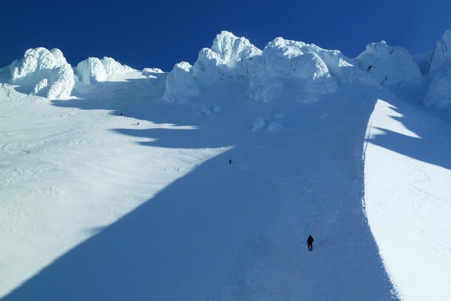
The Old Chute is ice-free after the nice weather we've had. There's a good staircase up at the top, though lower on the chute it's kinda slushy and goopy. The snow was so soft even before the light hit it that you can just walk down it without downclimbing.
Dawn summit light
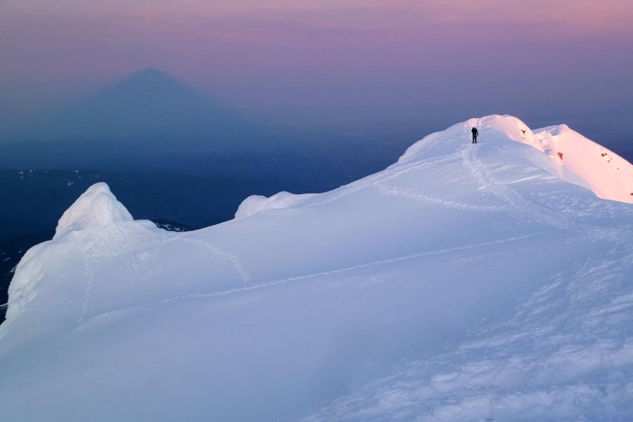
Going down the top of the Chute
Cutoff path over to the top of the Hogsback - easier walking, might be less safe once the sun hits it.
Gear Notes:
Ice axe, crampons, helmet.
Approach Notes:
Walking up the sno-cat tracks.
-
I'm not an ice climber and so while I get that ice comes in different forms and different degrees of solidity (just like rock!), I've seen a variety of terms on here for different types of ice and don't have a good idea of what they mean. Can anyone give me a rundown on sytrofoam vs snice vs plastic vs dinner plates, etc? Thanks!
-
The current Houdini has been sublty restyled for "running" - not sure if this has any effect on its mountain-worthiness or not. I have had no problems with the one I got last fall, and it's obviously a super useful piece, but like a lot of Patagonia stuff the cut of the shoulders is a little narrow for the climber build, and in order to not have it poof out around my torso, I wear a size that's a little tight under the arms, especially if I have it over a layer. Most of the time it's not an issue, but other brands sometimes fit better.
-
"Numbered, limited edition."
Be sure not to take it out of the package in order to preserve full collector's resale value.

-
If anyone wants to upcycle some old junked ice tools gathering dust in their garage, I will happily take them off your hands for all the really dumb 5.8 dirt and moss climbing I plan to do in the Columbia Gorge in the next few months.

If you live in Portland, I can swing by and pick them up at your convenience, or if you're not local I can send you some bucks for shipping.
Gracias!
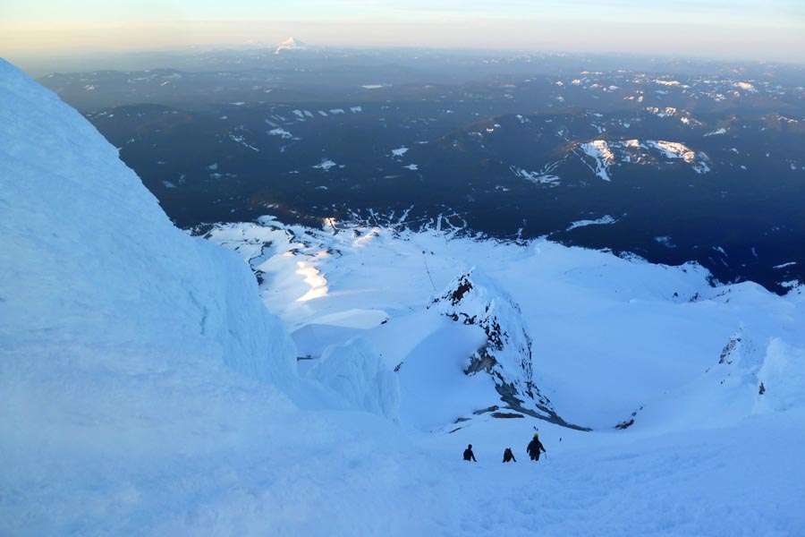
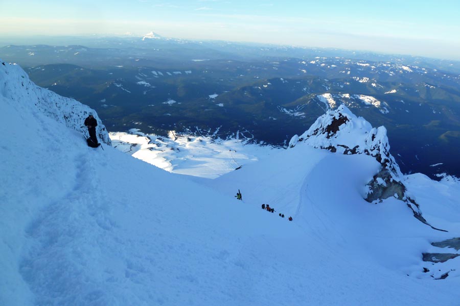
[TR] Mount Hood - South Side/Old Chutes 5/24/2014
in Oregon Cascades
Posted
I heard about that rescue. Was it icy above the Hogsback, or was the snow just really hard?