


Drederek
-
Posts
1090 -
Joined
-
Last visited
-
Days Won
2
Content Type
Profiles
Forums
Events
Posts posted by Drederek
-
-
Well on the off chance you are looking for a serious response in this forum, May is a very nice month for the desert SW.
-
There's a cave in Oregon somewhere that may be quite amazing in geological terms, I'd check that out.
-
Also Juniper Hedgehog sounds like "adventure".
If you mean Cinnamon Hedgehog it is certainly remote, we saw no one all day when we did it.
-
So what kind of bolts did you choose to rebolt with and do you think they will last 50 years?
-
Crag drones
in Spray
Saw that at JT last year, another reason not to own a gun.
-
if you have permits. This is the best time of year to go!
I'm pretty sure you dun need permits after Oct 15
-
This was a fun route. Totally worth doing while you're up in that area. Easy to find with good pro. The first two pitches are more like 15m each and it appears people are rapping from the p2 anchor to the ground. The p1 anchor no longer exists but its not necessary with a 60m or longer. The fixed slings are a bit crispy so I added some tat, it'd be best to redo them. We finished on the unprotected 5.4 slab to the top of p3, a great spot to watch the ants crawl up Aasgard Pass!
-
Seeing is a priviledge, not a right!
helen keller?
If Helen owned a car that would not give her the right to drive it.
did you know she had a car?

All I know is she moaned with one hand!
-
Seeing is a priviledge, not a right!
helen keller?
If Helen owned a car that would not give her the right to drive it.
-
Seeing is a priviledge, not a right!
-
Well the bit about blacking out your address on your registration so the thieves can't go back to town and burglarize you seems like a great idea if it really is ok with the cops.
-
Nice job and a great write up, thx! Was the rock quality better on one end or just worse in the middle? Or just randomly bad here and there? Your comments on the usefulness of the route description and your descent reminds me of Inner Constance.
-
There are quite a few crags scattered about the Oregon & Washington sides of the Columbia River. Some of the crags have possible access issues so they are not posted online, but check out the Facebook Group "Cascade Corridor Climbers" and you'll get all the beta you want. Also feel free to drop me a message & I'll answer any questions & show you around. Elmomecsko@gmail.com
Oregon Side:
Area 51 • Many Sport & a few Trad lines.
Bulo Bluff • Beginer area with fun Sport lines.
Pete's Pile • Quality Trad Routes.
Klinger Spring • Many tall Sport & Trad routes.
Washington Side:
Old Highway 8 • Shorter Sport & Trad lines.
The Bypass • Short pumpy Sport routes.
Wankers Collumns • Trad routes.
Lyle Area • Tunnel Wall, Rest Stop Wall, Klickitat Bouldering
From mtn proj forum
-
much more enjoyable snow.
-
Trip: Olympics - North Brother to South
Date: 7/26/2014
Trip Report:
A recent trip report finally got me to set my sights on the north Brother. I've been up the south Brother a few times and on at least half of those times I've looked across at the north and wondered how much more time it would take to do both. Living in Olympia, I'm a confirmed daytripper in the Olympics. Last year I traversed over from "lunch rock" to look down into the east basin but with a late start and no real plan to do it turned back. The guide book says traverse over, I'd call it more of a rising traverse over the top of a deep gully and below the small headwalls.
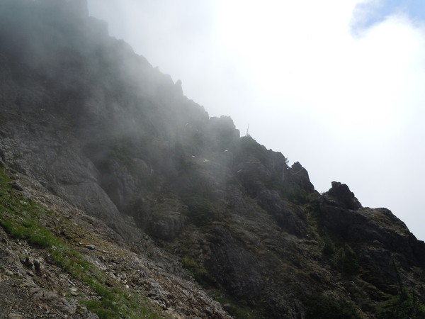
A half dozen goats were laying about where I crossed the first ridge on my recon last year, so I crossed below them and it worked out fine. A couple ridges later and I was once again looking down into the east basin.
It was full of those pesty clouds that like to hang around mountains in the afternoons but as they seemed to be fading in and out I just hoped I'd be able to see when I needed to. Great views of the east ridge route under the clouds.
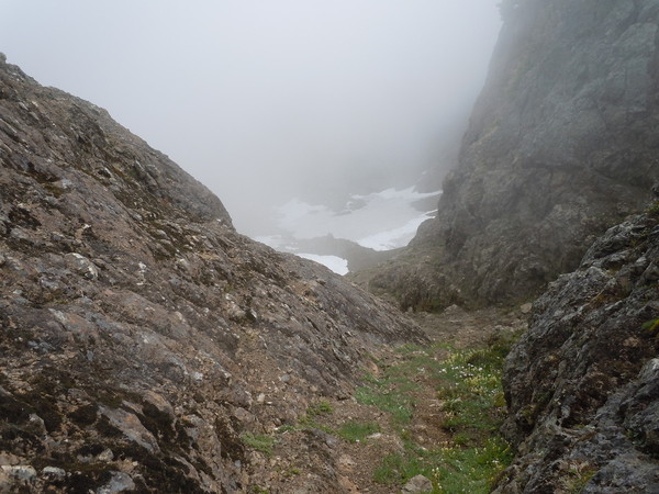
The old guidebook said head up a coulier and easy rock to the north summit. Without being able to see the tops of the gullies I crossed the basin and headed up the easiest looking one, which ended up connecting to the next one to the north above a gendarme. It proved correct although the North summit was to climbers right not left as I had guessed.
Could hear the people on the south summit, and after a bit the clouds swirled some and there they were.
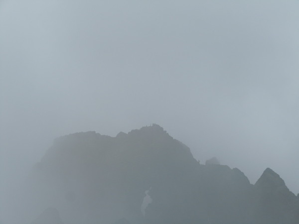
With almost no snow going back down into the basin seemed like it would be no fun so I decided to do the traverse to the south summit. I was a bit worried that the absence of snow would force me to climb some questionable rock over bad places to fall but it was really all very easy with straightforward routefinding. The Bombay slot near the middle of the traverse.

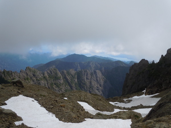
A little less than an hour later I was on the south summit looking back at the north.
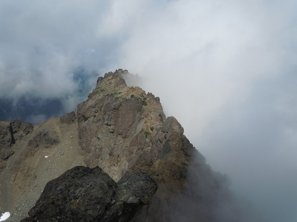
The North Brother and the traverse to the south were the best parts of another great day in the Olympics, I can't believe they don't get done more often. Took me 11 hours car to car, a couple hours more than just the South Brother and about the same as Mt Constance.
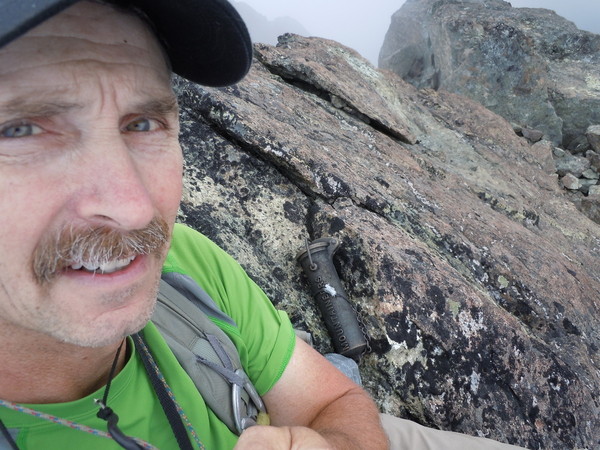
Gear Notes:
It was comforting to have an axe crossing the icy basin but not really necessary
Approach Notes:
Past Lena Lake, up the valley of silent men. So Bro route till it turns up after the traverse, keep traversing.
-
The keys for me have been spotting the Longs Pass trail while still in the Cascadian so you have a feel for where you're headed and hiking a bit further uphill on the Ingalls trail than you think you ought to. The sign is weathered wood about eye level maybe 12" x 4". I think it just says Longs Pass
-
Get to the lake before sunup. Find the Longs pass trail before dark. Hang out by the the creek till the sun is off the trail, its more fun/less heinous in the shade. Double slings very useful.
-
Sadly, the only thing about steep sport climbing that helps Alpine is how far above the carpark they are. The problem is 5.6 cruxes are much more akin to alpine difficulties than the moves you've been practicing. When the wife started climbing and I had to put up easy stuff for her it just didn't seem to be as easy as it ought to be. But I think its helped my alpine climbing. Its a whole different angle to get used to. Also you're looking for different terrain clues, at much longer runouts and if you try to pull hard you'll just tear holds off. Totally worth it though, do it all!
-
People who do not brush these routes are just plain assholes.
Ah, so they are a different kind of asshole than you are Bob?

Pointing out a bad behavior makes me an asshole?
I think he just means you're not plain!
-
As long as it doesn't look to be in any worse shape than the rest of your cams its probably ok, but I wouldn't place it anywhere its failure would mean certain death. The real question is, is your buddy going to buy you a new cam or will you accept a bootied one in its place?
-
Well you could hang a draw off the lower piece if it was above or away from you and set it up like a toprope.
-
Well nothing is up yet and climbing is not on their list of categories. Guess we'll check back in a few weeks.
-
I was hoping this thread would devolve into a Super Taco battle cage match.
Perhaps if you pointed out that you can wear them Velcro side out?
-
I do not like selfish assholes not respecting rules. The rule clearly states, if the right lane is open and you are not actively passing another vehicle, you are supposed to drive in right lane. So OMG, how hard is it to follow this rule?
So if the person going slow in the fast lane is doing the speed limit it doesn't affect you because you're respecting the speed limit rule?
Carrying your water on alpine objectives?
in Climber's Board
Posted
Get a stick on patch kit for a rubber raft. Any cheap sporting goods store should have something that will stick pretty good.