traildirt
-
Posts
13 -
Joined
-
Last visited
-
Days Won
7
Everything posted by traildirt
-
i want to be stoked
-
best of cc.com [TR] Cascade Volcanoes - Bike-athon 06/06/2025
traildirt replied to traildirt's topic in Mount Rainier NP
Here is the compiled cal topo with the full route. https://caltopo.com/m/NV0J5M0 the only significant change id make is avoiding the mega detour to i5 between msh and rainier. FR 25 would be ideal, but it may not be open for a while (years?) the other option could be to climb msh first, then Adams…and take FR 23 (or possibly 21?) to Packwood. The likely barrier there is that the snow may not melt off the highest elevations on that road until July…which isn’t necessarily a problem but I wanted to do this in June oh and there were a few miles between Elbe and eatonville where I was very close to getting hit a few times (called Alder cut off I think)…if I did it over I would avoid this even if it added 20 miles like the alternate might have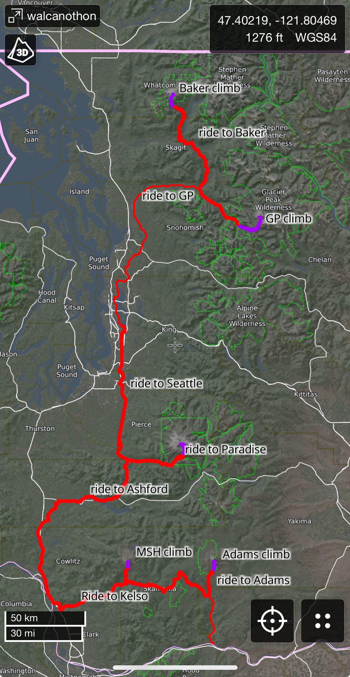
-
best of cc.com [TR] Cascade Volcanoes - Bike-athon 06/06/2025
traildirt replied to traildirt's topic in Mount Rainier NP
Do it!! It’s a fun way to explore broader landscapes and get to know places I saw a news story this week that Killian Jornet is currently bike-hiking all the 14ers of CO…followed by CA and then up here for Rainier …all during the month of September ? -
best of cc.com [TR] Cascade Volcanoes - Bike-athon 06/06/2025
traildirt replied to traildirt's topic in Mount Rainier NP
here’s one when I got new panniers on day 5 and just for fun, here’s what I was rolling with when the old ones exploded coming down from MSH ?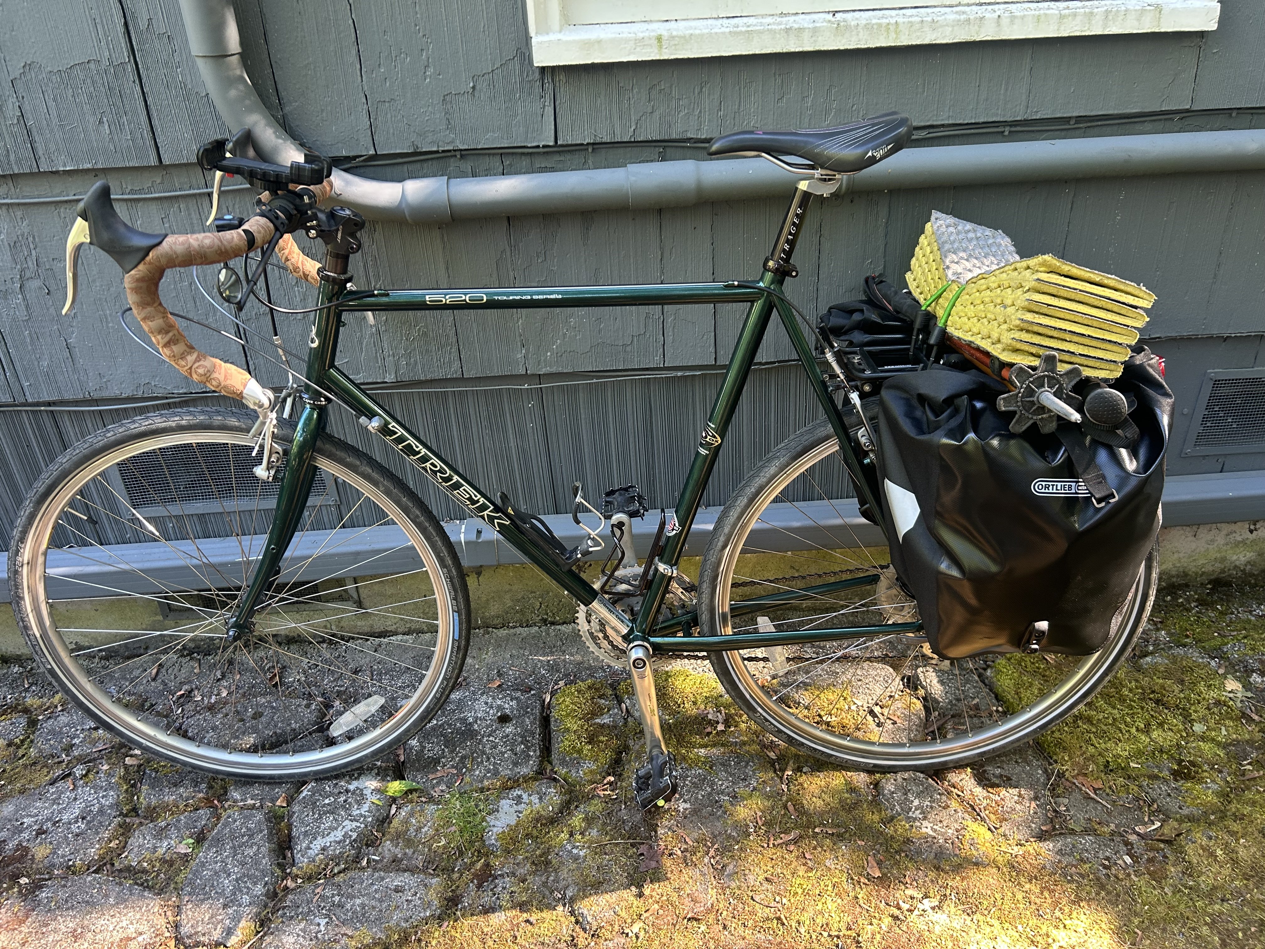

-
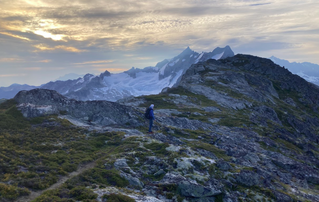
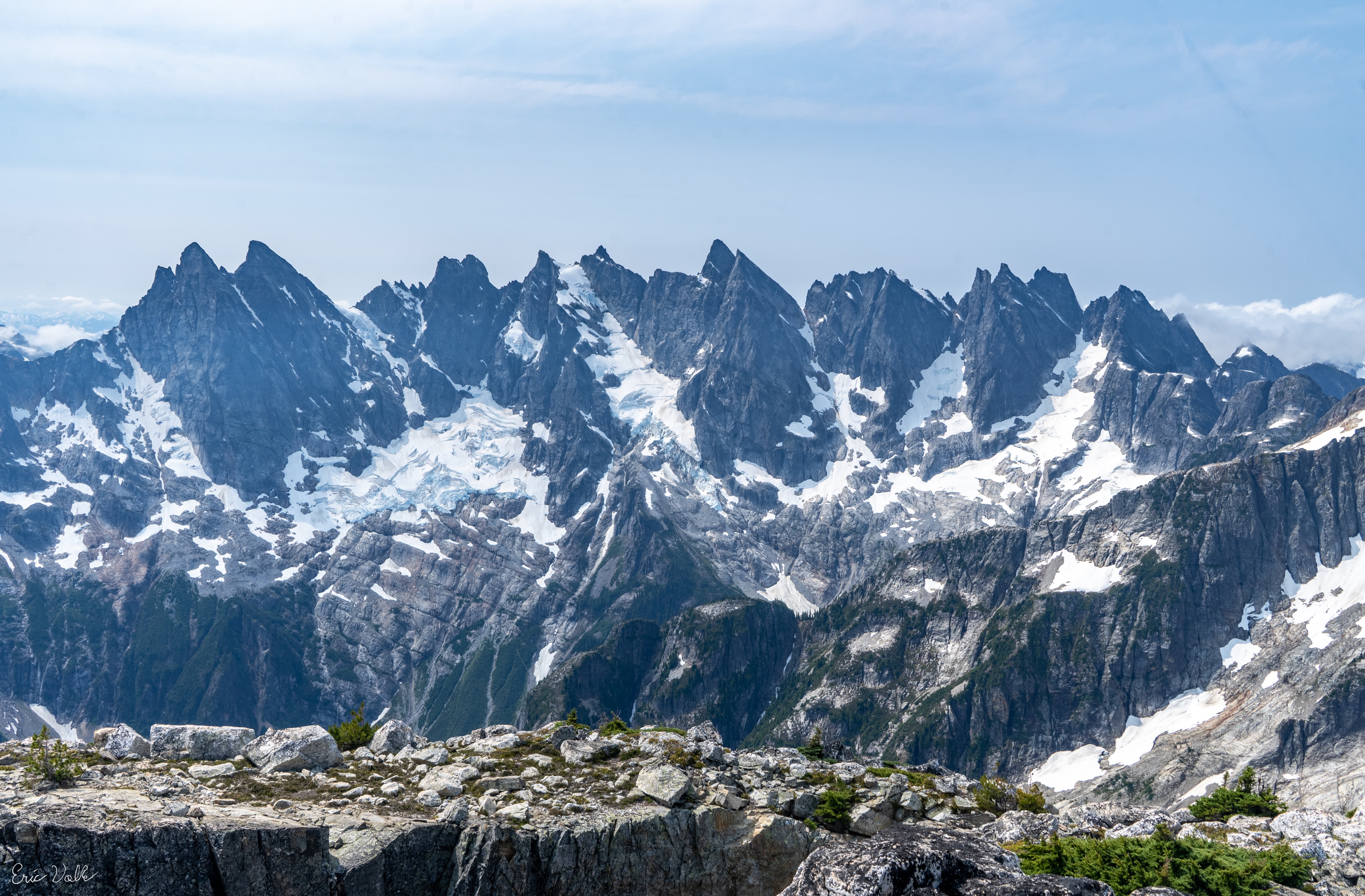
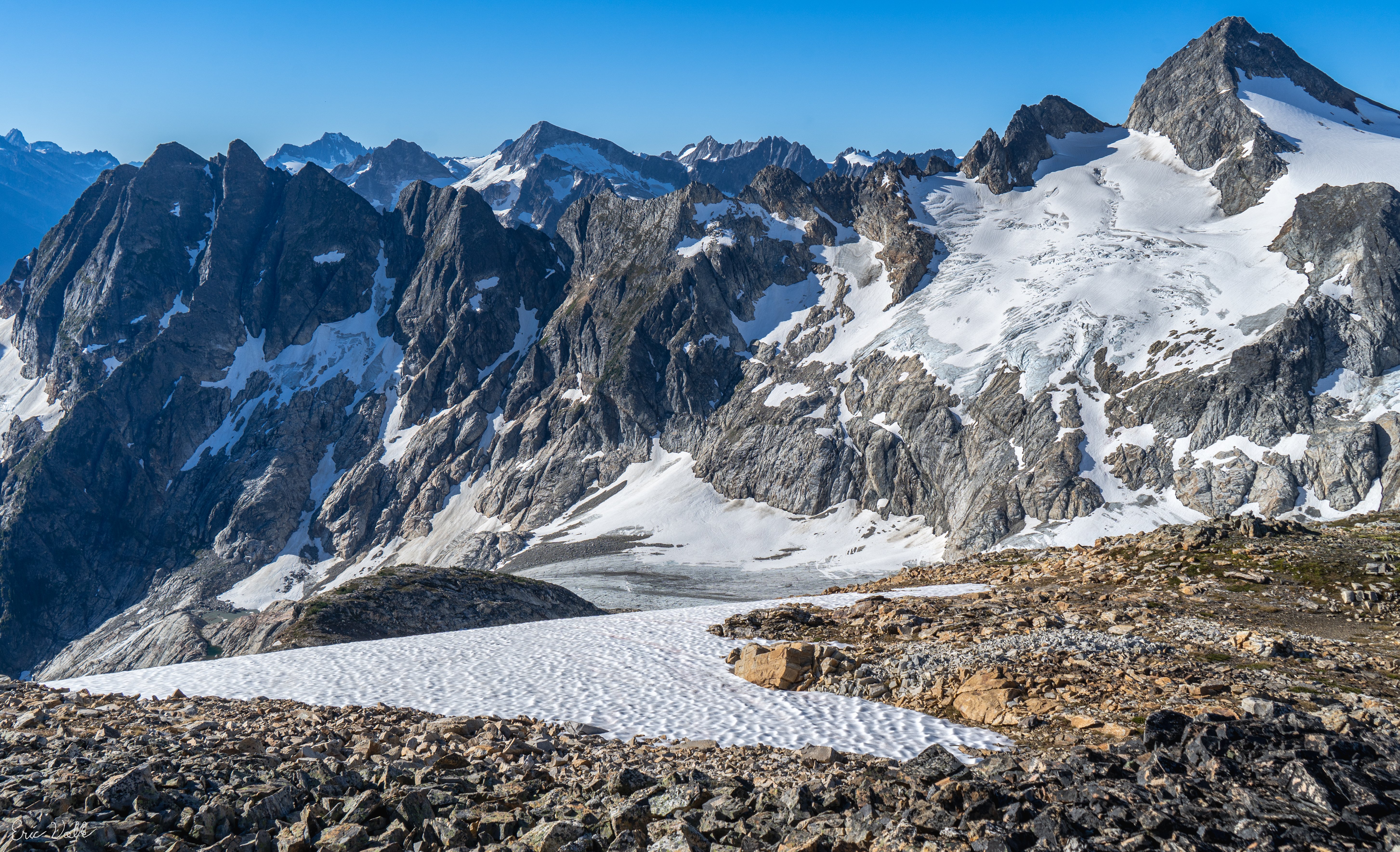
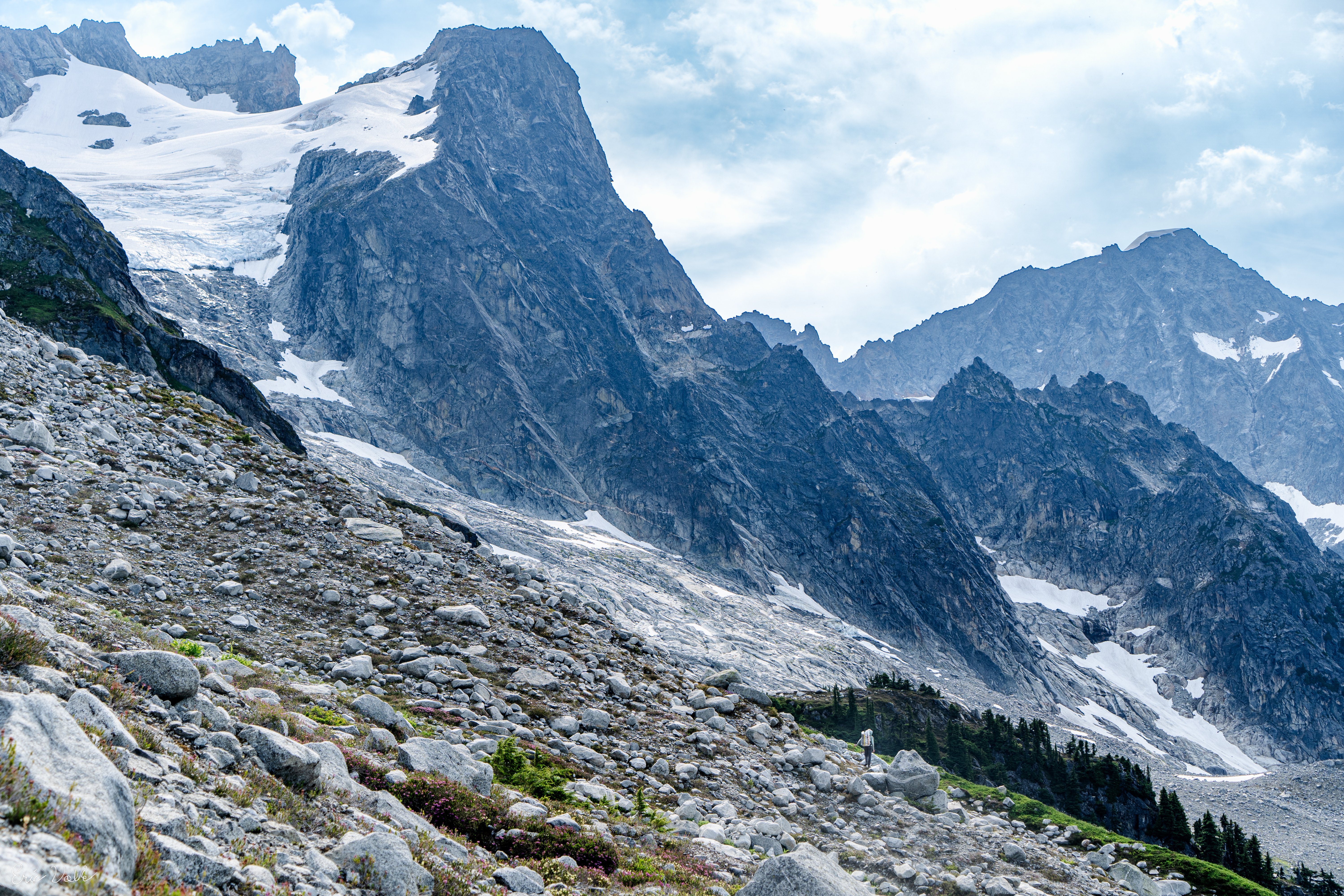
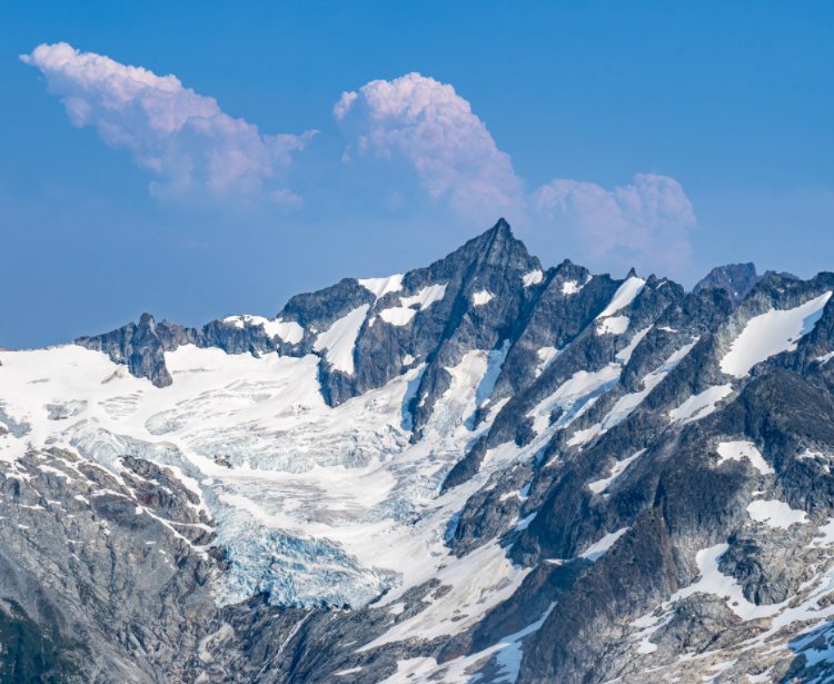
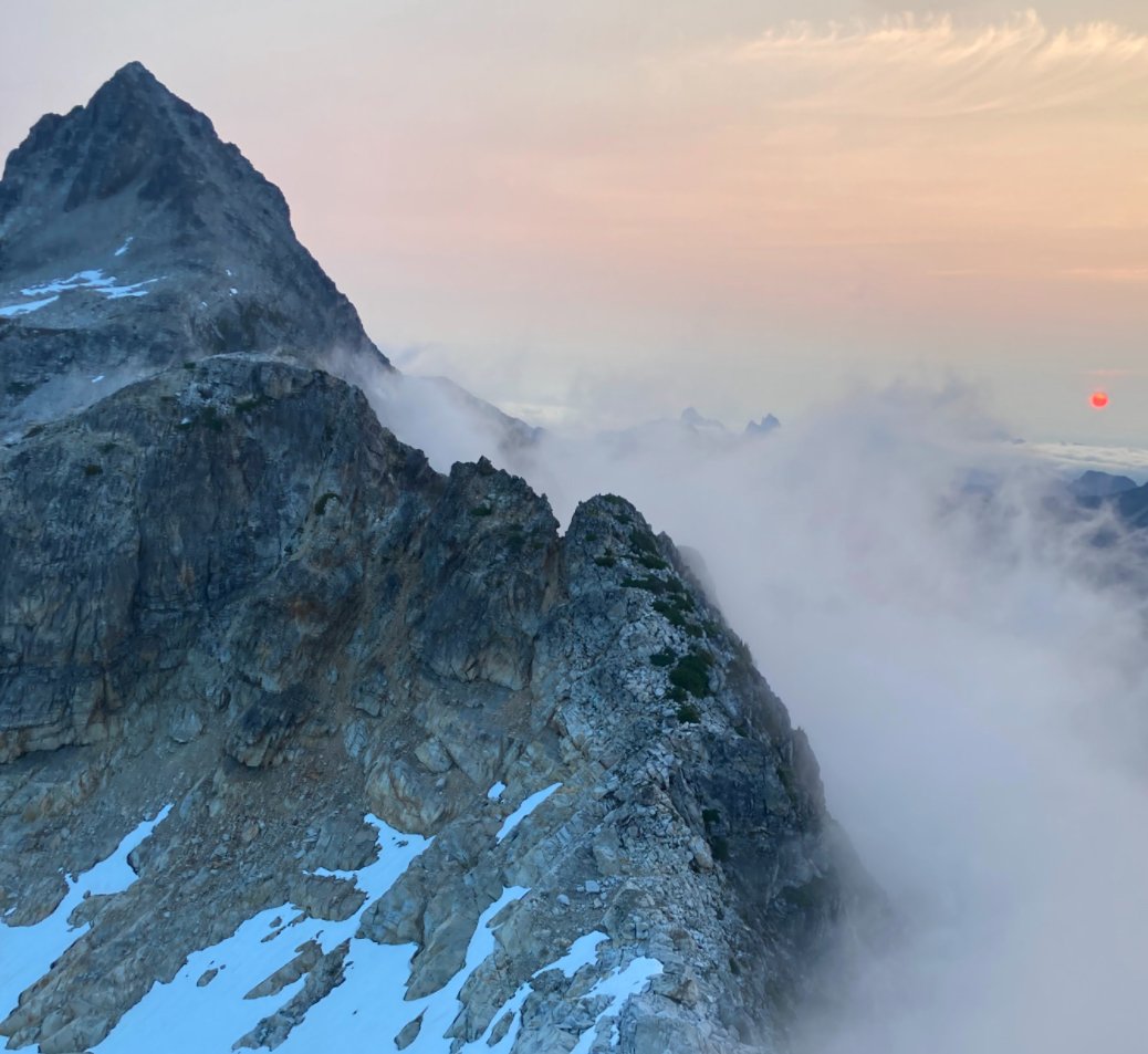
Trip: Cascade Volcanoes - Bike-athon Trip Date: 06/06/2025 Trip Report: Summary: I set out to stand all 5 WA volcanoes in the same 7 day (168 hour) period, bike powered between them. As usual, antics ensued. An unplanned road closure added ~100 miles on the bike and the goal was adjusted to 8 days/192 hours. In the end, I stood atop Mount Baker on hour 189 since departing the Mount Adams summit. The journey in between had deep suffering, even deeper discovery and an adventure I’ll always remember. The trip had to be solo. But the story was too good not to share… Classic DC shot, peak 3 of 5 In recent years I’ve become increasingly obsessed with long bike-hikes. But it's hard to remember exactly where, when or why this dream came to be. A while back some lunatic bike/climbed all the Cascade volcanos and that certainly added some fuel to the fire. There is something about doing it all on human power makes the adventure feel a little more....real…for lack of a better term. Earning every inch helps put me more in touch with the broader landscapes which connect our High Places Planning an effort like this was sort of an impossible task. Timing the trip would require some favor from the weather gods. But knowing the patterns of the PNW and its’ volcanoes, June would be the time. Without better criteria I figured lets pencil it in around the longest days of the year in order to limit the odds of after-dark cycling. The snow coverage on Rainier in particular would also help mitigate the risks of solo travel on big glaciers. So I wrote it in for June 14-22…but a forecast presented in the first days of June that was too good to pass up. I was not fully recovered from training, nor was my equipment or logistics in order. But that was all figureoutable. With a week of solid high pressure I eeked my way out of whatever responsibilities I had, and set off. Originally the plan had been to start the trek from the Adams TH and climb with a friend. The new plan instead had me start the ride from White Salmon, at the Oregon border. That green-blue-white color scheme ? Its finally summer in the hills Call it a warm up! The 37 miles to the Adams TH went pretty quick until the last few. Reports warned of a “rough” “dirt” road leading up to the south side climb. Rough was fine, dirt was fine. The sandy parts were nearly impossible on a bike loaded up with camping and climbing gear. Despite that, I eventually reached the TH, unpacked and slept as soon as I could. By 2am it was too cold to stay asleep. The forecast for the week was going to be very warm. So I chose the lightest quilt I had in order to save weight. But that first night I paid the price. Preferring to rest longer but knowing when to bend I got up, packed, ate and started trudging upwards. Because my concept of this challenge was starting the clock when I departed the first summit, I kept my pace slow to conserve energy for what would inevitably be a very long first full day. By 830am I reached the top. Perfectly clear, sunny…but bitter cold wind. By 845am I started the clock and raced down the mountain. A few thousand feet down the surface was soft enough for efficient plunge stepping. By 1130am I was back with the bike, repacked and ready to coast a bit. The road would not make this as carefree as I hoped. Tedious, bumpy miles eventually lead to a delightful (paved!) forested downhill. Once in Trout Lake I found the restaurants closed. So I had my first gas station meal of the trip. A secondary goal of the trip was to eat ice cream at every country side store I could. Feasting junk food on the front porch, the staff asked “isn’t it early for through hikers?” I must have smelled like one already. The first of 22 ice creams... As we chatted I learned that forest road 25 was still closed due to a combination of landslide, construction, lingering snow and owl conservation. I spent most of the day having my at home contact help brainstorm how I would re route after climbing Mount Saint Helens. In the mean time I continued, but the uncertainty weighed me down. Riding to MSH took the rest of the day. There were a few miles of pushing the bike through snow. Definitely among the low points of the trip. That night I slept at the climbers bivouac TH after 19 hours and 12k of combined vertical gain. I was exhausted and the stoke was low. That night I had some thoughts of giving up. Ultimately a series of bad dreams in the early morning were disturbing enough to force me awake. Sometimes nightmares can serve that benefit. Within seconds of waking my mind refocused. Trying to close the distance before dark on day 1 Hiking MSH under good weather was a treat. The ascent went fast and easy, but not as easy as the descent. I was totally out of water but snagged a liter that had fallen out of someone’s pack on the glissade track. Back at the road, some kind soul had packed a can of coconut water in a snow patch they built near my bike. A little trail magic- bike touring edition. It really made me happy. Not just the fluid intake but that some strangers had the consideration of doing that for me. Solid folks can still be found… At first I thought it was a beer...probably for the better that I was wrong... Another huge boost came that morning when I was high enough to catch cell signal. I was able to devise a re route to get me to Rainier. It would add a day of cycling, and push the 7 day goal to 8, but the mission would continue! Riding back to the I5 corridor was definitely not my preference but flexibility is a trait we learn on quests like this. I spent the night at a trashy motel near the freeway. The next day was type 1 touring. Flat farmlands with many, many ice creams to be had. I reached Ashford in the late afternoon and settled in for a 13 hour sleep. The next “day” (actually two days, no sleep in between) would be huge. Arguably the crux “day”. It was some of the best sleep I’ve ever had. The schedule for the next segment required I wait til around noon to start. Timing travel on the upper slopes of Rainier was the priority. The 20 miles from Ashford to Paradise was actually pretty nice for being continuously uphill. I took my time through there, keeping my heart rate and mental stimulation as low as possible. Reaching Paradise at 4pm on a perfect Saturday, I remembered why I avoid this place on summer weekends. Luckily, on a bike parking is not an issue… A nice melty treat...and also an ice cream The permit stop was pretty seamless. Months prior I had received approval for a solo climb. Checking in was a simple formality. I killed a couple hours (and ice creams), letting the sun begin setting and the snow firming up. By 630pm I could wait no longer. Setting out from Paradise I continued to be intentional about managing my pace. Once on the snowfield I started to open it up a bit. At Muir I was surprised to find absolutely zero wind. I took this opportunity to rest for an hour. After that break, something came over me. My energy was maniacal. It felt like nothing could stop me. By the time I reached the top of disappointment cleaver I had passed 52 people. 3h 53m after leaving Muir, I was standing alone on Columbia Crest, well ahead of sunrise and ahead of schedule. I had stood there many times before, sometimes alone, but this was a very powerful moment. Its hard to describe the feelings that came over me as the first bits of dawn stumbled over the horizon. Its amazing how full life can be…I hope some day I can better explain what came over me. The descent was uneventful… fast, efficient. By now I was getting better at repacking the bike, even though one of my cheap panniers had exploded. Riding down from Paradise was probably my favorite segment of cycling in my life. Almost no pedaling, fantastic views. Hardly any traffic, surprisingly. The bliss would not last. The rest of the day would be 80 relatively flat miles but with a strong headwind and temperatures reaching the low 90s. To boot, it was the first hot Sunday of summer and the roads were bustling. The miles were stressful and seemed to never end. Eventually I reached home in South Seattle. I had started the effort 32 hours earlier. In the end I would gain over 16k feet of vert and drink 15L of water. It was nice to be home for a second. But I had many tasks to complete in order to be ready to ride out the next morning. New panniers arrived. I did laundry. Tuned up the bike…and even had a few minutes to tend to garden tasks. The next morning I had pizza and cake for breakfast and then hit the road. The day would be 12 hours and 117 miles but it actually went pretty well. The first ⅓ of that were on routes that I ride often. I encountered some nice bike paths from Snohomish to Arlington, and beyond to Darrington. The gas station there was closed due to “extreme heat”. But I still managed to find some ice cream and groceries before continuing to the Glacier Peak TH. It was at this point that I started to feel like this could actually happen… It was a poor night of sleep there. But by 550am I was on the move, even if it was a little sluggish. If you’ve hiked GP before you know what a slog it is. It seems never ending, like you’re making no progress. My morale and energy improved as the day went on. I made the summit around 430pm. What a view. Glacier Peak is a highly underrated IMO One of the few photos that day. Rainier seems real far away ! It would be a long ways back to my sleeping pad and fart sack. But I made pretty good time. When I left White Pass at sunset the beauty was astounding. I had enough energy to run a few miles. The slog along the river valley did seem to take forever but at the stroke of midnight I strolled back into the parking lot. It did not take long to eat and fall asleep. The next morning I woke up and ate the 100 calories of crumbs left in my bag and started the (easy) 25 miles back to Darrington. Once at Moe’s I ate an unspeakable amount of food. Probably it was “too much” because my pace slowed to a crawl on the miles from there to Concrete. Once in town I decided I had better over-eat again… holy cow! just one left... It would be just a few more hours of uphill pedaling until I’d park the bike for the final time on this trip. There is something odd that happens at this stage in a grand-journey. Two strong but opposing feelings. On the one hand there is incredible relief that the work was nearly over. But the part that might be unexpected to some is the feeling of sadness that the mission would soon be over. So many years of planning and preparation, and now this week of total focus…it would be done soon. I had found comfort and identity in my striving. And with the finish line in sight I would lose them both At Schreibers Meadow I had a few hours to rest before starting up. A friend was at Sandy Camp and would be joining me for the final hours. Before the trip I wondered how my energy would be at this point. Would I be exhausted and barely hanging on? Or would I have tapped into some deeper energy and be racing to the top… A night to remember...headlamps stayed in the pack It was the latter...stoke was through the roof...through the clouds even... At 550am we stood on top So much of what makes a journey like this worthwhile are the elements that can't be transmitted in words or photograph...but I've enjoyed trying Gear Notes: no gear. just ice cream Approach Notes: no
- 11 replies
-
- 11
-

-

-

-

-
Sometimes it’s hard to make it to marblemount before they close. So we will drive in the evening before. You can go to the station and get your number for the next morning, even if they’re already closed. That can help expedite the morning after….because yes it can take a while even on random week days
-
Sure. Mostly I’ll focus on the gear we took from artist point to GP. The gear up Baker was different…sort of standard summer volcano kit… After Baker we treated it more like backpacking. Going as light as we could wherever ~reasonable We used 55L Hyperlite packs. Big enough for all the gear and weeks worth of food. But light enough to accomplish the goal of being under 40lbs fully loaded. tents - we used a big Agnes UL freestanding and a Hyperlite 1p non freestanding. sleeping gear varied by person but for the most part we were using ~20 degree UL quilts and the lightest air pads we could tolerate. I had an old school 3/4 foam pad to supplement footwear was a big topic of discussion in the months (years, really) leading up to the trip. I can’t say enough good things about the scarpa ribelle run xt for the wide variety of terrain out there. They take a crampon really well for being essentially a trail runner. I wish they dried quicker but they definitely met the need without having to wear boots for the endless regular hiking hours various UL ice axes, standard strap on crampons, trekking poles regarding technical gear (which may be more what you actually want to know here)…this too was an endless back and forth leading up to the trip. It would be easy to go way too heavy. But you can’t really head out in this terrain with just hiking kit. Ultimately we ended up with a 30m rad line, a couple small cams and nuts, a picket, couple ice screws. We used everything except the screws, although there was a moment where we considered some funkery that would have employed them. We had some other basic glacier pieces. Grivel screams for rapping the rad line…our harnesses were all super minimal (there’s a few out there that weigh like 2-3oz) food: yes, a ton of freeze drieds. Various other calorie dense snacks. Cashews, MMs. We packed a ton of pizza out with us from the resupply. The calorie deficit was probably the hardest part of the trip. It really wears on your mind when it goes on for that long. Honestly I’m not sure I’d bring that much more food though. Keeping the pack light was pretty important. Perhaps we could have added a resupply at cascade pass and then been able to go with more food/day through the southern portions feels like I’m missing something but I think that’s it other than some other unremarkable items like chargers, cookset etc
-
Thanks man. Hopefully not too understated! Every day was hard af! Full effort, plus some luck… glad you enjoyed the tale ??
-
7 days worth from Artist Point, and another 7 from hwy 20! was pretty heavy but we should have carried more
-
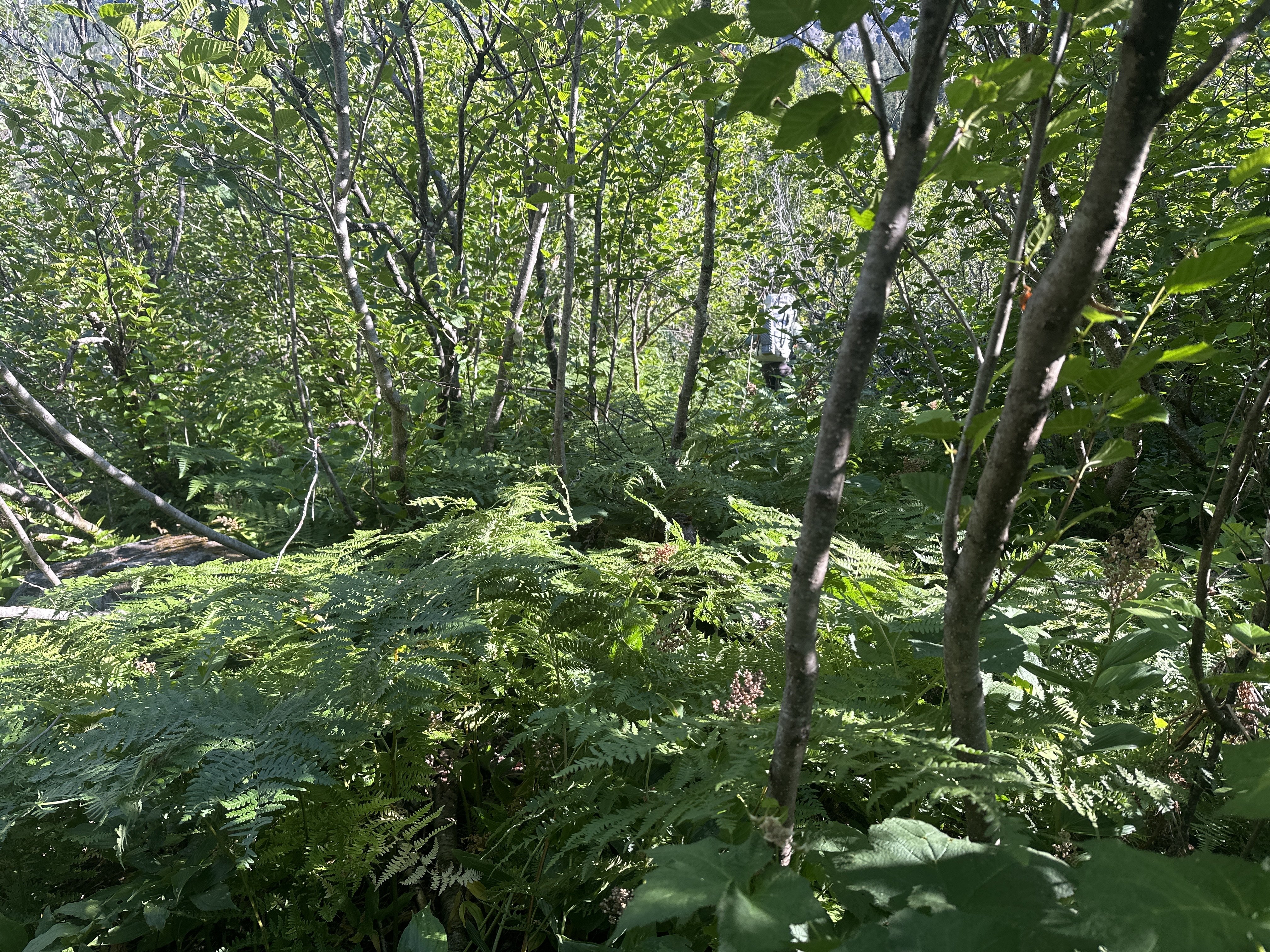
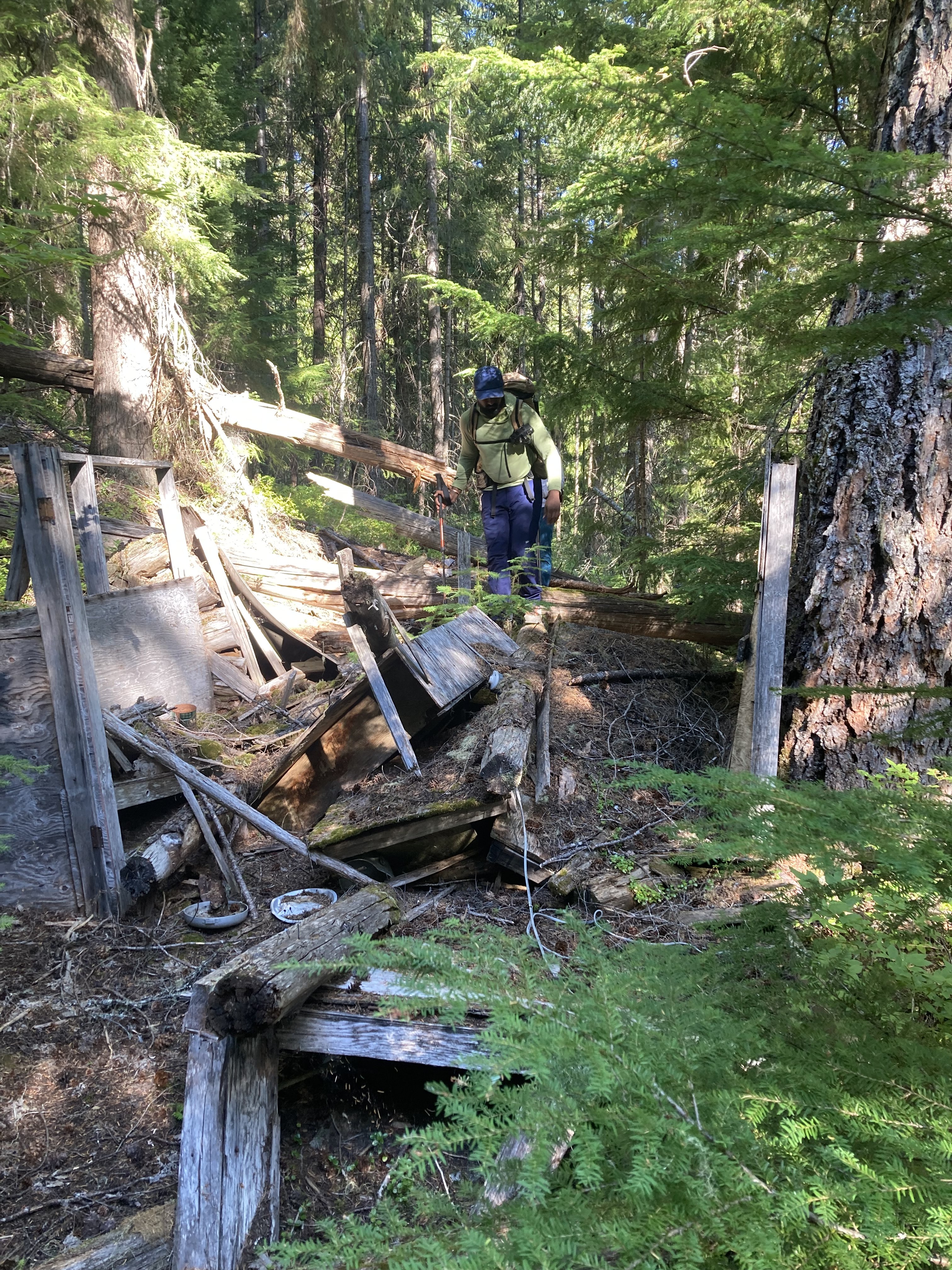
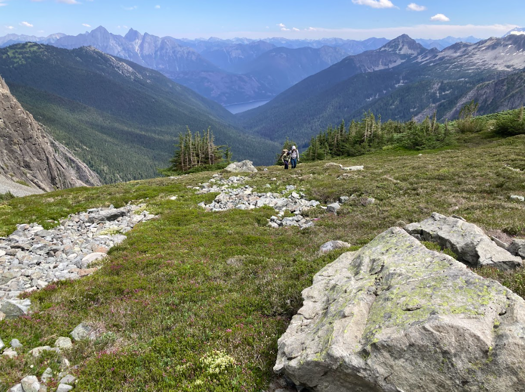
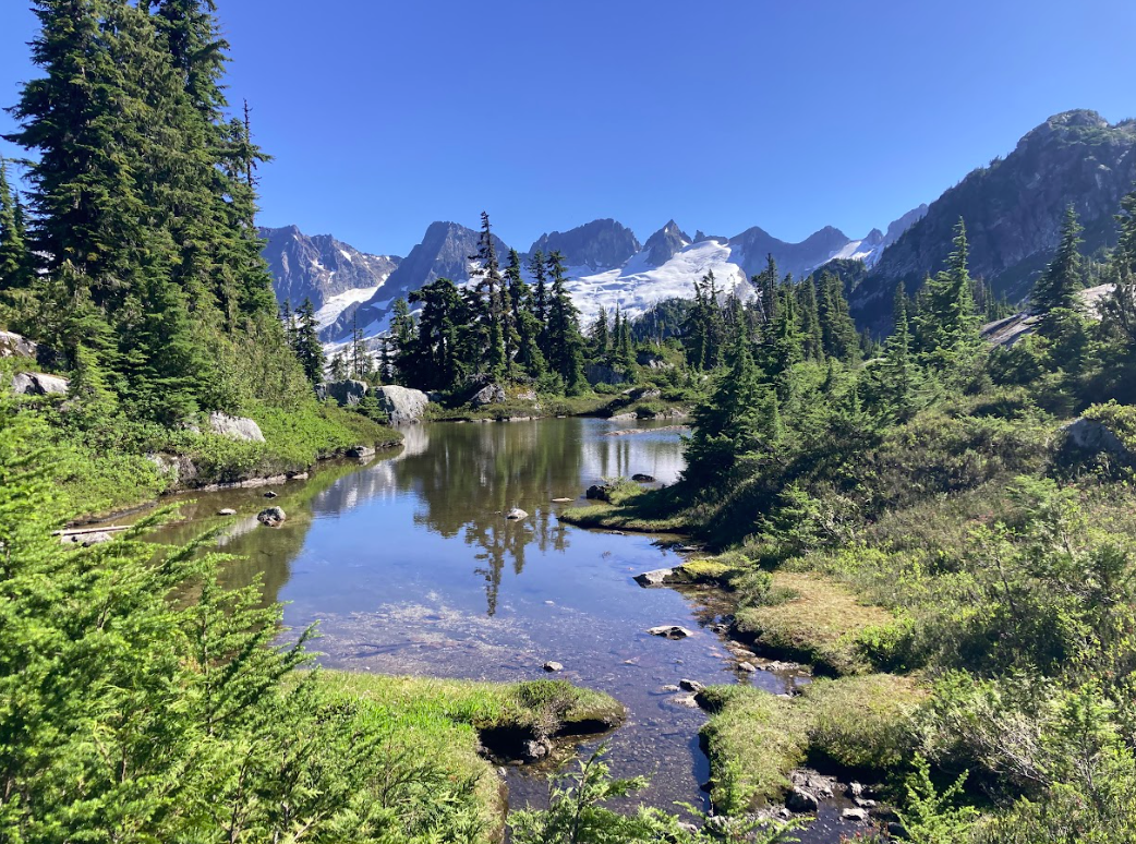
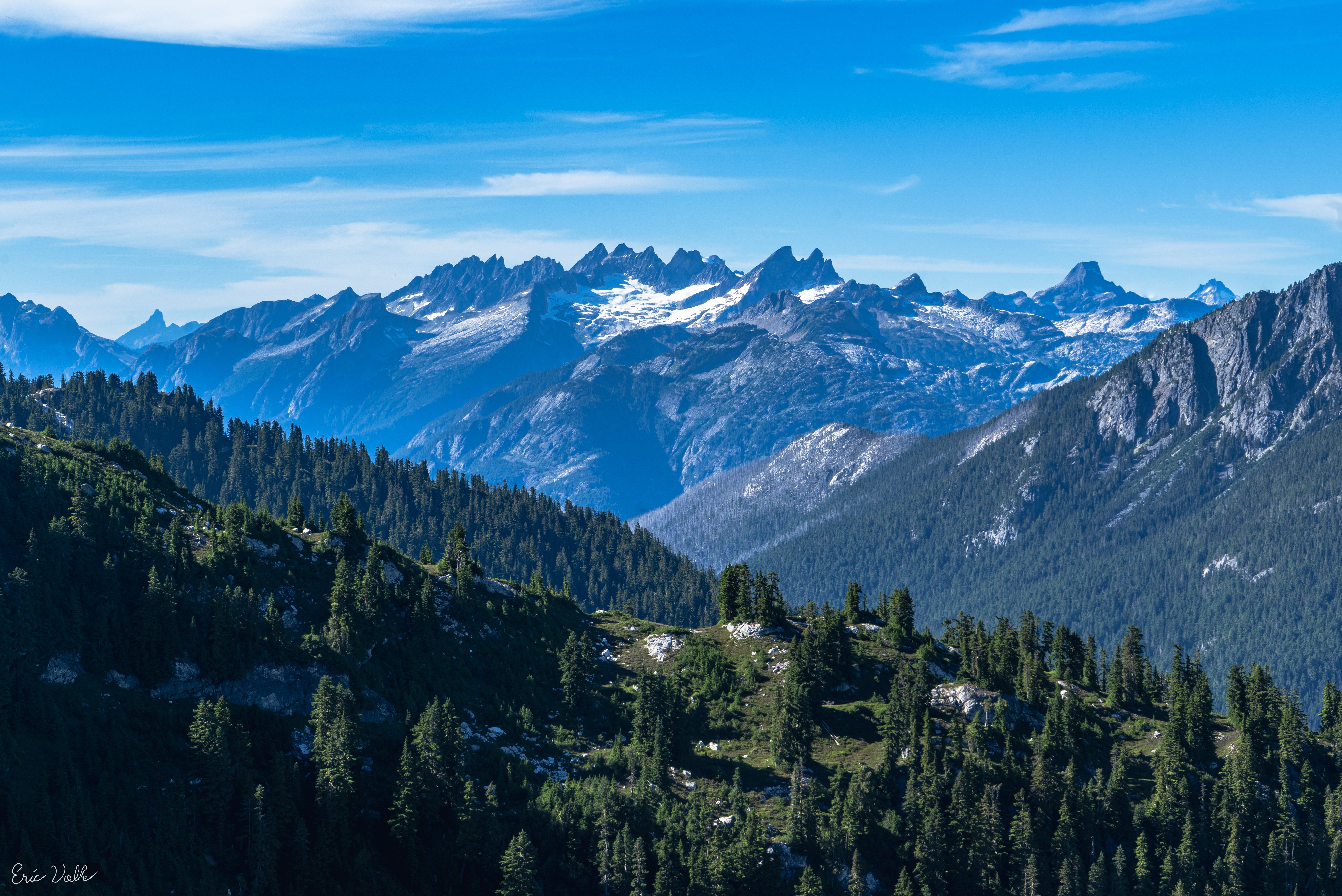
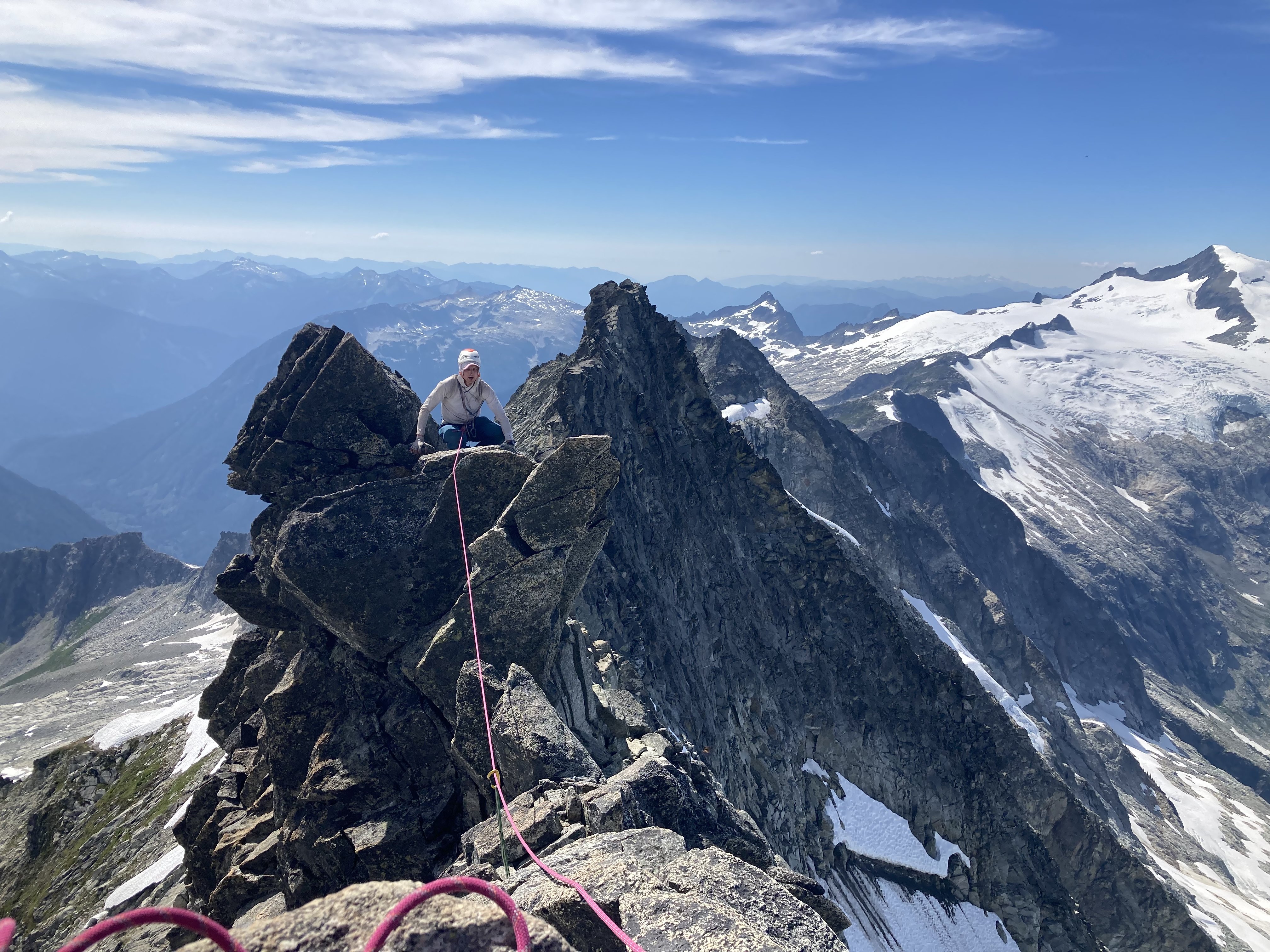
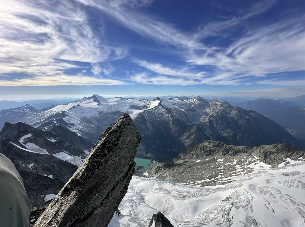
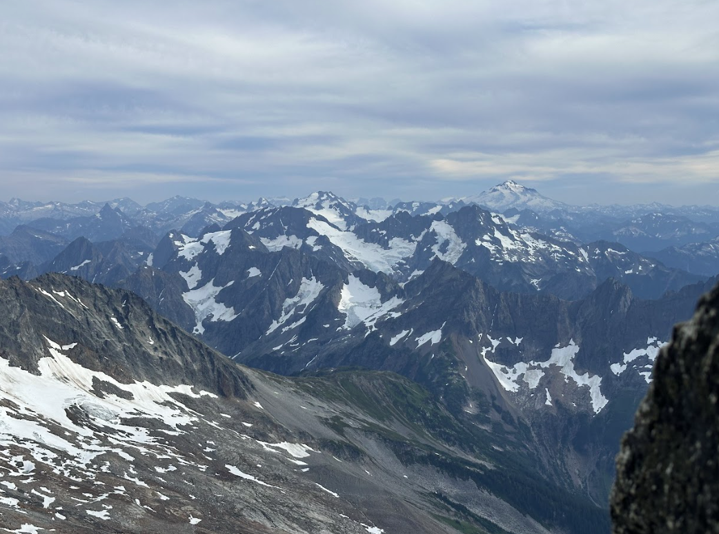
Trip: Baker to Glacier Peak: - 17 days across the North Cascades Trip Date: 07/20/2025 Trip Report: The result of years of imagination and separate efforts. Perhaps it started after exploring the Ptarmigan Traverse, but wanting more. We started gradually exploring the areas to the north and south. Many of us have noted, with some surprise, that there was not a defined “High Route” for this area, unlike some other spectacular ranges of the American West. A few years ago some mountain runners established a “North Cascades High Route”, starting from Silver Creek and ending along the flanks of Agnes mountain. This was an impressive and inspiring feat. Nevertheless we felt it incomplete and starkly contrasted with the style in which we experience these mountains. Although in the end, our route would include much of the same terrain traversing the heart of the National Park and Cascade Crest. But as we played with the possibilities of this terrain it was hard to ignore the striking aesthetics of the volcanos near each end of the range. With both Baker and Glacier Peak being slightly higher than the peaks of the crest, they act as natural waypoints to assess exactly where one is in the vast sea of Cascade summits. It would be impossible to include every spectacular basin, cirque and summit into a single high route but starting and ending with the volcanos gave us a framework to operate in. The route we eventually completed is actually composed of many different shorter routes, linked together by various less visited terrain. Within reason, our goal was to 1) stay above tree line, 2) avoid trails and 3) keep it only lightly technical. We suspect that climbers with the required stamina, skillsets and schedules will likely choose other exploits in the range, or beyond. Nevertheless we present here some basics of our North Cascades high route. Mount Baker Our route up and down the Park Glacier had some obvious benefits. Most significant was that we could change out proper mountaineering gear for more of a hybrid backpacking kit upon return to the TH (Artist Point). The route itself is pleasant, with a scenic approach and lovely high camp. The day we climbed it the snow was soft enough not to require any belay or rappel applications, though in more firm snow that would not be the case. The upper part of the glacier was fairly broken up considering it was early July. We managed an improbable line between a series of large cracks. This line may not have been viable even a week later in the season. We stood on the summit late morning of July 5th. Shuksan Navigating this terrain presented a few obvious and a few not-so-obvioius options. Perhaps at first glance one would think Fischer Chimneys…and then descending from the Crystal Glacier onto the Nooksack. Unfortunately the bergschrund separating the two was gaping by early July and would have required a substantial amount of extra gear that would become dead weight for the week to follow. Additionally the prospect of immediately starting this traverse by hiking on trail through the forest did not match the criteria we set forth. Looking instead to the North side we scouted various lines contouring high above the deep, alder filled basins. There were definitely viable lines through the majority of the terrain, but we determined them to be too complicated and conditions dependent. The biggest concern being that the time involved would be hard to predict. It could take a few hours, or a few days. Additionally there was a good deal of objective hazard traversing high in this terrain. Ultimately we chose a safer and surer, albeit less appealing line. Hiking the ridge above Chair 8 and eventually descending to meet with the White Salmon approach, we faced our first bushwhack in the hottest part of a very warm day. Once escaping the alder hell we climbed to a ridge above and contoured forest down towards Price Lake. We crossed the outflow and traveled along the approach for the Price Glacier route for a while. There would be some fuckery along the base of Nooksack tower getting down to the glacier. But once down there we continued on part of the Nooksack Traverse until Ruth Mountain. Mineral High Route On a map this looks like comparatively straightforward terrain. We did not have a pre-scouting trip for this zone. And we definitely underestimated it. The bushwhacking before and after Chiliwack pass was steep and complicated. Before we escaped tree line onto Mineral mountain there were a series of steep and improbable gullies that took us far longer to complete than what we imagined. In hindsight I think we started out in the wrong gully and paid the price. Eventually we reached “the route” but by then we really weren’t sure if the terrain would go. Finding some clearing among the multitute of brush-gulleys. Above the forest travel cleared again. Although we soon found an abandoned, and completely full backpack. A startling sight this far into remote territory, we searched around for signs of remains but found none. The pack was probably out there for at least one winter, possibly more. We noted its location and passed a message to the park service before continuing our quest. Mount Challenger via Easy Ridge This terrain was fairly straightforward, although the day we did it was very un-summerlike. With no chance of shortcutting the impasse in these conditions we continued the sog and slog down to the lower bypass. Climbing out above the crossing was fairly sketchy. It is very eroded, hard packed and water running along the surface definitely made it attention worthy. Some of the steeper scrambling between there and Perfect Pass was also potentially consequential in heavy rain. Nevertheless we made it to the pass, but soaking wet and in high winds plus white out conditions. Crossing the Challenger glacier in near hypothermic conditions was very….engaging, to say the least. We were all very relieved to step back to “dry” land an hour later. Northern Pickets Descending into the basin is fairly straightforward, albeit somewhat tedious and extended side hilling. The climb back out through Luna Lake and to the Fury shoulder is pleasant, scenic and fun. Especially given that this day the sun had returned. The lower part of the Fury glacier develops some pretty sketchy moats early in the summer and may require walking on exposed glacier ice around 30 degrees. Rather than spend time with that we found a bypass to the north, which lines up with one of the ways parties may choose to climb Fury. We skipped the summit and instead climbed Outrigger along the way. From the col we ascended a 50 foot 5.0 pitch, followed by some rightward traversing 3rd class terrain to the south ridge. Looking back, there was a way to avoid the initial low 5th entirely by starting a bit further west in the col. Descending Outrigger was one of the highlights of the trip. Easy hiking, with the Southern Picket skyline so close you can almost touch it. There was a 15m rappel, which could certainly be bypassed by down climbing 4th class terrain slightly east of the anchor. A short but exciting and exposed bit led to continued easy hiking. Southern Pickets Getting from Picket Pass to the bottom of the basin was pretty fucked. There is some 4th-ish slab downclimb that some parties have rappelled. Beyond that, some of the beta out there is pretty snow dependent. Our planned line was not viable and it took some time to find another way down. Two of us independently destroyed a trekking pole in this zone. Once at the bottom there is some unavoidable alder to contend with. You ever get through one of these, look back from a higher vantage point and realize oh wow, I could not have possibly taken a worse line. That’s what happened here. We should have stayed closer to the cliff along the SW side of the shwack. Oh well. Climbing out to the east of the McMillan spires was fairly straightforward. We managed to avoid brush entirely. Other than a few deep gullies it was a breeze, and an incredible position. From McMillans to Highway 20 Choose your own adventure, depending on legality. Once the Sourdough trail re opens you can traverse east towards elephant butte and then south along Stettattle ridge. Until then, a legal option would be to find Goodell Creek trail/approach and take that to the highway. I cant remember which of these we took… Highway 20 provides the only on route resupply. You could probably utilize Cascade Pass, or even a trip to Holden. But we did not. Isolation Traverse- much has been written on this. Its awesome Looking back to the Pickets, Redoubt from the Mccallister glacier Eldorado to Cascade Pass- decent travel along a nice ridge and basins. Nothing too complicated. Sahale arm trail for a mile or so is a nice reprieve. If you wanted to add some major style points throw in the Torment-Forbidden Traverse through here, although its likely to add some gear complications. Ptarmigan Traverse- MUCH has been written on this. Its awesome Classic White Rock Lakes shot Dome peak area- leaving the Ptarmigan and finding the Dana then Dome glaciers. We scouted a route along the south side of Dome. It probably would go but on the trip we ultimately took the Chikamin glacier around past the gunsights and onto Kaiwhat Pass Doin’ the bull dance. Feelin’ the flow. Workin’ it. Workin’ it To Canyon Lake- The terrain eases here and may involve some bushwhacking but nothing crazy. We abandoned our map, and rationality…instead navigating on vibes alone. Our line to Totem pass was awesome and on paper probably shouldn’t have worked. Between the pass and Canyon Lake there may be a way to avoid significant brush but we did not find it. Still it went quick (downhill) Canyon Lake trail- Seems decomissioned. It’s overgrown and washed out in different places, but still a comparatively decent 5 miles. Image Lake to Lyman Lakes- We looked hard how to avoid such an extended on trail section but there really weren’t any viable alpine options. When we came to this section we were exhausted and very calorie deficient. The easy miles were welcomed. The trail itself is well maintained and incredibly scenic (cloudy pass in particular). Just a hop, skip and a “fuck!” away... Lyman Lakes and beyond- We climbed over Chiwawa mountain without much difficulty. Although the last few hundred feet were steep, slimy, scree covered slab when approached from a direct north line. Pretty gross. It would be better to find the main ridge further east and continue to the summit from there. It started to rain when we were on the summit, so we schemed a bypass for the exposed scrambling awaiting on Fortress. We found a line of weakness that allowed us to bypass to the south. It didn’t take long from there to find the pass no pass trail and follow it towards High Pass (another really scenic on trail moment). Bypassing Fortress For Napeequa we took a path of least resistance well south of the summit, descended to another saddle and then back up and around Hoof. Eventually we had to traverse below the north side of Ten Peak. It took a while but overall it was straightforward. The Honeycomb and Suiattle glaciers brought us to Glacier Gap, along the standard walk up for GP. We were greeted by friends with treats. The next morning we jaunted up the last couple miles. It was a busy weekend on the peak. Spirits were high, despite the suicide gestures Standing on the summit felt surreal. It wasn’t necessarily a positive emotion. Spending the last few summers obsessed and the past few weeks starving made this moment feel like a weird dream. The hike out from there is long, but we crushed it in hopes of making it to Olive Garden in time. Which we did. All the pasta…dipping donuts in wine…it was finally over… By the numbers: 17 days 175.2 miles (73% off trail) 86k vertical gain (86% off trail), 88k lost Average vertical change per mile: 993 feet Average time from camp to camp each day: 14 hours Average calories/day ~3800 Body weight lost- 18lbs (9.6% total lost) Pizza consumed- nowhere near enough Gear Notes: a picket, 2 screws, 3 cams, 4 nuts Approach Notes: the whole thing was an approach...
- 15 replies
-
- 12
-
-
-
-
-
The exposed part just beyond had a very thin fixed line on it last year, end of July. Honestly looked like paracord ?
-
Last year we faced this going the opposite direction as well (fury to Luna col). And the section right before reaching the col was tricky. I think that’s what you’re talking about? I think this shows the area right behind JasonG’s photo ? We had no beta and just from looking at it it seemed too chossy and ~5th class for us and no rock gear. We dropped down towards Luna lake wrapped around about 6400, though in hindsight the line at about 6700probably would have gone with class 3 or less. the whole detour took about an hour
-
Trip: Forbidden via Silver Creek: Warm Tales from Summer - ... Trip Date: 07/22/2024 Trip Report: It started as an attempt to link the alpine zones from the Chilliwacks to Glacier Peak. It became a ten day approach to Boston Basin. So many fires... A week in, we pivoted to go Isolation-Forbidden-Inspiration after crossing hwy 20. With all of the traditional access closed, we should have it all to ourselves..and since Forbidden can be climbed with just a glacier kit, why not take advantage of a rare opportunity at solitude on a classic? Hour 26 of that day's effort. I think everyone gets benighted from time to time. But you gotta really fuck it up to also get bemorninged. But before all that we enjoyed a sunny float to the north end of Ross Lake... Silver creek. Henceforth "shit valley". Interesting relics...wonder what the story is Life getting a lot better by this point Nodoubt about it- our pace really put the "chill" in Chilliwack It doesnt look that Furry to me? But you do Luna lot out here And from the other side We'll Pick-it up from here in the morning Obpicketory south side shot We took a day off at the highway. We said it was for "weather". But really it was for pizza. Getting Isolated...except from the piss fiends Mosquito heaven Pickets from their softer side And El Dorado from its harder side Pioneer fire was ripping this day Eventually we'd get to business. His first ever pitch of roped climbing was a memorable one... A look at where we had come... And the work left undone Gear Notes: a glorified backpacking set up Approach Notes: really long