firebeard
Members-
Posts
13 -
Joined
-
Last visited
Everything posted by firebeard
-
[TR] Sherpa Peak North Ridge - North Ridge Variation 06/13/2020
firebeard replied to firebeard's topic in Alpine Lakes
Not sure why some photos could be embedded but others just links to download. Anyways you should be able to access them. -
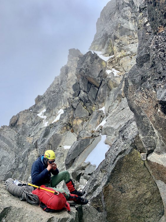
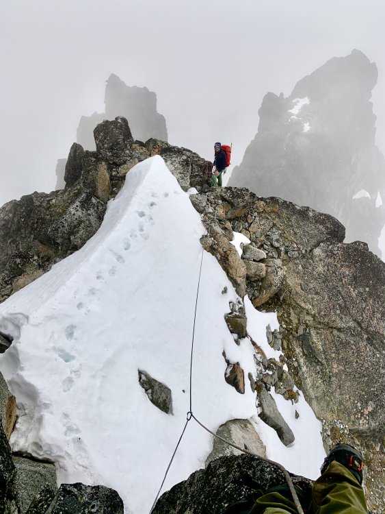
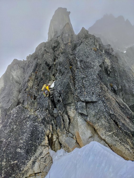
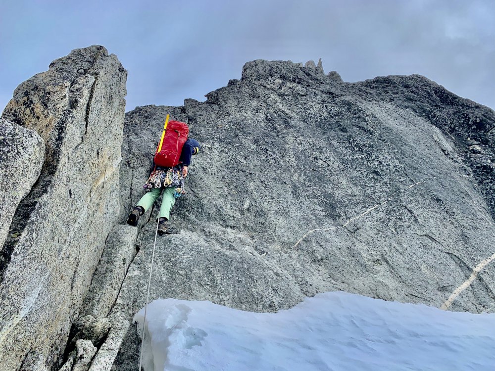
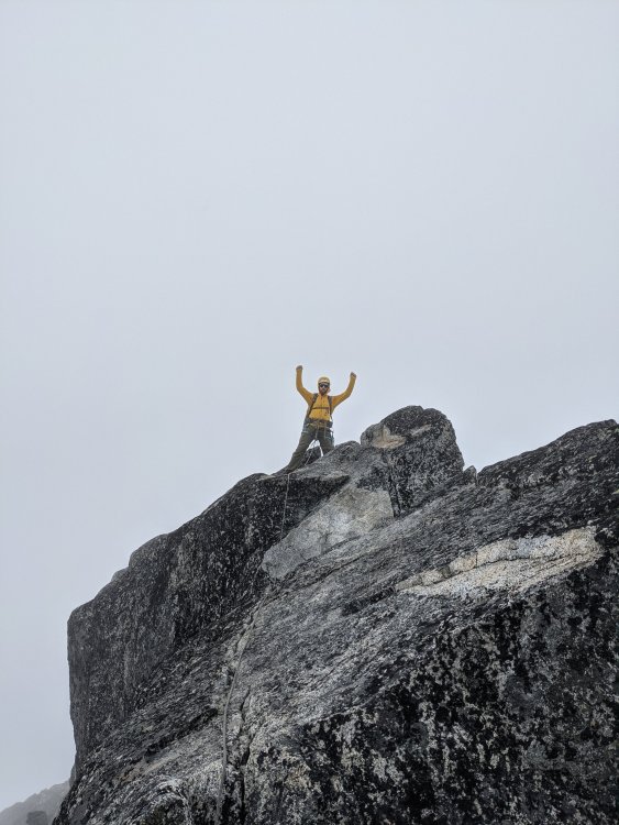
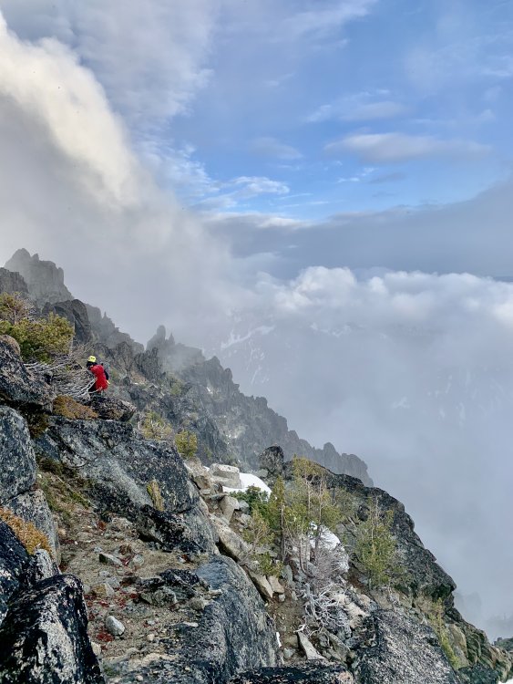
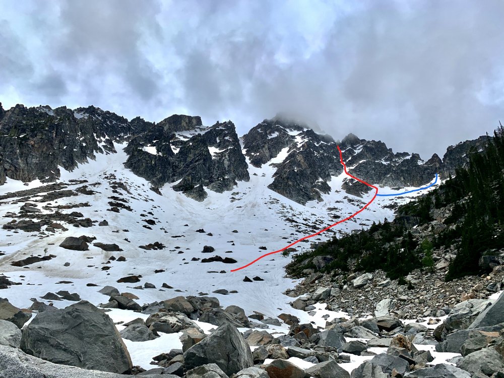
Trip: Sherpa Peak North Ridge - North Ridge Variation Trip Date: 06/13/2020 Trip Report: Timeline Saturday 6/13 7:00 a.m left Stuart Lk TH 11:00 in upper basin below sherpa and argonaut 3:30 On the Ridge at 2nd notch 6:30 On the Summit 8:00 At Bivy Site on South Side of Sherpa Peak Timeline Sunday 6/14 8:30 a.m left bivy site 11:30 at sherpa pass 3:00 Back to the car Approach Notes Others trip reports mentioned turning off of Stuart lake trail at the first switchback heading up to the lake. We must have missed that and departed a bit later. Was not a problem though. The bushwhacking was not bad at all and we continued making our way towards mountaineers creek. We actually ended up hitting a boulder field and remembering some trip reports mentioned that thought we were in the right spot. Followed cairns through the boulder field for a bit before realizing we were heading right towards the north ridge of Mount Stuart. We checked the map and dropped down off the boulder field until we hit mountaineers creek. Once at the creek we followed the climbers trail up into the basin. We crossed over the creek to the east side to wander up a boulder field before crossing back over to the west side above the slide alder and onto another boulder field. We continued up the field for a short bit before crossing back over mountaineers creek near the basin's entrance. We cruised on up the basin to views of our route. This is the meadow you read about in trip reports. We somehow ended up having to walk through the meadow on our way back and it was horrible bushwhacking leading up to the meadow and of course the meadow is a swamp so we were wet not that it mattered hiking out. On the way in we went a bit past the meadow before leaving the trail. You can see colchuck peak on the left, argonaut, sherpa pass, and the destination peak Sherpa on the right. 998166BF-BFD1-45A9-9E30-480BDF6EF137.heic The next picture shows our route in red up onto the ridge and shows the standard approach route onto the ridge in blue. We decided to to head up the couloir in red on the picture to gain the ridge early and make the summit that day. It looked like it went and directly to the 2nd notch which would put us right at the start of the reported 5.8 pitches. It did go and we made the notch at about 3:30. The snow was fairly easy to kick steps in approach shoes and we switched to crampons about 1/2 the way up the couloir. On route up the couloir B5BDBA85-CF61-4925-BD44-F362B15A36A4.heic A little over halfway up we hit a rock band we had to ascend over to get back on snow. Maybe low 5th class? I am not good at grading. It was exposed but mostly easy scrambling back onto snow. Pictured below is my partner on the rock section. 63A31BAC-51C8-4C30-A97C-CFD89C24C799.heic We hit snow again for a short bit before getting back onto rock and gaining the ridge. Looking down the couloir below. DFC28675-1992-4D0B-8776-264FF4A66743.heic Pictured below is my partner on the ridge at the 2nd notch and there is the start of the technical climbing. The first pitch and the 2nd pitch were short and loaded with rope drag. Partly due to my poor placement of a few pieces and due to the nature of the route. I also had to be careful on the pitches of poor rock. At one point my foot completely gave out as a rock I was standing on gave way down the mountain. The 3rd pitch was almost a full rope length and much more ascetic. The 4th pitch my partner led was close to a full ropes length and put us on the summit. The last 2 pitches were by far the best. Pictured below is my buddy belaying me at the start of the 3rd pitch. This and one other spot was the only snow on the ridge we had to step through. My Buddies vantage point of the start of our 3rd pitch. s Below is my partner starting out on the 4th and final pitch to the summit. He reported quite a bit of rope drag as he belayed me up. This pitch I found the climbing fun though and was surprised and happy to find myself on the summit at the end of it. This was the other spot on route with a bit of snow. The Summit. We had white out conditions with some light snow flurries the whole way up. It was cold when belaying but warmed up while climbing. We descended the first rap down the "west ridge" into a 3rd class gully. The descent was not as arduous or horrible as many have described or at least that is how I felt. After the first rap you descent the obvious gully climbers left until you run into another rap station around a big boulder. We rapped down onto a gradual snow slope. Below is looking down the gully we followed to the 2nd rap station. 9C81CCB1-2BCF-46F0-9666-C2519C00C03B.heic Looking back up the gully 07723B3D-6711-4ED1-84CD-09B7D51E3C2B.heic Start of traversing at 8000 feet We followed Lemke's descent route which was spot on. After that second route and descending the snow slope it opened up and we headed climbers left at about 8000 feet. Then we ran into the most wonderful bivy site. 08B834C7-A77E-4FBC-A3C2-856095098E4C.heic Looking back at our route down. route down.tif The next day we traversed for just a short bit at 8000 feet before dropping down a longish snow ramp (loose rock late season I imagine) towards 7000 feet. At 7000 feet we made our traverse pretty easily over towards sherpa pass. Below looking back up sherpa pass on the the left and our peak on the right. 9E249E86-1EF0-4FBA-A85F-D2865CD2AF5D.heic Rad trip all in all. We got snowed on a bit that night and it was 24 degrees in the morning but the weather cleared a bit and we could see mount rainier. Gear Notes: Gear to 3" Doubles of .75" and 1" I don't think you need doubles of anything. Set of nuts. Approach Notes: Reference trip report above B5BDBA85-CF61-4925-BD44-F362B15A36A4.heic
-
Got it working. Thanks!
-
4 hours from car to camp at 6800 ft Sunday 24 Hours from Camp to Car Monday Left camp at 6:30 a.m. We were able to avoid the glacier all together except for about 50 yards right before we gained the large rock feature that leads up to the couloir and gullies which take you to the notch of the west ridge. Ascended the "cat scratch gully" which was the first gulley to the left of the standard couloir ascent. Simuled the gulley in one simul pitch to the notch. Once at the notch we hit consistent snow the rest of the climb. We simuled the first two pitches from the notch but the snow added another level of difficulty that we felt would be better handled by pitching out the last of the climb. The climbing was pretty exciting with the extra challenge of snow. We hit the summit at 2:00 well behind schedule and quickly began rappelling back down. We finally got back to the glacier at about 10:00 pm. It was a long slow cold descent. The day was beginning to turn into an epic. To add to the joy of our day it took us 3 hours to find our tent after getting off the glacier. We must have walked right by it numerous times. We were packed up and hiking back to the car by 1:30. Hit the car at 6:00 a.m. Gear: Set of nuts, .4 - 2 cams, and 12 slings Camp at 6800 ft Alternate Gulley Approach to Ridge High Up on The Ridge
-
Trip: Silver Star Mountain and Big Snagtooth - Silver Star Glacier via Burgundy Col Date: 5/6/2016 Trip Report: Buddy and I were looking for a long apline day. We found what we were looking for by bagging Silver Star Mountain and Big Snagtooth in one push. Started from Highway 20 and the route drops down immediately from the highway until you reach a river crossing. Once across early winters creek you head east and up keeping a different creek to your right as a handhold. About 30 minutes in we hit a trail and we pretty much ascended snow free for the next 45 minutes about. Bergundy col is obvious and easy to navigate to. We used crampons for a short bit once out of the trees but not quite to the col. Not needed again this trip other than from the saddle just below silver star to its summit. Here is a look up at the easy climb to the summit. The true summit is actually behind me out of view. My partner belayed me to the true summit and there are two places that have slings you can use to protect the short section to the summit rock. Once back to the saddle we descended down the south side of the saddle and made our way down to the east side of snagtooth ridge. The couloir was easy to descend. There was a short section with just really loose sandy gravel but easy to descend. Most of it was in soft snow easy to plunge step and glissade. Once at the bottom we made our way over to the east side of Snagtooth where we found a small couloir to ascend up the col directly between bigsnag and willow tooth. Then we found a short but easy climb that I felt better protecting so I found a good spot to girth hitch a sling around a pinch point between two boulders then belayed my partner up. This led us just shy of the spot right below the big boulder you had to slab your way up to gain the summit. My partner gave me a boost! It was a bit difficult to get the first move off the ground but then it is easy from there. View from of me standing on the top looking back at silver star. The obvious couloir with the patch of dirt towards the top was what we descended to get on the east side of snagtooth ridge. From there it was a straightfoward walk back to the car. FUN FUN Trip and we were able to bag two peaks in one go. There was not any beta that I could find on this route we did so hopefully this can help someone else out! Here is our tracks on google earth
-
Trip: Shuksan - Sulphide Glacier Date: 5/16/2015 Trip Report: -Group of three left seattle at 8:00 a.m and hit the trailhead by 10:30, hiking by 10:45. We were the only ones at the trailhead and the ONLY people on the mountain this weekend. Unbelievable. Solitude on Shuksan! Hiked the entire first day in a whiteout. -Hit camp about 4:00 p.m (5 hours from car). We hit the sack by 6:30 but not before the mountain showed us a glimpse of what was in store for the next morning. -Started towards the summit by 3:30 the next morning to clear skies. The only clouds where the ones below us and the ones covering up the summit pyramid. -Our ascent starting at the SE side of the pyramid. We began our ascent there and at about half way up we traversed over to the central gully. -Almost to the top! -Summit View! -Rappel Off Summit -Down Climbing a Section -Looking Back at Our sweet Summit! Gear Notes: Standard glacier travel equipment. Carried with us one 50 meter rope so our rappels were short. The down climbing was not bad though. Approach Notes: Things to note: -Snow began around 4500 feet. Once on the first ridge your in snow all the way to the glacier, soft snow at that. Sinking a good 6 inches or so every step on the way in. -Get an early start on summit day. The snow is soft at 3:00 in the morning and REALLY soft at 12:00 in the afternoon. -We made the mistake of beginning our ascent on the summit pyramid from the SE Side while traversing over and up. We made a wrong turn for the SE ridge then decided to down climb a bit and traverse over the central gully. Only lost about 20 minutes there not too bad. -Second mistake was not dawning crampons before our ascent. Snow was soft and we just didn't. The whole pyramid is pretty much covered in snow still and the central gully is all snow. There were several icy sections that made things rather dicey without crampons on. multiple foot holds were made with ice axe. Made it to the top ok however. Put crampons on for descent. -There was a good anchor on top to clip into and it made a good spot to rappel. -On the way down we rappelled the first 25 meters. Then downclimbed to another rap station about 25 meters. Did one more 25 meter rappel and downclimbed the rest. -Nothing to note once at the bottom of the pyramid except for the super soft snow and blazing sun. Weather turned out to be phenomenal this weekend which was a nice surprise as the forecast was not great. Again we had the whole mountain to ourselves a rare treat I am guessing.
-
Trip: Mt Baker - Coleman Demmings Date: 3/8/2015 Trip Report: - Started from car at 1:00 a.m - No Snow on the road and it did not start until about 4800 feet. - Made it to our party who was camping at 7200 feet by 5:00 a.m. - Roped up and made the summit by 9:30. With day light savings I think we actually started at 2:00 a.m. - Snow between 4800 feet and 7000 feet is thin, compact, and icy. Needed crampons there. -Snow between 7000 feet and 9000 feet on the ridge was softer. We only had to step over a few very minor crevasses. - The ridge at 9000 ft to the summit was fairly icy but we would have been able to arrest with out to much of an issue if needed. It softened some for the descent. -No route finding issues was easy to navigate. Quite a few parties were up there that day. We hung out on the top for about 1 hr 30 minutes before heading down. We had a skier in our group who skied down from the summit. Mentioned it was some of the sketchiest skiing he has done as the way down had a lot of icy sections. Other than that nothing remarkable to report. -There was a big party of skiers skinning to the top with only ski crampons. None of them made it much past 9000 feet because they did not have regular crampons and the surface was too icy for ski crampons. So if your skiing bring regular crampons for the icy sections.
-
Trip: Eldorado Peak - East Ridge Date: 2/22/2015 Trip Report: Made a day trip of Eldorado Peak with my regular climbing buddies. -Slept in car at Trailhead Saturday night. No snow on road and road is in good shape all the way to trailhead. -Started hiking 2:30 a.m -Sumitted at 10:30 a.m. -Back to the car at 3:15 p.m -There was NO SNOW until about 5,000 feet. Crazy right. Here we are just about to reach the ridge that drops you into Rush Creek/Basin. Looking at the Eldorado Glacier and the Peak On The Summit Gear Notes: Standard glacier travel equipment. Cheese. Beer. Approach Notes: First time doing the climb. The log crossing is easy to find just down the road maybe 30 yards on your right. One person in our party fell on his ass the very first step onto the log (quite funny). Its wet and slippery so tread careful there. Once across the creek the trail is hard to find and stay on at night especially for those not familiar with it. We just followed our barrings once off trail until we ran into the trail again about 30 minutes after losing it. We were able to follow it easily after that up to the talas field. We hit snow about 5000 feet and it was easy to walk on without crampons all the way to the east ridge. Once on the East ridge we dawned crampons. We opted out of roping up route. The "knife edge" leading up to the summit was no as intimedating as I have seen in pictures (though it was winter). VIEWS WERE INCREDIBLE from the summit. Took us 13 hours round trip with a few small breaks and one long lunch/beer break. Excellent weather.
-
[TR] Mt Rainier - Gibraltar Ledge/Ingraham Direct 1/25/2015
firebeard replied to firebeard's topic in Mount Rainier NP
Interesting trip report Lukeh glad that fall was not bad. From the look of your GPS tracks we took a pretty similar descent line at the start of the ingraham. Maybe the avalanche did take some snow off the route that made things a bit more passable. On the way down it definitely was broken up in a lot of places but the line we went with got us all the way to cadaver without much of an issue. Lucky line? -
[TR] Mt Rainier - Gibraltar Ledge/Ingraham Direct 1/25/2015
firebeard replied to firebeard's topic in Mount Rainier NP
Stamati, Yes winds were crappy. Beautiful day otherwise. Have fun Lukeh the winds and weather looks quite favorable for you -
Trip: Mt Rainier - Gibraltar Ledge/Ingraham Direct Date: 1/25/2015 Trip Report: My climbing partners and I reached camp muir Saturday evening about 4:00 to find the place deserted. We had the hut all to ourselves until a group of four came in about 9:30 that night. Wind was howling. Next day we went up Gib Ledge and down the ingraham direct through cadaver gap and back to muir. -Left Camp Muir at 4:30 up to the ledge and reached it by 7:00. -Made to through the ledge and to the top of Gib Rock by about 8:30. -Winds where awful we decided to skip the summit trip and head directly down the ingraham to cadaver gap. -Ingraham was not a problem to navigate through. -The Gib ledge was in fine shape and it was easy to make good footing all the way through. There was no ice on the route and the snow firm but easy to kick steps in on the way up and quite soft by the time we descended. Gear Notes: Standard glacier travel equipment. Forcast was for 19F with 60mph winds on summit I ended up to warm with multiple layers and down jacket under shell.

