


ftrain
-
Posts
12 -
Joined
-
Last visited
Content Type
Profiles
Forums
Events
Posts posted by ftrain
-
-
I camped by a small hot creek just below Yellowstone lake along the YS river, but I think there are probably many such creeks. It was near, though not on, a maintained trail. This was over 20 yrs ago, so I'm a bit short on details. Good luck!
-
Thanks, Jason. Good tip on snow dome. Would be awesome sunset from there. As luck would have it we only saw two other people all day and they turned back at the bergshrund.
-
Trip: Mount Olympus - North side of the summit block
Date: 7/22/2013
Trip Report:
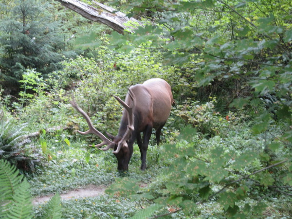
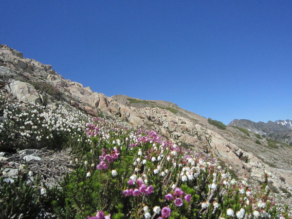
It was our first trip to Mount Olympus and the approach though long and flat (virtually no elevation gain for the first 12.5 miles), was spectacular. Hemlocks over 8' in diameter, broadleaf maple at 5' and giant alders. We even encountered a 6X6 elk that took about 10 minutes of polite conversation before he would get off the trail.
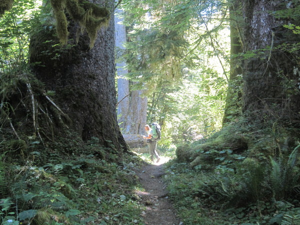
As we cross the Hoh over a high bridge and started to ascend we ran into some climbing rangers who were returning from recovering the body of a climber who had fallen on the standard route of the summit block. This event was to weigh heavily on us the night before we climbed.
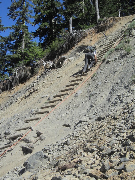
Nearing Glacier Meadows the trail has been washed out and the Park Service has installed a "ladder" that descends about 100' to a small creek.
Glacier Meadows is a bit of a misnomer. The meadow consists of about 100m of false helebore. Campsites are in the trees and the mosquitoes were fierce. There is good water with easy access, though.
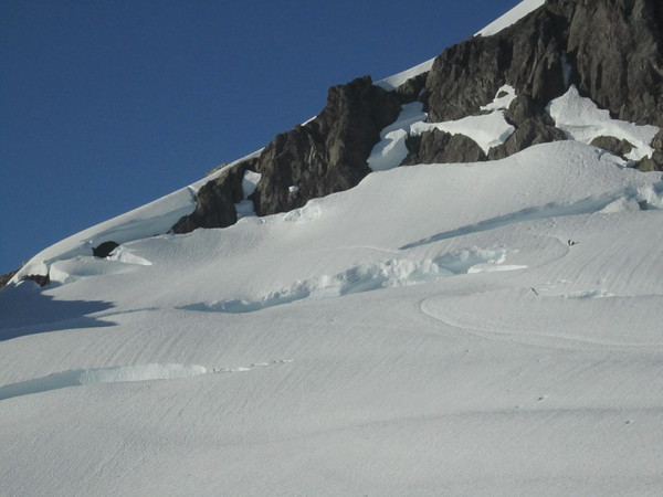
We left camp about 3:00 and headed up to the moraine, dropped down to the Blue Glacier, aiming for a large rock band on the other side. Crevasses here are generally small, and easily negotiated. The rock on the other side was grippy and made for and easy walk up to the base of Snow Dome.
Snow on the Dome was soft, but firm. Climbing was easy. Just before the bergshrund we met two climbers who were turning back. They were the last people we saw for the rest of the climb. The 'shrund is in good shape and will probably be so for a while.
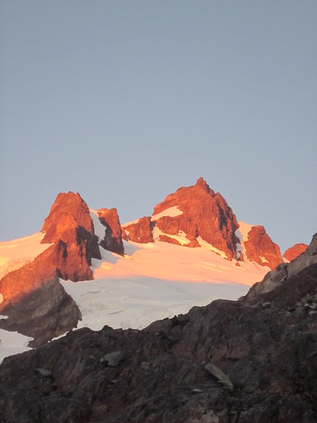
Crystal Pass views were incredible, views of Rainier, Baker, Adams and St Helens.
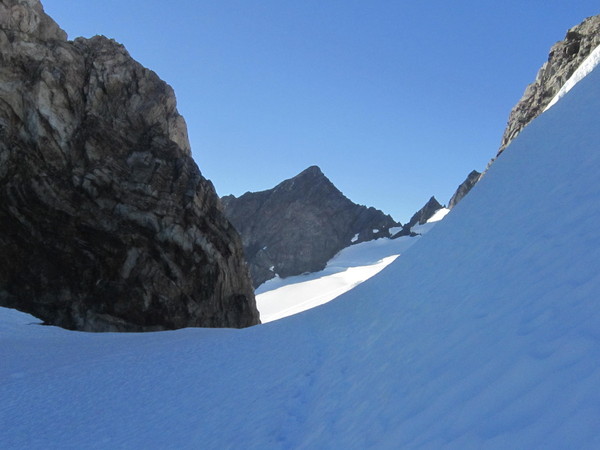
Winding up to a rocky plateau, the route descends steeply on scree the goes up steep (60 degrees?) snow to a flat spot at the base of the north side of the summit block. The standard route is to the left of this snow slope. It is a scramble, but the rock is incredibly bad, and appears virtually unprotectable.

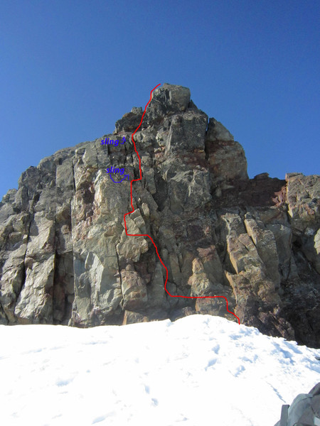
The north side has decent rock, that is protectable. We used a couple of small cams and slings for the first two short pitches with an easy scramble to the top.
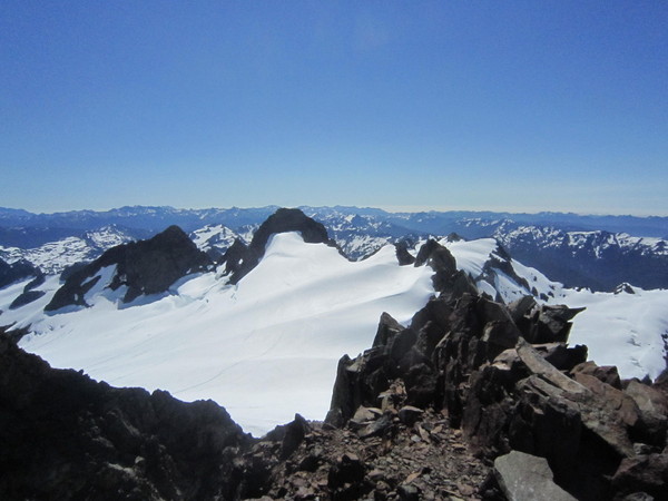
Views are of course spectacular
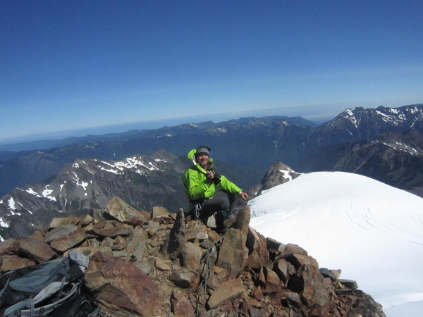
The snow was soft on the was down, but still no post holing. We did punch through a couple of crevasses on the way back across the Blue, but didn't go in.
We slept at Glacier Meadows and hiked out the seventeen miles and drove the 5 hours home the next day.
The contrast between the rain forest and the high alpine environment and the solitude make the long slog in worth it.
Gear Notes:
usually glacier stuff, small rack and slings
bug dope
Approach Notes:
Bugs are vicious
-
I ended up with two FA Hang Fires, same color, same beat-up look, after talking with two guys at the 5 mile island camp. Send PM and I will mail to you.
-
You in PDX? If and I can pick them up tomorrow during the day let me know, thanks, Frank
-
Skied South Sister yesterday summit to car, but it's going fast. Looks more like late June up there.
-
PM'd on screws
-
Black Diamond 02's. Good condition, midstiff cartridges. Have cosmetic scratches on plastic. Comes with mounting template and instructions. $80.00 includes shipping to lower 48. For photo go here: http://picasaweb.google.com/brokedownteleskier/O2S?feat=directlink
-
I have a pair of TaaKoons. Both have hammers. I'd like to trade a hammer for, or buy an adze. The head of the tool has "WING" stamped on it. Thanks, ftrain
-
PM'd
-
PM'd on Cobras
Grivel Quantum Race Carbon Ice Tools $175 / each
in The Yard Sale
Posted · Edited by ftrain
pmd