


Raoul Duke
-
Posts
91 -
Joined
-
Last visited
Content Type
Profiles
Forums
Events
Posts posted by Raoul Duke
-
-
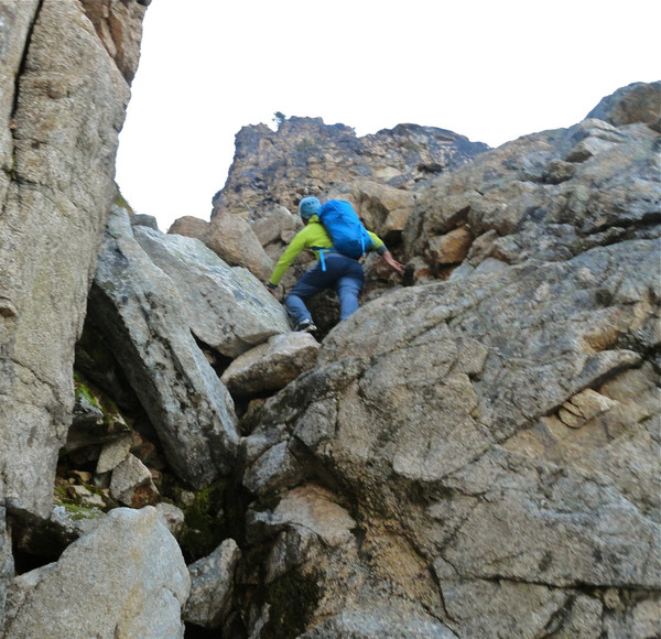
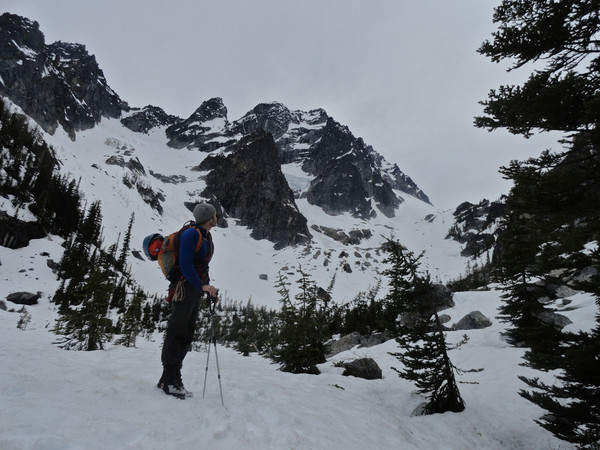
As of 1/19, the route continues to be in about the shape Jake and others describe. Great sticks down low, and a breakable crust with sugar underneath it for the last 60 meters or so.
The skiing (and skinning) above Source Lake is just plain nasty, and had us wishing we had just worn climbing boots from the car.
Didn't see any snow movement. The NE Butt looked good too!
-
looks in, next time bring your kit.
You know, it might be. "It needs time" is coming from me, a 4 leader on the best of days!

-
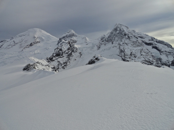
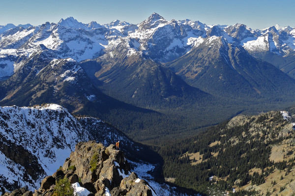
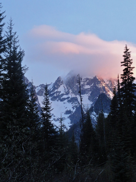
Was out for a tour yesterday and saw this:
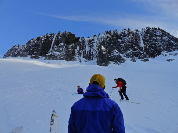
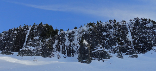
Looked like it needed time to even reliably take stubbies, but we didn't really get close to it.
-
Trip: Baker - More Heliotrope
Date: 11/11/2013
Trip Report:
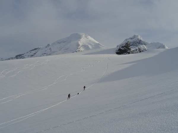
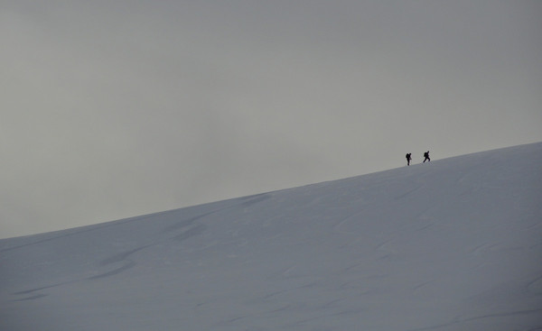
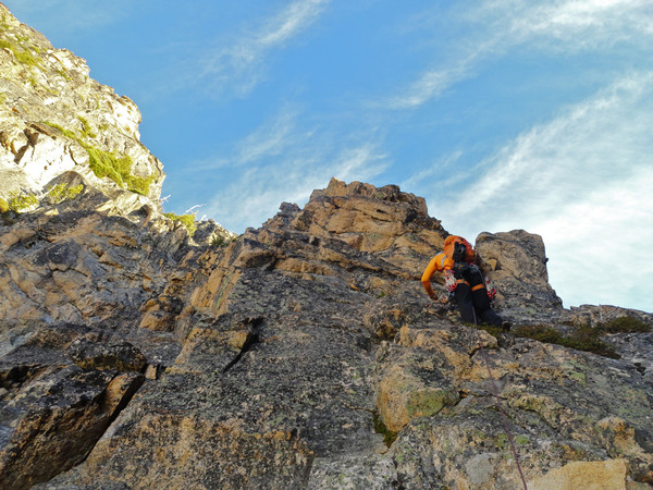
As of Monday, road continues to be in good shape (just a touch of snow in the last half mile), trail is clear, and the hogsback provides some icy skinning. Good snow started above 6,000, and despite being thin and slightly sun and wind affected, it skied very well and I had a fine time running a few laps under the mostly cloudy skies.
I meant to get a shot of the Colfax ice routes to post, but never made it over that far... the Coleman had much bigger cracks in it than I wanted to negotiate by myself! I *think* I saw the curtain on the Cosley-Houston, and if I did, it needs a little more time.
Great to be back on the skis!
-
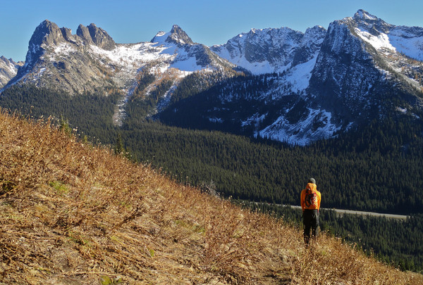
Trip: Cutthroat - South Buttress
Date: 10/20/2013
Trip Report:
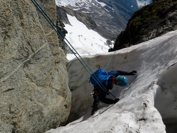
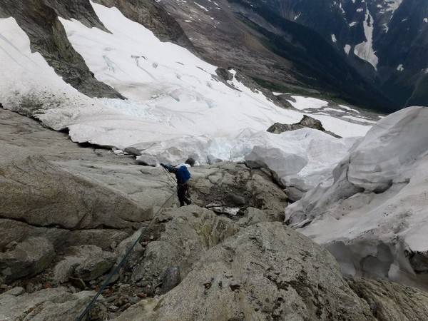
We went into the basin under Cutthroat on Sunday armed with axes, gloves and puffy jackets expecting something cold and testy; no such luck! Warm and sunny rock all the way from the notch to the summit. A lot of melting up there over the past week, still some snow in the approach gully.
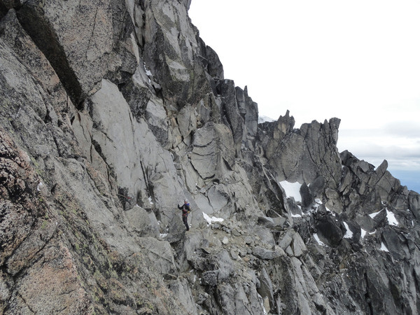
Route-finding on this route is indeed tricky... if, that is, you go up there thinking there is a "correct" route to find. We didn't climb the "5.7 face" right out of the notch as mentioned in the Supertopo guide, didn't "go under a huge chockstone" on pitch 8, and never found a 5.8 crux pitch with fixed pins.
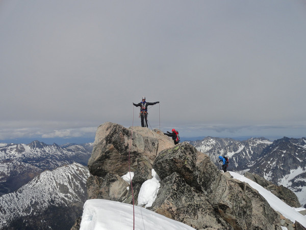
We simul-climbed the obvious crest low down, found ourselves at the base of a stepper face, climbed a steep pitch (150' 5.7?) up cracks, and then a short, easy pitch that put us between the humps. Then some rambling to the summit. The route has a very broken, alpine feel and doesn't seem to lend itself to topo-fication; we followed a line of resistance and had a fine time.
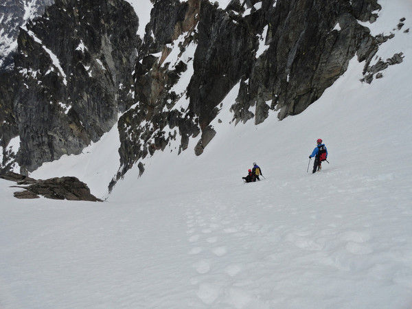
Descent down the West Ridge was a mix of rappelling off shiny bolts and some awesome, easy down-climbing on the exposed catwalk.
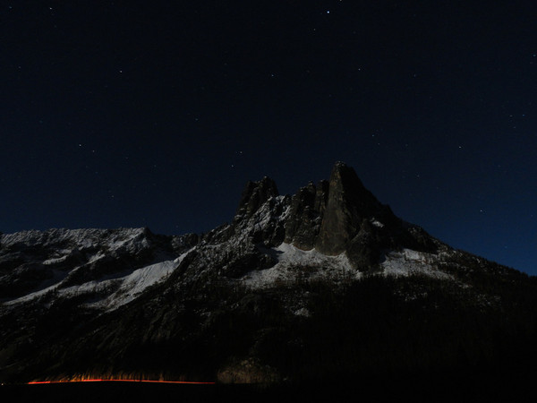
Moonlight on the Liberty Bell group from the overlook:
A step in the approach gully:
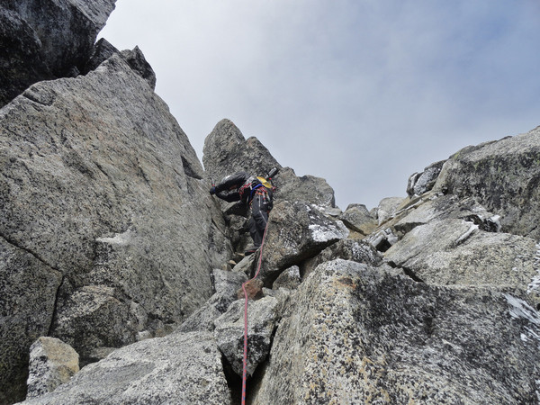
Getting out of the notch:
On our crux pitch:
Looking up at the final OW:

Summit!
Descending the West Ridge:
Looking back:
Out!
Gear Notes:
Slings for trees. Never really needed anything beyond 2" except for an optional 4" (we brought it) for the summit off-width.
Approach Notes:
We found the start cairn in the daytime from a previous trip which made an early start easy.
-
Lost on Saturday 6/15: a Sony point and shoot in a small, black Deuter camera case, either at the base of Kiss of the Crowbar or Endless Bliss, not sure which.
If you found it, you can return it for the karmic, beer or cash reward of your choice!
Send a PM. Thanks.
-
If you're interested in two week-old secondhand information, a friend skied Eldorado on the 9th and said it was ~6 miles to the Eldorado TH.
-
yep south side descent, 15 hours from cooper spur shelter to charlie's mtn view
Does one use a car shuttle to do this?
Awesome and cold-looking photos, thanks for the report!
-
Awesome! Thanks for the update!
-
Had expected to find more snow in-residence than we did, oh well, at least the ice tools got to go for a walk! Happy almost-winter everybody...

-
Thanks Mr. Storms, that's a great compliment from a climber of your caliber.
Ha! Actually this is Clive, likewise happy to be confused with a climber of Mr. Storms' caliber.

-
Very impressive Eric! Hope you made it to the BBQ caboose in good time.

-
An interesting idea about the bolts Chris, but it may set a dangerous precedent...
Little-known climber Meinold Ressner once warned about the "murder of the improbable."
-
Thanks Jason. Are the cat scratches 3-4th class?
-
Yes, as Eric reports, there was not much fun to be had in the snow couloir down from the Forbidden W. Ridge notch. I read jordansahl's TR from last week where he expressly said not to descend the snow and then... went ahead and descended the snow. Stellar, stellar decision-making up there. BTW, how does one (or can you) approach the West Ridge under current conditions?
Pictures of the crap:

...But it was great to share a beautiful route with you Eric, Chris, Amanda and Andrea!
-
That's just too cool! Thanks for sharing, way to up the cuteness-factor of cc.com.
-
Nicely done Jordansahls!
A somewhat generic Torment-Forbidden question: most people seem to do the SW ridge rather than the South Face on Torment. Why is this? The bergschrund onto the South Face is reported as tricky late season (and was also the cite of Craig Luebben's accident, no?) but it seems like a much quicker line than the SW ridge. I guess there's also an aesthetic argument for staying true to the ridgeline.
Interested to hear any stories from the South Face...
Tofu Todd, hope to share the bivy with you this weekend!

-
Nice write up CascadeClimber, and an impressive ascent!
You picked the right day, Saturday night it blew hard and rained at Schurman, and no one had much fun.
FYI, the "AJ" you mention on your blog was actually "JR." A hazard of two-letter names, I guess.
-Clive from Marmot
-
Thanks for the great photos, what beautiful country! I'll have to make it out there sometime...
-
Well done to you too Montana Climber!
Mhux- not too sure about next weekend. Although I am not familiar with that side of the mountain, my general impression was that the route was on its way to being out of shape. If I was going up there next weekend I would certainly try to develop a schedule that had me climbing the ridge below Thumb Rock (as well as the initial 1000' above Thumb, lots of stones there too) during the coldest part of the night...
-
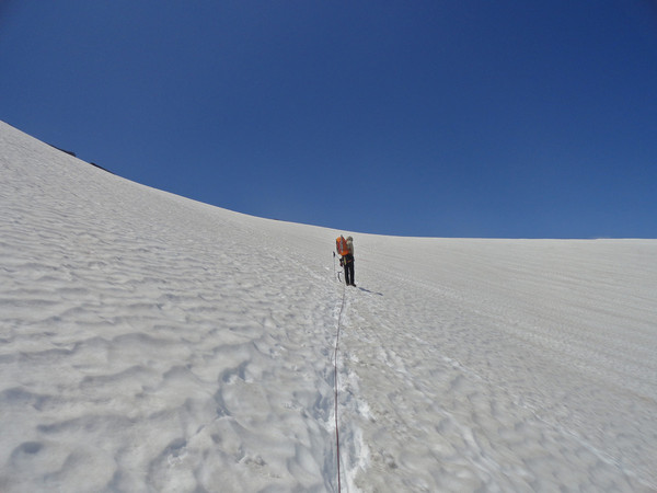
Trip: Rainier - Liberty Ridge
Date: 7/15/2012
Trip Report:
Climbed a slightly boney Liberty Ridge from July 13-15.
The path through the Carbon Glacier involves some tricky snow bridge work in a couple of spots, and we accessed the ridge from its left side, gaining about 750 vertical feet on rock before moving onto the snow on the ridge's right side that led to Thumb Rock; there was some rock fall here that kept us moving quickly upward. We felt pretty committed at this point given the difficulties of the Carbon and the lower ridge.
Above Thumb rock the route was in good, icy shape: we were very happy to have technical tools, and rope simuled the shield on the Willis Wall side as well as the bergschrund exit. Pulled onto Liberty Cap just after 7 a.m. in a fierce wind.
Fun Itinerary Facts:
White River CG > Curtis Ridge: 5.5 hrs.
Curtis Ridge > Thumb Rock: 5.5 hrs.
Thumb Rock > Liberty Cap: 6 hrs.
Liberty Cap > White River CG: 8 hrs. with lots of breaks.
Fun Gear Facts:
Our packs weighed 25 pounds each! Slept in a Firstlight and a Feathered Friends Vireo, the finest sleeping bag ever made. Used a 30m rope. Placed one picket (brought 2) and 5 ice screws (brought 3) on route.
Pictures!
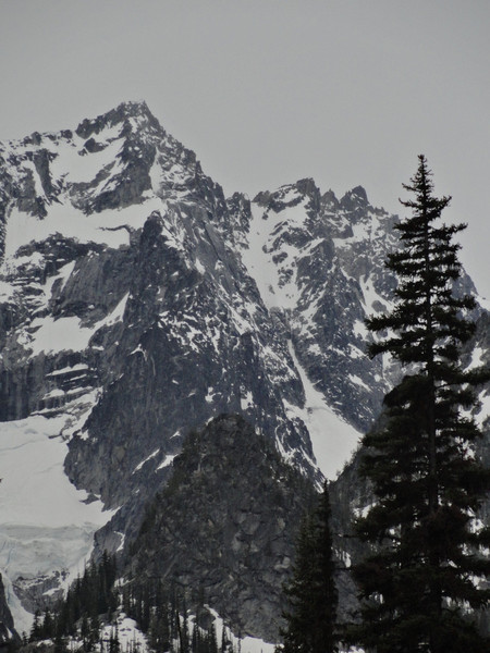
Across the Winthrop:
On the Curtis Ridge:
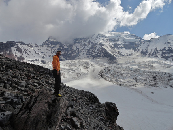
The Carbon:
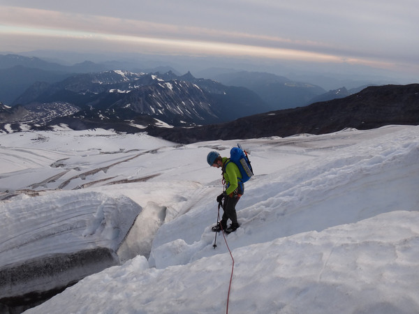
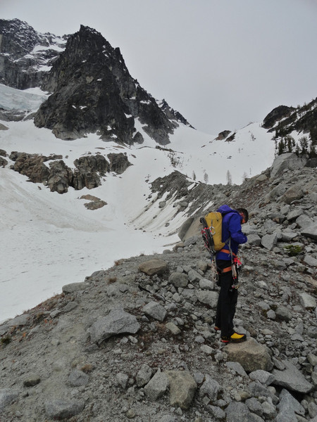
Rock low on the ridge:
The snow below Thumb Rock:
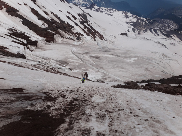
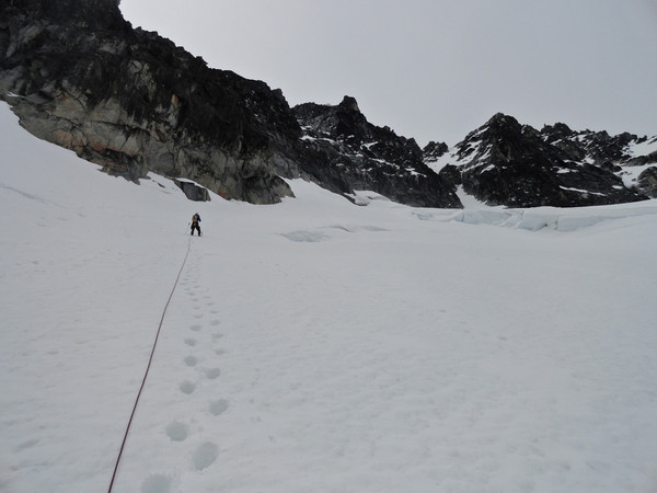
Clearing the bergschrund at 13k:
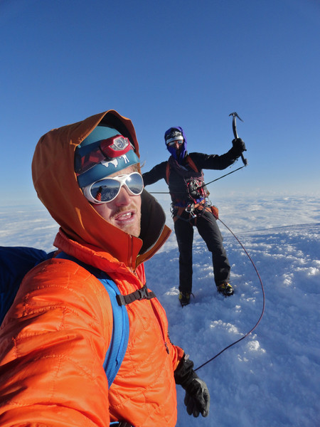
Summit:
-
Great to meet and climb with you Matt! -Clive
-
Yeah I would take the god-forsaken talus over the dead-fall extravaganza of the creek anytime.
-
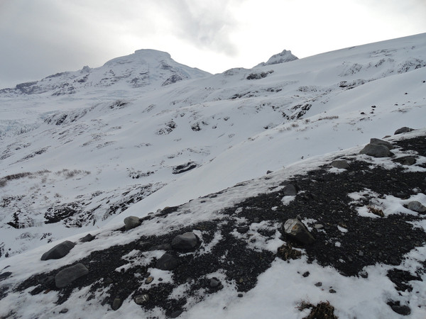
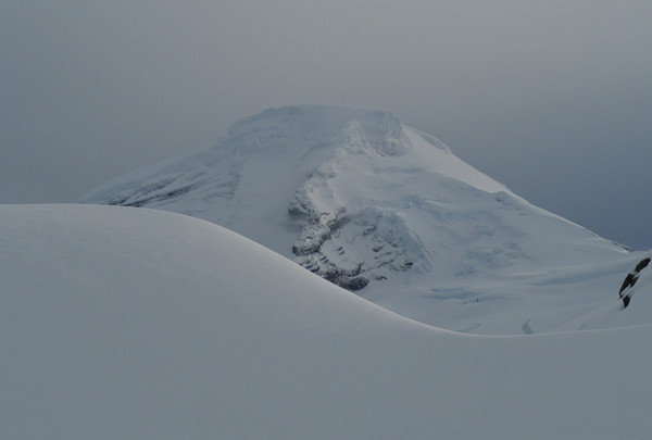
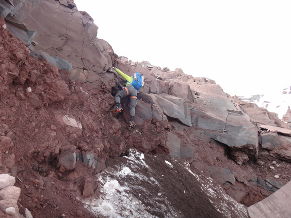
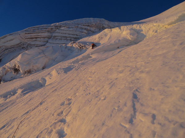
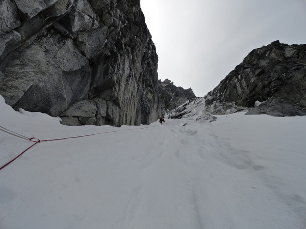
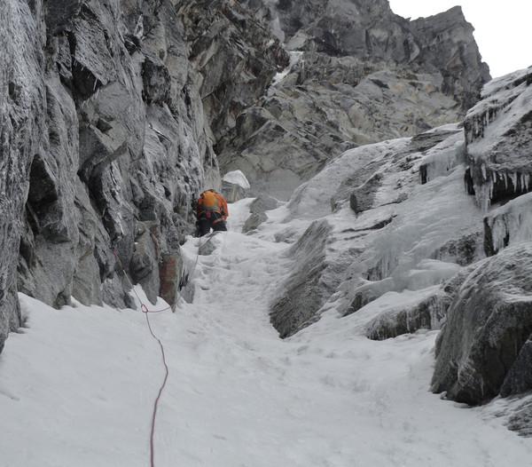
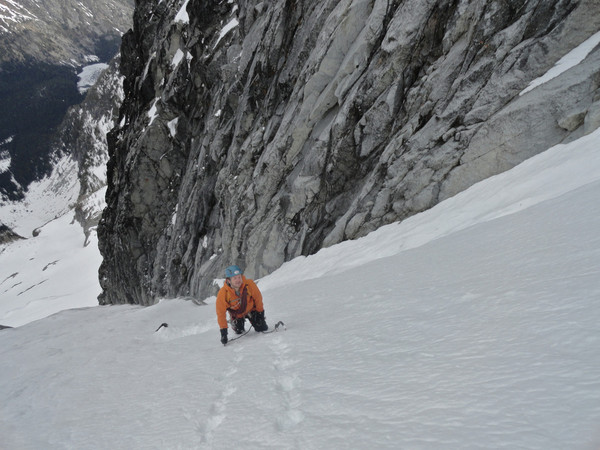
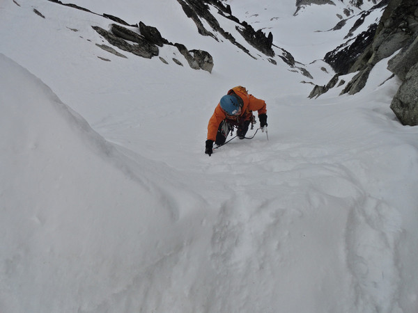
Trip: Mt. Stuart - Stuart Glacier Couloir
Date: 6/3/2012
Trip Report:
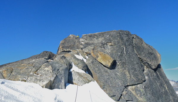
Among those flocking to the Enchantments for the promise of a window were myself and partner JR, who climbed the SGC from the car in a 16 hour round trip, with about 4.5 hours on route from bergschrund to summit.
Found this to be an excellent and pretty consistent mixed route for the modern weekend warrior-- don't let that 1944 first ascent fool you! The schrund required some rope and gear, and we stayed roped until we were over the constriction, which provides a few moves of real swing-the-tools ice work on rotten stuff. The upper section of the couloir is steep but straightforward. We reached the West Ridge notch with fears of route finding issues, but the rock section went uneventfully in two long simul blocks. The traverse on the north side of the ridge still has substantial sections of feet-on-snow-ledge-with-gloved-hand-jams that makes you feel very Mark Twightish.
We shared the summit and the descent with two guys who had come up the Ice Cliff, and seemed to have found good conditions there too.
Descent down the Sherpa Glacier Couloir was easy in a pay attention sort of way.
Enough blab, here are the pictures:
Gear Notes:
No real need for screws, although we did place one below the ice bulge. We were very happy with a 30m rope. 30m rope = only 30m worth of gear = light packs. Makes sense to me!
Approach Notes:
The talus leading up Mountaineer's Creek drainage is snow free, and travel conditions are good above the basin.
LOST: Half a splitboard, Source Lake TH
in Lost and Found
Posted · Edited by Raoul Duke
Posting on behalf of a friend who left one half of his white Prior splitboard (with skin) at the upper lot trailhead on the way to Source Lake, Chair Peak, etc. This was on Saturday March 15.
Please let me know if you've seen it! Thank you!
206-550-5273