AlpineK Posted January 21, 2002 Share Posted January 21, 2002 R and I skied Cannon Mtn. coulior on saturday. We had good but windy weather. I cut a small slab at the top of the couloir (3"-4" crown) but nothing else. There was some nice powder on the upper half of the descent and some vairiable funkyness on the lower slopes. Overall a good day. Big drops rule!! Quote Link to comment Share on other sites More sharing options...
mikeadam Posted January 21, 2002 Share Posted January 21, 2002 Very cool. Quote Link to comment Share on other sites More sharing options...
telemarker Posted January 21, 2002 Share Posted January 21, 2002 I tried skiing the couloir last Spring under horrible conditions of shallow, rotton snowpack. Did you follow the road all the way around, or cut straight up the slopes below the couloir? Quote Link to comment Share on other sites More sharing options...
AlpineK Posted January 21, 2002 Author Share Posted January 21, 2002 we crossed the stream on a log and headed straight up. Quote Link to comment Share on other sites More sharing options...
mattp Posted January 21, 2002 Share Posted January 21, 2002 Are young trees yet starting to crowd the woods in the burn? How deep was the snow down at the Mountaineer Creek trailhead -- enough to comfortabley ski through the woods at that elevation? Quote Link to comment Share on other sites More sharing options...
AlpineK Posted January 21, 2002 Author Share Posted January 21, 2002 There is enough snow and the slopes are open so skiing is good down to the creek Quote Link to comment Share on other sites More sharing options...
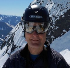
mattp Posted January 21, 2002 Share Posted January 21, 2002 Thanks, but how much snow was there down at the trailhead? That would serve as some kind of indicator for other trips in the area. Cannon Mountain Couloir is, I agree, an excellent run, and I agree that BIG DROPS RULE. I am wondering about trying some other things in the area, such as Peak 7550 above Lake Stuart or Cashmere Mountain. By the way, here is a picture of the drop in at the top of the Couloir. -Matt Quote Link to comment Share on other sites More sharing options...
AlpineK Posted January 21, 2002 Author Share Posted January 21, 2002 Snow where we left the road was over a foot deep. Quote Link to comment Share on other sites More sharing options...
philfort Posted January 21, 2002 Share Posted January 21, 2002 How steep is it? Is it the one that drops down from right near the summit? (just looking at a map here...) Quote Link to comment Share on other sites More sharing options...
Downhill Posted January 21, 2002 Share Posted January 21, 2002 Nice as that photo is, I don't think it's the actual "top" of the CMC. my opinion, almost worth what you paid for it Quote Link to comment Share on other sites More sharing options...
AlpineK Posted January 21, 2002 Author Share Posted January 21, 2002 You can't miss it just look up as you cross the bridge at bridge creek. As to its steepness I duno 35 maybe pushin 40 Quote Link to comment Share on other sites More sharing options...
mattp Posted January 22, 2002 Share Posted January 22, 2002 Actually, that photo IS the top of the CMC--unless I had the wrong couloir. The couloir in the photo is the couloir that drops from the N. Peak of Cannon Mountain, about 1 1/4 miles NNE of the main summit and, as Mr. K said, it is the couloir that you "can't miss" when you look up from the bridge at Bridge Creek C.G. When I took the picture, I was standing on the cornice directly above the throat of the top of the couloir, and my buddy KJ was looking at where we were about to drop in, about 30 yards west, where the cornice was (on that day) a little smaller. Quote Link to comment Share on other sites More sharing options...
Downhill Posted January 23, 2002 Share Posted January 23, 2002 quote: Originally posted by mattp: .....When I took the picture, I was standing on the cornice directly above the throat of the top of the couloir, and my buddy KJ was looking at where we were about to drop in, about 30 yards west, where the cornice was .... I gotcha. I remember the top as being a narrow chute for 25' or so before opening out - much tighter than the broader slope in your picture. You were probably standing right at the spot I had in mind when you took the picture. My apologizes – like I said, my opinions are worth what you pay for ‘em. Quote Link to comment Share on other sites More sharing options...


Recommended Posts
Join the conversation
You can post now and register later. If you have an account, sign in now to post with your account.