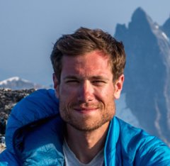
kuhar Posted July 5, 2018 Share Posted July 5, 2018 (edited) Trip: Twin Sisters Range - Twin Sisters TraverseTrip Date: 07/04/2018Trip Report: Hi friends, We traversed the Twin Sisters on the Fourth of July in 14.5 hrs. I have always been curious what this range offers as I've stared at it from Mt. Baker or other places in Skagit Valley. As a team of three we gave the route a go and had a great time out in the mountains exploring this new range. I'll write a few more details than the average TR as it seems like this route is not completed very often (judging by the poor quality of rap tat [now replaced] we found) and maybe could use some specifics and pictures (since I lugged a DSLR along the route). By the numbers: Linear distance: 17.2 mi Vertical gain: 6,536 ft Our route combined the following (for reference, see Beckey Guide 3: Rainy Pass to Frasier River pp. 40-45): TH on Middle Fork Nooksack River Rd. 38 (Beckey Guide 3 p. 395) South Twin ascent via the W. Ridge (II-III; mostly class 3-4, upper segment is low 5th) North Twin ascent via the SE Ridge (II; low class 5) North Twin descent via the W. Ridge (II; class 3-4) Click here for topo Our gear: Mountain or cyclocross bike 70 m half rope (60 m would be the minimum) Approach shoes (Eg. guide tennies) Glacier harness Ice axe Micro-spikes Helmet Climbing gear for rappel, rap tat (you shouldn't need any now ;-)) and maybe a very limited set of pro (we didn't use any, but that was our comfort level) Getting to the TH is pretty straightforward. We camped at the bridge the night before so we could get an early start. In the morning we set off on our bikes for a 6 mile uphill ride (took us 1.5h) on the nice gravel/dirt road before stashing them at the start of the trail for the North Twin (our out for the day). Quick note here about our choice of going S to N: descending the W Ridge of the N Twin at the end of the day was very nice. It has the best quality rock and the trail out is way more established. It's a lot of ground to cover and knowing the end of the day was going to be straightforward was something we were thankful for after a day of feeling pretty out there. It's a quick walk further down the road to the start for the S. Twin. The trail is in pretty good shape, but the brush is thick for most of the first half. After about an hour we exited the forest and into a beautiful alpine valley in-between the twins. We gained the W ridge of S twin pretty far down through some climbing on snow and then easy rock. From here it's a mostly class 3-4 affair for about 2-3hrs to the summit. The route-finding was sometimes unclear although there are occasional well-placed cairns. We found ourselves on something like a trail just south of the crest for the lower half of the route and then stuck mostly to the crest itself for the upper half. Like all of the climbing of the day, we did not rope up. Getting started: Trail to S. Twin is easy to follow, but overgrown: Into the alpine to ascend the ridge of S Twin: The W Ridge of S Twin is long and like this most of the time: The summit of S. Twin was accessed by a short traverse of a snowfield south of the crest and then ascending the final SW flank. This was low class 5 in places, but always secure. From here we traversed over to the true (?) summit to the SE for a quick lunch before debating how best to make our way over to the N. Twin. Descending the N ridge of . Twin looked to be full of towers that would probably slow our progress. We also probably didn't have enough rap tat for all of that. Descending the NE aspect and out on the arm looked dicey, but probably could go for a team that is braver than we are. We finally decided on descending the SE ridge to a notch that is well-visible. There is lots of exposure and loose rock here. We put in a rappel station up high and then reinforced/replaced the one in the notch that drops down onto the glacier. A quick rappel, downclimb, and small glissade put us down onto the sisters glacier. This area is probably also possible to downclimb if you really wanted to go ropeless, but please be safe, you know? This is where you exit the ridge and then ascend the snowfield to the final climbing for the summit of S Twin: On the summit of S Twin: Rapping onto the glacier from further down the SE ridge toward a notch: Backside of the rappel onto the glacier: Traversing the glacier was probably the high point of the day: Fast moving over flat ground, minimal crevasse hazard, gorgeous views in a remote-feeling alpine setting that just reinforced that the N. Cascades are the proverbial shit. Getting back onto the rock for us could not have been easier. We aimed for a clear low point in the ridge connecting the twins. From here we unroped and weighed our options, choosing ultimately to go for the not-often-traveled SE ridge (FA in 2008 according to Beckey). Of note, we did observe a new-looking rappel station here that would be convenient for those choosing to descend back into the valley. The SE ridge was by far the most dirty and chossy section of the day with challenging route finding in places. I tried to assemble a few cairns along the way. If you have trouble dealing with uncertainty, this is going to be a great way for you to work through those issues... Closer to the top we were able to reach the false summit by transitioning onto the W aspect and ascending a small, loose gulley back to solid rock. From the false summit, we downclimbed an airy section below several towers into the head of a massive gulley before quickly making our way on rapidly improving rock quality to the true summit. Aiming for the notch to access the SE Ridge of N Twin: Eyeing the SE Ridge of N Twin (I can't even begin to draw a line): It mostly looks like this: Traversing between the false and true summit: From the other side: True Summit of N Twin: Looking back on the day from N Twin summit: From the true summit we downclimbed the entire W ridge of N Twin giggling at how good the rock quality was. It was a superb experience to be so exposed with such high quality rock and clear route finding. You literally just stick to the crest for most of the route. From the base of the route we blitzed down the excellent trail to the bikes and then onward to lightspeed for the 6 mi downhill bike ride. Descending W Ridge of N Twin: Thanks for reading! -Ryan Gear Notes: See TRApproach Notes: See TR Edited July 5, 2018 by kuhar Adding overview pic 3 Quote Link to comment Share on other sites More sharing options...
BK9 Posted July 6, 2018 Share Posted July 6, 2018 wicked nice tr dude! Quote Link to comment Share on other sites More sharing options...
G-spotter Posted July 6, 2018 Share Posted July 6, 2018 I thought you had to climb over all the subsidiary summits to the south to call it a Twin Sisters range traverse? Quote Link to comment Share on other sites More sharing options...
PorterM Posted July 8, 2018 Share Posted July 8, 2018 Well done! Did that route last fall except we went North twin to south twin with a single 15m rappel on North twin. We got lost in the woods coming off south twin so that is a clear benefit of your route. Either way, fun day in the mountains, not done everyday either which makes it fun! Quote Link to comment Share on other sites More sharing options...
Jason4 Posted July 9, 2018 Share Posted July 9, 2018 I was up there yesterday and our party pulled your first rap anchor getting off the SE ridge of S. Twin, I just wanted to mention it so nobody goes up there expecting one to already be in place. The one at the notch is still there. Quote Link to comment Share on other sites More sharing options...
geosean Posted July 10, 2018 Share Posted July 10, 2018 On 7/9/2018 at 8:56 AM, Jason4 said: I was up there yesterday and our party pulled your first rap anchor getting off the SE ridge of S. Twin, I just wanted to mention it so nobody goes up there expecting one to already be in place. The one at the notch is still there. What were you guys up to in that area? Something awesome? Quote Link to comment Share on other sites More sharing options...
Jason4 Posted July 11, 2018 Share Posted July 11, 2018 18 hours ago, geosean said: What were you guys up to in that area? Something awesome? Braden Downey and I climbed the Green Creek Arete and the NE ridge of South Twin. We got off the summit by following the route described above to the notch and then went SE down to the Green Creek headwaters before following the creek back down the valley. It was pretty awesome. Quote Link to comment Share on other sites More sharing options...
Ian in Seattle Posted August 14, 2018 Share Posted August 14, 2018 Great TR! We're looking to do this in the next few weeks, been on my bucket list for awhile. Does anyone know how the glacier holds up this late in the summer? Is there more serious bergschrund and/or crevasses to deal with on the traverse? thanks Quote Link to comment Share on other sites More sharing options...
Daphne H Posted August 20, 2018 Share Posted August 20, 2018 On 7/8/2018 at 12:18 PM, PorterM said: Well done! Did that route last fall except we went North twin to south twin with a single 15m rappel on North twin. We got lost in the woods coming off south twin so that is a clear benefit of your route. Either way, fun day in the mountains, not done everyday either which makes it fun! Sensing a common theme! We also got lost coming off of the south twin in the valley, and then again in the woods. I think getting out of the woods took longer than the rest of the climb... haha Quote Link to comment Share on other sites More sharing options...
R. Forbes Posted August 29, 2018 Share Posted August 29, 2018 (edited) Thanks so much for this trip report, it inspired my climbing partner and I to go out and repeat it yesterday! This is an incredible traverse. I posted a TR if anyone's curious about current conditions. Edited August 29, 2018 by R. Forbes 1 Quote Link to comment Share on other sites More sharing options...


Recommended Posts
Join the conversation
You can post now and register later. If you have an account, sign in now to post with your account.