Search the Community
Showing results for tags 'northwest face forbidden peak'.
Found 1 result
-
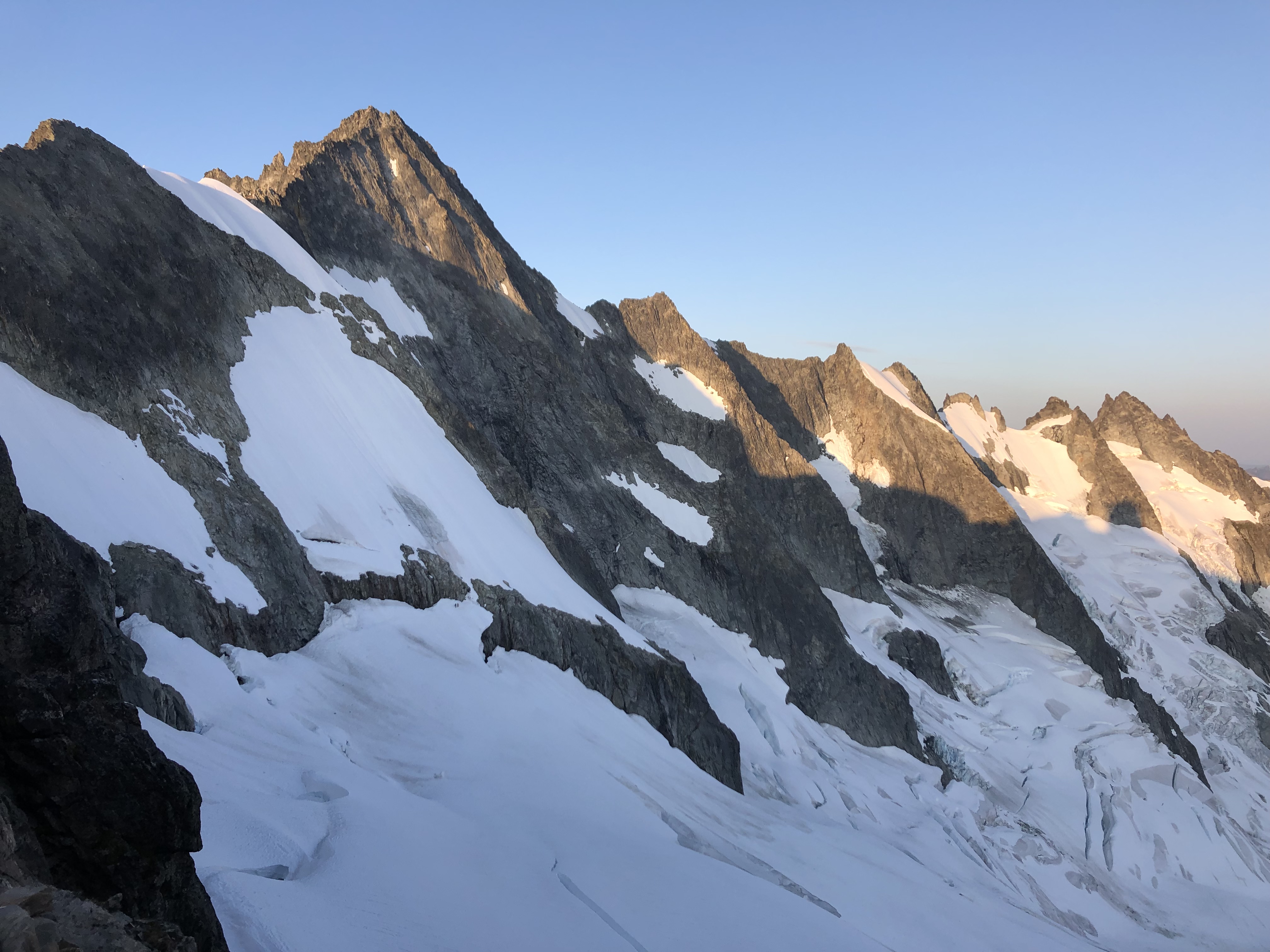
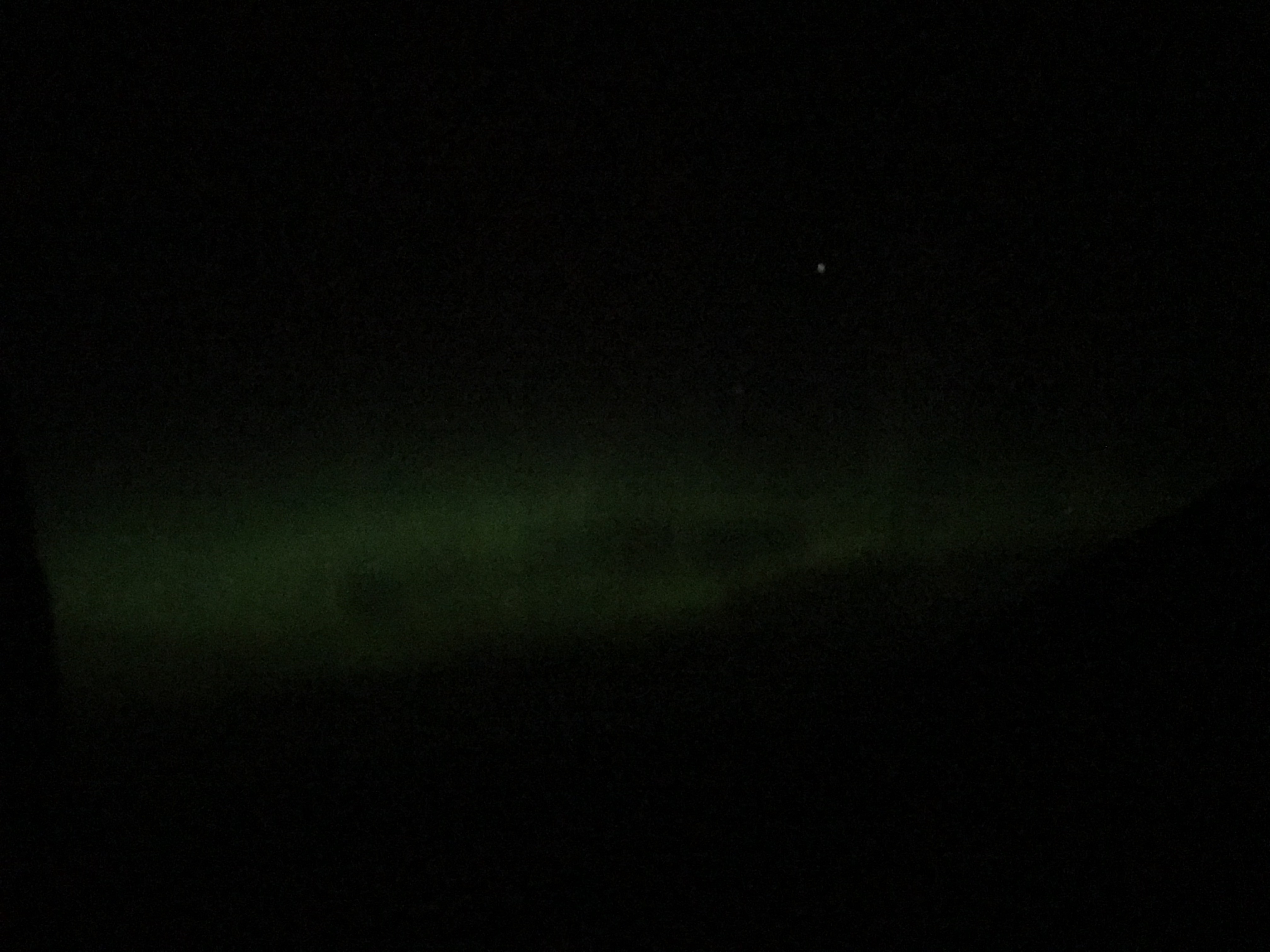
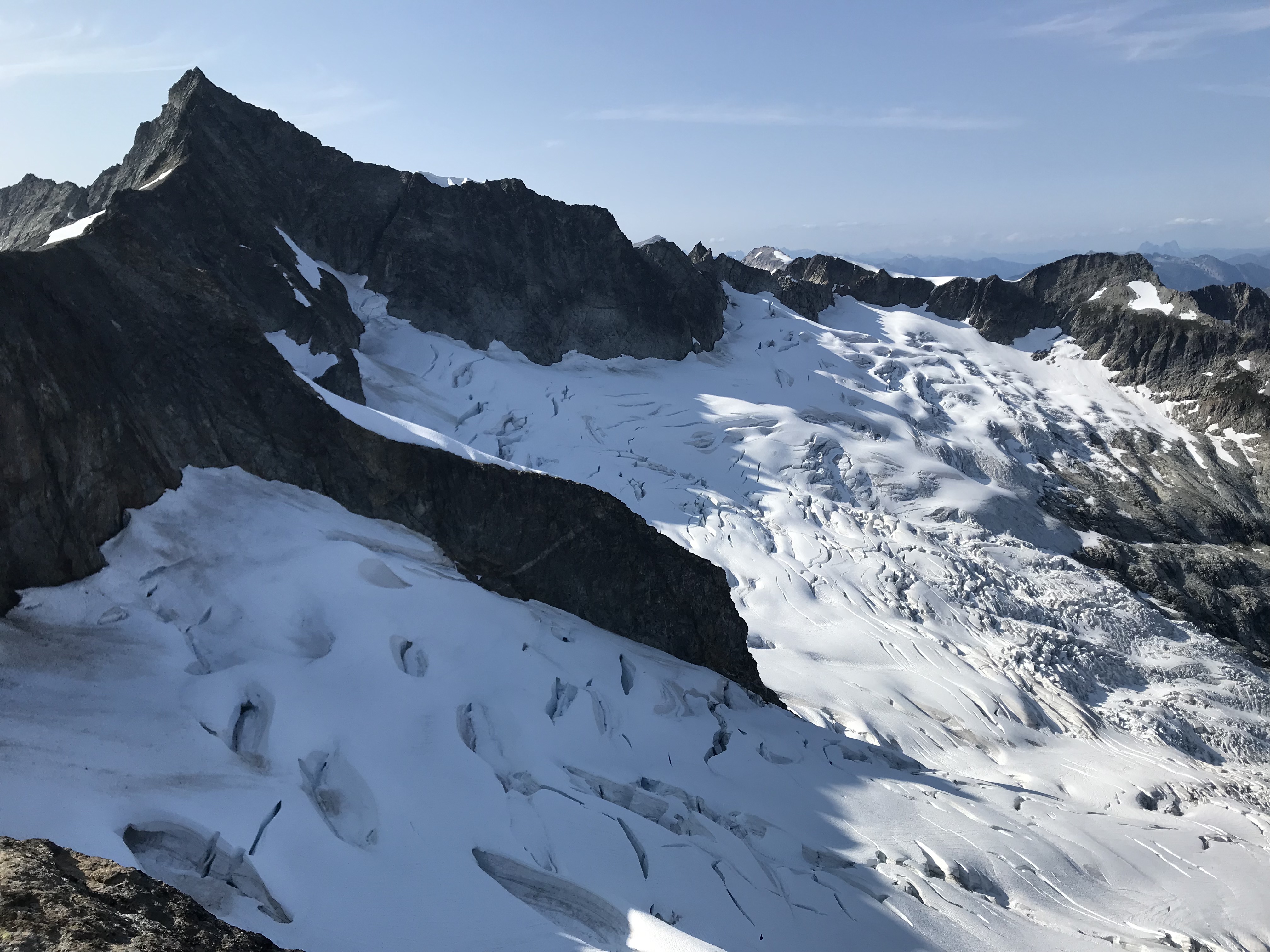
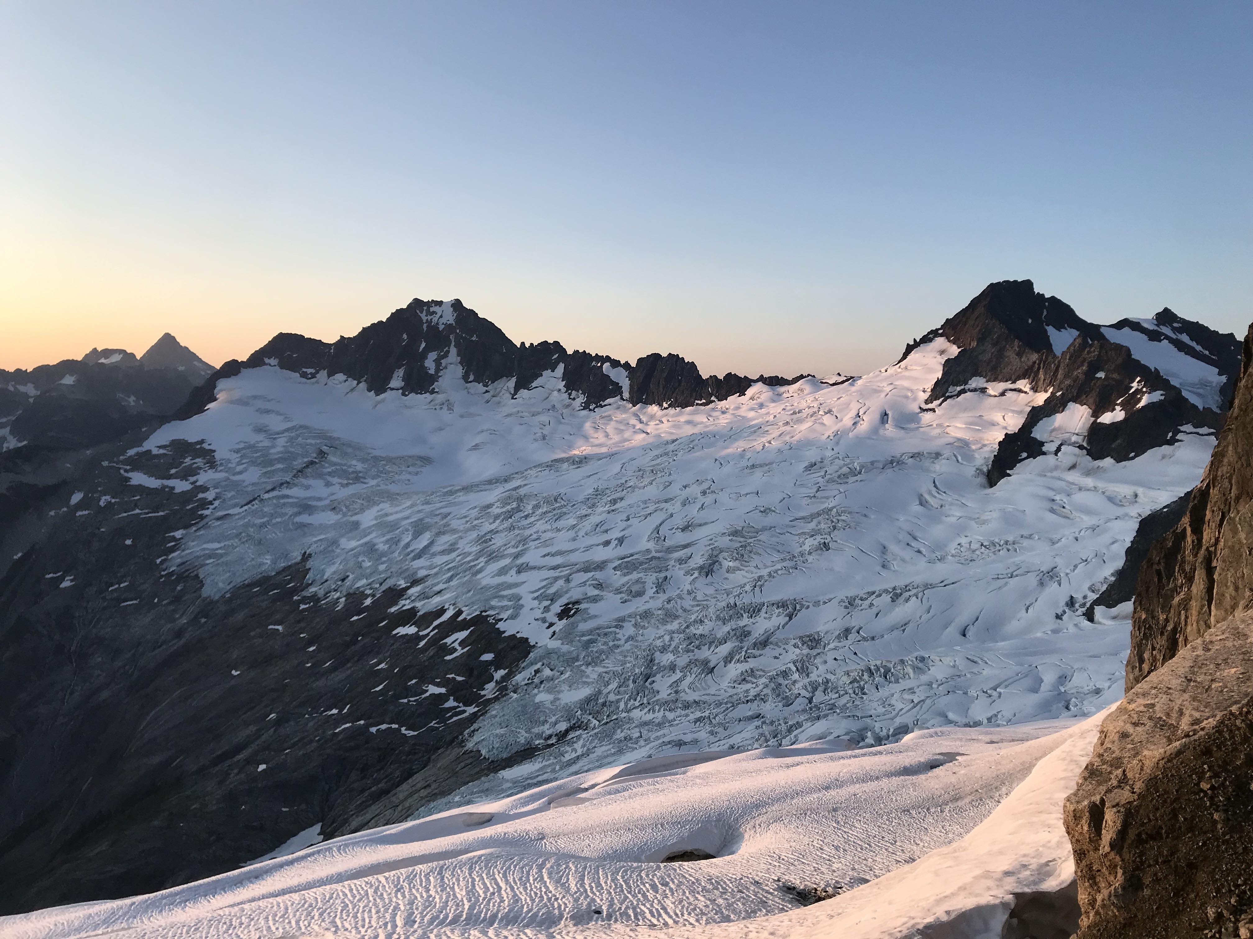
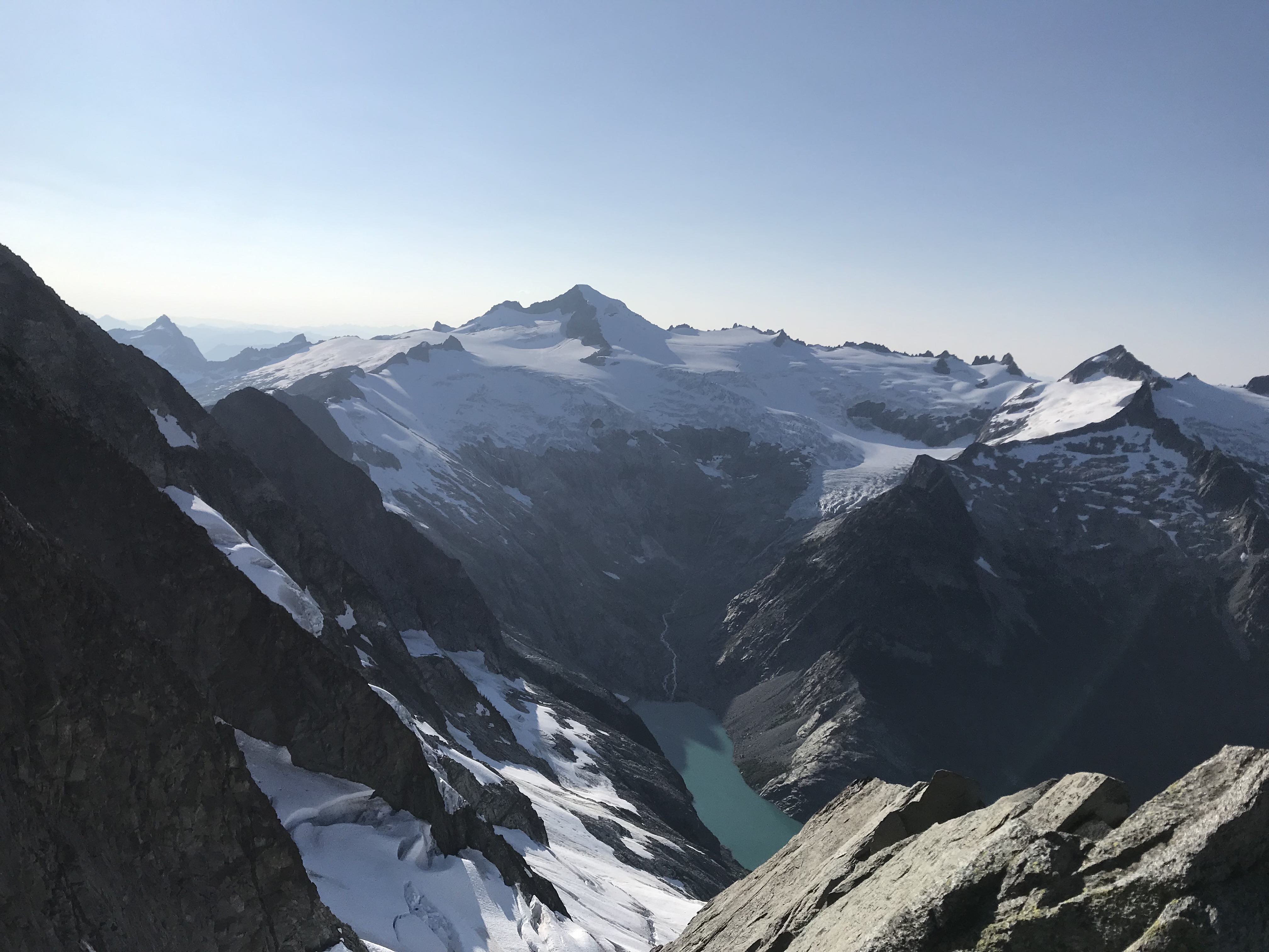
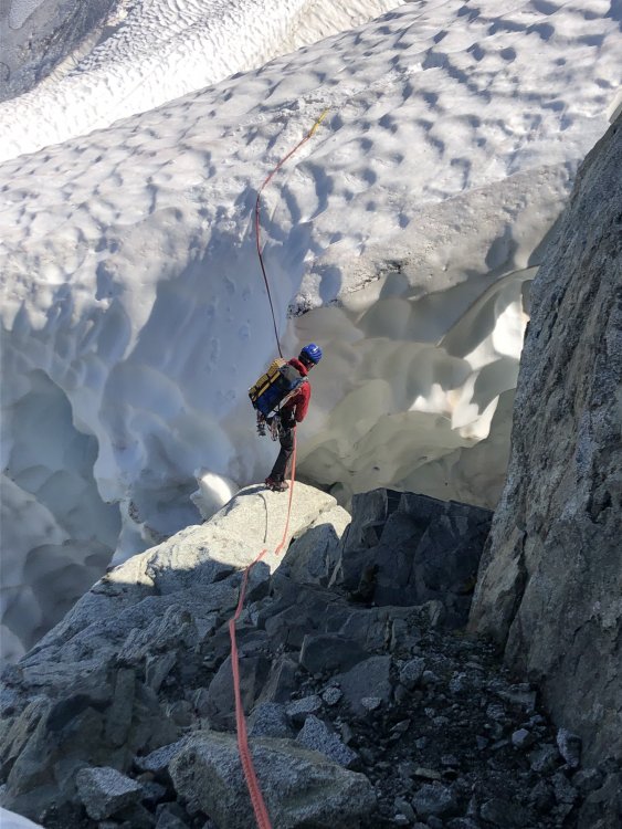
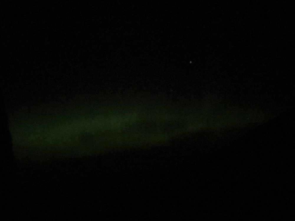
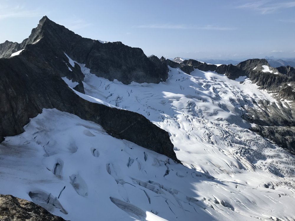
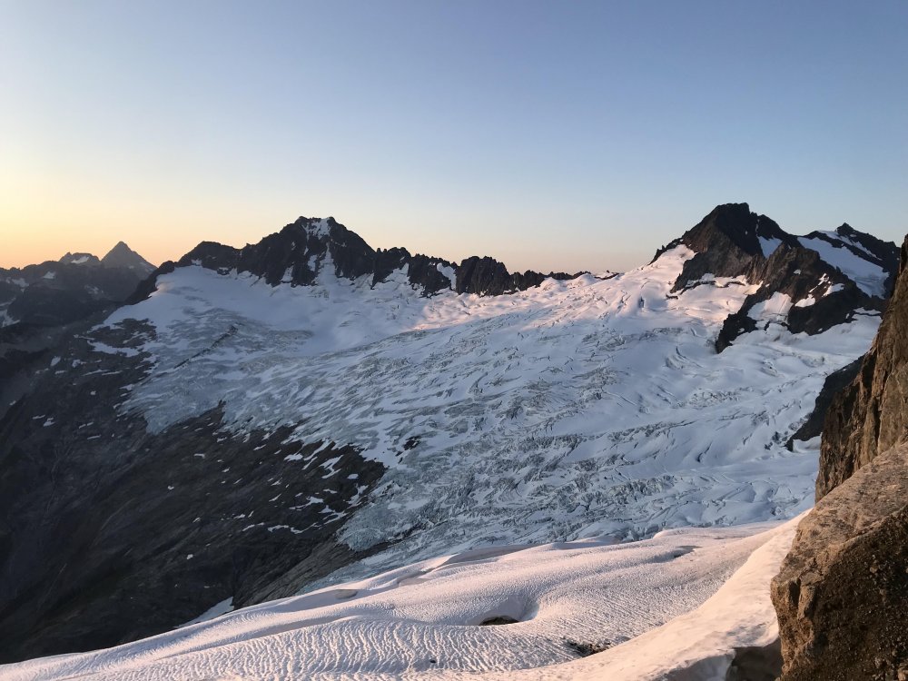
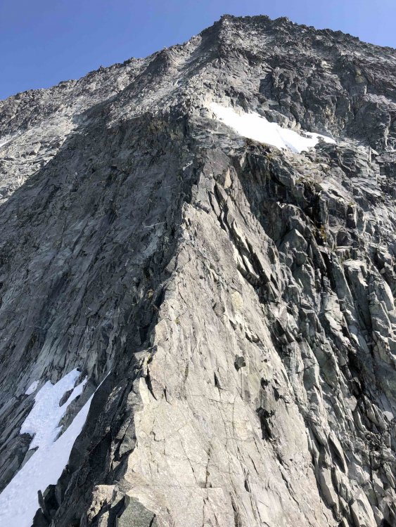
Trip: North Cascades - NW Face of Forbidden Peak Trip Date: 08/04/2019 Trip Report: Climbed the Northwest Face of Forbidden Peak on Sunday, Aug. 4. I believe now that we badly botched getting on the start of the route, exiting the glacier too close to the toe of the arete, rather than attempting to climb further around and up to the right of it. This resulted in some time consuming and stressful problem solving in unpleasant terrain. After crossing the Forbidden Glacier, we found a place where we could make a short down climb/rappel off the glacier and onto rock, near what we thought was the start of the climbing route. Off to our right was a gaping hole filled with ice and rock debris that's part of the moat. Once on the rock, we scrambled up 10 or 15 feet to where we were beneath a roughly seven-foot-thick snow patch, looking up at a corner system that we reasoned (convinced ourselves) could be the start of the rock climbing. (View from across the Forbidden Glacier of the rib on Forbidden where the climb is located.) (Rappelling off of the Forbidden Glacier. The snow was soft and we reluctantly opted to bury and leave a picket to do this.) My climbing partner Pat led the corner, and some terrain above it. There was some dirty rock and some of the climbing felt 5.8/5.9. He stopped after about 80 feet at a semi-hanging belay. I followed up to the belay and we decided after some discussion we were definitely not on the route. Some abandoned gear we passed on the way up indicated we may not have been the first party to have made this mistake. Looking down and climber's right we could see what appeared to possibly be the access ramp feature described in the Cascades Rock guidebook. We then watched as the top of a massive ice tower--a chunk of ice that was maybe about the size of a 55-gallon drum--collapsed into another debris filled hole in the glacier, next to the ramp. Short on good options, we lowered/rappelled down into a more sheltered part of the moat, and then climbed a short section of polished 5.8ish rock up out of it, over to the right, to reach the start of the ramp. In the place where we finally established a belay we were just above the debris hole where we'd seen the ice fall, and close to other threatening towers of ice that were by now baking in direct sunlight. But it appeared that we were far enough away that we were not in immediate danger if anything else fell. From here we followed the ramp system up and further right to the climb proper. Parts of the ramp felt mid-fifth class, with maybe some 5.6/5.7 moves, and sparse gear. As this ramp trended higher, the snow got closer to it, although I can't confirm whether there's a spot right now where you could get off of the glacier in this area and onto the rock. At this point, the climbing thankfully became more straightforward and matched with descriptions we'd read. Although the lower part of the route was looser and dirtier than I expected it would be. The 5.6 knife edge and 5.8 pitch were both stellar, with fun climbing, good gear, and an amazing position on the mountain. I stayed near the ridge crest approaching the 5.8 section and then climbed cracks and other features on the steeper rock straight ahead before cutting left. This seemed to work well. On the upper section of the climb, the rock quality improves somewhat compared to the lower portion. But don't expect to be romping up Leavenworth or Index grade granite, there's still plenty of loose rock. We simul-climbed after the 5.8 pitch, stopping twice to re-rack and belay before the summit. (Upper section of the climb, with the 5.6 knife edge in the foreground, the 5.8 section above it, and the rest of the route beyond.) All of the messing around at the base of the route meant that we reached the summit much later than expected. We descended the West Ridge, reaching the notch just after dark and decided to bivy there, rather than continuing with the rappels back down into Boston Basin. This meant we both missed a day of work without giving notice and caused a great deal of worry for our significant others who expected us back on Sunday night. But having not done the rappels before, I think we made the right decision. We woke up around 5 a.m. and descended back to the car without incident. One perk of staying out an extra night is that we got to see an impressive northern lights display from the notch on the West Ridge that lasted until around dawn. (Feeble attempt at capturing a dramatic northern lights display with an iPhone camera.) On the approach, the Boston Glacier wasn't too difficult to get across. We were able to pick out a line across most of it from the rappel notch near Sharkfin Col. We also watched another party headed to do the North Ridge hit a dead end that we were able to then avoid. (Boston Glacier, as seen from the rappel notch right of Sharkfin Col.) (Looking back at the Boston Glacier from near the gully that leads up to the low point on the North Ridge, that provides access to the Forbidden Glacier.) The Forbidden Glacier becomes more heavily crevassed nearer to the base of the route, but it seems like based on past trip reports that this is pretty standard. As for the rappels on the approach, two raps with a 60m rope from the notch right of Sharkfin Col will currently get you to the edge of the moat on the Boston Glacier. It's also possible to scramble down climber's right after one rappel onto the glacier. We went too high in the gully that leads to this notch and had to go back down to reach it. It's off climbers left in the same general area (can't remember if it's before or just after) as a slung rappel station in the gully. If you're getting too far above that rap station in the gully, you've gone too far. This gully is mostly snow free right now and very loose. We crossed over to the Forbidden Glacier via the low point on the North Ridge (there's another place to cross over just north of here, not sure if there's any advantage to using it instead). From the low point on the ridge, exposed scrambling (we roped up for it) down and skiers left of a bivy site will lead you to a rappel anchor that we backed up with a new piece of webbing and a second rap ring. One rap with a 60m gets you down onto the glacier. On Saturday night, we bivyed below this cross over point on the North Ridge, on the Boston Glacier side, near the glacier, where we had access to snow to melt for water. My overall impressions of the route are that it climbs a beautiful feature in an iconic part of the North Cascades--a great mountaineering adventure in a wild setting. (Eldorado Peak and Moraine Lake as seen from the climbing route.) That said, I thought it was short on good rock climbing. The crux for us was definitely getting on the route, but I also don't think we did it the easy way if there is such a thing. Don't underestimate the time it could take getting on this climb and the hazards that are present near the base of the route, particularly this late in the summer. And don't forget there aren't many easy alternatives to get back to Boston Basin once you're on the Forbidden Glacier. This was my first significant outing in the North Cascades after moving back to Washington state following a four year stint in Washington, D.C. It was a full on one. Definitely memorable. Gear Notes: Single 60m rope, double rack of cams from finger sizes to #2, one #3 (small gear seems to be more useful than big pieces on this route), set of nuts, two pickets. Approach shoes, aluminum crampons, ice axe. Approach Notes: See trip report.


- 7 replies
-
- 3
-

-

-
- north cascades
- forbidden peak
- (and 2 more)