
Search the Community
Showing results for tags 'first ascent'.
-
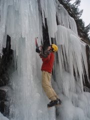
 Trip: Hells Gate/Fraser Canyon - FA "Styx" 105m WI3 Date: 1/26/2008 Trip Report: This line is located 200m north of Cerberus on the west side of Hells Gate. I had scoped it earlier and it seemed pretty easy, with a couple steep steps dividing rambly-type ice. My friend Sarah was down from PG and looking to do her first ice leads so this appeared to be a good choice. We left Agassiz at 7:30, had some Triple O's in Hope and left the car parked at Hells Gate around 8:30. Hiked down to the river, waited for 2 trains to pass, crossed the bridge and 2 sets of fences, and hiked up the tracks past Cerberus gully to below the route. Crampons on at the tracks and 100m of easy approach hiking up low-angle ice led to the route. First pitch was 45m with 5m and 15m WI3 steps separated by easy ice. Second and third pitches were led by Sarah for her first two ice leads. P2 was 20m WI2, mostly moving the belay up an easy ramp. P3 was 40m WI3 with a 5m near-vertical wall halfway up and easier ice elsewhere. Two raps down. Snow started on first rappel. On the way back out it turned out one of the locked gates we had climbed over was not really locked. Slog back up to the highway, as always, is crux of climbing at Hells Gate. Gear Notes: 8 screws, 2 ropes, waterproof gloves Approach Notes: Hike down trail, cross river, walk up tracks
 -
 Trip: First Ascents in the Stikine Area - Various Date: 8/9/2007 Trip Report: Well, I know that the title promised multiple first ascents, but what we really have is one first ascent, one failed fA, and one second ascent. But, that is a rather long title. I'll be brief here, and direct people with more interest to my website: http://www.pierce.ctc.edu/faculty/cwillett/scud/index.html'>http://www.pierce.ctc.edu/faculty/cwillett/scud/index.html'>http://www.pierce.ctc.edu/faculty/cwillett/scud/index.html'>http://www.pierce.ctc.edu/faculty/cwillett/scud/index.html The website has vastly more photos and text. Myself and two Vancouverites headed up north for another trip into the Stikine-Edziza area. We float planed into Yehiniko Lake, shown on this fine map: From Yehiniko, we bushwhacked and swam our way (70 stream fords!) up Quattrin Valley and onto Quattrin Glacier, climbing it to a col that was to be a basecamp for about a week. We first tried a new route on White Rabbit: The West Ridge. White Rabbit has been climbed once before, via a different route, mostly snow and a short ice pitch. The West Ridge is substantially longer and all rock. Below is a shot showing White Rabbit and our general route: We approached up a glacier, climbing approximately 1500 feet to the top of a ridge that we called Blaster. Even in August, the glacier was in excellent condition. From the top of the ridge, we traversed along and then descended deeply to a notch, where we could gain the West Ridge itself. The rock quality changed radically from the notch. Blaster Ridge was generally solid and strong, whereas the West Ridge of White Rabbit was truly a horrifying experience. I would have loved to be on the nice, solid rock of the Olympics. It was poor enough that we only roped for one pitch, as there were few places strong enough to take protection and not rip out. The route is mostly exposed fourth class on crumbly rock, with some extensive sections of mid fifth class work. A white out came, making it difficult to gauge our progress. After approximately 8 hours of climbing, we decided to turn around on the ridge, as we had not brought bivy gear with us. The photo below shows our approximate ending location Being in a white out, it was difficult to tell exactly where we ended our climb. From subsequent observations, I believe the higher one to be correct, though there is a chance the lower one is. We pounded two pitons to rappel past a particularly difficult section of rock. On this rappel, rock broke loose (oddly enough, not caused by the rope or us - It just came loose) and cut most of the way through one of our half ropes at the 40 meter mark. This left us with 60, 40, and 20 meter strands. We rappelled once more, slinging a large block with webbing. We made it back to camp in the middle of an ice/rain storm around 7 pm. I,personally, was glad to have survived. After a day of rest, we headed to the other side of the col to try for a reasonable looking peak above us. As far as we know, this has not been climbed before by any route. We've taken to calling it Doormouse, a bastardization of Dormouse, from Alice in Wonderland, wherefrom White Rabbit is also taken. The Doormouse yielded easier than did White Rabbit. From our camp at the col, we climbed scramble up rock and snow to gain the moderate glacier below the peak. In the photo below (taken from two days earlier on White Rabbit), you can see the approximate approach route. The glacier started at a moderate 30 degrees, but quickly stiffed to 40 degrees, and eventually to 45-50 degrees near the top. The glacier gained us approximately 2000 feet and dropped us at the base of the East Ridge. The rock here was much better than that found on White Rabbit. We climbed 4th class and low fifth class rock, trying to get on top of the ridge. We roped for one pitch of 5.6 rock and that got us to the top of the ridge itself.In the below photo, you can see me coming up this pitch. From there, easy class 2-3 terrain, non-exposed, led along the ridge. The ridge narrowed to a knife edge and then dropped into a notch. We built an anchor there and set out 20 meter strand to rappel down into the notch. We left the rope in place to use to climb back out on our return. This was a fine idea, as none of really wanted to lead the off width to get back up. It runs about 5.9 or 5.10a. From the base of the notch, we built another anchor and Mike led the 5.6 pitch up and out of the notch. The below photo shows us rappelling it on the way down. The climbing route runs to the right of the rope. Once we were all up, the rest of the route was easy class 2 walking over talus to make the summit. Views from the summit are extensive. The below photo shows the Scud glacier. The prominent peak to the left is Mount Hickman, which has seen one ascent, by Fred Beckey and others. To the far west, there was several prominent peaks. The right most peak is, I believe, Mount Ratz. The left most is, I think, The Devils Thumb. Sorry for the grain, but this is a 100% crop taken from a 70 mm lens. To the south and east is Mount Hoole, named for a Matis guide for Campbell, one of the early explorers of the region. As far as is known, it has not been climbed. It doesn't look easy,though the approach isn't too difficult. It is the prominent peak in the center of the below photo. Finally, we got a good look at Dokdaon, which was first climbed in 1967 by a group of four from Seattle and Alaska. It has not been climbed since. We built a cairn on top and then retreated back down the peak, retracing our climbing route. The climb up and out of the notch proved to be a rather challenging off width affair, with lots of the obligatory cursing and swearing. It is in the 5.9-5.10a range, but because we left the 20 meter strand, we could do it on top rope. Round trip was in the 12 hour range. After another day of rest we moved our camp from the col down to the base of Dokdaon, where we also had a food cache. Weather was cooperating and we intended to summit Dokdaon the next day. However, this is the Coast Range and good weather just doesn't last. For five days we were pinned down by unpleasant weather. It usually didn't rain/sleet too hard or too long, but visibility was poor enough that climbing wasn't really an option. The above photo shows a stretch of nice weather when Mike and Bob went for a stroll to the top of the Scud. They summited a minor peak, presumably also a first ascent, in a white out. We called it The Count, though they thought it more of a bump than a peak. Our time was running out, so one morning we forced the issue and went for it. From our camp on the Scud, we climbed glacier, generally in good condition though with some snow bridges of dubious quality, to gain the south face of Dokdaon. We should have continued traversing the snow around the mountain, but instead took to a snow finger than gained us a lot of elevation. Here is shot of Bob on the traverse around the mountain. You can see that here, on top of the glacier, the terrain is really rather moderate. Why we gave it up for the snow finger is unclear at this moment. In the below photo, the red route is the climbing route, the blue the descent. It would have been better to take the blue route on the way up. Our climbing route eventually dumped us onto more difficult class 4 terrain that was necessary, with some loose rock thrown in. There were some exposed sections. Here is a shot on a higher up snow finger. The weather, of course, closed in on us and we were in a complete white out when we summited. Fortunately, there wasn't much precip. Below is summit shot of Bob with the cairn that we found from the 1967 group. We also found an empty tin of sardines. As we descended it was clear that there was a better route down: Just go straight to the snow. This was much easier than our climb and we got to the glacier fairly easily. In the white out we had to be careful not to get lost (visibility was under 20 meters), but came across some cougar tracks in the snow to follow back to our ascent tracks. Round trip was about 10 hours. Our time was more or less up, for we still had to traverse the Scud glacier, then the Scud Valley, out to the Stikine for a jet boat pick up. Here is a map showing our entire route. In the below photo, the top lake is Yehiniko, where we flew in, and the ending point is the Stikine. The big glacier is the Scud. The traverse out was, shall we say, painful. The bushwhacking was really nasty and I would not do it again. Instead, I would fly in and out of Yehiniko. Here are some shots of the traverse out. Looking north back to Dokdaon. Looking south down the Scud - our route out. Nearing the end of the Scud, we start to worry about ice falls, as we getting close to the 1000 feet in elevation level. We reached the end of the Scud and found nothing to worry about for ice fall. The next day the weather took a turn for the worse, and this misty crappy would sit on us for the next few days as we bushwhacked. For a while the flood plain of the Scud was nice walking, except when we got stuck in quicksand. But the river is big enough that we were not about to try to ford it, and when the river pinned us against the edge of the valley, we had to bushwhack through thick Devils club and slide alder to get over these headlands. This is a "clear" section of bushwhacking. When we were lucky, we found some rocky areas to traverse, instead of fighting the bush. Below is one of the headlands we had to cross. Here is Mike on a nice section. We frequently found grizzly trails to help us along. Bushwhacking is never fun, but when you have a mountain axe, two technical tools, and a picket on your pack, it is even worse. To get down off of one headland, we rappelled down a steep gully using slide alder as a rope. Bob's mother made us about 15 pounds of raspberry fruit leather. We never got tired of eating it. Here, you can see true joy in Bob's face as he digs into some of it. The sun also came out for the first time in 3 days, so we were able to dry out soaking gear. On the next to last day, we had some furious bushwhacking to do. Here, I fight my way into a wall of green. Believe it or not, I found a squirrel trail to follow. The "trail" was perfect for someone standing 10 inches off the ground. We had a harder time of it. We made it to the Scud Portage, a short cut between the Scud and the Stikine. We had hoped it would be a pleasant meadow walk. Well, it wasn't. In fact, the first time we tried it we got so turned around that after 2 hours of work, we ended up back at the Scud. The next day we walked a bearing instead. The devils club was thick. Finally, we made it out to the Stikine. I was very happy. Our jet boat got us a few hours later and took us upriver to the hamlet of Telegraph Creek. Along the way, we passed the spectacular Sawtooth Range. From Telegraph Creek, we flew back to Yehiniko and then drove back to Vancouver. -------------- So, what is left to do up there? Everything. Almost nothing has been climbed. The 1967 group also summited Ambition and Endeavour. We had plans for these but weather didn't work out for us. Here is the east face of Ambition. The 1967 people did not take it, but instead snuck around the left. Their route is a scary class 4 traverse, according to them. I suspect their class 4 is rather more difficult than what we think of class 4. Endeavour is the mountain to the right of Ambition. It is in the left of the below photo. The peak to the right is unnamed and unclimbed, but we took to calling it The Nipple. The snow route on the left we scoped out from Dokdaon and looked like a good climb in the 50 degree range. Access to the area, via Yehiniko Lake, is very straightforward and much easier than most in the Coast Range. Again, lots more information and text can be found at http://www.pierce.ctc.edu/faculty/cwillett/scud/index.html One last photo before I end this thing. Taken on the flight out. It speaks for itself. Gear Notes: See http://www.pierce.ctc.edu/faculty/cwillett/scud/index.html Approach Notes: See http://www.pierce.ctc.edu/faculty/cwillett/scud/index.html
 -
Trip: Mount Brice - FA North Face "Graveyard Shift" ~1000m, IV WI3 Date: 12/8/2007 Trip Report: I have been eying up the unclimbed North Face of Mount Brice for a while. It rises c. 1200m out of the valley of Twentysix Mile Creek and can be seen in partial view from a few nearby summits and from one narrow section of the Hope-Princeton. The face is bushy low down and split by many parallel gullies - not a great choice for summer but perfect for winter conditions climbing. A few people I know have climbed Brice over the years via Silver-Skagit Valley and the Star Creek mine road to Mt Andrews then a traverse around and up the SE ridge of Brice. They reported the rock to be not bad. How to get to the base of the face? Two options. One was to come in via the Silverdaisy Mne road to the high col east of Hatchethead and descend into the valley to the base of the face. I skiied that a couple years ago as far as the col and it was not the greatest as a climbing access route. Tha left an approach from Sumallo Grove and a shwack up the valley of Twentysix Mile Cr. from near Delacey Camp. Checked this out with a hike a few weeks ago and it seemed OK. With apparently excellent alpine winter-style climbing conditions prevailing, Jesse Mason and Graham Rowbotham decided to come along with me and check out the face. We made plans for a 4am departure from Chilliwack, planning on making Delacey by sunrise and having daytime vis. for the bushwack. I thought it would be about 3 hours to the base of the face. From the views I had of the face I expected that the main gully on the face would give a climb like a longer North Ramp on Harvey and we could solo it all pretty quickly, maybe 4 hours up. Then a quick descent back down Brice's SW ridge and back to the cars in around a 15 hour day. NE face from Hatchethead Col. It turns out that you can only see the top half of the face in this photo. Our route took the main gully line in the centre of the face. View of the upper NF of Brice from Skagit River. You can see the finishing ramp of our route on the left. So my alarm went off at 3:30 AM (oi! alpine start!) Jesse and Graham picked me up at 4:20 and we were at the parking lot at 5:30 AM. We started hiking down the trail by headlamp. Along the way we heard scary loud drumming noises from the forest. Apparently a tree in a log jam in the river was thumping or something? It was unusual, anyway. Around 6:15 we got to Delacey Camp and found the spur trail off up 26 Mile Cr. that actually apparently leads up the ridge to the Moles and Hatchethead. Headlamps off on this trail, the sun came up and we could see the rhododendrons, bear tracks in the snow, etc. Sunrise on Silvertip Well, the valley was cliffy and canyony and bushy and travel was much slower than anticipated. Not hideous, but time-consuming. By the time we got to the base of the route it was 12:30, in fact. Graham crossing a log over 26 Mile Creek. We had a brief discussion about how much it would suck to turn back and about how we needed to move fast, then geared up and started climbing. The first section of the route was not a nice snow ramp like I had thought it was going to be. It was a series of ice pitches in a narrow gully, with snow slopes and spindrift pouring down. Real alpine climbing yeehaa! A couple went at solid WI3 with short sections of up to 80 degree ice and dinner-platy conditions. We all soloed the first couple pitches. Then Jesse and Graham did a bit of simul-climbing and I soloed one pitch and avoided another via a mixed snow and tree 60-70 degree ramp on the right. There were 8 or 9 ice pitches in all, but lots were WI2, maybe 3 or 4 were WI3, and the one I avoided via the ramp may have been WI3+, it was pretty steep and Graham placed a couple screws. Graham soloing the first pitch And the third pitch. By the time we got into the upper gully it was getting pretty late in the day. The gully forks and we took a mixed traverse across snow and tree and rock ribs to get into the left fork that leads to the upper ramps on the face, putting on headlamps just after getting established in this fork, and climbing the rest of the gully via headlamp. The upper gully was mostly 35 to 60 degree neve and powder with a couple of short 50-60 degree ice and neve bulges. The very top of the gully had 20-30cms of windloaded spindrift and was a bit slabby but serious avalanche conditions did not occur. Graham found a way through a short section of overhanging cornice and we pulled onto the summit ridge around 6:30 PM. Sky looking up the gully at headlamp time Sunset We started walking off and by some fluke of luck, were able to link together features I had remembered from a brief scan of the topo map the day before, and find our way onto, and follow, Brice's SW ridge all the way down to the Skagit Trail. By this time we were mostly out of food and our remaining sips of water had frozen so we started to go slower and slower what with stopping to rest evry 15 minutes or so. We followed goat tracks for part of the way down the ridge and did not get cliffed out too many times, too badly. It took about 7 hours to descend the SW Ridge and then another 4 or so to hike the relatively flat and level trail back to the car, we were really dragging our asses by the end - 3 or 4 5-minute nap breaks between the gold mine and the trailhead in fact! That strange drumming thing was still drumming when we hiked by on the way out too. By the time we reached the car it was 4:40 AM, 23h 10m car-to-car. We put on some cold, dry clothes, ran the heater 15 minutes, then drove to Hope. At 5:30 AM not even the Husky truck stop was open so we napped for an hour until it did then had trucker breakfasts washed down with coffee, tea, pop, anything liquid in fact. If the soup had been on I would have had soup too. What with work and school and life and stuff it has been more than a year since my last big alpine route so it was nice to finally get up something serious in 2007! Thanks Jesse and Graham for the fun day out Gear Notes: Carried a light alpine rack but only the screws got used by J and G while simulclimbing. Did not see many possibilities for rock pro placements. A couple of trees could have been slung off to the side for belays but screw belays were better. Approach Notes: Hiking trail for 4km then the bushwack starts
-
 Trip: Sumallo Bluffs - Unnamed WI3 - 60m Date: 12/1/2007 Trip Report: I went up to the Sumallo Bluffs today with Matt Kidd and his buddy Cam. We climbed a WI3 a few hundred meters to the left of 'the mess'. The ice was super thin and sketchy for Matt to lead because of lmited screw placements. We all made it up and I was ecstatic after my first ice climb ever. Here's some pics... Here's details about our climb. We drove past the Buzowski Kippan and Landmark gullies for at most 1km and pulled over at a small parking lot across from a couple small clearcuts. We headed into the trees about 50ft back from where we parked and crossed the creek on a small log bridge we contructed over a shallow area. We bushwacked up the trees for 20 mins to find ourselves at the base of a small gully with some low angled ice at the bottom, we then traversed east into the next gully and ascended snow covered rocks to the base of our climb. The 60m rope was about 15ft short of making it to the anchor tree (above and left of the route)..so a 70m rope would be a good idea unless you want to simul climb 15ft of the route while your partner climbs to the anchor. To descend we did one single rope rappel down a cut in the trees to the left of the climb and then one double rope rappel down the last bit of trees. These two rappels bring you to a little slope 25m left of the base of the route. We then bushwacked straight down through the forest back to the car. If this is an FA I dont really know what to name the route..suggestions would be cool.. I was thinking of calling it Stairway to Heaven because the route reminded me of three big steps.. but I'm pretty sure that that name has been used a million times before.
 -
 Trip: Alpine Lakes - FA--"Bumbling Genius", Wedge Mountain 5.7R Date: 11/3/2007 Trip Report: I was in Leavenworth and was planning to climb with my friend Ben Hargrove. I had been thinking of doing Givler's Crack because it looks so spectacular, and some other climbs in that area, but when Ben suggested doing a second ascent of a route on Wedge Mountain, that sounded more interesting. After an hour drive we began the hike, which after about half an hour turned to a bushwhack across to the notch where we planned to gear up and leave our packs. Ben had forgotten to tell me that there wasn't actually a trail to or from his climb. I love bushwhacking about as much as I love early morning alarm clocks, but alarm clocks help me stay employed and bushwhacking gets you to good places. It was a beautiful day, so I forgave him. We reached the notch only to find a trail...after all that bushwhacking! We made note of it for the descent. We made our way to the face. We picked out an obvious ramp. Ben said he thought that it was our climb. We scrambled up 4th class rock to the start of the ramp, where I built an anchor. We reauxchambeauxed for first lead. I won but then Ben seemed really disappointed, so I relented and let him have the first lead. Here are links to some photos I put in the gallery. I couldn't figure out how to post them in the TR. If someone smart wants to follow the links and fix this post for me, be my guest!!! But please don't email me and explain how to do it, I already looked at the post in Newbies and it's just too complicated for me. Scenic! View of our route from the base. Go up the ramp and belay where the rock changes color, then traverse upwards and over to the flat ledgey thing you see to belay the second pitch. Pitches 3-5 are in the fog. Ben putting on his shoes. Check out the view! The first pitch was almost a full rope length and followed nice granite up a ramp, to a fun little crack and then some face moves, about 5.7 for the cruxes. Ben leading the rampy start of Pitch 1. At the first belay the rock changed from nice granite to some kind of crumbly, chossy gray rock that I decided was shale because of the way it peeled off in layers. I am not a geologist and I am probably wrong. At any rate, I ruefully took the sharp end and proceeded into a full ropelength of the scariest 5.6 face climbing I have ever done. I only found gear about every 30 feet and then I had to scrape off several layers of crappy rock with my nut tool to place a piece that I thought had any chance of holding at all. In addition my footholds had an eery way of coming detached when I tried to stand on them. I honestly felt more than once that at any moment the entire wall I was standing on and holding onto could become detached with me on it. As Ben yelled, "Rope ten feet" I neared a tree that looked like a good belay, and suddenly could move no further. My rope and gotten stuck in a crack below me! I had run out of long runners and hadn't been able to sling the rope loosely enough, so it was running tight over a block. I had been fighting rope drag and had had to pull out slack to move for the last 25 feet. I had wedged the rope into a crack near my cam, and now I was stuck. Fortunately the moves to the tree looked easy, although they went over some huge loose-looking blocks that I was very careful to avoid. I untied from my rope, placed a cam and tied the rope to it, then I soloed to the tree and anchored myself to it. Now safe, I went back down and built a good anchor for the rope, making it a fixed line for Ben to self-belay his way up with prusiks as he climbed and cleaned the pitch. Whew! This climb was getting pretty exciting in my opinion. When Ben reached the belay, I asked him what the rest of the route would be like. He said something along the lines of this not being the same route and he had made a mistake. Hmmm.... Looking down at "The Shale Pitch" Me very cold at the top of Pitch 2. I didn't know you could get screaming barfies in your feet! Looking up there continued to be a clear line and it appeared that it would go, at least as far as we could see. We decided to carry on--after all adventure was what we were after, and the only thing I had to look forward to on a retreat was lost gear and more bushwhacking! Ben led off Pitch 3 for a full ropelength over once-again beautiful granite up some face moves and into a cool corner/chimney, about 5.5. As I belayed Ben I took this photo and then my camera battery died, so I wasn't able to get pictures of the remainder of the route. Ben's rope up Pitch 3. I led Pitch 4 as the rock turned right up some optional face moves (5.7) and then headed up an easy ramp leading to some exposed moves and through a small roof (5.7). Fun!!! Be careful of large loose blocks. As Ben finished Pitch 4 it was getting dusky. He quickly led off Pitch 5, a full ropelength that traversed to the right and up through some fun moss-filled horizontal cracks/face moves and exited the route through a tree. Apparently someone thought I needed to work on my bushwhacking skills. (Actually, he was almost out of rope, and it was a safer bet. But you know, I can't let him get away with leading me through a tree without a little hassling.) We QUICKLY regrouped in the near-darkness and started hoofing it down the ridge. Be careful on the descent as there is another cliff band skier's left of where you get off the route. Traverse around the mountain to climber's right, above the cliffs, and you will find a game trail that leads down the ridge. Head down the ridge to the notch, and then find the tree-choked trail down to the fallen down cabin and onto the real trail. Doing this "trail" covered with blowdown, ice, and snow in my treadless shoes by my weak headlamp was a crux for me, but we made it back to Ben's car with only a couple minor falls on my part, and in no time were enjoying delicious porters! About the rating: Ben and I debated whether to give it an R or an X rating. There are some huge loose blocks up there, and if one did come loose and fall on the rope or your partner, it would be very very bad. But if you are careful, the climbing is pretty easy and there is enough gear to prevent a death fall, presuming it holds, which I think it would. But I can't recommend falling on this route. The route itself is actually pretty fun, an alpine feeling climb with a relatively short approach, under 2 hours, and the scenery is amazing. Two stars. Thanks, Ben, for the great adventure! We'll have to find some more chosspiles to climb in the near future! Gear Notes: 60 m rope (50m won't make it to good, solid belays) gear to 3" nut tool for scraping moss and choss nuts not necessary Approach Notes: Take the rutted back road up to Wedge Mountain from Blewett Pass. Bear left at all intersections. High clearance vehicle or good driving skills recommended. Go up the hiking trail. Go left at the intersection. At the fallen down cabin head uphill following a trail that is often obscured by blow-down, until you gain the notch. Bushwhack down past the first wall to the second wall. The route starts at the base of the most obvious granite ramp which can be gained via fourth class moves.
 -
 Trip: Sawtooths: Baron Spire - FA: tallboys and breakfast burritos III 5.10c Date: 8/29/2007 Trip Report: After completing a route on Ne'er-do-well, we took a rest/scope day. We spent a couple hours checking out all of our options and weighing them with our goals and desired style. The south east face of baron spire caught our eye due to its proxiemty to camp and a prearranged descent. Plus we were stoked to get to use the 1940's beckey bolt ladder up the summit block. Unlike "a bum's rush" we were both feeling a bit apprehinsive about some of the areas on the intended line. the south and east face of baron spire and baron spire lake Tallboys and Breakfast Burritos III 5.10c 5 pitchs 800 or so feet follows chimney and splitter crack right of center highlighted w/ the black line Pitchs two and three worried us in particular because we only had one three and it looked like a good bit of wide hands and then the porblem of having the gear to build a solid anchor was even more in our minds. However it all worked out and went flawlessly. Here you can see the overhanging flared chimney to the splitter hand and the Y in the crack where split off right. The large patch of shrubs were impassable. pitch one: 5.8 start in the white dihedral below the chimney with a butterknife flake 2/3rds up the pitch. Use face holds and scrap out grass and plug in gear until you reach the flake take the right side and follow sweet hand crack up to base of chimney. pitch two: 5.10c fight your way up the flared chimney with the varied crack in the back up and into the splitter wide hand crack. belay just below Y junction here Trevor Bowman begins what he calls one of the most unique and best single pitchs he has done in the alpine. i carried that statement with some weight considering he didn't work all summer and just climbed in the alpine. He likened it to a 5 star pitch in Yosemite. pitch three: 5.10a begin by using both cracks and then transfer to the right crack and pull the technical overhang, continue up the slot throguh some vege and out right around the corner to the chimney system. Belay on the ledge. pitch four: 5.8 take the right side following the inside left facing dihedral. Take to the summit ledge. pitch five: A1or2 1949 beckey bolt ladder, here is what summit post says about it: The peak sees a few climbers each year and some of those never see the true summit- they free climb the rock routes but just under the true summit, they are often spooked by the overhanging bolt ladder. The ladder was put in by climbing legend Fred Beckey in 1949, hence the name the Beckey Bolt Ladder. He, Pete Schoening and Jack Schwabland spent three days engineering the 22 bolt ladder on the corner of the summit block. Their climb nearly ended in disaster as a severe storm hit the area. They made an epic descent to avoid a very uncomfortable bivy. It was reported by Schwabland that the rock was running with water and all the holds were packed with hail. Lightning struck within two hundred feet several times. They somehow made it down and back to camp. The condition of these bolts varies, as some of the originals are still there. Aid climbing doesn't look hard to the casual observer, but it's tough to learn on an overhang near the top of a summit like this. The Beckey Ladder is said to go between A1-A2. All routes converge on the west side of the summit block and must ascend the Beckey Ladder to truly make the summit. Sorry no summit photos, battery ran out before the ladder which was in my buddy' words "biblical" Don't think anyone else had been up there for a little while. We replaced all the webbing on the rap down the east face. we ended the day by coming down, packing up camp, and hiking the seven miles out to the boat dock. We did this so we could grab the first boat out and get a good ole tall boy at the marina and then head in the stanley bakery and order a huge burrito filled with heaven. Gear Notes: same rack as for a bums rush with same recomendation Approach Notes: I would stay at the baron spire lake and hike west up the hill side to the base of the south east face. The chimney is obvious
 -
Trip: Sawtooths: Peak 9211 (Ne'er-do-well) East Face, - FA: A Bums Rush III 5.11- Date: 8/26/2007 Trip Report: This August Trevor Bowman and I spent a little bit of time in the Sawooths, here we stumbled upon this great face near little baron lake. Peak 9211' is not known to have been climbed via a technical route. If no other ascent exsit we would like to give it the "climbers guide" name Ne'er-do-well; a slang on never do well, meaning: A self-indulgent person who spends time avoiding work or other useful activity The East Face of Ne'er-do-well Peak We picked a line up the center face up to the main break 4/5th's the way up and then took the only obvious line up the upper headwall. A Bums Rush: 5 Pitchs, 265meters + 200m of 3rd/4th class to summit Pitch One: 5.7 55m Start in a R trending crack about 40' uphill (left) of the most obvious diagonal crack. Follow this to a L facing dihedral to a good leadge w/ 2 trees. Pitch Two: 5.9 65m Continue straight up the R leaning thin crack past two small buldges and wander up a left (5.6/7ish) then back right and up a cupped hands crack to a ledgyish area. looking down at pitch two as trevor pulls the bludges and begins the sweet moderate climbing Pitch Three: 5,8 60m Follow the big corner system up cracks and dihedrals to a good ledge this photo shows trevor wandering up to no-where land for thirty feet to a table sized flake that gave him shivers. He downclimbed the like 5.9ish corner and traversed right to the ocbvious big corner system. We are recomending to go straight to the corner system. Pitch Four: 5.7 20m Take a R leaning flared chimneyto the major upper ledge that cuts below the upper headwall. Pitch Five: 5.11a 65m Sorry No Pics for this wild pitch Start up a blocky corner to a short awkward chimney 5.9 (get gear in when you can). Continue up splitter 4" -3" crack 5.10 to alcove. Make the strenous slightly overhanging hand traverse (no feet out of the alcove to the left(5.11a), continue up the 3" crack to a short chimney finish(5.9). Take 200m of 3rd and 4th class wandering up blocks + slabs to thew summit. With the Chockstone splitter Gear Notes: Large set of Nuts and pea nuts (the toofs take them so well) single set of small cams doubles .5BD-#2bd 1 of #3 bd. ( you may want to take 2 #3's) Cord cause there all gear anchors Approach Notes: Take same descent as carpal tunnel
-
 Trip: Molar Tooth - West Face - FA - II 5.8 Date: 9/26/2007 Trip Report: This is one of those faces in the North Cascades that is hard to get a look at from popular destinations. Last spring I viewed it from 4 miles away and recognized the profile as seen from the Cutthroat Lake side (but in reverse). I thought that there was probably something to climb there although I couldn't make any detail. Yesterday I went to take a look at it with James Hamaker. We intended to hike up the drainage shown on the Green Trails map but we never found it. Instead we ascended the forested rib east from where the PCT crosses Porcupine Creek and this took us fairly efficiently up to about 7000 ft. At this point we weren't sure exactly what was the summit of Molar Tooth, let alone what we should try to climb and the clouds blowing across the mountain tops weren't helping matters. We decided to traverse south, climbing class 3 over one rib of rock and traversing steep slabs around the base of the next. Up a bit and we found a clean 40 ft slab that we scrambled up to set a belay at a small larch tree (center of photo): James led up some easy 5th class then traversed to the right where there was an exposed 5.7 move around the corner (under the smooth bulge). There were some loose handholds here but solid ones could be found. He belayed closely above at a dead tree. The next pitch started up a chimney (poor rock but easy): Above was some 5.8 face climbing and an interesting boulder-pedestal with a fist crack behind it. This involved climbing up one side using the crack then descending the other side to get back on route, not that hard, but awkward. There was a loose rectangular block at the base that I considered trundling but it was OK to stand on with downward pressure only. Some more 5.8 led to a low angle heathery section. James was eager to lead and I didn't argue as I would have taken longer on the harder moves. Above were some cool slab overlaps. James went straight up and was able to place pro in a crack at the steep part (5.5): We were heading for the gap between the two apparent high points seen from the start but weren't sure where the actual summit was. There was a chimney with overhanging chockstone at the end of this 3rd pitch that went at about 5.7. Above this the summit was an easy scramble. The clouds had cleared and the scenery was great: We descended by the normal rappel route down the north ridge. The rock on this route was good. There were some loose potential holds but they could be avoided. There seemed to be less black lichen than on the north ridge and east face. We didn't see any signs of previous ascents on this climb. Robert Campbell Gear Notes: 50m rope, medium rack up to #3 cam
 -
A few days ago, Kurt Buchwald and I (Martin) climbed a route on the North Face of Chair Peak that I have not been able to find any beta on. It is basically a direct line from the summit proper to the base of the North Face. It is a 5 pitch route, goes at 5.9 and has surprisingly good rock quality. It is in parts the same rock (Snoqualmie Batholith) that you see in the standard descent rap couloir (not to be confused with the loose surface garbage that is laying around in the couloir). We felt it was a good line, worth the trouble and could up the appeal of Chair Peak. A more indepth trip report of the route can be viewed at http://www.proguiding.com/tripreport/view/chair-peak-north-face-direct We are looking for input from y'all to see if this route had been done before. At any rate, we can recommend it. Certainly harder than the NE Buttress, but also way higher quality. The fact that it basically goes straight to the top is nice. Cheers. M
-
Trip: Mt. Goode - Megalodon Ridge ( IV+ 5.10- ) Date: 9/6/2007 Trip Report: Last Wednesday, my friend Sol Wertkin and I headed out to the North Cascades National Park on an attempt to stretch a little more summer into what was rapidly becoming fall. The intended destination was a climb of the complete East Ridge of Mt. Goode. After seeing photos and encountering the ridge last month, I knew it would be a "big fish to fry" hence Sol coined it the " Megalodon Ridge" in honor of the biggest and scariest fish to ever swim the seas. The ridge runs from L->R across the skyline. On the first day we approached the base of the technical climbing and had a perfect bivy on the ridgeline before it steepened up. A few drops of rain fell on us, but by morning it looked as though things might clear up. After crossing some icy snow in the morning, we started up the ridge, with the summit often lurking in distant clouds. Dan Hilden and I had climbed this first part on a traverse a few weeks ago, but bailed off due to 40lb packs, and very little climbing gear. We made one 50m rappel and began swapping leads along the crest. The position was amazing, with alpine lakes below us, and the sun coming out just when we needed it. The rock wass often pretty good along the crest, with memorable highlights including a 5.8 finger crack and another overhang corner of the same grade. Soon the steep wall of the SE peak began to loom closer ahead of us. Sol fired off the first headwall pitch, which ended up being a splitter 5.10- hand crack to a nice belay ledge. I got the next pitch which started up a perfect corner before stepping left and doing some delicate stemming to the top. A bit of scrambling brought us to the last pitch on the SE peak, which Sol lead through with scanty protection. "No life Guard on Duty" here... From the SE Peak we skirted the steep glacial ice by climbing through the moat. Ross and Sky skied from near here ~5,000' down to Bridge Creek a couple years ago, that just blows me away. Some steep solid rock and an au-cheval crest led us up to the final pinnacle before Black Tooth Notch. We had joked around for much of the climb about all the potential shark-themed names, which was fitting as our crux involved this pitch climbing down into Black-Tooth Notch. I belayed Sol down and across the wall to the notch, with several thousand feet of exposure to bridge creek below his feet. He protected this lead perfectly and memorized nearly every move so as to feed me beta as I seconded the traversy downclimb. It ended up being overhanging 5.10 climbing, but it brought us back "on the map" and past all major obstacles. From there we did one long running belay to the summit. It was late and we were tired, so we did some quick construction and settled in for a night on the highest point in the National Park. An amazing sunset and meteor shower had us in awe all night. The next morning's chilly sunrise was a nice sight as well... As Sol says "Livin' the dream, life is Good(e)" Yesterday we made the 5,000' descent down the south side of the mountain to Park Creek and were thankful for the cool fall breeze on our 19-mile hike back to the car. There was also a forest fire that provided some temporary entertainment. This was a really fun trip with a great partner. The summit bivy spot is (obviously) highly recomended by us both. The register which was there last summer is gone now though... Gear Notes: Standard climbing rack. Should have included goldfish crackers to complete the fish theme. Approach Notes: Up N.Fork of bridge creek for 2 miles, turn left and cross the creek through open clearings when the ridge is obvious.
-

first ascent [TR] Mt. Triumph - FA SW Ridge - Layton/Wallace
layton posted a topic in North Cascades
Trip: Mt. Triumph - FA SW Ridge - Layton/Wallace III 5.8b Date: 9/2/2007 Trip Report: This summer has been a long string of alpine failures. Wayne and I were 0/2 on our big project list, and with a shitty weather forecast, we were thinkin' it was going to be 0/3. Rain, shitty routes not worth finishing, partner failure(Bailure), and too much work finally caught up with me this summer. So with nothing better to do than try another one on the "list", Wayne and I did a lap around Mt. Triumph via a new route on the Southwest Ridge and down the NE ridge for full mountain circumnavigation. Having been told by irate girlfriends, annoyed climbing partners, rangers, and hapless co-workers that I was a bit rough around the edges, I decided to make the best out of my "time to think" at camp saturday night I don't know what the fuck this "Dale" guy is talking about Of course along the way, we followed proper protocol and picked up a permit. Thanks NPS for your permission to use "your" wilderness! Wayne and I had a great time walking on durable surfaces, collecting our waste in bags (to keep next to my Kleenex boxes, jars of urine, and bundled newspapers at home), fishing with dynamite, building huge fires, hunting birds, and stealing picnic baskets from day hikers. Since we were not allowed to bring a machette, we had to use gas powered weed wackers. After it ran out of gas, Wayne hucked it in the lake, and we had to use our trecking poles to hack at plants and wave at bears. Wayne wondering where a good spot to heli-lift the Ski-Doo's into this winter Anyways, up and around Thorton Peak we went, and down to below the South Face of Triumph for our original intended objective. The still unclimbed S.Buttress of Triumph It was much to steep and crackless, also soaking wet (the main line is a watercourse) so we opted for plan B. It could go, but it would require some aid and bolting, also hard climbing. We scrambled up ~500 feet of steep cliffy heather. It wasn't so bad, except for the fact that the sky was turbulent and threating a mega storm to hit any minute. The thought of downclimbing was not a happy fun one. All the peaks had big lenticulars forming, and the thick black wave-like patter of clouds above our heads shouted "hurry up and climb be-otch!" It gonna Rain! The climb started off with a few pitches up steep slab. The rock was solid, lots of good holds, and fun! Pro was scant, so there were a few moments of nervousness. I had to bust out my ice tool for an "M" move to bypass grabbing a very untrustworthy looking flake/key hold. It was solid, and the mixed/moss mantle was unnecessary. It started raining, then stopped. Hurry up! Wayne scoping the route The ridge topped out about ~1100 feet up to the final summit headwall. Wayne had a great fun steep lead. It looked scary but turned out to be a super fun 5.8 pitch. Climb Monkey, Climb! I got the last pitch, traversing some shitty gendarms and up to the summit. 20' up the exposed crumbly gendarme Wayne shouted, "It's about to let loose up there!" A wall of rain headed our way, but somehow it cut north at the last second and spared us a slippery and scary descent. We only got a few drops the whole day, but we did get in a great fun climb and an awesome mountain. Our cramponless hike out wasn't a great idea, but I'm here, so I guess we didn't need them! Heading down the Northeast Ridge just waiting for the douching We got back to the car at 7:30, having left camp at 5:45 a.m., which is funny since the 1500' route took only three hours of impending rain hurried climbing to the top! Gear Notes: Nothin bigger than 3" and no pins or tat needed. Crampons if you want. One rope. Approach Notes: Up the 3rd lake to a col next to Thorton Peak, down and around (long) to the S.Face, and up a steep moss gully to the SW ridge. -
 Trip: Cutthroat Wall - Easy Getaway (F.A. III 5.10-) Date: 8/29/2007 Trip Report: This TR is going to read like the boring blow-by-blow climb description that it is, but that's in hopes of providing adequate info for folks to go get on it and have some fun. Upon climbing one route on the Cutthroat Wall, I was eager to go back and investigate the clean looking roofs and corners to the left of what we'd done in early August. Last weekend, Dan Hilden and I headed up to check it out. Bryan Burdo was a late scratch on the roster for this climb as well, after he dropped his tennis shoes off a new route on SEWS and was left with just rock shoes and sandals. His Methow valley cragging guide should be out within a month, and his North Cascades Rock (WA Pass Area) guide by next spring... Anyhow, we braved the 45 minute approach from the car and began the climb ~40' to the left of The Perfect Crime on a perfectly flat granite patio. From the base, one can locate a series of clean L-Facing corners which serve as good landmarks for the route. A vertically striped dihedral (the Zebra corner) is especially obvious. The climb went very well, with fun moves, some nice challenges, and a few spots where the cliff seemed made for climbing. Pitch 1 (5.10-) Up left on a slab to a clean crack and obvious overlap/roof. This roof move can be protected from above with a blue alien. From here, climb up and left (easy slab), past another steepface, to beneath a large roof. Pitch 2 (5.9) Start up the R-Facing Corner with stemming and finger cracks. Past tree, move left (delicate undercling) into the clean orange corner. Move right out of the corner and belay. Pitch 3 (5.9) Face climb up and right, then follow clean cracks (layback, mantle) back up and left to a short splitter finger crack, ledge, and belay below short overhung RFC. pitch 4 (5.9) This pitch leads to the base of the striped corner visible from below. Power up the short overhung corner and face climb up and left into a crack. (Don't get tempted rightward into the blank corner) Follow this crack up to a tree at the base of the corner Pitch 5 (5.9) Again begin by fun moves up another overhung corner, then follow the beautiful/clean Zebra Corner crack upward. The top of the corner was seeping from the prior day's rain, so we "walked the plank" rightward across a solid/safe block and along the ledge to the right. If dry, consider following the corner to the top and doing an undercling out right for the directissima. Pitch 6 (5.10-) This pitch looks imporbable but works out great. Face climb up to the base of a L-facing corner below roofs. Jam the corner, climb left through the roofs, and continue jamming and laybacking up into the granite chimney. Follow the chimney to a large pine at the base of an obvious long corner. Pitch 7 (5.10-) Jam or layback the perfect hand crack up past a tree to some roofs. Undercling/jam through the roofs to the very top of the corner, step right, belay. (From here, one can downclimb rightward ~30 to get to the belay ledge before the last pitch of The Perfect Crime, whish is a *** pitch featuring splitter cracks on the far right edge of the buttress.) Pitch 8 (5.9) Head up the obvious chimney straight above. Good pro can be placed deep inside, and one can then move to the outside edge to climb though. I found this great fun. Dan, with a pack on, had a differing opinion. Follow the lower-angle stemming slot to a 5.5 hand crack on a slab, and belay above. From here, unrope or belay one more pitch (low 5th) to the flat summit. The rock quality on this climb is as good as Rebel Yell and better than anything else I have climbed on in the Washington Pass area, but the climb is only an hour from your car. All the cruxy bits are well protected and could be A0ed. I think it'd take a strange climber to not enjoy this route quite a bit. The only drawback is the pine needeles on ledges, but maybe with some traffic this would change. We also found an OLD rusty, and completely unmarked bent piton on p2, so maybe someone did the whole route back in the 60s and didn't tell anyone... who knows. I'd enjoy re-climbing it and leading the pitches Dan took as well, so if you are looking for a partner, send me and email. From the top, you can scramble up to the ridge and look down on the Hwy 20 hairpin, and of course see much of the North Cascades as well. Descent: walk across the flat summit terrace (cairn) to where the crest narrows before you'd need to scramble up again. Look for a pine tree on the right with a yellow runner. Make one 20m rappel down to the right, then contour at that elevation, skier's left around the head of a gulley and walk down/left on timbered rib to the base of the wall. Mini Topo - Big Version Linked Below http://www.cascadeclimbers.com/plab/data/503/Complete_topo.JPG Green Writing goes with Green Topo, pitch-by-pitch Gear Notes: One set of nuts Cams from finger tips to #4 camalot (only needed if you avoid the chimney and do the last pitch of The Perfect Crime) Doubles in finger-hand sizes Approach Notes: From the Cutthroat Lake TH, walk up the old road bed for ~5 minutes, then head left up the hill into the brush. The brush is moderate at first, then the forest is pretty open and easy until moderate brush for the last couple hundred feet. The route begins at the far right (west) side of the wall. From the base of this route, the toe of the "Snout" is a ~10 minute level traverse across open ground, so one could combine a climb of those routes as well.
 -
Trip: Cutthroat Wall - The Perfect Crime (F.A. 5.9 III) Date: 8/10/2007 Trip Report: A few weeks ago, Max Hasson and I did a new route on what I'm calling "the Cutthroat Wall", near Washington Pass. The top of the wall (and top of the climb) can be seen from the Cutthroat Lake Trailhead, but most of the wall cannot. The climb was done in 5 pitches (most were 60m) and featured very good rock and some fun moves. It was all pretty neat to be anble to walk up to a wall like that, one hour from the car, and climb a new free route of good quality, hence naming it "The Perfect Crime." Dan and I repeated it the other day, and he liked it as well. Here's a small topo, the larger version is linked below. http://www.cascadeclimbers.com/plab/data/503/Cutthroat_wall_Topo.JPG Climbing begins at the right toe of the buttress, above a small cairn, and just left of ~6 dead silver snags in a group. The first two pitches begin with a steep bouldery step, before angling on nice cracks, slabs, and a couple short/steep corners. Generally begin going up/left and follow the cleanest line of least resistance. The 3rd pitch has you undercling and layback rightward along a nice crack, before overcoming a roof. This roof is smaller and further rightward than the other prominent roofs. another view... You'll know you are on route if you climb to the left of, then above a spiral-trunked "barber poll" tree. The 4th pitch goes up a steep crack from the belay ledge, traverses right across bulletproof orange rock, then follows a hand/fist crack up to a nice patio belay spot. The 5th pitch begins with a face climb traverse right, then beautiful splitter cracks (4" then 1") for most of 60m, to where the angle eases off and the flat summit can be reached. and From the top, you can scramble up to the ridge and look down on the Hwy20 hairpin. For descent, walk across the flat summit (cairn) to where the crest narrows before you'd need to climb up again. Look for a pine tree on the right with a yellow runner. Make one 20m rappel down to the right, then contour at that elevation, skier's left around the head of a gulley and walk down/left on timbered rib to the base of the wall. The rock is overall very good, well protected, and with nice views. Every belay is on a comfy ledge, but with a 50m rope you'd need to do it in more pitches. Every pitch is rated 5.9 except the first pitch (5.7) and cruxes are short. At only 45mins-1hour from the car, this might make a good alternative to other routes in the area, especially if traffic gets more of the pine needles off the cracks. Feel free to email me if you want more detailed info about anything. A written topo is attached. Gear Notes: One set of nuts Cams from finger tips to #4 camalot (needed for last pitch) Doubles in finger-hand sizes Approach Notes: From the Cutthroat Lake TH, walk up the old road bed for ~5 minutes, then head left up the hill into the brush. The brush is moderate at first, then the forest is pretty open and easy until moderate brush for the last couple hundred feet. The route begins at the far right (west) side of the wall. From the base of this route, the toe of the "Snout" is a ~10 minute level traverse across open ground, so one could combine a climb of those routes as well. Climb Location 3785-PerfectCrimeDescription.doc
-
 Trip: anderson river valley, les Cornes - FA of "Voodo child" and FA of " Srung Cock Errect" Date: 9/17/2007 Trip Report: Hello yall. Did a few new routes in the Anderson River valley last year. I've been meening to get a post out forever. Here is some route info so you can do them. the Sprung Cock Errect (sorry but we couldn't stop calling it that) is excelent !!! It has the best climbing on the mountain. I have climbed all the routes on the mountain and can safetly say that it is the best. All pitches are high quality and very clean. Another great option would be to climb the first 3 pitches of SCE and continue up the original route when you hit the easy ramp. This avoids the total choss of the SBA and climbs 2 pitches of 3 star 5.10 and one pitch of 5 star 5.10+ ( overhanging hands!) The first 3 pitches have bolted belays and a few protection bolts as well. Voodo child has a five star Split pillar on the second pitch (very close to the pillar in Squamish, but a harder size) Topo: Discrip: photo of routes: Gear Notes: Voodoo Child, double set of cams from #1 TCU's to #2 BD, Single Small TCU's and #3 and 4 BD. Sprung Cock Errect, double set of cams to #4 BD (you can bring one #4 for the OW if your feeling strong, its only 5.7) extra finger peices for the top 5.11- pitch. Approach Notes: for more info contact me at craigskibum@yahoo.com
 -
 Trip: North Cascades - First Ascent N Arete of Varden Creek Spire Date: 6/22/2007 Trip Report: After looking at this fantastic piece of rock for several years while skiing around Silver Star Larry Goldie and I finally overcame our sloth and made the long trek up to try to climb what we thought would be the N Arete of pk 8252. This striking piece of rock rises up from the head of Varden Creek and forms a significant high point along the complete E ridge of Silver Star. We made this foray late last Sept and were sent packing by very thin pro and a thin coating of frost that did not melt. After two longish and very run out pitches on slippery lichen we rapped off trees vowing to return with knifebaldes. The rock quality, position and asthetics of th eline were irresistable. In mid June of this year we ventured back armed to the teeth. The climbing turned out to be all we had hoped and so I think others might like to know about a route of this quality. We reached the toe of the buttress proper and stayed very close to the arete all the way to the last pitch. The rock quality is some of the best I have seen in the WA pass area. And it remains such all the way until a short very easy section just below the summit tower. The climbing is consistantly 5.FUN with a few spicey moves thrown in to keep you on your toes. We placed (and left) around 7 knifeblades in strategic locations so that you won't have to lug in pins and a hammer. Just stick close to the arete unless the climbing becomes harder than 5.9 then follow the easy way but steer back the arete ASAP. We never went more than 20 feet or so off the ridge and most of the time were right on the arete which gave great climbing and nice exposure. I'll post a few photos and a topo here but there are more photos on ncmountinaguides.com. The climbing in general is not sustained with just the odd hard move here and there. The exception to this is the 5.9 variation on P7 which is a sustained finger crack and licheny. View looking up Varden Creek at the proud line Sorry for the squiggly line Sweet rock typical of the whole route Larry following P5 Larry leading P6. Yep, it goes up the RH skyline Larry next to the summit Gear Notes: Light rack of single small cams to number 2 Camalot, runners etc. Like I said we went in loaded for bear and were way to heavy. Most hard pitches have crux protected with fixed pin. Approach Notes: We are nothe guys to ask about approaching this thing as we went the hard way both times. What I suggest would be one of the two following options. 1)Camp at the Larch bench below Burgandy col and approach over the col and cross SS glacier and over the Varden/ SS creek divide to the toe of the route. 2)Ascend Varden Ck but reputed to open trees and not bad by moderately reliable local source. We went up Mudhole lake trail and then cross country to the base. Took us 4 hours to the base. DESCENT; It turned out that this was not the N ridge of 8252 but was its own seperate little sub summit and hence the unique name. So we did two short raps to get us back to the start of the last hard pitch and then down climbed to the snow basin below the E side to the Arete. Pretty easy down climing but it could be rapped from tree anchors too.
 -
 Trip: Mount Shuksan - Northwest Arayete III 5.9 Date: 8/6/2007 Trip Report: On August 6th Matt Alford and I climbed an enjoyable rock route on the northwest side of Mount Shuksan. The route follows the crest of a fine arete on good rock for nine pitches to the summit of a prominent horn above the White Salmon Glacier. Though dirty at times, the position is incredible, the rock is solid and every pitch is sustained for it's grade. I had first seen this arete at least twelve years ago while descending the glacier and thought it both beautiful and improbable due to a lack of features. Ever since the idea of climbing it has been knocking about in my head. I'm not sure what took so long but it was great to turn that idea into a reality! As it worked out the rock here (Green Schist) is horizontally banded and the rock is just littered with positive jugs and pockets that allow moderate climbing up imposing walls. We left the car at first light and reached the base of Winnies Slide four hours later. From here a short descent led to the base of the arete. There was significant shrund that made accessing the rock a bit problematic. We end up rappelling off a bollard to reach a ramp on the left side of the arete. A good ledge system on the right side could probably have been used as well. Matt takes the first pitch. Fun, juggy face climbing was followed by a 100' of 5.8 friction right up the crest of the low angle arete. The gear grew increasingly sparse until he had to run it out maybe 40' to the belay. A second short easy pitch led to a much steeper wall. P1 Frictioning up the crest of the Arete The third pitch exemplified what makes establishing new routes such an amazing experience. We're at the base of a steep blank wall. On the left is a filthy corner system full of grass. Out right a few weaknesses lead towards a steep arete and the possibility of good climbing around it's edge. The grassy corner will go, but the climbing will suck. The traverse out right is a total mystery. Will it go? Is there any gear? Whats on the other side? What if I can't make it? P3 Working things out on the crux traverse Intending to head up the corner I find myself heading out right instead. Focusing on protection I find that the apparently blank wall has a few narrow seams obscured by lichen that allow me to place several solid pins. Soon I'm at an obvious crux move. Cleaning some loose blocks off a small ledge I watch them freefall to the glacier. Hesitating I close my eyes, focus on my breathing, feel the chill in the cool shade, listen to the ice creaking and groaning below. Eventually I just run out of reasons to stand still so I commit, stemming wide, finding a small uncling, shifting over and reaching for the crest of the arete. Grabbing solid jugs I pull over the corner and find myself on a beautiful wall of clean, orange rock. IT GOES! P3 Matt pulling around onto the beautiful orange wall So many intense experiences tend to just slide away. Things no longer "stick" like they once did. But this one is different, this one set deep. I'm going to remember exactly how wonderful it felt to pull around that corner for a long time. The fourth pitch was the best of the climb, awesome juggy 5.7 climbing on near vertical rock with great gear. Soon we're at the base of the imposing upper arete. The climbing looks improbable but once again the rock turned out to be covered in positive holds. Staying about 40 feet left of the arete Matt is able to climb more or less straight up the wall on 5.7 rock to a belay in an alcove. P4 More Arete P6 Starting up the steep upper wall Climbing through a grungy 5.8 roof I find super featured 5.6 rock on the crest of the steep arete for a full ropelength. Matt quickly leads another long pitch of fun corners to a fixed pin belay at a small roof. A final short pitch up clean slabs ending with an easy arete brings us directly to the summit. Unreal, the route unfolded far better than we could have imagined! P7 Stellar climbing on the crest of the Arete P9 It Ends like it Begins…. It's late in the day so we snap a quick summit shot and get moving. An easy scramble down the backside gets us to the Upper Curtis Glacier. After following some mountain goat tracks we picked up the boot track leading back down the mountain. In my exhausted state the entire descent seemed somehow timeless as if it took no more than half-an-hour. Yet many hours and a beautiful sunset later we reached the car with the last of the dieing light. Well there's already a Northwest Arete and a Northwest Rib on the mountain so Matt (grudgingly) agreed to name our route the Northwest Arayete after someone I know. Gear Notes: Rack to 3.5" with a double set of very small to medium nuts and small to 1” cams. A few short knifeblades and bugaboos recommended. Approach Notes: Follow Fisher Chimneys Rt to edge of White Salmon Glacier (bivi sites) then descend a few minutes on steep snow or ice to the base of the arete. Potential Shrund problems getting on the rock.
 -
 Trip: Gunsight range - West face-north peak Date: 7/25/2007 Trip Report: Inspired by CC.com trip reports Jens (Holsten) and I got on a boat last week and headed towards the fabled gunsight range. Though this website can sometimes be a waste of time, even a repository for spray and slander (mine own included) I feel sort of obligated to return the favor, as without the info gleaned here our trip may have never been. Anyway, enough bullshit. The trail up Agnes creek was uneventful right up to five mile camp, where the trail crew had stopped. Immediately after this we encountered the aforementioned hundreds of blow-downs and developed a cowboy like posture after so much straddling. A light cloud cover didn't do a whole lot to abate the heat, but it was better than nothing. We had hoped (foolishly) to knock off the approach in a marathon afternoon, but after reaching the spruce creek turn off decided to bivy. This was a smart decision, as darkness would have found us stranded on a 50 degree hillside suffering in the rain. Instead we camped on the river and ducked in the tent when the light showers hit. Not a whole lot to say about the next day, just some straight suffering up a hill. Blake and company humbly understated this phase of the journey, we were just glad to find the mountain. Several hours later we hopped onto the blue glacier in the afternoon heat, hoping not to get creamed by an ice fall. We walked right by what was to be our basecamp, intent on making it over to the chikamin. After some sketchy recon we discovered our mistake and settled in to one of the most amazing bivies ever. Wednesday morning we ambled over the pass above our camp and roped up for the super loose step down onto the gigantor chikamin glacier. A mellow crampon session found us at the base of the west face, I only fell into one talus hole where I nearly lost control of my bowels. The route is gained off a rad traversing ledge which beats the hell out of some ungainly moat. As almost everyone else has said the rock quality is superb, if a bit grainy the higher you get. If this wall was a little closer to the road I don't think this would be the case. Anyway, I headed up just to the right of Blake's cairn and wound my way towards the fabled crux pitch. It seems like Nelson and Dietrich (I think that's his name) veered right on the second pitch and climbed a very thin corner before moving back left to the belay which supposedly needs bolts. Again, no bolts were found in situ, leading us to conclude that Jim Nelson had a bad memory. The second belay would be more comfortable with bolts, but they certainly aren't necessary. Jens tentatively made his way upwards, made a tenuous move left of thin flakes and was still unconvinced that the pitch would succumb to our assault. However, move by move, he found unanticipated decent holds, good gear, more positive flakes (a trademark of this wild wall) and uncanny knobs, all of which took him past the crux to a well deserved victory whoop. Here he is crushing. I also managed to scrap my way up this stellar pitch, which left us exhilarated but also a little nervous about the rest of the climb, which wasn't quite over yet. The next crack system looks sort of like a hand crack off the belay, unfortunately its a shallow flaring flake. It does accept gear however, and after a little bit of pansying around I commited to the steep lieback. Another flake follows the first, and I did a little more pansying, unsure if our relatively light alpine rack would get me to the next stance. Luckily the crack finally turns into hands, where I was able to recover enough to run it out to a little knob belay where I plugged in the last of my gear, the four camalot and a blue alien. Here's Jens following. The final bit of steepness supposedly contained some crux wideness, which Jens so graciously allowed me to lead, but it ended up being a little less difficult than the third pitch, which didn't dissapoint me in the least. Jens led one more shorty to "flat ground" and we eventually found a way up onto the crazy summit blocks. The library is about to close so I'm just going to leave it at that for now. I'll give everybody some time to slander and wrap it up when I get the chance. Suffice to say, the rock is good, almost as good as Index. Maybe even better than Mt. Stuart.
 -
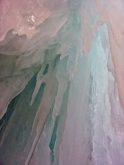 Trip: Sawtooths - Chockstone Peak - Beggars Can't Be Choosers (FA) Date: 7/19/2007 Trip Report: Summary : Chockstone Peak - Beggars Can't Be Choosers 5.9+ Grade III+ - Nick Dolecek and Elisif Harro - July 19th, 2007 Note: To the best of our knowledge and research this climb is a first ascent. I'm still waiting on hearing back from a few inquiries to cover all of my bases. Feel free to chime in if you've heard anything as well The Route The Trip: A Team Harro planned vacation had to get batched due to Daniel's Fire Academy for the entire month of July. Unfortunately, this left me with either a week's worth of time to either get to know myself really well or divide up the team. I chose the latter and made plans with an old friend from OSU, Nick, to do some climbing in the Sawtooths. I climbed in my trusty Subaru and drove all night to meet Nick in Lowman Wednesday morning. After the requisite gear sorting, we headed to Stanley to catch the boat. The quintessential approach shot: Hiking in we had tentative plans to do a route on Warbonnet. My tank was already pretty empty from being up for 24hrs accompanied with my solo 8hr bender of a drive , so as we stopped for a break during our climb up to Alpine Lake after the trail junction we looked across the Creek gully and thought hmmm...that looks like fun We set up camp at this sweet campsite by the creek and though didn't get any climbing in that day still ended up having quite a good time. dStigz5eLWk The next day we crossed the creek and started our climb at the left base of the granite dome following an easy approach. We started off soloing about 80 meters of fun 4th class climbing and then started our first belay past a large Lodgepole Pine. Some highlights were an exciting face traverse on pitch 2 and some great, clean-granite moderate climbing on pitch 3. Some challenges of this lower dome was just the large amount of cleaning that needed to be done in order to get to the crack systems, which probably is what led to us taking such a long time on this lower section. However, once unearthed there were some amazingly fun features to be had. 4th class Nick on 2nd pitch before 5.9 traverse into dihedral Nick on traverse out of dihedral - 3rd pitch This entire granite dome (1st 5 pitches) could be potentially bypassed by hiking up Chockstone Basin, although I'm not sure how one would get to the base of the West Face of Chockstone Peak this way. (The established routes I have found thus far are on the East Face of Chockstone). Take home message: While a bit meandering in places and requiring some cleaning, I though it was worth it to do this bit To get to the Peak (Pitches 6-9) from the top of the dome we scrambled across a boulder field to the base of the West face. The Goods on pitch 6 Pitch 7 has a fun tunnel Coming around to the East face for the last pitch The last pitch has a fun chimney and then a sweet traverse Yay Summit The descent was about 10 double-rope rappels down the Iowa Gully on the East side, which unfortunately the last two were done in what could definitely be classified as the dark. Luckily, there was a surprising amount of bolts and other asundries to help guide the way. Then a hike, fondly known as bushwacking down Chockstone Basin, back to the creek, and then back to the trail. This alderfest might have been better in the daylight. Oh well, gives me some fun scratches to pick at We slept in the next day, then some more fun in the creek, followed by a hike out to some great beverages and bluegrass music at the lodge and then some hotsprings soaking Who loves Idaho? Gear Notes: We took a set of doubles which we are glad we had for the epic rappel descent. 2 x 60meter ropes are definitely mandatory if you want to get down in a timely manner. RPs are also useful for some of the crack placements. Otherwise, pretty standard, pm me if you want specifics. Approach Notes: Drive Drive Drive. Get gas, go to the bathroom, drink redbull. Repeat x 1. Recommended: Have a driving buddy so you don't start to go crazy on the way back home:crosseye: or deaf from rocking out too much. See the attached topo for specific approach and descent notes.
 -
first ascent [TR] Gunsight Peaks Traverse - "Gunrunner" IV 5.10
Blake posted a topic in North Cascades
Trip: Gunsight Peaks Traverse - "Gunrunner" IV 5.10 Date: 7/11/2007 Trip Report: John Scurlock Photo A long-winded TR from a long, windy climb... The Gunsight range is a N-S trending ridgeline of fantastic granite near the southern end of the Ptarmigan Traverse. With four named summits over 8,000' tall and several intermediate pinnacles, it made the perfect candidate for an early July destination. Dan Hilden (Dannible) and I spent 3 full days climbing up there this week, and completed 2 new routes, plus the second ascent of the E. Face. The first day we were tired from the approach, so we didn't aim for anything too big, but found an exciting climb anyhow. I'll let the pictures tell the story... The route begins in the obvious corner which splits the face. We had to downclimb into the icy moat, so the first pitch is about 15' longer than it looks. The first pitch was splitter fingers/hands and ended at a nice ledge. Dan escapes the moat... The next pitch Dan lead around to the right, then straight up through wild loose overhanging chimneys. Here's looking straight down past my shaking toes: The last pitch was an easy romp to the summit where we found great views of Dome and Sinister. Artsy rope throw photo on the descent After playing in the spotlight of a natural cannonhole, we headed back to camp and sorted gear out for the next day. On July 9th we circled around the range along the Chickamin Glacier to the north end, well past the NE peak. We found some great hand cracks which lead to the ridge crest at its terminus and began the traverse. Wide stemming into a perfect hand crack... From the ridge crest we climbed south on fantastic granite above the Chickamin and Blue Glaciers. N->S allows you to climb the steep North faces and descend the south sides of the peaks. Pitch 2 climbs to the left (East) side of the crest and featuresan amazing 5.8 corner and face crack. The day definitely had more of a "climb" feel than a level traverse, and we'd both fully recomend it if you have a complete day in the area. Along the way we had one single rap from the NE peak and one double rap from the middle peak. The fourth pitch on the route was a well-protected face climb leading to an exposed roof on golden rock. We summited the Northeast peak in 7 or 8 pitches, and the climb to there would be a fun grade III. The last pitch to the NE summit actually began by circling around to the right (West) and climbing a chimney and then through the hole in the back of an enormous roof to the top. From there it was on to the North and Middle summits. The West face, in profile on the right, is still awaiting a FFA. There was one spot while climbing up the the North Peak where we were in a face crack which ended, so we pendulumed to the right to join other features. Apart from this bit of aid, the entire climb was done free, and I think we could have avoided it if we had looked ahead more carefully. By the time we summited our third peak (the middle one) I was feeling dehydrated and exhausted, but Dan found his second wind and led on as the sun set. He lead up to the top of the South Peak as the stars came out in force, and we rappeled down onto the Blue Glacier in the dark. The next morning we went to the East Face of the middle peak to climb the route which Sol (Frosty_the_tradman) and friend did last summer. (By the way, congrats to Sol on getting married last weekend, your route is fantastic too!) We broke up the pitches differently, and belayed on comfy ledges. See their trip report for more details. Above this splitter hand crack step right then up the finger crack and continue up the crack in the R-facing corner, over the lip(crux .10d), and to a big ledge. This elminates the need for a hanging belay and as long as you save one hand-sized cam for the last 15', it should be easy gear-wise, because of changing crack sizes. The second to last pitch features a beautiful delicate slab climbing. This face is in shadow all afternoon, and the sunset topout gets a Blake-and-Dan thumbs up. This was a fun trip and Dan is a great partner and camp chef. It was nice climbing with another young punk for once, as we have a combined age of only 41. [edited to add topo -porter] Gear Notes: Single cams Blue alien, #3 Camalot, #4 Camalot Double cams Green alien - #2 Camalot One set of nuts Crampons, Ice axe Should have brought more pringles... Approach Notes: Agnes Creek via Stehekin 3786-3784-Gunrunnertopo.doc -
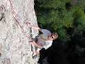 Trip: Cathedral Park, BC - Macabre to Grimface Traverse + possible F.A. Date: 7/1/2007 Trip Report: Quick photo TR of a trip to Cathedral Park over the weekend. I had heard great things about the Matriarch to Grimface Traverse and with the weekend forecast looking soggy for Canada Day on the coast we decided that we would head to the dry side of the Cascades and hope for better weather. First day we hiked in via Wall Creek. The Wall Creek approach is highly recommended. It's a cruisy 4 hour affair to the meadows with excellent camping and bouldering! There are a lot of blowdowns but it's still a great approach. The next day we went up to look for things to climb on Matriarch, Macabre, or Grimface. We were looking for a nice line to climb, and preferably something that might be unclimbed. We didn't have the beckey guide so we were going by what we had seen on bivouac and the pages I had cut out of the Fairley Guide. The description in Fairley is vague at best and didn't help much. The buttress just to the right of the South Buttress looked quite nice and we thought it might be unclimbed so we decided to give it a go. The climb was 8 pitches long and mostly easy except for a very short but difficult roof we rated at 5.11a. Most of the climbing was pretty easy 5.6, 5.7, 5.8 type of stuff. We finished the climb just below the bolt ladder on Macabre. From the summit of Macabre we continued on the traverse to Grimface. With the exception of two rappels we kept the rope in the pack the rest of the day. We were back in camp a few hours later. Gear Notes: set of nuts, full rack of cams from #0 tcu to #3 camalot. Approach Notes: Wall Creek Trail from the Ashnola River Road
 -
Trip: Salish Peak & Roan Wall linkup - 17 pitches 5.10+ - Date: 6/20/2007 Trip Report: Yesterday Darin Berdinka and I climbed two new grade III routes near Darrington. The are both recently completed and feature flawless granite in a beautiful spot. We did them in a day 16 hours round trip. Approach using the Squire Creek Trail towards Three Fingers, and the Roan Wall is on your right, easily noticeable from the head of the valley. Ours was probably the 4th ascent of both of the routes, but they deserve lots of visitors. The Roan Wall has a 5.8 bolted pitch, a 5.4 cracks pitch, then a bit of scrambling before 8 more pitches up the steep wall. Mostly small edgy face climbing, although the last 3 pitches have cracks mixed in. Locate bolts on the above bulge to begin climbing. The 5th (crux) pitch involves a leftward move close to the belay The last 3 pitches have fun crack climbing. Then you top out and are a short walk from this: Scramble off the top of the Roan Wall by walking along to the left, then across to the base of Salish Peak. Every pitch is mixed crack and face, with lots of fun exposed moves. The 3 hardest moves are all somewhere in the 5.10 range and you could AO on a draw. Pitch 1 Darin had told me that the face move was 5.11something and I A0ed without trying it out. He freed it on TR and said it was more like .10c The 6th pitch was spectacular face and crack... maybe the best of the route. You can rappel the route in 5 double-rope rappels, using fixed stations. The black webbing/grey mammut runners are ours. From the base of the route, we high-tailed it back to the car in 3:40, because I insisted to Darin that we complete the day wihout headlamps. After all, the solstice is good for something, right? (The trailhead is at the base of the landslide in the distance) Cheers to Chris Greyell for putting up the routes, and to Payless Shoes, whose $20 sneakers passed the test. Also, the gas station in Darrington gives out all its hot food for free after 10pm:hcluv: , so thanks to Darin for putting up with my erratic driving when my hunger-crazed brain payed more attention to Taquitos than turns on the highway. Darin was a great partner even though he originally tried to get me to leave Bellingham at 2:30 AM! This linkup is one of the best rock climbs I've done, it should be high on the to-do list!
-
 Trip: Mt. Robson - Emperor Face, House-Haley (FA) Date: 5/25/2007 Trip Report: Excited by a good forecast, Steve House drove north from Bend on Wednesday afternoon for his 7th attempt on Robson's Emperor Face. Fortunately all of the more talented climbers he approached could not go, so we met up in Seattle and hit the road up to Robson on Thursday morning. On Thursday afternoon we flew with Yellowhead Helicopters to the Helmet-Robson col, and left the col at 4:30am on Friday to approach the Emperor Face by descending the ramped ice-fall above the Mist Glacier. We climbed the face in two long lead blocks, both seven pitches long. My block had longer pitches (about 80m on average) and moderate climbing, then Steve's block had normal-length pitches (about 55m on average) and much more difficult climbing. Our route roughly followed the gully system immediately left of the Stump-Logan, but on the last pitch we suddenly encountered 3 fixed pitons. Presumably Stump and Logan finished a little bit to the left of the arete that is shown in most photos. Our route shared at least the last pitch with theirs, and perhaps the last two pitches. I reached Steve's belay at the top of the headwall at 11:30pm, and we spent the short night sitting on a small ledge chopped from the ice. In the morning Steve led two easy mixed pitches up to the crest of the Emperor Ridge, which we then crossed onto the upper SW Face. We traversed across the South Face, me now feeling very sick for some reason (I think a bug that I have had ever since Patagonia), and joined the Wishbone Arete in deteriorating weather. The upper Wishbone Arete included some funky gargoyle climbing, and we topped out in a whiteout at 1:00pm. We descended the Kain Route and then Steve hiked up to retrieve our camp at the Helmet-Robson col while I sat and contemplated vomiting. Our camp-to-camp time was approximately 36 hours. On Sunday we descended the Robson Glacier (sometimes stressfully off route due to the whiteout), and then hiked down to Kinney Lake, leaving the last 7km of walking for Monday morning. I probably won't have time to post pictures until July, unfortunately.
 -
Trip: Mt. Stuart - Lara Kellogg Memorial Route (FA) Date: 4/29/2007 Trip Report: Yesterday Dylan Johnson and I climbed a route on the NE Face of Stuart that I believe is a new variation. We had made an attempt last Saturday but bailed up the Ice Cliff Couloir after realizing we weren't prepared for the difficulties. The succesful ascent yesterday took about 19.5 hours car-to-car, using bikes for Mountaineers Creek Road. The route we took ascended various bits of previous routes, with what I believe were two new ice pitches. The lower portion of the face is comprised of horizontal bands of vertical to overhanging rock seperated by snow ledges. The first rock band we climbed via a short pitch of WI4. The second rock band had a spectacular free-standing ice pillar, but it looked very difficult (probably WI6) and at risk of collapsing, so we traversed right to join the original route (Mahre-Prater, August 1959) for one pitch. This had a move of aid, and there were 3 old pitons. From the top of the aid pitch we traversed back left to the ice line, and climbed the last rock band by a difficult waterfall pitch that I felt was WI6. It was not very long, but steep, narrow, and very chandeliered. Perhaps in some years it is nonexistant, and perhaps in some years it is WI4. Above the rock bands we joined the Nelson-Klewin May 1978 route for the middle snowfield and a short step of ice. We diverged from the 1978 route to the right for several hundred feet, and then joined back up with it for the finishing bowls and gullies to the ridge crest (this finish also established by Mahre-Prater, 1958). Although I think our route is only a new variation and not an independent route, it is an aesthetic line with challenging ice climbing on Stuart's cleanest face. We wanted to name it in honor of a wonderful friend and excellent climber who Dylan and I both were fortunate enough to know. Following the tradition from Mt. Index, we would like to call this route the Lara Kellogg Memorial Route in the hope that the name will help carry Lara's memory to future climbers in the Cascades.
-
Trip: Squeah Mountain (1798m) - NE Couloir to N Ridge (FA?) Date: 4/1/2007 Trip Report: Jordop, J_Mace, Stemalot, Dr.Hook and I climbed this route on Sunday via Deneau Creek. We could 4wd to the first fork in the road at around 540m elevation. From there it's maybe an hour and a half of walking to get to the road end in the bowl east of Squeah. The most obvious couloir imaginable leads to the col north of Squeah. Good potential for a ski descent. (550m vertical, 35 to 40 degrees). From the col we wandred up the north ridge of Squeah (NTD) in a whiteout until we reached a highpoint that could have been the summit. With visibility about 2m in all directions, we decided that it was, and descended rapidly. Da route In da gully. Summit ridge whiteout. jordop froze an eye shut. Stemalot doing some extreme jeeping on the way out with jmace giving guidance. Gear Notes: One ice axe and crampons sufficient. No technical climbing. Approach Notes: Deneau Creek requires 4wd-hc and narrow vehicle to fit past large stump (see photo). Snowline currently 600m +/-. Road driveable to 540m.
-
Trip: Abercrombie Peak - SW Face (First Ascent) Date: 3/20/2007 Trip Report: Colin Haley and I skied up the Valdez Glacier to the base of the 1450 meter SW Face of Abercrombie Peak (circa 2130 meters) on March 19. The forecast was for "a major change in the weather pattern" to hit in a day, so we knew we would be racing the weather. We left camp under clear skies at 6:40 on March 20 and climbed steps of water ice and mixed terrain to around WI4- and 5.4b. Although we wore harnesses and carried a rope and some rack, we never used it. Good training, I guess. We reached the summit at 15:00 in a whiteout and began the descent. We reached camp at 19:00 and coaxed enough water out of our dying gas cylinder for a Ramen each. We were very pleased that we had gone high class and brought Maruchan rather than Top for this recovery meal. We believe this to be the first ascent of the face. Some photos are at http://59A2.org/valdez/200703/


