Search the Community
Showing results for tags 'best of cc.com'.
-
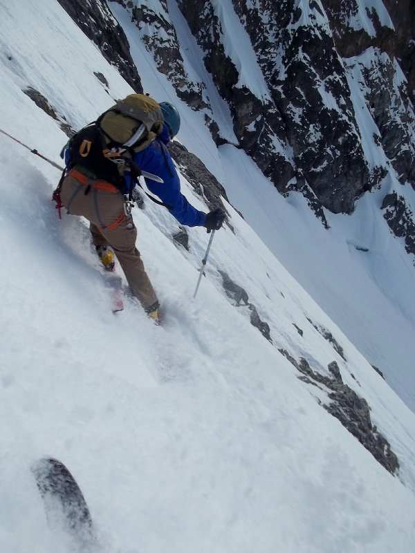
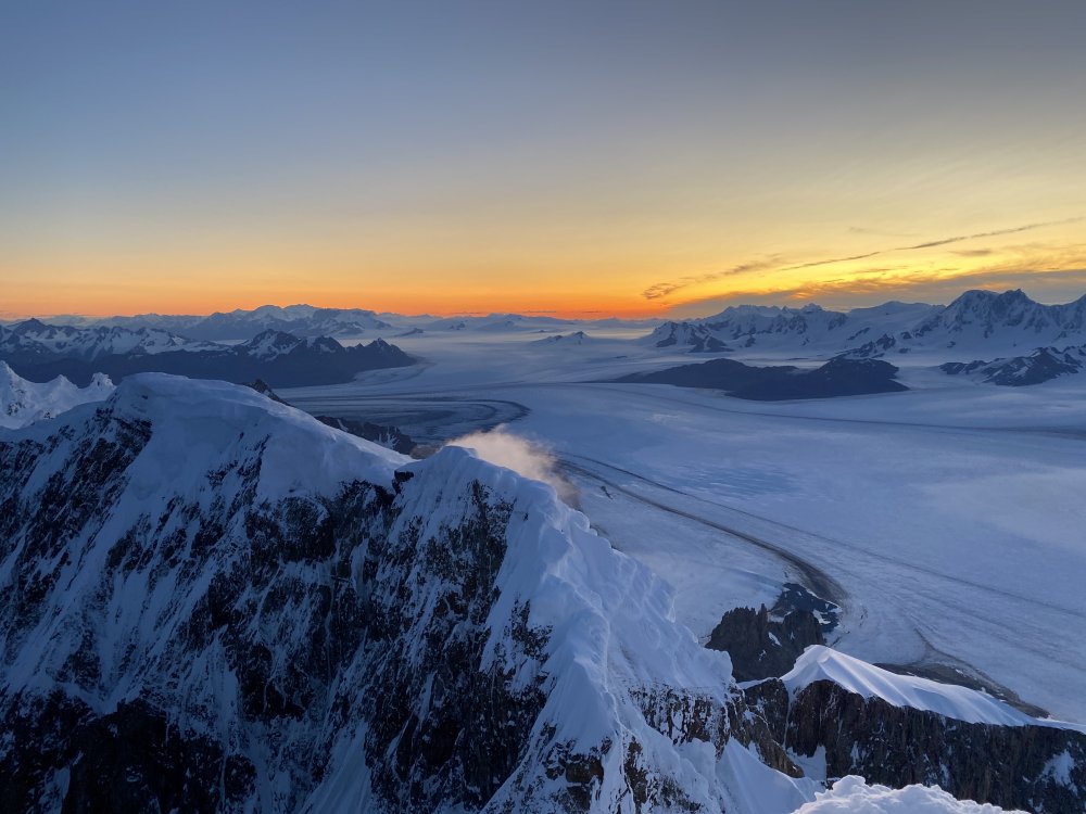
Trip: West Fork Ruth Glacier, Alaska - The Rooster Comb, DIrect North Buttress Date: 4/15/1980 Trip Report: OK, this all happened a long time ago, so here it is, to the best of my rapidly aging recollection: In late April 1981, Keith Royster and I had been camped on the West Fork of the Ruth glacier with a couple of friends for two weeks. We were waiting for a weather window long enough for a 3-day alpine style ascent of the unclimbed North Buttress of the Rooster Comb. The pattern had been 2 to 3-day periods of stormy weather separated by a day of clearing. We knew from our experiences of the previous three seasons spent on the Ruth that if we were patient that pattern would reverse, and we could expect a 3 to 4-day period of fine cold conditions. Rooster Comb routes Bivy sites We both had climbed other Rooster Comb routes on those earlier expeditions. Scott Woolums and I had bagged the first ascent of the Rooster Comb’s main summit in 1978 via the SE Face. In 1979 Jeff Thomas and I made an ascent to the NW summit from the top of the col between the Rooster Comb and Mt. Huntington. In 1980 Keith and Leigh Anderson climbed a new route up the NW Face to the NW summit. Each year we looked at the North Buttress and vowed to come back and give it a shot some day. That day was rapidly approaching for Keith and I, but the current weather was less than perfect. It WAS good enough for a bush pilot from Talkeetna to land on the West Fork just above our camp and drop off two British climbers, Nick Colton and Tim Leech. They post-holed over to our camp, introduced themselves and announced that they were going to climb our route the next morning. After the brits left to set up their camp we convened a hasty war council. We could beat them to the base; our gear was packed and we had skis. In a footrace we could move much faster that the post-holing brits and get on the route ahead of them. But we knew the weather, and it wasn’t going to be good. We had seen the lower buttress disappear under enormous avalanches more times than we could count. At best there would be continuous spindrift for most of the route. It was a huge decision… did we want the first ascent or the best ascent? In the end we decided to wait for the weather. We were climbing for fun, we told each other, not glory. Five days later Nick and Tim were back from their epic. Or maybe it was just a typical day on the crag for them, being crazy brits and all. The constant spindrift had slowed them down dramatically in the lower third of the route, and they had bypassed the crux section of the gully by aid climbing around to the right. If we couldn’t be first, maybe we could score some points on style. Now finally the weather was becoming settled, and we hoped most of the new snow had fallen off the route, because we were going to go that night. It seemed to us that, after weeks of watching the face over the past three years, the big avalanches cut lose in the mid-afternoon. By starting the climb at 10pm, we could be out of the lower gully before noon. Even in late April there is plenty of light for gully climbing at night. We blasted off right on time, leaving our skis at the base of the route. The lower gully was classic, with excellent snow and ice up a twisting gully, perfect granite on both sides. We climbed together, moving fast, the leader placing pro until out of gear. Sometime before dawn we switched leads at Nick and Tim’s first bivy platform, set dead center in a wide section of the gully. I was nervous just stopping there to belay. It must have been a nasty bivy in the conditions they were climbing in. Keith in the lower gully By 10am we were feeling like we were in safer ground, with most of the lower gully below us. About that time our friend Jim Olson was at the base to retrieve our skis. From the center of the West Fork he watched a massive avalanche fall into the gully below us. A cornice had let go from high above and it scoured the gully, then washed out halfway across the West Fork. A half-hour slower and we would have been right in the firing line. As it was, we were blissfully unaware of our close call. At about the halfway point, the gully becomes discontinuous as it runs into a prominent 500-foot rock band. We set our first bivy where the snow and ice of the lower gully met the rock band. It was a very small platform, maybe two feet wide, but well protected by the overhanging bulge of rock above. We spent the night in sleeping bags and bivy sacs at –20F. I had a miserable night, not cold, but cramping up on the narrow snow ledge. Even my facial muscles were cramping, locking my eyes shut. About 30 feet right of our platform, the next pitch began with a 30 foot section of vertical rock, beyond which the gully picked up again, though quite a bit more steep than it had been. Keith made quick work of the rock, and led up the gully a ways before bringing me up. I got a really sweet lead up the gully to the base of the crux pitch. This is the point where Nick and Tim had climbed out to the right, bypassing the heinous, rotten vertical ice hose that the gully had just become. I was not unhappy that it was Keith’s lead! Keith led up some beautiful gully ice to the foot of the overhanging 40-foot chimney partially filled with some really crappy looking ice. He put in an ice screw that MIGHT have held a light fall, and headed straight up. It was mostly a very scary looking stem, with his backpack and right shoulder against the rock wall on the right and his feet kicking holes into the rotten ice curtain on the left. It was a monster effort, and I was sweating bullets for him until he finally pulled over the top. Definitely a no fall situation! Keith on the heinous crux pitch Keith continued on easier vertical mixed ground and banged in a belay. I jugged past the heinous chimney, thinking all the while what a scary lead it must have been. I lead off from Keith’s belay, first traversing left to follow the remnants of the gulley, now degenerated into vertical ice-filled cracks. Protection was scarce, and my first piece after traversing left was a number 1 stopper. I climbed up another twenty feet of ice-covered rock, heading for a three-inch wide runnel of ice. At the base of the runnel I was REALLY looking for a placement, and there in the base of the crack was a fixed pin left by Nick and Tim. I hit it a couple of times with my north wall hammer. It rang true and I and clipped in. WHEW! I set my axe and north wall hammer into the ice of the runnel and grabbed hold of the sling I had clipped to the fixed pin to lean back for a good look up the ice runnel. Suddenly the rock broke, the pin pulled, and I was forty feet lower, upside down over 2000 feet of air. Hanging from the number 1 stopper, I watched my snow shovel fall back to the glacier. I looked over at Keith as I slowly rotated in the air. He told me, “Stop screwing around Kerr, I’m freezing over here!” I got back on the rock, and looked up to see my ice tools waiting for me, still stuck in the runnel. The pitch had been hard with tools. Climbing back up to them barehanded was “interesting”. Once reunited with my tools, I banged the pin back in and scampered up the ice. For the first time in two days I climbed into the sun. I anchored in and brought my frozen partner up. In a couple more easy pitches we were above all difficulties and built a commodious bivy ledge. The next morning we kicked up the summit snowfield and pulled out the flask for a quick summit celebration. The weather was still holding perfect, and we enjoyed the 360-degree view for a few minutes before starting down the ridge that led to the col between the main summit and the NW summit and plateau. The descent to the col was exciting ridge climbing, ending in a long free rappel into the col. The climb up to the NW summit ridge was not difficult and we walked west across the plateau to the top of the wide gully that leads down to the Huntington/Rooster Comb col. It was late and we decided to bivy in the bergschrund before descending to the col. Unfortunately, we were out of food. After we dug our way down into the crevasse and set up our bivy, I told Keith I was going out to find us some dinner. He looked at me like I had been smoking too much pot. I crawled out of our cave and crossed the top of the descent gully to the base of a large rock. I dug at the snow and rock for a few minutes, then reached into a hole in the rock and retrieved the bag of food and fuel that Jeff Thomas and I had left there the year before. Keith was suitably impressed with our foresight when I returned with a huge meal for two and a pint of stove fuel. We started down early the next morning, and made two rappels down the gulley. We were crossing the giant cornices of the col barely an hour after we started down, working our way across to the west side, and the safest descent route to the West Fork. I knew the way down from the Huntington/Rooster Comb col really well. I’d made two round trips over the col in 1979 on our way to Mt. Huntington’s SE side, and one round trip in 1980 to gain the East Ridge of Mt. Huntington. It’s straightforward snow and ice climbing, made a game of terrifying Russian roulette by the huge cornices and seracs that threaten every part of the face. This is definitely not a place to stop for a picnic, and Keith and I fairly flew down the face, reaching the glacier in about two and a half hours. Crossing the Huntington/Rooster Comb col on the descent We felt great after the climb. We had managed to cut a full day off the first ascent time, climbed the crux gulley pitch, and done it in a spell of perfect weather. The North Buttress is the most classic line in the West Fork, in my book, and I put it at the top of my personal list of achievements. Some days after we got back to base camp, Nick and Tim returned from climbing a new route on the West face of Mt. Huntington. You had to hand it to those two; they really maxed out the possibilities on their visit to the West Fork. Two years later Keith and I skied back into the range from the North, destination: the Colton/Leech route on Mt. Huntington. But that is another story… Since our ascent in 1981 this route has only had one other successful ascent. Gear Notes: Lightweight alpine rack (screws, one picket, assorted pins), 160m double 9mm ropes, sleeping bags/bivy sacs, MSR stove, 3 days food/fuel
-
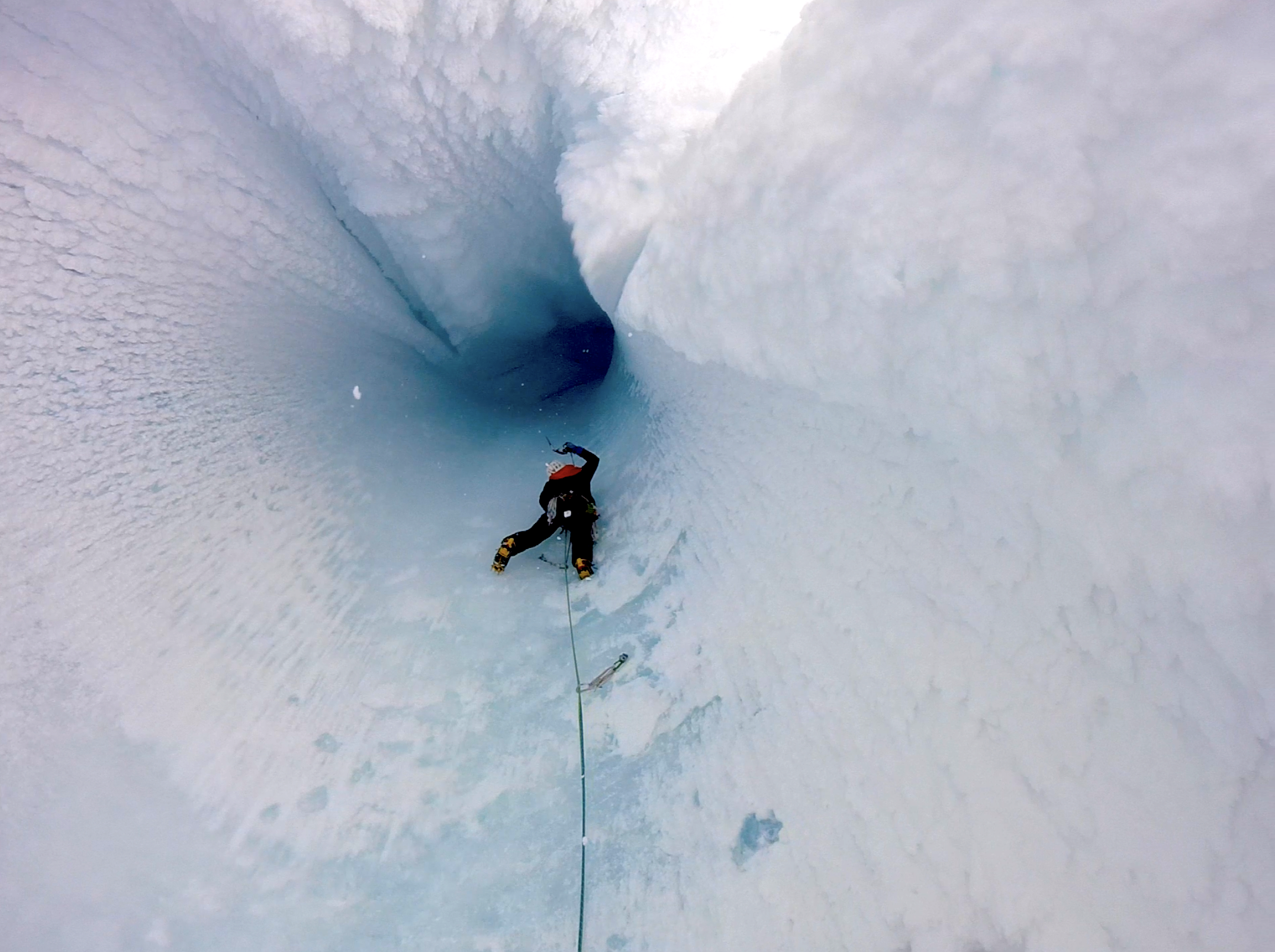
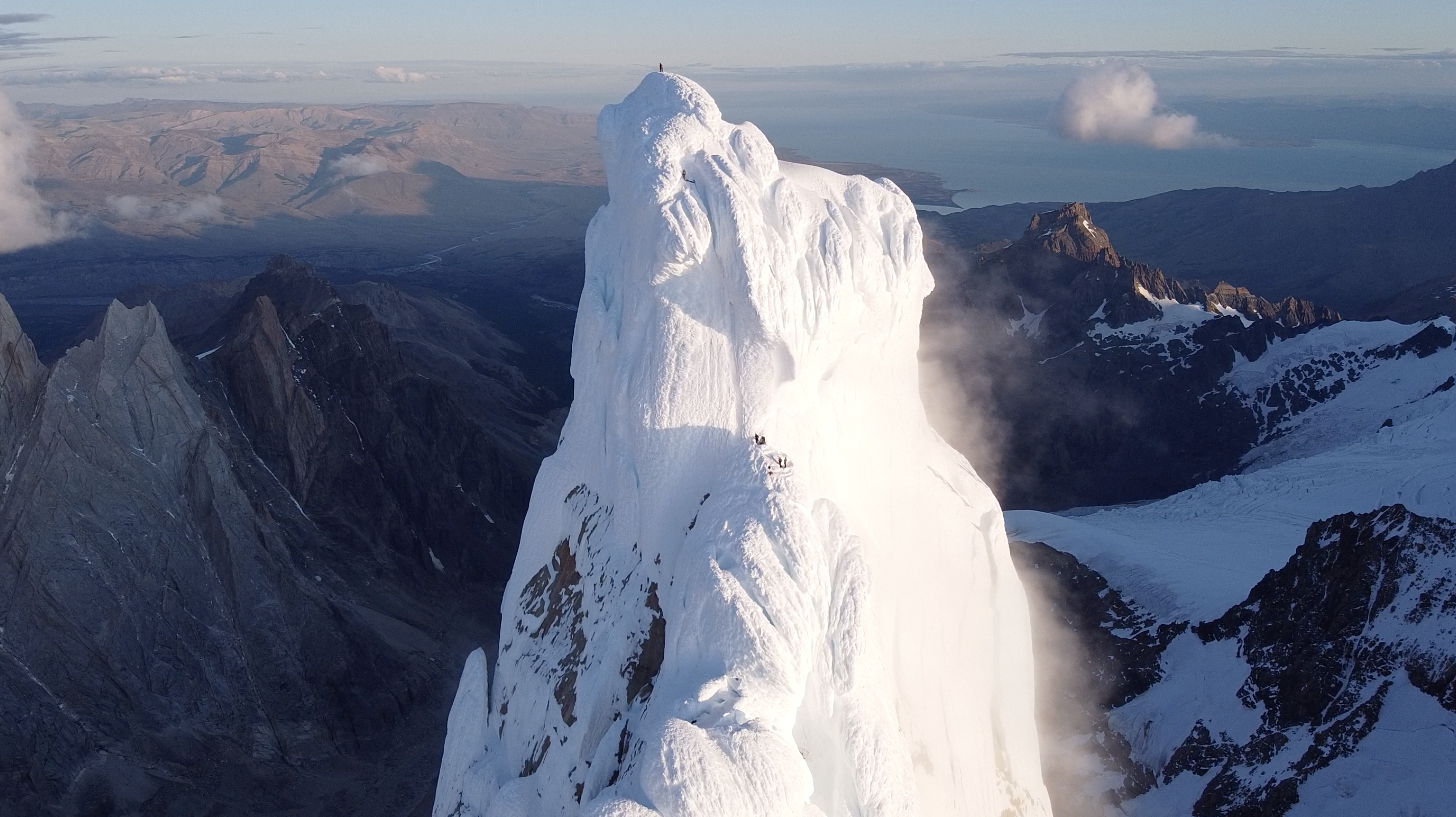
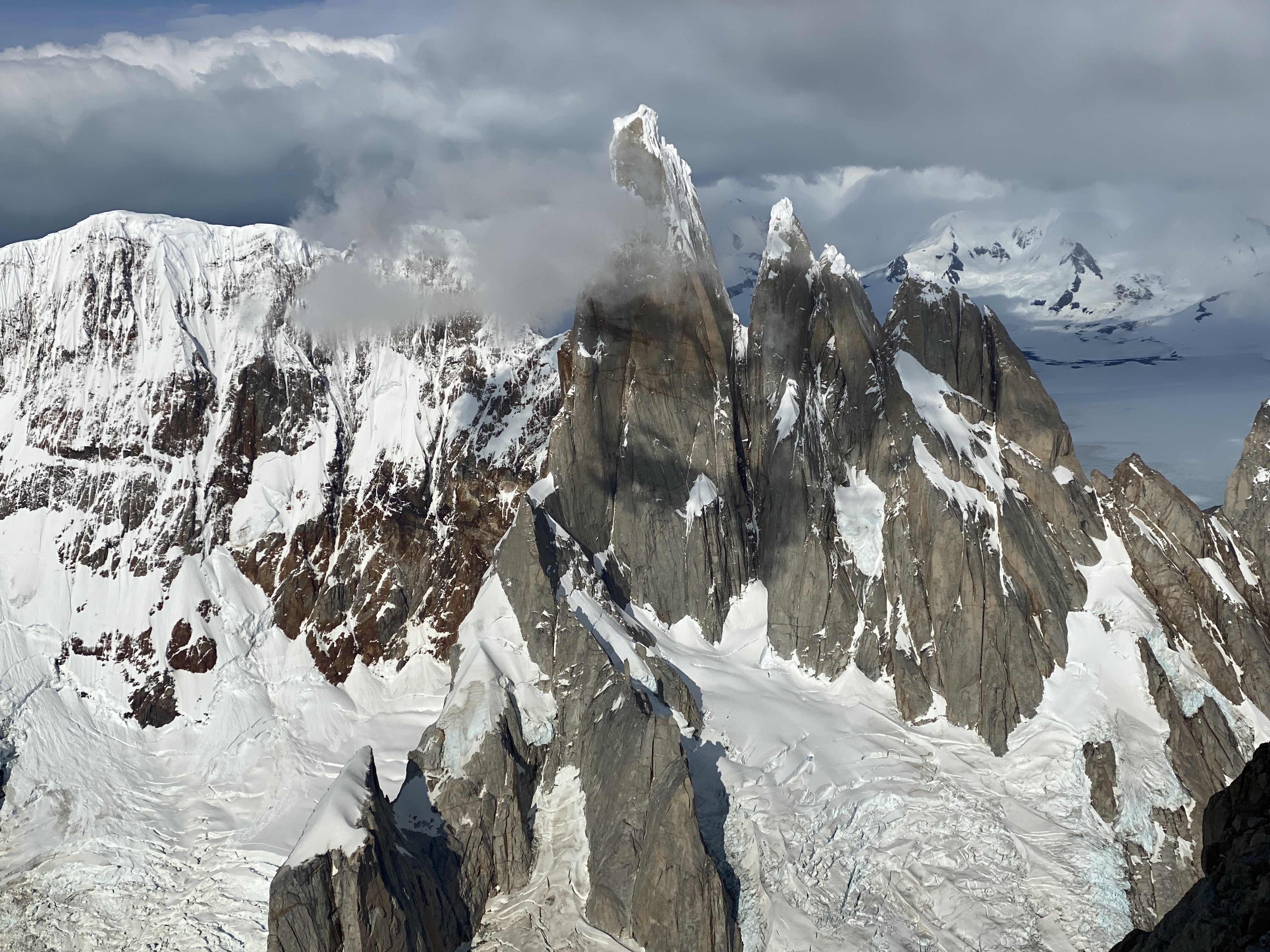
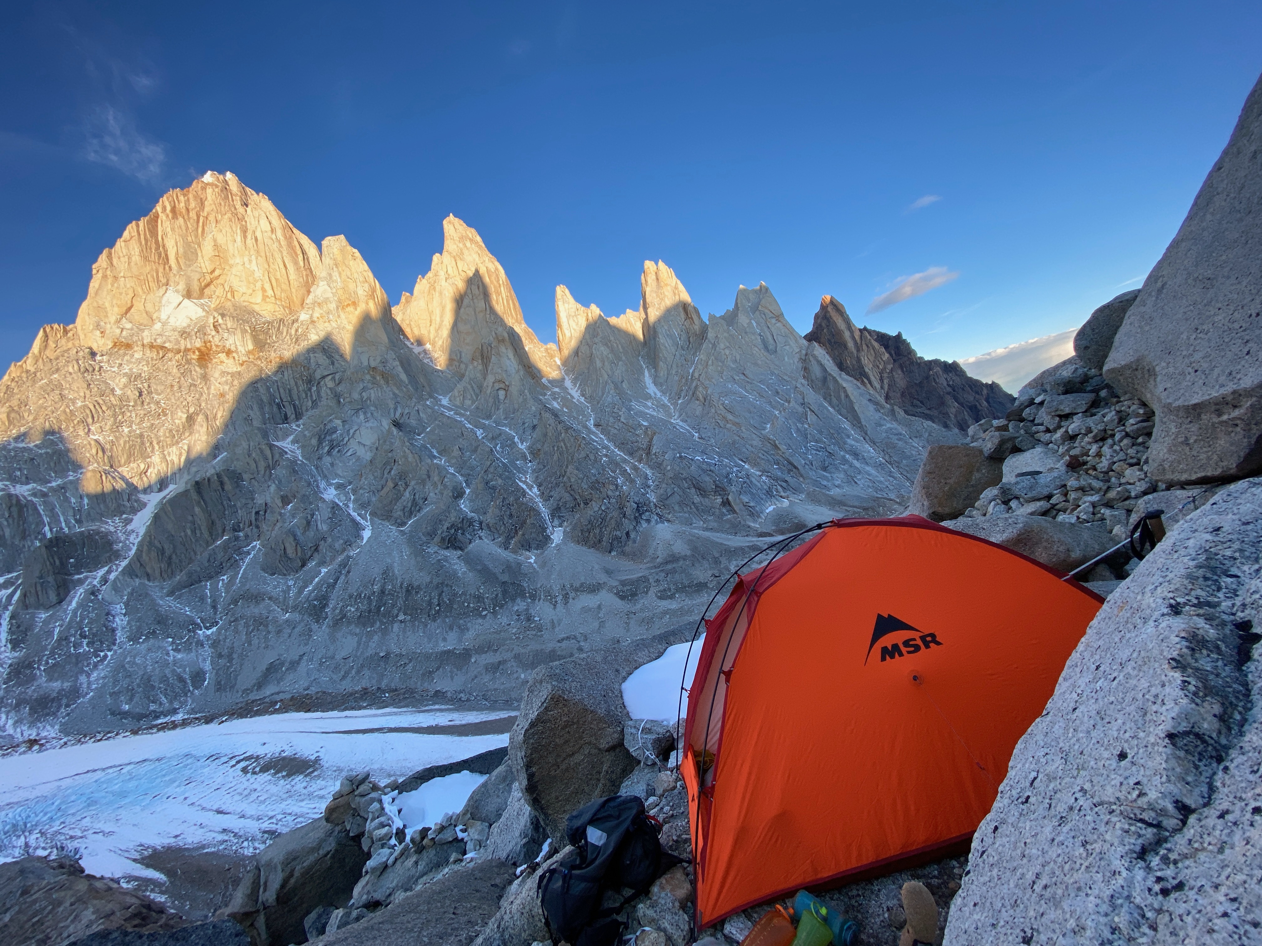
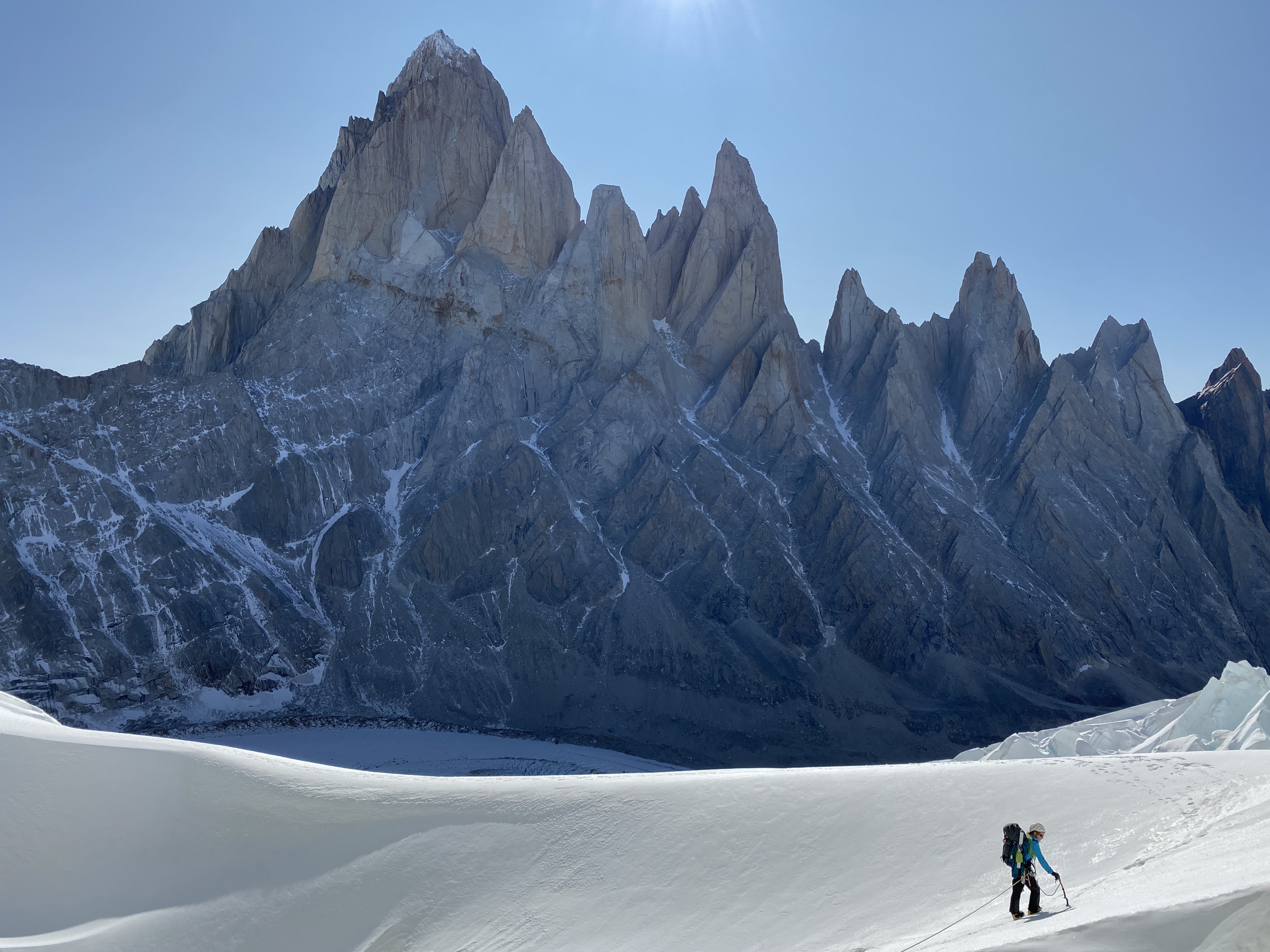
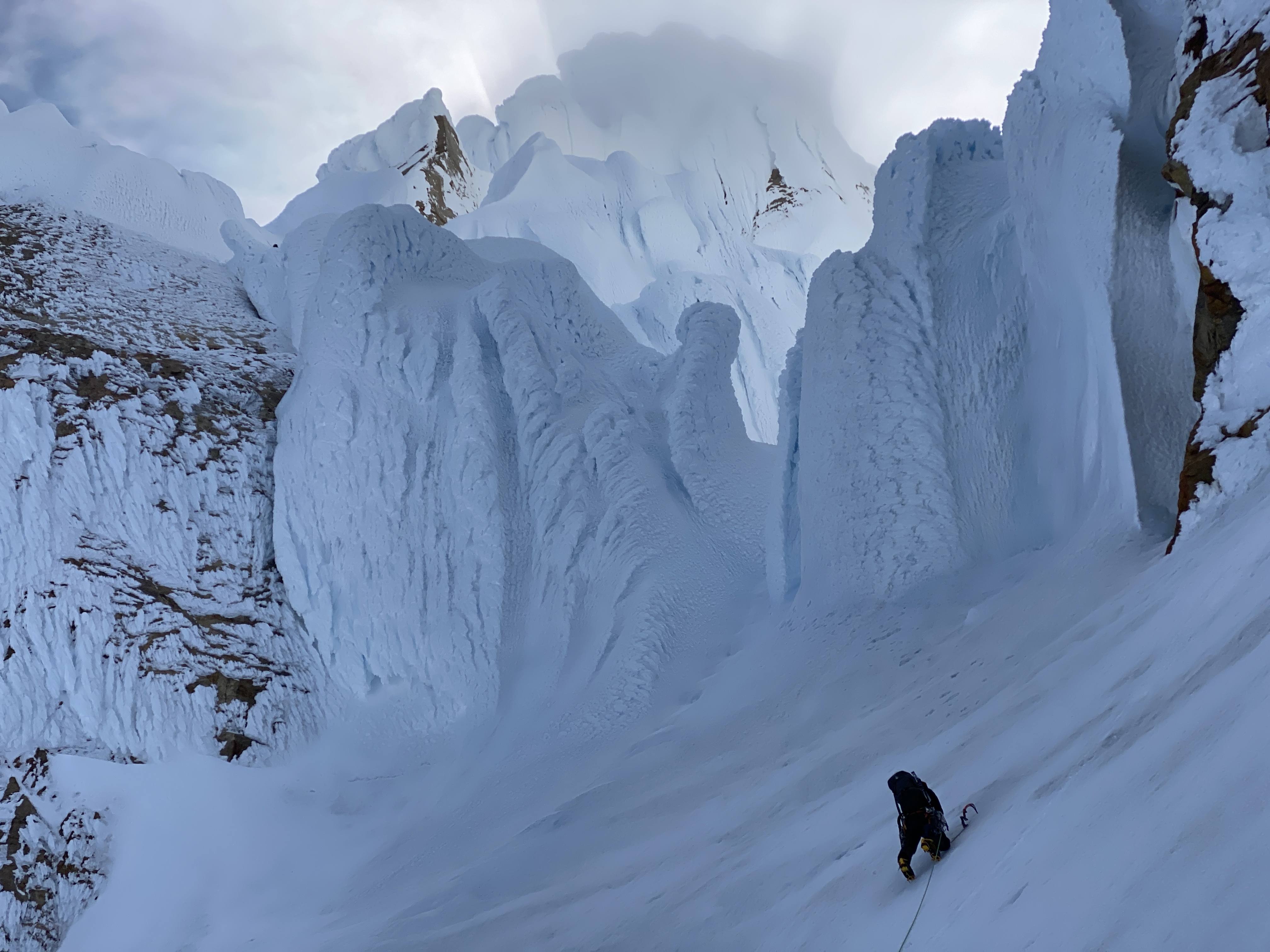
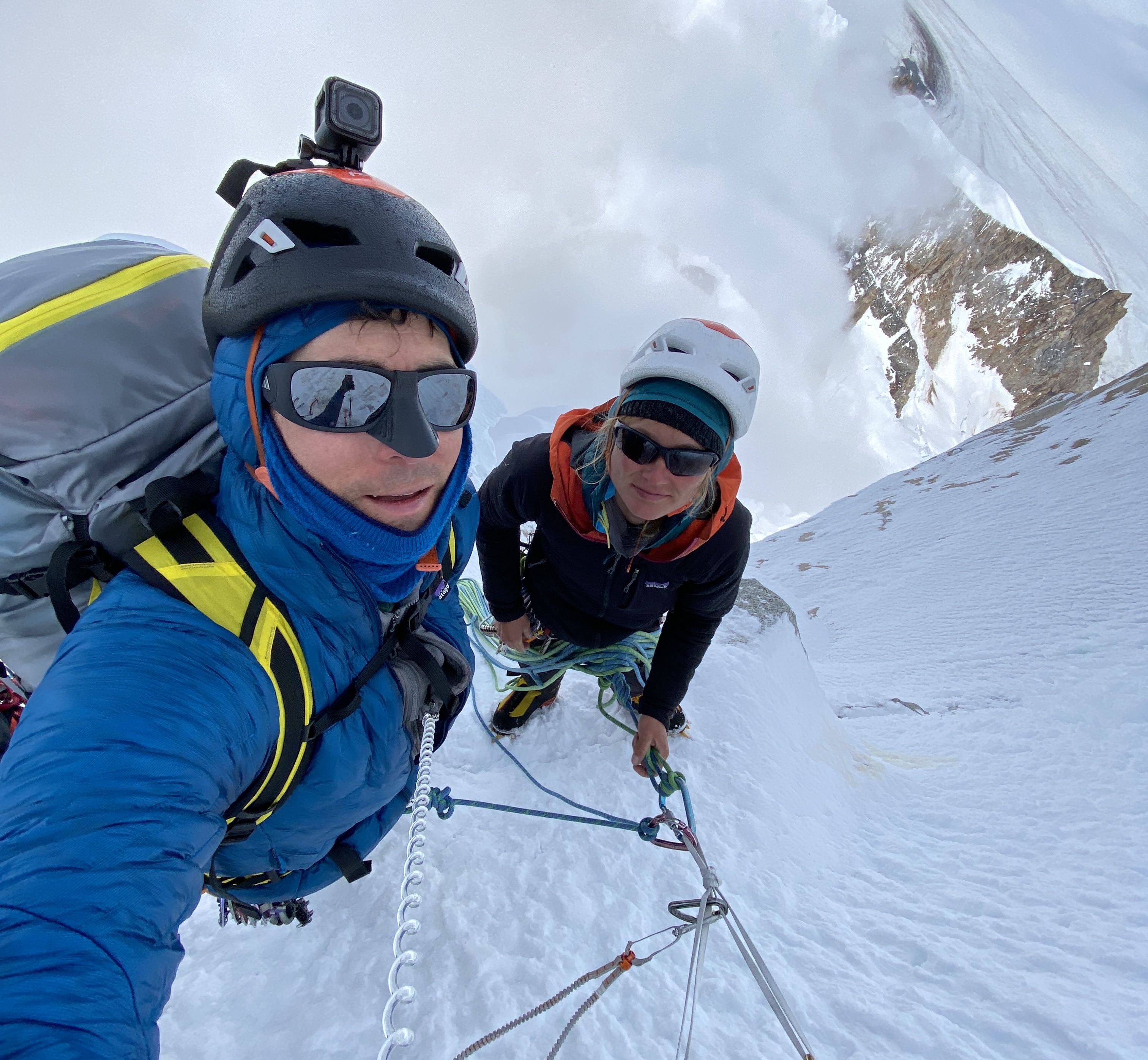
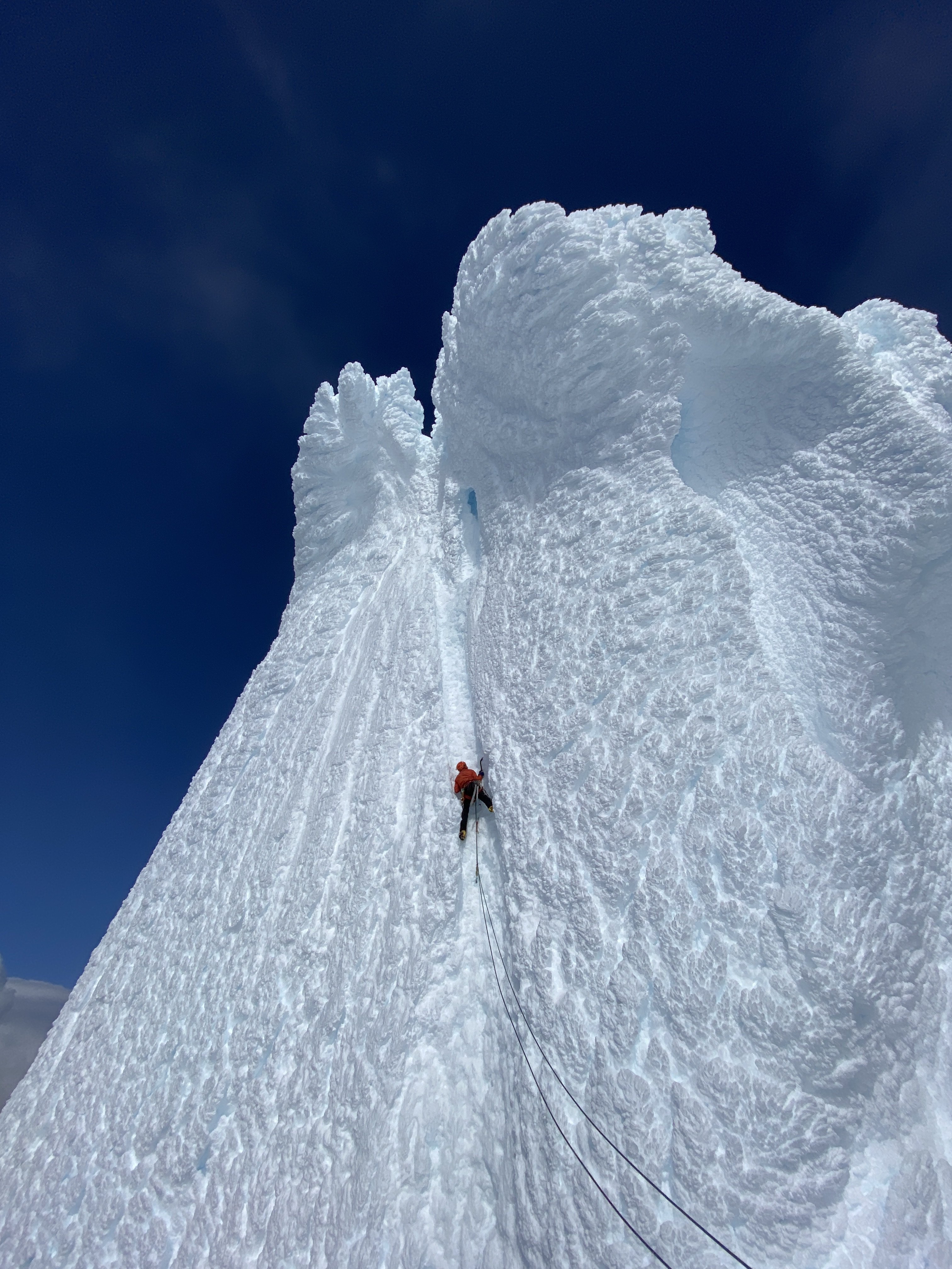
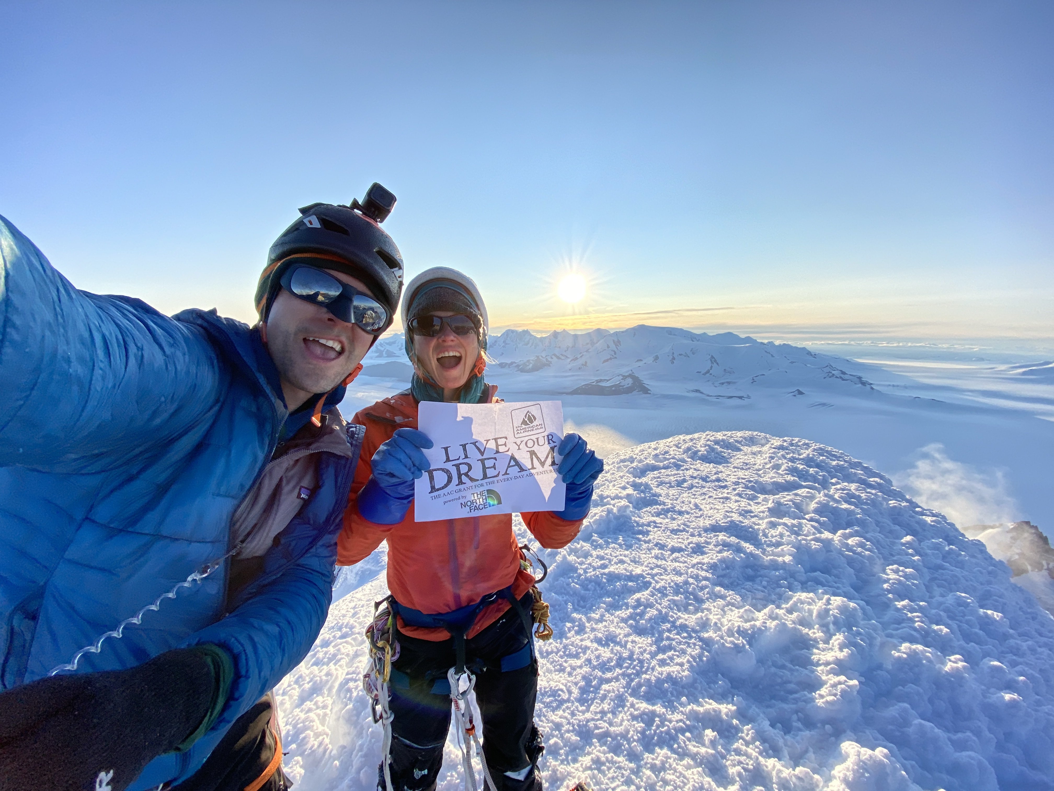
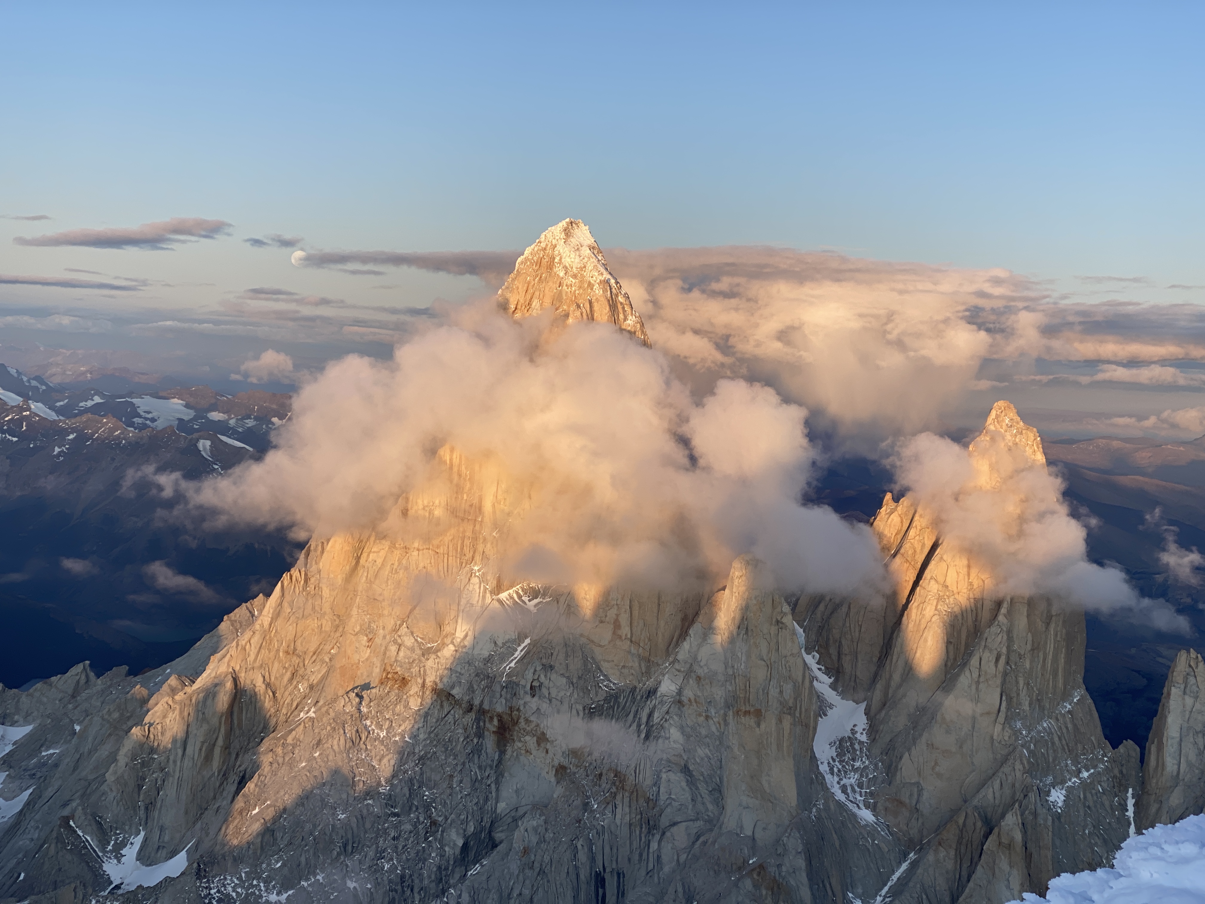
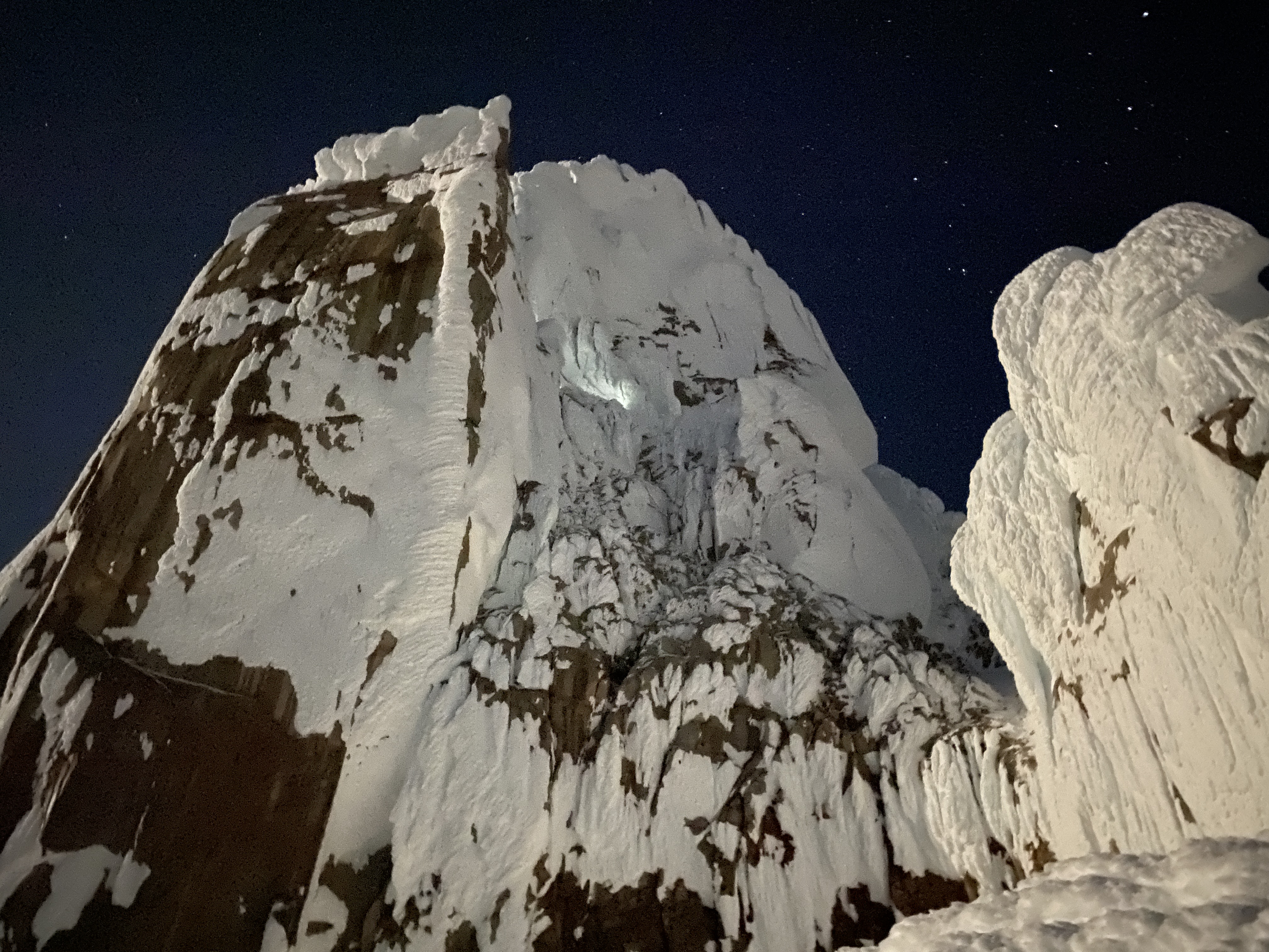
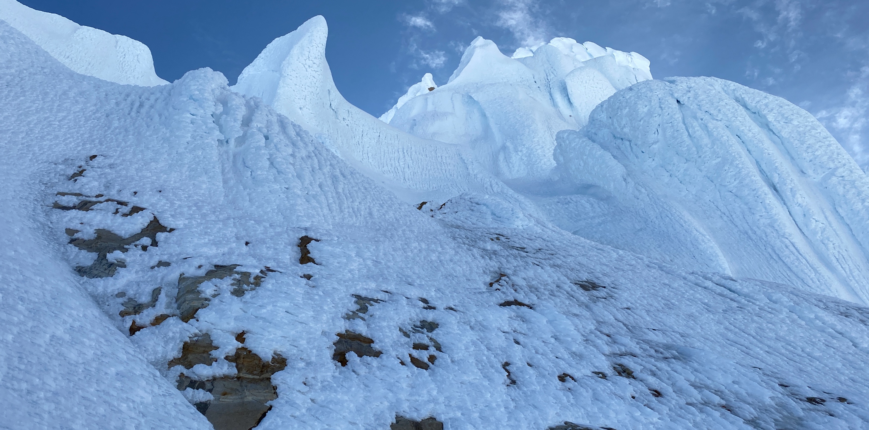
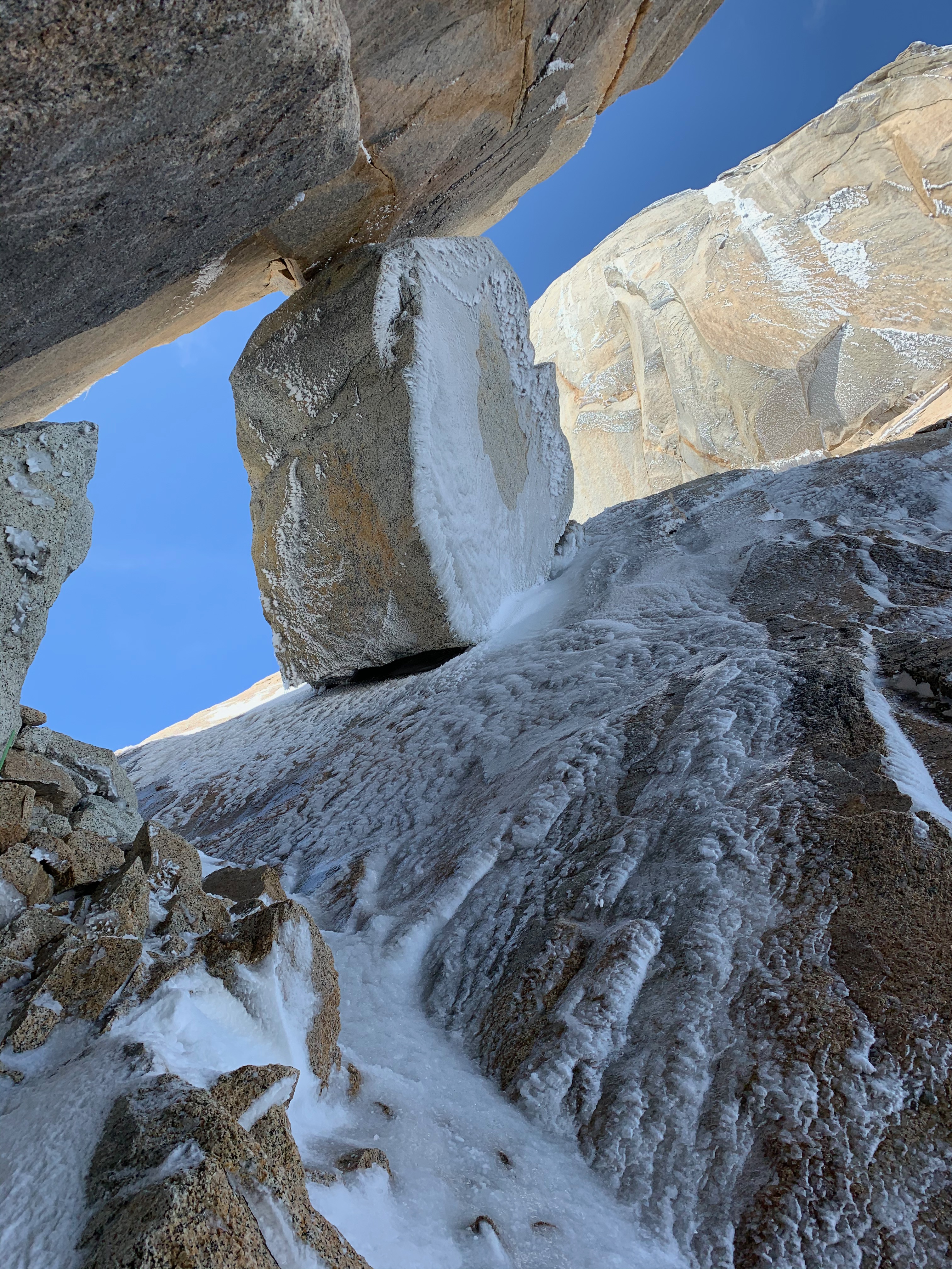
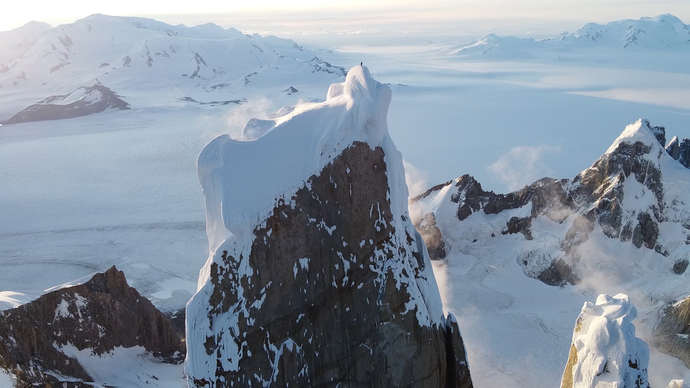
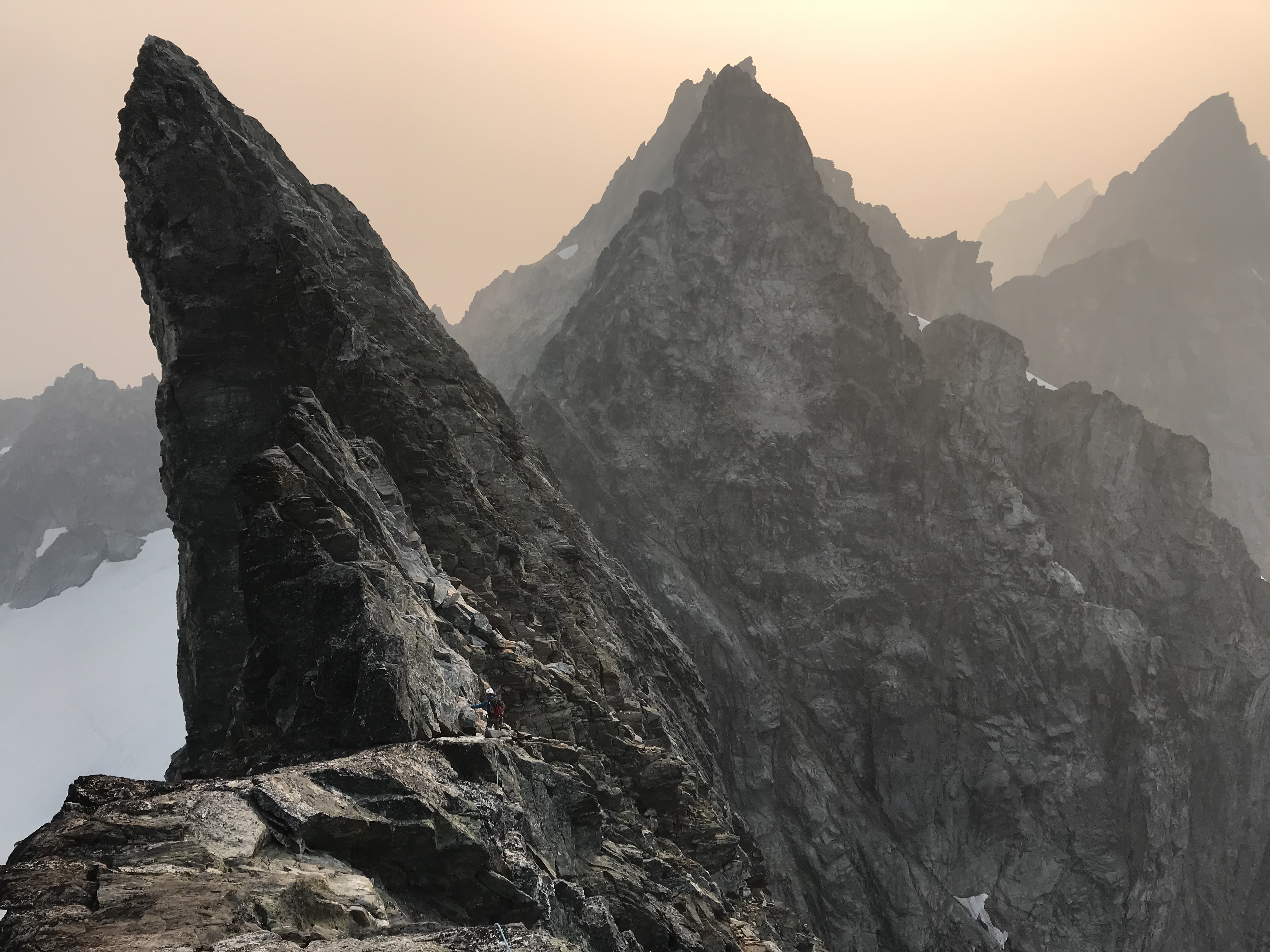
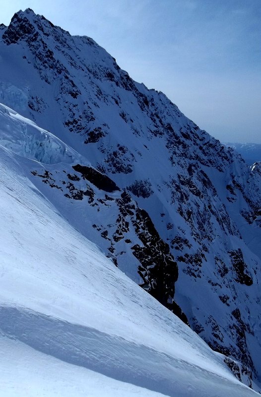
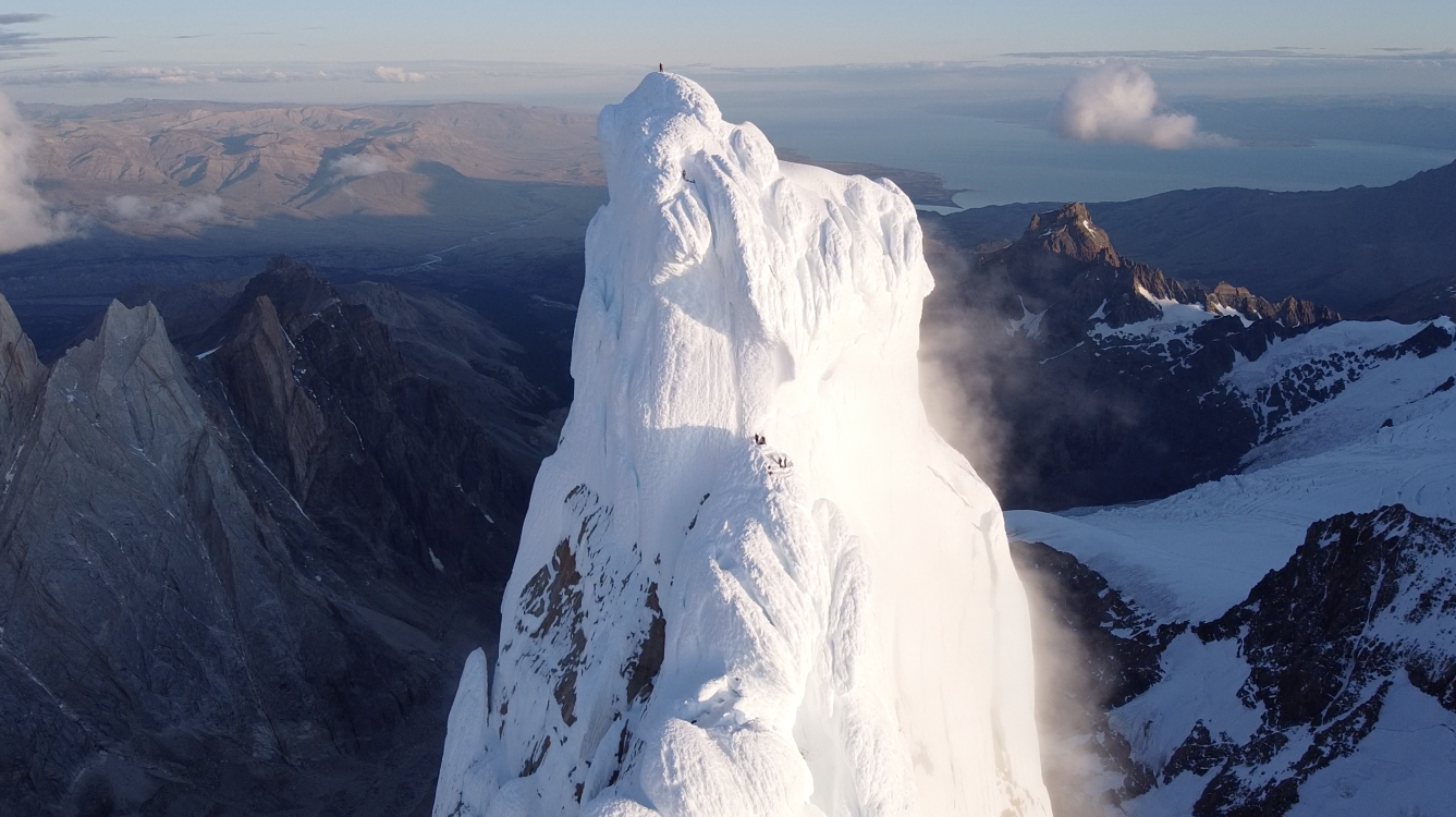
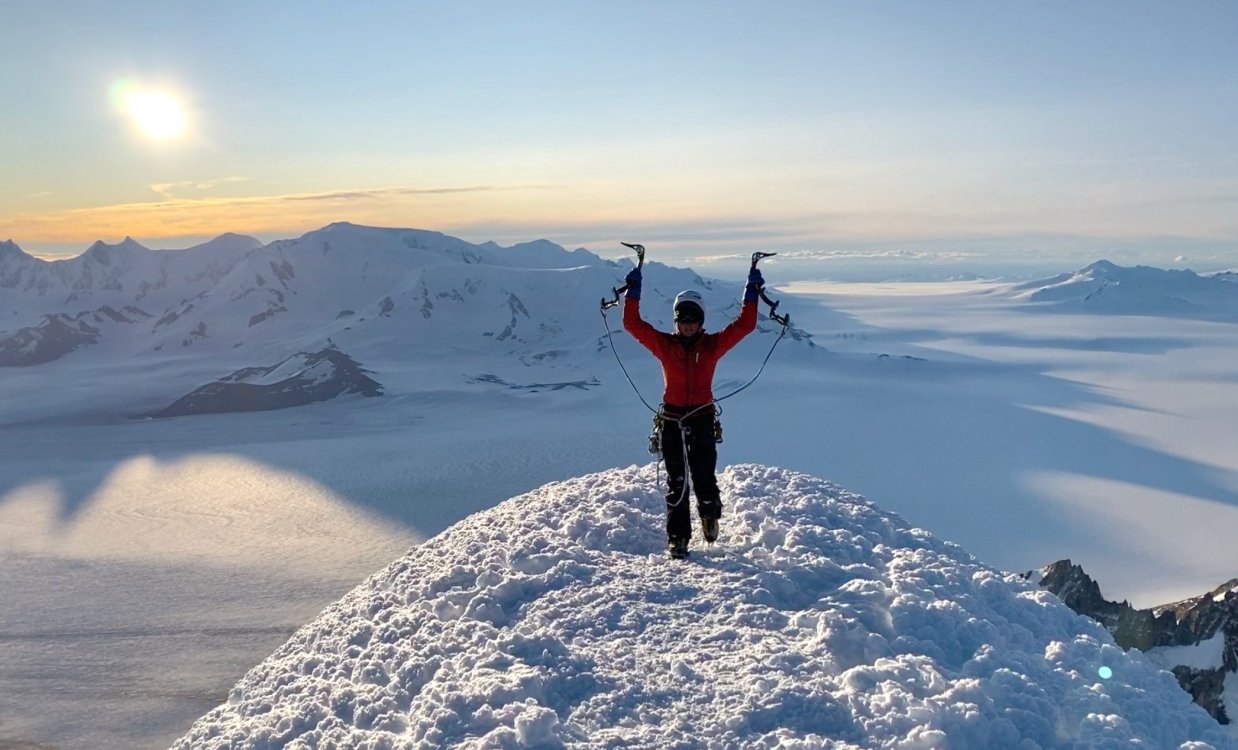
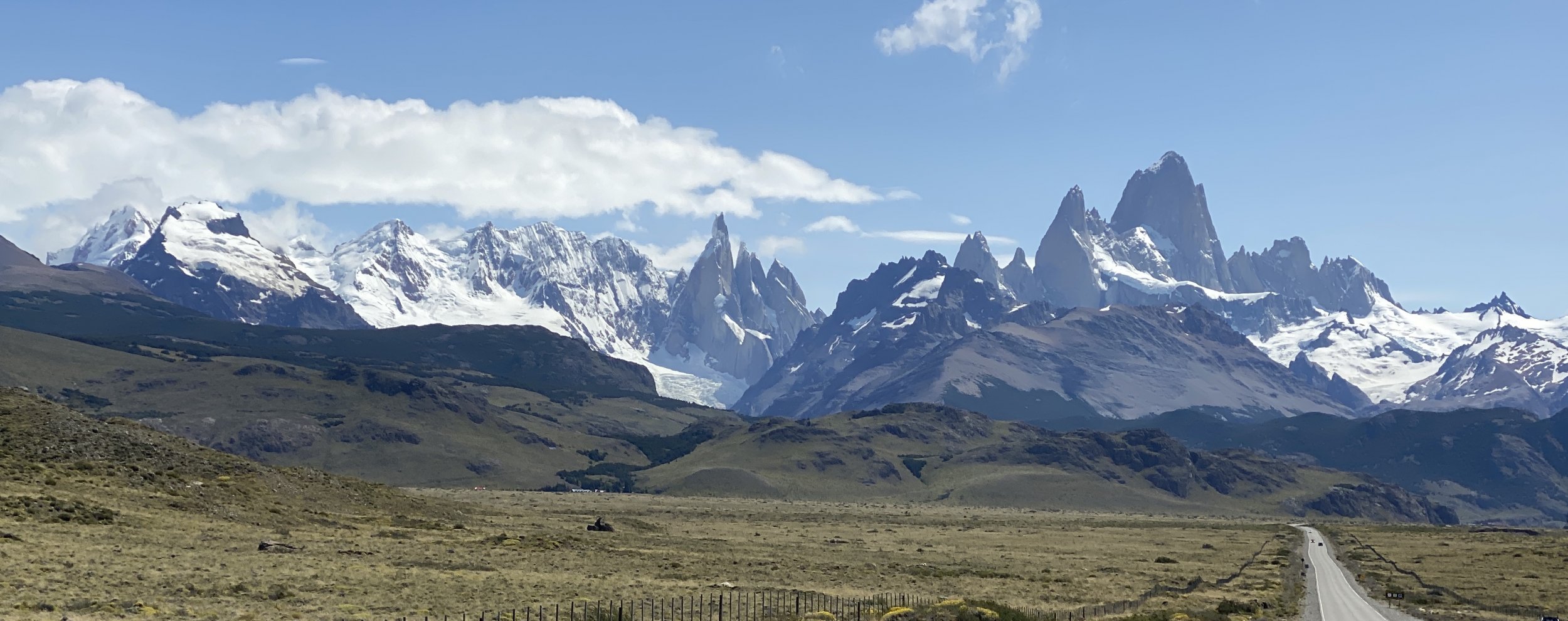
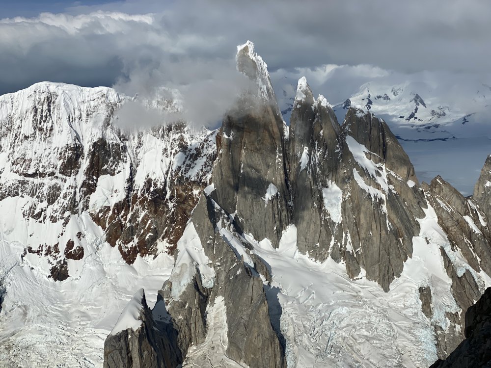
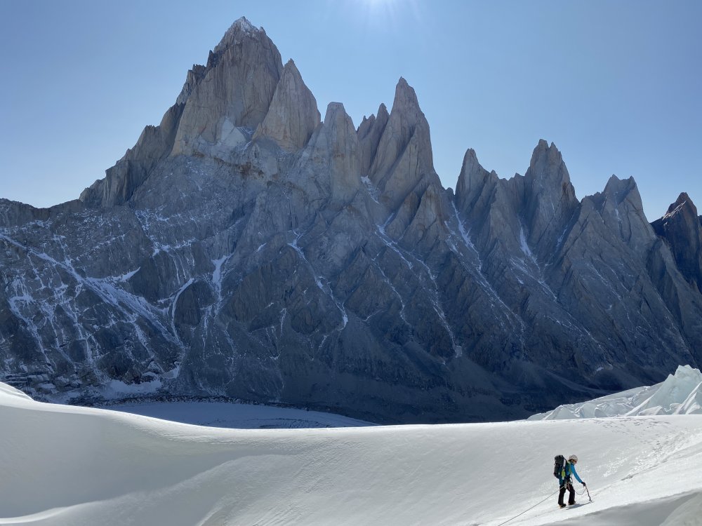
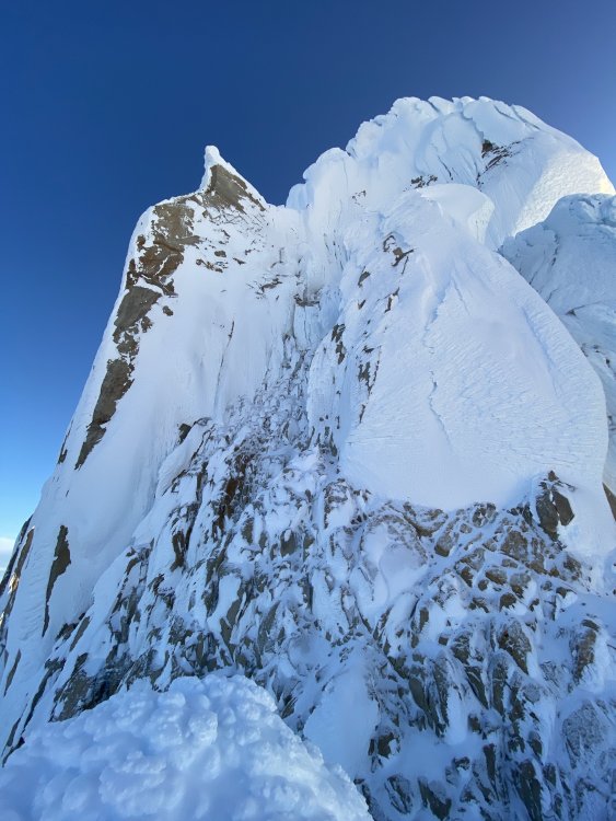
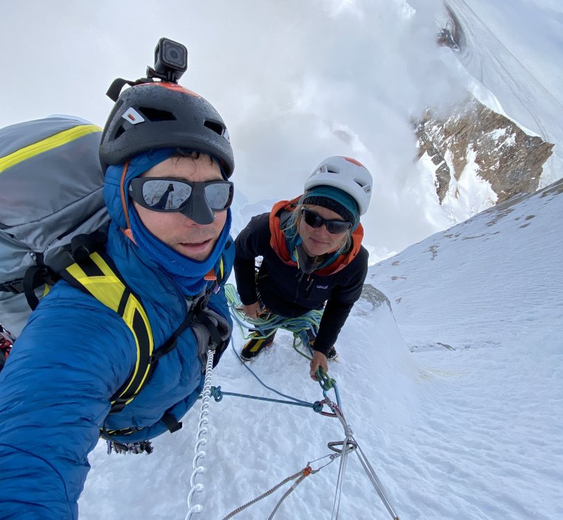
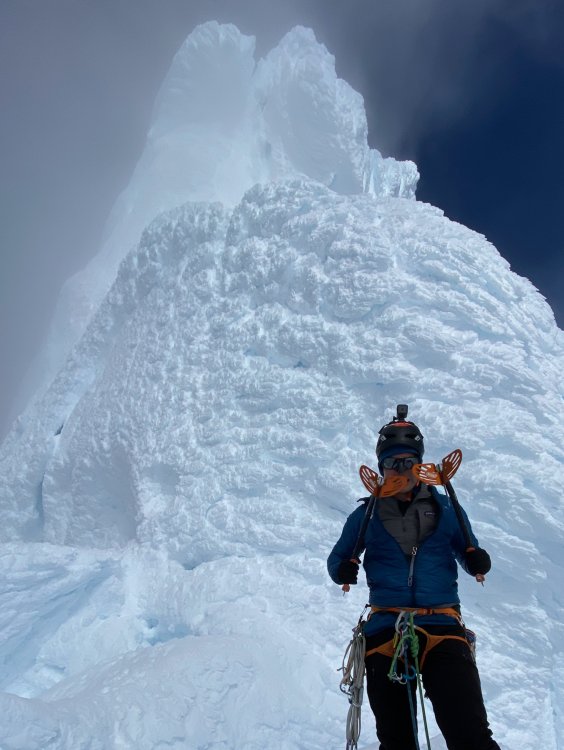
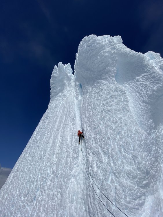
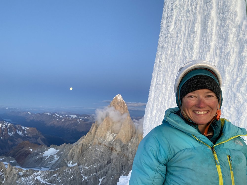
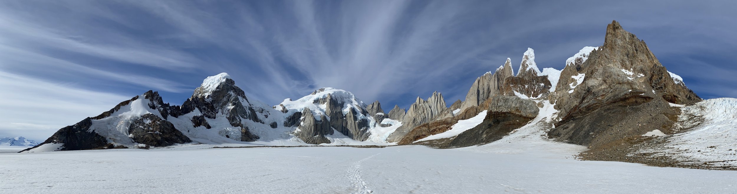
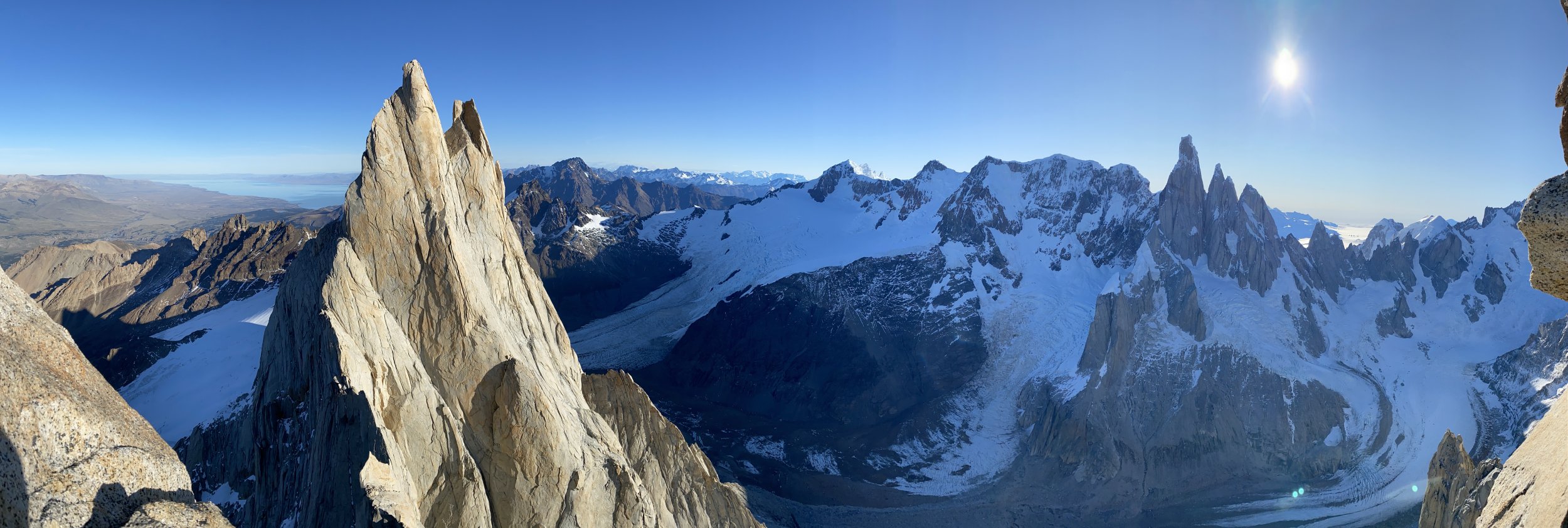
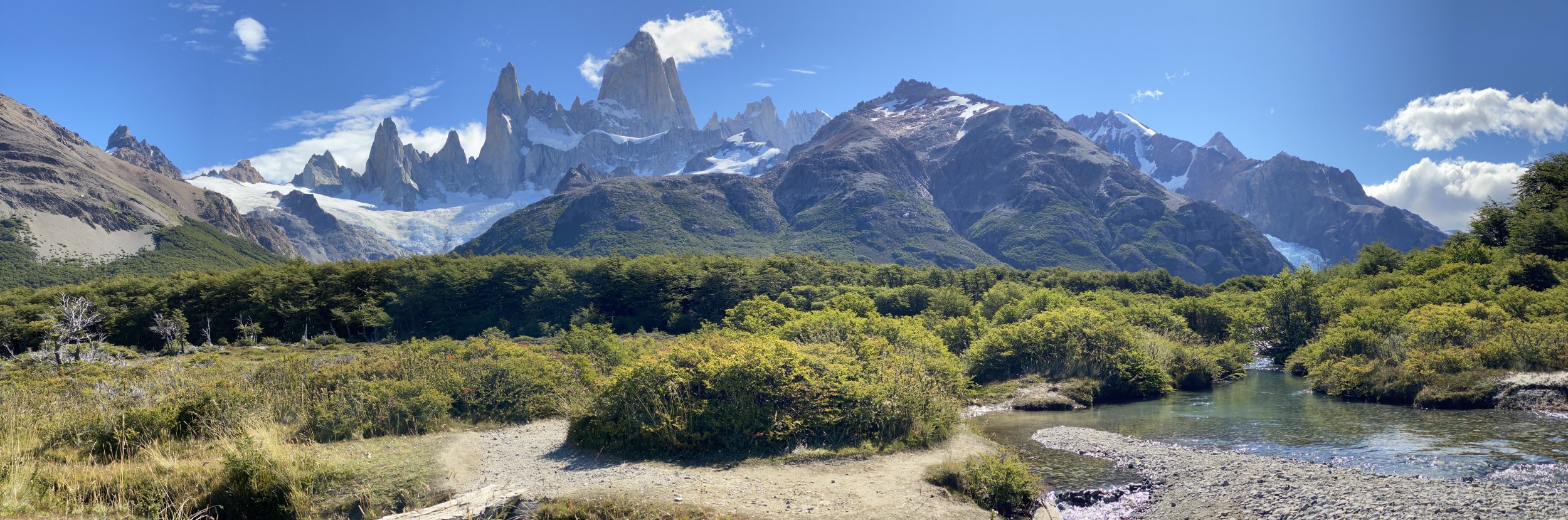
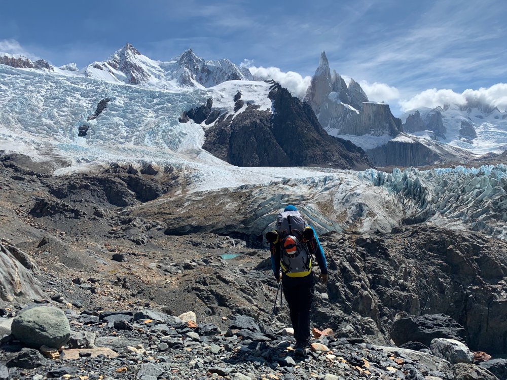
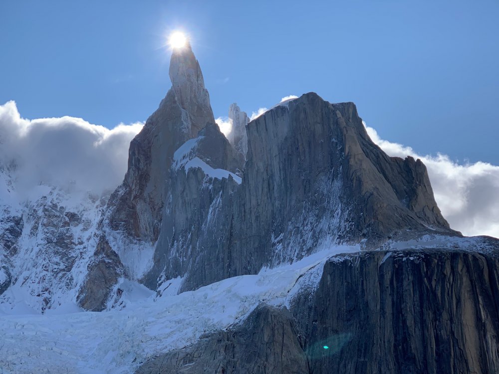
 Via dei Ragni: Grade VI, 95deg snow/rime/ice, M4, 1000m Scribe/Photos/Climbers: Jeff and Priti Wright Google Street View: Cerro Torre Summit 360 Panorama We’ve had a picture of Cerro Torre on our desktops, phone wallpapers, and posters above our bed for the past 5 years. It was the reason we took up ice climbing in the first place. In February 2016, we made our first attempt on this route, hoping to at least get a glimpse of the scale of the mountain and understand what it took to climb it. The weather was too hot by then for the climb, and after three days, our high point was below the hard technical climbing. Previous trip report: The road to El Chaltén The Fitz Roy Massif These past two months were our fourth (and longest) climbing trip to the Chaltén Massif, and sixth year of watching the Patagonian weather patterns. We wanted to return to attempt Cerro Torre again, but the next two seasons were not possible because of bad weather. Last year, at the beginning of February, we saw a fantastic weather window, and the stars aligned. We flew down to Patagonia in a 9-day magical whirlwind of constant movement, and summited Fitz Roy via the Franco-Argentina route. While on the summit of Fitz Roy, looking down at the surreal summits of the Torre, we were determined more than ever to come back the following season. Day 1. We arrived in El Chaltén on New Years Eve, the last day of a 4-day weather window (brecha)…we missed it! Since then, January was filled with short stints (8-12hrs) of good weather in the mountains, and the arrival of a 6-day mega window in early February sent an electric buzz throughout town. We were a couple of bats out of hell with our 40lbs packs each as we set towards Laguna Torre. The plan was to pass through the Niponino base camp in the Torre Valley and bivouac at the higher Noruegos (Norwegian) bivouac, which would put us closer to Col Standhardt (the next day’s objective)…the passageway to the West Face of Cerro Torre where the Via dei Ragni route begins. Our bivy site at Noruegos Day 2. From the Noruegos bivy site high on the slopes of the Torre Valley, we traversed near the base of the Torres, under the celebrated SE Ridge (perhaps the greatest climb in the world) and also the 1959 Maestri line to the triangular snowfield where so much history and controversy took place. From the East, all of the Torres stand impossibly steep and impassable. To get to the Ragni route on the West side, we would climb up and over the Col Standhardt where an implausible car-sized chockstone sits interminably between the col’s steep walls. From the col, one gets the first glimpse of the Southern Patagonian Ice Cap (Hielo Continental), a massive expanse of ice 200mi long. On a rare, clear day such as this day, we could see green Chilean fjords across the Ice Cap between large, snowy volcanos. A Lighthouse Several rappels deposited us down to the Circo de los Altares (Cirque of the Alters), an impressive crescent of white-capped peaks and toothed spires. From there we headed up another glacial ramp on Cerro Torre’s West Face to a high camp, 150m below the Col de la Esperanza (Col of Hope), first reached by Walter Bonatti in 1958 who hoped that this col would one day blaze a path to the summit. It wasn’t until 1974 that a team of Italians from the Ragni di Lecco (thus the name “Via dei Ragni”) completed Bonatti’s vision. Circo de los Altares Steep snow climbing and easy mixed terrain led us towards the camp at Col de la Esperanza, the camp we hadn’t reached on our last attempt. As we hiked past our previous high point, our hearts soared. This time around, the climbing felt much easier with 4 more years of climbing experience under our belts. Day 3. This day was a rest day of sorts. To set ourselves up for success on summit day, we were moving to the highest camp a few hundred meters up: El Elmo (“Helmet”), a prominent plateau below the steep, technical climbing. Those who were faster and stronger than us had gone straight to the highest camp the day before and were now going to do the hard work of battle-axing the bullet-hard blue ice and cleaning the cotton candy mushrooms of the summit. As we came over the Col of Hope, we entered an otherworldly expanse of mangled rime towers and precarious exposure. These deformed blobs of ice towers with icicle branches and feathery leaves seem like something only God or Dr. Seuss could conjure. It’s something so beautiful and terrifying at the same time. We were face to face, looking up at thisbeastly Tower. A spectacular nightmare. Day 4. Summit Day! We were pretty antsy to get going on the summit push. Falling snow greeted us when our alarms went off at 2:00AM as the mountain was enveloped in a cloud. All over camp, alarms went off and were snoozed as the precipitation discouraged movement. When the stars finally came out again, we were the first to muster our strength and get to work. Walking up to the base of El Elmo in the darkness, the first overhanging rime ice mushroom of the route, we gave a sigh “ah, breakfast!” The last 10m didn’t actually have any good protection (besides maybe a horizontal picket), and it was a sequence of cutting the feet loose, campus’ing from questionable tools, and shoving knees into the soft rime to make upward progress. Once at the top of El Elmo, a crowd had formed at the base, chomping at the bit. All of camp was finally up. The snooze button had proved an epic failure of our collective, strategically staggered alarms. We all watched in awe and gave whooping shouts from this low perch as our friend, Fabi Buhl, paraglided from the summit in the wee hours of the morning, slowly swirling in front of the spectacular sunrise over Lago Viedma. He was the first ever to fly off the summit of Cerro Torre having climbed the mountain first (and not dropped off via helicopter). After El Elmo, the mixed pitches zig-zag through a maze of rock and ice up to the base of The Headwall. Two pitches of blue, overhanging, bullet-hard ice. The final pitches mount three tiers of giant rime mushrooms facing the Ice Cap. This high ridge gets pummeled by the wet, freezing storms that race around the Southern Ocean to create these crazy rime formations. The first and second rime mushrooms had formed spectacular, natural blue-ice tunnels created by vortices of wind spiraling up the ridge, clearing a path through the thick outer layer of soft rime ice. Climbing into this vertical subway tunnel for 60 meters felt like entering a portal into another world. It eventually funneled up to an elevator shaft and spat us out of a squeeze tube. For the second and third mushrooms, we attached Petzl prototype “wings” to our ice tools to make purchase in the soft, overhanging, cotton-candy rime. These wings are horizontal plates that bolt onto the picks of our ice tools like Dilophosaurus gills. The Final (Summit) Mushroom was a beast. The previous day, it had taken the other parties many hours to clear a natural half-pipe, then dig a tunnel through the steepest part for many hours. Their line then exited their manufactured tunnel out onto the overhanging summit lip. Walking up to the steepest point on Cerro Torre on a perfectly still, clear day was absolutely surreal, basking in the bright orange-red glow of the sunset. The 200 miles of the Continental Ice Cap stretched before us and the Pacific Ocean now clearly visible. Behind, on the other side of the Torre Valley, small, wispy clouds hovered over the summit of Fitz Roy. We were lucky to get perfect lighting to fly our drone around for 30 minutes alone before we headed back down to our tents at El Elmo for the night. Days 5 and 6. To get back to town, you can reverse your way up Col Standhardt (M7 shenanigans), or take one of two trekking passes along the Ice Cap. We had experience taking the Northern pass (Paso Marconi) which was now in really bad shape. We opted for the Southern pass (Paso del Viento) to try something new, and hopefully be able to turn our brains off for a few days (sadly, this was not the case). The Hielo Continental spans 50mi across and crawls 200mi north to south across Southern Patagonia. It looked so beautiful and serene from our climb. Now, face to face with this beastly crocodile, it was the stuff of horrors. Canyons after canyons of impassable crevasses, we zig-zagged our way in no logical direction under a bright, unhelpful, full moon. From the air, our tracks must have looked like the random scribbling of a toddler on a massive, blank white floor. A sun dog greeting us after our descent. Finally reaching the pass and seeing people again after such a mental test of sanity was nothing short of jubilant. A popular trek is to take the pass South to Lago Viedma: the Huemul Circuit. We were now on a delightful trekking path and could now…finally… turn our brains off and just put one foot in front of the other for a mere 14 miles back to ice cream and showers and safety. Thanks: We had good confidence in the forecast and the length of the window, but it’s still important to have daily weather updates to anticipate the inconsistencies between each day. We’re so grateful for our weathermen who sent us updates to the inReach and gave us both confidence and peace of mind each day that we spun ourselves further from civilization: Dan Berdel, Devin Monas, and Rolando Garibotti. We’d also like to thank Dave Burdick (Alpine Dave!) for his support, inspiration and beta on the route. Also thanks to the American Alpine Club Live Your Dream Grant for supporting this trip. Recommended Reading: The Tower, Kelly Cordes Patagonia Vertical, Rolando Garibotti Enduring Patagonia, Greg Crouch Gear Notes: 13 ice screws (including 3 stubbies) 1 Picket (to place horizontally in vertical rime!) small set of nuts (Wildcountry Superlight) small rack of cams (Black Diamond Ultralight cams .4-1, Metolius Mastercam 1-3) 2 Petzl Nomic Ice Tools + Petzl prototype wings (rented from Viento Oeste gear shop in town) Petzl V-link Umbilicals 2 stuff sacks (gear management in pack, and also to leave for snow anchors) The North Face Phantom 50 backpack 4 double-length Petzl Pur'anneau runners with 2 Camp 22 biners each 2 double-length Petzl Pur'anneau runners with 1 Camp 22 biner each 7 single-length Petzl Pur'anneau runners with 1 Camp 22 biner each (can’t have too many runners) Patagonia R2 Jacket Patagonia Micro Puff jacket Patagonia Macro Puff jacket Patagonia Kniferidge hardshell jacket (didn't use)...also, it's now the "Ascensionist Jacket". Mainly wore the Micro Puff for outer layer Patagonia Nano Air Pants Patagonia Softshell pants (bibs) Patagonia base layer (top+bottom) Platypus 2L soft bottle Garmin inReach Mini (love this little guy!) Petzl Dart Crampons 2x Mammut Twighlight Twin Rope (7.5mm) Petzl Sirocco helmets Petzl Sitta harness (for him) and Arc’teryx harness (for her) Metolius Feather Nut Tool (each) Mammut Smart belay device (not the Alpine Smart) 3 lockers for group: Grivel Tau K12L, Grivel Lambda HMS, Grivel Plume 2 medium fuel canisters Jetboil Sol stove Safety ‘biner (each) – Edelrid 19g caribeener, Petzl Micro Traxion, short Sterling Hollowblock, Trango Piranha knife Bivy setup – Full Length Thermarest NeoAir XTherm sleeping pad, Exped Air Pillow UL, Feathered Friends Spoonbill sleeping bag MSR Advance Pro 2 Tent (amazing!) La Sportiva TX4 Approach shoes La Sportiva G2SM boots Petzl Reactik headlamps (each) + 3 extra AAA batteries + Petzl e+LITE headlamp Other things: 1 long spoon to share, chapstick to share, small Joshua Tree sun stick to share, Frog's Tung phone leash, lighter, whistle, duct tape, Thermarest repair patches, Voke tabs, Nuun, pain killers, 1L Platypus soft water bottle (for her) and 750mL HydraPak Stash (for him), warm headband, glove liners, 1 pair thick long socks (each), sunglasses, ear plugs, WRFA emergency form, small pencil, cotton handkerchief, wad of toilet paper, ID, Credit Card 1 Swix alpine pole (with snow basket) Arcteryx ball cap Adidas Sunglasses (with nose sun guard), no longer available iPhone 11 Pro (with route beta downloaded) GoPro HERO 5 Session (with helmet mount) DJI Mavic Mini Drone (remote and drone stored in USPS Tyvek bag) Dinner: 2 AlpineAire meals, 3 Near East Couscous boxes repackaged with small olive oil packets in ziplock bags, salt Day food was mostly bulky, yummy snacks: vegan jerky, dried mango, nuts, Cheese-Its, sesame sticks, Gu, nut butter, etc Approach Notes: Approached via Col Standhardt. Also possible to approach via Paso Marconi (currently in difficult/sketchy conditions) or Paso del Viento (long). We came back via Paso del Viento, but it's also possible to climb back over Col Standhardt (M7 shenanigans with old fixed ropes here and there).
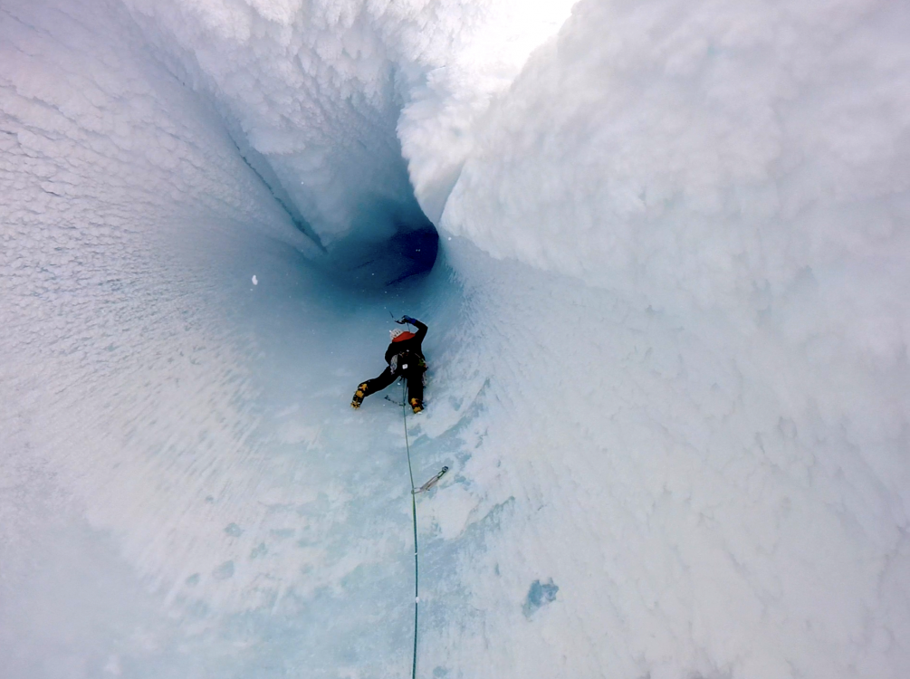


-
 Trip: I Love the Desert Date: 4/28/2008 Trip Report: This spring I was fortunate to make a really fun desert Southwest tour with my wife Michelle and a few other friends. We visited Colorado, Utah, Arizona, and Nevada. During the trip I climbed 32 desert towers and a half dozen other routes. First stop was Colorado National Monument. It was pretty cold, but we managed to climb Independence Monument, Otto's Route (III, 5.9). Colorado National Monument, with Independence Monument on the right: A close up: The route was pretty "cool" with snow all over the ledges, But fun none-the-less. Love the history of the route with all the manufactured holds and staircases. You can see one of the staircases in the pic below, and Michelle is grabbing on to an old pipe hole: With temps dipping down to 10-degrees, we decided to head farther south to the Moab area. We did a quick climb of South Six Shooter, South Face (II, 5.8). On South Six Shooter Peak, with North Six Shooter in the distance. It snowed on us, so dreaming of warmer weather we decided to head farther south into Arizona. We had long wanted to climb in the Superstition Mountains outside of Phoenix. The Superstitions. The Hand, the Tower, and the Prong are the first three towers on the lower left. The larger Grandfather Hobgoblin Spire is on the right, but blends in a little with the cliff behind: The rock at the "Supes" is really interesting, some kind of crazy conglomerate. The protection is often sparse, and when there are bolts, well... One of those plant towers: The first day we did a collection of towers on the northwest side of the range. We climbed The Hand (5.6), The Tower (5.8 R), The Pickle (5.4), The Periscope (5.4R), and The Prong (5.6). All of them were unique little climbs and summits. Very cool. The Hand: Here is Michelle at a small belay on The Hand. The 3-pitch route we climbed was called the Razor's Edge and the climbing was on a 3-foot wide, steep ridge crest: The Tower had 25-feet of unprotected, overhanging 5.8 climbing to start the route, then a long and thoughtful 5.7R pitch above that. It felt good to get on top of that sucker. The Pickle was fun - it looks steep and hard from the base but it really is only 5.4. The climbing is on huge cemented together conglomerate rocks. Michelle rapping off the Pickle. The next day we woke up for two more climbs of Grandfather Hobgoblin (III, 5.9), and the really fun North Buttress, Spider Walk (III, 5.6). Here is Grandfather Hobgoblin, the 4-pitch route climbs up to the notch on the left, then right up to the summit: Looking down at Michelle atop the first pitch: View from the summit out towards the suburban sprawl: After rapping down we went directly over to the North Buttress. Spider Walk takes an improbable looking line (for 5.6), meandering up 4 pitches of run-out slabs, with hard to find bolts, then up a chimney/crack system up a very cool feature. Here's a shot of the North Buttress. The route starts on the left side, then works its way up to the chimney near the top: Michelle following the second pitch: At the end of the route, you can scramble up to a high spire that overlooks everything. A final sunset: Next stop was Red Rocks, Nevada. We spent a few days climbing Dark Shadows (5.8), Frogland (III, 5.8), Sour Mash (III, 5.10a), then met with our good friends Chin and Raleigh and climbed Eagle Dance (III, 5.10c A0) and then a twisted variation of The Gobbler and Yellow Brick Road (III, 5.10c) on Black Velvet Wall (this to bypass the cluster on Dream of Wild Turkey's and other routes). Hiking up to Eagle wall: Me leading the second pitch of The Gobbler, with Raleigh belaying: Michelle following Sour Mash: All in all we had a great week in Red Rocks, with splitter weather and pretty moderate crowds. Next stop: Zion. I really love Zion, and this is partly why: We only had a chance to spend two days here. The first day was a bit of a lazy day. We rode up canyon in the shuttle and climbed The Pulpit, Original Route (5.9, C1) - a cool little spire at the end of the road. Here's Michelle following the one and only pitch: Day 2 we climbed the Iron Messiah (III, 5.10) a 10-pitch route on the Spearhead. You gotta love chimneys to like this route: High on the route (see Michelle at bottom of crack and shuttle bus below), the second to the last pitch was a stellar 200-foot corner. It had been a few years since visiting Zion and I was really psyched to climb there again if only for a couple days. Michelle had to head back home and my buddy Jim flew down to meet me for some climbing around Moab. Our first stop was the Bridger Jack Towers in Indian Creek. In two days we climbed Sparkling Touch Tower (5.11-), Thumbelina Tower (5.11), Sunflower Tower, East Face (III, 5.10), Easter Island Tower (5.10), and King of Pain, Vision Quest (III, 5.10+). Shadow of the Bridger Jacks on the desert floor: Jim's picture of me leading Thumbelina, a great single pitch of 5.11, and a cool spire to boot! Jim's picture of me leading the first pitch of Sparkling Touch: The King of Pain. Vision Quest climbs the split between the two towers: Here's Jim in the 5.10 slot on Vision Quest. After this pitch, I won't disagree with the guidebook description calling the route "burly". Jim taking the lead on the last pitch of Sunflower Tower. South and North Sixshooter can be seen in the distance. I was psyched to finally climb on these towers. The ease of access, quality rock and routes, and relaxing atmosphere made for a great couple of days (and a great warm up for Jim!) Next we headed into Canyonlands National Park. We stopped by the ranger station and got a permit to camp down on the White Rim for a couple days, then later that afternoon we climbed Washer Woman, In Search of Suds (III, 5.10+). The route was super-classic just like everyone said it would be. Gotta be one of the most unique looking towers in the desert. Can't wait to see what it looks like when that chock stone falls out! Washer Woman and Monster Tower: Looking down from the last pitch, with Monster Tower behind: Jim's pic of me leading the final summit block: Gotta love that rappel! Next we headed into Monument Basin. Our first objective was the ultra-classic Standing Rock, Kor Route (III, 5.11). You can tell this route gets climbed a ton because there is no loose rock or mud typical of the area to speak of. I can only imagine what it must have been like on the first ascent. Jim's pic of me leading the great roof (way easier than it looks from below): Jim following the second pitch: That afternoon we climbed the Shark’s Fin, Fetish Arête (III, 5.10c R). This route doesn't seem to get as much traffic and one gets a taste for some more authentic Monument Basin climbing. This picture was taken from Island in the Sky. The route follows the lower angled right side for 5 fun pitches: Jim's pic of me starting up the first pitch: I thought the 1st and 3rd pitches were more R rated than the 5.10b R second pitch according to the guidebooks. Jim rappelling off of Shark's Fin - awesome rock striations: ....continued...
 -
Trip: Utah Desert Tower Tour - Date: 3/20/2007 Trip Report: My wife Michelle and I just returned from a two week trip climbing desert towers around Moab, Utah. Overall we had a great trip, climbing 11 routes on 10 towers (actually 9 towers and 1 mesa). Our first stop was Arches National Park. We decided to warm up on Off Balanced Rock, North Chimney (5.7). The 100-foot runout on the second pitch was a little unnerving but luckily the chimney was fairly secure. Here's a shot of me taking a picture of Michelle coming up the chimney: On top of Off Balanced Rock: Next stop was the obligatory Owl Rock, Olevsky Route (5.9), definitely a must do tower for anyone visiting Arches. Michelle rapping off: That evening we hiked out to Delicate Arch for the sunset. Next it was time for the Fisher Towers. It rained a little the night we got there, so climbing Ancient Art the next day was out, as climbing dry mud is bad enough. Instead we did the really cool hike through the towers and out to a viewpoint. Later that evening it seemed to dry out enough to give Lizard Rock, Entry Fee (5.9) a go. Leading up: Michelle on top: The next day we headed up to do Ancient Art, The Corkscrew Route (III 5.10d) The route climbs up the central chimney then up the highest point on the left. Following the first bolted crux: The summit has to be one of the top five coolest spots in the world that I have been. We came back down and I decided to give a go at The Cobra (5.11 R). I mean, how much longer is this thing going to be there? I had to get it while I still could. Chalking up under the lip: One more day in the Fisher Towers and we wanted a little bit more, so we climbed the Kingfisher, Colorado Northeast Ridge (IV 5.8 C2). Kingfisher, the route ascends the left side of the tower: This was actually Michelle's favorite route of the whole trip! Not because the climbing was that great - mostly a bolt ladder with a few very C2 mud placements and some good free-mudding. But the overall line, exposure, and summit were fantastic. Looking straight down the Northeast Ridge: Summit views - The Titan, Echo Tower, and Cottontail Tower: Next stop was Castle Valley. We of course had to do the obligatory route on Castleton Tower- the Kor-Ingalls (III, 5.9). Castleton Tower: The route follows the central dihedral: The line is good, but the climbing leaves a bit to be desired. The crux offwidth is only cruxy because they tell you to bring so much god-damned gear up the route and you have to squeeze up the thing with all this crap. In reality you only need a number three Camalot and 4 quickdraws to lead the crux pitch. Anyways, cool summit. Michelle coming up the crux OW/Chimney: The Rectory came with many recommendations, and although it is a mesa and not a tower, it still has a tower feel and is a really cool desert formation. The Rectory is the Mesa in the foreground, the route climbs directly up the facing wall: We climbed Fine Jade on the Rectory (III, 5.11a). The first two pitches are the crux and are both interesting and sustained. The warm up pitch is a steep but short 5.10d hand-OW-hand crux. Michelle following the first pitch: We hiked across the Rectory to watch some climbers on the Honeymoon Chimney of The Priest. Climbers on Fine Jade, The Rectory: Later that afternoon we decided to climb the North Chimney of Castleton Tower (III, 5.9), as many people consider it the better of the two moderate routes. The first pitch was ultimately classic. Two parallel cracks, mostly hand jamming, and interesting moves for an entire 150 feet. The second pitch, however, was mostly junk and I linked all the way to the notch in exactly 200 feet. Michelle following the first pitch: The next mission was Sister Superior, Jah Man (III, 5.10c). Another fine desert route, with a stout but short crux on the 3rd pitch. And one of the finer chimneys in the area - the Sister Squeeze chimney on the 2nd pitch. Sister Superior: Up close: Looking down the 3rd pitch: On the summit looking toward Castleton and the Rectory: And for the final hurrah we took the long drive out and climbed Moses, Primrose Dihedrals (IV, 5.11d). Moses is the tallest tower: The route is everything it's cracked up to be - short but sustained pitches, interesting climbing, and an awesome position. Michelle coming up the 4th pitch: Pitch 5: Summit success: Gear Notes: SuperTopo: Desert Towers - a great guide for these routes. Approach Notes: High clearance 4x4 recommended - even for parking lots.
-
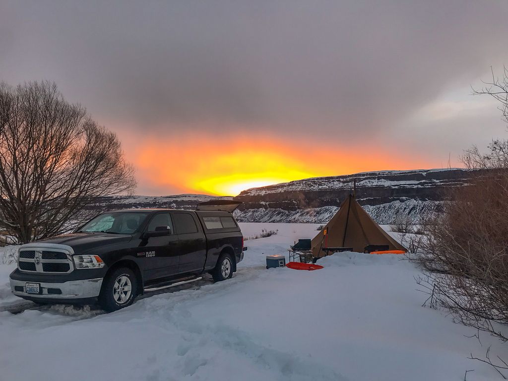
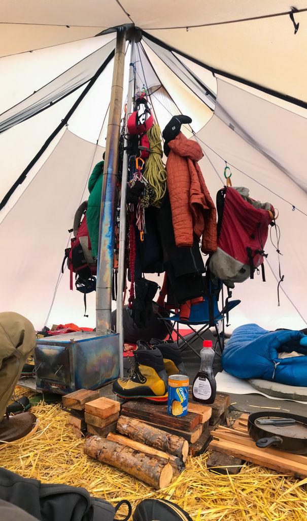
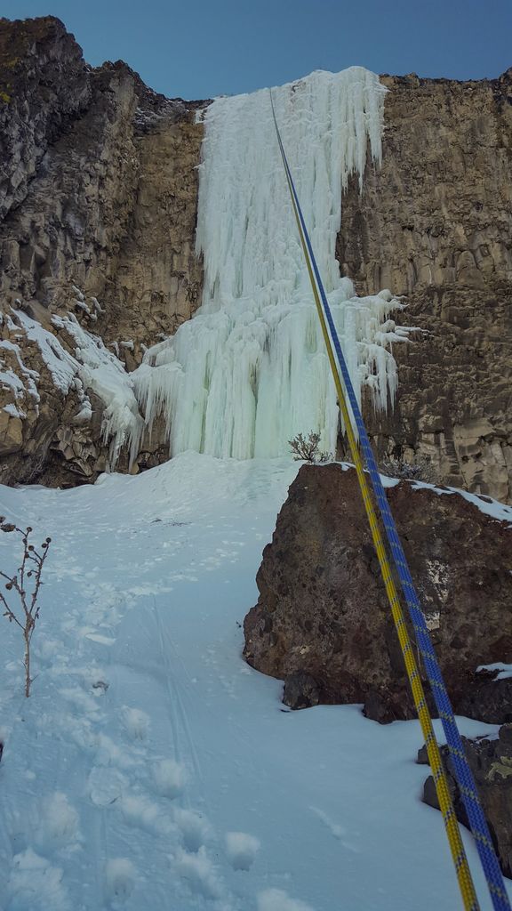
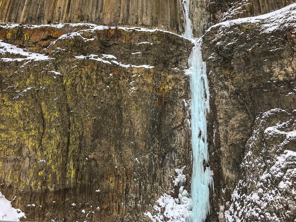
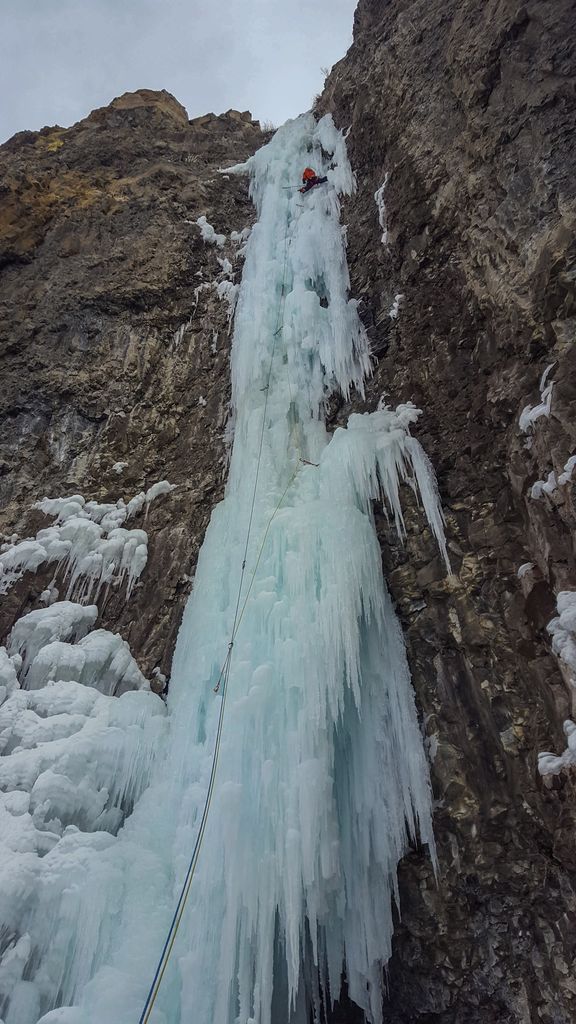
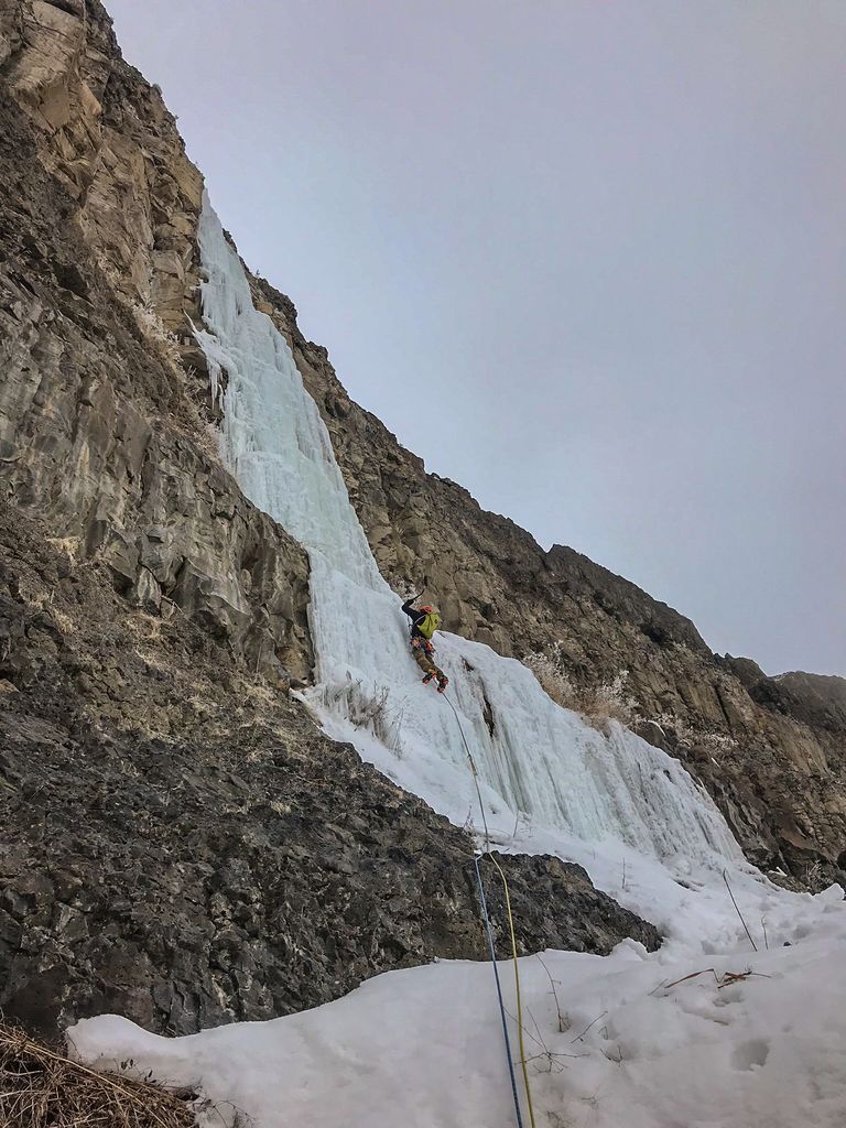
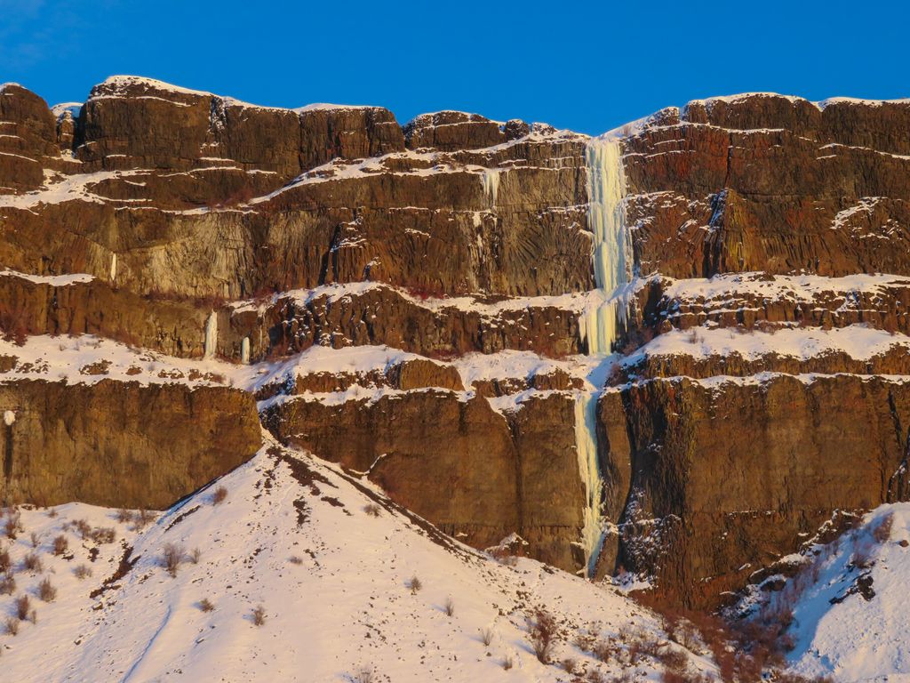
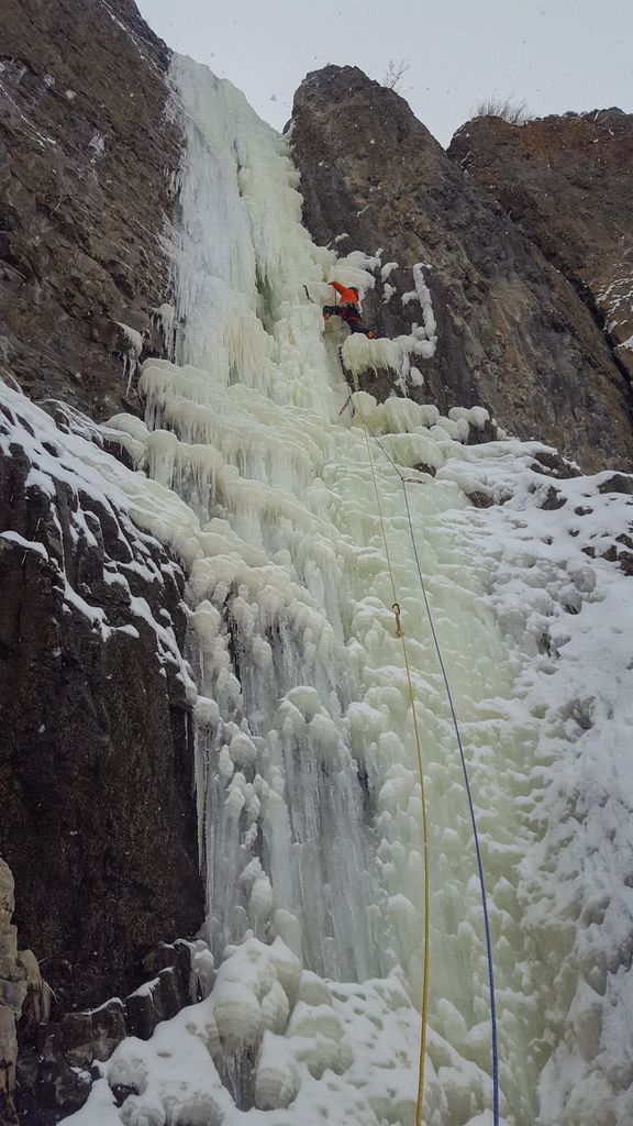
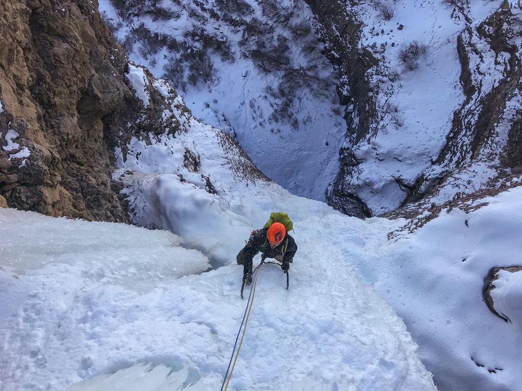
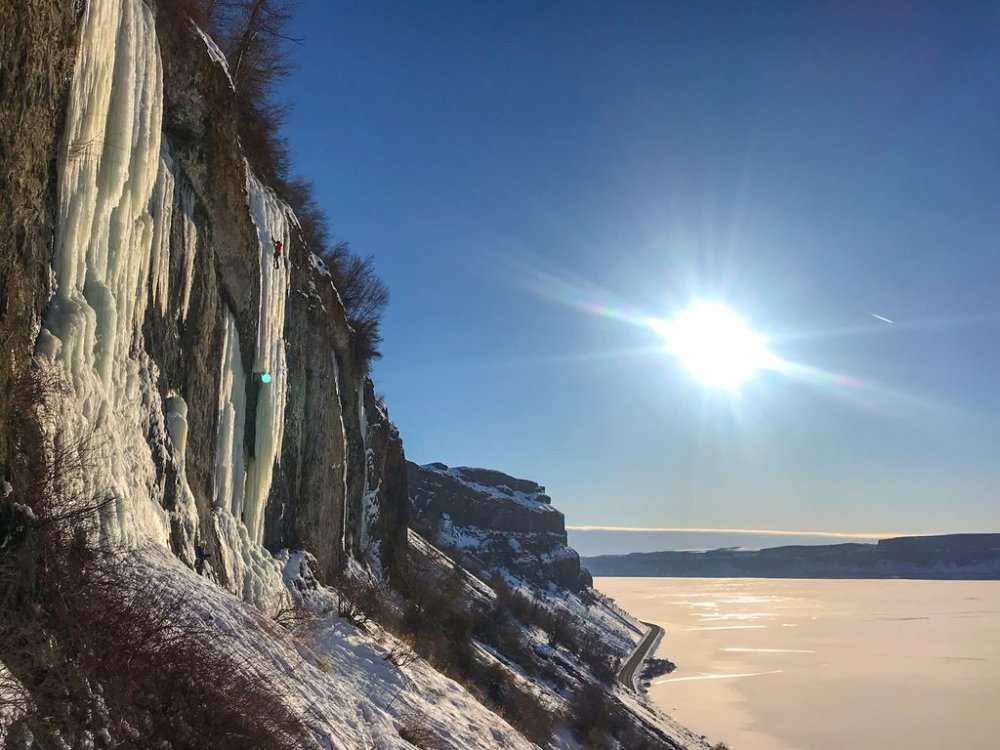
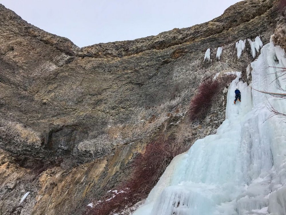
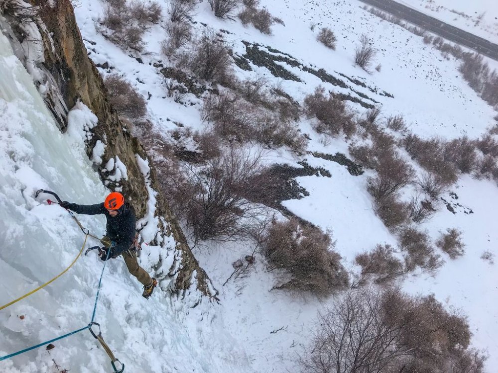
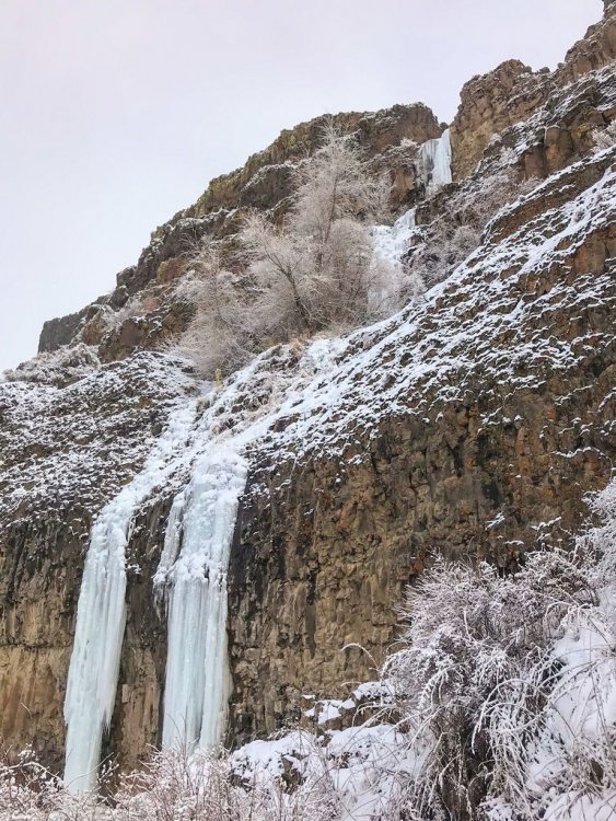
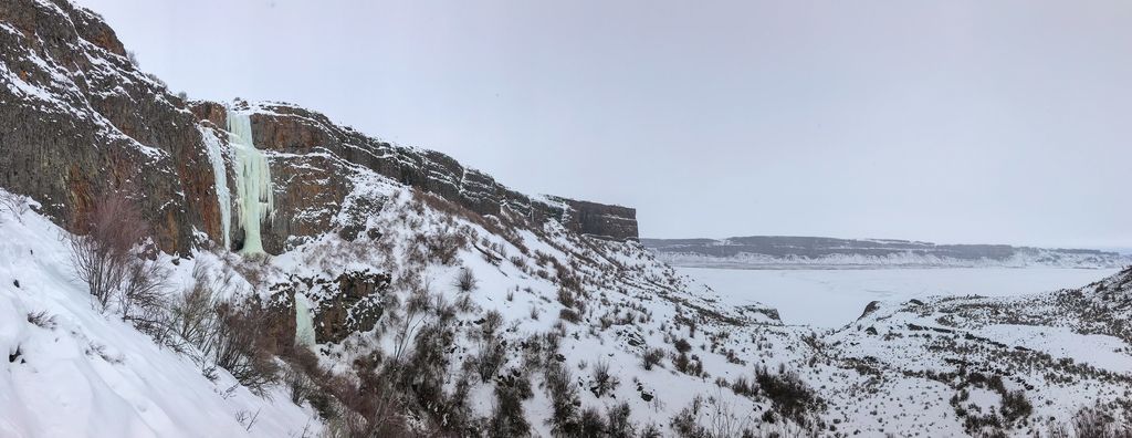
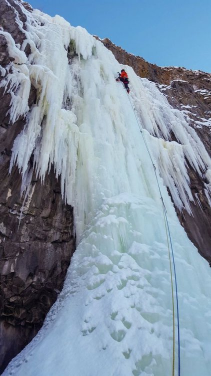
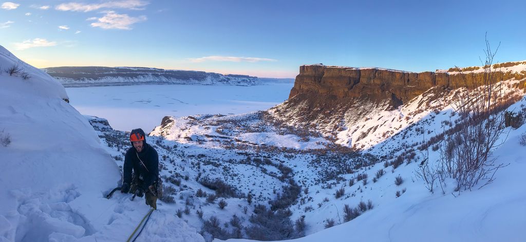
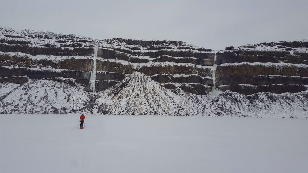
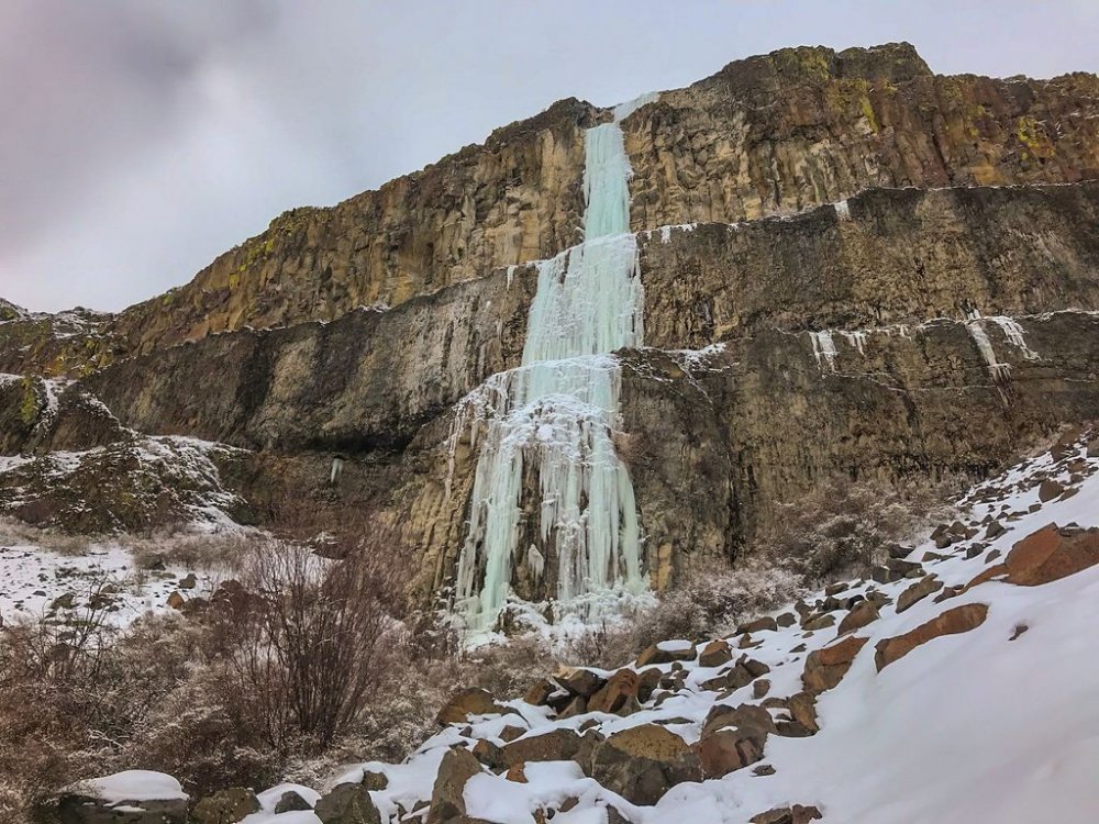
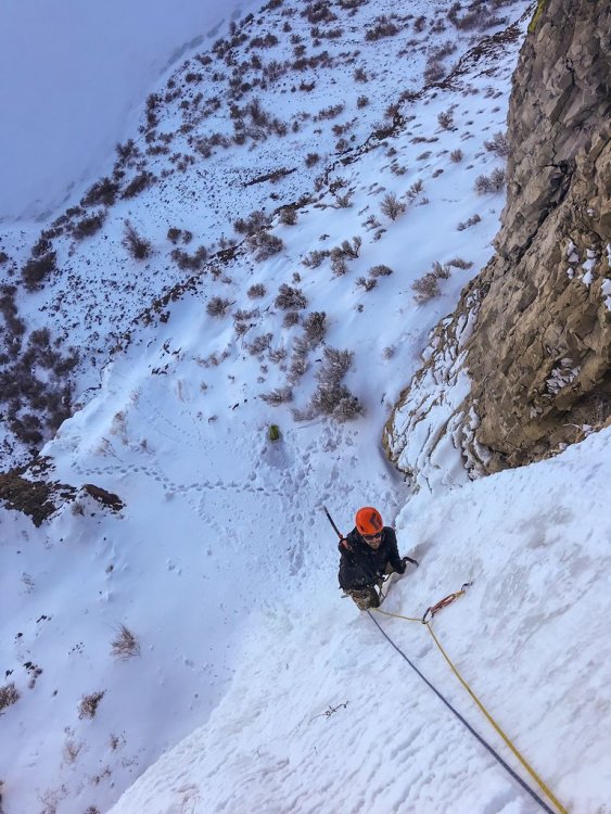
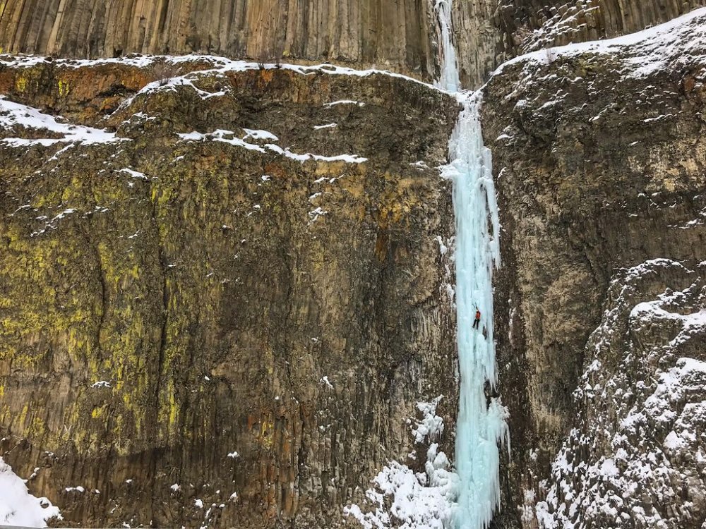
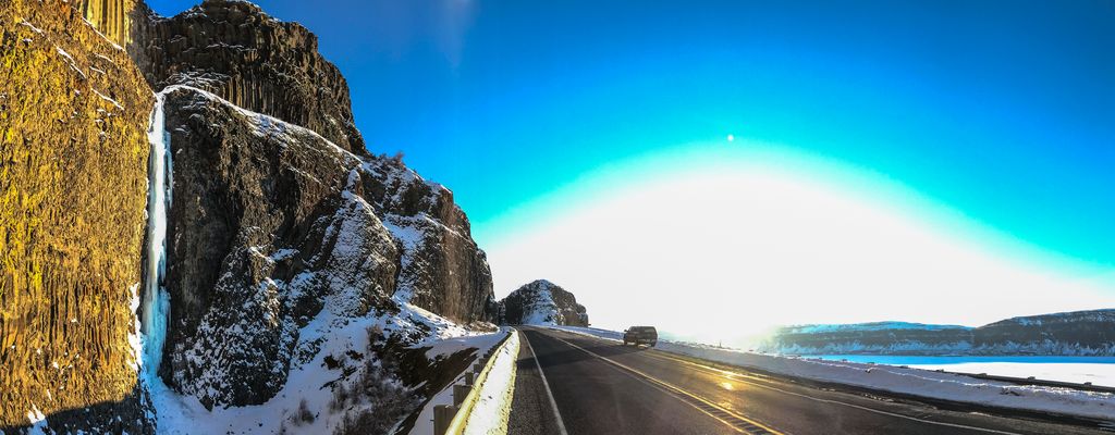
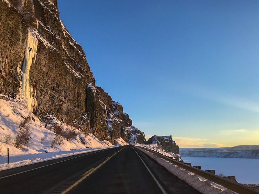
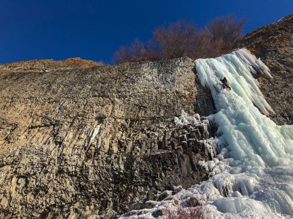
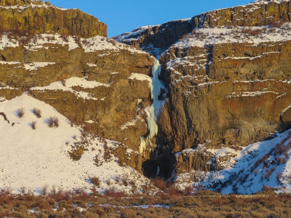
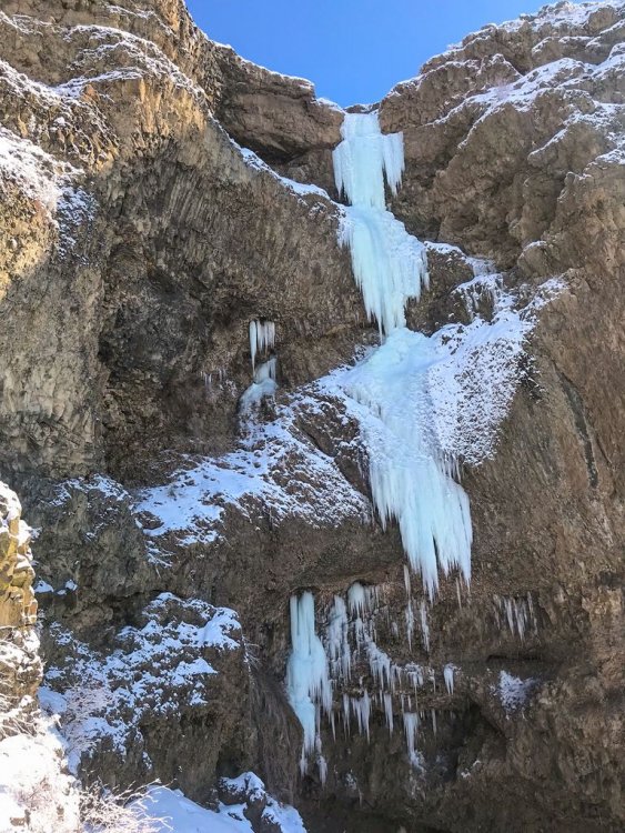
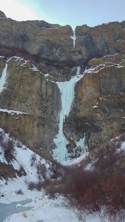
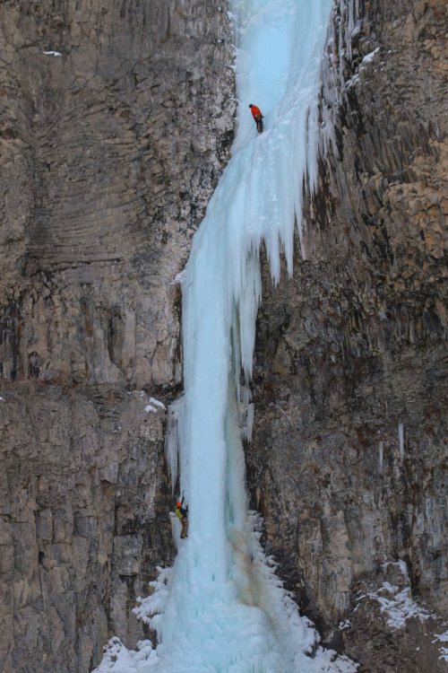
 Trip: Banks Lake, WA - Zenith, Emerald, Cable, Razorblades plus others Trip Date: 03/03/2019 to 03/14/2019 Trip Report: With reports of an incredible season at Banks Lake, my partner (Joe Peters) and I decided we needed to get over there. We drove over on March 3 to find a good place to set up a camp. Joe had to finish a couple things at work, but my wife Trisha came out to climb for the 1st two days until Joe got back. Then Joe and I were able to spend another 9 days climbing some of the wildest ice I have ever been on. Banks lake is that good!! I didn't list any grades in this trip report. Banks is a funny place and I found that grades were tricky to judge. In the end I decided that Wayne Wallace was right when he said..."Grades don't matter, everything here is hard." We camped in Joe's tipi tent which is pretty luxurious complete with stove for heat and drying gear. The best spot we found to camp was right across from Salt and Pepper. Camping limit is 15 days, it was free, and there was a toilet. We were able to sit in camp and stare up at Salt and Pepper every evening. Evening light in our camp. The view of Salt and Pepper from camp. (photo credit Joe Peters) Living it up inside the tipi. With that stove we could be sitting around in a t-shirt. It was absolutely essential for drying out boots and other wet gear after climbing every day. Here is a brief overview of our trip. 3/4 - Peewees #2, 3, 4, 6, and 7 3/5 - Climb below Emerald, Trotsky's Folly and Trotsky's Revenge (also called Phase Transition) 3/6 - Peewees #1 and 5 3/7 - The Emerald and Satan's Panties (also called Absent Minded Professor) 3/8 - Tea 'n' the Sahara 3/9 - The Cable and H2O2 3/10 - Unnamed climb Butch Cassidy in Moses Coulee 3/11 - Bombs over Old Baghdad (the climb across Banks lake at MP3) 3/12 - Shitting Razorblades 3/13 - Salt and Pepper 3/14 - Zenith I will just let the pictures tell the rest of story with a few captions. Peewee's Playground. I referenced these from right to left starting with 1 and ending with 8. Me leading Peewee #4 on the 1st day. A great place to start getting used to Banks ice! (photo credit Trisha Thorman) Craig Pope had just put up this line which he thought was probably an FA. It transitioned from the ice through the rock and out to the hanging dagger. It is Peewee #2 and he named it Turn the Page. This is a couple guys from MT climbing it on TR in the beautiful afternoon sun. The next day Trisha and I climbed this little flow. It was fantastic steep climbing that eased off about half way up. It is right off the road at the Emerald Pullout. It is amazing to me that there are so many of these lines that don't have names. Anywhere else and these good pitches of ice would all be named! Trisha doing a TR lap on Trotsky's Revenge. Day 3 Trisha headed back home and Joe arrived. Here Joe is arriving at the top of the fantastic Peewee #1. This is Satan's Panties (also called Absent Minded Professor). Rumor is that it hasn't come in for multiple years. It was a really fun multi-tiered climb that was a great warmup for the bigger climbs at Banks. The Emerald sits tucked up in a small valley above the main Banks Lake proper. It was a fantastic steep pitch of excellent climbing. It even faced north so it didn't get any sun to ruin the ice! Me leading the Emerald. (photo credit Joe Peters) Joe topping out on the Emerald at the end of a great day! With a cloudy day we decided to brave the lake and head across for some of the bigger lines. Thankfully the lake ice was thick and solid with no noises. The climb directly above me is Tea 'n' the Sahara. The one to my right is unknown.....it never came in this year unfortunately (or at least the dagger never touched down). (Photo credit Joe Peters). A closer view of Tea 'n' the Sahara. This was definitely my favorite climb of the trip. It consisted of 4 steep pitches each about 90-120 feet in length. The ice was typical Banks with plenty of excavating but the position and length of the climbing make it a classic for sure. Joe climbing the final steep 4th pitch. Looking back up at pitch 4 of Tea 'n' the Sahara from rappel. We were able to rappel the entire route with 2 rope stretching 70m rappels......take 70m ropes! (photo credit Joe Peters) The Cable....it is such an amazing, steep, crazy, gymnastic, different route. An absolute must do at Banks. Here Brian Williams is a little past halfway up the long pitch. Me leading the Cable. It is so good......just go do it! (photo credit Joe Peters) The Cable in the setting sun. Next we went to climb H2O2. Here are a couple of unknown climbers on it the night before. Yet another great pitch of climbing right next to the road. Here Joe is putting up H2O2 in the evening sun. The following day we drove over to Moses Coulee. Unfortunately Butch Cassidy and the Sundance Kid were pretty wrecked by the sun. This is an unnamed climb on the same road about 1/2 mile before Butch Cassidy. After reviewing the guidebook and talking with several other people this is actually Butch Cassidy. The climb between Butch and Sundance Kid is unnamed (although climbed). The WA ice guidebook has the wrong mileage to these climbs. Looking up at Unnamed route Butch Cassidy was awe inspiring. There were so many hanging daggers through the steep upper roofs. I gave it a go on lead but ended up sitting on a screw in the roof. I found out I wasn't fit enough to lock off on a tool and clean hanging daggers for that long. Still an awesome experience! Me approaching the large ice roof of hanging icicles. (Photo credit Joe Peters) The next day was cloudy so we headed back across the lake. This climb is right across from MP3. It isn't in the WA ice book and nobody seems to know what it is called. After staring at it disappearing into the fog above we decided to call it Stairway to Heaven. (Edit: sounds like it is called Bombs over old Baghdad) Here is Joe leading up pitch 2. The next day was time to get on Razorblades. This is a climb that had been on my list to do for a while and it didn't disappoint. Some years the first pitch isn't in or so thin that you can't protect it well. This year it was fat! Me leading up the crux first pitch of Razorblades. I don't think I have ever climbed ice by pulling on ice mushrooms with my hands instead of swinging my tools into the ice....fun but funky! (Photo credit Joe Peters) Finally after staring at Salt and Pepper every night for a week, we decided we needed to go and do it. The guidebook made the 1st pitch sound hard and scary. It climbs the loose rock on the left and traverses up the snow ramp to the ice. It was loose, but I found a decent pin and a couple cam placements. You definitely don't need a #3 C4. I would take a couple of KB pins and a set of cams from BD .3 to #1. The crux step of rock is easy 5th but it is loose and a fall would be very bad. Joe climbing up the steep ice of Salt and Pepper. It was a fantastic climb with big exposure. This is looking straight down for about 300 feet. We wrapped up our trip with Zenith. A fitting end to a fantastic trip. It was very fat this year but still steep and long! (Photo credit Joe Peters) Joe and I on Zenith. Being a roadside crag, many times a few people stop and watch. Sue Tebow was one such person but she was kind enough to leave us her contact information so we could get a couple pictures she took. It is always a treat to get both the leader and the follower in the same picture. Thanks Sue! (Photo credit Sue Tebow) A final parting shot of the huge deathcicle above Zenith. It was so fascinating to look up at but we wasted no time in getting out of there. It consisted of a thin hollow tube of ice that extended 30 feet or so below the cliff. Out of the center poured a huge amount of water. (Photo credit Joe Peters) Gear Notes: Ice screws and 70m ropes Approach Notes: Short and easy unless you are crossing the lake!


-
OK, i fixed some MAJOR errors (i was REALLY REALLY drunk when I 1st wrote this trip report), but i'd like to tighten this up to 500 words. any good ideas. i am a very bad editor. Fecal Hoarding on Cuttroat Peak: Well I'm totally wasted on tequilla from from a post-climb depression/celebration of a succesful ascent of that E.Face Coulior on Cuthroat Peak. I think it's called the Cauthorn Wilson or something. Since I'm totally fucking drunk, I'll give this trip report from the perspective of my feces which I hoarded througout the day: I forced my master to awaken at 2am and hypnotically sugested that he quaff his regurgitated coffe vile he brewed hours earlie to help coax me out of my early alpine start slumber. Well it was to damn early and the coffee wasn't strong enough, and as each crunch from the hard snow sent parastalic waves of anger through me. I knew my time was near as each jolt tried to jostle me from me moorings. Unforetunately as dawn broke below the route, my arch nemisis "Pinchy" kept me at bay as my master haphazardly climbed well above his so called "partner". Sending showeres of ice and snow onto his cursing belay bitch, Pinchy held me from my destiny. Alas! My master hast forsaken me!! Thoughts of imentent death were all my master could think of as he manged to live through the rapidly melt and delaminating crux pitch of ice. Where was I during this insane fight with potential energy, gravity and mortality? I was lurking in the bowels, biding my time, and waiting for pinchy to lose control. Master's so called "partner" led a easy WI-4 pitch and belayed Master and I from a tied off shrub and sunken ice-tool. I was begining to force my way into Master's concsciousness until the sight of that belay, and master's next lead all but destoyed my will. Pinchy quickly regained control. My master prayed to his god as he pinched Pinchy tighter and tighter as his death fall potential increased with every sketchy, shaky, sugar snow over slabby step, slipping, but somehow gaining ground. 60, 70, 80 degree slush and powder snow barely held his feet, nary his useless ice-tools. Every inch was a mile, every step was a step toward the grave for yours truly. Would I ever experience the taste of freedom and witness the sweets smells, sights, and sounds of the outside world that I have only experience my previous existance as a jumbo steak burrito? Master could not use his tools on the near verticle slush-mare! He punched the snow with his hands and packed in more snow until it became dense enough to swing his tool into. Instead of pushing down on the snow, Master would bear hug the snow to keep it still attached to the mountain. Master was looking at a 400' whipper onto the none-to-secure belay, as the sun's pulsing rays oscillated down upon the ever-softening snow pack. At last, a cam, a pin! Master was off belay! Such relaxation caused my power to become almost overwhelming as my noxios gas of joy escaped from his churning bowels. The oppresive heat almost overcame him, as master looked across the sweeping range of the North Cascades. But Master's attention was quikly divered. "Fools!" my master thought when he saw two climbers approaching the entrance gully to the climb below him. I knew that this late in the day would be foolish, even to a turd worming his way to freedom. Master hoped they would turn around or perish. The climbers realized their error in timing, and turned around. Master smirked and brought up his partner. On the summit my master tried with all his might to keep me at bay. There was little room and he was emabarrase to show me to this climbing partner of his. I was writhing and screaming with indignity. To "top-off" the summit is the greatest honor one of my charcter can possilbe have, and my horrible master would deny me this fate. Oh! Cruel Master! Many stupid rappels later led master to a 1,000' long down climb which he downclimbed just fine. His partner however, took about 45 minutes longer, all the whilee cursing masters good name! His partner called him reckless for descending so fast un-roped! But this was my doing. Master would finally have to stop and wait. Master did just that, and squatted while looking upon his downclimbing partner. The sun was blazing. The time was at HAND!!! Pinchy was exhausted and had no power over me anymore. I leaped for freedom into the new world which my tribal leaders of yore told me of during my rite of passage through Master's G.I. tract. I steamed and coiled upon the snow, all the while his partner downclimbed slowly. I was buried this day upon the southern flanks of Cutthroat peak, but i exist still as part of everything. I have become the soil, the water, the air, and the animals. I speak now of a universal tale of battels between man vs. mountain and, my kind vs. Pinchy, gatekeeper of the underworld.
-
Me in Yosemite, 1965 FA Smith Rocks, 1995:
-
 Climb: TR- Johannesburg Mt. -CK route F.A. Grade V, 5.10b, AI 3+ Date of Climb: 8/27/2005 Trip Report: I figured I'd take my first stab at a trip report with this format: Several summers ago Loren Campbell and I attempted a direct line on the North Face of Johannesburg but had to retreat due to steep blank sections of rock. After some planning, we went back for round two with the same line. Johannesburg has always been a favorite mountain of mine to climb because on each trip J-burg seems to pull out something new from up its sleeve. In addition, the approach is perfect for someone as lazy as myself. The trend in the last couple of years has been to traverse lots of peaks or run routes together to get one big "climb". For those looking for a good adventure, Johannesburg delivers plus I was told that the North aspect has the greatest vertical rise in one horizontal mile anywhere in the U.S. outside of Alaska? --- Last Saturday I picked Loren up at 1:00am in Issaquah, and after packing gear we left the cascade pass parking lot at approx. 4:30a.m. We traversed below the fan and the beautiful steep red wall that I always thought would make a great sport wall and passed several more sections of rock until we got to our start. We climbed through various pitches up to 5.8 until we were cliffed out by an World Wall 1-"esque" overhanging wall that ran all the way right to a waterfall. (The 1985 Kloke route takes slabby ramps to the right of the falls and goes up and onto the other side of a huge prow). After tryiing three different options we were ready to throw in the towell. I felt stupid because I'd promised Loren we'd make it through this section even if meant aiding through with pins, hooks, mashies, or whatever other monkey business was required- At the lot, I just packed a free rack. I decided to give on last overhanging chimney that was just left of a 15 foot horitzontal ceiling a try. I started up a face and then cut into the mossy chimney. Luckily it was late August and the moss was dry. Any earlier in the summer it would have been wet and unclimbable. I pulled through and let out a whoop of joy. The packs hauled easily out in space for the pitch. The belay would allow a base jumper a clean jump all the way to the talus. It wasn't like penguins in bondage at squamish or anything but the pitch was solid "index" 5.10. We scrambled up the slabs with the huge snout of the glacier looming above us. We were going to climb the left of the two beautiful hanging glaciers. The 1985 route was on the other side of a huge butress and pulls on to the right of the two hanging glaciers. We scrambled up 1,000 feet of low to mid fifth class rock.until we came to a prow of rock to the right of the start of the left hanging glacier. Just then, a huge section the size of 3 houses of the glacier calved off and scoured excatly over the rock we'd just climbed. Then as we were uncoling the rope, another mini willis wall size section cut loose. We were scared shitless. Had we stopped for 5 extra minutes lower on the route we'd have been toast. The snout of the glacier was overhung and onion peeling away. We agreed we'd have to get up a little ways on the rock and then climb onto the glacier. The snout of the thing looks small from the road, but when you are by it it makes the ice cliff glacier on Stuart look like snqoqualmie's bunny hill. We climbed about 200 feet of 5.7 rock untill we were able to downclimb onto the glacier. As soon as I saw the upper glacier, I was afraid that we were stuck and would have to traverse onto the slabby wooded ridge route that is in the Nelson Volume 2 guide. We figuered we'd give the glacier a go. Loren masterfull led off and we were using two tools right from the get go. We spent hours climbing in and out of crevasses trying to pick a line through. It was the most monkey business I'd ever done on a glacier in my whole life. Near the top, our hearts sank as we found oursleves dead ended. One crevasse that overhung a whole pitch blocked our path. We found a moat wall to the right that we were able to climb. Loren masterfully led a beautiful vertical AI3+ pitch to pull us through. We were thankfull for spending the last five winters doing a lot of waterfalls. We reached the top and traversed onto ramp where an ice wall brought us to the end of the snow arete of the before mentioned select climbs route. We trudged on to the summit. The glacier was like climbing up the ice cliff glacier on Mt. Stuart in mid summer two or three times. I was beat. We topped out and decided to descend beacuse the weather forcast for Sunday was poor. We descended and reached the CJ col at 2:30am and bivied. We'd been climbing for 22 hours except for the 1 hour of hiking across the talus. Next morning we hiked out Doug's Direct. The route was by far more committing than any of the numerous grade V's I've done in the Cascades. Pictures to come. Go do it! I'll give you a topo. Gear Notes: full rock rack, rock shoes, 2 ice tools each, ice screws packs were hand hauled on vertical and overhanging pitches. Approach Notes: easy 1 hour approach
 -
 Trip: Bear Mountain - North Buttress: Beckey Route Trip Date: 07/15/2018 Trip Report: Bear Mountain: Two new dads trying to keep a 10 year dream alive For me, mountains can become obsessions, sometimes to the point of irrationality. In my life, no mountain, or route has been more indicative of this than the North Buttress of Bear. I stumbled upon Bear in 2007 in my early days of climbing WA by devouring each page of the Beckey guides like they were some gripping novel. Trip reports from this site only further set the dream of someday ascending this monster objective. Being nothing but a budding sport climber at the time, this peak seemed out of my grasp. As the years went on, I honed my mountain skills. I learned to trad lead, sent my first few alpine rock routes, got on my first glaciers, and began developing the mind for the rigors of schwacking in the cascades. By 2011, I began thinking this dream could possibly become a reality for me. I even found a climbing partner, Andrew, who shared my dream. Each year we'd talk about making our dream a reality but each Summer would come and go without an attempt. For 5 years in a row we'd try to make plans only to see them fall through. Timing, schedules, obligations, weather, forest fires, and work all conspired against us. Fast forward to 2016, and each of us became fathers of our first children. Yet another reason to push Bear farther from our grasps. During the first year of fatherhood I discovered, although not surprised, that being a father does not easily co-exist with committing alpine objectives. My fit physique, lead head, and drive for summits began to recede like the glaciers surrounding the peaks I had grown to love so much. Over trail runs, occasional crag days, and family outings, Andrew and I still spoke of our mutual dream contrasted with our diminished abilities. One thing was clear from these conversations: the dream, and our stoke was still alive for our beloved Bear. Spring of 2018 came around. It had been a dismal Winter of training. Trips to the crags confirmed, family obligations and our lack of training over the Fall and Winter had left both of us less than prepared to crush in the coming Summer, but we began to discuss plans for Bear as we did every year. We settled on the dates of July 13-15 and began attempting to play catch up with our training. As the dates drew closer, one thing became certain, neither of us felt strong. But the week of July 4th came and still nothing looked to foil our set plans. So early July 13th we made the early morning drive to the end of the Chilliwack road along Chilliwack Lake in British Columbia. The bushwhack across the border and out to bear camp lived up to its dreaded hype. Six hours of magical, rarely touched old-growth forest contrasted with the torturous efforts required to navigate and move through said forest left us bewildered and uncertain. This uncertainty as well as the contrast of beauty and torture would be a reoccurring theme over these 3 days. From bear camp to the bivy on the western shoulder of bear is 4000 vertical feet up. A quarter of the way up, late afternoon, and we were beat. I am on liter 5 of water, schwacking in my underwear due to the heat and effort. Both of us are bonking and cursing ourselves for thinking we could pull this objective off. We were not fit. We had not trained enough. Doubt began to dominate our thoughts. It has already been 8 hours of this shit and we still had 3,000 feet of trail-less hell ahead of us. Who were we kidding? There was no way we were going to make it to camp before dark. We sat, uncomfortably, on a steep slope, in the middle of nowhere and began talking of retreat. "Squamish isn't too far away, is it?" "I guess we could always just crag at Mt. Erie on our way back to Seattle." Inside, a voice screams at my exhausted brain, "MT. ERIE!!!!???? Are you fucking serious!!?? I am never coming back into this valley again. It is now or never for Bear. The dream either lives or dies on this shitty, viewless, insignificant slope." My senses kicked back in. Remember, anything too big to fathom all at once needs to be broken into digestible chunks. The decision to push on grew from this and we decided to at least try to make it to the lake for the night and we would make the next decision from there. Two hours later, after 1,000 feet of extremely steep blueberry bush pulling, we broke out into the alpine and our spirits began to soar like a vulture in a thermal updraft. It’s amazing how something as simple as alpine views can change the mindset and determination of a climber. I began to feel rejuvenated. Maybe we could make the bivy site before dark. A heather-strewn meadow on a gentle shoulder gave us the first real physical break of the day. Panoramic views of remote North Cascade summits rose all around us. A mother Ptarmigan and her brood of chicks sprinted out of the bushes, snapping me from my alpine daze. Discussions of a potential closer bivy site gave us a closer goal. Running on fumes, past the lower bivy spot, and we still have light. Must, keep, moving. At last, 12 hours after leaving our car, we collapsed at the col. We had made it. I promptly gave the double middle finger to the valley below, clearly showing the shit-show we just wallowed through. We promised ourselves we would not make a decision about what to do about the next day until after we ate. Dinner went quick. As we crawled into our bags, we listened to the cacophony of a thousand tiny flying vampires trying desperately to find a way through our netting and into our skin. Twilight lit the sky with a rainbow of color. We both agreed that since we had overcome the uncertainty and brutality of what many, including us, consider the hardest approach in the Cascades, we felt obligated to throw ourselves at the North face the next morning even as our bodies screamed in opposition. We awoke with the sunrise. I shook the heaviness of last nights sleep from my head and felt somewhat shocked that yesterday wasn't some dream/nightmare. I was here. We were about to start our summit day. A day we have both been dreaming of for at least 10 years. With each sip of coffee, my stoke began to rise. We strapped on our crampons and make a quick and pleasant descent onto the north side of the mountain. We turned a corner to catch our first glimpse of Bear's north buttress. Ominous, glorious, stunning, perfection on ice. Words cannot really describe the feelings I had, but these are close. Upon seeing both the direct north buttress and the north buttress couloir, we checked in. The direct looked safer as the couloir looked broken up near the top, but our energy levels and dismal cumulative rock pitches for the year had us thinking that the extra rock pitches might not be reasonable. We settled on following the couloir and Beckey's footsteps. In hindsight, this might this might have been a bad idea, but I am pretty sure I would have said the same thing if we had taken the other option. Either way we felt the collective weight of our dreams, the debilitating approach that we vowed never to do again, and the sheer power of what we were trying to accomplish. I felt as if every step upwards tightened the grip of the vice we were in. Committed, for better or worse, to move upwards. We switched back and forth from approach shoes to crampons a few times and quickly found ourselves in irreversible territory. There is terror and clarity in realizing the only way out of a predicament is forward. We broke out the rope to lead our first pitch out of the couloir. A shit show of snow, poor pro behind detached blocks, and slopey ledges littered with rocks of all shapes and sizes. My rope skirted across a ledge and sent a microwave down towards Andrew. Our years of work together in the mountains gave us the foresight to expect such events and was glad Andrew had set himself out of harm’s way before I led. We had reached the 4th class ledge system that would get us up to the North buttress proper. Kitty litter, slopey ledges, and the exposure below made for careful, calculated movements while simuling, often without adequate gear between us. Trust in each other became paramount and again I found myself thinking that I was thankful to be climbing with such a trusted partner. At last, we reached the first real quality pitch of the route. Beckey's glorious left facing 5.8 corner. Andrew led and we both laughed at the idea of "5.8" at the top. It felt like index 5.9+ but would be an instant classic if situated at the lower town wall. We were finally finding some type 1 fun. I linked the next two pitches of fun and deposited us at the base of the infamous 10a offwidth. DE8DD876-06ED-4585-BEE2-4CF80B5ED29B.MOV It was at this point that we began to feel the efforts of the pat 36 hours. Dehydrated, low on energy, and stoke, Andrew reluctantly agreed to lead the next pitch and quickly made the decision to take the 5.8 bypass pitch. We ended up breaking this pitch into two because the lower portion of the offwidth took most of our small cams and the upper 5.8 portion looked to take nothing bigger than a .75 BD. Crap. We swapped leads under the only stance Andrew could find conveniently under a car sized detached block. I was tasked with leading over it and him without touching it. Yikes. I led to a nice ledge and brought up my partner. Both of us feeling both physically, mentally, and emotionally drained, we began to flounder. Neither felt the desire to lead the next pitch. Bonking hard, I finally took the sharp end. Staying on the crest I mantled to the base of a steep featured, but unprotect-able face. I began to lose my cool. 15 feet above a ledge and my last piece and seeing committing climbing and no cracks above me, I retreated. Reversing the mantle had me nearly hyperventilating but I, somehow, safely made my way back to the anchor. We discussed our predicament, spied a horn with rap slings 30 feet down to our right and consulted our beta. We both thought that this was the Beckey rappel that would take us to a 4th class gully exit but our position would not allow us to confirm it. Below us, the gullies looked vertical, smooth, and crack-free. Committing to the rappel felt serious. Andrew rappelled at a diagonal across ribs, at times placing gear as directionals to reach the farthest gully. Upon reaching the first gully, Andrew looked up. There is no way that is 4th class. Second gully. Sweet baby jesus! It goes! Relief washed over us like a warm caribbean breeze. I rappelled down and we quickly began to lead. We both just wanted to be done with this endeavor. How quickly a dream becomes dread. My mind screamed, "Get me the fuck off this mountain!" After two rope stretching pitches and some mid fifth climbing (another sandbag) the Sun hit our darkened spirits and the tomb I'd climbed myself out of was no more. A few hundred feet of 3rd class was all that separated us from the summit. Elated, exhausted, and emotional, we hugged. I looked over the edge, down the north face and wept. Tears of joy, relief, and sadness fell hundreds of feet down the alpine face of my dreams. I always pictured myself feeling triumphant at this moment, but instead all I felt was relief and the intense desire to hug my wife and two year old son. We had done it. We had fought through constant moments of fear and uncertainty to obtain our dreams, but I felt far from dreamy. As we began the descent, I turned around and gave one last look at the summit of my dreams and gave it the double middle finger. I was done. I could close this chapter of my climbing pursuits. Fatherhood has changed my drive, my dreams, and my abilities. I am unsure if I will ever climb anything like this again, but much like any overwhelming obstacle, I will take it one decision at a time. Who knows how I will feel about such commitment and risk taking in the future. We hit a mellow snow slope and just like any decision we made that day, we assessed the terrain and made the best choice for moving forward. The joy in the glissade took me by surprise and I burst out into a giggle fit. Type 1 fun!!!! What a wild ride of emotions. We reached our bivy a half an hour before sunset. We smiled and laughed as we recapped the day. Feeling thankful and shocked to have pulled the ascent off, we crawled into our bags, passed a joint back and forth and fell into philosophical ramblings about life and reality. What a life we live. The next morning we made the long march back down to bear camp and through what felt like endless old growth shenanigans pushed by the thought of a dip in Chilliwack lake and the beer stashed there. Upon reaching the lake we found the beer gone, hoards of people on what I thought would be a secluded beach, and leash-less dogs aggressively charging us while the owner continued to flirt with some bikini-clad girl. WTF. I thought that was the shit-cream on top of a long and miserable day, but oh no. Upon reaching the trailhead I saw my car in the distance but somehow it did not look like my car. The back window was missing! Someone had broken into my car! Son-of-a-bitch! As we got closer, the horrific reality set in. My car had not only been broken into, it had been set on fire. The tires, the windows, the interior. Everything that could have burned did. My car was a hunk of metal and nothing more! I was in disbelief. How was this possible!?? How are we going to get out of here? Is this a nightmare? Am I still in the mountain sleeping in my bag and this is some horrid hallucination fueled by the joint and exhaustion? Nope. This was reality. Whoever did this also nearly set the entire forest on fire based on the completely burnt cedar behind my car. Jesus Fucking Christ! We could have been trapped in that valley if they had succeeded in doing so! As my mind swirled with the gravity of our situation, the last car in the parking lot approached us and gave us a ride into town dropping us off at the Chilliwack police. After reporting what had happened, expecting surprise, they just smiled and said, "Yep, this has been happened a lot this Summer and there was little they could do about it. They gave us our police report number and directed us to a local bar and motel. I called the border to confirm they would let me back into the states without my passport (burnt in the car) and made arrangements for a friend to come pick us up. ”the urban mountaineer” This trip will live in my mind till the day I die and will hopefully entertain many. Journeys like this are great reminders for what is important in your life and just how lucky I am to be apart of this amazing planet. Get after what fuels your soul people! Gear Notes: 60 m rope Double rack tops to fist. Single 4 and a set of stoppers. Lots of alpine slings Approach Notes: Follow the tape till you can’t then turn on your zen and be one with the forest.
- 26 replies
-
- 14
-

-

-

-
 Trip: Lake Wenatchee - AK47 Date: 12/12/2010 Trip Report: Redpointed my new route at the Demilitarized Zone- a crag just West of Lake Wenatchee. Enjoy. I'm calling it m 7. Climb it in crumby conditions for brownie points. [video:youtube]http://www.youtube.com/watch?v=CcGRfQXYZsY Gear Notes: QD's. Approach Notes: ~ 2 miles up the White River Road on the Right hand side right before the river access turn out on the left. Please be courteous and park off of the road in either turnoff. If you need beta on how to get there pm me.
 -
Trip: North Cascades - Southern Pickets - Southern Pickets Enchainment (Traverse) – Second Ascent Trip Date: 08/17/2018 Trip Report: Climbers/Scribe/Photos: Jeff and Priti Wright Priti and I completed the Second Ascent of the full Southern Pickets Enchainment (Traverse) between 8/12/2018 and 8/17/2018 via the first ascensionists’ agenda (VI 5.10+, ca. 3 miles). Thirteen peaks in four days staying on technical terrain enchaining every peak in the Southern Picket Range from East to West. The Chopping Block was our 14thpeak on the last day à la Bunker-Haley-Wallace. We were lucky to have splitter weather the whole time except for our approach day which was non-stop drizzling and kept us from jumping on the rock right away. We had previously attempted this climb during the July 4thweek earlier this summer but were stormed off at the base of Mount Terror. View of the entire Southern Pickets from Mount Triumph. Photo Credit: James Blackmon (1) Little Mac Spire, (2) East McMillan Spire, (3) West McMillan Spire, (4) Tower 1 summit of the East Towers aka "Don Tower", (5) Tower 5 summit of East Towers, (6) Inspiration Peak, (7) Pyramid Peak, (8) Mount Degenhardt, (9) Mount Terror, (10) The Rake aka "The Blob", (11) The Blip, (12) East Twin Needle, (13) West Twin Needle, (14) Dusseldorfspitz, (15) Himmelhorn, (16) Ottohorn, (17) Frenzelspitz, and (18) The Chopping Block The Chopping Block is on the left. History: FA: In 2003, this visionary line of 13 summits (Little Mac Spire to Frenzelspitz) was first completed by Mark Bunker, Colin Haley, and Wayne Wallace in an incredibly speedy 4 days car-to-car. http://c498469.r69.cf2.rackcdn.com/2004/34_wallace_pickets_aaj2004.pdf https://cascadeclimbers.com/forum/topic/15094-walking-the-fence/ 2011: Dan Hilden, Jens Holsten, and Sol Wertkin completed 12 of the Southern Pickets summits (Little Mac Spire to Ottohorn), but were halted by an impassable moat under the South Face of the final bookend peak, Frenzelspitz (a lesson we borrowed to not take the snow approach). https://www.outdoorresearch.com/blog/article/chad-kellogg-jens-holsten-tackle-complete-picket-range-enchainment http://www.alpinist.com/doc/web15s/wfeature-never-ending-holsten-kellogg https://cascadeclimbers.com/forum/topic/82900-tr-picket-range-complete-enchainment-attempt-922011/?tab=comments#comment-1029444 2013: Jens Holsten and Chad Kellogg traversed 11 of the Southern Pickets summits (Little Mac Spire to Himmelhorn), and carried on to the Northern Pickets to do a mind-blowing Southern and Northern Pickets traverse. Even though Jens humbly calls their climb an “attempt” since they left out three minor summits, their ascent was easily one of the greatest alpine achievements in the lower 48. https://cascadeclimbers.com/forum/topic/92032-they-made-it/?tab=comments#comment-1101276 http://jensholsten.blogspot.com/2013/07/desperate-country-seven-day-enchainment.html https://www.outdoorresearch.com/blog/article/chad-kellogg-jens-holsten-tackle-complete-picket-range-enchainment Legend In the topos below, note the following color codes -Blue circle: belays that we chose to take (all are optional, obviously) -Yellow arrows: Bail options, or ways to enter/exit shorter segments of the Enchainment -Green tent: bivy sites (note the comments) -Red lines: Ascent -White circles: Rappels -White lines: Descent Day 1 With our packs each weighing in at 28lbs, we hiked in to Terror Creek Basin via Goodell Creek through wet bushes and a light drizzle and bivied at the Terror Creek Basin High Camp. Day 2 As we roped up at the base of the start (Little Mac Spire) on Day 2, Priti glumly pulled two left-footed red Moccasym rock shoes out of her pack, but decided to keep going like the hardcore badass that she is! We climbed from Little Mac Spire (5.8) through East McMillan Spire (5.6), West McMillan Spire (5.8), the East Towers (5.8) summiting Don Tower and Tower 5, and finishing the day with Inspiration Peak (5.9). We had to climb up 1/3 of Pyramid to find a small snow patch for water and dinner. On our last trip in early July there was a lot of snow at the cols, so it was easy to find water. There was a lot less snow in the cols in August, making finding water along the traverse very tricky, to say the least. We filled our dromedary up every time we found snow. The smoke made the views hazy, but we could tell how far away the later peaks were, and how far we had to go. The base of Little Mac Spire The start of the technical climbing (5.7) on the face of Little Mac Spire The upper ridge of East McMillan Spire View looking West in July View looking West in August Upper face of West McMillan Spire Starting up Tower 1 Priti is belaying below Pitch 2 (5.8 with a hand/fist overhang) Inspiration Peak Summit is the impressive overhang on the left Day 3 On Tuesday (day 2 of climbing, day 3 of the trip), we started out on Pyramid (5.8), and traversed over Degenhardt (3rd class). We chose a steep face crack for the first pitch on Terror to start. This may be the 5.8 start Jens and Chad did. Starting further out left might go at 5.6. After finding the piton rappel off Terror, we downclimbed about half of the Rake-Terror col before starting up a loose gulley on The Rake (skier’s right). The climbing didn’t feel too hard, and we must have avoided the 5.9 R climbing described by previous parties. However we didn’t make it to the nice bivy at the summit, instead hunkering down on a slopey grassy ledge for the night. Snafflehounds poked me in the face and jumped on my feet to start the night out. The meteor shower sparkled above us. In the morning, Jeff found his helmet strap had been gnawed through, his crack gloves stolen and the nut butter munched. Nothing a little duct tape won’t fix! Starting up the technical climbing on Pyramid Peak Inside the crux chimney Day 4 On Wednesday (day 3 of climbing, day 4 of the trip), we only climbed for a few hours doing lots of fun ridge climbing on the Rake (5.8) which took us to the best bivy spot of the trip: on top of the West Rake Summit. It was so nice, we decided to relax the rest of the day and camel up for the next day. The choosy 4th class gully which exits the Terror-Rake col (about halfway down) on climber's right The entire Rake ridgeline is pictured here. Priti is on the initial ridgeline, heading to the Rake's deep, major notch (right of center). Stay high on this initial ridge to get to a 5.6 traverse about even with the notch to get over to the notch. Starting the traverse too soon may result in 5.9R climbing. The vertical ridgeline just left of the major notch is the technical crux. The technical crux of The Rake. This is the second pitch after getting to the major notch which takes you to the The Rake's ridge proper. 5.8+ ledges with small gear. Starting out on the Rake's ridge proper. Looking back at the Rake (Eastward) from the summit Guns out! Amazing bivy site! Don't stop at the col (aka "Ice Station Dark Star"), but continue to this bivy after a short pitch. Day 5 Thursday morning we woke up stoked for the Twin Needles and Himmelgeisterhorn. The Blip between the Rake and the Needles was a quick jaunt (5.6). In the descent gulley, Priti kicked a small rock down, which tipped a precarious car-door sized boulder over and core-shot our rope. She literally had two left feet! We just climbed the rest of the way with 40m of rope out. East Twin Needle (5.10a) had some of the best climbing on the trip, following an aesthetic line up the knife edge ridge, that looks like a gothic tower. There was a TCU that the previous party stuck behind a flake, and was reminded of the giant footsteps we were following. The last couple moves were extremely dirty though. The left variation of the crux is much easier than sticking right. West Twin Needle was chill 3rd Class. Then came Himmelgeisterhorn (5.10), the “Horn of the Sky Spirit”. The climbing was fantastic: engaging, with great position, and unique au chevaling! We climbed over Düsseldorfspitz, on the way to the summit of Himmelhorn. We rappelled down the North Face of Himmelhorn with our 60m rope which worked out perfectly. Ottohorn took about an hour to summit and get back down to the Himmel-Otto col. The 3rdclass route that Bunker-Haley-Wallace took is gone due to some fresh rock fall. Instead of taking the 2 pitch 5.7 variation that Hilden-Holsten-Wertkin took, we attacked the fresh rock scar directly which was splitter 5.6 hand cracks for maybe 15 m to the ridge and summit. In the fading light, we then headed over to Frenzelspitz (the final peak of the Enchainment) from the Himmel-Otto col, traversing along rock on the north side of Ottohorn. The ledge/gulley traverse had the most heinous, scary, exposed choss. Luckily the climbing on Frenzel was pretty great 5.7ish. We made four fresh rappel anchors, starting with a runner on the summit block, two double-nut anchors, and another slung horn. 5.8 ridge (vertical blocks) The fantastic climbing on the technical crux of East Twin Needle. Priti leading out onto the technical crux (and I mean technical!) - face climbing on crimps with small gear Looking up and over Dusseldorfspitz. Priti is belaying between Dusseldorfspitz (foreground) and Himmelhorn (background). The crazy outcropping (Dusseldorfspitz) just East of the summit of Himmelhorn Looking back down from the Himmelhorn summit at the belay. Left to right: Dusseldorfspitz (the small spire along the ridgeline, just below the summit), Himmelgeisterhorn ("Horn of the Sky Spirit", also a small suberb of the German city of Dusseldorf), Ottohorn, and Frenzelspitz...three names taken from the label of a mustard bottle brought along by Joan and Joe Firey (kindred spirits and personal heroes of ours) during their first ascent of these peaks in 1961. Ed Cooper, also on the trip, was "aghast" at the names chosen! The magnificent Northern Pickets Frenzelspitz, a perfect pyramid Day 6 The last day we climbed the Chopping Block via the NW Route (4thClass) and hiked out via “Stump Hollow” to Terror Creek. Mega thanks to Wayne, @solwertkin, and @jensholsten for their great beta, inspiration, and support. Priti and I have been dreaming of this climb for years now since reading Alpinist 47 magazine’s expansive article on the Picket Range and being inspired by Jens Holsten and Chad Kellogg’s 2013 Pickets Traverse (of both the Southern and Northern Pickets, 10 miles) after we had just taken the @boealps Basic Climbing Class. The next level of alpinism in the Southern Pickets may be to complete the entire enchainment in a day! This seems like an entirely reasonable feat (especially for a soloist) given enough familiarity and speed. Bivy Beta: Primo bivies (East to West) base of West McMillan Spire descent (snow through the summer, nice bivy walls) base of Mount Terror, cross over ridge to North side - late season snow available on top of the Rake sub-peak (1 pitch past the “Ice Station Dark Star”) – lots of snow just a short scramble distance away along the Rake descent. Himmel-Otto col (if no snow on the col, make one rappel toward Crescent basin to find snow) Terrible bivies (East to West) base of East McMillan Spire descent (sloping ledges, snow early season) slabby ledge about 1/4 the way up the Inspiration West Ridge (exposed) Pyramid-Inspiration col (no snow late season) grassy ledges down and climbers left when you first gain the ridge proper at the start of the Rake “Ice Station Dark Star” (as coined by Hilden-Holsten-Wertkin) which is the col after just rappelling from The Rake summit (snow early season, but rappel north late season to find snow down a heinous choss gully)…if no snow just at the col, then recommend continuing on to the Rake descent to find tons of easily accessible snow in late season Himmelhorn summit (no snow) Gear Notes: small set of nuts and some brassies doubles BD UL Camalots .4-2 single BD UL Camalot 3 (for Inspiration East Face) singles BD C3 000-1 (extra green 0) single BD Camalot X4 Offset 0.1/0.2 single BD Camalot X4 0.3 singles Metolius Mastercam 0-3 4 double-length runners with 2 Camp 22 biners each 3 double-length runners with 1 Camp 22 biner each 9 single-length runners with 1 Camp 22 biner each (can’t have too many runners) 30L Patagonia Ascensionist pack (for him) and 30L Black Diamond Speed pack (for her) Patagonia Micro Puff jacket (each) Patagonia Alpine Houdini jacket (each) Patgaonia Nano-Air Light Hybrid Jacket (for him) 2L MSR DromLite (essential!) Garmin inReach Mini (love this little guy!) Beal Escaper (for emergency bails) Petzl Leopard FL crampons (each) Petzl Sirocco helmets Petzl Sitta harness (for him) and Arc’teryx harness (for her) Metolius Feather Nut Tool (each) Camp Corsa Nanotech 50cm (each) chalk bag, each (didn’t use) tape gloves (for her) and OR Splitter gloves (for him) x2: Mammut Smart belay device (not the Alpine Smart) + Grivel Sigma Wire D carabiner 3 lockers for group: Grivel Tau K12L, Grivel Lambda HMS, Grivel Plume 60m 8.5mm Beal Opera rope 15m 5mm cord (did not use ever) 1 medium fuel canister 1 small fuel canister (did not use) Jetboil Sol stove Safety ‘biner (each) – Edelrid 19g caribeener, Petzl Micro Traxion, short Sterling Hollowblock, Trango Piranha knife Bivy setup (each) – Short Thermarest NeoAir XLite sleeping pad, Exped Air Pillow UL, Feathered Friends Vireo UL sleeping bag 8.5ft^2 tarp by Hyperlite Mountain Gear TC Pros (for him) and Moccassyms (for her) La Sportiva TX2 (for her) and TX4 (for him) approach shoes Petzl Reactik headlamps (each) + 3 extra AAA batteries + Petzl e+LITE headlamp Other things: 1 long spoon to share, chapstick to share, small Joshua Tree sun stick to share, Kenu iPhone tether, lighter, whistle, duct tape, Thermarest repair patches, Voke tabs, Nuun, pain killers, 1L Platypus soft water bottle (for her) and 750mL HydraPak Stash (for him), warm headband, glove liners, 1 pair thick long socks (each), sunglasses, ear plugs, WRFA emergency form, small pencil Dinner: 2 AlpineAire meals, 3 Near East Couscous boxes repackaged with small olive oil packets in ziplock bags, salt Day food was mostly bulky, yummy snacks: vegan jerky, dried mango, nuts, Cheese-Its, sesame sticks, Gu, nut butter, etc Approach Notes: Excellent Approach trail Goodell Creek to Terror Basin. The descent from Crescent Basin is tricky The luxurious tree marker where one descends from the ridge below "Stump Hollow" towards Terror Creek Log crossing Terror Creek on descent


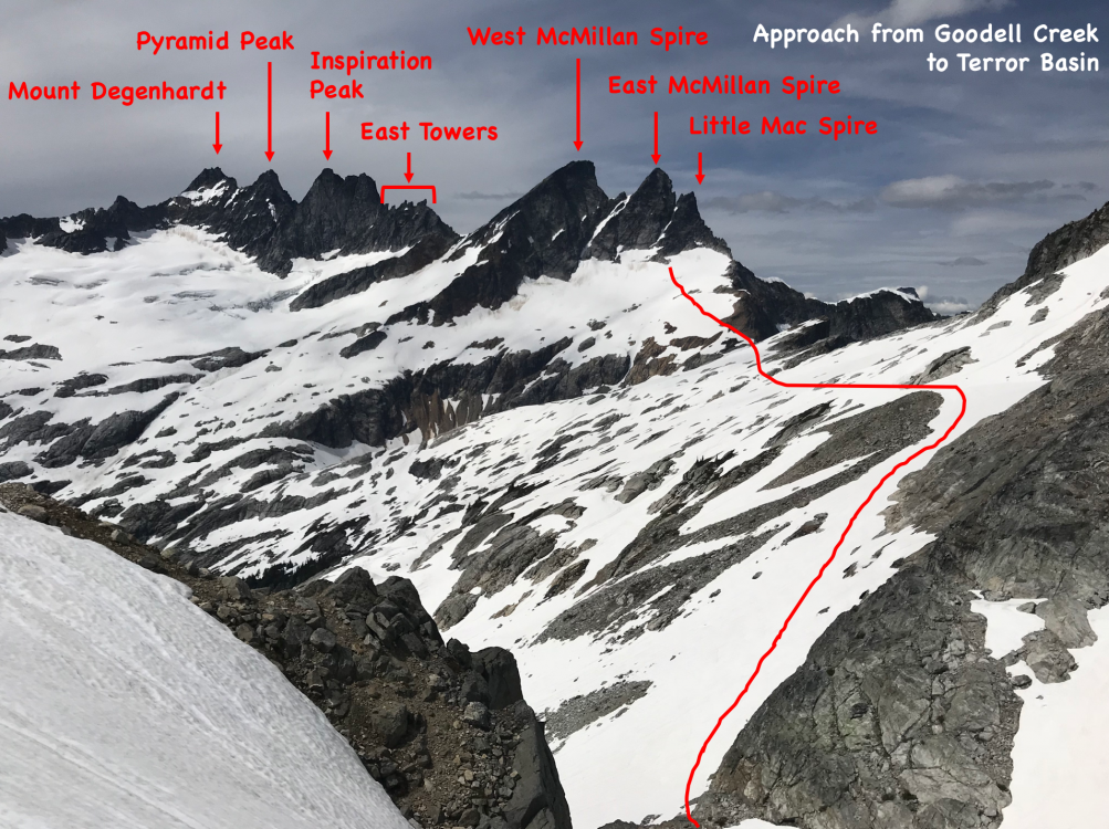

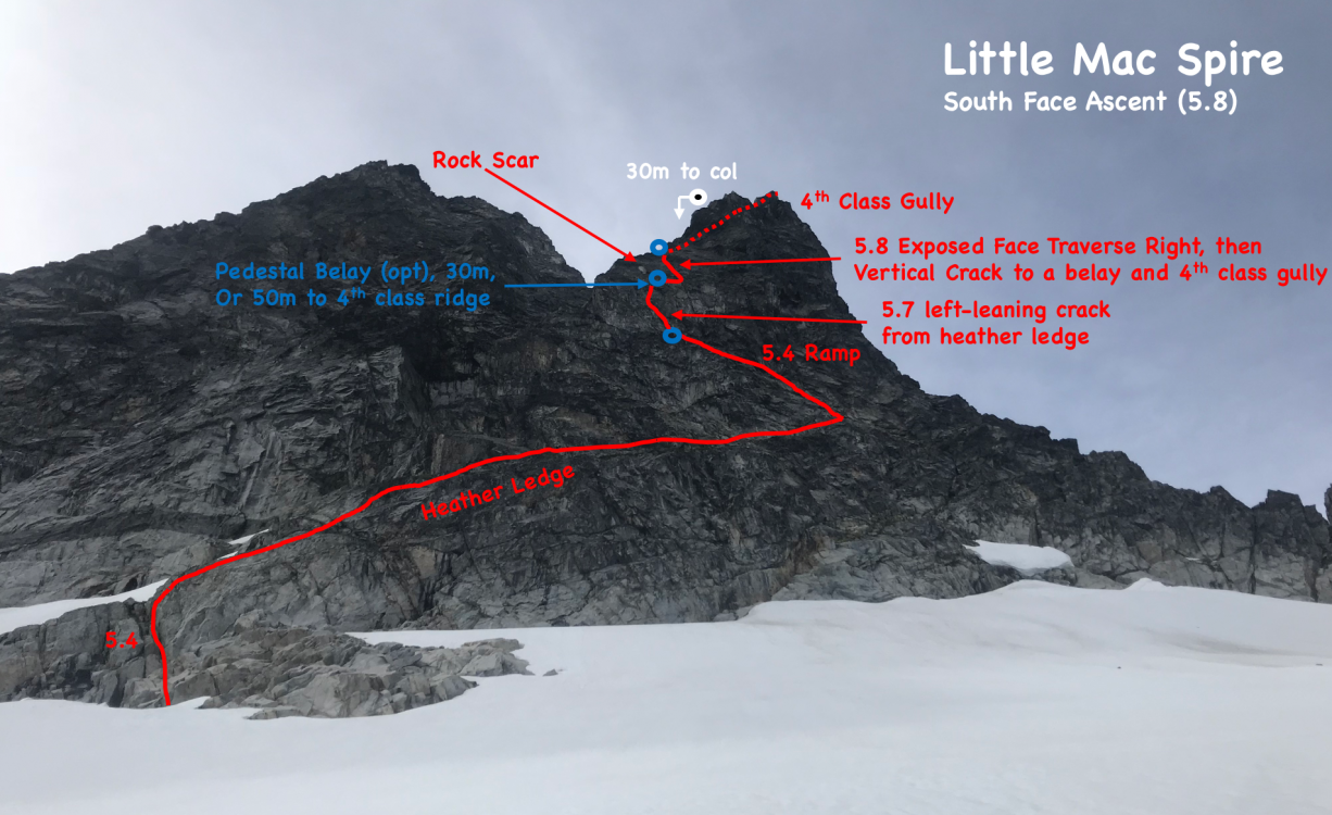

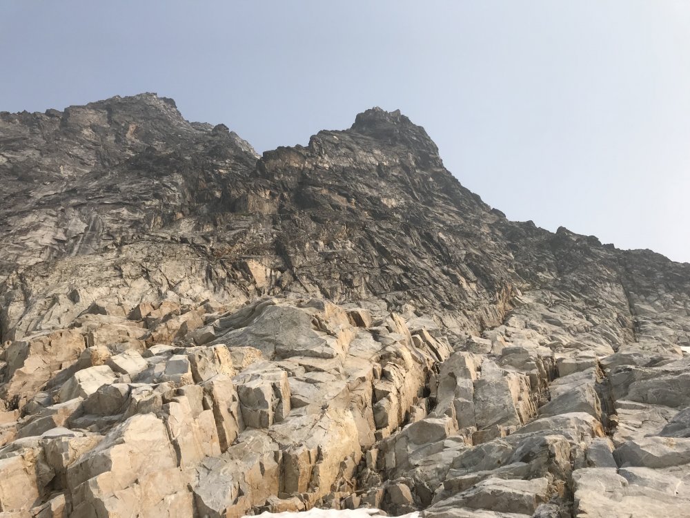
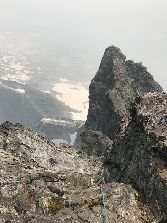
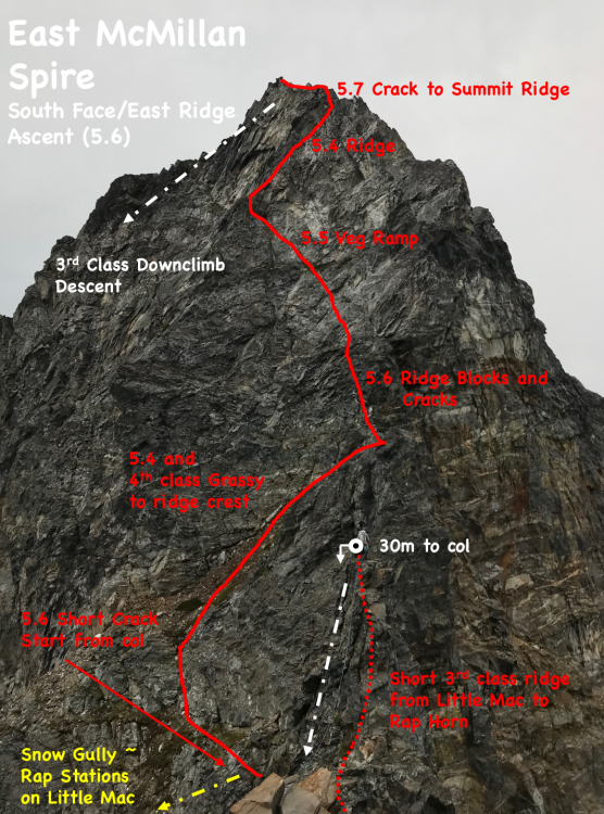
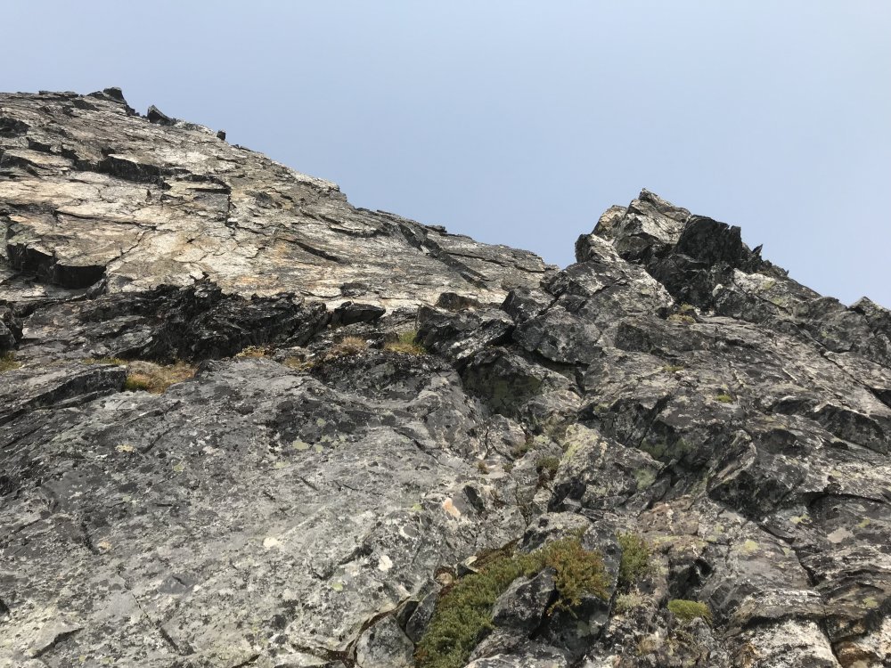

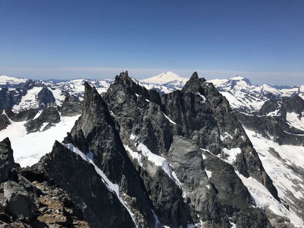
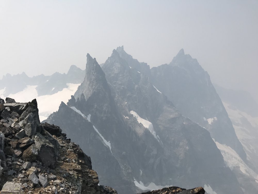

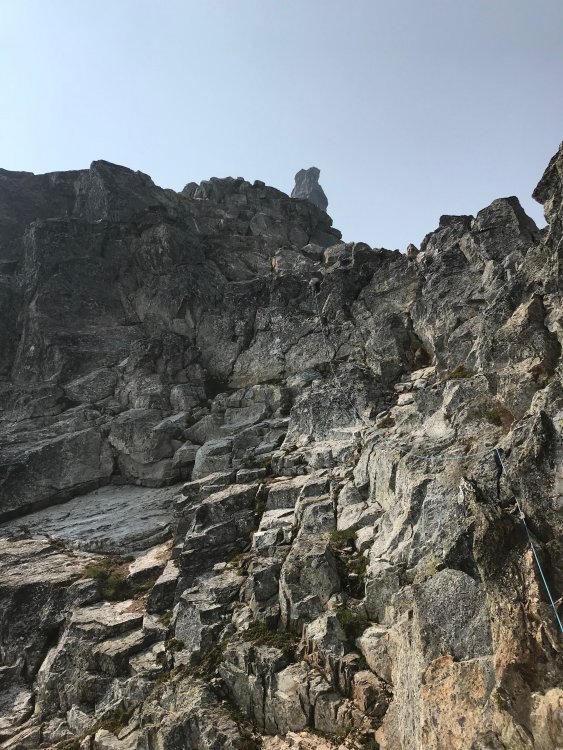

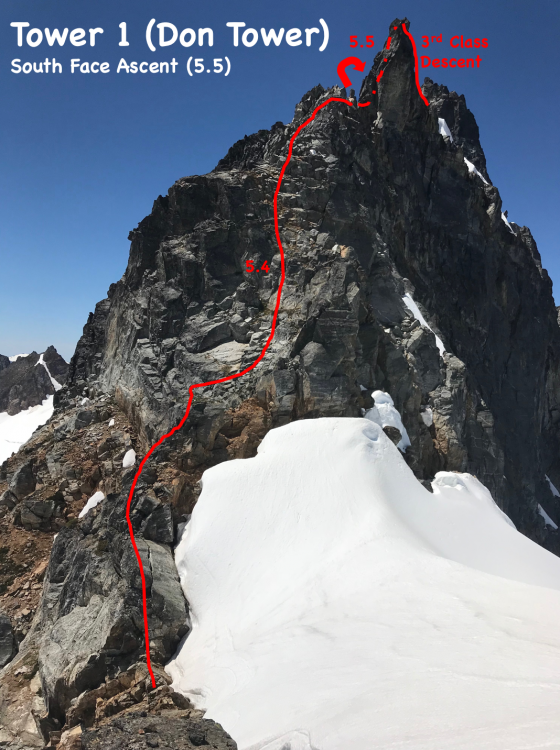
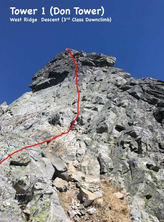
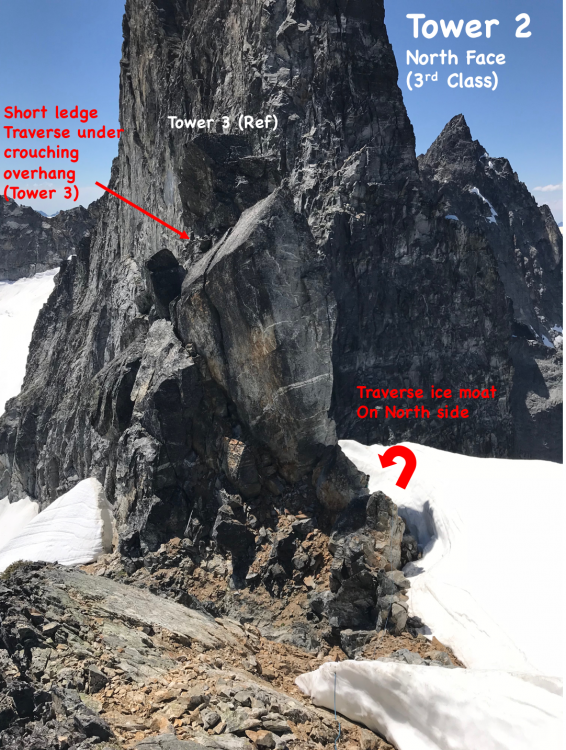
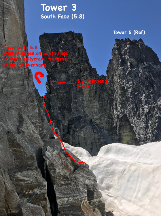
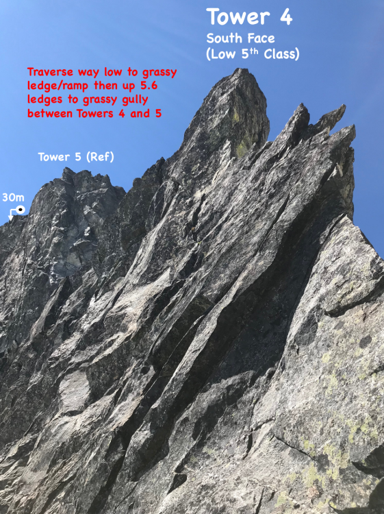


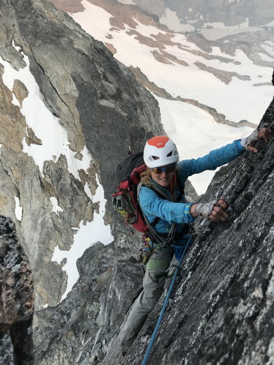
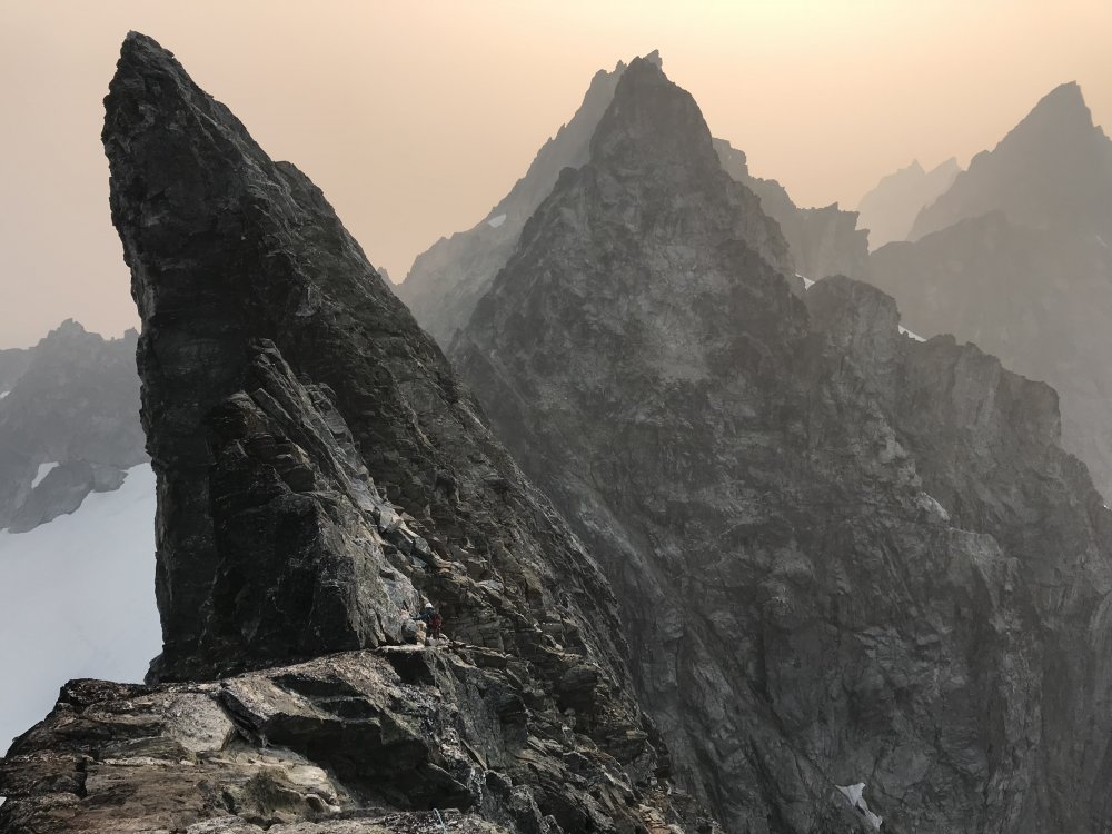
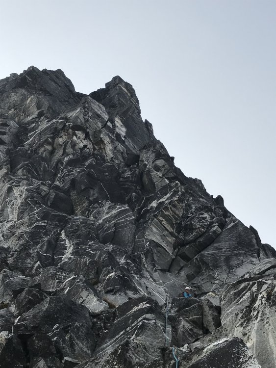
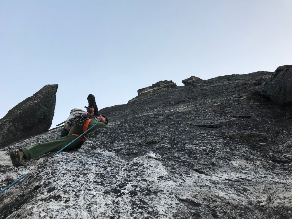
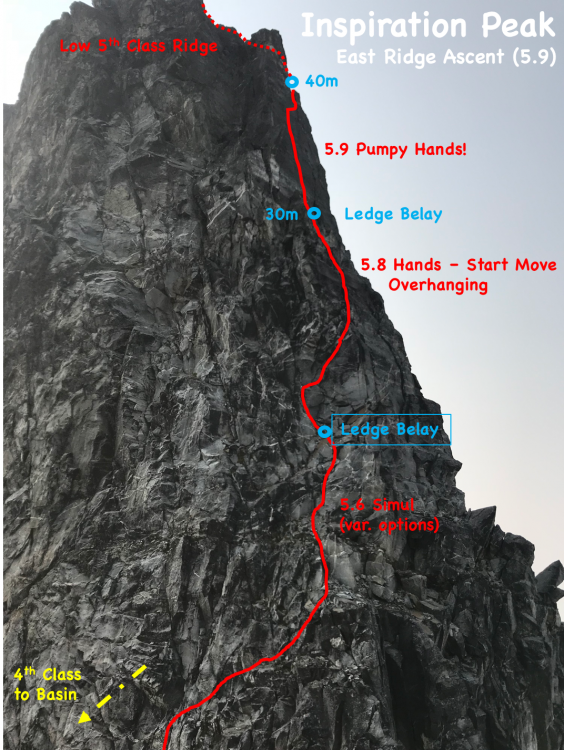

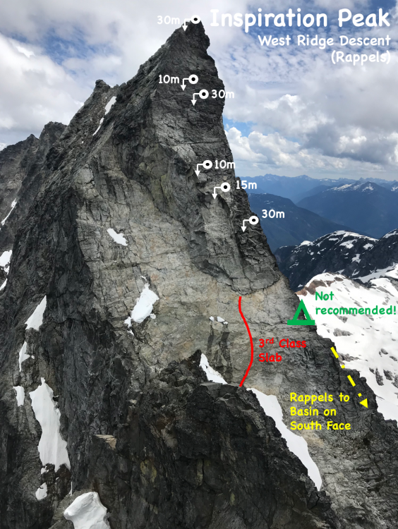
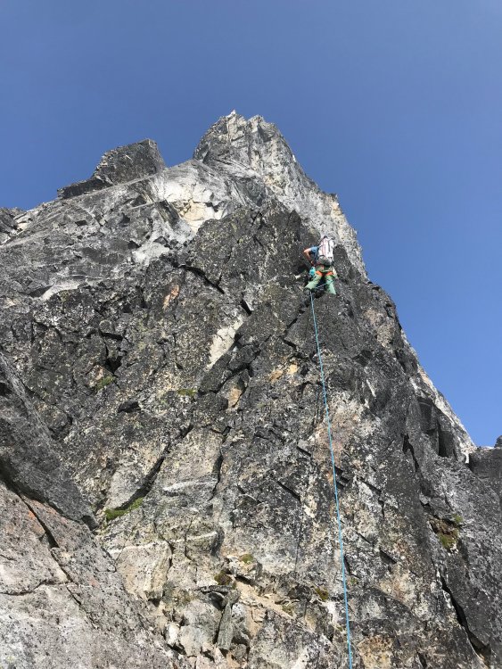
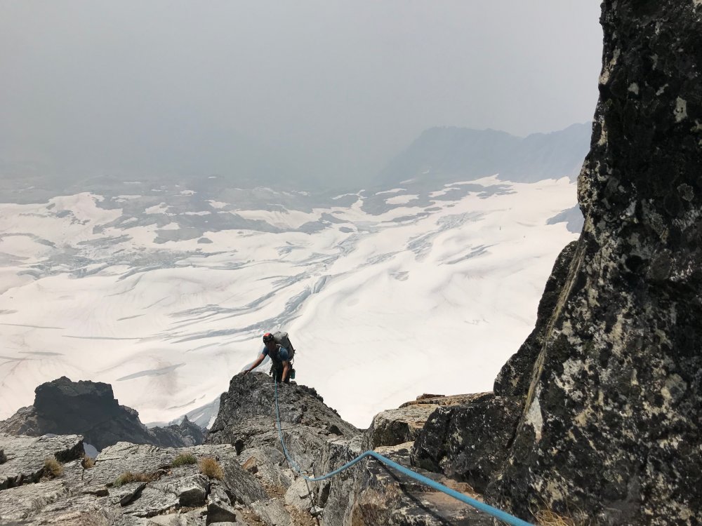
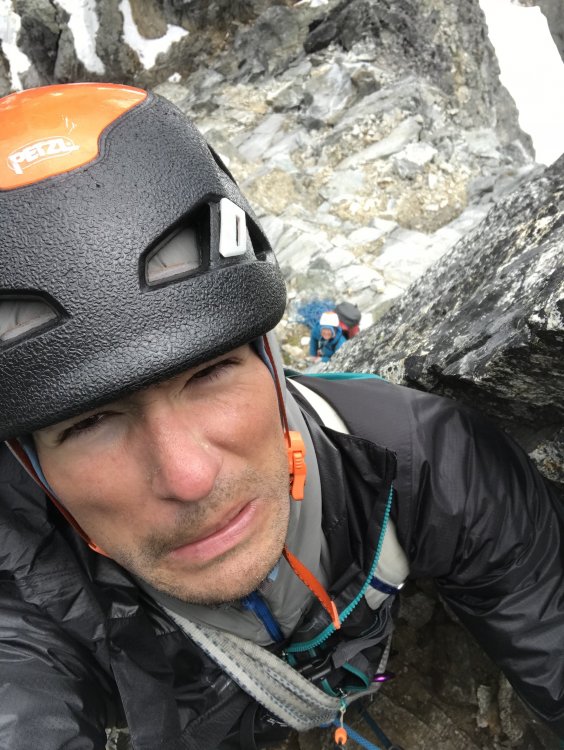
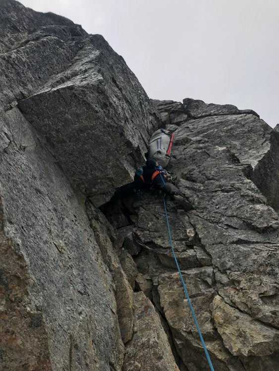
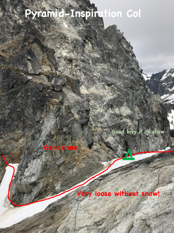
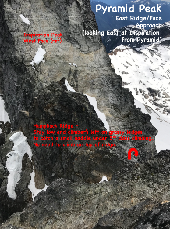
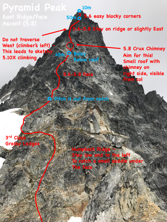


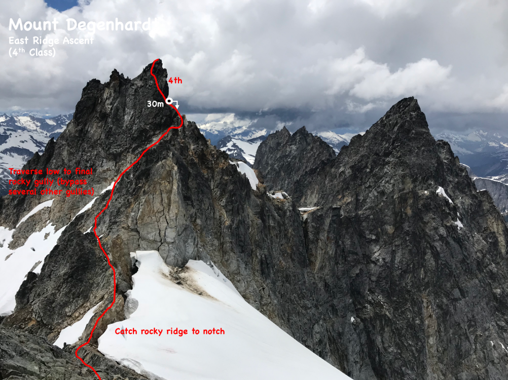
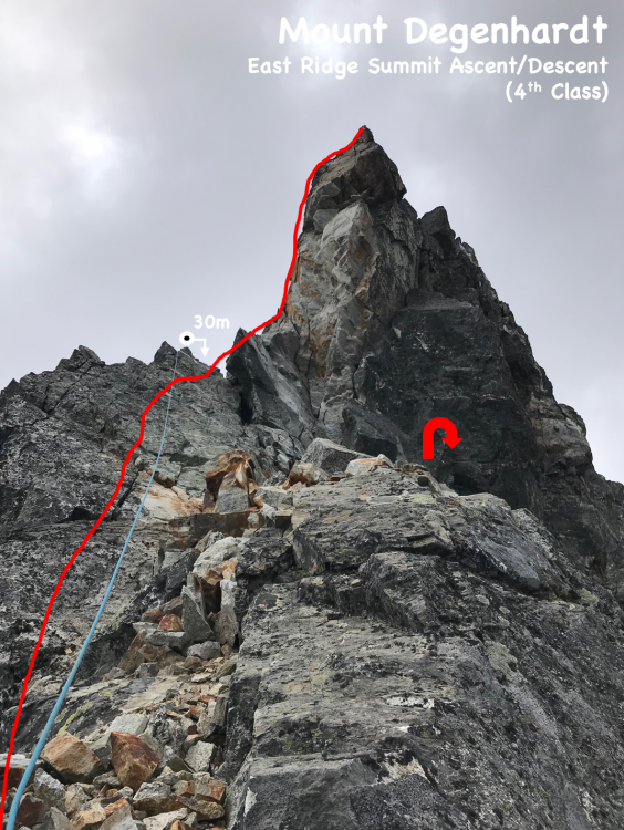
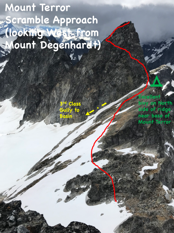
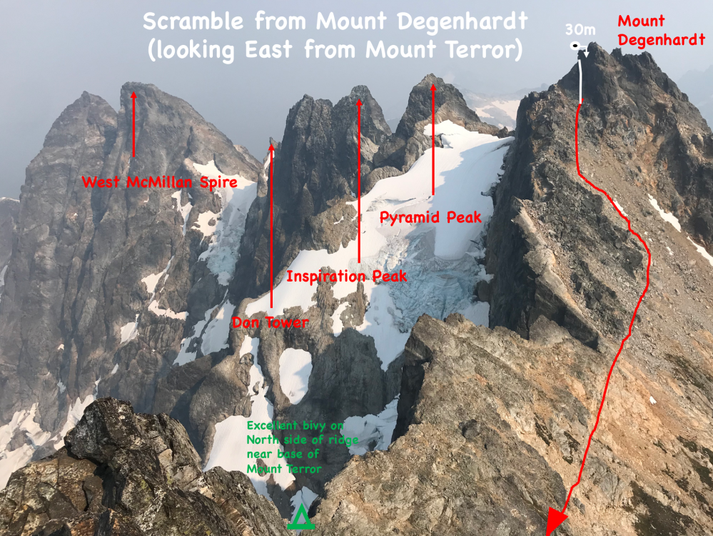
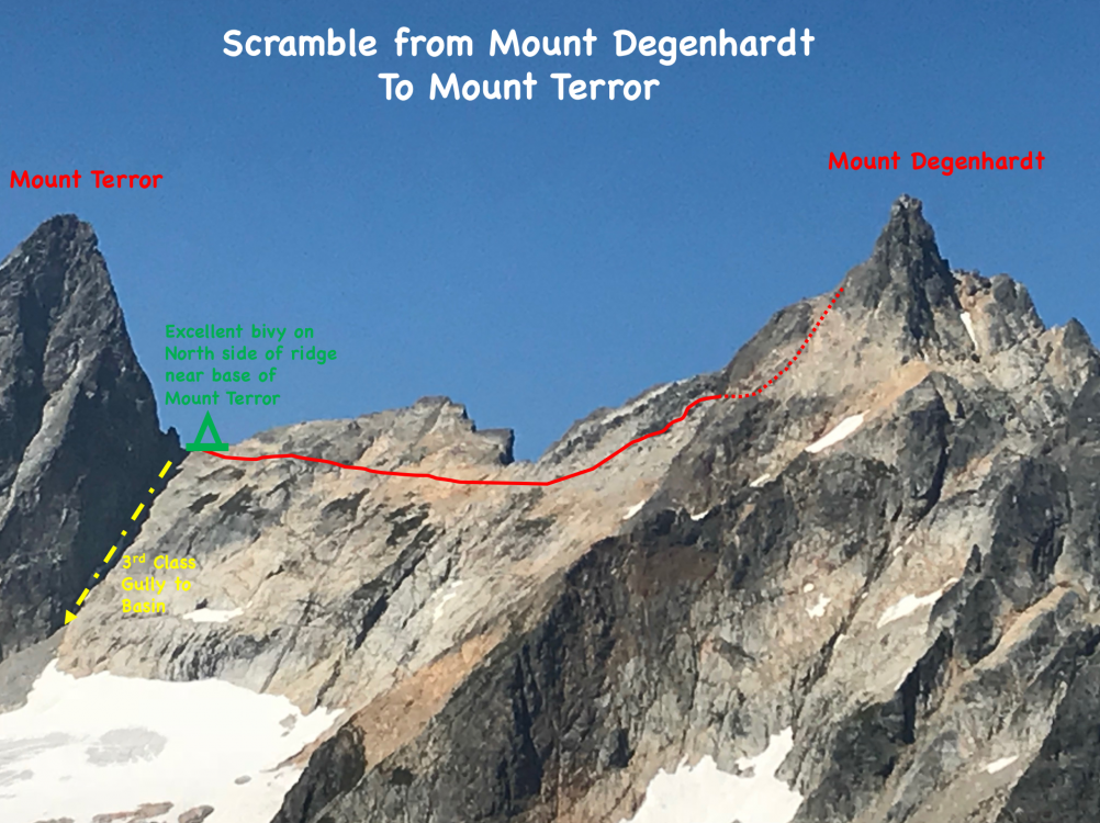
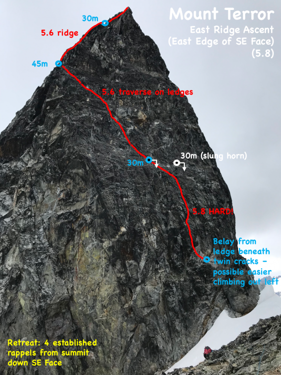
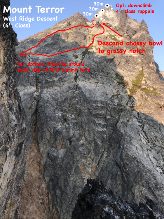
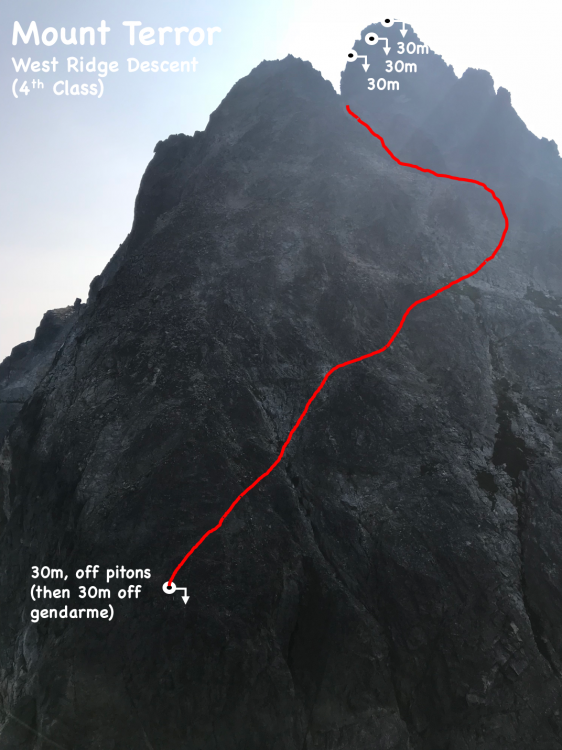


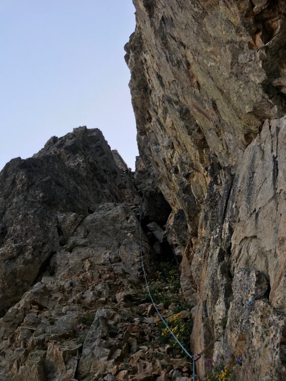
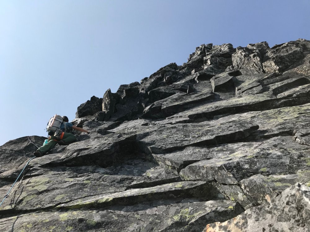
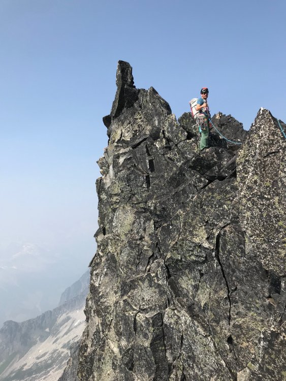
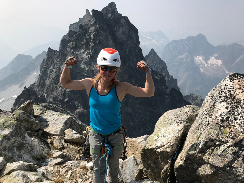


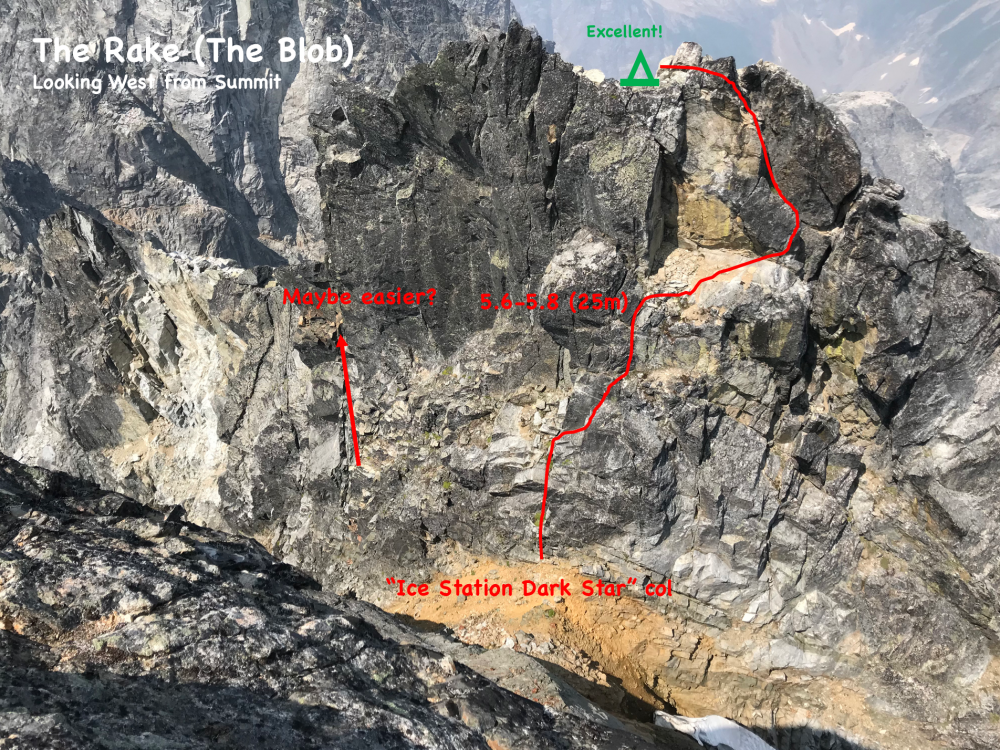


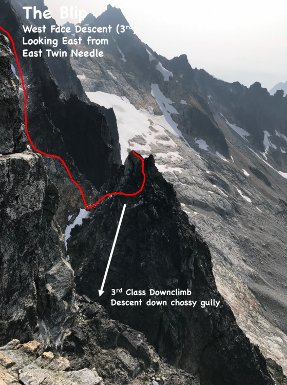


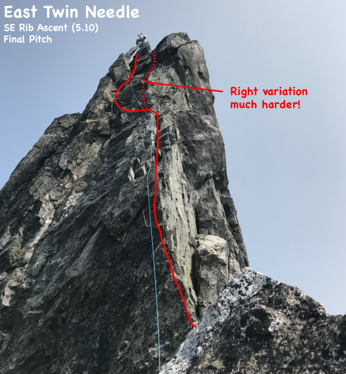
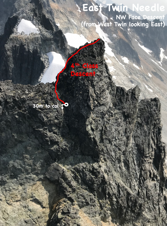
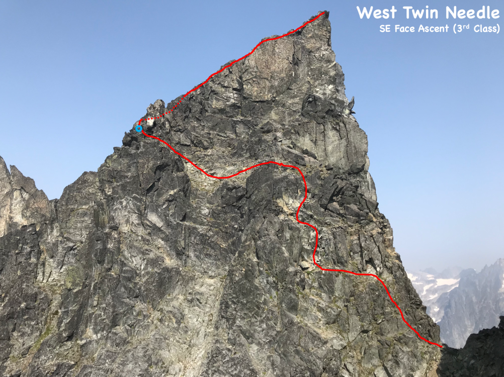
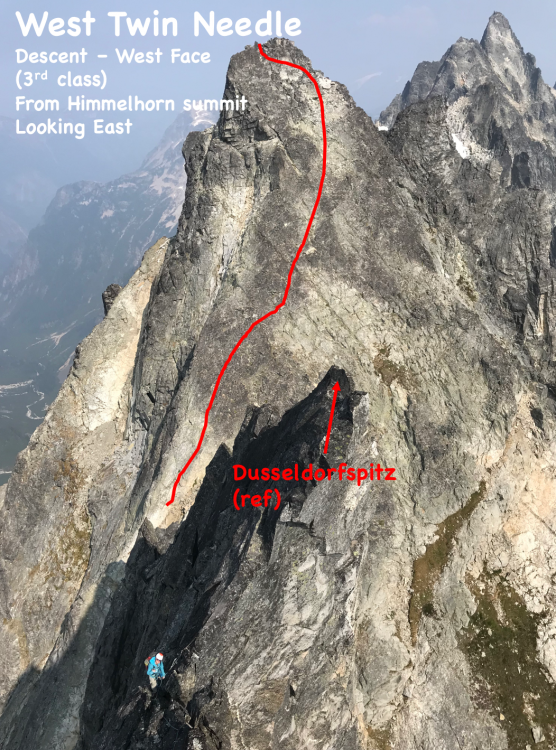
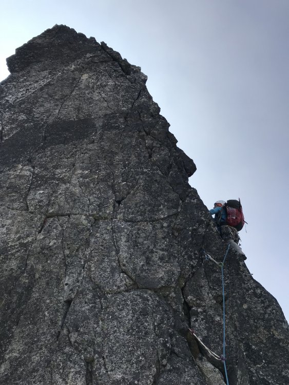
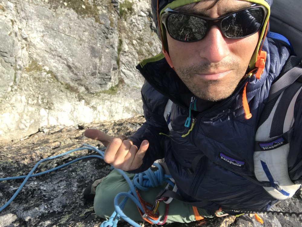
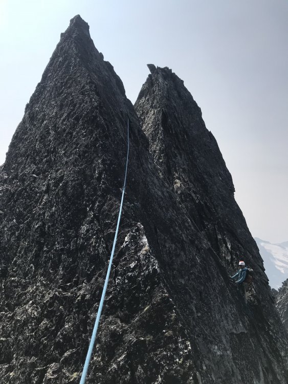
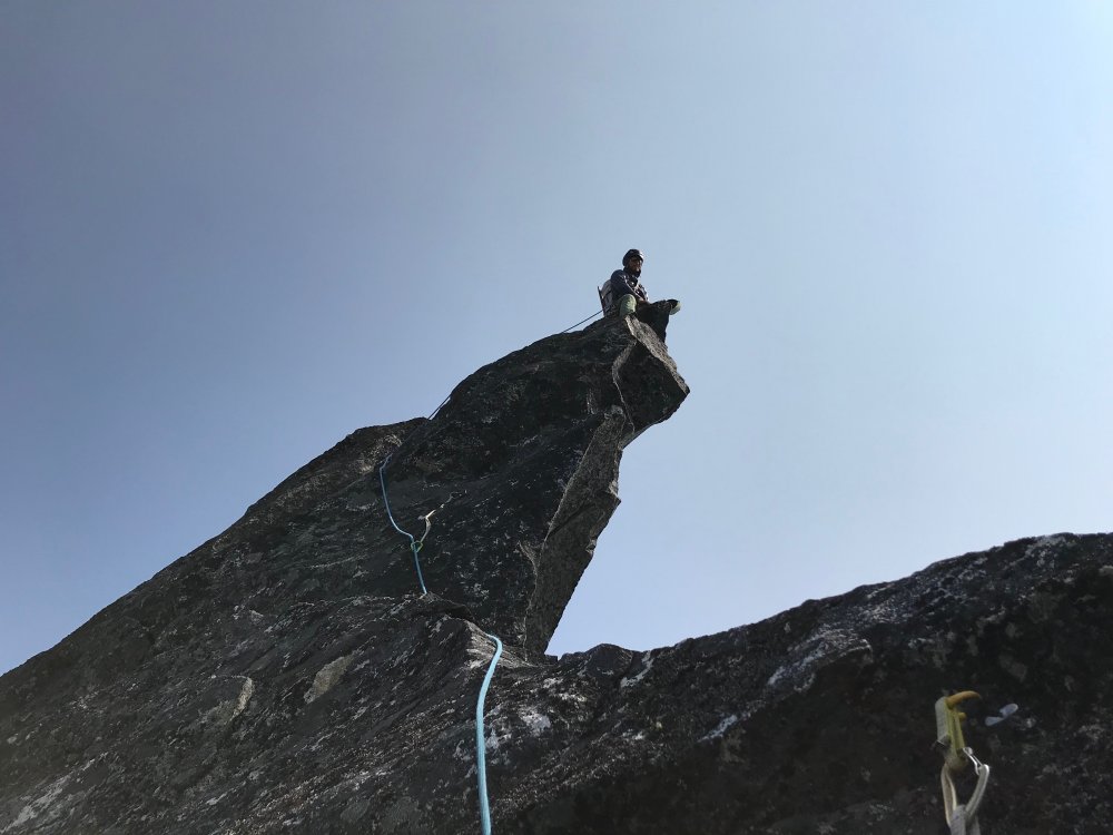
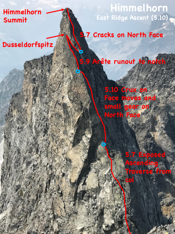
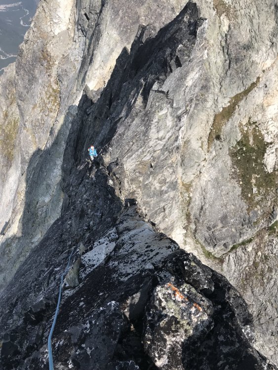

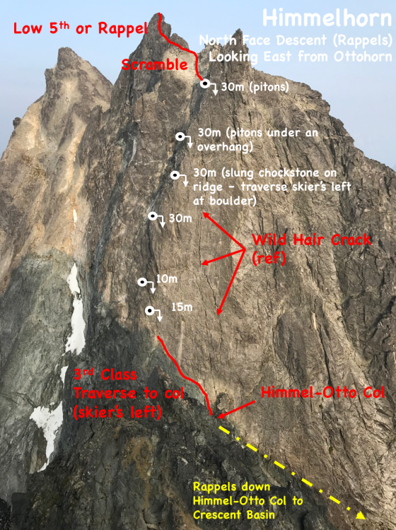
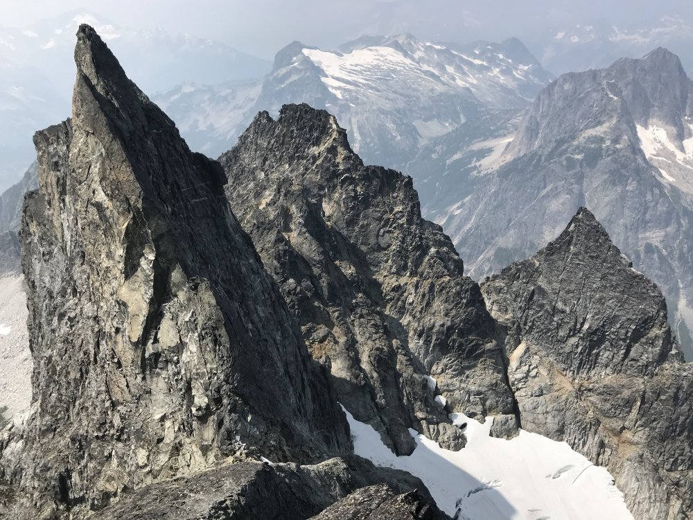


- 23 replies
-
- 13
-
-
-
-

-
Where is the nodder?
-
Here's the deal. I'm very tired and wired so my writing may not be that interesting. The Approach: I had my alarm set for 1:45 Tuesday night and awoke at 12:30 to the police knocking at my door. "Move your truck!" they shouted through my door. Weary from 4 hours of sleep I moved my truck and was wired by the time I picked up Matt at 2:00am. We drove to Big Four all the way to the parking lot and hiked in. The avy chutes to access the face were raging so we buskwacked and hangdogged up the cliff and trees to acces the face. It was full scale bushwacking. Instead of our hour estimate, it took 3 hours of fighting to get into the upper basin. It was light enough to see by then, and we saw that we could've done a sweet ice climb directly up the cliffs instead! Too bad! The Climb. We soloed up to the base of the 1st ice pitch on firm neve and deep powder sections. I took off and we simul-climbed for a 1,000 feet on very steep ice, snow and rock. It was hard, fun, and classic stuff. Good pickets and screws! I climbed to the base of the crux 1/2 way up the route and hammered in a picket and a screw for a belay. Matt's turn. Lucky bastard got the crux. It was a full 60m of near vertical to vertical ice with shitty ice and shittier snow. Matt did a great job on lead, slinging an icicle. I also slung an icicle on one of my turns, making it the route with the most icicle slinging I've ever done. I'd say the crux was WI5. It was not fat, but it wasn't super scary. Here's a photo: We swapped simul-climbing leads for what seemed like for ever on many long sections of steep ice and snow until I ran out of gear except for my belay picket just below the corniced ridge. Matt then saved both his pickets for right below the cornice (maybe 30-40 feet tall) and the snow like above the crux, was pretty shitty. Matt then spent the next 1.5-2 hours tunneling through the cornice in a tour de force of thrashing. He gave a cry of relief as sunlight poured through our escape hole! The climbing took around 8 hours. Here is Matt digging the hole, the summit ridge, and me on top: The Descent: On top we had about an hour of daylight left. We downclimbed the ridge climbers right until we saw a notch in the trees far below us (1000’). The ridge got very steep and we started rapping through awful rimmed up trees for ever. It got very very dark and we found a couloir that paralled the ridge on the south face. We took that couloir until we figured we were below the notch then climbed back up to what we thought was the ridge. Unlucky for us, we actually climbed a smaller satellite ridge that paralled the main ridge so when we topped out on it, it appeared we were on top of our descent route. What we really did was go down the satalite ridge and it funneled us into the south face again! We descended the entire south face into steep walled canyons getting cliffed out again and again climbing up down left right, and everywhere to get out into the woods finally. By this time we were in the valley basin following a wide braided river. We figured the couloir we went down put us out by Hall peak and we were headed toward the Stilguamish?? river and the road. Hours later (2am) we stopped in the woods and sat around shivering until it was light again (6:30am). We maybe hike between 4-7 miles down river by this point. We backtracked up river to get a lay of the land and after an hour we saw big four…the south face. Around this time the first helicopter sounds arrived. We were very surprised to have a rescue being mounted so early. I always figured give us a day to be late, then mount a rescue. Anyway we hiked forever and finally wound up on the shoulder of Hall peak. We wanted to get to our notch again, but over a mile of steep walled canyons, cliffs, and steep terrain blocked any possible route over. Hall peak looked like vertical slush on rock since it was so sunny out. Looking back, we could hike down river again and find a road. No, we knew the notch descent was the way down and didn’t know anything about the other ways. We had to get there. So we fucking forced a route across all the awful terrain doing raps and downclimbing and upclimbing and tree and root pulling. Our only food for this day was a Pemican bar split between us so we weren’t running. I kicked steeps and tree and bush pulled up the entire south face up to the notch with helicopters flying overhead all the time. I figured they saw us but I guess they didn’t. We got to the notch at 2:45, did a couple raps, and downclimbed to the top of the lower cliff band. We downclimbed and rapped through the trees again and met up with search and rescue at the very very last rapped to the ice caves trail. The Aftermath: The rescue operation was FANTASTIC. Thank you everyone for trying to help us. I would gladly do the same. The parking lot was crazy! There was even a food wagon with hot sandwiches and chili! Several of my friends were in the lot geared up and ready to climb to save us and many more took today (Friday) off to climb it today. The S&R folks were so nice and helpful. I almost wished we needed help to justify all the effort. Thank you all once again for caring. It made me feel all warm and fuzzy. There were a million messages on my answering machine when I got home and tons of folks waiting for me in my apartment. I couldn’t believe it! I went to the Ranch Room and got a beer before I passed out from being up for 48 hours!!! I’m sure I missed a lot I wanted to say, but my memory is foggy and short-term right now. Basically it was an awesome climb with an awesome partner with a crappy descent. I read the B’ham herald this morning. Every word is wrong and they should be beaten for their horrible journalism. We were never rescued or “found.” But we are grateful that if we needed it, you guys were there. Thank you so much everyone who helped or was going to help today. -Mike
-
Climb: Bonanza-NW Ridge via Dark, Needle Pk. (IV 5.8) Date of Climb: 8/20/2006 Trip Report: This 2-day North-to-South climb followed a huge connecting ridge that stretches all the way from Needle Peak to the true summit of Bonanza Peak. The original plan had been to stay on the crest the entire time, but deep notches between Needle Peak and the Anonymity Towers provided the impetus for a detour on day one. Tim Halder (TheRunningDog) and I spent Friday night at Swamp Creek Camp along Agnes Creek, before heading out Saturday morning on Needle’s long North Ridge. The climbing was fun and featured sections of solid fourth and low-fifth class rock to the summit, which had seen 2 entries in the previous five years. Tim and I sketching out on what Beckey calls “third class with some exposure present.” Lovin’ the views after sewing up the North Ridge of needle. After working our way along the ridge from Needle, we decided that we’d need to rappel down to the East side to access water and avoid steep gulleys. We contoured lower towards the Dark Glacier before noticing a likely looking access point to regain the ridge between two previously unclimbed peaks known as the Anonymity Towers. (Green Beckey Guide, Page 232) South Tower North Peak Both of these peaks are just over 7,500’ and we built cairns and left registers on both North and South towers. The South tower required 2 pitches of low 5th class, while the North Summit was a simple scramble. We eventually worked our way onto the Dark Glacier and began the climb, which was straightforward and got us back onto the ridge crest for good. Tim leads the way up to the ‘Dark Divide.’ Atop Dark Peak on Saturday evening. We enjoyed an amazing sunset from our ridgeline shiver-bivy that night, and continued along the crest early Sunday morning with pleasant climbing and plenty of mileage ahead. Myself and Tim, taking turns leading the way. The final 1,000’ up to the West Summit of Bonanza was actually the easiest part of the day, and we arrived on top to find an old tin-can register with 2 entries in the previous 54 years. (‘52, ’03) From the West summit, Beckey quotes that “knifed teeth and vertical walls gave absolute protection” to the true summit, so it was comforting to know that the traverse had at actually been completed in the past. We found the climbing memorable, if loose in spots. Ye-Haw Bonanza! The last 3 pitches were actually very solid rock and some of the best climbing of the route. Enjoying some Stehekin Bakery cinnamon rolls on the summit. We down-climbed solid rock to the Mary Greene Glacier and descended skier’s left without too many crevasse problems. Tim and the Entiat fire. Gear Notes: Full rack of rock gear to 2” and Glacier gear. Ice tool might have been nice for the upper Mary Greene Glacier. Approach Notes: Approach 8 miles up the Agnes Creek trail from the Stehekin Road. Best part of the de-proach (after ice cream in Holden Village)
-
-
is it worth bringing tauntaun/icepicks to for the evils of mt hood winter? do pings reach towers through snowbeast thank you praise the lord and his unmanned drones of justice
-
 Trip: Slesse Northeast Buttress - 2nd Winter Ascent - Date: 4/6/2015 Trip Report: This is a full month late, likely a by product of my brain exploding after my Patagonia trip as well as this climb I am about to describe. It is now undeniable that I have some kind of addiction to climbing Slesse Mountain. I have climbed the mountain more than 10 times by at least five different routes both solo and with partners. I think the main reasons for this are that: 1: It is ridiculously easy to access from the East. 2: The East flank of the mountain is hands down the raddest face in the area. 3: I can be a creature of habit. I had always wanted to climb a big route on Slesse in the winter, and after learning to 'really' mixed climb in the Canadian Rockies it became even more of a priority. I spent most of my winter in Patagonia, managing to bang off some great climbs in the Torres, including a solo ascent of the beautiful Cerro Torre. As I made the journey back north to Canadia a bit of sleuthing had me convinced that Slesse must be in the 'condition of the century' for winter climbing. I tried to find a partner to attempt Navigator Wall, but with only one or two days of stable weather remaining it was too short of notice. Listening to an interview with Stevie Haston on the airplane, I heard him describe his free solo ascent of The Walker Spur in winter which got me psyched, so I began to formulate a new plan. I had climbed the Northeast Buttress of Slesse too many times in summer, including a speed ascent in one hour and fifteen minutes. But in winter the line would certainly provide a completely new challenge. The line had only seen one winter ascent, in 1986, which required several bivouacs as well as aid on the upper headwall. Because I knew the route intimately I was able to slowly convince myself that I may be able to free solo the route in winter, for the 2nd winter ascent and first free winter ascent. It seemed a bit of a lofty goal, so I brought along an 80 meter 6mm Esprit cord and some pins and wires to bail with 'just in case'. John Scurlock photo. Isn't it just irresistible?! My sister, who lives in Chilliwack dropped me off at the start of Nesakwatch Creek FSR and I briskly walked to the Memorial Plaque beneath the mountain where I spent the night. I awoke at 4am the following morning, and after spending nearly an hour huddled in my sleeping bag I mustered the psyche to get a move on. At 5am, I left the memorial and approached directly through the basin beneath the mountain. The snow conditions were generally quite good, and a short WI2 step soon brought me to the slightly threatened slopes beneath the toe of the Buttress. I veered left here, joining the standard summer approach through the pocket glacier cirque. The upper section of the cirque still held a surprising number of deep crevasses, likely caused by avalanche debris from the East Face forming deep craters on impact. I crossed over several bergschrunds on the right hand side of the cirque then climbed directly up to the bypass ramps leading to the Buttress crest. This section, normally a third class ledge walk in summer, was a surprisingly steep and exposed traverse on snow. As I neared the crest the angle and exposure kicked back and I quickly made my way upwards on good snow to the first 5.8 rock pitch. This pitch was surprisingly easy in the conditions I found it in, the air was just warm enough that I could climb barehanded, as long as I stopped every two minutes to re warm my numb fingers. The pitch only required a few minutes of careful climbing and soon I was back on steep snow and neve, now accustomed to the exposure. Dylan Johnson photo of the route, taken the day before my solo. Line shown in red. On the traverse into the Beckey Ramps I climbed slightly too high and had to make a very exposed down climb to reach the correct ramp on the north face. The ramps were coated with perfect ice and neve, making for fun, fast and easy climbing with a spectacular view down into the 'Heart of Darkness'. "This is rad", I said out loud. The ramps led me back onto the crest of the Buttress and the second 5.8 rock pitch, which looked to be slightly more mixed than the pitch lower down. I removed my gloves again, and was able to climb about half the pitch with my hands before transitioning to proper mixed climbing. Finding a thin crack for my right tool, I danced over leftwards with my feet on small patches of ice until I could reach a thin veneer in which to place my left tool. The pitch felt around M5 in difficulty, and above the climbing slowly eased off until I reached to huge bivy ledge at mid height. At the bivy ledge I took a break to eat some snacks and assess conditions on the upper headwall. The steepest pitch appeared to be fairly free of ice, but above, where the angle relented slightly, the rock was decorated by a patchwork of thin white ice. It looked interesting to say the least. The snowslope leading to the headwall was relatively boring and does not need much description, nor does the WI3 runnel I took to bypass the first 5.8 pitch on the headwall. The 'rotten pillar' pitch was straightforward enough and soon I was on the crux, stemming in crampons around detached flakes in a corner. On top of one of these flakes I paused to remove my crampons and warm my hands before embarking on a slightly insecure bit of climbing on downwards sloping holds. I traversed back right to a small roof which I passed on juggy finger locks, and now at the apex of the small overhang I was able to peer upwards to the iced up slabs I had observed from below. It was clear I was going to need my crampons again. I placed a large nut and clipped myself to it for security, then gingerly stepped into my crampons one foot at a time. I mentally rehearsed my next sequence as it appeared from my airy stance, then removed the nut securing me to the wall and committed. I switched my feet on a good hold and stepped up and right onto the slab. With my frontpoints set in small divots I balanced upwards, holding a small edge with my left hand for balance. I uclipped the ice tool from my right side and reached upwards for a small bit of ice pasted to the wall. Now at the edge of my comfort zone, I gently tapped the tool twice against the ice until the first two teeth sunk in. I tested the tool carefully, then took care not to make any sudden movements while I slowly searched out higher edges for my feet. The edges I found sloped slightly downwards but my frontpoints found purchase enough to balance higher still. I carefully pulled out my left tool and placed it in thin but good ice above bringing me to a comfortable stance on a ledge. The crux now behind me, I allowed the mental RPM to decrease steadily until I was ready to continue. Jim Nelson photo from their 1986 ascent. This shows the crux pitch with the same patches of thin ice that I encountered. As I climbed excellent mixed terrain above I could really admire my wildly exposed position on this beatiful mountain. The whole buttress stretched out below me, black stone stained white with snow and ice. My tools found purchase on the well featured rock and the climbing gradually eased off pitch by pitch until I crested the final summit ridge and found myself standing in the sun. Eating a bar with the summit register in hand, I wrote, "Northeast Buttress - 2nd winter ascent. March 9 2015. Very exciting". The crux pitch was likely delicate M6, perhaps M5+, but someone will have to do a second free winter ascent to verify. The west side of the mountain was surprisingly warm compared to the shady, iced up North face, but the ledges and gullies were still covered in snow and neve making for a quick and pleasant descent. Descending the scree slopes on the Crossover Pass descent was nicely facilitated by the well settled snow and I was rewarded with a spectacular view of the route I had just climbed. After stumbling down the steep wooded trail below, I arrived at my bivouac site and ate a candy bar before packing up my equipment. Walking the road back towards civilization I pondered my options. I had no ride back and considered walking the fity kilometers to my sister's house through the night. I thought back to the ascent I had just made, it's often surreal when a long time dream, like climbing Slesse in winter, glides into the present, then into the past. I knew that my mind needed a break, I needed to relax and digest the adventures of the past months. As I thought these things, an animal control vehicle pulled up to offer me a ride. The driver was a likeable guy named Mark and we chatted, mostly about travelling, until he pulled up to a bus stop in Chilliwack and bode me farewell. A bus arrived a moment later and soon I was just a block from my sister's home. Her husband Robert saw me walking down the street through the window and came to greet me at the door. They welcomed me in happily, and at 6:30pm we all sat down to a delicious supper. Parting shot, taken from a plane that flew around the mountain the day of my solo. If you zoom in on a high res version my track is visible bottom center. Gear Notes: Lightweight bail kit! Approach Notes: Super chill relative to radness of climb.
 -
Once again looking for a partner to hit something this week. Doesn't matter when or where. 5.8 - 5.10. Trad, sport, crag, multi, alpine, snow, glacier. Only thing i ask is for you to be generally honest about your abilities. A bit unnerving to get up on the Apron and find that your partner can't place a cam. R.
-

best of cc.com [TR] Black Peak - NW face 5/19/2012
danhelmstadter posted a topic in the *freshiezone*
Trip: Black Peak - NW face Date: 5/19/2012 Trip Report: In a collaborative effort, Eric Wehrly and I climbed and skied the NW face of Black Mountain. There are ski lines that when viewed from a deceptive perspective, or through some camera trickery appear to be truly steep when in fact they are only moderate in slope angle. The Northwest face of Black mountain is not one of those lines. Steep, sustained, exposed, are words that come to mind when contemplating a description. Snow conditions were scary in places, but good enough for a complete descent in proud style. Rocks and holes shallowly buried with sugar snow, slick ice crusts lurking under variably meager depths, these conditions added spice to both the climbing and skiing. Little in the way of progress came easy, the ground we gained was fought hard for in places, and entailed many white knuckled / no mistakes hours of fun. As I write this days later, I am still in a daze of emotions and memories that will be long to fade. We got some good pictures, this is my favorite one, Eric shreds the knar John Scurlock photo Black peak NW face (left), and Black peak western summit (right). This was our first view of the NW side of Black, we had to make a long steep downslopeing traverse on variable snow to get to the beginning of the NW face (far right). Eric Wehrly photo On the traverse, Eric Wehrly photo E$ climbing lower face Eric Climbing steep sugar over rock and ice high on the face. cruxin Looking down on our route from the summit. Eric Wehrly photo $ $ $ Eric Wehrly photo Eric Wehrly photo Eric Wehrly photo $ $ $ Eric Wehrly photo E-Money crossing a runnell mid-face E-Money Eric Wehrly photo Eric Wehrly photo Eric Wehrly photo Eric Wehrly photo Looking back on the traverse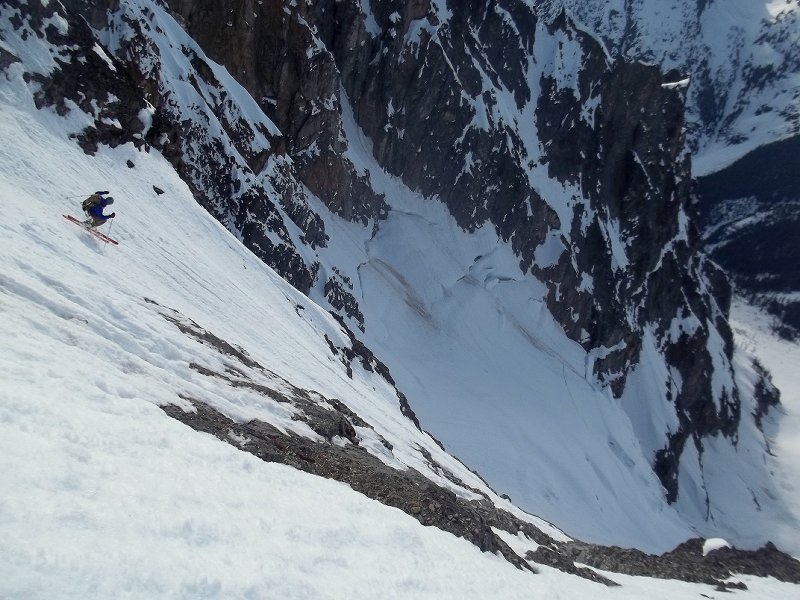

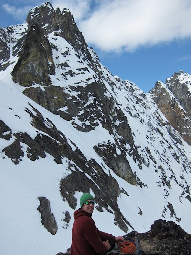
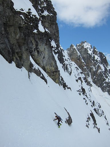


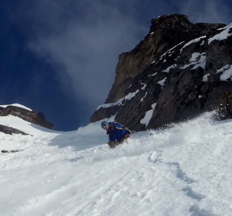
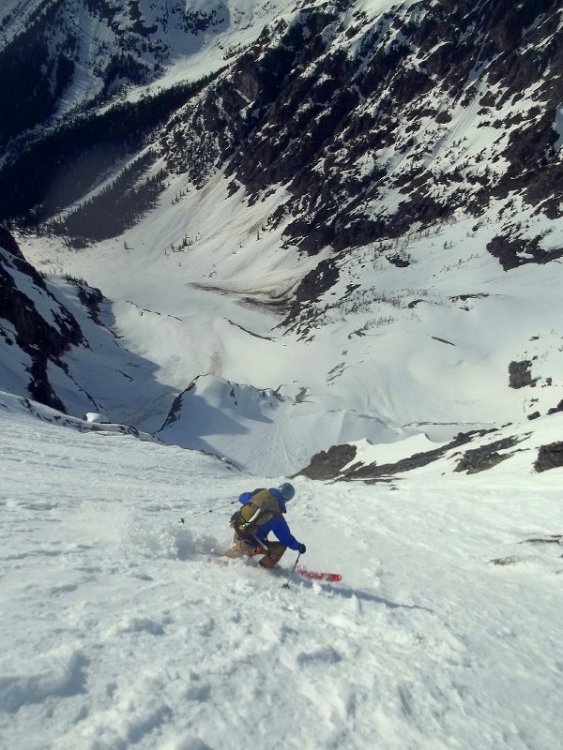
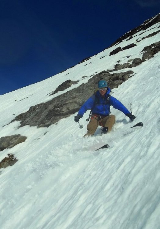
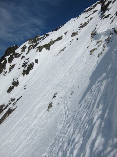
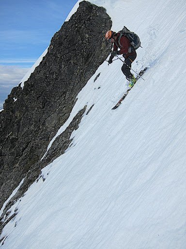

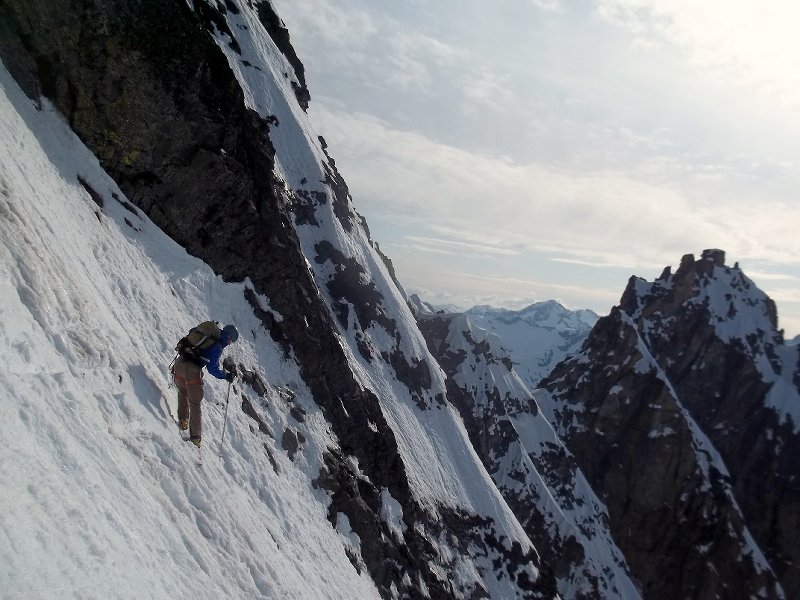
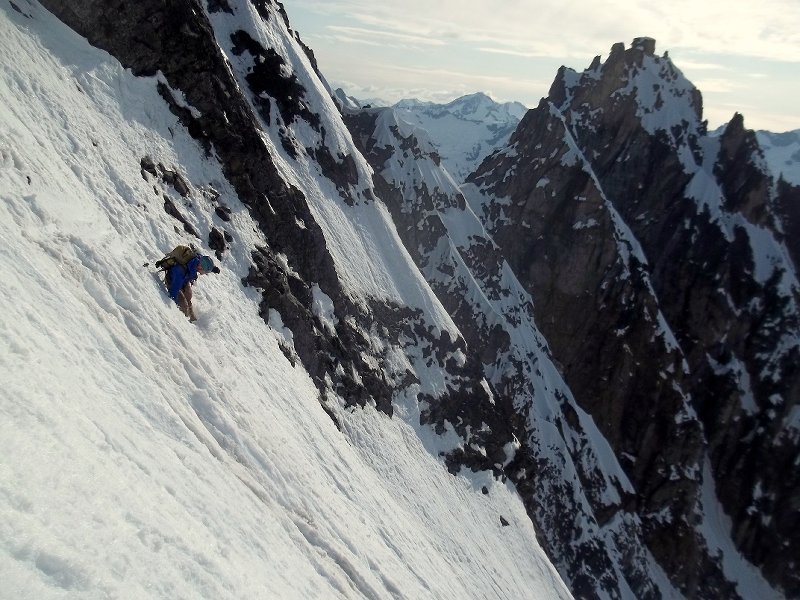
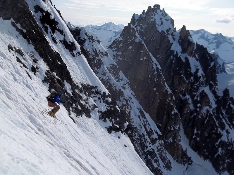
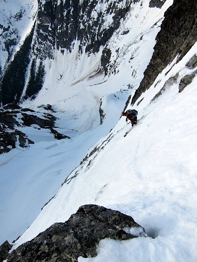
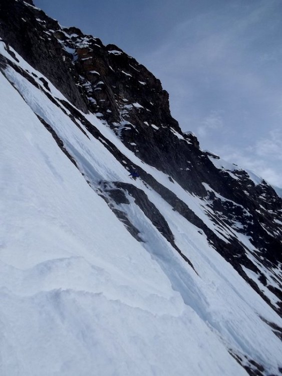
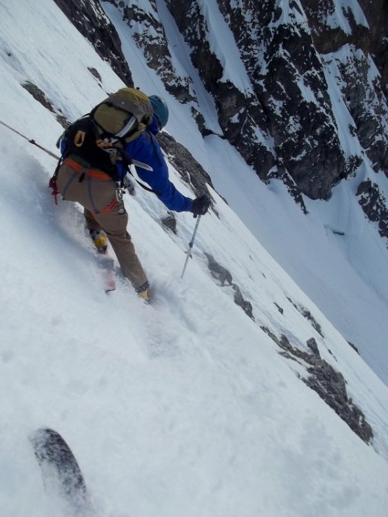
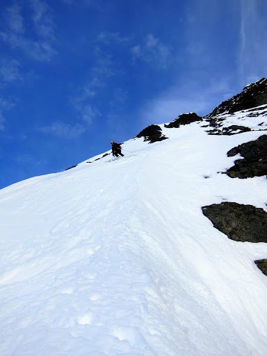
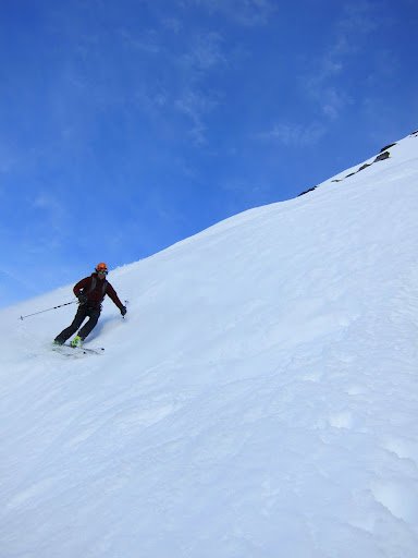
-
Trip: Mt. Shuksan - Curtis Ridge Date: 3/25/2012 Trip Report: I was looking forward to schlarping the fabulous powder that I had just skinned past on the White Salmon, but maybe, just maybe instead I would drop into a steep west facing line that I've eyed wistfully for years, the line is however quite exposed, steep, and windward... So my expectations of finding acceptable conditions were low. I reached the col from the sunnyside where I could survey the said line, looking down on it my first thoughts were -- there's no way I'm going to ski this thing! but after some time of thoughtfully soaking up the fearsome view, I slowly weaned myself off comfortable thoughts of powder on the White Salmon and adjusted to the possibility of accepting commitment to the exposure below. I downclimbed the first few hundred feet to scope conditions, and was amazed and stoked to find mostly powder with just a few crusty sections here and there, I scampered back up to the top drunk off stoke. The descent was awesome, favorite turns of the season for sure. Crossing under the seracs at the bottom was creepy, but over quick enough.


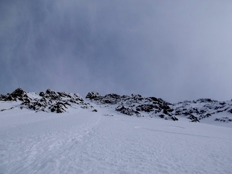
-
Trip: American Border Peak & Canadian Border Peak - abp - east face, cbp - sw face Date: 5/10-13/2012 Trip Report: I took this photo from the summit of Pleiades in early February, at first glance, a ski line on the east face of ABP seems improbable, but the photo captivated my imagination and eventually provoked me to attempt ABP, Twice I made it to the summit of Winchester in April, getting shut down first by a nasty cold, then by stormy weather. approximate route I climbed and skied on ABP (photo from feb 12) On Thursday I went in heavy with extra food and gas. Bivying by the south face of Larrabee, the night was cold, and snow solid the next morning for the approach. The first sight of the east face of ABP was not inspiring. Conditions appeared to have deteriorated considerably since February - melted out and runnelled. I decided to keep circling 'round in hopes of more coverage on the NE aspect, there was. I climbed up moderate glaciated slopes for about a thousand feet, then went left onto the steep east face, following what appeared to be the least icy way. The way was complicated, a few times I thought I would dead end in a chute and have to back track, but it went, twisting and turning up chutes and ribs. Conditions were a little scary. There was lots of icy slide worn neve, and lots of crust, with powder here and there shallowly burying the slickened neve. There was just barely enough snow clinging to the summit nub to make it skiable. Exposure was intense, especially looking down the sheer ~1000' cliff of the west face. I clicked into my skis and cautiously made my way down. Lots of crust, ice, death balls, and edgy runnels made catching a tip and taking a slide for life a frightening possibility. Friendly snow conditions such as pow or corn would have made this a much different experience, instead I was on edge the whole time. I headed back to my bivy feeling good, and decided to ski the cool looking southwest face of Canadian Border Peak the next day. Approaching CBP was somewhat of a pain in the ass - probably just a few miles, but lots of up and down getting over cleavers of high basins. The SW face of CBP was fun to shred, much less serious than the east face of ABP, and conditions were ideal for fast turns. I skied the sw face from 50 feet below the summit where the snow ended. The next morning I skied lookers left on south face of Larrabee, nice & friendly low stress conditions. South West face CBP Views from the summit of ABP east face abp, no bueno conditions low on abp turns on moderate slopes down low on abp north face of larrabee abp from somewhere on cbp view of international border cool formations I already miss the soft hazy red sunsets over Tomyhoi.
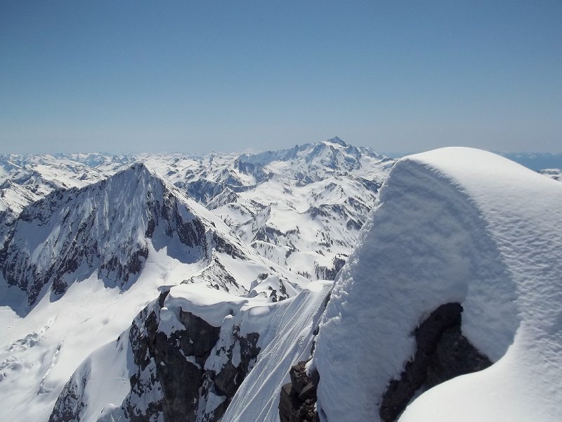
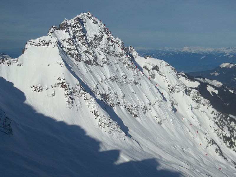

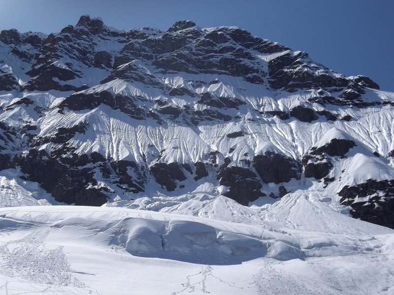
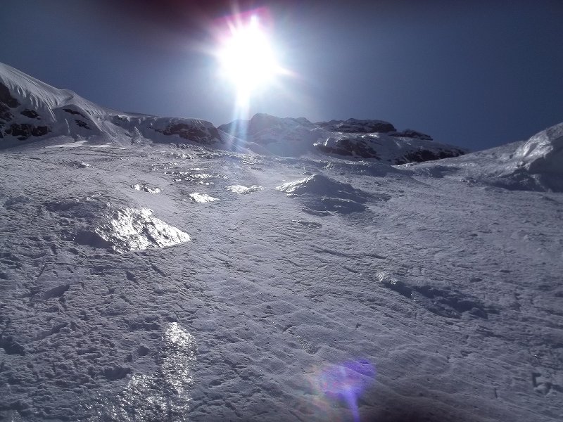
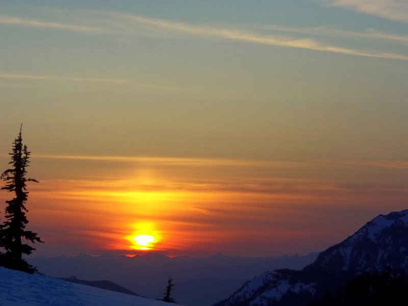
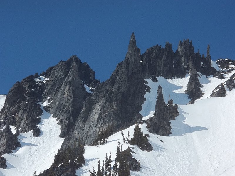
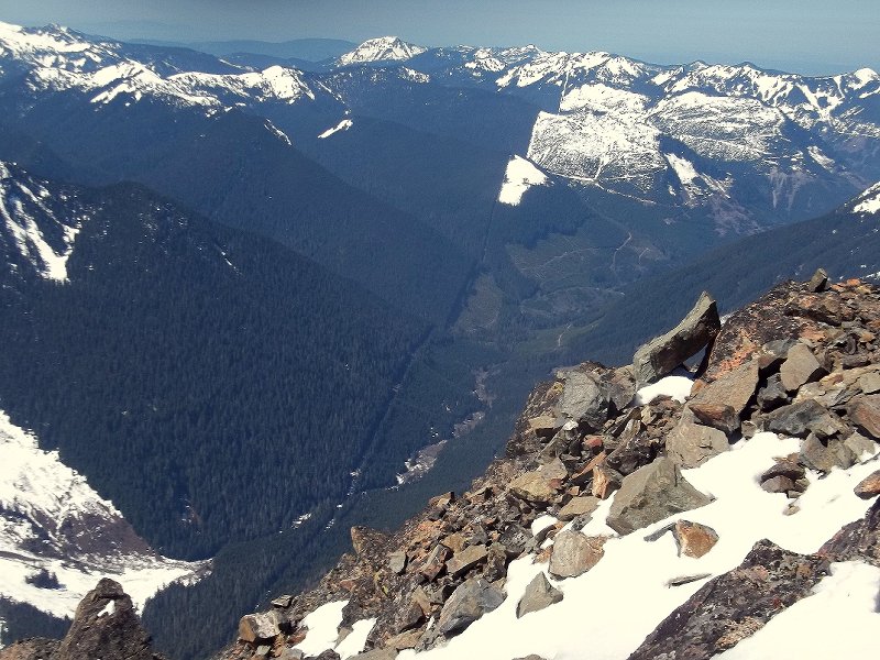
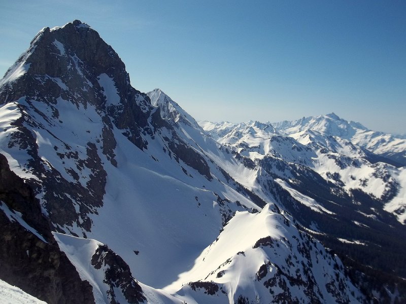
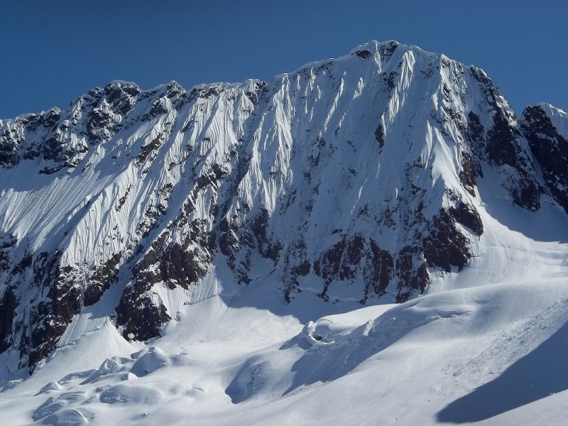
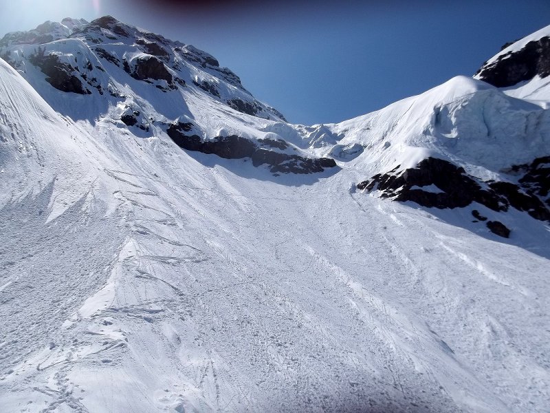
-
 Trip: Isolation Traverse with alternative finish down to Thunder Creek to get back to our car. Date: 8/26/2013 Trip Report: Dates: July 10–15, 2013 Robert Crouse and I (Doug Walsh) took 6 days to complete the Isolation Traverse in North Cascades National Park, with an alternate finish so as to avoid a car shuttle. I dropped Robert off at Pyramid Creek Trailhead, and then drove the car to Thunder Creek Trailhead at Colonial Creek Campground. After hitching the 3.5 miles back to the Pyramid Lake Trailhead, we started up the trail around 1 pm, following the Isolation Traverse route for the next 3.5 days to get to a camp at the col between Dorado Needle and Tepeh Towers on the McAllister Glacier. From here, we hiked to Klawatti Col and then north around the Austera Towers and over Primus Peak down to Thunder Creek, which we followed back to our car at Thunder Creek Trailhead. We found the scenery on this route to be stunning, while the travel was 90% casual and pleasant. The remaining 10% of travel was not very pleasant or casual, but such is the price one pays for getting to see country such as this. Day 1: We hiked up the relatively pleasant Pyramid Lake Trail for 2.5 miles. Once at the lake, we followed a relatively well worn climbers path steeply up the ridge toward Pyramid Peak. After 3 hours of grunting up the steep and often overgrown “trail” beyond Pyramid Lake, we cleared treeline and found a nice spot on the ridge close to a snowmelt stream. Day 2: (8.5 hours) We broke camp around 8:30am and worked our way over to the glacial lake at the base of the Colonial Glacier. It was relatively easy going up the Colonial Glacier (no visible crevasses) to the col that separates this glacier from the Neve Glacier. From this col, the view of the Neve Glacier was surreal, as we witnessed a number of big crevasses visible during brief clearings in the mist. We took a nice break here, hoping for some clearing in the weather to facilitate easier routefinding on this crevassed glacier. Once we did get moving again, it was a relatively steep descent onto the Neve, where we roped up. Fortunately for us, the weather cleared as we proceeded, and routefinding was easy as we climbed southward towards the pass between The Horseman and Snowfield Peak. Robert on the Neve Glacier. Col separating Neva and Colonial Glacier visible above him. Once at this pass, we took another break and contemplated a side trip to summit Snowfield Peak. We were both feeling the weight of our still loaded packs, and decided to skip Snowfield. This was a good decision, as we promptly ran into some unexpected challenges after leaving the pass. Our goal was to gain the ridge running between Snowfield and Isolation Peak. We headed S–SE hoping to reach an obvious flat area on this ridge, but ran into a huge gash which was hidden from our view back at our break spot. This gash was deep and with near vertical walls, and thus stopped all forward progress. It appeared that our only option was to turn around and gain all the elevation we’d lost in an attempt to detour around this feature. Fortunately, as we were climbing back up, Robert spotted a gully leading SW onto gentle snow below that looked like it would go. We gave it a shot and found this path to work – only a short section of easy 3rd class scrambling at the bottom of the gully to gain the snowfields below. Solid line shows our path. Dashed line is standard route followed south of Horseman/Snowfield col. Once on the gentle section of ridge between Isolation and Snowfield, we headed down SE a few hundred feet to a nice bench with great views and running water for a camp. Camp at end of day 2 Day 3: (9 hours) This was a tough day. Not much distance traveled, but a lot of up and down, with much of it very steep. We started out on a gradual descending traverse to the beautiful tarn east of Isolation Peak. From this tarn, one can follow a snowfield (40–45 degree snow) up to a bench on SE shoulder of Isolation Peak. From this bench, we contoured west below cliffs until we reached the top of a steep grassy ramp that lead down SW into a drainage running SE off of Isolation Peak. We hugged cliffs to our right and above us as we descended down this ramp on very steep heather. I wouldn’t want to go down this way if this slope was wet. As it was, we slipped and landed on our butt every couple of minutes. Fortunately, this only lasted 45–60 minutes or so. This ramp led us into 100 yards of so of dense schwacking as we crossed the head of the drainage. Then we contoured (steep side¬-hilling) SW thru forest until we were able to gain the ridge running SW off of Isolation Peak. In retrospect, we thought it would have been better to avoid the steep ramp descent and simply climb Isolation from the bench on SE shoulder, and then descend directly to ridge (see dashed line below). After a short distance on this ridge, we contoured over to the snowfield south of Wilcox Lakes. From here, we climbed SE up to a col. From this col, we descended on very steep forested and then rocky terrain down to a large snowfield at the head of an arm of McAllister Creek. This was another VERY steep descent, from which we got great views east towards the double pour off of the McAllister Glacier. From the snowfield, take the obvious couloir that leads S–SE up to backbone ridge. We bypassed a section of very steep snow in this couloir about 2/3 of way up by climbing onto rocks on left side. We followed the rock to the top of the ridge on left side of couloir and ran this ridge to the top of the couloir where we camped. Day 4: (9 hours) The Devils and Mt. Baker from camp on morning of day 4 Routefinding on this day was easy. After leaving camp, we contoured SW over to a spur ridge running SW off of backbone ridge. As we turned this spur, the beauty of backbone ridge was laid out before us. We contoured SE across gentle slopes on SW side of Backbone Ridge into the head of the Marble Creek drainage, and then followed an easy snow gully (25-30 degrees max) up to the col between Dorado Needle and Tepah Towers for a camp (take the right most of two distinct notches at top of this snow-filled gully to get onto McAllister Glacier). This was a pretty mellow and pleasant day with easy routefinding and gentle terrain. We passed through a short section of beautiful old growth in the Marble Creek drainage as we turned NE up the snow gully towards our camp, and found the shade a welcome respite from all the snow and sun. Camp at edge of McAllister Glacier on day 4 The standard route for Isolation Traverse on Backbone Ridge goes up the Marble Glacier and climbs up 5th class loose rock to a rotten col from which you must do a long rappel onto 50–70 degree snow above gapping crevasses on the McAllister Glacier. Doesn’t sound like much fun to me. Unless one is on skies and looking forward to skiing the McAllister Glacier (or the marble Glacier if you do the Isolation Traverse in opposite direction as we did), I see no reason to take this route over what we did. Our route was elegant, scenic, zero stress and quite pleasant. Day 5: (5 hours) This day’s agenda was to cross the Eldorado Icecap and climb Austera Peak. I had done the Eldorado Icecap Traverse in 2010, and climbed Klawatti, Eldorado, Dorado Needle and Primus, but missed Austera due to bad weather. I’ve been wanting to get back and climb Austera ever since to see what I had missed, so I figured what better way to approach Austera than the Isolation Traverse? Why climb a mountain in only 2 days when you can do it in 6 and see some new gorgeous country in the process? We left camp at around 8am and wandered over to Klawatti Col (flat area west of Klawatti Peak). Eldorado Peak from Klawatti Col We crossed over onto the Klawatti Glacier via a col that required maybe 15–20 feet of steep downclimbing (low 5th) on East side. We slung a boulder with a runner and rapped this to be safe. From here, we headed NE and then N to highest point of Klawatti Glacier at base of Austera Peak. We then dropped our glacier gear and scrambled north towards the summit towers. Once at the base of the twin towers, we worked right on a ledge on right most tower, wrapping around to NE side of the tower. From the end of the ledge, climb up steep class 3–4 to top of this tower. Descend into notch between towers on steep 4th class rock. From this notch, we walked up some remnant snow (not visible in photo below) until we were able to get onto rock on left tower at a good spot. From here, 20–25 feet of rock (class 4+, maybe a couple of 5.0 moves) put us on the summit. Eldorado Icecap from Austera Peak After some time gawking at the amazing view of the Eldorado Icecap and the McAllister Glacier’s twin pour off, we rapped off the summit and scrambled back to the rest of our gear at top of Klawatti Glacier. From here, we descended the Klawatti Glacier, heading east along edge of Austera Towers, until we reached a nice snow free ledge overlooking Klawatti Lake at around 1pm. We decided to take a break here, and eventually decided to make this camp. There aren’t many opportunities to spend time enjoying a place like this, and we had two days of food left, so there was no need to push on to the glacial lake at base of Borealis Glacier as we had originally planned for the day. Day 6: (11.5 hours) After a bit of a lazy morning, we left camp at 9am and headed up the North Klawatti Glacier towards Primus Peak. A mere two hours after leaving camp, we were on the summit. Robert summiting Primus Peak Klawatti Lake from Primus Peak After some time taking in more crazy amazing views (especially loved the gaping maw of the Thunder Creek draninage some 7,000 vertical below us to the north), we headed down the east ridge of Primus (class 2 if you stay to the south of a prominent rocky outcrop on this ridge just below the summit) to Lucky Pass. From Lucky Pass, we traversed NW across the Borealis Glacier until we could find and easy way down into the glacial lake basin below the cliffs. We walked past this glacial tarn on the east side, crossed an outlet stream not shown on the topo, and then worked our way north on a prominent moraine to the top of the forested ridge that leads N–NE down to McAllister Camp on the Thunder Creek Trail. After a lunch break, we began the descent down this ridge around 2pm. The descent began gently, on a well-defined climber’s trail. Soon however, we entered forest with brushy undergrowth and the trail became much more difficult to follow. At one point, we got off the ridge crest and into dense brush on the west side of the ridge. Once we realized our error, we had to schwack up steep slopes to regain the ridge proper. From that point on, we were much more careful to stay right on the ridge crest, although this was not always well-defined enough to be obvious. As we reached point 4835, the ridge steepened considerably. At 4,200 ft, the ridge steepened even more, and we were both glad we were going down instead of up. There were a number of very steep sections to navigate, some of which required we turn around and face the slope using tree limbs and roots as handholds as we downclimbed slowly. At one point, I found myself going down a very steep climber’s trail full of gravel and dirt. I looked down below me and realized that if I slipped here (a very real possibility), I would likely slide/tumble down a couple of hundred feet and over a minor cliff band. A bit unnerved, I noticed what looked like a trail contouring off to the left. We took this “trail” as it contoured beneath a small cliff band, and thankfully it led to easier ground. After what seemed like an eternity to our feet and thighs, we finally reached the bottom of this ridge and the Thunder Creek Trail around 6:30 pm. As the bugs were biting fiercely, and our car was only 6 miles by trail away, we went on autopilot and cranked out the remaining trail to our car. Nothing like 6 days of off trail travel in the North Cascades to make one appreciate the ease of mechanized travel. ) But oh what a glorious trip this was! Gear Notes: – one 60 meter rope (30 meters would have been sufficient) – helmet – standard glacier travel gear – ice axe and crampons.
 -
Trip: Cheam Peak - North Face Date: 6/10/2009 Trip Report: After my grade 12 graduation this past weekend I wanted to kick off my summer by doing something big and committing and to do it solo. I look up at the North side of Cheam every day and I had noticed that the 1976 route on the North Face looked to be in nice condition, so I put that on my itenerary. Cheam Peak has some burly relief on the north side rising just about 7,000 ft from the highway to the summit, the first half of this gain in elevation is mostly steep, dense bush and the upper half is composed of a mixture of steep snowlopes cut by steep rock bands of crumbling choss.... perfect! I packed up my bag, bringing no rope, harness, or protection other than my ice tools. I threw in some food, 2 liters of water a sweater and some shell pants too. My parents forced me to carry crampons even though I knew I wouldn't need them.... I mean seriously, I'm graduated! I set me alarm for 5:15 AM and slept a few hours, then I had some breakfast got dressed and woke up my Dad to give me a ride over to the base of the mountain. He dropped me off on a powerline road branching off the Highway just East of Bridal Falls. I started hiking up at 6:00, hit the creek draining the face in a few minutes then reached the wooded ridge I would follow a few minutes later. I was hiking up a bear trail low on the approach when I ran into a big black bear. I the bear politely let me pass and I had no other encounters for the next two hours of thrashing up the ridge. At 8:00 I emerged from the forest onto the moraine and snowlopes below the North Face. I got my first real view of my objective then and was rather intimidated by the large steep face. I ate some food then hiked up the snow to the left of a large rocky outcrop then cut back right onto the knoll at the top of the outcrop. I started the technical climbing above the knoll at 9:00. I traversed some steep snow right of the knoll, then skirted around the bergshrund on some rocks to the left. I climbed up a short but terrifying rock step made up of crumbling, wet choss sprouting moss and grass. It was probably only about 5.4 but it was extremely dicey, especially the last 15 ft which was pretty near vertical. Above this I hit the long, right trending snow ramp leading to the NW ridge. This section was tiring and took a long time, I had to be careful not to slip and fall down the face but not linger too long and get hit by rocks falling from the summit. By the time I reached the upper NW ridge I was pretty tired of snow so I avoided the upper section of the ramp by climbing rocks to the right. The headwall was surprisingly easy but very exposed and the rock was awful. The last 200 ft to the summit was loose, exposed and steep, but 4th class gravel covered ramps led to the summit ridge and I topped out just west of the summit at 1:00. A few victory whoops later I was on the summit enoying some 'pop tarts' and cold water. I descended the west ridge then glissaded easy snow slopes into the bowl below the NW face and hiked a long ridge beside the drainage gully draining the NW face. The descent was quite fast and I reached the Highway at 4:00 PM, making this a 10 hour round trip... not bad. Overall the route was pretty loose and exposed but definitely worth doing once. For a grade like 5.4 and snow to 45 degrees it is quite serious. Definitely my biggest, most commiting solo yet. Pics: A long way to go... from the approach. Me and the North Face.. Objective Up the snow and rock bands, then around the corner onto the ridge. Looking down the NW ridge... I came up from behind the ridge. Looking west shortly before topping out. Self Timed shot of me on the Summit. Edited photo showing my route, I had much less snow, the rock crux isnt even exposed in this shot! Gear Notes: Ice ax... if you plan on using ropes and crap bring some LA pitons and runners and leave everything else at home. Approach Notes: Bushwack... lots of it.. unrelenting... look out for bears and wasps, I ran into both.
-
Saturday's weather is supposed to be great. Wondering if anyone would be up for doing a one day ascent, leaving Paradise at either 9pm Friday or 9pm Saturday? Obviously any queries will have to result in a real one-on-one meeting as there's no way to know who's got the skills/experience over the internet.
-
 Trip: Mt Si Haystack - FA- Dull Pickels Date: 4/1/2010 Trip Report: 5.4/M 3-4. Hey check out my addition to SP. Probably a FA. http://www.summitpost.org/view_object.php?object_id=609840&confirm_post=12 Gear Notes: ice tools. Approach Notes: Take the interstate all the way to the top.