


max
-
Posts
906 -
Joined
-
Last visited
-
Days Won
1
Content Type
Profiles
Forums
Events
Posts posted by max
-
-
On 4/12/2024 at 2:20 PM, JasonG said:
... but the public definitely ruined that privilege long ago, unfortunately.
Not being smarmy: what did the public do to ruin that privilege? I don't see that area getting trashed or abused...
But I also 100% respect Hampton's right/interest in closing the place. Fires are real and cost $$$.
-
16 hours ago, JasonG said:
Its crazy to think back to the days when he first showed up here and how much her grew from there. Wild story.
-
is that "(shit work) computer" or "shit (work computer)"?
hi!
-
Not answering your question, but...
... a buddy and I did a version of the Isolation and ended up at the south end. It took us a total of about 5 minutes to secure a ride (i.e. "hitchhike") to the north end at Colonial Creek. I bet this time of year you'll easily find someone to give you a ride.
BTW it took us two legs: one to Marblemount (first ride was west bound) and then another eastbound along HWY20 to Colonial Creek.
-
GONE!Free for pickup in Bellingham: John Scurlock photo, won at a Banff screening several years ago. About 32x24 in nice frame and matte.Bellingham pickup only. TEXT ME AT (360) THREE ONE NINE 3 ZERO 5 ZERO (sorry about the caps but I'm not rewriting that)

-
 1
1
-
 1
1
-
-
Agreed!
I get all my important information about titanium sporks on cc.com....
-
On 11/13/2020 at 7:53 PM, JayB said:
The way the market is going for print media I think it's only a matter of time before all outdoor publications coalesce into a single publishing syndicate.
Isn't there a anti-monopoly law (old school, some of the original anti-trust stuff) that forbids single owner dominance of media?
-
On 9/18/2020 at 8:15 AM, JasonG said:
Right. That.

sorry about the language. I'm just passionate about brushy trails.
-
7 hours ago, JasonG said:
Good point! Also, the Downy Creek trail has been burned over and is still smoking. Will be spicy/filthy for some time, likely years. Those burns can be spooky, esp. in wind.
Not to mention... "closed".
") I'd bet it stays officially closed through the winter.
I'd bet it stays officially closed through the winter.
Agencies are ratcheting up their closures "for public safety".
But the ninja does not care. the ninja is only concerned with the flow.
-
Just did a trip with similar attributes: relatively high ridge running (wind); camping at high lakes; north cascades. Didn't really mind the bugs most of the time, but glad I had a meshed tent to chill in the evening. Could you get by without? sure. Is it worth the weight drop? I doubt it.
You might consider how much of the night you anticipate being "out" of your sleeping bag... i was pretty warm at night even at 6800.
-
1 minute ago, chandlerg said:
My fingers are crossed for that.
Indeed. It will be a sad situation if we're indoors ALL summer.
My suspicion is that as this rolls on longer and longer, the guidelines for being outside/getting some exercise will be more and more clear. non-improved sites are not included in the National Forest closures....
-
On 2/20/2020 at 7:56 PM, JasonG said:
That's tough. Sorry to hear about that.
-
On 2/19/2020 at 8:42 AM, JasonG said:
...a death in the local SAR community several years ago.
Can you provide some searchable details? Interested.
-
part of what you pay for in an initial bar tack is the strength testing and statistical analysis/confidence margins that likely won't come from a home shop.
-
28 minutes ago, genepires said:
Very envious of skiers on the way back to the airstrip, though.
THAT is real pain...
When talking about extended time at sub zero F, we shouldn't even be talking about "tight" boots. It should be "Are those boots even snug."
-
101 hikes has done everyone a favor and made the Nooksack Cirque hike into a tough hike... ts not! It's flat, trailed, and all season. I guess most just aren't that adventurous.
-
I'm a PLB guy now. Used to scoff at them, but now I just consider it an extra margin. Still need to have other safety systems in place, but when used in conjunction with a designated reporter, would significantly incrase the chance of a timely rescue.
-
-
5 hours ago, genepires said:
maybe someone can make it spicy by throwing a ladder over that big crack. then we can get all everest style points.
or even better... ('cause it'sfor ealz...) I think this guy is a b'ham local...
-
3 hours ago, genepires said:
" putting your autoblock on your leg loop is good for a third hand but is not a redundant back up for your rappel device/belay loop/main rappel carabiner "
the loop for autoblock does not need to be anywhere as strong as a belay loop. We are talking about the small prussik that backs up the brake hand I assume. Basically it needs to be as strong as your hand grip is. the autoblock replaces the hand as a way to apply braking force to the rappel device.
I wish my grip strength was in excess of 15Kn pulling force.
So Gene: what's the "best" way to back up a rappel? prussik above the belay device? autolocking device above the belay device? Rappel deaths seem to have good "gear" solutions if you know the right gear and configuration.
Dave
-
On 2/4/2019 at 4:07 PM, stillcrankin said:
num1mc, is this the camper you remember
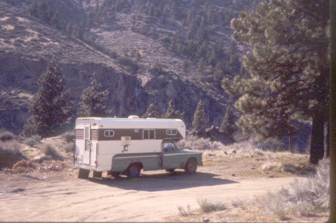
Not to sound like a dumb-ass (oops, too late), but is that Tonasket?
-
ah yeah, Nooksack ridge. My mistake. last winter (and for several before that) an easy crossing on a log jam.
-
I'm not sure which crossing you're talking about... at the end of the (summer) driveable road (to get to second half of road/trail), or at the end of the trail/just before entering the cirque (to get to Price Lake/Nooksack Ridge)?
At the end of the road, last winter there was a log jam immediately down the trail from the parking lot. Gets you onto a big sand bar, then (sometimes requires) another log jam to cross a braid that shows up in high water. Overall, chill.
Last time I was up the trial, I saw some flagging right at the wilderness boundary sign (recently smashed by a snag and (I think) put back up) that (I think) marked a route to a snag across the Nooksack. But I can't remember that part. Know I saw some flagging. But that's only if you're trying to cross the Nooksack to get to Price Lake et al.
-
On 10/31/2018 at 9:37 AM, slb said:
Those customizations make my iphone 4 on 3G choke like NOTHIN!
The original kantola graphs worked 100% of the time and quick-like.

Baker area hut proposal
in Access Issues
Posted · Edited by max
BTW, access from the other side (coming in Hampton/Sierra Pacific land from much farther south on Mosquito Lake Rd) is getting attention as a more legitimate access point under the auspice of visiting the DNR Daley Prairie Nature Area Preserve. Its 3-4 times longer but all bike-able.
https://www.dnr.wa.gov/dailey-prairie-natural-area-preserve
https://www.gaiagps.com/map/?loc=12.1/-122.0436/48.7031&pubLink=HvWt3tXDN4hxcctmlr5OsnYq&trackId=52e0a40a-30fe-4eb5-8baa-692cb581c84c