

-
Posts
10 -
Joined
-
Last visited
Content Type
Profiles
Forums
Events
Posts posted by TroyHorse
-
-
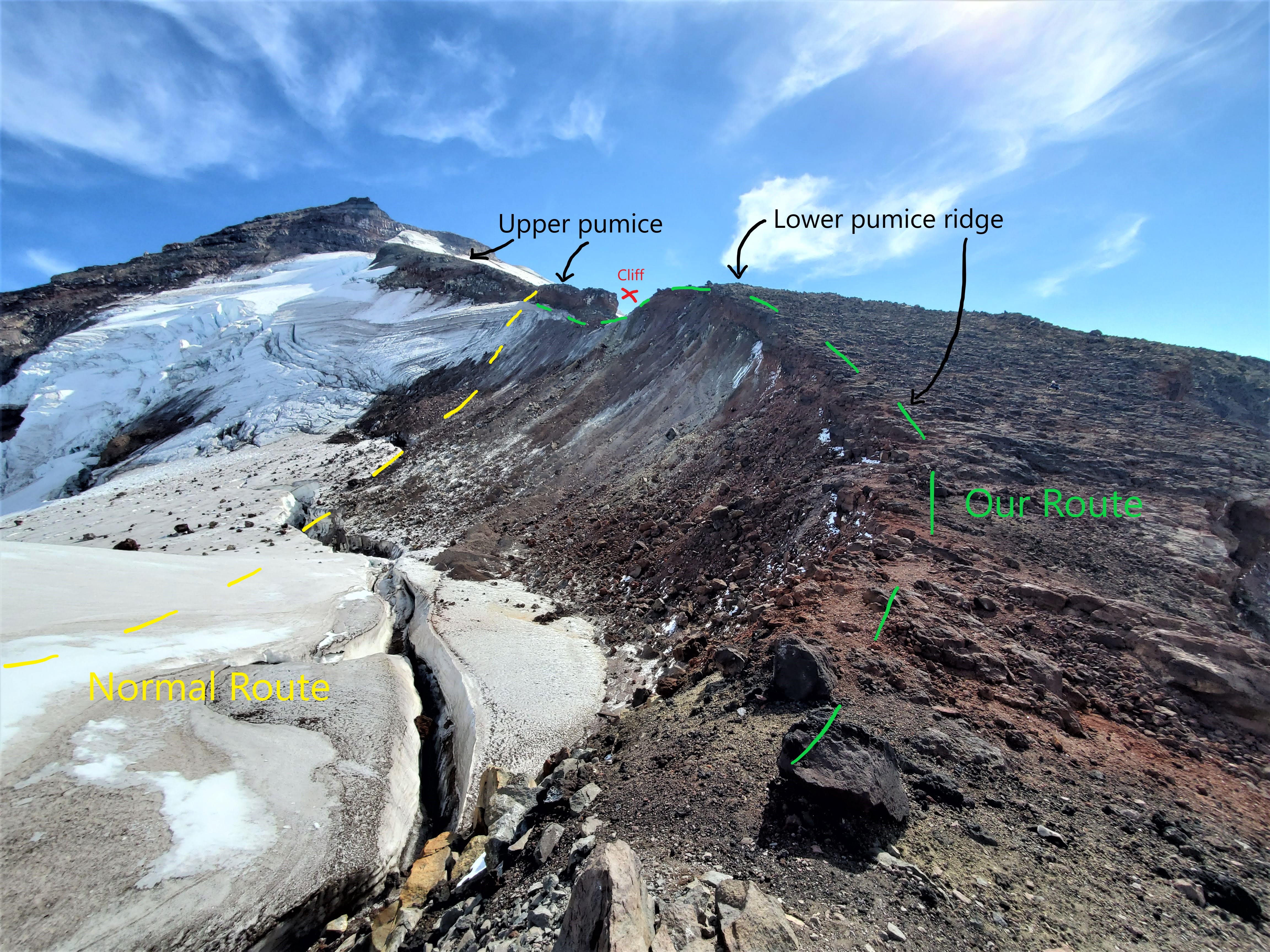
Looking up from the bottom of the lower pumice ridge
-
Snow bridge at the saddle, just below the lower pumice ridge
-
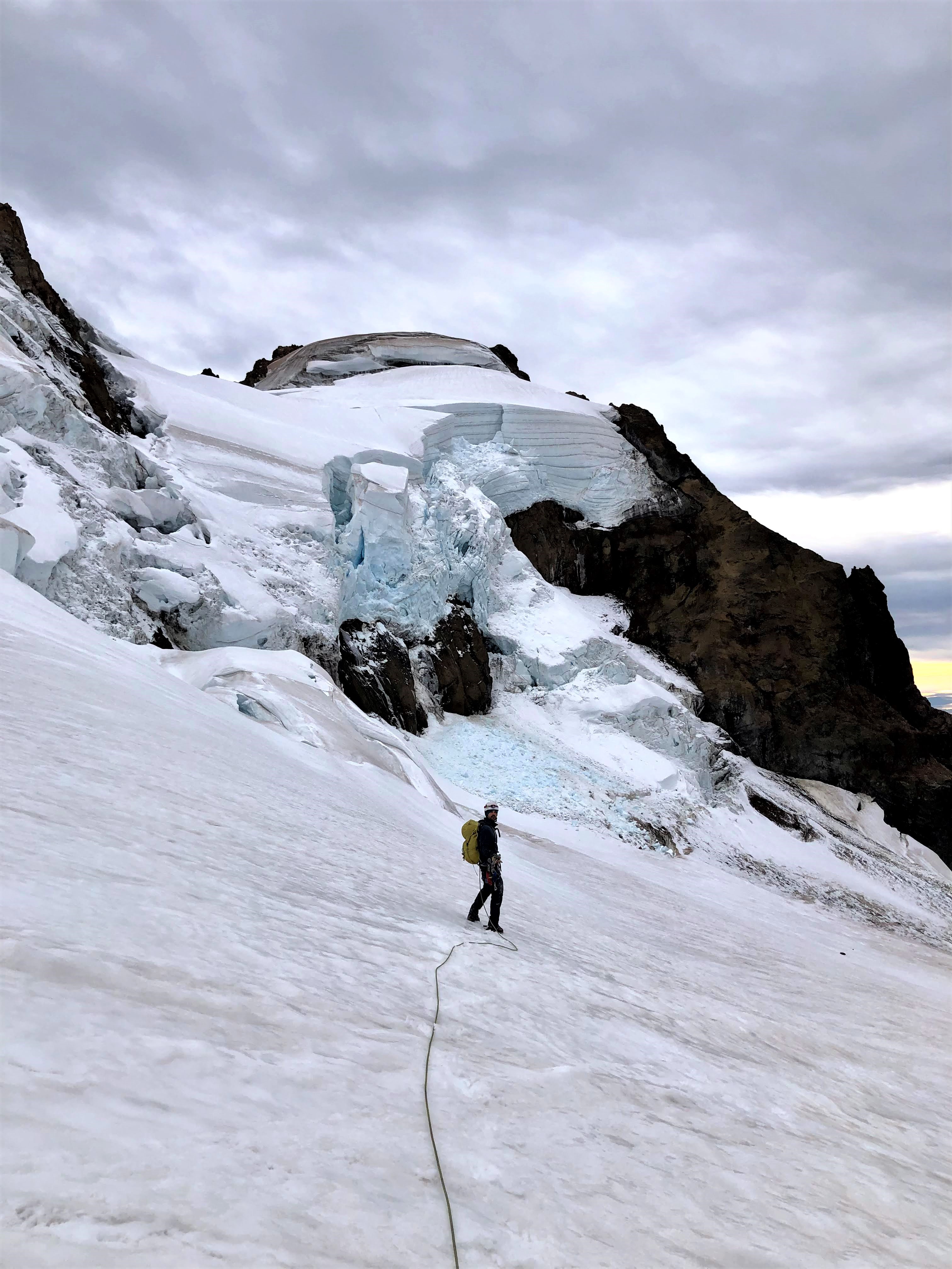
Passing the serac on Colfax
-
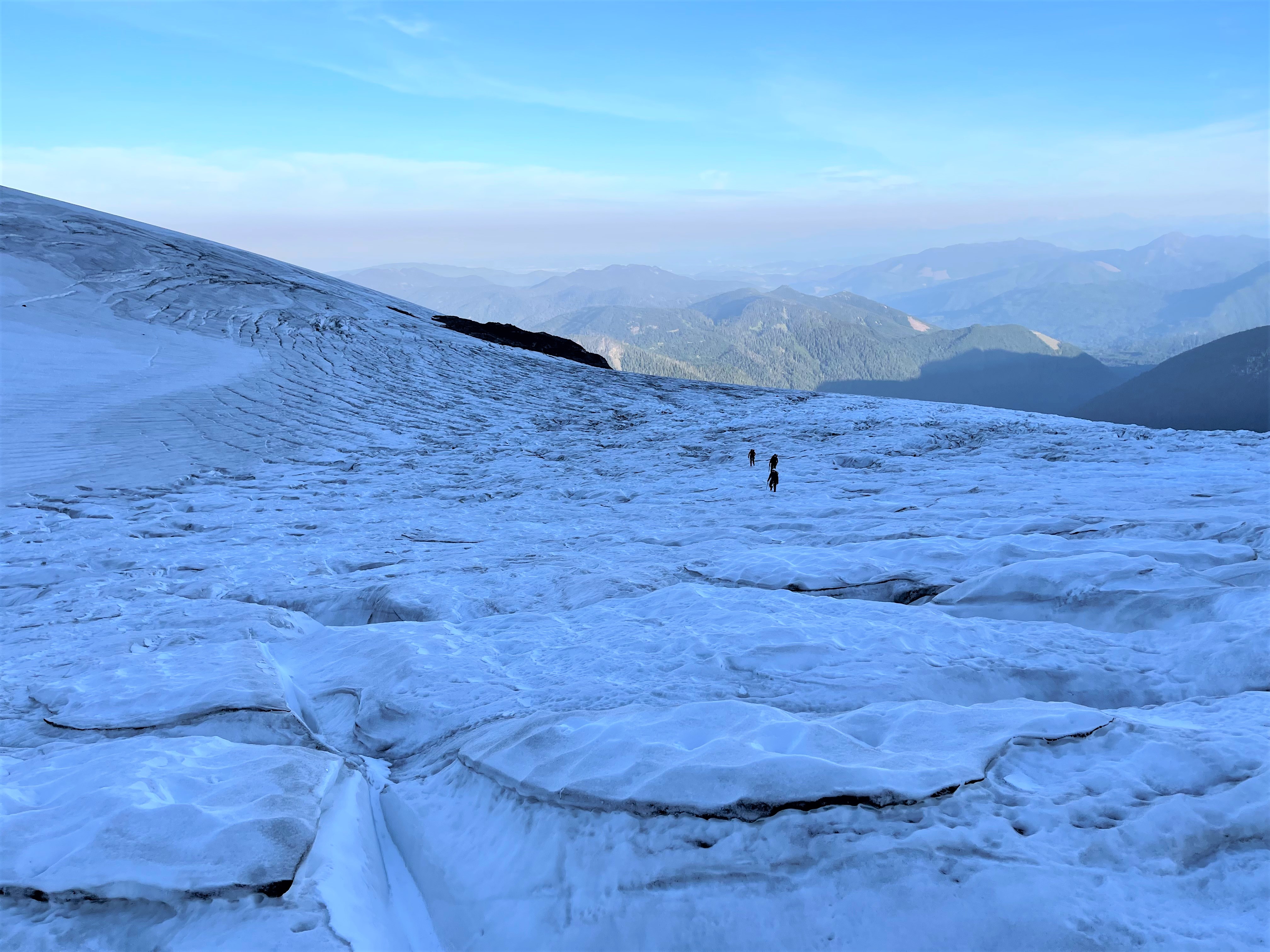
Looking back towards the bottom of the football field and the fin that protrudes just below it
-
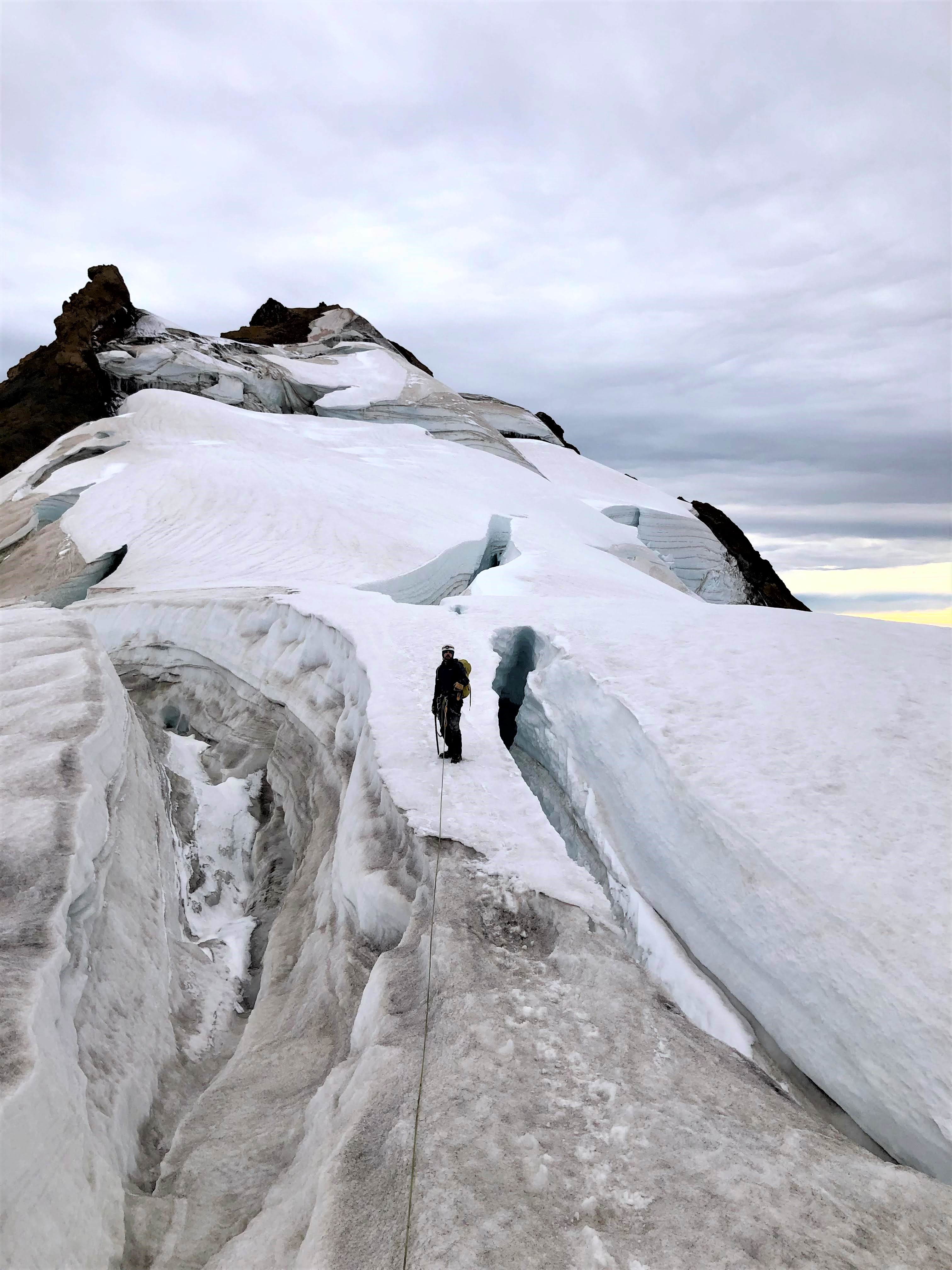
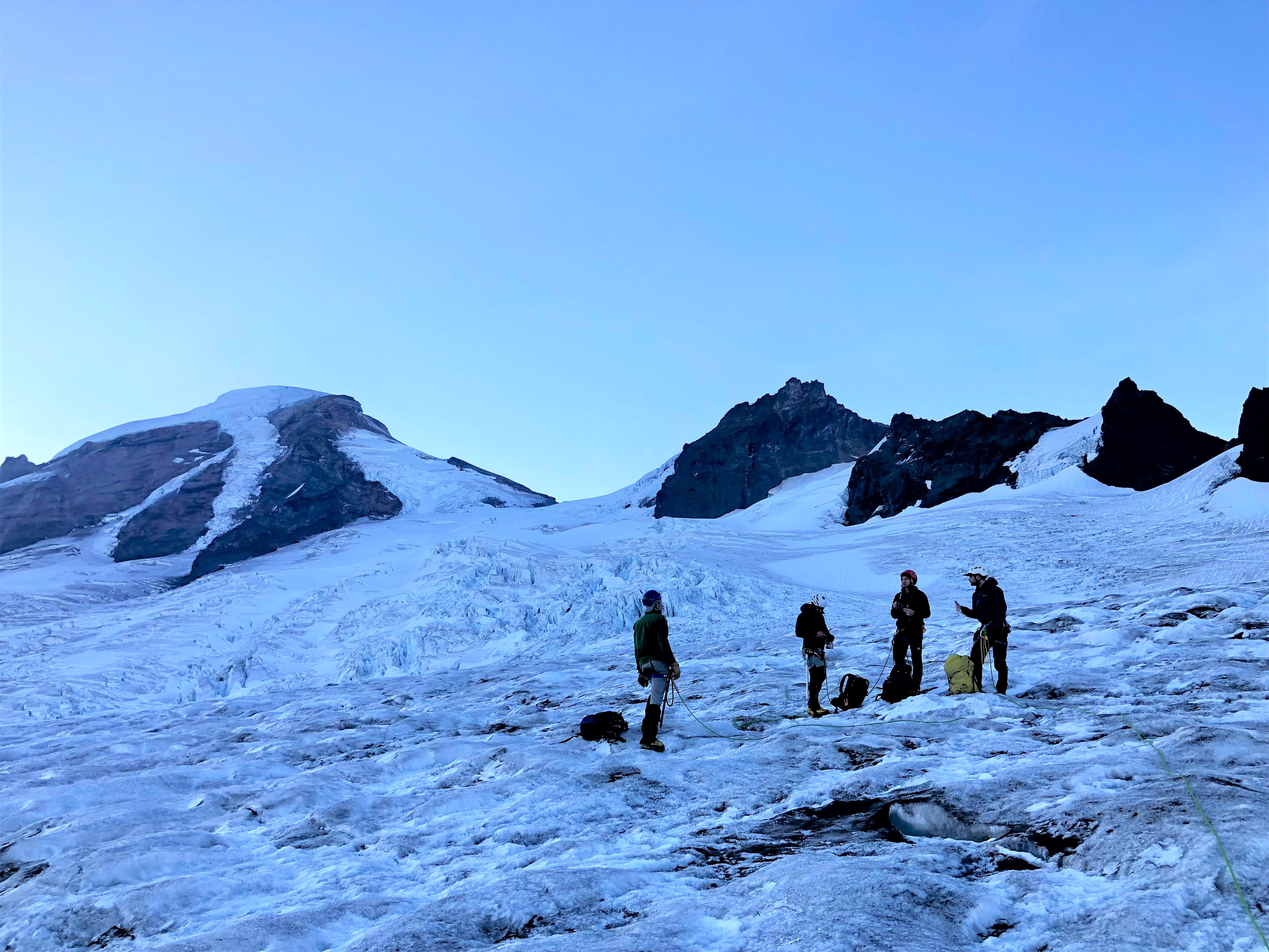
On the lower glacier
-
Update: we hit the mountain on 9/2/21. Started at the Heliotrope TH at 1:40am with temps in the low 50's. Got up to Hogsback where temps were in the low 40's. Geared up and hit the glacier at 6,180 ft. The terminus was surprisingly icy. In retrospect, we should have placed a couple screws and belayed up, since it was icy enough that if one in the group fell, self arrest was futile and the entire group was going for a ride. Once we got a little higher up, adjacent to the volcanic fin that protrudes just below the football field, the grade lessened and we had easy travel despite still being ice. There were tons of small crevasses, but they were easy to navigate and hop. Around 6,850 ft, near the bottom of the football field, we finally hit the firn line and beautiful grippy conditions for most of the remainder. Wet took the lower CD route on the way up, which had a number of moderate crevasses requiring time-consuming navigation. We ended up heading south to gain the upper CD route, which was much more straightforward. A few huge crevasses pushed their way towards the standard route, but they were easy to end run. Colfax was saddled with its serac, but there were no signs of any recent icefall. It was easy to end-run the bergschrund around 8700 ft, which had a decent, though giant snow bridge, which I image could be gone in a few weeks. Once we hit the saddle a little below 9000 ft we had to cross some large crevasses that were thankfully bridged. We hopped onto the lower pumice ridge, since the regular route was melted out, icy and crevassed (see pics). We then traversed an icy spot under the cliff that terminates the upper pumice ridge (requiring another crampon transition), and worked our way up to the notch where the normal route gains the upper pumice ridge. There were no signs that anyone had done this route recently, either marks on the glacier or moist soil on the ridge. At the top of the pumice ridge we got a good look at the Roman wall. Its lower section was great, but then it turned into a wet, muddy, icy mess. We worked our way to the top of the wall where it normally gains the summit plateau, but as you can make out in the picture, we got cliffed out at the very top due to insufficient snow pack. Climbing the cliff was impractical, as it was crumbling apart. It may have been possible to traverse SE around the cliffs at 10,200 ft, but after seeing big rockfall from above, we decided to head down and call it a day. The descent was unremarkable, except that the terminus, which was initially very icy, had softened up and made for an easy transition back onto the moraine. Pics to follow...
-
Once we get on the glacier, what areas are considered safe for gathering together un-spaced. I assume the football field and Colfax saddle? Anywhere between those? And what about the Deming glacier and summit plateau? Thanks!
-
Very helpful. Thanks so much!!!
-
Hey guys. I'm flying in next weekend with a group of buddies to take a whack at the CD on Mt. Baker. Anyone know what the latest conditions are? I assume the route is still open, just heavily crevassed? What's the situation with the bergschrund at 8800? How bad is the ice is higher up and should we expect to need ice screws to belay up past the Roman wall? Also, is there any water on the glacier above Hogsback camp? Would love any beta I can get. Thanks!
Coleman-Deming Latest Conditions
in North Cascades
Posted
Looking up at the Roman Wall from the top of the pumice ridge