


-
Posts
65 -
Joined
-
Last visited
-
Days Won
4
Content Type
Profiles
Forums
Events
Posts posted by underscore_child
-
-
Nice dude, looks like a good time. U gonna mountain-project these rigs? That'll get em some attention.
-
Sick.
I added that mp listing years ago hoping it would stir up some more beta or stories out of the mist. Please go change it however you feel inclined. I assume Martin or Jeff changed it to the falcon route, I don't know where that name came from.
This looks like such a cool climb....
-
Fuckin bad ass. Those pictures stir up memories deep in my soul; not that I've ever climbed something this epic but 'improvised' overhanging pitches that are half tree and have a loose block roof pull with a lichen mantle aren't something you forget easily. Someday I'll climb this! Inspiring!
-
Dry rock out there today! Sorry yall skipping this one to go climbing.
-
 1
1
-
-
I have no suggestions, but I'm in for this one assuming I don't get ensconced in snow on the way back from Utah.
-
Have fun guys. Southern Utah is sunny. Perchance I'll join you when Washington is again.
-
 1
1
-
-
I'd be down, probably can't fake my way into a bar but if yal outside somewhere I've got intoxicants
-
Time indeed will tell. Might be going up to Helms Deep next week, a place you might enjoy, I'll shoot ya a text
-
1
-
-
13 hours ago, Rad said:
Thanks for posting!!!!
You said, "The belay ledge had a detatched block I threw two cams in and tried not to weight .."
Quick comment from a crusty veteran: feel free to use detached blocks for protection, but it's far safer to sling them as low as possible than put a cam behind them. Cams generate very large outward forces that can lever off a block and cause the anchor to fail and/or dislodge the block onto you and/or your partner. You can use the rope to sling larger blocks and you can also use your body sometimes. You might do some experiments in a steep talus field so you have more knowledge of what works and what does and doesn't work when you get into the alpine. Be creative, consider leaving at least some of the heavy cams at home if you don't expect a lot of clean cracks, and keep climbing and sling more blocks!
And thanks for posting!
Ahh, that's smart actually. Good to keep in mind. In this situation the block was unslingable, the top and the bottom were mushed up nicely against the rock and the crack on the right was all that was accessible, so maybe not 'detatched' in a normal sense of the word, but with a hammer I could get it out. In any case I was braced against a bush and belaying Zach off my harness. Glad you enjoyed!
-
1
-
-
Heh, they can have the negative for now if they wanna slog up there, but I'd talk to Erich and Josh before they go too crazy...
-
Trip: 3 days north of Snoqualmie - Thomson W Ridge, Huckleberry W Face, Alaska, Kendall
Trip Date: 08/11/2022
Trip Report:
Blue collar alpinism.
I am many things, and as a climber, only a few (tree beautifier and occasional murderer, recently unmotivated pebble wrestler, occasional *blue*collar*alpinist, and mostly a steep cave sport choss wrangler), and recently all of those climbers inside my earthly shell have been tugging around the term blue collar alpinism. All that goes with it - lack of aesthetics, a sugar bowlful of chossy andesite, a bunch of unpleasant walking, rarely visited (or often visted) summits, frequently climbed (or never climbed) paths to those summits. Actually, this term has been bouncing around my head since more than a year ago, when @JasonG off-handedly awarded myself and Zach the 'blue collar award of the week' for some stupid romp up Guye.
I read trip reports on this site for truly outstanding ascents and FA's in the NC's, where ice and snow and rock collide for national-park-worthy pictorial territory - like @waynesaid at some point recently the golden age of the Cascades is now. I spent a delightful 5 or so hours once reading through a collection of TRs that @Blake collected on his blog more than a decade ago, so many under the radar hard, cool, scary, cutting edge routes going up in corners of the range yet-undiscovered.
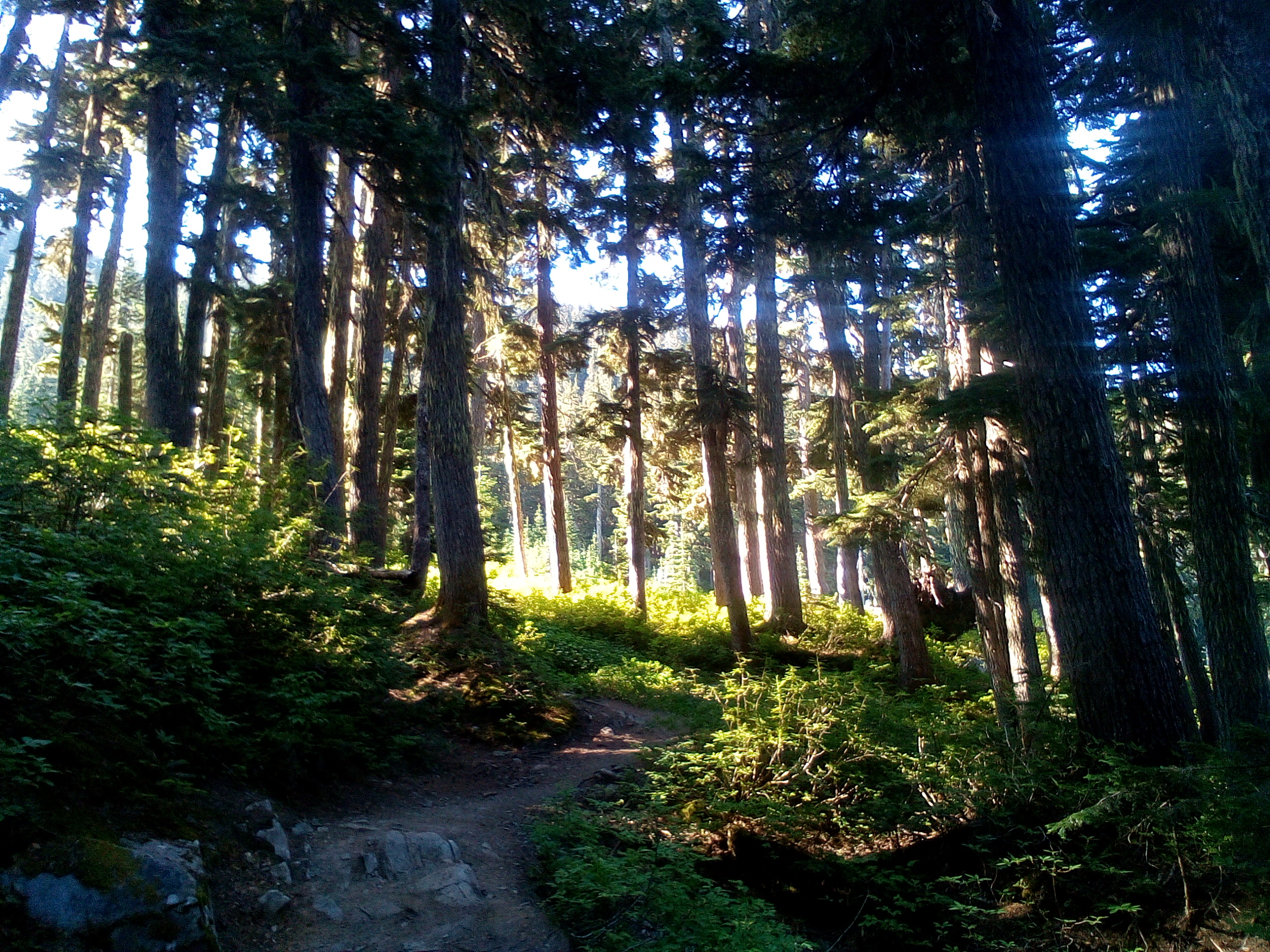
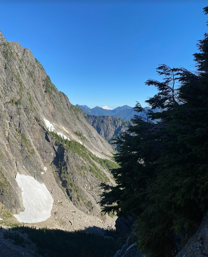
But as I venture from the truck to explore even more deeply my corner of the range, the 3 forks of the Snoqualmie (a blue-collar river if there ever was one), and find hidden crags, secret swimming pools, a wealth of dramatic glacier-carved terrain, rarely visited peaks, goat carcasses, hard new bolting & scrubbing experiences.... I am reminded how Cascadian they truly are. Walking up the PCT and staring over to the basin to the north of Alta Mountain: how many people have ever been there? It doesn't go anywhere, only a 800 foot bushwhack from Gold Creek or a chossy traverse & descent from Alta would get you there. And now that I've visited the Wasatch and other such ranges, I'm eternally grateful that this backyard I happen to have is so damn crazy. The Wasatch is predictable, the Rockies are predictable, the Sierra is predictable, but the Cascades deliver stunning amounts of unclimbed ridges, faces, steep heather slopes... yall know what I'm trying to say here... even along the PCT as far south as Snoqualmie Pass. Blue collar alpinism, yes! But blue collar in the best sense of the word.
The idea for such a trip had been floating around since last year between Zach and I, and he finally lured me out of World Wall and the Actual Cave to sack up and ride the trail to the choss wonderland that is Thomson, Huckleberry and their compatriots. As we began tromping, heavily laden, up the Commonwealth trail, I thought more about the blue-collar nature and where it would lead after this trip: more 'white collar' climbing at WA Pass? Forays into the North Cascades to test our finger pads?
Getting ahead of myself, I thought.
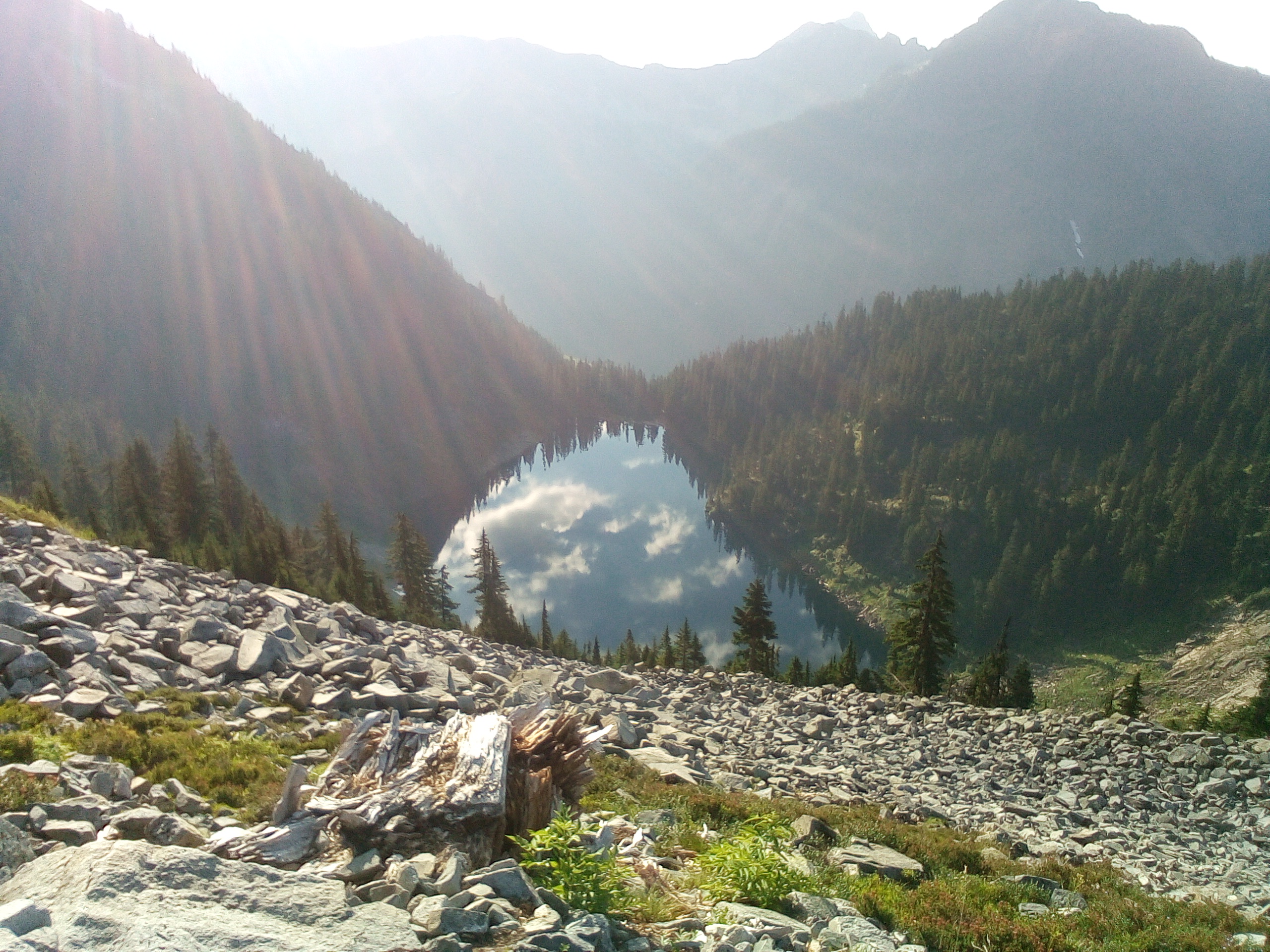
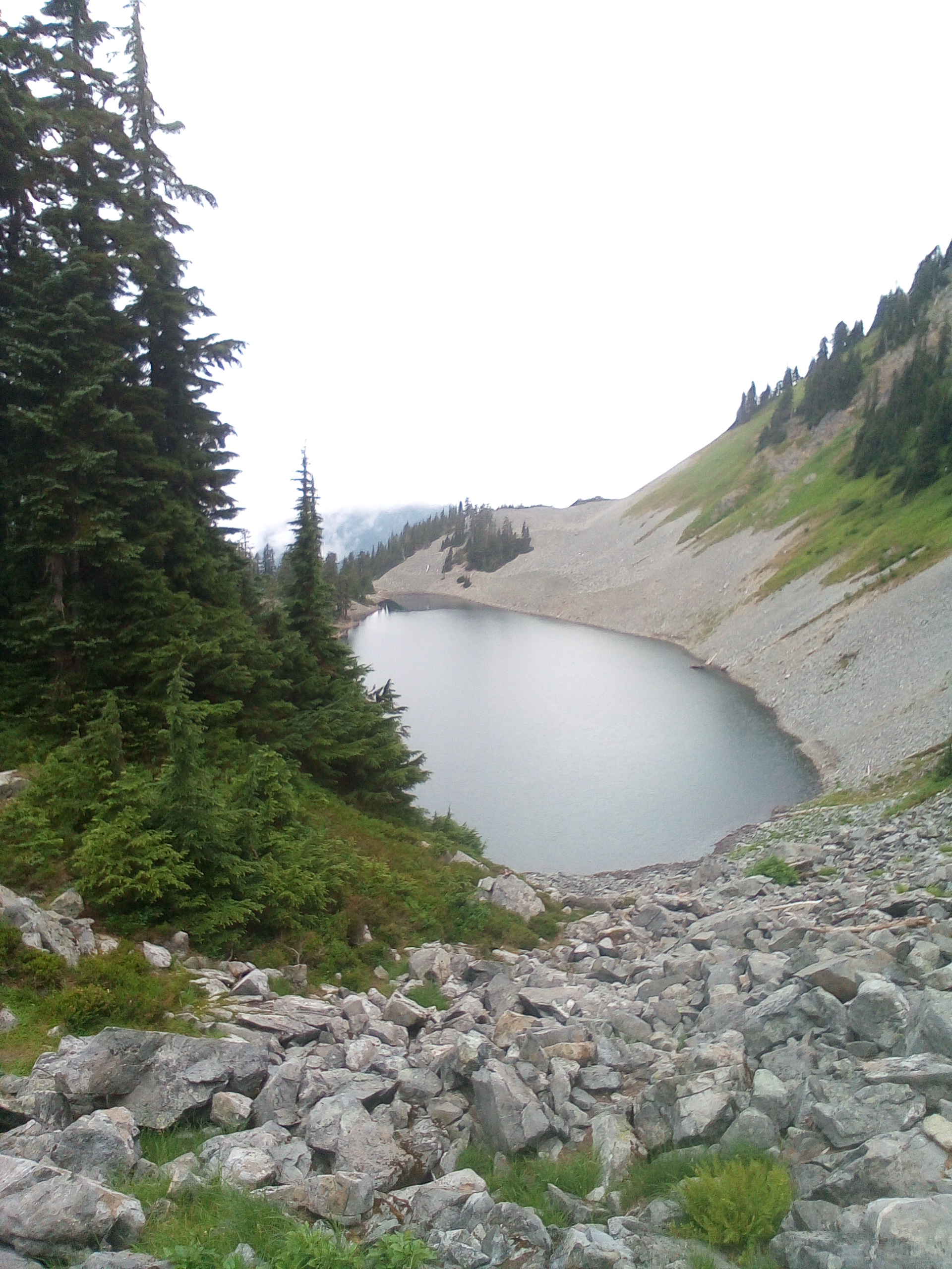
We made great time to Gravel Lake and hurriedly pitched camp at 11am.
Part 1: The Blue?
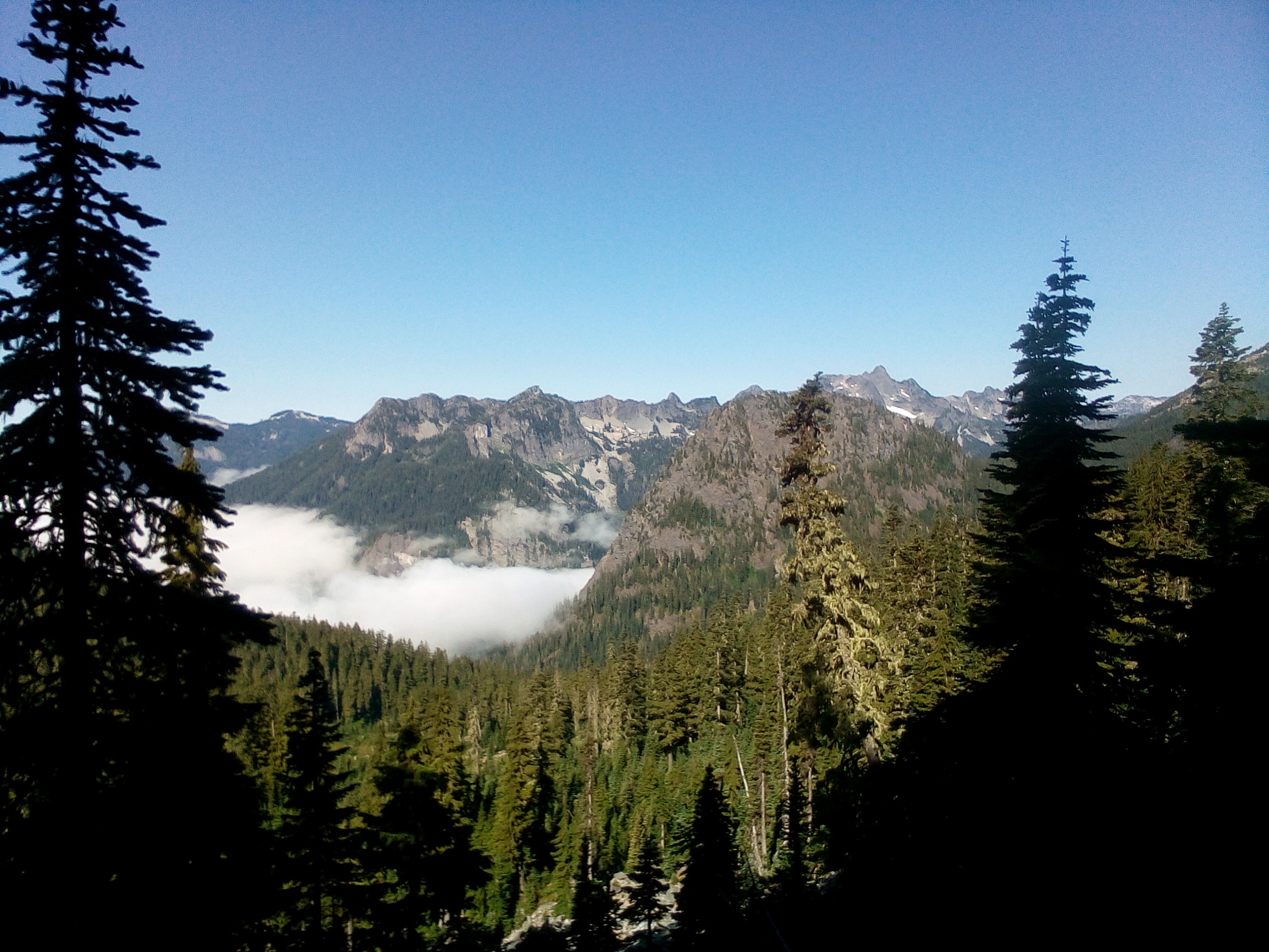
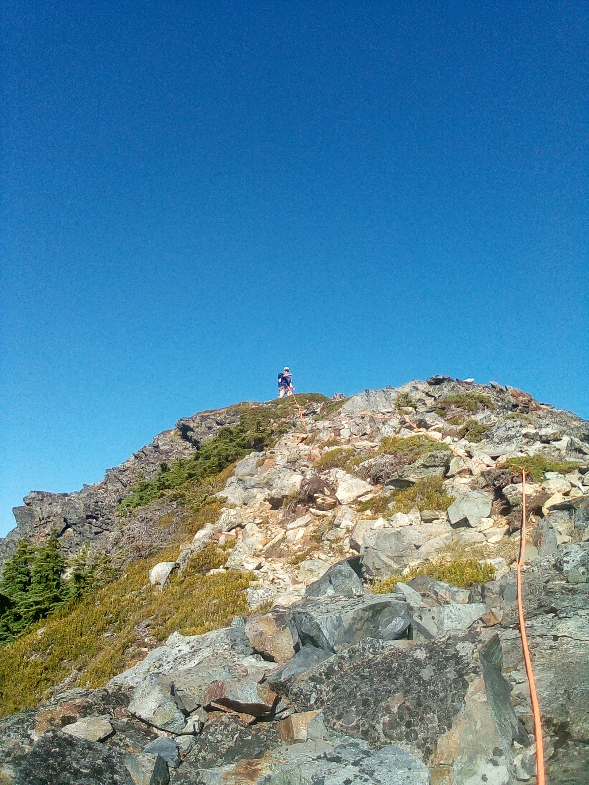
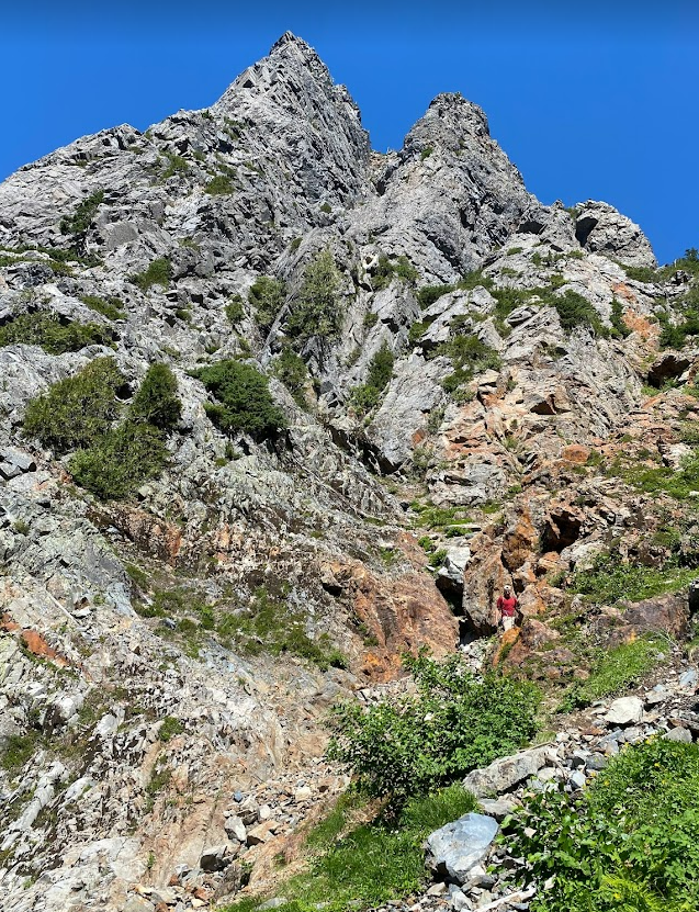
Our first thought was to Thomson, and off we went to pluck it, I with a rope, Zach with a rack, and no one (yet) with the shivers. Bumblebee Pass was a slog after 8ish miles of hiking but thoughts of water in the basin gave wings to our feet. Immediately, we wished we'd camped there instead.....
.jpg.a903f47abe80b73db34f5d8c2e84d3d8.jpg)
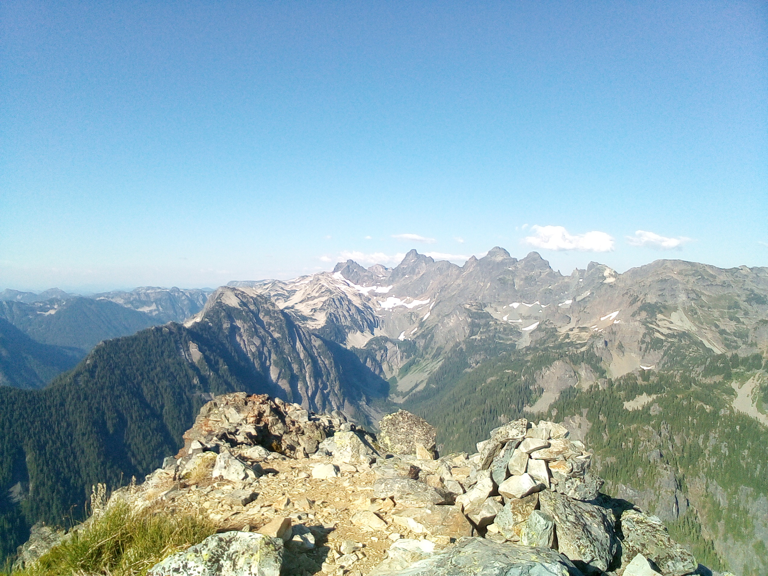
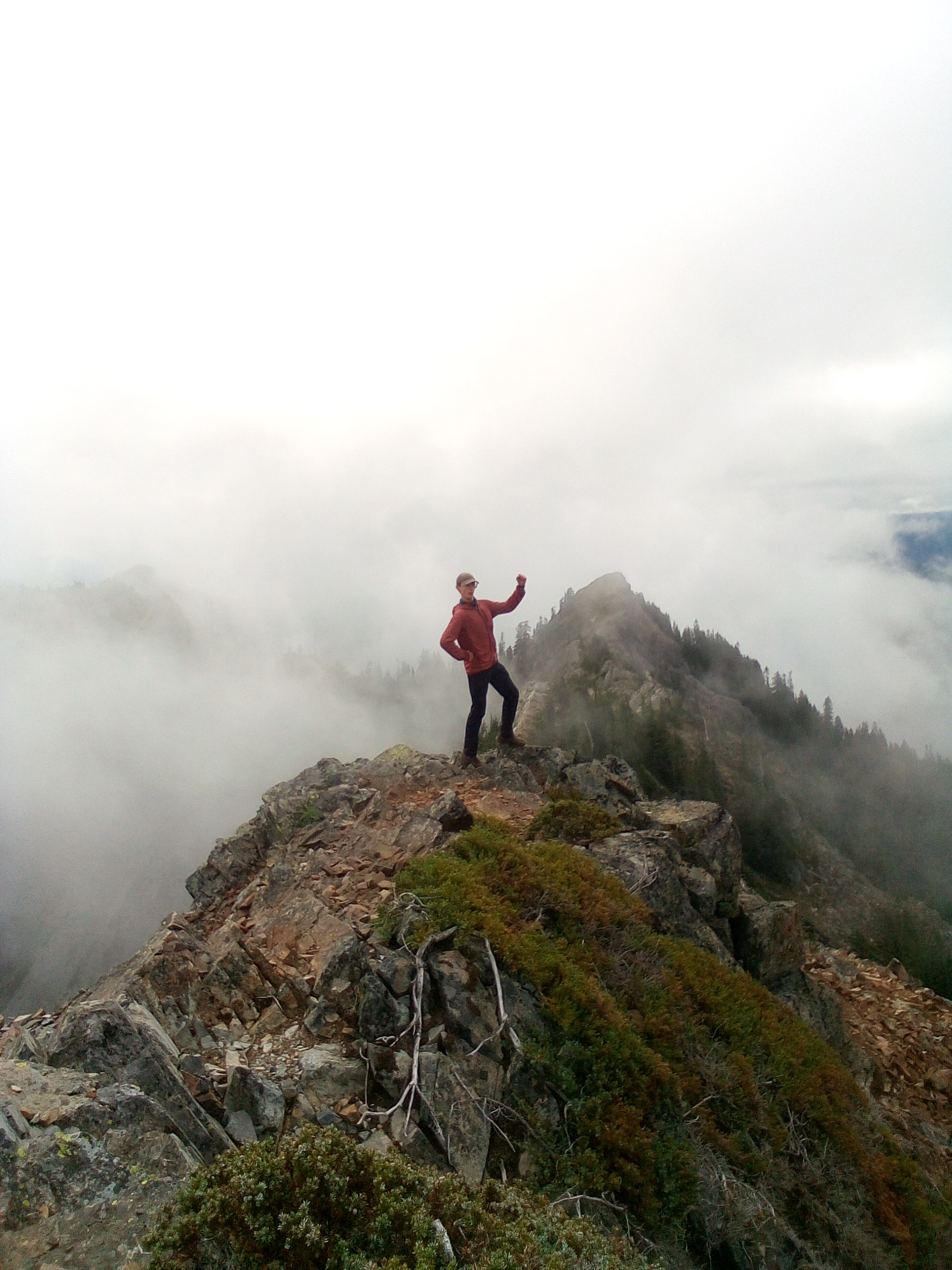
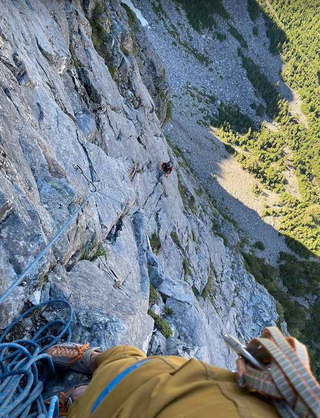
Surprisingly pleasant talus kept us moving up to the base of the west ridge. Zach took the first pitch sliding up through some discontinuous corners. It wasn't here where this realization came (that was back at camp Day 2 with a joint), but the andesite we have at the crest in this part of the world is a Blessing in Disguise. Granite doesn't overhang the way this metamorphosed andesite does. Finding the safe and clean path through a maze of chossy andesite roofs (so good if bolted, if only...) is a Blue gift from the mountain gods. I wholly appreciated the challenge of P2, though a small challenge it was, getting to pull a roof even at the end! Zach led up to the base of the slab mid-route, which provided good picture opportunity. Knowing the hard part (hard? more like Blue) to be behind us I romped on up the slab and pranced happily toward a steeper bit of choss - too much prancing perhaps, Zach called up behind me 'are you gonna put a piece in?' Doubtless it wouldn't hold, but that isn't sad, it is Blue, and a challenge to be appreciated.
.jpg.85354bfac6d7d7684f3abfb452987f17.jpg)
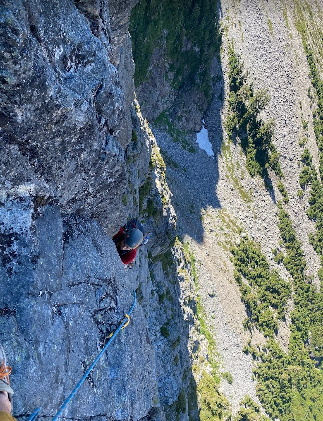
The belay ledge had a detatched block I threw two cams in and tried not to weight as Zach ran up to the false summit. Once in the notch, a further fun (Blue) pitch brought us to the final summit. A text was sent to let my sport-choss-wrangling buddies know that we weren't swallowed by the Blue just yet.
The descent was straightforward, some raps, an inappropriately timed coiling of the rope, an inappropriately timed uncoiling of the rope, another rap, an appropriately timed coiling of the rope, and some marmot-like gamboling across the talus during which I decided I didn't want to hear anything for the rest of the trip that wasn't about marmots. Zach responded with 'a sizeable middle finger approaches.' Back to camp, swallowed food, water pumped, and the great chase of Sleep began as the Blue faded, and gave way to the Collar.
Part 2: The Collar?
I awoke to a chorus (that I neither heard nor heeded, but which was there all the same....): The Blue has been summitted and the Collar rises in your horizon to provide a test for the ages. Breakfast was eaten and a start was made at 7:30. (No indeed, an alpine start it was not...) Along the PCT heading north we made a simultaneous impulse decision to scramble the clean white granite ridge of Alaska Mtn. A pure joy to bring us back to reality: humans don't belong in the Andesite Choss World, and we tread there lightly and quickly. Back down the ridge we went and along to the west side of Joe Lake, where a decision was to be made.
Toppling Tower sits on the ridge to the north of Edds Lake, which sits below the northeast side of Thomson and about 900 feet below the PCT. We had the thought of combining its summit with Huckleberry, that day, but peering over the ridge at the bushwhacking, and elevation, and talus, and then the climb, then the talus, the elevation, and the bushwhacking we'd have to do.... Huckleberry seemed a much more certain objective for the day, and less painful! What can I say... we're only human.
(Certainty? Lack of Pain? Did the Collar win, so early in the day? Not so... a branch of the Collar provided a sunburst of humility we walked through with grace, leaving the true mountain to climb... being the true mountain itself.)
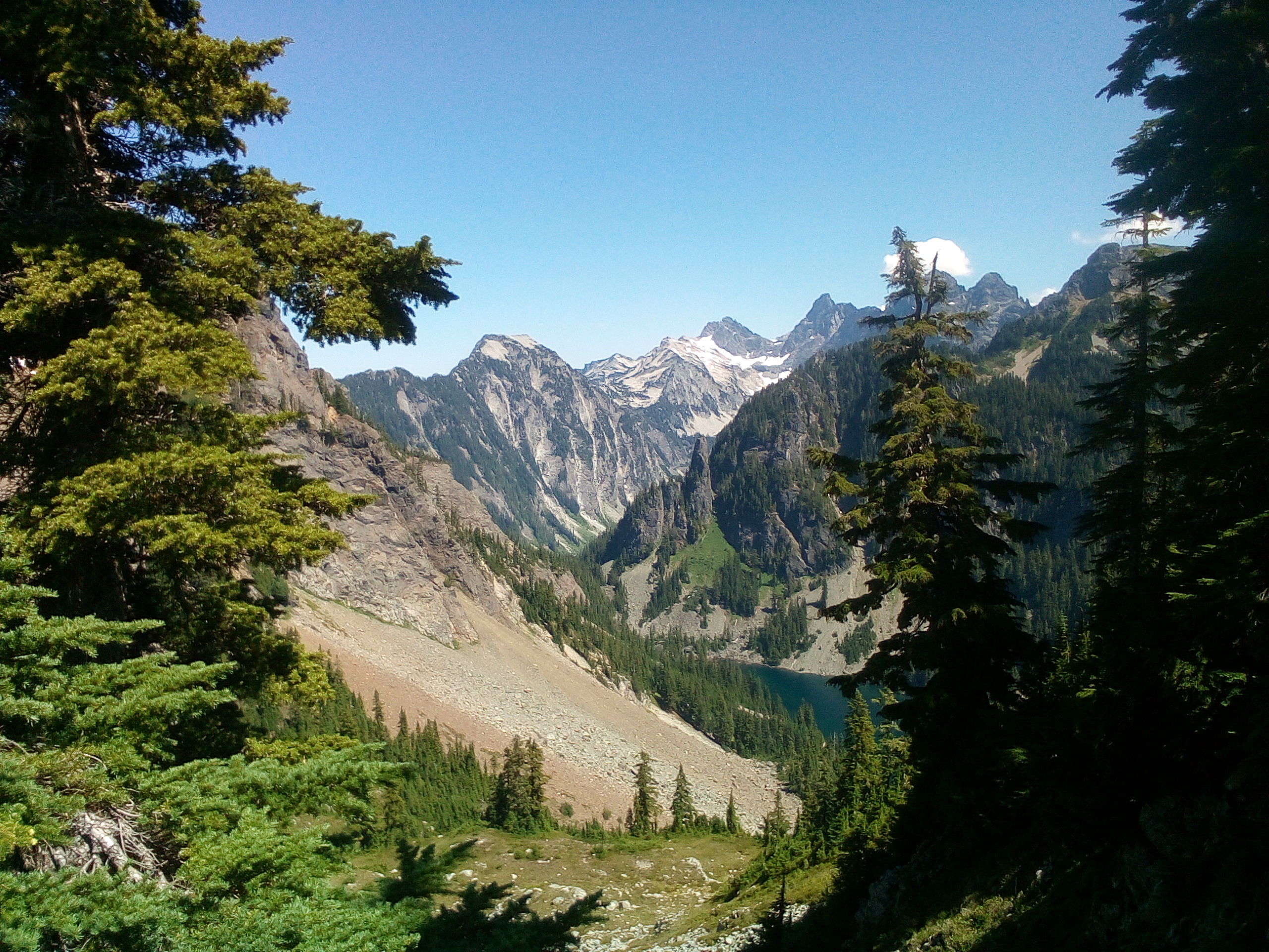
So on to Huckleberry! I'd vaguely read this TR on the west face of Huckleberry being a more pleasant option than the classic east ridge. It was also closer to us, and I hate hiking. We dropped off the PCT in a nice meadow, leaving my pack for the return journey, as I took up the rope yet again. (And still, no shivers....) After a short detour where we realized we had no water and I returned to the pack for the filter so as not to raw dog dirty swamp puddle filth, we began up another talus field to a short 3rd class step, then delightfully into the shade, and not so delightfully into the mosquitoes. Bug Boy, we call him. I'd forgotten much about the TR except the pitch description, so we started, as directed, left of a large loose chimney. When Zach was halfway up the pitch, I started simuling to escape the mosquitoes, which were horrendous. It hurts to call them Collarful; too soon, they were simply horrendous. What was Collarful was the first pitches: vertical to overhanging tree and moss climbing up about 250 feet to a big ledge.
At this point the Collar was upon us, and Zach and I were certain to be off route. I scouted the upper headwall for something that would go; there were cracks I was confident I could climb, but where would they lead me? Not to anywhere I could rappel from if necessary. Eventually, I traversed the ledge (and perhaps the Collar as well) to find exactly where we needed to be, at the base of a fourth class ramp. I lead and brought Zach up to below the final pitch, 2 small steep dihedrals cutting up to the summit. Now it was time for my superior rock skills to shine. While still folded in the Collar we may be, I saw the light on the outside and had only to claw my way skyward.
I began up a dihedral placing on the left and the right. Standing in a stem for what must have been 10 minutes, I cleared dirt from a crack to place my first bomber piece of the day, a #1 in a well-attached big slab/block. With this confidence, I put my knee in my armpit, my right forearm on dirt, and mantled hard. Now I was standing on heather. The last dihedral looked BIG, and detatched, and overhanging, but not dirty. I bumped a #2 up the nice hand crack until the final moves. It was clear I could pull up and over, but how attached was the block above me? (The Collar had been flicked closed, and I was losing sight of the light...) The other option was a high step, roof pull, and mantle to the left. I extended the #2 and reajusted the placement to hopefully hold a fall. A cackle arose in my throat, remembering the adage about the Mox Peaks: 'If you don't like where the hold is, just pick it up and move it to where you do!' I warned Zach and started pulling holds of the ledge I was to mantle on, scrubbed some lichen off a foothold, and committed to the move. Rubber met the road, chalked fingers met welcome jugs, and I was on the summit.
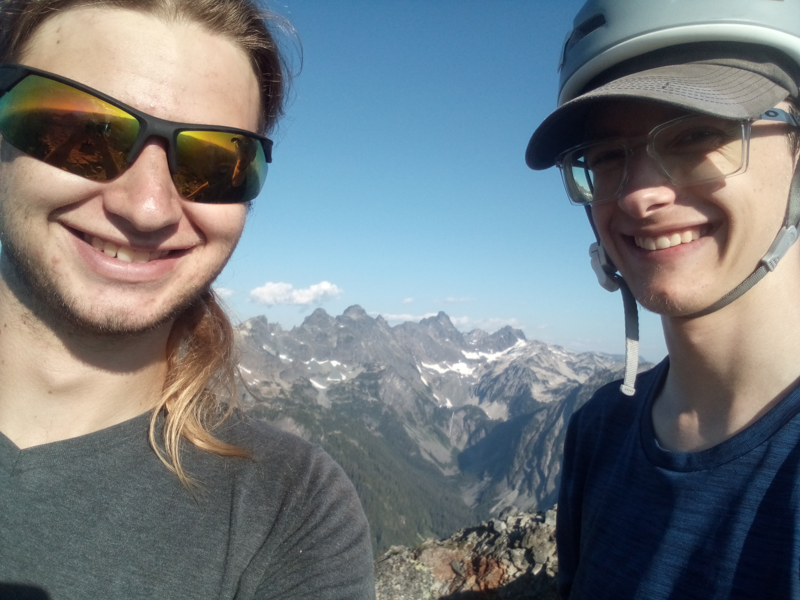
.jpg.e8c15d79a08748085bb3b3e89f7d0732.jpg)
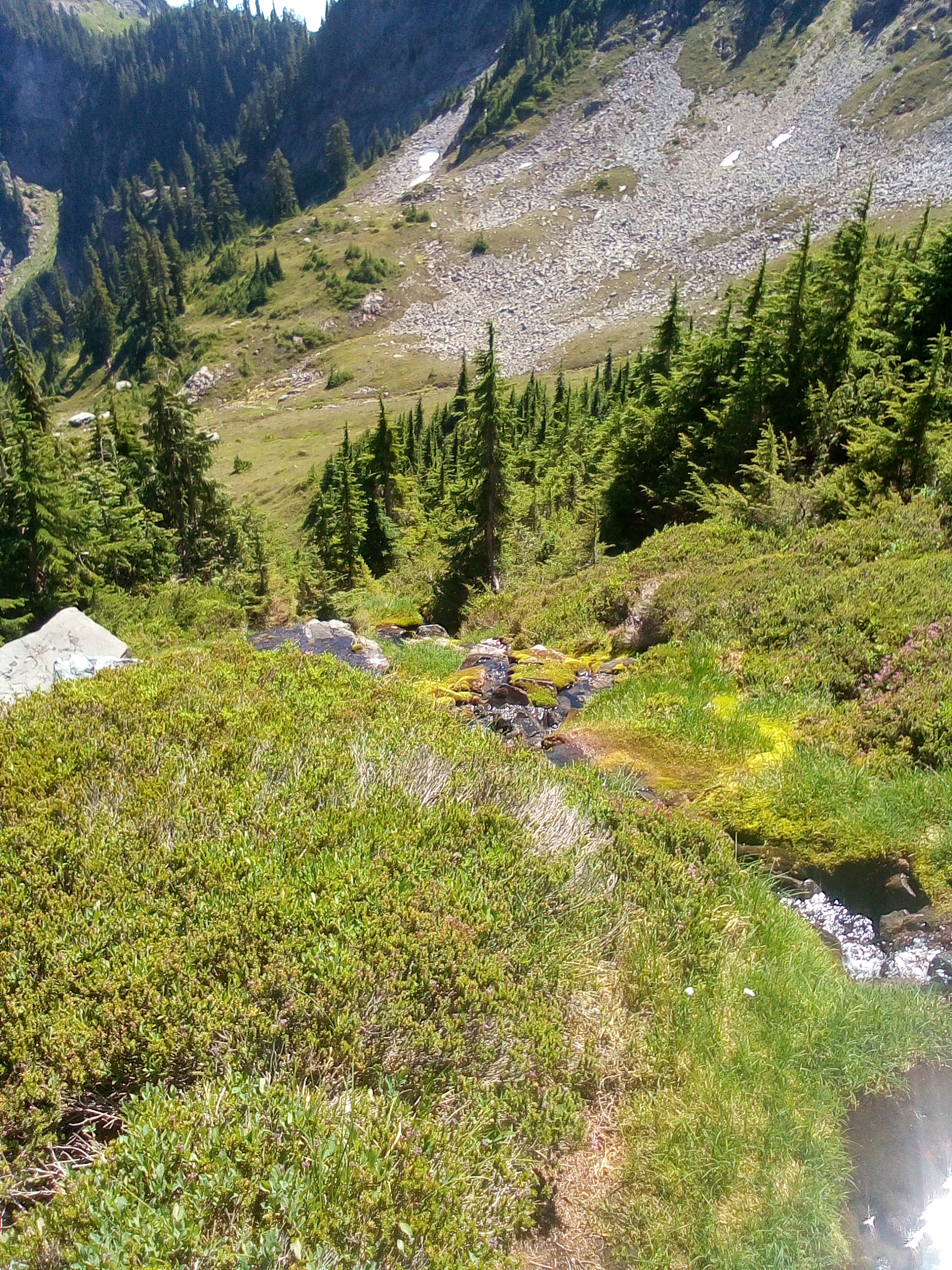
The descent was an adventure involving poor rappel anchors, limited tat, breaking old tat with my hands, and downclimbing 800 feet of scree. But by that point we were out of the Collar, and almost on to the Alpinism.
(Or, from here on, the Alpinist.)
Part 3: The Alpinist
If there's one lesson we might've learned from the movie, was it 'know when to stop?' No, it wasn't, that kind of oversimplification does poor justice to LeClerc's memory, but it's the lesson I'm choosing to drag out and apply here. We could have gone on to Toppling Tower the next day; I'm not sure what was in Zach's head, but he clearly wanted it, and so did I. A rarely visited summit with many unknowns and challenging climbing? Of course we selfishly desired to have said we'd done it. The glory of such a climb is fleeting at best and nonexistent at the real state. But the lessons we'd internalized (never verbalized until now) through the Blue and the Collar were clear, when doing our little corner/pitiful imitation of blue-collar Cascades alpinism, know our limits. It wasn't the tower that would stop us in our tracks. Dropping over Bumblebee Pass and 1200 feet down to the lake, around the bushwhack of Edds, up to Toppling Tower itself, doing a climb, getting off some way or another (20 year old rap anchors?) then all that back again, then down the PCT 8 miles.... we simply weren't fast enough at navigating such blue collar Cascadian terrain.
Such was the decision we tentatively made before we even went up Huckleberry. The ascent of the Berry Mountain confirmed it even more (the 3 hour descent) and when we awoke to mist and fog, we didn't even have to discuss plans. We ate, packed up, and headed homeward. A scramble up Kendall (which neither of us had enjoyed before) took some of the sting out of it, but there was no sting, really; 4 summits in 3 days plus 28-ish miles of travel is nothing to sneeze at for us at least. Thus ended the trip of the PCTfor Zach and I; we must have passed 130 people on the Saturday morning way out (big yikes...) Shakes at the Dairy Freeze, shower, and a long period of photo organizing and trip report writing, and here we are.
If you read all that, thanks, it was essentially a very long way to justify posting this TR at all on what is increasingly a Cascadian all-star roster, so if you enjoyed this truly blue-collar trip report (if maybe not a blue collar trip? although I quite seriously tried to convince you it was), you're welcome.
Anyone been up Toppling Tower recently? How was it?
As I discovered 35 minutes ago, we did go the correct way up the west face of Huckleberry. Anyone else repeat that route in the last two decades? What was your experience? I think @Kuckuzka1 did a route on the south face maybe? How did that stack up?
Gear Notes:
we kept it pretty fuckin light
Approach Notes:
feet-
2
-
 1
1
-
1
-
-
And the end of the story is Rad bailed on Trevor and my invitation to the Actual Cave the next day....
-
Trip: Morning Star - Beyond Redlining
Trip Date: 08/07/2022
Trip Report:
The Trevdog and I climbed @Rad's route Beyond Redlining 10+ 11p last Sunday, real sunny beautiful day. Pretty stunning the amount of work that went into this and, honestly, the amount of quality pitches. Seriously good pluck Rad and Kurt.
The story really starts in Mayish 2020 when Trevor climbed MHC with Rad to haul gear for this route, a tale related later to me as 'Rad was very confident it wasn't gonna rain. There was about 15 feet of snow at the base of the route. I did all the climbing in 15 minutes and fixed the rope for Rad to TR solo with a bucket of gear since he forgot climbing shoes. When we were on the summit, Rad was confident it wasn't gonna rain. I told him 'Rad look there's rain like right over there'. It dumped on us on the way out.'
Trevor climbs one multipitch a year (a lifestyle known only to a rare few) and we picked Beyond Redlining as something that didn't involve a bunch of fucking annoying widgets and also that somewhat challenged us. Shawn and Kat joined in to do MHC on the same day and we started driving at 4ish. I blazed around an empty 405 for a while. Man, driving on an empty racetrack/highway at night is fun. We must've got to Sunrise Mine TH at 6:30 or 7? Shawn and Kat dawdled, as they like to do, Trevor and I started racing up the trail. I think we did the approach in like 2 hours even though Trevor led us directly off the trail for about 30 minutes.
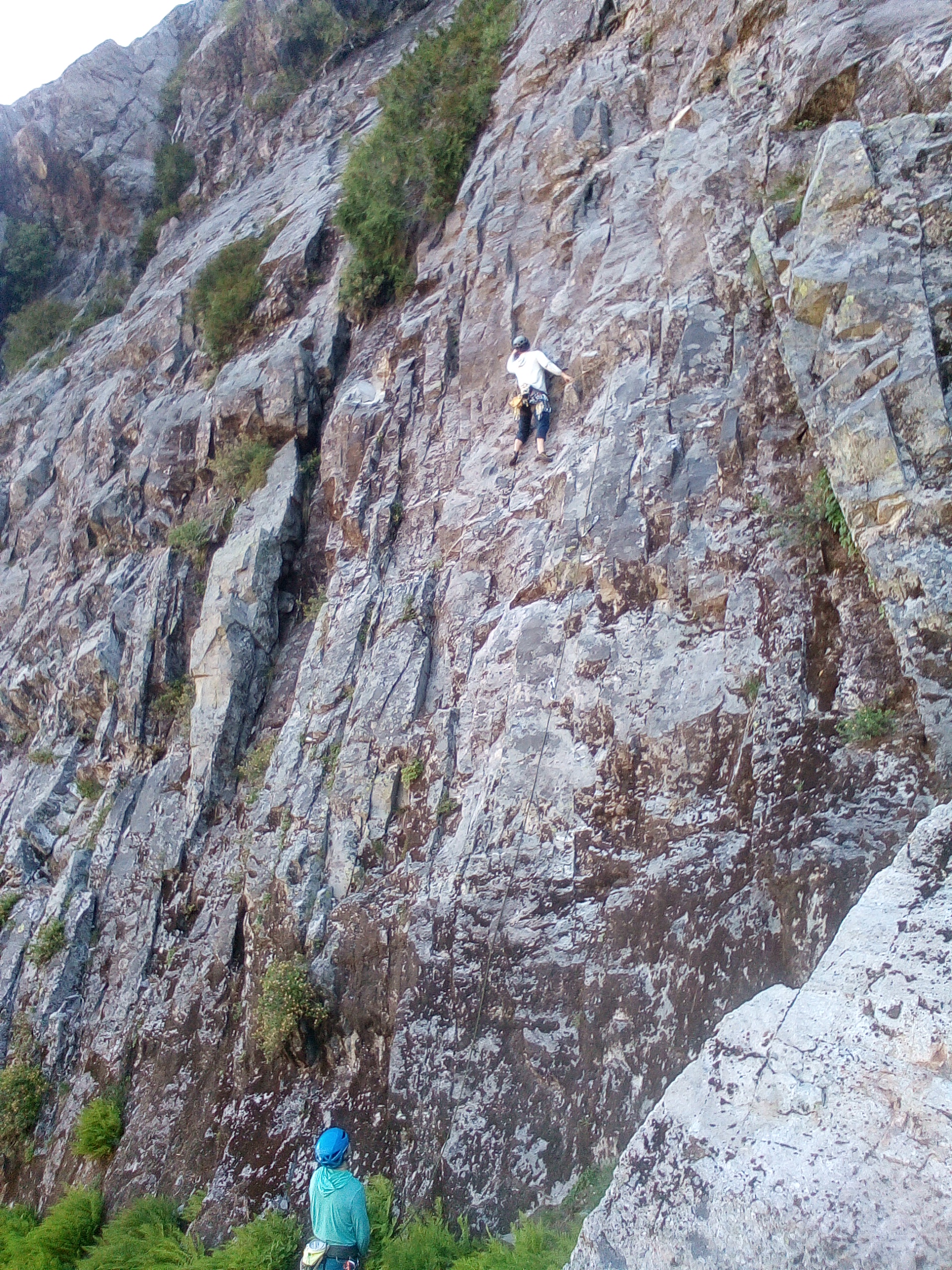
Some new friends on P1
We got to the base of the route at maybe 8ish behind some slow party (how the hell did they get there before us? For real, we were blasting all day long), watched them struggle on P1, eventually enjoyed the weird slab of the intro climbing. I linked P2-3 some classic cascadian choss (a phrase I've used about 13 times too many in the last week) but with shiny bolts! Trevor linked p4/5. We weren't too impressed with the climbing so far.
Me on P2
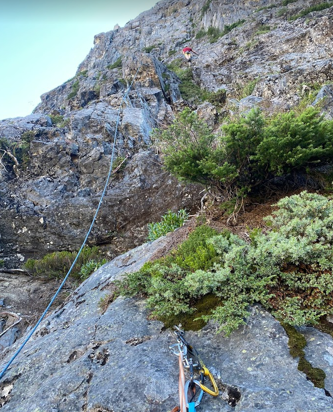
Side o' Sperry and Baker in the horizon
I led P6 the first 10+ pitch which actually had a very engaging and unique crux sequence over a bulge, and very clean as well. P7 was an easy romp over another bulge, then we waited for the party in front to struggle their way through P8. It took some thrutch to onsight that thing, as I discovered, some damn cool steep 3d climbing that we'd be lucky to have at some crag in the exits! And honestly, I thought pitches 8 through 11 were all f'ing brilliant. A variety of steep exposed headwall climbing with a different style of crux each time: P9 a pumpy high step on an overhanging face, p10 a rad step around a bulge and some Mazama-esque crimps, p11 the 10d slab/fingerlock crux and a final juggy headwall..... sooooooo good.
Me following P7 maybe?
Im guessing this is P9
We summited at 1 pm (5 hrs on route) to no sign of Shawn and Kat, who we then met at the last pitch anchor for MHC. We rapped with Trevor leading us to the wrong anchor and downclimbing a dirty ledge to the next ones, scrambled down, raced down the approach, got back to the car around 5ish.
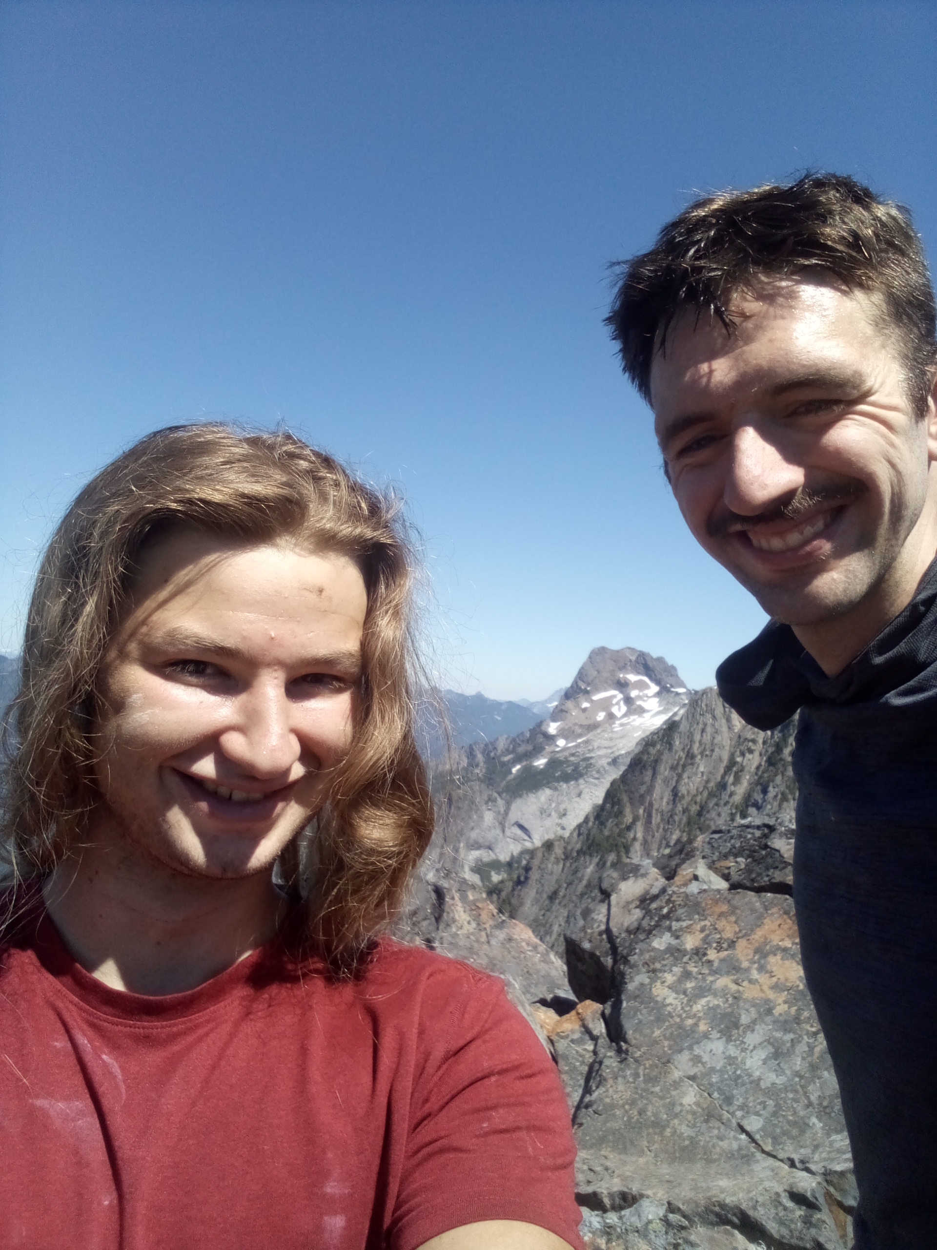
Some dumbass summit pics
Overall, that route's gonna change a lot with freeze thaw as so many of the jugs are gonna go. But right now it's awesomely fun with literal tufas to grab! And so much steep climbing! Great for a pair of sport climbers who hangdog 4 days a week in the steepest confines of the Exits.
MHC and descent gully
Sperry
Gear Notes: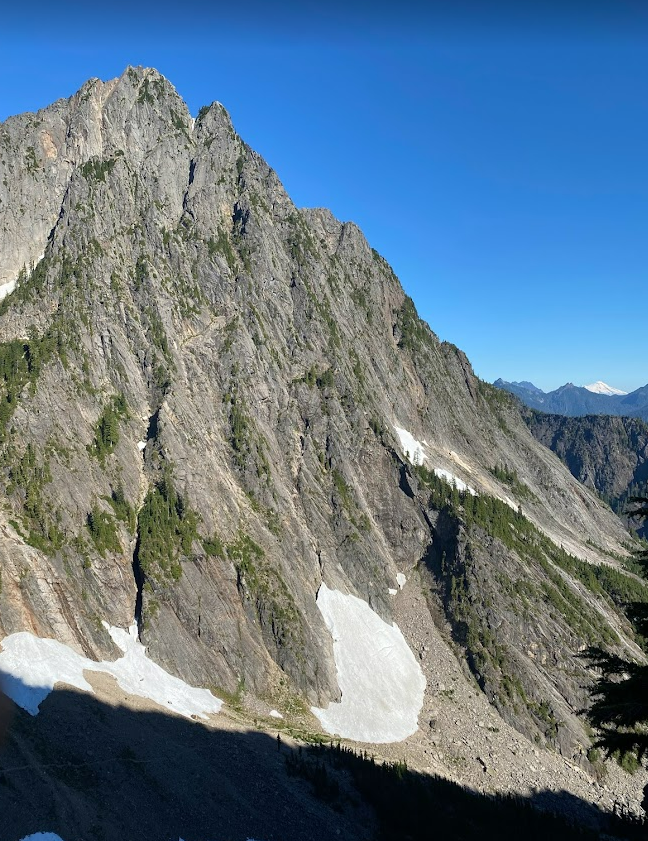
Buncha draws
Approach Notes:
Sunrise Mine TH-
1
-
1
-
-
There's a bigger crag across the valley from the NF. so no river crossing. Caves, steepness and great looking long 5.8s 5.10s (3 pitches? 5 pitches?)
Probably gonna bolt a couple routes up there this summer if anyone's interested. Helms Deep is taking up my time quite nicely though
-
20 hours ago, JasonG said:
What is the solution to the river crossing this time of year?
Embrace pain and imminent death, or bushwhack 2 miles from the nearest bridge
-
If anyone was wondering about this as I'm sure you all were it's Michael Madison who's been rebolting the whole thing also it is sandbagged and fun as fuck
-
On 9/27/2021 at 6:02 PM, JasonG said:
I would think the NF Snoqualmie would be tough to cross in the rainy season?
Not to rain on your parade....
We have plans for that, if not a full Tyrolean then something similar. A fixed dinghy maybe. I have yet to see it in full flow though.
-
So I went up to the infamed north fork crag yesterday and am PSYCHED OUT OF MY FUCKING MIND.
Long story short - bushwhacked through swamp, crossed the river too far north, bushwhacked up to some random cliff, chilled in the woods, gave up, went back to river, spotted the actual crag, found the trail, went up, saw routes, screamed with ecstacy, bushwhacked back in the dark swamp.
(For those who don't know it's a huge cave/amphitheater, 25 ish bolted routes all 11 through 13, stays dry in the rain, 15 miles up the north fork county road out of north bend.)
So if anyone is psyched about this, please join me in trying to beat a new trail in between the road and the river. The crossing is chill this time of year but the swamp creek crossings are irritating. From what I've read in old threads the creeks just mush everything up pre river so it'll need a solid effort to squish one in. The road is plenty driveable, bolts are in great shape, there's a few modern permas, the routes are stunning and it's total choss.
My cave stoked friends and I are gonna be out there doing this mo matter what, this crag is too good to be true (ain't climbed hardly anything yet but it looks better than World Wall in my _humble_ opinion). But it'd be more fun with more people. If you have more info about the crag pls post and such.
-
1
-
-
5 hours ago, genepires said:
that tooth fairie route feels like easy 5.10 route especially on the crux. 5.9+ can mean a lot to different climbers. but maybe another line went in somewhere nearby tooth fairy.
Yeah I thought the crux was maybe 10a or b. But 9+ seems fair overall.
-
Thanks Bill! The seasons mostly over but I guess I'll try to get out and do it before the snow, or next year I suppose. Appreciate your hard work.
-
Yup.
Wayne Wallace mentioned it to me at Index a week or two ago. I think. And I overheard someone (maybe Nelson?) at Marblemount talking about a new bolted route on the Tooth, mid 10.
-
I heard there was a new Whitelaw Nelson sport route on the Tooth. Anyone have deets/rumor confirmation?
-
Glad to hear he'll be back to sport climbing eventually, his potential there always intrigued me more. Maybe he'll try to repeat Flex Luthor?
-
Idk about a Friday. A couple Tuesdays ago I was there, we arrived at 6:55 and waited an hour and 15 minutes to talk to the ranger and get the permit. I think two or three groups had gotten tickets the night previous and several more had gotten there 10 minutes before us. Maybe you can extrapolate from that, hope it helps...
[TR] [FA] Silver Peak - Ice Cold Zach Daniel's 08/24/2023
in Alpine Lakes
Posted · Edited by underscore_child
Trip: [FA] Silver Peak - Ice Cold Zach Daniel's
Trip Date: 08/24/2023
Trip Report:
Not much to report here but an uneventful new route. Ice Cold Zach Daniel's, 5.9+, 3 pitches, FA Daniel Montgomery and Zach Colburn.
The north face of silver peak had kinda always been on our radar as something we felt should be climbed. We hiked a load of bolts to the top last October during our Indian summer (anticipating too many death blocks for any kind of ground up nonsense, which turned out to be accurate). Found a line that seemed like it would go and used up a drill battery. The face was shorter than we hoped (about 80 meters) but seemed worthwhile enough.
I went to Utah for about 5 months, came back in April 2023 and waited for the hot days of summer. This basin stays cool and shaded making it nice for the month of August when a lot of the pineapple basin routes are roasting. We hiked up again with more batteries, rapped down and bolted the lower pitches, climbed the route and hiked out.
First pitch has 3 bolts and wanders through some choss to a ledge with 2 bolts. This is just so you don't have to link a full 120foot pitch if you don't want to. About 5.7
Second pitch is about 90 feet with some juggy, dirty 5.8 climbing.
3rd pitch (100ft) is quite clean following a line of positive holds diagonally across the face. Fun 80 degree face climbing that requires some thought. It is a little traversy but the rope drag is minimal.
To descend make 3 straight 35m raps down from the last anchor. The anchors on the climb dont have rap hardware.
It's a pretty short route, approach is only about an hour compared to the tooth though. And it's shaded. There's a ton more potential for similar routes up there, but I don't really care much about bolting any more easy routes. A job for the guides.
Gear Notes:
10 draws and a 70m rope
Approach Notes:
Go to Snoqualmie pass and drive back heading for Mt Catherine/ pct crossing in ollallie meadow. (Fs road 9070) Follow the road back as far as your car will take you then walk it to the end where there's an old fire pit. A trail heads north from here. Follow it to the talus field that sits below the gentle northwest ridge of Silver peak. Then go straight along the talus towards the face/ follow hunter trails along the edge. Pretty easy and doesn't take long. At the base of the face scramble up dirty ledges , the right and traverse back left to the first bolt. (The last rap takes you over the ledges) Zach wrote a more detailed approach beta on mtn project