Trip: Diamond Peak - Corrigan Lk Trailhead Trip Date: 05/31/2019 Trip Report:
Diamond Peak
Directions
Oakridge, to hills creek dam, road 21, to road 2149 and Corrigan Lake trailhead. There's only one small hiking sign on the right side (East Side) of the road.
We left Eugene at 4am, and arrived at the trailhead at 6am and got on the trail at 615. The was snow within a .5 mile of the trailhead. One of our party had previously summited from this side so she became the group leader. After following the trail for a mile the snow covered it. Basically she headed uphill on the first hilly ridge we found. After an hour and half we started getting good looks at the western false summit, and our leader took a bearing to stay on course. When broke through the trees we opted to head up the ridge thad runs southwest off the false summit. The snow was still pretty thick but we decided to climb the rocks ona few of the gendarme? instead of the steep snowy slopes which were surprisingly firm. The forecast had thunder storms in the early afternoon, and looking south to Thielsen they were building in that area quite thick. (We camped at Diamond Lake that night and had an amazing lightning show. Check out my "Mt. Thielsen double rainbow lightning strike!!" on YouTube if you wanna see pictures. ) We kept moving up, and slightly to the right of the western false summit. That put us in great position to transition to the final section up the summit ridge without gaining unnecessary elevation. The snow was in great shape for climbing, despite strong wind gusts that were making us walk like drunken sailors.
The summit was glorious. A few quick pics and we retreated to a small rocky area out of the wind. After some food, the fun began. Using some butt sleds and Avi shovels we dropped elevation super fast to the saddle of the false summit. The second drop was even faster, and longer. We were all giggling like little kids, and covered in slushy beautiful snow. We had taken a compass bearing to Corrigan lake before we glissaded, and followed that to the lake. Some of us swam, others napped, and then picked up the trail and hiked the one mile back to the car.
Total Mileage: 8.4
Time on route: 7 hours 43 minutes
Elevation gain: 4025
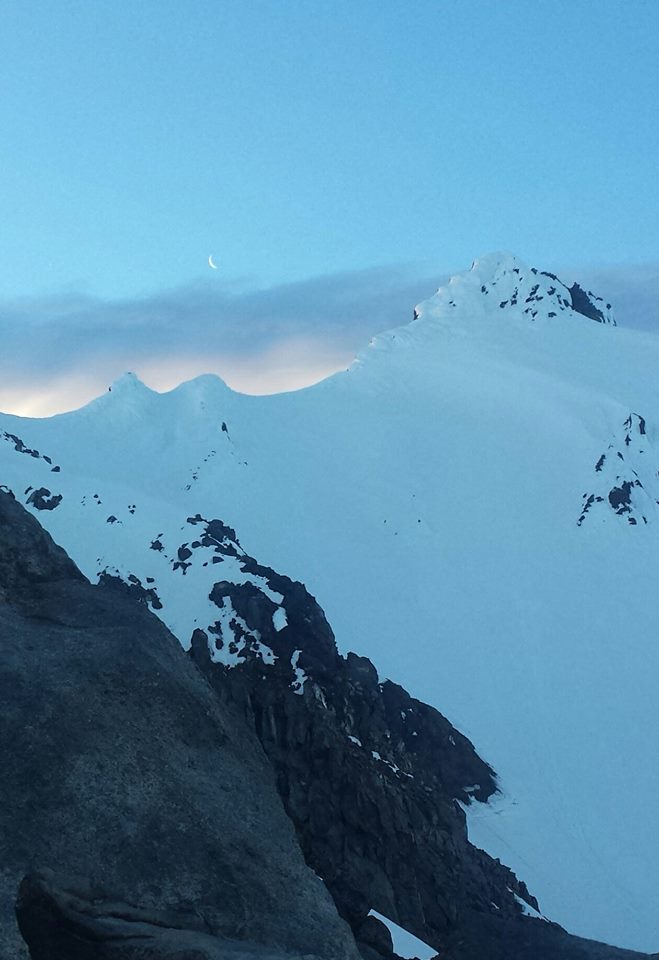
I included a picture of the south ridge for those interested in doing that route. The top still has a lot of snow for those wishing for the type of ascent.
Here's a link the a video I made of our ascent of Mt. Thielsen the following day. Double Rainbow, multiple lightning strikes!!!
Gear Notes: Butt sleds for the way down. Approach Notes: Bring a compass, because it's so helpful for navigating through the snow, off trail, and through the trees.