

-
Posts
16 -
Joined
-
Last visited
-
Days Won
5
Content Type
Profiles
Forums
Events
Posts posted by mtangeman
-
-
16 hours ago, Michael Telstad said:
Not too shabby. An onsight solo of the N-Ridge is proud in it's own right!
Thanks! Should probably clarify as I realized I didn't in the TR, it was just the upper, not the full.
@tanstaafl the south side of Argonaut is very appealing but definitely a slog no matter how you cut it - worse hike/climb ratio than Prusik, but that S Face has so many really nice lines. The West Buttress as well has a steep and clean looking prow not too far east of Sherpa Pass. Really cool mountain.
-
 1
1
-
-
Trip: Stuart Range Traverse - SRT
Trip Date: 08/10/2020
Trip Report:Should maybe be titled Stuart Range Traverse* because there's always some disclaimer in there, good style is just about doing it with as few asterisks as possible. My main asterisk is I didn't actually summit Sherpa. I'm also no Peter Croft, but based off all the TRs that are out there for this thing, none of us quite are.
Anyway, I've had a weird relationship with climbing this year. There have been a lot of other things going on (perhaps an understatement in this wild year) that demand more attention. I came back from a full season deep down south feeling absolutely on top of my game, a feeling which quarantine somehow morphed into a sense of burnout, fear, overanalysis and a general loss of motivation for big objectives. I've wondered if maybe I've finally developed a frontal lobe in my brain. Seeking comfort and sticking close the ground, I've focused on running and bouldering. While the Stuart Range Traverse is neither of those things, I did feel a certain motivation to get it done before I move to Colorado (I know) for a bit, and all it really boils down to is a nice long run with some V0 highballs.
Plotz told me it's kind of a slog. He was right. But I still had fun, and given enough time I might even consider doing it again, with fewer asterisks.

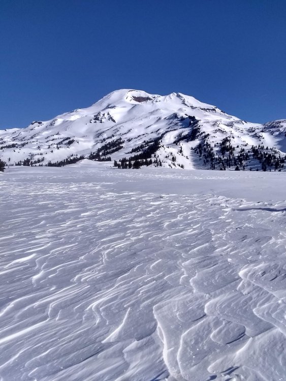
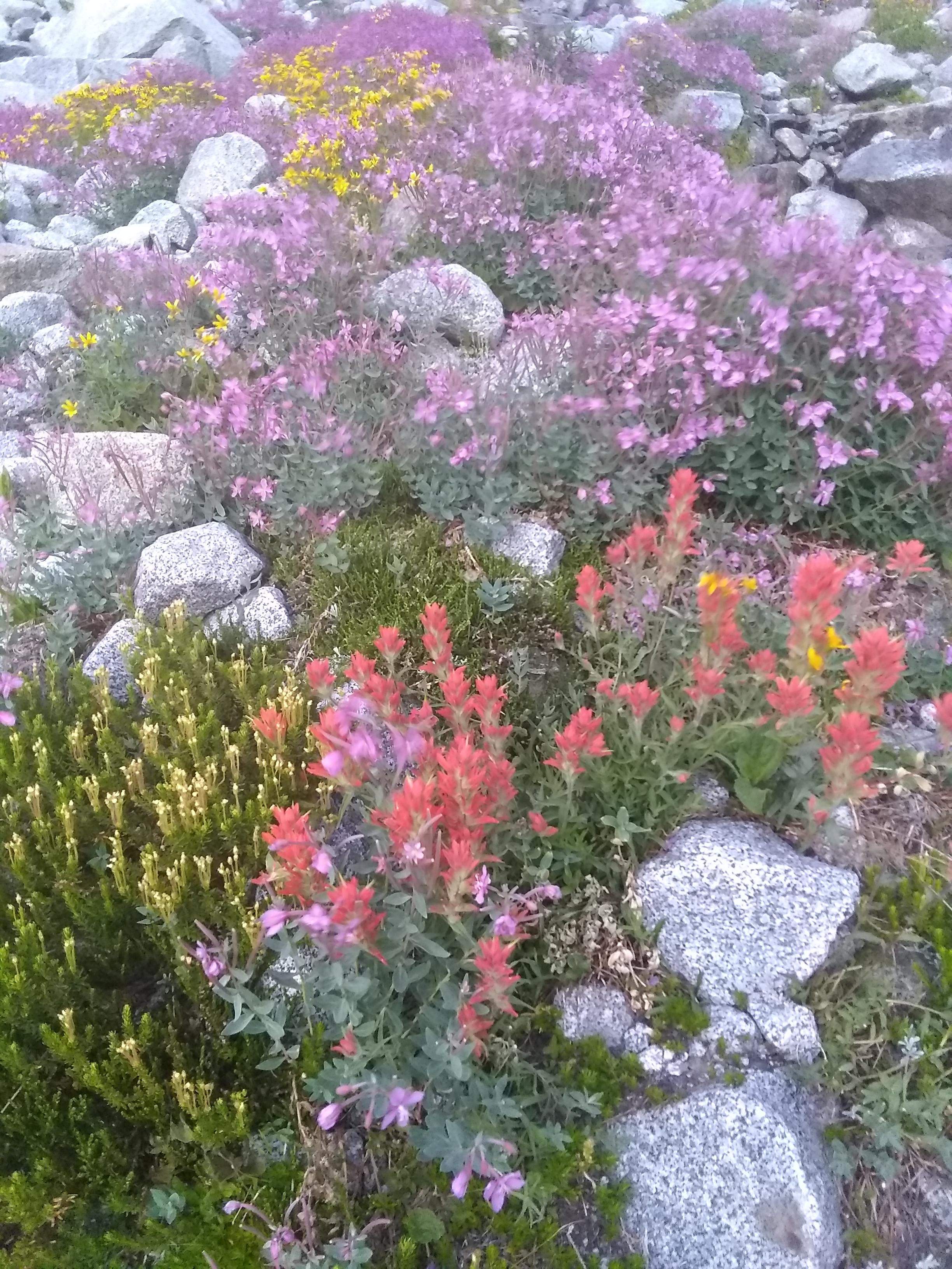
lovely little garden below Stuart.
The first bit of excitement came on the slabs below the Stuart Glacier, where I felt my pack suddenly lose a lot of weight. I turned around to see one of my two liters of water careening down towards the snowy gully where it shall spend the remainder of eternity. Somehow my pack had come unzipped, and I almost lost a lot more kit than I did. I kinda thought my plans for the traverse tumbled down into the moat along with it, as I had just passed the last water source and I couldn't bank on finding anything between the ridge and Argonaut. But I still had one liter infused with electrolyte-whatever, and I could bail at Sherpa Pass if I had to.
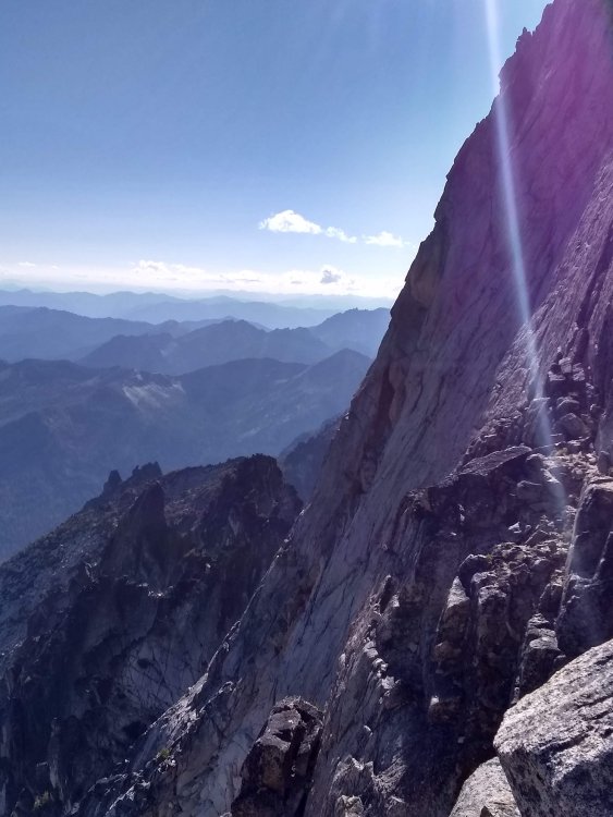
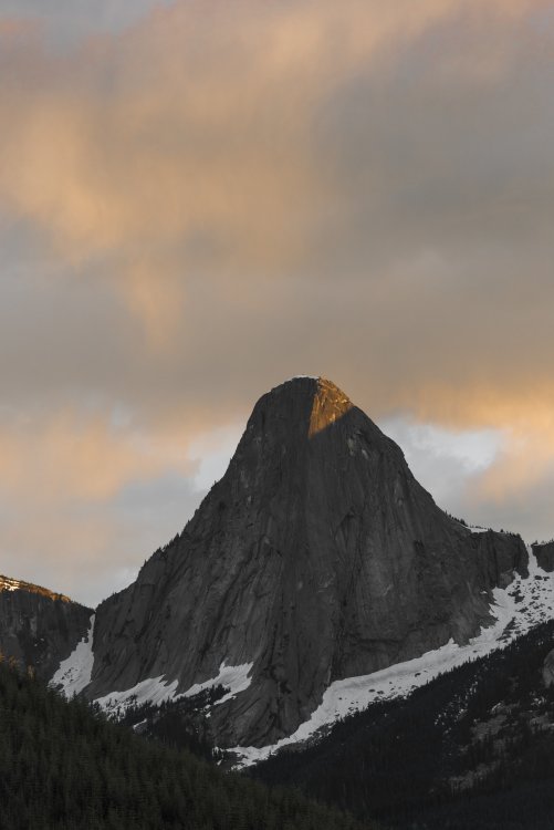
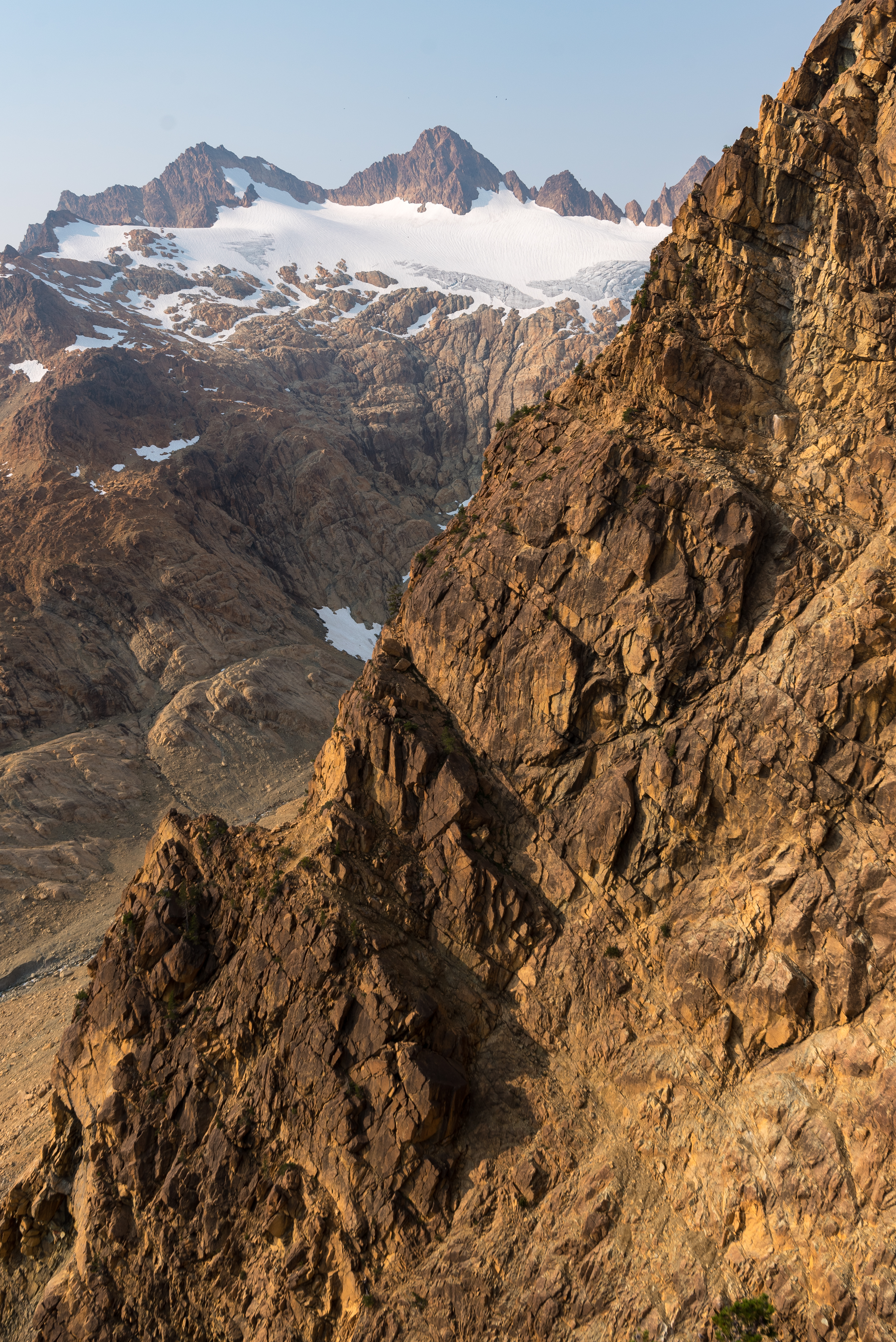
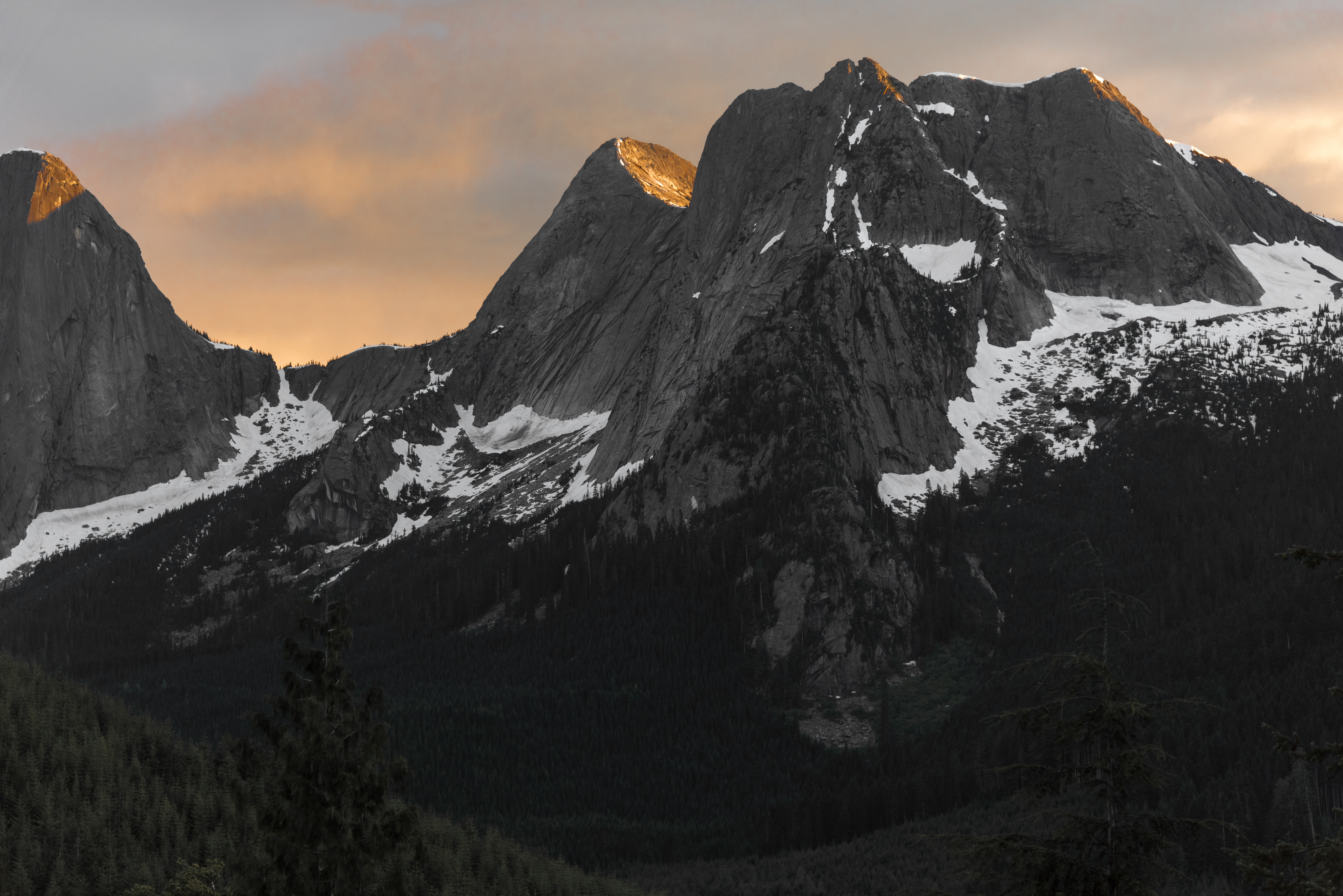
Not much to be said about the North Ridge of Stuart, other than the fact it's phenomenal. I had never climbed it, or Stuart for that matter, until yesterday. It was worth the wait. Was on route for about 2 hours.

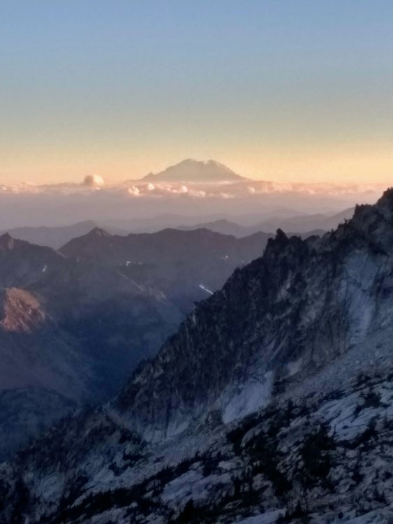
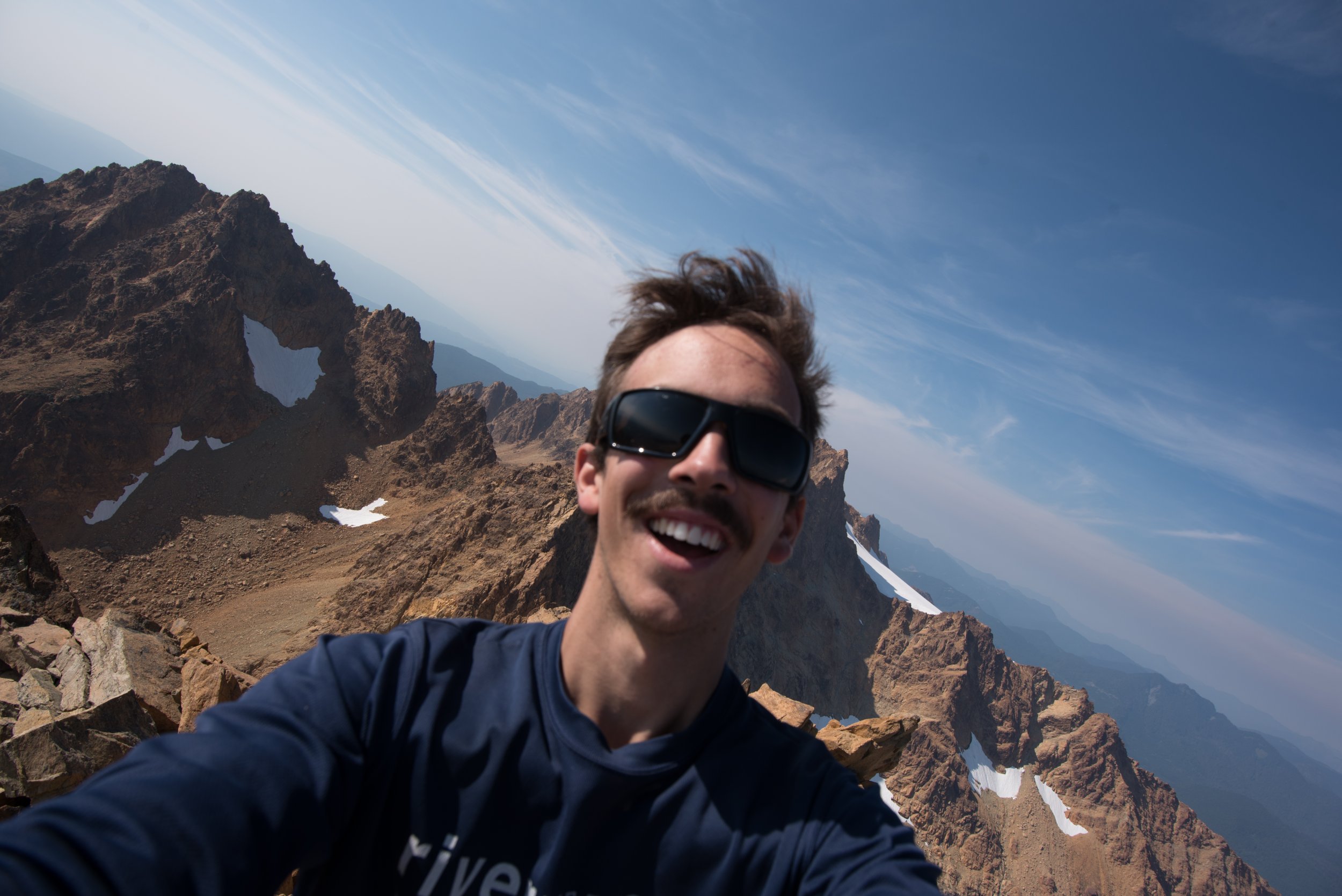
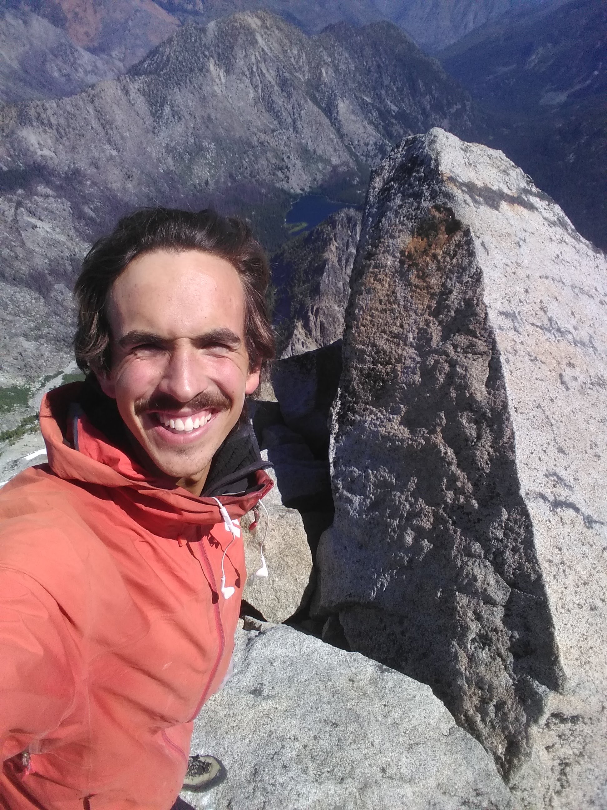
stuart summit selfie. that's what everyone likes about TRs, right? selfies?
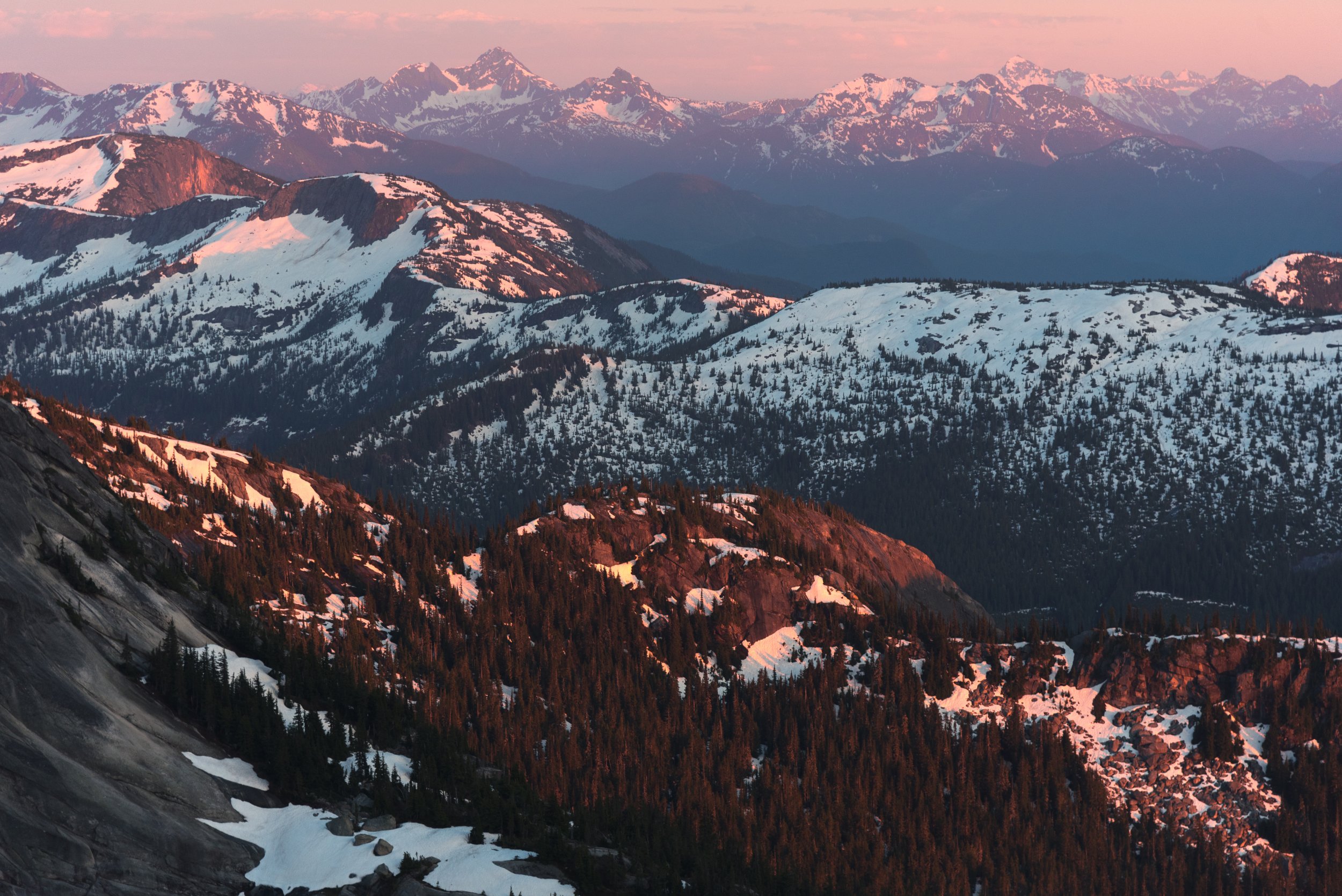
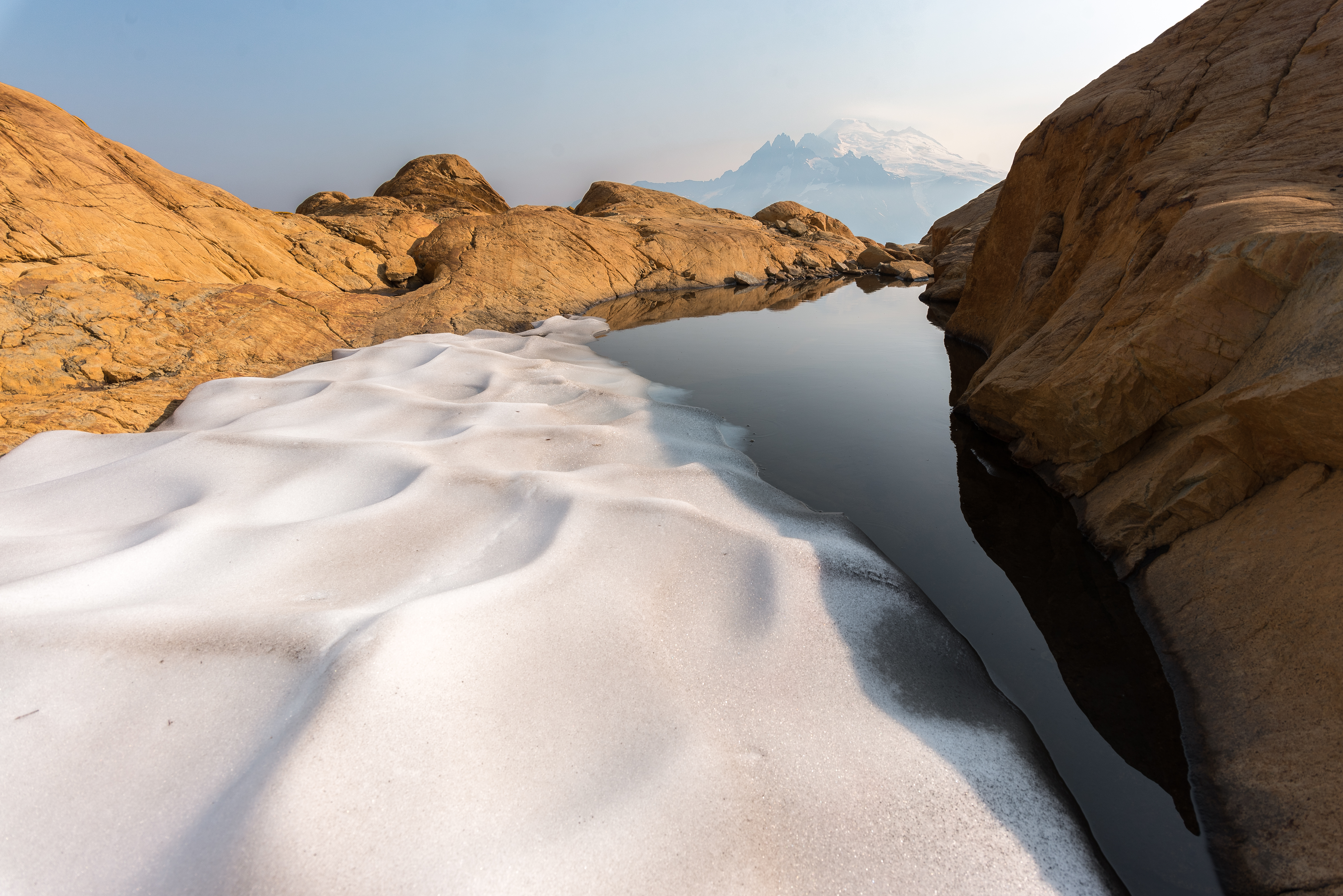
As soon as I was on the south side of the crest the wind was gone and it was hot. I was really worried about running out of water. I also made the classic rookie mistake and got suckered down the wrong gully (not ulrich's) while searching for water. I did find some, but also found myself well below Sherpa. I had already had a few routefinding snafus early on and was a couple hours behind schedule, doing the math I figured if I tagged Sherpa's summit I'd most likely bail at the pass - which turned into a cost-benefit analysis of what I valued more, another summit or a more solid chance at the traverse? I chose the traverse. There was an excellent ledge system below Sherpa, complete with a goat highway, that got me to Sherpa Pass quickly.
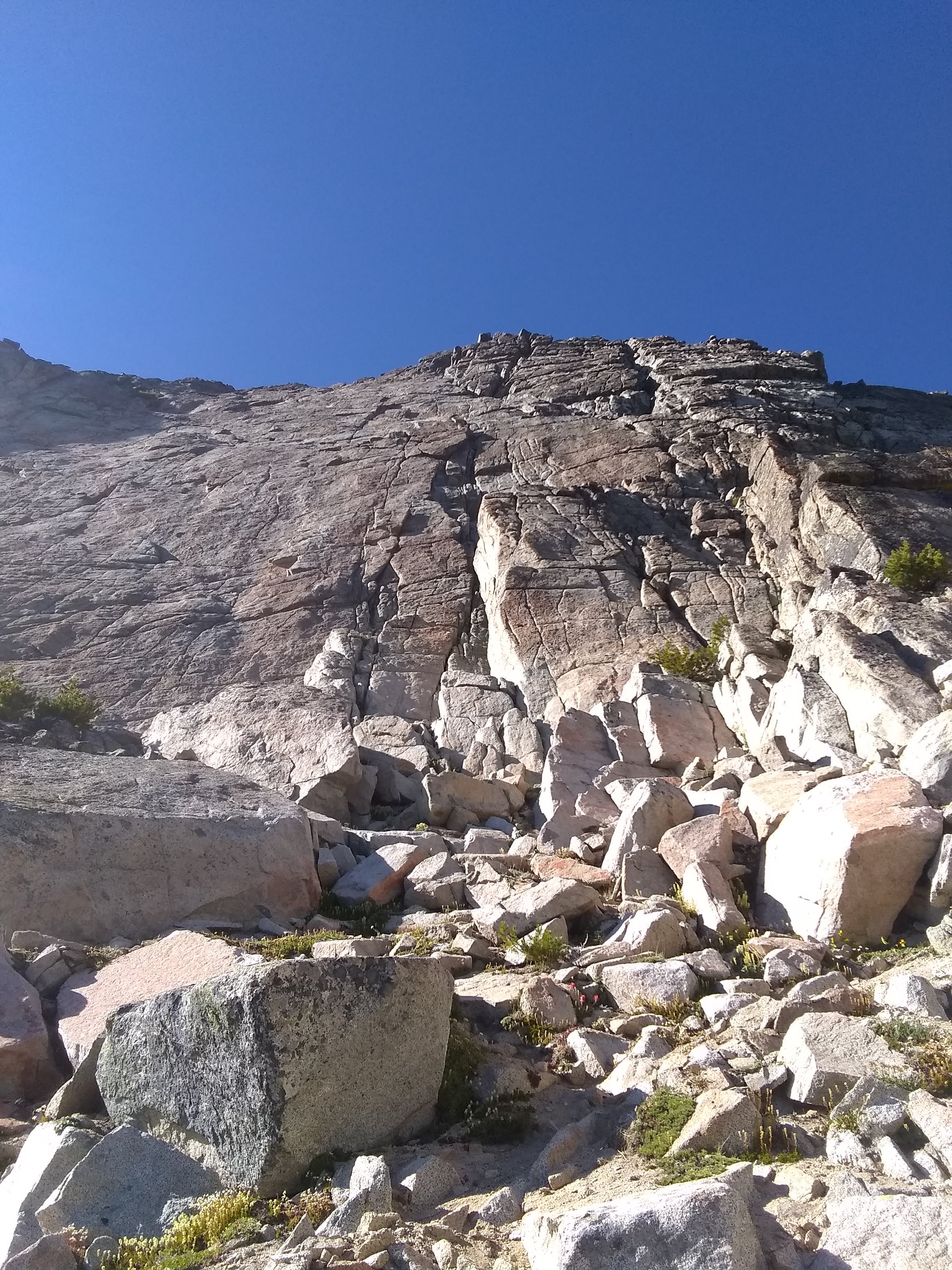
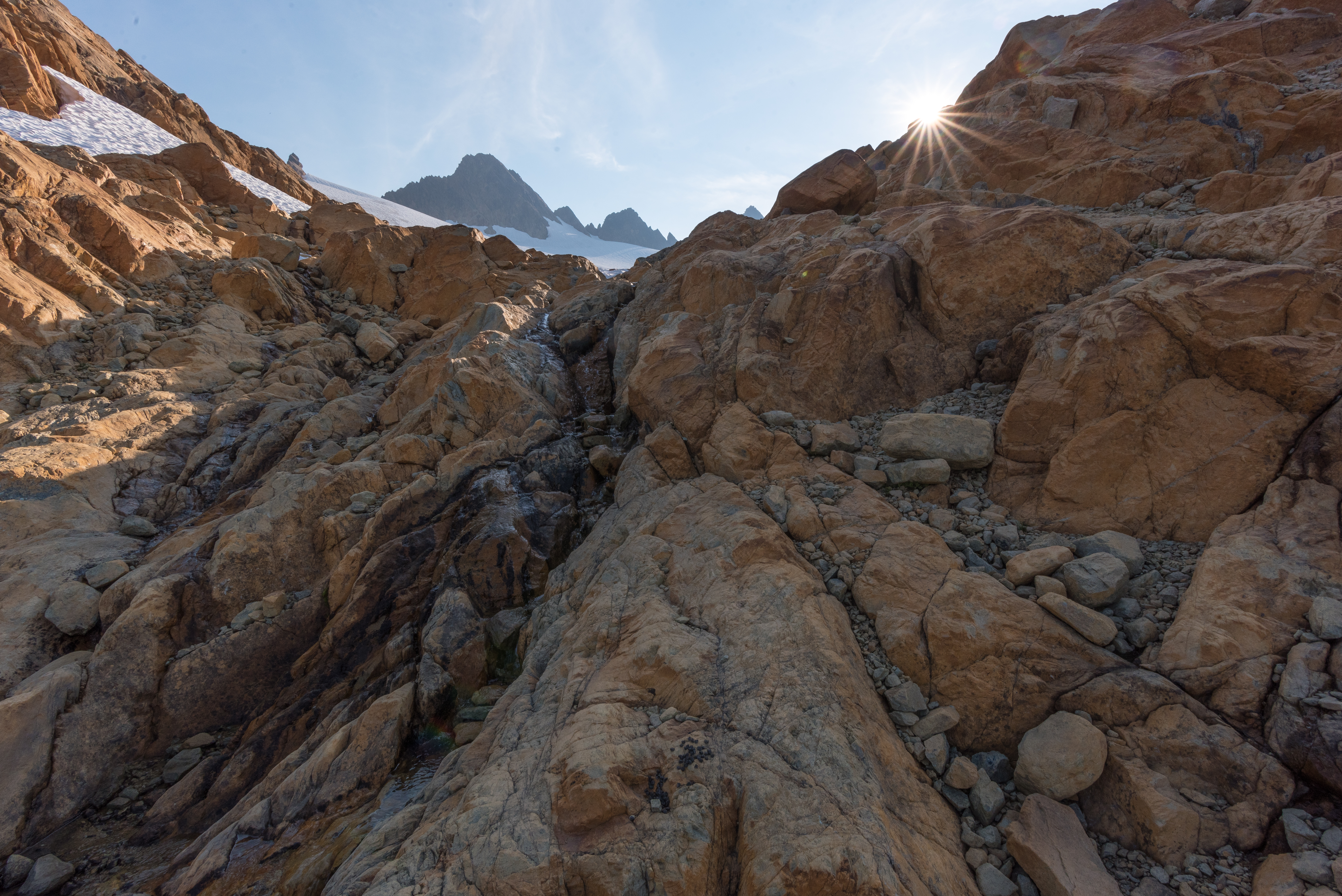
If it wasn't chest deep in the boonies, the south-facing slopes between Sherpa and Argo would host excellent cragging - I spied numerous perfect cracks and checkerboard patina reminiscent of Red Rock's Brownstone Wall, all on perfect red granite. And if you keep your eyes and ears open, water can be found in small springs that quickly dive underground. Overall, I didn't think this section was as bad as people say. I mostly stayed just barely below the ridge crest. I stayed hydrated, stayed psyched, and speaking of sweet crags, soon found myself at the base of the S Face of Argo.

choose your own adventure! knobs and splitters galore!
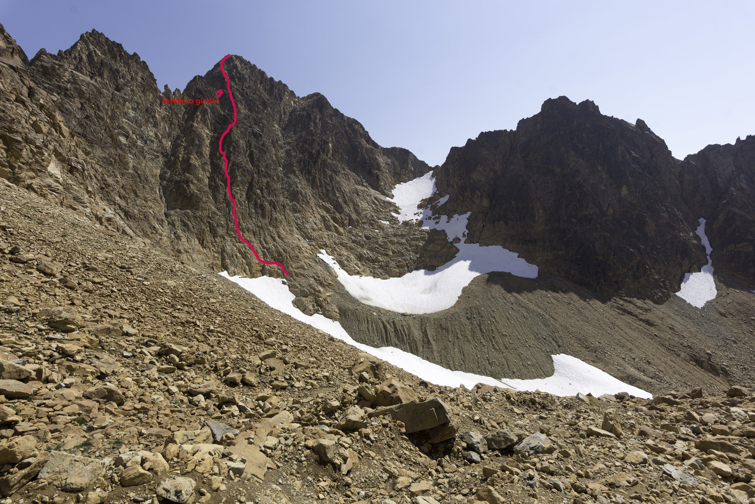
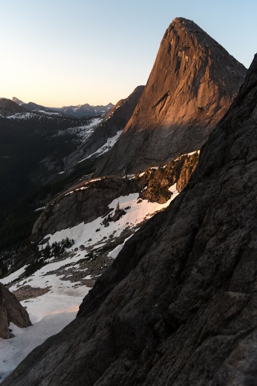
s face of argo from the right margin.
This was also my first time on Argonaut's summit, which was quite nice. Great view, and fun, easy climbing.
I had brought a skinny half rope to use as a rap line if I needed it - not totally necessary in hindsight, but I was glad to have brought it as it did give me a little nicer sense of security, which like I said, I haven't really had that feeling of security with climbing lately.
Well, turns out that shiny new half rope came all this way just to be put under the knife on some short rappel I ended up soloing up and down anyway. Getting it stuck on the rap pull was a result of my own negligence and it cost me a lot of time - so if you're trying to descend into Argo's east gully and find a well-used rap station above a splitter looking dihedral, just downclimb. There's maybe one section of 5.6 to get you down to a big ledge. As you jam the perfect hand crack (seriously, why didn't I just downclimb this from the get go), take a moment to admire the remains of about 3 or 4 different ropes stuck deep inside. Mine's one of them. Hooray! But ultimately, I can't really blame myself for taking an extra precaution when I was already tired and clumsy.
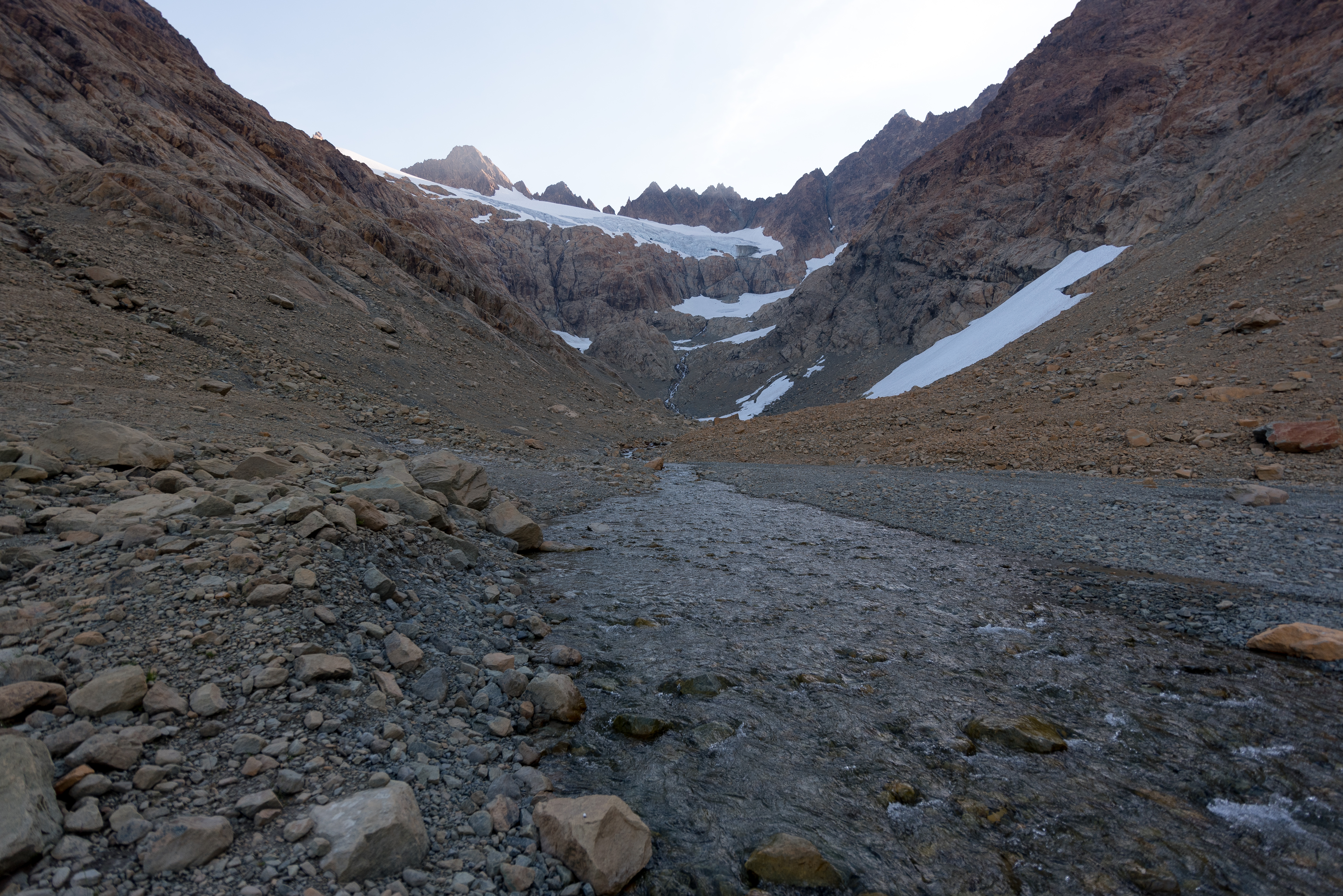
From there, it's loose third and fourth class down the east gully.
man, I wish I had a better phone camera.
Once at the shelf between Argo and Colchuck, I put the headphones in and motored up and over Colchuck and Dragontail, arriving at Aasgard in the dark. Pop Tarts and Prince carried me to the finish. 22.5 hrs C2C.
Gear Notes:
an extra liter of water so you can jettison the first one into the void
Approach Notes:
there is one, yes.-
 1
1
-
 5
5
-
-
Nice to see this beta all in one place. Plenty of time for a CC forum revival in quarantine.
-
1
-
-
Trip: South Sister - Prouty Headwall
Trip Date: 03/19/2020
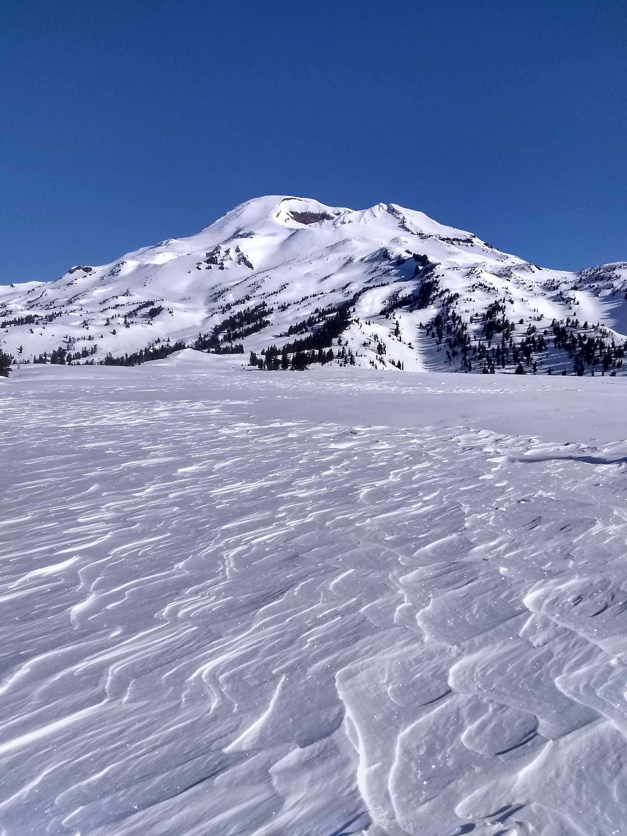
Trip Report:Feeling grateful to have days like these right in my (new) backyard. I parked at Dutchman Flat, therefore having about 6 miles of pleasant road skinning to get to the usual Devil's Lake trailhead. The day started out cold and humid, but there were no winds and by the afternoon things felt like spring.
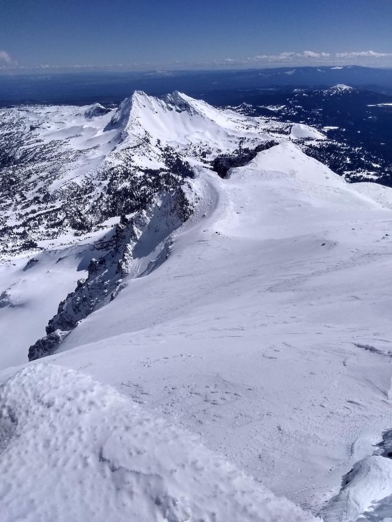
I was able to skin to about 9000 feet (without ski crampons), traversing all manners of frozen mank along the way. Booting to the summit involved rime, a little blue ice, and icy hardpack that didn't even pretend like it would soften into corn. The summit was clear and beautiful, and a raven greeted me when I arrived.
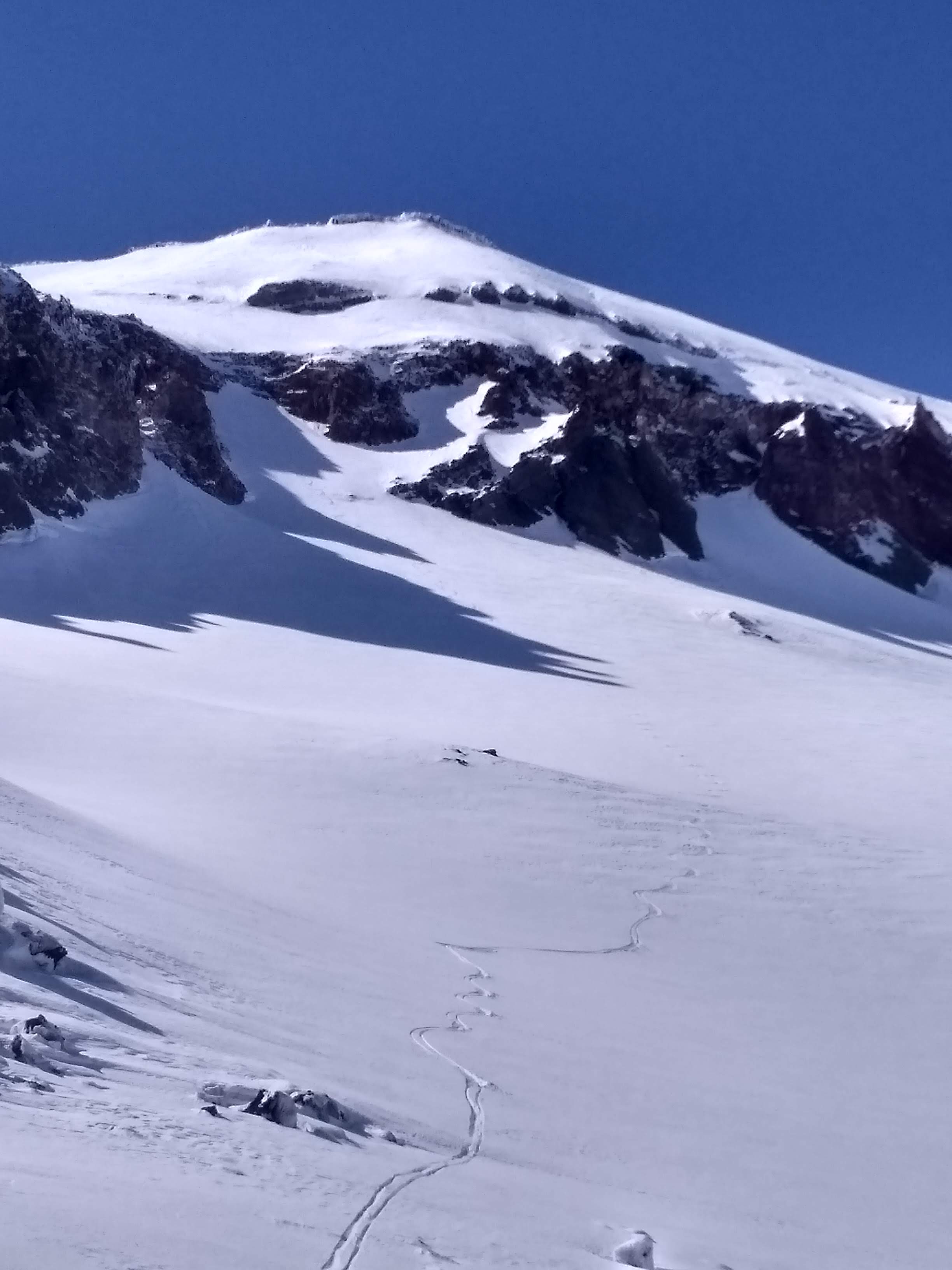
Wanting to avoid the ice I climbed up, I dropped into sheltered ENE facing slopes above the Prouty Headwall. Though it at times threatened to get icy, I was mostly skiing shallow, creamy, windbuffed pow.
The standard lines through the headwall (that I had seen detailed elsewhere) were all out, with low tide and large rock bands. I couldn't see the exit, but a steep couloir directly below Hodge's Crest tempted me. I dropped in on the same soft snow as above, which soon became less and less edgeable. Below, I could see it transitioning to water ice and rock at the couloir's exit. Fortunately, a mellow ramp cut left at this time, dropping me perfectly onto the broad, powdery lower headwall. Hero turns ensued.
I've been in Patagonia since December, so this was day 3 on skis for me this year and my legs were burning as I skied through the seasons from high alpine pow all the way down to a warm spring snowpack at Green Lake. I found the perfect spot to lay in the sun, doing my best not to think too much about the long, flat walk out. Back at the car a few hours later, I saw the first other humans I'd seen all day. Social isolation achieved.
Gear Notes:
someday I need to actually purchase ski crampons.
Approach Notes:
aerobic.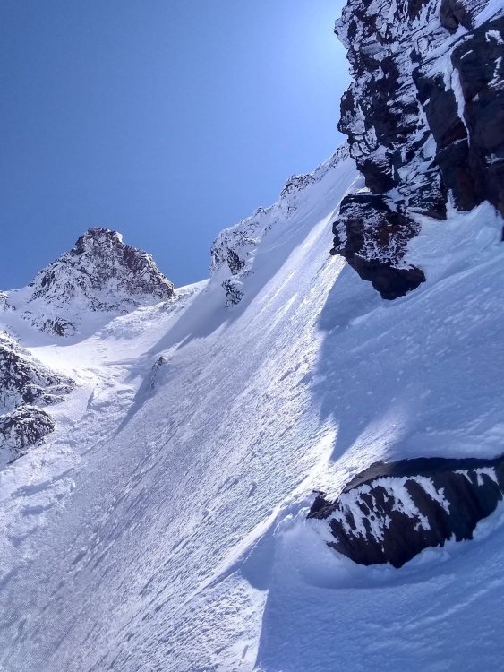

-
2
-
-
The Lake Chelan-Sawtooth Wilderness is probably up your alley. You can follow the crest for a long ways, nothing technical, but perfect airy scrambling/ridge running. Cheops, Martin, Switchback, Bigelow, Star, etc. all WA top 100 peaks along that crest. Theoretically could run the ridge all the way from Angels Staircase to War Creek Pass and then some. Dry air and lots of talus so you should feel right at home!
You'd be held back without glacier skills in most of the core of the North Cascades.
-
SethKL, yikes. I think I opted to just place a piece next to the pin instead of clipping it when I was up there this summer, glad to see that hesitancy was warranted but at least it's not in a critical spot regardless. Wonder how long some of the other fixed stuff is gonna last.
Ahparker, nice work on the send!
-
I was really hoping to make it out there this year. Maybe it can still happen.
Thanks for the TR and stoke. Looks amazing!
-
1
-
-
Yeah, I regret not running up Skookum but it's good incentive to get back out there soon!
-
Trip: Twin Sisters Range - Green Creek (Lite) Circuit
Trip Date: 08/28/2018
Trip Report:I've really only dabbled in the Twin Sisters area since moving to Bham for school a couple years ago, but what a surprisingly complex, interesting and under-appreciated resource it is, so close to town. The recently cleared air got me giddy, and after being unable to find a partner for any adventures further afield I set my sights closer to home. The Green Creek Circuit looked like a great way to familiarize myself with lesser-traveled corners of the range, and it was. Definitely gained a new appreciation for this area.
I crossed the Middle Fork and began hiking the Elbow Lake trail in the deep blue, pre-dawn glow graciously accompanied by the feeling that some apex predator was eyeing me from the bushes which tends to happen while hiking solo in unfamiliar places. The "bushwack" into the cirque has apparently really cleaned up since previous TRs I've read; I've had harder times following trails to popular crags in Squamish. There's solid tread the whole way and the route is generously marked with blue reflective diamonds, perhaps excessively so, but it eased any worries I had about potentially having to hike this section in the dark. Some of the ancient cedars and firs in this area are really impressive.
The Green Creek cirque is gorgeous. It wouldn't even be unreasonable for the highly motivated boulderer to haul some pads out here - there's some great looking boulders and lines. I couldn't have felt any further way from Bham or other familiar places up the Nooksack. Truly wild zone, that is until I had to pick up someone's pile of plastic food wrappers that were clearly too heavy to pack out. Seriously?

I started up Green Creek Arete as the sun poked over Mt. Baker and began to fill the valley. Solid, clean rock, nice exposure, great scrambling. I haven't felt that relaxed and in tune with the mountains in a while.
As I topped out, smoke began to fill the air and Kulshan was temporarily obscured - bleh. It slowly cleared, though, and crossing slabs and tarns en route to the Sisters Glacier was another unexpected scenic highlight of the trip. Easy travel, great views and lots of peaks ahead.

The moat crossing to S Twin NE Ridge was easy, and the ridge was a lot shorter than I expected. On top around 10, I started to relax and slow my pace down with all the daylight still in front of me.
As I scooted down the south face gullies, I was eyeing Skookum with a little apprehension. I didn't bring a rope, and the Jaws Tooth downclimb didn't sound very up my alley, so I was looking at climbing directly up to the Jaws Tooth notch and finishing up Skookum. It looked like a large moat to steep choss - which, in hindsight after climbing other things on this traverse, I'm sure it wasn't, but I also became more worried about sketchy looking conditions crossing the Hayden Col, Little Sister Col and dropping back on the glacier, and ended up passing Skookum by. I know I probably missed out on the best climbing of the whole outing, but that was my call in the moment. I'll be back.
A common theme of the Sisters area appears to be things looking much steeper/chossier/more difficult than they really are from a distance. Despite being totally melted out, the Hayden Col was casual, so I scrambled over to a summit I thought to be Ribbon Point, but was actually the one just to the north of it. Either way, cool spot. The talus crossings weren't nearly as bad as I'd heard they might be without snow, though my bruised tailbone might think differently. Slower going, but reasonable.
Not wanting to miss out on any more good climbing, I eyed up my line on Little Sister's NW face and settled on the rightmost of the two ribs on the left side of the face. Surprisingly good 5.4ish up and sometimes left of a little corner system, stepping left onto a beautiful, highly featured and varnished slab to bypass a small bulge, leading to class 3 up the rib to the summit. Stellar!
selfies are hard with an slr! stoked on top of little sister
route up little sister with the easy-ish access to green ck glacier marked
I dropped my pack at the notch just above the Green Creek Glacier, sussed it out and found passage via a collapsed snow bridge. All around, the schrund was huge, and I decided to go with the devil I knew and hop across here, as opposed to traversing Little Sister and Cinderella and potentially not being able to get back down to the glacier. This I think was a good call, the normal col where people drop onto the glacier was severely melted out with a large looking moat.
The hike down the glacier, into the valley and out was calm and tranquil. The smoke had fully cleared, I don't think I've ever had as good of a view of Lincoln and Colfax as this. Grassy benches without a trace of human travel, bright orange rock contrasting with Baker's white, and the jagged cirque and glacier at my back. 15 hours car to car, for what little peakbagging I actually accomplished I'd say this is a modest time that could be significantly improved with less lollygagging, summit naps, routefinding snafus and blueberry pit stops. But I like all those things.

Gear Notes:
axe and pons, sense of adventure
Approach Notes:
now equipped for the masses-
2
-
1
-
2
-
-
Nice work dude! Looks like you've been getting some good mileage up there this summer.
-
1
-
-
On 7/6/2018 at 2:25 PM, G-spotter said:
Name those peaks: Outram and Manson Ridge in centre-left midground, Silvertip group at back right
Nice! Thanks, I was genuinely curious.
Yeah, Steinbok is kind of like the backwoods-BC lovechild of El Cap and Snowpatch Spire, it looks like. Hard to believe the rock quality doesn't (allegedly) reflect that.
-
Whoa! That's awesome. Nicely done.
-
On 7/4/2018 at 8:48 AM, John Douglass said:
Beautiful area. Thanks for the update. This may have pushed me over the top towards getting out there to climb.
It's well worth the journey out there. Would be even better to bivy up high and spend a few days!
-
On 6/25/2018 at 10:03 PM, layton said:
It's all contrived anyway and no one has actually fully repeated ALL of Acid Baby (one more pitch up top).
Where's that final pitch go? My memory is foggy but I don't remember there being much more above...
Great linkup guys! That's a yuge day out.
-
Trip: Les Cornes - Springbok Arete
Trip Date: 06/17/2018
Trip Report:I'm not the trip report type, as evidenced by the fact we went out there weeks ago, but the approach to Les Cornes and that whole group of peaks has changed a bit since Cascades Rock so wanted to give a heads up to anyone heading that way. Cattermole Timber and Chilliwack Natural Resources don't really go out that way so don't count on calling them as a way of getting current road beta.
The road getting there is pretty much impassable at 12.1 miles - so plan on an extra ~3.7 miles of human powered travel each way. I don't see this changing anytime soon, as there's a couple back to back washouts, with the remaining roadbed being off-camber and partially blocked by small boulders. Mountain bikes or dirt bikes would be great.
The final road (the turnoff at 15.1 miles in Blake's guide) is overgrown to the point that we second guessed ourselves when we turned onto it. Didn't really look like it was driveable any time in the last decade. But, it's marked by flagging at the entrance. It's also washed out beyond repair not long after the turnoff but the stream that did the deed is crossable on a good log.
The route was stellar. We did the direct start and half the first pitch was under snow. Not sure the slung block belay at the end of the awkward 5.9 OW horizontal pitch was still there, but there is a fair bit of choss in that sector, I belayed at the start of the 10+ wide hands cracks above.
The rappels are feasible with a 70m just by following Blake's double 60 rap beta in Cascades Rock and finding intermediate anchors on the longer raps. Some rope stretchers. Doing this in the dark may lead to shenanigans - the sunset was nice though.
Ibex/Les Cornes/Chamois

S T E I N B O K - would love to talk with someone who's climbed this
name those peaks?
Gear Notes:
hefty - doubles tips to #4 (both 4's were placed on at least two pitches). 70m rope.
Approach Notes:
long.-
1
-
1
-


SEWS Escargot info?
in Climber's Board
Posted
Any updates on this? Not heading there anytime soon but I've always been curious about some of those SEWS obscurities (Midnight Ride, Cascade Mall, Inferno?). All I've heard about Escargot is that it's slabby and quite the bolt ladder, but well bolted low-angle hard face climbing sounds pretty fun to me.