
landoclimb
-
Posts
40 -
Joined
-
Last visited
-
Days Won
11
Content Type
Profiles
Forums
Events
Everything posted by landoclimb
-
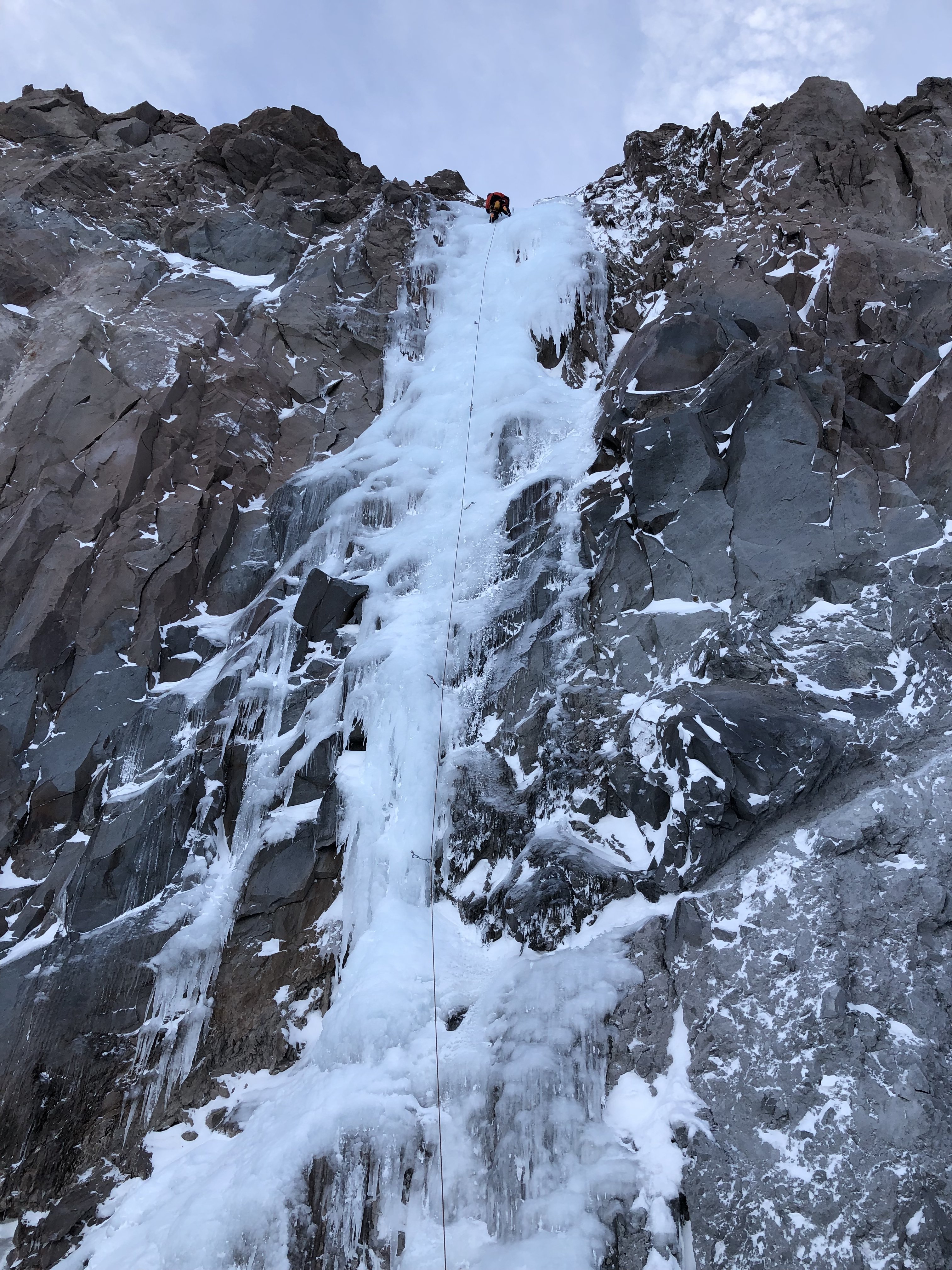
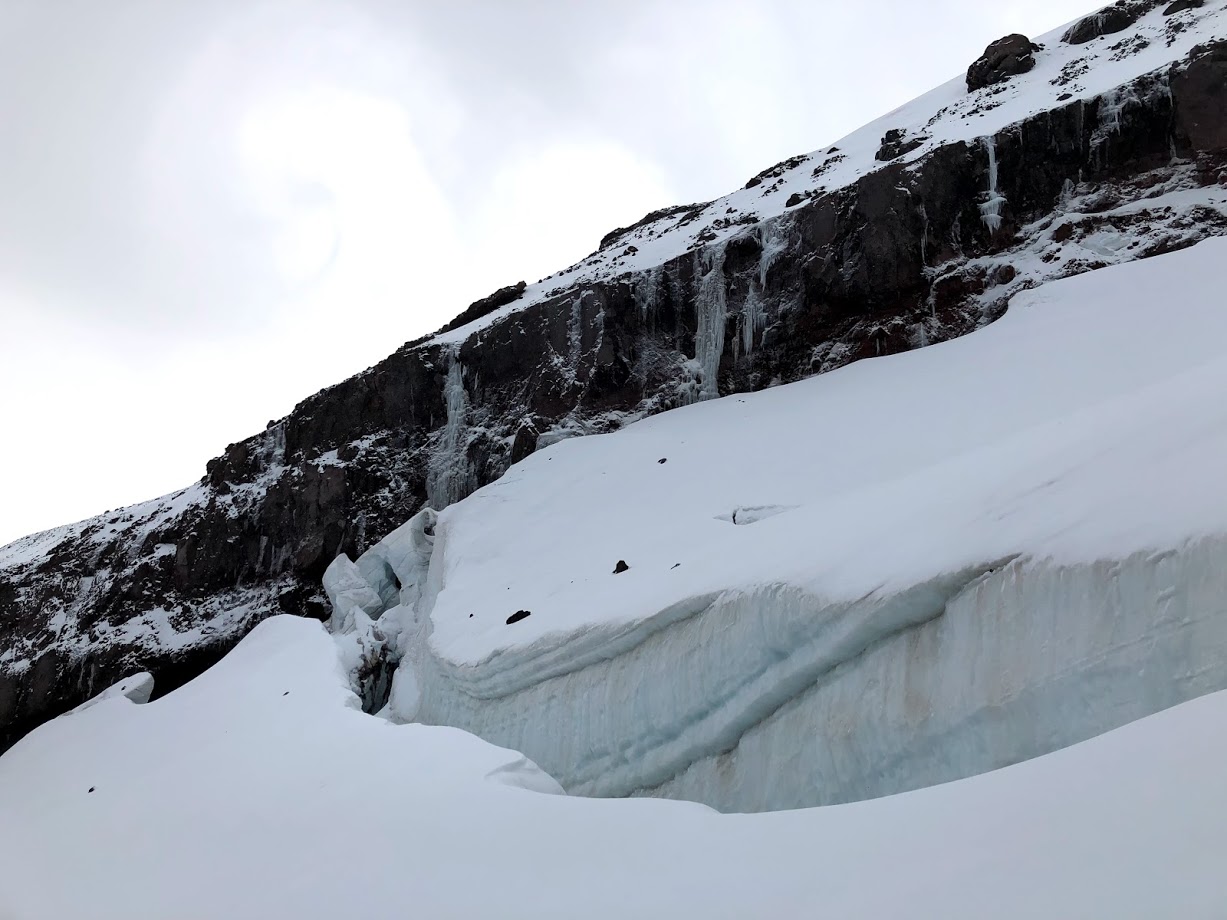
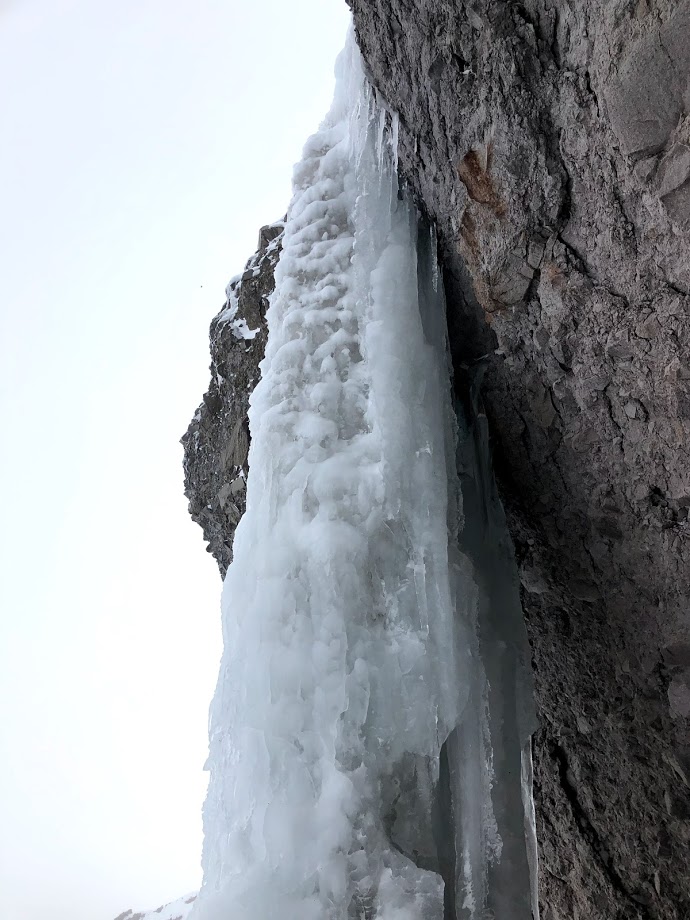
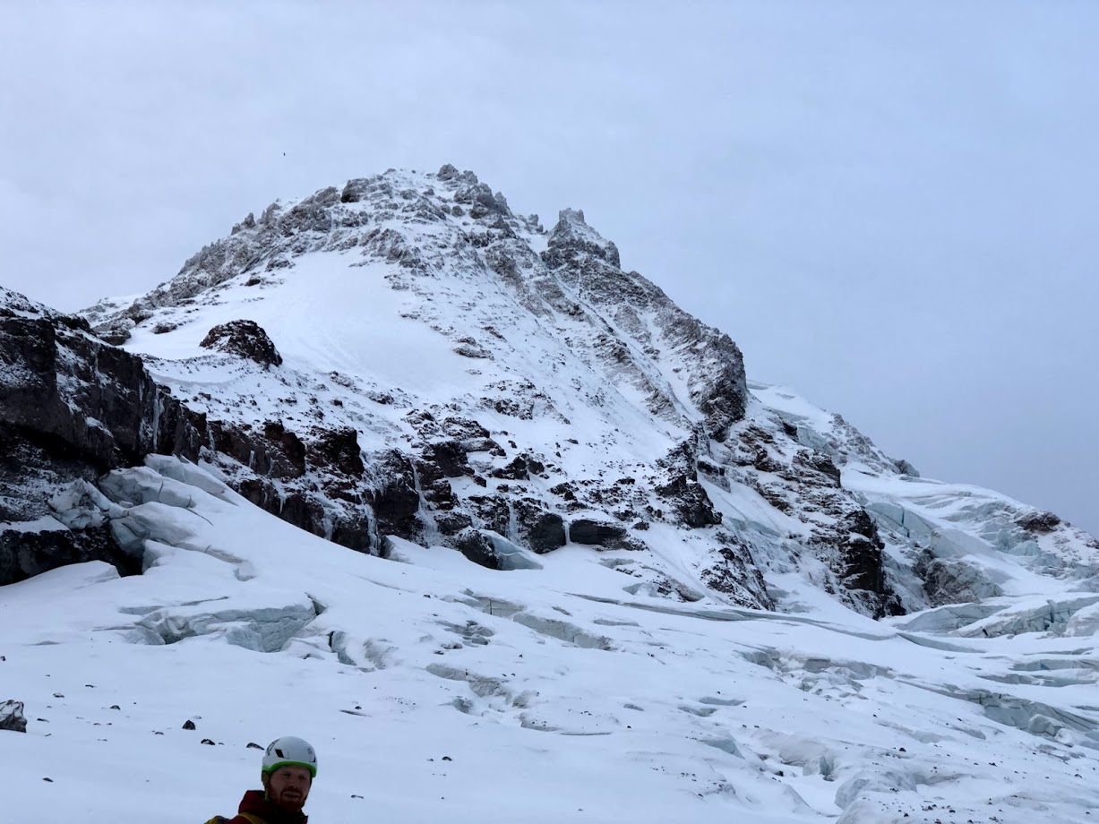
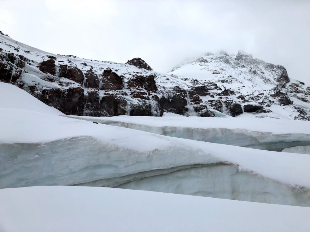
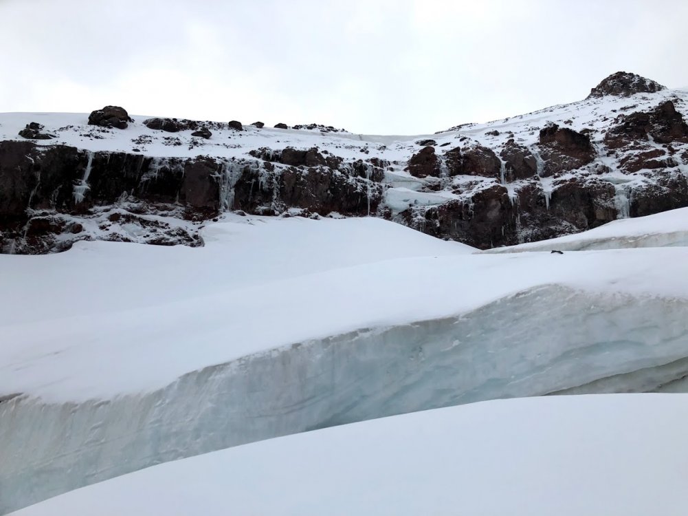
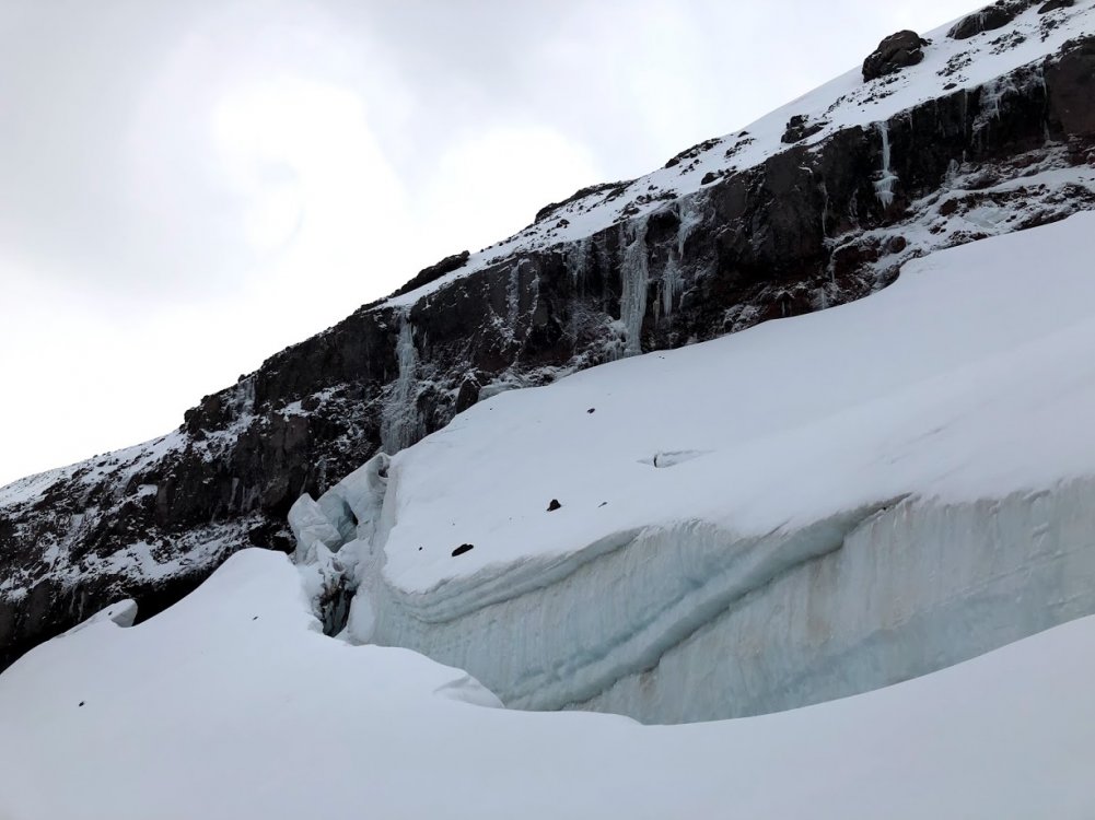
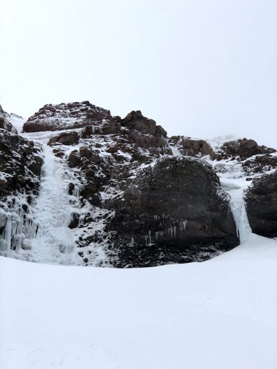
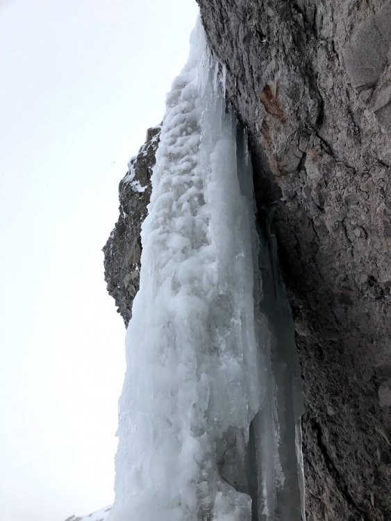
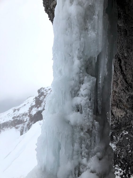
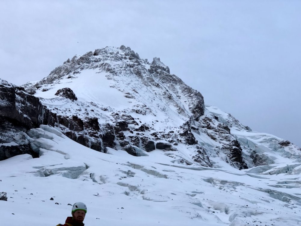
Trip: Mt. Hood - North Face Right Gully Trip Date: 01/02/2019 Trip Report: New year new objectives! Plans, partners, and conditions finally aligned for the north face of Hood. I parked at Timberline and my friend drove us to Tilly Jane. 12am sharp we were on the trail. The approach to the A-Frame was super mellow and took us slightly over an hour. From there we followed a well compacted path to the carin on Cooper Spur. The snow on the glacier was boot deep most of the way. Not bad conditions at all. By 4:20 we stopped at about 8500 feet to nap because none of us got any sleep the day before. Sleeping at the base of Cooper 30 At 5:50 my partner woke me up. I'm pretty sure I was hypothermic but that nap felt soooo good. The slog up to the base of the route uneventful but the sunrise was well worth it. We crossed to the right of the bergschrund. The snow was kind of spooky but it went with ease. After some more slogging we got on the first ice step. It felt WI2-3ish overall. After about 50 meters of climbing I made a belay with a screw and picket. First ice step Me leading up the step The snow between the ice steps was quite pleasant. We comfortably soloed through it, kicking in deep if we needed to rest. Here's the second ice step. It felt pretty easy as well. WI2 probably. A few hundred more feet of slogging brought us to Cathedral Spire. It looked like a fun climb for another day. Climbing up one of those cracks looked compelling and fun. What the snow looked like Summit pyramid. At the summit pyramid we faced the first alpine ice we had seen on the entire route. Opting not to simu-solo, we unroped for the last stretch. Pulling the summit cornice was bittersweet. Throughout the entire route we faced no wind, relatively mild temperatures, and perfect visibility. When we got to the summit, it was a different story. It was a total whiteout, icy wind made everything freeze, and things got pretty damn cold. We decided to descend the old chute because the pearly gates were iced up. We made it down in record slow time, mistaking ice formations for buildings and people a number of times. The descent to Palmer had very little snow, it was mostly these ice rock things. Our lack of sleep was finally catching up to us. When we got to the car, I began seeing imaginary hot air balloons and large apartment buildings. Overall though, it was an exceptional trip. The snow was great. The ice was great. Even the approach was pretty mellow and fun. All in all it took us about 15 hours including the impromptu nap time. I honestly have no idea when we got to the summit. It was a fun but relatively easy romp up the mountain. here's what the descent conditions looked like Gear Notes: 4 Screws 2 Pickets Approach Notes: Follow the trail, descent at the carin
-
The Ambit3 Peak works great. Its proven to be pretty durable so far. For running it's great and also pairs with the Suunto heart rate monitor. Without GPS the battery lasts for a little over a week it seems. Its got a bunch of different modes to track activities like skiing, climbing, hiking, etc.
-
ice climbing 2018/2019 OR/WA Ice Conditions
landoclimb replied to ggres335's topic in Ice Climbing Forum
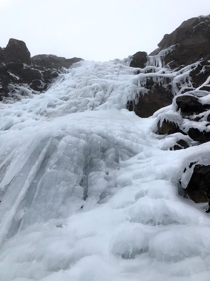
Eliot Goacier ice is IN. Cooper 30 is solid and some other ice around is in decent shape too.
-
As of a week ago the road was completely open to the inn with no snow.
-
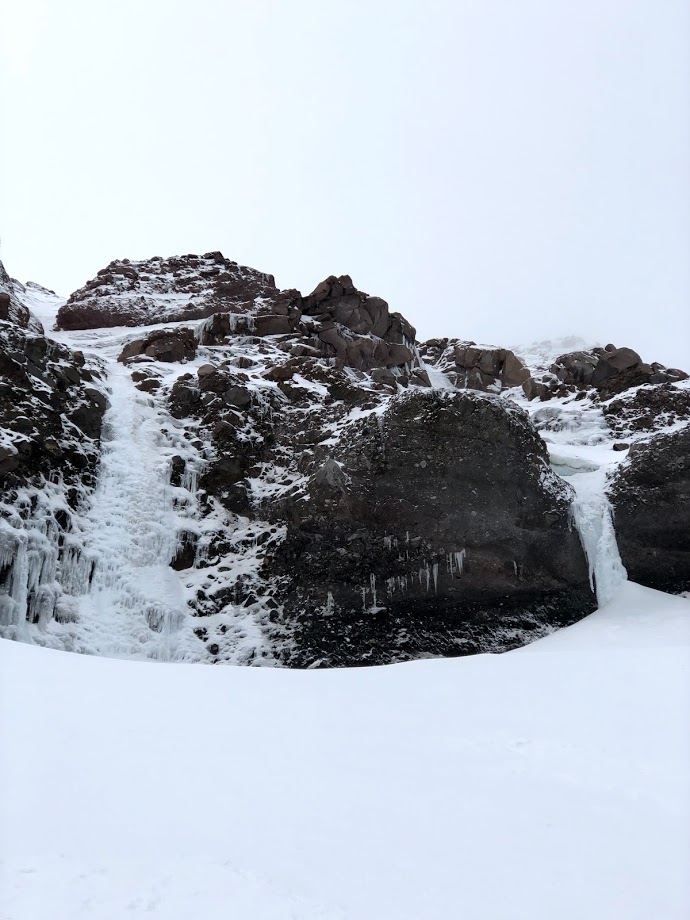
Went up this weekend 11/3 to check out the drips on the Eliot glacier. A few of the climbs are kind of in. The climbable ones are super wet. The north gully also looks like it's pretty close to being in. The two routes I got on The north face. 11/3

-
Mt. Hood North Face Right Gully 11/2-11/3
landoclimb replied to landoclimb's topic in Climbing Partners
That’s good thinking. I found someone to go craging with me by the drips up there. The window seemed too narrow and the wind would have blew anyways. I’ll post about the conditions and what I observe tomorrow. -
Mt. Hood North Face Right Gully 11/2-11/3
landoclimb replied to landoclimb's topic in Climbing Partners
Yeah the weather on saturday night sucks. I was hoping to get in friday night and be done saturday morning. -
Looking for an experienced partner to go up the north face with me. We would start Friday night/Saturday morning ish. Just a quick trip up to start the season!
-
That’s some solid alpine training!
-
[TR] Johannesburg Mountain - NE Buttress Solo 08/01/2018
landoclimb replied to landoclimb's topic in North Cascades
Thank you for sharing that. May Doug rest easy. -
[TR] Johannesburg Mountain - NE Buttress Solo 08/01/2018
landoclimb replied to landoclimb's topic in North Cascades
Going straight up and skipping most of the trees might go, but there would definitely be more 4th and 5th class rock. I encountered some 5.8 moves but I’m sure there are lines on the buttress with easier or harder rock. Most of it was low 5th however. -
[TR] Johannesburg Mountain - NE Buttress Solo 08/01/2018
landoclimb replied to landoclimb's topic in North Cascades
I don’t think the couloir was in. Not that I saw at least. -
[TR] Johannesburg Mountain - NE Buttress Solo 08/01/2018
landoclimb replied to landoclimb's topic in North Cascades
Fixed photos -
[TR] Johannesburg Mountain - NE Buttress Solo 08/01/2018
landoclimb posted a topic in North Cascades
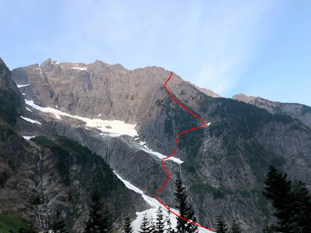
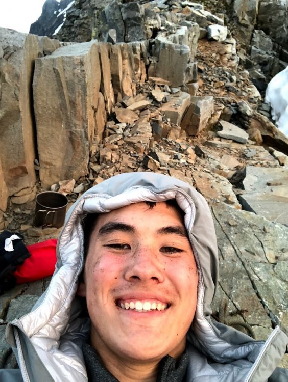
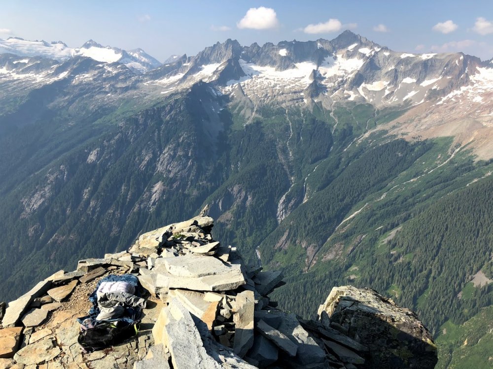
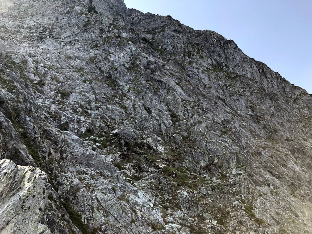
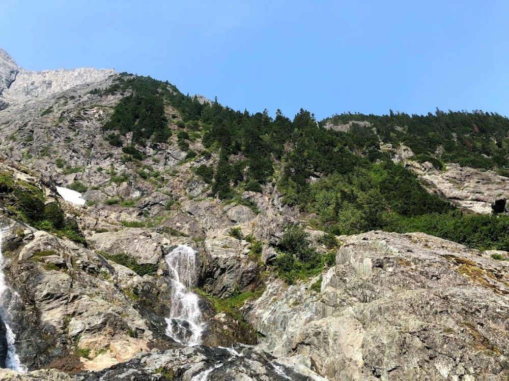
Trip: Johannesburg Mountain - NE Buttress Solo Trip Date: 08/01/2018 Trip Report: I overheard some friends talking about Bill Amos' solo of Johannesburg and was immediately inspired. The allure of the mountain and style of climbing was too much to pass up. Before I start my senior year of high school I wanted to do something really fun. After binge reading trip reports and training for a few months, I felt psyched and ready. I already have a decent bit of soloing under my belt so the climb just seemed right. Fast forward to Monday night, I got in my car and drove out to Cascade Pass. I set my alarm for 7:00 but woke up at 6:30 (probably due to the anticipation). The sheer beauty of Johannesburg is impossible to ignore; its imposing face shows so much promise. After scarfing down a breakfast bar and some pop-tarts, I locked my car and began the arduous approach. A grueling .2 miles down the road lead me to a dirt mound with access to the river. Crossing over rocks and walking up a talus field put me at the first snow on the route. The snow was rock hard so my crampons begrudgingly came out of my pack. I was careful to move fast across the snow because I didn't want to get taken out by an avalanche. A rock ramp to the left of the second waterfall provided seemingly easy access to the buttress. Looking up at Johannesburg After some easy slab and low 5th class I arrived at the second snowfield. Here's where I made my first mistake. Once again, the snow was rock solid. I put on my crampons to walk the 100 something feet across it to the rock. Thinking more snow was soon to come, I clipped my crampons to my harness. Looking for a good line through the trees, I decided to go straight up some 4th class rock and then traverse right later on. This beta absolutely sucked. The initial 200 feet or so was smooth sailing. I soon encountered more and more trees, eventually reaching an impassible rock band within the brush. From here I traversed right until I found a gully within the trees that allowed me to climb up. It was hot, steep, and heinous bushwhacking. Finally I could see the third snowfield. At this point I was well above it but had a clear view of the 1957 route. This snowfield basically cuts the buttress in half until they join up again high on the vertical rock. Tired, I took off my pack to eat a probar and drink some water. Looking at my harness I realize only 1 crampon is clipped on. My other must have gotten eaten by trees earlier in the bushwhack! Thinking about Jean-Christophe's rescue on Annapurna reminded me that I'm probably not going to die if I'm short one crampon. Slabs before second snowfield. It's hard to describe how much the trees suck. I found no evidence of a path and basically pulled on branches, heather, and devil's club the whole way up. Things would frequently get caught on my rope or ice tools during this section. Another hour or so of this put me at the heather slopes. For about 800 feet I walked up some easy 3rd class slopes covered in heather. The 70 degree heat made me really thirsty. I brought 2 liters of water and realized it probably wasn't going to last all the way to the bivy. Rationing out water was uncomfortable but that's life. More scrambling finally put me on the rock. What a relief! Soon 4th class rock turned into low 5th and life was peachy. It felt absolutely euphoric to move well on the steep slopes. I didn't find loose rock to be that big of an issue. I checked my watch and realized I was about 400 feet from the bivy. Up ahead of me looked to be the "crux" rock section. I traversed right from the 1951 route on to the approximate 1957 route. I think this allowed me to skip some hard sections because I encountered maybe 5.6 rock up to this point. Though the glacier was still obscured by rock, I knew I was close. Rock face. I stayed in the middleish left My fatigue meant I wasn't climbing at my best. I elected to take off my pack for the next 200 feet or so and just haul it up. Some 5.8 face climbing through loose rocks put me on top of a small ridge. I was at the glacier! After bringing up my pack, I scrambled up some 4th class rock and was at the bivy. I drank straight from the glacial runoff. This was the first time in my life I was happy to see mosquitoes. The struggles of the day melted when confronted with the beauty of the mountains around me. After a warm meal and some relaxing. I was sound asleep in my bivy sack. Bivy of the decade Me stoked to be fed and hydrated Waking up at 6:30 was kind of cold. I didn't bring a sleeping bag but was pretty was comfy nonetheless. After some packing and eating, it was time to get on the glacier. This part was less than ideal. The snow was luckily much softer than at the base of the mountain. Despite only having one crampon, climbing up the snow to the arete was easy. After carefully walking on the arete I decided going straight up the headwall would be hard. I downclimbed a few meters to the rock ridge. The rock actually went! Easy scrambling and some short traverses on the snow allowed me to skip almost all of the glacier and headwall. At the summit ridge I scrambled up right to the biggest peak. I made it! It turns out I was the first person there in almost a year! The log could also use some more paper if anyone is going up there soon. The feeling of being up there is indescribable. Signing the summit log and snapping a few photos, I was ready to head down. Headwall. I scrambled on the rock to the left Obligatory summit selfie Signing the climber's log Staying to the south side of the gendarmes, follow a loosely marked carin path to the East face. I opted to rap instead of downclimb initially. 8 bomber rappels brought me to some low angle heather. It's important to aim straight for the CJ col. There looks like other paths would be better but they cliff out. About 600 feet of downclimbing brought me to the col in one piece. Looking up from the col Now sidehilling ensued. Going close under the buttress and heading straight toward Doug's Direct seemed to work best. Walking through all the brush isn't fun but the ascent to mix up peak was easy. About 1000 feet 3rd and 4th class scrambling down the north ridge of Mix Up brought me to Cache Glacier. The climbers trail is visible from the top of the ridge; go there. Walking down the climbers trail felt like one of those flat escalators at an airport compared to the rest of the climb. 3.7 miles of running and I was back to the parking lot. Looking down from the top of Doug's Direct. This was a climb to remember. The beauty of the North Cascades is hard to forget. I don't think I'll be back to Johannesburg for at least a few more months. I would really love to try and get up it in the winter. Shoutout to Steph Abegg and everyone else who has previously made trip reports. I have mad respect for anyone who has done this climb. Don't let your guard down when you get to the summit. Johannesburg is the mountain that keeps on giving. Now its time to get ready for Bear Mountain. Here's the general route I took. I could have screwed up but I'm pretty sure this is where I went. Gear Notes: Took climbing shoes and chalk but didn't need them. Approach Notes: Walk .2 miles down the road. Cross river.

-
Looking for a partner to go up the aforementioned route this Friday or Saturday night. Let me know if you’re interested!