-
Posts
98 -
Joined
-
Last visited
-
Days Won
40
Content Type
Profiles
Forums
Events
Everything posted by Kyle M
-
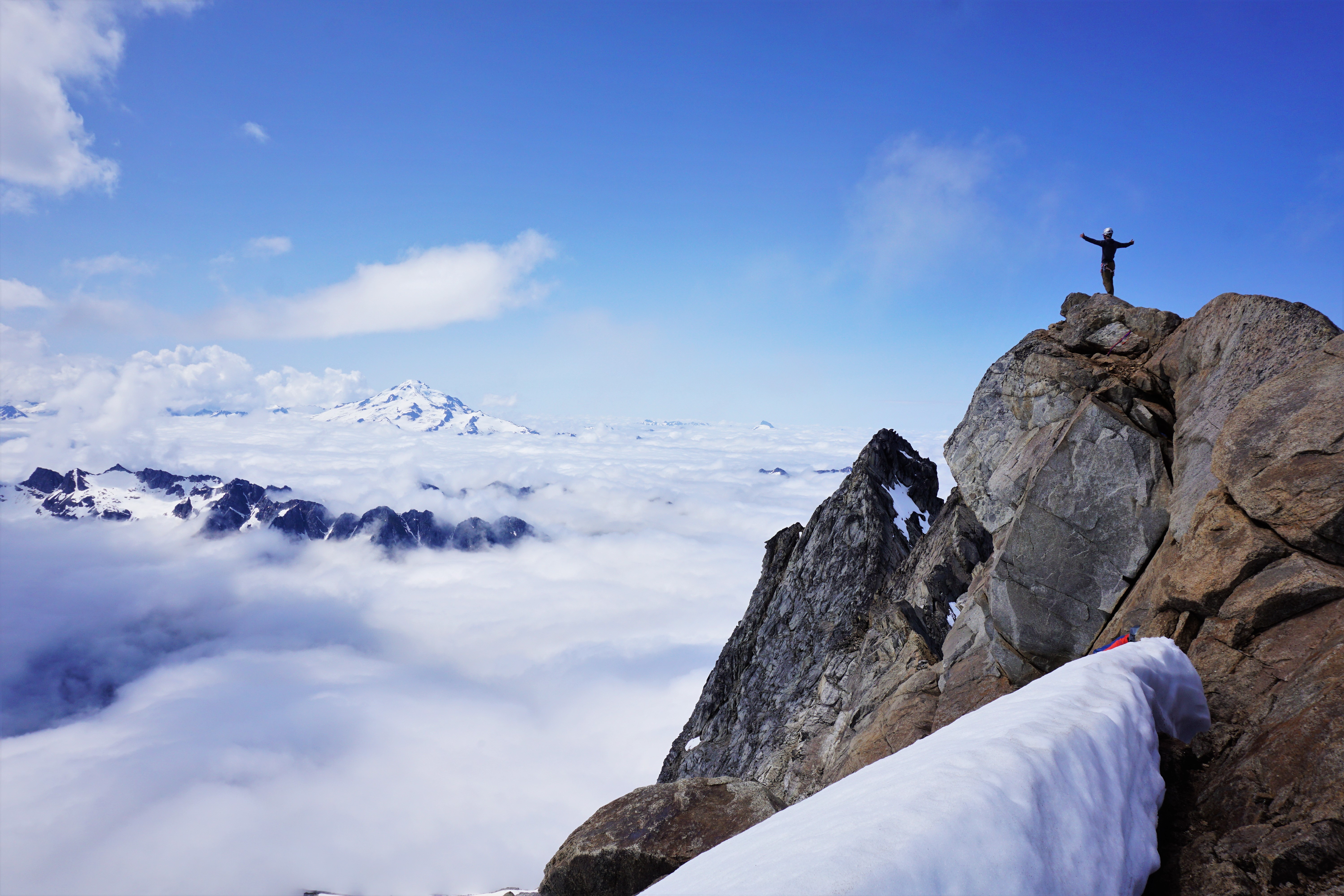
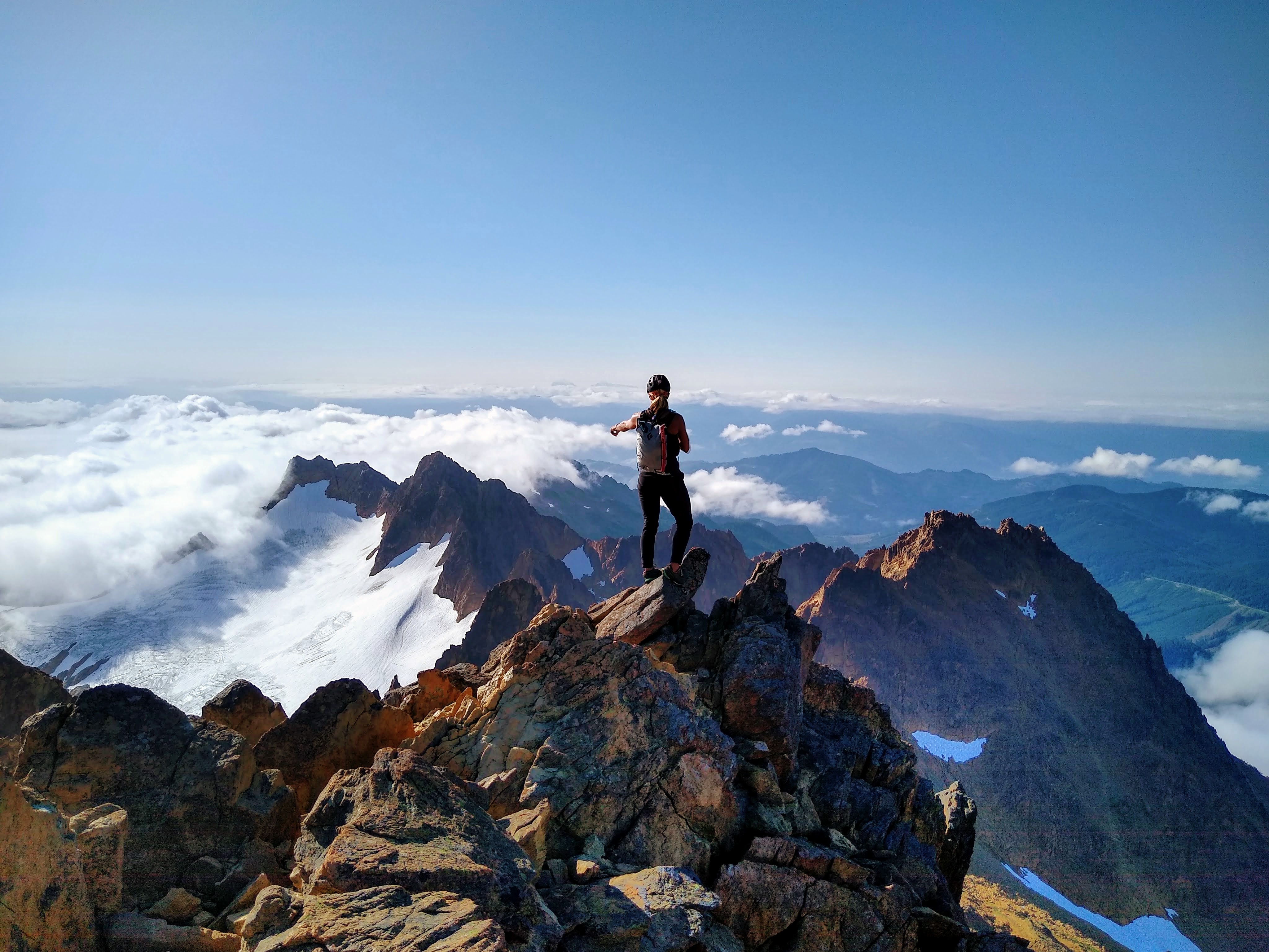
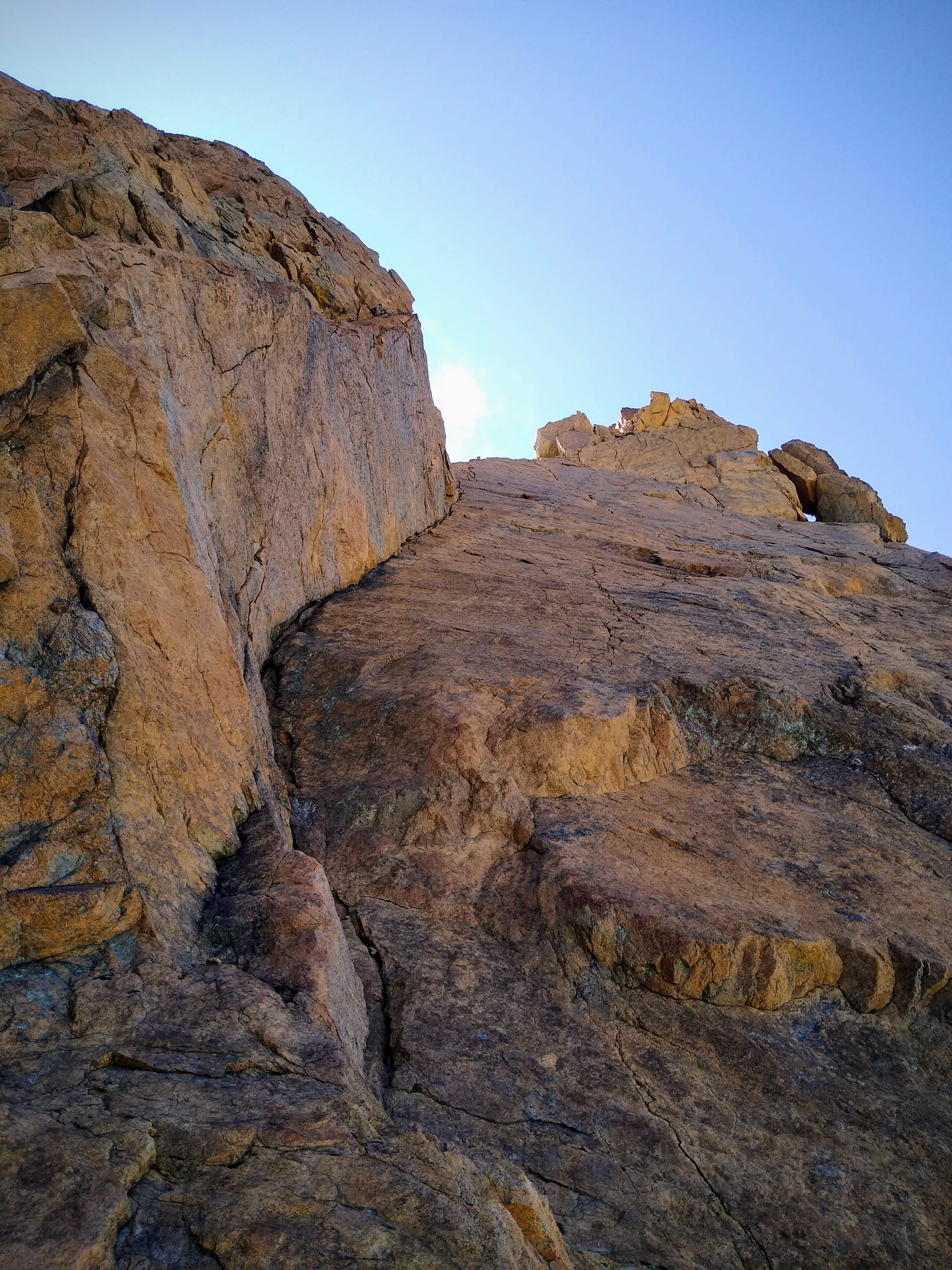
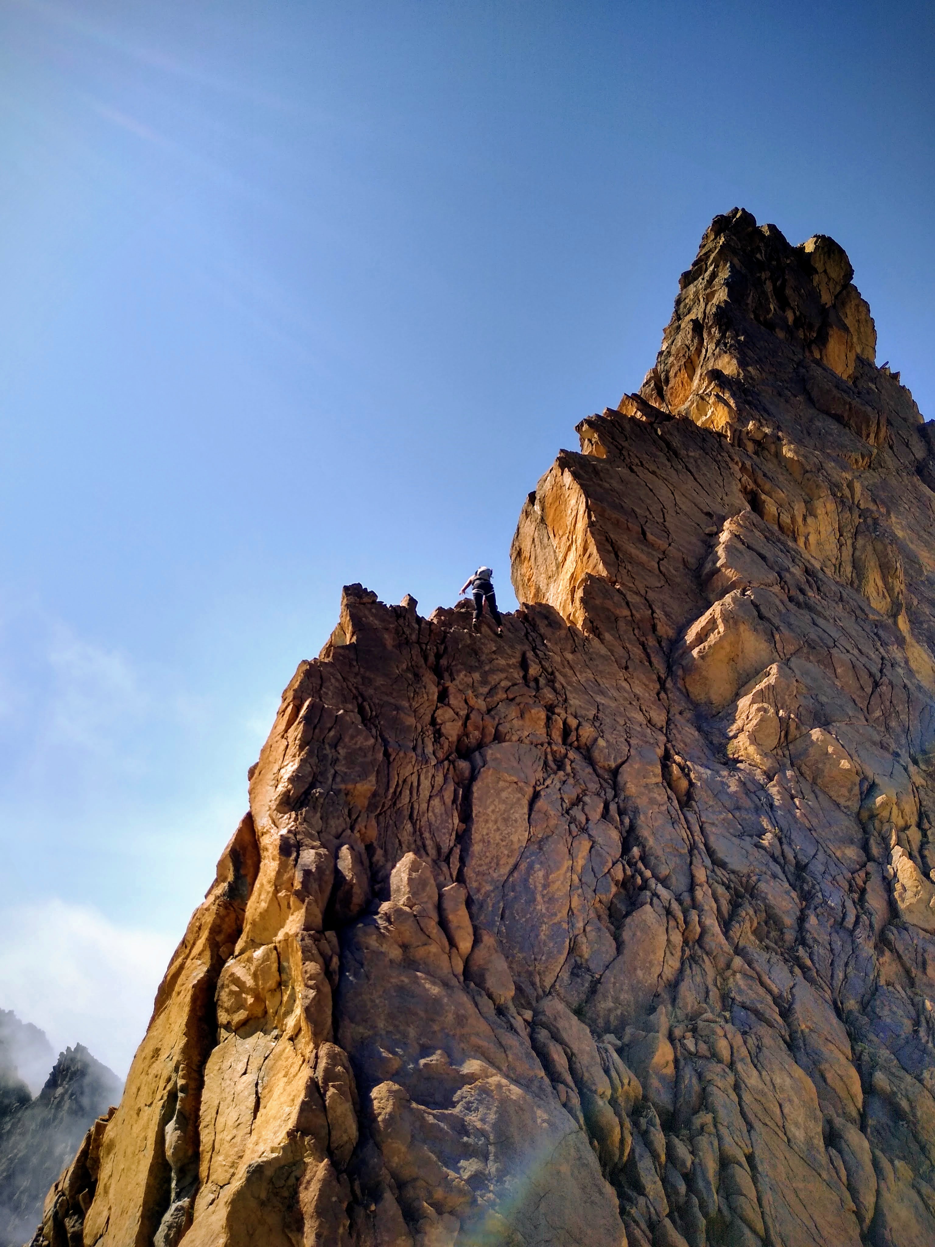
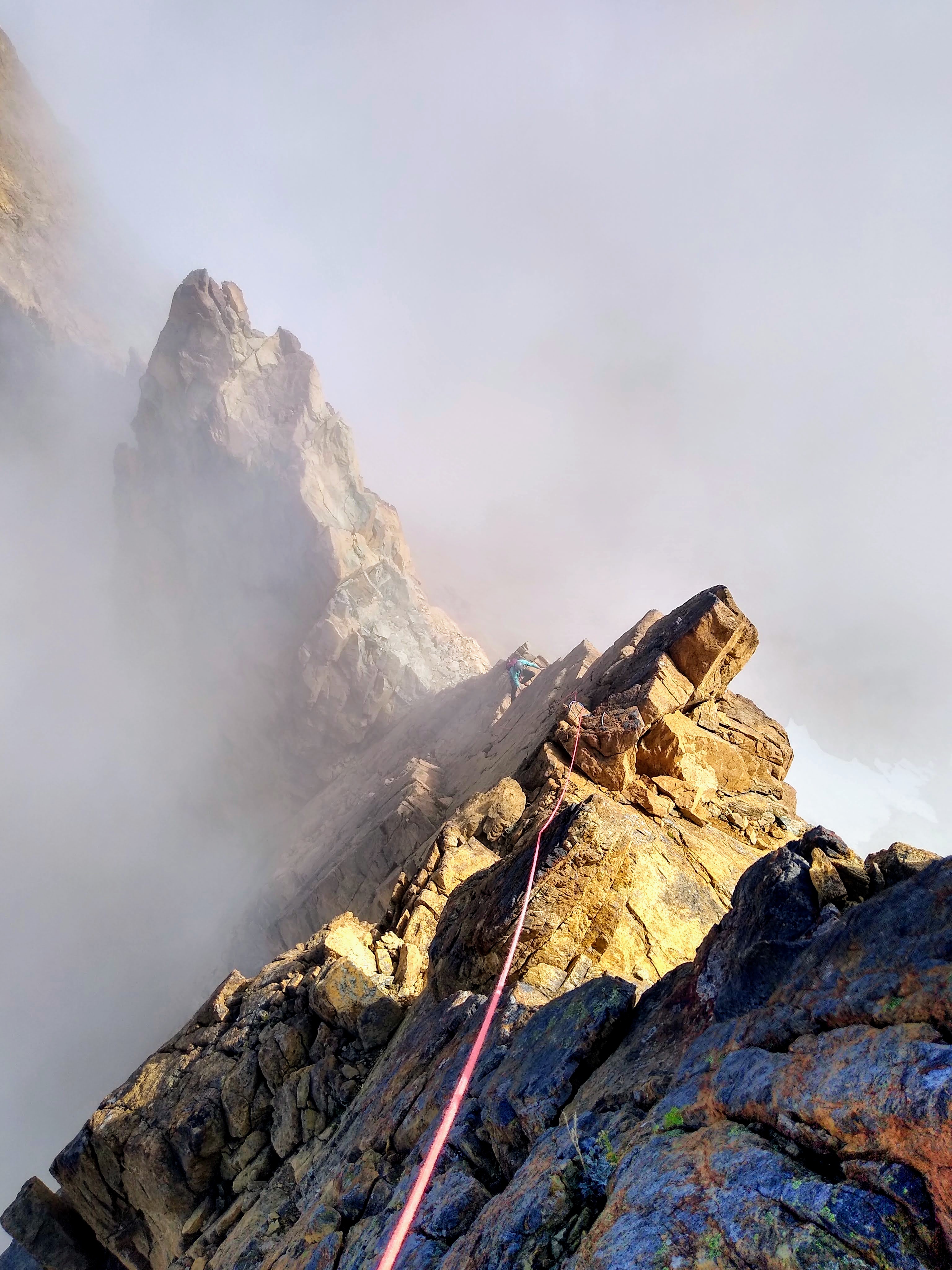
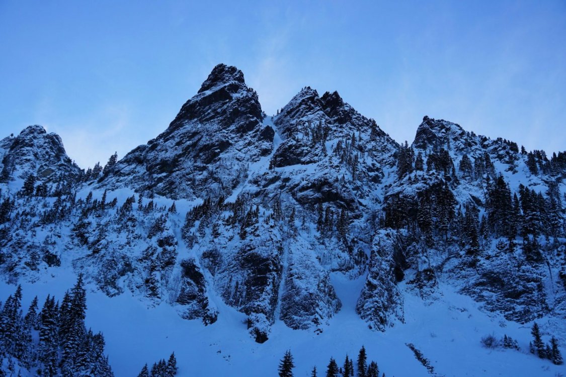
 Trip: Mont Blanc Massif - Arête du Diable Trip Date: 07/11/2022 Trip Report: During my mostly hiking vacation to the Alps, I had an impromptu linkup with none other than @drdirtbag himself, tagging 6 4000m peaks in the Mont Blanc Massif. I was scrolling through Strava when I noticed he was biking in the Alps and sent him an email. It turns out he needed a rope and partner for the most technical peaks in the 4000m list, so we had a match! I rented crampons for my running shoes and an ice ax and took the tram up... The climb is more of a ridge traverse with five independent towers, separated by rappels. The final climb to the summit of Mont Blanc de Tacul is just a long scramble. The actual climbing was on excellent granite and generally no harder than 5.8, with one definite crux on the final tower. The scale and drama of the setting was truly magnificent. It was an incredible experience to get to actually try my hand at real ALPine climbing. Just challenging enough, but generally relaxing and never stressful. We stayed the night in the Cosmiques hut before parting ways. I returned to Italy via Aguille du Midi and the Panoramic Skyway, while Dr. Dirtbag continued on his crazy peakbagging endeavors. Pretty spur of the moment linkup, but it was pretty rad. https://climberkyle.com/2022/07/11/arete-du-diable-5c/ Now for some eye candy: Now for some sunset photos: The traverse! Gear Notes: Running shoes, strap on crampons, ice ax, single rack .4-2, nuts, slings, 60m rope. Approach Notes: Glacier remarkably filled in considering the absolutely terrible snow year and summer heat there... bergschrund crossable still. Approach couloir just 3rd class choss, be careful for rockfall here.
 -
Black Spider report:
-
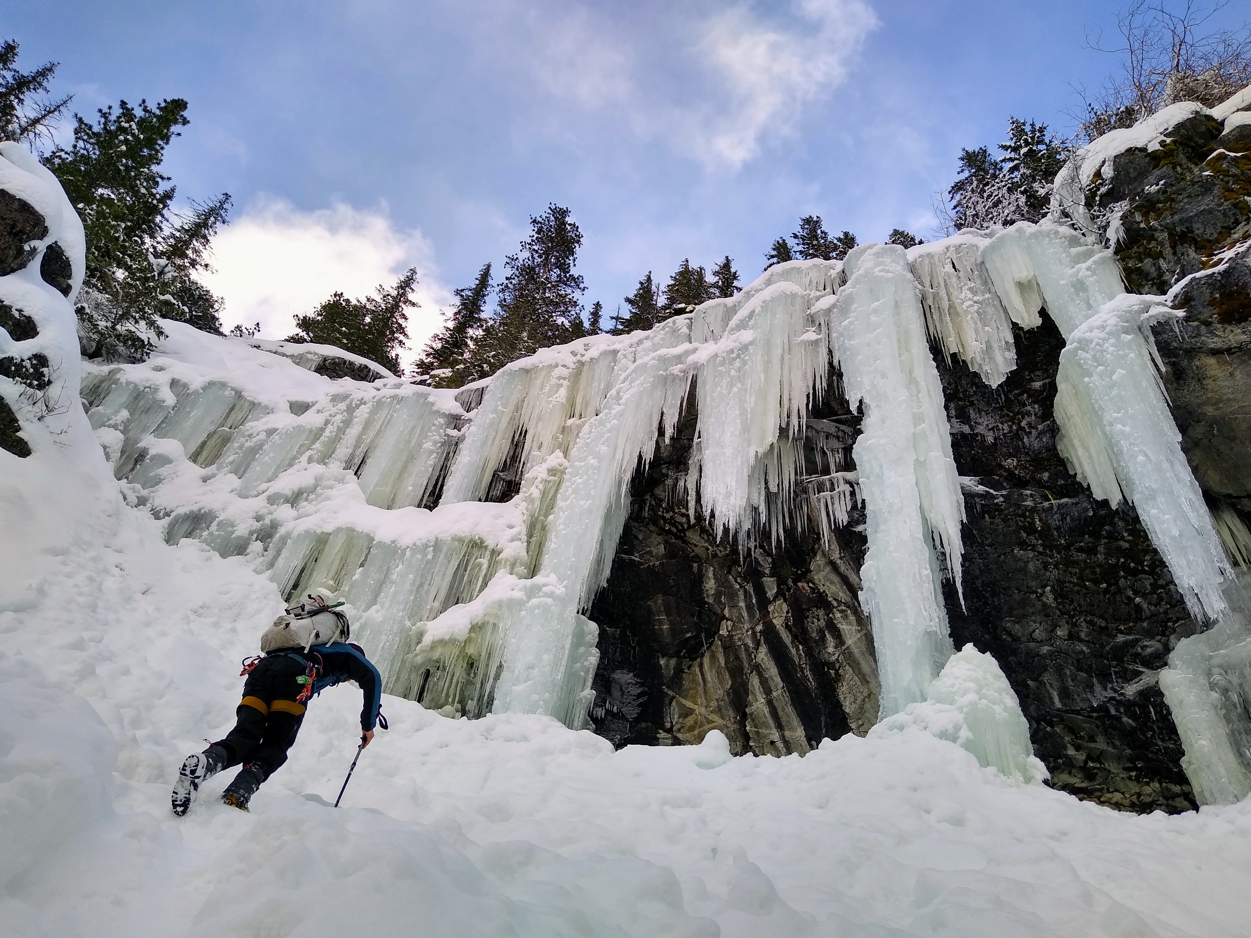
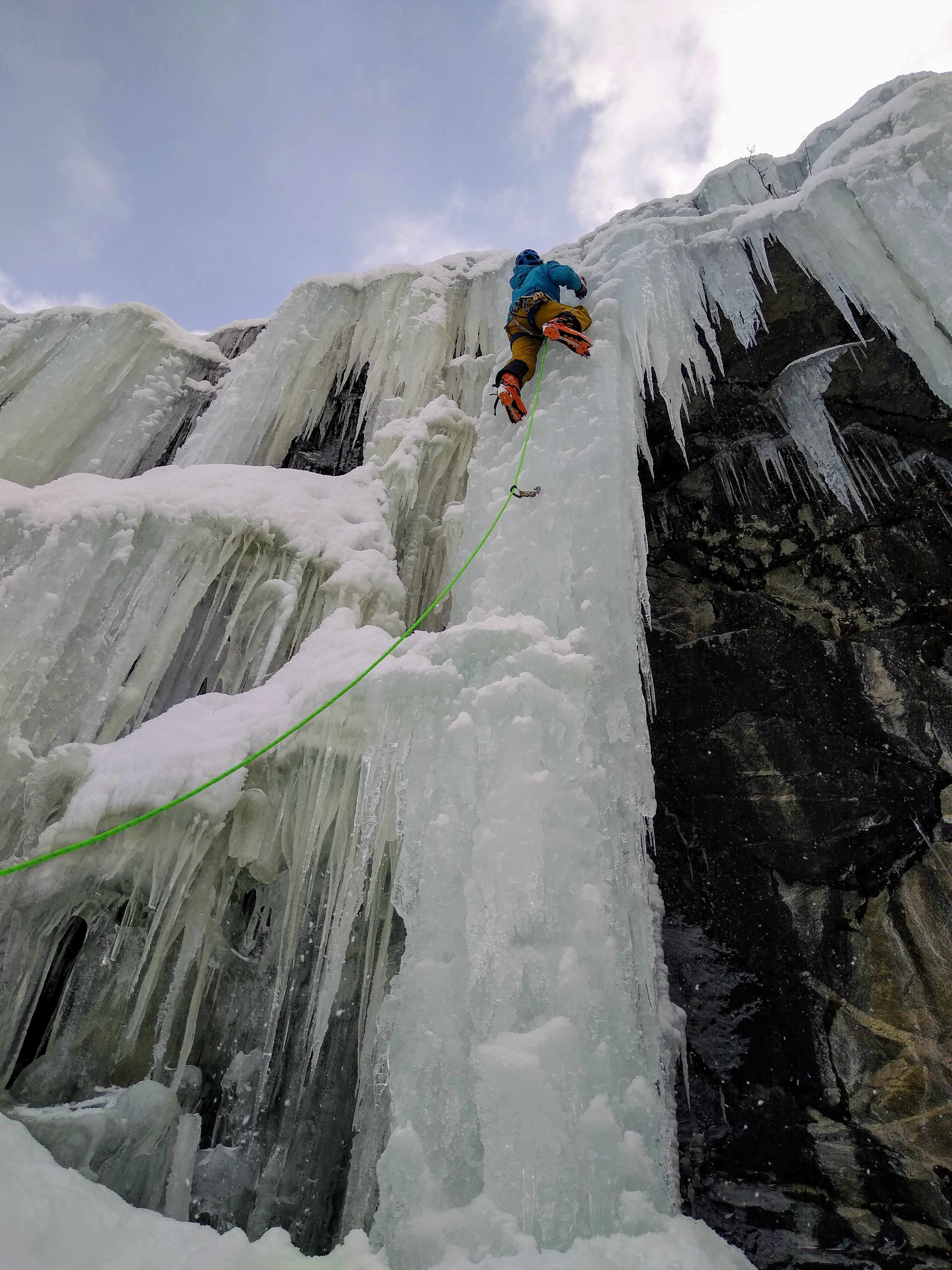
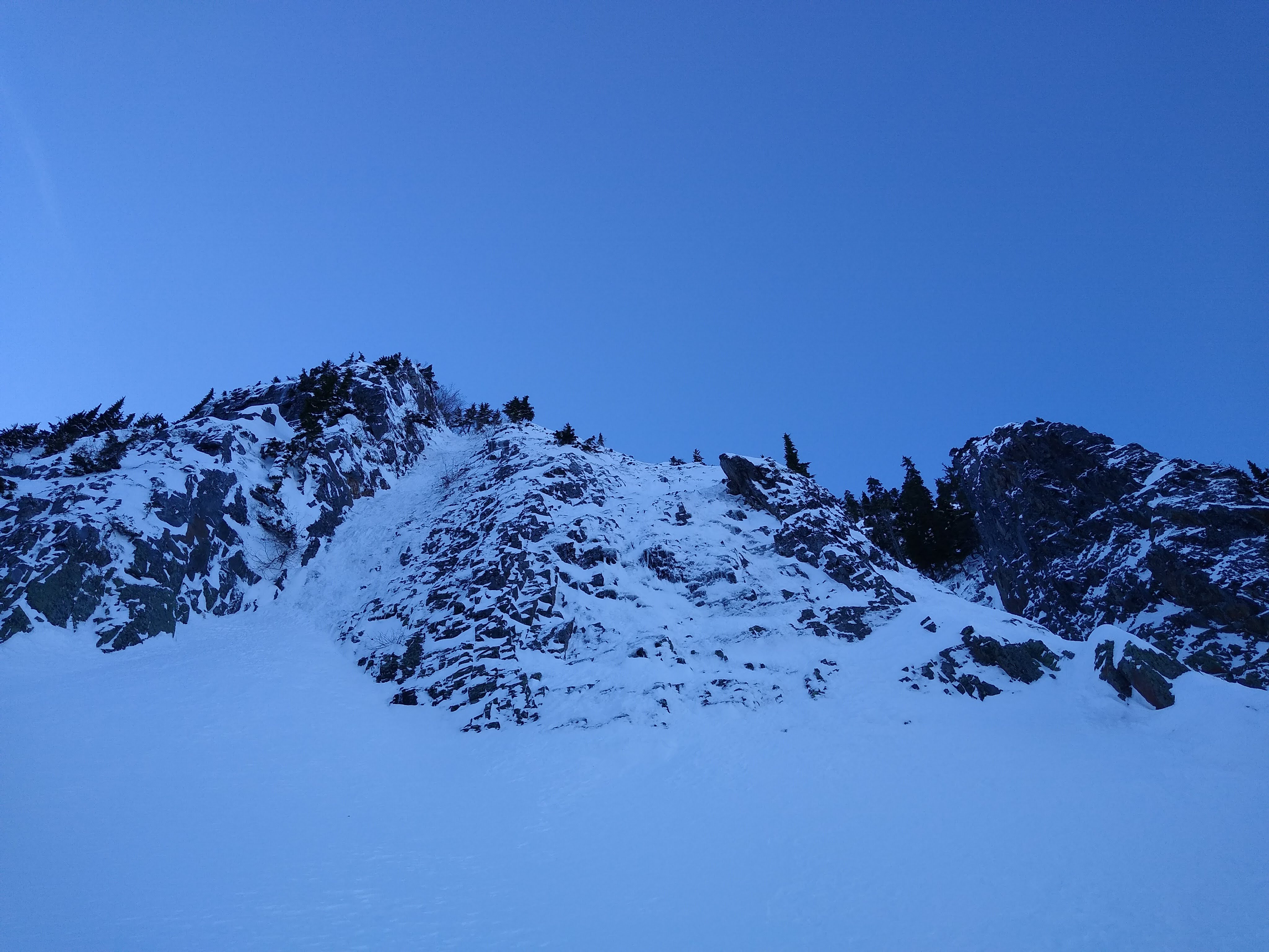
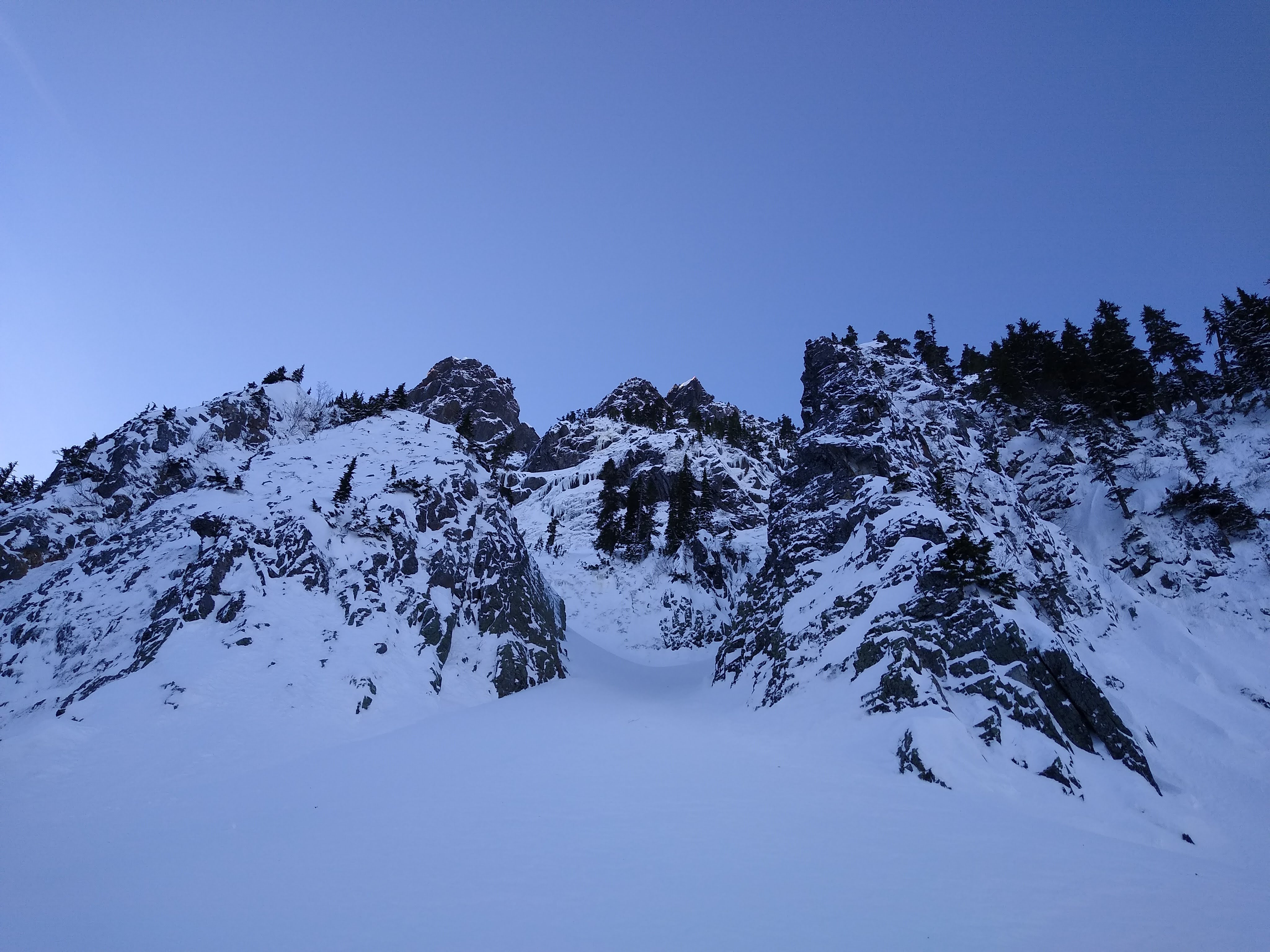
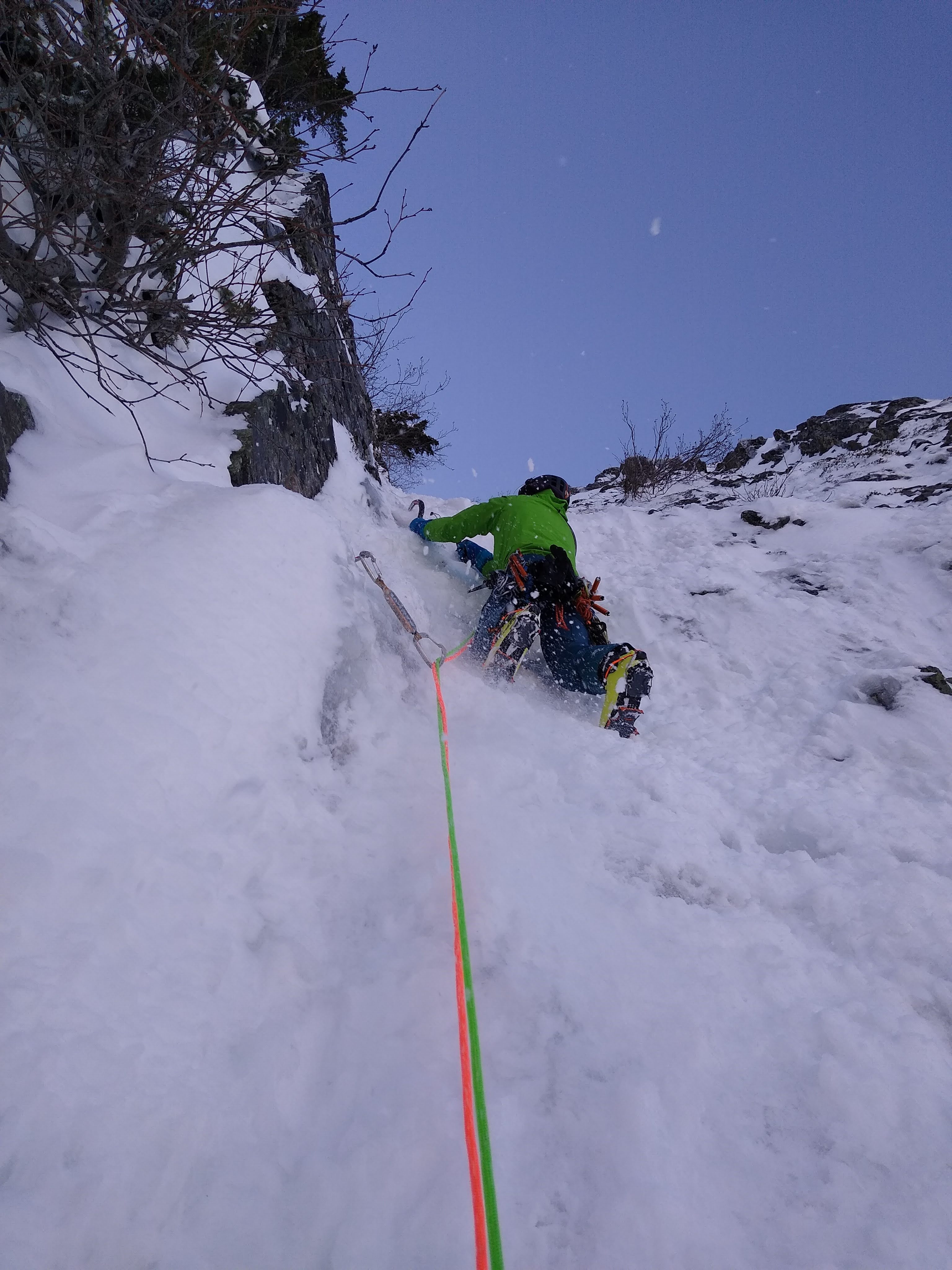
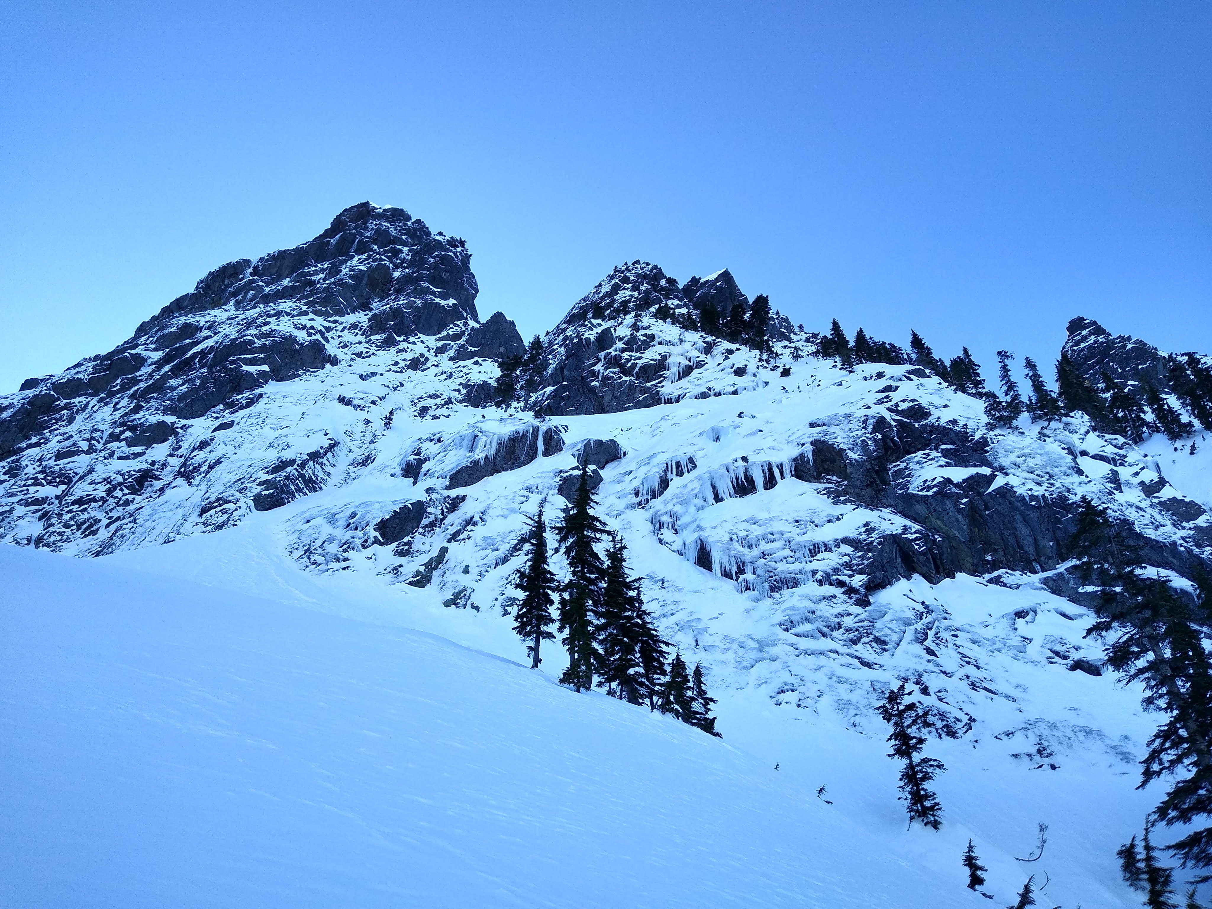
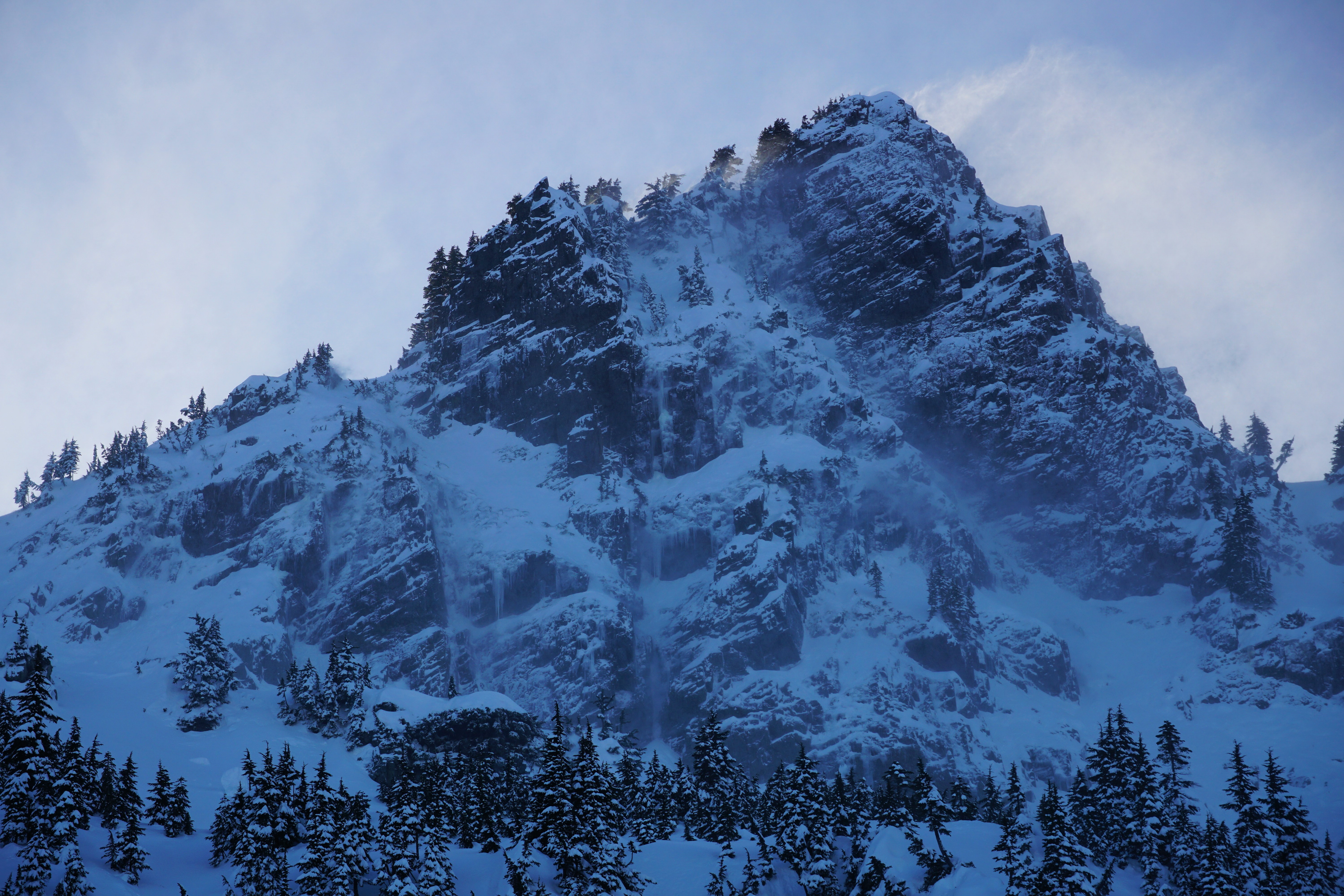
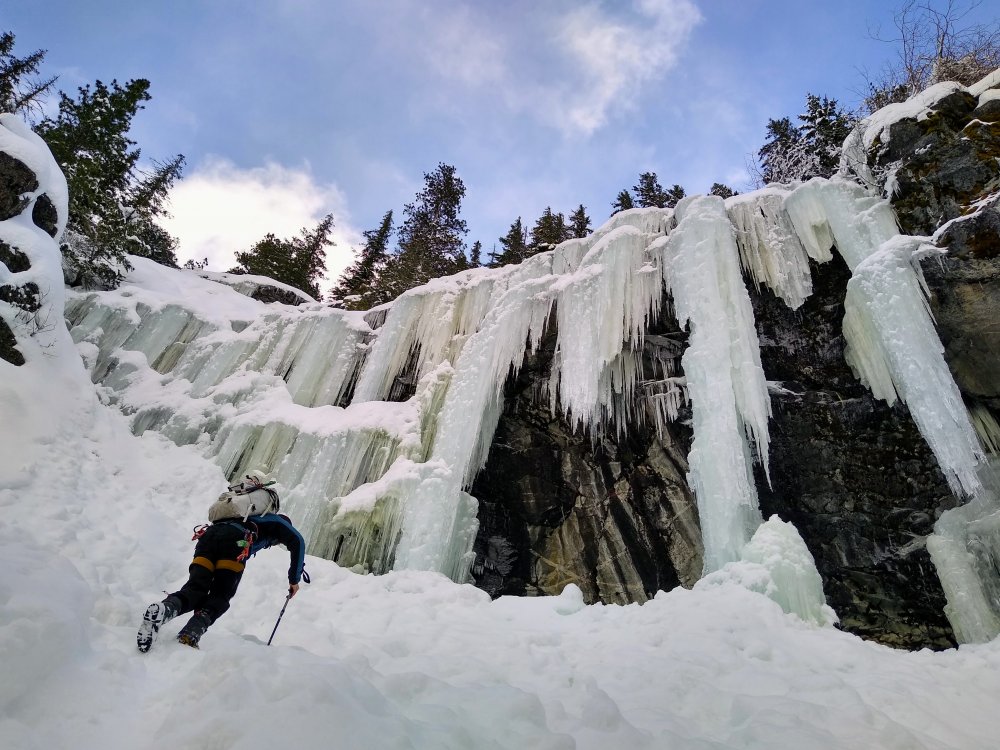
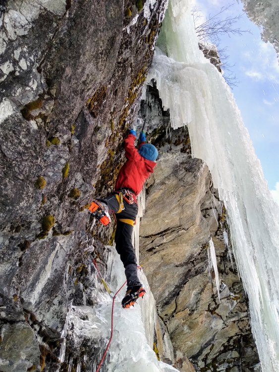
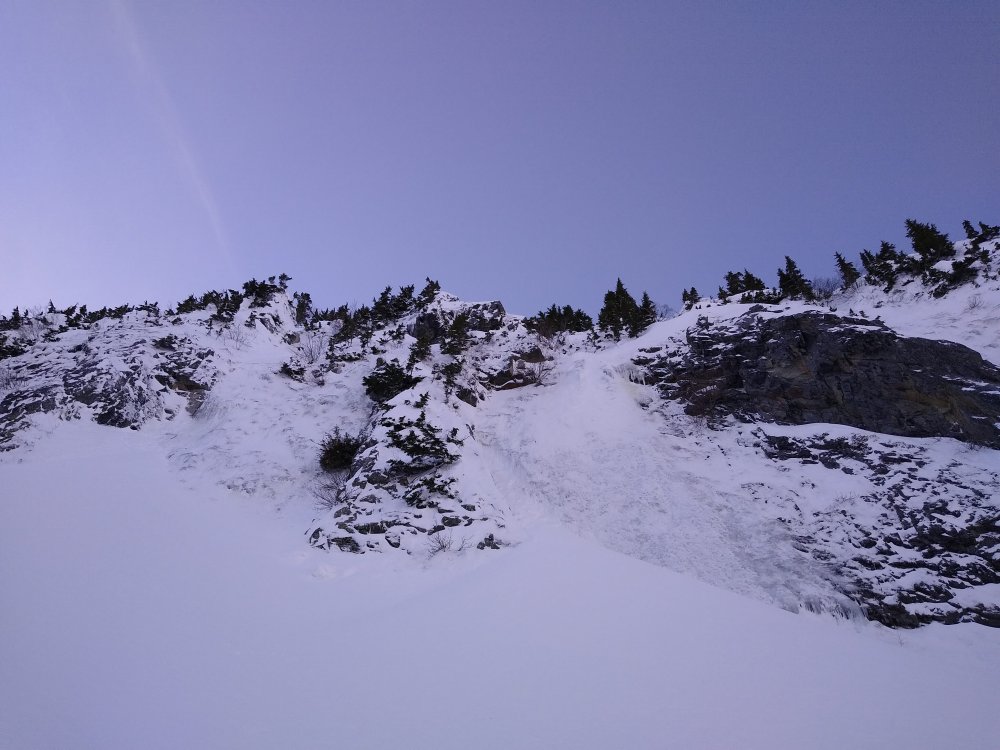
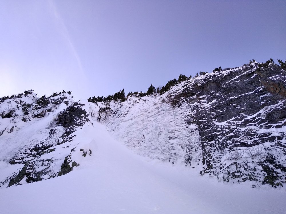
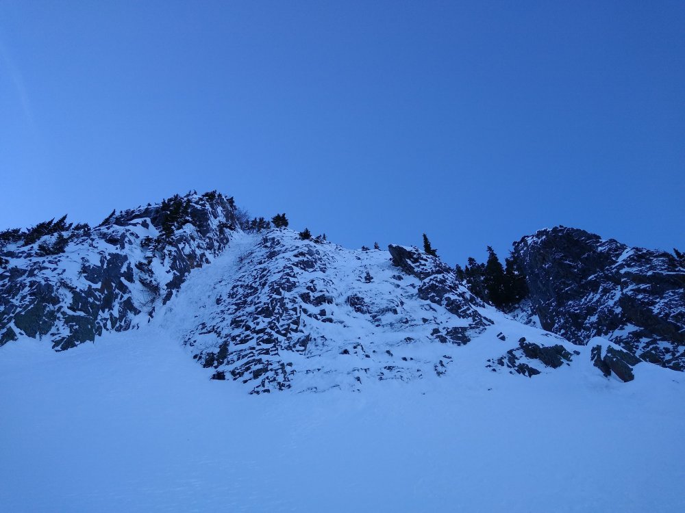
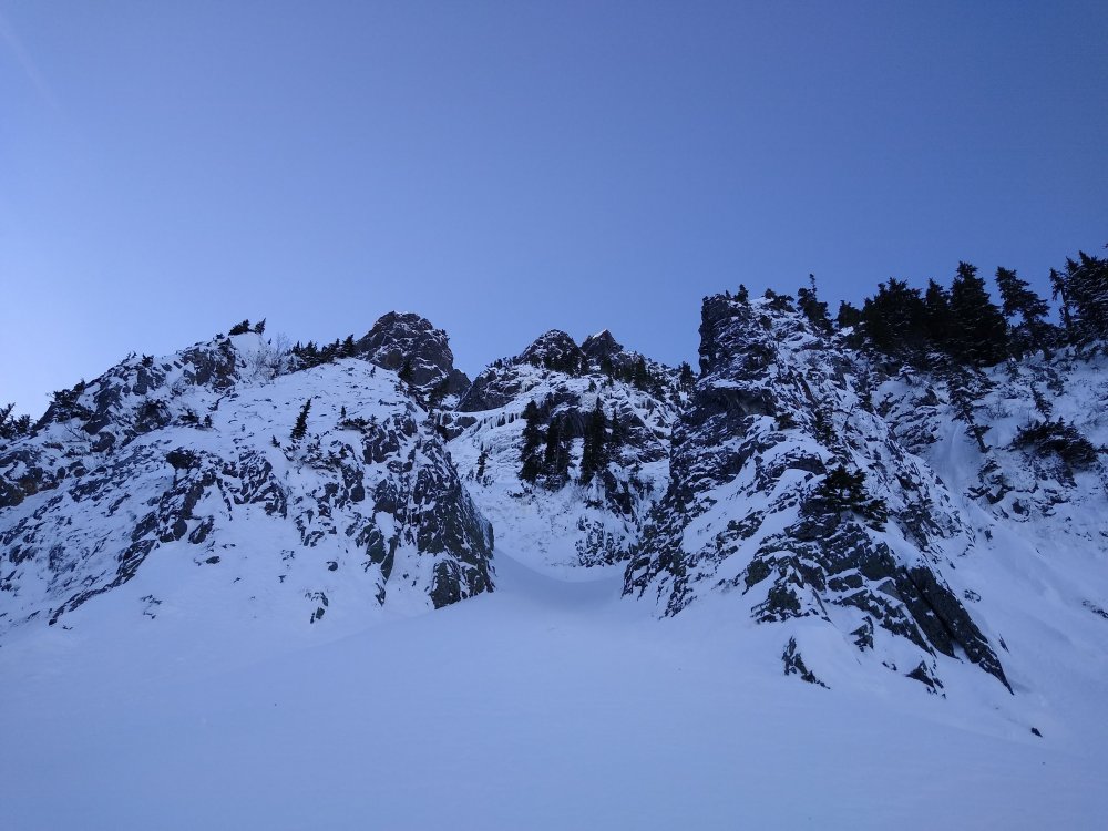
Trip: Mt. Hood - Arachnophobia Direct Trip Date: 01/25/2022 Trip Report: @Michael Telstad and I did Arachnophobia Direct on the Black Spider Wall. In fat (i.e. no mixed) conditions, we found it to be a very easy, enjoyable romp. There was a lot of sustained AI2-3 with some neve, snice, and snow mixed in. We found the ice in the upper half of the route to be a little worse for the wear due to all the sun and warm temps recently but still secure for climbing, just worthless for screws. Incredibly, almost nothing fell on us the entire time we were on the wall. We credit this to good luck, three weeks of high pressure leading up, and moderate temps with a nice breeze. It is definitely an intimidating face, but the climbing is pretty chill in the current conditions. https://climberkyle.com/2022/01/25/mt-hood-arachnophobia-direct-ai3/ Thanks to @wayne and Matt Z for the beta! Gear Notes: 10 screws. Definitely not use for the 22cm and should have brought another stubby. Brought rock gear but place none. Single 60m rope. Approach Notes: Crampons all the way from the Timberline parking lot. Crossed the White River Glacier Canyon around 8600 ft to 9k. Definitely not worth bringing skis in the current condition, mega icy.
-
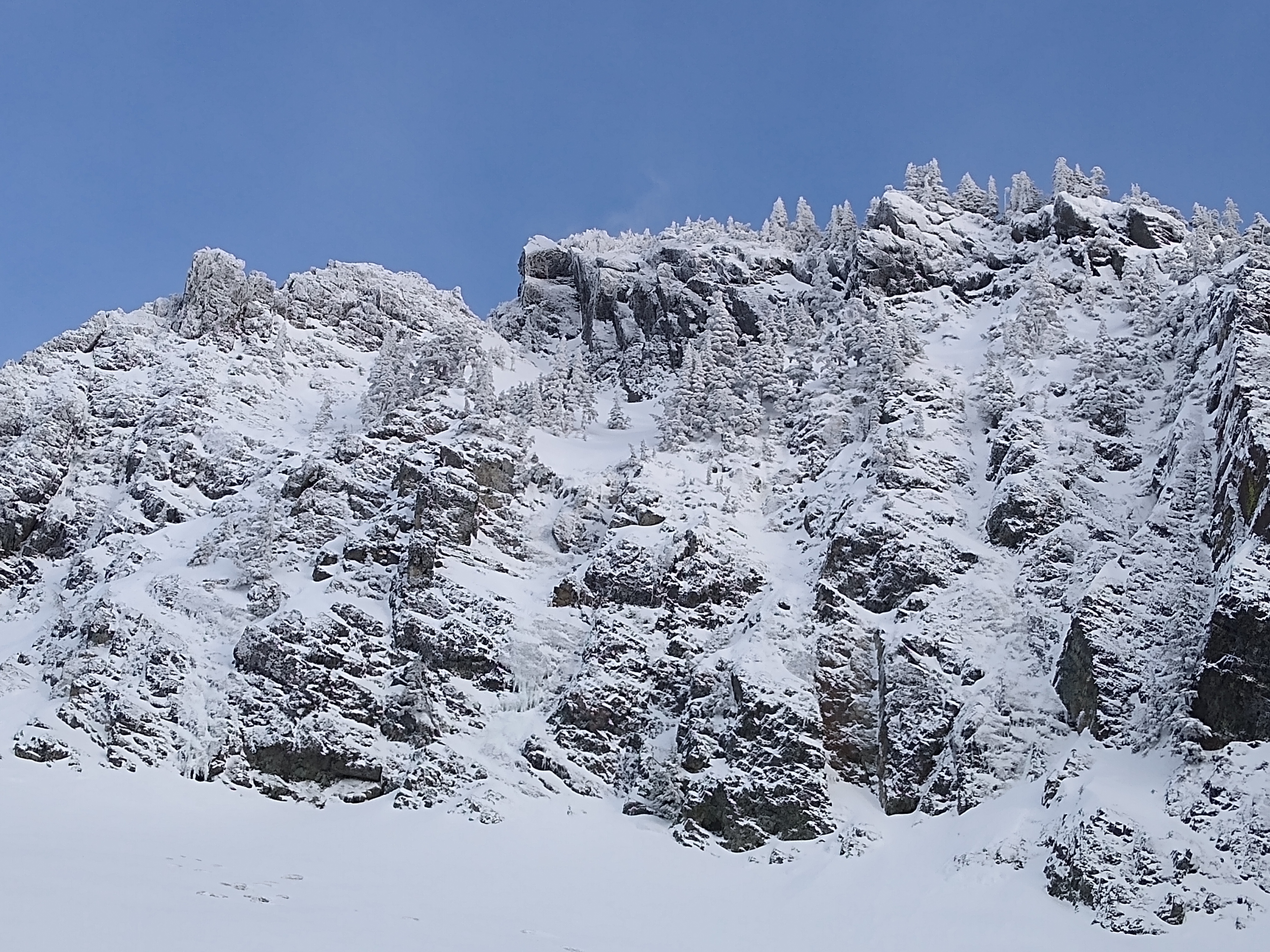
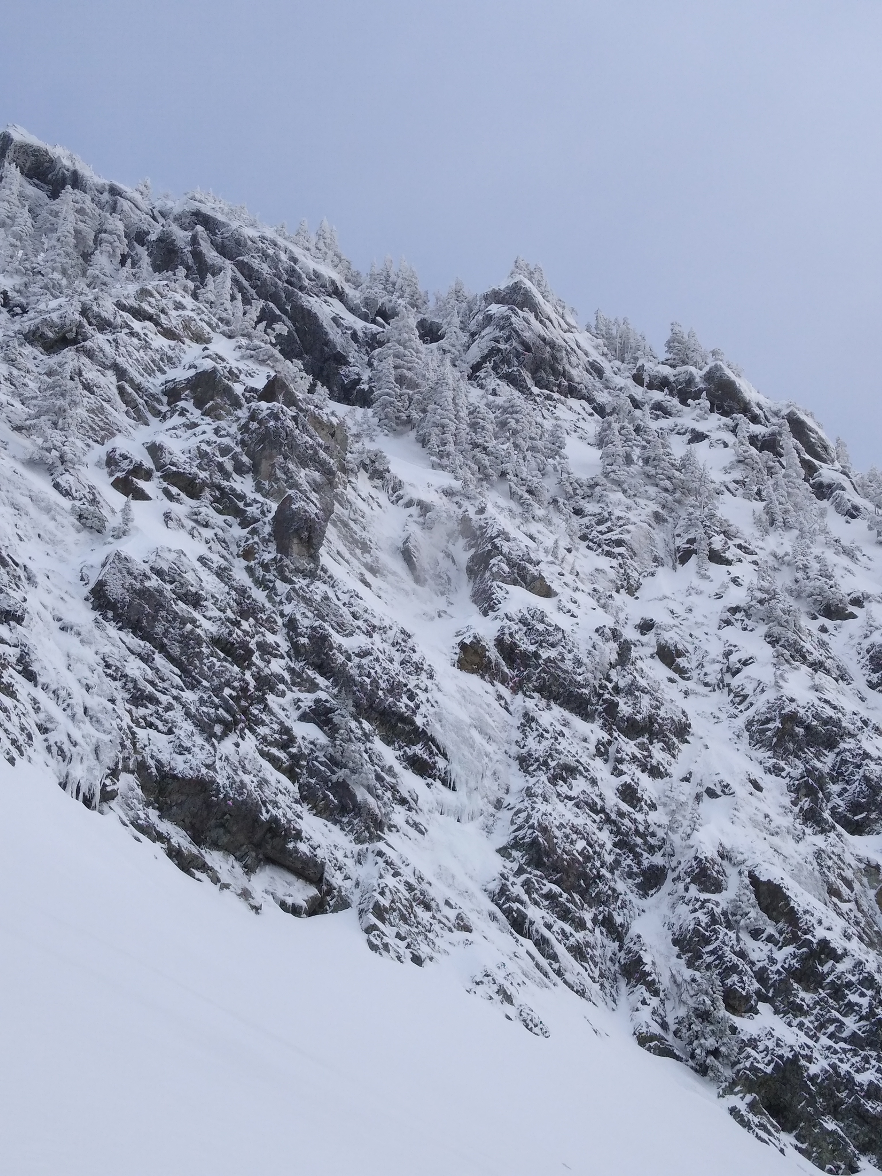
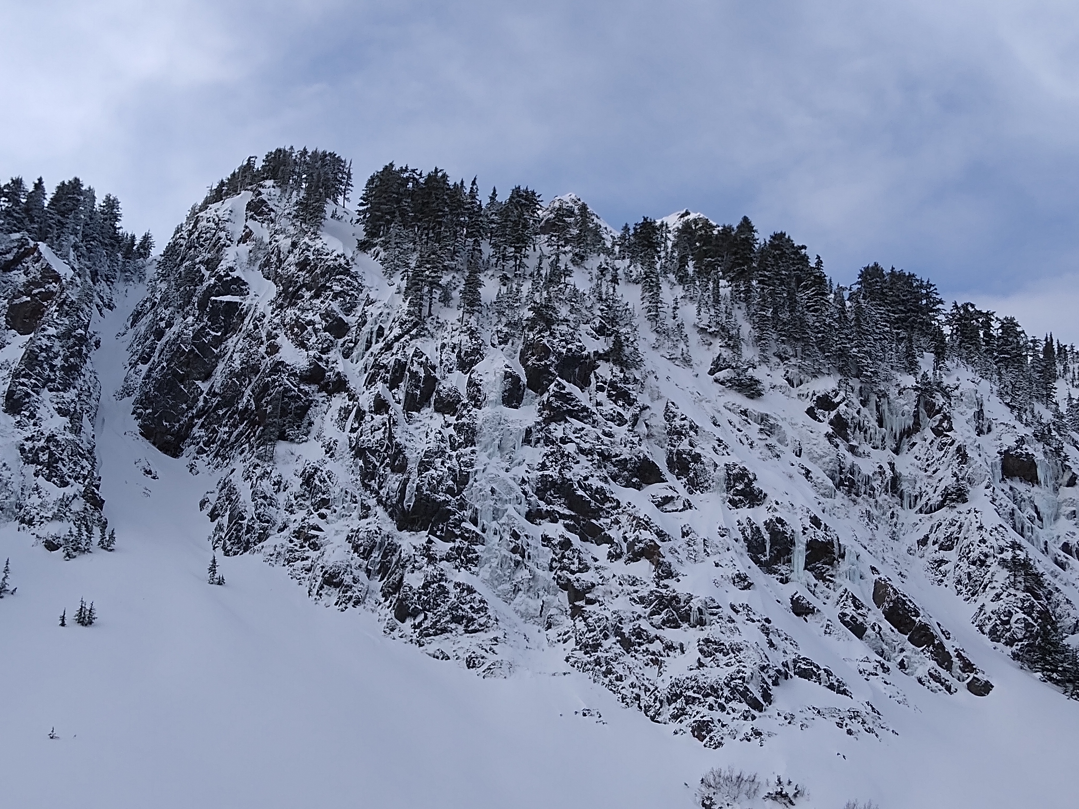
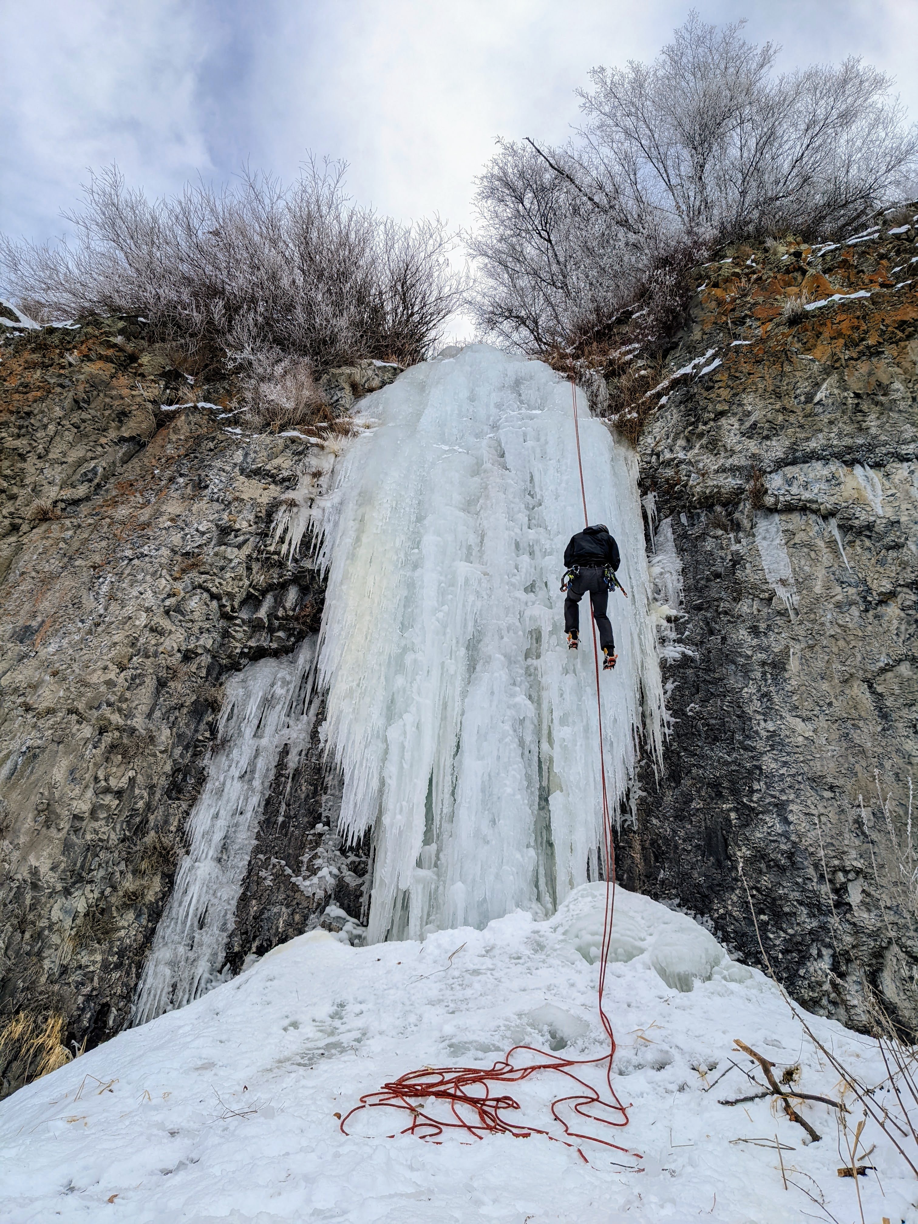
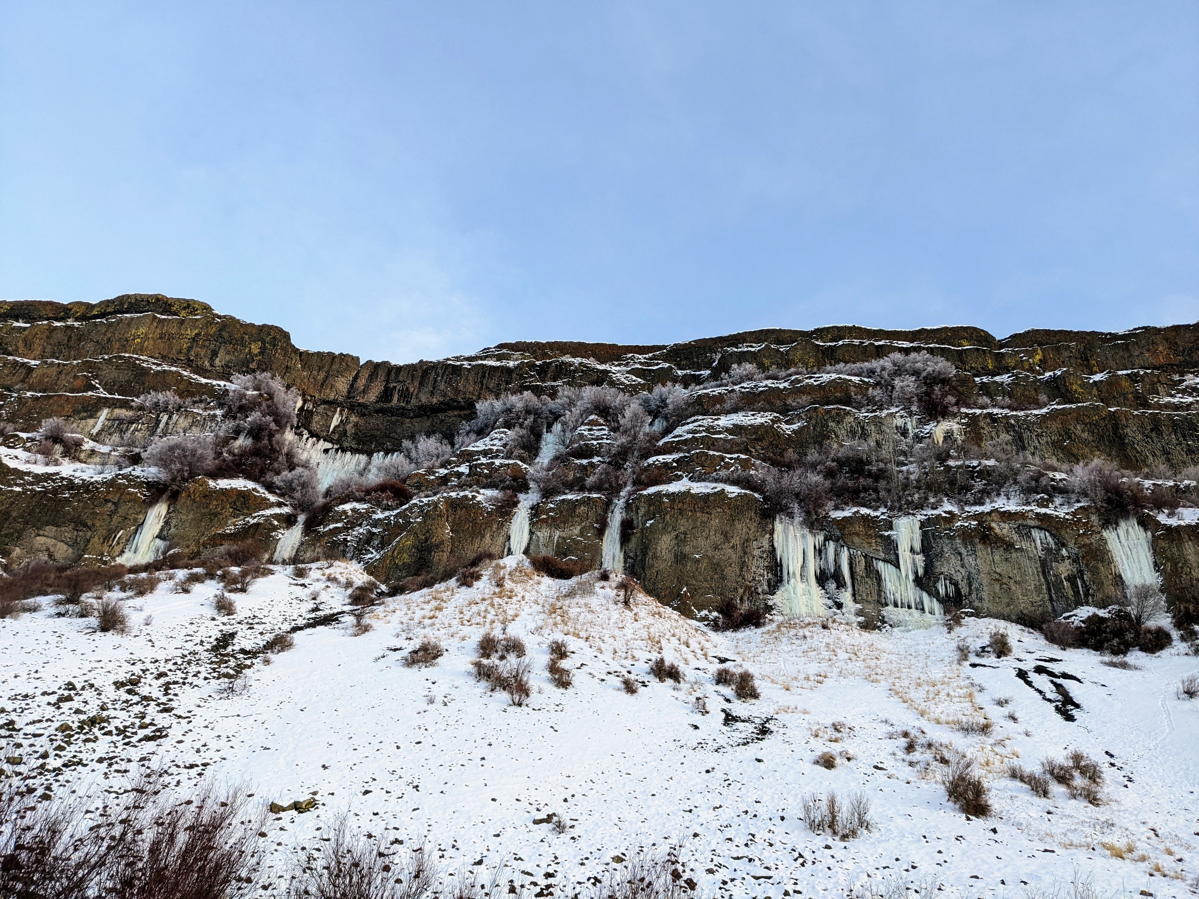
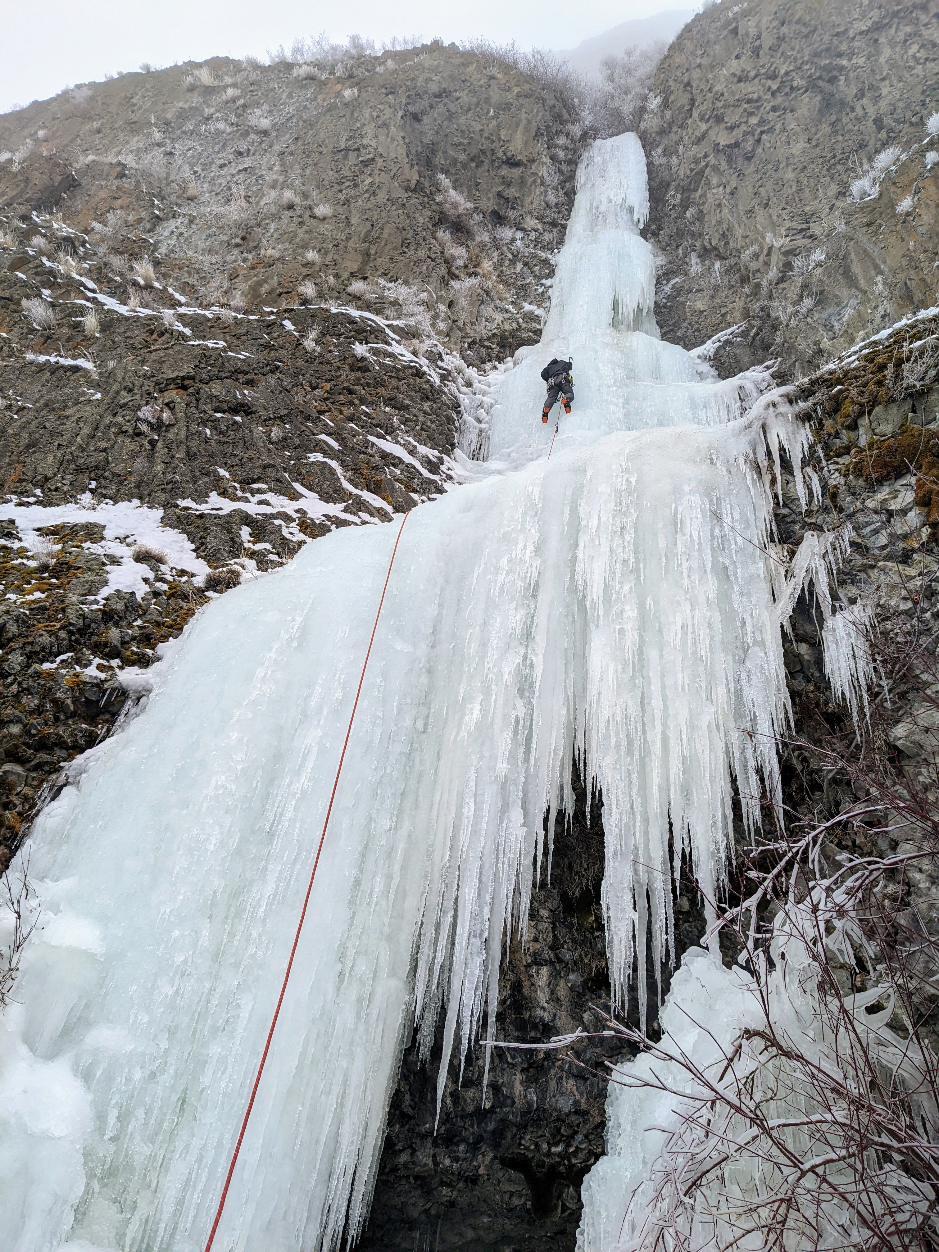
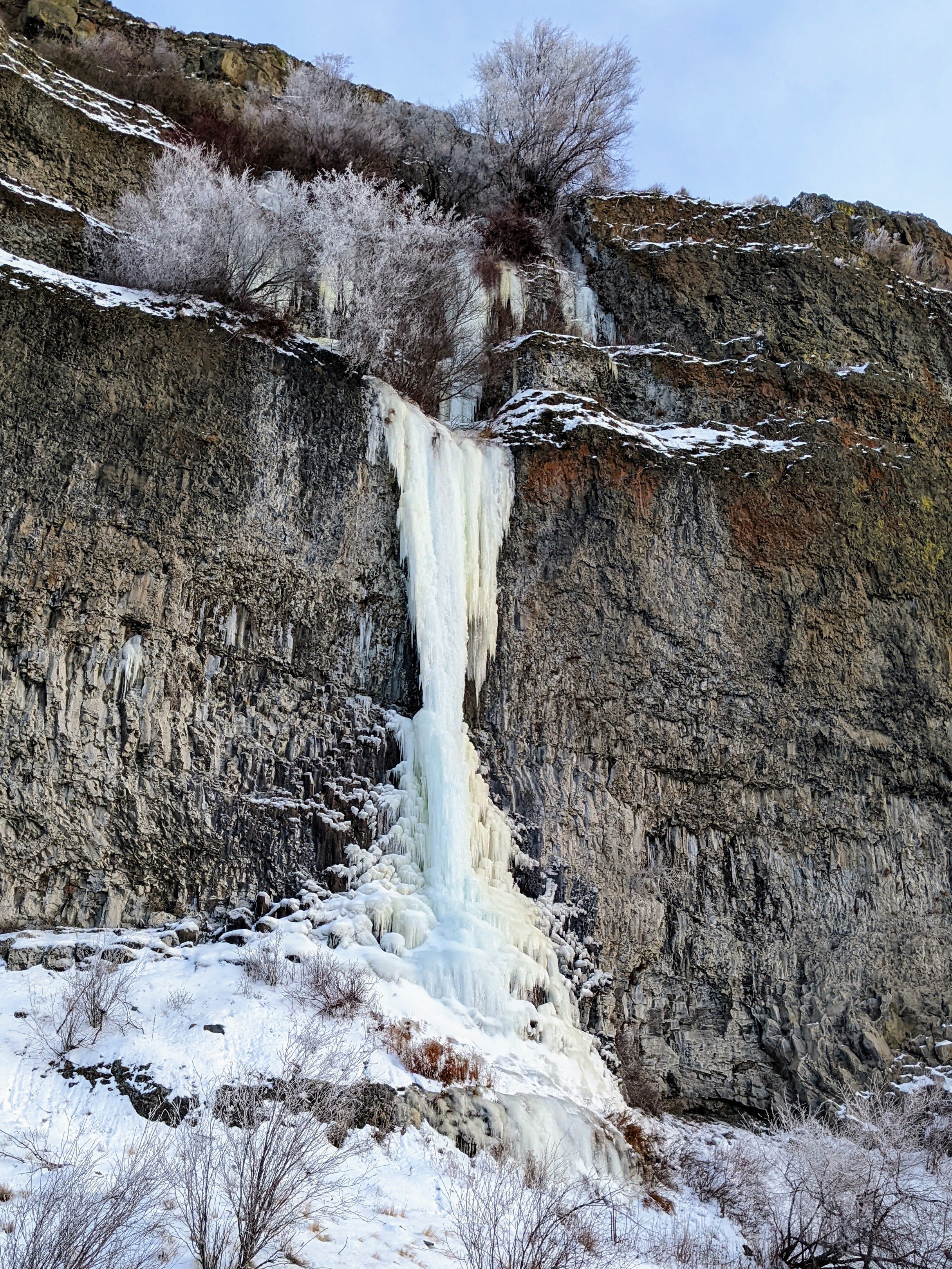
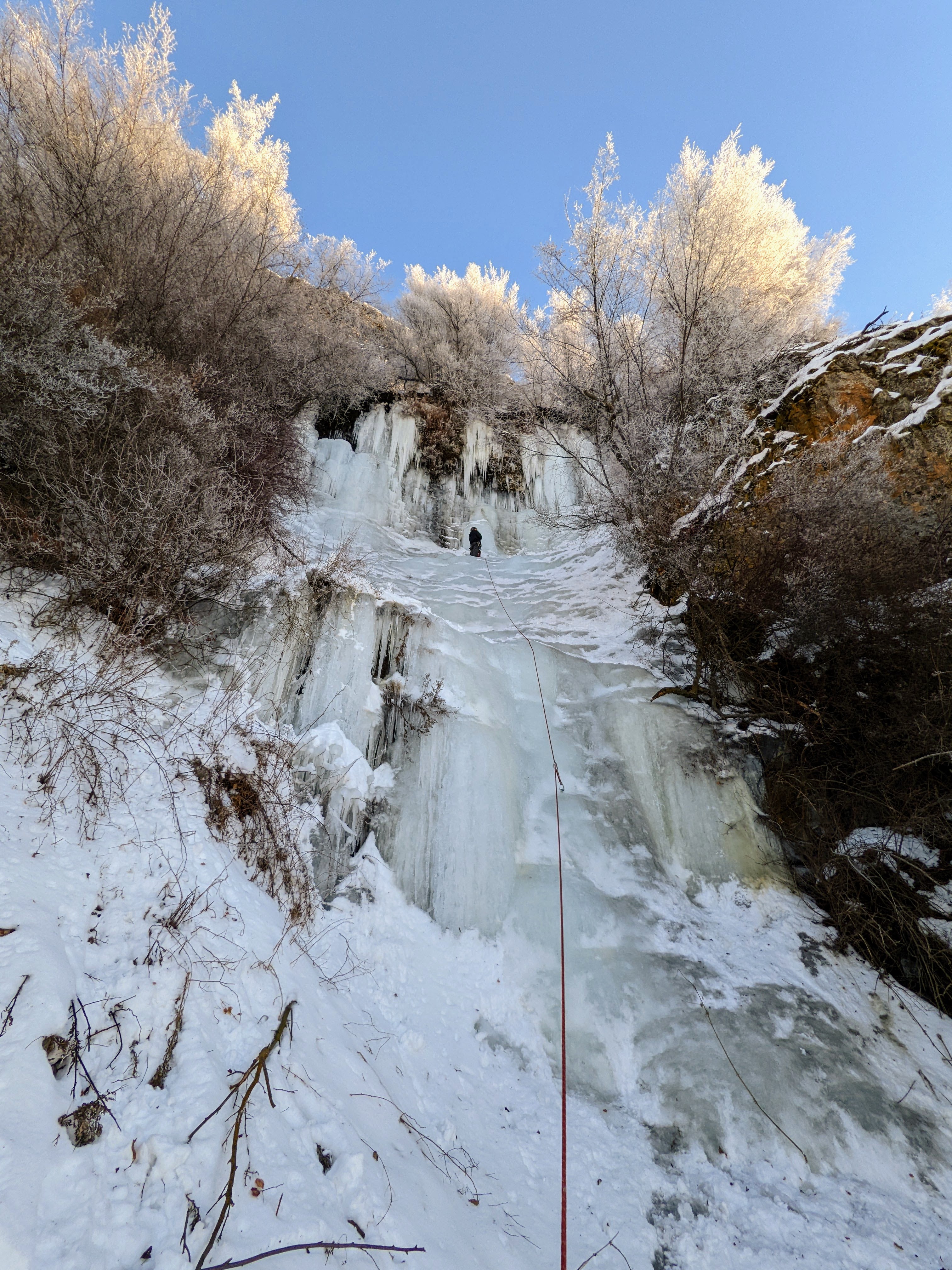
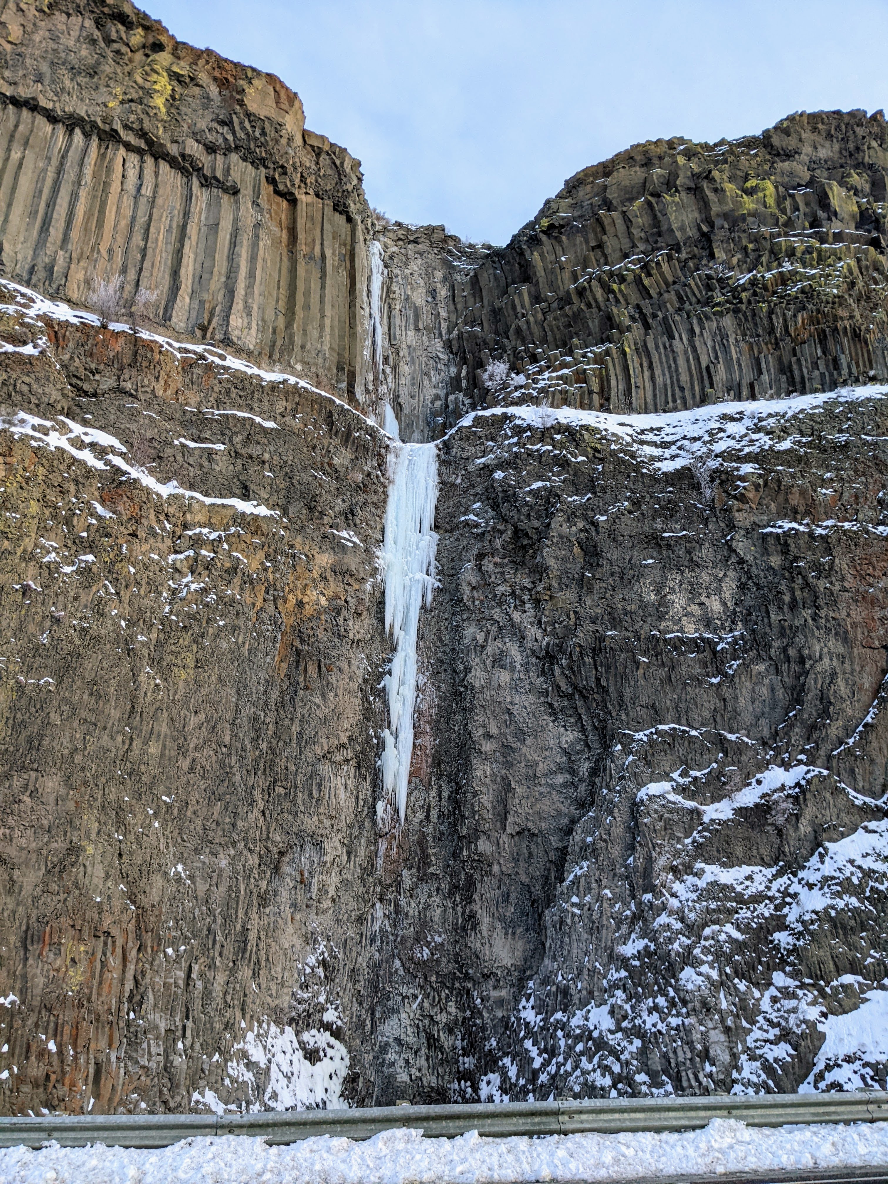
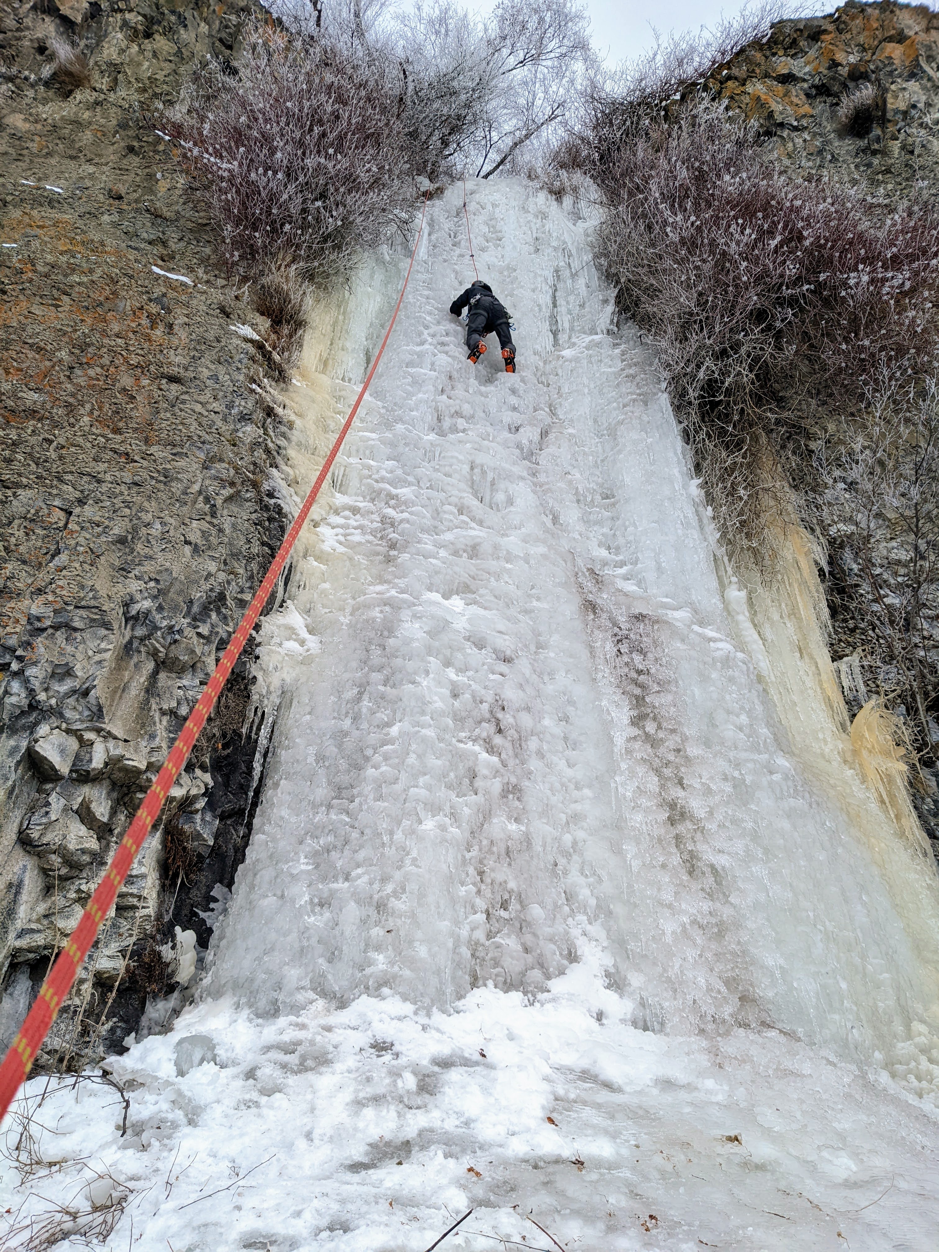
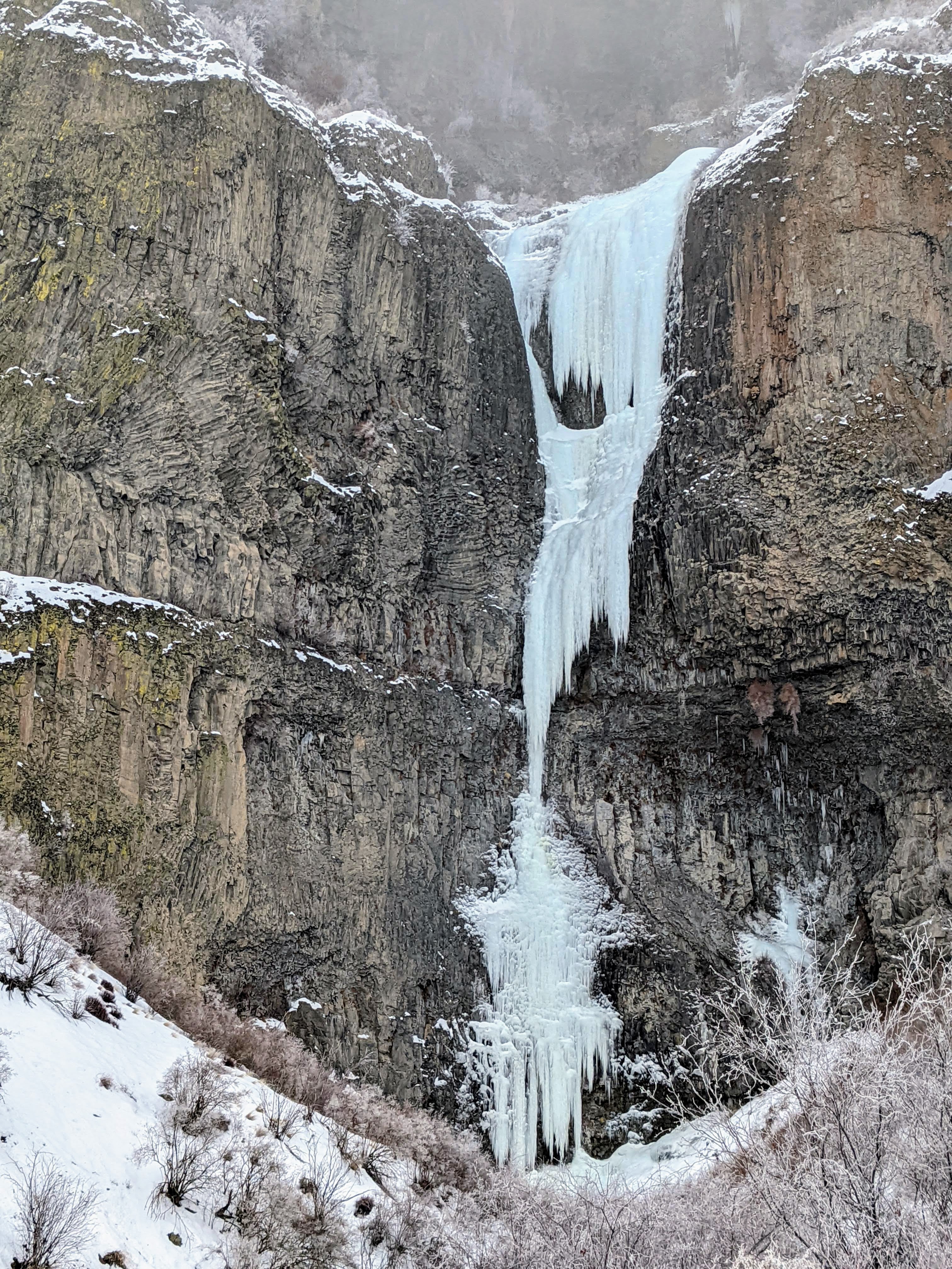
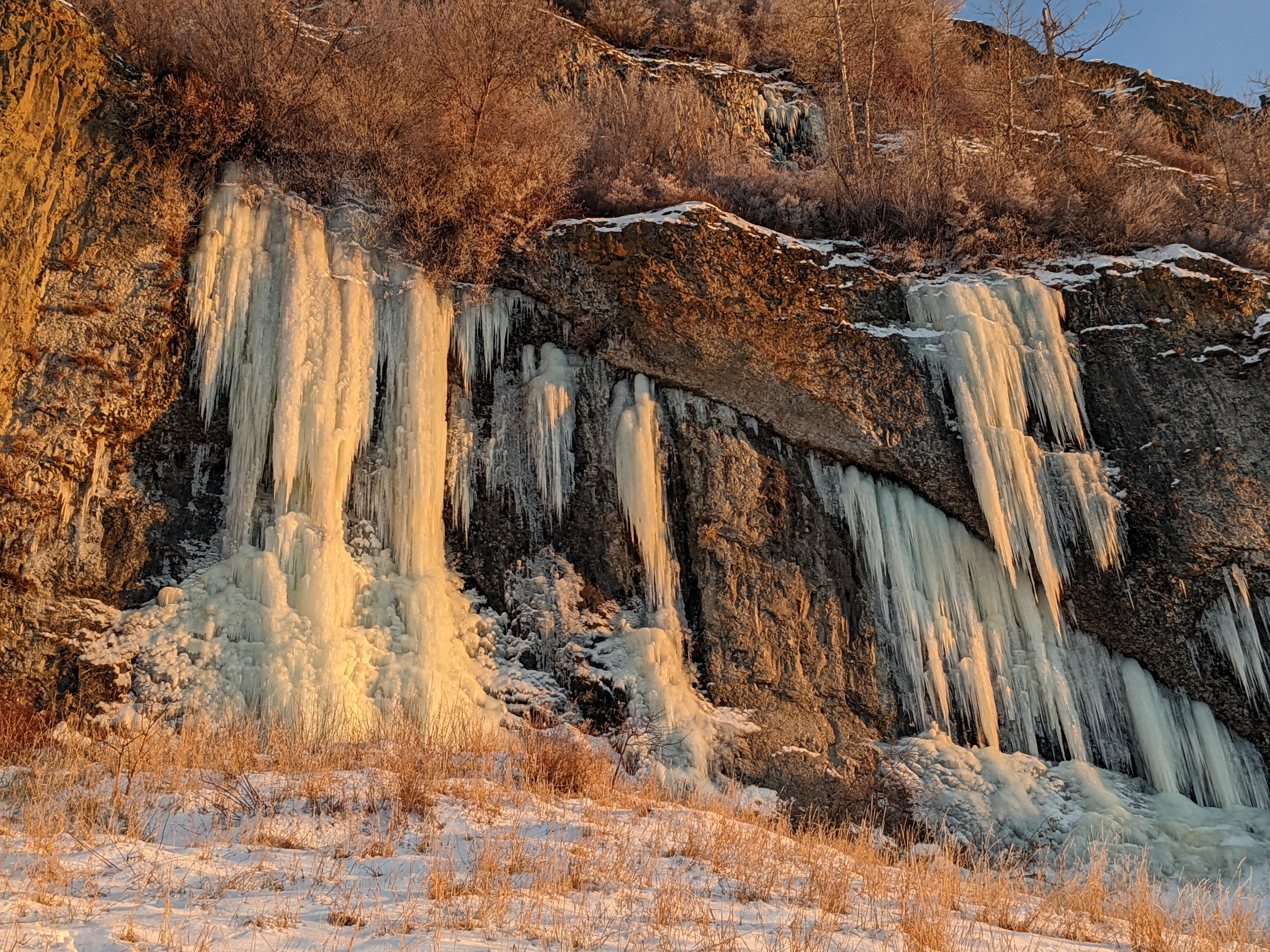
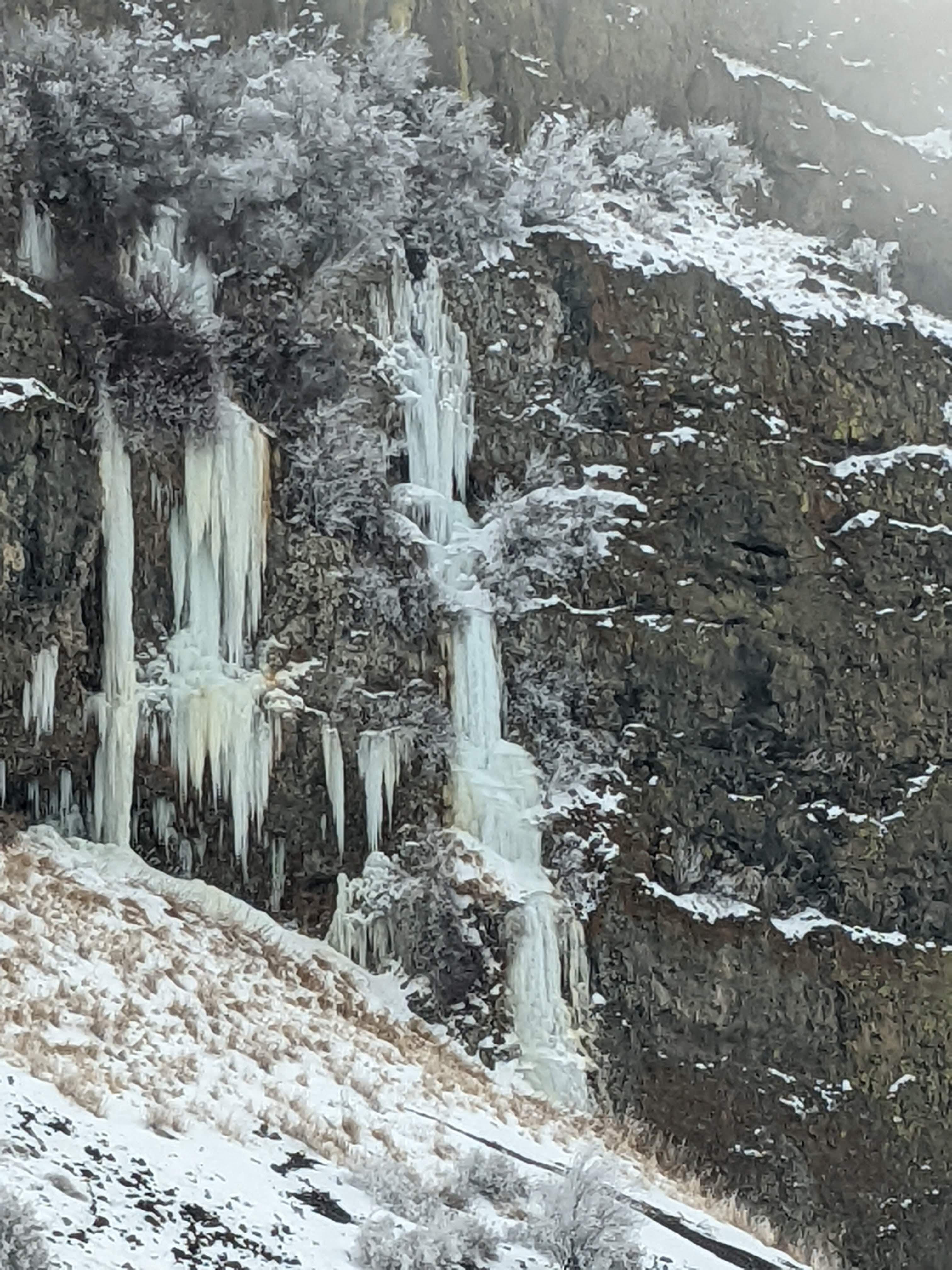
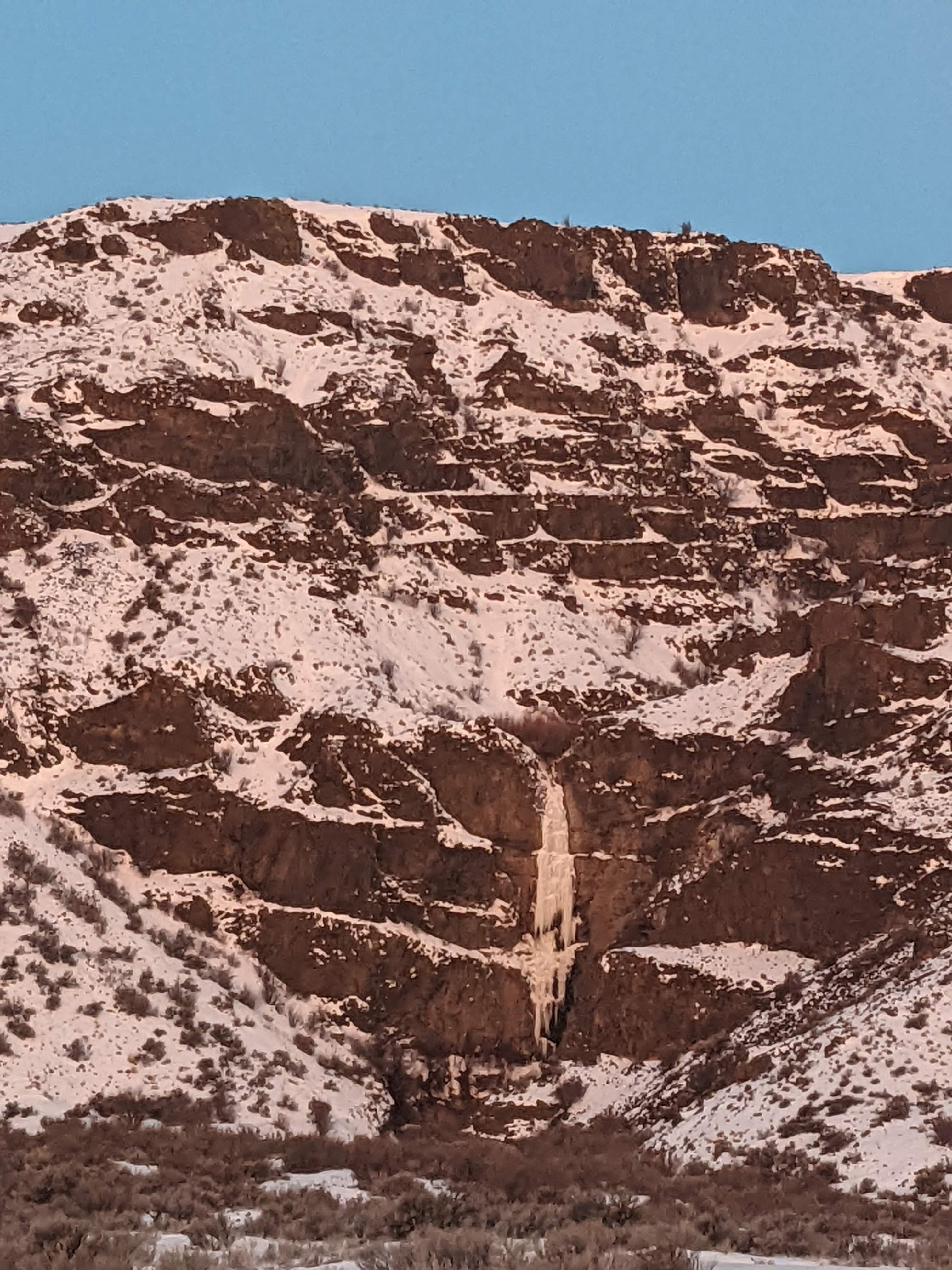
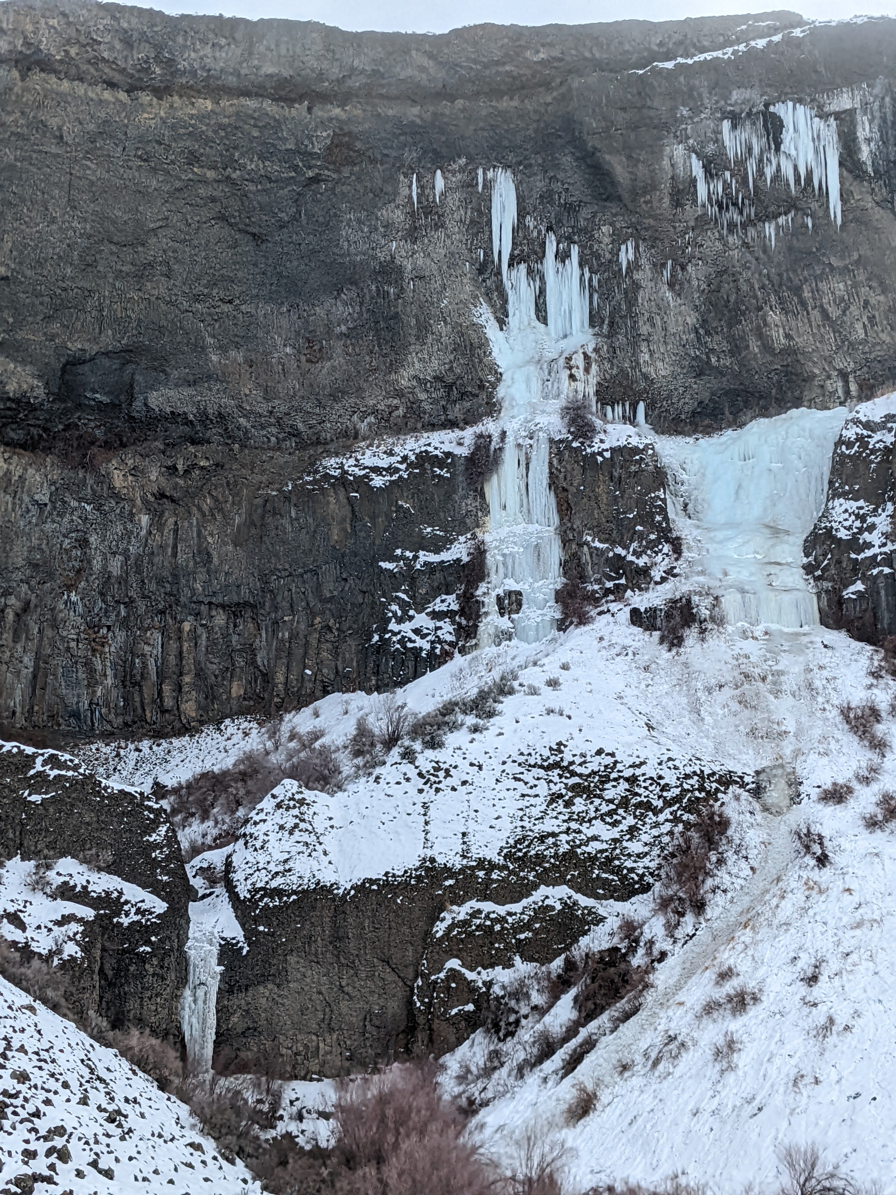
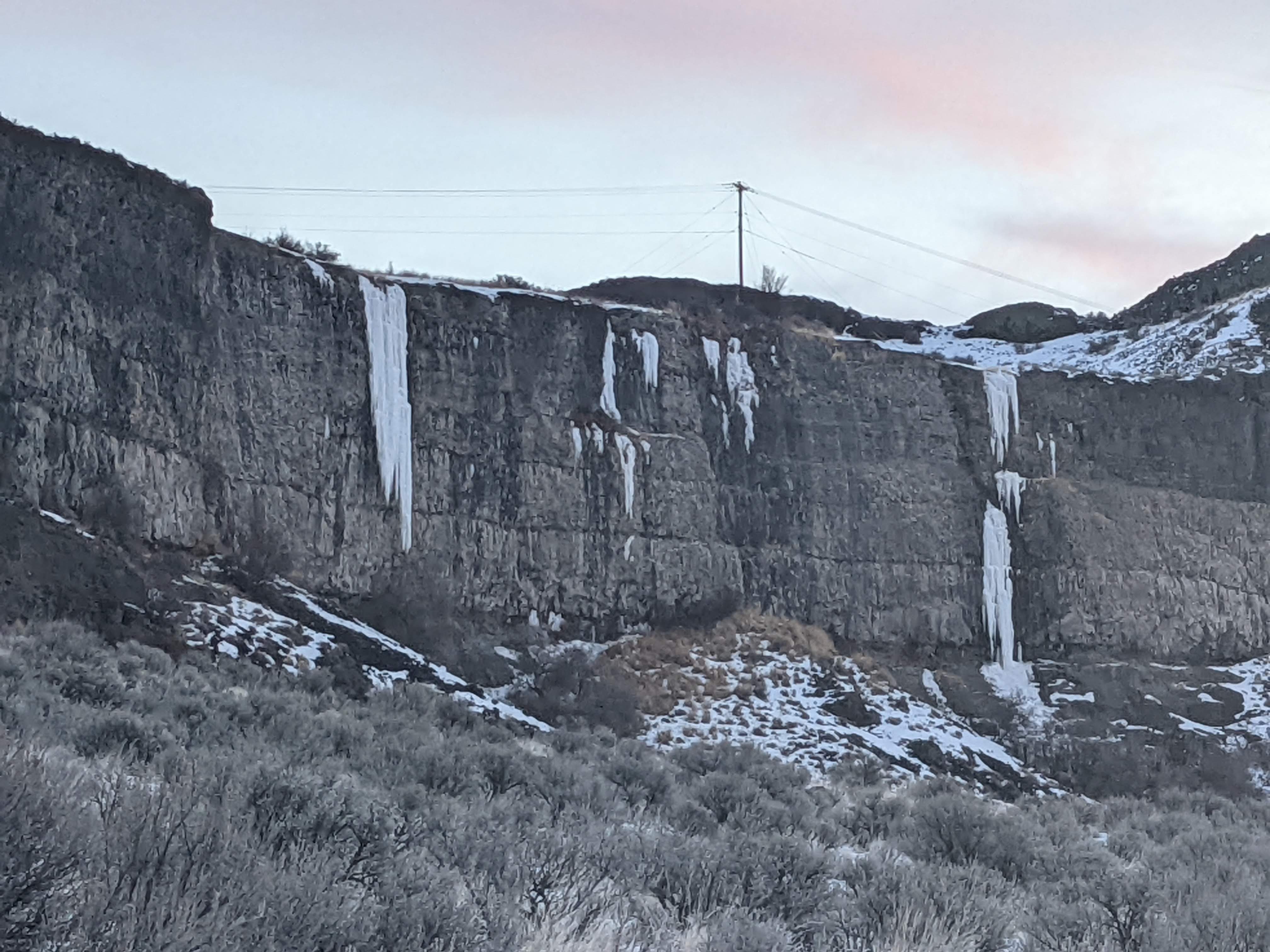
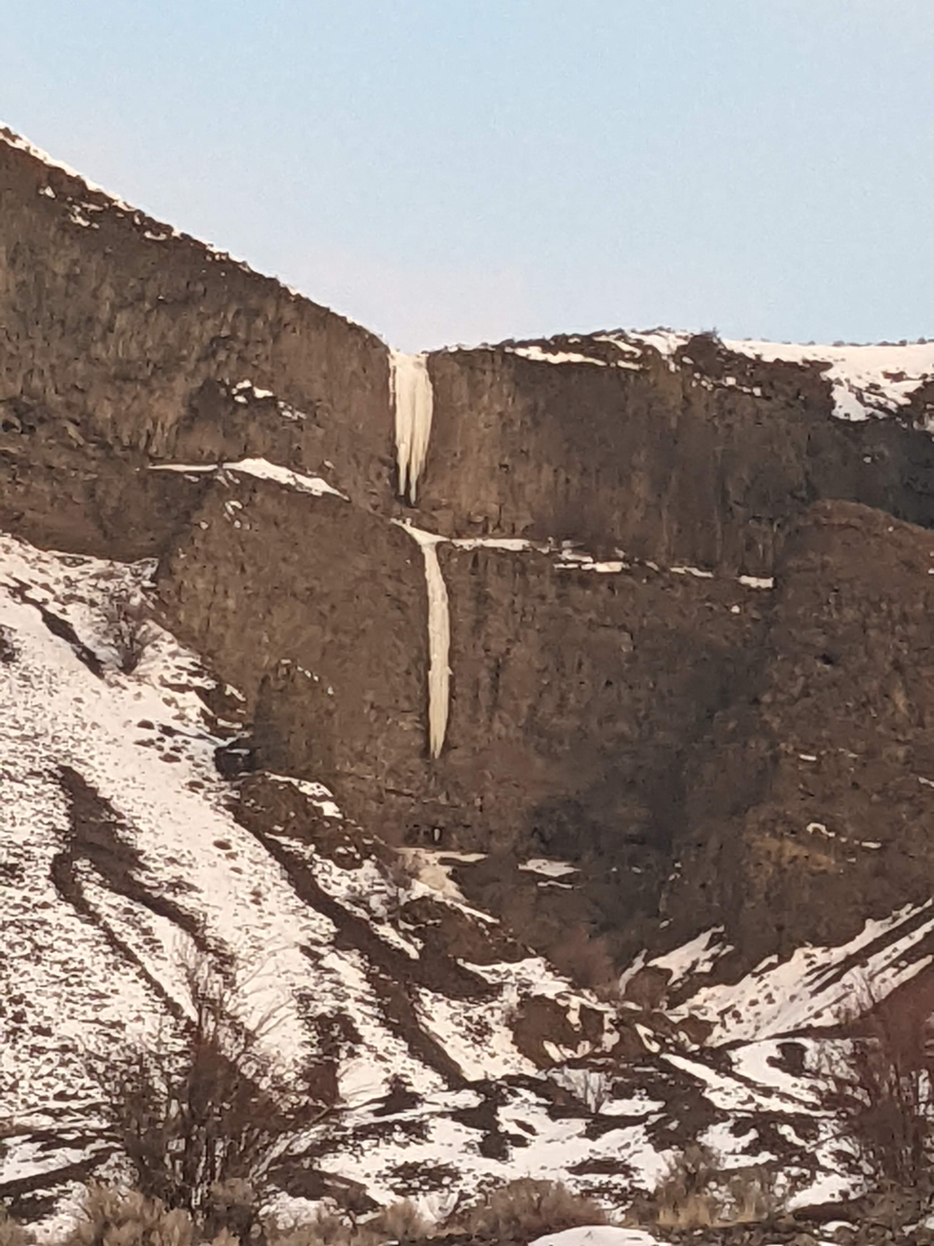
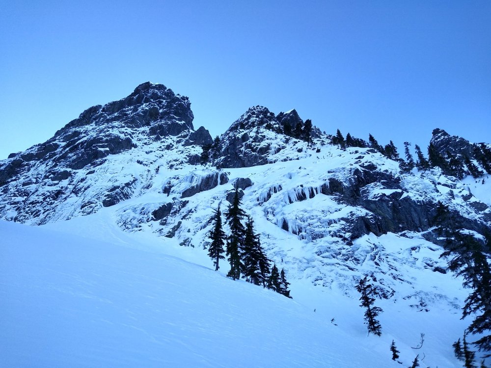
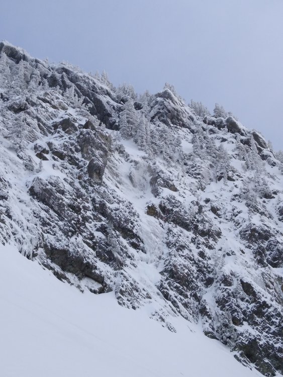
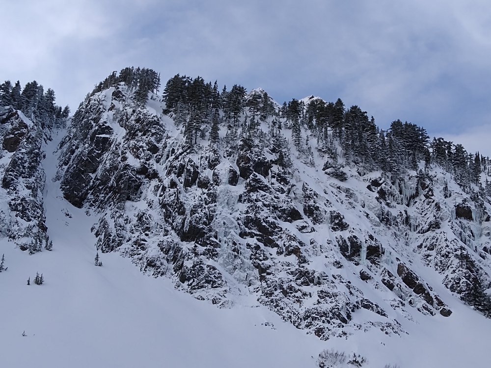
Stopped by Vantage last night. Went up to some of the drips to the right of Frenchman Falls and the ice was ghostly, aerated, definitely on its way out. Then I walked over to the top of Fuggs in the dark. I am pretty sure I was at the correct spot, but I was confused because I found absolutely no ice. The creek that usually feeds it was bone dry. Ouch. Driving up to Banks the next morning, here is some Soap Lake Ice. A few Lake Lenore area routes, not sure the names. There's additionally a route I only saw on the way home on the east side of the highway that actually looks good. Children of the Sun and Clockwork definitely not in. At Banks, the only classic that is really in is H202. Zenith maybe could be climbed, but it looks desperate. Cable definitely not. Devil's Punchbowl looks hazardous. Not a drop of ice on Salt and Pepper or Absentminded Professors. We did the two routes at MP 14, which were long and in excellent condition. V Threaded 30 feet before the top of the left one to keep it WI4. Then we moved over to Pewee's Playground, which held surprisingly good ice and fun routes. We did #4 and #5, including the second pitch. These climbs were excellent and we were very satisfied with our day. More Banks Ice has a good line that is in. Overall, it was a great day and super exciting to see this area in winter finally. I guess not much is in, but it did not really bother us because all the classic are too hard for us anyways. The quality of all these unnamed "playground" level climbs was simply astounding. Thanks to @Marlin for some helpful beta! PXL_20220110_222028040.MP PXL_20220110_215228444.MP PXL_20220110_201518169.MP
- 28 replies
-
- 2
-

-

-
- ice climbing
- pnw
- (and 1 more)
-
The gully west of the TH (east gully of Esmerelda) looked pretty mixed, no real ice in there. The west facing wall not far south of the TH had several very promising looking lines. Got up to the base of one but not in yet. Apparently one of them is a 5.10 sport climb in the summer with bolted belays and all.
-
More words, if you are into that kind of thing: https://climberkyle.com/2021/11/27/esmerelda-east-moonlight-serendipity-wi2-m5-1200/
-
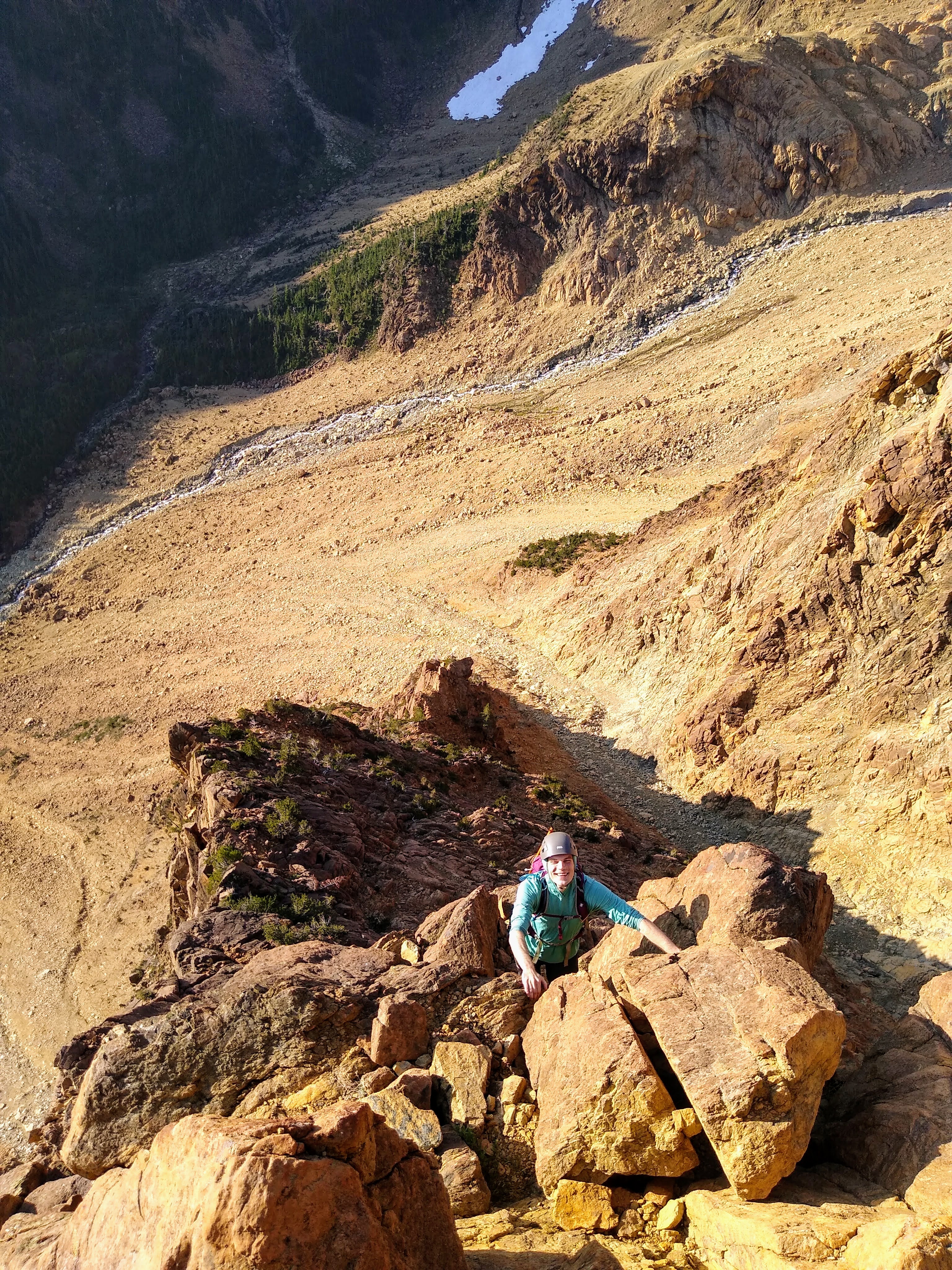
Trip: Chiwaukum Range - Chiwaukum High Route Trip Date: 09/09/2021 Trip Report: This definitely isn't alpine climbing, and nothing exceeded class 3, but I think it is kinda interesting... John Berude and I completed a high traverse of the Chiwaukum Range in a single push. We started at the Lake Ethel Trailhead and ended at Hatchery Creek, summitting Big C, Big Lou, and Big Jim along the way. It was definitely the hardest high route thing I have onsited in a day and one of the best days I have had out there with the scenery and fall colors. It measured 32 miles and 14k ft gain, mostly off trail, and took us 16 hours. Full TR: https://climberkyle.com/2021/09/09/chiwaukum-high-route/ The most interesting part was getting between the Glacier Creek and South Fork Chiwaukum drainages. We utilized the pass to the east of Pt 7955. The south side of the pass looks improbably on a topo map, and there is indeed a cliff there. But one can follow ledges westward and through the cliff band miraculously. A beautiful morning in the Chiwaukum. Above Cup Lake. Some exposed scrambling on Big C. The beautiful Glacier Creek drainage. Looking back on the key ledge that gets you through the cliffs near Pt 7955. Vibrant orange near Cape Horn. On the summit of Big Lou. Nearing the summit of Big Jim. Gear Notes: Running shoes, poles, running vests. Approach Notes: Leave Lake Ethel Trail right before going down to the lake and enter the alpine! Hatchery Creek has over a hundred blowdowns.
-
I heard (from a guide) that it was guides that put them in, along with the piton anchors on Green Creek Arete. I'm not sure why they put them in however.
-
[TR] Twin Sisters Range - Green Creek Circuit 08/19/2021
Kyle M replied to Kyle M's topic in North Cascades
@Otto Dylan told me about this route since he had done it a few years ago. I believe Darin was the first to really publicize this official "circuit": -
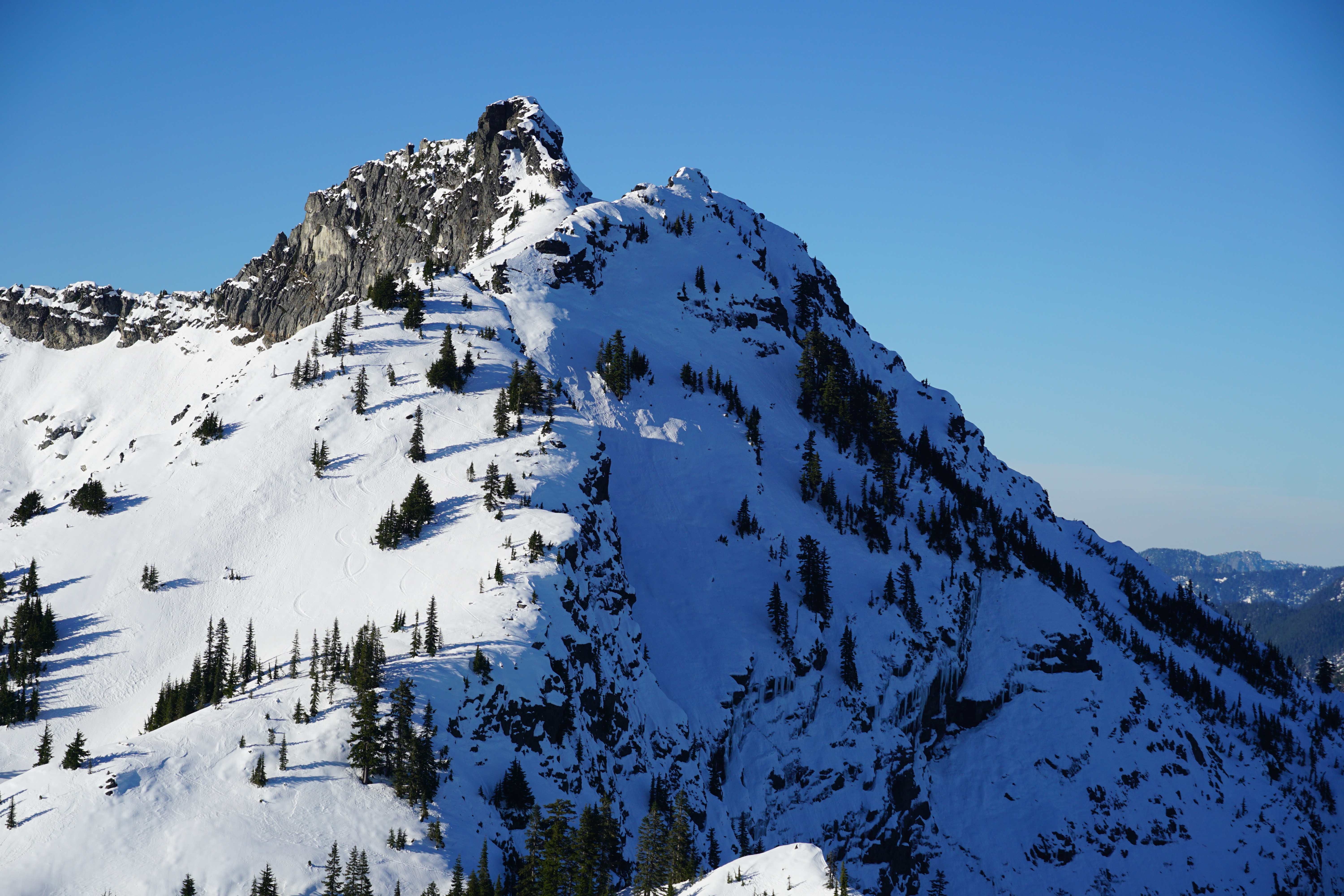
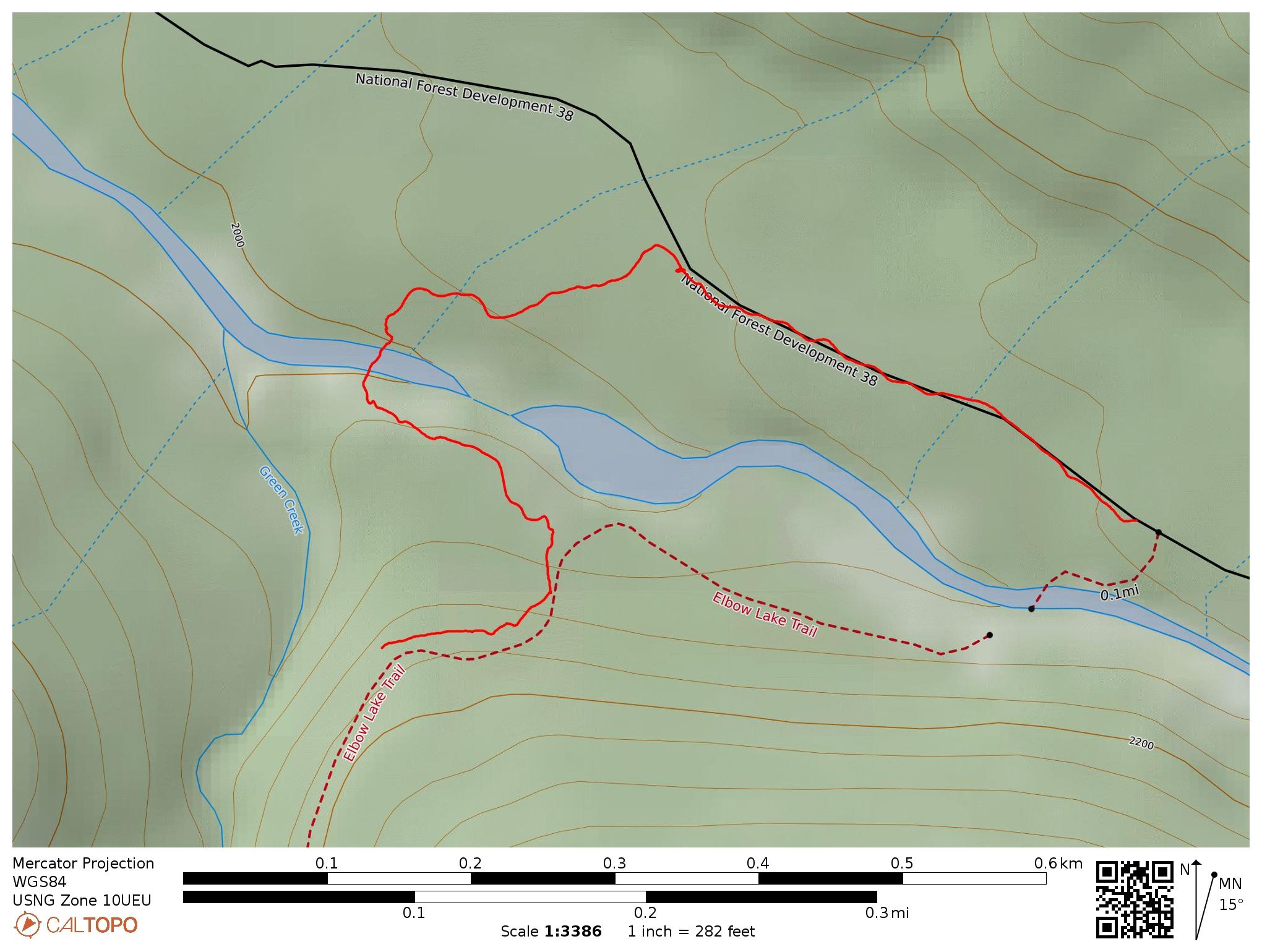
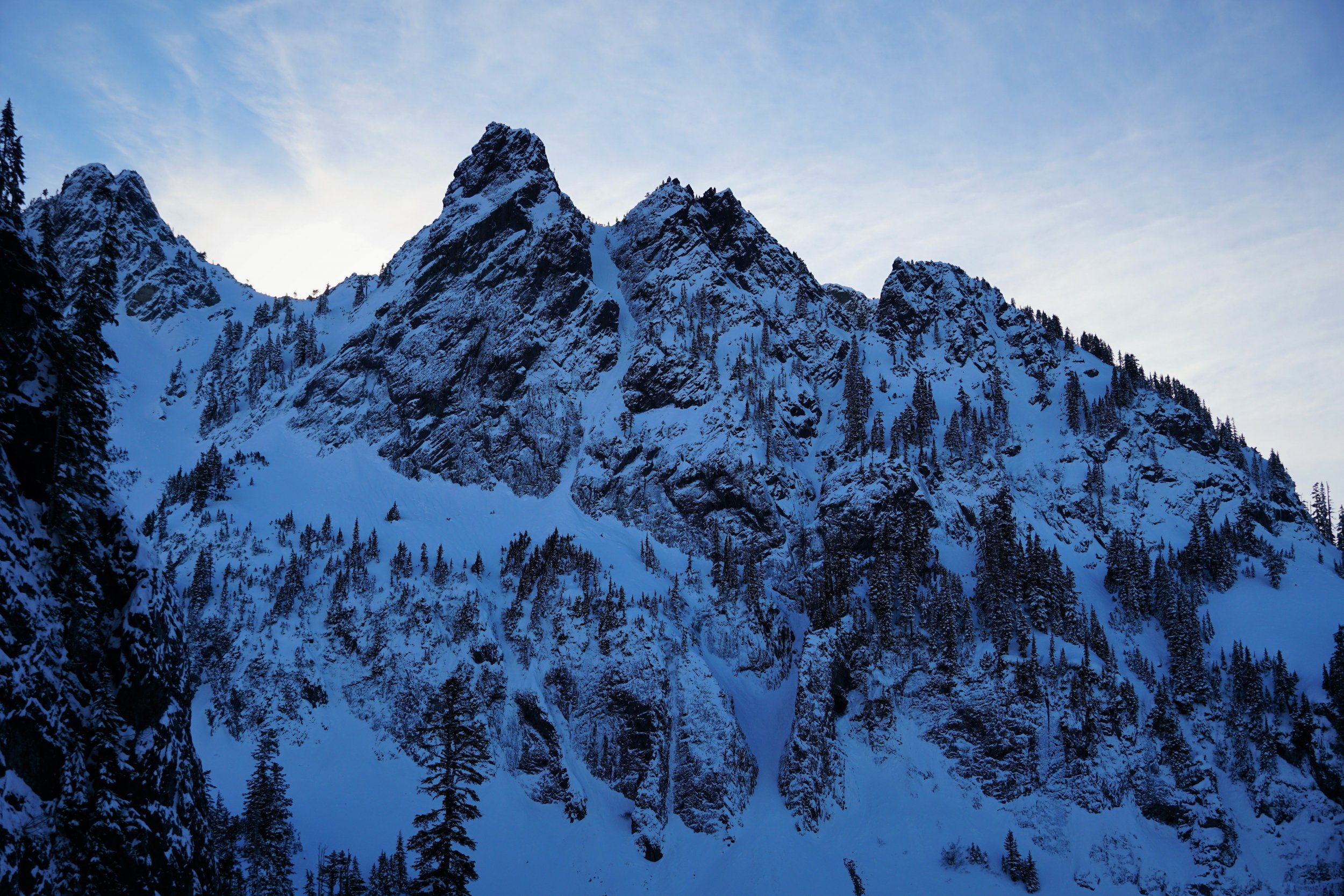
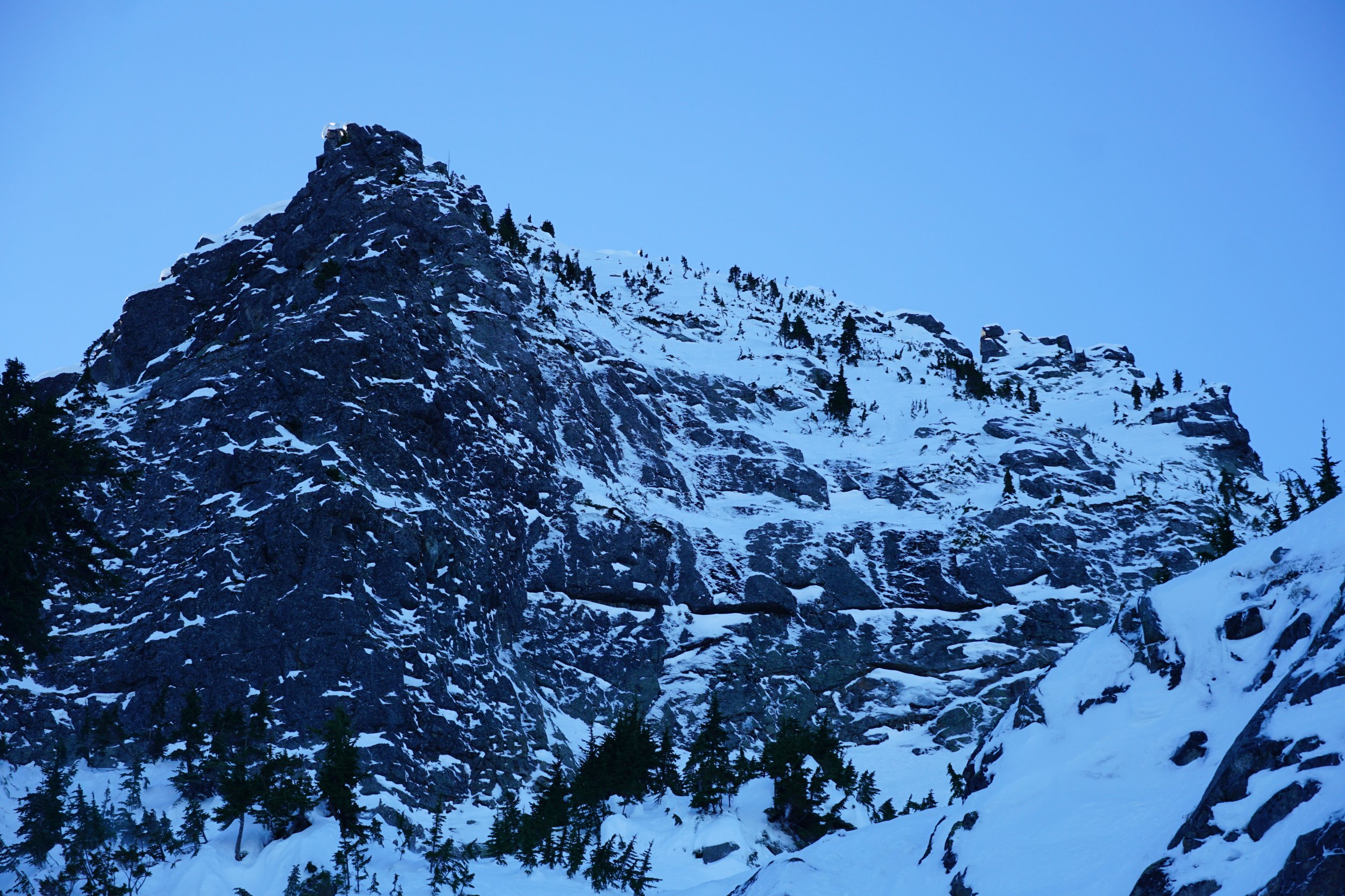
Trip: Twin Sisters Range - Green Creek Circuit Trip Date: 08/19/2021 Trip Report: @thedylan and @jenny.abegg and I did the classic Green Creek Circuit. It was a super fun day! I'm mostly posting to share details about the late season conditions, since this seemed more like an early summer thing. https://climberkyle.com/2021/08/19/green-creek-circuit/ We took advantage of some beta that some nice people had put in a log bridge about 1/4 mile downstream from the usual river crossing. There also is a Tyrolean if that suits you more. I will include a photo of where the bridge is. Hopefully this becomes a regular bridge! My track for where the bridge and according trails are. The trail to the bridge leaves the road with flagging. Trail is in surprisingly good shape, follow the climber's trail into the Green Creek Cirque. The Arete was awesome and then we found running water beneath the Sisters Glacier. The NE Ridge of South Twin was very enjoyable and the clouds shuffling by were beautiful. All the chossy descents were pretty darn chossy with no snow. We kicked off some pretty big slides and had to be careful. I definitely understand how snow would make this more enjoyable, but it is still manageable. Jaw's Tooth to Skookum was absolutely stunning! The 5.6 crux layback on Jaw's Tooth felt pretty real in approach shoes, but Jenny of course soloed it in style. I definitely enjoyed a rope. The crux 5.6 layback. So good! Jenny on Skookum Peak. Wow! With the clouds on Skookum. Note that a 30m rope is barely enough for the rap off Jaw's Tooth. We entered the clouds as we climbed up Little Sister and did the left arete. Maybe there is a better way to start it, because we started with about 100 ft of unprotectable face climbing that felt much harder than 5.4, with small downward sloping holds. Then it returned to excellent rock up the long climb to the summit. We did most of the ridge traverse to Cinderella before just bailing to the scree and then ascending the easy west ridge of Cinderella. From the summit, we just dropped to the north down slabs towards the edge of the Green Creek glacier. We had no issues with the glaciers on either sides: super easy to cross, no moat problems, no crampons even used. It looked like you could get on the Green Creek Glacier in a myriad of spots. Overall, this was a super fun day! The circuit definitely goes just fine late season, but it is probably a little slower with the chossy descents and you have to be careful with the loose rock. But if you are impatient like me, go for it! Gear Notes: Approach shoes, 30m half rope, small to medium cams, tricams and nuts (not really used), slings, crampons and ice ax (not used), helmet Approach Notes: See the map above for where the log bridge was placed. The river maybe could have been forded, but it would be a little scary.
-
Trip: Bailey Range - Full Bailey Range Traverse + Olympus Trip Date: 07/31/2021 Trip Report: https://climberkyle.com/2021/07/31/the-bailey-range-traverse/ Nick, Sam, Rio and I did a Bailey Range loop through Olympus starting and ending at Sol Duc over 5 days. It measured 61 miles and 26k ft gain. It was incredibly beautiful and rugged, as epic as the Ptarmigan or any other classic North Cascade High Route. My main beta contribution is that I think there is a better route between Queets Basin and the Humes Glacier. This is purely hypothetical, but I think one could drop to 3300 ft and then ascend relatively bush free river gravel bars up towards the Humes, instead of that henious sidehilling and ravine crossing. Blue shows our route, red are the theoretical better routes. Glaciers were fine, but do bring real crampons for the bare ice! Crystal Pass route in fine shape. Gear Notes: Standard UL backpacking gear, bear can, La sportiva Ultra Raptors, strap on aluminum crampons, ice ax, lightweight glacier gear Approach Notes: Sol Duc in and out.
-
Trip: Darrington - Squire Creek Wall -> Buckeye -> Whitehorse Trip Date: 06/19/2021 Trip Report: @jenny.abegg and I did a linkup of Skeena26 on Squire Creek Wall, Buckeye Peak, and Whitehorse. It was a full value 16 hour day, even with nearly everything going "right". Super fun, if you don't mind some jungling and adventure climbing. The MP approach beta for Skeena26 is spot on. We did not find the bolts until the top of P3, and from there on it was still hard to follow the route as the bolts hide in the shade. The upper section of the buttress above the route is pretty blue collar, as is the top of Squire Creek Wall. We were happy to be on snow climbing up to Buckeye Peak. The ridge heading north from Buckeye was very aesthetic, featuring mid fifth class climbing over steep gendarmes with wild exposure. We did a few pitches and a few rappels and then ended up at the SE Ridge of Whitehorse. The SE Ridge definitely felt a bit fifth class to us for a few hundred feet, but we were definitely pretty tired. It is "Beckey 4th class" after all. The rock is ok. Rappel over the bergschrund, then long hike out. https://climberkyle.com/2021/06/19/the-darrington-rodeo/ D-Town is cool! Skeena26 is definitely worth checking out! Gear Notes: Single 60 m rope was enough. A few moderate sized cams, lots of long runners. Approach Notes: About 6-8 minutes after the official Squire Creek Trail sign, there is a white rock cairn. This marks the trail, which leads down to Squire Creek. Found a log crossing just downstream. Then hike up the trail on the other side.
- 6 replies
-
- 12
-
-
-

-
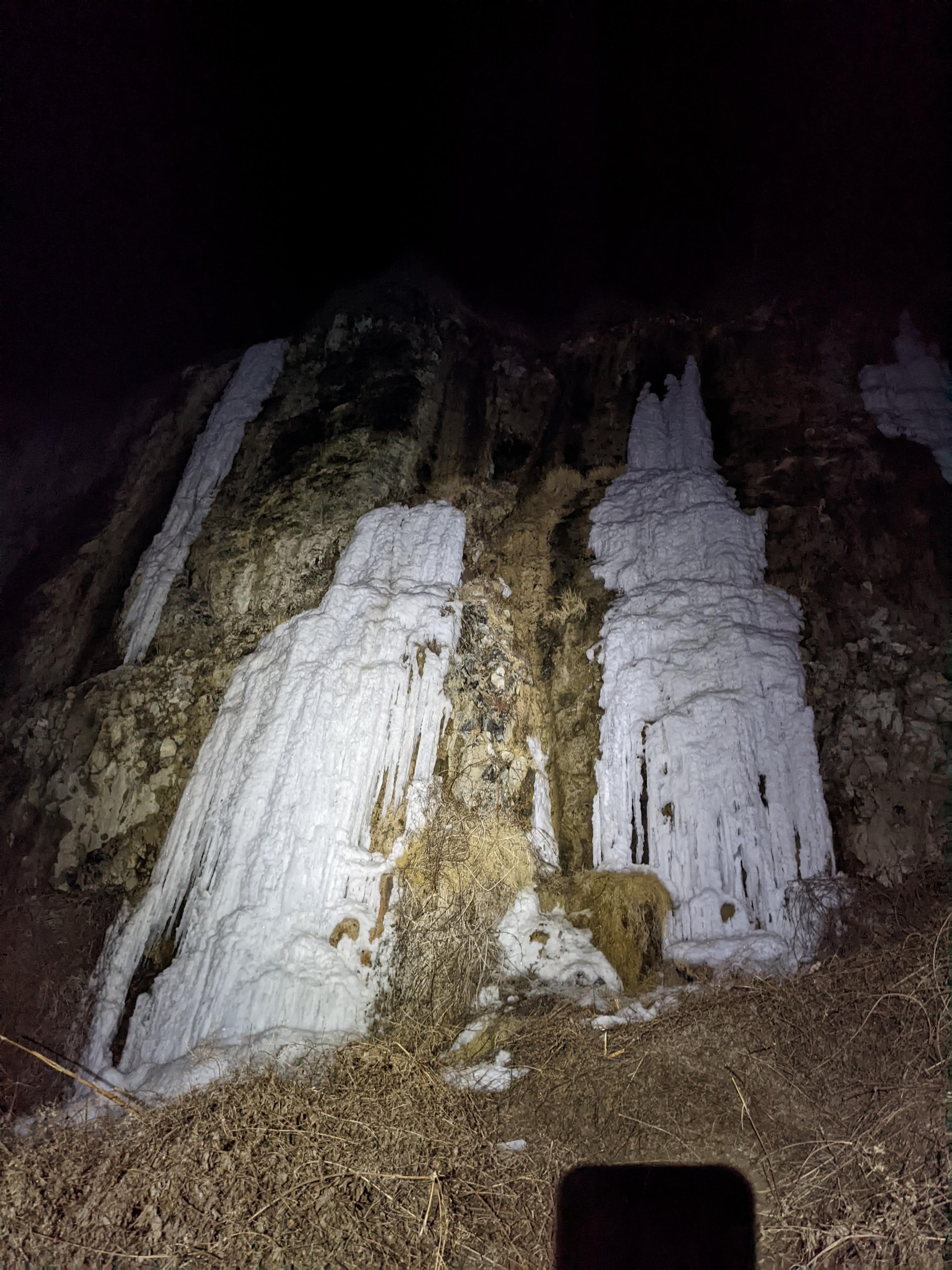
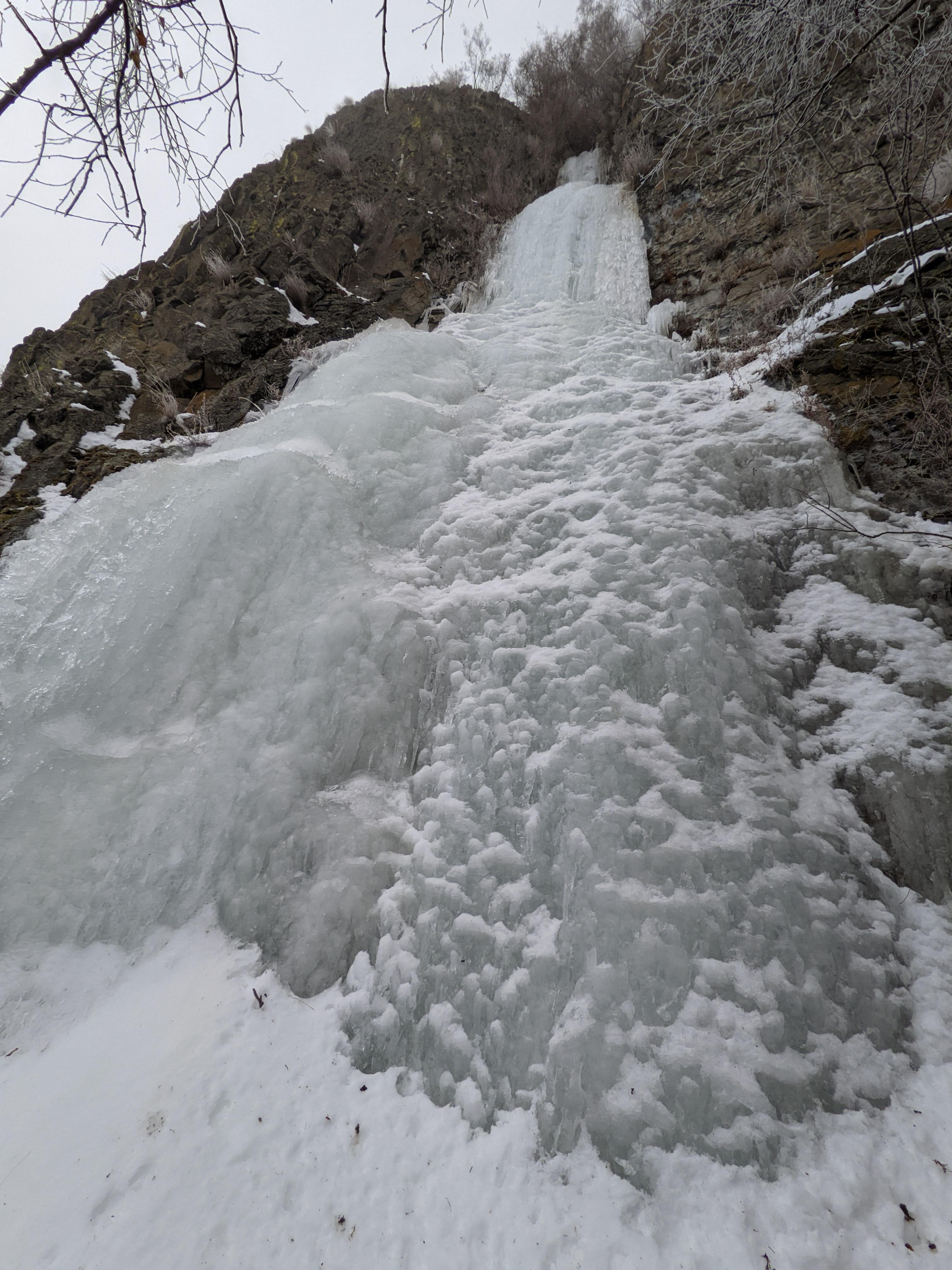
Whitepine Ice delivers! Josh's route "Doctor's Orders" was truly a gem, definitely worth checking out. He put up the routes on mountain project: https://www.mountainproject.com/area/120310945/whitepine-ice-mixed. He fully realizes there might be established names for these often-climbed routes, but he just figured he would give them some names for the MP page. And here are some more photos from my blog: https://climberkyle.com/2021/02/20/whitepine-ice/ Not sure if these pillars will survive the rain the next day or so, but if they do, I bet they'll be solid next weekend with more cold temps.

-
Sick! I cannot wait to get back on this one! I wonder if it was also good conditions for the incredible north face of Sperry.
-
Great work! So much snow that the usual anchors are buried - incredible!
-
I remember in January 2019 when Jacob and I reached the top of the Melakwa Flows and turned around and laid eyes on the beauty. We remarked how it could be "the Winter Dance of Snoqualminix!". But it was far above our pay grade at the time. So psyched someone could finally go send it. Some more enticing photos of it, from a scouting trip around Christmas 2020. Top of the flow is visible in the bottom right. Visible once again upper left of the image.
-
@Doug_Hutchinson and I checked out the Roosevelt Flows yesterday. Most of the ice was rotten and aerated with snow clinging to it, just like most everything else we've seen in the snoqualmie area recently. We climbed the thin gully feature, which went at WI2+/3- for 60m. There's a lot of potential here, but none of the climbs are really in. Definitely worth the trek when it's in! https://climberkyle.com/2020/12/28/roosevelt-ice-exploration/

-
Checked out the Melakwa Valley today. There's lots of ice forming, and maybe some is climbable, but definitely not protectable. Very thin and lots of snow sitting on the ice so I presume it's aerated. Hot Tubbs. Melakwa Flows. Also, Source Lake Line not in. Other random ice around Snow Lake - same status. For more details, see our ice observations page! https://cascade-ice.com/observations/28

-
@Doug_Hutchinson in all seriousness, I wanted to include historical weather data that led up to a particular observation and compare it with current weather patterns, but the data costs anywhere from $10-$50 per month, so I wasn't about to do that on my own money.
-
So for this winter, as @Doug_Hutchinson alluded to, I present to the ice community a new observations page: https://cascade-ice.com/observations. I think that we could record observations of ice in the field in a more organized, easy to search manner, with location pins. Over many years, I believe that this format could have a lot of value because of its clarity and searchability. My dream would be to display historical weather patterns that led to certain observations and awesome insight like that. Facebook posts get buried after a few days. CC Threads are great, but can be tricky to search through and it can be challenging to describe exact locations. This isn't meant to replace CC or anything, more augment it. It's an experiment. I welcome feedback. This observations page I will maintain with submissions from the community. To make development easier, there's no form for user submissions, just send us an email at cascadeiceguide@gmail.com and I'll get it up as quickly as possible. There are instructions on the page of what information to include in submissions. Think cold thoughts and hopefully it'll be a good season!
-
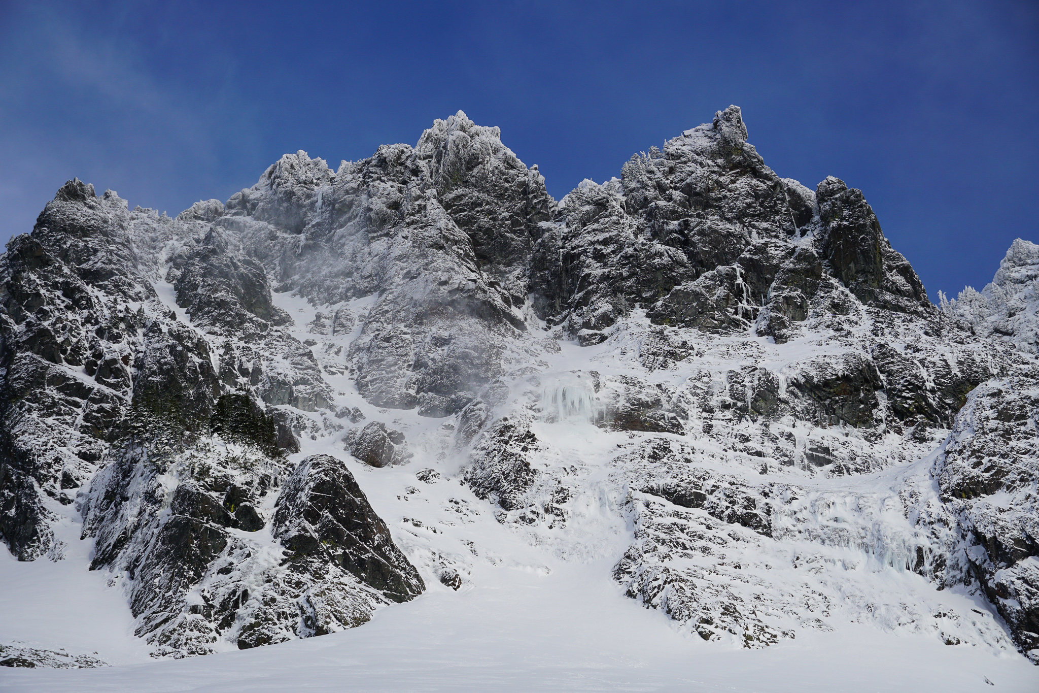
Toured around Snoqualmie on Saturday. Multiple parties gunning for NEB Chair, one party reported a successful climb later. The ice step seemed to be in pretty good condition actually. Source Lake Line, all the other stuff, not in. Made it out to the summit of Wright to scope the surprisingly impressive north summit of north Roosevelt (north^2 roosevelt). This area is often loaded, with 6-7 single pitch lines right next to each other and multipitch potential. Only really one of the single pitches looked good currently, but it's still very early in the season. Maybe someday I'll have the motivation to stop sliding down couloirs and climb some of these guys, but I've been by them a few times now and it's a pretty cool spot.


-
North Face lundin looks like it has some potential. There's also some vertical ice most definitely formed on the cliffs below the Lundin/Red saddle on the north side. You can see the ice lower right in the above photo. Commonwealth Falls is running water, obviously, with a little ice on the sides.

-
Trip: Heliotrope Ridge - Various Heliotrope Water Ice Trip Date: 11/08/2020 Trip Report: Just an update from the Heliotrope Water Ice "Playground". Over the last few years, I've had a great time getting back into the flow of ice by cragging at the various water ice flows above the Heliotrope Ridge Trail in the fall. The combination of Fraser outflow events, northern aspect, and superfluous water supply from the glacier above seems to create the most consistent water ice opportunities in Western Washington from late October until the trailhead is inaccessible. The climbs are easy and short, yes, but it's pretty easy to get in 10 reps of a 50 foot pitch and then, bam, you have 500 ft. of ice climbing just a short walk from the car. Not bad IMO. To help explain some of these climbs, I created this map. https://caltopo.com/m/06CB. I'm by no means claiming FAs or anything, but there is limited information about these climbs so I thought it was helpful to name a few so I can give my recollections. In 2019, on Nov 1st, I climbed a ton of climbs, starting with "hidden in plainsight" and working my way through the "heliotrope headwall". All the "misc curtains" were fat, lots of other climbs like "Cauliflower Curtains" were manageable. We had an early dump of snow (late september) that started the freeze thaw early. Some of the climbs are fed by glacial runoff and streams, but others need seepage from early snowfall and freeze/thaw. In 2020, I headed up there October 24th during a cold spell (overnight around freezing in BHAM). It was evident the ground was still too warm and almost none of the climbs were in. We did however find "Femoral Bleed" a bit higher up than I had ever explored before. It was in great shape on the 24th, but when we returned on the 25th, after a very cold night, it somehow had become very wet and was spurting water out of a hole in the middle, nowhere near where we had climbed the day before. Bizzare. I returned on Nov 8th (today). Temps were very warm (freezing level 7k) just a few days ago, so I wasn't too hopeful. Friends had walked up there on the 6th and found running water everywhere and no real ice. But as we started hiking up, the ground was very frozen and signs were good. We found "Cauliflower Curtains" to be in good shape, not protectable on lead, but good fun on TR. It was possibly in better shape than the year before even. This had gone from a full waterfall to climbable in less than 48 hours. Impressive. We continued up to Femoral Bleed. It was very thin and wet compared to last time, not in good shape at all. Perhaps it does not form as well under fast-freeze conditions? Maybe it will bulk out in the coming days. But just to the right we found a beautiful line "Supermarket Shrimp", with wonderful tentacles and striking ice formations. This was a fun TR. Two weeks before, when Femoral was fat, this climb was running water. Go figure. It looks like serious snow is coming soon, but maybe some people will find this useful in future years. It's a primo spot: 1-2 hr approaches to relatively reliable water ice, at least by WA standards. Happy hunting! A few more details can be found in my trip reports: * https://climberkyle.com/2019/11/01/heliotrope-ridge-ice-playground/ * https://climberkyle.com/2020/10/24/heliotrope-ice-hunt-2020/ Oh and if you were wondering, CH is looking quite a bit better than a few weeks ago. Probably good to go. Gear Notes: microspikes very helpful for the trail, as always. screws, tools, and slinging boulders all used for top rope anchors. Approach Notes: Road can be treacherous, take caution in the fall. It's usually worst a few days after a low snow event and freeze thaw on the road.
-
@genepires on descents the hard, rigid sole just kinda wears down on the forefoot until my feet are quite sore. It's not that I cannot wear them at all, it's just I'm soft and complain if my feet are not in cushy trail runners.
-
@kmfoerster I personally just cannot hike in approach shoes. I know some people can. I wish I could! Then approach shoes would be great for me. I also think that you're a little more technical climber and thus can tackle most alpine rock routes in them, whereas I know I have to bring rock shoes anyways for anything 5.6 and harder. Also, I try to run more, and you definitely cannot run in them. Our styles are different, so approach shoes are more valuable to you.
- 12 replies
-
- 1
-
-
- trail running
- ice climbing
- (and 3 more)