


specialforest
-
Posts
22 -
Joined
-
Last visited
-
Days Won
2
Content Type
Profiles
Forums
Events
Posts posted by specialforest
-
-
Trip: The Bugaboos - Pigeon Spire - W Ridge / South Howser Tower - Beckey-Chouinard / Bugaboo Spire - NE Ridge
Trip Date: 08/02/2019
Trip Report:
Aug 2-8, 2019
Our initial plan was to head down to The Bugaboos a week earlier, but according to a weather forecast, a storm was coming, so we decided to wait it out. Luckily, several days later we saw another window of good weather. I’ve heard some people plan a trip months ahead only to sit in a wet tent with snow all around
 . We used https://www.meteoblue.com/ for the weather forecast.
Itinerary:
Aug 2: Meet after work. Drive as far as we could. Spend a night at a campground along the way.
Aug 3: Drive the rest of the way. Hike to the Applebee campground and setup tents.
Aug 4: Leisure morning. Climb Pigeon Spire W ridge.
Aug 5: Alpine start. Climb South Howser Tower.
Aug 6: Rest day.
Aug 7: Alpine start. Climb NE ridge of Bugaboo Spire.
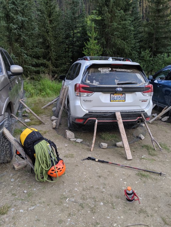
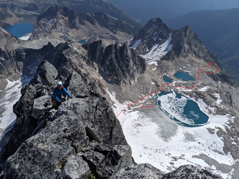
Aug 8: Hike down and drive home.We did not bring chicken wire. There will be plenty. I’m not sure if it helps – I saw porcupines walking behind it, or make sure it's solid and there are no holes between the wire and ground. TH to the Applebee campground – 2.5h. The campground has tap water and plenty of toilet paper. The place is swarming with rodents. Don’t leave any food in a tent or a backpack – there are metal boxes and hangers for it.
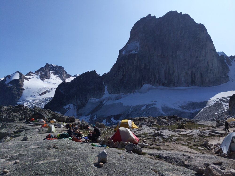
Pigeon Spire - W RidgeThe route is longer than I anticipated. I’d call it three-summit traverse (the last is the true). We simul-climbed on the way up. On the way down, we did two rappels from the summit and down-climbed the rest unroped. I was wearing mountaineering boots.
Timeline:
9:25 – Start
10:25 – Top of Snowpatch col
11:20 – Base of the climb
About 13:15 - Summit
14:30 – Back to the base
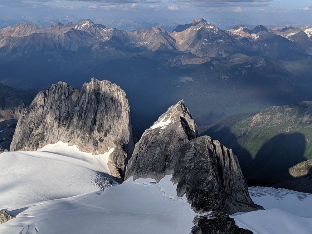
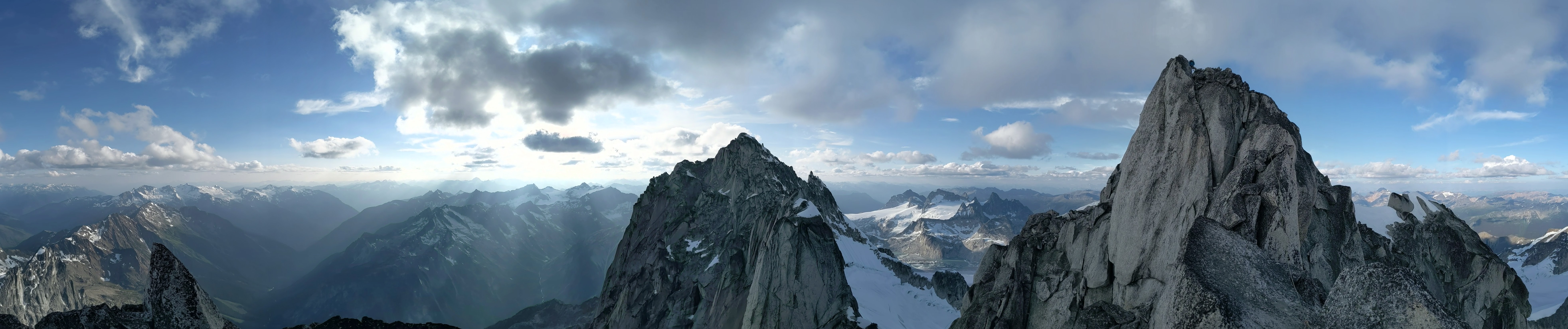
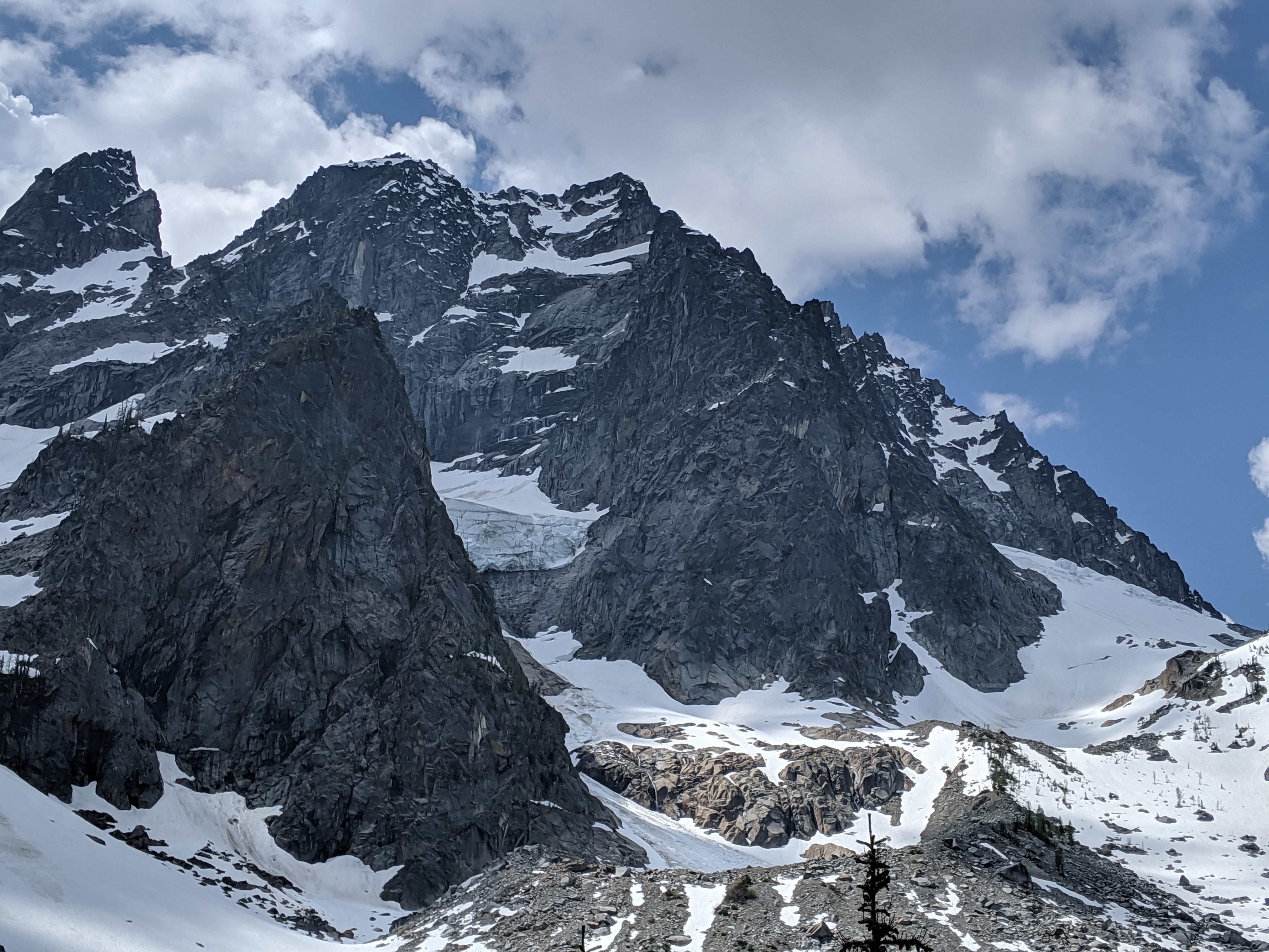
Pigeon Spire on the right as seen from the summit of South Howser Tower:
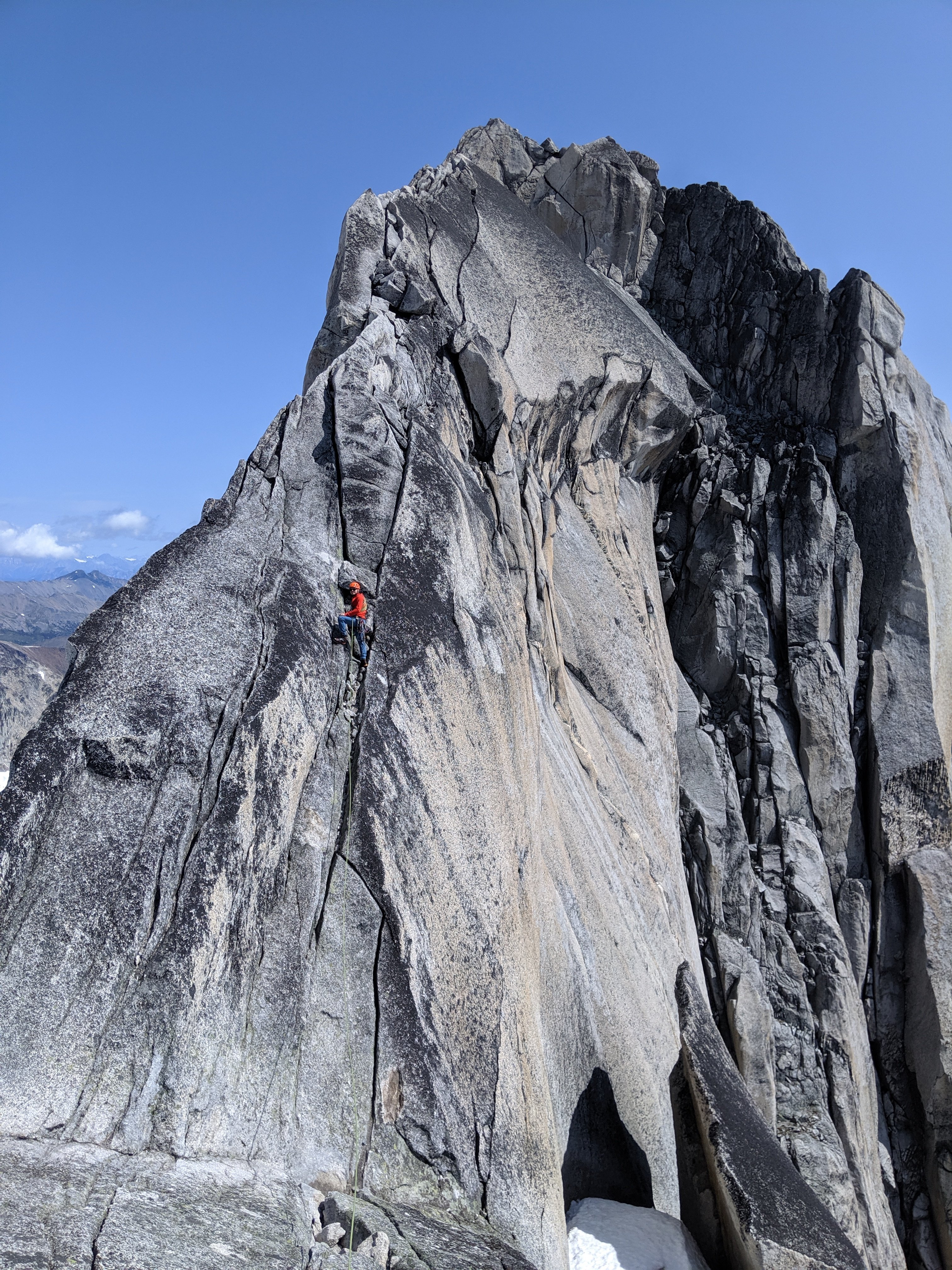
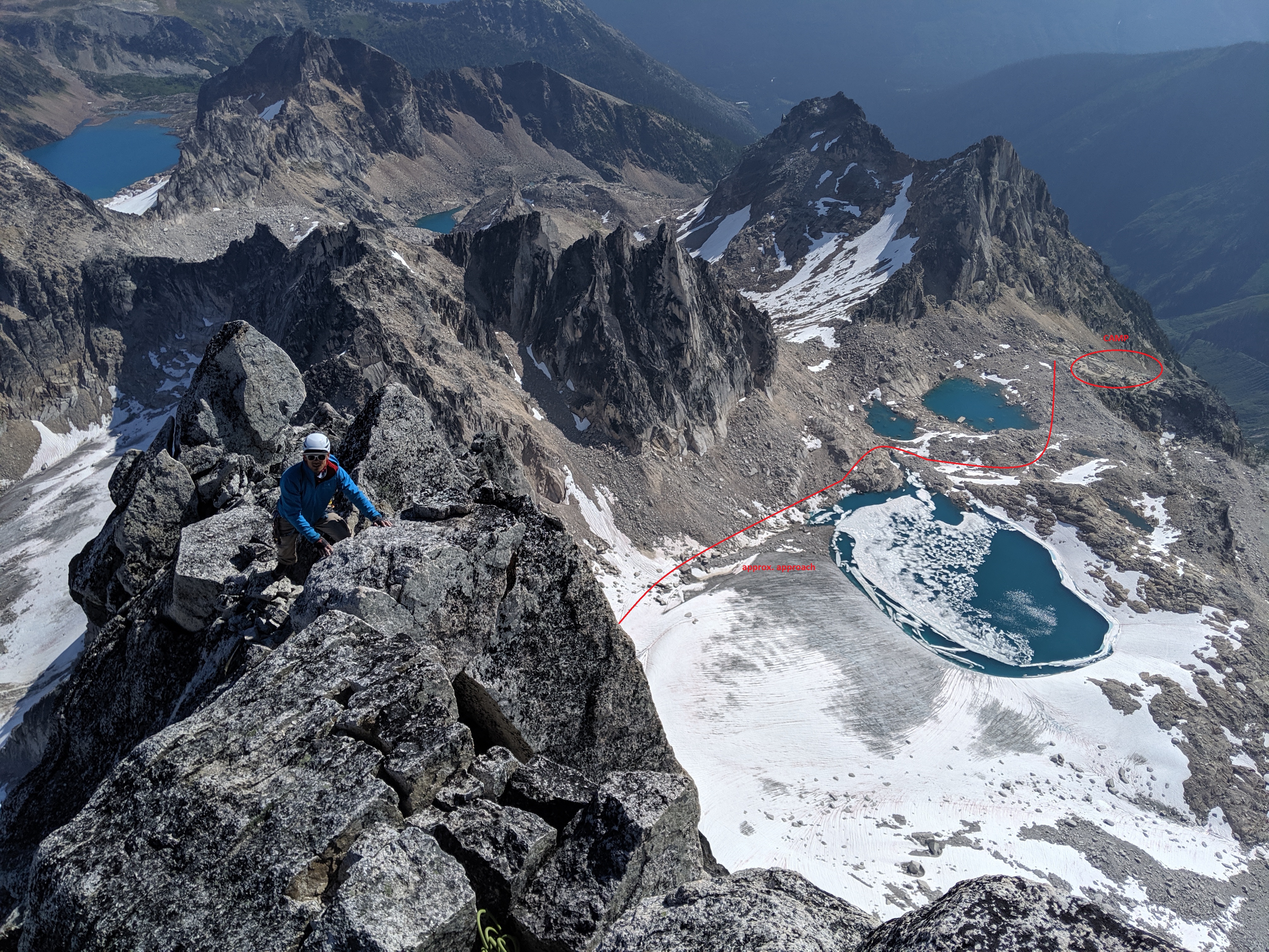
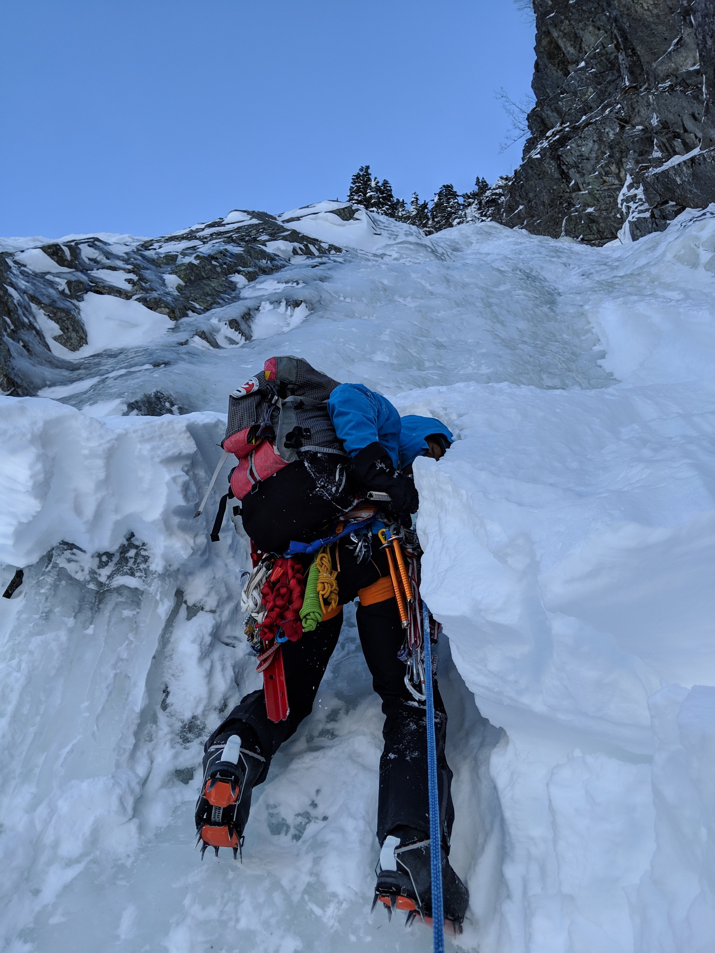
South Howser Tower – Beck-Chouinard routeI did wear boots until Pigeon col, then switched to approach shoes. For the rest of the approach we had one pair of crampons and an ice axe for both of us. There was stream water after descending the col.
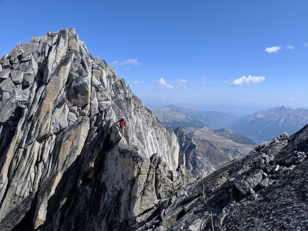
We were lucky to have only three parties total on the mountain and we left the first at the base. We simul-climbed until the forth (5.10-) pitch. First few pitches after the bivy site seemed shorter, and watch for loose rock.
For rappels, we used 60m and followed instructions from Steph Abegg supplemented by @JeffreyW’s comments. Here are my additional comments:
#3 - stay on the ridge, at the end where will be a step down with a small ledge. When standing on the ledge bolt anchor is about climbers 1pm o’clock. Silly I were standing on the ledge, did not see bolts, swung left, and had to ascent a rope after.
#6 – after finishing #5 use nearby bolts. Rappel (walk) left (climbers) along the ledge, i.e. what Jeff describes as “rappel parallel to the handline down the scrambley ledge”, until find next bolts:
#last – the first person got lowered and extended rappel with a cordelette just in case.
Timeline:
3:40? – Start
7:10 – Base of the climb
11:15 – Big ledge
18:10 – Short rappel
19:40 – Summit
Shortly after pitch-dark – Finished rappels
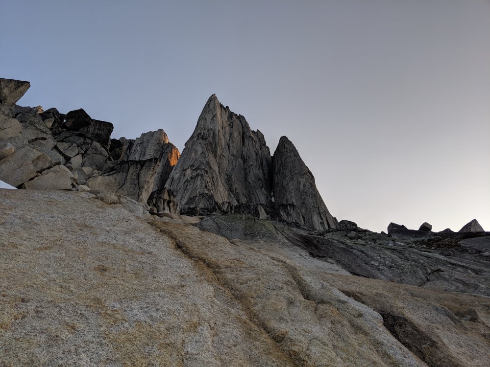
1:20 – Back to the campgroundNot as big, huh:
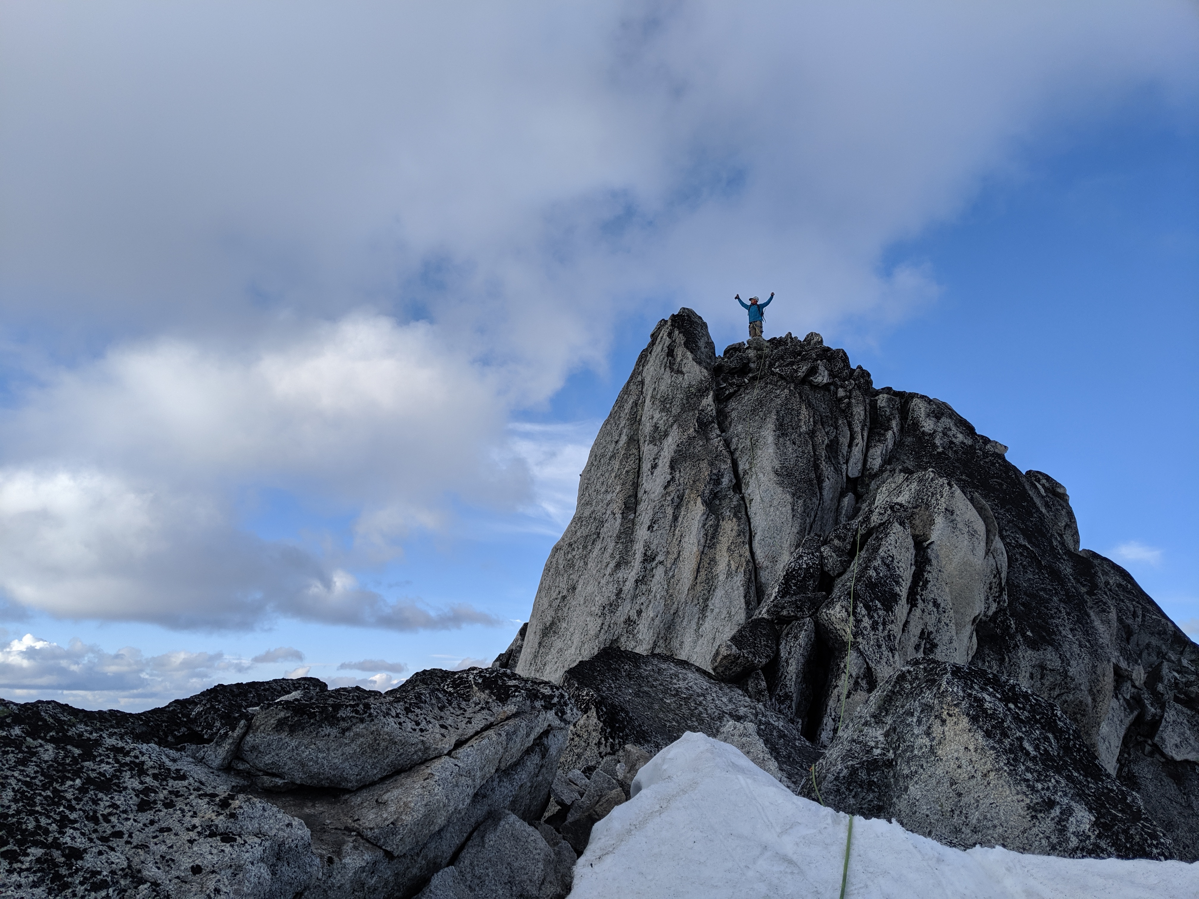
Standing on the summit:

North and South Hoswer towers:

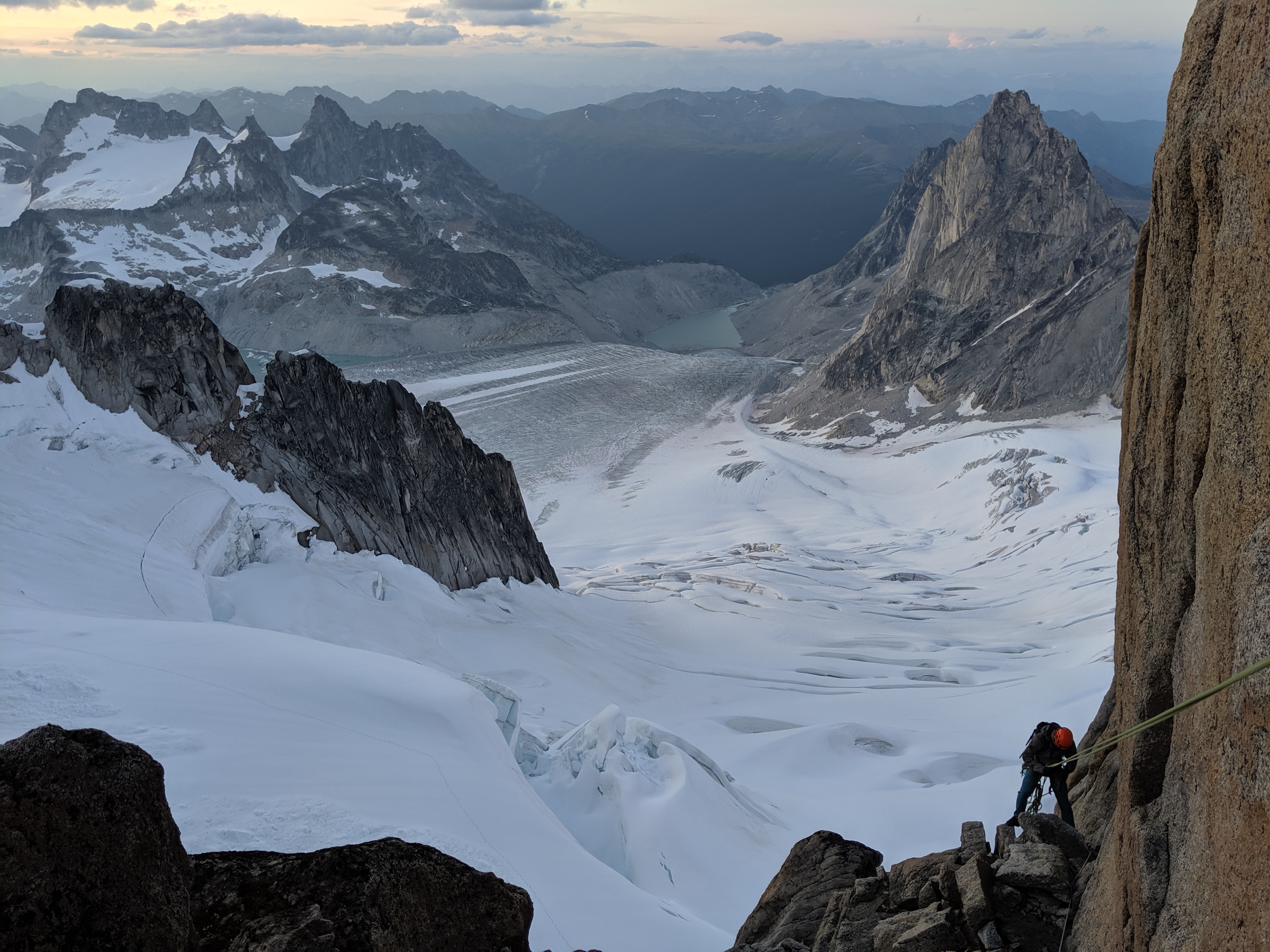
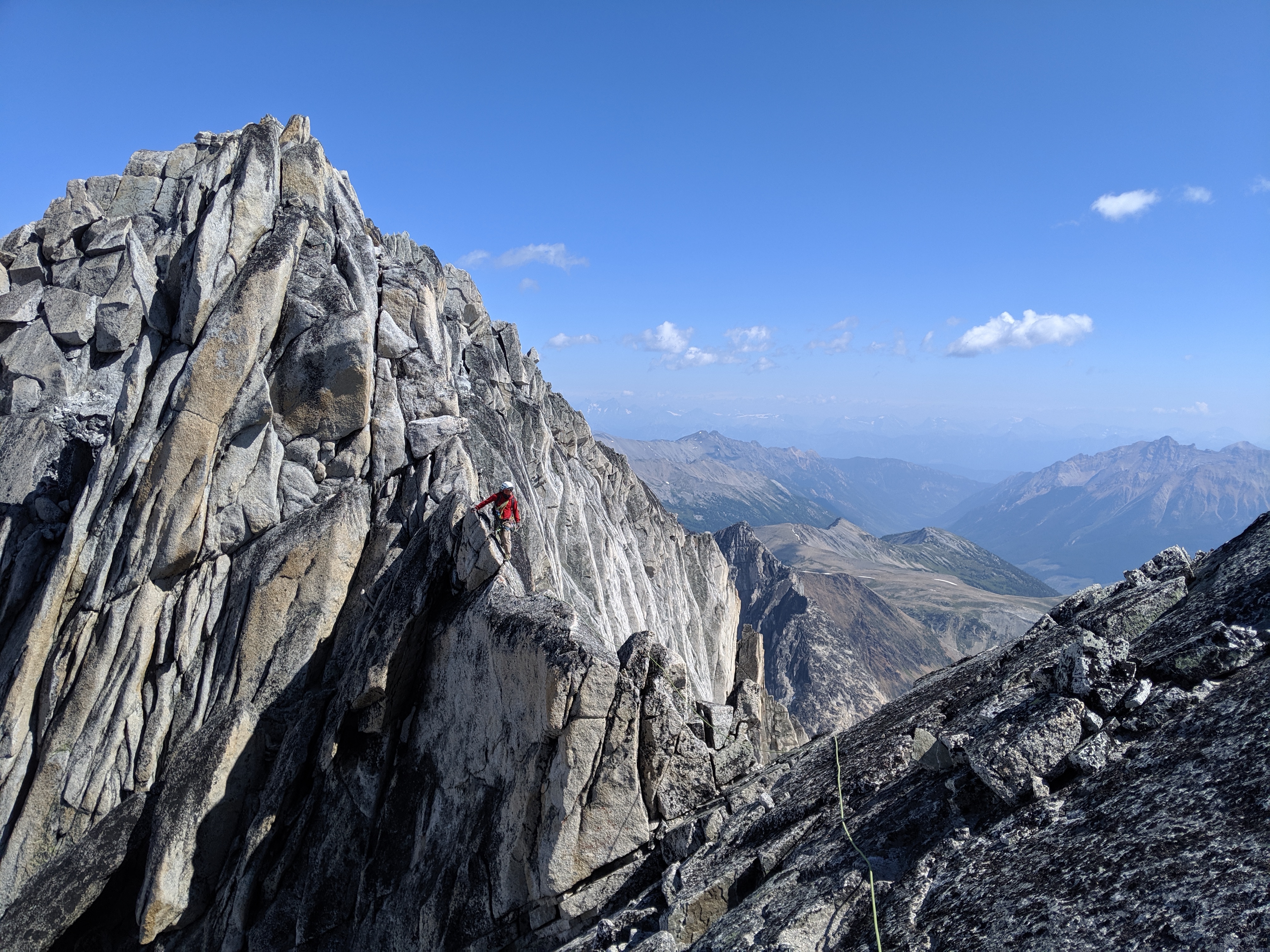
Bugaboo Spire – NE RidgeScrambling up Bugaboo-Crescent col was fine, but there was one insecure move, that made my back chill. I tried to link first two pitches with 60m, but end up short 3-5m. Make sure to well extend the third pitch, because of its nature. Left variations and 5.10 to gain South summit were great. Scrambling down Kain route was endless. There are multiple paths, generally marked with cairns, do not drop down too fast and keep traversing skiers right. I can see why parties descending in the dark often get in trouble on this route.
Timeline:
5:00? – Start
5:50 – Base of Bugaboo-Crescent col
6:20 – Top of Bugaboo-Crescent col
7:00 – Base of the climb
11:00 – North summit
12:30 – South summit
15:40 – Top of Snowpatch col
17:00 – Back to the campground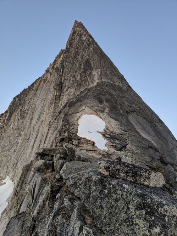
Traverse from N to S summit (looking forward):
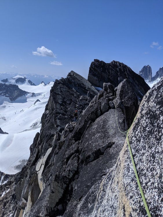
Traverse from N to S summit (looking backwards):
Bonus
1. On the way home, we stopped by Kinsmen Beach at Windermere Lake to wash off all sweat and dust. It was delightful.
2. Below is my food plan. All food was portioned into zip-lock bags. What worked well: none left with no starving. Instant potatoes with tuna was the best meal. Egg noodles and cheese was the worst.Fri Dinner Grocery/Restaurant take out Sat Breakfast Buy a sandwich Lunch Buy a sandwich/etc Dinner Couscous 363 cal Turkey Jerky 105 cal Pita bread 140 cal Chocolate 150 cal Sun Breakfast Instant oat + powdered milk 300 cal + dried blueberries (oatmeal) Granola bar 130 cal Lunch Gummy bears 180 cal Pita bread 140 cal Trail mix 250 cal Snickers 250 cal Tailwind 400 cal Dinner Instant potatoes 392 cal Tuna 160 cal Pita bread 140 cal Garlic oil Mon Breakfast Oatmeal 300 cal Granola bar 130 cal Lunch Couscous 320 cal Salami 200 cal Pita bread 140 cal Trail mix 250 cal Dinner Egg Noodles 381 cal Cheese 170 cal Chocolate 150 cal Tue Breakfast Oatmeal 130 cal Granola bar 300 cal Lunch Gummy bears 180 cal Pita bread 140 cal Trail mix 250 cal Snickers 250 cal Dinner Mountain house? Wed Breakfast Oatmeal/Bars/leftovers 300 cal Granola bar 130 cal Lunch Stash some food at the car
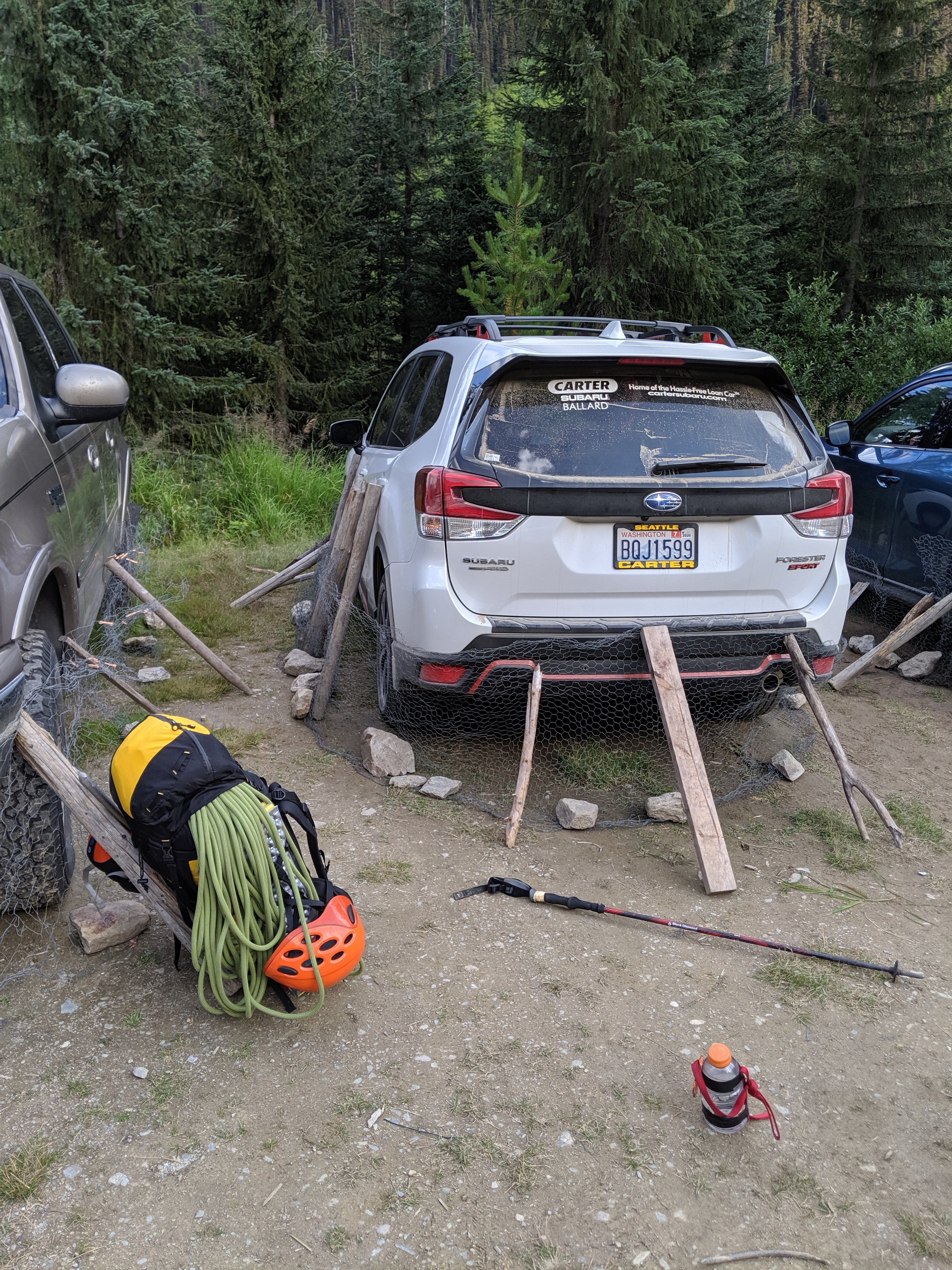
Gear Notes:
A tent, two 8 oz fuels (we ended up using only one), jetboil, water filter. 8 singles, 6 doubles, 2x cordelette, BD cams .1-.3, doubles in .4-4”, 60m rope, grigri, set of BD nuts.
Approach Notes:
Some comments in TR-
 3
3
-
 1
1
-
 2
2
-
-
Is anyone going to exits/index this evening?
-
On 6/17/2019 at 8:36 AM, JasonG said:
DUDE, CAN'T YOU LISTEN? The entire Coleman glacier is OUT!

We bailed doing it the same day. I wasn't able to convince my partners. There is a good and cheap beer in the area though

-
Looking for a partner(s) to go climbing after work or super early before work on weekdays:
- sport climbing at Exit 32/38 grades 5.10-11s. Bonus if you climb 5.12s.
- trad climbing at Index grades 5.9-5.10s. Bonus if you climb 5.11s.
-
Yep, all photos are gone now.
-
1
-
-
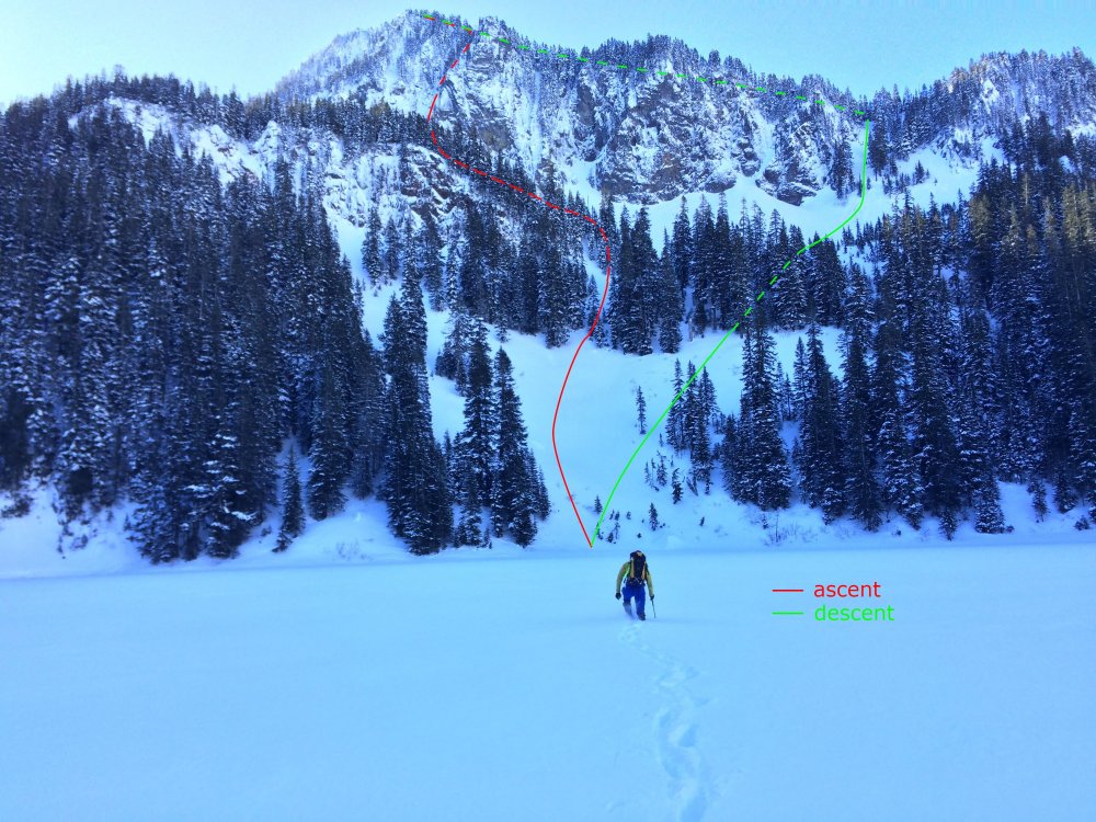
Trip: Mount Stuart - Direct North Ridge
Trip Date: 06/01/2019
Trip Report:Disclaimer: in 2019 snow melted very fast.
At least three parties made it to the summit last weekend. All crux pitches are dry. Some running water on easy pitches below the notch. The slab pitch is partially covered with snow. Need to cross patches of snow on the upper mountain from time to time. There are four scattered bivy spots on a ground after pitch five, a few spots higher up along the route that are not covered with snow but can fit one or two, a large snow ledge about 400 ft below the end of last pitch towards a false summit.
Descended via Sherpa glacier. Left side (skiers) of it gets early sunshine and snow was soft to descent without crampons at 9am. Though my partners used them. Right side that stays in a shade was hard as rock.


Gear Notes:
BD .1, .2, .4 to 4.; Metolius 0&1; small nuts (placed one nut just because I can); 6 singles & 6 doubles, cordelette, ice axe, bivy, 1/2 crampons
Approach Notes:
ticks are swarming-
1
-
1
-
2
-
-
There was not much ice at all.
-
Did it yesterday. The approach is endless. Potholing is devastating. Solid snow in couloirs. Much less snow in between then on photos above. Oh boy, the mountain is shitting rock non stop.
-
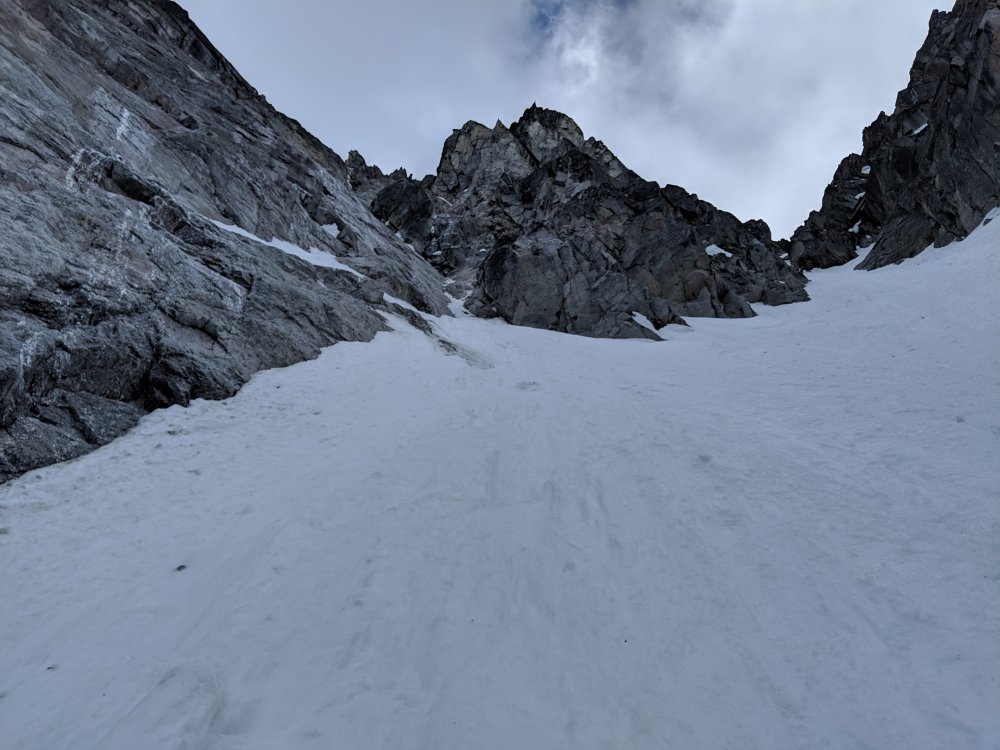
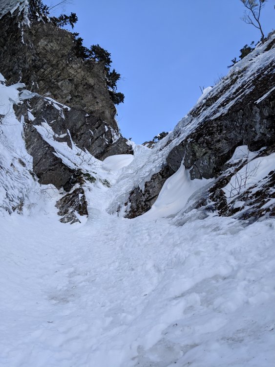
Trip: Abiel Peak - North Face Gully
Trip Date: 03/10/2019
Trip Report:I haven't seen any recent TRs, so posting...
Hiro and I picked Abiel Peak to be our next ice climbing destination. Since there are multiple routes we decided to come and see which one to climb [checkout the old TR and AlpineDave blog for options].
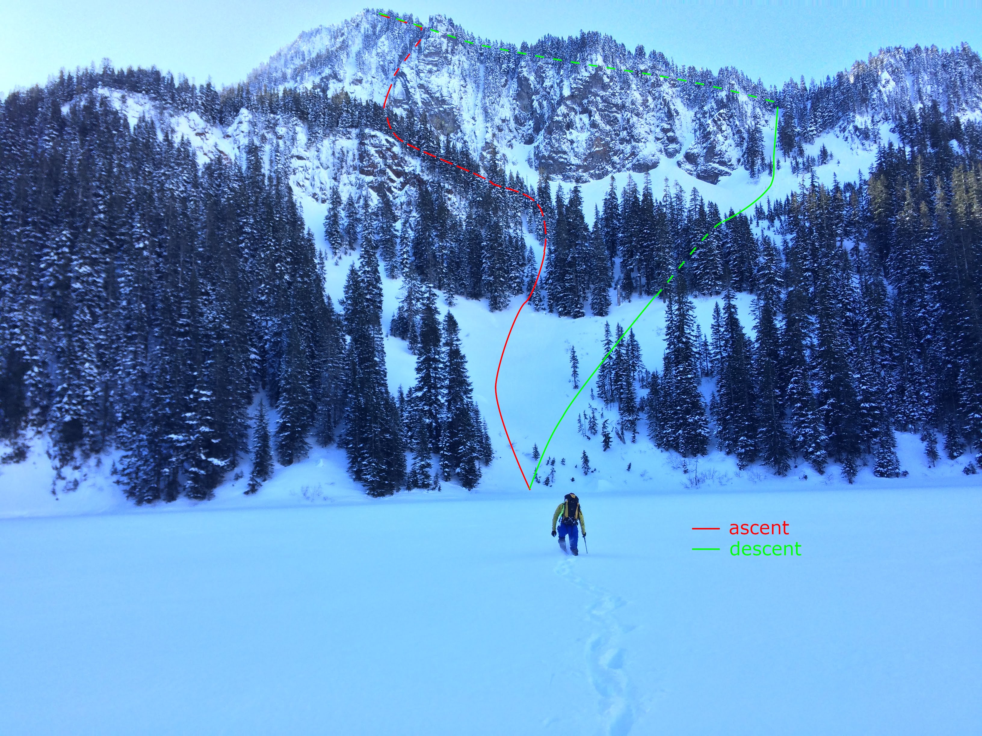
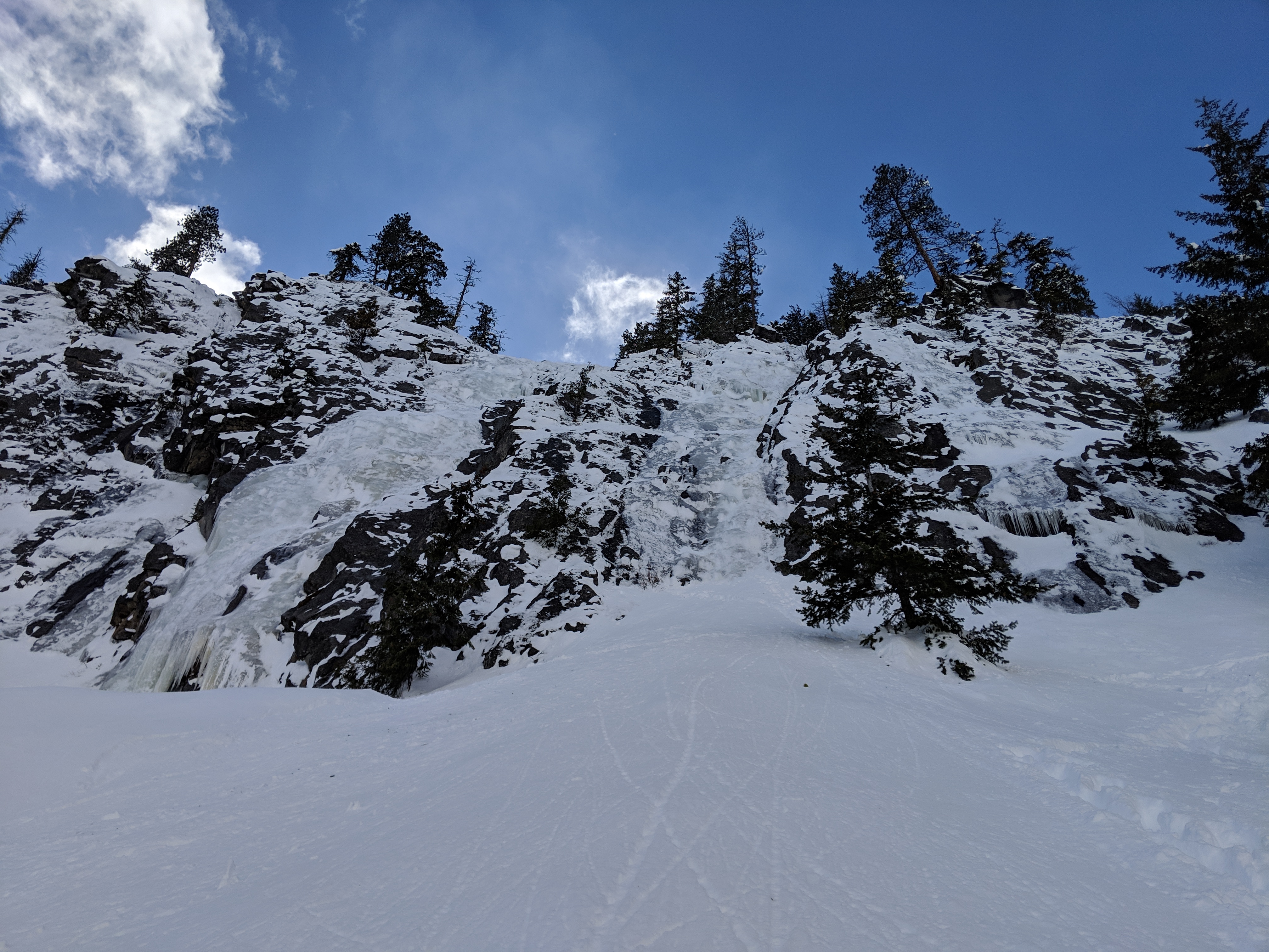
It turned out to be North Face Gully. Here is an overview of the climb:
Most of the route is hidden from the approach. Here you can see only the beginning of it at the bottom center:

Closer:
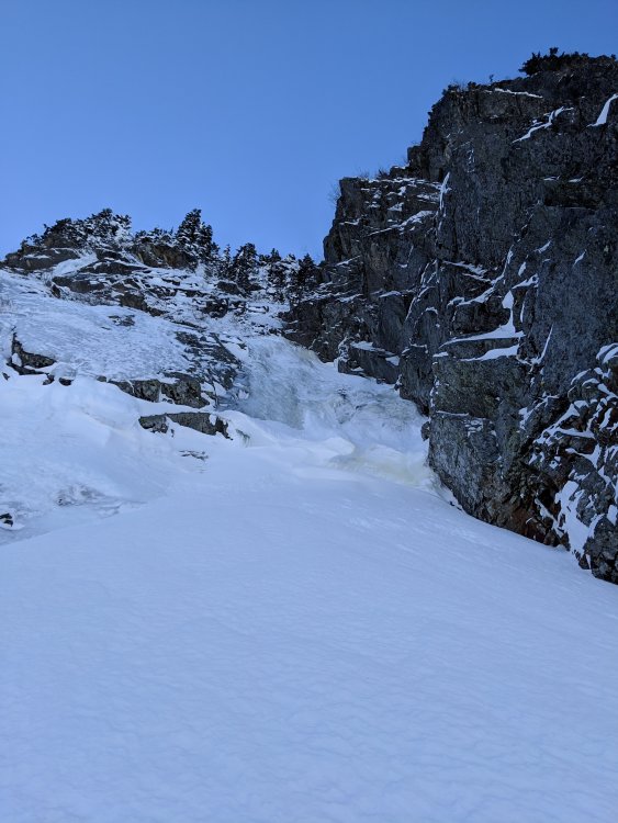
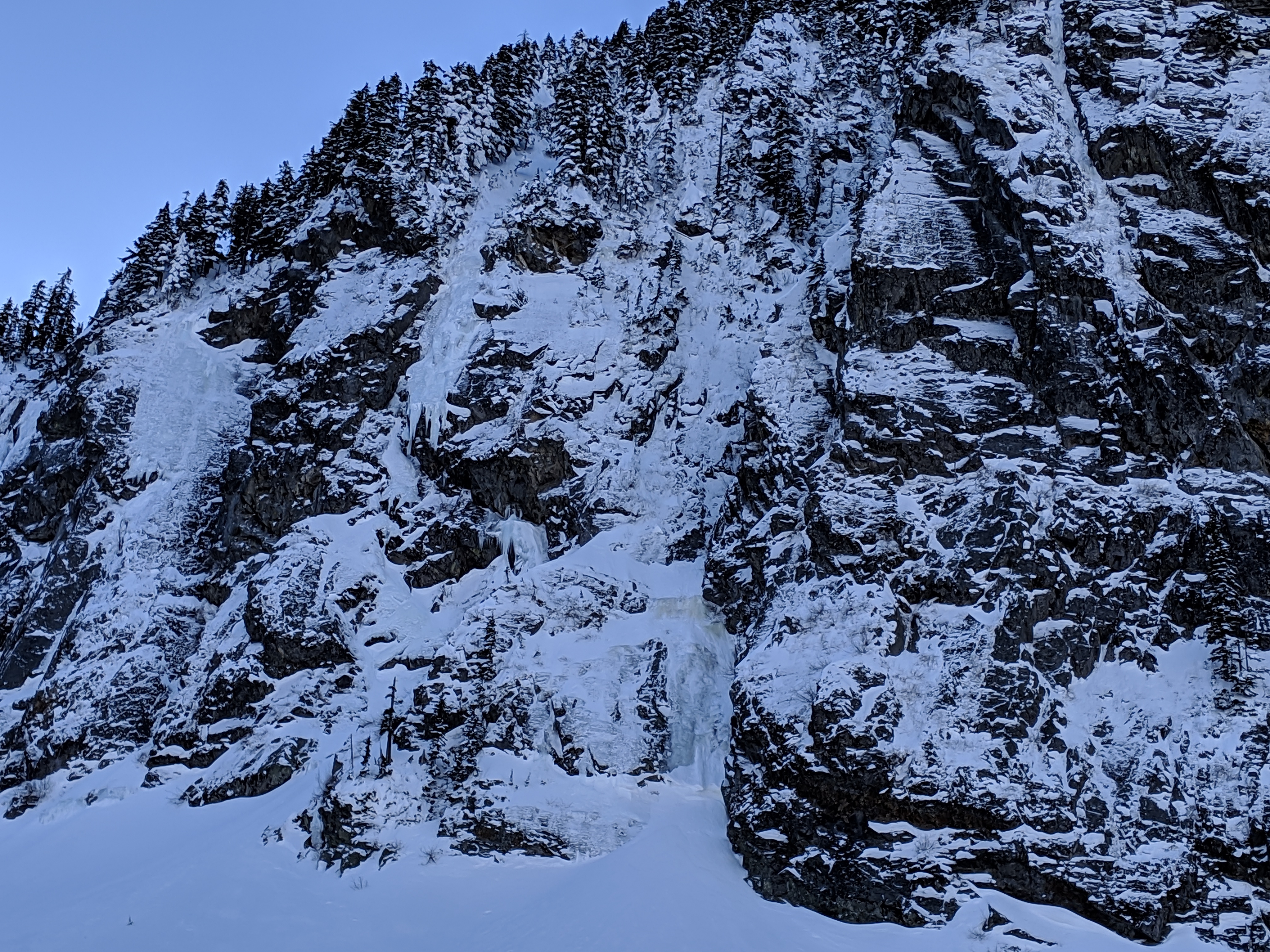
Soft snow accumulated at the bottom. We spent plenty of time taking turns and cleaning it up:

There was decent ice under snow:

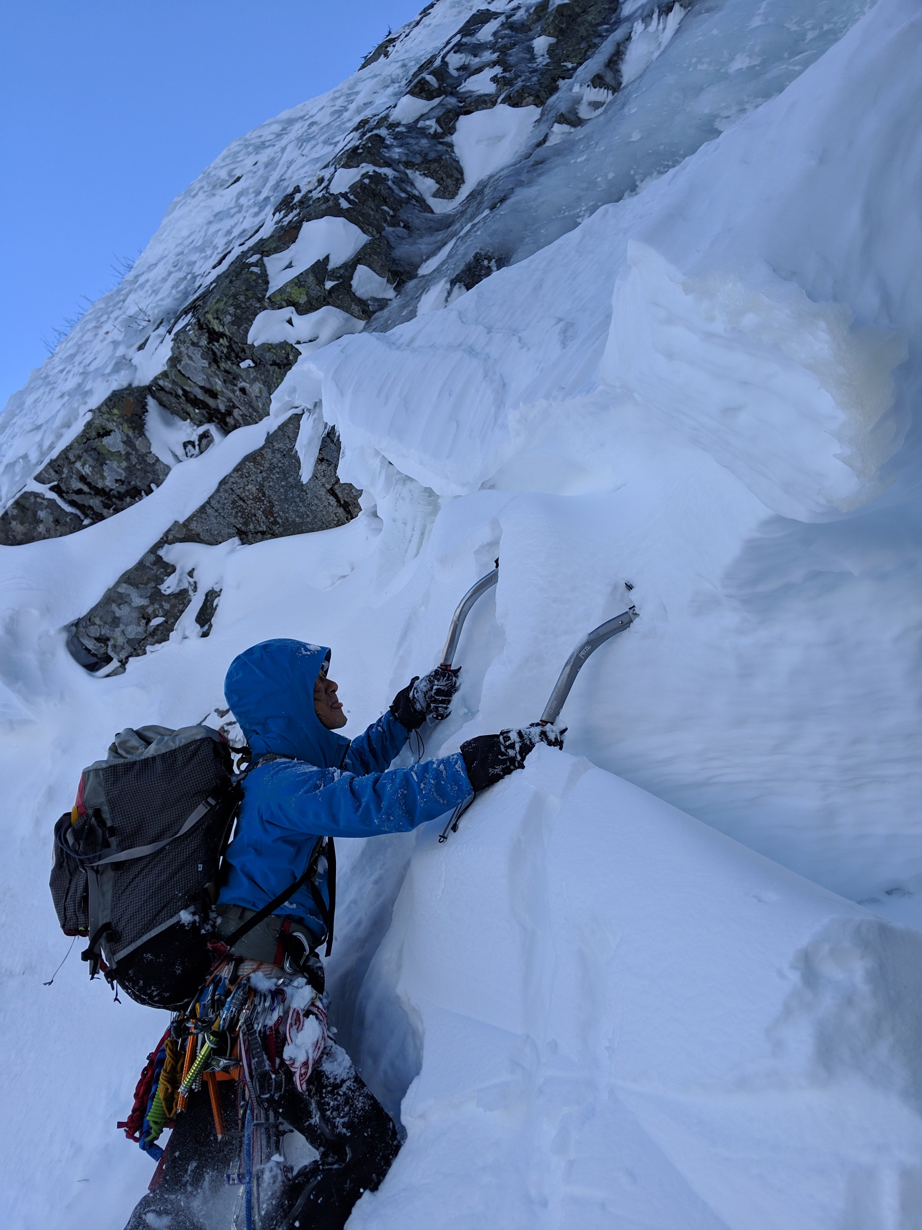
Most of the first pitch was a solid ice.
The second pitch was mostly snow. We did simul climbing. Looking down while at the 2nd pitch:
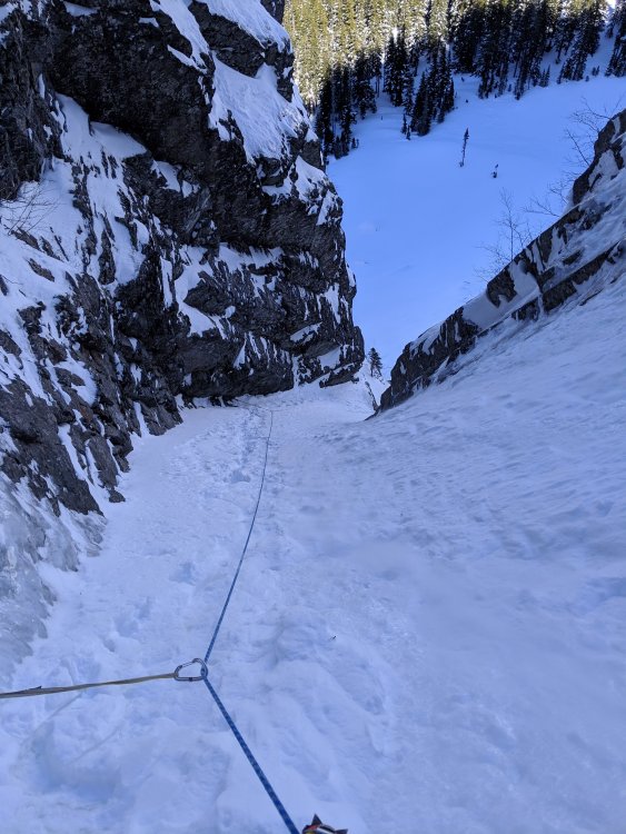
But simul climbing came to the end very soon, because the third pitch unexpectedly popped around a corner:
It is not vertical, but steeper that it looks like on the photo
 . Ice wasn't making it easier: at some places it was thin, at others - crumbly snow-ice mix. How does the saying go: placements are getting closer as pucker factor goes up?
 ")
Nevertheless we made it up and after that it was only about 30m of snow to a ridge. The ridge met us with sun, warmth and view to Rainier. When walking towards the summit there was a short section of snow covered boulders with lurking cavities in between them.
For a descent we went West staying on a ridge as it kinda circles clockwise. It was just walking. We came back to a car by a sunset. After eleven hours we returned to a car with Granite Mountain saluting us in sunset colors.
Gear Notes:
7 ice screws, 2 pickets (used one), 0.4, 0.5 & 1 cams (used all), small nuts (used few).
Approach Notes:
Solid footpath until Lake Annette. Crossed the lake. -
I know this guy in a beaten black diamond helmet
It was a nice day!
-
Full house at Franklin Falls today. At least 5 lines are clammable, but getting beaten. Come early.
-
Hubba Hubba as of 02/18. Climbed central (left on the photo) and right (central on the photo) flows. Next time I'd bring 70m rope or 2x60m
The approach was exhausting due to fresh snow even in snowshoes.

-
oh I don't own a boat
 It'd be great to install a permanent steel cable across so people can do Tyrolean traverse
 -
Below freezing temperatures this whole week and still holding

-
-
Any thoughts about Inspiration Peak in pickets?
-
Wassup G-spotter? Any good new out of your nest?!
-
It was a beautiful climb!
-
1
-
-
Most likely 21.
-
...


[TR] The Bugaboos - Pigeon Spire - W Ridge / South Howser Tower - Beckey-Chouinard / Bugaboo Spire - NE Ridge 08/02/2019
in British Columbia/Canada
Posted · Edited by specialforest
@Rad yes, but note that the last rappel on South Howser Tower may require an extension depending on snow level, so you don't end up in a moat.