JeffreyW
-
Posts
67 -
Joined
-
Last visited
-
Days Won
28
Content Type
Profiles
Forums
Events
Everything posted by JeffreyW
-
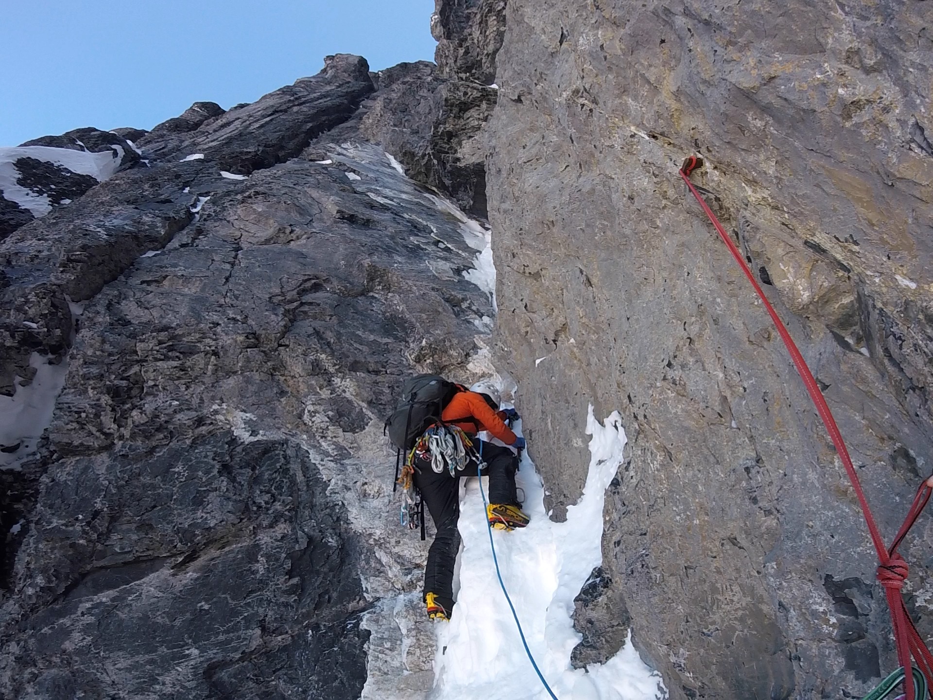
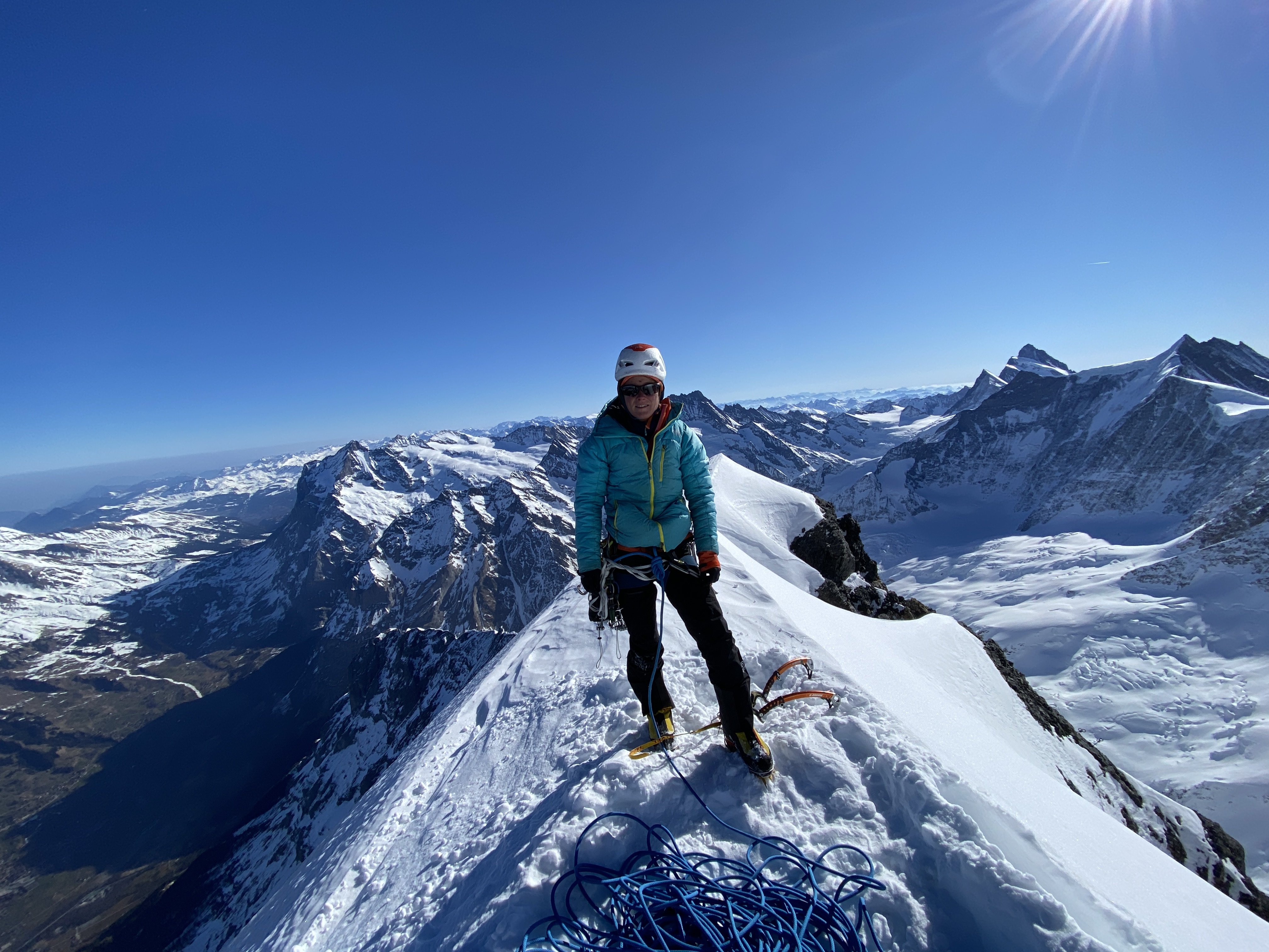
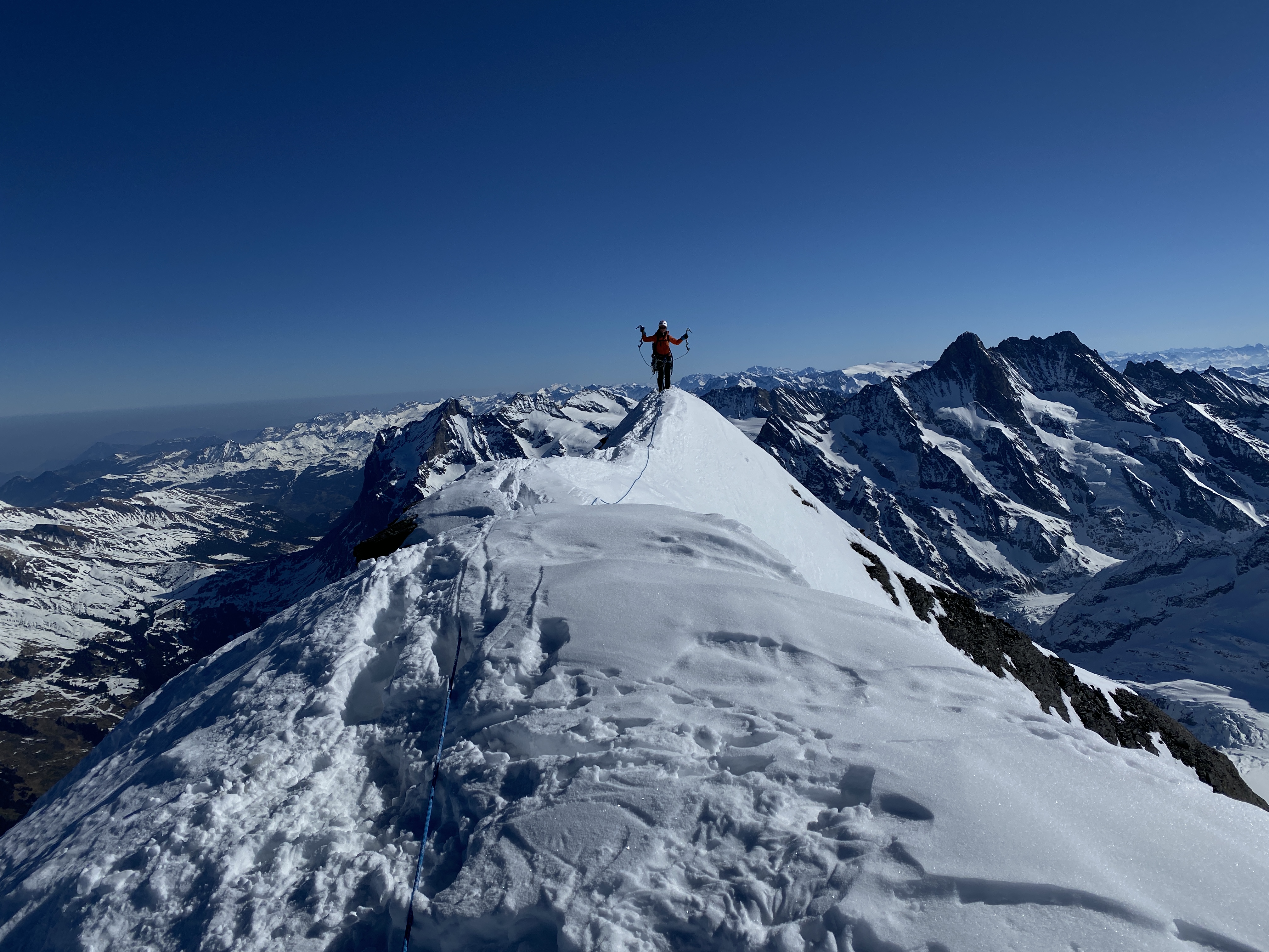
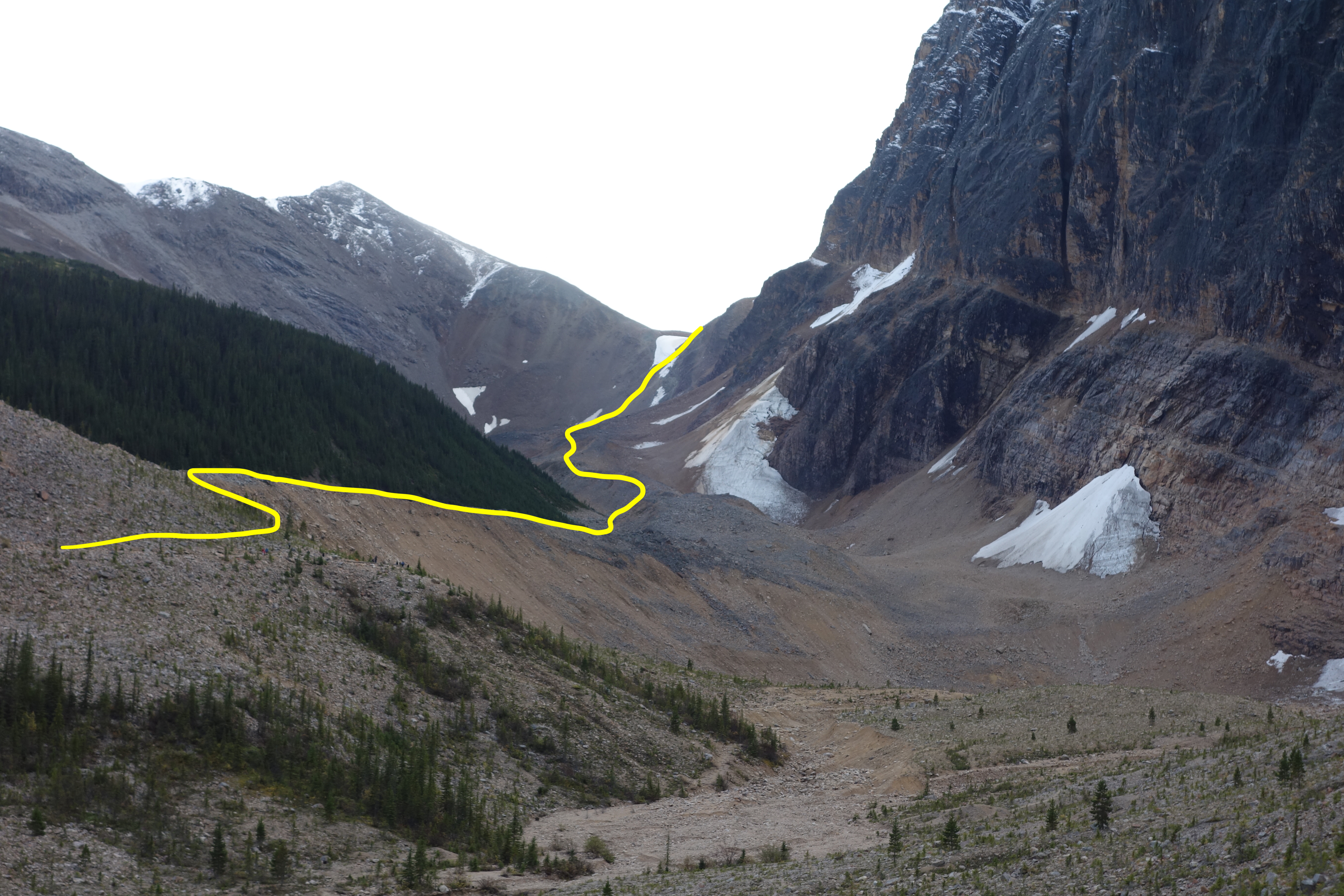
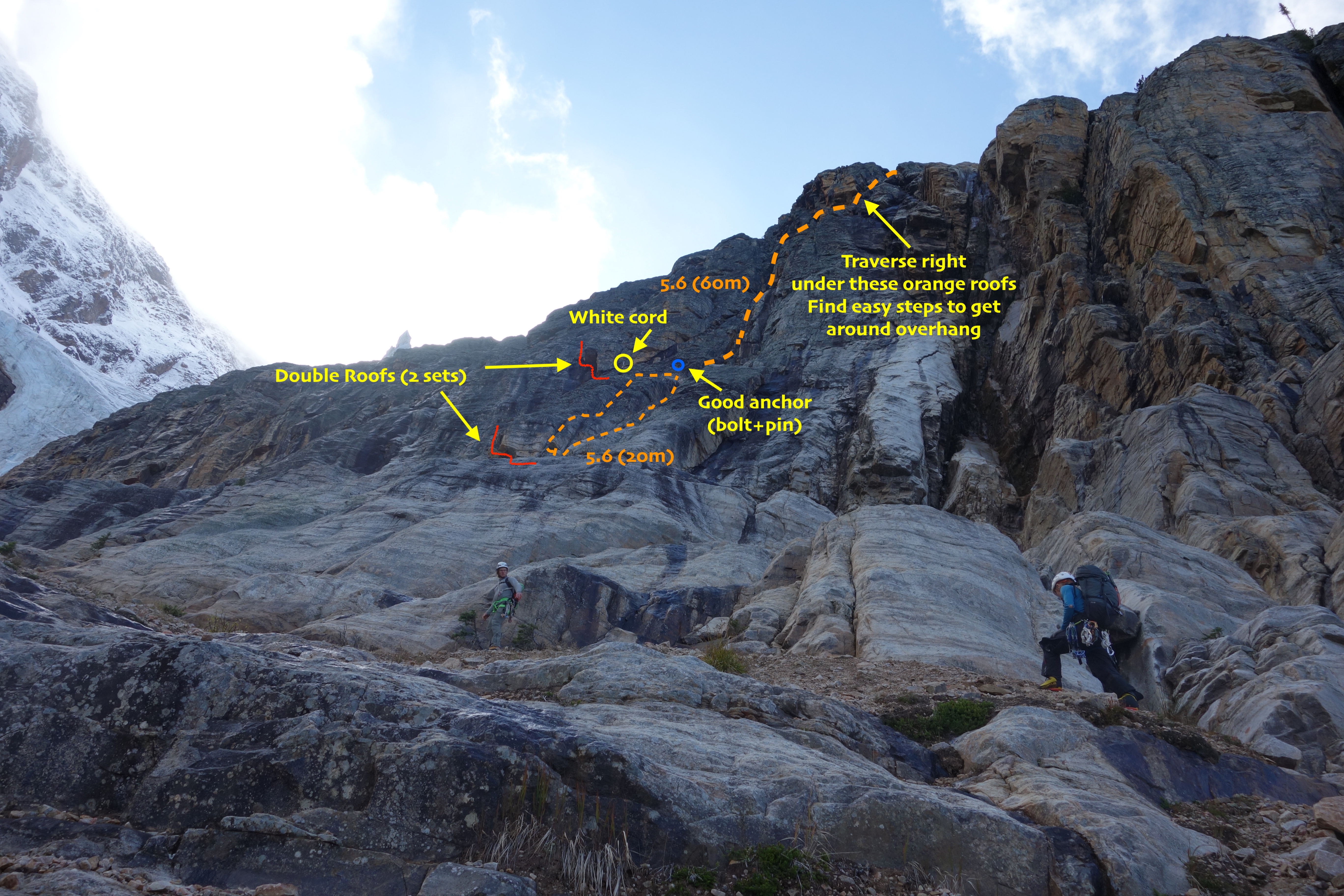
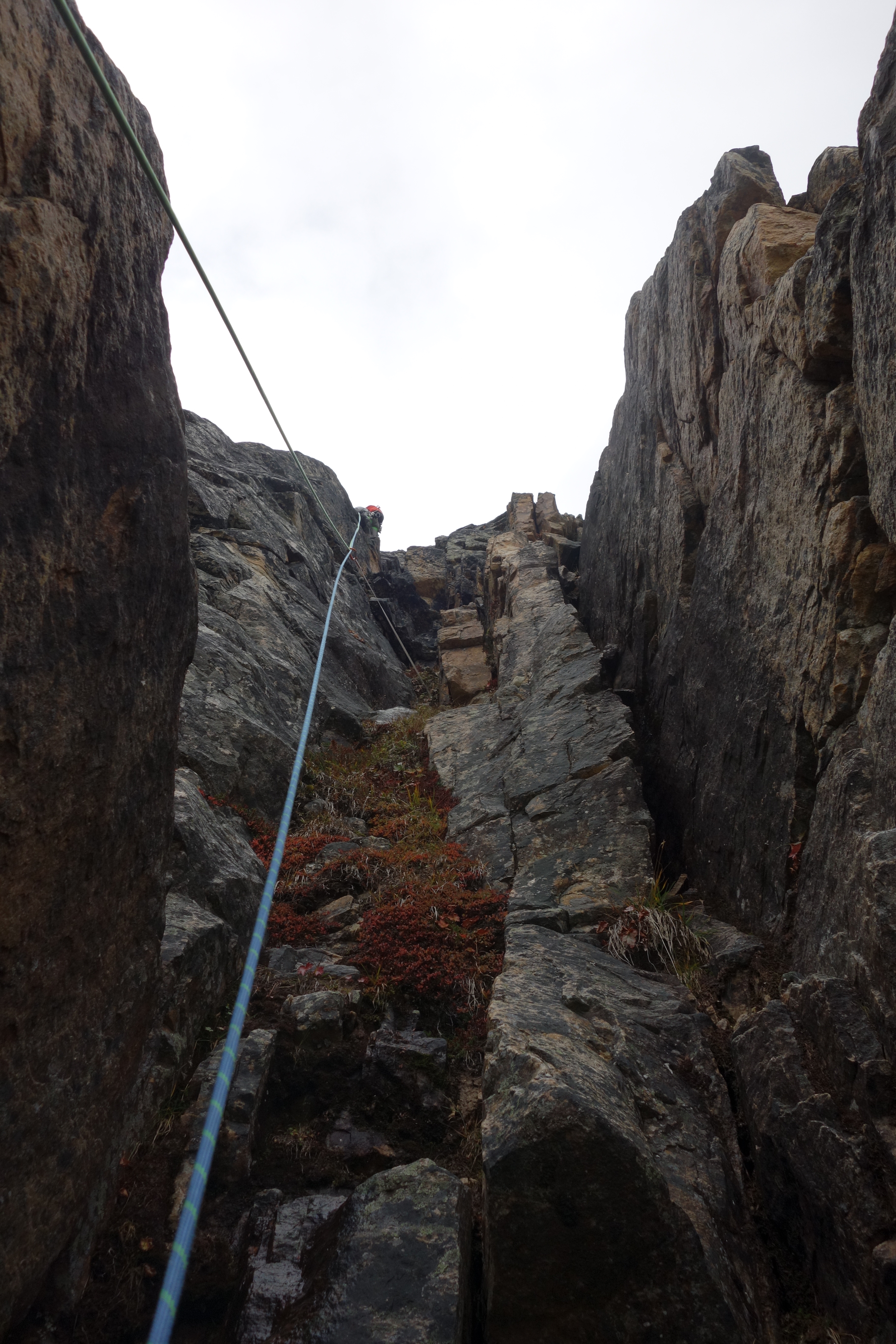
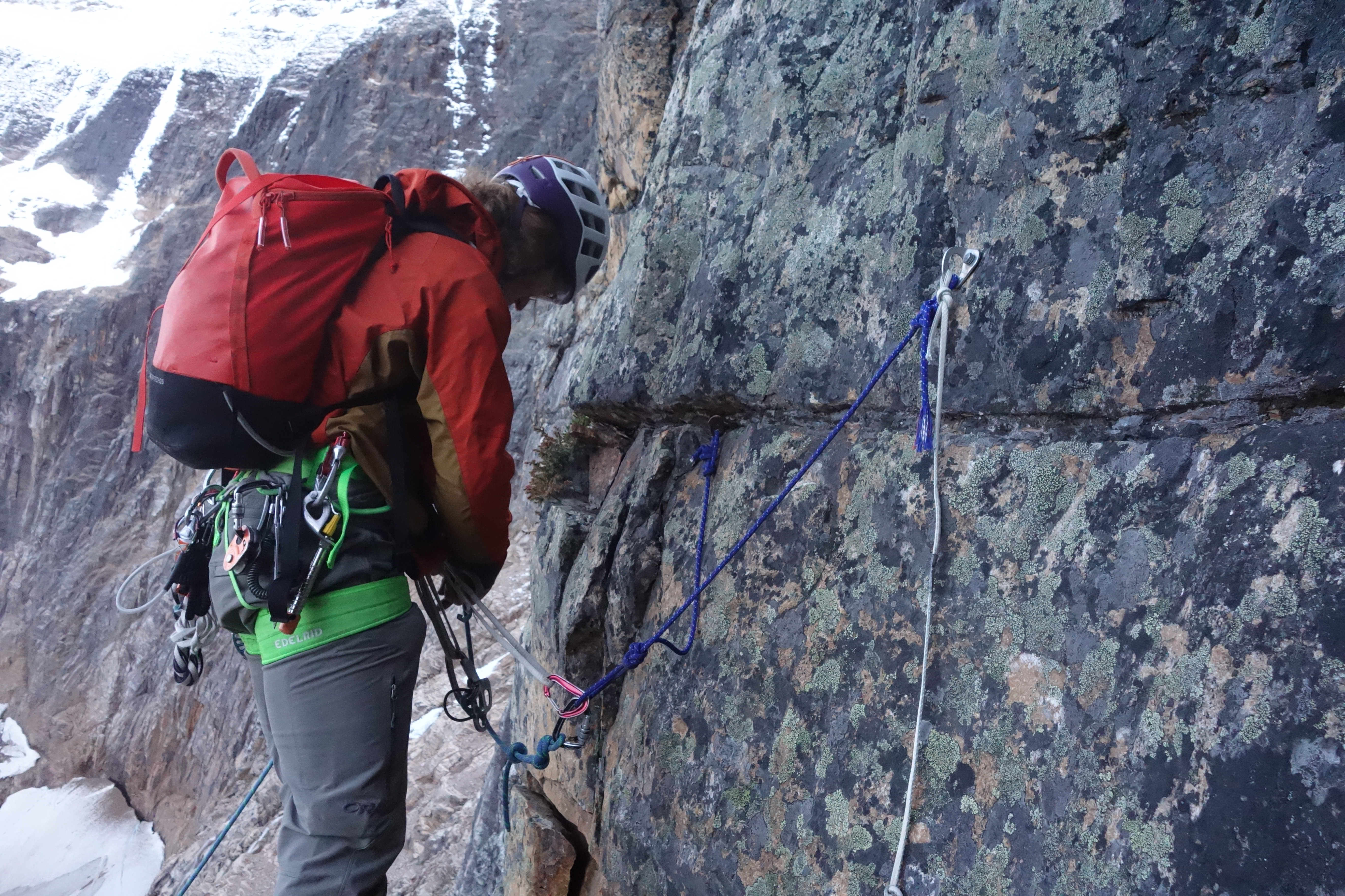
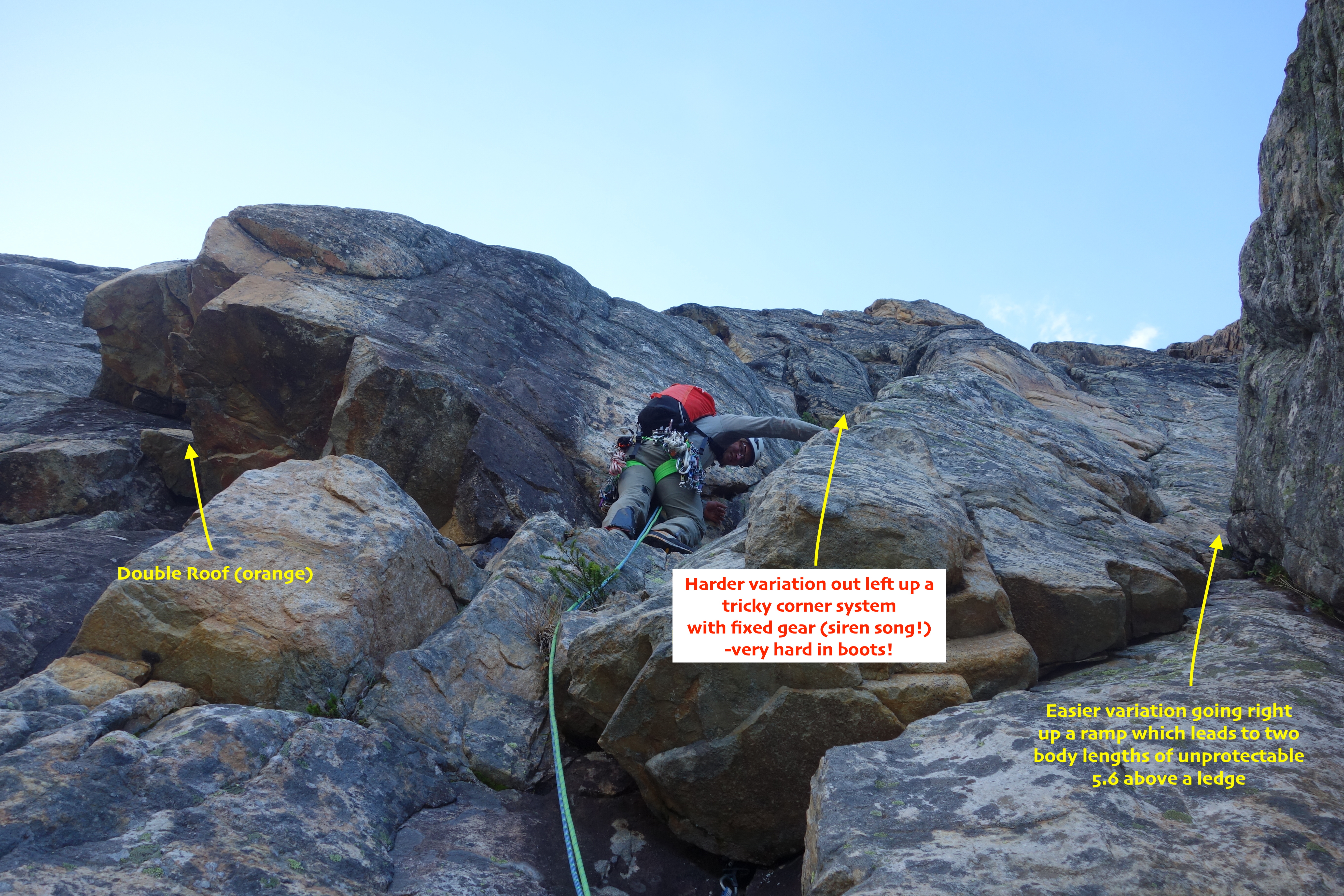
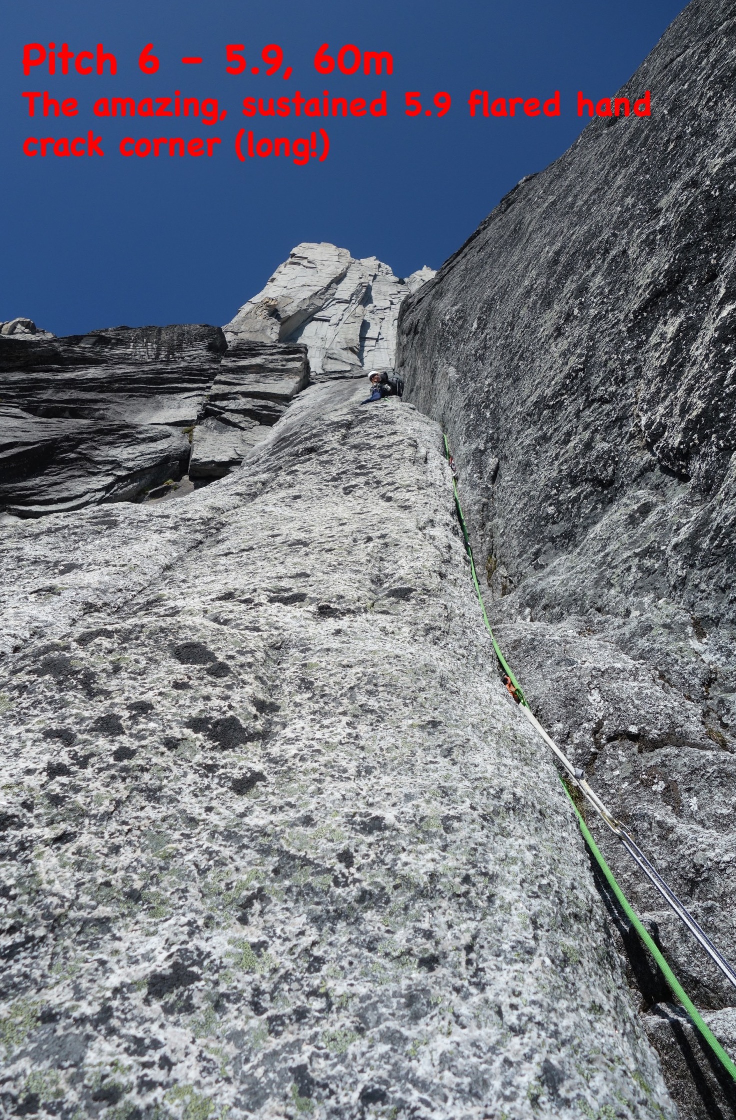
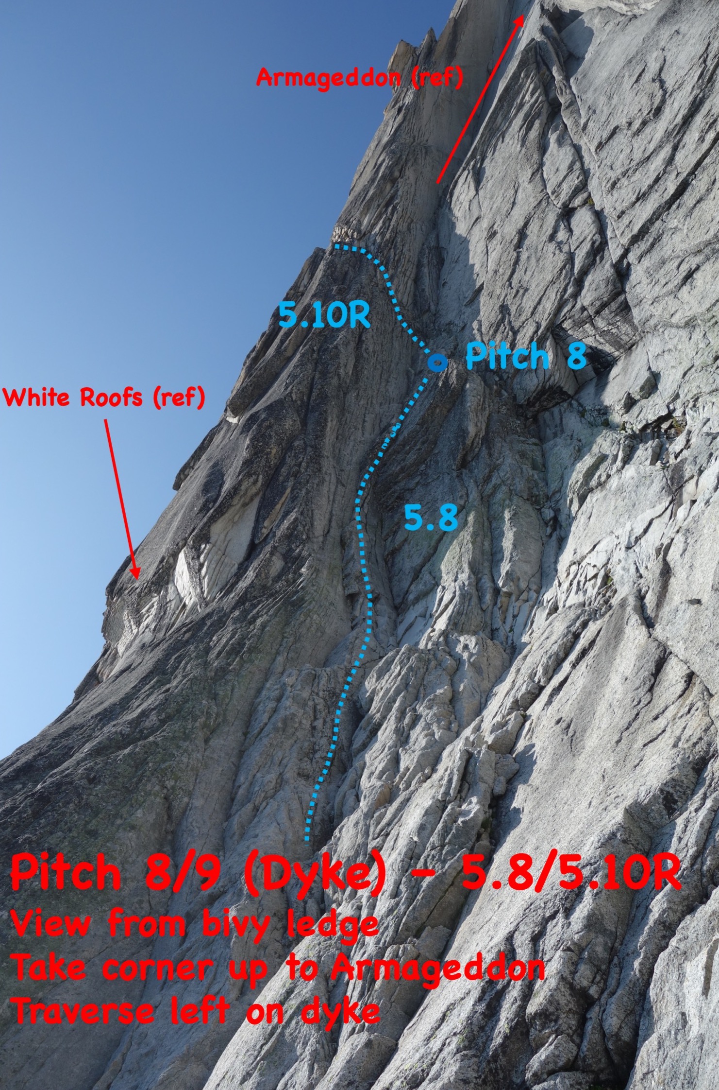
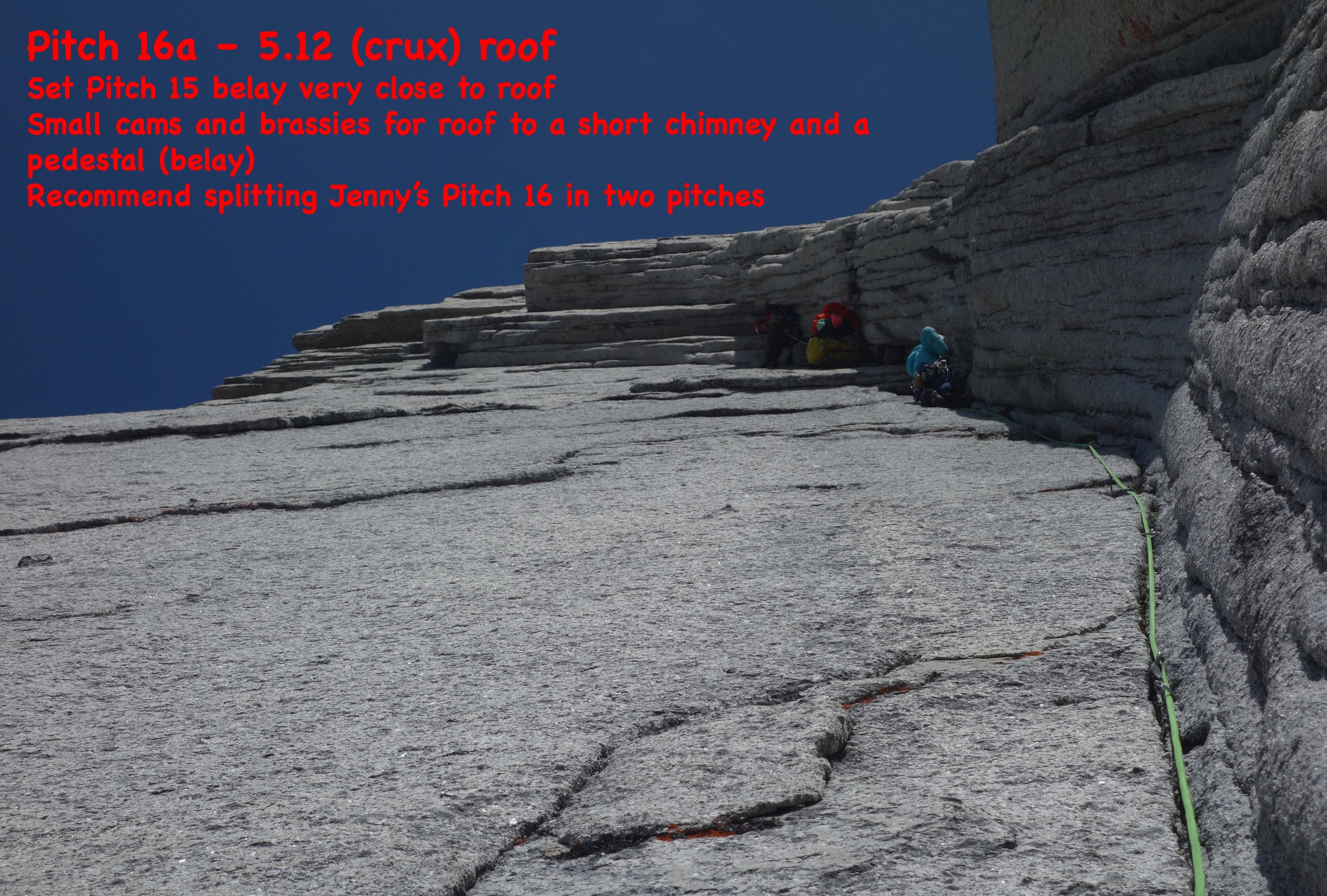
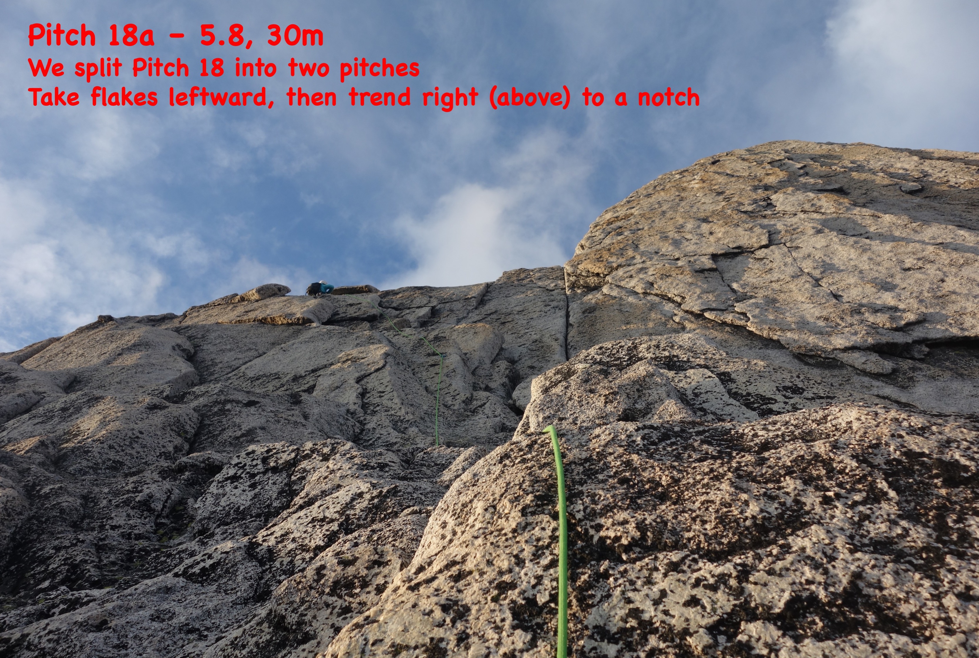
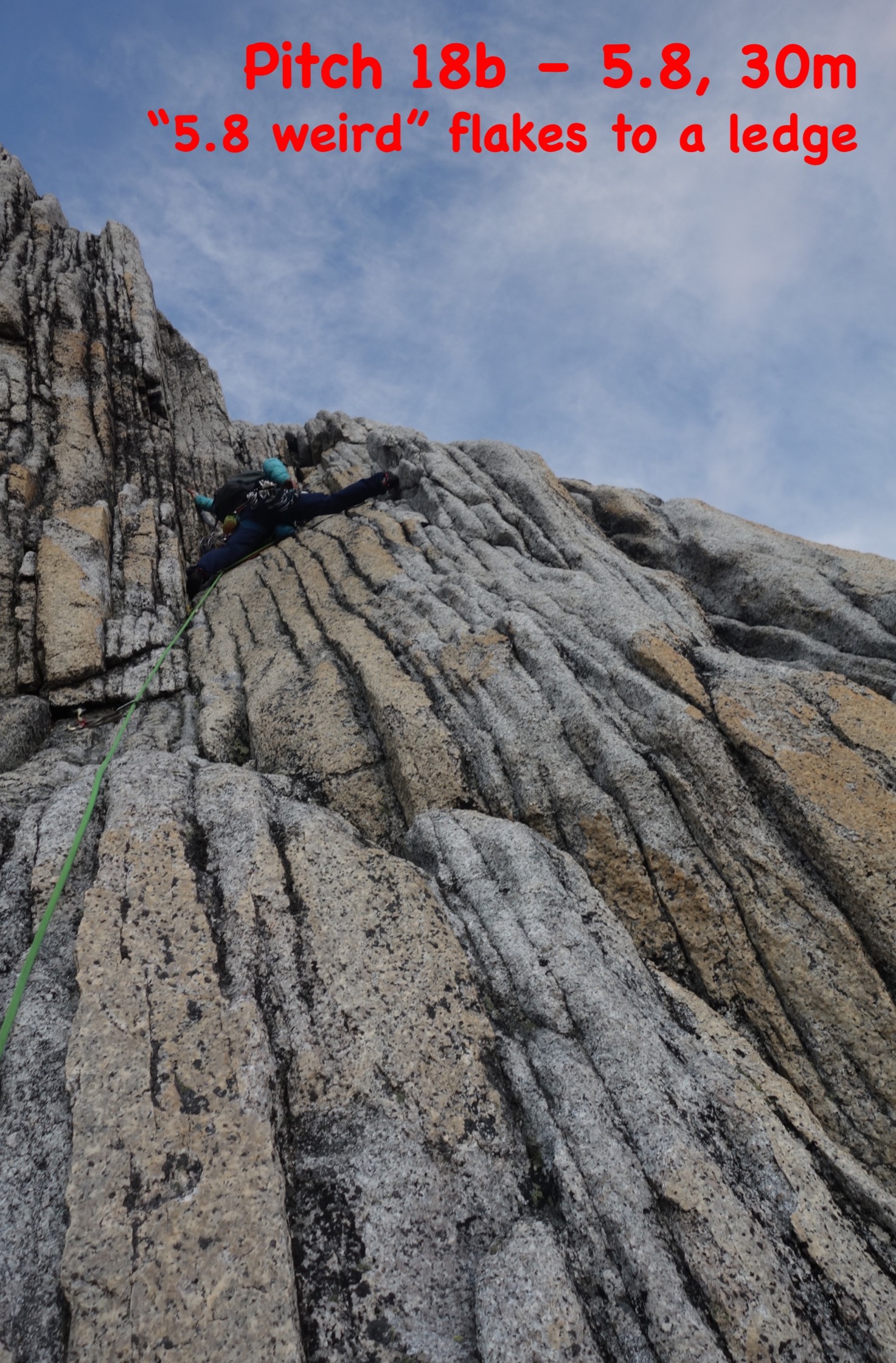
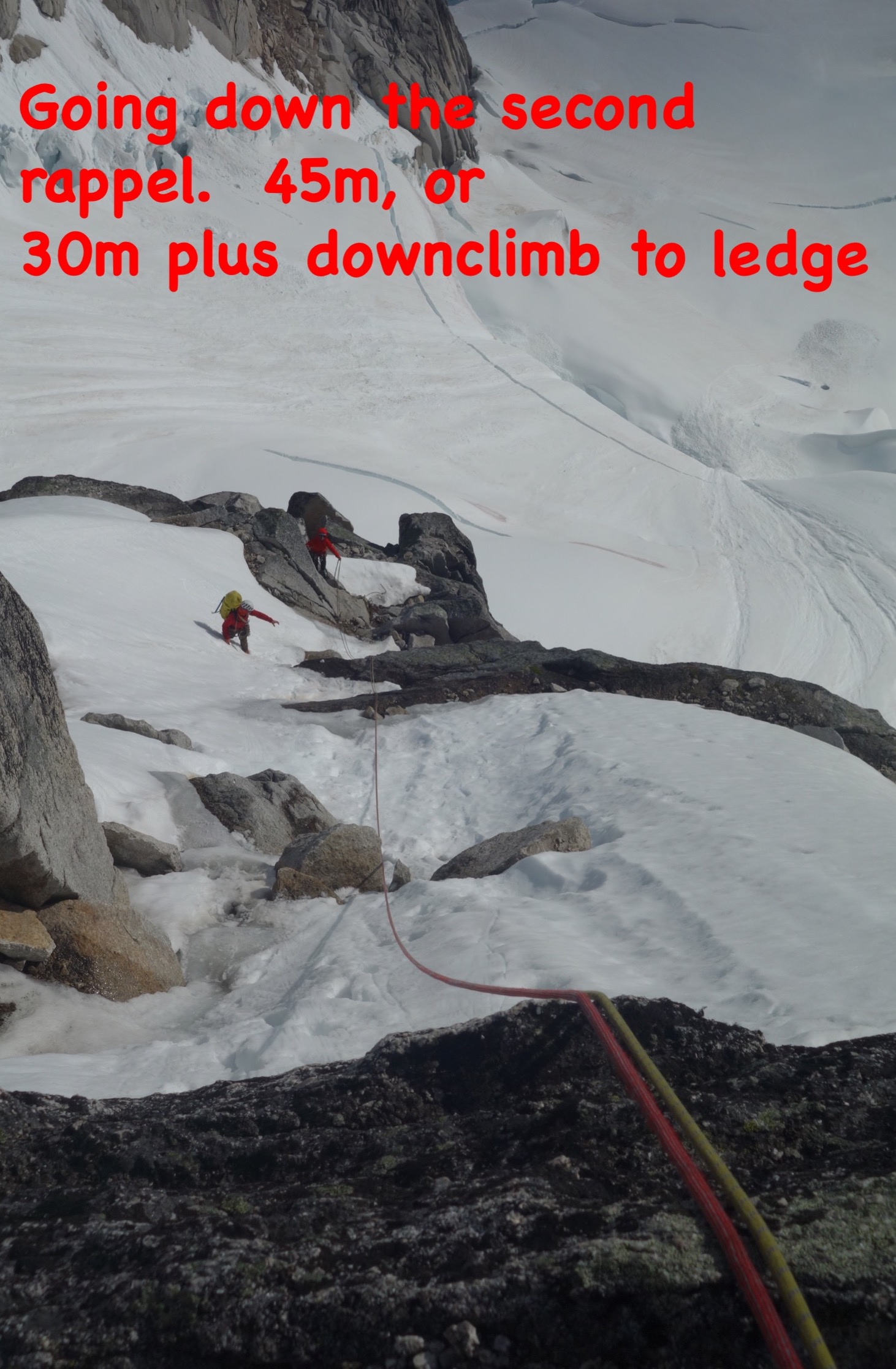
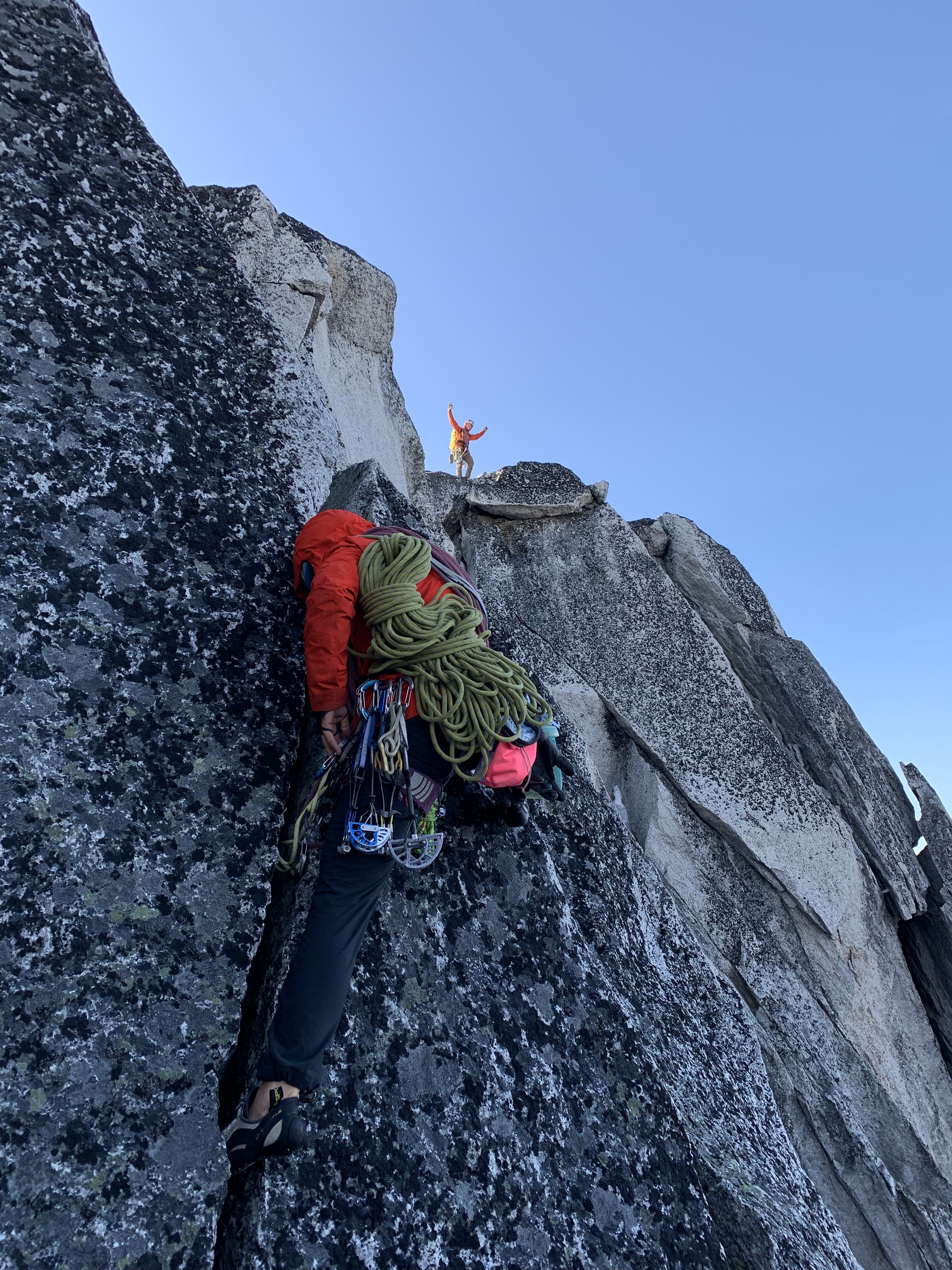
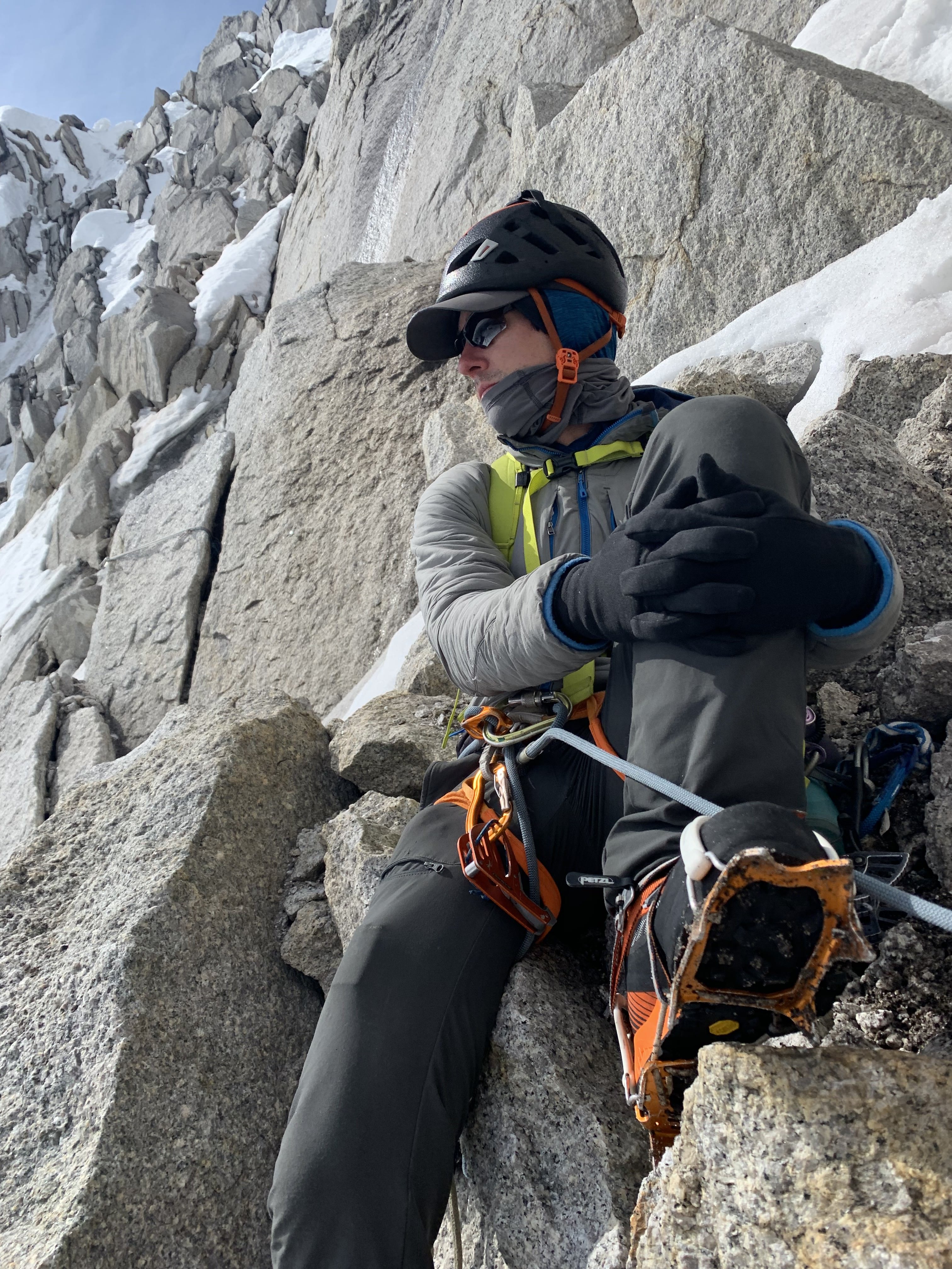
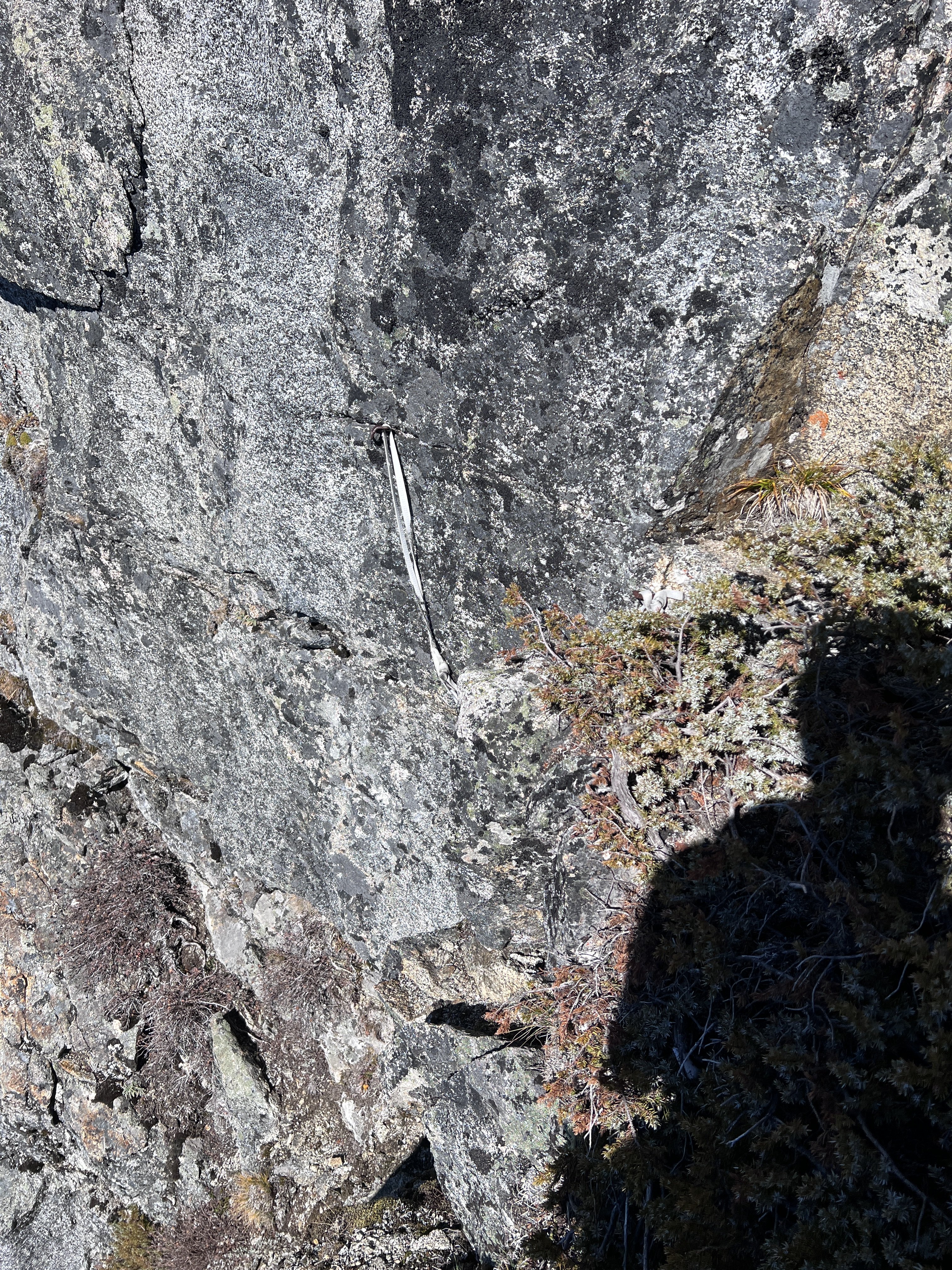
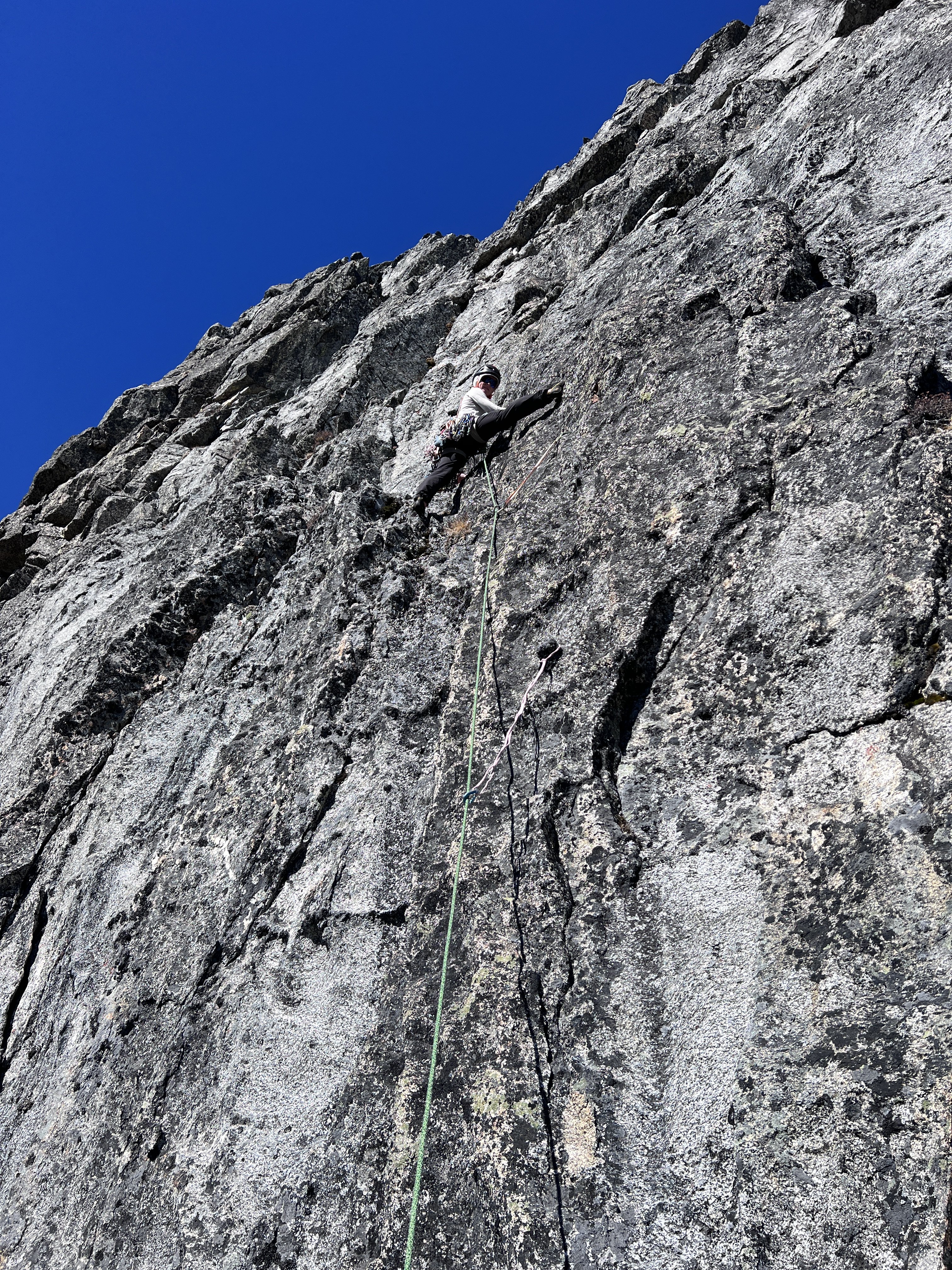
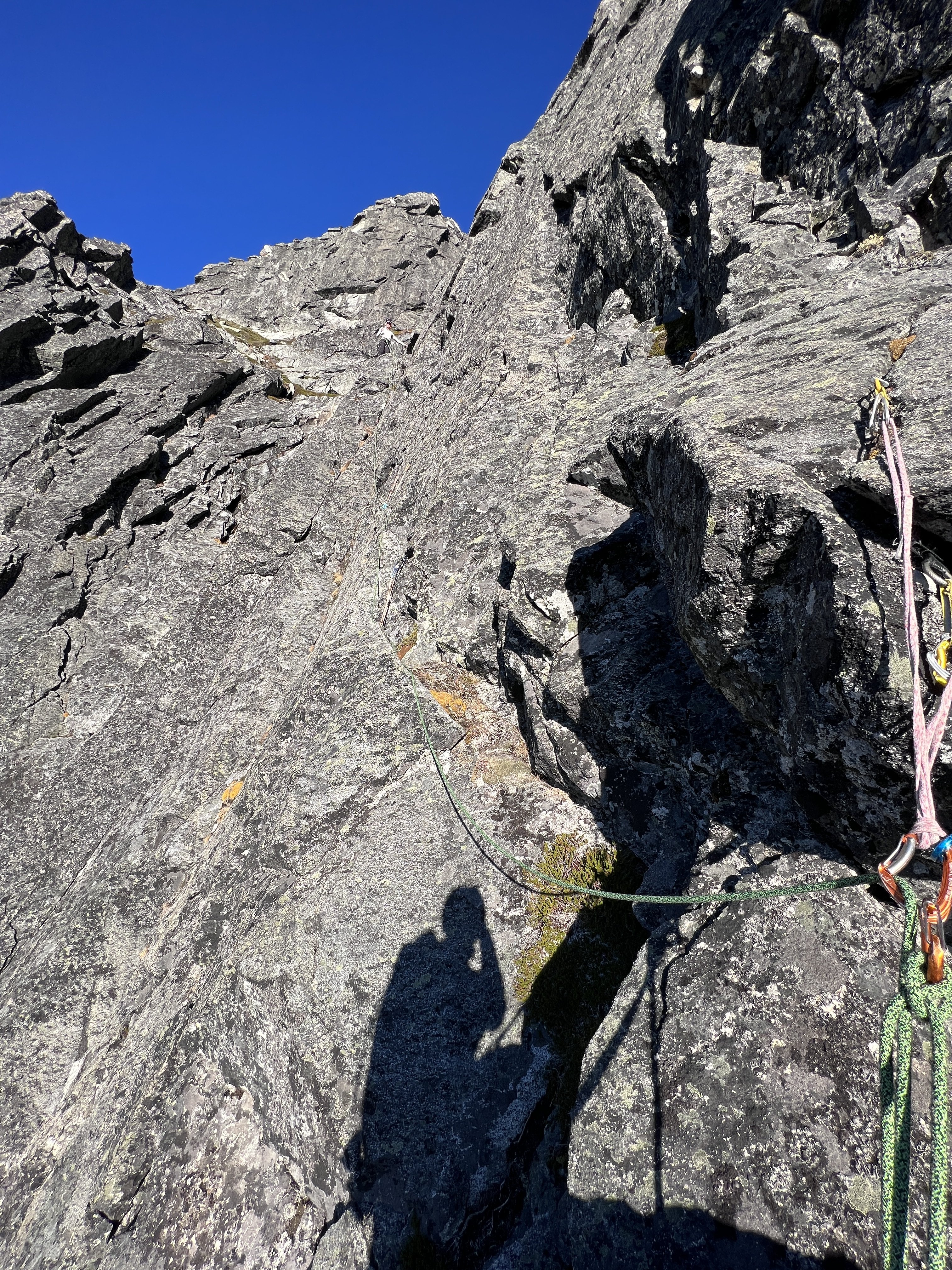
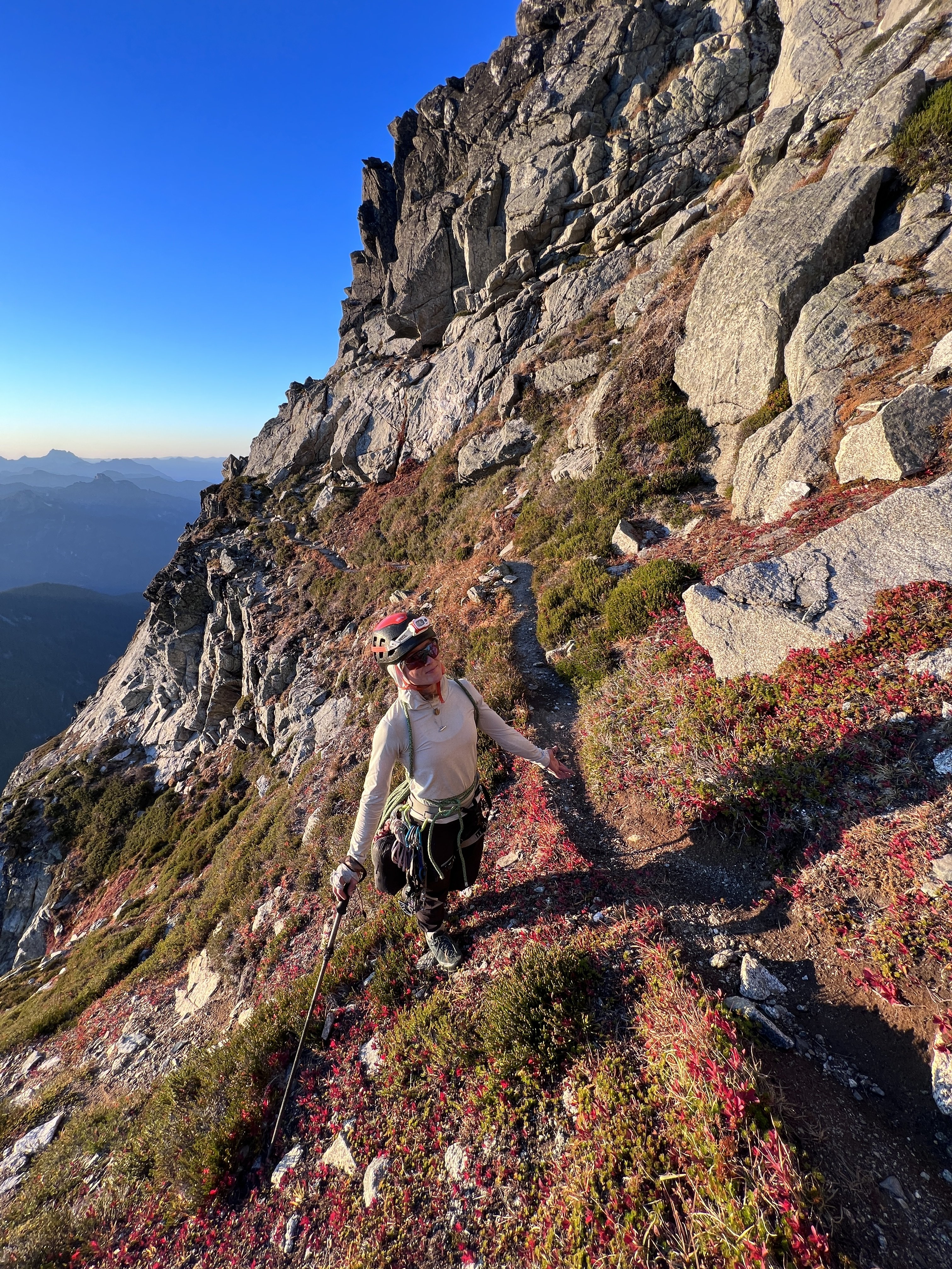
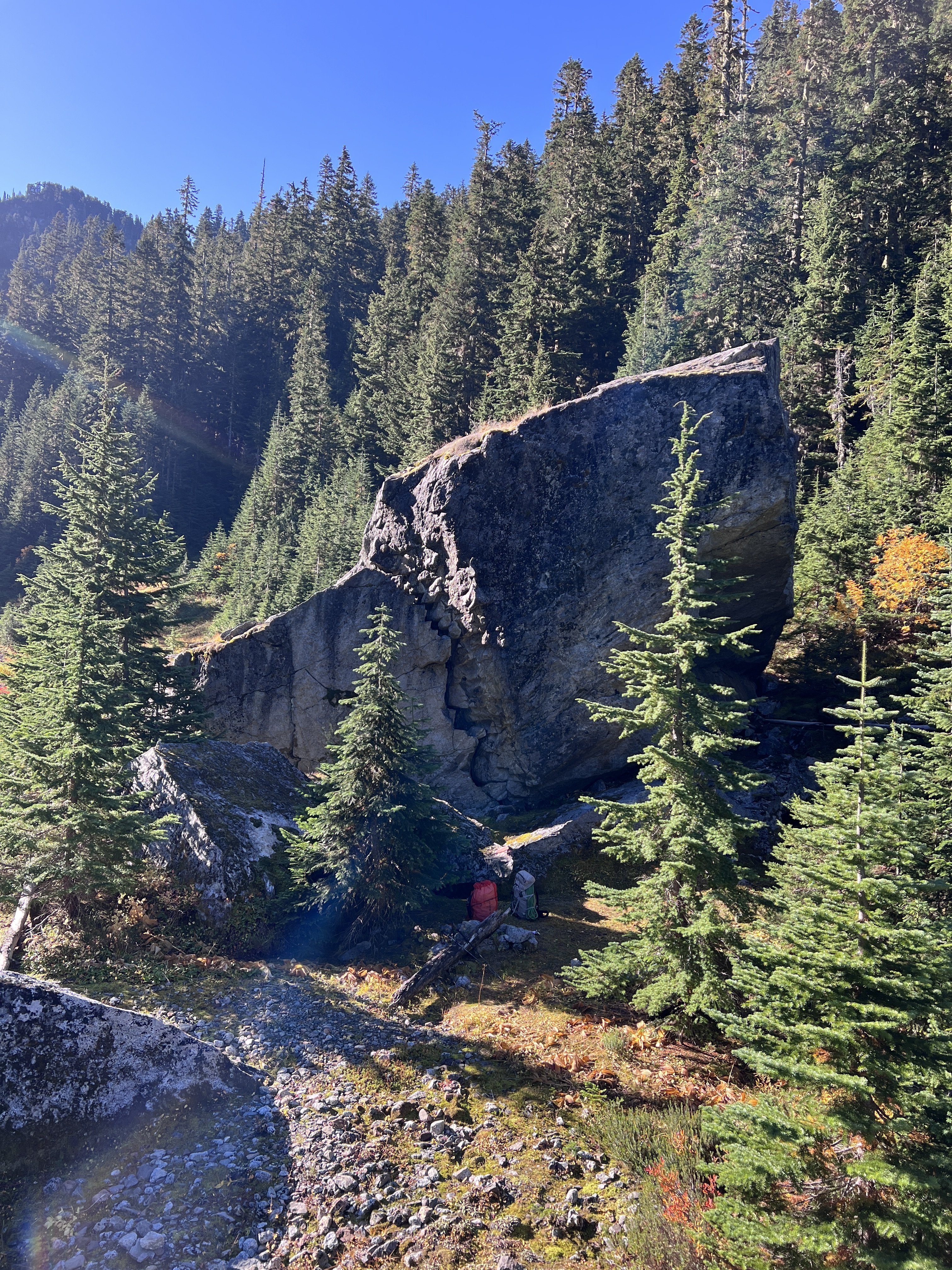
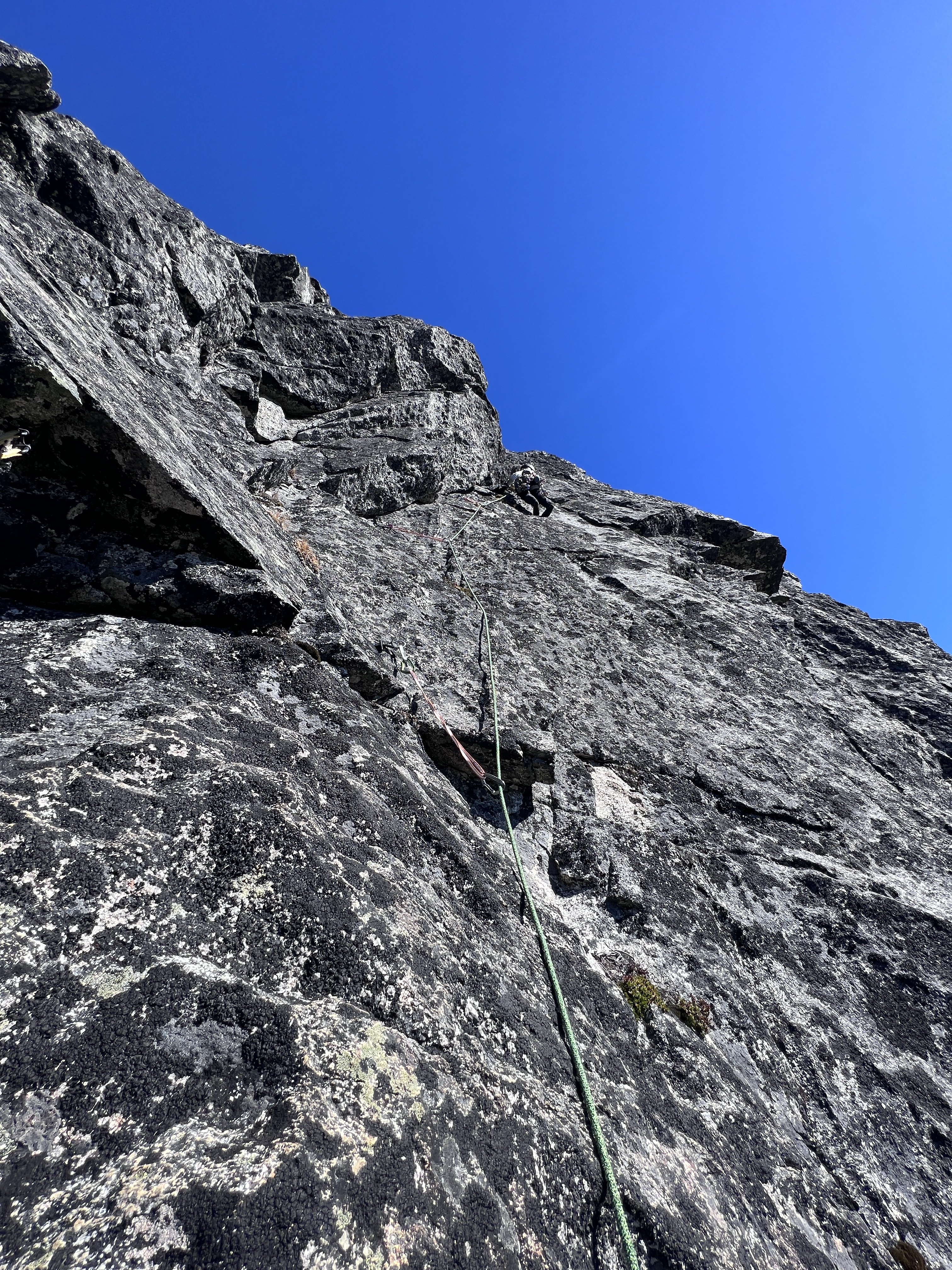
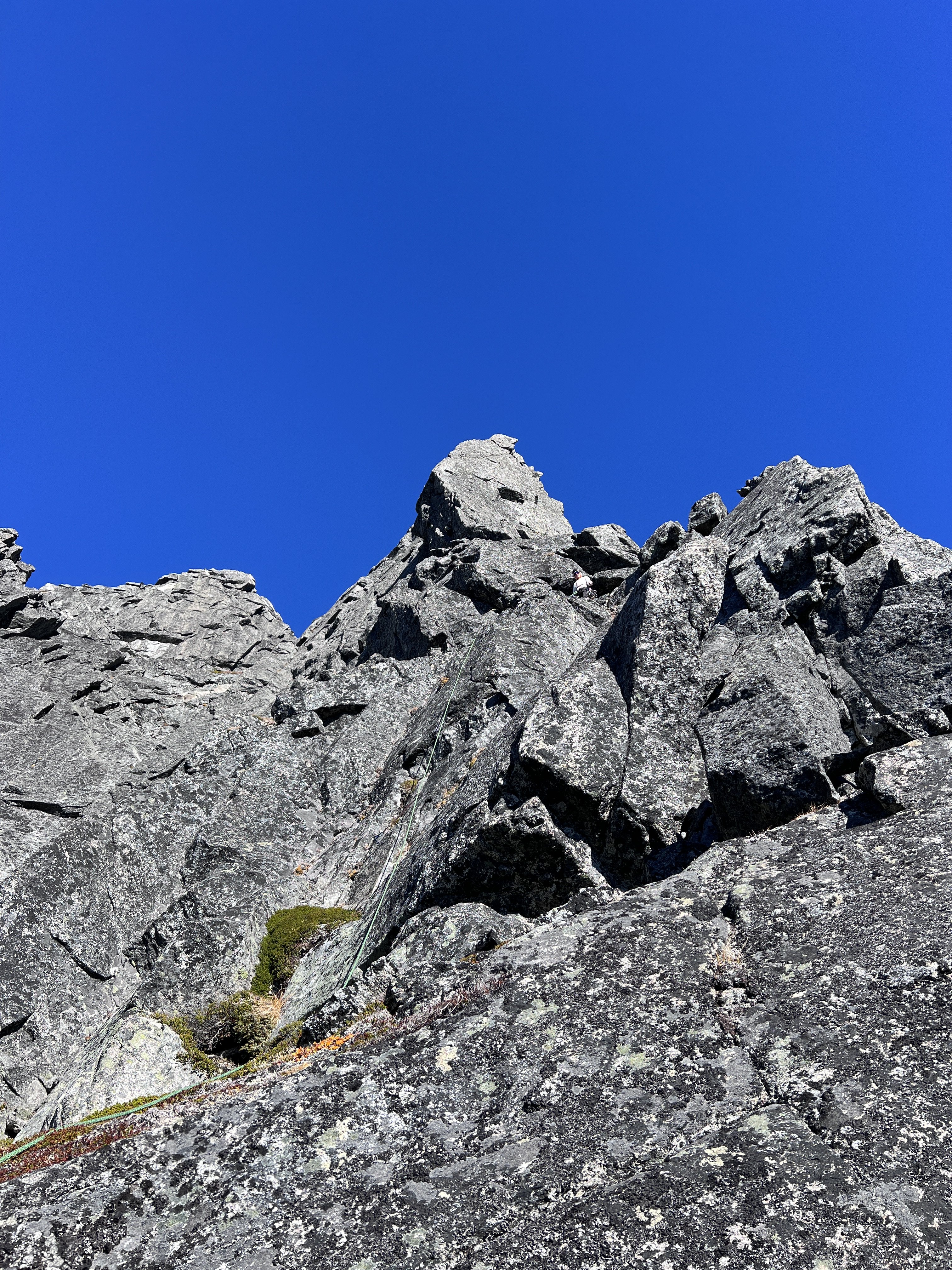
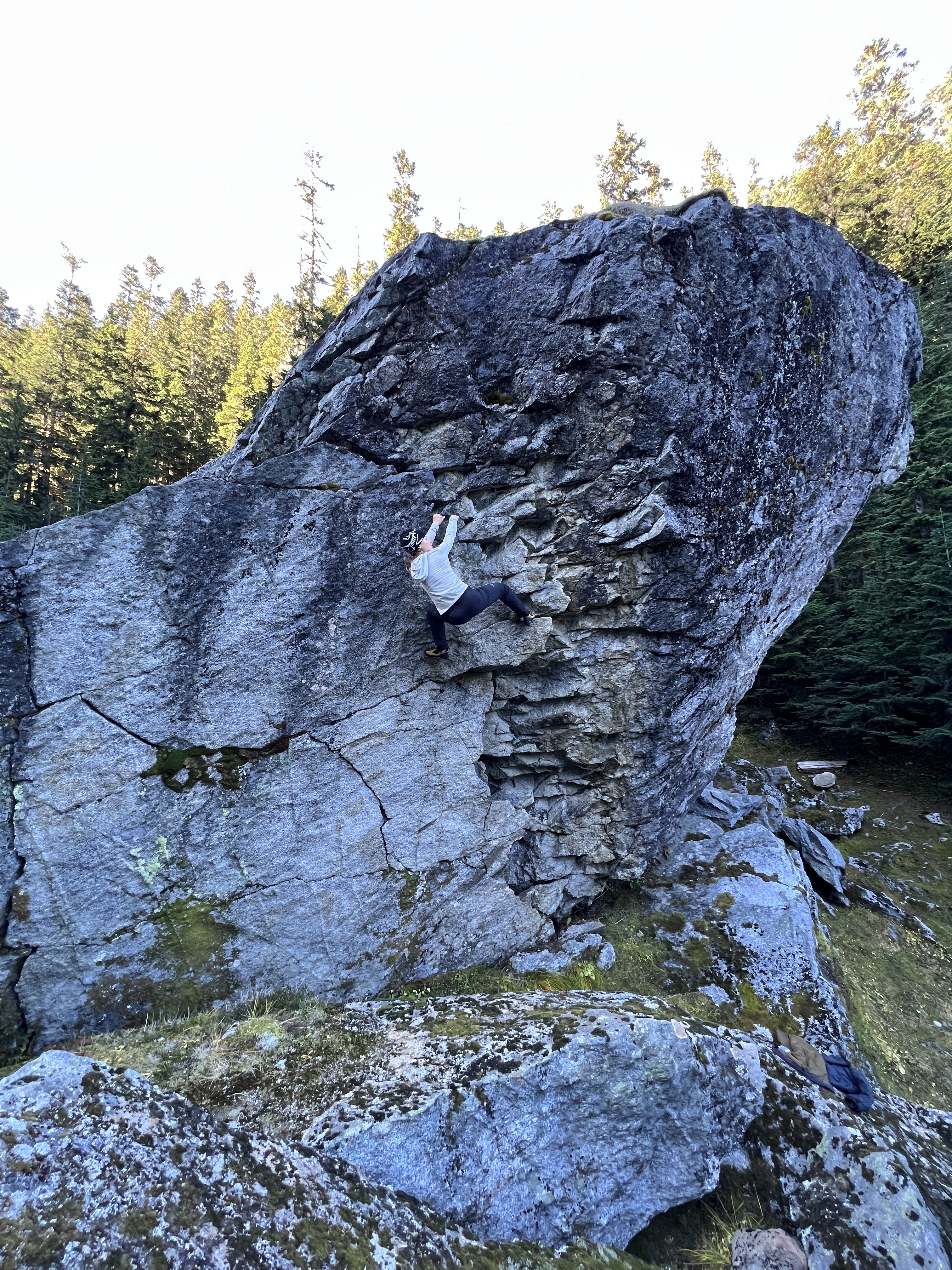
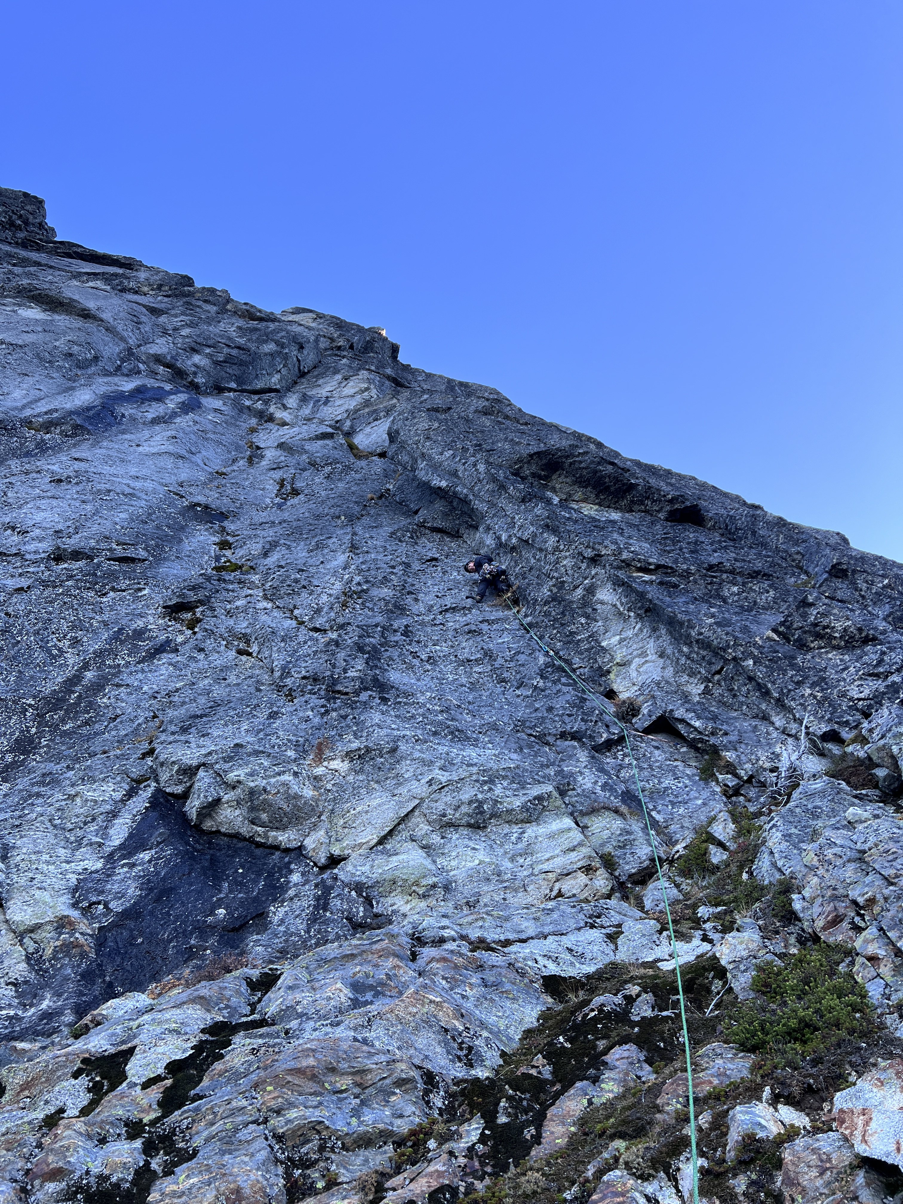
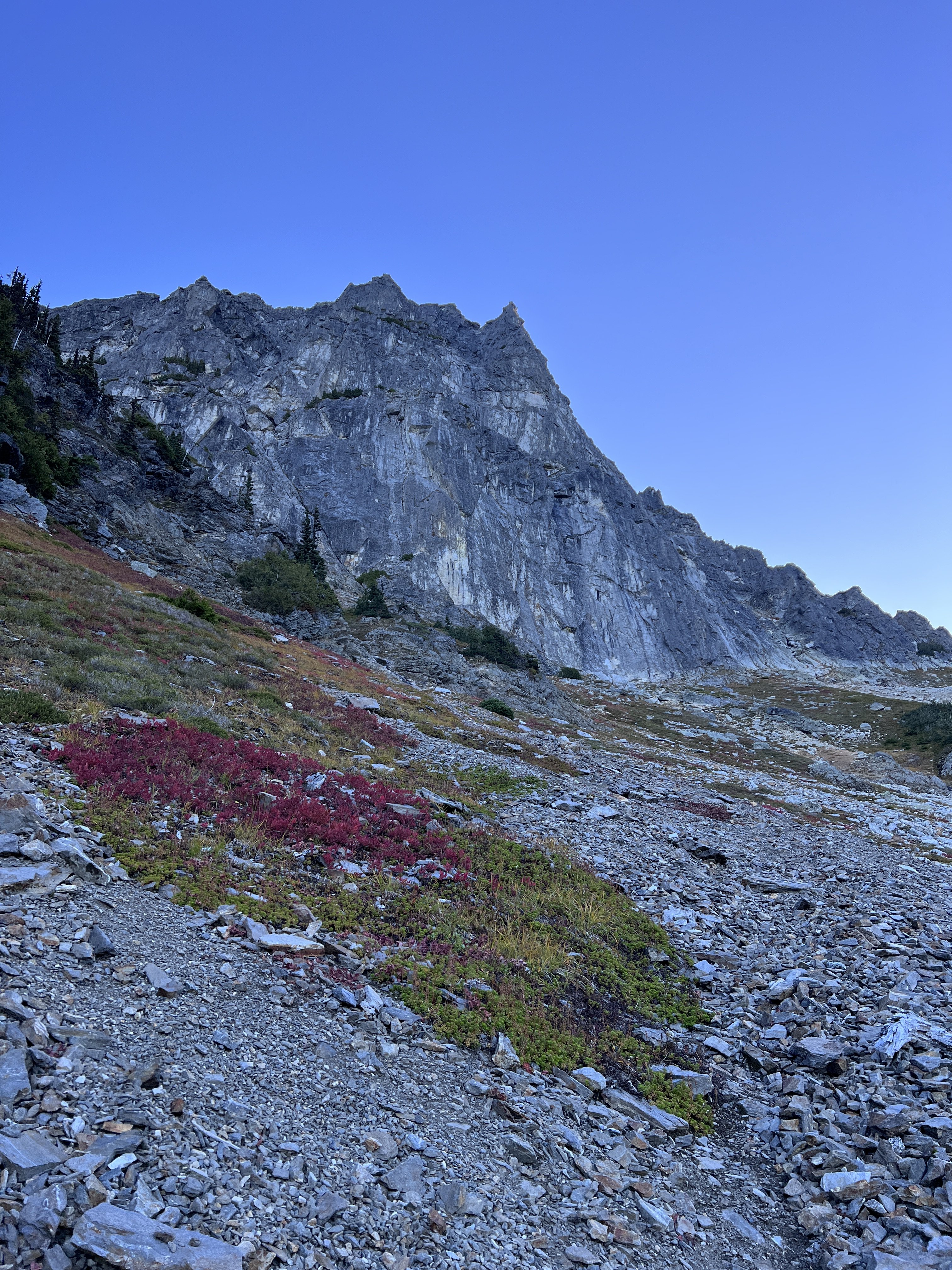
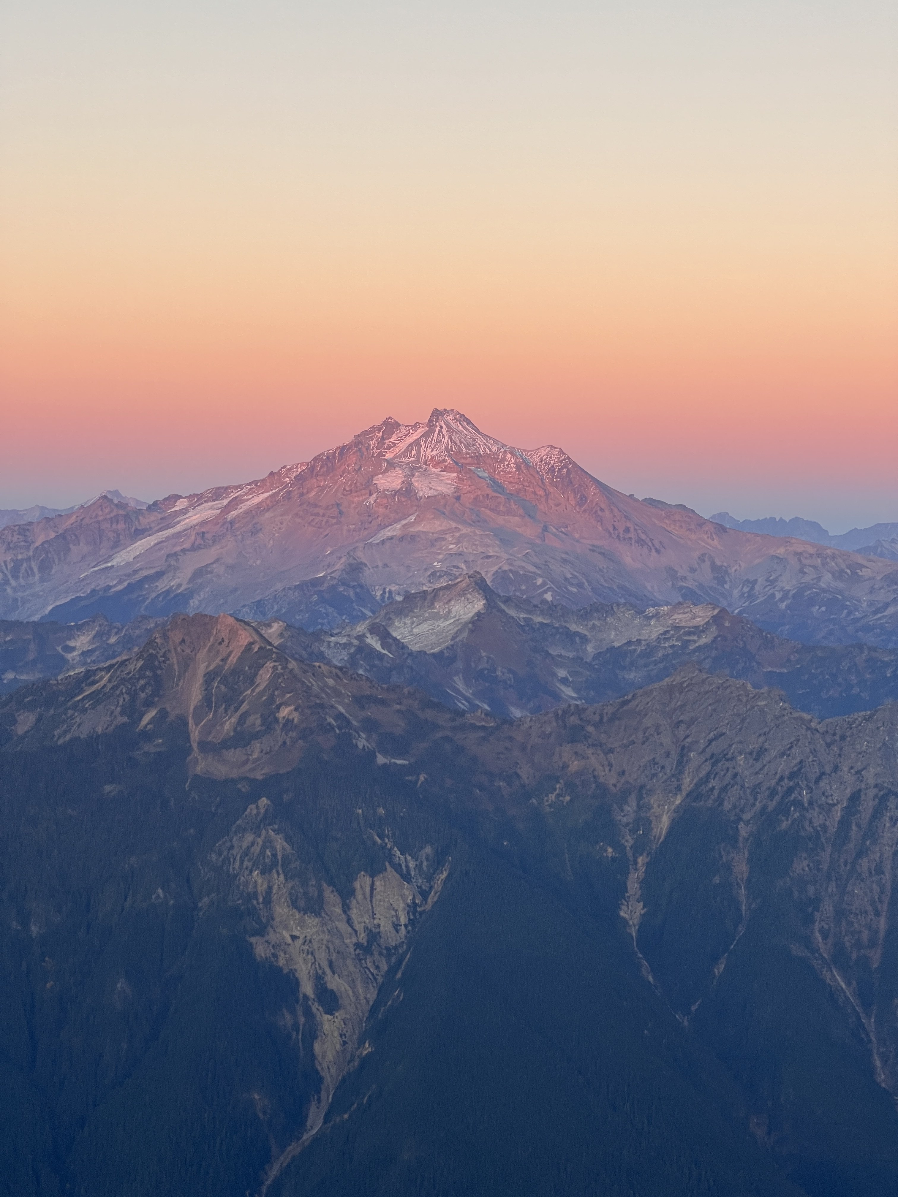
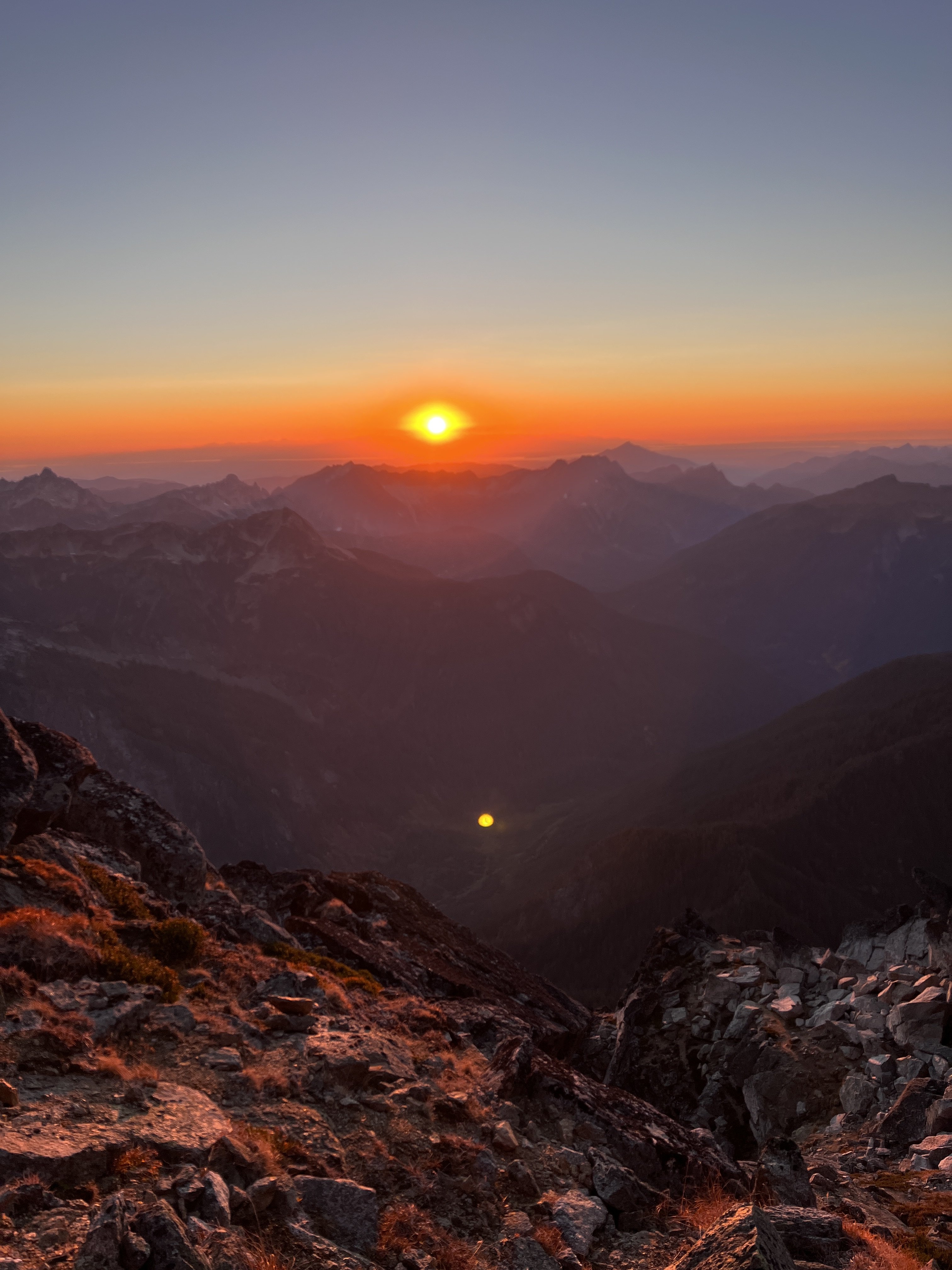
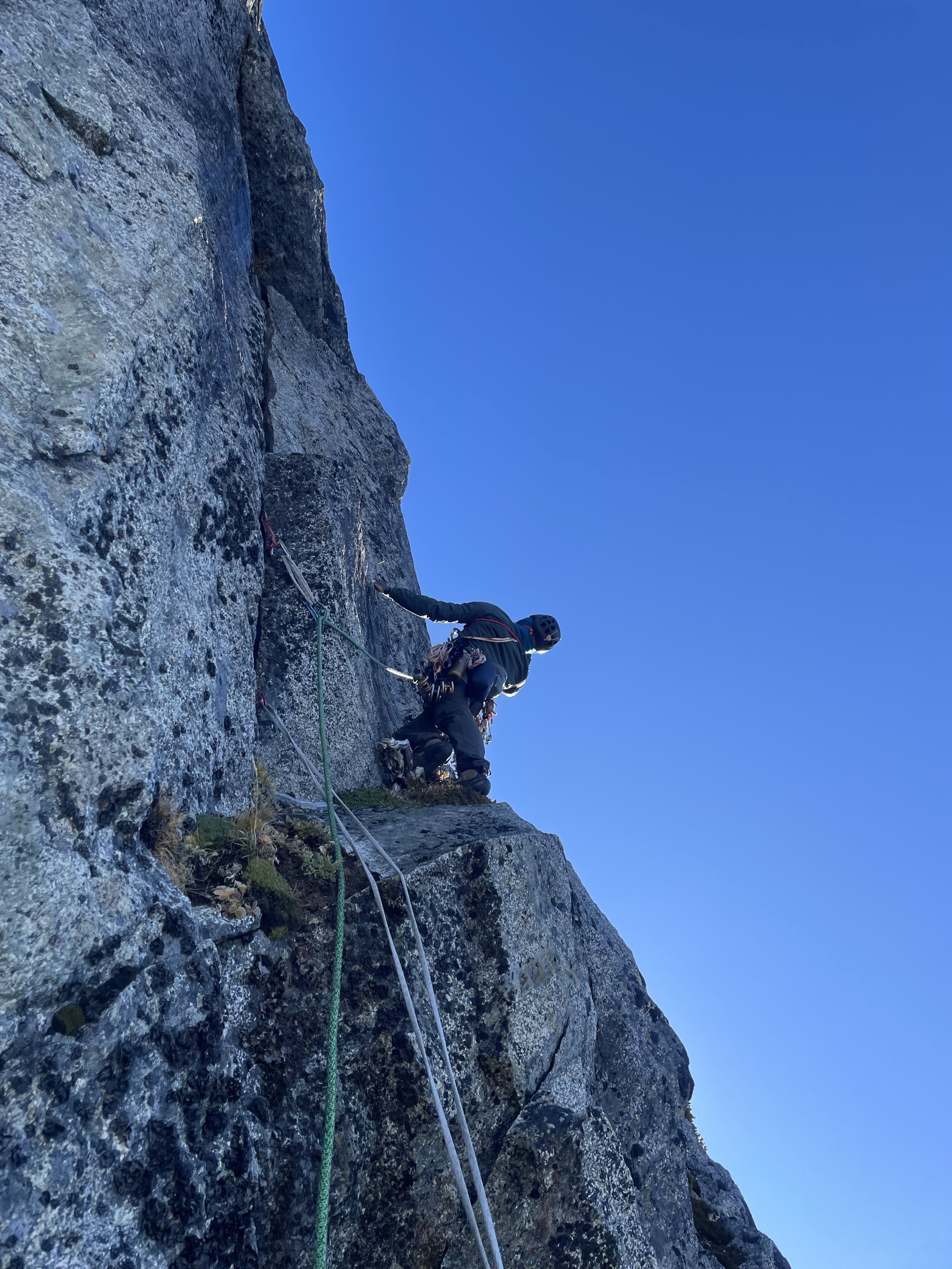
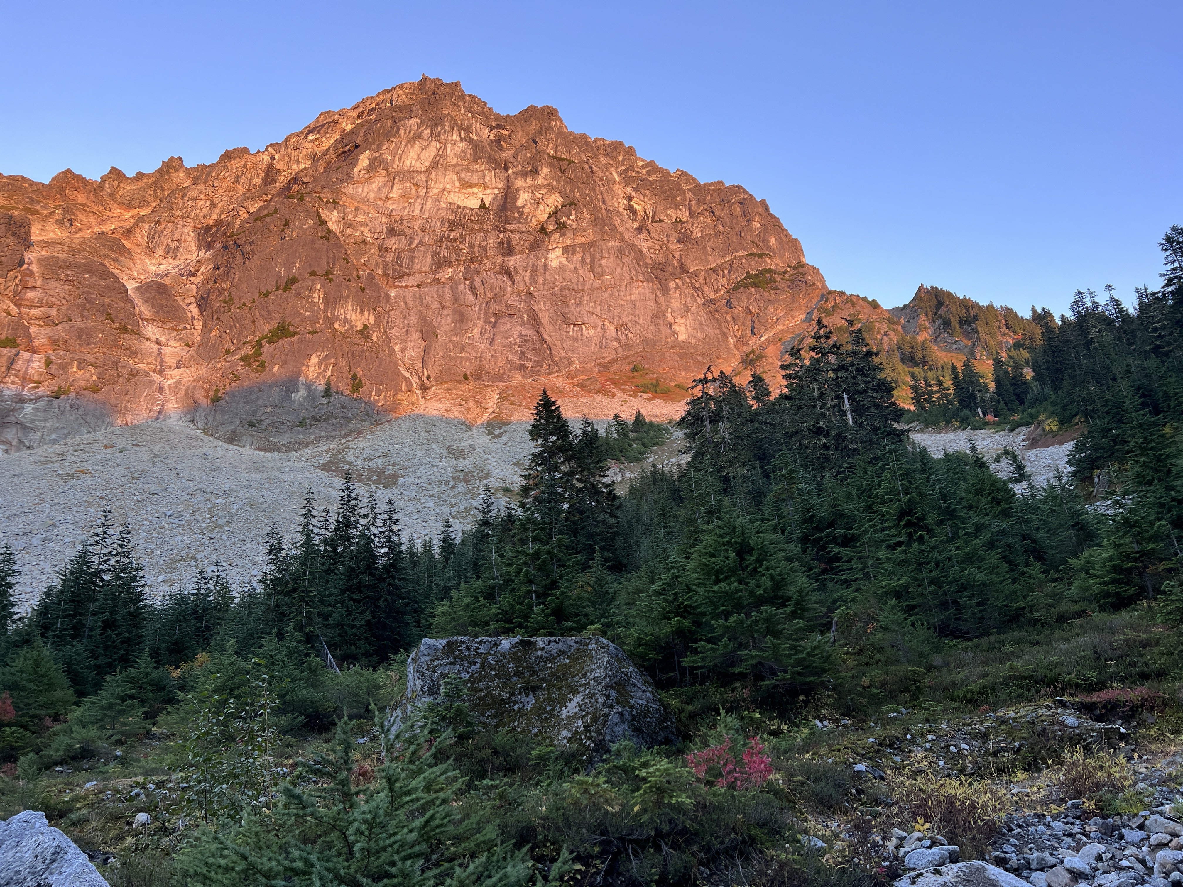
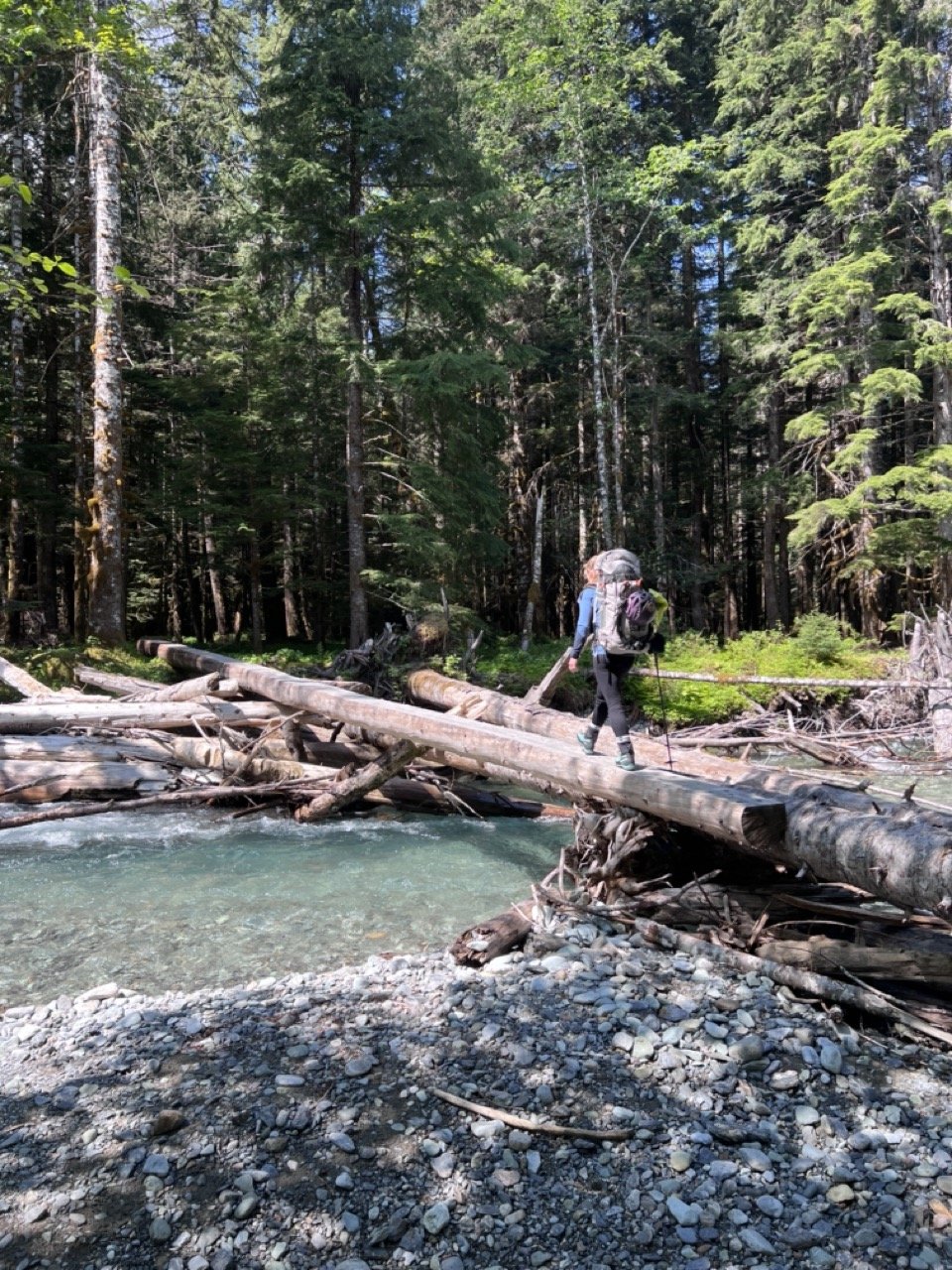
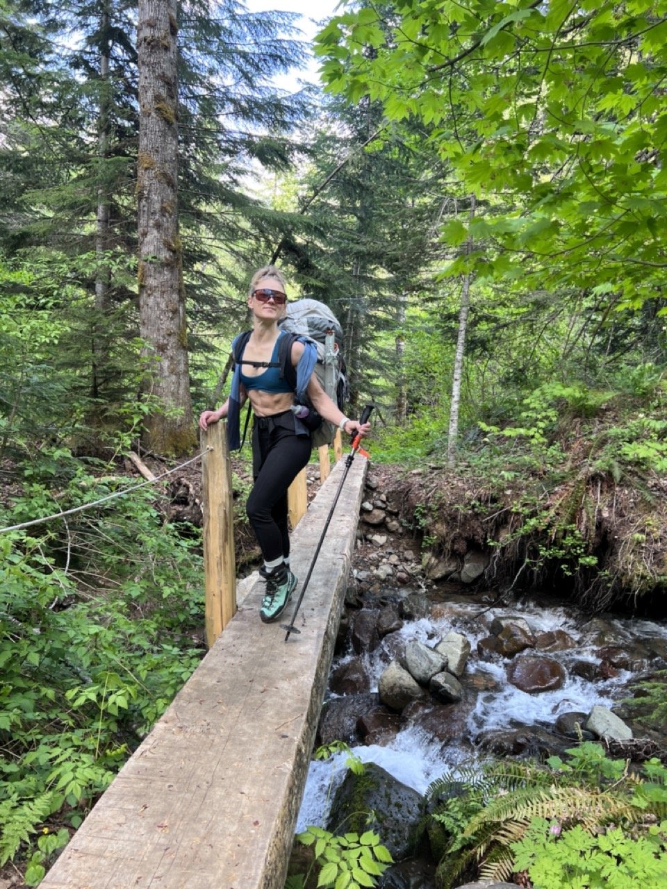
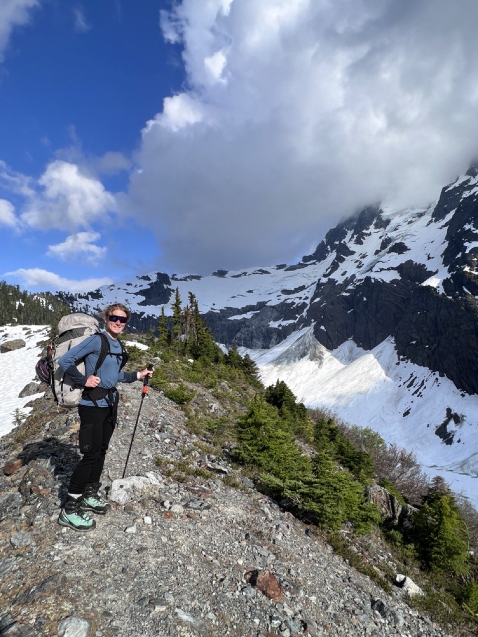
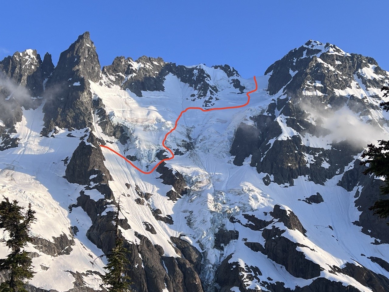
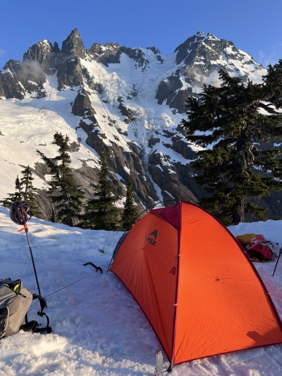
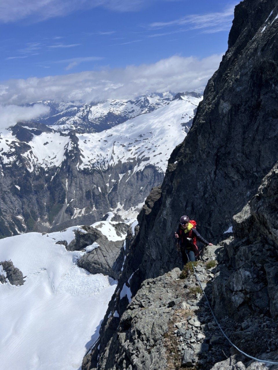
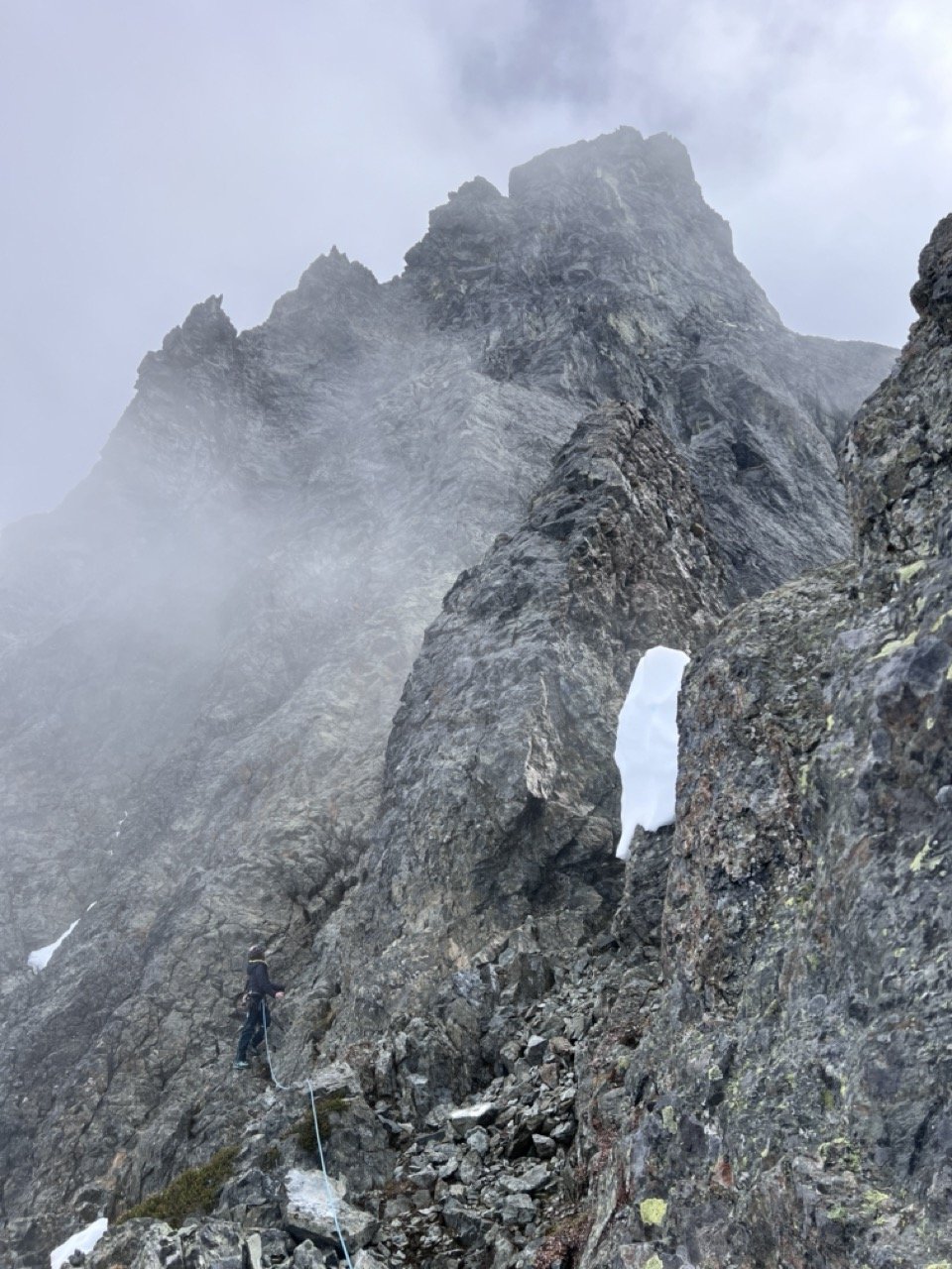
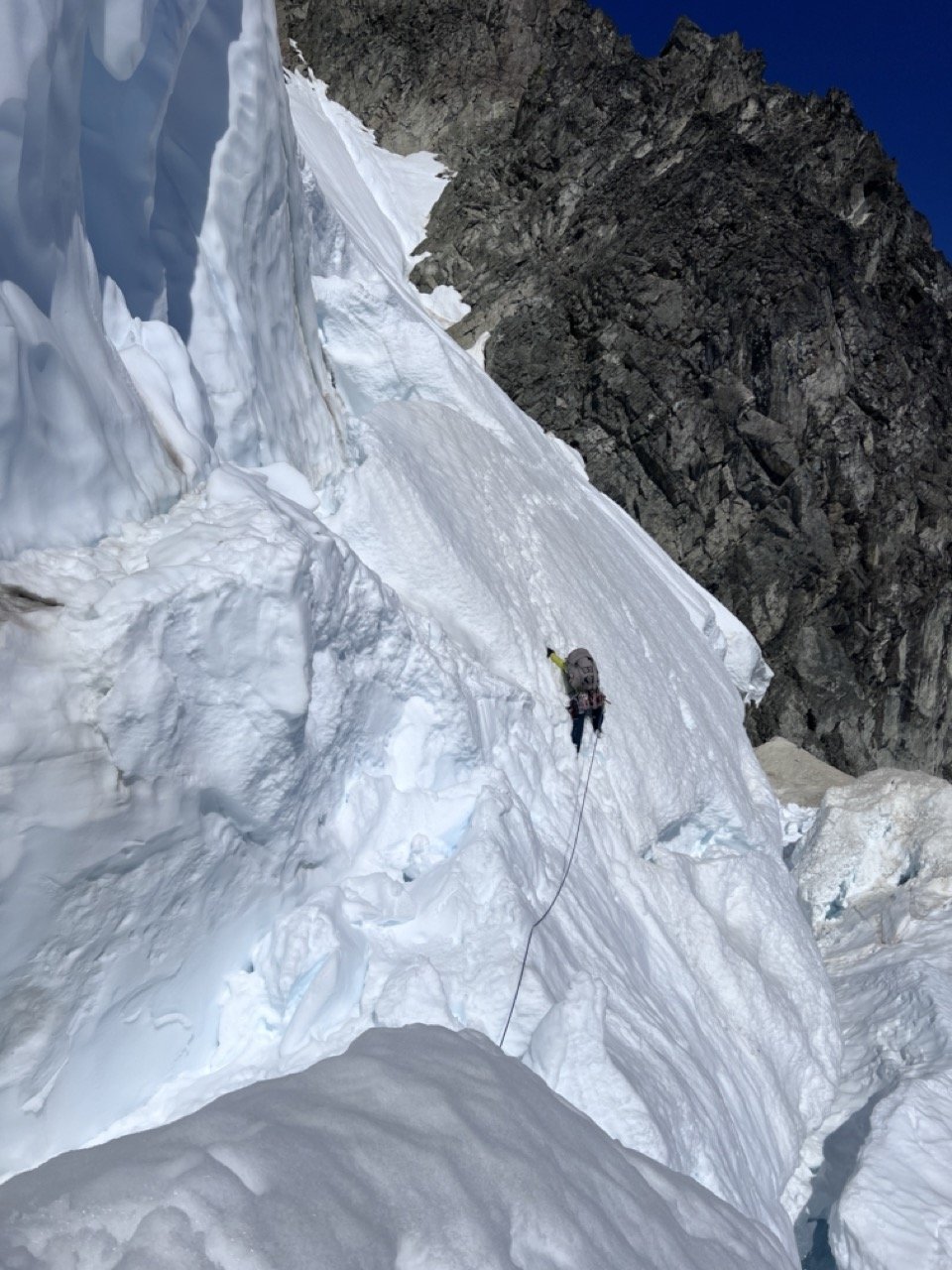
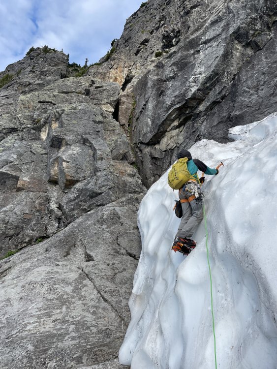
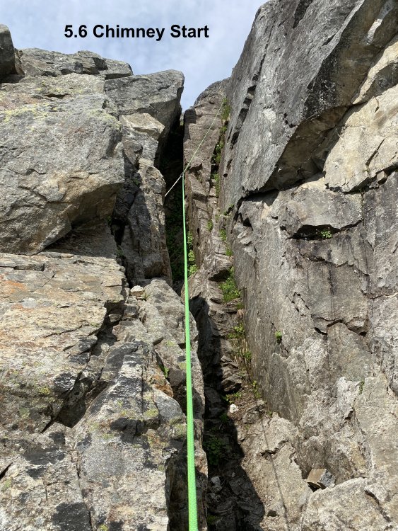
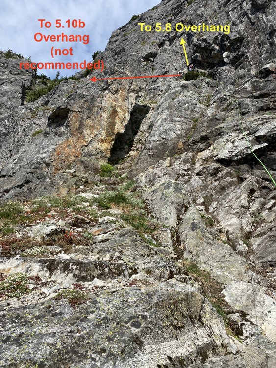
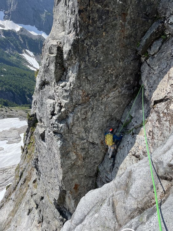
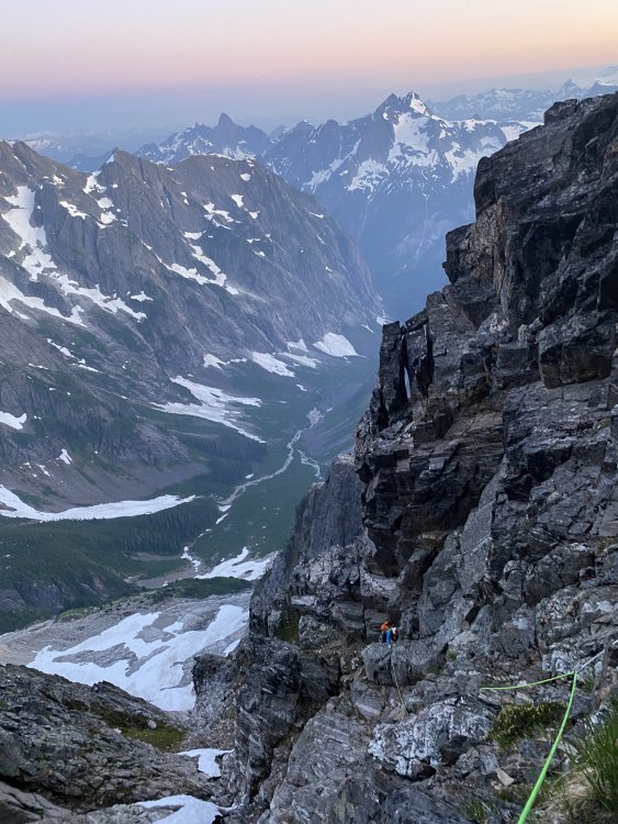
Trip: Sloan Peak - Fire on the Mountain (8 pitches, 5.10+) Trip Date: 10/07/2023 Trip Report: After attempting the SE Shelf on Sloan Peak (the "Matterhorn of the Cascades") in early-October with some Alpine climbing students and not summiting, Priti Wright and I (Jeff) went back the next weekend to climb Blake Herrington and Rad Robert's brilliant route Fire on the Mountain. I've honestly never alpine climbed in the Cascades this late in the season (typically rock climbing). Late season alpine can have really variable weather, but under the right conditions can be surprisingly perfect! One weekend, the mountain was a cold, snowy, winter wonderland. The next weekend, it was a beautiful, warm, dry, summer Type 1 outing. We studied all the past trip reports, downloaded all photos and route descriptions from every source, and still had a couple of issues. This report is not a one-stop shop of beta for this route since I still recommend you look at the past reports/pictures, but here are some extra learnings that we would've liked to have known going in. Read Wayne's report and all the reports linked (we had photos saved to our phone since routefinding was not obvious to us): https://waynewallace.wordpress.com/2018/08/02/fire-on-the-mountain-sloan-pk/ Also, save the excellent Mountain Project Description: https://www.mountainproject.com/route/122891276/fire-on-the-mountain Also, take a look at Steph Abegg's description and overlay of the SE Shelf route (which is the descent route): https://sites.google.com/stephabegg.com/washington/tripreports/sloan-bedal Approach I suppose, theoretically you could also approach via the Corkscrew Route (Sloan Peak Trail), then descend the SE Shelf to get to the base, then take the Corkscrew Route all the way back to the car, but I'm not sure how that compares to Bedal Creek. Most people seem to approach via Bedal Creek, so that is what I will describe. Bedal Creek starts by driving a few miles up a really nasty FS road (4096) which is not on Google Maps (high clearance 4WD advised...I know of at least one party that got a flat tire on this road, and I had to replace one tire after the trip). Here is the turnoff from the Mountain Loop Highway: https://maps.google.com?q=48.0856022,-121.3886677&hl=en-US&gl=us&entry=gps&lucs=,47071704&g_st=ic Take the road up until there is a small berm at the end (there is space for maybe 4-5 cars): https://maps.google.com?q=48.0719366,-121.3763550&hl=en-US&gl=us&entry=gps&lucs=,47071704&g_st=ic NW Forest Pass required (I think). No backcountry permit required. Gotcha #1: The road continues past the berm where you park, but do not start hiking up the road. The trail begins immediately uphill via a good, clear path and flagging from where you park. The USFS description is confusing when it says "Bedal creek trailhead is not located at the end of the road." (that's not a typo, but it is a poor description) There are many trip reports of unfortunate souls continuing up the road only to realize the trailhead was back where they left the car. The Bedal Creek approach (despite all previous accounts) was weirdly difficult to route-find. After many iterations, I think I finally nailed the approach if you are trying to get to the West Face, North Ridge, SW Face, or SE Shelf. Here is a CalTopo map with tracks, turn-by-turn waypoints and water sources (recommend downloading the topo map and satellite map for offline use with these tracks and waypoints): https://caltopo.com/m/RFMPB/LE9HFB06R0Q6PE6H 2-3hours to reach camp under the gigantic boulder in the Bedal Creek Basin (site of the old Harry Bedal Cabin who mined for asbestos in the early 20th century). This is a fantastic site with spring water nearby on flat grass that can fit multiple tents. The only downside to this site is that it is so comfortable and idyllic that you won't want to leave. It is also the site of Washington's most secure and gleeful V1 highball. Many folks climb Sloan in a long day from the City, but we did two nights out for a leisurely Type 1 camping trip (plus limited Fall daylight). Camp in the basin, or higher up at one of the sites on the South Ridge (very close to the start of Fire on the Mountain or the West Face route). See waypoints in CalTopo Map Gotcha #2: Most of the season you will encounter snow and running streams on approach for water sources. We didn't get any snow or water above camp until we descended to the glacier...oops. Carry water. Above: The West Face. Note that the "West Face route" (5.8) actually begins on the Southwest Face (which is on the other side of the right-hand skyline shoulder) Above (SW Face): Fire on the Mountain starts on the right hand side and goes straight up to the pointy gendarme. The West Face route (5.8) starts up the left-trending ramp on the left side of the face that you can see in the picture above. Pitch 1 (shown above) starts in a chimney then finger cracks (5.10+) then belays on a shelf above the obvious finger cracks. Pitches 1 and 2 take the longest, then the rest of the route is fast and cruiser. Money pitch! Pitch 2 (Gotch #3): the FA party did Pitch 2 in two pitches, but all parties since have done it in one long pitch. We ended up splitting up the pitch due to routefinding issues and rope drag, and it seemed logical to split this pitch up since it is so wander-y. Some reports showed climbing a wonderful hand crack flake above the belay, but NO! Ignore this beautiful crack (shown above), walk 10ft to the right on heather and find another beautiful hand crack next to an off-width. Climb the hand crack on the right, then traverse right to a small ledge. Climb up and gradually right on runout face to a "vertical seam"....we never found any of this since the face climbing was too scary so I backed off. Instead, we did a low, hand traverse to a grassy gully that led up to the roof (this was a complete garbage variation). I don't know...weird pitch...I never figured out where to go, and you can't see the roof from the bottom of the pitch...just keep trending up and right). The roof was super runout, save your #3 and 4 for this. I would have very much liked to have had a second #3 and one #4 for this pitch. Pitch 3 (shown above): climb the obvious, right-leaning crack, and don't be suckered straight up or left. Pitch 4 (Gotcha #4): This is NOT an Offwidth (unless it has changed in 10 years)! The Mountain Project and the Steph Abegg descriptions of this pitch are correct. It's just an obvious straight up, right-facing, dirty corner. Very straightforward. End on top of a pedestal (old piton rappel anchor from Kearney is down and left of the pedestal). No place for a #4 on this pitch (what the hell Blake!) Pitch 5 (shown above): Get your slipknot ready before you get off the deck and eye up the chickenhead (shown above)! Follow knobs then a ramp leftward. Skip the first right-facing dihedral and continue leftward to the second right-facing dihedral (5.10c). Belay just above the dihedral or keep going as much as you can in order to make Pitch 6 shorter. At least one party I know accidentally went straight up (into a right-facing dihedral) from this belay instead of starting off on the left; they found hard runout climbing to get back on route. Follow the chickenhead! Pitch 6: Climb as high as possible until you run out of rope (consider simul-climbing because it's no harder than 5.8). Skip the heather ledge and keep climbing into Pitch 7. Skip the unnecessary "boulder problem hand crack" and just take the path of least resistance out right then back left. Just chose your own adventure and continue straight up. It wasn't harder than 5.8 unless you just want to do a 5.10 boulder problem. Keep climbing, aiming for the pointy gendarme. Lots of good belay spots. Pitch 7 (shown above): If you extended pitch 6 past the shallow, heather ledge, chose your own adventure up the easiest path (no more than 5.8 if you chose wisely) and continue straight up to the pointy gendarme. DON'T start traversing too early! Continue aiming for the pointy gendarme summit until you reach an overhanging bulge (shown above) and you are forced to traverse out left. Belay under this overhanging bulge. You definitely want to split this pitch into 2 pitches, which is very logical because (1) rope drag is terrible on the traverse and (2) you can stretch this traverse pitch and end it above the heather ledge where you feel really comfortable to unrope. Note: for reference, there is a steep, slabby gully on the left side of the gendarme...don't go here! Stay on the prow and traverse high which puts you directly onto the final heather ledge. Once at the safe, heather ledge, you can unrope, put comfy shoes on (it's 3rd and easy 4th class from here), and coil the rope. Gotcha #5: Don't start traversing right at the first heather ledge system you see at the top because it does not join the Corkscrew Route here. Whether or not you are opting for the summit, traverse left on gentle heather for about 30m until you reach a gully. Ascend this gully for another 30m (3rd and easy 4th) until you reach the HIGHWAY that is the Corkscrew route (shown above). From here, leave your stuff and go left, following cairns, a nice path and some more 3rd/4th terrain to the summit (~30min to summit). Or, if you skip the summit, take the Corkscrew highway going right. Pictured above: descending the corkscrew trail traverses counter-clockwise around the Southwest side of the mountain where you will get a view of the impressive East Arm. The SE shelf descent route is a lower shelf beneath the East Arm. You will need to descend down slopes down an obvious gully to a rappel station (15m rappel or low-5th downclimb) which takes you to the top of the SE Shelf. Some parties rap off the shelf onto the glacier, but we found that just going all the way down the shelf was pretty fast and safer (plus the moat at the bottom of the rappel could prove tricky). There is some low-5th slab climbing at the bottom of the SE shelf. See some of my waypoint notes in my CalTopo. Enjoy! Gear Notes: Doubles to #2, single #3 (lots of finger size cams). Would have liked an additional #3 and also a #4, but not necessary. Didn't bring ice axe or crampons since we knew that the glacier could be avoided by climbing slabs in late season (recommend ice axe and aluminum crampons for added safety). Bring lots of water. Didn't have any water or snow from our bivy site in Bedal Creek all the way to the glacier on descent. One hiking pole each was really nice. One big follower pack. Approach Notes: Download this map (topo and satellite) plus the routes and waypoints: https://caltopo.com/m/RFMPB/LE9HFB06R0Q6PE6H
-
[TR] North Pickets - Mongo Ridge (Tower 1) 07/01/2022
JeffreyW replied to Jake Johnson's topic in North Cascades
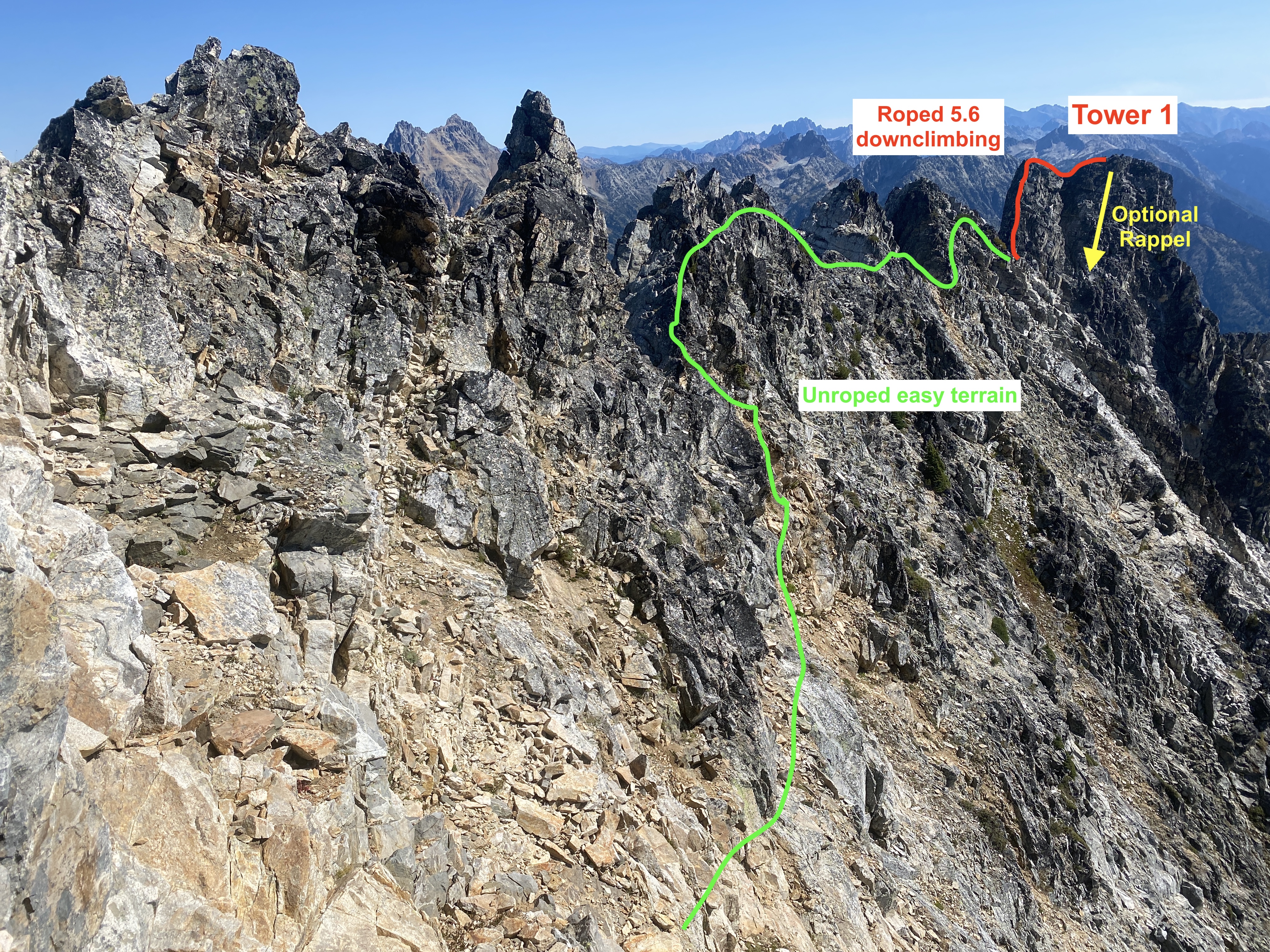
Good effort, team!! Wish the pics were still available. I'd love for someone to figure out the optimal way to ascend Tower 1. I thought it was very cruxy/scary! -
Thank you so much for the work you put in! It’s amazing!
-
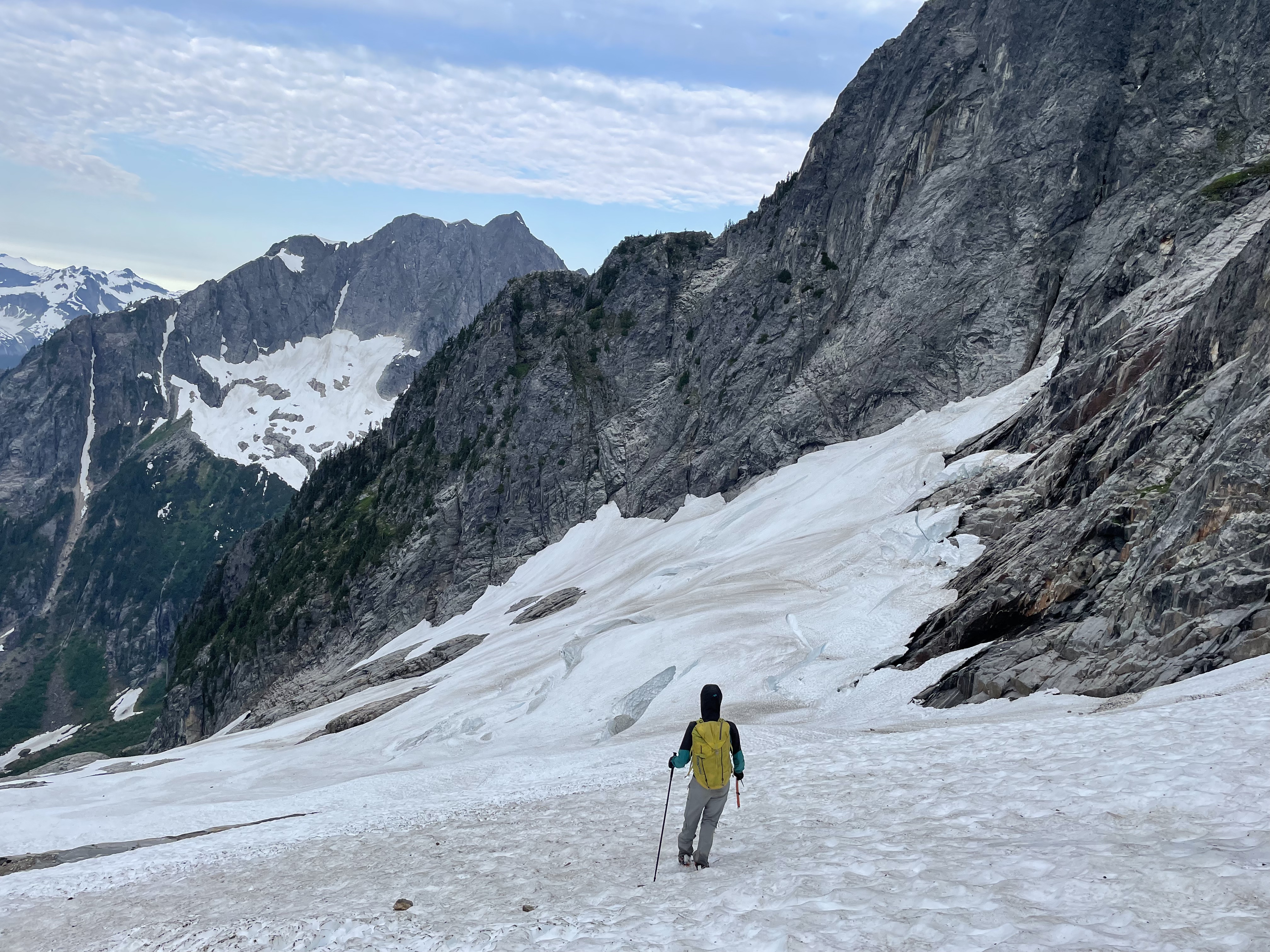
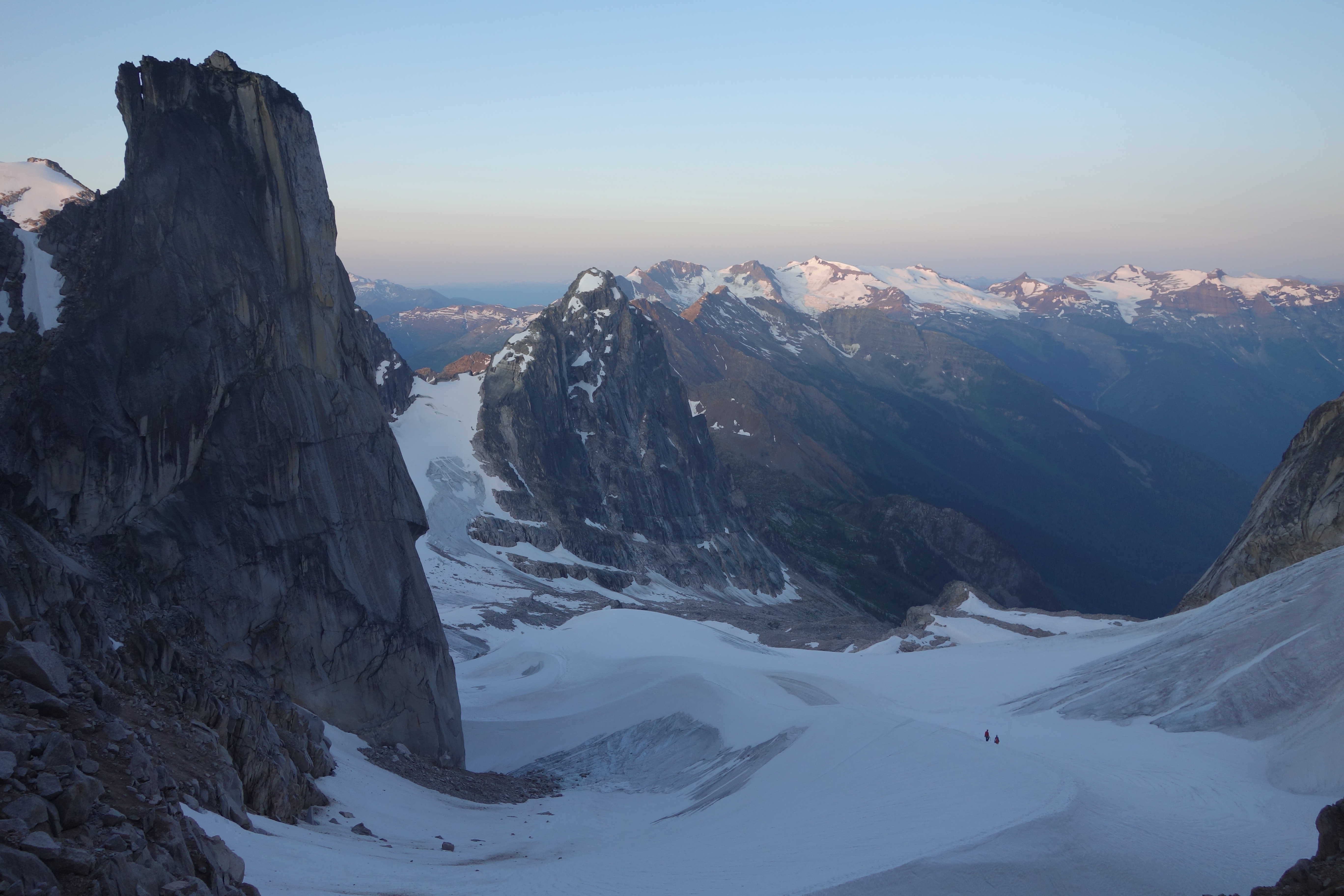
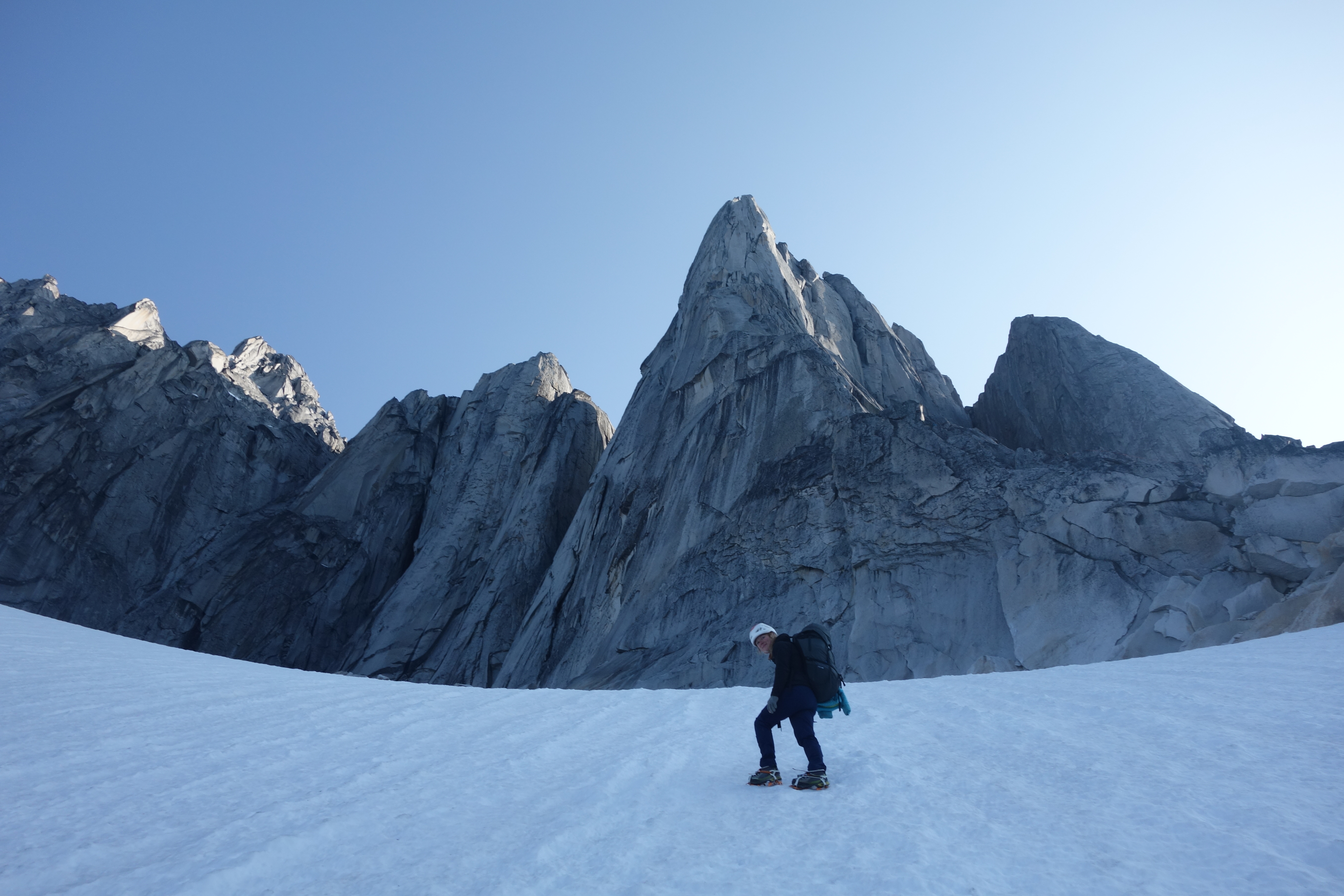
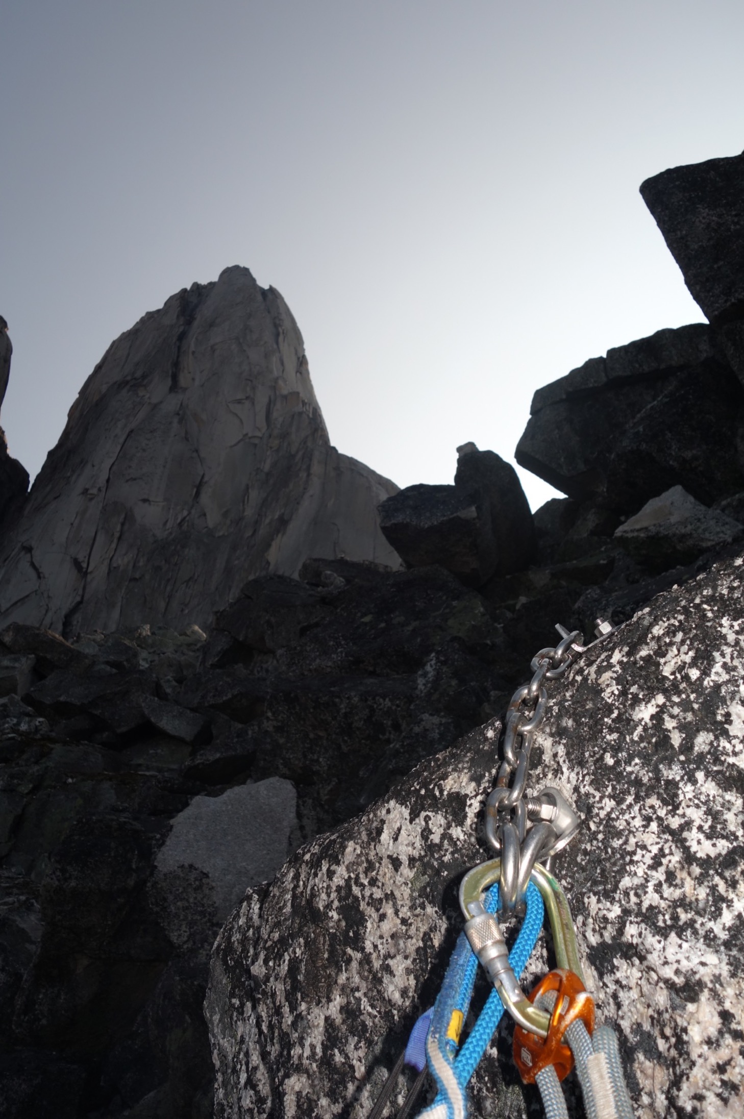
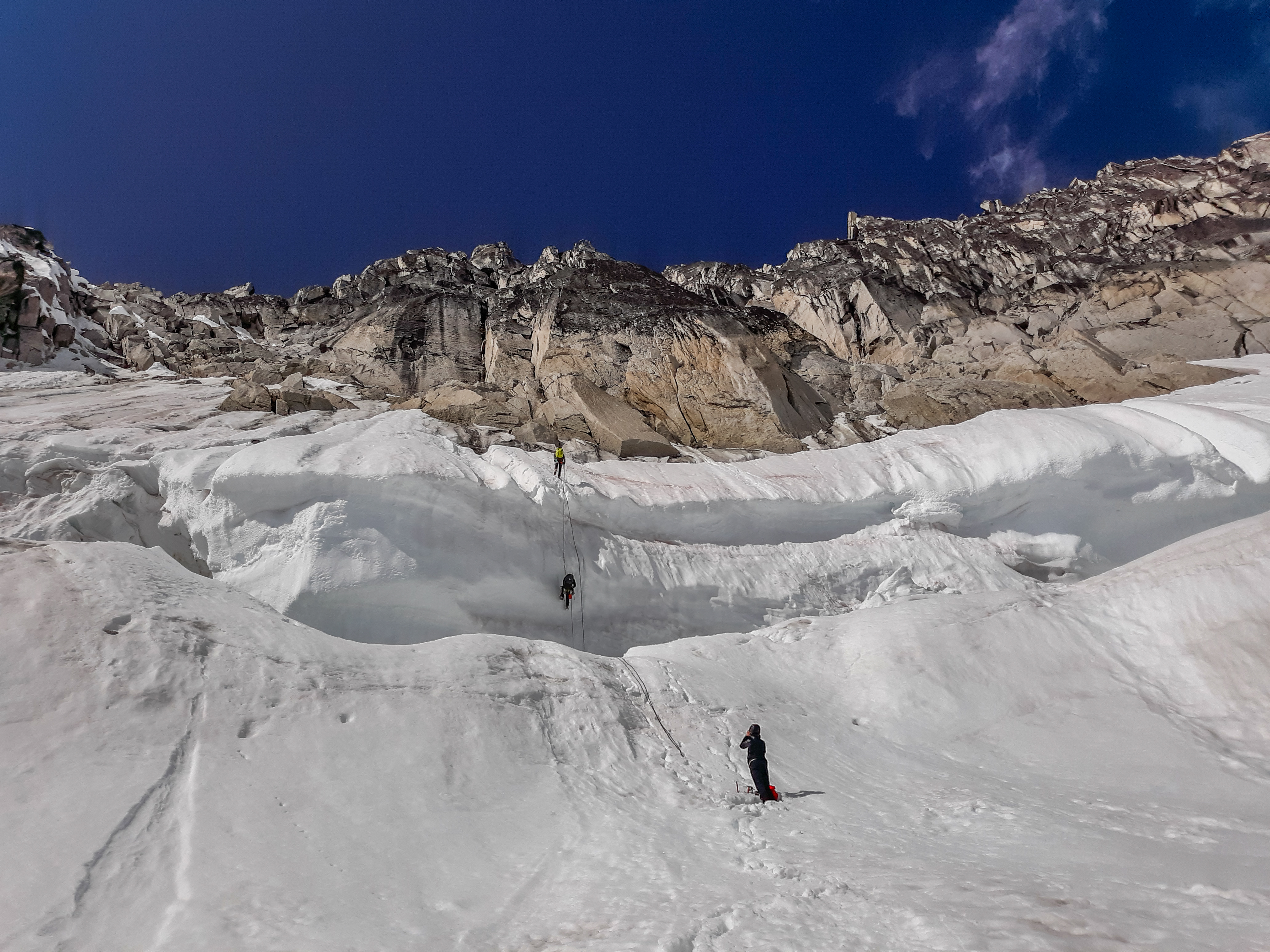
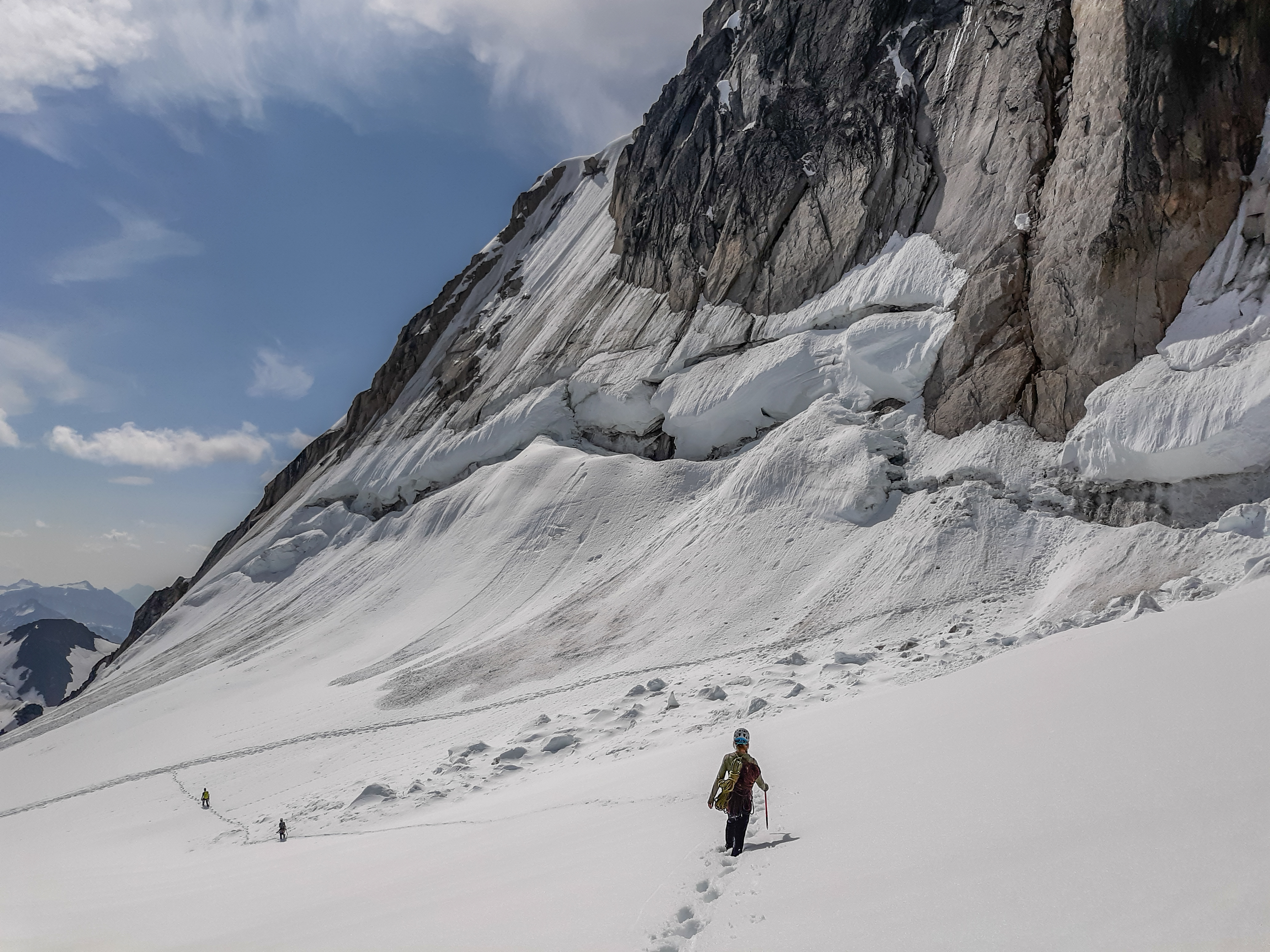
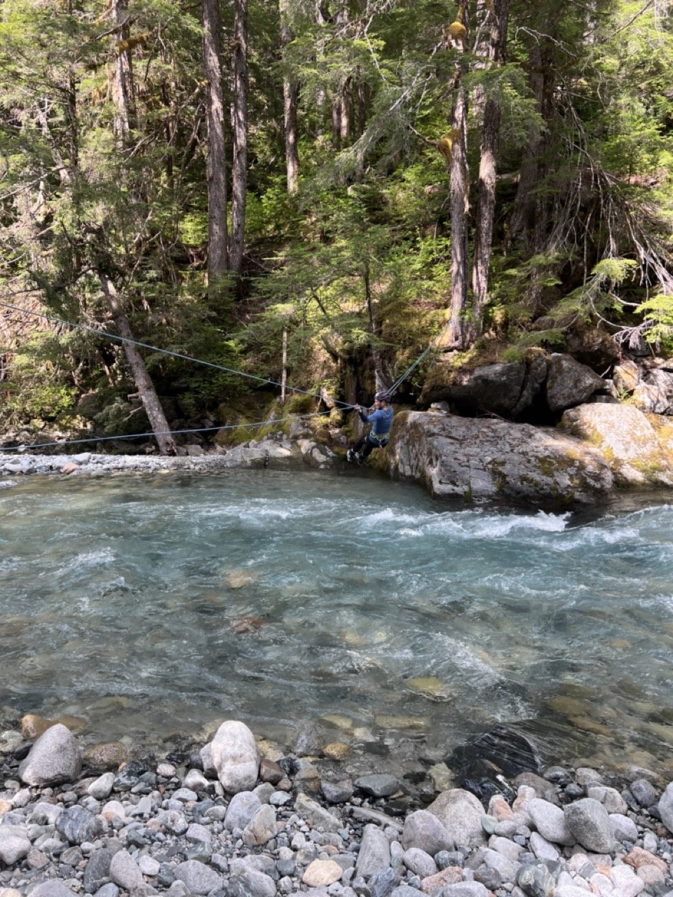
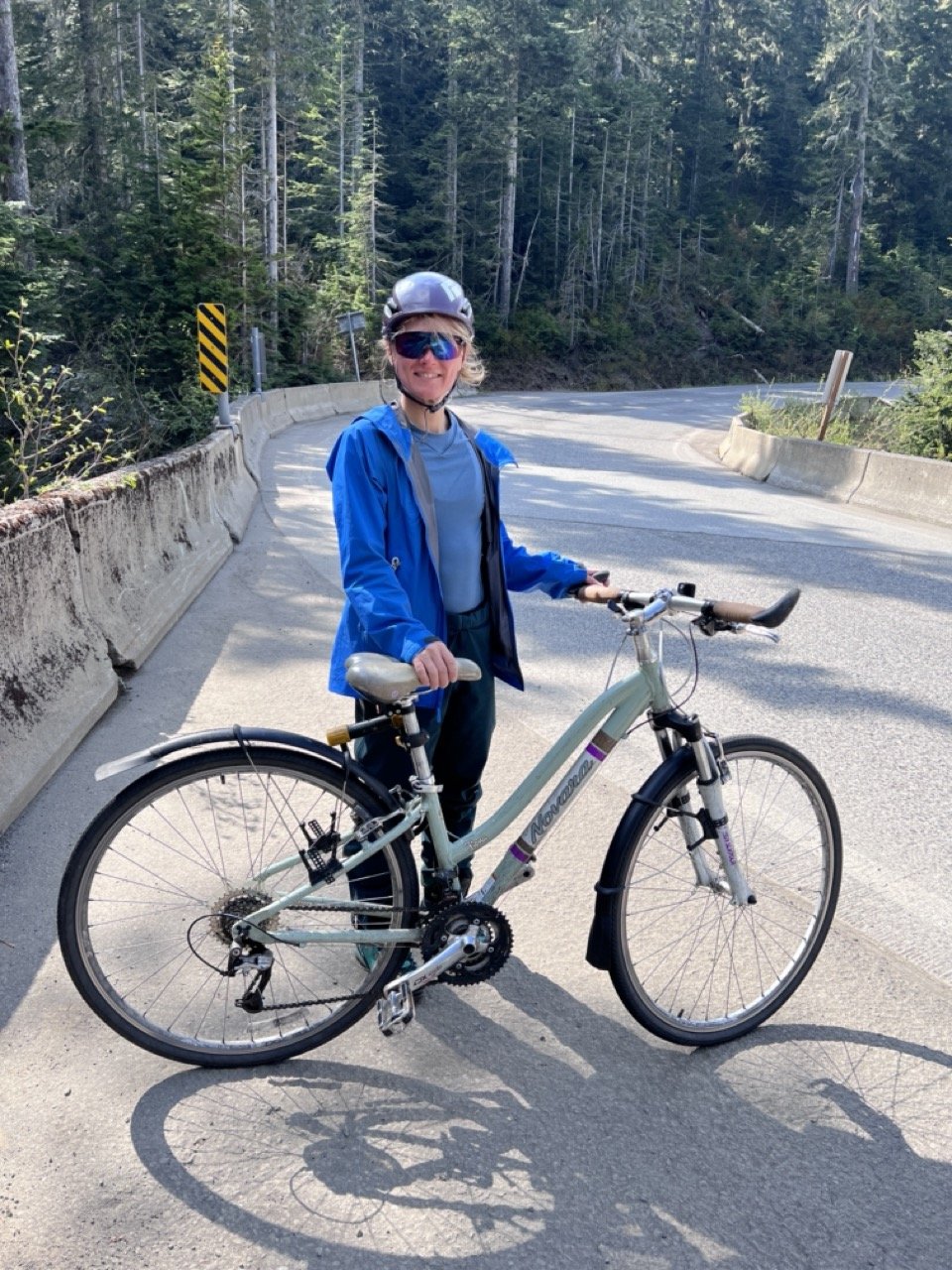
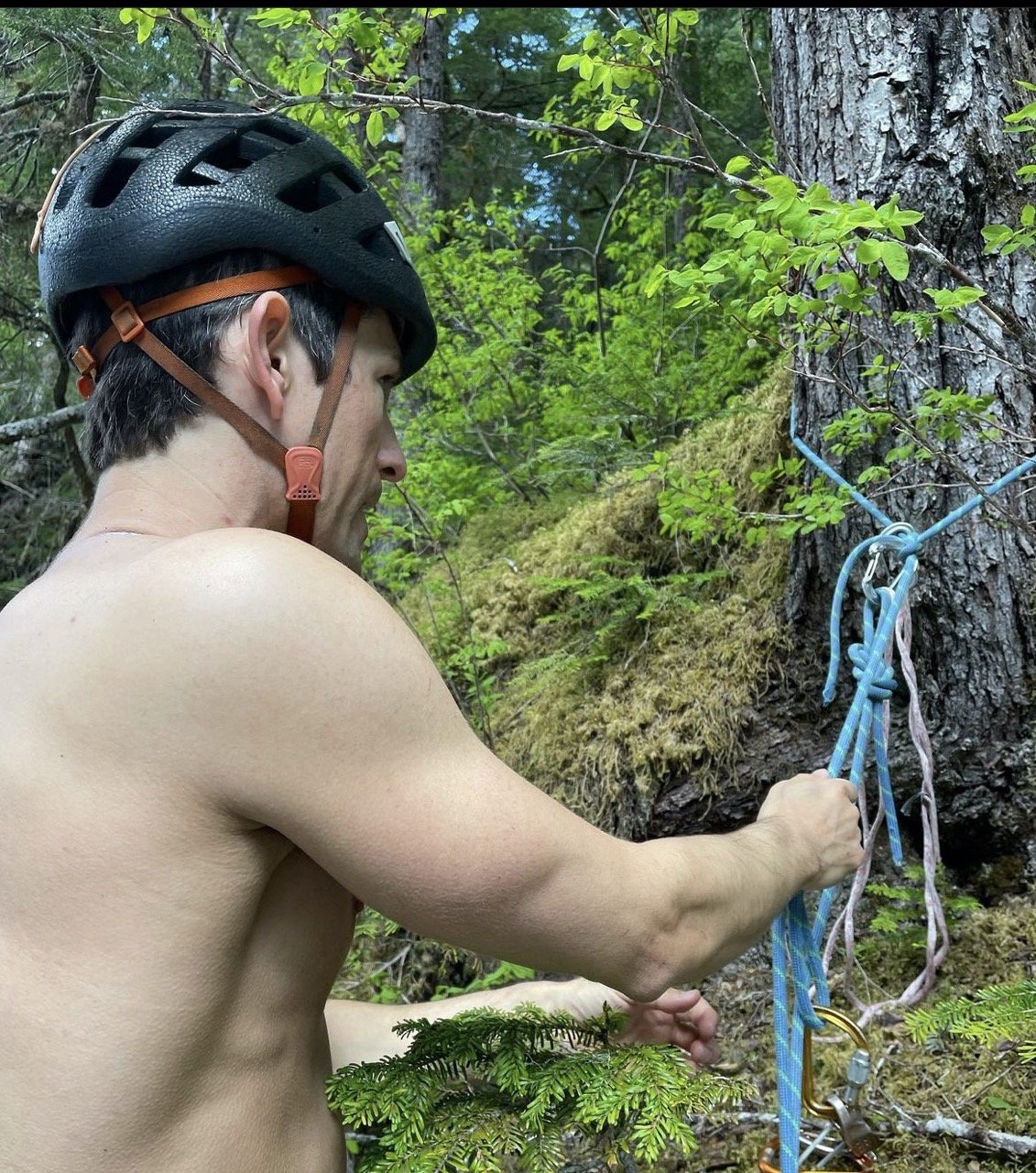
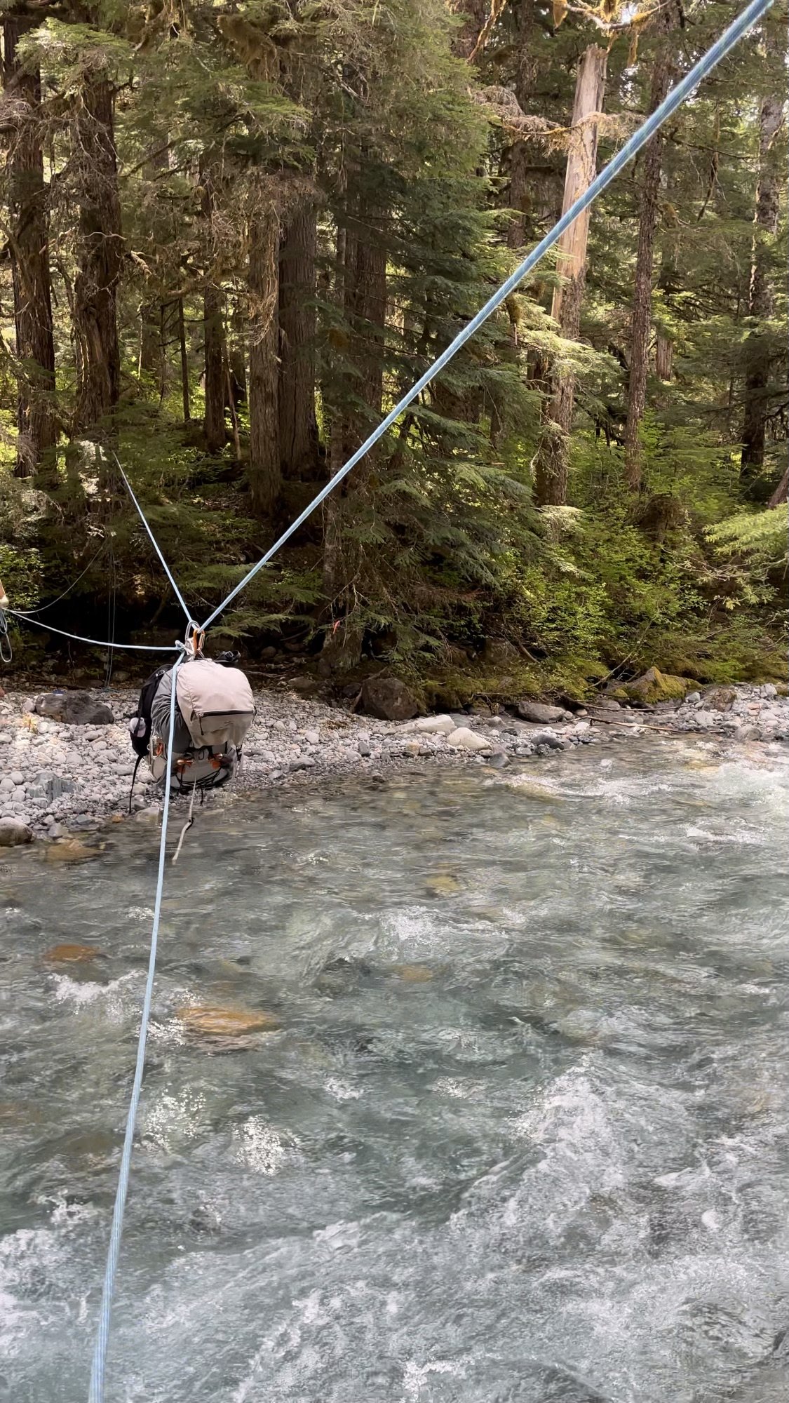
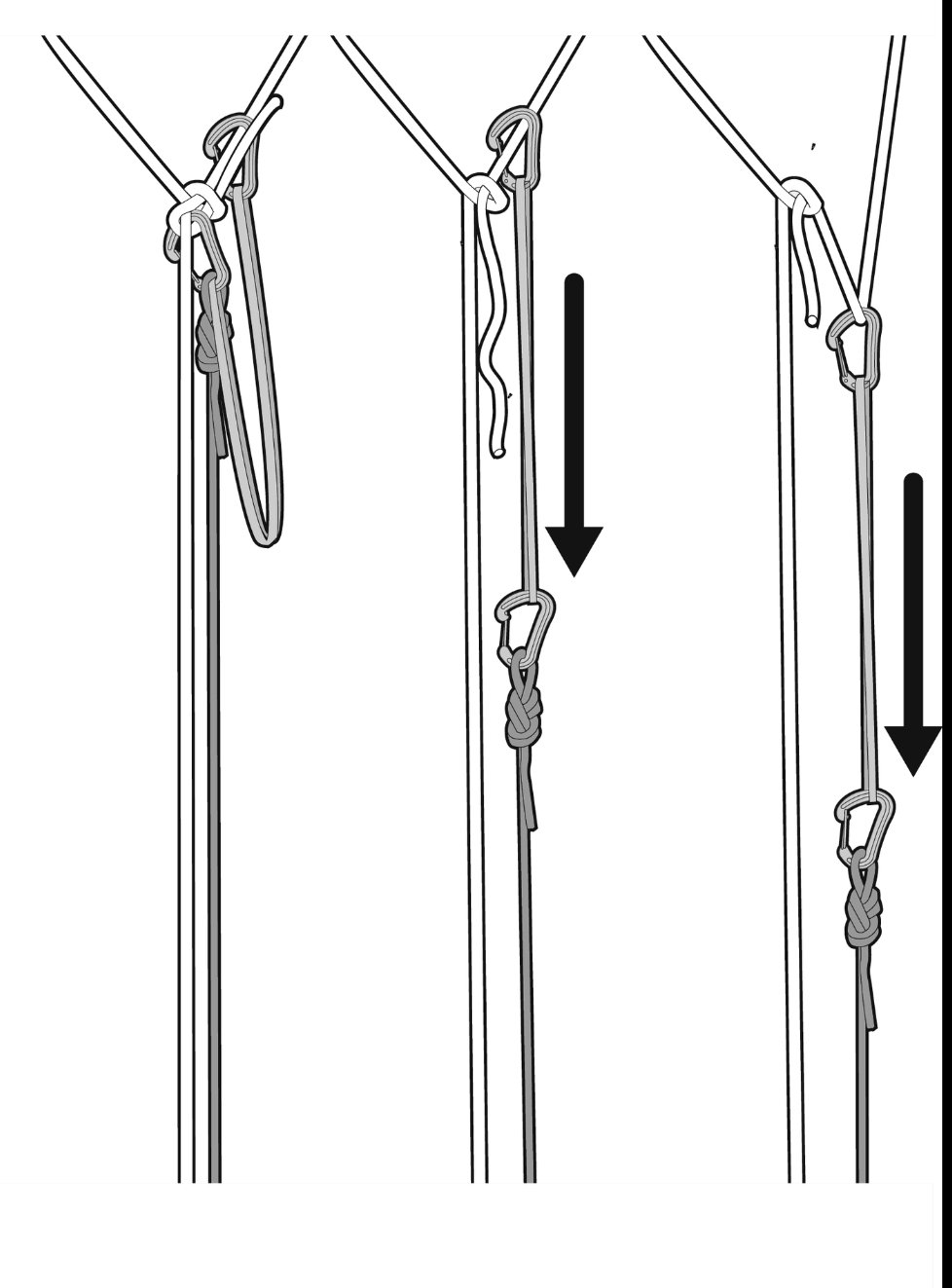
Trip: Mount Shuksan - Price Glacier and Nooksack Tower (attempt) Trip Date: 05/29/2023 Trip Report: Trip Dates: May 27 (Saturday) - May 29 (Monday), 2023 (3 days/ 2 nights total) Climbers: Jeff and Priti Wright Climb: Price Glacier (50 Classic) on Mount Suksan's North Face (successful) + Nooksack Tower (unsuccessful) along the way This report contains conditions on two routes: one is currently a sandbag and one is currently a featherbag...that way everybody has something to comment about! Descent Options: Fisher Chimneys, but there is snow on the trail all the way up Lake Ann according to the rangers on May 27. Rangers recommended floatation on the trail. White Salmon Glacier (skis), but you have a heinous bushwhack on the way out per this TR (link) "Once at the bottom of the glacier, we initiated the most miserable slide alder/thorny bush battle of my life. I was in a tee shirt, and was absolutely brutalized trying to fight through the vegetation with skis on packs." Sulphide Glacier (this requires a long car shuttle) but probably the easiest/fastest way off the mountain. Lots of traffic on Sulphide, no evidence of folks coming up White Salmon or Fisher Chimneys Memorial Day weekend. The snow on the Lake Ann Trail is perhaps scaring people away from Fisher Chimneys. Hanging Glacier Route No matter what you chose, make sure to have GPX tracks of all descent routes downloaded to your phone. You can find GPX tracks at caltopo.com or peakbagger.com. Logistics: Cache a bike or car at White Salmon Base (White Salmon Glacier or Hanging Glacier descent) or Bagley Lakes TH (Fisher Chimneys descent). We locked a single bike to a signpost behind a guardrail (very discreetly) near the White Salmon Base Area. It's a short/fun bike ride downhill and on the dirt road back to Nooksack Cirque Trailhead to your car. Note: White Salmon Base parking lot is closed for construction and no parking is allowed there. Therefore, I'd probably recommend Fisher Chimneys descent with a bike cache at Bagley Lakes parking lot. The road to Artist Point is partially open, so you can cache a bike higher up the road, maybe. You can also hitchhike down Mt Baker Highway then walk the extra 2.2 miles from the NF-32 turnoff to the Nooksack Cirque Trailhead. Park at Nooksack Cirque Trailhead and start from here. To get here, take NF-32 off of Mount Baker Highway, then branch off right onto NF-34 to the end of the road. NF-32 and NF-34 are dry, dirt roads in good condition currently. Plan for extra days out. The Price Glacier route can be trivial or it can be really complex and time consuming. Sandbag: In its current condition, there was no really technical terrain on Price Glacier (this will change day-to-day!). Just easy snow walking all the way up....much easier than the North Ridge of Baker. The bergshrund has a trivial crossing up the middle that might last a few more weeks. If it's out, however, then you're in for some mixed climbing out of the moat on the left or right side of the shrund. Featherbag: Nooksack Tower has a lot of rockfall, the worst rock quality I've ever experienced (even after the Southern Pickets Traverse!), VERY sparse protection, lots of required downclimbing, and difficult routefinding. Basically, YGD, and I don't recommend this peak at all to anyone, probably ever. I know it's a Cascade classic, but I was so shut down on it and also so unimpressed. It's just terrible...and too dangerous imo. All you successful Nutsackateers are free to comment about how trivial it is and how I need to harden up. Approach We got to the Ranger's office in Glacier at a leisurely 9:30 (they open at 8:00) but recommend you get there as soon as they open because stashing the shuttle/bike takes time. You might also want to consider getting your permit a day early, then sleeping at the trailhead to get an alpine start. Then we discreetly locked up a bike off the road near the White Salmon Base area and drove to the Nooksack Cirque TH. At the trailhead, head straight to the river and slightly downstream to reach an improved log crossing to start the Nooksack Cirque Trail. The trail has a few downed trees, but is generally in good shape. First improved log Crossing just at Trailhead Second improved log crossing along the trail...Priti doing her sexiest logwalk pose After reading this legendary trip report (link) from Pellucidwombat about their 9/2/22 Labor Day Weekend climb, we came prepared to encounter anything. This report is definitely worth a read. Mad props to those two for getting it done in those difficult conditions. I really feel like earlier in the season, the better for this climb. The original log crossing across the North Fork Nooksack River (now gone) has been there for years and years and provided access leaving the Nooksack Cirque Trail into the Price Lake valley. Pellucidwombat describes how they found a new crossing and provided us with the GPX point. Their new crossing is also gone (not underwater, but actually swept away). The best place to ford the river that we could find is at the original log crossing location (N 48.87097° W 121.61267°). We went up and down the river for hours to look for a new crossing. This location spot is the least sketchy spot to cross. A few parties have done it unroped this season (with skis!), however I thought it was sketchy and high enough to cross on belay then set up a tyrolean for the packs. Our tyrolean steps: Set up one end of the 60m rope to the tree as a retrievable bowline (equivocation hitch could also work, but this thing give me the heebie-jeebies, and it might be harder to release after a tensioned tyrolean). Practice this at home first! Tie-off of the bowline tail as as a Backup/Failsafe. Cross the river on belay with a bight of rope attached to your harness. Note: bring a bight across, not just the other end. Keep both ends of the rope at the start. Once across, make an anchor around a tree (2x 120cm runners work), then bring the anchored end of the rope tight and tension it with a simple Z-pulley (I used two micro traxions since they release easily). The taut, Tyrolean line goes from the Bowline to the Z-pulley. If you happen to have a GriGri, it is much safer to use the GriGri as a progress capture pulley than the micro traxion (link). Technically, Petzl says YGD if you use a micro traxion as a progress capture pulley for a tyrolean (link). Of course, a regular/passive pulley (such as a locked-open micro traxion) with an old-school progress capture hitch (Bachmann, prusik, Valdotain, etc) also works well and is safer. The free end of the rope going back to the start gets pulled in and attach a backpack to a figure-8 on a bight. Clip the pack onto the tensioned line and pull the pack across with the slack line. With a 60m rope, the person at the start should hang on to the free end of the rope to pull the carabiner back across. Therefore, you have a tensioned line and a slack line (tether). Re-tension the Z-pulley between each crossing. Once both packs are across, follower confirms that the Removable Bowline is set up, removes the Backup, then Tyroleans across the tensioned line (nothing fancy, just hand over hand with a locker on their belay loop) Release the tension on the Z-pulley. The Bowline (or EQ Hitch) won't release while the line is tensioned. To release the micro traxion (or GriGri or progress capture hitch), you'll need to tighten the Z-pulley slightly in order to open the toothed cam (practice this if you don't know what I'm talking about). Pull the pull side of the rope to release the Bowline (or EQ hitch). Note: this may be a *vigorous* pull! If you've set up an EQ Hitch, practice ahead of time what it feels like to pull on each line alternating between each bight release. Releasable Bowline (pictured) from 'Down' by Andy Kirkpatrick: the most effective ghosting technique, due to the fact most climbers know how to tie a Bowline, it’s safe if carried out correctly, and it works. In this set-up, a 120 cm sling is being used. You can use a longer sling (240 cm) or cord, but 120 cm is the minimum length. Anything shorter and the Bowline will probably not fully release. Also note that the tail of the Bowline must be long enough to tie an effective and secure the Bowline (30 cm long), but not so long that the tail does not fully clear the Bowlines when the RELEASE rope is pulled. There is flagging at either end of this river crossing location. From here, follow frequent flagging up the slope through mild bushwacking and bootpack trail until it opens up and you get your first glimpse of Price Lake. If you lose the flagging, retrace your steps and try to get back on course (GPX tracks are helpful). This section of the approach would be much harder without the flagging, so please try to preserve it. This section from the North Fork Nooksack River up the slopes to the Price Glacier moraine is fairly trivial, but it is STEEP! Once the slope opens up, you first traverse across talus and boulders to eventually gain a lateral moraine. Follow the moraine bootpack trail (green line pictured below) until you are under a cliff band. Immediately gain the cliff by the first gully (red line pictured below), then follow the undulating ridge (many bivy sites here) until you are forced to go down onto the open snow slopes. We bivied on top of this ridgeline the first night, but a strong party can easily make it to the Nooksack bivy which is recommended so that you get on Price Glacier early the next day. Priti and I originally planned to spend one day on approach, one day on route (Price Glacier only), then fly off the summit the morning of the third day. There was a team of 2 who were one day ahead of us (Eli Philips @eeelip and Ian Mock @cascade.ian) who impressively planned to do Price Glacier with skis on their backs and also tag Nooksack Tower along the way. When we got to the Nooksack bivy, and saw their tracks going up the Nooksack Tower approach gully (and after watching them effortlessly float up the Price Glacier in just a few hours), we couldn't let these guys 1-up us! So, we changed the plans and spent all of our second day questing up Nooksack Tower with just the pictures of the pages from Selected Climbs. The route line in the book is a little deceiving since it goes straight up the "central couloir" which looks to have overhanging terrain, and not the 4th-and-low-5th class terrain advertised. If we had done some research ahead of time, these two trip reports would have been handy from 2013 Jason G (link) and 2014 Dave Shultz (link). Eli and Ian (as we found out later) also didn't have enough beta, starting too low in the approach gully and bailing after getting spooked on runout terrain. I think we started at the right spot which is to go as high in the approach gully as possible then start up the right side at some TAT (don't get suckered up the chimney directly up the middle). The route has 3 distinct sections: low angle ramp/slabs (red line below), low angle couloir (orange line below), then a sharp traverse out left to more low-angle ground to the summit (green line below: the presumed route which we did not explore, so do not trust this green-line-overlay!). The start of the route has a few body lengths of wet, low-5th ledges with good gear in a corner which soon eases to low 4th class and little protection. Pass a large rappel anchor at the top of the slope where the angle steepens, then make a short traverse out right under the steepening wall and turn the corner to continue up and left into a wide gully (orange). Continue up this gully which gradually steepens to gain the ridgeline and a prominent notch where you get amazing views of Price Glacier. Side Note: A neat option for future parties might be to bring all your kit up to this ridgeline (top of orange line), cache your packs, summit Nooksack, retrieve your packs, then make two 30m rappels down the other side of the ridge to the top of Price Glacier which would bypass much of the heinous descent and shorten your total trip. The only downside is that you'll bypass the fun lower 2/3 of the Price Glacier route. From the ridge, we accidentally continued out right onto the West Face (yellow line). The route got difficult, loose, with bad protection (spooky!), so we tucked our tails and bailed. A key bit of beta from JasonG's TR would have helped us tremendously: "For aspiring Nooksack Tower ascensionists ... traverse hard left [at the ridgeline] across 3 or so ribs as soon as feasible once you've climbed up and right from the snow gully. Then, basically traverse left until you get to 3rd/4th class gully that will take you to the summit. This is key, don't be pulled up and right by the numerous rap stations-these led to the North face . Alpine Select gives this variation a 5.7/.8 rating and it felt quite spicy in boots." Note: I presume this North Face route continues straight up from the orange line. Photo above is taken from pelluciwombat 9/2/22 TR and not representative of current conditions. Nooksack Tower Descent: Selected Climbs warns that the descent off Nooksack Tower takes longer than the ascent, which is true! We only had one 60m rope so we made a couple short rappels with a lot of belayed downclimbing between stations. Two ropes would definitely had been nice! Be prepared to freshen up lots of anchors with new tat and maybe some leaver nuts since a lot of the anchors are snafflehound-tattered stuff from JasonG's 2013 ascent. Priti nearing the prominent notch at the ridgeline. We went right (West Face). North Face is pictured in the center (possibly). Likely, the Beckey route is way left around the other side of the skyline ridge. We bivied our second night after our 12hr attempt on Nooksack Tower at the Nooksack Bivouac (the prominent saddle under Nooksack Tower). Right now it is flat and snow-covered for several tents comfortably. Note that late in the season (according to pellucidwombat), this saddle is just a knife-edge snow ridge and not conducive as a bivy site. There is another nice bivy site on flat snow on an obvious rocky outcropping on route just after traversing out from the Nooksack Bivy. With fresh steps to follow, the Price Glacier itself was a non-event, taking 3-4 hours to ascend the face. Pure Type 1 Fun! We may be the first people in history to have steps kicked and the proper route found for them on Price Glacier! Luxury. No gear was placed, no crevasses were fallen into, and we got the muscular endurance workout we were hoping for. We each carried one picket and the follower carried one screw in case of a crevasse fall. The bergshrund crossing was easy, located in the middle (pictured below). I would almost feel comfortable solo'ing the Price Glacier in its current conditions (from a technical standpoint) except for the fact that it is still a glacier with several potentially dangerous crevasses, so a rope and glacier travel gear is still recommended at the very least. Above picture: Priti crossing the bergshrund in trivial conditions. This is traditionally the crux of the route. If there is no way to cross it directly, then mixed ground must be taken across the moat on the right or (more commonly) left side. Once on top of the face, it is necessary to make a wide circumnavigation to join the procession of Sulphide climbers. Instead of the wide circumnavigation, we followed Ian and Eli's clever shortcut, traversing high under the summit pyramid, then ascending to a notch in the South Ridge then descending slightly to join the main route to the summit. The summit pyramid is in easy conditions now, with snow most of the way to the top, with just a short section of 4th class rock (a few body lengths), reaching the summit at noon after starting out at 6:00AM. The descent went smoothly, then Priti grabbed her stashed bike and picked up the car, for a multi-sport weekend! Thanks North Cascades! Gear Notes: Single rack to #1 (used on Nooksack, didn't place any rock gear on Price...still a good idea to bring some rock gear for Price just in case, small cams are nice on Nooksack) 2 pickets for glacier travel (one on each person at all times, more pickets if you're not comfortable soloing "steep" snow) 1 knifeblade (didn't use) 10 ice screws (didn't place any, good to bring maybe 4-5 at all times) 12 runners (used a few to make anchors on Nooksack Tower, bring LOTS of anchor material and nuts if you plan to climb Nooksack) small rack of nuts (great anchor gear on Nooksack Tower) V-threader Rappel device for Fisher Chimneys rappels (good to have for emergency anyway) we did not bring rock shoes but I might have liked them on Nooksack (although traditionally it's been climbed in boots, but I'm not hard enough) crevasse rescue kit single hiking pole each (very nice for all the snow walking) 2 alpine ice tools each (Petzl Gully would be perfect) tent was very nice to have on exposed bivy spots (as opposed to open bivy or tarp) Floatation (snowshoes? ugh) *might* be nice for Lake Ann Trail, but I think skis are maybe a bit contrived for these current conditions considering how much bushwacking you do on approach and descent. We didn't bring any floatation and were very glad we didn't. 1x 60m rope (a pull cord or half/twin ropes would have been nice for Nooksack Tower) Approach Notes: Nooksack Cirque Trail
-
[TR] Mt Shuksan - Price Glacier 09/02/2022
JeffreyW replied to PellucidWombat's topic in North Cascades
Amazing trip report! Thanks for putting this together. FYI to everyone, the new log crossing described in this report is swept away. The best place to ford the river that we could find is at the original log crossing location (N 48.87097° W 121.61267°). We went up and down the river for hours to look for a new crossing. This location spot is the least sketchy spot to cross. Some folks have done it unroped this season (with skis!), however I thought it was sketchy and high enough to cross on belay then set up a tyrolean for the packs. -
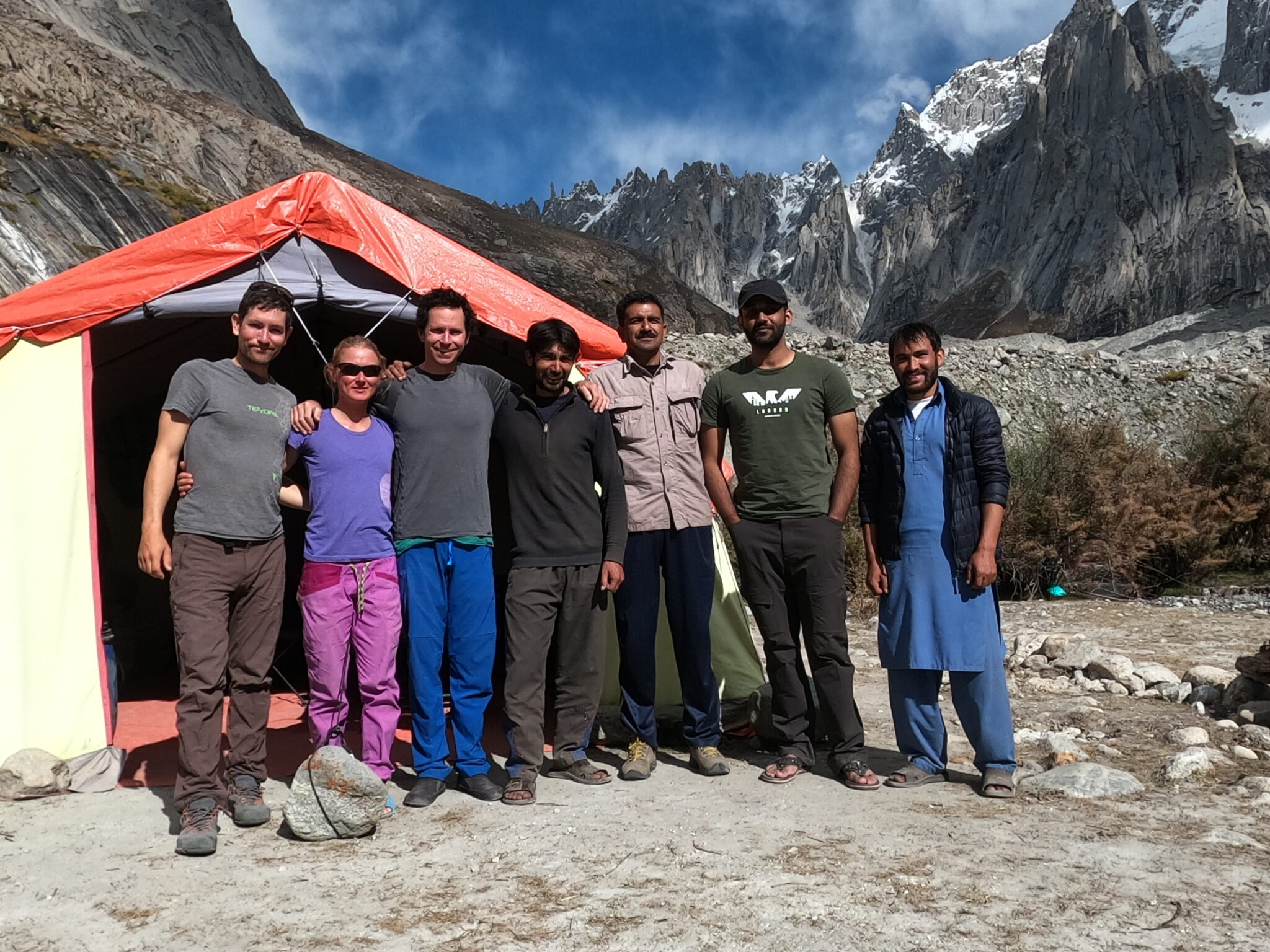
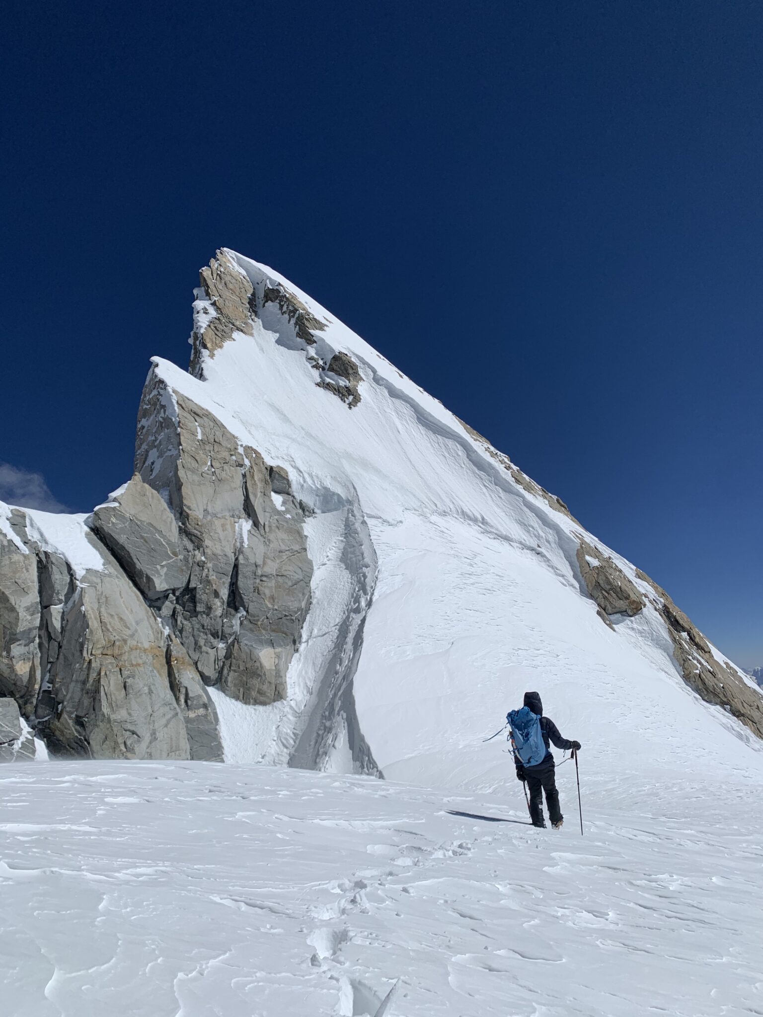
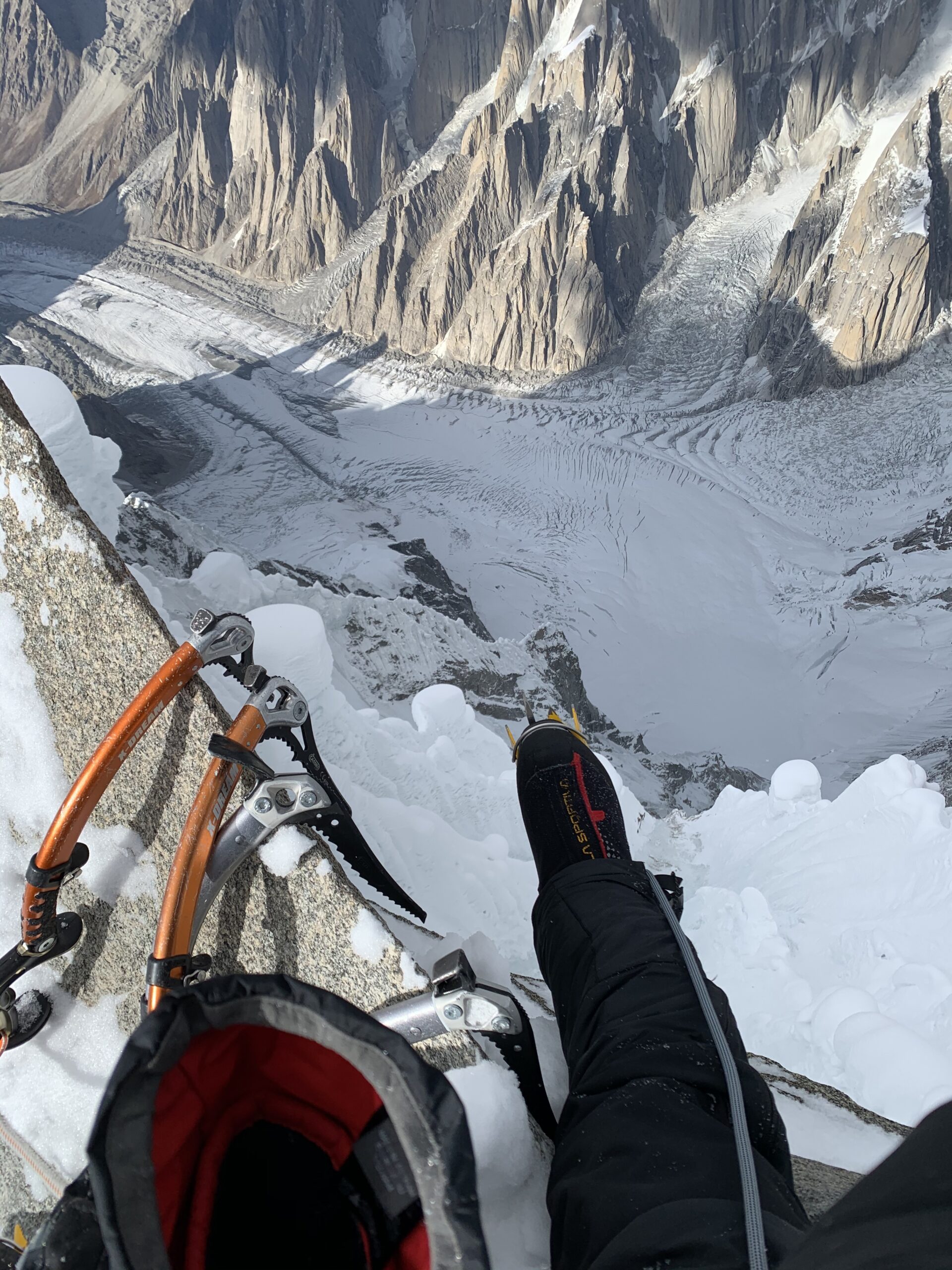
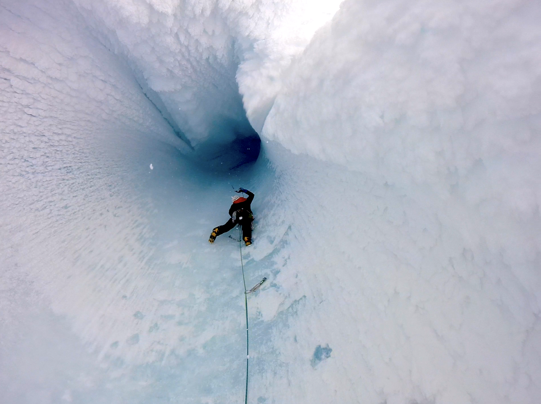
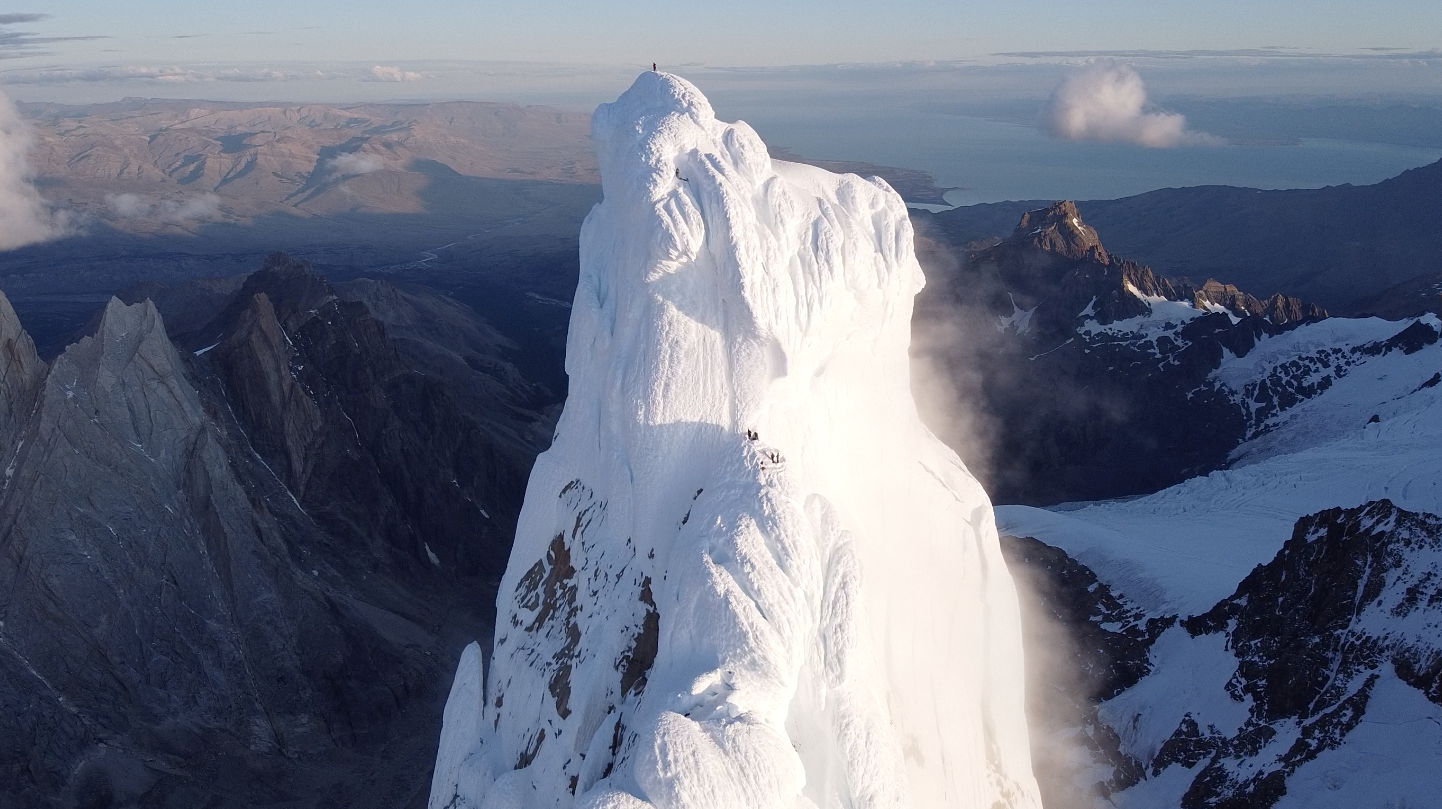
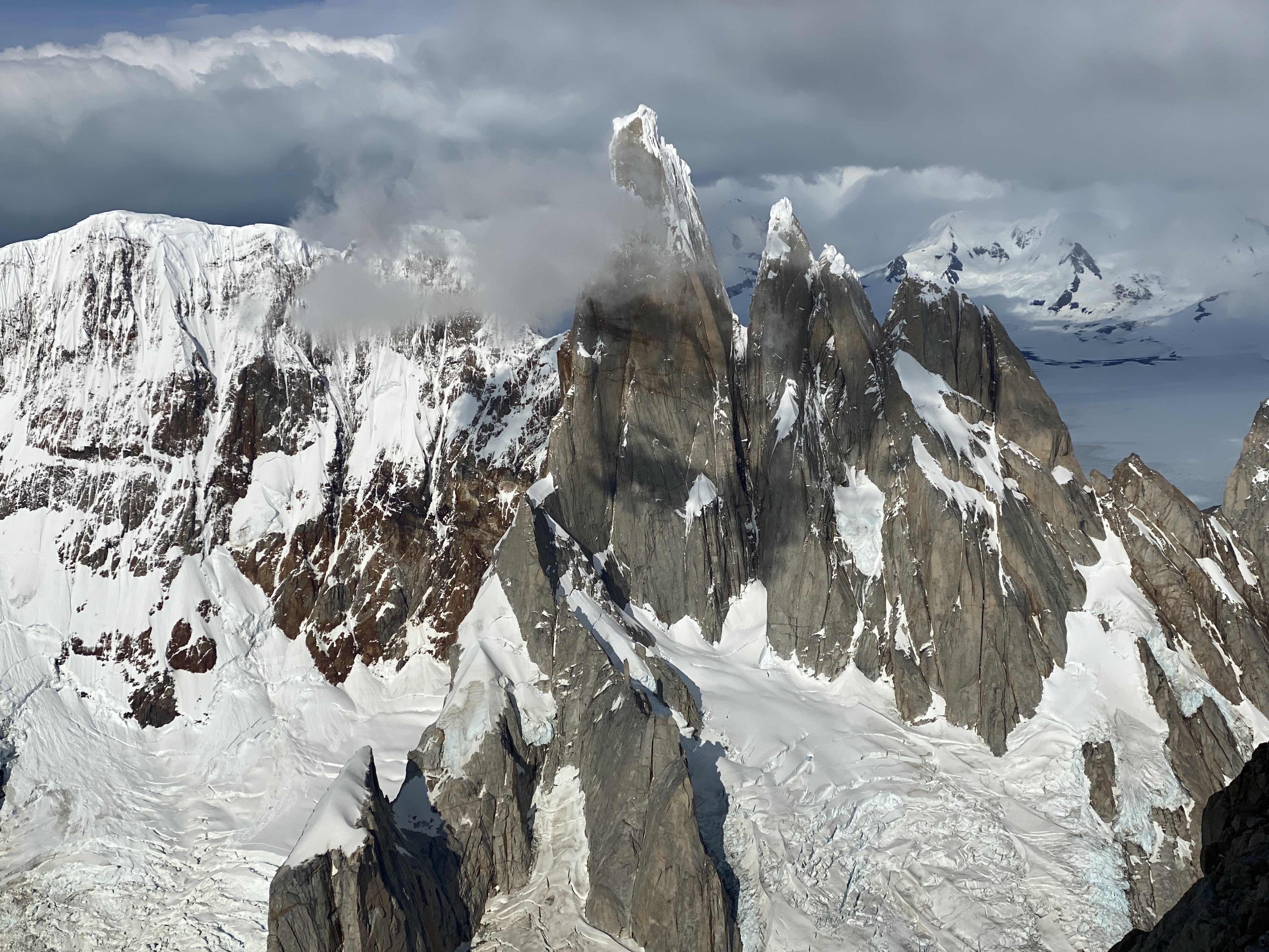
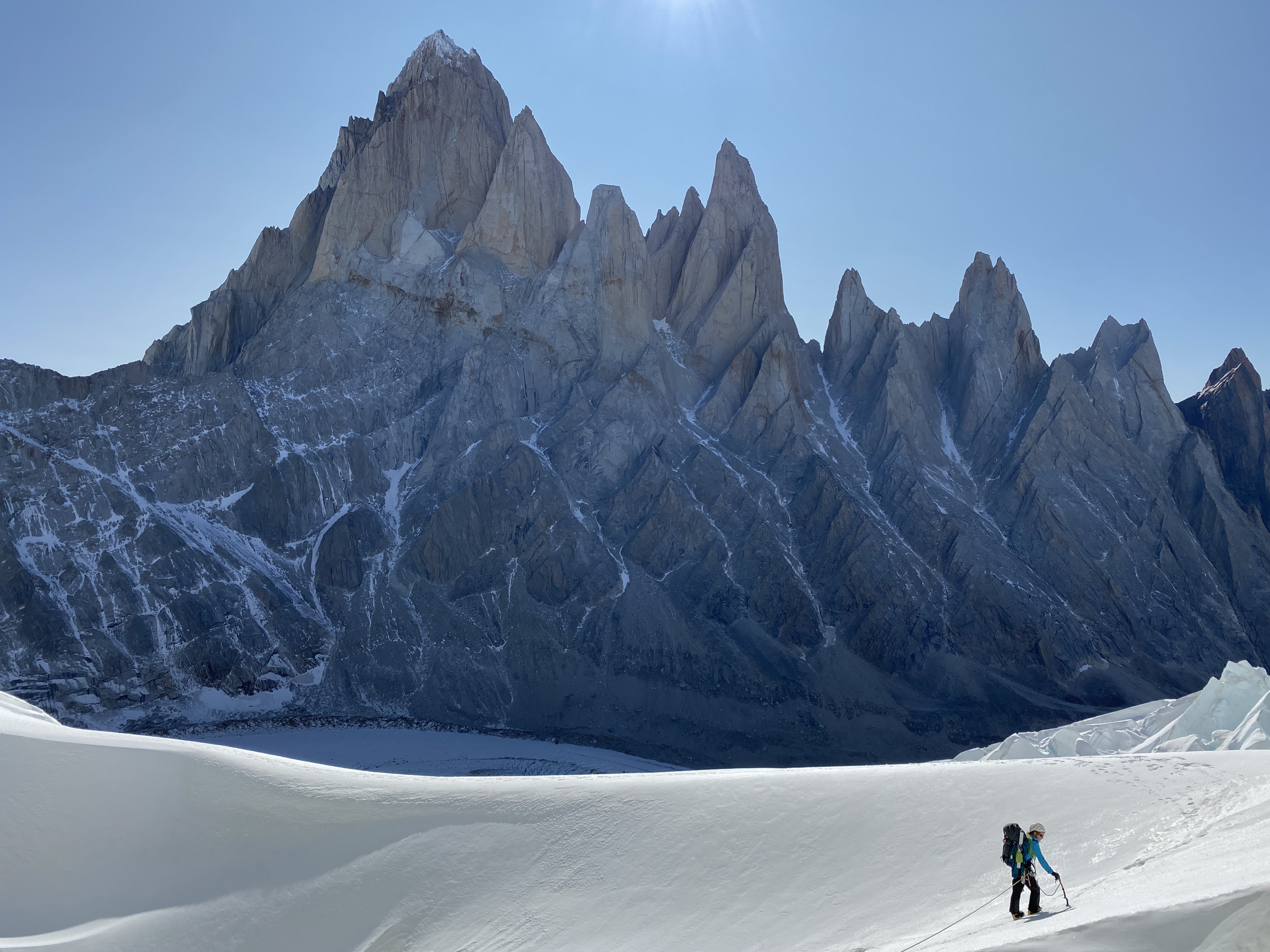
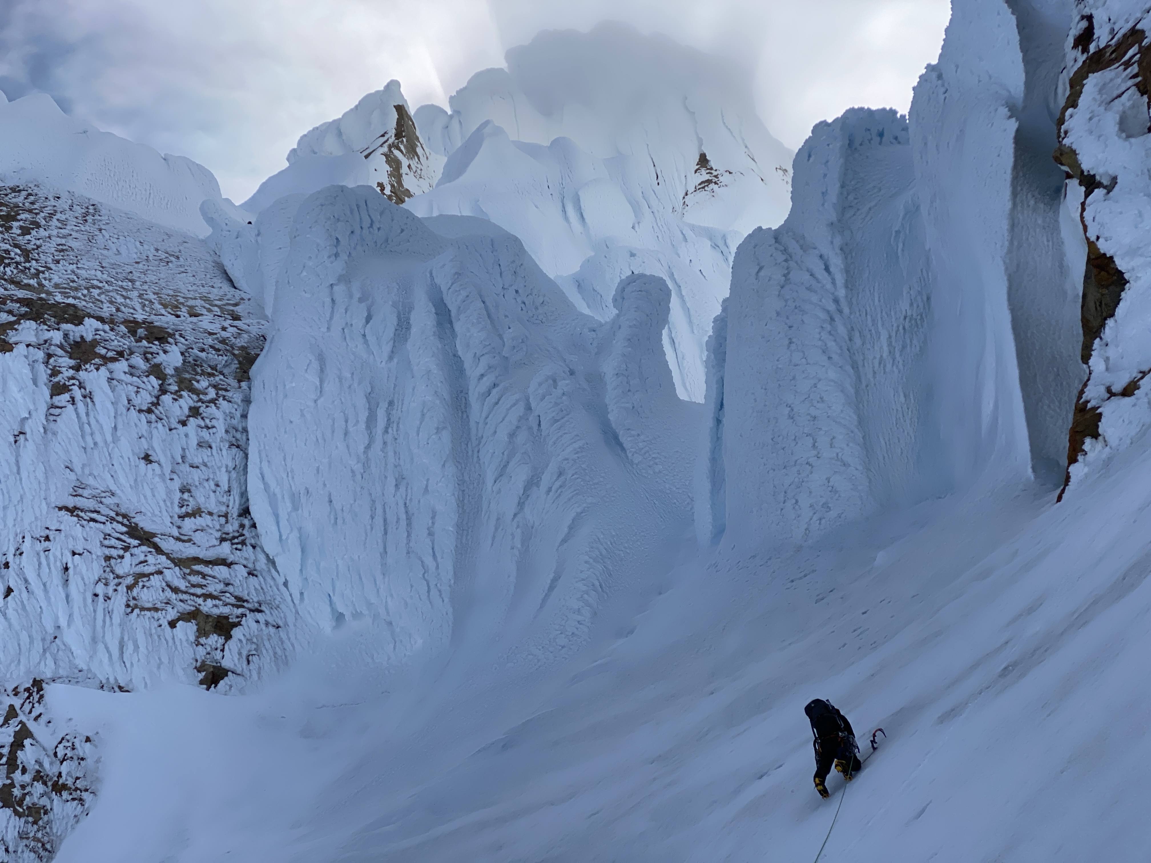
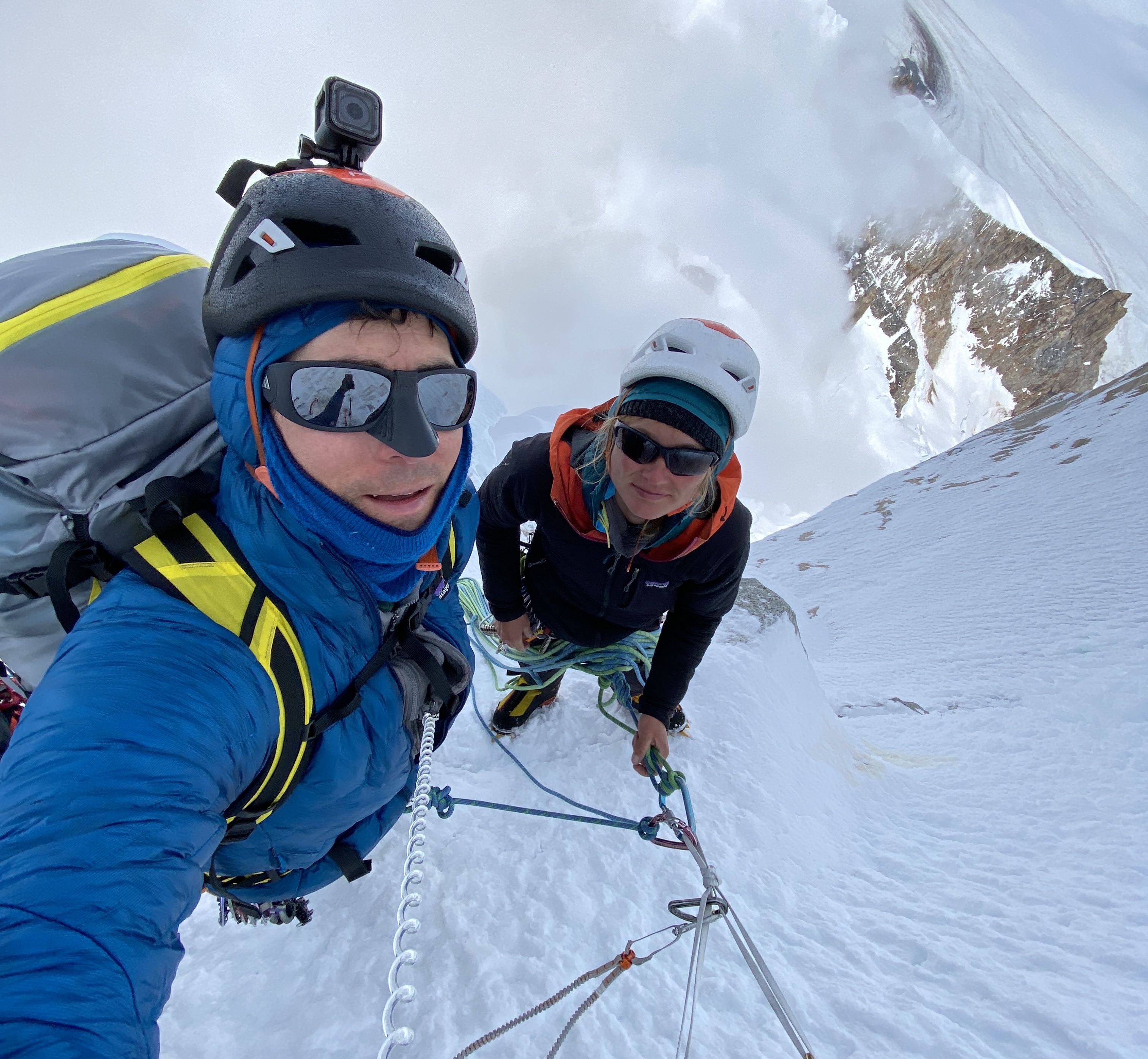
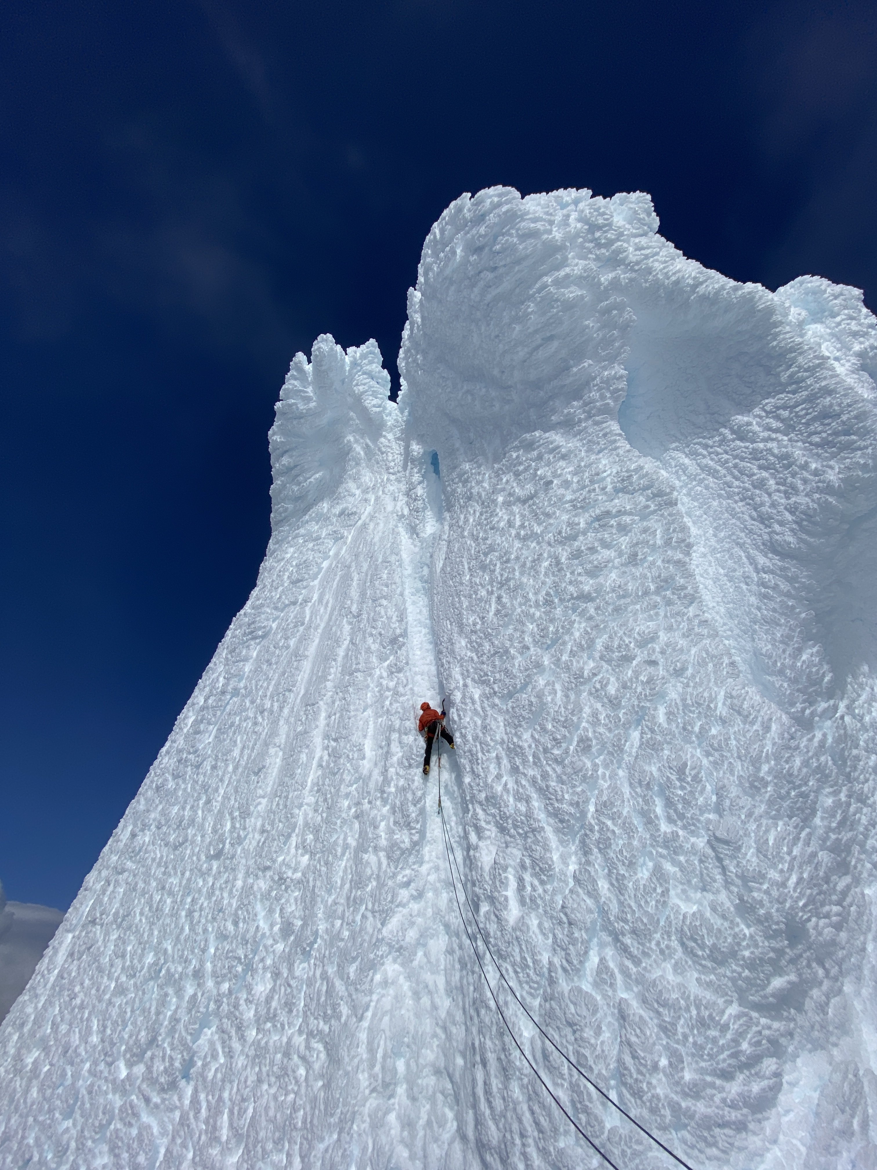
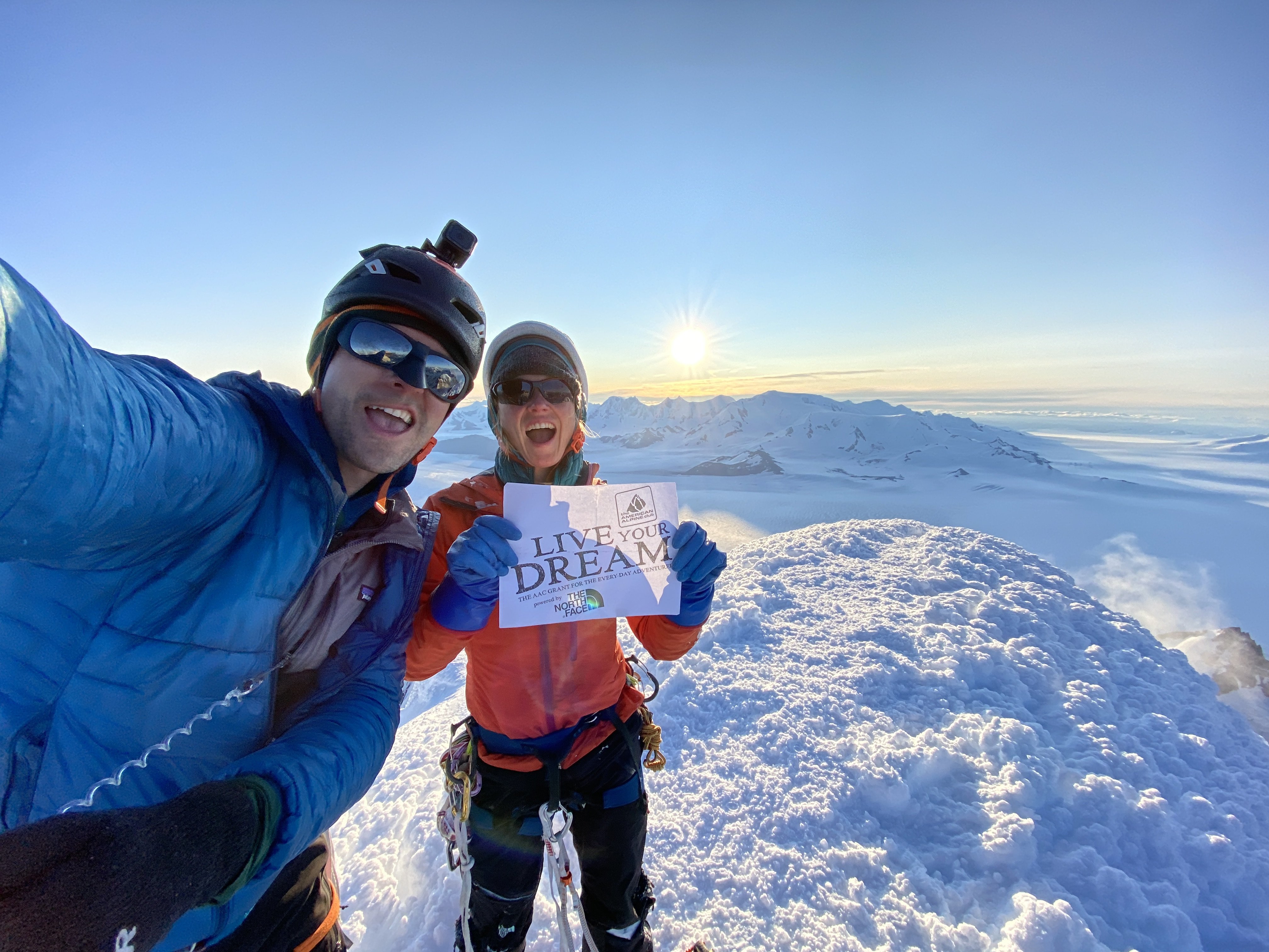
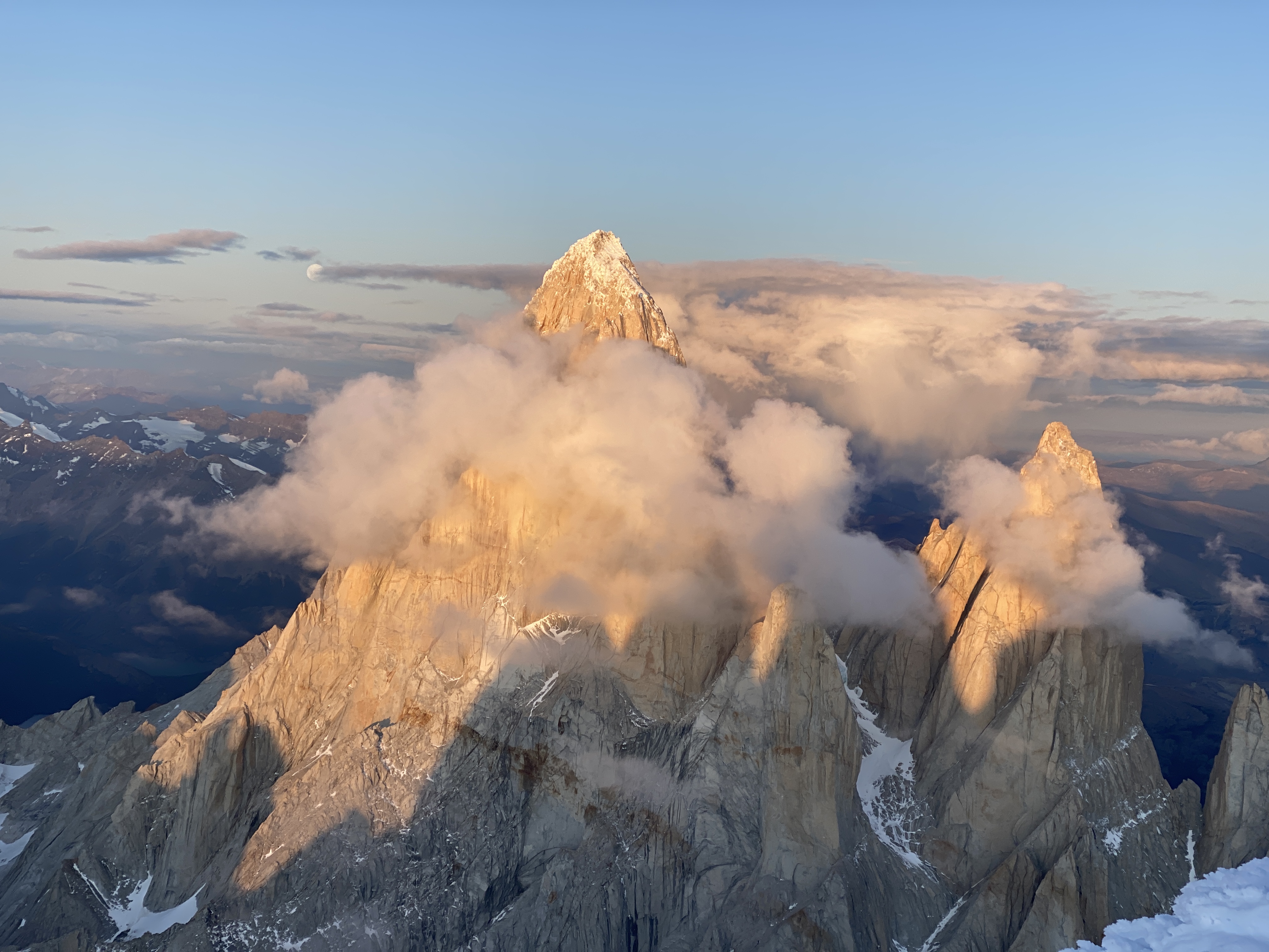
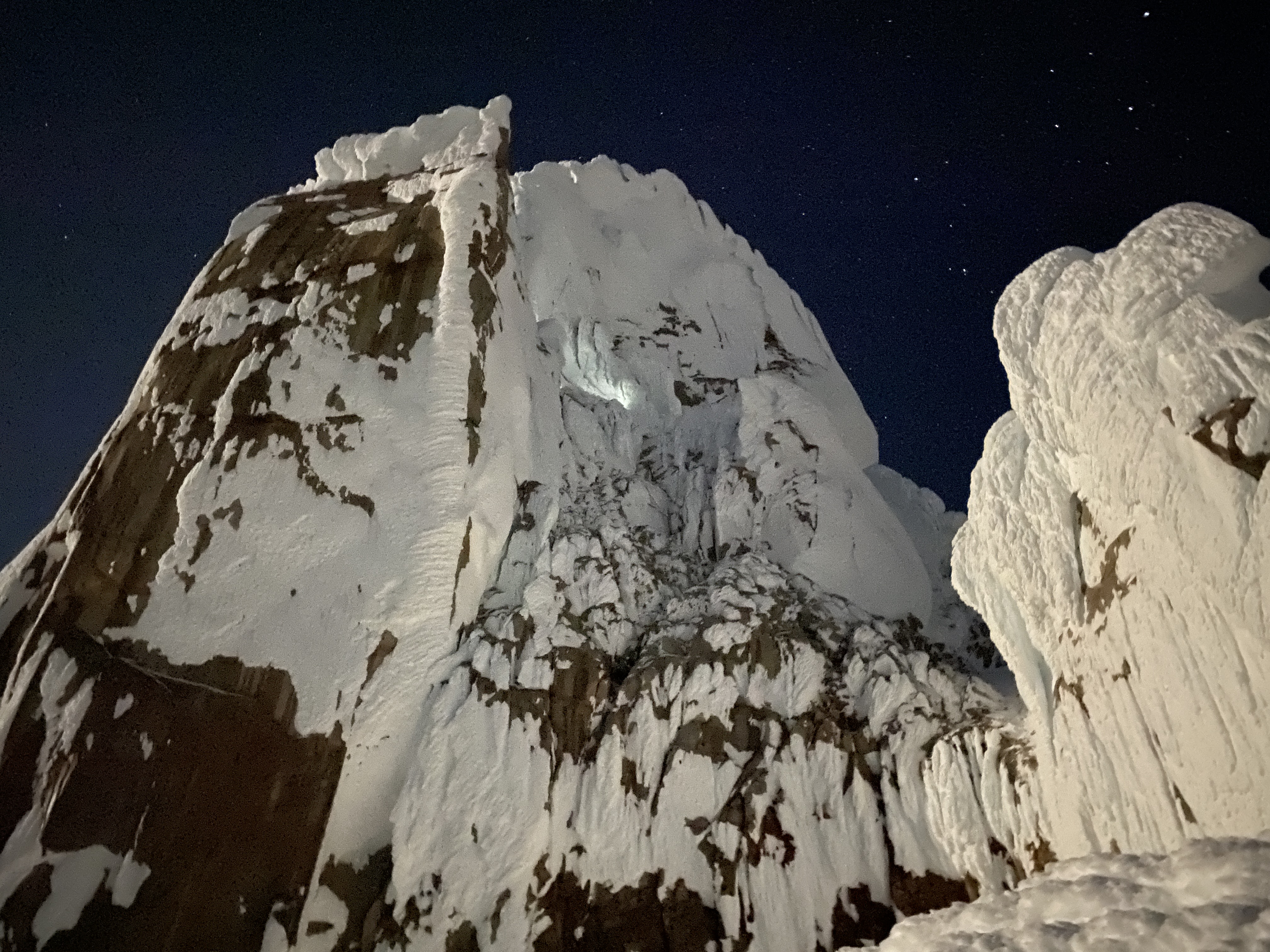
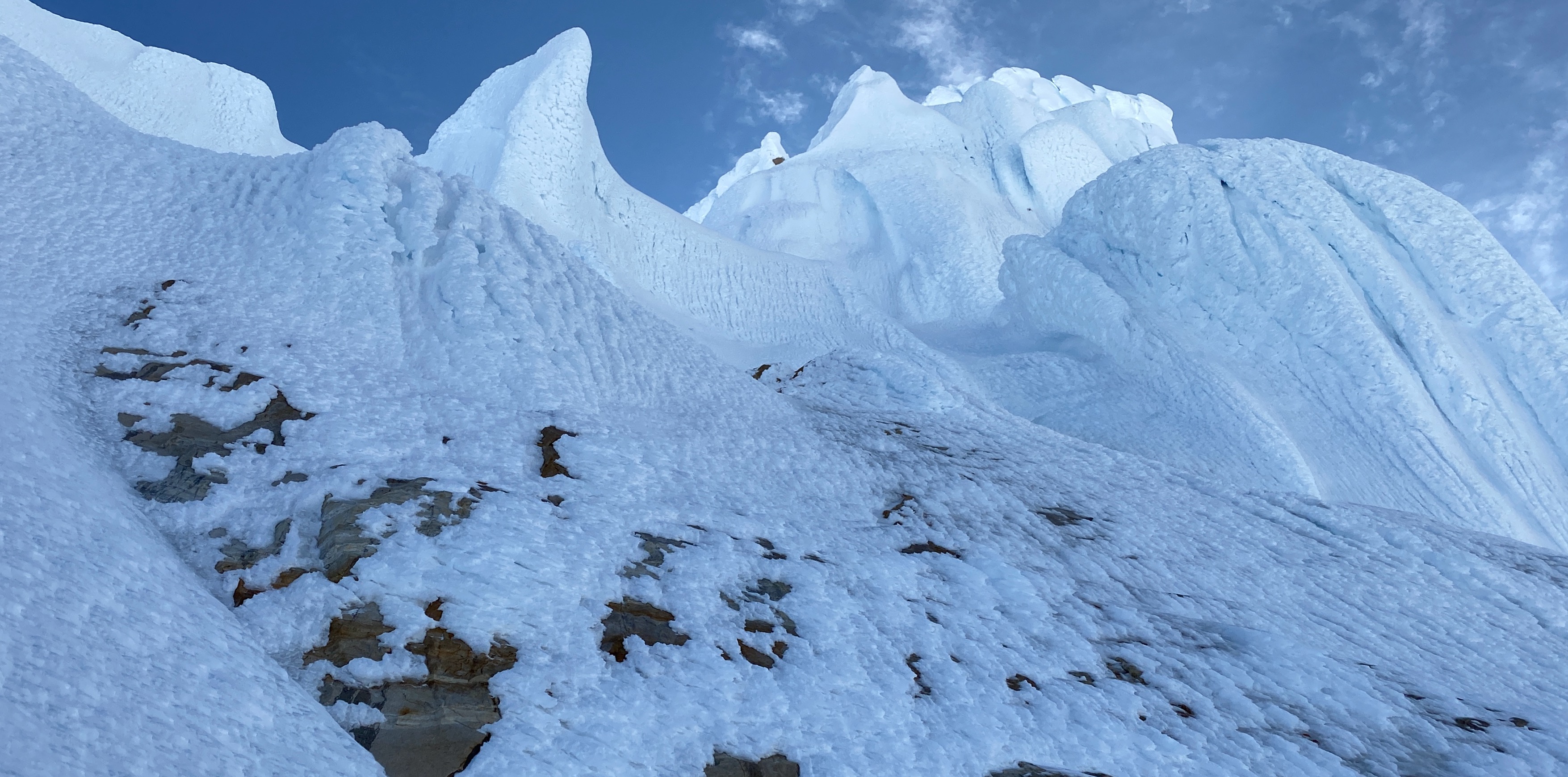
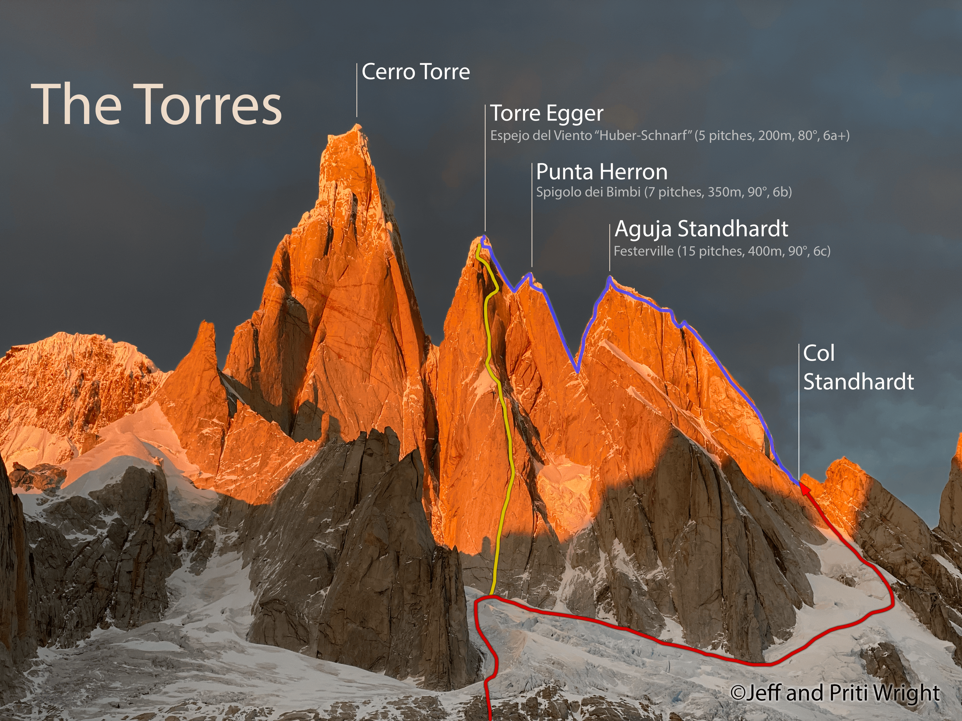
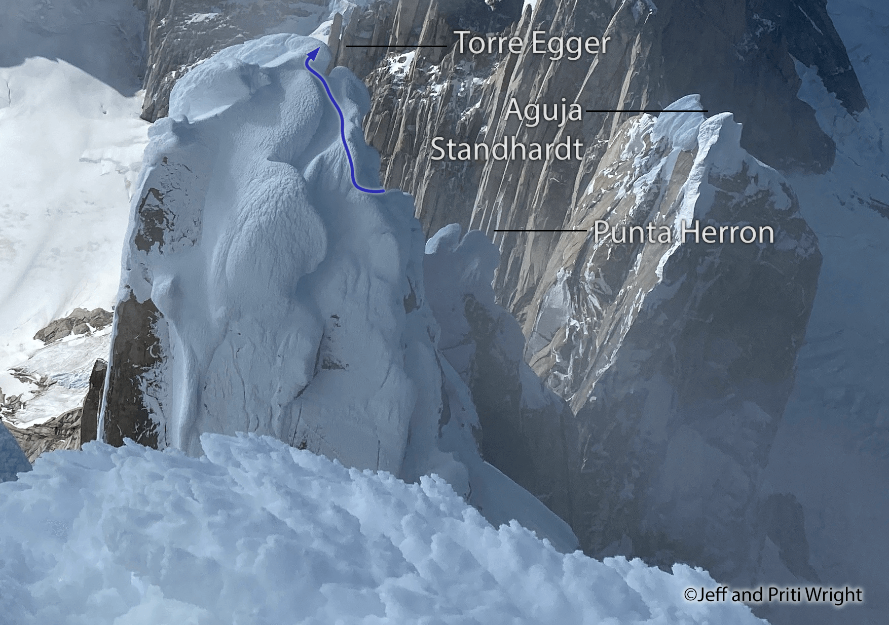
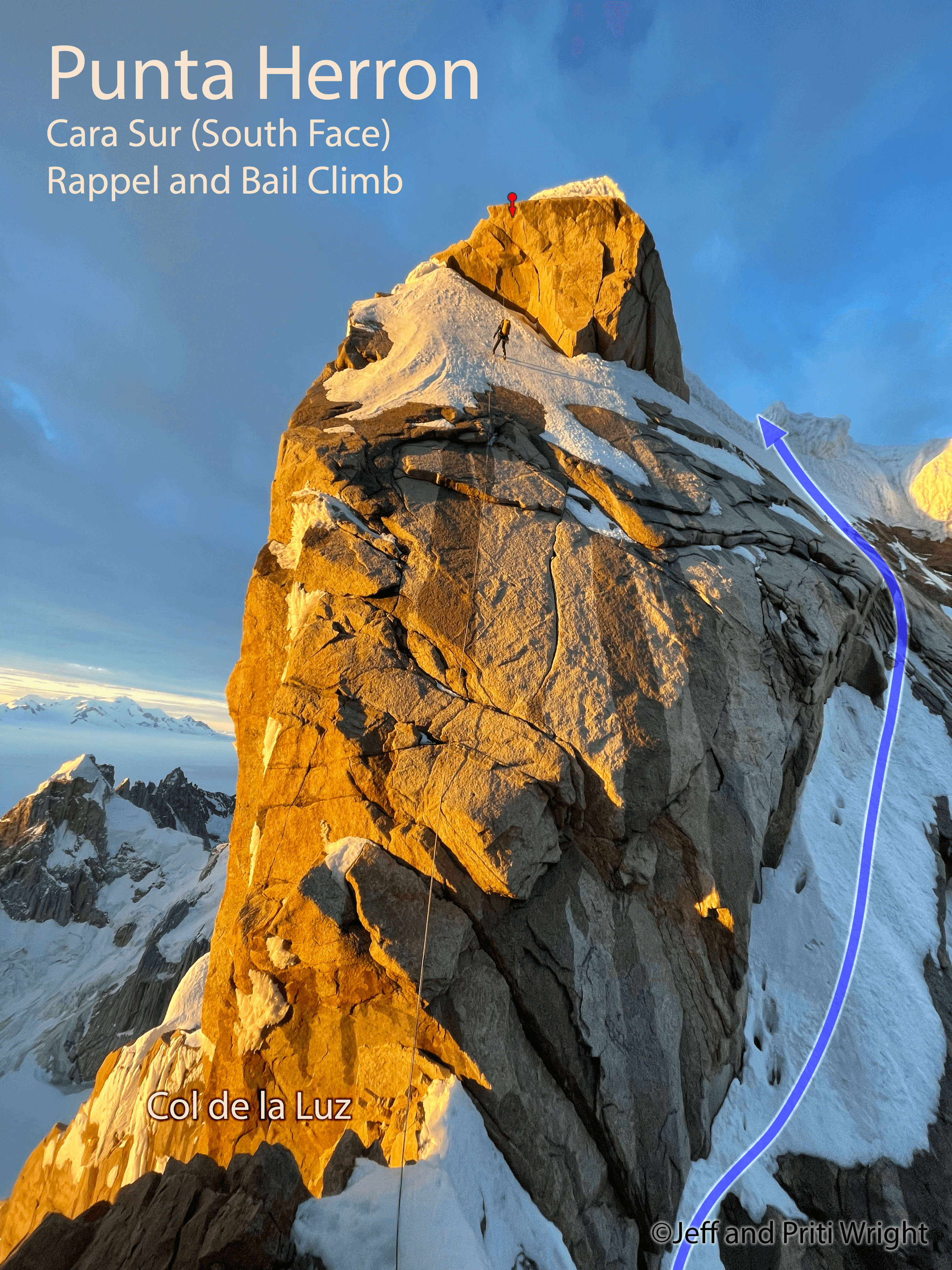
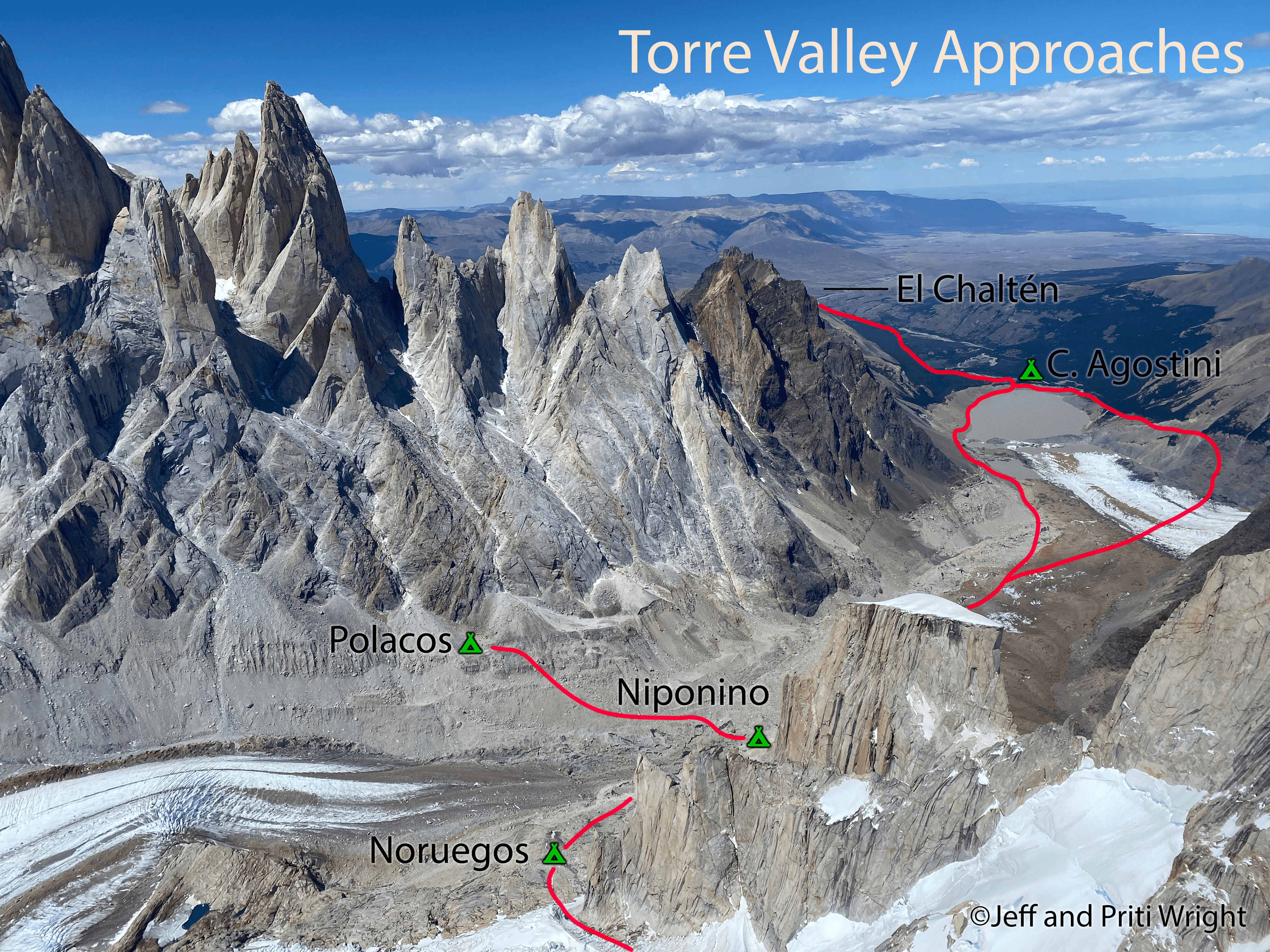
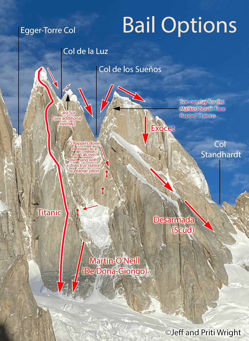
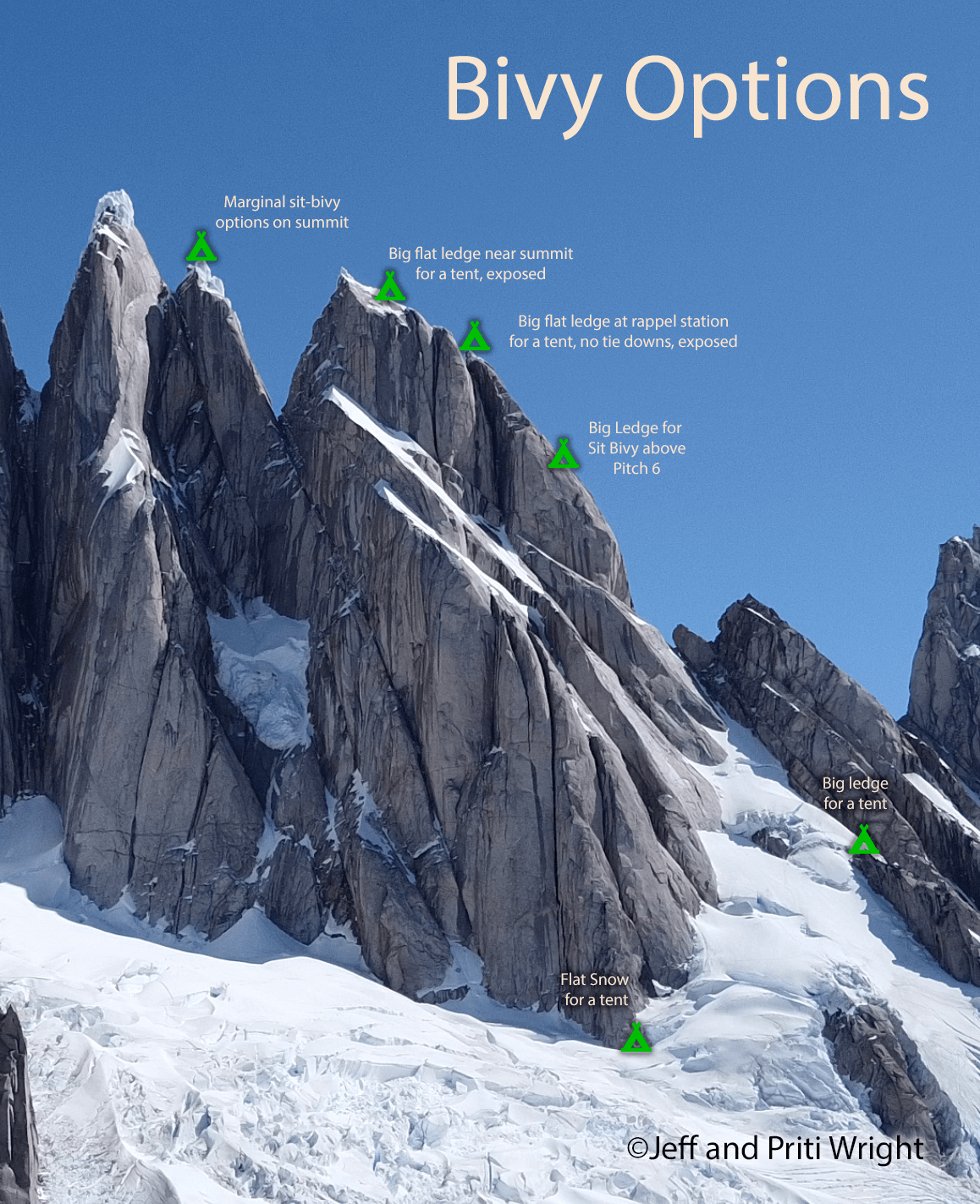
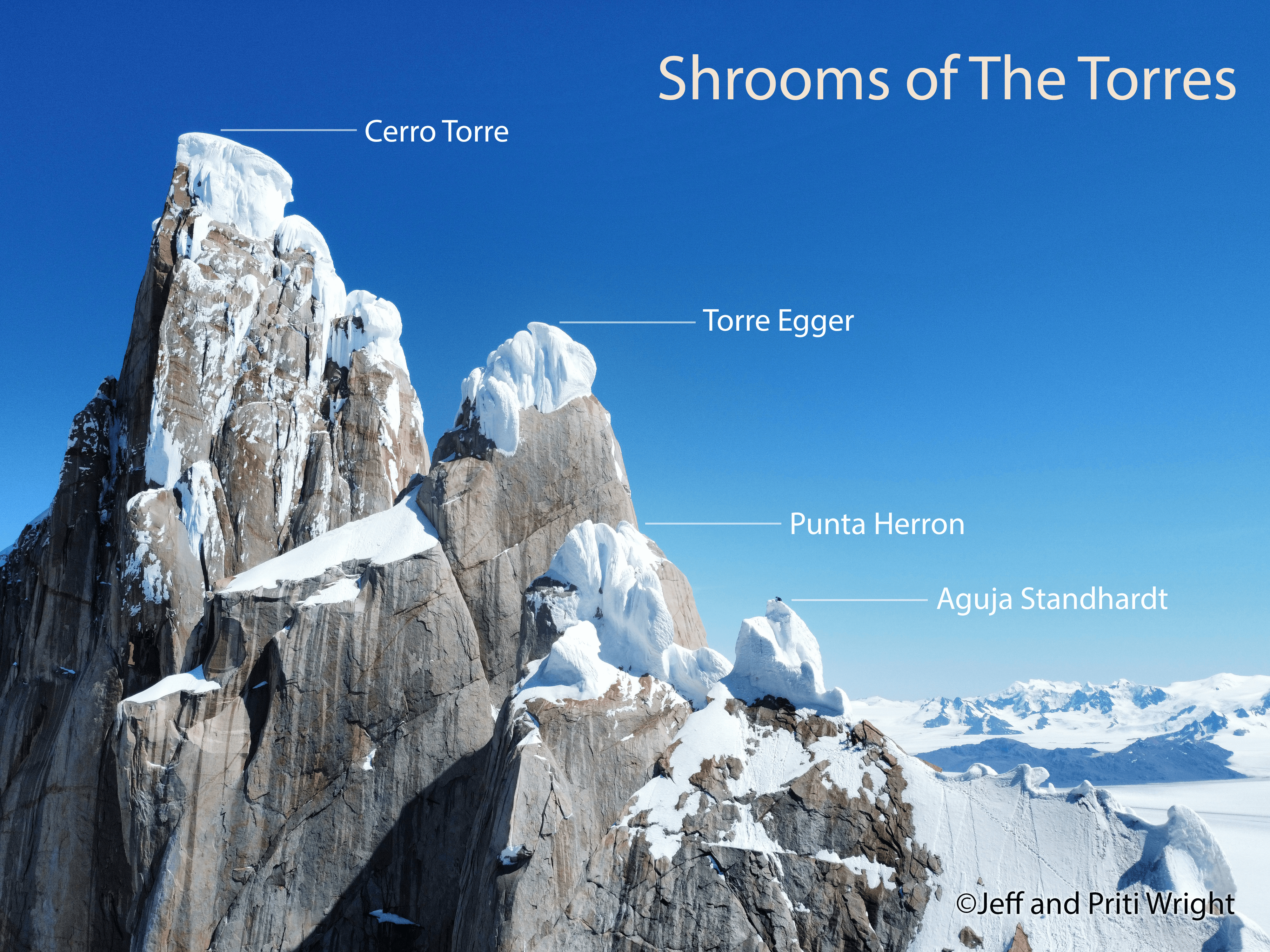
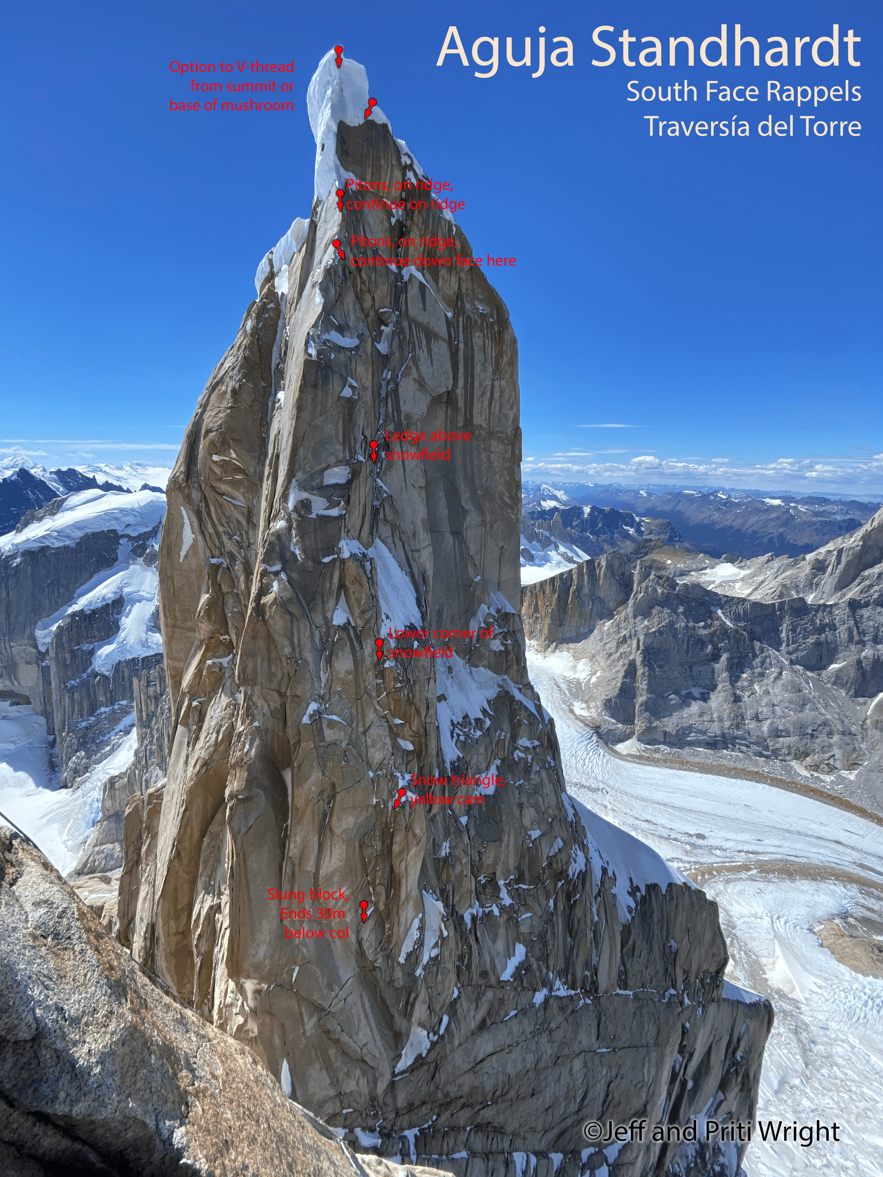
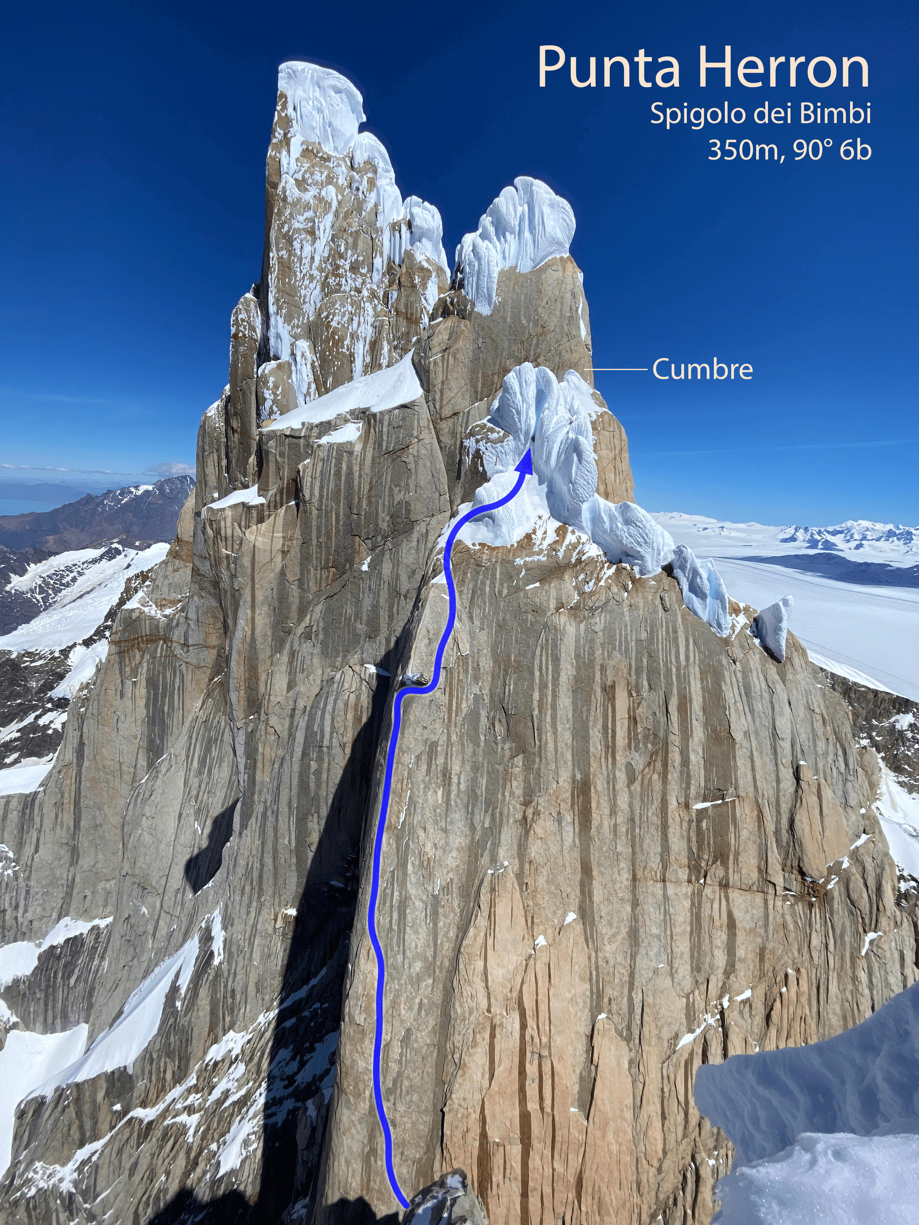
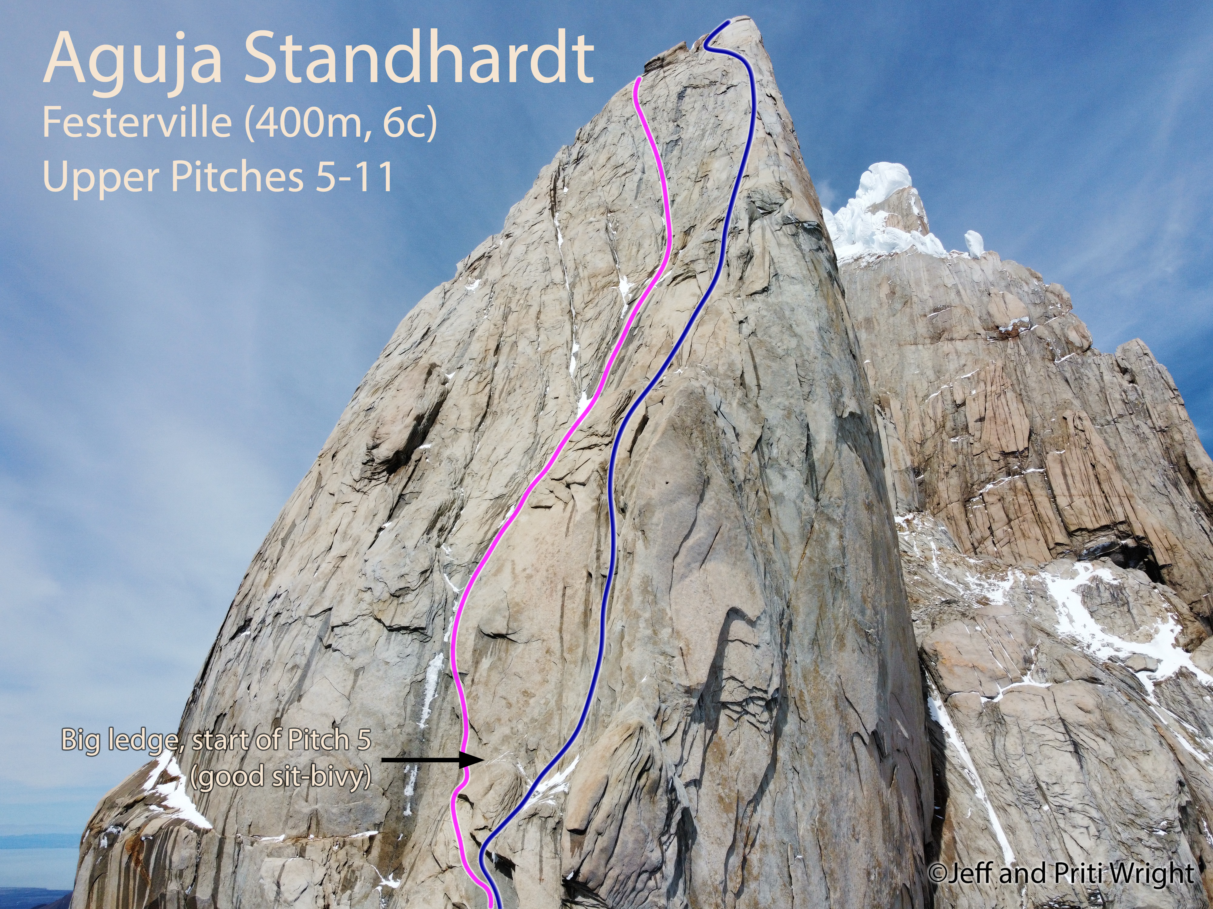
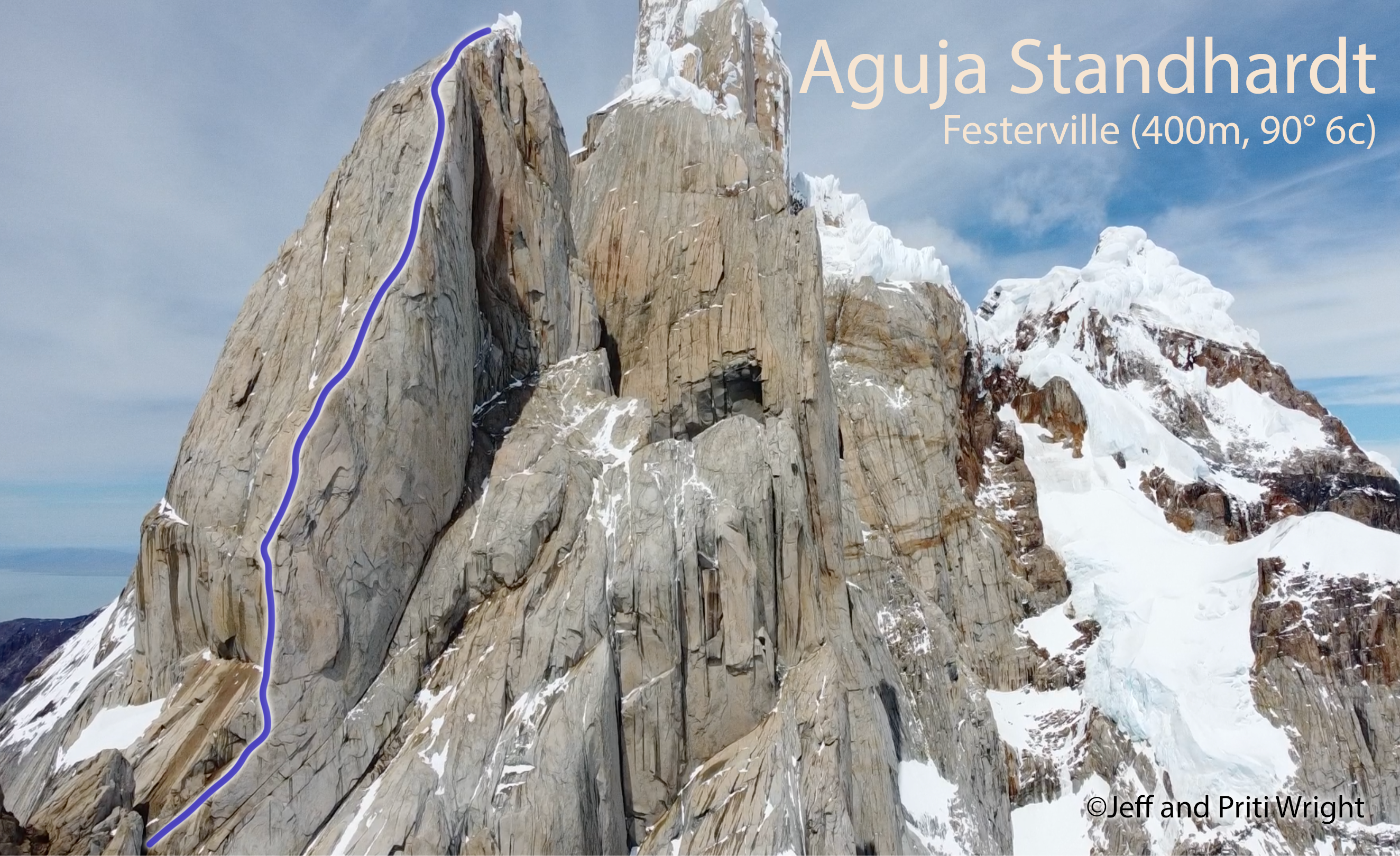
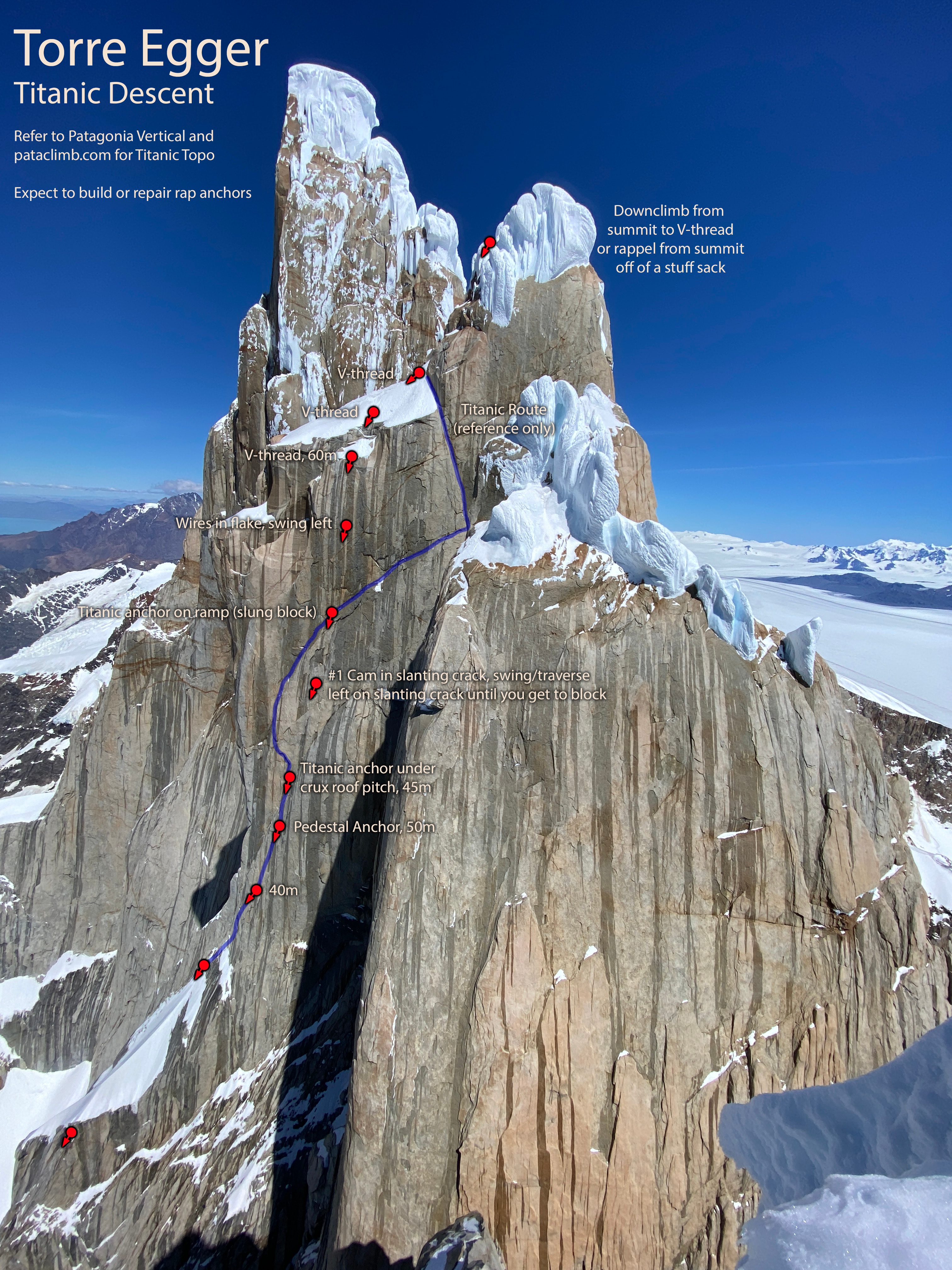
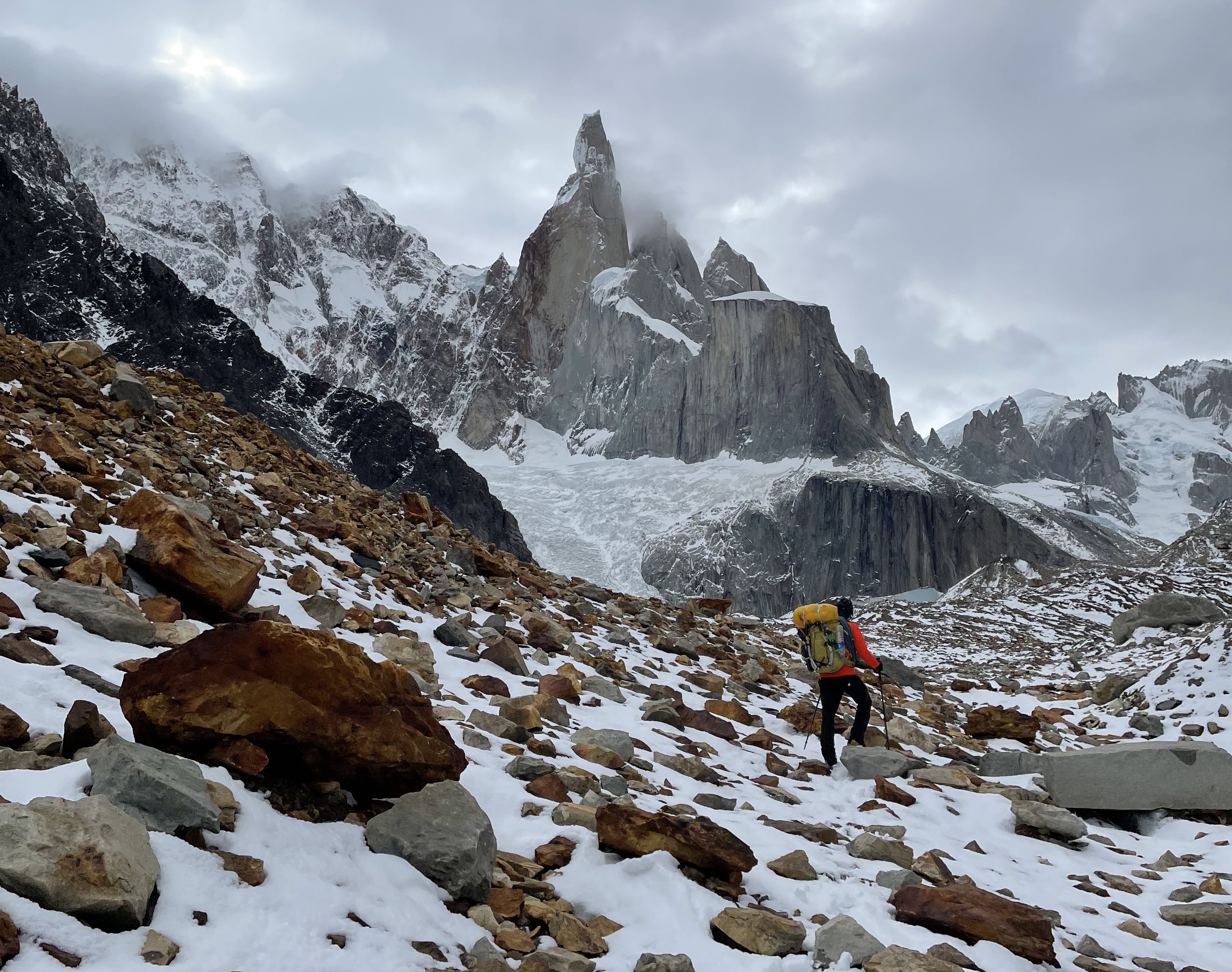
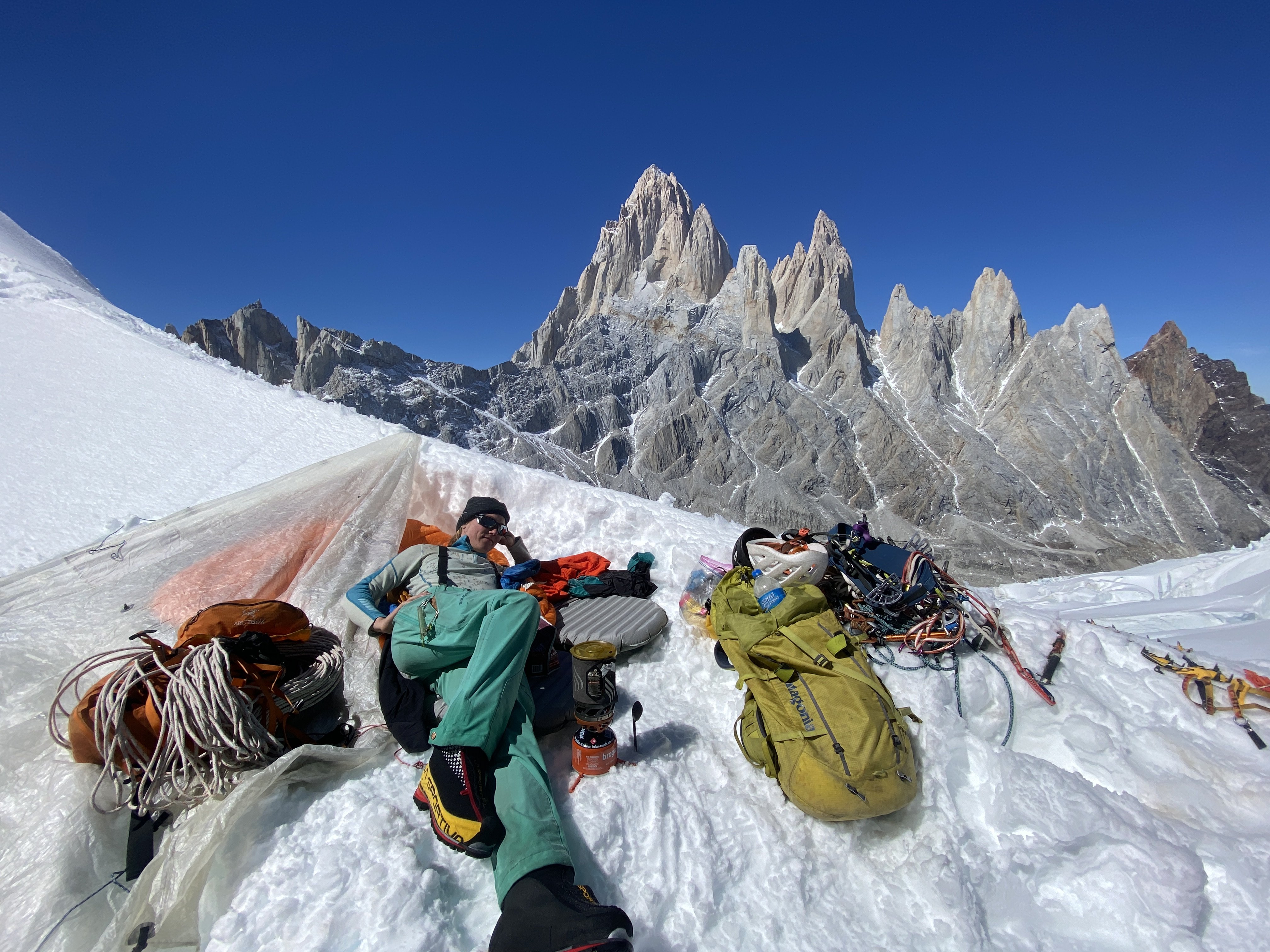
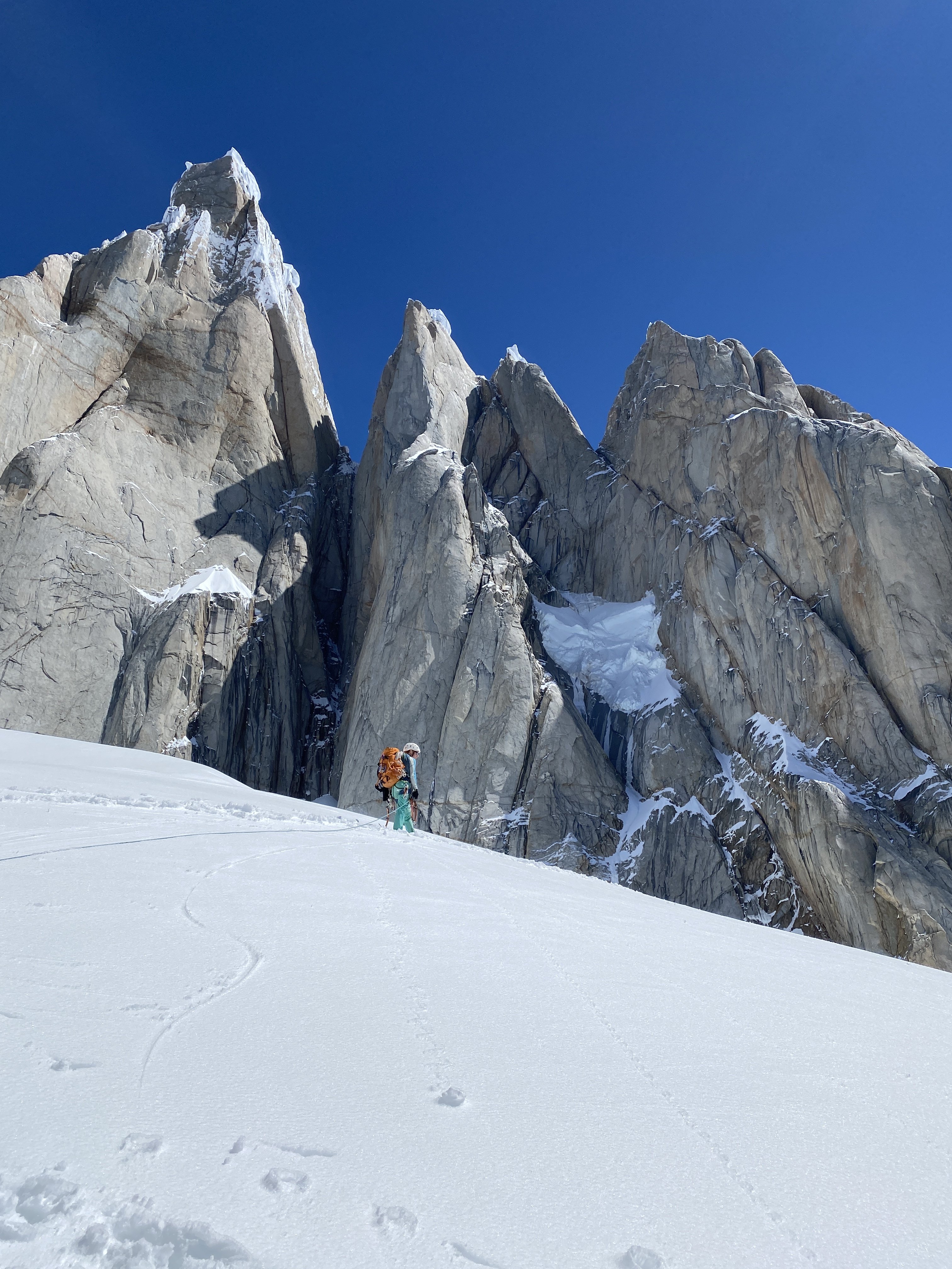
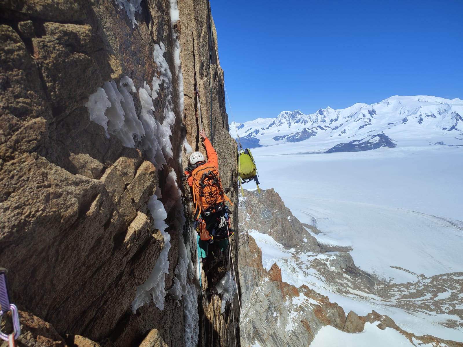
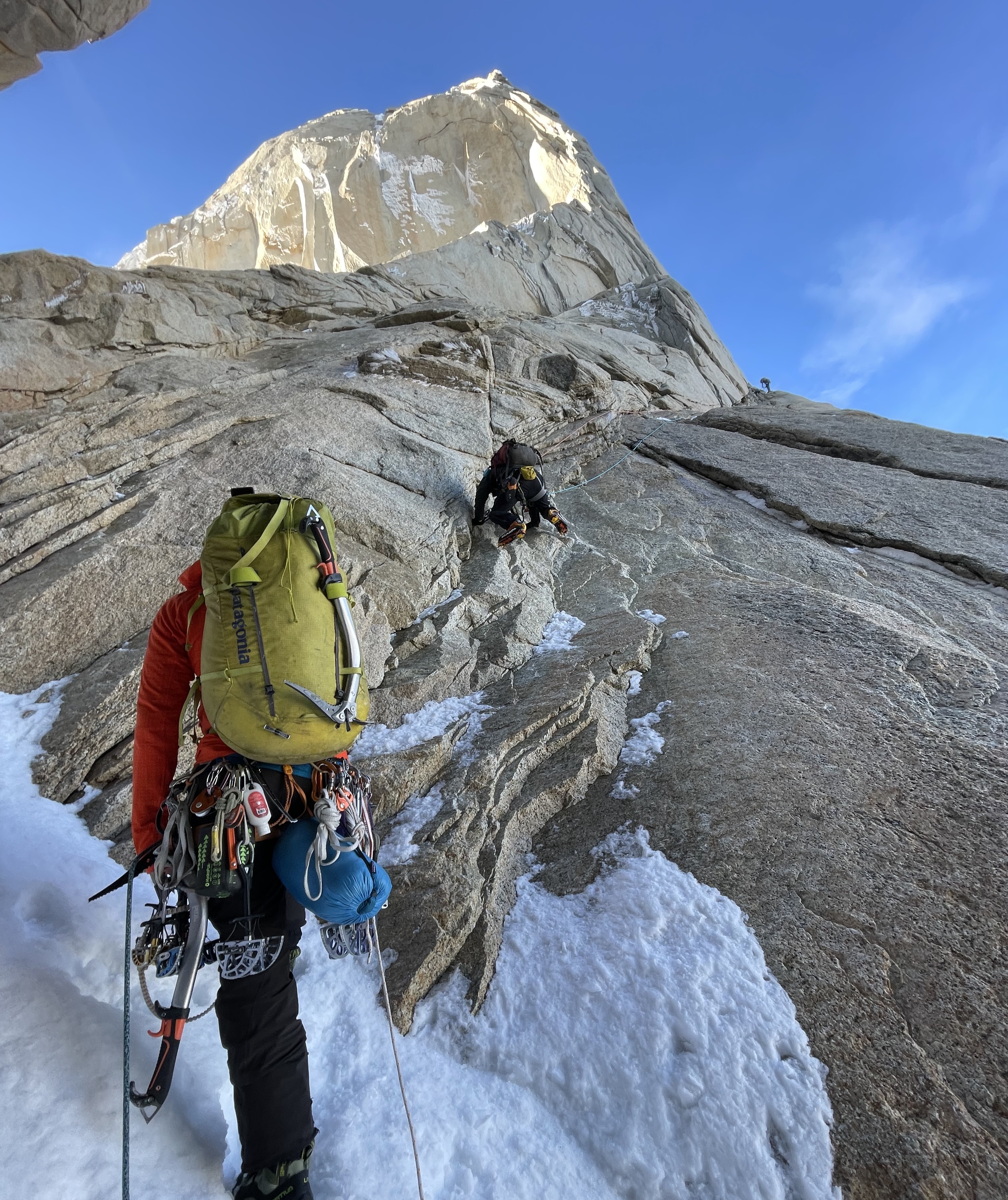
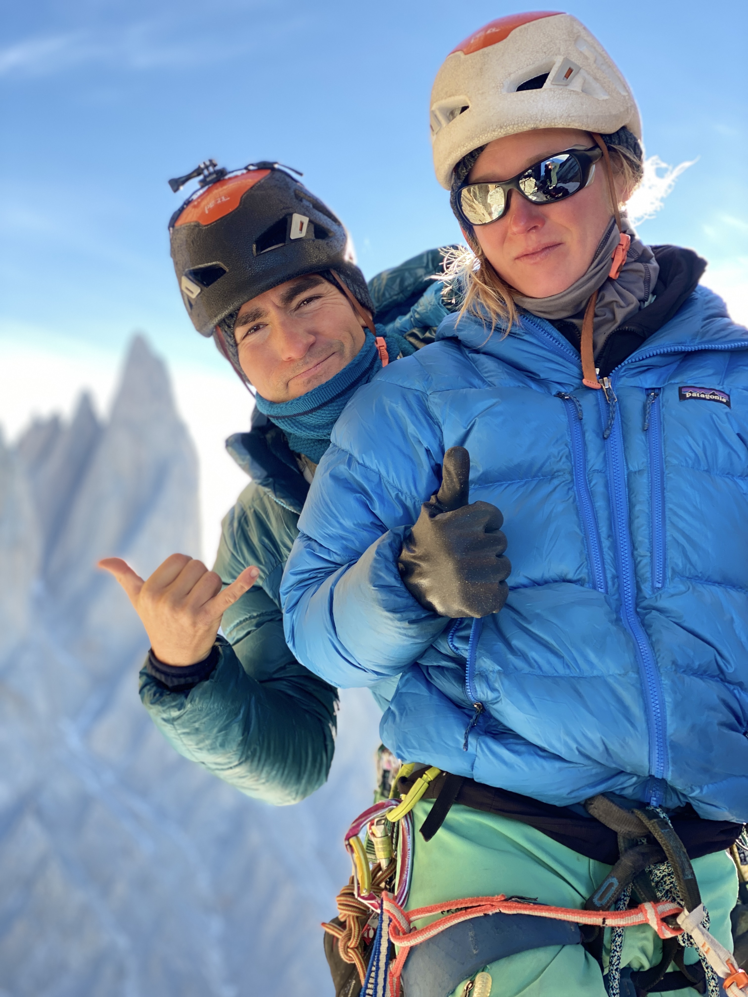
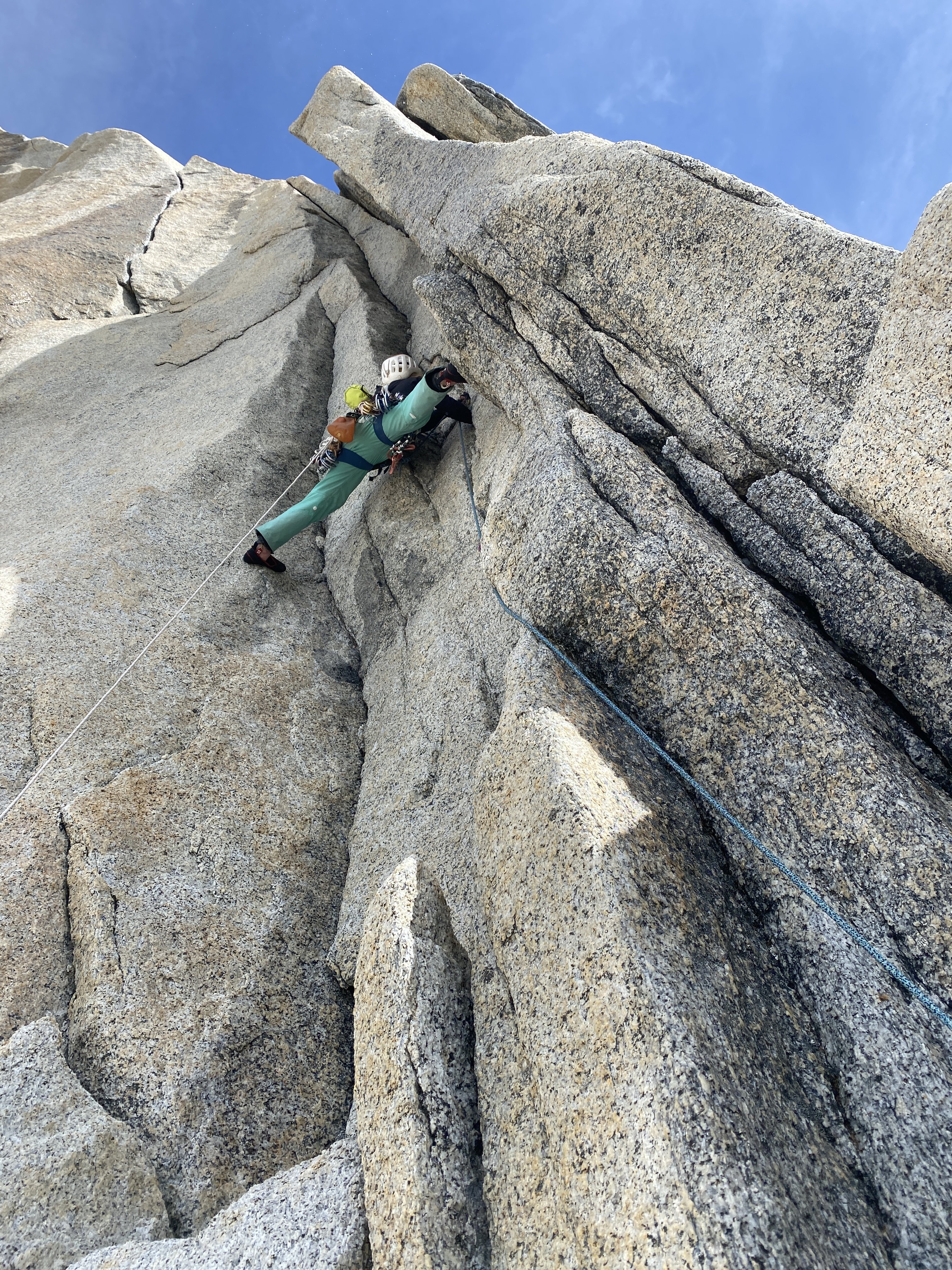
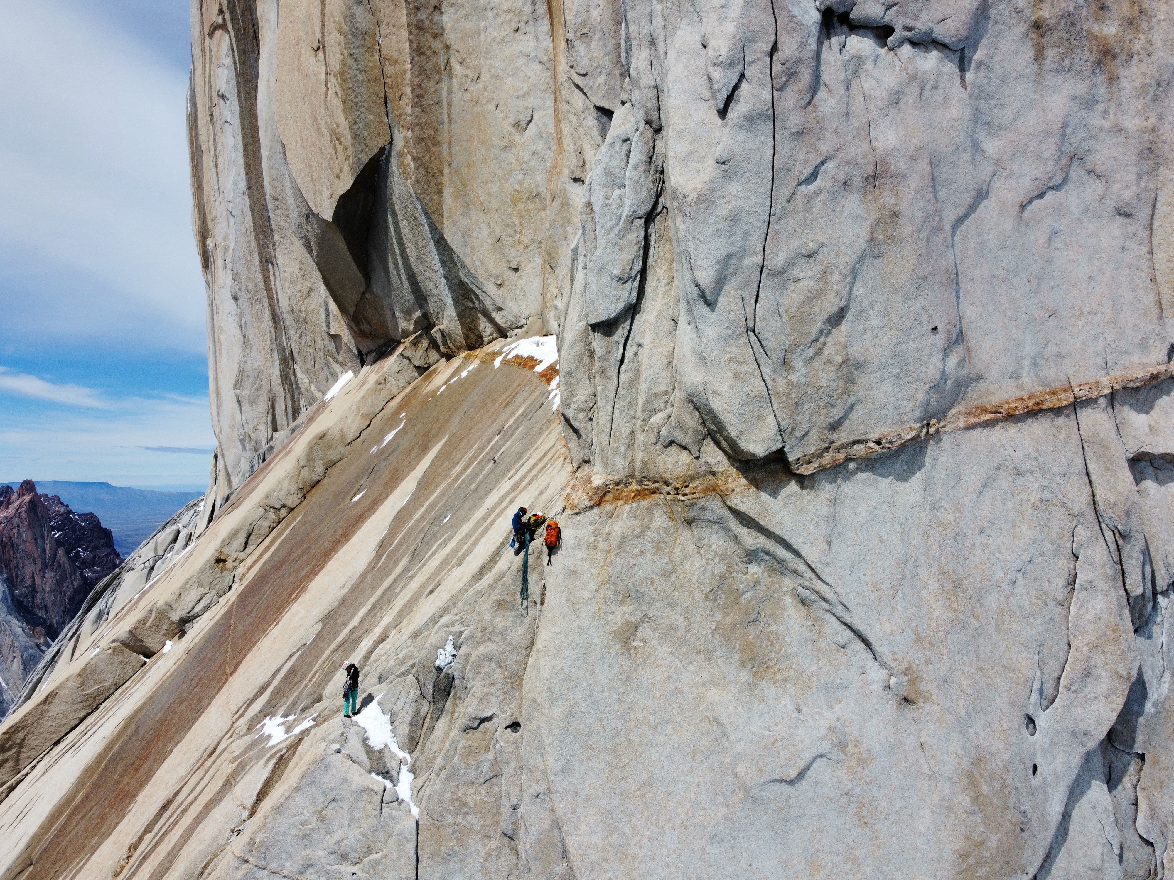
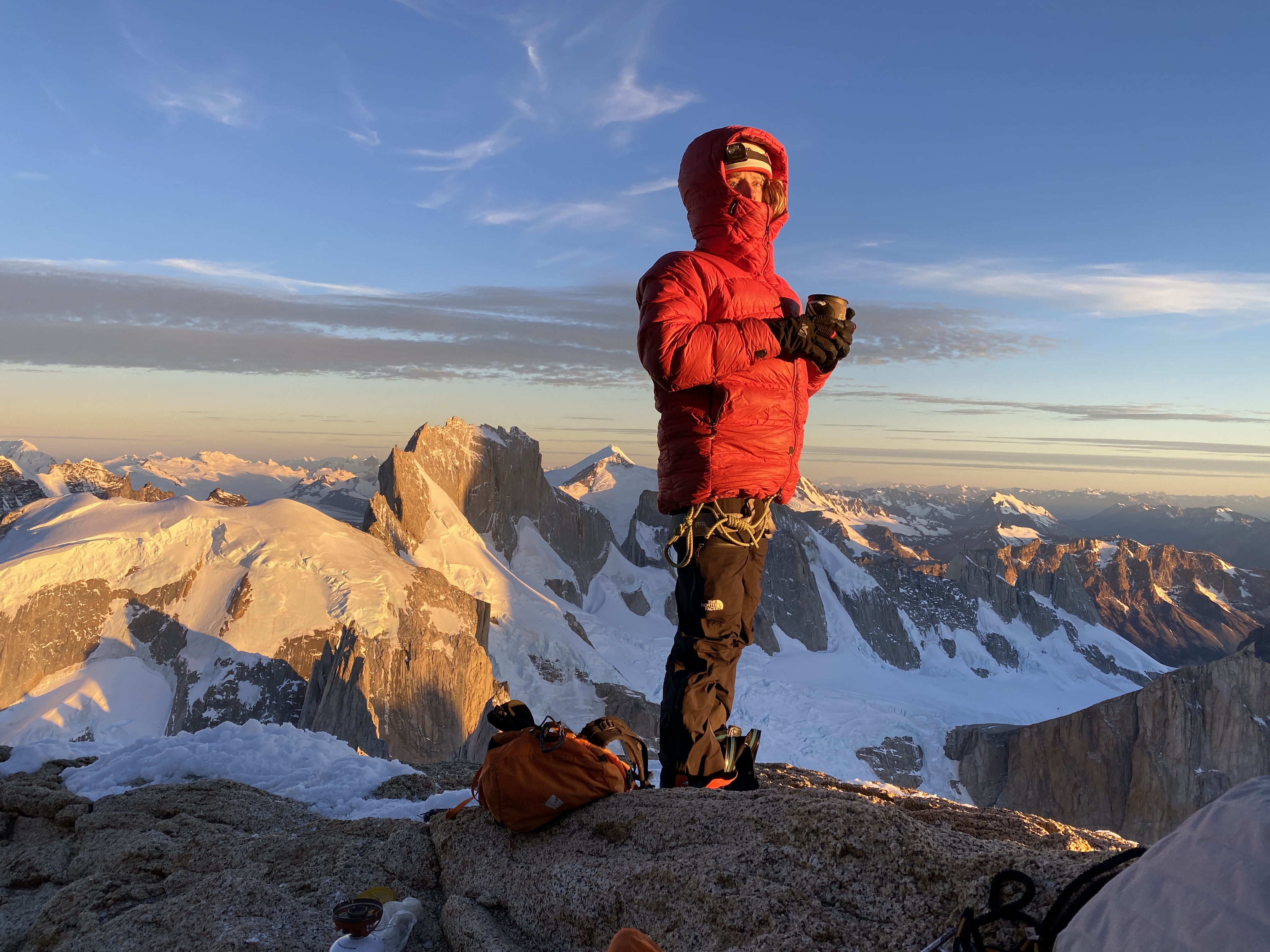
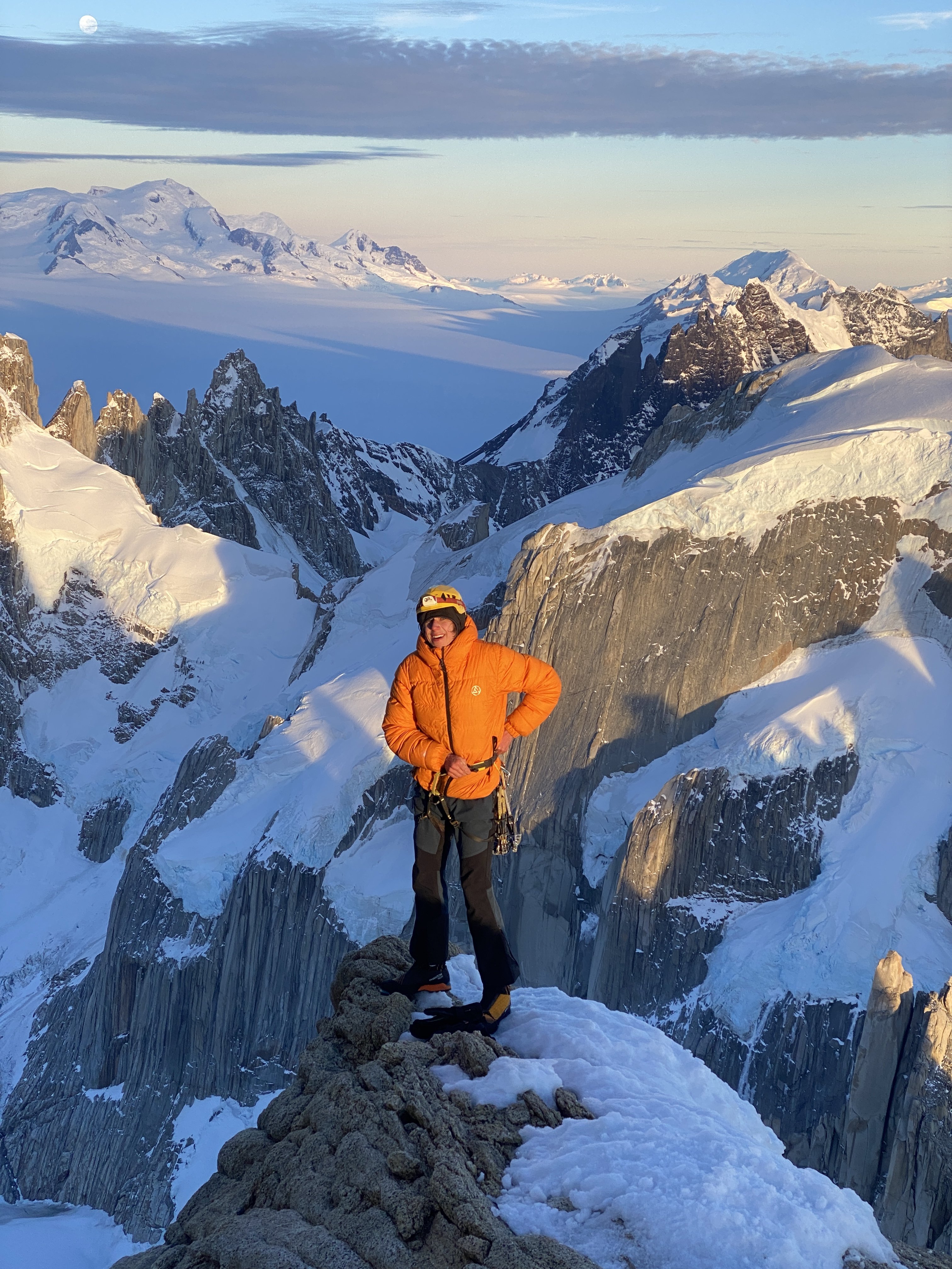
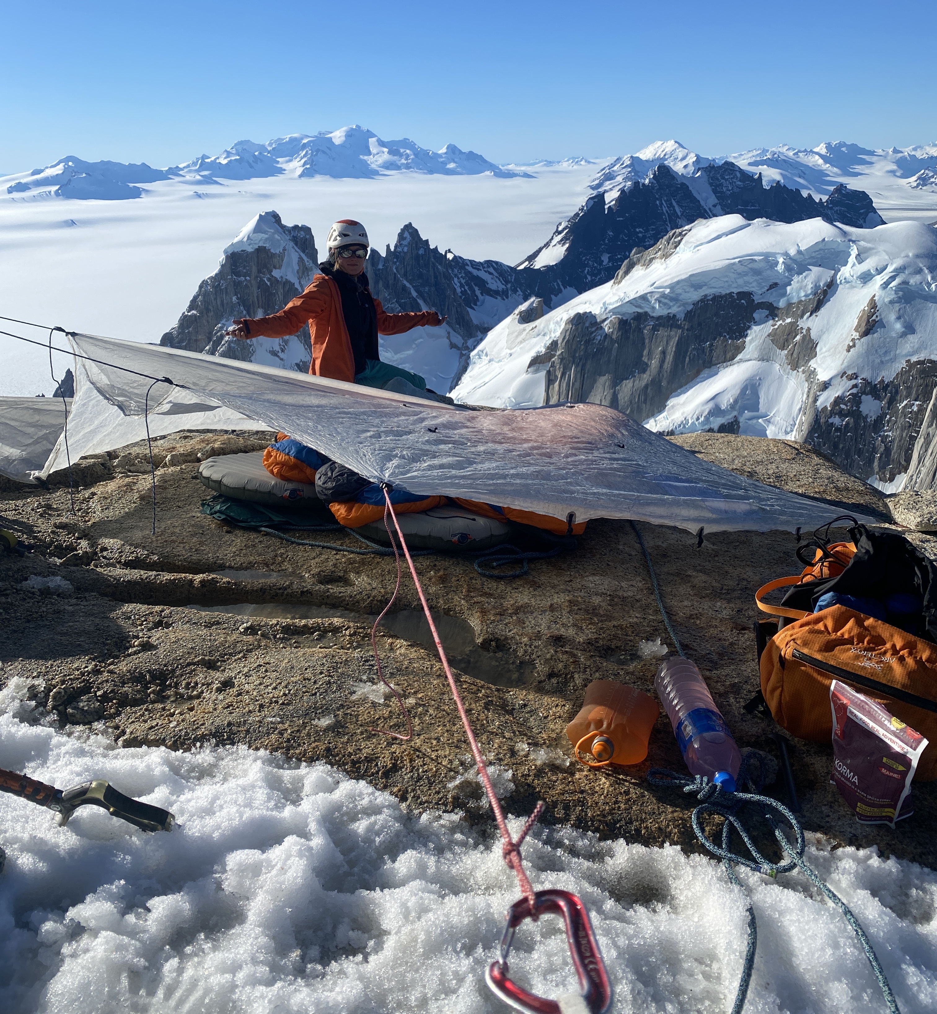
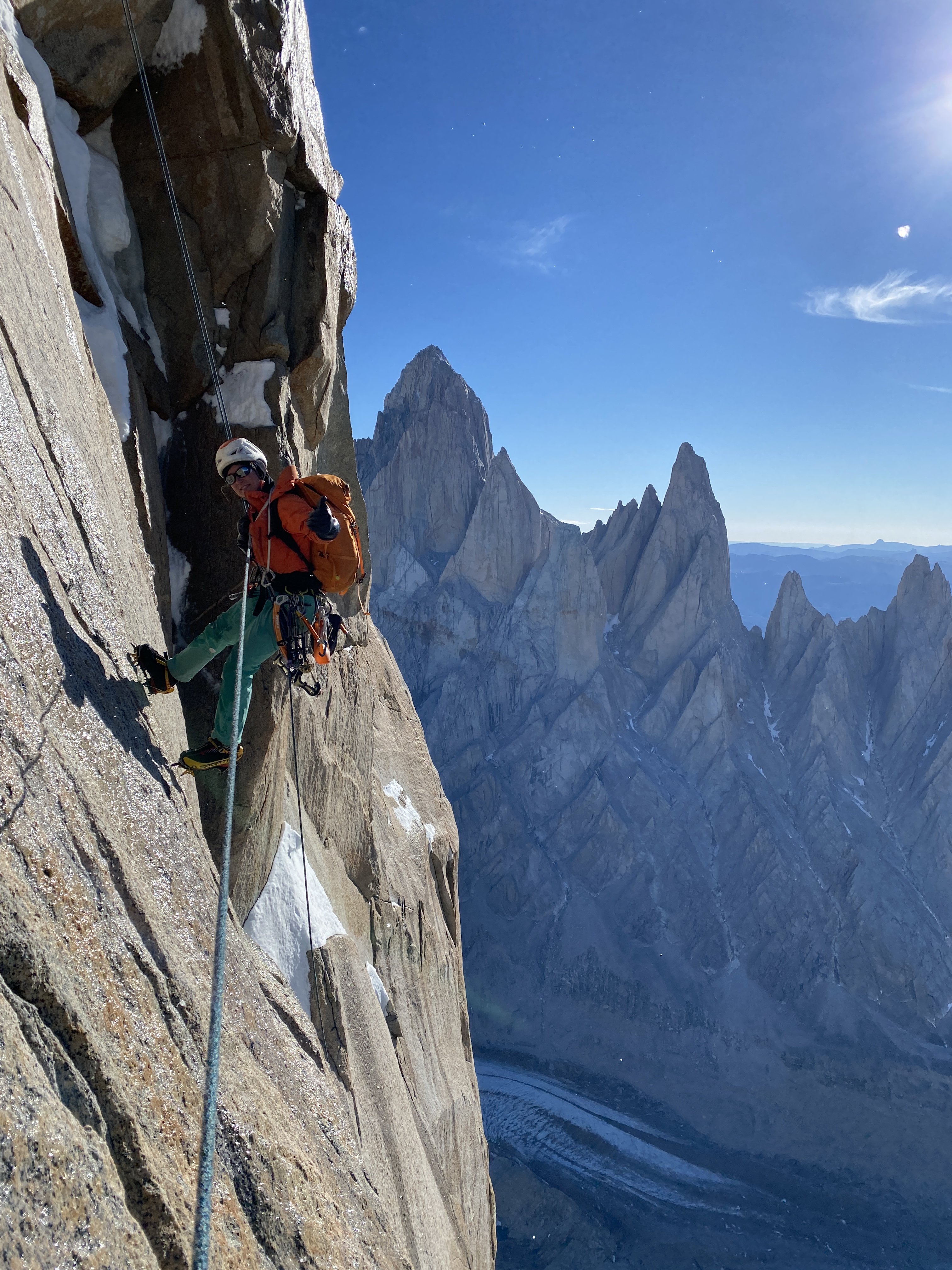
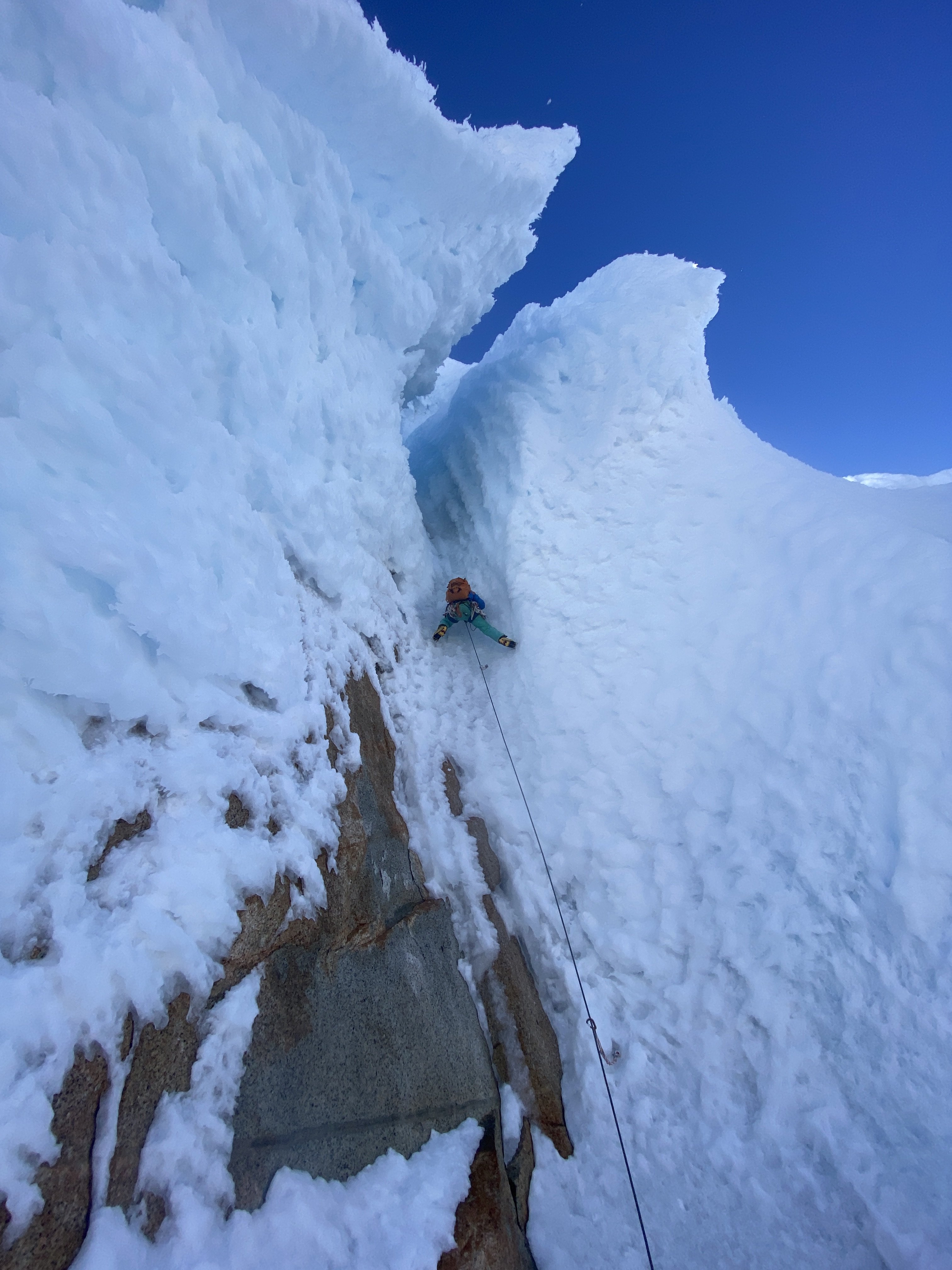
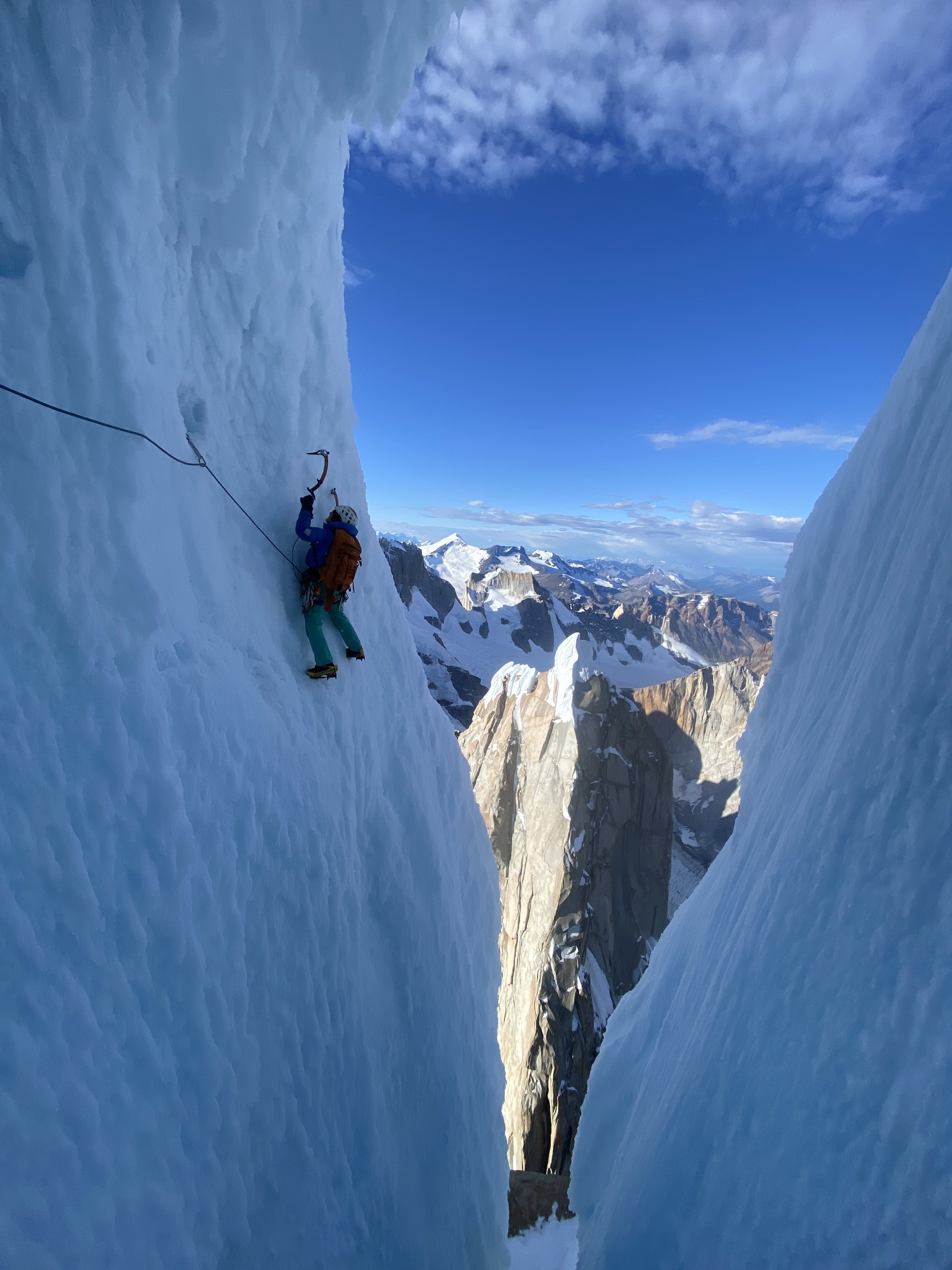
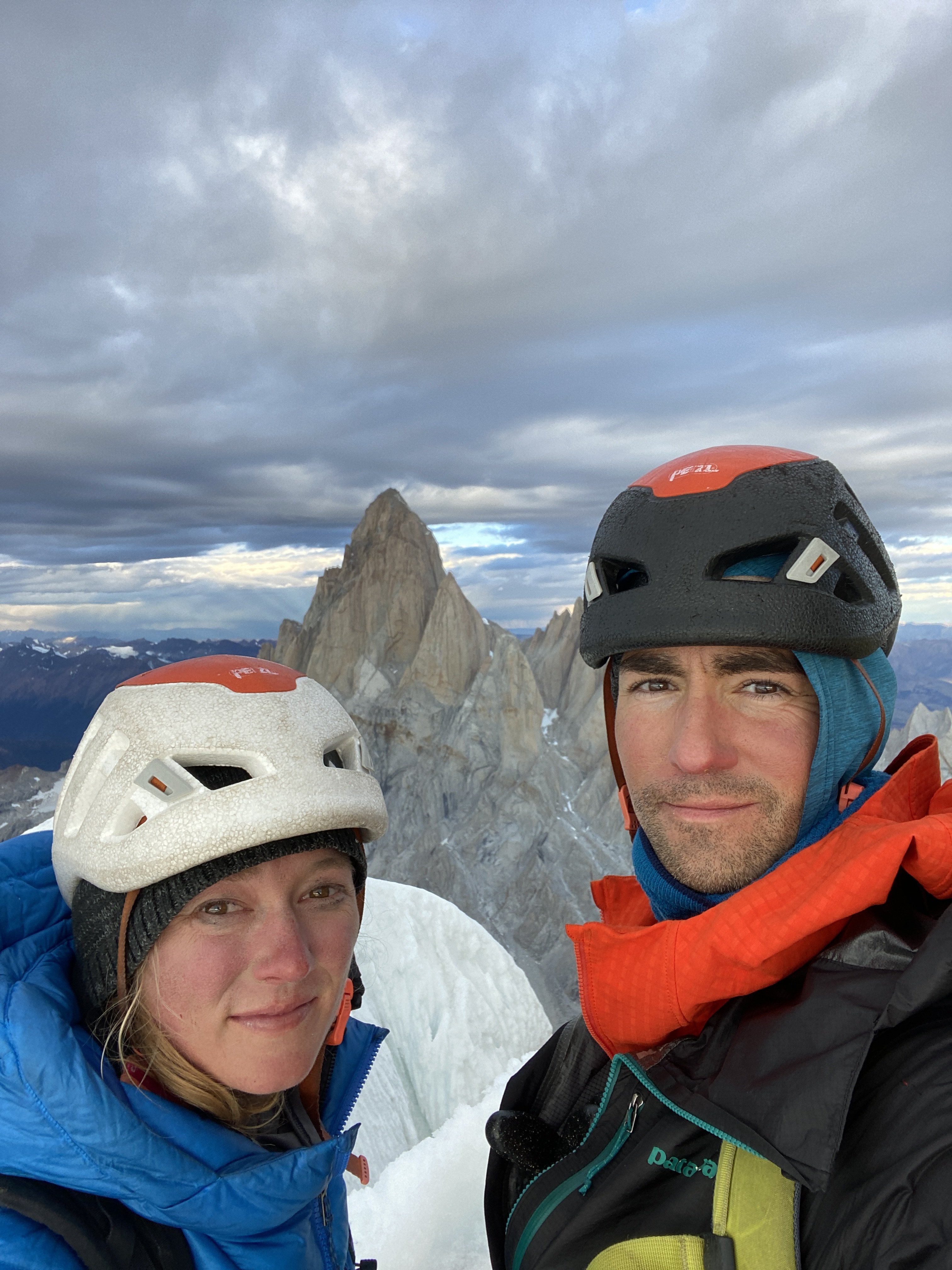
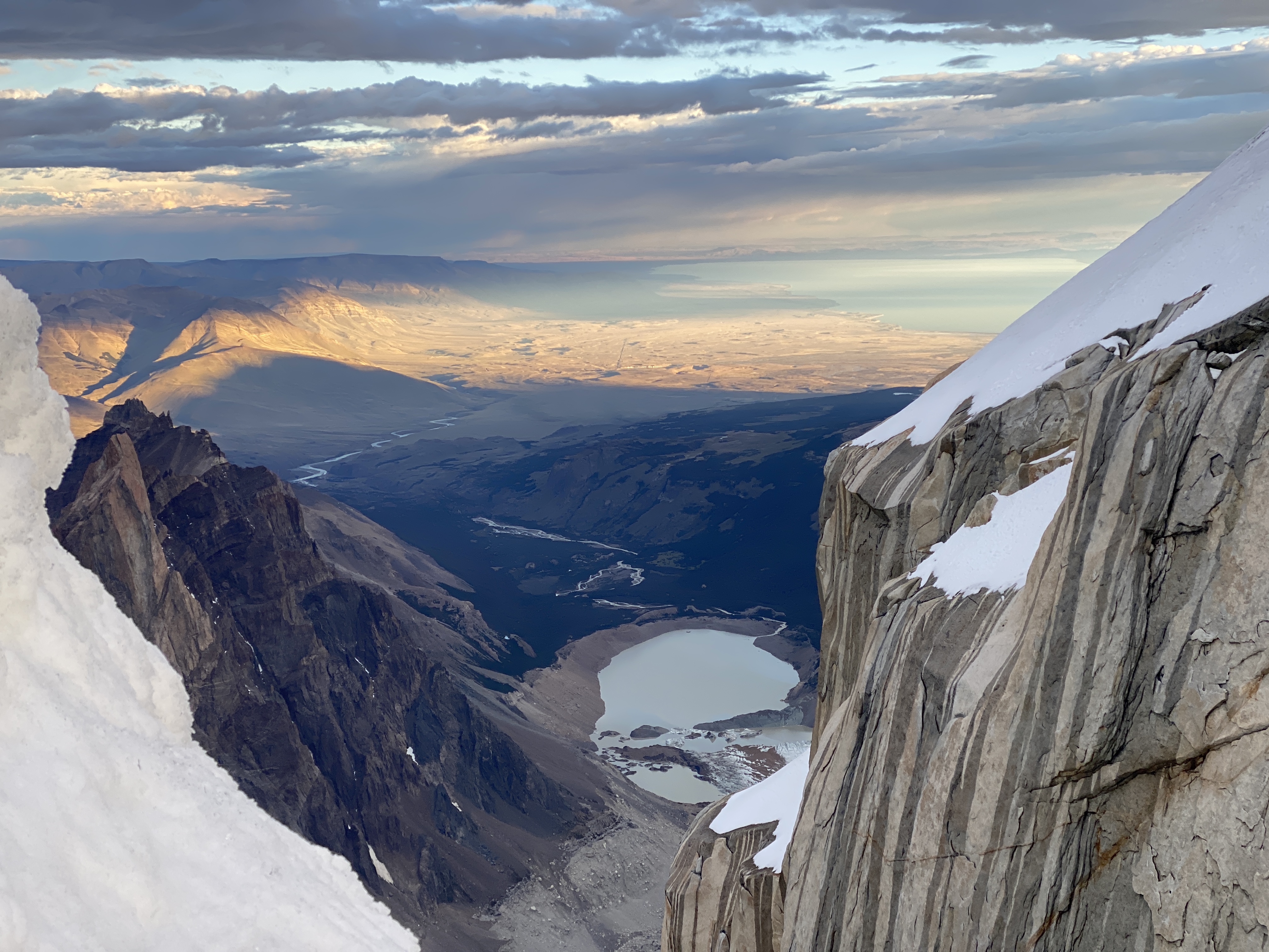
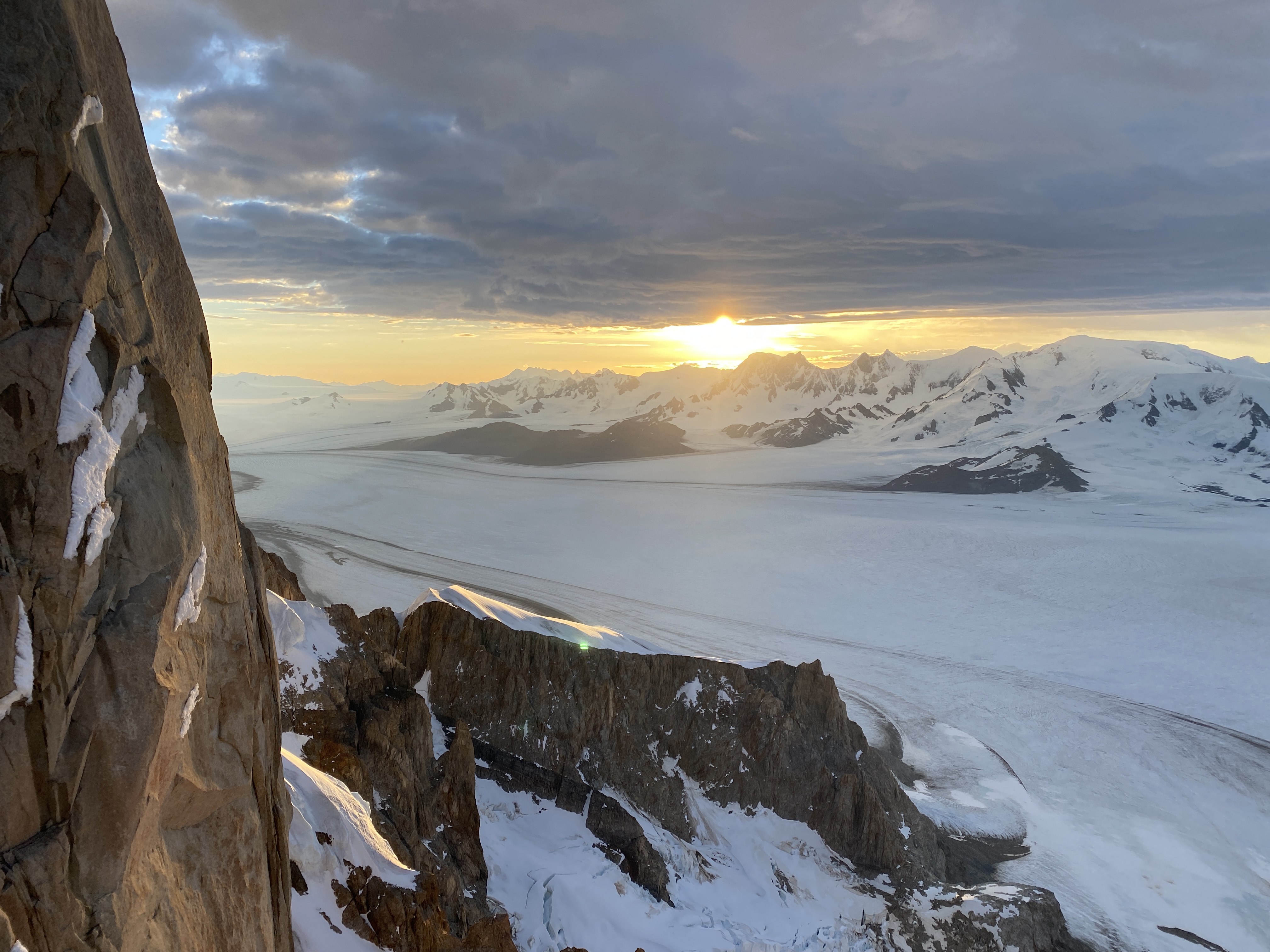
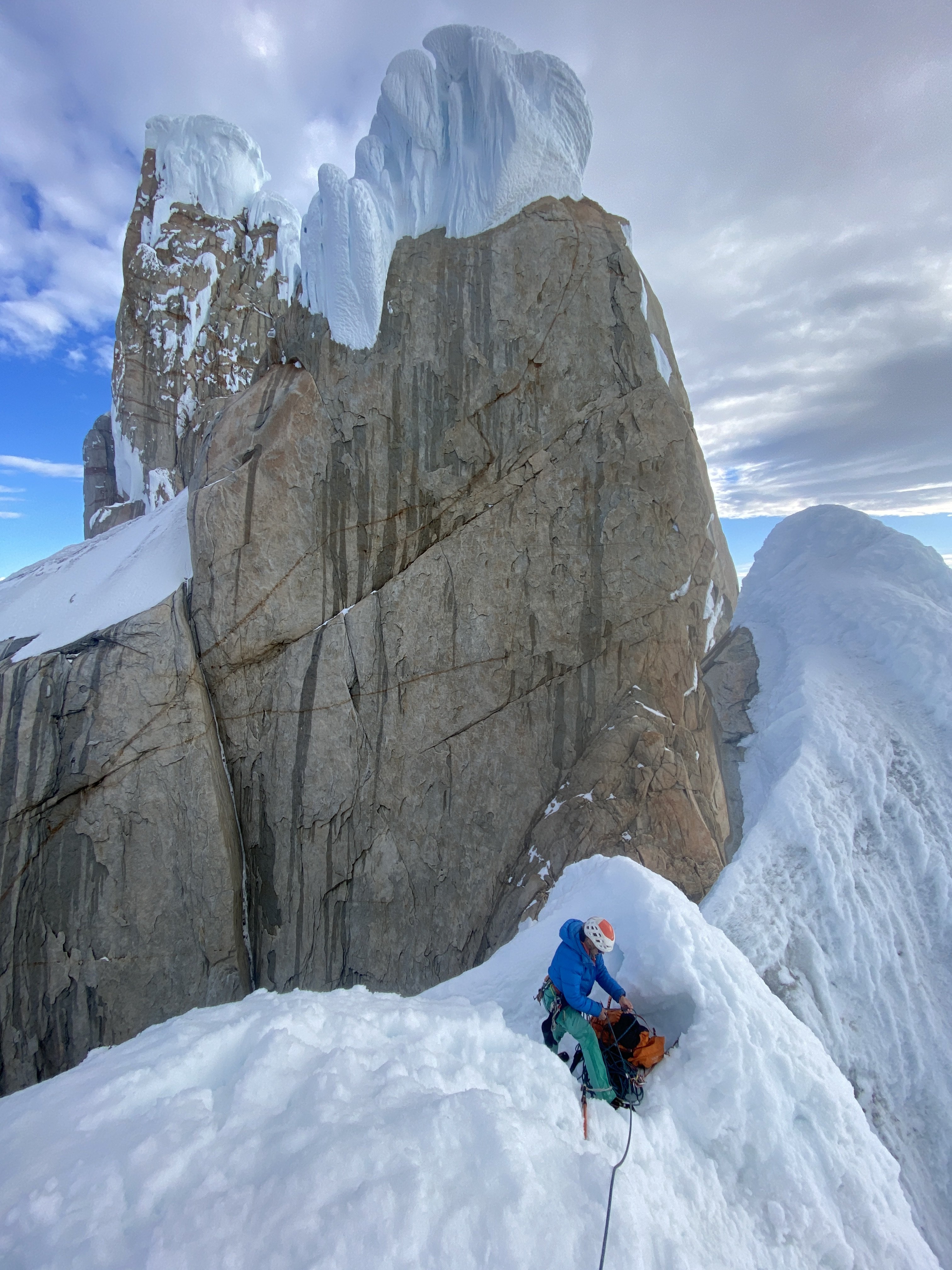
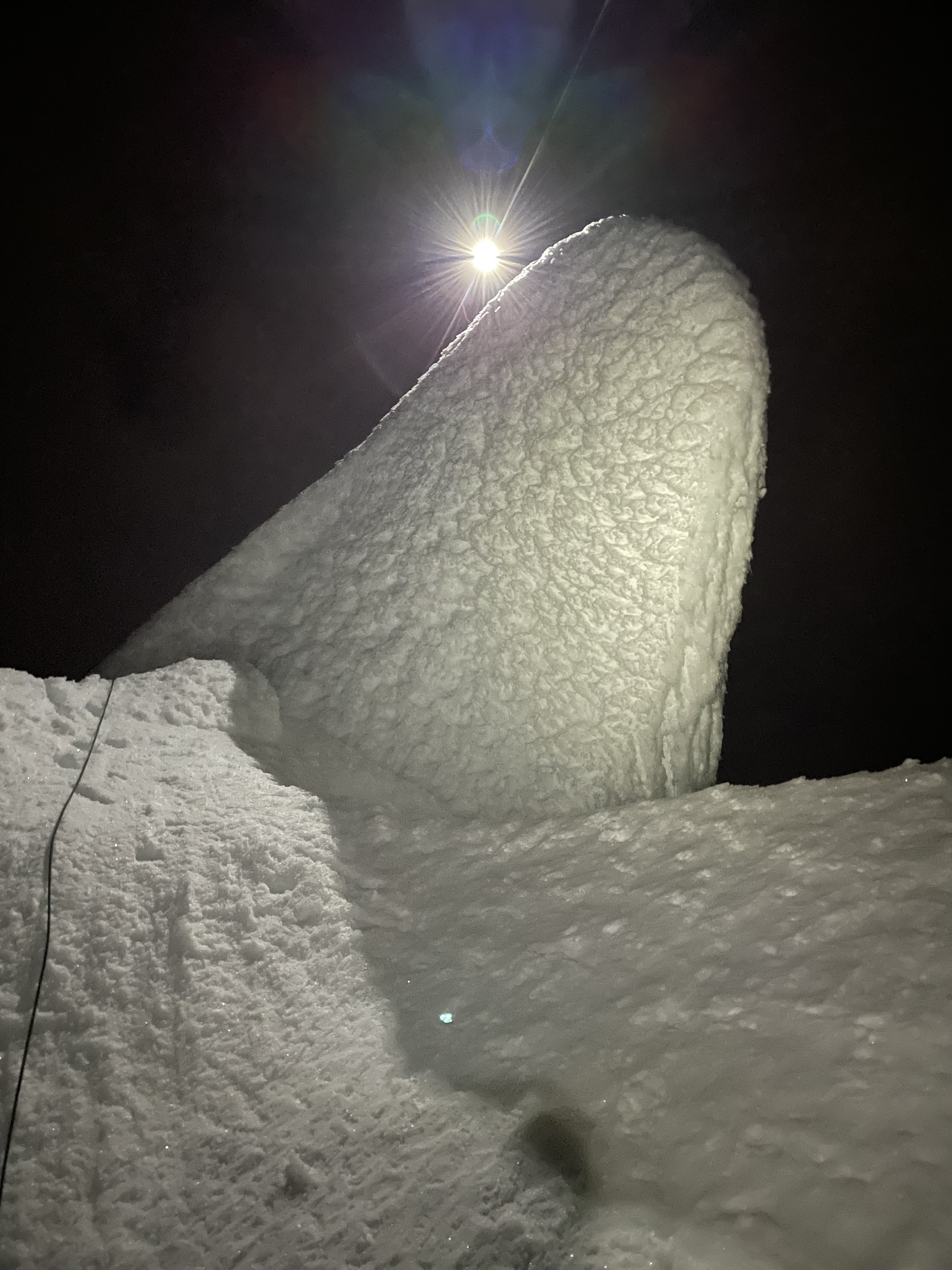
Trip: Patagonia - Torre Egger Smash 'n Grab - Huber-Schnarf Trip Date: 01/21/2022 Trip Report: Climbers: Jeff and Priti Wright Location: Patagonia - Chaltén Massif - El Chaltén, Argentina Traverse of 3 peaks: Aguja Standhardt - Punta Herron - Torre Egger Climb Date: January 18, 2022 - January 21, 2022 Full Trip Report: https://alpinevagabonds.com/torre-egger-traverse-a-smash-n-grab-story/ Climbs/Rappels Aguja Standhardt Climb via the North Ridge route Festerville (400m 90° 6c) in 15 pitches (14 pitches of rock and 1 pitch of rime ice) from Col Standhardt Aguja Stanhardt Rappel via South Face (7 Rappels) Punta Herron Climb via North Face route Spigolo dei Bimbi (350m 90° 6b) in 9 pitches (5 pitches of rock and 4 pitches of snow+ice+rime ice) Punta Herron Rappel via South Face (1 Rappel) Torre Egger Climb via North Face route Espejo del Viento (200m 80° 6a+, often referred to as the “Huber-Schnarf” route) in 5 pitches (3 pitches of rock and 2 pitches of snow+rime ice) Torre Egger Rappel via Titanic (countless Rappels, two downclimbing snowfields, and one 30m downclimb from the summit) In January of 2022, we completed another Patagonian “Smash ‘n Grab”, summiting three of the four peaks in the Torre Range via previously established routes (11 days Seattle-to-Seattle): Aguja Standhardt, Punta Herron, and Torre Egger. Including our ascent of Cerro Torre in 2020, we have now climbed all four summits of the Cerro Torre skyline, making Priti the first female to summit all four peaks. 2022 marked our fifth climbing trip to El Chaltén. In 2019, we completed a 10 day Smash ‘n Grab of Cerro Chaltén (Fitz Roy). In 2020, we spent two months in El Chaltén, during which time we climbed Cerro Torre on the route Via dei Ragni. Urgency and several parties in line behind compelled us to accept a top-rope on the final pitch of the summit mushroom of Cerro Torre, joining the conga line. Pink: The accidental line we took on wet, grimey terrain....oops (not recommended); Blue: the original route Festerville on golden granite Their 2022 traverse from Aguja Standhardt to Torre Egger enchained three distinct climbing routes (all established by different parties), climbing for four days and three nights, bivying twice on Standhardt and climbing through the third night up-and-over Torre Egger. After arriving in El Chaltén, we cached a tent at the standard Niponino Base Camp, carrying a tarp and a double sleeping bag for the traverse. We started on the route Festerville (400m 90° 6c) which follows the spine of the North Ridge of Aguja Standhardt for approximately 13 rock pitches. Another team of two (Michał Czech from Poland and Agustín de la Cerda from Chile) started up the route ahead of us and the four effectively joined forces, climbing symbiotically, each team helping the other along the way. After summiting Cerro Standhardt via 30 meters of 90° ice and rime, Michał and Agustín rappelled the Exocet route back to Base Camp while we (Jeff and Priti) made seven rappels down the South Face of Cerro Standhardt, continuing the traverse. The South Face rappels end 30 meters below the Col de los Sueños (the col between Standhardt and Punta Herron), requiring climbing the final 30m of the route Tobogán to reach the col. The traverse continued up to Punta Herron via the route Spigolo dei Bimbi (350m 90° 6b) climbing 5 pitches of rock and another two pitches of beautiful, vertical ice and rime to the summit. A single rappel from the summit of Punta Herron led down to Col de la Luz under the North Face of Torre Egger. Spigolo dei Bimbi included some of the most fantastic rock climbing that we have ever climbed in Patagonia! From Col de la Luz, we continued up the route Espejo del Viento (200m 80° 6a+, often referred to as the “Huber-Schnarf” route) in the dark of night for three rock pitches which ends in a long, run-out, wet, technical slab traverse under Torre Egger’s overhanging summit mushroom. We continued through the night, climbing two more moderate pitches up the mushroom on easier 70 degree snow and ice to the summit of Torre Egger at 2:00AM, the most difficult summit in the Chaltén massif. We continued through the night without a bivouac, descending 27 rappels and down-climbing along the route Titanic which follows the East Pillar of Torre Egger. Upon reaching the tent at Niponino in the Torre Valley after 44 hours of constant movement, we collapsed in the tent realizing we were too late to catch their planned flight home. Unfortunately, we neglected to notify anyone that we were missing our early-morning airport taxi. When the taxi arrived at our hostel Aylen-Aike, the driver woke up Korra Pesce who was sleeping in the room where we had previously slept. Korra notified the hostel owner Seba and Rolando “Rolo” Garibotti who were all quite worried and proceeded to notify rescue teams. Later that morning, Rolo successfully contacted us on our inReach before any rescue efforts began, teaching us a valuable lesson: let people know if you're going to be late! A week later, a team of bold volunteers attempted an unsuccessful rescue of Korra Pesce, the legendary French-Italian Alpinist, on the North Face of Cerro Torre who will be sorely missed by his friends, family, companions, and fans. Being back at home in the US by the time the accident occurred, we wished that we had been present to aid the operations. The 2021/2022 Patagonia season was marked by several notable deaths and rescues in the mountains as well as several celebrated new climbs. Patagonia continually demands of its visitors the humility that this place deserves. We really want to thank Rolando Garibotti and Colin Haley for their beta, support, and encouragement; Agustín and Michał for being a great team to partner with as we shared the same objective on Cerro Standhardt; Aylen-Aike for putting us up at the last minute in El Chaltén; Hector Tito Soto Nieto and Andrew Reed for loaning us your cams (we decided what route to do while on the airplane); our bosses and work colleagues for letting us go for a week with hardly any notice; Ilia Slobodov for the awesome weather updates while on route; and Kelly Cordes for the rad Patagonia gear. Priti on the summit of Torre Egger, 2:00AM. Time to rappel. Gear Notes: 2x Camalots to #1, 2x TCUs, 1x Camalots to #3, 6 ice-screws, a set of stoppers, and deadman stuff sack (substitute a jacket instead?) to rappel off of Torre Egger (or a retrievable ice tool anchor or downclimb) Approach Notes: Approach as for Col Standhardt

-
Awesome report!!
-
This is amazing! Thanks so much. I'll definitely use this when we go back!
-
I am an experience climber who has climbed Triple Couloirs three times on three different years in various conditions. I consider myself a very conservative climber with a low risk tolerance who has climbed some of the most technical routes all over the world. I have only solo'd two "technical" routes in my life: one 5.6 rock climb in Leavenworth and Triple Couloirs, but I generally always prefer a running belay on all "technical" climbs. My personal opinion is that Triple Couloirs for the experienced climber lends itself to solo'ing. In the best conditions, TC has two very short ice pitches (less than three body lengths each) separated by three couloirs of snow which generally would be good terrain to self-arrest a fall. If you get to the first ice pitch and it is dry or thin, you can easily walk back down. If you get to the second ice pitch and it is dry or thin, you can easily walk back (reversing the moves or rappelling the first ice pitch). You can basically climb up and turn around when you get to a section that you decide that you can't reverse the pitch in its conditions. Yes, the route can be dry and it can be thin, but you can always turn around if it's not in great conditions. A fall from one of the two ice pitches would be relatively easy to arrest a fall. I teach students on arresting a fall on snow. I would classify the angle of snow in these couloirs relatively moderate self-arrest terrain (not the easiest, but not a difficult place to stop a fall). As a very experienced Mountaineer, I assume Dr. Thurmer was an expert at self-arrest technique on snow. I solo'd TC with three other friends at the same time, all soloing, carrying a 30m skinny rope to rappel or for emergencies or for a belay if somebody wanted it. In prime conditions (as I climbed it solo), the first pitch is 4-5 body lengths of AI3- and the second pitch is 1-2 body lengths of AI2 (sometimes it's even just snow that you walk up). Page 191 of the new guidebook "Cascade Classic Climbs" is a good, representative picture of my wife about to solo the "crux" WI3- on TC. You can see that in prime conditions, it is a *very easy* ice step. Without an autopsy, and without knowing the conditions, and without having known Dr. Thurmer personally, it is possible that he got hit by a falling rock and may have been incapacitated to arrest (the worst case and very unlikely scenario). Impossible to know. I don't think TC is notorious for having rock fall this time of year. I have climbed this mountain 8 times in March and April on different years and never observed rock fall. It's possible that he was just really unlucky and got hit by a rogue rock. Norman_Clyde, I think it's very unlikely that Dr. Thurmer would have set up a self-belay at any point, as the pitches do not lend themselves to a self-belay. I have climbed Gib Ledges, and (for comparison), I did not and would not solo that route due to the frequency of rock fall. I think Gib Ledges has much more exposure and much more objective hazard, for reference. The point of me saying all of this is that I personally think there should be zero judgment towards Dr. Thurmer's decision to solo this route. I don't really think there is any "no-fall" terrain on TC, as long as you are experienced with self-arrest techniques. I 100% respect all opposing opinions since everyone has different risk tolerances. My personal opinion, if you can lead WI4 ice clean, roped, and it feels easy, and you also have solid self-arrest skills, TC is a trivial route to solo (coming from a guy who doesn't solo shit).
-
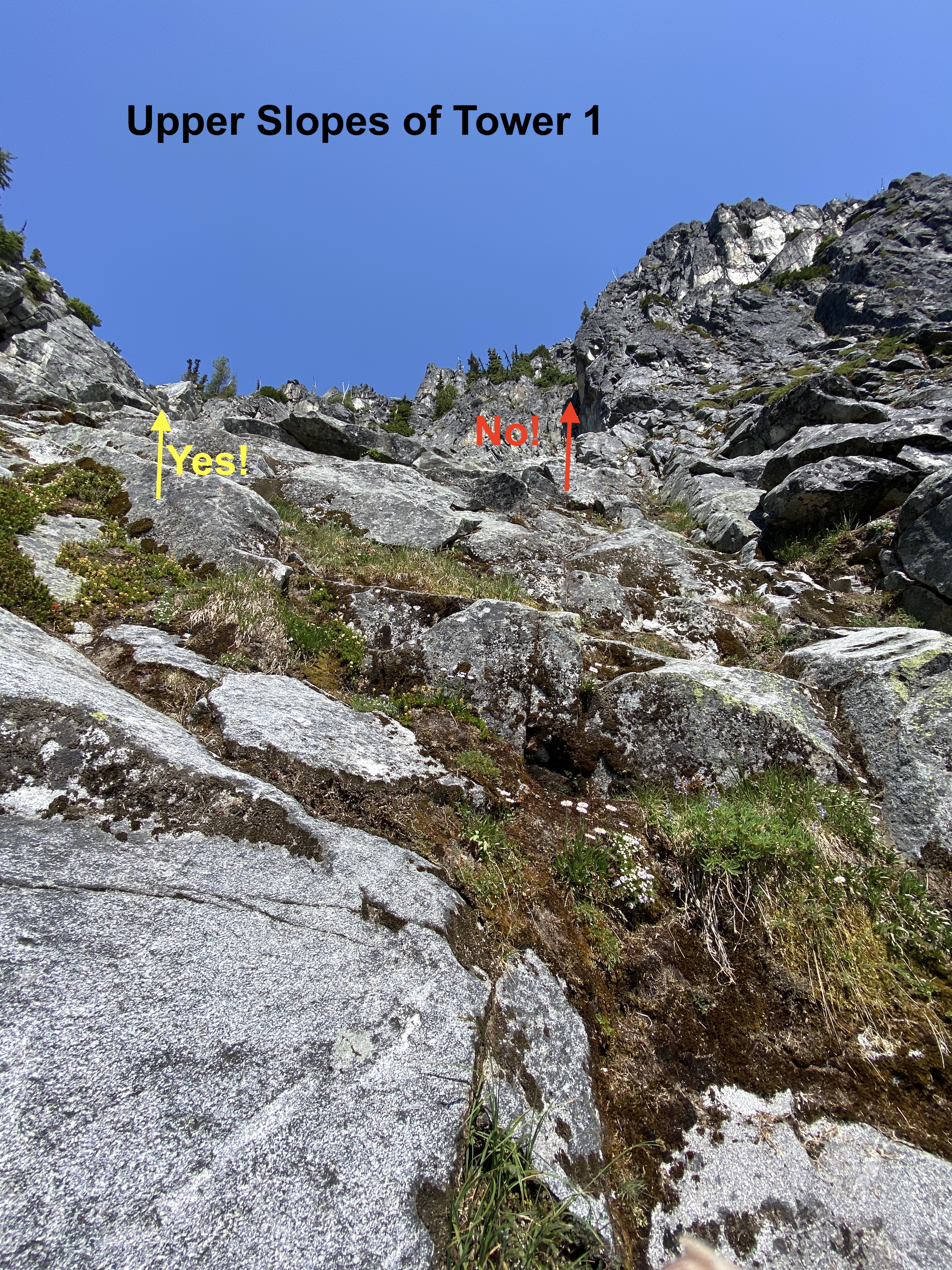
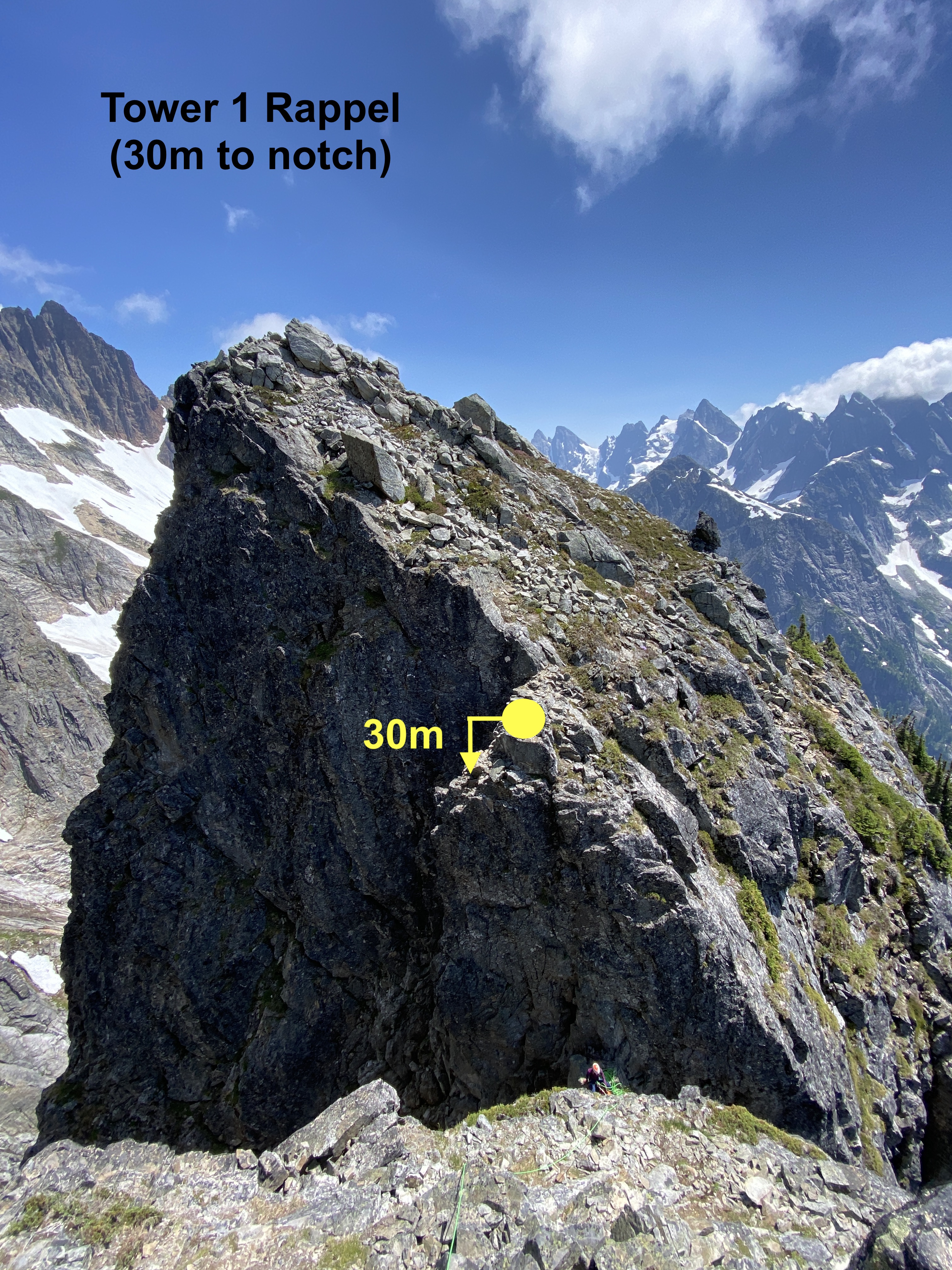
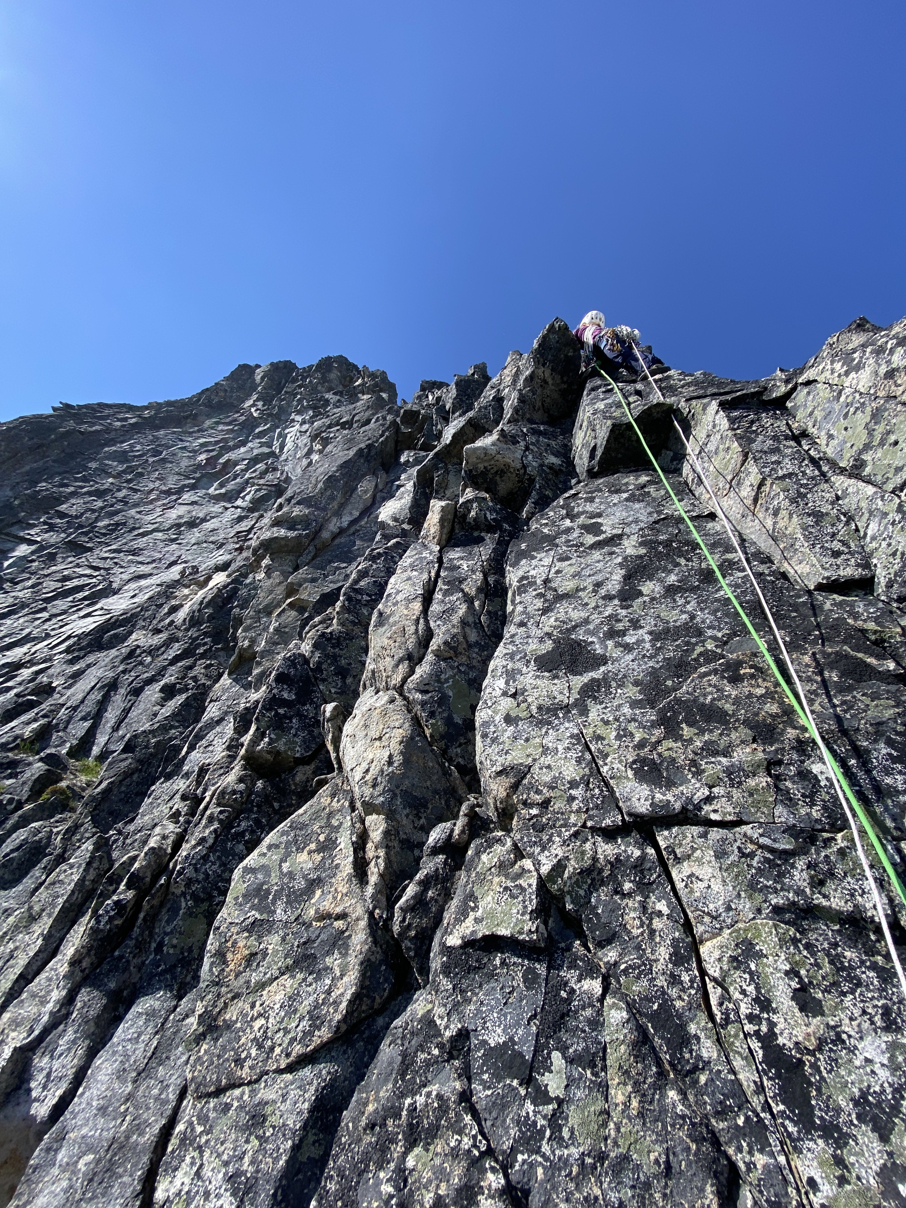
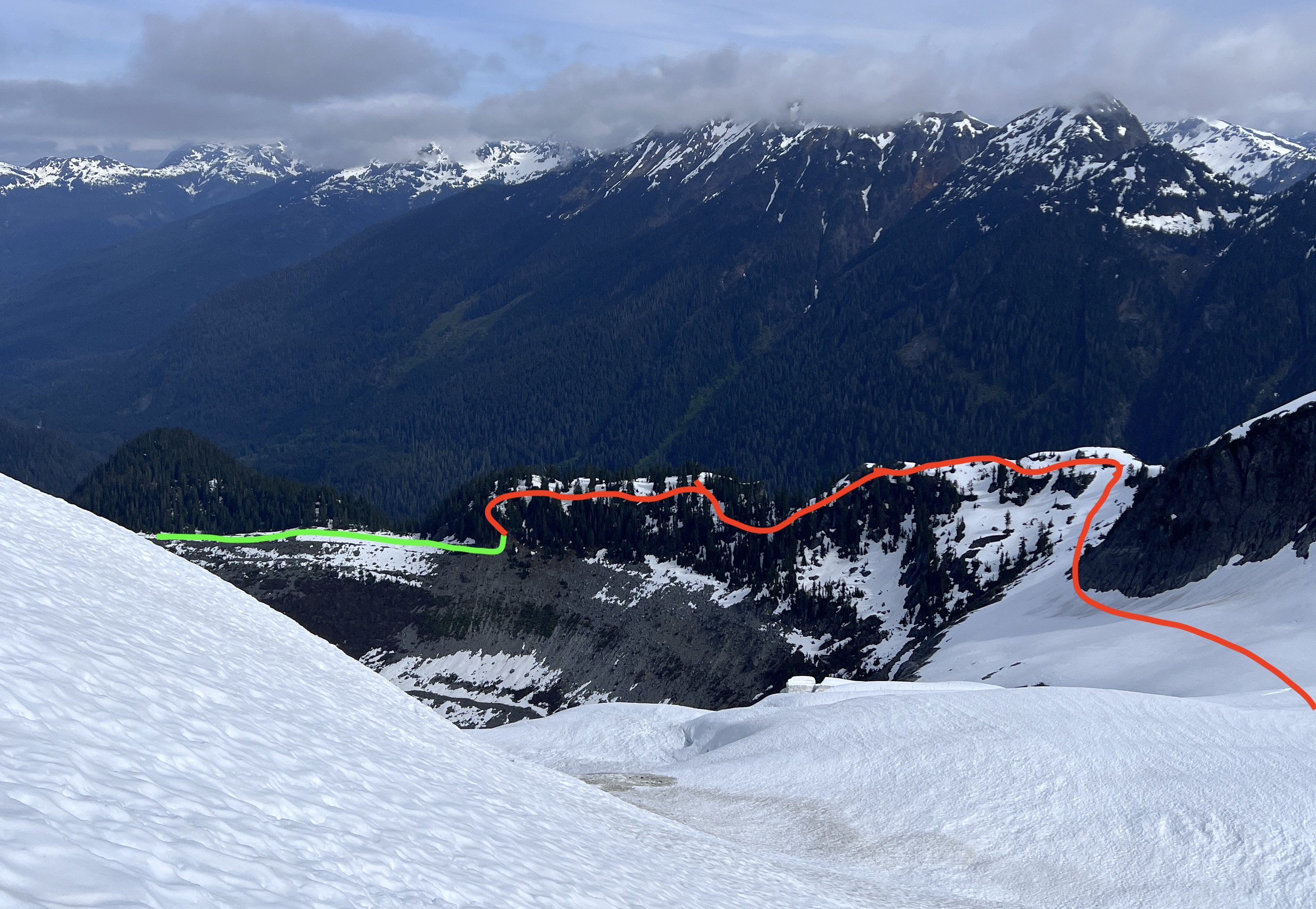
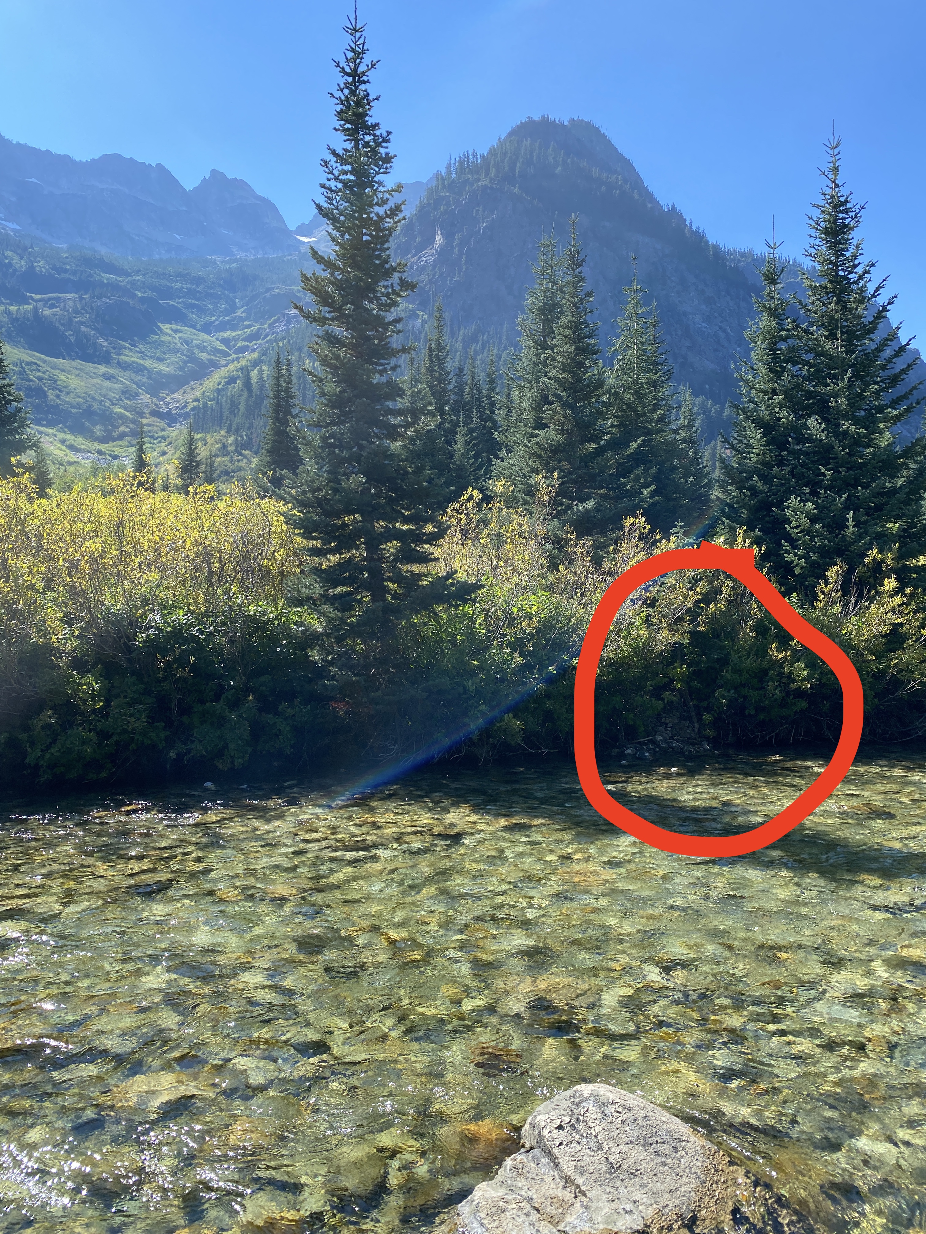
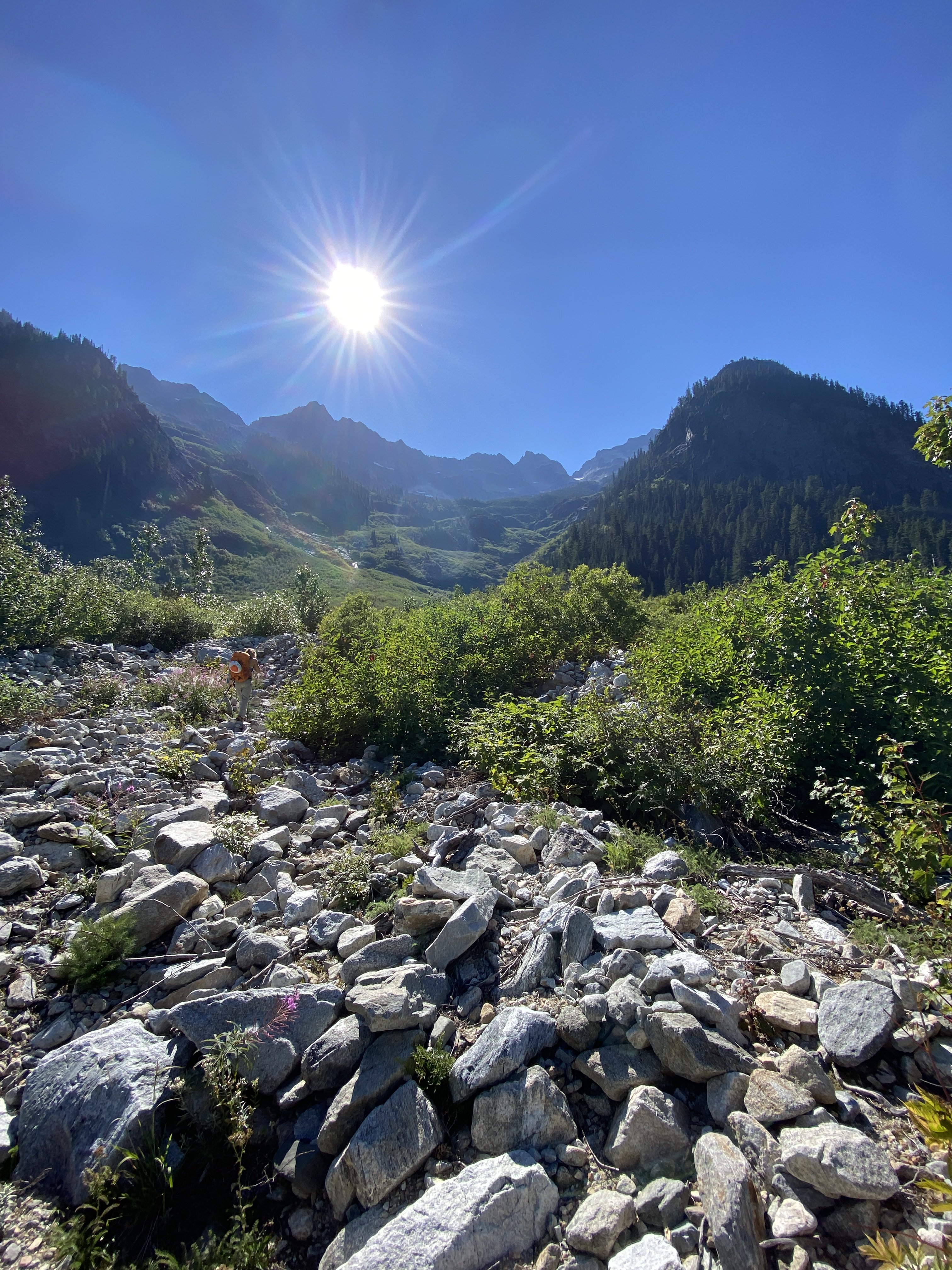
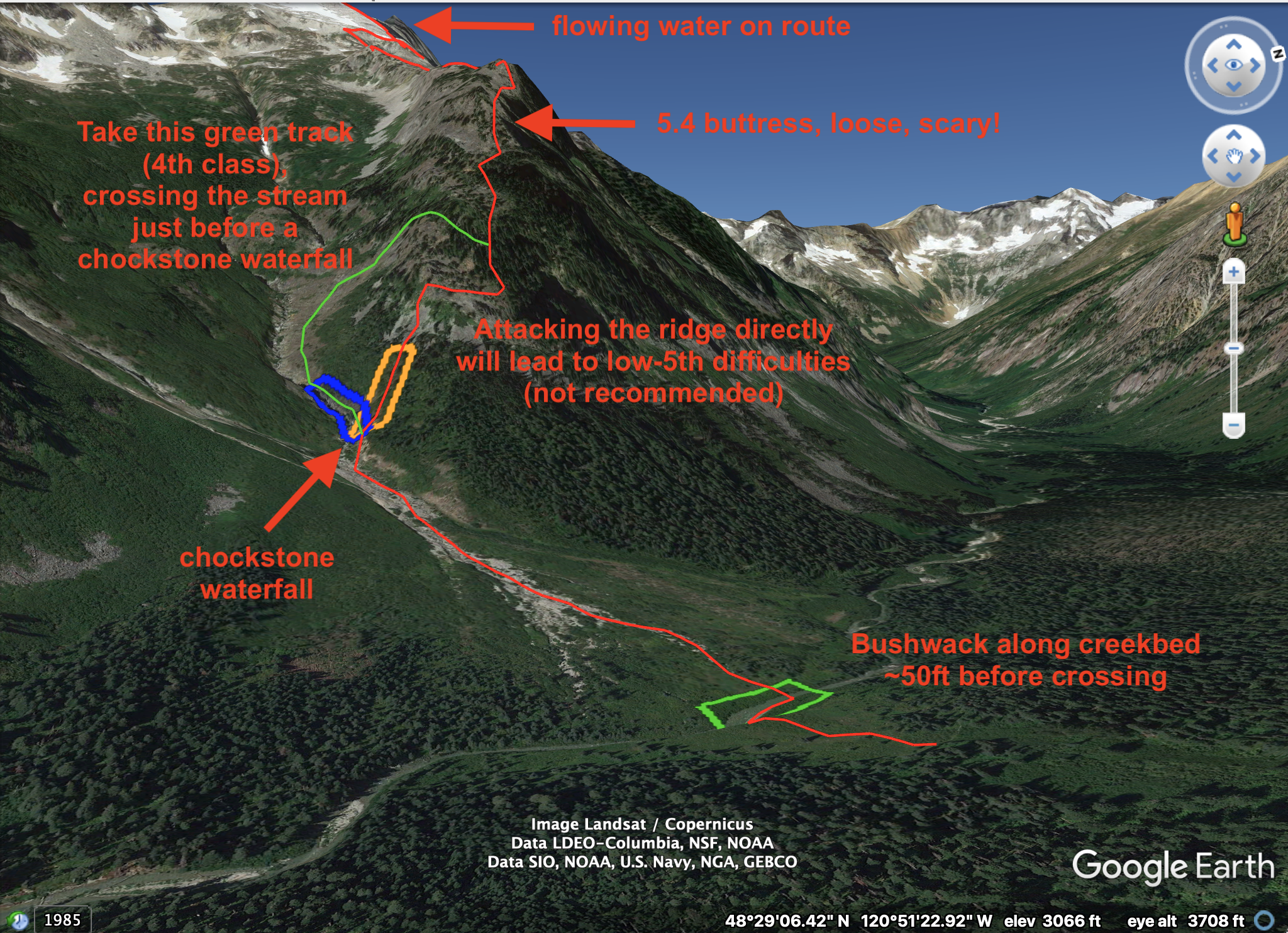
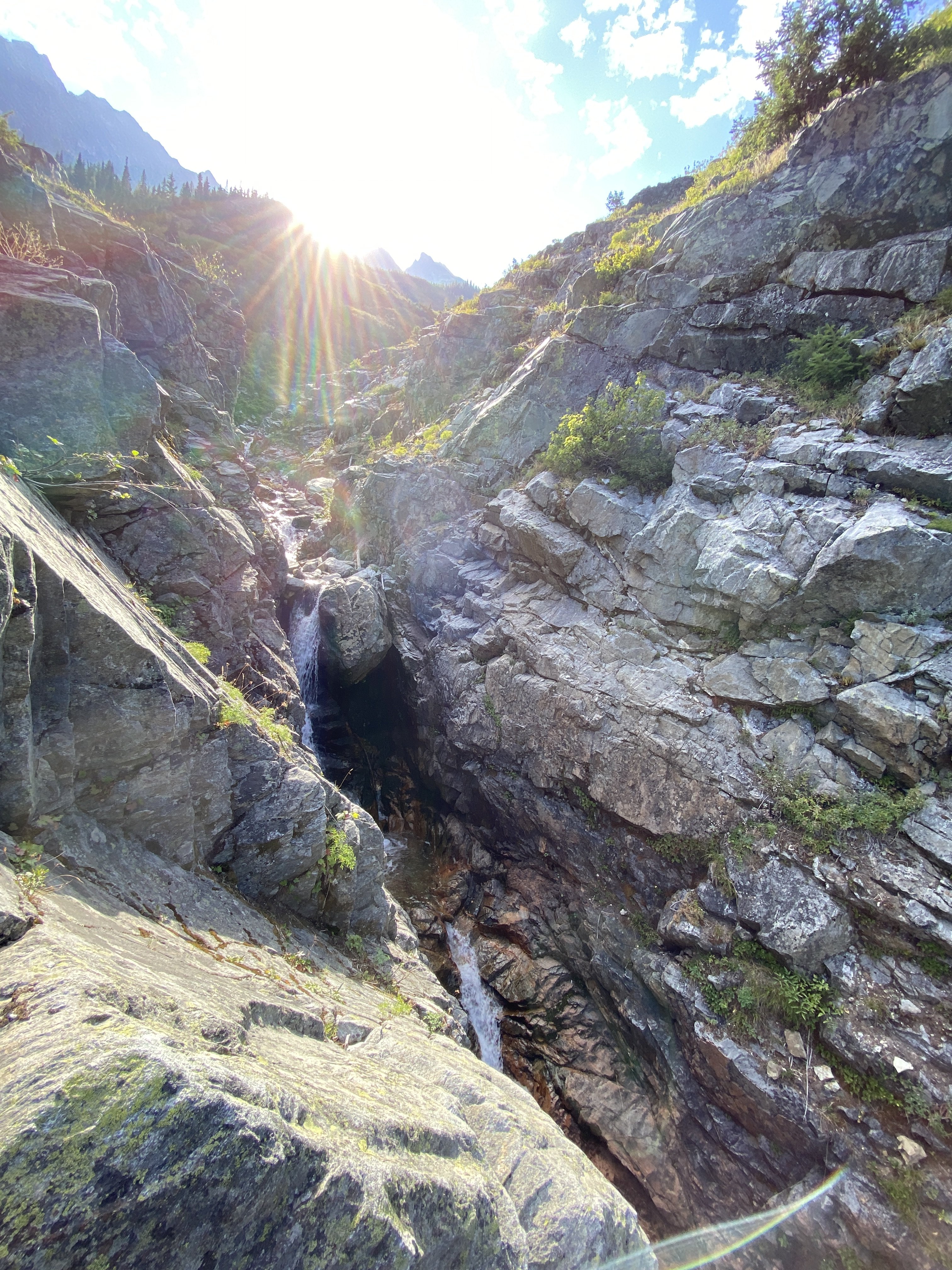
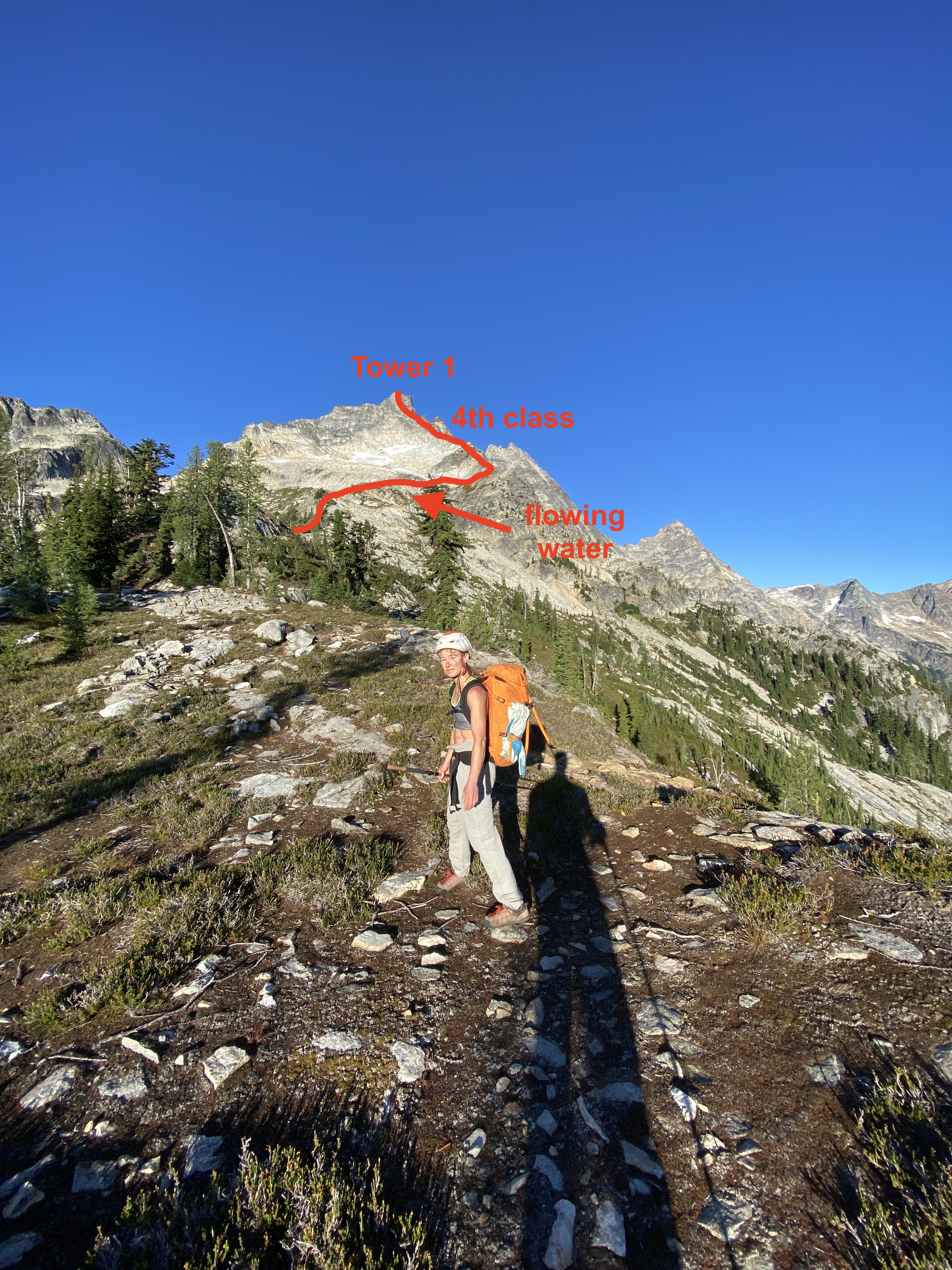
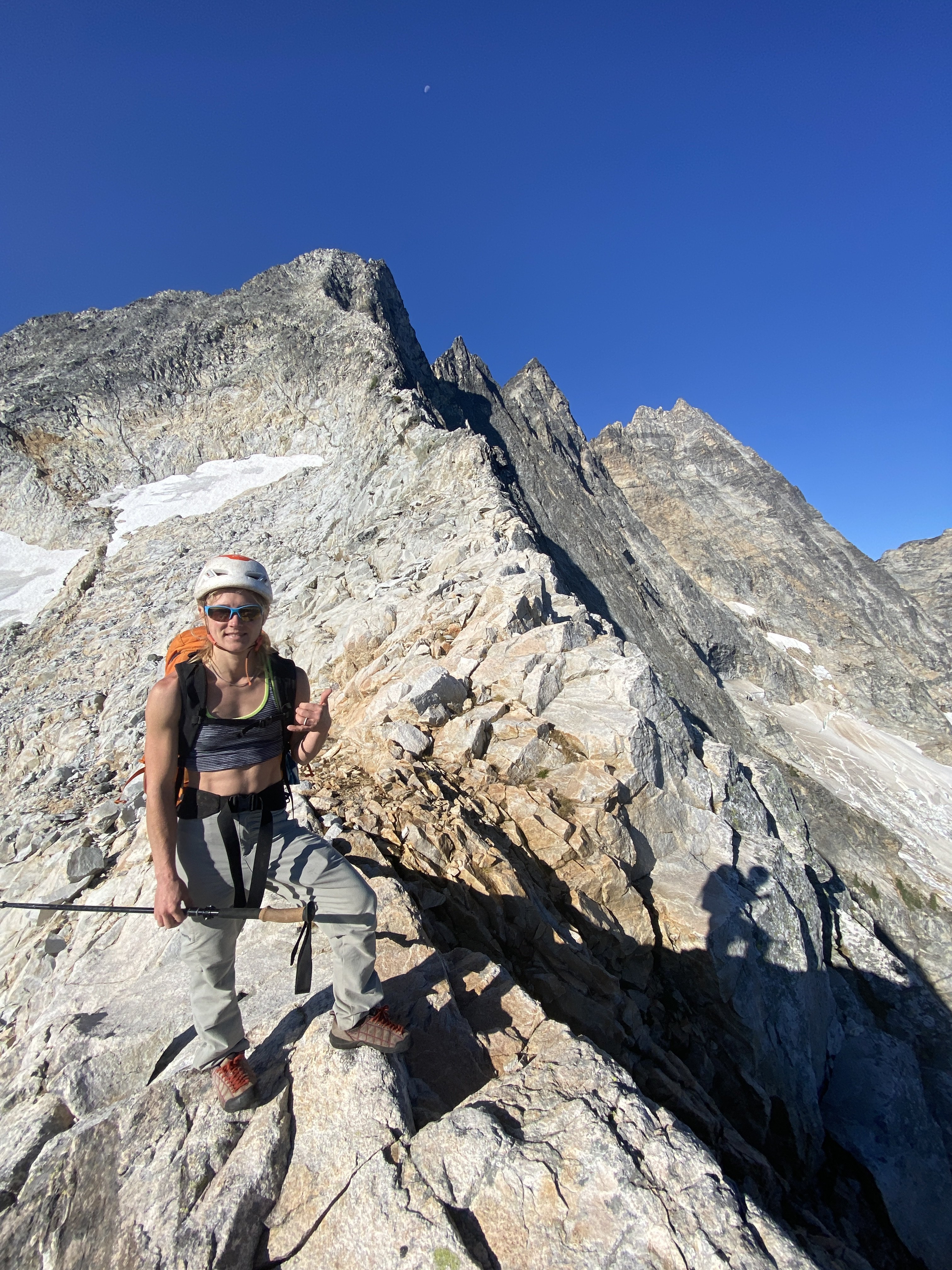
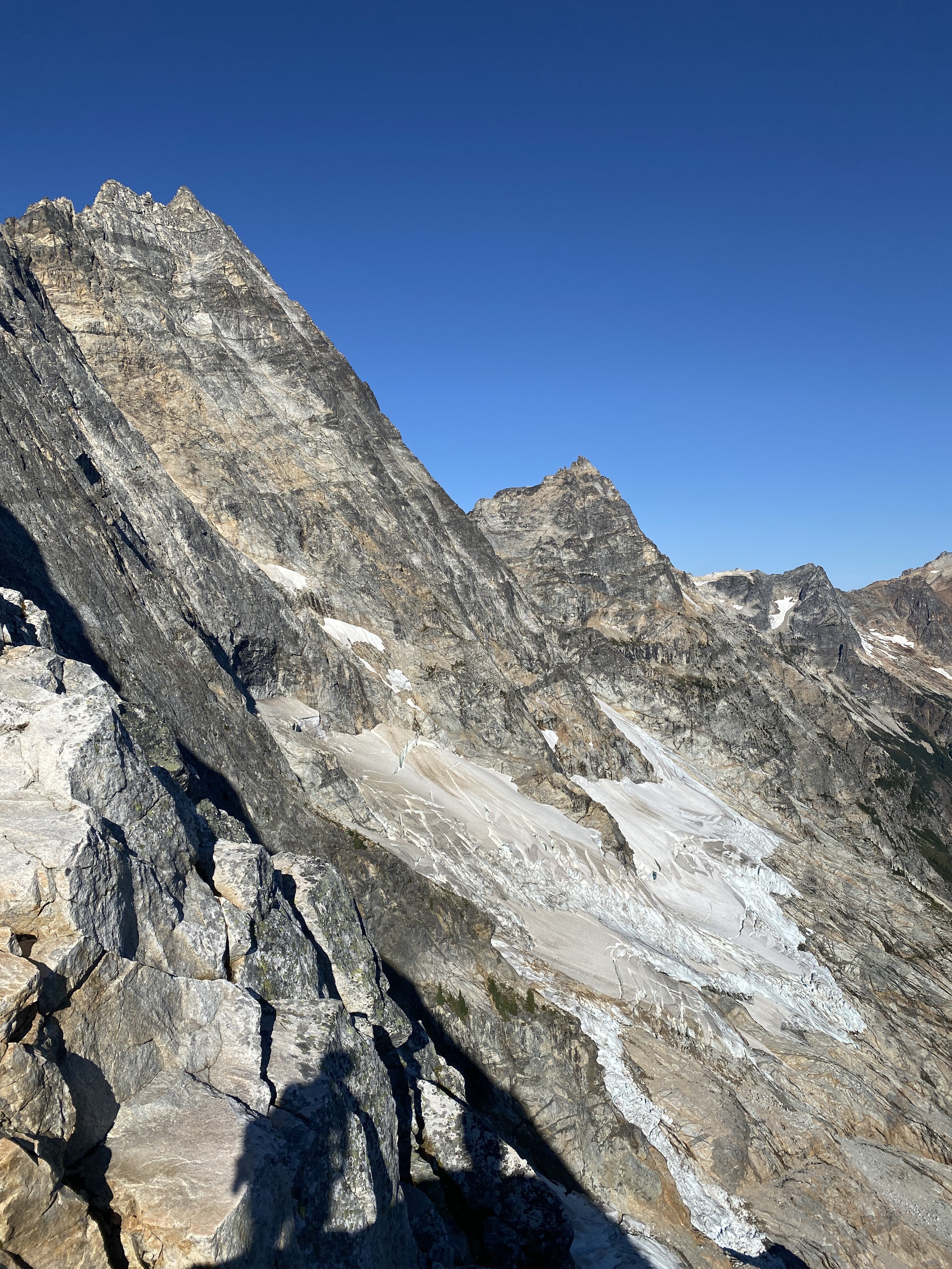
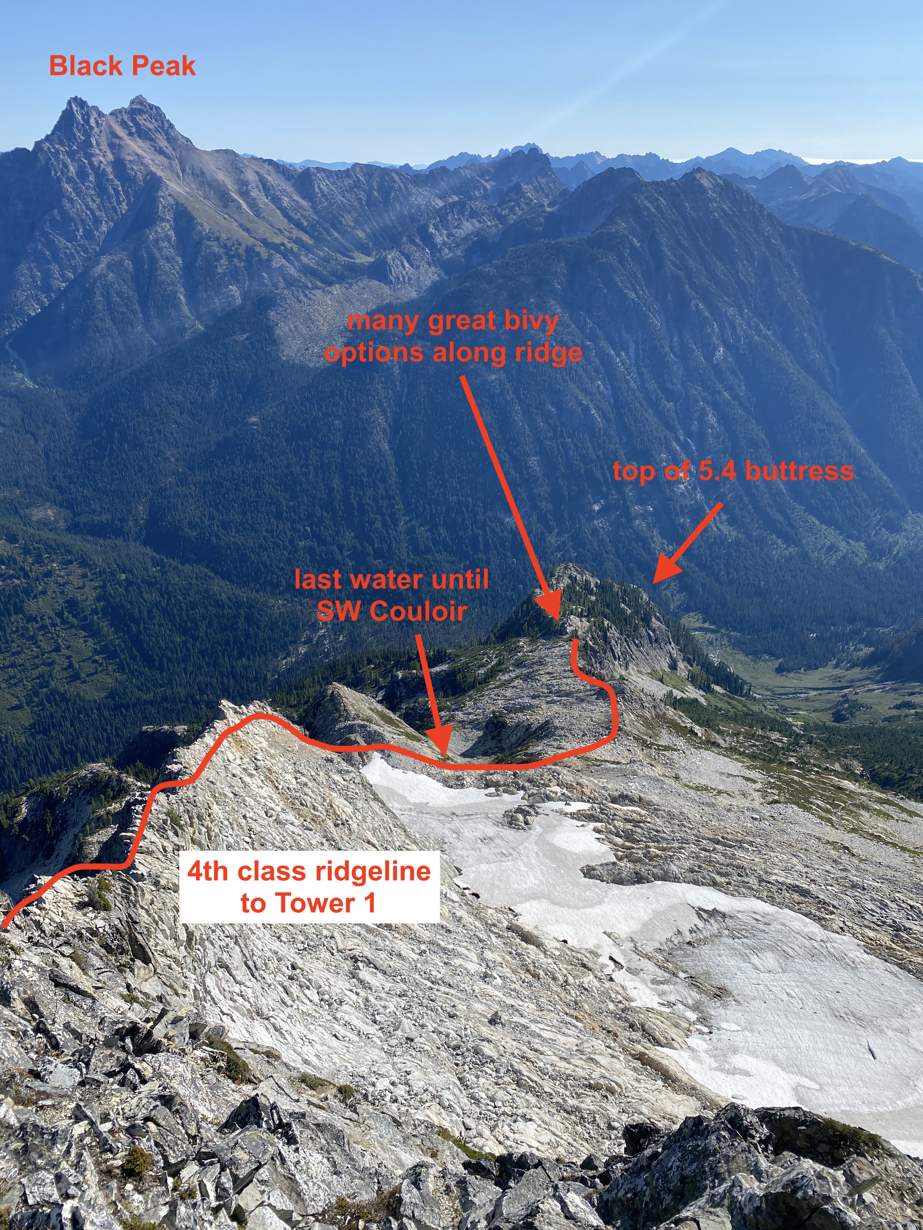
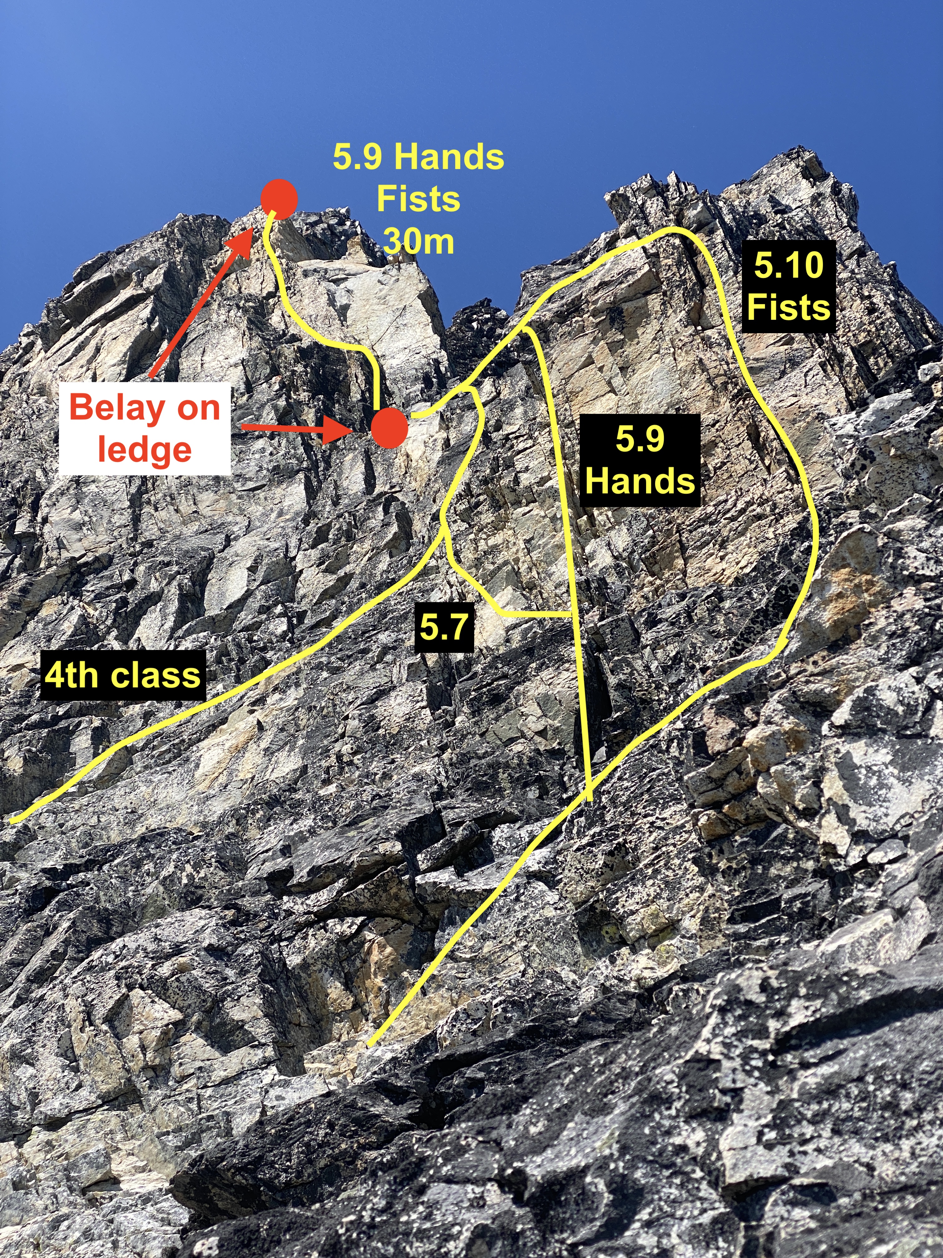
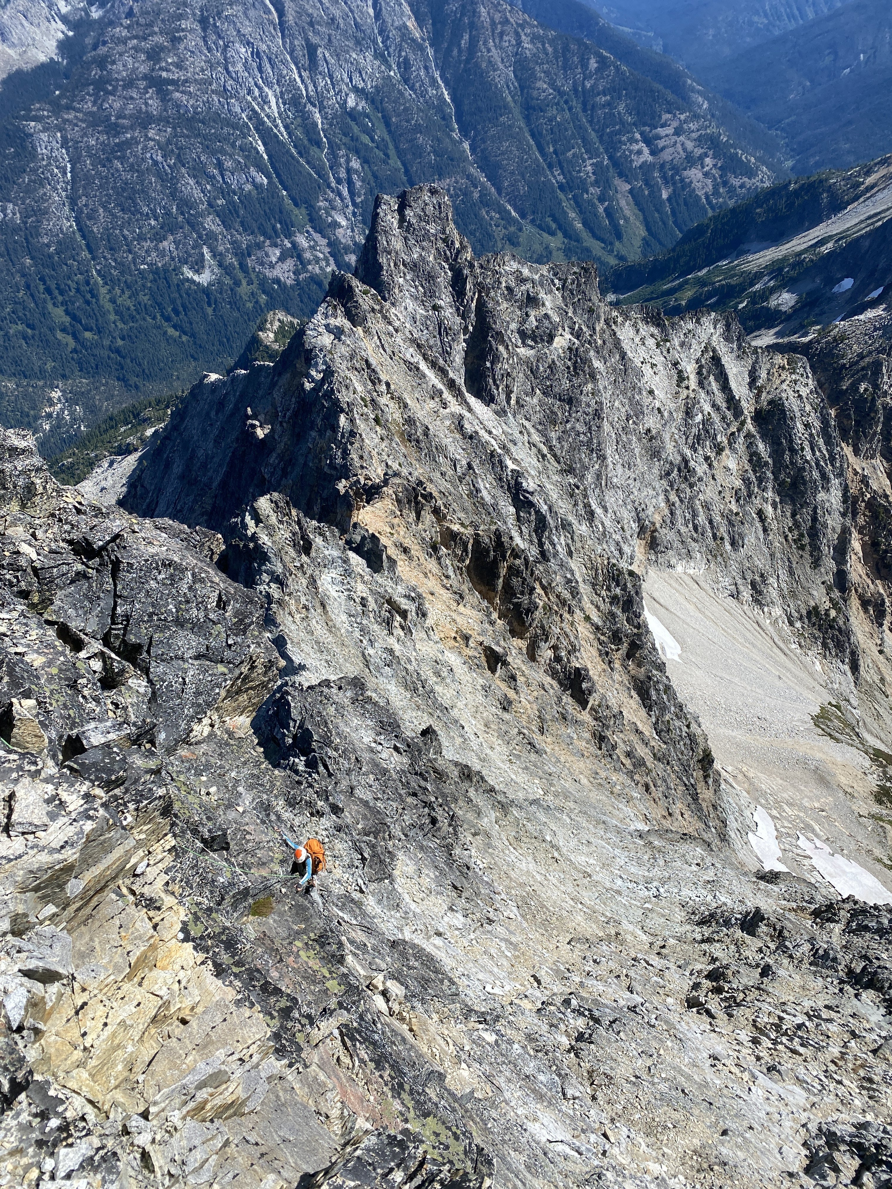
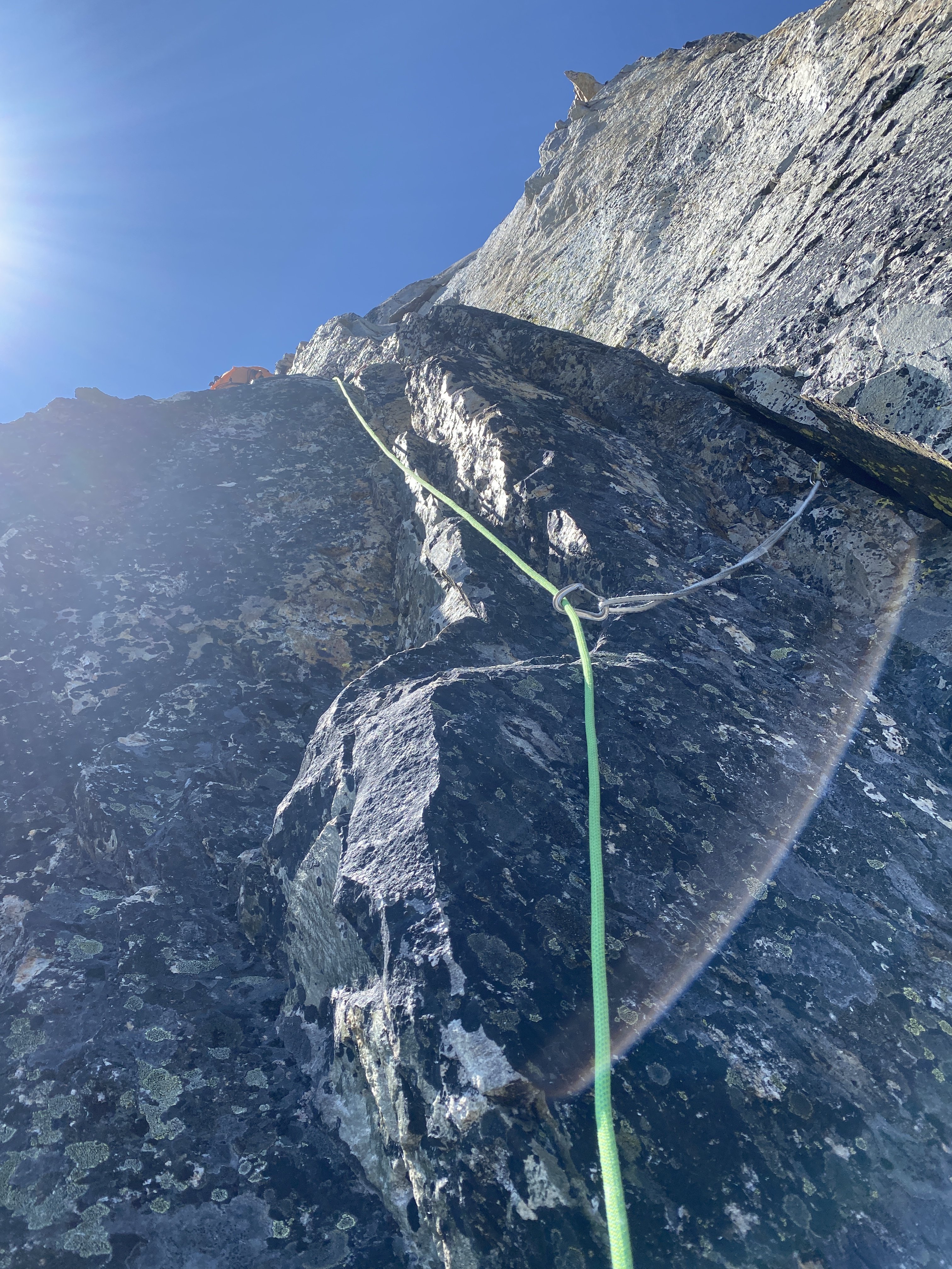
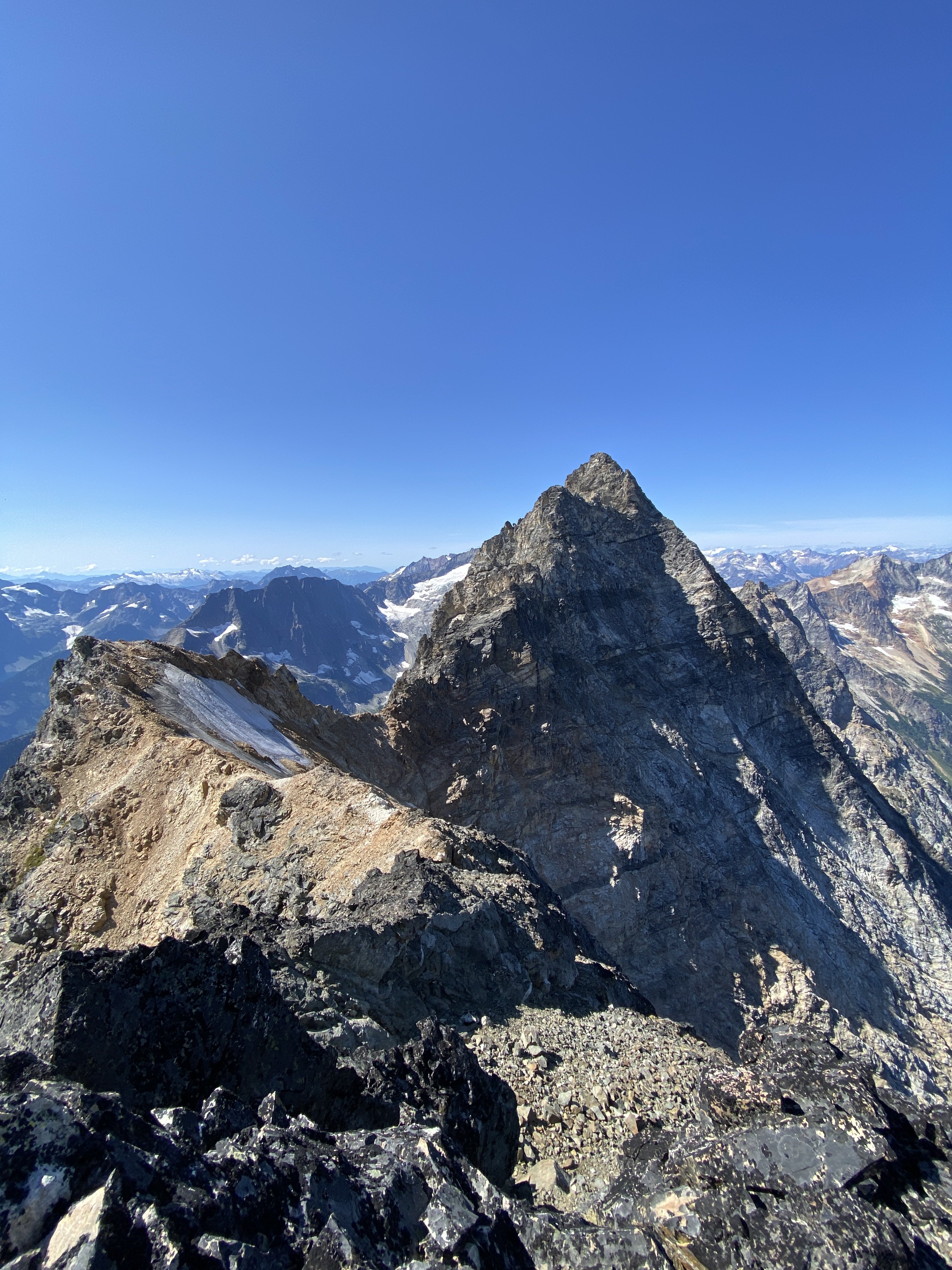
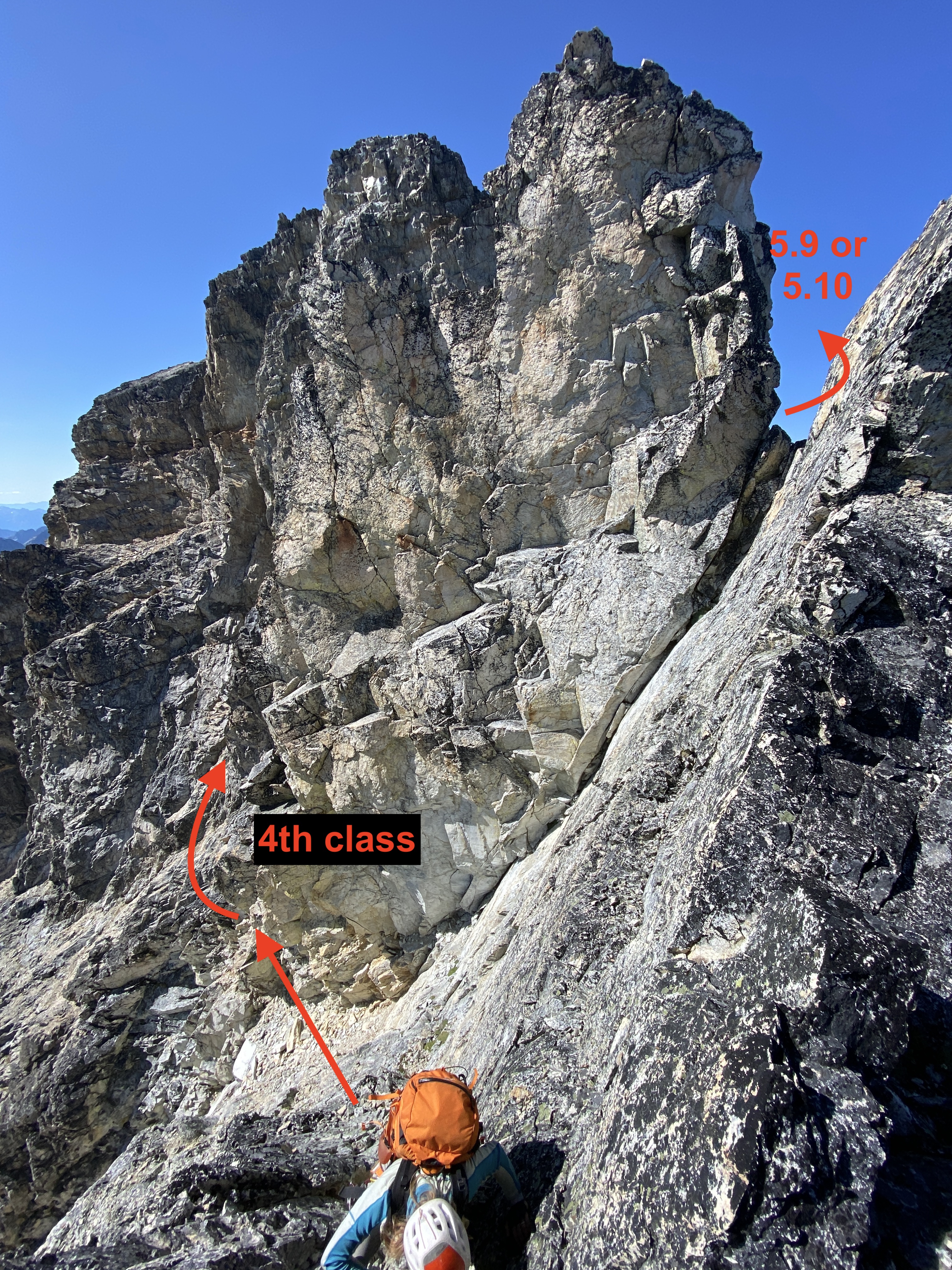
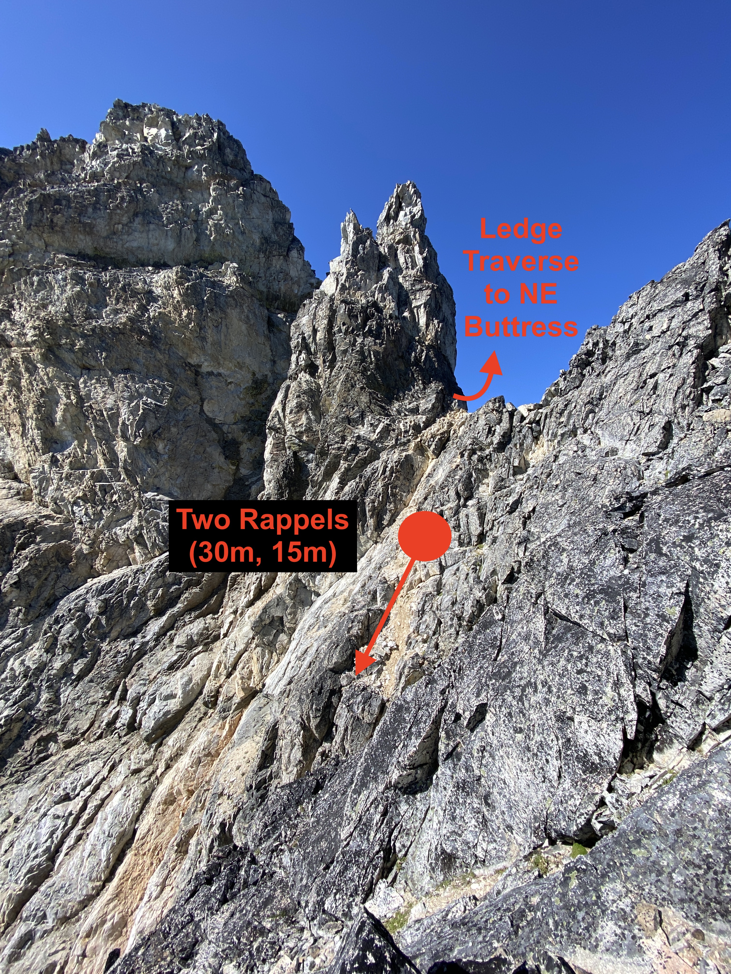
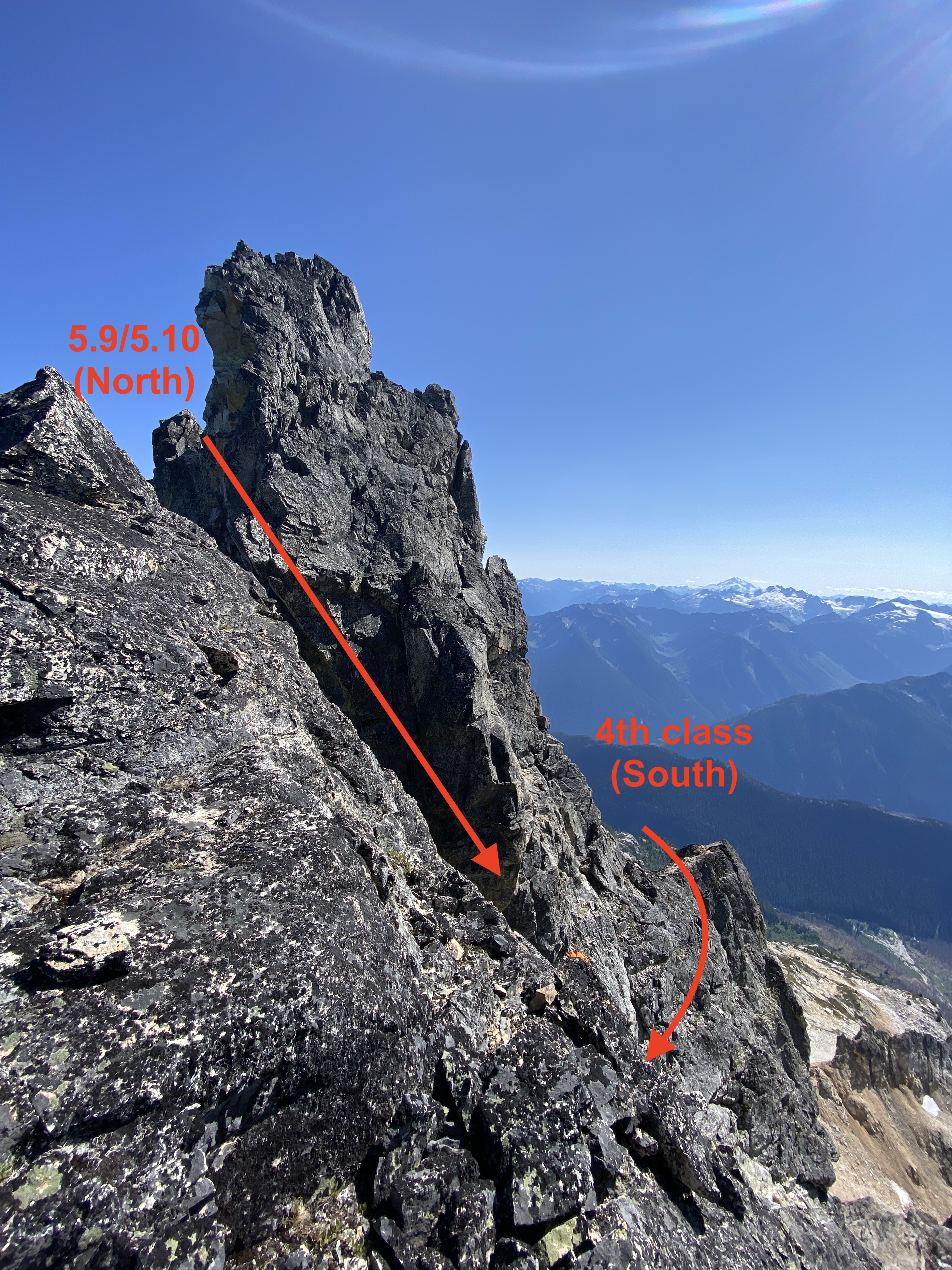
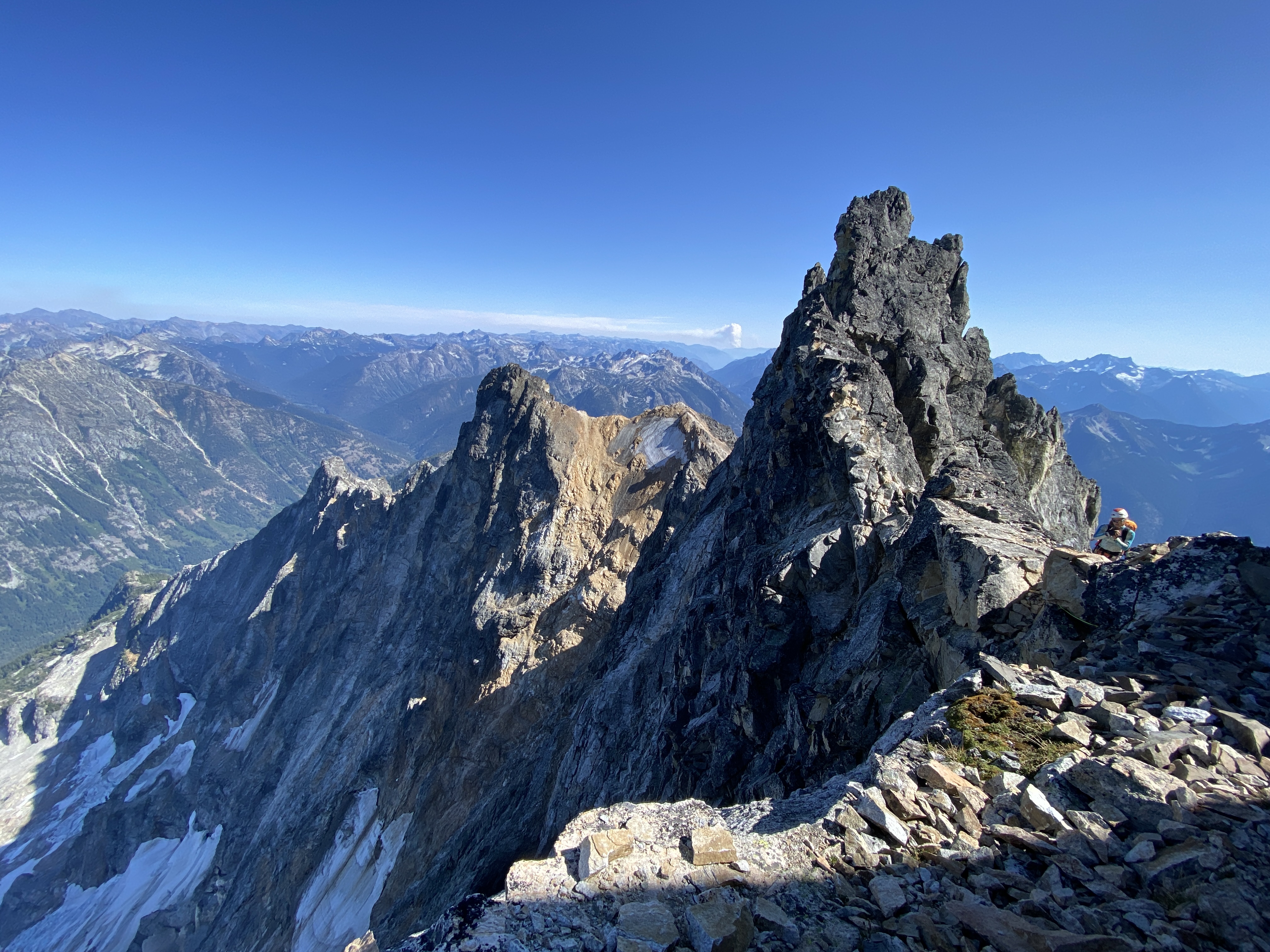
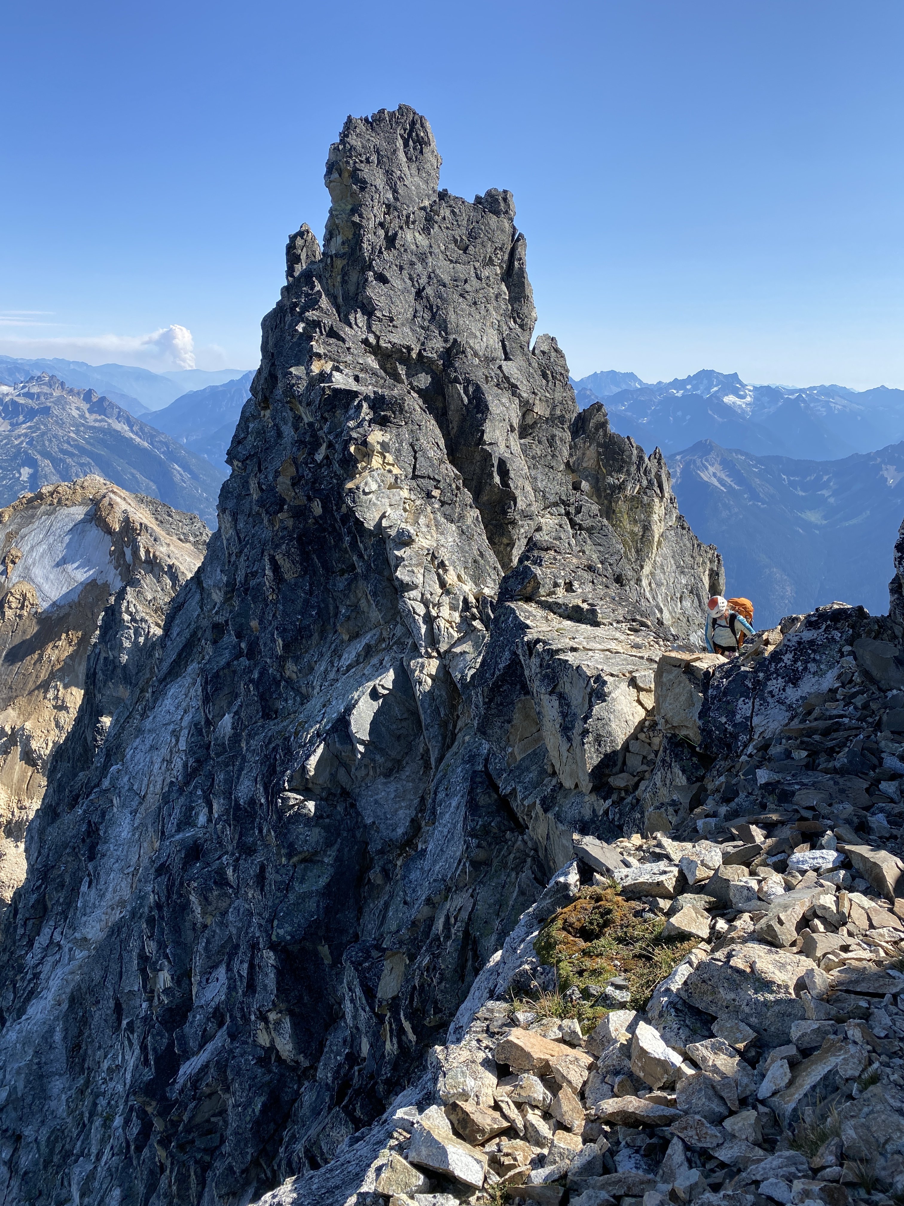
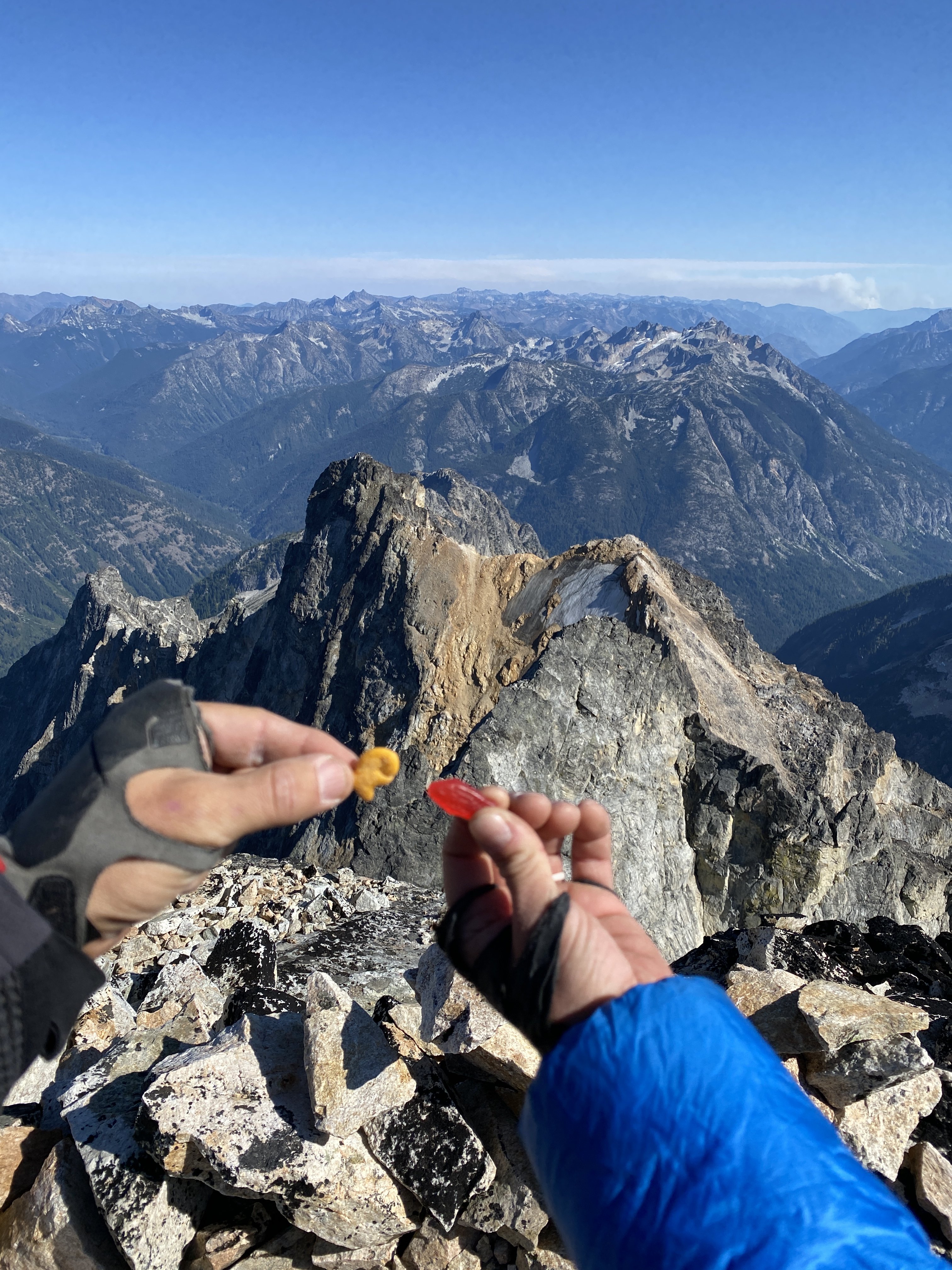
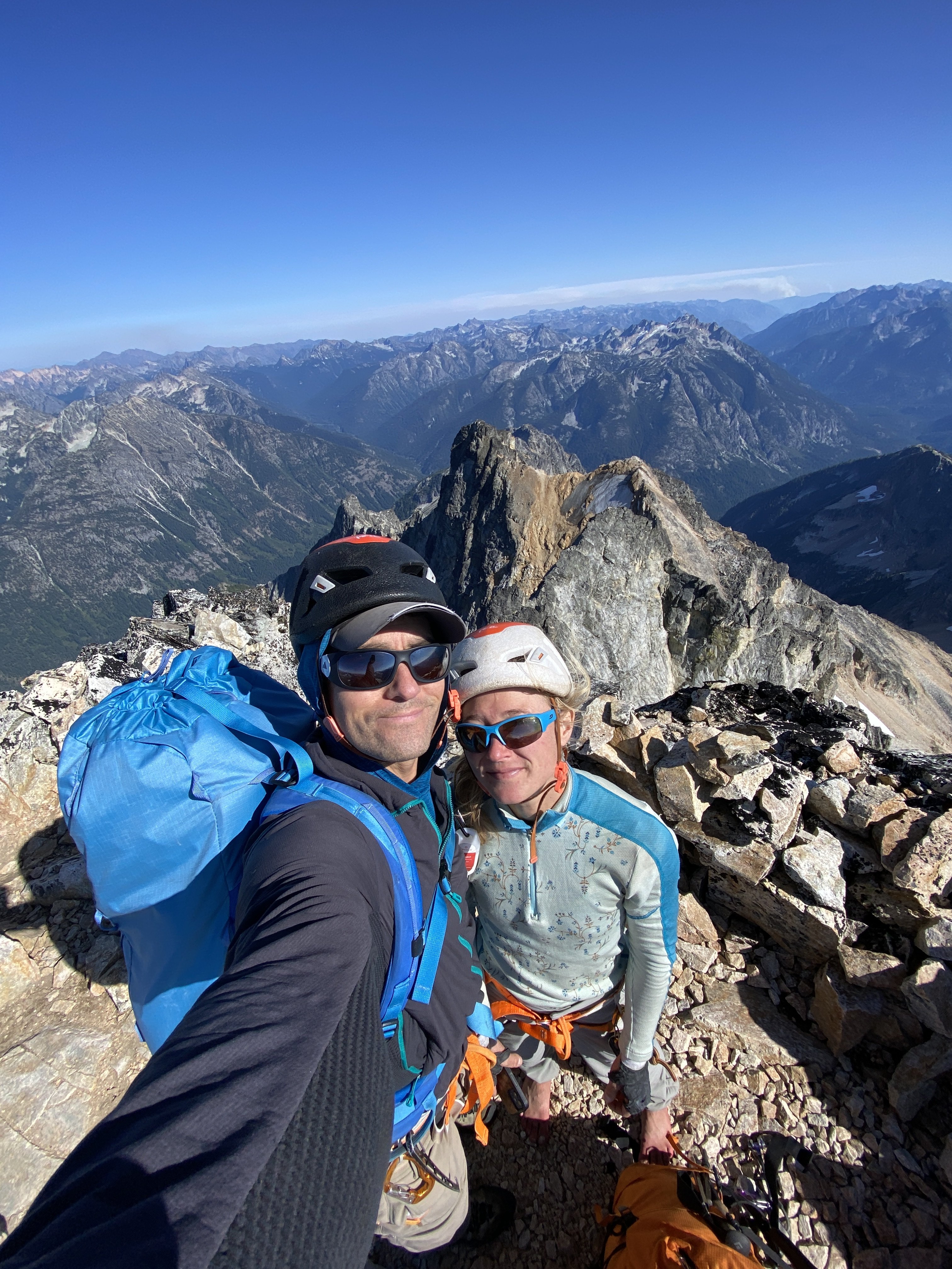
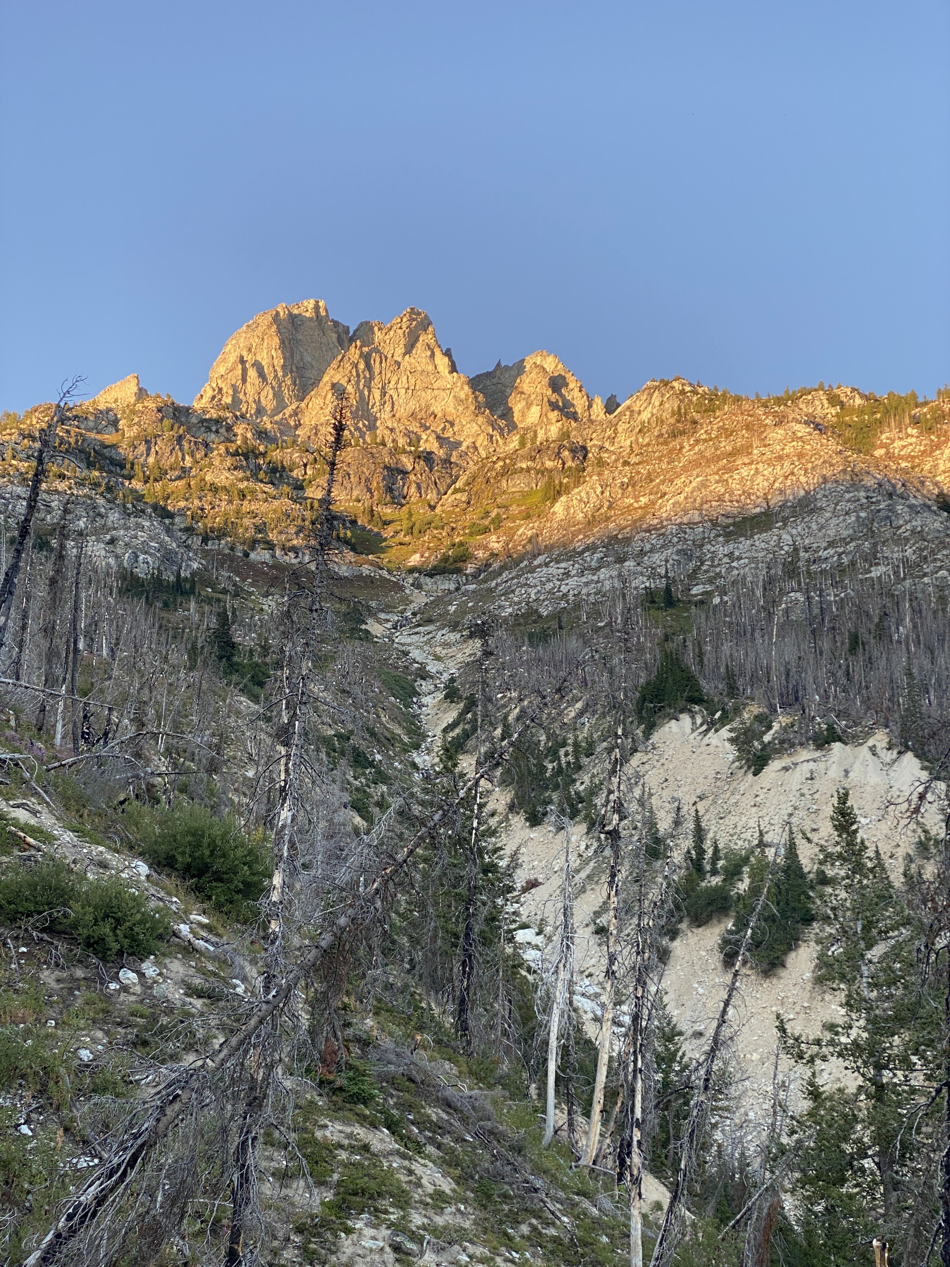
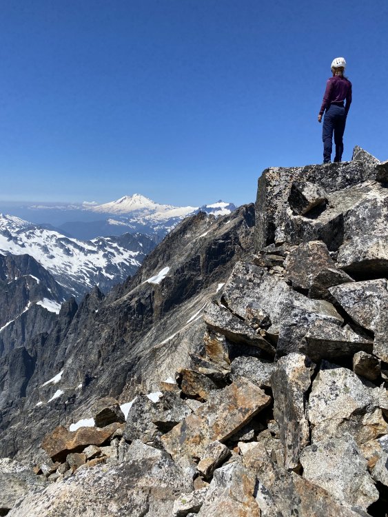
Trip: Goode Mountain - Megalodon Ridge Trip Date: 08/29/2021 Trip Report: Megalodon Ridge. An evocative name for an evocative climb on Goode Mountain, the tallest peak in the North Cascades National Park. Priti and I have been struck by its lore ever since we were students learning to alpine climb. It is another one of those mythical Cascades test pieces that rarely sees ascents (although it really should get more attention). Megalodon Ridge is the East ridge of Goode, joining with Memaloose Ridge and Goode Ridge from the Southeast before it reaches the summit. The climb ascends with foreboding views out onto Goode’s impressive North Face and the highly aesthetic, classic NE Buttress. Put up in 2007 by local legends Blake Herrington and Sol Wertkin over three days with recon by Dan Hilden, we were maybe the sixth known ascent. Dan and Jens Holsten made the second ascent in 2010 over a blistering 27 hour single push. FA TR: https://cascadeclimbers.com/forum/topic/53892-tr-mt-goode-megalodon-ridge-iv-510/?_fromLogin=1 Second Ascent TRs: - http://jensholsten.blogspot.com/2010/09/sound-of-goode.html - https://cascadeclimbers.com/forum/topic/76094-tr-mount-goode-megalodon-ridge-932010/ Other folks who have successfully put their hat in the ring include local heroes of ours: Alex Ford, Laurel Fan, Austin Siadak, Michael Telstad, and Sean Fujimori…all people we have no business having our names in the same sentence…which added to the improbableness of this climb. With new standards in moderate 5th-class choss tolerance, however, I think it’s time to lift the veil on this elusive climb. Named after the prehistoric behemoth of the ocean, fish-themed snacks are a must. 33.5miles and 8,500ft vert round trip make this climb a relatively chill 3-4 day outing, an ambitious 2 day outing if you’re a pro climber, and an unfathomable single push outing if you’re a demi-god. Being mere mortals, we did this as a casual 3-day outing with lots of time to spare. Since its inclusion in Blake’s 2015 “Cascades Rock”, those pages went unconfronted for six years until Michael and Sean posted of their adventure this past July, reigniting its possibility. Michael TR: https://cascadeclimbers.com/forum/topic/104101-tr-mount-goode-megalodon-ridge-07192021/ Michael had an amazing trip report that helped us immensely. The purpose of this TR is to sprinkle in some more micro beta if you choose to have less of an adventure. Strategy Tips The route could feasibly be done in 2 days by a very fast team of folks who are used to covering many miles of trail quickly. But it is actually a very moderate outing when done in 3 or 4 days. I'll outline all bivy options. You never really need to carry much water with you unless you plan to bivy on the summit. We chose to carry less water on the route, and skip the summit bivy, since it's just an hour or two down the SW Couloir to flowing water. The Goode Mountain summit bivy is truly remarkable and a destination in and of itself. There are two ledges at the very top which can fit four, then two more ledges 60m below the summit which can fit four more. Sleeping on top is REALLY COLD, however, and you can get away with bringing less clothes if you don't sleep on top. You really don't need to have a stove on this trip either since there is enough flowing water (unless the daily high's are below freezing in early season). We regret bringing a stove. Save every ounce In all of my anecdotal polling data, nobody has taken the alternate wraparound descent as described in Cascade Rock. Seems to be generally difficult and sketchy, requiring gnarly glacier travel and crampons. Most parties who do the NE Buttress go down the SW Couloir to Park Creek, and it's kind of nice to just take the normal descent and avoid any extra shenanigans. So...recommend just taking the normal descent. There is still some weirdness going down to Park Creek, however, and we had to check our tracks frequently. Many tracks are available on Peakbagger.com You can probably skip crampons and ice axe. The SW Couloir doesn't really require it, although you will find chill snow travel on descent. There is a snow ridgeline along Megalodon Ridge (the ski descent). Depending on the time of summer, you may be on top of the snow, in a moat, or in choss. If you're on top, you can probably get away with just belaying across if you're worried about the exposure. Pair down the weight!! We brought light glacier harnesses and loved it! We clipped gear onto our backpack waist straps and all draws went around the neck. There is really only 4 roped pitches. The descent is between 2 and 6 rappels depending on how much down-climbing you're comfortable with, so you don't really need a regular harness, unless you're bringing more than a single rack. A single rack .2-3 and a few small nuts is more than enough if you plan to solo <5.6 terrain. Bring more gear if you plan to simul. You can even skip the #3 if you are really confident at 5.9. Less is more. Headphones and downloaded podcasts make the 20 mile hike out go faster. Skip the chalk bag. Maybe bring a tiny tube of liquid chalk. If you're confident in climbing 5.8 in techy approach shoes, you could maybe skip rock shoes altogether. Cache beverages at Maple Creek on the way in so you have it on the way out! There are really just 3 mandatory pitches of climbing all stacked on the headwall, and two additional optional pitches (the rest is 4th class and low 5th). To start off, I personally highly recommend roping up at the top of Tower 1 for the downclimb to the first notch since it is megaloose 5.6 downclimbing with mega exposure (Note: the FA party rappelled 50m to the south, not recommended). Then unrope for the traverse up/over/around gendarmes until the headwall pitches (4th class and low 5th). Bypass gendarmes logically via lines of least resistance (sometimes up and over, sometimes around). Rope up for the three headwall pitches to the summit of the SE summit: 1) 35m of LOOSE 5.7-5.10 (depending on which variation you chose), 2) 30m of 5.9 (technical crux of route) with many hand cracks, 3) 70m (simul) of LOOSE 5.7 to the SE summit (you can stop before summit if you don't want to simul). Then unrope again, pass over the "ski descent" snow ridge, downclimb talus Gain the rocky ridgeline again and pass a prominent col (not to be confused with Black Tooth Notch) Continue on the rocky ridgeline, passing a piton and an old sling (5.6), continuing mostly on top of the ridgeline to the final gendarme just before the Black Tooth Notch. Blake describes it as "a pitch of well-protected 5.10 climbing on the north side of the crest down into the notch" (Michael down-graded it to 5.9). We found a 4th class route on the South side (climber's left) which bypassed the gendarme entirely, if you want to lose cool points. Cross over the Black Tooth Notch (the SW Couloir), notice the rap stations, then an exposed traverse (cairn here) meets up with the NE Buttress. Three 30m pitches of exposed and quality 5.6 (angling severely up and right) take you to the summit. We downclimbed the 5.6 back to the Black Tooth Notch, skipped the first rappel at the notch, scrambled down 15m to the next rappel, then made two raps (30m then 15m). I highly recommend not trying to downclimb these two rappels...just take them, it's steep, loose terrain. Approach Start from Bridge Creek Trailhead (just East of the Rainy Pass Trailhead) and take the PCT south, leaving it for the North Fork Bridge Creek trail (this is also the approach for the NE Buttress of Goode). Starting from the Bridge Creek TH instead of Rainy Pass saves an extra mile of hiking. Our downloadable tracks once you leave the North Fork Bridge Creek Trail and getting up on to the ridge are here: https://www.peakbagger.com/climber/ascent.aspx?aid=1748765 Pictured above is the turnoff from the North Fork Bridge Creek trail which matches the tracks. It's an obvious boot pack that quickly turns into easy bushwhacking through alder. This turnoff is approximately when the trail is closest to the creek. Pictured above is the minor bushwhacking (knee to waist) over the creek (hidden) to gain Megalodon Ridge (right side of the frame). The bushwhacking will be much harder if it's just after a rain. When you get close to the creek the bushwhacking goes over head just for a little bit. We took lessons that Michael and Sean learned and stayed on land through the dense brush, heading upstream for ~50ft along the creekbed instead of attacking the creek directly and wading upstream in the icy water. When you pop out onto the creek, don't get in the creek until you confidently see your egress point. You don't want to spend more time in the creek than necessary. I got screaming barflies just from our straight-line crossing. If you don't see the super obvious exit point (circled in red above), keep plowing upstream through the dense brush. Once on the other side of the creek, a little more bushwhacking takes you to a rocky stream bed which you follow for a ways until you reach a chockstone waterfall (get water here). You have 2-4hrs until you reach water again (approximately 1/4) up the ridge, so you don't need to carry too much. Chockstone Waterfall. Follow ledges high and right until it opens up. Follow the stream until you get to the chockstone waterfall (where the green track diverges). Cross the creek over to the North (Megalodon) side and skirt the the top of the canyon wall until it opens up...don't go straight up the ridgeline. Follow open slopes up to the top of the ridgeline until you get to a small saddle and a 5.4 buttress. This 60m buttress is super loose and scary, so spend some extra time looking for a safe route up. Above the buttress is a few more hours of 4th class hiking and scrambling to the top of Tower 1. There is mild exposure on the final ridge to the top of Tower 1, but it's easy climbing. From the top of the buttress to the water are several really good bivy sites. At the water source is flat snow and boulders (not really a good, dry bivy site), so find something lower down on the ridge and hike up to retrieve water. This is the last flowing water until the Goode High Camp basin below the SW Couloir (1-2hrs after reaching the summit), so fill up a day's worth or more if overnighting on the summit. You also have the option to melt snow at "ski descent" along the way if you chose (no flowing water here). 4th class ridge to the top of Tower 1. Looking over onto the North Face and the awesome NE Buttress route. Neat pic. Pano of Memaloose Ridge as it meets up with Megalodon at Tower 1 on the right. From the top of Tower 1. The "headwall" is on the left (SE Summit) which contains three roped pitches. The FA party rappelled 50m to the South then traversed to the notch (not recommended). Other parties since have downclimbed. The downclimbing is loose, exposed 5.6...highly recommend roping up! You can unrope again down at the notch (~2 rope lengths). Unroped, easy scrambling up/over/around several gendarmes to reach the headwall. The traverse from Tower 1 to the SE Summit Headwall. Once at the headwall, choose your own adventure. The first pitch is 30-60m (depending on how high up you start belaying) of 5.7-5.10 climbing. Belay under an obvious corner on a ledge. The second pitch is quality 5.8 or 5.9 (the technical crux of the route) hands and fists for 30m to a ledge below the final ridgeline to the summit. The third pitch is 70m of unprotect able 5.7 ridge climbing (stacked, loose blocks) to the SE summit. You can stop short of the summit if you don't want to simul. Blake suggested the SE summit as potentially a good bivy, but I didn't see anything that looked mildly comfortable. Press on to the summit or the Goode High Camp. Looking down from the belay at the top of Pitch 1. You can see the ridge traverse down to Tower 1 (center), Megaladon Ridge (left), and Memaloose Ridge (right). Could be a neat trip to take Memaloose into Megalodon Ridge! Looking up at pitch 2. Start in the corner and traverse left. From here we unroped for the rest of the way (and we're not very good rock climbers either). You can also put on your approach shoes for the talus. Cross over the snow (it is all choss now). Melt snow here if needed, no running water. Downclimb talus and start back up the ridge, staying mostly directly on the ridge. The final obstacle is a gendarme guarding the Black Tooth Notch. Go right (North) for the 5.10 original route (5.10 or 5.9) or downclimb and go around left (South) for our 4th class cheater-bypass route to gain the Notch. Once at the Black Tooth Notch, traverse right (North) to join the NE Buttress. Climb 3x 30m pitches of quality, exposed 5.6, trending right to reach the summit. You can then make 3 traverse-y rappels back down to Black Tooth Notch or downclimb. Recommend taking two rappels down Black Tooth Notch (30m, then 15m) since it is very loose and steep. Here is a really good description of the descent: https://engineeredforadventure.com/goode-mountain-northeast-buttress/ Looking back at the final gendarme before the Black Tooth Notch at the two route options (photo taken from Black Tooth Notch looking East). Photo of the entire Megalodon Ridge! By now, you should be able to pick out "Tower 1", "SE Summit", and "final gendarme". I'm not going to overlay them for you . The photo is taken from the ledge traverse on the North side looking back at Black Tooth Notch. Another view of the "final gendarme" and the 5.9/5.10 downclimb on the North (shady) side that we did not do. Fish-themed snacks are mandatory. Looking up from the normal descent towards the SW Couloir. A long, but straight-forward descent down to Park Creek Trail and 20miles on trail back to the car. There is a good High Camp bivy site with water in the basin below the couloir: N 48.48025° W 120.91991° Gear Notes: single rack .2-3, few nuts, 8 single alpine draws, 3 double alpine draws, light glacier harness Approach Notes: Tracks: https://www.peakbagger.com/climber/ascent.aspx?aid=1748765
-
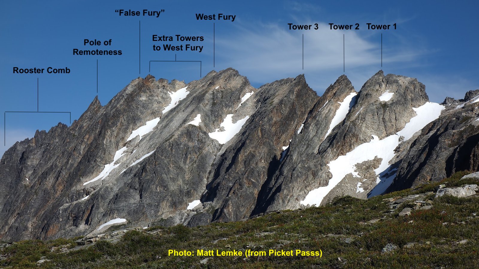
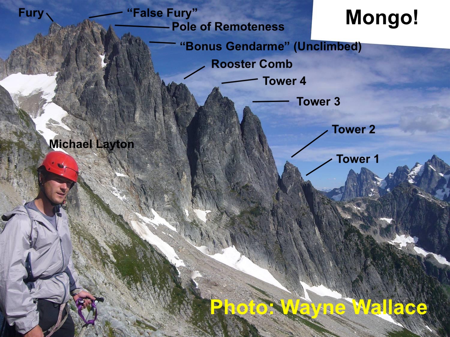
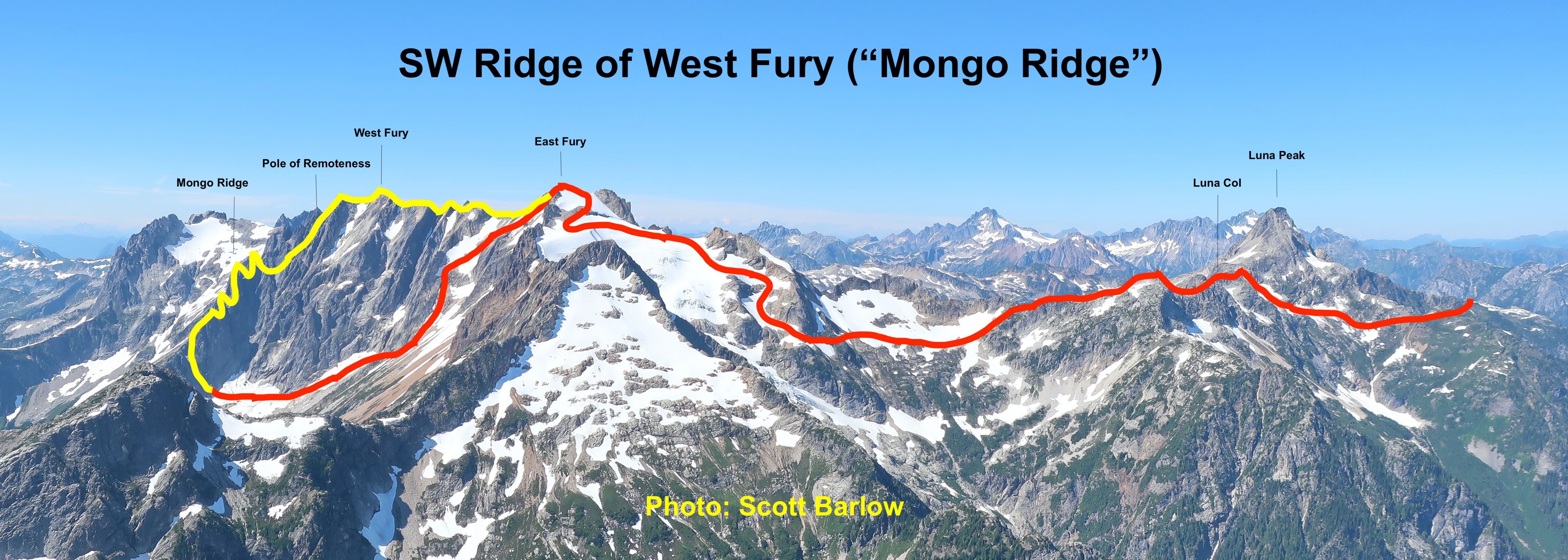
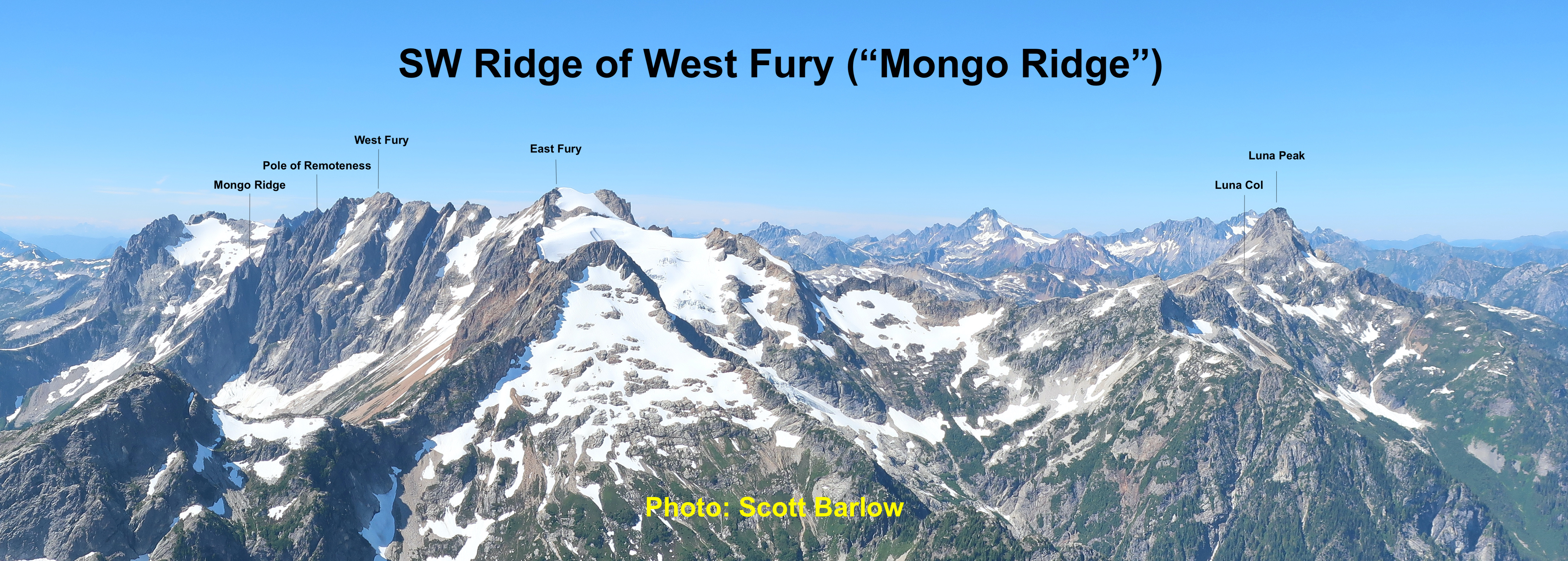
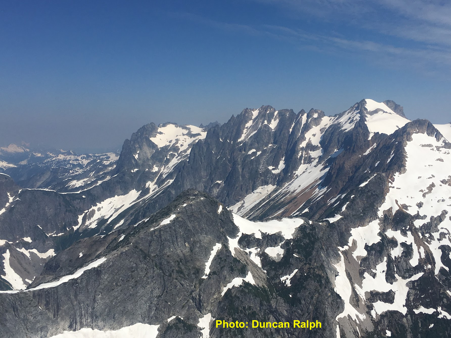
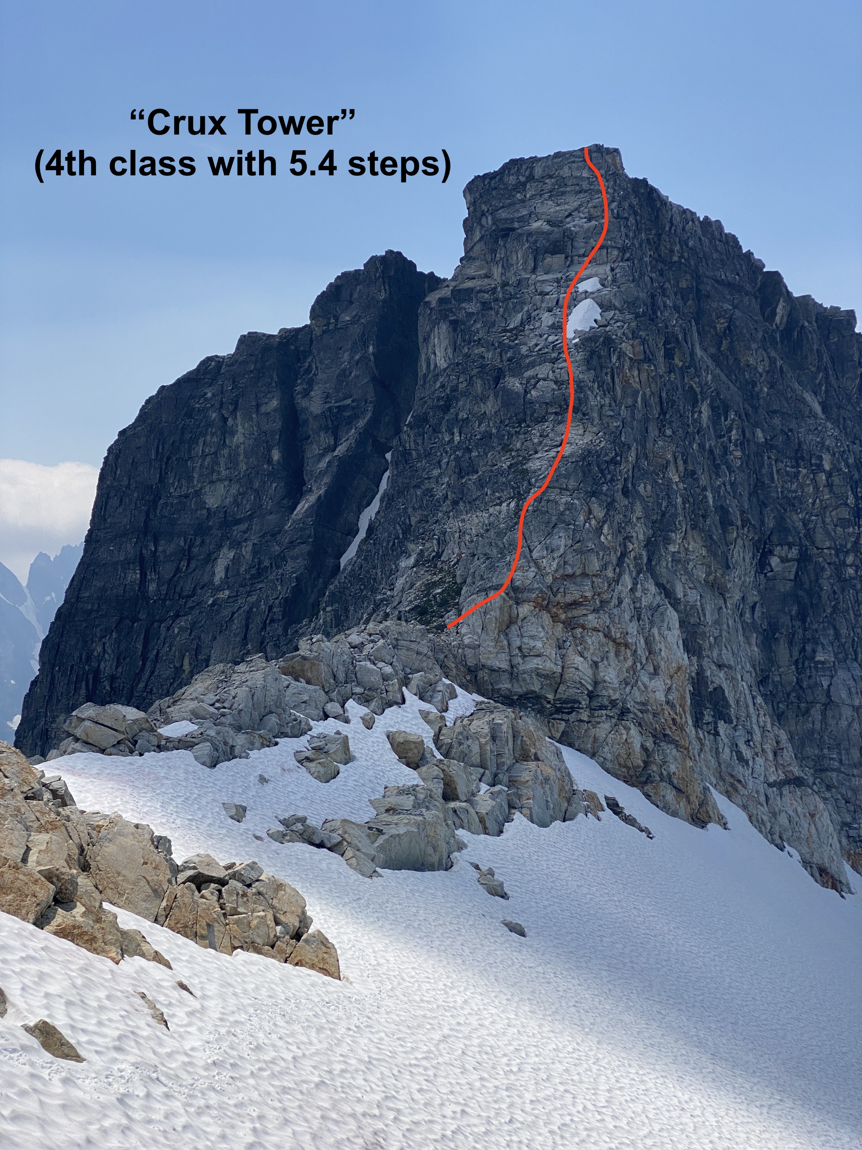
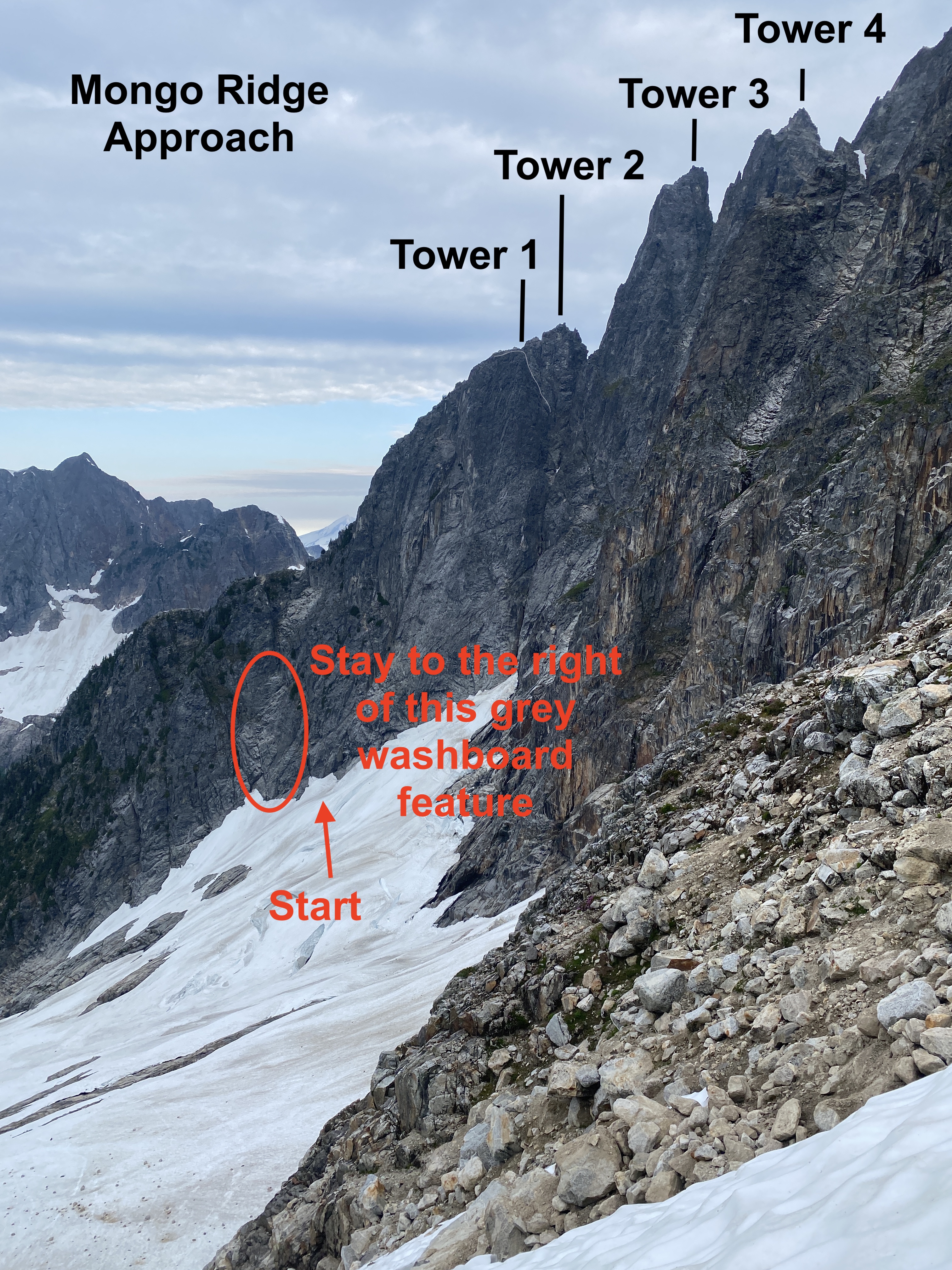
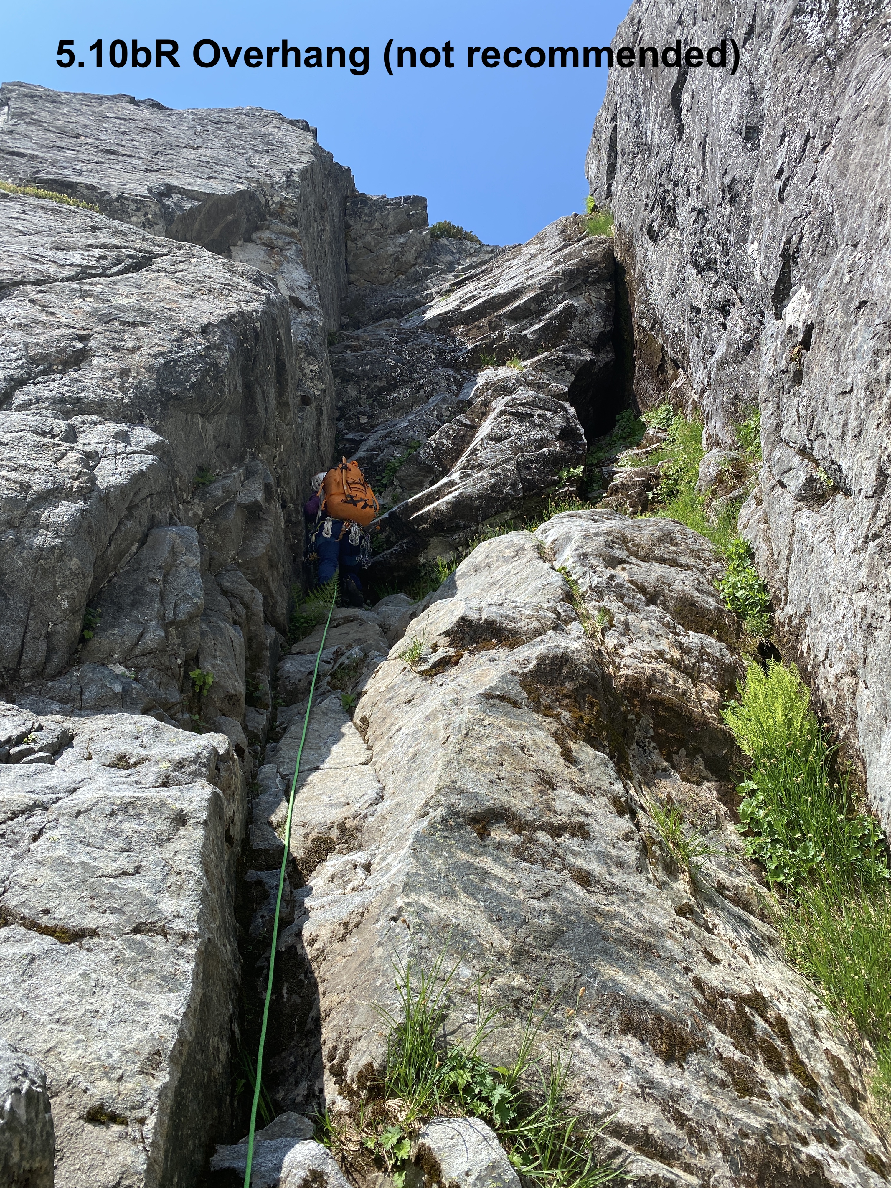
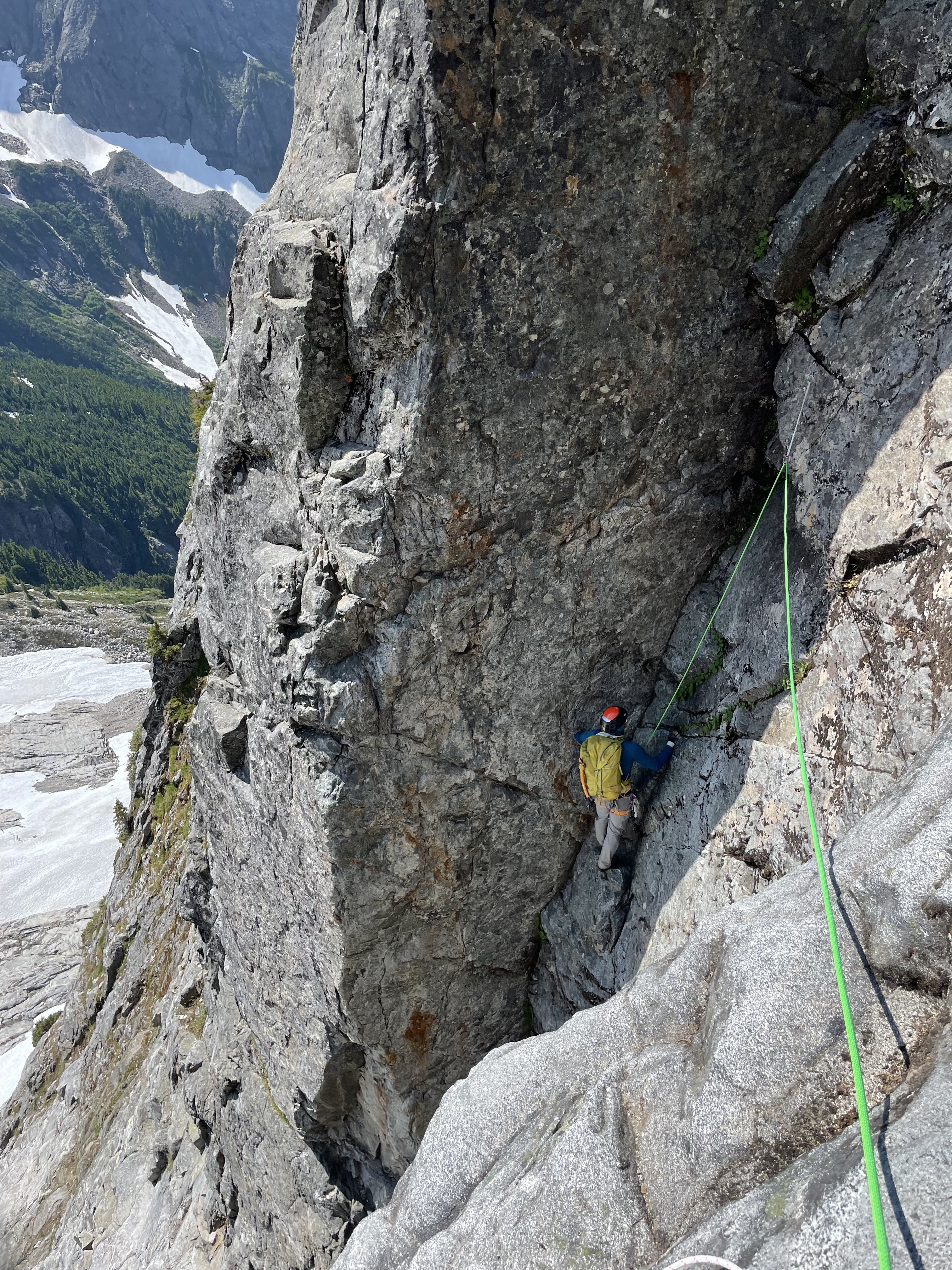
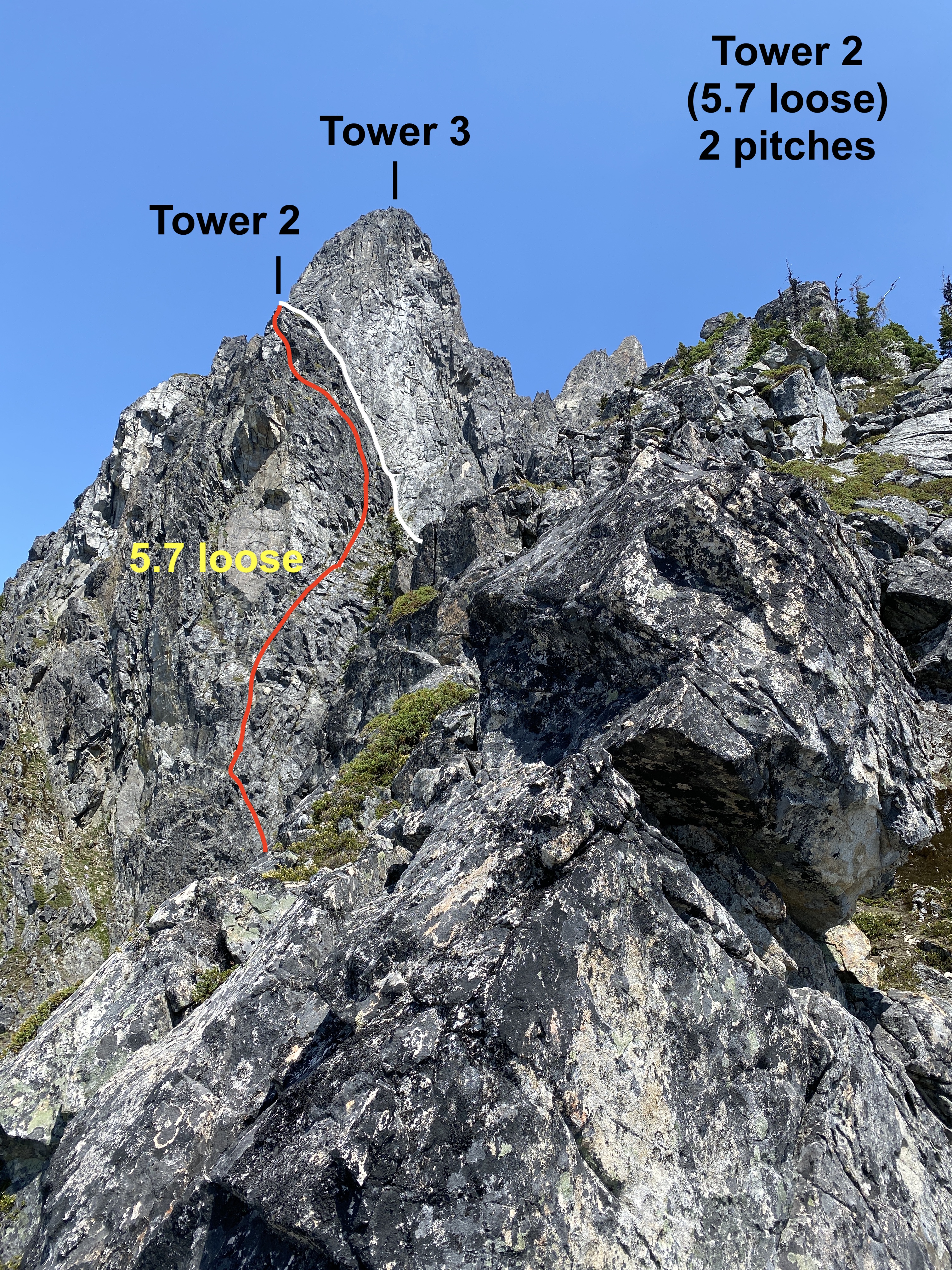
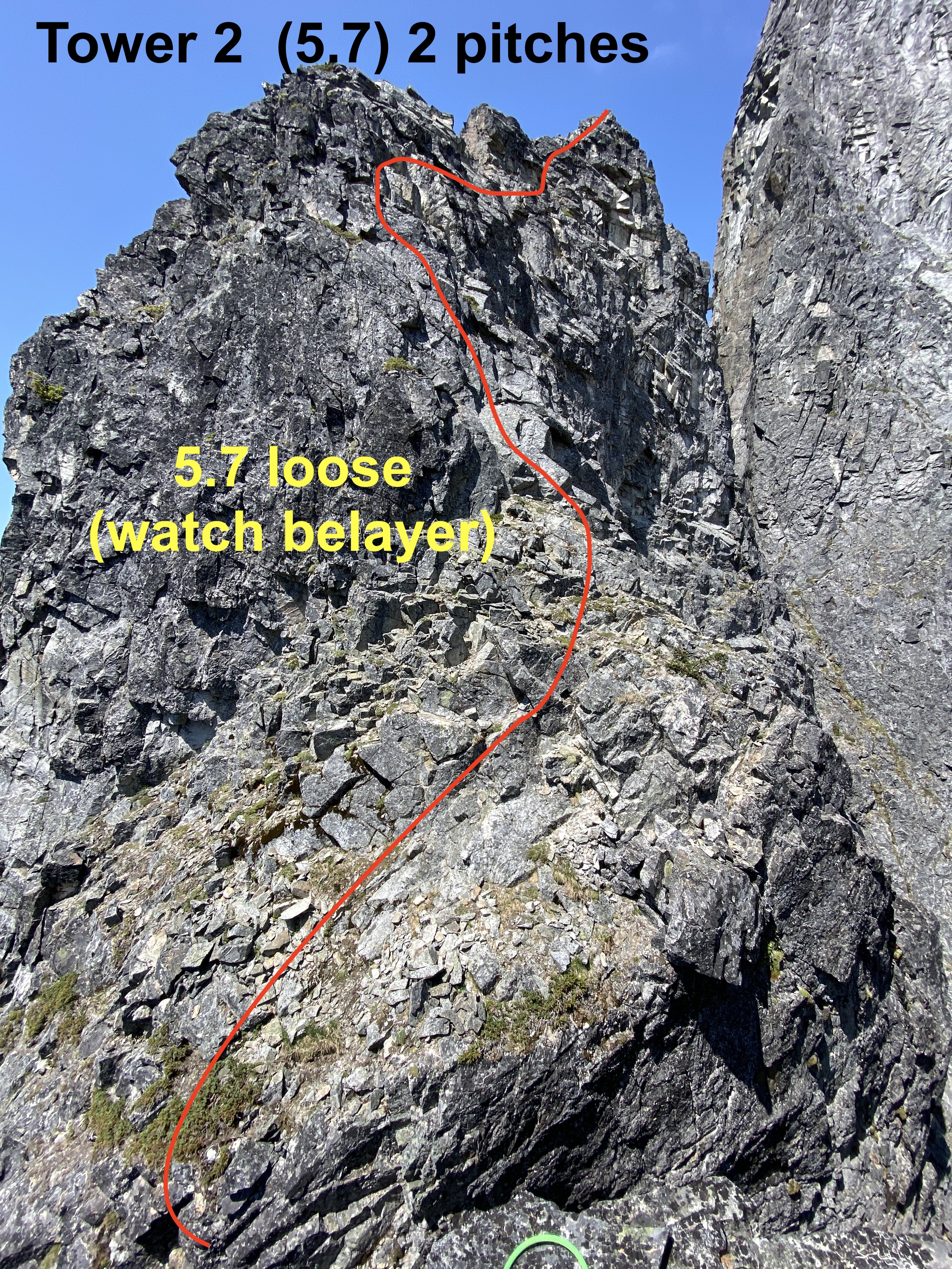
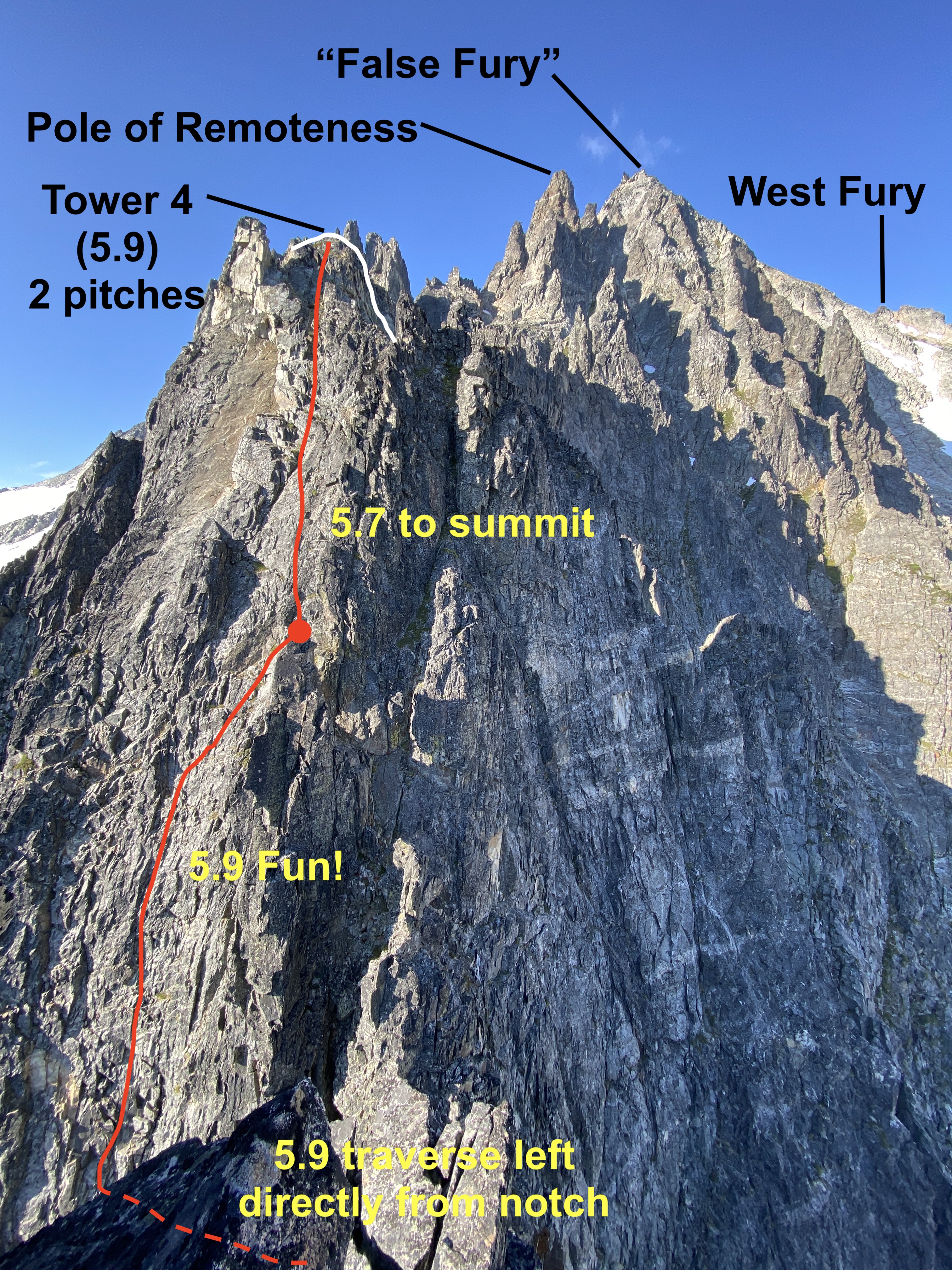
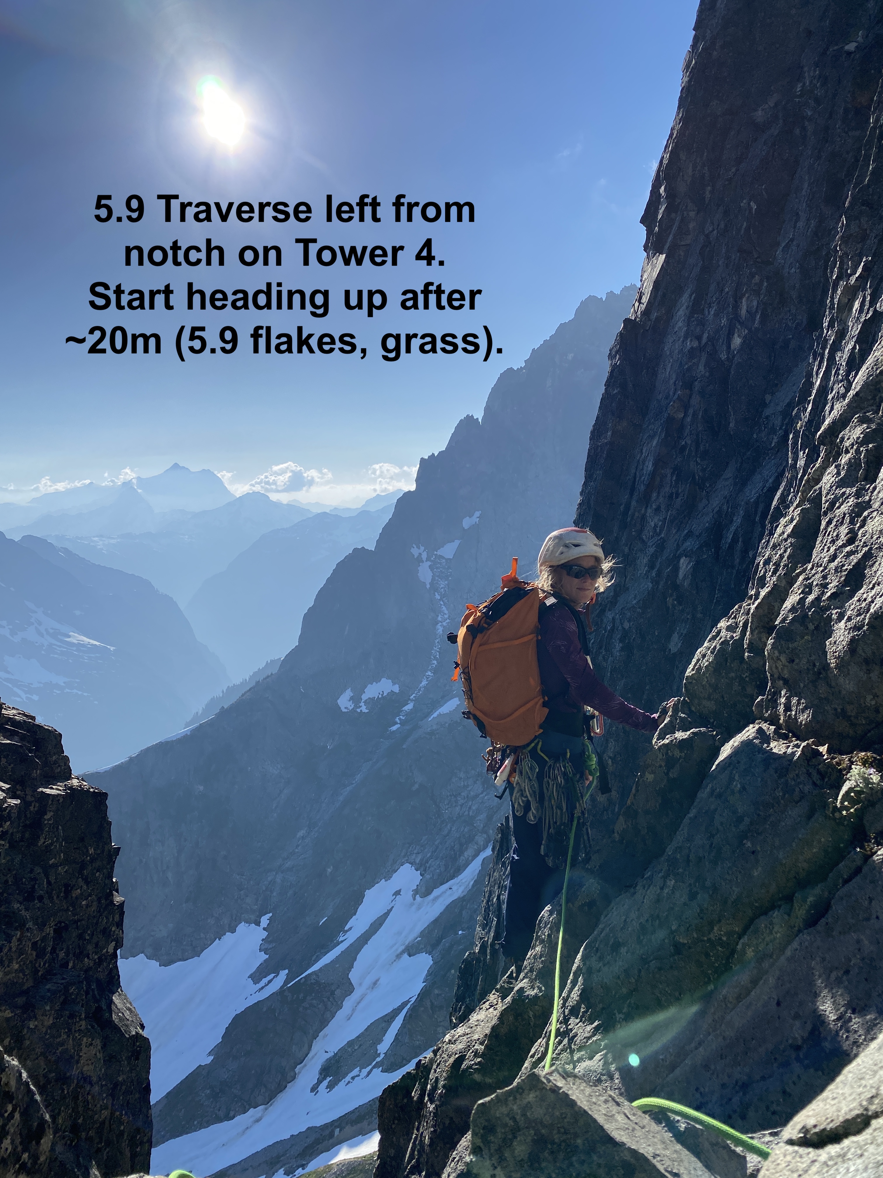
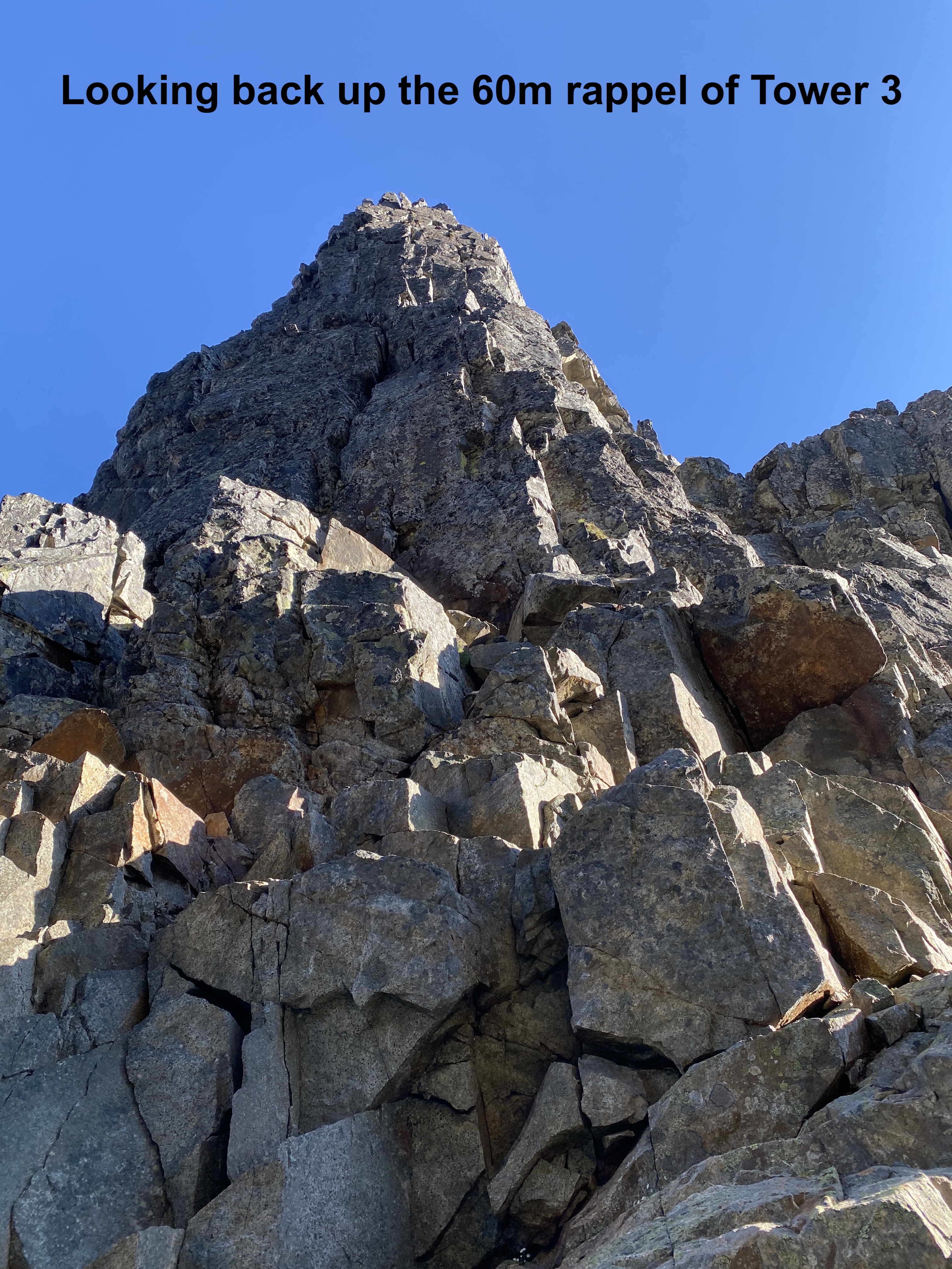
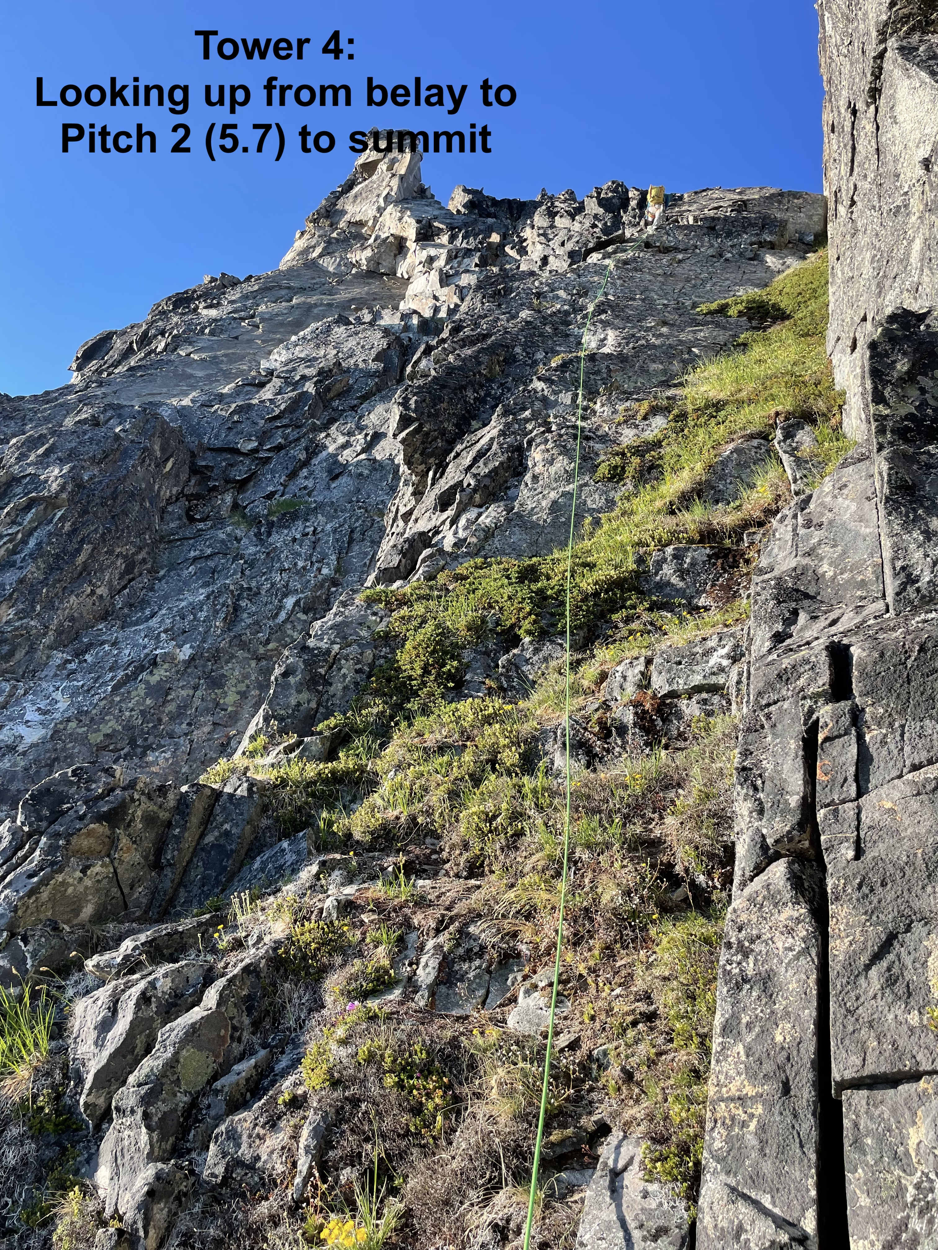
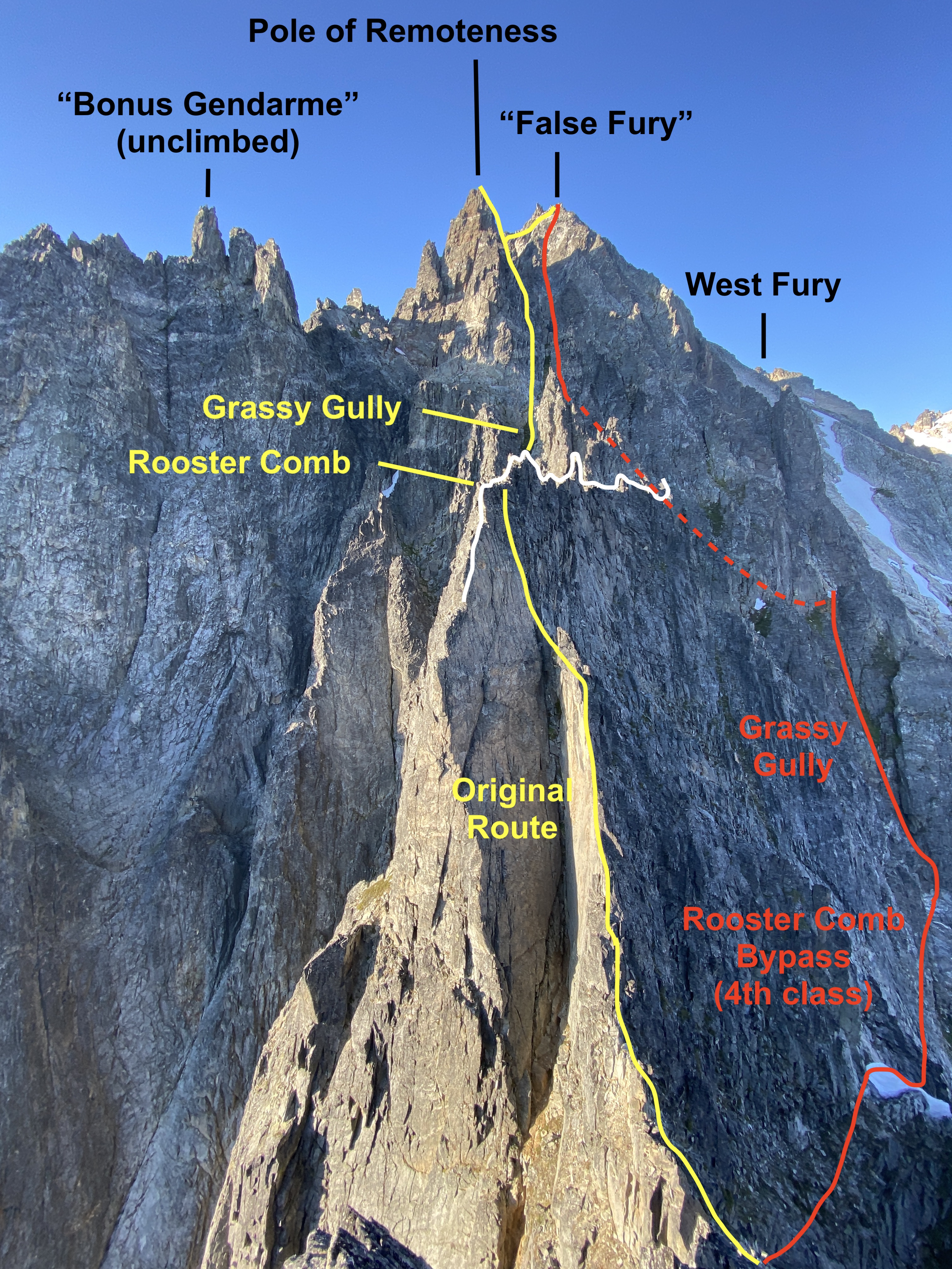
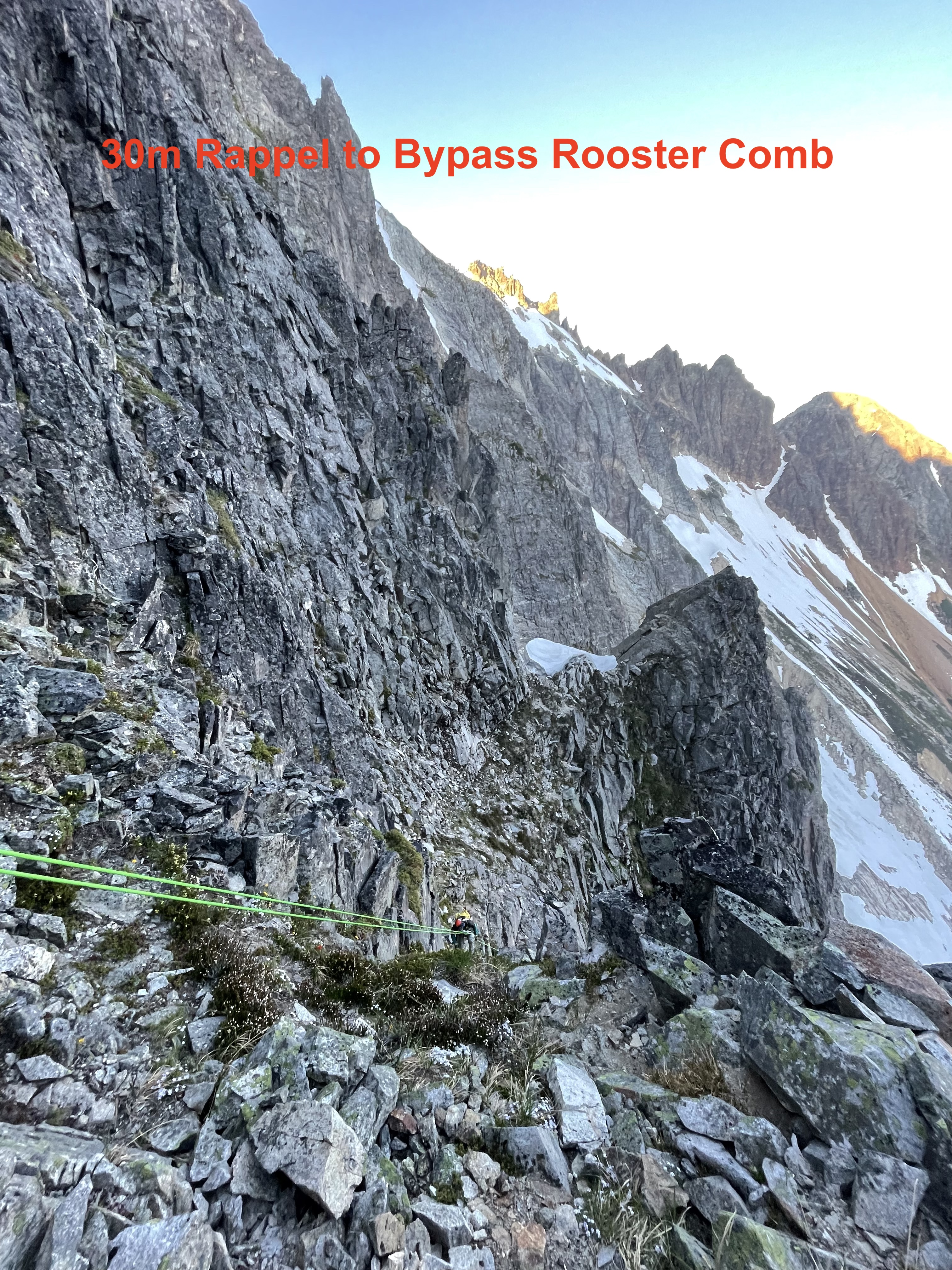
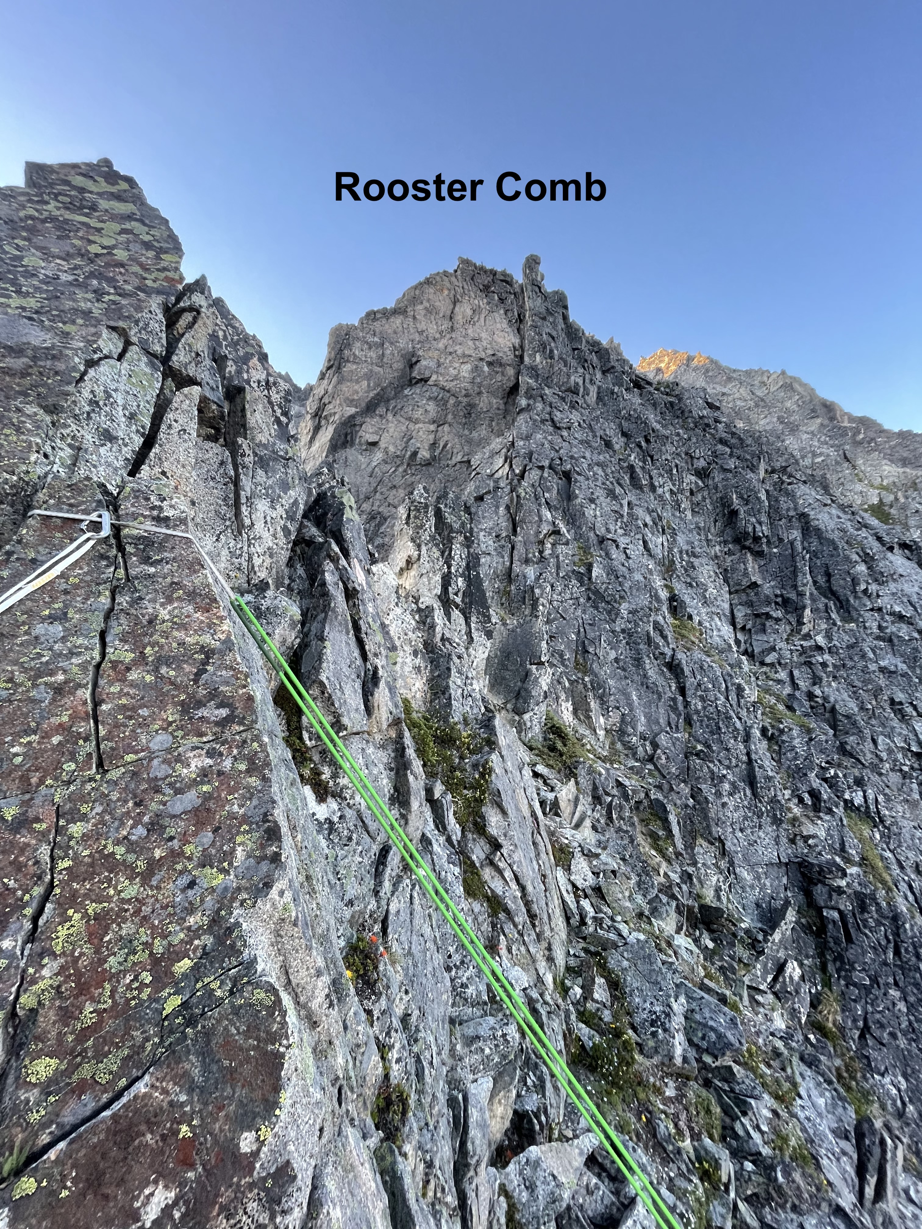
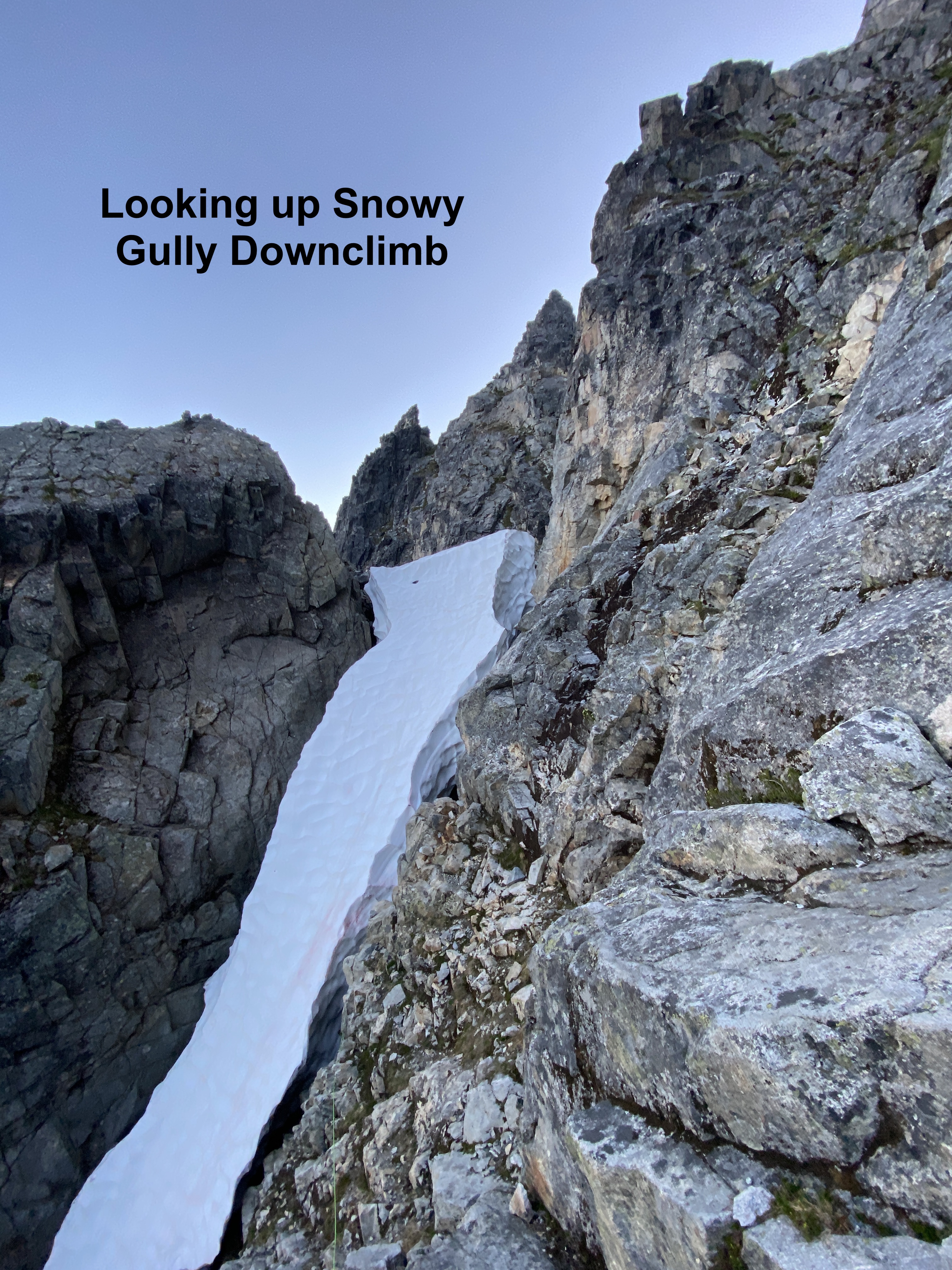
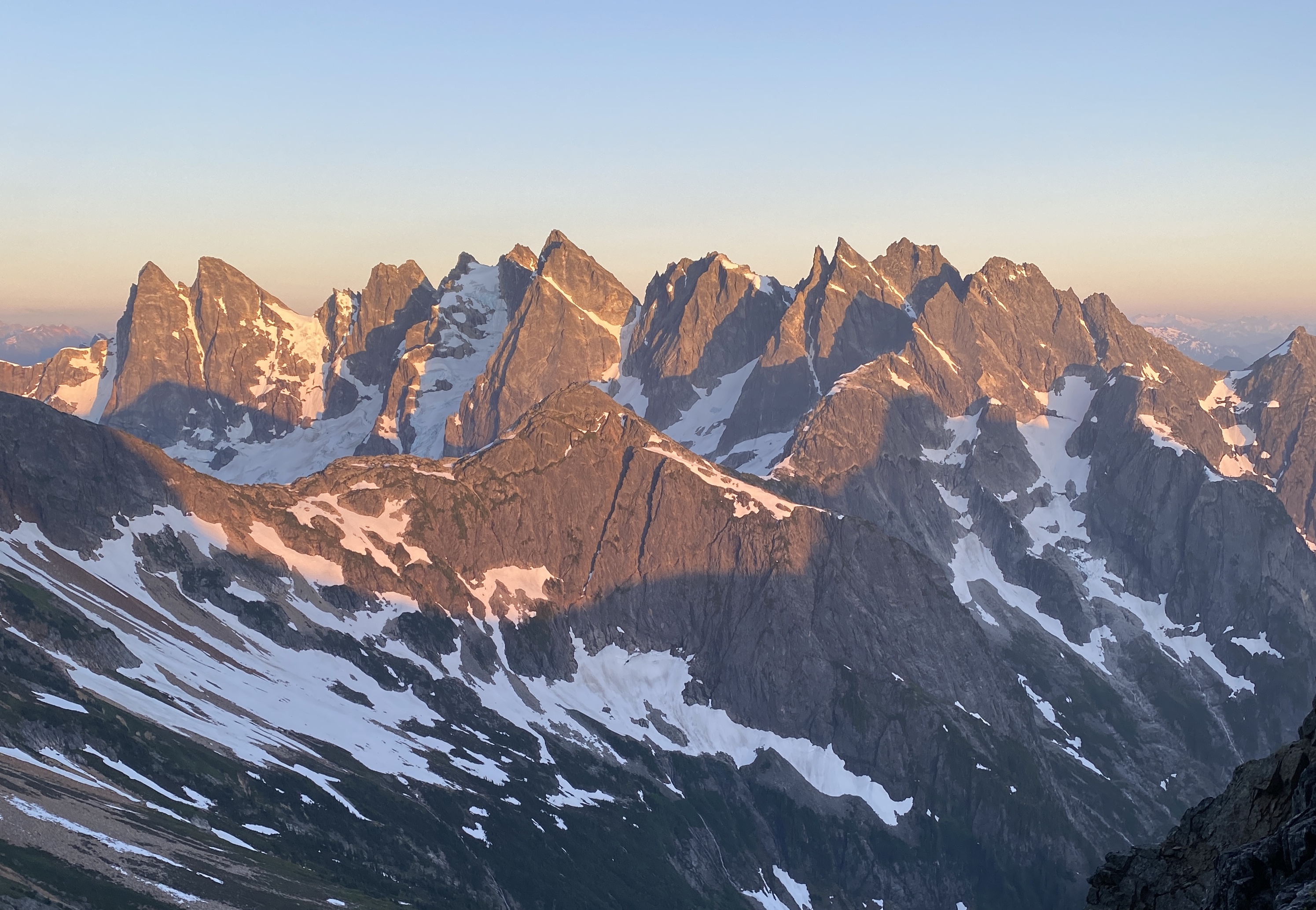
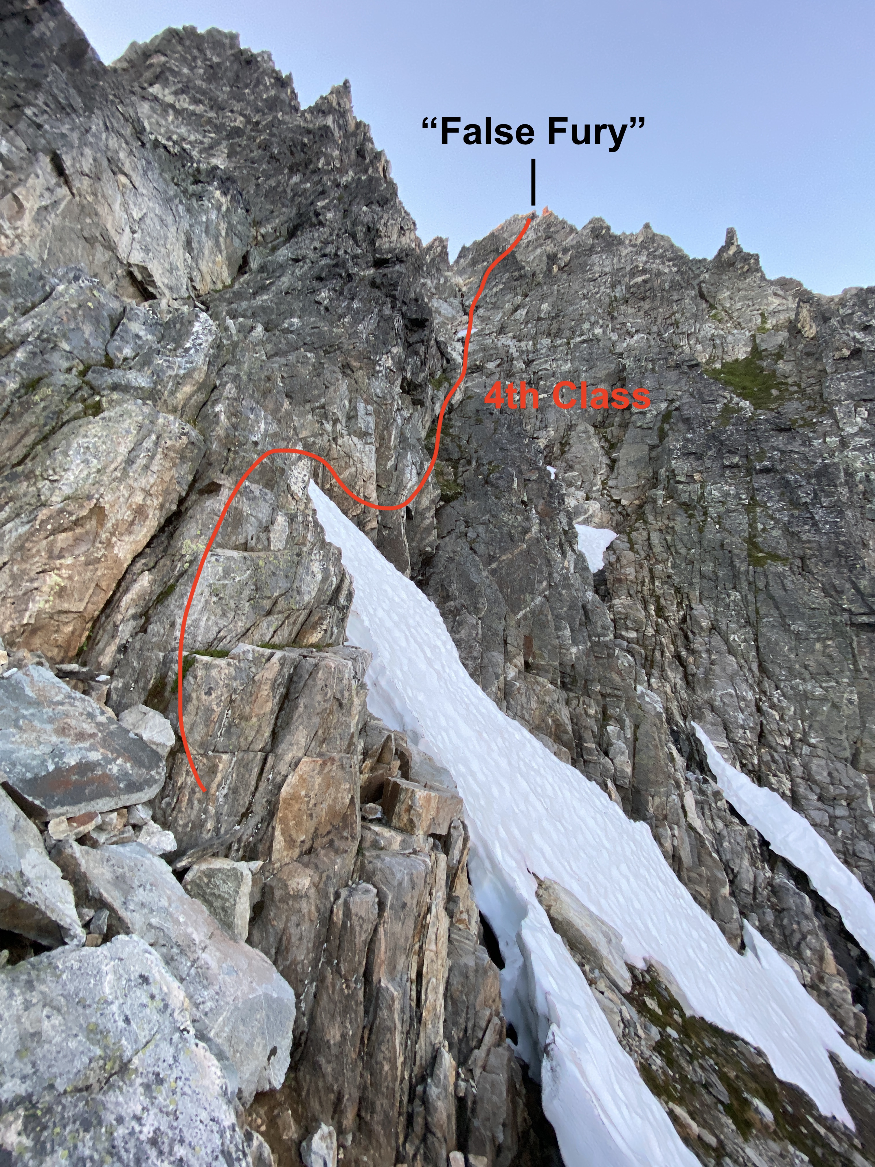
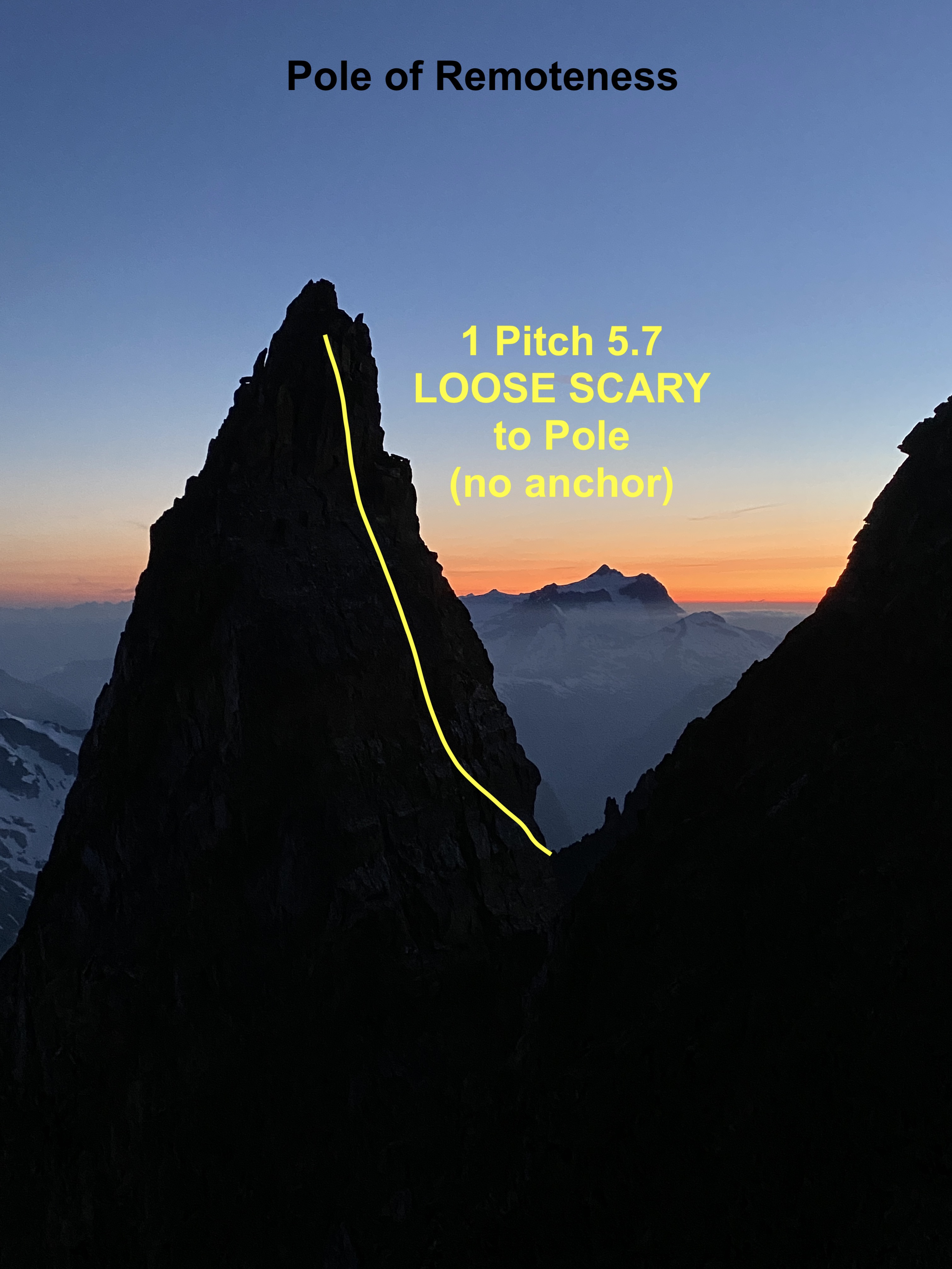
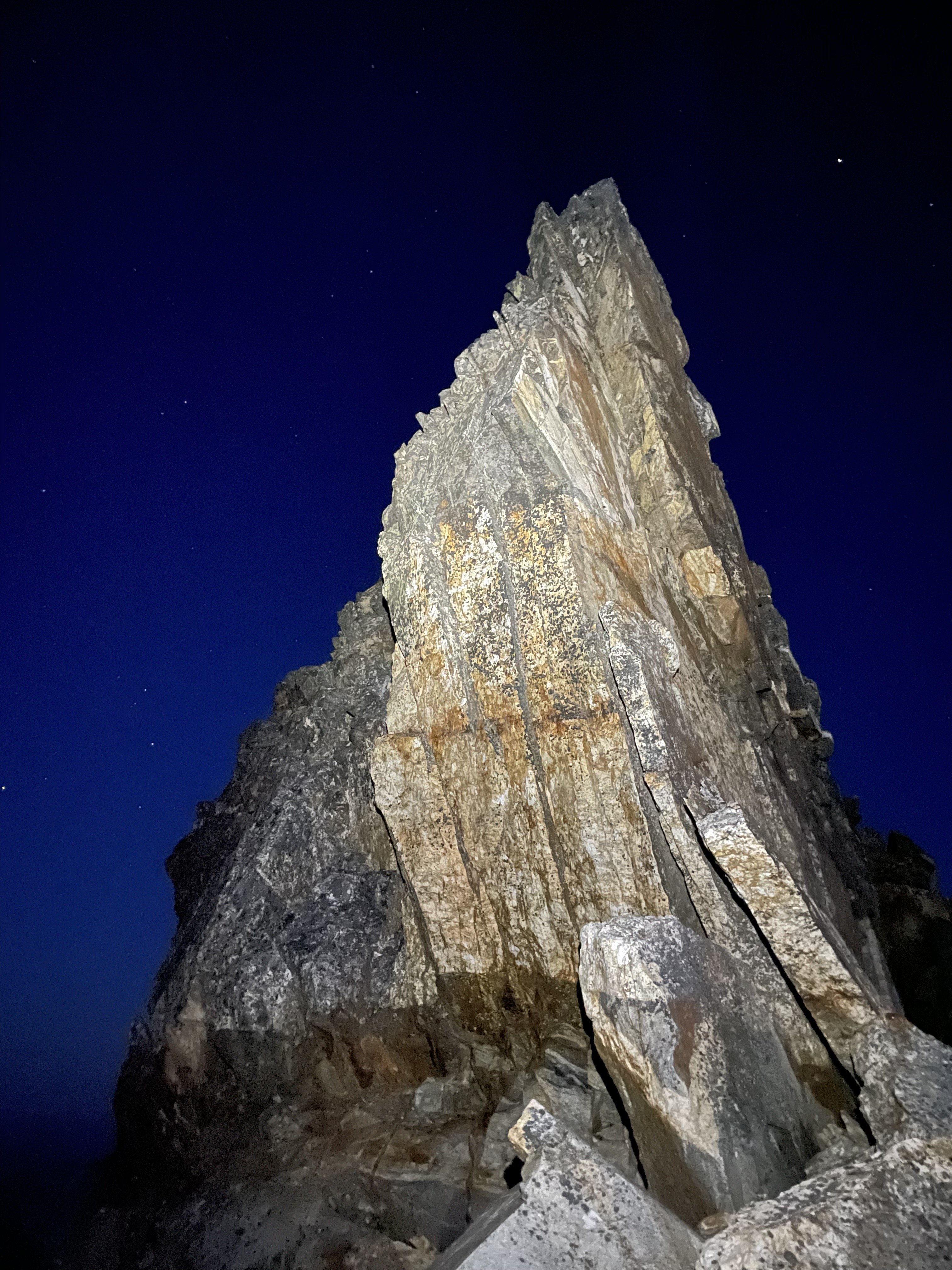
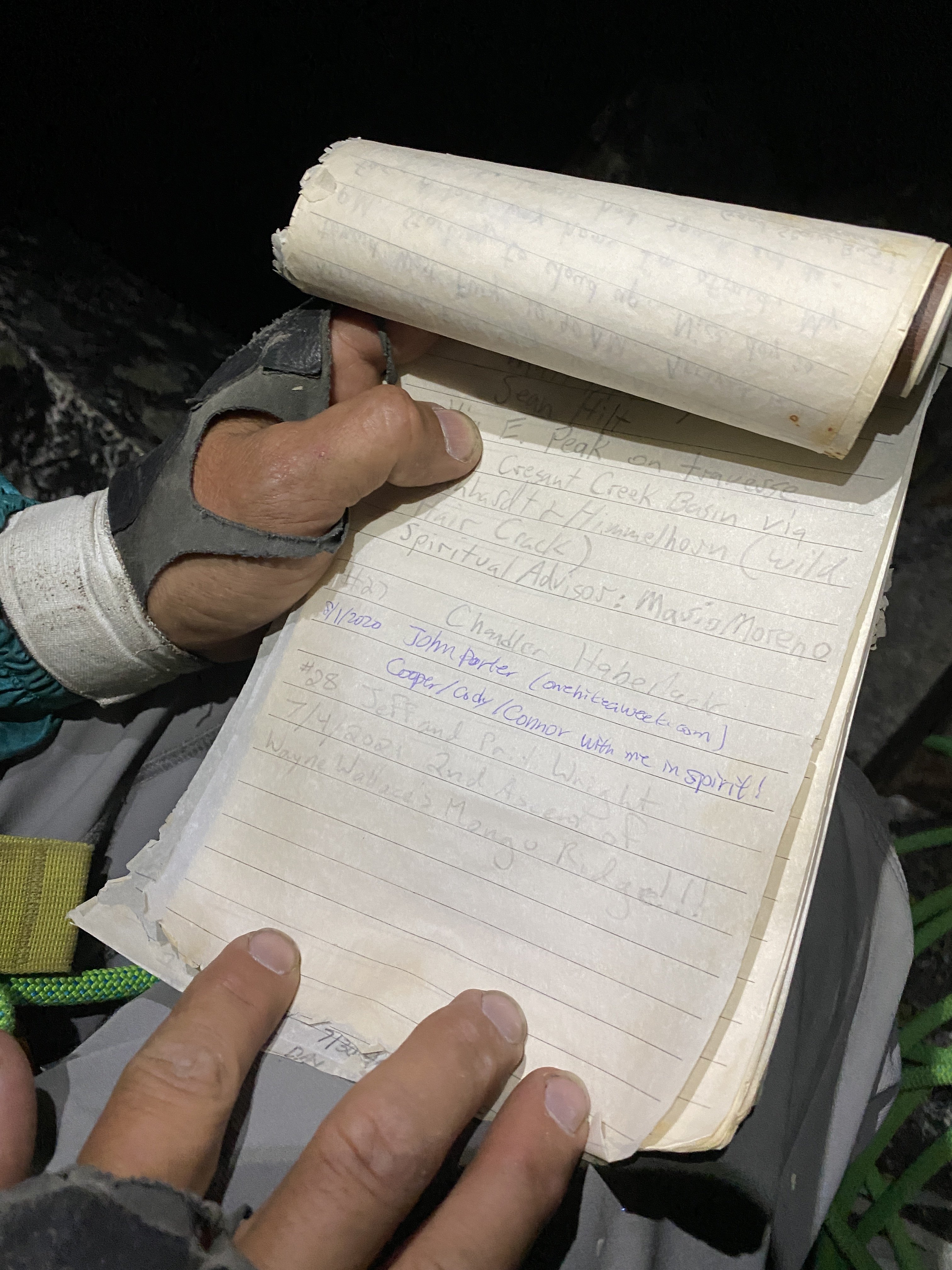
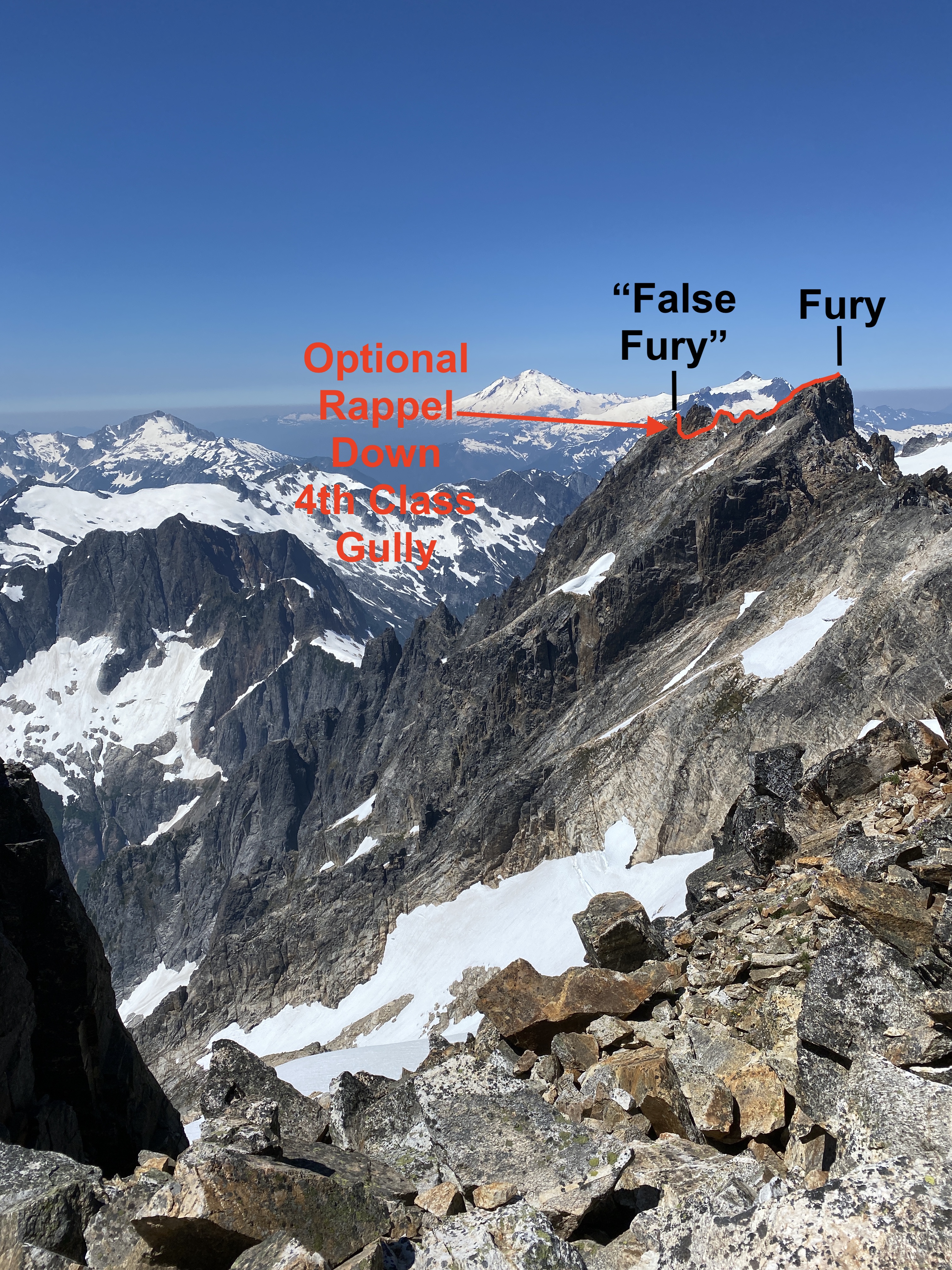
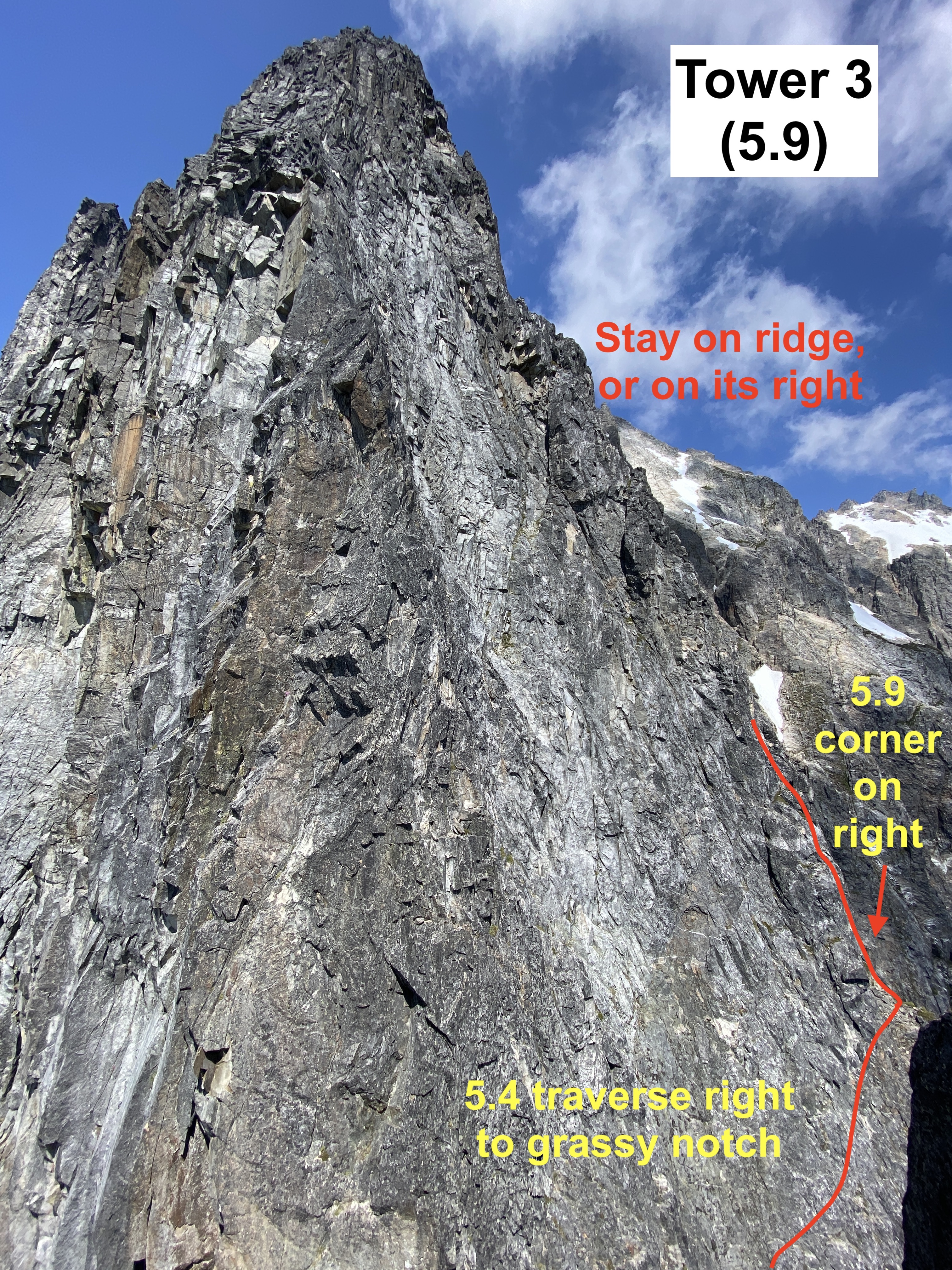
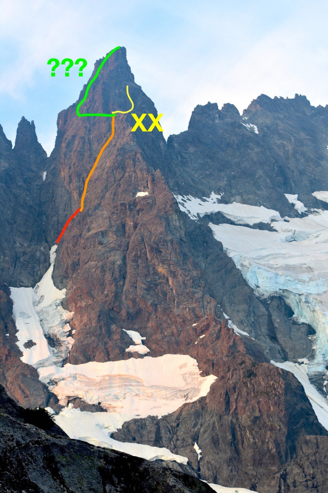
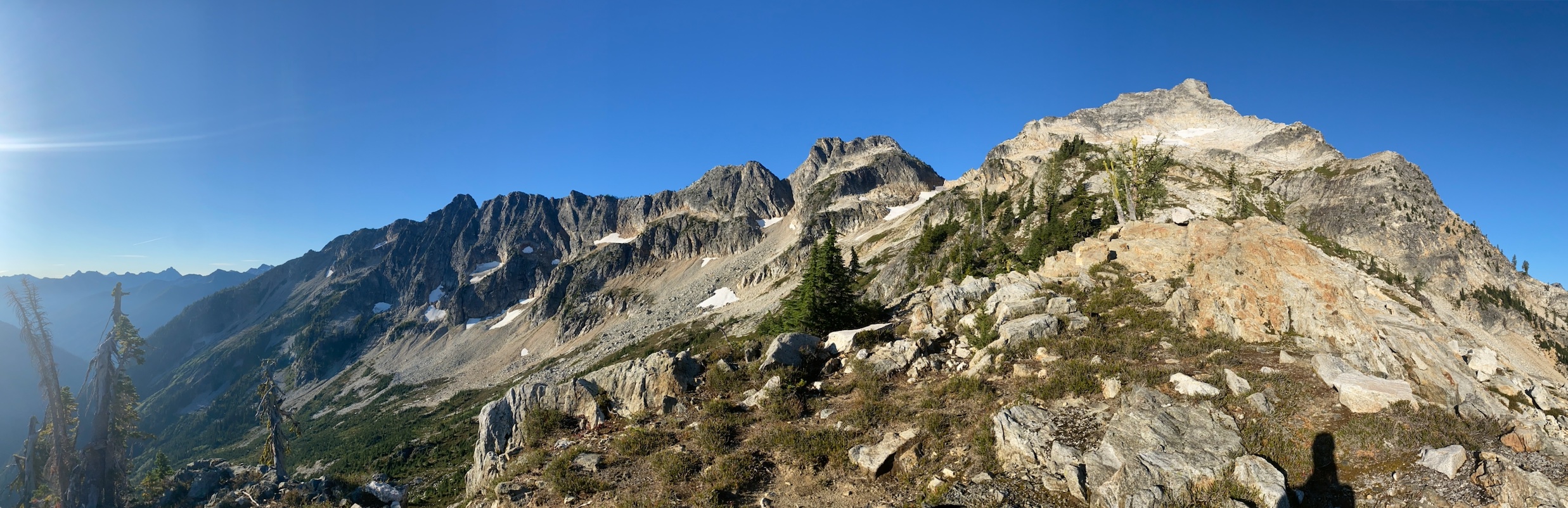
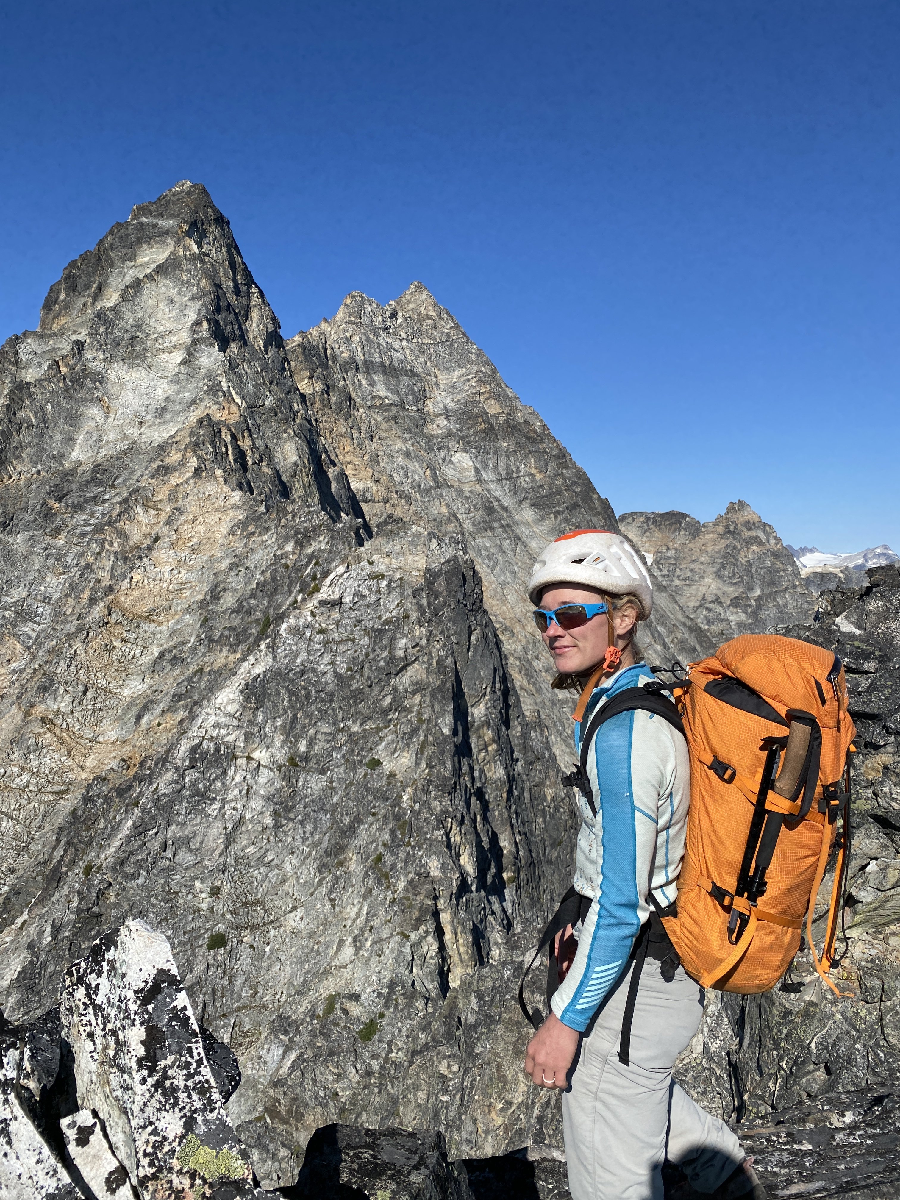
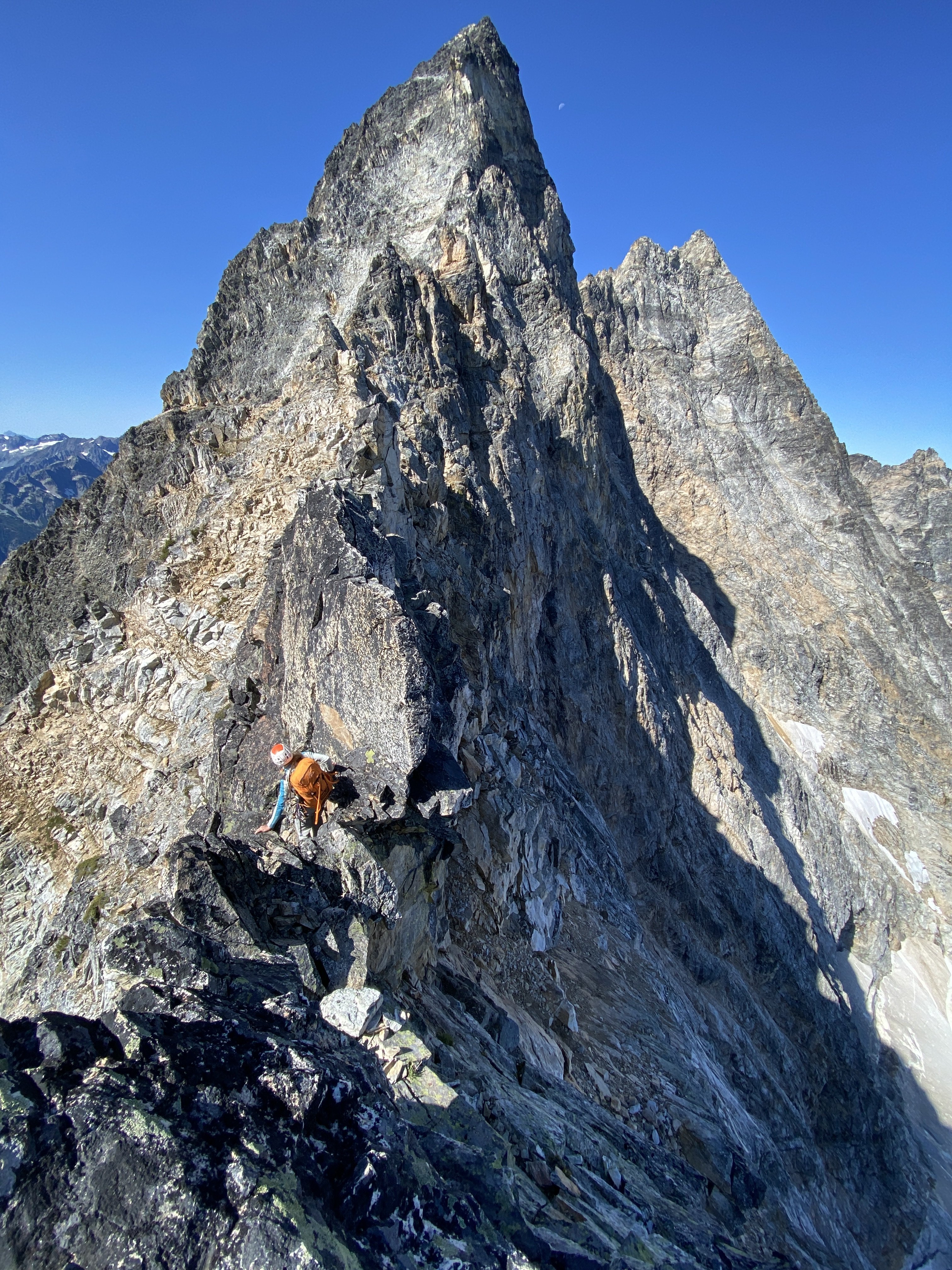
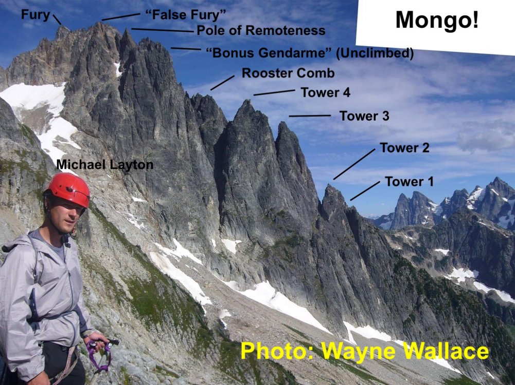
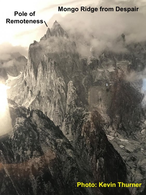
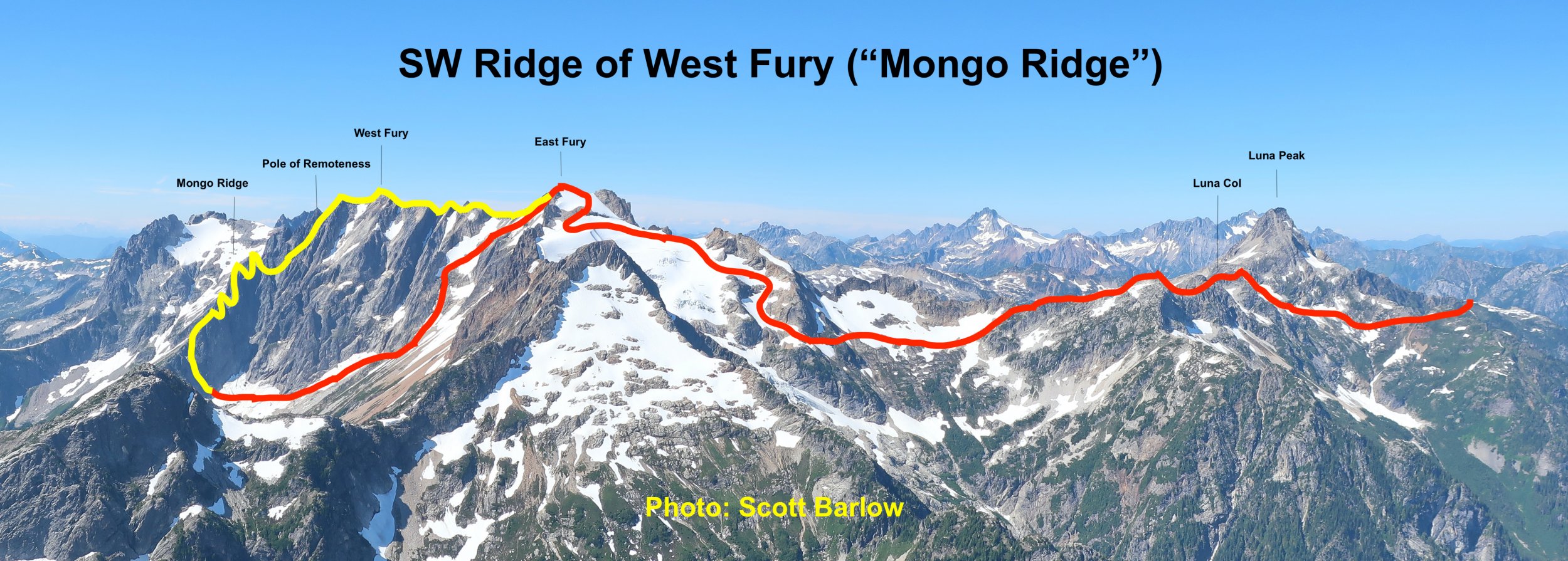
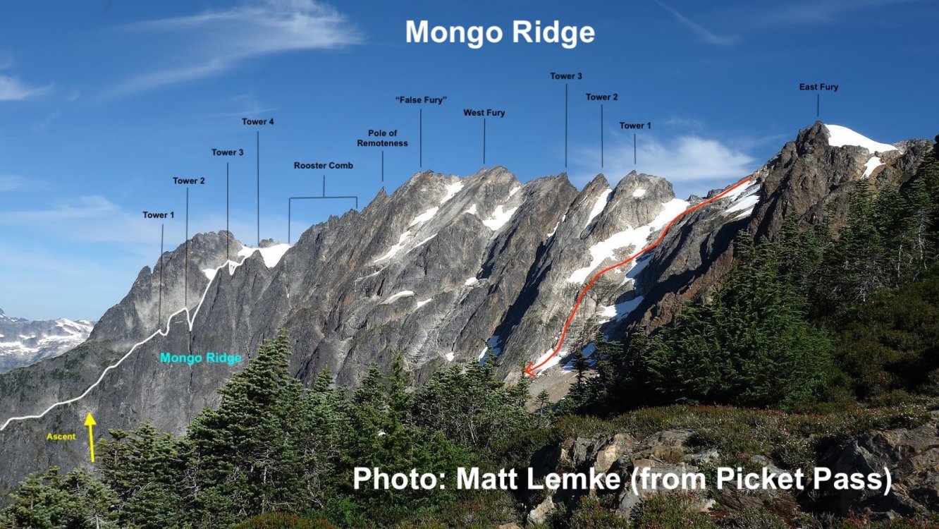
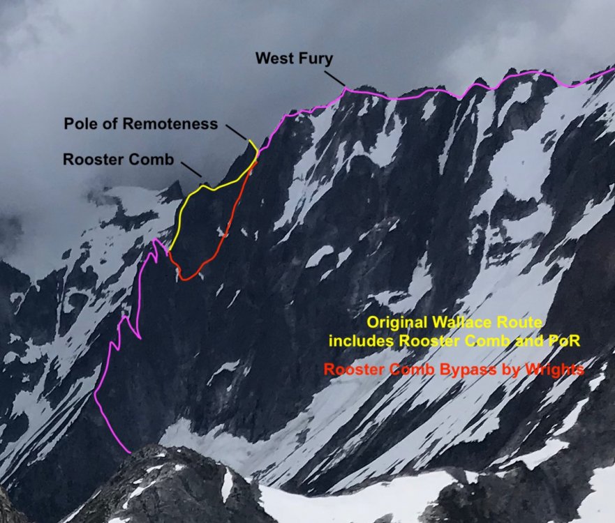
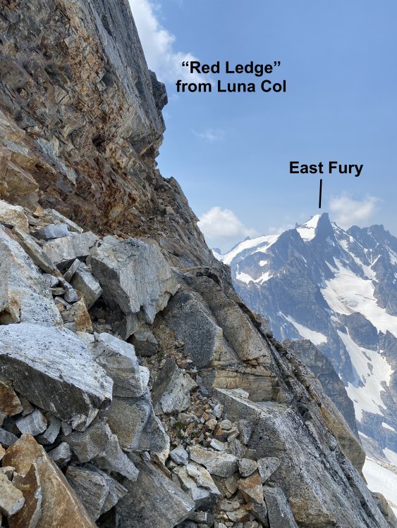
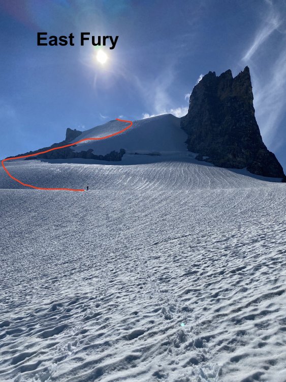
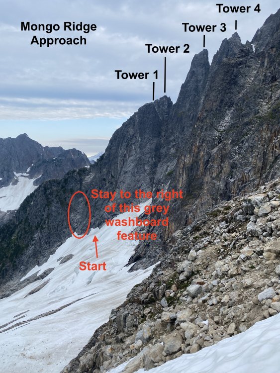
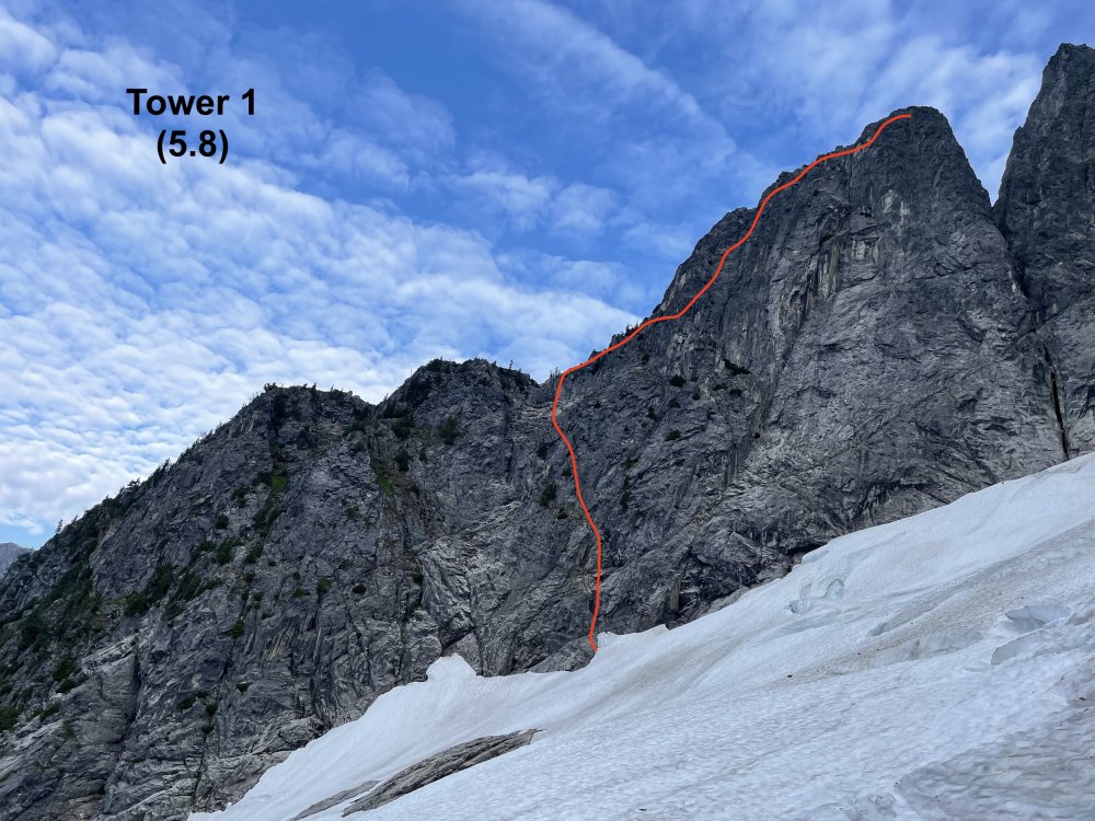
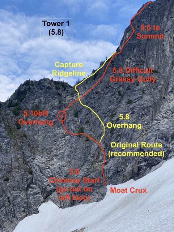
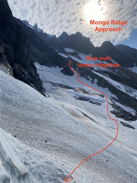
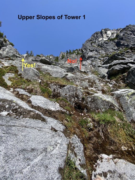
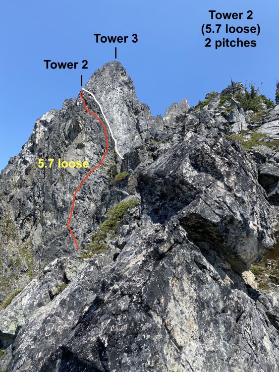
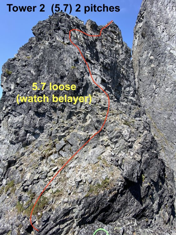
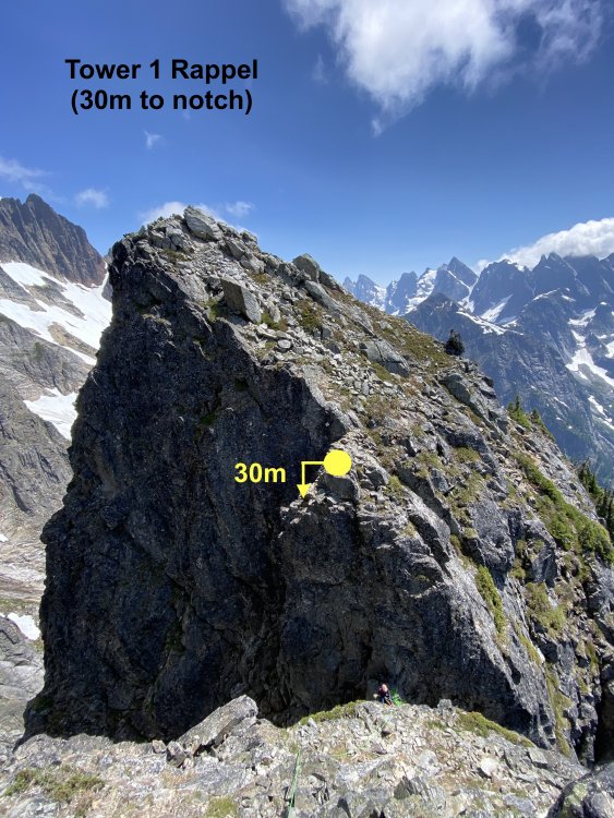
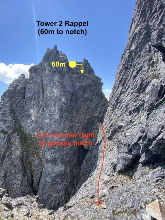
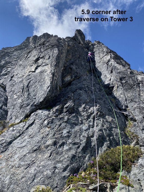
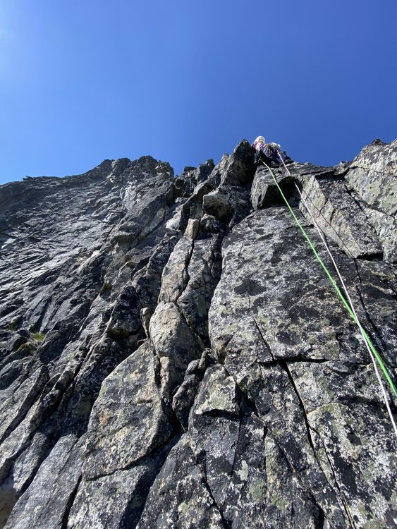
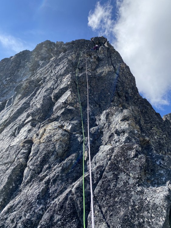
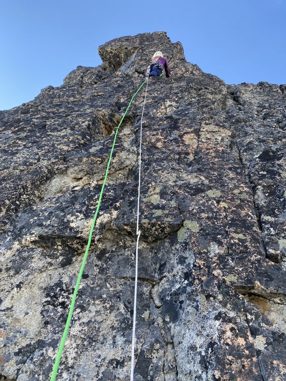
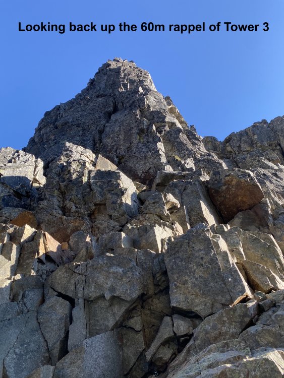
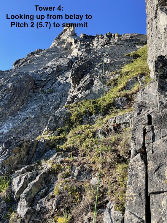
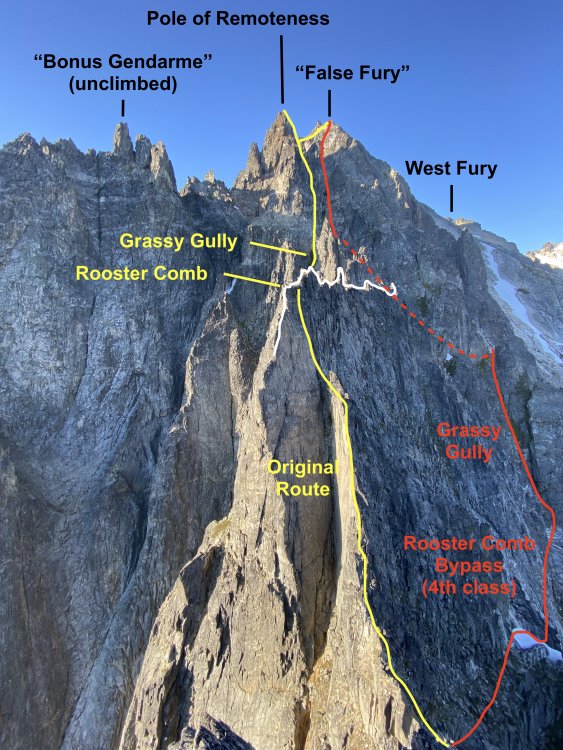
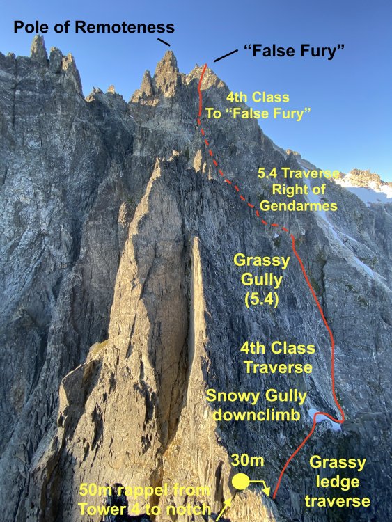
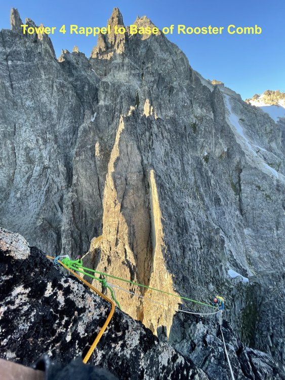
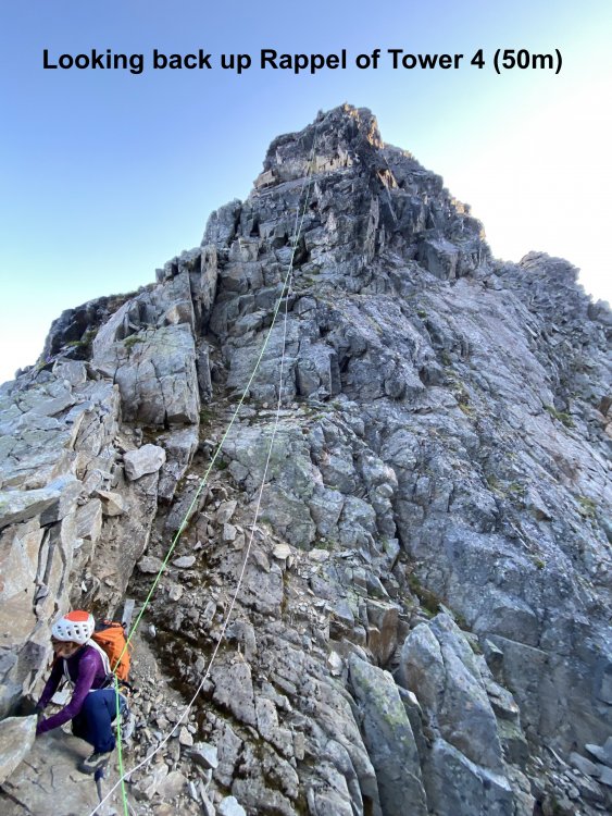
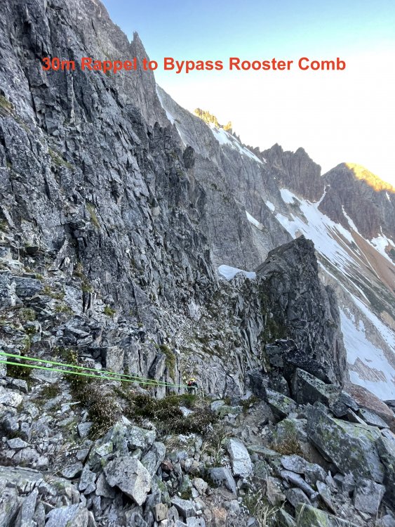
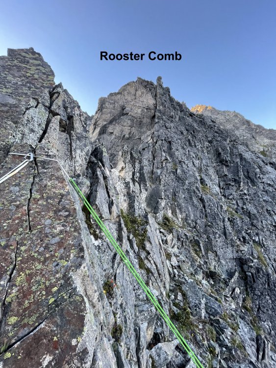
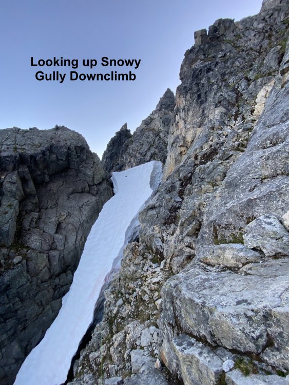
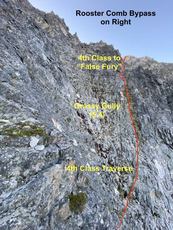
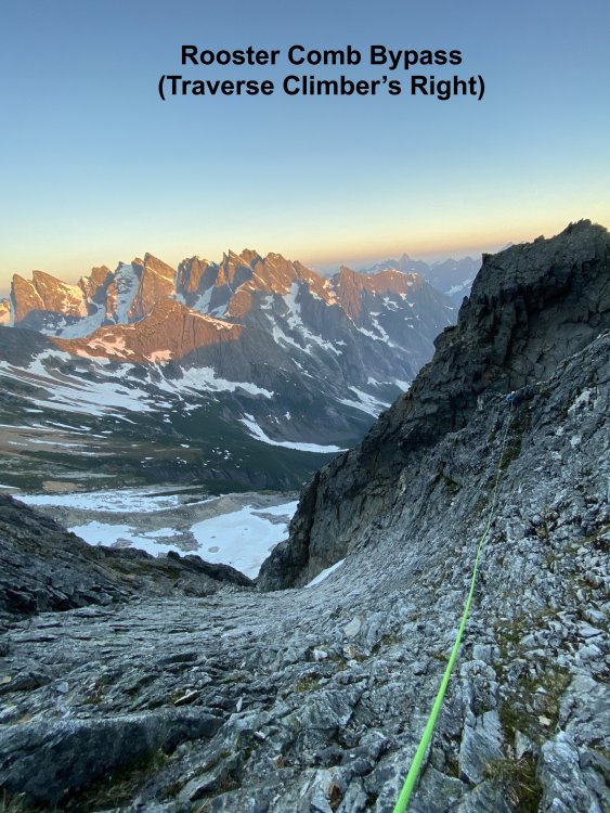
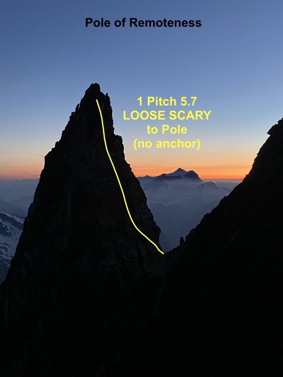
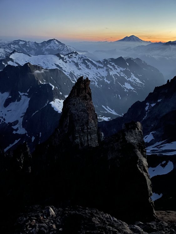
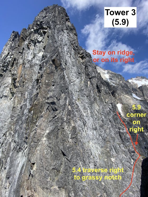
Trip: West Fury - Mongo Ridge Trip Date: 07/05/2021 Trip Report: In our relentless pursuit to ride the coattails of THE Wayne Wallace, Priti and I made the second ascent of Mongo Ridge (the SW Ridge of West Fury in the Northern Pickets of the North Cascades). It is a Stegasaurus ridge which rises 4,000ft over a mile from Goodell Creek punctuated by thick clusters of gendarmes that look like they’re straight out of the Karakoram. We first heard about Mongo when Wayne came to speak for a BOEALPS - Boeing Employees Alpine Society Banquet in 2015 and regaled a captive audience with his bold adventures. We warmed up Wayne's feature presentation with a talk on our trip to Patagonia climbing Aguja de l'S. Then Wayne came on stage talking about Mongo, making de l'S look like a mole-hill. Wayne climbed this route in 2006 SOLO, like a boss, questing into unknown terrain that easily could have landed him into mandatory hard free climbing. With vertiginous cliffs on both sides, he knew that bailing from the route was not an option and that he had to climb whatever the mountain presented. The difficulties on the route were up to 5.9, with an additional 5.10b pitch (a routefinding error), but the towers presented possibilities up to 5.11 if we weren’t lucky enough to have Wayne’s beta. The first ascent is one of the legendary, mythical ascents of the Cascades and even of the climbing world. After 15 years, only a handful of folks to my knowledge have even considered attempting it again. The bottom half of the ridge has four narrow towers which require you to summit and rappel in order to make vertical progress on the ridge. Long, double-rope rappels and hard technical climbing discouragingly makes it take hours just to ascent 100ft at times. Above these four towers are the “Rooster Comb” and the “Pole of Remoteness” (named by John Roper who figured it was the hardest place to get to in the lower 48). After Tower 4 and before the Rooster Comb, we scramble traversed low around each of these features and did not summit the Pole of Remoteness since it was getting dark and we did not bring bivy gear. At Wayne’s suggestion, we planned to climb camp-to-camp which was situated at the summit of East Fury. This means that while we did ascend the topographic feature of Mongo Ridge to the summit of West Fury, we did not truly climb “Wayne Wallace’s Mongo Ridge” in the manner that he climbed, including many more pitches of technical terrain. When we talked to Wayne in 2019, I told him that “Somebody needs to repeat this route, just so the world can understand what you accomplished.” It’s impossible to understand the scale of this route without being on it, competing as “one of the largest features on any mountain anywhere.” “You have to climb a major mountain [East Fury] just to start a most major climb.” Even with Wayne’s pictures and descriptions, we were still filled with dread as we attempted to route-find up each tower. While I am proud of what we did accomplish, I am still shaken at the boldness and audacity of the first ascent. Our tale should be considered a celebration of that event. Wayne called it Alpine Grade VI, but Beckey downgraded it to V deeming it (incorrectly imho) similar in commitment to Slesse NE Buttress (ref. Cascade Alpine Guide Book 3, pg. 118). We concur with Wayne's Grade VI rating, although I won't be even slightly offended if anyone wants to challenge the grade while ensconced in sofa cushions. Our itinerary: -7/3/21: 2PM boat ride from Ross Lake Resort to Big Beaver TH. Bivy in Access Creek basin. -7/4/21: Access Creek Basin to East Fury Summit. Left summit bivy in situ. -7/5/21: 23hr day camp-to-camp including Mongo Ridge and the traverse from West Fury to East Fury. -7/6/21: East Fury to Access Creek Basin -7/7/21: Access Creek Basin to Big Beaver TH. 2:30PM boat back to RLR. Here are collected links regarding Wayne's FA, for reference: https://waynewallace.wordpress.com/2014/05/ http://www.alpinist.com/doc/ALP19/climbing-note-fury https://www.nytimes.com/2006/10/21/sports/othersports/21outdoors.html http://www.alpenglow.org/nwmj/07/071_Mongo.html http://publications.americanalpineclub.org/articles/12200713002?fbclid=IwAR0iS9vNBvJ1XUQPOTPIXy8eymiTsuWFHI5TJtuAvLJUNb5LknfgeYgTriI Scurlock Picture: https://www.pbase.com/nolock/image/65948954 I won't go through too much detail on our approach to Luna Col and East Fury, since it is detailed well in many other places: https://onehikeaweek.com/2020/08/02/mount-fury/ http://www.nwhikers.net/forums/viewtopic.php?t=8021967 (specifically useful here is the traverse from East Fury to West Fury) Since we planned to do the route camp-to-camp (situated on the summit of East Fury), we studied the traverse from West Fury to East Fury in detail since we figured we'd be onsighting it in the dark to get back to camp. I will point out the "Red Ledge" (pictured above) just past Luna Col is reached by staying directly on the ridgeline from the col to begin the traverse over to East Fury. Past the Red Ledge, the next tower (called "Crux Tower" in some reports) is ascended directly via 4th class ledges and short 5.4 steps. A rope and gear would not be useful here. There is significant foreshortening here, as the route looks much more accessible as you get closer. Unless you're climbing in Winter or Spring, you will not be able to get across the bergshrund (as shown in the Beckey overlay), but instead will traverse left then right to reach the summit arête. Furthermore, the approach to the base of Mongo Ridge from East Fury's summit as discovered by Wayne is the easiest approach. While it is possible to reach Mongo's base via Picket Pass (either by navigating over Outrigger Peak "Southeast Peak" or Otto-Himmel Col), these approaches would be significantly more effort...or bushwhack for days up Goodell Creek. As you approach, notice the grey washboard streak with an overhanging gully. The route will start to the right of this feature. The 4,000ft descent from East Fury's summit may involve a lot of slab if the snow levels are low. We regret not bringing bivy gear on route. An alternative itinerary could be: -Day 1: Big Beaver TH to Luna Col -Day 2: Luna Col to Mongo Ridge Tower 1. Option to leave stove and tent on East Fury Summit as you pass by. There are no good bivouac sites on route. Just bring a sit pad and a sleeping bag and open bivy if splitter forecast. -Day 3: Tower 1 to either East Fury or Luna Col. A note on weather: The Pickets have notoriously unpredictable weather. Even with a splitter forecast, you can still have rain or even storms. Consider a tarp as backup shelter. Crossing the moat is the first crux. The moat is huge! Only found one place where it touched the rock slightly. On the approach, don't come down anything you can't go back up! Here I had to cross a giant moat (unprotectable compact snow), using both Gully tools (then passed the tools down to Priti). A picket here would have been very useful...but that's a big cost. Might have to bury a tool and rap/swing across the moat. Tower 1 was a TIME KILLER! Wayne reported a 5.8 overhang crux which we did not find. Instead we got suckered into a runout 5.10b overhang in the grey washboard gully. Recommend future parties to avoid this gully completely, and instead stay on the face to its right. Our second mistake was getting suckered into a difficult 5.8 grassy gully. Wayne later clarified that he immediately captured the ridge first, then went straight up the ridge (recommended). We started in an obvious chimney (5.6), gaining the face on the left then going right (many variations). After the chimney, we went left to the 5.10b overhanging grey gully instead of going up. It looked harder to gain the face above, but it is 5.8 if you can find Wayne's Way. The slopes to gain the ridge are all STEEP. We breathed a sigh of relief once we were on situated on the upper slopes of Tower 1, but route finding continued to be a challenge. A 30m rappel took us down to the notch between Tower 1 and 2. It seems possible to bail here back down the glacier and back up to East Fury. Perhaps the last legitimate bail option, so we considered the time and knew we would be climbing through the night. Tower 2 is only 2 pitches of 5.7 with no real route finding difficulty and went pretty quickly. The rock is REALLY loose however, so I was careful not to knock anything down on my belayer. Route lines are all approximate by the way! The first double rope rappel from Tower 2 led to the notch between Tower 2 and Tower 3. Tower 3 is the technical crux of the route and another TIME KILLER! It takes hours just to gain 100ft elevation. Once atop, it's demoralizing to look down and see the top of Tower 2 so close. Wayne reported a 5.10a bulge which I think we avoided by staying on and just right of the ridgeline. From the notch between Towers 2 and 3, a 5.4 traverse gains a grassy belay with 5 more pitches above ( 5.9 30m, 5.9 30m, 5.9 30m, 5.9 50m, 5.6 65m). Priti stopped whenever she found a good belay spot. We also hauled packs on 4 pitches expecting 5.10a climbing at any moment. It was real 5.9 climbing, consistently on decent rock for four pitches. Next time, instead of hauling just load everything into the follower pack and leave the leader with a mostly empty backpack instead. We took two backpacks on this climb to evenly distribute weight and bulk while simul-climbing. This was a good method. We consistently trended right above the belay. Higher Hiiiiiigher Hiiiiiiiiiigher Another 60m rappel deposited us to the notch between Towers 3 and 4. Finally, we got through the technical crux and we were losing sun fast! We knew we were in for an open bivy or a heartbreaking omission of the Pole of Remoteness. Tower 4 is another quick one. Two pitches, 5.9 then 5.7. It looks like really hard climbing going straight up! Instead we followed Wayne's advice and traversed out right for ~20m on 5.9 terrain with decent protection, then up following flakes and grass to a good belay. As you start climbing up, the climbing doesn't ease up, but instead is engaging, fun 5.9. Then 65m simul-climb to the summit. A final 50m rappel down to the base of the Rooster Comb. We were a bit confused here since the terrain opened up into a minefield of gendarmes. The Pole of Remoteness was indistinguishable among all of the towers. We knew we had to boogie so we took all the shortcuts that we could find. We noticed that the Rooster Comb could be bypassed on the right on low-5th terrain by taking another 30m rappel, then down climbing and traversing its Eastern flanks to a grassy gully. Wayne went up and over the Rooster Comb, not realizing there was a bypass. The Rooster Comb is very complex with several small flagpoles that required rappels. Wayne describes the final rappel off the rooster comb as a "diagonal rappel" that you can redirect off of horns, after which he flicked the rope to retrieve. There are at least two more intermediate gendarmes between the Rooster Comb and the Pole of Remoteness that we skirted around. Wayne found himself on their left side while we were on their right side. Wayne captured the upper 4th class slopes via a grassy gully (shown above). From here it's all 4th class to the "False Fury" summit. I coin the label "False Fury" because we stared at this point almost along the entire route thinking it was the West Fury Summit, but instead is fairly far from the true West Fury summit. Above is pictured our Rooster Comb bypass route which required an additional 30m rappel (or easy down climb). This was the first time we encountered snow on route, but don't count on it being there! Bring 4L water each. Southern Pickets in all their glory. Wayne traversed around the right side of the Pole of Remoteness to reach the col and summit it from the backside. To climb it directly would probably be 5 pitches of hard, loose climbing. From the notch between "False Fury" and the Pole of Remoteness, Wayne reported 1 pitch of 5.7 to reach the summit of the PoR. There is no anchor on top, so he threw a rope around a loose block and solo downclimbed, using the rope as a backup. If you are a team, consider downclimb-belaying. We sadly felt the need to skip the pole since it was total darkness by the time we got to the notch with a lot of traversing left to go. Once atop "False Fury", we couldn't find the summit register and realized that the real West Fury was maybe .25miles away separated by 4 more gendarmes, first downclimbing (or rappelling) down and right and traversing around the first gendarme, then weaving up, over, and around the others to finally reach the real West Fury summit. Glad to have put in the time to memorize the traverse beta between West and East Fury, it went off slowly but smoothly. One piece of key beta was at the end of Tower 1 (the last tower between the Fury's), you can find a secret 4th class ramp around to the North (climber's left) to find the rappel station that leads to the final push up the slopes back to East Fury. This is a 30m rope stretcher rappel, by the way! Thanks to Wayne for all of your support and encouragement! I think this route is more of a classic in the way that Hummingbird Ridge is a classic. We should really just sit back and marvel at the first ascent. It's a true Picketeering adventure, but loose rock, lack of bail options, and lack of bivy sites is pretty discouraging. The Pole of Remoteness still needs a second ascent, however! But it would a pretty doable day to get to PoR in-a-day from your East Fury bivouac by traversing high along the ridge and scrambling down from "False Fury", then reversing the route. Gear Notes: Single Rack .1 to 2, doubles .3-.75, small cams (TCU 00, TCU0). We like small cams in the Pickets! Small rack of nuts. 1 screw and 1 V-threader for glacier (didn't use). 60m single rope, 60m pull cord (three long rappels + optional pack hauling), 1 Petzl Gully (technical light ice axe) each, 10 single alpine draws, 3 double alpine draws, 1 quad, 50ft 5mm cord for rap anchors (used it all), left three caribeeners on rappel stations, steel horizontal front-point crampons. Approach Notes: Boat from Ross Lake Resort to Big Beaver Creek - Access Creek - Luna Col - East Fury - 4000ft descent on South side - Mongo Ridge - West Fury - Easy Fury


- 16 replies
-
- 11
-

-

-

-
- tripreport
- cctripreport
- (and 1 more)
-
[TR] Darrington - Squire Creek Wall -> Buckeye -> Whitehorse 06/19/2021
JeffreyW replied to Kyle M's topic in North Cascades
Holy cannoli! This is an epic trip you two! Bravo. Takes creativity and vision to dream this one up. Probably not many people understand exactly how crazy hardcore this is. Next level. Chapeau. -
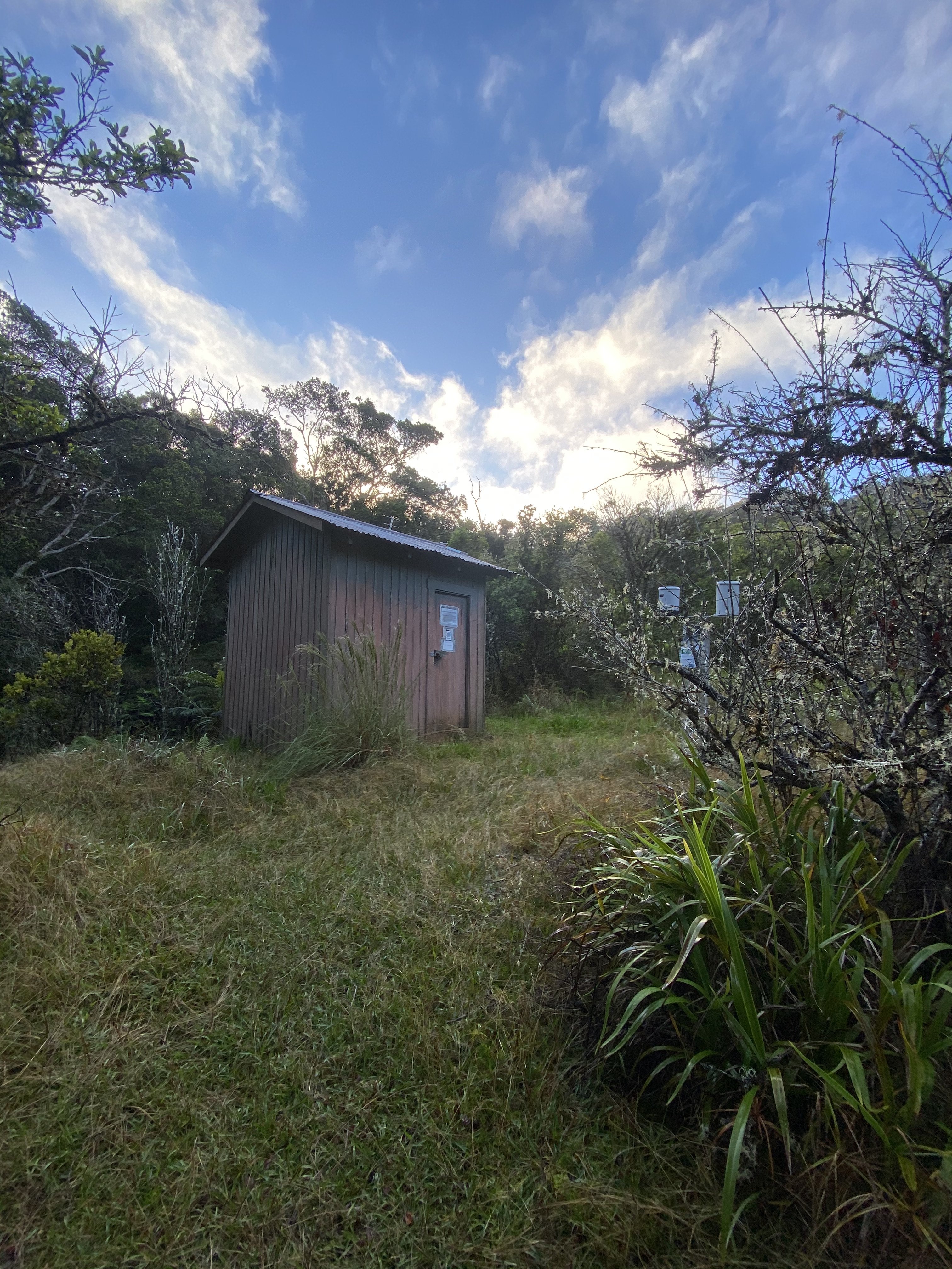
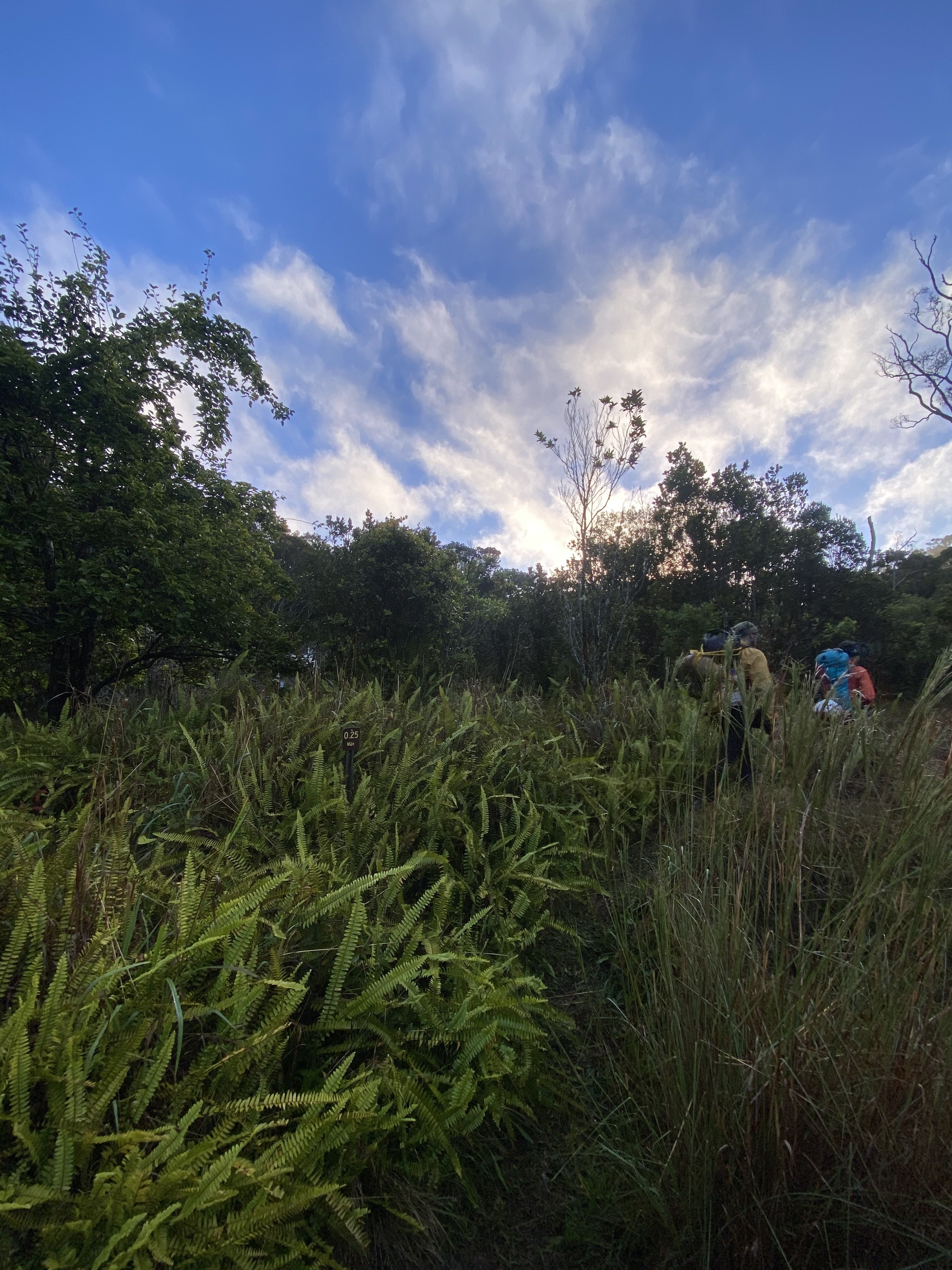
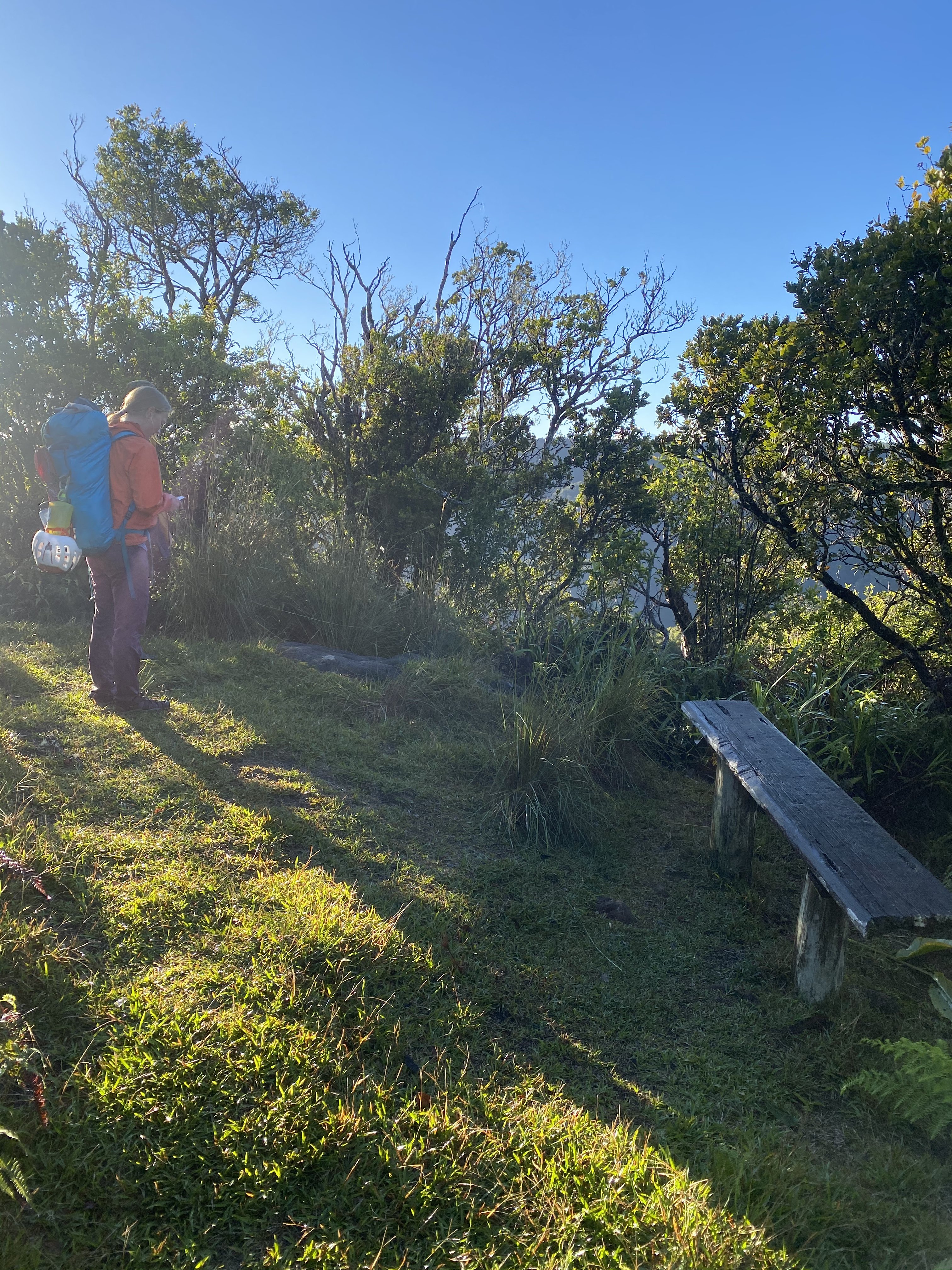
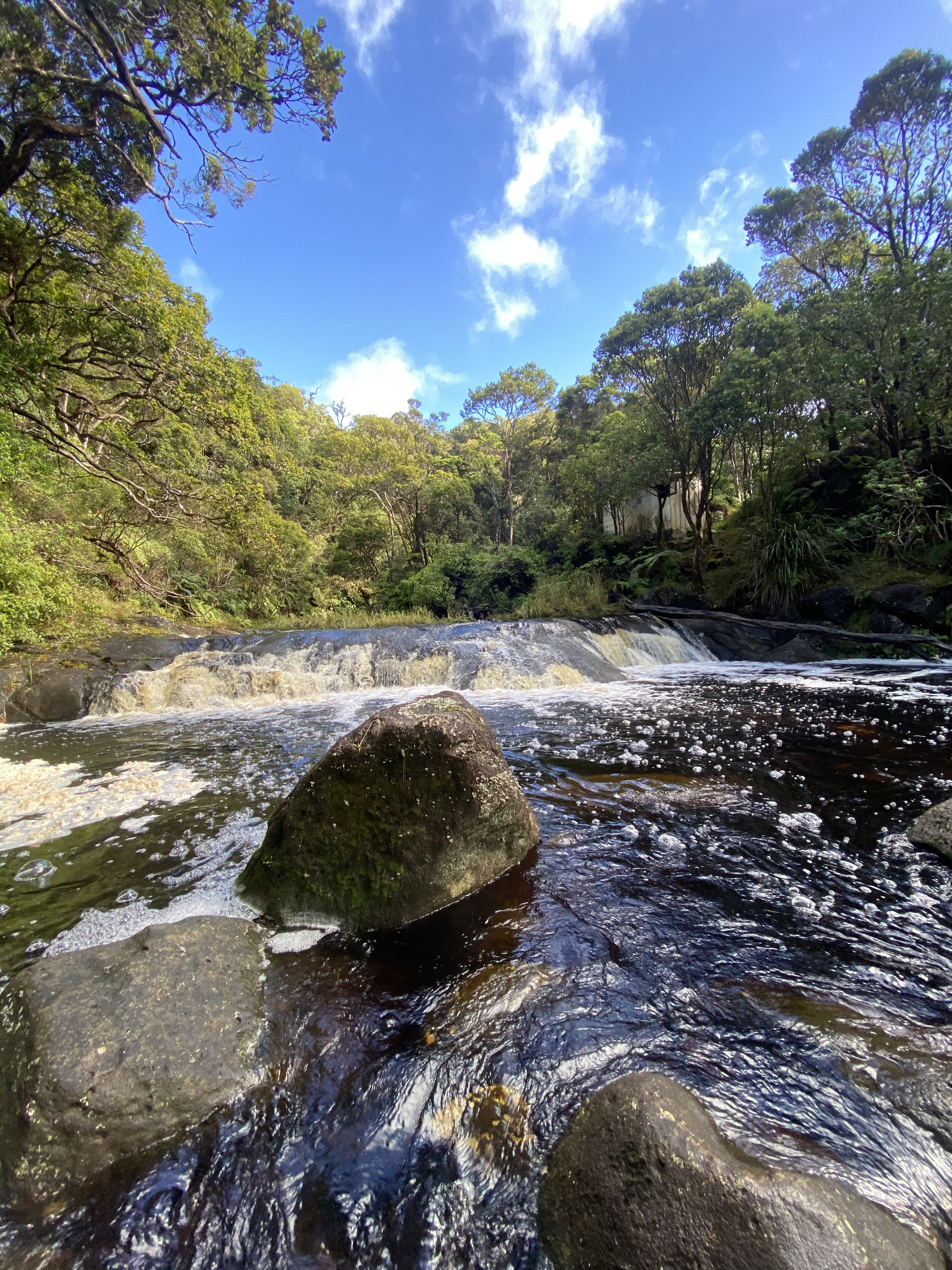
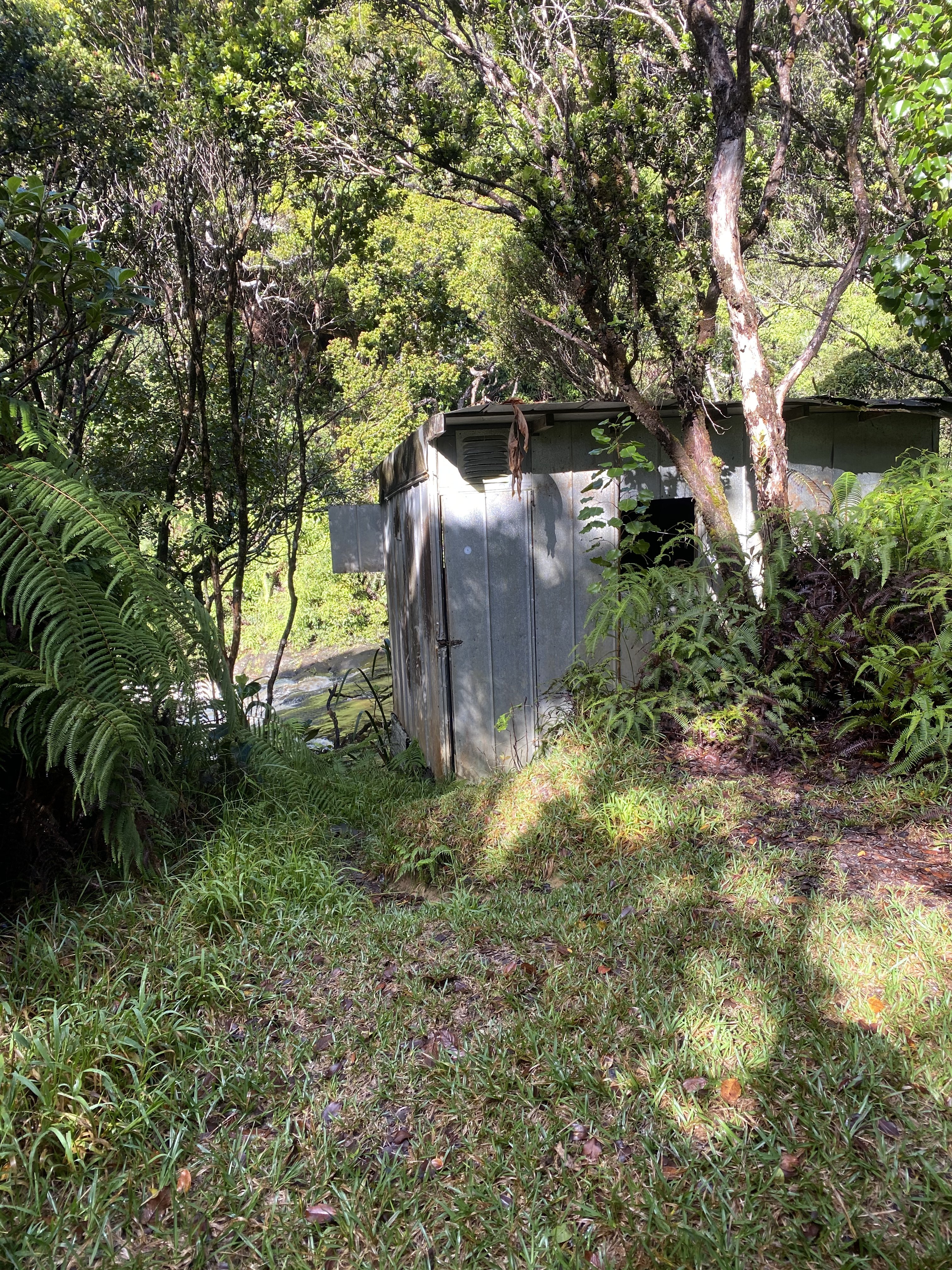
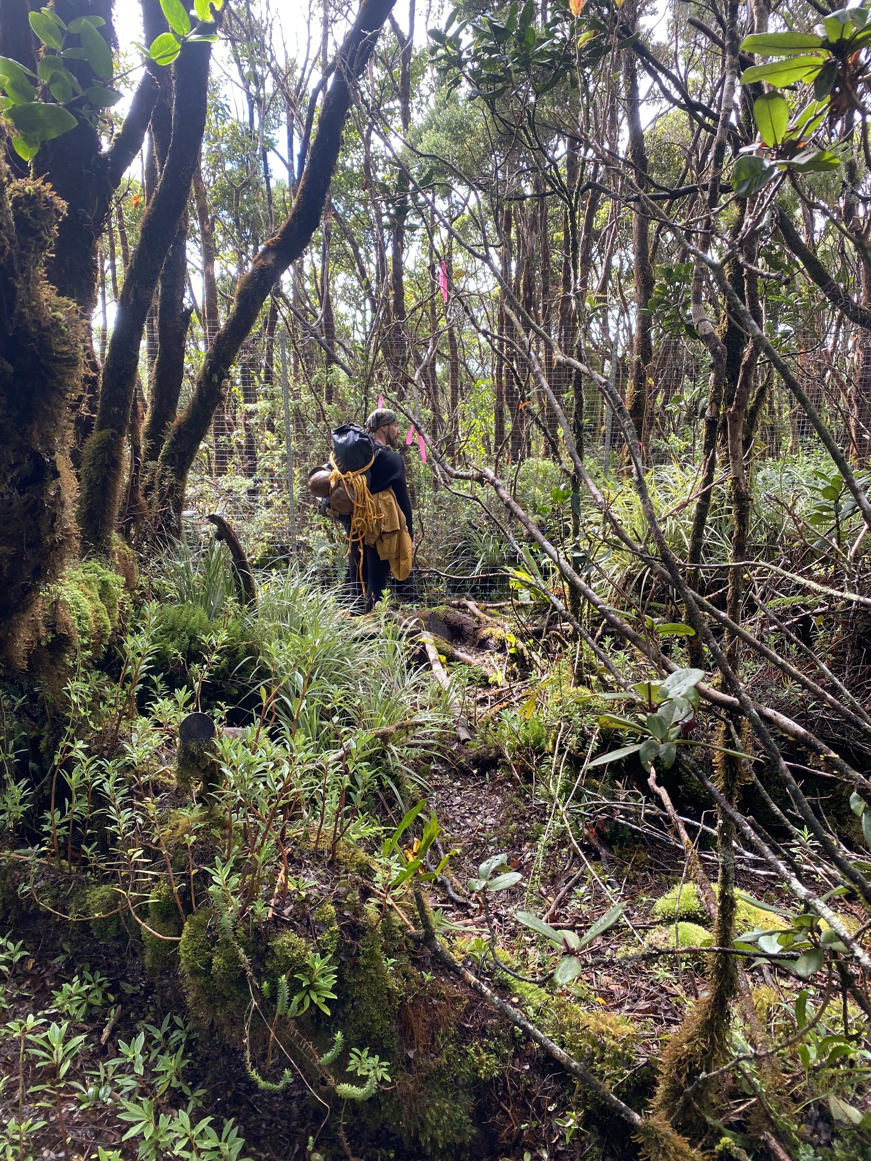
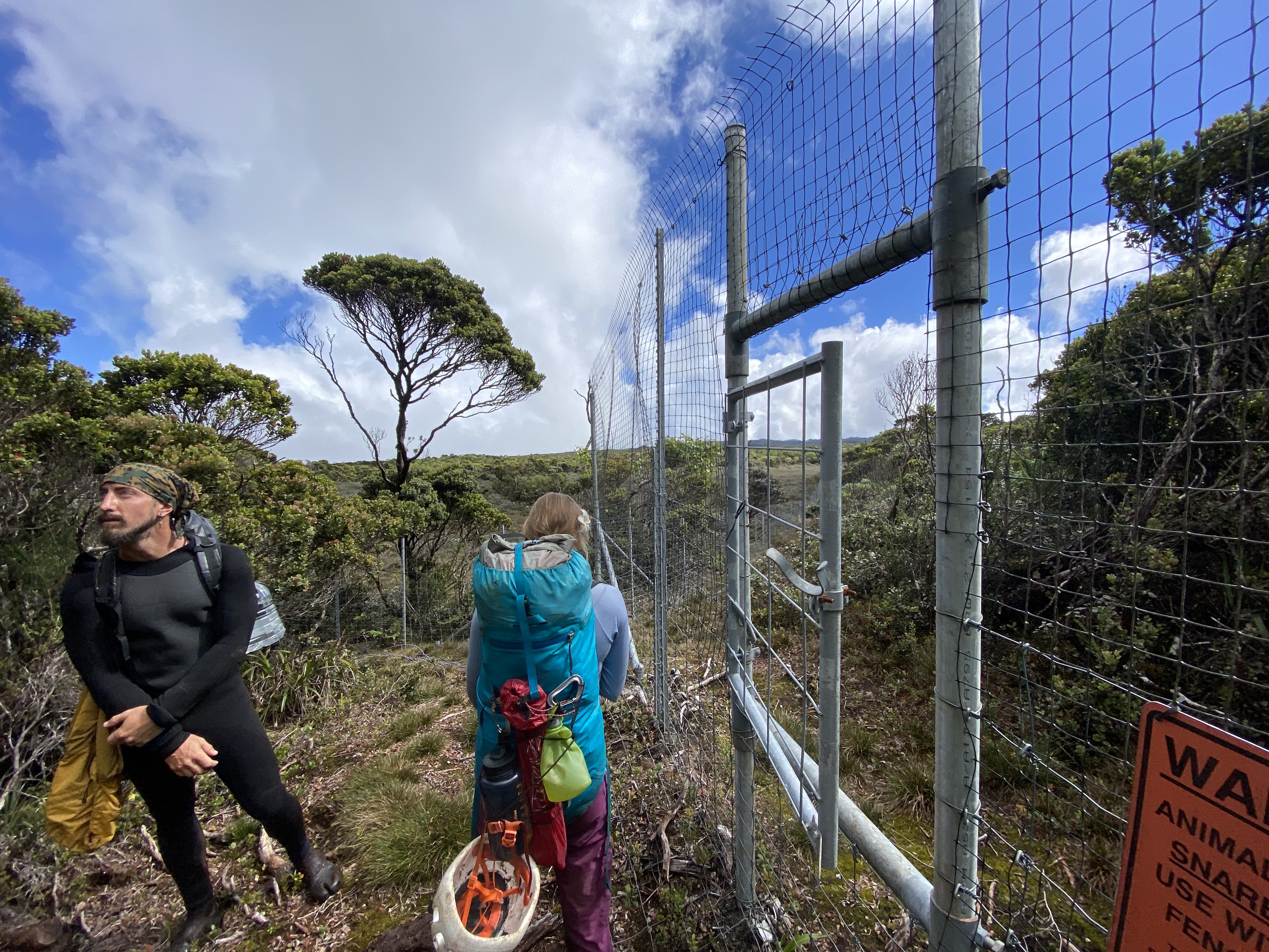
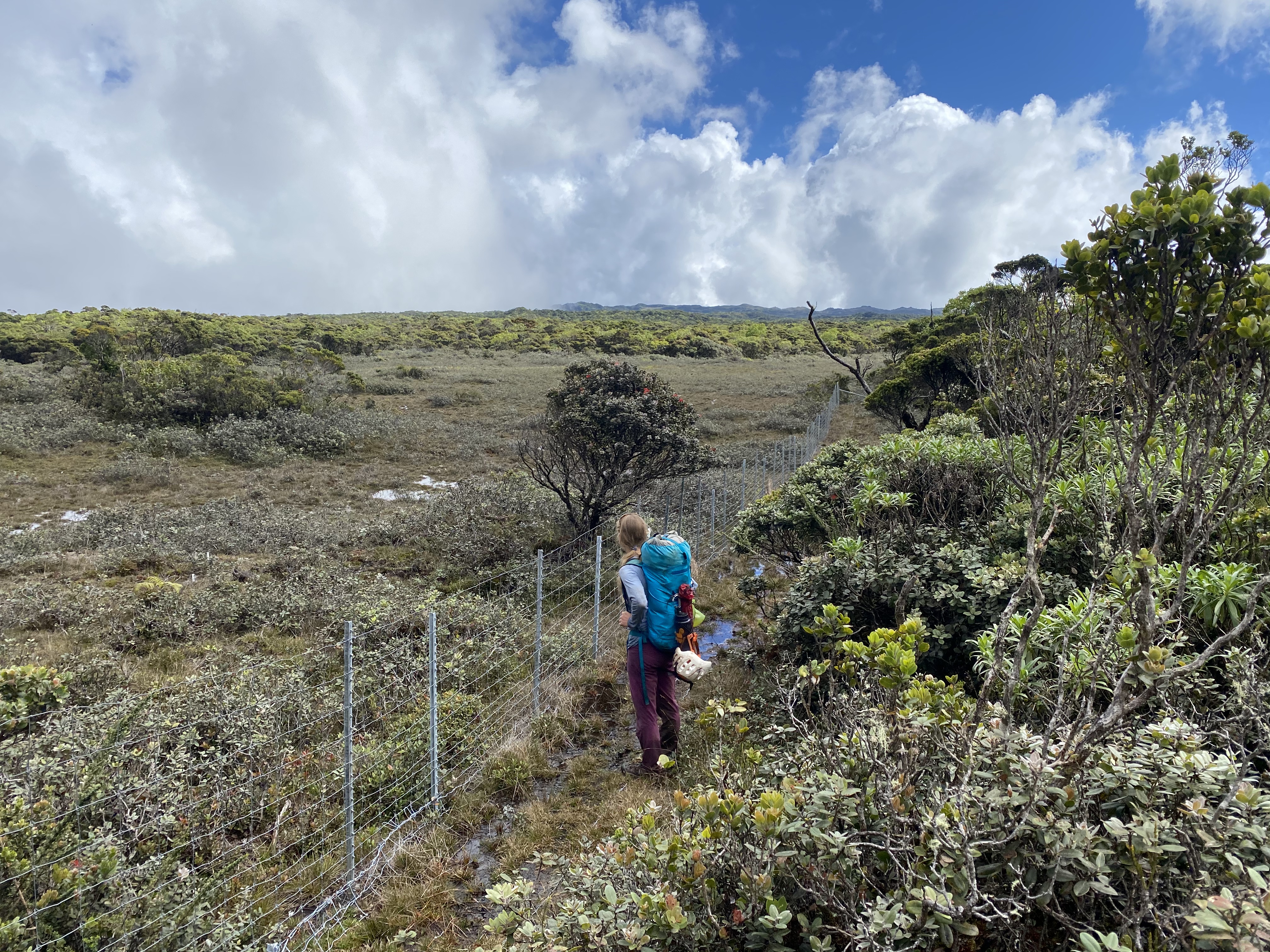
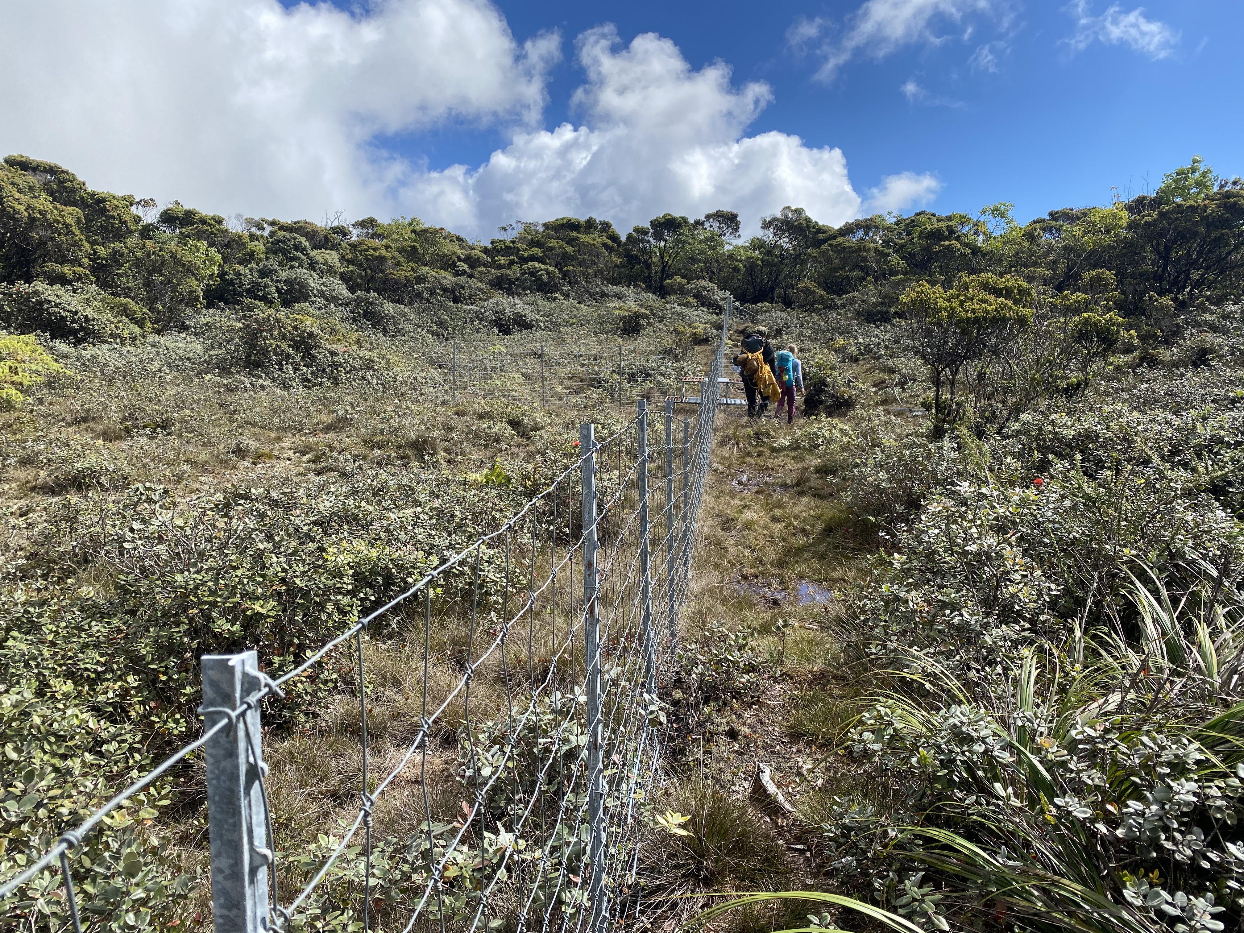
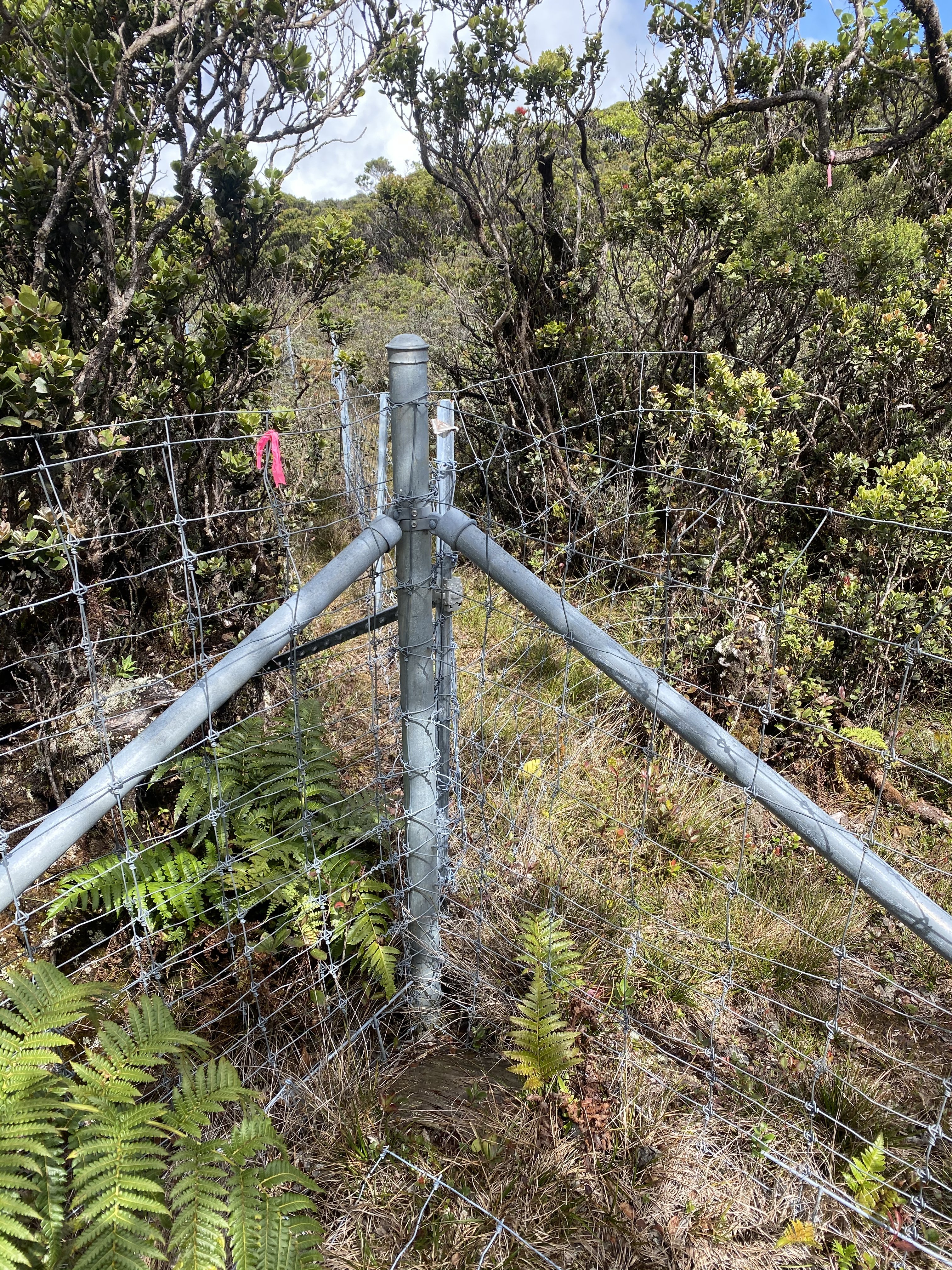
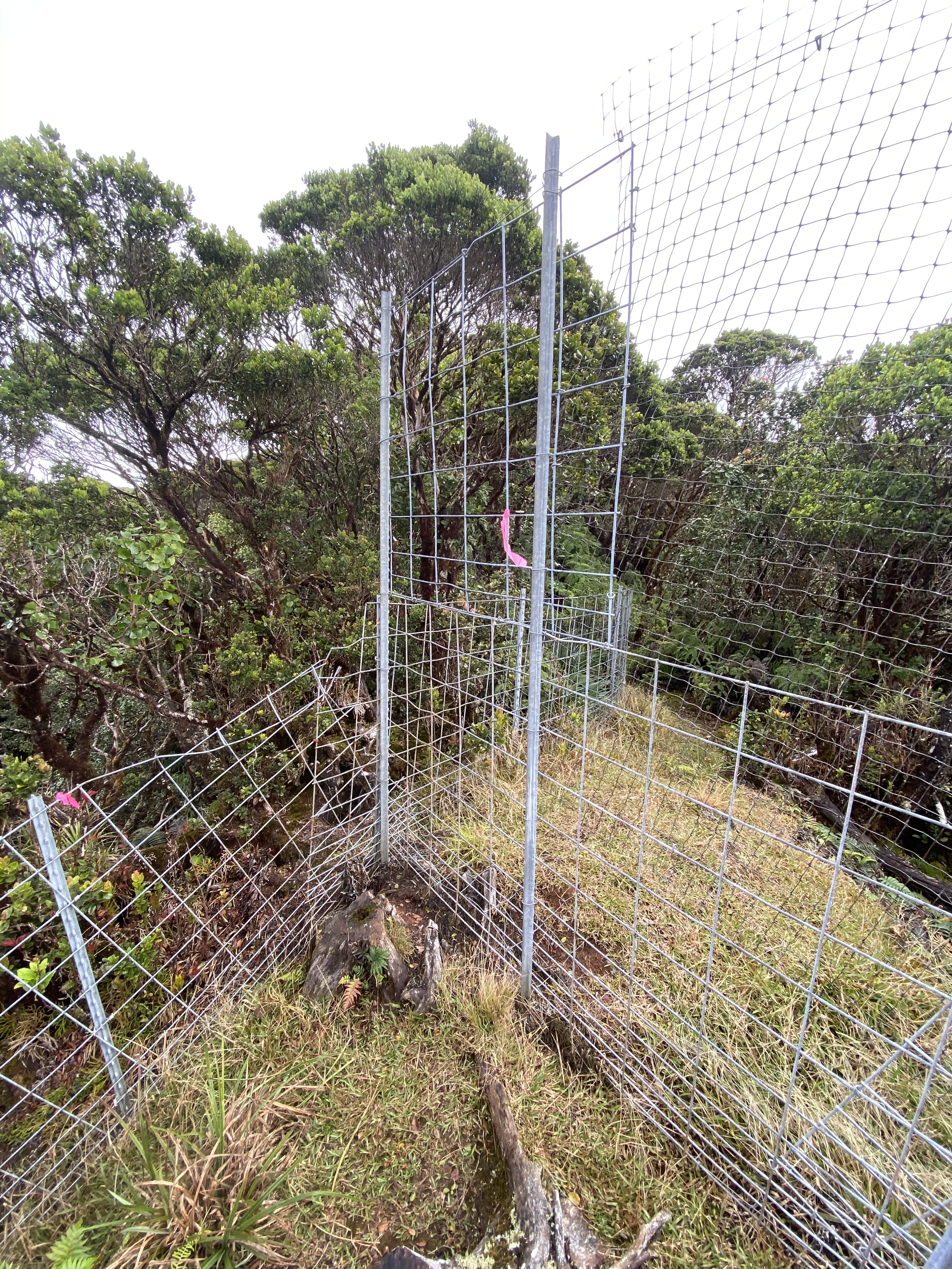
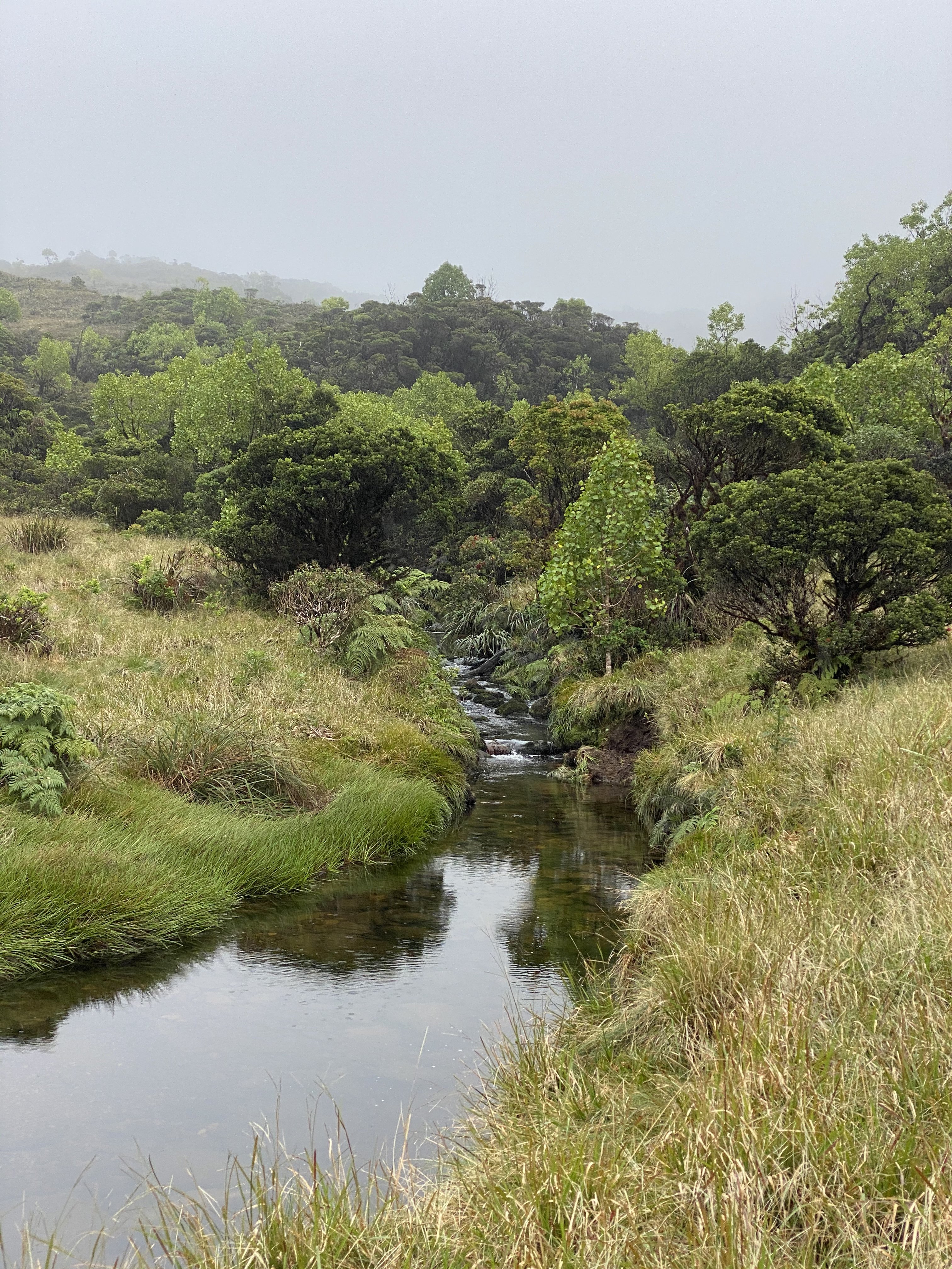
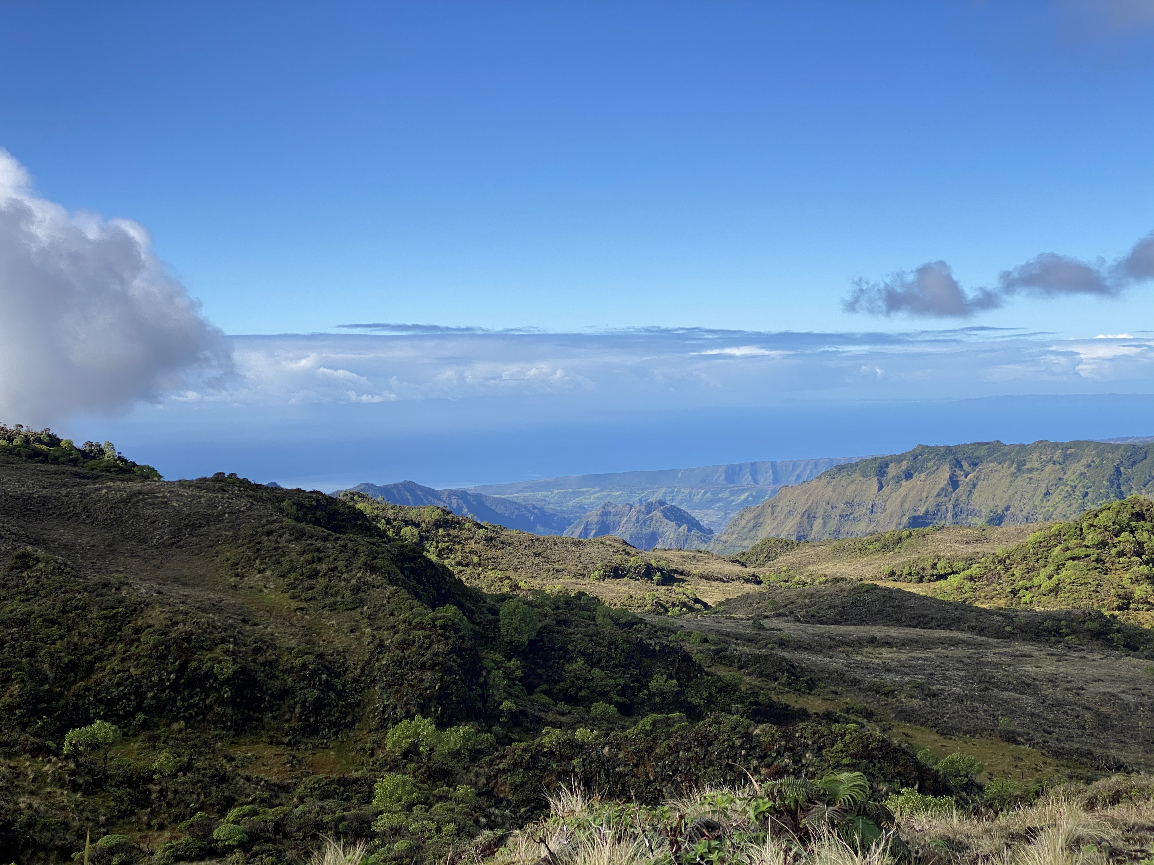
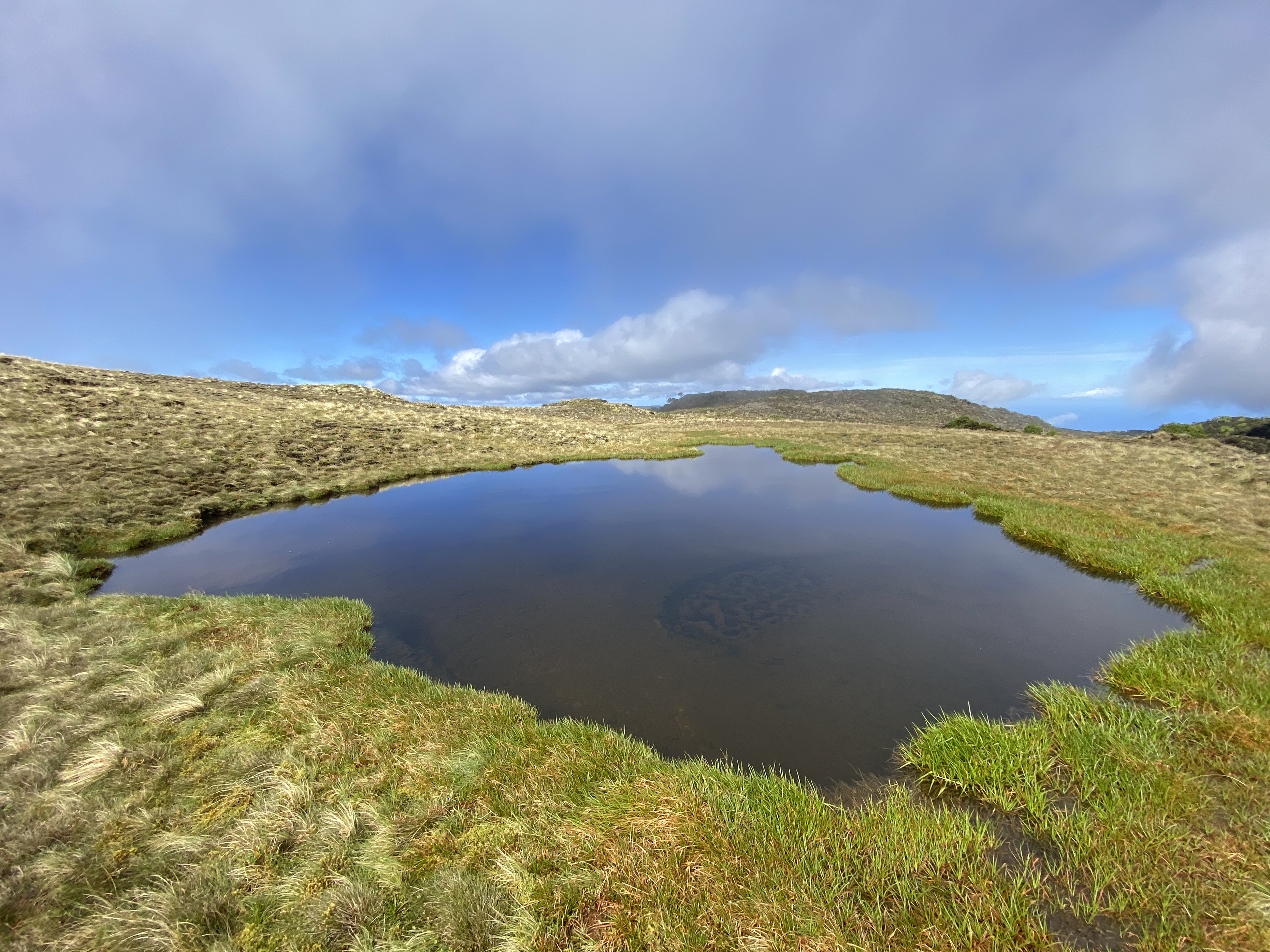
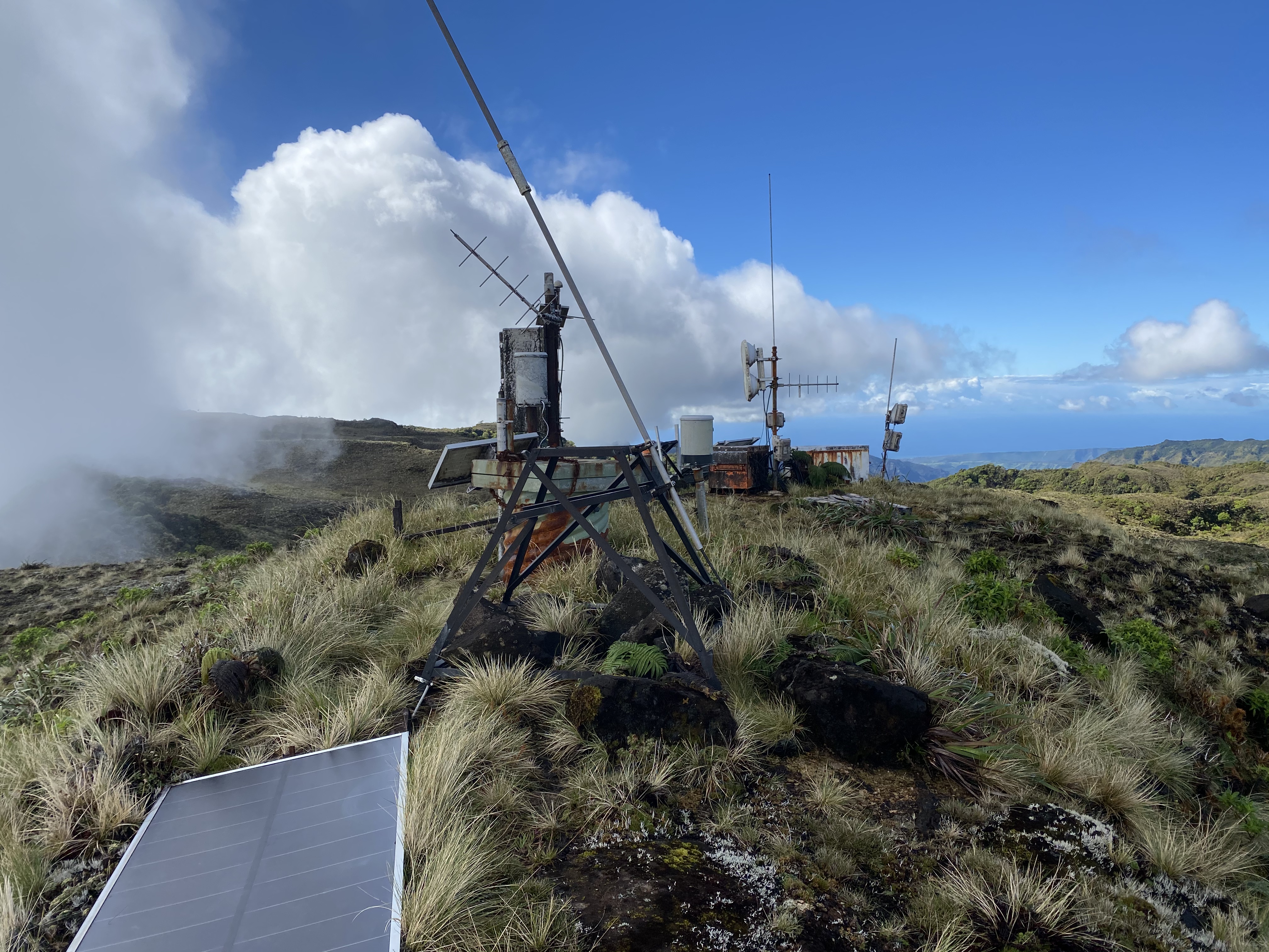
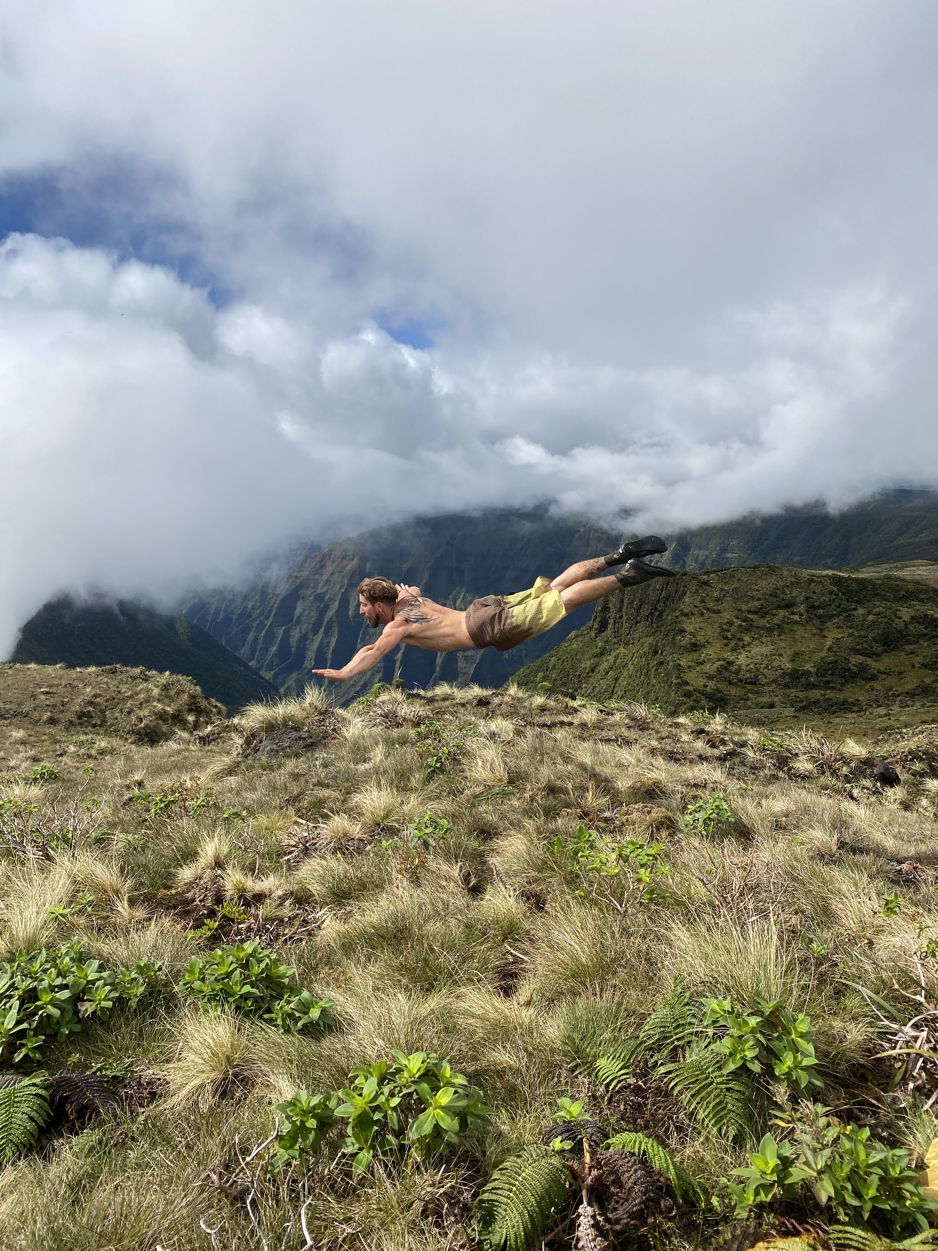
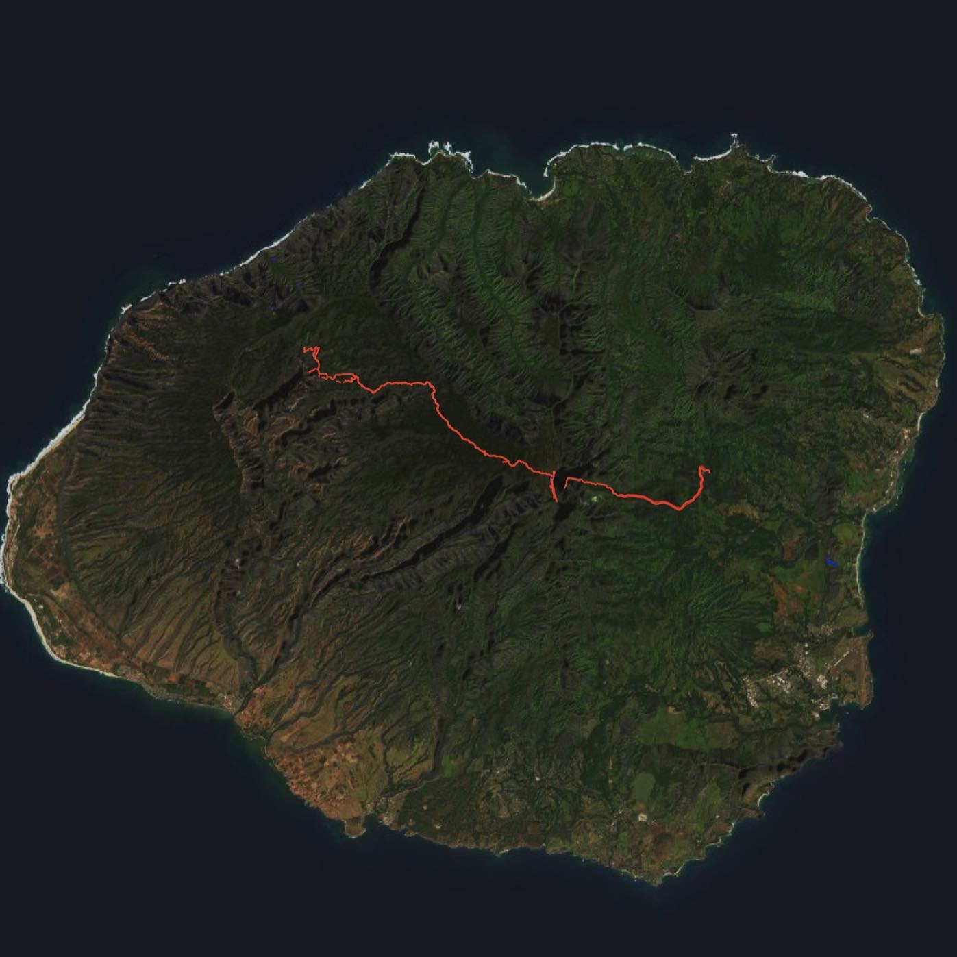
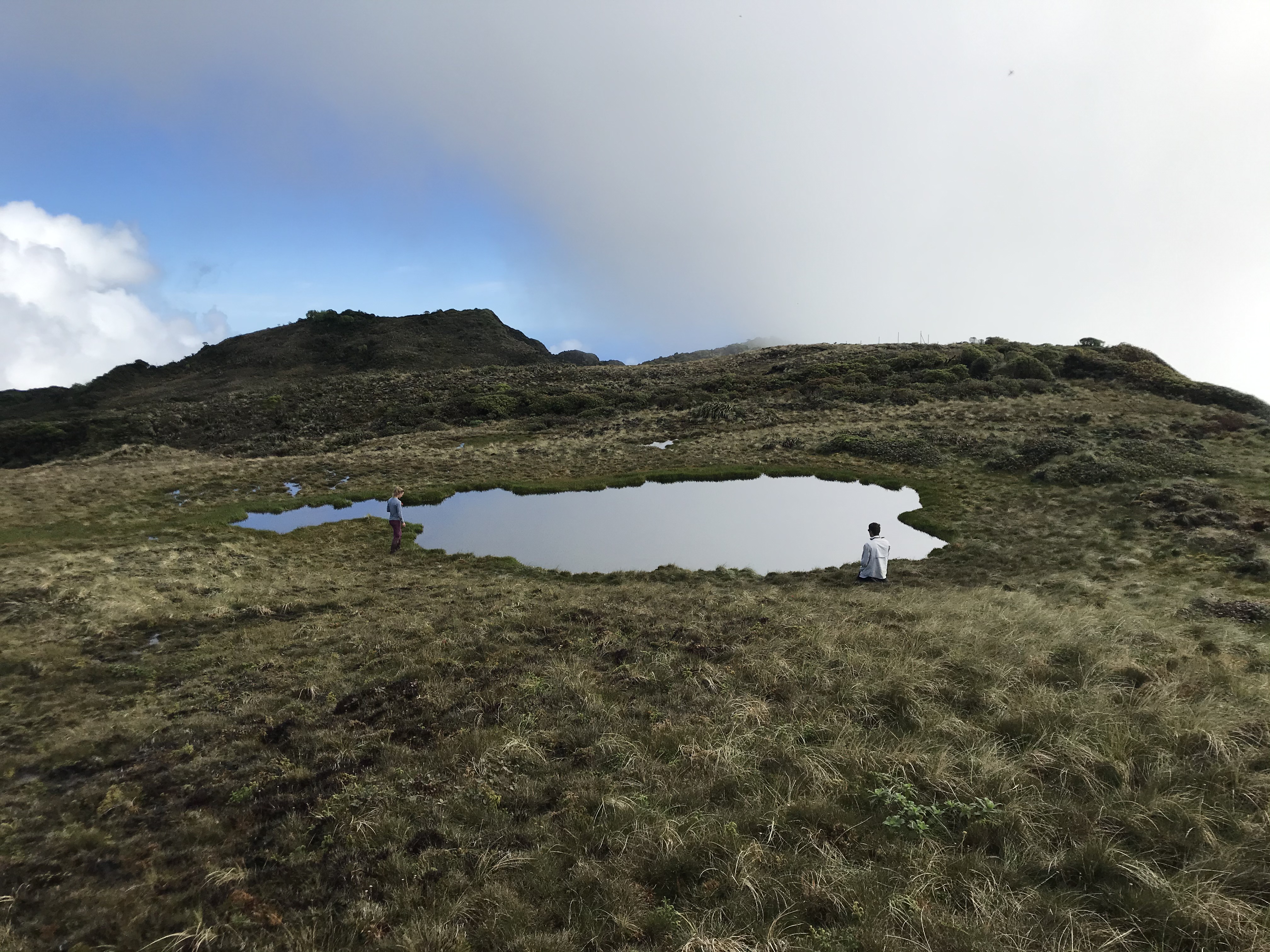
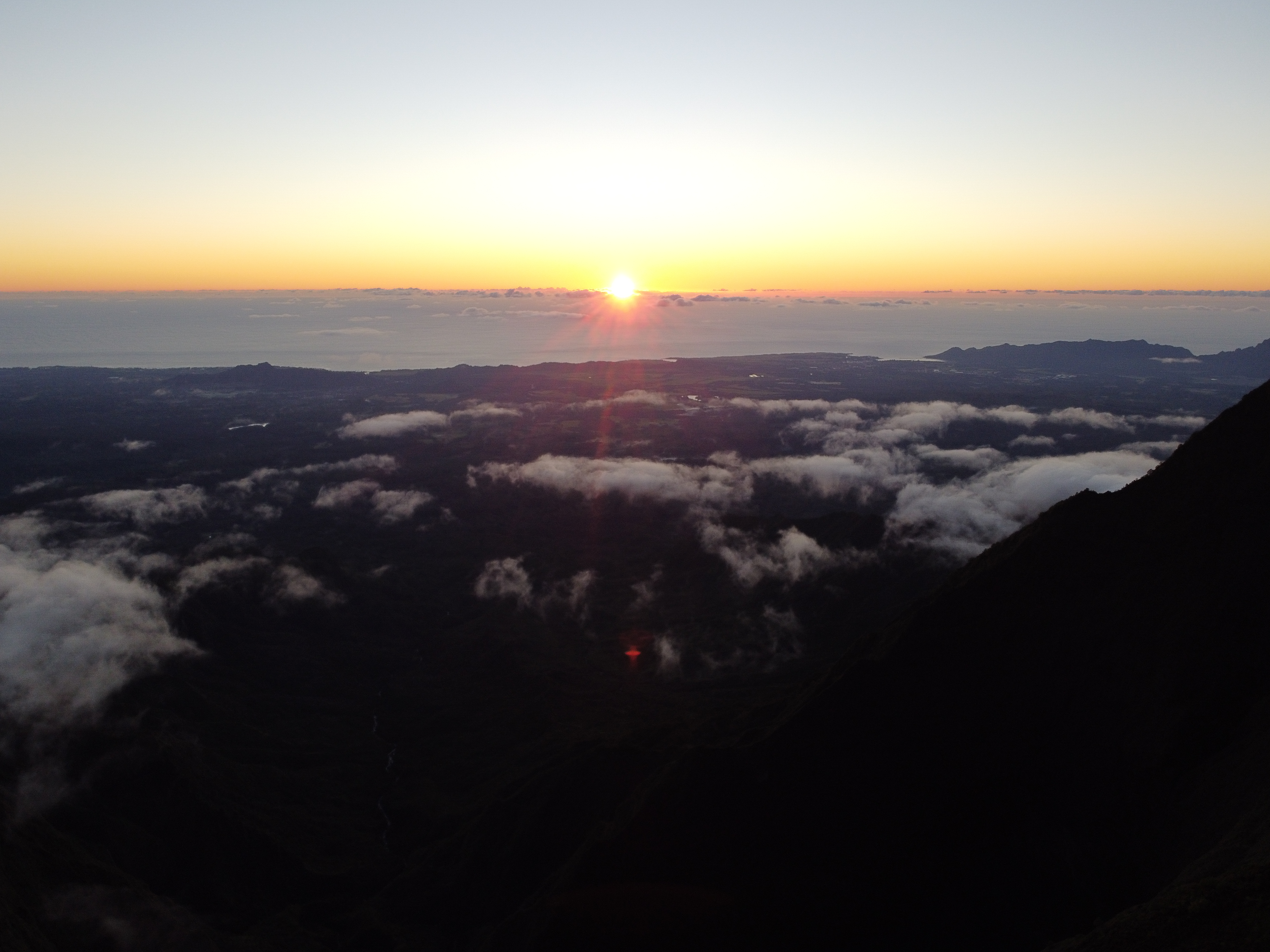
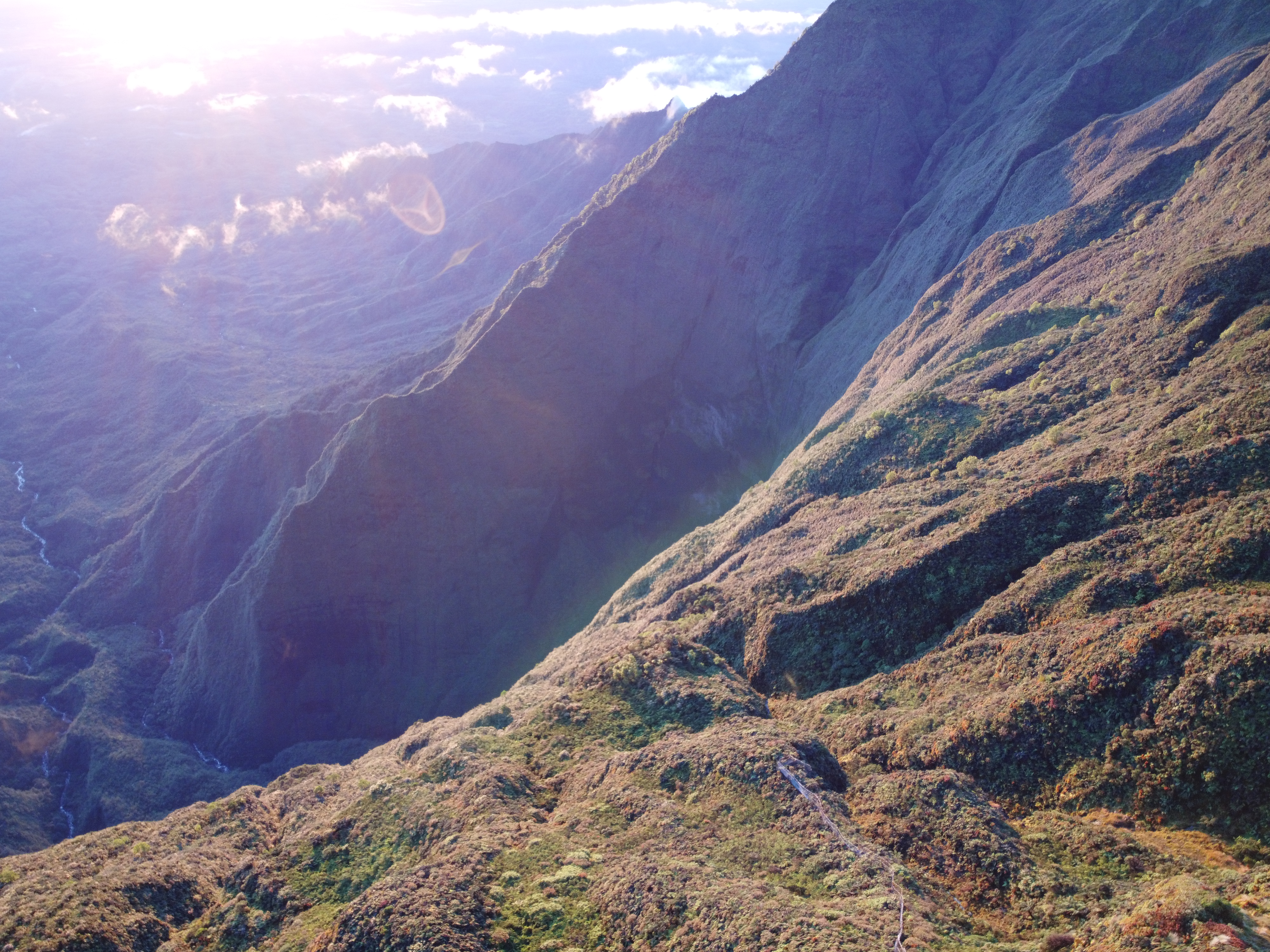
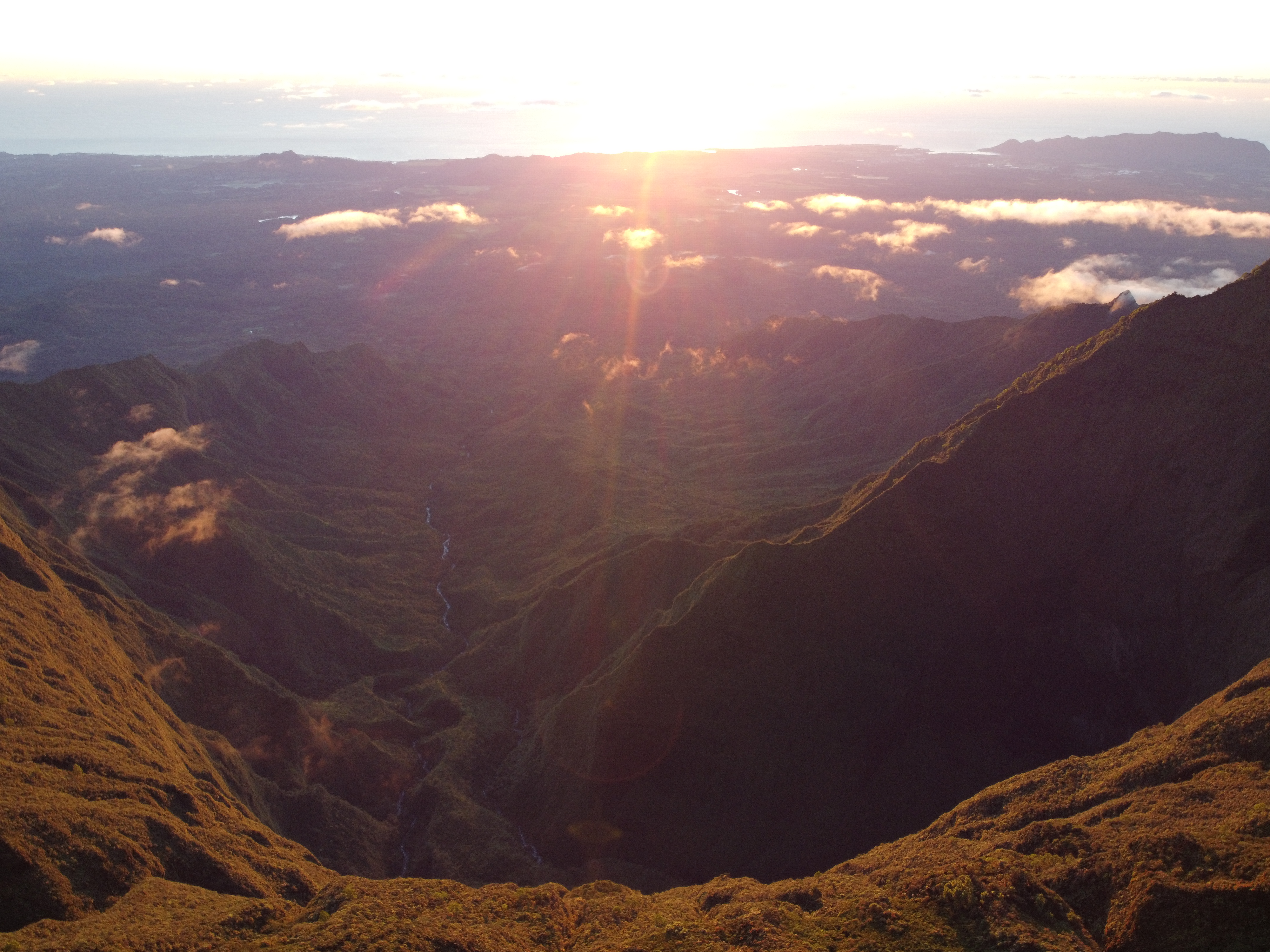
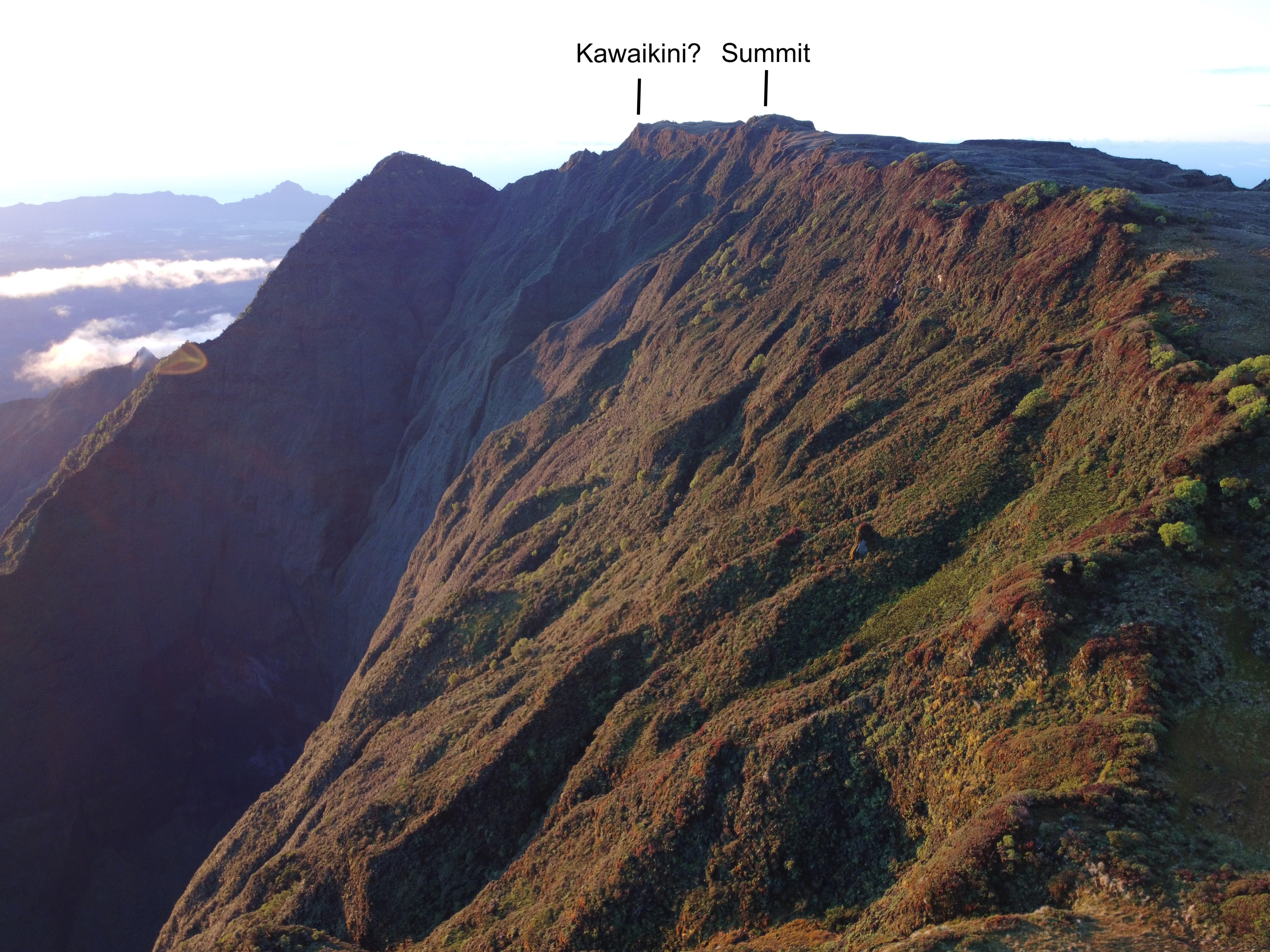
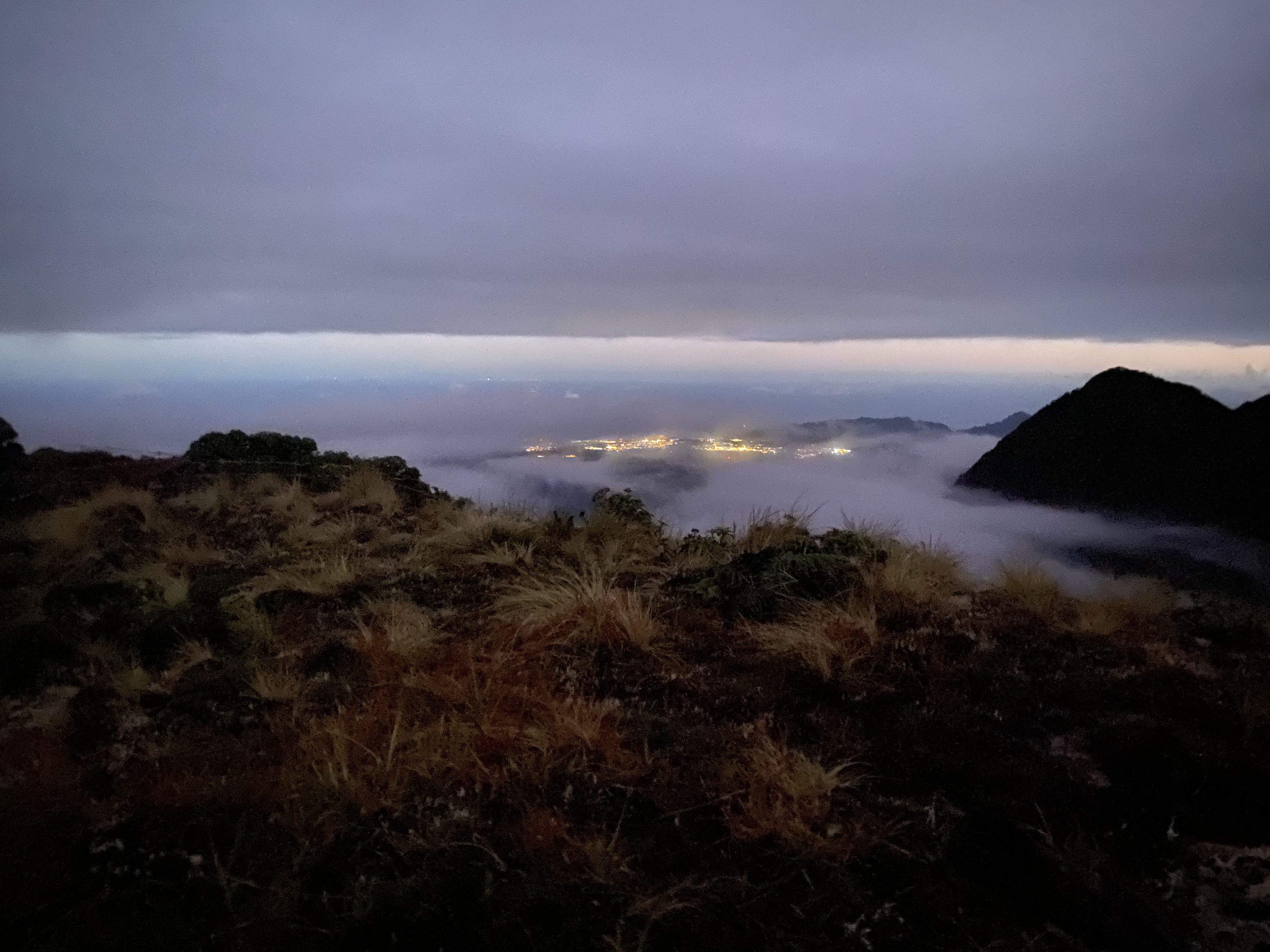
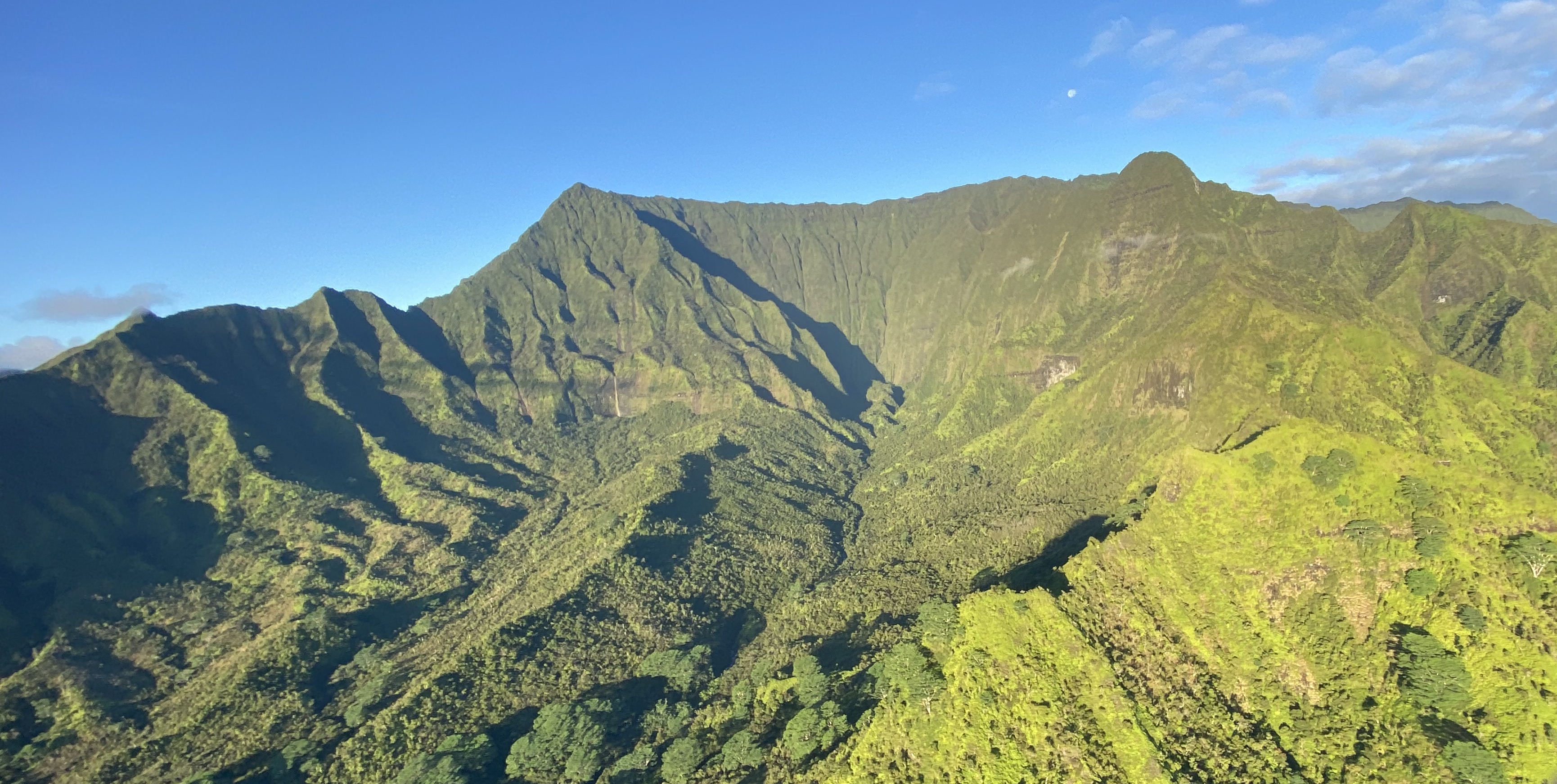
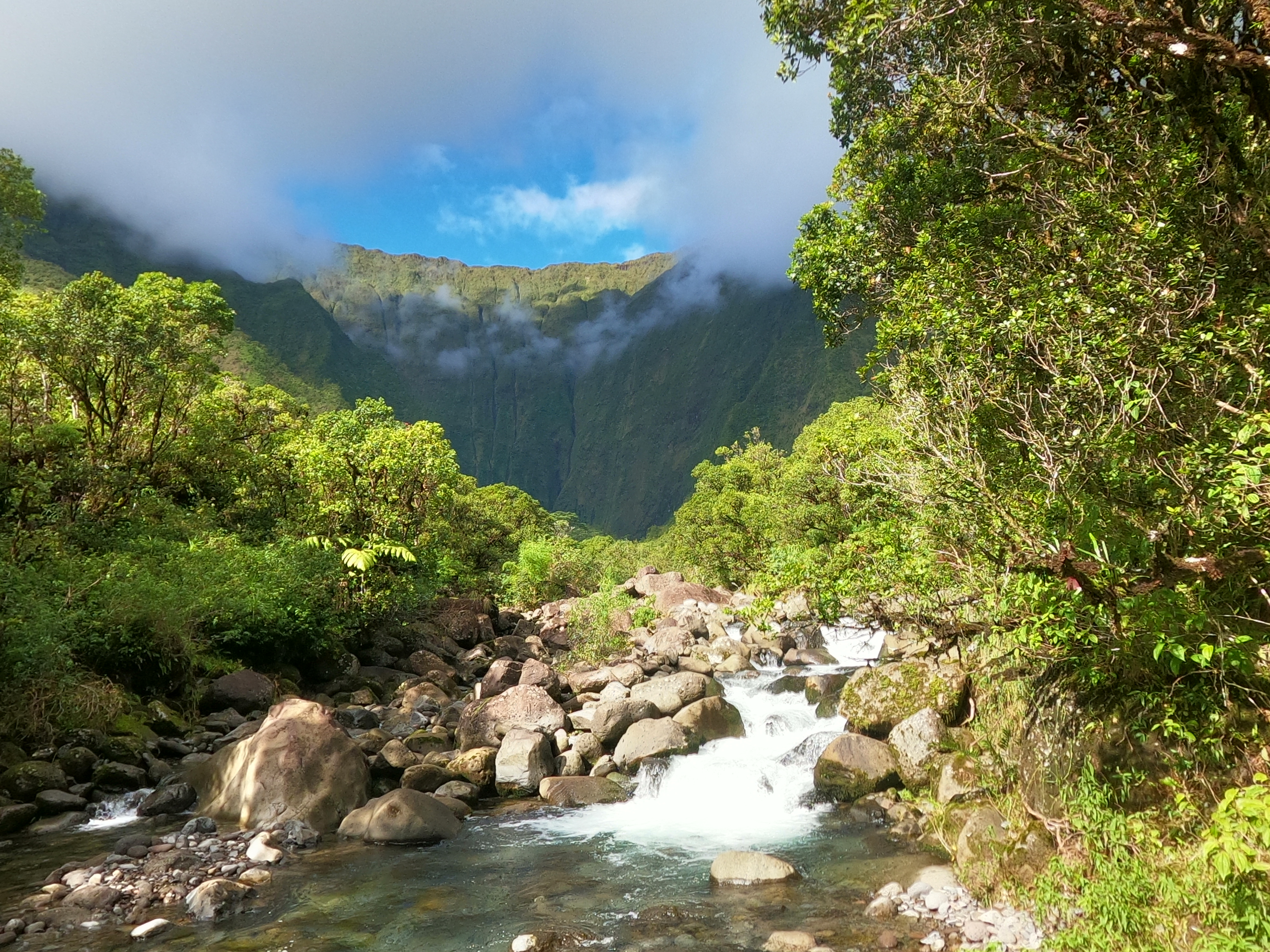
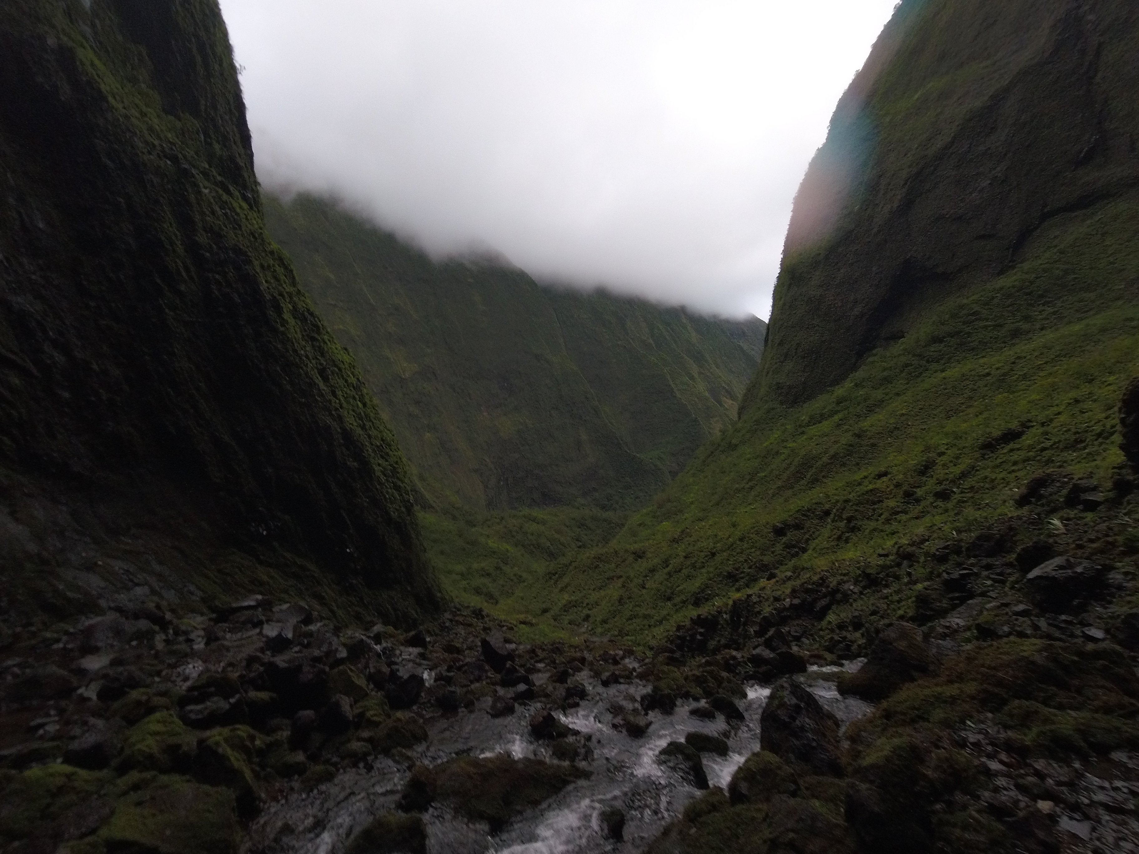
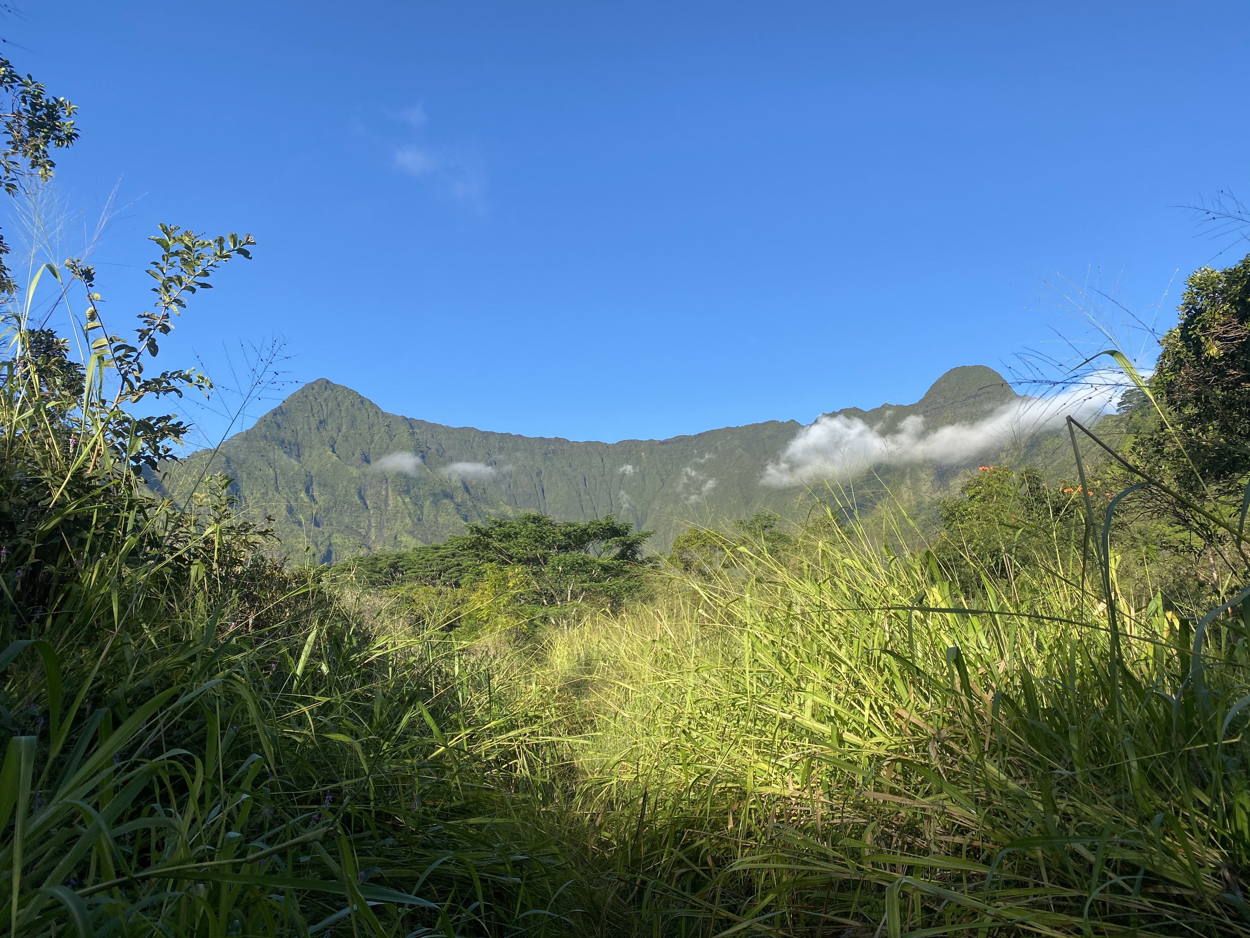
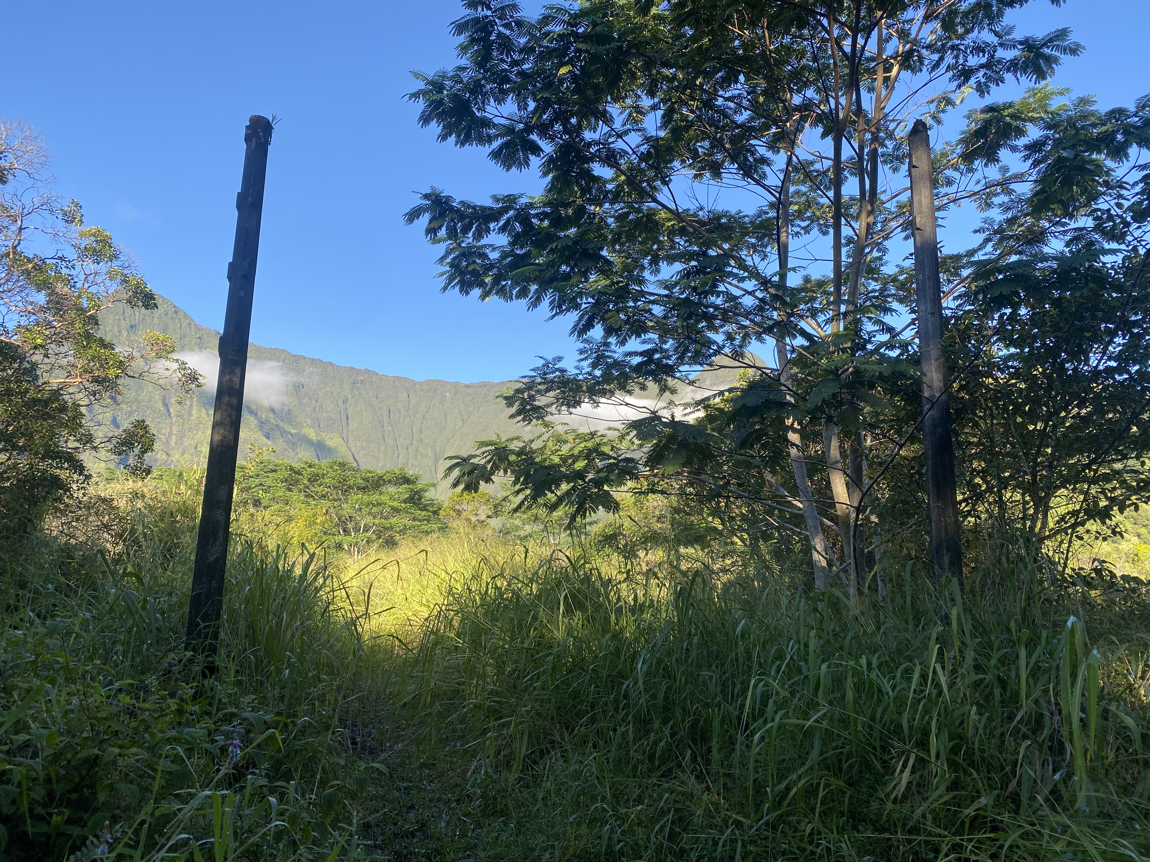
[TR] Wai‘ale‘ale - Alaka‘i Swamp 12/01/2020
JeffreyW replied to JeffreyW's topic in The rest of the US and International.
Ha! That's a good way of putting it! Still can't believe you biked and hiked the whole dang thing in a day. Total badass. I was so nervous and intimidated about this hike, and it ended up just being good Type I fun. Couldn't do it in a day though. The video of crash landing and the proceeding 30min of untangling lines from the ferns will remain in the vault forever. -
Trip: Wai‘ale‘ale - Alaka‘i Swamp Trip Date: 12/01/2020 Trip Report: The Summit of Kaua‘i: Kawaikini, Wai‘ale‘ale, Weeping Wall, and Blue Hole Since I was a kid, I thought of Wai‘ale‘ale as an inaccessible, spiritual place filled with adventure that only the hardest humans in history have ever visited. I never thought it would be possible to get to the center of Kaua‘i, the highest point, one of the wettest places on Earth surrounded by swamp, dense vegetation and vertiginous cliffs. Two decades since I first learned of this place, many folks have blazed a path, and the DLNR has even installed a fence line for much of the journey (intended to discourage invasive, wild boar from rampaging the inner parts of the island). The installation of the fenceline in 2011 has made the challenge much less daunting. The entire hike is located in what’s called the Alaka‘i Swamp which is a large, high (relatively flat) plateau on the Northwest side of the island. If you’ve heard rumors of heinous, hardcore adventurers going to Wai‘ale‘ale before, it’s not as serious an endeavor as the rumors make it out to be. On the flip side, if you’ve never heard of Wai‘ale‘ale, it’s WAY more serious than you can ever imagine. Chances are, if you’re on this website, you’re already a badass. This hike may be the most challenging non-technical adventure you’ll ever do…and I can’t recommend it enough! I’ve devoured every bit of information on this hike with a Bibliography at the end, and hopefully this can serve as a single source for everything you need to know about getting to Wai‘ale‘ale. Stats on Wai‘ale‘ale -Dirt Road (Mōhihi-Camp 10 Rd): 12.2 miles round trip. 1000ft of gain and loss each way. -Trail from Mōhihi-Wai‘alae Trailhead to Kawaikini: 23.3 miles round trip. Going towards Kawaikini includes over 2200ft elevation gain and over 950ft loss. Stats on Blue Hole/Weeping Wall -Loop Road (Keahua Arboretum to Jurassic Park Gates and Blue Hole/Weeping Wall Trailhead): 9.8 miles round trip. Going towards the trailhead includes over 1,000ft elevation gain and 500ft loss. -Hike to Blue Hole/Weeping Wall: 4.86 miles round trip. Going to Weeping Wall includes over 1,350ft elevation gain and 50ft loss. Tracks https://caltopo.com/m/KK6B Here is a link to all four GPS tracks: -Road to Wai‘ale‘ale: 4x4 Mōhihi-Camp 10 Road (red) -Hike to Wai‘ale‘ale: Trail to Wai'ale'ale pond and Kawaikini (orange) -Road to Weeping Wall: 4x4 Loop Road to Jurassic Park Gates (red) -Hike to Weeping Wall/Blue Hole (blue) Summary Over three days (Nov 30 – Dec 2, 2020), myself (Jeff) and my wife, Priti, traversed up and over the island, summiting the highest point of the island (Kawaikini), then paraglided off near the shores of the sacred Wai‘ale‘ale pond, landing at the film location of the Jurassic Park Gates (the beams are still in place today). For the Wai‘ale‘ale hike, we were joined by a friend who took video of our takeoffs and expertly drove us to the Mōhihi-Wai‘alae trailhead. After landing, Priti and I headed back towards the mountain, from whence we came, along the Wailua River towards its source, Weeping Wall, 3,000ft directly below Kawaikini, passing Blue Hole along the way where three rivers converge. Wai‘ale‘ale and Weeping Wall are two completely distinct hikes that I’ll explain separately. Wai‘ale‘ale is the seldom-visited, central high point of the island, reached from the West through the Alaka‘i Swamp via Koke‘e State Park (Waimea Canyon…the Grand Canyon of the Pacific). Weeping Wall, however is the impressive wall of waterfalls that cascades 3,000ft down from Wai‘ale‘ale (the most sacred water) to feed the Wailua River below (the most sacred river) and is reached from the East (Kapa‘a). We just linked these two adventures together with paragliders. So, this is really two trip reports in one. Hire a Guide There are several local guides who can take you on either adventure if you are nervous about doing it alone, although no guide companies to my knowledge will even advertise Wai‘ale‘ale as an offering. Blue Hole, on the other hand, is a popular, guided hike. For many years, “The Ultimate Kaua‘i Guidebook” guidebook said it was not possible to reach Wai‘ale‘ale, but the most recent addition has some good beta on this trek as well as the Blue Hole/Weeping Wall hike (both of these are not really “hikes” and have no trails). Also, the companion app (“Kaua‘i Revealed” which is a great app!) has a description and downloadable GPS tracks (for the road and the trail) for offline use. A local guide I would highly recommend is Andrew Hewitt (808) 651-7429. But in all honesty, you really should give it a go on your own, especially if you have a Mountaineering background and can reasonably take care of yourself in the wilderness. You can basically just grab the GPS tracks, download a copy of this trip report, and start now! As much as I’ll be hyping this up, it’s not that hardcore. The Blue Hole/Weeping Wall hike, while extremely difficult, is much less of an adventure. This hike starts on the totally opposite side of the island, at the Keahua Arboretum parking lot. Many hiking guide companies will advertise taking you there, and they will even drive you in Jeeps up Loop Road if it’s open (a fun drive for the adventurous driver). Wai‘ale‘ale Driving Directions The adventure begins up Waimea Canyon Road in Koke‘e. The crux of the entire trip is the infamous Mōhihi-Camp 10 Road. Rental cars are only ever allowed on paved roads, even the 4x4 vehicles and Jeeps. If you have any concerns, it really isn’t a big deal to just park your car at the Koke‘e Natural History Museum and start walking up the Mōhihi-Camp 10 Road. It’s all a dirt road as soon as you turn off of Waimea Canyon Drive. The nice thing is that most of your elevation gain is already out of the way anyway. If you are feeling adventurous, you can drive as far as you can up Mōhihi-Camp 10 Rd, and leave the car. You can maybe even get as far as Sugi Grove pretty easily. But leaving your car along the road at a random spot for a night or two is less-than-ideal as well. You can also consider taking bikes (mountain bike preferred, of course, but you can still get far with any old bike). Our friend’s truck got stuck on the way out, and he is very experienced with the rough Kaua‘i backroads. As of March 2020, the last few miles of this road are absolutely trashed and you will definitely be hiking on the road for at least the last few miles anyway. In Google Maps, your first turn off of Waimea Canyon Road is “Kumuela Road” (N 22.129186° W 159.656790°), directly across from the museum parking lot, follow signs for Camp Slogett (a YMCA camp). However, Kumuela Road corresponds to “MOHIHI RD” shown in the park map below, passing Camp Sloggett along the way. Don’t use Google Maps for this part! Google Maps will tell you to take the next right off of Waimea Canyon Road (N 22.130806° W 159.653717°) onto “Mohihi Rd”, but this is not possible because it forks into private property and also is too overgrown. Therefore, start at Kumuela Road (N 22.129186° W 159.656790°) until it joins with the original Mōhihi-Camp 10 Road. Follow the GPS tracks for this drive/hike/bike. Even the map above is not very detailed and does not show every turnoff. The last .5 mile (or so) of the Mōhihi-Camp 10 Road is a prominent fork. They are both really rough roads, but the lower (right) fork is significantly worse. The lower (right) fork is called the Mōhihi Ditch Trail on some maps. Whether you are driving, biking, or walking, I would advise you to take the upper (left) fork. Strategy One strategy if you are walking/biking since the road adds 6.1 miles and 1000ft of gain and loss each way (up and down and up and down), is to camp at the Mōhihi-Wai‘alae Trailhead (there are picnic shelters there too), cache your gear and try to do the entire trip to Wai‘ale‘ale/Kawaikini in a day. That would be a huge day! Instead, I’d highly recommend bringing a light bivy kit to enjoy it more, and as a safety backup in case you underestimate the journey. If you are a total boss, you can try to bike from the Koke‘e Natural History Museum and do the entire hike and back in a day. If you’re hiking the road, there’s a good chance you can catch a ride for part of the journey since the road is popular with truck-riding hunters. Note that there are also cabins you can rent at Koke‘e lodge if you don’t want a long, early morning /late night drive up and down Waimea Canyon Drive. Gear There is generally no cell phone service in Koke‘e and especially in Alaka‘i Swamp, so taking an inReach or two-way satellite communication device is highly advised. Also, I wouldn’t recommend recording tracks, since you really are depending heavily on your GPS tracks to get you in and out. For this reason, consider taking a small battery pack and a miniature phone charging cable for backup. A map and compass are not really helpful since you don’t have many landmarks to sight along the way. Other items: -Headlamp and spare batteries. -Bug spray is not needed… no mosquitos here! -Emergency bivy gear. -I lined my backpack with a trash bag which worked well, instead of the silly backpack covers. -Pants and a long sleeve since you’ll get scratched from ferns. -Hardshell jacket and rain pants were very nice to have. -A cheap, plastic poncho could be a very effective backup too (Gore-tex works…up to a point). -A covered hammock or a single-wall Mountaineering tent can be an acceptable lightweight solution. The smaller the footprint the better. -Synthetic sleeping bag (we brought down and just made sure to double bag it) -The tent floor will be wet, so a thick, inflatable pad will be a welcome luxury. -An extra tarp to hang over everything is pretty standard for hunters who spend a lot of time out here. Leave a totally fresh set of clothes and shoes at the car and a trash bag to dump all your ratty clothes when you get back so you don’t trash your rental. Bringing dry clothes in a dry bag is nice for sleeping in as well. Be sure to put on your wet clothes in the morning! They will be wet immediately, regardless. Don’t bring a machete! Unless you just want it for the Instagram. There is no need to do any real bushwacking for any of this trek. You want to be as light as possible. Bring all of your water with you (3-4L). The streams are heavily silted with decaying volcanic organic matter. Some OK water sources include the Wai‘ale‘ale pond at the very end or some off-route streams near the end that are a pain to get to. You still want to filter all your water! Footwear If you watch the video above, you can see the type of mud and murk that you have to wade through. You have to have footwear that you can comfortably plow through all of this terrain to cover the miles. You don’t want to pause and skirt around every mud puddle because you’re trying to protect your expensive La Sportiva shoes. You want to plow through with confidence! Note that approximately half of this hike follows a fence that is buried in mud. There is jagged rusty fence ends buried in the mud, so you absolutely want footwear that covers your whole foot to avoid getting your feet injured. Open sided sandals are not recommended, even with socks, be careful to avoid the fence in places where there may have been hidden wires under the mud. You will be hiking frequently in shin, knee (or sometimes deeper) mud so be prepared for your entire foot to be submerged in the sticky, red clay. You can wear just about any footwear for the first 4 miles to the Koai‘e Stream crossing, then cache those shoes in a bag and wear another pair for the rest of the trek (so have a relatively dry pair to put on for the way back). Good options for the hike past Koai‘e Stream are water shoes, reef walkers with felt bottoms ($20 from Walmart/Cosco in Lihu‘e), or just regular tennis shoes or trekking shoes that fit snugly so you don’t lose them when pulling them out of the mud (they will get trashed). Make sure to wear socks for blister protection. Rubber boots may be OK, but will be terrible to walk in for so many miles and you will surely get your feet deeper than the lip of the rubber boot anyway. I wore technical water shoes from OluKai with an aggressive sole and socks (a bougie option but turned out amazing). My OluKai’s are 8 years old at this point, and they are similar to the current ‘Imaka Trainer model and well worth the investment (the only shoes that I know of that are specifically made for this kind of terrain). Ankle protection is not really important for Wai‘ale‘ale, but be aware on the Blue Hole/Weeping Wall hike that there is lots of ankle-busting wet-rock hopping that may warrant the extra security of an ankle-protecting boot. When to Go Locals say that there are usually only 20 days out of the year that you can actually SEE Mount Wai‘ale‘ale from town and usually that’s just a partial-day viewing (usually early morning). It is one of the rainiest spots on Earth with over 450inches of rainfall annually, and it’s no joke. The hike is between 3,500ft and 5,000ft so it is also COLD…hypothermia is a real threat here. If you plan to camp overnight, make sure you have an entirely dry set of clothes to sleep in (even underwear), and be prepared to put all your cold, wet clothes back on in the morning. The Cascades are GREAT training for this hike. We checked weather.gov and meteoblue.com for the summit weather for over a month before we found a good weather window. It usually just says “Rain” non-stop every day. Just wait for a good forecast; this could mean the difference of just being miserable or absolutely hating life. It will still be unenviable suffering under normal, wet conditions. Even if the forecast says “Sunny”, you will get rain, you can count on it. Sometimes it can just be a fog or mist, but it can also be hard rain. Our forecast was full-blown sun for three days and we still got hard rain each day for many hours. Don’t be disappointed if you don’t get a view at the end, either. The best way to ensure you get a view at the end is to go on a splitter weather window and camp at the rim since the early mornings are your best bet for clear weather. This was the most spectacular sunrise of our lives as it rose over the Pacific Ocean with the lights of Lihu‘e gently dwindling beyond the sweeping green valley walls below. Winter and spring get the most rain, but you can do this hike year round with the right weather window. https://forecast.weather.gov/MapClick.php?lon=-159.4976234436035&lat=22.065755331828683#.YEmYkC1h1WM https://www.meteoblue.com/en/weather/week/wai‘ale‘ale_united-states-of-america_5854158 You should also check the discharge and gage height of this nearby stream to judge if the Koai‘e will be passable: https://waterdata.usgs.gov/hi/nwis/uv?dd_cd=02&format=gif&period=31&site_no=16019000 Bob Burd recommends not going if the cfs discharge is greater than 7fps and also the gage height is greater than 2 ft, and I think I agree (although that may be overly conservative). Here is an example of when NOT to go (from recent torrential rain): Also check the Mount Wai‘ale‘ale Rain Gauge and don’t go after extended periods of significant rain: https://waterdata.usgs.gov/hi/nwis/dv?cb_00045=on&format=gif_default&site_no=220427159300201&referred_module=sw&period=&begin_date=&end_date= The Hike OK, you made it to the trailhead on the Northern/Upper/Left fork. I’ll walk you through the hike and point out the “gotchas” where we got lost (you may get lost at other places, so stay vigilant). Just download the GPS track and input the Gotchas on your map. We basically just followed GPS tracks the whole way, frequently pulling them up on our phones. Without the tracks, we would have never found the way. Some reports mention flags and broken tree limbs, and arrows scratched in logs. Don’t count on any of it; it’s all bullsh&t. For your first time, you are blindly following a GPS track. Period. I could probably find my way again if I went again without tracks, though. The “mountain sense” is totally gone up here. It is otherworldly, and compass needles just spin around because you’ve entered another dimension. You are in a misty, boggy, heavily spiritual place that feels more dangerous than any mountain I’ve ever been on. You must respect the ‘āina. Also, ignore all flags. I think hunters use various colors to show boot paths to other destinations. Trailhead (upper/left fork): N 22.11872° W 159.60389° This looks like an official trailhead. There is a trail sign, a covered picnic table, and plenty of flat spots to camp (although the lower/right fork trailhead is a better place to camp imo). Start on the maintained trail which turns into a road and joins up with the end of the lower/right fork road after 1000ft (about 5min from the trailhead). When you get to another covered picnic table, this is where you leave the trail/road and enter the forest. **Gotcha #1** At this point, we did not enter the forest at the picnic table, but instead just kept walking back up the lower road (back towards Koke‘e) for another 15min until we realized our mistake! Instead, when you get to the second picnic table, LEAVE THE ROAD HERE AND ENTER THE FOREST, descending to cross a small stream (the Mōhihi Stream), which is also an OK water source. **Gotcha #2** After walking another 300 ft, just after the Mōhihi stream crossing, you’ll see a shack on the right with a faint trail that keeps going past this spot. Instead, you want to take a right almost immediately after the stream crossing and about 10ft before the shack. There is a faint boot pack through grass/ferns and a “0.25 mi” marker. The shack, just past the "0.25 mi" marker Turn right here, past the marker to stay on trail From here, you’ll follow a nice, semi-maintained trail with occasional views into Waimea Canyon. Your next waypoint is an overlook with a bench (N 22.10940° W 159.59376°) about .83miles from your last turnoff. Amazing views of Waimea Canyon Overlook and bench **Gotcha #3** N 22.11432° W 159.58414°. The end of the semi-maintained trail (the “Mōhihi-Wai‘alae Trail”). When you get to this point, make a right turn at a small clearing. **Gotcha #4** N 22.11424° W 159.57655°. The trail is still a pretty decent boot pack but it gets a little squirly at this point, so consult your track. You make a sharp left turn to go up and gain the ridge line. It will be pretty obvious and overgrown if you get off track. N 22.11369° W 159.56335°. Here you start descending 60m down to the Koai‘e Stream with the aid of some old, fixed ropes. It’s obvious to find. **Gotcha #5** N 22.11231° W 159.56267°. This waypoint is more for your way back out. The bottom of the fixed rope to Koai‘e Stream can be hard to find in the dark on your way out as you steeply ascend back to the ridgeline. Koai‘e Stream N 22.11253° W 159.56192°. The Koai‘e Stream can be impassable when it’s high. Some parties carry rope with them to belay across. I’d say leave the rope, take your chances, and don’t go if the stream telemetry is reading high. If you really want to bring a rope, 40ft of cord should do it with a bowline on a coil harness and a hip belays. When we did it, the crossing was a trivial rock hop, and we didn’t even get wet. You can cache your dry pair of shoes before the crossing, because it’s immediately going to get gnarly. The Koai‘e Cabin Just across the stream is the Koai‘e Camp Cabin. It’s a fairly nice shelter that used to be littered with trash and old hunting gear but was totally empty and clean when we found it. You can sleep several people on the floor of this covered shack. This could be a good strategy to split up the hike over 2 or 3 days if you were really resistant to bringing your own shelter. **Gotcha #6** At the Koai‘e Camp, the next 100ft of the trail is lost in a maze of swamp and ferns before it becomes clear again, so keep an eye on your track. There are pink and orange flags everywhere that lead to other hunter boot trails, so don’t get suckered. The trail here is pretty nicely maintained, so if it feels to bushwack’y, then you’re off-route. Logs have been laid along the trail to stop it from eroding, and even a few ladders have been put in place! N 22.11115° W 159.56113°. There is a short, tricky rope ladder here. Continue following a decent trail and you will eventually find the new (tall) fence on your right (N 22.09163° W 159.55107°). Follow the fence, keeping it to your right (it will be too tall to get over anyway). This side of the fence is luxuriously clear and easy to walk (enjoy it while you can!)...almost sprint-able. At a certain point along the fence, there is a very nice bivy site option with tree coverage to help if it’s raining (N 22.08494° W 159.54131°) and sturdy fence pickets for a hammock or tarp. About 50 yards beyond, the new (tall) fence ends and the old (short) fence forks off left and right. You want to go through the gate on your right (through the tall fence), then keep the short fence on your left (N 22.08497° W 159.54094°). You are now entering “Sincock’s Bog” which is a long, flat clearing on your left that you will skirt around Shortly after, you be in the trees again briefly and come out to another bog called “Bogette” (yes, it’s a smaller bog than Sincock’s). Both bogs can provide flat, open camping options, but I highty recommend the one mentioned above. Camping in a bog is exposed to rain and wind. You’re pretty exposed from here on out. The end of the “Bogette” clearing is what Bob Burd listed as “Start Hell”. In reality, it’s all hell, so his “Start Hell” and “End Hell” are not worth keep track of anymore since we now have a fence to follow. For the original trailblazers, this was more difficult because you are no longer in an open bog, but dense swamp. Continue following the fence, keeping it on your left. At this fence intersection, make an abrupt right turn to keep the fence on your left Soon, you will start to noticeably ascend a hill. This is the rim of a small, ancient caldera called “Kapoki” which created much of Kaua‘i. Looking back at Alaka‘i Swamp from atop the crater rim **Gotcha #7** N 22.07620° W 159.52241°. The fence line T’s off at the top of the hill (caldera rim). The fence continues straight while another REALLY TALL FENCE cuts right. Do not go right, along the tall fence. Instead, climb up and over the fence “T” to continue on the same trajectory following the shorter fence. Note that if you have a hammock with you, all of these spots where the fence T’s off at an angle is a great place to pitch a hammock because the fence pickets are quite sturdy. The wood in the Alaka‘i swamp is very soft, old, and decomposing which doesn’t make for good hammock posts. You continue along the Kapoki caldera rim (with the crater on your left). Some past parties bivied inside the caldera in a clearing, but it is way out of the way and didn’t look like a good spot to camp. Note that THIS is the real crater, although there is nothing left to see here, really. Weeping Wall/Blue Hole/Wai‘ale‘ale, while not a crater or the remains of such, is an impressive erosional feature (box canyon) and the main attraction. N 22.07138° W 159.50919°. You’ve kept the fence on your left so far, but now the right side becomes too overgrown and you will need to hop over it and keep the fence on your right, briefly. We also set up camp here, although there is nothing special here that makes it an especially good campsite. The terrain foliage begins to open up here. On your left, you’ll see a rather idyllic shire and a clear, running stream, but it is very difficult to get down there and not worth going out of your way. The Shire...Very pretty, but not worth going out of your way for (just stay along the fence) Smaller footprint, the better Drying out gear in the morning while we have some sun After a short ways along the left side of the fence, it becomes apparent to hop back over to the right side of the fence again, keeping it on your left all the way to the rim. Looking out at Ni‘ihau (The Forbidden Island) The terrain really opens up as you get closer to the rim Looking over the West Side of Kauai‘i and Ni‘ihau N 22.07138° W 159.50919°. Allegedly some ancient ruins are located here, although we saw no sign of anything. N 22.06849° W 159.49850°. Congratulations! You’ve made it to the rim. The fence impressively continues to go down over the cliff to keep out those pesky cliff-climbing hogs. The fence T’s off and goes left here towards the Rain Gauge and the Wai‘ale‘ale pond. There is a sturdy “T” in the fence to pitch a hammock. The ground is wet and soggy here, but you can easily set up a tent anywhere…or fly your paraglider off (although the rotor/updraft can be really dangerous)! Go left (heading Northeast) to get to the USGS rain gauge then just a little further to the sacred Wai‘ale‘ale pond. At one point, ancient Hawaiians built a short canal to connect Wai‘ale‘ale (literally “rippling waters”) to make it feed the most sacred Wailua River, 3,000ft below. There is a heiau (Hawaiian sacred stone terrace temple) called Ka‘awako at the head of the pond. It is absolutely magical and a must-see…way more interesting than the slight bump that marks the island’s high point. There is a water level gauge in the center of the pond, too. You can continue exploring along the ridgeline, or turn around back to the end of the fenceline. The sacred shores of Wai‘ale‘ale The heiau is at the far end of the pond Rain Gauge and other equipment Wide angle views looking back from where we came, across the Alaka‘i Swamp No more fence, drop gear and head to the summit hill, Kawaikini Kawaikini, viewed from the North From where the fence ends and goes over the rim, you head Southwest (right) along the rim to get to Kawaikini (hint: it’s not close). There is no fence in this direction and you are weaving around cliffs, sometimes entering bands of stunted tress near the rim with some fragments of trail (many options). Allow another 45min to get to the “summit”, and another 15 min to get to the Southernmost point of the rim (“Kawaikini”). Looking West into the impressive Olokele Canyon "You can fly, You can fly, You can fly" Summit selfie Olokele Canyon Kawaikini is the name given to the high point of the island. “Kawaikini” literally translates to "the multitudinous water", referring to the island's high rainfall. Most maps label it as the southernmost point on the rim, however the actual highpoint does not correlate to this point. The actual summit is about 400ft before the end of the rim (see screenshot from peakbagger.com). If you’re concerned about peakbagging, consider tagging both points: the summit (N 22.05865° W 159.49734°) and Kawaikini (N 22.05688° W 159.49678°). Supposedly, there is a USGS marker somewhere, but no trip report has verified its location. We tagged the true summit, but we did not go over to Kawaikini since it is way out of the way (you have to back up a bit and go down around a bluff), but the views over there are also supposed to be worth checking out. 3,000ft below is the incredible Weeping Wall of waterfalls. Supremely wet during a splitter weather window The end of the fence line, looking southeast towards Kawaikini - the pyramid summit on the left is an unnamed sub-peak We camped again at the rim even though it was early in the day, since we were shooting for an early morning flight when it was clear and calm. An epic sunrise Looking down at the Wailua River and the J-shaped box canyon of Weeping Wall Looking East towards Kapa‘a and Lihu‘e The Weeping Wall The Lights of Lihu‘e Lihu‘e and Menehune Salt Pond Visible Priti and I took off in perfect conditions with a slight headwind and an ideal takeoff field. We had several landing options scouted already along Loop Road depending on how far we could get, but with our mono-surface wing and a headwind we had to land at our last-resort location: the fern clearing behind the Jurassic Park Gates. Loop Road is mostly covered over with tall trees, but there is a small clearing here with tall, devilish ferns to softly land in if you can’t stick the landing on the open road. It was heinous to untangle everything from the ferns, but at least we were closer to the trailhead! Flora and Fauna As you hike, notice the foliage and birds. The ecosystem up here is really unique to be able to survive in this permanent dampness. The rare puaiohi (Myadestes palmeri), also known as the small Kaua‘i thrush or Palmer’s thrush is an endangered species and known only to live in the Alaka‘i Swamp. The rare puaiohi (stock image, did not see one) You’re also likely to see an ‘elepaio. There are three species of this monarch flycatcher, one endemic to each of the three islands of Hawai‘i, Māui, and Kaua‘i. An endemic ‘elepaio (my image, we saw one!)...they are very friendly and bold There was a pack of goats running around near Kawaikini while we were there, and you may also run into wild pigs or deer. Don’t mess with a pig! They can be highly dangerous. Ohia Lehua flowers You’ll also see a lot of beautiful Ohia Lehua flowers. While tempting, DO NOT PICK THESE FLOWERS. If you pluck this vibrant, red flower, you will separate ancient lovers and cause it to rain! Read more about the legend of the Ohia Tree and the Lehua Blossom here: https://www.lovebigisland.com/big-island-mythology/ohia-lehua/ Blue Hole We really didn’t do much research on Blue Hole and we literally only had the GPS tracks. The road to the trailhead (“Loop Road”) is a well-maintained dirt road that can get closed for long periods of time while they are repairing it after heavy rains (I believe it is closed for repair at the time of this writing). Even if it’s open, there are several really difficult river crossings that are for expert-drivers only. I wouldn’t recommend taking a rental here, even a 4x4. The Jeep and 4x4 rental places expressly DO NOT want you to take their cars on Loop Road. Even if you were to do it on the sly, it is very difficult and a tow will be very, very expensive. Hiking Loop Road is fast, easy and trivial with no navigation tricks and no car-stresses. Takes about 1.5hrs to walk it each way (or less). Just park at the Keahua Arboretum (or up the hill at the yellow gate where the Powerline Trailhead is located). You will pass the beams that remain from the old Jurassic Park gate film set (queue the music). At the trailhead, you really just stay along the Wailua River. It is long, slippery, dangerous, time consuming, and NOT A TRAIL. You are going in and out of the river constantly, whenever you can find short stints of trail on the river bank. Sometimes there is flagging, but local guides like to take them down so you get lost and hire the guide instead. If you have the tracks, navigation really isn’t an issue. Lots of boulder hopping. Go slow and don’t bust your ankle. Blue Hole Looking back down onto Blue Hole Eventually you get to a large beautiful blue pool where three rivers converge. Some sources call this spot “Blue Hole” while other sources call the J-shaped box canyon of the Weeping Wall the “Blue Hole”. Two of the rivers form an impressive waterfall. Take a rope on the left side to gain the path above the waterfall. Further down, about where the river makes a sharp left bend, there will be fixed ropes to help ascend the steep, slippery hillside. Go through the gate in the pig fence and enter the magical world of the Weeping Wall. Depending on the season, it can be engorged with waterfalls all around you. Looking back down the J-shaped box canyon and the Wailua River source The Weeping Wall If you are in decent shape, you can easily make this a VERY long day trip from the Arboretum. Start early, in the dark, so that you are back on Loop Road before nightfall. There is also a nice place to camp at the trailhead (big, open field) if you prefer. The river makes for an excellent water source (always filter). This is another one that everybody loves to over-hype, but it’s really not that intense…unless you’ve never heard of it, then it’s INSANE! A Note on the Hawaiian Language Hawaiian script is very phonetic (unlike English) and there are only a few rules to follow in order to pronounce the words correctly. Hawaiians had no written language prior to Western contact, except for petroglyph symbols, and the modern Hawaiian alphabet is based on Latin script just two centuries ago. If you’d like to participate in respecting the language and culture, please follow the few simple rules (just don’t be an asshole about it): -Vowels are pronounced the same way every time (car, bet, city, for, and moon for ‘u’) -Consonants are (nearly) the same as in English (except for “w”), with “p” and “k” being softer (but don’t worry about that). -Inside of words, W can sound like V: -After i or e: usually a “v” sound (i.e. “Haleiwa”) -After u or o: most frequently like “w.” -After a or at the start of a word: either (i.e. Hawai‘I or Wai‘ale‘ale or Wahine) Fake it ’till you make it: When in doubt, you can split it down the middle and use a softer “w” sound somewhere between the two. I’ve never heard anybody say “Vai‘ale‘ale”. **The kahakō accent** A macron ( ¯ ) over a vowel extends the sound, and is called a kahakō in Hawaiian. The macron is also very frequently omitted. For example “Māui”. **The ‘okina accent** The ‘okina is a glottal stop, similar to the sound between the syllables of “oh-oh”. In print, the correct mark for designating an ‘okina is the single open quote mark (a.k.a left single quotation mark) or the turned comma (Source, University of Hawai‘I style guide: https://www.hawaii.edu/offices/communications/standards/hawaiian-language-considerations/). In computer publications, you may also see it as a grave accent (`) (a.k.a “backtick” or “backquote”), the right single quotation mark (‘) (a.k.a curly apostrophe), or the ASCII apostrophe ('), but these are all less preferred to the turned comma or left single quotation mark. Consider this important character, the ‘okina, the next time you pronounce Hawai‘i or O‘ahu or Kaua‘I and attempt to select the correct character in writing (Mac: alt + ]) **In conclusion** -Don’t be lazy and say “y-ollie-ollie” but try to use “y-alay-alay” with glottal stops (even if you find that local Hawaiians don’t!) -Most locals pronounce Wai’alae (the trail name) like the sport “Jai alai” (but with a “w”): Y-ah-LIE. Instead, it’s pronounced WAI-ah-LA-ay (with the glottal stop!) -Kaua‘i (KAU-WAH-ee) with a glottal stop and an extra feature called the “w-glide” which follows “u” vowels when they precede another vowel. -Kawaikini. The “w” can be pronounced either way. KAH-WHY-KEE-nee -Koai’e Stream (the major stream crossing): KOH-WHY-ay (with a glottal stop!) Geology The tourist industry has taken to refering to the semicircle of cliffs along the summit rim as "The Blue Hole" and "Waialeale Crater" but this is an erosional feature (J-shaped box canyon) and not a crater or remains of a crater. It feeds the sacred Wailua River. Sometimes, you’ll also hear Wai‘ale‘ale referred to as “the rainiest spot on Earth. Most signs have now been updated to “One of the rainiest spots on Earth”. It usually always makes the top 10 list, and has made #1 a few times in the 20th century. In fact, “Big Bog” on Maui usually gets higher annual rainfall. Regardless of the ranking, it’s rainy as heck! Wai‘ale‘ale literally means “rippling water” or “overflowing water” which is the name of the sacred pond at the end of the hike, just 15ft away from the rim. This name is also given to the entire geological massif, called “Mount Wai‘ale‘ale”. Kawaikini is the highest point on Kaua’i. It is attributed to a small blip on the summit ridgeline of Wai‘ale‘ale. Although most maps attribute the spot to the southernmost end of the ridge, and not the actual summit hill. When viewed from Kapa‘a or Lihu‘e, Kawaikini is obscured by an unnamed sub-peak on the far lookers-left. History An excerpt from Summit Post: With the summit guarded on three sides by cliffs thousands of feet high consisting of wet, slippery and loose volcanic rock, the only possible approach is through the forbidding Alaka‘i Swamp. A trail once existed up what the ancient Hawaiians called "The Great Ridge of Kane" from the NE to make offerings to Kane, the god of creation and fertility. The last documented ascent of this trail was about 1902 and the route has long been lost to the jungle and landslides. Another trail was built to service the rain guage about 1911, but after the hurricane of 1959 and the advent of helicopters, that trail was abandoned. A couple of additional hurricanes in 1988 and 1992 finished the job. The route of the trail still appears on some maps but only exists beyond the mid-swamp bogs as a workable "trail" in a few short sections and is very difficult to follow. The modern hike through the Alaka‘i Swamp is the easy way! You take your car up the vast majority of elevation gain and simply trudge a long distance horizontally through the Alaka‘I Swamp. Here is an account from Hank Sobeleski (and also a call to action for the Cascade Climbers community!): Scaling Waialeale’s Eastern Face In ancient Kauai, Mount Waialeale was a most sacred place. Each year, Hawaiian chiefs and priests would climb Waialeale’s forbidding eastern face to the summit, where they would make offerings of flowers and wreaths to their god Kane at a small, stone heiau called Kaawako. The Hawaiians began their annual journey near the mouth of the Wailua River. From there, they traveled upstream by canoe, following the northern course of the river until it was no longer navigable. They would then walk in the shallows until they came to the base of a ridge that would lead them up to a false summit called Pohukapele and then on to the top of Waialeale. Atop this ridge (which today forms part of the boundary separating Kauai’s Hanalei and Kawaihau Districts), the travelers would camp for the night at the 2,300-foot level. The next day, they would follow the spine of the ridge upwards to the northern end of Waialeale at 3,200 feet. The climb from there to the summit, another 2,000 feet above them, was steep, slippery, and treacherous. Rope ladders, secured at the summit, were needed to climb the final leg. They would then make their offerings at the Kaawako heiau while chanting praises to Kane. When the United States Exploring Expedition led by Navy Lieutenant Charles Wilkes visited Kauai in 1840, it learned that Hawaiians still regularly climbed Waialeale’s eastern face to the summit in clear weather to view Oahu about 100 miles away. Historian James Jackson Jarves also noted likewise during his observations between 1827 and 1842. In 1870, Grove Farm Plantation owner George N. Wilcox also climbed Waialeale to the summit by following the same trail the Hawaiians had climbed, but when Wilcox climbed it, the trail was overgrown and rarely, if ever, used. George Wilcox repeated the climb in 1874 with George Dole and Fred Smith. About 100 years later, Valdemar Knudsen, with Kauai helicopter pilot Jack Harter aloft in radio contact, made a dauntless attempt, but was turned back at 3,000 feet by impassable terrain. No one has scaled the eastern face of Kauai’s sacred mountain since 1874. http://great-hikes.com/blog/pure-speculation-2/ Links Here is a list of links that we used to prepare for the trip. While useful, you don’t need to open them as I’ve done my best to distall all the essential and interesting information here. https://www.summitpost.org/kawaikini-and-rain-gauge-in-one-day/968920 (a good TR, but slightly out of date) https://www.flickr.com/photos/59798762@N00/sets/72157627235468118/ (neat history lesson with great maps of old and current routes!) https://www.peakbagger.com/climber/ascent.aspx?aid=291803 (very detailed report) https://www.peakbagger.com/climber/ascent.aspx?aid=1548392 (a recent report from 2020) https://www.peakbagger.com/climber/PeakAscents.aspx?pid=11862 https://www.summitpost.org/mountain/150983 http://www.cohp.org/personal/Hawaii_2013/Hawaii_January_2013.html http://www.cohp.org/hi/Kauai_1.html http://www.cohp.org/hi/Kauai_2_textonly.pdf http://www.cohp.org/hi/hawaii.xml http://www.cohp.org/hi/Kauai_2_textonly.pdf https://www.snwburd.com/bob/trip_reports/kapoki_2.html?reports=kapoki_2.html http://www.cohp.org/personal/Hawaii_2013/Hawaii_January_2013.html https://www.snwburd.com/bob/trip_reports/kapoki_1.html https://www.snwburd.com/bob/trip_reports/kapoki_2.html Gear Notes: Non-technical hiking Approach Notes: Included in the TR
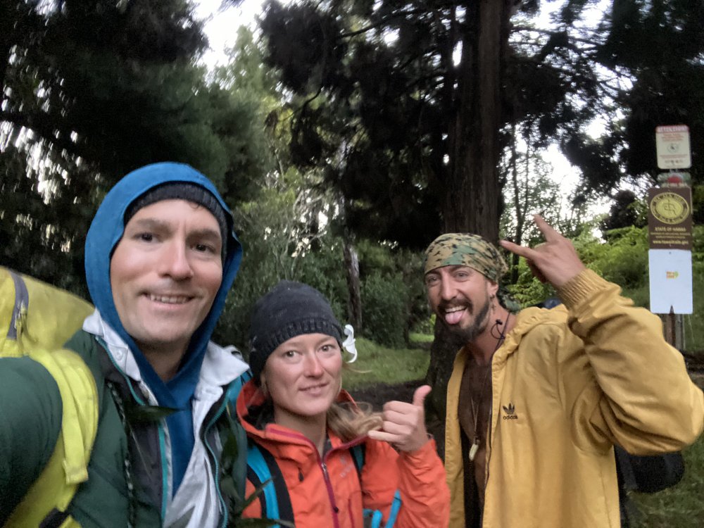
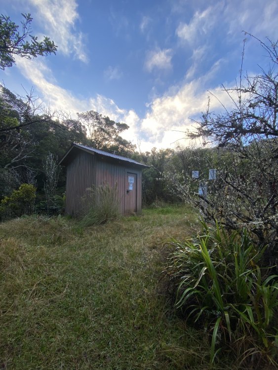
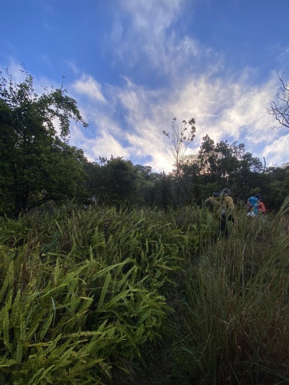
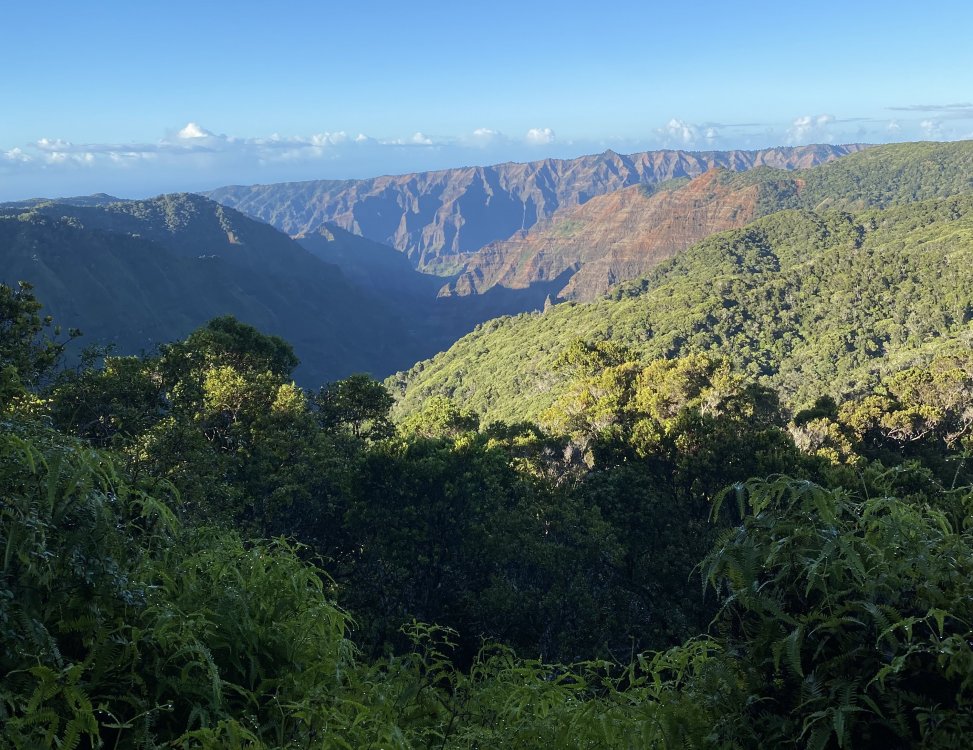


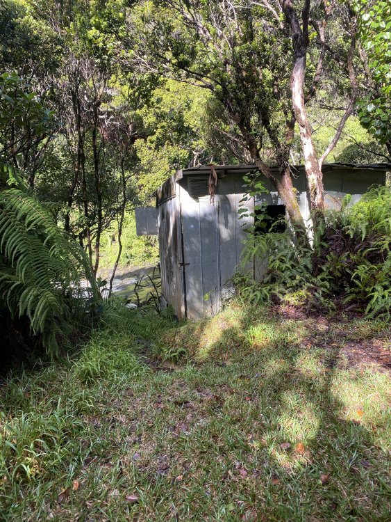
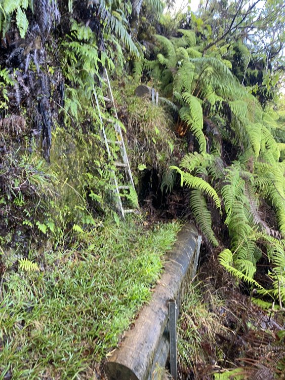
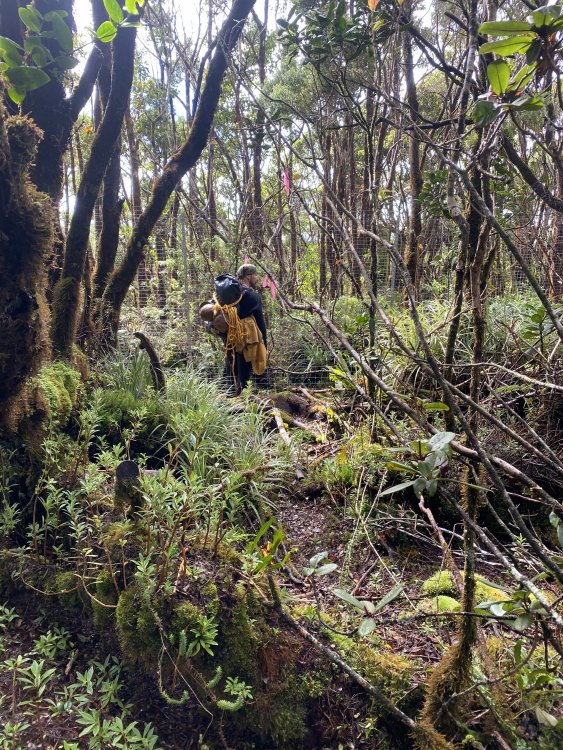


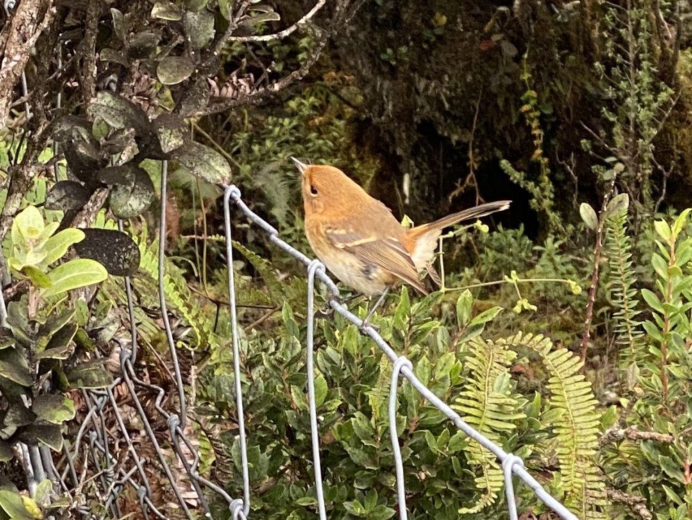
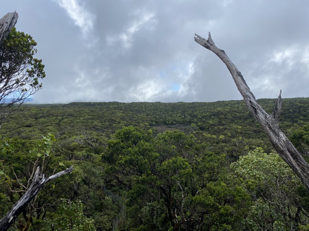

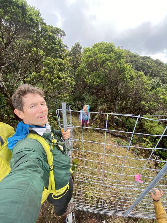
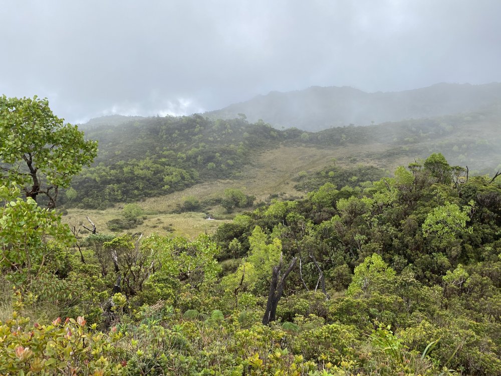
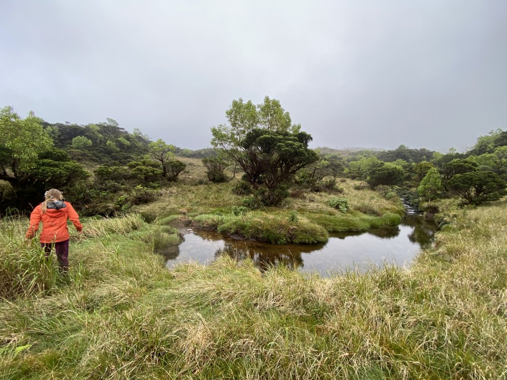
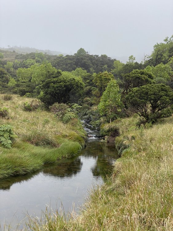
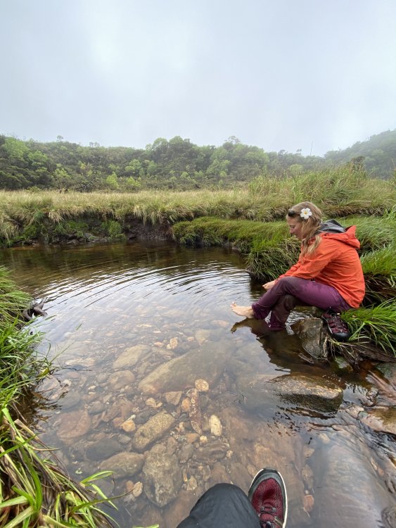
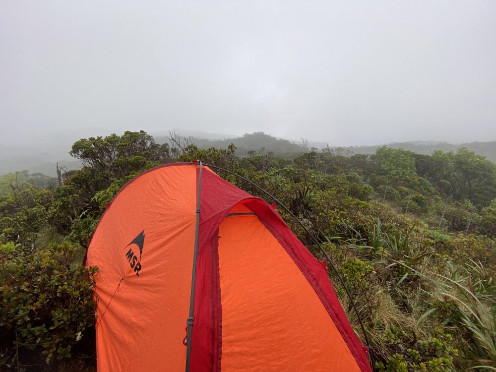
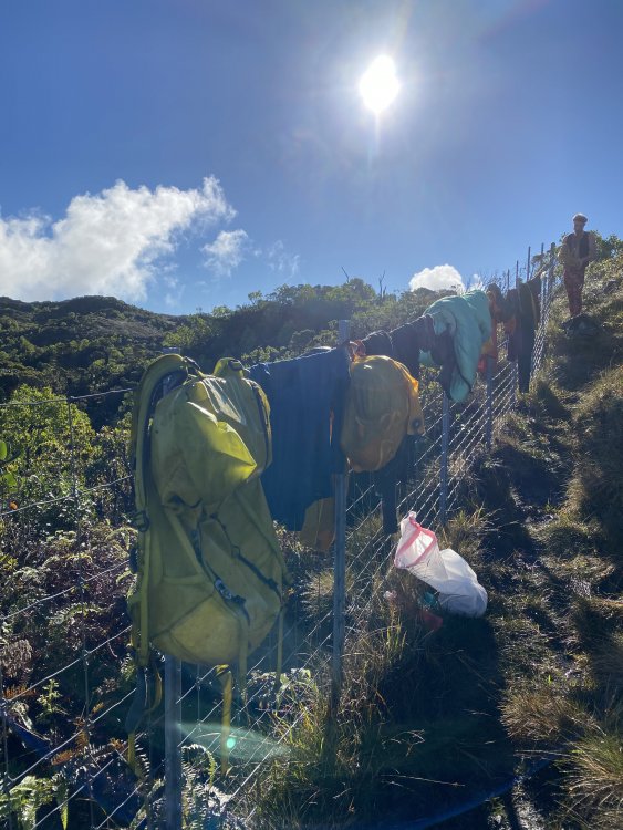
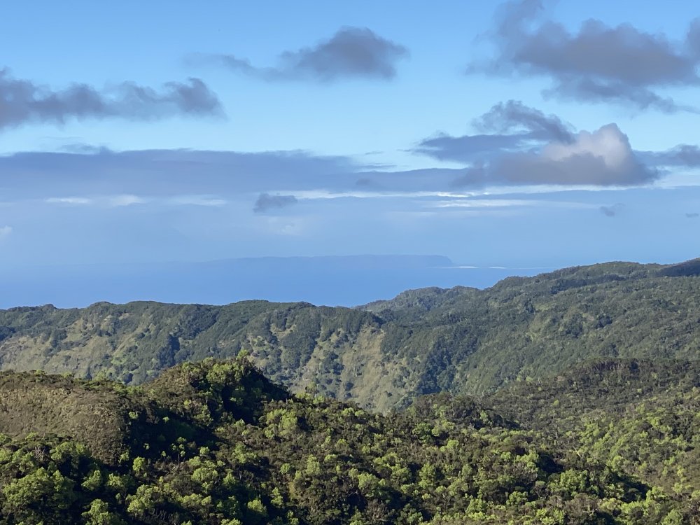
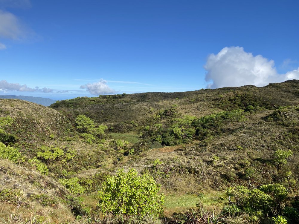
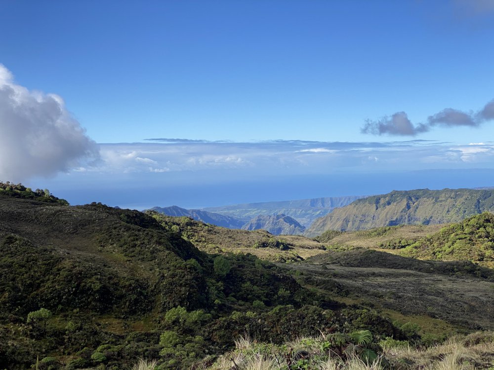


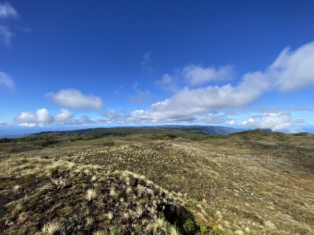
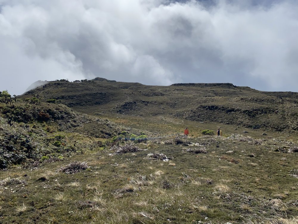
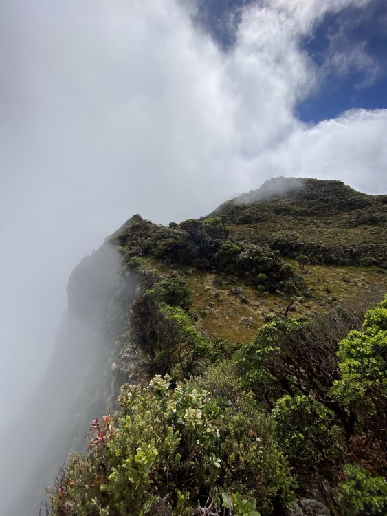
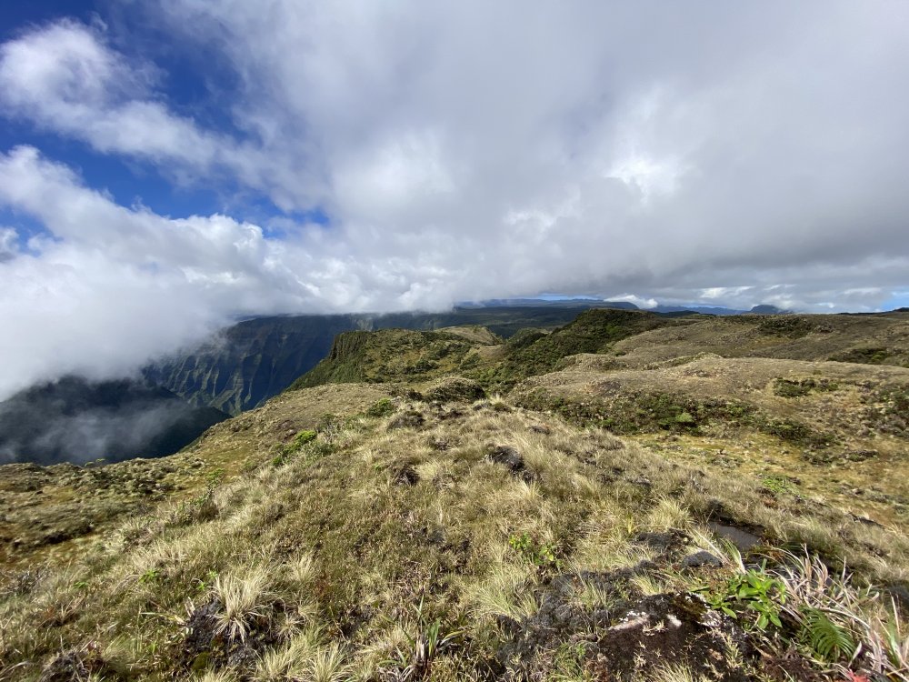
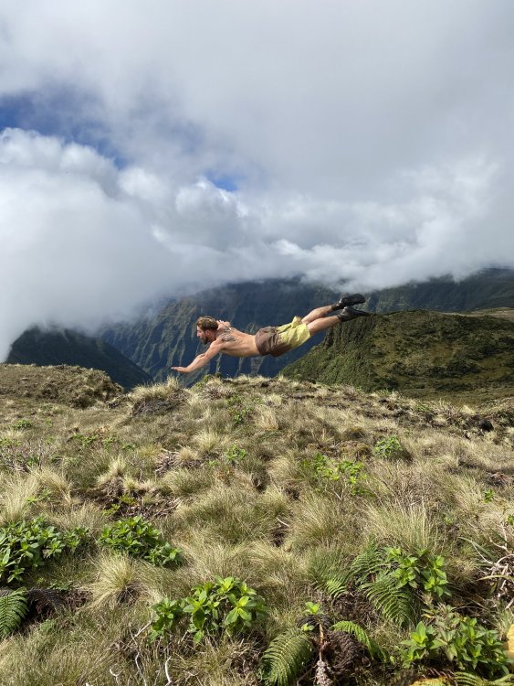
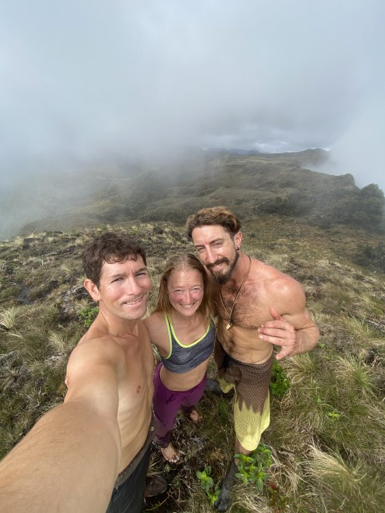
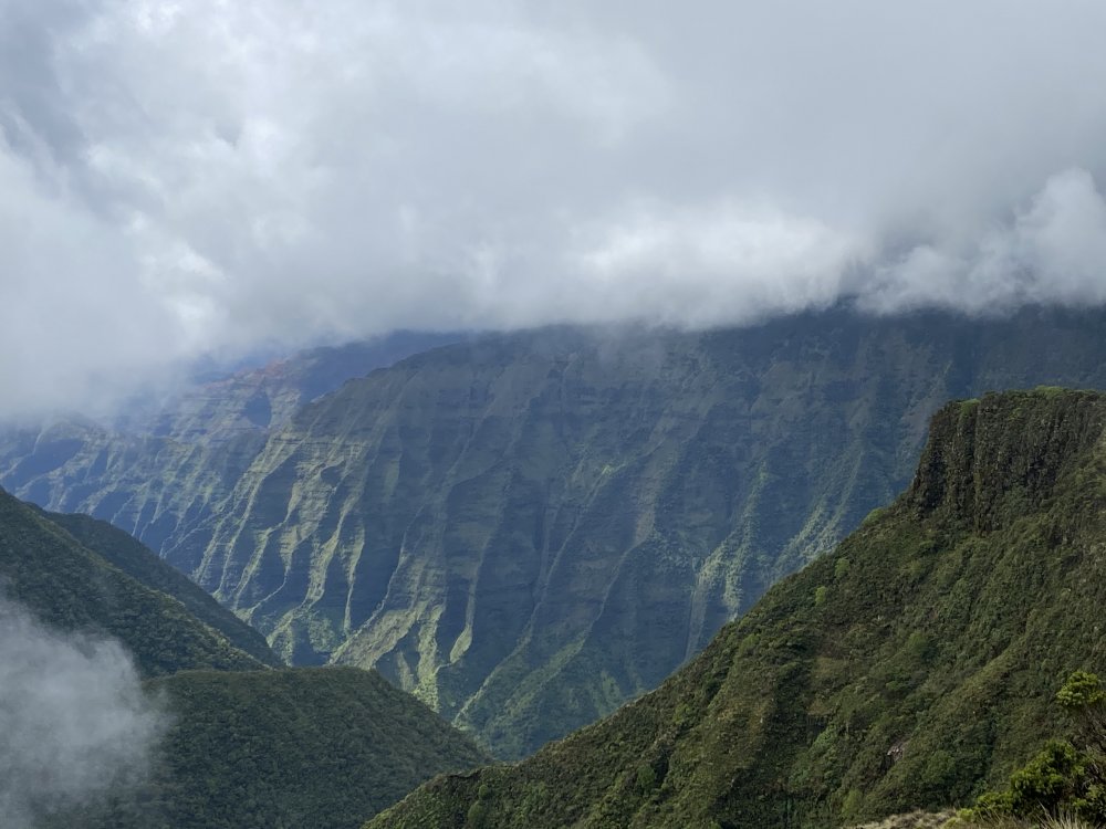
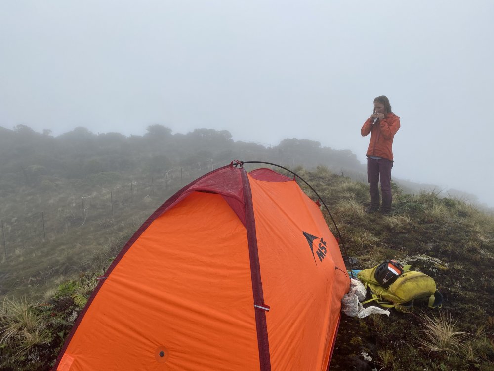
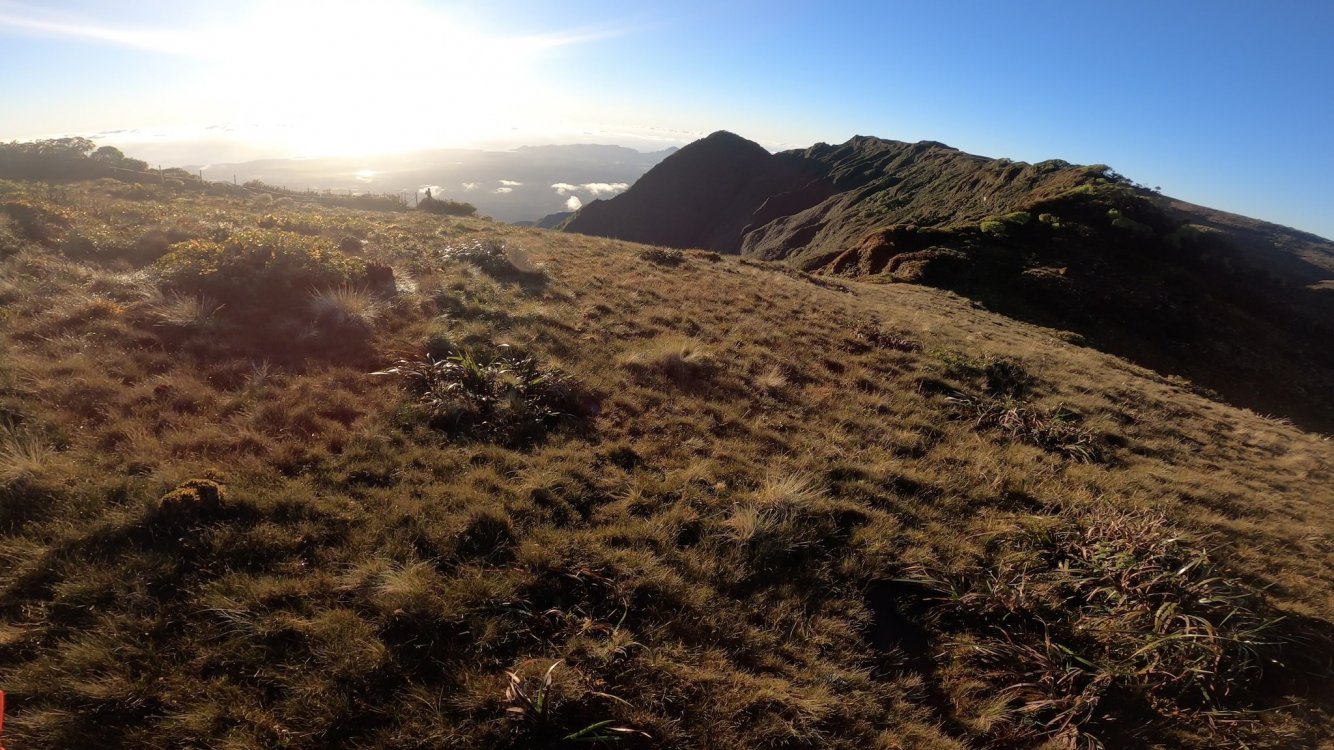
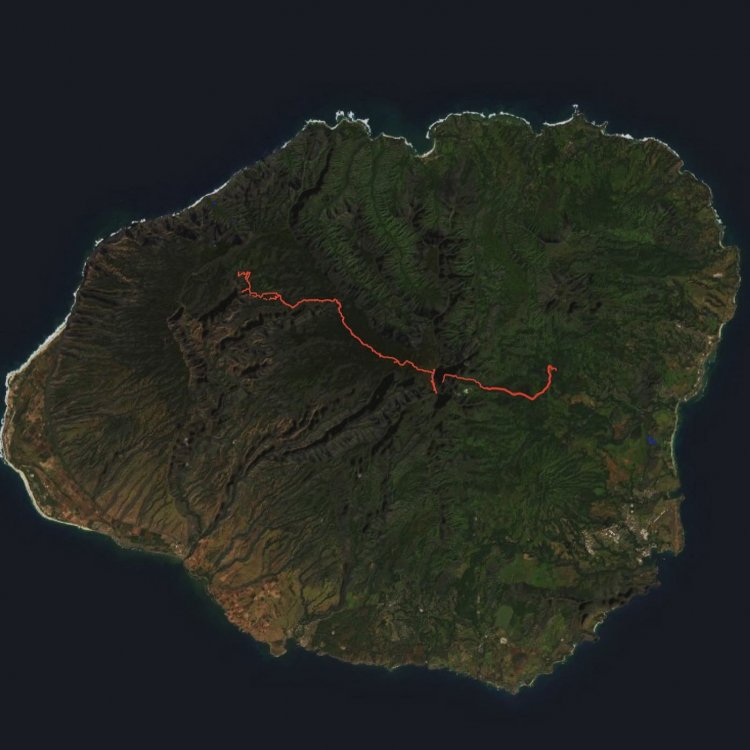


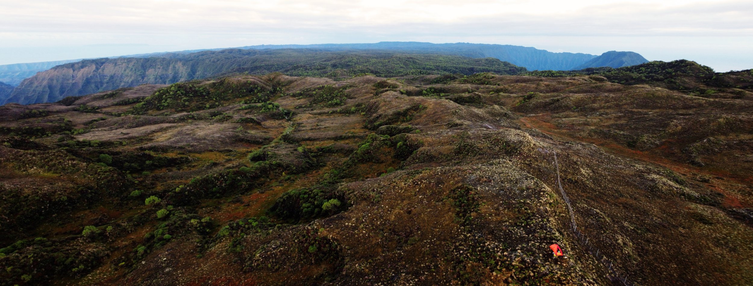
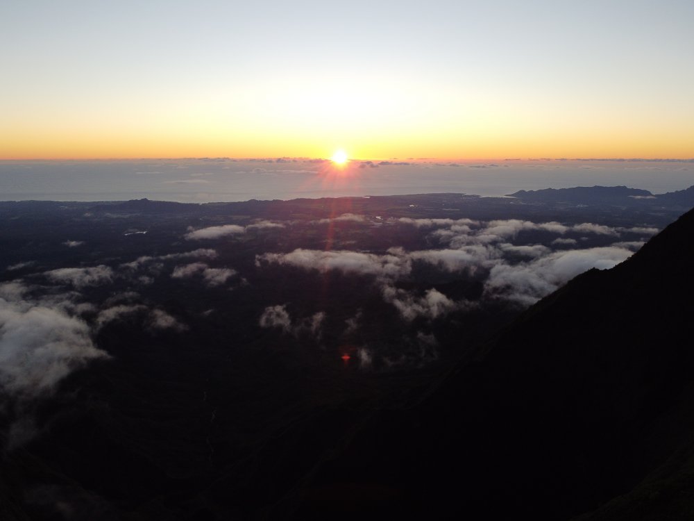
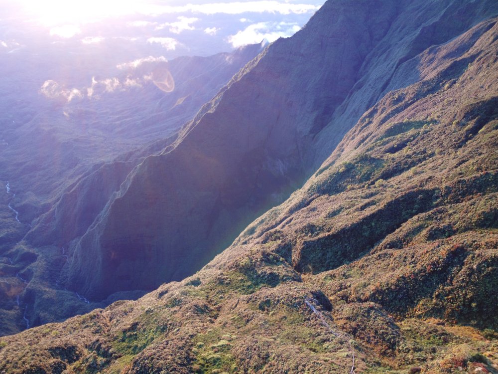
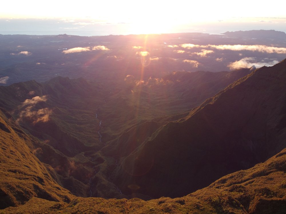

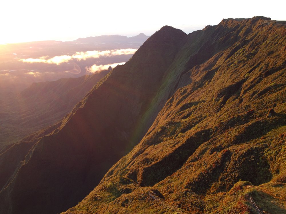


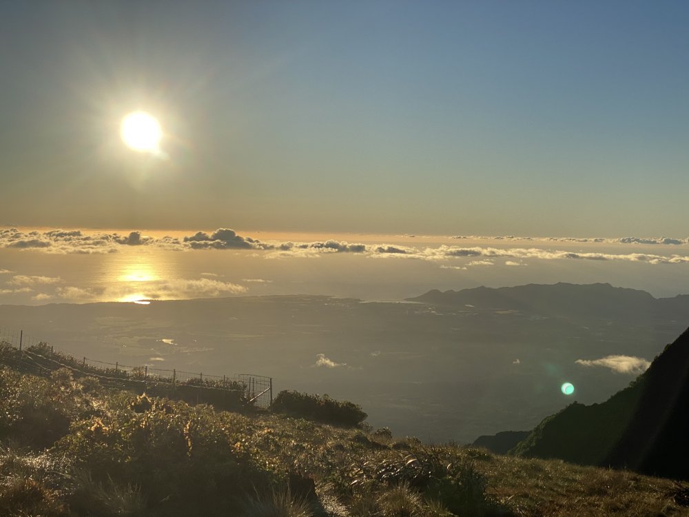
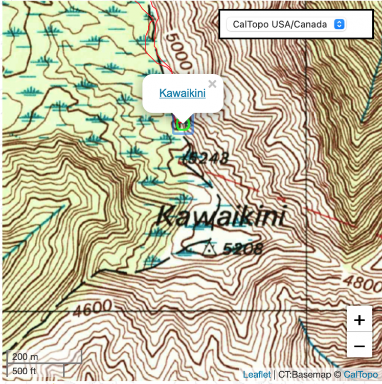
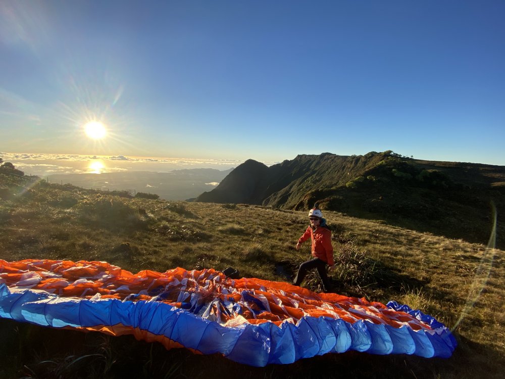
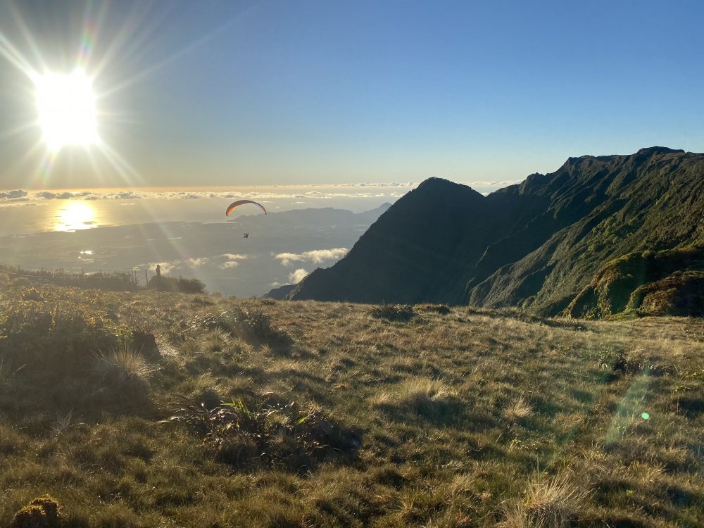
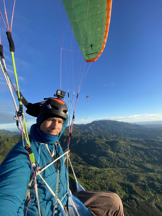


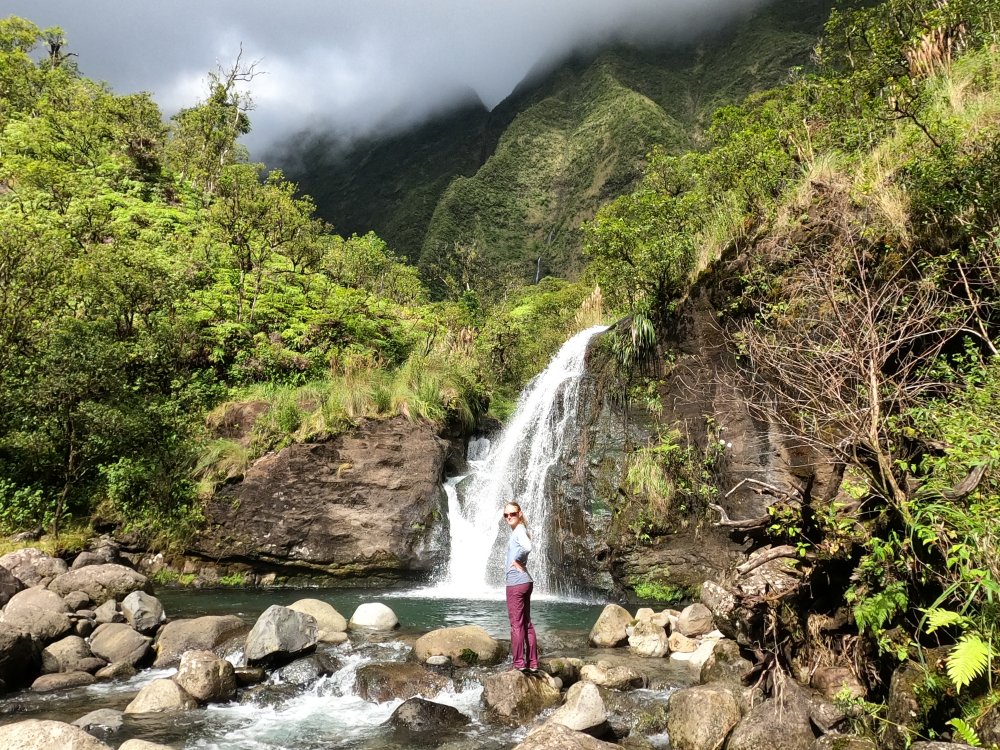
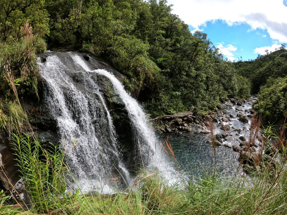
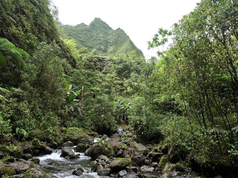
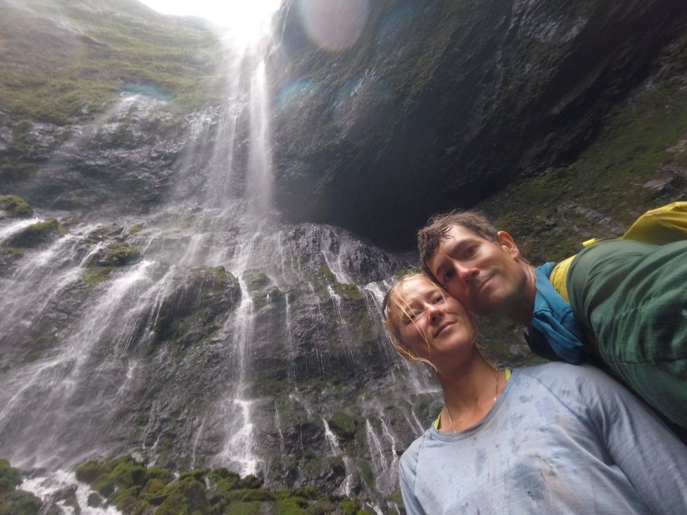
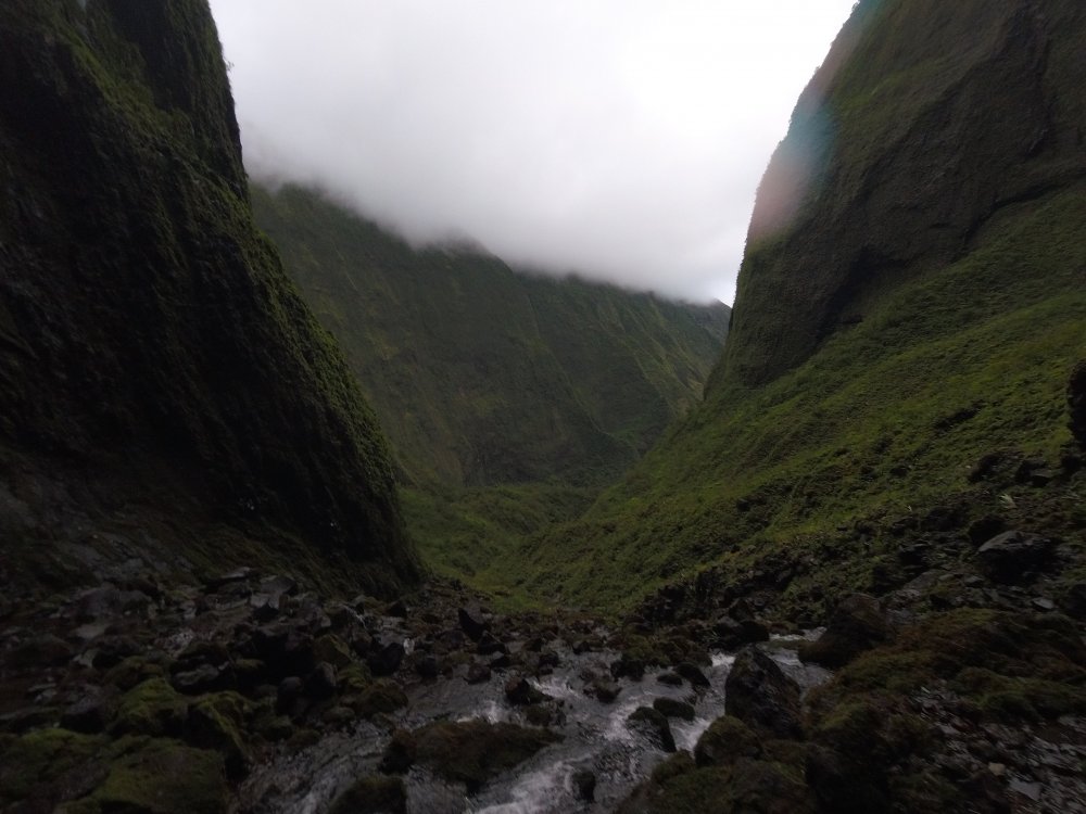
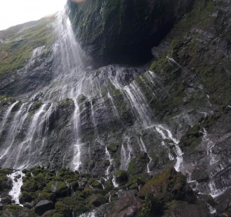
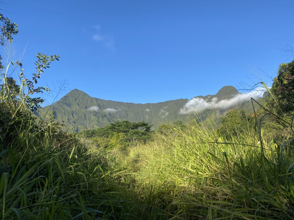
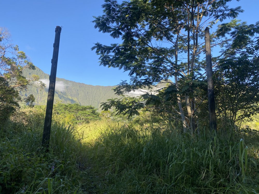
-
best of cc.com [TR] Pakistan - K6 Central 10/09/2020
JeffreyW replied to JeffreyW's topic in The rest of the US and International.
Definitely skiable, maybe a few raps to get past the steeper upper section. Dust over ice, and just bare ice in spots, if that's ok for you! -
Trip: Pakistan - K6 Central Trip Date: 10/09/2020 Trip Report: Dear CC friends, Sorry we haven't been on here much, but we've been working a lot on our blog. It's more of a diary for us since we don't care about hits or ad content. We really don't want to just post a link to our blog TR and leave it at that. We want to see CC thrive and grow! So we've copied our latest TR from Pakistan below. If you are interested in other TR's from our 2020 year of traveling and climbing, like our ascent of all Six of the Great Alps North Faces and Cerro Torre in Patagonia, check out our blog or Vimeo page. https://alpinevagabonds.com https://vimeo.com/user37304873 Stats Location: Masherbrum Range, Karakoram Mountains, Gilgit-Baltistan, Pakistan K6 West, 7,140m, 3rd ascent, October 8, 2020 K6 Central, 7,155m, 1st ascent, October 9, 2020 Climbers: Jeff and Priti Wright Trip Report K6 Central Summit Selfie (7,155m) We climbed K6 West (third ascent 7,140m) and K6 Central (first ascent 7,155m) this October. We summited West on Oct 8th and Central on Oct 9th. We had been planning to climb K6 from the Nangmah valley side for over two years. When COVID struck, we held on to the hope of going but delayed our trip from the original June-August until late September-October when the country announced they were allowing tourists to enter with a valid COVID test. A week before we departed, Colin Haley decided to join our trip to climb various objectives solo. Colin has been a hero to us, and was a major inspiration for us to start Alpine Climbing over six years ago. In fact, we modeled our Sabbatical Year on a typical year in Colin’s life (Patagonia – Chamonix – Pakistan). It was a real treat for us to have him join us at Base Camp, and he provided us with a wealth of knowledge and advice in this new game (for us) of high altitude Alpinism. Jeff on K6 Central’s summit This was a difficult year for climbers, world-wide, due to COVID. Nearly all serious expeditions canceled their plans, so when we continued with our planned Karakoram expedition to K6, we were quite alone in the whole range. Certainly no one expected us to make a first ascent of K6 Central, a 7,000m peak, in late season. K6 has three major summits along its summit ridge: West (7,140m), Central (7,155m), and Main (7,281m). K6 Main was first climbed by an Austrian Expedition in 1970 led by Eduard Koblmueller. Before the expedition, we were lucky enough to get in contact with one of the original expedition members of the young Austrian team, Fred Pressl, who graciously shared pictures and stories from his 1970 expedition. In 2013, Ian Welsted and Raphael Slawinski became the first ascensionists of K6 West via a highly technical route from the North (Charakusa) side (for which they won a Piolet d’Or). Then in 2015, Graham Zimmerman and Scott Bennett became the second ascensionists of K6 West from the South (Nangmah) side. But an impending storm forced them to retreat without continuing the traverse to K6 Central, and it remained unclimbed. Priti with K6 West on the left, Main in the middle and Central on the right The first hurdle to overcome was getting to Pakistan. We kept in contact with Ali Saltoro, our expedition tour operator, who kept us informed on the COVID status there. We delayed our trip a month and a half, but when he told us that tourism had opened up in Pakistan, we dusted off our Visas from December 2019, bought plane tickets and got the fresh COVID tests required for entry. We had heard of no expeditions traveling this season, and we didn’t know what to expect. We arrived in Islamabad on August 23rd, Ali met us at the airport, and hours later we flew to Skardu, without even leaving the airport. We arrived smoothly and safely at basecamp in the Nangmah valley on Aug 26th, with zero hassle. Advanced Base Camp, with the South Face of K6 behind Once we got to basecamp, we started acclimatizing on nearby Kapura Peak and had a full view of K6’s SW Ridge and West Face from what’s called Alam’s Col (a route first climbed by Portugese Daniela Teixeira and Paulo Roxo in 2013). From this vantage point, we could see that there were several options for climbing the West Face. After acclimatizing on Kapura Peak (no summit attempt) located on the West Nangmah Glacier, we moved over to the East Nangmah Glacier and made an Advanced Base Camp. We continued acclimatizing, exploring two of the three alternative lines that would bypass nearly all of the technical mixed climbing found by Graham and Steve. We climbed up to 6200m and slept above 5700m for 5 nights, before determining that Graham and Scott’s descent line would be the ideal line of ascent as well. Bivy high on K6, with the East and West Nangmah Glaciers below We descended back to Base Camp (4,400m), upon learning that Colin had fallen ill. Colin ended his trip and returned to France, but we made plans for a summit attempt when we received a promising weather forecast. We were well acclimatized, and poised for attack, despite the dropping temperatures and rapidly shortening days. Paragliding near base camp, Shingu Charpa behind On October 2nd, we headed back up to ABC at 5,150m. From there, the route starts on a major ramp on the southwest flank of the peak, following up to 60 degrees ice/snow to the SW ridge for about 600m to the southwest ridge. We then traversed for 300m across the West Face, across the bergschrund, then straight up the icy 900m West Face. When Graham and Scott descended by this line in 2015, they made 19 Abolokov’s to get below the bergschrund. The 900m ascent of the West Face was a strenuous, calf-burning, 12hr day to reach 6,600m on the southwest ridge. The West Face consisted primarily of a few inches of névé over solid, very hard ice (~70deg for 900m), which we simul-climbed. The West Face of K6 The upper slopes consisted of deep snow, and we wallowed the last 400m to the summit ridge at 7,000m. Our weather forecaster warned us that we would encounter the jet stream above 6,500m with sustained winds of at least 45km/hr and a morning low of -21C; he was correct. This late season ascent meant climbing in cold, clear, windy weather, and especially short days and cold, long nights. We climbed new terrain along the traverse from K6 West to K6 Central. The West Face of K6 Central was up to 80 deg ice/snow including a bergschrund and a tenuous cornice to overcome. Final slopes to K6 Central The North side of the sharp, rocky summit ridge of K6 Central precipitously dropped dead vertically into the Charakusa Valley. When we finally reached the highest point of the fan-shaped crest of K6 Central’s summit, we sat on the knife-edge ridge with one leg over the Lachit Valley and one leg over the Charakusa Valley. Strangely, climbing an unclimbed peak did not feel any different from climbing any other peak. However the clear weather gave us great views of the enormous 7,000 and 8,000 meter peaks that spread out around us in a vast panorama in all directions, and we felt exuberant and humbled. But our elation was short-lived because we had a long way to descend. Priti’s foot dangling from the summit of K6 Central, over the Charakusa glacier We owe many thanks to Steve Swenson, Graham Zimmerman, and Ian Welsted for their helpful beta, to Colin Haley for his great advice and wonderful company, to the rest of our base camp crew, Ishaq our basecamp manager, Azhar our cook, Captain Zohaib our liaison officer, and of course Ali Saltoro, our expedition tour operator. We couldn’t have done it without them! Our basecamp crew: Jeff, Priti, Colin, Azhar, Ali, Captain Zohaib, Ishaq Gear Notes: 6 Ice Screws, 6 Alpine Draws, 60m Beal Opera, 60m tag line, two tools each, dual points. Gear brought but not used (bummer!): 5 cams, extra Alpine Draws, small rack of nuts Approach Notes: Approach via East Nangmah Glacier
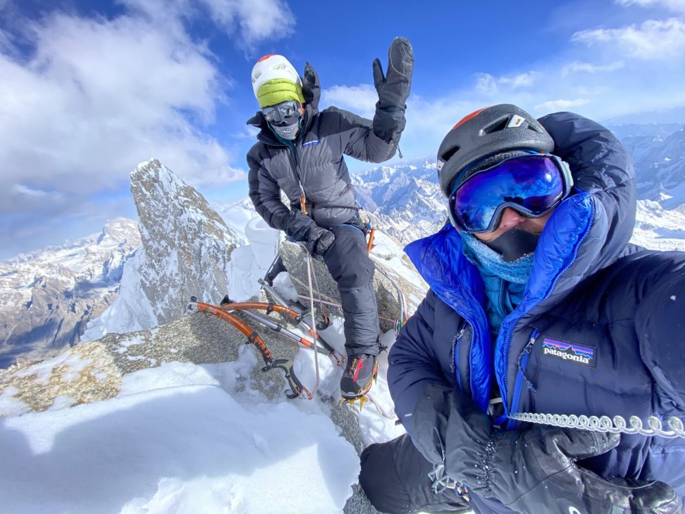

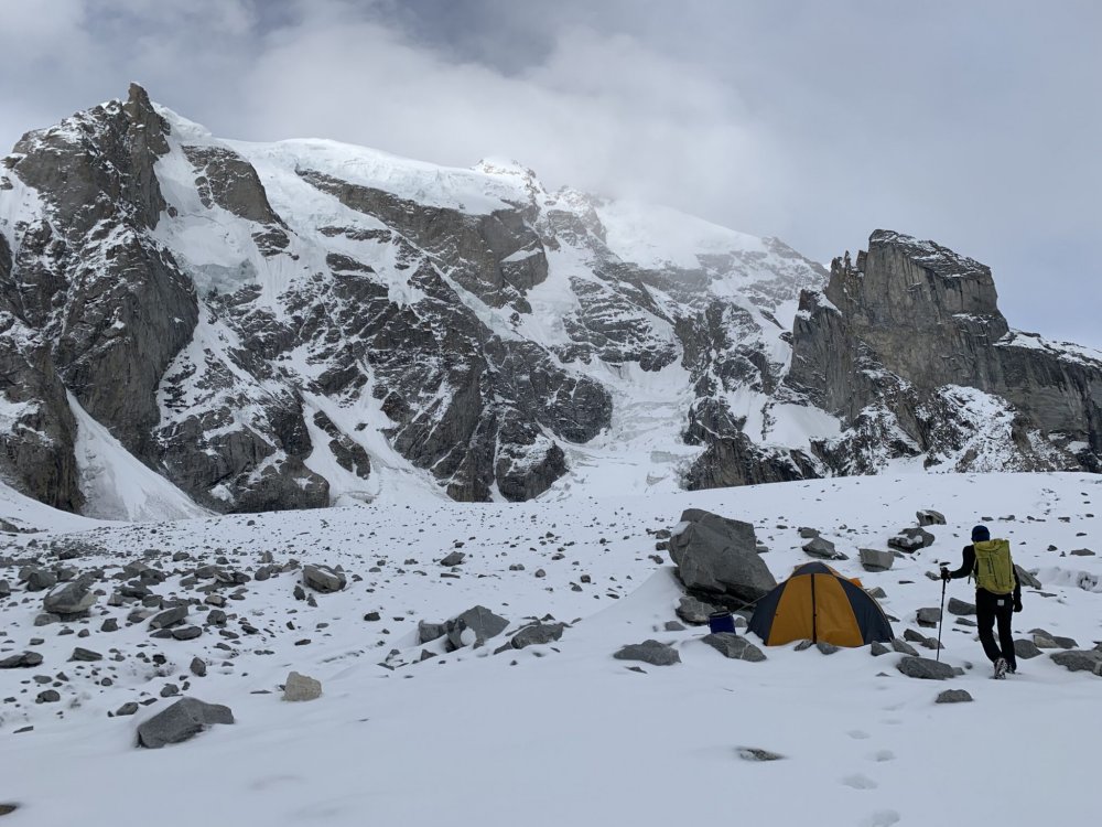

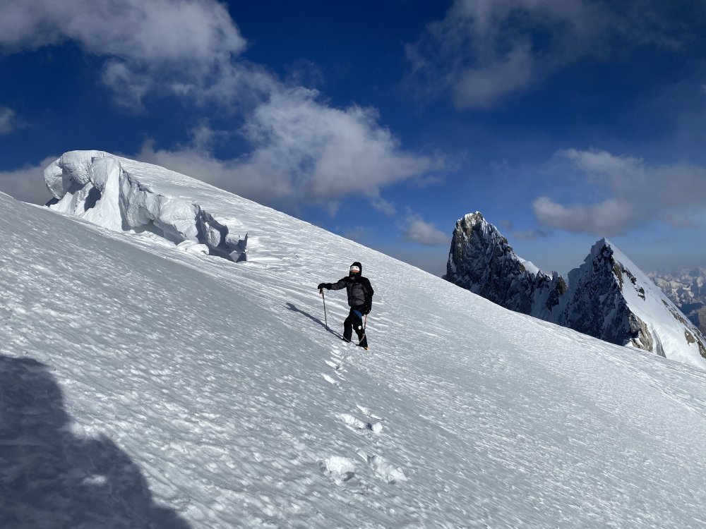

-
[TR] Cerro Aconcagua - Ruta Normal 02/02/2020
JeffreyW replied to bellows's topic in The rest of the US and International.
Sweet pictures!! Congrats! Thanks for putting this together. -
iPhone 11 Pro (most of the pics). Also took a GoPro HERO 5 Session and DJI Mavic Mini
-
Yep! DJI Mavic Mini. That thing is tiny!
-
The sound of the bells is so amazing! From summer reports, it seems like the sound is very loud even up on the wall. March was too early for the bells. Wish we could've heard it. Thanks so much for sharing!
-
Trip: Eiger North Face - 1938 Heckmair Route Trip Date: 03/18/2020 Trip Report: First off: I'd be remiss not to mention the extenuating circumstances we're all in right now. Priti and I have been at home in Chamonix since March 19 now, and we'd encourage everyone to do so as well. This climb occurred prior to the French, Swiss, and US lockdowns. We returned home to quarantine with the rest of France just after this trip. I hope this trip report will entertain and inform you so you can start your own Eiger Training Plan and trip planning! Don't FOMO, we're not doing anything right now either! Your friends, J&P “Anyone who returns from the Eigerwand cannot but realize that he has done something more than a virtuoso climb: he has lived through a human experience to which he had committed not only all his skill, intelligence and strength, but his very existence.” -Lionel Terray, Conquistadors of the Useless “Yes, we had made and excursion into another world and we had come back, but we had brought the joy of life and of humanity back with us. In the rush and whirl of everyday things, we so often live alongside one another without making any mutual contact. We had learned on the North Fae of the Eiger that men are good, and the earth on which we were born is good.” -Heinrich Harrer, The White Spider The 1938 Heckmair Route. Photo Credit: @eiger_daily (Instagram)...the best overlay we found. Posted here with permission. Climbers: Jeff and Priti Wright Luckily (or not), our ascent of the 5,000ft Eiger North Face (or ‘Eigerwand’ or ‘Eiger Nordwand’) in mid-March 2020 may have been on the quietest days in the face’s history of climbing since its first attempt in 1934. No summertime cow bells ringing in the rugged hillsides of Alpiglen above the town of Grindelwald, no cars and honks were noticed, no sounds of ski lift machinery, no joyous skiers on the hillsides of the Jungfrau ski resort which sits at the foot of the Eiger, few trains were in operation (and solely for construction workers). Not even any sounds came from the sky as we climbed in perfect, bluebird weather for three days. Frankly, I could’ve used more cow bell. Among the reasons I climb, isolation is not one of them. I appreciate the sights and sounds of civilization from a climb which provides significant psychological aid. We did, however, see several helicopters fly by delivering goods and construction materials to the future site of a new lift within the resort, along with several Swiss Air Force F-18’s practicing formations through the beautiful Berner Oberland valley. Jon Krakauer wrote in Eiger Dreams: “I didn’t want to climb the Eiger, I wanted to have climbed the Eiger.” This is a sentiment I think most climbers can understand at some level. For years this quote has haunted me. There are many climbs to which I could solidly attribute this feeling. I knew, however, that whenever I would finally step out onto the snowy slopes of the Eiger, I didn’t want to have this feeling. The Eiger is just too dangerous; too big; too bold. I always knew that if I felt this way, I would simply turn around. I wanted to be in it, and enjoy my time wrestling with the alligator. Luckily, both Priti and I were itching to attack, having fun the whole way. Left to right: Eiger, Mönch, Jungfrau We arrived in Grindelwald, Switzerland from Chamonix the day before our intended climb and took an overpriced 1hr train ride to Kleine Scheidegg, the central hub of the Jungfrau Ski Resort. Kleine Scheidegg is crowned by the historic and elaborate alpine resort, established in 1840: Hotel Bellevue des Alpes (where ‘The Eiger Sanction’ and ‘Nordwand’ were filmed). Many of the more well-sponsored Eiger climbers throughout history have stayed here. But not all. You would have thought that the Third Reich could have at least put up Karl Mehringer and Max Sedlmeyer up for a few nights! Many climbers discreetly bivy near the foot of the Eiger within the ski resort, or on the floor of the restaurant at the Eigergletscher complex (the uppermost hub of the Jungfrau ski resort). However, we were expressly denied permission to sleep on the restaurant floor. Furthermore, we also found the Women’s and Handicapped restrooms permanently locked. All of the construction workers are male, and the proprietor must have caught on to the unexpected guests of the Women’s restroom from recent Eiger Conquistadors. If a climber wants to step up their bivouac accommodations slightly above a bathroom stall or a restaurant floor, they can stay at the Eigergletscher Guesthouse (hostel). However, with the ongoing construction of a brand-new, state-of-the-art gondola which will link Grindelwald directly to Eigergletscher by the end of 2020, the guesthouse is exclusively housing construction workers until the end of the project. There is another hostel at Kleine Scheidegg (Hotel Bahnhof), but it had already been closed for a few weeks due to Coronavirus precautions. Staying at Eigergletscher or Kleine Scheidegg is ideal so that you can start your first day of climbing as early as you like (however, many climbers do start their first day from the 7:00AM train in Grindelwald). During summer months, climbers might also base camp in pastures beneath the face, as Mehringer and Sedlmeyer did for their attempt in 1936, however the train is so expensive that base camping in Grindelwald is now the norm while waiting for weather and conditions. The thing about the Eiger is that even if the forecast looks splitter, you never know when the semi-mythical and unexpected ‘foehn’ will show up. These are southerly winds that blow on the north side of the Alps in winter. The foehn (literally meaning ‘hair dryer’) frequently surprises climbers bringing sudden bursts of warm air and stormy weather. The Jungfrau ski resort is unusual in that its primary artery is a 128 year old railway: the “Jungfraubahn”, highest railway in Europe. A climb of the Eiger usually begins with an expensive 1hr train ride from Grindelwald to Kleine Scheidegg, then a change of trains for another 10min ride up to Eigergletscher. Exiting the Eigergletscher deposits one out onto the lower slopes of the North Face. The train, however, does continue on, burrowing up through the depths of the Eiger and on to a high saddle (the “Jungfraujoch”) between two of the Alps’ most impressive 4000m peaks: Jungfrau and Mönch. From Kleine Scheidegg, one gets an incredible vantage point for the skyline of these three behemoths: Eiger, Mönch, and Jungfrau. Modern folklore has it that the Monk (Mönch) guards the Virgin (Jungfrau) from the Ogre (Eiger). The actual German word for Ogre is “Oger”, and the true etymology of the word ‘Eiger’ stems from a curious and long-forgotten amalgam of middle high German, Swiss vernacular, and Latin for something like “high peak”. There is a multi-use, groomed run which connects Kleine Scheidegg up to Eigergletscher. Trying to save some money, we skinned up this run instead of buying a train ticket to reach Eigergletscher (only 30-45min of easy skinning). Then, we skied down an amazing groomed run for 6 miles and 4500ft of descent from Eigergletscher all the way down to our hostel next to the train station in Grindelwald. All day, the ski resort was bustling and vibrant, and no one at the resort or the train station expected any disruption of service any time soon due to Coronavirus precautions. With the Eigergletscher Guesthouse closed due to construction, Hotel Bahnhof closed due to health precautions, and the Hotel Bellevue des Alpes open but too ritzy, we planned to discreetly bivouac near Eigergletscher. Upon arrival back at Grindelwald, however, we got word that the entire resort (lifts) and the trains would discontinue operation that evening for the indefinite future due to Switzerland’s precautions against Coronavirus. A final and devastating setback. Hotel Bellevue des Alpes with (left to right) Eiger, Mönch, and Jungfrau behind We had originally come to Grindelwald due to a large high pressure system which was bringing a week of unusually phenomenal weather to the otherwise grim mountain. We’d planned to at least visit in order to understand the approach, logistics and start to observe the conditions on the mountain. The lack of train meant an extra 6 miles and 4500ft gain of approach to the mountain…a mere “sit-start”. We were not yet about to give up and call it quits. Back home, Chamonix-Mont-Blanc lifts were still running under normal operations and both France and Switzerland were not under lockdown, so there was no urgency to leave; no compelling ethical reason to begin self-quarantine. As luck would find it, we found a companion for our laborious day of skinning our heavy load up to Kleine Scheidegg. Another BOEALPS veteran happened to be in Grindelwald at the same time: Fabien Mandrillon. He is revered within the club for his years instructing classes and for being Head Instructor of the Basic Rock Class (as we had also been). He had emigrated to Zurich before we joined the club, and we had hoped to meet him at some point on our Sabbatical. Having pleasant company under these unfortunate circumstances was certainly a delightful way to start our adventure. Surprisingly, we saw only a few other backcountry skiers on the hike up from Grindelwald. The resort had even groomed the track from Grindelwald that morning expecting the closures would not to keep people off the slopes. It was a beautiful day after a light dusting of fresh snow the day prior. If this situation were in Washington, the trail would have been packed with backcountry skiers! Priti and Fabien enjoying a lovely day of skinning Eiger North Face, West Ridge, and West Flank (descent route) Once we were back up at Kleine Scheidegg, under full expectation of sneak-bivouacking within the resort, we were delighted to find one set of accommodations still open (under extenuating circumstances). The grand Hotel Bellevue des Alpes had remained open a few extra days because of a few VIP guests which they were unwilling to expel. Thus, we took a sizable chunk from our Sabbatical budget to fork over to one night of luxury before we took on the Eigerwand. The evening was reminiscent of one of my favorite films, Wes Anderson’s ‘Grand Budapest Hotel’. The entire establishment glistened with immaculate, Old World luxury. Only the remaining handful of guests were being served the magnificent 4-course meal (indeed, one of the greatest in my life) within the halls of the elaborate dining rooms. At dinner, the guests were seated segregated by an optimal number of empty tables so as to assuage our newfound distaste for social interactions. Under strict orders of “No sports attire during dinner”, we sheepishly dined wearing our Eigerwand armor and our complimentary, fuzzy bathroom slippers while the other guests wore formal wear of suits, ties, dresses, and formal shoes. As we found out later, the few guests remaining were elderly patrons going back decades, one of whom had lost her husband of 47 years the week prior, escaping to a memory of their life together. Feeling the rush to appreciate our accommodations with the clear acknowledgement of our pre-dawn start, we spent a few minutes alone in each of the exquisite rooms of the establishment, excitedly recollecting the various scenes filmed there for The Eiger Sanction: the billiards room, the parlor, the bar, the lobby, even the concierge desk. The tolerant bartender with an immaculately groomed beard and pencil-long mustache, served us some truly delightful concoctions ginger ale, tonic water, and citrus: no summit, no party. We wryly noted that whenever we expressed our intent on climbing the Eigerwand, nobody would bat an eye. Naturally expecting some expression of praise (“vanity is one of the prime movers of the world”), we were taken aback at the utter apathy to which the world judged our sepulchral pursuit. We were not special! “Eiger-birds” (hopeful climbers) were a dime a dozen, and we were to receive no accolades before or after our adventure. From our bedroom that evening, we watched winter’s shy sun set early on the North Face of the Eiger, and the nocturnal eyeball of the “Stollenloch” wake up to illuminate the lower slopes. At the turn of the 20th Century, enterprising Swiss railway Engineers blasted an impressive tunnel through the heart of the Eiger, from which two windows were poked through Eiger’s North Face about a third of the way up. One upstream (the “Eigerwand Station”) on the looker’s left side of the face, and one downstream (the “Stollenloch”) on the right side. The Stollenloch (“Door 38”) is a small, purely utilitarian window which was used to jettison debris from the early railroad construction over a century ago and was never a tourist observation window. Some climbers have approached by walking up the railroad tracks and exiting the Stollenloch to bypass the lower snow slopes of the face. Approaching via the Stollenloch is generally considered taboo, while nearly all climbers take the train up to Eigergletscher (and down as well). We have to start somewhere, and it’s not Bern! Still, it’s worth noting that Kurz and Hinterstoisser biked from Berchtesgaden, Germany, nearly 400miles away…perhaps the true sit-start for the Eigerwand! When there is enough snow, climbers stash skis up high for a victory ski lap back down to Grindelwald to top off the climb. Train entering the depths of the Eiger tunnel The Heckmair route goes very near the Stollenloch which has given this window quite a reputation through the climbing history of the face. The other gallery (the Eigerwand Station) is not near any other popular climbing route and is on the far left side of the face. The Eigerwand Station is an engineering feat, clearly visible from the valley floor, consisting of a series of several large balconies (later converted to glass windows) that mar this limestone sculpture. Since the Jungfraujoch extension opened in 1912, tourists have been able to lean over the vertiginous parapets to marvel at the face’s dizzying slopes. The balconies were even outfitted with paper bags in the event that a tourist experienced any physiological discomforts! The Eigerwand Station was a 5 minute train stop solely for tourist observation from 1912 until 2016, when newer, faster railway vehicles were incorporated, and this renowned observation point was put out of service. Interestingly, since the Eigerwand Station’s closure, “much of the publicity material fails to acknowledge that this viewpoint station ever existed” (Wikipedia). Quizzically, the iconic and celebrated Eigerwand station was axed in order to add one more train and reduce travel time to Jungfraujoch. The smaller, unassuming window, the Stollenloch, on the other hand, still plays just as an important role as it ever has. In 1936, after his other partners perished on the face, Tony Kurz froze to death in front of the Stollenloch while rappelling in free space, unable to pass a knot in the rope, just out of reach from rescue workers (recounted in the German film ‘Nordwand’). Clint Eastwood was rescued through this window in The Eiger Sanction. A window which has always served as a trap door for climbers to miraculously transport themselves from the unforgiving alpine face to the civilized world. The window from which many climbers escaped storms including Mugs Stump, who in 1981 after finding this shelter and bounding down the tunnel towards Eigergletscher was only to realize the true horror of trying to plaster his body within the 1-foot clearance of the rocky walls while the immutably time-conscious Swiss train rolled past him (Source: Krakauer’s “Eiger Dreams”). I made sure to have a copy of the train’s timetable in case we had to Gooney our way down this escape-chute/death-trap! While climbing this route, we were most impressed at the abilities of the early climbers 80 years prior being able to climb on such difficult terrain with such rudimentary equipment: Karl Mehringer, Max Sedlmeyer, Andreas Hinterstoisser, Toni Kurz, Ludwig Vörg, Anderl Heckmair, Louis Lachenal, and Lionel Terray. These climbers were total badasses. Their efforts boggle the mind. Many of the cruxes on this route are no-shit overhangs on brittle rock, downsloping ledges, and poor protection (if any at all). With a pre-dawn start from our comfortable beds at the foot of the Eiger, we stepped out into a frozen darkness. We walked the extra 45min from Kleine Scheidegg up to Eigergletscher on a deserted ski run, passing by several early-morning construction workers who were less-than-enthusiastic about our presence as we tip-toed through the construction site onto the lower snow slopes of the Eigerwand. A recent blog post by an Italian team had us hopeful that their steps in the snow would pave the way. But alas, we found no steps and instead had to make our path and kick our own steps (later deeming that the blogpost was not clearly dated and was actually from earlier in January). Since much of the route is snow travel, the existence (or not) of another party’s snow steps can drastically alter your timeline in terms of both physical exertion and time spent routefinding. It is important to intimately know the features on the face, the names of the pitches, the condition of the cruxes. The route was so meticulously memorized as we quizzed each other on the drive up, that it felt as though we were executing a victory lap of versed, choreographed sequences of movements through Nintendo’s Mario Bros (with a princess waiting on top). First, traverse across easy snow slopes towards the First Pillar, zig-zagging across snowed-over limestone ledges up to the Shattered Pillar, and finally the ‘Difficult Crack’, the crux-y start of the actual climbing. Memorize This! Sadly, we never even saw the Stollenloch. The route passes nearby, but not directly over the Stollenloch, and is very much out-of-the-way. A party behind us on the same day purposefully started late so that they could spend their first night inside the Stollenloch (requiring a good amount digging). The Difficult Crack is still truly difficult (and also hard to find)! The Difficult Crack is the start of the technical part of the climb. If there is low snow coverage, you’ll have an extra pitch much lower down, before The Difficult Crack (just above the bergschrund and next to ‘the plaque’) which is a straight up rock corner. However, we were able to easily bypass this pitch with an easy snow ramp. Many parties don’t even find The Difficult Crack and instead pick their way up much harder variations to get up to the Hinterstoisser Traverse. It’s especially important to know what the Difficult Crack looks like (keep pictures on your phone) and how to get there (a traverse about 10-15m long heading right and slightly downhill). After that, the rest of the routefinding on the Heckmair is relatively trivial. The Hinterstoisser Traverse is infamous for its very difficult climbing with snow/ice over blank slabs situated under the impressive overhang of the massive blank face of the Rote Fluh. The Rote Fluh is one of two major obstacles on the face (the other is the Gelbewand), and they are both seriously impressive overhanging faces. Shown above: start of Hinterstoisser (low angle snow) which then turns into steep slab with fixed ropes (no picture) A permanent rope is affixed to the Hinterstoisser Traverse due to its incredible difficulty (everybody pulls on them!) but also as an homage to the 1936 tragedy when the entire team perished while trying to retreat down the face but were unable to reverse the traverse (likely due to fresh verglas plastered to the slabs). Our feeble notion of “free-ing” the Heckmair route quickly evaporated in our minds almost at the very first move of technical climbing. This route is longer and more difficult than we could have imagined, but we were prepared for every obstacle. The mixed climbing is seemingly never-ending and the overhanging steepness of the cruxes were shocking for a route completed 80 years ago. After the Hinterstoisser Traverse, more fixed lines lead up through a short chimney (‘Swallow’s Nest’) to the First Icefield, which had good névé and offered good step-kicking. A narrow gully connects the First and Second Icefields with the only pure ice climbing pitch on the route: the Ice Hose. If you’re unlucky, the pitch is bone-dry and makes for extremely difficult rock climbing (a variation on its left). Lachenal and Terray opted for the rock variation on the second ascent of the route in 1947, deeming that the WI3 Ice Hose would take too long to chop steps! Nowadays, with modern ice climbing technique, climbers are truly blessed if they find it was we did: in WI3 conditions, heavily featured, and easily accepting “stubby” ice screws. The start of the ice hose is just visible in the middle (sorry I didn't get a better pic) The Second Icefield is a long, snowy traverse on low-angled ground to get to mixed corners (Bügeleisen, or ‘Flatiron’ buttress) and finally to the wall’s first and only decent bivouac: the ‘Death Bivouac’ (aka ‘Karl-Max Bivouac’ where Mehringer and Sedlmeyer froze to death in 1935). It was dark by the time we got to the mixed corners of the ‘Flatiron’ and the climbing was terribly difficult with long runouts and poor protection at about M5. The corners were bare of snow and ice. While leading the pitch, I recalled a story from Barry Blanchard in The Calling of his and Kevin Doyle’s ascent of the Grand Central Couloir on Mount Kitchener where Doyle took off his mitts and licked his fingers so that they would stick to the rock and help his purchase. I took off my beefy climbing gloves in the cold darkness and found the extra stickiness of my bare fingers also provided excellent aid on the downsloping ledges! I could withstand the pain for a few minutes (it was probably 15F outside) if it helped prevent me from falling from my precarious perch. We finally made it to the Death Bivouac and we had been moving much slower than anticipated all day with only 12hrs of sunlight. Knowing that it was improbable that we would make the summit the next day, we planned to have a short day and bivouac again at the route’s only other decent bivouac: the ‘Traverse of the Gods’. Here at the Death Bivouac, we had to dig out a platform under a narrow overhang. Surprisingly, our ledge was just wide enough to sleep side-by-side… a welcome and unexpected luxury. We had each brought a thin, lightweight sleeping bag and a short, inflatable ‘summer’ sleeping pad. While brewing up dinner, I was horrified to discover that my sleeping pad had a hole which prevented it from staying inflated. I therefore had to sleep three nights in sub-freezing temperatures on narrow ledges with only ropes and backpacks under my ass! Every morning was difficult. We woke with the sunlight and made coffee with very little urgency. The entire climb felt rather like a holiday with a very leisurely itinerary and perfect weather. Ashamedly, we spent more time on the face than the first ascent in 1938 and the second ascent in 1947. The face doesn’t receive sun until late in the evening where you are lucky to get 30-60min of direct sunlight on your face. After the Death Bivouac, a short traverse across the Third Icefield leads to ‘The Ramp’, several pitches of easy mixed ground which funnels up to the ‘Waterfall Chimney’ (possibly the crux of the entire route). The Ramp (much like the Hinterstoisser) crawls timidly under another massive overhanging face, the Gelbewand. The ‘Waterfall Chimney’ is a genuine overhanging chimney of few holds which gushes with water in the summertime. Luckily, being in winter there was no water (good) but also no ice (bad). Usually when climbed in colder parts of the night, the spring/summer thaw freezes and makes the pitch much more palatable. Above here, the route splits into another chimney on the right (not advised) and a tenuous traverse above a head-spinning overhang on the left. The chimney above looked so well protected with fixed ropes and pitons everywhere, but every topo told us to go left around the corner instead. This leftward traverse spits the climber above a dizzying overhang, balancing on delicate, unprotectable limestone discs. A fall would mean a giant pendulum into space, dangling thousands of feet above the concave of the face below. Luckily, a multitude of pitons after a long runout help surmount a final bulge to a short, stout icefield cirque. Above: the Waterfall Chimney, overall crux of the route (in our opinion). Other contenders: Difficult Crack, Crystal Crack, Exit Chimney Above this icefield is a steep wall which you traverse on the ‘Brittle Ledges’. In Conquistadors of the Useless, Lionel Terray describes the Brittle Ledges as “tottering, piled up crockery”, which is as best a description as I can surmount. Luckily those piled up crockery are surprisingly solid, making for very interesting traversing on impossibly protruding discs. One final crux to reach our next bivouac: the Brittle Crack. From a hanging belay, you surmount a sizable bulge via perfect hand/fist cracks. This may have been the most fun pitch of the route, gleefully taking off my gloves and jamming my way up solid cracks in sub-freezing temps. Above: Traverse of the Gods bivouac Here, one finds a final bivouac at the beginning of the ‘Traverse of the Gods’, so named because it miraculously provided passage to the final major feature (the White Spider) for the first ascensionists. This accommodation was much narrower than the Death Bivouac and we were forced to sleep narrowly in a line, head-to-toe (with feet dangling off the sides). A typical timeline is to do the route in 2 days with one bivouac here at the ‘Traverse of the Gods’, making for a VERY big first day from Eigergletscher. The ‘Traverse of the Gods’ takes easy mixed ground rightward to the lower-left appendage of the ‘The White Spider’, a large snow/icefield high on the face. The White Spider is an obvious concave weakness in the wall spotted from the valley floor which was more black-and-blue this time of year than “white”. In winter, the snow/hail sloughs off immediately and the upper part of the face does not get above freezing during the day. Therefore, the White Spider was hard ice for us (instead of easy névé of the late spring and summer). This made for strenuous front-pointing on bullet-hard ice to the final left-trending ramp (the ‘Exit Cracks’) which led to the summit slopes. Above: Start of the Traverse of the Gods. Just before the next belayer in the background, the traverse goes up slightly, then back down. Above: Further along the Traverse of the Gods (the lower end of the White Spider just visible) Above: The White Spider, with Exit Cracks (ramp) above Moderate mixed terrain up this ramp ends at a final crux, the 15 meter long ‘Quartz (or Crystal) Crack’ (due to the splotches of Quartz on the limestone face). Sometimes there can be ice in this off-width overhang, but we found it dry. Steve House calls this pitch “Enjoyable when dry”. Priti led this pitch brilliantly, employing virtually every tool in the kit. Another mixed corner leads to a short traverse/rappel on a fixed line to the left-most couloir: the ‘Exit Chimney’. Above: Quartz Crack (technical crux, but short) It was my turn to lead on what looked like an exceptionally fun pitch of easy 5.6 terrain in a wide, hamstring-stretching chimney, of which all three walls resembled a washboard of downward-sloping holds. The crux here is not so much its difficulty as is its headiness. If you’re lucky, there is ice in this chimney (for climbing on and not for placing ice screws in!), but we found it dry as is expected in winter. The limestone is so compact in this chimney that protection does not exist for about 20ft. Your first piton is visible from the bottom of the pitch and you eye it up ravenously as you climb higher. Wide stemming and outward bare-handed palming are more valuable than pure dry tool technique. Here, mono points find value in the corners of the shallow chimney as you try not to look down. A fall would mean cheese-grating on this washboard slab onto a narrow snowy ledge over an overhang into space. The final moves to the first piece of protection were some of the headiest of my life as I made a dynamic (admittedly ungraceful) throw with my ice tool to the weathered cord hanging from a doubtful piton. After this point, another 100m of much lower-angled couloir climbing takes you to the ‘Summit Snowfields’. Above: Exit Chimney (psychological crux) This pain-in-the-ass route never ends! Above: 200m low-angle mixed just before summit snow/icefield You still have 200m of easy, mixed terrain followed by another 200m of bullet-hard low-angle ice to finally reach where the summit ridgeline meets the Mittellegi Ridge. We knew the summit was flat enough for a bivy site, but we found a luxuriously wide flat spot earlier, at this juncture with the Mittellegi Ridge. Here, this comfortable bivouac overlooked the Bernese Oberland down to the North and the Ischmeer Glacier (‘Ice Sea’) down to the South, with a brilliant sunset and sunrise. Above: Our final bivouac, just where the Mittellegi Ridge meets the summit ridgeline. The next morning was a casual stroll on an easy, snowy ridgeline to the summit as we enjoyed finally being showered in sunlight. Earlier, at the ‘Traverse of the Gods’ a French team of two and a Swiss team of two passed us as we made coffee. We were glad to have people pass us so they would blaze a descent trail down the West Flank of the Eiger. In summer, the descent can be an annoying affair with rappels and down climbing. But in winter, it’s easy snow all the way down to Eigergletscher, and we were glad to have tracks going down the slopes. Above: looking down at Grindelwald and the Berner Oberland Above: Looking down the Eiger's West Flanks (Eigergletscher and Kleine Scheidegg are visible below) Above: View from Eigergletscher up the Eiger's West Flanks. Check out (Instagram) @eiger_daily post (Feb 5, 2020) for a good overlay and description of the descent. We picked up our cached skis at Kleine Scheidegg and enjoyed the victory ski lap down to Grindelwald on yet another perfectly sunny day in a deserted ski resort. As soon as we got back to Grindelwald, we got an automated text from the French government (sent to all French phone numbers) that France was now in lockdown. The next morning, we high-tailed it back to Chamonix to commence 4 weeks of mandatory lockdown. Selected History of the Eigerwand: 1935 - Karl Mehringer and Max Sedlmeyer established a line to the First Icefield (much further left on the face from the Heckmair route) and established the path to the ‘Death Bivouac’ where they perished. Their line to the First Icefield is not often climbed and has much more sustained difficulty and objective hazard. 1936 - Toni Kurz and Andreas Hinterstoisser established a new line to the First Icefield which then met up with the Mehringer-Sedlmeyer route up to the ‘Death Bivouac’ before retreating in a storm. This new line went up through ‘The Difficult Crack’ and across the ‘Hinterstoisser Traverse’. Hinterstoisser masterfully crossed this difficult slab with a series of strenuous tension traverses. Nowadays, most climbers just pull on the fixed lines across the Hinterstoisser Traverse, although with enough snow and skill, the Traverse can be free’d. Kurz, Hinterstoisser, and two other climbers (Willy Angerer and Edi Rainer) perished on retreat during a storm, as recounted dramatically in the German movie Nordwand. 1938 - Anderl Heckmair, Heinrich Harrer, Fritz Kasparek and Ludwig Vorg complete the first ascent via the Kurz/Hinterstoisser variation (reference Harrer’s book The White Spider). 1947 - Second Ascent by Lionel Terray and Louis Lachenal (reference Terray’s book Conquistadors of the Useless). 1957 - Two Italians (Claudio Corti and Stefano Longhi) and two Germans (Franz Meyer and Gunther Nothdurft) epic on the Heckmair Route in bad weather (scathingly recounted in Conquistadors and White Spider). Only Corti survived. Corti sat for four days on a narrow ledge near the top of the face at the base of the Exit Chimney before a 52-person rescue operation unfolded, finally rescuing him with the use a summit-mounted winch and steel cable. Topo maps still point out this “Corti Bivouac”, however the term “bivouac” is more tongue-in-cheek since this tiny protrusion would no place to spend a night. 1961 - First winter ascent, Walter Almberger, Toni Hiebeler, Toni Kinshofer, and Anderl Mannhardt. 1963 - First solo ascent, Michel Darbellay, in 18hrs. 1964 - Daisy Voog first female ascent. 1971 - First helicopter rescue from the face. Today, the company ‘Air-Glaciers’ regularly plucks climbers off the face with reliable mastery. 1987 - Christophe Profit free-solo’s an enchainment of the North Faces of the Eiger, Matterhorn, and Grandes Jorasses (the “Alps Trilogy”) in a single push (with paraglider and helicopter transport) in under 42 hours. Many say this event marked the beginning of the era of the “fast and light” style in mountaineering. 1991 - Jeff Lowe put up the Metanoia route straight up the middle of the face (solo and in winter) with unparalleled, visionary madness. 2007 - Roger Schaeli (“Mister Eiger”, with 52 ascents of the Nordwand at the time of this writing) belayed by Christoph Hainz establish the route “Magic Mushroom” (so named for the iconic mushroom-shaped pillar on the West Ridge on which the route tops out), rated 7c+ (5.13a) 2008 - Dean Potter free-BASE’s a Nordwand route called Deep Blue Sea (5.12+) then jumps from the top. 2015 - Sasha DiGiulian first female to free “Magic Mushroom”, along with Carlo Traversi 2015 - Ueli Steck solos the Heckmair Route in 2 hours 22 minutes 50 seconds 2016 - After 25 years, Jeff Lowe’s Metanoia route sees a second ascend by phenoms Thomas Huber, Roger Schaeli, and Stephan Siegrist. Beta side-note: Bring a pocket full of Swiss Franc coins! There are large lockers at the Kleine Scheidegg train station to store ski boots (5 Swiss francs), ski lockers (2 Swiss francs per pair of skis), and a high-powered viewing telescope at the Hotel Bellevue des Alpes to look at conditions on the face (1 Swiss franc). Special Thanks to @eiger_daily for your incredible hospitality, support, and beta; you are truly fostering a wonderful community in the Berner Oberland. Resources: Aside from browsing blog posts and Google Images for route overlays, Eigertopo.com is the best route description we found. This little pamphlet provides pitch-by-pitch descriptions as well as informative overlays. This little book is literally all you need!! Also check out @eiger_daily (Instagram) for recent pictures of the face and also scroll through the post for the best overlay and gear beta. More important beta from Steve House: https://www.uphillathlete.com/climb-eiger-north-face/ Uphill Athlete Training Plan: https://www.uphillathlete.com/eiger-north-face-training-plan/ The Italian topo here is VERY descriptive and shockingly accurate. Take belay locations with a grain of salt. Link or simul as many pitches as you can: https://www.camptocamp.org/routes/189333/en/eiger-n-face-heckmair-route Gear Notes: Single rack #.3-1 (5 cams), nuts, 1 piton (didn't use), 5 ice screws (2 stubby's), 2 technical ice tools each, monopoint crampons, light (summer) sleeping bags, puffy pants, big-ass belay parkas, short 3/4 length (summer) inflatable sleeping pad, 60m 8.7mm rope, 6 quickdraws, 4 single-length alpine draws, 4 double-length alpine draws, cordalette, 3 micro traxions for the team (for simul climbing) Approach Notes: Normal approach from Eigergletscher


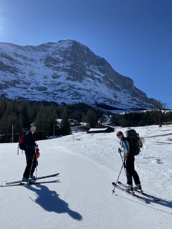
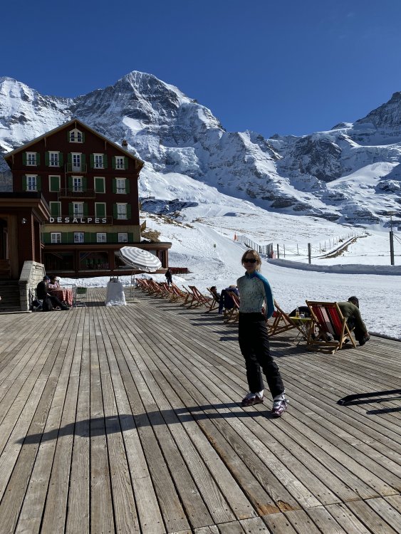
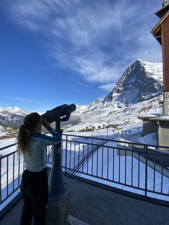


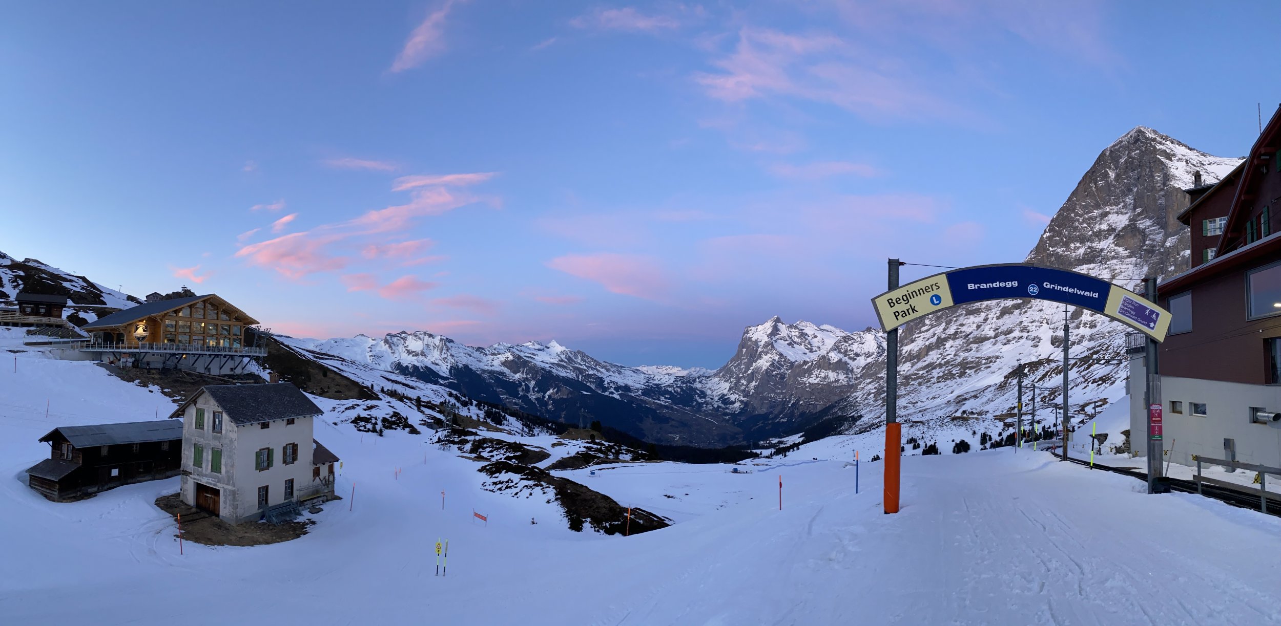
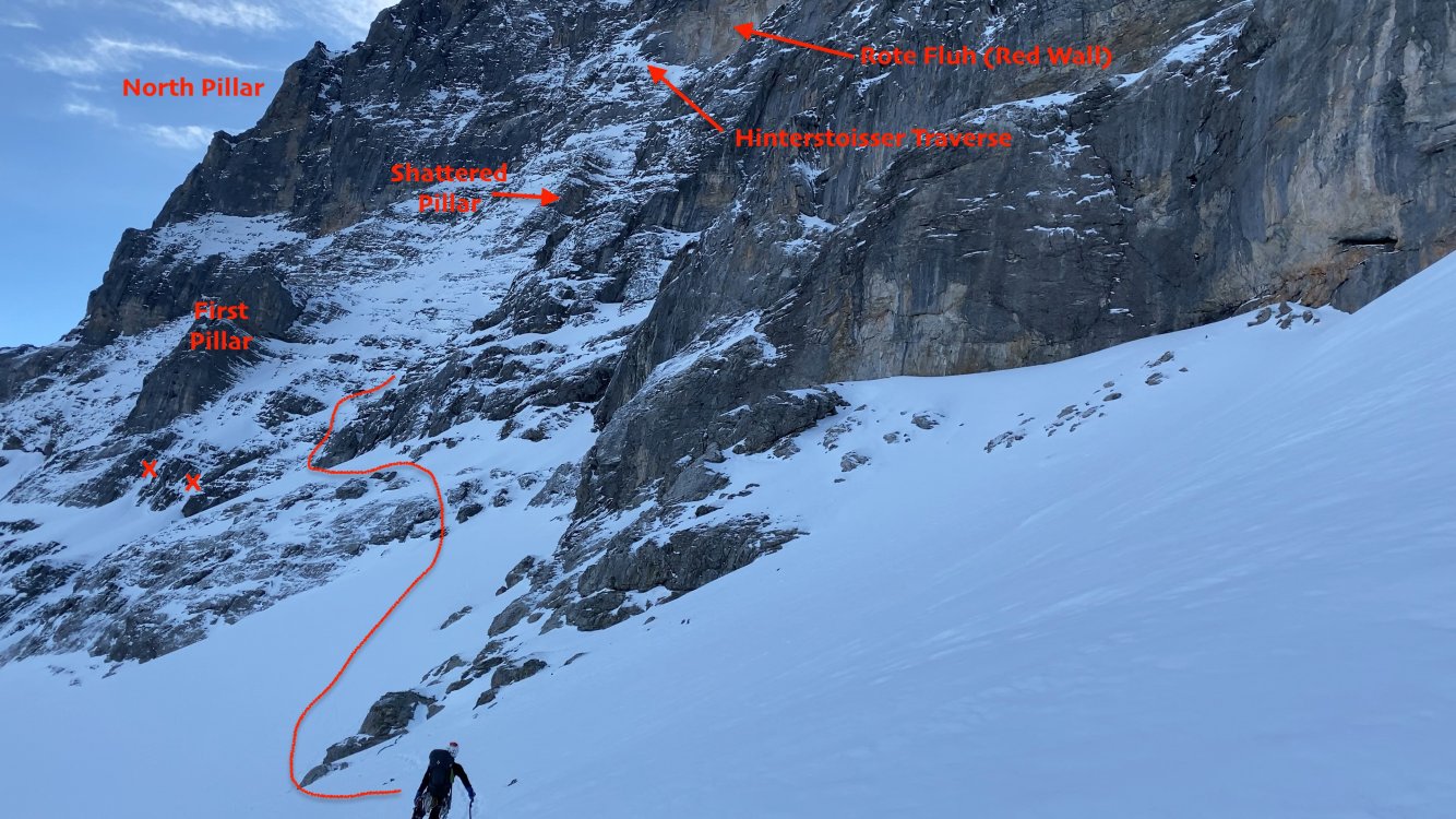
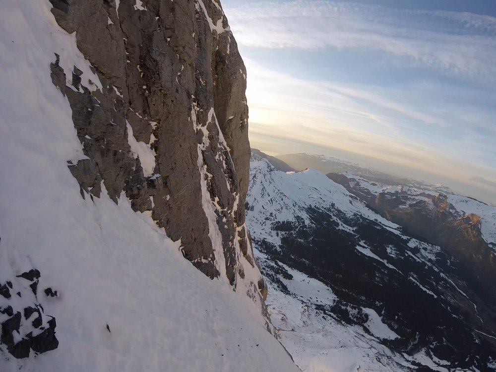
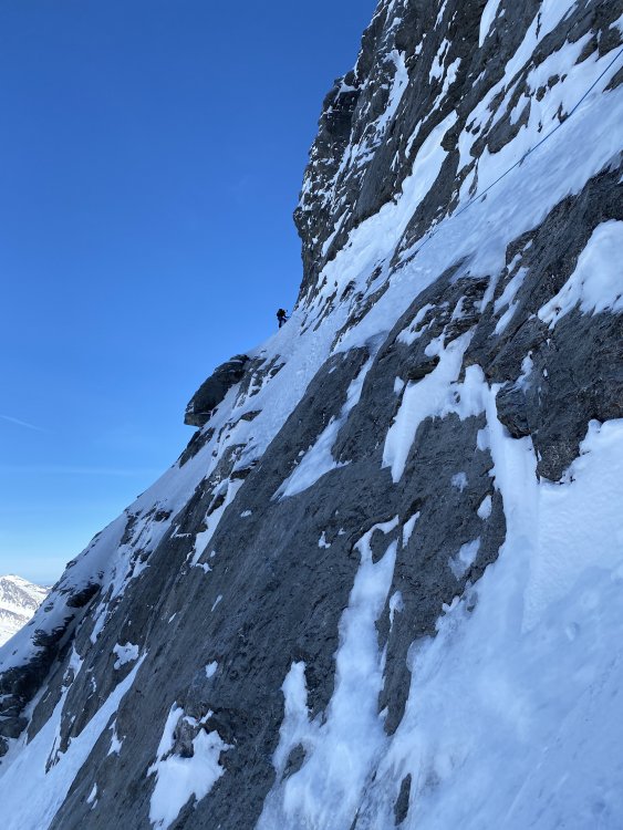
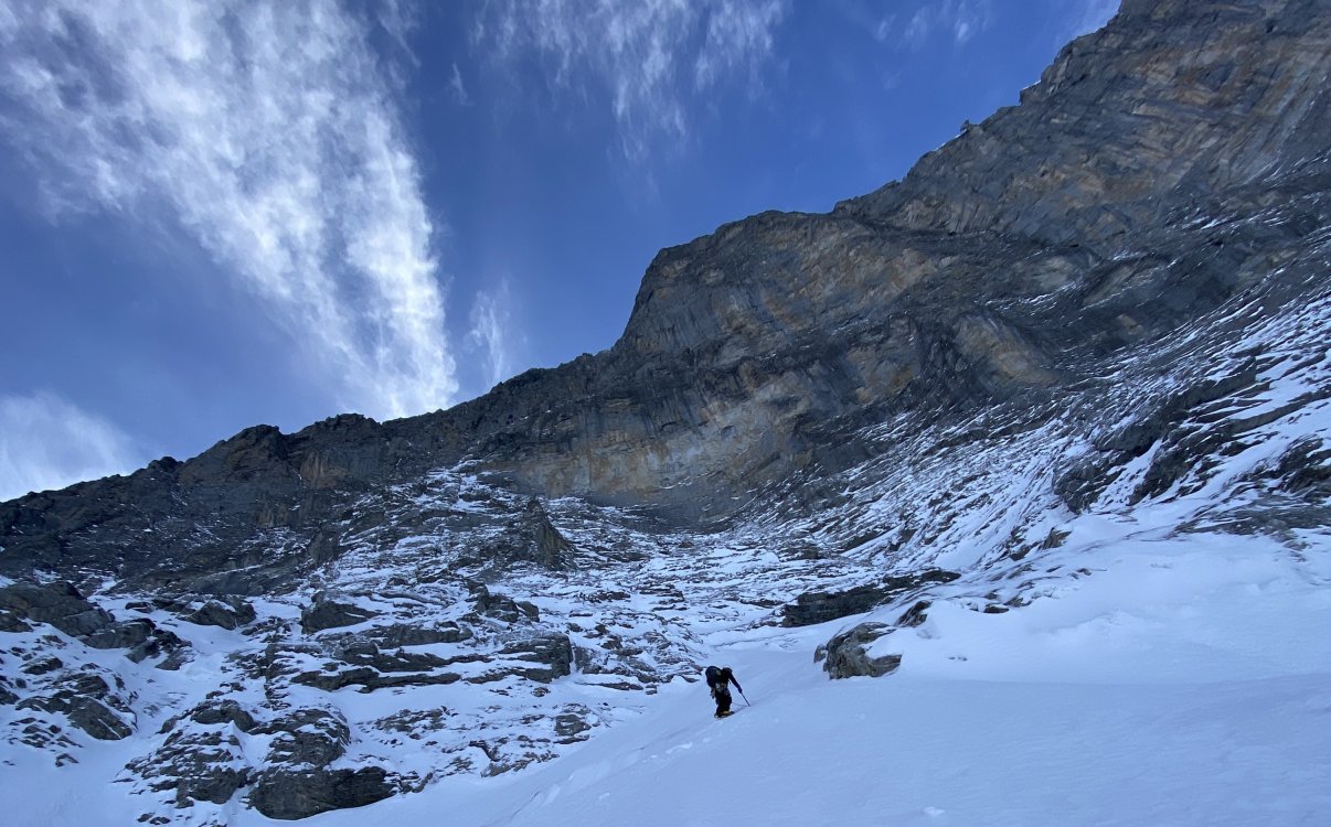
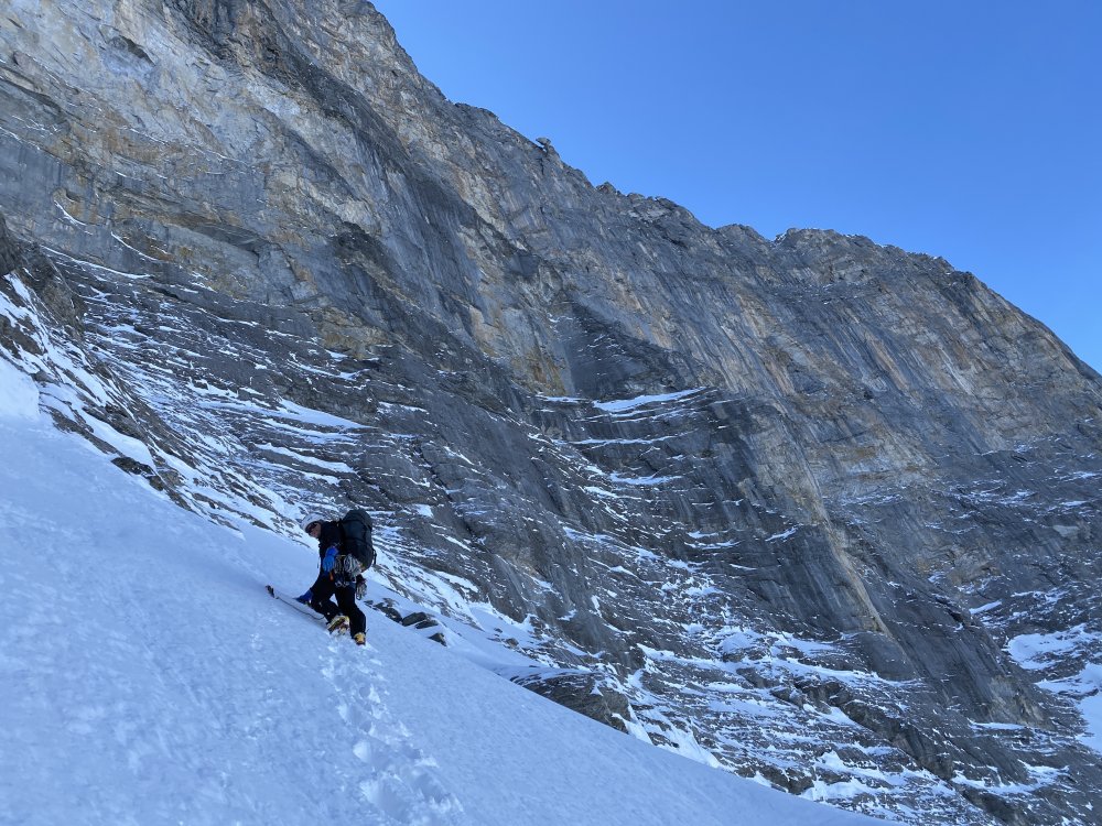
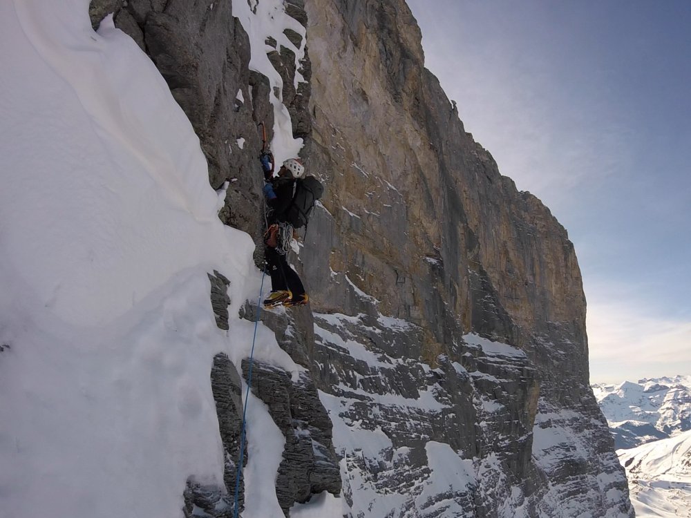

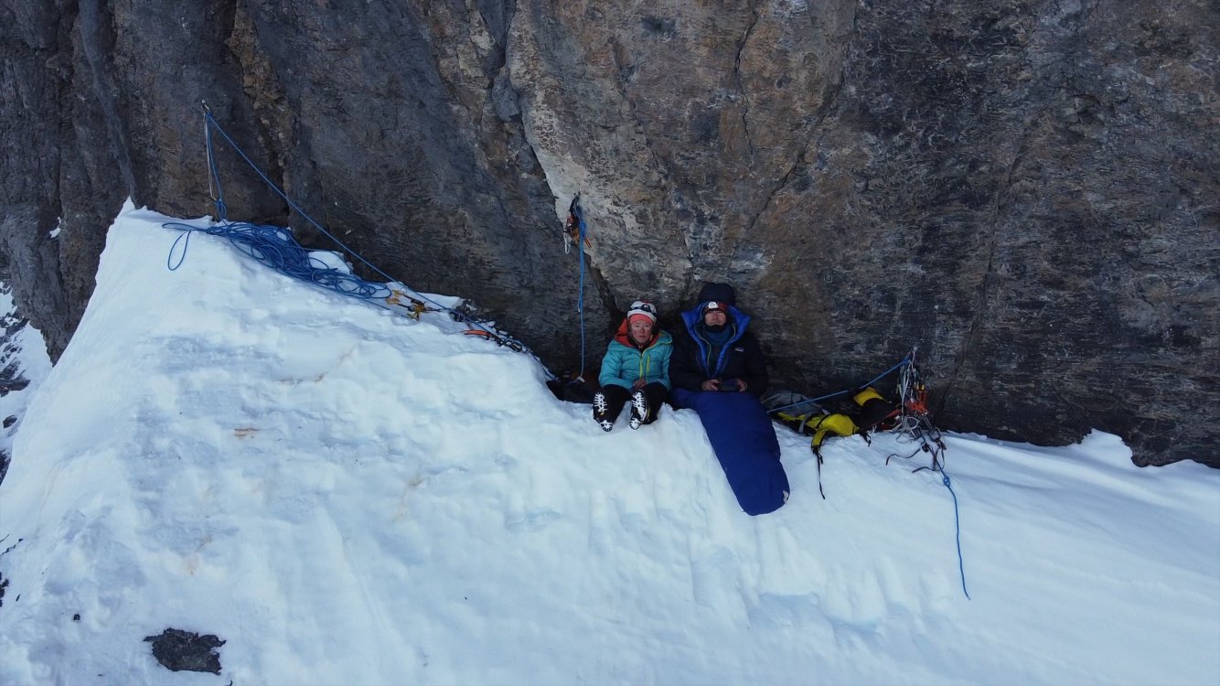

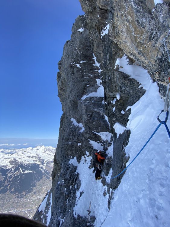
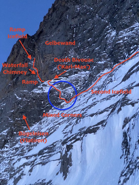
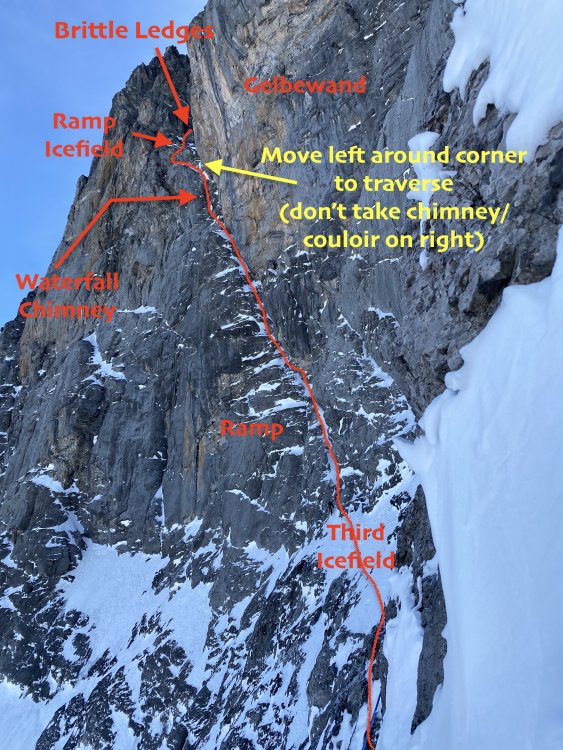

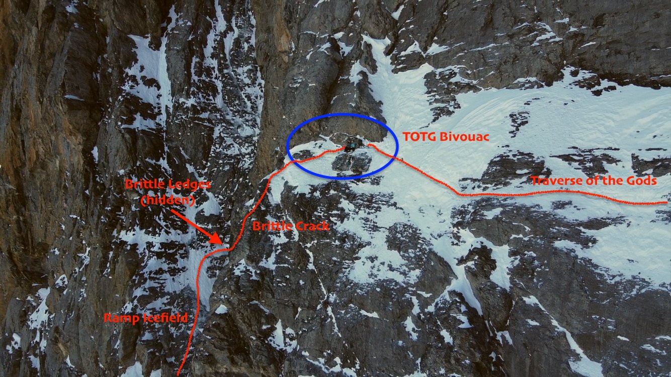
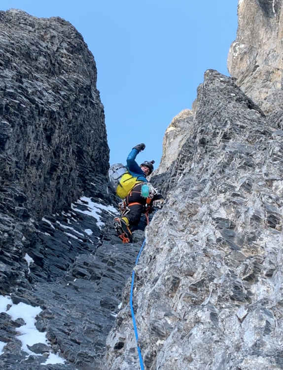
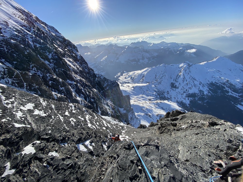

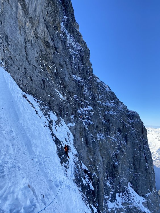
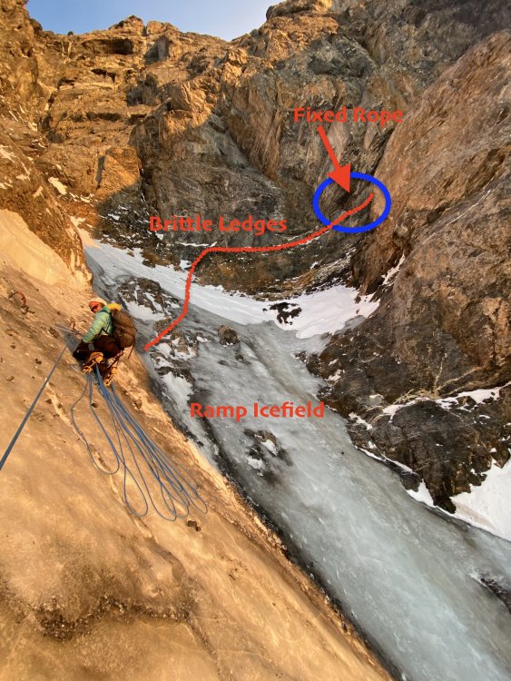

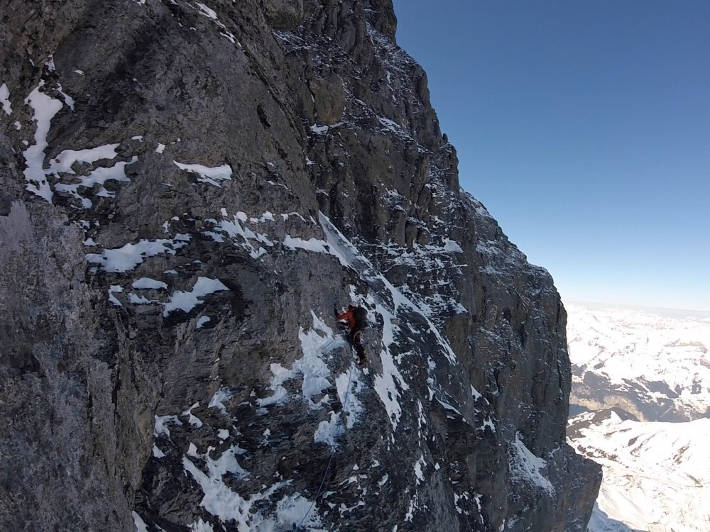
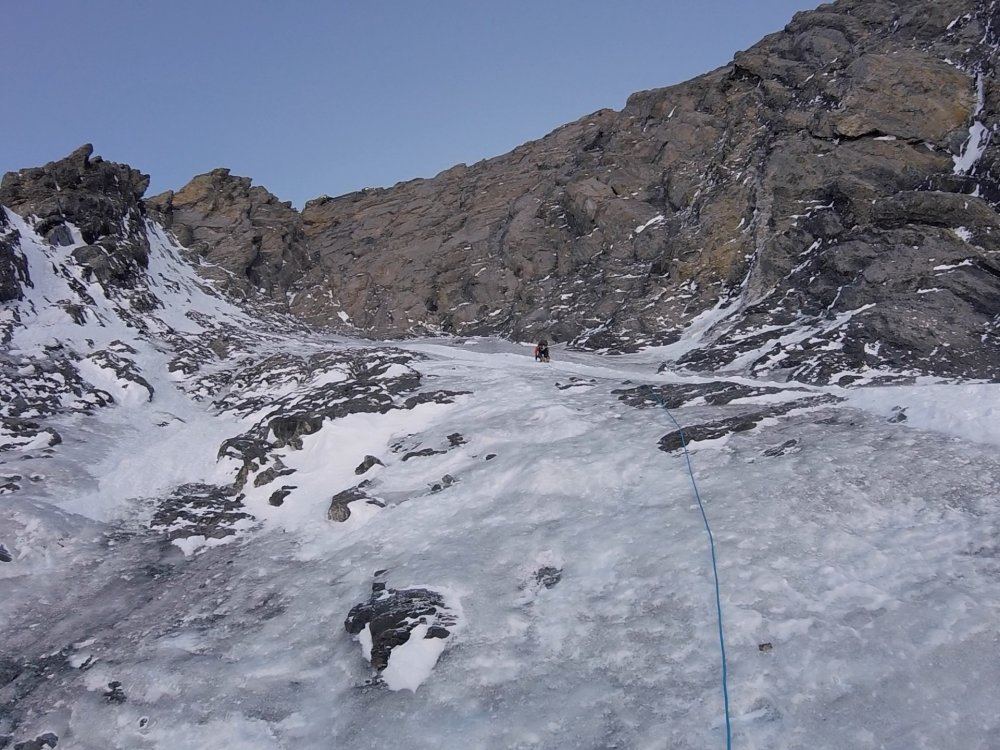
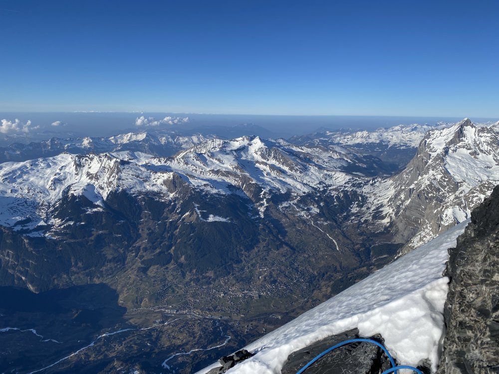
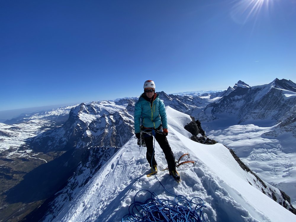
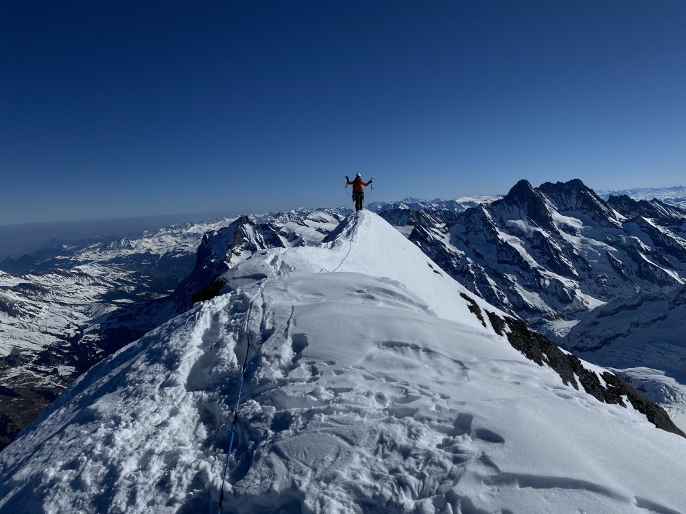

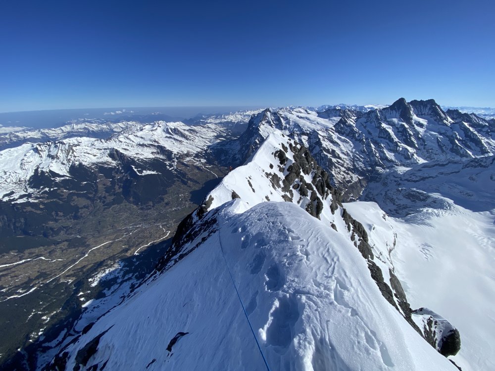

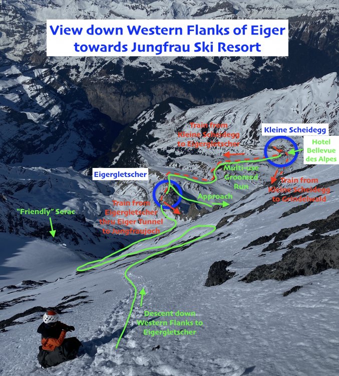
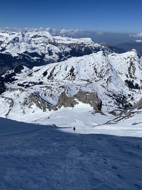
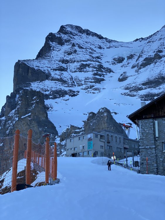
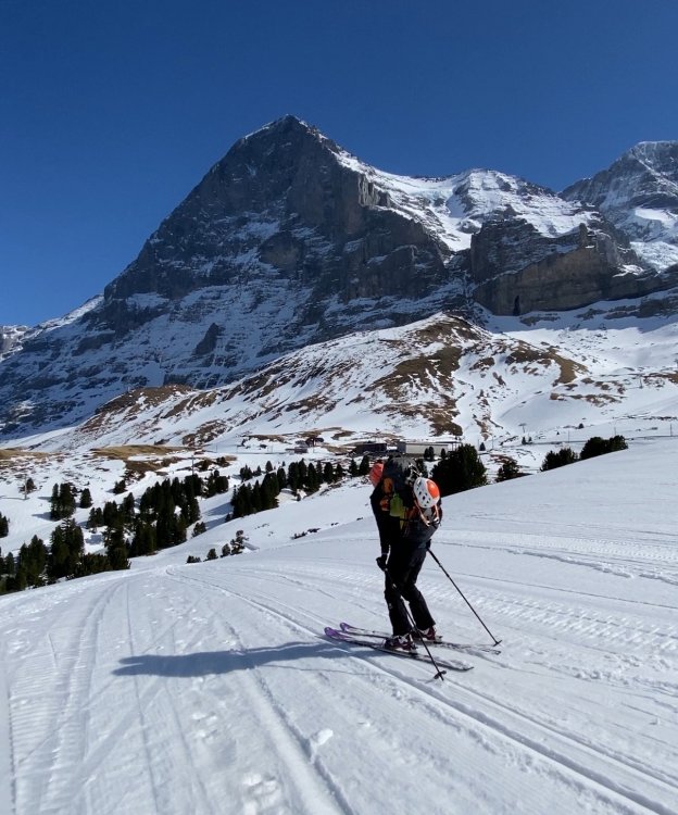
- 21 replies
-
- 10
-
-
-

-
Via dei Ragni: Grade VI, 95deg snow/rime/ice, M4, 1000m Scribe/Photos/Climbers: Jeff and Priti Wright Google Street View: Cerro Torre Summit 360 Panorama We’ve had a picture of Cerro Torre on our desktops, phone wallpapers, and posters above our bed for the past 5 years. It was the reason we took up ice climbing in the first place. In February 2016, we made our first attempt on this route, hoping to at least get a glimpse of the scale of the mountain and understand what it took to climb it. The weather was too hot by then for the climb, and after three days, our high point was below the hard technical climbing. Previous trip report: The road to El Chaltén The Fitz Roy Massif These past two months were our fourth (and longest) climbing trip to the Chaltén Massif, and sixth year of watching the Patagonian weather patterns. We wanted to return to attempt Cerro Torre again, but the next two seasons were not possible because of bad weather. Last year, at the beginning of February, we saw a fantastic weather window, and the stars aligned. We flew down to Patagonia in a 9-day magical whirlwind of constant movement, and summited Fitz Roy via the Franco-Argentina route. While on the summit of Fitz Roy, looking down at the surreal summits of the Torre, we were determined more than ever to come back the following season. Day 1. We arrived in El Chaltén on New Years Eve, the last day of a 4-day weather window (brecha)…we missed it! Since then, January was filled with short stints (8-12hrs) of good weather in the mountains, and the arrival of a 6-day mega window in early February sent an electric buzz throughout town. We were a couple of bats out of hell with our 40lbs packs each as we set towards Laguna Torre. The plan was to pass through the Niponino base camp in the Torre Valley and bivouac at the higher Noruegos (Norwegian) bivouac, which would put us closer to Col Standhardt (the next day’s objective)…the passageway to the West Face of Cerro Torre where the Via dei Ragni route begins. Our bivy site at Noruegos Day 2. From the Noruegos bivy site high on the slopes of the Torre Valley, we traversed near the base of the Torres, under the celebrated SE Ridge (perhaps the greatest climb in the world) and also the 1959 Maestri line to the triangular snowfield where so much history and controversy took place. From the East, all of the Torres stand impossibly steep and impassable. To get to the Ragni route on the West side, we would climb up and over the Col Standhardt where an implausible car-sized chockstone sits interminably between the col’s steep walls. From the col, one gets the first glimpse of the Southern Patagonian Ice Cap (Hielo Continental), a massive expanse of ice 200mi long. On a rare, clear day such as this day, we could see green Chilean fjords across the Ice Cap between large, snowy volcanos. A Lighthouse Several rappels deposited us down to the Circo de los Altares (Cirque of the Alters), an impressive crescent of white-capped peaks and toothed spires. From there we headed up another glacial ramp on Cerro Torre’s West Face to a high camp, 150m below the Col de la Esperanza (Col of Hope), first reached by Walter Bonatti in 1958 who hoped that this col would one day blaze a path to the summit. It wasn’t until 1974 that a team of Italians from the Ragni di Lecco (thus the name “Via dei Ragni”) completed Bonatti’s vision. Circo de los Altares Steep snow climbing and easy mixed terrain led us towards the camp at Col de la Esperanza, the camp we hadn’t reached on our last attempt. As we hiked past our previous high point, our hearts soared. This time around, the climbing felt much easier with 4 more years of climbing experience under our belts. Day 3. This day was a rest day of sorts. To set ourselves up for success on summit day, we were moving to the highest camp a few hundred meters up: El Elmo (“Helmet”), a prominent plateau below the steep, technical climbing. Those who were faster and stronger than us had gone straight to the highest camp the day before and were now going to do the hard work of battle-axing the bullet-hard blue ice and cleaning the cotton candy mushrooms of the summit. As we came over the Col of Hope, we entered an otherworldly expanse of mangled rime towers and precarious exposure. These deformed blobs of ice towers with icicle branches and feathery leaves seem like something only God or Dr. Seuss could conjure. It’s something so beautiful and terrifying at the same time. We were face to face, looking up at thisbeastly Tower. A spectacular nightmare. Day 4. Summit Day! We were pretty antsy to get going on the summit push. Falling snow greeted us when our alarms went off at 2:00AM as the mountain was enveloped in a cloud. All over camp, alarms went off and were snoozed as the precipitation discouraged movement. When the stars finally came out again, we were the first to muster our strength and get to work. Walking up to the base of El Elmo in the darkness, the first overhanging rime ice mushroom of the route, we gave a sigh “ah, breakfast!” The last 10m didn’t actually have any good protection (besides maybe a horizontal picket), and it was a sequence of cutting the feet loose, campus’ing from questionable tools, and shoving knees into the soft rime to make upward progress. Once at the top of El Elmo, a crowd had formed at the base, chomping at the bit. All of camp was finally up. The snooze button had proved an epic failure of our collective, strategically staggered alarms. We all watched in awe and gave whooping shouts from this low perch as our friend, Fabi Buhl, paraglided from the summit in the wee hours of the morning, slowly swirling in front of the spectacular sunrise over Lago Viedma. He was the first ever to fly off the summit of Cerro Torre having climbed the mountain first (and not dropped off via helicopter). After El Elmo, the mixed pitches zig-zag through a maze of rock and ice up to the base of The Headwall. Two pitches of blue, overhanging, bullet-hard ice. The final pitches mount three tiers of giant rime mushrooms facing the Ice Cap. This high ridge gets pummeled by the wet, freezing storms that race around the Southern Ocean to create these crazy rime formations. The first and second rime mushrooms had formed spectacular, natural blue-ice tunnels created by vortices of wind spiraling up the ridge, clearing a path through the thick outer layer of soft rime ice. Climbing into this vertical subway tunnel for 60 meters felt like entering a portal into another world. It eventually funneled up to an elevator shaft and spat us out of a squeeze tube. For the second and third mushrooms, we attached Petzl prototype “wings” to our ice tools to make purchase in the soft, overhanging, cotton-candy rime. These wings are horizontal plates that bolt onto the picks of our ice tools like Dilophosaurus gills. The Final (Summit) Mushroom was a beast. The previous day, it had taken the other parties many hours to clear a natural half-pipe, then dig a tunnel through the steepest part for many hours. Their line then exited their manufactured tunnel out onto the overhanging summit lip. Walking up to the steepest point on Cerro Torre on a perfectly still, clear day was absolutely surreal, basking in the bright orange-red glow of the sunset. The 200 miles of the Continental Ice Cap stretched before us and the Pacific Ocean now clearly visible. Behind, on the other side of the Torre Valley, small, wispy clouds hovered over the summit of Fitz Roy. We were lucky to get perfect lighting to fly our drone around for 30 minutes alone before we headed back down to our tents at El Elmo for the night. Days 5 and 6. To get back to town, you can reverse your way up Col Standhardt (M7 shenanigans), or take one of two trekking passes along the Ice Cap. We had experience taking the Northern pass (Paso Marconi) which was now in really bad shape. We opted for the Southern pass (Paso del Viento) to try something new, and hopefully be able to turn our brains off for a few days (sadly, this was not the case). The Hielo Continental spans 50mi across and crawls 200mi north to south across Southern Patagonia. It looked so beautiful and serene from our climb. Now, face to face with this beastly crocodile, it was the stuff of horrors. Canyons after canyons of impassable crevasses, we zig-zagged our way in no logical direction under a bright, unhelpful, full moon. From the air, our tracks must have looked like the random scribbling of a toddler on a massive, blank white floor. A sun dog greeting us after our descent. Finally reaching the pass and seeing people again after such a mental test of sanity was nothing short of jubilant. A popular trek is to take the pass South to Lago Viedma: the Huemul Circuit. We were now on a delightful trekking path and could now…finally… turn our brains off and just put one foot in front of the other for a mere 14 miles back to ice cream and showers and safety. Thanks: We had good confidence in the forecast and the length of the window, but it’s still important to have daily weather updates to anticipate the inconsistencies between each day. We’re so grateful for our weathermen who sent us updates to the inReach and gave us both confidence and peace of mind each day that we spun ourselves further from civilization: Dan Berdel, Devin Monas, and Rolando Garibotti. We’d also like to thank Dave Burdick (Alpine Dave!) for his support, inspiration and beta on the route. Also thanks to the American Alpine Club Live Your Dream Grant for supporting this trip. Recommended Reading: The Tower, Kelly Cordes Patagonia Vertical, Rolando Garibotti Enduring Patagonia, Greg Crouch Gear Notes: 13 ice screws (including 3 stubbies) 1 Picket (to place horizontally in vertical rime!) small set of nuts (Wildcountry Superlight) small rack of cams (Black Diamond Ultralight cams .4-1, Metolius Mastercam 1-3) 2 Petzl Nomic Ice Tools + Petzl prototype wings (rented from Viento Oeste gear shop in town) Petzl V-link Umbilicals 2 stuff sacks (gear management in pack, and also to leave for snow anchors) The North Face Phantom 50 backpack 4 double-length Petzl Pur'anneau runners with 2 Camp 22 biners each 2 double-length Petzl Pur'anneau runners with 1 Camp 22 biner each 7 single-length Petzl Pur'anneau runners with 1 Camp 22 biner each (can’t have too many runners) Patagonia R2 Jacket Patagonia Micro Puff jacket Patagonia Macro Puff jacket Patagonia Kniferidge hardshell jacket (didn't use)...also, it's now the "Ascensionist Jacket". Mainly wore the Micro Puff for outer layer Patagonia Nano Air Pants Patagonia Softshell pants (bibs) Patagonia base layer (top+bottom) Platypus 2L soft bottle Garmin inReach Mini (love this little guy!) Petzl Dart Crampons 2x Mammut Twighlight Twin Rope (7.5mm) Petzl Sirocco helmets Petzl Sitta harness (for him) and Arc’teryx harness (for her) Metolius Feather Nut Tool (each) Mammut Smart belay device (not the Alpine Smart) 3 lockers for group: Grivel Tau K12L, Grivel Lambda HMS, Grivel Plume 2 medium fuel canisters Jetboil Sol stove Safety ‘biner (each) – Edelrid 19g caribeener, Petzl Micro Traxion, short Sterling Hollowblock, Trango Piranha knife Bivy setup – Full Length Thermarest NeoAir XTherm sleeping pad, Exped Air Pillow UL, Feathered Friends Spoonbill sleeping bag MSR Advance Pro 2 Tent (amazing!) La Sportiva TX4 Approach shoes La Sportiva G2SM boots Petzl Reactik headlamps (each) + 3 extra AAA batteries + Petzl e+LITE headlamp Other things: 1 long spoon to share, chapstick to share, small Joshua Tree sun stick to share, Frog's Tung phone leash, lighter, whistle, duct tape, Thermarest repair patches, Voke tabs, Nuun, pain killers, 1L Platypus soft water bottle (for her) and 750mL HydraPak Stash (for him), warm headband, glove liners, 1 pair thick long socks (each), sunglasses, ear plugs, WRFA emergency form, small pencil, cotton handkerchief, wad of toilet paper, ID, Credit Card 1 Swix alpine pole (with snow basket) Arcteryx ball cap Adidas Sunglasses (with nose sun guard), no longer available iPhone 11 Pro (with route beta downloaded) GoPro HERO 5 Session (with helmet mount) DJI Mavic Mini Drone (remote and drone stored in USPS Tyvek bag) Dinner: 2 AlpineAire meals, 3 Near East Couscous boxes repackaged with small olive oil packets in ziplock bags, salt Day food was mostly bulky, yummy snacks: vegan jerky, dried mango, nuts, Cheese-Its, sesame sticks, Gu, nut butter, etc Approach Notes: Approached via Col Standhardt. Also possible to approach via Paso Marconi (currently in difficult/sketchy conditions) or Paso del Viento (long). We came back via Paso del Viento, but it's also possible to climb back over Col Standhardt (M7 shenanigans with old fixed ropes here and there).
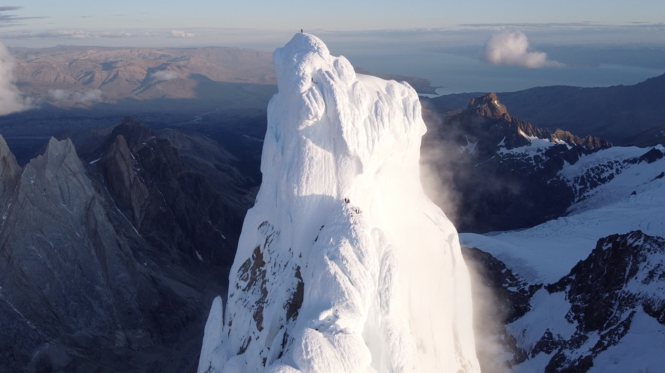
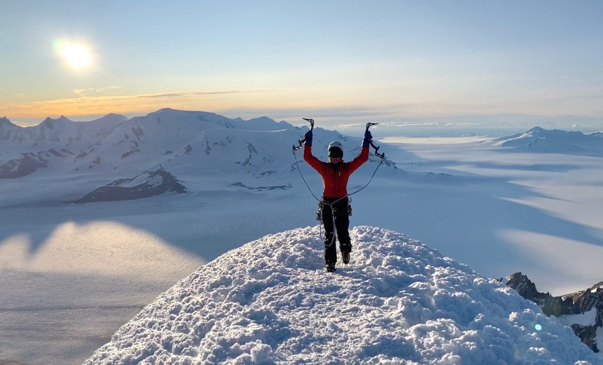
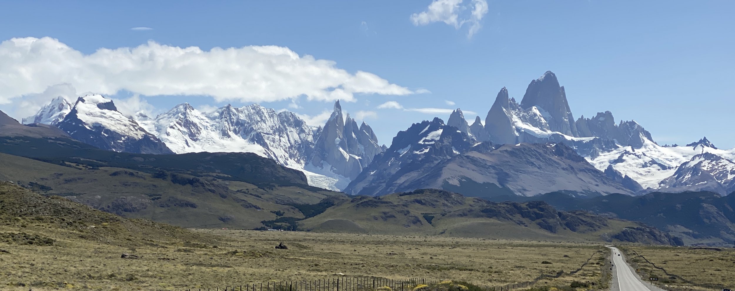
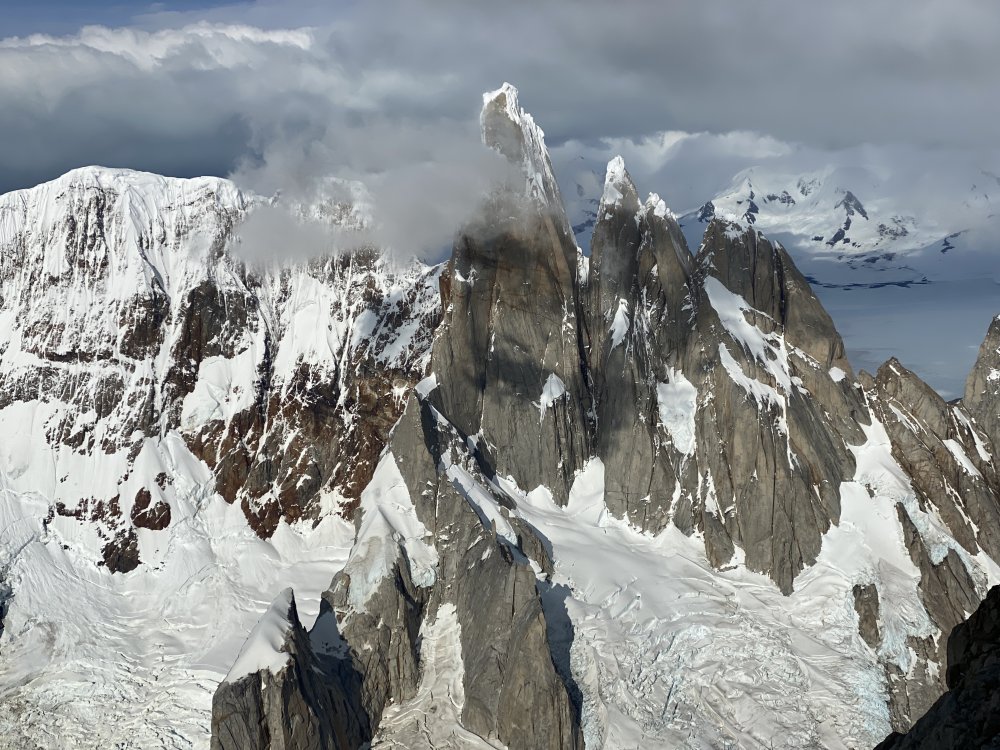

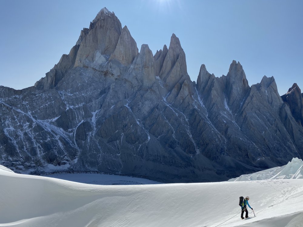

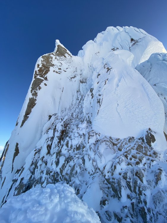
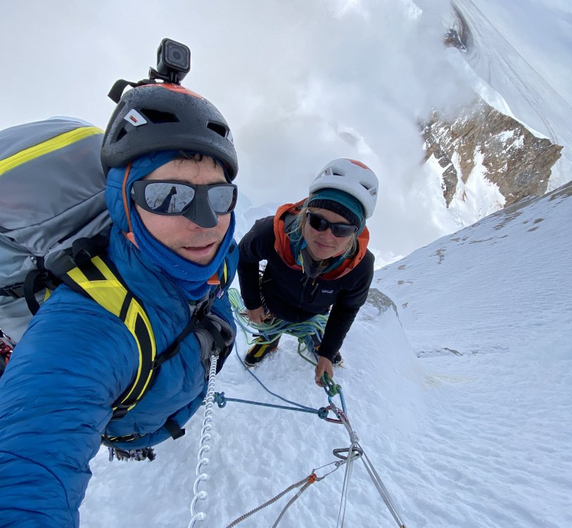
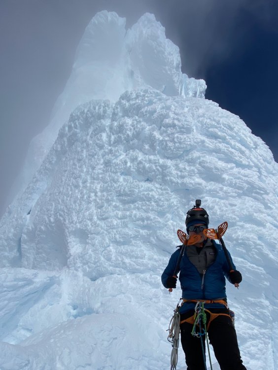
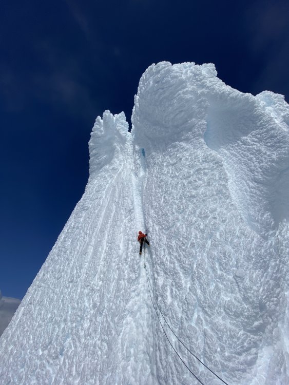


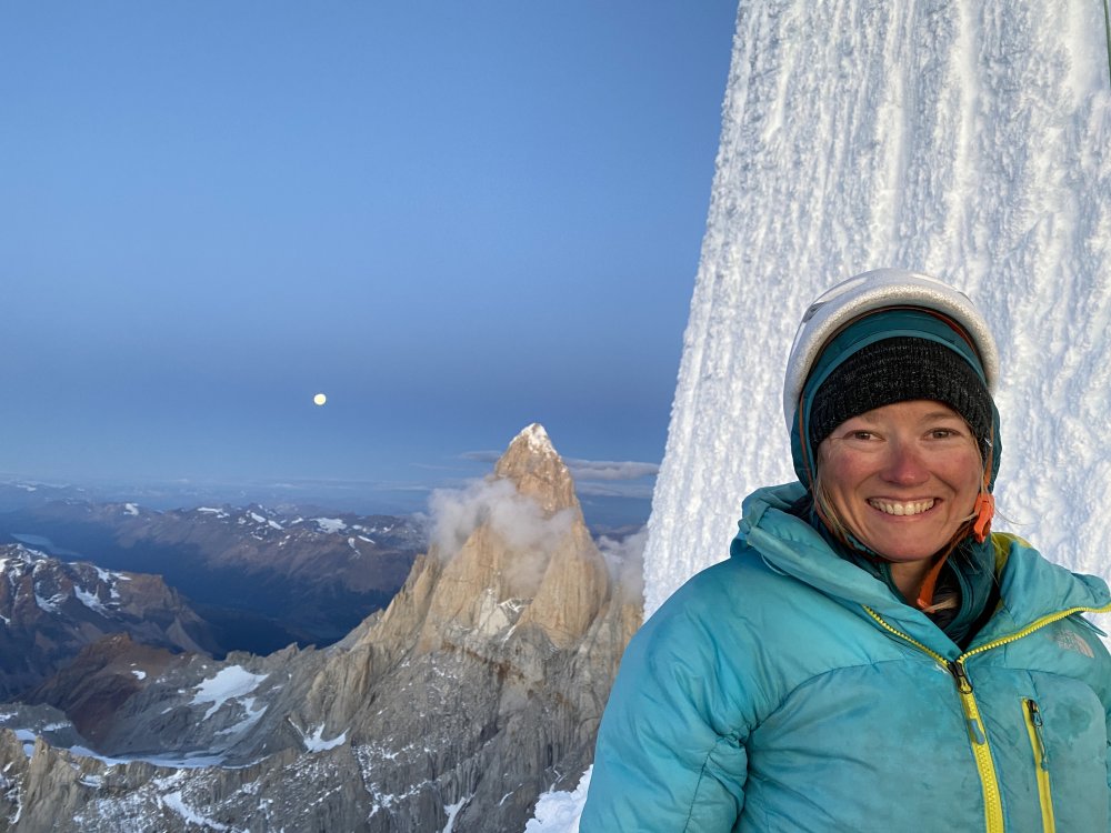
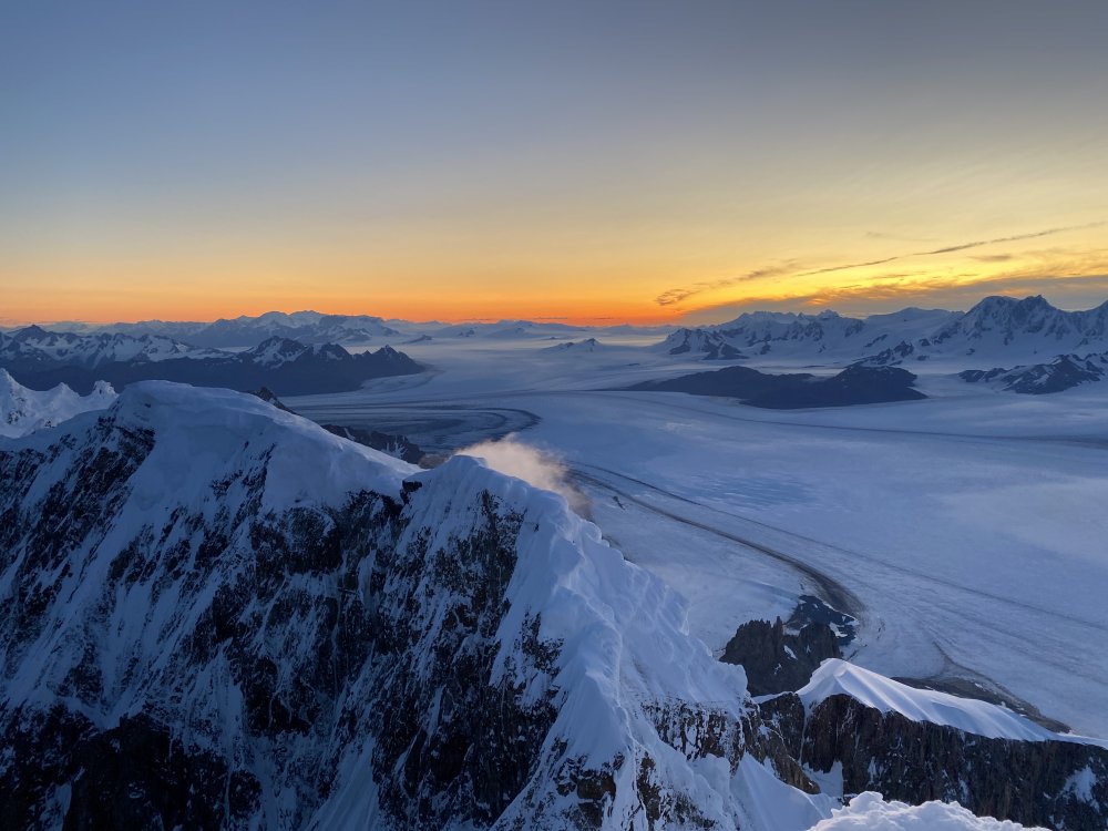


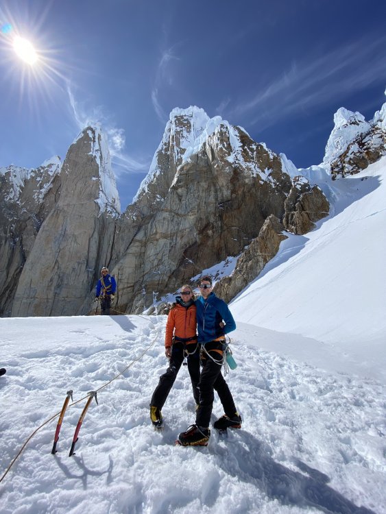

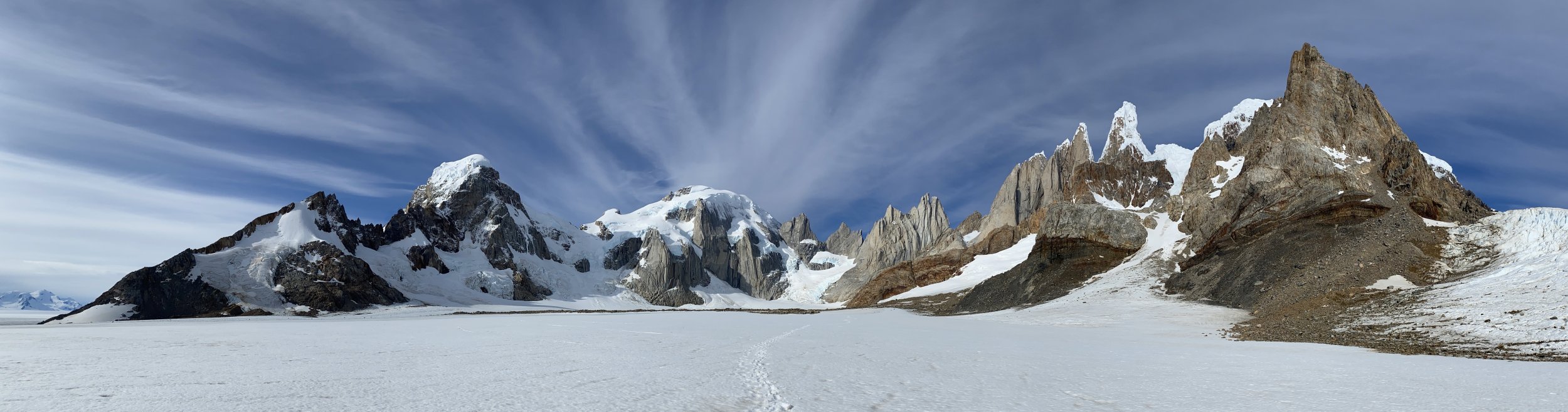
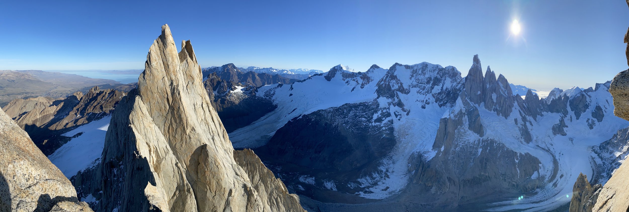
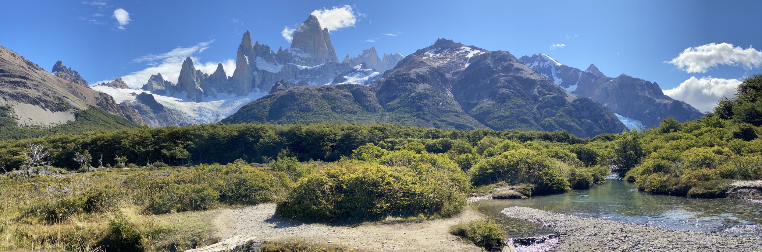

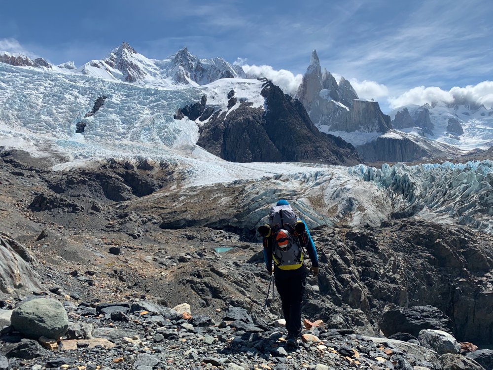
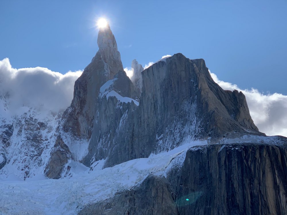


-
Trip: Mount Edith Cavell - North Face (Chouinard/Beckey/Doody) - Attempt Trip Date: 09/22/2019 Trip Report: Climbers: Jeff and Priti Wright, and Dane! High Point: Bergshrund at the base of the wall, above the Angel Glacier One of North America’s great mountain faces. The original North Face route on Mount Edith Cavell (near Jasper, Canada) takes the central line up the face to the summit. This was a Smash n Grab attempt from Seattle after watching weather and conditions for a month. I think we nailed it on both counts, which alone was a good lesson. We were joined by our friend Dane who has been climbing in the area for a month long trip and whom we met while climbing All Along the Watchtower this August. We got up to the base of the wall above the Angel Glacier bergshrund and were forced to turn around due to a crampon toe bail failure. None of us had brought spare crampon toe bails (lesson!). We're stoked to come back and try it again, now that we have the approach beta dialed. It was still a grand adventure! The typical style (which we followed) is to do the approach in a few hours by daylight to practice the routefinding on the complex 5.6 rock route up to the Angel Glacier to get around the hanging seracs. Then, come back to the car, sleep, and start over again at O-dark thirty to go for a car-to-car push in a day. This avoids bringing bivy gear up the wall. It was humbling and awesome just to get up to the base of the wall, stand on its bergshrund, and look up into the dimly moonlit vertical darkness with packs full of metal and desire. On the attempt in the dark, it took 4.5hrs to get from the car to the bergshrund. We had left two fixed ropes and top rope solo'd to avoid re-leading it. If I came back with a single rope, I would fix the 60m single rope from above the chimney (leave an anchor) to get all the way to the bottom of the 5th class start, then re-lead the final 25m again in the dark. The route is commonly climbed in July and August, which brings two hazards: 1) rock fall, and 2) a band of exposed, loose, unprotectable shale near the summit ridge. By waiting until late August-October, the rock is more stable, and the band of shale is covered in snow and/or ice. The downside is that snow on route makes the climbing mixed, and icy cracks can make it difficult to find protection. By late September, the approach is still dry, 5.6 rock climbing (which we did in boots). The wall, however, was all snow-over-rock, which makes the 5.7 rock on the wall a mixed experience in crampons and ice tools (instead of rock climbing with rock shoes in the summertime) . This TR only describes the approach. The original route took 3rd class terrain to the left of the Angel Glacier ice flow. But hanging seracs now threaten much of the wall, and a new 5.6 approach route goes way right of the ice flow to gain the Angel Glacier. This route is totally safe and stays well away from the hanging seracs. The picture above is our high point along the Angel Glacier to the bergshrund, and the approximate North Face route is a dashed line (which we didn't get to do). We followed the hand-drawn topo on Mountain Project, and it was REALLY useful! https://www.mountainproject.com/photo/107268014 From the parking lot, cross the small stream and immediately gain the lateral moraine (shown above) which eventually leads up to the wall. As you approach, take note of 25m tree rappel (above your head) shown in the topo which is an alternate descent to down climbing the 3rd/4th class approach. Continue traversing on a 3rd class path for quite a ways, step across one stream from a waterfall, and continue until it forces you to start ascending up and right to a large ledge (shown in the topo). This is the same ledge which leads to the optional tree rappel descent (this tree is easy to find and is all the way climber's right along this ledge). The approach is left of a small waterfall and right of the larger waterfall (as shown in topo). Below is a picture of the tree from which you can make a 25m rappel, if descending. From the large ledge, continue up 3rd/4th class terrain (unroped) and look up for two sets of double roofs. The lower set is orange and you belay just below this. The upper is black, and has and a white cord hanging from a pin just to the right of it. This white cord is a crummy anchor, or (more likely) a redirect to the better anchor further right (one pin, one bolt). There are two options for the start, if you take the easier option (right), you won't pass by this white cord at all. Two pitches gain the upper 3rd/4th scramble. Recommend making the 1st pitch a short, 20m pitch and stopping at the bolt anchor to avoid an awkward belay further up in the chimney. The second pitch goes up a chimney (no actual chimney moves, nice feet and hands abound), and is a 60m rope stretcher with a short overhang section. Both pitches are just left of the corner waterfall shown in the picture below. The picture below also shows Priti and Dane on the big ledge (the same ledge where the tree rappel is). We had twin ropes and fixed one long 60m rope from the top of pitch 2, then fixed a short 20m rappel from the bolt anchor. This allowed us to top rope solo the route in the dark the next day with a micro traxion and skip having to re-lead it in the dark. Watch out for snafflehounds in the summer! The picture above is looking up from where you first rope up. Above is the bolt/piton anchor above the first pitch on a good ledge. If you take the right variation on the first pitch, it leads directly (and obviously) to this anchor. The second pitch looks a little different than what the topo describes (beware). Start up a chimney (shown above) for 20m to a scrambling section. Then cross right on easy terrain under large orange roofs (don't keep going up a ramp straight up, shown above). Then a short overhanging move with good feet and hands (5.6) to a large ledge with a 2-pin anchor (may require a few meters of simul-climbing to reach this anchor). You can add in a good black Totem to this anchor to back it up. From this ledge, you can unrope. You are not yet on the large ledge shown in the topo which crosses the waterfall; this is still above you. Continue straight up from the anchor on easy 4th/low-5th until you find the large ledge. Cross back right across the waterfall and continue to a large left-facing corner. Easy ledges take you well up the corner system until you can exit right on easy 3rd class steps. Don't leave the corner too early! Pass through a patch of small trees, then across a grassy patch to look up and see a large, obvious notch (easy to pick out in moonlight). Continue up scree slopes to this notch. Once at the notch, the topo recommends descending 15m, then ascending a gully. We did this, and we do not recommend!!! Loose, hard, and scary. Instead continue up a right-facing corner straight up from the notch; this looks difficult, but there are good feet to stem. Once above the corner, traverse way left to get onto the Angel Glacier. Whew! Water plan: Here you will find an optional bivy site and running water. Allegedly there is also running water at the East Ridge col. You can start from the car with just half a liter of water, fill up a couple liters at the bivy site, then fill again at the East Ridge notch (maybe). The Angel Glacier is heavily crevassed near the seracs (obviously) so you can make a wide sweep to get away from the edge. It gets a little steep when you approach the wall, but not too bad. Some reports mention that it gets tricky to cross the bergshrund in summertime. The East Ridge (recommended) is way shorter and takes you straight back to your car. This is the descent recommended to us by the Smileys. The West Ridge is much longer, with complex routefinding on easy 3rd class terrain, and forces you to walk back up the road to get back to your car. The East Ridge is mostly 3rd/4th but stays mainly on the ridgeline (shouldn't be too hard to find your way in the dark) and has a crux 5.2/5.3 section that some parties rappel. This 5.2/5.3 section is located just above the shoulder, halfway up the ridge. Below is the easy descent from the East Ridge col which takes you along the lateral moraine to a trail and back to the trailhead. Gear Notes: Pickets for the summit snow field, 4 screws (various sizes), rack to #3, nuts, 2 KB's, 2 ice tools each Approach Notes: Read above


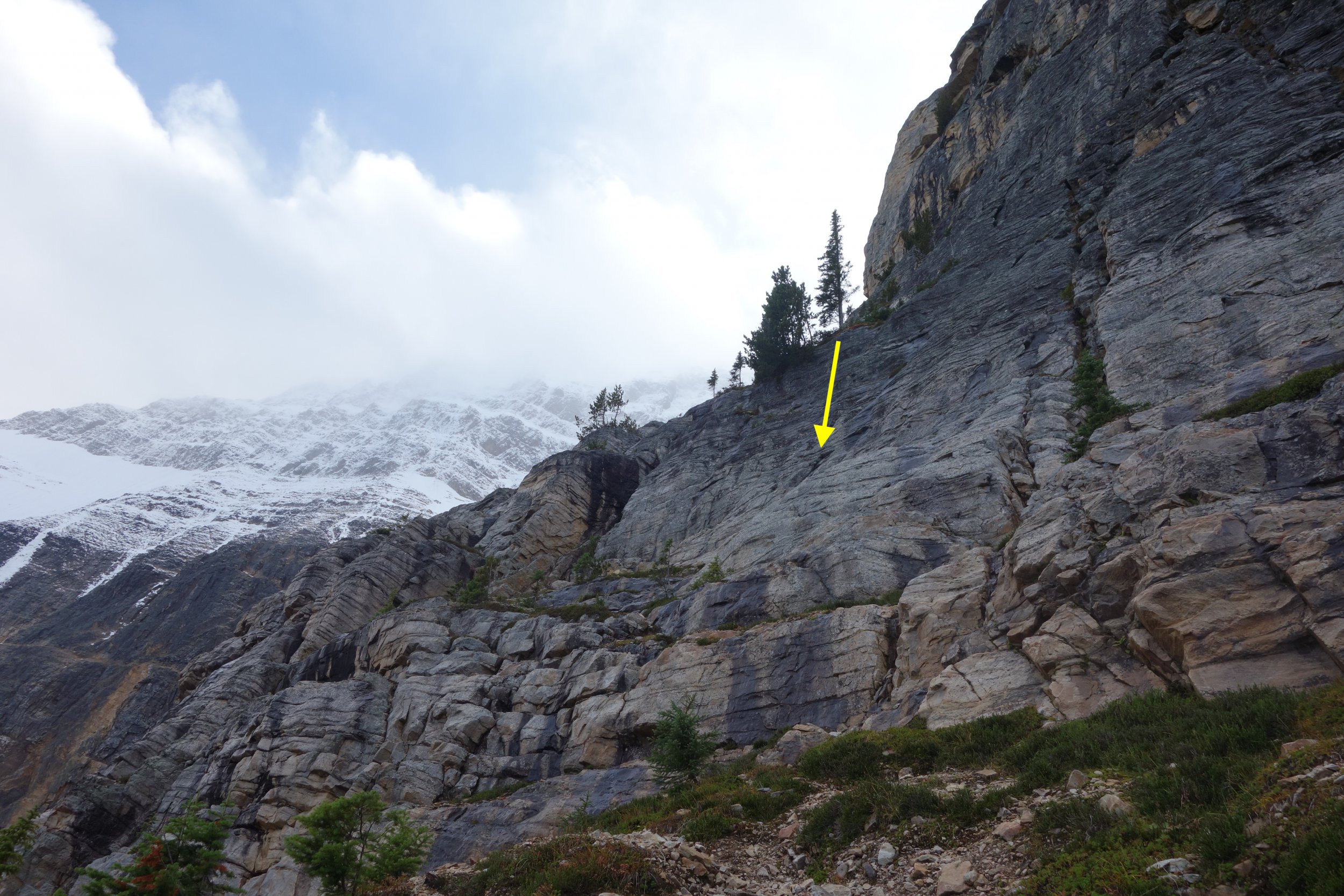
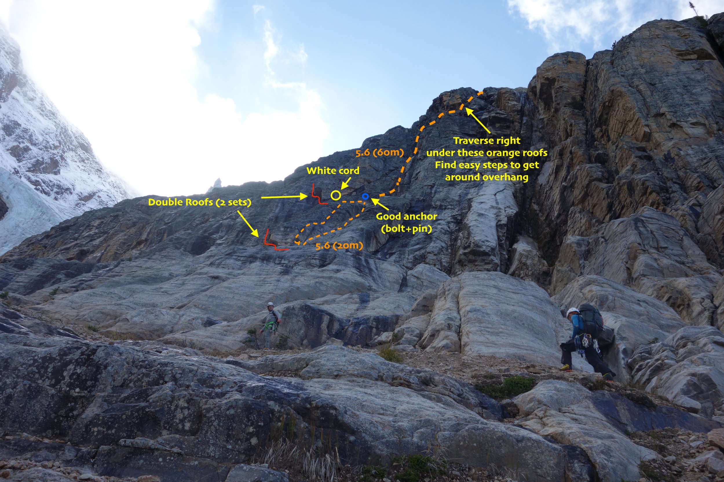
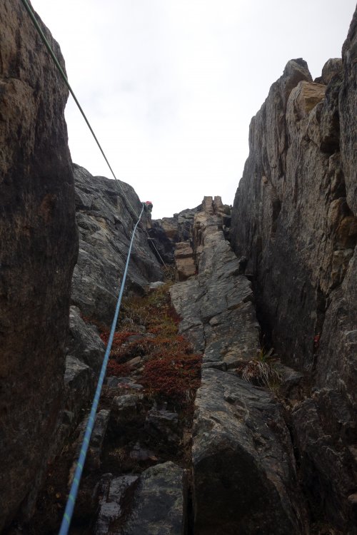
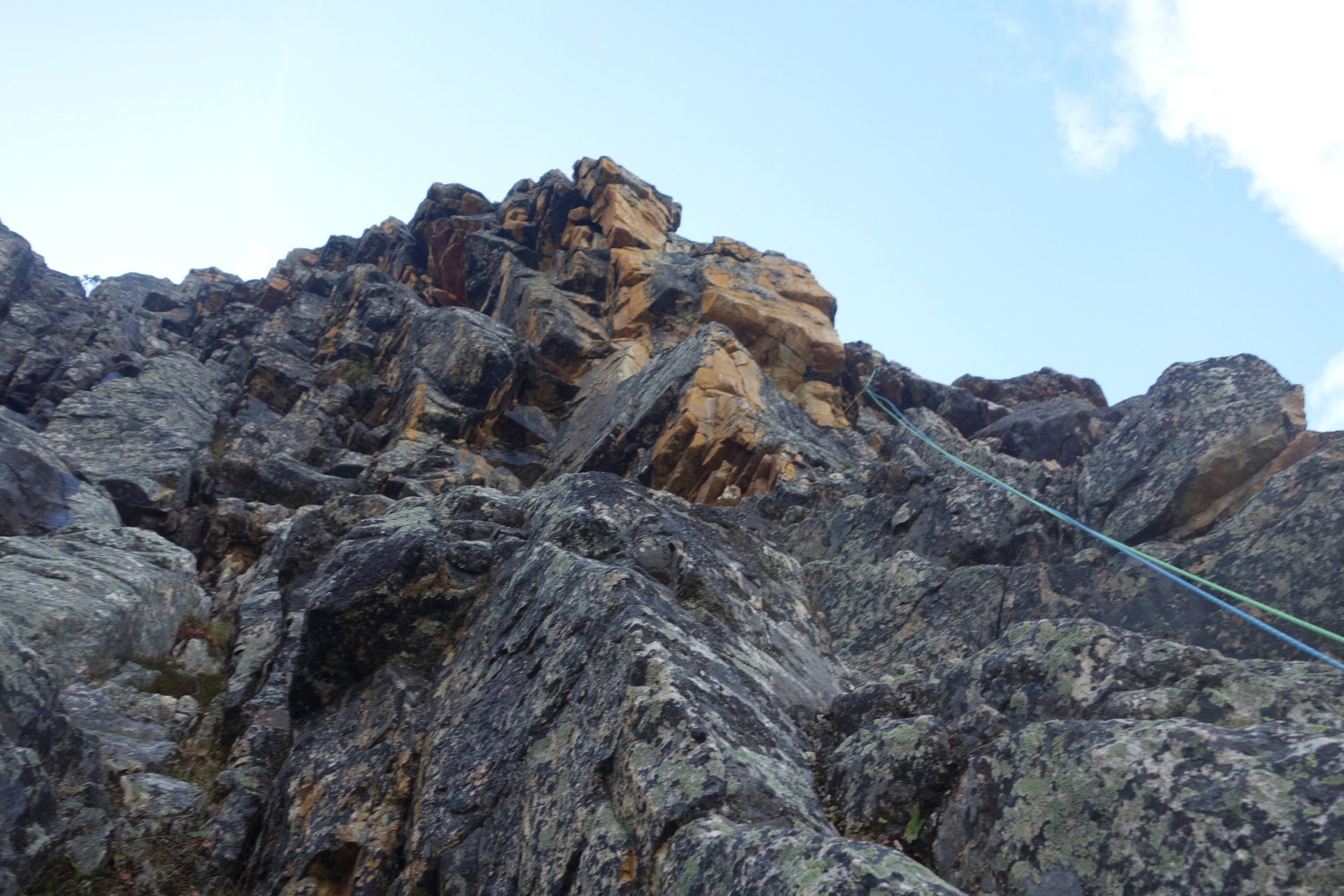
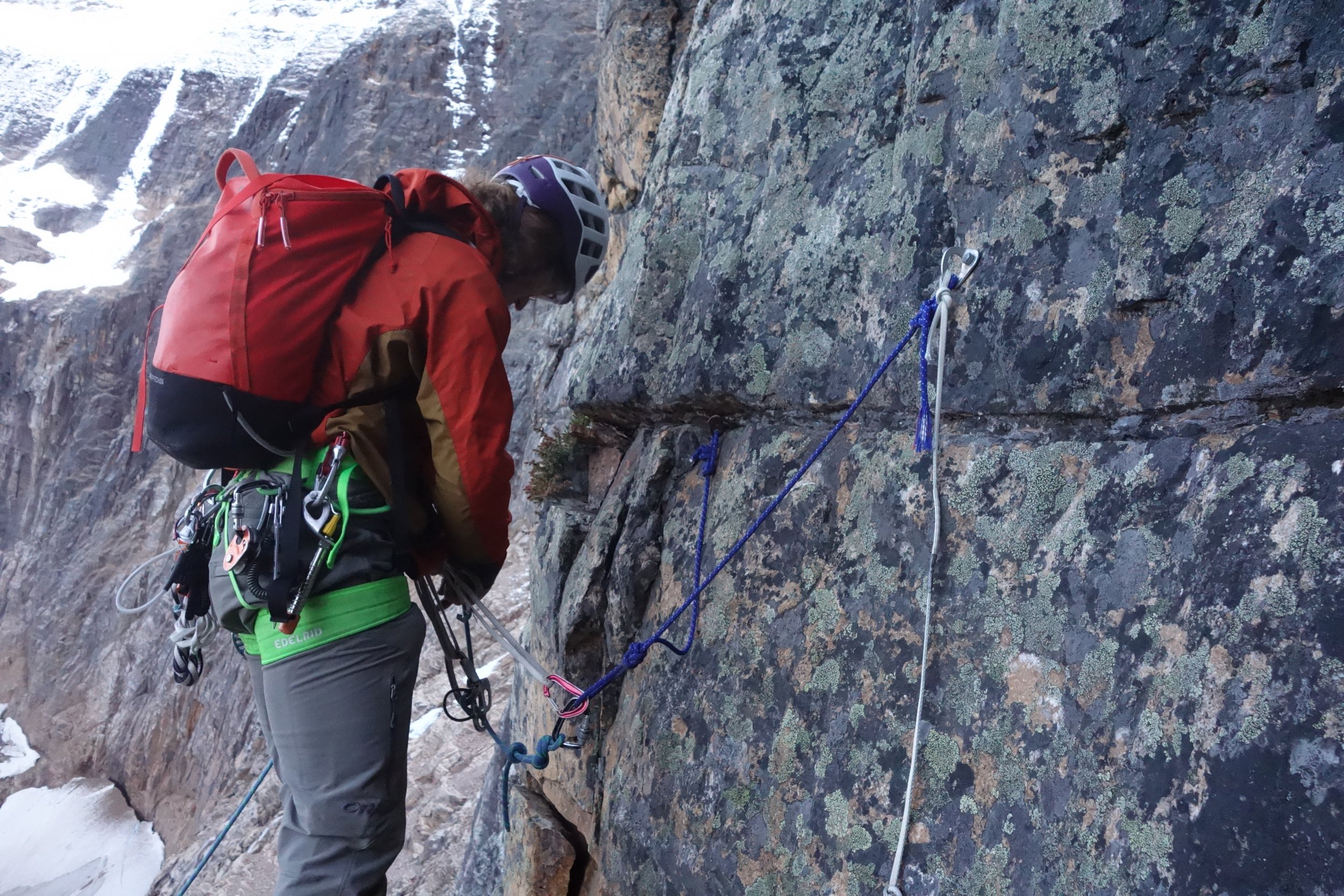

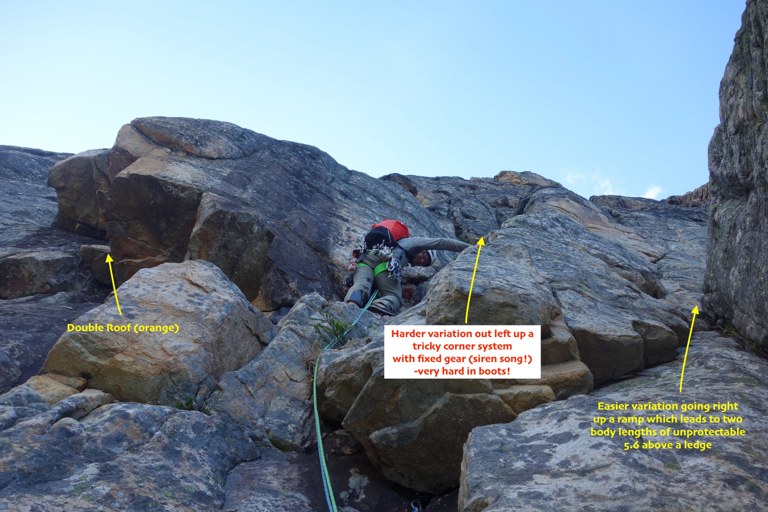
-
Trip: North Howser Tower - All Along the Watchtower Trip Date: 08/06/2019 Trip Report: Climb Date: August 4-6, 2019. Summit August 6, 2019 Climbers: Jeff and Priti Wright Climb: All Along the Watchtower (Grade VI, 3000ft, 32 pitches, 5.10/C2- or 5.12) Style: Follower jugged every pitch in the Dihedral with micro traxions and runners. Heavy French/Aid utilized by the leader in the Dihedral. Two packs brought. Leader climbed with light pack, except in the Dihedral (where follower jugged with one pack on, trailing the other). Two bivouacs (one at base of Dihedral and one on the Summit ridge). With so little beta out there on the route, we found the route finding tricky. This post is intended to be a beta sheet to help with route finding. All Pitch numbers are per Jenny Abegg's topo which was very useful (https://jennyabegg.com/climbing/trip-reportsbeta/all-along-the-watchtower-north-howser-tower/). Pitches 2 and 3 were confusing and we split each of these into two pitches. If you stay on route and watch rope drag, you can avoid splitting these up. They are both full-length pitches. Pitch 3 is so wander-y that rope-drag might be unavoidable - recommend splitting this into two pitches. Pitch 16 (5.12 crux roof) in the Dihedral was only pitch where we thought it was mandatory to disobey Jenny and split into two pitches. Topos Jenny's topo was pretty spot on. Pitches 8-11 on Jenny's topo are the dyke variation that Westman/Haley did (on accident) which ascends directly up from the bivy ledge. Jenny's topo does not show the original route option, which splits off 30m below the bivy ledge. If you wanted to get snow at the bivy ledge and continue on to the original route, you have to rappel or down climb 30m 5.7 to meet back up with the original route. The party behind us did the dyke route and we did the original route. After talking to the party who did the dyke route, it's very safe to say that the dyke is better way to go. The Mountaineer's guidebook (the green book) topo shows both the original route and also the dyke route options, but the High Col topo shows only the original route. The High Col topo is not accurate at all, so be careful. Keep a copy of Jenny's and the Mountaineer's topo on you. Bivy sites: -We didn't see any good bivy sites until atop Pitch 7 (flat, walled, snow in early season). Some descriptions said there was one atop Pitch 3, but it's more of a sitting bivy. -Another good bivy site is out-of-the-way, about 20m left of the base of the Dihedral (flat, walled, no snow). Some descriptions said this was 4-person, but it fit the two of us pretty snug. To get from here back to the base of the dihedral, you have to down-climb 10m (5.7) then ascend 10m (5.7) to the base of the Dihedral. -Some bivy options along the ridge (four of us stayed at one, very snugly, about halfway on the summit ridge above the seventh rifle gully). -A flat, walled bivy spot on the summit (lots of snow throughout the season). When we saw it, it had thick snow/ice on it, so you'd be sleeping on top of snow. Photo Credit above: Tim Banfield Descending down to East Creek from the Pigeon-Howser Col. Left to Right: North, Central, South Howser Towers, Minaret. Priti is just below the Beckey-Chouinard Route From East Creek descend until you can scramble up to the ridge. Stay low on ledges if you want to cross over into the gully ("B" in picture, not recommended, loose scree and hard ice). Recommend staying on the ridge (climber's right side, "A" in picture) as if approaching for Beckey-Chouinard on South Howser Tower. From the base of Beckey-Chouinard, it is easy to scramble down to the snow to traverse high over to the North Howser Bivy Rock. This is a big, obvious boulder just at the next ridgeline. There is a luxurious, sheltered, covered bivy cave here (recommended instead of East Creek if you only have bivy gear and you want to get an early start for the route in a push). Four rappels (two hangers, chains, rap rings) take you to the snow below. The first rappel is heavily cairned and easy to find (even in the dark), requiring a bit of down-scrambling to get to the lip of the ridge. The rappel line is straight down. Each rappel is easy to find and on obvious ledges. You'll want crampons and ice axe for the snow below, on the way to the base of Watchtower. We used a Beal Escaper for the rappels which worked like a charm... we did not bring a pull cord on this trip. Note: rappels shown in picture above are approximate (just use cairns to find the first one, then take the plumb line). The picture is not intended to help you find the rappels. The first rappel. Crossing the moat. Another party of rappelers above. The approach snow after the approach rappels. You're committed now! Looking up North Howser Tower. Approach at the base all the way left to big ledges just before the large, obvious gully. Take ledges all the way left to dihedrals. Pitch 4 (above), 5.10, full 60m: a striking dihedral (protect on the face on the right) which starts as an easy stem/chimney and ends in an overhanging, difficult off width. Photo credit: Dane Steadman Bivy site along ridge. Looking down the ridge from the summit. Photo credit: Dane Steadman "Hand crack on the right side of crest". Party on the summit. Photo credit: Dane Steadman Simul Rappelling over the bergshrund. Photo credit: Dane Steadman Joining up with the Beckey-Chouinard steps. Photo credit: Dane Steadman Gear Notes: Double Rack to #3. Single #4. Triples in finger sizes for dihedral. Offset nuts, brassies. Did not bring offset cams (did not think they were necessary). No aid gear. 1 sleeping bag to share. 1 bivy sac to share. 1 Jetboil. Beal Escaper for rappels. We did not bring a pull cord. Recommend a pull cord to 1:1 haul packs in the Dihedral. Approach Notes: Started from Kain Hut, ended at car.


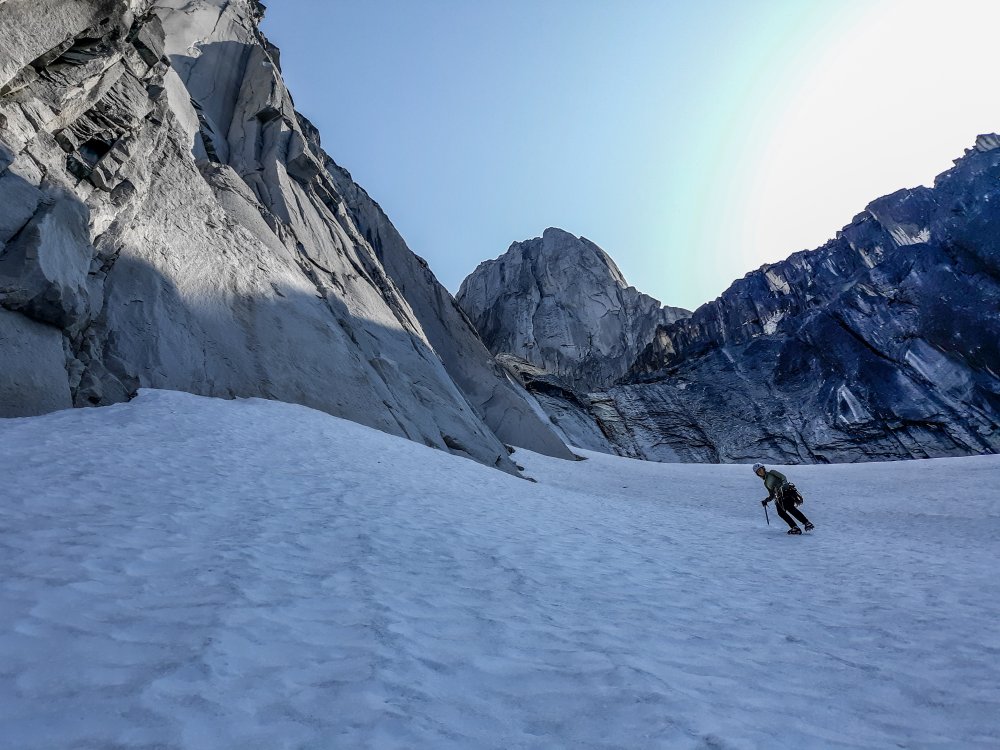

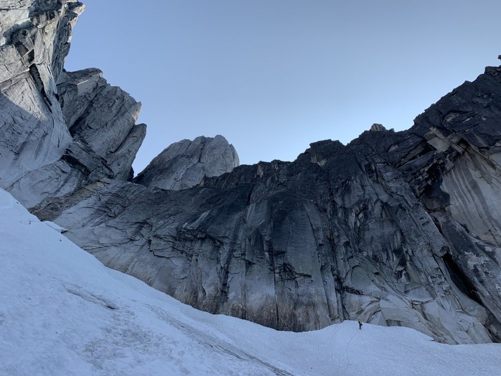

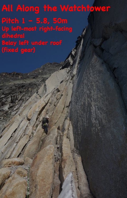


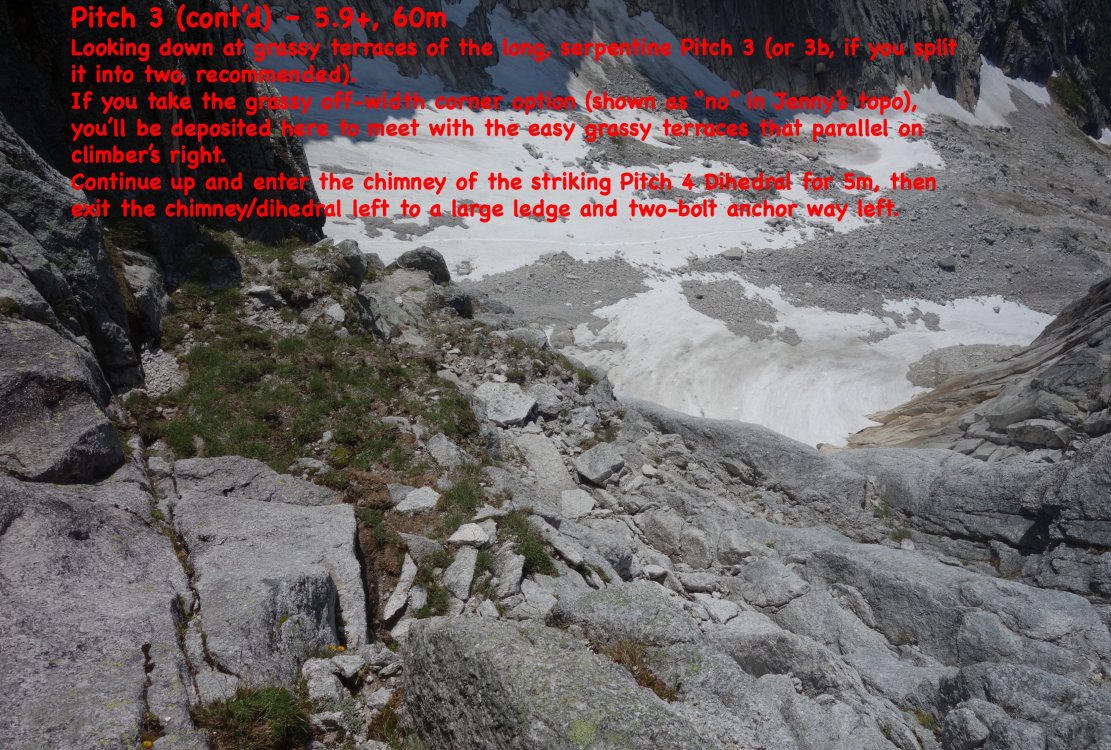
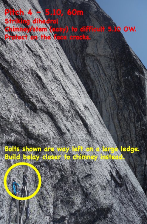
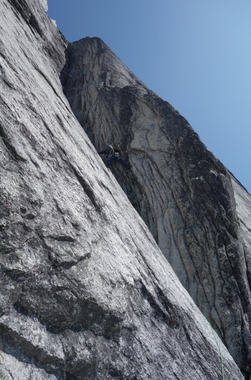
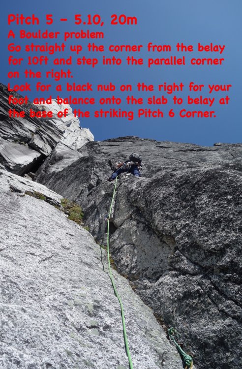
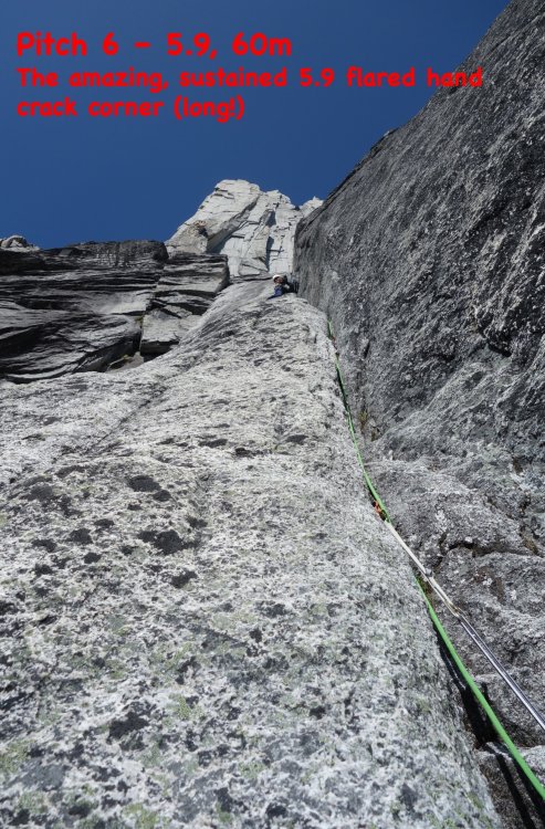
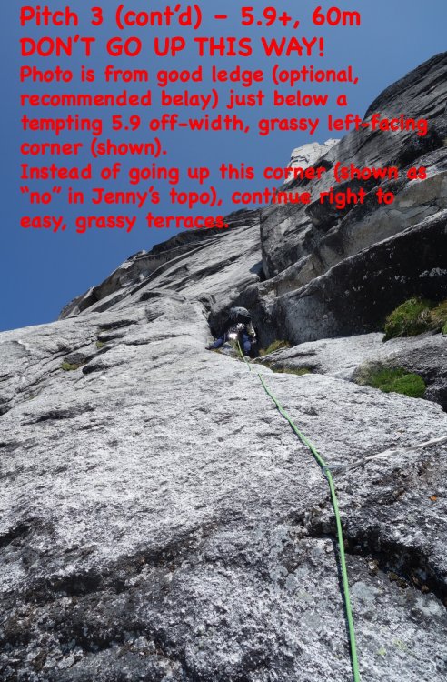
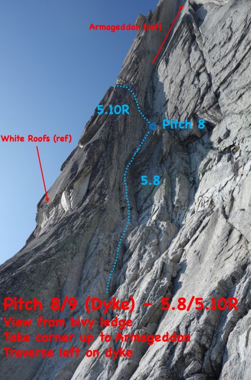
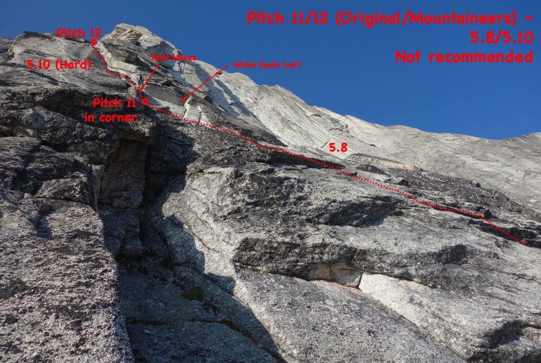
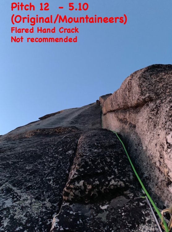


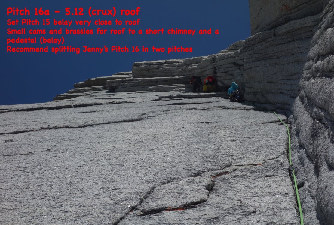
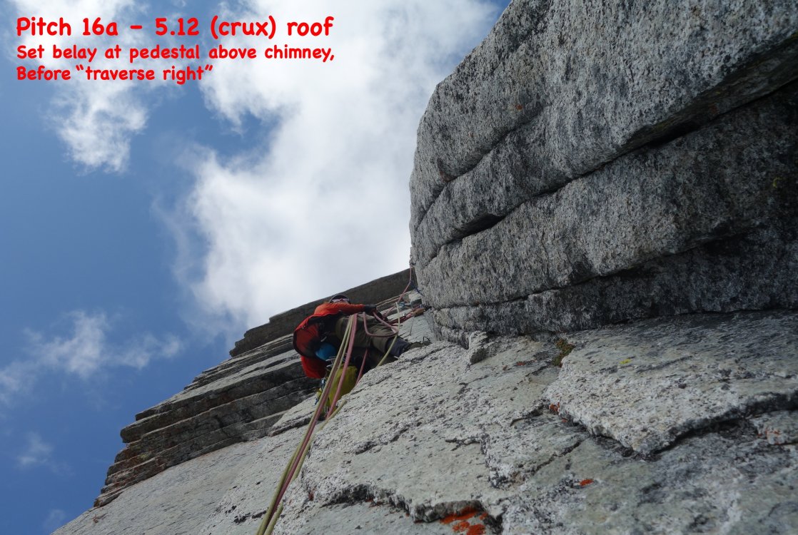
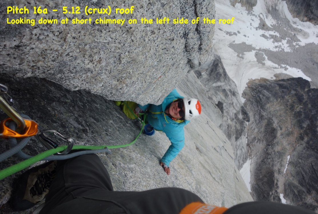
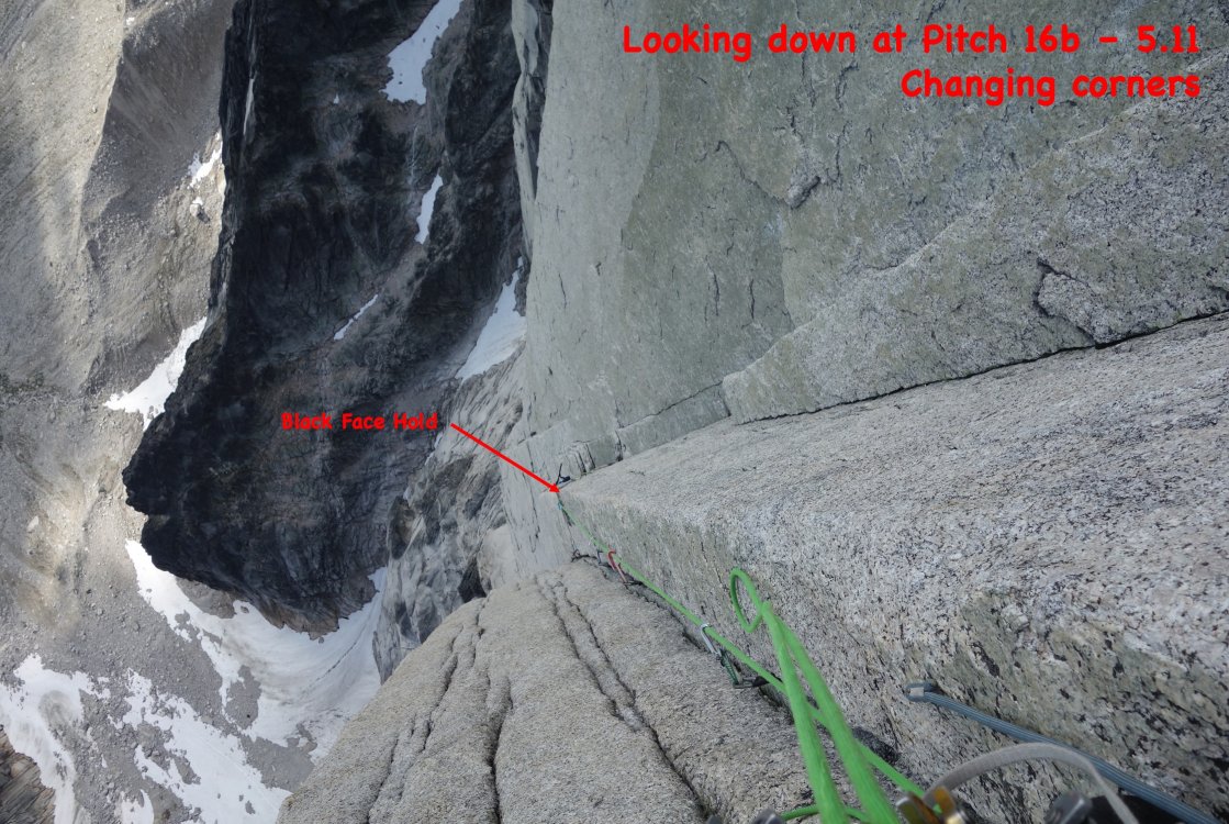
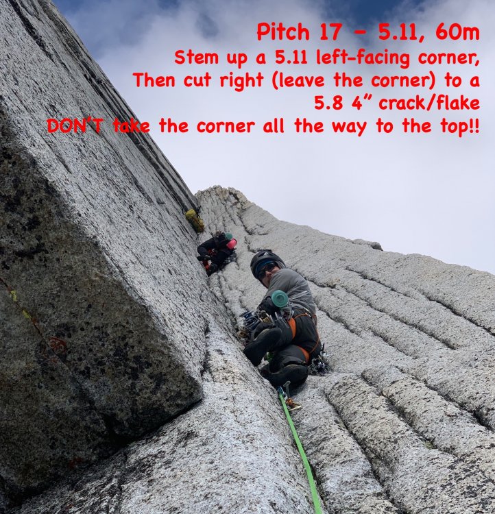
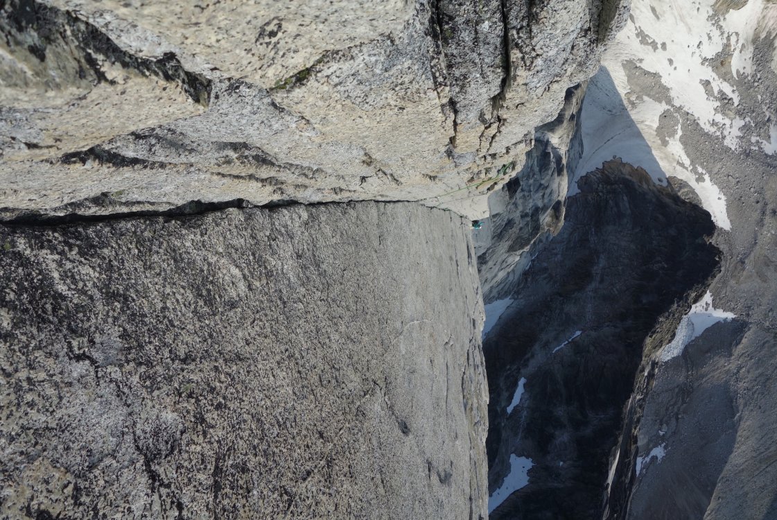

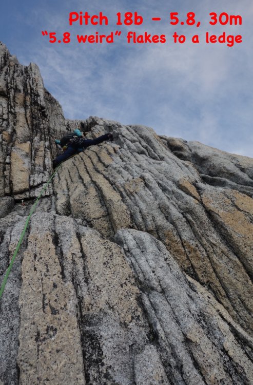

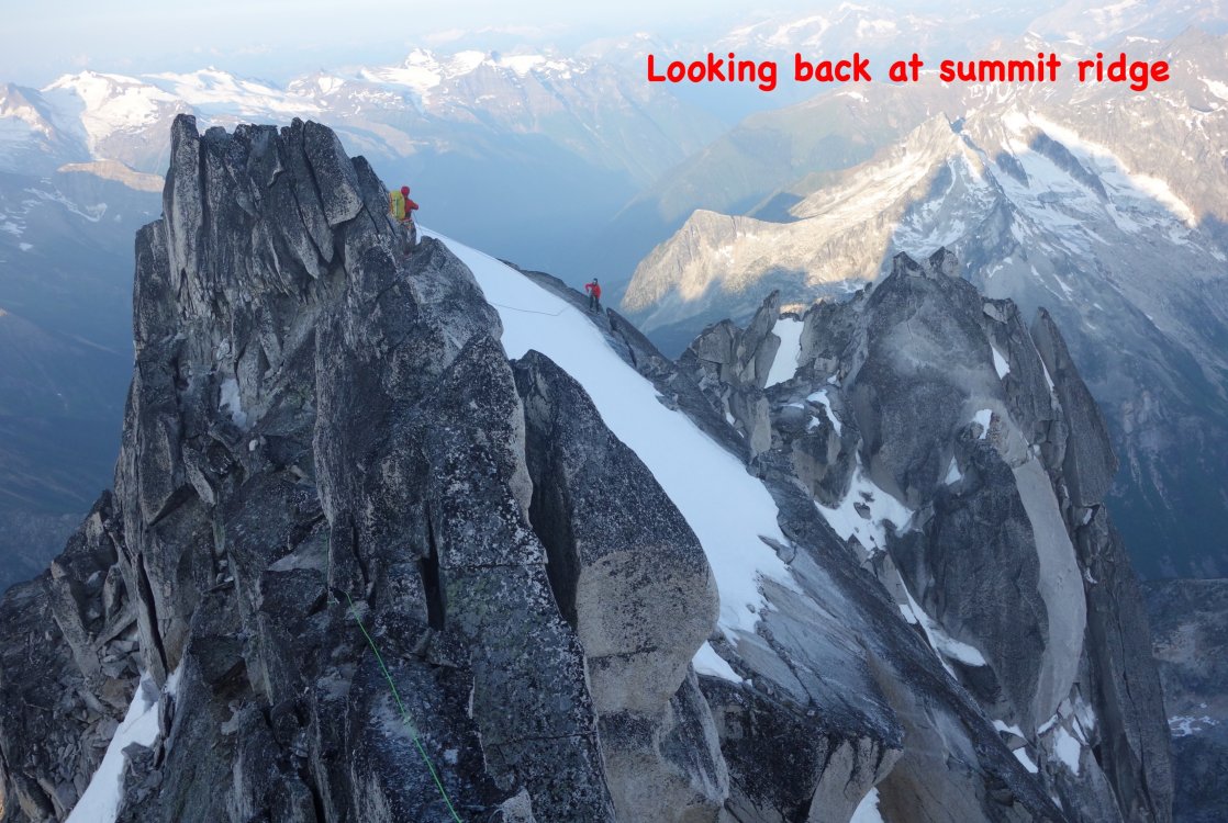


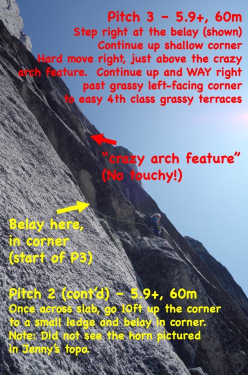

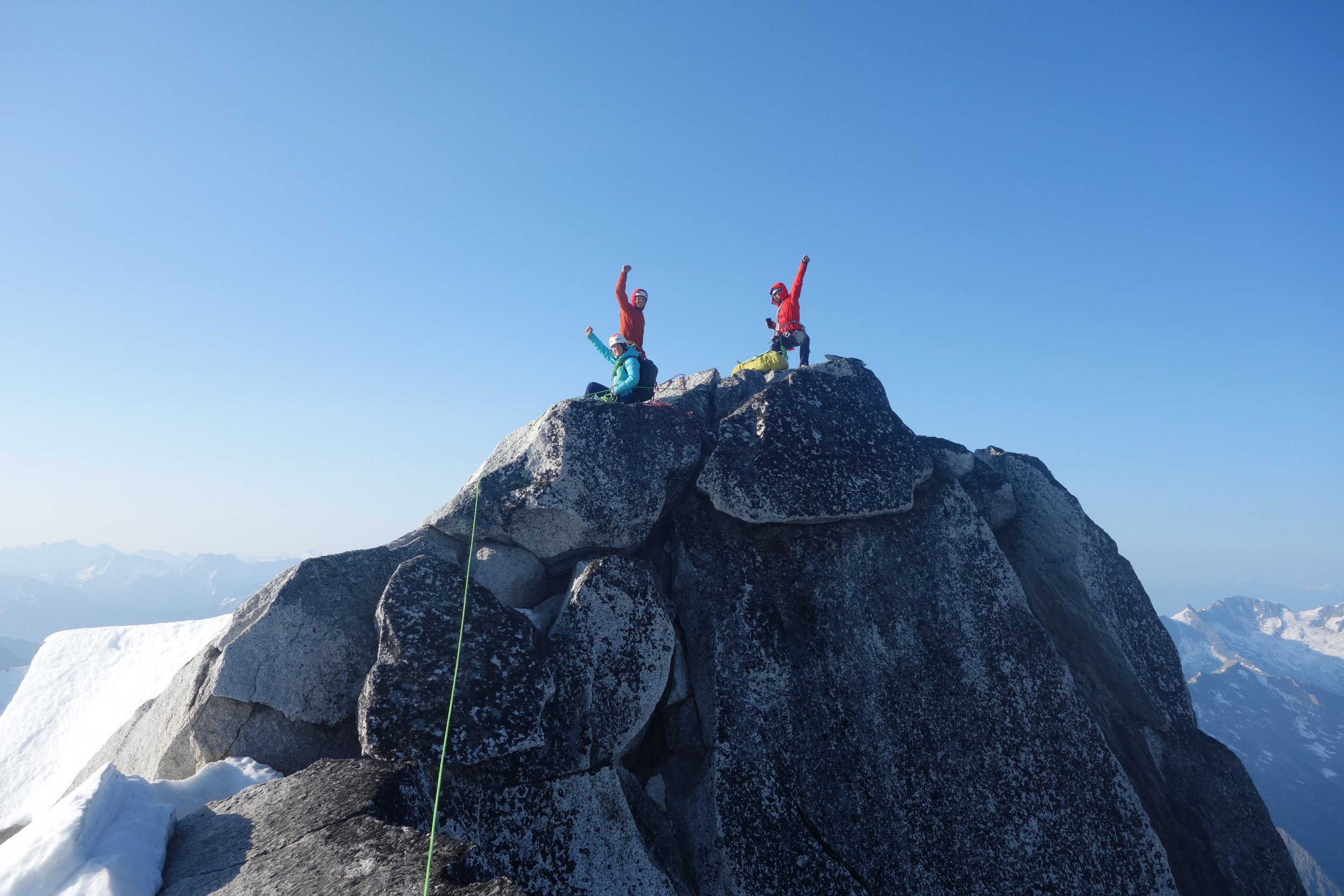
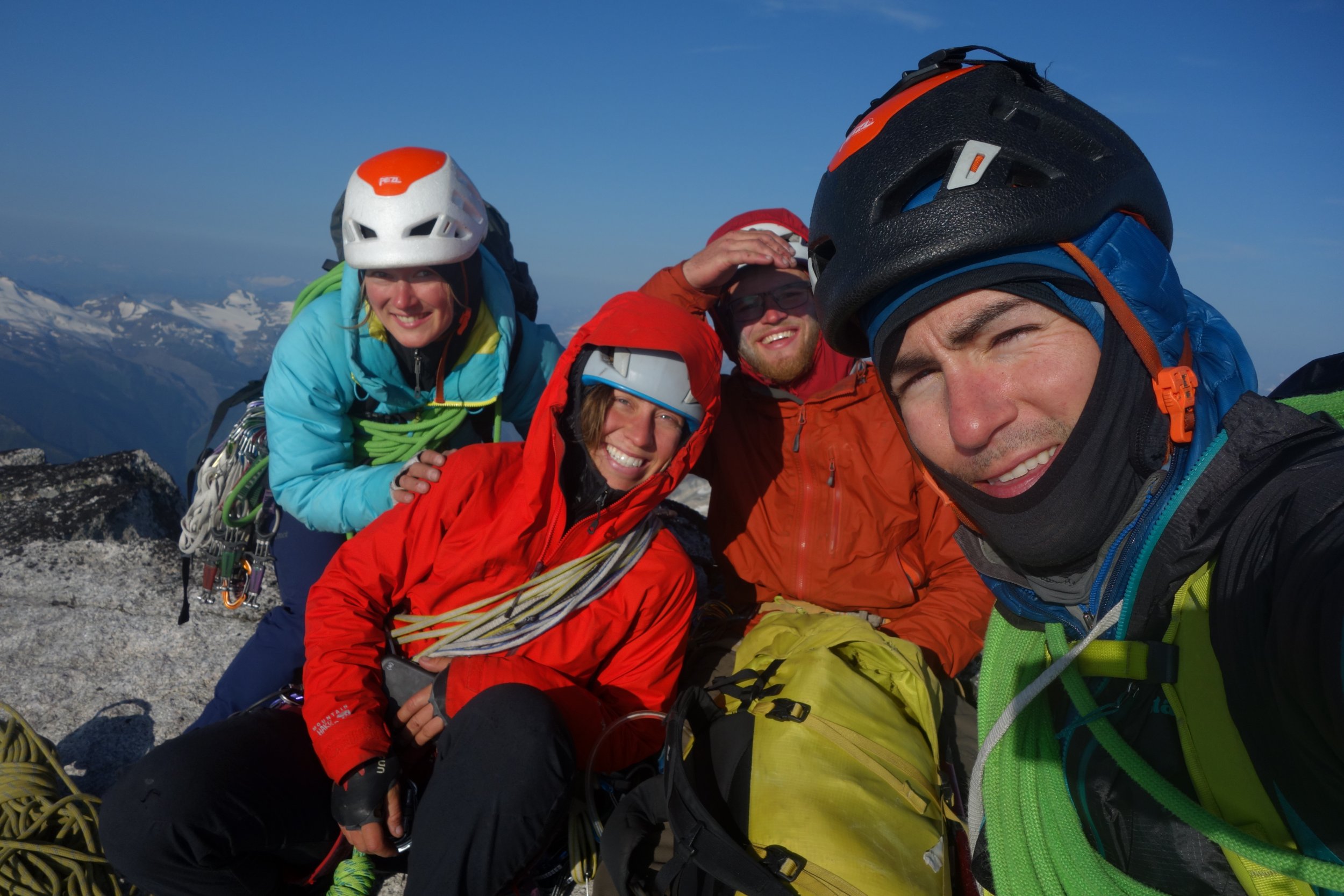
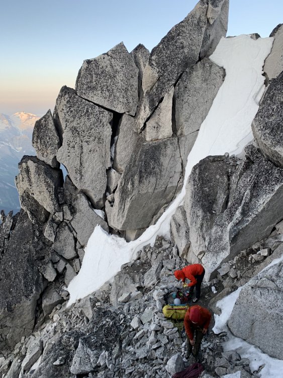
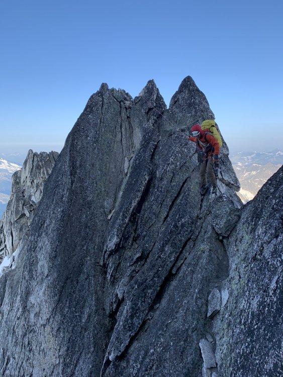
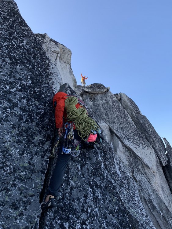
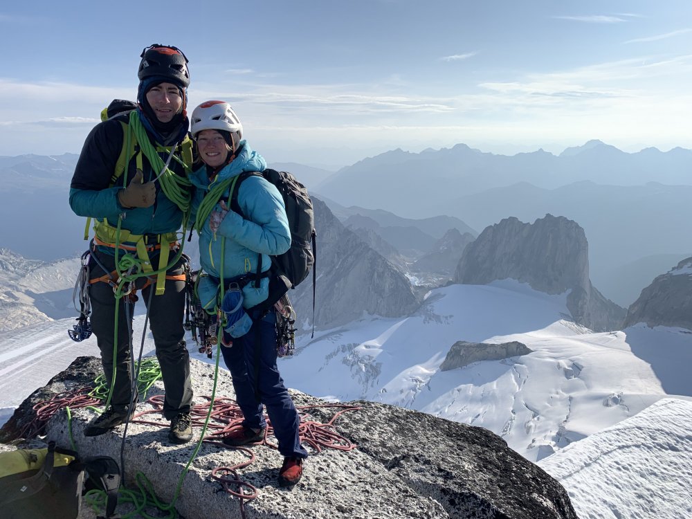


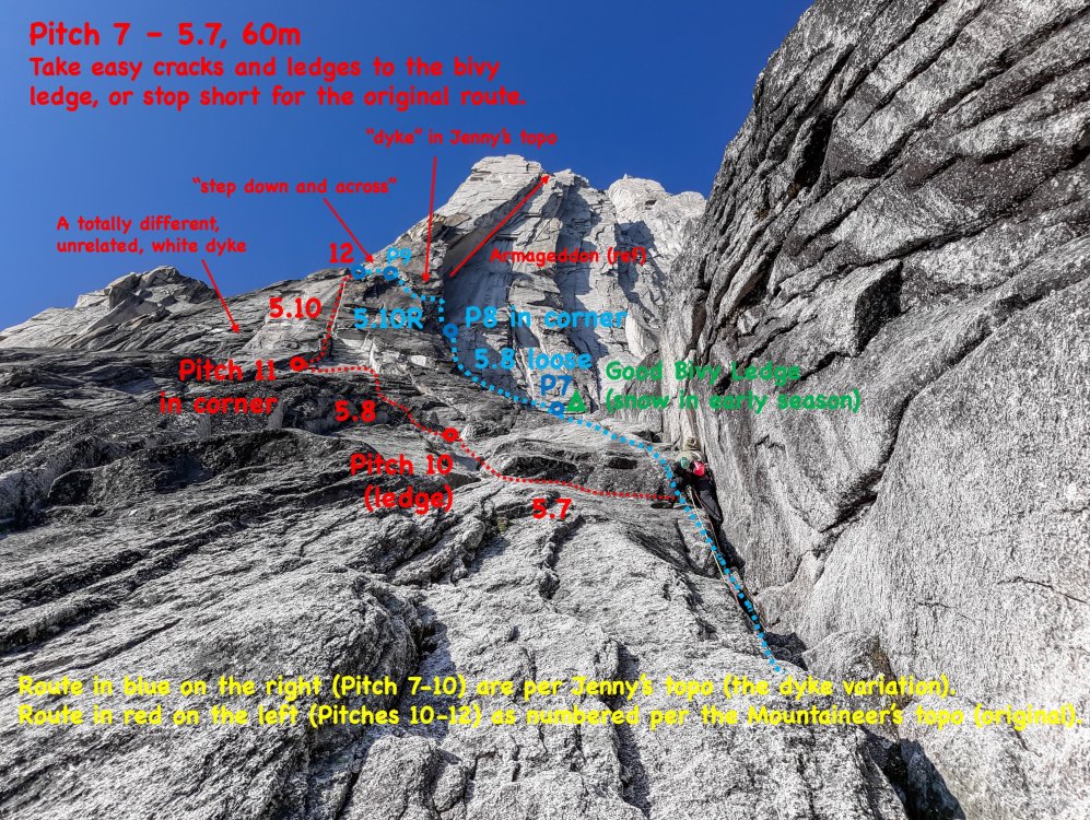
-
Trip: Sherpa Balanced Rock - West Ridge Trip Date: 06/15/2019 Trip Report: ***WARNING: This Trip Report contains mega beta spray for free climbing Sherpa Balanced Rock (and will take all the fun out of figuring it out for yourself)*** FA: Dave Mahre and Gene and Bill Prater, 1955 (shoulder stand + 5.7) FFA: Jens Klubberud & Scott Gg, 2006 (5.10c) The epic debate over whether the traditional summit of Sherpa Peak or the Sherpa Balanced Rock is the "true summit" remains legendary. I can tell you that it is true that whether you sit on the "summit" or the balanced rock, your head is surely higher than the other. They are within feet of each other in height. Having stood on both, I still can't tell you which is higher. Someone needs to go out there and shine two laser levels between the high points to find not only the true summit but measure the difference in height (you'd only need a 3ft roll of measuring tape). Still, climbing the Sherpa Balanced Rock is an adventurous and worthy goal since it is just so dang fun! Note: whenever I use the word "summit" in this TR, I am referring to the traditional summit (not the Balanced Rock). Fred Beckey's infamous "shoulder stand" beta seemed way too spicy for my blood. The base would lean at a 45 degree angle over a 5ft deep chasm on a shaky pile of human-made rocks from which the leader would climb on their arched partner and mantle onto a narrow ledge. The free variation is WAY more fun! (However, I'll give it credit that the shoulder stand pictures are probably way more entertaining). First free'd in 2006, it still sees very few ascents each year. From the summit, we made a short rappel down to the scrambly ledges on the south side which leads to the base of the Sherpa Balanced Rock. There may also be a scramble route on the East side of the summit block to avoid having to rappel. We left a 60m fixed line from the rappel anchor to the base of the Balanced Rock. If you want to descend via the West Ridge, you'll need to go back up to the summit and reverse the West Ridge route from there (which is what we did). This meant that we jugged back up our fixed line to get back to the summit on our descent. Picture above is looking up the West Ridge route. Two pictures above are looking back (from base of Balanced Rock) at the fixed line and rappel from the summit. View of the Balanced Rock from the summit. We made a belay anchor at the base which came straight out from under the lower rock. You can see the human-made pile of rocks on the ledge (we belayed from here). If you do the Beckey handstand method, you stand on that pile of rocks and lean wayyyyy over (over the scary gap). The leader then mantles on to the ledge. A fall would be really bad. Once at the pile of rocks, scramble down (climbers) left (South side) to start the free variation. We opted to do a rope toss over the southern horn, since a lead fall would be an ankle-buster at best. From the pile of rocks, toss the rope over and pull it into the wall. I found some beta that said you can place a #1 under the first overhang. I didn't see a good place for a #1 myself, but a #5 or #6 just under the overhang would be perfect if I were to free it ground-up. This is a committing move, but it's trivial with the top rope throw. 5.10c seemed accurate (an easy bouldering move). Grab a right hand hidden undercling/sidepull in the overhang (shown above) and extend left to grab a left hand 3 finger pocket (amazing!) just above the overhang (shown above). Find a critical, little edge for your left foot out and above the roof (shown above). Then, step up with your left foot (committing) and find a high right hand incut crimp (bomber!). Bring your right foot up to the sloping edge (shown above), and reach your left hand for bad crimps and slopes. Match your right foot with your right hand on the bomber incut edge and reach for great jams between the blocks. Mantle up to the ledge. You can then clip the old bolt (which is at head height). I placed a #1 in the crack at my feet between the two blocks in order to back-up the bolt if it failed. The upper block (shown above) is "5.7" if you can reach the jug. The wall overhangs slightly and there is a huge jug if you are 5-10 or taller. I'm 5-7, so the free climbing required tricky crimps to make my way up to the jug. Once at the jug, you have a good right foot and you're home free. I found the upper block MUCH harder than the lower block (for a shorter fellow). You can, of course, pull on the bolt and easily reach the jug no matter how tall you are (easy). For the top anchor, you can sling the top horn (shown above). The existing anchor is an old bolt and a bomber nut with new tat, which we only used for the final rappel. Jugging back up the fixed line to the summit. Enjoy! Gear Notes: #5 or 6 to free it ground-up (or do a rope toss). #1 to protect between the blocks (backup to bolt). Cordalette to sling the summit horn. Approach Notes: Scramble down (southward) from the summit. If you climb the East Ridge, you pass the Balanced Rock on the way to the summit.