


Sam Boyce
-
Posts
42 -
Joined
-
Last visited
-
Days Won
12
Content Type
Profiles
Forums
Events
Posts posted by Sam Boyce
-
-
7 hours ago, brooks said:
Is the title Tom Robbins inspired?
The name is inspired from the Japanese film Pom Poko. The movie follows some shape shifting raccoon dogs known as Tanuki in a not so subtle commentary on modern development. On The first attempt, we rolled into the crystal creek basin to find that all of the underbrush was trampled, like a herd of dozens of bears had rolled through (with plenty of scat to back it up). It was quite spooky to bivy in the valley. The smoke was epic and there was no signs of life in the valley, quite and desolate. It felt like the Tanuki were fucking with us.
-
 1
1
-
-
Here are the pitch notes I took while on route, for anyone ever interested in repeating. I always try to take pitch notes, both from a sense of eternal optimism and my absolutely horrible memory... There were bouts of really awesome climbing, and a couple engaging pitches with minimal protection, hard climbing and consistently portable holds.
P1 5.4 220’ Scramble up white slabs to a good stance below the large, steeper band of darker rock. You are aiming for an obvious, large open book for the next pitch.
P2 5.8 190’ Head up into the open book, climbing to its top. Traverse left back into low fifth terrain to a talus covered bowl.
P3 5.6 260’ Climb the rib to the right of the bowl past a bunch of scrambling to another large talus ledge.
P4 5.9R 140’ Climb through a heinous choss band into a gully with better rock.
P5 Low fifth 230’ Scramble up the gully to a solid belay.
P6 low 5th 150’ gully
P7 5.7 100’ Start up the face. Trend Left to a Left facing corner. Follow this to a good ledge on the prow.
P8 5.10a 110’ climb the face past a roof and up a ramp to a second roof. Belay on good ledge.
P9 5.10 200’ Climb the thin Right facing corner to a ledge. Then a short steep section takes you to a ramp. Follow this to a Right facing corner. Climb up this to some scrambling that leads to a large ledge.
P10 5.7 180’ Climb the low angle, loose face to a shit belay.
P11 5.10R 150’ Quest up the face to a decent ledge with a tricky anchor
P12 5.10R 180’ Another vision quest pitch to the notch on the shoulder of the ridge.
P13 5.10+ 60’ Climb the overhanging splitter to a chossy ramp.
P14 5.9 170’ Start up a nice varnished corner that eases to chossy mid fifth
P15 5.8 110’ Traverse to the ramp on the right. Follow it to the S ridge
P16 4th 250’ A short scramble takes you to the SW summit.
-
1
-
 2
2
-
-
I finally was able to figure out getting the heic photos to display correctly in the forum. Apple has unfortunately and intentionally made it almost impossible to change photos to jpegs. Its one of their obnoxious attempts at encouraging people to commit to their entire platform. Luckily though, this is probably my last iphone, after the last IOS update, I have lost a lot of signal sensitivity in the mountains.
I also added some rough maps to show where we went and potential optional routes for future parties. @manninjo The best approach in general is via baker river and crystal creek, this is fairly direct, with minimal bushwhacking and the least amount of gain. The best way to return to the Baker River TH without linking into the traverse would be to descend the standard E ridge route on Seahpo, then descend the first immediate drainage down into crystal creek basin (following somewhat closely underneath the ridge). We have been most of the way down these slabs, but not all the way, it looked like you would have to establish a few raps near the bottom when the slabs steepen. There looked to be ample trees and the terrain looked fairly easy/non-committing. Another approach would be to come in via the Ruth-Icy traverse. Then set up a camp at the Icy-Seahpo col, doing this slab descent as your approach to the climb. If done this way, it might be possible to do the whole ridge in a mega push and return to camp at the col.
There appears to be two options to bypass Tanuki Tower for those who prefer to avoid the munge. Option 1 would be to climb the slabby ridge feature to the left of the ridge amongst the waterfalls. This looked no harder than 5.8 and would provide access to the glacial basin on the S side of the ridge. This approach would have the benefit of looking fairly munge free while avoiding a potentially questy and undone bushwhack. Option 2 would require an approach from the baker river side, the maps suggest its possible to bushwhack up the ridge to the climbers left of crystal creek, aiming for the talus and slabs that lead to the hanging glacial basin that could provide access for a bypass. All that being said, the munge pitches aren't that bad and are fairly short lived, anyone accustomed to the style of blue collar munge found in the cascades shouldn't be too phased by the climbing on Tanuki Tower. Think like a 5.9 version of Jo-Berg or N face of Index...
-
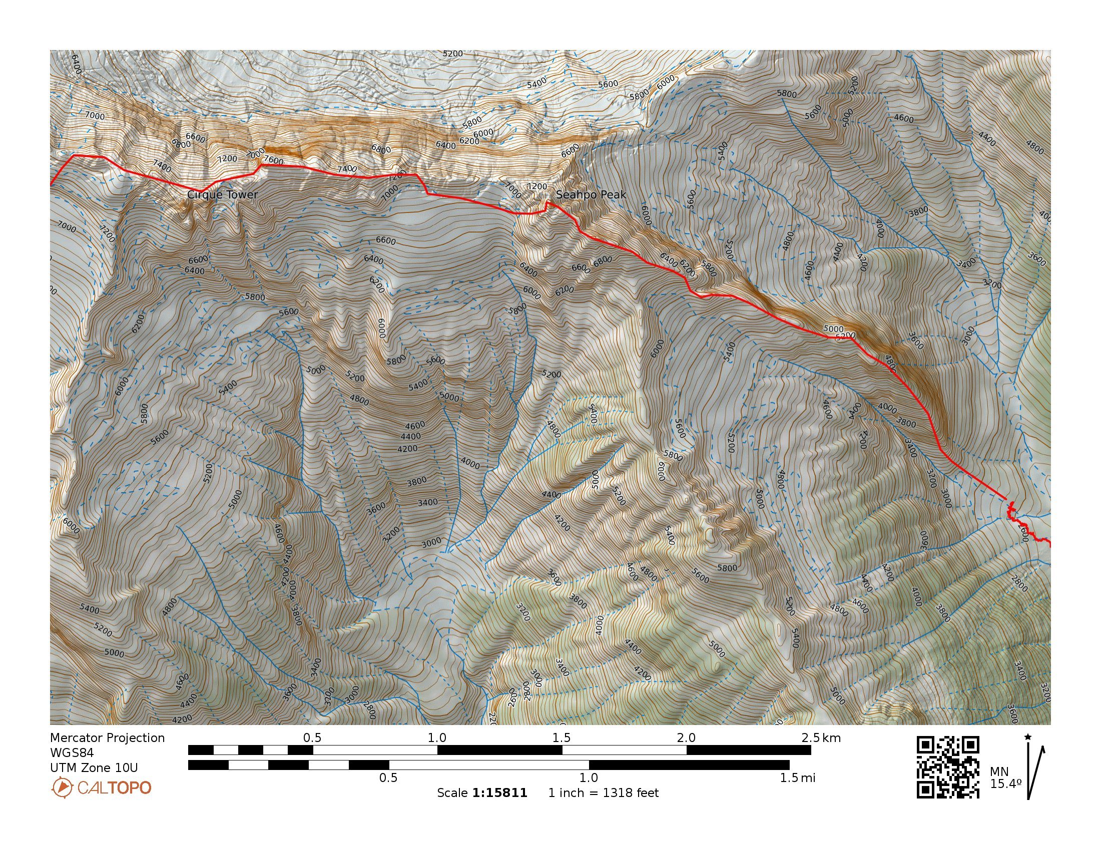
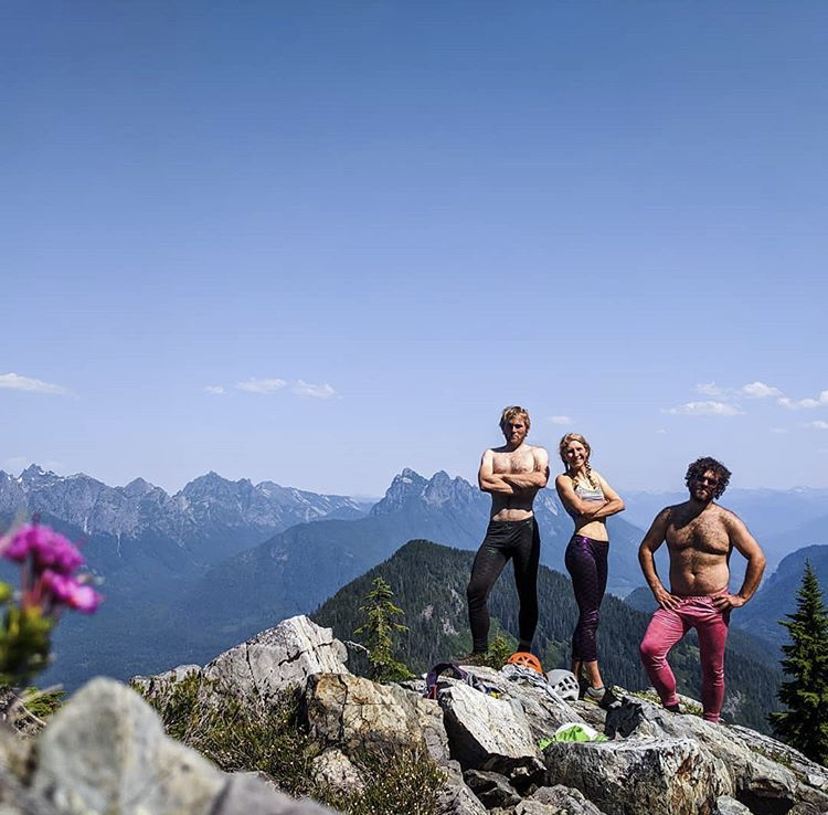
From Aug 20th to 24th Lani Chapko, Nick Gonzalez and I did the first ascent of the direct SE ridge of Seahpo Peak. The SE ridge gains roughly 4400' over around 1.5 miles of horizontal. Jagged Ridge adds roughly another 1.5 miles of ridge traversing. We climbed roughly 30 pitches on the SE Ridge of Seahpo with another 6-8 or so on Jagged Ridge. I would consider the SE ridge a Grade V as a stand alone if a team were to descend the standard route, and while maybe controversial, consider it a Grade VI with its continuation through the Jagged Ridge (Grade V 5.6). We had 18 hours of climbing time on the SE ridge and around 12 hours of climbing time on Jagged, totaling just shy of 30 hrs of climbing time over the course of 3 long days. Lani and I's climbing time on Mongo Ridge was around 17 hours and our non-speed-climber NIAD time last year was 16 hours. While not really relevant, these seem to be common benchmarks that people like to compare to.
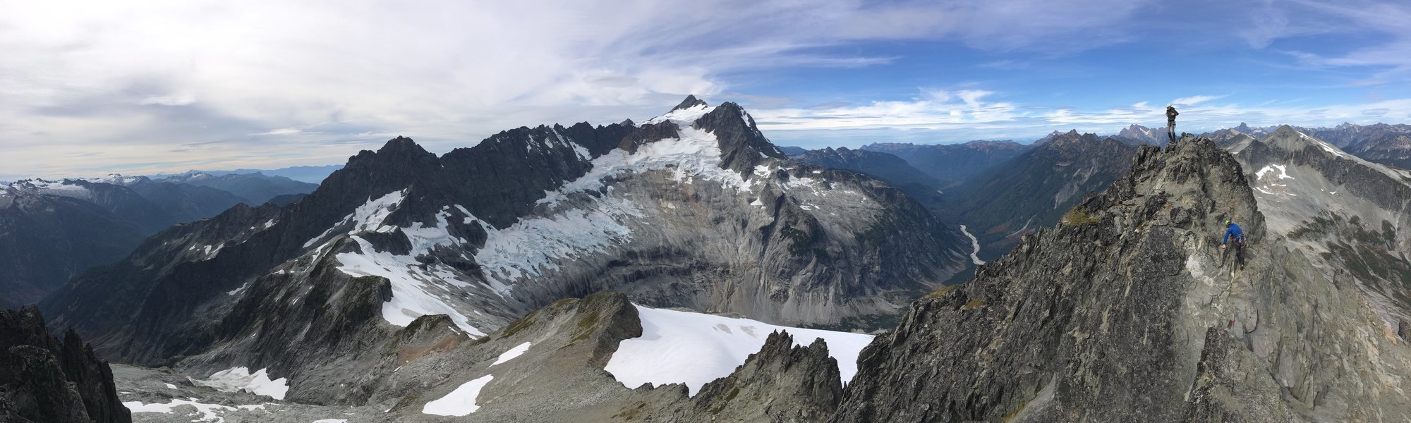 Photo I found last year from the summit of Icy showing the entirety of the ridge (sorry i don't remember who took it...)
Early Attempts:
I first spotted the line last year when Joe and I went in to do Spectre. It is a sneaky ridge that is only visible from a fairly narrow window of the North Cascades. We both agreed it looked massive and epic. I convinced Lani to give it an attempt late September. This was a couple weeks after a bad ankle sprain on Jo Berg. We ended up bailing after around 800' of climbing because of extreme heat, dry conditions and mild hallucinations from intense smoke. We approached via the Baker River and Crystal Creek. This year in July we had a window and decided to give it another go. We figured the Baker River approach would not go smoothly so we decided to try a high route approach via the Ruth-Icy traverse. Once at the Icy-Seahpo col we dropped down the head of the Crystal creek cirque and tried to find an access point to the ridge from the north. The climbing looked like 5.10X with minimal anchors, so we ultimately bailed out with the knowledge that we would have to repeat the heinous munge we found on the ridge last year.
Day 1:
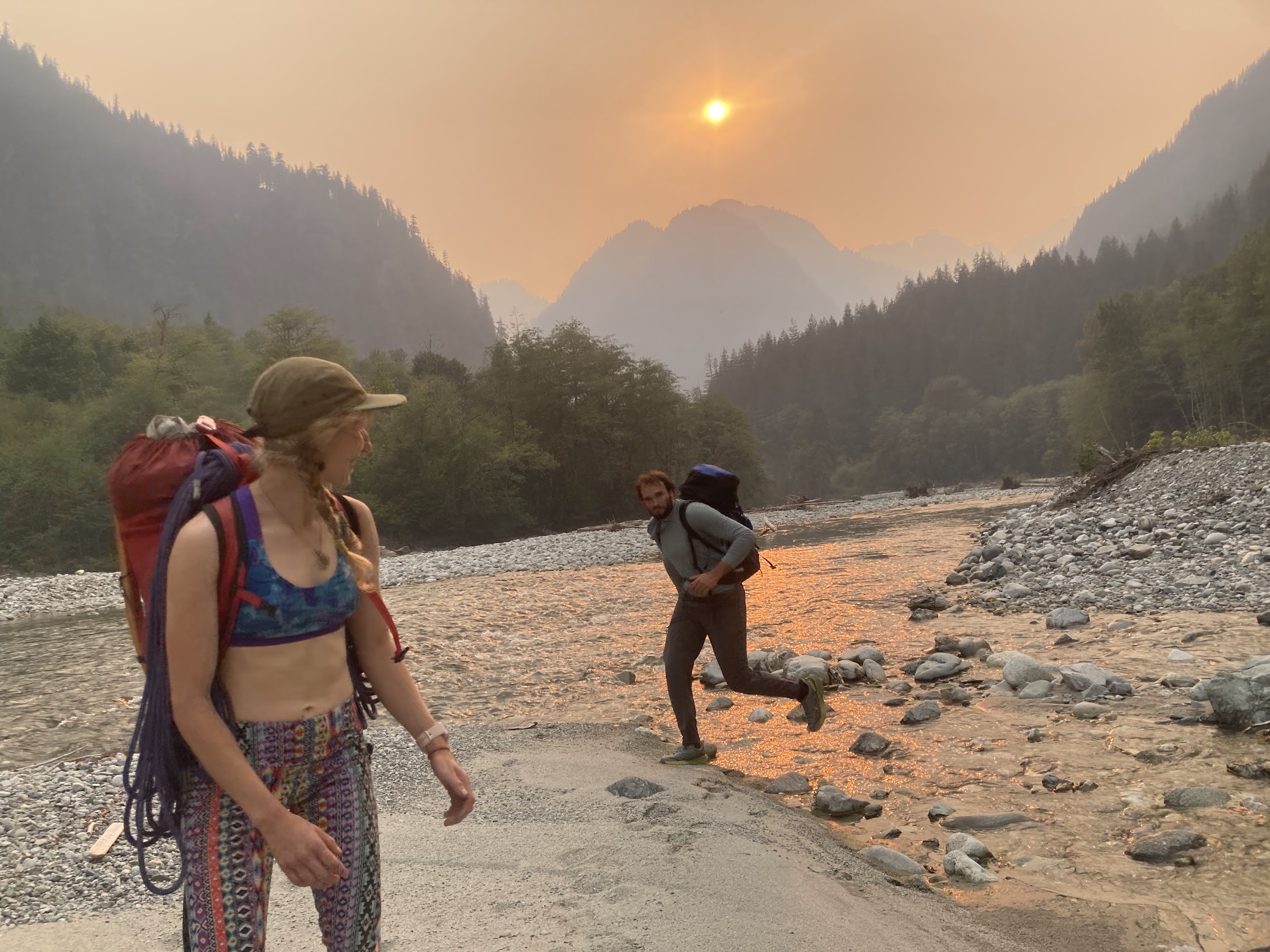
We knew we were heading into dry conditions, so we sought out a third person to join the party to help distribute water weight on the harder climbing near the toe of the ridge. We reached out to Lani's friend Nick the morning of to see if he would be down, and he somewhat reluctantly joined knowing he would be procrastinating some work. The last minute shuffle meant we were in for a bit of a long packing session and late start. We got to the Baker River Trailhead in the mid afternoon and started our approach around 3PM. The approach went smoothly as the Baker River was super low and the crossings were super chill.
We again picked up the old trail up crystal creek. We were initially super confused about the existing trail until we consulted with Eric W and learned that there used to be a trail up crystal creek.
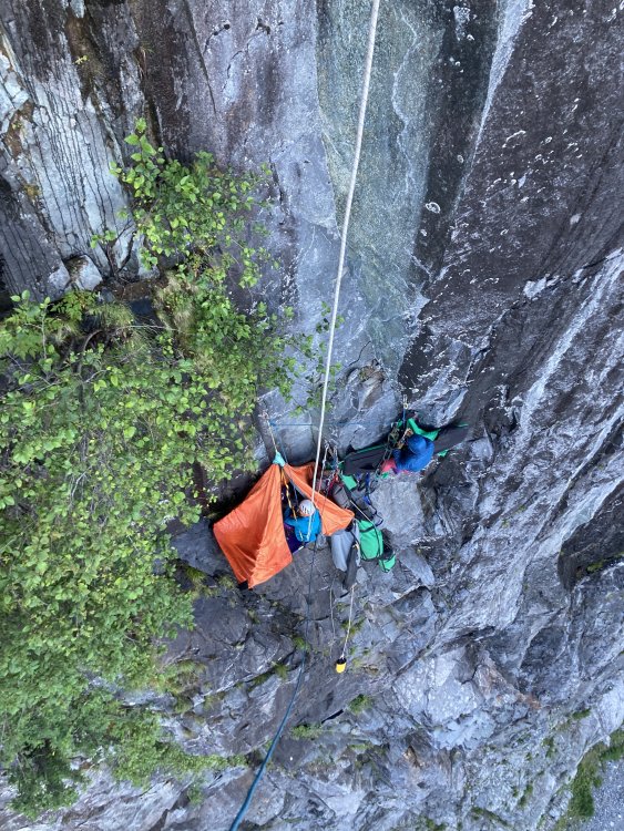
We got up into crystal creek basin right as it was getting dark and decided to set up camp in the trees just after crossing crystal creek. Near the end of our approach, Nick got stung by a ground wasp and started developing some full body hives. He had previously never been allergic to any kind of stings so this was a new development. Luckily we had just added some Benadryl to the first aid kit. He reacted well to the Benadryl and the hives subsided after around 20 min.
Day 2:
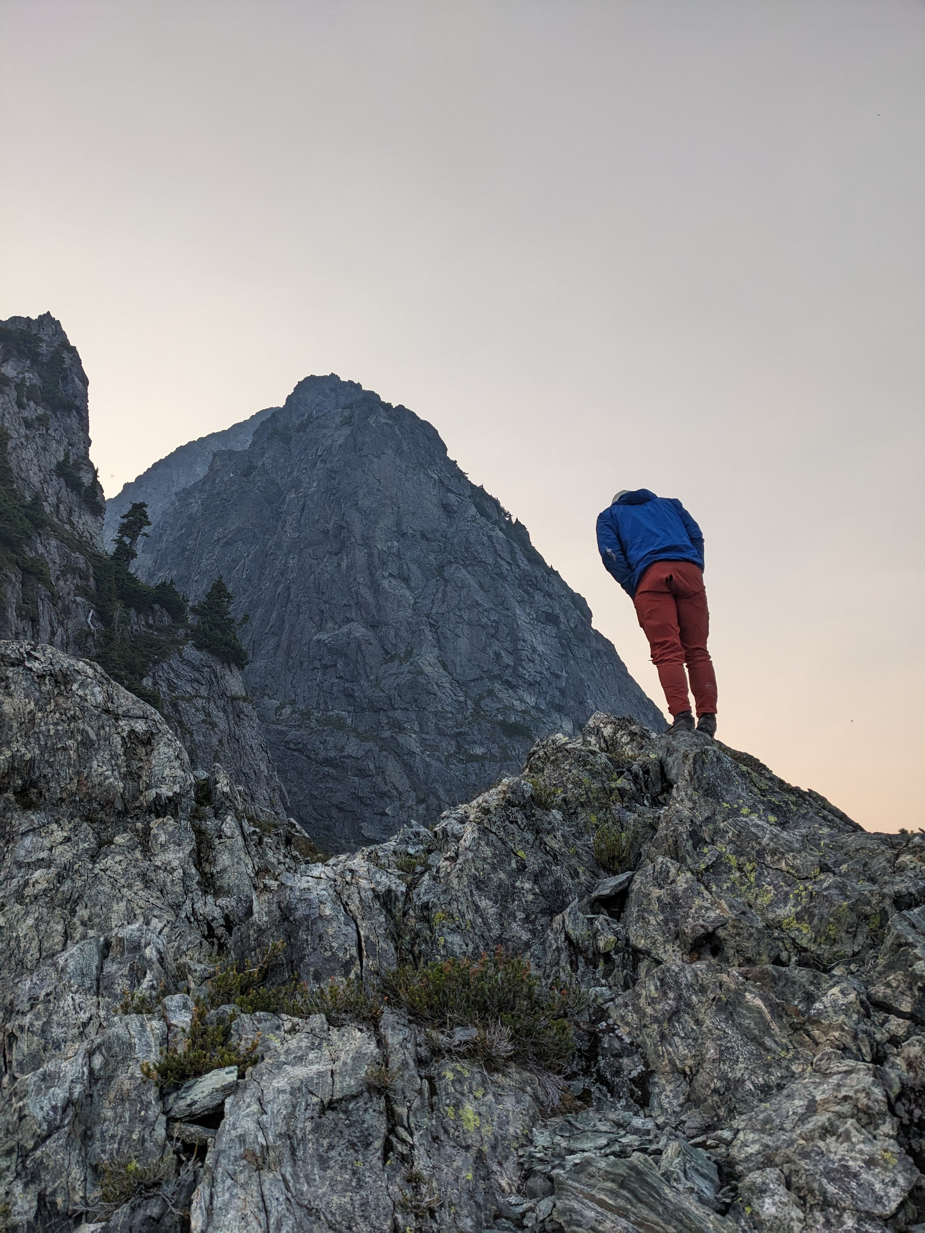
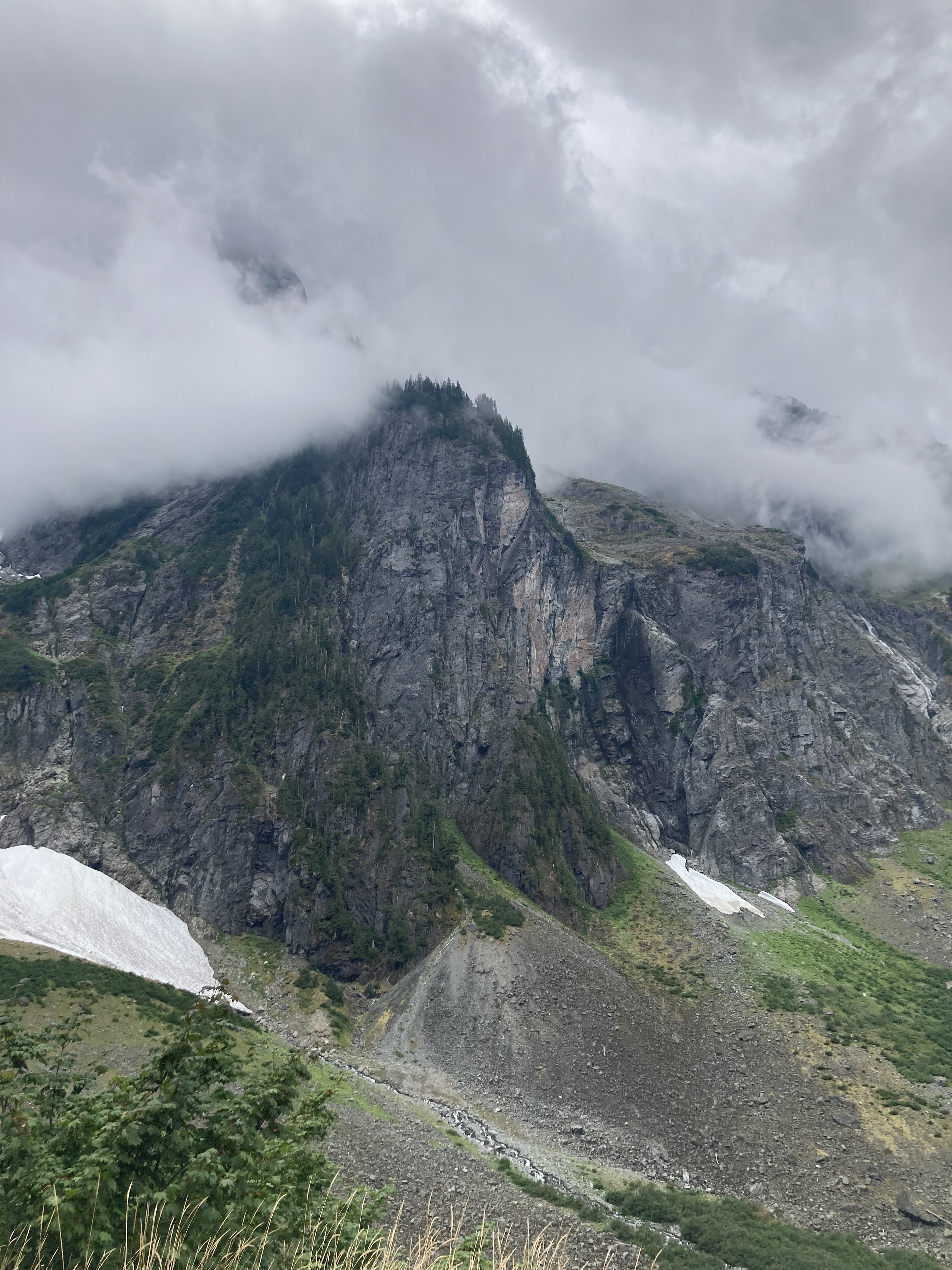
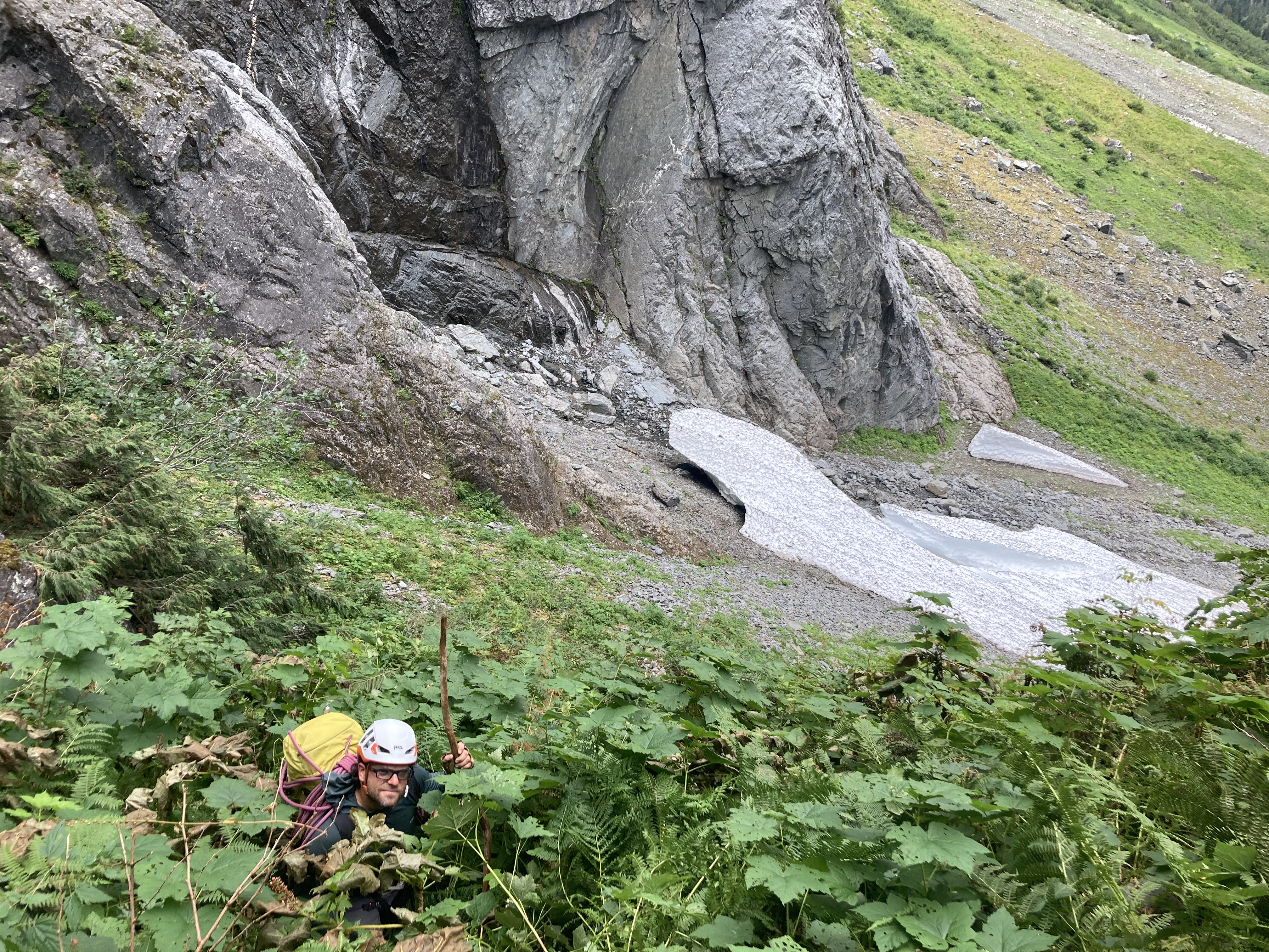
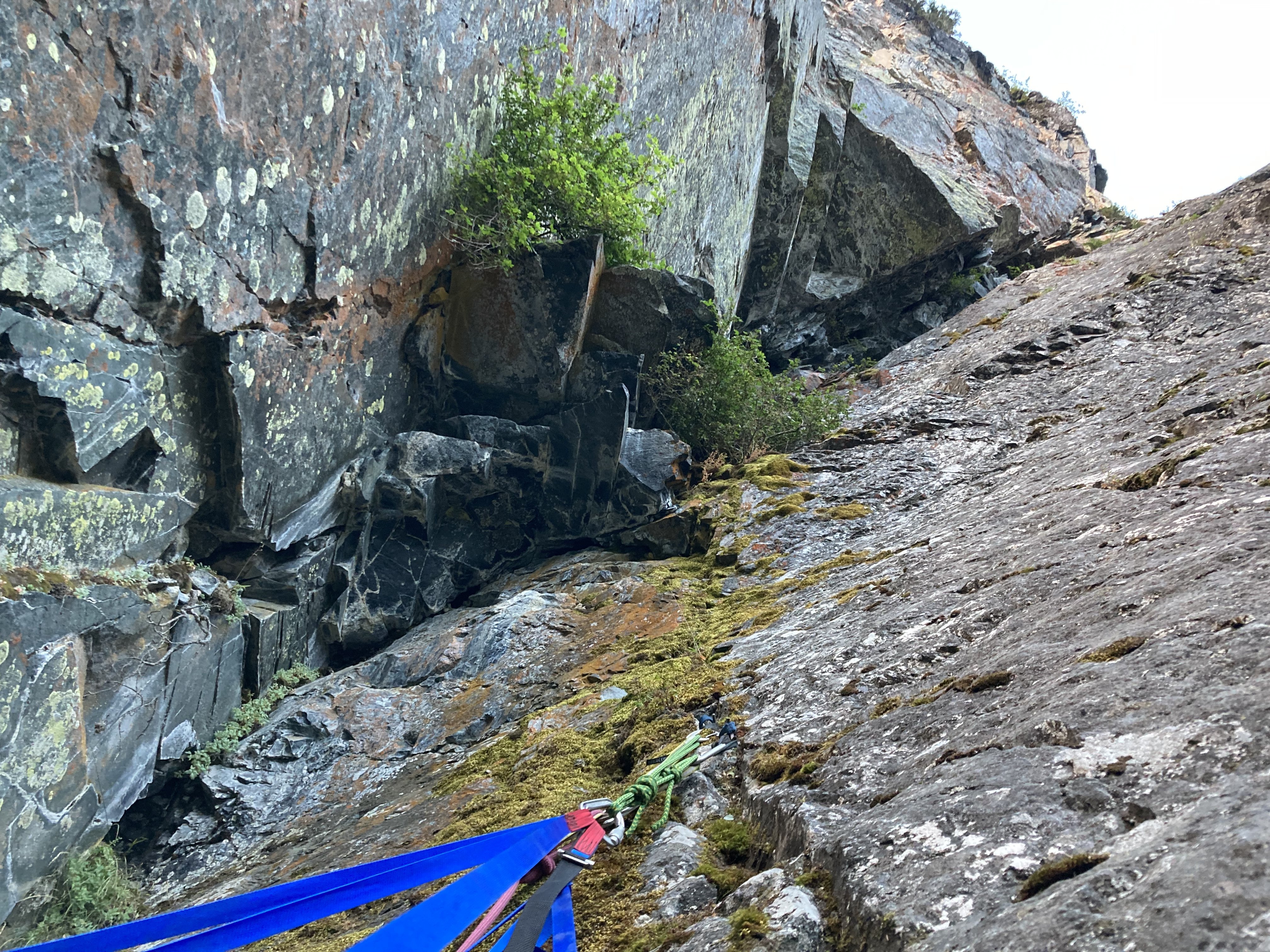
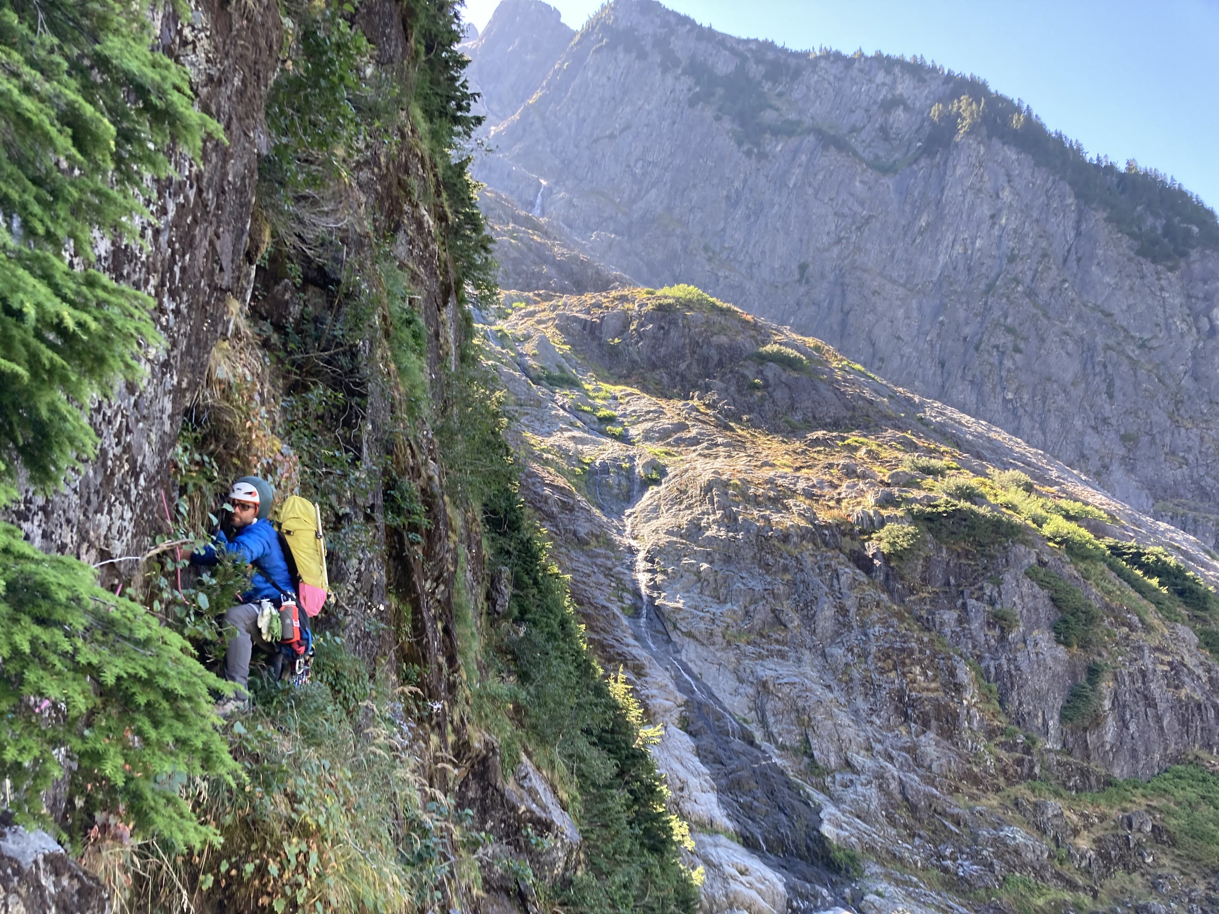
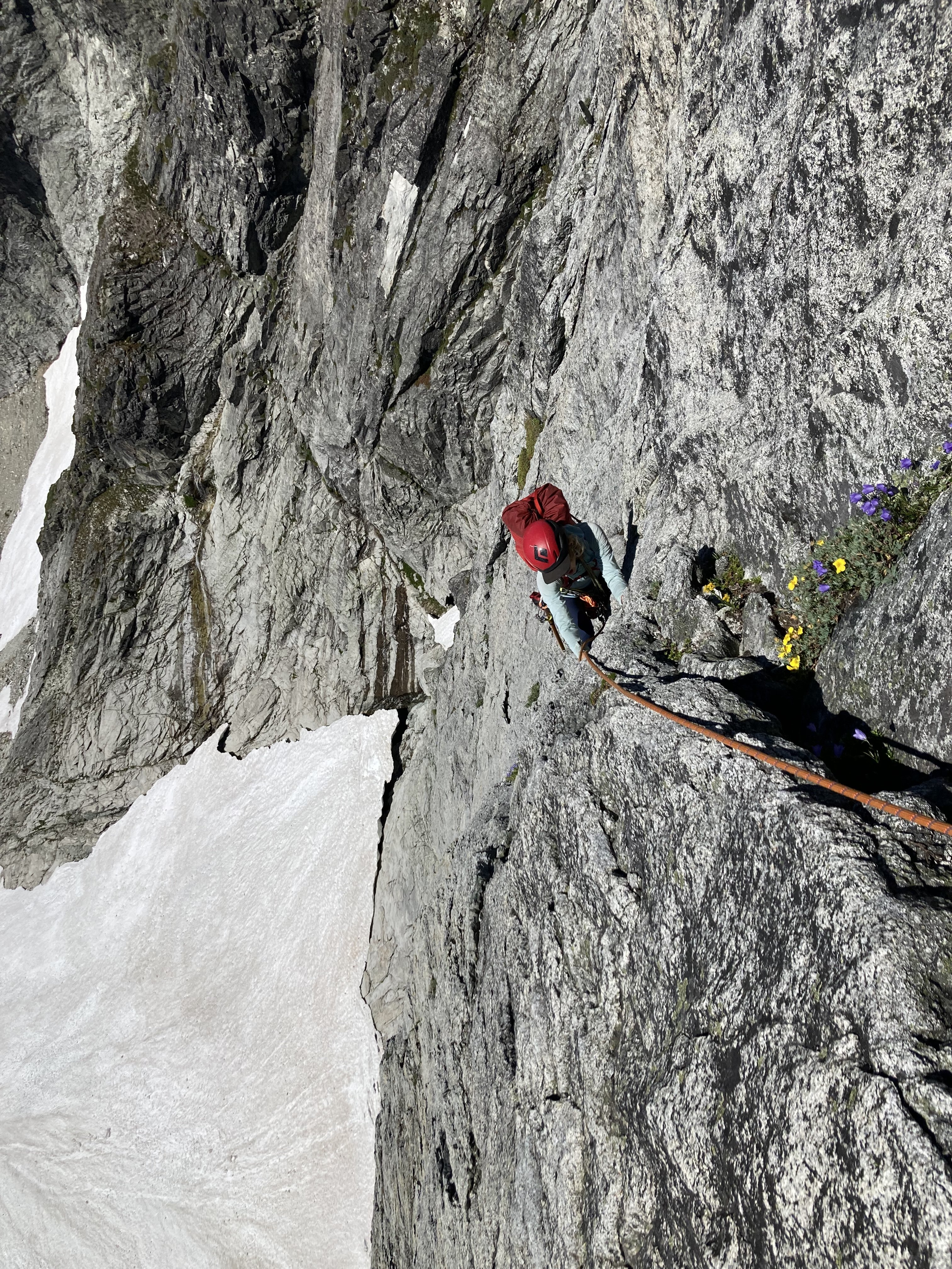
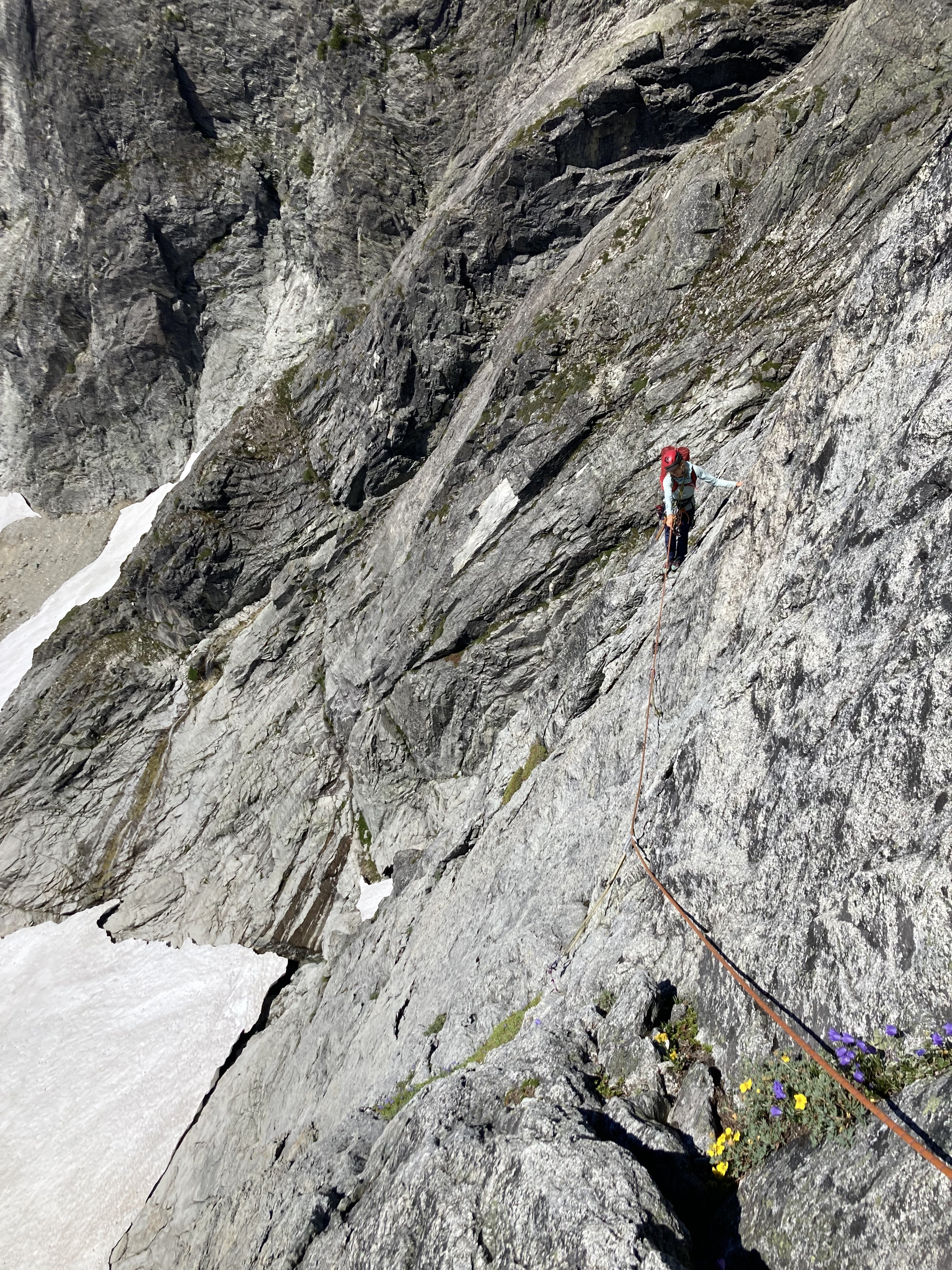
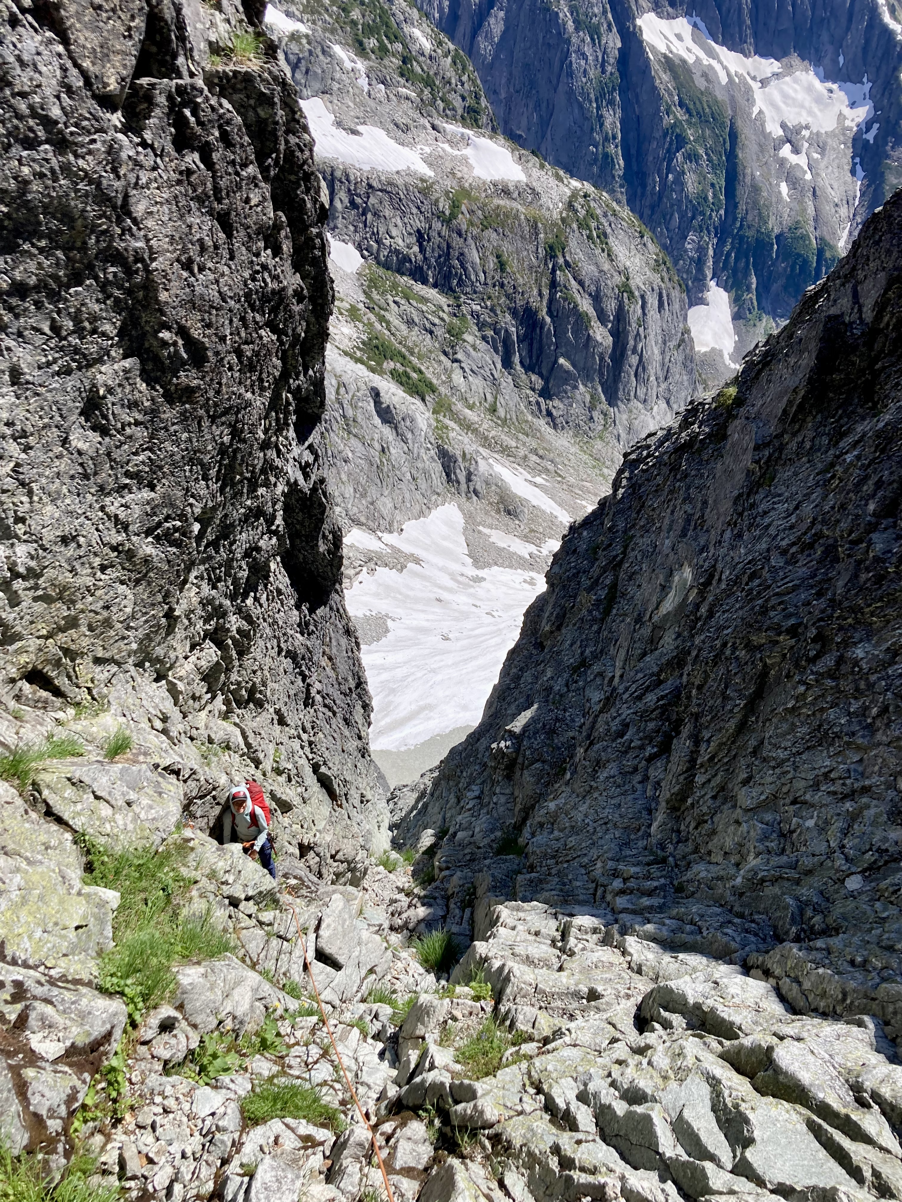
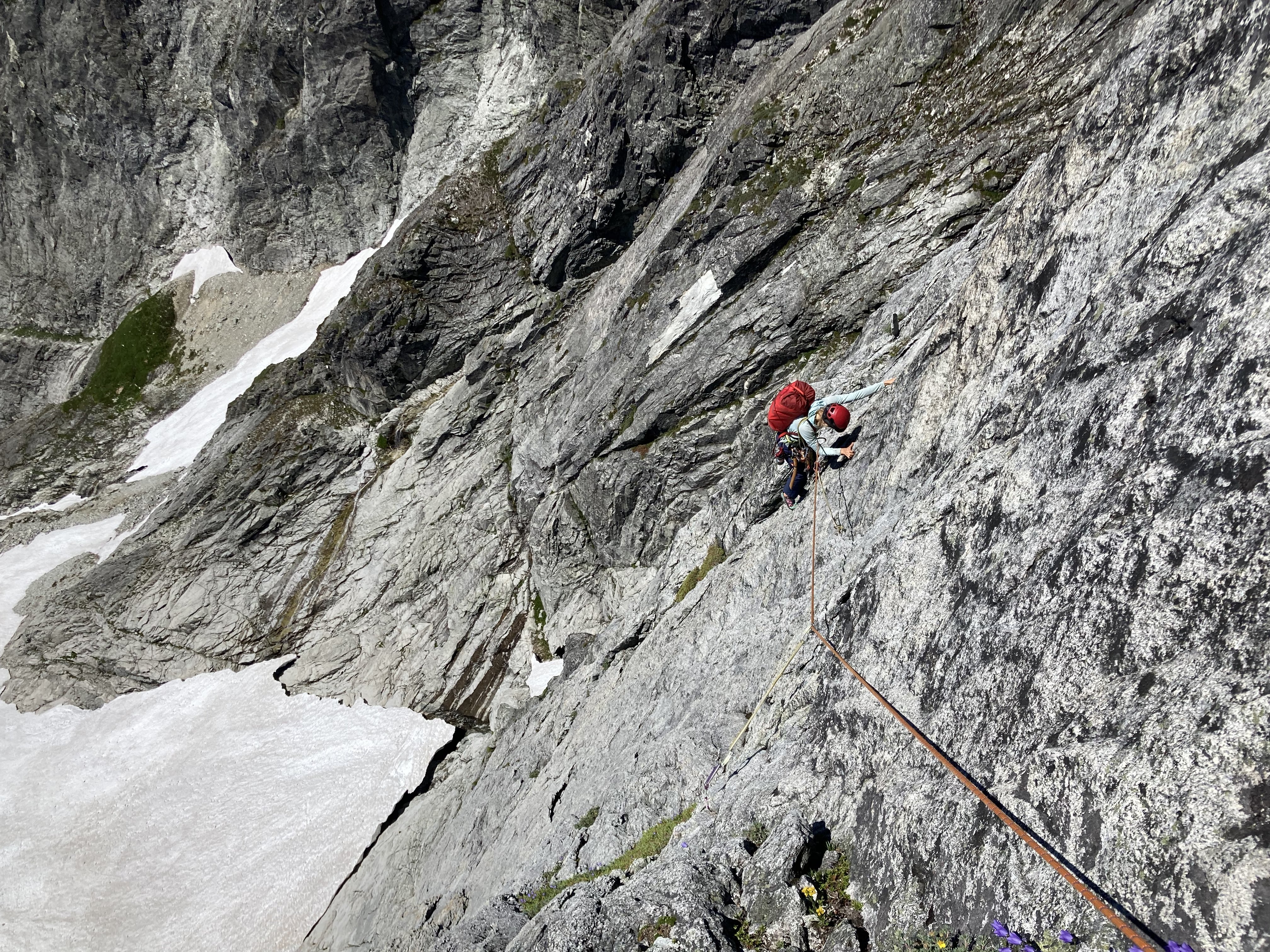
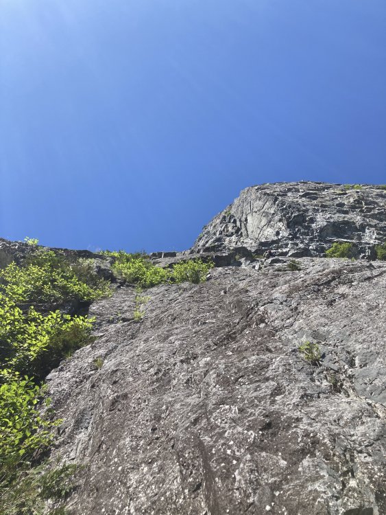
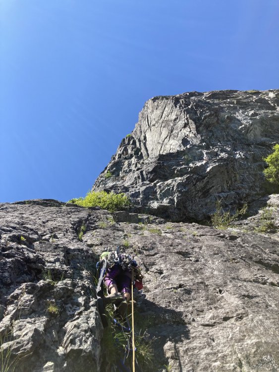
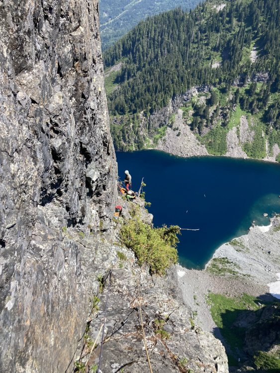
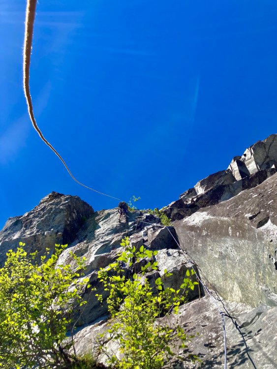
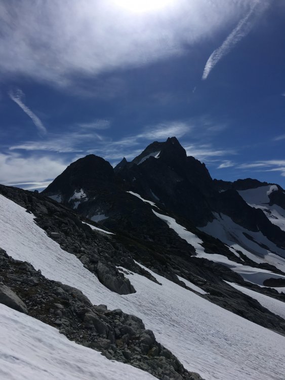
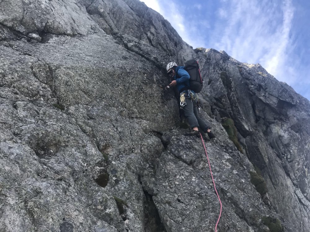
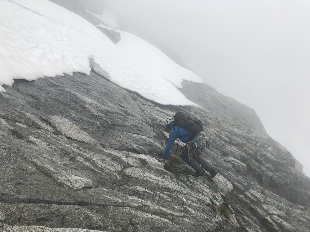
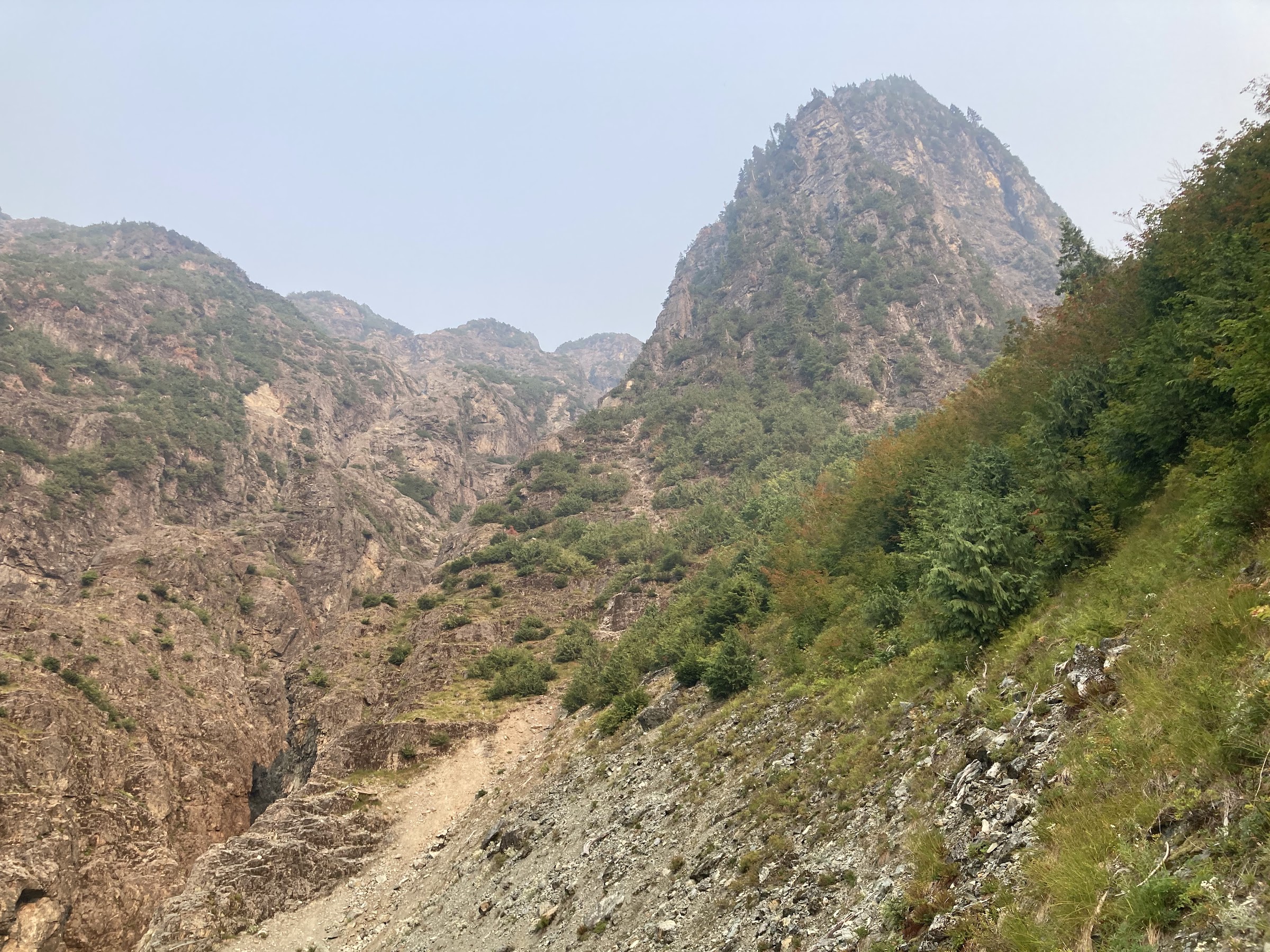
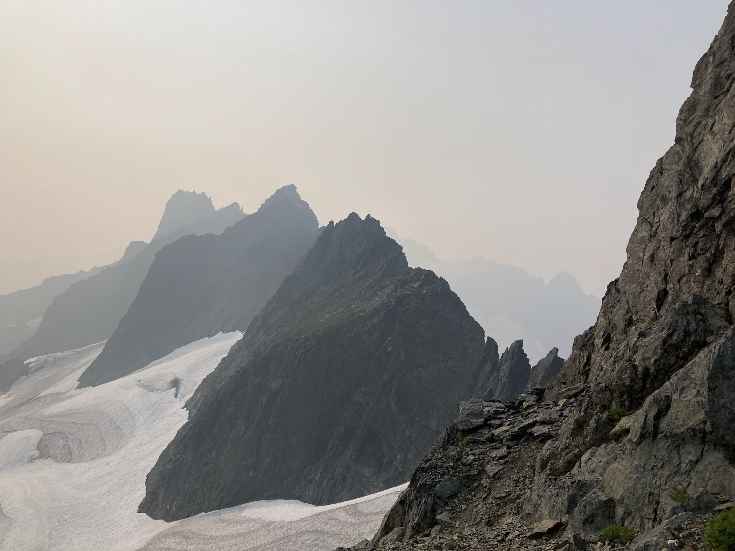
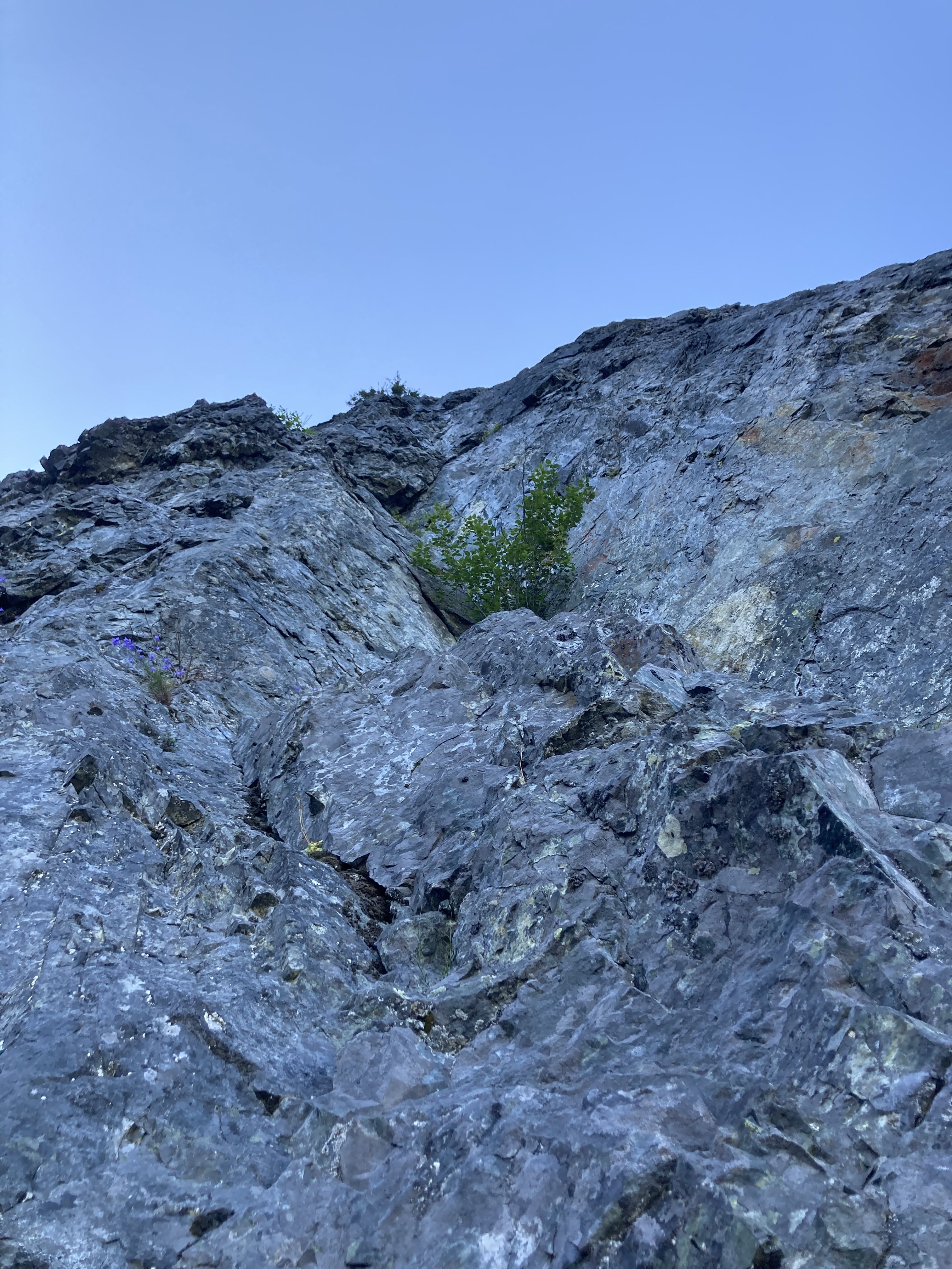
We started out the day finishing our approach up the crystal creek basin. This involves some mellow, but overhead grassy bushwhacking. When we were here in 2022, there was clear evidence that a ton of bears had trampled the valley. Adding a very eerie feeling to the endeavor. We felt like we were being taunted by Tanuki, hence the name. The climbing on the ridge starts around 2900-3000' depending on how your device is feeling.
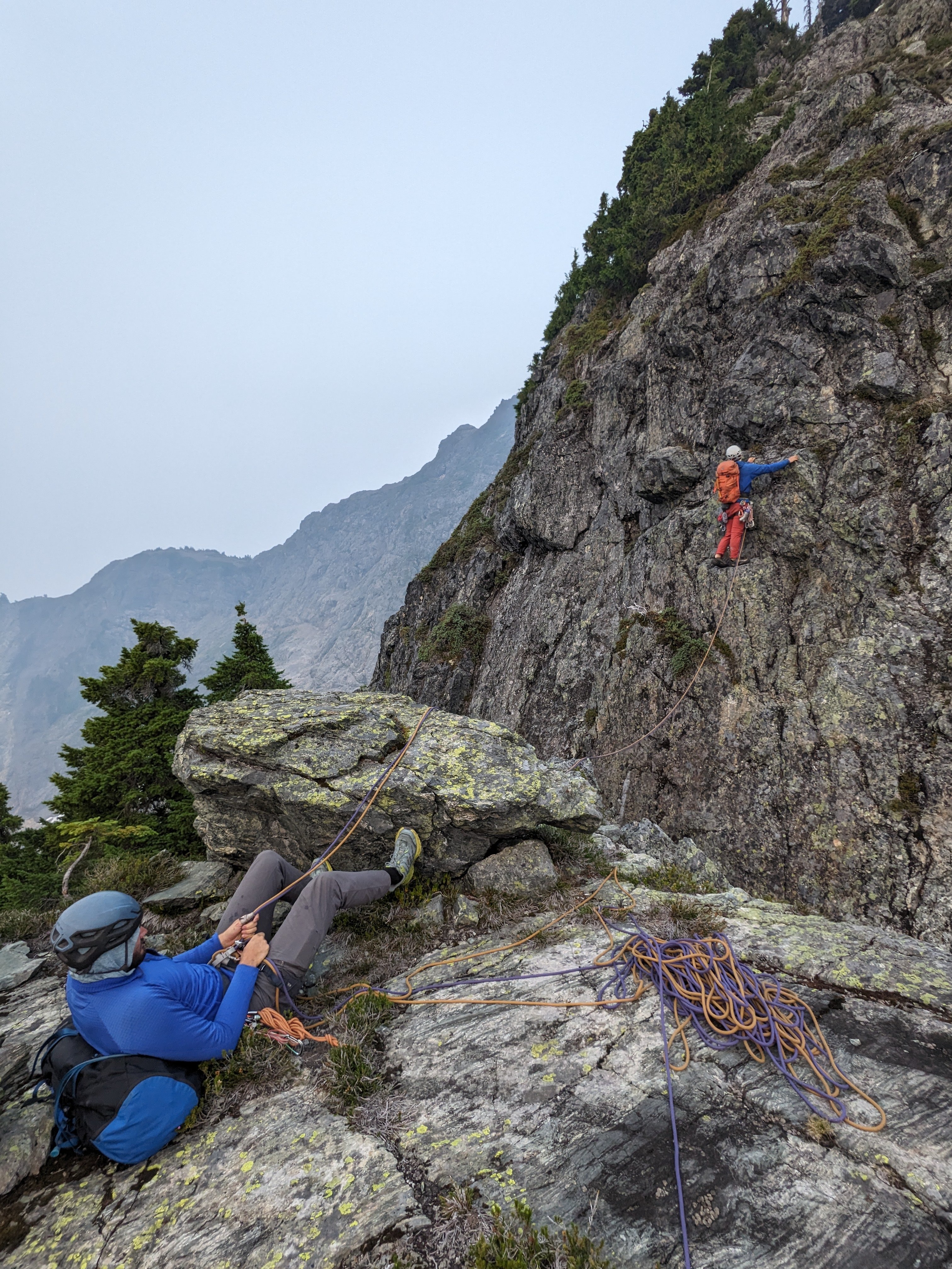
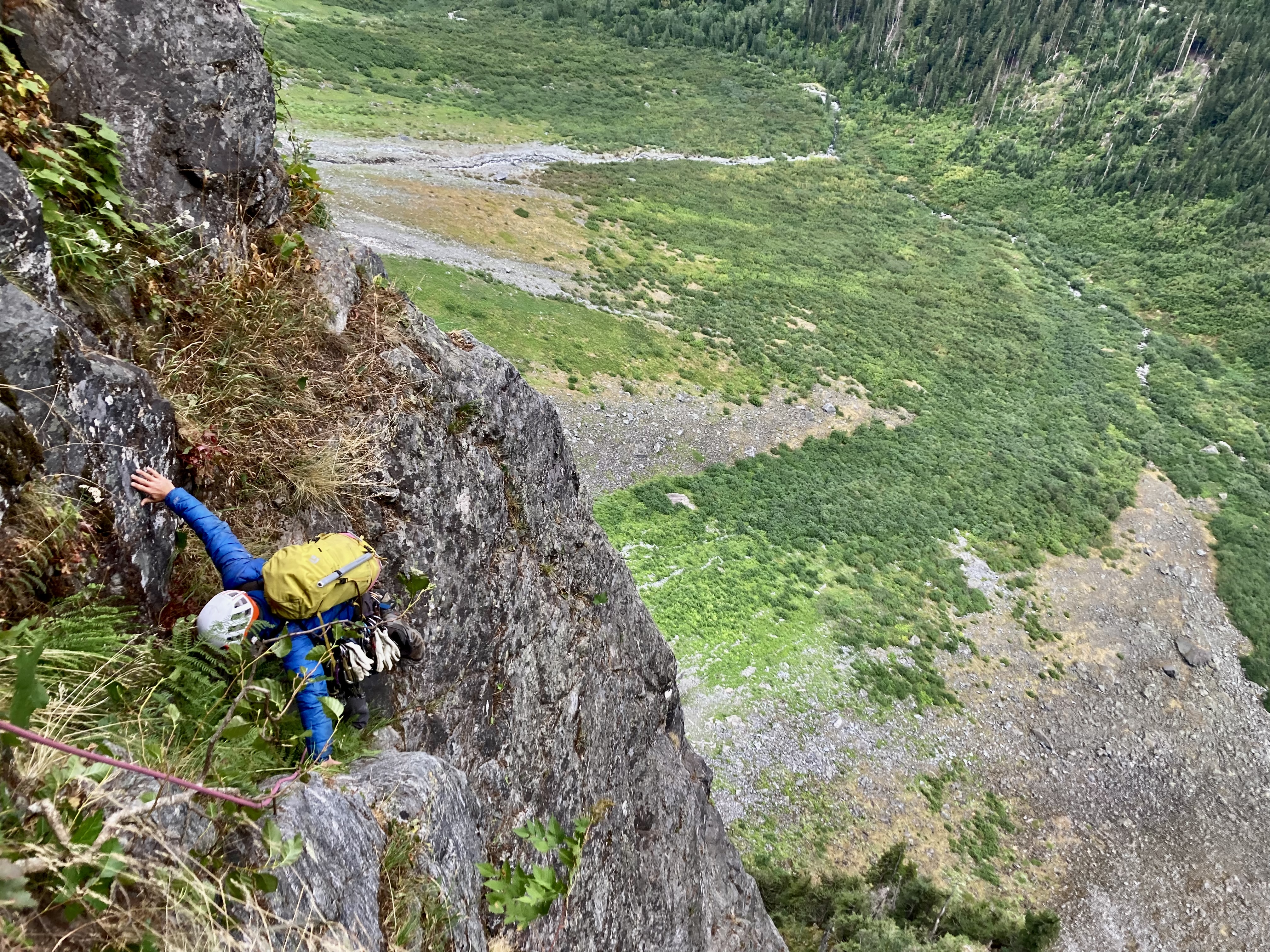
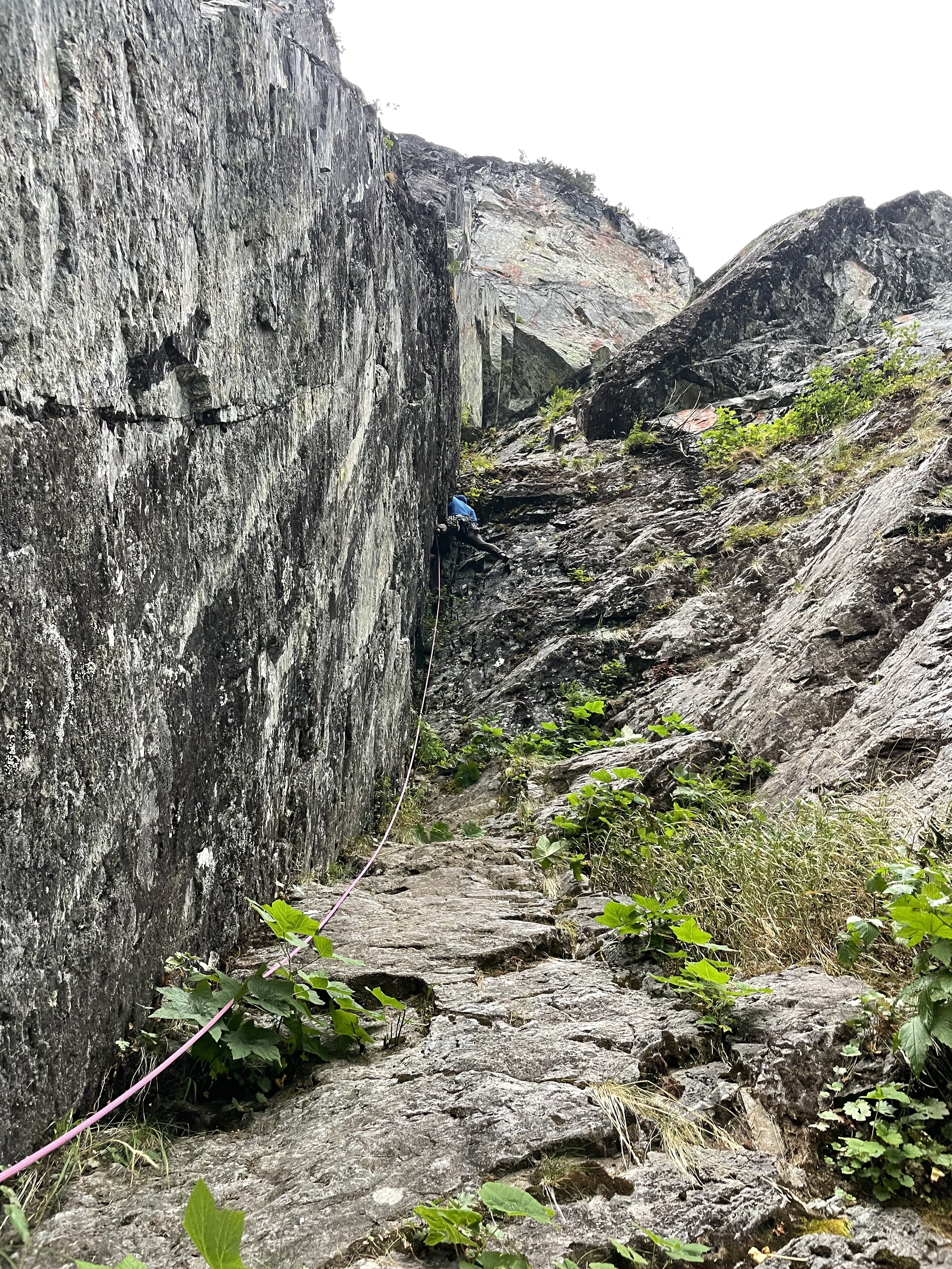
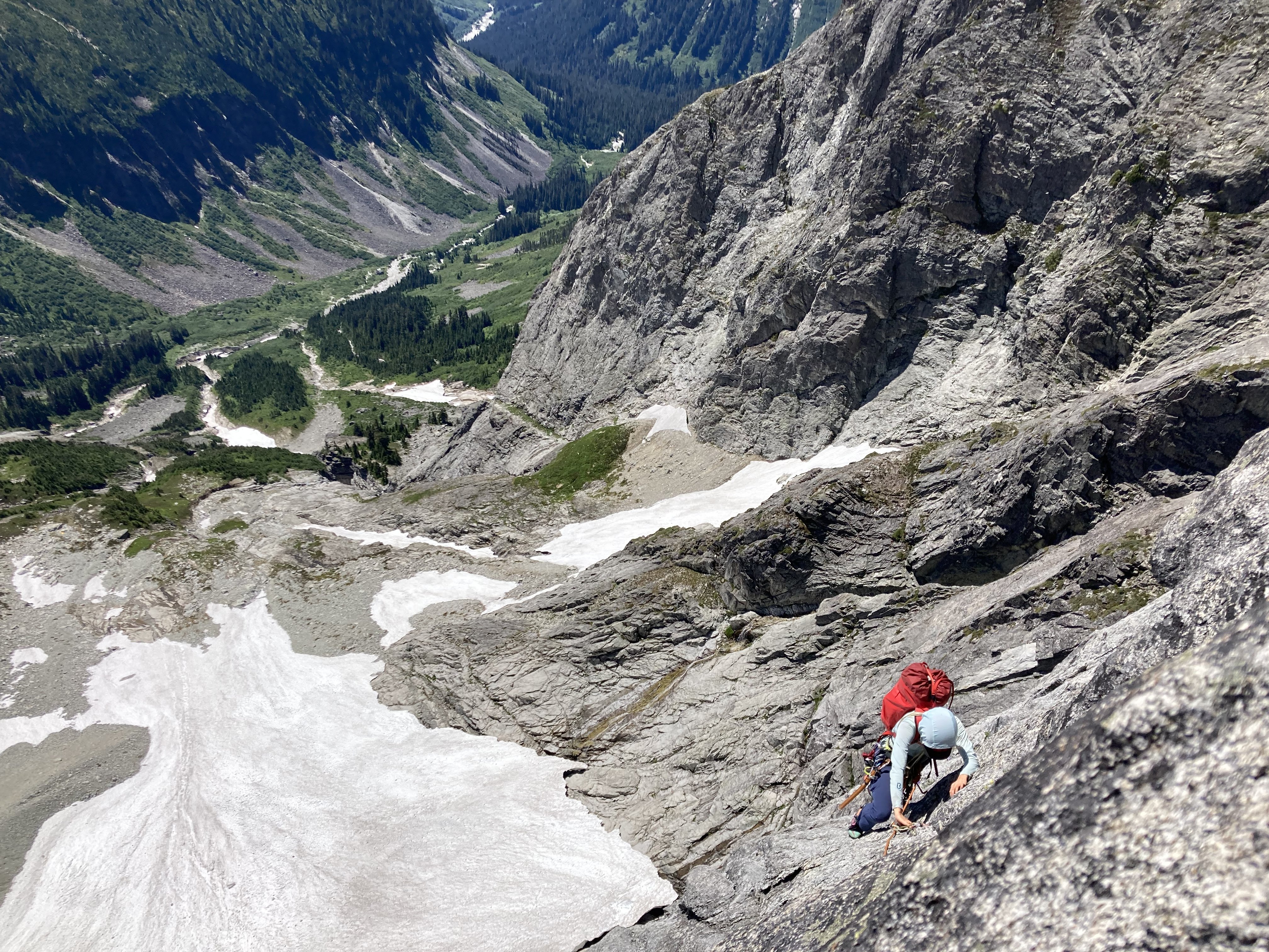
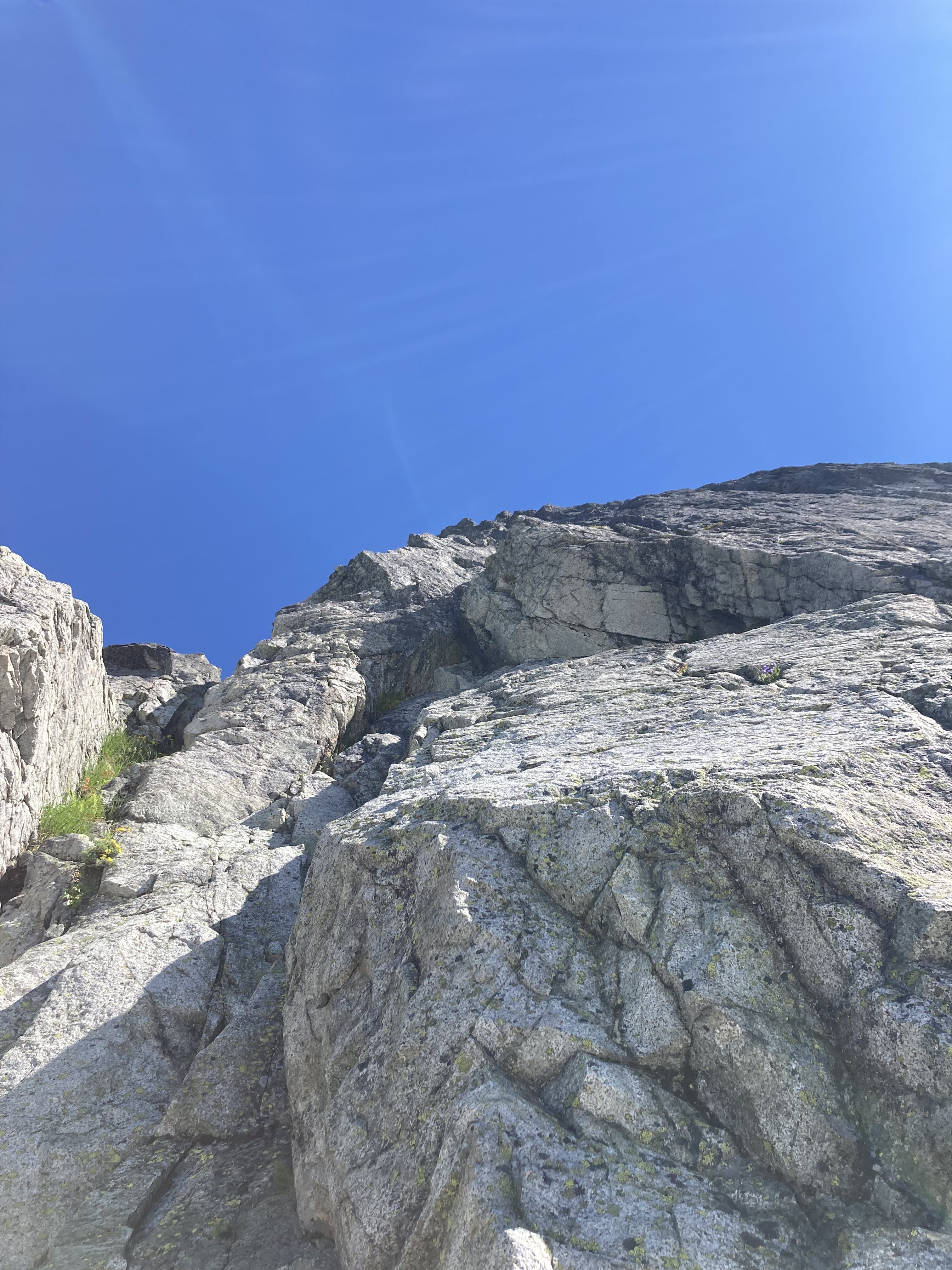
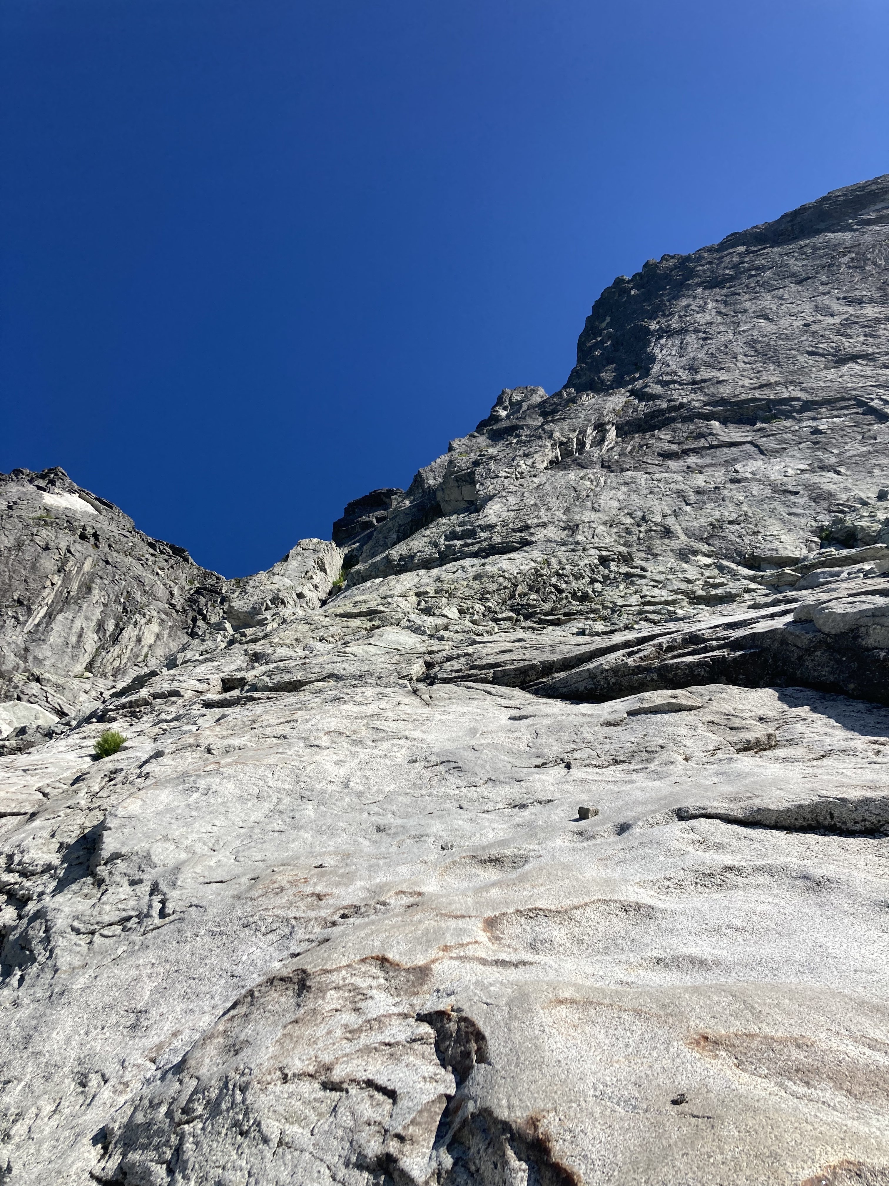
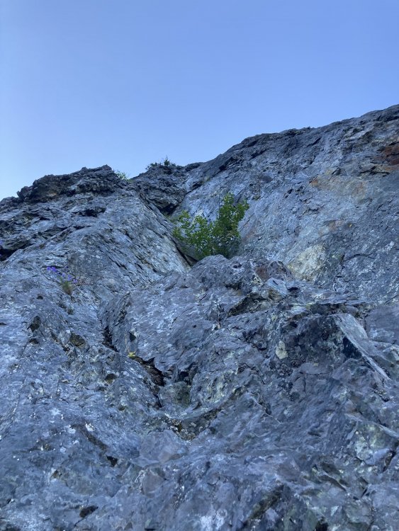
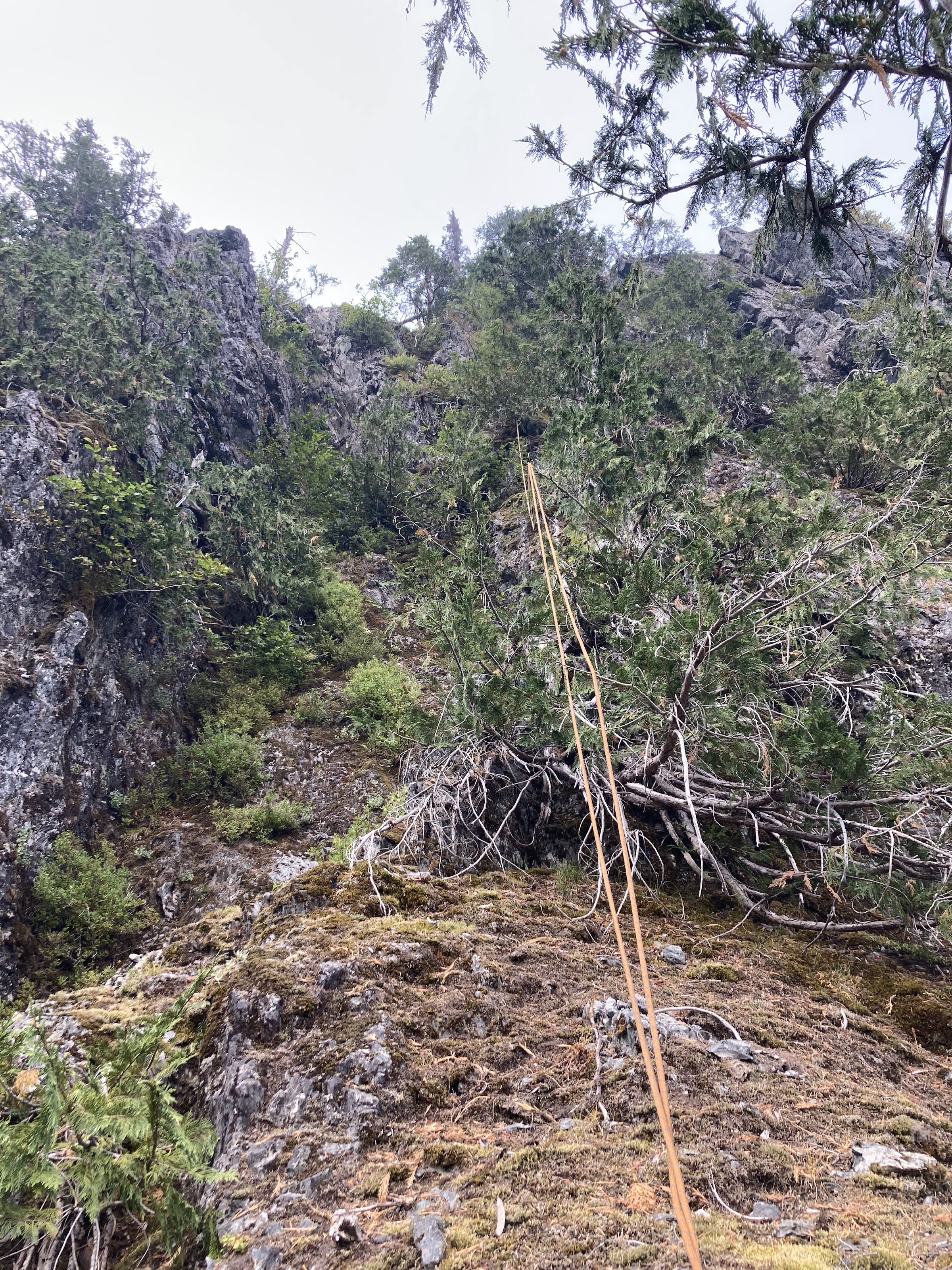
Once at the base of the ridge again we were back in familiar terrain. Ignorance may have been bliss... The first 1000' of the climb involves some substantial, runout and sometimes challenging munge-a-neering.
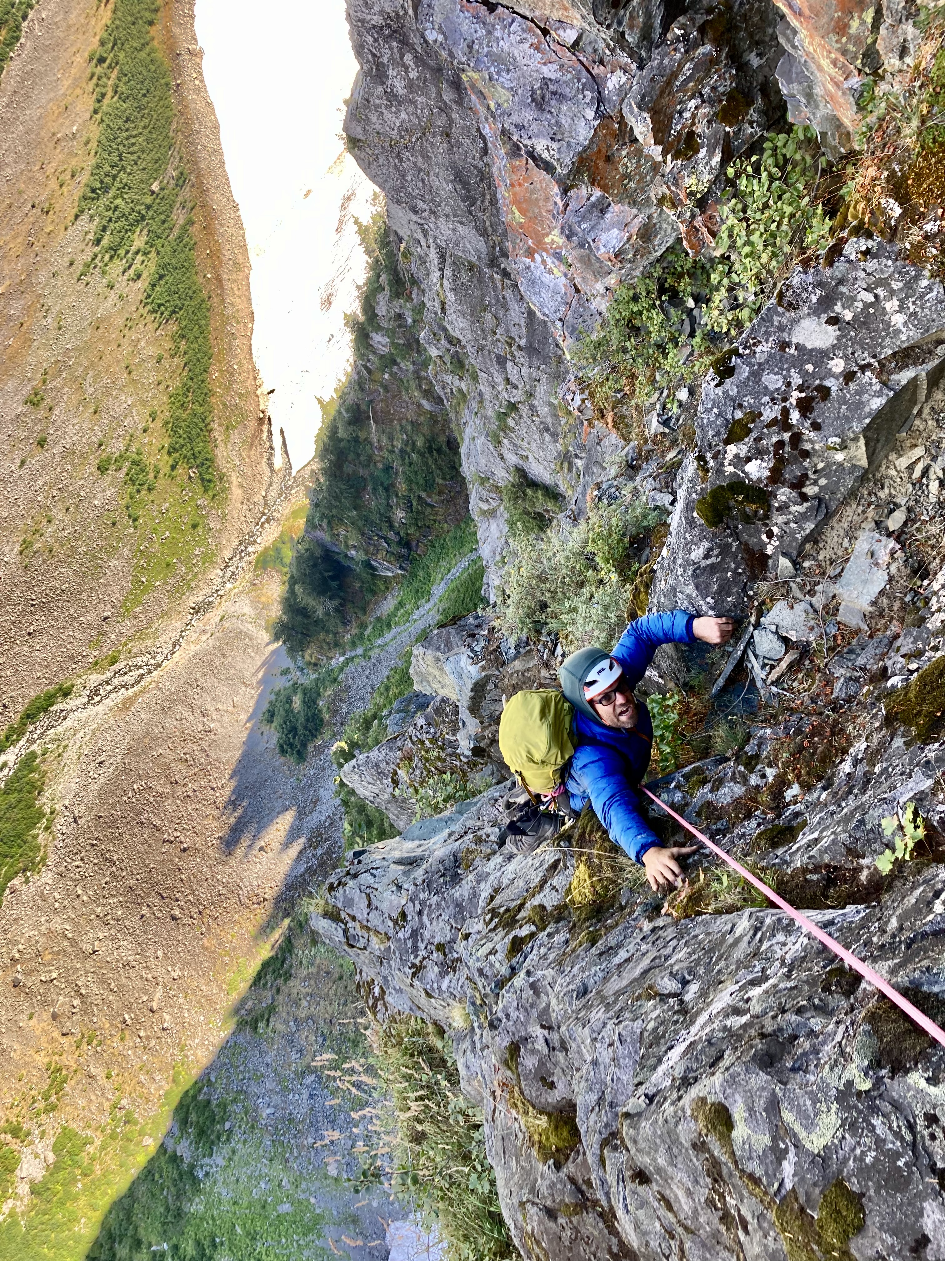
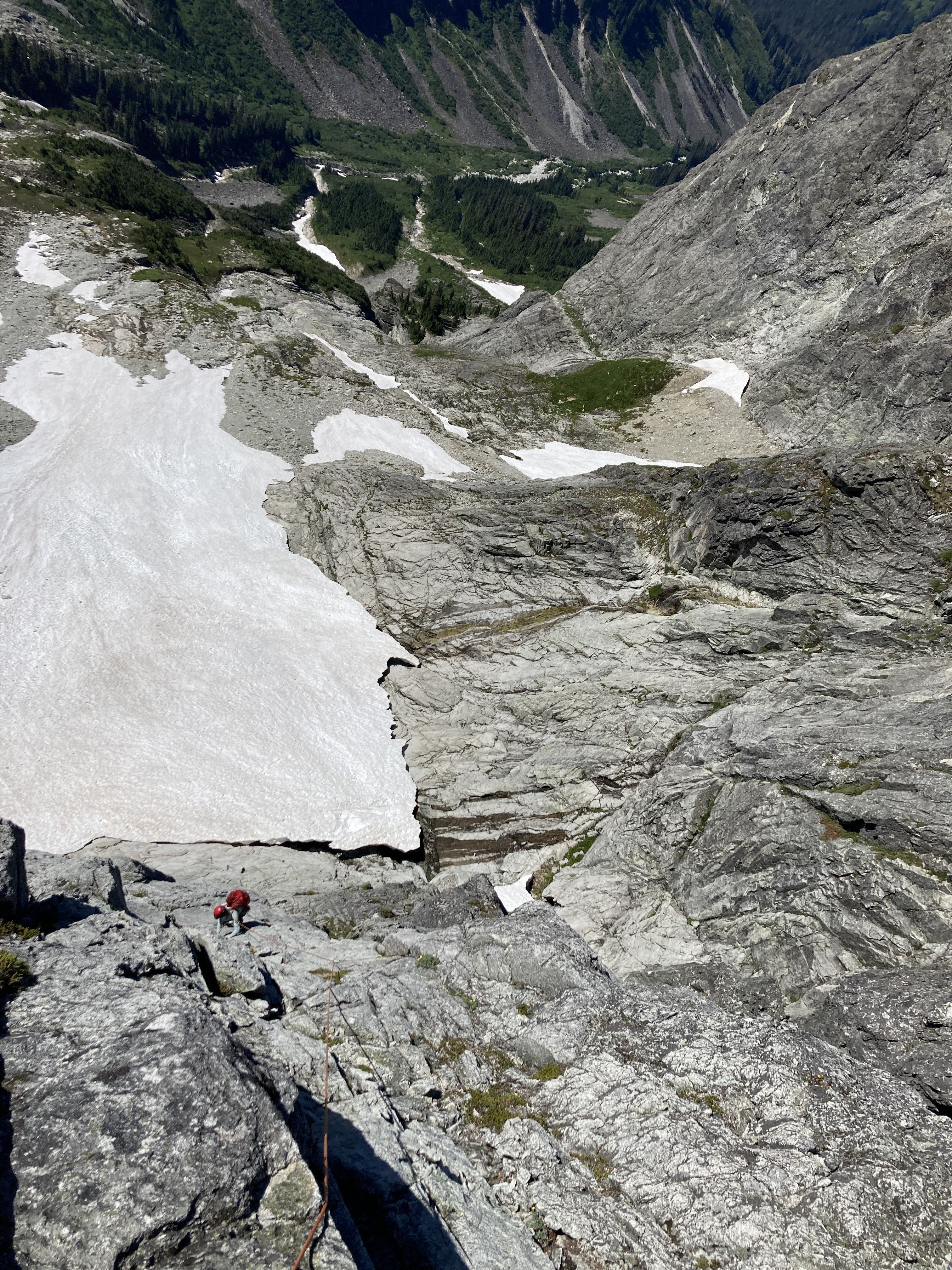
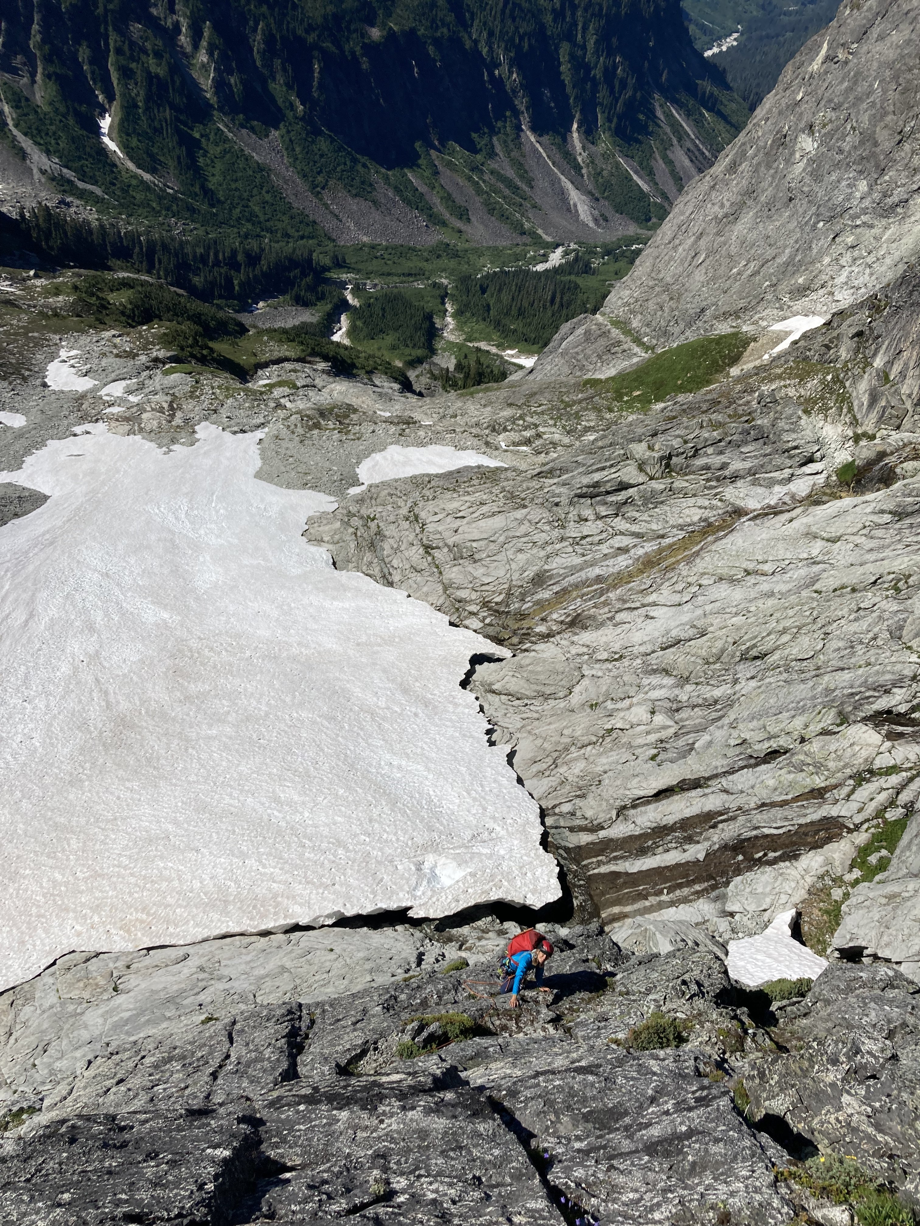
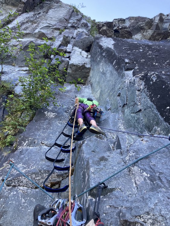
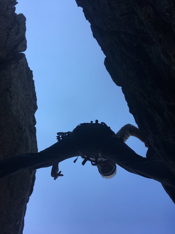
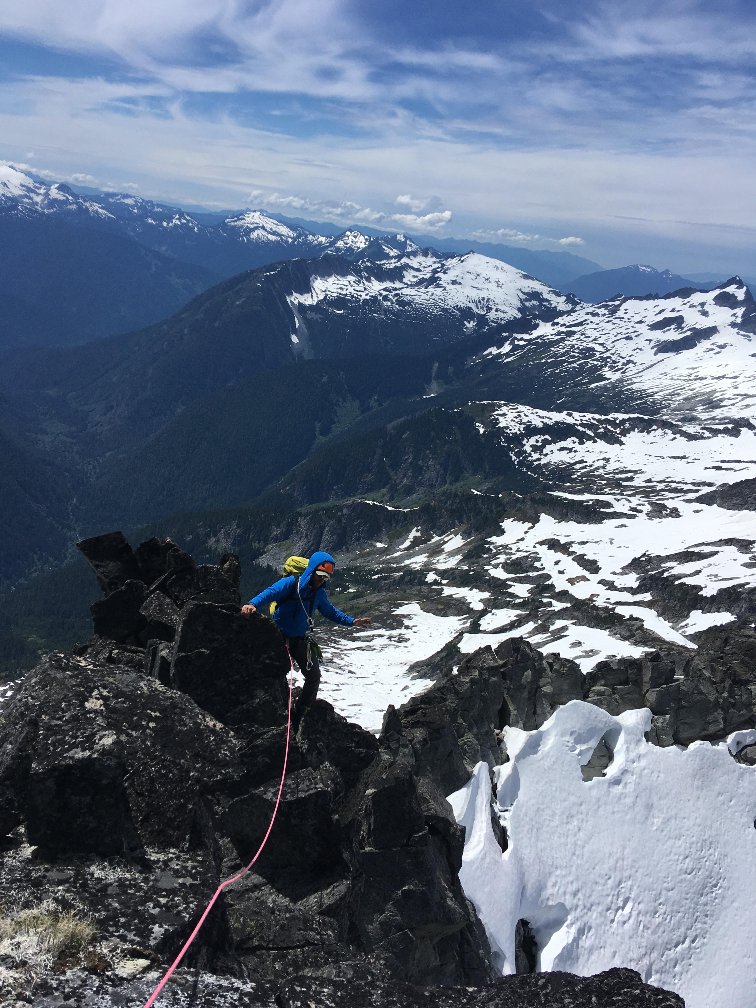
Lani following one of the 5.9 munge pitches on the first attempt
Looking up at the crux munge pitch after bailing on attempt #1
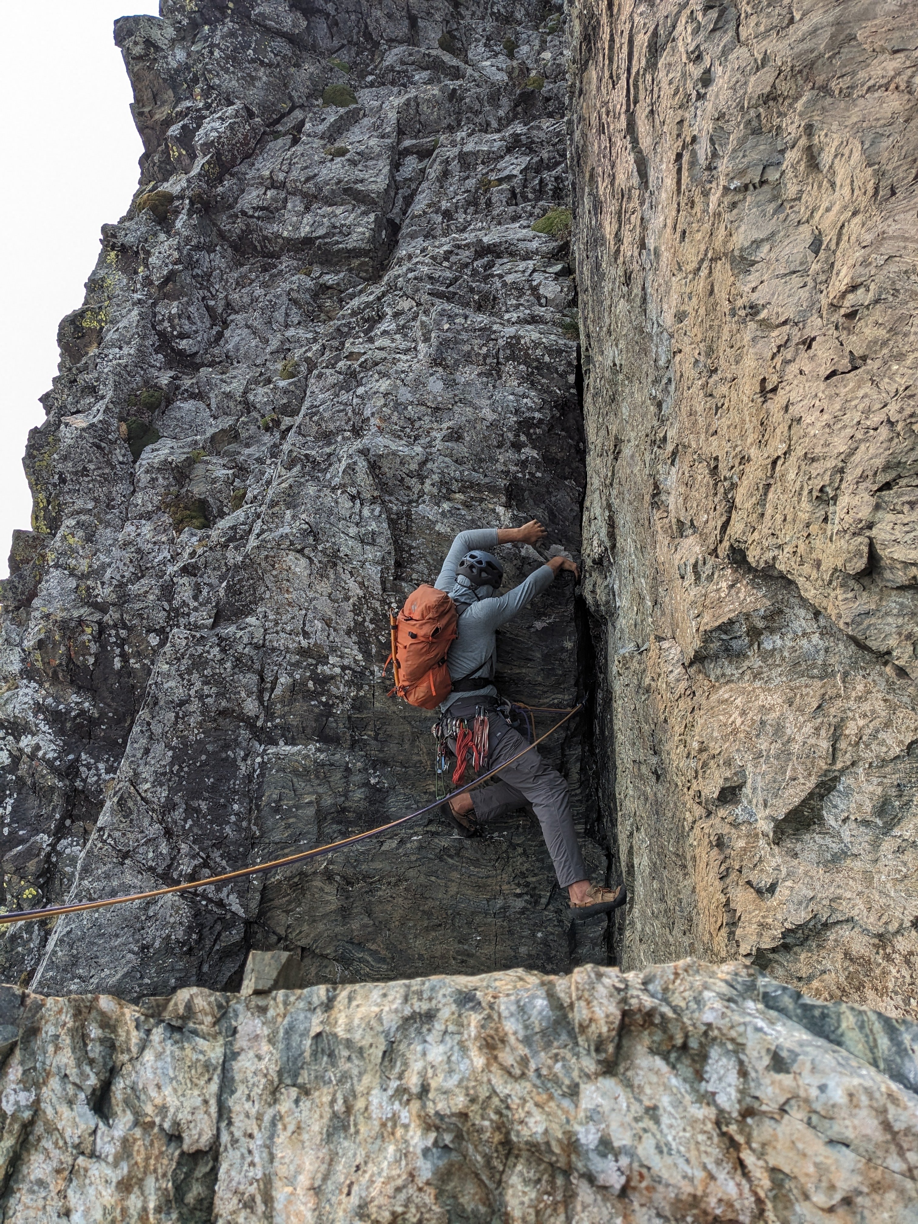
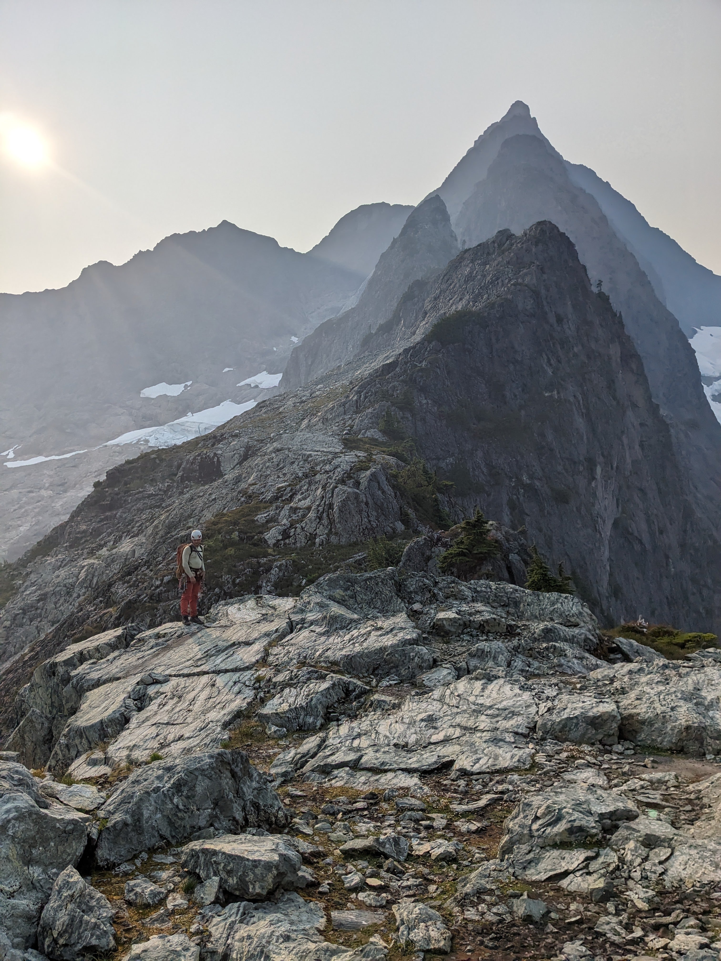
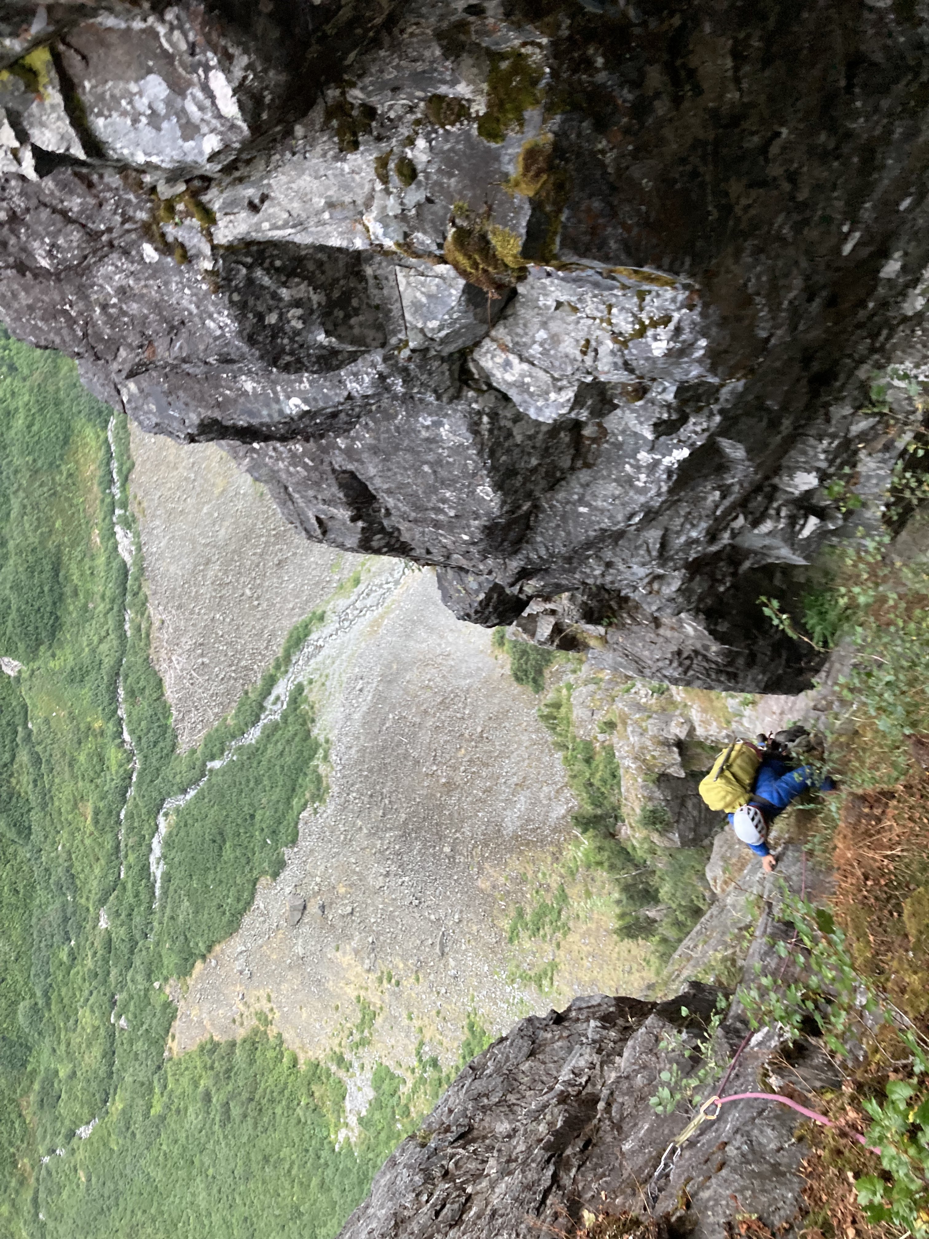
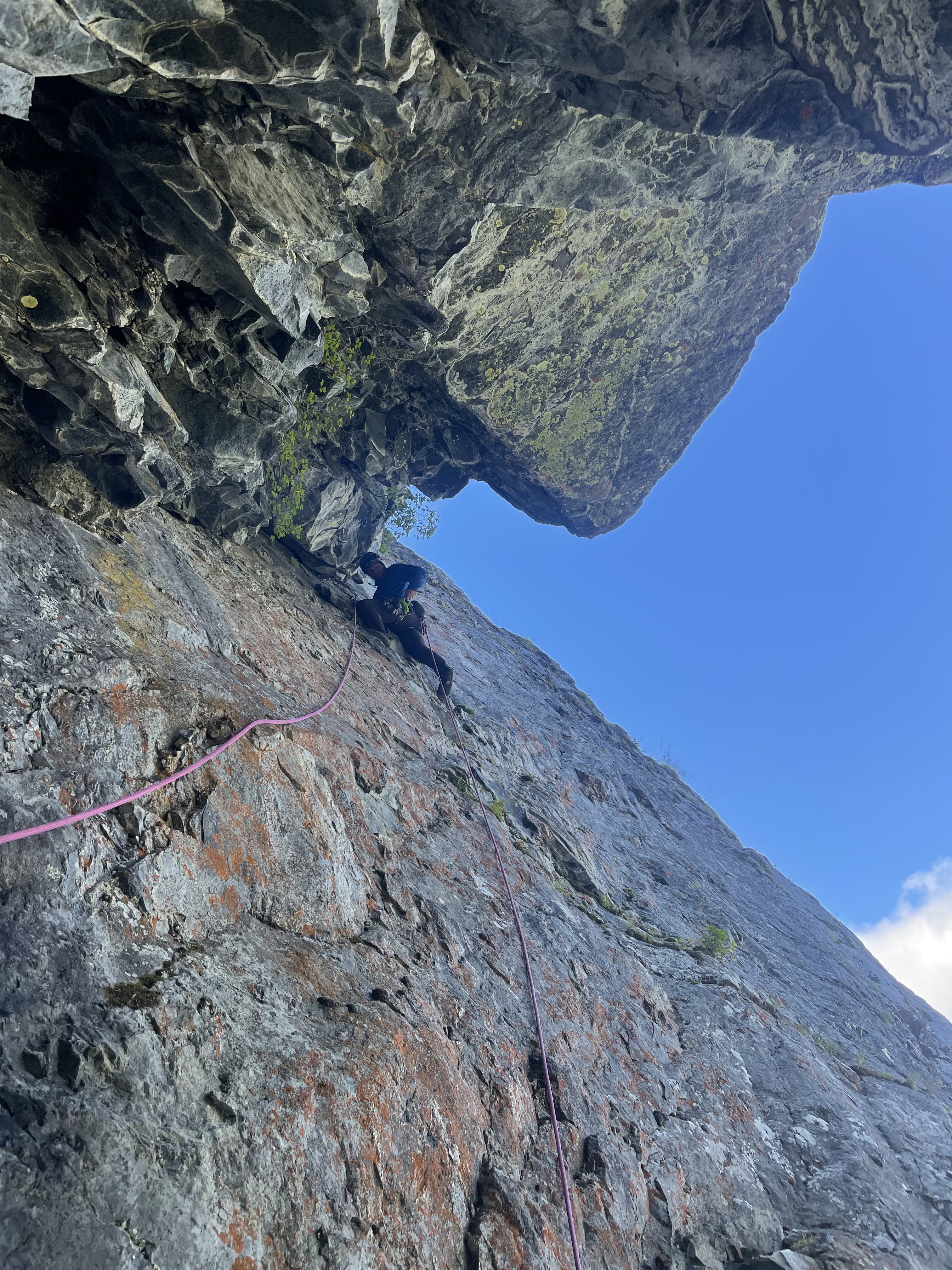
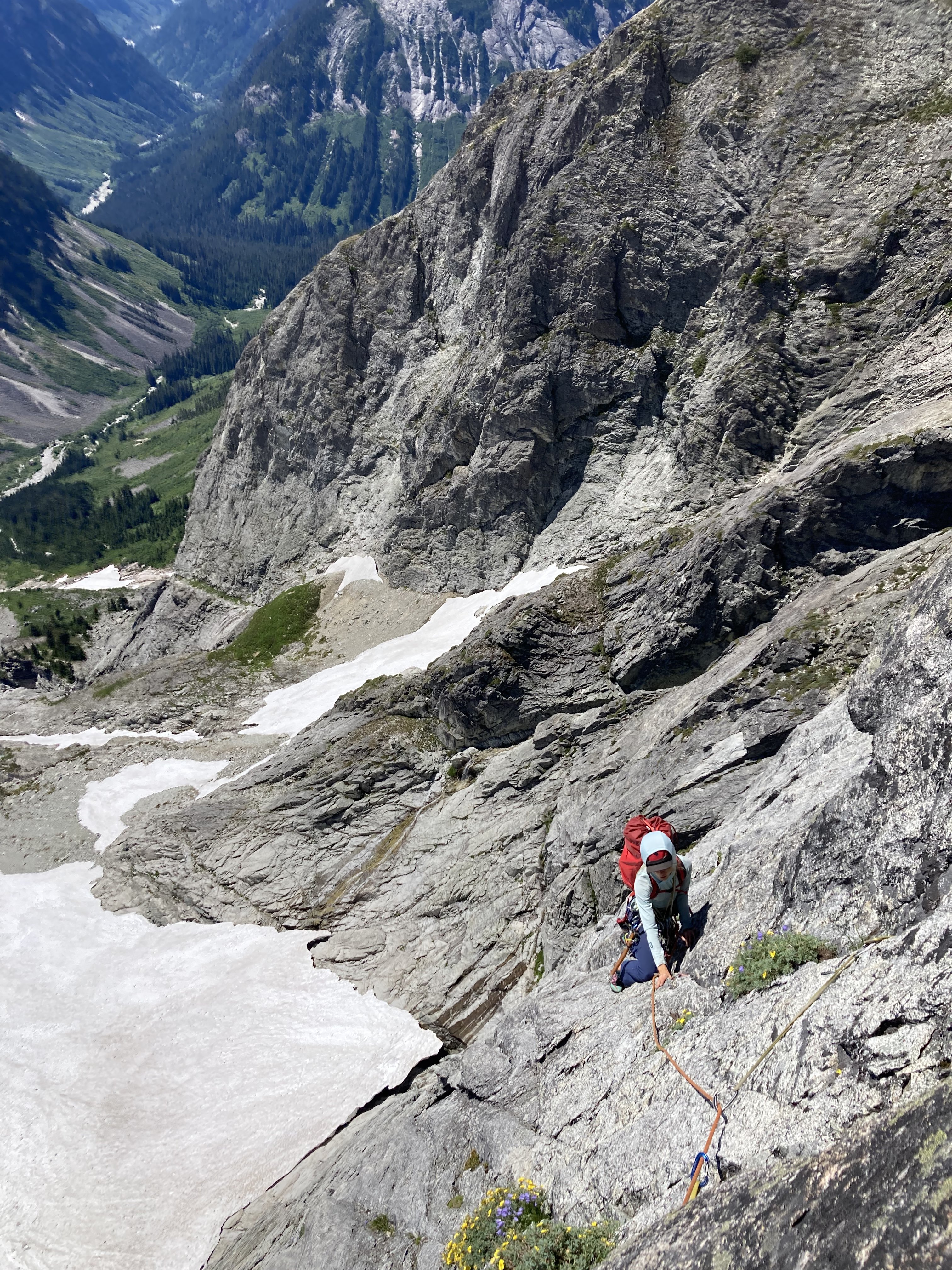
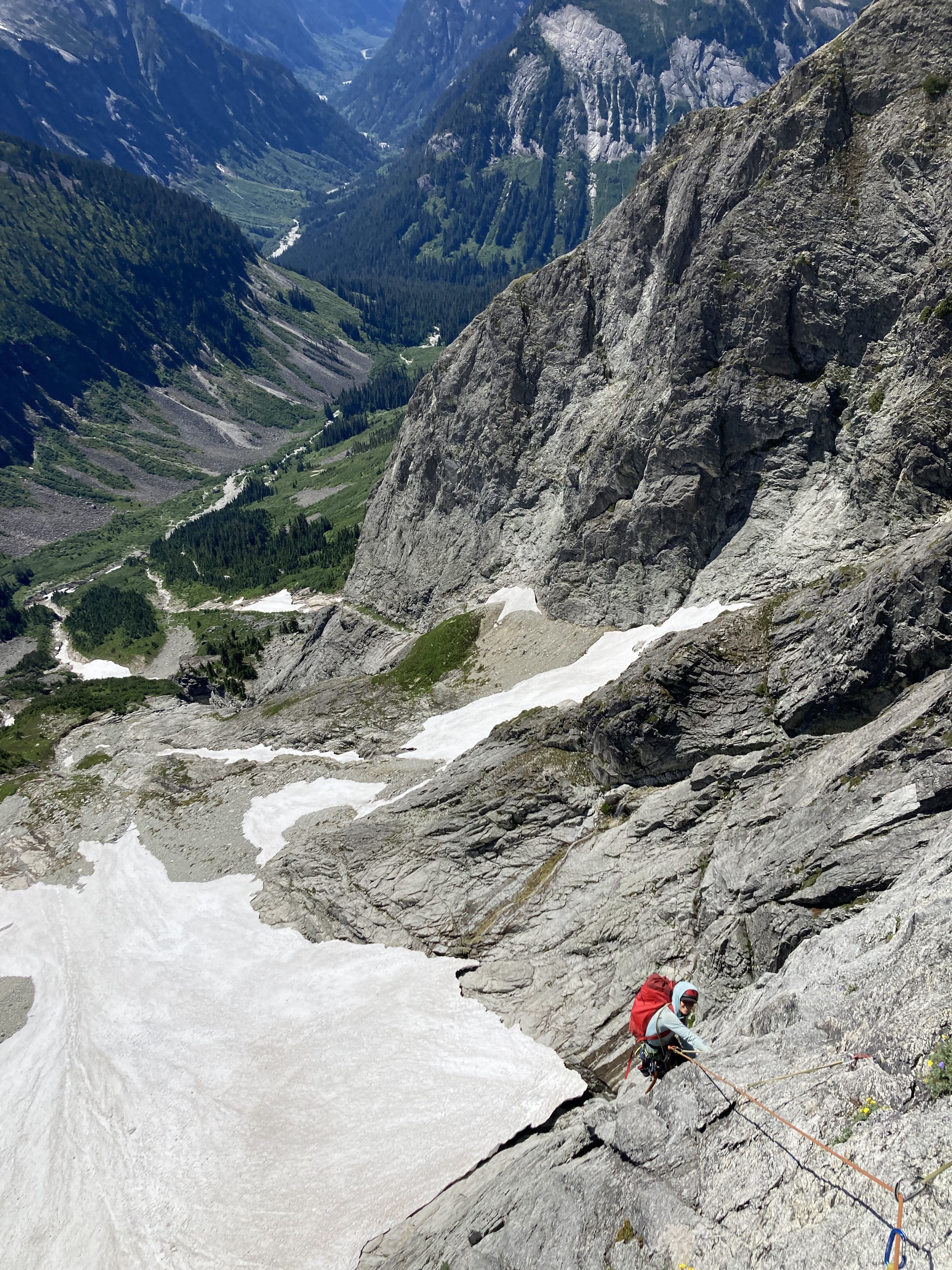
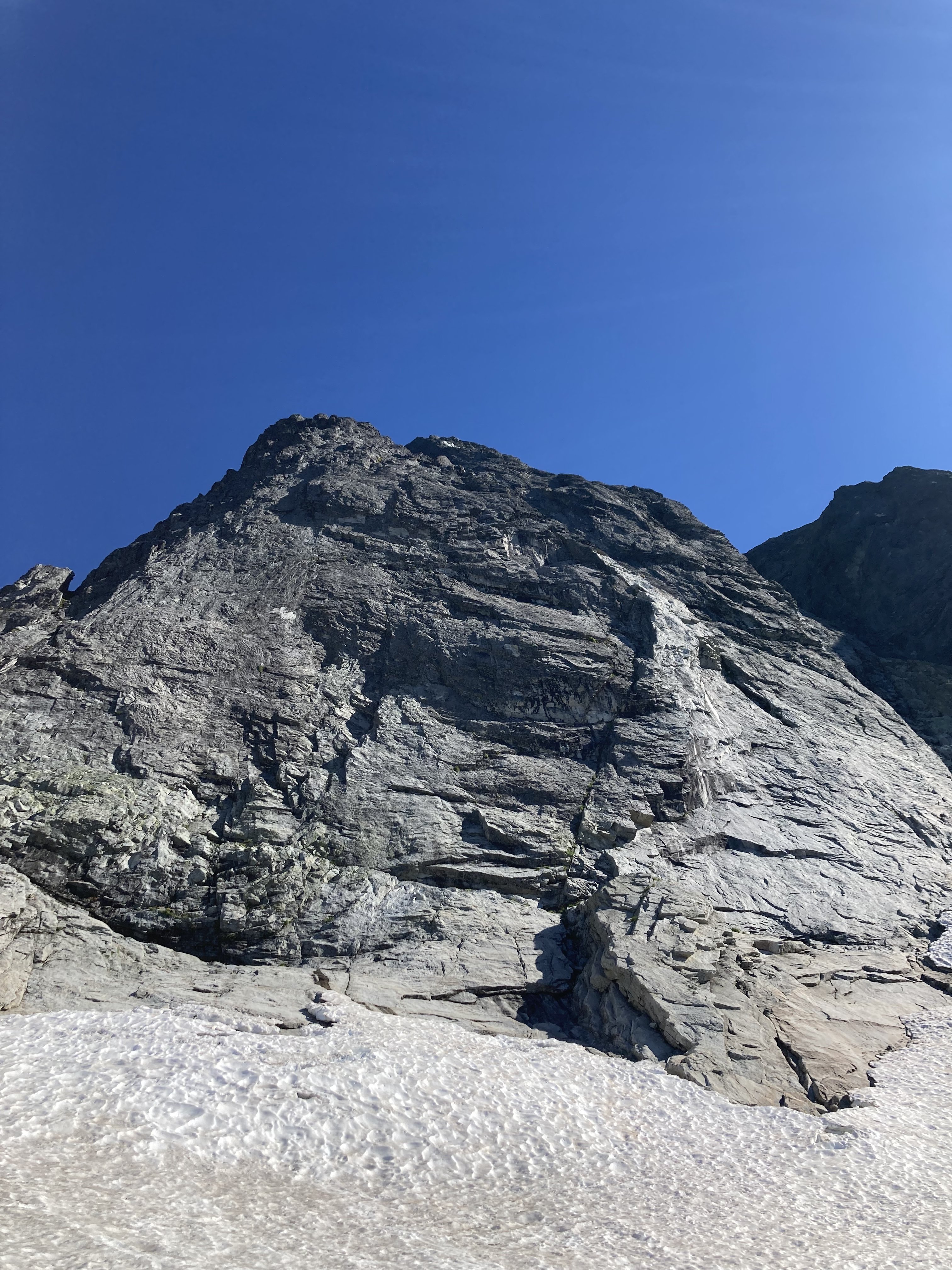
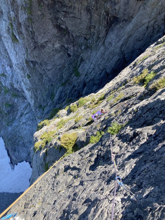
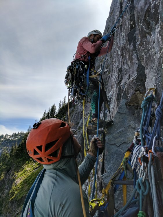
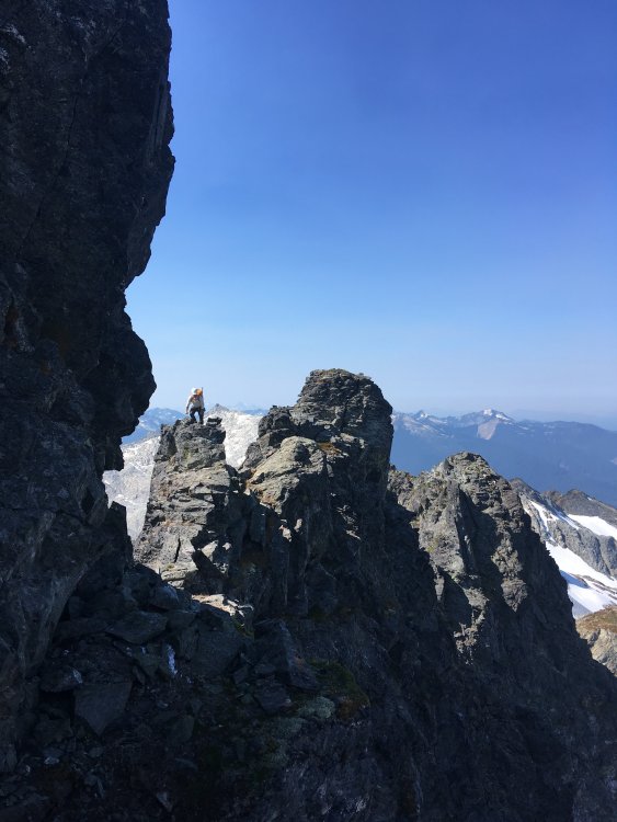
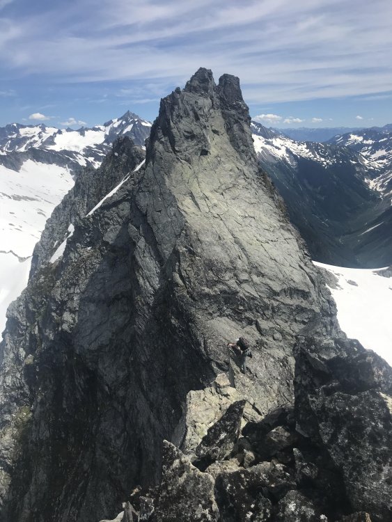
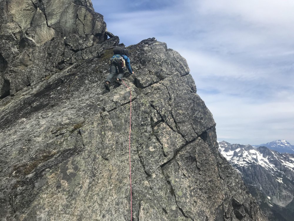
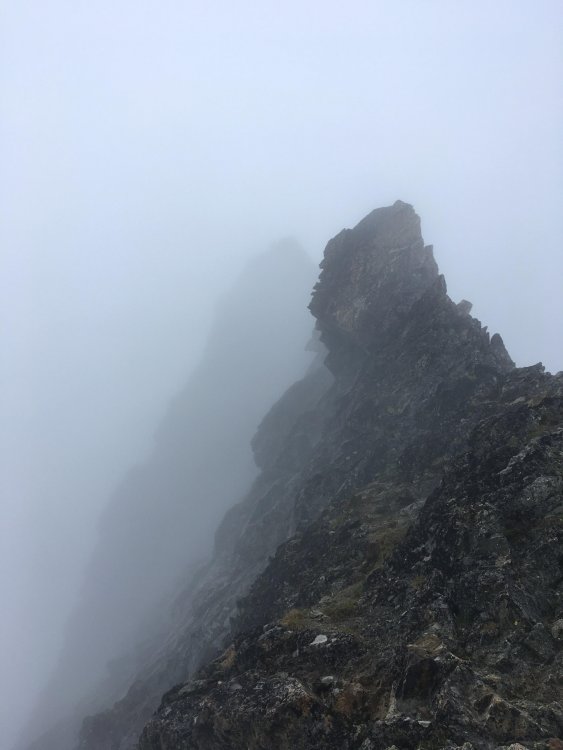
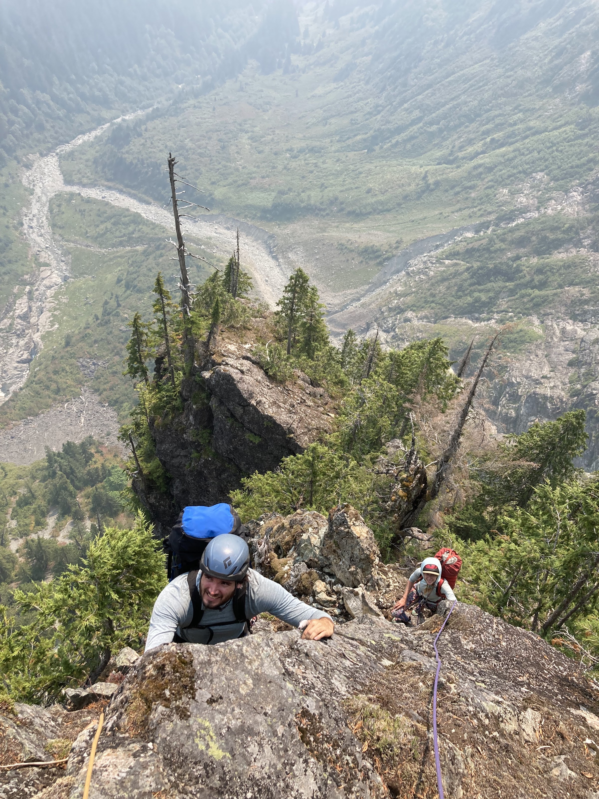
After reaching our high point, we continued questing upward. We had a hunch that we were through the major difficulties of the lower ridge on the first attempt, and luckily that prior assumption was true. 1000' more munge led us to the summit of the first major tower. This tower rises over 2000' over crystal creek basin and feels like a major accomplishment in and of itself.
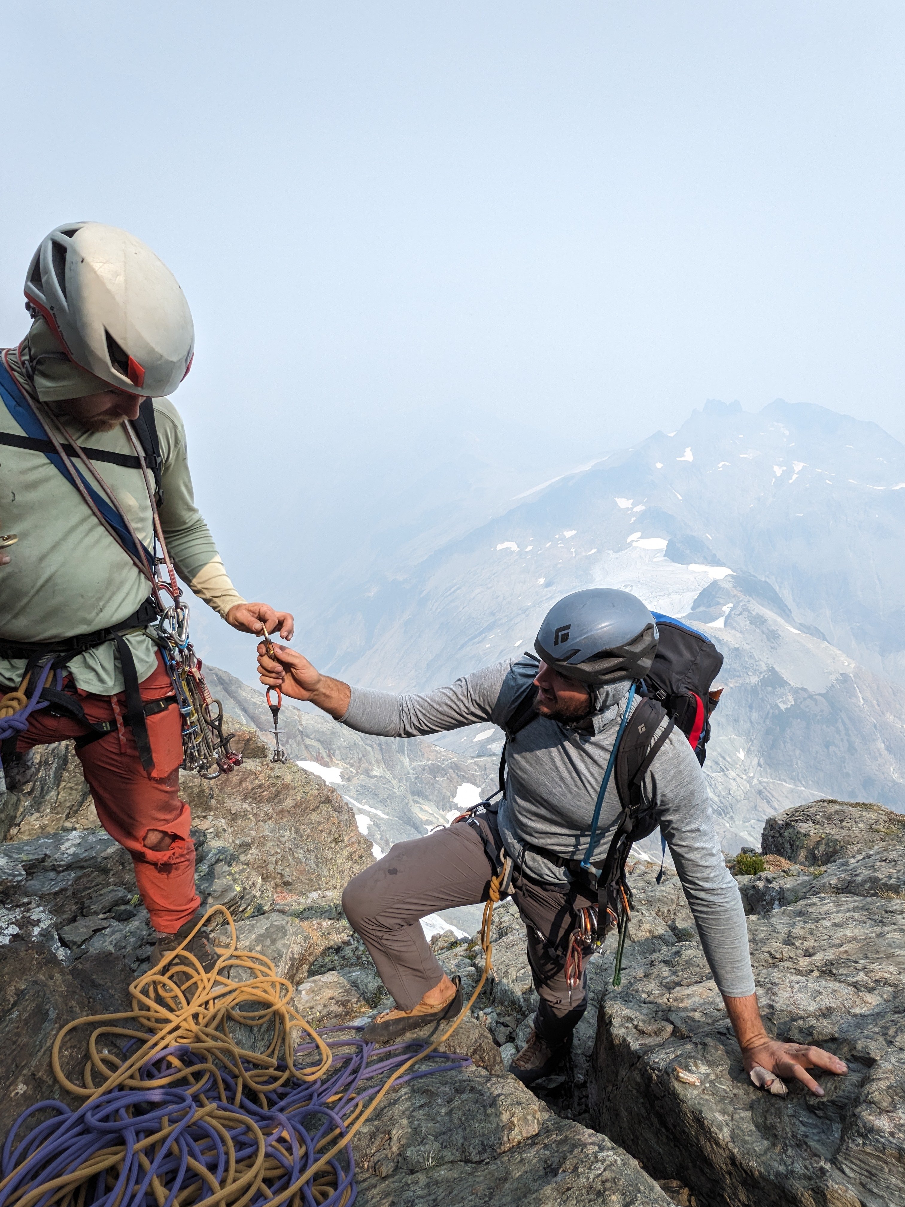
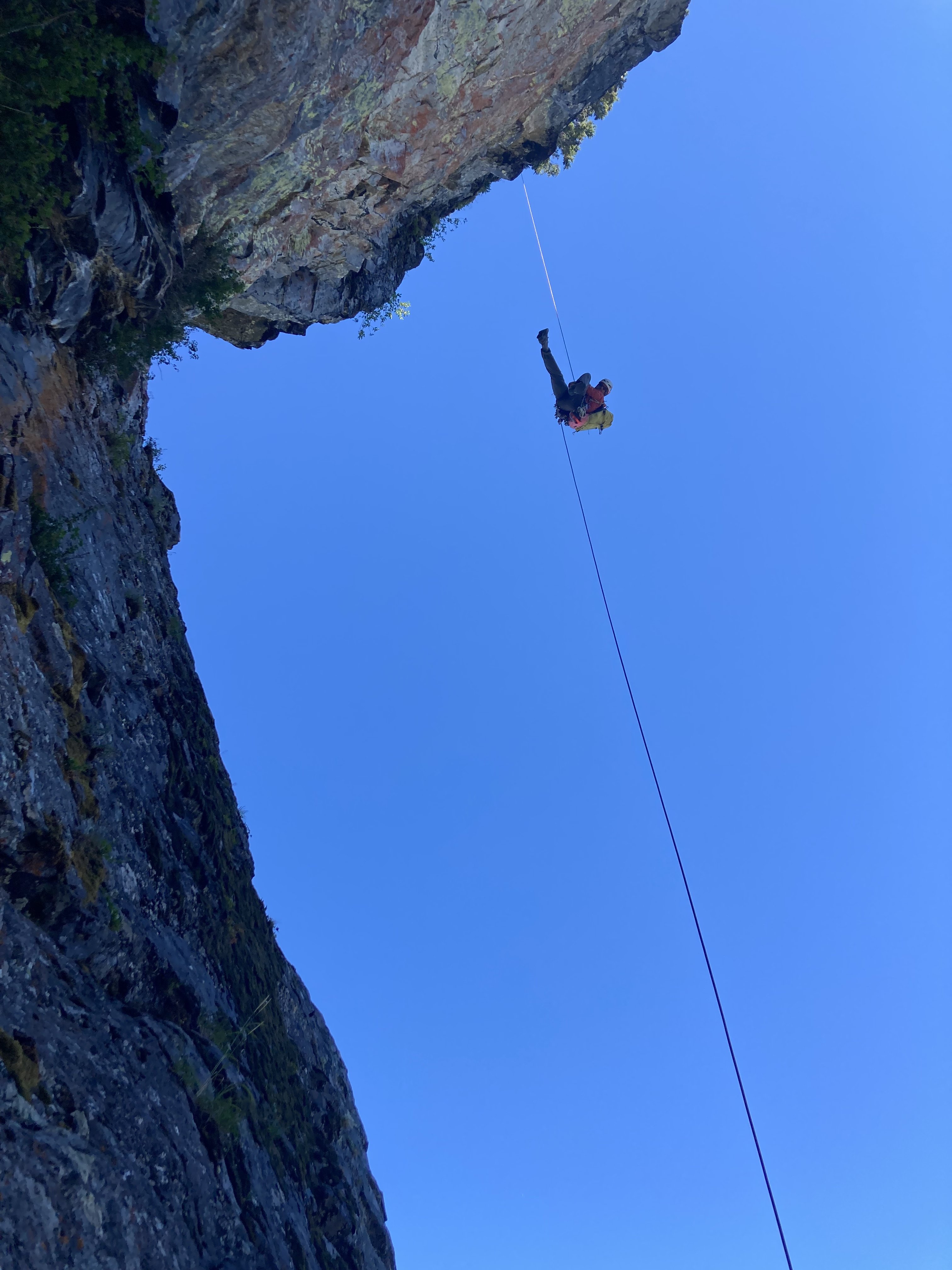
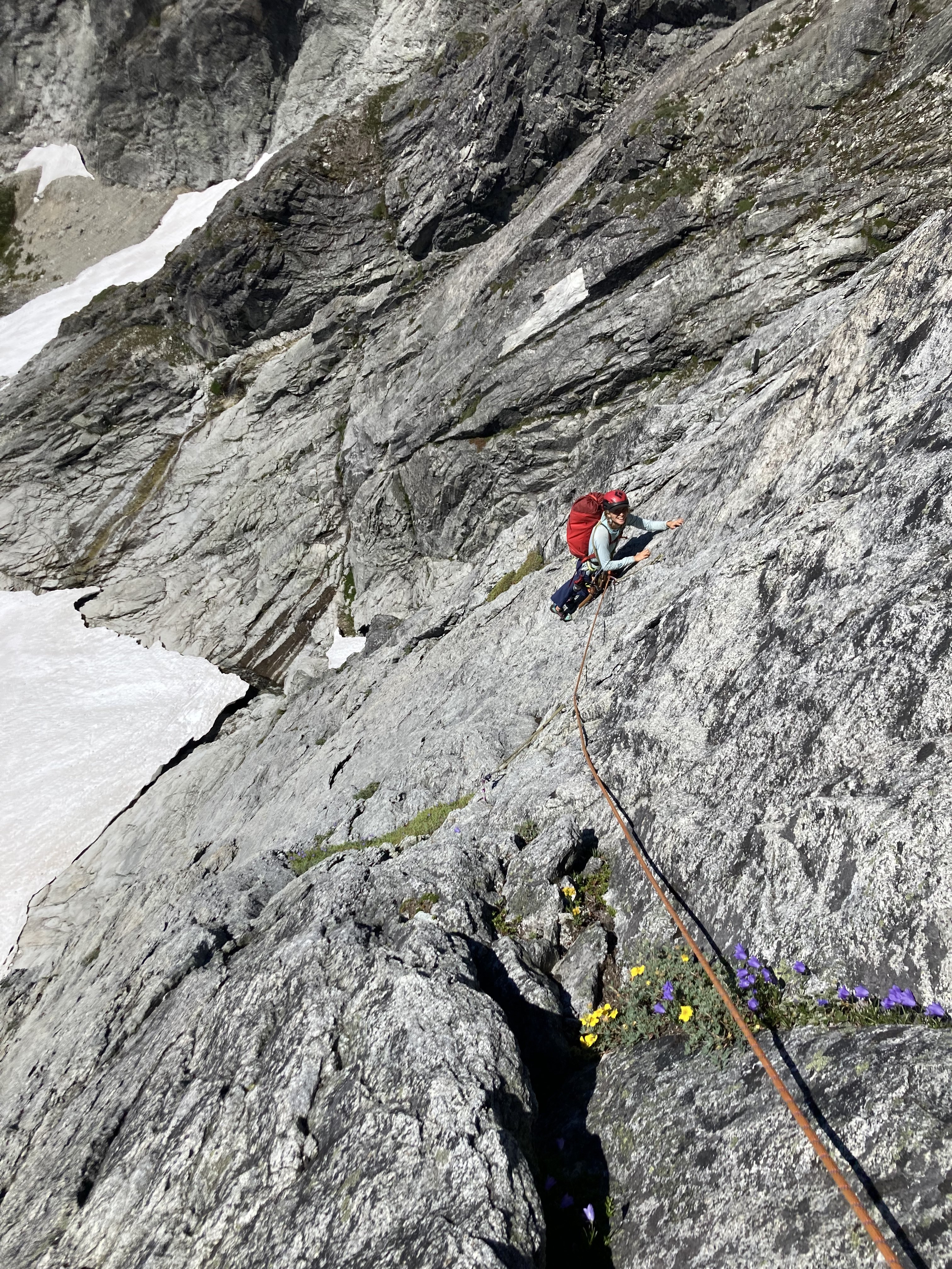
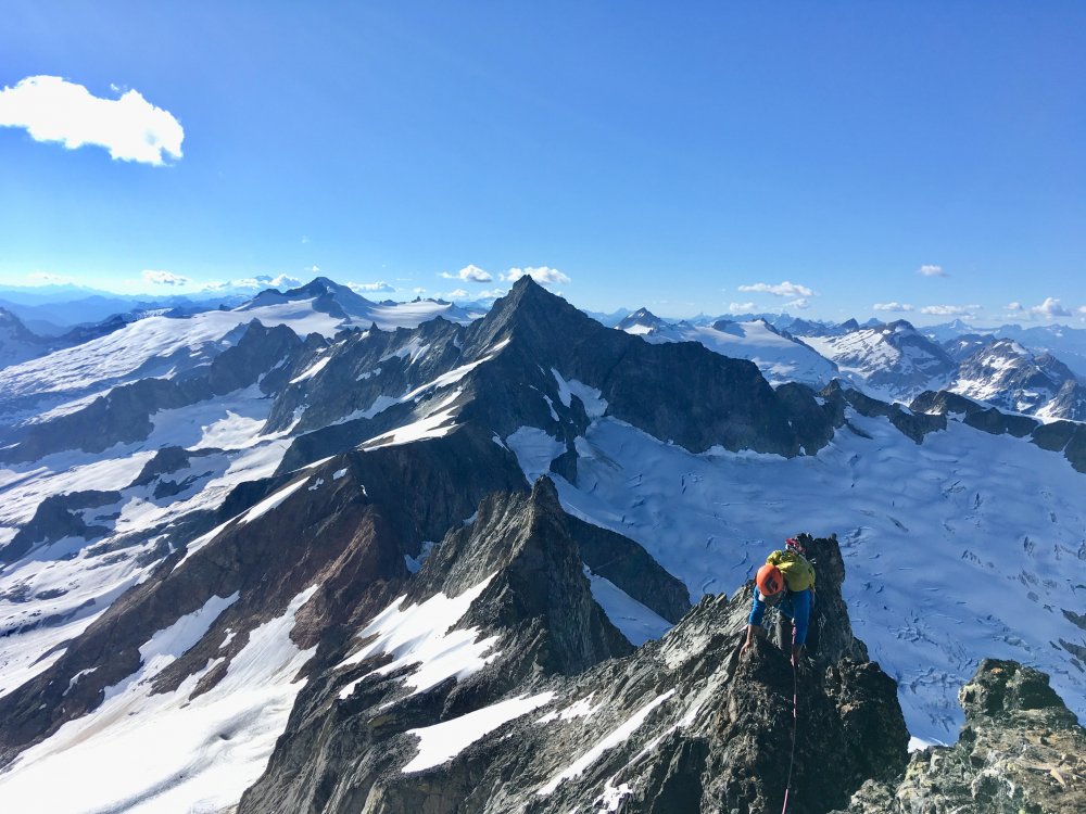
Lani and Nick Following near the top of Tanuki Tower
Looking back down at the long scrambling section in the middle of the route
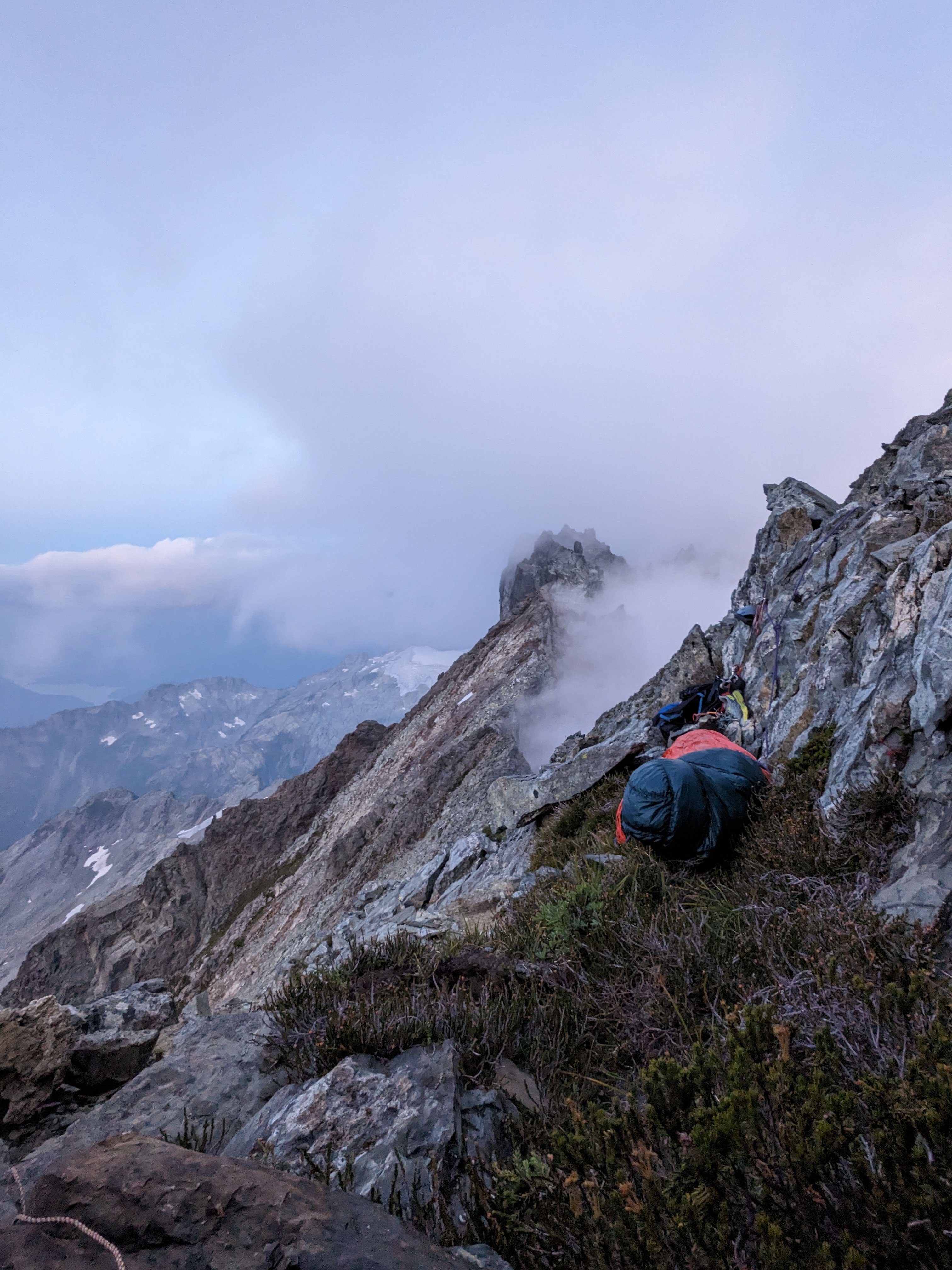
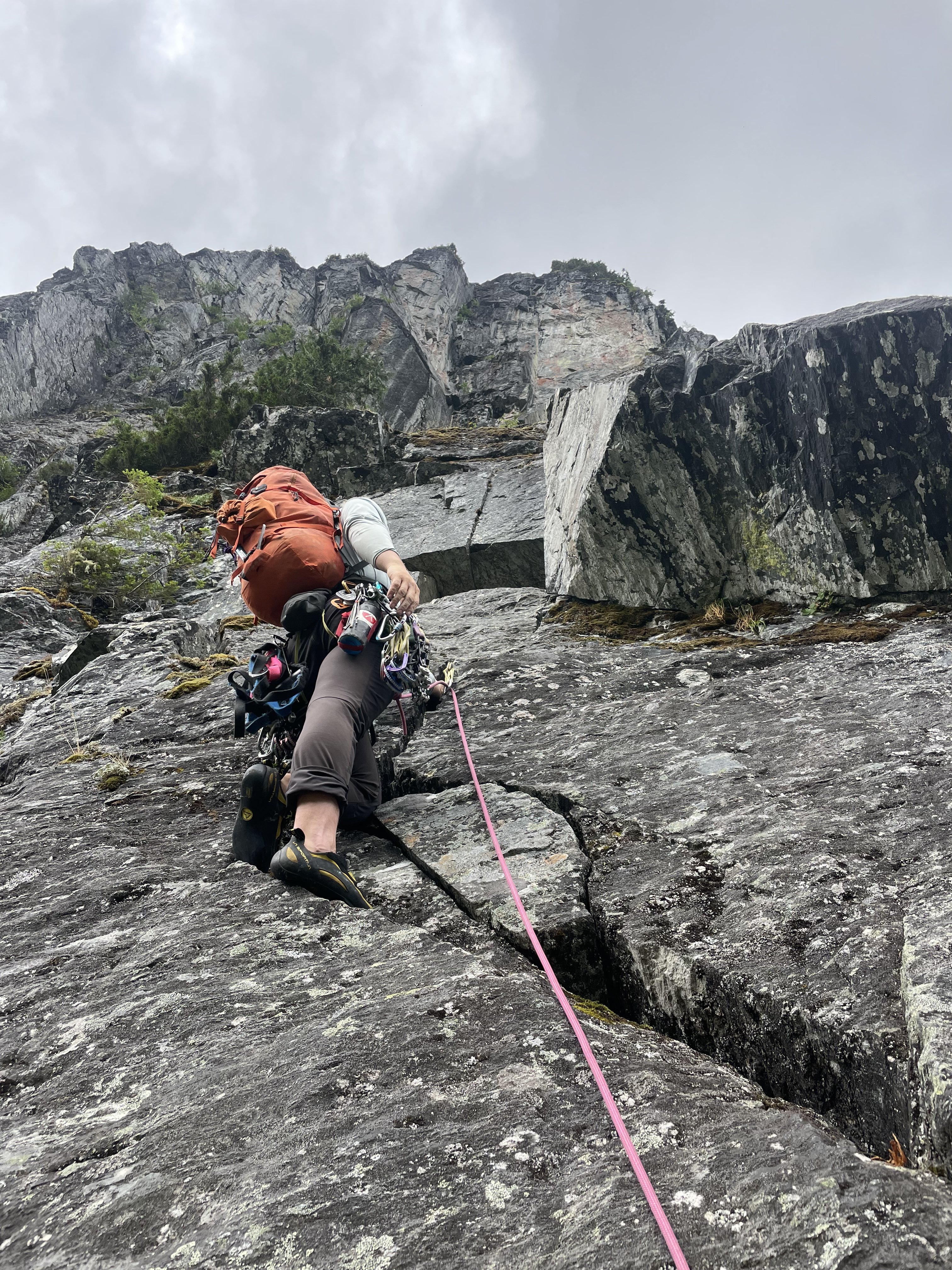
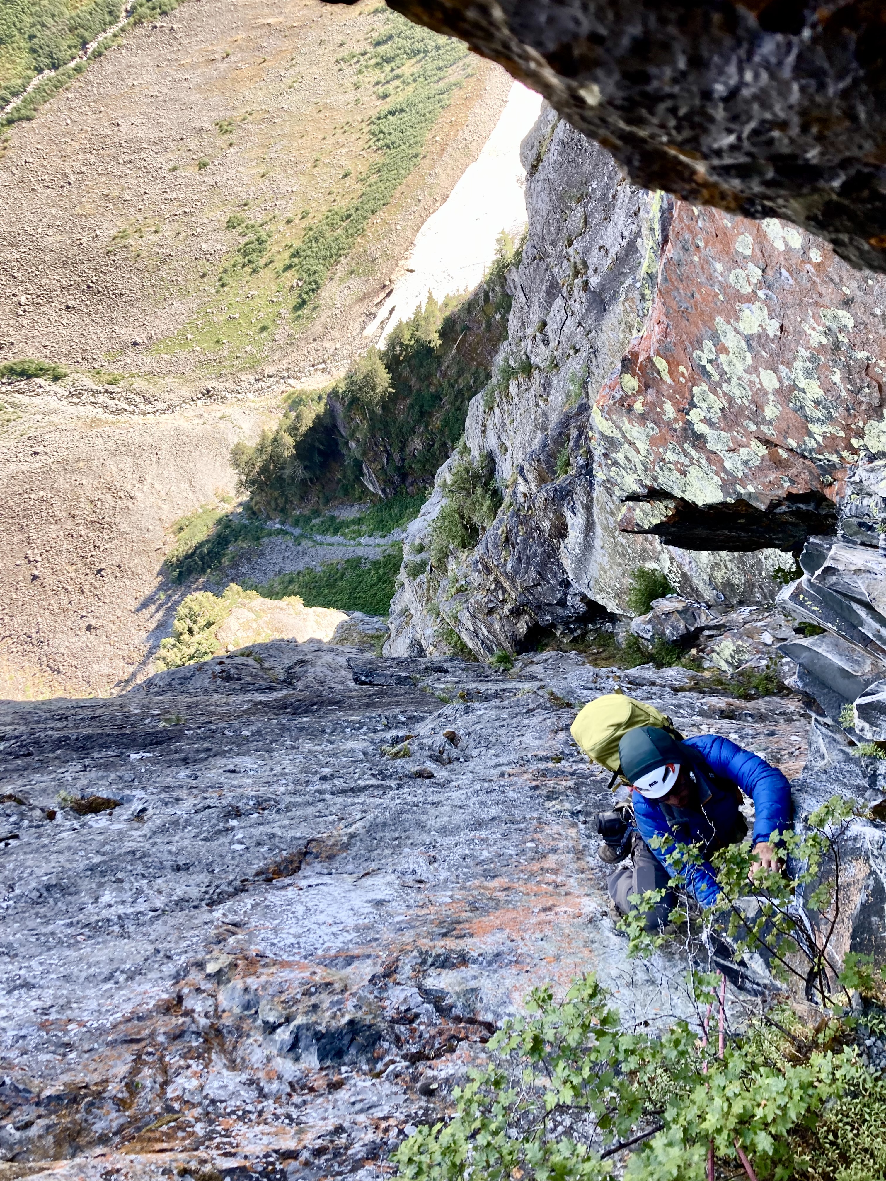
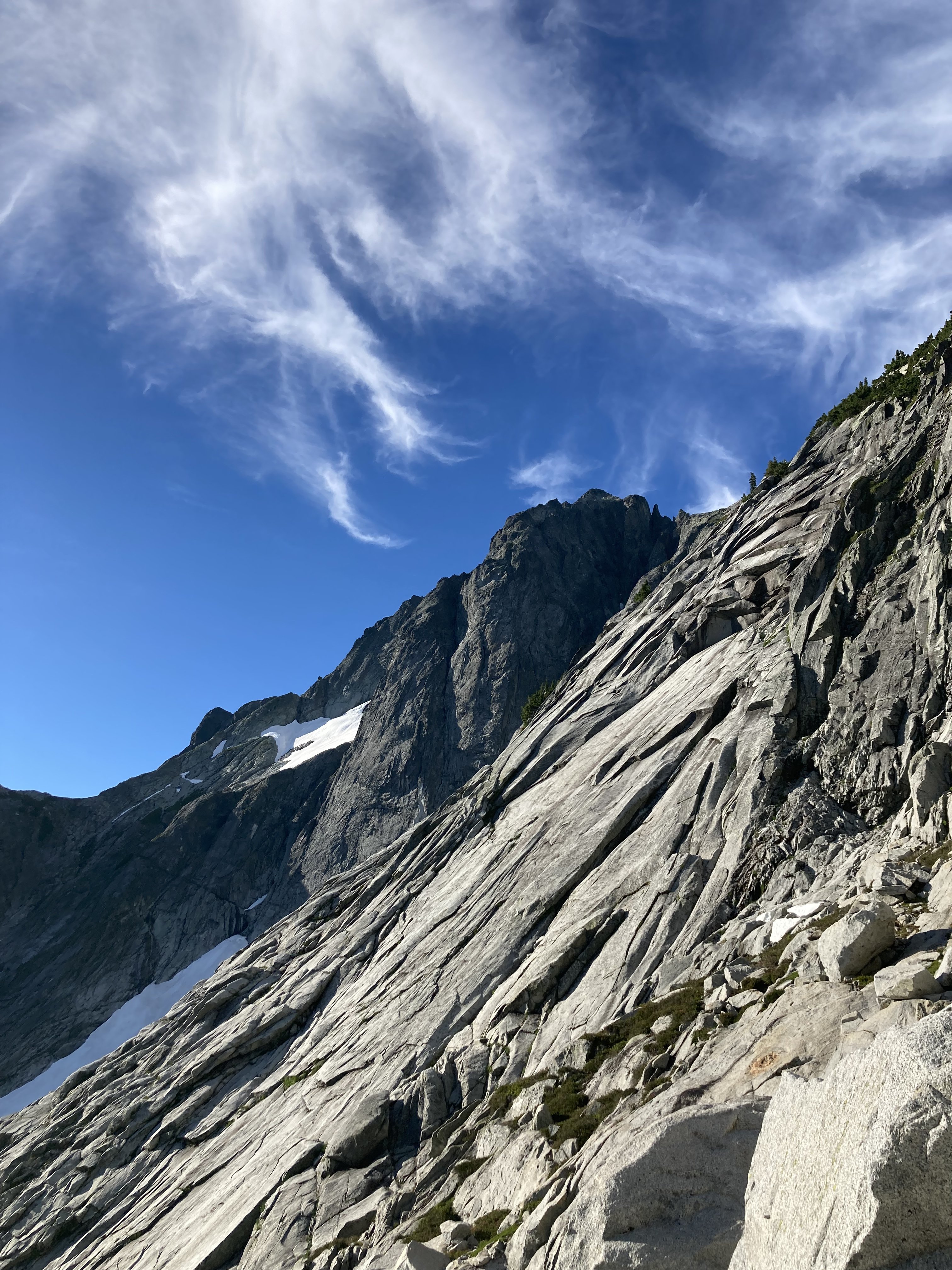
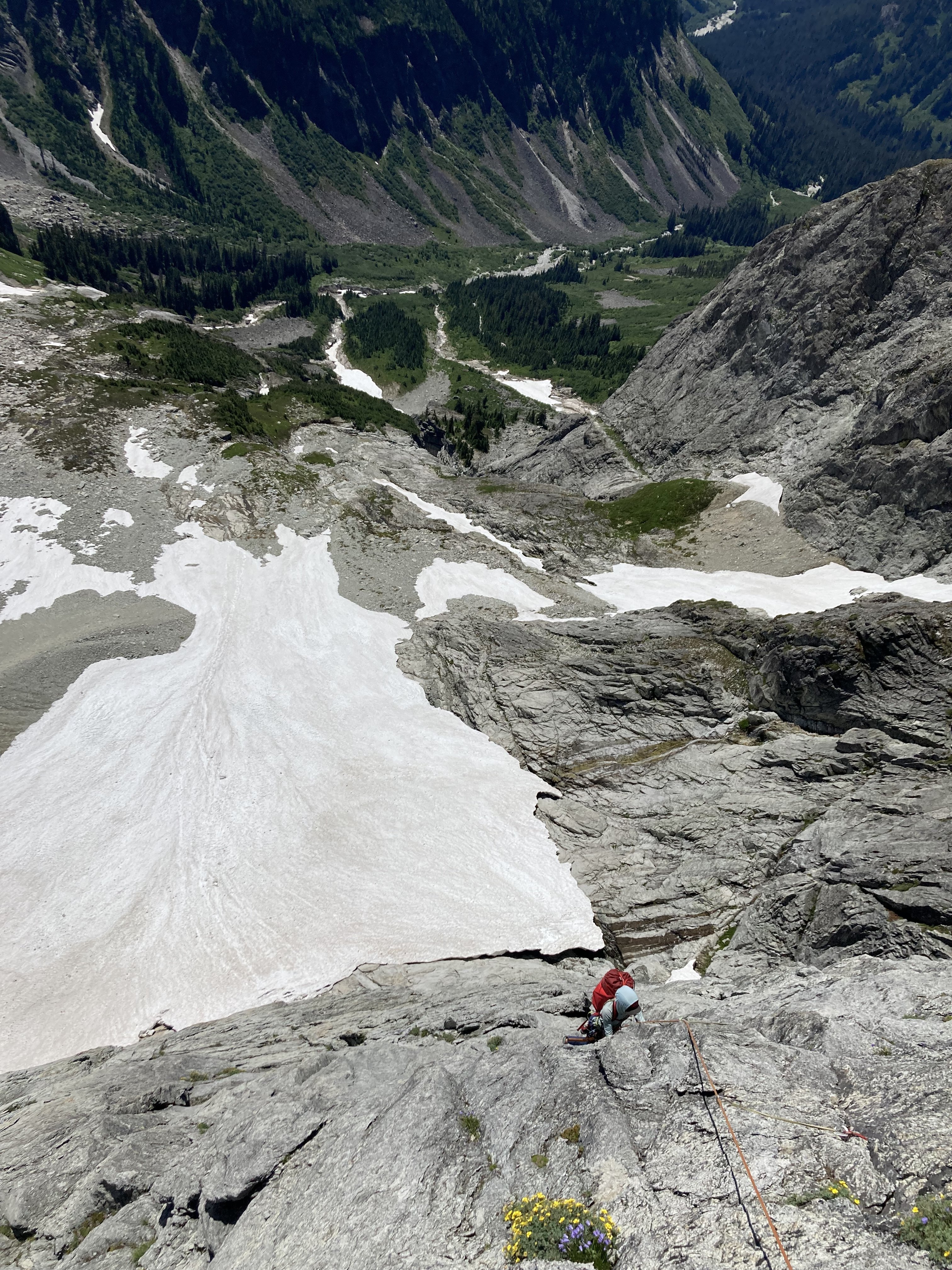
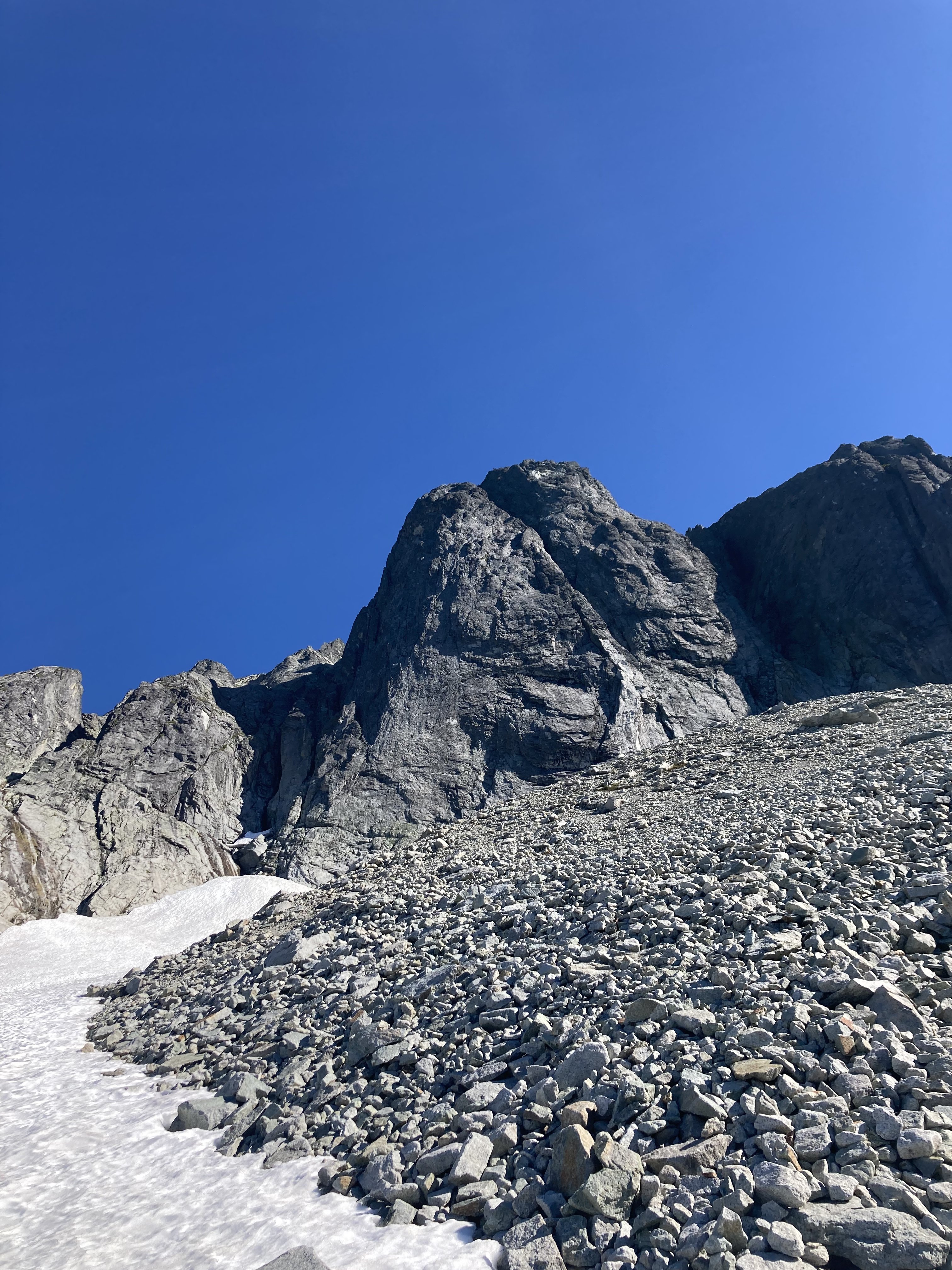
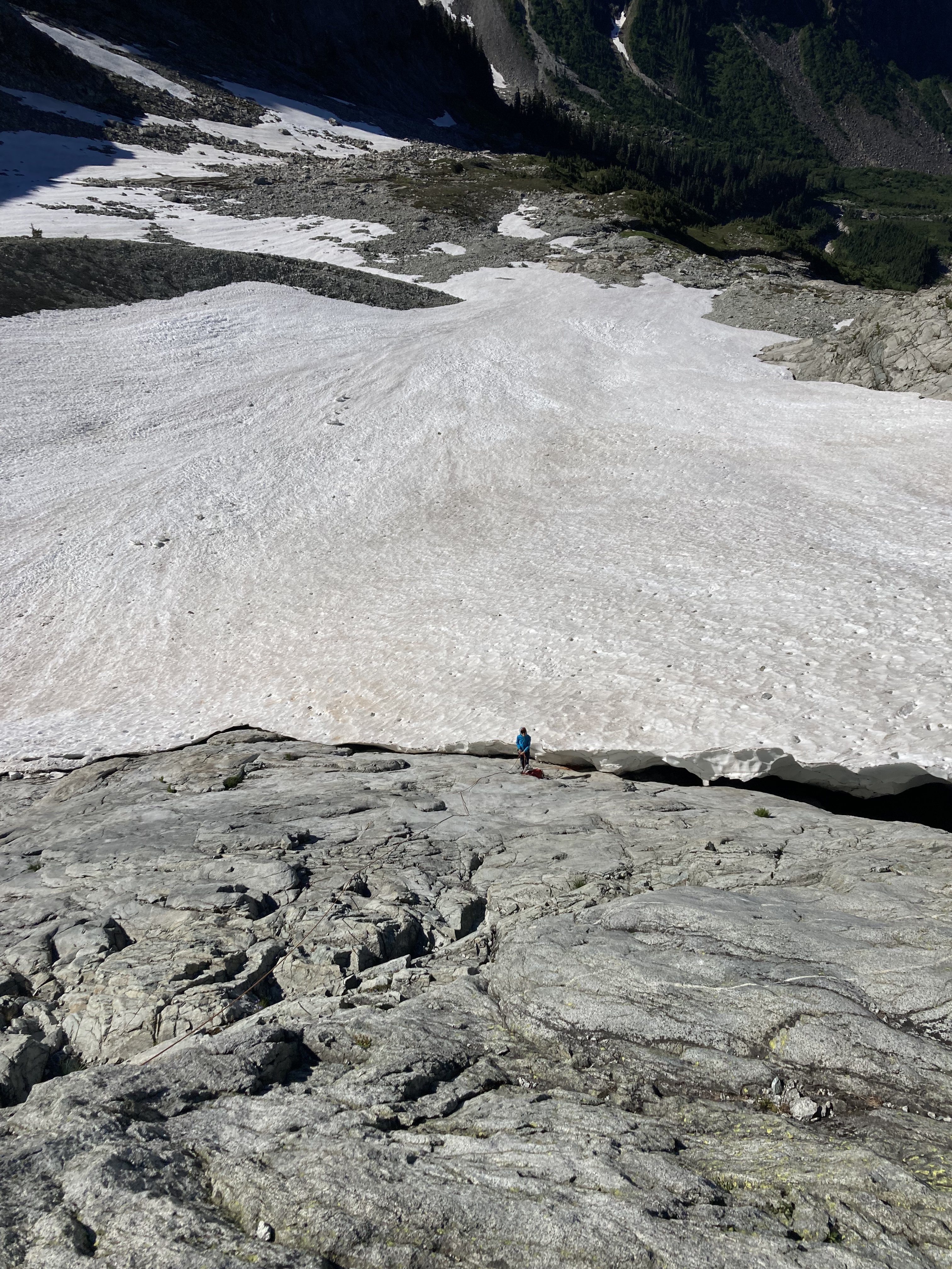
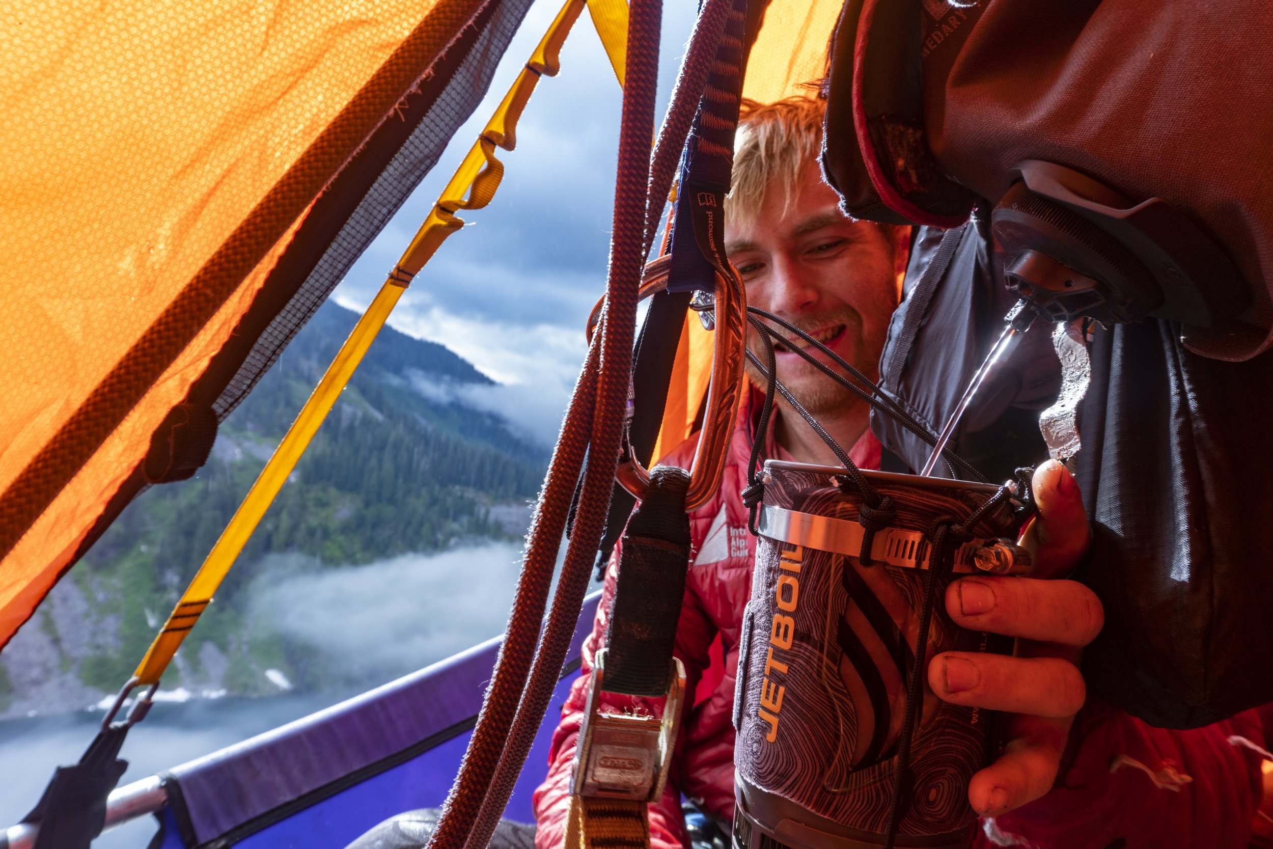
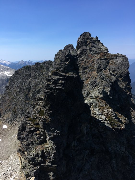
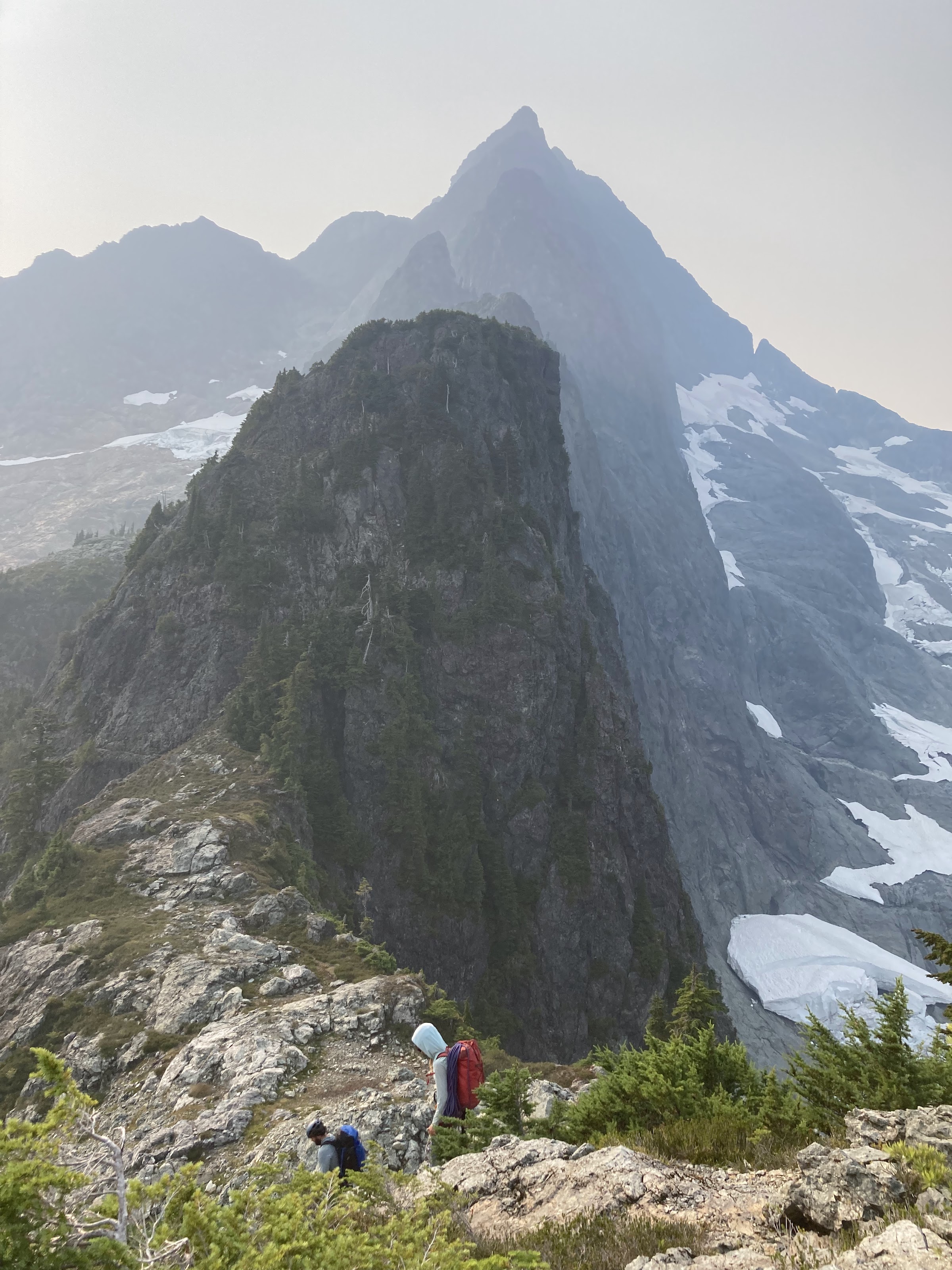
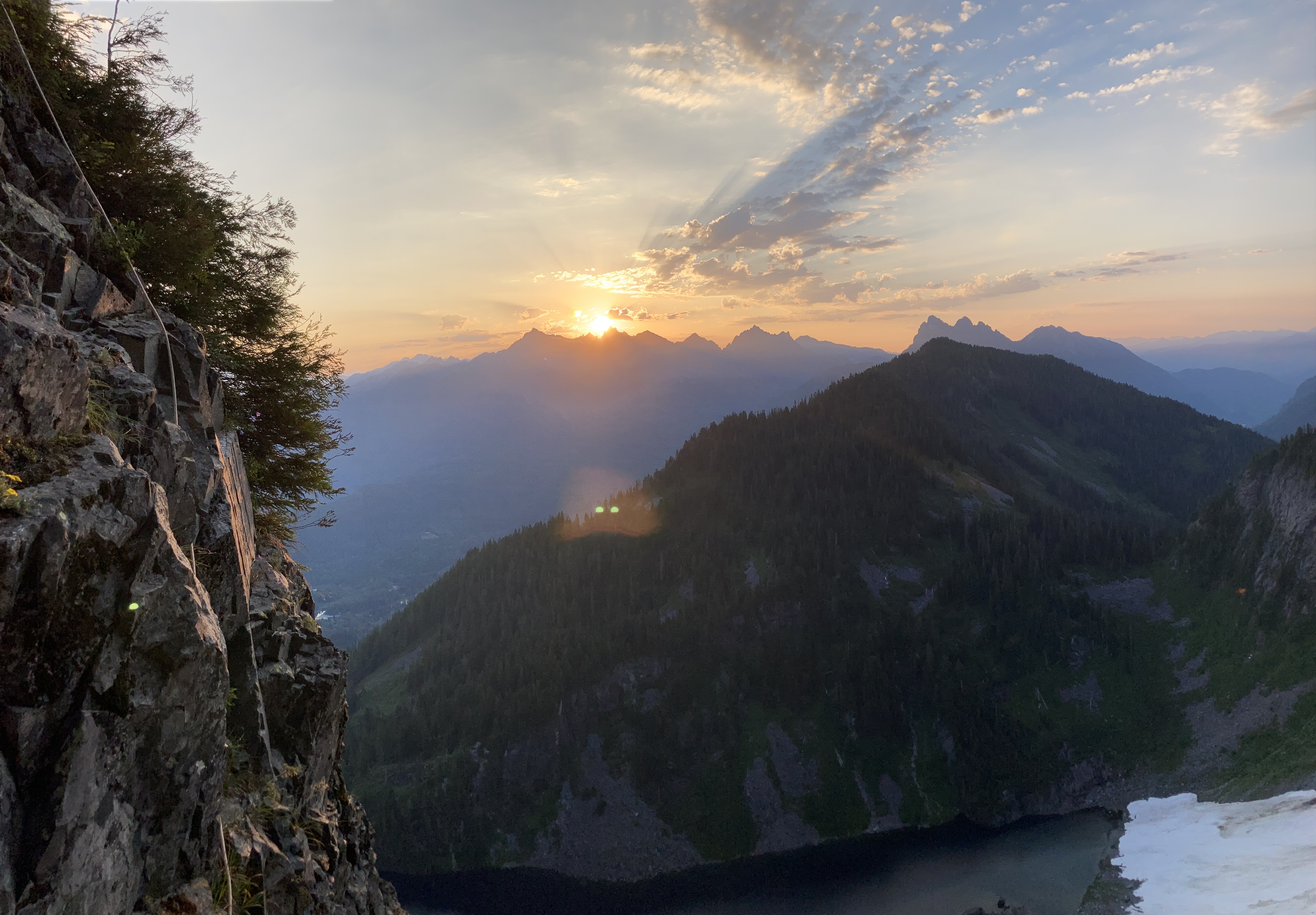
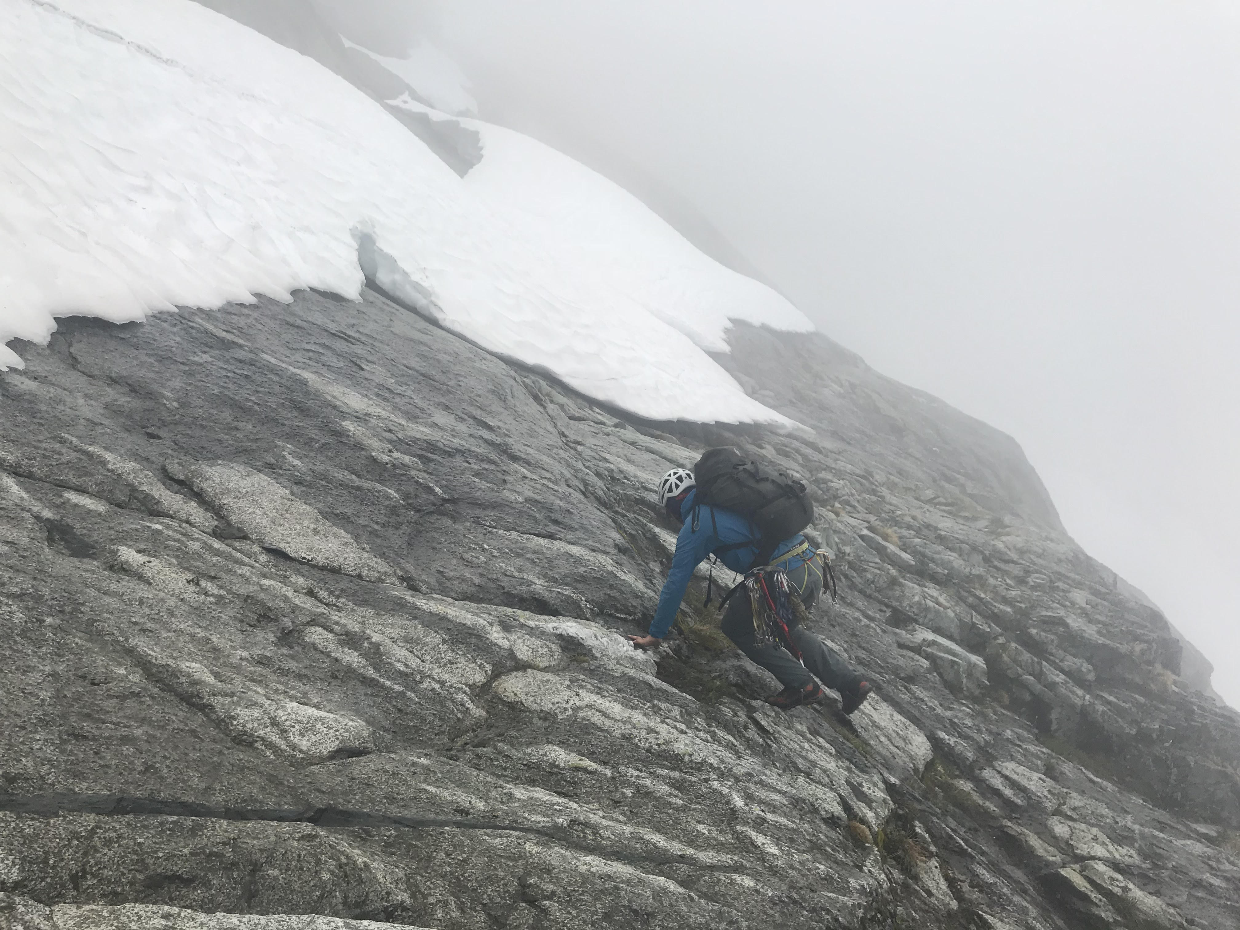
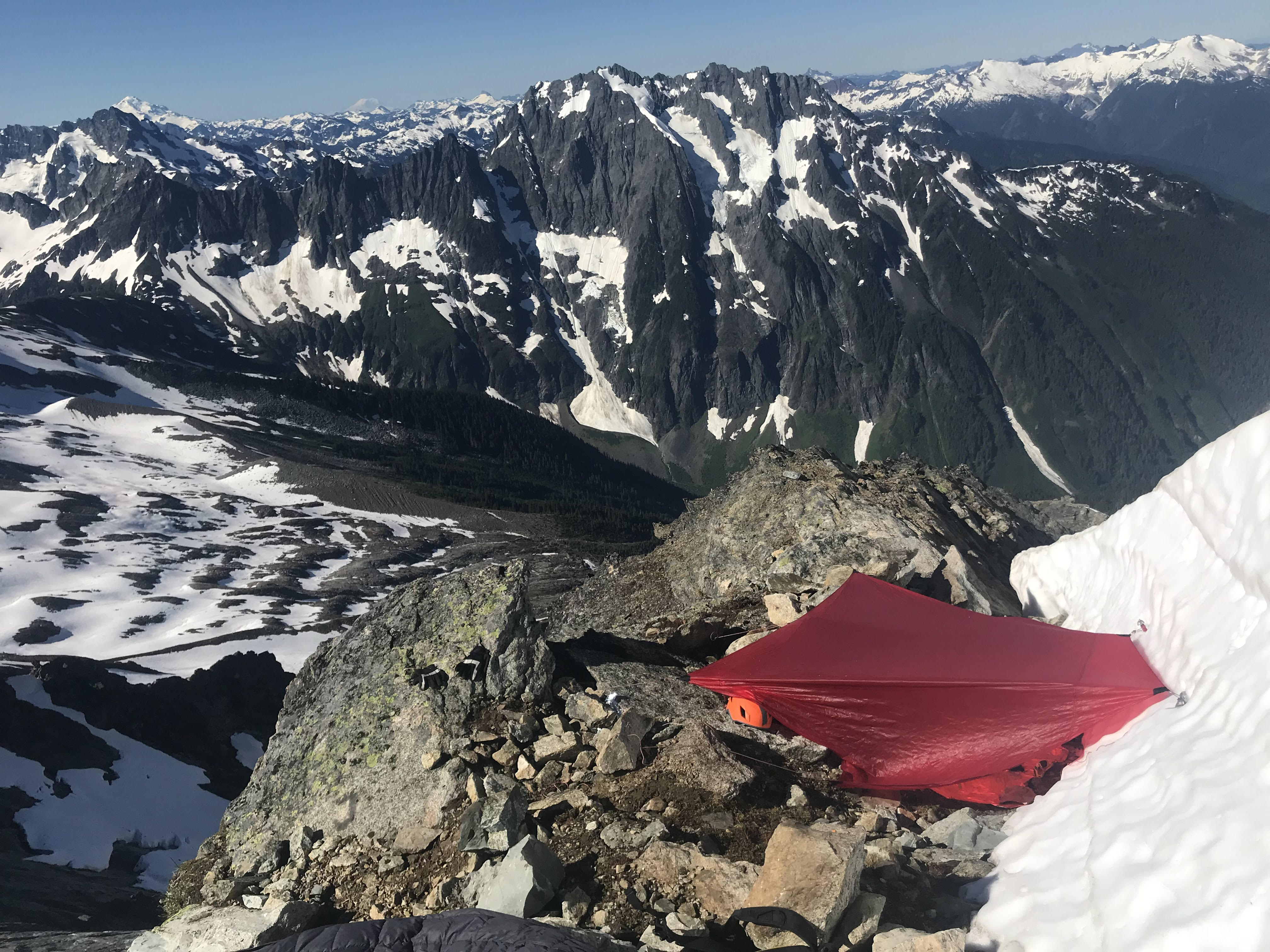
After reaching the summit of the first tower, which we later dubbed Tanuki Tower, the ridge eased back for a massive, long section of 3rd and 4th class scrambling, separated by the occasional pitch. We were able to make good time to the base of an obvious gendarme to camp at 6900'. When we arrived at camp we were able to locate a 3rd class access ramp that allowed for access to the glacier on the south side of the ridge. This allowed for a much needed water top off. Future parties could consider gaining the upper (more classic) ridge via this hanging basin and scrambling access ramp to avoid the munge on Tanuki Tower.
Looking up at the upper ridge from camp.
Day 3:
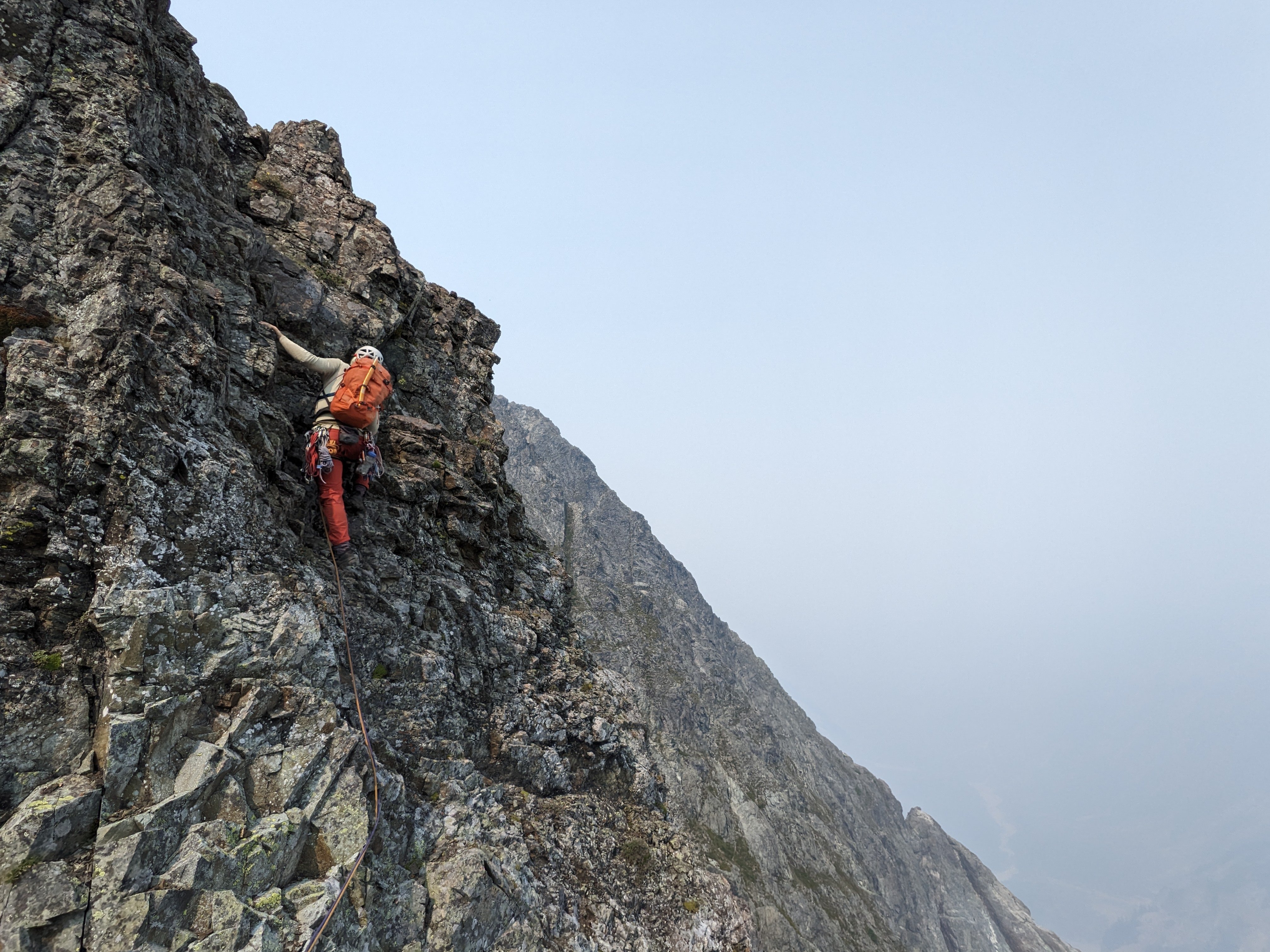
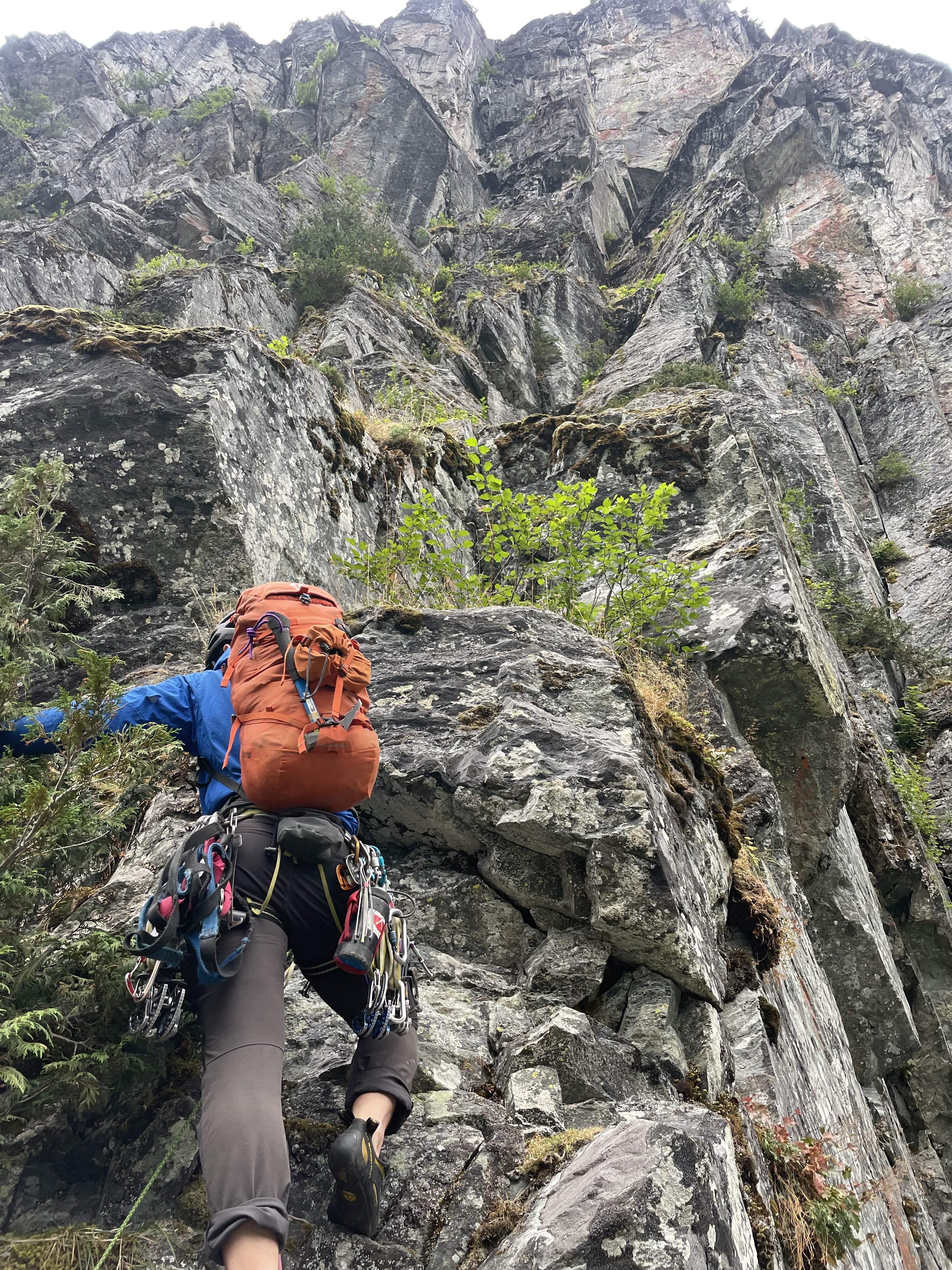
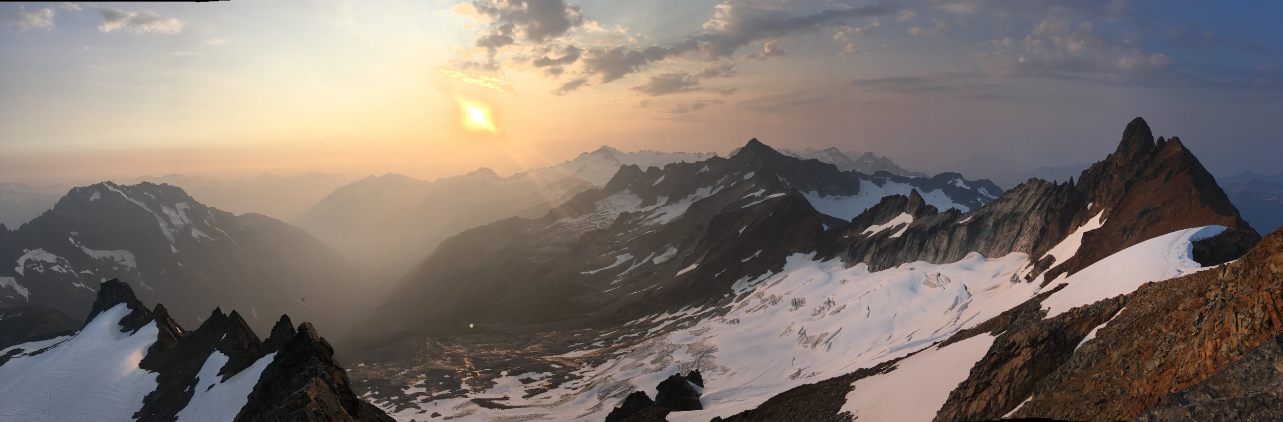
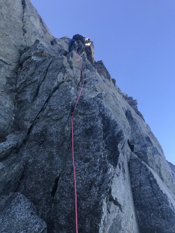
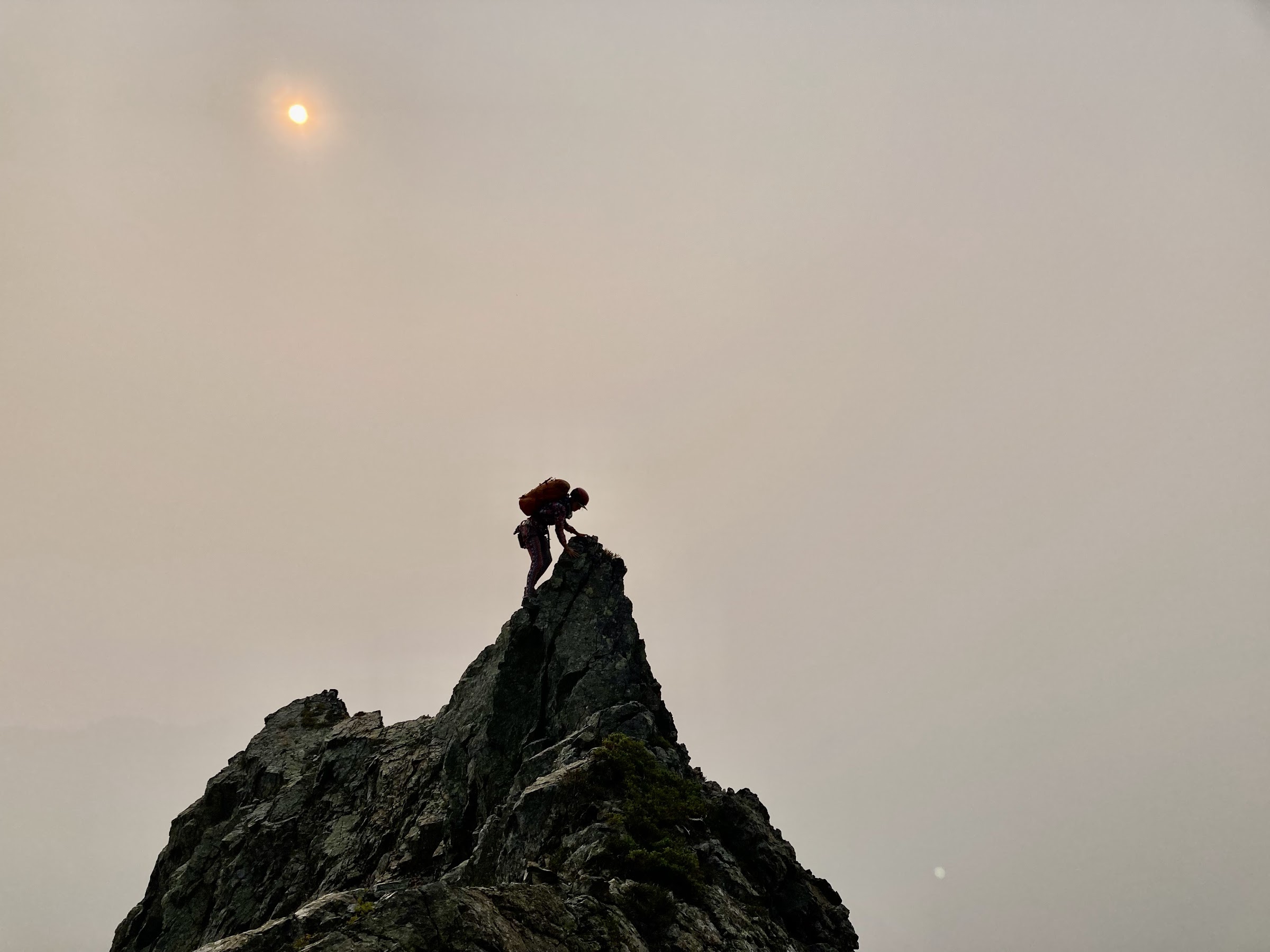
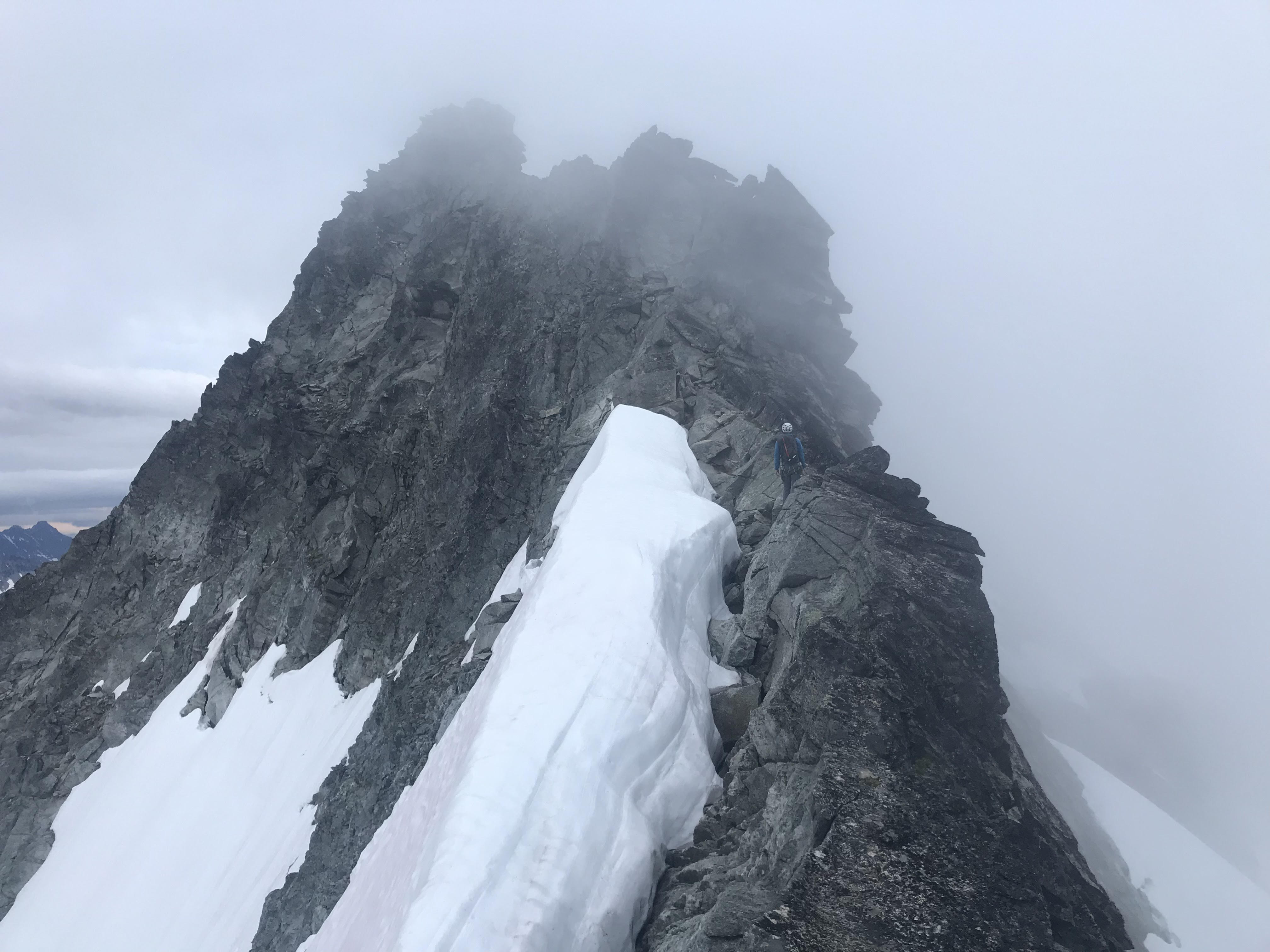
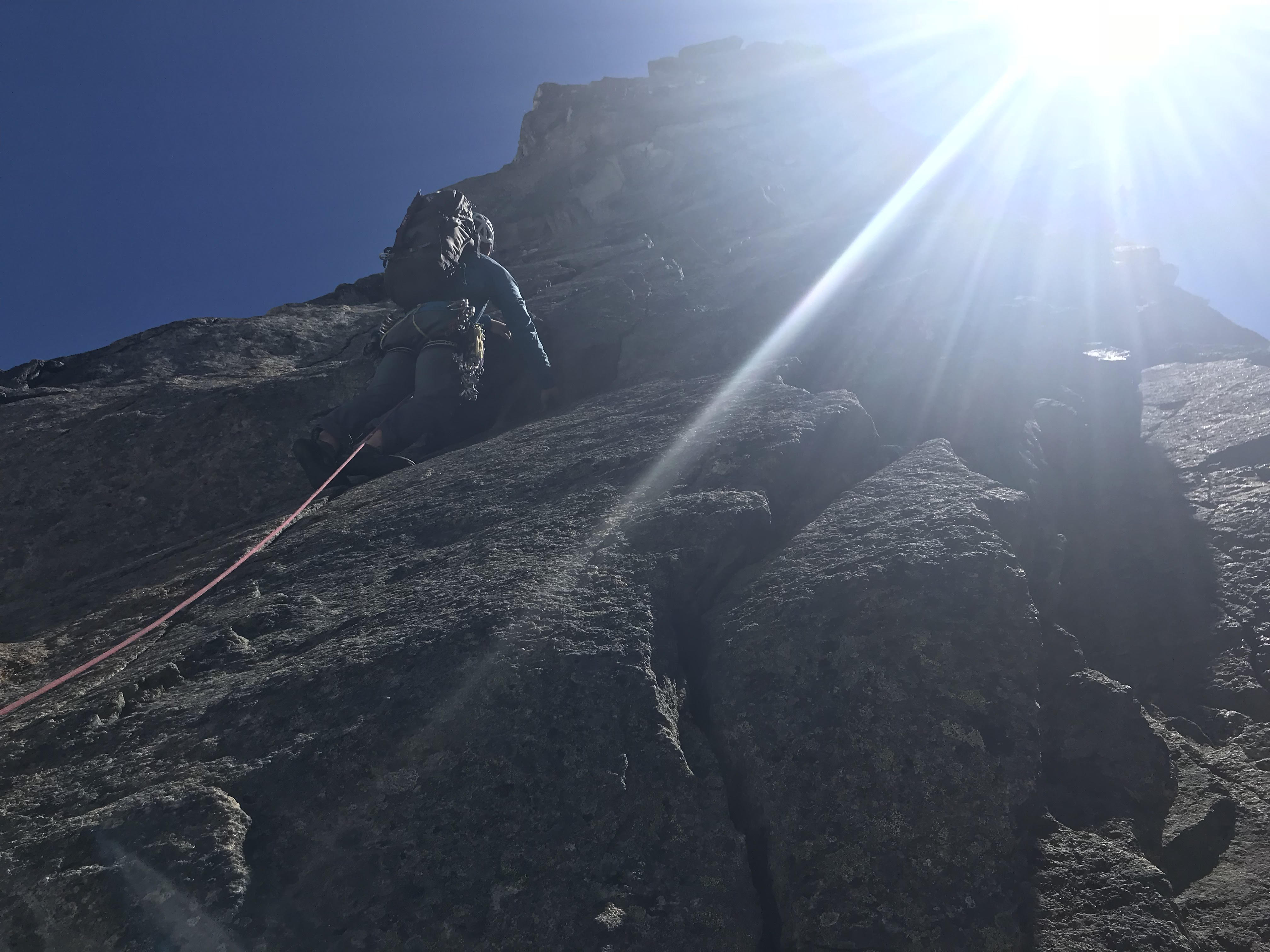
We started by climbing the obvious Gendarme above camp and traversing to the main summit massif and upper ridge.
Classic moderate climbing on the Gendarme above camp
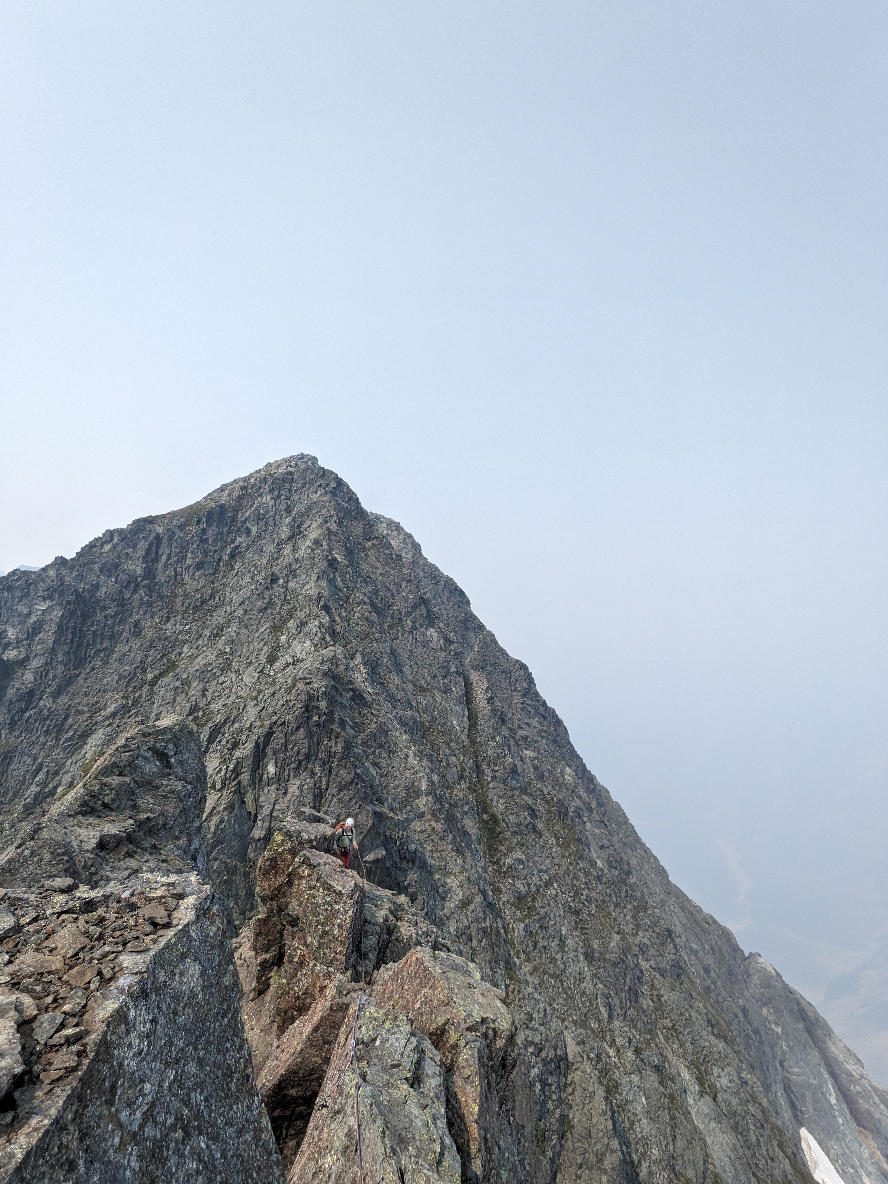
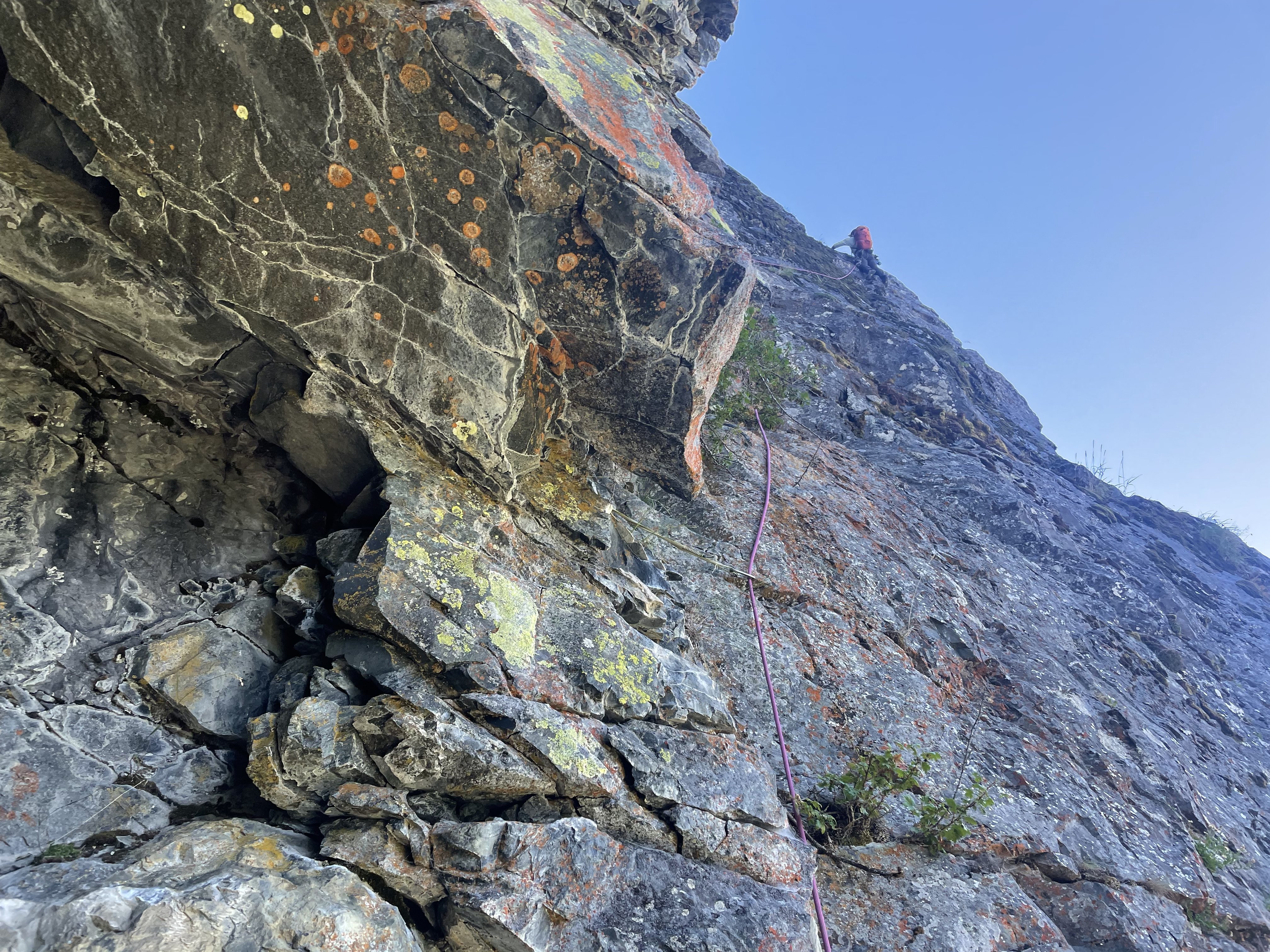
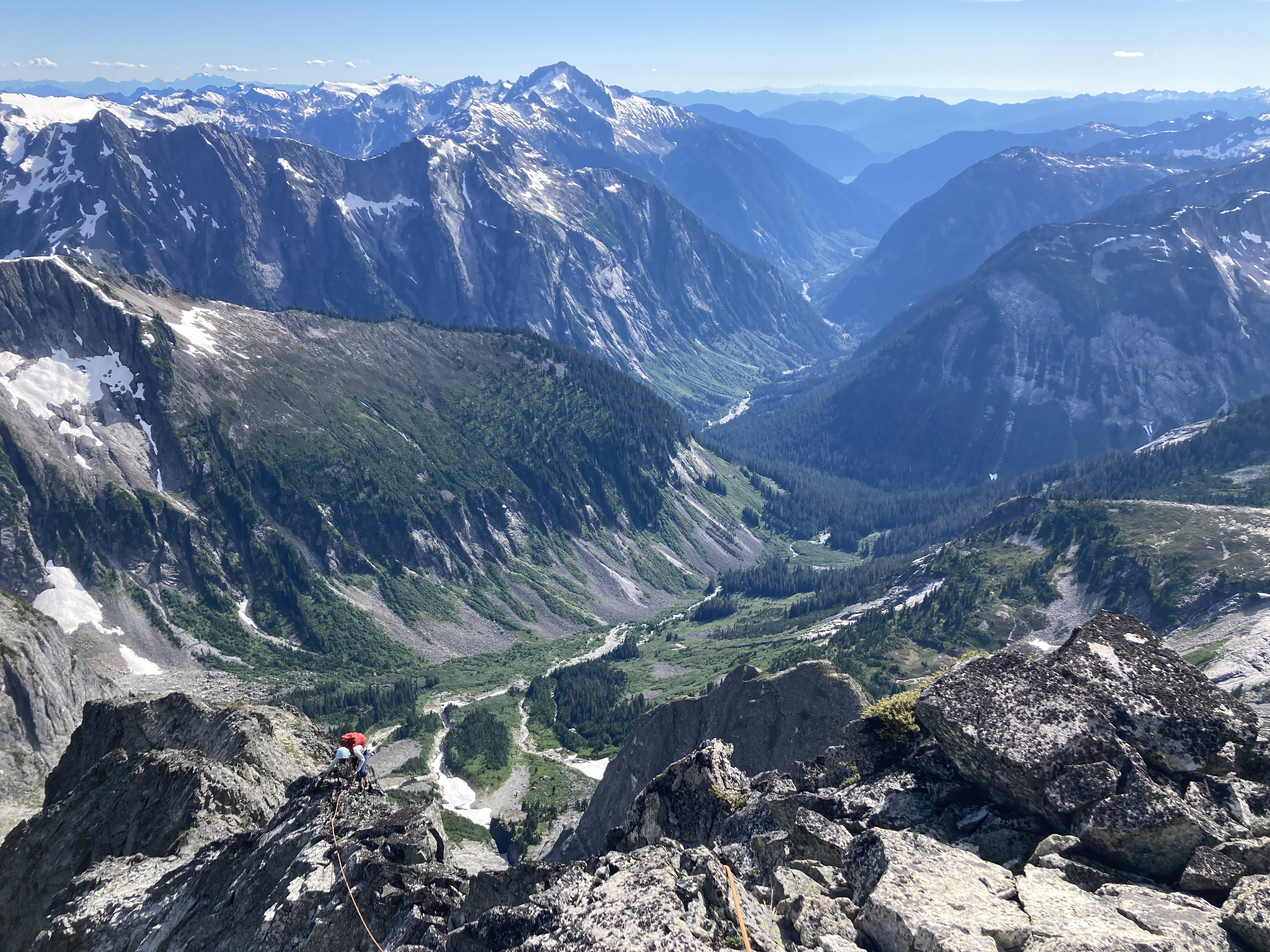
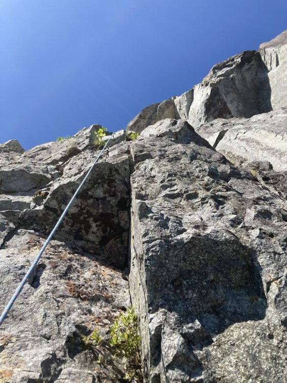
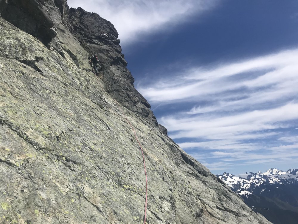
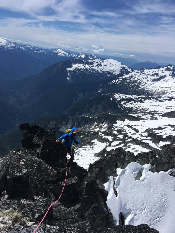
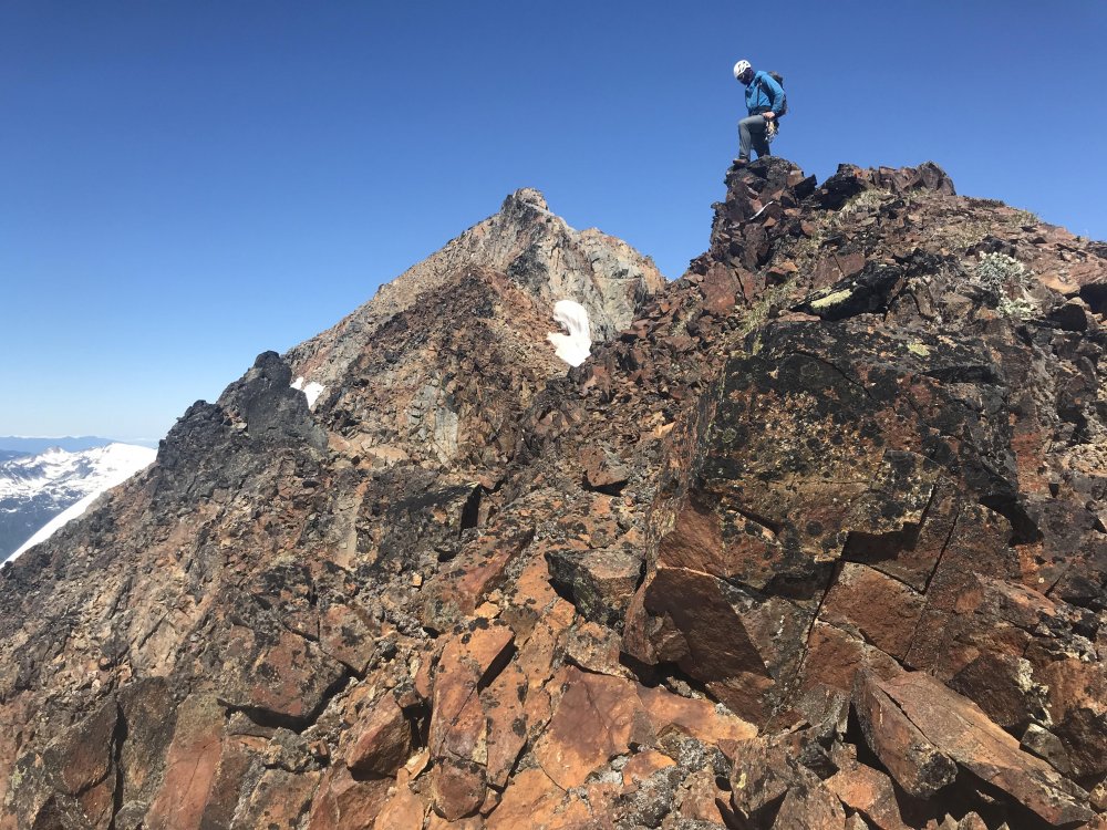
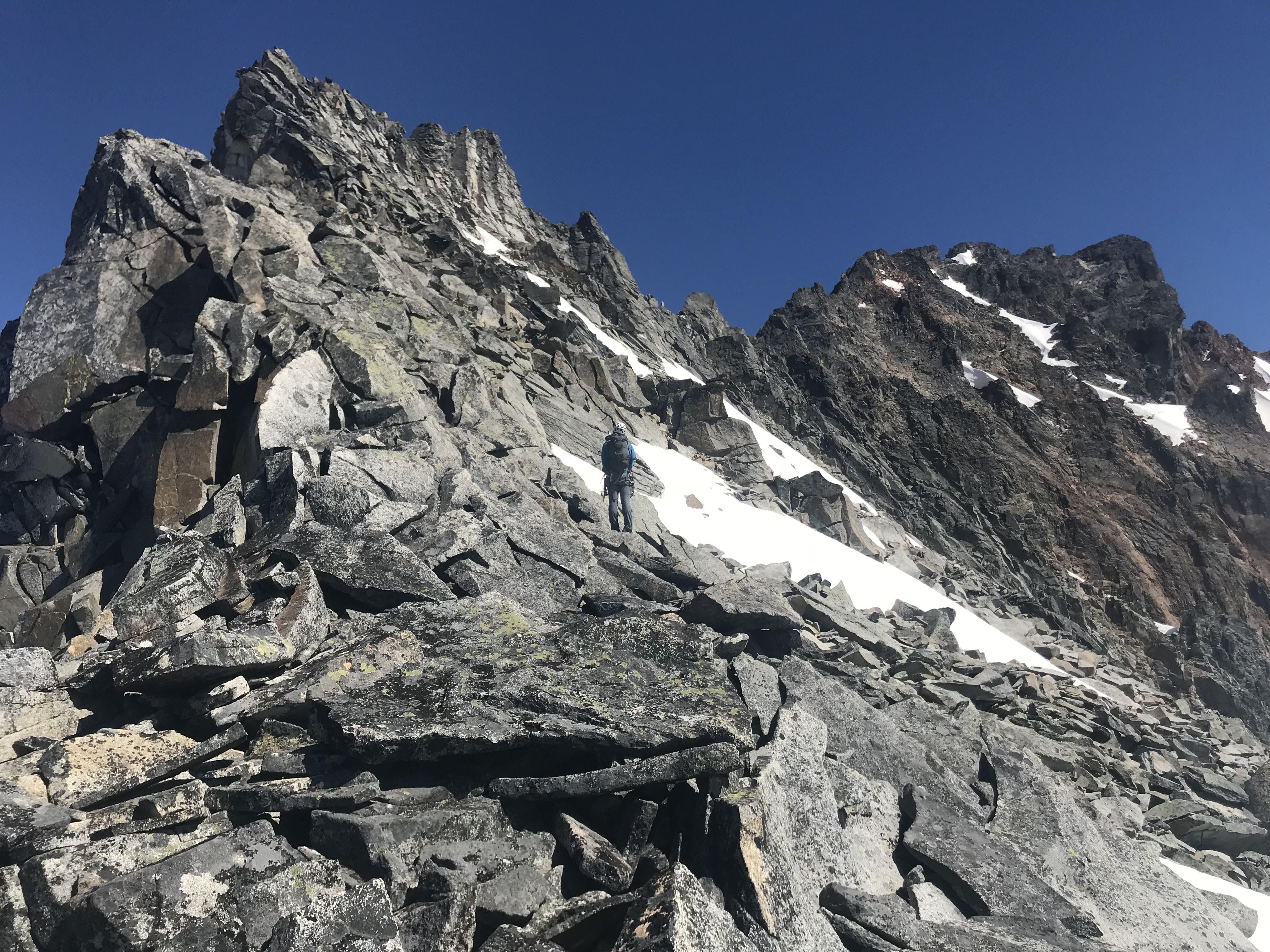
The upper ridge provided a ton of clean, moderate ridge climbing with a bunch of awesome position and good climbing.
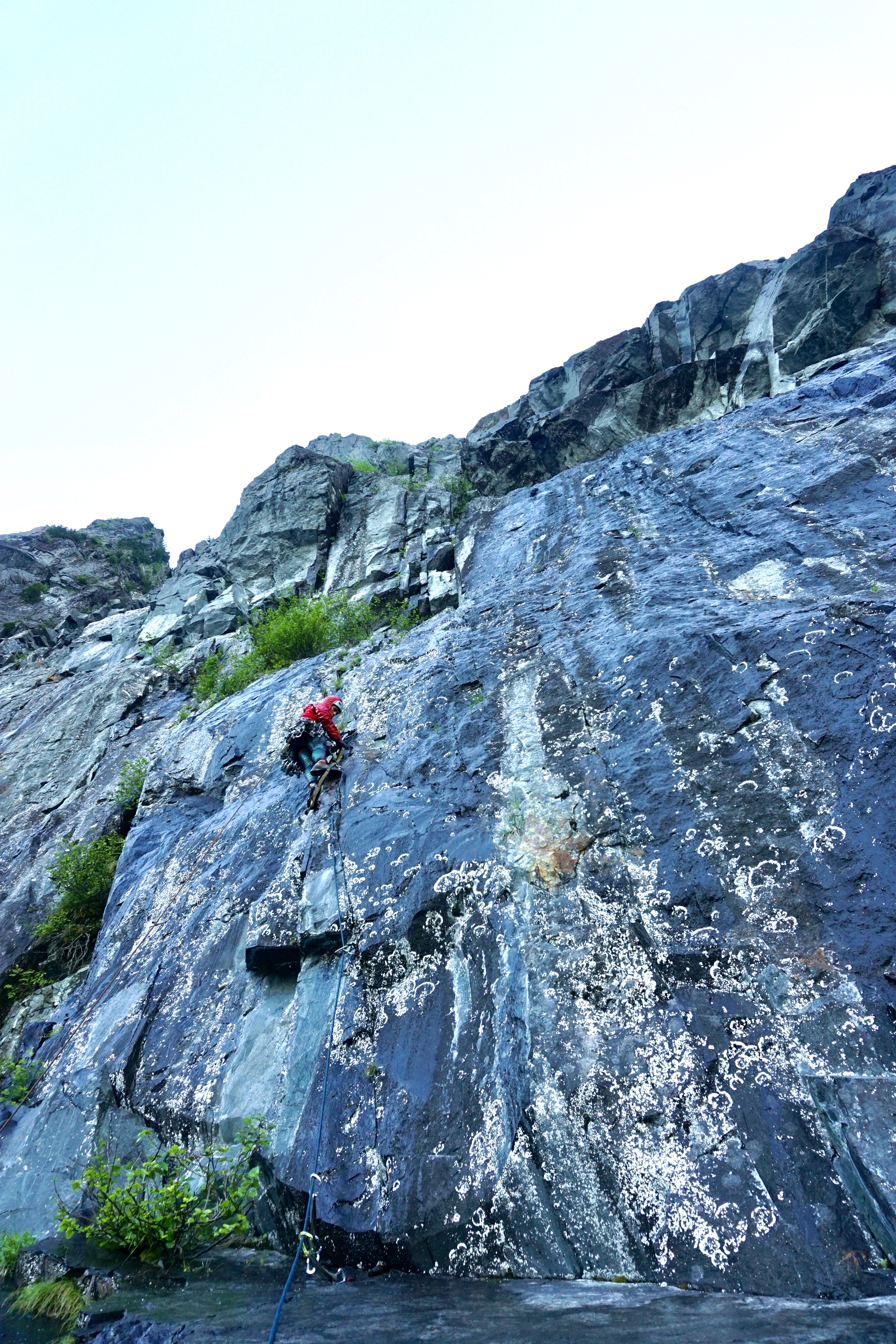
Nick leading the upper crux, a clean 5.8+ lieback
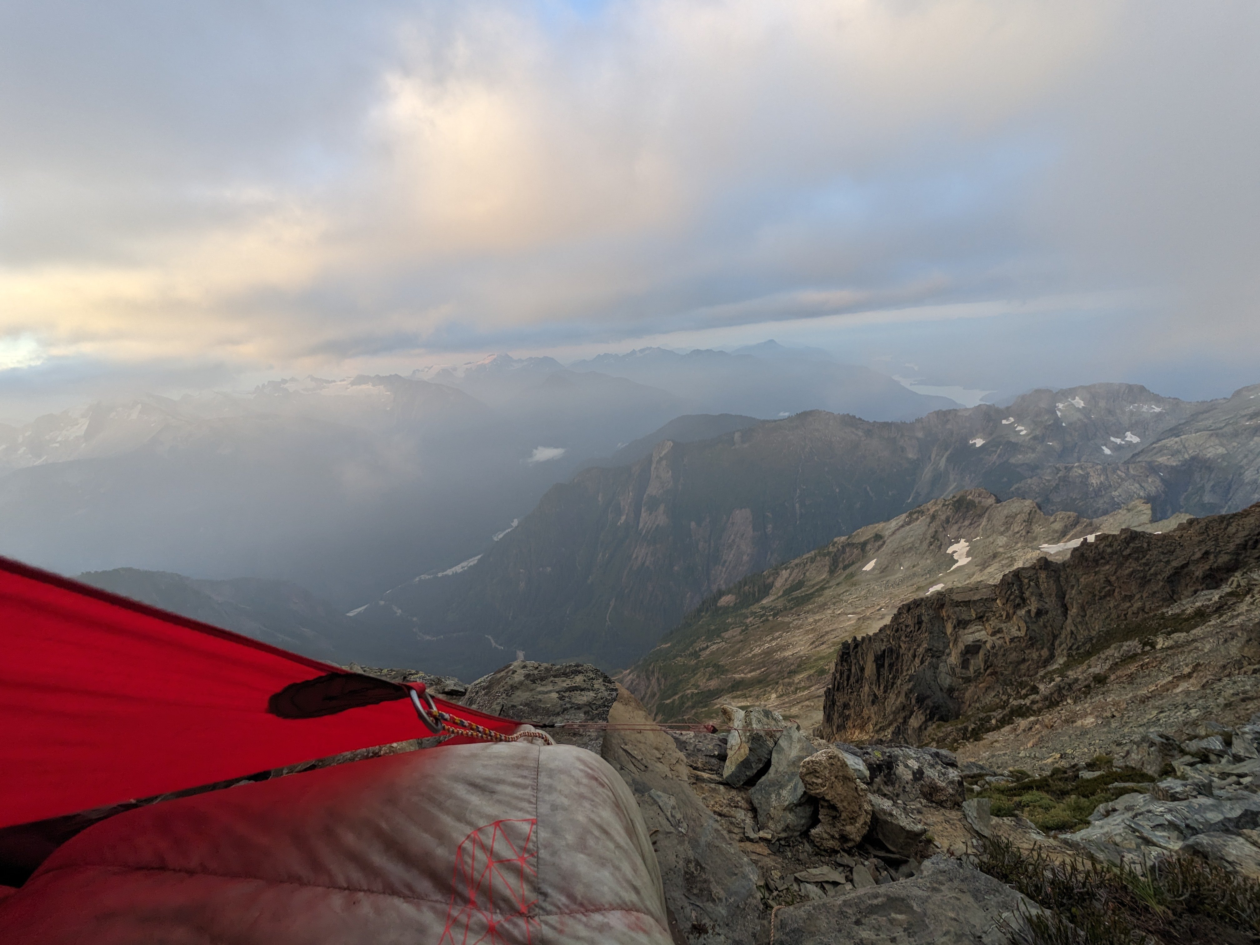
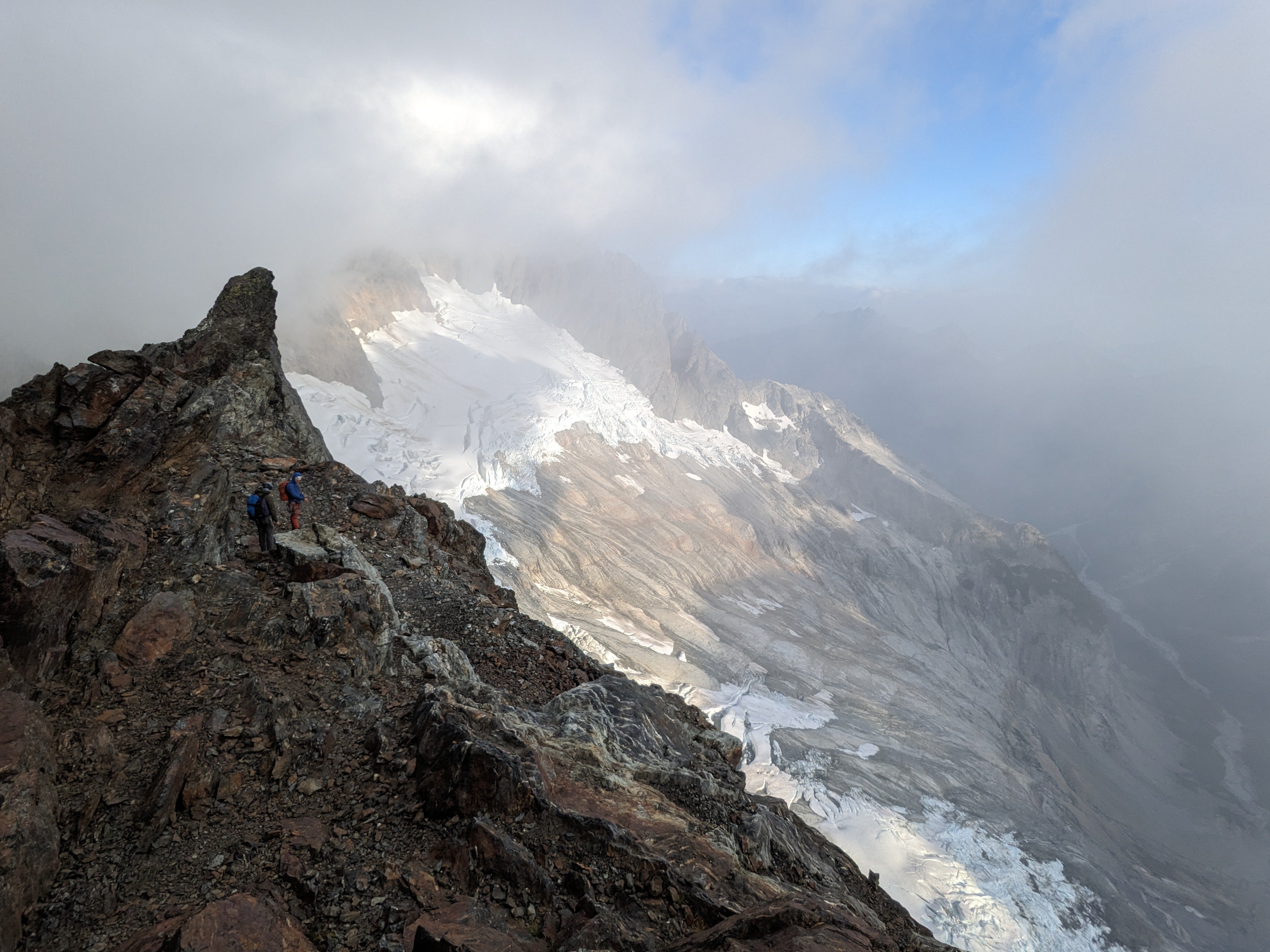
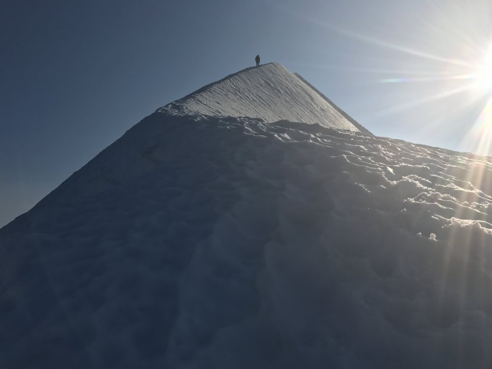
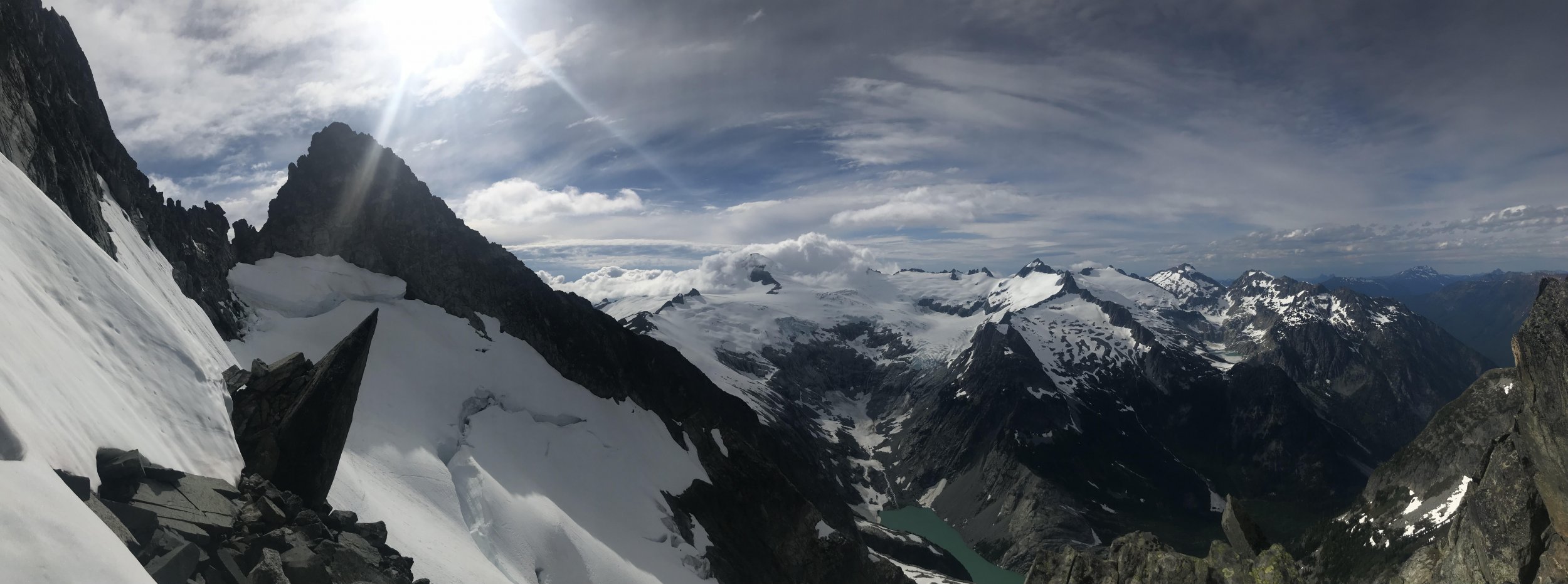
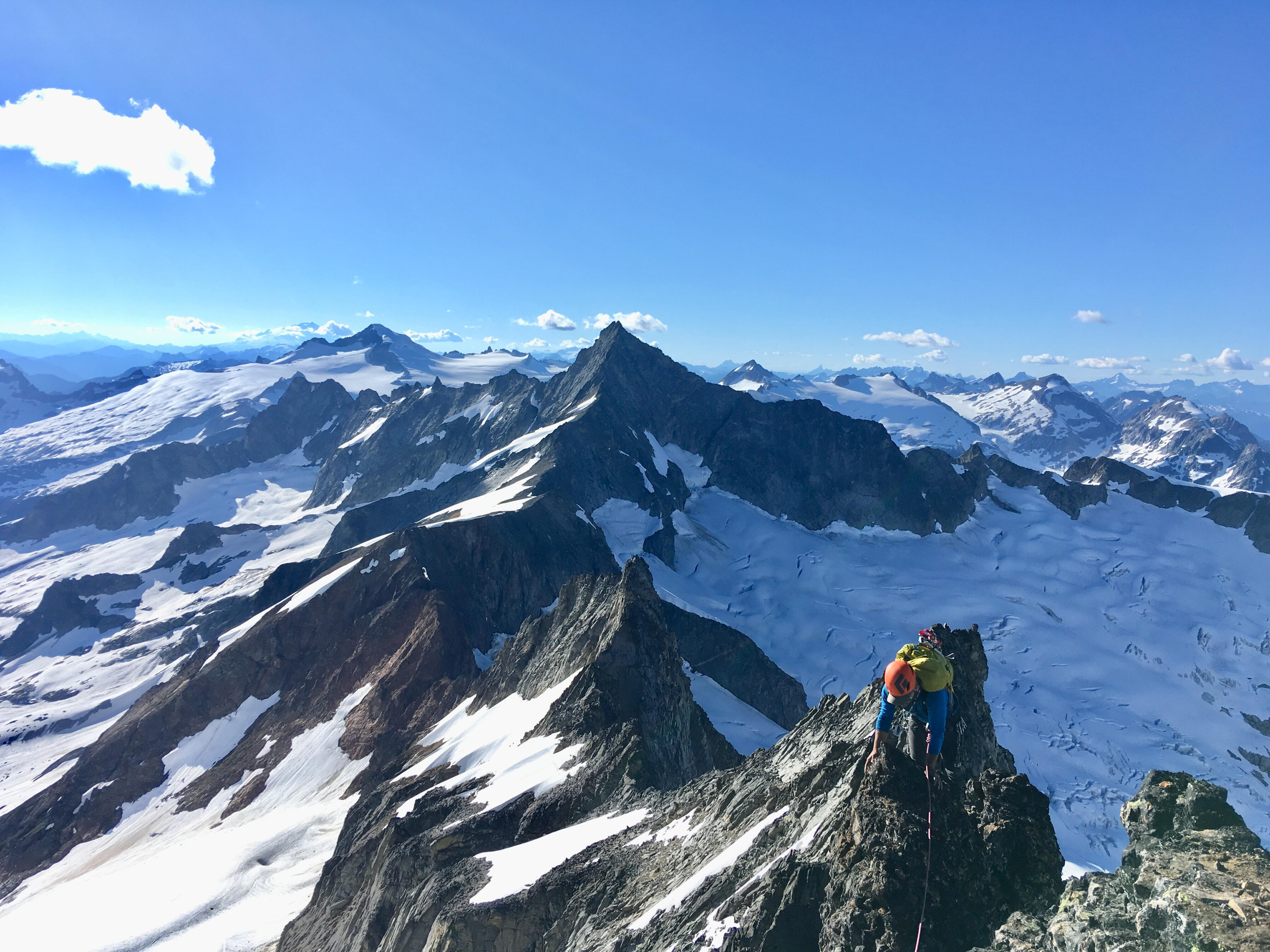
After a bunch of false summits, gendarme traverses and generally entertaining ridge climbing, we finally found our way to the summit of Seahpo. Stoked on our success we started the debate about continuing. We all had trail runners and light aluminum snow gear. After an hour long debate we decided thin conditions meant we could work around the snow and manage the little that we had to, so we began our committing raps off the summit of Seahpo. We started off with the moderate snow traverse across the glacier to regain the ridge. Conditions were super firm, so while only being around 30 degree traversing terrain, we ended up pitching out this short section.
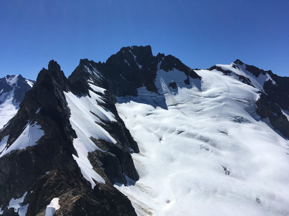
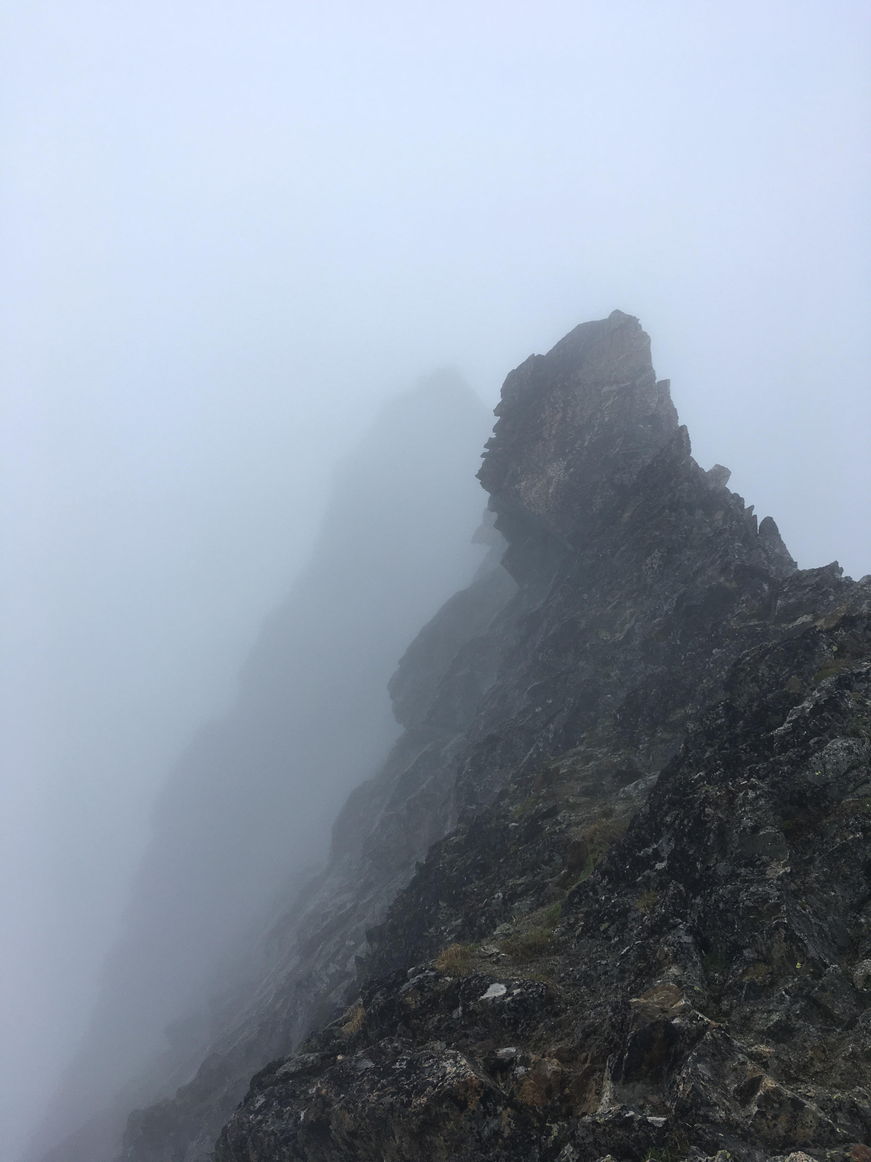
Looking out from the start of the Jagged Ridge Traverse
Clean Rock on Jagged Ridge
Once back on the rock, we were able to make super quick progress soloing a bunch of 4th class terrain to near the mid point on the Jagged Ridge traverse. There were minimal opportunities for bivies, but we found a reasonable, albeit exposed ledge near the ridge crest. If we would have been able to continue for another 20 min, we would have made to to a kush ledge on the north side of the ridge that would have been sheltered from winds.
A nice ledge amongst the choss traversing near the end of Jagged Ridge
Day 4:
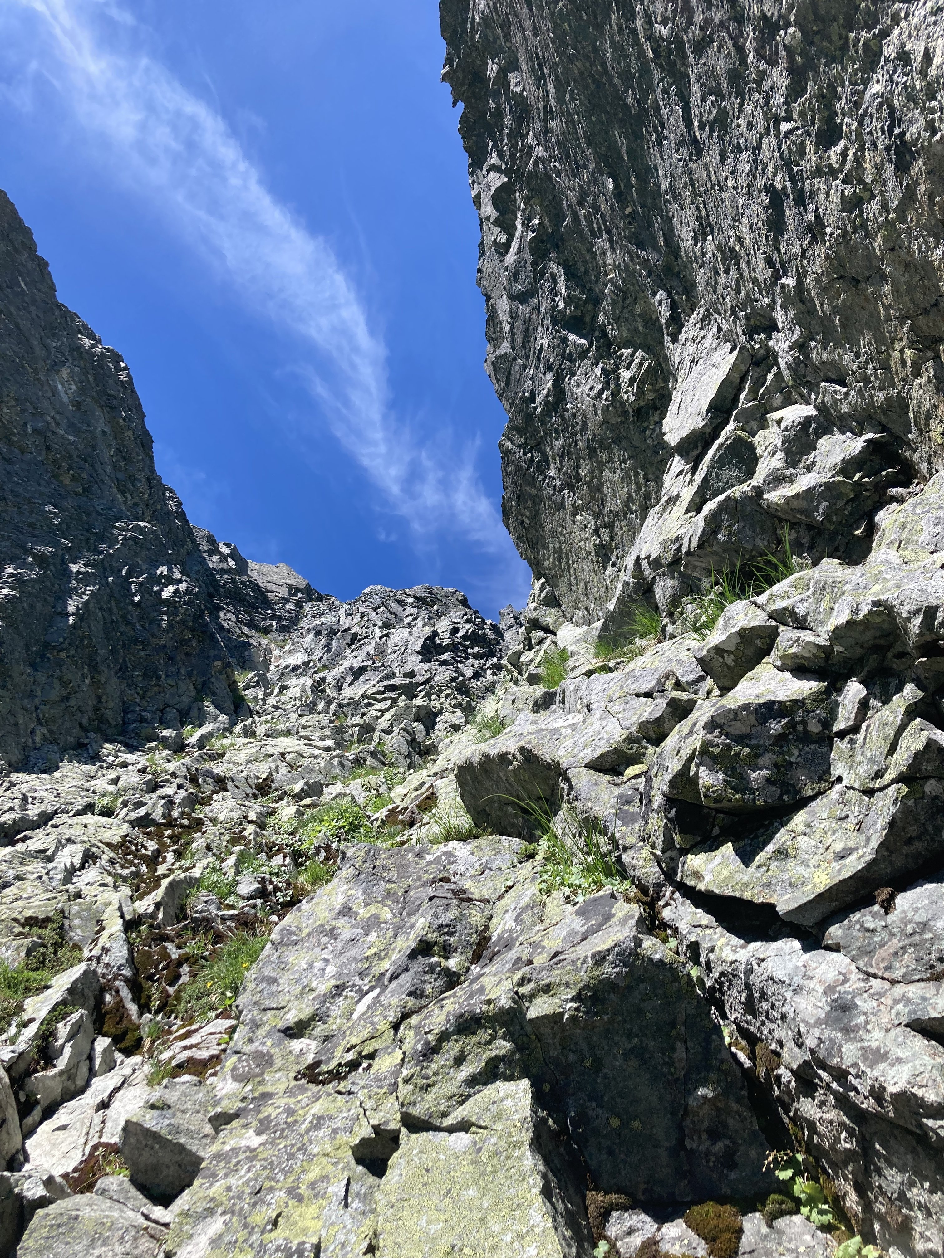
The remaining part of Jagged Ridge was honestly kind of awful without snow coverage. Very loose compact dirt and unstable talus traversing above big exposure. There was the occasional pitch but mostly scrambling. We ultimately made it to the final group of towers that define the exit to the ridge. We didn't really find the "lethal choss chimney" described in other reports, though there was a low angle choss gully with a 5.6 boulder problem around a chockstone. The final pitch to exit was the definitive crux and decent climbing, though a bit steep and committing for 5.6. Once off the traverse, we realized our mistake in equipment selection. It was clear that heading up onto the crystal glacier with so much blue ice exposed would be an awful test of our mediocre snow gear. That and a whiteout shielded the bergshrunds from our vision, so we didn't have a clear view of our exit. Our original plan was to head up and maybe tag the summit pyramid, though we decided to bail onto the slabs below the crystal and sulphide glacier. There was a level of uncertainty with terrain and overhead hazard, though the seracs looked quiet enough to feel comfortable with the traverse. The 2 mile long slab traverse took what felt like days, but we were able to link into the sulphide route right at the standard sulphide camp, avoiding all of the steep exposed ice.
We took the slabs just below the snout of the crystal, then back up the rocky passage on the Sulphide
Typical terrain on the slabs after a waterfall crossing
A quick jaunt down the shannon ridge trail got us back to civilization, but not out of the clear... as we opted not to spend the time to set up a car shuttle. Nick in all of his glory had volunteered to run the shannon ridge trail and road all the way back to baker lake trailhead to shuttle the car, for a total of an 11 mile run to finish off the trip!! Overall, this was a grand journey up one of the largest technical features in the lower 48. I would recommend the whole ridge as an awesome cascadian, blue collar route!
Rack: Singles Single Rack to 3 with doubles up to .75, optional KB's, Single 60M Rope
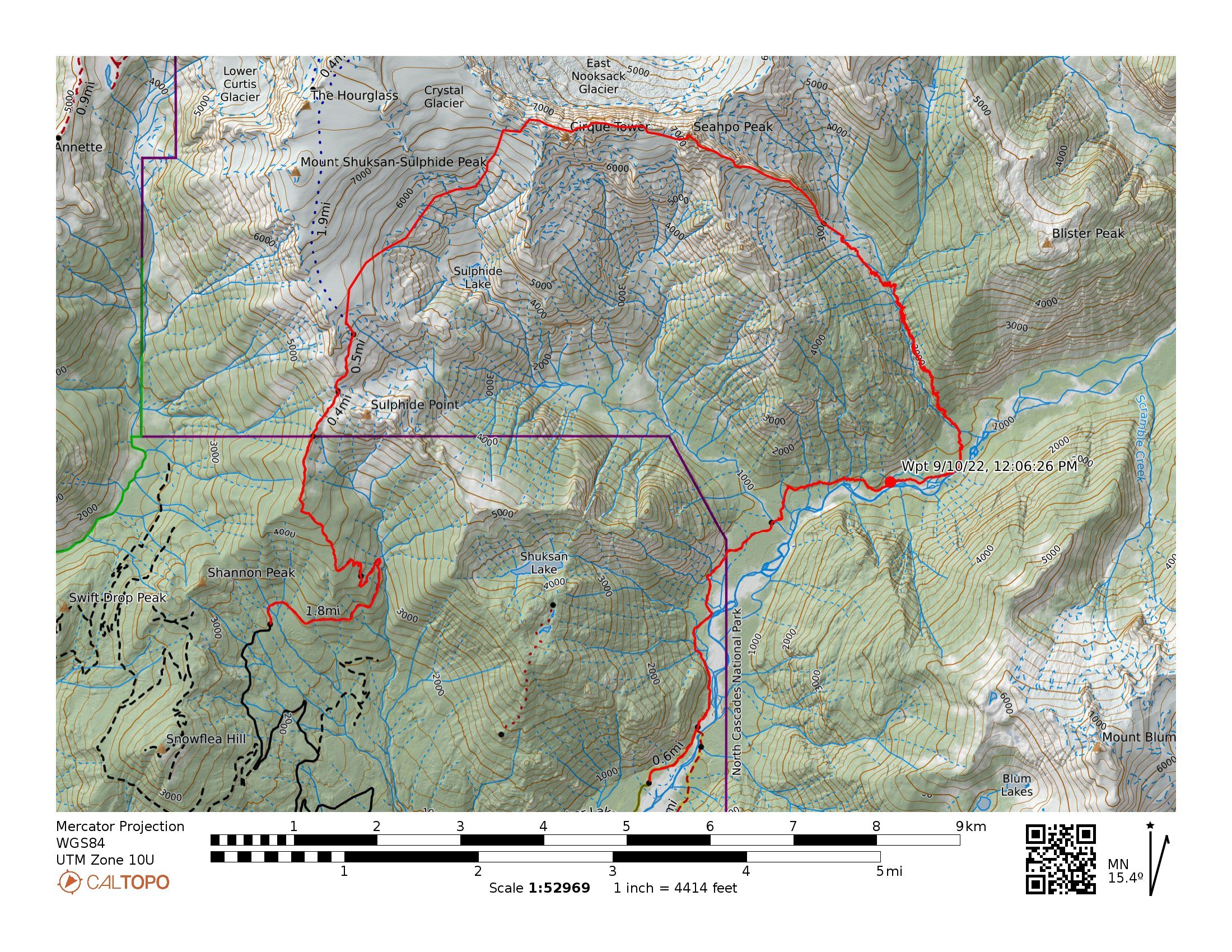
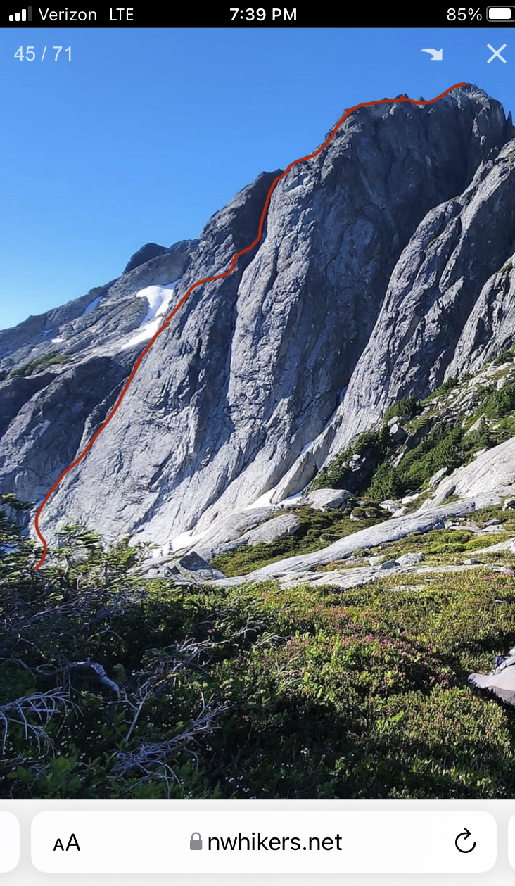
A rough track showing our approximate route TH to TH
A Close up showing our rough track on route
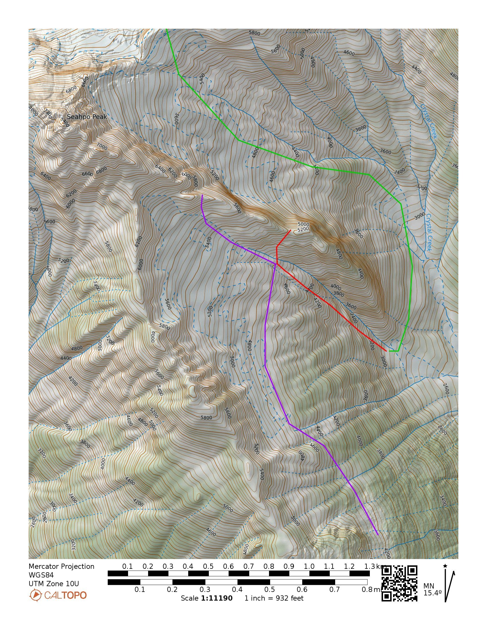
Potential alternate approach tracks; Green showing an early season approach via the Icy-Seahpo col, this route may require some rappels down low angle slabs. Purple being a potential high route that would require a bushwhack up the ridge to the left of Crystal Creek. And Red showing a technical track up low angle waterfall slabs that would access the hanging basin to bypass Tanuki Tower. The two access points (red and purple) seem like equally easy and viable ways to access the ridge.
-
1
-
 1
1
-
 4
4
-
 2
2
-
-
On 10/23/2022 at 3:03 PM, kurthicks said:
I lost a Black Prophet up there about 15 years ago--I can't remember if it was a carbon or an aluminum/rubber one though. Not much of a tale to tell--it fell off somewhere and I had to use a skinny rock to dagger my way up the glacier. Who knows how many tools are lost up in the park!?
Look familiar? Parker still has it.
-
4 hours ago, dberdinka said:
Juan I was pretty much referring to everyone but Sam and Kyle. Who do see when you look in the mirror?
the use of Tacos and spending a couple days up there is a pretty cool level of commitment to a new jungly line. Was there water on route? I assume not, so how much did you bring for 3 days? Seems like that follower pack would have been heavy!?
Edit to add the Moljinar is a nice touch. Nothing in 40 years has improved on the utility of an old school north wall hammer for Cascade FAs.
Planned iten was to bivy on the wall the first night, then climb up to the bivy at the snow arete high on route the second night. So we went relatively light on water. No water on route. We carried 5 liters total. We tagged the leaders pack through some of the harder pitches when it looked like we could find anchors within 100’. Followers pack was likely sub 30 pounds. Stopping on the route where we did meant a night/morning without water which ended up being not that bad because there is water near the base.
-
11 hours ago, Juan Sharp said:
Which variation of the NE Rib is more popular - '57 or '51?
My best guess is the 51 route because of steph abeggs beta…
-
48 minutes ago, JasonG said:
Inquiring minds want to know @Sam Boyce and @Kposaune....did you find the grape soda can @pms may have "forgotten" on the mountain?
Legend has it that @Juan Sharp will pay handsomely for it. You covered ground that hasn't been searched yet!
Didn’t see anything. I did the ‘51 route back in 2019 with my friend Parker. We found half of a carbon black prophet (the head half) that had been there for many years… always wondered who’s it was. I think Parker still has it.
-
1 hour ago, JasonG said:
Oh man.....that sounds and looks like a terrifying adventure.
To willingly go up into that insanity is a display of impressive choss jedi skillz!

A high level of tolerance and stupidity mixed in with a short term memory are staples for the cascades climber.
-
2
-
 2
2
-
2
-
-
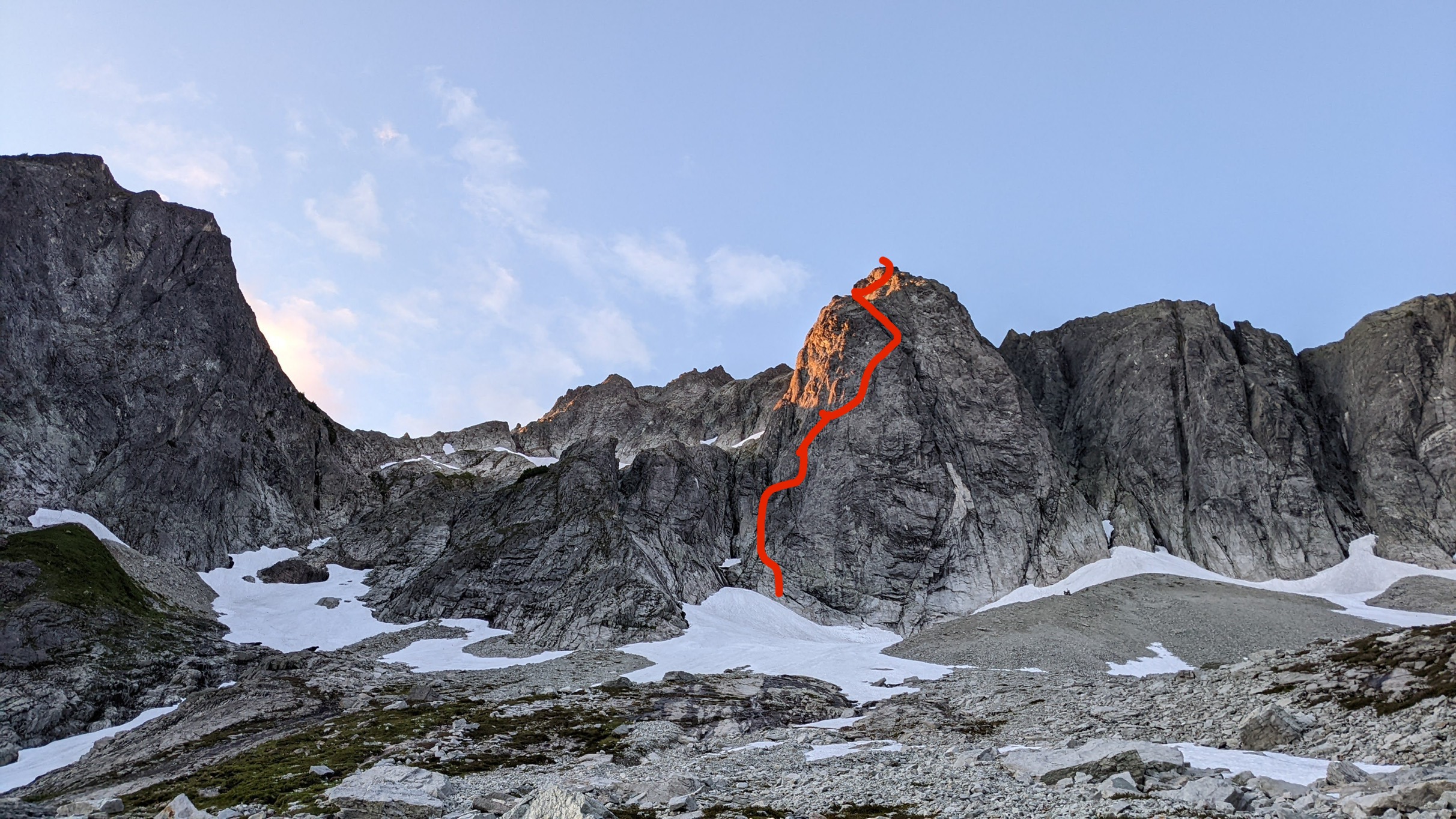
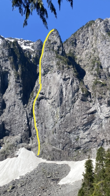
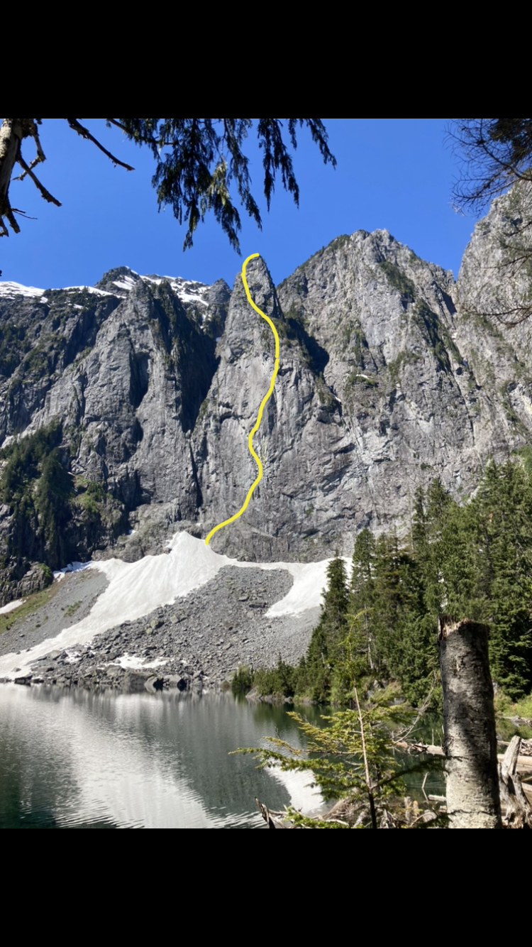
24 minutes ago, Juan Sharp said:
Good grief. What an effort and the best route name ever. Your piano teacher would be proud. Any chance you'll post a photo with your line marked?
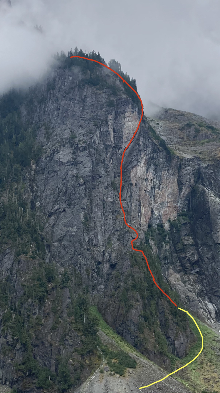
Yellow is approach. Red is our line to the top of the tower.
-
Trip: Johannesburg - “Flight of the Bumblebee” FA of the sit start to the NE Buttress of J Berg TD 5.9+R 1500’
Trip Date: 08/27/2022
Trip Report:This weekend, Kyle and I climbed the sit start to the NE buttress of J-Berg. We ended up rappelling due to injury after linking into the ‘57 route on the NE buttress. We added about 1500’ of steep and challenging climbing. The sit start climbs a tower with a bit of a distinct summit, so I don’t feel too bad claiming an FA. Becky likely wouldn’t have given us credit for anything, so judge it how you will. If linked to the summit, it would likely be one of the biggest monolithic climbs anywhere. TD+… ED…? Only one way to find out. This is likely a one and done for me, when we topped out the lower buttress I thought to myself “the climb we did so no one else had to”, but rapping where we did leaves the door open for at least one suitor to up the ante.
The lower buttress in moody, morning fog
We had a late start sat morning. The uncertain weather had us sleeping in and waiting. Lani and I had attempted the line a couple years ago and ultimately bailed because the climbing looked like it was going to be far more time consuming than our 2 day itinerary would have allowed. This time around, kyle and I packed a couple taco portaledges in case we had to bivy on the steeper lower wall. The approach involves a good bit of blueberry and devils club laybacking in high exposure. We came prepared this time and had leather garden gloves to grab the clubs…
Kyle on the approach
The approach is a bit of foreshadowing for what to expect on the rest of the buttress, but simply steeper… The first pitch was a long moss gully with difficulties that felt about like 5.7. For the second pitch, we discovered a sick splitter hand crack. Too short and too easy…
Starting up the second pitch
The third pitch was ledgy and mossy hand crack steps that fed into the main gully/corner that defines the route. This was the previous high point.
starting up the third pitch
The fourth pitch is what intimidated Lani and I off the route before. Steep, mossy overlapping roofs and steep corners loom above. This time around we were prepared to aid if needed and had a good bit of iron and a real hammer. We didn’t end up using the ladders and battled the moss with a nut tool and clawed our way up the slightly overhanging corner past a roof to a sloping ledge. We decided to start hauling the leaders pack at this point and ended up needing to tag the iron up for this belay.
Kyle on the traverse above the P4 roof
pitch 5 was more of the same, but with a chimney. Pulling through the chimney made me happy about the decision to haul packs. I ended up climbing a steep crack on the face to diverge from the main corner. To make faster upward progress, Kyle ended up climbing the thorn bush corner. He ended up unintentionally releasing about a ton of gravel when he stepped in the wrong spot. That reinforced the decision to take the spicy looking face. We ended up setting up a bivy at the top of this pitch. Glad to have the tacos as it was completely hanging.
heading into the chimney on P5
kyle following the choss corner at the end of P5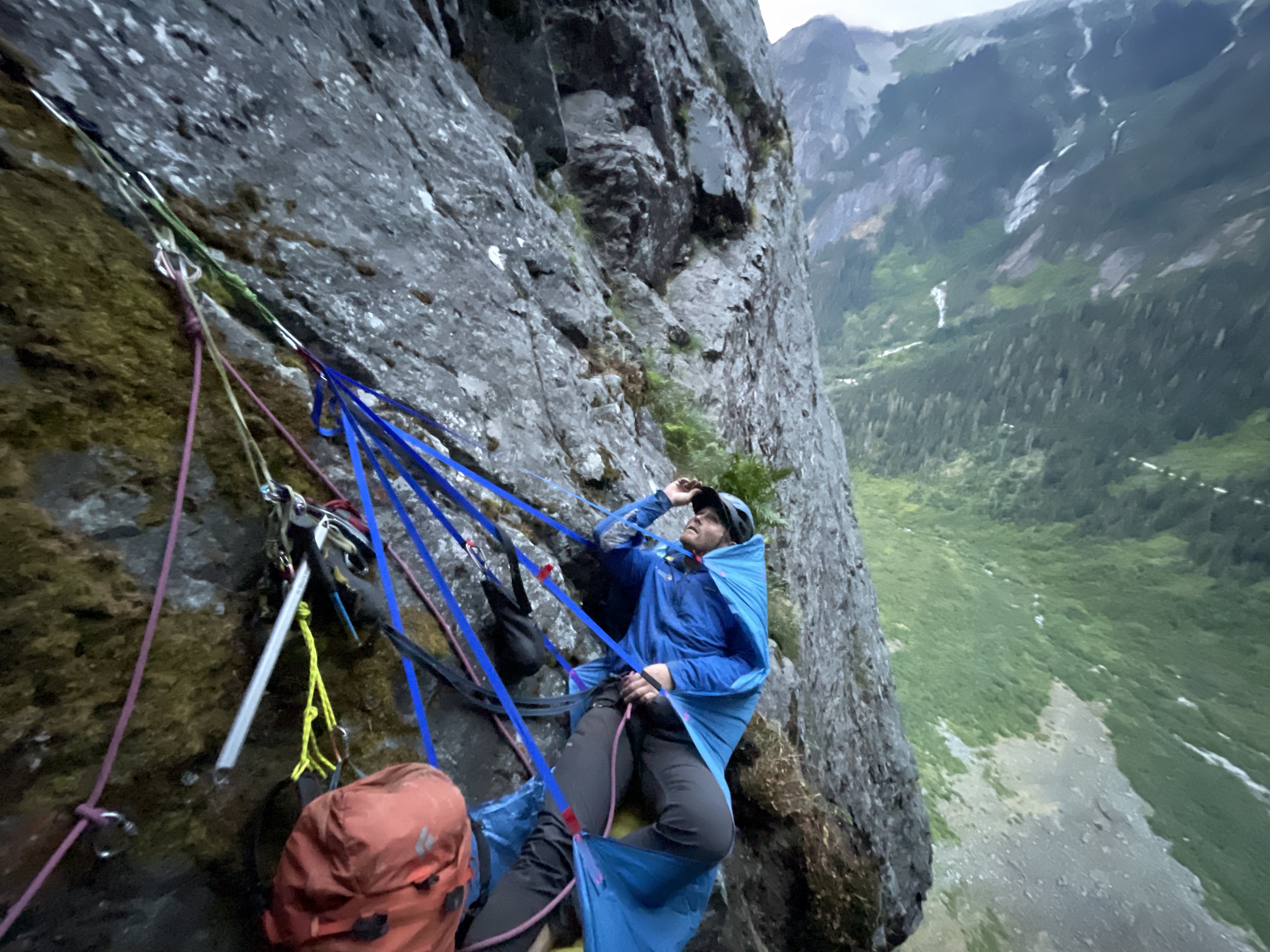
chilling at the bivy in a super taco
looking up at the upper corner from the bivy
The next few pitches were actually pretty fun. Steep face and corner climbing on surprisingly solid rock.
starting up P7. 5.7R up to the roof.
kyle following the roof at the top of P7
The 8th pitch was the start to the sting in the tail. We climbed a runout face to the right of the corner. This took us up to the edge of the wall. The wall pinched off to a blunt, knife edge arete. A 5.8 downclimbing traverse into a rock scar was probably the most dangerous point on the climb. The last piece was maybe about 60 ft away and around the arete. A fall would likely chop the rope along the arete. Strong R. The rock scar was overhanging 5.9 stemming on less than ideal rock but with good gear.
climbing up near the arete on pitch 8
kyle finishing up pitch 8Once on the prow of the wall we had a few options. None of them looked good. The chimneys above looked truly awful, so we opted to traverse the arete to the right and found a mossy ramp that took us out onto the NW face. I belayed short for communication and to help make decisions. The next pitch was bleak, dead vertical terrain everywhere and so much munge. We ended up making a huge S shaped traversing pitch to work our way up moss covered 5.8 sketch blocks. We named this pitch “Phil’s Traverse” as we were intending on calling the route “the land of confusion”. The sting in the tail continues…
kyle following the zag on Phil’s TraverseA long pitch of overhanging 5.7 tree climbing spat us out on a decent ledge where we transitioned out of rock shoes to prepare for the Forrest. I was nearing the end of the rope on a classic J-Berg tree pitch and grabbed a tuft of moss, as you do. This particular tuft was a bees nest. I felt stinging and saw a few on my right hand and about 100 bees shot out of the hole, dead set on face fucking me off the mountain. I let go in a knee jerk reaction and went for a slow motion, sports action highlight style whipper. I kind of wish I had a video camera on as it had to have been funny to watch. I ended up grabbing, and swinging off a tree on the way down, making a single rotation tomahawk and falling onto my feet as the rope caught me. Glad I took a lead belay. I ended up rolling my ankle and was otherwise unscathed. I belayed Kyle up and we weighed our options. We decided to find a place to bivy and wait until the morning to make any decisions. We ended up climbing up another 300’ of forest munge to the top of a heather slope. The top of the slope was a comfy knoll that marked the summit of the lower tower, and an awesome bivy! This was our summit and the first point where it was obvious we had linked into the ‘57 line.
kyle rapping a steep section of the wall
Waking up, my outlook was pretty grim. I could barely hobble around, so we decided to descend our route. I couldn’t really put weight on my ankle so I ended up glissading the last 100’ of 35 degree heather. Once back at the tree line we began rapping. We ended up rappelling about 1800’. Primarily rapping on trees and using an escaper we were able to get away with only leaving a couple gear anchors along the way. Traversing the talus back to the car was kind of miserable, but manageable. My ankle is starting to feel better already, crossing my fingers for a minor sprain.
For the aspiring munge warrior, here’s pitch notes
P1 5.7 180’ head up moss gully on the left to a big ledge with trees.
P2 5.7+ 180’ traverse to left edge of ledge. Head up good hand crack. Traverse slab to the right and climb a nice finger crack up to a large ledge on the ridge crest.
P3 5.8 150’ head up into the large mossy corner. Climb up to a distinct roof with hands to fists gear for anchor.
P4 5.9 100’ continue up the corner. Mossy crack climbing leads to a rightward roof traverse. Pull past the roof onto the large sloping ledge. Two beaks in place for anchor
P5 5.9 100’ continue up main corner on clean slab. Past a short chimney and a crack on the right face (5.9+). Belay at uncomfortable stance below a striped roof in a good crack in the main corner.
P6 5.9+ 85’ continue up main corner past a small roof (crux) to an alcove at the base of the massive looming roof above. #4 critical for belay.
P7 5.9+ 70’ climb the face to the right of the corner (5.7R). Up past an off width section to a section of steep crack/stemming on good rock. Belay in a cave.
P8 5.9+ 160’ traverse out of the cave. Climb the face on the right up to a knife edge arete (5.8R). Traverse the slab rightward into a steep rock star (5.9+ spicy). Continue up past low angle broken terrain. Belay by a bush on a small ledge.
P9 5.7 60’ head up and around the arete to the right. Traverse over on mossy ledges and build an anchor
P10 5.8R 100’ “Phil’s traverse” traverse right. Up mossy blocks to trees. Traverse back left to a big tree for a belay. Heinous drag.
P11 5.7 150’ climb the belay tree. Then continue up until rope drag stops you.
P12 5.6 200’ trees up to the ridge crest to join ne butt route.
Gear Notes:
Double Rack .2 - 1 Singles 2 - 4 no nuts placed. Pins in place.
Approach Notes:
Park at cascade pass. Traverse talus to the base of the “munge cone”. Traverse to the right up steep ferns. Gain a steep ramp that cuts up and left on 4th class devils clubs. Mandatory devils club laybacking. We brought leather gloves for this. Traverse the ledge to an exposed perch by a steep gully.-
5
-
4
-
1
-
-
30 minutes ago, John_Roper said:
Sam, please draw your line on Matt Lemke's photo.
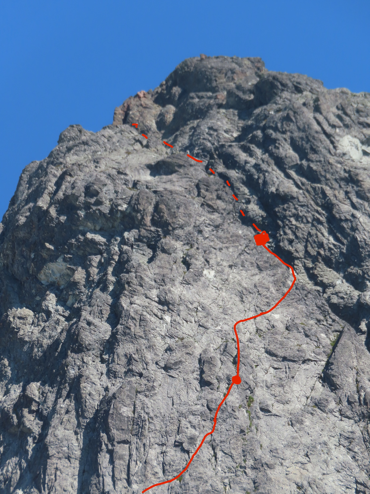
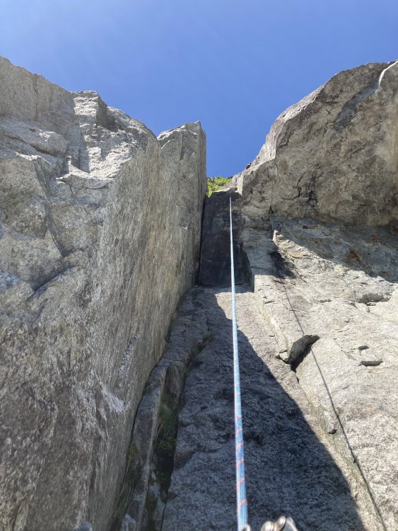
Hopefully this helps. The lower part and traverse pitch are compressed at that angle so it’s probably not exact, but this should show the upper part well. We climbed that giant cleft at the top of the wall for 2 long pitches and were surprised not to find loose rock. It ended up being a lowish angle (low fifth) water polished slot canyon.
-
Photo dump. These are kind of in order (reverse order that is, starting at the top and working down to the bottom)


-
1
-
1
-
-
5 hours ago, rat said:
Nice job. Does your line take the buttress on the left in Matt's photo with your "mega gully" separating it from the slightly shorter but steeper buttress on the right? Thanks.
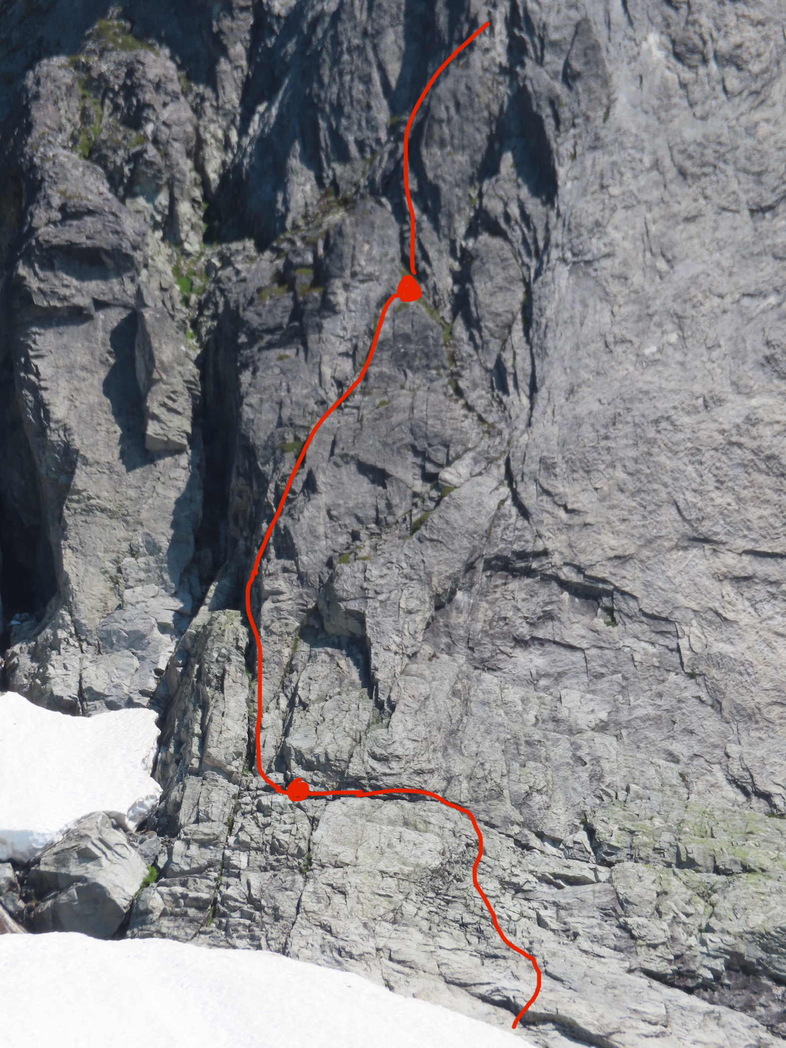
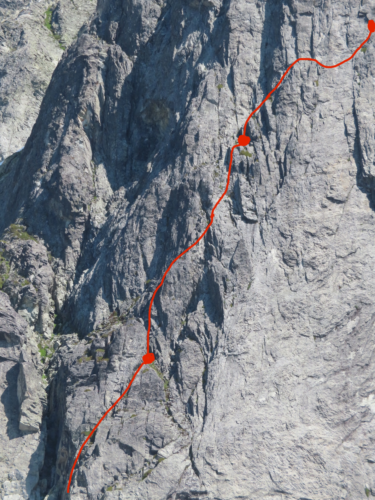
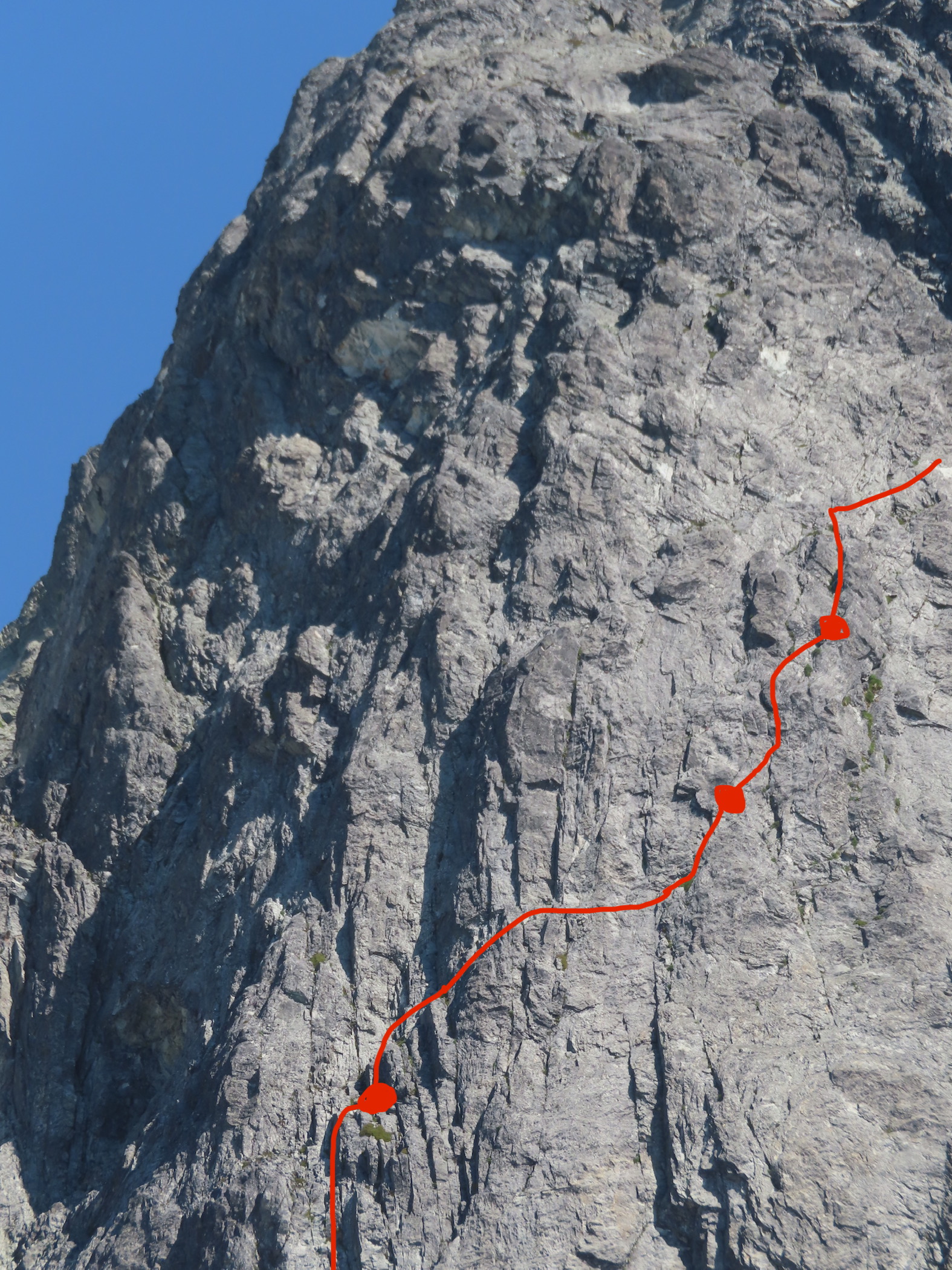
Here are some high res photos that We got on Joe’s camera. I drew in our route line and put dots at all of the belays.
-
Trip: Whatcom Peak - “Castle in the Sky” FA of the South Buttress of Whatcom 5.10b TD
Trip Date: 08/06/2022
Trip Report:
Yeeehaw! What a weather window it’s been! From Aug 5-7th Lani and I climbed the first ascent of the south buttress of Whatcom. This route came as a suggestion from Wayne. Thanks! It was excellent climbing on great rock in the most perfect of settings. I would say it’s one of the finer alpine routes I’ve had the pleasure of climbing in the cascades! We would highly recommend the route! There is certainly some choss and some runout but it is the pickets. I have to start work today so a hasty trip report will have to do. Here’s a link to the report I wrote up. Sorry for the forced click through, I’m rolling out the door and don’t have time to format photos for CC. Thanks for the stoke y’all! Go get it while the gettins still there!
Gear Notes:
Single rack .1-3 doubles .2-1 full set of nuts. Optional #2 and 3 KB’s. Single 60M rope
Approach Notes:
We took easy peak to the imperfect impasse.-
3
-
1
-
7
-
-
Trip: Spectre Peak - “Spirited Away” FA of the S Ridge of Spectre Peak 2000’ 5.8
Trip Date: 07/26/2022
Trip Report:Joe Manning and I just got out of the Northern Pickets. We did the first ascent of the South Ridge of Spectre Peak. We had excellent weather and were out for 4 days. I’m having trouble loading any photos from my phone on here so this will be super brief. For extensive photos and whatnot check out my trip report on our blog…
Gear Notes:
Singles .1-2 doubles .3-1 light rack of nuts and optional 3. 40-50ft of cord and a single 60M rope.
Approach Notes:
Easy peak to improbable impasse to perfect pass to challenger col to phantom to pickle pass.-
1
-
2
-
5
-
-
Trip: West Fury - Mongo Ridge 5.9 ED1 (second ascent of the Pole of Remotenesses)
Trip Date: 07/14/2022
Trip Report:Hello all, Lani and I got out of the pickets a few days ago. We repeated Mongo Ridge and got the second ascent of the pole of remoteness. Lani wrote a solid trip report on our blog with tons of photos
and more beta which is linked below. For now here are some important cliff notes on the route…
https://www.theclimbingguides.com/post/mongo-ridge-and-the-pole-of-remoteness-7-09-2022-7-14-2022
1- we did not do the rooster comb. This feature is awesome looking and deserving of being climbed if you have the time. The bypass doesn’t seem to detract from the aesthetic of the line too much, you are about 100-150’ from the roosters comb the whole way as you traverse the south face.
2- we did not encounter any 5.10 terrain. After seeing photos from Wayne’s trip we climbed slightly different terrain than he did on tower 3.
3- everyone seems concerned with the commitment grades thrown at this thing. I would argue that an American commitment grade makes little sense on a climb like this. I would like to propose Mongo as the benchmark ED1 for the cascades. It is a considerable step up in length, commitment and general alpine involvement over NE butt of slesse, and I’ve always understood that climb as the benchmark TD. There was 3500’ of climbing done in 30 pitches without any simuling. we chose not to simul as there really wasn’t enough solid gear to make it feel like we weren’t just soloing.
4- this was my first technical climb in the pickets, so I don’t have much to compare it to but I felt the rock was pretty damn good and the route was fucking awesome. The route was similar in nature to the west arete, but longer and with better rock, and almost no overhead hazard. I would highly recommend the route.
5- the sit start to the ridge is a logical evolution of the route. For those interested, it looked improbable to gain the lower ridge anywhere other than toe. This would ultimately add about 1200’ to the climb. Once seasonal snow is gone, it may be easier to trudge up the depths of goddell creek…
Gear Notes:
Single rack .1-2, doubles .3-.75
Approach Notes:
Long-
3
-
1
-
9
-
-
J berg has some of the best rock quality in the cascade pass region. Not really sure why there’s a bunch of hype over the choss, type 1 cascadian hilarity the whole way! Maybe best done sans rope and sans bivy gear, I recall my 15 L pack was about all I’d have wanted to carry through the jungle gym of cedars. Anyone do any of the lines on the wall to the left? The Yellow flower route and the two just right of center look neat, looks kinda steep for 5.6/7 though, sandbag or optical illusion?
-
49 minutes ago, kukuzka1 said:
Awesome! finally something gets done on that thing. Just for shits and giggles is possible to draw a rough line of the Doorish route? I cannot quite see it
As far as I can tell this is it. A couple fxed lines over there gave some clues on features.

-
1
-
-
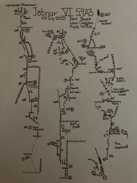
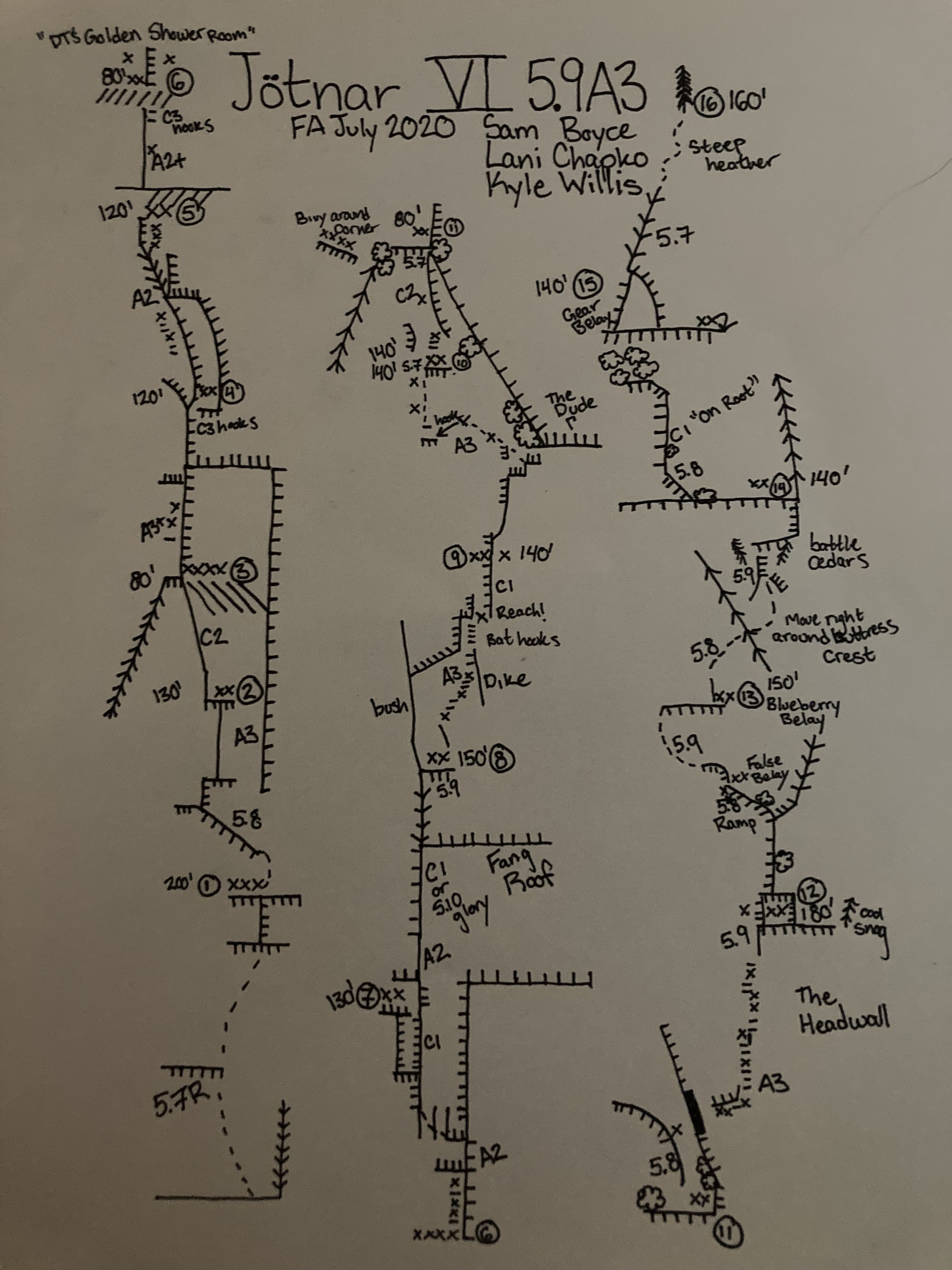
Trip: North Norwegian Buttress - Jötnar VI 5.9 A3
Trip Date: 08/01/2020
Trip Report:Whaddup maggots. The crew of vagrants and miscreants just got down yesterday from north Norwegian round 2. We completed our line to the top of the buttress. We spent 1 day fixing back to the high point then 6 days on the wall climbing in capsule style to complete the route. We are naming the line “Jötnar”, the race of god-like giants in Norse mythology. We unofficially started calling the Norwegian cirque Jötunheim, “the realm of the giants”. While only having one line up there might not give us “authority” to name something, I’m enamored with the zone and like the name, and no one else has to call it that... anywho, here’s a brief report of our experience, hopefully this inspires someone to follow in our footsteps, as it’s an incredible route.
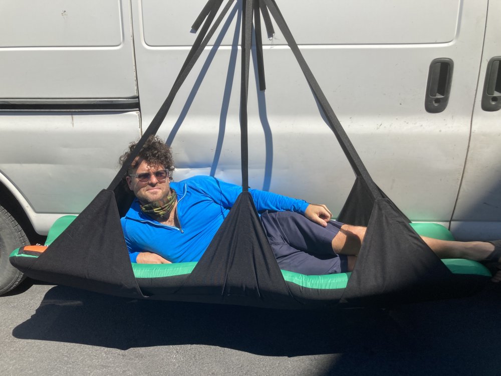
In June, we made our first foray onto the wall and found soggy conditions as our route runs through a water streak for a good portion of the lower buttress. Poor weather lead to poor conditions, if you read my previous trip report, you’ll remember we did not get far. In 4 days of climbing we completed about 700’ of the line. We left gear stashed with the intent on returning. Our window of time off about 3 weeks away. Prep for the route started a few days before our departure date. I headed over to kyle’s studio (For his gear business “high mountain gear and repair”) in Ballard to make some various things. One of those being an inflatable big wall hammock that we had been discussing in recent weeks. Kyle would test it out on this wall, likely the secret weapon for big wall alpine routes in the cascades. Kyle came up with the name “Taco” as a mockery of conventional portaledges.
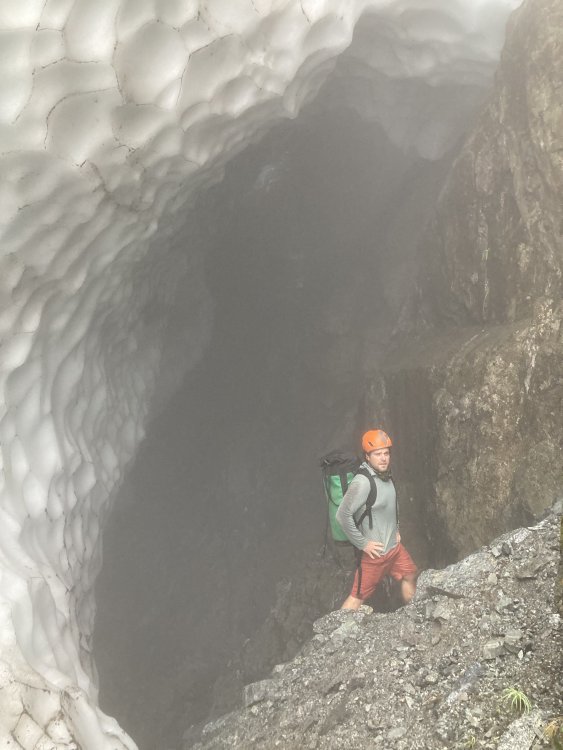
After making various things for the wall we set out on our own errands the next day then reconvened to shuttle a load up to lake serene. Fetching water was considerably easier than last time, the moat had opened enough to walk inside, being a whiteout day we decided it was safe enough to brave for 15 min to get water (better than hiking back to the lake!!)
After unwrapping our gear stash we discovered a snafflehound gnawed on a rope! The backup lead line nonetheless. Another rope was needed, the volume of rope was becoming absurd. We told Lani to pick one up on her way down from Bellingham. Logistics here got weird. Kyle had commitments in the form of a bike packing trip during the start of the window we had to climb. So when Lani and I started climbing we would have to leave lines fixed to the ground for Kyle to use to join us two days into the climb! On the first day we got a ride to the trailhead early morning and moved with motivation all Day to fix lines the the high point on our route. The line climbed substantially better because of the cleaning we were able to do previously. Fixing high on the wall we descended to the base that evening to sleep on the ground and prep the load to haul. We woke up early again and started the manual labor. Moving faster that expected we were able to haul to the high point and get camp set up around mid afternoon. Plenty of time to start up new terrain. Lani started up the next pitch which would prove the steepest on route. She got about halfway up the pitch before deciding it was time for dinner.
On day 3 she headed up the pitch and pulled through the massive steep band that blocked our view of the upper buttress. This would prove to be the only pitch that requires a fixed line for descent. I took over the lead on the next pitch and found cool expanding beak cracks that lead up to a surprise! We pulled into a band of bulletproof skagit gneiss that would run the whole middle part of the route, immaculate stone.
I climbed up into a massive right facing corner and up an amazing #2 crack through the second massive roof on the route “the fang” as we had pre named it. Continuing up an easy flare I found a good stance at the base of a large slab.
Lani was still feeling mega tired from the steep lead and told me to keep going, I quested upwards on the slab utilizing a mixture of hooks and rivets to reach a dike that proved discouragingly shitty. The dike however led to a good flake that rapidly turned not so good, the whole corner was a Jenga stack. Being on lead I reluctantly bat hooked the face around the choss. These bat hooks could maybe be avoided post cleaning, still chossy and expando in there though. I eventually put a bolt in to reach far and tension to the next small corner, which proved to be cruiser C1 to a good stance for a belay, post dirt removal this would likely be sweet 5.9-10. Here I called off belay while placing the anchor bolts and Lani zipped down to camp to start dinner. Meanwhile Kyle had started up the wall hauling the second half of the load solo, having to haul twice he only got to the bivy at pitch 3 and would camp here.
Day 4 started with shenanigans to situate the ropes where they needed to be in order to fix higher. After we were able to snag an independent rope Lani and I again began the commute up the fixed lines to push the line higher while Kyle hailed up to camp. From the high point, Lani led up Inobvious but moderate aid to the crest of “the dude”. The biggest roof on north Norwegian, and an intimidating mega overhang. Incipient and creative low angle A3 led up and left under the roof and around the bushy corner to a small ledge.
Reaching this ledge we figured we were far enough up to move camp, and thus Lani went down to assist Kyle in starting to haul while I started soloing the next pitch to the intended next camp. About halfway up my pitch I got a call saying there were technical difficulties at camp, we decided to reestablish camp and fix to the top my pitch.

Day 5 would start super early with the big move. Myself and Lani would double counterbalance sky haul the pigs while Kyle cleaned the line below and brought up fixed lines. A few hours of hot manual labor brought us to the high point ledge. A grassy inset which seemed suboptimal for two portaledges, we spotted a good spot left of the buttress crest and concocted a creative plan to swing the bags over. I free climbed up to the top of a flake and put a good bolt in and lowered down (clipping the haul line to the bolt) to the intended spot. I drilled while Kyle and Lani prepped the bags. Once ready I took tight on the haul line with my gri gri and they kicked the bags over top rope style to me where I lowered them in place and docked them at the anchor. Shenanigans. After setting camp up I hugged up to my high point on the pitch and continued my lead. “The head wall” proved to be wicked exposed but I had to fight the features pulling us left into the chossy chasm and drill my way to a stunning corner on the buttress crest.
Kyle and Lani came up to join me and Kyle started up the next pitch. Moderate free and aid led up through a tree to a roof. An inobvious ramp cut out left through some chossy bush. Kyle bulldozed his way up eventually running out of patience and drilling around some dangerous choss. Running low on daylight Kyle threw in a belay and called it a day.
Day 6 started with a poor decision, only one gallon of water came up the wall... after jugging we were already dehydrated but didn’t think too much of it. We started on the e face and got good afternoon shade but the upper part of the route climbs the crest of the se ridge, and gets blazing sun all day. I got the the high point first and in the spirit of decluttering the tight stance I started free climbing. 50 ft up I hit an awesome ledge too good to pass up, so I added an anchor and moved the team up. Kyle in the mean time cleaned the previous bit to a state of being semi pleasant climbing!! At this belay our peril became evident, we were already spiraling into gnarly dehydration. Kyle was getting loopy, Lani unstoked, and myself crankerous. I would continue up with inobvious route finding. A long circuitous pitch of steep 5.9 led to another good albeit sun exposed ledge. We were closing on the summit, Lani encouraged me to keep leading while Kyle cleaned the route.
A blueberry filled corner provided passage to the next tier, a pitch likened to the tree climbing on j berg!!
One more mega ledge and we could smell it! A casual pitch of 5.7 led up to a short bit of heather clawing onto the summit of the buttress.
We had read that it was easy climbing to the summit of middle index from here and it looked so. It also looked like a bunch of cascadian bush mank that seemed like it would taint our experience in our state of dehydrated madness. We descended to camp to smoke the joint we found in the parking lot and contemplate our descent.

One or two puffs in I had this idea to lower Kyle with the bags down the whole face. We all became (mostly) convinced it would work and put wheels in the motion the next day. After wranglin the bags back to fall line we descended two pitches to the intended “drop zone”. We delicately stacked 1000’ of rope joined with edk’s, we would would bump em all through a munter. Kyle and the bags were probably closing on 400 lbs, we needed a gri and munter to control the load. The lower went smooth, and we were amazed! Bags were down!!!! So myself and Lani dropped all but two ropes down the face and Kyle started managing the clusterfuck. Our new friend River had responded to a Facebook call for porter help and met Kyle at the lake to take down 50-60 lbs of our load while me and Lani rapped the face and cleaned our gear. We touched down not too long after and started the soul crushing hike down, we had about 70-80 lbs a piece. I had called my parents again as it seems like all our friends are busy this time of year, they met us at the parking lot with a cooler of cold bubbly, fucking great climb. Shoutout to Lani for stoke, Kyle for his undying willingness to suffer and commitment to the manual labor and route creation, and River! For being willing to come up and help total strangers hump our stinky clusterfuck around. This route was certainly the effort of a village, and a wonderful big wall line that I hope people enjoy.

Gear Notes:
Double Rack micro to #4, Single 5, Single set of offset nuts (didn’t use rp’s), 4-5 each beaks, 2 small lost arrows, 10 rivet hangers. All bolts and rivets are stainless, one or two bolts didn’t take well in the wet mud, but could potentially be reset with a funk and tightented (all anchors have at least 2 good bolts). Some may need to be tightened up again after initial loading. No ledges big enough even for 1 to sleep, good portaledges camps at the top of pitch 3,6,9, and 12. Do not haul above 12. Bivies at 3,6, and side of 11 take 2 ledges well. Rap the route, some directionals need to be placed on a handful of pitches to get down, pitch 7 needs to remain fixed with an extra 35-40M rope (it could be possible to down aid the roof on rappel to get back to the previous anchor)
Approach Notes:
Scamper to Lake Serene while the tourons ask about your “paraglide” or “boats”. Easy talus walking to near the waterfall between the buttresses. Enjoy your stay in Jötunheim!-
3
-
9
-
-
Back at it! Got back to the high point and settled into camp yesterday, starting up the next block of the wall today. It is STEEP!
-
1
-
-
Trip: Mt. Index - North Norwegian
Trip Date: 06/25/2020
Trip Report:
Bringin big walling back!

I’ve grown up in a vacuum, an existence in climbing severely lacking a critical component. There’s no fucking wall climbing in the NW! Or at least nobody does it, and when they do they retrobolt it for the sport wanking mutants. This is a trip report and a calling.
Last year I caught a bug and became obsessed with a specific wall, the North Norwegian. Maybe the largest proper wall around and no one climbs it, 5.9 A3, that’s a damn moderate. I scheduled attempts and got shut with weather and work until sept. I convinced my friend Lani to go and check it out, work of course cut into the plans and shattered our window from 6 days to 3. So we cut the bolt kit down to the minimum “Peter couldn’t have put that bad of bolts in could he?”, oh how naive we were. We ran up there with like 6 bolts and a handful of rivets in case any blew. We climbed the free pitches up to the “bivy” in the topo and climbed the 2 pitches above. The anchor for the first pitch was a rusted carbon 1/4” wedge and a excavated #3. The 3 fell out when I kicked the rock above the anchor and the structure of the rock in the belay changed a bit. Needless to say the first few beak placements were moderately stressful. Reaching the second anchor we found a couple more gnarly rusted 1/4” carbon bolts. One I pulled out with a light tug of the hammer. I slugged one of our stainless bolts in there and we decided to head down. Not enough bolts with us to tackle that whale! The thought of that bail festered all winter and plans percolated into the spring. Weather persisted to be quite shit for quite too long. We escaped down to the valley for a lap on the captain and raced back to wa to impulse take advantage of a weather window. A last minute call to my friend Kyle and we were 3. 3 bumbling idiots lumping way to much shit up to lake serene. After the taste of the doorish route we determined it would be the same amount of effort to climb a new line. We choose a weakness that runs the left side of the buttress, opposite of the two existing routes.
On our first stint up the wall, we pushed the route about 700’. Of course the cascades had its way with us and we got plenty of rain half the time we were up there. Turns out our line happens to blast straight up a seasonal water streak, hence the nice cracks... so even when the sun was out the soakage continued! It was mud wrestling, manual labor, much trundling and plenty of hilarious fuckery. We set up the route to return and our window of time off is narrowly approaching and stoke is high! Hence the spray!

Pitch 1 is more or less shared with the doorish line (or at least what we could discern from the mank topo). Getting to the base was entertaining and involved with a couple hundred feet of neve unexpectedly gaurding the wall. We had very minimal snow gear so I ended up hauling the pigs off a single ice axe anchor, which mostly worked, until it didnt and all parties went flying. Quite entertaining for a little 20 degree slope. Eventually we got the bags up there and docked on an axe and we could climb. A delicate saunter up the pitch was mostly familiar, but I veered left towards our crack. I think I found 1 piece of gear in some 200’, but at least two points of contact were mostly attached to the wall most of the time, that’s redundancy right ther. I stretched the rope and got to a horrid low angle stance on the “ledge” and drove a shit beak in to tag the anchor kit up. The sloping shit ledges would become a theme of the route so far. Bolts in I started to haul, Kyle helped the bags surmount the chossy 5.7 as dusk rolled. Lani finally gets up to the lake having climbing baker that morning and we decide to convene on the ground for some sleep. We had to bring one bag back down to fill up water at the lake as the moats were particularly man eating and scary to get water from. Morning came and we all set our wheels in motion. I jugged the lead line and stole one of the ropes to start soloing the next pitch while Kyle and Lani got water and hauled the load to the pitch one anchor.

Pitch 2 started out with a nice 5.8 slab that led up to some C2 choss blocks to an A3 crack up a face. At one point an expanding beak popped out a little and I’m pretty sure I’d a shit myself if I hadn’t just emptied my bowels. This angry beak proceeded to pop 2 more times until it was only in there about an eighth inch. Held in by broken dreams and the tears of a “fear fucked orangutan”. I got 2 two lobe cams shoved behind a loose block and equalized em and jumped on em. Much fuckery persisted as the junk show assembled at the base of the pitch. I eventually made it up to the “gnar shard”. Figured I’d kill my partners if I tried to climb up through this thing this far away from them so I again tagged up the drill. So much for the plan to stretch the pitches out! Unsure if I’d already dead ended the team I figured I’d go up and check this block out.
An easy C1 crack led up to the big stack of death blocks, I looked around and tapped it with my hammer. I felt like I could deconstruct it at a reasonable pace to huck the individual blocks clear of the belay. The first few were toasted sized and easy to manage. Then I had to top step and try the big un’. It unexpectedly popped and nailed me in the collar bone. I wrestled the microwave and won! Using my body to shield the belay I was able to will it away. Some primal noises ensued, the route goes on! We were expecting weather at this point so I was tasked with locating a reasonably sheltered spot to set up a portaledge camp. The easy C1 crack continued up to a large overhanging corner beneath a roof. Bingo! I started setting up the bivy anchor while the clusterfuck migrated. The next would be the last pitch for my block, so I decided to fix while Kyle and Lani set up the ledges and got camp situated.

This would prove to be the crux of the route so far (A3+ or so) and the first rivets to come out. The rock quality however increased substantially. There was a heinous water streak coming off a roof partway up the pitch. Climbing in a waterfall is... fine... the pitch topped out with a bunch of cool natural hooks in near overhanging terrain to a small ledge in a mud waterfall corner. I fixed the ropes and zipped the line to a warm camp. A whiteout rolled in that night.


The whiteout and drizzles came and went throughout the next day but the water streak provided a constant deluge of water. The weather was never bad but conditions would have been... engaging. Nobody could muster the motivation to go up there and lead the mud waterfall pitch in those conditions. We decided we were lame and were ok with that and drank some tea.

The next morning we awoke to sun, much needed to dry our stuff out from the “dry our stuff out” day. We rambled up to the top of the fixed lines and Kyle volunteered to take the next block. He started up a relatively dry but mud filled corner.

This dry corner soon became a fun experiment in the dynamics of daily snow melt cycles. It slowly progressed into a muddy waterfall. The muddy corner became full of death blocks and the drill came out to avoid some heinous choss. Out of sight we heard “fuck I just broke my finger!”. Having not heard rockfall we guessed Kyle smashed his finger driving a rivet in. Turns out that was the case. We showed up at the belay and his finger was starting to turn funny colors in a particularly unnatural direction. Kyle touted it was “just the tip” and there was nothing to do about it so we decided to continue on. He was however not psyched on leading, so I was somehow nominated to continue up the soaking wet pitch above.

Again aiming for what looked like an obvious ledge, I found fun and solid thin nailing up to another shitty sloping stance. I started to set up the anchor for another bivy as things had progressed to a particularly damp state of affairs. The positioning of the ledges was tricky but we managed and settled in to weigh options. With our time off from work running low we decided to use the time we had to better set up the route for a return visit (trundling n whatnot). The rappel was mostly without incident, other then Kyle sending off a smart car sized boulder that caused a house sized chunk of snow to collapse into the moat. Coming off the wall I reaffirmed a concept and am psyched to turn it into a project. I want to write a PNW big wall guidebook, I know the walls are out there, most are unrepeated Pete Doorish obscurities with death anchors. I’m starting a tick list of faces, features, walls and routes, I think these lines could use some updated anchor bolts and some friggin traffic! Here’s my rough list so far, who’s got suggestions? I’m not super familiar with sw bc walls. Write me the most fucked up tick list you can!
NNB (gotta wrap up our line this month and update hardware on that doorish line at some point, also clear all the trash rope left on the doorish line and voodoo proj)
South Norwegian
N face Baring
utw routes
Diamond on N face bear
SE face tower mt
e face liberty bell
anything else I’m missing in the wa pass/ rainy pass zone?
the chief/Squamish wall lines
Big wall belt!! Who’s read those aac posts?!?
southern bc has so much granite, what are the biggest baddest faces up there?
theres purportedly a wall style route on slesse
mt snoqualmie of all places
tower rock down south sounds cool
Gear Notes:
Evolving
Approach Notes:
Jaunt up lake serene trail-
4
-
-
Trip: North Cascades- Boston Basin - The Boston Marathon
Trip Date: 07/10/2018
Trip Report:This is super delayed, but i was looking though old pics and thought this trip was worth sharing with y'all. Kyle was most certainly the brain-child behind this absurdity. I think it was sometime in the summer of 2017 he mentioned this idea of solo circumnaving boston basin. I was a bit suspicious that things might be a little more involved than was anticipated so told him i'd join in for a recon mission. We trail ran the sahale glacier route one day and gawked at the rest of the ridge, reading the unknown v known terrain and looking at the way the ridges tended to run. It was clear we were going in the wrong direction. For one, we would have to do the tft backwards, which would have honestly been the most chill weirdness. Downclimbing the ridge to sharkfin looked damn near suicidal. So we regrouped and planned a 2 day mission from the other end. We decided to start at the hidden lakes th and start on the triad via the sibley pass approach. When we hit the triad it was clear the "triad traverse" approach as described for marble creek basin didn't really let on to how gnarly the scrambling would be if one were to stay true to the ridge. We estimated summiting the triad sometime before 10 am, somewhere around mid afternoon we finally were running up the eldorado glacier. After tagging eldo via the east ridge, we ran over to the torment col while the sun was setting. After soloing the s ridge of torment in the morning, we realized we again had underestimated our objective, so we bailed down b basin and gorged on berries. One last attempt that summer would be thwarted by an overuse injury. And the september rains came, and boston basin stood like that itch you just cant reach all friggin winter long. Summer came around again and we were racking up at our first opportunity. Sometime in early July.
looking back towards eldo and the triad on an early recon
We Again set up the car shuttle, but this time the road was closed at the eldo th, and we had 4 days off, so we figured we'd tentatively plan on just tossing the triplets, cascade and j-berg in on the final day (our plan was to scramble the j berg summit ridge and bushwack down the gnar forrest straight back to the eldo th.). Weather ultimately meant this final link would not go, but its certainly something to aspire to. We set off from the trailhead for the triad. This time, we were prepared for the choss.

early scrambling
Kyle down-soloing some 5.6 choss on the triad
Some 4th class funk on the triad
100ft tower we climbed along the way, 5.7 nothing on top suggested we were the first to visit such a bizzare place

some more down climbin
w face of w triad 5.6 R super aesthetic
The first time we visited the triad we stayed true to the ridge crest east of the eastern summit and down-climbed somewhere about a third or half way down the east ridge. This proved to be an extremely dangerous experiment in natural jenga. We pushed off multiple oven to mini cooper sized blocks that impeded safe passage. We ended up bailing down some 500 ft 5.4-5.7 wall to the glacier. This was the boldest down-soloing i've ever committed to and would never be recommended. Remembering this experience, we opted to drop off the ridge after the eastern summit of the triad. A quick jaunt accross the glacier brought us over to eldo. We decided the truest line would be to climb the south ridge of eldorado. We found info on the south face, but none on the south ridge. We thought this odd, but the ridge looked quite reasonable. It ended up providing 4-6 epic and high quality pitches of easy rock climbing. A worthy stand alone mission and my second favorite (second to the west arete) way to summit the mountain.
the first pitch gaining the s ridge of eldo

second pitch

some good ol' fashioned knife ridin
good conditions meant a casual walk down the e ridge
From the summit of eldo we decided to stop and rest at eldo camp rather than push through the dark to the torment col. I mean, there is a toilet there, thats pretty darn good motivation. We woke up early the next day and scurried across the feint climbers path leading over to torment. The torment col is always a neat place to hang out and fill up water. The true line here is the NW ridge of torment. We quickly glanced at the beckey bible the first time, and saw that it had gone. But when we got to the base of the ridge the gnar choss was quite strong, and we weren't entirely sure if we had the beta memorized, so we bailed back around the mountain to the south ridge. This time around we had taken some photos of the guidebook and decided to turn reason off. Getting on the ridge was the crux, purely mental, it turned out to be fairly easy going. There was one exposed and runout 5.8ish knife-edge pitch somewhere in there, but it all kinda blurred together. Soon enough we found ourselves on the summit of torment and in familiar terrain. The TFT awaited, finally some classic easy ridge travel! A classic b basin white out slowly creeped up as we reached the w ridge notch. It became apparent a storm was comming in so we scrambled to get the tarp up. We knew we were in for a wet night.
looking over at the nw ridge of torment
the entrance to the ridge, what looked like 5.10 from afar turned out to be 5.6
some more ridge scrambles on torment
topping out the crux pitch of the nw ridge
looking back at the entrance to the tft. getting on the glacier required a 20ft pendulum, then we had to rap down that high bergshrund. our first overhanging rap off a snow bollard.
things were wet and snowy on the "3rd class rock" bypass variation
We woke up on day 3 soaked (i say woke up, but there wasn't that much sleep). Rain stopped around 1 pm. The whiteout however persisted. We eventually got restless and started up the w ridge of forbidden. Neither of us had been down the east side of the mountain before, so we knew we were in for a good challenge when the whiteout lingered, but we knew we had to keep going if the traverse was going to go down. Finding the raps down the east ledges was tricky, but not unreasonable, we eventually got onto the e shoulder of the mountain below the start of the east ridge route. and knew that we had no clue what layed ahead, so we tucked tails and pitched the tarp.

west ridge with a fog break
another little break in the whiteout while descending the east ledges

our bivy the next morning, j-berg looking classy as ever
We awoke on day 4 with the sun and our first view of the nw ridge of boston. And we were decidedly a little concerned. Nonetheless we packed up and found our way down to the end of the e shoulder of forbidden. if ya think boston peak is choss, try scrambling around out here, it will change your understanding of the word. We reached the end, and the large cliff that would feed us to the the notch below the sharkfin ridge. this was truly un-rappellable terrain. So we backtracked to a low 5th class gully. A very stressful hour of downclimbing and rappelling spat us on the edge of the Qiuen Sabe. Another gully by the notch led us up to the steep hanging snowfield below the sharkfin ridge. We were short on time because of weather and opted to leave the subsummit west of sharkfin for another time. We quickly found ourselves at sharkfin. We climbed something on the sw ridge of the tooth, hard to remember exactly what we did. It was solid, exposed and 5.8. Had a hanging belay and no other signs of climbers. Not sure what we climbed, but it was fun. After some victory food on the summit we rapped off and set sail into a sea of virgin choss. I think there was maybe 1 more rappel to access boston, then we started up the ridge. We soloed about 1500 ft of low 5th class before hitting a vertical section and roping up. A circuitous combination of rappeling and ridge climbing brought us to the famous "ore" describing boston. A knife edge ridge guarded the easier looking summit headwall. The prospect of bailing at that point seemed worse than climbing the ridge, so i pushed up. The rock was best described as feta cheese. And i had to mow about a foot of the surface rock off as i au chevaled to ensure the entire ridge wouldn't collapse with me on it. I fabricated a belay half way across this called "off-belay". Kyle didn't look convinced i had found gear. Climbing delicately through the remaining pitches we found ourselves in unprotectable low 5th. So we soloed to the summit. The register up there is pretty rad, its a neat summit and the regular route doesn't look that bad. A few rappels and we knew we had done it, sahale was like the icing on the cake. And a 2000 ft boot ski down to the sahale arm was the reward. We blasted obscene music and trudged down to the cascade pass th. Overall we pitched out 26 pitches, rappelled 26 times and the gps read 26.2 miles back at the eldo th. A proper cascades test-piece. Some day we might go back and add j-berg. Maybe when memory fails us. "The Boston Marathon" VI 5.8R
scouting the downclimb to the qiuen sabe
looking over at the nw ridge of boston

starting up sharkfin

the final approach to boston. We ended up climbing just under the ridge crest for good 4th and low 5th class traversing until the gendarme right before the ridge starts gaining elevation, thats were we roped up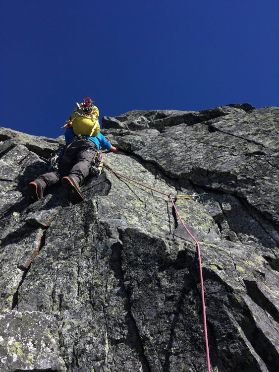
the first roped climbing on boston
finishing up on the first pitch of the au cheval
.thumb.jpg.e1bfe41408e1b7f12c77d6a1201c222a.jpg)
Heres the track i took of the traverse loaded into caltopo, my phone died for about half of boston peak, so there is a straight line through that section.
Gear Notes:
Single Rack to 2, 50m half rope
Approach Notes:
We approached via the hidden lakes th with a car shuttle to the eldo th-
2
-
6
-
-
Looks like a little high pressure system might push in early next week. And i have tue-wed off. I'm looking to do a one day summit push and ski on either day (normally wouldn't be all that big of a day, but that all depends on how much of the road is going to be snow covered). All pending conditions and snow stability. shoot me a text if your interested 425-761-9849


.jpg.22eb2979f0d666bcc955d7e97c379357.jpg)
"Nookie with the Tanuki" VI 5.9 FA of the SE ridge of Seahpo (cloudcap) into Jagged Ridge
in North Cascades
Posted · Edited by Sam Boyce
Wrong day of week
Lani will be putting on a sideshow of this climb and a couple others at the mountaineers this coming wed. You don’t have to be a member and they are offering free beer!
https://www.mountaineers.org/locations-lodges/seattle-program-center/events/beta-and-brews-lani-chapko-on-castle-in-the-sky-tanuki-ridge-and-planning-a-first-ascent?fbclid=IwAR1iojfALeXLUC5YL4jJX4qEtWqOp3JsWczdOolPKGBmH1FpiKr8mvrI33o_aem_ASHUtgeL2Jfs6GJ7zdPvlY_cXrgrVMB9aihwVIL8Bkk5a_YJw8Z2nqrkXM7_bUJhVuE