

Ian Lauder
-
Posts
61 -
Joined
-
Last visited
-
Days Won
8
Content Type
Profiles
Forums
Events
Posts posted by Ian Lauder
-
-
I don''t do well in heat either. Its surfing weather
-
3 minutes ago, KaskadskyjKozak said:
thanks! Yeah, I hear you on stream crossings - they'll be really raging this coming weekend
Be safe out there. With these temps we scrapped our Sinister climb for this weekend. Not sure what to do, but we're going to sit out anything big or that has stream fording.
-
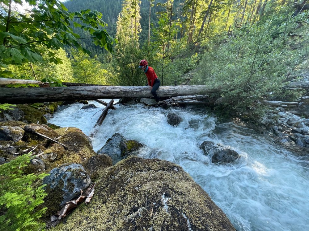
One thing to maybe note is on our way in the 1st crossing 1.5 miles in from the trailhead was fine. But by 5pm on our way out it was raging and not crossable. We went about 500ft downstream to where there are a handful of fallen logs that are over half the stream where its split into 2 steams. We dropped some branches between 2 rocks that otherwise would have been a jump across, then au chevalled another log. If the water was raging on the way in the au cheval would work fine but if those branches we dropped are swept away that could be a bitch to figure out how to get across.
-
I'd say snow started consistent a bit higher like 4200ish in the trees. No postholing and we didn't punch through any bridges. Once you get out of the trees in the upper slopes the snow is probably 3-4 feet deep still. Biggest issue are how high the streams are running. The normal crossings are covered and even the one 500ft upstream on Terror Creek the normal log was a waterfall. Still found 2 smaller logs to zig zag across.
-
 1
1
-
-
We did that Eiley Wiley Ridge in and out last year to Challenger. As much as I'd like to pull out the good camera gear and do the fantastic milky way shots I'm seeing more and more. After an approach like that I just want to sleep.
-
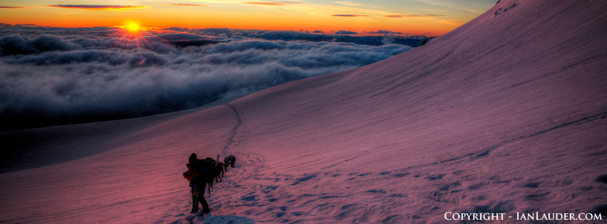
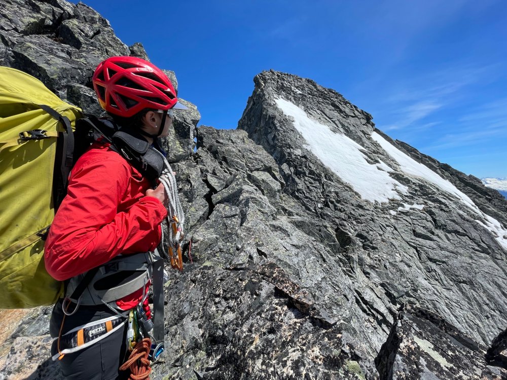
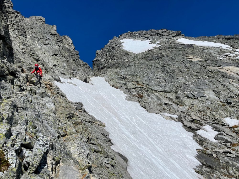
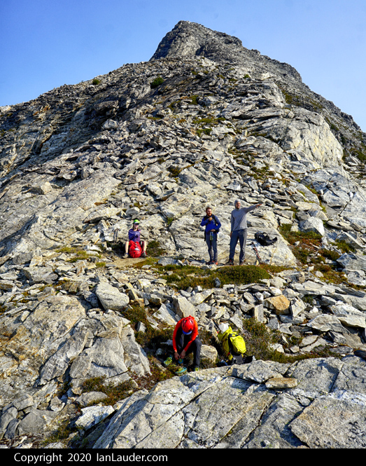
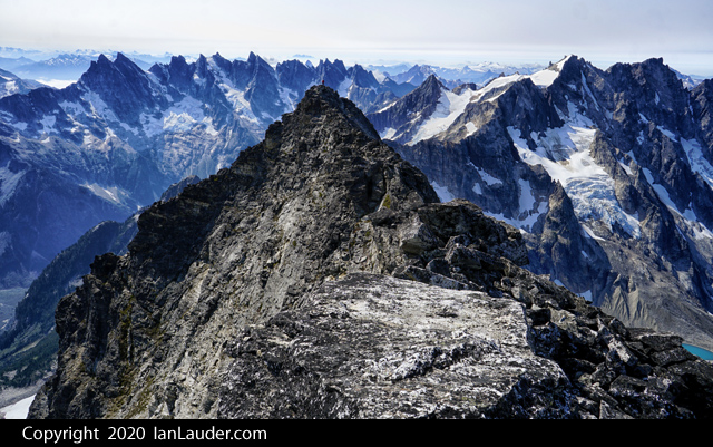
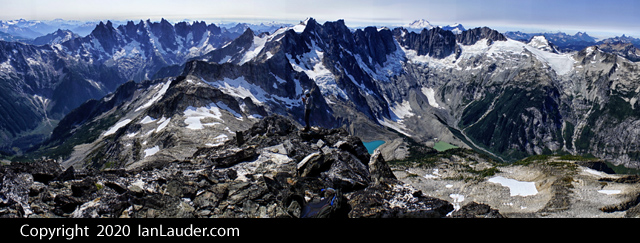
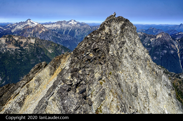
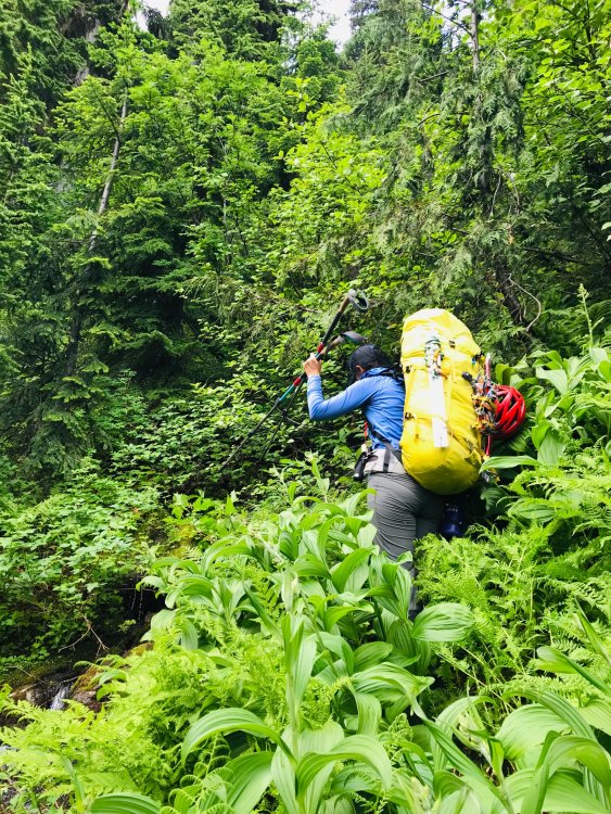
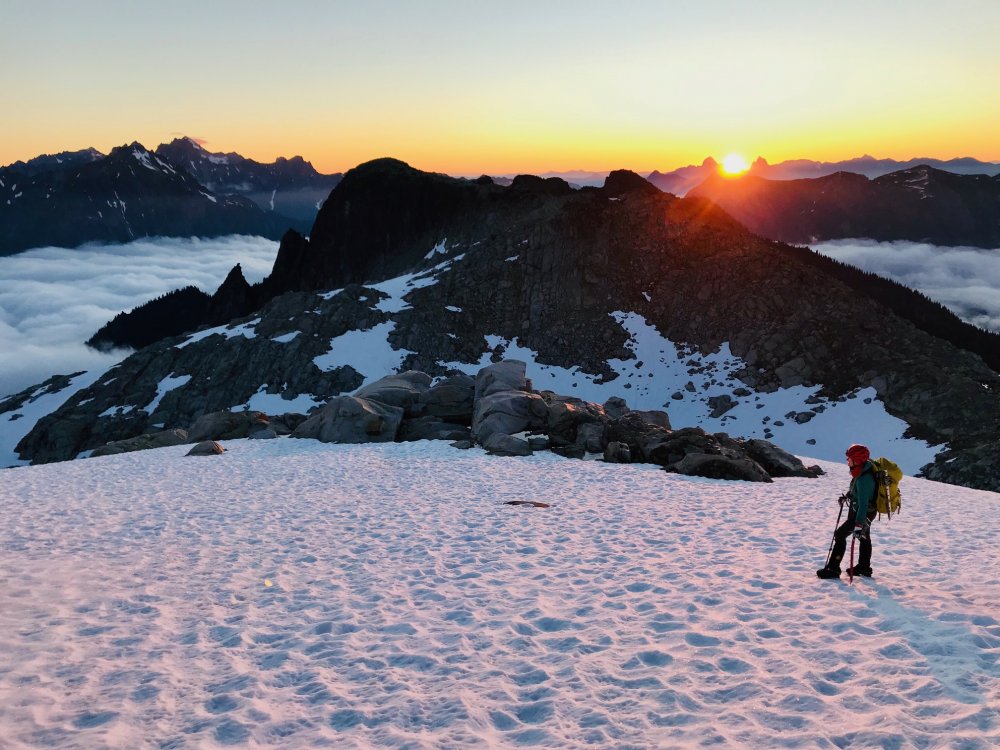
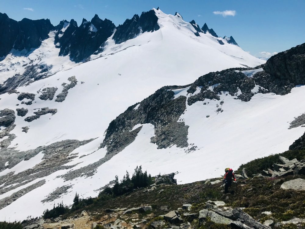
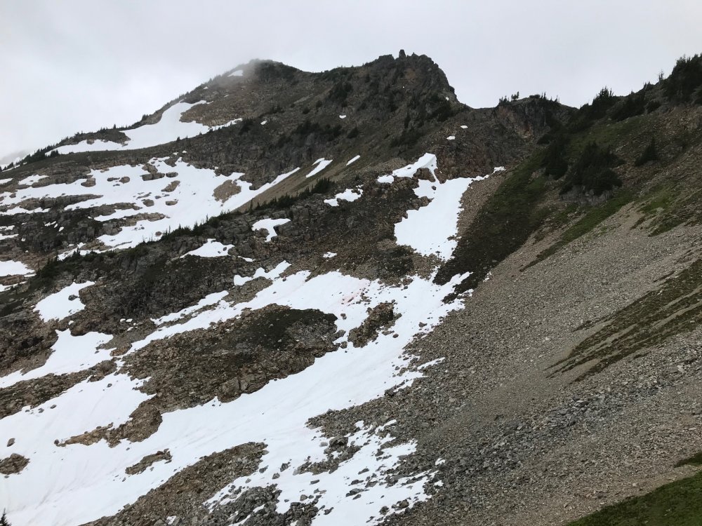
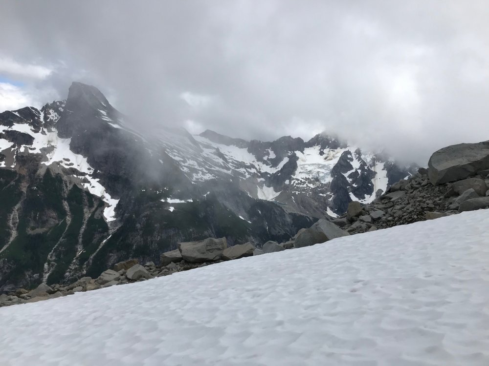
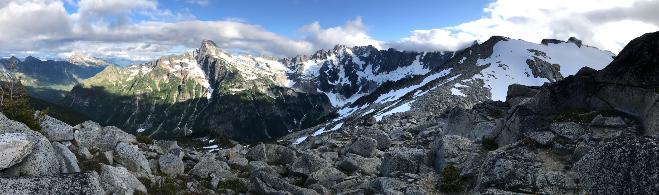
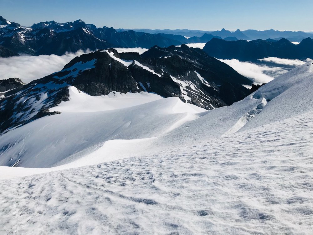
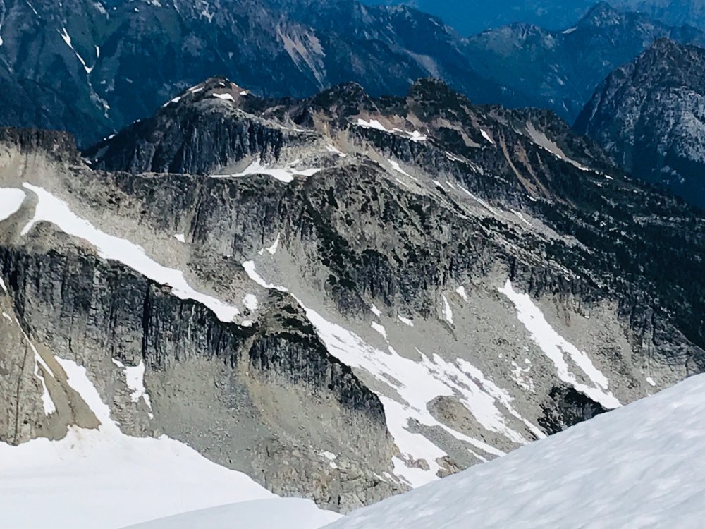
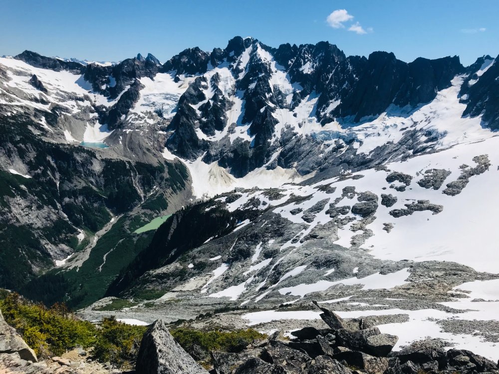
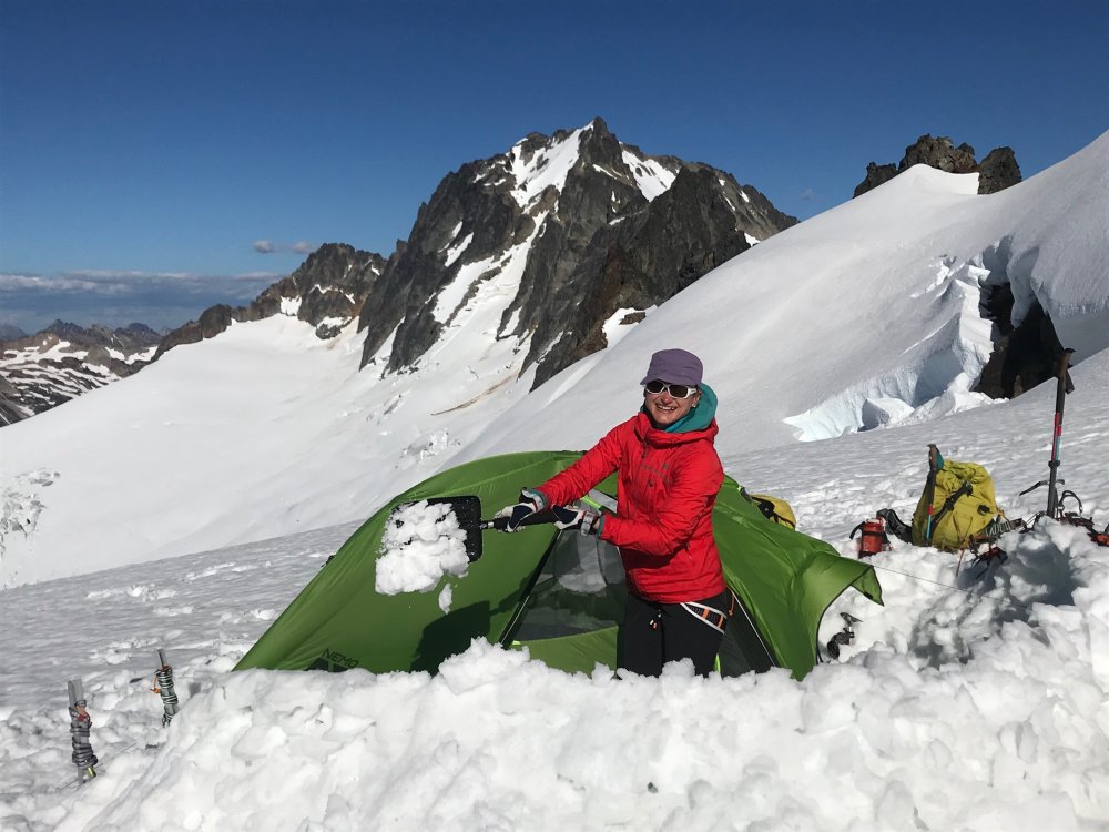
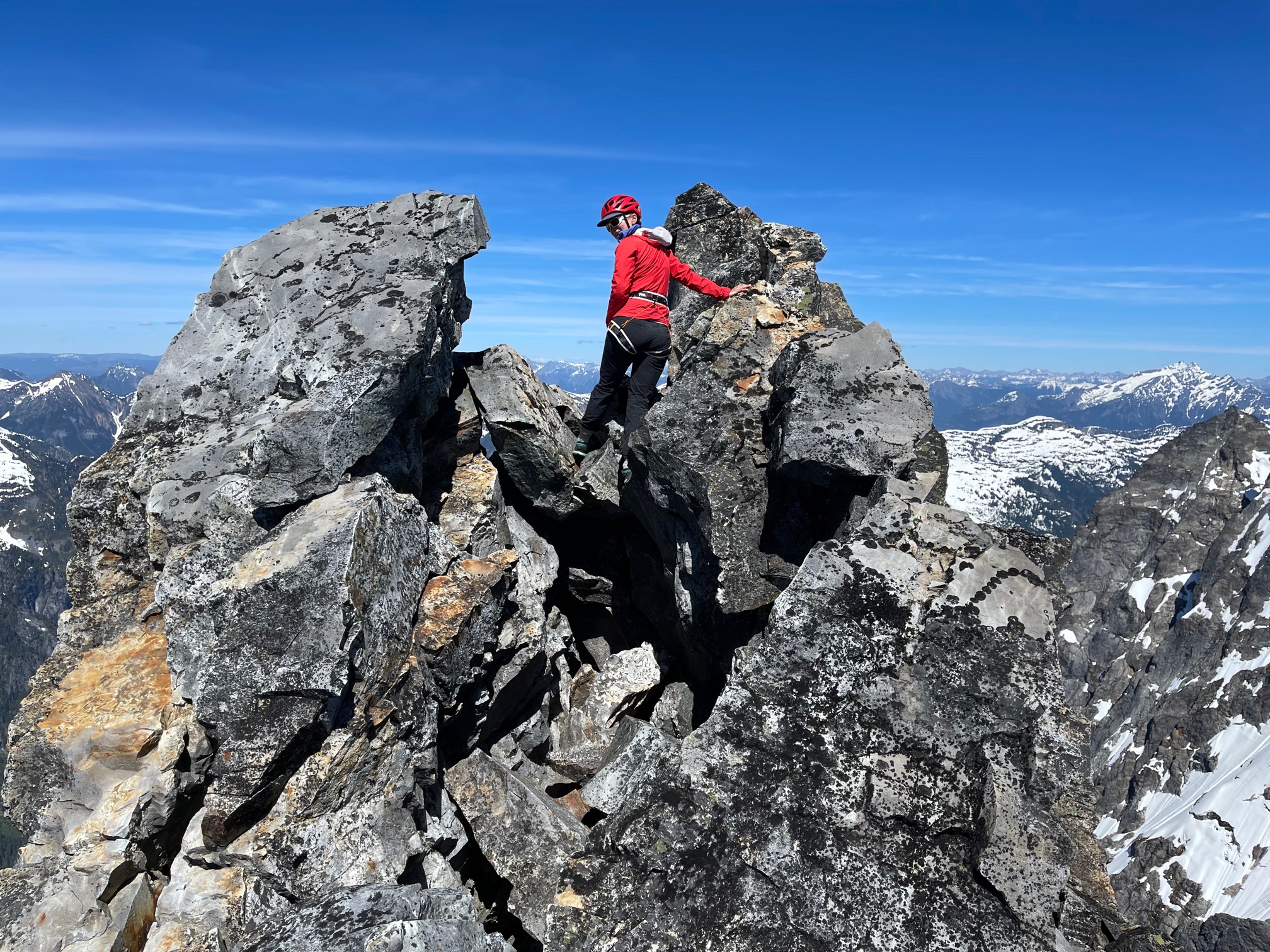
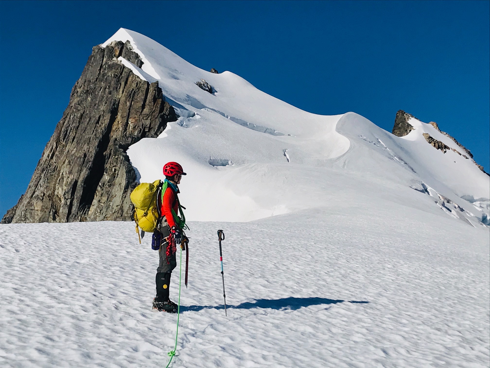
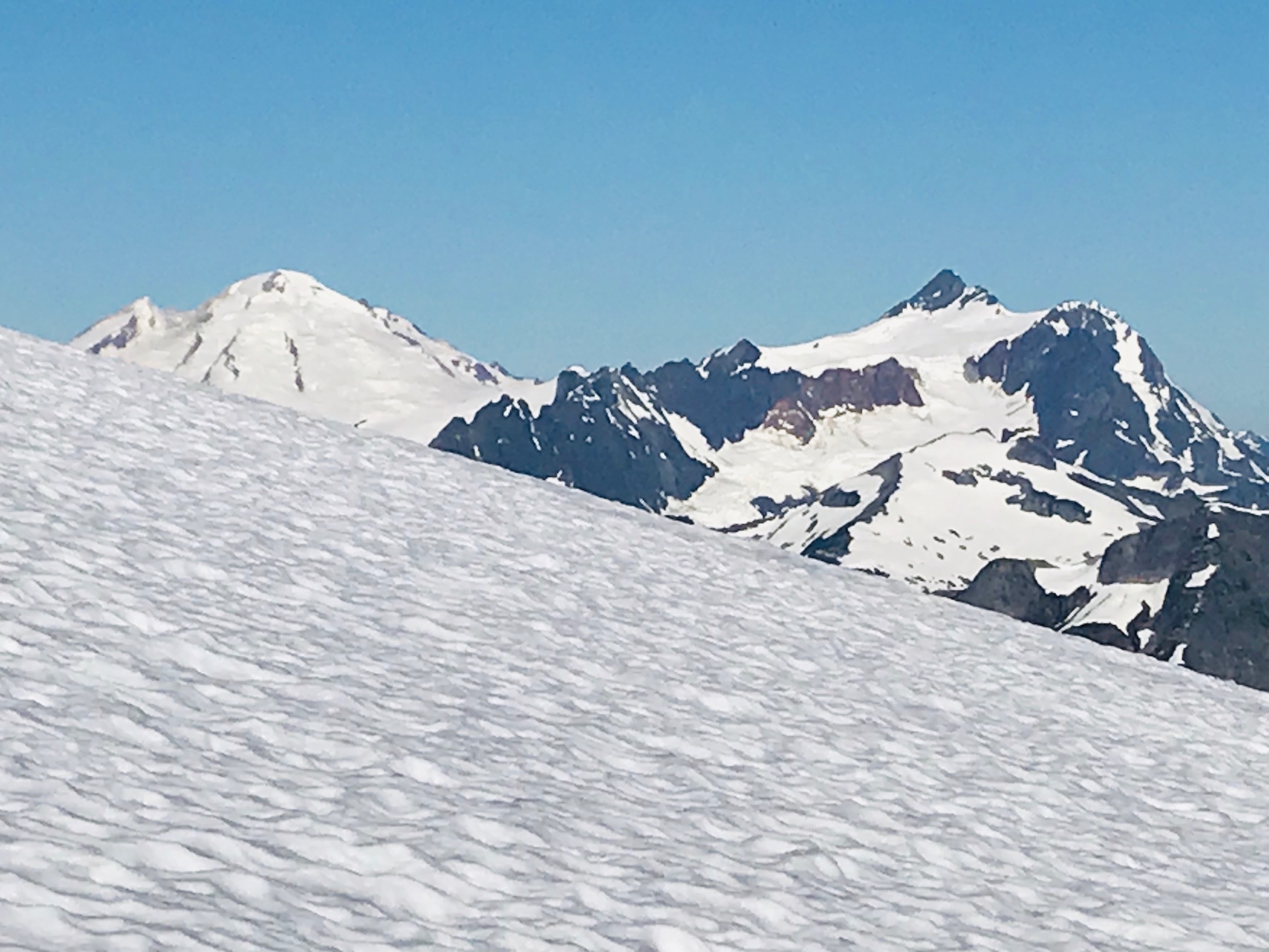
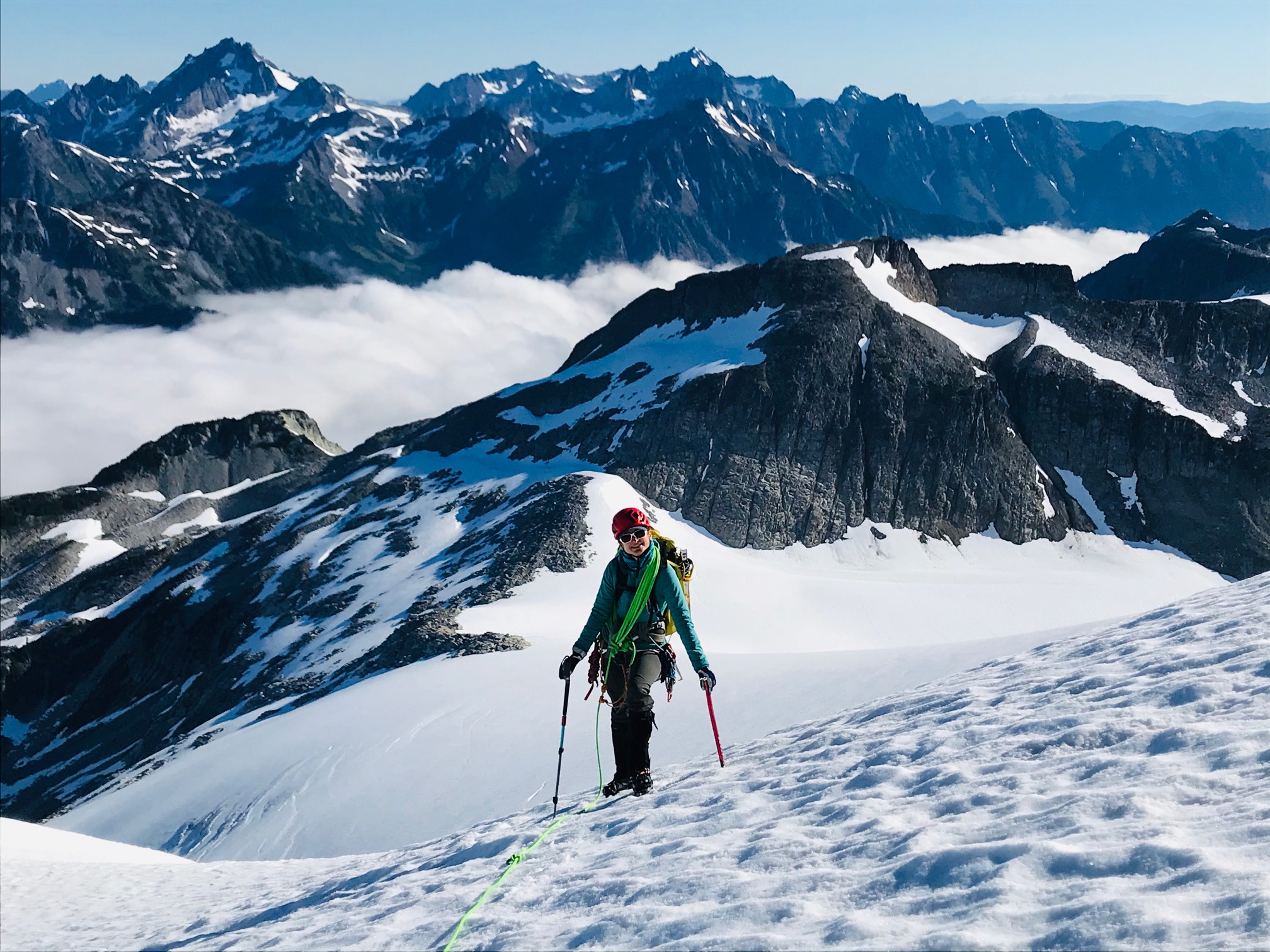
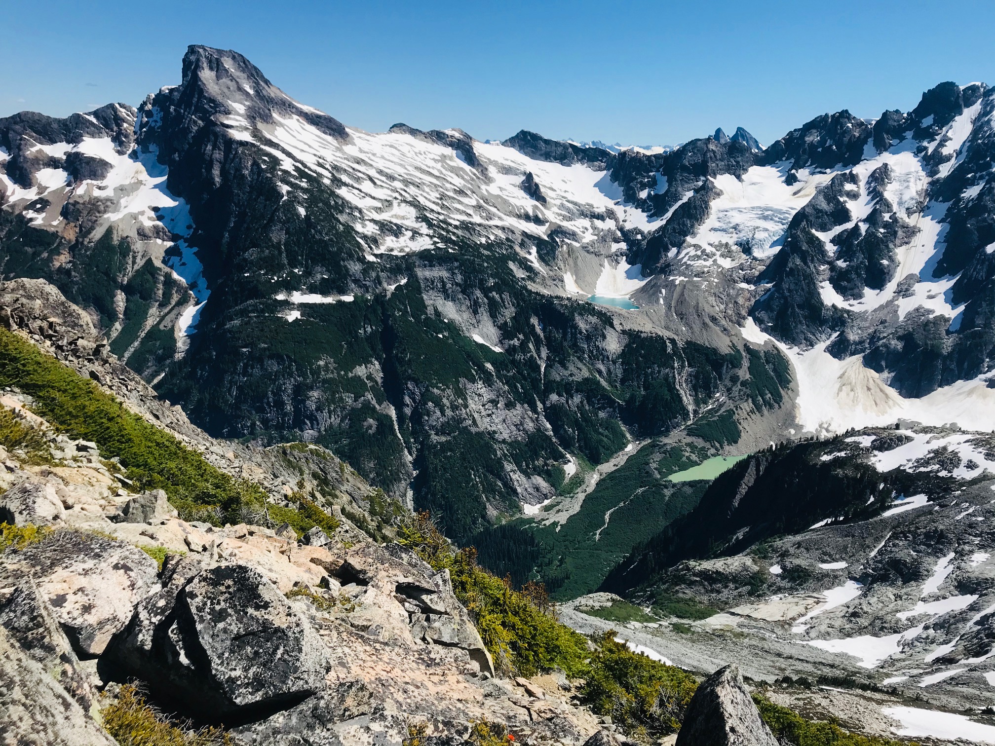
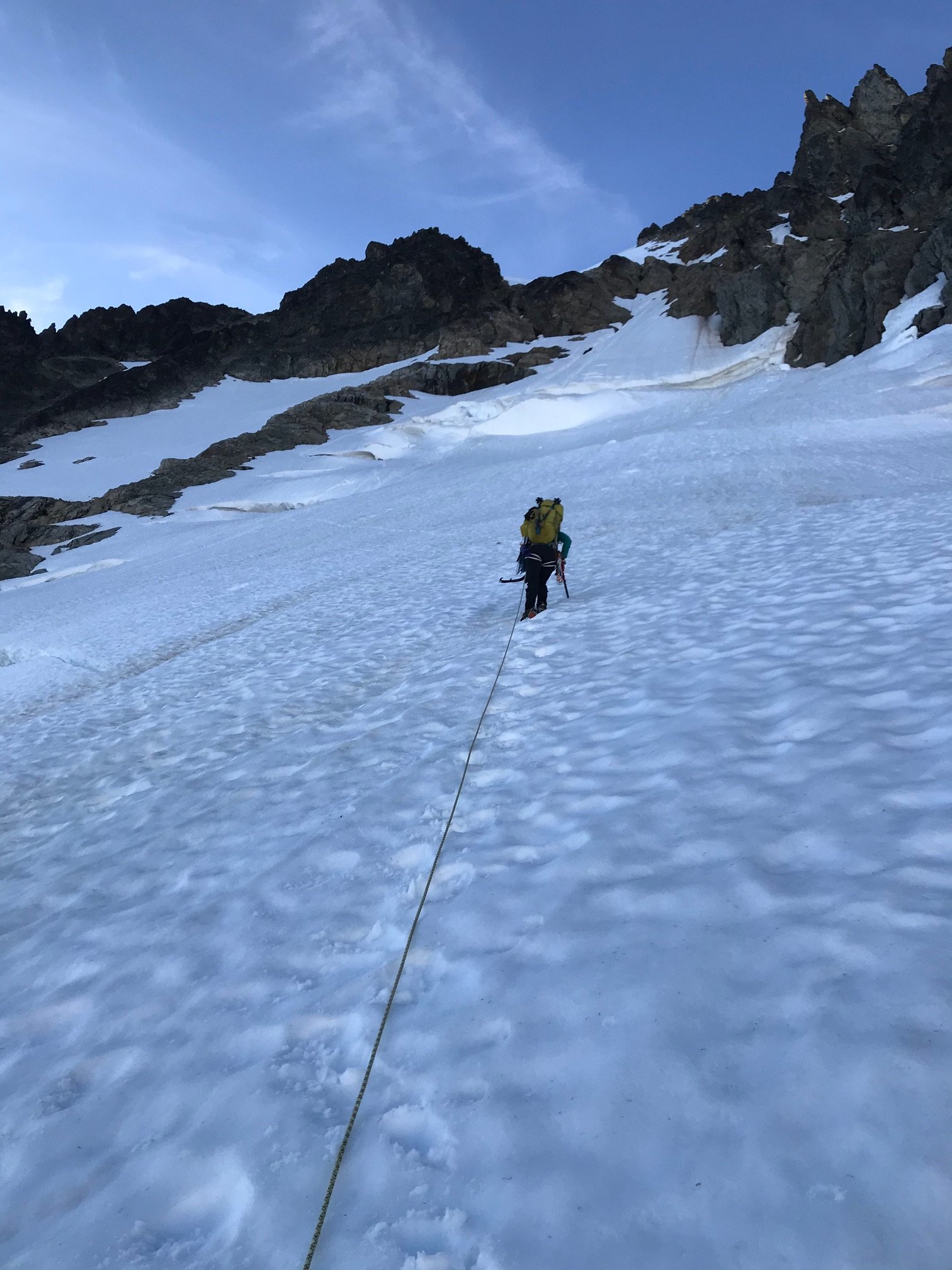
Trip: Mount Terror - West Ridge
Trip Date: 06/20/2021
Trip Report:YouTube video: https://youtu.be/xpHcQ5-uq5g
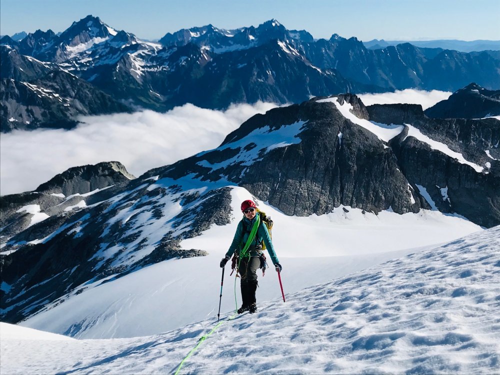
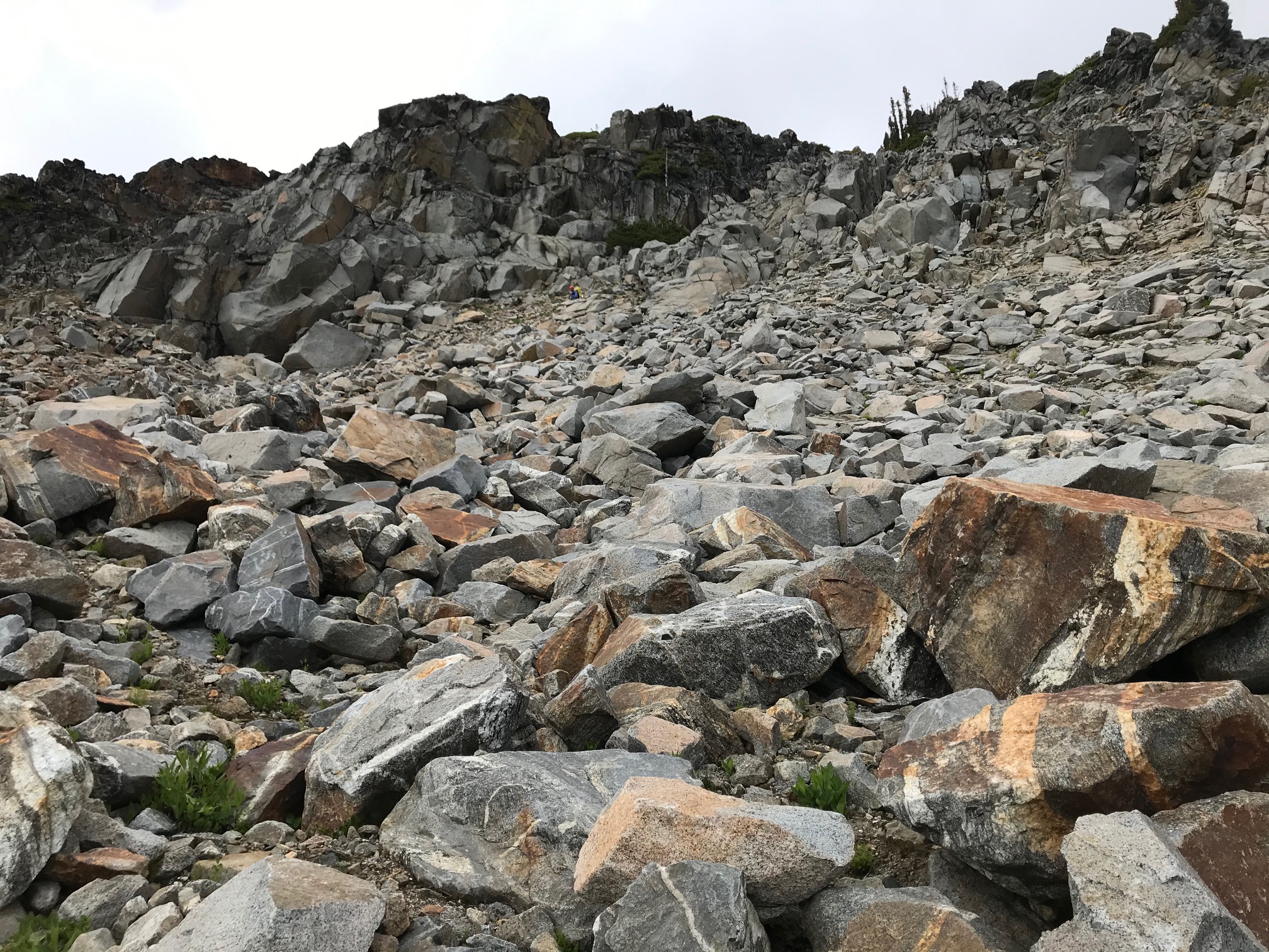
3 day trip, early season. Crux of the trip were the raging stream crossings. Getting in during the morning was okay. But had to work to find a crossing on the way back with the streams rising. Went aways downstream on the last crossing and hopped a big rock to an island then climbed up to a pair of fallen logs and au chevaled one to get across.
We saw more bear crap on the trail this trip than the last 10 years combined. Literally about every couple hundred feet was a pile of bear poo. Heard some crashing through the brush on the way out pretty close to the trailhead. The poo thinned out once we got to Terror Creek but still saw some up on the climbers trail on the ridge.
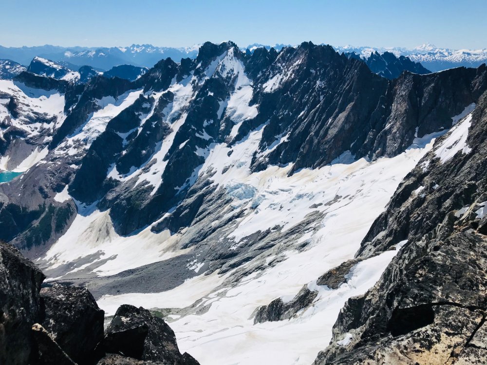
Other than that its tough to follow the climbers trail in without constantly losing it. If you lose it don't venture too far, find it as soon as possible. From Terror creek it was almost 4000ft gain before we saw any running water for as much snow as there is up there.
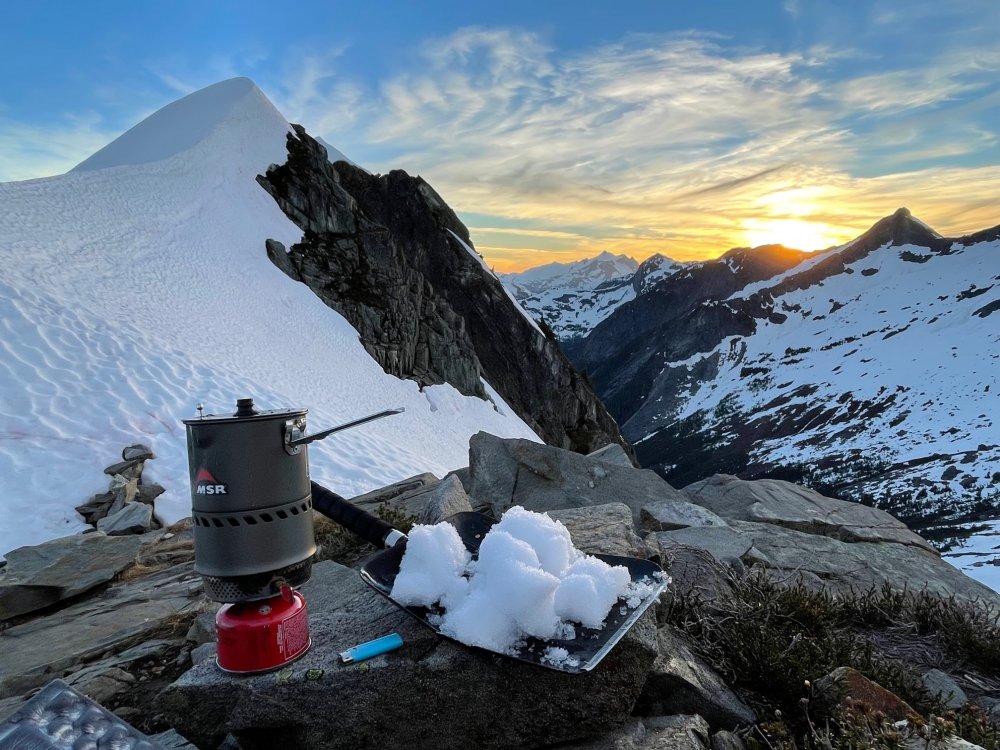
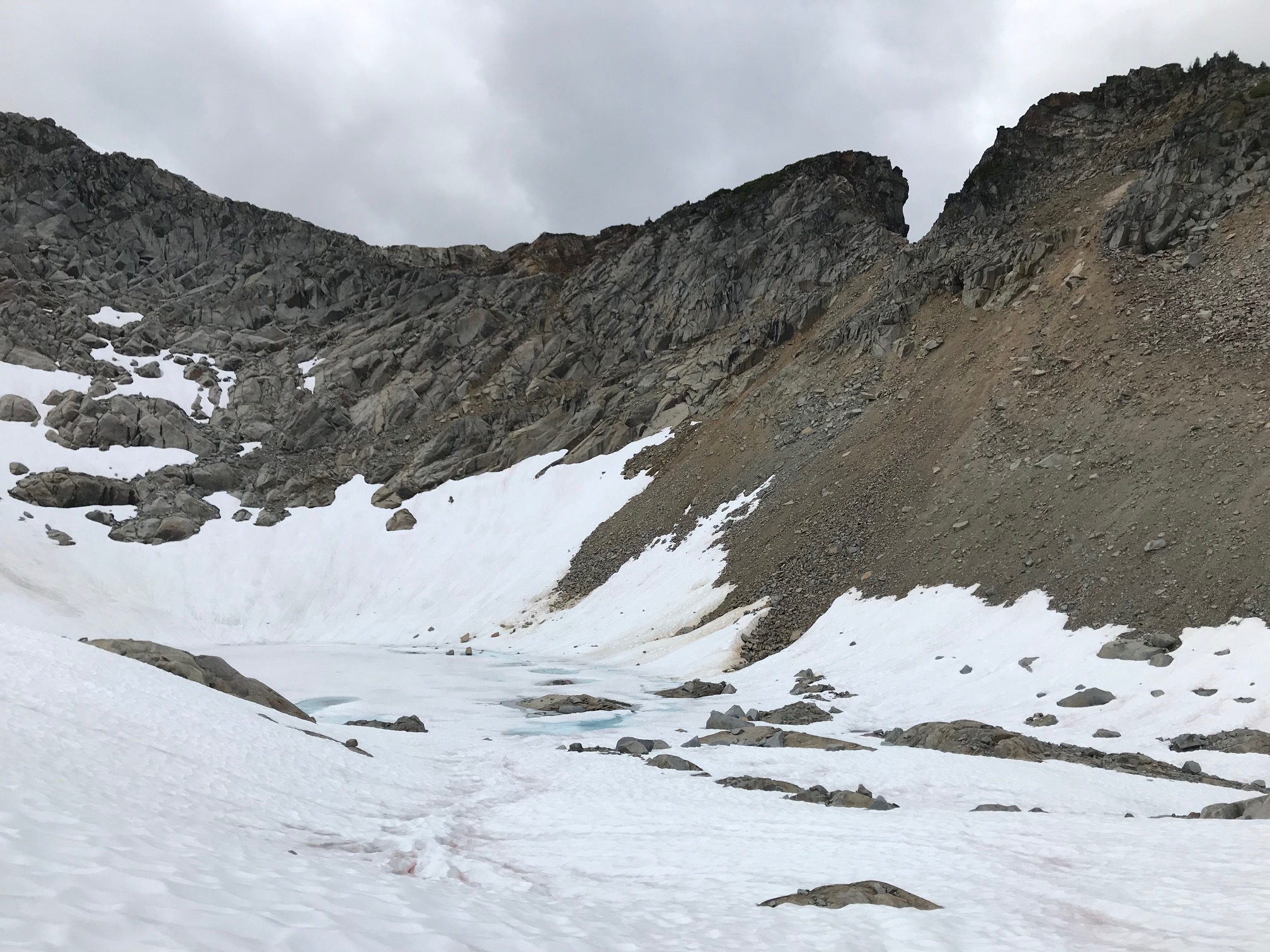
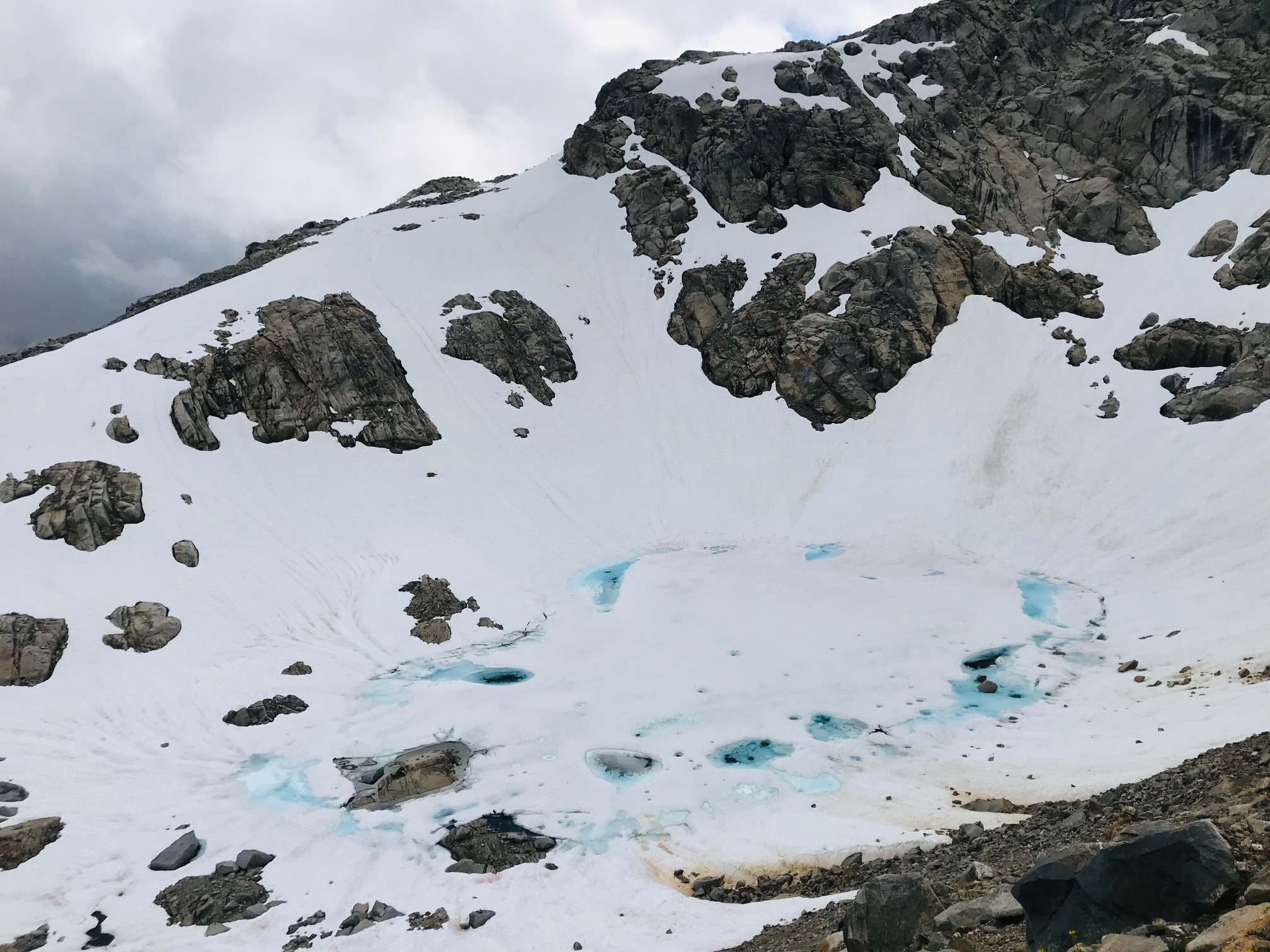
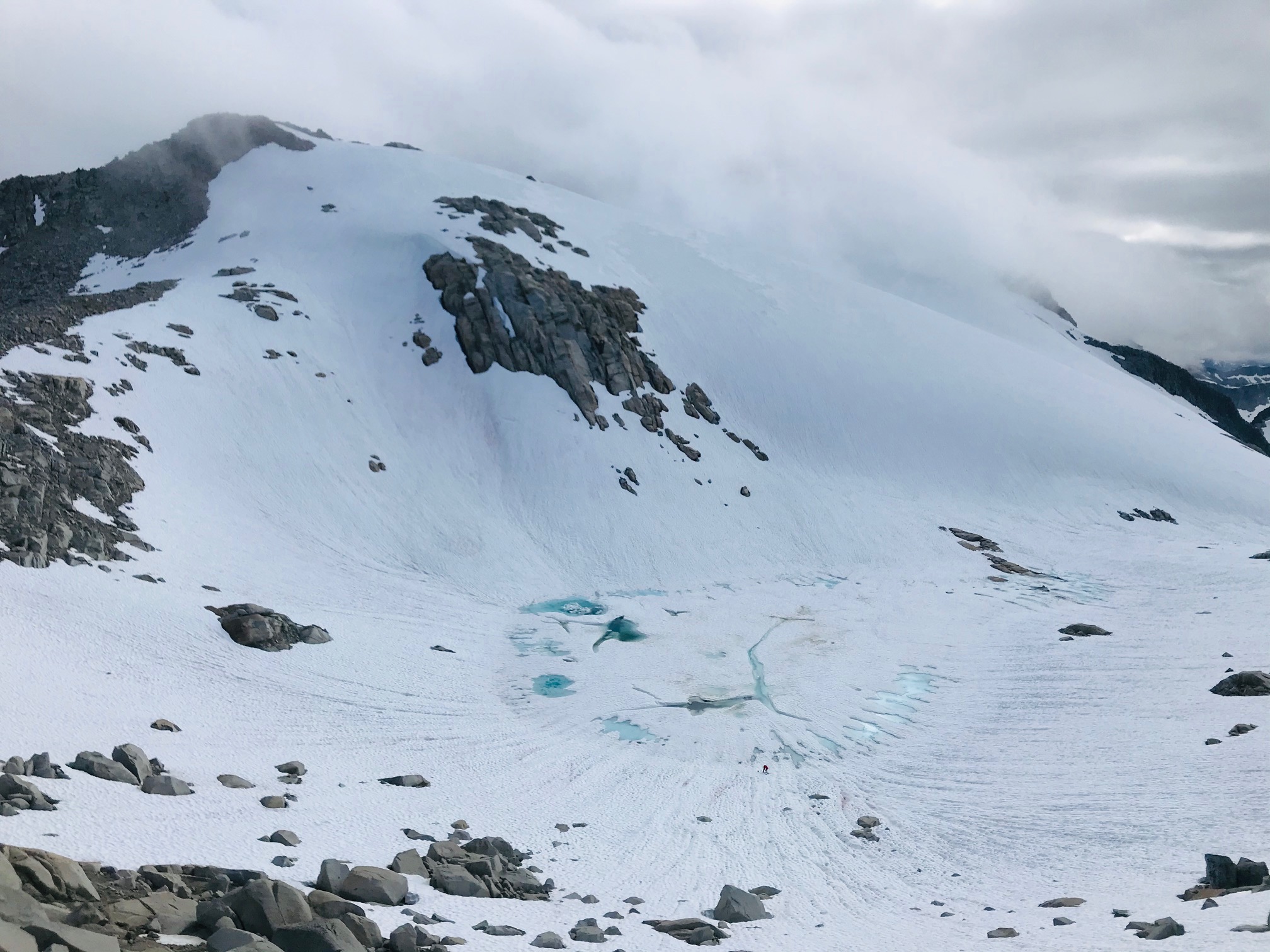
The campsite at the col is under a giant 10ft mound of snow with just the edge visible. We carved out a tent platform in a whiteout just next to the rocks of the ridge.
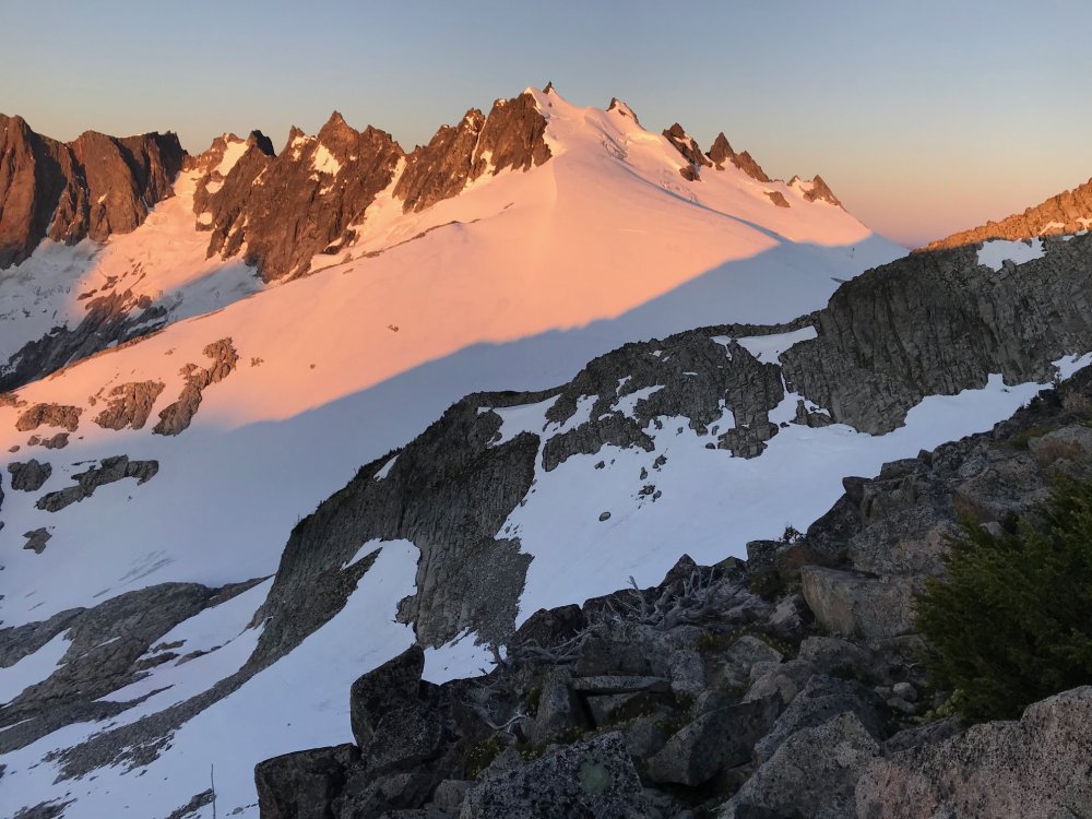
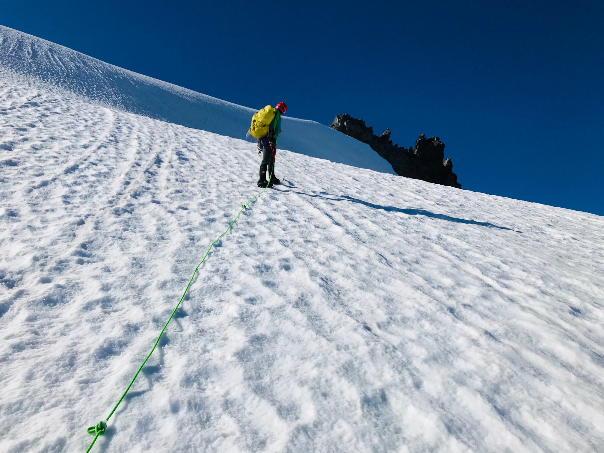
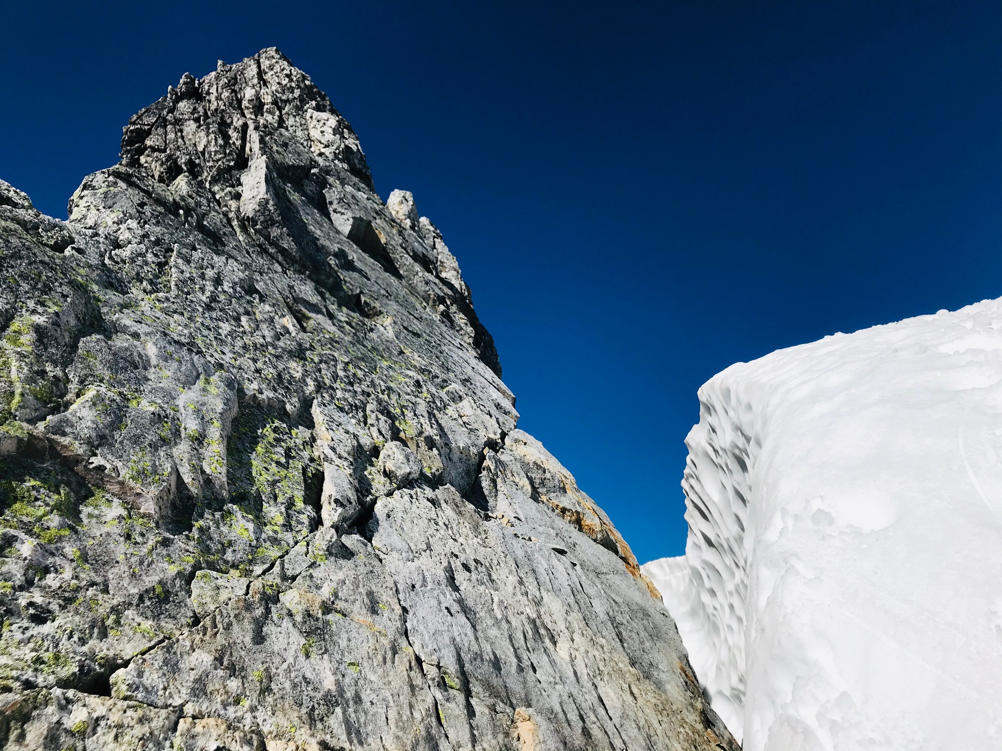
Next morning had great weather and snow all the way from camp to within 10ft of the notch up the gully. Great conditions going up, didn't rope up, no moats forming yet. Then a short steep snow section up to the base of the rock climb.
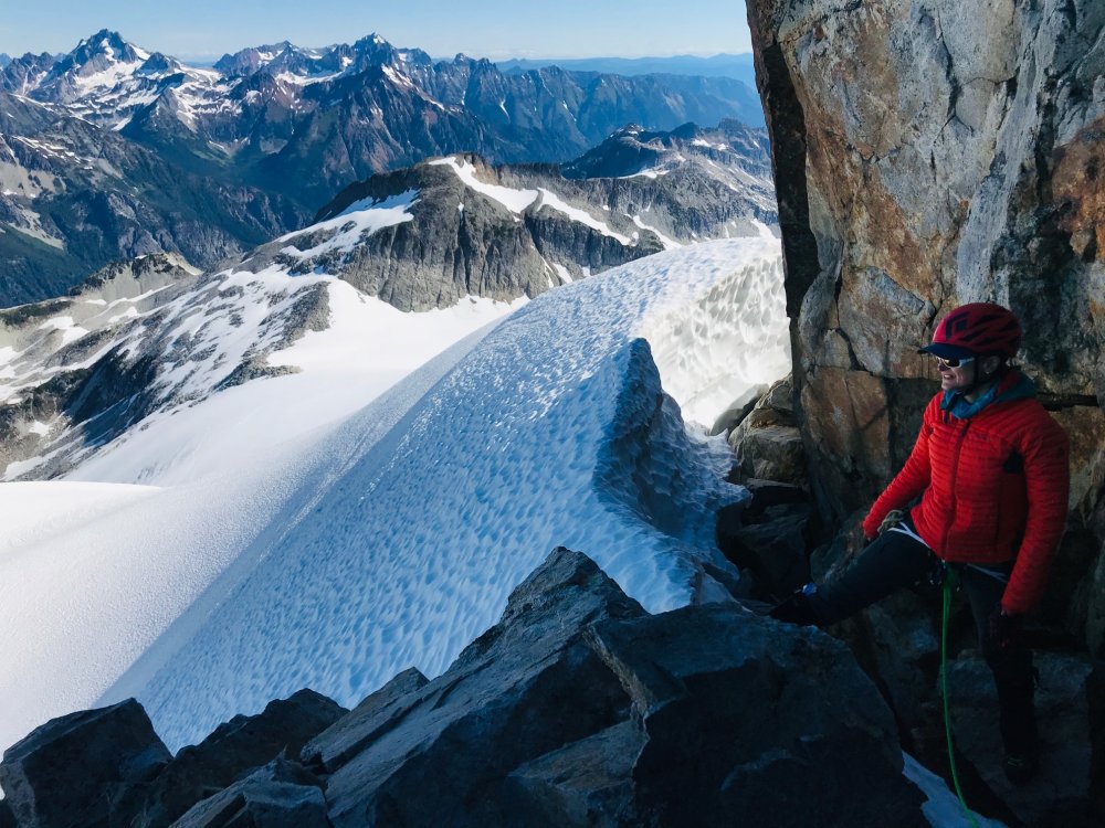
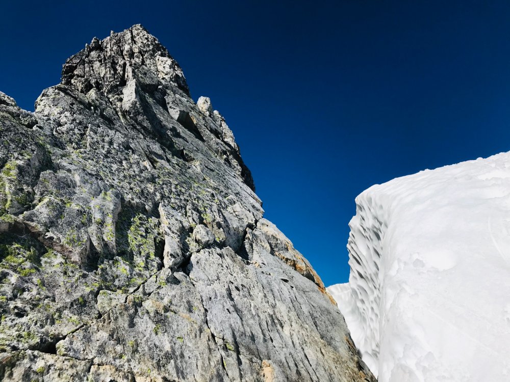
Not sure why there are reports of 2 pitches of low 5th class. We did a 30 meter pitch of low 5th then it was easy scrambling from there.
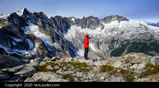
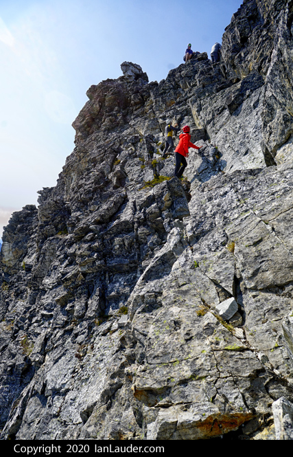
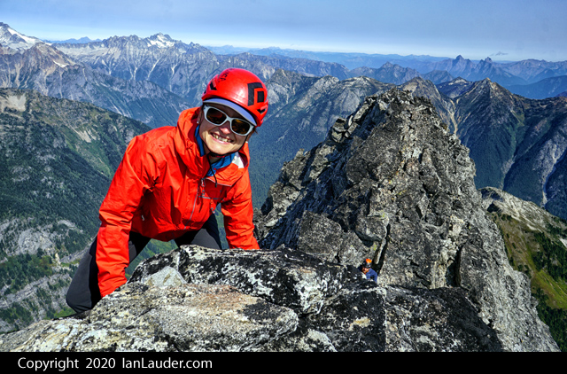
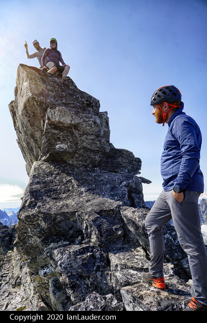
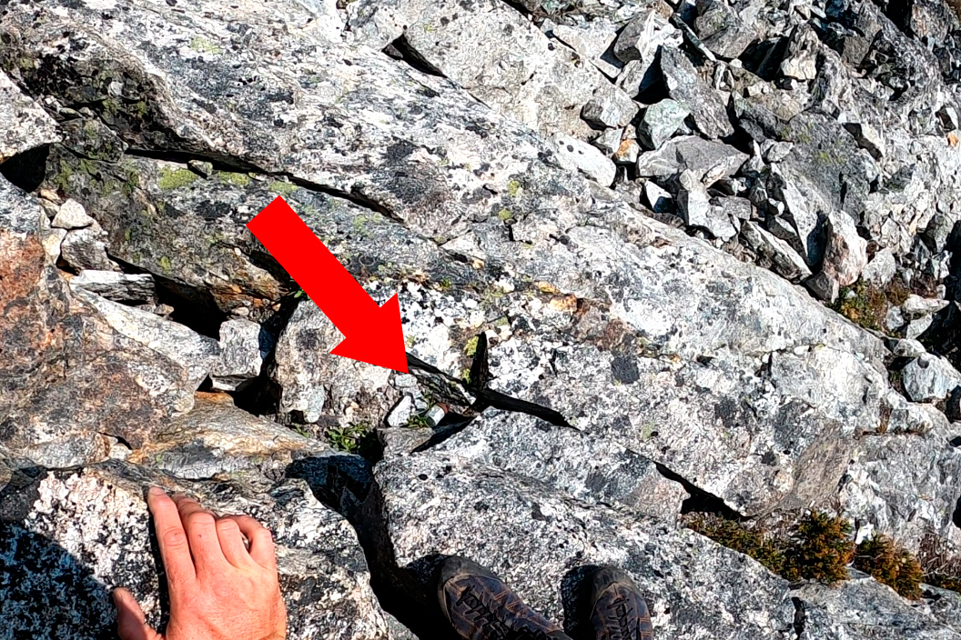
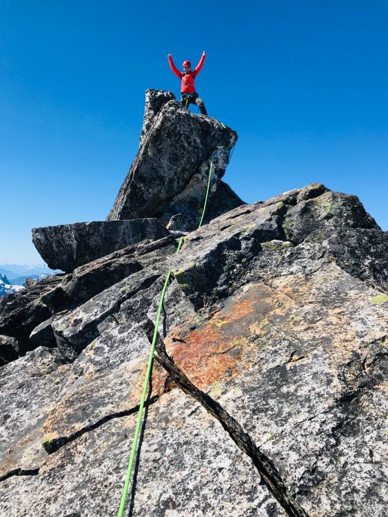
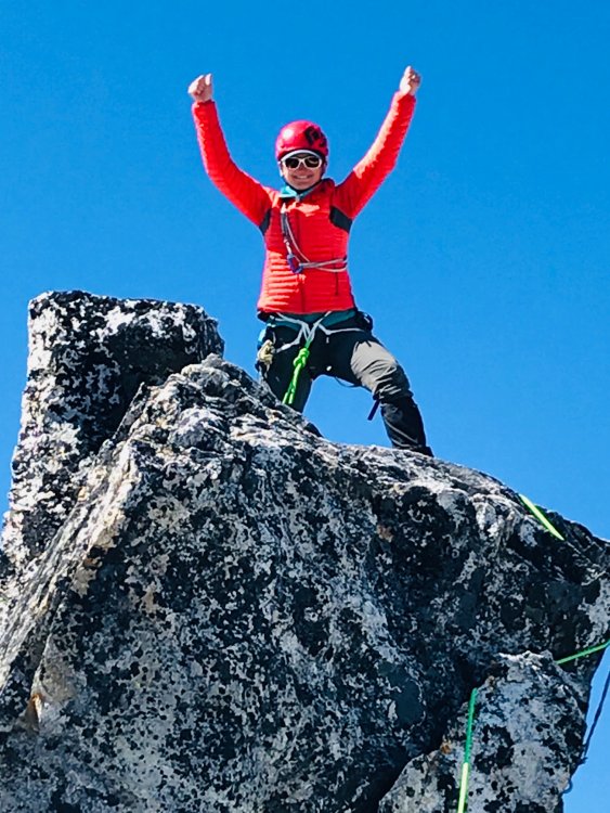
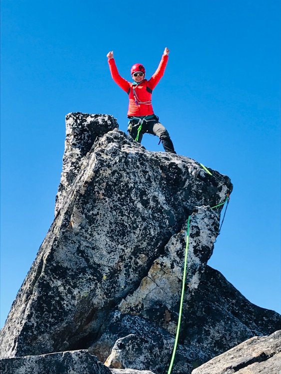
We went to the false summit first (in hindsight should have gone into the right gully below the face further down. This meant a 4th class downclimb a hundred feet or so. There were some rap slings but we just downclimbed. It looked intimidating from further back but once on the left side of the face it was great 3rd class (some have said 4th class) scrambling with solid rock. Steep enough we did 3 rappels back down from existing slings. The rap stations were all looking pretty ratty so we left behind a couple slings to back them up. The step across to the true summit is exposed but easy on solid rock.The summit register is in a crack right at the summit block. If you step up to the summit block, look down and its in a little white PVC tube in a crack.
The snow coming down the gully was a couple inches of soft mush over hardpack and we had to facein downclimb about 2/3 of it.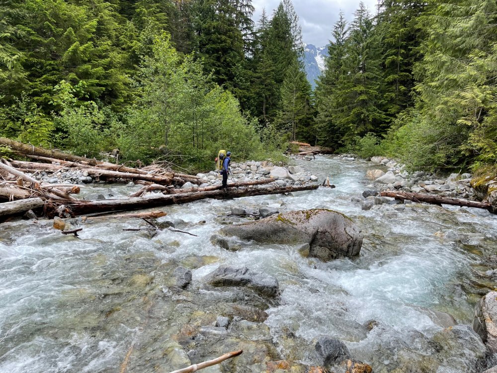


Gear Notes:
60m skinny rope, light rack to #1, a few small nuts, ice axe, crampons
Approach Notes:
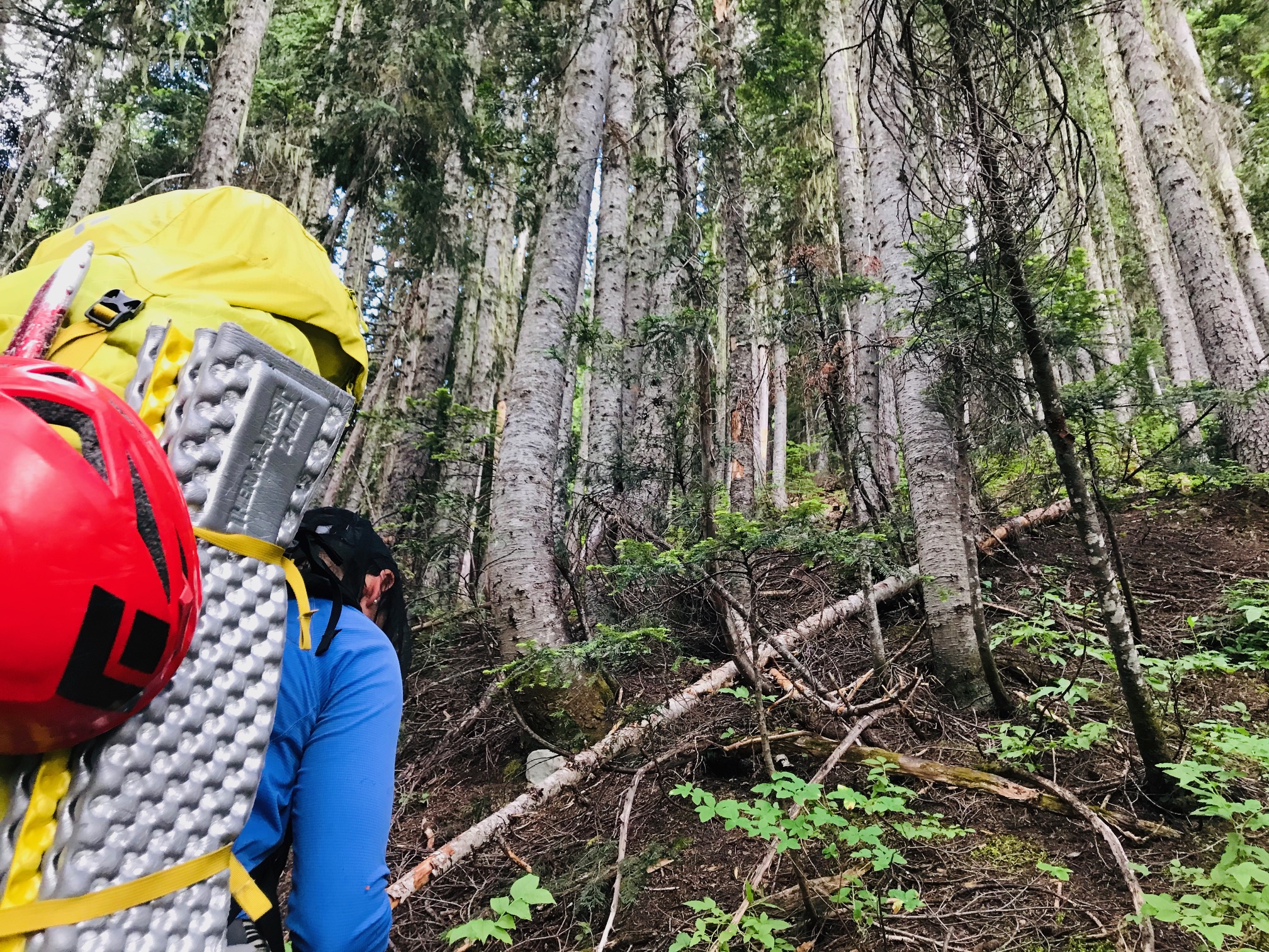
Its the Pickets, it sucks. Like the TR before us. If you loose the climbers trail, find it. Crux of the trip were the raging stream crossings.-
 1
1
-
 1
1
-
1
-
-
There weren't any other entries in the register after yours for 2020. We just signed it a couple days ago. FYI, the little PVC tube is soaking wet inside. Good thing its waterproof paper.
-
That was a great trip. We did it the weekend before you. Fun ridge weaving through the cornices.
-
18 minutes ago, Rad said:
You're on a roll. Even a partial southern Picket traverse - say West Mac to Inspiration to Degenhart - would be spectacular.
We've done West Mac a couple times. I think I overheard my wife mention something about wanting to traverse over there. She does most of the planning and I just try to keep up.
-
5 minutes ago, Rad said:
Sounds great. Other amazing adventures await you out there if you have a taste for Pickets suffering. Enjoy!
LOL, yea, we did the Eiley Wiley ridge route in and out for Challenger last month. Got a taste of that already. Next trip there next season we may shoot for both Furys. We've planned a full traverse multiple times last year but weather kept us out every time.
-
12 minutes ago, Rad said:
Amazing report! I've never been up Luna cirque at all much less headed to that peak. Gotta get there. How would you say late season is versus when there's more snow?
So you never saw the couple? Hope they are OK.
Everyone gets to decide what success means to them. It's part of the fun of climbing.
Thanks for posting!
Only our 2nd trip into the Northern Pickets so I couldn't speak to early season vs late. But the travel was relatively easy considering other late season approaches we've done where we would want snow. We could have just missed someone along the way who may have camped off the trail, but we didn't come across any other pairs on the way in and when we asked the pair was saw it wasn't them. So who knows, and that's just the word from one of the resort boat drivers. And I'm counting "success" in this context against hitting the high point where the summit register is if you are logging them on Peakbagger or something like that.
-
5 minutes ago, JasonG said:
Thanks for the details! Busy is the new normal on Luna, it seems.
No kidding, must have been 4 parties trying to camp at Luna col as we were heading back down to Access Creek basin. One guy out on Fury and us and that other pair going down. Not sure how many people try for the true summit though, didn't see much in the way of a lot of recent entries in the summit register. Looks like most people stop at the false summit. Not sure if that counts as a "success" though. If you just want the views though, that's all you need.
-
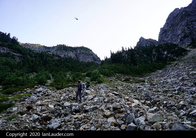
15 minutes ago, JasonG said:
Watched the helo Saturday night and was wondering what was going on since it seemed to take a couple hours to do the extraction. Glad that it sounded non-life threatening.
Nice work on the summit, Luna is a haul!
Thanks, we've had quite a few long hauls the last month or so (Luna, Logan, Bacon, Challenger, Fortress/Chiwawa). They pulled 2 guys out one at a time (father/son duo), and they flew in and out a couple times beforehand presumably scoping out how they wanted to do it. We stopped and chatted with them before the heli came and they were in good shape otherwise and didn't need any other help. Luna I think was one of the easier and more relaxed trips we've done lately.
-
Trip: Luna Peak - Standard Route - True Summit
Trip Date: 09/05/2020
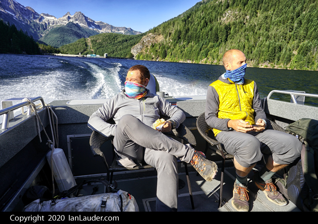
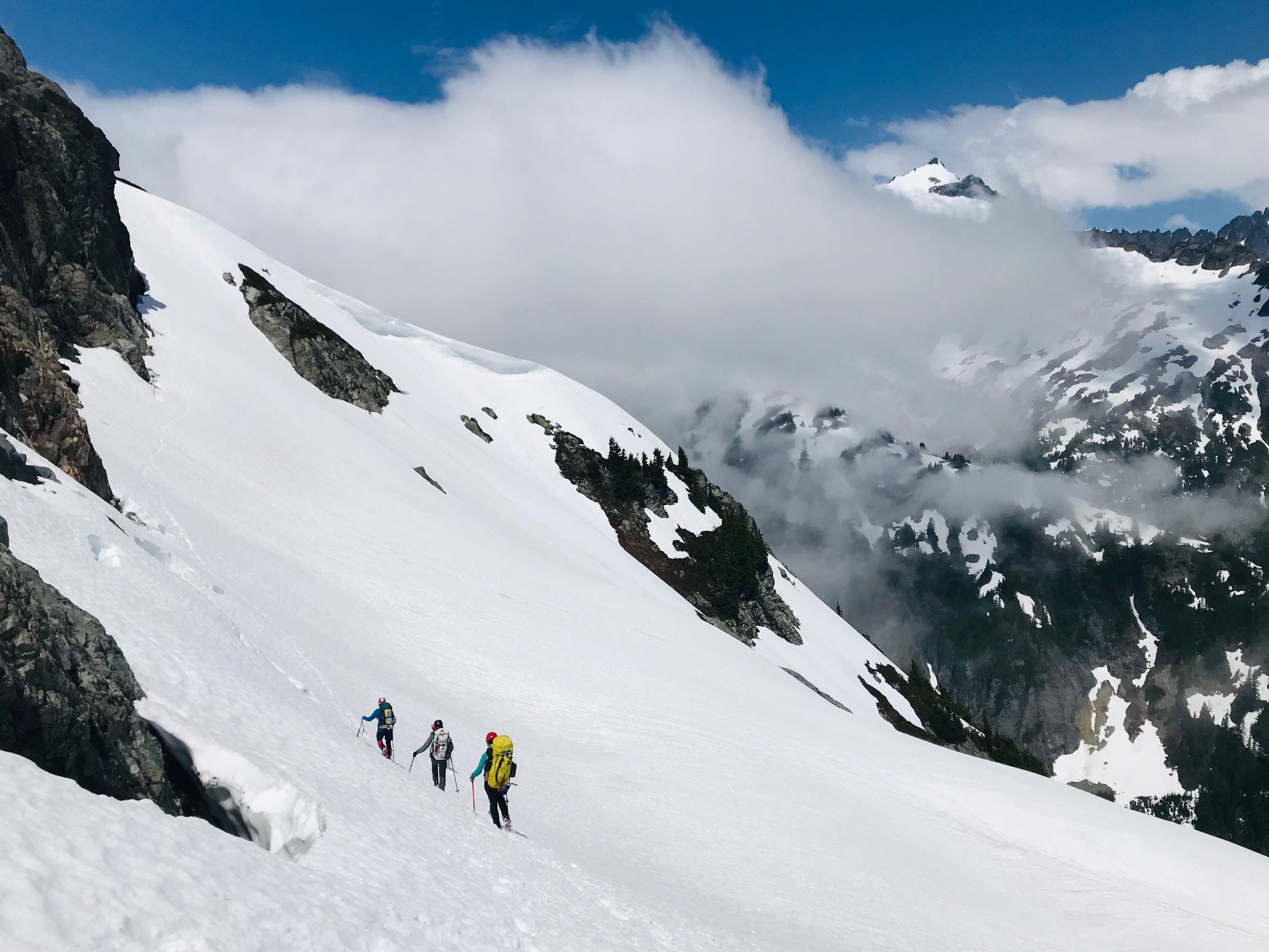
Trip Report:With it being Labor Day weekend, we sent someone ahead the night before to get a ticket at the ranger station for the next morning since we had a 9am boat taxi scheduled on Friday. Luckily, we got our permit within a half hour or so of them opening and got to the boat pickup on time.
With pleasant weather we made quick work of the first 10 miles to the Luna Camp signpost. Sitting around taking a lunch break a solo guy came by on his way to do Fury. A couple people in our party had thought the Luna signpost was for a trail split to where you head off to Luna and told the guy he was taking the wrong path. He seemed to have that response that sounds like he knew where he was going and was wondering if we knew where we were going. A couple people had gps tracks though that did show someone went to Luna from the Luna Camp split. Never caught up to him to say sorry about that. We did eventually spot him just topping out on Fury as we were on top of Luna the next day.
One mile later we got to the cairn that marked the spot to head up to Luna Peak. There really isn’t any kind of trail to follow so unless you know just where to find the log crossings it could get really tricky getting through the first mile. The boat driver mentioned he had dropped of a couple the day before who had gotten lost the week before trying to get to Luna who were trying it again. But we never ran across a couple ahead of us all the way to Luna so not sure where they went. We all wondered if there was a couple still lost in the brush somewhere on their 2nd try.
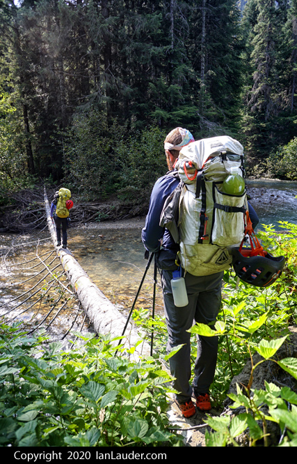
We found the log crossing we were aiming for without any problem and found climbers trail on and off the rest of the way into the basin. We found a lot more of the trail on the way out but still managed to do a fair amount of bushwhacking both ways. Took us about 7.5 hours to do the 15 miles into Access Creek basin where we setup camp. Figured shooting for Luna Col would have had us there in the dark so Access Creek was a good spot to stop with views of Luna and the boulder field we needed to go up in the morning.
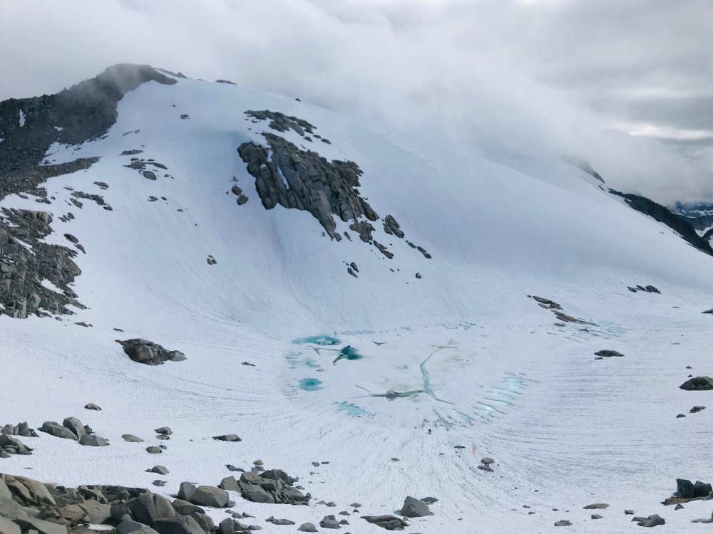
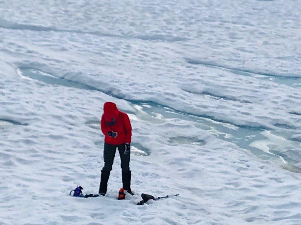
Next morning, we took off up the narrow rocky gully, but going wider right and up and then across through the trees works too (probably a bit easier too). Knocked out the first 2000ft gain then rounded the corner for the first view of the col and Luna. Another easy 1000ft up to the col put us at the base of Luna Peak in just a few hours.
Just a bit up the scramble to the false summit we past a pair of climbers coming back who had stopped at the false summit.
Another hour (about 4 hours from camp) put us at the false summit where the fun really starts. Beta we had said you could run the entire ridge (harder) or take ledges across but requires a bit of a 4th class downclimb. After shimmying down most of the chimney the last move or two just felt too sketchy with the drop-off into nothing below and it feels like there were not solid holds for the amount of exposure. So, we split the difference and ran the first 30 feet of the ridge which is exposed but felt more solid and that took us to a ramp down to the ledges. Once there it was easy scrambling across picking our way across then switch backing at the end to get under the summit block. Once under the summit block, we wrapped around the backside and found a few easy moves up to the summit block.
Just as most of our party were down to the ledges a group of three guys came up behind us who were pretty chill about hanging out waiting for us to get over and back since they were camped at the col and it was only about 11:30am.
The summit register was full, and we wound up signing the back cover. If anyone goes up anytime soon it could use a new register.
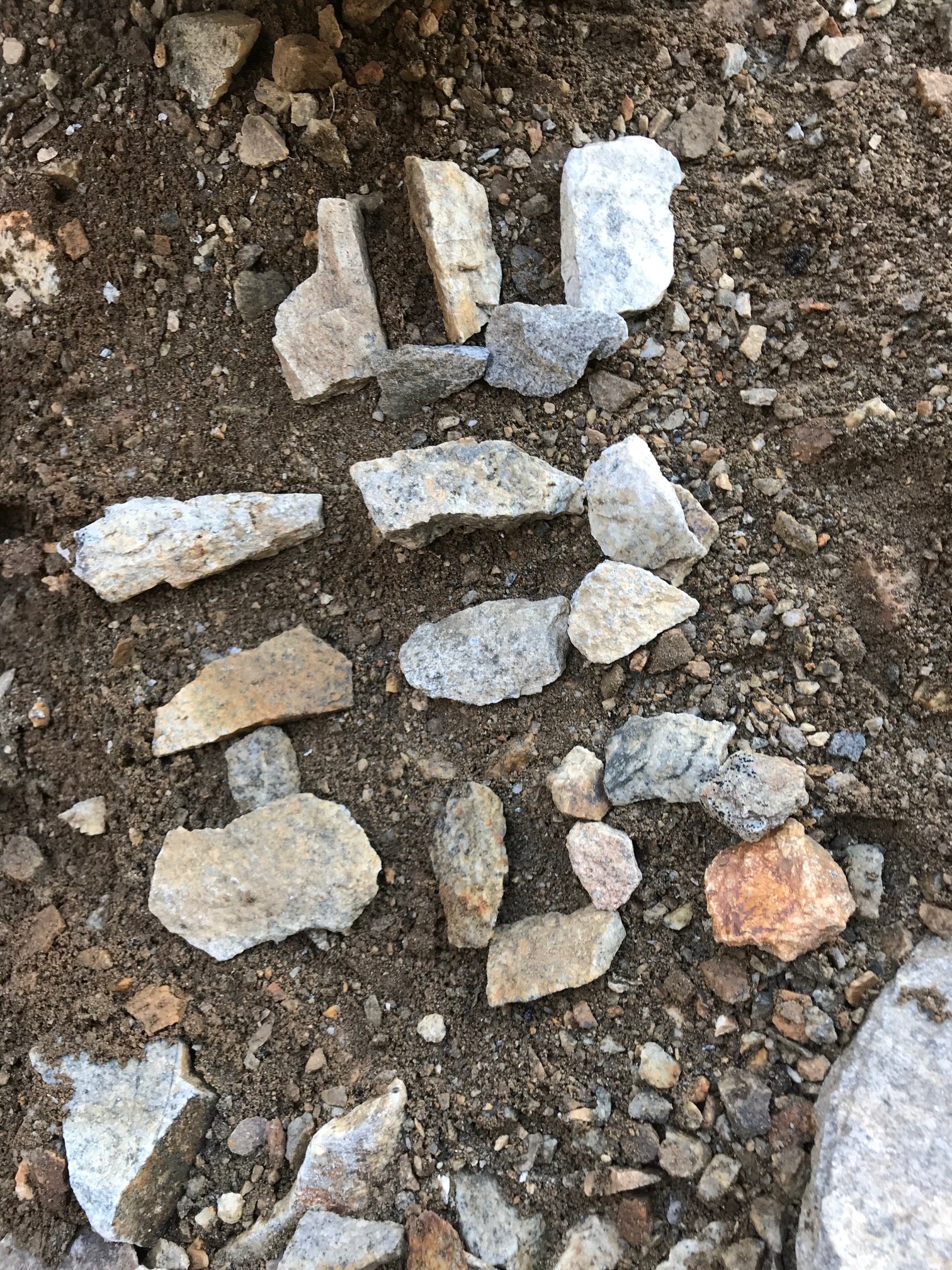
On the way down from the summit instead of heading straight over I had gone down a couple ledges and wound up finding an old rusty metal film canister. I thought there might be a film roll inside but instead there were a few loose pages of an old summit register. Most of the pages were faded too much to read or disintegrated but some were clearly dated from 1971, 77 and 78 which was a cool find. I brought the canister back out since it had been sitting there for so many decades. Not sure how long It had been dropped down on the ledges. I found a trip report from CascadeOriginals where someone had mentioned signing a register in a film canister back in 2003. Mailing it over to the Mountaineers to archive it.
On the way back everyone else retraced their steps to go back up to the ridge then to the false summit. I went up the chimney which was a little awkward but went up fine. The party of 3 waiting for us then took off for the true summit while we took a lunch break before heading back.
On the way back to the rocky gully above the basin we passed a couple trail runners who mentioned a pair in the gulley that had an accident and appeared on of them broke an ankle. On our way down we stopped by and chatted for a moment. It turned out to be the pair we had passed and chatted with a moment on the scramble up to the false summit in the morning. They had everything handled and were waiting for a heli rescue that was on the way and didn’t need anything. Props to them for getting hundreds of feet down the upper gulley to a flat area and props to SAR for pulling them out hours later.
Next morning had a leisurely hike out and found more of the climbers trail going out than we found on the way in. Still got off track a few times and took a bit of navigating to find the log crossing.
Fantastic trip overall with good weather and good company.
Gear Notes:
None
Approach Notes:
Bushwacky from the trail to Access Creek basin in places.-
2
-
1
-
-
Stout work in the rain. That was tough enough in good weather. Glad to see I had put up a useful trip report.
-
Thanks. I think since we had never done it and only read about how bad the bushwhacking can be we figured we could push through it both ways. If we had done it once before as an exit I'm sure we never would have done it this way. We have no intention of ever setting foot on Eiley Wiley ridge again. As fun and scenic as the rest of the ridge was. If anyone ever winds up there keep an eye out for a perl and gold earring Rodica lost somewhere in the brush. There's also bits and pieces of skin on the branches.
-
Right on. That's pretty much how we felt climbing through it and how we did it. Although with just a little more coverage thru that spot.
-
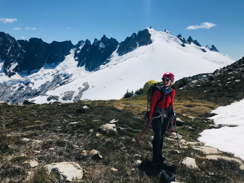
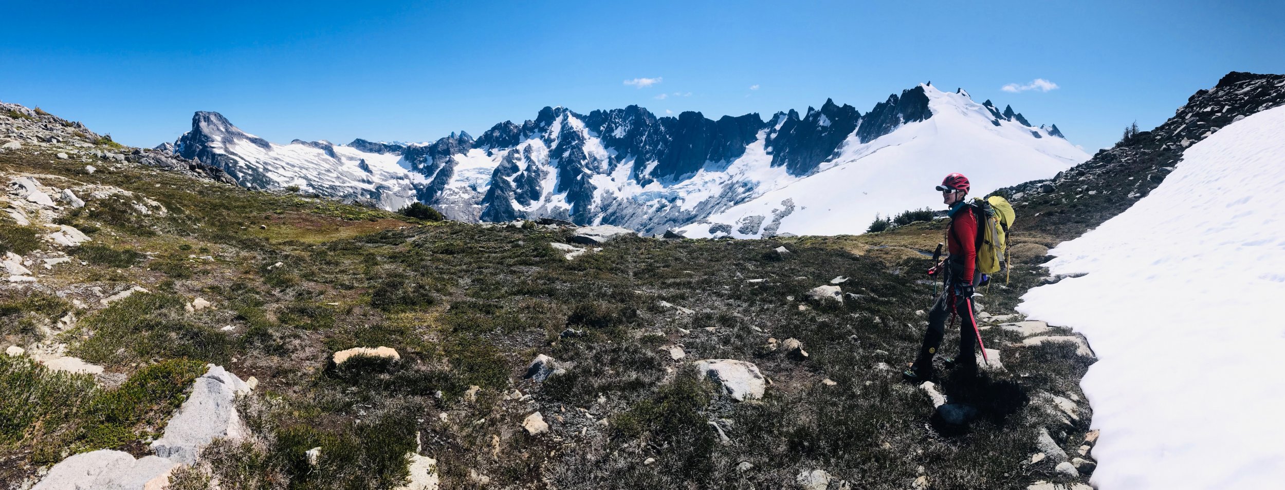
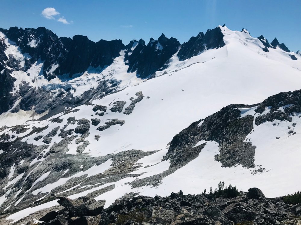
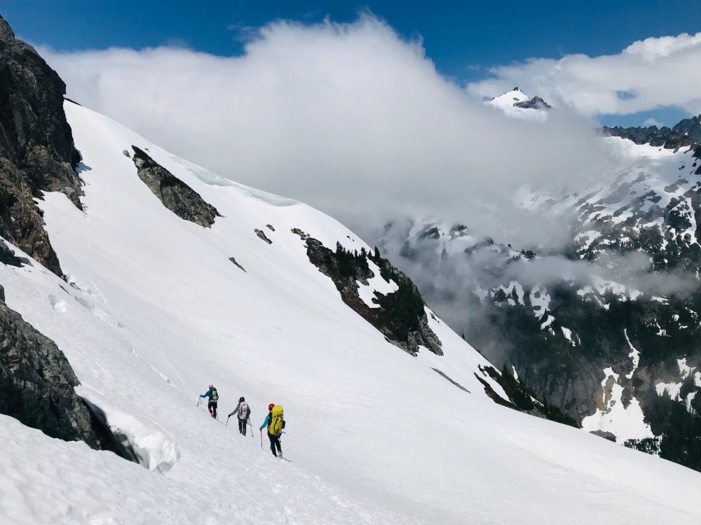
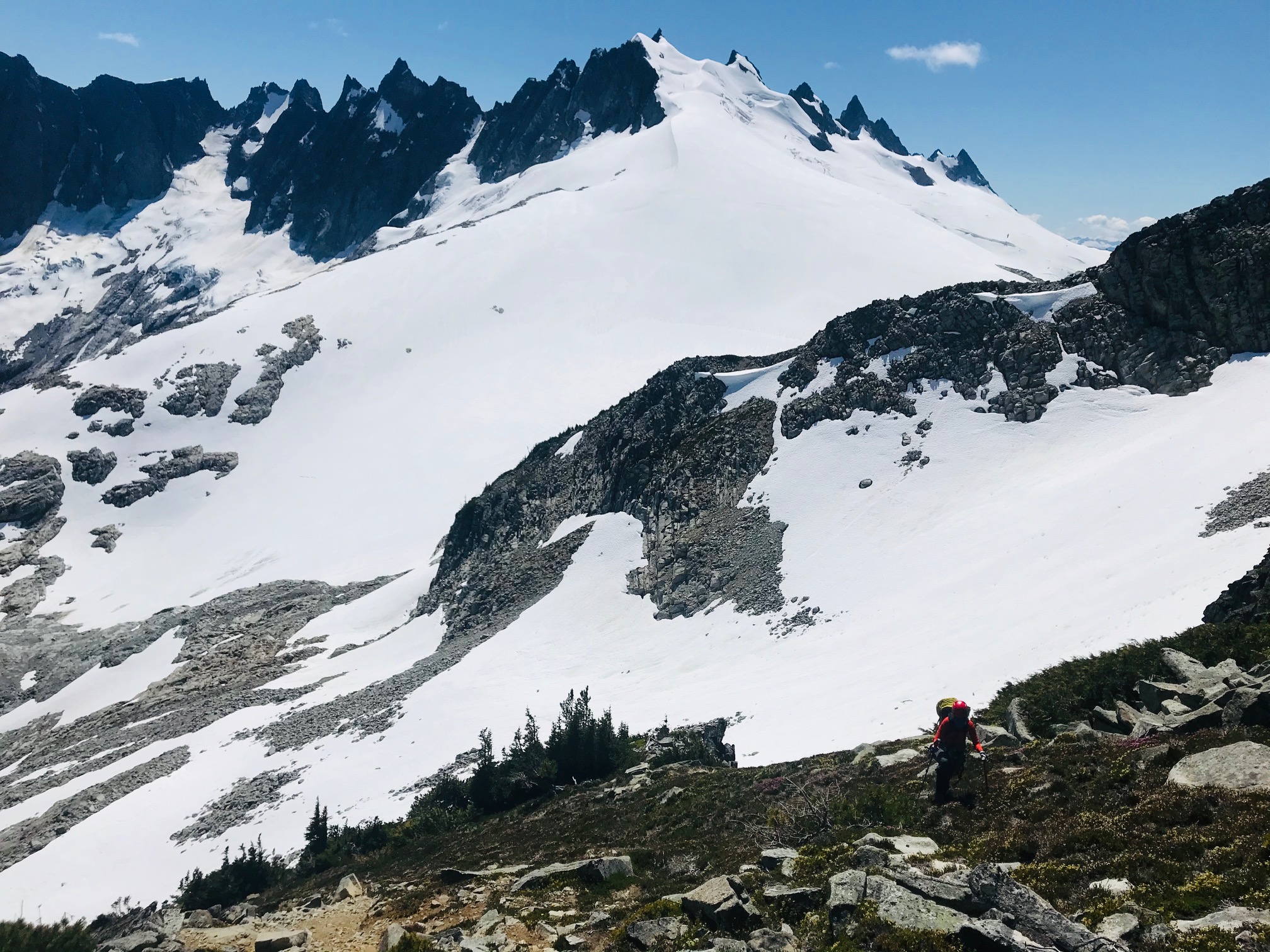
Trip: Mount Challenger - via Eiley Wiley Ridge
Trip Date: 07/25/2020
Trip Report:(so the video does have a couple clips out of sequence in the rock climb section and it ended abruptly due to all the GoPro batteries and chargers having run dry at the last clip).
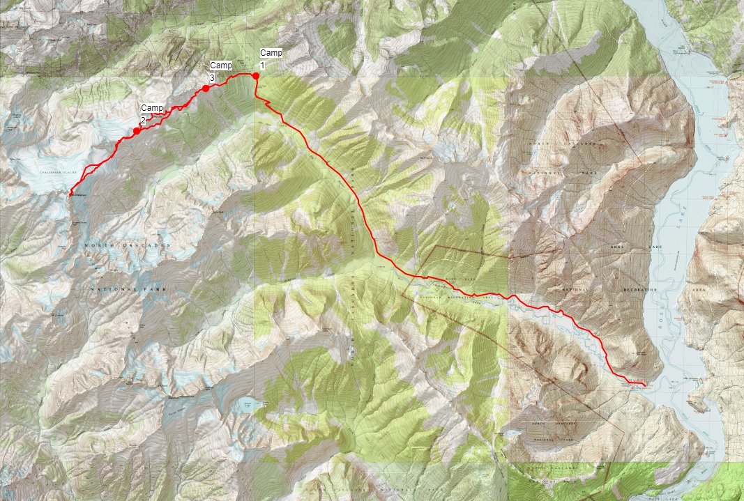
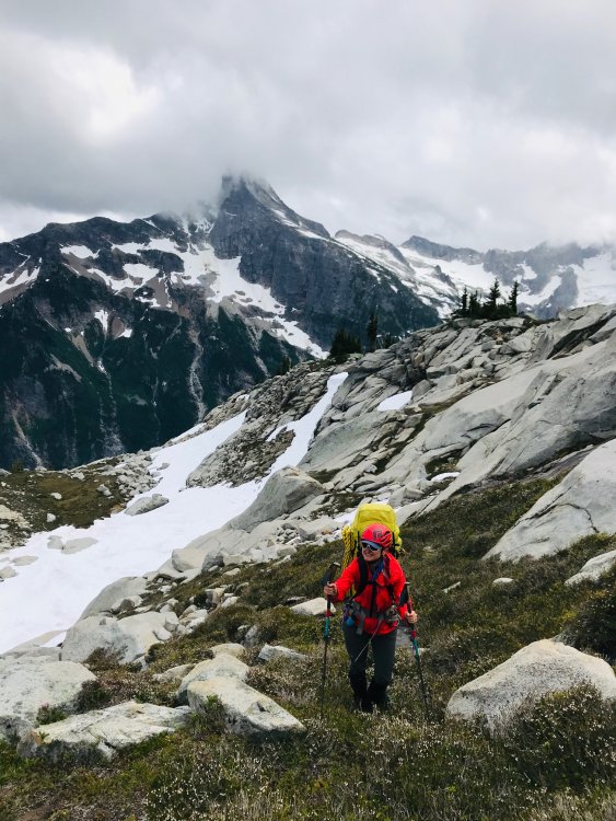
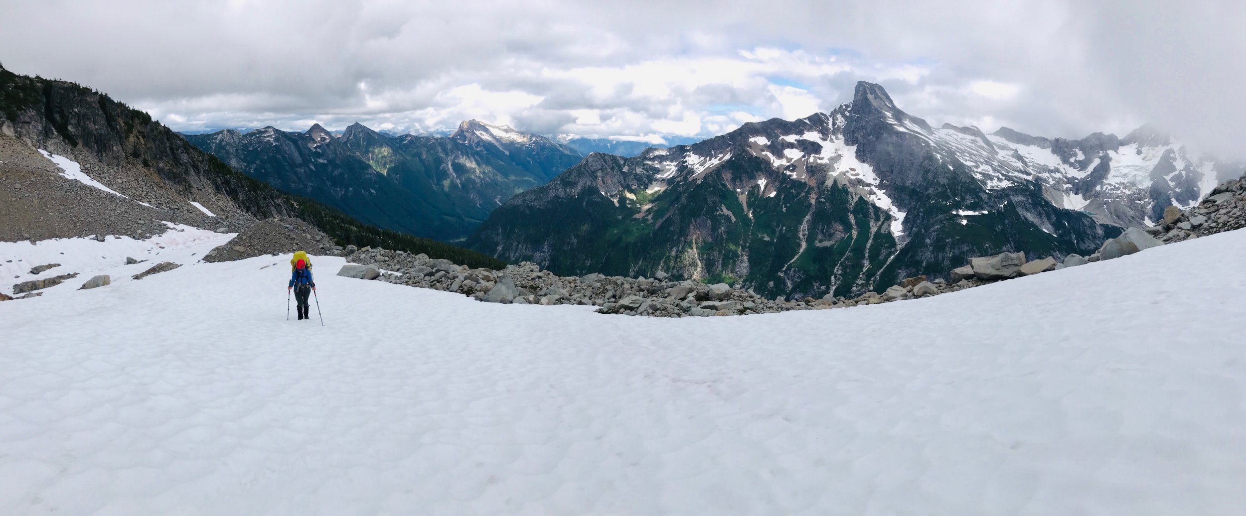
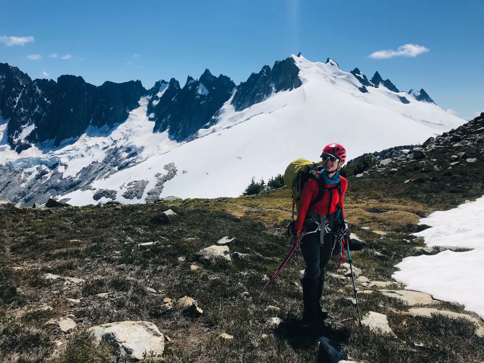
Hot off the NF of Buckner and barely recovered we had a weather window for Mount Challenger but only for a 4-day trip. Our full Pickets traverse we have had planned the last couple seasons keeps either getting weathered out or life gets in the way. So, to do it in 4 days we planned on doing it from the Big Beaver trailhead with a boat shuttle then via the Eiley Wiley Ridge knowing that this was also going to be the harder approach option.
Day 1 - Thursday
Got to the Marblemount ranger station at 6:30am to get permits which was good timing, the crowds showed up shortly after.
Picked up the boat shuttle which dropped us off at the Big Beaver trailhead saving an extra 7-mile walk from the Ross Lake parking lot. From there an uneventful 13 mile and 3000ft gain hike to the Big Beaver campground. In bed around 8pm for an early start.
Day 2 – Friday
This was going to be the hard day. Up around 3:30am and a leisurely 5am start. We knew from beta to expect some awful bushwhacking to gain the ridge. While we did pickup the odd climbers trail in key places throughout the trip where anyone who goes through the ridge seems to funnel through the same few spots there always peter out shortly and you are left to your own navigation for 95% of the ridge.
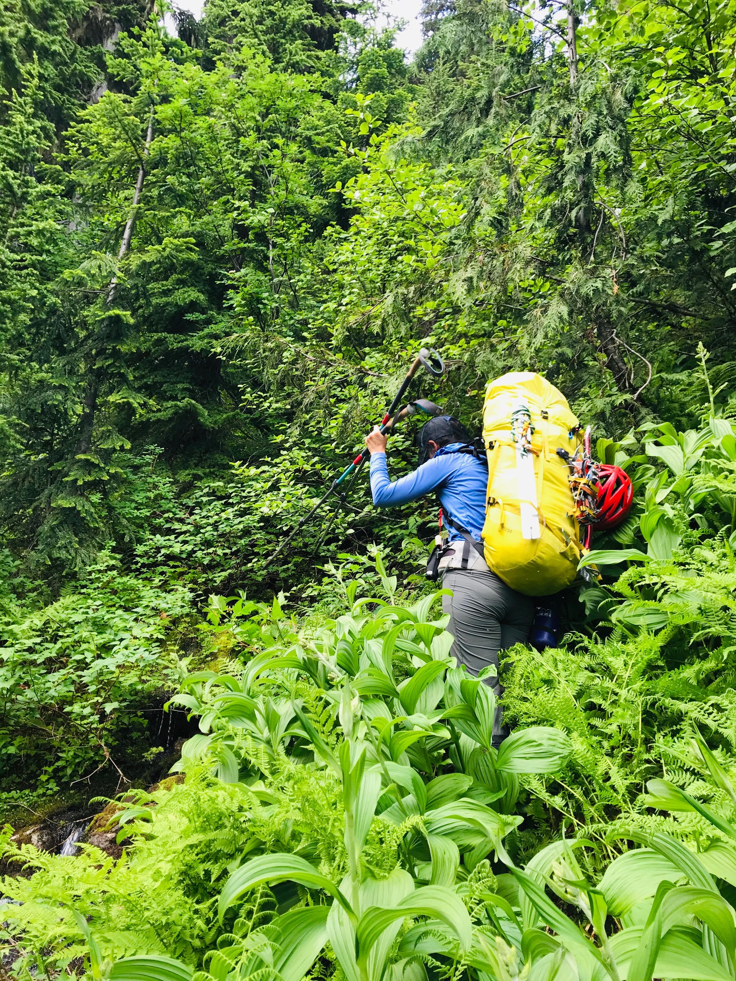
So, we started out full-on dense brush bushwhacking from camp and I think we picked more or less a fairly good line. But as you get higher there seems to be no way around hand over fist veggie belay climbing and bushwhacking through about 500ft worth of the 2000ft gain. Its all steep and virtually no sign of any climbers’ trails till you hit the very top. That took about 2+ hours and our clothes were full of pine needles inside and out.
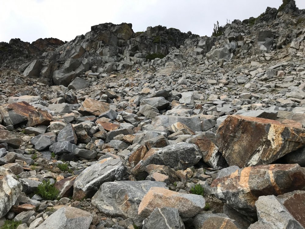
From there we spent another 6 hours getting across to the end of the ridge which was about 3 more miles after the 2 miles of bushwhacking. Mainly because we kept a middle line across the ridge until getting close to Eiley Lake. From there it looked like you could gain the ridge and do a high traverse over a large wide ridge. The topo map showed a relatively flat and wide ridge as well with only a single contour line and large bump. So, we gained that ridge only to find it ended in about 200ft cliff and wide chasm that was more than a few contour lines deep that did not show on the topo map. But from there looking back could spot what looked like a gulley down to the lake. That gulley was very steep, loose dirt/scree/boulders but it got us down to Eiley Lake. We blew a couple extra hours here. Had to exit that basin then took a line around another slope heading towards Wiley Lake.
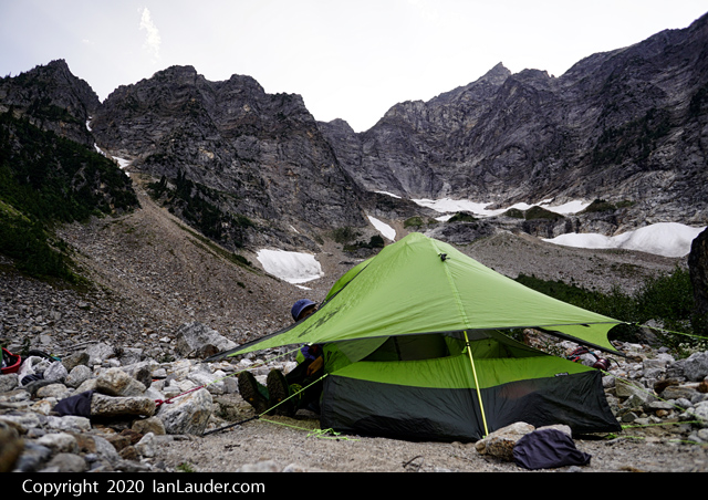
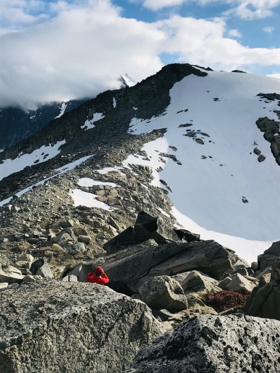
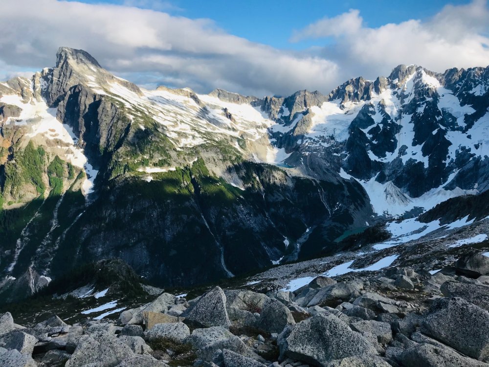
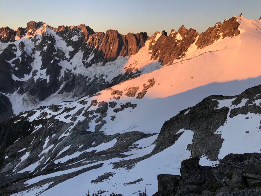
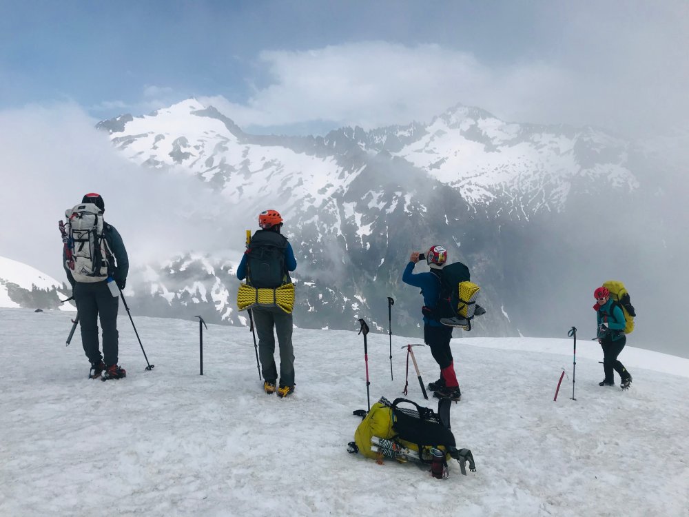
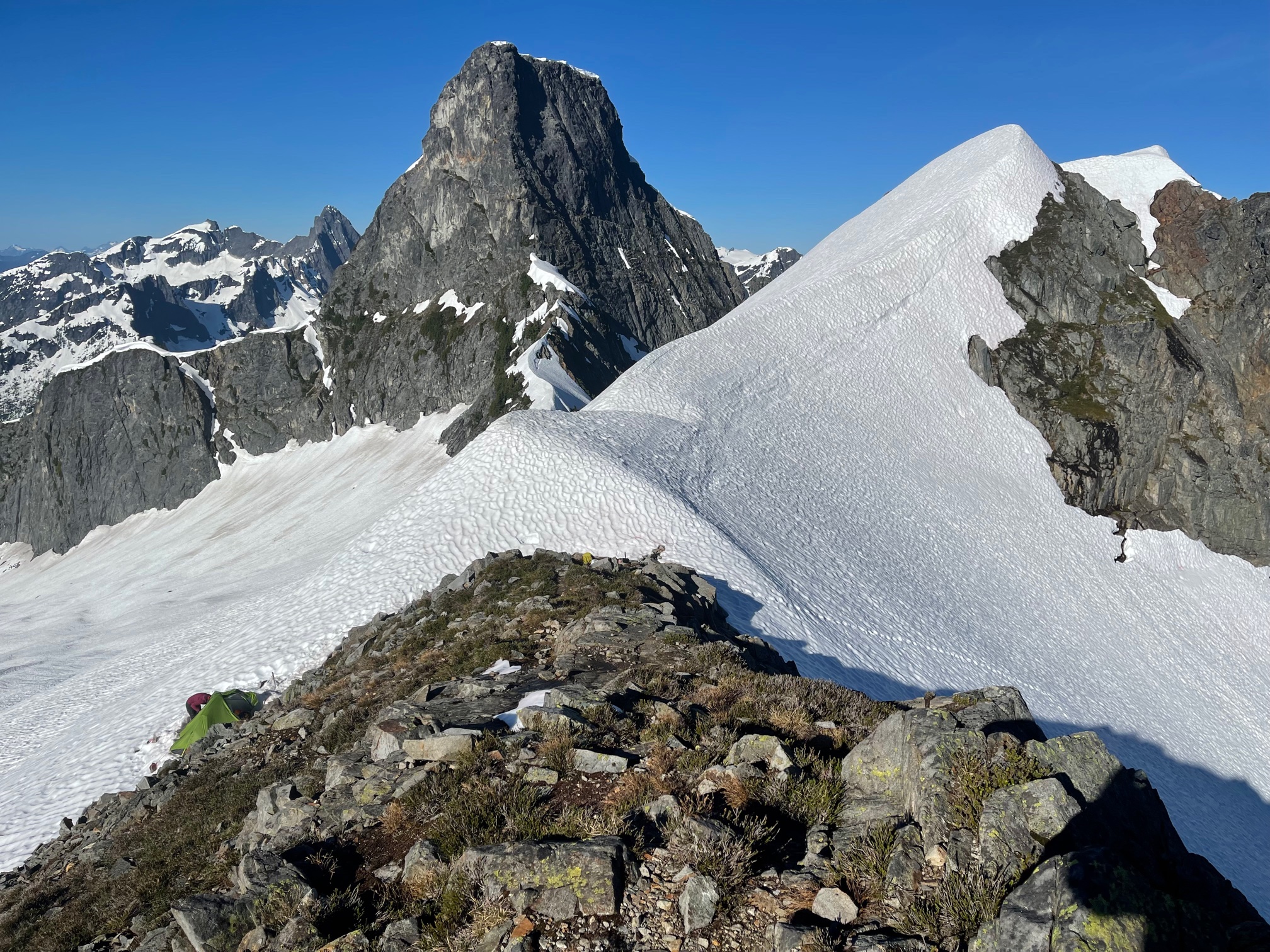
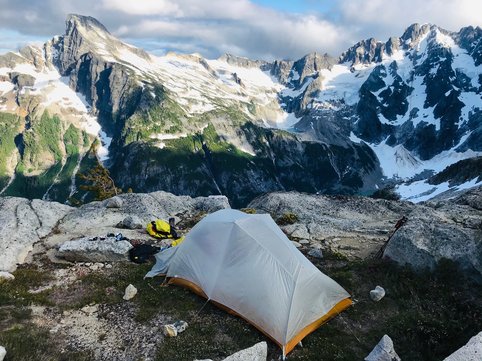
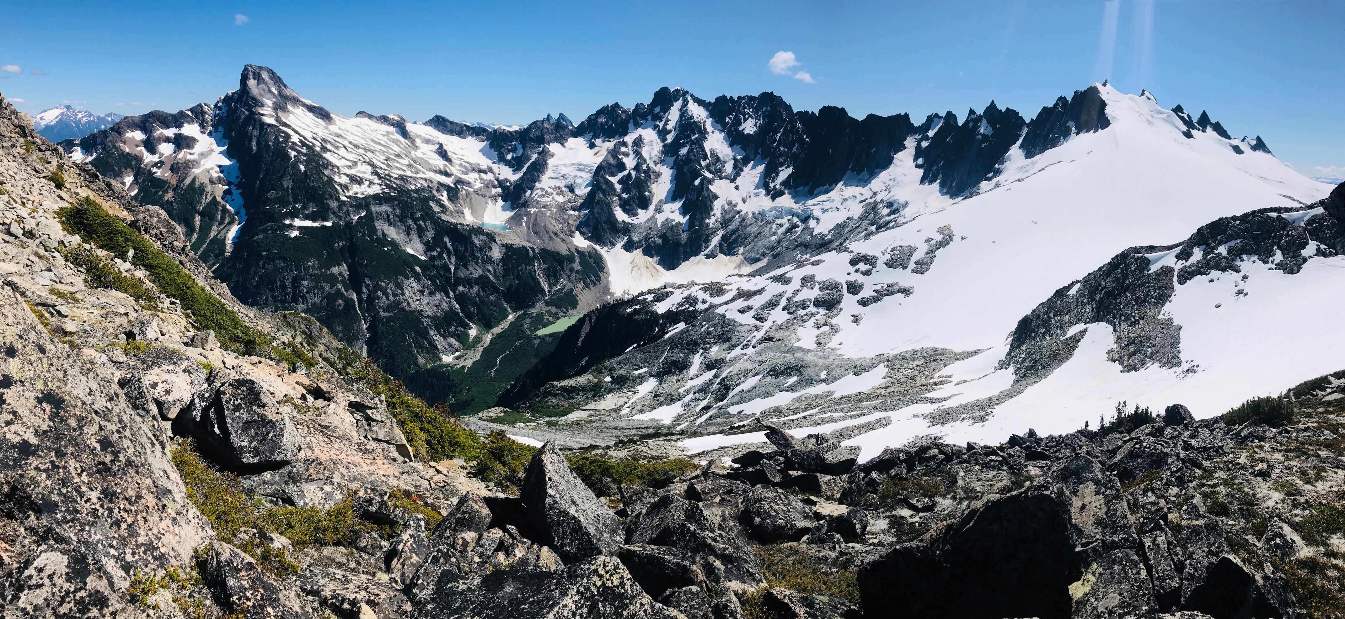
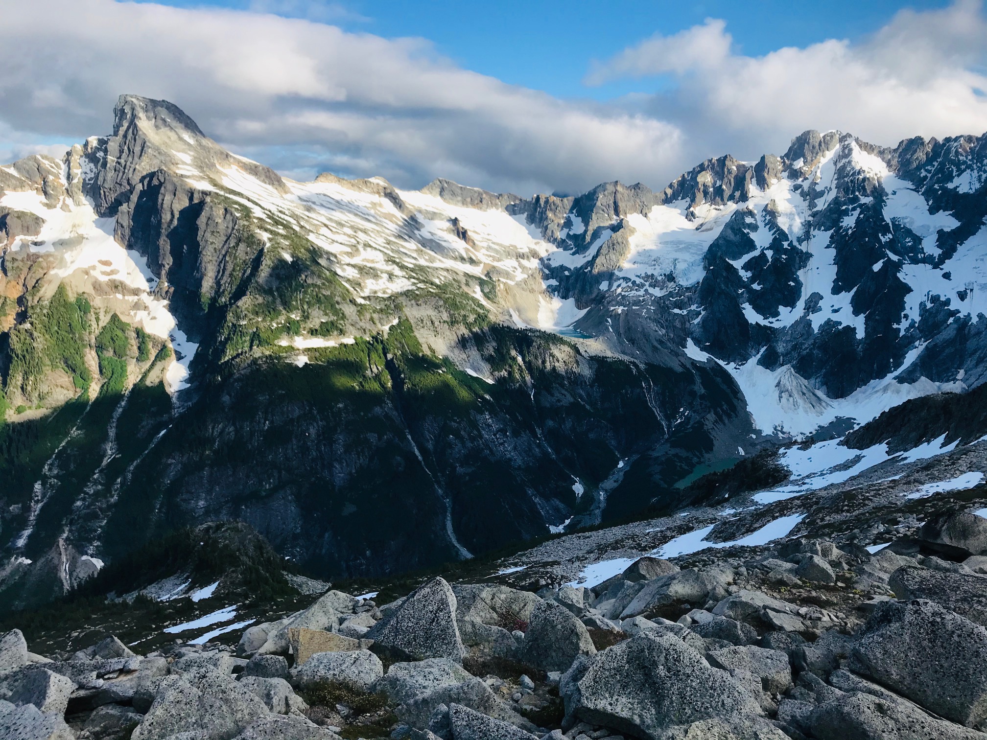
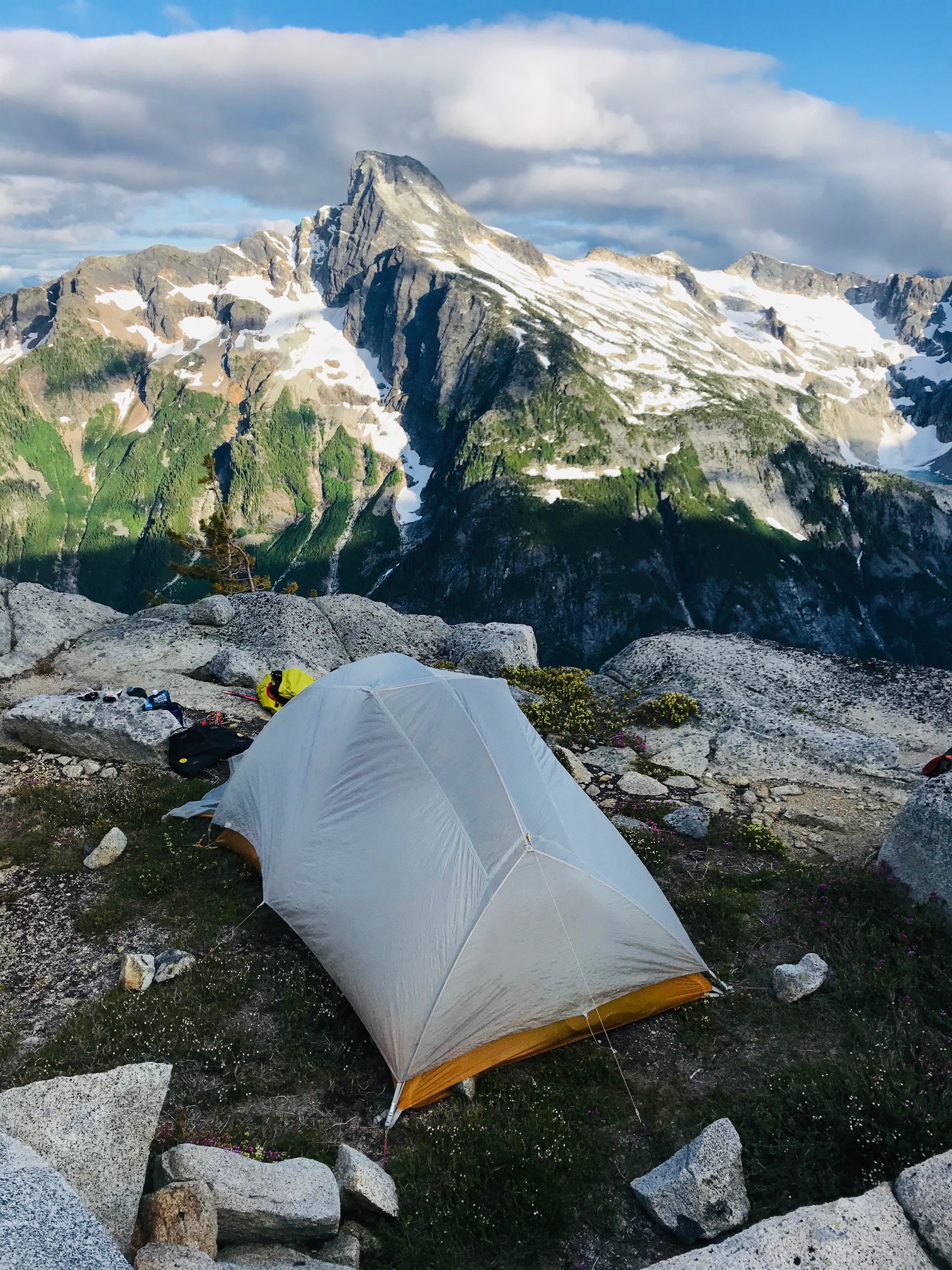
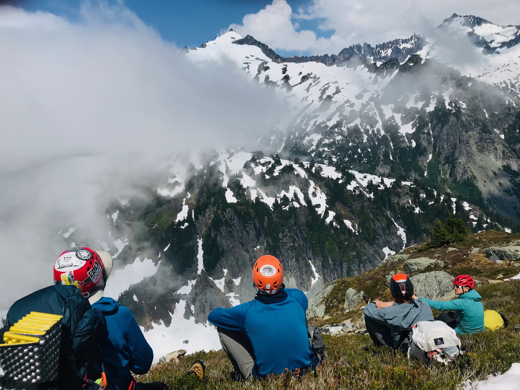
Once we popped over the boulder field looking down at Wiley Lake and across to the last half-mile of where we wanted to be it was getting late and very windy and the rest of the approach to our planned camp was in a whiteout so we found a small sheltered ledge in the boulder field with a great view of Luna Peak and setup camp.

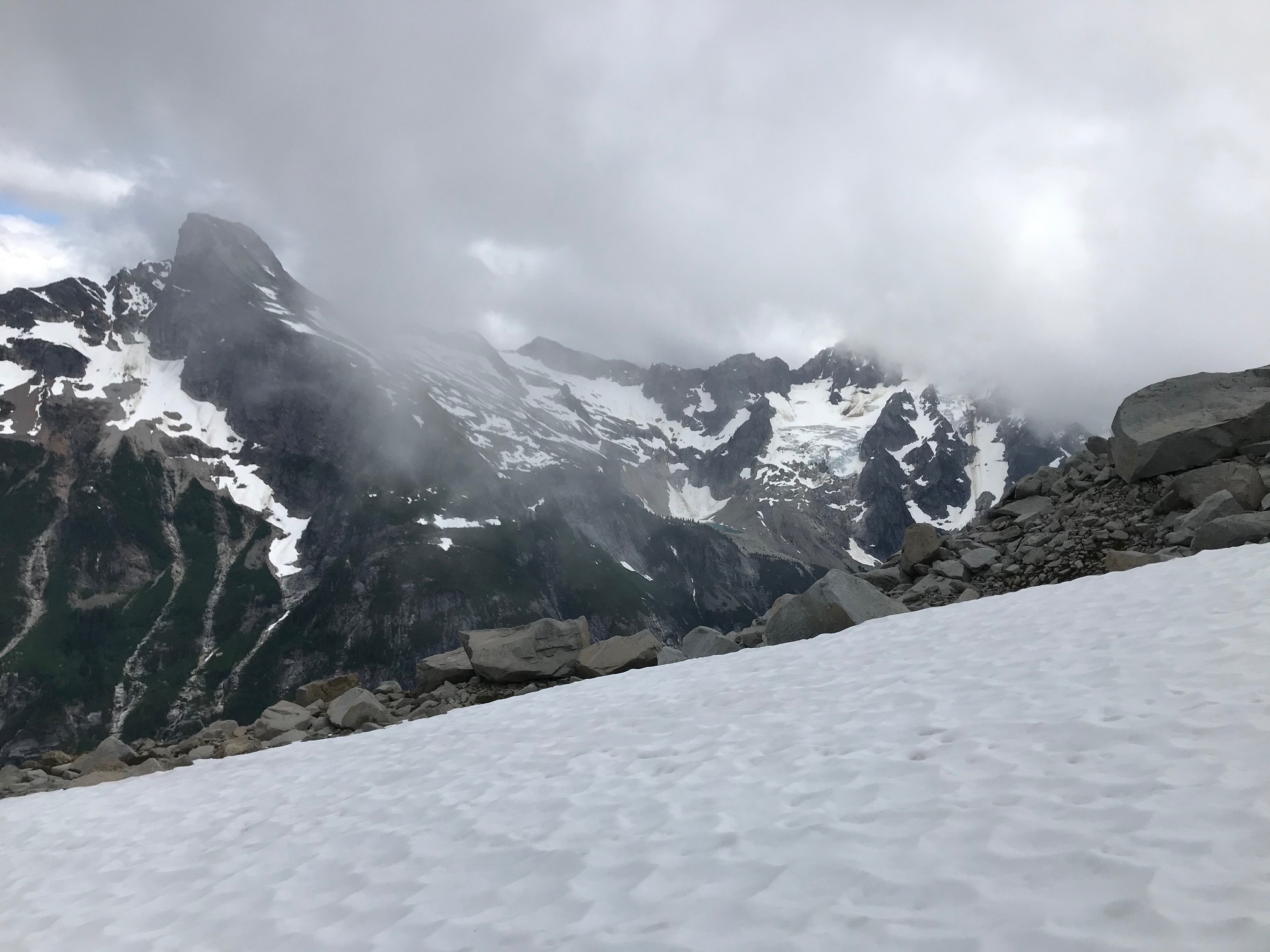
The weather was supposed to be clearing by late evening but had gotten worse. By the time we had camp setup and ready to turn in the clouds started lifting enough we could get some views of Mount Challenger in the distance.
Day 3 – Saturday
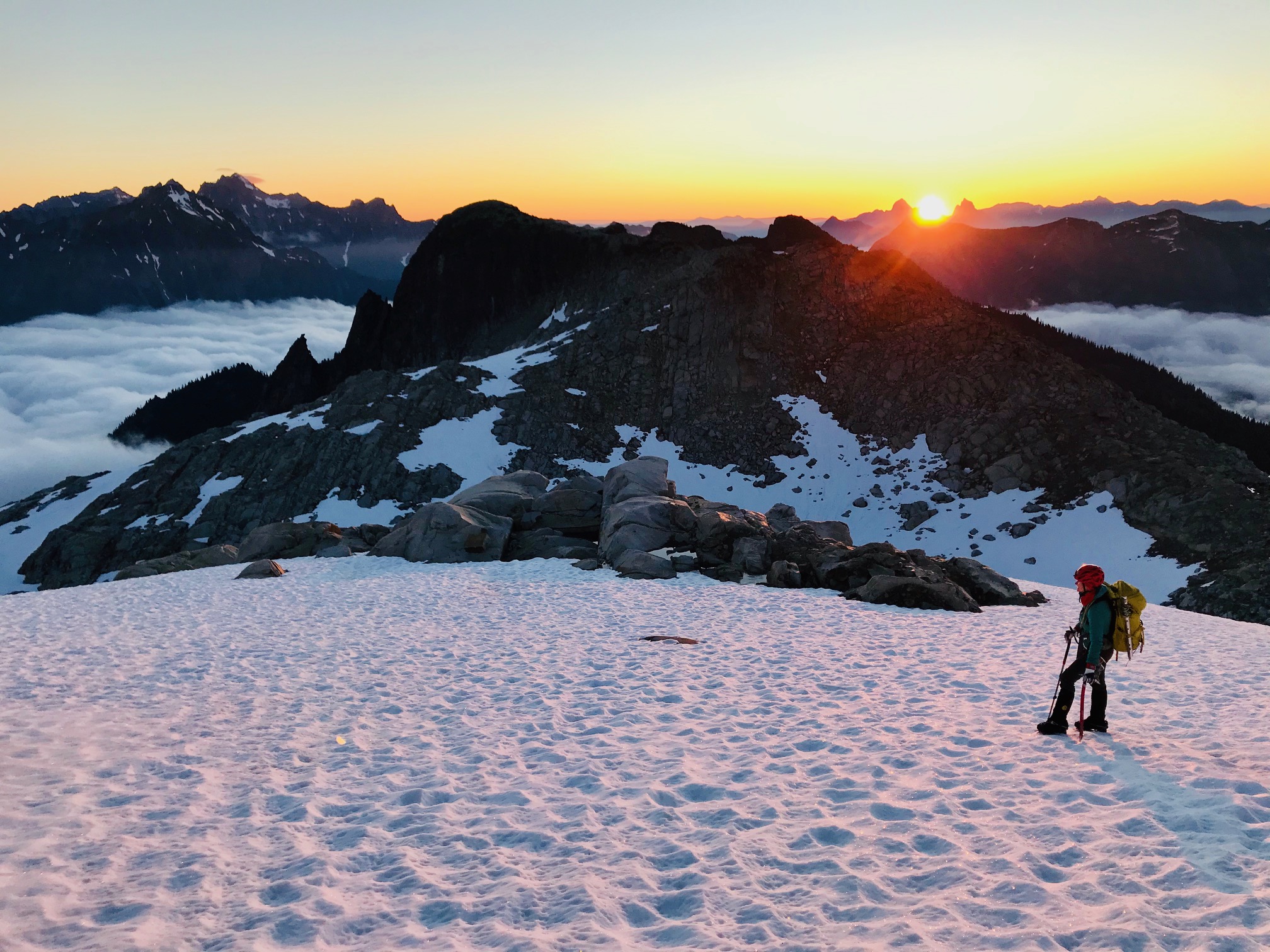
Another 3:30am wakeup call to calm weather and blue skies just as forecast.
We figured we had a shot at it if the route was in. Dropped down the boulder field and up the knoll on the other side of Wiley Lake and started to decide our options for getting around Big Beaver Peak. The right-hand side was supposed to be a horrible traverse, so we ruled that out. The topo showed that a notch just to the left of the peak may be doable, but we did not want to get suckered into another cliff.
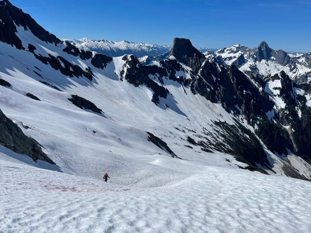
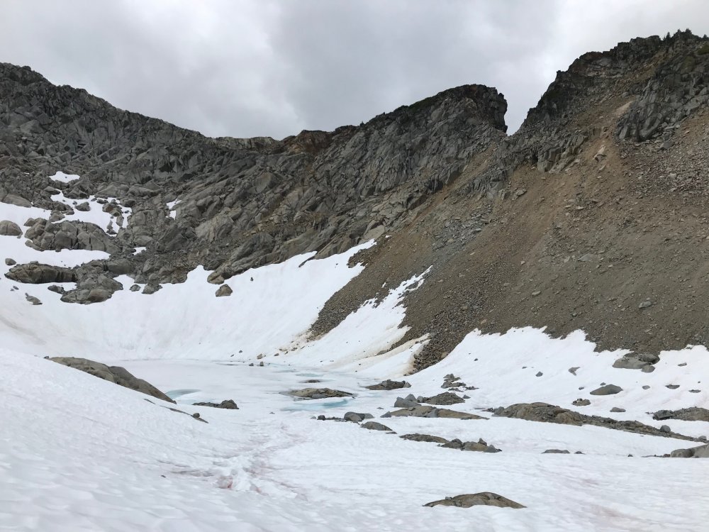
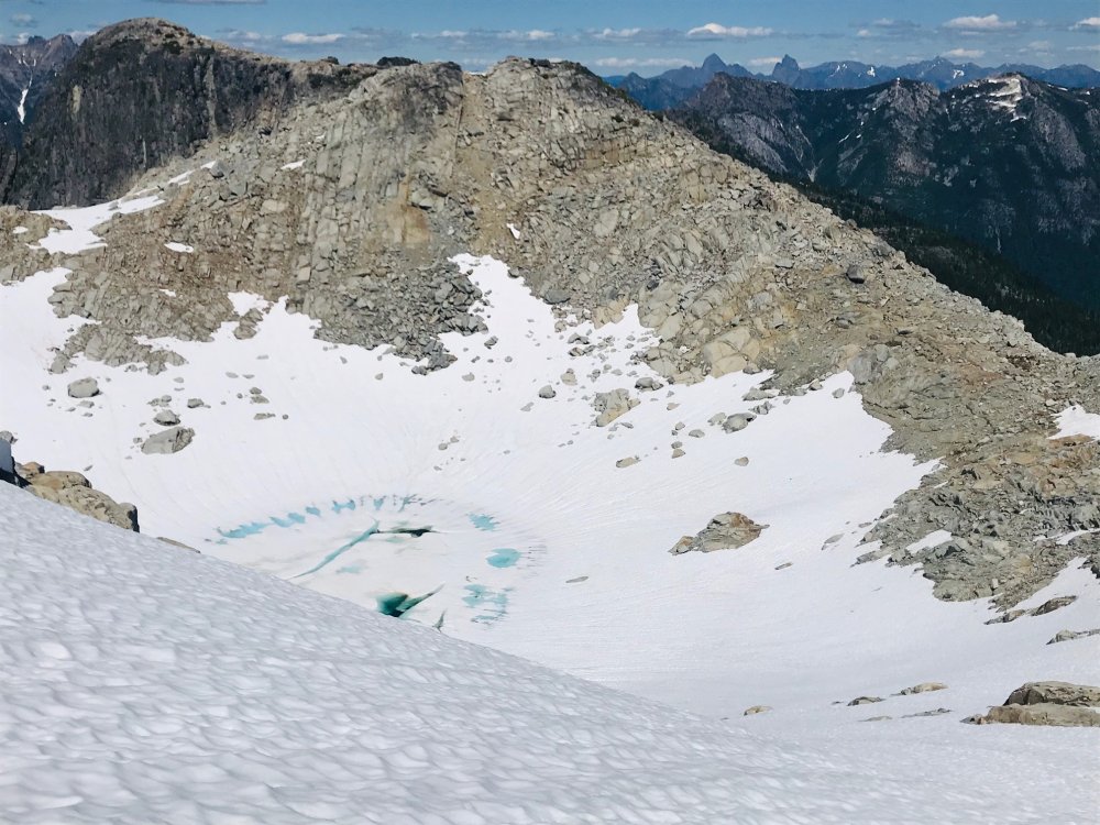
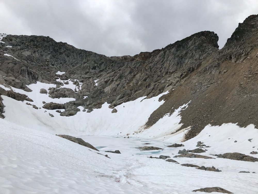
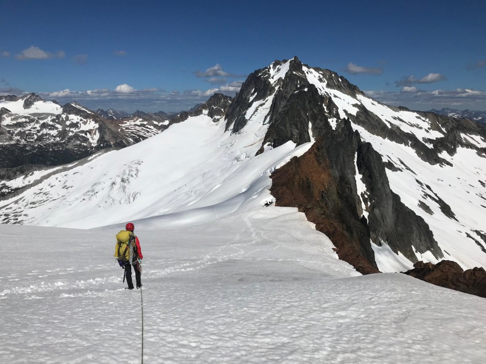
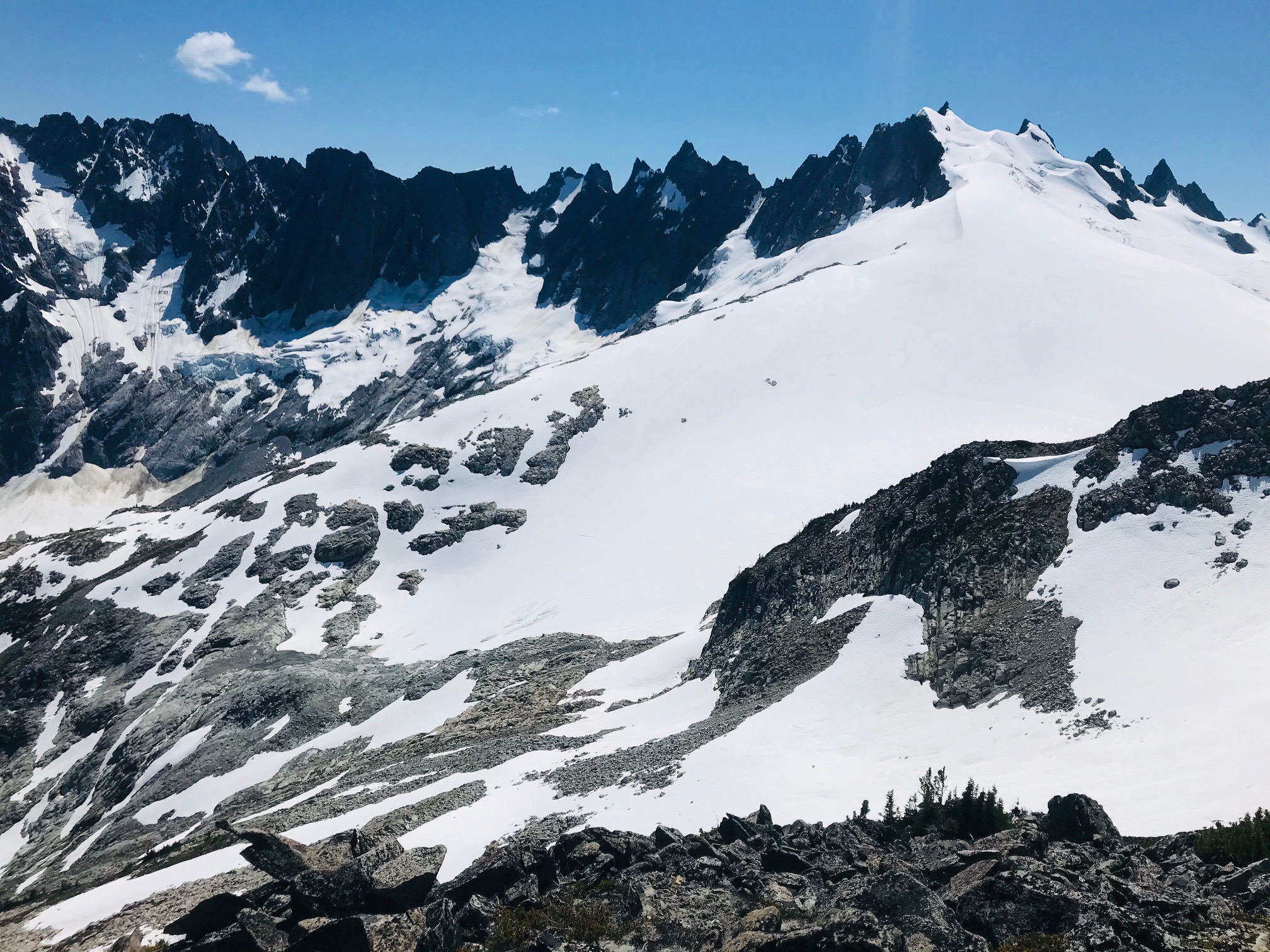
Poking around the top of the knoll we spotted a heather gulley that looked like a wider and longer version of the descent gulley getting to Eldorado so we headed down that which was about 1000ft loss taking us down a large snow field and around the buttress to the base of the Challenger Arm.

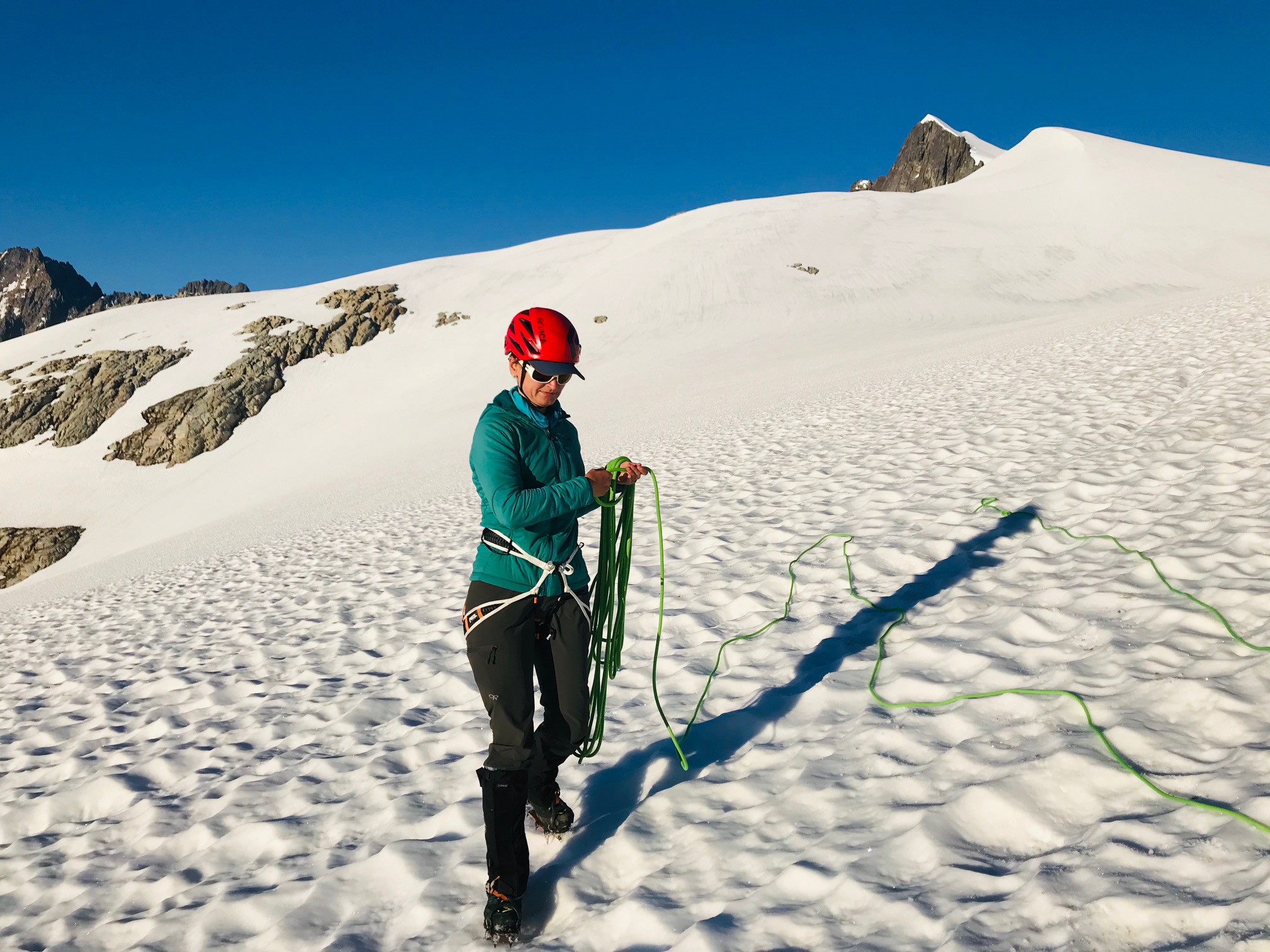
The route looked like a straightforward walkup, but the summit block and bergschrund are hidden from view, so we roped up and headed up. No issues all the way and the bergschrund had not started to open. Once we got close to the summit rocks there was a steep snow slope with a large moat. We had beta that showed you could scramble the first set of rocks or go around them.
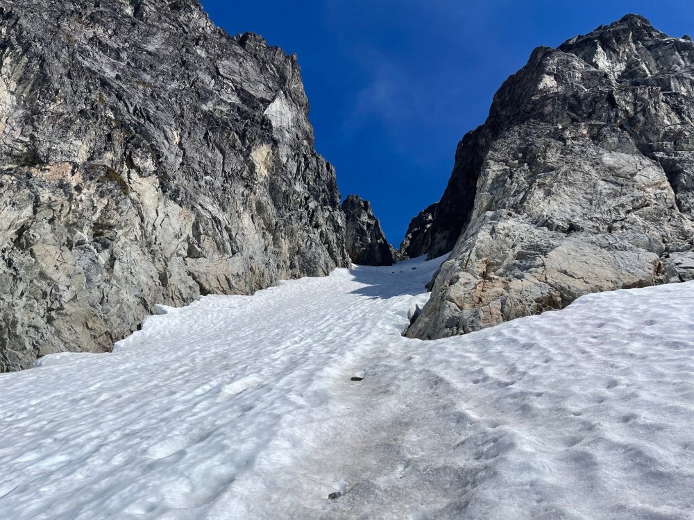
So, we split the difference and scrambled up a bit to clear the first part of the moat and then dropped back down into the moat and traversed around and found the base of the rock climb.
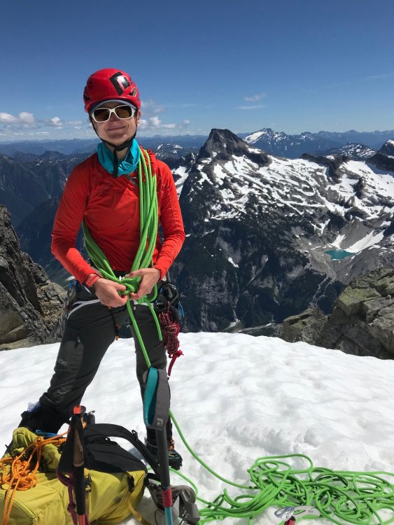
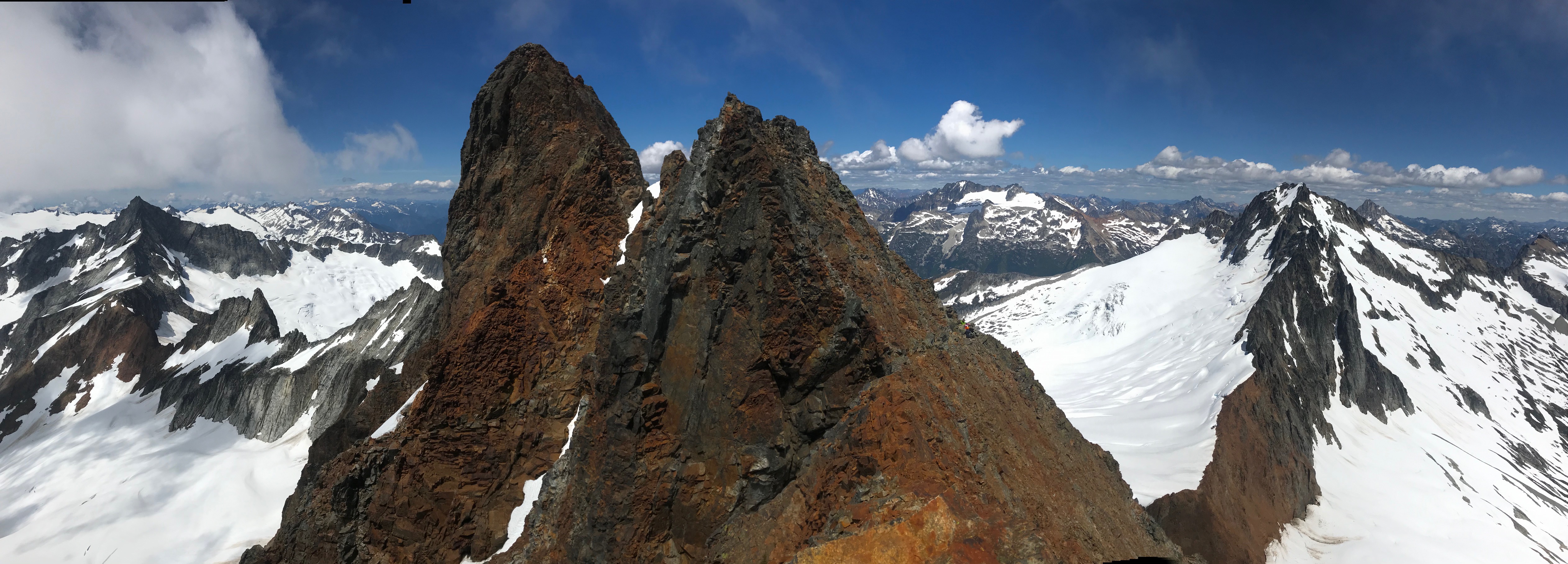
The 5.7 rock climb was straight forward. We’ve read reports pegging this move at between 5.5 and 5.7. After doing it I think the rating depends on how long your arms are. Only 50ft long and 4 rusty pitons. And brought a .5 cam to backup the crux move. Past that the rap slings are a couple easy moves up and another 30-foot scramble to the summit block which we belayed and set a handline. The 40m rope was long enough for the rappel with just a few feet to spare.
Easy scramble and walk back down from there then the 1000ft slog back up the gulley and back to camp.
We wanted to get back down to the Big Beaver camp before dark so we took a more straight forward line back which still was a lot of mini-navigation stops and a lot of little meandering through the terrain and a bit of solid bushwhacking through the trees in a couple places.
Camp is about halfway up the right side of the boulder field in the pic above of Wiley Lake. Tucked into a little ledge looking out at Luna Peak.
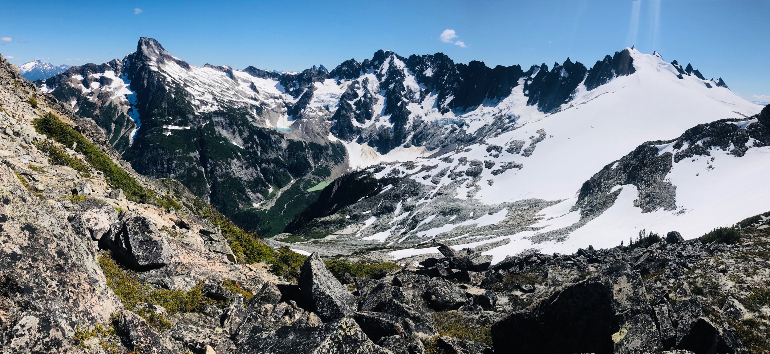
We did not hit the ledges at the far end of the ridge till about 9pm and there was no way we wanted to navigate the descent in the dark. So, we pitched camp on a snow patch at the ledges.
Day 4 – Sunday
Another early start and picked up the bit of climbers trail at the very top of the Eiley Wiley Ridge. There were climbers trails heading both left and right here so we went right and that trail stopped in about 40 feet. We then checked the left trail and figured we had found something that we missed on the way up. It probably descended a couple hundred feet as it got fainter and fainter till it stopped at a cliff. And then began the hand over fist veggie belay bushwhacking and tree climbing again. Having to move back left, up 100ft over a rock band, more bushwhacking and side hilling for maybe a tenth of a mile. Eventually we were able to start moving back down and found lines that keep us more or less moving straight back towards the Big Beaver camp doing our best to navigate around fields of devils club. Still took just as long to descend as it did to go up.
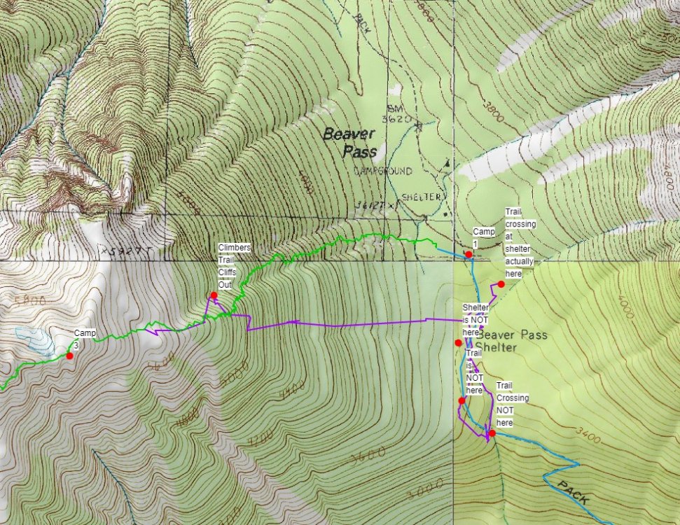
Once down took some navigation and finally realizing that the GPS was not matching up with what was on the topo map. Turns out the GPS was putting us accurately on the map but the trail and shelter locations on the topo maps are not correct. Our GPS was showing us on one side of the trail then the other in multiple places we checked where we took long hikes in both directions crisscrossing where the trail was on the map. We finally gave up trying to pinpoint the trail by GPS and topo and found the large stream we knew intersected the trail and passed by the Big Beaver camp and followed the stream back uphill. Turned out the GPS and topo had us going in the opposite direction. So, word of caution, have your navigation skills through dense brush where you cannot see any reference points down and you can only see 50 feet in any direction. The 2nd topo screenshot below shows where we were looking for the trail and stream crossing and where they are actually located. Once we got back to the Big Beaver Camp, we had to calculate how fast we had to move to make the boat pickup.
So, for 13 miles out with short water/snack breaks we had to do about a 3mph pace with the heat going up to at least 80 to make the boat. At one-point Rodica thought she was hallucinating seeing things jumping all over the trail. I looked down and at first glance though we were standing in a swarm of spiders. Looking closer the trail for about 100ft was full of tiny frogs jumping all over the place. We made it at 3pm on the dot in 5 hours. Thankfully, the boat was about a half hour late so we could soak in the lake for a while.
With all the camera and phone batteries dead by Day 4 didn't have any more pics or video. It was just a mad dash to the finish line.
Overall, some of the most rugged, remote, and scenic wilderness we have been though. Awesome trip at times brutal and almost demoralizing gaining and descending the Eiley Wiley Ridge (and we had a high bar already for horrid bushwhacking). Even with a lot of preplanning, gathering beta on the ridge and getting some tracks from others it was a lot of navigation work and on-the-fly decision making doing the ridge approach.
~11,000ft gain and 46 miles over 4 days.
Gear Notes:
4 alpine draws, .5 cam, 40m rope, basic glacier gear
Approach Notes:
The climb itself was easy. The bulk of the work and trip report are on the Eiley Wiley Ridge approach.


-
5
-
-
We were out the last 4 days so might be too late to have responded to this. I think our temps were mid 30s in the morning and went up to the 60s on our way down with a lot of sun exposure since it was a blue sky day. The lower route was in shade and was in good condition, the upper slopes were just starting to soften up to the point bootsteps were getting sloppy at the very top by 10:30am. If you made it up there how was that constriction point where you have to transition to rock?
-
I wasn't taking it as a critique, just explaining how we did the route deciding on more simulclimbing to speed it up. Lots of ways it can be done.
-
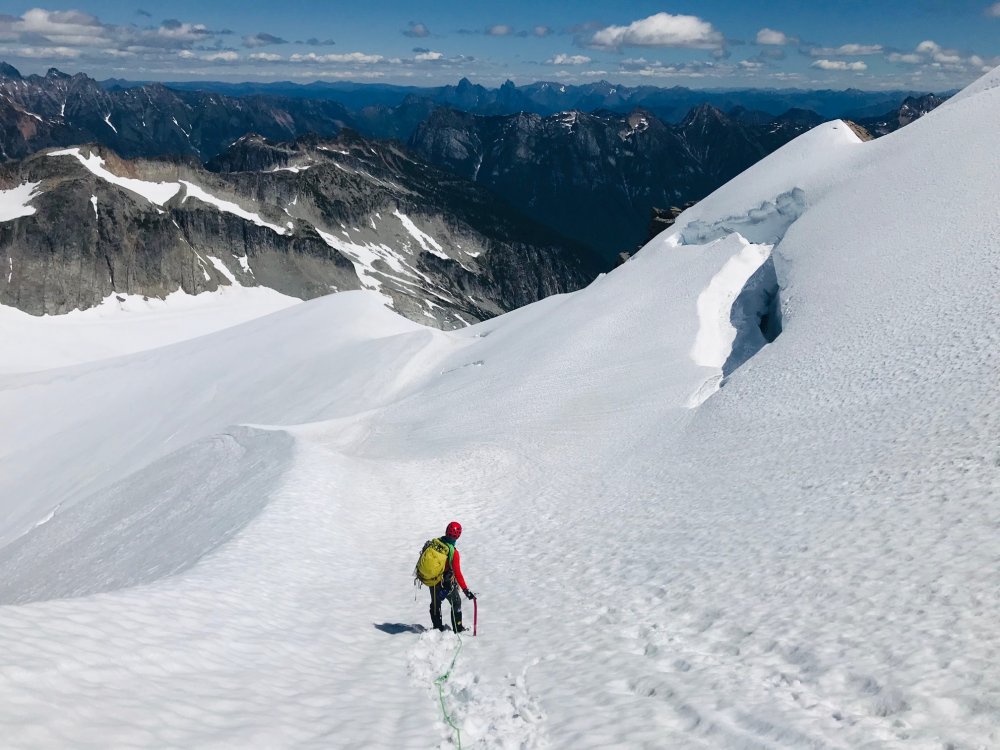
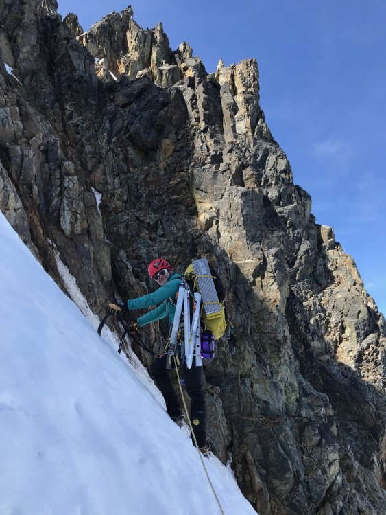
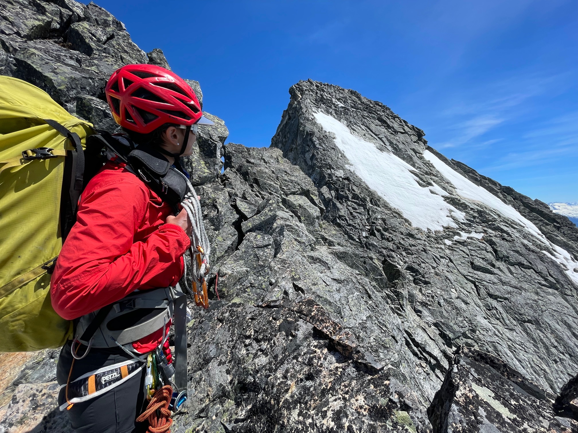
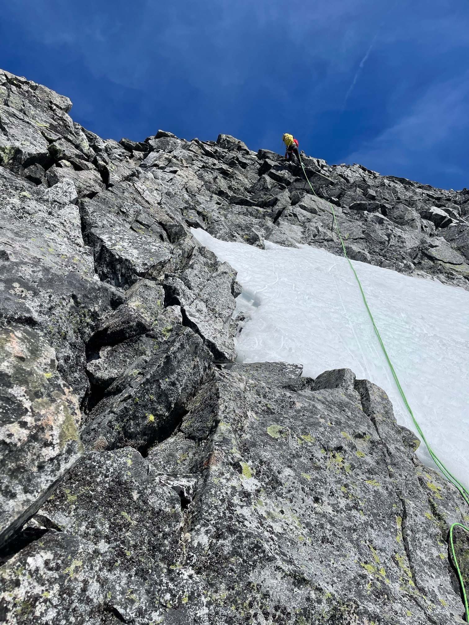
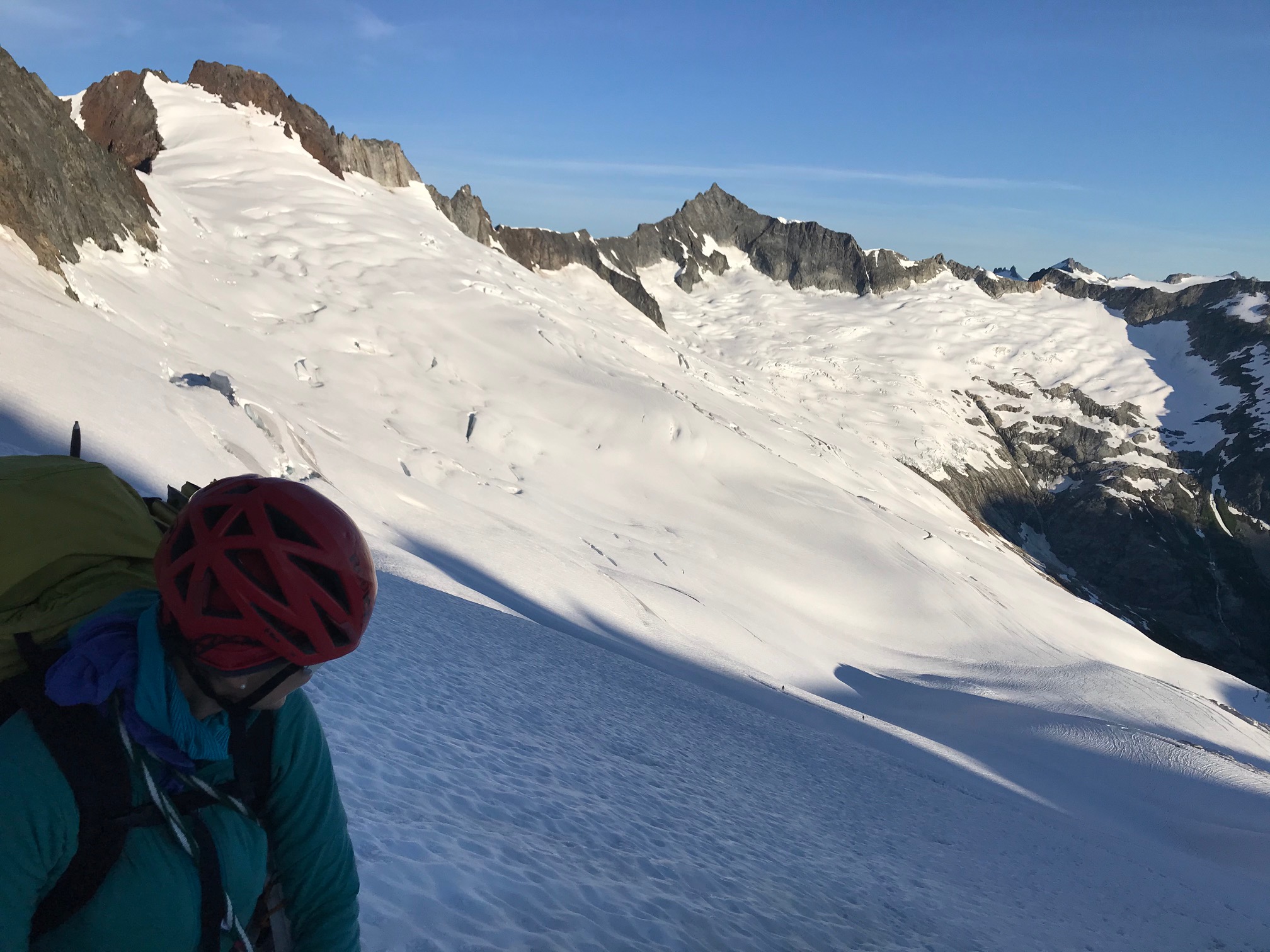
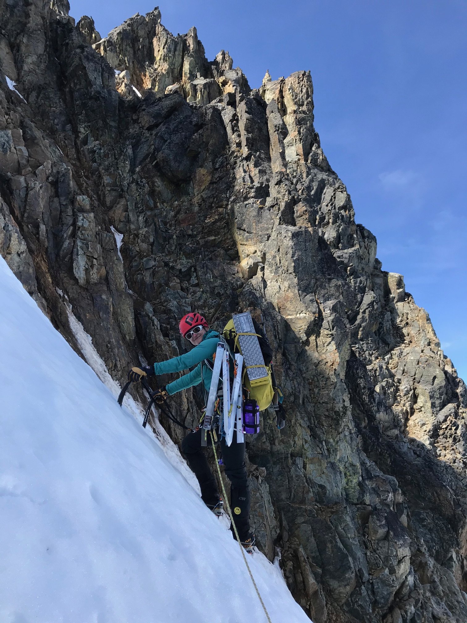
Its only 4 pickets for about a 1300ft of climbing. Simulclimbing with 1 picket in at any time between us on a 37m rope, with some simulclimbing at the beginning and end. Did the whole thing in 4 pitches. Not much in the way of any other kind of pro (rock or ice screws) so pickets were the only way to protect it. Which I think only 1 picket at a time if you really think about it you might as well just be soloing it since the snow was on the softer side. But it was nice to have a couple pieces in around the constriction point having to move onto the loose and wet rock section.
-
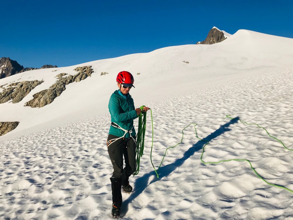
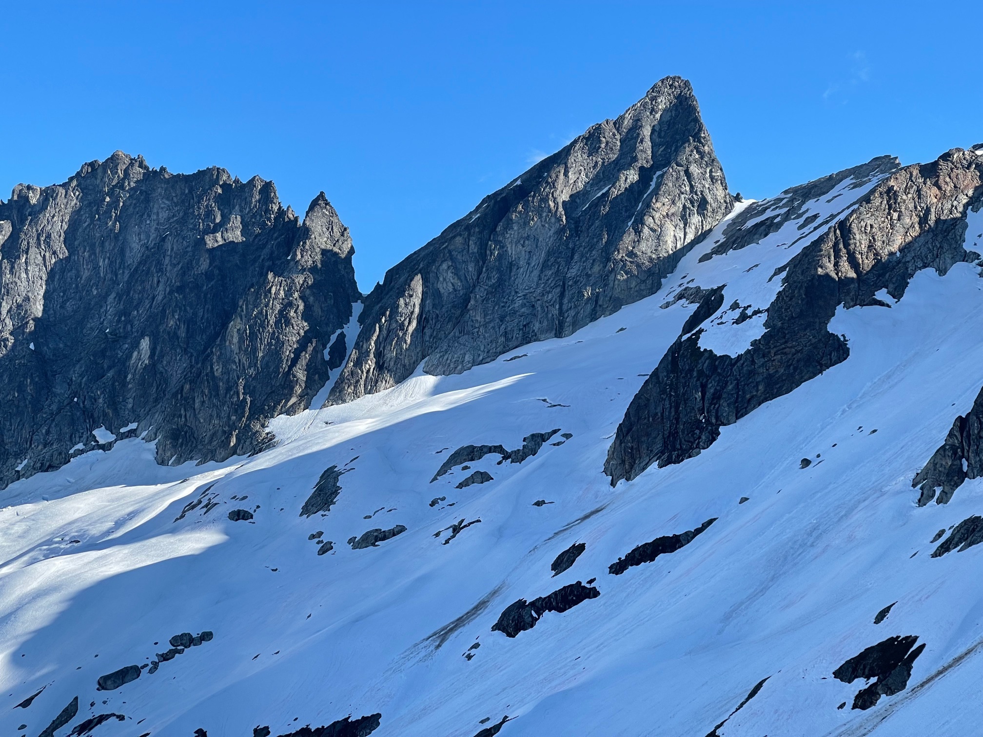
Trip: Mount Buckner - North Face
Trip Date: 07/19/2020
Trip Report:The North Face of Buckner has eluded us the last couple seasons getting weathered out every time we planned it. Last year hunkering down in a whiteout at the Boston/Sahale Col overnight hoping for a break in the weather that didn’t happen.
This weekend everything came together with a clear weather, not too high of temps and the route conditions appeared promising. Although we didn’t know what the route itself was going to be like we had seen a photo of the Boston Glacier from the summit of Bucker from the weekend before which made the transition to the glacier look easy (from a distance).
I drove up to Marblemount on Friday to pickup a Boston Glacier permit not wanting to wait in a long line on Sat morning which worked out. Still arriving at 2:30pm there were 9 parties waiting for the 1 ranger helping with permits and the first 2 parties took at least 20 minutes each apparently doing their vacation planning at the permit window. Around 3:30 with about 6 parties ahead of me a ranger came out to announce they were closing in 30 minutes and they wouldn’t get to everyone and some would have to come back in the morning. No way I’m driving 6 hours on Friday for nothing. Then a ranger came out and gave a guy on the side his permit who was behind me. Then they had a couple extra rangers come out last minute to expedite things and got our Boston Glacier permit just before they closed.
Back home and finished packing and a 3:30am wakeup Sat morning for the drive back to the Boston Basin trailhead and was able to get one of the last parking spots and were on the trail by 7:15am.
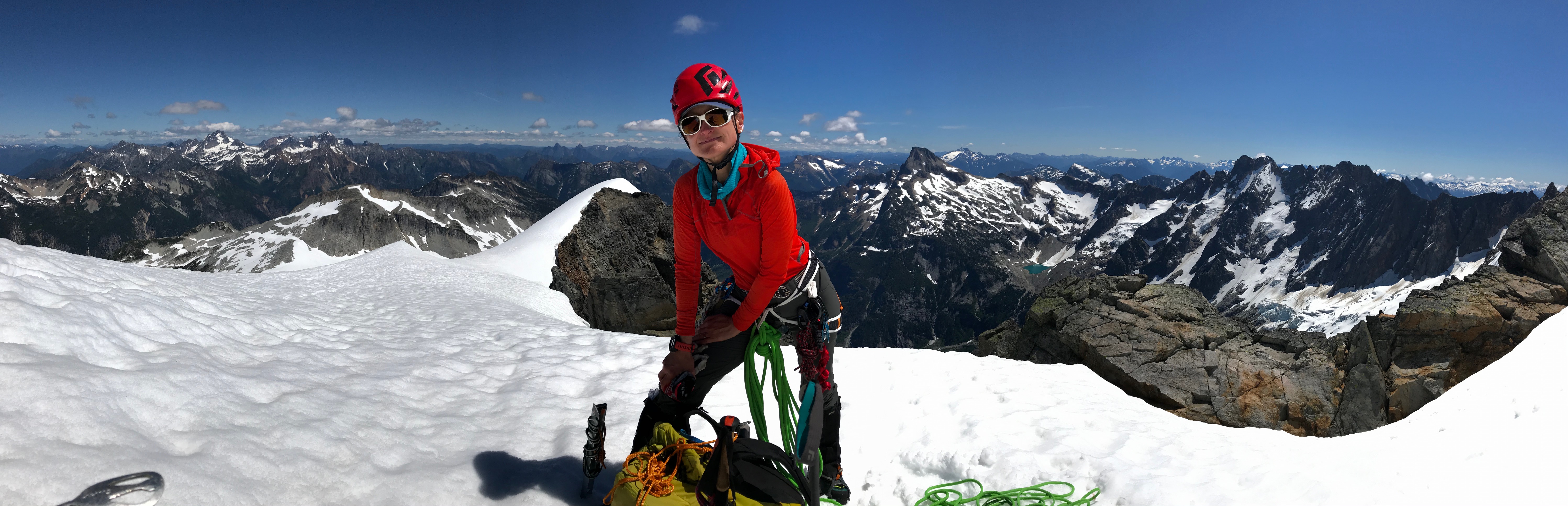
About 5.5 hours up to the Boston/Sahale Col and met up with another party of two doing the same route. Lunch break on the col which is the furthest we had ever been on either of the Buckner routes.
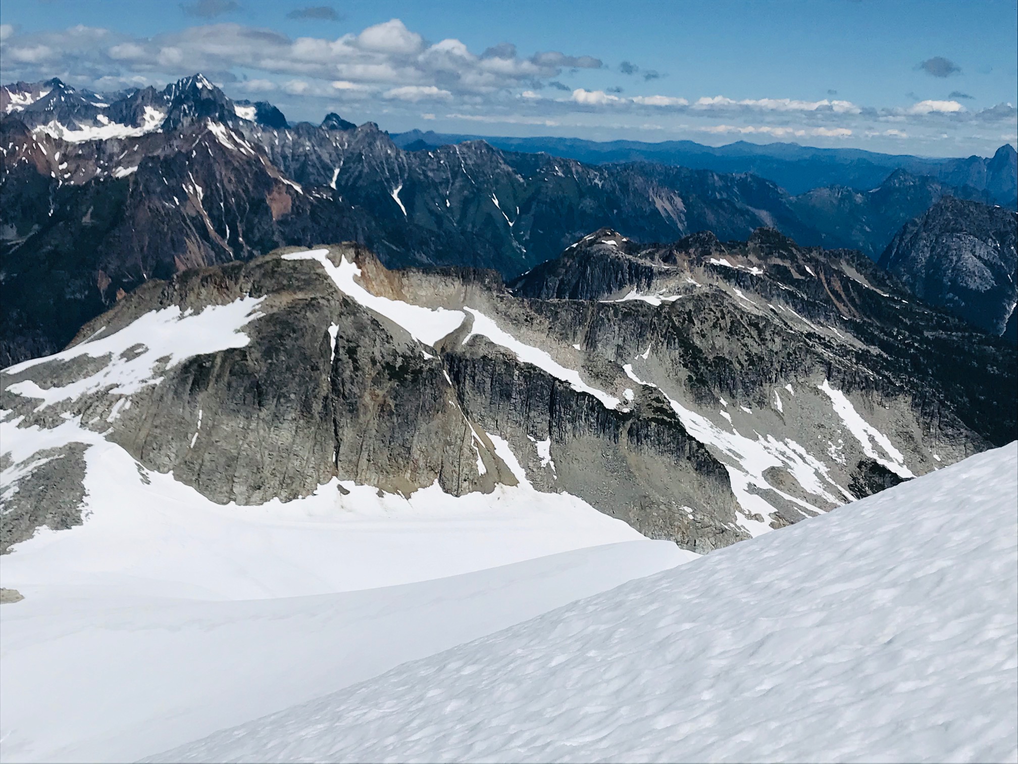
Scrambled over to the base of Boston Peak which is a very exposed thin ridge with steep drops on both sides and a lot of loose rock. Found a nice flat rock and took a long nap looking at the route and views for a while.

Once we got around the corner saw that the Boston Glacier snow came all the way up and it was as expected, an easy walk onto the glacier and down to where we would setup camp. No sketchy downclimb transition.
The other party kept going and dropped further down towards the rocks closer to the base of the climb. All of us had gotten up around 3:30am and took our time getting ready. By 5am we had camp packed. For us was more of a 1 mile walk staying high and closer to the ridge navigating around some big crevasses while the other party had about a 1000ft gain up to the base from below and we all converged about the same time.

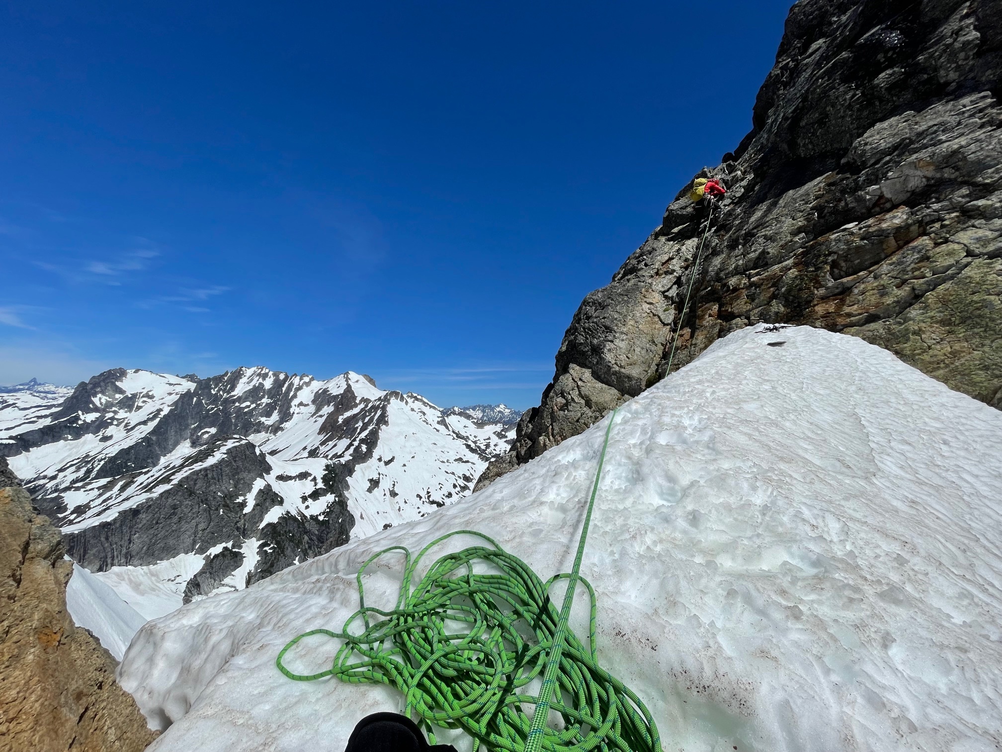
Rodica lead off doing the lower portion of the route. We stuck close to the rocks on the right-hand side and weaved around some bergschrunds at the start and had to step over one starting to form. Once we approached the middle of the climb the other party took the lead and I took our lead through the middle sections.

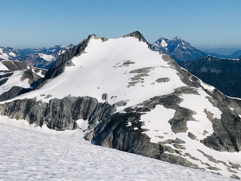
It was mostly steep snow from that point placing 1 picket between us until it constricted to the point, we had to transition right over some rocks which was loose, wet, muddy, kitty litter but not terribly hard. Not much in the way of rock pro but I did find a spot for one cam before moving into the rocks. Above the rocks it was a snow traverse back left where I brought Rodica up and I was able to make a marginal rock anchor.
North Face route has a lot of bergshrunds opening up but were able to zigzag around them at the start and step across one starting to open up. Left side variation may be the way to go within a week.
There is no continuous snow from bottom to top. It narrows to a constriction near the top and requires a transition across some rock. Loose, wet, muddy, kitty litter rock with little to no pro. Possible variation to the left but not sure how easy that rock scramble would be that would put you onto the upper slope a bit further down.
Once above the constriction move left over the edge and its the last 300ft of steep snow straight to the summit.
From here it was maybe another 300ft to the summit and Rodica took lead following the other pair and it was just a long steep snow slope up to the summit.
It took about 4.5 hours for the climb itself which put us there around 10:30 and we took a long break on the summit.
On the way down we had considered doing Horseshoe but we took too long a break and with the other party doing it ahead of us figured that would put us home past midnight so we opted to head back which was around noon by then.
By 2:30 we were partway up the route back to Sahale camp and at the rock scramble portion of the way back up. Since we had never been here before we got a little off track where the obvious footpath stops. We had looked right and just saw a steep cliff with a narrow couple foot path but that didn’t look traveled (it turned out the route is a rock scramble straight up from that point and the patch gets lost in the rocks). We saw a lot of boot prints and well-traveled trail going left so we followed that well around the corner the other way which also petered out at rocks. So, we figured it was a rock scramble up. But where we went up started turning into 4th/5th class rock climbing and we wound up stuck at someone else’s bailout slings. So instead of exploring with full packs and hot and exhausted we decided to rappel down and backtrack to that first cliff and ledge. After some poking around we found the rock scramble up and on the path. That pretty much blew the couple hours we saved by not doing Horseshoe peak.
In hindsight now looking at our gps tracks where we blew our time doing the 4th/low 5th climbing and bailing back down at the bailing slings if we had continued up climbing another 40 to 60 feet would have reconnected with the route.
After that it was just a long straight forward slog back to the Sahale camp, down Sahale Arm to Cascade Pass back to the parking lot then down the road to the car by 9pm.
Of course, everything was closed on the way out, so it was dinner at Taco Bell pushing midnight on the way home in Marysville.
Gear Notes:
4 pickets, 2 screws (didn't use), light alpine rack (4 cams, 6 nuts) - only used a small cam a couple times.
Approach Notes:
Transition onto Boston Glacier is in great shape, easy walk onto the glacier from the ledge leading to the base of the Boston Peak summit block. Kept a high line from camp as near to the ridge line as possible skirting the large crevasses nearing the route.-
3
-
1
-
-
13 minutes ago, ursaeagle said:
Nice work! We were on the Ptarmigan this past weekend and hit that nice weather from White Rocks to just beyond Cub Lake. Coming across that cornice at the top of Cache Col in a whiteout was certainly a bit of a shock! How did you deal with the lower cornice (just before getting onto the cache glacier)?
Thanks. The lower cornice wasn't an issue as we went all the way to the top then dropped down next to the rock. Shown here on our return you can see the tracks heading up close to the rocks on the left. At that point it was just a steep slope down without any cornice.
-
 1
1
-
-
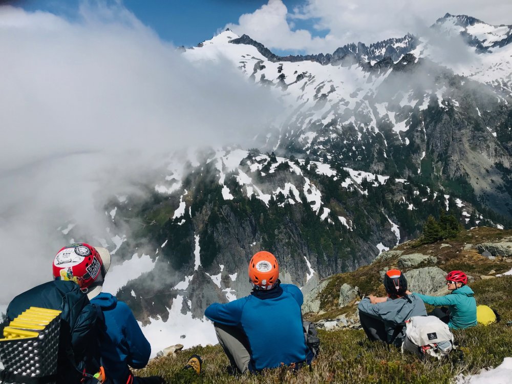
This is the best I got through the clouds. Tim, Albert or Sean may have gotten something clearer if you check with them.


[TR] Mount Terror - West Ridge 07/25/2020
in North Cascades
Posted
I found an old lost summit register on Luna last year that was a film canister from the 70s. Most of the pages were crumbled and faded beyond recognition.