
geosean
-
Posts
190 -
Joined
-
Last visited
-
Days Won
38
Content Type
Profiles
Forums
Events
Posts posted by geosean
-
-
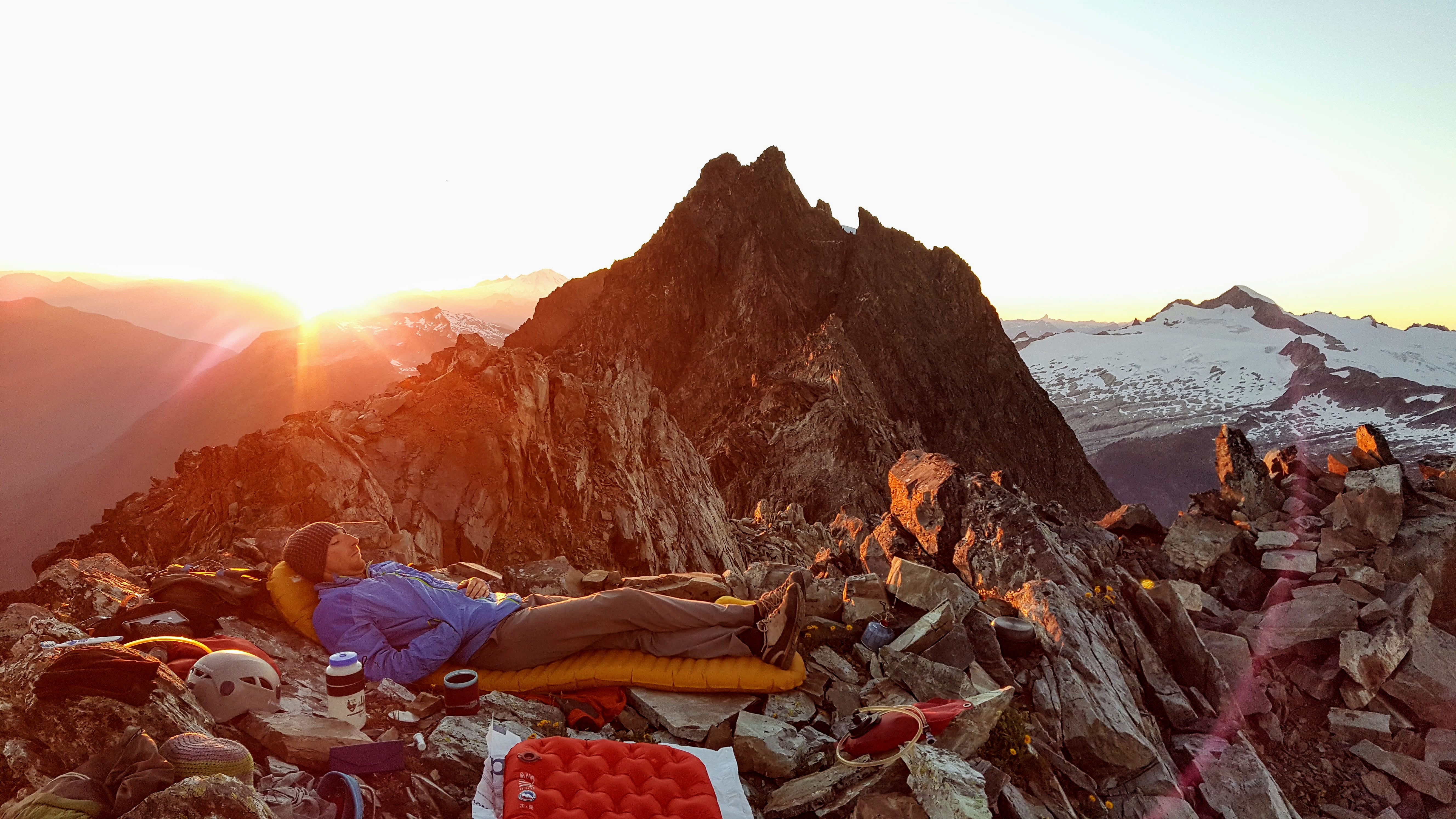
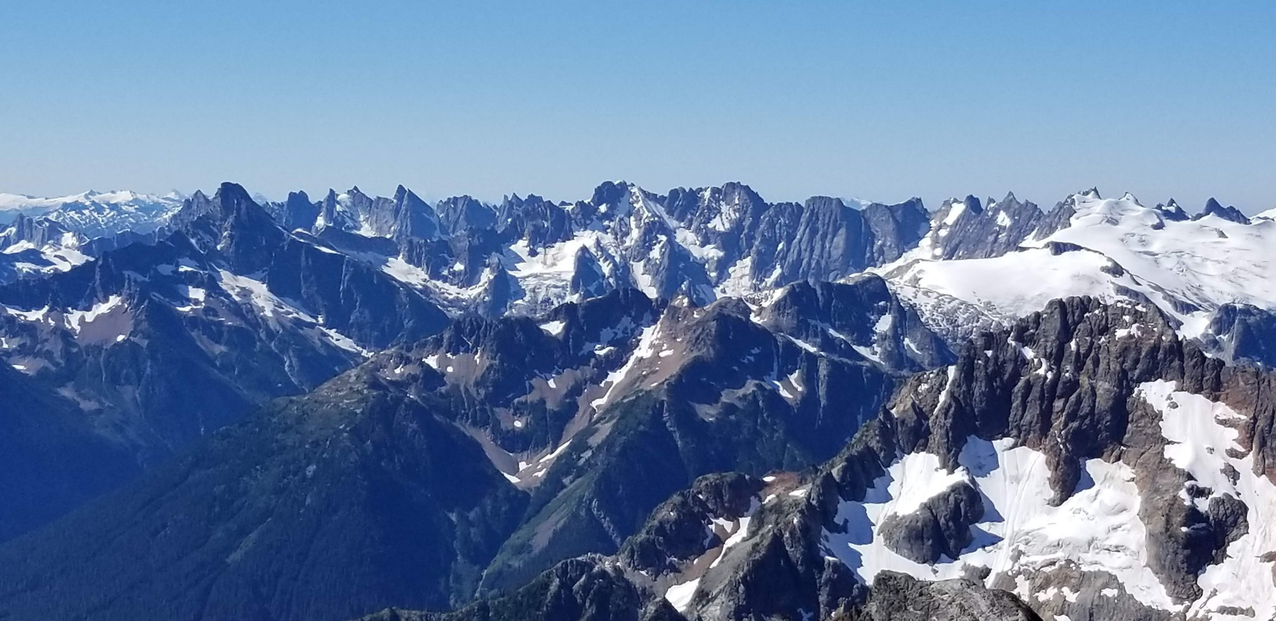
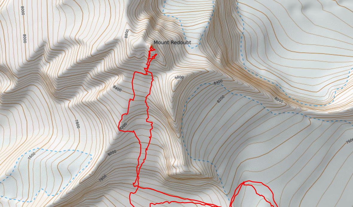
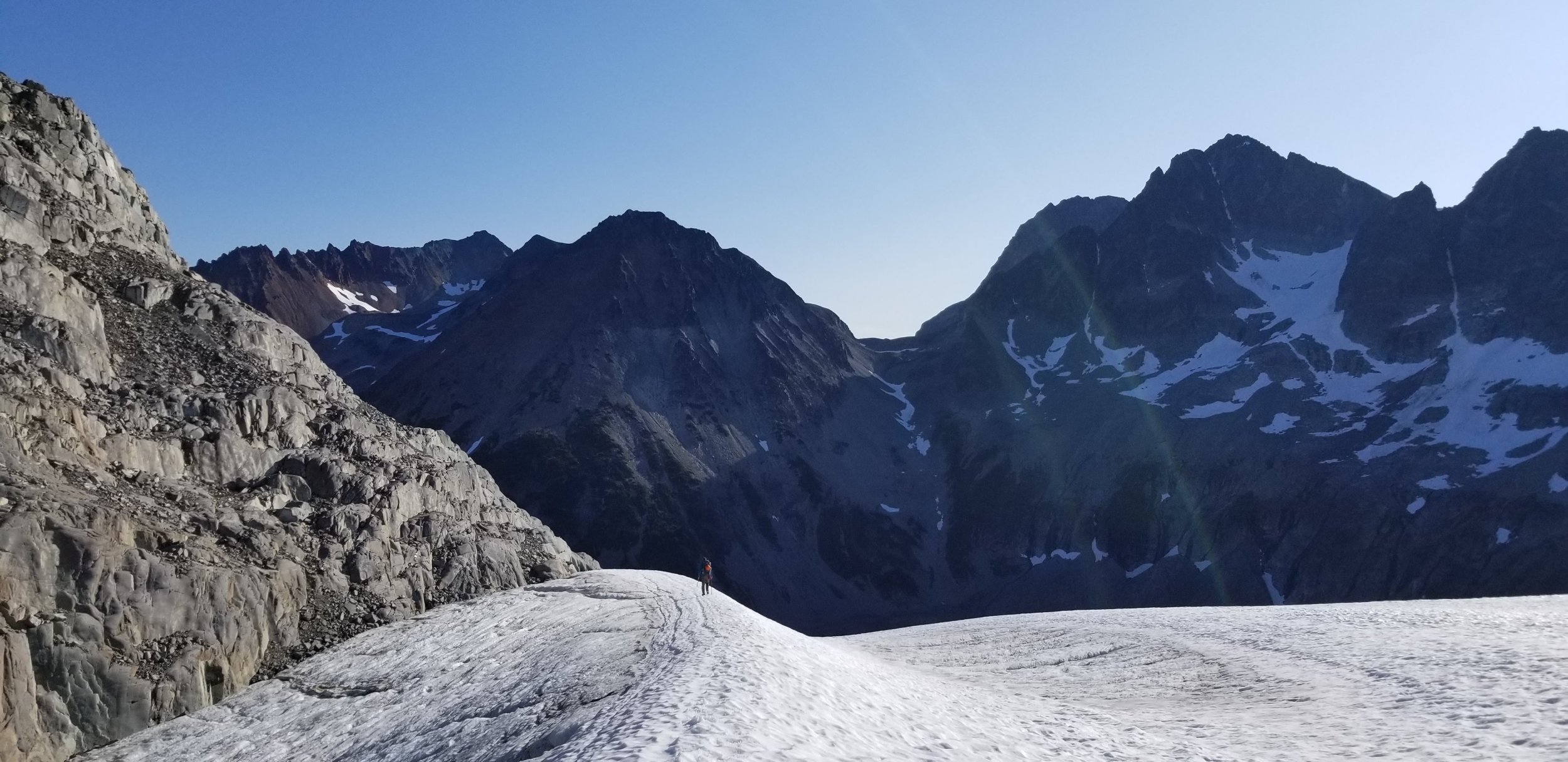
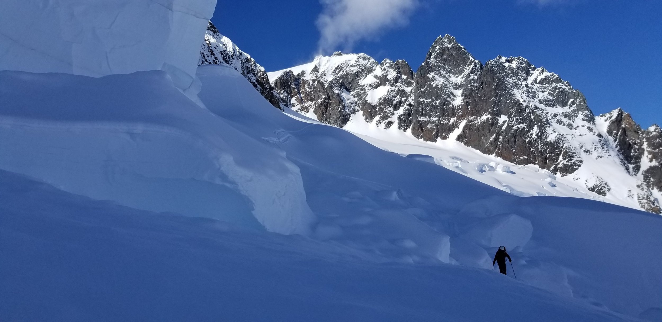
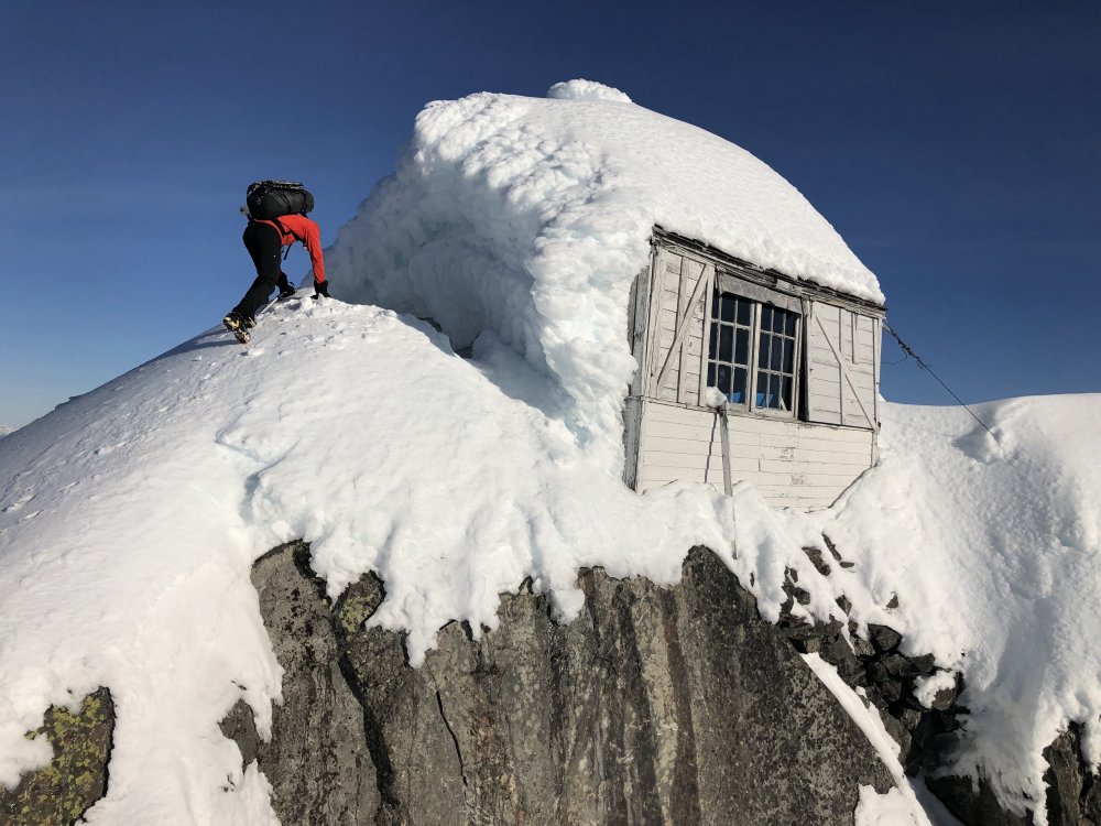
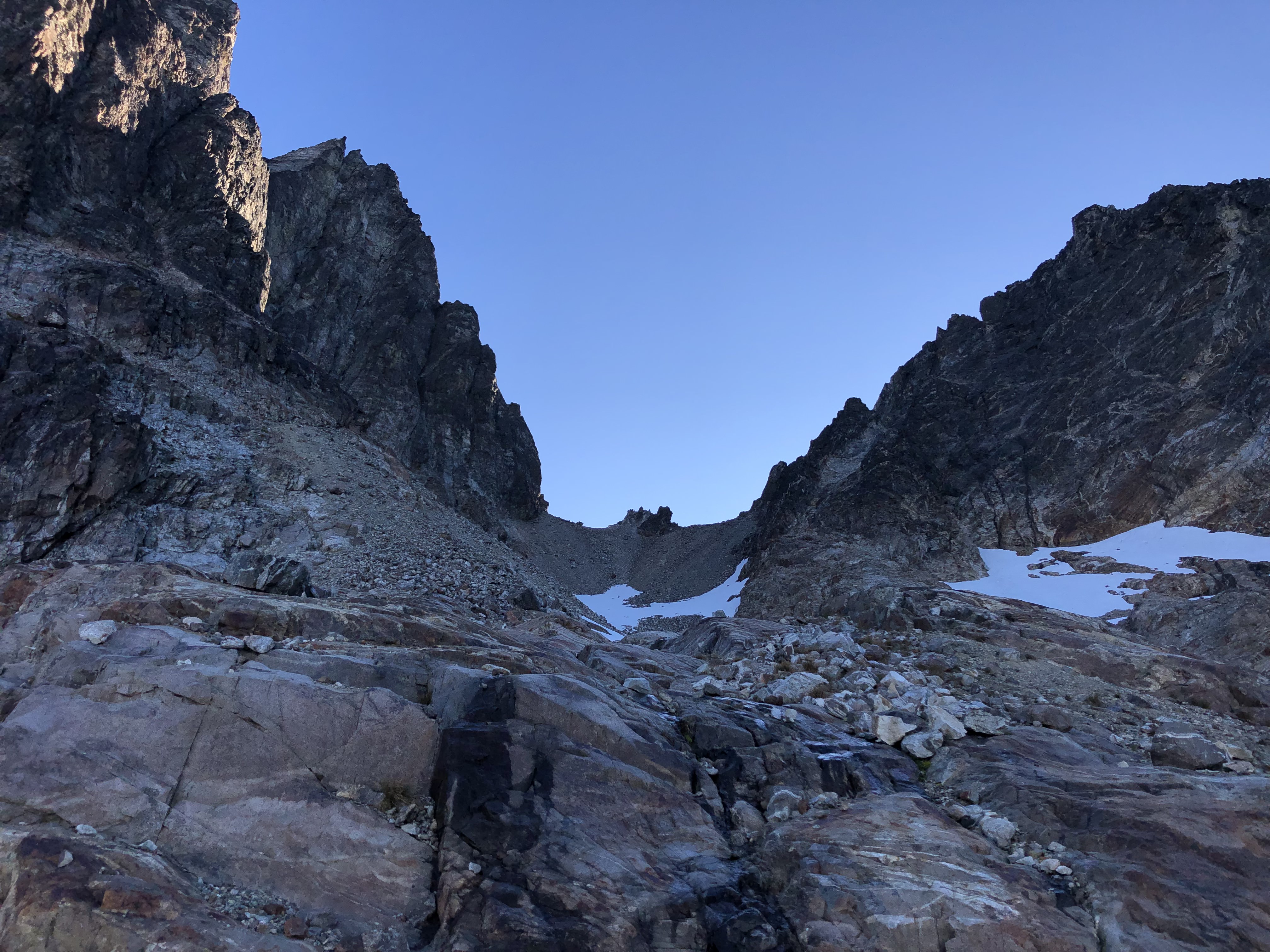
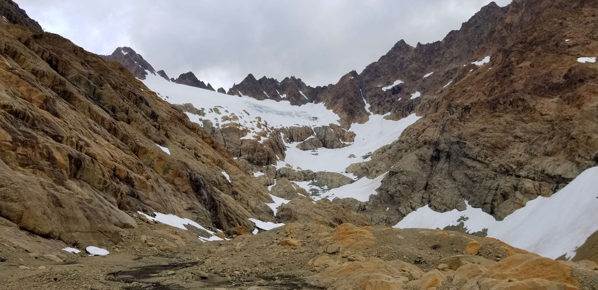
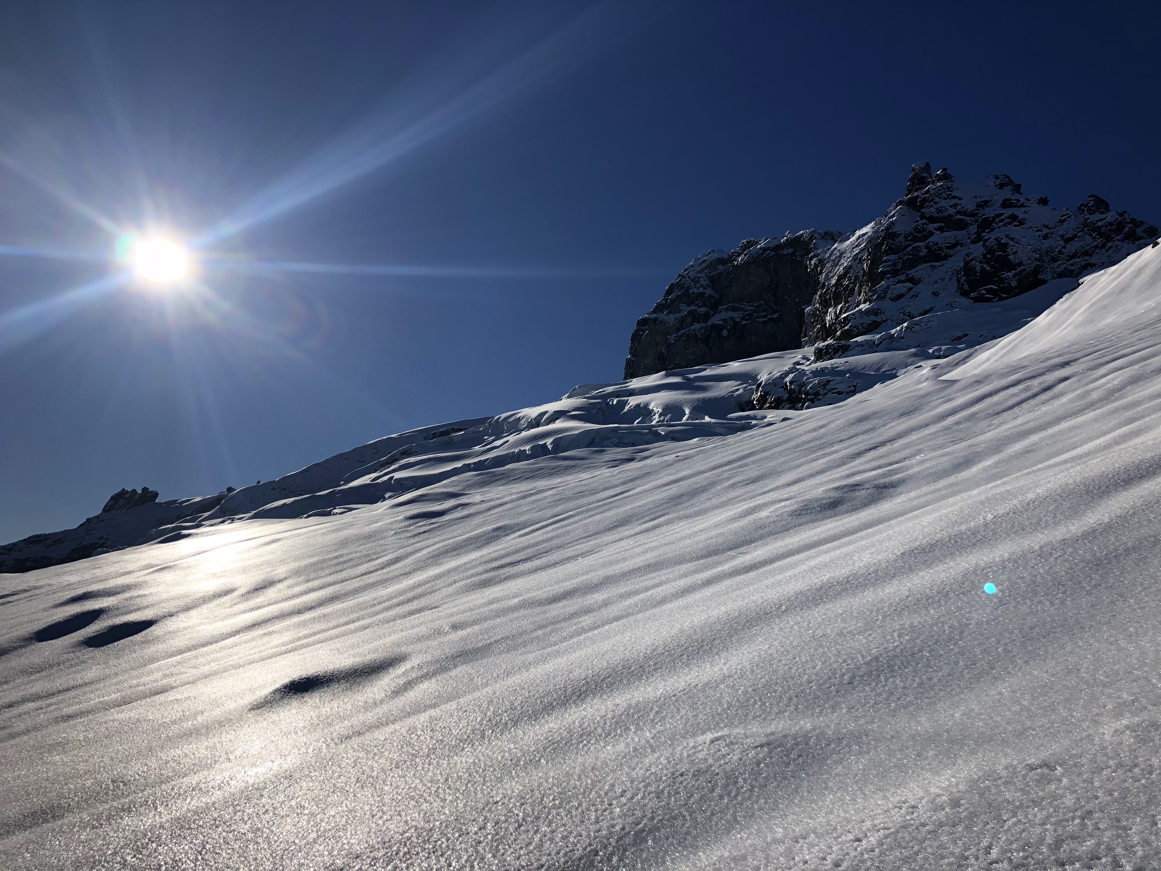
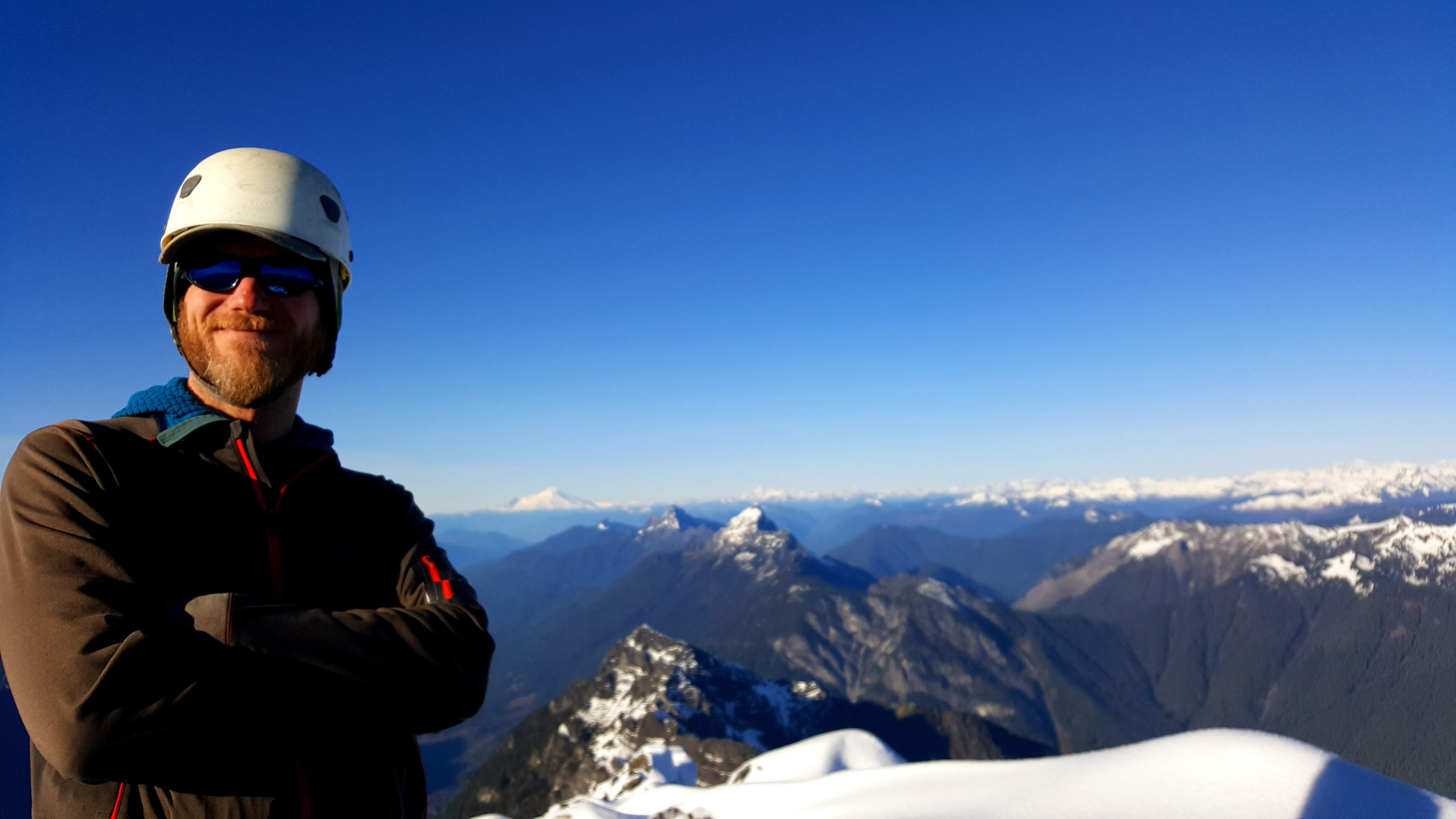
Trip: SE Mox, NW Mox, Mount Redoubt - West Ridge, SE Face, South Route
Trip Date: 07/25/2019
Trip Report:
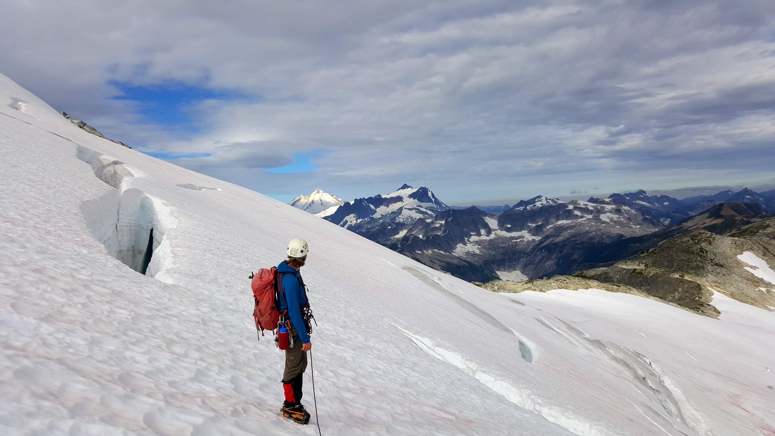
@Albuquerque Fred and I were at it again, this time up in the Depot Creek drainage over July 25-28. Fred had gone up a month prior to scout the approach and tick off the requisite easy Bulger peaks. Now we were back to get the ones he needed my help on.
")
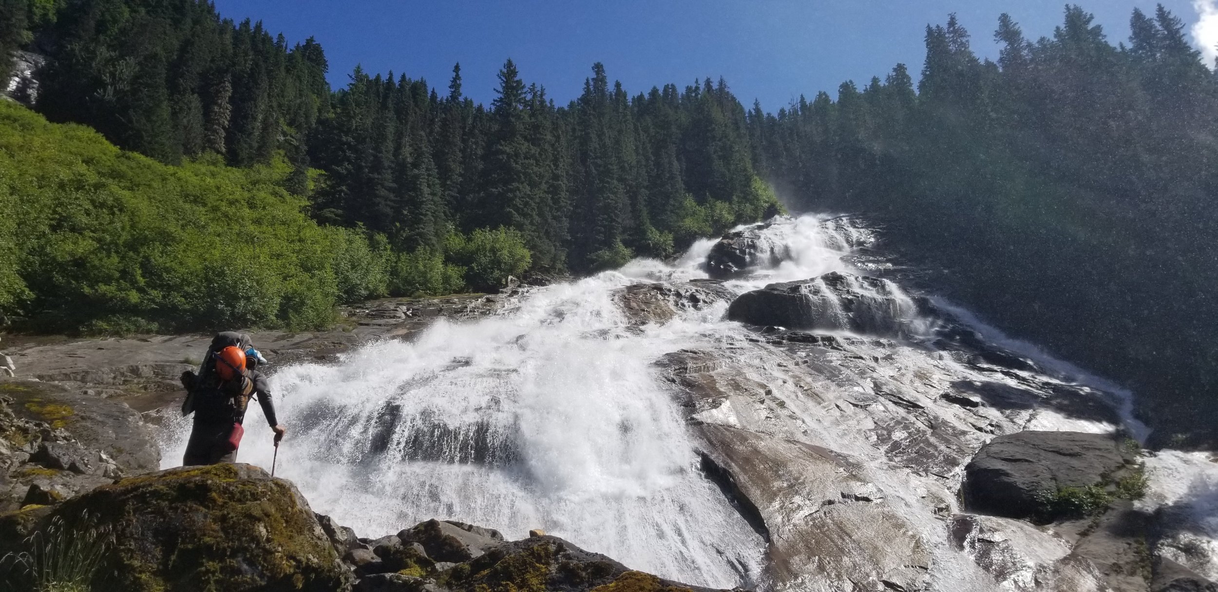
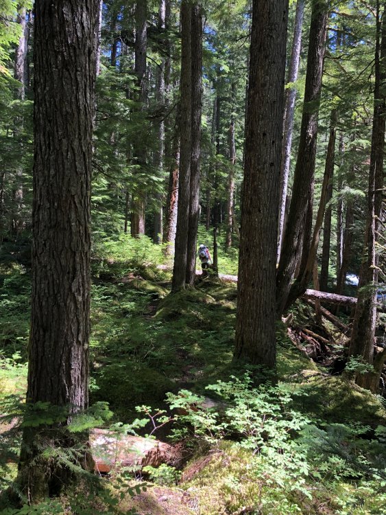
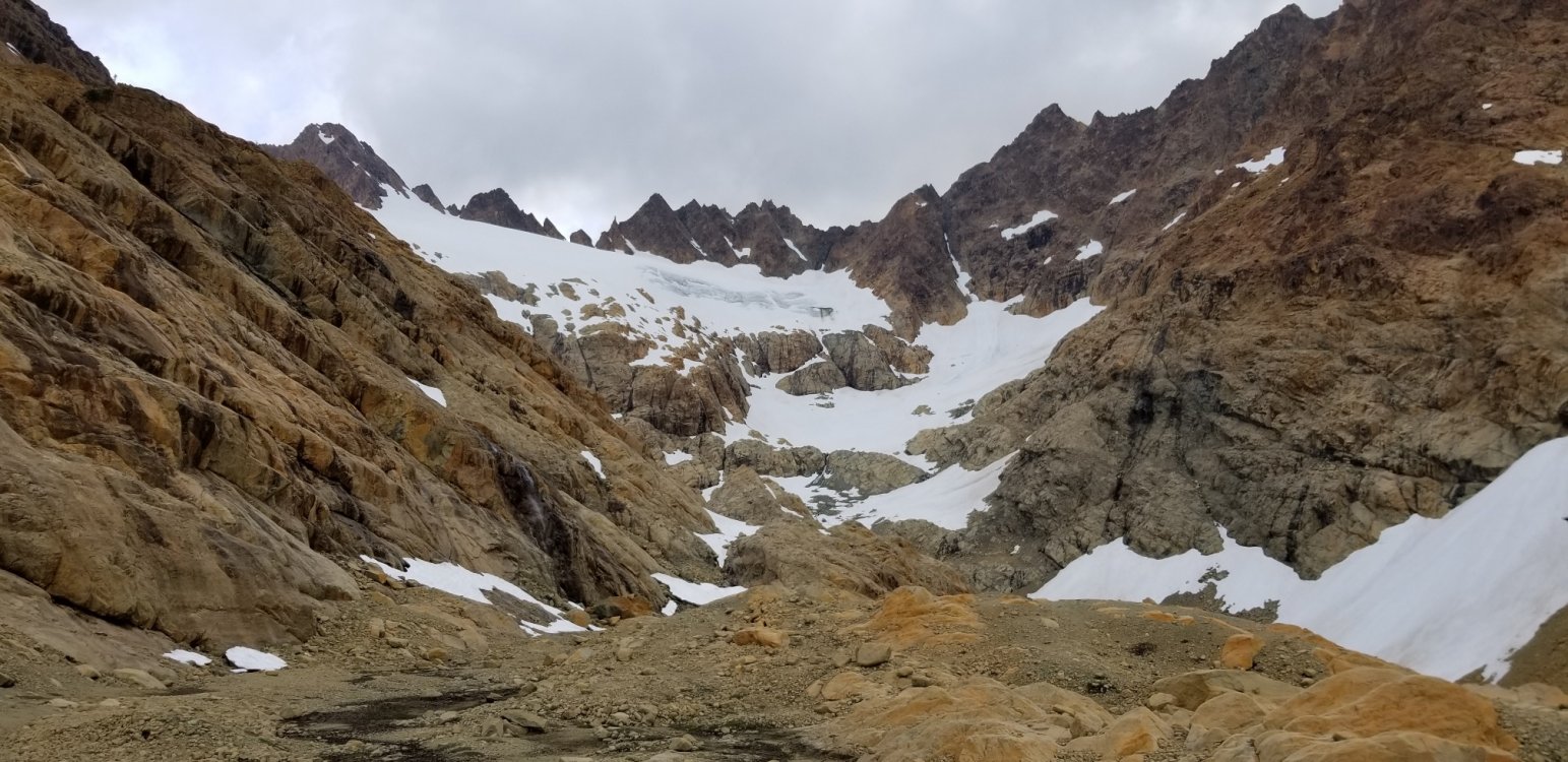
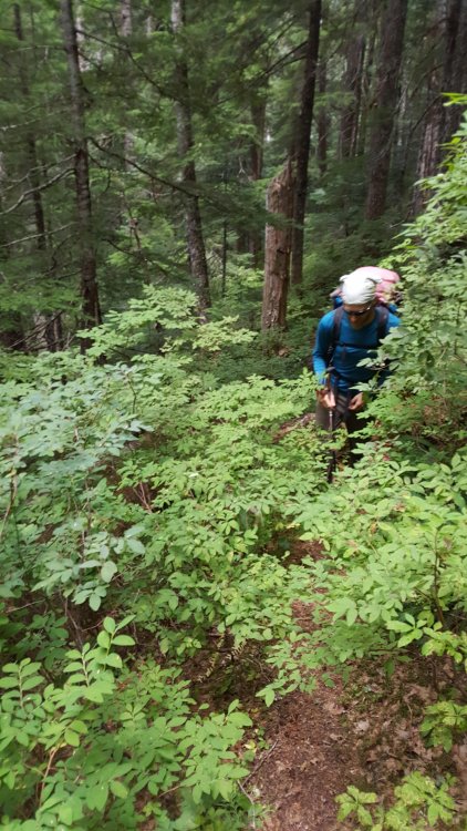
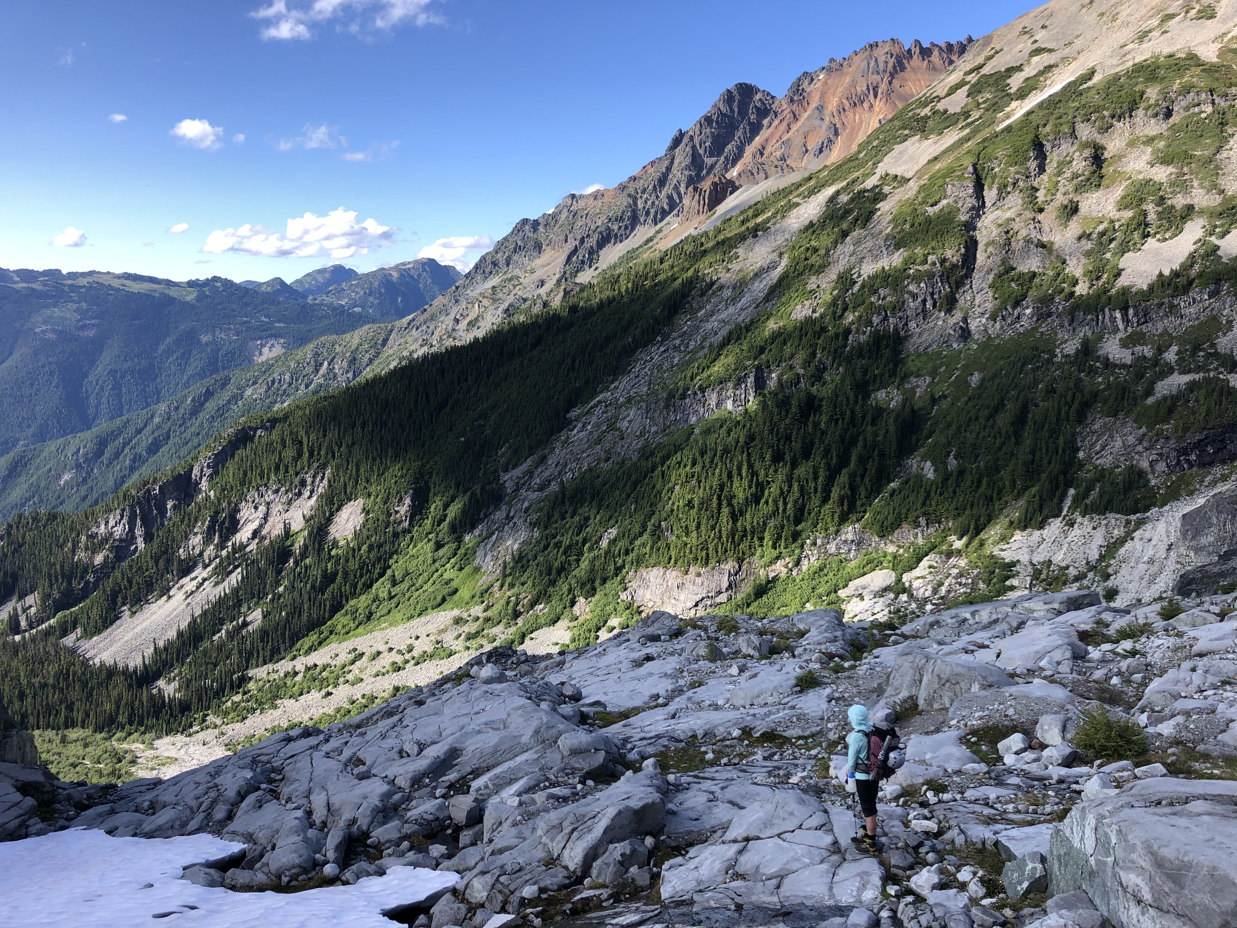
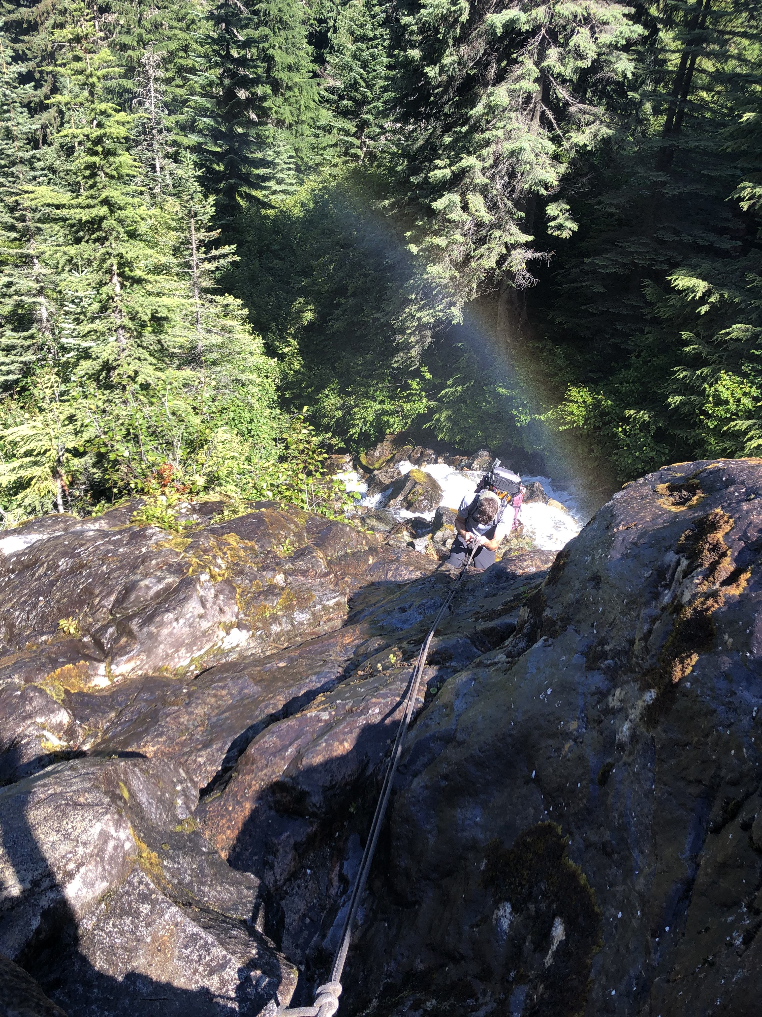
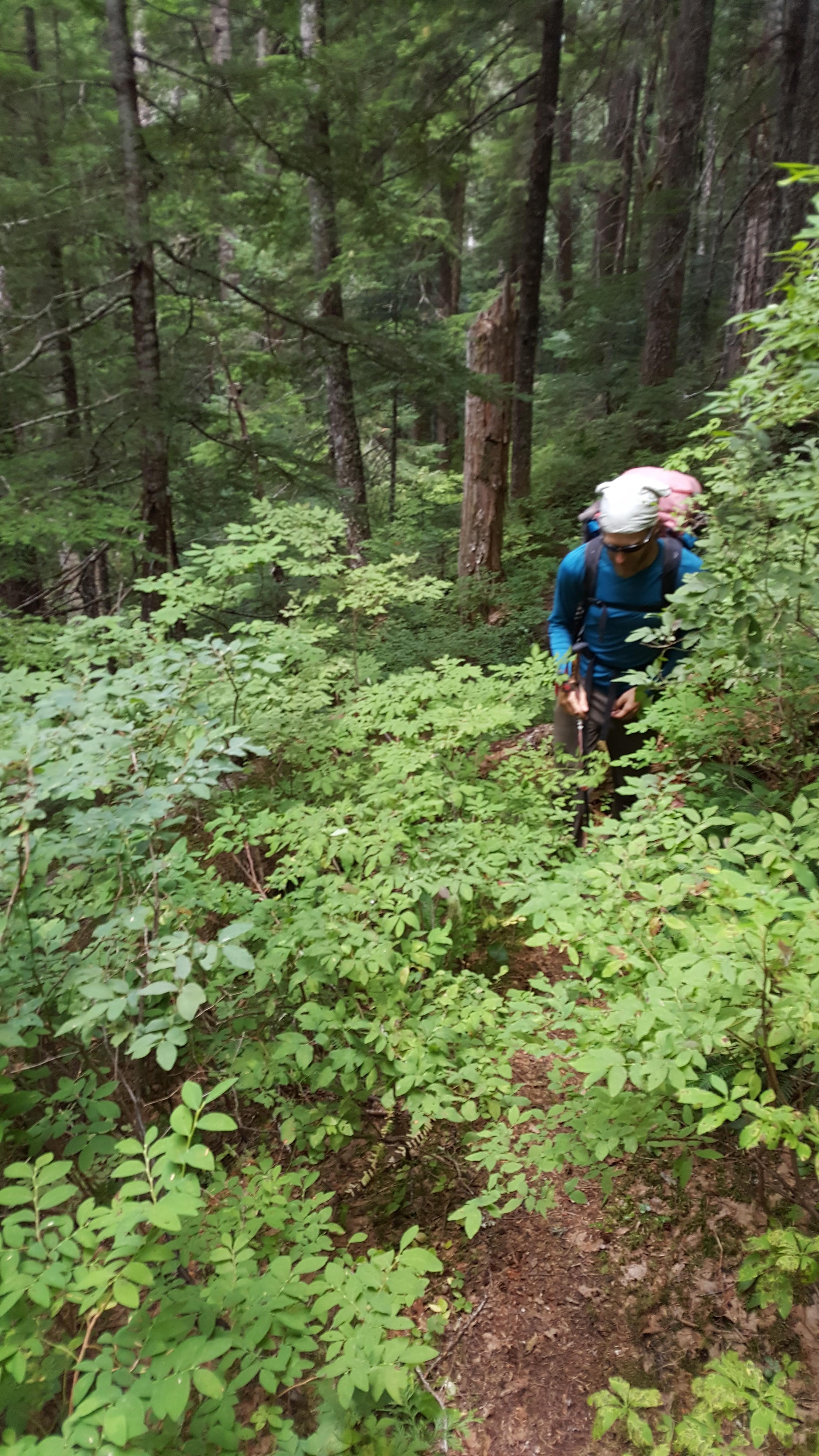
We hiked in on Thursday none too early after Fred graciously picked up the permit in Sedro Woolley. If you follow Steph's approach beta you will do fine. The trail was decent, we lost it a couple of times, but only once for more than a minute. There was brush... and deadfall, and mud and swamps and bugs and waterfalls and fixed ropes and bear crap and loose moraines and stream crossings. No problem. It took us 7 hours to 7200' camp at Redoubt saddle. If you are used to climbing in the Cascades it's a little worse than the average for a trail, but better than off-trail.
Fred and the falls:
Me somewhere along the trail photo by Fred:
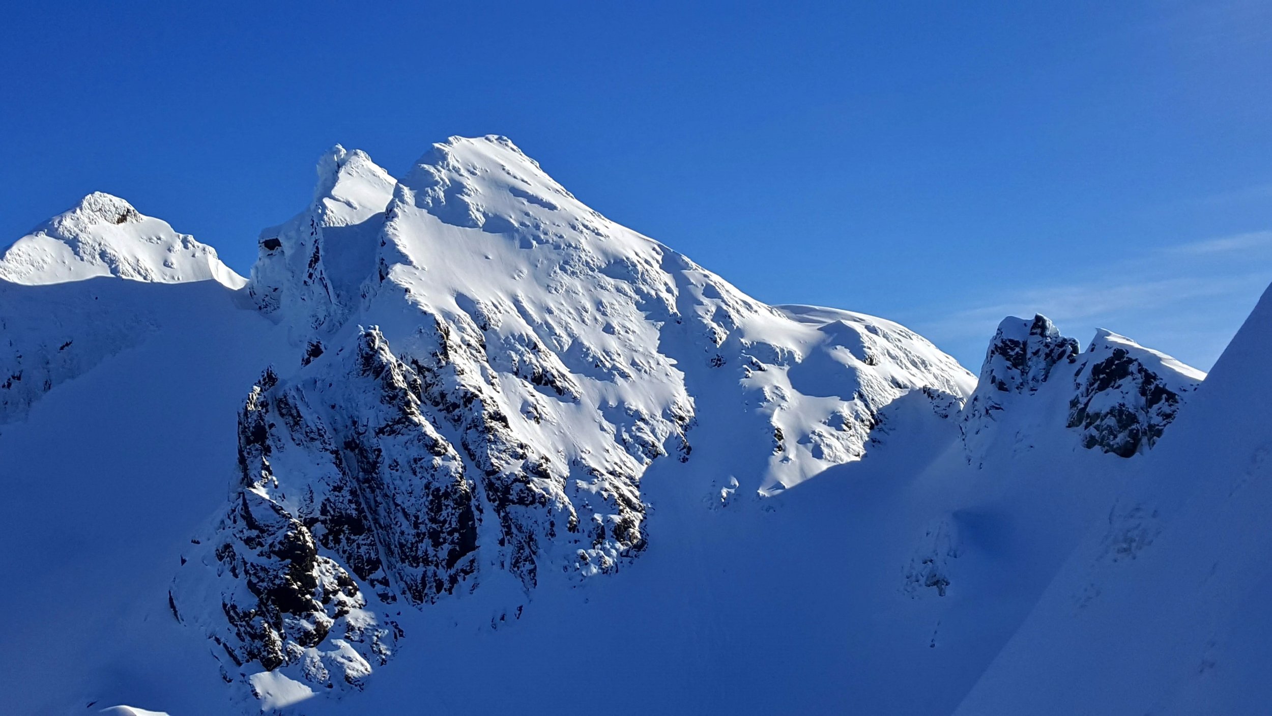
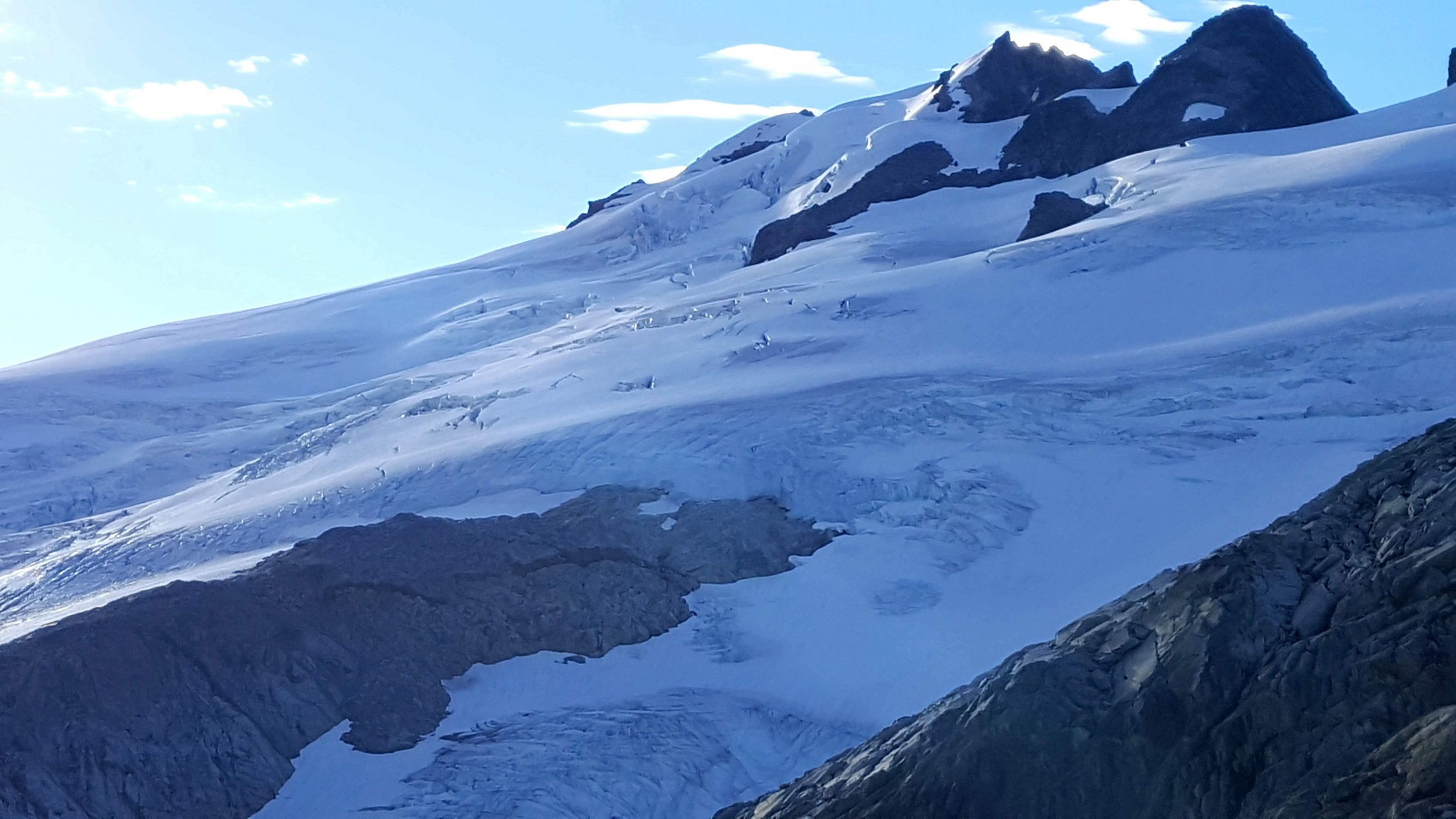
Redoubt N Face, photo by Fred:
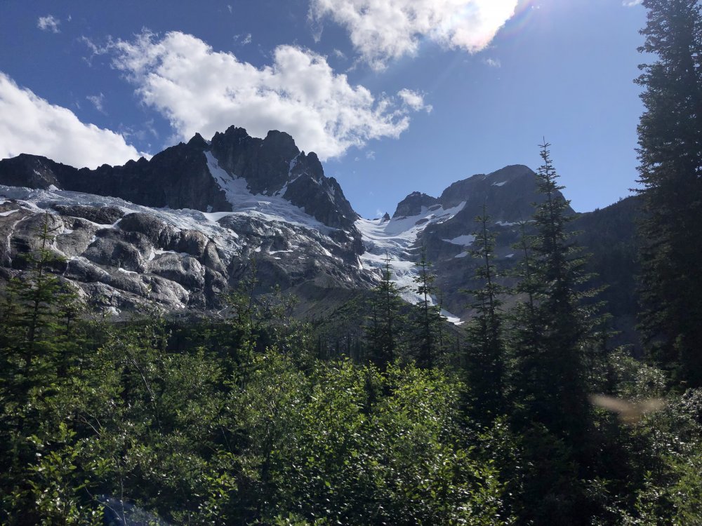
Me below the glacier on the direct route to 7200' camp, photo by Fred:

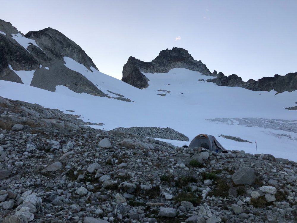
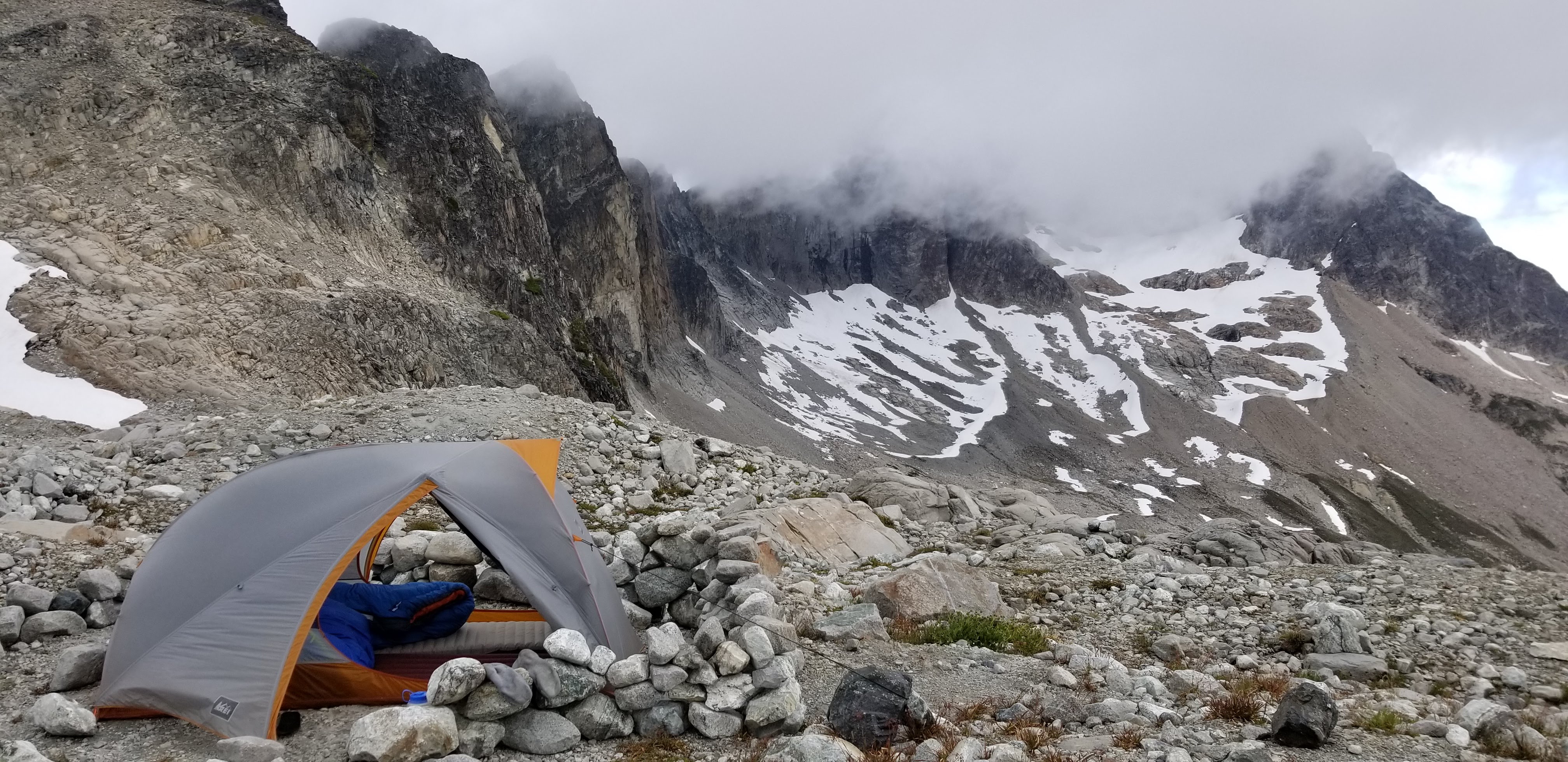
Camp below Redoubt:
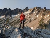
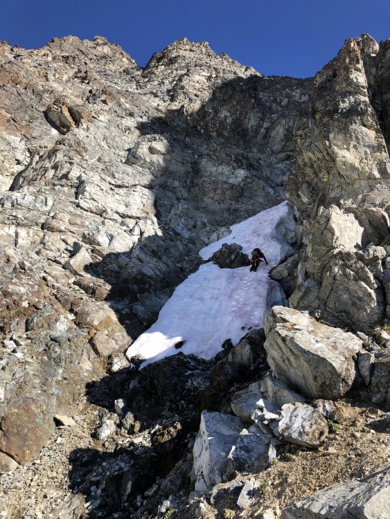
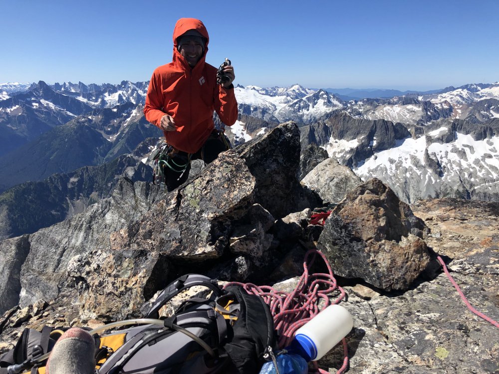
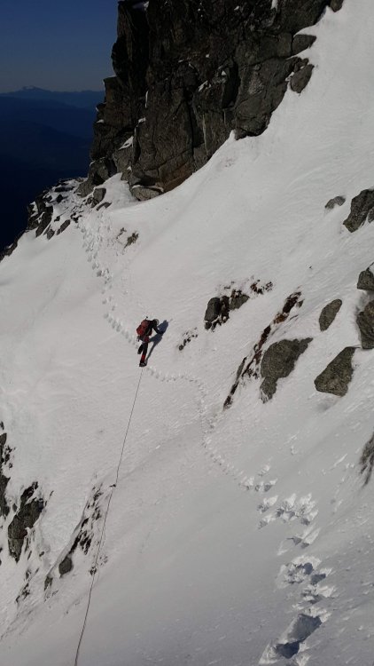
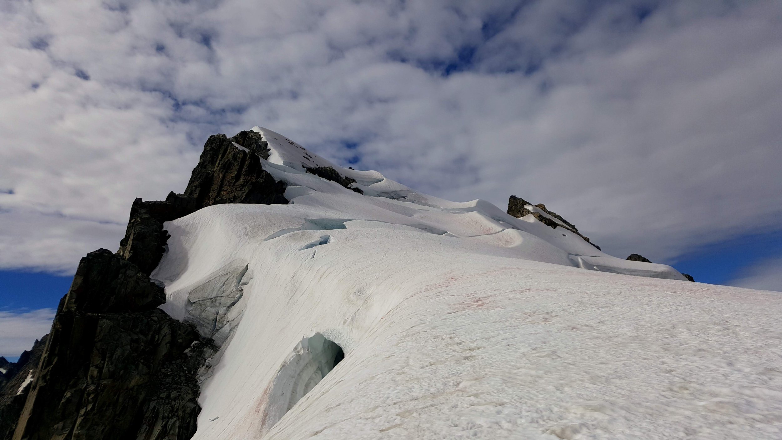
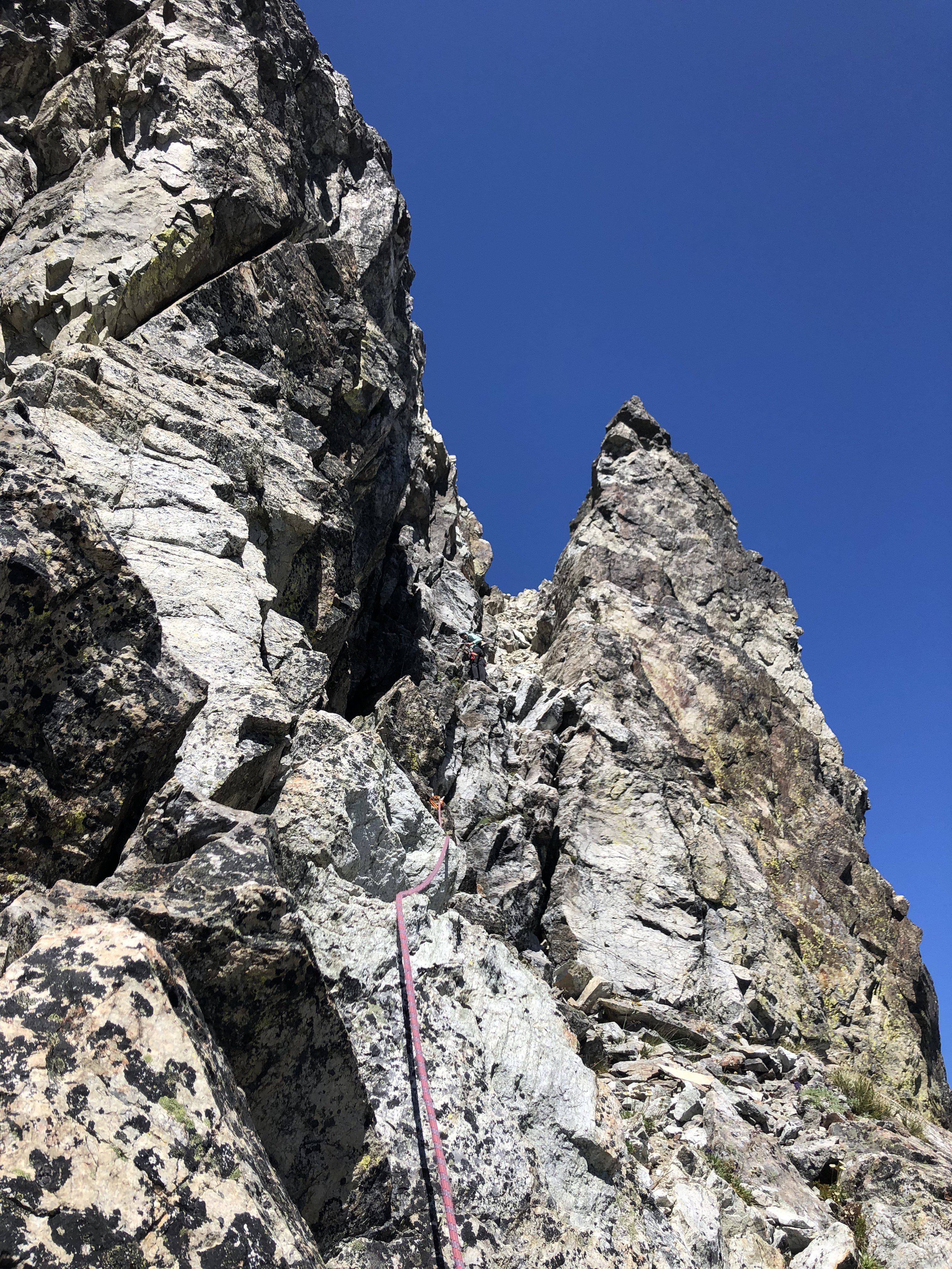
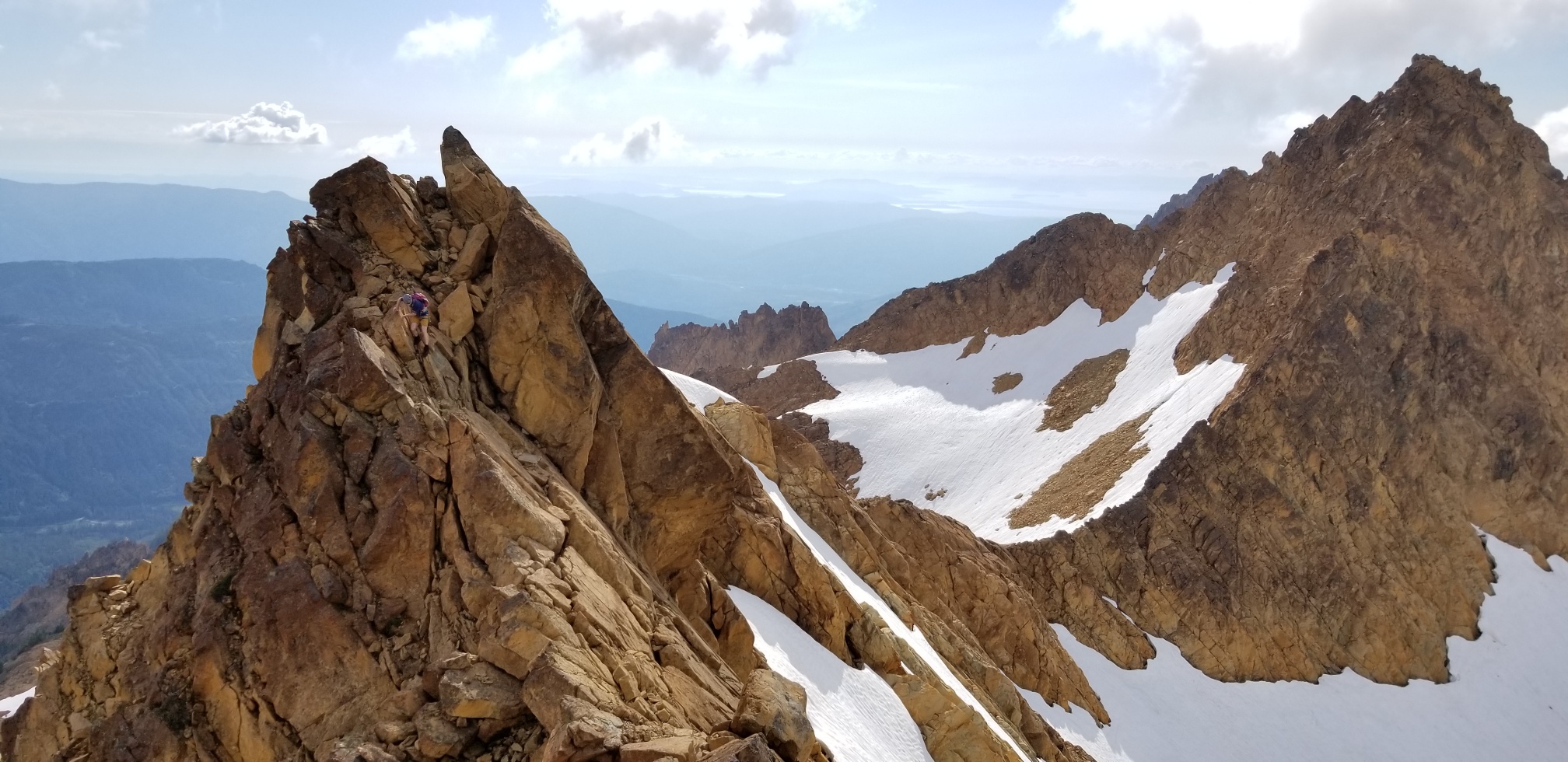
Friday we climbed both Mox Spires beginning with SE (or "Hard") Mox. This turned out to be much easier than "Easy" Mox. The route finding was my biggest concern going in as it sounded complicated, but Beckey was dead on. Follow his beta, we never went wrong. Ignore Klenke and his heavy-handedness, the best beta has been available in print for decades. It was a great climb; if you like loose gullies and lots of route finding on moderate ground to a very moderate rock climb, with more loose rock, as I do, then this is for you.
We did 6 hours Col Of The Wild to the summit and back to the col, exactly as Beckey states, with about 30-45 min on the summit.
Fred on the approach:

Col Of The Wild, photo by Fred:

Me downclimbing the "major snow gully" photo by Fred:
Fred's silhouette on route:
Pickets:
My favorite part, cleaning up old rap tat, photo by Fred. Please do your part too; if is not good enough to rap on, its trash. LNT!:
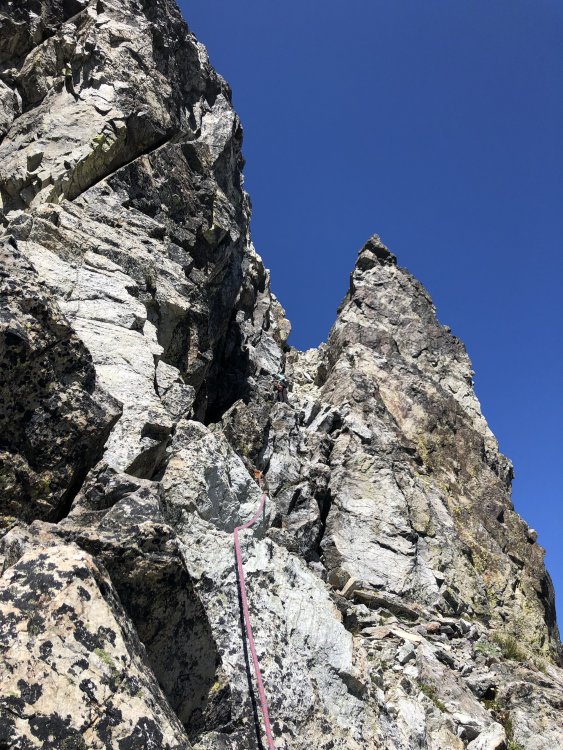
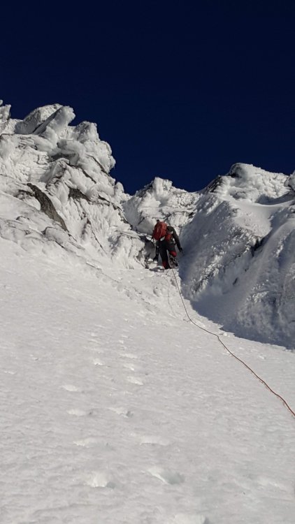
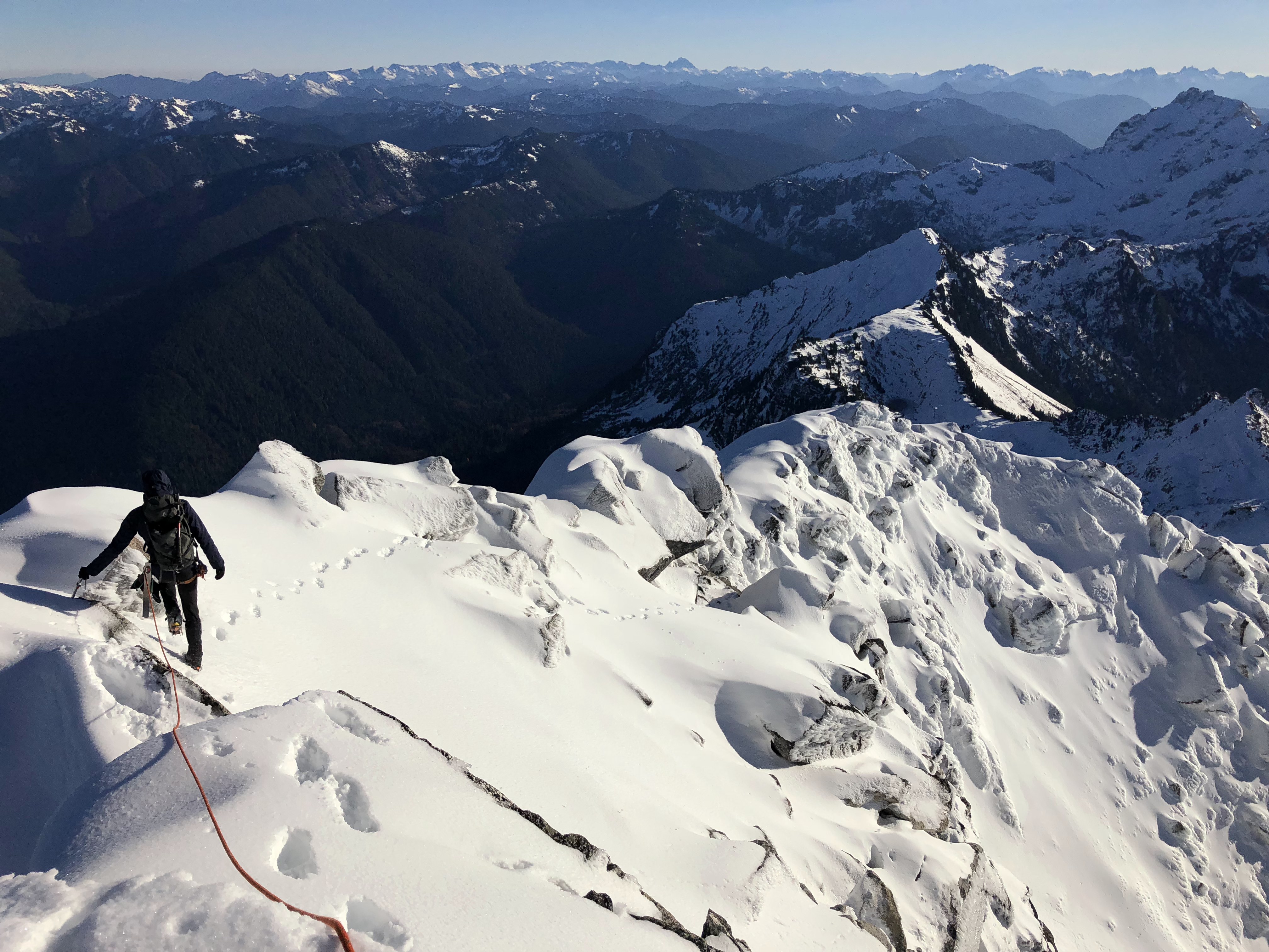
Next NW Mox, southeast face route from Col Of The Wild. We followed Matt Lemke's beta here from his NW Hikers report:
http://www.nwhikers.net/forums/viewtopic.php?t=8028072
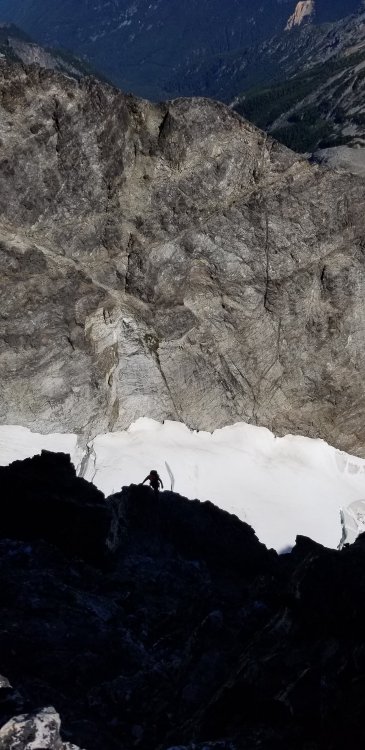
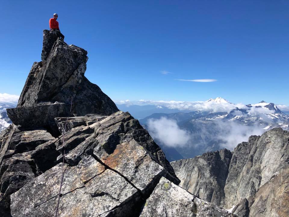
It was scary. The gully you climb is loose with lots of large detached blocks to pull on in the class 5 stretch. I lead the first pitch and I was scared; easy climbing, but no decent pro since everything is loose and/or detached. This was probably the most dangerous climbing I have ever done. Either we missed something or Matt was being ironic with his summit register comment of the route being 5 stars. Any comments would be appreciated.
The scramble was easy though and we made about 4 hours round trip. The rappelling was actually pretty safe and easy.
It was great to get both Mox peaks in one day and in reasonable time as well. If there is a better way up the SE Face of NW Mox it would be a spectacular paring. We did 13.5 hours camp to camp this day with good breaks on both summits and a long break in the basin in the afternoon.
Loose death gully, photo by Fred:
Victory pose, photo by Fred:
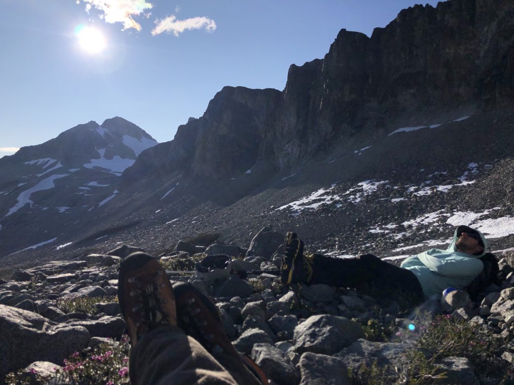
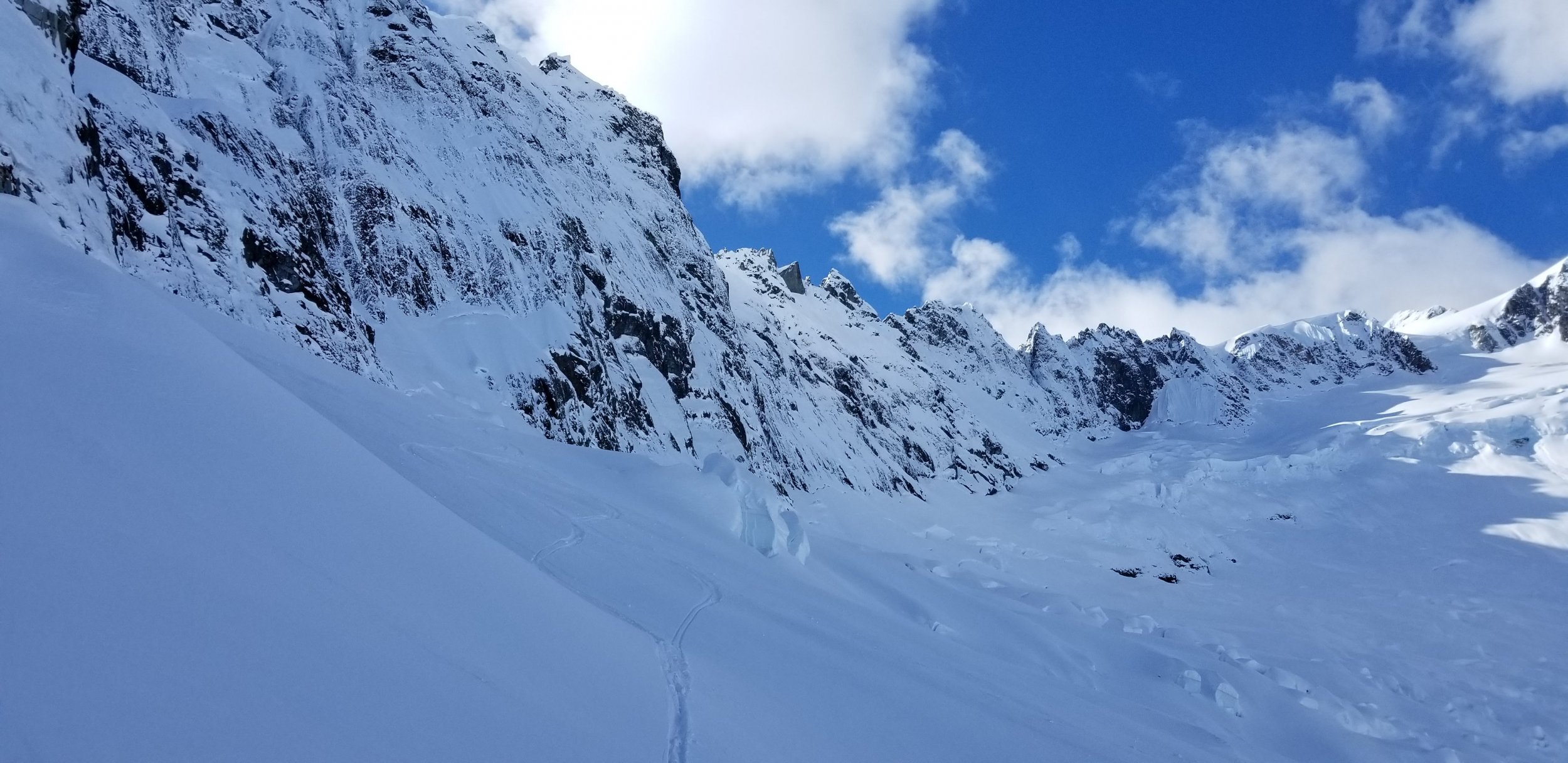
We slept in until around 9 the next morning due to rain, this was expected. All we had left to do all day was Redoubt.
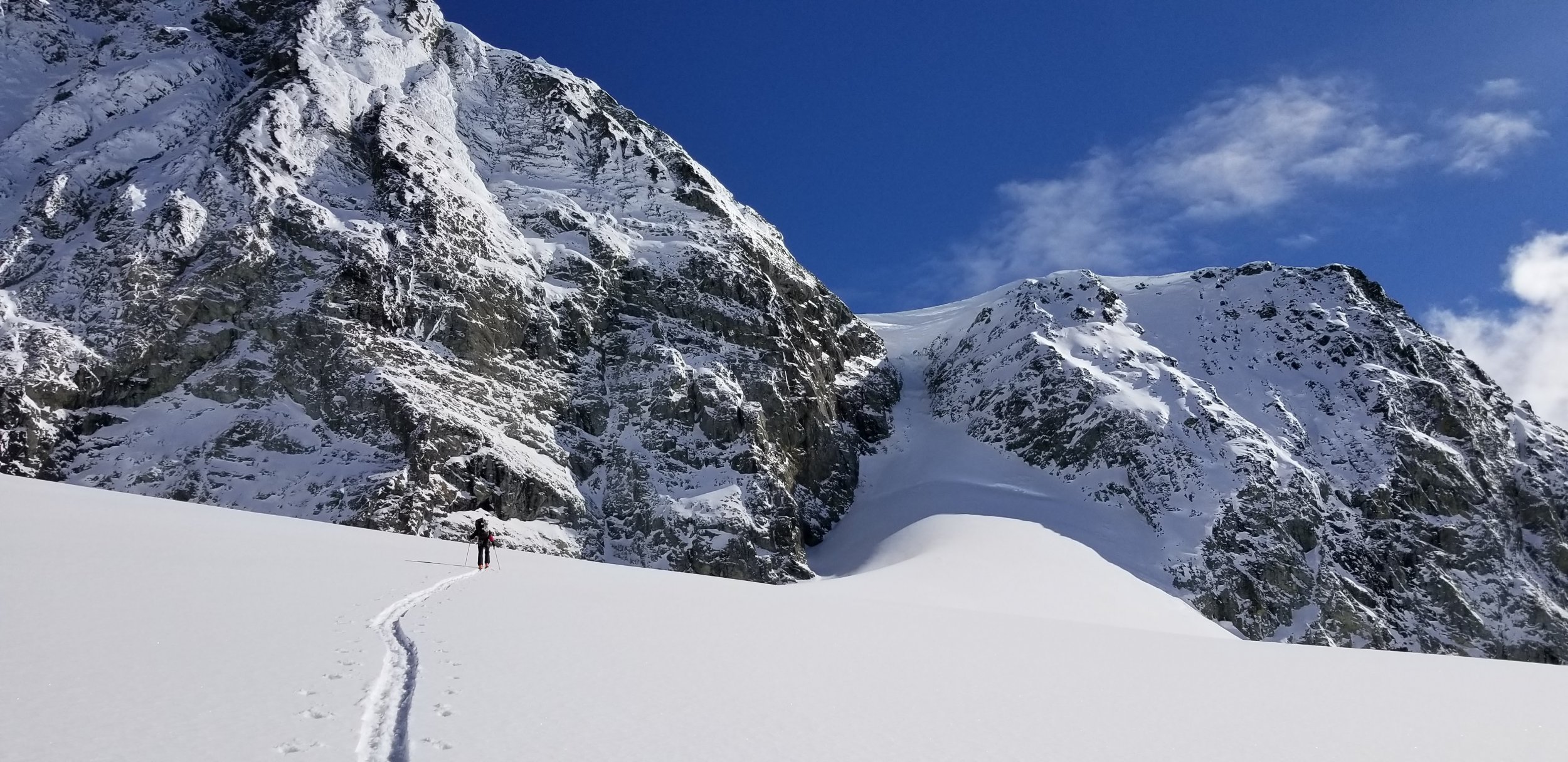
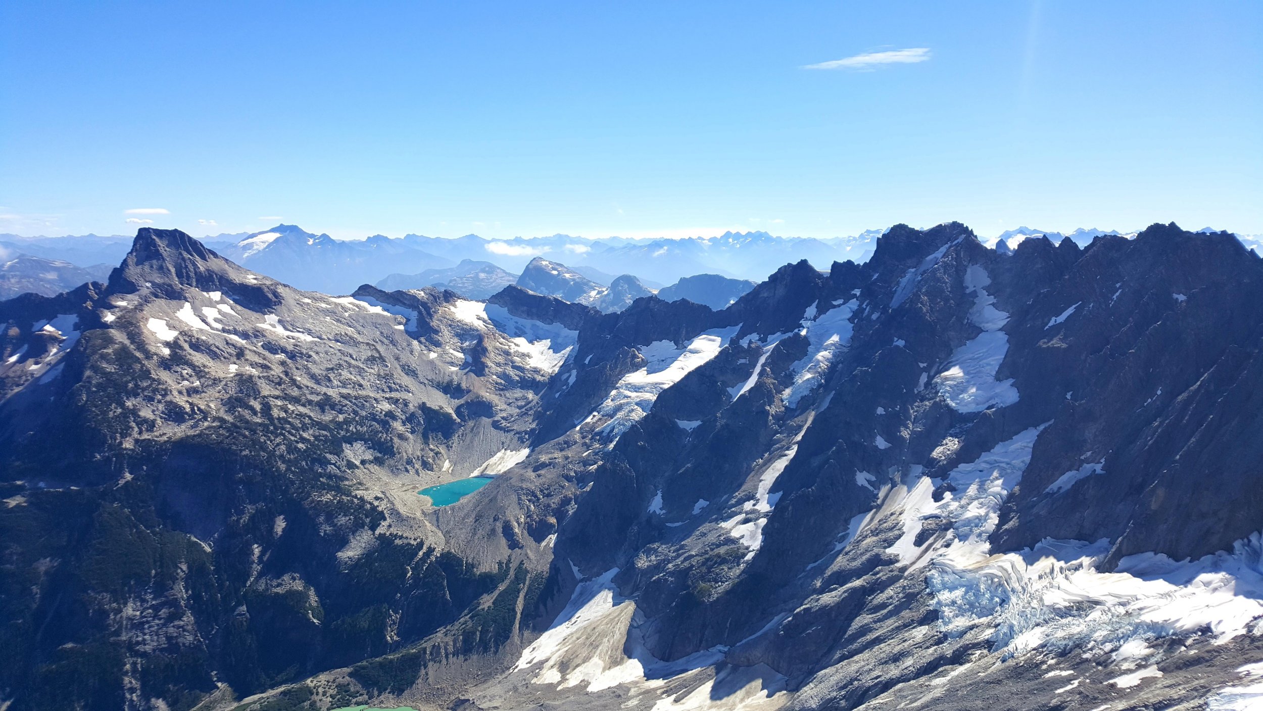
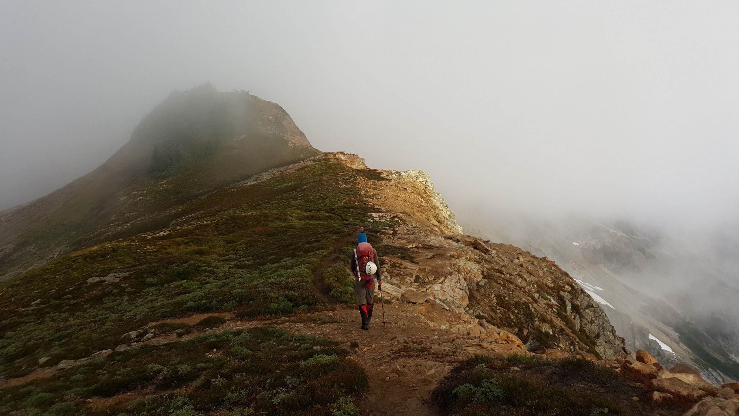
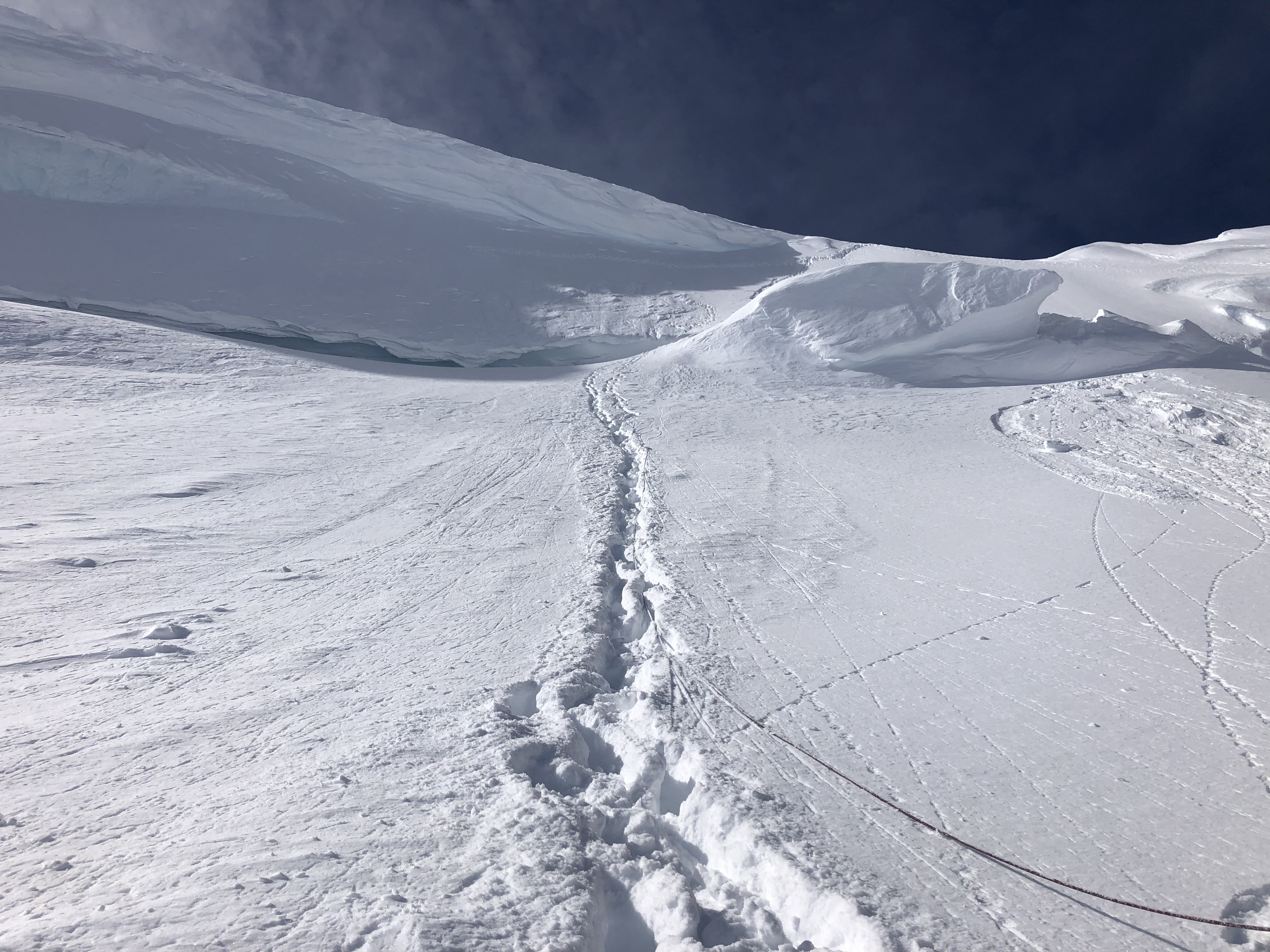
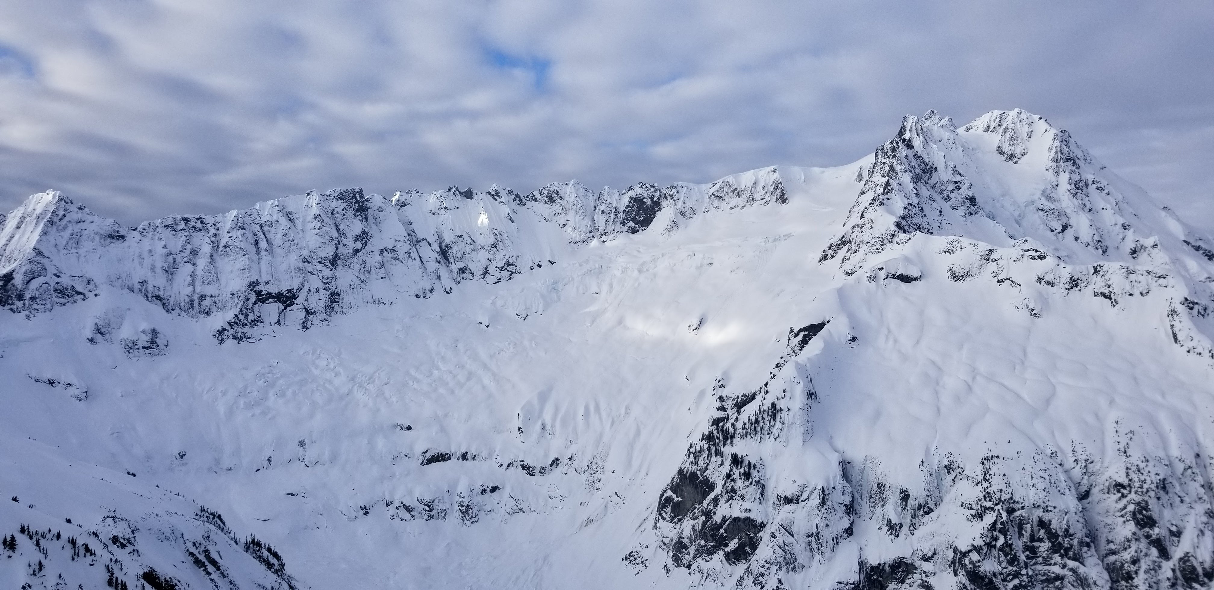
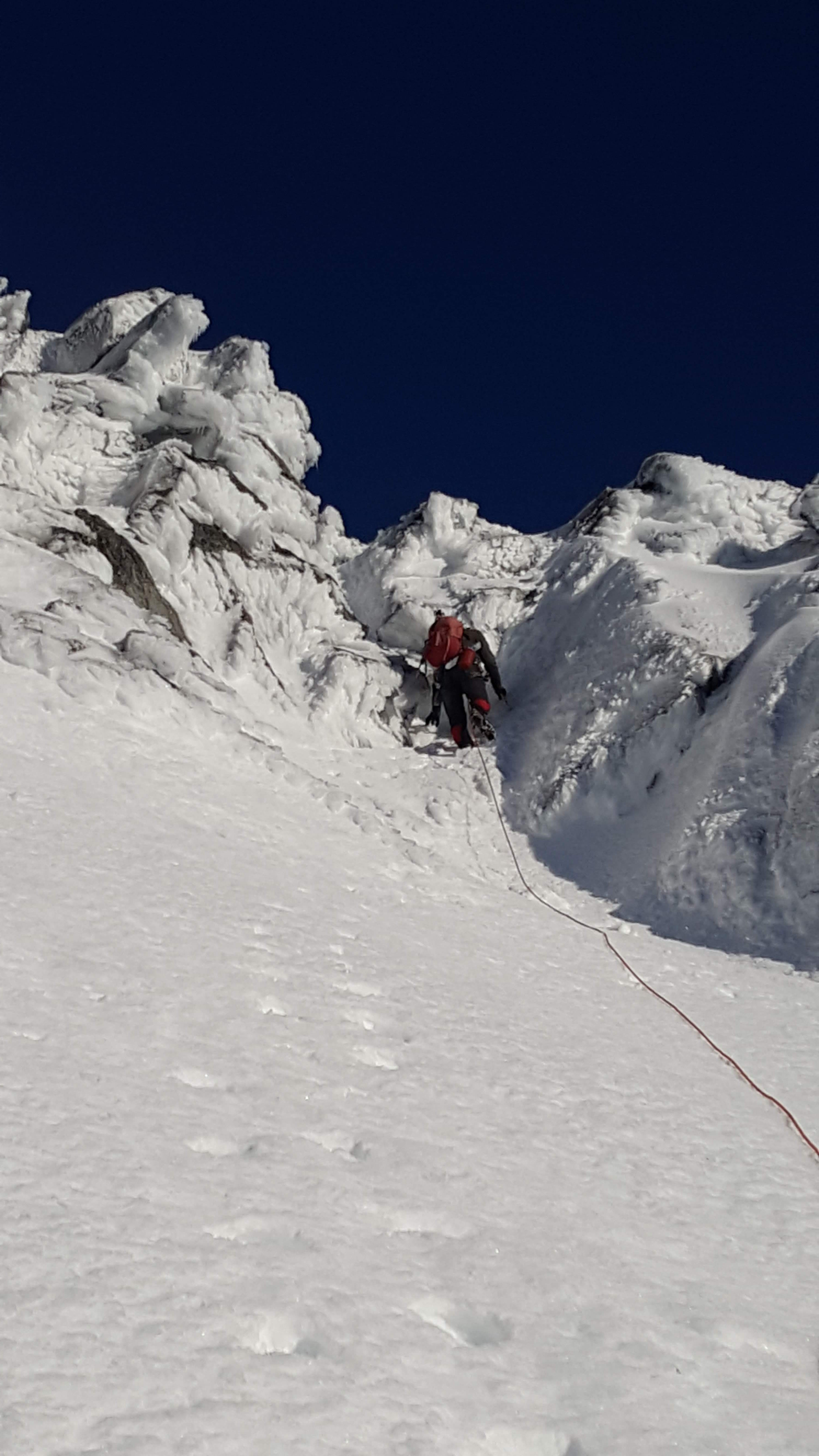
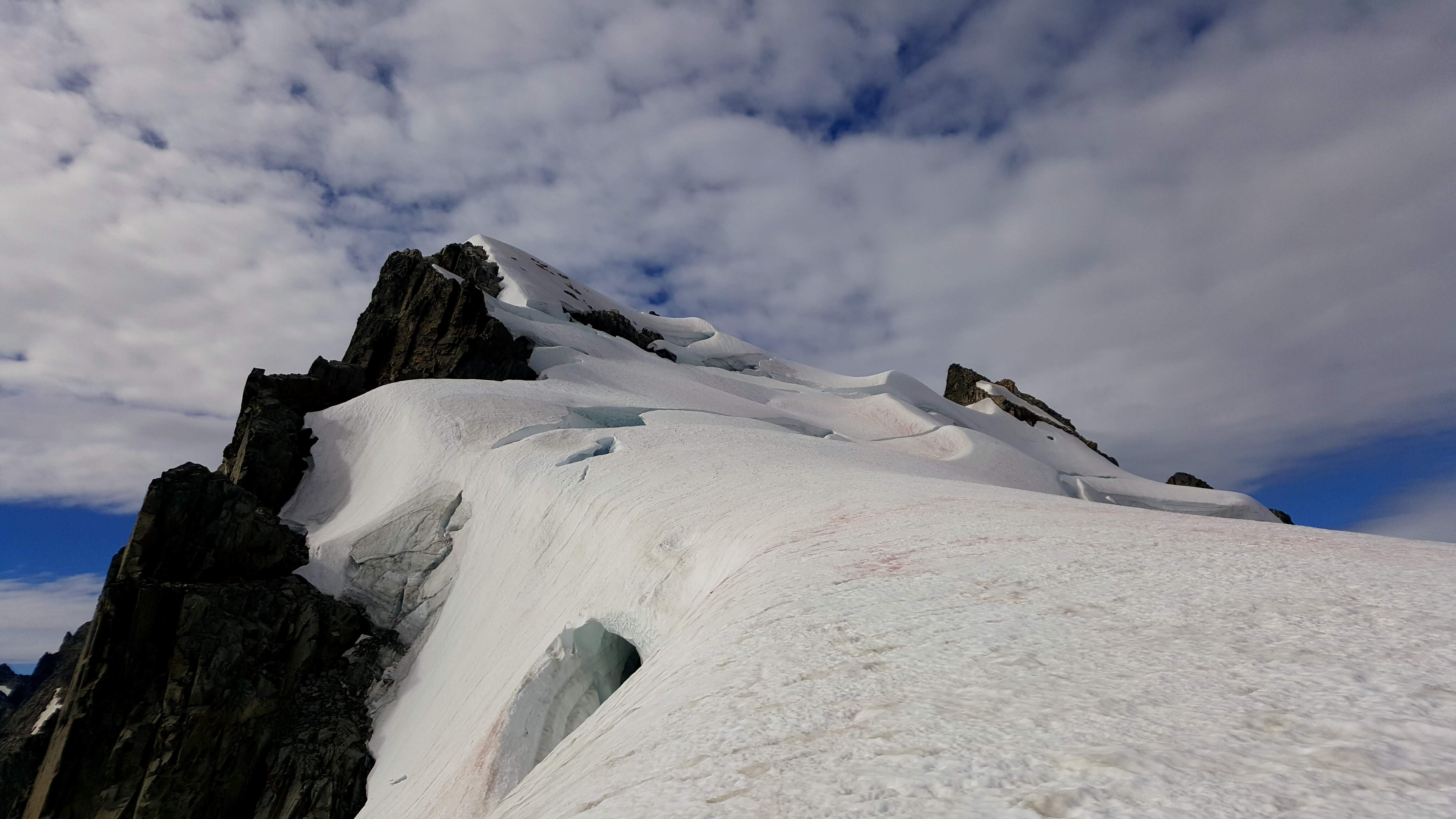
We did a bit of a route variation and instead of trending left from the first snowfield into the second snowfield and the talus we continued from the first snowfield straight up a narrowing snow couloir to within 300' of the summit. Then we scrambled left in a rusty chossy gully to regain the standard route at a minor notch in a small buttress. The scrambling was easy with one tough move at the "cannon hole". We mostly followed Steph Abegg's beta here, limited but sufficient.
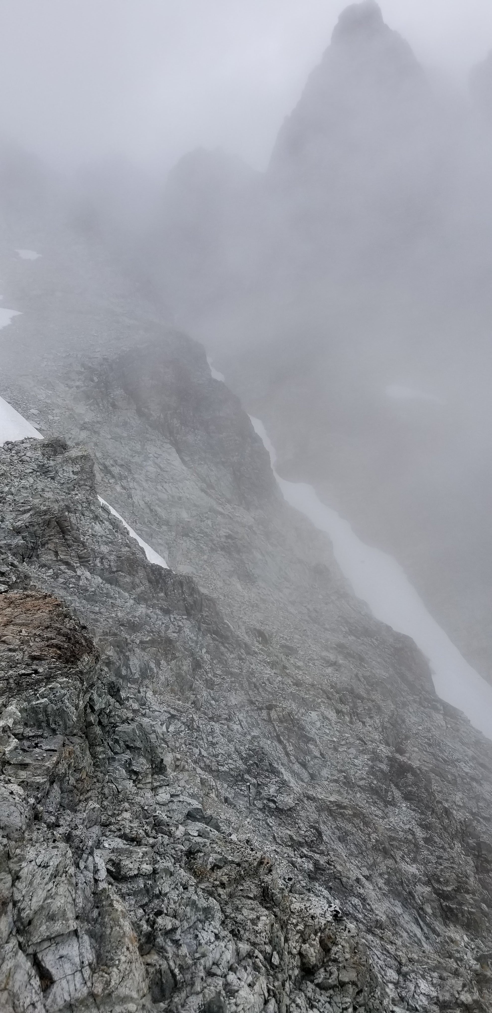
The views were non-existent on top so we descended fairly quickly, going down the more standard route.
View up-route from the basin on the south of Redoubt:
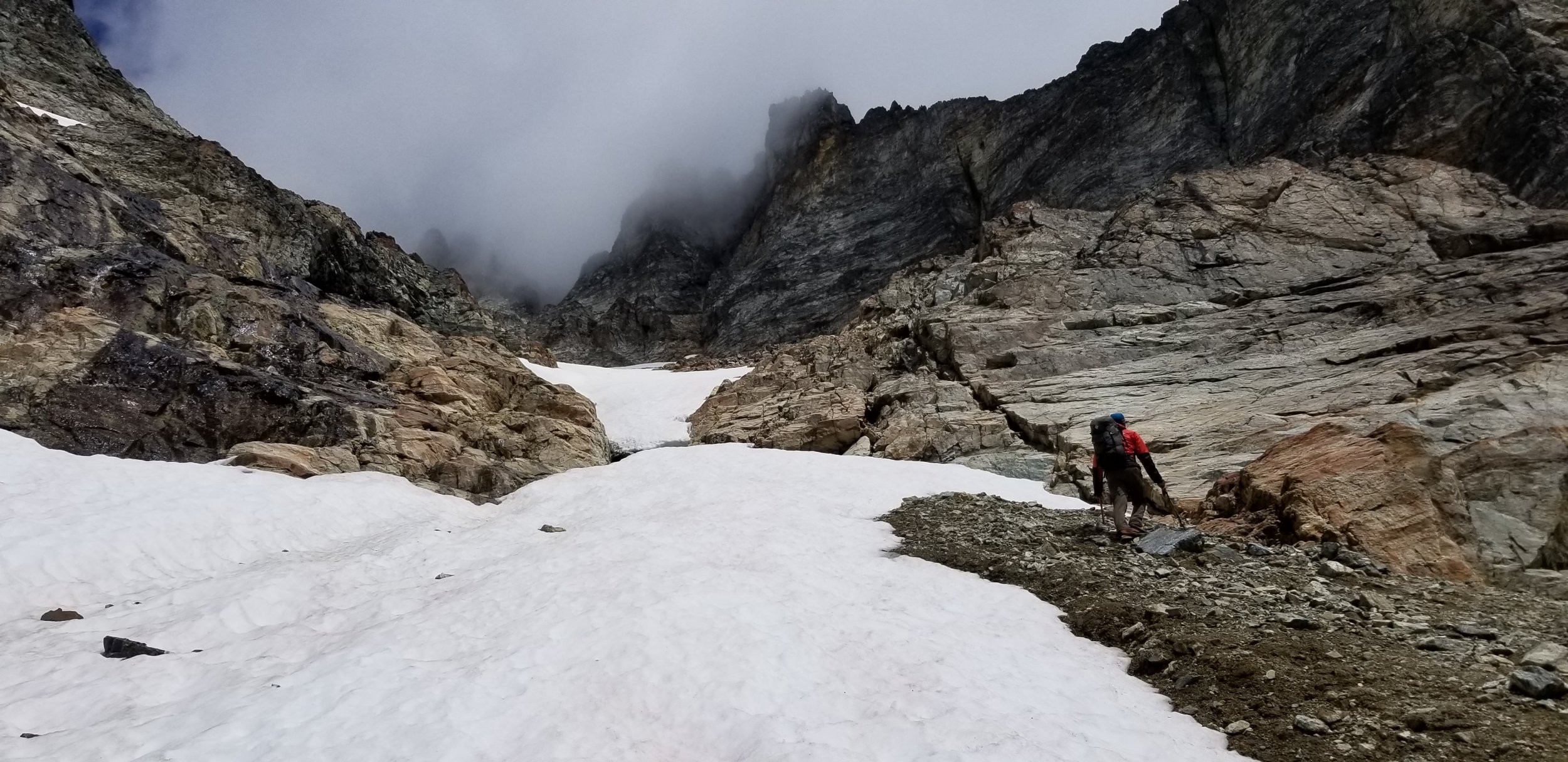
Fred in the couloir we climbed:

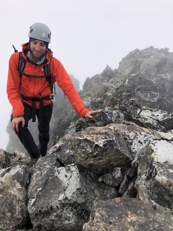
Me approaching the summit, photo by Fred:
Best photo I had of our couloir from the standard route on descent:

We ascended the right line and descended the standard route on the left:
Drying out camp that afternoon:

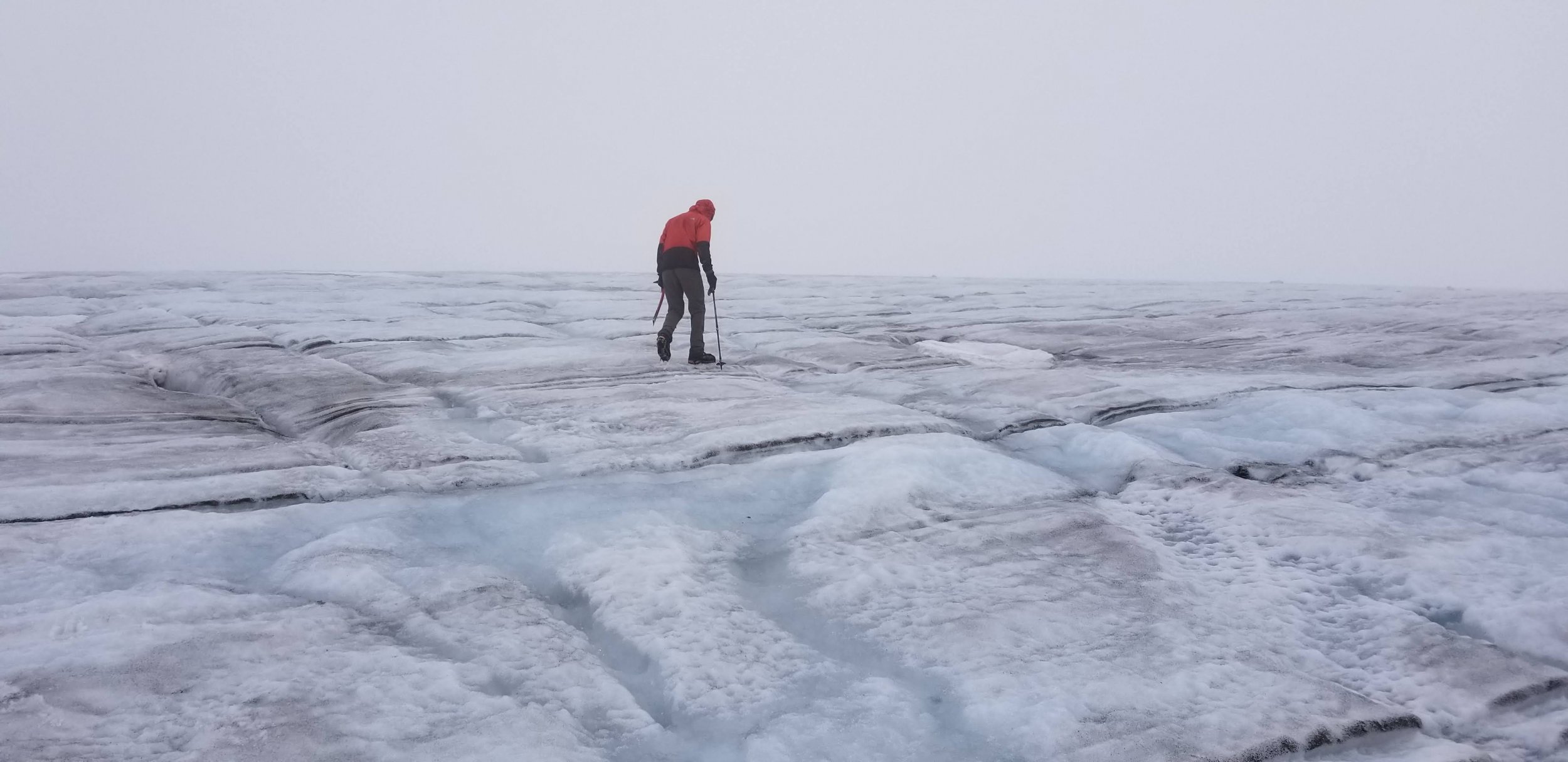
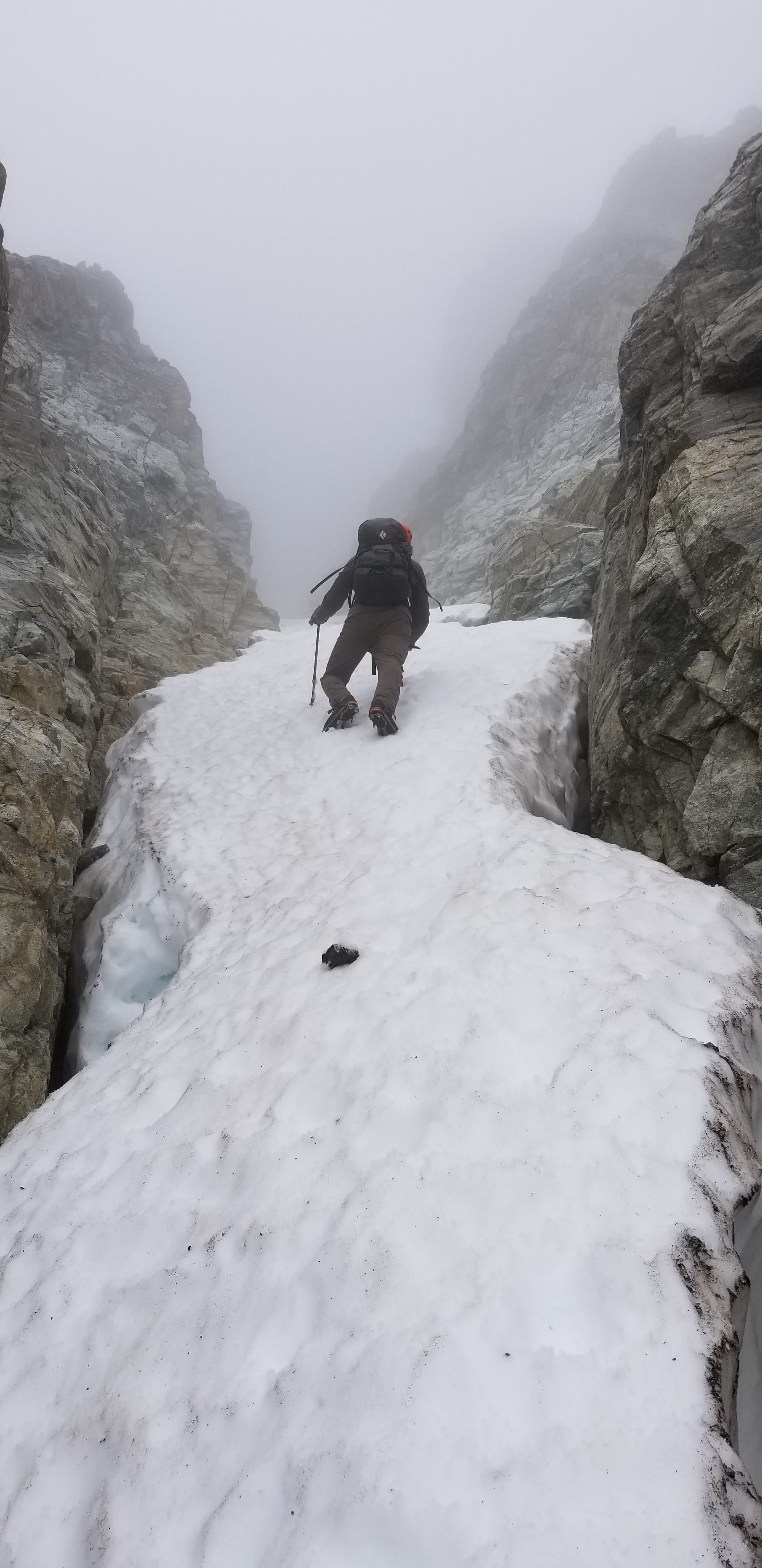
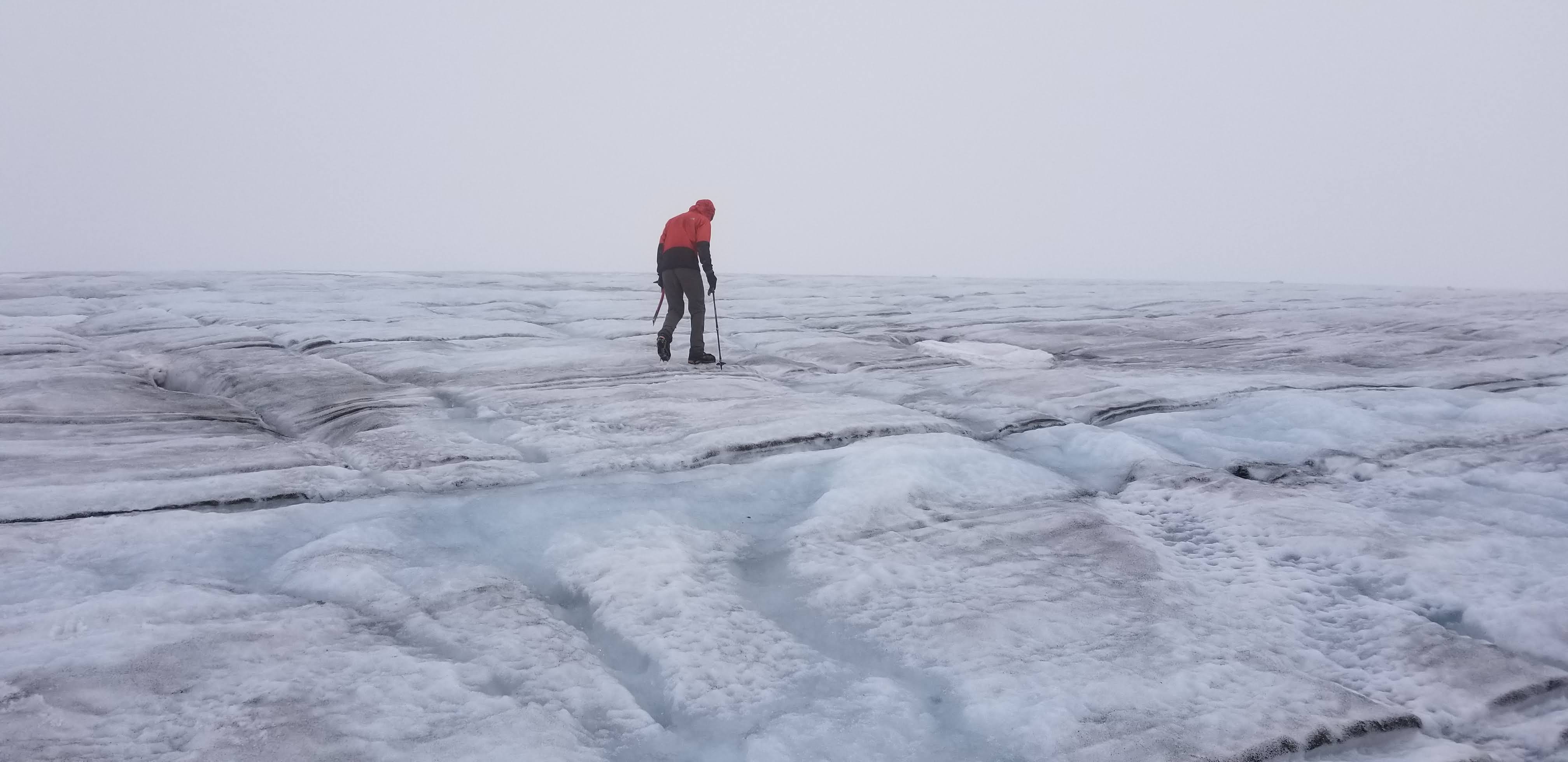
We did about 5 hours camp to camp on Redoubt moving fairly mellow with some route-finding in the fog. In the afternoon we went for a stroll on the glacier ice next to camp, it was way cool to just stroll and look around:
We slept a lot again and hiked out the next morning, 6 hours to the car.
Fred on the Redoubt Glacier on descent:
In the falls:
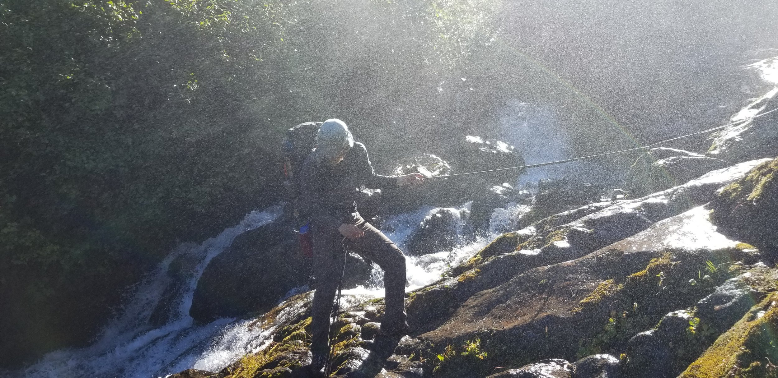
More falls, photo by Fred:
Gear Notes: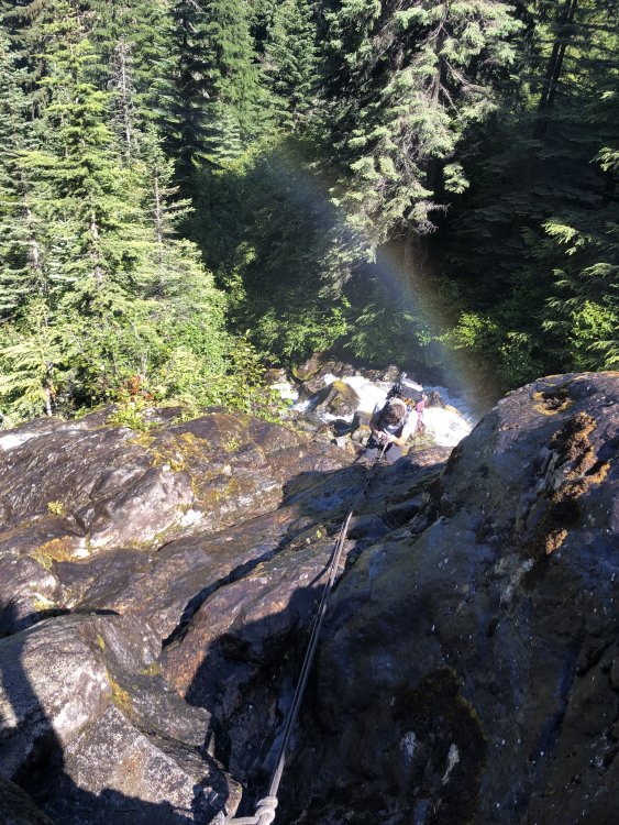
60m rope medium rack (small would be better) crampons axe rock shoes (would skip if there is a next time)
Approach Notes:
Long and arduous, as advertised.-
 3
3
-
-
Trip: South Twin, Jaw's Tooth, Skookum (Kloke), Little Sister, Cinderella - Green Creek Circuit
Trip Date: 06/30/2019
Trip Report:
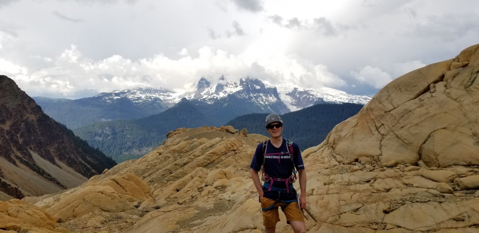
Me and Dylan climbed the Green Creek Circuit per the "Cascades Rock" guide: Green Creek Arete to South Twin, NW Face of Jaw's Tooth, NE Ridge of Skookum, central arete on the NW face of Little Sister, then the west ridge of Cinderella.
It was amazing.
Lots of fun mostly easy travel on varied terrain with soloing, simul-climbing, downclimbing, snow, loose gullies. My kind mountaineering and classic Cascades style.
I would say that the left arete on Little Sister might be better due to a section of scary detached blocks on the right one that we climbed. On the left one you would get more ridge scrambling which was amazing.
14.5 hours car-to-car, 7800', 13.4 miles.
More terrain to be explored past Cinderella at left:
Dylan on the final scramble to Cinderella:

Looking back up Green Creek after a great day:
Dylan in the upper Green Creek basin:
Dylan eschewed my offer of a trekking pole in favor of looking like a doofus crossing the Middle Fork:
Gear Notes: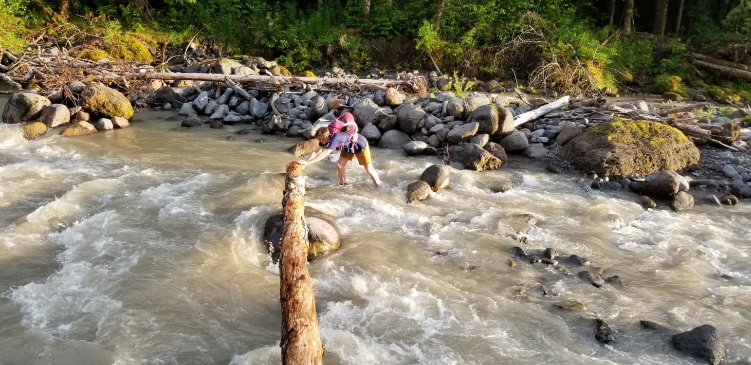
30m rope got us off Jaw's Tooth with some easy downclimbing and was perfect for simul-climbing axe small rack
Approach Notes:
Per Darin, the Forest Service has actually cleaned up their part of the trail and it is getting moderate use to Elbow Lake.-
3
-
-
Definitely give us some route conditions beta if you do the Price!
-
Cool, sounds like a cruiser, fun day. Thanks for the report.
-
Nice work, thanks for posting!
-
 1
1
-
-
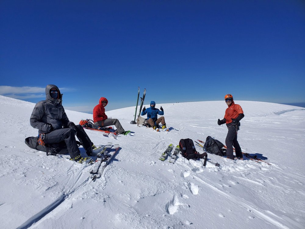
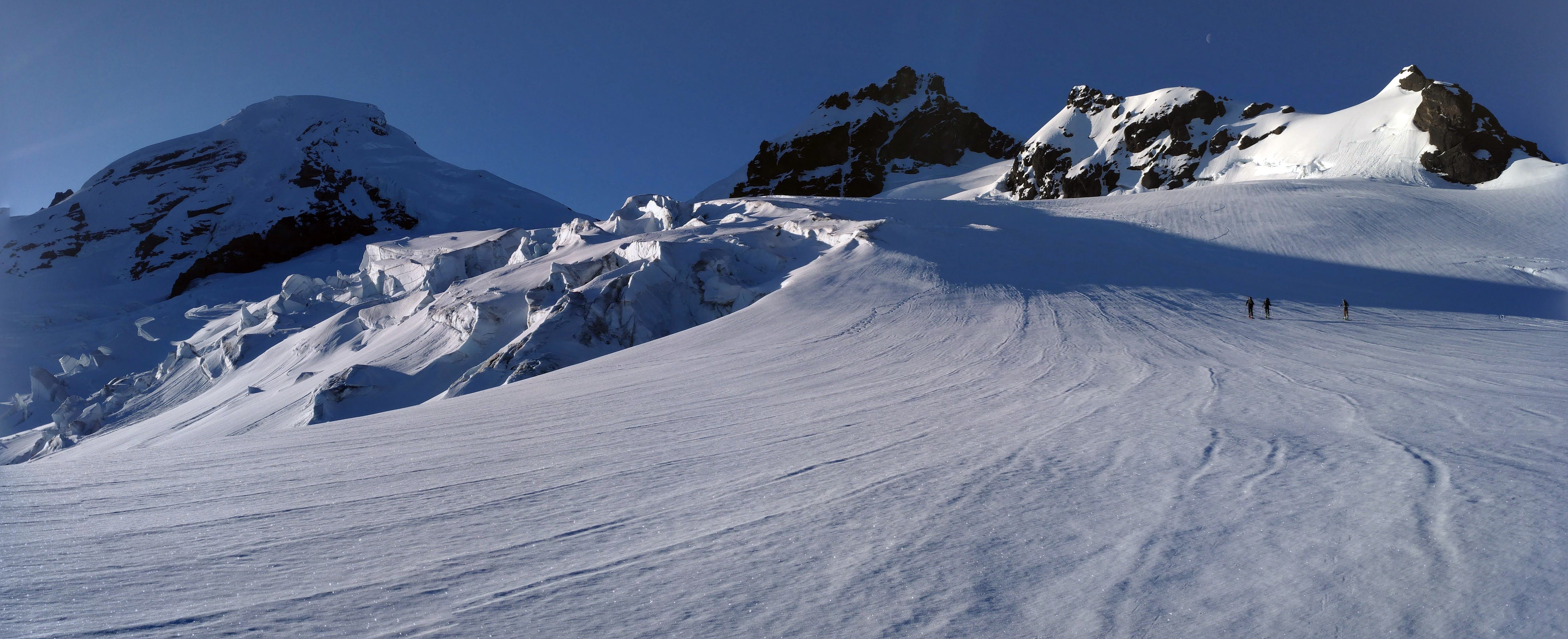
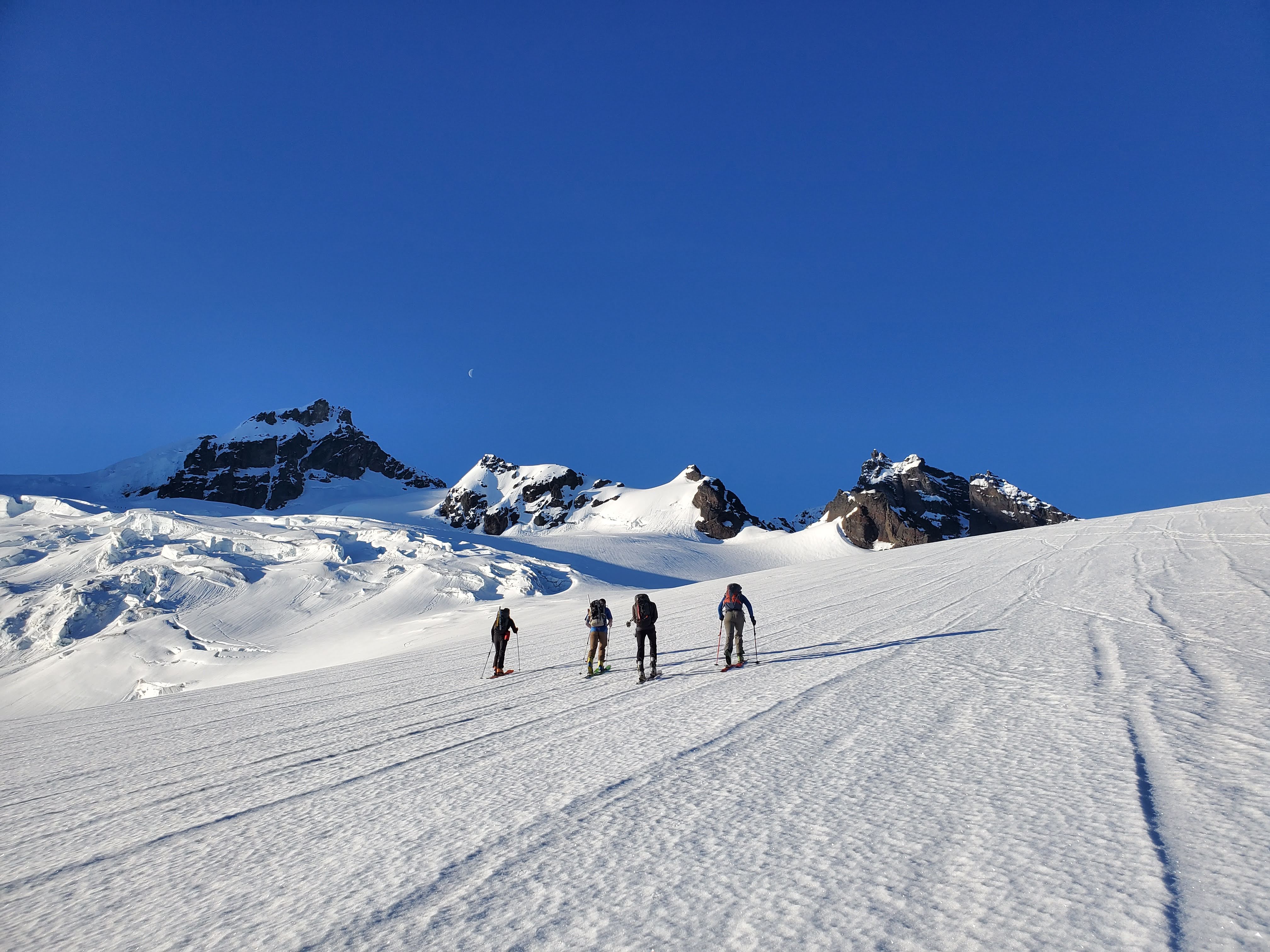
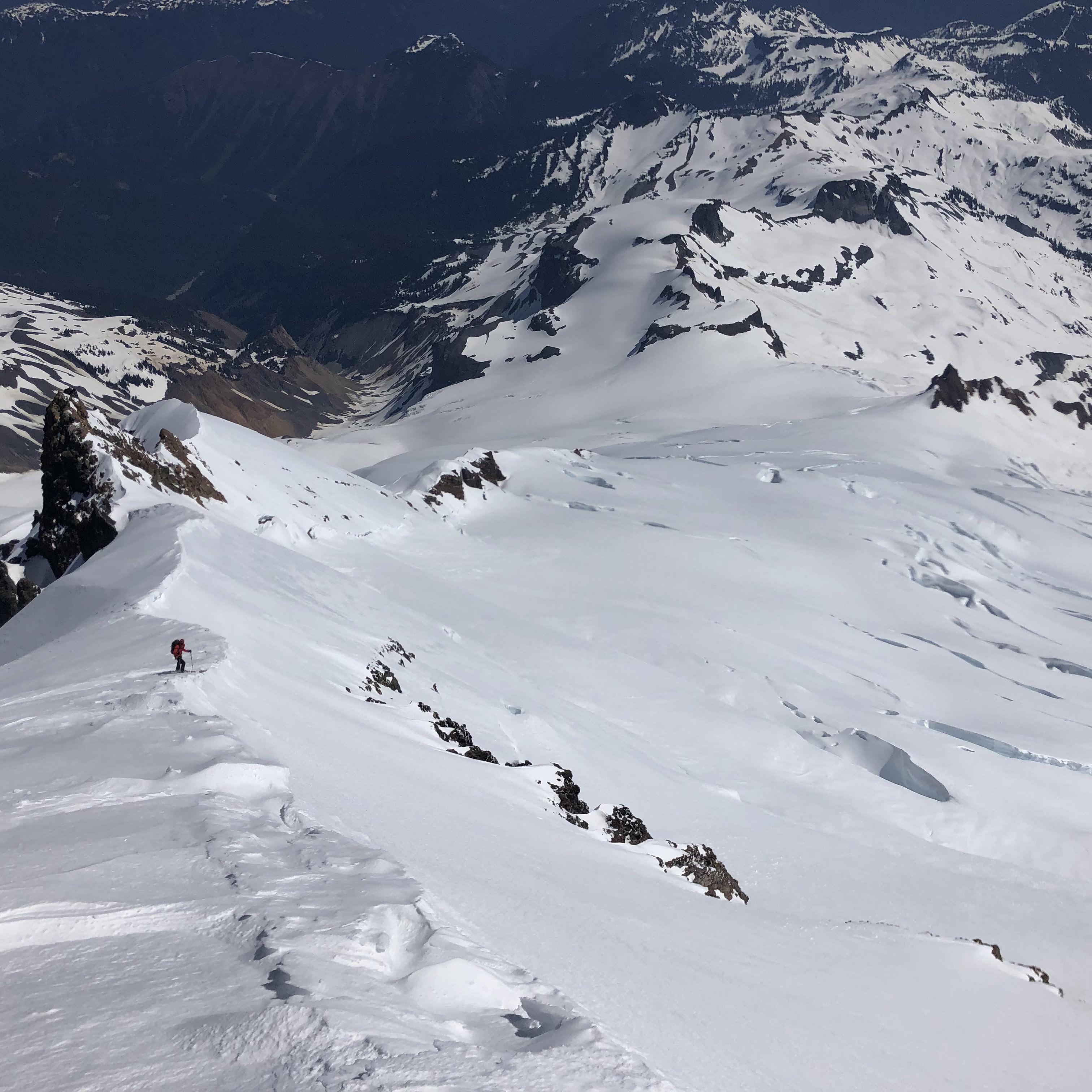
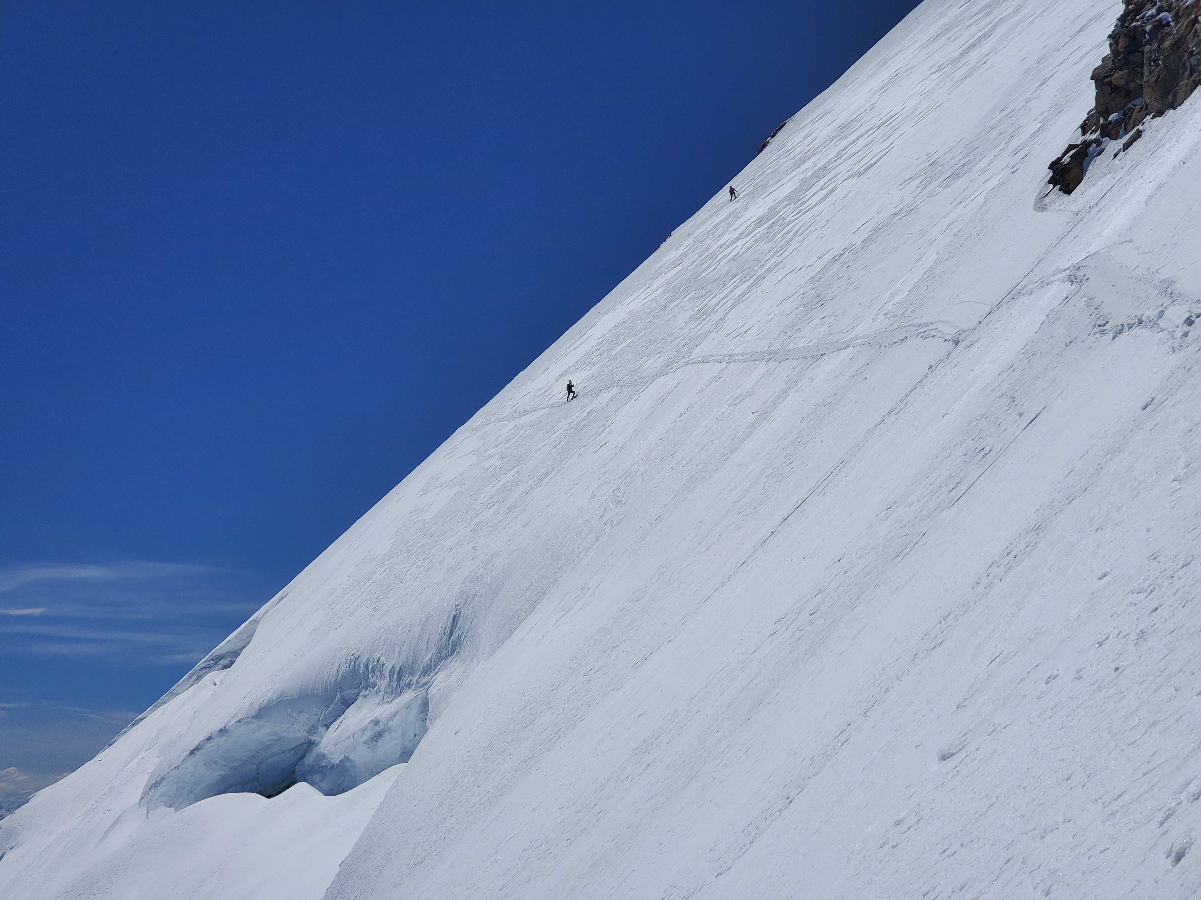
Trip: Mount Baker - Watson Traverse
Trip Date: 05/27/2019
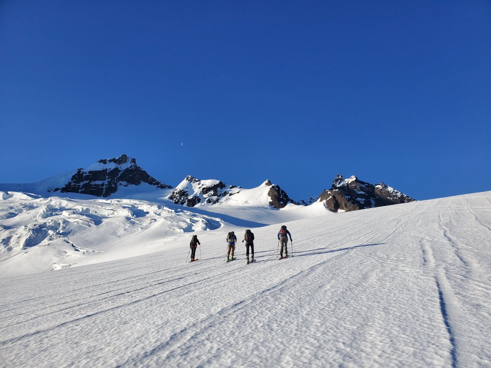
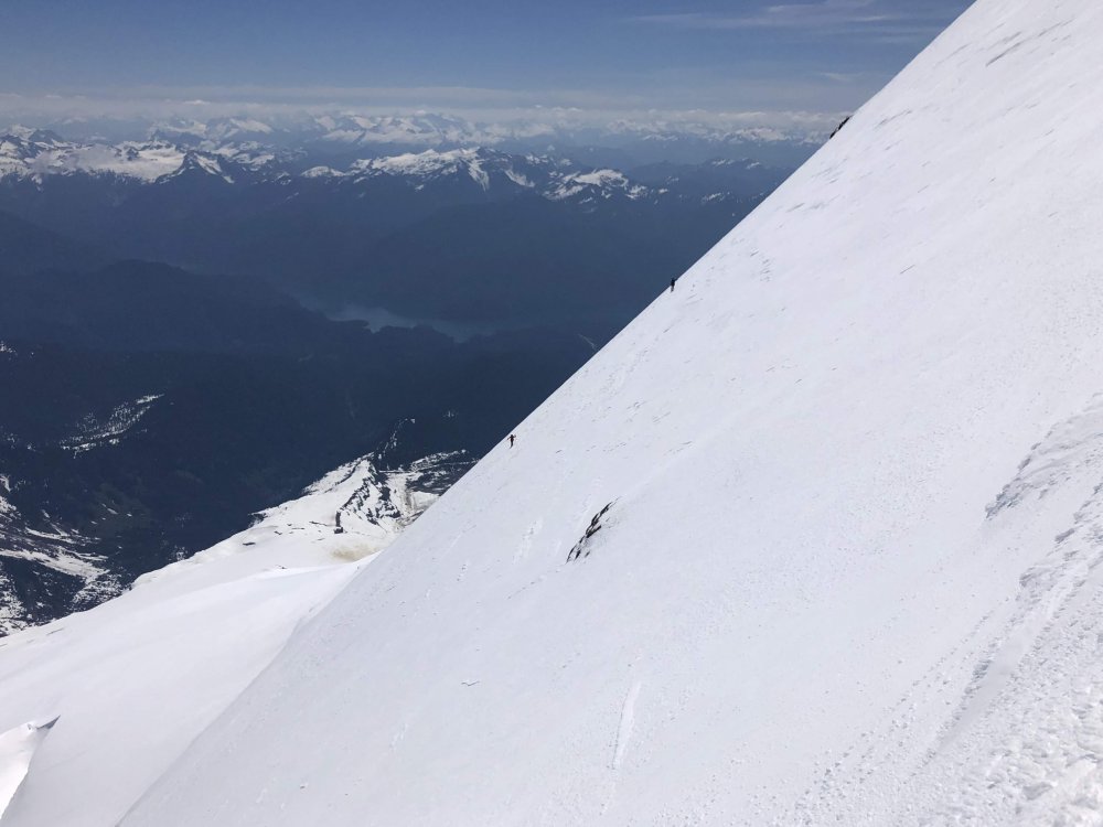
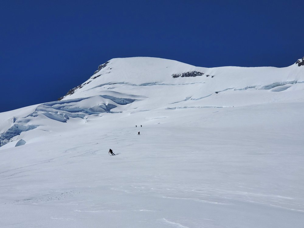
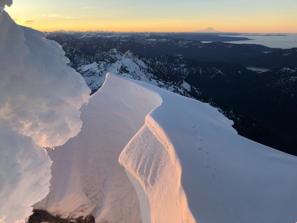
Trip Report:Me, my buddies (Fred, Dylan, Max, Tim) and Josh (whom we met on route) did the Watson Traverse up and over Baker on Memorial Day. We left the Heliotrope trailhead at 4 am and arrived at Heather Meadows at 4 pm. It was a lot of work after skiing the Park Glacier, but a way cool route.
We summited at 10 am in blasting gusty conditions, but the Park was soft and buttery, pretty much perfect. The crevasses took some thought to navigate, but no real issues. On the miles of traversing I learned that you can skin without skins with sufficiently sticky snow by just switching to walk mode and keeping the angle moderate... pretty cool, and a lifesaver on this route.
Coleman Glacier skinning:

Kicking it on the summit:
Tim ripping the Park Headwall:
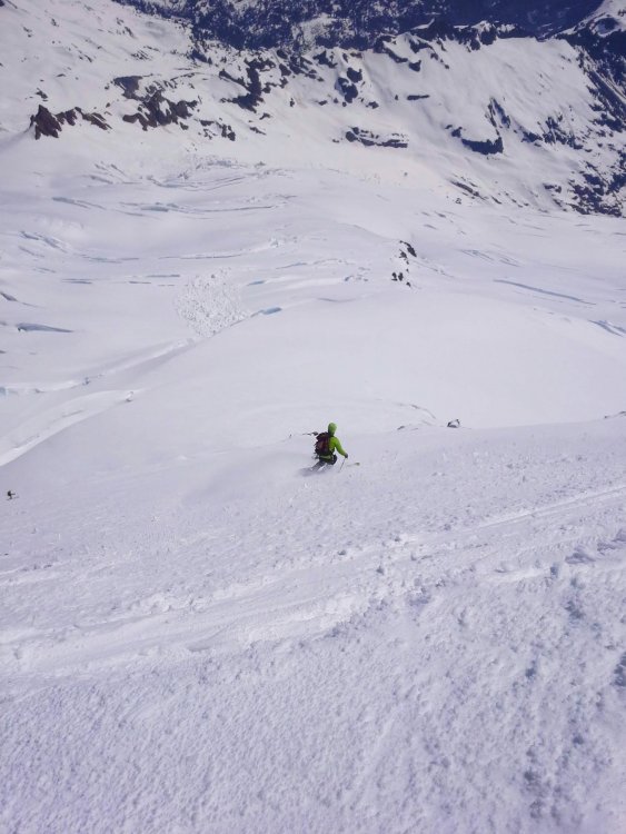
I wussed out and took the Cockscomb Ridge down a ways, though this doesn't lessen the angle, just the distance you ski 55 degrees above crevasses:

Park Headwall:

Somewhere west of Coleman Pinnacle:

You could see our tracks from as far as Artist Point, pretty rad:

Photo credit goes to Tim, Max, Fred, and Dylan. It was great skiing with everyone!
Gear Notes:
Ski mountaineering gear. Used axe and crampons. Running shoes.
Approach Notes:
Running shoes to the bottom of the Hogsback, then skis to Heather Meadows. Car shuttle.-
3
-
-
Sounds casual, don't know why it isn't super popular.
There will probably be a line next weekend.
-
 1
1
-
-
On 4/29/2019 at 12:01 PM, AlecE said:
Cool! Looking for some recent photos of CJ, but thanks anyway. Looks like a nice day out.
When I was there on 4-20 C-J was pretty ugly from a skiing perspective, mostly avy debris the bottom half or more. Not sure if you're looking to climb it, probably doable.
-
I would have added pics, but I didn't take any. I have so many pictures of the mountains, and my partners are not handsome enough. I believe it is pretty easy though.
-
Trip: Sahale Peak - Sahale Arm
Trip Date: 04/20/2019
Trip Report:
Me, Fred, and Max skied Sahale arm and summited yesterday, 4-20-19.
The road was closed at MP18 so we had a nice 5 mile warmup to the summer trailhead. We started hiking in runners at 7am.
After 4.5 miles we hit the abrupt beginning of continuous snow, it was glorious... the way spring skiing ought to be; hike dry road bet to 4' of snow. Bam. Skis on.
We skinned up the gut toward the pass, booting a short section though the cliff band at 4800'. From there it was cake to 100' below the summit. We cached skis there and booted up, around the east side to the top. It was a one at a time affair up there, we each tagged it and bailed back to the skis. The exposure was real, on steep snow, and added a killer thrill.
The snow was firm at the top, mashed potatoes at the bottom, but pretty good all the way to the pavement.
Summited at 2:00, car at 6:00. 11 hours with a couple of long breaks. 7300', 18.4 miles.
P.S. I did this on my phone in about 10 minutes... post your trips people! Its great to hear what is going on out there, and this forum is way cooler than facebook!
Gear Notes:
Skis, axe & crampons for the top 50'
Approach Notes:
Trail shoes. Lots of road.-
1
-
3
-
-
Oh, and I forgot to mention, regarding the lowering. Yes he could have prussiked back up the rope, we had all the equipment necessary for crevasse rescue.
-
Jason, my sanguinity comes only after much reflection and decompressing on the issue. We talked a lot about it that night in the tent.
It really makes me think about basically every snow anchor I have ever placed and not loaded simply because no one fell.
Both the axe and the picket were buried vertically, clearly this was the critical mistake. I dug down through the powder into what I thought was firm snow, and tested it. I have decided that we need some snow school time to practice these techniques.
We are pretty experienced snow climbers and I have placed pickets as pro a number of times, though mostly in spring conditions. Everything seemed secure. It was very eye opening to put it mildly.
-
1
-
1
-
-
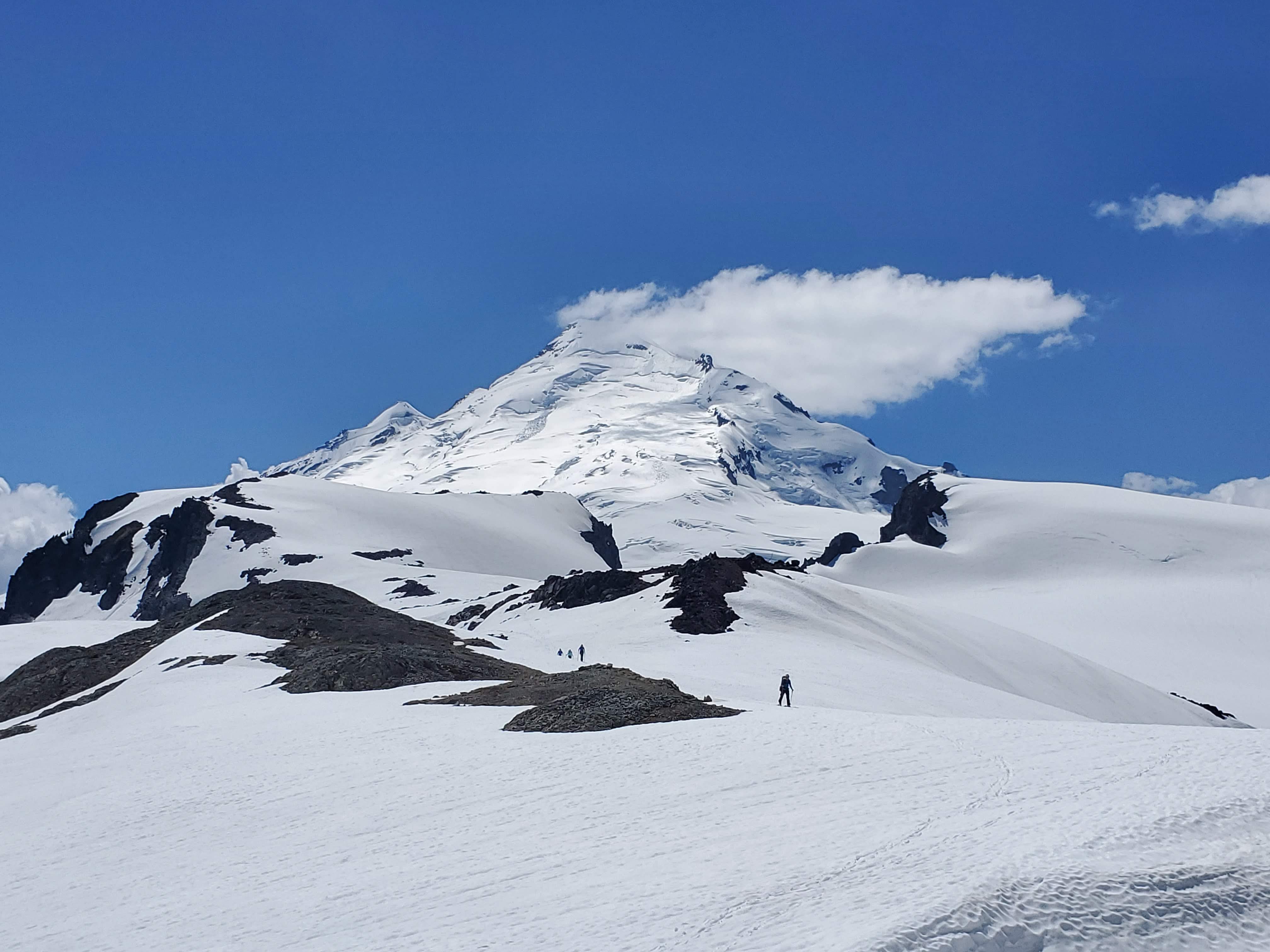
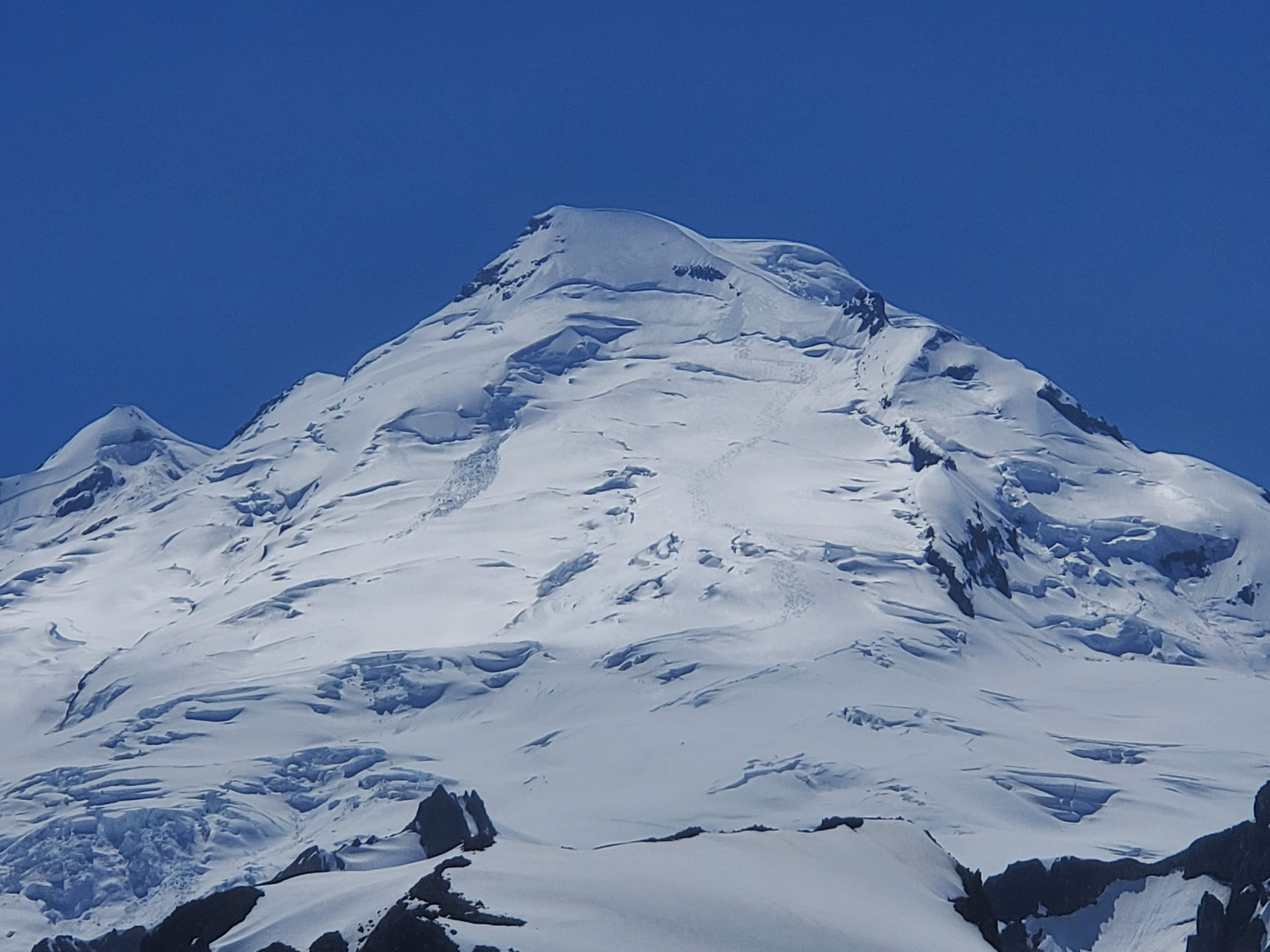
Trip: Shuksan, Icy, Ruth - Nooksack Traverse
Trip Date: 03/01/2019
Trip Report:
Fred and I went and did the Nooksack Traverse over the first three days of March. We had fun, I think. We had probably the worst snow conditions of any ski trip I have ever been on, extremely cold temps for Washington, a crevasse fall, and several equipment issues.
I might not go back... this year anyway.
We parked a car at the Hannegan Pass Road picnic area right at the highway, then drove up to the lower ski lodge. The trip into the White Salmon valley was typical. We traversed in and lost ground to some guys who skied the clearcut, but they didn't have overnight packs.
Skinning up the WSG was a breeze really, excellent snow if you were going downhill. We opted to climb the Hourglass instead of Hells Highway. We found about 20' of hard water ice... surprising. It was tough with a single axe and only two screws. Bring real ice gear and do it though! There was another bigger step above that we skirted on the left and topped out on the Sulphide. I would guess it was WI2.
Fred approaching the Hourglass:
Summiting was easy after dropping our packs at the bottom of the pyramid. We had lost a lot of time in the Hourglass, it's not worth it as a time saver, so we tagged the top and headed down. We skinned down to the flat spot on the Crystal Glacier while the sun set, getting the tent up just at dark. The crossover from the Crystal to the Sulphide was easy, poor light made it seem hard though.
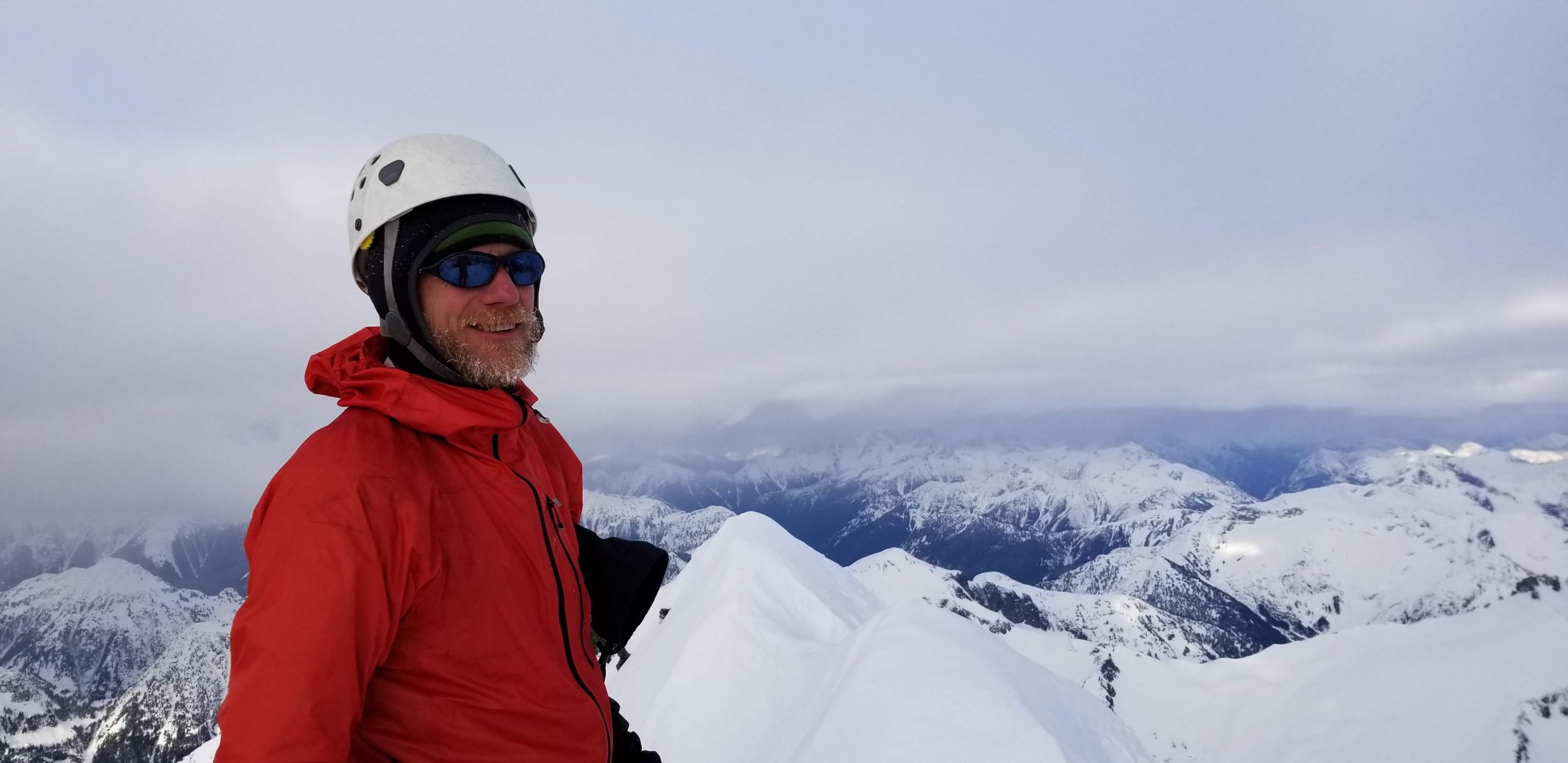
Fred on the summit of Shuksan:
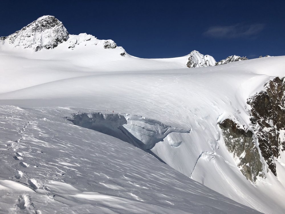
After a long cold night we packed up and headed uphill for a warmup skin and a look into the Price Glacier. The topout looked unlikely with a crack already running completely across the headwall.
We skied down to the entrance to the Nooksack Glacier to check it out, a little trepidatiously we worked our way in, and found bad news. It looked scarry, way scarry. Obviously it's steep, but there is a serac just below the only cornice free entrance, then a crack running completely across the base of the headwall. We balked. We walked the cornice with hopes of rapping over it and downclimbing through a gap in the bergschrund at a minor rib.
The drop in on the Nooksack headwall from further east above the cornices, photo by Fred:
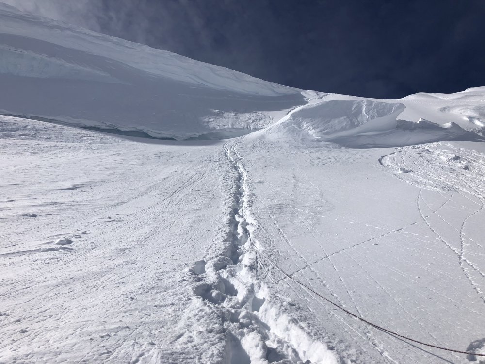
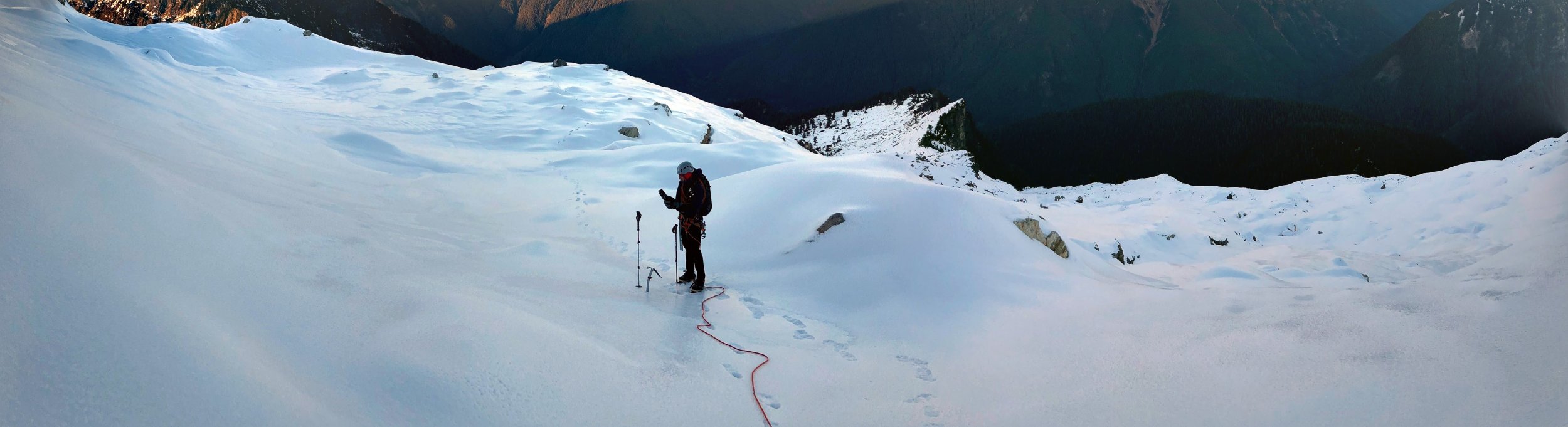
This option didn't really seem safer, so we went for another look. I really wanted to bail at this point; the WSG is a pretty darn good consolation ski, but I also really wanted to do this route, and Fred never bails (jk). We strapped our skis on our backs and Fred began downclimbing on belay. We only had two pickets so it would be a thin running belay at best. When he got to the top of the 'schrund he couldn't see over, so I set a 2 point anchor and began lowering him... Then the lip blew, it collapsed under him and he fell, the picket and axe I had in blew, as did an intermediate picket Fred had in, and I began rolling. I rolled probably 60' down a 50° slope. My first thought was "oh shit, Fred! I blew it as a belayer!" My second thought was "oh shit, ME! This is going to suck." I think I bounced off the far side of the 'schrund, then hit bottom.
We both had the same thought when we hit the ground: "get your head up so you don't suffocate." When I could see again Fred was a few feet away and we were in a 20' deep crevasse. We had fallen about 10' over the lip, then 20' more into the bottom, but we were OK. We both check in with each other, then tried to climb out. The bridge we were on was not the bottom, and it was super hollow, my feet kept punching through into air. I had to take my pack off (with skis on it remember) and use it to push against so I could get my feet up and onto firmer snow. After I got untangled from the rope I climbed the far wall of the crevasse, it wasn't hard, just steep, loose snow. Fred did the same and we were seemingly fine.
We later debriefed and realized that this might actually have been the best case scenario. If the anchor had held and I had lowered Fred he would have been free hanging, then we would have run out of rope before he got to the bottom. My only choice would have been to go Joe Simpson on him and cut the rope.
The slope and 'schrund from below, photo by Fred:
So anyway, we skied down and crossed the Nooksack Glacier without needing to skin. It was close, and there was some shuffling, but we made it through.
Fred hanging out below a big serac:
Looking back across the Nooksack:
After more crappy, technical, icy skinning with crampons, we made the Icy Peak shoulder. My crampon broke about 30' shy of the summit of Icy when I was climbing the icy gully and kicked a rock slab (they were aluminum). But Fred pushed on. We camped between Icy and Ruth for another cold night, making camp just before dark again.
More icy hard skinning led the next morning to Ruth and eventually the skin all the way back to the highway.
Fred nearing Ruth summit:
The East Nooksack from Ruth:

Well, I'm glad we did it. Perhaps it is not the best year, perhaps we are just not good enough skiers for the headwall, who knows. We had fun, kind of. I'm glad we did it, glad we made it out, and glad I don't have to do it again, at least until there is another good weather window!
Gear Notes:
Standard ski mountaineering gear, ski and boot crampons, lots of clothes.
Approach Notes:
Traversed in from chair 8.-
1
-
-
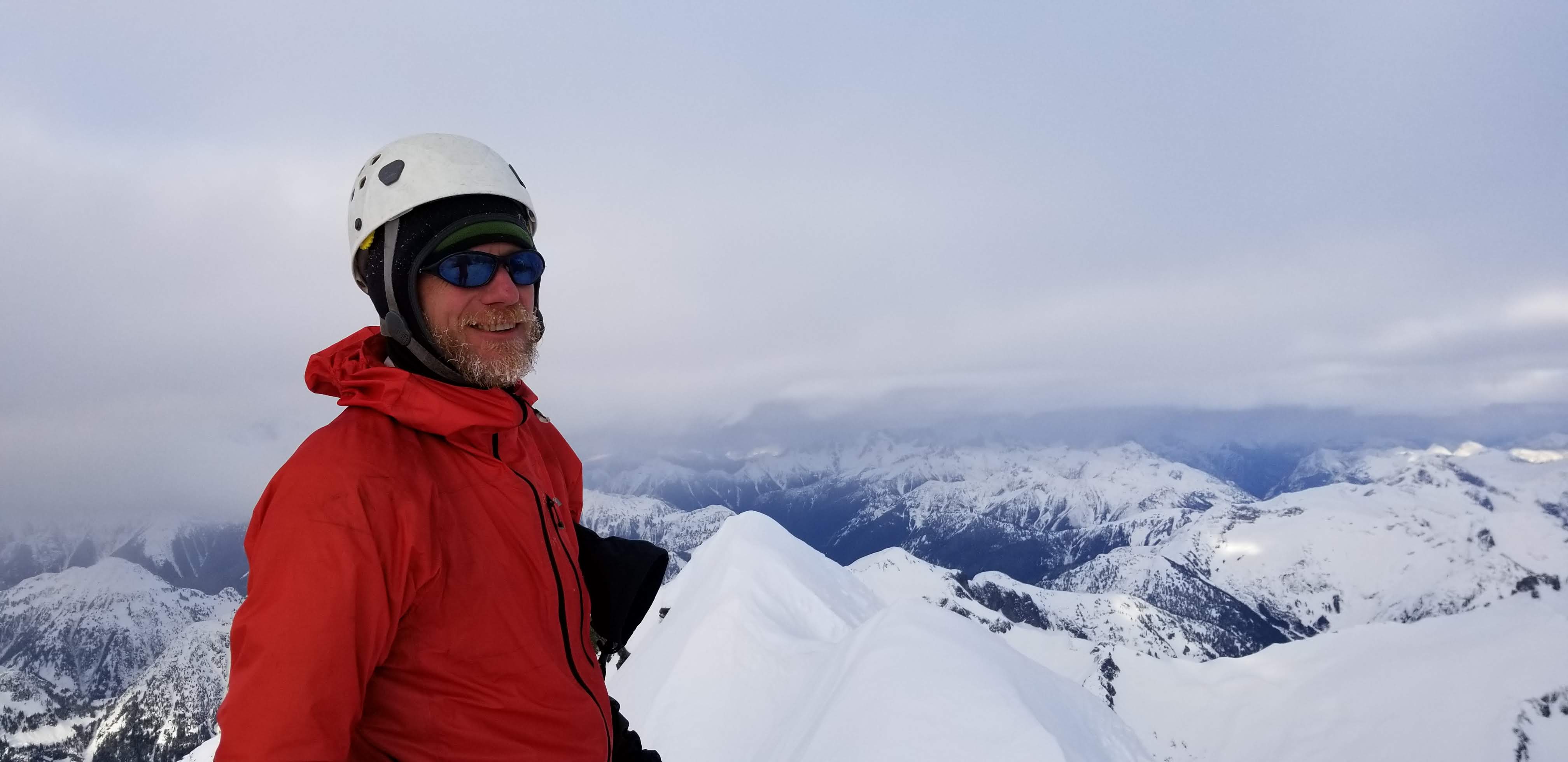
Trip: Three Fingers Lookout - Meadow Mountain Trail
Trip Date: 01/26/2019
Trip Report:
Me and Fred took advantage of the prolonged crappy skiing to do some mountaineering for a change. We had thought about biking the closed road to the summer trail, but it didn't look that much shorter and I remembered the lower portion of the trail as being pretty crappy from years ago when I did it. With the high snow line it seemed like a good choice... not too sure now.
We shouldered our snowshoes and walked from the road closure to 3900' on the Meadow Mountain Trail before we needed to put on snowshoes. The abandoned trail was in great shape, better than some maintained trails I've been on.
The snow was pretty soft in the old growth and icy in clearings, so side-hilling was tough with snowshoes on, but we toiled upward. The route it turns out is circuitous in three dimensions... up and down, side to side, all around the map we went, mostly upward. At Saddle Lake we were astonished to learn it was 1 pm. Thoughts of camping early flashed through my mind - and oh yeah, I forgot a pot for the stove, so anywhere but the lookout means no tea, coffee, or mountain house dinners. Bummer. We assumed there would be some kind of pot at the lookout... If we can get in.
The north side traverse was thought-provoking on firm sun crust. No-fall terrain for sure.
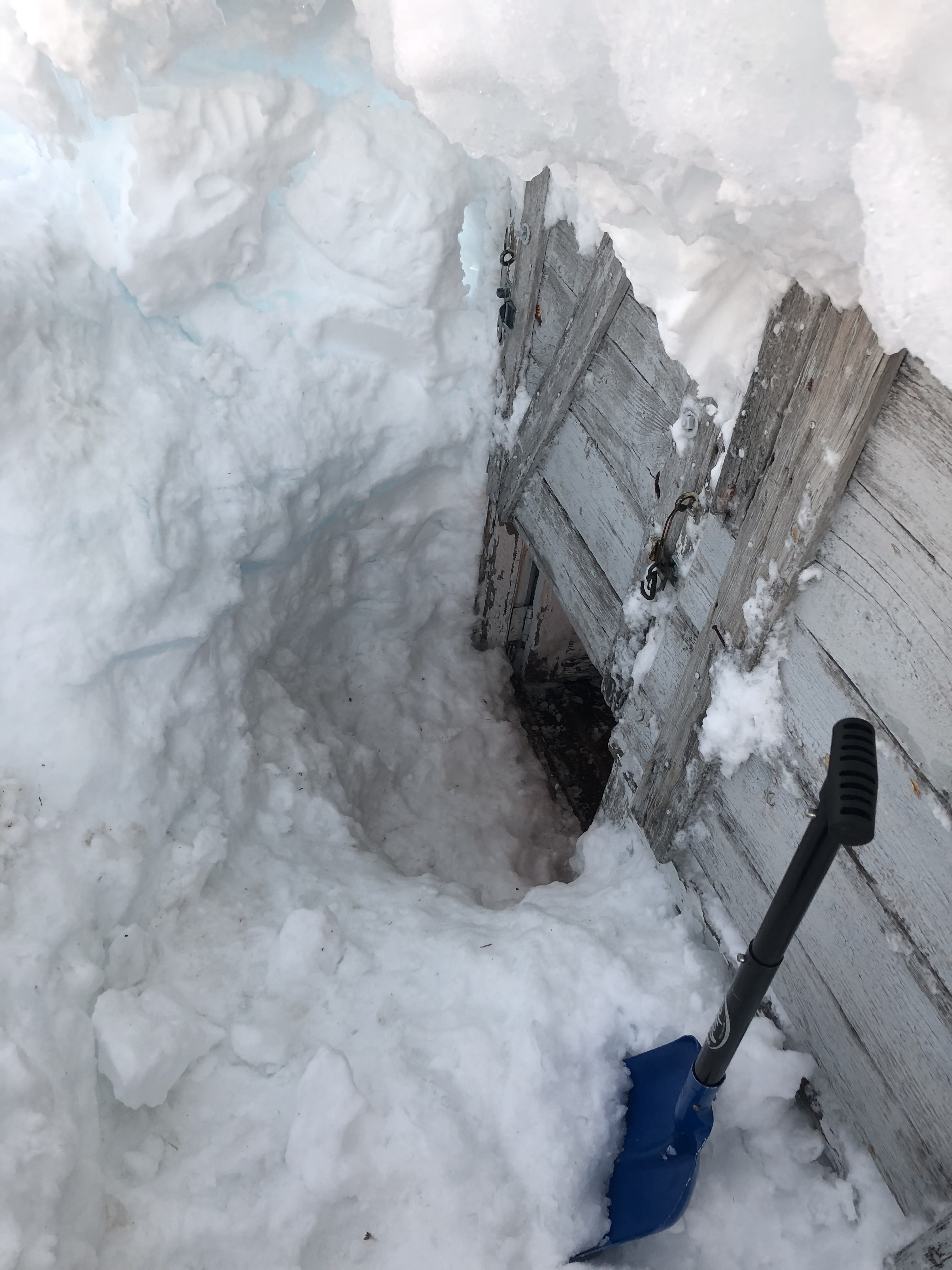
We missed most of the sunset traversing on the north side. At dark we were within 600' of the summit. The rimed rocks of the summit area threw perspective out the window in the headlamp's beam. We seemed to fly upon rocks that seconds earlier appeared hundreds of feet above. It would have been eerie if it hadn't been for the tiredness and the ever-present thoughts of what if. What if we can't get in? What if there is no pot? We had watered up so there was little chance of death by thirst, but it would have been decidedly unpleasant.
We dug for an hour and a half through multiple hard ice layers interspersed with sugary snow. It was hard work, and we didn't really know where we were digging. For future reference, the door is on the far lookers left of the building, not near the middle. In short, we figured it out, got in, and spent a lovely night lying about in luxury.
Thanks to all the volunteers that keep this place together. Sadly one of the window panes in the door was broken out which let in a bunch of snow that piled behind the door. This made our entry tricky. We removed all the snow, but it will just come back. We couldn't figure out a way to block up the window with the supplies we had. If you go there take a bunch of duct tape or something.
The hike out was uneventful, though footsore with wet socks. Next time I'll try the shortcut listed in the comments here:
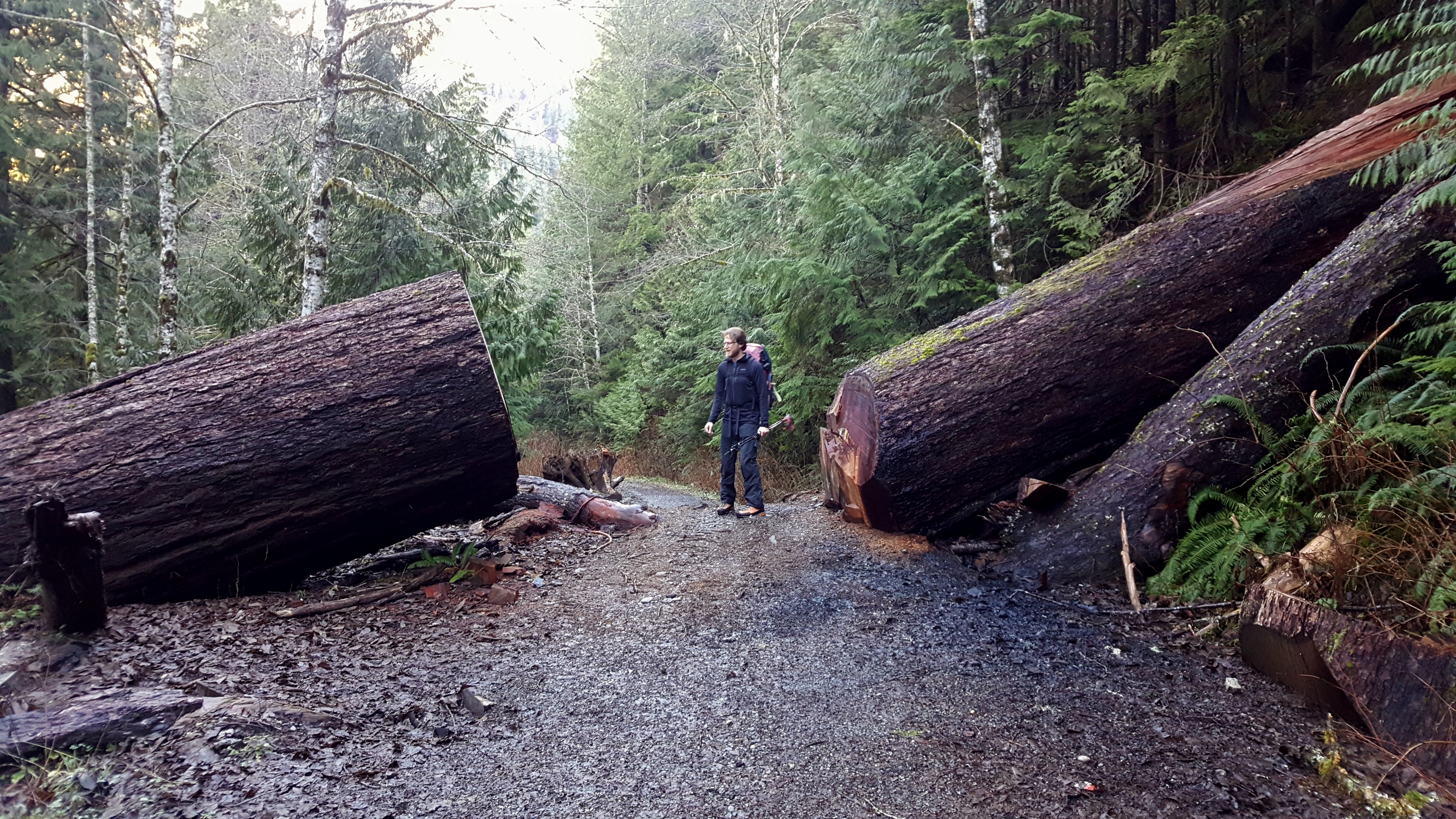
Fred checking out a huge log across the road:

Our entry into the lookout:

The view from the front door in the morning, photo by Fred:
Tricky downclimbing for the first steps of the day, photo by Fred:
Looking back at the summit from Tim Can Pass in the morning. The lookout is on the middle peak in the photo:
We hiked down into the sea of clouds we saw from the summit:
Gear Notes:
Axe, crampons, snowshoes.
Approach Notes:
Meadow Mountain Trail from road closure.-
3
-
 1
1
-
3
-
-
On 11/27/2018 at 11:29 AM, John Frieh said:
Great TR. How long did the approach take before you broke out of the brush? How was the road to where you parked?
Sorry for the delay, the road was a bit potholed but no big deal; that late in the season it wasn't especially brushy, pretty open forest really. It opened up by 5000', the worst of the forest was below 4000'. We didn't follow much of a trail but there was flagging all over.
This might be a decent winter route if you could count on safe conditions on the east face traverse. I recommend the Sauk River approach.
-
Glad to hear some people put in a bunch of work out there. Thank you! I didn't make it to Darrington this year - I just discovered Index. Maybe next spring I'll go back!
-
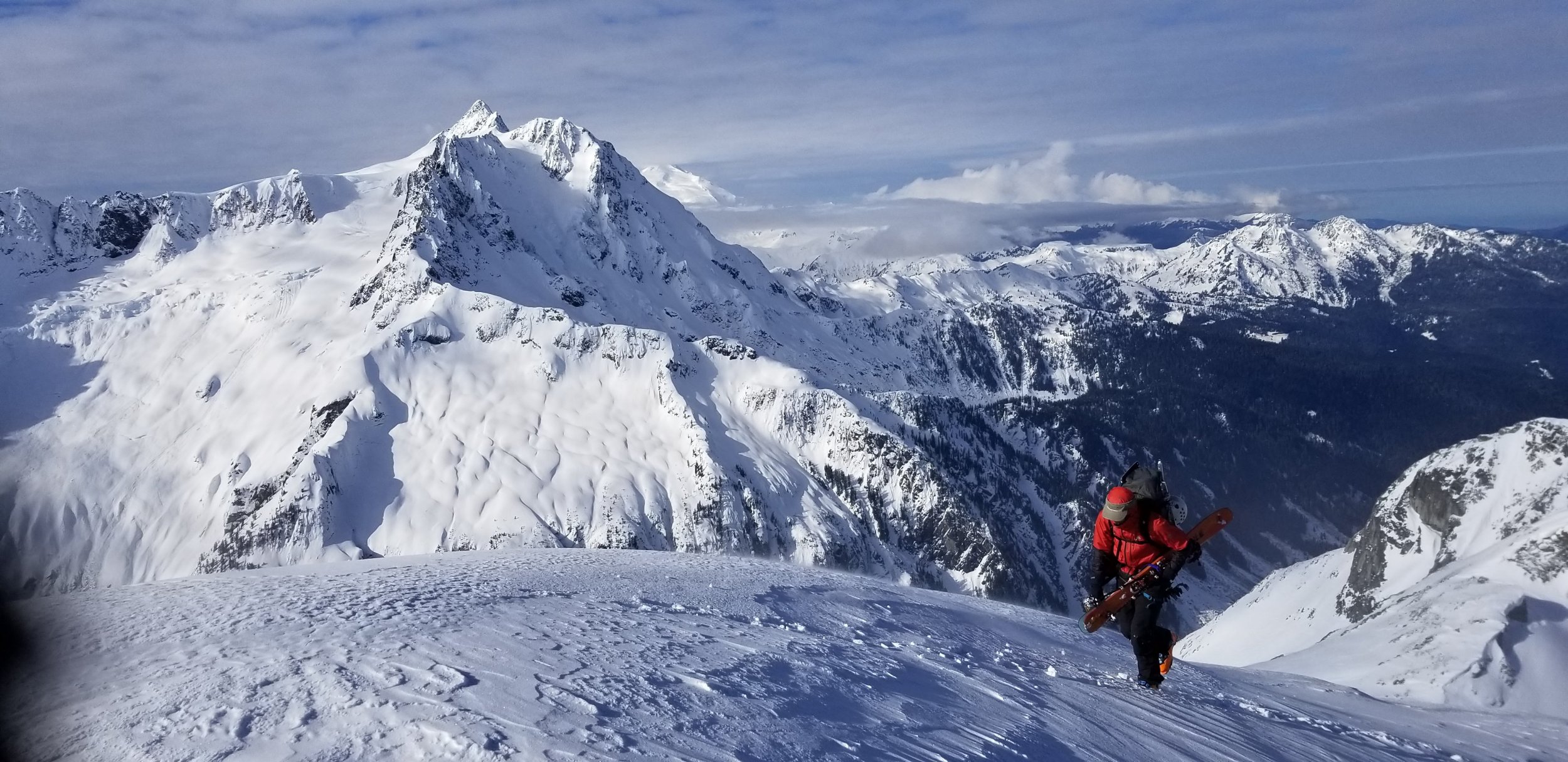
Trip: Sloan Peak - Corkscrew
Trip Date: 11/17/2018
Trip Report:
Fred and I took a romp up Slan Peak on Saturday. It had been a while since I had summited anything so it was great to get on top, plus there was a bit of early season adversity that made it just hard enough to be sweet. We expected slogging through powder on the north side, but there was a nice rain crust above about 5300'. The east face traverse across the "heather ledges" was also better than anticipated with fairly good step kicking snow. Some rime ice on the scramble made it pleasantly spicy.
Rain crust on the approach to the glacier, photo by Fred:

Me in the rain crust, on the descent, photo by Fred:
Fred on the traverse on the east face, on the descent:
Fred near the summit:
Fred looking smug on the summit:

Me descending, photo by Fred:
Gear Notes:
Axe, crampons, glacier gear, snowshoes for training.
Approach Notes:
Bedal approach, it was a bit brushy, seems worse than the Sauk if the river crossings are OK.-
3
-
 1
1
-
6
-
-
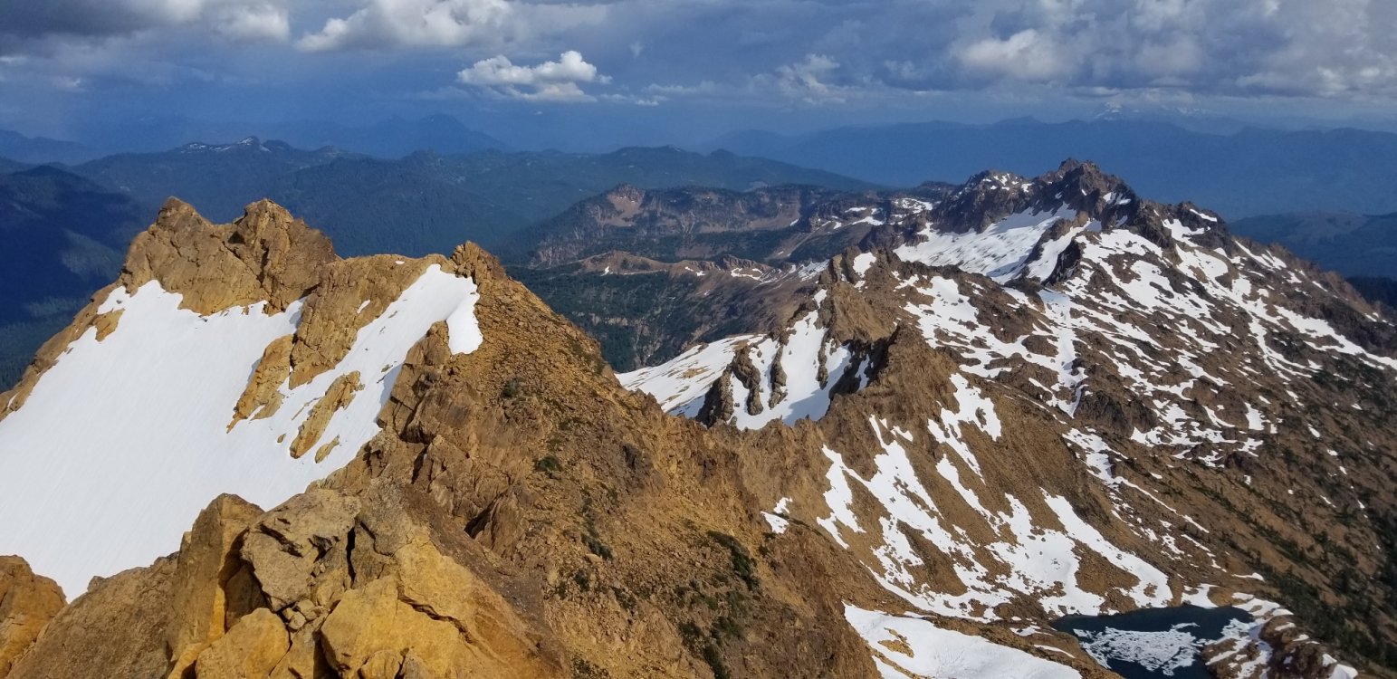
Trip: Mount Challenger - Easy Ridge to Challenger Glacier
Trip Date: 09/03/2018
Trip Report:
Fred and I did Challenger in 3 days over the Labor Day weekend via Easy Ridge. Simple conditions/bragging report is all you will get since the route is pretty straightforward and well documented.
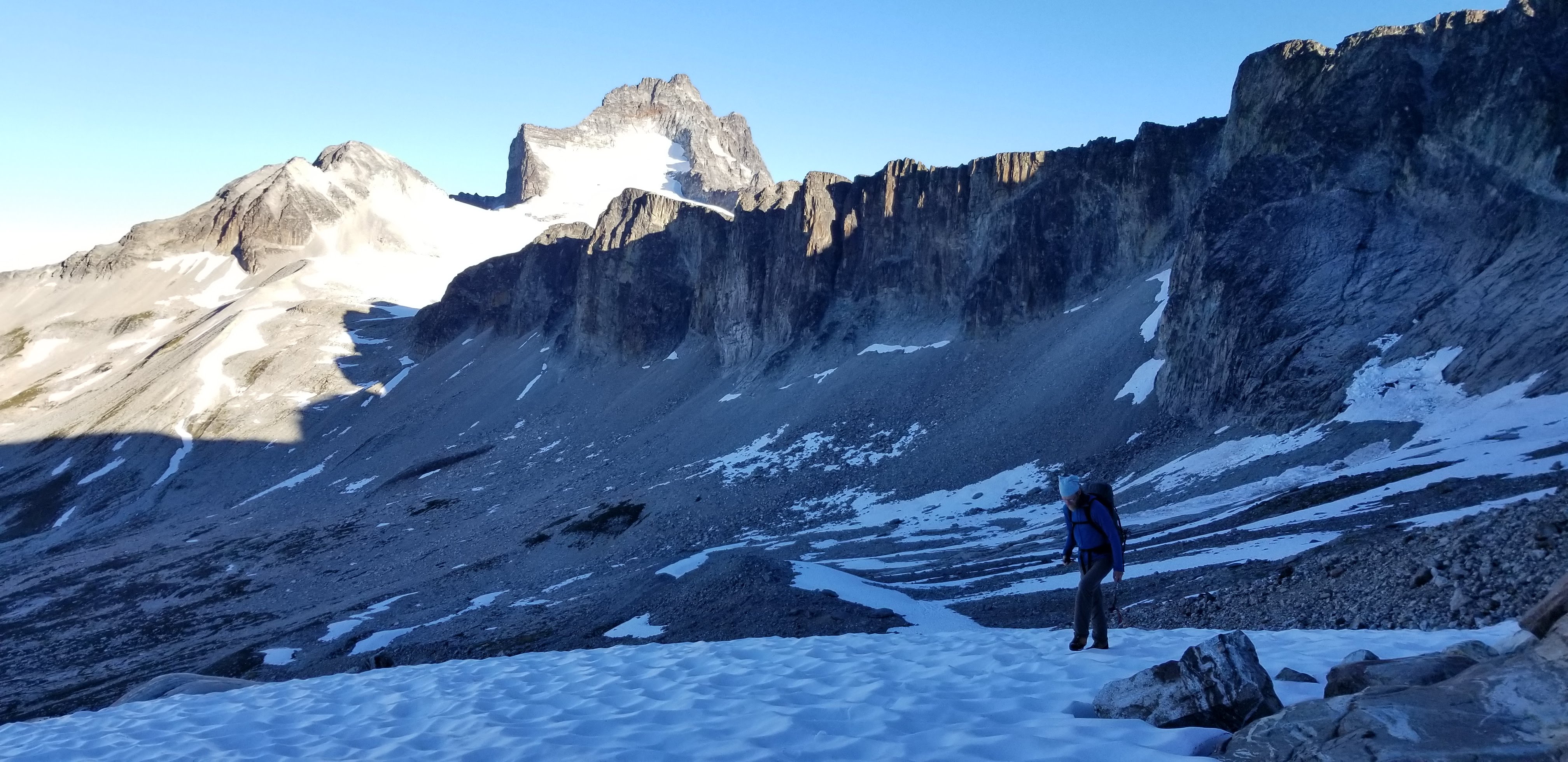
Good trails and cool weather made 15.5 miles and 6500' vertical melt away to camp on Easy Ridge just before point 6553'. The next morning we descended and crossed the Perfect Impass. This was easy, ascend 150' up from the base of the buttress, boot tracks will aid you; follow a faint self system. The climb back out was better than it looked up to come red rap tat (sketchy to rap off of)! The Steph Abegg beta photo is only good when the Impass is filled with snow which it was not.
We cruised over Perfect Pass and traversed the glacier to the NE ridge of Challenger. The various moats and bergschrunds appeared to be impassable so we took the rock to the left, scrambling in crampons, then up the steep snow arete to near the summit rocks. The top out was easy, 4 pitons and a fixed cam, a ridiculous amount of pro for 30' of 5.5 and a couple of scramble moves. 12 hours camp to camp.
Down to camp again and out the next day in the fog, perfect timing on the weather.
Easy Ridge Trail down low, it improves higher up:
Challenger Glacier from Perfect Pass:
Fred on the glacier:
Looking up to near the summit from the ridge.
Luna Cirque:
Fred's awesome summit shot of me, thanks!:
Hiking out the next morning:
Gear Notes:
Glacier Gear, 4 slings
Approach Notes:
Trails all in good condition, Chilliwack River was an easy ford, attaining Easy Ridge was better than many "maintained" trails.-
3
-
1
-
-
Nice report, thanks for sharing. You make everything sound so chill! I suspect from other reports that much of this trip is harder than it comes across in your report. It sounds like it was a cool trip with some personal history to make it even more meaningful.
What did you take for footwear?
-
13 hours ago, pu said:
How hard was it to access the nw arete of argonaut this late? For some reason i thought it required snow to get up the notch to the base of the route.
I forgot to mention this: we accessed the Arete from the west, climbing an easy gully on the west side to the notch at 7400'. This was an easy gully hike, scree, but not as bad as access to Liberty Bell for example. It did require us to do some pitched climbing and class 2 hiking to get to the base of the route proper. One could probably access the notch at the start of the climb from the west as well, it looked easy also; there was a tiny bit of easy snow that might be avoided. The standard approach gully looked gnarly, with discontinuous snow and moat issues for sure.
-
Trip: Sherpa, Argonaut, Colchuck, Dragontail - Sherpa - N Ridge, Argonaut - NW Arete, Colchuck, Dragontail - Walkups
Trip Date: 08/09/2018
Trip Report:@Albuquerque Fred and I had a great 4 days over August 9-12 in the Stuart Range. Fred put this plan together to avoid permits and maximize climbing. It worked great, good camping, sufficient water, great climbs and not bad approaching. It was extremely hot the first two days however, we did mostly avoid smoke.
We hiked in on Thursday afternoon in 90-degree heat and camped at about 5700' NW of Argonaut Peak in a beautiful sandy patch amongst the boulders. The next day we did the North Ridge of Sherpa and back to camp. The climb was fun but we cheated a bit by following ledges to the left because we were so hot and worried about water that it made taking the tough line a hard choice. It would be a great climb if you stayed faithful to the ridge crest I'm sure. The crux pitches were 5.8 as advertised, but easy pro and not long. The descent went mostly per Nelson and Potterfield, definitely "arduous".
Day three we carried camp over the NW Arete of Argonaut and down to Colchuck Col. This was a great climb with an easy descent or raps and walking to Colchuck. After lots of food and water in camp and some sheltering from wind and brewing rain we ran up Colchuck. I may have said something like "we better run if we want to avoid the rain" but I didn't mean it literally... Fred did.
Day four we walked up Dragontail and down Asgaard Pass and out to the car, passing ten thousand people. Up to this point we only saw three guys in the woods on their way out from Sherpa on day one. Awesome.
We had planned to descend Asgaard because there is a lot of ice exposed on the Colchuck Glacier.
I was taking a break from my phone on this trip but I know @Albuquerque Fred got some photos. Maybe he will share!
Gear Notes:
Single rack sufficient, lots long of runners 60m rope rock shoes approach shoes No axe or crampons needed the whole trip, we carried them for training.
Approach Notes:
Trail, woods - no real brush to speak of by Cascades standards.
-
1
-
1
-
1
-
-
On 7/9/2018 at 8:56 AM, Jason4 said:
I was up there yesterday and our party pulled your first rap anchor getting off the SE ridge of S. Twin, I just wanted to mention it so nobody goes up there expecting one to already be in place. The one at the notch is still there.
What were you guys up to in that area? Something awesome?
-
That looks like an awesome line. Nice work putting it on everyone's map.
-
2 minutes ago, JasonG said:
a great and lonely vantage!
Lonely is right! I forgot to mention that we were the first people to sign the summit register in four years! I normally don't even look at registers but on a lonely mountain I usually sign them. This one was a tiny pocket notebook, less than half full, and placed there in 1968 on the third ascent.


[TR] SE Mox, NW Mox, Mount Redoubt - West Ridge, SE Face, South Route 07/25/2019
in North Cascades
Posted · Edited by geosean
Yeah, the "LNT" was pretty tongue in cheek I guess. Obviously I'm still leaving a trace. I always leave at least 2 pieces at a rap station, but I try to clean up all the old rat eaten stuff, I just hate the clutter when there are like 10 pieces and you cant even inspect them because of the nest of tangled webbing.
Also my opinion of good enough to rap on is pretty liberal, a couple of bleached pieces are great in my book, I took some stuff off of Redoubt that was cut loose and left lying there.