
geosean
-
Posts
190 -
Joined
-
Last visited
-
Days Won
39
Content Type
Profiles
Forums
Events
Posts posted by geosean
-
-
1 hour ago, Bronco said:
Things like this make me never want to climb Nooksack. It seems like everyone who climbs it has one of these close calls.
In this case it didn't have anything to do with the specific climb but glacier travel in general, we could have easily swung farther around the crevasses and avoided the bridge entirely but we didn't want to do as much traversing. But it was still a bit unnerving. By then on the descent we were pretty over it and just dealt with it, but still good food for thought.
-
 1
1
-
-
"Maybe this is fun."
HAHAHAHA, nice try at positive thinking, I like the effort. Thanks for the post, I've been trying to get in to that area for a few years. It looks amazing. Quite the solo effort, I think I'll take a partner!
How was the camp below Crooked Thumb, aside from less than ideal water access?
-
1
-
-
Damn! Glad it all worked out!!! Sketchy.
"Warning, climbing is inherently dangerous" to be sure. Even on routes that seem like they should be safer than say Lincoln or North Index in winter or the Price Glacier.
-
Trip: Nooksack Tower - Beckey-Schmidtke
Trip Date: 07/23/2023
Trip Report:Hi, I'm going to try to keep this brief as my eyes are still dry from the long sunny dry day yesterday. Me and @thedylan climbed the "easy" route on Nooksack Tower over the weekend of July 22-23. We had a pretty easy time on the tower, especially compared to basically every other report out there. I don't believe we followed Beckey's beta exactly, but we climbed camp to summit in 4.5 hours and never anything harder than about 5.0, and that was the last 30' to the summit. I would recommend our route highly (if you insist on climbing the tower at all).
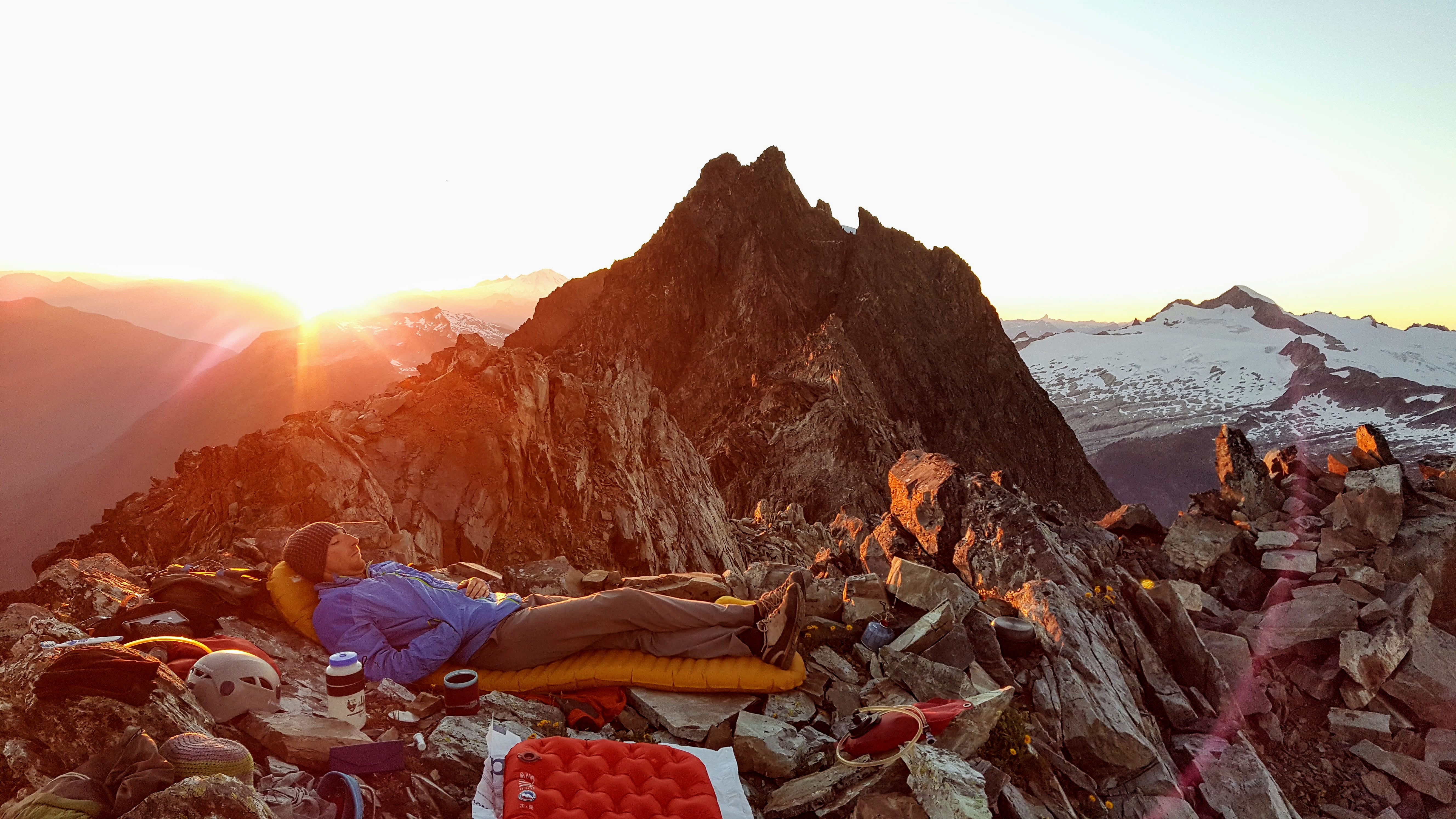
We hiked in to camp at 6100' in 5.5 hours without pushing particularly hard. The hike was beautiful and the camp spectacular, if one had to retire from climbing but still wanted a good mouthful of it this would make a spectacular backpacking trip. Our campsite was at 6100' at a minor notch in the ridgel it had close water, immediate access to the glacial snow slopes, no bugs or rats, and perfect flat smooth slabs for sleeping and lounging, even backrests!
It was weird having time to lounge, eat, drink and etc while on a serious climbing trip. But this route isn't broken up well into approach and climbing day.
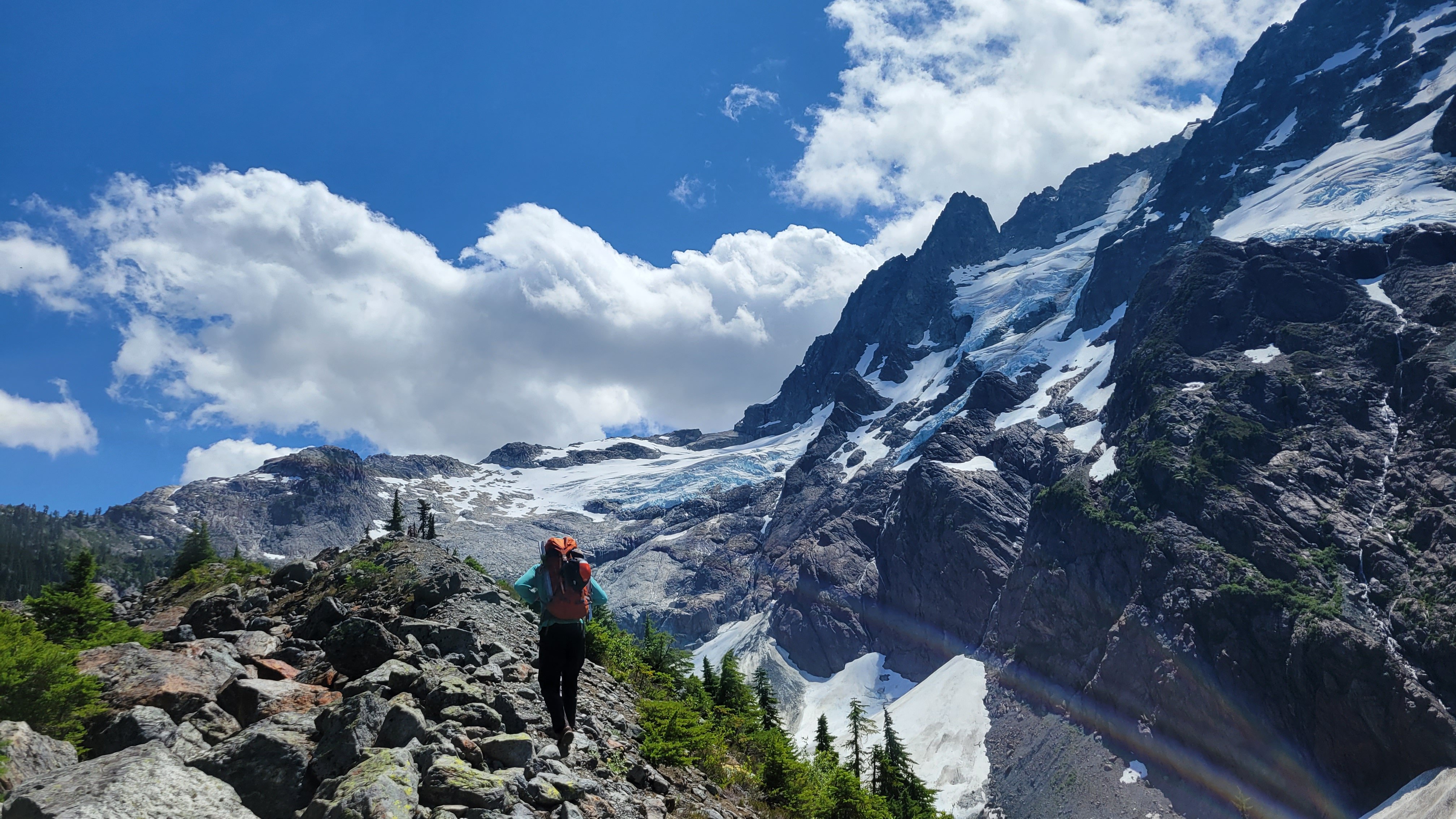
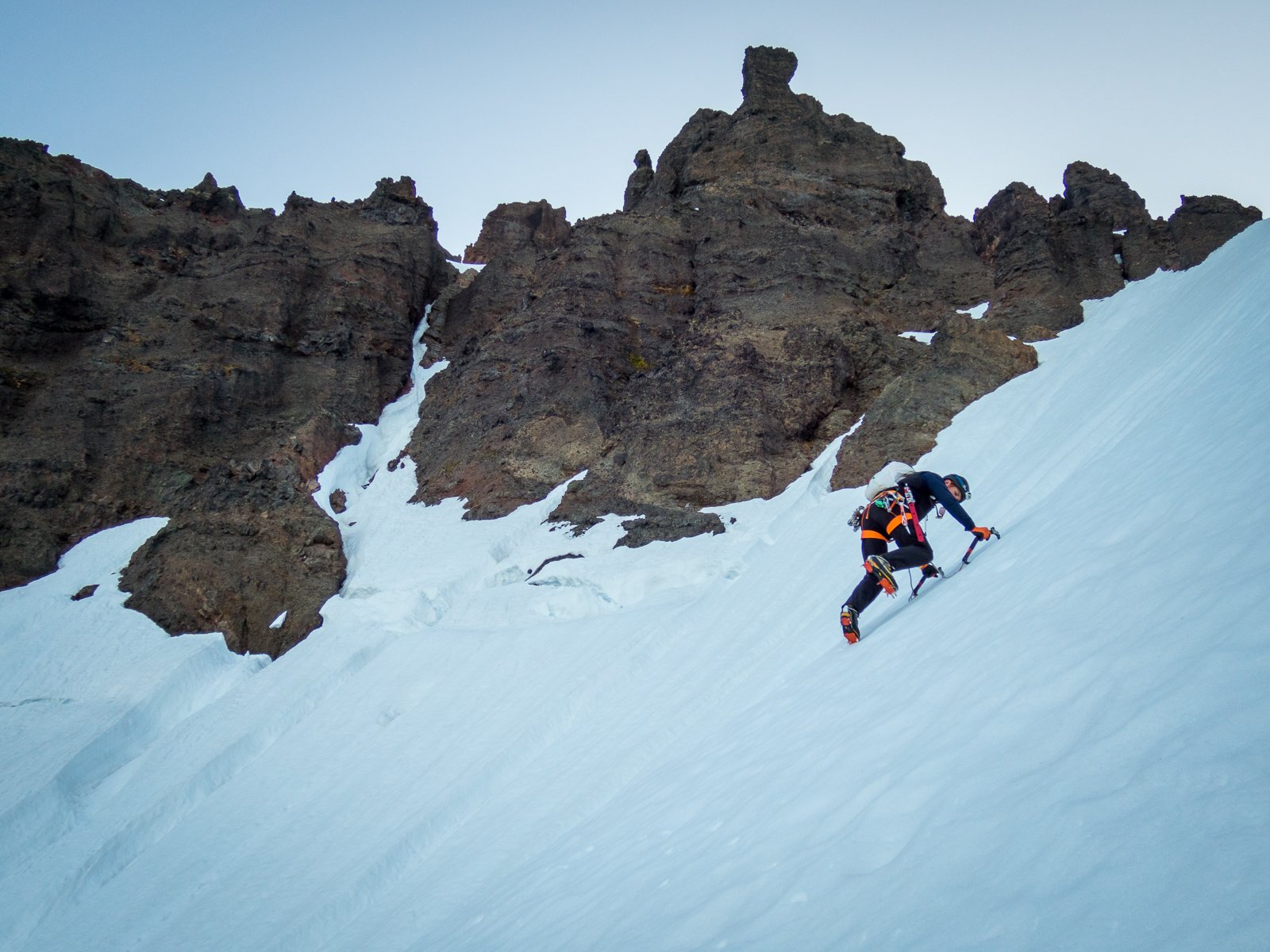
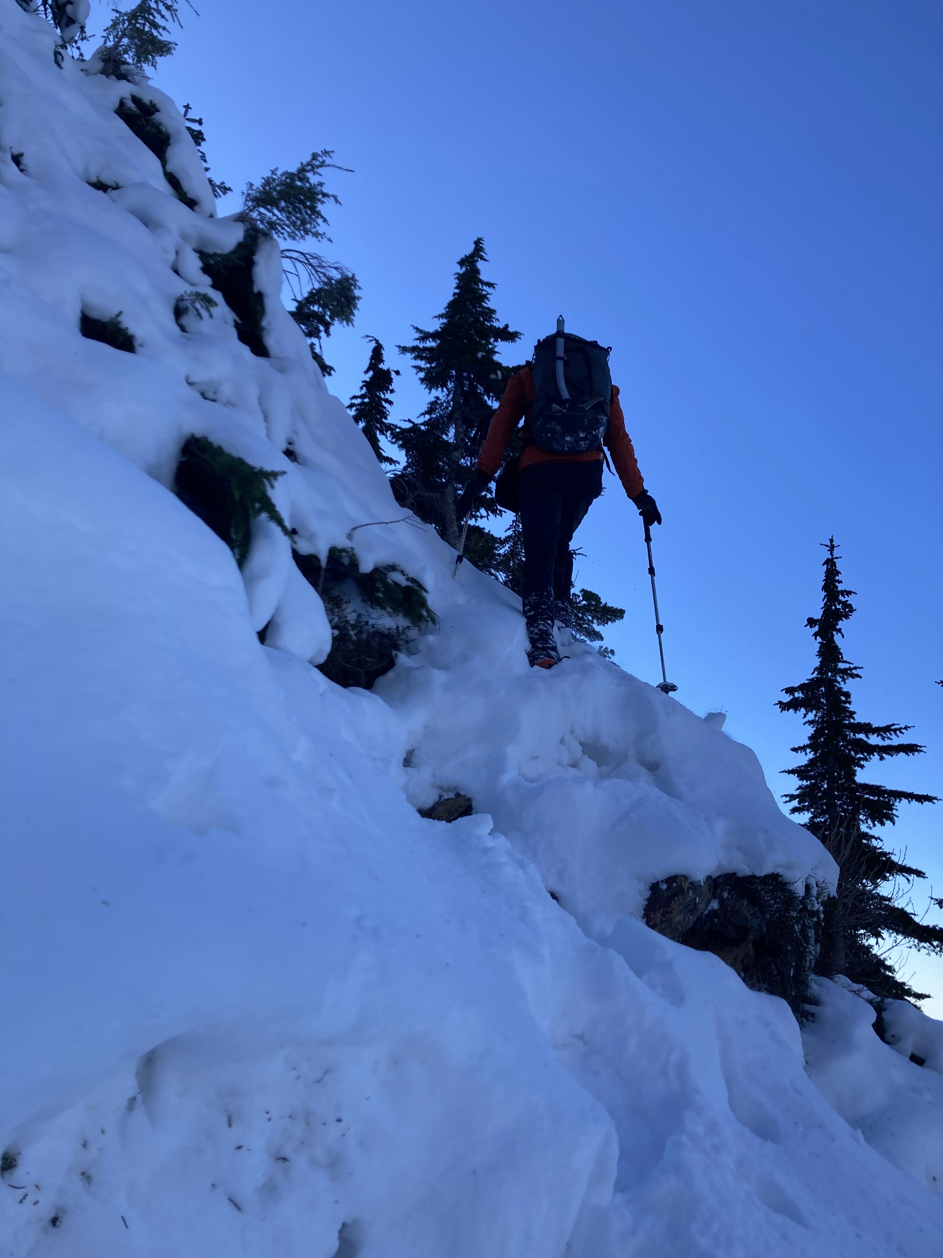
We were up at 2:30 am, hiking by 3:30. We found an easy bridge through the bergschrunds and were headed up the gully by first light. I had laughed at Tom Sjolseth's 2009 report that suggested the snow was 60-70° at the top, but it was! If only for about 20'. Fortunately, there was a fantastic moat to change out equipment in. A lot of people seem to get on the rock too early, we went to the top of the summer snow, "where the couloir narrows" per Beckey means really narrows, not just a little narrower.
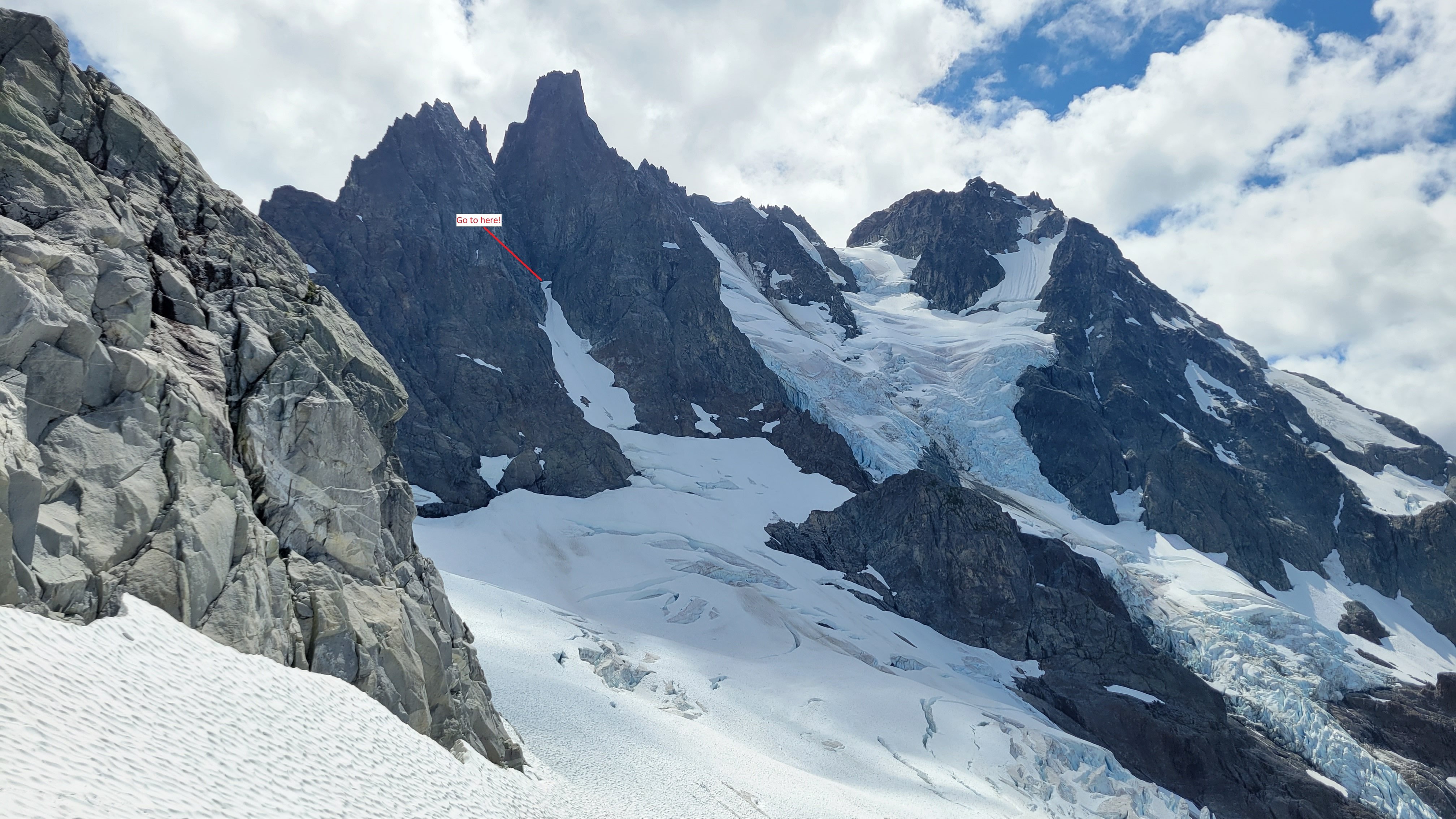
We climbed right up a crappy "slabby" corner, actually a chockstone gulley to access the obvious class 3 right leaning gulley, after 200-300' we worked a bit right out of the bottom of the gulley to keep the terrain moderate as the gulley steepened. We climbed a steepish wall here that might have been 5.0 but it could have been bypassed lower and right. This working right felt like wrapping around a rib at the time but isn't really when seen from above. After "wrapping around the rib" we were on a face and this is where a LOT of people go wrong.
We passed lots of rap stations that apparently lead up and right to the north face route (BAD, insert frightening those emoji). We climbed up class 3 and 4 open terrain for ~250', then started working left and up. Lots of left. In this open class 3-4 area keep looking left, the multiple ribs and gulleys below you and left are steep, once they start to mellow out and the terrain above begins to steepen work left across multiple ribs and gulleys. We found this to be very positive incut hands class 4 ground with some ramps in places leading you up and left.
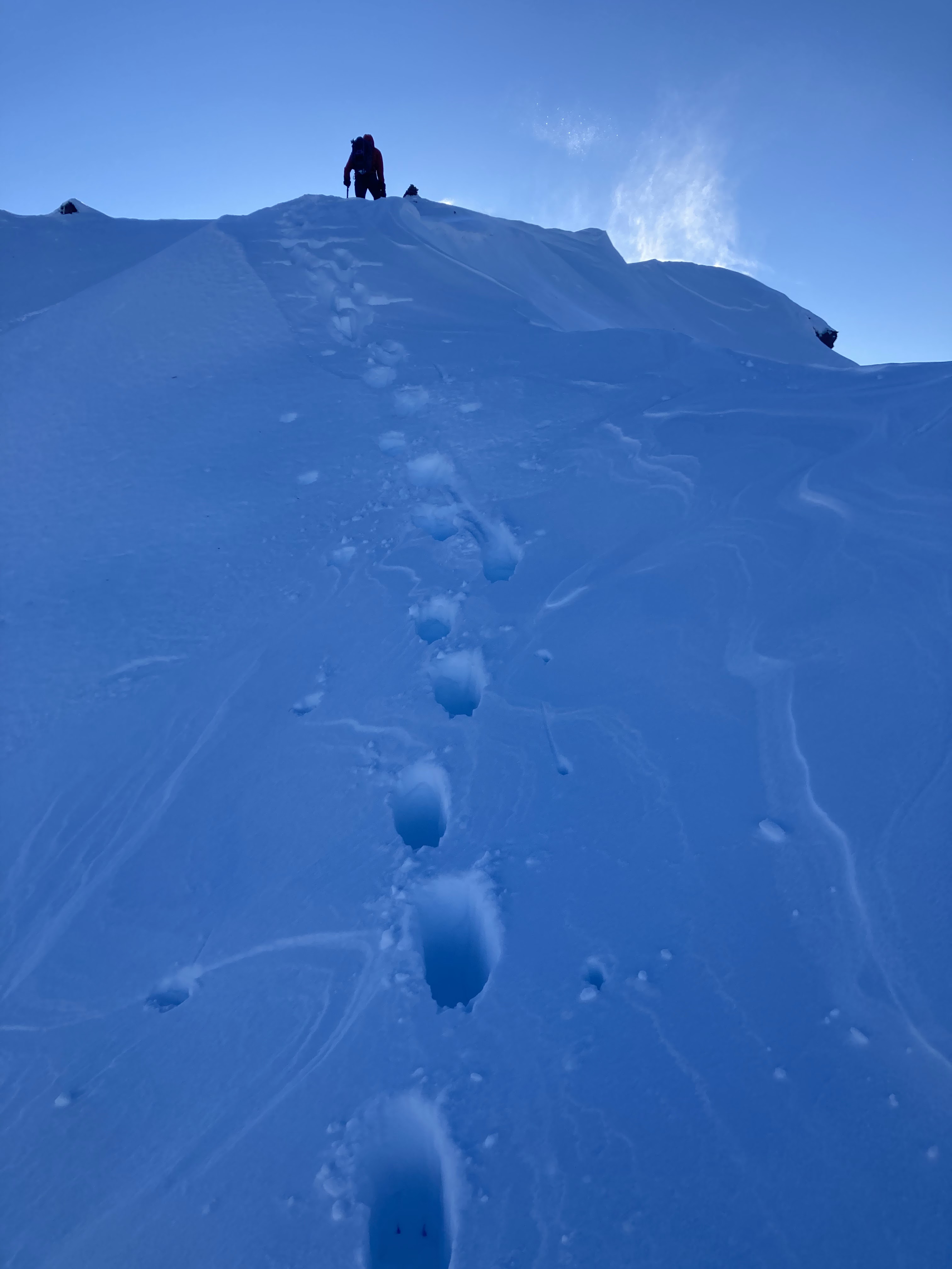
Once you get into a distinctly bigger gulley you are in the zone, this leads to the ridge crest 200' north of the summit, or, I believe, you could keep traversing one more large gulley over and climb straight up to the summit. This looked easy from above but we didn't go that far over. The big gulley we climbed up was mostly class 3 with some 4th class steps.
We hit the ridge and put on the rope for the first time. Dylan lead out, simuling to the summit in about 150' of rope length. There was massive air on the west (right) and plenty on the left that I'm glad we used the rope even though I think the only 5th class part was 20' or so up a wall to the very summit.
There were some familiar names in the summit register. Bizzarely, we signed in right below @Albuquerque Fred from 5 years ago!! Can that be true!? In this case the summit really is only about half way there, so we headed down after some snacks and photos.
We did 2 raps in a row off the summit back into the large cl 3-4 gulley, then downclimbed it and the traverses back to the NF rap line. We did 3 more raps to the snow moat and our gear.
"We" decided it was OK to downclimb the top scarry steep part, so Dylan went first since it was his idea. It was actually OK, the snow was soft enough for good steps but firm enough for solid high dagger sticks. This was extremely tedious after about 800'! My hands hurt today from stabbing my axes into the snow. When we got back to the compound bergschrund situation we couldn't figure out how we came up, Dylan kept climbing down where I insisted I had lead up, but there was nothing obviously right. I kept insisting it was there and that it had been easy but he kept insisting what he saw below was steep icy climbing into the cracks. Eventually we traversed between some cracks and set up a rap off a bollard on the lip, we then realized the bridge we had come up on had collapsed and was lying in the bottom of the 'schrund!
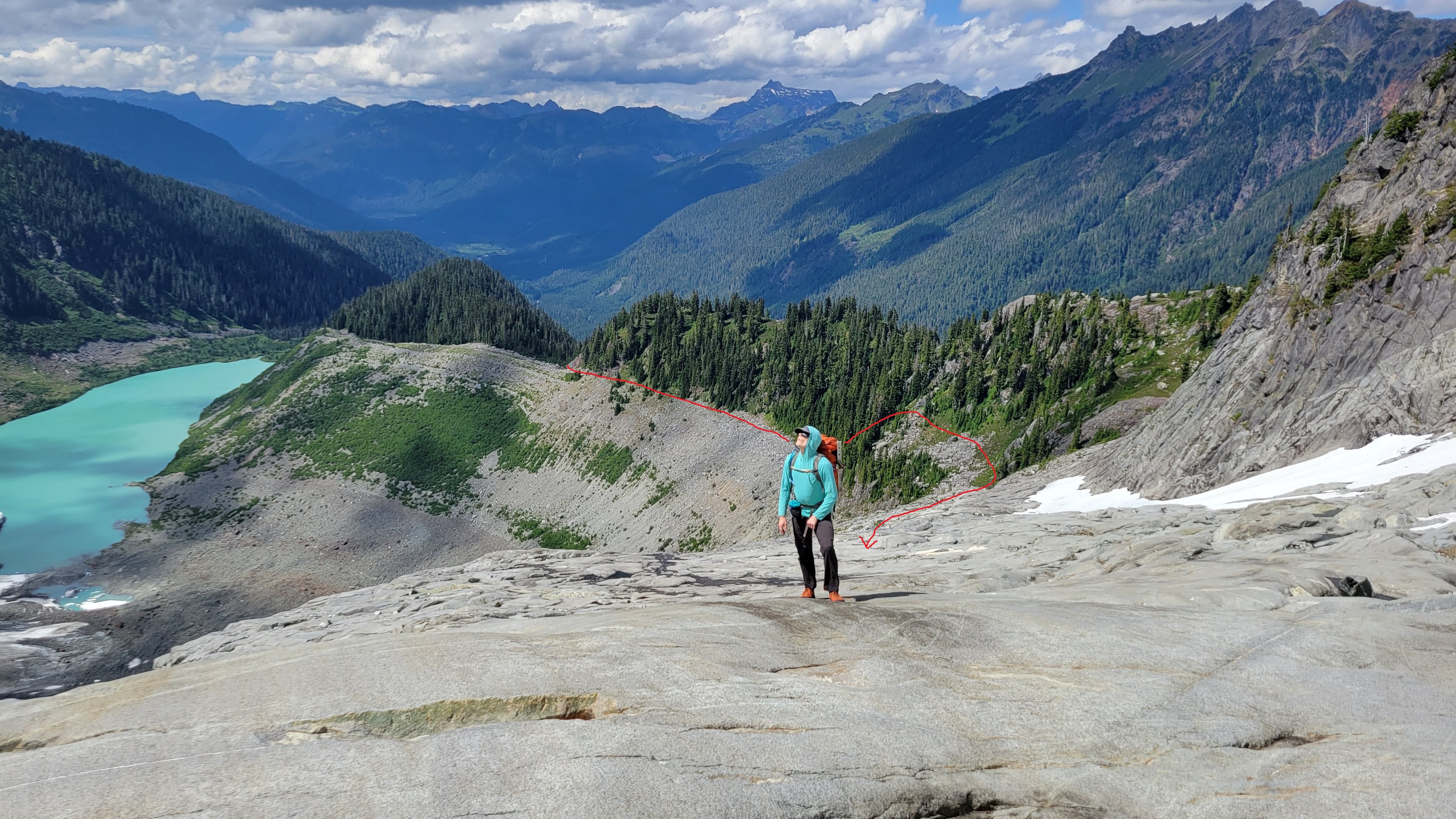
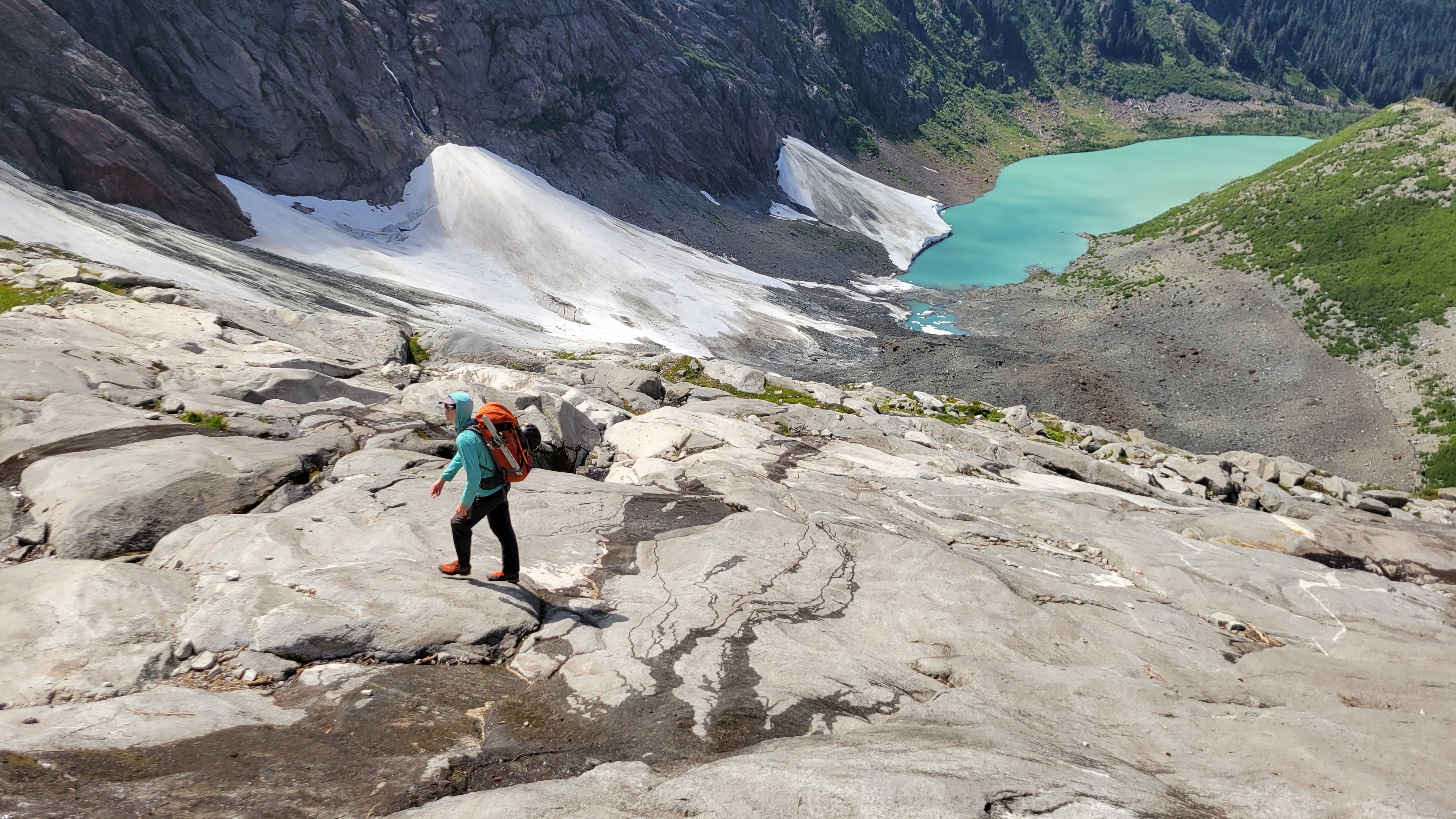
The hike out was uneventful but didn't take much less time than the ascent did, bizarrely. Once above the moraine, we did different routes up and down and I think this added to the increased exit time. On the way up we followed the boulders at the base of the trees as in the red line below. This was a mostly flat traverse between 4600 and 4700'. Then we turned up to traverse at 5200', below the buttress to the right of Dylan in the photo. The ascent from 4600 to 5200 was lousy climbing pulling on blueberry, if you can find a good way to do this it would be way faster than the ridge crest. There is a perfect goat path through heather and a ledge through the steeper slabs, then easy clean slab walking to camp. The slabs were amazing, beautiful clean rock, easy walking and fantastic pools and streams of water tracing intricate routes along the rock fissures.
On the exit we reversed the slabs and the traverse at 5200' but then gained the ridge and followed it all the way down to the moraine, the last steep part was as bad if not worse than the way we went up but the ridge was also brushy and tedious. I would recommend our ascent route in red below:
OK, so not so short, but it was a long trip.
Car to camp: 5.5 hours.
Camp to Summit 4.5 hours.
Summit to camp 6.5 hours.
Camp to car 4.75 hours.
Apprach:
Moraine and first look:
Slabs below camp:
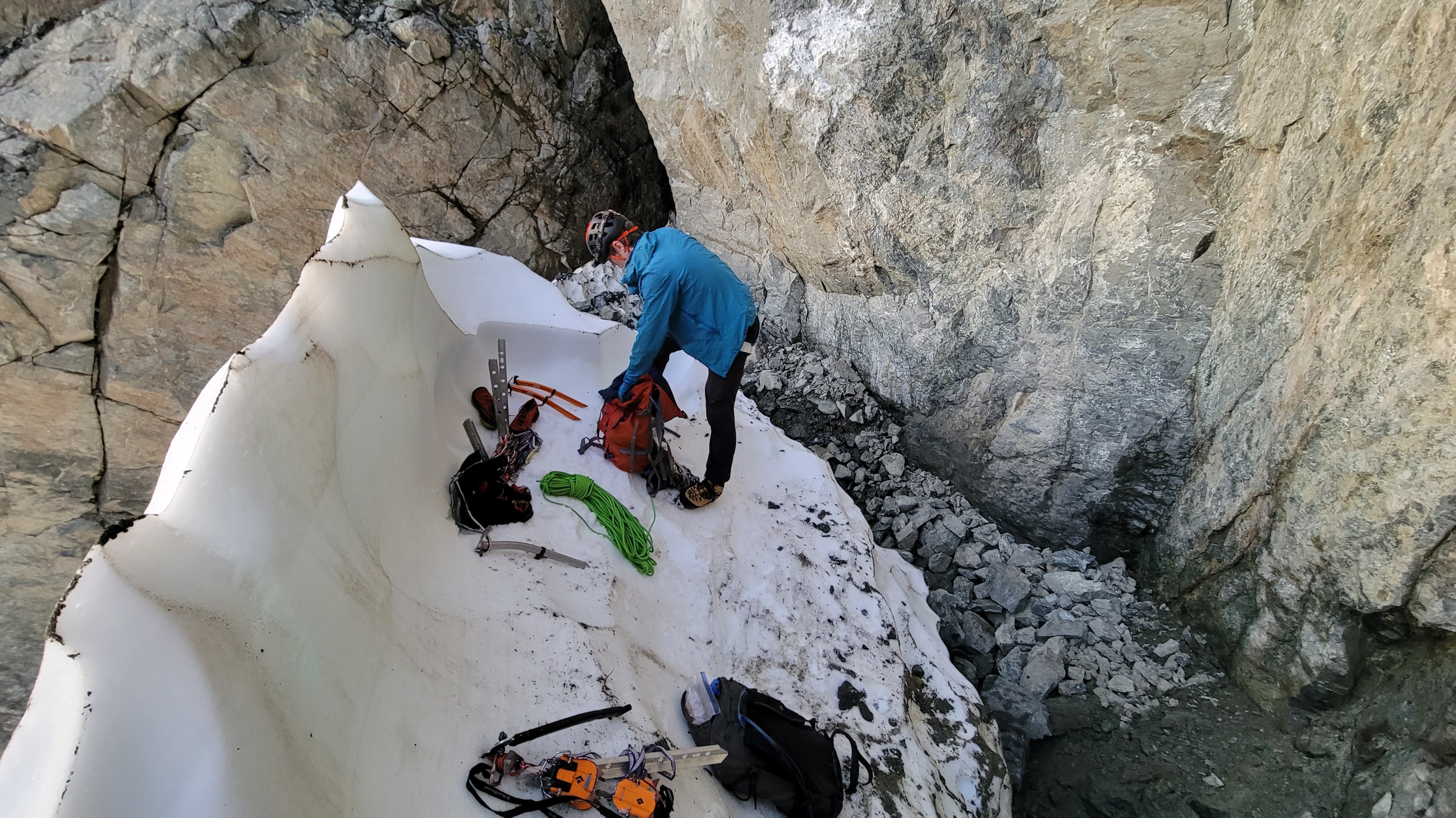
At camp:
Changing systems:
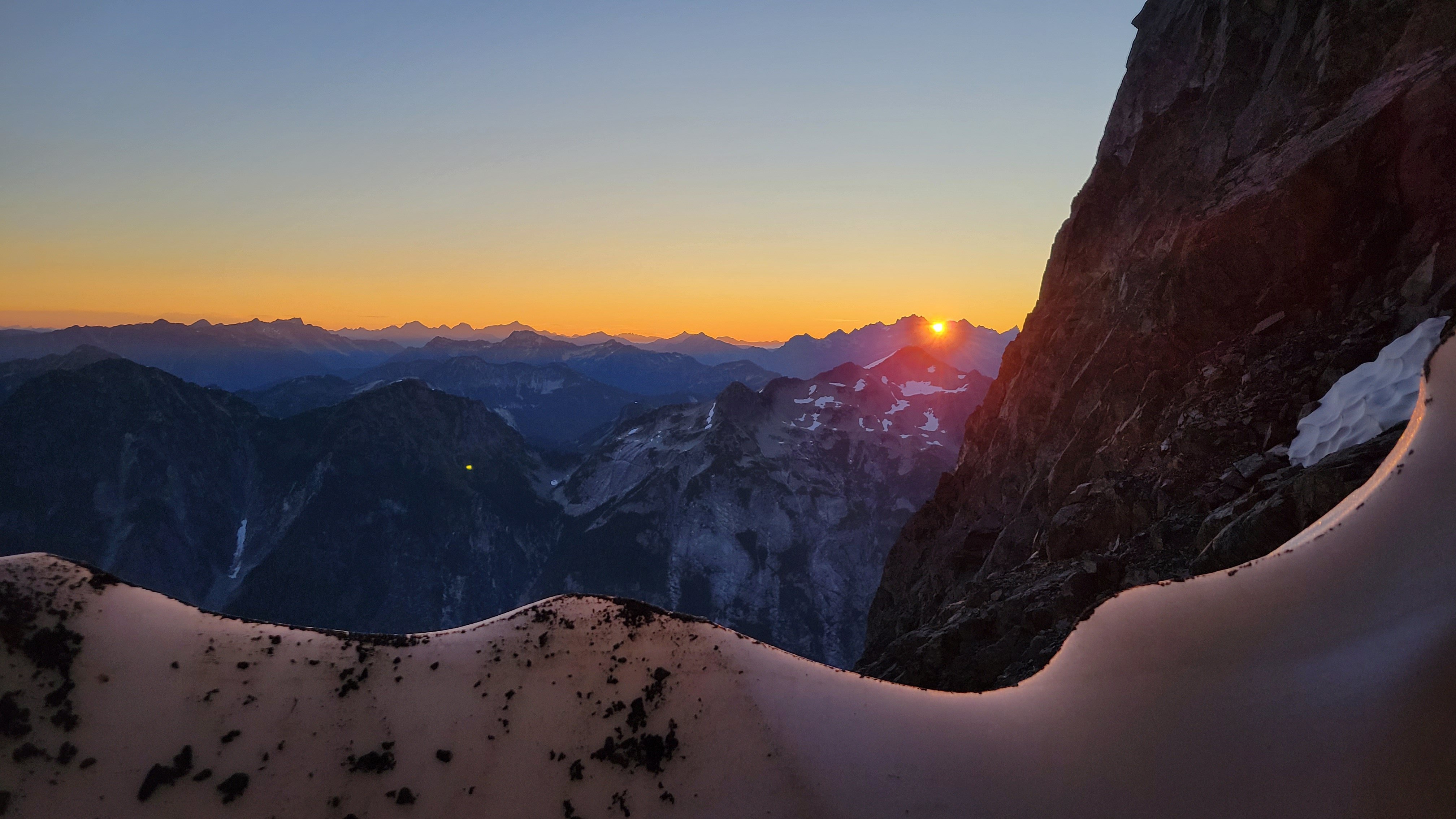
The sun rises from Redoubt Camp from the snow moat:
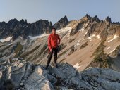
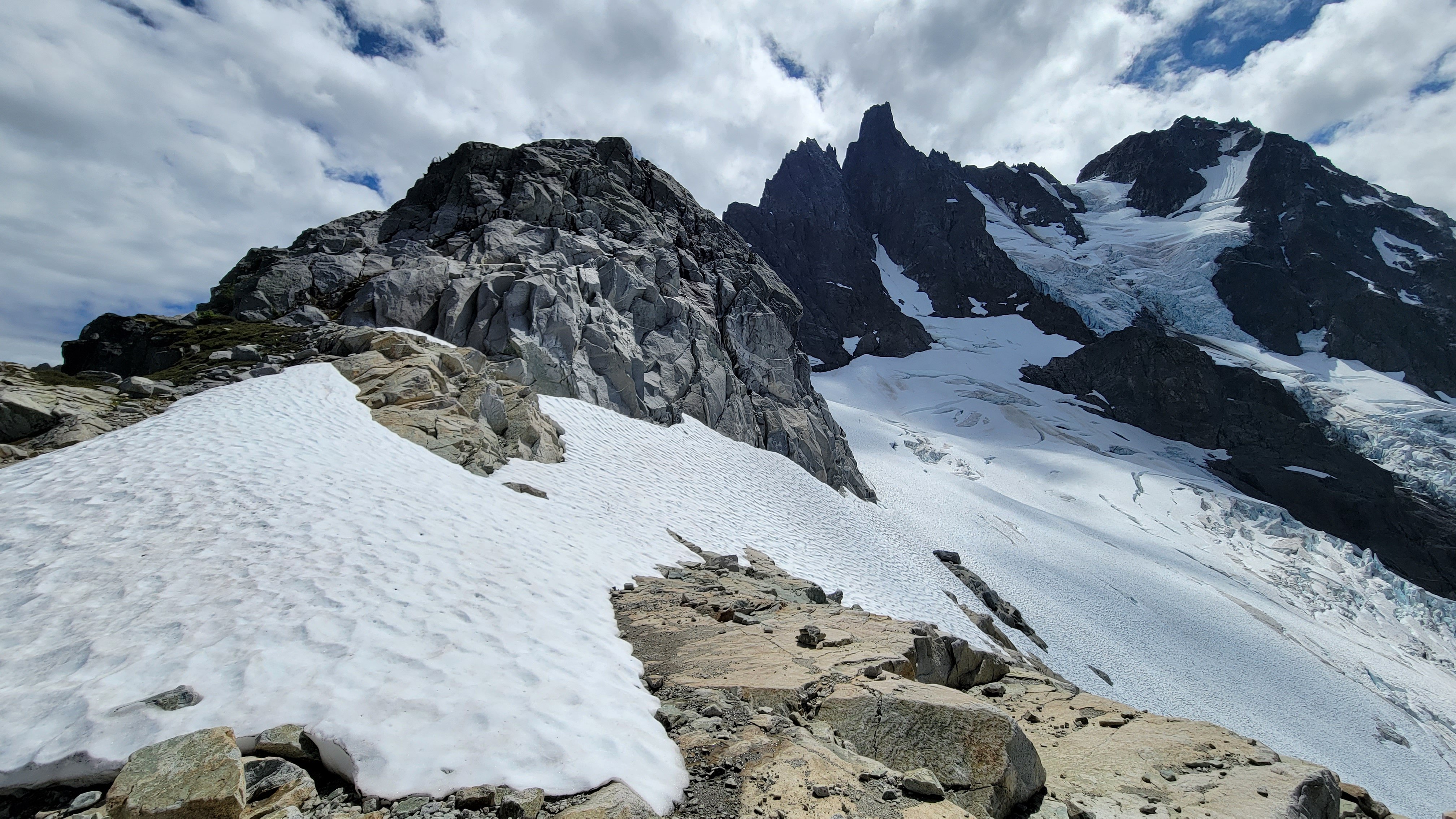
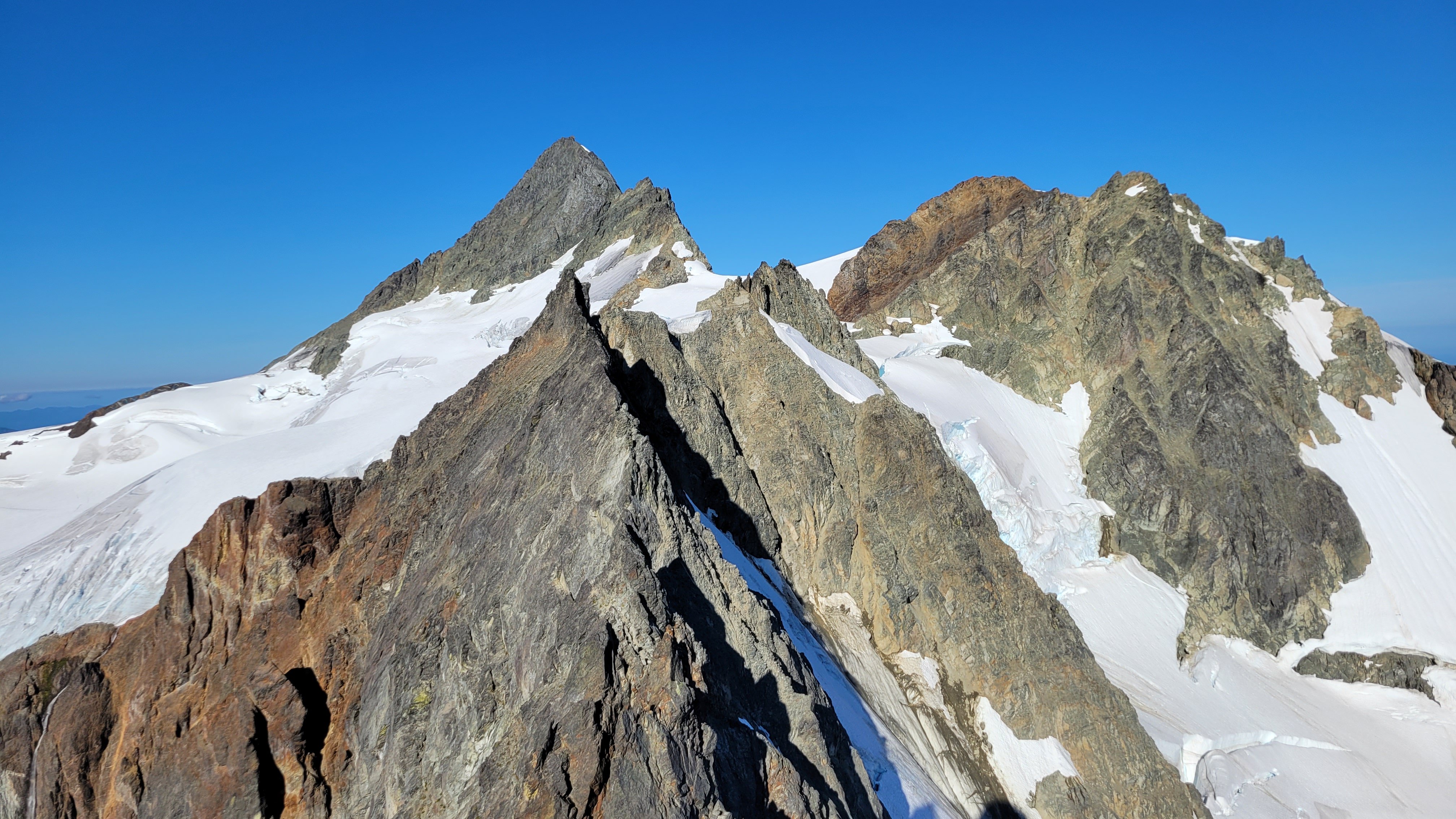
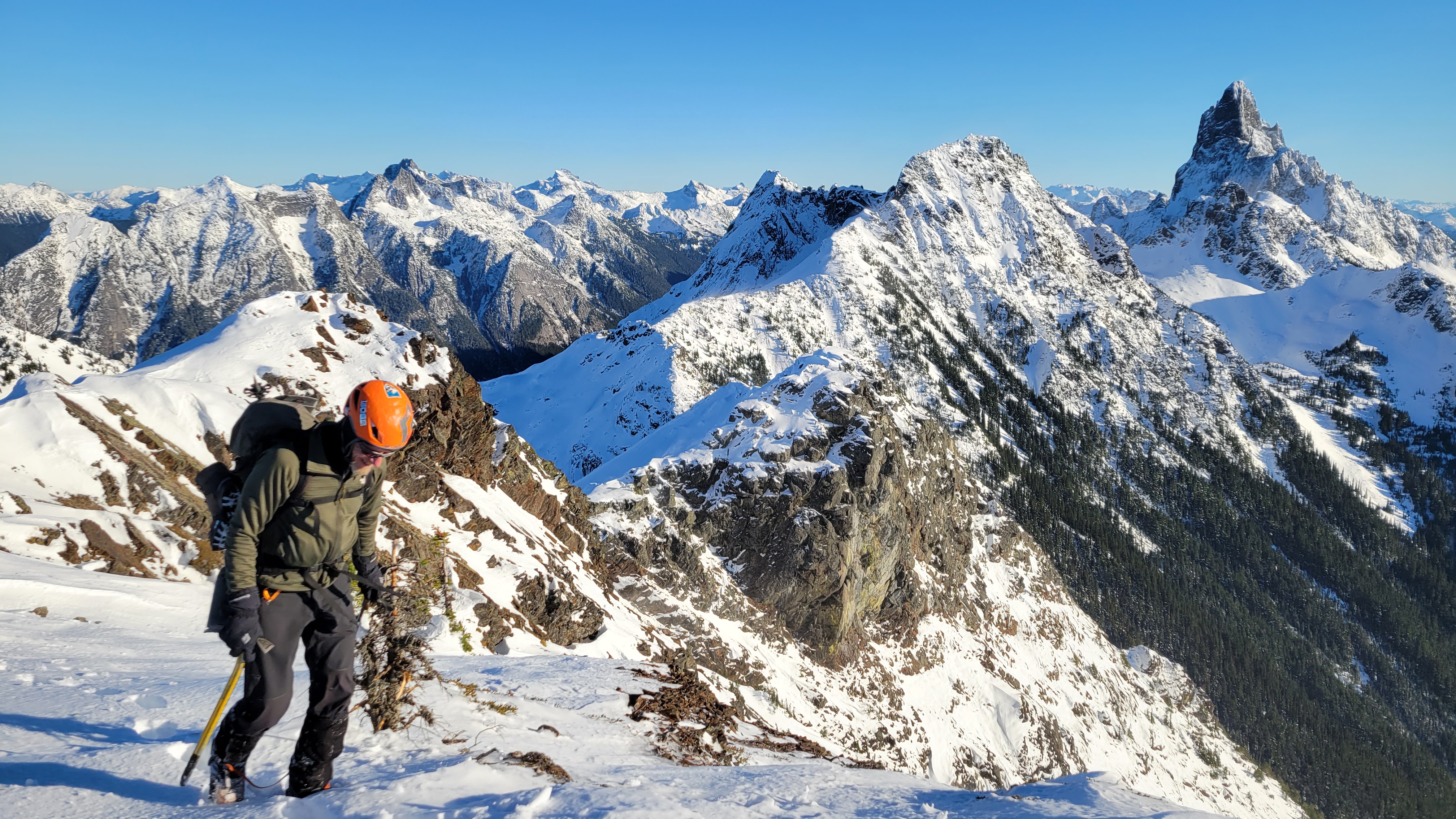
Shuksan from the summit, the Price looks tough:
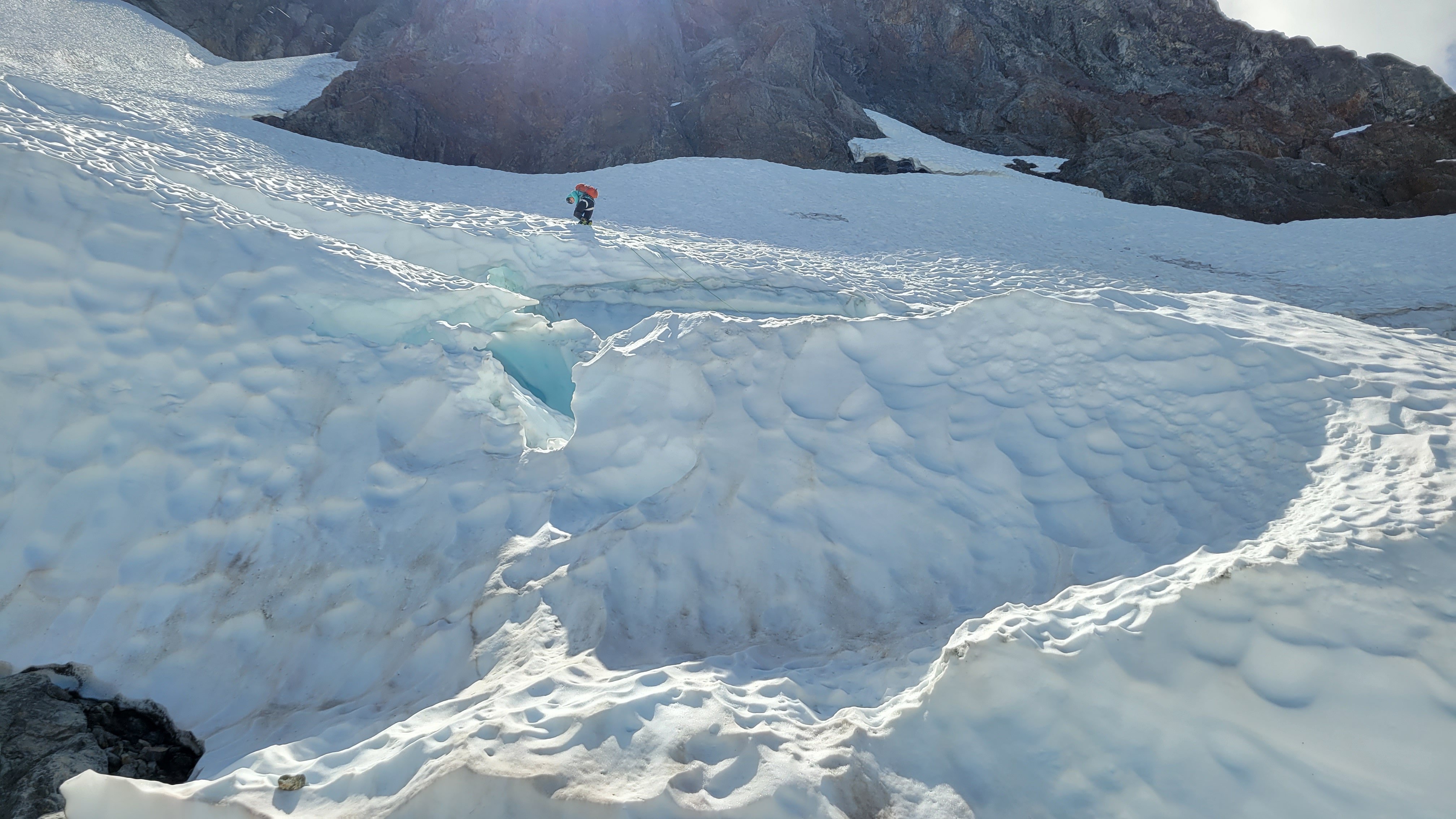
Dylan on rap:
Last look:
Gear Notes: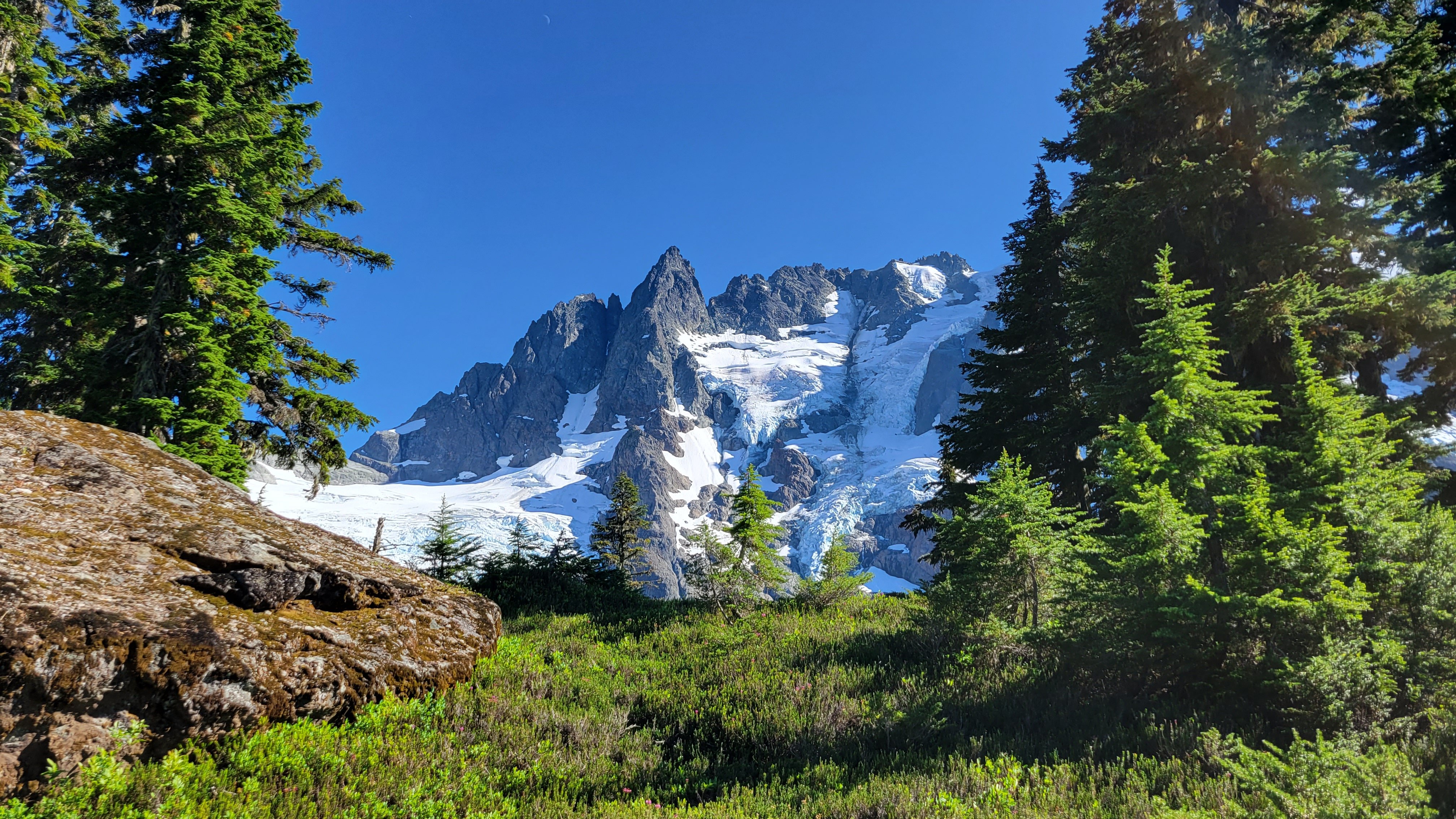
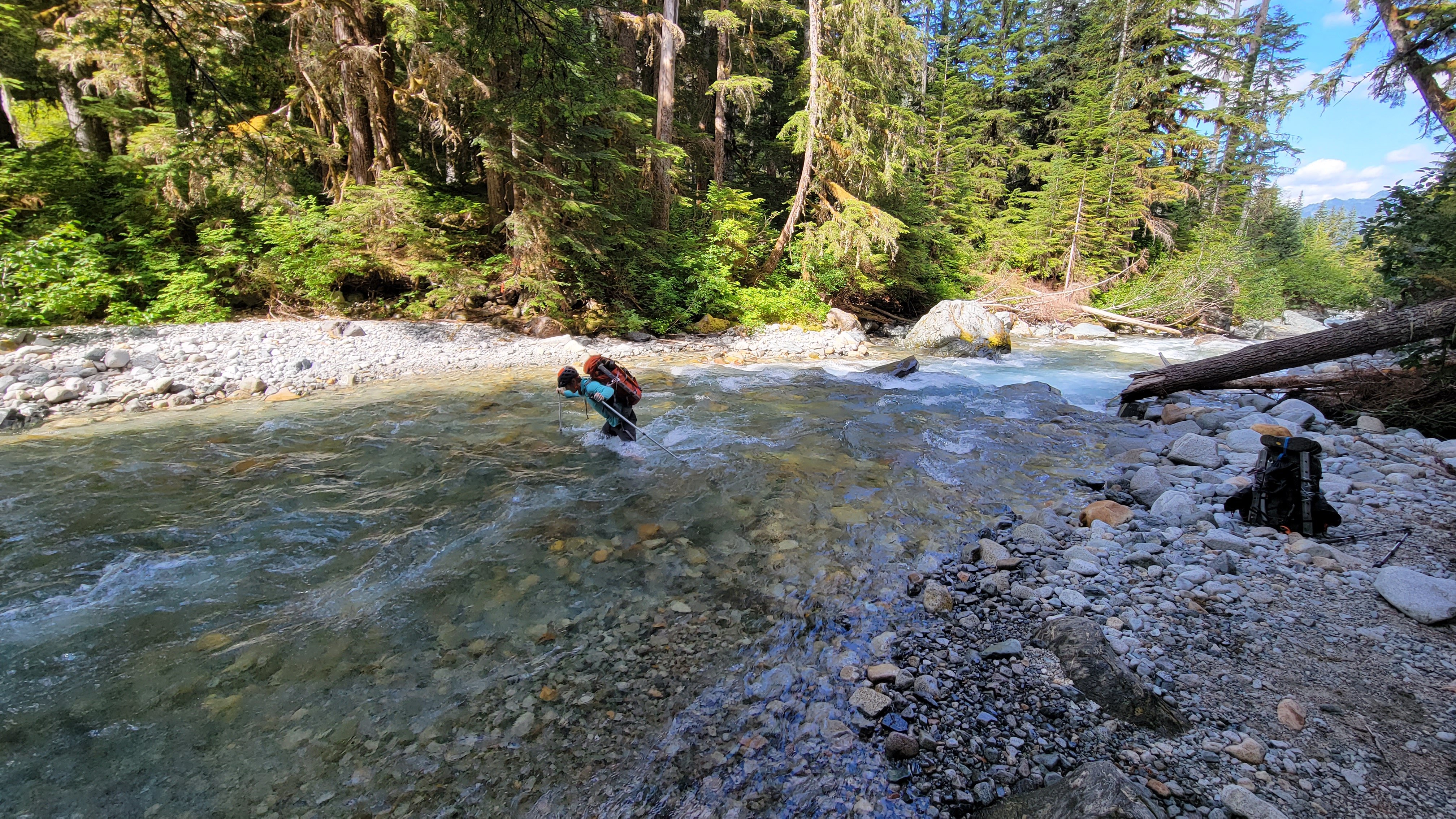
60m twin rope, 60m tag line, 2 axes, steel crampons, e-bivys, small rack (placed 2 pieces), tat (used none), 2 pickets each (didn't use), approach shoes for the hike and rock, boots for the snow, poles for the river.
Approach Notes:
River was fordable, tough on the way out, crossing is flagged. Trail largely flagged, not bad.-
1
-
 3
3
-
 1
1
-
-
Oh man, I'm not sure I would solo the Challenger Glacier personally. I was there on Labor Day and there are some big cracks, glad you made it ok.
It never seemed to me to be worth dropping down at the impasse, I mean, you're there to climb mid 5th on the peak.
Nice trip, thanks for the writeup!
-
Thanks for a great trip Karsten, it was a tough one to pull off with a new partner; I think we did great.
As Karsten mentioned, @Riley81's beta was invaluable:
The only place we screwed up was on the north face of North. Follow Karsten's directions above. The dihedral mentioned by Riley81 and Beckey is really short and easy, we climbed it as a face, and there is a big tree growing out of the back of it, so it didn't seem like a great landmark. At this dihedral you wrap around from the NE ridge to the east face basically, then up into a gulley, then you are at the horn with tat and the start of the hidden ledge traverse. Don't go up the easy class 3 gulley to the steep wall. Otherwise you end up doing Beckey's variation: "Variation: On the lower portion of the climb, from the "hidden ledge" ascend a steep rock wall to a large hanging brush patch. Imitate a gorilla..." You get the idea.
Riley81s beta on the descent from North was perfect (it reads insane at home, but following along totally works).
The only thing I would add is descending from Middle, we did the same thing but had to do some looking around. From Middle Index we started down the ridge, bore left down a gulley to a treed area, then back west up a heather gulley, through a notch, down some rock and trees on the west side to an easy ledge system. Then bear east (left) along this ledge and heather to slabs, you cross the ridge back to the east side here where it is very gentle. Down slabs easterly until it starts feeling cliffy below, then go back over the crest to the west again and down a chossy slope or a chossy incised gulley. Wrap around to the crest where there is a chockstone gulley that leads to the notch. We made a rap station off a huge block on a prow skiers right of the chockstone and did a ~25m rap into the notch. Just above our station is a tree that Riley and co rapped off of (we didn't check this out). Incidentally, we were a tad confused that no one mentioned that the Middle-Main notch is a double notch with a point in it, this we easily climbed over to belay at the base of the next pitch out of the notch.
With @Riley81's, and of course @JasonG's, beta with some Beckey thrown in we did pretty well. It's mostly all there, the looking around is the best part.
If I were to do it again (which I won't) I would take a higher percentage of double runners and more small cams e.g. #0 and #1 master.
-
 2
2
-
 1
1
-
-
On 6/5/2023 at 9:29 PM, JasonG said:
I think this pretty much sums it up. @kmfoerster taking care on the way back from our high point:
Damn! That looks firm for that route.
-
This is a cool report and I have tons of respect for you two as climbers and amazing trip report writers but I have to agree with Rat, paragliding is illegal in Wilderness areas. It is the responsibility of all of us to protect the character of the wilderness lest we lose it or incur more regulations to curtail misuse.
Unless there is something I'm missing here, then please disregard.
-
23 hours ago, tanstaafl said:
how you say in English -- banal?
I love that scene!
-
I would recommend Glee and The Roost just south of West McMillan Spire if you are looking for more like class 2. Some would consider Mixup Peak soloable, not me though. Magic was fun and solo worthy, as well as Hurry Up; I did those in a day as a group solo. I believe the Cache Glacier is widely considered soloing territory.
-
Trip: Mount Rainier - Curtis Ridge
Trip Date: 05/29/2023
Trip Report:We failed utterly, this is a conditions report.
We went in at the tail end of the Memorial Day weekend hoping to climb Curtis Ridge but the route was super melted out so we ended up doing the Emmons instead. After two attempts over the years my realization is that this is an earlier season snow route. I believe I will try again someday in April or even March.
We were suspicious after hearing that lots of people were turning back from Liberty so we decided at least to get to 10,300' at the do or die rappel point. From here you get an excellent view of the whole route. We bailed, crossing the Winthrop glacier at 8600' to Schurman.
The lower two traverses appear to be largely rock, it's hard to tell because I haven't actually done the route but the exit gullies appear to be mostly rock as well.
Gear Notes:
Between five of us we carried 2 30M ropes, two small racks, glacier gear, two tools each.
Approach Notes:
Piece of cake once the road is open to the trailhead. Usually May 25th.-
2
-
-
Wow. Good perseverance I guess. I can't believe you went for the summit, that's mental toughness.
Thanks for the really geat write up and magnificent annotated photos.
-
Looks like a great trip! Glad it all worked out after the long wait.
-
Thanks for all the hard work @olyclimber. I love the TR search function.
-
-
Trip: Baker - Easton Glacier
Trip Date: 01/29/2023
Team
@geosean @Albuquerque Fred
Trip Report:Me and Fred have decided we need to get into bigger mountains, so to get ready for cold weather we decided on doing some winter volcanoes, Baker being the easiest nearby.
The weather seemed perfect if somewhat cold, and @thedylan offered to give us a tow with his snowmobile so the trip was a go!
On Saturday morning Dylan (really his wife Ellie drove) towed us from the snow line to the summer trailhead where we started skinning.
We skinned up the groomed, that's right groomed! Track up the Easton Glacier drainage to about 4400 ft where we broke left and headed to Park Butte. We ditched our stuff at the lookout then went for a look around for a couple of hours. We had a pleasant but very chilly evening hanging out in the lookout drinking and chatting.
After a very leisurely wake up of 5:00 a.m. and an extremely slow leisurely time getting out of the lookout we were finally on our way in the bitter cold. Fortunately the sun came up pretty soon and because it's mid winter it was shining right on us immediately.
The sun the previous two days made for really gross icy crust over soft powder that would have made for tough skinning if it wasn't for all the snowmobile tracks everywhere. Somewhat ironically they basically broke the trail for us.
Eventually we got high enough that the crust gave way to rime and hard wind packed sastrugi. We eventually put ski crampons on but not for very long and then at about the crater we switched to crampons and left our skis behind. The Roman Wall was extremely firm, but probably would have been okay if not a little hair raising.
All the way to here the predicted wind had really not materialized and we'd been skinning in the sun so it was almost pleasant despite being in the single digits. But once we hit the summit plateau the wind started blasting and the temperature dropped hugely. So we spent all of maybe 10 minutes on the summit and turned right around again.
The whole way up we have been thinking how crappy the ski down was going to be since the conditions were very variable with the only constant being firm. But actually everything ended up being pretty decent if you like hard icy skiing, which at 9,000 ft in the winter is more than you dare ask for.
The way out down the groomed snowmobile highway also went shockingly well. As long as you don't mind a lot of traffic. It's definitely not your normal wilderness experience but I can't complain.
We went into this trip hoping to learn something about how to deal with cold weather like the rest of the world experiences most of the time and all I really learned is to try to keep my nose covered, man was it red and sore on Monday.
Approach:

Sunset over the Twins:

Nearing the summit:


Fred skiing:
Gear Notes:
Glacier stuff, ski stuff, camping stuff, whiskey.
Approach Notes:
Snowmobile, it would be an easy skin.-
3
-
1
-
-
Thanks for the report, I've always wanted to do this trip and never made it a priority. Some day.
-
Did this fix the security certificate issues with the site? I used to never be able to post links to cc on Facebook or even access it directly through the address bar. I've noticed it is fixed now. Either way keep up the good work!
-
1
-
-
This sounds cool. Nice work. Now I need to go do something so I can write a report!
-
1
-
-
On 12/7/2022 at 4:59 PM, Stefan said:
Cool!.
I got me a question. The trailhead is low. The trail must cross the logging road a couple of times....do people use the trailhead because they can not get up the road due to a gate on the road? Just wondering for the future becuase...well, I would rather driver higher, and start higher if I could. Thanks for the info!
Yeah, the road is gated. It also seemed to be very overgrown at the beginning, but when we crossed it later it was better. In the dark on the way out I'm pretty sure we saw some people with motorized transport, but dirt bikes could obviously pass the gate.
-
Trip: Mount MacFarlane - Trail
Trip Date: 11/13/2022
Trip Report:
Me and @Albuquerque Fred snowshoed/climbed Mount MacFarlane the other day. I figured I would post something just to fill out the website in this time of crap season.
This peak is in SW BC in the Canadian Cascades, only about as far from Bellingham as Heather Meadows. In the summer there is a trail to the summit, but we found it more difficult.
We hiked from the TH at 1100' to about 3100' in sneakers, then switched to boots due to some snow. From there on to Pierce Lake at 4500' there was about 4" of snow on the trail, which is in the first the whole way, and as steep as any climber's trail.
A bit after the lake we switched to snowshoes for a steep climb up to the NE ridge. We found a fixed rope just after we really needed it, so at least we knew we were on route.
It had been cold and shady but still up till now, but as we neared the ridge it got windy, so we stayed just to the north side of the ridge, eventually switching to crampons for the fun of potholing through crust and sugar.
The summit was very welcome. I'm not used to this cold crap yet, remember summer? We lounged in the sun on the summit of Burgundy Spire at 8400' just a month ago. I think we didn't all of 5 minutes on top, then turned back.
The tough snow conditions made everything slow, we hoofed it down to 4800' where we hit the bootpack to take our first break in hours. While breaking we realized it would be dark soon, so we donned headlamps as well. It was disheartening to realize that we had ~3500' to descend in the dark. Stupid winter. It went fine though and we were thrilled to have extra extra cold ciders at the car. As a bonus the car was still there with all of it's parts.
Canada, eh.
Technical snowshoeing.
Fred and Slesse.
Gear Notes:
Axe, crampons, snowshoes.
Approach Notes:
Border crossing. Long steep trail.-
1
-
2
-
-
On 10/21/2022 at 12:15 PM, robertm said:
awesome loop, larches and without the maple pass crowds :-)
I didn't know there were larches anywhere besides Maple Pass!! and maybe the core zone.
-
 1
1
-
-
Wow, sounds like a really amazing trip.
I can't believe how many people will go to the se few places. Somebody tell Instagram for me to stop talking about the Enchantments and Heather/Maple Passes.
-
1
-
-
Haha, wow, I never expected Seano to back me up on ABP! I love your mountaineering style man, very classy in an oh-my-god-i-cant-believe-he-did-that way.
Denali - Cassin Ridge (VI 5.8 WI4) June 3-6, 2022
in Alaska
Posted
Nice writeup, thanks for sharing!