geosean
-
Posts
190 -
Joined
-
Last visited
-
Days Won
39
Content Type
Profiles
Forums
Events
Everything posted by geosean
-
Following. What gives!?
-
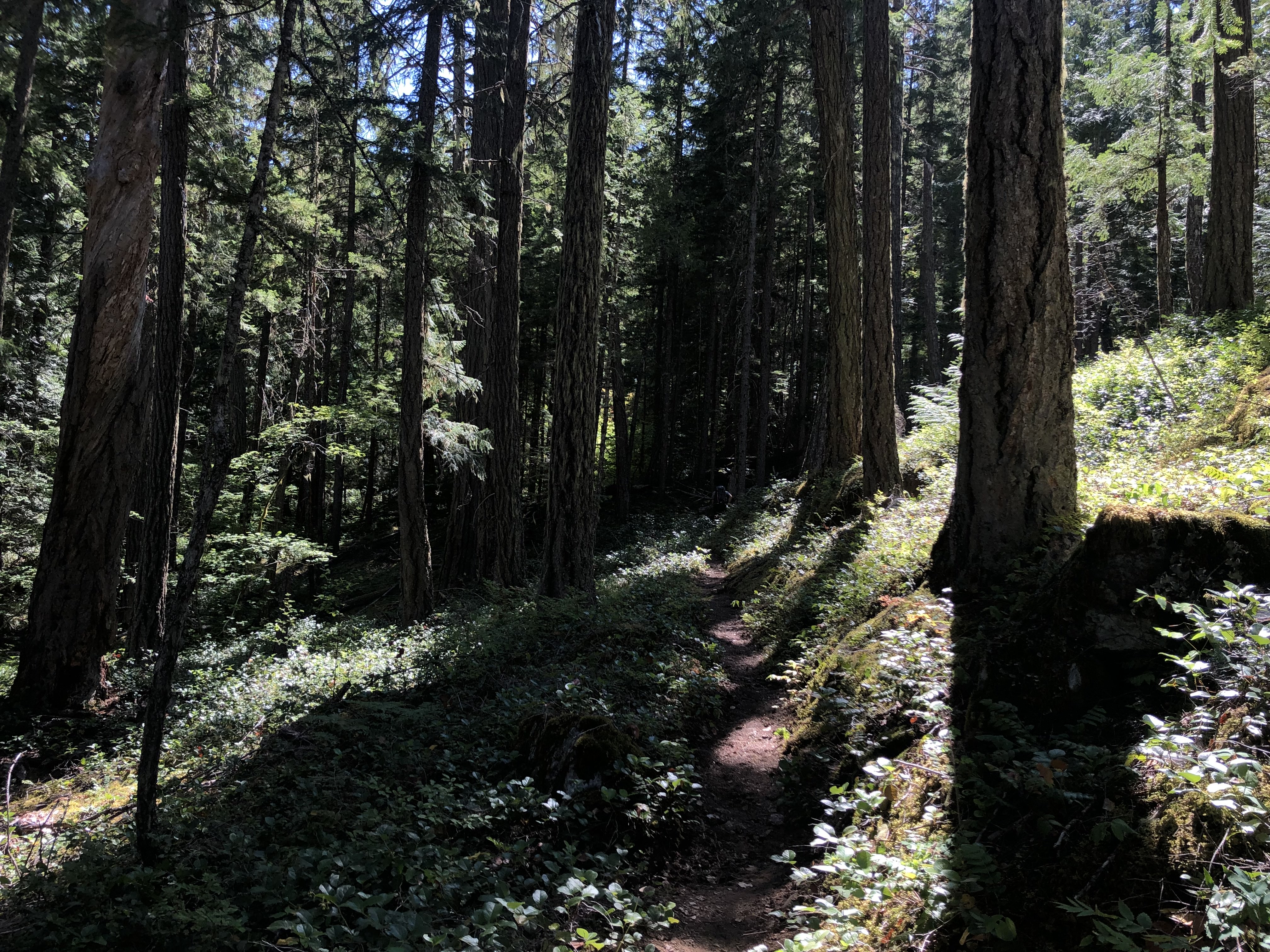
 Trip: Townsend, E. Merchant, Merchant... then Baring - Merchant Northeast Gully Trip Date: 05/30/2021 Trip Report: Due to the predicted heavy snowfall at high elevations for the Memorial Day weekend @Albuquerque Fred, @MGraw and I decided on an easy trip from Mount Townsend over Merchant to Gunn and all the Gunn peaks. This turned out to be wildly optimistic. So we did the east part, then bailed down the Merchant standard gully to a trailhead camp, then did Baring the next day for a somewhat chill two day "long" weekend. We hiked the Barclay Lake trail and the route (not quite a trail) up to Eagle lake, walked the west ridge of Mount Townsend, then following somewhat-remembered Beckey beta we went for Merchant. I kind of remembered that Beckey said it would go, but not what he said. Again, we thought this trip would be easy so we went light on beta. We traversed down from the Merchant-Townsend saddle to what looked like a hidden gully. It opened up to a beautiful mellow snow-filled gully all the way to the ridge crest. We (I at least) were stoked to have such a great route, it was a fantastic easy snow climb for 1100'. Townsend: Merchant from Townsend with the hidden gully between the east (left) and main peaks: In the gully: Topping out the gully: We walked up East Merchant (because it was there), then climbed moderate snow to the summit of Merchant. It was 5:30 pm. I had hopes of descending a gully to the SW to the basin between Wing and Merchant to a camp, but it didn't look great and we had foolishly not brought a rope (it was supposed to be easy). The plan had been to descend the south gully and reascend the western branch to get over to Gunn, but it would have involved another 1000' of climbing and then some messiness. So we made the tough choice to bail to the car (good thing we had overnight gear for this day trip). Baring from somewhere on Merchant: Descending the south gully: The south gully was not trivial anyway, so we still got to have some fun. I think this would be a great early spring route if you could nail the avalanche conditions, but it didn't seem like a very good route in these conditions to me. Maybe the party we saw the next day had a better time...? We had to bail a hand line to get down a wet slab move onto a thin snow bridge over a very deep moat (the second waterfall I believe). Fun was had by all at camp with manhattans and comfy shoes. The next day we did Baring in prime conditions. It was basically all snow from 4400' to the summit. A very enjoyable scramble to great views. Would recommend. It was like climbing looks in photos with lunch in the warm sun on the summit and good comradery, rather than the grunting, wetness and agony climbing often is. Baring gully: Easy snow near the top: Index from Baring: Gear Notes: Axe, crampons, helmet, 10m handline (bailed in Merchant S gully), overnight gear for training weight on Merchant Approach Notes: Barclay Lake trail to Eagle Lake
 -
[TR] Seward Peak - Standard - West Ridge 05/23/2021
geosean replied to geosean's topic in North Cascades
I saw no gate nor any such signs. There is a gate and I believe signs about video monitoring at the side road that descends to the river for the fish passage construction site. But that is about 4 miles before the turn off for the Rankin Creek Road. -
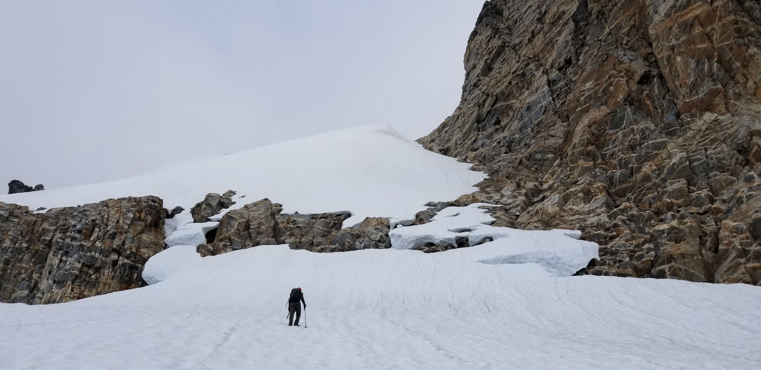
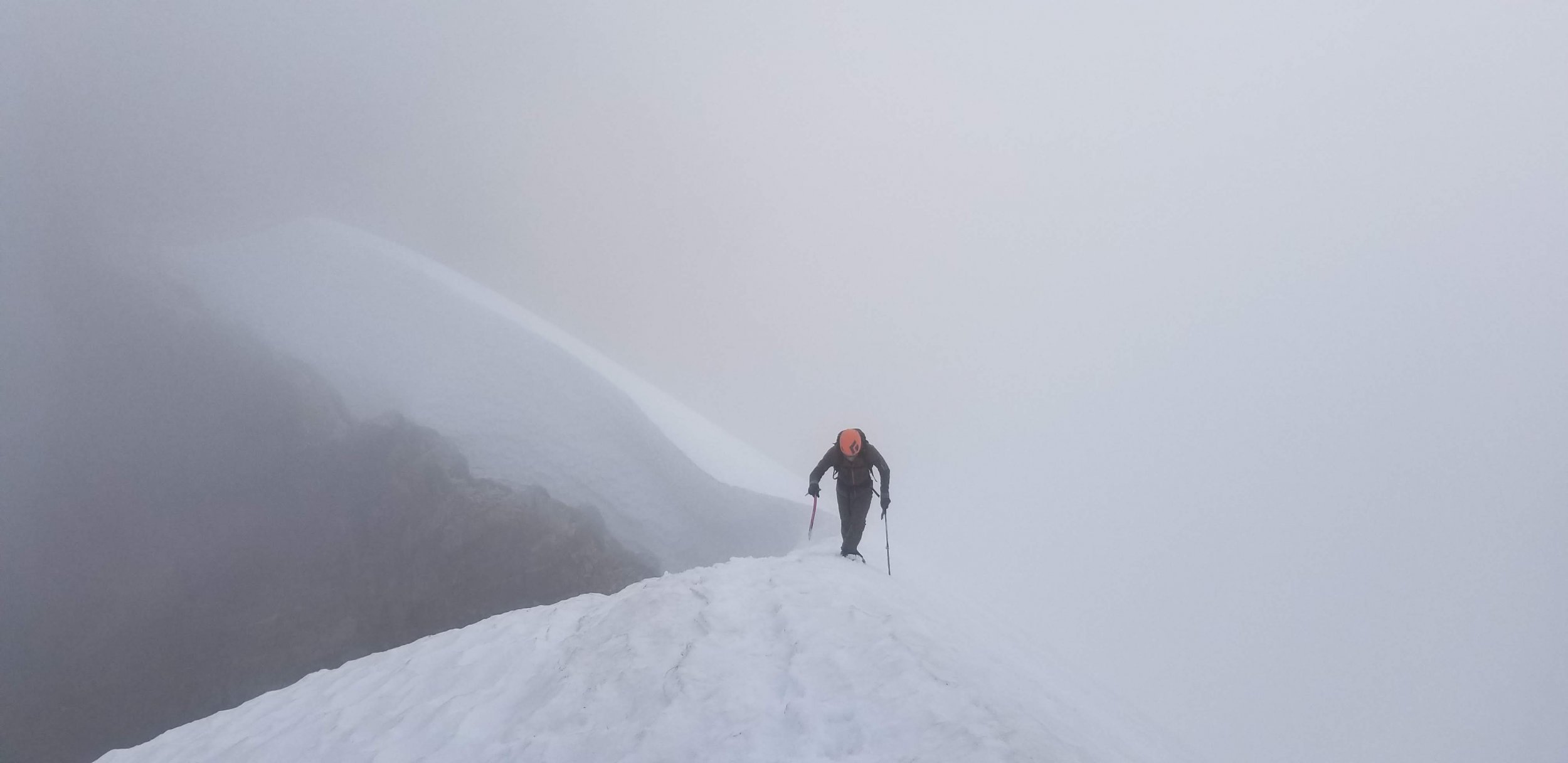
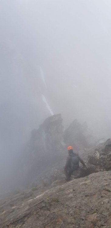
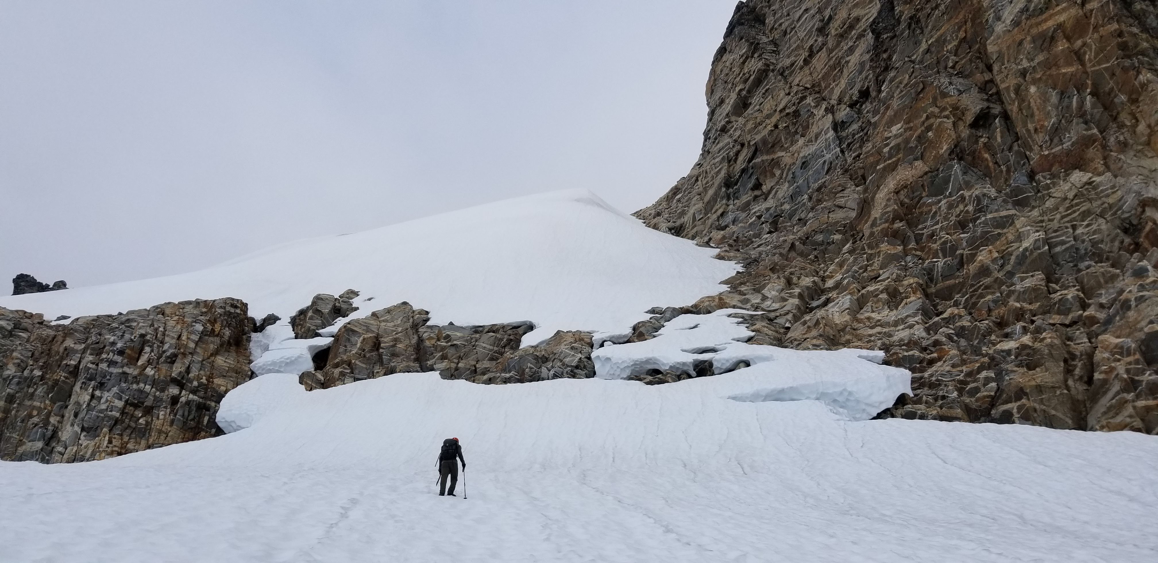
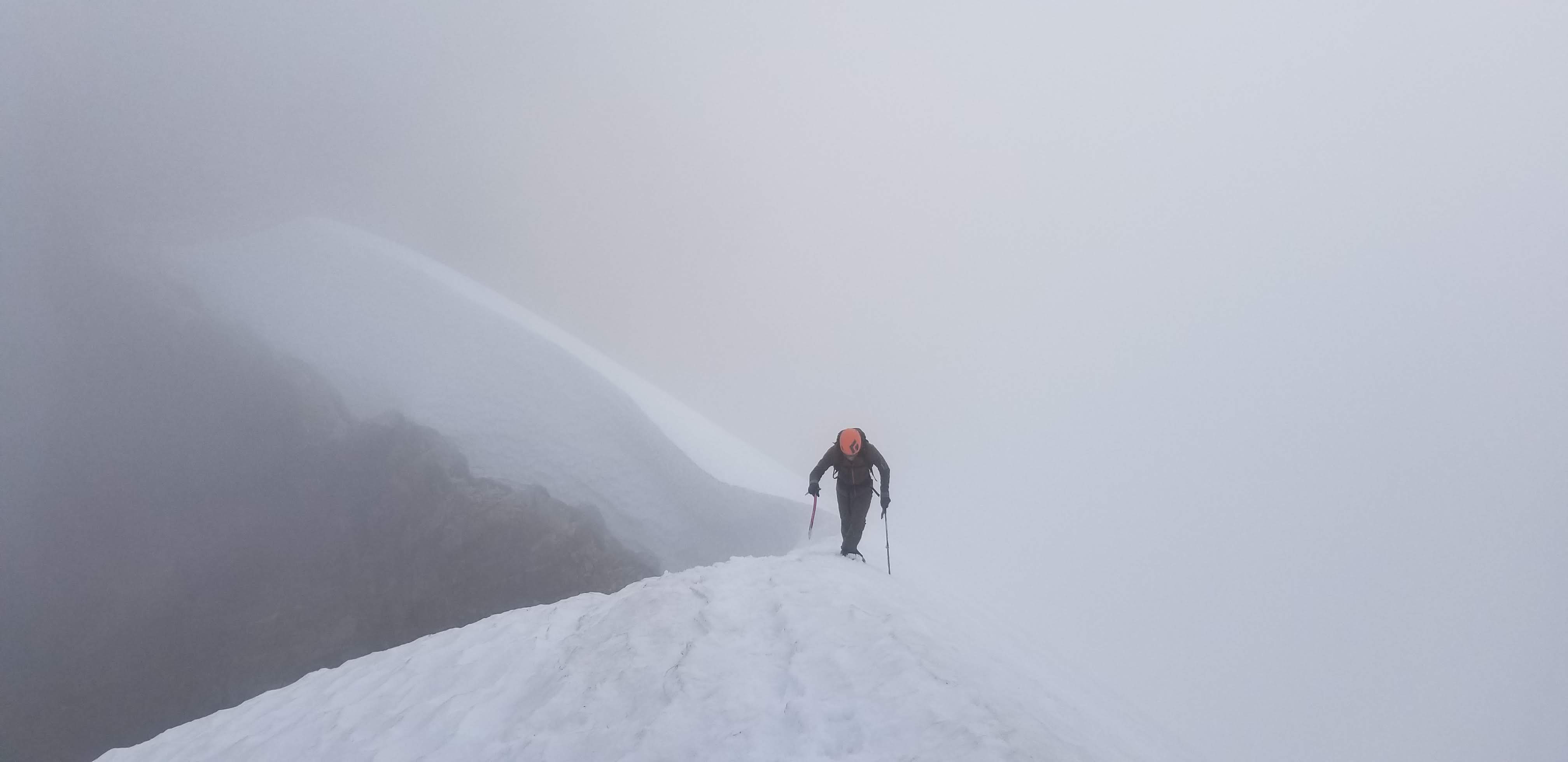
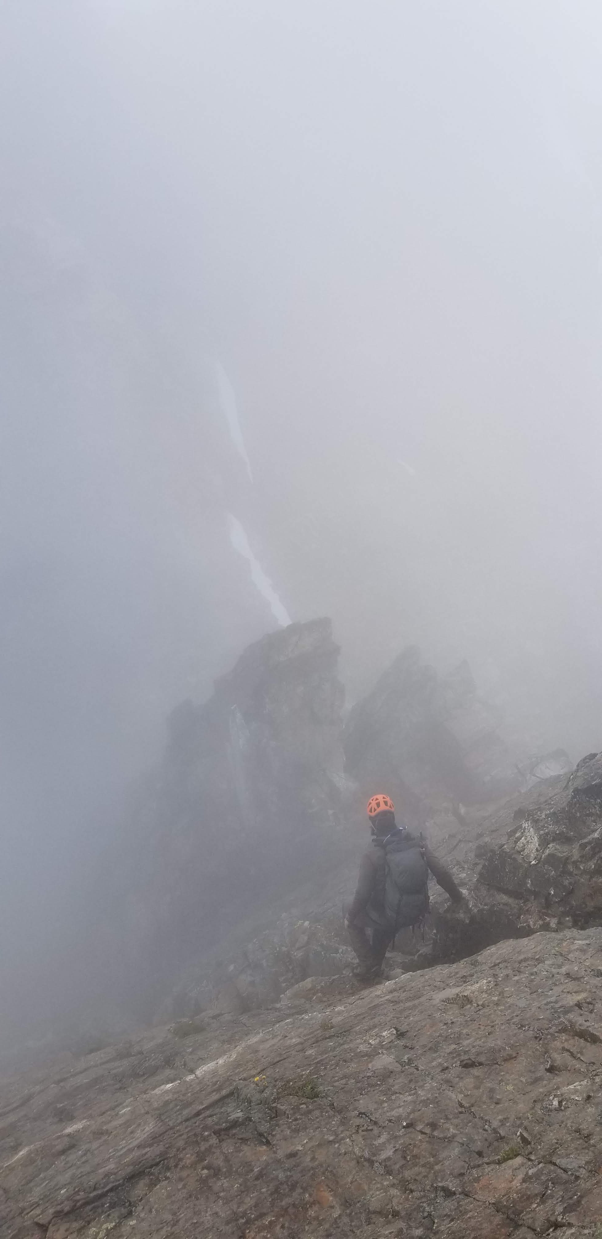
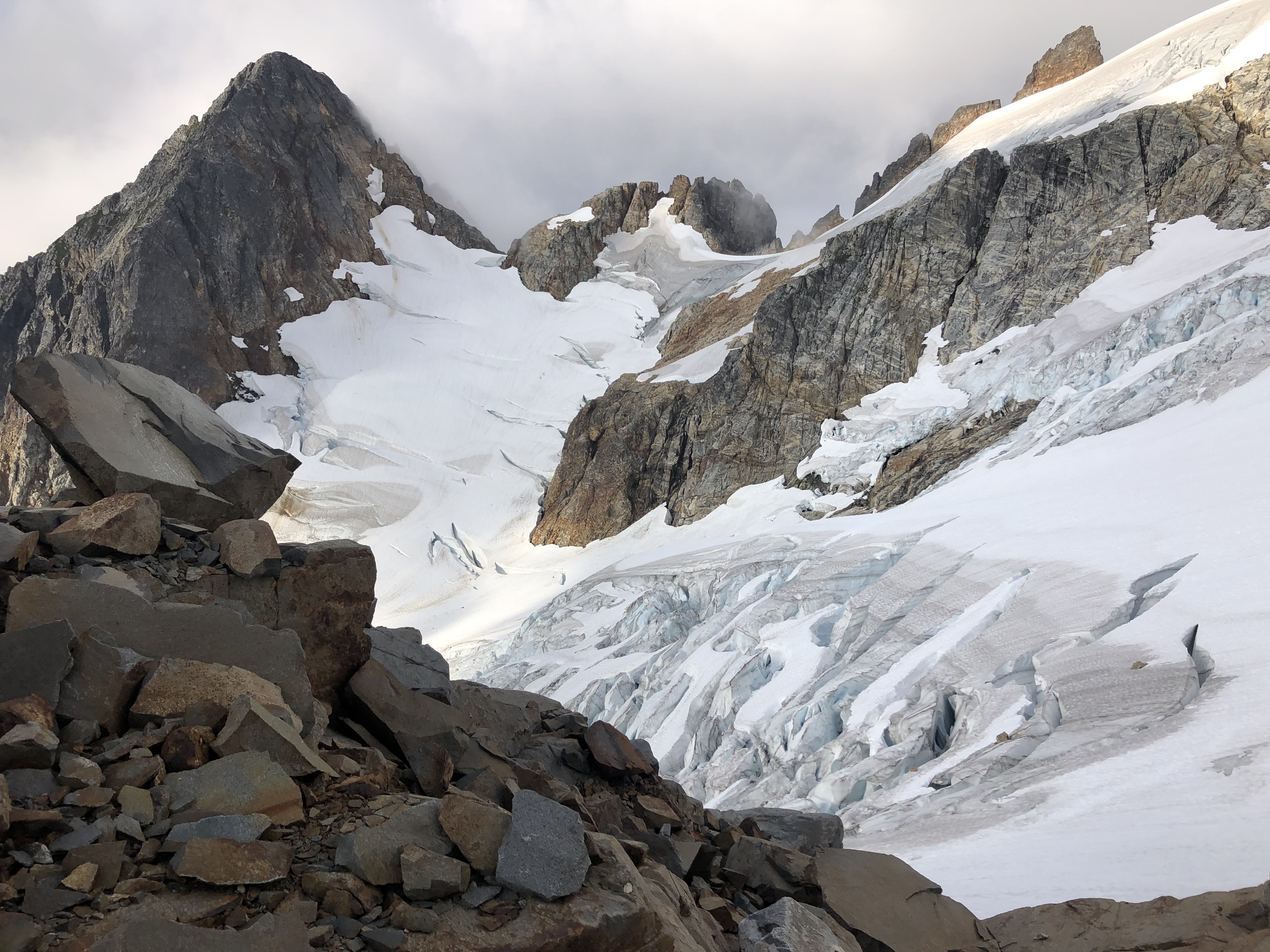
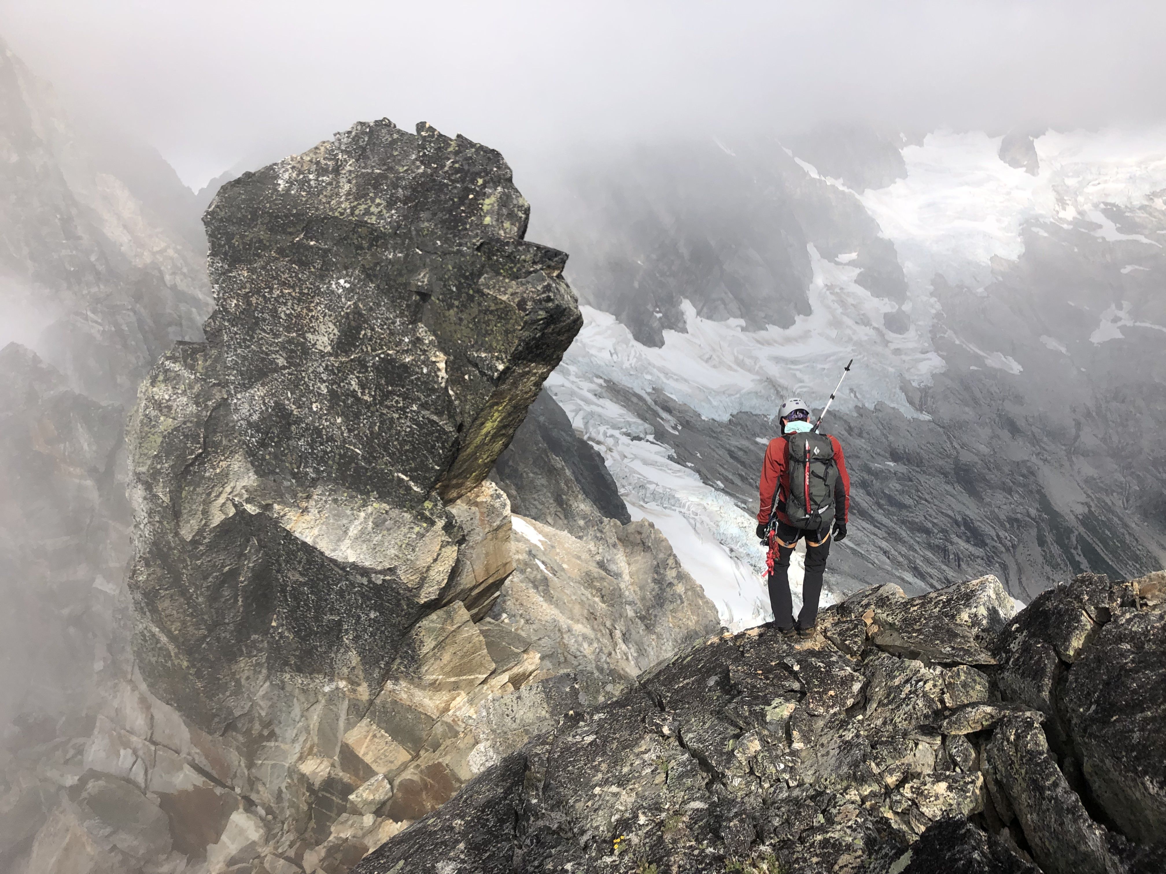
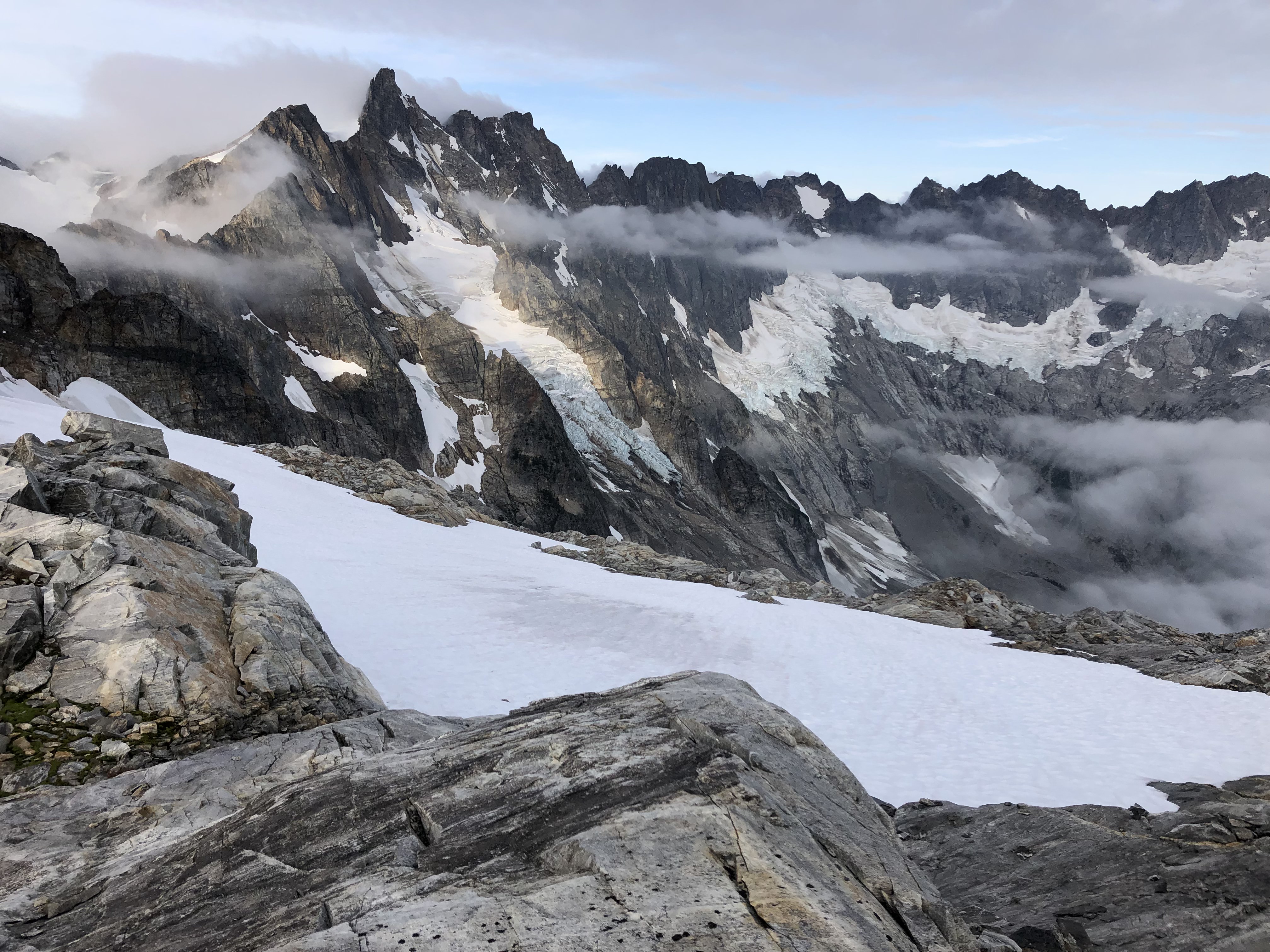
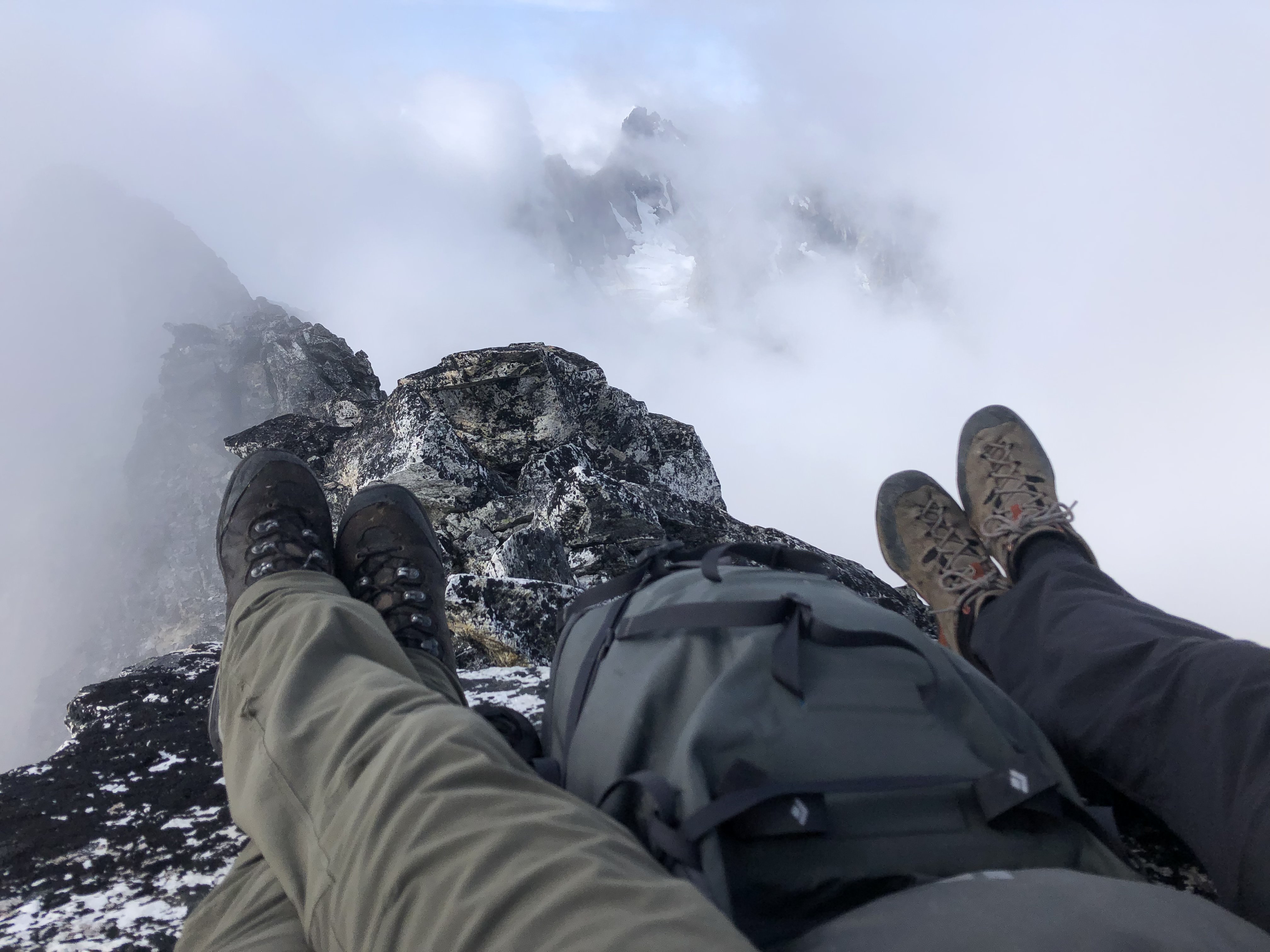
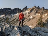
Trip: Seward Peak - Standard - West Ridge Trip Date: 05/23/2021 Trip Report: Yesterday me and @Albuquerque Fred climbed the seldom done Seward Peak on the shoulder of Mount Baker. It was very enjoyable in this season and I would highly recommend it. I would imagine that later in the year it might become less fun due to brush and more challenging choss scrambling. We didn't see a soul after the road, nor any sign of people other than some cut brush. But then again we didn't see much at all. We drove up the spurr road labeled as FS Rd 38, adjacent to Ranking Creek, until the third switchback with no problem; after this the road looked good for just as much as you can see, then after that it gets really ugly and rough. Two parties in trucks did make it two more switchbacks and were camped when we walked by but I bet it took as long as walking did. Photo of the road after the third switchback, the trough on the left is very rough and pretty deep. The brush on the old road grade wasn't bad; I think this was the perfect time of year since nothing was leafed out yet and snow covered a lot of it. Continuous snow cover began around 3900' so we donned snowshoes to get them off our backs and for traction. We continued on what seemed to be an old road bed continuing north through the last switchback shown on the map and took a hard right uphill into a gully/clearing at 4200', continuing up to the ridge crest. About here we realized we had hiked up into the clouds and it remained a whiteout for the rest of the day. I think this is Fred around 6000'. We stopped to remove snowshoes and contemplate our fate at 6100', right below the first cliff band, though we couldn't see it. After a break we got a very short opening, just enough to plan out a route: We went up the snow ramp, scrambled a short section, up the large snowfield to the top left above the horizontal rock island, then scrambled a gully to the ridge crest. This must be the standard route because we passed several rap slings. Looking back down the gully: Me too high on the ridge: Beckey says to ascend the ridge then descend on easy ledges, I would say you almost immediately descend after reaching the crest, we went waaay to high to the top of a gendarme and had to backtrack a lot, loosing tons of time (we couldn't see anything). We descended on snow into the south bowl and climbed to the final rock band. In this season this was mostly moderate snow with a short scramble section. Then a few minor ups and downs on the ridge to the summit. Worth it for the views, Baker in the distance: We left a tube with some register paper behind since we didn't find anything and it seemed doubtful there would be a register. Please let me know if I'm mistaken. We spend all of one minute on the summit and headed out. Ascending back to the ridge crest: Two 90' raps down the gully, downclimb the snowfield, then one rap on pretty easy ground to the snow ramp and back to the world. 11 hours car to car with lots of dinking around routefinding in the whiteout. 5300' gain. Gear Notes: (2) 30m ropes, snowshoes, axe, helmet, crampons, mountaineering boots Approach Notes: Middle Fork Road to the third switchback near Rankin Creek. Not too brushy, snow cover began at ~3900'.
-
Trip: Mount Shuksan - NW Couloir Trip Date: 03/10/2021 Trip Report: I've been wanting to do this route for years; this was my fourth attempt, all others ending ridiculously far from success (although on one we did summit and ski the summit pyramid instead, so how can that really be a failure. Last weekend me, @MGraw, and @thedylan got the idea that conditions would likely be just right for a real try at the NW Couloir mid-week this week. After many weekend storm days skiing near the resort we had a pretty good read on conditions. We decided to play hooky on Wednesday and go for it. Everything worked out great, the warmup on Monday even mysteriously held off trashing the powder down low in the White Salmon valley. We were patting ourselves on the back pretty good when we topped out the north shoulder at 11:30, 5.5 hours after starting out. Then for the hard part... The route is pretty straightforward so I don't need to say much. It rocked! It was scarry getting in and across the traverse; when I took the photo of the traverse from above my hands were shaking. We had all watched the Cody Townsend video the day before where they make it sounds really scary. After doing it there is the possibility that they are playing it up a bit for the camera. Althogh the pucker factor is actually a million-bajillion as stated. Especially with the traverse fairly thin and rocky as we had it. Gear Notes: Axes for the upper S-curves & traverse. Approach Notes: Travers into the White Salmon Valley
-
Trip: Barometer Mountain, Baroclinic Zone - S Ridge Up, N Ridge Down Trip Date: 02/27/2021 Trip Report: Me, @thedylan and @MGraw skied Barometer Mountain last saturday with the goal of skiing out down what has been called the Baroclinic Zone. I don't know if this is a well-accepted name but we found it on Caltopo. We dropped a car at the Salmon Ridge Snopark at the Nooksack bridge, then got a buddy to give us a ride to Heather Meadows. Thanks Dave! We skinned over Herman Saddle and Galena Butte getting great light powder turns, then followed some guys up the south ridge of Barometer. They set a great skin track and I was glad I told them so when we later found out they are CC poobahs, great meeting you guys! The skiing off the summit was great, then a short skin up to the 5500' point on the north ridge of Barometer. From here we had a great time skiing 3300' down to Anderson Creek Road and out to the car. There were some tight trees and some brush but it was great (we called it mini ski mountaineering to adjust the mental picture of what is acceptable fun). The snow coverage was good all the way to the car where we had chips and beer. A great time was had by all! Me and Dylan nearing point 5500': Great tree powder: Photos by Mike, scouting trip 3 days prior by Mike and Dylan, nice work! Gear Notes: Skis Approach Notes: Car shuttle was clutch!
-
Trip: Sperry Peak - East Gully Trip Date: 01/23/2021 Trip Report: With the long period of sunshine after the rain event, @thedylan and I figured it would be lousy skiing but should be great for climbing... we were right! (This time). Earlier this fall we had made a list of possible winter climbing objectives, but then it started snowing, and snowing, and snowing; so we gave it up and went skiing. But this was our opportunity. Emboldened by some beta from this 2009 trip report, and this extra beta from Kyle M we decided to go for the East Gully route on Sperry Peak. It turned out to be an awesome route for easy ice and snow. Typically crappy ice climbers (like us) are left out in the cold (see what I did there?) when looking for alpine routes. You ask on a forum for east ice routes and everyone suggests Colonial, Eldo, Graybeard, etc. Or else North Twin and east snow routes. There never seems to be a happy medium or real climbing but not AI4. This was it! We nailed the conditions on route, except for a little sugary snow shenanigans on the ridge. The Mountain Loop Highway is closed for the winter at Deer Creek at 1600' so we opted for bikes. After a TH bivy on Friday night we started off at 5am. To our surprise we made it to the summer trailhead with only minimal biking through crusty snow, arriving there at 6:30 with 7.6 miles under our belts already. We brought snowshoes but ditched them at 2400' where the trail breaks out into the open and we got a good view of how crusty the snow was going to be. We did not regret this. The approach is short but was seriously aided by the high elevation snowpack and firm crust. We easily booted to the approach scramble at 3600'. First view: Route from where we left the summer trail: From the trail the route is obvious, up the gully that splits the face. All the photos make it look like there is a notch between two high points, but the right point is just a flat spot on the ridge. At about 3400' the approach scramble begins that shut down Kyle M and party. Fortunately, we had an easy snow gully, the ice step was wet and thin but there is a right variation that worked with an easy scramble section. The climbing begins at about 4400' with the money pitch right off the batt. If there was a way to build a rap anchor I might have been tempted to give up here and just lap the first pitch, there were several variations possible and it was awesome easy ice and hero snice, the kind of conditions to make you feel like a good ice climber! This didn't last and after maybe 100' it turned to snow over rock with no pro and a rock step looming, I built a crappy anchor and belayed Dylan up. He took the rock step that turned out to be an easy scramble move aided by the shockingly warm sunshine (I climbed it without gloves or a jacket). Then we were back into the snow gully. From here it was simul-soloing moderate snow and snice for several simul blocks with one great snice and ice step in the mix for Dylan to lead. First pitch: Second pitch rock step with spindrift: I lead again up to the ridge, as I approached it I realized I was climbing up to a cornice so had to bear left onto some insanely steep sugary snow with no pro and terrible axe plunges. I wallowed upward somehow making decent footholds and trusting that it seemed to be working. After probably 30 minutes for what was realistically probably 50' but felt like 200 I topped out on the ridge at a flat safe spot at 5500' and started burying everything metal I had for a crappy anchor in the sugar snow. I was psychologically done from the insecurity of it. You don't train for those conditions. The climbing worked, somehow, but it felt awful. Dylan, naturally, made it look easy on second. Dylan's photo looking back down to my belay with the NE ridge behind: Dylan lead the next simul block through the same place mentioned in the 2009 report: " the physical crux of the climb on such a move that required hooking a tree and pulling up with disintegrating footholds above a near vertical flute that dropped into the north face." Second that! The summit was close but the cornice looked daunting, fortunately, it was mostly fatigue talking and it was an easy 4' vertical step onto the summit! Summit slope: We had a good snack break in the sun and felt much rejuvenated. The descent went smoothly, some front pointing and careful walking on crusty snow, mostly NW near the scramble route to the head of the cirque and across the lake to the trail route and out to Headley Pass. We hit the summer TH at 6pm making it an 11.5 hour day on foot, just under 14 car to car. This was a fantastic route, if we could figure out a better way to do the NE ridge part I would definitely go back. There was an ice line to the left a few hundred feet below the ridge crest that I think the '09 party took, but it looked hard compared to the snow I did... in retrospect... Gear Notes: bikes, sneakers, boots, axe, ice tool, helmets, 60m 1/2 rope, 3 screws, some nuts and cams (placed 2 rock pieces all day, minimal options), 2 pickets (3 maybe useful?) Approach Notes: Bikes! Crust made for awesomely fast travel on the low angle stuff. The climb is very accessible from the summer TH.
- 7 replies
-
- 10
-

-

-
[TR] Heliotrope Ridge - Various Heliotrope Water Ice 11/08/2020
geosean replied to Kyle M's topic in Ice Climbing Forum
Nice Kyle, I've been looking up there while serac-ing, wondering how all that stuff was. Thanks for the compilation! -
Does anyone have a recent photo of the north face of Shuksan? Possibly from Goat Mountain or nearby. I'm looking to assess ice/rock ratios. Thanks.
-
Does anyone have a recent photo of the north face of Shuksan? Possibly from Goat Mountain or nearby. I'm looking to assess ice/rock ratios. Thanks.
-
[TR] Torment forbidden traverse - Tft 07/28/2020
geosean replied to JonParker's topic in North Cascades
Pretty weak Dylan, couldn't even c2c the TFT after a broken leg. I guess the northern Pickets in a day will have to wait 'til next year. Awesome work @JonParker! -
[TR] Johannesburg - 1957 NE Rib 08/01/2020
geosean replied to The Real Nick Sweeney's topic in North Cascades
Actually, I was the follower through that stretch, and glad of it. We bivied on the top of the last tower on the east ridge right before the first rap station. It was nice for two and broke up the route nicely, also a handy snow patch for water. -
[TR] Johannesburg - 1957 NE Rib 08/01/2020
geosean replied to The Real Nick Sweeney's topic in North Cascades
Nice write up Nick. Me and @thedylan did the '51 rib this past weekend and were surprised at all the names on the register this year. If anyone goes again this season take some Rite-in-the-rain pages for the register, it's almost full. Also many of the rappels only have a single carabiner at the anchor so if you have some bail 'beaners please add one here and there. My most important piece of gear specific to this climb was work gloves! They really save the hands in the heather and the vertical brush. Does anyone have an opinion on whether the '51 or the '57 route are better (aka more fun)? -
Does anyone know the status of the North Fork Sauk River Road? (AKA Sloan Creek, AKA Rd 49). I know the FS says it's blocked by a slide, but I heard this might be passable. Just hoping someone has fresh beta. Thanks.
-
[TR] Mt Baker - Coleman Glacier Headwall 03/18/2020
geosean replied to PorterM's topic in North Cascades
Well done, thanks for the report! It's curious that it was so hard to get onto the base of the route this year; was your attempt to last year in the same season? -
[TR] Marble Creek Cirque - Lost Marbles Couloir 03/09/2020
geosean replied to JasonG's topic in the *freshiezone*
Nice work Jason, it looks like you had good conditions for skiing. We had terrible visibility everywhere except in the couloir. Apparently I blew up the stash. -
Has anyone actually ever climbed the Triad and winter? I mean I know it's been done but I can't find any information about it and I am just looking for some general beta. Volken briefly mentions it under the Hidden Lake section in his ski touring book. If anybody has any information I would appreciate it. Thank you.
-
Trip: Lost Marbles Couloir - Hidden Lake Peaks Area - Lost Marbles Couloir Trip Date: 03/01/2020 Trip Report: Tim did a nice write up on TAY, for our ski descent and boot-up of the Lost Marbles Couloir. Link To Report Here Does anyone know if this is a commonly done trip? It seemed too good for the almost total lack of information online. I'm mostly posting here because I love Cascadeclimbers and don't want it to fade into oblivion. BTW that's what will happen to your trip report if you post it on Facebook. No one will ever hear about how awesome you are, nor will others benefit from your beta in years to come. Gear Notes: Skis Approach Notes: Hidden Lake Trail route to around 4800'
-
Is anyone interested in selling a Black Diamond Eldorado or I-Tent? I'm looking to buy!! Let me know if you are interested! Thank you for reading.
-
Yeah, actually that was the initial inspiration for this peak. One day I'll have done all the Smoot guide but probably only because I'll have done most all the peaks around; it might be a while yet. He is a good source for peaks that don't necessarily catch your attention, that are best done shoulder season.
-
Trip: Columbia Peak - West Spur Trip Date: 10/06/2019 Trip Report: Sunny skies = had to get out. Light snow cover = nothing "in" season Solution = scramble! Columbia Peak from the Monte Cristo area, standard route. 21 miles, 5700' vertical, 11.5 hours. We had a great time I believe. It's always good to get out and get some sun in October and it felt extra sweet this year with all the crappy early fall weather. Columbia was a good choice, mellow, but with a couple of spicy spots to make it feel real. There were 3 or 4 places where a fall would have been gnarly and we had to introduce some mixed skills, but no ropes required. A bit more snow would make it better/safer still, so feel free to be inspired to hit this up yet this year. It was a fun shoulder season trip. @Albuquerque Fred please contribute some photos if you would. Max McHale is a lurker and thus will not be @mentioned. Fred and Max taking a break at Monte Cristo: An easy step below the gully: Fred descending the gully: Max downclimbing: Gear Notes: Axe, crampons, poles, bikes. Approach Notes: Bike wagon road 5 miles to Monte Cristo. Trail is in great shape, hit snow at the 4820' saddle and switched from runners to boots.
-
[TR] North Cascades - Isolation / Inspiration Traverse 09/21/2019
geosean replied to 2OldAnd2Slow's topic in North Cascades
Damn dude. -
[TR] North Cascades - Triple Rainbow High Route 09/21/2019
geosean replied to Kyle M's topic in North Cascades
Wow, nice work guys! That looks amazing. -
[TR] Pickets - E & W Fury, Luna - Standards 08/15/2019
geosean replied to geosean's topic in North Cascades
I know, 1 visit ever 5 or so years over decades, then 3 this summer! Views are over rated anyway... I didn't have any on Redoubt in July. -
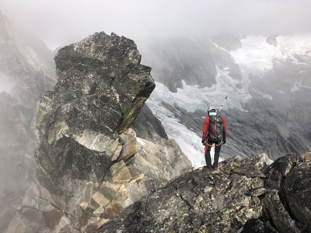
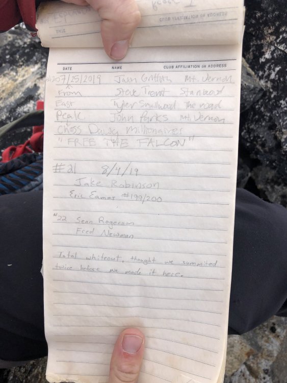
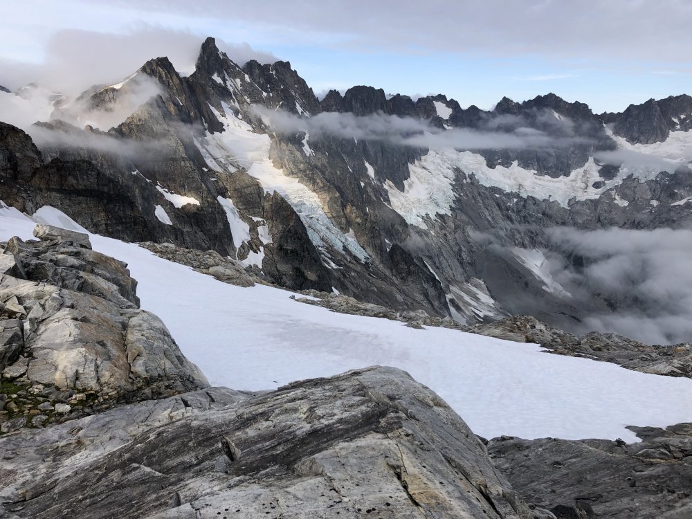
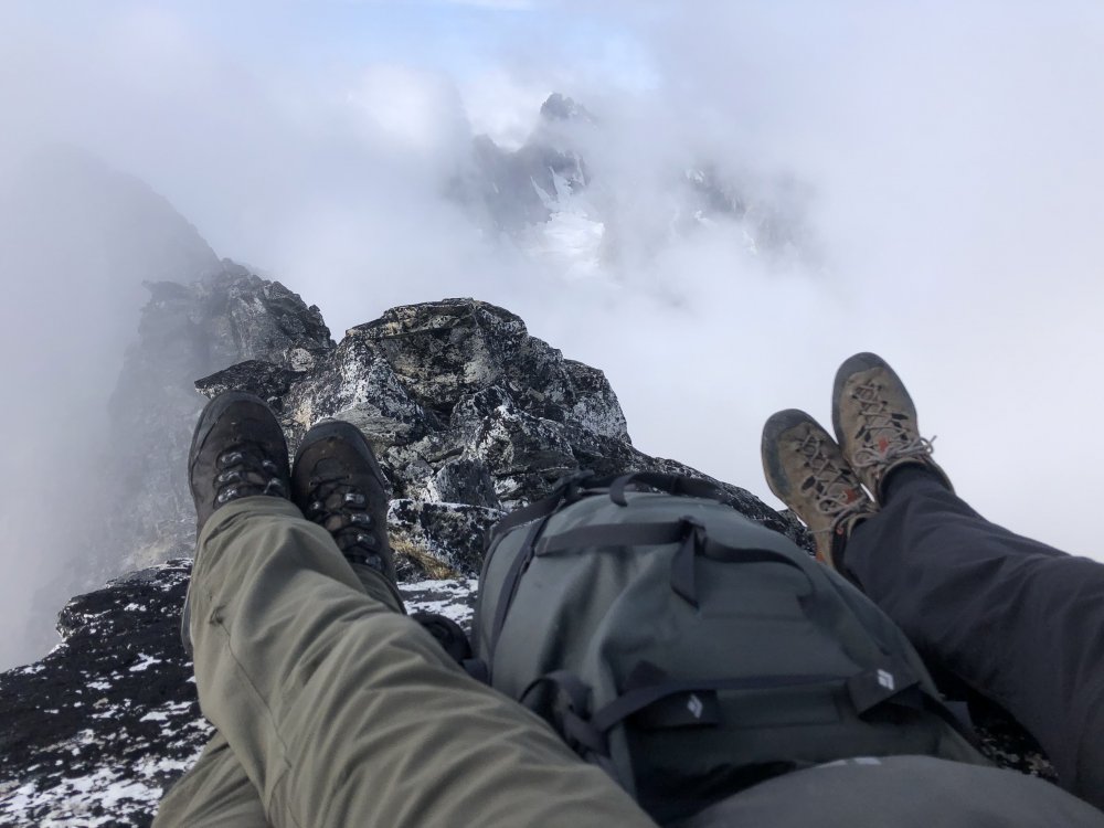
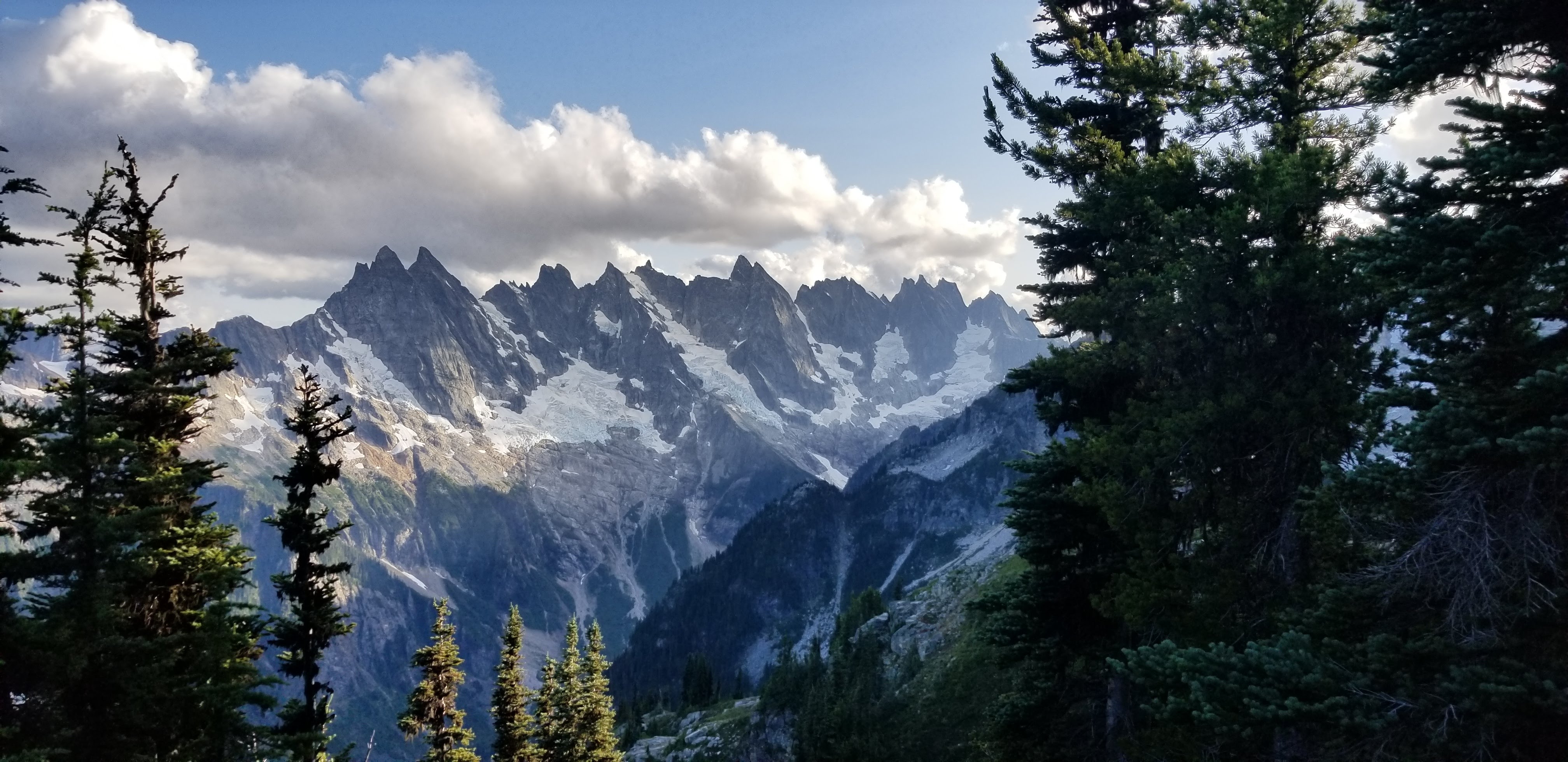
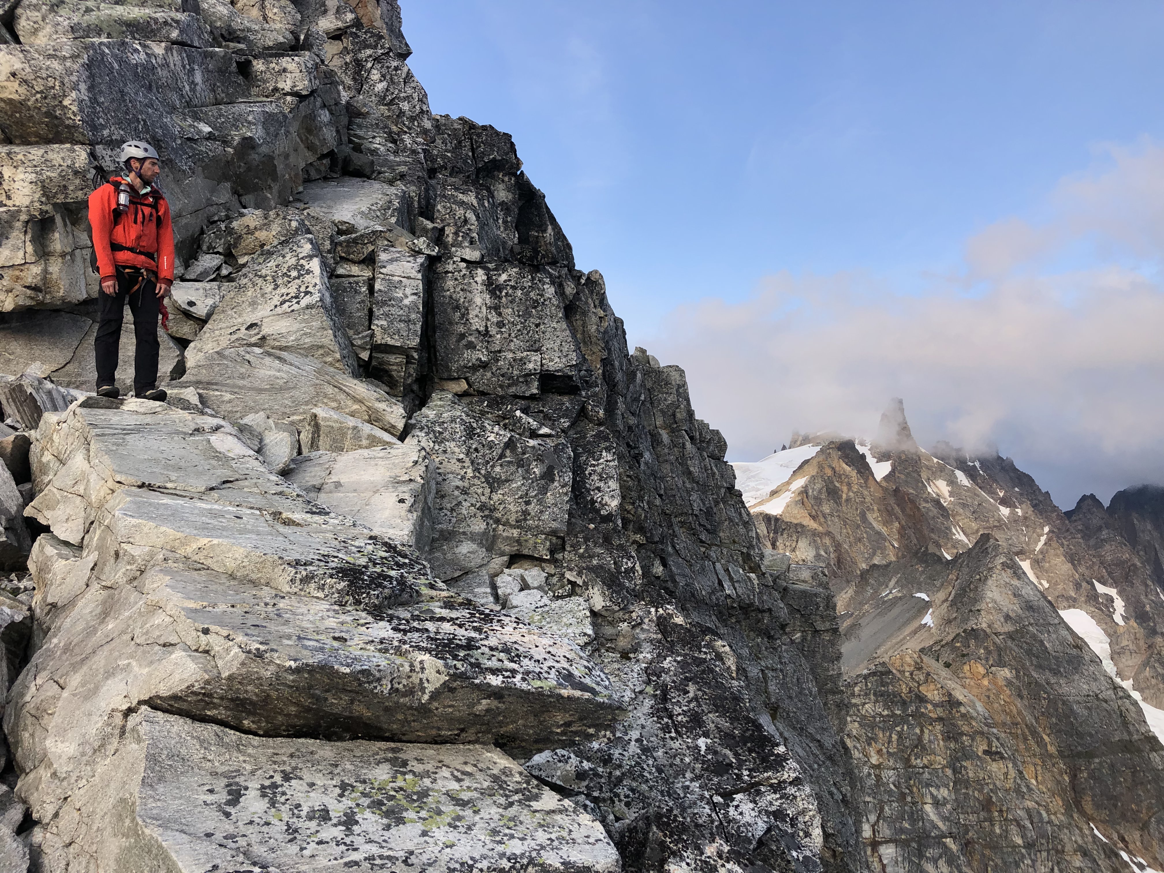
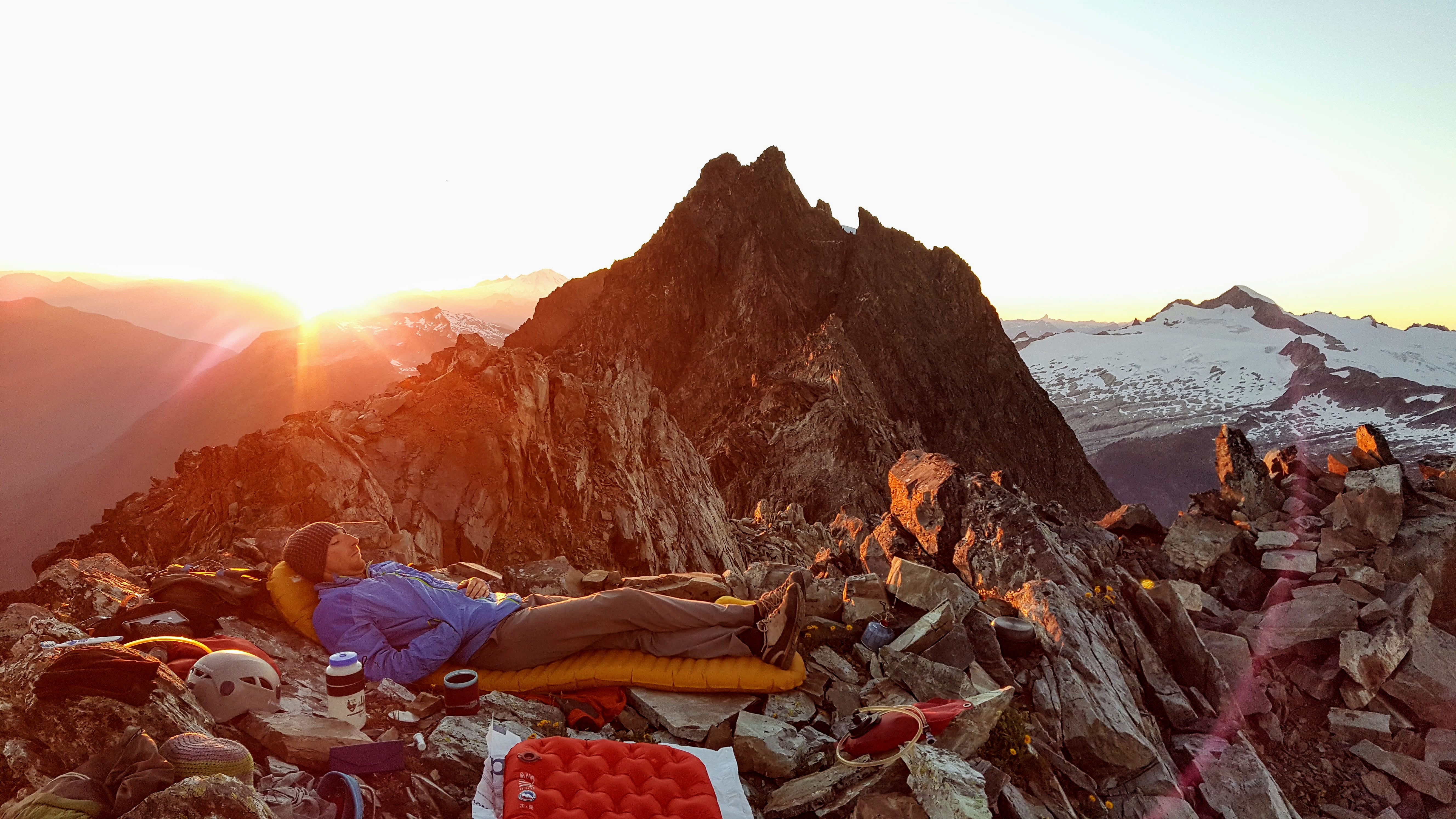
Trip: Pickets - E & W Fury, Luna - Standards Trip Date: 08/15/2019 Trip Report: @Albuquerque Fred and I teamed up again... West Fury as the main event, East Fury happened to be in the way, Luna was convenient. Day 1: We took the water taxi to Big Beaver, leaving pretty late at 10:30am on Thursday. In about 4 hours of really good trail we were at the good log crossing right where it was supposed to be. A GPS was clutch here as there is no indication along the trail of where to turnoff and really no trail to the log. After thrashing some brush on the other side of Big Beaver Creek we wound up on the wrong (south) side of Access Creek. It is misplaced on the map by about .1 mile, shown to the south of reality; there is a tiny creek about where Access is shown on the map. After some bushwhacking upward we eventually found the climber's trail which was surprisingly good. I guess people heard about the 4G on the summit. We walked into Luna Col camp at 8pm, just in time to get one picture of the northern Pickets before they dissapeared for the next 3 days. Water is acceptably ample on BB trail and the traverse to Luna Col, lacking at the Col however. There is snow in the col and a tarn below the snow patch a 10 minute walk to the north of the col. Obligatory boat ride photo: The lake was a little low: Only good view of the southern Pickets, from the traverse to Luna: Our best view of the Furys: Day 2: We awoke at 4:45 am to lots of clouds. Onward to the Furies! Over 3 major humps and down into the basin SE of E Fury. It was all snow free which made for tedious travel. We found a ledge system at 6800' to round the SE buttress of Fury, then turned right and scrambled a talus and slab slope near a stream (last water!) We gained the east edge of the glacier at about 7400' due south of point 7820'. Crampons were required for the bare ice and moderately steep firm-ish snow ascending the east ridge of E Fury. There seems to be some mixed scrambling required at both the east and west approaches to the snowfield just below the summit. (We went up the east and down the west). Onward to West Fury! Down, up, down, up, down, up, down, up. Three towers and the summit block with loose crappy gullies between each. Tower 1: on a tip, we descended 100' on snow to a talus ledge, then scrambled up, left and up some more, then left again (you'll figure it out) to wrap around the tower not quite summiting. We soloed this. Oh, by the way, I should interject that since the lower glacier we were in total whiteout conditions and would remain so all day. This made route-finding challenging and despiriting. Tower 2: we climbed directly. Descending was trickier; scramble down an eroded dike/gully, when you approach a notch and a filthy gully on skier's right take to the arete and downclimb into the filthy gully. Legend has it descending the dike to the bottom leads to 5th class no holds traversing to get around the arete. Soloed all this. Tower 3: climb directly up a chimney just right of the obvious one. Easy soloing by now. Then we scrambled to the summit! Three times in fact; the whiteout kept making us think we were there just long enough to get excited, then another rise would loom in the white. Eventually we did make it and signed in as #22 in the register. We descended by rapping all 3 towers. Tower 1 required a 60m rope. Long and tedious trip back over E Fury, multiple basins, and many towers and rises back to camp. 12 hours round trip going hard, but with slow route finding. Morning right out from camp: Outrigger Peak and the south Fury Glacier: Mixed step on the east side of the summit of E Fury: Fred on the final summit ridge: Me descending somewhere between the Furies: Fred descending somewhere between the Furies: Gloruous summit photo on West Fury! Worth it for the views!!: Register: What, you dont mountaineer with manhattans? I left the shaker at home so we had to drink them warm, but it was pretty chilly out anyway: The rest is history. Sleep, lounge, climb Luna. We descended to Luna Camp day 3, then hiked all the way to the car day 4. Victory pose on Luna summit: Lots of this on the way out: The summit register on Luna was totally full, please replace it if you go there. 3 summits 49 miles 14,000' 12oz of manhattans Gear Notes: 60m rope for rappels Crampons Axes We took some rock gear but didn't use it. Manhattans Approach Notes: Big Beaver to Access Creek, cross Big Beaver Creek at 2520', cross Access Creek to south side at 3900'. Trail was great, trail into Access basin was decent climbers trail, good even, in places.