JonParker
-
Posts
104 -
Joined
-
Last visited
-
Days Won
12
Content Type
Profiles
Forums
Events
Everything posted by JonParker
-
Anyone else think Ulrich’s is a less shitty descent of Stuart than Cascadian? I climbed the W ridge 5 years ago solo. I accidentally started down Ulrich and was several hundred feet down when I realized what happened. By that time I didn’t want to climb back up. I never cliffed out, but did find the nice steep 4th class slabs eventually gave way to slightly sketchy plunging in gravel that sent some large blocks tumbling. It took about 4 hours to get from summit to trailhead. On Tuesday I climbed the N ridge with a partner c2c. It took 6 hours from summit to trailhead via the cascadian. Part of that was was fatigue from the long day and my partner’s microspikes not handling the snow well. But still, as the monotonous trudging went on and on I found myself questioning how the Cascadian became the standard descent. I suppose it’s simpler than Ulrich’s, and overall less exposed (though the steep snow we found at the start was comparable risk to the steep slabs in Ulrich’s, especially if you have the wrong gear for the conditions). But Ulrich’s is a more direct descent, probably snow free earlier than cascadian, and unless my memory deceives me, not that bad. Having gone both ways, I’d be inclined to try Ulrich’s again before Cascadian, especially if solo (smaller consequence to kicking rocks). Curious what other people have experienced going that way.
-
Yeah, longer but very mellow Strange rock abounds
-
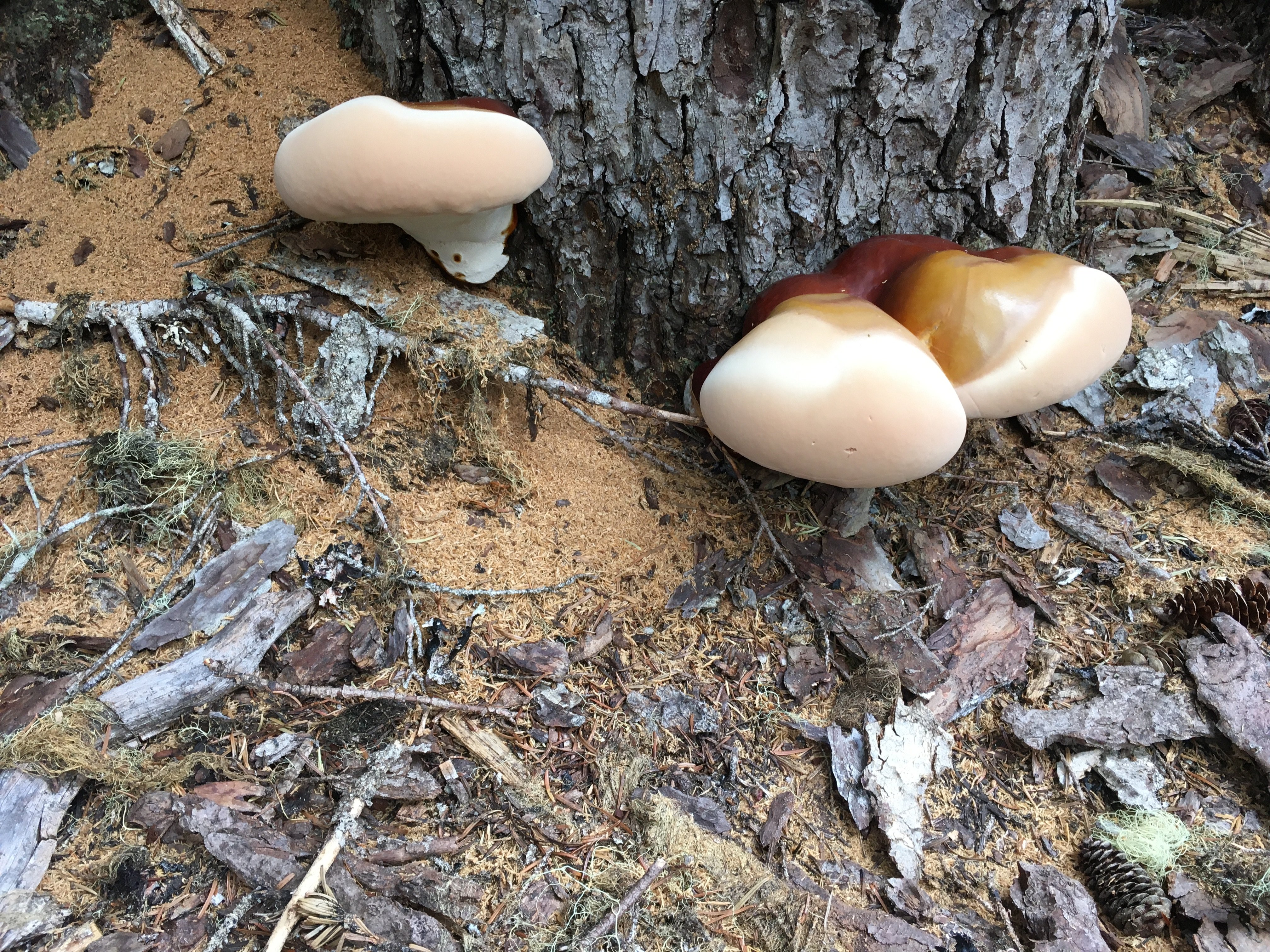
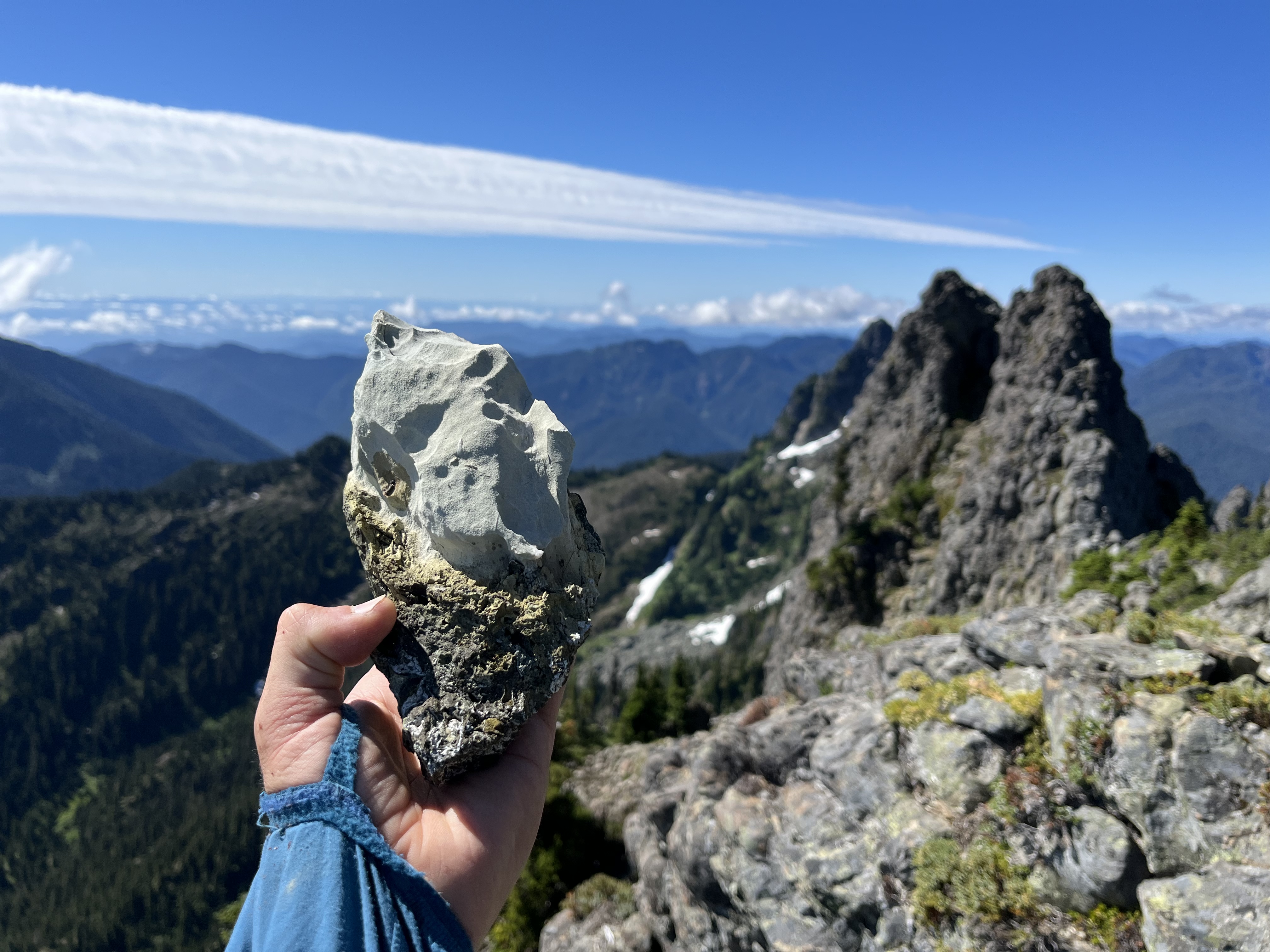
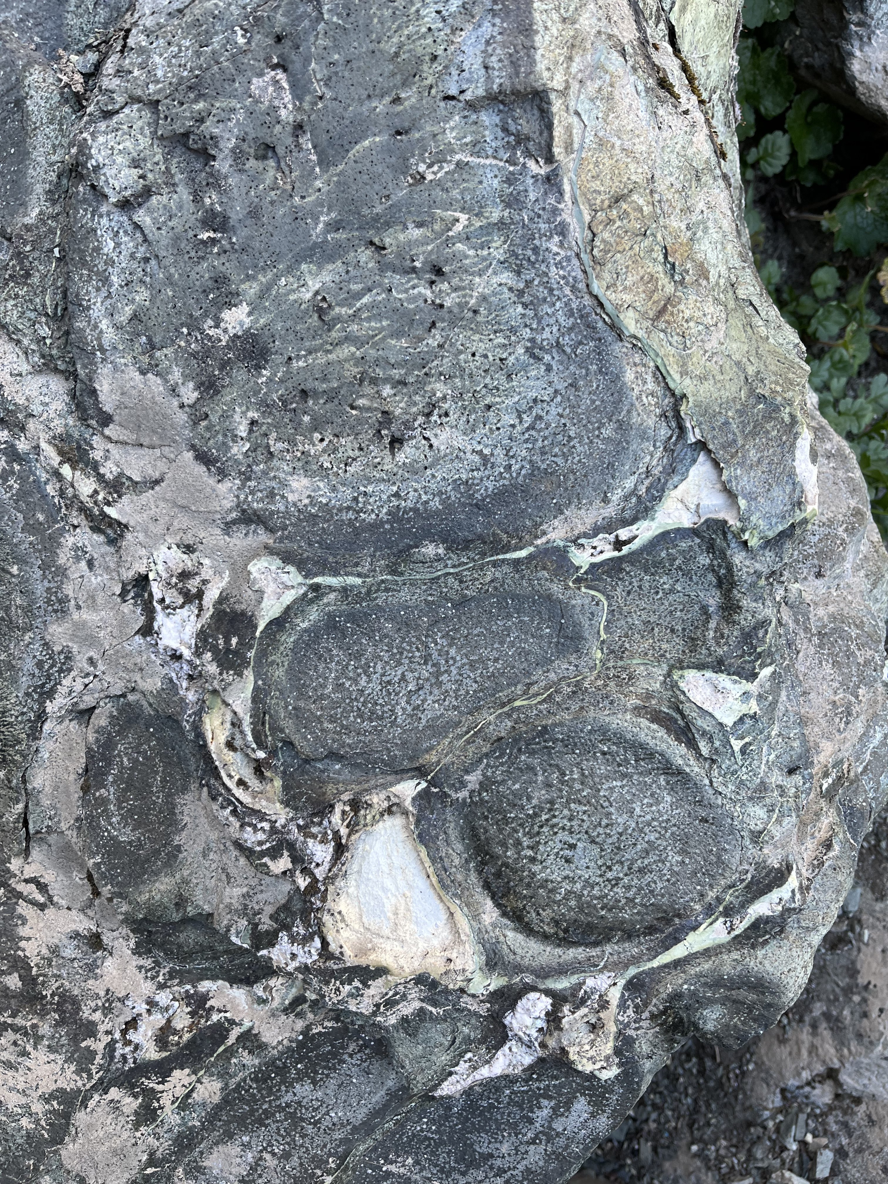
Trip: Cruiser - Standard Trip Date: 08/05/2022 Trip Report: I rarely consider the Olympics but on Friday I was unable to find a partner and didn’t want to waste the good weather. I saw something about a “5.3” route on Cruiser so I decided it was time to check out some pillow basalt. The miles flew by to this aptly named peak (21 miles round trip with a few side missions, more like 20 without). The trail is never steep. I jogged a few portions. At the basin the steep snow finger was bulletproof and I didn’t want to put my light axe and strap on crampons to the test. I was afraid I might have to hang out until it softened but then I noticed I could skirt around the snow on the left along class 3 slabs all the way to the notch, bypassing all the snow. In my brief research of the route I came across a TR that mentioned scratching up the dirt gully when the snow melted out. This is completely unnecessary. Maybe in early season the snow could force you into a couple of tricky spots higher up on the slab, but I found easy and secure travel at the lower end up the slab, near the moat. Continued N from the notch up and over beta. There was only really one steep loose gully to descend to reach Cruiser. A few awkward exposed 4th moves above a cave led to a higher notch. I ascended right on the face to reach the base of the face/spine leading to the summit. A couple reachy moves off the deck led to some fun stemming then easier moves to the anchor. A narrow ledge scramble leads to the summit. Upon returning to the anchor I decided to do one rap (hard to read the route from above) back to the bottom of the face. I descended the other way here, going through a narrow class 2 chimney for variety and less exposure. I spiced it up on the way back up the steep loose gully when I noticed a 12 foot tall splitter fist/lie back just off the trail (5.7?). I couldn’t resist the spire just S of the notch above the snow because it tapers to a summit just a few square feet wide. Looked like a fun perch. Lichen crinkled underneath me, but I didn’t come across anything too dubious. The summit horn is slung, but it seemed like exposed class 4, maybe 5.0 on the way up, so I just downclimbed. A few hours had passed but the snow hadn’t seen much sun. I didn’t even bother trying it and descended the slab bypass, but when I stepped on flat snow at the bottom it was soft. So I probably could have saved some time taking the snow down. Back at the lake I went for an icy swim and re-enacted King Kong with countless big obnoxious biting flies. The trail isn’t too exciting below flap jack but gets fun again when it reaches N Fork Skokomish. Beautiful river and lots of huge old trees. Gear Notes: Approach shoes, 60m for rap Axe and crampons not used Approach Notes: Mellow trail from Staircase to the basin west of sawtooth ridge


-
[TR] Logan and Goode - Douglas and NEB 07/29/2022
JonParker replied to JonParker's topic in North Cascades
Yeah the step on east side at the base getting to the notch is unsavory though not terrible (I had one puckery move). Quality dramatically improves at the notch. You have to pay attention but I found generally quite solid rock all along the ridge from the first notch to the summit. I recall it being best near the summit, trusted it enough to downclimb to ledge leading to black tooth rather than rap. -
[TR] Logan and Goode - Douglas and NEB 07/29/2022
JonParker replied to JonParker's topic in North Cascades
Jason, Jacobs Ladder is fun, great position. I do wish the rock were just a little cleaner but it’s not bad (until near the summit). I wouldn’t have sought it out on its own, think it makes more sense as a side trip in a longer foray, worthwhile if you’re in the neighborhood. Great views from the summit and it’s clearly the best way to get there. Since I wasn’t planning on it I had no beta other than “class 3”. Didn’t know where to start, and the bushwhacking was tough for about 500’ vert but we found a better way on the way back with minimal thrashing. Thanks for sharing it, without that in my back pocket I would have had to sadhike back to the dock a day early. -
First ascent! Glad you’re ok
-
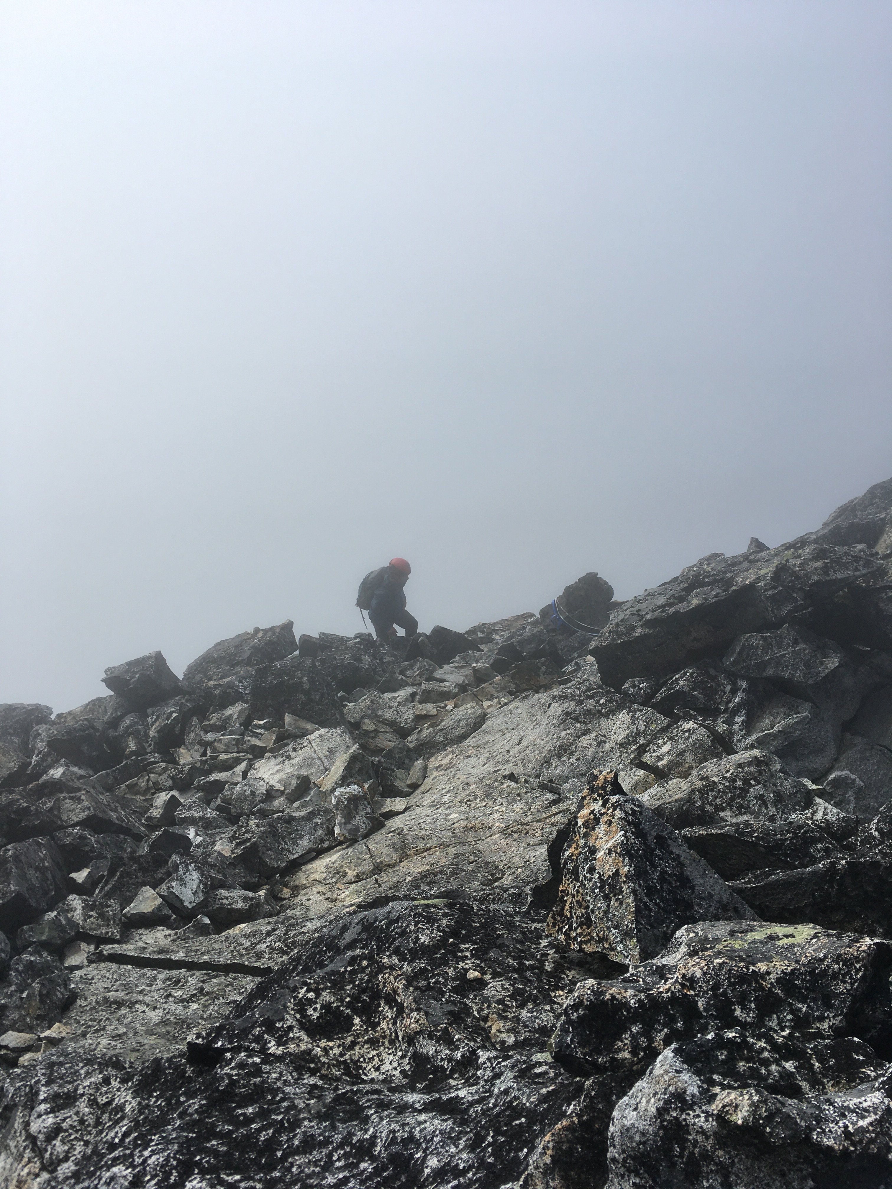
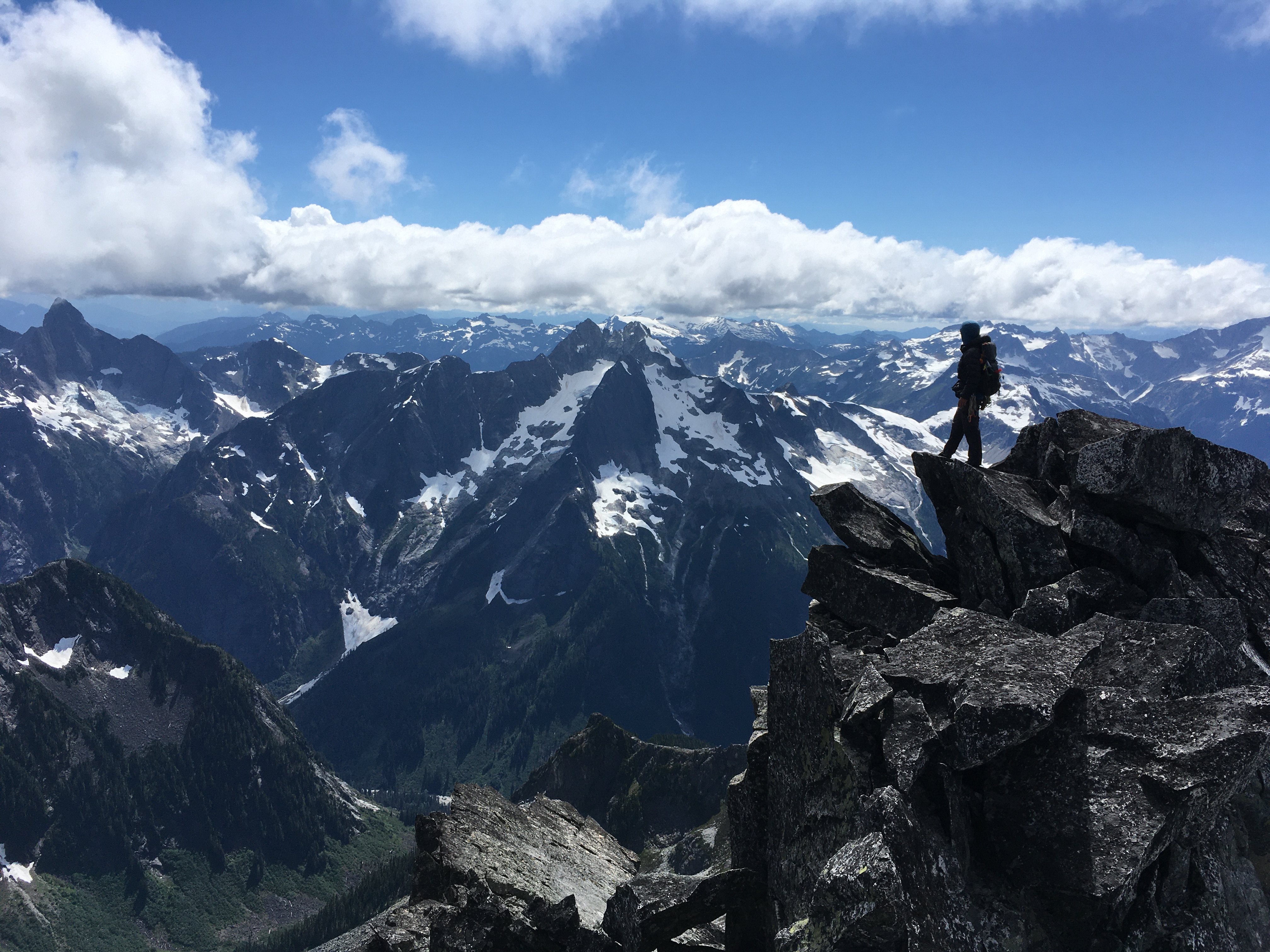
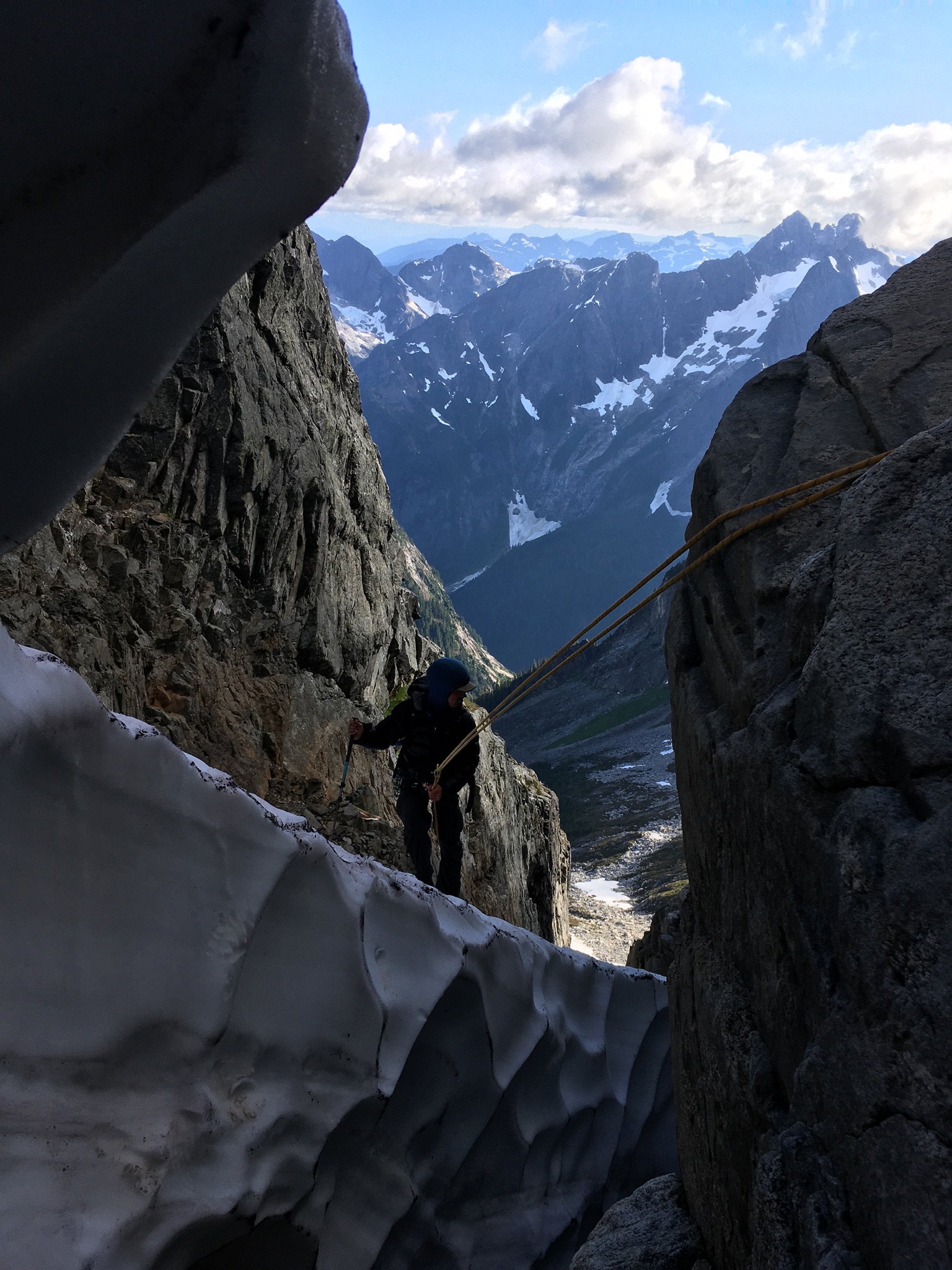
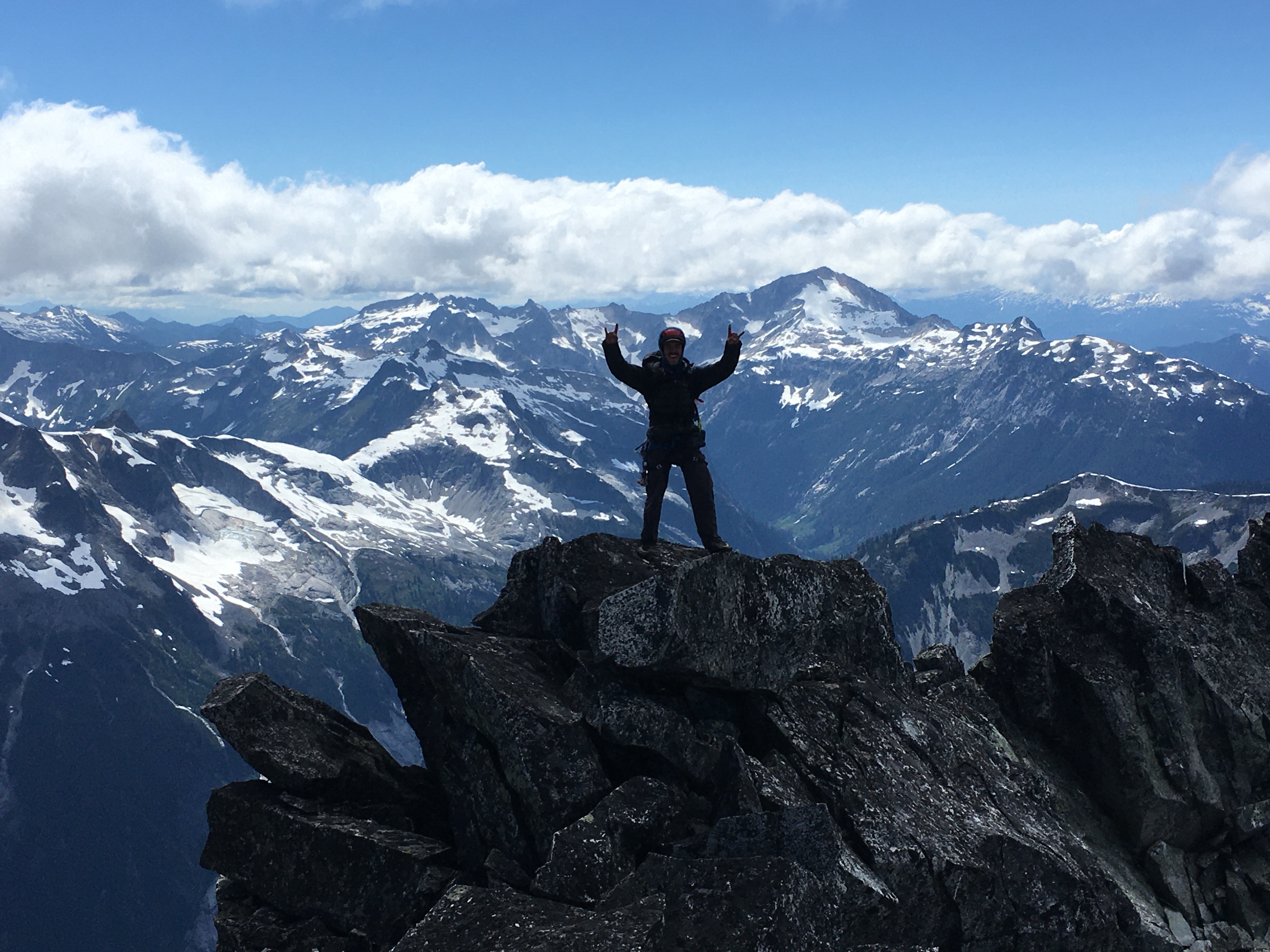
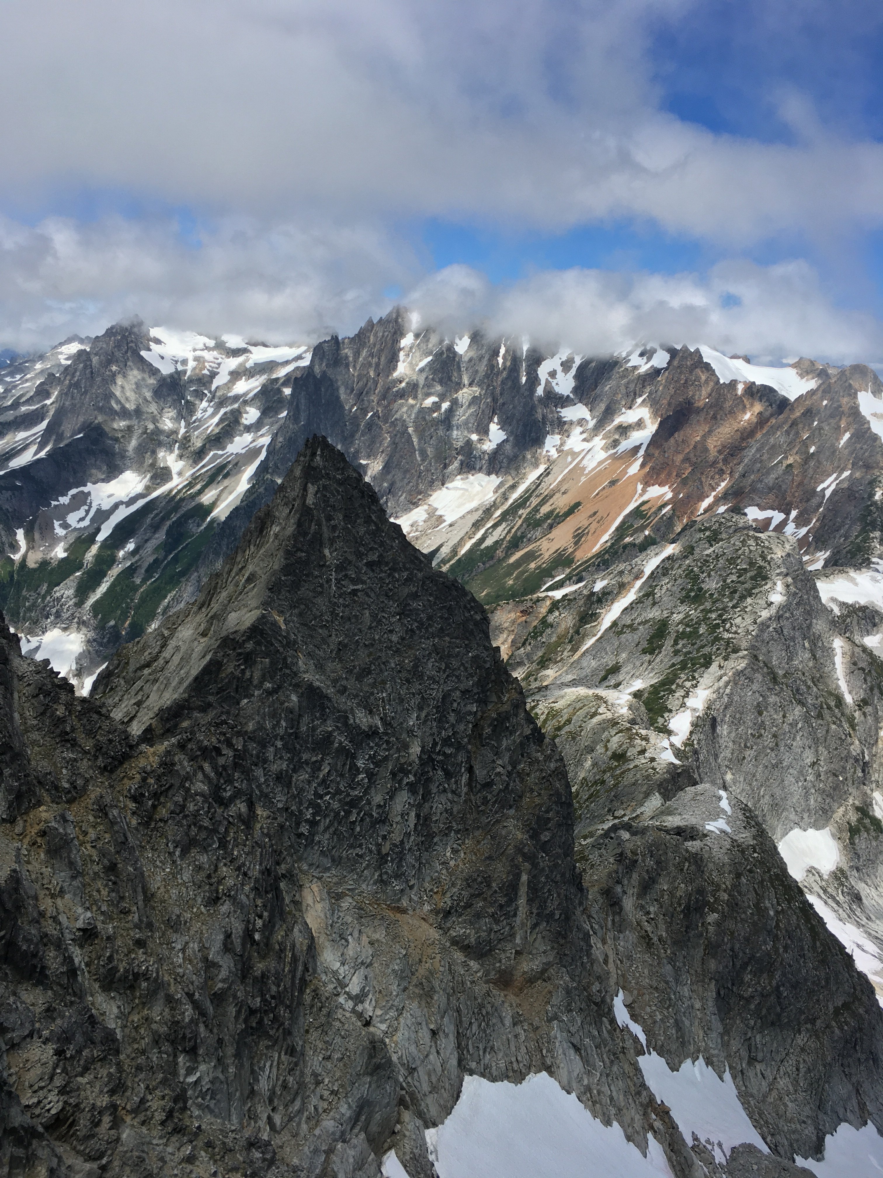
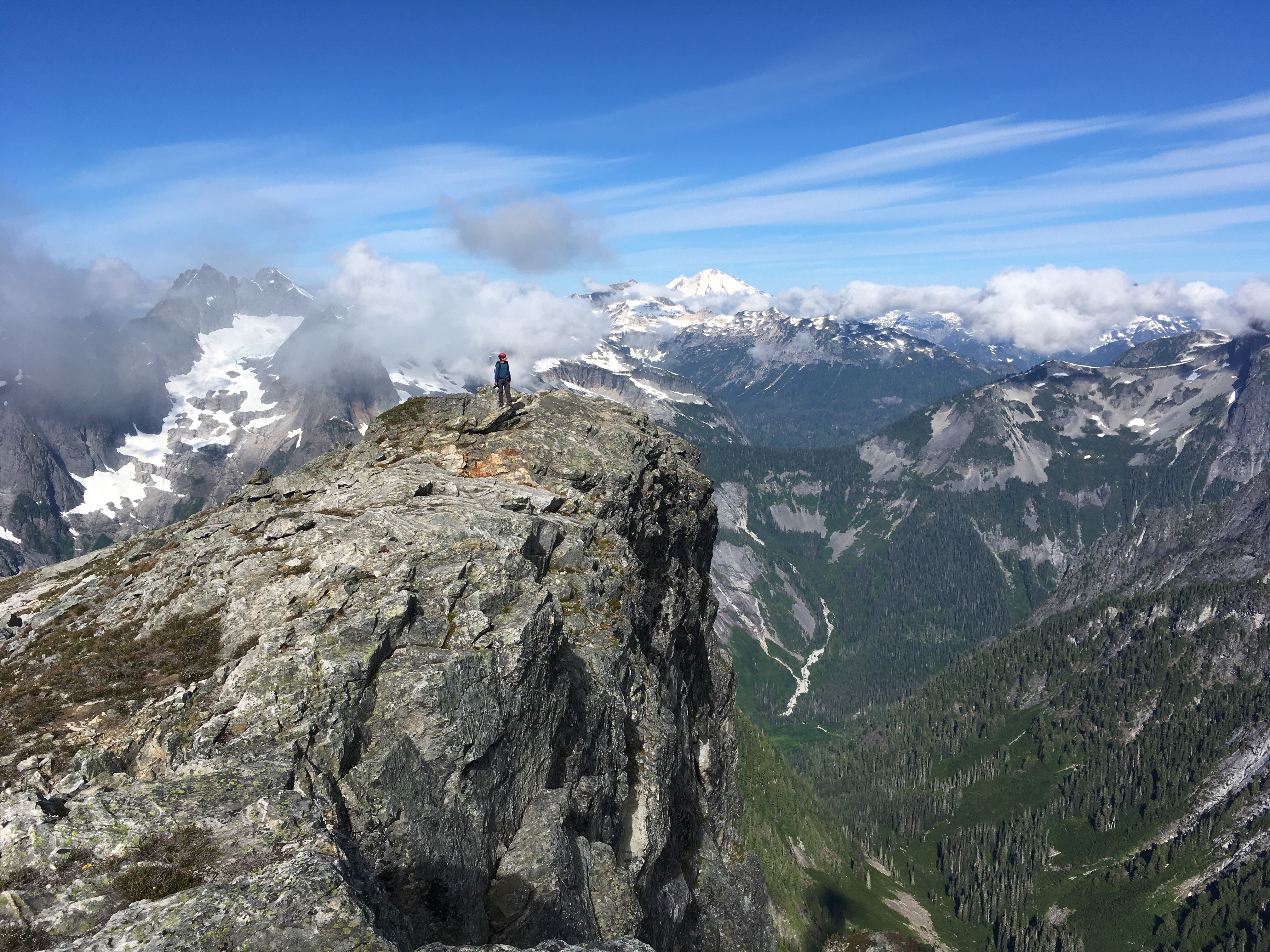
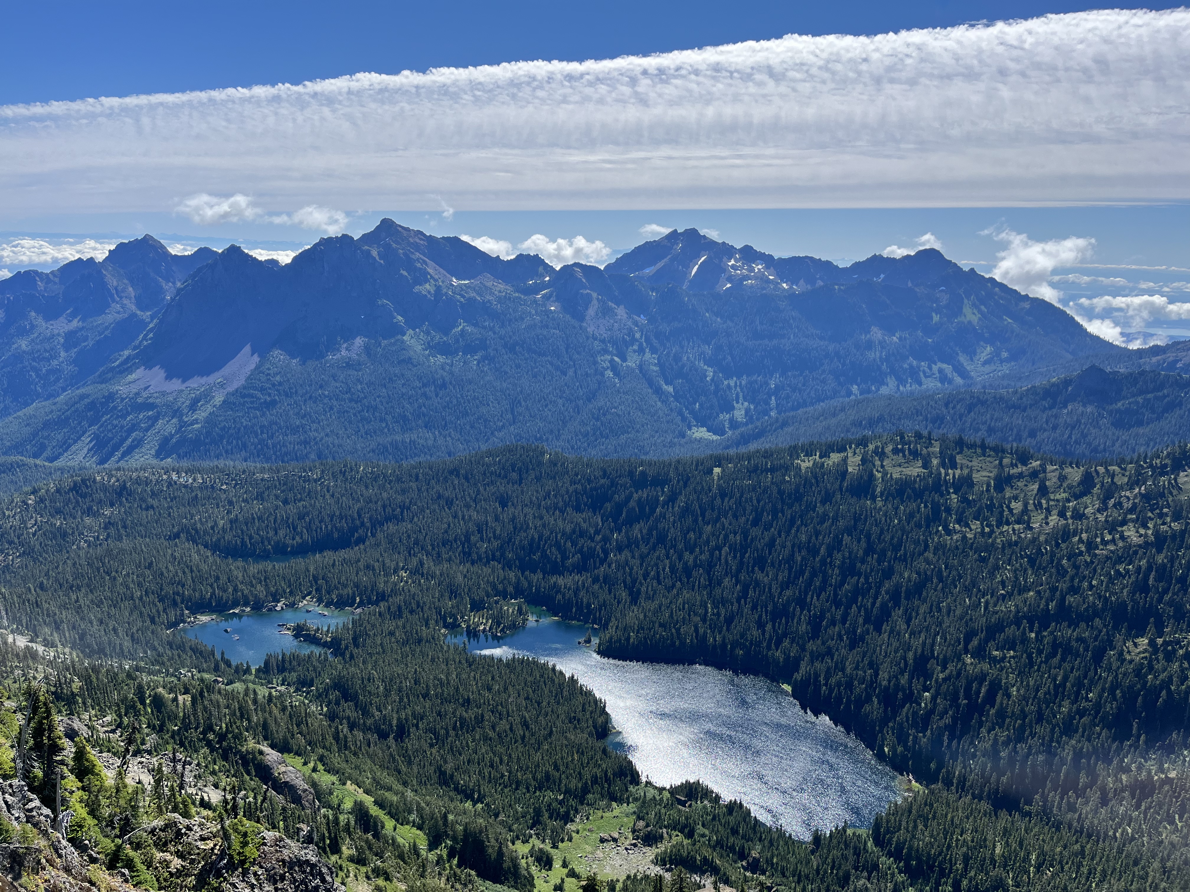
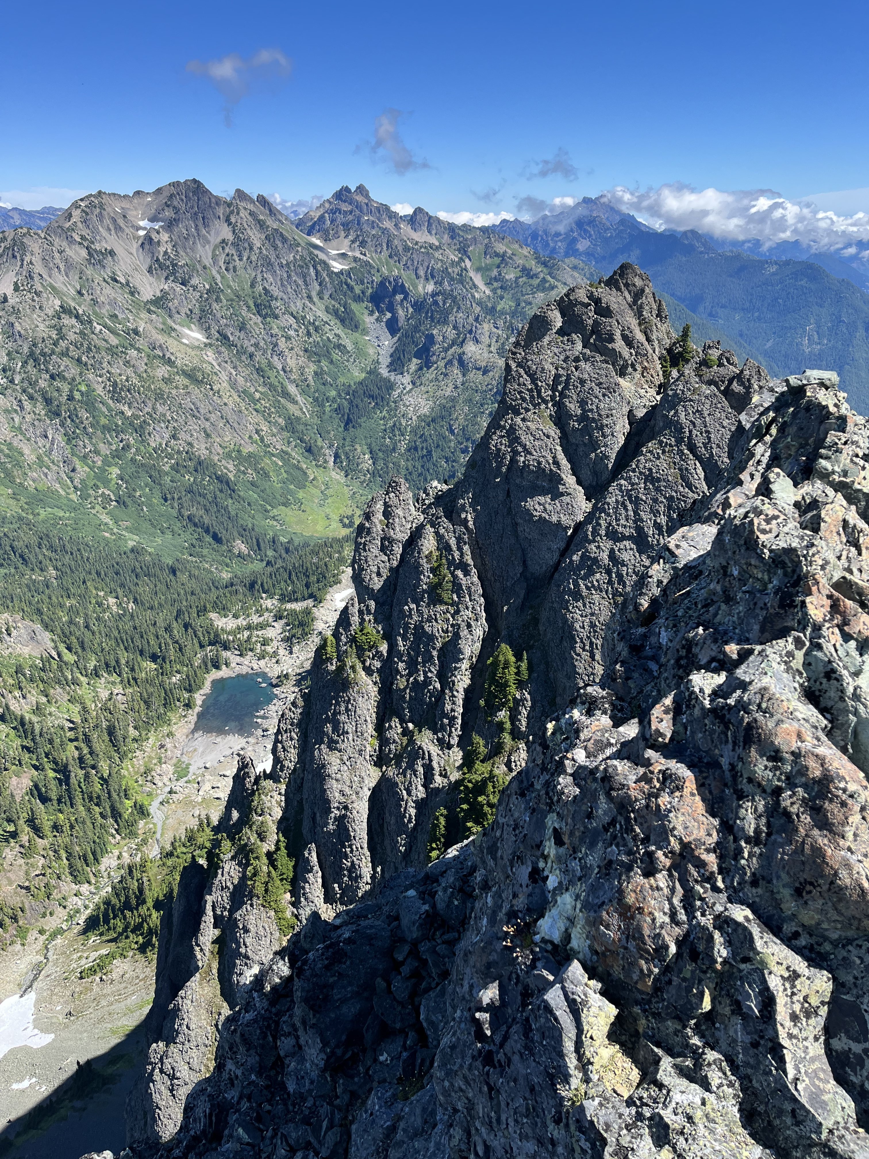
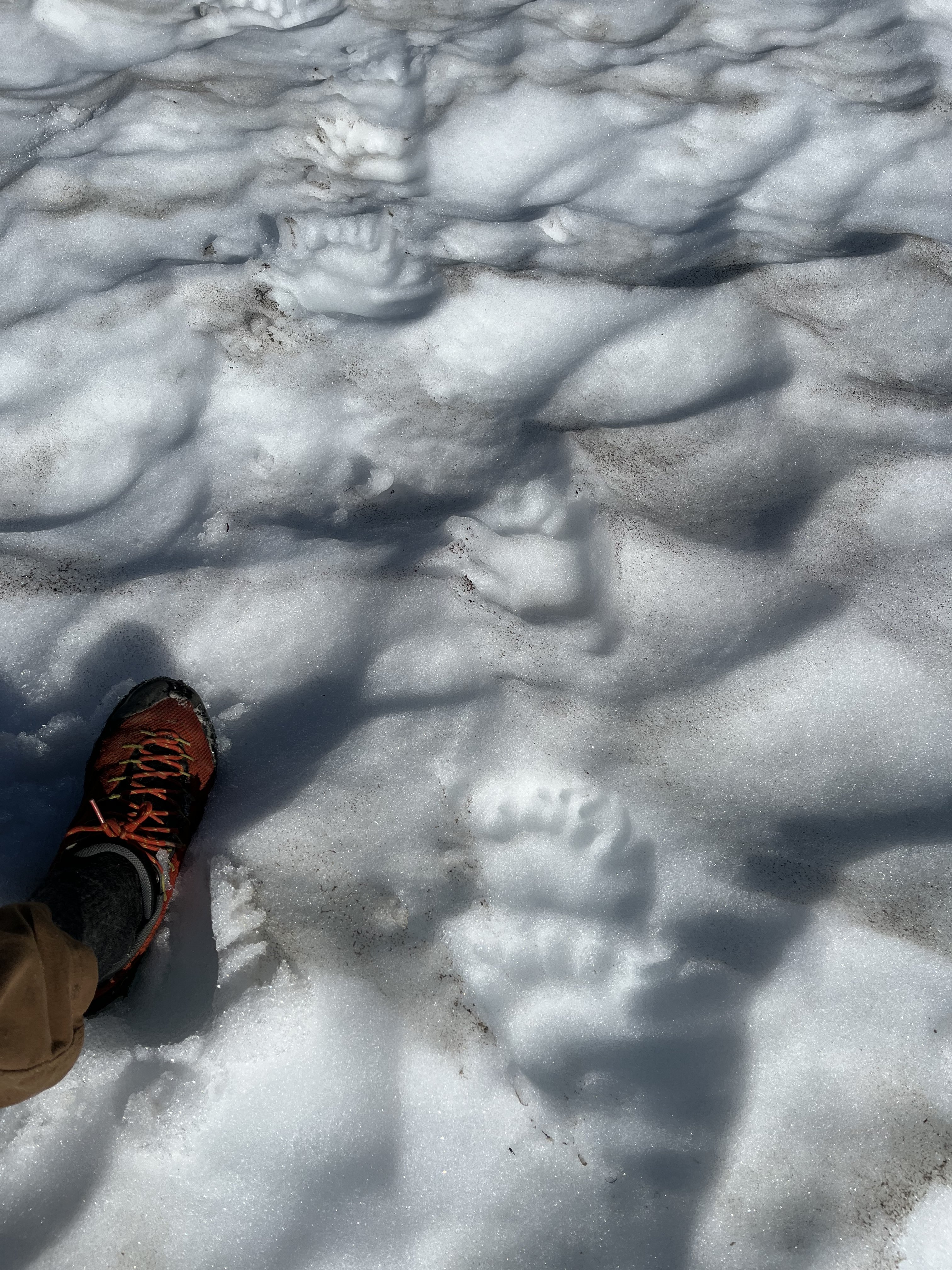
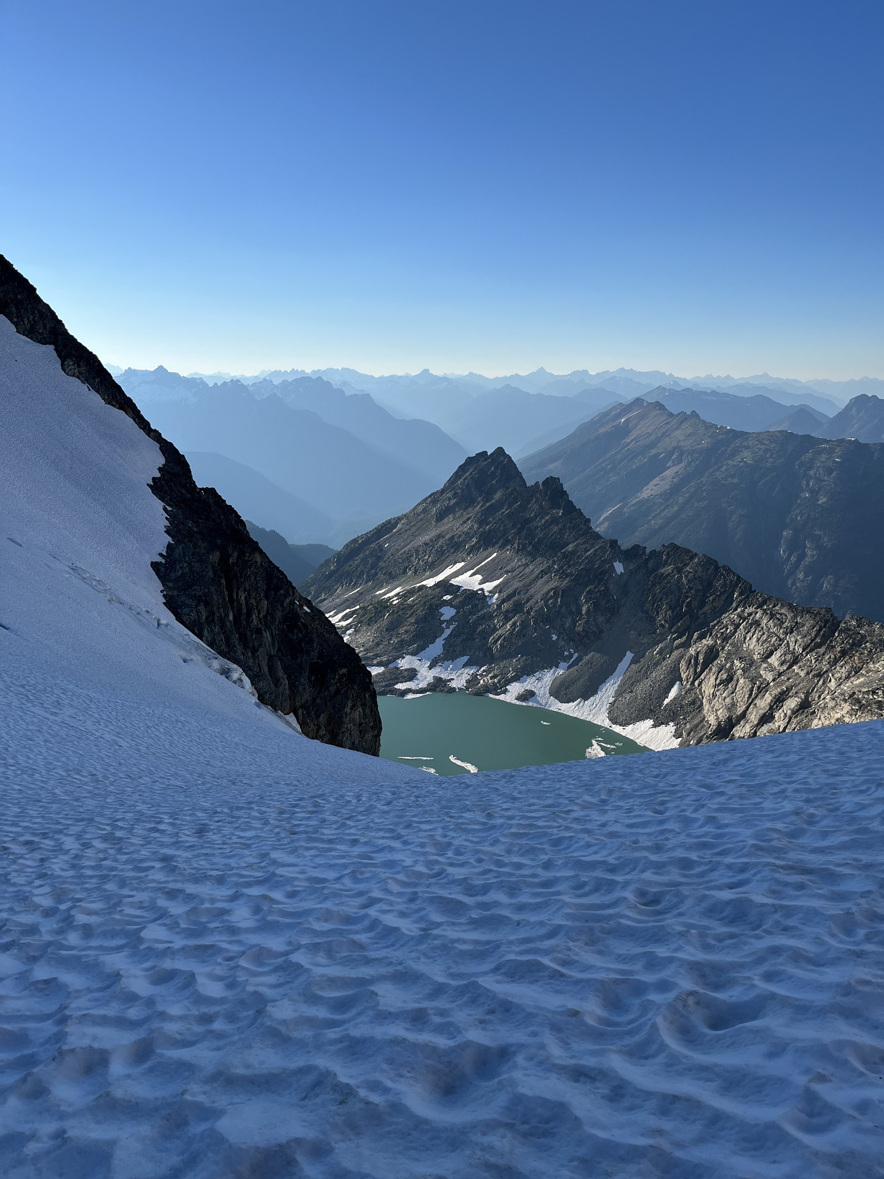
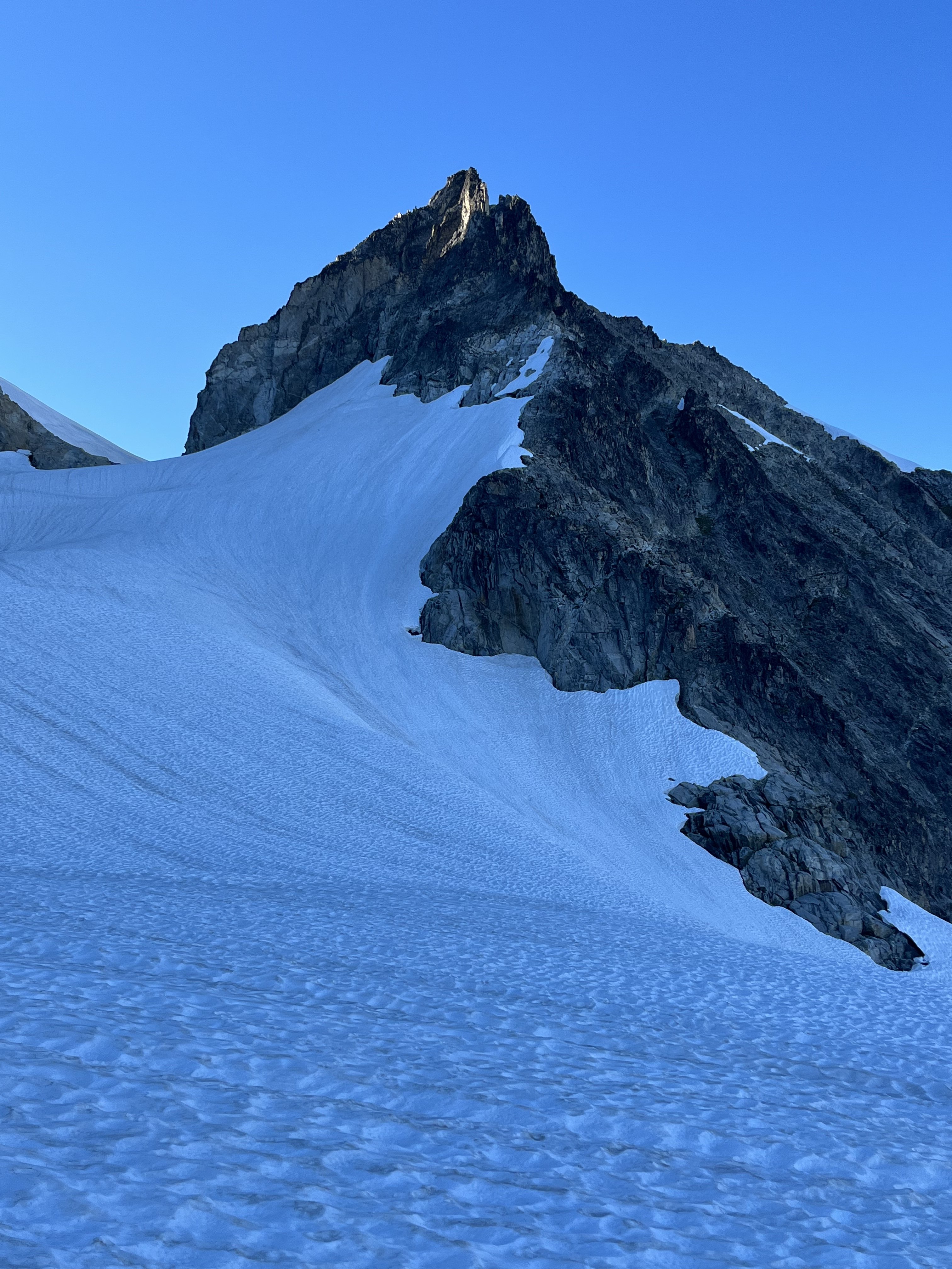
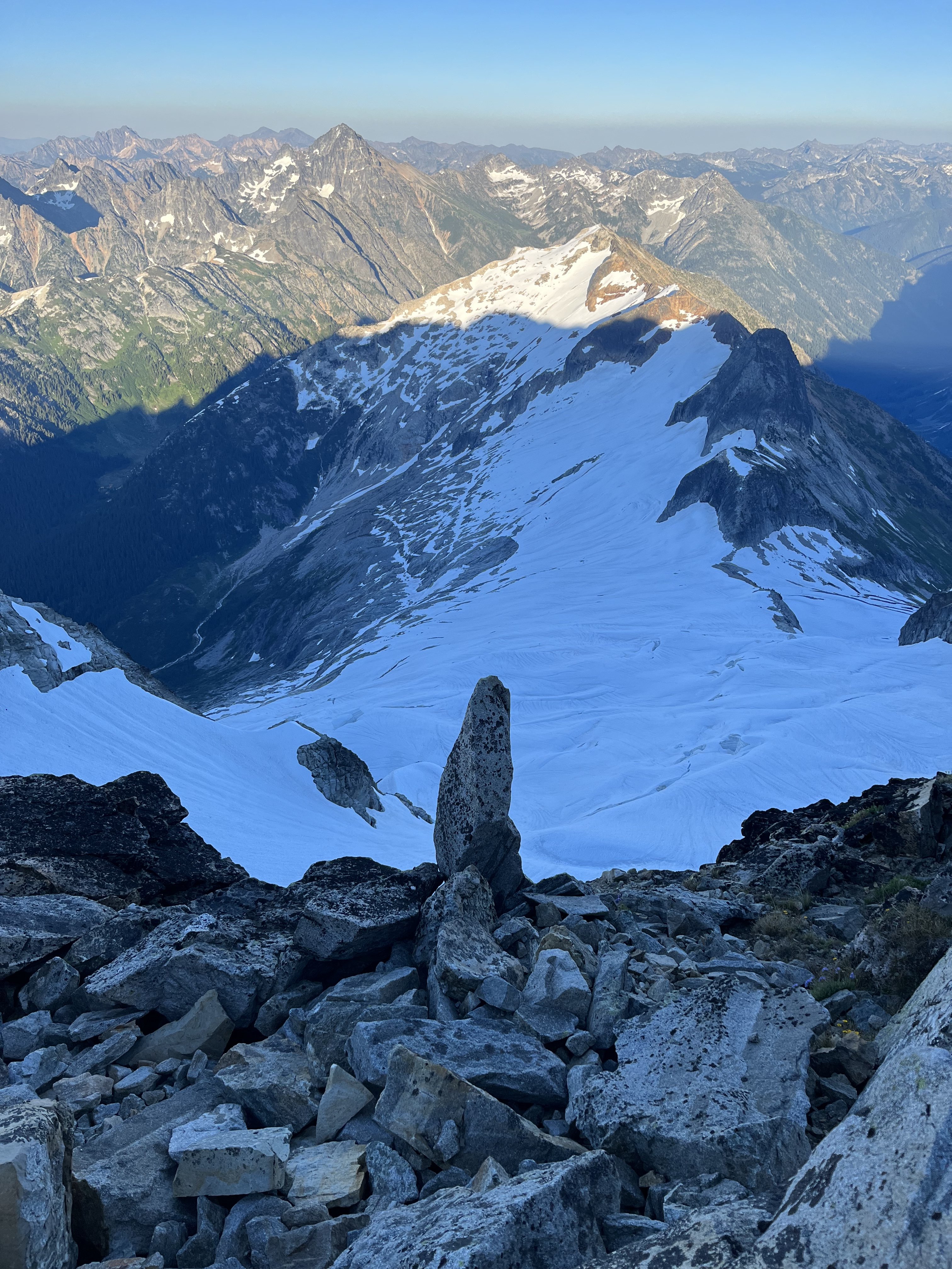
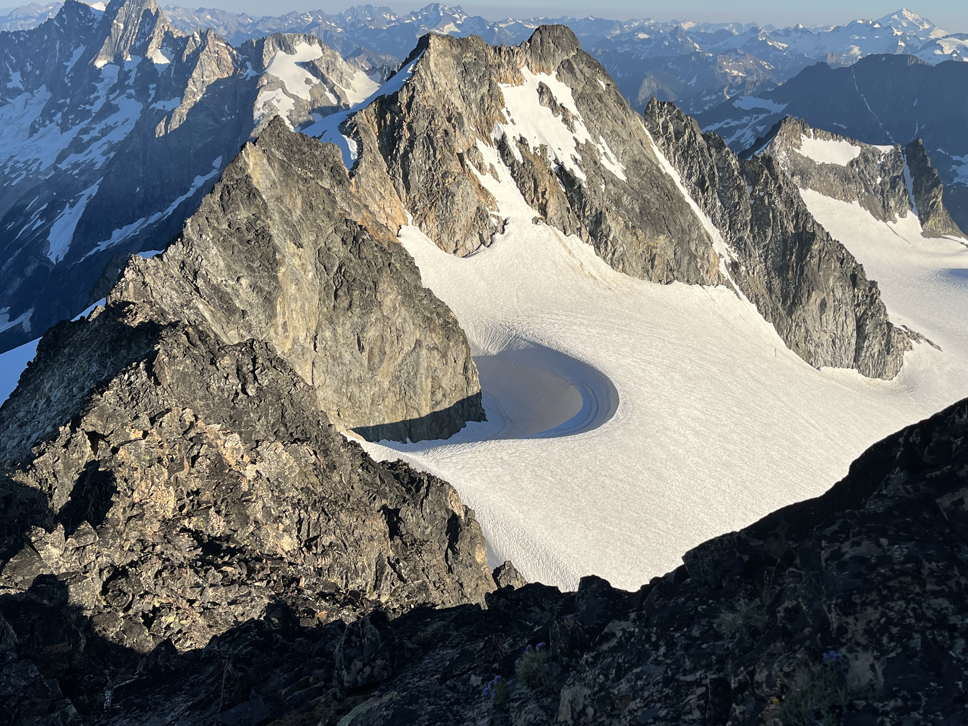
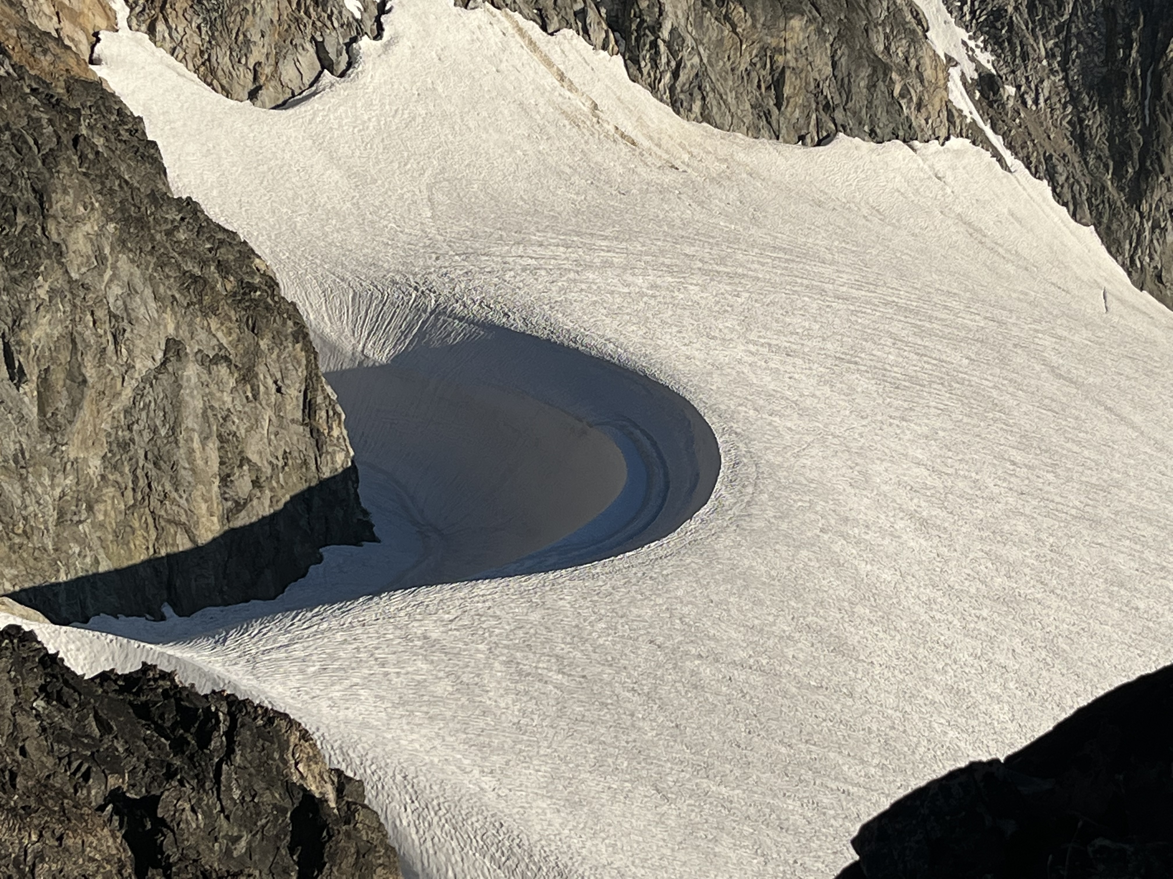
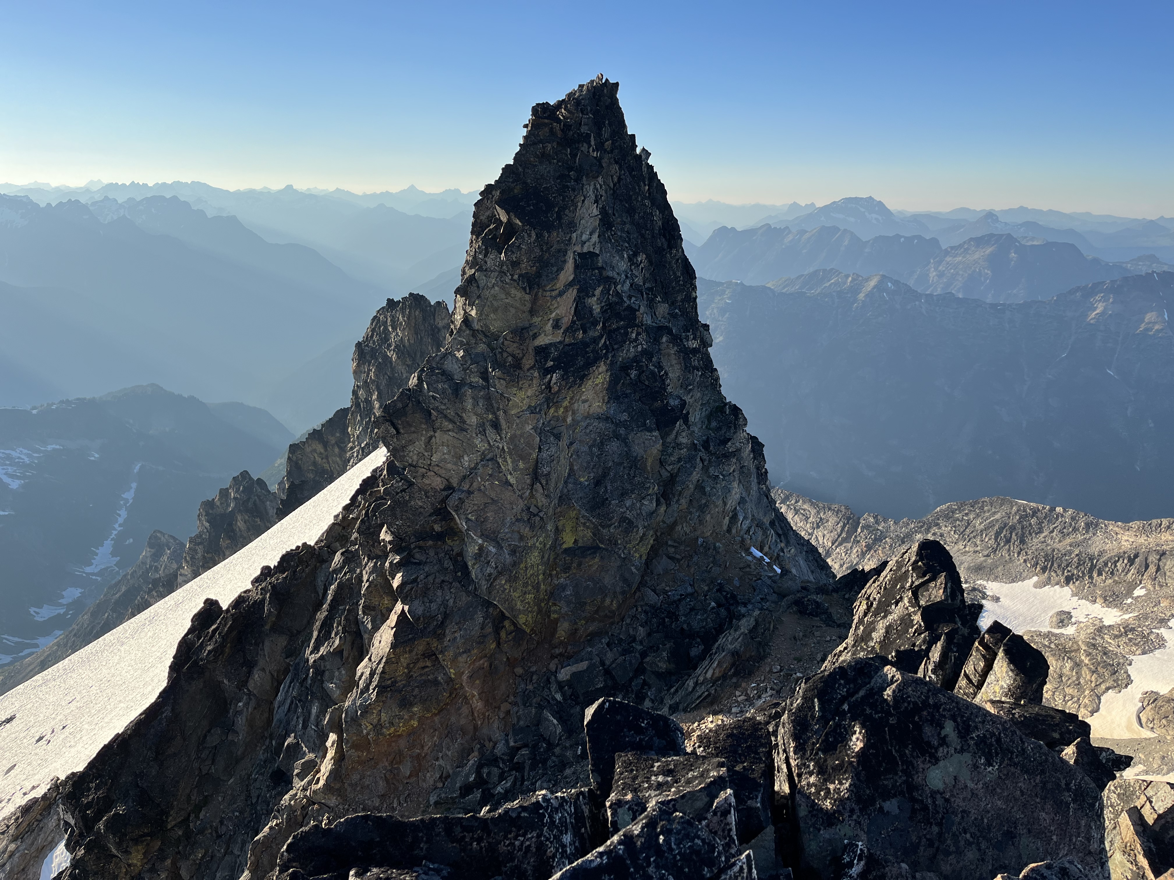
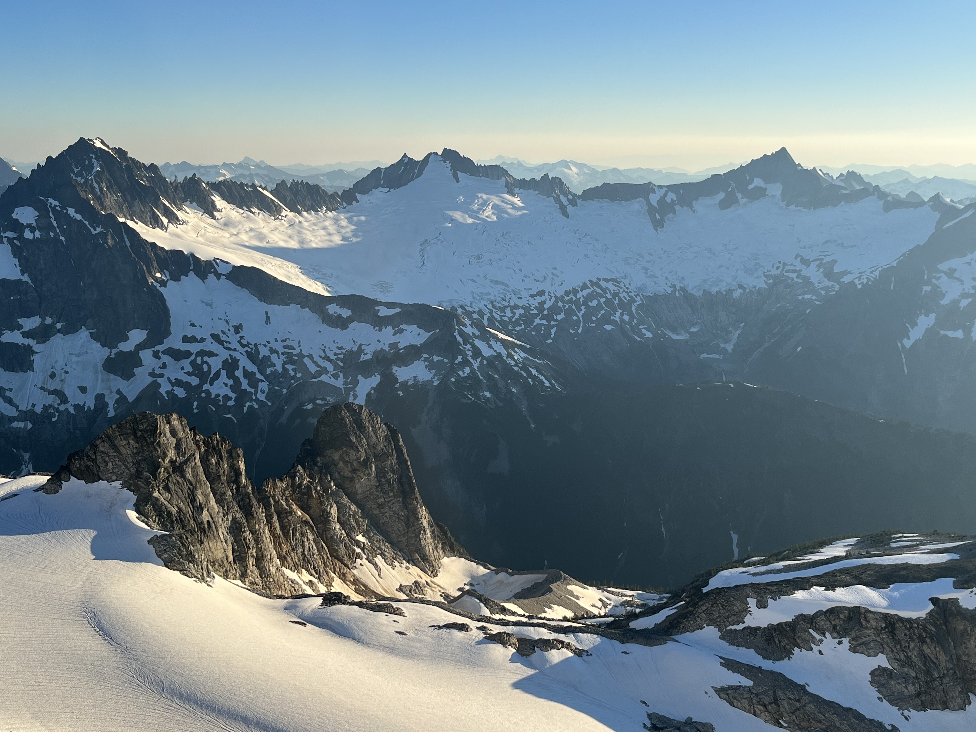
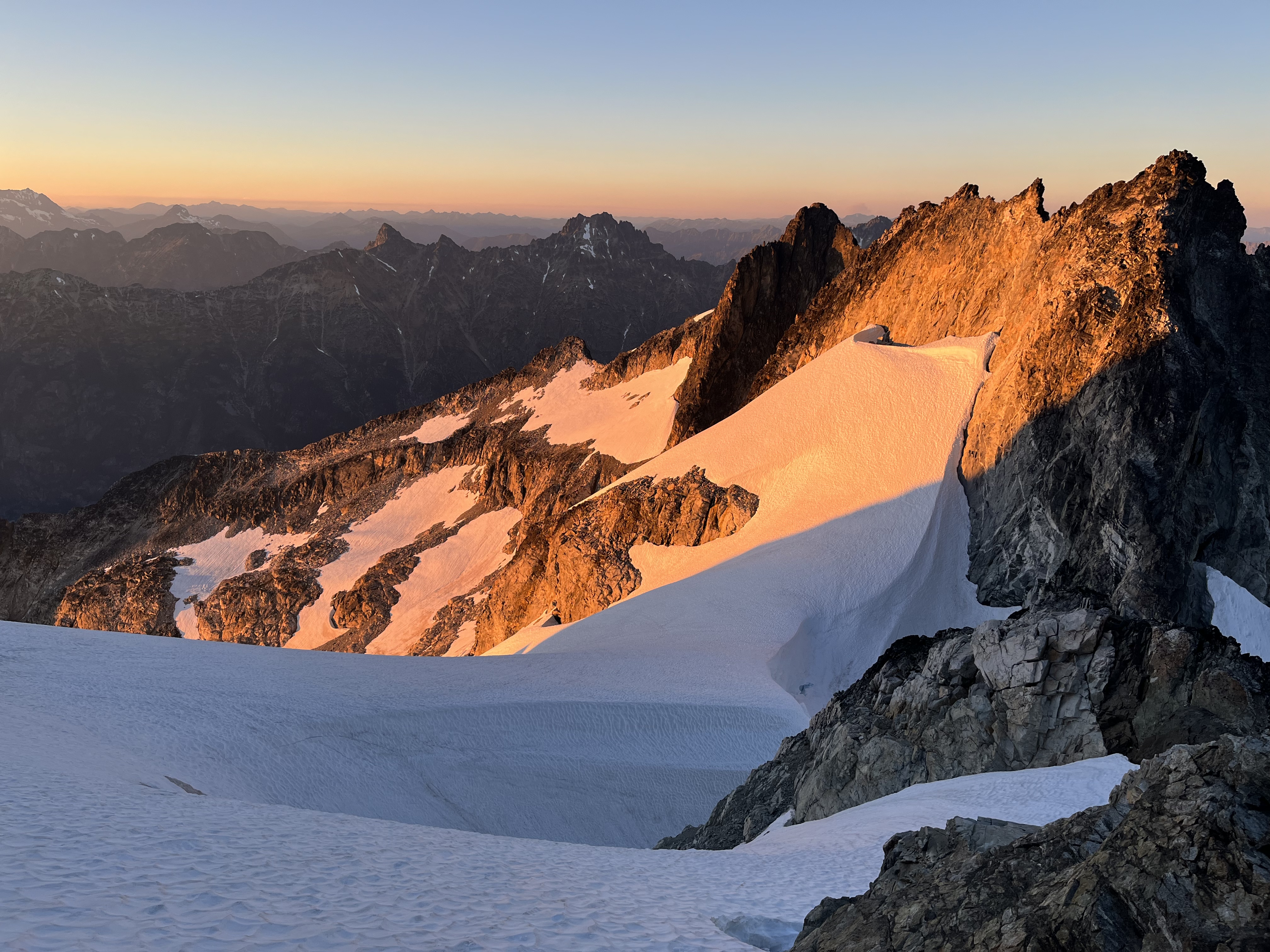
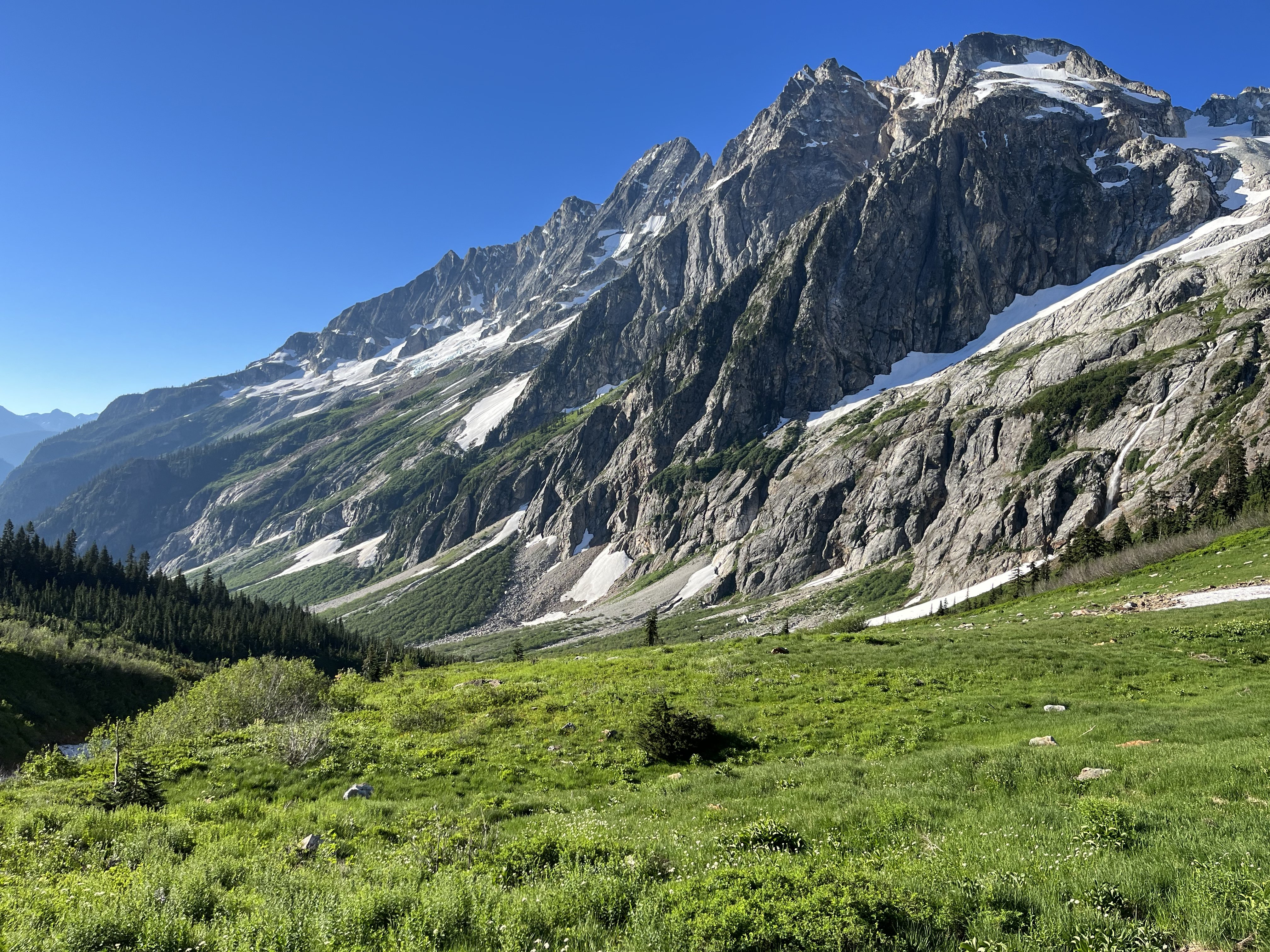
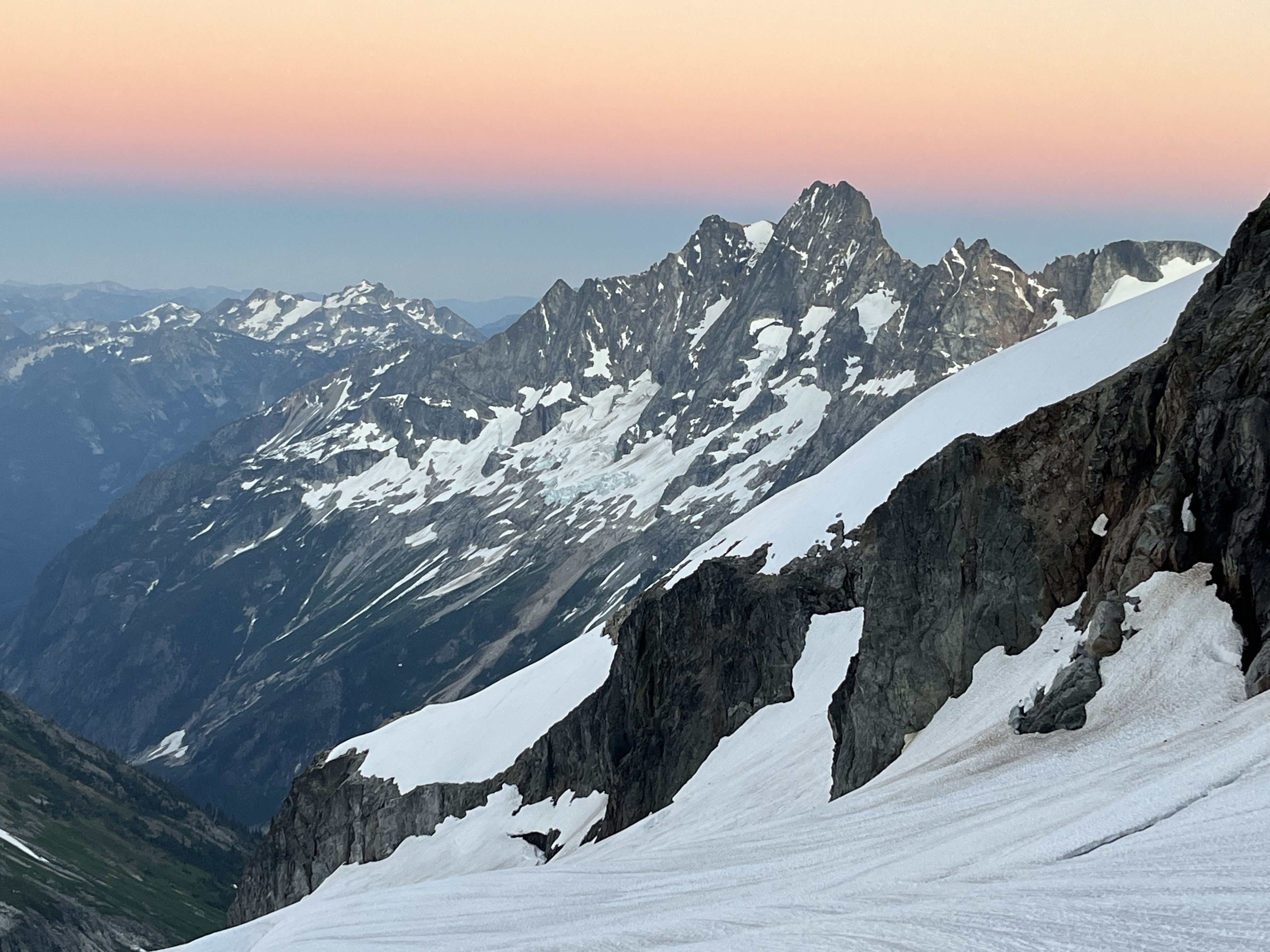
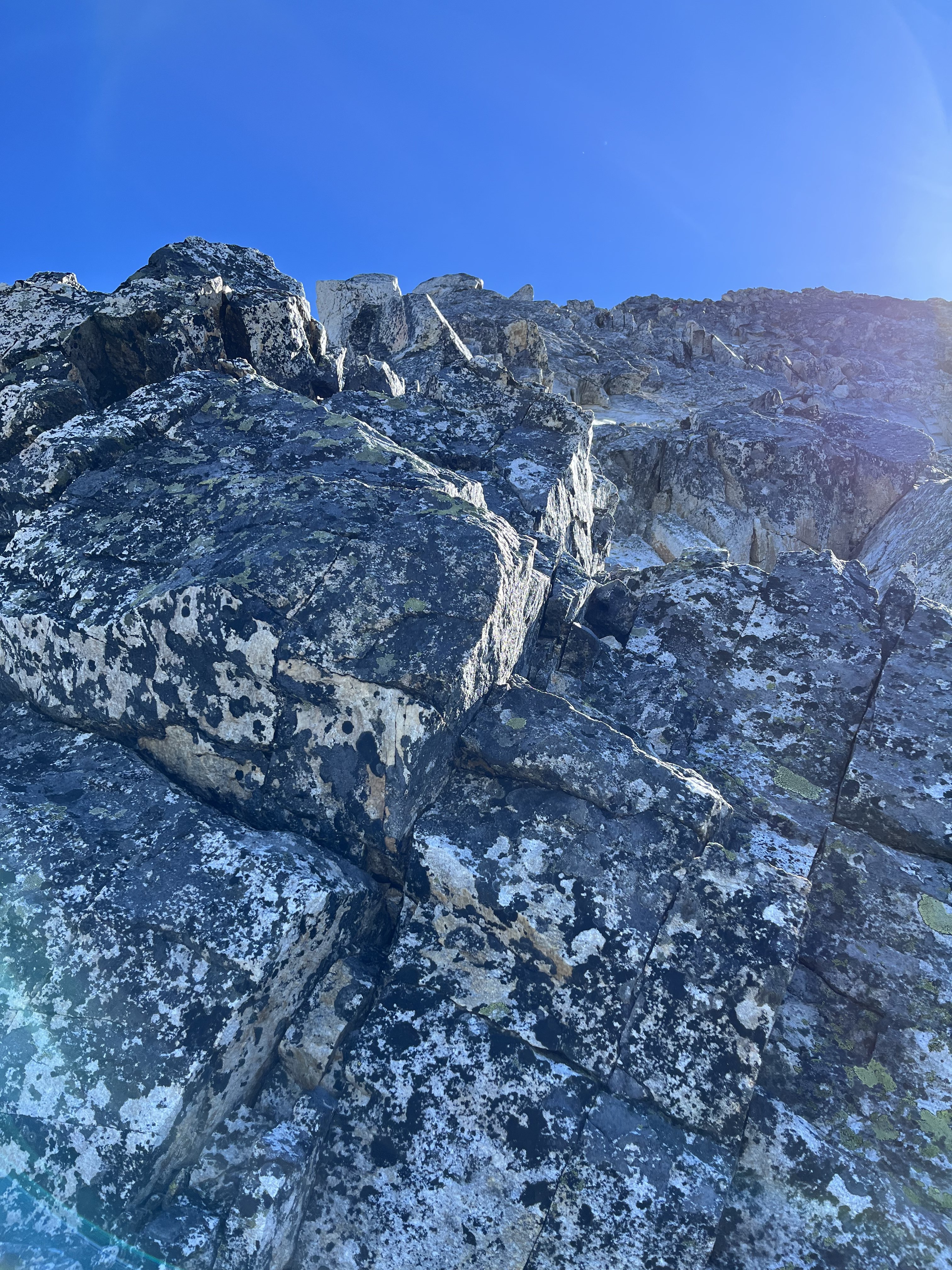
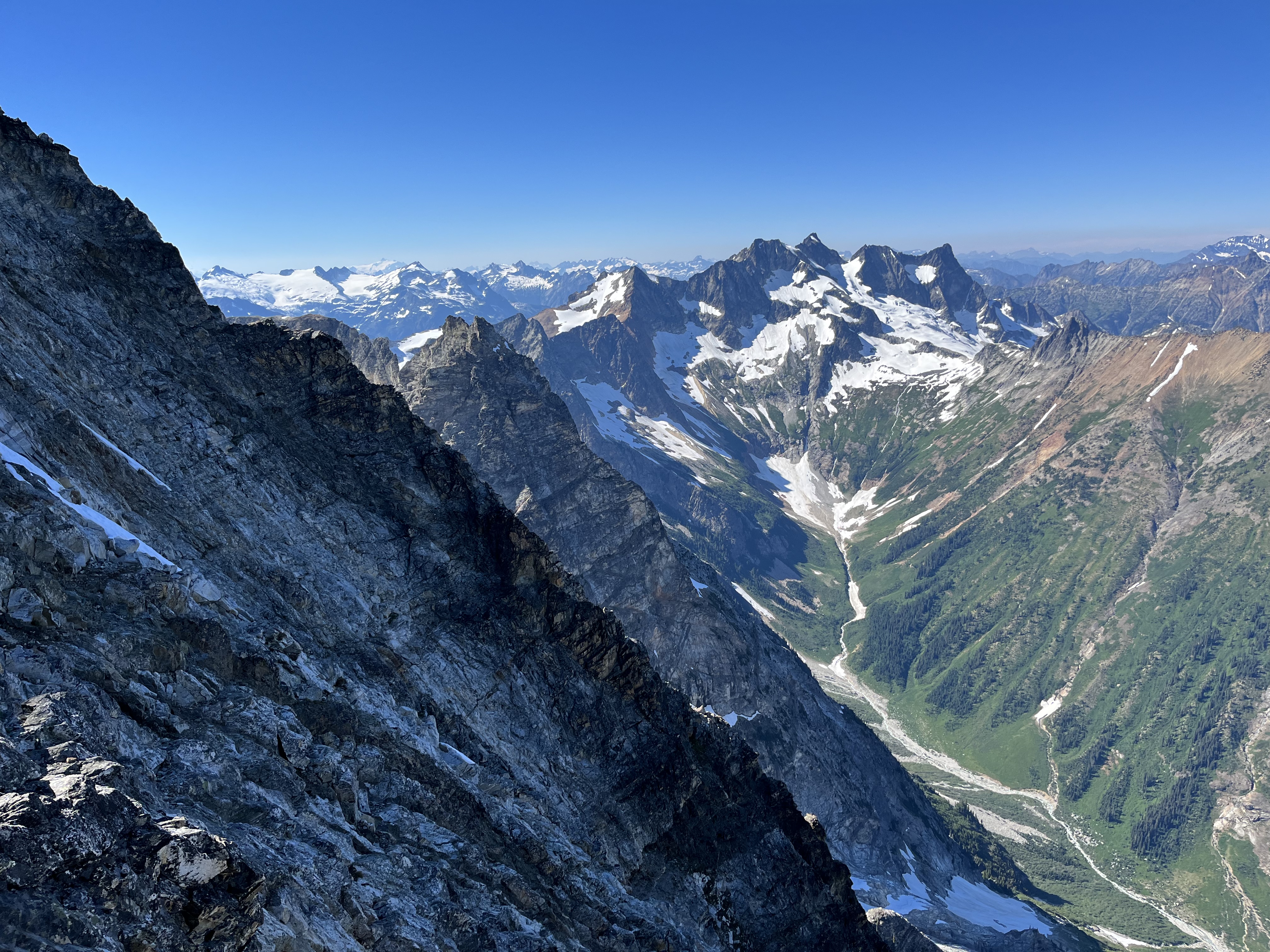
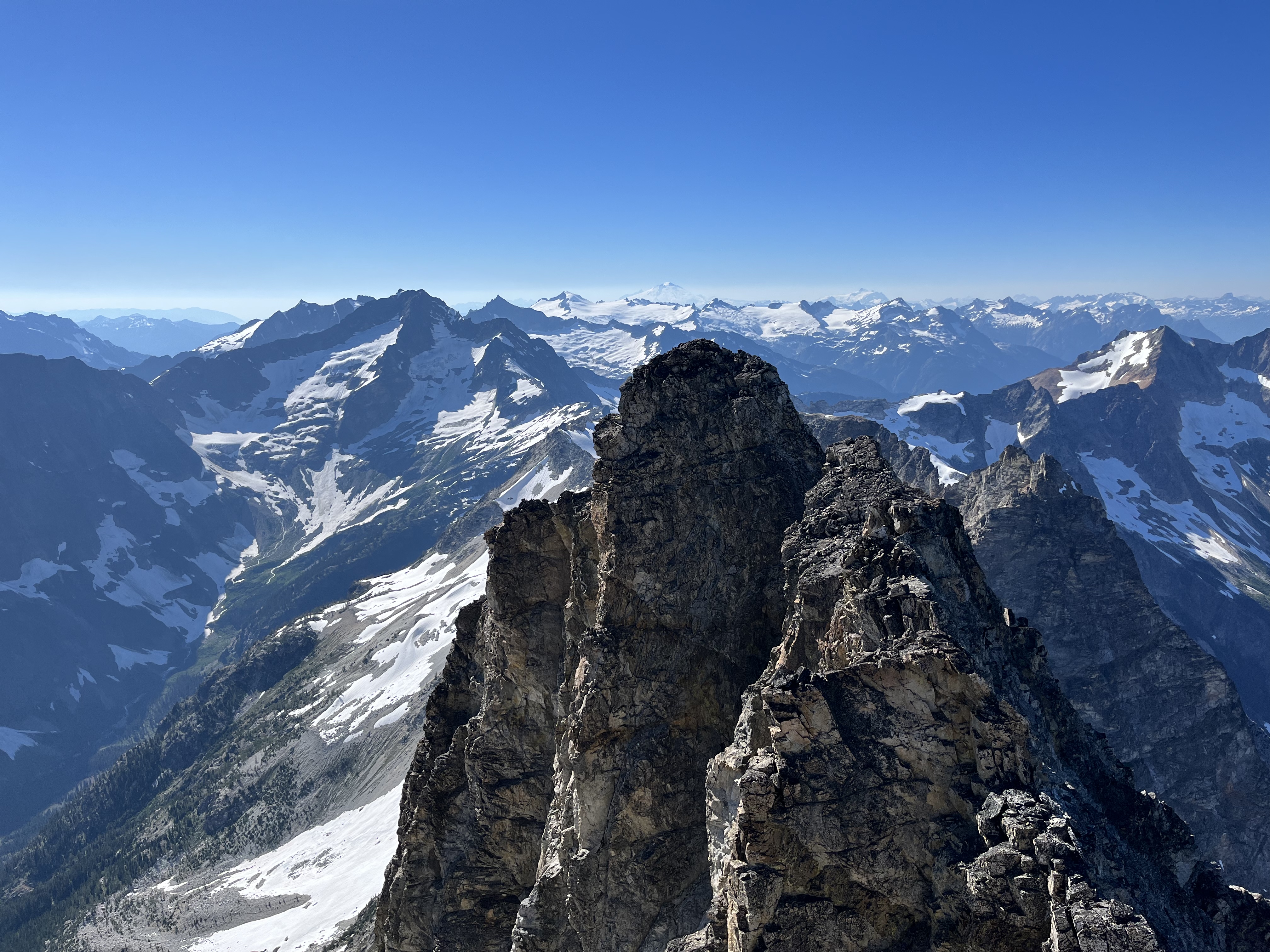
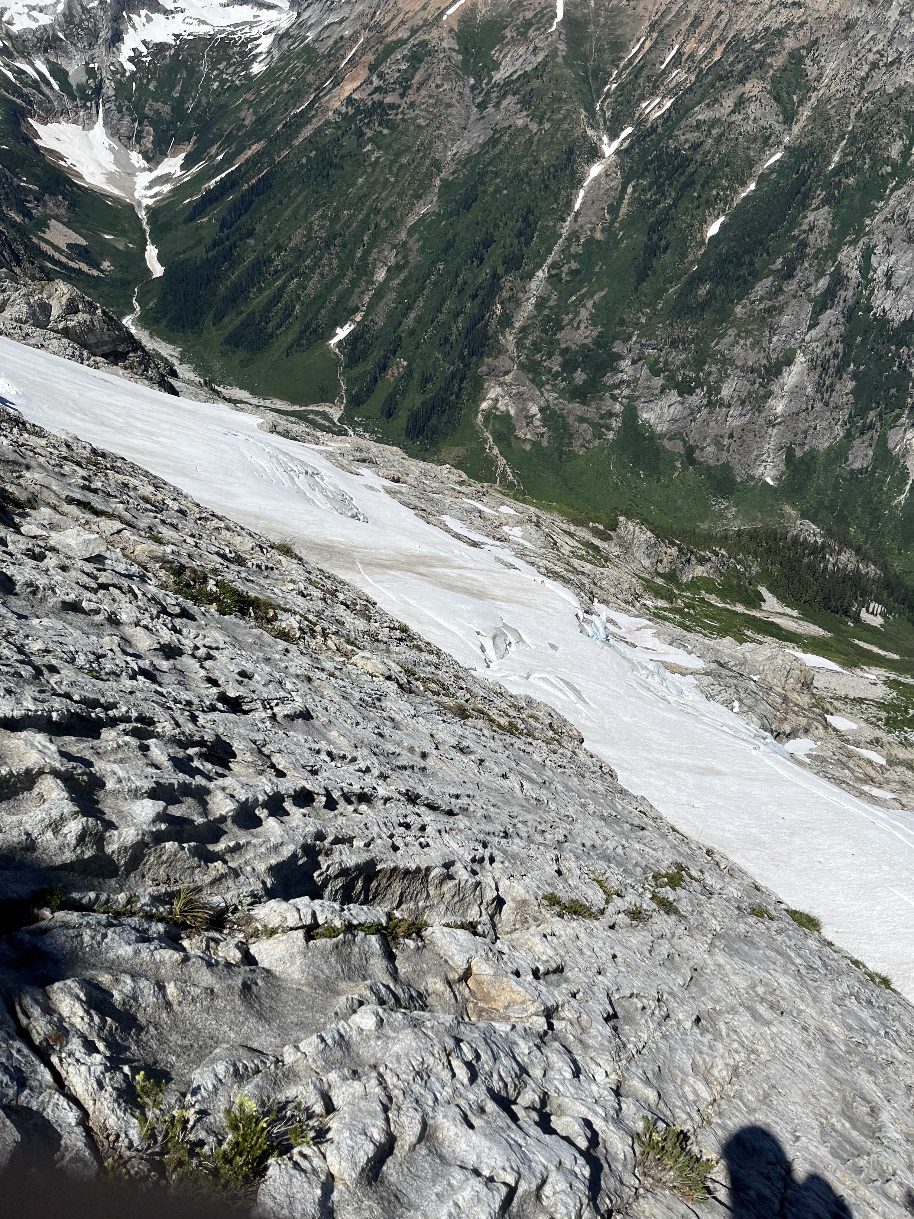
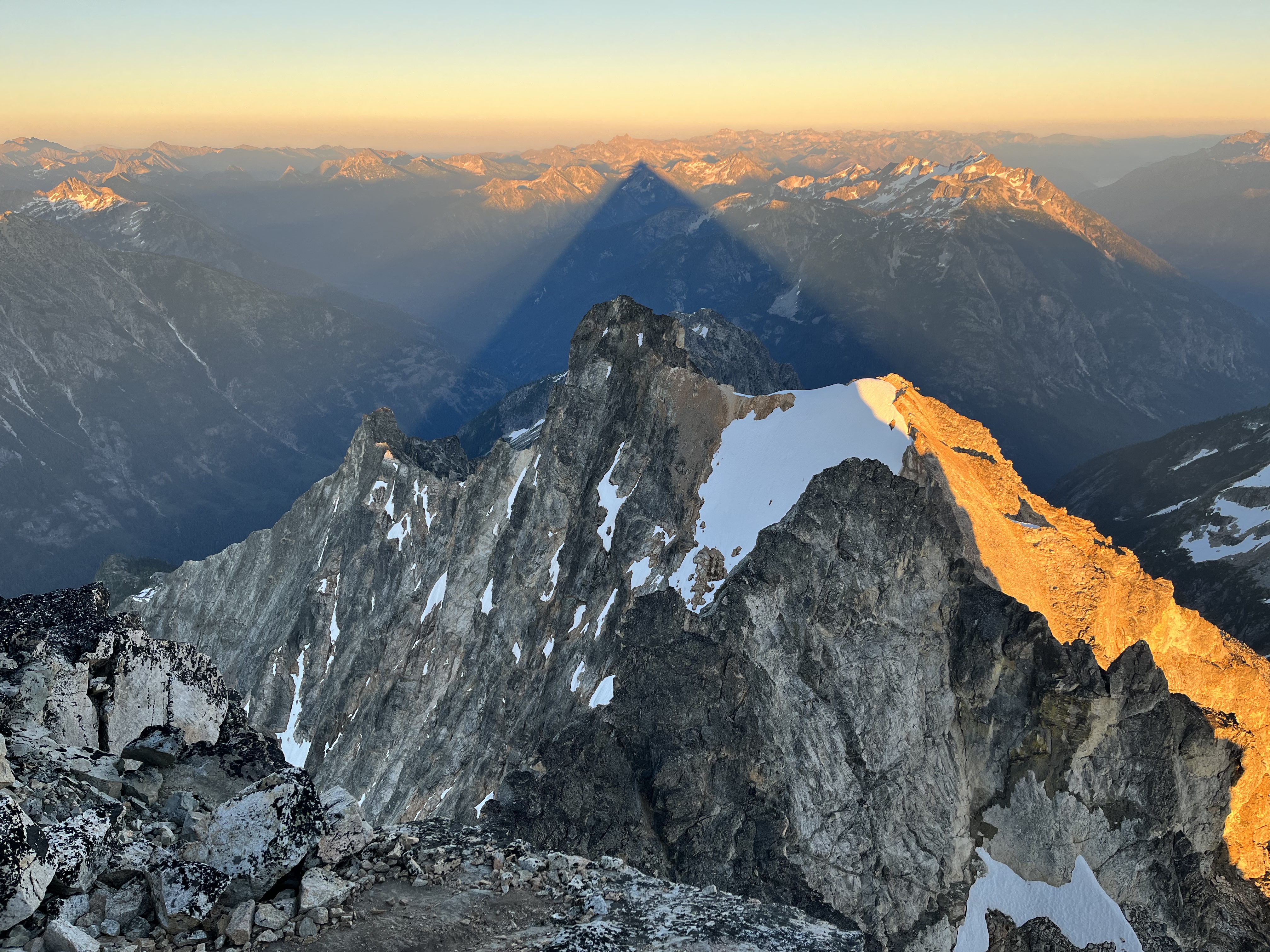
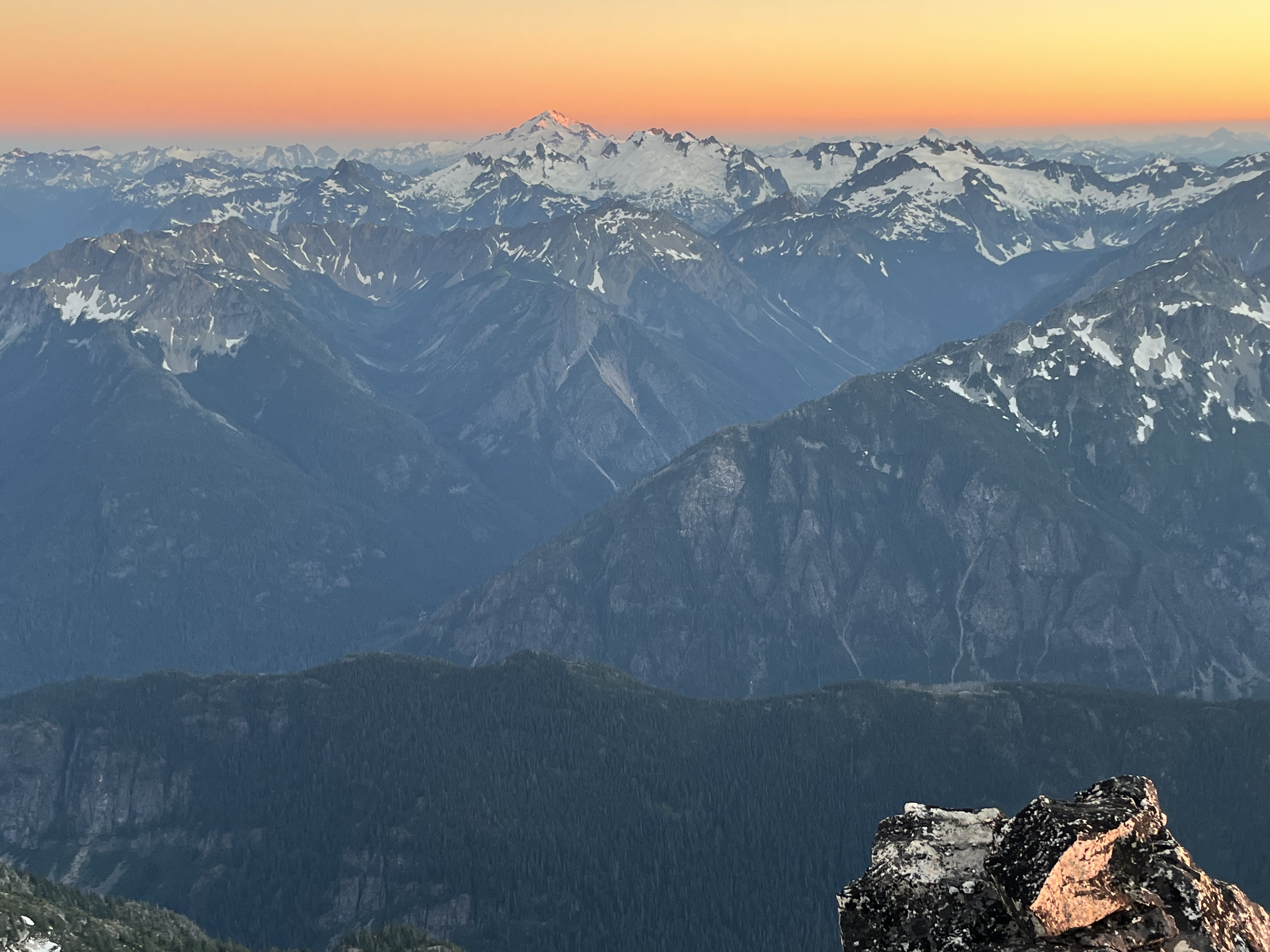
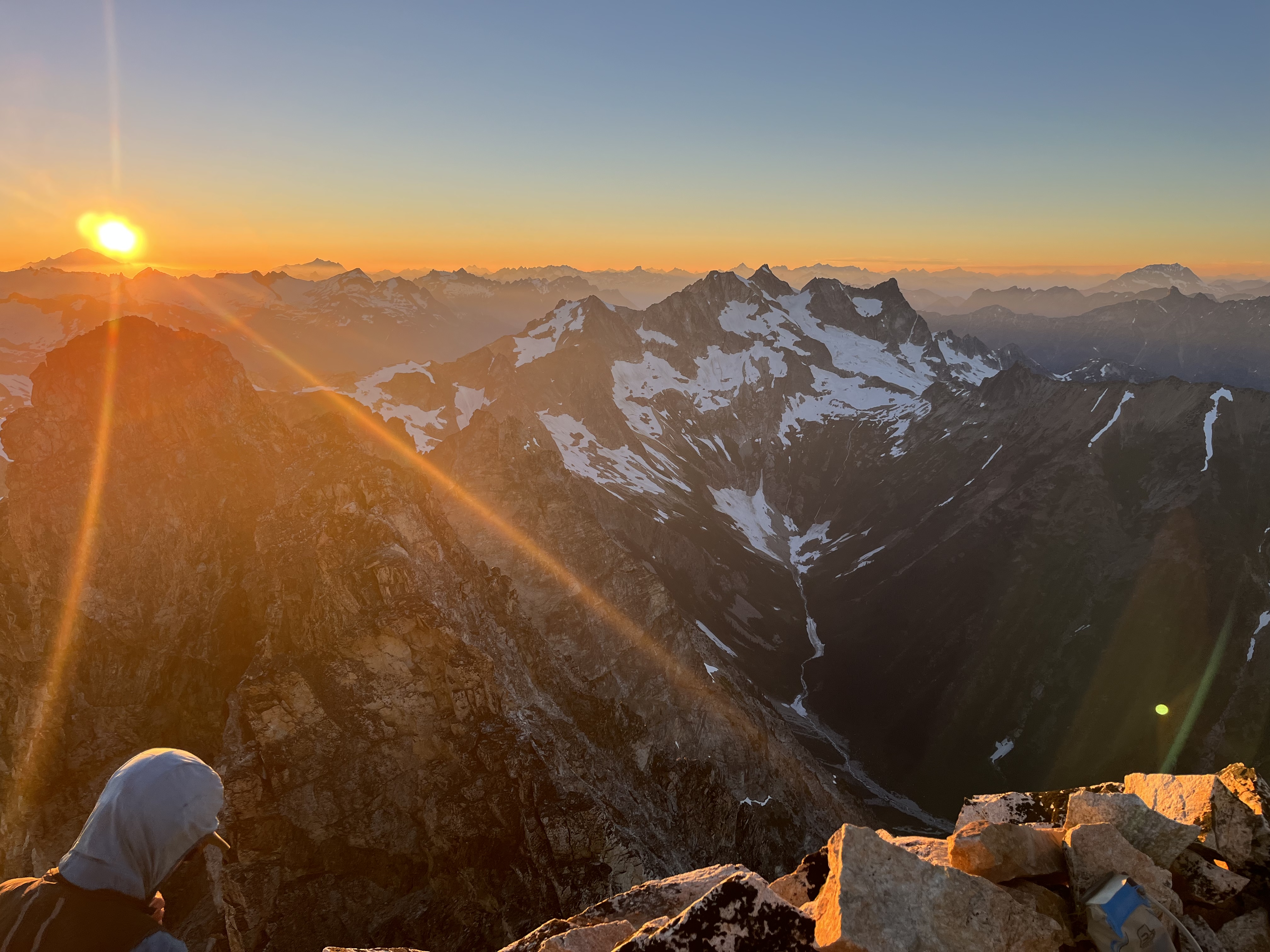
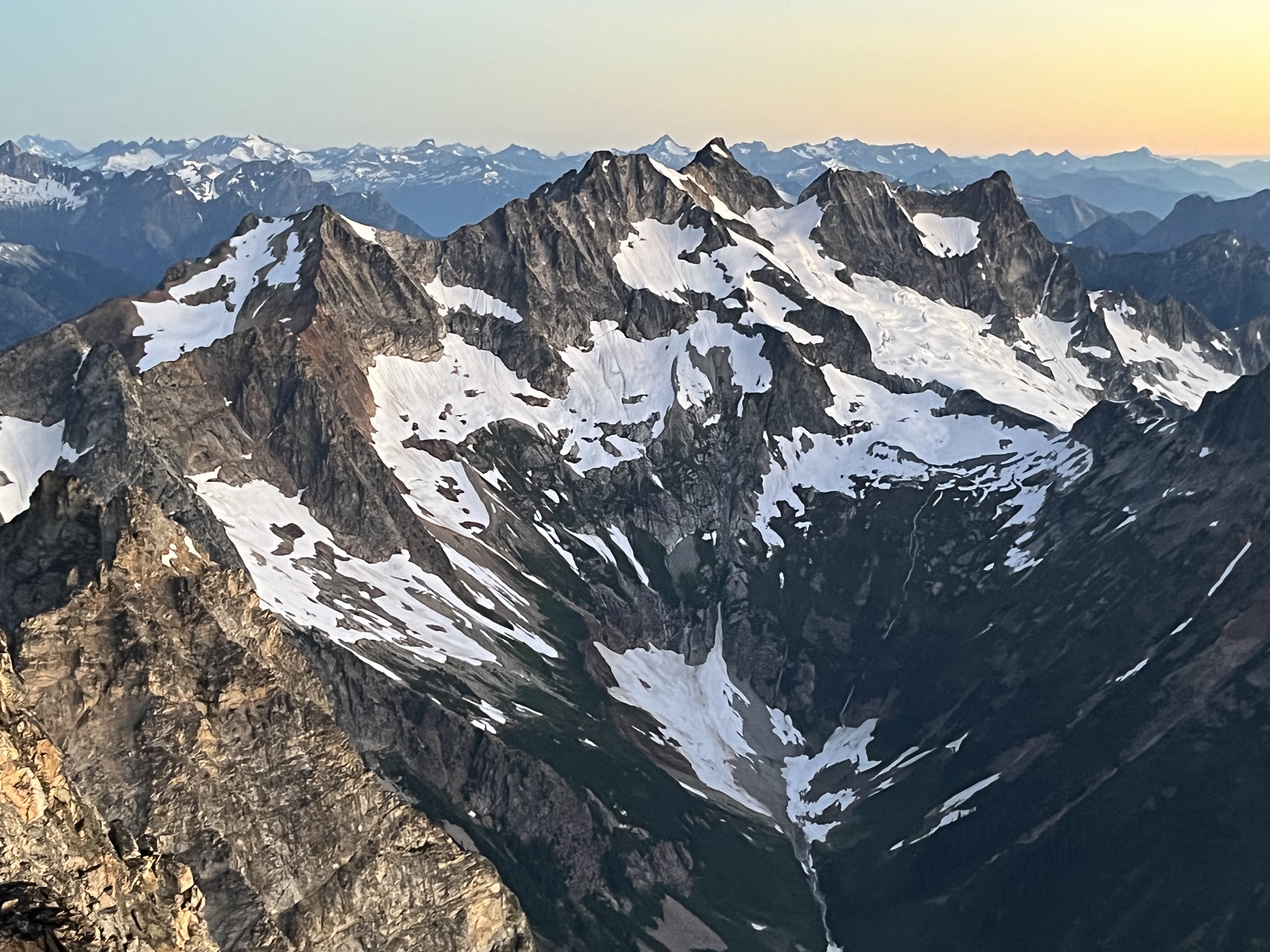
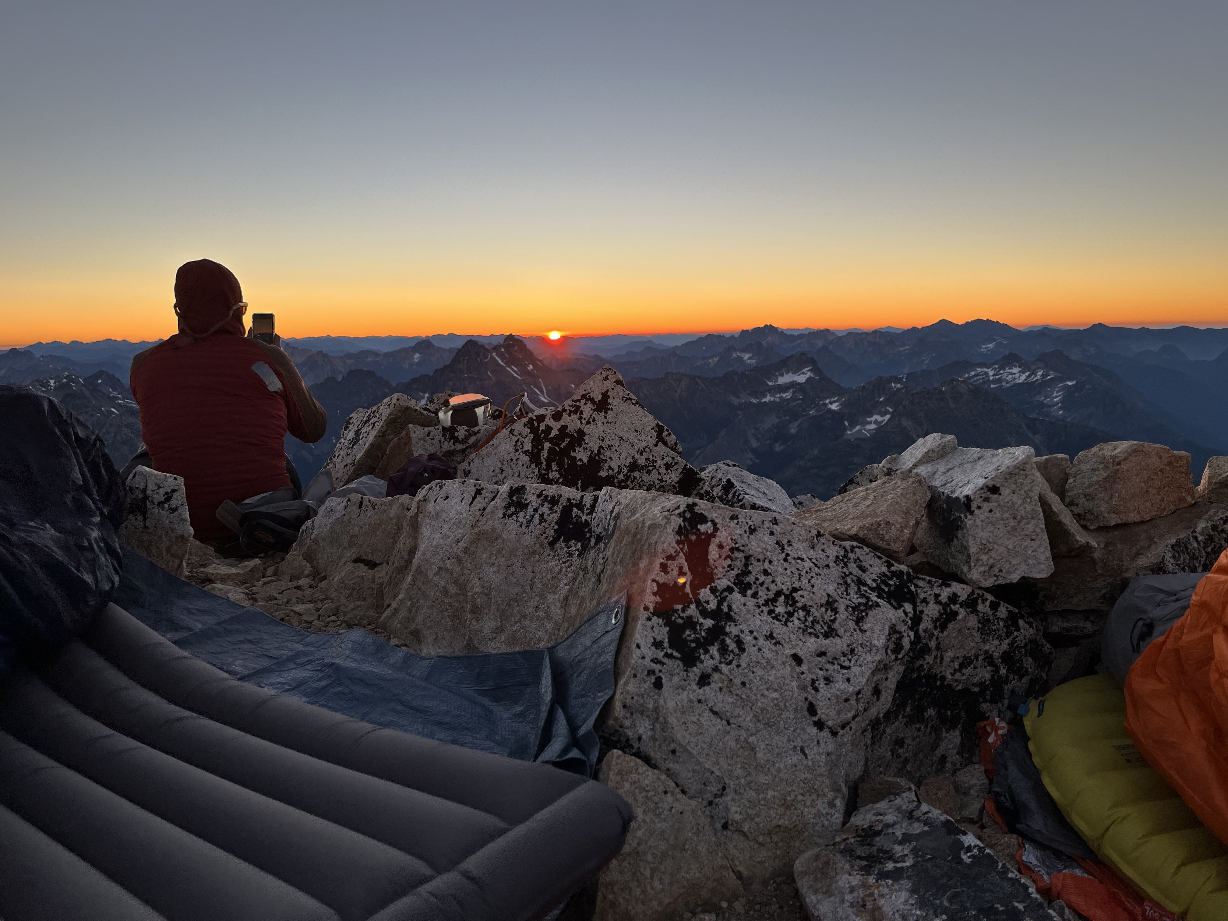
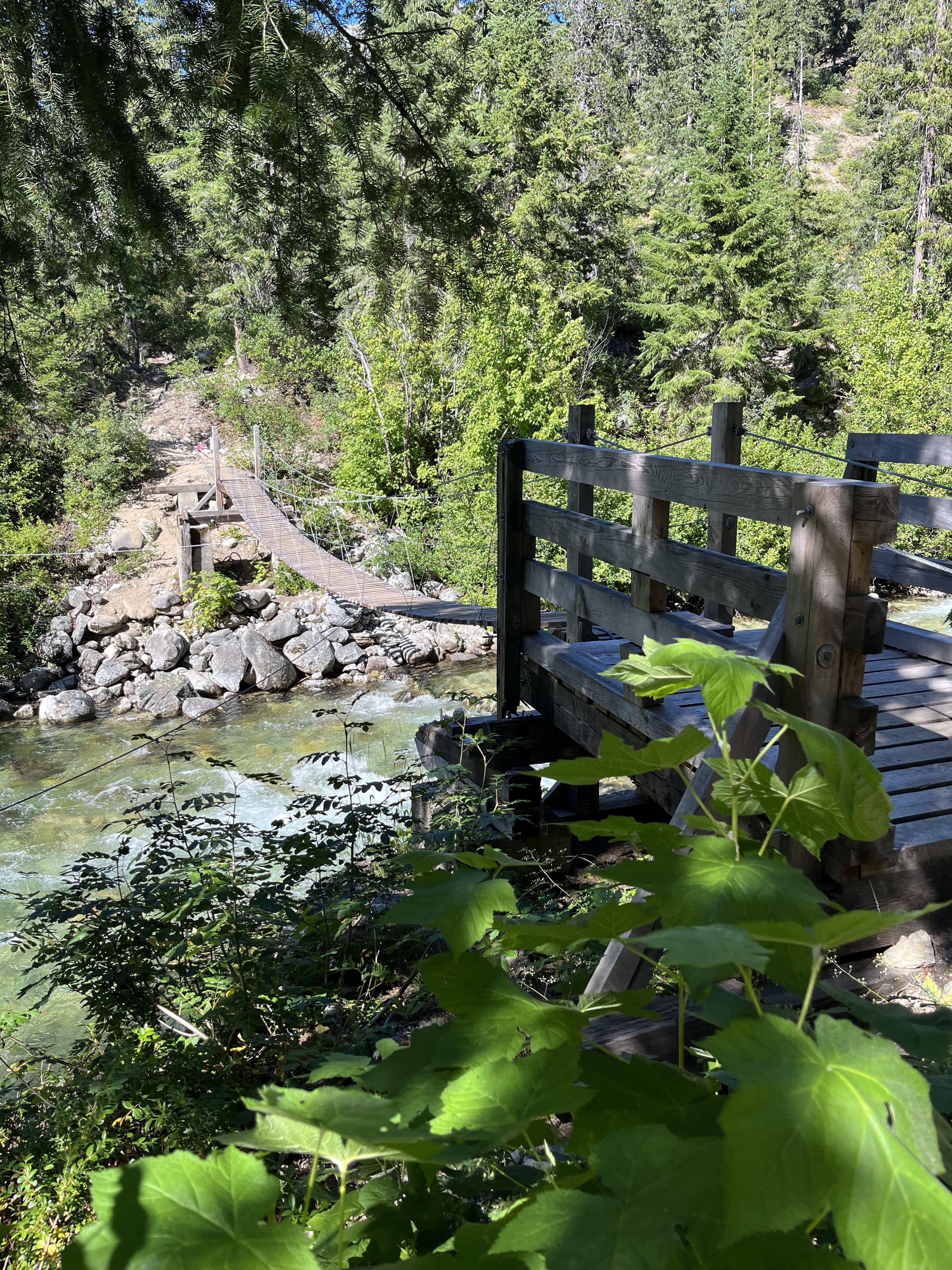
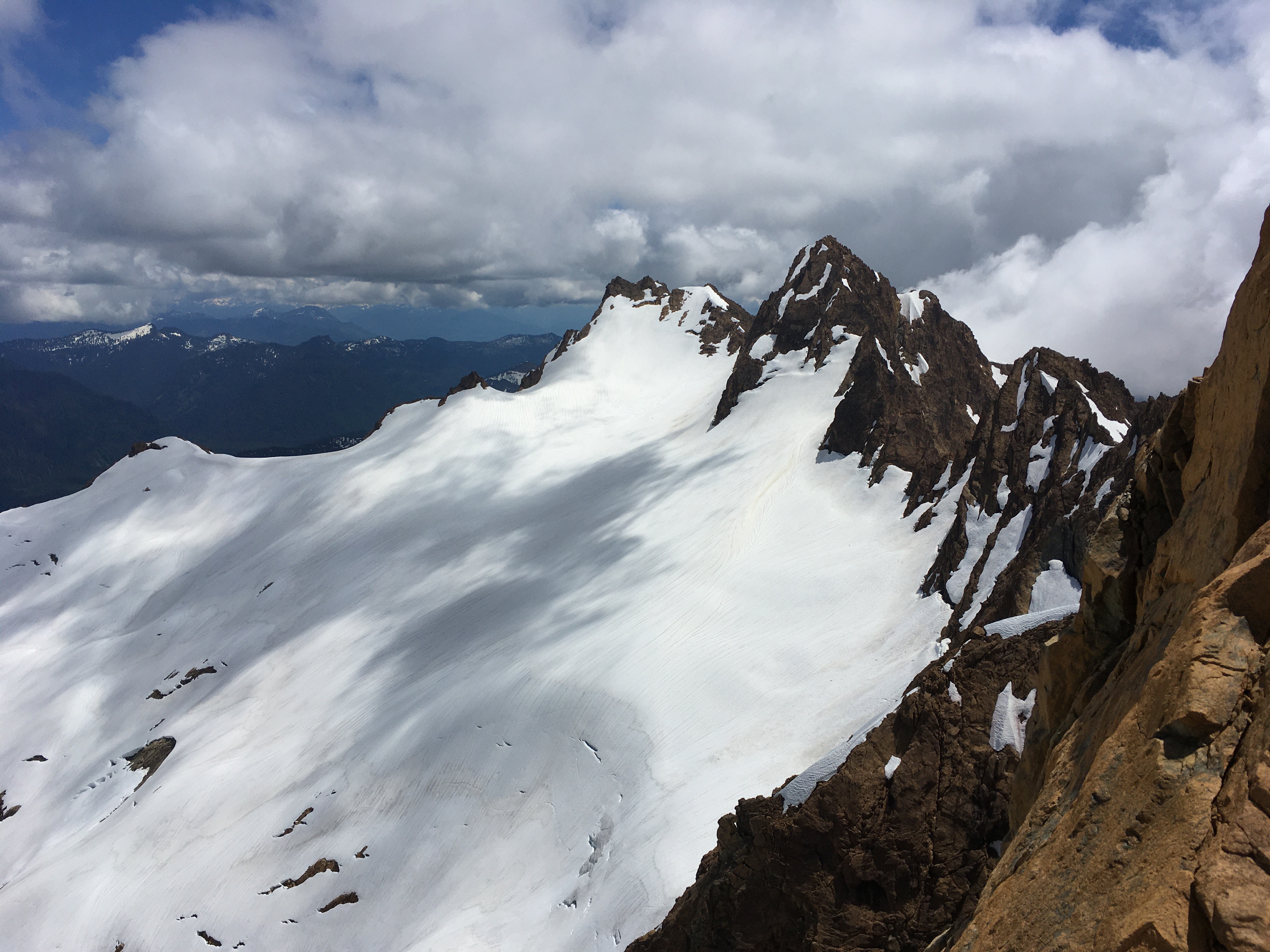
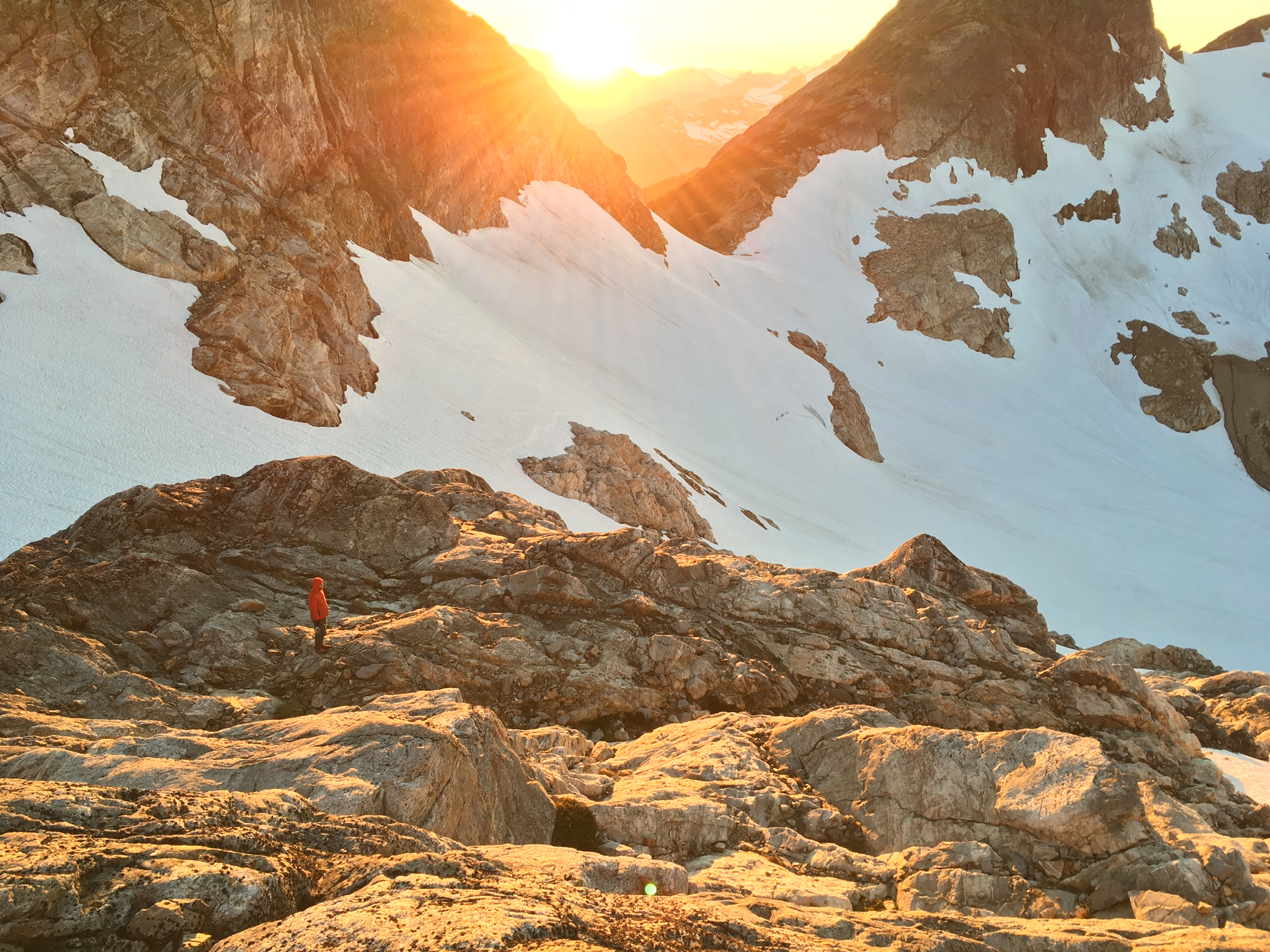
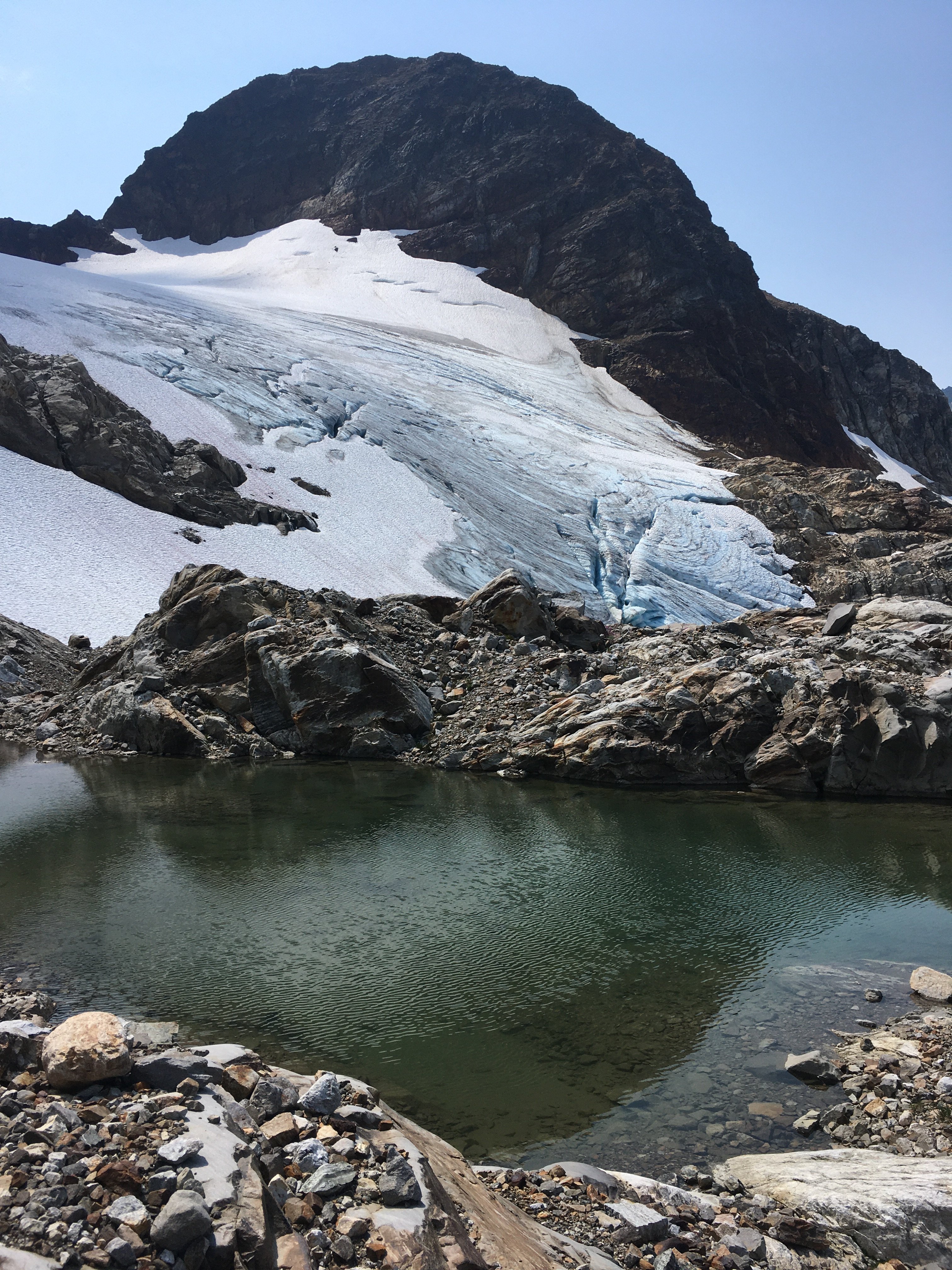
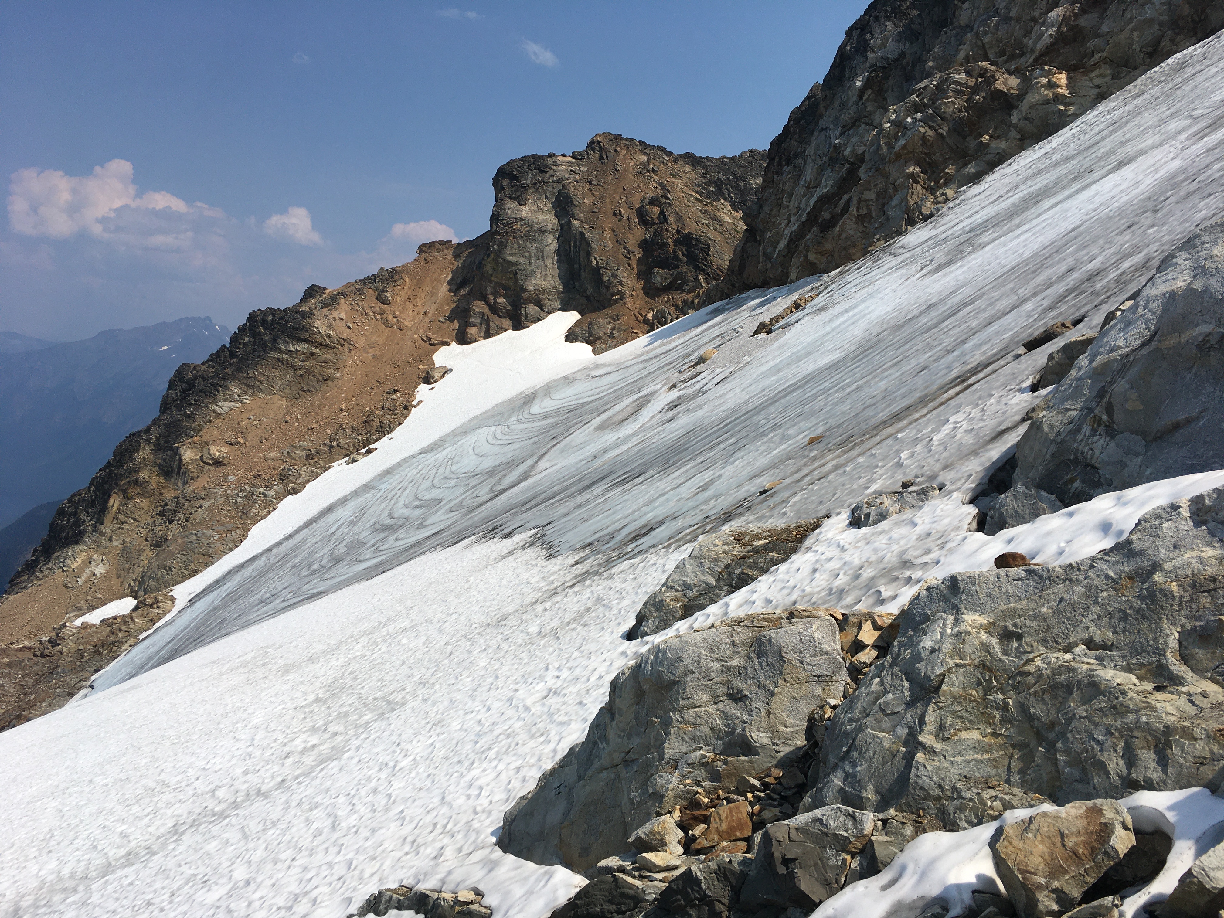
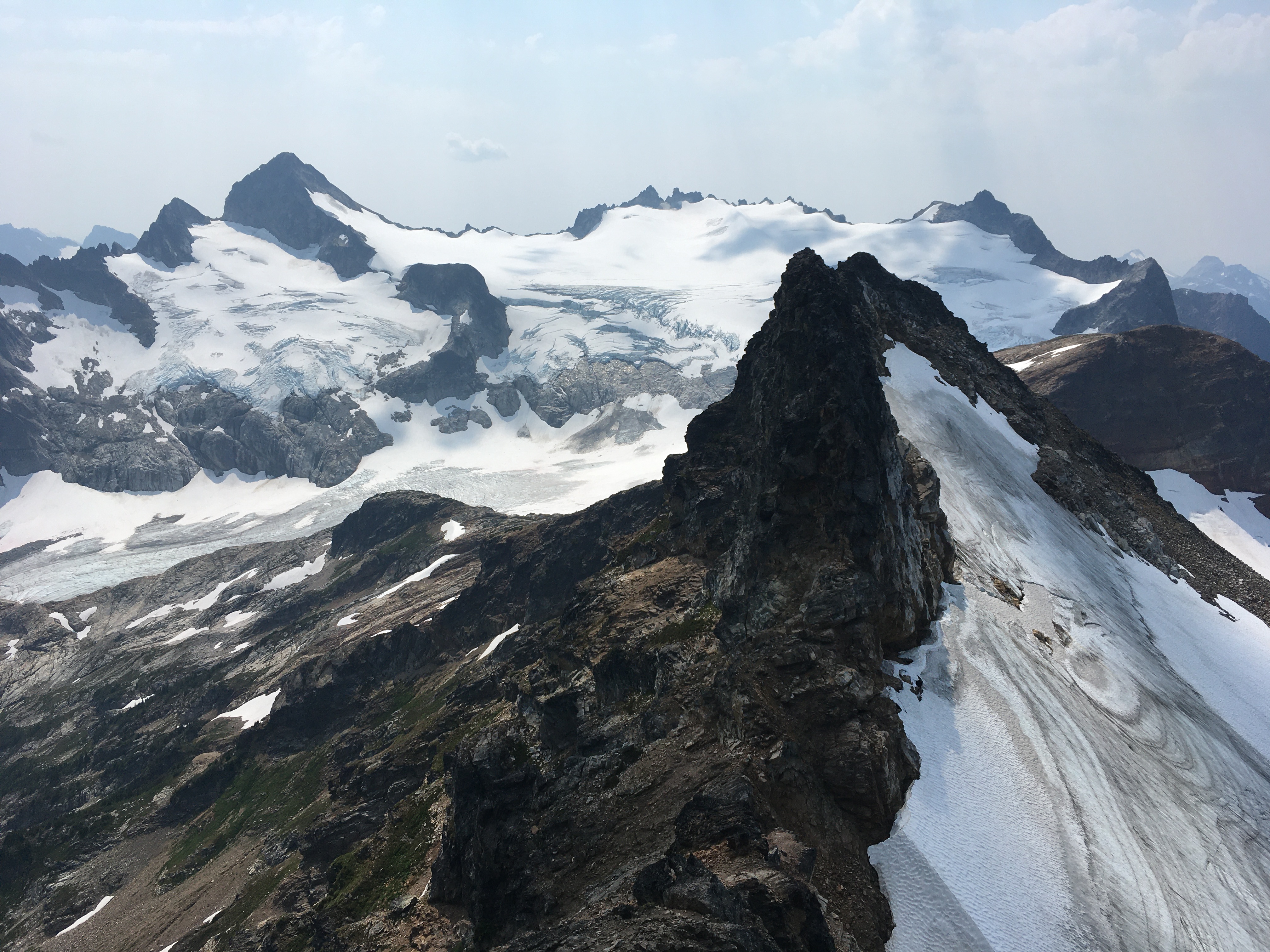
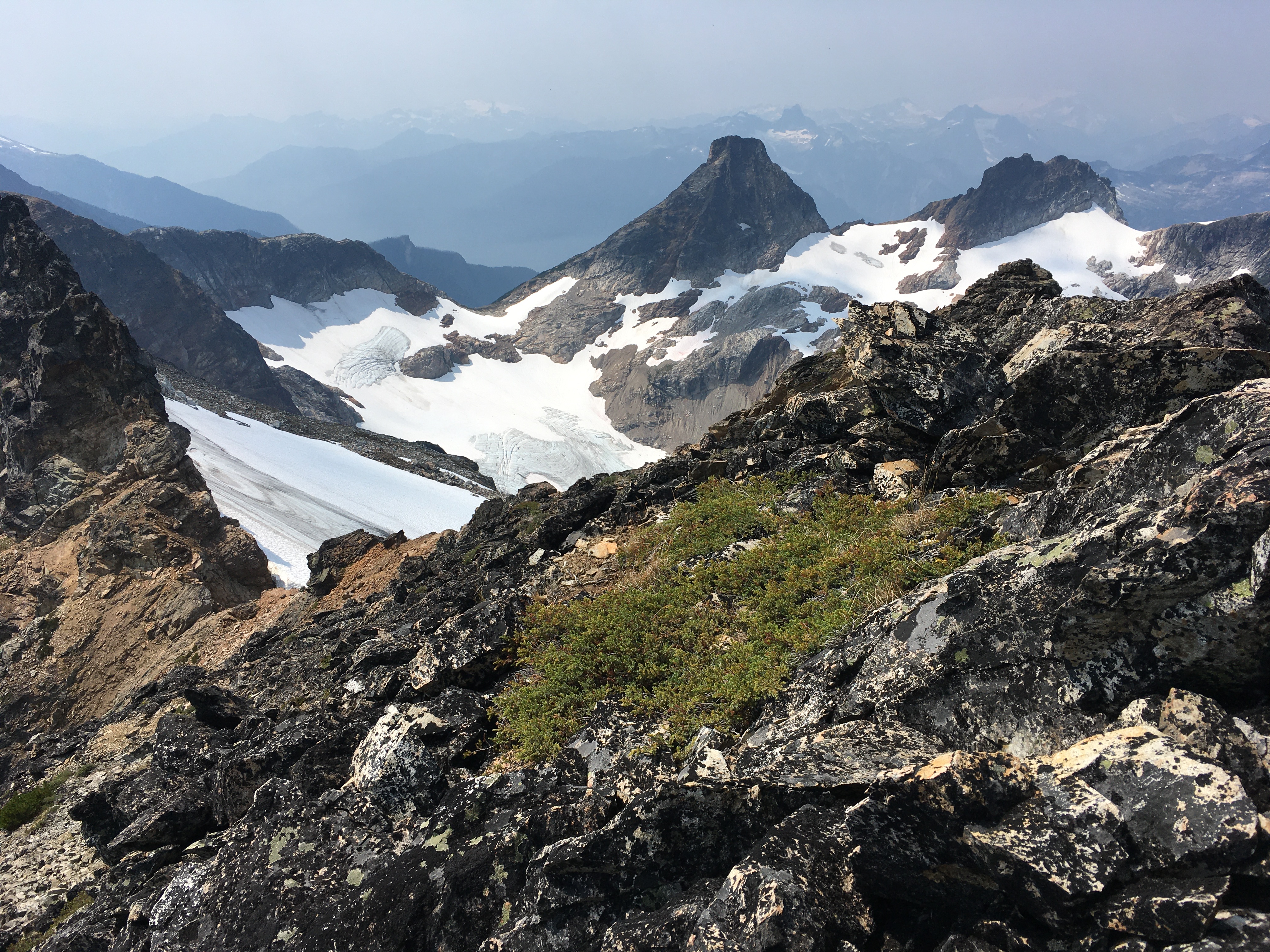
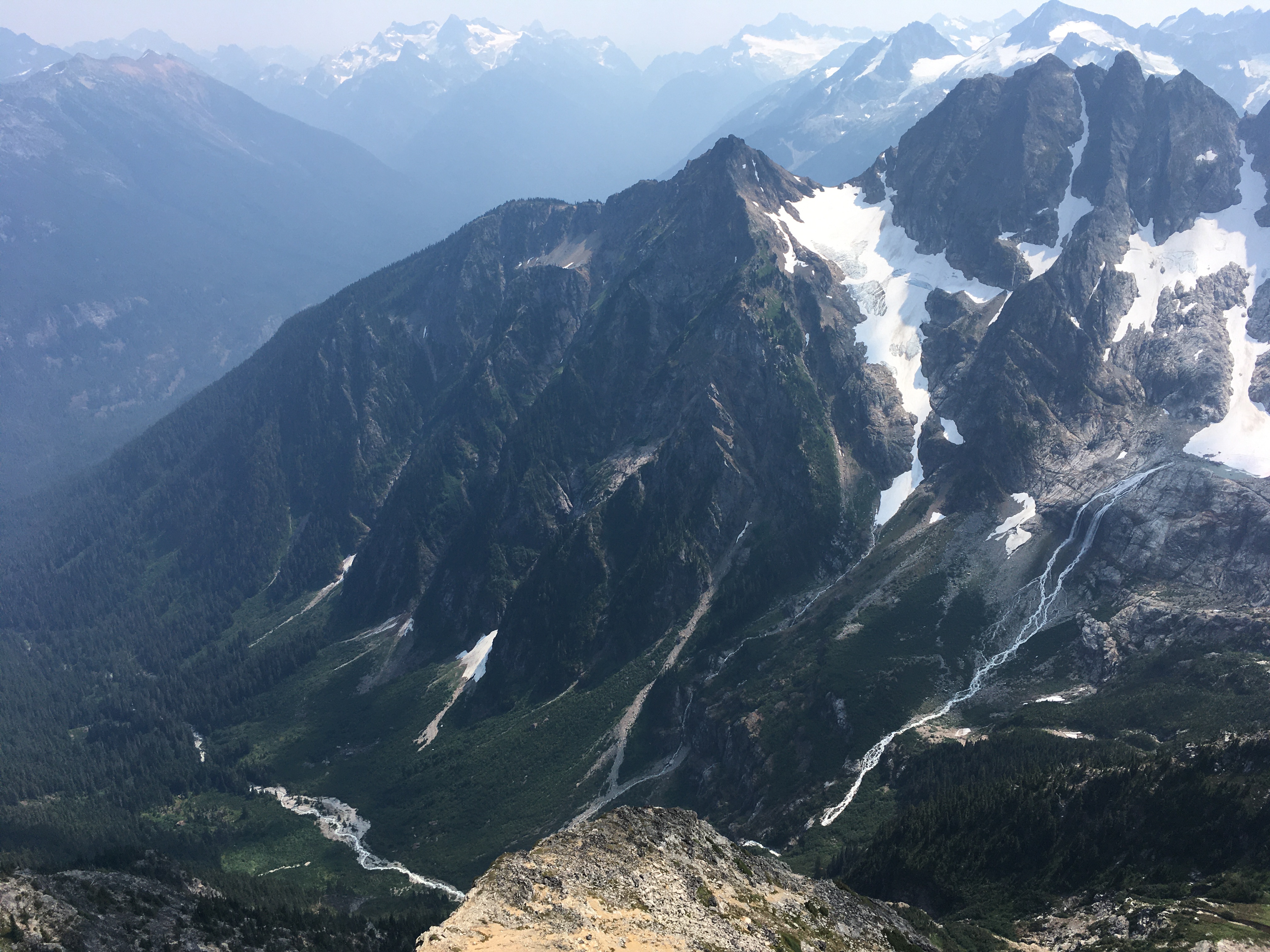
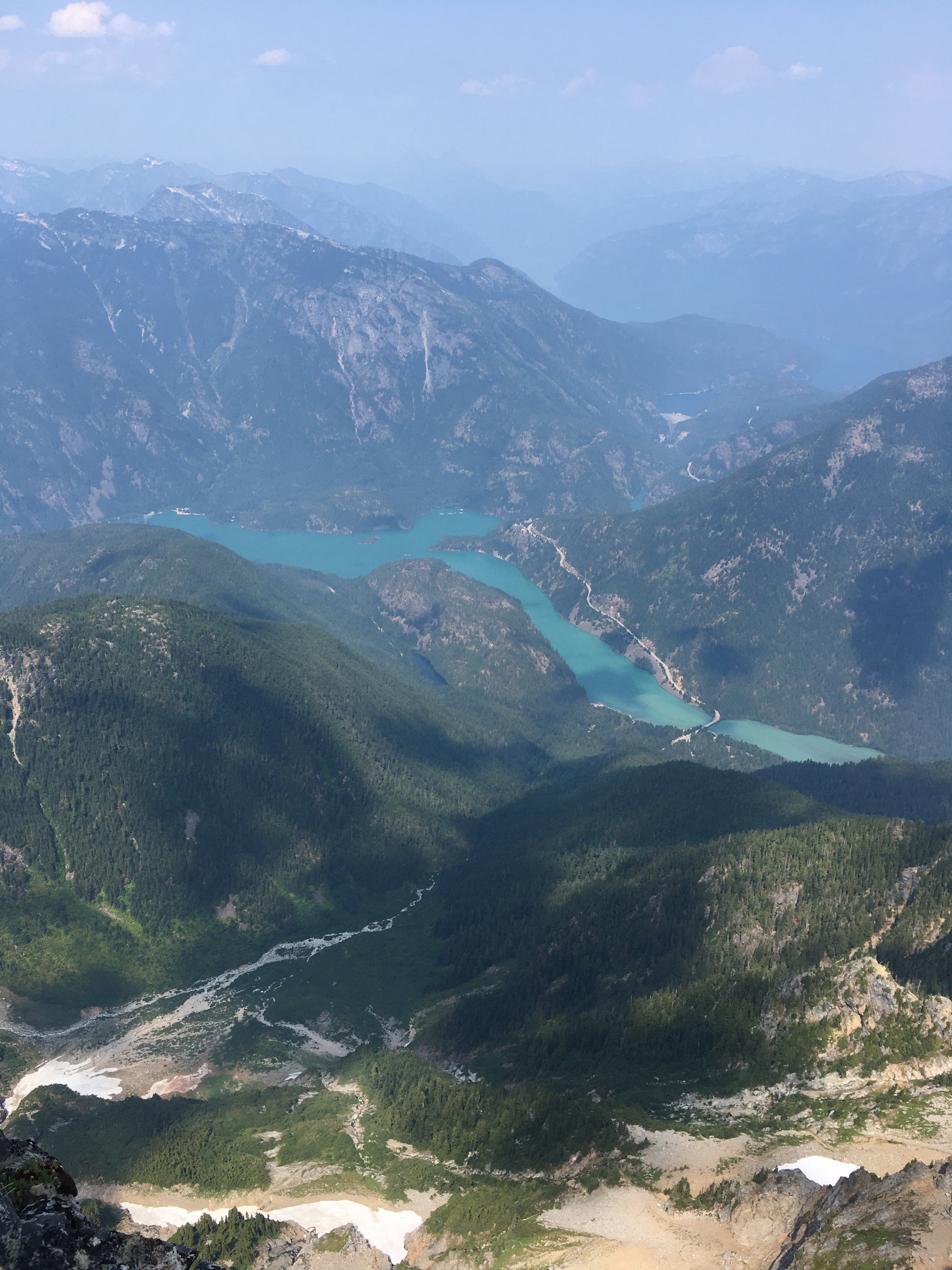
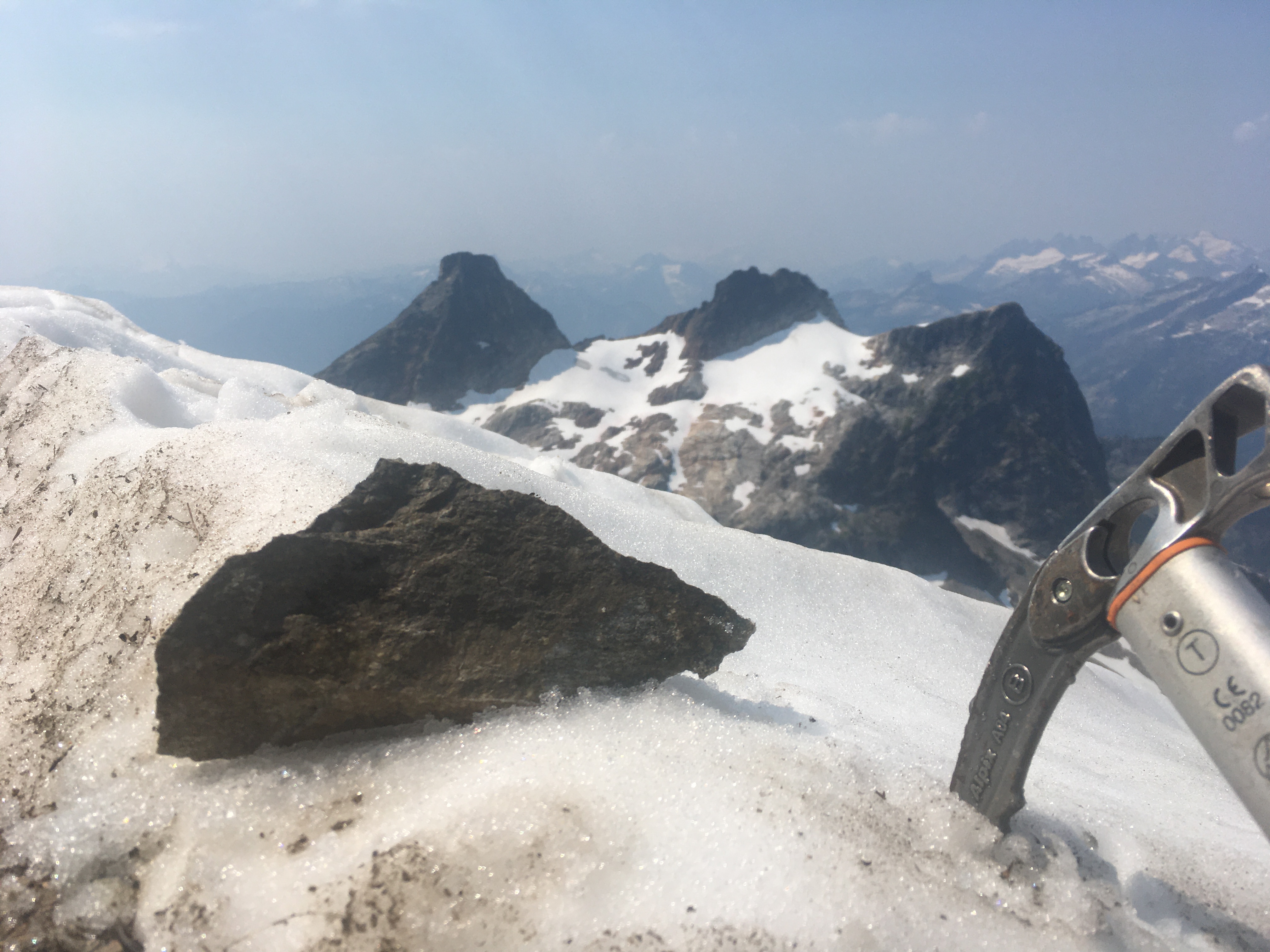
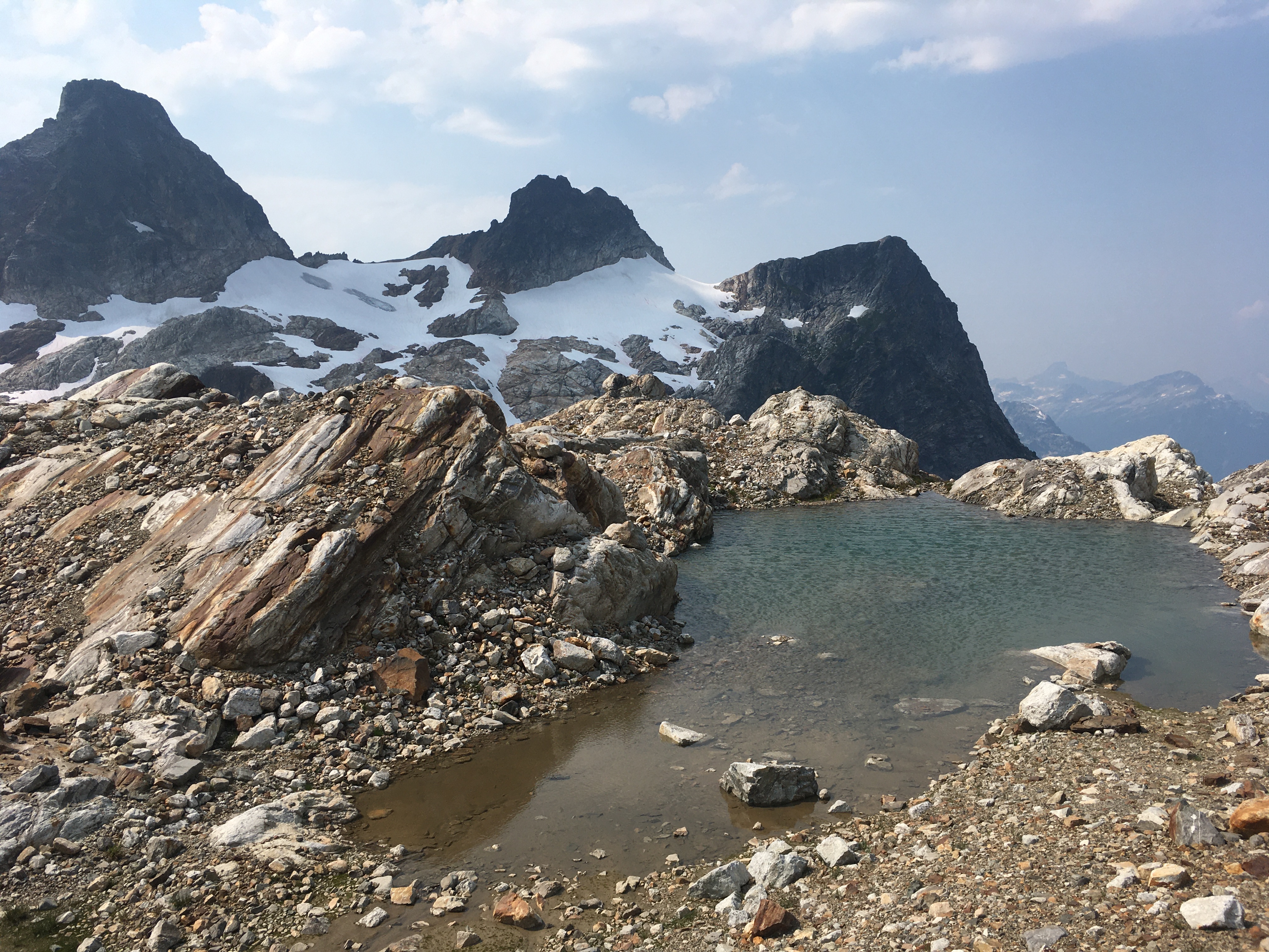
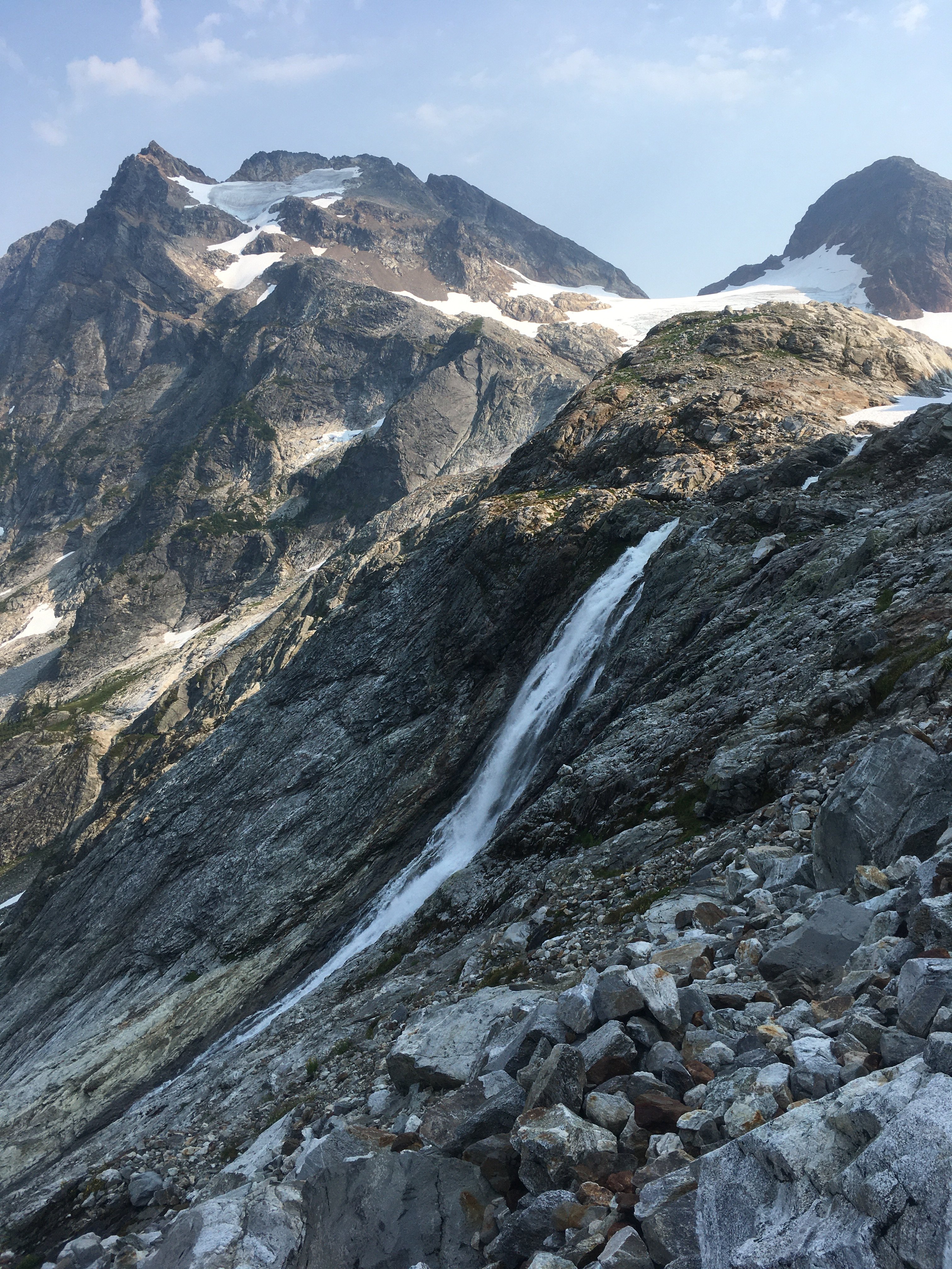
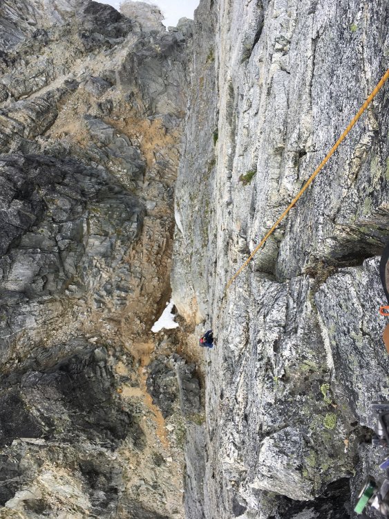
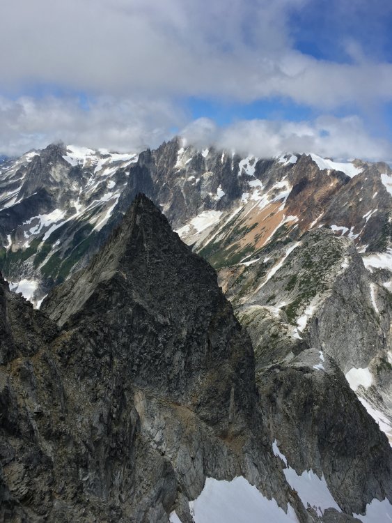
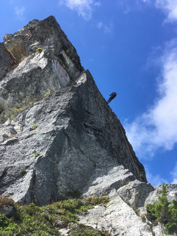
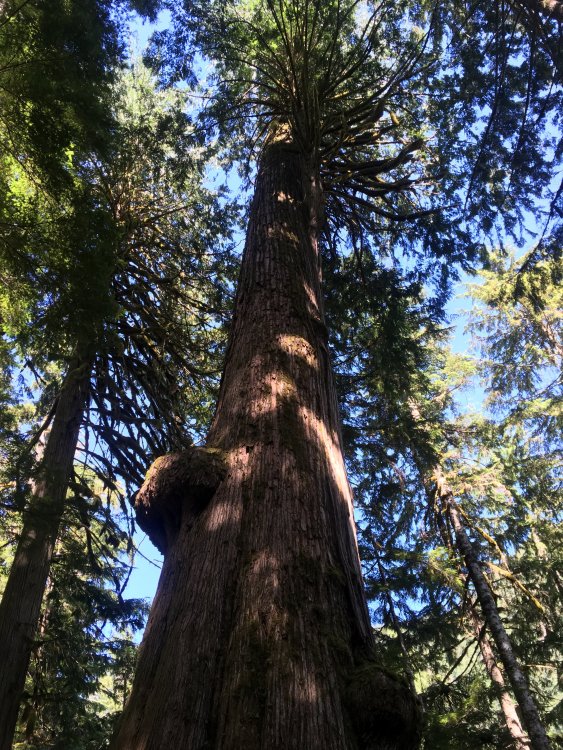
Trip: Logan and Goode - Douglas and NEB Trip Date: 07/29/2022 Trip Report: I wrapped up my 37th orbit with a loop from Easy Pass to Bridge Creek trailheads, climbing Logan via the Douglas and Goode’s NEB. Storm King was a low priority option going into the trip and didn’t make the cut. I had the pleasure of excellent conditions interspersed with horrible shwacking and a death march to conclude it. In many ways the timing couldn’t have been better for me. I sprained my ankle less than two weeks prior on the way to Fury. In the first hour afterward I was worried that most of my summer masochism would need to be cancelled, but hobbling back towards Luna camp, with vitamin I kicking in, I started to suspect the injury was not that bad. It swelled more like an orange than a grapefruit. I was game for Jacobs Ladder on Prophet the next day, which was welcome consolation for missing out on what I’m guessing was an awesome day for the NE Buttress of East Fury. Fast forward to a few days ago, I haven’t tried foot jams yet, and would like to avoid them, but walking feels fine. So a route with endless blocks and ledges sounds like just the ticket. Just needed to not twist it again in the many miles of trail-less travel. Besides my ankle I was also concerned about the heat. On the one hand I got away with not taking a sleeping bag. I always travel with a puffy and wool hat. I supplemented this with long johns and was just barely warm enough at night on a mat in a bivy sack. On the other hand, the heat obviously made things kinda brutal. For beta and inspiration for this loop I used Hiking down easy pass to Fisher was pure joy. This was the location of one of my first hikes in the N cascades, probably 12-13 years ago, getting my denim soaked in the brush. It’s actually more breathtaking than I remembered, was great to be back. The fisher creek crossing was briefly disorientating because there’s more water than land in the zone, with pools and twisty side channels everywhere. I gradually found my way moving south along the east side of the creek feeding into Fisher (presumably Douglas creek? I don’t see a name on the map). The ground was dry and relatively open and easy. There’s lots of huge erratics in this area. As I approached the the “pill box” from the summitpost description I chanced upon dry stream beds that I followed upwards. The maple+alder made for good hand holds without getting in the way of my feet. I thought this might have been a shortcut vs the TR I referenced, but after topping out on the other side I found very thick and young evergreens and chest high brush. Progress was slow here but at it was another beautiful scene down near the creek. It’s hard to say whether or not I found the path of least resistance. Finally free of the brush, I headed up snow and rock, trending right. I came across bear tracks in the snow and filled up at the last spot for flowing water that I could see. I arrived at the bivy col at about 6pm, which was later than I liked. But it was a good thing because it meant shadows were now extending down the Douglas, cooling it down. Some of the crevasses are quite large. But there was a fairly direct path through them and I felt good about the firming snow conditions and the gentle angle (<30 degrees?). The swale at the top of the glacier is a really cool feature. Looks insurmountable at first, but I found an easy way on the right side. I then cut back left above one more crevasse to gain the ridge (a little steep here, don’t fall in). The scramble to the summit is pretty fun, good rock for a Cascade scramble. The views speak for themselves. I slowed significantly near the summit both ways due to some really stubborn cramps. I carefully followed my ascent path on the way back down to the col, getting there just before headlamp time, with incredible purple views of Goode. It was a 12 hour day. Two pairs of eyes were reflected in my headlamp as I got ready for sleep, but they were far enough away that I couldn’t tell what they were. I left the col a little after 6am the next morning. The TR I linked earlier had me expecting smoother sailing than the day before. That turned out to not be the case. Descending the basin above North Fork wasn’t too bad, though I don’t know if I was always on the easiest path. I wonder if the ‘magic staircase’ was flowing instead of dry, because I don’t think I found it. The worst part was lower in the valley. I could find bits and pieces of a trail, but it’s very faint and overgrown. Occasionally I’d lose it and end up in the worst shwacking I’ve ever encountered. Walls of alder with a foot of water underneath. Feeling actually stuck. The other TR doesn’t mention this at all, so maybe better route finding makes this avoidable. I don’t think I lost more than an hour here but it was certainly terrible. The north fork ford was only knee high but very swift, wasn’t easy. The route up to Goode glacier looks improbable from below. Pretty cool how it comes together. The snow-rock junction is in good shape at the start of the NEB. It’s exposed and dirty getting up to the notch (took me a while to find a safe way) and the stone was burning my hands. But from the notch to the summit is awesome, and pretty well shaded. There’s a super knobby slab at the start. Unfortunately it doesn’t last long but what comes afterward on the ridge proper is solid, blocky steps as far as the eye can see. I was reminded of a slightly less steep version of the upper half of the NW face of Forbidden. As I climbed I couldn’t help thinking how surreal it is to be in the exact moment that you’ve thought about for years. The ridge steepens at 8400’ and I hit one dead end, with about 10 feet of rock that was too steep and featureless for me to solo safely. I backtracked down the steep face to the left and found a bypass that allowed me to regain the ridge. As is so often the case with ridge climbs, there are occasional dirty ledges that can make sections easier, but the best climbing is on the ridge crest itself. Aside from this one bypass, I stayed true to the ridge the entire way to the summit. I passed a party of two maybe ½ way up the ridge and other party of 2 just before the summit. I got there a little before 5, for a 10.5 hour day. The next party arrived shortly after and later in the evening the lower party arrived. Everyone was nice, we chatted about climbing and spent the time pointing at and naming all the crazy stuff you can see from Goode. We squeezed all 5 on the summit that night (one of the spots looked pretty gnarly, 5 is a tight fit). I heard there was a guided party that day too, so 7 people in all on the route that day. I started to feel sick when I arrived at the summit. I think it was mainly due to the heat. This was a bummer but I gradually improved and took in the sunset, then the new moonset, headlamps down in the valley SW of Goode (night hiking?) and a couple of fuzzy shooting stars. The notions of up and down that climbers obsess over started to lose meaning while staring into space with hypnogogic mind setting in. The next morning we all got a leisurely start. I started my day popping my head up for a view every few minutes in between a few last sips of sleep. I left the summit at 7am, just after one party started rapping. I downclimbed (5.4?) to the highest snow patch (plenty of snow on the route right now BTW) as I had run out of water. I melted some for a freeze dried breakfast then made my way skier’s right up a ramp leading to the notch. It was here that I got to really test out my lightweight rappel system that I assembled after some online research (I did a short sanity check in town earlier). This was <$100 and shaved 3 lbs and I didn’t die. The second rap got me a ways into the firm snow finger on SW side of Goode. I used my light axe with a good bite (found on Quien Sabe some years ago), crampons strapped on to approach shoes, and my pole in the other hand. It was face-in downclimbing to some gross dirt-choss, then more face in walking backwards down steep snow. I paused to look at Storm King and estimate time. I guessed that going for it would mean getting back to the trailhead around midnight. Realistically, if I wanted to climb it, I would have had to do the Goode descent the day before. But it was more important to me to enjoy the summit of Goode than to tag another choss pile, so I was happy with my decision to skip SK. Maybe I was jaded from the shwacking the previous two days, but the way down the burn wasn’t as bad as I was expecting. I had downloaded somebody’s GPX and it was pretty helpful. I think this is another section that’s only semi-intuitive. I thought I would find running water on the other side of Goode, but didn’t. I descended the burn around noon with temperatures soaring and my water run out. Probably downed a liter in couple minutes at the first stream back on trail. I didn’t keep track but I’m guessing I drank about 2 gallons of water throughout the day. I also had less than 1000 calories because my body wouldn’t tolerate the bars I had remaining (again, likely due to the heat). At the end of the day I think I counted 4000 uneaten calories in my pack (that should have been eaten). I guess I need to revise my nutrition strategy for trips like these. The hike out is a blur given my nausea and the heat. Dipped at park creek (delightful!). The bridge at Bridge creek is another fantastic scene. One of many in this loop that I wish I had more time to savor (honestly, 4 days would have been more fun, though any exit from Goode seems inherently awkward logistically). I also remember one giant cedar on the trail, some cool bluffy terrain, and the suspension bridges were a fun surprise too. On the rare occasion of a cool breeze, I felt like I was drinking water through my skin. I filled up one more time at the last major creek >8 miles from the road and met up with one of the parties I shared the summit with. Together we blasted out the next 5 miles, took a short break, then made one more push for the car. Even in my approach shoes my feet were just starting to get medium rare by the time the hike was finally over. I had a bike at Bridge Creek TH and a bike light, but since it was getting late (finished at 9pm for a 14 hour day) and I was depleted, I happily accepted their offer to drive me back to Easy pass. Thanks Hank and Steve! Gear Notes: Approach shoes, crampons, one axe, one pole, and a rappel setup worked for me, but this means unroped glacier travel and low 5th soloing. Approach Notes: Hard to say
-
Wow! Incredible photos
-
Awesome! Getting onto the rock from Forbidden glacier is no joke.
-
-
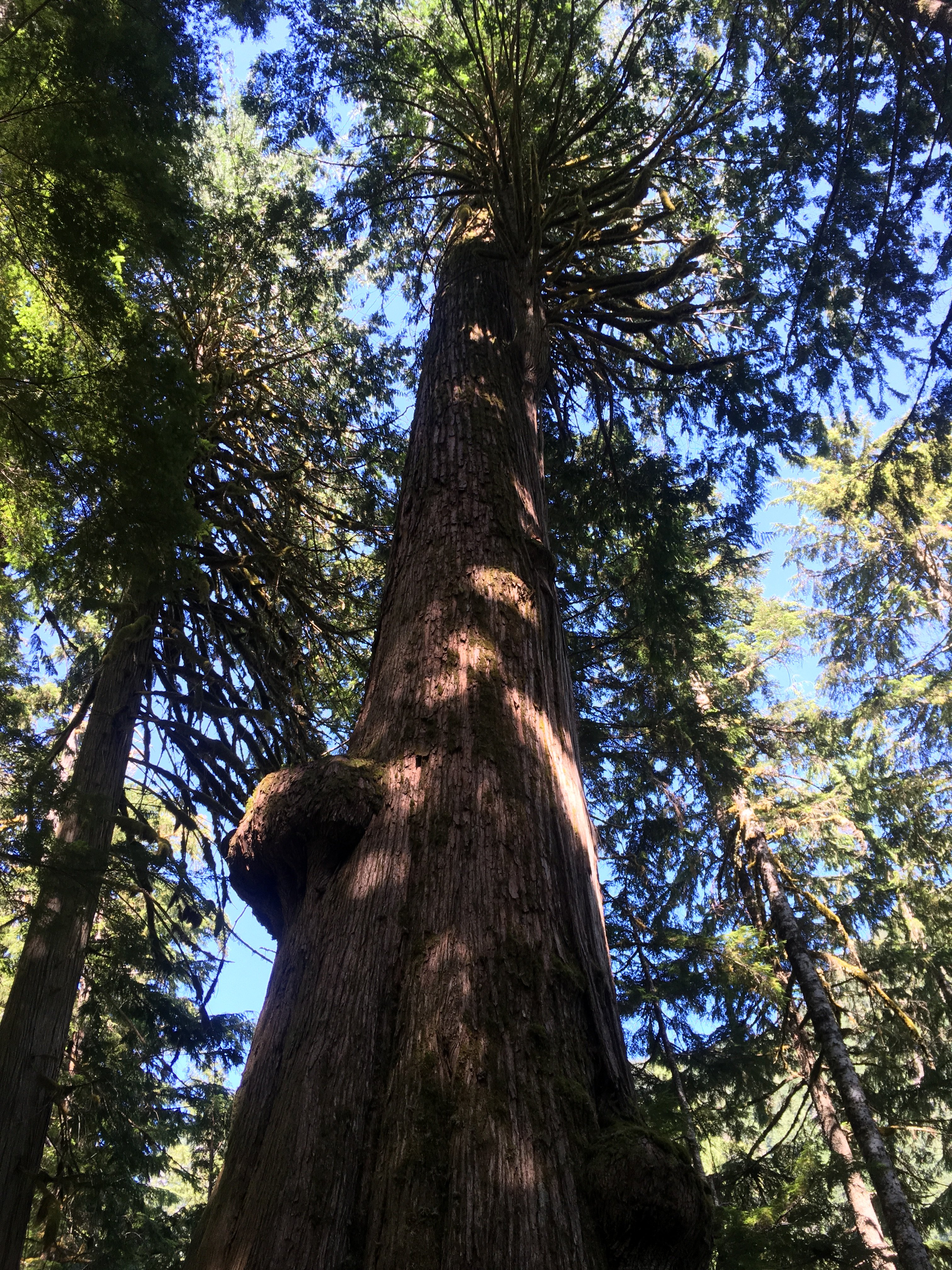
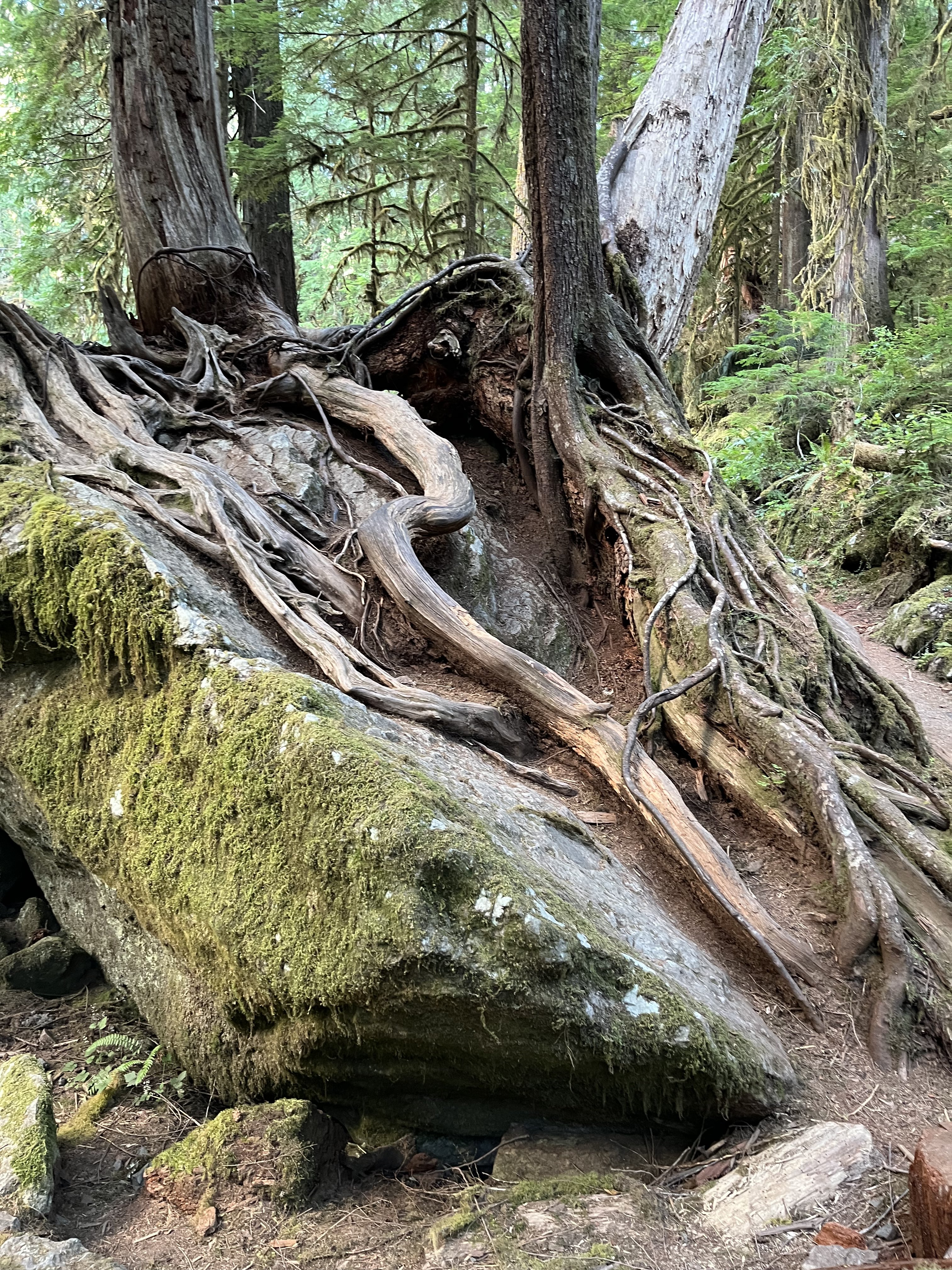
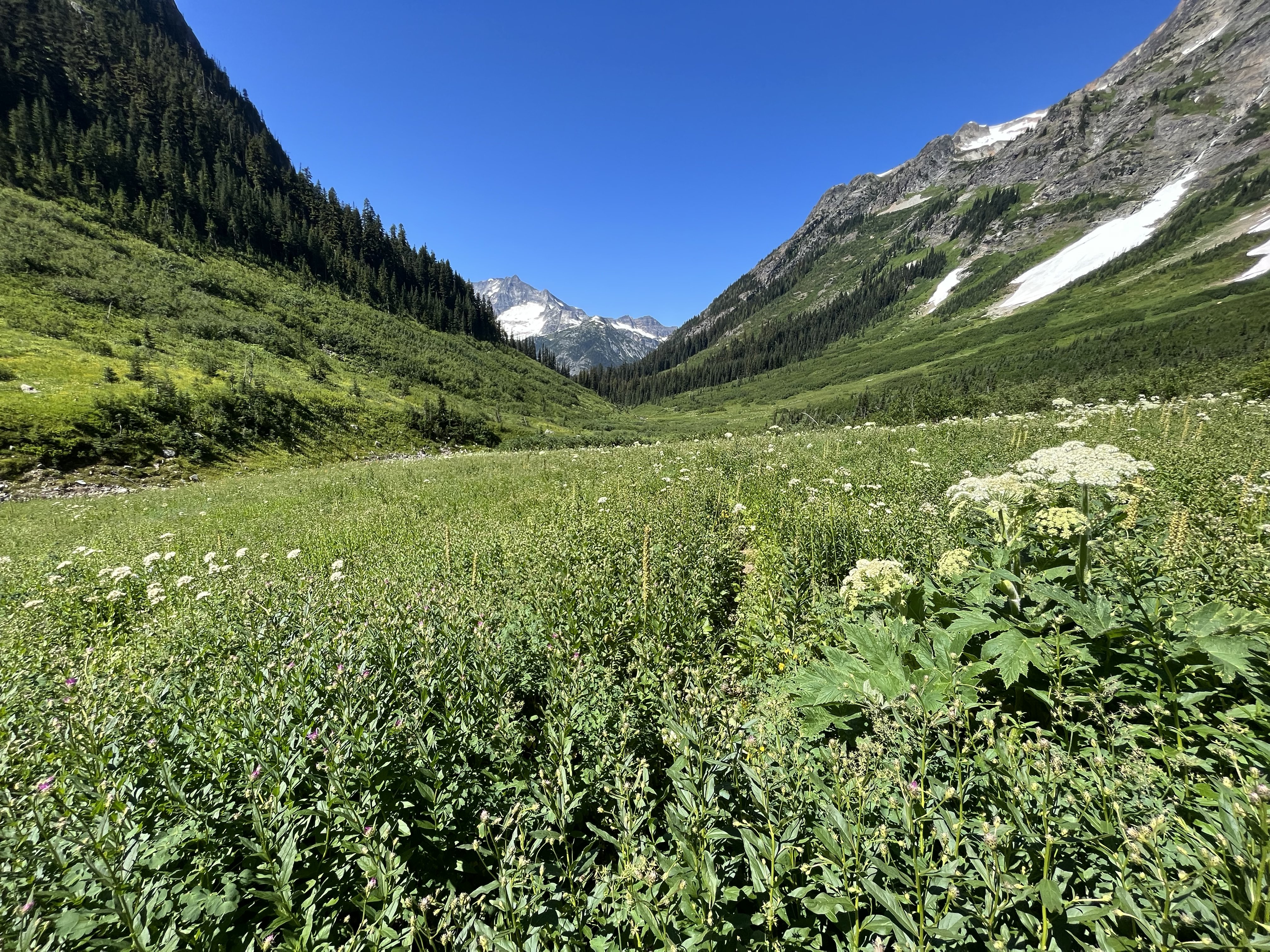
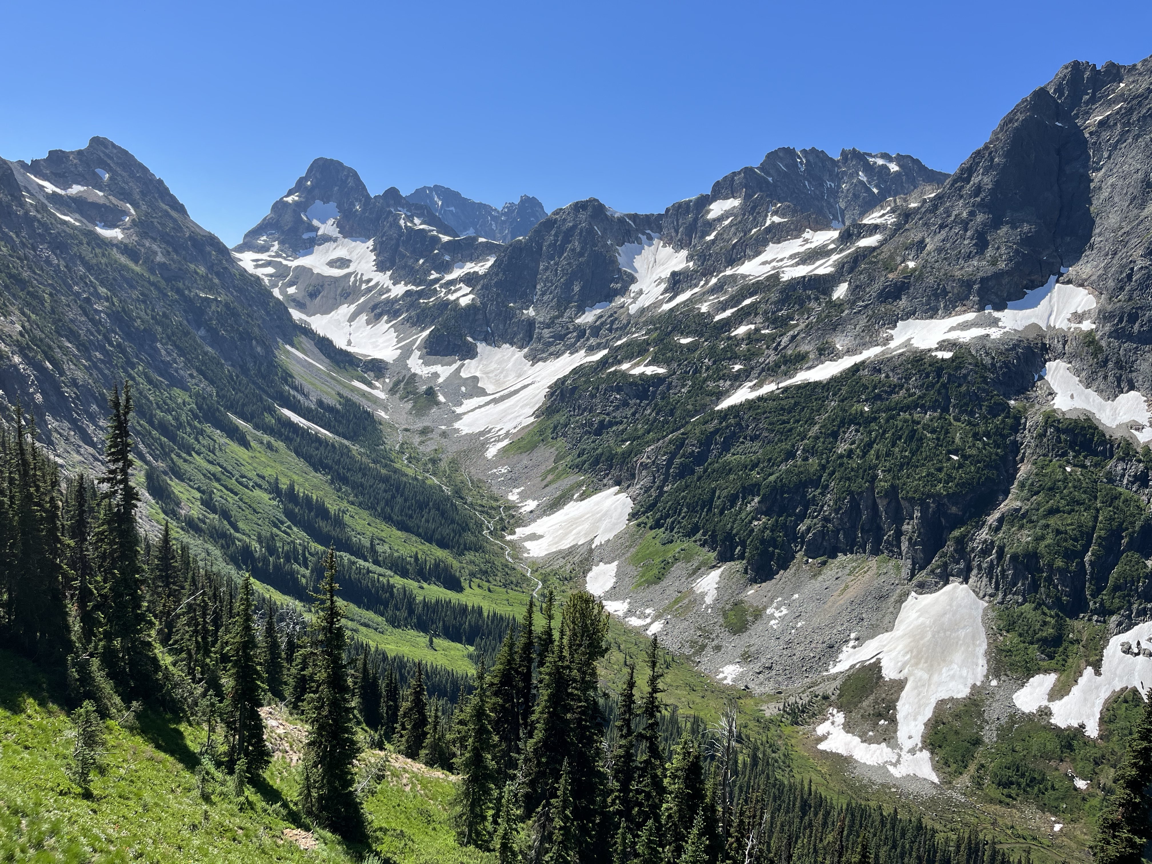
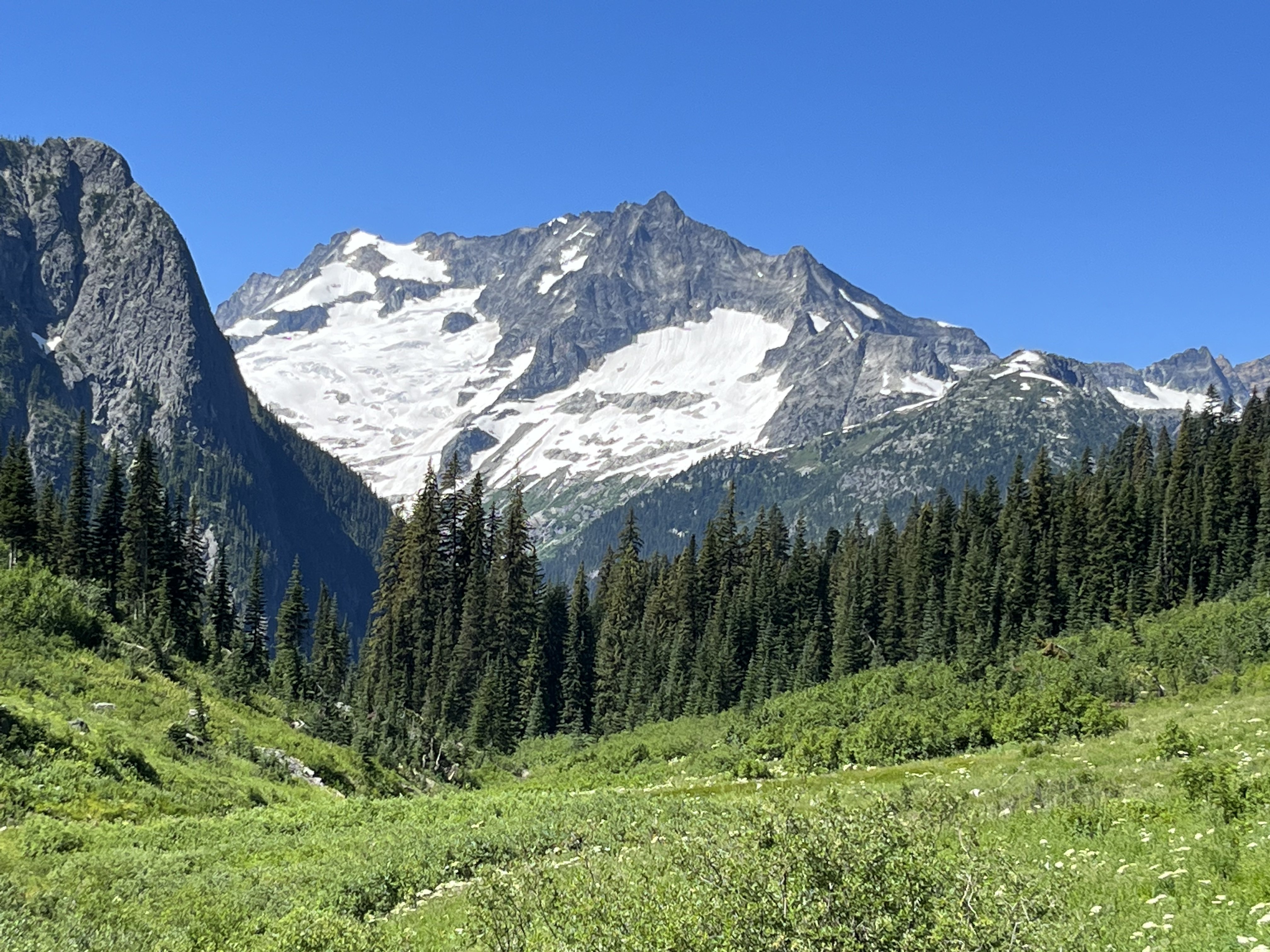
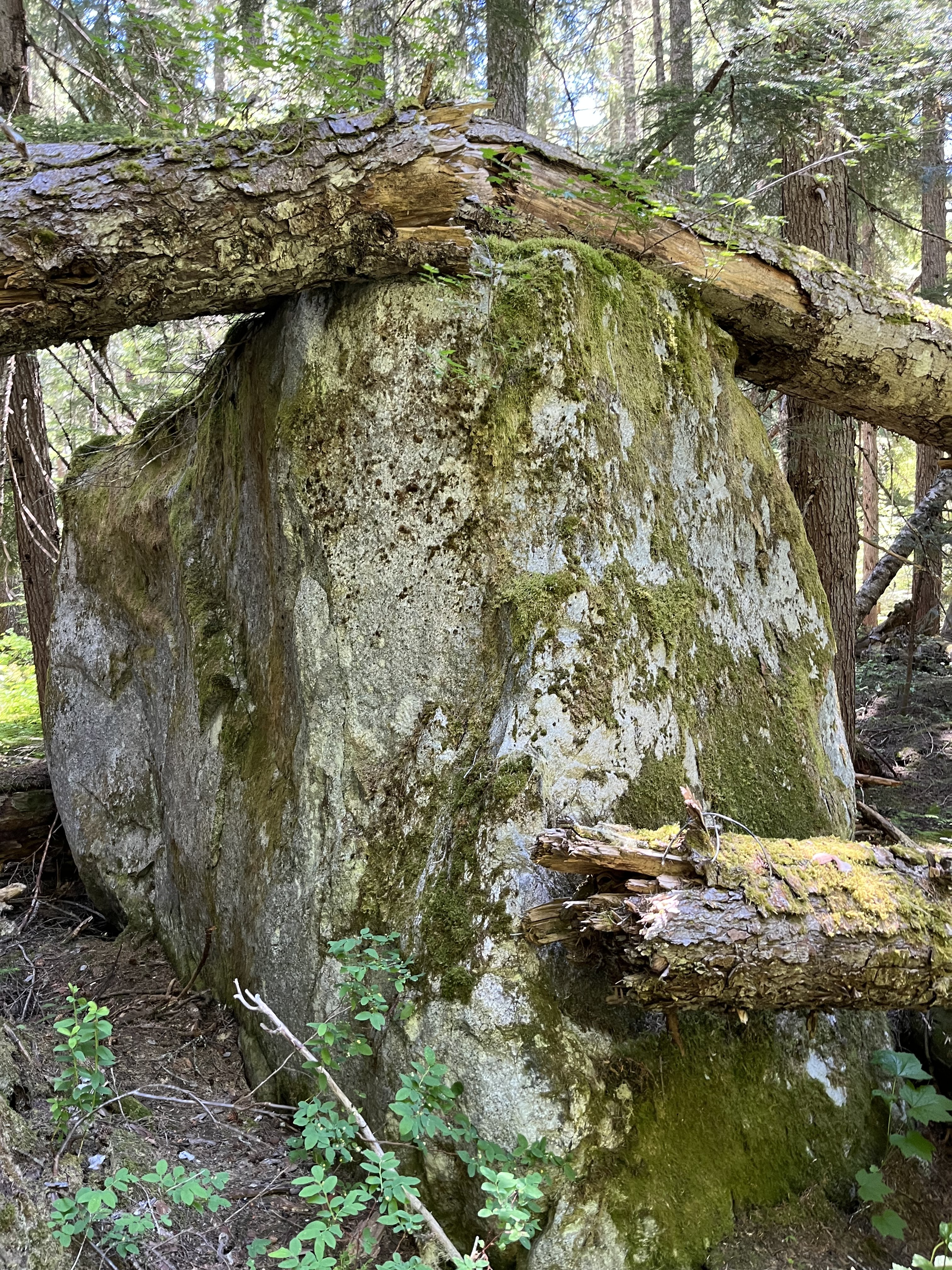
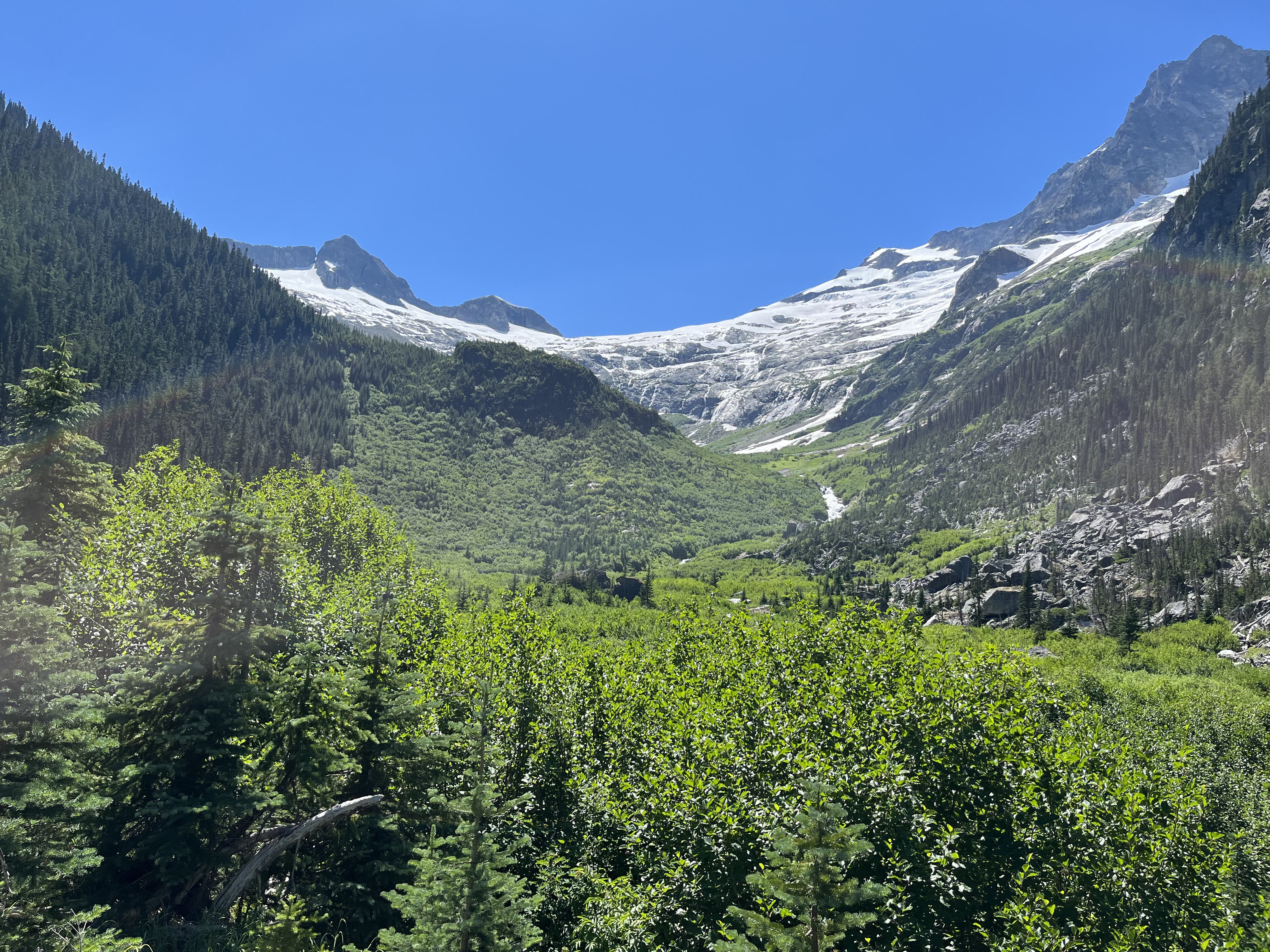
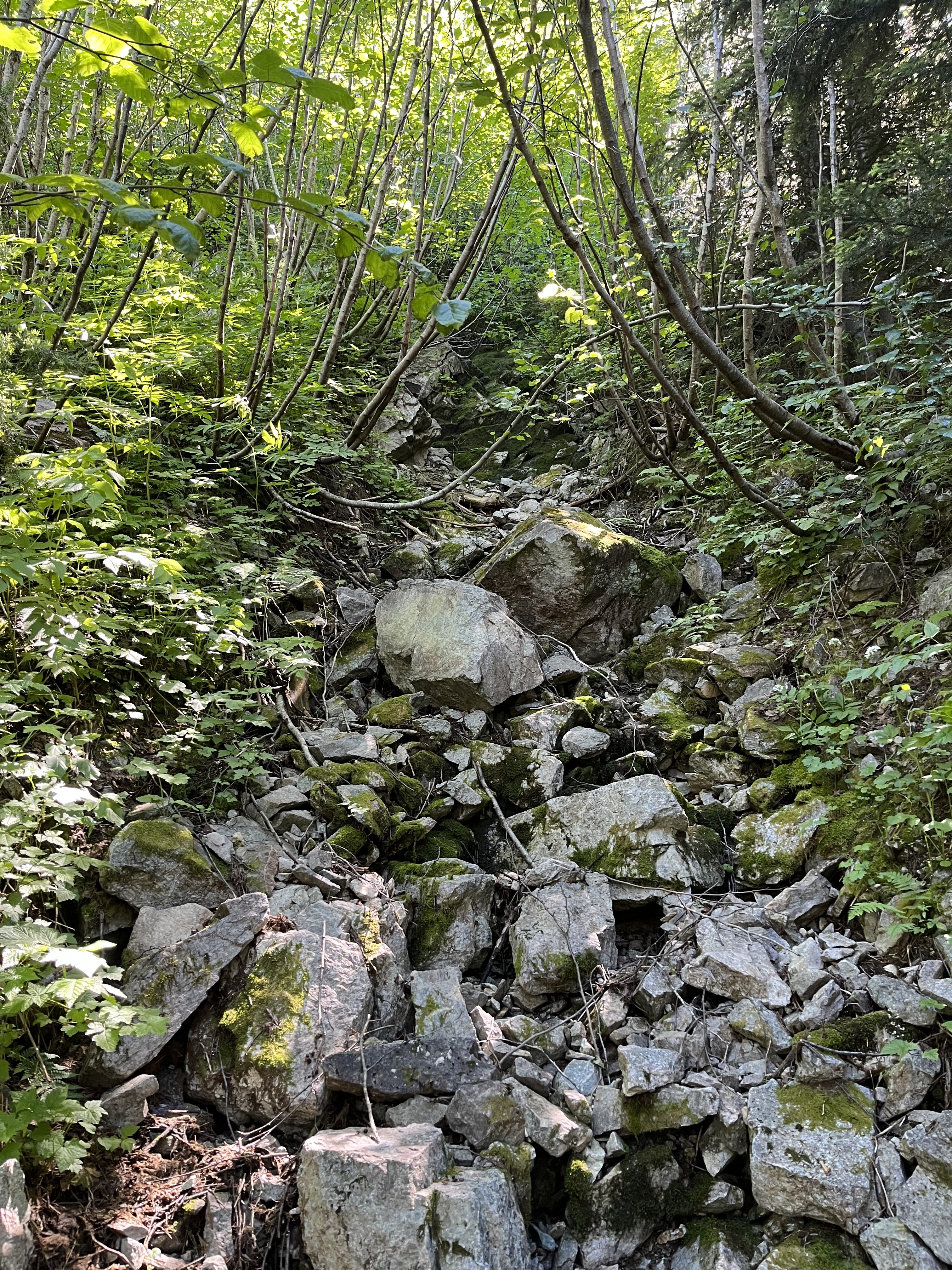
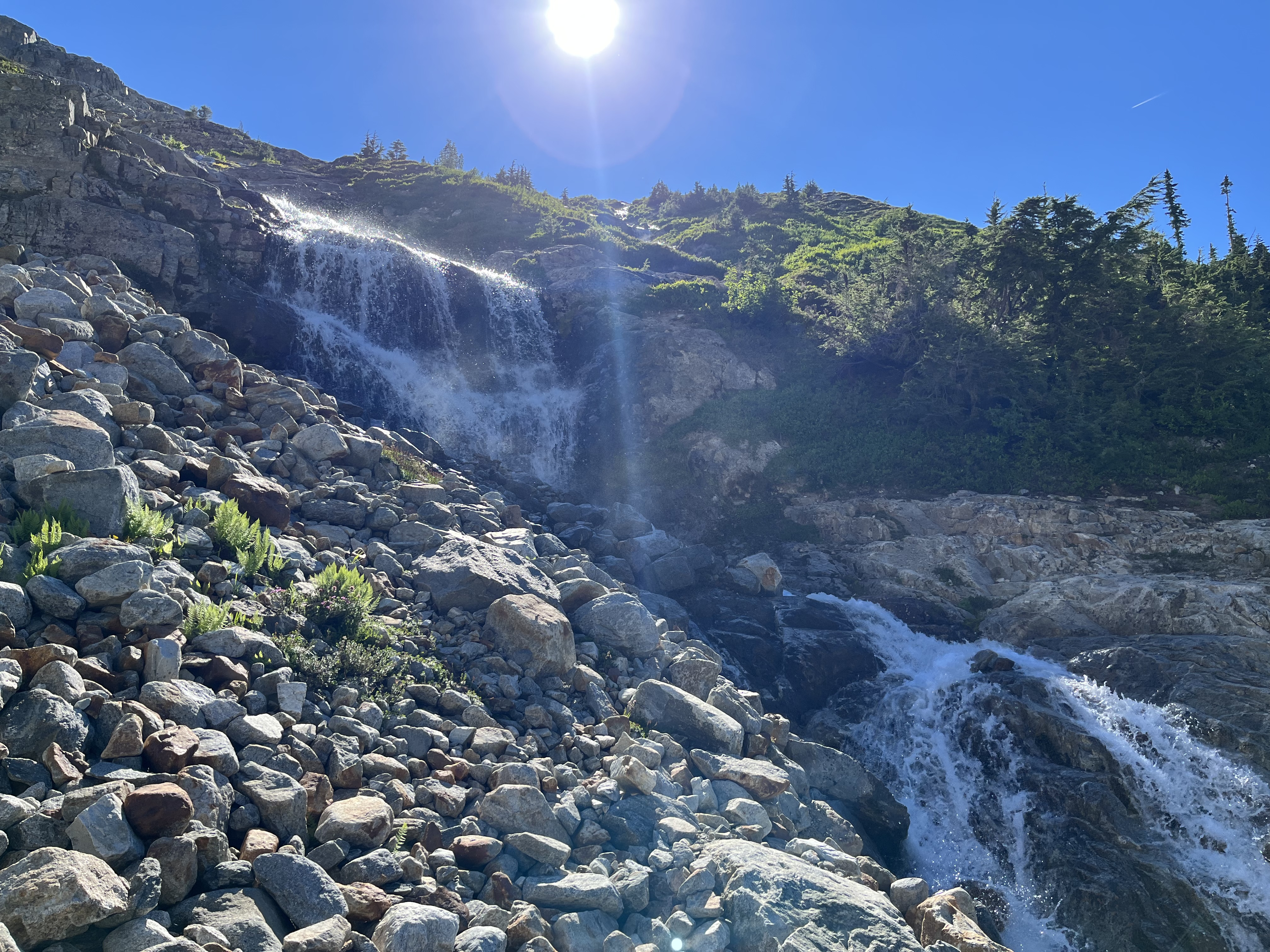
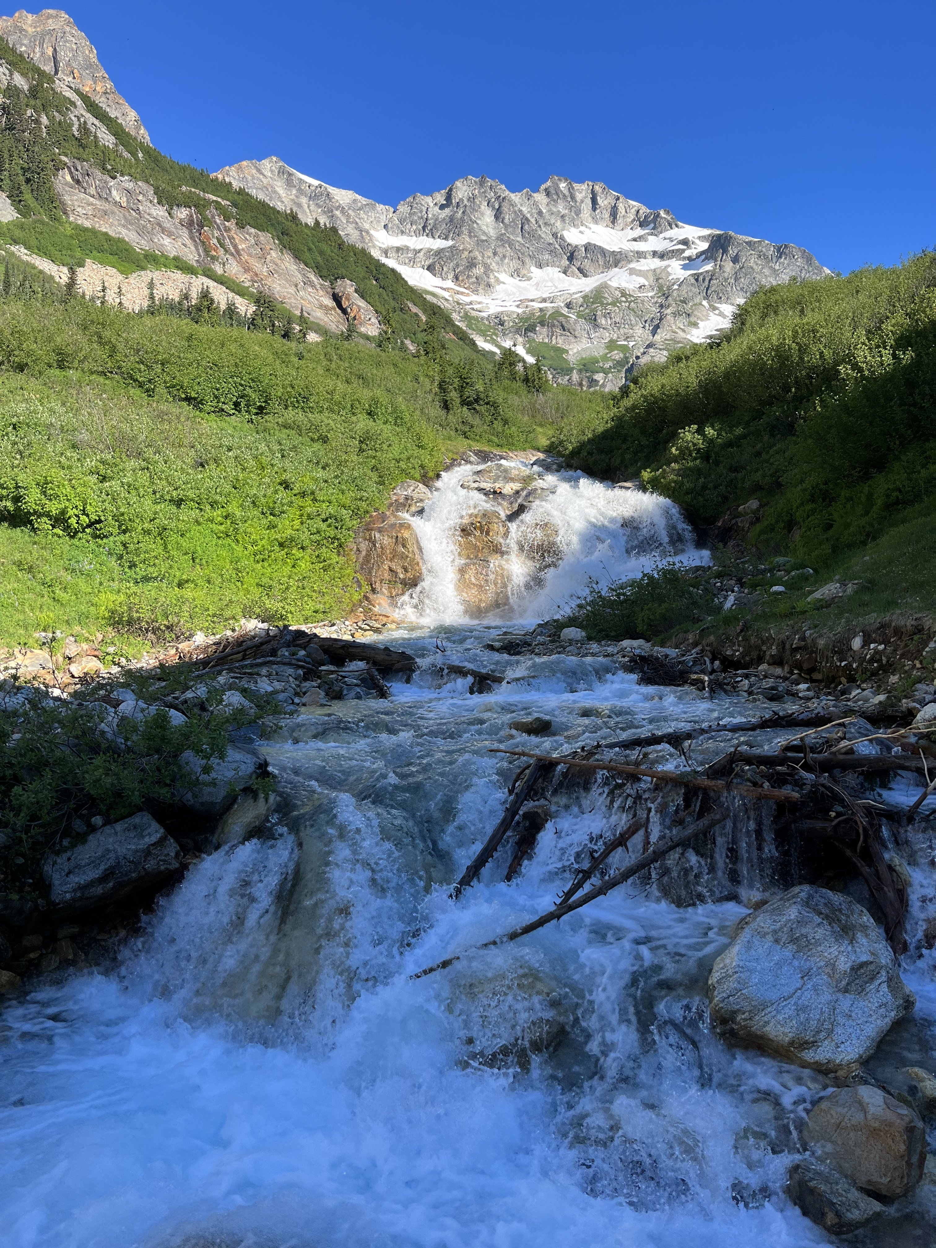
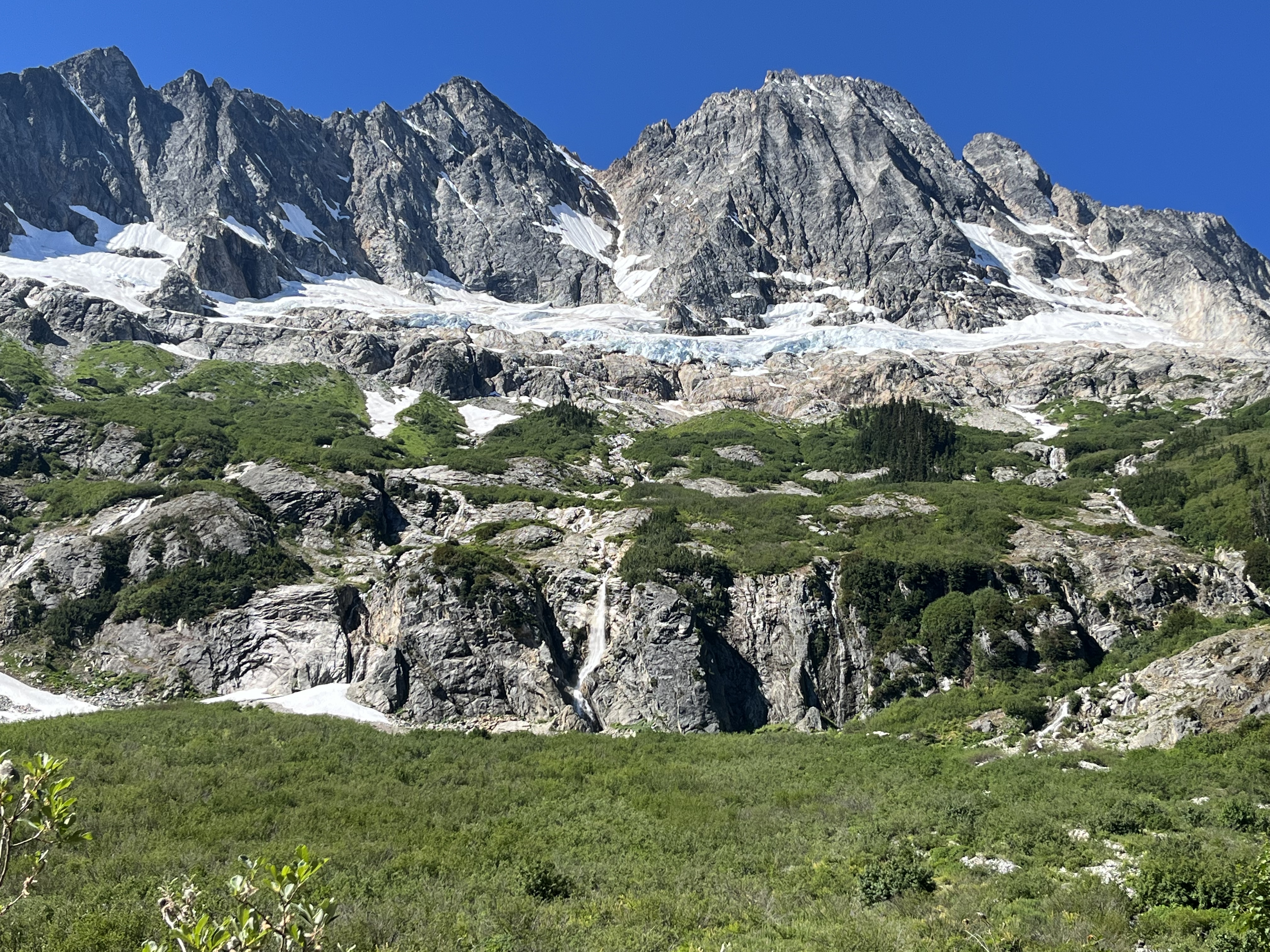
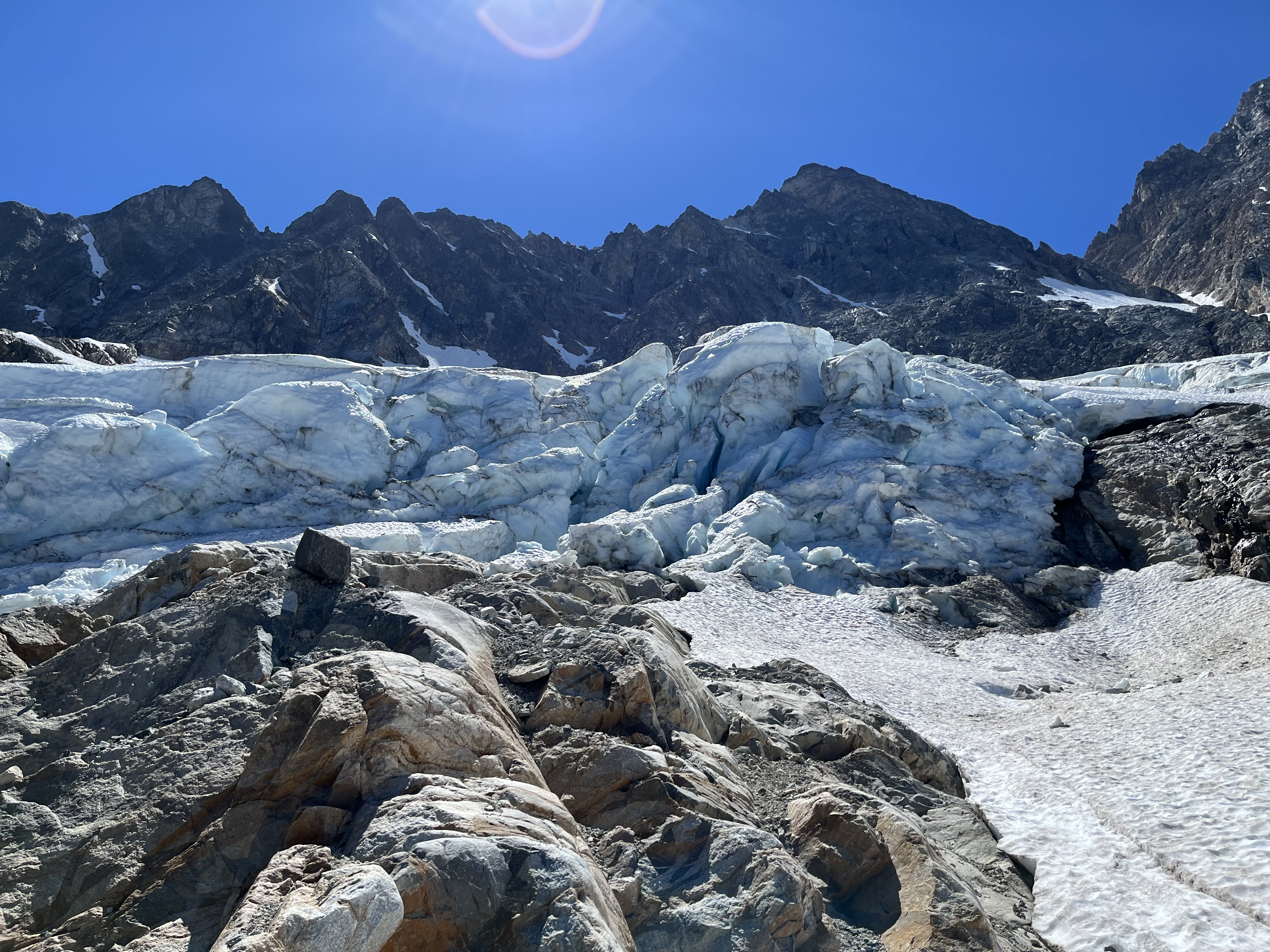
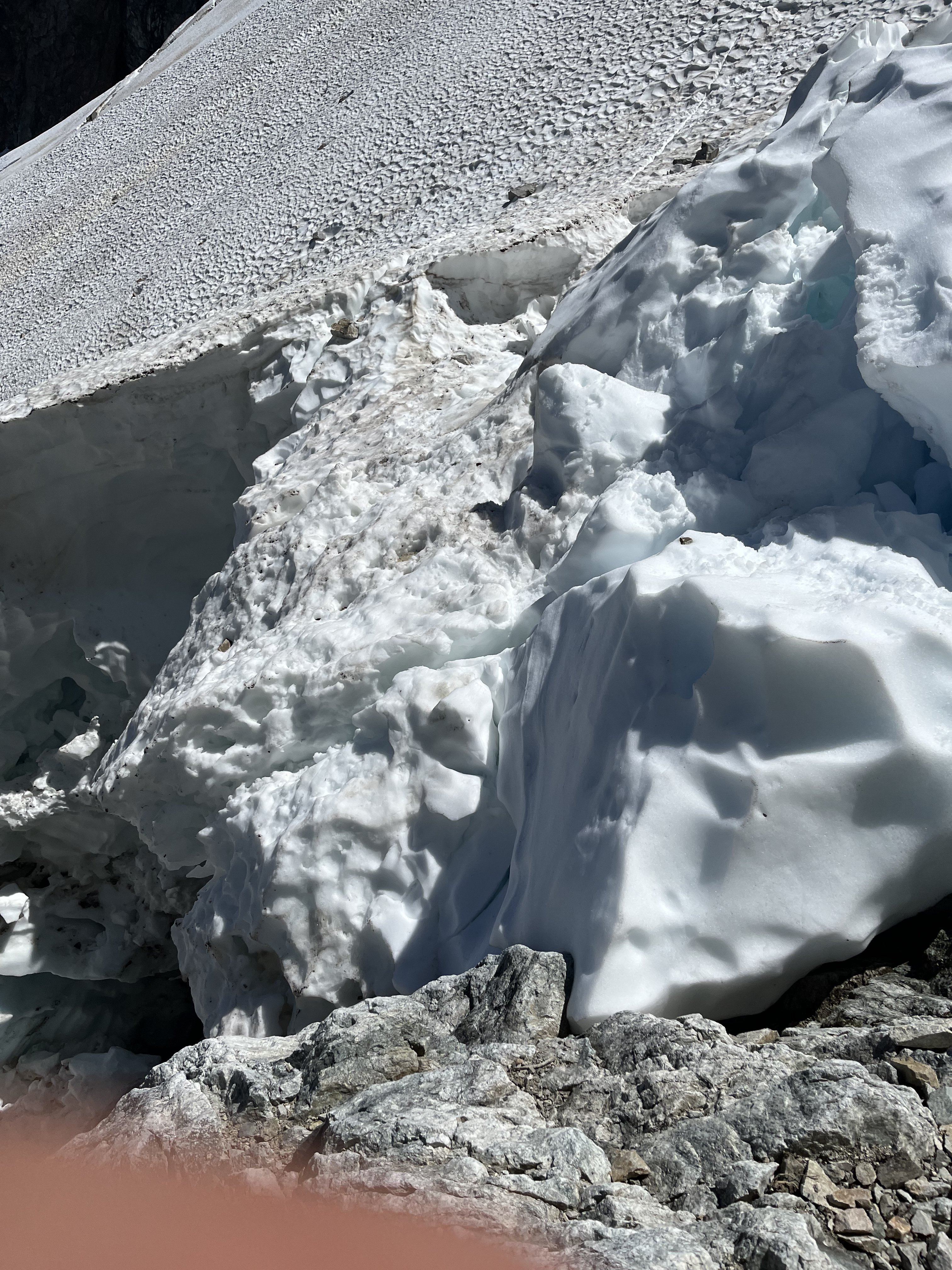
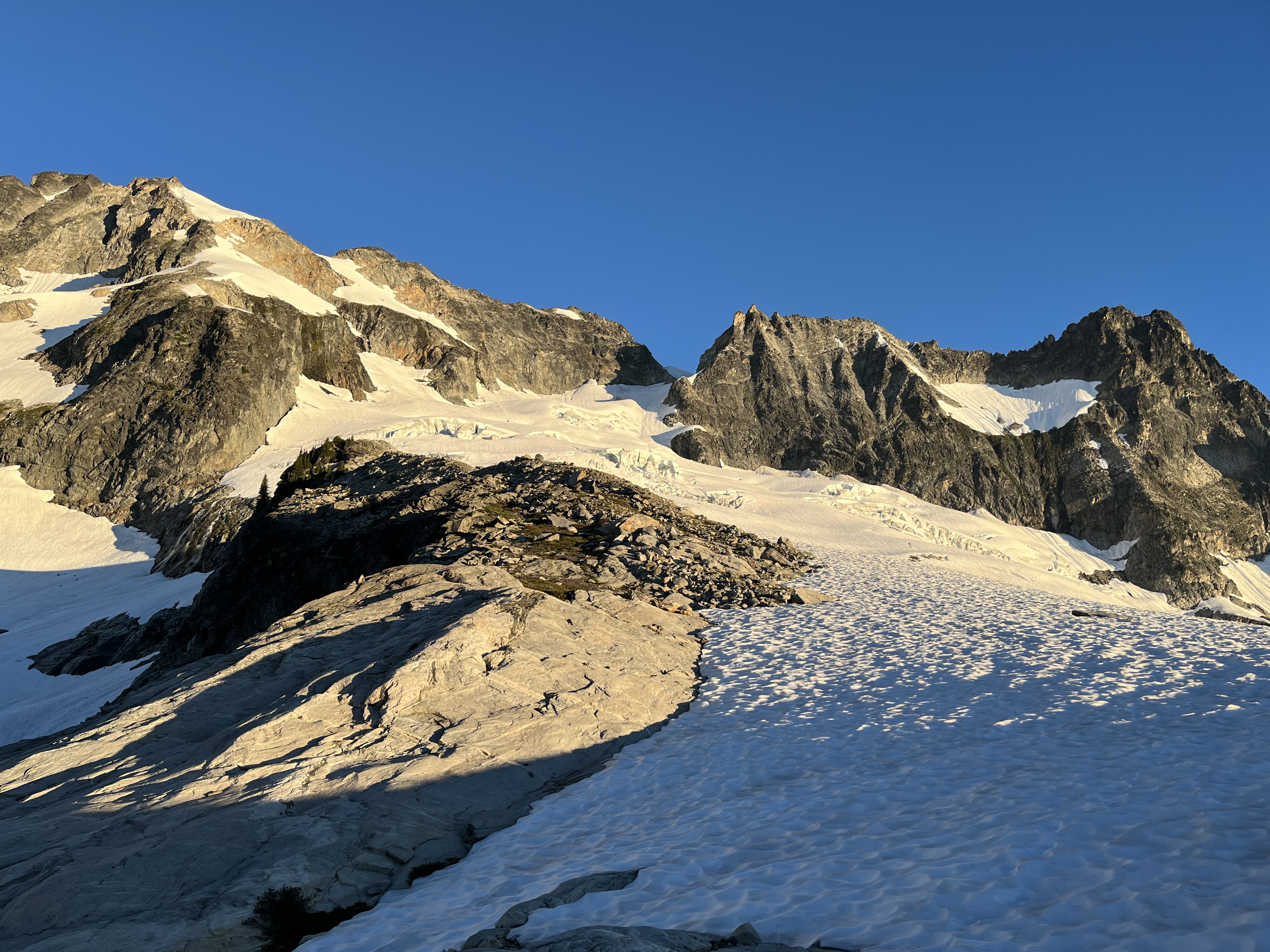
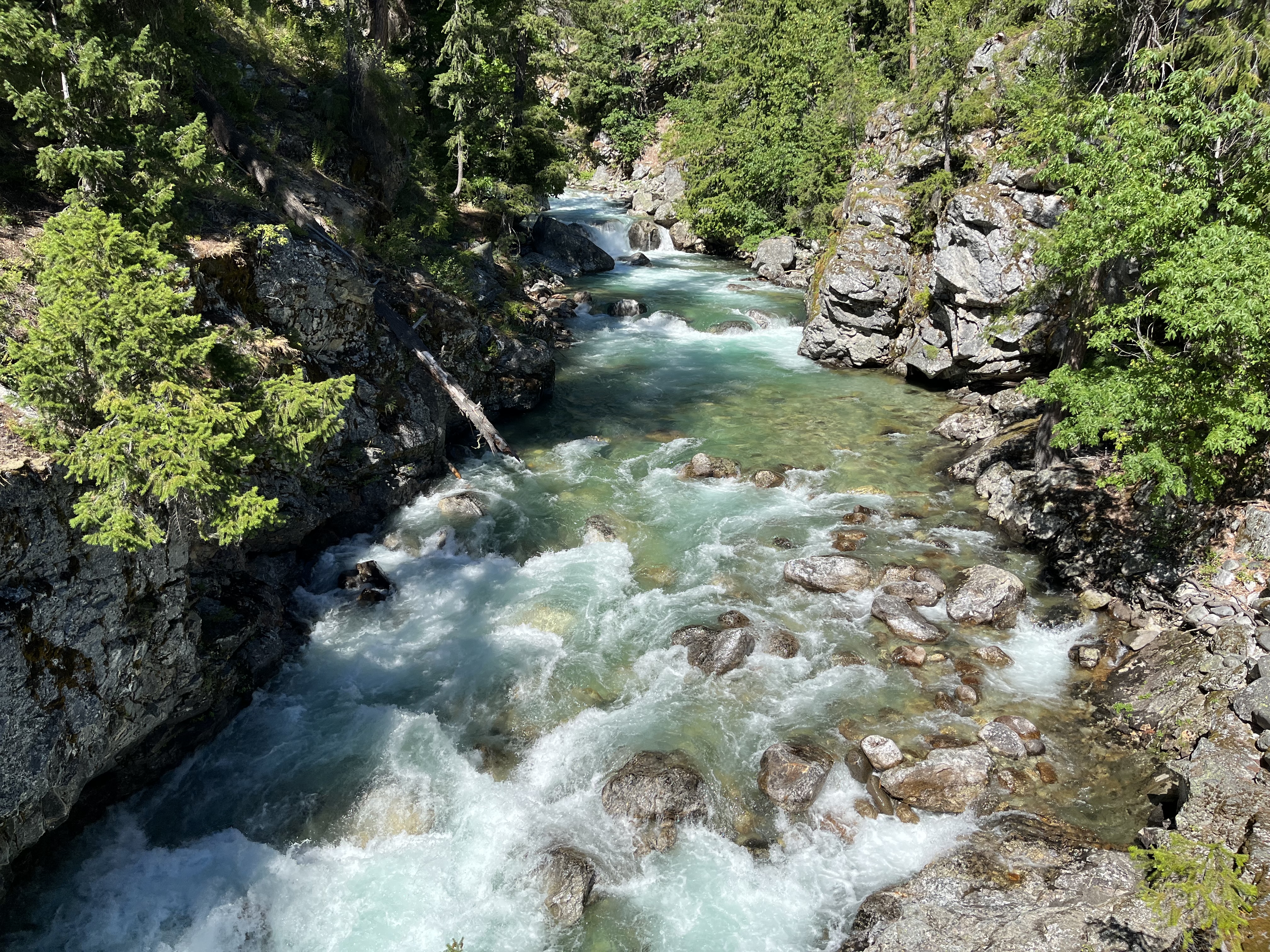
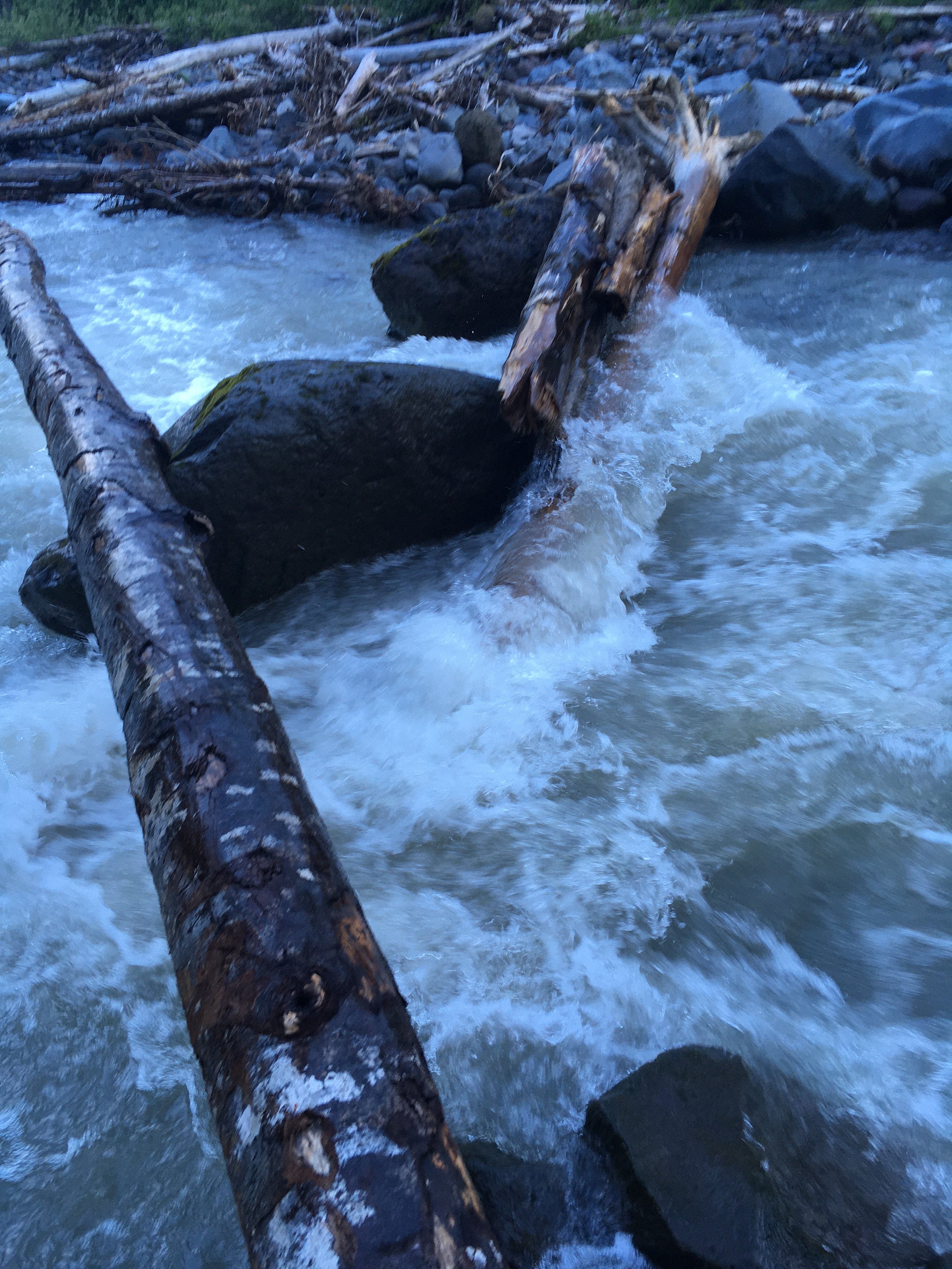
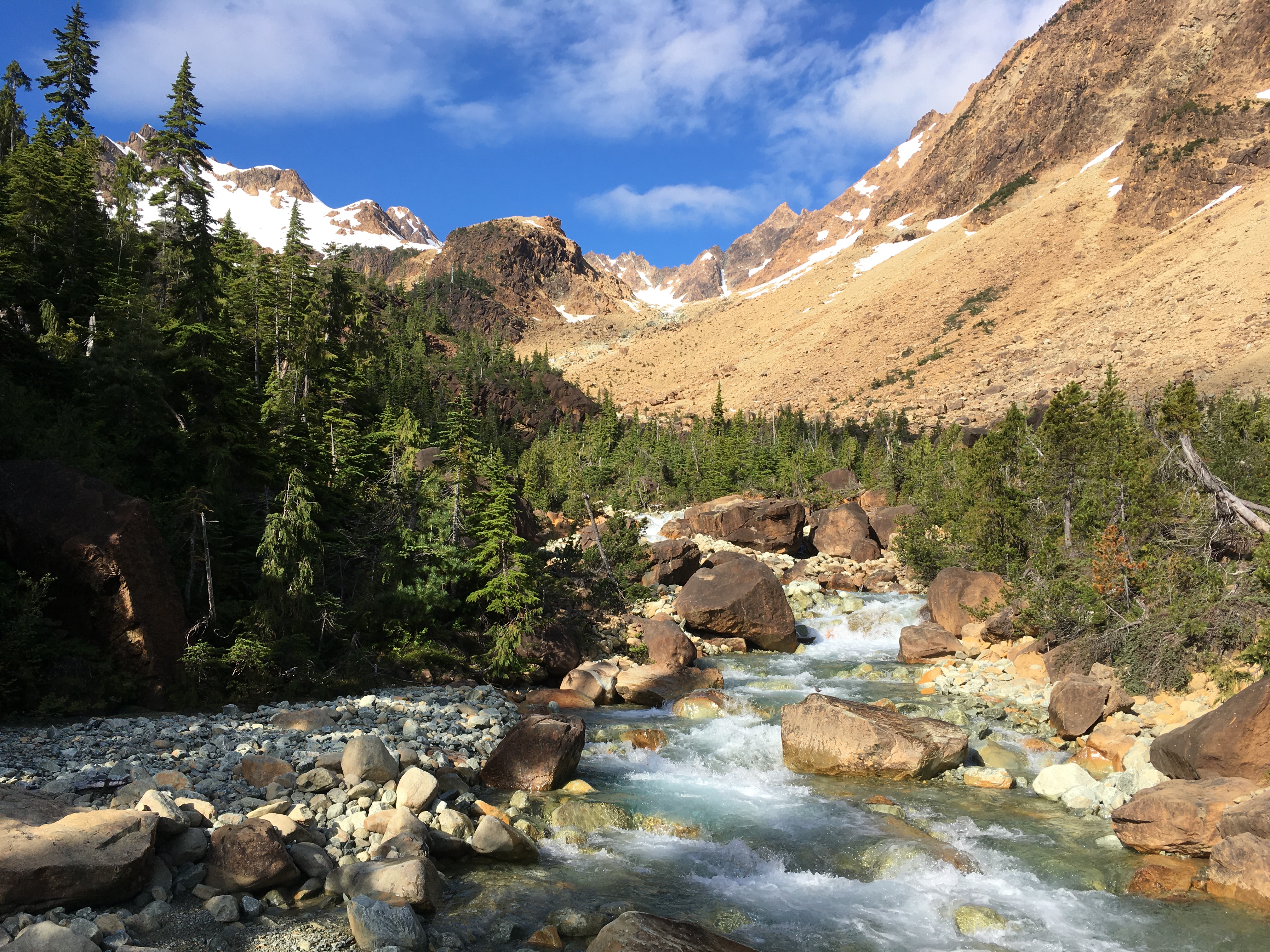
Trip: Green creek - Circuit Trip Date: 07/01/2022 Trip Report: I first saw Darin’s TR quite a while ago and have been excited to check this out ever since. It did not disappoint. The weather throughout the day was photogenic, so I’m sharing a few photos and observations from my trip. The crossing of middle fork Nooksack a quarter mile west of the trailhead looked different from what I had seen in photos. Either I didn’t find the easiest one, or a giant boulder has washed away. It ended in a single slippery log, not very wide. A backwards butt scoot on the way in and inching forward in a spider man crouch on the way out got me through the first and last of many no fall zones for the day. The ancient trees on the other side are very cool. I was surprised to see a handful of old giants all the way up to tree line near the green creek crossing. At first I missed the climber’s trail. It starts just before a switchback that is about 1000 ft from Hildebrand creek. The path has evidently seen a lot of traffic because it’s very easy to follow. The blue diamonds nailed into trees, at times every 30 ft, are unnecessary and IMO not in great taste. I lost some time looking for an easier crossing up stream at green creek, eventually returning to where the path had led and crossing there. It was a bit above knee height. On the way back my shoes were wet from all the snow travel so I kept them on for the crossing. Much easier than barefoot. Beautiful turquoise waters and red-brown rocks here are slightly reminiscent of the southwest, like Havusupai, but flatter. The pines are another interesting surprise. Definitely seems like a different ecology dropped by mistake into the west cascades. I’m not certain I actually ascended green creek arete. I started on the right side of something, gradually crossing to the left side, running into sketchy garbage and backtracking a couple times, then returning to the middle. Whatever was to my left across the widening choss gully looked more like an arete. After topping out I kept traversing rocks until it seemed more efficient to switch to snow. I used crampons for the section leading to NE ride of S twin but went without for the rest of the day. The snow was soft enough that kicking steps was easy, while still being supportive. The down climb of south side of S twin was the first of 3 tedious careful choss descents. It’s not possible to see the bottom from the top, so I was just following my nose for the way that seemed the least messed up, keeping an eye out for the occasional goat path. The snow conditions also meant I had to be careful at every snow-rock interface to avoid hollowed out bridges. I reached jaws tooth and decided to keep my approach shoes on. I thought they would have better traction than my old rock shoes I had accidentally packed. After easy slabs I started up the splitter crack leading to the top. There was a fair bit of low 5th throughout the day, but this crack was the only part that felt like real climbing as opposed to blocky scrambling. It’s a cool feature. In the final 5 feet the angle increases and I suddenly became acutely aware that my feet no longer felt very secure. One shot of adrenaline, two moves, and it was over. I didn’t like my margin of safety there. Maybe rock shoes would have made it easier, or maybe it’s just not easy enough for my taste. Everyone’s skill and risk tolerance is different, but in retrospect I would say a rope makes a lot of sense for that pitch. Slightly rattled from the Jaws tooth finish, I felt a little intimidated by the sight of Skookum. But here I was. I rapped with my 30m and headed up the crest. It turns out to be comprised of easy moves despite the exposure, felt like a return to (4th- low 5th) scrambling. I skipped Hayden because I’d like to climb the NE pillar Darin posted about, some other time, with a rope For little sister, the safest exit from snow took me to the left side. I ascended this for 100-200 ft to a prominent ledge that I took to the right rib. Moving up this rib the rock quality was good but gradually became slightly suspect, and blocky but overhanging features kept forcing me to the right. There were short steps here of probably up to 5.6. Just when I was getting nervous about the route I found a chimney I could wedge into and reach out left onto a narrow ledge to escape the rightward trend and return to easier ground on the left side of the rib. This was the last crux (besides returning across the middle fork). I continued to the top of little Sister and continued on to tag Cinderella too, from the west. Then I began the descent of green creek glacier, generally staying to the right, occasionally glissading, keeping an eye out for cracks. There are definitely some around by now. They can be tricky to spot from above, so the lower angle the path, the better. At the bottom of the glacier I crossed to the N side of the creek on snow. This meant I had to ford the creek once more on the way out, but travel looks much simpler on the N side coming down. After the log crossing at middle fork Nooksack I took a ritual dip in a shallow side channel and was pleased to find that my car wasn’t broken into, which meant I could ski Ruth the next day. Thanks to Darin and others for all the beta and stoke. I look forward to going back there. Gear Notes: Axe, crampons, 30m. YMMV Approach Notes: Logs 1/4 mi W of elbow lake TH
-
[TR] Chiwaukum Range - Chiwaukum High Route 09/09/2021
JonParker replied to Kyle M's topic in Alpine Lakes
Wow, that orange! -
[TR] Dragontail Peak, NE Towers - This, My Friend 09/12/2021
JonParker replied to kmfoerster's topic in Alpine Lakes
Nice photos! Pitch 2 alone is worth the hike -
[TR] Mount Despair - southeast face/east ridge 08/14/2021
JonParker replied to peter_mcb's topic in North Cascades
Thanks for the beta dump, there’s not a lot out there for Despair. Did you happen to see the north side of south Despair? I’m wondering what a traverse of the two would involve, never seen a report of that. -
Awesome, love these photos
-
I considered exploring that, but from where I was I couldn’t see the down climb on the other side. I also vaguely recalled a description of some scary shit in Abegg’s old TR. So I went with the devil I knew. View from the summit (see the pic facing Snowfield) seems to confirm it’s non-trivial. Glad that you found it was ok passage.
-
Oh yeah I should add this photo from the area in July 2018, because look at it
-
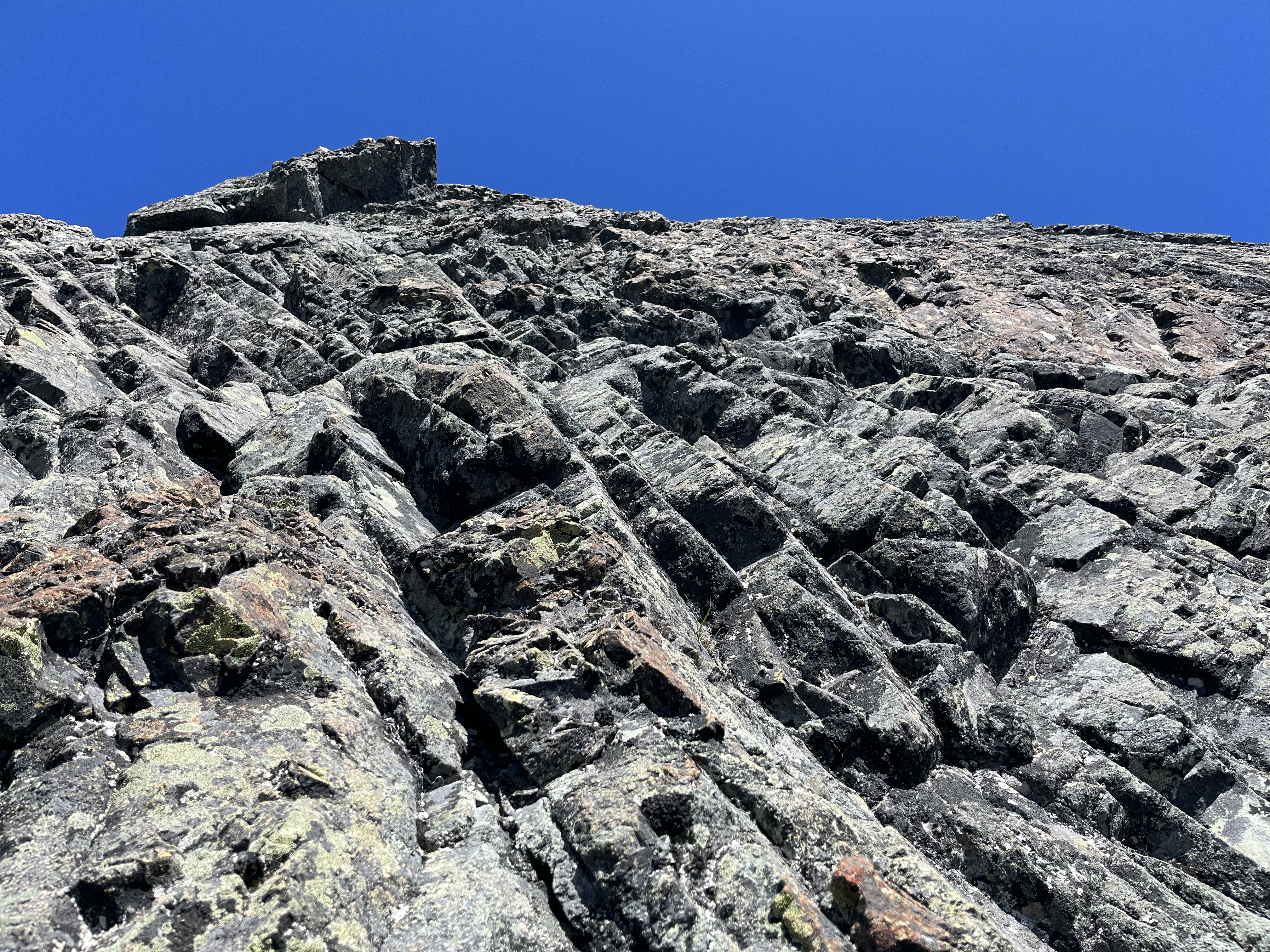
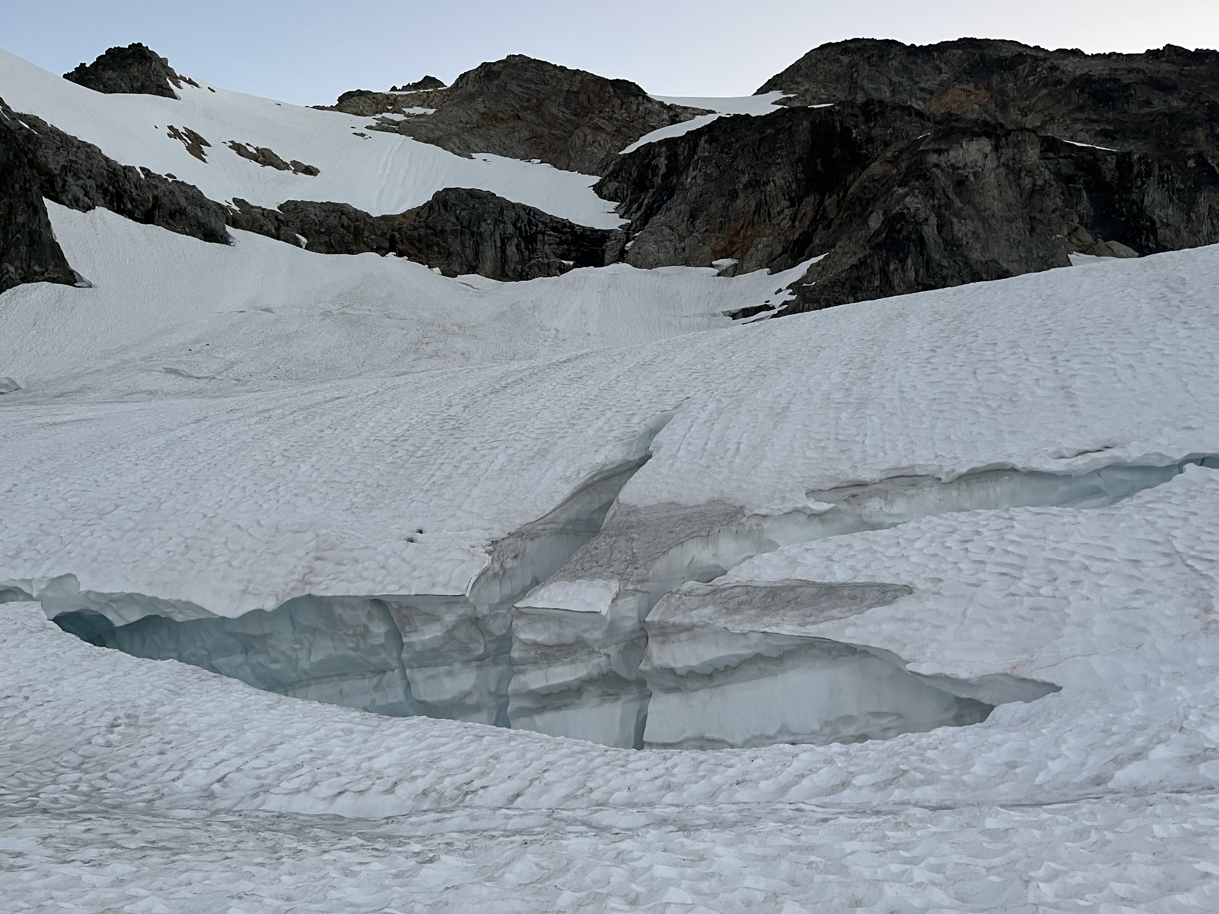
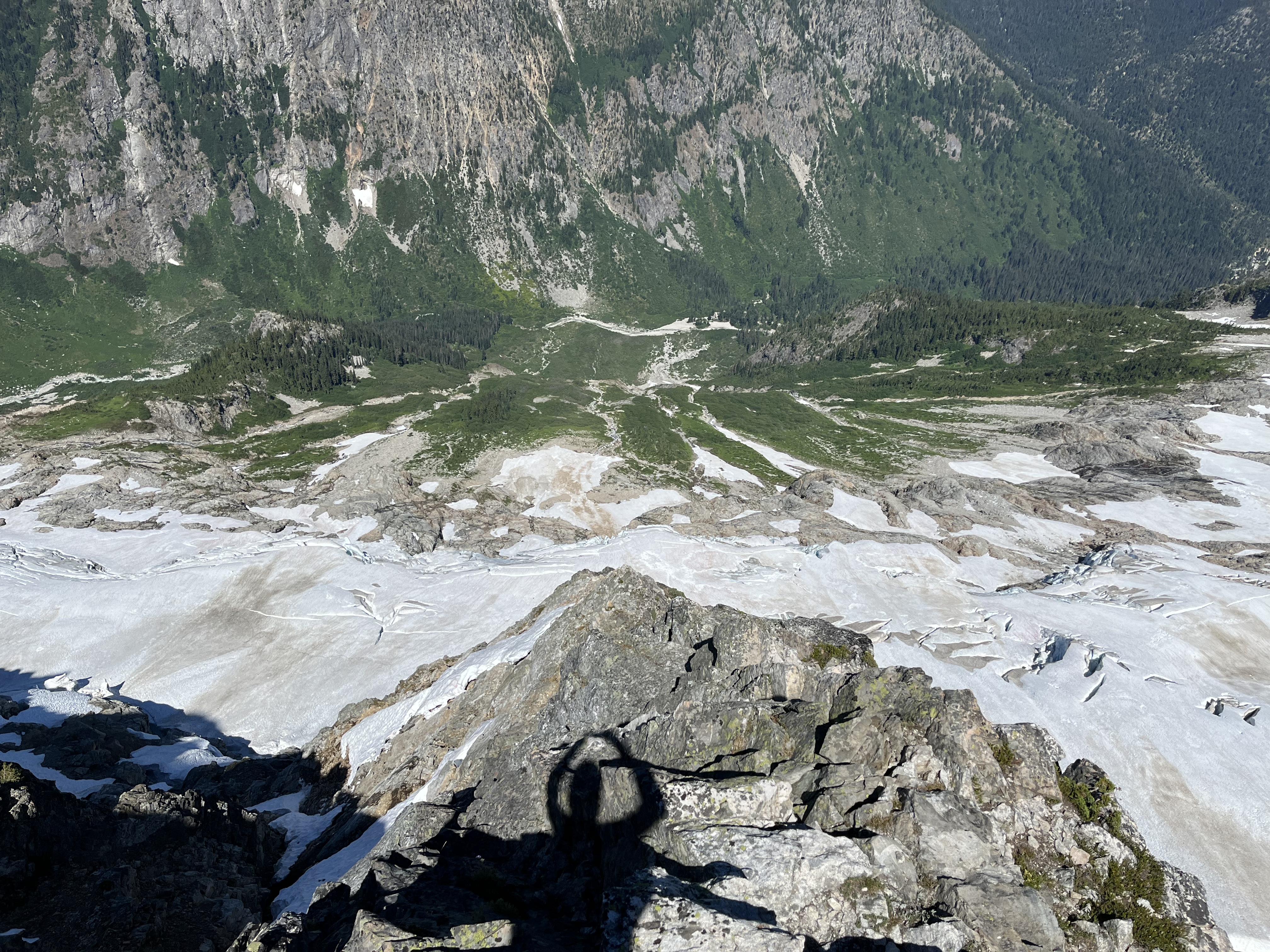
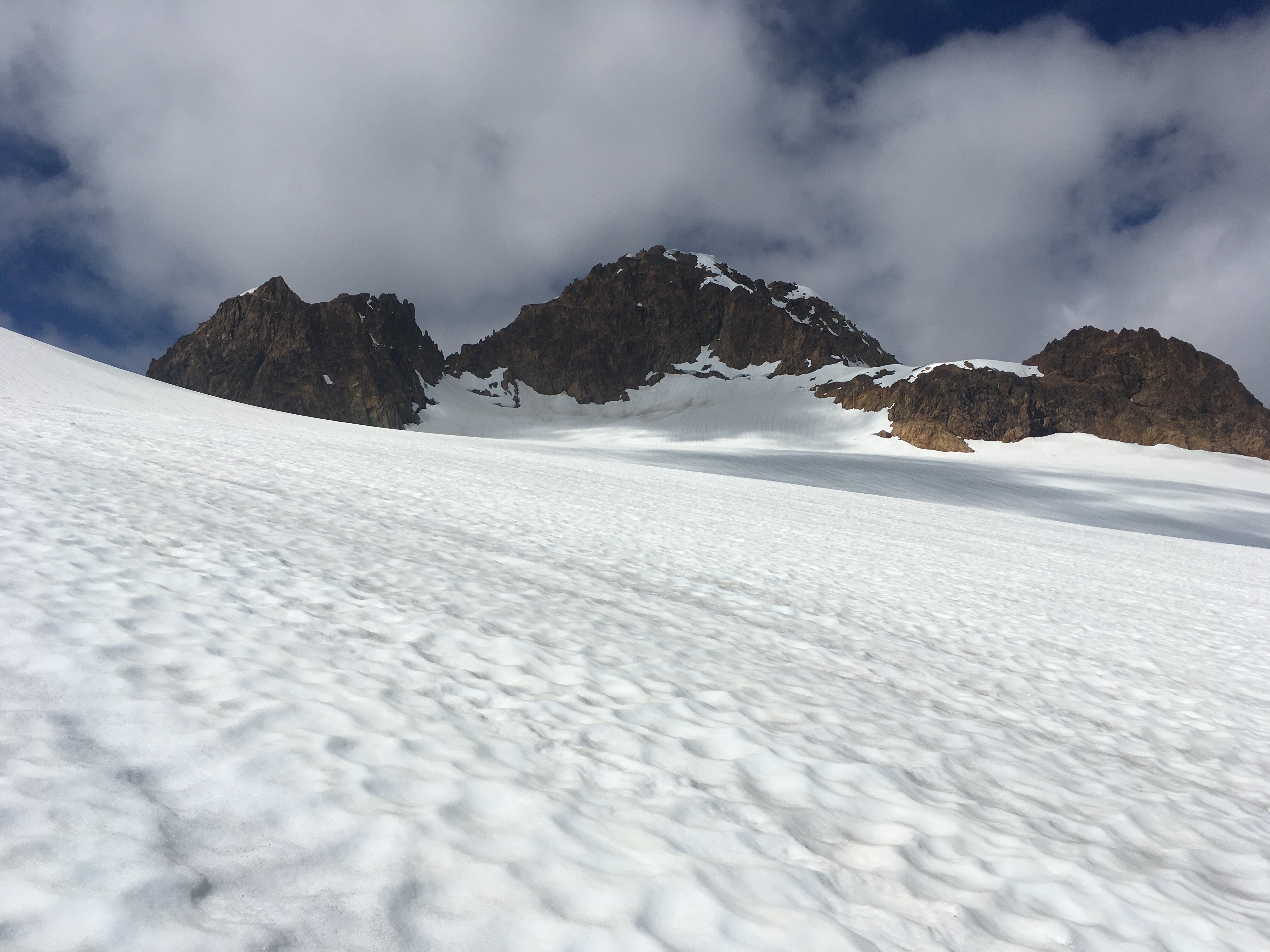
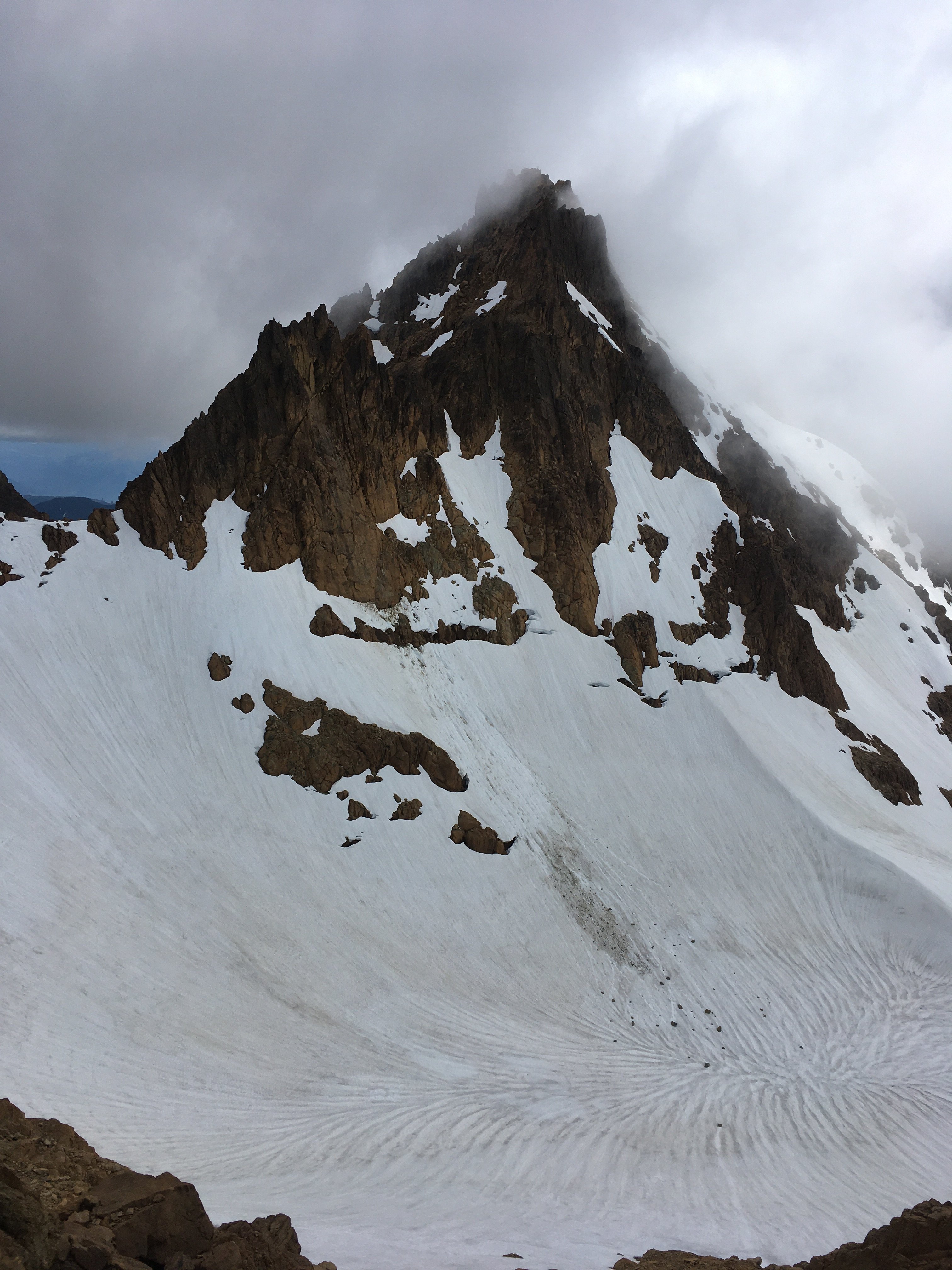
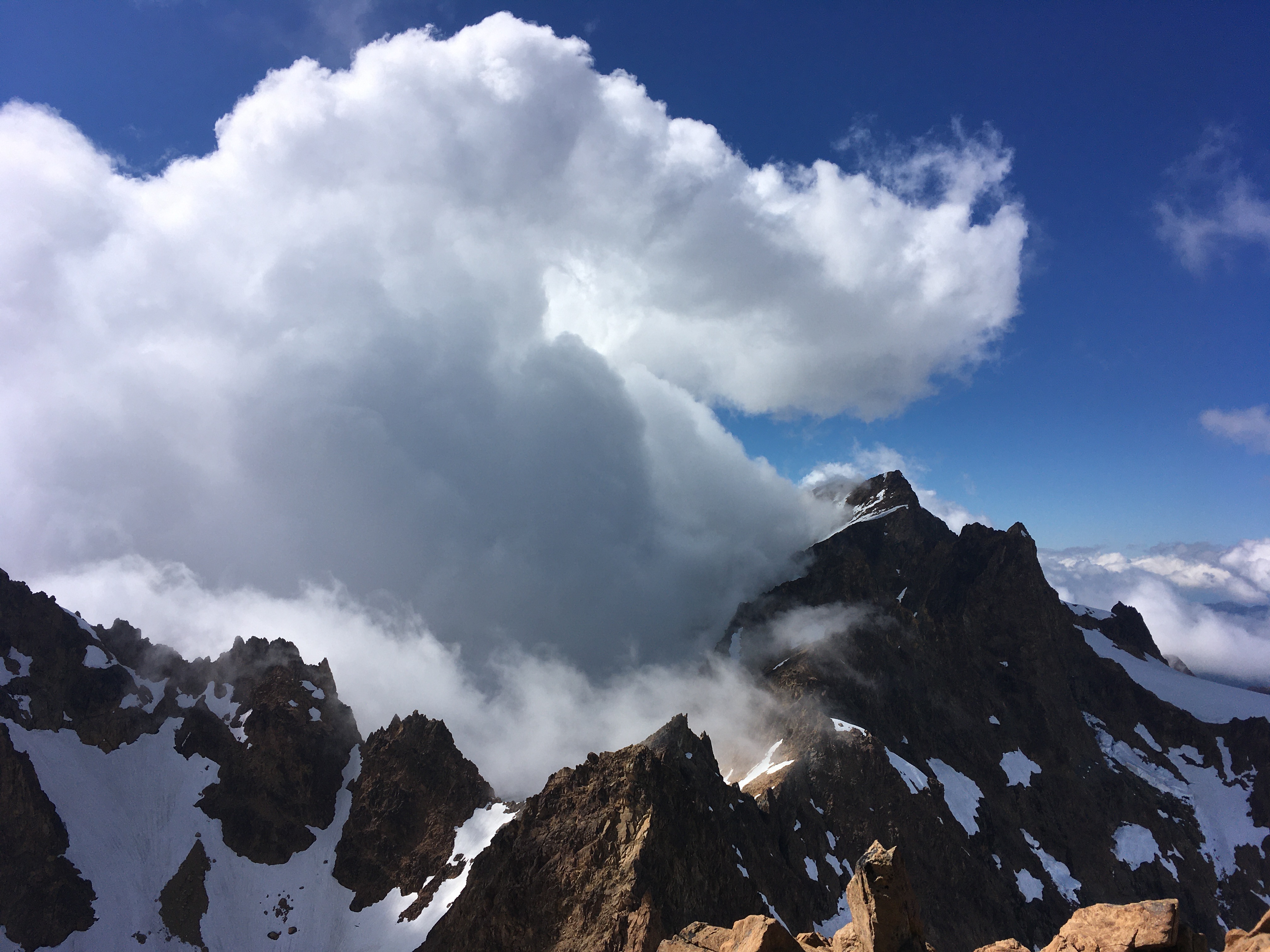
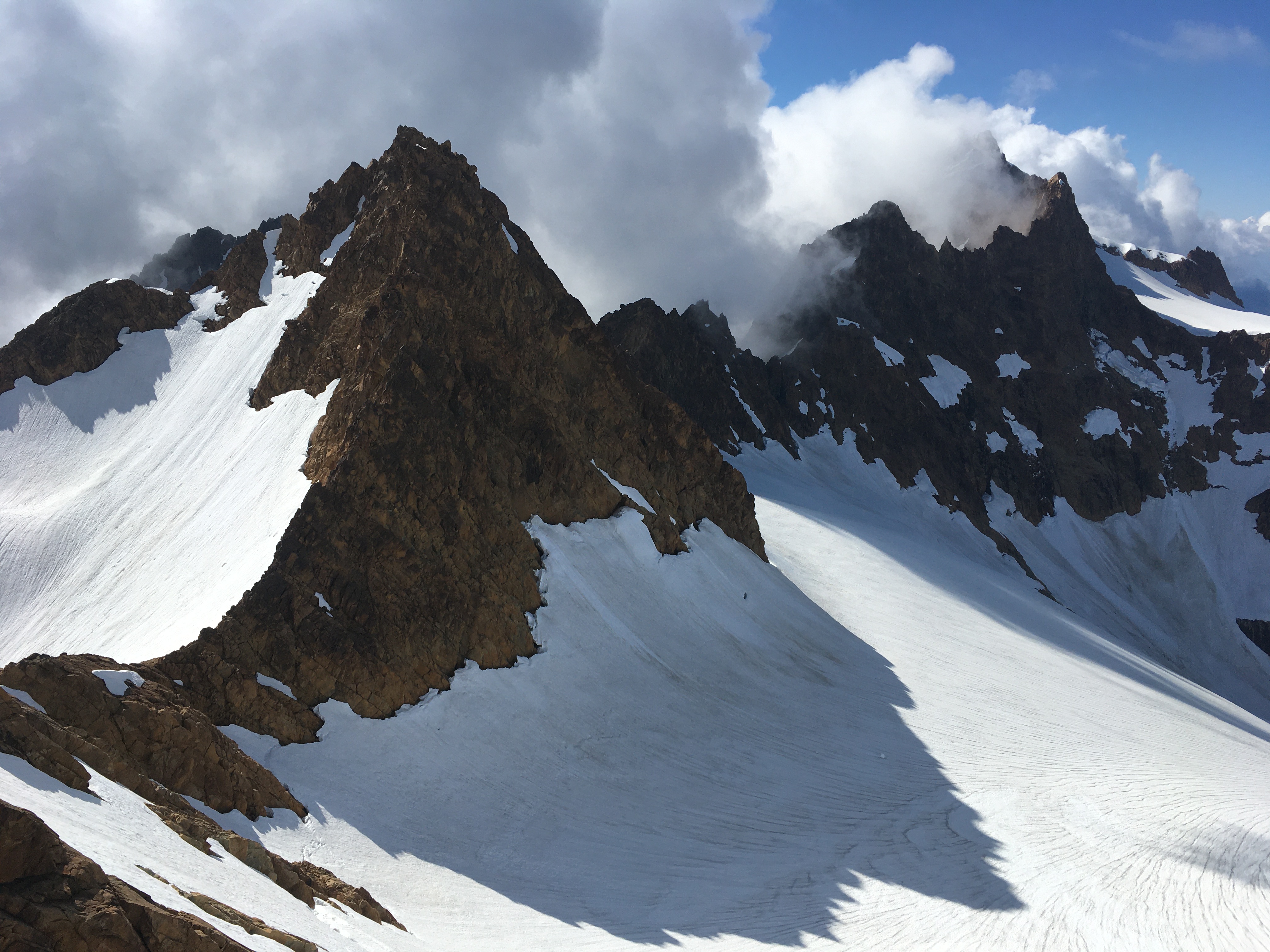
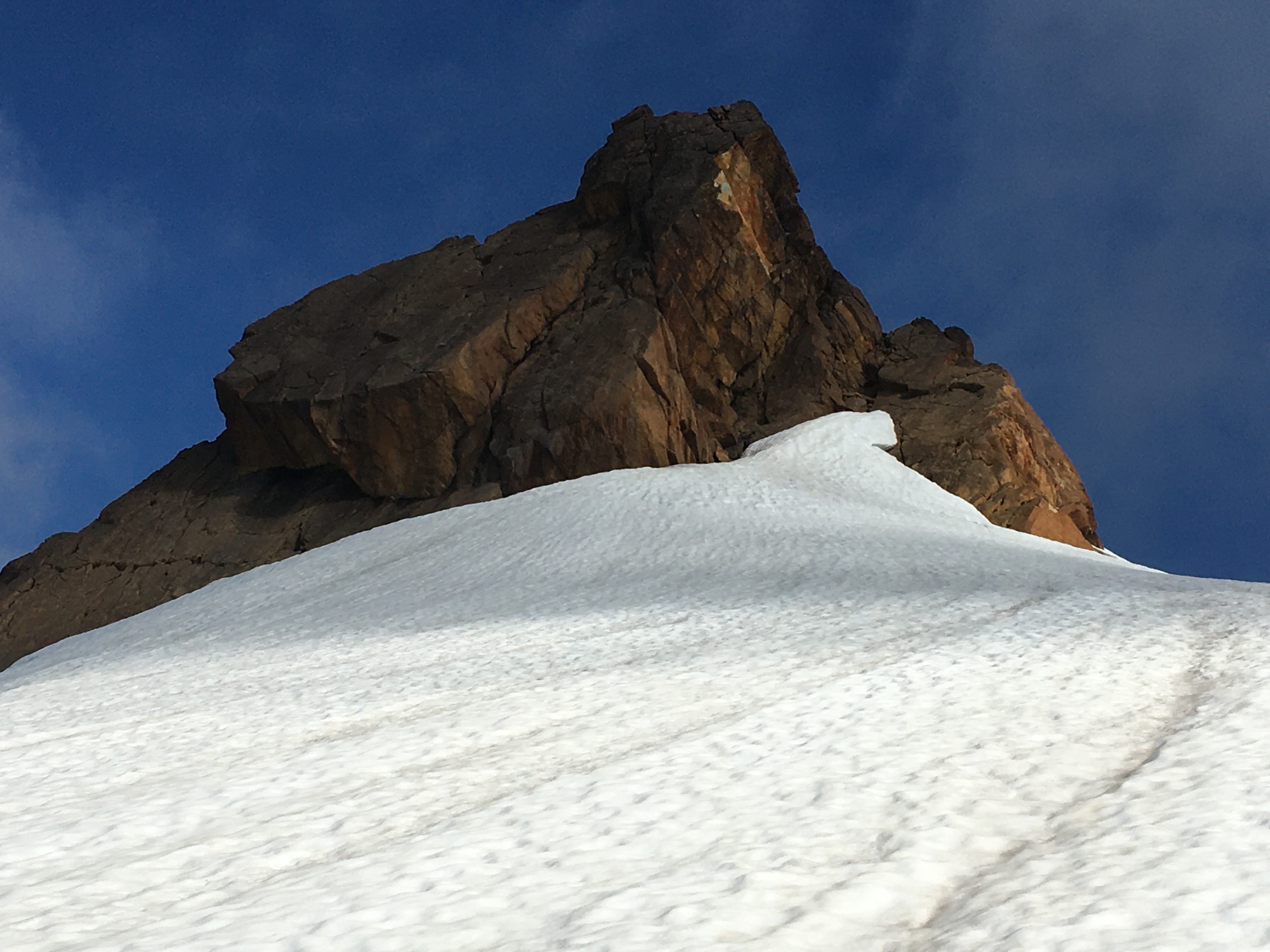
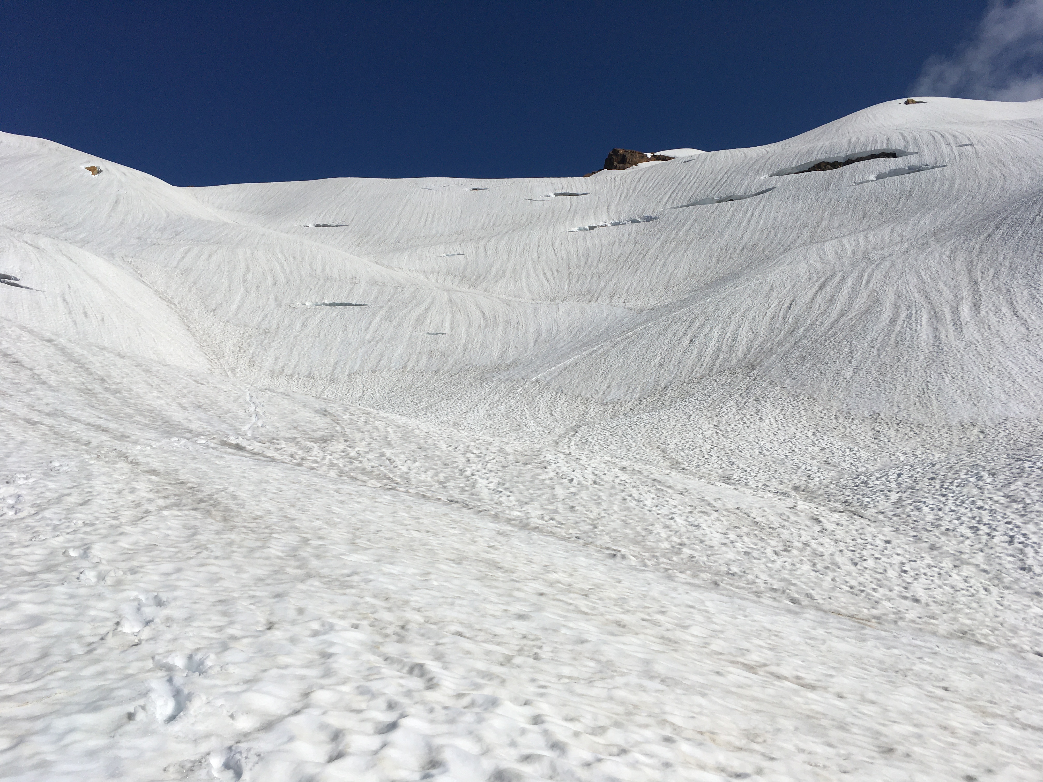
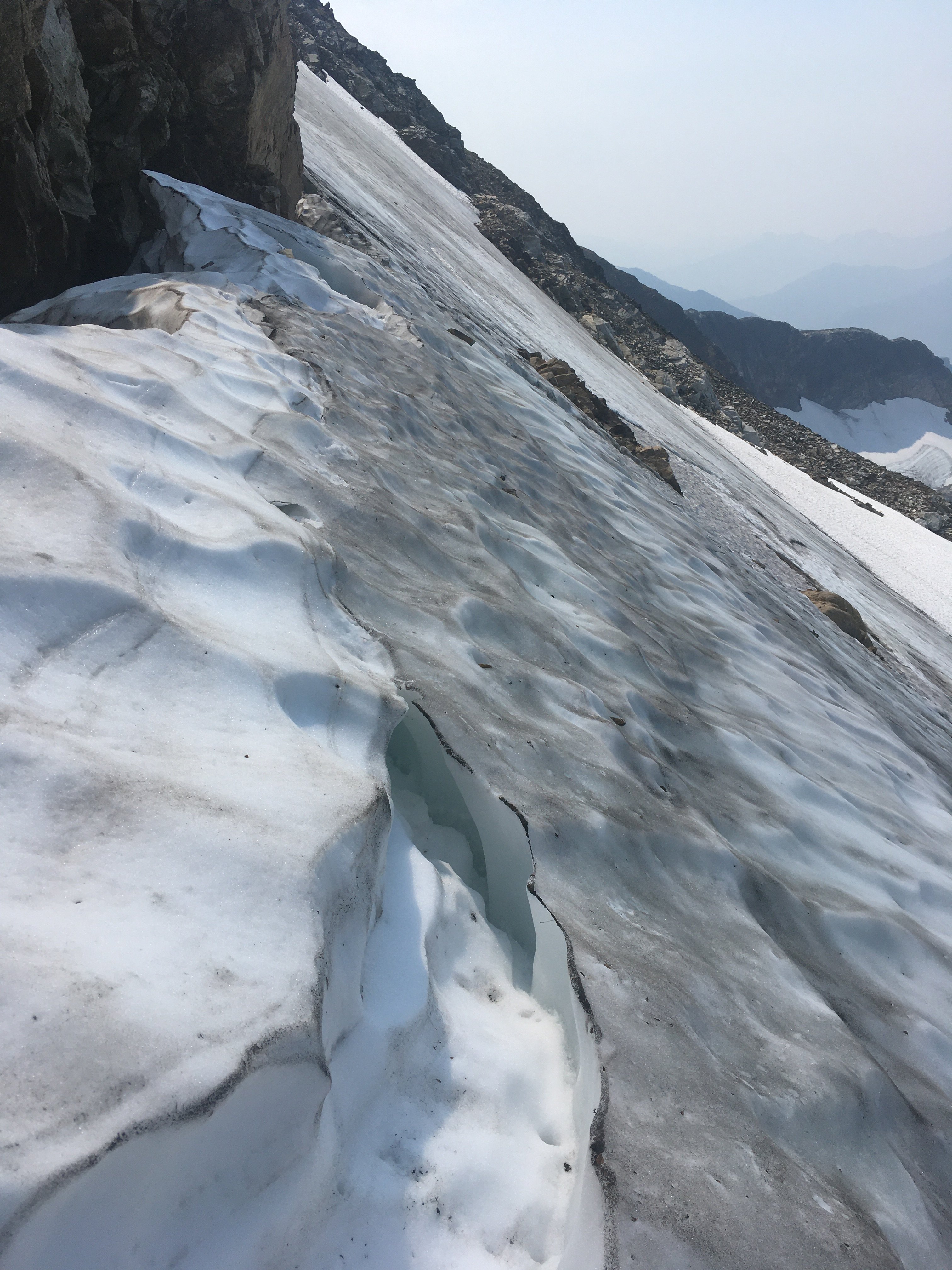
Trip: Colonial - standard Trip Date: 08/03/2021 Trip Report: After various plans fell through over the last 2 weeks for various reasons, including life, rain, and smoke, I was itching to do something, anything. On Monday I checked the next day forecast on windy and saw a pocket of good air predicted over the area including Snowfield, etc. On a trip to Snowfield a few years ago we skipped Colonial. A pika had obliterated my partners backpack straps at night. We improvised something out of our glacier gear, which my partner deemed suitable for getting back to the trailhead, but not inspiring enough to add another climb on our way out. Given the favorable smoke forecast I thought this must be my chance to go back for Colonial. Popping out above the trees I could see the forecast was spot on. Haze all around in the distance, but plenty clear locally. I could also see that the face below Colonial was mostly bare ice. It looked intimidating, maybe impossible to do solo with my one axe, approach shoes, and kahtoolas. But I thought I’d proceed for a closer look, and just go as far as I thought I safely could. Upon reaching the face I assessed. The ice was probably unavoidable, unless you down climb steep exposed snow, where it might be possible to skirt around the ice to some choss and back onto snow. The ice was steep at the bottom, below the point where the approach intercepts it. But higher up, from where the approach meets it to the notch looked about 40 degrees. And the runout wasn’t too bad at the beginning of the ice (gets bad 1/3 way across) so I grabbed a sharp rock for my 2nd tool and tried it out. The going was ok and I soon reached a crack in the ice that I used as a kind of ledge to traverse to the notch. I’ve never seen a route described as AI1 or WI1. Maybe this was it. There was a little snice here and there. The cracks in ice had a little snow on the border. When this snow is gone, which won’t take long, the route will require a real ice pitch. I couldn’t have got away with my single axe and light crampons if not for the ‘ledge’ system bordered with snow at the margin. There was a chance of thunderstorms beginning in the afternoon, and I wanted to avoid headlamp time anyway, so didn’t overstay my welcome on the summit. Military jet or two came by to desecrate the area for a little while. Too bad the wilderness act doesn’t cover air space. Traversing the face back the way I came was about the same difficulty as the way up. Definitely required some concentration for the no fall zone. Checked out a small glacial spring on my hike back. The water was quite warm, and the floor was extremely slick, glad I didn’t get stuck in there. The slabs on the way down the ridge made travel enjoyable, as did the knobbier granite from 5800’ down to 5400’. But I felt old on the hike down as knee pain started to kick in (maybe too much fun on the slabs earlier). The winds aloft started picking up and thunder began to rumble in the last mile to the car. Gear Notes: Crampons, two tools would have been good Approach Notes: Be prepared for ice if going now/ late season


-
[TR] The Chopping Block - NE Ridge 07/24/2021
JonParker replied to tanstaafl's topic in North Cascades
Ha I wonder if that bear is parked there, we saw one really close to the trail head on the 18th -
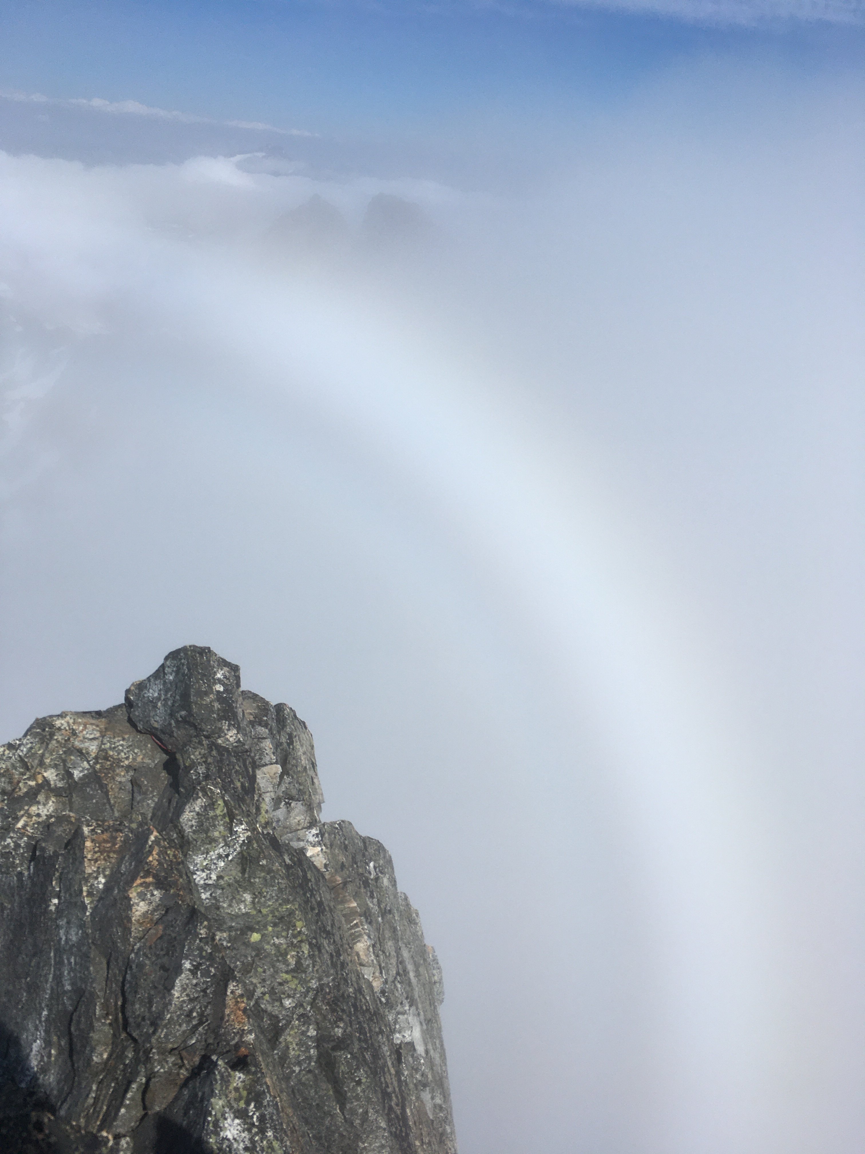
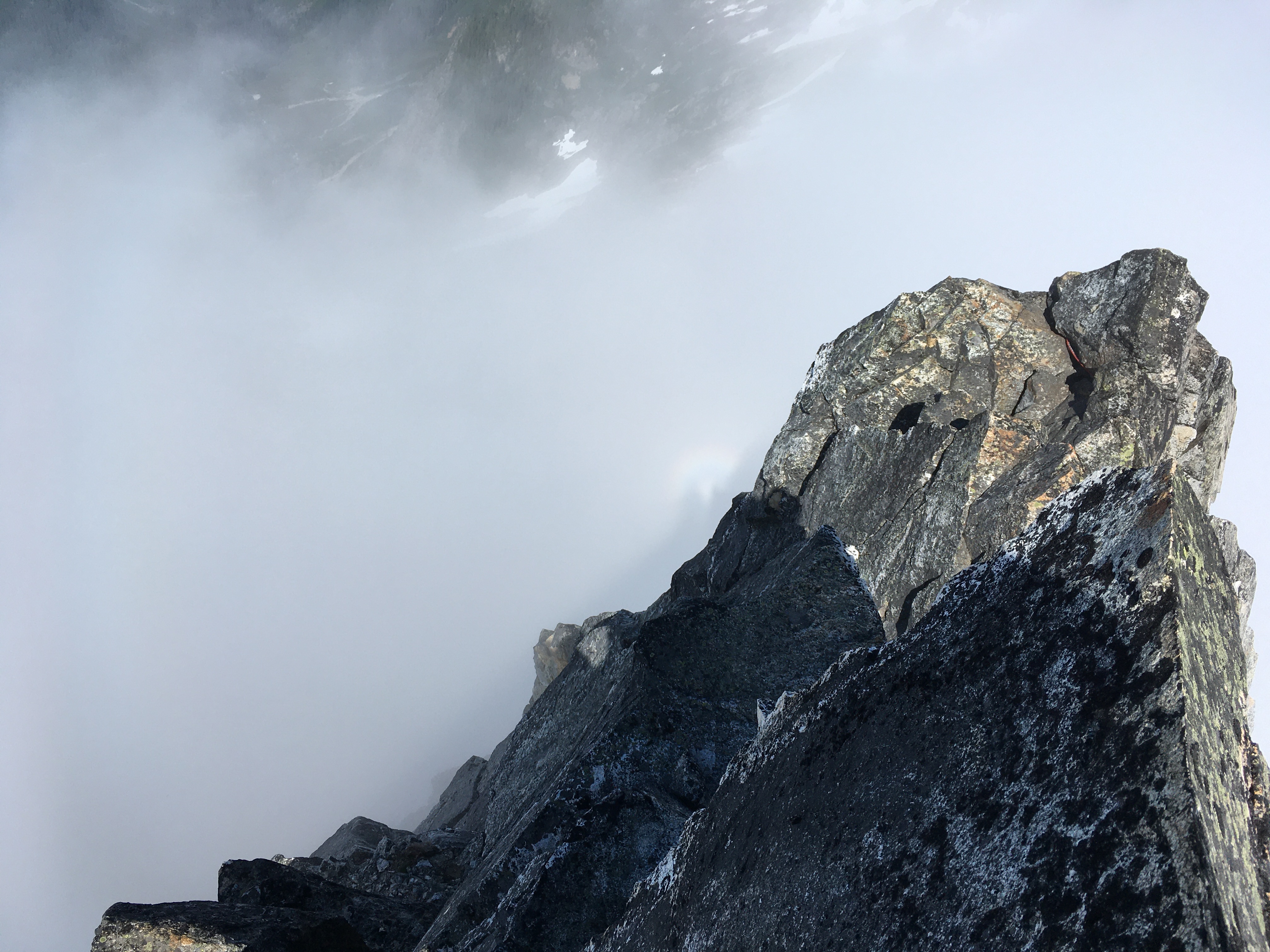
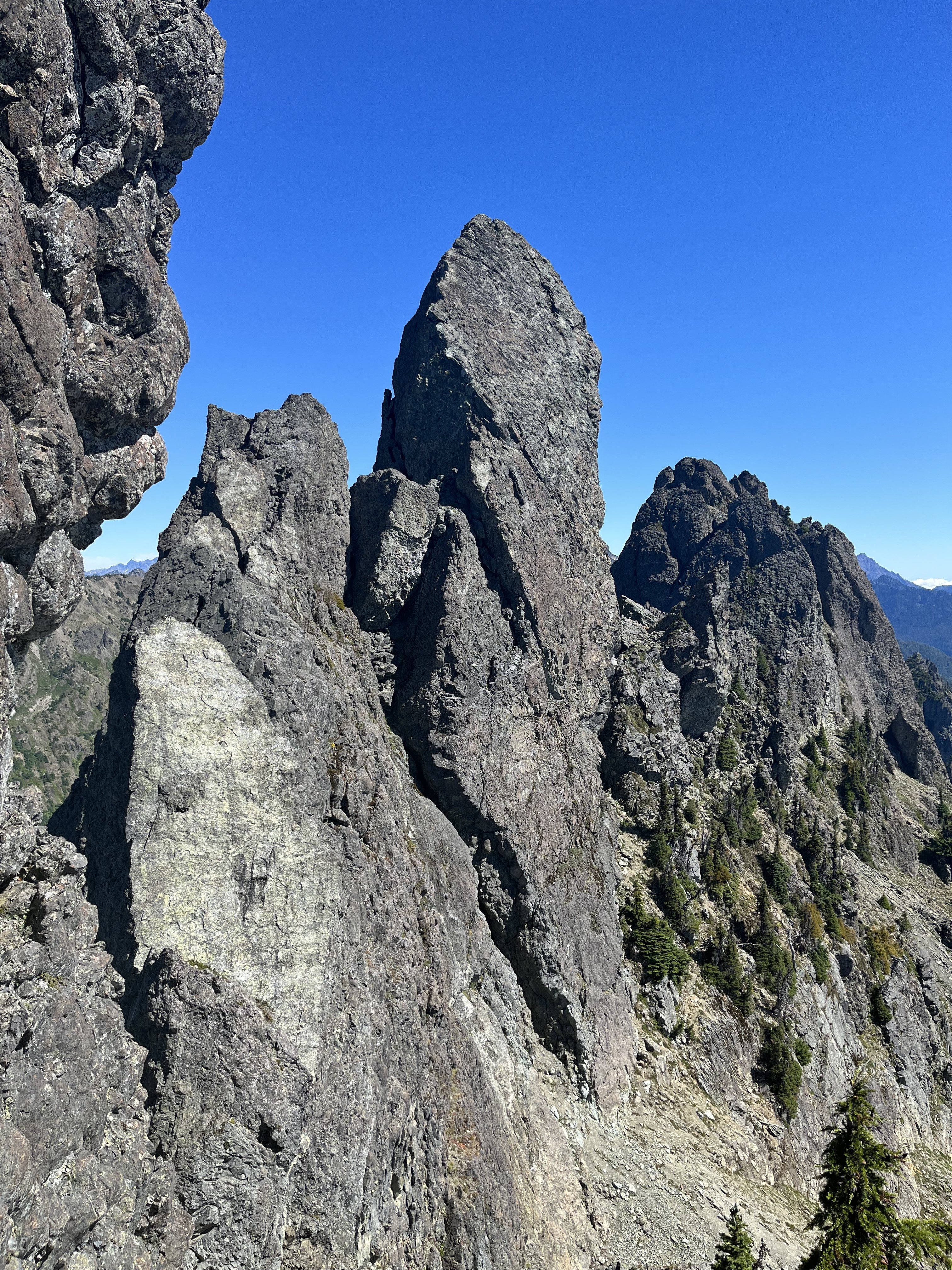
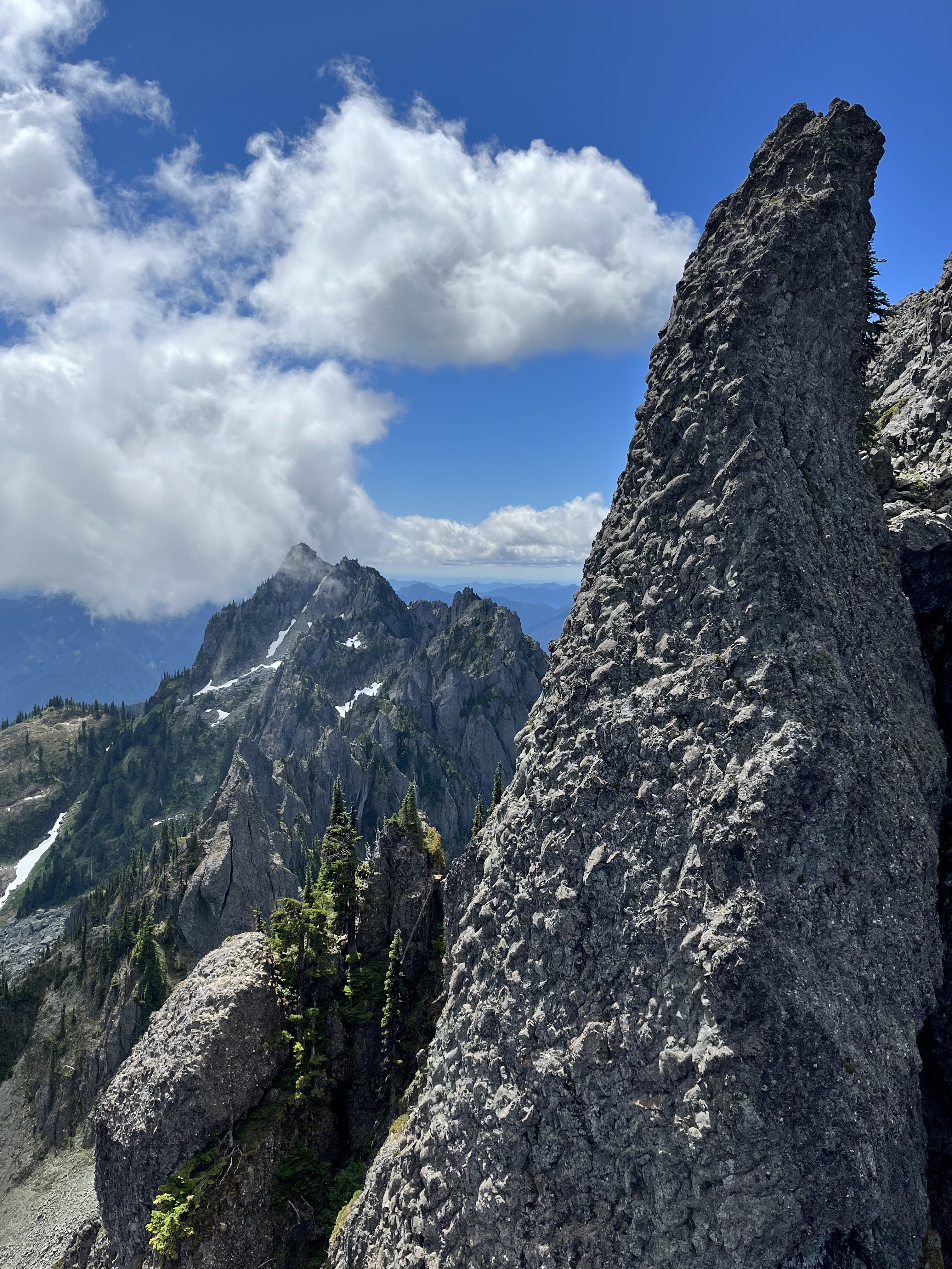
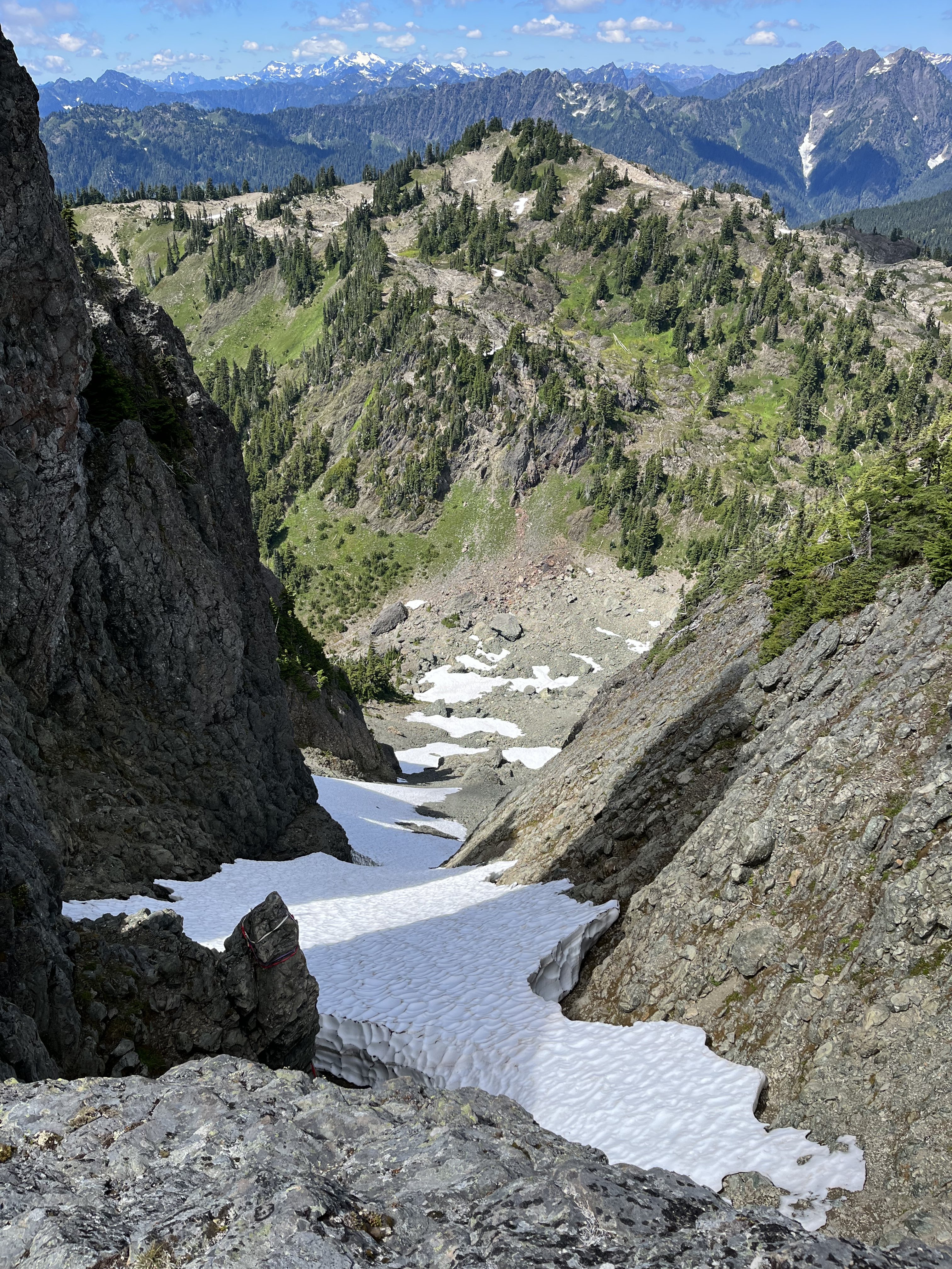
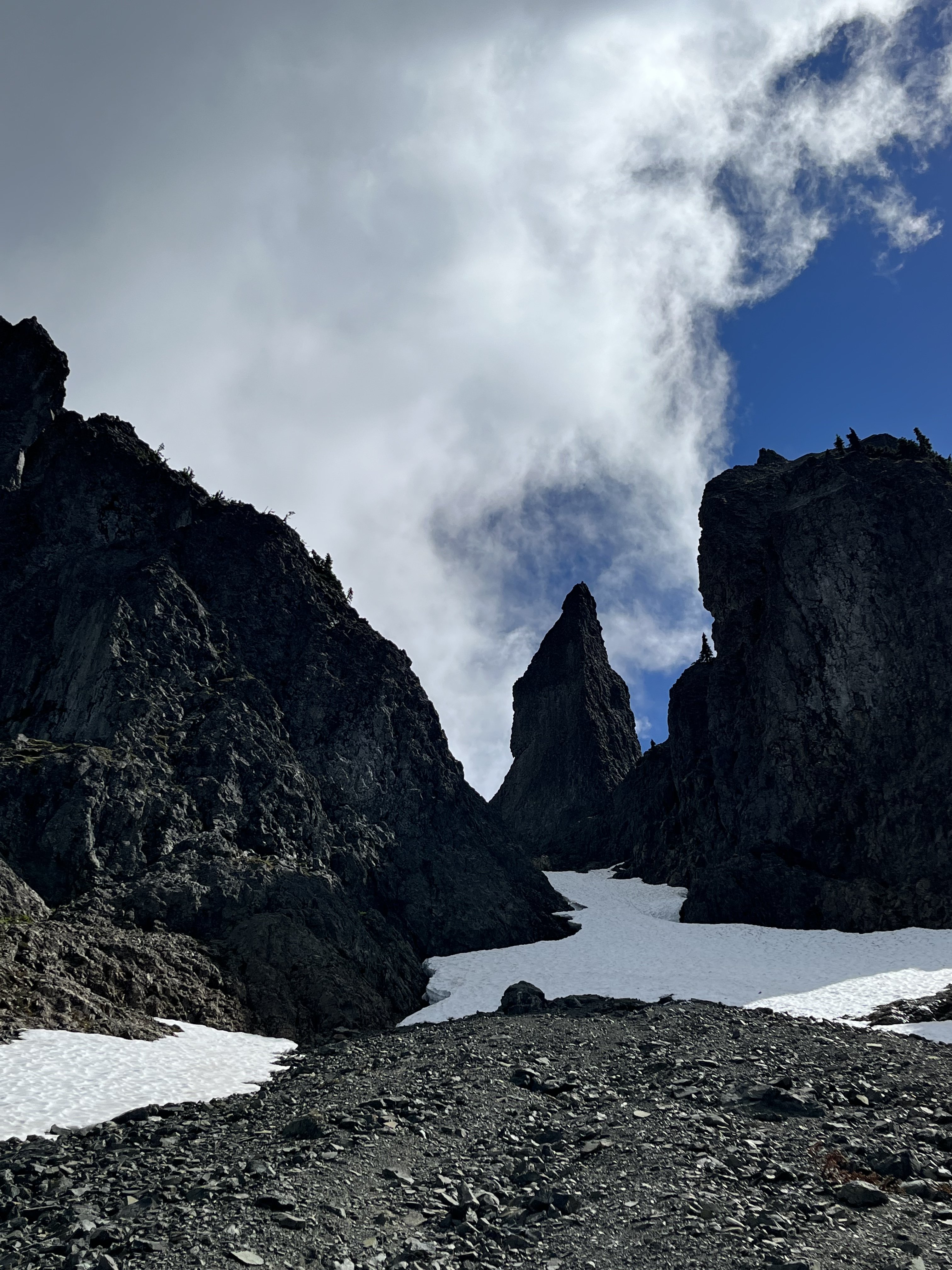
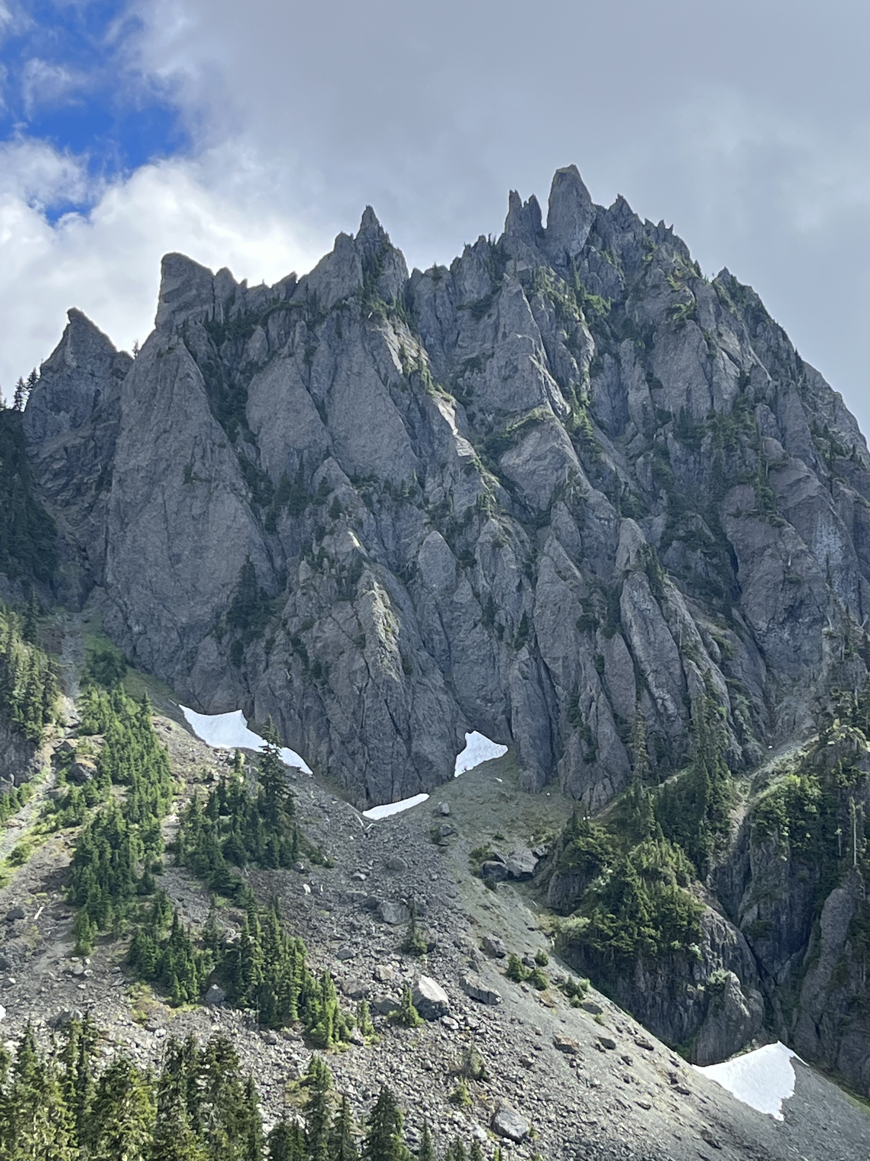
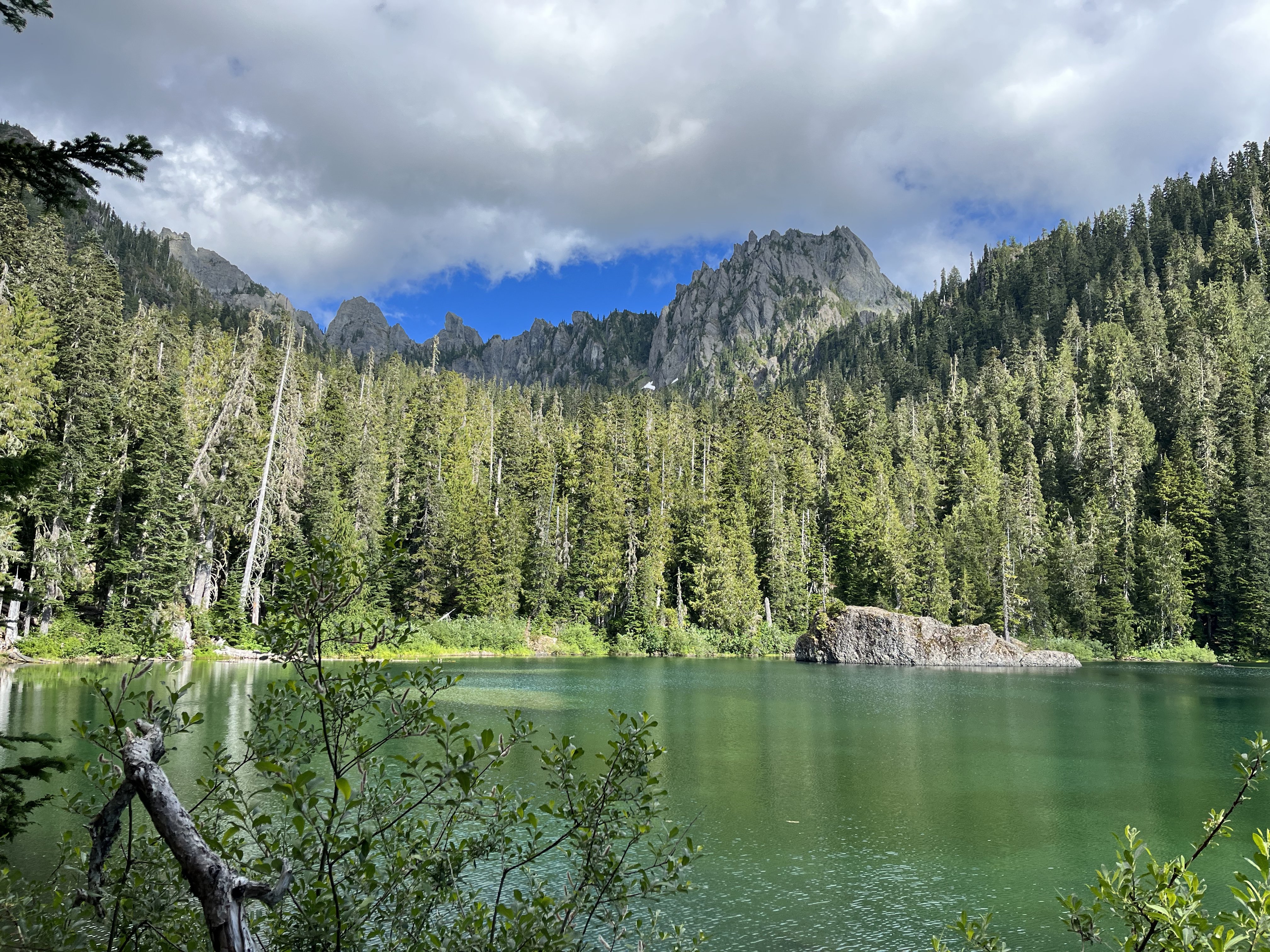
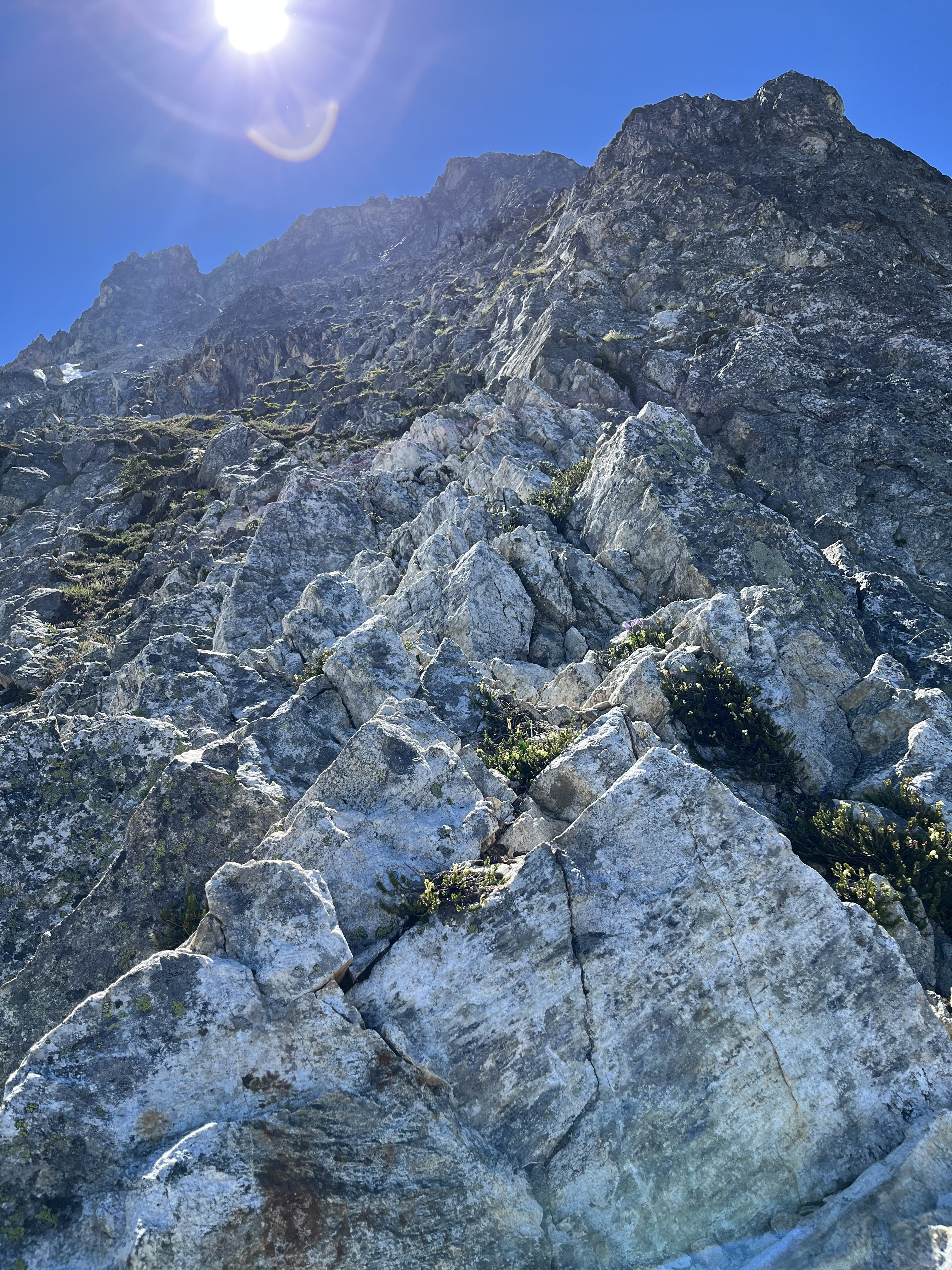
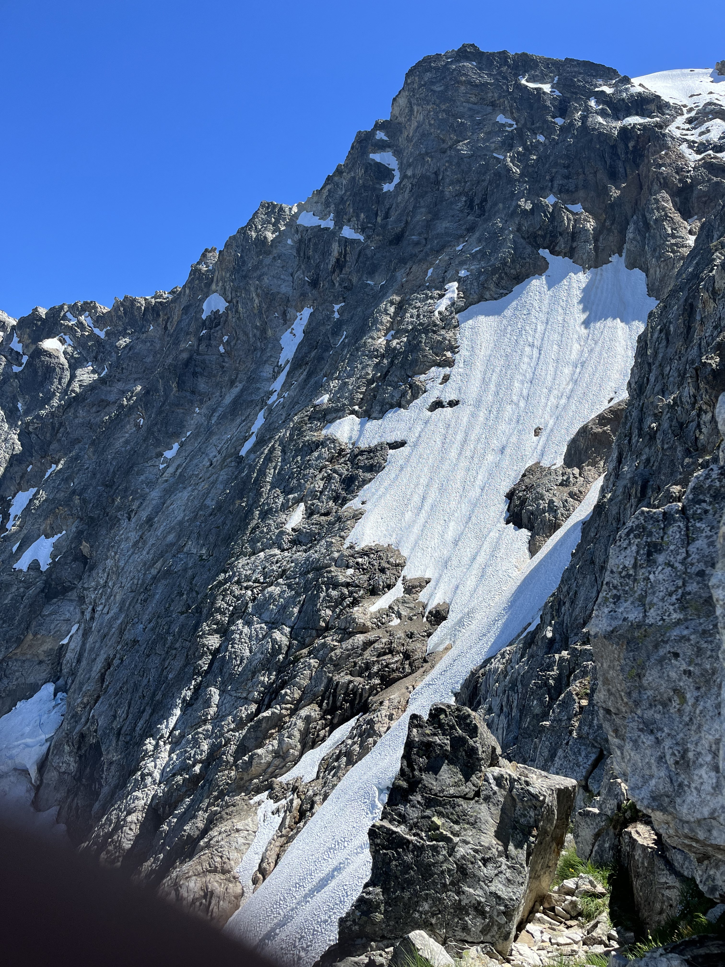
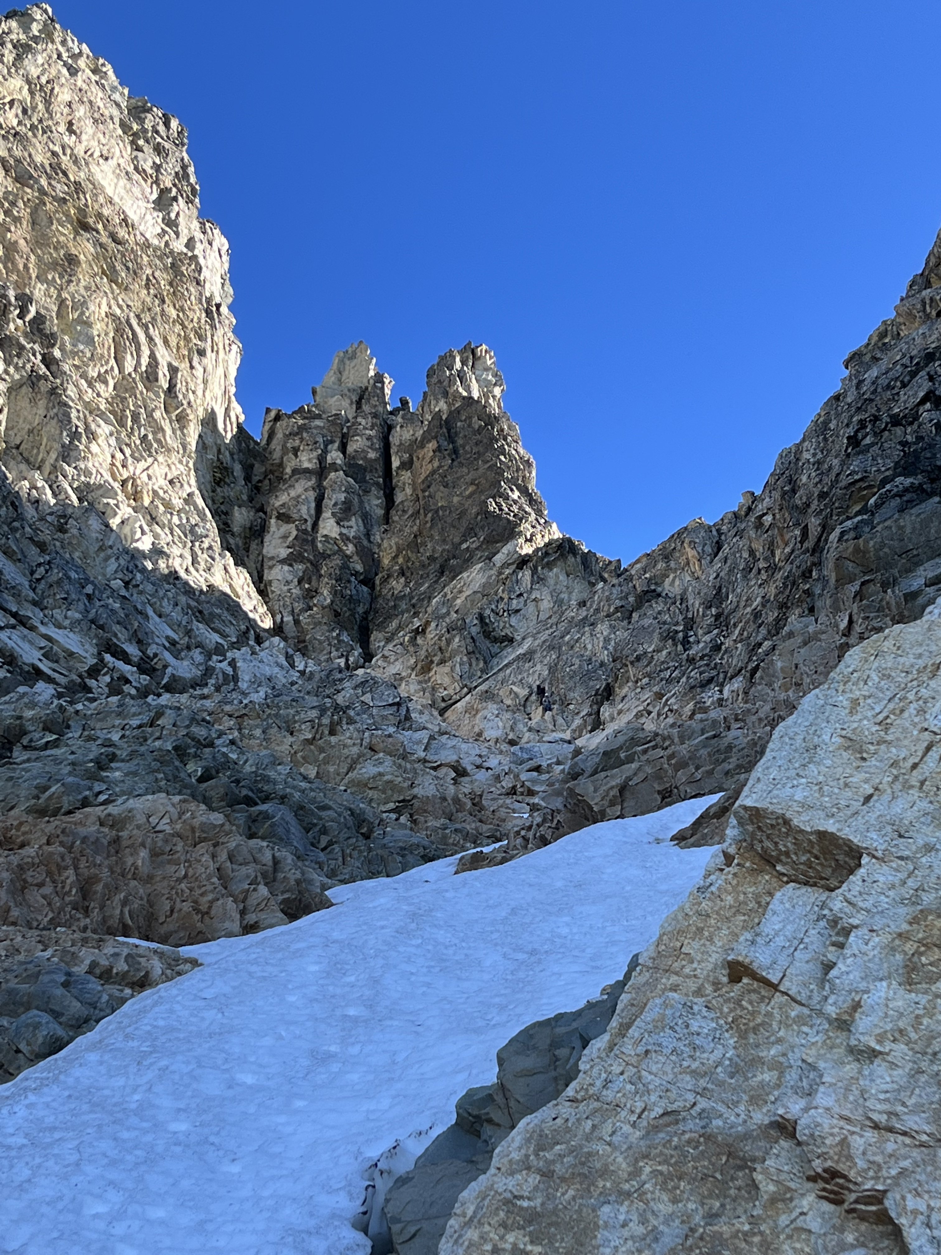
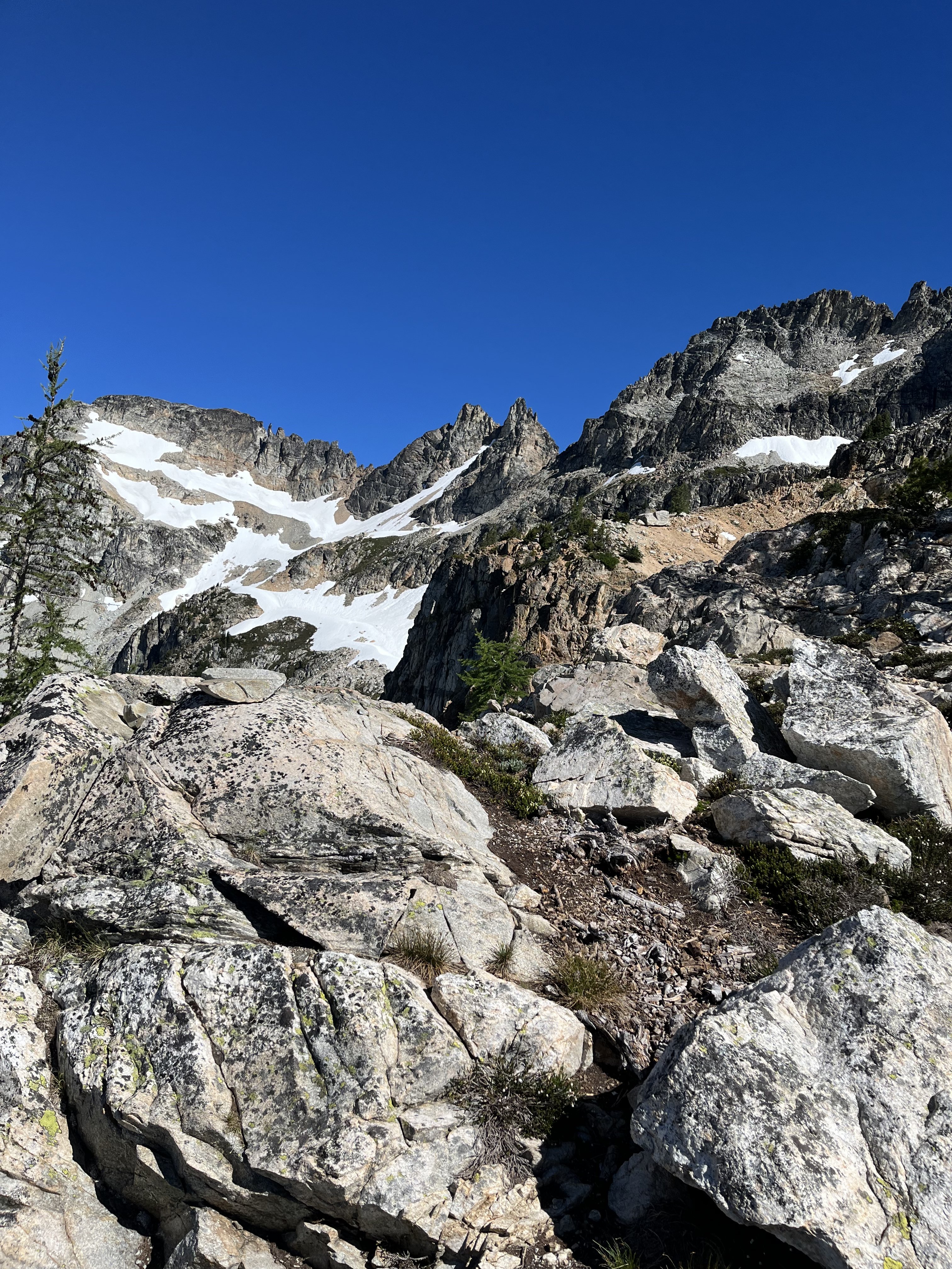
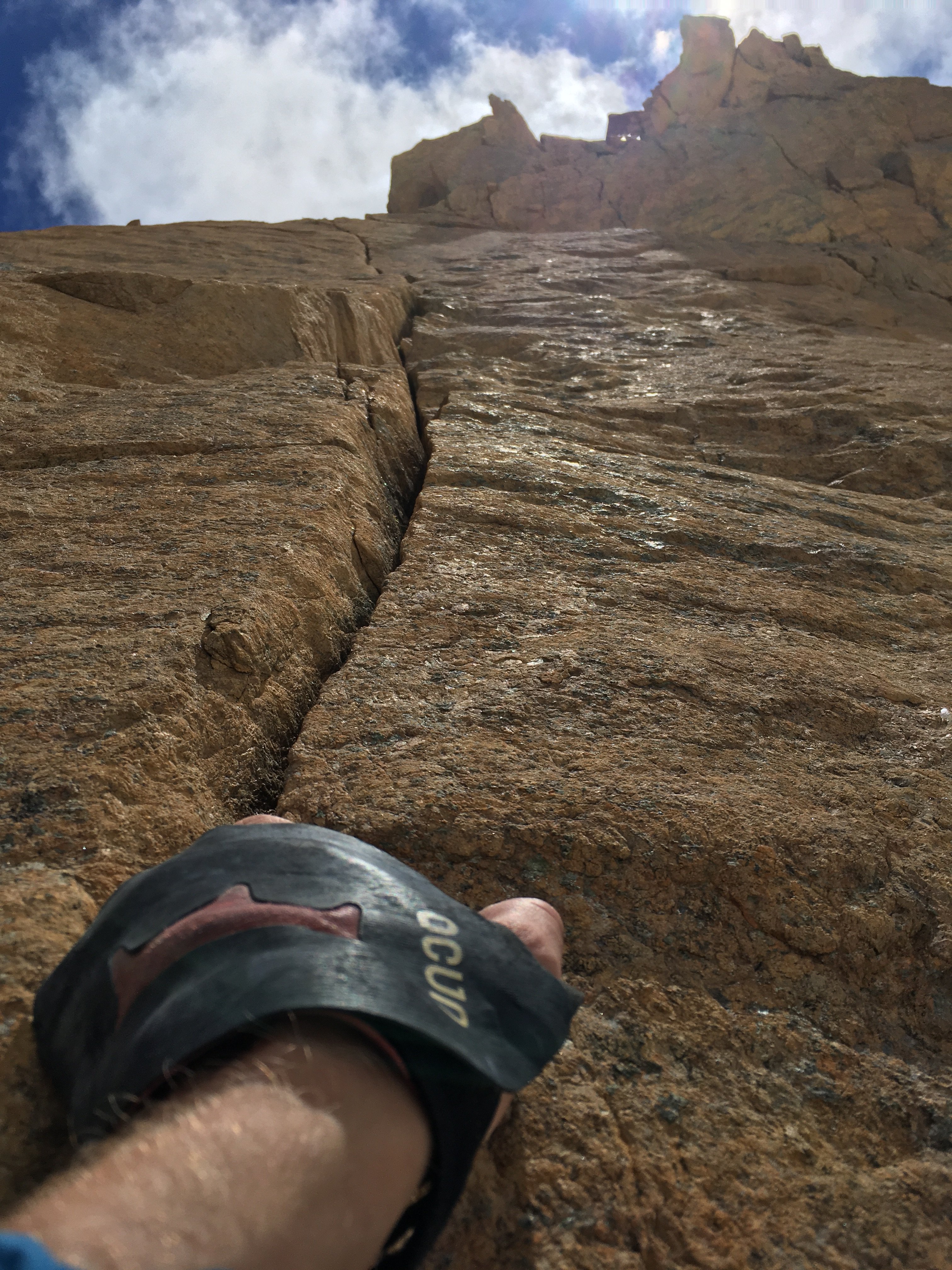
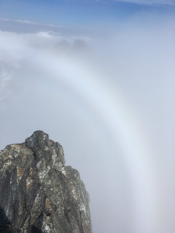
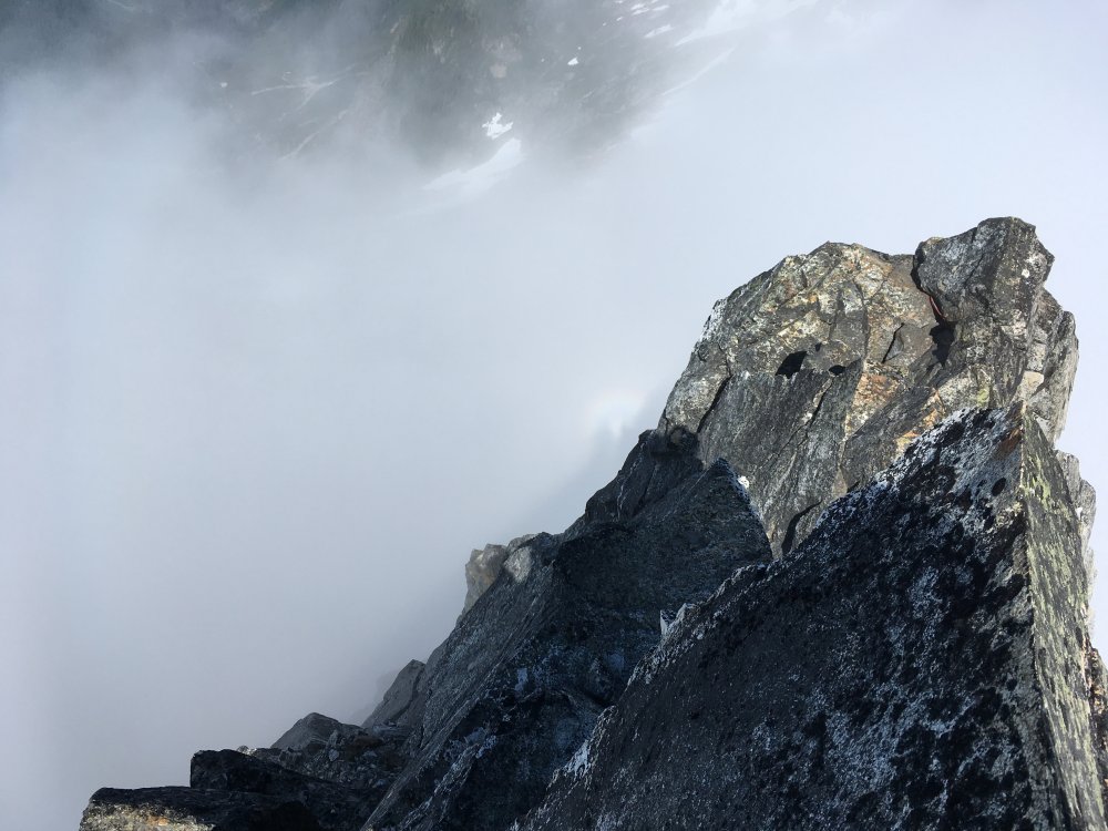
Trip: Crescent Creek - Terror W ridge, wild hair crack, chopping black NE Trip Date: 07/15/2021 Trip Report: Went to the crescent creek area 7/15-18 with Alex. Shwack before terror creek is confusing at times but not exactly heinous. The creek crossing (ford) was easy for us. Trail on the other side is superb, possibly the steepest I’ve hiked, and very beautiful too. Not as enjoyable going down though. Once at the crest the path becomes ambiguous again. Didn’t have any trouble on the way up but somehow kept losing it on the way back. It took a while to reach the 6400’ notch and weather was coming in so we opted to just rest in the evening. We could see only the lower portions of the basin, and the going looked tough from afar. The spires were still a mystery at this point. Top priority for the trip was Wild Hair Crack, and Stoddard was 2nd. We needed two full days of good weather on days 2-3 to pull them both off. Waking to very low visibility on the morning of the 2nd day we called off Stoddard (next time) and planned to push wild hair to day3. We caught up on sleep for a while, finally getting going after noon towards the west ridge of terror as consolation, because the weather didn’t seem to be getting any worse. Traversing the basin ended up not being as bad as it looked. Took an hour to reach the base of the gully leading to Terror. Crux of the day was in the middle of the gully where a break in the snow forced a tenuous step down onto slabby choss and a few moves up from there before returning to snow. On the way back we chopped back snow to excavate an anchor at that spot. If I’m not mistaken the chockstone flexed when I tested it, but we rapped anyway. Poor visibility made it hard to find the start of the route but eventually we did one diagonal pitch from a notch to a slung rock. We unroped and scrambled from here in the mist. Some of the rock on the route is quite nice, more like the granite in the basin than the crap in the gully. Just as we were reaching the summit the cloud layer thinned out. I was remarking that this was glory weather and sure enough, a large white ring formed behind Terror. We got flashes of clear views to Fury and MacMillan. Saw our own halos for a minute then headed back. The climb was done to pass the time during poor weather, but a glory sighting took it to another level, validated the whole day. The weather finally cleared mid morning day3 and we were soon at the Otto Himmel col. The chockstone had fun looking moves on its right side, but probably 5th class so we kept it simple with ledges on the left a little ways below the stone. WHC did not disappoint. I mostly took small cams and they were mostly useless. The first good spot I noticed above the runout chimney is a thin horizontal crack, so some small pro helps. Other than that it seemed like most pro opportunities were in #2-3 range. The climbing was easy and solid enough that I was fine with long run outs. We relished the views up top, calling to the tiny figure over on the summit of Terror, our neighbor for a couple days. Descending with 60m rope worked fine, there are probably more anchors around now than in the past. On our last day we went to the NE side of chopping block, doing some exposed scrambling before roping up at a rap anchor. To my surprise I reached the summit in one 60m from there. This is another great vantage a place to mull over various traverse schemes deep in the backcountry. As we were packing up for the hike back, someone arrived at our spot. It was not his face but his lack of a backpack that helped me correctly guess his identity. Not a lot of people do day trips in the pickets. At least one who does has posted some insane reports here. My suspicion was confirmed and it was nice to meet and chat with dr dirtbag himself A dip in Terror creek and another in Goodell at the end of the trail helped wash away the grind of the descent, literally and metaphorically. Gear Notes: Axe and crampons for gullies Try to keep it light but mostly large in the cams Approach Notes: Useful gpx are out there


-
‘Bird’ Mtn looks nice, did you climb it from the south?
-
Yeah I think NCCC’s hyperbolic style is a bit dumb but their comments and others like Sierra Club’s are worth reading https://cara.ecosystem-management.org/Public//ReadingRoom?Project=58218 I’m certainly no expert in these matters but it’s hard to picture how cutting big trees and constructing new “temporary” roads could be good for forest health. Seems like there’s a lot to take issue with, even with the less shitty alternative 2.
-
[TR] Mount Index, North Peak - North Face 01/29/2021
JonParker replied to sfuji's topic in Alpine Lakes
Awesome! This reminds me that I should try adding bad jokes into my repertoire instead of relying solely on tangled ropes. -
It’s sketchy, go get it!