Kameron
-
Posts
187 -
Joined
-
Last visited
-
Days Won
9
Content Type
Profiles
Forums
Events
Everything posted by Kameron
-

Atacama 2010: Licancabur & Socaire
Kameron replied to Kameron's topic in The rest of the US and International.
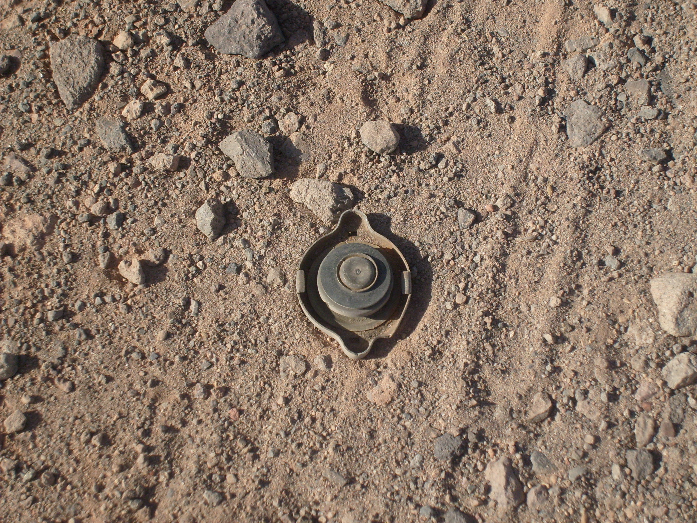
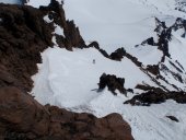
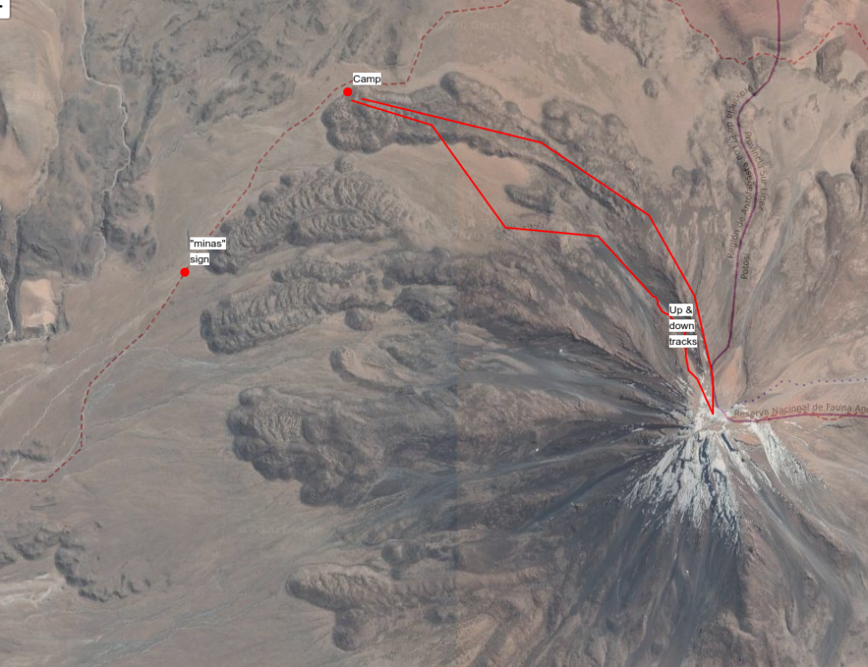
I feel like my memory fails me a bit on the details of that day... now that I mull it over more... I think I might have realized that object wasn't a mine eventually, although it definitely scared the shit out of me at first. But I'd definitely forgotten that when I first posted this. I saw that picture and my files yesterday and was like "whoah!" I found a website from the Chilean de-mining commission that shows the types of landmines used in Chile: http://www.cnad.cl/?page_id=83 as well as maps of affected areas http://www.cnad.cl/?page_id=171 Antofagasta: Zoomed into the area around Licancabur. The peak is located south of MF-E1-22, which was the area we passed through. This map is dated from January 2018, and the yellow color means "campo minado depeje en proceso" or minefield partially cleared. This area did not have anything more than that one small sign on the ground marking it. Best I remember our route and camp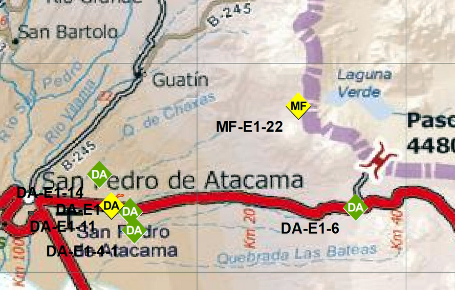
-
Atacama 2010: Licancabur & Socaire
Kameron replied to Kameron's topic in The rest of the US and International.
Found this, basically the only sign that we were in a dangerous place, no evidence of where the boundaries were. We'd driven through a fully fenced minefield right off the highway, but this was on the rough road as we're approaching the flanks of the volcano and the border.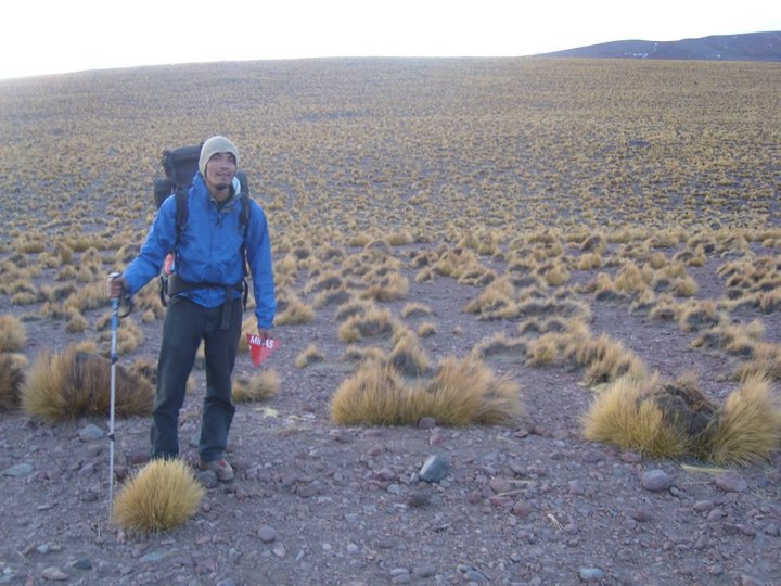
-
Atacama 2010: Licancabur & Socaire
Kameron replied to Kameron's topic in The rest of the US and International.
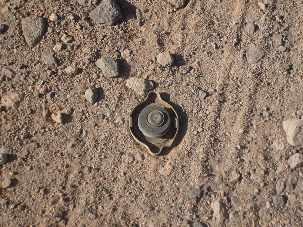
You could be right (edit: I think it is a radiator cap now too @bellows, haven't seen any mine photos that have the metal base, but it looked a lot like a mine!)... I didn't want to pick it up and find out. There are a number of different models that the Chileans have used. I'm not sure what all of the designs look like: http://archives.the-monitor.org/index.php/publications/display?url=lm/2003/chile.html They claim to have cleared out all mines from the country, but I doubt that is even possible in these large, remote areas. http://www.icbl.org/en-gb/news-and-events/news/2020/chile-announces-mine-free-status.aspx When it rains, they have can wash away and end up anywhere. -
Atacama 2010: Licancabur & Socaire
Kameron replied to Kameron's topic in The rest of the US and International.
This was also quite the relief! -
Atacama 2010: Licancabur & Socaire
Kameron replied to Kameron's topic in The rest of the US and International.
It was one of those "too dumb to realize" how dangerous it was ... until I saw that land mine (edit: mine-like object?) in the road and it all becomes clear and your gut just drops out. It's quite a shame that Chile's military did what it did. There are a bunch of interesting peaks that I'd like to check out but don't really want to have a similar experience on. Skiing Parinacota and Pomerape, which are two volcanoes further north in Atacama that actually have glaciers, would be incredible! You can, of course, do it, but going from the Bolivian side is much safer. I had a nice chat with Pato on Facebook yesterday (Chilean "independence day") and we laughed about this stuff! -
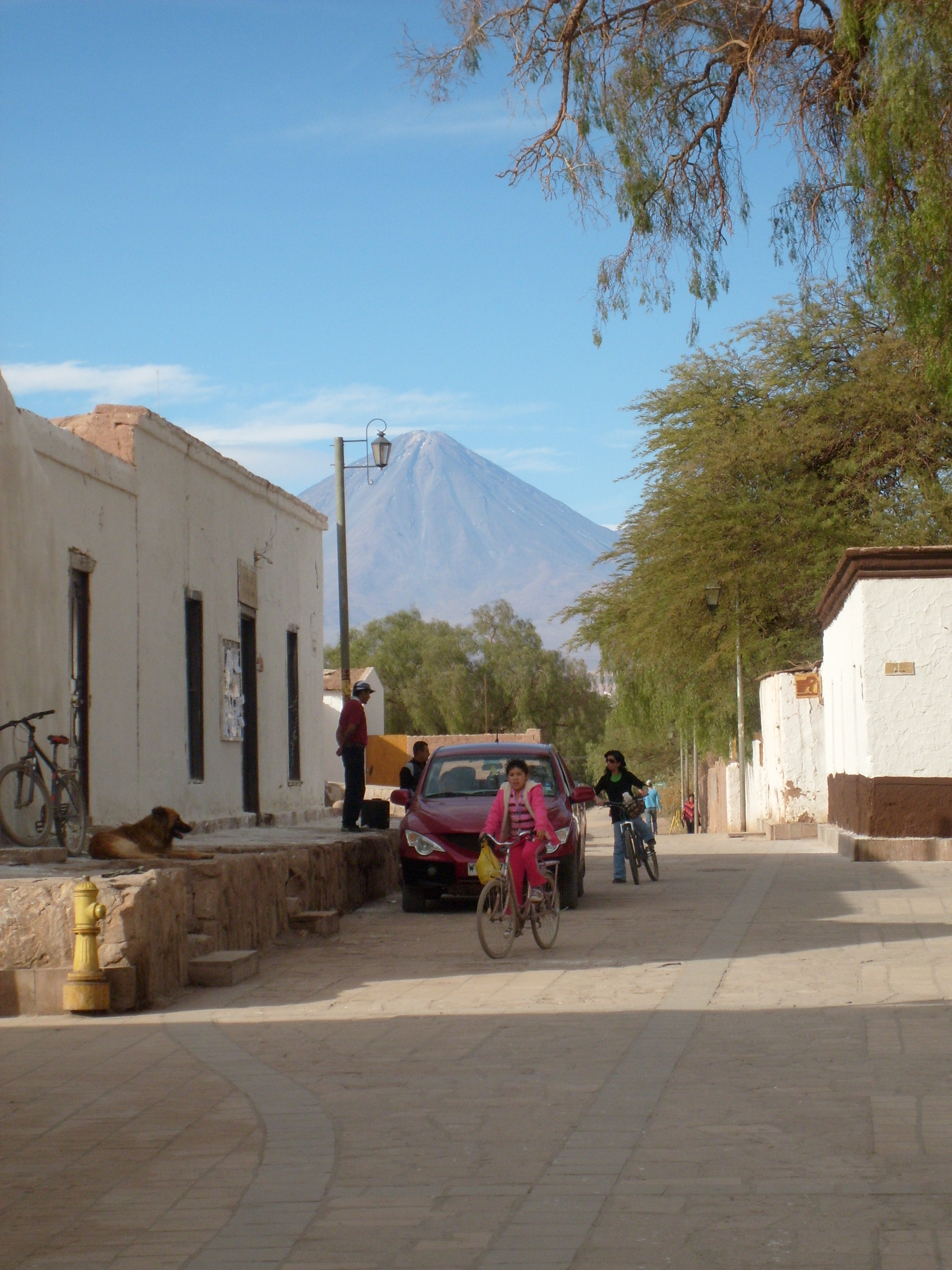
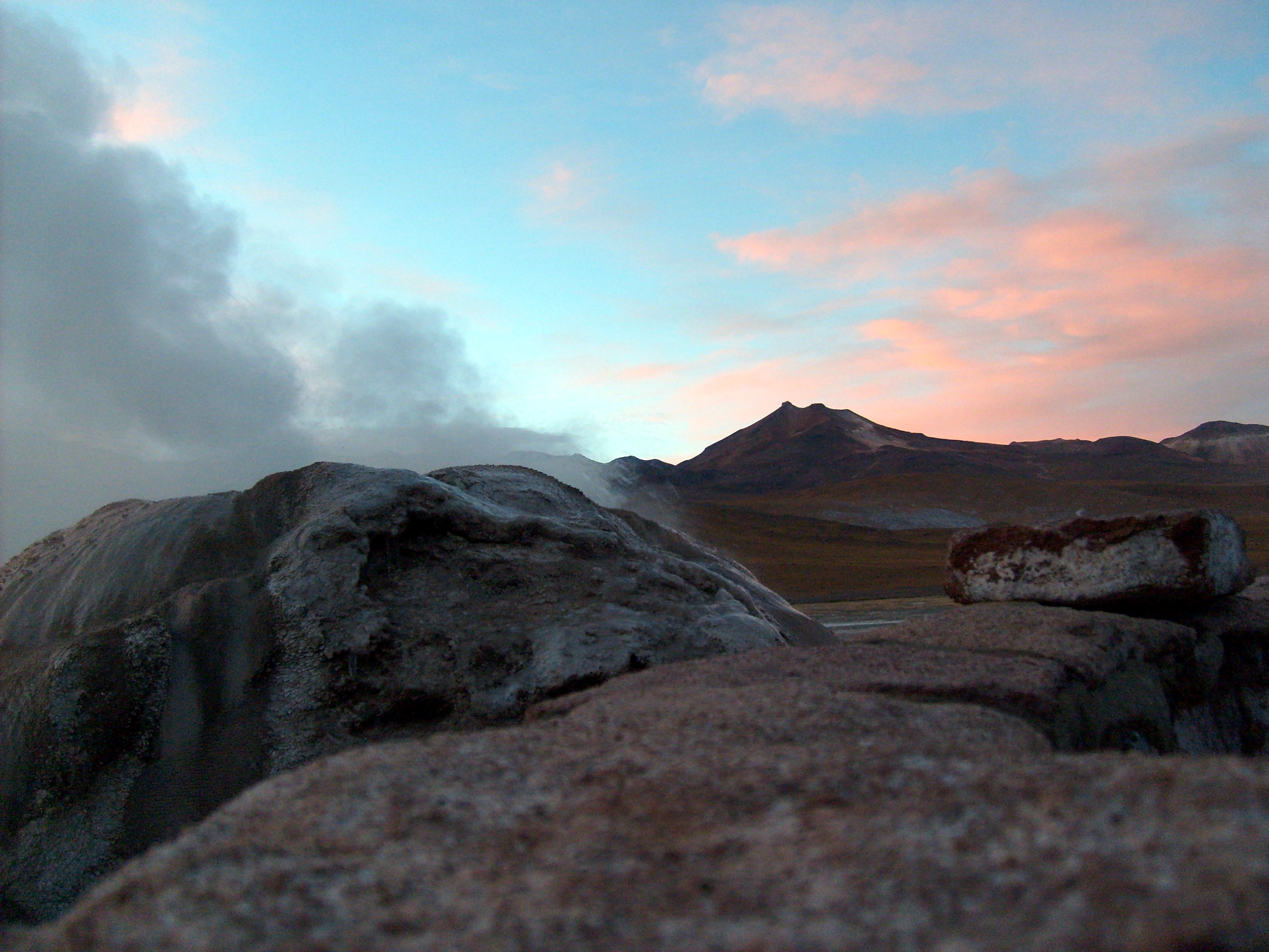
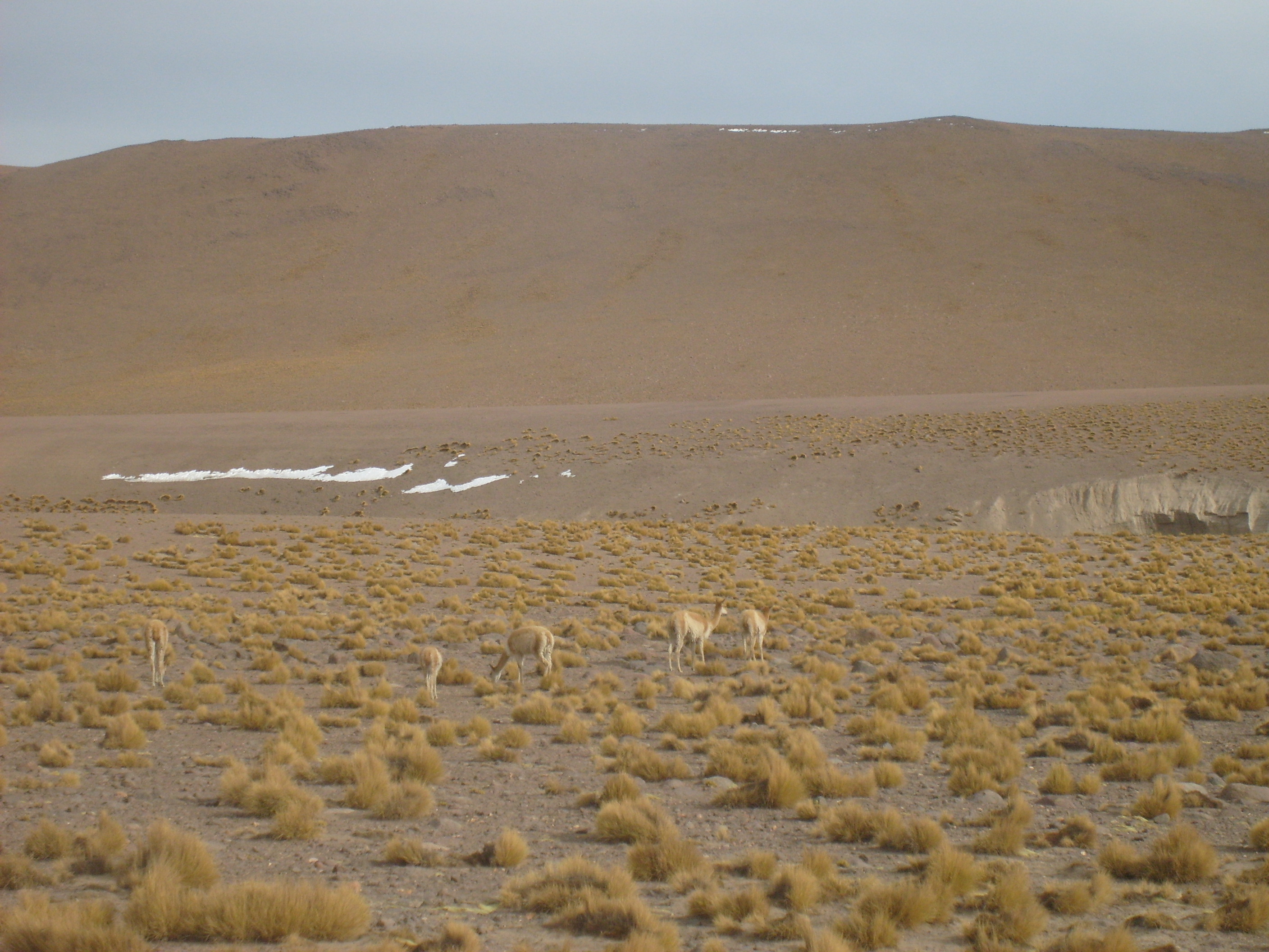
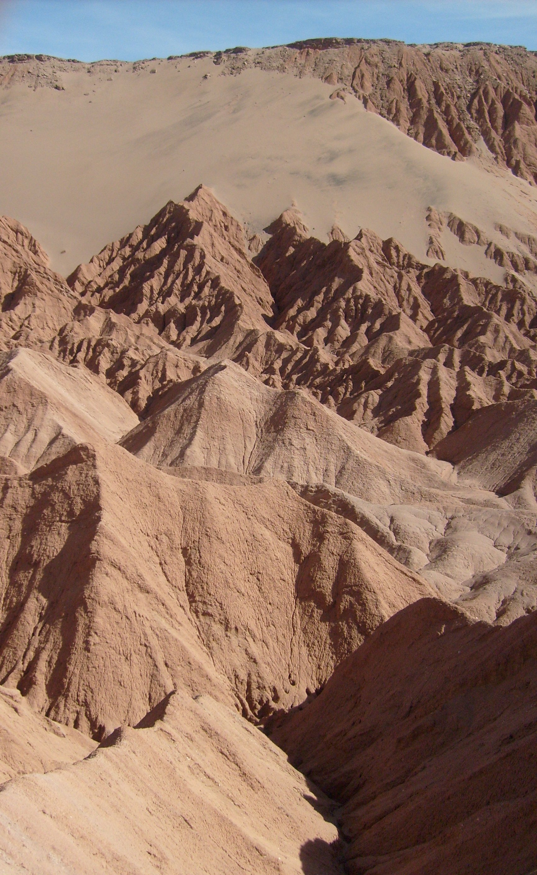
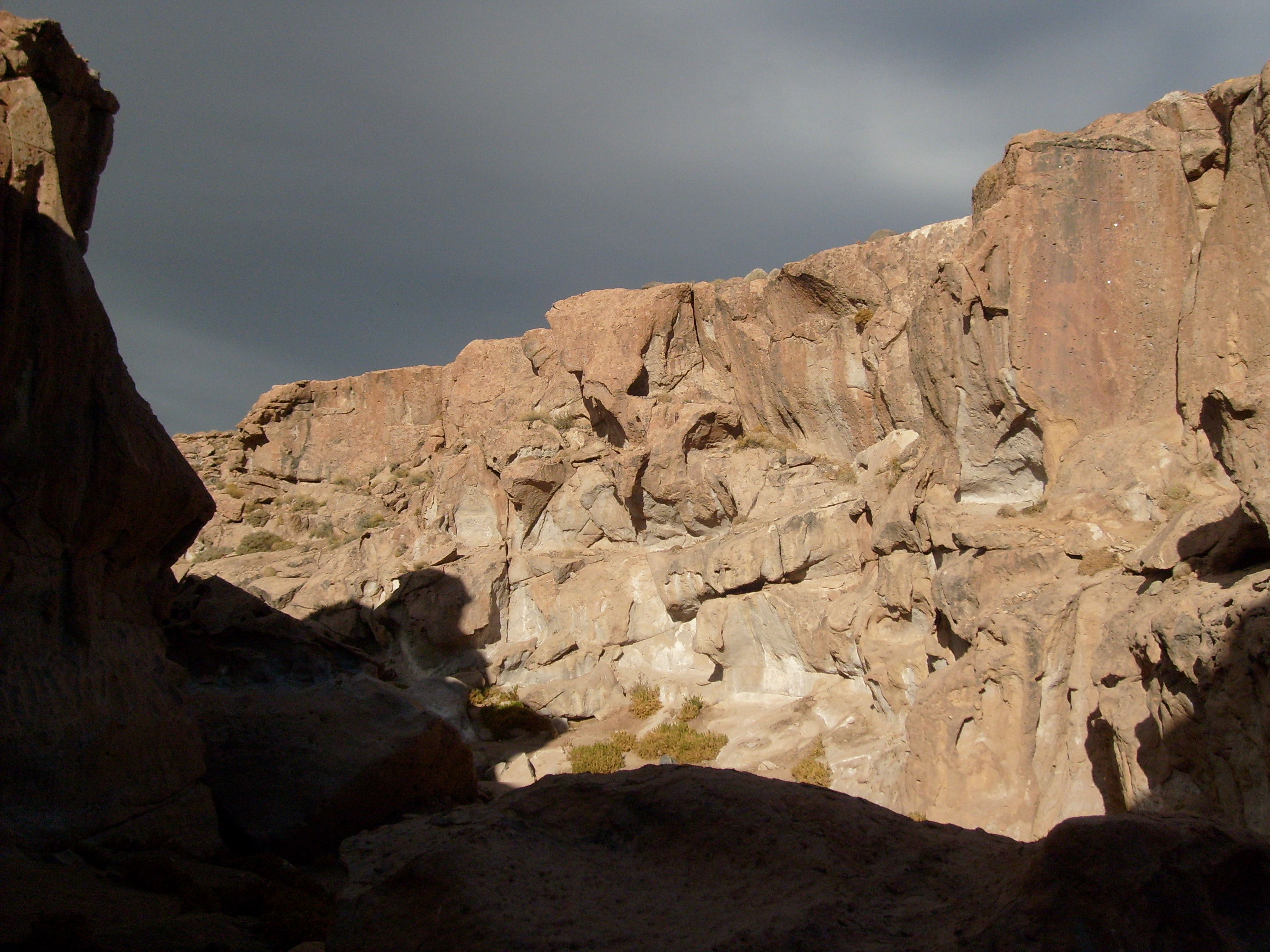
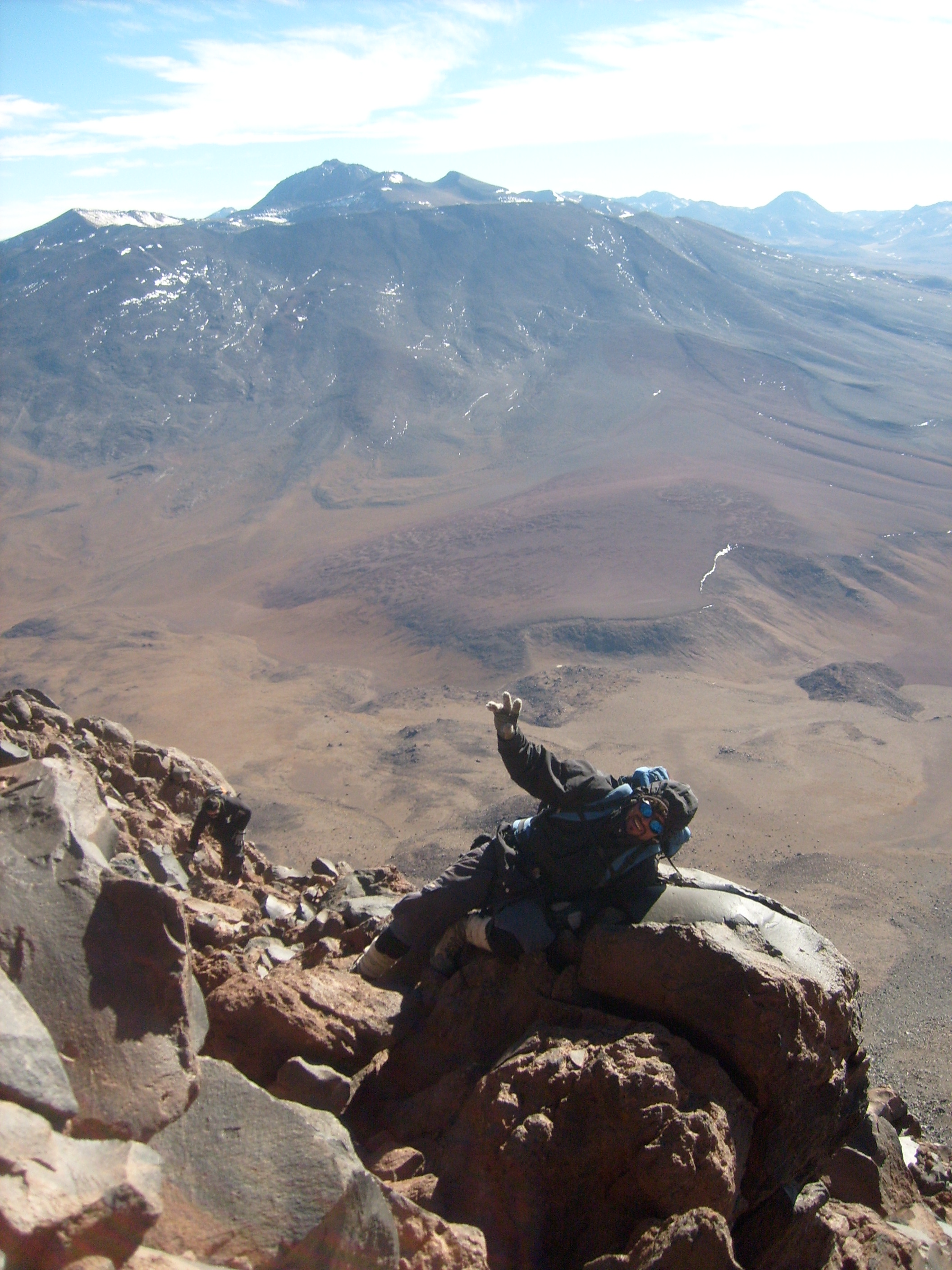
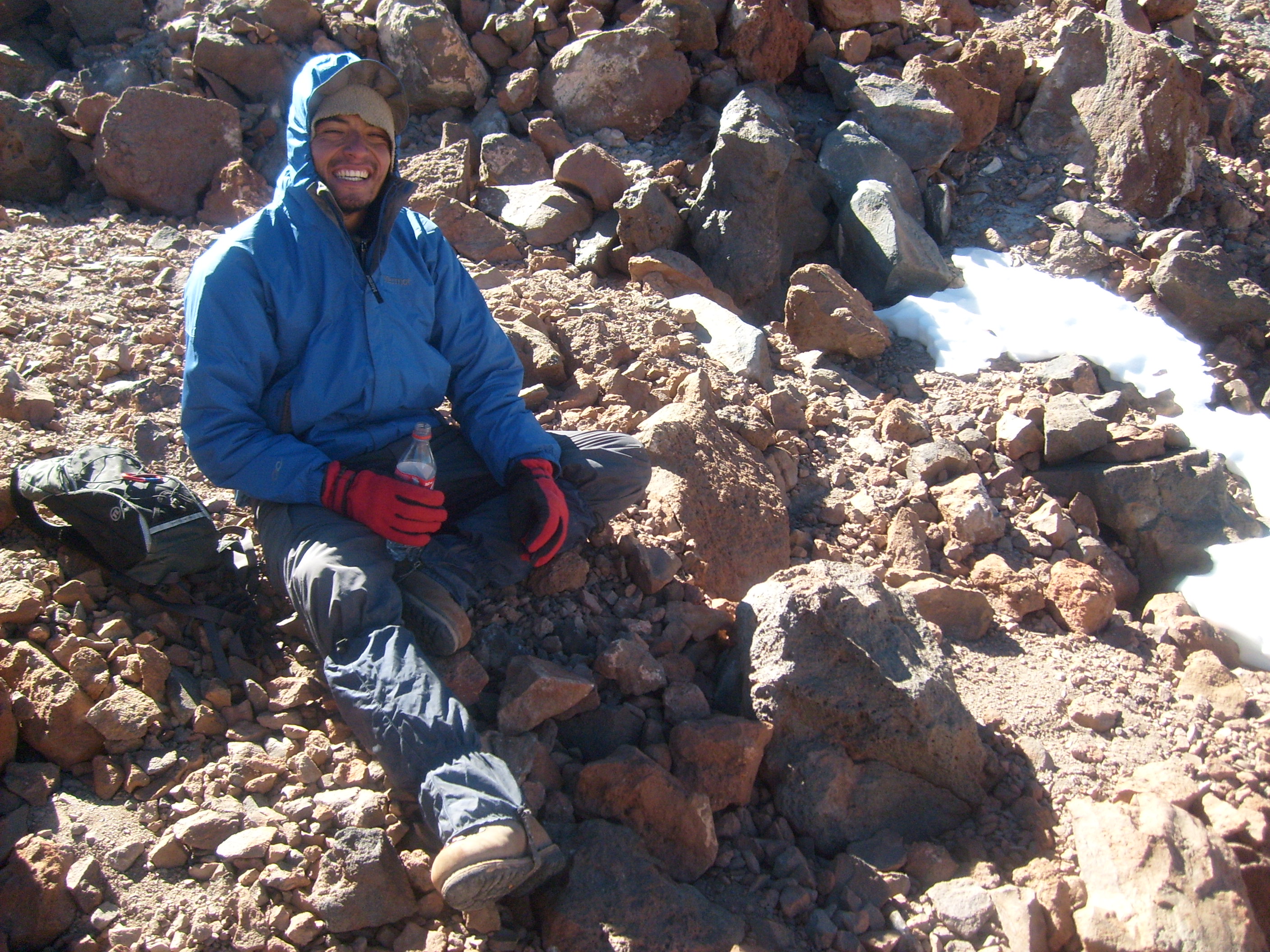
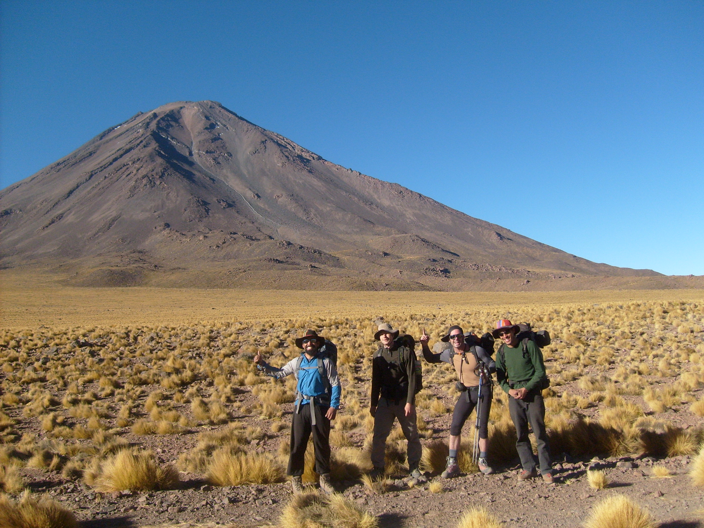
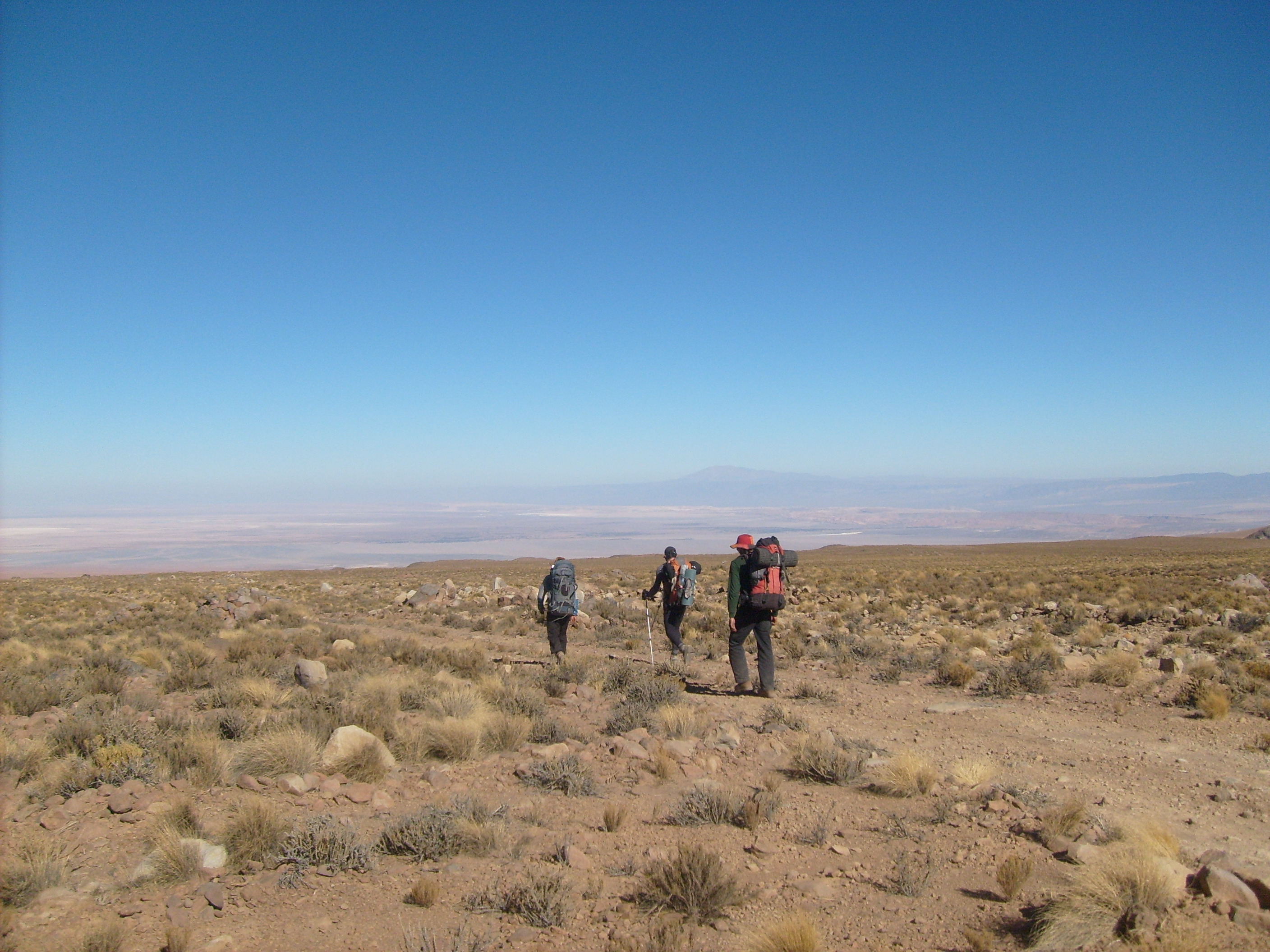
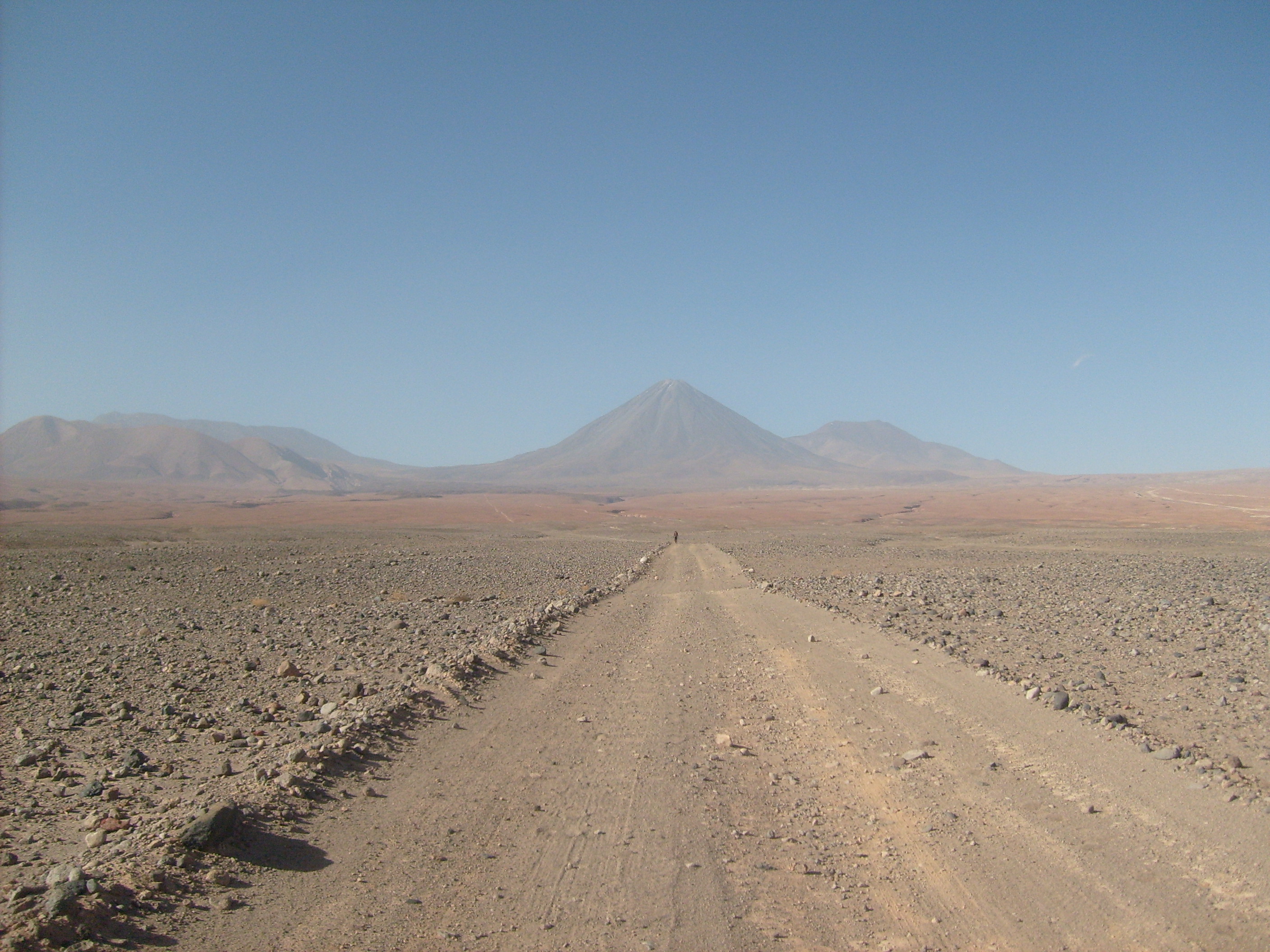
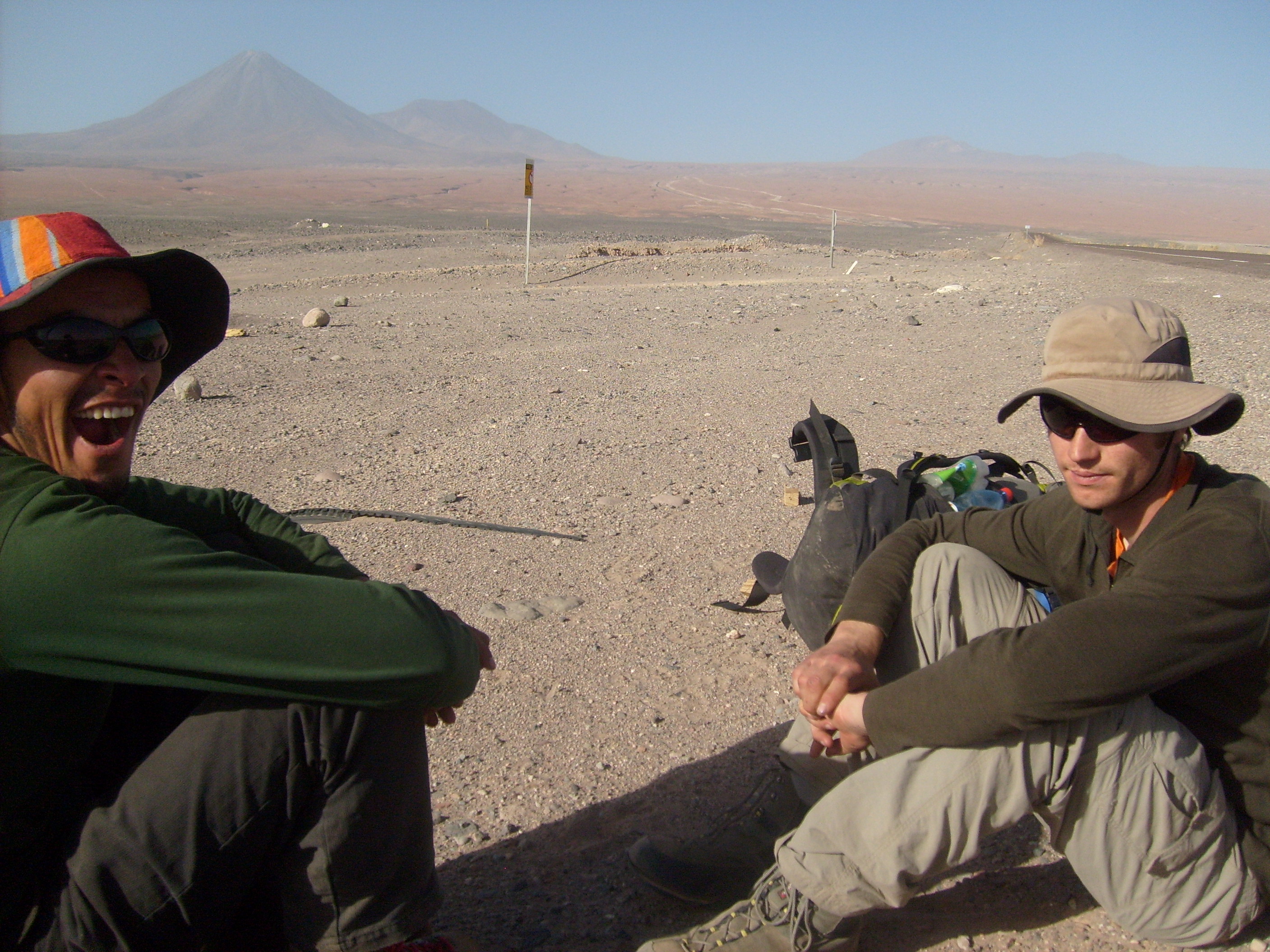
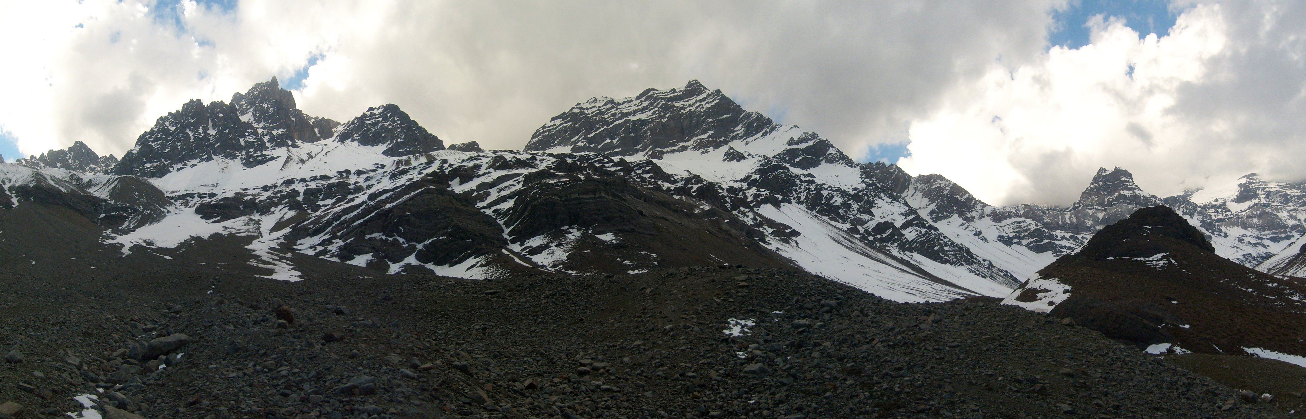
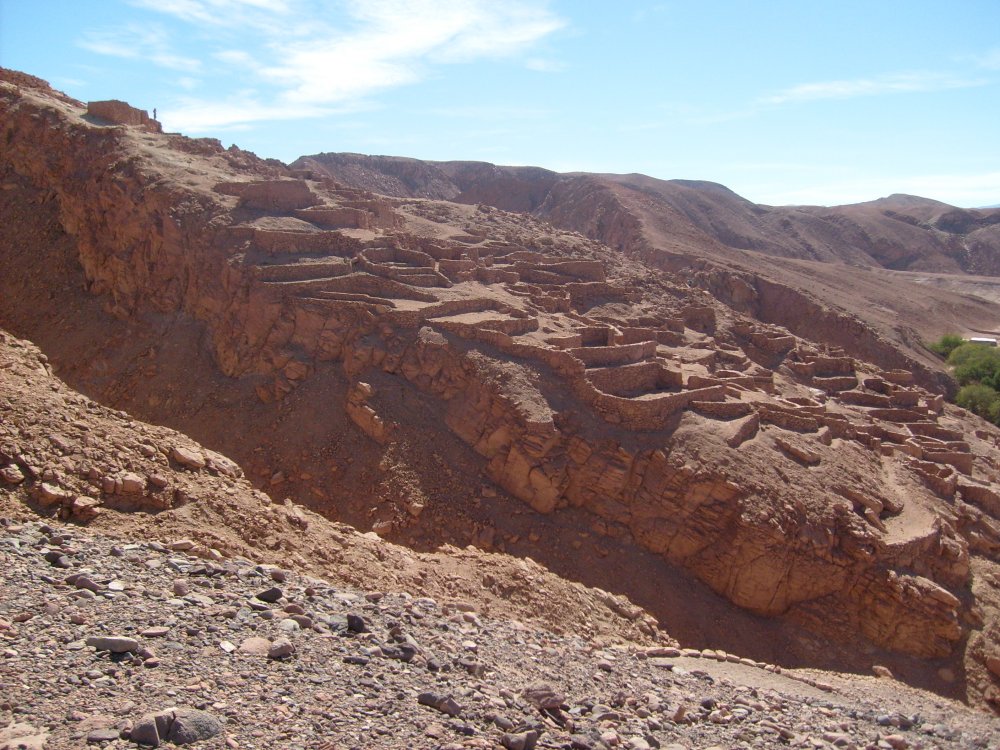
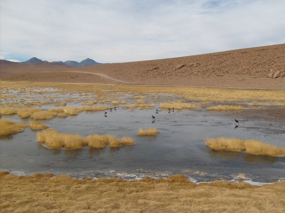
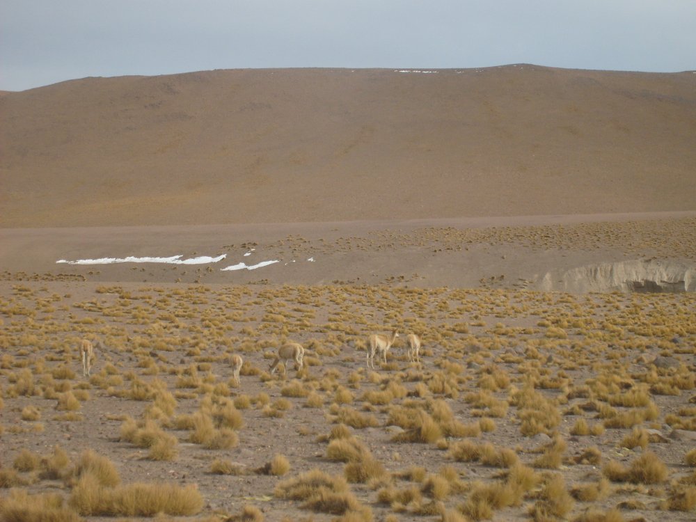
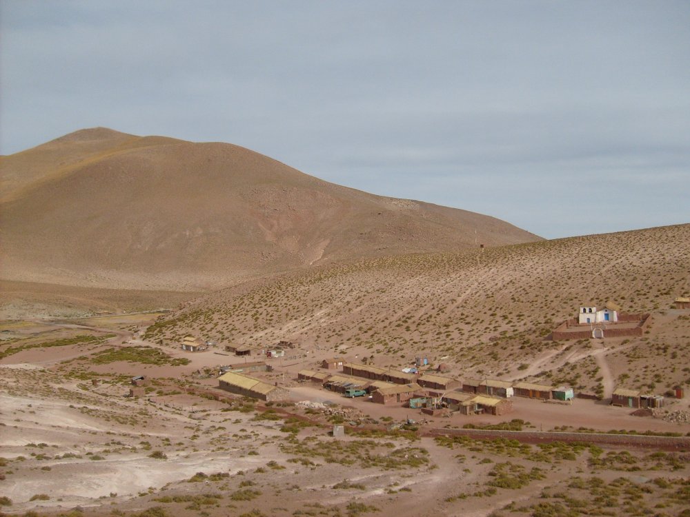
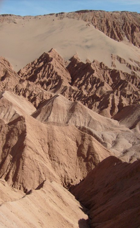
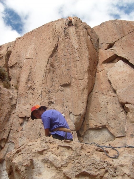
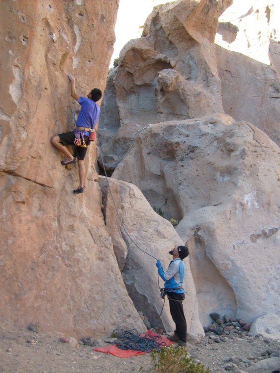
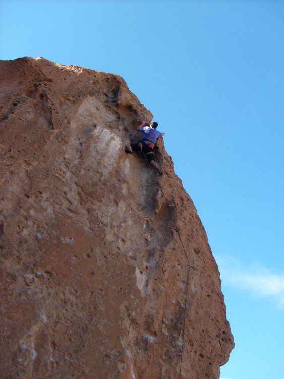
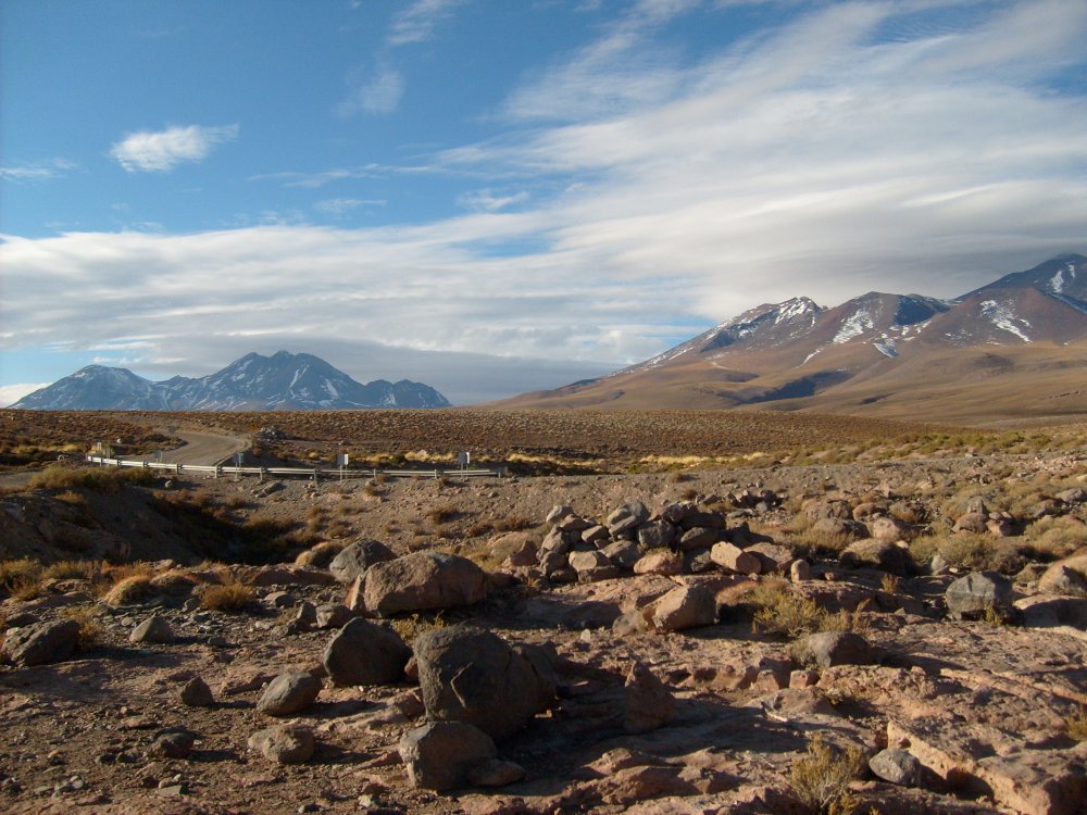
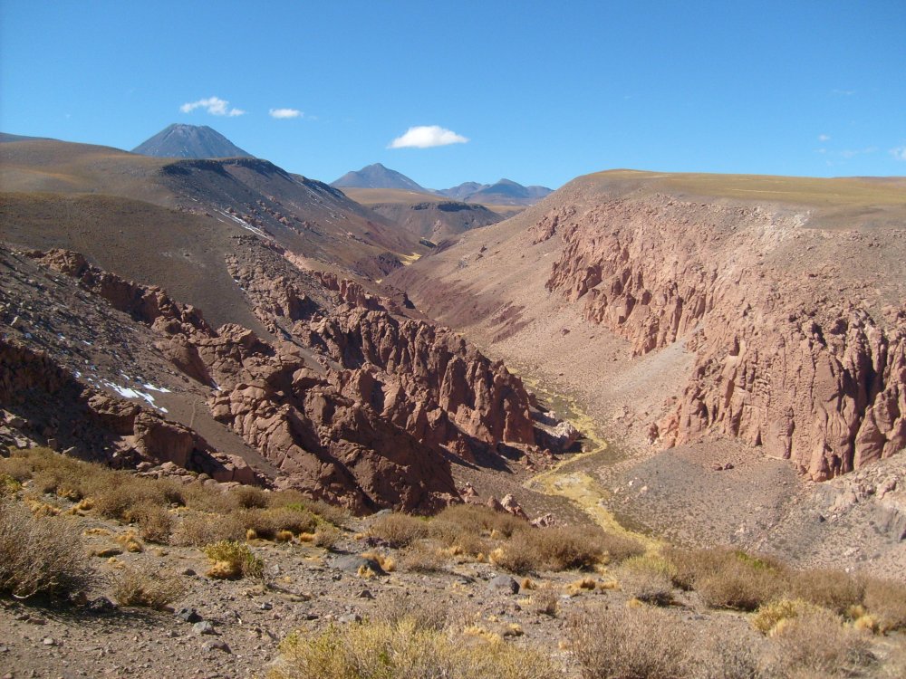
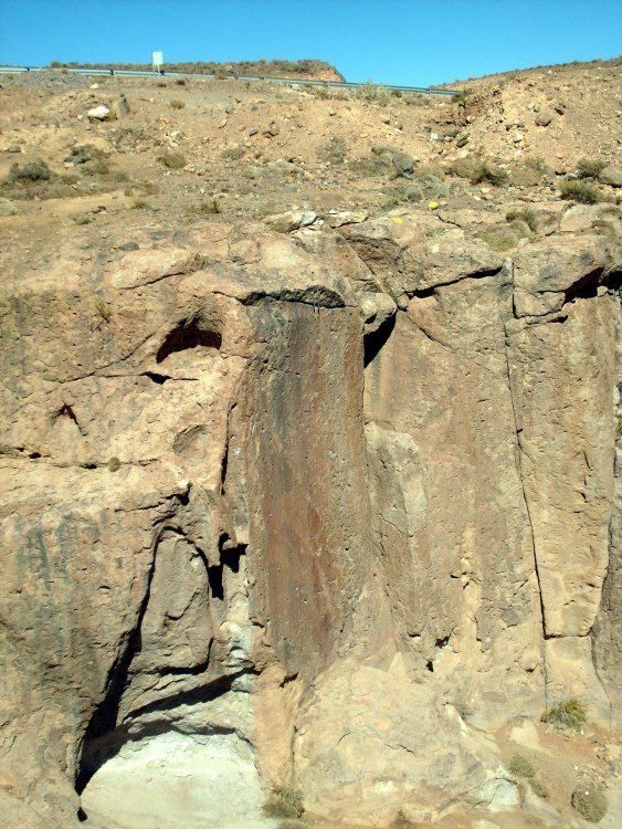
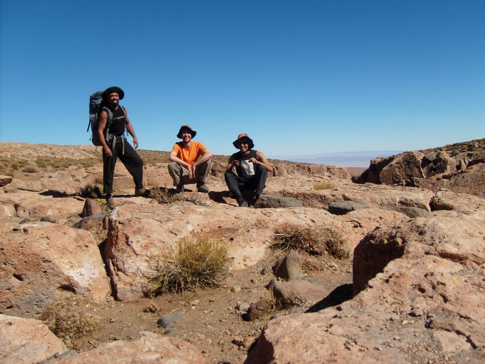
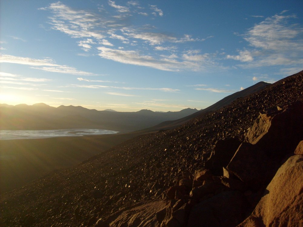
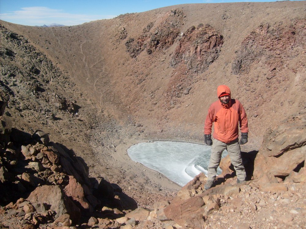
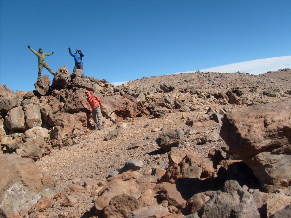
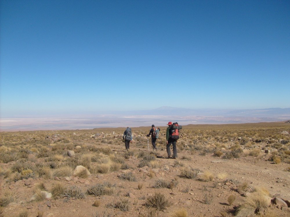
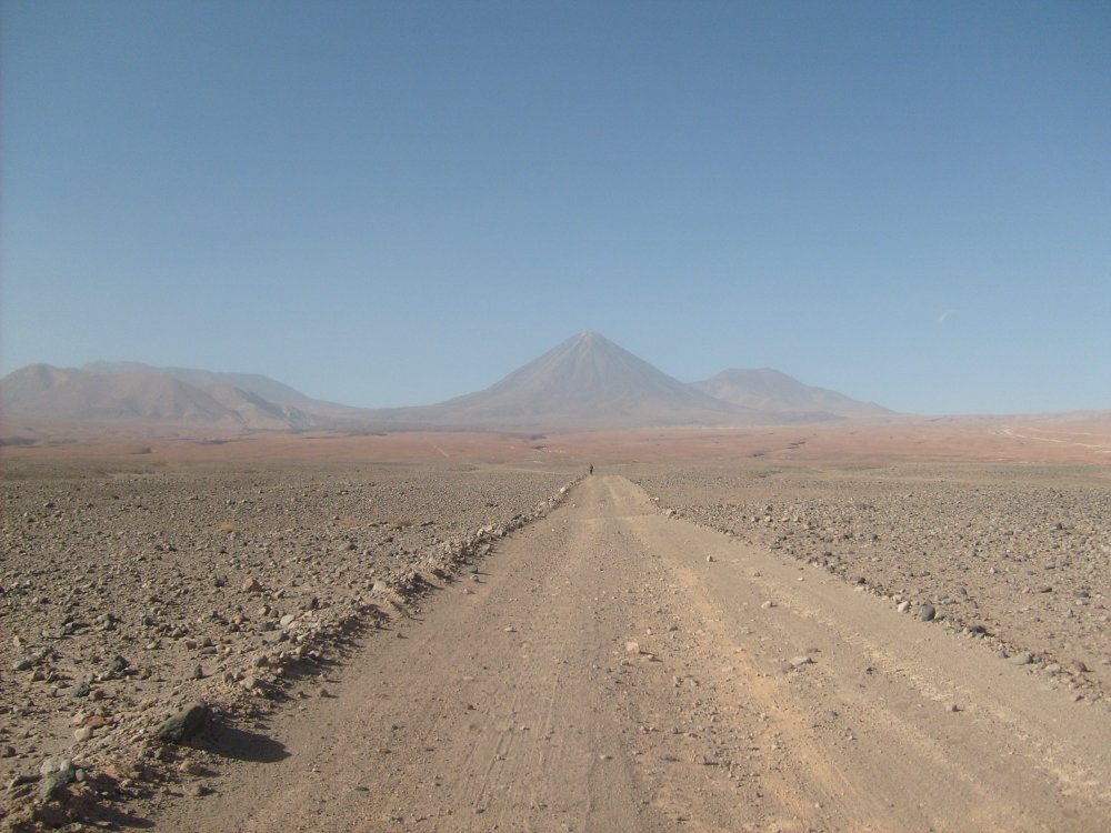
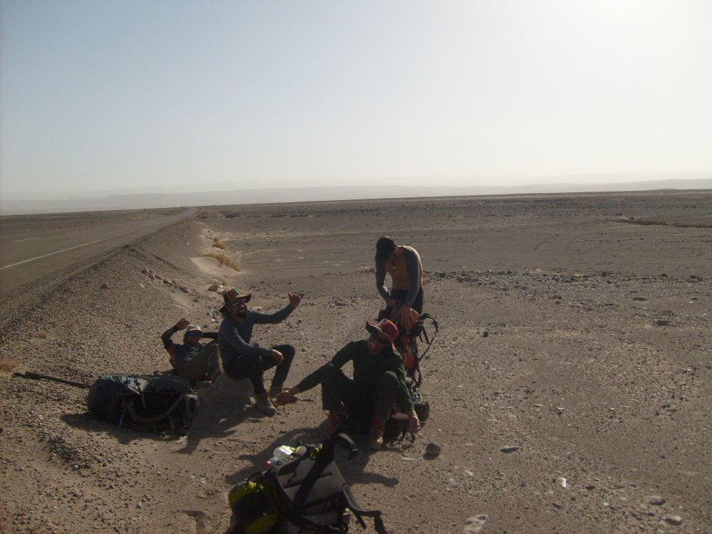
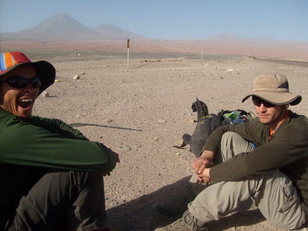
I was digging through my old photos and remembering an epic and formative trip. Thought it would be worth a share. I lived in Valparaíso, Chile for most of 2010. That's where I started doing mountaineering and rock climbing, with a group of chilenos of questionable safety standards. Most of them were part of the Club Universitario Andinista, which was a club formed by former students of the Universidad Técnica Federico Santa Maria. The university club was disbanded after a very public tragedy on one of the Patagonian icefields where, after being pinned in tents by a storm for some number of days, a bunch of students perished from exposure after getting separated into two groups. One of the survivors became my friend and mentor Carlos, although he didn't talk much about that experience. I had climbed a couple times at Las Chilcas, an area in the central region known for sweet but hard sport climbs and easy bus ride from Valpo or Santiago, and tasted the oceanic rock around Valpo. My friends Jose-Luis and Pato Chico made money doing ropework odd jobs all over, and their big paychecks were often working for the mining companies. They got a job doing some work for a mining company around Antofagasta or Calama and invited me to meet them there for some climbing. I was soooooo stoked and I think I flew up there to meet them. Jose-Luis' sister put me up in Calama, I think, the I went to San Pedro de Atacama. SAN PEDRO San Pedro is a popular tourist town in the desert and very beautiful. There aren't many other places in the Atacama that foreign people visit. I spent a few days exploring around town and stayed with friends of friends. (I'm kind of embarrassed about how cheap I was back then, given that I was getting paid pretty well for a person living in Chile.) Licancabur, a beautiful symmetric volcano on the border with Bolivia, as seen from town. Checking out the geysers is a popular tourist activity It was cold at night. This is June, and the water is frozen. Wild camelids, either guanacos or vicuñas, I'm not sure which. I tried eating barbecued llama meat on this geyser tour and ended up getting really sick for nearly the rest of the trip. Pueblo atacameño típico I scrambled up and over some of these giant piles of dirt and salt and almost couldn't get myself out. Kind of scared myself and was an omen of more near-disastrous experiences to come. Below me was a dark sarlacc pit of doom. SOCAIRE Anyway, at some point Pato and Jose showed up and we went to Socaire, which has a beautiful canyon with sport and trad climbing. They had been there before. We took a bus and paid the driver extra to bring us a few miles closer to camp. I don't remember much of the details, but I think most of the climbs we did were in the 5.9-5.10 range with cool pockets and eroded features. Steep, bolted, although the other guys TR'd some cracks. I didn't know how to crack climb yet. Pato belaying with me up top. Jose belaying Pato ' The scenery is amazing { During our couple of days climbing, we slept in a bivy cave in the canyon and drank water from a trickling stream that ran through it. None of my chilean friends ever treated or filtered their water in the Andes, so I didn't either. I was pretty dehydrated all the time at this point in the trip from diarrhea I got from the llama meat. I think the second day of climbing, I gave a try at leading a short, 3 or 4-bolt route that was pretty much vertical. I was new to climbing but had learned to lead on day 1 at las Chilcas because... that's what they had me do! So it wasn't my first lead but I was pretty green. I clipped all bolts and was at the chains, totally pumped and trying to clip. I remember being so pumped I grabbed the chains and clipped my draw, but couldn't make the clip. My hands got greasier and greasier until I fell. Jose was belaying me but not really paying attention and had out too much slack. I basically fell right onto his head, but the rope came taught. Although I tweaked his neck, scared the shit out of myself, and scratched my glasses when they fell off, we were more or less okay. I took the next day off climbing and hiked around the canyon taking pictures. I think this is a picture of the route I ate shit on: The crew: a couple strong chilenos and one weak gringo! We walked into the town of Socaire then spent all day bumming around the plaza and trying to get a ride to San Pedro. Eventually, we found someone who was heading that way that we paid for a ride. LICANCABUR Licancabur (5916 m according to wikipedia) is the volcano that just calls to you from San Pedro. It's amazingly symmetrical and is sacred to the Aymara people of the region. Like a lot of high, dry peaks, there are ancient ruins at the summit. We decided to try and climb the thing from the Chilean side, because of course that way we'd be doing it the Chilean way and could bring any sort of smoking kit needed. Typically, people climb from a beautiful green lagoon on the Bolivian side. There is a marked trail there and that's the way guides will take you. But it's just a walk-up, so no big deal, right? Well, the other reason people climb from that side is that the Chilean dictatorship mined a lot of border areas to prevent a feared Bolivian invasion. (The Chileans took a huge chunk of land from Bolivia and Peru during the war of the Pacific in the late 1800s, which both other countries still complain about, with good reason.) So to get to the Chilean route, which climbs the N rib of the volcano, one needs to travel through an area which is known to have land mines. I was young and dumb, so was content to trust my (experienced yet crazy) Chilean friends and go that way. We found some other fools to join us, friends of Jose and Pato, mostly tourist/mountain guides from San Pedro, and a guy who worked in mining who crucially had a 4x4, plus a Spanish dude who was stoked. We piled into the car and drove towards the border on the paved highway, then turned north on the dirt road that would take us towards the climbing route. Like most remote land in Chile, it's privately owned. We called the landowner who said it would be okay for us to use it and that the road had been de-mined and was safe. As we drove down the road, we passed a fenced-off minefield that was signed. Eventually the road became too rough to drive, so we left the car and walked. There is absolutely no water in this area, so we carried I think two large soda bottles each (maybe 4 L?). I remember having to take a crap (still diarrhea) and digging a hole in the road because I didn't want to leave the road. I got behind my friends but kept walking along. Then the weirdest sight. A dude on a bicycle coming from Bolivia! He came by and I said hello. He was friendly enough, and I asked him if he was coming from Bolivia. He said something like "no, I'm just out for a spin". But it didn't make any sense. He looked Bolivian and had a Bolivian accent. He was also riding a bright red beach cruiser style bike and carried only a tiny daypack. It was weird, but I was pretty zonked from dehydration, etc., so I just kind of accepted it and walked on. We regrouped and my friends said they were pretty sure he was a smuggler. It made sense. We decided to not worry about it and keep going. As we walked, the road turned into more of a path. At one point we saw a small, metal sign on the ground with only one word: "minas". It wasn't clear where they would be. We continued and camped at a tongue of lava, on the border, where the route was described to begin. From there, it was just a chossy hike to the top of the volcano, but the altitude was brutal even though I'd been at 4000 m for a week. I was also still really dehydrated, but amazingly got over my diarrhea mid-climb. I don't think everyone made it to the summit, but Pato, Jose, and I did. Early light looking into Bolivia One of the homies (Marcelo I think?) feeling smoked, Spanish dude we called "Super Tío" behind On the summit. One of the highest "lakes" in the world. You can see a trail going down on the other side of the cone. Pato delirious Crew: I remember being so tired I wanted to just sleep on the summit. I probably was in the early stages of some kind of edema. We decided to descend by foot-glissading down this incredible chossfield that went on for ages. It was one of the craziest boot-skis I've done. We CRUISED down that thing. Somehow it didn't start a rockslide. After descending this, we made it back to our camp without exploding. This was stressful... we crossed a big flat area, on the Chilean side, that we weren't sure if it was mined or not. You can see the boot-ski big gulley with the choss "runnel" in it here, and the flat expanse we crossed below: Well, we'd been successful so far, so we felt pretty stoked. But then we got back to our car to find it had been broken into. Likely the smuggler and his friends decided to try and sweeten the deal (he likely had a pack full of cocaine) by grabbing a newer SUV as well. Luckily the anti-theft system worked. One guy had left a laptop in the car, though, and it was stolen. Marcelo tried to hotwire the car himself and actually got it running for a second before the anti-theft kicked in and shut off the engine. At this point the stoke was wearing off as we realized we probably had to walk back to the highway and were out of water. We didn't even have any in the car---although there was a bottle of red wine that the smugglers had left us. We managed to get a cell phone call to town and ask for a tow truck, but they told us it would be a while. We started walking. We met the tow truck on the road. They gave us a little water but said the road was too rough and were going to turn around. So we ended up having to call a different truck to come later. Not really a good scene when you're walking on a "safe" road and spot this (edit: probably just a bit of junk that scared the crap out of me!) But we made it.


-
Fuck land mines. You ever spend time around those, and you will not even want to joke about it.
-
100% agree that this is the most important gear and agree with most of your observations! Breathability has been very important for me in summer. I am prone to getting immersion ("trench") foot. So trail runners are definitely worth using on a long approach even if I'm going to carry mountain boots. I learned that the hard way on Triumph and Logan. I'd add that ski boot fit, which is probably what I know most about since I ski better than I climb, is super important for downhill performance and comfort. Took me a while to figure that out after stuffing my feet into too-small boots after learning to race that way.
- 12 replies
-
- 1
-

-
- trail running
- ice climbing
- (and 3 more)
-
Snow lake? Shuksan arm? Ruby mtn?
-
[TR] Cascade pass - Magic, Formidable, Mix-up, Sahale 09/02/2020
Kameron replied to JonParker's topic in North Cascades
Maybe a stoat aka an ermine, which is a small weasel. -
I would try contacting the guide services and private guiding companies (like ProGuiding) directly. This year is different.
-
OldsCool...
-
Some good photos from this Spring in this TR: https://turns-all-year.com/trip-reports/mount-baker-heliotrope-skyline-traverse Seems like a lot of icefall hazard
-
wanted to buy ARC'TERYX KHAMSIN 52 INKWELL COLOR (LOOKING FOR THE TOP LID)
Kameron replied to pquiroga's topic in The Yard Sale
I've got a CiloGear 30 L worksack lid that's in great condition that I'd sell real cheap.- 5 replies
-
- 1
-
-
- backpack
- replacement
- (and 3 more)
-
This thread inspired a visit

-
Got it from a friend and I've never used it. I don't know if it's ever even been placed. Measures out to the large size (7 x 10.75"). Yours for $10 in Fremont. Like this: https://www.msrgear.com/snow-tools/snow-anchors/snow-fluke/snow-fluke.html
-
Climbing, smoking weed, and drinking beer is not enough to bring the cops from what I can tell....
-
Those signs have been there for 5 years or so. As far as I can tell, they are not enforced. But I have been scowled at by old ladies walking by. Haven't been in a year or two, need to check it out again....
-
[TR] Primus and Tricouni Peaks - East and West Ridges 07/23/2020
Kameron replied to Alisse's topic in North Cascades
Nice! Let's go on skis -
I don't think dogs are disallowed in the wilderness. Although I wouldn't recommend bringing your dog up over the punchy crevasses.
-
What a sandbag TR! I ain't no "hard-core"... that ridge seemed pretty full-on when I was on it.
-
The Easton usually is in better shape than the Squak late season. As of now, they are both passable. There is a highway-style boot trench up the Easton
-
Viewing the upper Boulder from Sherman peak on 7/11
-
Climbed yesterday up the Park headwall (good conditions for climbing & skiing). There is a boot track from a previous party that finished up the glacier. The glaciers seem to be in fine shape for July. The scramble fixed rope onto the ridge was coreshot and now has two knots tied in it. Ideally, come prepared with your own ropes to rappel the ~25 m step, or be prepared to pass the knots on the way down.
-
Instant classic TR... whoah!