

nonbasketless
-
Posts
63 -
Joined
-
Last visited
-
Days Won
3
Content Type
Profiles
Forums
Events
Posts posted by nonbasketless
-
-
LOooooove it! I've been waiting to see a TR going around Kennedy Peak.
-
Oh snap! I thought it was working for others when I asked. Bummer.
I only have backest of backend C++/math skills. If you can pose the site's problems as a multivariate nonlinear optimization problem, I can probably fix and future proof it in 15 mins. -
Is it just me, or is this still broken? If logged in, I just see a picture of a bicycle. If not, it tells me I'm not allowed to see it.
-
I mean, Wayne FA'd Mongo Ridge solo
-
 2
2
-
 1
1
-
-
Fantabulous pics, thanks for sharing
 . Love that third from last one, I bet you two feel so lucky to know each other!
-
1
-
-
Very impressive.
-
You crazy mofos :O. Hats off, very very admirable!
-
The pic with the thin snow bridge has me giggling with delight
-
1
-
-
On 8/8/2022 at 10:51 PM, jefetronic said:
We also ran into a soloist who said he’d started up the Kennedy Glacier, but turned around. It was a bit ominous hearing that as we marched our way North on the PCT.
Hah, that was me!! Sorry I made it sound ominous, I thought the route looked excellent, I was just out of sorts, inconveniently emotional. So delighted to see you guys made it (kinda making me wish I continued), thx for posting
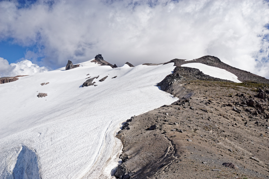
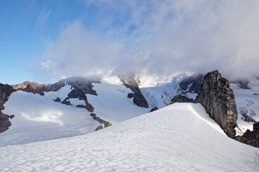
Beta for other potential soloists: if you aim for Kennedy Peak, you can walk between it and its subpeak (looks round on a topo map, but there are two spires). Then drop down to a saddle (my intended campsite) and head SE from there on crevasse-free snowfields to the ridge. Though this involves a bit more elevation waste, it avoids just about all glacier travel on approach, and the glacier you do get on (around N side of Kennedy Peak) is pretty tame. I would probe though, you can see minor crevassing in late season satellite imagery. Tracks below show that and also a misguided attempt in 2019. Third time's the charm for me?
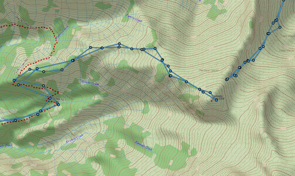
View of Kennedy peak (highest point of skyline):
View of snowfield you'd use to gain the ridge (center of image) from Kennedy Peak:
Another advantage of this approach is that you'll spot the elusive PNW parrot.
-
 2
2
-
-
-
DOOOOOPE!
-
1
-
-
Trip: Mt Thomson - West (solo)
Trip Date: 08/28/2021
Trip Report:Last Friday, my friend and I set out for a two-night trip to the Kendall Katwalk & surroundings.
Due to car trouble and Portland traffic, our arrival was seriously delayed and we made camp at just a few miles in from the pass. Long story short, we set about doing our own things the second day and I wasn't at the base of the route till 15:30.
I've never lead solo in the alpine before. Between that, my faster-than-expected dwindling water, and the hideous start time I had very strong "turn around" thoughts happening.

But eh! I'm not above bailing on a few nuts if need be. Route goes up left skyline in pic above, mostly.
I did it in 6 pitches, pitching out the very first short bit that's normally simul'd or solo'd. Great climbing! The hardest move IMO is the very very first one. Stepping off the first real belay ledge and getting into a chimney.

My 40 meter rope barely worked, resorting to doing dumb shit like extending the anchor every now and then to get the rope to reach.

Though movement was great, it was hard to enjoy because I was in such a hurry and thinking about rationing my water. Methodical climbing interspersed with dizzying handiwork to take down/build anchors and the occasional gulp. I was soon climbing by head lamp, resigned and in less of a hurry, and only the last pitch fully independent of the sun.

Those summit views!! Thirsty but happy.

The descent down the East ridge was mentally taxing. Nothing like wading through stunted conifers, grabbing onto them, leaning far looking down, and seeing only bottomless black before trying another likely dead-end. Compass and map were very useful.
I did 3 raps. Found anchors the first two; for the last I left behind a locker and some cordellette. Note: if you find an oval locker up there that says "compromised"... it's not, that's just how I mark my gear.
Drank a ton of water at the basin, then made it back to camp (saddle above Ed's lake) where friend had made my bed 1:15 and thankfully was sleeping, not worrying. Lovely hike out the next day!
Gear Notes:
Metolius blue to BD blue, tricams, many nuts, DIY 60 liter backpack (shout out to Stitchback gear!). Could've been a bit lighter.
Approach Notes:
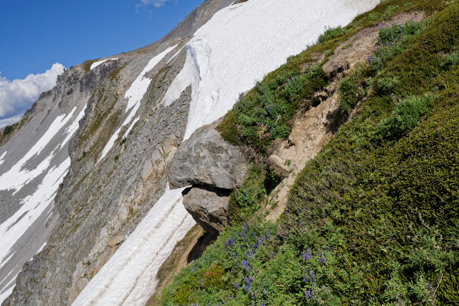
What's with those weird ass rocks with star-like patterns?-
1
-
2
-
-
Beautiful trip, what a treat to read!
-
This is the first time I've heard of it climbed barren of ice :O. Well done!
-
I'm in awe and highly entertained. "Pole of remoteness", hah
-
1
-
-
Daaaang! That crux pic of you

I bet that normally delicate rock was very very firm. -
That pic with the tent on the platform, yeesh!!! I have the same one (FirstLight) and even on Hood I get spooked when it flaps in the wind.
-
On 4/26/2021 at 1:49 PM, emanuelrohss said:
The truck could be dealt with later, the mountain had to be climbed now.
My favorite passage, sets the tone for the rest of the story.
Glad you got your summit and your asses whooped, thanks for the wonderful post <3 -
You crazy mofo <3
-
You crazy <3
-
Nicely done! Been itching to get up this route specifically, sounds and looks awesome
-
Ohhh, I see, I've fallen into that sort of thing where Palmer spills onto White River. Spooky indeed but not too dangerous.
Steam vents on the other hand, yeesh. -
Great great work, thx for sharing
Now I'm really curious, if nothing else for educating myself on mountain safety - what exactly were you punching through to? Loose snow? Crevasses (I thought there are never crevasses up there?)? Snow/ice caves carved by volcanism? Sounds scary.
-
9 hours ago, kadyakerbob said:
The HW itself is not technical but is a really long slog up although it’s a beautiful side of the mtn that most of us rarely see.
No kidding, couldn't recognize it's Hood in some of your sweet pics!
How important did the rope feel for glacier wandering? I heard crevasses are opening early this year.
AAI Sponsorship - 1 Year Renewal!
in cc.news
Posted
❤️