
Matt Lemke
-
Posts
114 -
Joined
-
Last visited
-
Days Won
1
Content Type
Profiles
Forums
Events
Posts posted by Matt Lemke
-
-
Full report can be found here:
-
Thanks Jason, is there any way to be able to show the original size of that photo? The photo isn't high enough resolution to read the notes.
-
Sorry about the duplicate report...this site is still as confusing as ever...
-
Trip: Mount Hunter - West Ridge
Trip Date: 05/31/2022
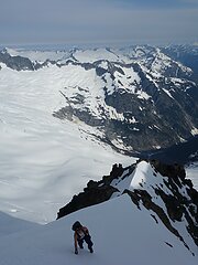
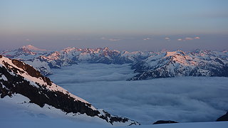
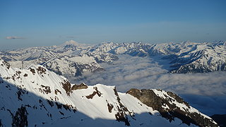
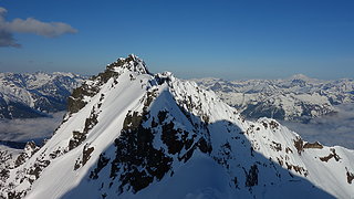
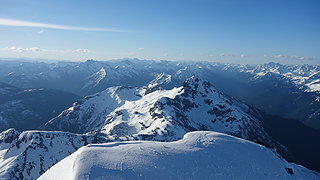
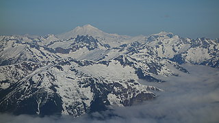
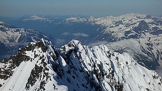
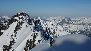
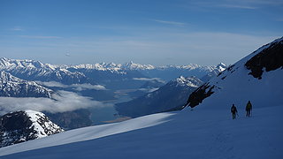
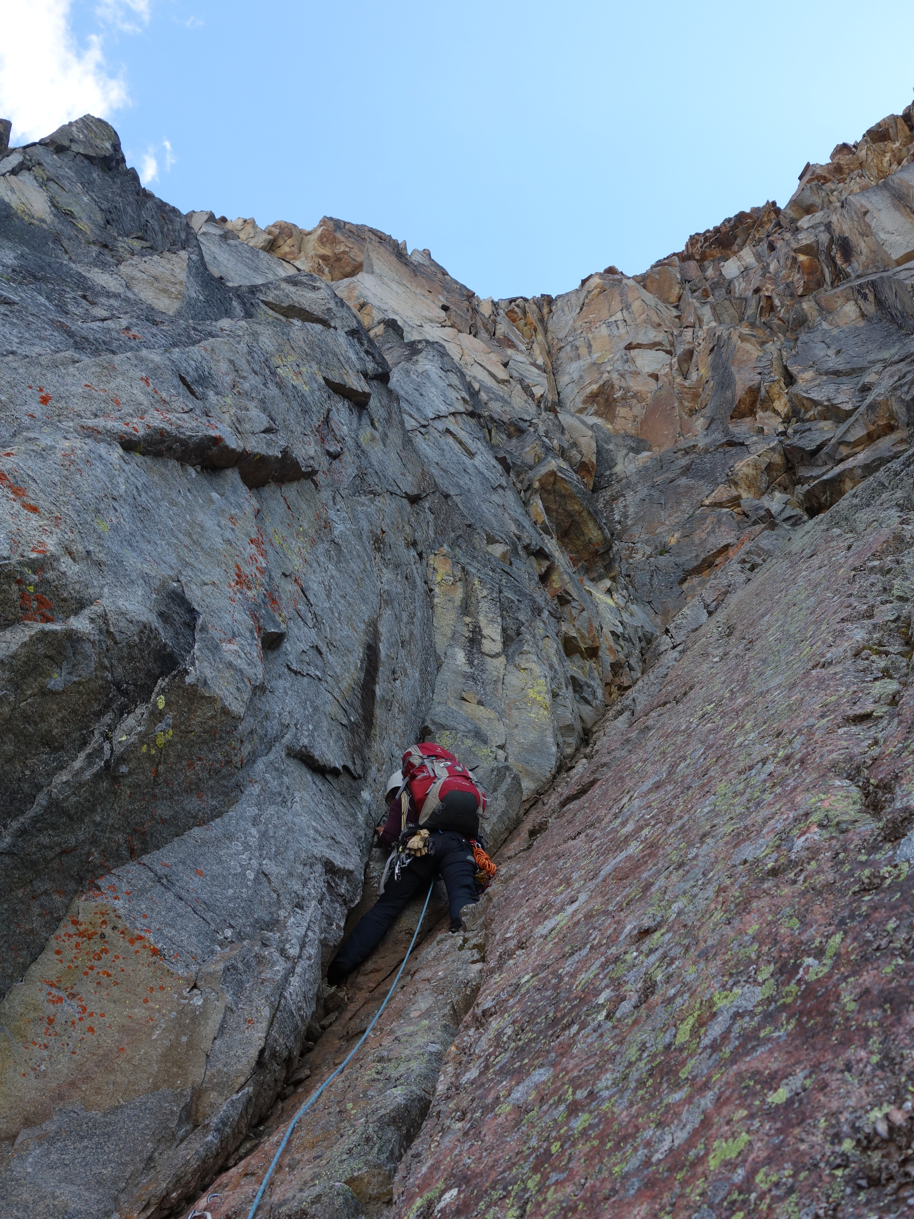
Trip Report:I climbed the west ridge of Mount Hunter from May 29 - June 1 just last week with a summit on May 31st. The route has changed drastically from the days of old, here is a good beta overview of the ridge if anyone is interested. We took 3 days on route with two nights at the 10650 col for a big 4k foot summit day. Weather has been fantastic in Alaska this season making for a carefree, worry free ascent (mostly lol).
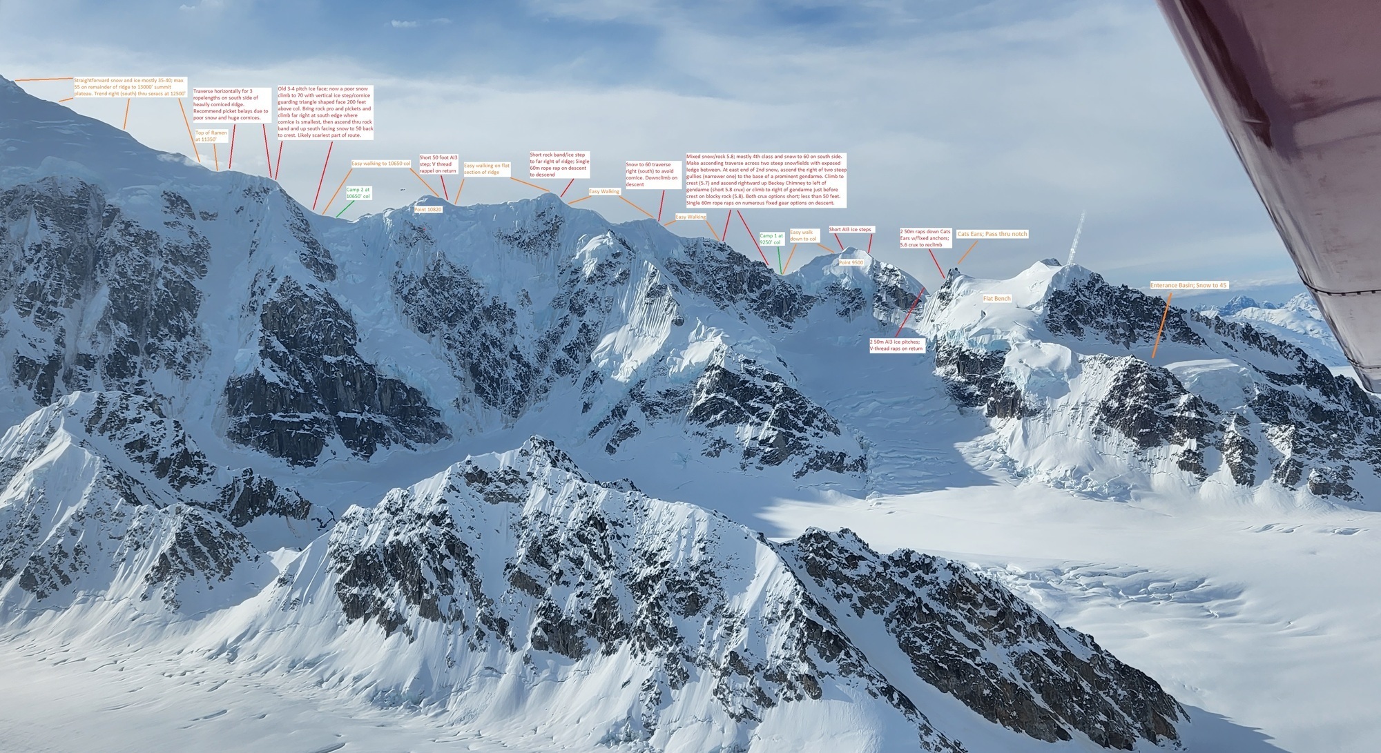
I'll get to writing a detailed trip report on my website soon...just figured I'd share these route notes for now. Conditions were mostly good, but afternoons on the lower ridge started getting scary when the stepp snow softened considerably in the hot sun. Summit temps were in the mid teens with very little wind. Photos at the link below.
Gear Notes:
Two 7.3mm twin ropes, 4 cams 0.5 - 2, set of DMM nuts, 5 UL screws, 3 pickets, 20 degree sleeping bag, 6 single slings and 1 double. Extra TAT
Approach Notes:
Snowshoed to base of ridge from landing - 1.5 hours.-
 1
1
-
 1
1
-
 4
4
-
-
This is an amazing trip report. Gets me wanting to do another pickets trip!
-
Starting in 2020, they began making a few big mountain boots big enough for me (euro size 50) and I bought the Olympus Mons Cube with the tech binding toe bail integrated into the boot. Score I thought, but I realized the heel couldn't lock. Everyone on here says to just climb in your AT boots, but alas, we still live in the stone ages where AT boots are not made big enough yet for me (I need a Mondo 34).
I find myself looking for a way to ski with my new Cube boots...I don't have much experience skiing free heeled, but the terrain I'll be on is mostly 15-25 degrees in steepness...hopefully easy enough to be doable. Might give those Voile's a try though, thanks for the thread everyone!
-
Looking for a partner to climb gunsight peak with starting Sunday and going to Wednesday next week. Also will be climbing sinister while up there. Ideal route is the gunrunner traverse but open to others. Hmu at mlemke100@gmail.com
-
Holy cow you had completely different conditions than we did. Looks like a lot of fresh snow fell after our may 26th climb. You were sinking through a crust? Damn the snow was hard ice the entire way for us!! Front pointing from start to finish. Nice work getting this one done
")
-
Nice photos! I did the nf of Buckner and horseshoe on June 8th... Wonder if it was our tracks you saw?
-
@jon, @olyclimber, @JasonG Yeah that's the kicker...the photos are not hosted on NWHikers. There is an easy linking system to any one of 4-5 external web album hosts. Flikr, Google Photos etc. If photos must be uploaded to the same site you are making the trip report on, it can be made possible to make it as easy, however you'd have to compete with Google's photo uploading system and speeds, AND have a very quick and easy way to link photos into the body of the trip report. It would require a huge amount of work. You also will need a large database capacity which will increase hosting costs. Summitpost is having a huge issue with this. They have so many photos on the site it costs $2000 per month to host. This ultimately will lead to the death of that site in the near future.
My recommendation would be to avoid requiring photos having to be uploaded to CC in order to build trip reports (although you can still make it an option). I actually believe that leads to sites dying out in the long term as we are seeing on Summitpost.
-
Please note this TR is copied from NWHikers. JasonG as you may be aware after chatting with a couple friends of mine, the editor for formulating trip reports, especially the image insertion tool is far superior on NWH. Actually, I believe NWH is the best site in the world for formulating TRs. Feel free to PM me if you'd like to chat more about this. I would be happy to help improve the site if I can.
-
Trip: Buckner Mountain NF, Horseshoe Peak - North Face
Trip Date: 06/07/2018
Trip Report:Who: Josh Lewis and I
What: North Face of Buckner and Horseshoe Peak. Bulgers #82-83 for me
When: June 6-7, 2018
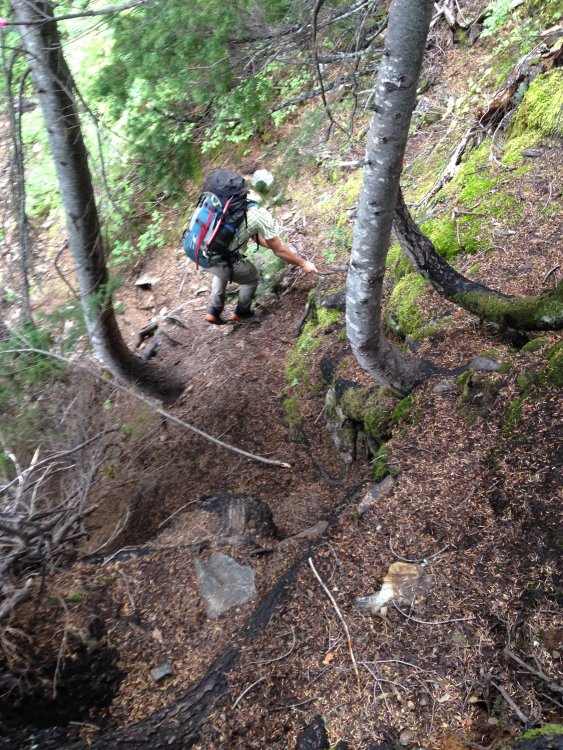
With good weather in the middle of the week, and Josh recovered from his surgery he had late last month, who else to call and invite for a mid-week climb of two Bulgers neither of us had done before? Leaving Renton at 10:30am Wednesday, I made the now routine pick-up of Josh in Lynnwood, and after a quick stop at the hardware store to buy some 90 degree aluminum angle bar (for more pickets...I lost most of mine on Lincoln Peak) we drove out in my van to the Cascade Pass TH (well, the gate at mile 21). Although we made it to the gate one mile beyond the Eldo TH, it is now gated AT the Eldo TH for more repairs. This earlier closure to the road took effect yesterday morning just fyi to anyone going up there.
We began the walk up the remainder of the road for 1.5 miles to the Boston Basin TH at 3pm Wednesday, and hiked the somewhat brushy trail all the way to 5,600 feet before hitting any snow! I couldn't believe how fast everything was melting. The snow however began extremely suddenly and within a matter of 50 vertical feet went from nothing to 5 feet in depth! Here I switched out of my approach shoes and into my boots, and we continued up the Quien Sabe glacier, passing a large Mountaineers Group along the way who were all camped at roughly 6,200 feet. We broke trail through the fresh snows of the past week, following the mostly hidden existing tracks all the way to the Boston Sahale col, where we planned to bivy for the night. To my surprise however, the ridgecrest bivies were all still snow covered, so we opted to continue over to the Boston Glacier to camp. We still had a couple hours of daylight left, leaving us enough time to made the tricky scramble (tricky with big mountain boots that is...) up the ridge towards Boston Peak and onto the upper reaches of the Boston Glacier. Small cornices remaining on the ridge made the traverse a bit more interesting, as we had to traverse small ledges below them on the east side of the crest, with 1000+ feet of air below us down to Horseshoe Basin!
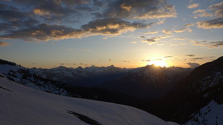
We made it to the Boston Glacier, and descended 500 feet to the first flat spot, and laid out the tarp for our bivy. We cooked dinner and melted snow and despite the haze/pollution/high clouds, the sunset was still a nice sight. We set the alarm for 4am.
 Totally dry below treeline!


 Large group we saw in Boston Basin
 Sharkfin Tower
 Sahale Peak
 Traversing to Boston Glacier


It was quite chilly in the morning (granted we were camped at 8,000 feet), so we were slow to get out of our sleeping bags. We even had some frost on our bags and tarp! Eventually, by 5:45 am we roped up and started the traverse across the upper Boston Glacier to the north face of Buckner. Crevasses were easy to spot and navigate around, and most had large snow bridges covering them. We passed beneath the north face of Horseshoe Peak along the way, and once at the base of the route, we unroped and simply continued ascending solo, passing around 4 small bergschrunds on the lower part of the face without difficulty. Here the steepness increased to 45 degrees as we continued climbing the perfect snow that took front points beautifully. We took small breaks here and there when we had a chance (rock ledges, slightly softer snow etc) and made it to the summit ridge just over two hours from leaving our camp on the Boston Glacier below Boston Peak. The final 200 feet of the face offered the steepest terrain, approaching 55 degrees, which was also the most insecure snow. Soloing this section got my heart racing a little more!
We left packs on the ridge, and traversed to the eastern summit of Buckner, bypassing a large gendarme on the south side descending 40 feet or so to get around. We decided it is worth ascending both summits of Buckner since they are likely impossible to determine which is the highest. After a quick stay on the east summit, we returned to our packs and finished the last 30 feet to the west summit and signed the register. Plenty of snacks were consumed as well!


 Our bivy at 8000 feet on Boston Glacier


 Boston Peak


 Boston Glacier and Forbidden
 Josh finishing the route
 Western summit from the top of the north face route
 Josh on his way to the east summit


 Looking down the north face from the west summit
By around 9:30am, after over an hour on the summit ridge visiting both summits, we began descending the SW slope, dropped 1000 feet or so and curved right onto a the snow finger leading up to Horseshoe Peak. We ascended this 30-45 degree slope to its highest point where it dumped us off on a large ledge 100 feet below the summit. I swapped into my approach shoes here for the summit scramble, and we worked our way leftward, around a small buttress and into the loose gully leading up to the notch just east of the summit. Then we scrambled up the left-leaning ramp on the south side of the slab, and I solod the short, one move wonder 5.2 finish to the top. Josh was right behind, although since he didn't have approach shoes, the final move was slightly harder for him, but still no problem. We watched from the summit as clouds began to slowly roll in from the west, now obscuring Jburg and Eldorado. We decided to start the long haul back quickly as to avoid a potential whiteout.

 Horseshoe Peak in the middle
 Josh making the final move
 Buckner from Horseshoe
We made a long descending traverse across Horseshoe Basin, dropping to a low point of about 6,600 feet, then ascended the ramp and onwards up 1000 more feet of snow back towards the Sahale camps at 7,600 feet. We then traversed over to the Sahale Arm, where we saw a couple skiers and a large Nols group coming down from Sahale Peak, and ran down snow slopes directly to the Cascade Pass Trail, bypassing Cascade Pass itself and in quick time, made it back to bare ground, where I was very happy to once again be not wearing my boots. As always, the stupid trail dragged on, with much annoyance until we reached the parking lot, which is now bare of snow. Only the last switchback just below the parking area still has some snow on the road, but I wouldn't expect the road to be open for a while still. The 2 miles back to the van were nice, as we caught up with the couple skiers we saw and chatted with them for a bit. Upon returning to the van at 4pm, I saw everyone parked at the upper gate had a notice the road was now closed at the Eldo TH and we could still exit at the gate there, but to close it behind us, as it was just "dummy locked". On the way out, milk and muffins awaited in Marblemount, and unfortunately with deteiorating weather for Friday (today) we decided not to attempt Tower and Golden Horn and just return to Lynnwood/Renton.
All in all, another great trip with Josh. We ascended 5,500 feet, then descended 500 in 6ish hours Wednesday and 3,200 feet gain, plus the hike all the way out in just over 10 hours on Thursday with packs, and managed to get both peaks. I call that a pretty good success!
Gear Notes:


Boots/Crampons, one technical tool, bivy gear
Approach Notes:
Boston Basin - Quien Sabe Glacier to Boston Glacier and traverse to NF of Buckner-
1
-
-
Hey Bri, also longtime WA climber here. I am looking for a VW mornings regular partner as well, however I tend to be in the mountains a lot this time of year, so can't definitively commit to the same day every week haha. If it's raining I'll be down for a gym sesh once or twice a week. hmu if interested!
-
I did Silver Star the day before you on Friday afternoon and had to plow through all that fresh snow on the upper part of the route. I remember looking down Silver Star creek and thinking "glad I came over Burgundy Col...its bone dry down there!"
-
Btw...geosean if you ever want to do south hozomeen hmu!
-
Hey! I was one of the guys up there on the 12th! Nice work man that sounds like a great trip adding on crater mountain. I'm surprised the headwall lasted until now it was melting out fast!
-
Trip: Jack Mountain - Nohokomeen Headwall
Trip Date: 05/12/2018
Trip Report:Well, I am back from 4 months in south america, and didn't waste any time starting my quest to finish the Bulgers this summer. After hearing Fletcher's report for Jack mountain via this route, Jake, Josh Lewis, Elaine, and Steven joined me to climb the Nohokomeen headwall knowing the conditions would be good. In short, we had a very successful, fast ascent of the route and topped out on number 79 for me.
Now for the slightly longer version...
I picked up Josh in Lynnwood in my van and met Steven and Jake at the Highway 20 closure late Thursday night May 10th. Elaine was with us as well. Around 630am we started biking the 4 miles up the road past the closure, passing by a line of cars waiting for the road to open for the summer at 10am. Too bad they couldn't open it 4 hours earlier!
In the cold fog, we biked along, and after just 25 minutes or so we reached the east bench trail, locked up the bikes and began the 8 mile walk. After a few hours we reached the point to leave the trail and started up the steep slopes towards the upper Nohokomeen Creek basin. at 4500 feet we hit continuous snow, and everything below was not too bushy thankfully. We crested over the ridge at 5000 feet and put on our snowshoes here to finish the approach traversing into the basin, and making our way up to where Elaine, Josh and I decided to camp at about 6000 feet elevation in a small snow gully sheltered from the wind just above the base of the glacier. Jake and Steven, who would climb the route as a separate team of 2, decided to continue on all the way to 8000 feet to camp on the glacier...something I had no interest in doing haha.
It was a beautiful afternoon with amazing lighting on the Pickets directly across from us. East Fury and Luna stole the show from our tent view!


Elaine decided to skip the remainder of the climb, but Josh and I woke up at 3:30AM, ate a quick breakfast and by 4 we were off, following Jake and Stevens tracks 2000 feet up the glacier in the glow of twilight. At 6am, we reached their tent, and awaiting us was Jake and Steven, who were just about to begin up the route. At this point the sun was just rising and our eyes were glued to the red glow lighting up the landscape. Mount Baker was particulairly stunning along with the Hozomeen Spires and the Pickets. Jake and Steven decided to sleep in a little, which worked out great with timing as all 4 of us began climbing the route together. Unfortunately for Josh, one of his crampons broke at the beginning of the headwall, so he was forced to wait it out and return to our tent.
Jake, Steven and I then all solod the route, alternating leads and kicking steps. It only took us an hour and a half to climb the headwall from their high camp at 8000 feet and we reached the summit at 7:30am. The snow conditions were nothing short of perfect as we easily kicked great steps the entire way up the headwall. Steepness averaged 50 degrees with a couple short spots at 60 degrees. Once on the ridge, it was a beautiful ridge run to the summit only 150 feet further.
On the summit we ate our snacks and enjoyed the spectacular views for 30 minutes or so. There was a brisk wind but not quite enough to chase us down real quick. This was my 79th Bulger, and the first one in 2018 for me. I couldn't really do any while in South America lol.


We made quick work of the descent and was back at the base of the headwall in an hour. We used our same steps on the descent which made it feel very secure. We packed up and were snowshoeing back down in no time. We reached the east bench trail around 2pm, at which point my feet were in serious pain from wearing the mountaineering boots so long, and I was glad to switch back into trail runners. The 8 mile hike back was uneventful, and Jake offered to run ahead and drive my van back so we could all get a ride back to the Ross Lake Trailhead saving us the bike back on the road, which now was full of cars.


Gear Notes:
Once we were all back, Jake and Steven returned to Seattleland, while Josh, Elaine and I proceeded to Winthrop for Mexican food, and to prepare to climb Robinson Mountain the next day. More on that climb in just a bit...
Brought 30m rope and pickets but didnt need them. Crampons and one quark were all I needed.
Approach Notes:
East Bench Trail for 8 miles. Continuous snow began at about 4500 feet-
2
-
1
-
-
If the flight costs 525 dollars per person I will probably be out. We will likely walk into little Switzerland from Petersville instead and climb the granite spires around Pika Glacier
-
2 hours ago, just some guy said:
Matt, epic trip! Way to persevere in the wild of Swamp Creek and everywhere else for that matter. For what it's worth and not that it is any comfort now but there is indeed a trail from the Dark swamp meadow basin down to the uber brushy green meadow below the waterfall. I suppose this is for anyone in the future trying to repeat from your direction, the trail can be found by getting to the end of the meadow and heading uphill (east) into the dry mostly dead undergrowth of the larger trees, you go uphill about a hundred or so vert and then contour over the somewhat defined ridge crest to the north. The trail gets defined here as it steps down through some rock faces and roots, I want to say there might have been flagging, there was definitely a live ground hornet nest in the trail! Eventually it turns out of the pine needles and pitches down towards the waterfall into the lush prickly goodness that doesn't stop until you pick up the trail again on the other side of the creek way down valley, well, you may find remnants of trail before that but nothing truly satisfying. Way to get after them Bulger's.
l
Wow, this knowledge would have been worth more than solid gold at the time! Thanks for sharing
I guess I get what I deserve for not researching really anything before setting out haha
-
http://www.nwhikers.net/forums/viewtopic.php?t=8025335 - Bears Tooth
Also, More photos from this trip can be found here:
http://www.nwhikers.net/forums/viewtopic.php?t=8025775
I agree the Beckey Route is a classic and worth the long approach! I just may have to return to actually do it!
-
I am looking to buy a pack raft I can use for floating some rivers in Alaska this coming spring/summer. Does anyone have any first hand experience with this and can pass on some info regarding which ones I should be looking at? Here's a little about me for context:
I am 6' 9" tall (yes...I really am) and weigh 200 pounds. So I would obviously need a raft I can fit in. Also, I would not consider anything more than 4 pounds. Needs to be light, as we are carrying it in deep into the Alaskan Mountains. I am a climber, (duh) looking to expand my horizons and try mixing activities. In order to save some walking, and money, I am thinking of getting a packraft to float out after climbing.
Any info regarding this is greatly appreciated.
-
I am working on planning out my time in Alaska this coming spring/summer, and trying to determine if the ski plane costs can be split. Last I recall they sold flights on a per person basis. Have you heard if they will reduce the price if more people combine into one flight? I am trying to reduce the $525 dollar flight per person that Sheldon typically charges.
-
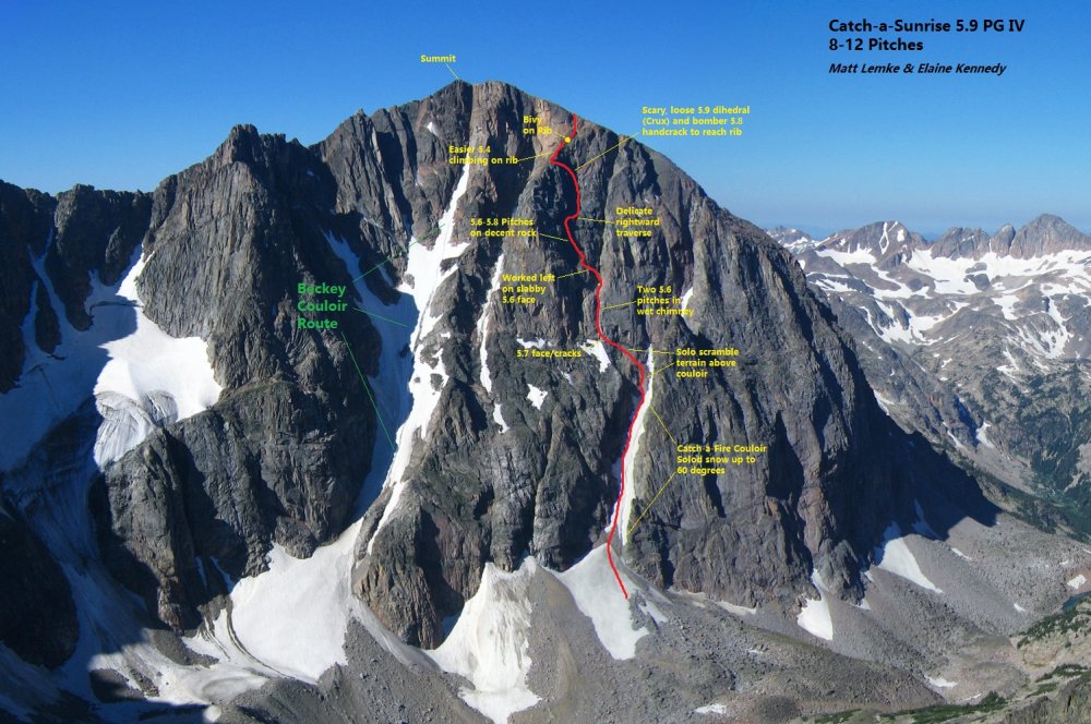
Trip: Glacier Peak NF Beartooths - Catch-a-Sunrise 5.9 PG First Ascent
Trip Date: 08/18/2017
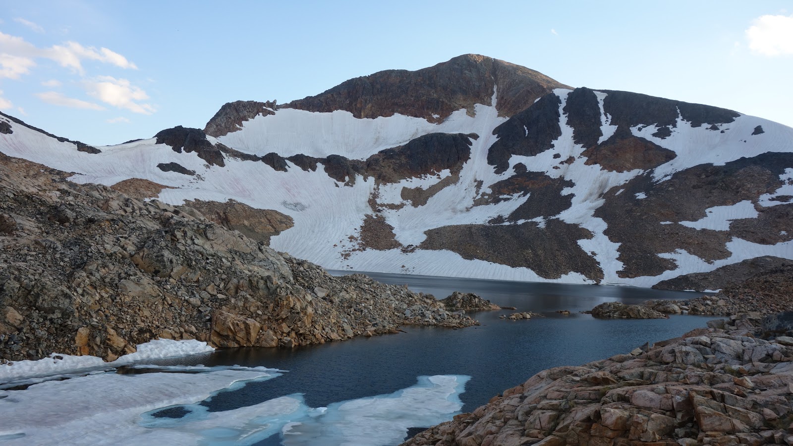
Trip Report:This was an exceptionally memorable climb that I did with Elaine, which was her first trip into Montana's Beartooths. Myself; I have been coming to this mountain range many times since 2012, and have seen enough corners of it to hold my own against any of the local Montana Beartooth stompers, however this climb was exceptionally significant because it was on Glacier Peak. This was the last Montana 12er I had yet to summit, and I had been putting it off until the right time came where I could climb the North face Beckey Couloir Route. This is a rarely climbed route straight up the rugged north face of the mountain. I could have easily tagged its summit by walking up the talus from the Aero Lakes Basin, however I wanted this peak to be something more than that. Knowing the conditions dictating everything for this route, I had to find the perfect time, and as chance would have it, Elaine and I had that chance in mid August this year just a few days before the total solar eclipse (which we saw in Wyoming!). As an aside, for anyone wondering, yes I am still working on that Beartooth Guidebook.
We had both just finished a successful climb of the East Ridge of the infamous Bears Tooth earlier in the week (see link above) and we were ready to tackle the main objective. The trip started on August 16th by driving up to the Goose Lake 4WD road from Cooke City and parking at the start of the 4WD road. It was a 4ish mile walk along the road to Goose Lake. We were hoping we would run into someone heading up willing to give us a lift but since that never happens, it didn't happen haha. Our late start of about 2:30pm also probably didn't help. We however hiked around the beautiful Goose Lake, and onward to the broad saddle between Iceberg and Sawtooth Peaks under beautiful sunny skies. Looking at Sawtooth Ridge from Goose Lake really inspired both of us to return one day to traverse that ridge.
At 5pm we reached the saddle, and I remembered the last time I was here on a quick solo venture to Iceberg Peak and to get a firsthand look at the west face of GlacierPeak. The wind forced us to continue the cross country walking over loose talus and the occasional snowfield east towards Glacier Peak. We passed alongside the stunning Iceberg Lake until we reached the point where we started descending steeply down loose scree onto the large rock glacier that extends off to the north of Mount Wilse. It was a long and mostly uneventful walk as the sun was setting into the boulder strewn valley at the base of Glacier Peaks west face. The ankle twisting loose rocks on the rock glacier was somewhat slow going, and I knew we would not be able to reach the base of the Beckey Couloir before dark, so I began looking for a place to sleep for the night.The towers and monoliths that surrounded us in this valley were awe inspiring, with the added sunset effect really making the evening magical in an otherwise heinous walk, which now exceeded 10 miles. As my luck would have it though, right as dusk set in and headlights would have become mandatory, we got to the edge of the rock glacier, and shortly after dropping off found a beautiful little flat grassy meadow, with a small stream nearby that we could lay down for the night! This wasn't the first time this year that I got extremely lucky finding a place to camp right as total darkness was setting in.
To save weight on what we knew was going to be a carry-over, and since we each already had ice tools, crampons and big boots, we didn't bring a tent. We simply threw the pads and sleeping bags down on the grass (or sedge, as it is apparently properly called according to Elaine) and cooked a nice dinner and quickly went to bed. With the perfect weather, we couldn't resist stargazing and looking for meteors for quite some time that first night, and thinking endlessly about the climb that lie ahead. I admit I was a little nervous mainly because I had been waiting to do this climb for years. Little did I know I was about to make probably the worst navigational error I have ever made in my climbing career.
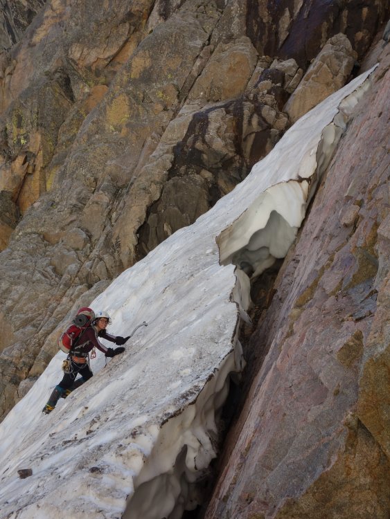
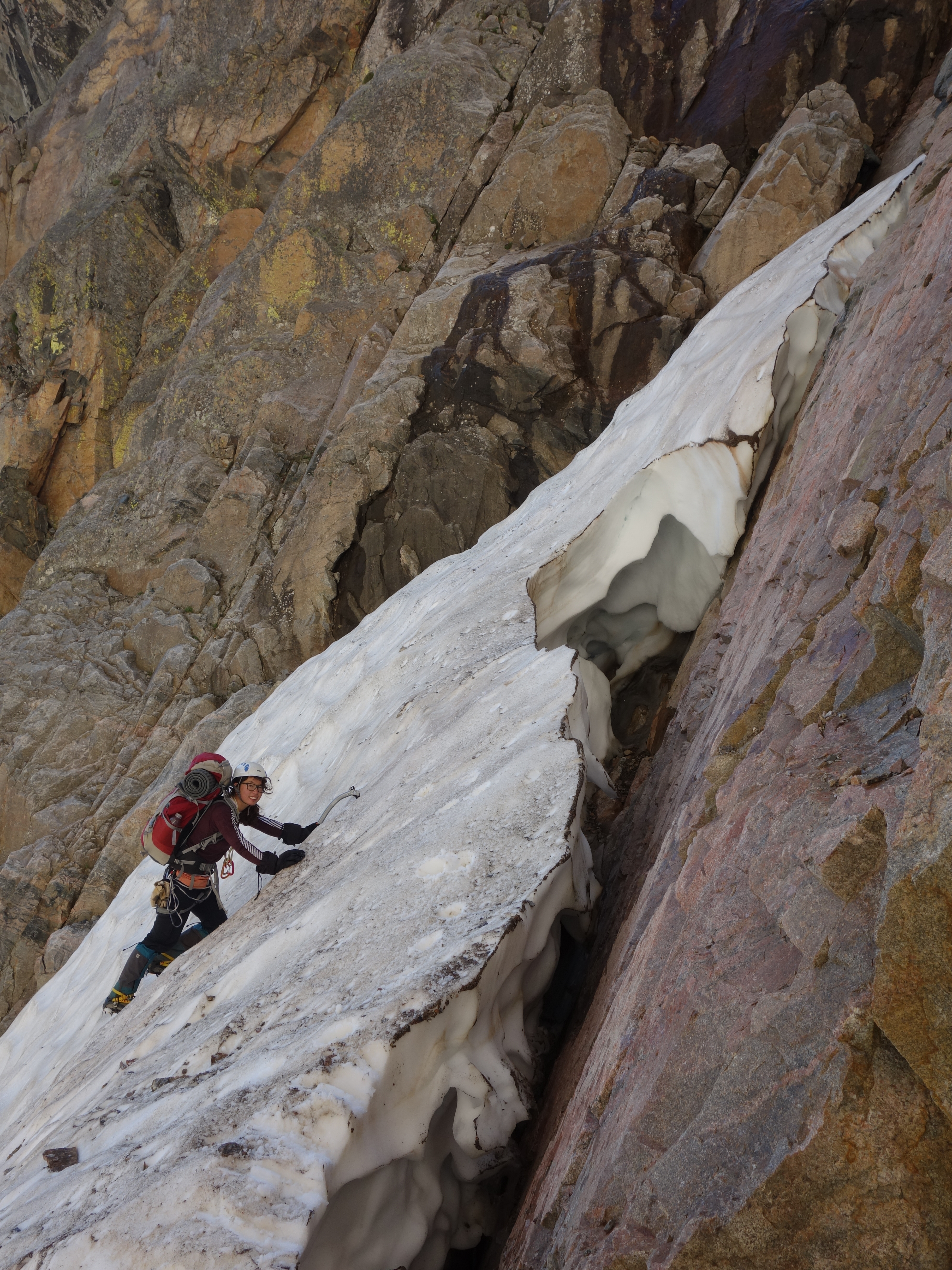
The next morning we started as soon as enough light broke the darkness of night, and continued hiking along the bottom of the west face, traversing the large talus fields until we could round the corner to the right and enter the basin below the north face. We hiked around a small tarn along the steepest part of the face below the northwest flank, and ascended once again until we reached a large snow couloir. It was roughly 8:30 in the morning when we reached the start of the couloir, and we took a nice snack break and switched into our mountaineering boots, put crampons on and layered appropriately. The climb was about to begin.
We started soloing up the snow, and actually both felt comfortable remaining solo until we reached the upper end of the steep couloir, which felt like it had a max steepness of about 60 degrees. For her first steep snow climb, Elaine did amazing and felt confident the whole way. I recall thinking the couloir ended rather quickly as it felt like we only ascended about 600 feet before we hit rock but I didn't think much of it. All I knew is I was looking for a rib that bisected the couloir and it was 5 pitches of rock up to 5.7 up this rib directly to the summit. Well, as we were standing in the small moat at the top end of the couloir we were in, I saw what looked like a rib heading just above us, but the couloir didn't extend to the left of it, only continued up to the right. I figured the left side finger had dried out and started scrambling steep and loose 4th class up this feature as Elaine carefully followed. After maybe 100 feet we reached a nice ledge system and traversed leftward until I hit a 5.7 rock section. We finally busted out the rope and cams and I led this short pitch in my boots to a "ready to explode" ledge just below a 5.8+ hand crack that I wasn't comfortable leading in my boots.
To save weight, I left my rock shoes thinking the route was only going to be 5.7, and just in case, Elaine brought hers, so she led up this 20 foot 5.8 crack and cut right into a large chimney. Since I didn't have any idea as to what each of the 5 pitches of the Beckey Couloir route entailed, I assumed we were on route, since the chimney wasn't too hard. Halfway up the chimney, Elaine made an anchor and belayed me up. She then continued up another pitch in the chimney to a huge ledge, which upon reaching myself, I really started to get confused. I still didn't know we were WAY off to the right of the actual Beckey Route, but upon looking up at how much more rock climbing we had to do, I was beginning to wonder.
So we decided that moving left looked better, and Elaine led another pitch up somewhat runout 5.6 slab to a ledge, then I led up a somewhat garbage pitch on loose 5.4 to another ledge. We were now 5 pitches up from where we started roped climbing, and no end in sight. Rather than worry about how we might be off route, I continued focusing on the task of safely getting up this face. Elaine continued up our 6th pitch on now more difficult 5.8 terrain with less pro. I was glad she brought her rock shoes and she led these pitches beautifully. As she started up a short 5.8 7th pitch, we started seeing considerably harder, slabby terrain above us, and she found herself in an alcove with nowhere to feasibly climb. I climbed up to her to scout out what lie ahead and it didn't look good. Up and left was impossible, and a delicate traverse to the right was the only feasible way. I took over leading, leaving my pack with Elaine and started making the traverse laterally to the right, where it appeared we could enter a long easier ramp system that would hopefully take us to an easier looking rib off above us that appeared to go towards the summit. Lots of speculation I know, but knowing we only had one option at the time we had to traverse right.
I managed to safely traverse across, but not without plenty of cursing, and make a good anchor. There wasn't much pro though so Elaine was rightfully hesitant to make the traverse knowing a fall would impose a large pendulum swing, especially doing it with two packs! I was able to talk her through it, despite not being able to see one another, however one move that required every bit of my long reach was very scary for her. I am amazed she pulled through.
Once we both got past the traverse, I led up a long 60 meter pitch up an easy 4th-low 5th ramp and kept a watchful eye on any climbable spots above up to our left. I was able to definitely confirm that the easier looking rib above and left of us would lead to the summit area, however we needed to get on that rib, which was 70 feet above us and looked improbable. We decided since we couldn't see what was at the very top of the easier ramp we were currently on, as it curved left, it would be best to go as high as we could and see what was up there. Elaine continued up a right facing dihedral in a seam along the base of the steep wall that blocked easy access to the rib above. It was easy until she entered that left curving area, where she continued to mention small car sized loose blocks. At this point I couldn't see her, and after she spent 15 minutes or so contemplating it she went for a move, then fell.
All I remember is hearing screams and watching her slide down the ramp on her pack popping two cams then stopping on her own (rope didn't end up weighted) as her pack got wedged into the dihedral she had climbed. Amazingly, she was ok despite taking a 30 foot fall, and after talking things through, she was able to calm down enough to build an anchor where she was, and allow me to go up and see what we were up against. When I got to the place she fell, I could see the large blocks she was mentioning, and found a spot to put one small nut and a 0.4 cam. That was going to have to do as I belayed her back up to me. I could see easier terrain and a ledge merely 20 feet above us, but that 20 feet was the scariest moment in both of our climbing careers. Since neither of us wanted to or was able to climb this section (mainly because we could not feasibly touch anything) I straddled the open book weighting the two pieces I placed, and with Elaine on belay, I pushed her up as high as I could until she could grab a solid hold above the two 7 foot long loose blocks. Thankfully she found something solid and was able to crawl onto the ledge just above. The scariest part of all this was that as this was all happening, I watched the nut I placed start to come loose, so as Elaine was midway up with huge rocks teetering right at my chest I also had to re-set that nut. This should have terrified me to absolutely no end, but I held my composure incredibly well...almost too well now that I look back.
With Elaine now on a good ledge, I climbed up to her, which was a solid 5.9+ when I wasn't able to touch anything along the seam of the open book we were in. It was even harder in boots. We took a nice rest here, and realized we were not out of it yet. Another 25 feet of vertical improbable terrain was left until we got to easier ground. I saw three seams above me, and none of them looked good or offered much pro, but around a bulge to our left looked like a potential route, so I left my pack with Elaine and led out stepping out over some serious air and around the bulge, and found a beautiful 20 foot 5.8 hand crack that I just told myself I will climb regardless as to what was on my feet. I mustered up the energy to basically pull up on just hand jams with next to no help from my feet since those huge boots were not jamming in any crack! It was right when I reached the top of this crack that I realized we were going to actually top out on this face. I let out a huge sigh of relief and walked back right to a point where I was directly above Elaine and pulled my pack up, then belayed her up. I was very thankful I remembered to take a few photos of the sunset because it was truly spectacular, especially with Granite Peak (Montanas highest) staring at us from across the valley.
Elaine continued on past me since I wasn't perched in the most comfortable of spots. It was quickly getting dark and I was really hoping we could get to the summit before dark. I led up one more pitch (now about 12 total), hoping this would be the last one, and I did reach the crest of the small rib we were looking up at all afternoon and was immediately blown away as to how suddenly it dropped off into a deep gash on a different part of the north face. It was very eerie coming up to this narrow, wildly exposed rib crest right as near darkness was setting in. Then I looked across this gash and saw another 200 feet of dead vertical rock silhouetted against the twilight and yelled out a loud "Oh sh##"
Then I looked to my right and saw the rib continued up on easy terrain, and was thanking the heavens lol and I continued until I ran out of rope, hoping I would find some kind of flat spot to bivy for the night. When the rope ran out I came to a spot on the rib that was at the very least flat, but not very big. I didnt take a very hard look at it yet and quickly belayed Elaine up this last pitch. When she arrived, it was too dark to see what remained of the climb, and upon further inspection, we agreed we could both fit in the spot we were in for the night. We doctored up the area a bit and made a spot long enough for me and a second spot right next to it just big enough for Elaine to fit. I built a small rock wall on my outer side to keep me from falling off the rib at night, secured our packs with a couple cams, and put down the sleeping bags (thank goodness we had them!).We were not planning to spend a second night on this trip, as we originally were planning to climb up and over Glacier Peak and hike out the second day, so we didn't have any food to make. We both ate one clif bar from our snack reserves, and stared up at the starts for a long time, contemplating what we were doing. We were both thrilled and relieved to have mostly completed the route, and were confident there wouldn't be much more climbing to reach the summit. We gazed at the dark, moonless night sky contemplating life and admiring the stars. It was a crystal clear, warm and calm night...perched on a very narrow rib with huge drops to both sides of us. We were alone, free and in a state of euphoria. At this point I was nearly 100% sure we were doing a new route, and were walking on untouched ground. That was one of the best nights I have ever known, and made even more amazing to share with someone as amazing as Elaine.
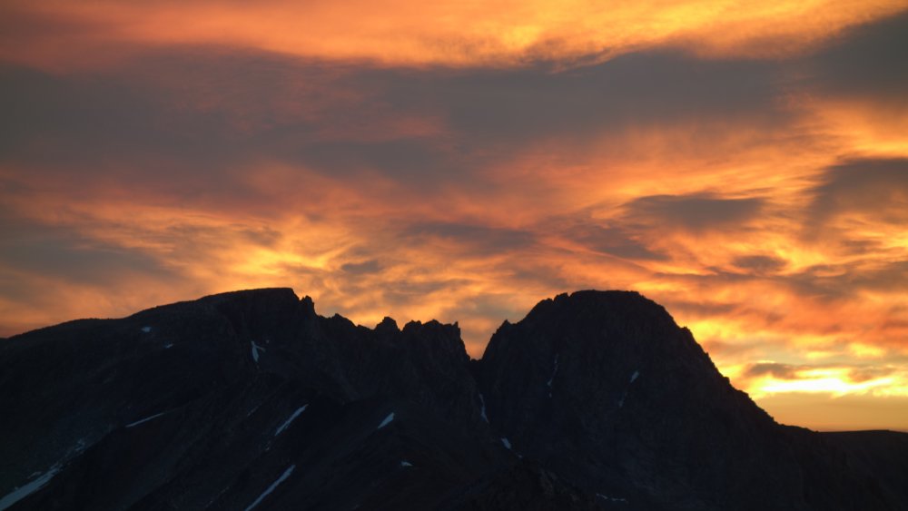
To add to the incredible nature of our bivy, as the night waned, and twilight gazed over the mountains, we watched a sunrise for the ages right over Granite Peak. We could finally really enjoy the views that surround us, as we were too intently focused on the climb the day before. We emerged from our perch shortly after sunrise and packed up our gear, which I then led up just one more 4th class pitch which dumped me onto the summit plateau!! I couldn't believe it, and let out a scream of joy. Elaine came up and we congratulated one another, had a quick break and packed away the rope. I looked up to the left and saw easy class 2 boulders that led to what looked like the summit just 40 feet above us. However, when we saw that the summit was a 10 minute walk to the south, up an additional 200 feet, I was at that point 100% sure we did not do the Beckey Route, and more than likely put up what would be both of our first, first ascent. When we finally reached the summit, I saw the top of the Beckey Couloir, and the whole route leading down directly below us. Elaine commented something along the lines of "Matt, that route looks so much easier!" along with a few joking criticisms that I have no idea where I am going etc etc...after all it was my fault we climbed the wrong route. I simply assumed the first couloir we came across on the approach was the Beckey Couloir, but take note...that is NOT true. The Beckey Couloir is much, much wider and longer than the couloir at the bottom of the route we climbed.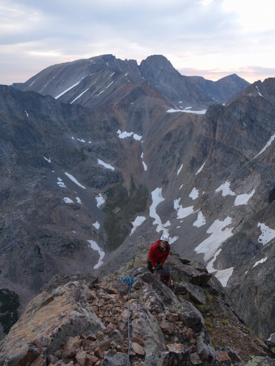
My friend Vince from Bozeman pointed out after we returned from the climb that the couloir we climbed is called "Catch-a-Fire" Couloir, which had actually been skied some time ago, but after consulting with a few local climbers no one had known of the route we did above the couloir so we believe it's safe to claim this FA. In respect of whoever named that couloir before us, we named the route "Catch-a-Sunrise" to remember that gorgeous sunrise we witnessed from our bivy. See the topo below, and notice the much larger couloir well off to the left. THAT is the Beckey Couloir!
k
Back to the summit...I pulled out my bag of Oreos that I was saving for the summit, which was the only food I had left. We shared them and celebrated as I had finished my last Montana 12er in spectacular fashion. I knew we had a long walk out though, so after a 30 minute stay, and some awesome photos, we started down the south slopes towards Upper Aero Lake, and hiked all the way out and getting back to Bozeman in time to meet up with my friends Josh and Vince. Josh had taken a Greyhound over from WA to join us for the Eclipse in Wyoming, and we ate a nice dinner at Montana Ale Works. Shown below are photos we took from the summit and on the descent.
A couple days later on August 21st, we had a group of 7 people atop Union Peak in the northern Wind River Range to watch the total solar eclipse, which capped one of the best weeks of my life. The experience of the solar eclipse was unlike any other experience I've ever had. During totality, you really are drawn to it in a non-explainable way, to the point where it was kind of mesmerizing, and mind-altering. Awestruck might be a good way to put it, but in a way that you cannot fathom unless you actually witness it. In the seconds leading up to totality, the lighting on the landscape turns a very strange, mostly colorless grey with a very off level of brightness. When the last rays of light do finally disappear, it turns way darker than I would have thought. There was actually sunset lighting in all directions, and a black hole in the sky.
All I know is that I cannot wait to see the next one!
Gear Notes:
One alpine ice tool per person, crampons, mountaineering boots, rock shoes would have been nice to have... Also had two racks to 2" (one ultralight), single 60m rope, helmets!
Approach Notes:
From Cooke city, up the Goose Lake Jeep road to Goose Lake, over pass between Iceberg and Sawtooth Mountains, down valley below west face of Glacier Peak and around into basin below North Face. Lots and lots of talus!-
1
-
1
-
1
-
-
Are you planning to hire a guide? If not, we may be interested in joining you.


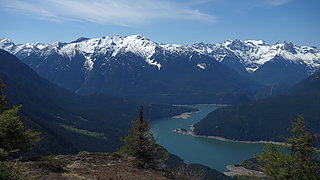
[TR] Picket Range - Southern Pickets Enchainment 08/04/2022
in North Cascades
Posted
Great work guys, I really should go back to finish the second half of the traverse over to otto. I guess you didnt find the great natural shelter bivy I constructed about halfway between Degenhart and Terror, ~50 feet below the saddle crest on south side. Sheltered us from 12 hours of rain without a drop hitting our sleeping bags! Glad to see people getting after it! You even climbed Pyramid the right way...that OW didnt look enticing so we traversed left and went up the upper S gully instead...much easier class 3 in case anyone else doesnt want to climb an OW or some sketch 5.10