


mrkittles13
-
Posts
23 -
Joined
-
Last visited
Content Type
Profiles
Forums
Events
Posts posted by mrkittles13
-
-
Nice! That ski descent is on my list this year.
-
pcg - damn, that looks about right. Would have been nice to know about this huge collapse *before* we left this weekend
 That is just massive.
 -
Trip: Mt. Hood - Sandy Glacier Ice Caves
Date: 1/28/2017
Trip Report:
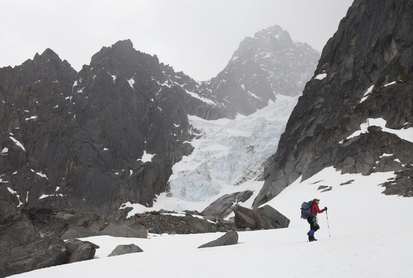
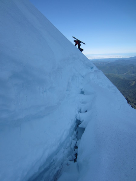
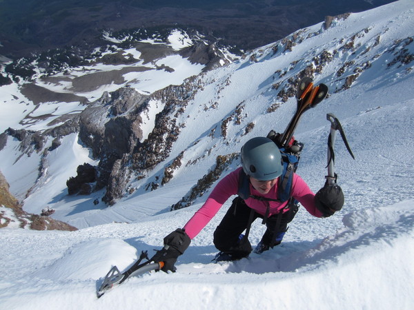
Bad news bear time. I was part of a team of four who visited Mt. Hood this past weekend, along with the masses. Our goal, however, was a winter exploration of the Sandy Glacier Ice Caves.
We left Timberline parking lot at ~8:45am on Saturday (1/28), arrived at Illumination Rock with our heavy photo-and-ice-gear-laden packs about three hours later. Descended the Reid Glacier and terminus snowfields until ~7,500ft, then traversed over the bottom parts of Yokum Ridge to the Sandy Glacier. We arrived at the ice cave entrance location at ~2pm.
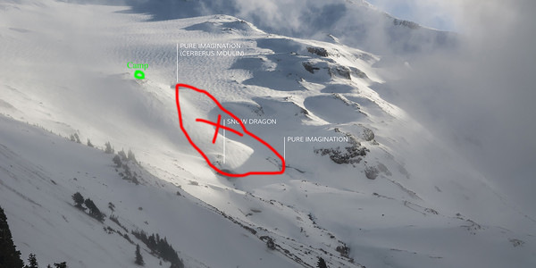
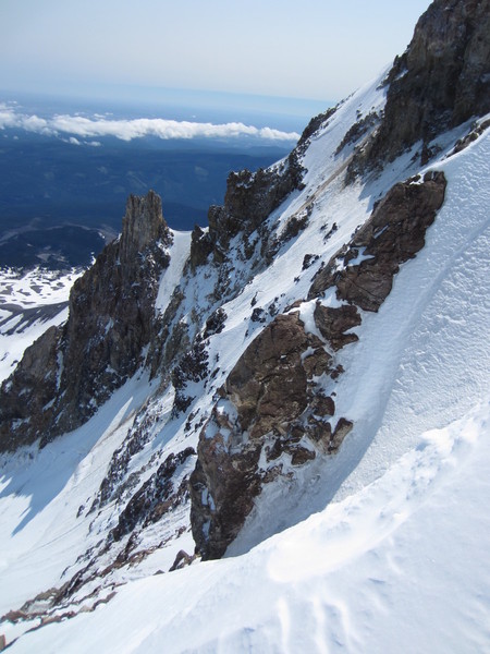
Alas, no entrance, no ice caves. It very much appears that a *large* section (probably a couple hundred feet) of the Snow Dragon and Pure Imagination caves is now gone, collapsed. Instead, we found the remnants of the old sides of the ice cave, resulting in a large half-pipe-like formation. We were unable to locate any entrance to the caves; perhaps an entrance will resurface after the winter snows melt. Hugely depressing.
I took a few photographs of the old entrance area to the ice caves on my phone (too bummed to photograph with my big SLR camera), but my phone later took a long tumble of indeterminable length down the steep terminus moraine slopes of the Sandy Glacier - a product of clumsy hands. Another big bummer. But here is an image that I found online, with an approximate drawing of the collapse area, along with the approximate location of our camp.
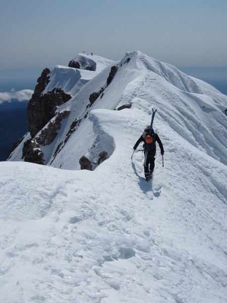
The winds really picked up Saturday night, causing a lot of schizophrenic snow conditions on the way back - lots of wind slab and solid ice to traverse. At times sketchy. Took much longer to make it back on Sunday than to get there on Saturday given the change in conditions. Type 3 fun. A hell of a lot of effort for no ice cave. Fortunately, we had good company and still managed to squeeze a good time out of the adventure.
-
Awesome! I've climbed Gimli but have wanted to check out some other climbs for years. How was the approach road? Last time I heard, it was closed...
-
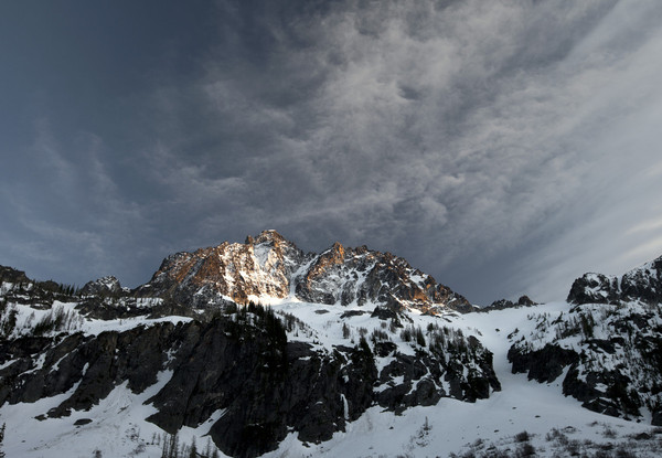
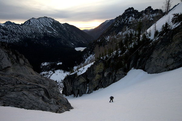
Trip: Dragontail Peak - Serpentine Ridge
Date: 6/7/2014
Trip Report:
My good buddy, Matt, and I took advantage of the warm and sunny spring weather to go for Serpentine Ridge on Dragontail this weekend. Got up at 4am at our glorious campsite in the Icicle Canyon and left the trailhead at 5:15 or so, fingers crossed for dry conditions on the route... especially this early in the season. Funny to think that exactly two years ago my wife and I climbed Triple Couloirs in snowy conditions.
The trail up to Colchuck Lake was dry and fast; the snow started at the boulders at the end of the lake. Perfect. The snow was hard enough to cruise up to the base of the route quickly, but soft enough that I was able to kick steps with approach shoes and without 'pons.
Dragontail in the morning hours.

Start of the route.
We simul-climbed for the first 500 ft, with some loose rock. We roped up for 3-4 long pitches of 5.7-5.8 climbing, with a 5.9-ish climbing up a crack system.
We simul-climbed the remainder of the route (low 5th class and 4th class terrain) without much in the way of route finding difficulties, with the one exception of the last pitch, which was mid-5th. Fortunately, the rock was dry for most of the route, other than a small snow patch here and there. Unfortunately, there was substantial loose rock on the upper part of the route, especially near the gully on the right side of the ridge.
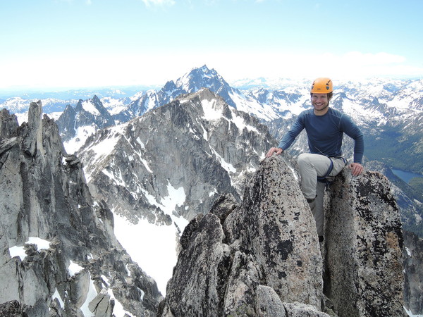
Matt on the summit
The descent was fast, with snow most of the way to Colchuck Lake. We then picked up the dry trail and cruised on back to the car, arriving back around 6:00pm or so.
Have at it!!
Gear Notes:
double rack BD cams .4 thru 2, single 3, and set of nuts. Ice axe was helpful on the approach and descent. Crampons could have been left at home.
Approach Notes:
Easy breezy.
-
I completely agree with Eric and Lowell that the rap line west of the couloir is the most dangerous part of the route and preferably avoidable, except if there are no other parties also on the descent (in which case, it is rather direct and efficient, albeit a bit loose). We were getting rained on by rocks immediately before the fall, when we were at the last rap station.
With that said, I don't think this accident was caused by rockfall. Without going into the details of the fall, there was little or no rock that came down with or around the same time as the body. Also, it was silent afterwards (other than our screams of disbelief), as if his partner did not know that he was gone. This is just reasoned speculation though.
Whatever the cause, my thoughts and prayers very much go out to the deceased's family and friends. I feel that the event will forever have an unshakable impact on my life. PM me if you know the climber and feel compelled to hear about the details of his fall. Also, I took some photographs of the beautiful sunset just an hour or so after the death with the purpose of providing them to any friends and family of the climber who wanted them.
-
Yes, it was horrific. The fall occurred around 5:30pm on Saturday, from about the third rap station coming down from the Forbidden col. I'm not sure who the climber was, but we were right below his team and then went down to report it. It was the most traumatizing thing I've ever seen. Don't know for sure, but it seemed like he mis-clipped or rapped off the end of his rope.
-
Great TR Tom. Sounds like quite an experience, especially the descent! In retrospect, I'm glad we didn't try this route in a day, although it would have gone... just would have been a really long day.
On Hood, we descended the Cooper Spur without issues. I was kicking myself for not taking my skis! Although the wind became incredibly intense on the way down, making it difficult to walk straight. Hood is always fun.
-
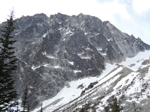
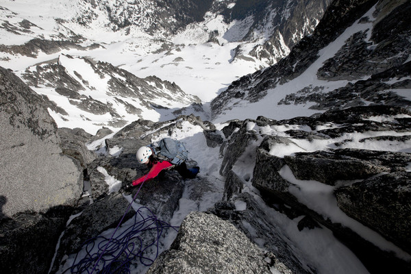
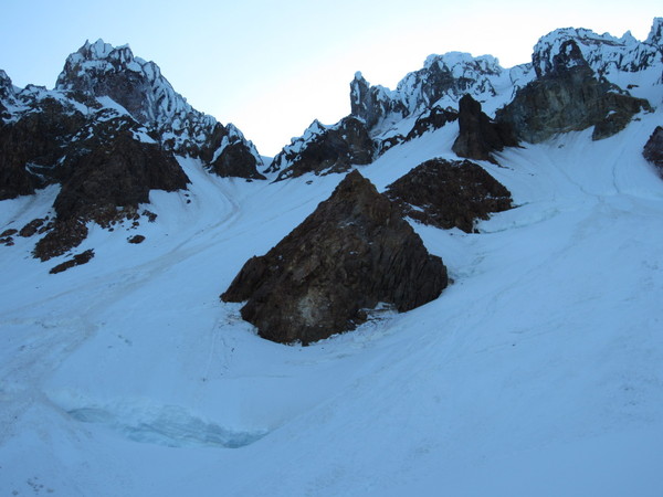
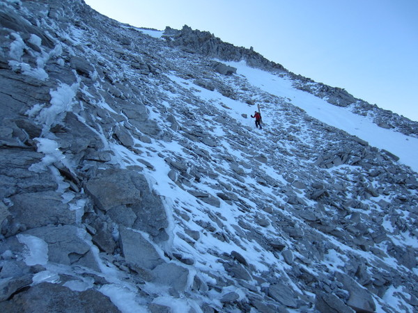
Trip: Mt. Stuart - Stuart Glacier Couloir
Date: 5/16/2013
Trip Report:
Taylor (my wife) and I had a week off last week, so did some climbing and camping, mostly in Leavenworth and Methow areas. We started off with a bang by doing the N. Face of Hood on Saturday on our way up north (we live in Oregon), leaving the parking lot at 4ish AM and wading through snow-cone like snow for thousands of feet. Returned to the parking lot around 2pm. For those that are interested, the N. Face of Hood is still plenty thick, although it is a bit of a slog to get there - at least it was in the warm temps we had.
Anyways, we next set our sights on the Stuart Glacier Couloir after a couple of glorious days of camping up the Icicle. This turned out to be a fantastic adventure with wild exposure and climbing, and was much more involved than we expected.
We thought we'd try it in a day, but then found ourselves out at a bar until fairly late at night without having packed our bags. So, we ended up hiking in the next day, saving the climb for the day after. After talking to some skiers about the horrors of the Mountaineer Creek on the hike in, we opted to approach via the Stuart Lake valley, which in retrospect was a great idea. Our planned descent was the Sherpa Glacier, so this change in plan had the added benefit of giving us a grand-tour of sorts of Mt. Stuart.
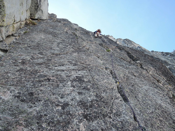
We left the tent at around 5am, walking straightforward snow slopes up to the Stuart Glacier. The couloir itself was fun, especially when it steepened, but was nothing too difficult or noteworthy. The real climbing came afterwards, to our surprise. The route required three pitches or so of mid-fifth rock climbing on the high north face of Mt. Stuart, made much more difficult by the relatively heavy coverage of snow and ice. It was totally wild in places, with a good 2000+ feet of steep exposure. I ran into what felt like a couple .10 moves, in boots. Maybe we were off route, but I did find a pin or two, so maybe not. From our position, the North Ridge looked like a pleasant walk in the park by comparison... at least it was mostly dry.
Once we made it over to the south side, the snow was much less pervasive, allowing for some fun and moderate rock climbing.
The descent was also a bit more involved than expected, required a great deal of kick-stepping. The Sherpa Glacier is in good condition and the bergschrund is easily passable in multiple spots. The weather turned a bit nasty on our descent and started raining on us. At the bottom of the Ice Cliff Glacier, we had the depressing task (made much more gloomy by the rain) of climbing up 1000 feet to the col at the base of the North Ridge to access the Stuart Lake valley. Maybe it's just me, but climbing up again on your descent just kinda sucks no matter how you cut it.
After hanging out at camp for a bit, packing up and hiking out, we arrived back at the trailhead at 7:30pm or so.
Overall, a totally awesome climb, mixed with steep rock, snow and ice that gives you a great tour of Mt. Stuart's many sides. I highly recommend and would expect that it is pretty much the same shape as shown in these photos right now.
Now, the photos!!
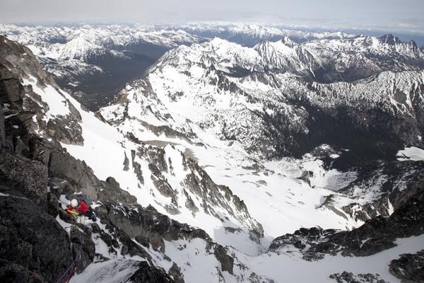
Mt. Stuart from our camp:
Hiking up, sunrise!
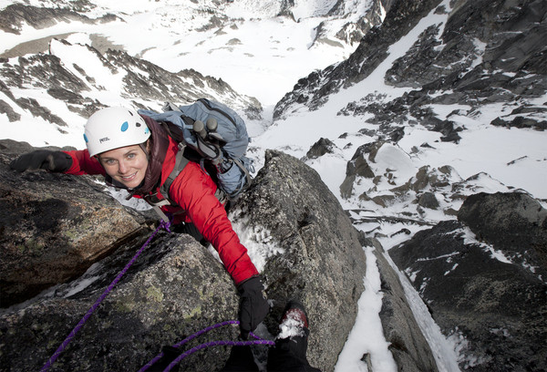
Taylor leading in the Stuart Glacier Couloir:
Taylor working it high on the north face of Stuart:
Same:

Same (before the weather turned for the worse):
Same:
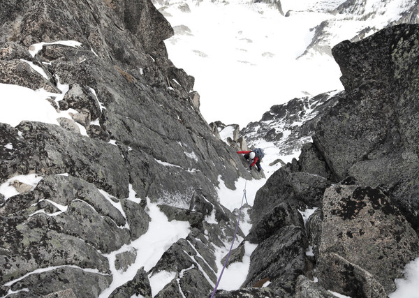
Same:
Taylor on the West Ridge:

Descending the East Ridge slopes:
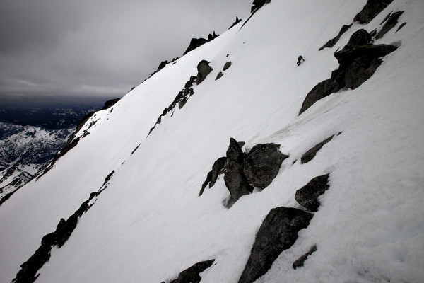
In front of the Ice Cliff Glacier, hiking back up to in order to access the Stuart Lake valley.
Gear Notes:
Two tools, maybe an ice screw or two, a couple pickets, and a decent mid-range rack up to 3 inches.
Approach Notes:
Would recommend approaching by the Stuart Lake Valley rather than Mountaineer Creek, at least from what we heard and partially experienced (we hiked about a quarter mile up the so-called Mountaineer Creek trail before we opted to turn around and go up to the Stuart Lake valley).
-
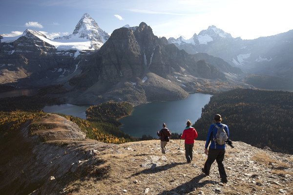
Descending from Nub Peak, Assiniboine Provincial Park, Canada.
-
Celebration on Mount Saint Nicholas, Wapta Traverse, Canadian Rockies.
-
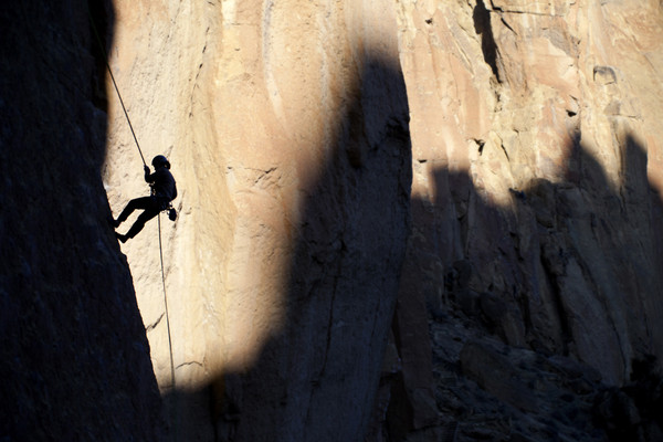
My wife Taylor rappelling after a climb in Smith Rock State Park, Oregon.
-
Ice climbing in Hyalite Canyon in bad weather.
-
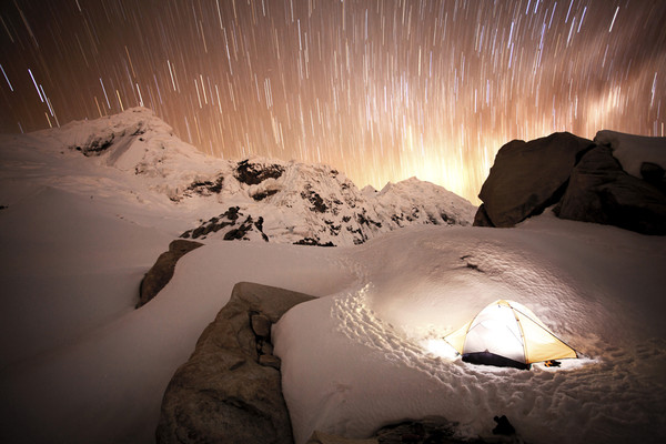
A cold night under the stars, high camp for Toclaraju in the Cordillera Blanca, Peru.
-
Good stuff! We were aiming for the N. Face that same weekend. We climbed up the south side, and were going to head down to climb the N. Face, but decided not to because it looked like a legit wallow-fest. We instead opted for a great ice route up the Devils Kitchen Headwall. If you need a partner to ski the N. Face in the future, let me know!! Would love to do it.
-
The ski down Emmons is cruiser. We must have passed at least 20-30 parties walking down. At one point, they all got bottle-necked at a crevasse crossing, and we were able to just ski right on through. Saved us hours and hours. Enjoy!
-
We did Lib Ridge a couple years back, very late season. The traverse was a nightmare (actually, the whole climb was a nightmare due to the rock), especially across the Carbon. It'd probably be better this time of year, but we had a bad taste in our mouth from our Lib Ridge trip and wanted to avoid that traverse this year.
-
Thanks! The shuttle was a solid 2 hours each day. I think it'd be better to descent to Paradise via the Furher or go back down the Ptarmigan, if you're up for it.
-
Trip: Mt. Rainier - Ptarmigan Ridge/Ski Descent
Date: 7/7/2012
Trip Report:
After climbing the Sandy Headwall on Hood on Wednesday, my good buddy, Matt Ellis, let me talk him into trying a 2-day ascent of Ptarmigan Ridge with a ski descent of the Emmons on Rainier.
I would have posted pictures, but Matt dropped the camera down the Mowich face. That was a bummer.
We left Mowich Lake parking lot at around 8:30 Saturday morning. By the way, Mowich Lake is still frozen and there's plenty of snow around. After skinning for several hours, we arrived at the spectacular high camp mid-afternoon in 88 degree temps in the *shade* (and 104 in the sun)!! Not ideal conditions for a mountain covered in glaciers!
Although we could see tracks up Mowich face and Liberty Ridge, there was no sign that anyone had recently been up the Ptarmigan.
The temperature only got down to 45 degrees during the night, so we only reluctantly decided to head up at 4:45am. We were able to switchback our way of the ~2000 ft of steep snow/ice, slowed down a little bit by the weight of our packs and occasional post-holing. At 11,500 feet, we opted for the rock variation. We simul-climbed an interesting pitch of blue ice (probably only AI 3), and then arrived at the rock rib. The rock step was very short but BEAUTIFUL: thin ice covered the rock with pockets of thicker ice, making for some great, if not strenuous, mixed moves. The last 2000-foot slog on the Liberty Cap Glacier proved to be very straightforward, with a variable crust. We arrived at the summit at little after noon.
The ski down the Emmons was great, but got a little mash-potatoee at around 11,000 feet. There was TONS of parties on the Emmons making their way back down to Camp Sherman. We were back at the car in 3 hours from the summit . . . then a 7 hour drive back home to the Oregon Coast.
Overall, the Ptarmigan Ridge is in condition, but it is advisable to wait for cooler conditions.
Gear Notes:
Two tools, 3-4 ice screws, 30 meter rope. We brought a very light alpine rack, but didn't use anything because there are a few pitons at the rock step.
Approach Notes:
Straightforward with a morale-reducing scramble up the crap that passes for rock on Rainier. You really do have to go to the top of the lower Ptarmigan Ridge and then traverse a loose ridge to camp.
-
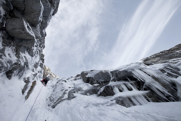
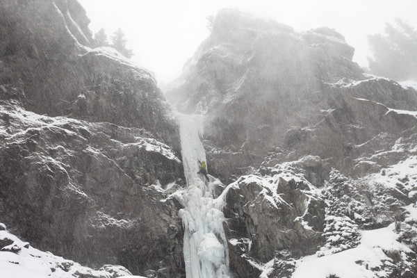
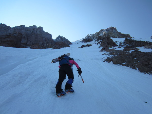
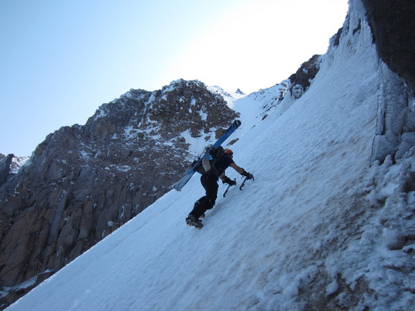
Trip: Sandy Headwall - Mt. Hood -
Date: 7/4/2012
Trip Report:
Having just spent 4 days climbing in Leavenworth, I somehow convinced my wife to drive from the Oregon Coast (where we live) to Timberline after work on Tuesday to do a one-day climb of the Sandy Glacier Headwall. Neither of us had done it before, but thought we'd give it a go, and then ski from the top.
We went car-to-car in 7 hours, and were back to enjoy the July 4th lunchtime fiestas at Timberline. We encountered very icy but fast conditions throughout the entire climb. There was ice up to 70 degrees at certain spots, with the majority of the climb more around 50 degrees. We did not feel that a rope was necessary; even if you wanted to rope up, the rotten ice that comprises the vast majority of the route will not take pro well. Overall, the route is altogether more difficult and committing than the Leuthold or (of course) the Hogsback, but is in great shape right now!
We arrived at the Timberline parking lot around 9pm on Tuesday and were greeted with pretty chilly conditions. We had planned on hanging out in our lounge chairs, drinking a beer, and watching the sunset/moonrise, but, alas, we were happy to be in our sleeping bags soon after we arrived.
The next day, we slept in a bit and left the parking lot at 5am. A generic two hour climb/walk deposited us at Illumination Saddle at 7am. We had planned on skinning/skiing all of the way to the Sandy Glacier Headwall, but all we found was bulletproof ice. Skinning was not to be and skiing down from I-Saddle was probably dangerous. Besides, we had our crampons on already.
The Reid Glacier is cruiser, and the Leuthold Couloir looks to be in pretty good shape. This weekend should be a good time to climb, but it probably goes without saying that you'll have to deal with the (small) ice missiles that tend to shower many of Hood's routes.
The high traverse over Yokum Ridge at around 8,600 ft goes easily, as long as you aren't afraid of steep ice with cliffs below and are able to negotiate the moat/bergschrund to get onto the Sandy Glacier. The traverse across the Sandy Glacier was also uneventful. We were at the bottom of the Sandy Headwall at 8:30-ish.
We were able to walk the lower bowl most of the way. After about 1000 feet, the pitch increased quite dramatically (which you can't really tell from the bottom) and we more-or-less front pointed through bulbous rotten ice the rest of the way. We summitted around 11am, hung out a bit, then strapped on our skis and were back to the car by noon.
And, just in case you're like me and are thinking of skiing the Sandy Headwall sometime soon: don't. You will die. Trust me on this.
However, a much better idea is linking the Sandy Headwall with one of the various routes on the North Face to the summit. We would have done that, but didn't know it would be so easy to do (so we didn't bring the necessary gear).
Required gear: two ice tools, crampons, helmet.
Leuthold Couloir, as of July 4, 2012. Looks pretty good!
Taylor in some rocks, partway over the Yokum ridge:
Descending the moat/bergschrund:
Taylor at the bottom of the Sandy Headwall:
Michael halfway up the Headwall (that stuff is straight crap-ice!):
Michael in the upper bowl:
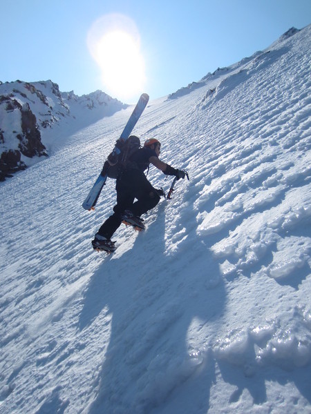
Taylor pulling out at the top of the Headwall:
The North Face - looks good!
Michael on the summit ridge:
Back at the car in time for lunch!
Gear Notes:
Required gear: two ice tools, crampons, helmet. Could bring some pro and rope, but that would probably just slow you down and not decrease risk much given the rotten rock and ice.
-
Looks good to me... although I'm getting a low of 24 on Sat night at 9,000 ft - snow should be nice and hard in the morning.
-
Anyone interested in joining me for a one-day ascent of the Sandy Headwall, starting from Timberline Lodge, with a ski descent this Sunday? Would love someone to join me.
My name's Michael and I was planning 2 days on Ptarmagin Ridge on Rainier this weekend, but don't have the time. I just returned from 5 weeks of climbing in Peru. Looking for more climbing partners in this area...
Thanks -
[TR] Mt. Hood - Cathedral Ridge - Summer Climb 07/18/2021
in Oregon Cascades
Posted
Trip Date: 07/18/2021
Trip Report:
Tim Stabio and I climbed Cathedral Ridge yesterday, July 18, 2021. We left Top Spur TH at 3:45am, and stumbled our way to the summit 5 hours 36 minutes later, where we relaxed alone on the summit in summer sunshine for about half an hour and ate wild boar burritos before descending the ol' south side. We reached my car parked at Timberline 7:34 after leaving, feeling good and unexpectedly wondering what we were going to do with the rest of our day. Overall, the route felt wild and remote, with about 1/2 of the route comprised of moderately OK rock and 1/2 comprised of horrible stuff only faintly resembling rock. If one assumes that everything one touches will move, then the experience will be great. There is also stellar positioning, offering some unique views of some of Mt. Hood's sexiest features.
Beta: the route is obvious, and generally follows the path of least resistance. I thought the route photo at https://www.summitpost.org/cathedral-ridge/660166 was good. We didn't encounter any snow/ice to really speak of, which was good because I packed the wrong crampons for my boots (dummy!). Fortunately, we each had two ice tools, so I was able to smear/tool my way down the still-frozen old chute on the descent. We didn't encounter the steep snow slope mentioned in other trip reports on the route, although it'd be easy enough to find one in the upper reaches; instead, we stuck to the ridge proper (rock). The only notable section might have been a pitch-ish of class 4/5 uber-choss that could have been bypassed on climber's left with a snow slope.
Lots of downed trees on Timberline Trail, which provided some interesting but not time-consuming navigational experiences in the wee morning light. We wore trail running shoes in, then switched those out for more rigid footwear when we started clawing our way up scree/choss fields.
Overall, a worthy and under-appreciated route for those not against a little groveling on choss.
Gear Notes:Standard alpine affair. Lighter is righter. Rope would only potentially be of use if there is snow/ice.
Approach Notes:
Top Spur TH provides the full experience of the ridge, from bottom to top, which was important to me. Better IMO than Timberline, if you can swing a shuttle.