

PellucidWombat
-
Posts
36 -
Joined
-
Last visited
-
Days Won
5
Content Type
Profiles
Forums
Events
Everything posted by PellucidWombat
-

[TR] Mt Rainier - Liberty Ridge 7/17/2011
PellucidWombat replied to PellucidWombat's topic in Mount Rainier NP
Thanks for the water protecting advice! I grew up in Utah and my mountaineering experience is mostly limited to California and the intermountain states, so I've never had to deal with moisture too much. I'm out of my element in the wet PNW :-) -
[TR] Mt Humphreys - East Ridge & Arete 2/13/2011
PellucidWombat replied to PellucidWombat's topic in California
For the most part the weather is pretty stable, and the avalanche hazard isn't nearly as frightening as in the intermountain states. And if you don't like the weather in the mountains, there's always sport climbing at the Owens River Gorge or bouldering here and there. It's just a shame that if you live in the Bay Area you have to drive 10-14 hours to get there, depending on weather. Being a local is best for winter play in the Bishop area. -
[TR] Mt Rainier - Liberty Ridge 7/17/2011
PellucidWombat replied to PellucidWombat's topic in Mount Rainier NP
Yep, I've read about how quickly the weather can turn, and plenty of accidents ranging from walking/falling off the Cap in a storm to hypothermia from waterlogged gear. Fortunately we brought extra food & fuel and kept in mind that it might be better to hunker down before things got too far out of control! Now I know that I need to waterproof my pack better . . . -
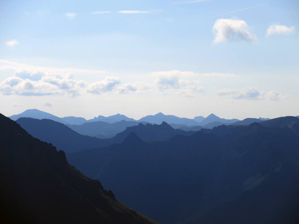
Trip: Mt Rainier - Liberty Ridge Date: 7/17/2011 Trip Report: Just in case I didn't put in enough photos in this TR, you can see more of them here. :-P Last weekend Eric and I headed up to Mt Rainier to climb Liberty Ridge. Since I am only in town for two weeks, I was willing to put up with a mediocre forecast in order to get up on the route. Though we had originally planned to do the climb Thursday-Saturday, the NOAA point forecast got us to shift the climb to Friday-Sunday so that we'd have the best weather on Sunday. Friday morning the forecast called for a good chance of rain & snow the first two days, and "Mostly Sunny" for Sunday. Two days of putting up with rain & snow until weather cleared or we popped above the clouds seemed an all right price to pay to catch the weather window Sunday. Friday - The Weather Ain't That Bad! Despite the 'bad' forecast, it was actually pretty clear on Mt Rainier. [img:center]https://lh6.googleusercontent.com/-Y3A5UkrxB3E/Tih38q0TdrI/AAAAAAAAb1U/5X6H0GrZJZE/s720/2011-07-15%252520-%25252001%252520-%252520Mt%252520Rainier%252520from%252520White%252520River%252520Turnoff.jpg[/img] We had nice views of the lower mountain on the approach to lower Curtis Camp, and visibility was not a problem on the Winthrop Glacier. [img:center]https://lh3.googleusercontent.com/-ThmvQ3A0CD0/Tih4DRMJYpI/AAAAAAAAb1c/KzG3DRJ_wsc/s800/2011-07-15%252520-%25252004%252520-%252520Little%252520Tahoma%252520Pk.jpg[/img] Little Tahoma Pk [img:center]https://lh4.googleusercontent.com/-ubEUYNCpxdQ/Tih4HAtrHJI/AAAAAAAAb1g/2AxB2cvisCo/s912/2011-07-15%252520-%25252005%252520-%252520St%252520Elmo%252520Pass%252520-%252520Annotated.jpg[/img] The only source of moisture on our gear was from perspiration this day as it felt hot & humid. [img:center]https://lh6.googleusercontent.com/-zz9_ReuhlF4/Tih4he74RTI/AAAAAAAAb1w/wr-AAJiora8/s720/2011-07-15%252520-%25252008%252520-%252520Lower%252520Winthrop%252520Glacier.jpg[/img] We made camp at about 7,400' on lower Curtis Ridge and enjoyed some rock slabs that were perfect for lounging and taking in the views. Since we expected it to be cloudy that night, I decided to make use of the weight of the DSLR I hauled in and took artsy photos of the Carbon Glacier. [img:center]https://lh5.googleusercontent.com/-LlbjjAP9eeA/Tih5GZVfPRI/AAAAAAAAb2I/EMiuDZffA9I/s512/2011-07-15%252520-%25252014%252520-%252520Carbon%252520Glacier%252520Crevasses.jpg[/img] [img:center]https://lh4.googleusercontent.com/-OzlshZ_yejo/Tih5WhI5uyI/AAAAAAAAb2M/FbAGTX33JwE/s512/2011-07-15%252520-%25252015%252520-%252520Carbon%252520Glacier%252520Crevasses.jpg[/img] [img:center]https://lh3.googleusercontent.com/-fCphve67RiU/Tih5mbBJA_I/AAAAAAAAb2Y/OEdCcSUpuQs/s720/2011-07-15%252520-%25252018%252520-%252520Carbon%252520Glacier%252520Crevasses.jpg[/img] [img:center]https://lh5.googleusercontent.com/-ItbBnjjoZC0/Tih6KnsGA-I/AAAAAAAAb2w/io0VT6EPnok/s512/2011-07-15%252520-%25252023%252520-%252520Carbon%252520Glacier%252520Crevasses.jpg[/img] [img:center]https://lh6.googleusercontent.com/-tKE0eUiVPmQ/Tih61H8lhgI/AAAAAAAAb3M/LhJ2b4UCxww/s720/2011-07-15%252520-%25252030%252520-%252520Liberty%252520Ridge%252520Toe.jpg[/img] As the evening wore on the clouds parted and we were fortunate enough to get a clear view of the north side of Mt Rainier. Considering the forecast, I had been prepared to miss out on this, so it was a great surprise! [img:center]https://lh4.googleusercontent.com/-53lAS-ryjLQ/Tih7hifhKlI/AAAAAAAAb30/EMpsIhglMtc/s512/2011-07-15%252520-%25252041%252520-%252520Eric%252520%252526%252520Rainier%252520-%252520Annotate.jpg[/img] Thar She Blows! [img:center]https://lh5.googleusercontent.com/-caoqKOcPOuk/Tih772GtLXI/AAAAAAAAb4I/PyZ8JXe8eos/s720/2011-07-15%252520-%25252045%252520-%252520Eric%252520%252526%252520Rainier.jpg[/img] [img:center]https://lh4.googleusercontent.com/-sjQwUEcoT7s/Tih9NrHR9yI/AAAAAAAAb44/T1q1R8oSyCo/s912/2011-07-15%252520-%25252056%252520-%252520Rainier%252520Sunset.jpg[/img] Saturday - Should We Keep Climbing? We woke to the soft pitter-patter of rain on the tent walls. Time to get wet. We started climbing under a light rain, but fortunately I never needed to use the waypoints I had put into my GPS. Clouds were either below us or above us the entire time, so visibility was fine on the Carbon Glacier. Rain turned to snow as we neared the toe. We had hoped to take the direct variation to Thumb Rock on the west side, but we couldn't find a way through the crevasses and were forced to endure about a pitch of unprotectable skice and slush mixed into a vertical gravel slurry to gain the toe from the east. [img:center]https://lh6.googleusercontent.com/-kITab1tFHnA/Tih9Xx9-3SI/AAAAAAAAb5A/QhA-g0lklX0/s720/2011-07-16%252520-%25252001%252520-%252520Liberty%252520Ridge%252520Toe%252520-%252520Annotate.jpg[/img] Fortunately as we wrapped around the sketch factor decreased, though for about half of the descent we had shallow snow mixed in with the loose rock. As we neared Thumb Rock I came across one chute that was dribbling out rocks every minute or so. I made sure to sprint across this section! We made it to Thumb Rock a little later than hoped, but still plenty early in the day. We napped and managed to get our clothes dried during the sunny intervals as the tide of clouds washed in over Mt Rainier, and then receded, over and over again. [img:center]https://lh6.googleusercontent.com/-4C0Yr1db1XM/Tih3oOzZMmI/AAAAAAAAb1A/1CttybObjpw/s512/2011-07-16%252520-%25252010%252520-%252520Center%252520Variation.jpg[/img] The WI3 Center Variation Above Thumb Rock Camp. [img:center]https://lh5.googleusercontent.com/-IlVbvHwY5XQ/Tih3ayTRoAI/AAAAAAAAb08/g5cOQOAFHiE/s720/2011-07-16%252520-%25252008%252520-%252520Willis%252520Wall.jpg[/img] Willi't Kill You' Wall Provided Good Background Noise for Our Camp The plan for the next day was to start climbing by 3am to get us over the Cap and down to the TH at a respectable hour, but when Eric checked the updated forecast on his phone, he saw that our "Mostly Sunny" weather window had changed to "80% chance of snow, 1-3" @ 13k'". Yikes! We were tempted to pack up camp then and there and just keep climbing while it was still clear and sunny, but we were tired, relaxed, and decided that since the weather was forecast to move in later in the morning, we'd wake at midnight and be climbing shortly after 1am to beat the weather. [img:center]https://lh3.googleusercontent.com/-vudZ1pdqxo0/Tih3D13nVqI/AAAAAAAAb0k/q1MLFty67K4/s720/2011-07-16%252520-%25252005%252520-%252520Thumb%252520Rock%252520Camp%252520-%252520Annotate.jpg[/img] Sunday - We Should Have Kept Climbing Climbing was great under a bright moon, and although we climbed in darkness, we had nice views of Seattle and the north side of Mt Rainier as we ascended. As we got higher we encountered more early-season conditions as the hard neve/ice often had a layer of fresh snow on top. Sometimes we could crampon, but often we where kicking steps calf deep and sometimes knee deep in the snow to make steps or reach purchase in the ice beneath. This was hard work and slowed our ascent more than expected. We took turns breaking trail, swinging leads about 6 times on the route. The weather was still clear as the sun rose shortly after we rounded the Black Pyramid to ascend the slopes above Willis Wall. I took my sole climbing picture of the day then, as by the time we reached the top of the Black Pyramid, the storm had already broken. [img:center]https://lh4.googleusercontent.com/-NqytY7TL4p4/Tih3vqQJC_I/AAAAAAAAb1M/gLDXgDAELzw/s720/2011-07-17%252520-%25252001%252520-%252520Eric%252520Leading%252520Beside%252520Black%252520Pyramid.jpg[/img] Eric Nearing the Top of the Black Pyramid We moved at a snail's pace as we tired from the elevation and soft snow, but the snow kept getting softer and deeper. As I traversed over to the bergschrund crux, I was often digging through waist deep snow, right up to the ice pitch. By this time it was snowing hard and the wind was blowing around 30-40 mph. The ice pitch had a continual dumping of windblown snow that was sluffing off the slopes above. I got thoroughly drenched from these pervasive ice crystals as I climbed 1 pitch of ice through the whiteout. Eric took the next trailbreaking lead and found another nice pitch of sustained 40 degree ice. Though exhausted at this point, I welcomed the ice for the break it provided from the soft snow. Plus it was fun! I finished another pitch of ice to the top of the route. Unfortunately here the wind gusts picked up and visibility dropped to near zero. We had difficulty reaching the top of the Cap as a large bergschrund stopped us less than 100 ft from the top. Going left, it grew larger, so we backtracked to the right and end-ran it and were shortly on top of Liberty Cap. The problem at this point was that we could barely see the snow 1 or 2 steps in front of us. Despite having our waypoints for descent set in the GPS, that only helped us for the larger scale routefinding. We realized that we could easily walk off a cliff or into a crevasse with the visibility as bad as it was. We were both thoroughly soaked and becoming mildly hypothermic. I already had the "umbles" and was beginning to get the "stumbles" and both Eric and I had been shivering non-stop for the past 3 or 4 hours. The last forecast we had seen showed the weather to dissipate Monday, so we decided it was best to set up shelter on the Cap to get warm & rested, and attempt to descend once visibility improved a bit more. We dug a platform into the bergschrund wall that we had end-run and I built up some hardy wind walls. Despite the howling wind, the BD First Light we were using was pretty calm, and our biggest complaint was being buried from snow drifting over our tent. Eric took initiative and shoveled snow off the tent a couple of times throughout the night. Everything in our packs was saturated, including our sleeping bags. Luckily neither of us was using down loft! We melted more water and spent the night gradually rewarming as we slept in our soggy bags and clothes. Monday - The Sorry Soggy Slog Hooray! We could now see about 20-50 feet! We were up early, packed up camp, and began navigating to our waypoints to bypass the Columbia Crest and GET DOWN. It felt like we were going pretty slow, but we actually made pretty decent time through the 50 mph gusts and whiteout as we found the right way off the Cap and around the Crest. There was still tension in the air as we climbed, as all of the fresh windblown snow hid the crevasses pretty well. I punched into two as we descended the Cap. The second one was large enough that I stopped my fall by hooking the far side with my tool and stemming my legs. I ratcheted back up, rolled onto the near edge, then jumped across to keep up the pace. Barely a setback at this point. We did get held up briefly in the seracs atop the Winthrop Glacier, as apparently you can't traverse straight over to the Emmons from the height of the saddle connecting the Cap & Crest (oops). For future reference, you still need to ascend a couple hundred feet up the Crest to bypass the seracs & 'schrund before dropping back town towards the Emmons Glacier. [img:center]https://lh3.googleusercontent.com/-2rKBrHEXfII/TiipJSUZONI/AAAAAAAAcGM/nC_mIUaH_II/s640/Liberty%252520Ridge%252520GPS%252520Track%252520-%252520Summit%252520Traverse%252520-%252520annotated.jpg[/img] Gradually the skies cleared and we found the Emmons Glacier wands. I put away the GPS, put my brain into autopilot mode (with the crevasse-search feature still engaged), and at last began a relaxed descent. I finally stopped shivering as we got more sunshine through the blowing clouds. Sadly the Inter-Glacier was too slushy for any real glissading, but we made good time rushing down the trail (thoughts of Doritos and beer in the car kept me at a steady 3mph clip). Overall the climb was great, but if you venture up anytime soon, be prepared for a lot of fresh snow! [img:center]https://lh5.googleusercontent.com/-f-AdmPLzui0/Tih9MWLHjtI/AAAAAAAAb40/3Z46dufD4Oc/s720/2011-07-15%252520-%25252055%252520-%252520Rainier%252520Sunset%252520-%252520%252520Annotate.jpg[/img] Gear Notes: We brought 4 screws & 2 pickets between us. This was more than sufficient. Approach Notes: The Carbon Glacier is getting more broken up. We had to do a large end run to the far west side of the glacier at the beginning, and we couldn't find a route around the toe of Liberty Ridge. The rock on Liberty Ridge's toe is very melted out now and best avoided if possible. Rocks where also falling off the ridge crest regularly just below Thumb Rock.
-
[TR] Mt Carl Heller - East Ridge 3/13/2011
PellucidWombat replied to PellucidWombat's topic in California
Thanks Veronica! The Russian rating was made in jest since two members of our group were Ukrainian. Vitaliy actually did bring some vodka for the bivy & summit, while I brought Jameson whiskey out of respect for my Irish heritage :-) -
Trip: Mt Carl Heller - East Ridge Date: 3/13/2011 Trip Report: Carl Heller is a rarely climbed peak just north of Mt Whitney in the High Sierra. However, the east ridge is often touted as being the best scramble in the High Sierra, with continuous exposure & knife edge scrambling on sustained cl. 3-4 cracks and friction slab. A few years ago I saw a photo of the ridge with snow on it, and it looked like a whole different level of challenge. Despite the easier rating, with snow this was a lot harder than the East Ridge of Mt Humphreys (III-IV, 5.4-5.5) that I had climbed the months prior, and with runouts traverses on soft snow adhering to steep granite slabs. I talked Vitaliy, Max, Shane, and Kevin into joining me, and as expected, the ridge was longer and harder than expected and we bivied one pitch shy of the summit before descending the next day. We reached the most exposed and technical crux in the dark, so sadly I don't have any photos of that. See the report link for more photos & the write up. Some highlight photos are included below. Link: Partying Like a G6 on the East Ridge of Carl Heller (In Winter Style) [img:center]http://www.summitpost.org/images/medium/704779.jpg[/img] Carl Heller seen from our camp. [img:center]http://www.summitpost.org/images/medium/708661.jpg[/img] The East Ridge of Carl Heller [img:center]http://www.summitpost.org/images/medium/704775.jpg[/img] The East Ridge of Carl Heller as we pitched it out (I left out 1 or 2 belays) [img:center]http://www.summitpost.org/images/medium/704776.jpg[/img] The East Ridge of Carl Heller as we pitched it out (I left out 1 or 2 belays) [img:center]https://lh4.googleusercontent.com/-gIe95cExOLA/TYc-KS8_73I/AAAAAAAAIa0/2pmreR91aLQ/s640/019-Vitaliy-6-188799_10150116011642270_515072269_6166620_2053633_n.jpg[/img] Some of the tricky climbing in the middle of the ridge. You had to dig around a lot in the snow to find pro & holds. [img:center]http://www.summitpost.org/images/medium/704797.jpg[/img] Increasing exposure on the ridge. Fortunately the snow on the slab held and only footsteps were collapsing. Gear Notes: Light alpine rack. Very large slings for slinging blocks. 1-2 pickets for psychological pro if you're desperate. In summer no gear is needed, though many people would appreciate a rope or climbing shoes for a couple of sections. Approach Notes: Approach by ascending 5,000 up the annoying bushwack in George Creek (snow does not make it easier!). After the climb, descend the cl. 4 West Face, and ascend 1,000 ft over Vacation Pass to the north to return to camp. In summer the route is often done out of Whitney Portal via Cleaver Col & Vacation Pass, then back out via Cleaver Col as a long day hike & scramble.
-
Trip: Mt Humphreys - East Ridge & Arete Date: 2/13/2011 Trip Report: This past winter I've discovered that one way to make the Sierra cl.3-mid 5th climbs more interesting is to do them in winter. The East Ridge of Humphreys (III, 5.4-5.5) was one such route. Link: Winter Ascent of the Full East Ridge of Mt Humphreys The route was long and slow enough in winter that we had to bivy in a snow cave at 13,600' and finish the last 3 pitches of rock climbing the next day. Below are some highlight photos from the climb. [img:center]http://www.summitpost.org/images/medium/701445.jpg[/img] [img:center]http://www.summitpost.org/images/medium/701390.jpg[/img] The full East Ridge. The standard East Arete ascends couloirs north or south of the ridge to the large notch just past the large sub-peak, making for a significantly shorter route, but not nearly as fun! [img:center]http://www.summitpost.org/images/medium/701408.jpg[/img] The upper, East Arete, portion of the route, as well as the final towers to bypass on the 13,000 ft gendarme. [img:center]http://www.summitpost.org/images/medium/701382.jpg[/img] The route seen from the Owens Valley 7,000 ft below. [img:center]http://www.summitpost.org/images/medium/701392.jpg[/img] Lower 1,000 ft of the route. Stay on the ridge crest for the most fun. [img:center]http://www.summitpost.org/images/medium/701393.jpg[/img] Cl. 4 climbing on the lower East Ridge. Great rock! [img:center]http://www.summitpost.org/images/medium/701396.jpg[/img] Yeehaw! [img:center]http://www.summitpost.org/images/medium/701217.JPG[/img] Bypassing a smaller gendarme. [img:center]http://www.summitpost.org/images/medium/701412.jpg[/img] The climbing on the backside of the 13,000 ft gendarme was exposed, clean, and very fun. I'd say it is the best part of the route. [img:center]http://www.summitpost.org/images/medium/701213.JPG[/img] Crux headwall, although I think I went the wrong way here :-) [img:center]http://www.summitpost.org/images/medium/701676.JPG[/img] Doh! [img:center]http://www.summitpost.org/images/medium/701423.jpg[/img] Final couple of pitches to the summit. Then to rappel & downclimb the route. [img:center]http://www.summitpost.org/images/medium/701434.jpg[/img] Downclimbing from the notch at the base of the East Arete on our descent. Gear Notes: Light alpine rack & long slings. Approach Notes: In summer, the clearance of your vehicle and the presence of 4WD will determine how close to the end of the dirt road you get. In winter it is snow level, which for us on this trip started at 6,500 ft. The approach is pretty straightforward and there are a number of ways you can do it.
-
This is a tentative invite, but I want to see if anyone will be in the area that I could join in with for a climb, either on TR or multi-pitch. I have personal gear but only brought a marginal alpine rack to Washington and have no idea what to climb at Index (I had other objectives - dang weather), so I'm happy to climb with someone else's agenda. Conservatively, I'm solid at 5.8, doing more 5.9s, and I've led cracks up to about 5.10a here and there and seem to be solid on cracks to 5.10c/d (Yosemite Valley ratings). Since I really won't know for sure if I can actually climb this Monday, I'd probably be best working in with a group or climbing with someone local to the area. Depending on circumstances I'll either be driving up from Seattle early Monday morning or straight from Mt Rainier Sunday night. PM me and we can exchange numbers to make arrangements!
-
Smith Rock Monkey Face swinger takes out climbers
PellucidWombat replied to ScaredSilly's topic in Rock Climbing Forum
While the rope swing could be done safely, leaving the setup accessible for less experienced or thoughtful people to use it in such a crowded location looks to me like an accident waiting to happen. I'm familiar with the rappel and that hillside, and watching the video of the swinger and imagining a rapp line in the way makes my stomach churn. I admit I'm not impartial here, since Liz Redman is a close friend of mine. I'm glad to hear that the bolts have been removed. -
Parter Wanted for Liberty Ridge in Early-Mid July
PellucidWombat posted a topic in Climbing Partners
I am flying up to Seattle on July 13/14 and would really like to climb Liberty Ridge. If I find the right partner, I'd even want to loop back around and climb Ptarmigan Ridge. I have all of the gear needed to do the climb and am even planning on renting a car if needed to get to Rainier from Seattle. All I need is a competent, fit and safe partner to join me for the ridge! I could potentially fly up a week earlier if necessary, but I'd need to know ASAP. I'd like to plan to do the climb in 3 days RT, with 2 weather days set aside. As far as experience, I have climbed (unguided) Rainier via DC, Denali via West Buttress, and many peaks in CA, UT, & CO in all seasons, including leading several mid-5th class ascents with mixed snow last winter in the Sierra Nevada. I lead solid AI2, and have gained over 10,000 ft in a day in the mountains, and I'm no stranger to lugging a 60-70 lb pack at a fast pace up endless soft snow slopes. If you want to get a better sense of my climbing history beyond what I've summarized, since I don't have anything on Cascade Climbers, you can check out the following links if you want to look more: MountainProject SummitPost -
Hey CCers, Good news! Liberty Ridge is in! Conditions I had been planning on climbing Liberty Ridge and some other routes in WA in Mid-July assuming that the late & heavy snow season would make conditions similar to last year. However, LR seems to be in condition a bit earlier. For those with experience with conditions in WA, how would you see the timeline for the following routes being good to climb, but not stupid/dangerous? (at least not more than usual :-) ) Liberty Ridge (Mt Rainier) Ptarmigan Ridge (maybe)(Mt Rainier) North Ridge (Mt Baker) West Ridge (Forbidden Pk)/Torment-Forbidden Traverse Adams Glacier (Mt Adams) I was thinking of doing whatever of these climbs I can find partners for between July 14-27. However, if any of these are likely to be in bad shape by then (for THIS year), I'd like to know as I might adjust the ordering or head up earlier to just do a main objective. Partners So I'm wary just meeting up with someone for these climbs without a prior climbing history together, but I'll try it out as my prospective partners either cannot come now or cannot commit to any particular part of the trip. Does anyone have any interest in meeting up to do any of these climbs? If so, e-mail or PM me. I will be flying in & out of Seattle (from Oakland, CA) and will rent a car for the duration unless someone wants to join me for a longer leg of the trip & carpool (and I'll just rent a car for whenever that isn't convenient). I'm fine leading all pitches on the above climbs, but I'd want my partner to be technically proficient in glacier travel/rescue and physically fit enough for these climbs to not be too much of a stretch. You can get a sense of my current level of experience from SummitPost & MountainProject. Ideally, if someone has the time, it looks like LR & Ptarmigan can be linked up nicely with a couple more days total for a trip to Rainier. Also, I would be psyched for the Price Glacier on Mt Shuksan, though for this year I'd conservatively consider myself more of a follower for the crux on that route if you need a good porter/belayer :[] I plan to come back to WA for some more climbing trips in the next couple of years, so it would be great to make some climbing connections in the area.