tobias tillemans
-
Posts
11 -
Joined
-
Last visited
-
Days Won
1
Content Type
Profiles
Forums
Events
Everything posted by tobias tillemans
-
Hey Pup I live here in N India and I agree that Leh should not see much if any disruption. There is so much climbing in there and so little red tape. For truly budget option one can take a bus 10 hrs from Manali and walk into the Zanskar from Darcha, no questions asked.
-
Looking to go to the upper town wall or the cheeks and climb tens or low 11s. Have rack, rope, can lead. Lots of experience plugging gear at index. thanks , tobias
-
[TR] Washington Pass, Liberty Bell - Thin Red Line 09/01/2018
tobias tillemans replied to ahparker's topic in North Cascades
Awesome photos and strong work. Looks amazingly fun. -
A few years ago in August we were able to access the ridge by detouring around the moat to the right. I put a trip report up for that.
-
Ooooh lordy would I love to have a set of skis here. that is in the works. Thanks for reading and, yeah, if I get up to anything else interesting I'll report, and continue to live vicariously through your TR's.
-
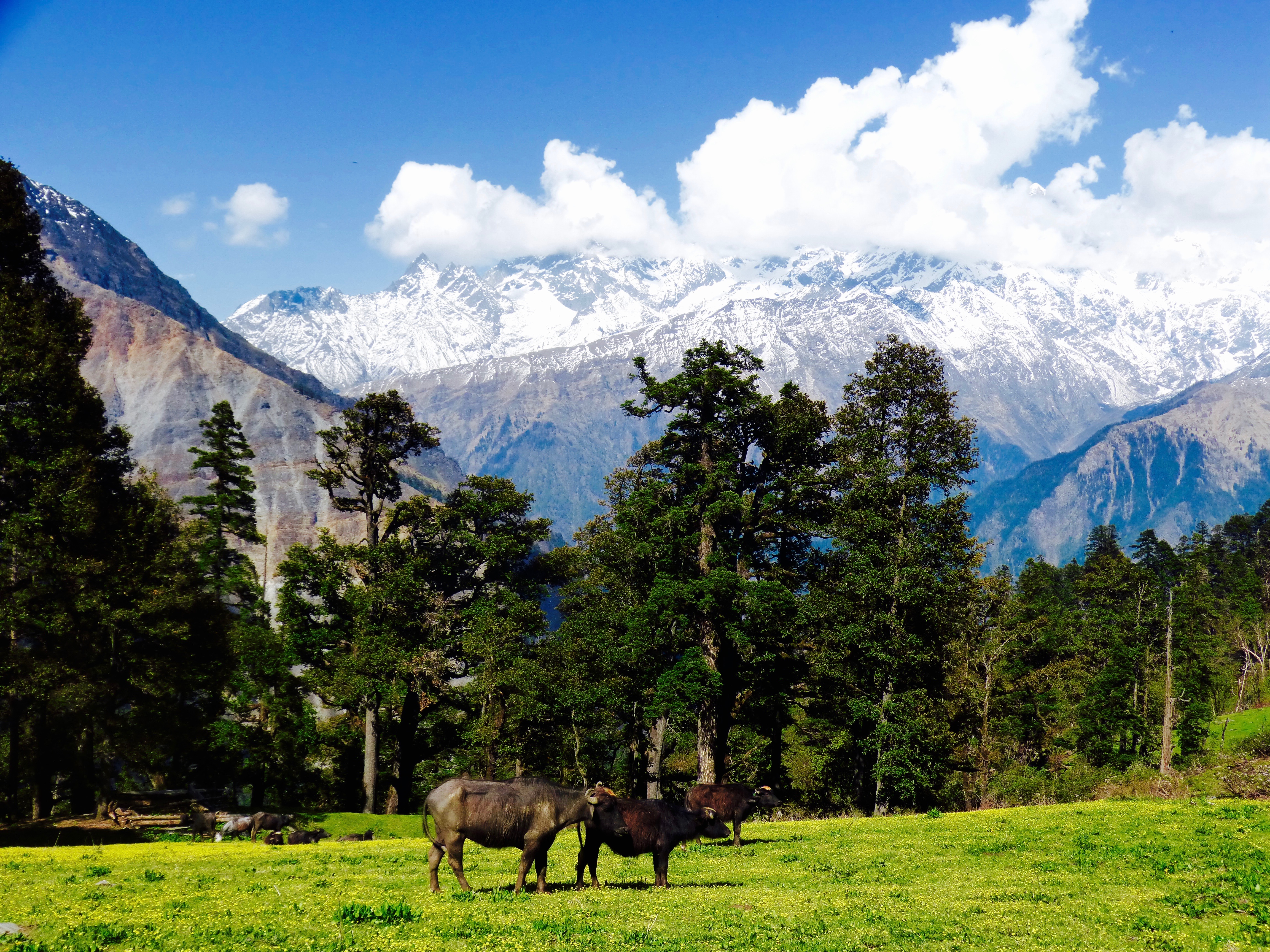
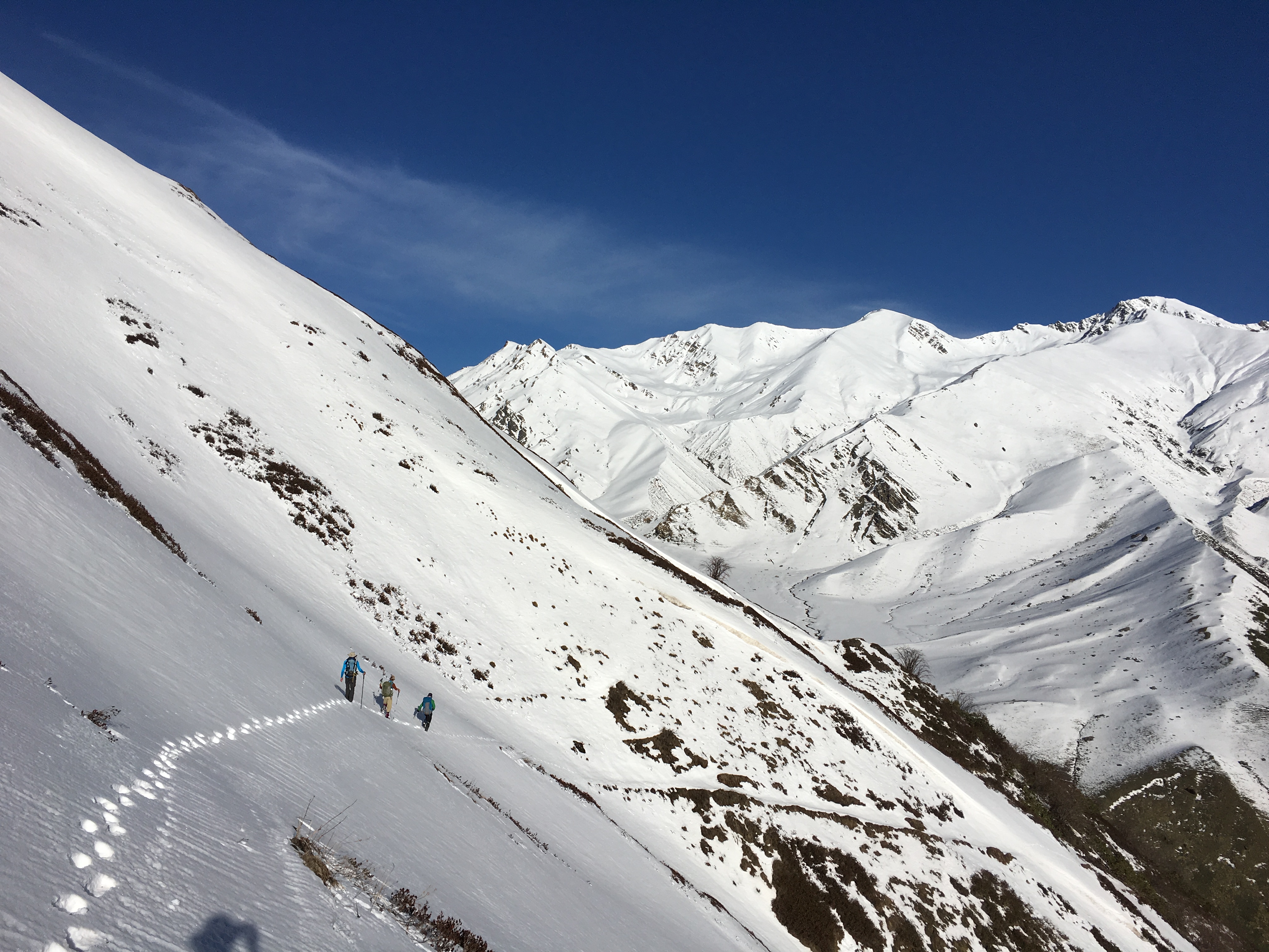
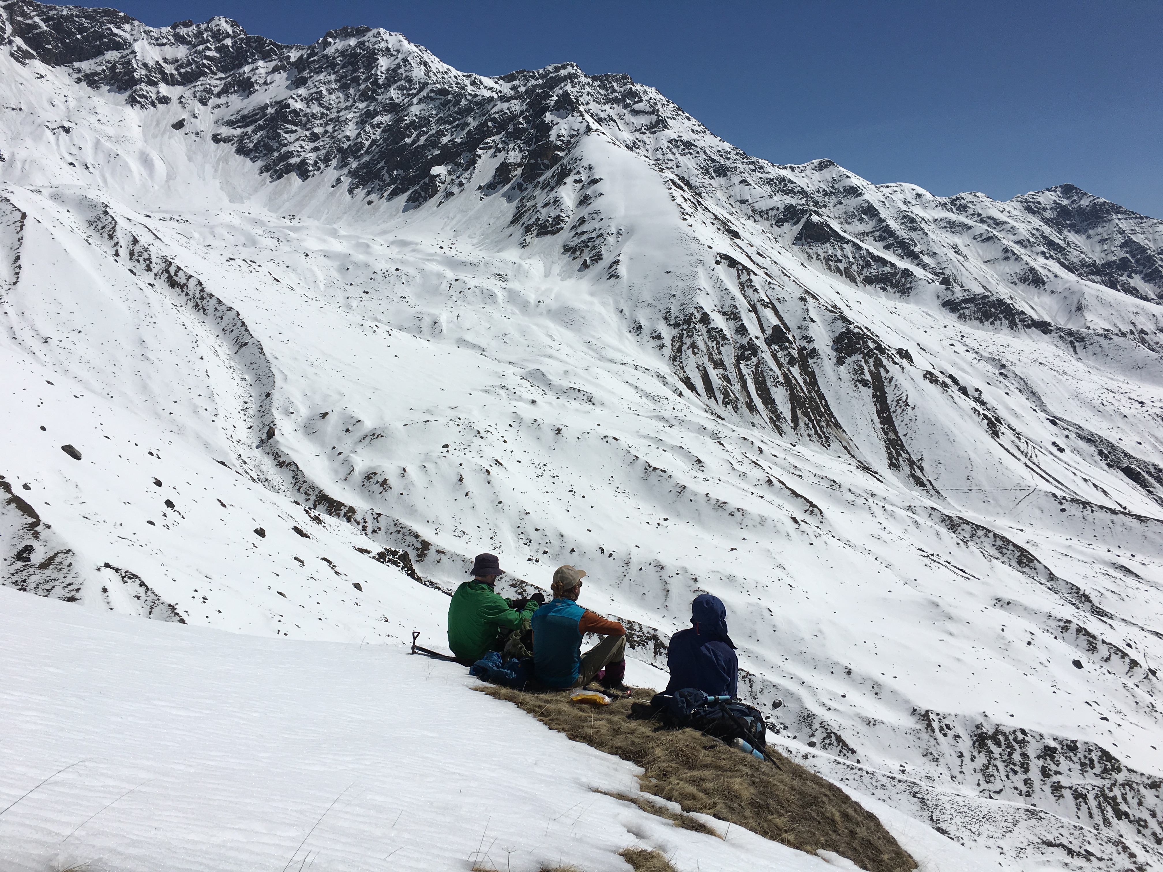
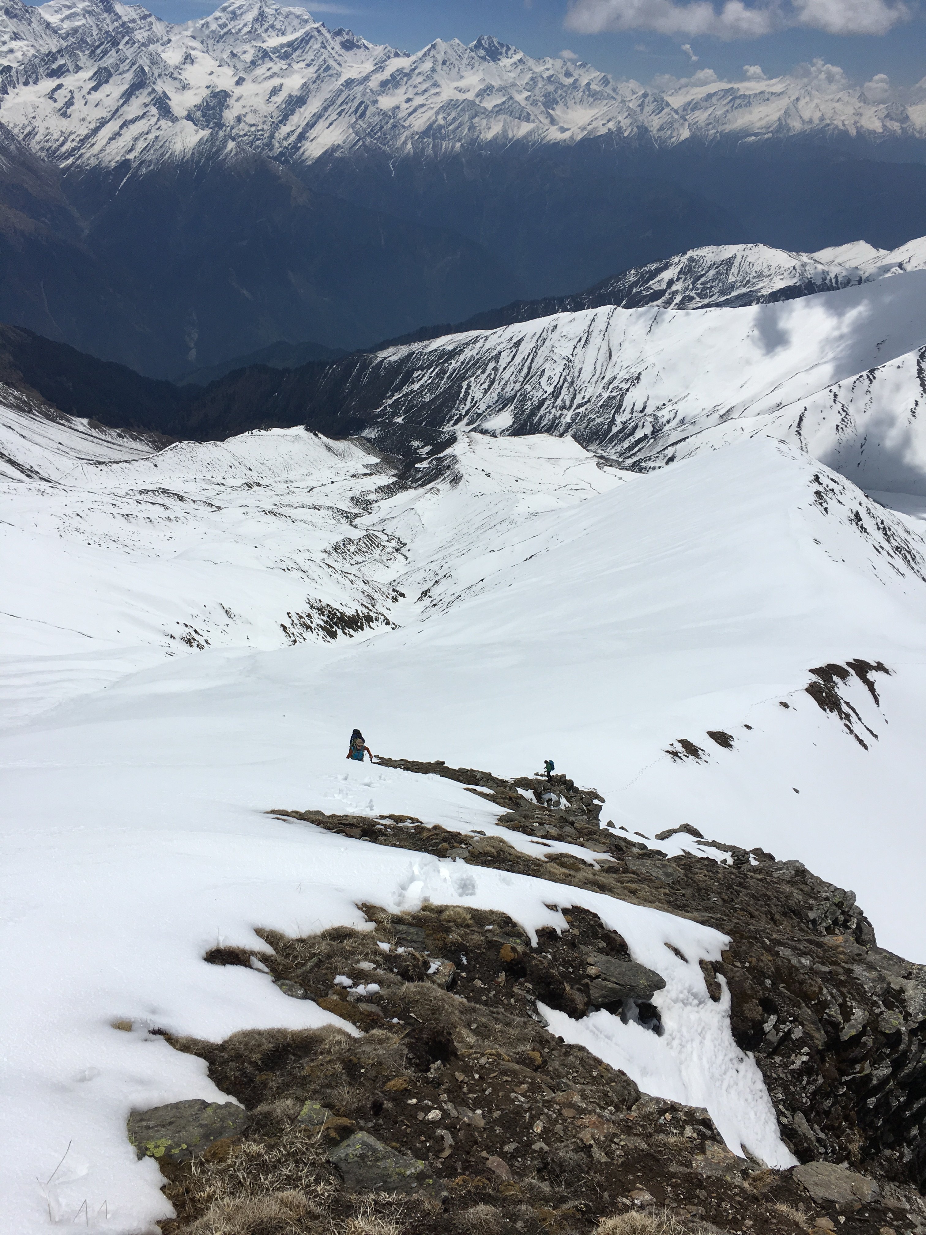
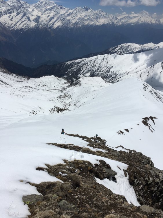
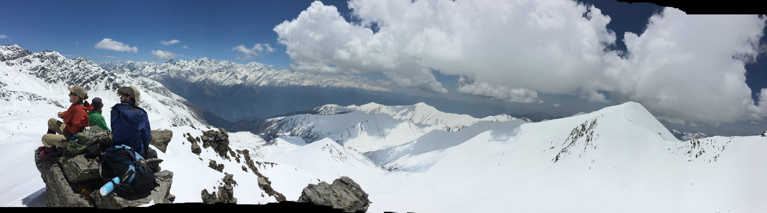
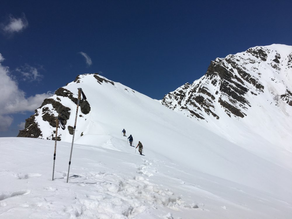
Trip: Indian Himalaya - Unicorn Bugyal Trip Date: 05/13/2018 Trip Report: Have you ever wondered if that huge meadow at 13,000 feet below Bandarpunch peak and across from the Gangotri range had a sheep trail access to it? Probably not, as you're likely still in the Pacific Northwest, where I used to be, and still miss desperately, but as I'm here in the foothills of India I have been putting some effort into finding mountain experiences reminiscent of the Cascades to pass the time until I can be back. One would think it would be easy to get into the mountains when living in the Himalayan foothills of India. It is not. Permits are required even for hikes, they are not easy to get, and neither are maps. Trails are not marked, and trail heads are many thousands of feet below the talus. Permits for actual peaks are amazingly expensive and complex. All of these barriers to entry, as well as working on weekdays, make me miss the North Cascades something fierce. I would rather schwack through a mile of devil's club than to endure again the 6-hr drive to the mountains, so I thought I might share my latest trip here as you all are my long lost mountain people. We left our home in Mussoorie at 5am, arriving in the hill town of Bhengali at 7500' at 11, where we secured for 5 dollars a guide to show us the correct trail to the big meadow. He turned back after 2 hours and left us with general directions. We found seasonal herders of goats and buffalo luxuriating in this amazing setting on the way up. After some wandering, about 6000' of ascent, and trail finding guesswork we arrived on a ridge above our destination at 13000' where we set up camp. This is not a place frequented by tourists, and the few herders, Muslim Gujjars who migrate seasonally from the plains, give us directions and buffalo milk. The next morning we dropped into the meadow on fresh snow, crossing a drainage and proceeding up an elegant looking ridge. How invigorating to be kicking steps again. We, two Americans, a Kiwi, and a Colombian, all felt relatively strong up to our summit, really more of a high point, which we coined Forman Top at 16000'. The new snow softened through the day, and we made the final scramble to the "summit" just before authentic slogging would have set in. We sloshed our way back down hill in giant loping steps and tumbles, descending the 3000 feet to the drainage which bisects the meadow in about 45 minutes, arriving back at our tents at about 2 pm after a rewarding 8 hour day. We made some coffee then observed that our water source, a tea-colored collection on a grassy depression, had almost entirely drained. What was left would be suspect in any country in the world, let alone a place of such diverse intestinal fauna as ours, so we decided to descend the 2000 feet to a green meadow below us. This turned out to be a good idea, as some powerful afternoon convection arrived around 5pm and all hell broke loose over our heads, right on the ridge where we had been set up. The next morning we followed the same route out, more sure of our bearings, and saw some of the same Gujjars and buffalo, had some milk. We were advised by the Gujjars that the ranger had followed us up. When we ran into him he gave us his phone number so we can call next time, let him know, and get a permit. We mapped the whole route for future travelers in our position, and now seem to at least have part of the permit puzzle identified. All this just to keep a cultural thread from me here to the PNW community and to remind everyone, even with the fickle weather, what an amazing place the PNW is to live. Maphttps://drive.google.com/open?id=1ZLXZZrtswVDsgDV3WZiqgwki6-IBdod4&usp=sharing Gear Notes: Skilled driver, Vomistop, passport copies, water treatment, basic Hindi. Approach Notes: about 3 hrs from Uttarkashi


-
Ideas for a highschool mountain climb
tobias tillemans replied to vsigler's topic in Climber's Board
As long as you're not a teacher at their school or trip leader in some other organization they are in you should be fine. I like the Daniel and Vesper ideas. -
Hmm. They describe them as not only 'ultra lightweight', but 'super light' and 'incredibly light' in their two sentence description, guess they've got a target audience.
-
[TR] Mt. Stuart - Complete North Ridge 8/20/2010
tobias tillemans replied to danhelmstadter's topic in Alpine Lakes
Hey Bstach, we were bivied at the notch while these guys were just below. There's no snow between stuart and goat passes. If you're crossing the stuart glacier to get to the notch, we did it carefully with one axe and a set of crampons between us. -
I'm looking for a partner for the west ridge of Forbidden sometime in the next month or two. I'm happy to do a high camp though I'd also be happy to take bivy gear and shoot to do it in a day. My schedule is flexible though weekdays are normally best for me. I'd be looking to simulcimb most of the route and am looking for someone comfortable moving reasonably fast on low 5th terrain.
-
Somewhere in The Country area, I think I left them at the base of Cunning Stunt. Size 12 mens, recently resoled. Many thanks, Tobias