


bellows
-
Posts
214 -
Joined
-
Last visited
-
Days Won
16
Content Type
Profiles
Forums
Events
Posts posted by bellows
-
-
Awesome, proud climb for the shoulder season.
-
Very cool! Thanks for writing it up. Looks like a fun adventure and great way to salvage a day if the north side routes look iffy.
-
Wow, fantastic trip report. I always find it interesting how quickly the "get me the f*ck off this mountain" moments seem to change a few days later at the office to "get me the f*ck on that mountain" thoughts.
-
 1
1
-
-
Cool, thanks for the early season stoke!
How was the West Ridge? I don't think it is in the Beckey or Alpine Select guides and I've never heard anything about it before. You should write up a TR.
-
Damn, that's impressive. Well executed you two!
-
2
-
-
Nice trip report and pics. I love that climb! The summit picture is a classic, so much so that it's the cover of Nelson's Selected Climbs vol 1.
-
1
-
-
I'm grieving. Jim was a friend of mine. He was one of the nicest, funniest, and genuine guys I've ever known. I never heard anyone say a bad word about him and I never heard him say a bad word about someone else. That seems rare nowadays, and is a testament to what a good guy he was. And it was infectious. He was full of positive energy and rubbed off on anyone who came in contact with him. I'm a better person for having known him.
I don't think he posted on here, but he's shown up in an occasional trip report or two. He's the "Jim" in the Dark-Bonanza-Martin traverse last summer. Second to last picture, guy on the left:
There's a service on Saturday 8/11 from 2-5PM at the Edline-Yahn & Covington Funeral Chapel in Kent.
Stay safe out there. This is hard to stomach.
-
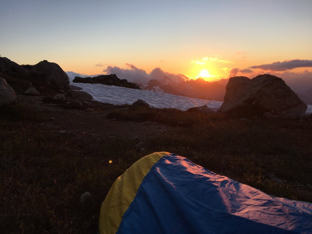
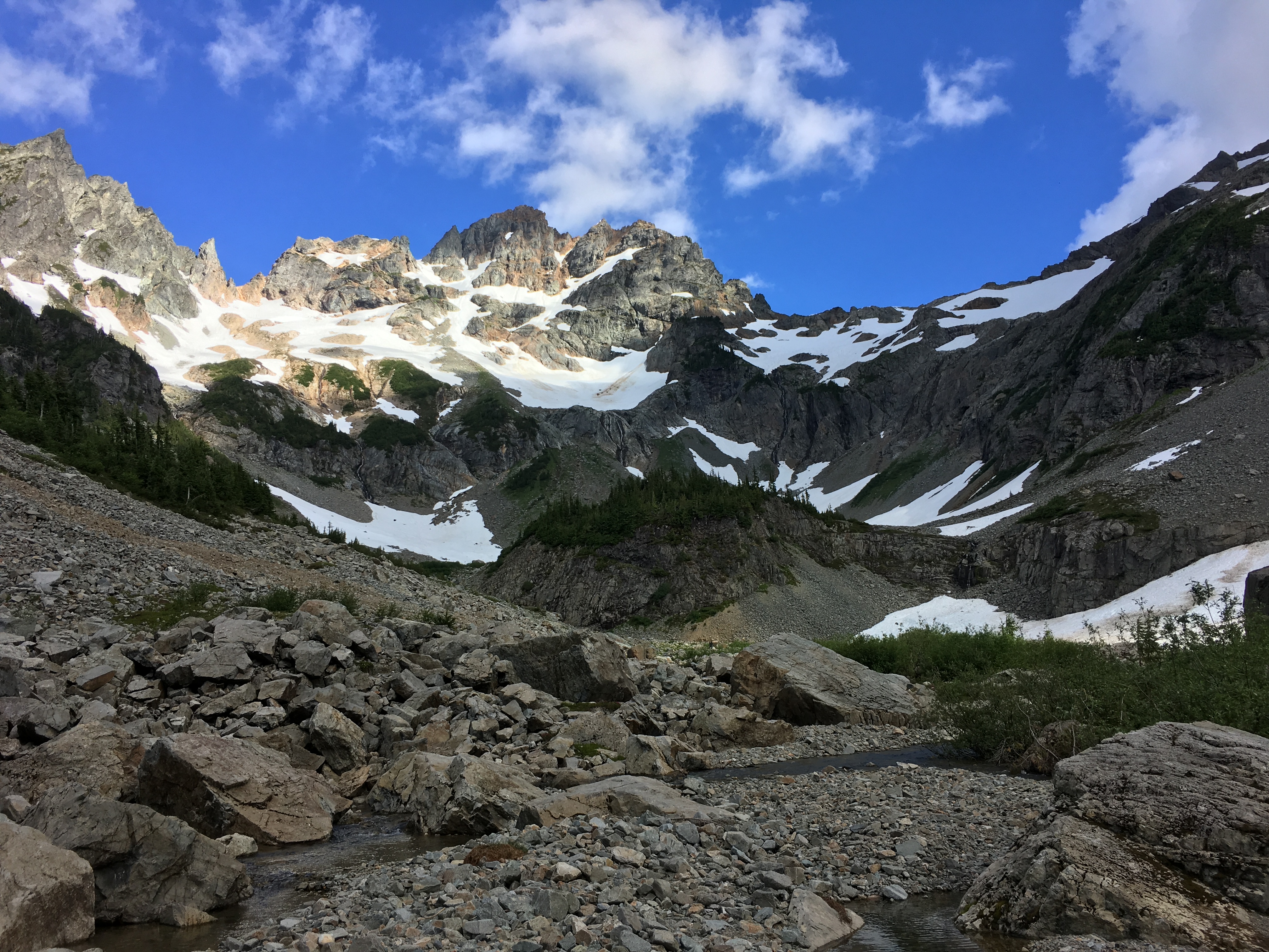
Trip: Monte Cristo Area - Columbia, Kyes, Monte Cristo & Cadet Peaks
Trip Date: 07/21/2018
Trip Report:
Last Friday evening and Saturday I explored the Monte Cristo area by connecting four of the major peaks in a big full value alpine loop.
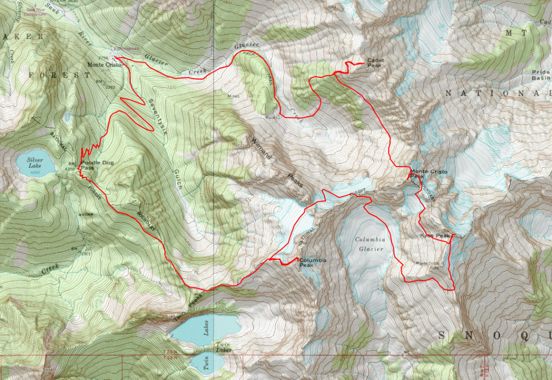
I left the office early afternoon on Friday and found myself biking the old Monte Cristo road around typical quitting time. First view of Columbia set my spirits sailing:
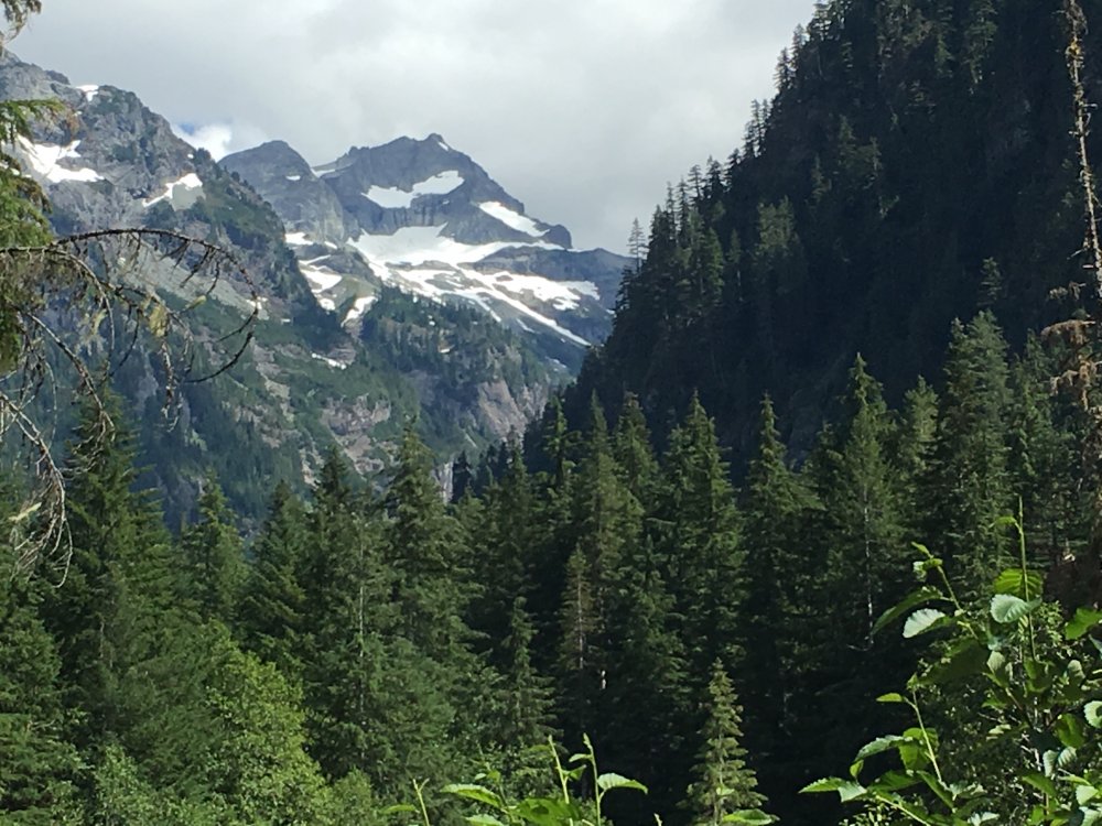
Couple hours later below the upper mountain:
I made quick work of the scramble up Columbia and scouted Saturday's peaks. I wasn't sure if Kyes was going to be on the itinerary tomorrow, but the 5400' west face snow ramp was mostly connected and it all looked like it would go. Better yet, it looked as though their would be a snow traverse to Monte Cristo Peak high on the west side of Kyes:
After descending down to 6000' on the west shoulder of Columbia I settled into my bivy for the night:
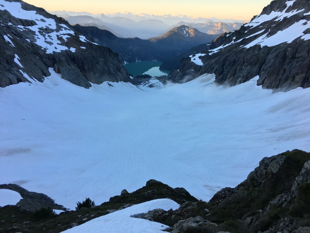
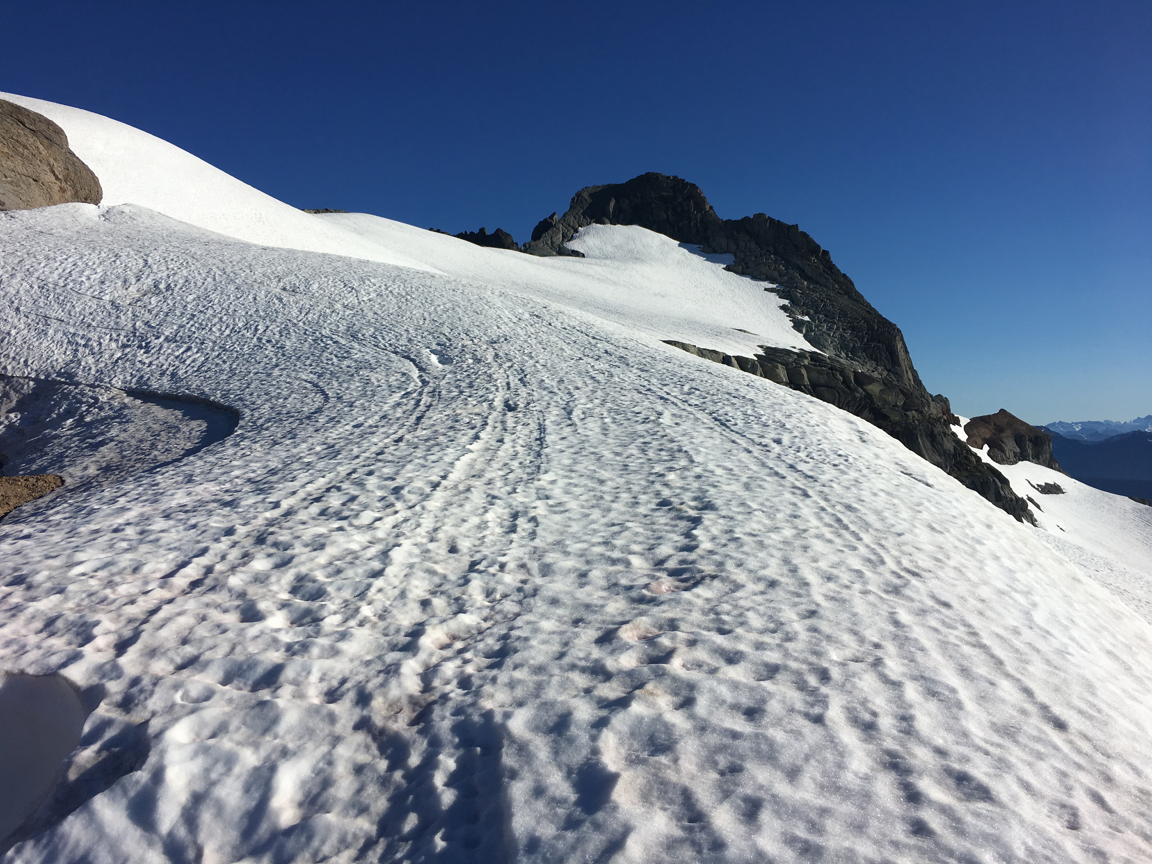
I was up and moving across the 76 glacier towards Wilmans Pass and then Monte Cristo Pass early on Saturday morning. Looking down the Columbia glacier and Blanca Lake from Monte Cristo Pass:
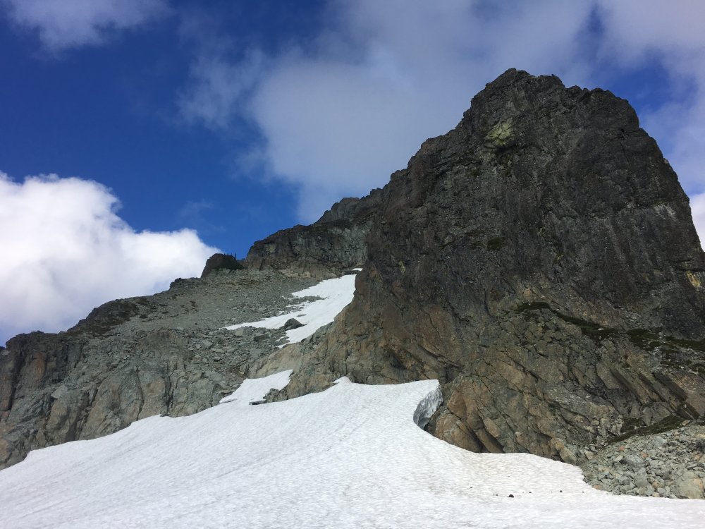
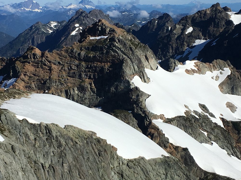
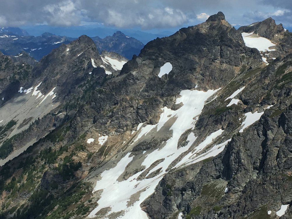
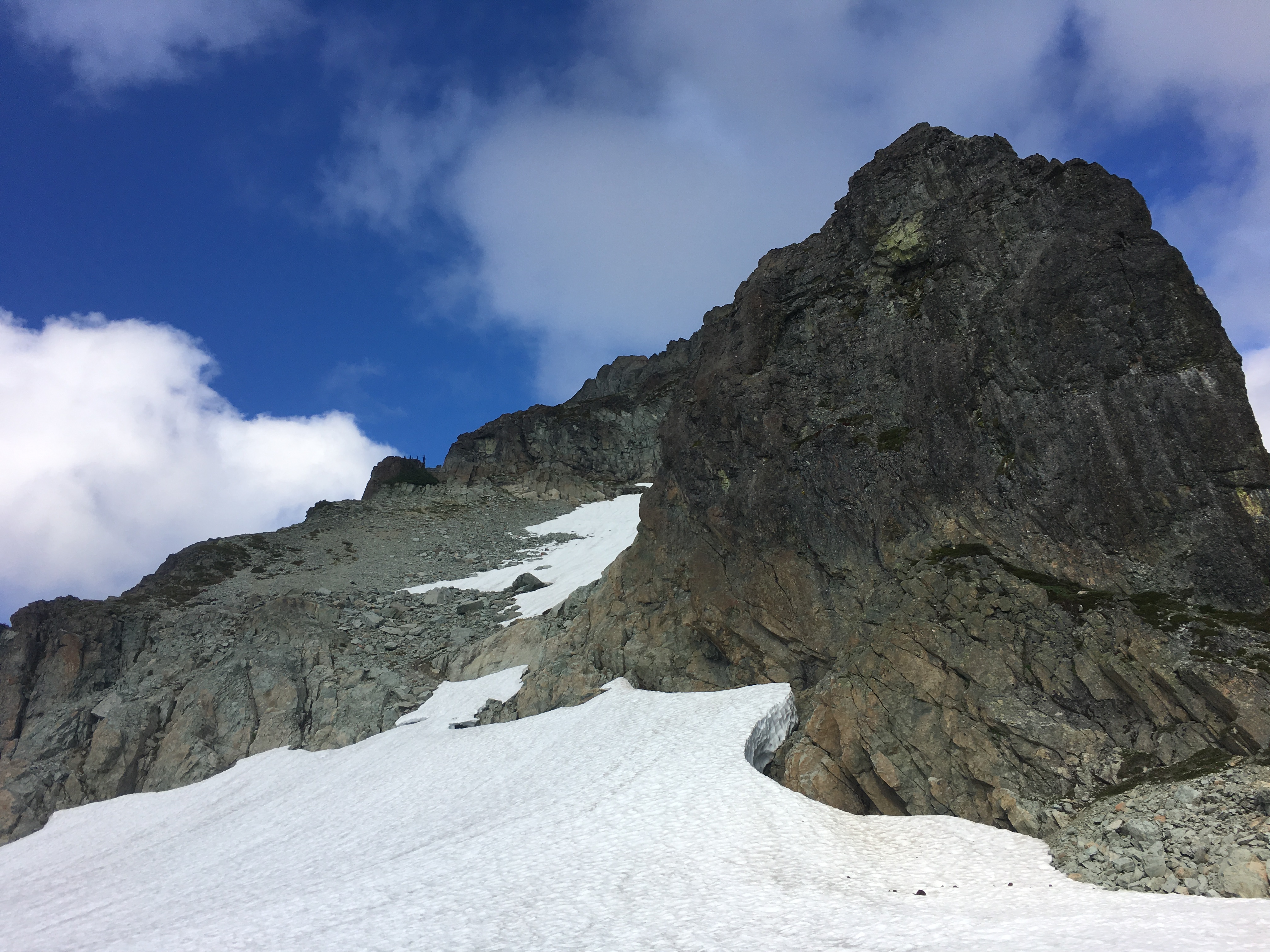
I descended to the glacier and on towards a large right facing gully and made my way up to the South Ridge of Kyes. Cresting the ridge gave this view of Kyes summit:

Class 3 scramble on the left got me to the top. View towards the next course, Monte Cristo Peak:
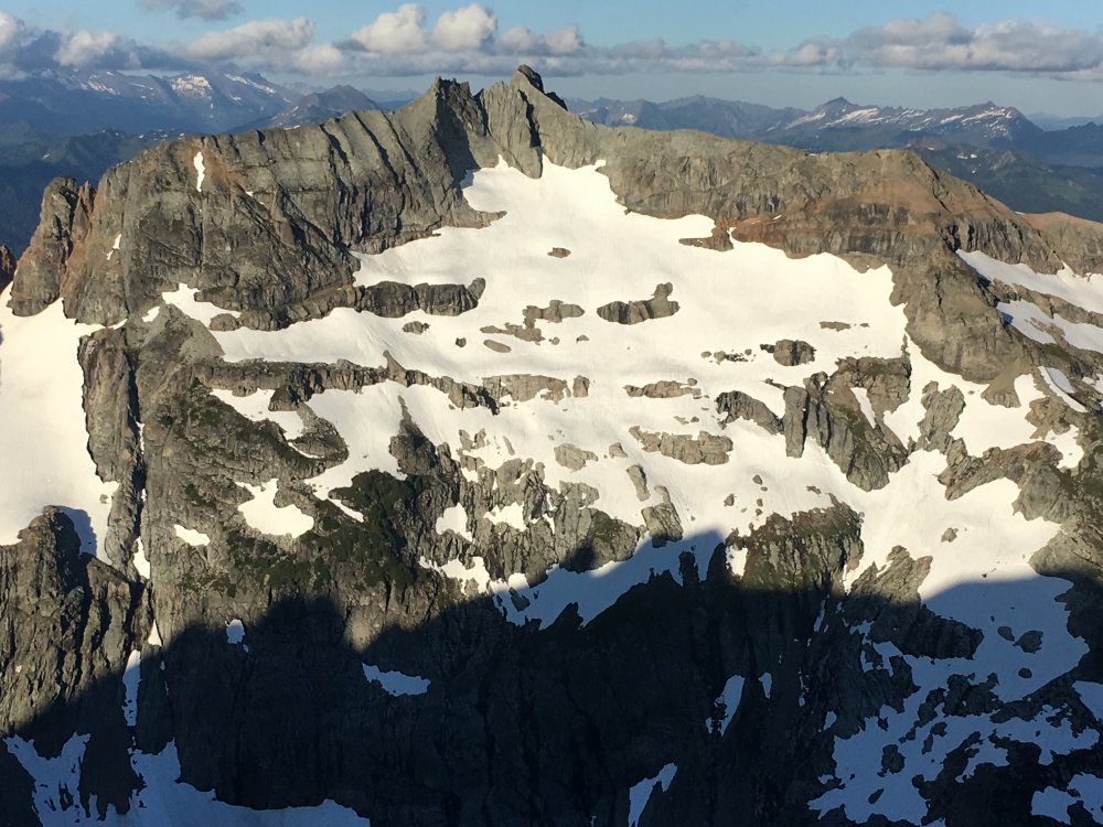
I descended the Kyes summit block back to the south ridge and found a short cliff leading down to the west face snow slopes. Two loose 15m raps got me over the cliff and traversing the steep snow of the west face, eventually leading to some rock scrambling and finally to the Kyes/MC col and then the north side of Monte Cristo Peak. From there I found the short fifth class pitch leading to class 3 scrambling above. A large moat blocked access to the rock, but the moat had caved in ~100' north of the rock pitch and I was able to scramble down in the moat and get to the rock pitch, now an extra 20' tall out of the icy hole. I self belayed the short fifth class pitch:
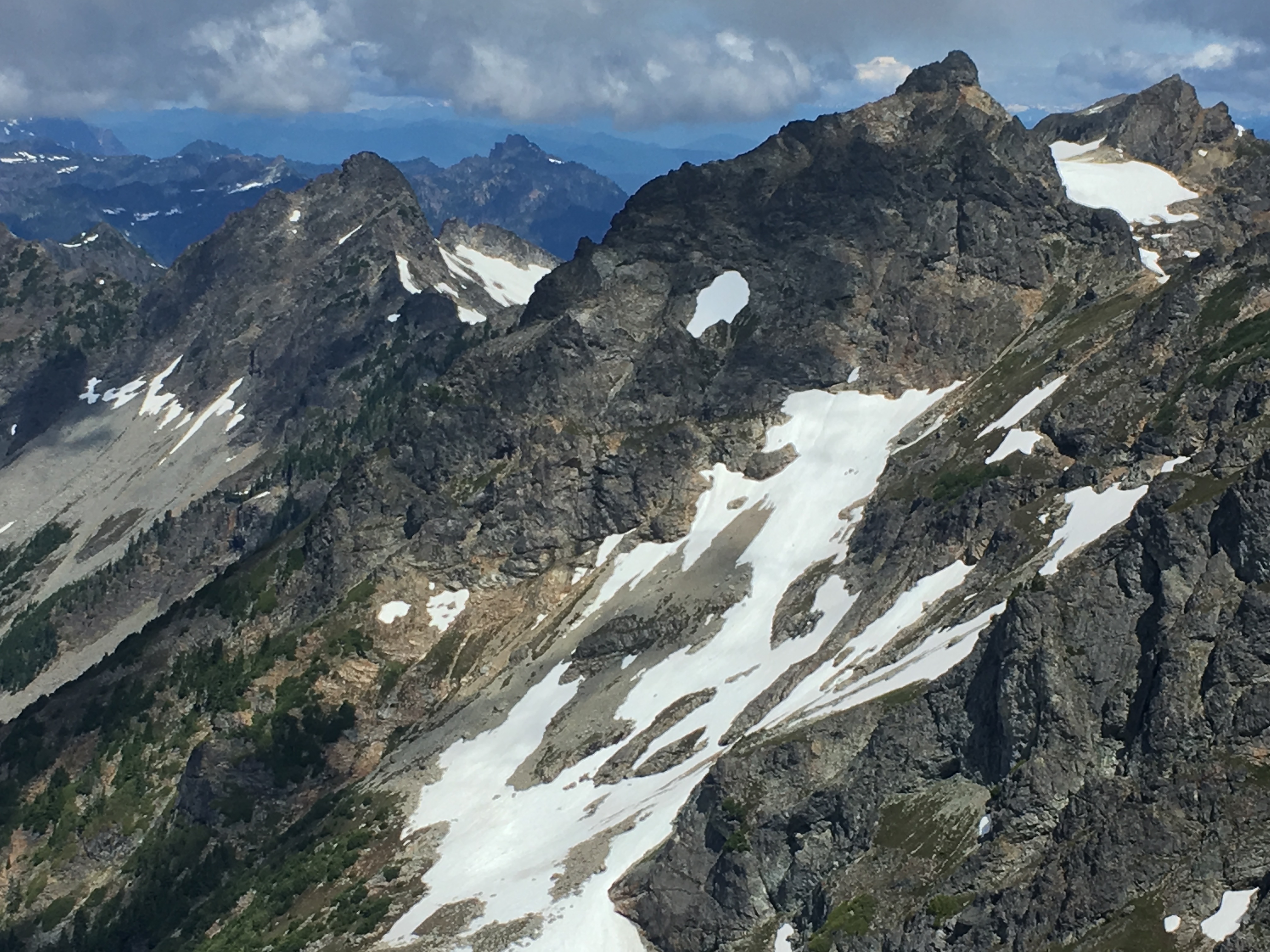
And scrambled to the top. Immediately looking forward to my next peak, Cadet:
Another couple raps and I was back on the snowy north face of MCP. Traverse to the north col, descend towards Glacier Basin. At ~EL 5800 I started a hard traverse towards the south face of Cadet. A perfect goat path led me across the bottom of the face where I eventually picked up the climbers trail to the top. The first trail of any kind I'd seen since Friday evening on the way to Columbia. Up the trail to the summit of Cadet, then reversing the trail down and into Glacier Basin with a view back up towards Monte Cristo Peak:

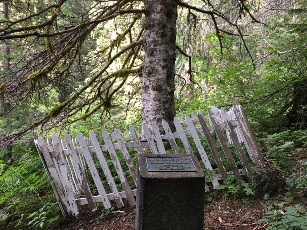
Finally hustling back to the ghost town, my bike, and my truck, my home, and my family. Passing this on the way out. James Kyes was an interesting man. His memorial deserves some maintenance:
The Monte Cristo area is a great compact alpine playground!
Gear Notes:
30m rope, a couple pieces for Monte Cristo Peak
Approach Notes:
Bike the Old Monte Cristo road with the log crossing. I took the new old Wagon Road on the way out and it just adds extra mileage and worse, extra elevation gain.-
5
-
 1
1
-
 2
2
-
-
What is the effect between the new site and google indexing? Search results on google aren't showing a ton of content from cc.com.
-
Posting trip reports is easy! I've been skeptical, I liked the old site, but i'll adjust. Glad to see the TR tool works so well.
-
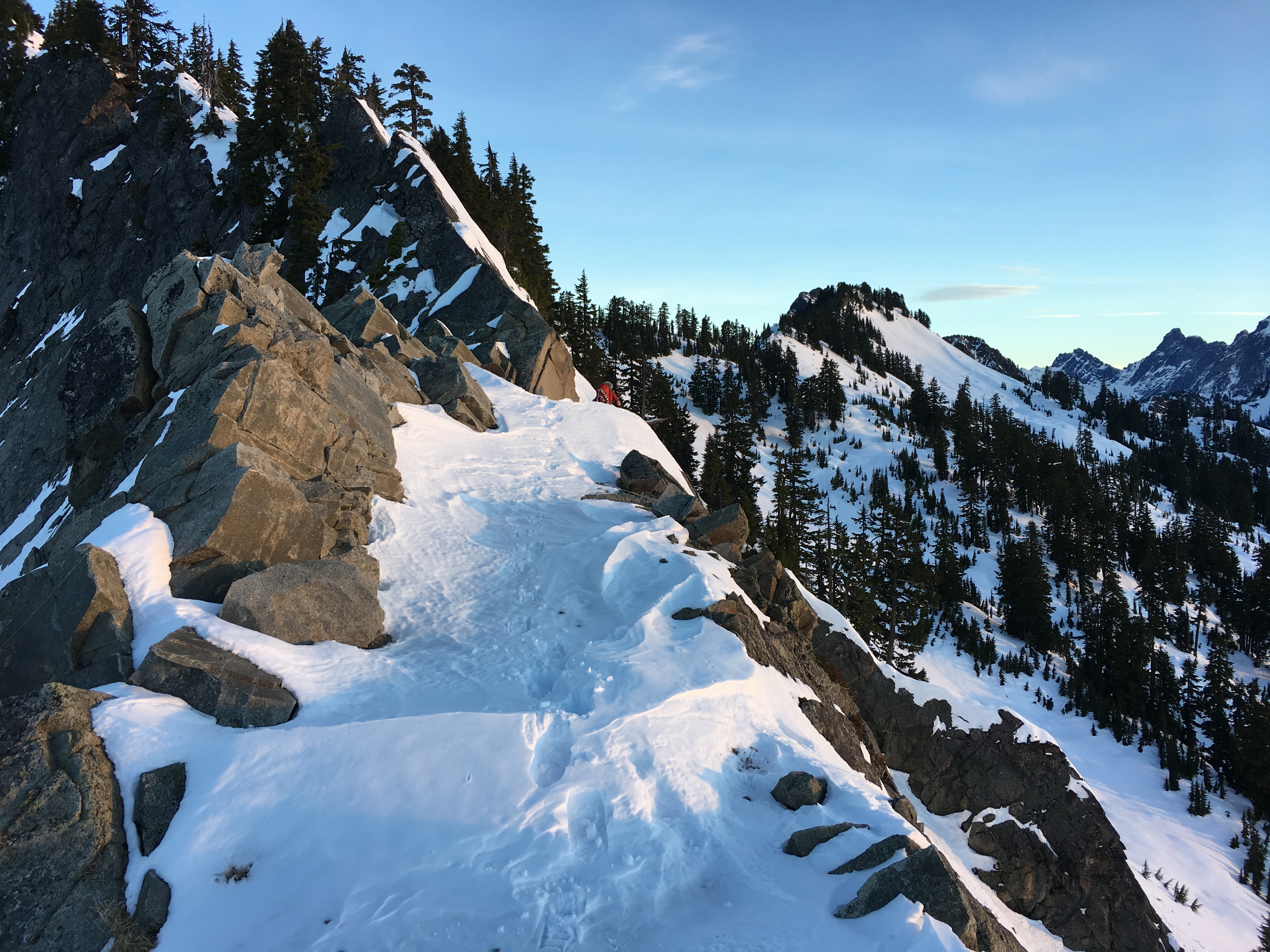
Trip: Mt Thompson - West Ridge
Trip Date: 12/09/2017
Trip Report:
Jake and I took advantage of the high pressure and big inversion to climb Mt Thompson over the weekend.
We hiked in Friday night and camped on a flat spot on the ridge below Kendall Peak and before the Katwalk. Hiking up in the dark was easy, with the bonus of shortening up the long winter night sleep. We arose at dawn and made our way along the surprisingly easy to follow PCT.
Snowed over Kendall Katwalk:

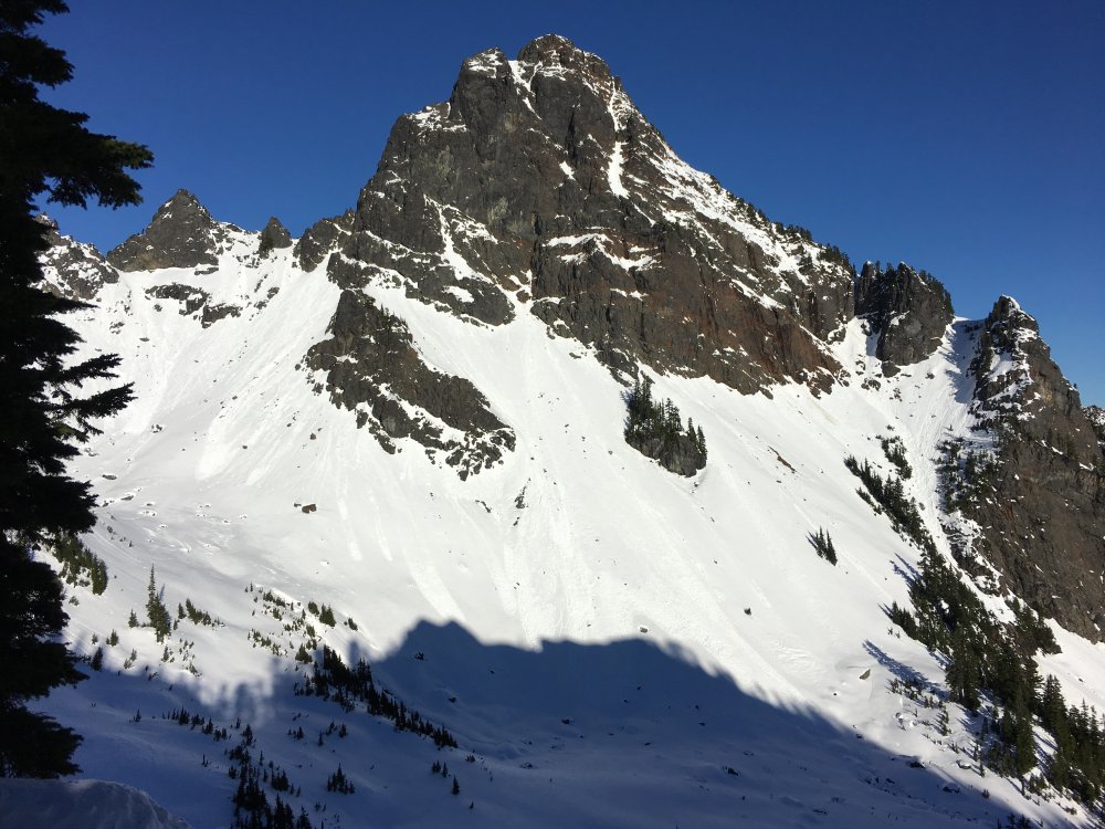
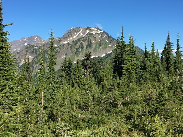
First view of Thompson:
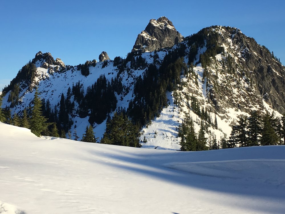
From Bumblebee Pass:
The route was mostly dry, although moves on the north side of the ridge had some snow/ice on them. The very first move of the entire route perplexed us for a bit as we debated on boots/gloves vs crampons/tools. In the end Jake led it with the steel assist while I gingerly followed without:
The next three pitches were quite good on warm rock with a bit of snow/ice on ledges and in cracks. Spring like climbing in December!
The easy pitch from the false summit to the summit is on the north side and was full on winter conditions and added nicely to the climb:
Views for days on top:


Two raps and some slogging back had us drinking whiskey at the tent by 9PM.
Easy hike out Sunday morning. The inversion layer was startling, especially with how defined the temperature line was. ~5000' temps dropped 10-15 degrees over the course of a few steps.
Gear Notes:
tools & crampons, snowshoes for the approach
Approach Notes:
PCT-
 1
1
-
1
-
-
It looked like there were lots of different options. We had a big step across but even if that particular access was gone I think it could be managed. It might take some searching and some creativity with low fifth rock but it doesn't seem like it would ever be a complete showstopper for a climber with moderate skills.
I was more surprised at how closed up the bergshrund(?) halfway up the snow thumb was. I've seen pictures with it more open in early July some years.
-
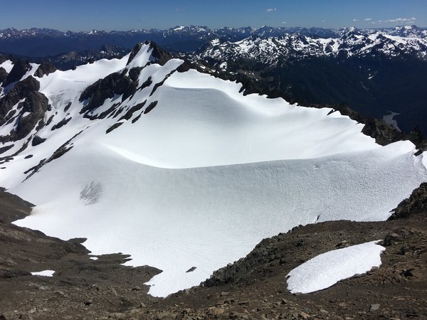
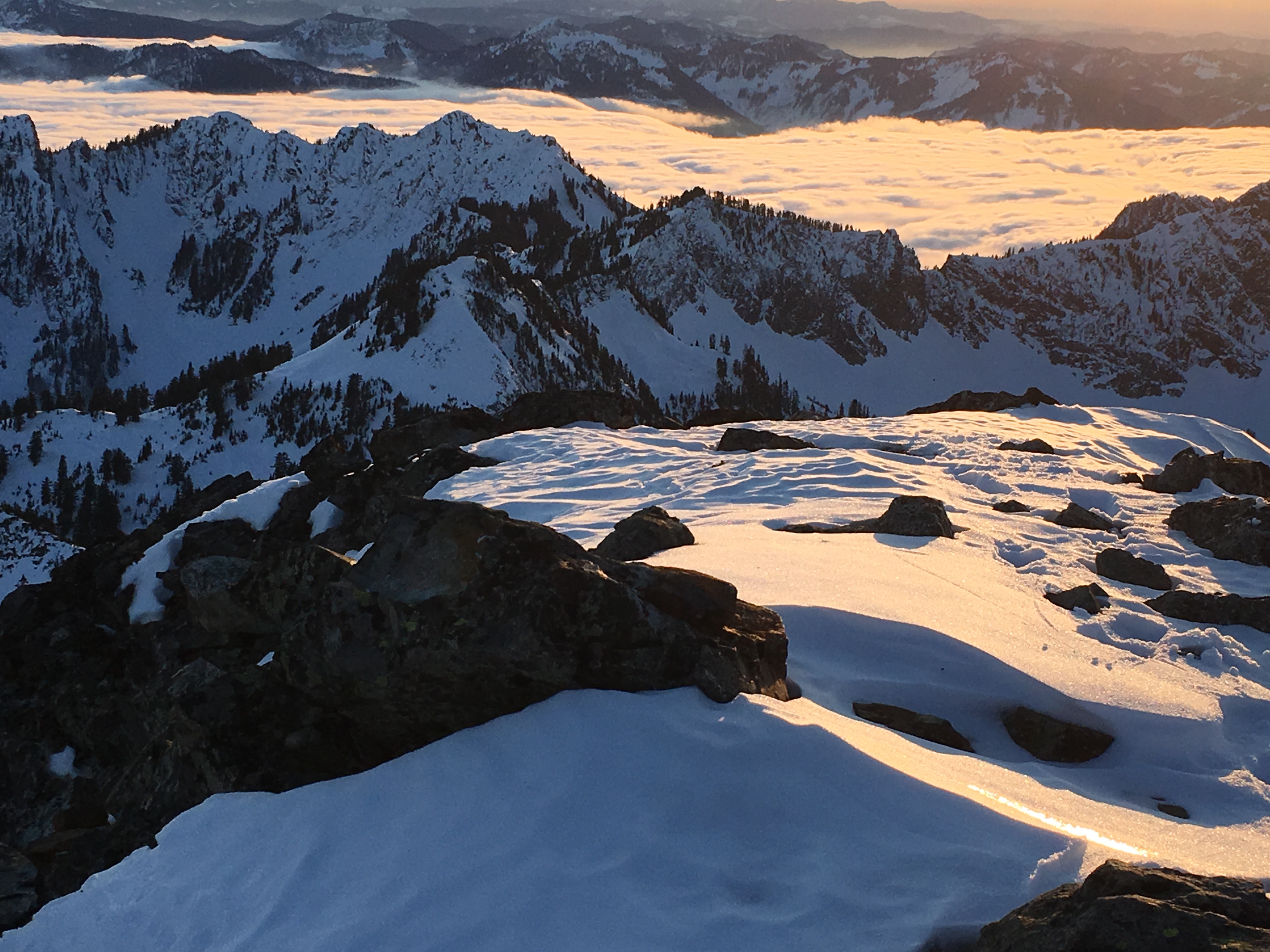
Trip: Bonanza Peak - Mary Green Glacier
Date: 9/16/2017
Trip Report:
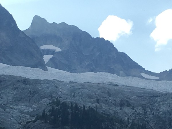
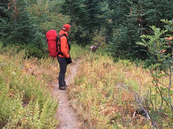
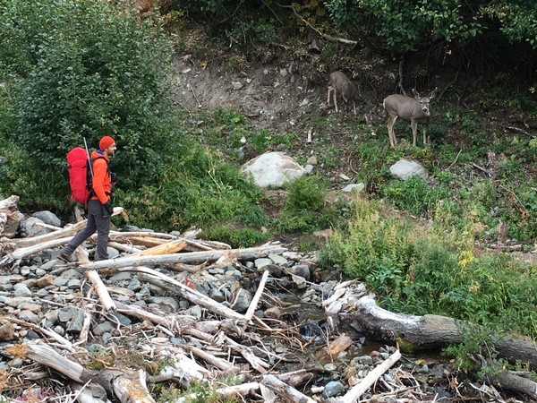
Bonanza Peak was the route du jour this past July after being relatively closed off for a couple years. Four trip reports were even posted on this site! I had plans to climb it then but they fell through and I didn't think much of it afterwards due to rumors of problematic late season glacier and moat crossings. But last week Wojtek thought the area would be good for high buck hunting so we decided to multi-sport the weekend and give the route a shot. It went, and rather easily.
Multi-modal transportation on Friday:

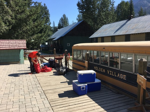
View of the peak from camp at Holden Lake:
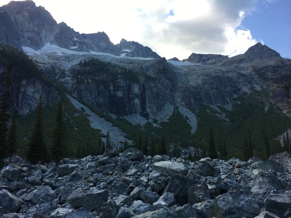
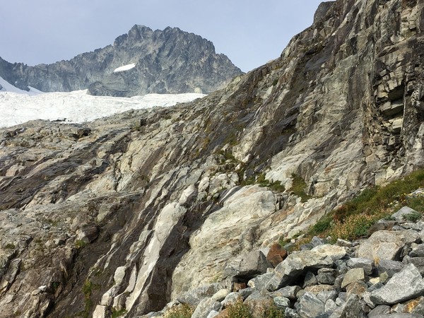
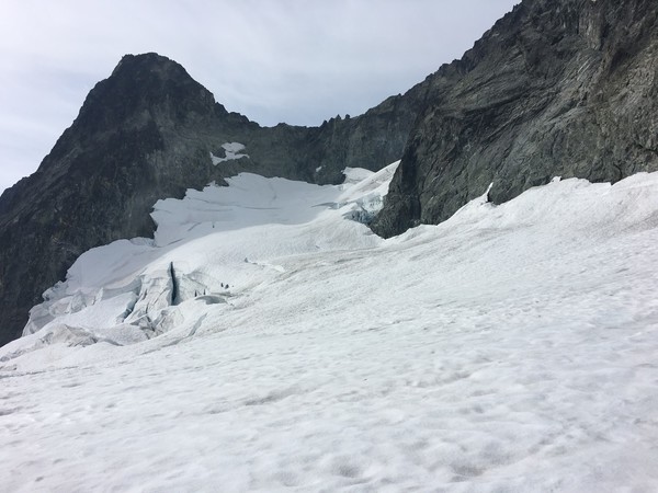
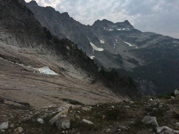
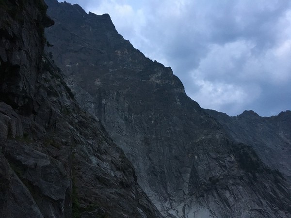
Saturday we schwacked a bit around the east end of the lake before eventually picking up the climbers trail up to Holden Pass and eventually to the waterfall slabs. Bonus of late season climbing was the slabs were relatively dry and completely trivial. We went up the north side of the glacier to get above the bulk of the crevasses. The bergshrund midway up the snow thumb was easily crossed on the left side and at the top of the thumb we were able to step across a cavernous moat onto 3rd class rock where we rested and had lunch before the scramble to the summit.
Waterfall slabs:
Snow thumb:
Start of scramble with Holden Lake far below:
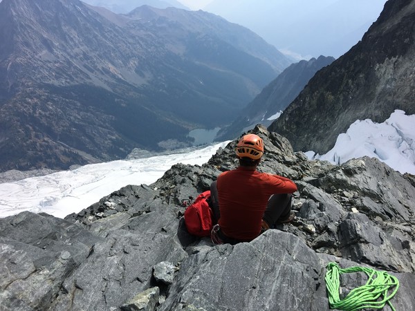
Smokey summit views:
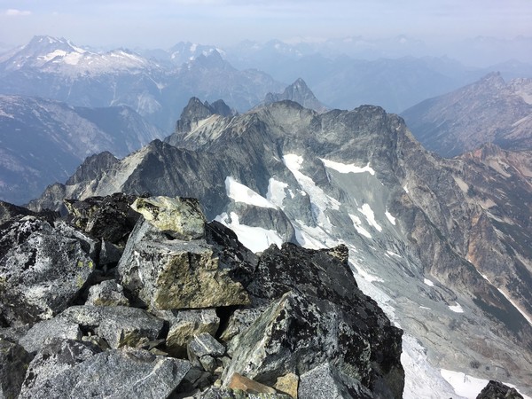
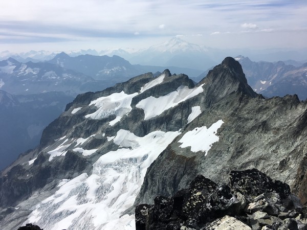

Parting shot of Bonanza on the descent:
Sunday we got up early and moseyed back down towards Holden hoping to finish off the trip with a bang, but no luck on that front.
Wojtek talks to the locals, asking where their boyfriends are at:
Snow over the last couple days has probably complicated climbing it for the rest of this year, but for future reference it is certainly doable in late season.
Gear Notes:
We carried a small rack for potential moat difficulties but never needed it.
Approach Notes:
Watch out for the hunters!
-
Way to get it done! Entertaining TR and quality pics.
-
Strong work John! Looking forward to the TR to hear all the details.
-
I've always liked Teneriffe much better than Mailbox or Si. You can also add some mileage and save your knees by taking the logging roads down and/or linking up with Si.
Forgotten is a bit longer and much less crowded than Dickerman. Same trailhead.
Rock Mountain out past Stevens Pass fits your criteria and is a really nice.
-
Lots of flowing water at the propeller cairn. Two weeks ago there was decent sized snow patch(es) above the big bivy ledge which may still be there. My guess is yes. You won't know until you hit the ledge though. There was also a smaller snow patch at the summit that may not still be there.
-
Here's a pic towards the Crossover Descent from last Saturday morning:
You certainly don't need crampons/axe for the Slesse Mountain trail descent. Very doubtful you need them for the Crossover.
And if you can get up the buttress you probably have enough alpine trickery up your sleeve to deal with potential snow on the crossover anyways.
-
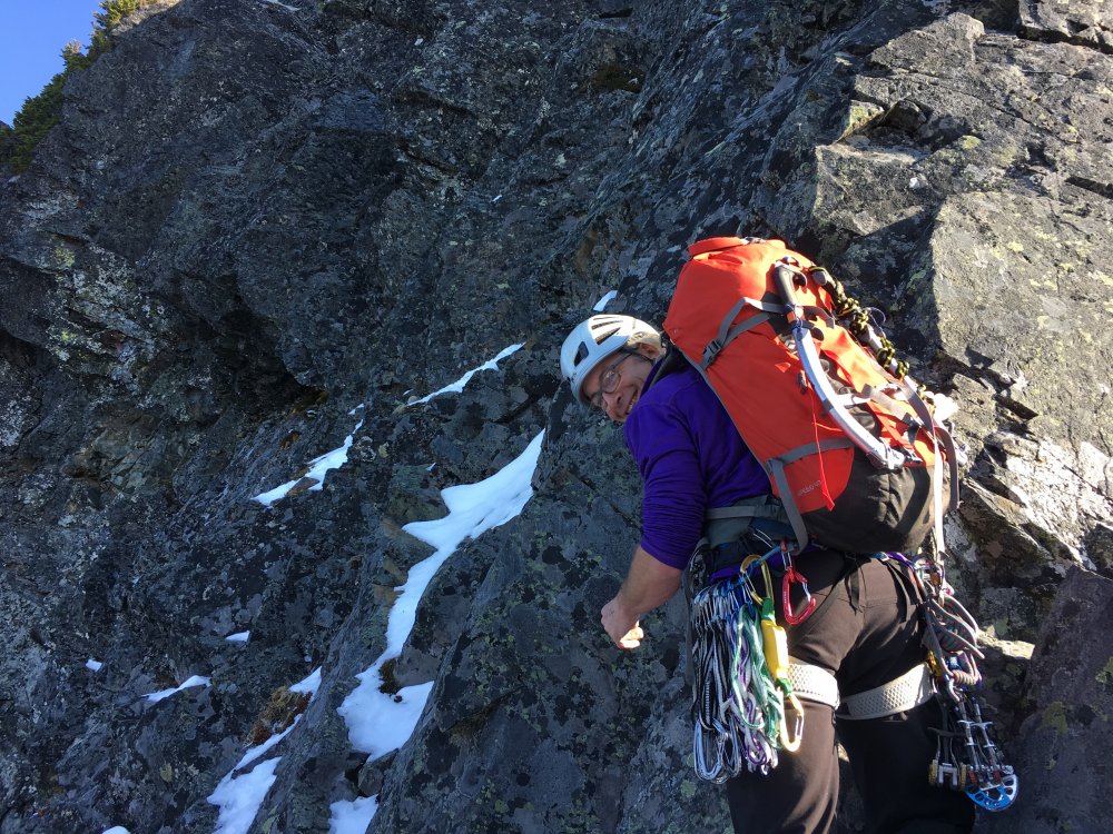
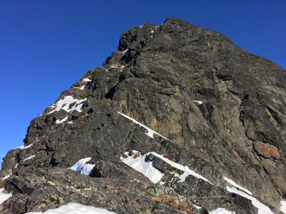
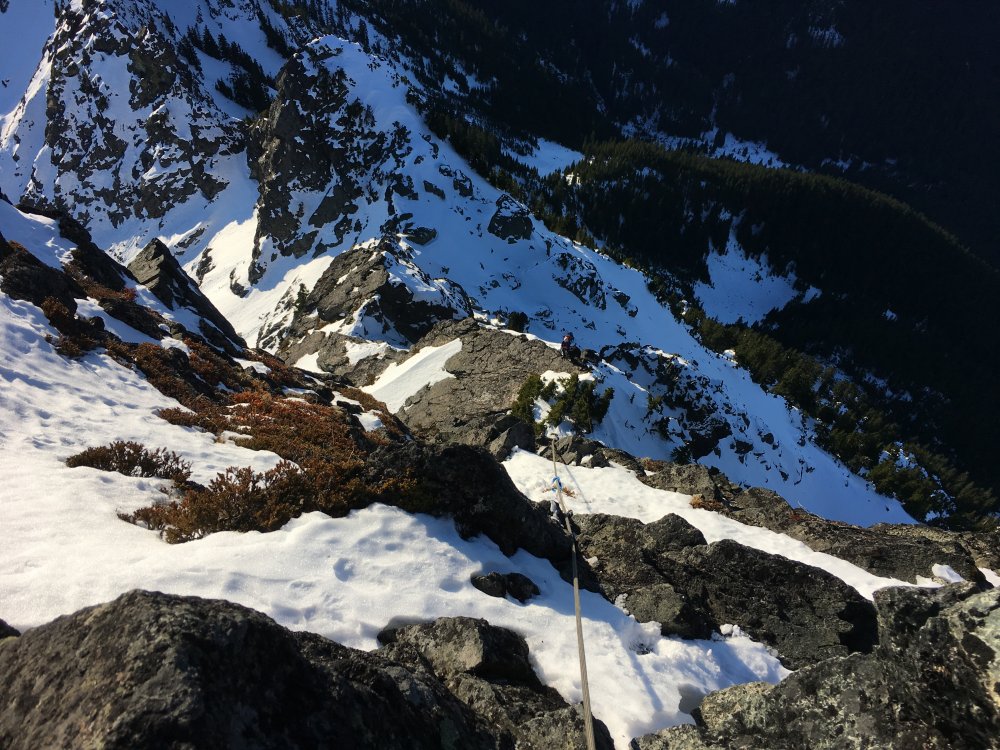
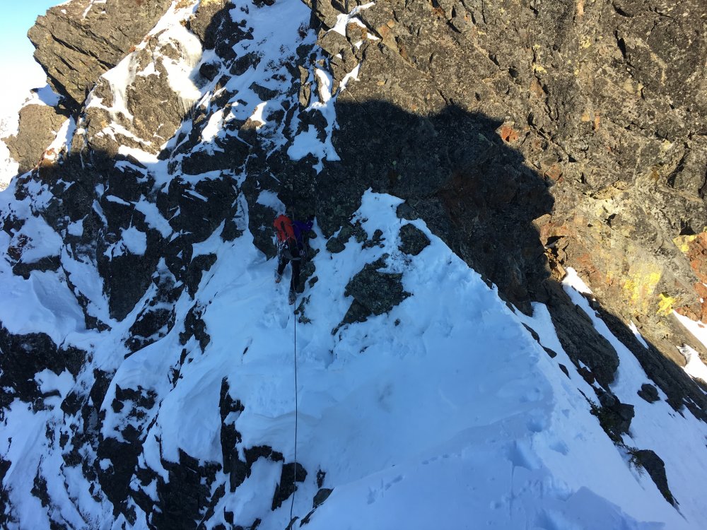
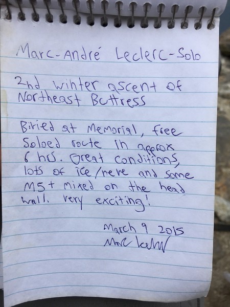
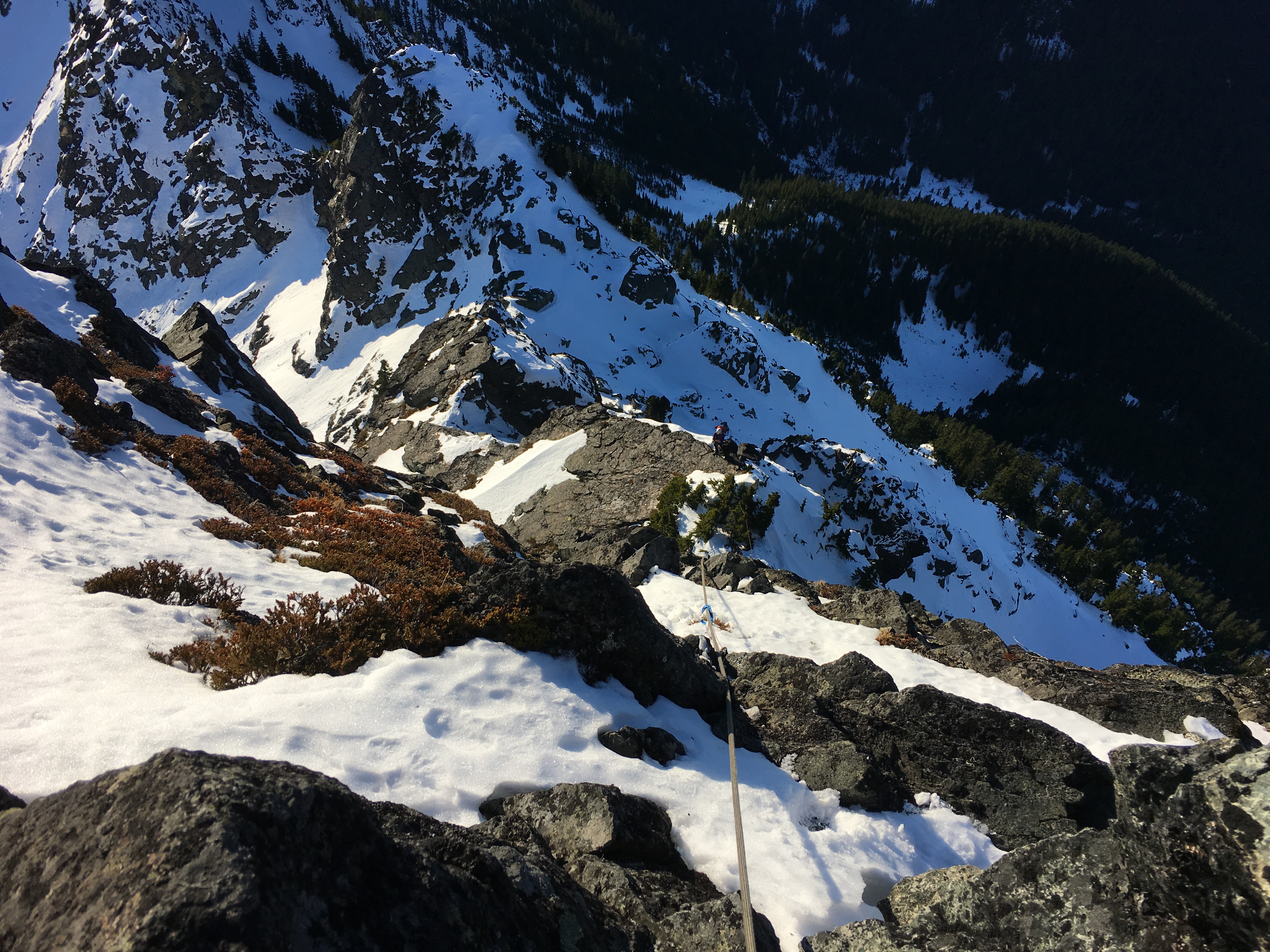
Trip: Slesse Mountain - Northeast Buttress
Date: 8/12/2017
Trip Report:
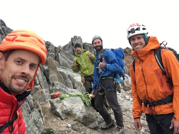
Carl & myself and Doug & Sasha climbed Slesse over the weekend as two teams of two. In summer and with a rope I still found it "very exciting". We timed the weather well, shortening our schedule and climbing the buttress all on Saturday to avoid being on wet rock in bad weather on Sunday.
Friday evening we staged a truck on the Slesse Creek Road (2wd fine) and drove around to the TH on the Nesakwatch Creek Road (higher clearance recommended). Left the trailhead at dark and hiked 2+ hours up to the propeller cairn for a nice bivy. Our plan was to carry our light bivy gear up the route and crash somewhere on the backside if necessary.
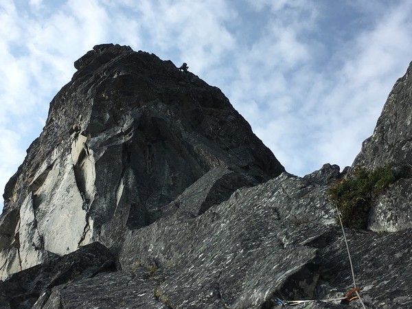
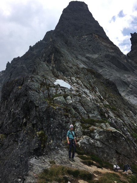
Saturday we were up at dawn and moving towards the start of the route. The buttress looming above us in the early morning light:
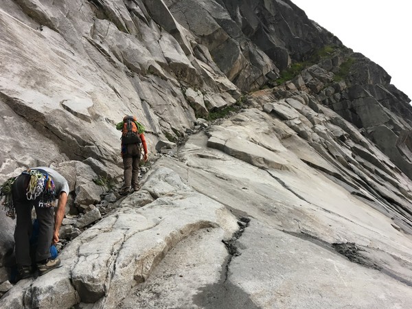
The pocket glacier was effectively gone, leaving nicely polished slabs to walk up to the bypass ramps.
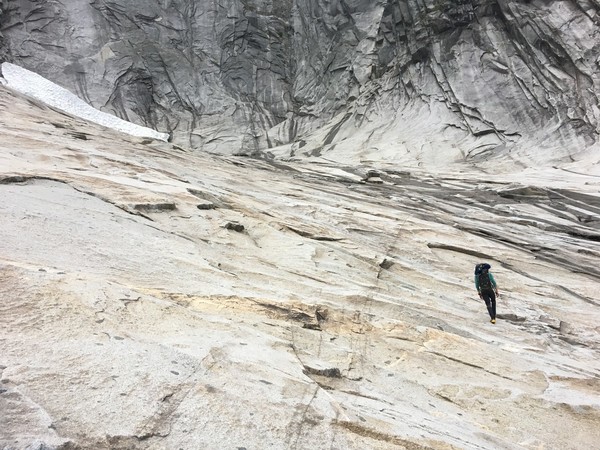
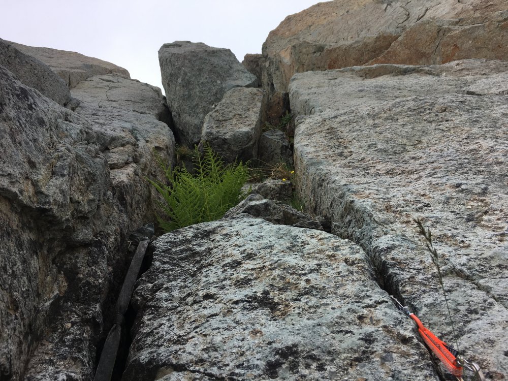
We scrambled up the ramps and all the way to a small gendarme several hundred feet up the route. If you're comfortable getting across an exposed 4th class step around midway up the ramp then you should have no problem making it to the gendarme unroped. Starting up the ramps:
We made it from the gendarme to the big bivy ledge via the direct buttress in 5 pitches with a bit of simuling. The crux 5.10 pitch was fun and juggy. The 5.9 pitch above it had a short tricky step that we thought was the hardest move of the climb. Carl leading the crux pitch:
There's still some patchy snow for water above the bivy ledge:
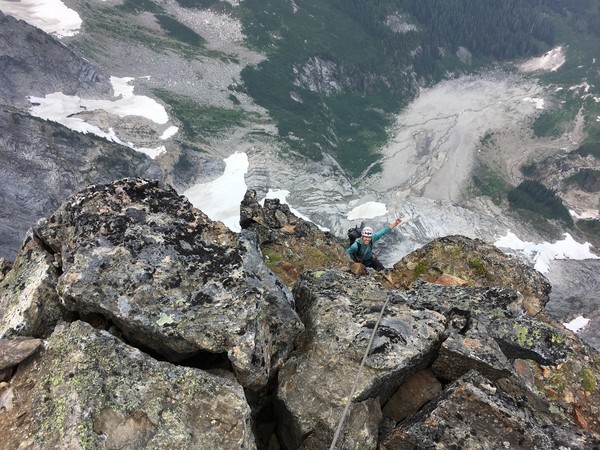
From the bivy ledge we made it to the summit in 6 pitches with a bit more of simuling. Carl arriving at the Slesse Sheraton with the buttress laid out below:
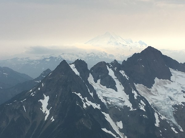
Overall it took about 9 hours of efficient roped climbing up the route. Views on top were shrouded in smoke and clouds. Baker:
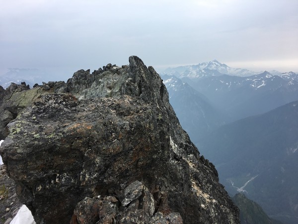
Shuksan:
Summit cheese:
The register was an impressive read. "Very exciting" indeed:
We crashed all the way back down to the truck around midnight, just as the first drops of rain started to fall. Perfect timing!
Gear Notes:
Crampons and an axe were not needed nor carried.
Approach Notes:
The trail is well marked and beaten in. It's amusing to read older trip reports about folks bashing through brush on the approach. It's a highway at this point.
-
Woah! I'm blown away. Amazing and inspiring. I don't even know where to start. I opened up caltopo to trace out your route and can't believe the amount of hard ground you covered. Totally nuts.
Nice writing too, I enjoy your continuing battle with the night frogs!
-
Very cool! The Maw looks... entertaining? Above it looks quite nice.
-
Nice, that's one of my favorite routes in the Cascades and a great way to finish with the scenic walk down Sahale arm.
-
Nice pics and entertaining dialogue, thanks for posting! What's peering out at you in the dark?
-
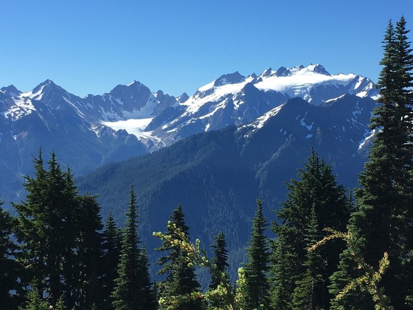
Trip: Mt Carrie - Catwalk Scramble
Date: 7/29/2017
Trip Report:
Saturday I had a good day climbing my last peak in the Olympic Smoots. I tagged Bogachiel and Cat Peak as a bonus.
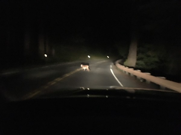
Driving over late Friday night I saw a cougar crossing the road near Lake Crescent. My first time seeing a cougar in the wild outside of Bellevue happy hours. Very cool!
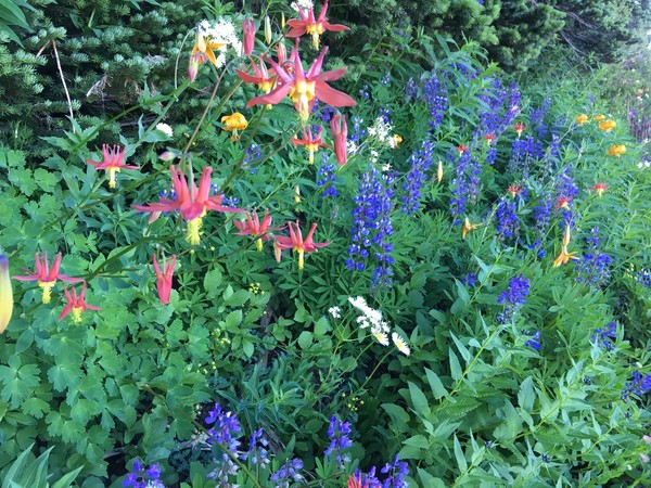
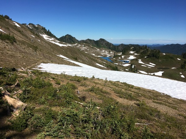
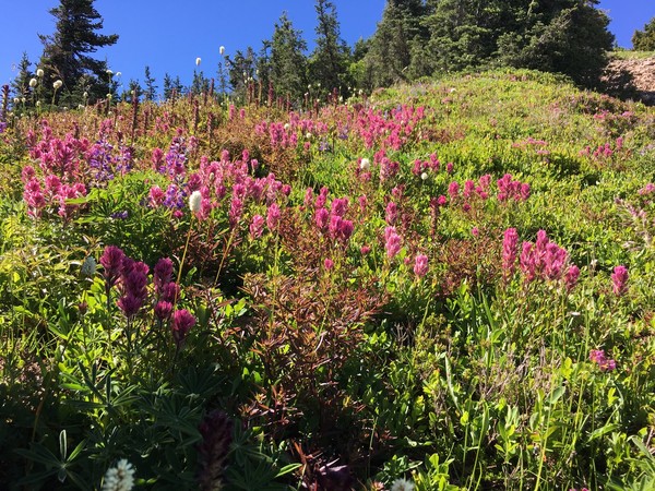
Early start on Saturday morning, I headed towards Deer Lake first so I could check out the Seven Lakes Basin area and hike up over Bogachiel Peak. Alpine flowers were on point as I traversed the High Divide:
Looking back at Seven Lakes Basin somewhere along High Divide:
First view of Mt Carrie from High Divide:
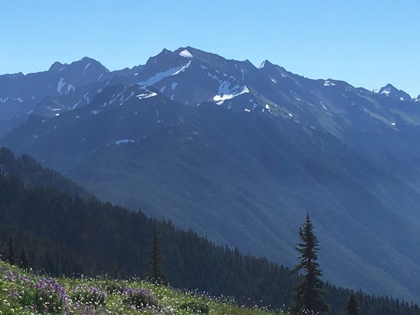
Mount Olympus was in my face for most of the day. At times I could pick out climbers on the Snow Dome.
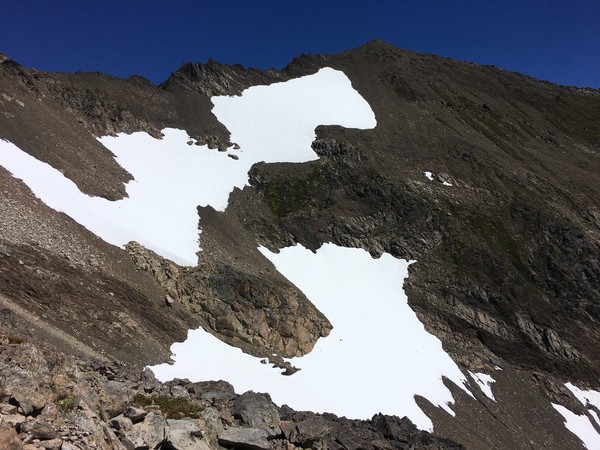
The "catwalk" part of the route seemed almost negligible. It blows me away the variation found in Olympic "class 3". After the catwalk I found ghosts of a bootpath up the west ridge of Carrie. The snow in the basin below the summit could be easily avoided by going above it. Crampons ended up being carried for training weight only:
Views were sublime from the top on a cloudless day. Olympus again:
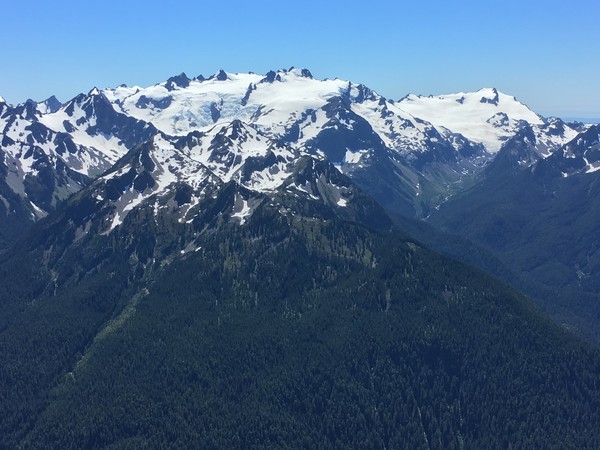
Carrie Glacier and the Bailey Range:
More flowers:
On the return trip I went up and over Cat Peak. The ascent up the east side was easy. The descent down the west side was probably the crux of the trip with steep schwacking thru scrubby trees. Looking back on Cat Peak with Carrie behind:
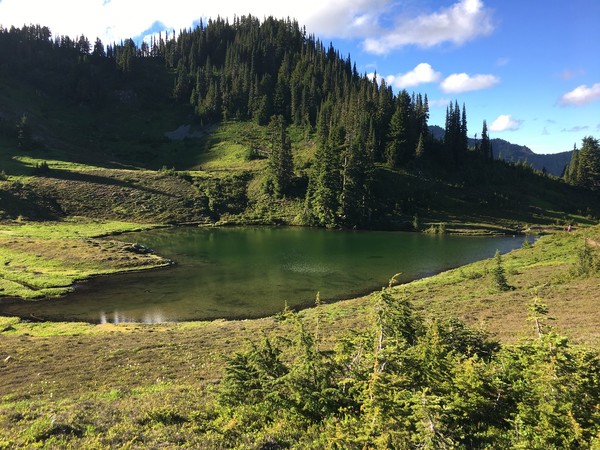
Finally to Heart Lake where I returned via the slightly shorter Sol Duck trail.
Loop:
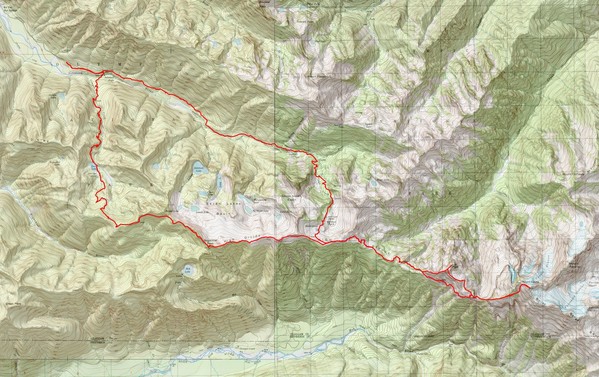
I may have finished the Olympics peaks in Smoot's book, but seems I've barely scratched the surface of this wild and beautiful range.
Gear Notes:
Trail runners and trekking poles
Approach Notes:
The loop via Deer Lake adds a few miles and ~800' of elevation and is well worth the extra effort


Old Kloke Book "One Day Winter Climbs"
in Climber's Board
Posted
Hey Jason, any chance I can get a pdf sent my way too?