lilmarmot
-
Posts
5 -
Joined
-
Last visited
lilmarmot's Achievements
")
Gumby (1/14)
0
Reputation
-
[TR] Mount Baker - North Ridge, Ski descent of CD 5/18/2011
lilmarmot replied to lilmarmot's topic in North Cascades
yeah, it gets vertical up at the ice cliff. But you can choose a shorter line. Our line was about 50 feet, although there are some variations for shorter, or longer options. I have heard that once it gets a little warmer the ice gets nice and spongy, but we found it to be super hard and covered in rime ice! -
[TR] Mount Baker - Coleman Headwall 5/19/2011
lilmarmot replied to AlpineK's topic in the *freshiezone*
NICE! We climbed the North Ridge the same day, and we were highly debating skiing the headwall...but in the end we just cruised down the CD. I wish we would have pulled the trigger and gone for it after seeing this report! Next time...hopefully it doesn't end up in my climbing tick list basement as well! -
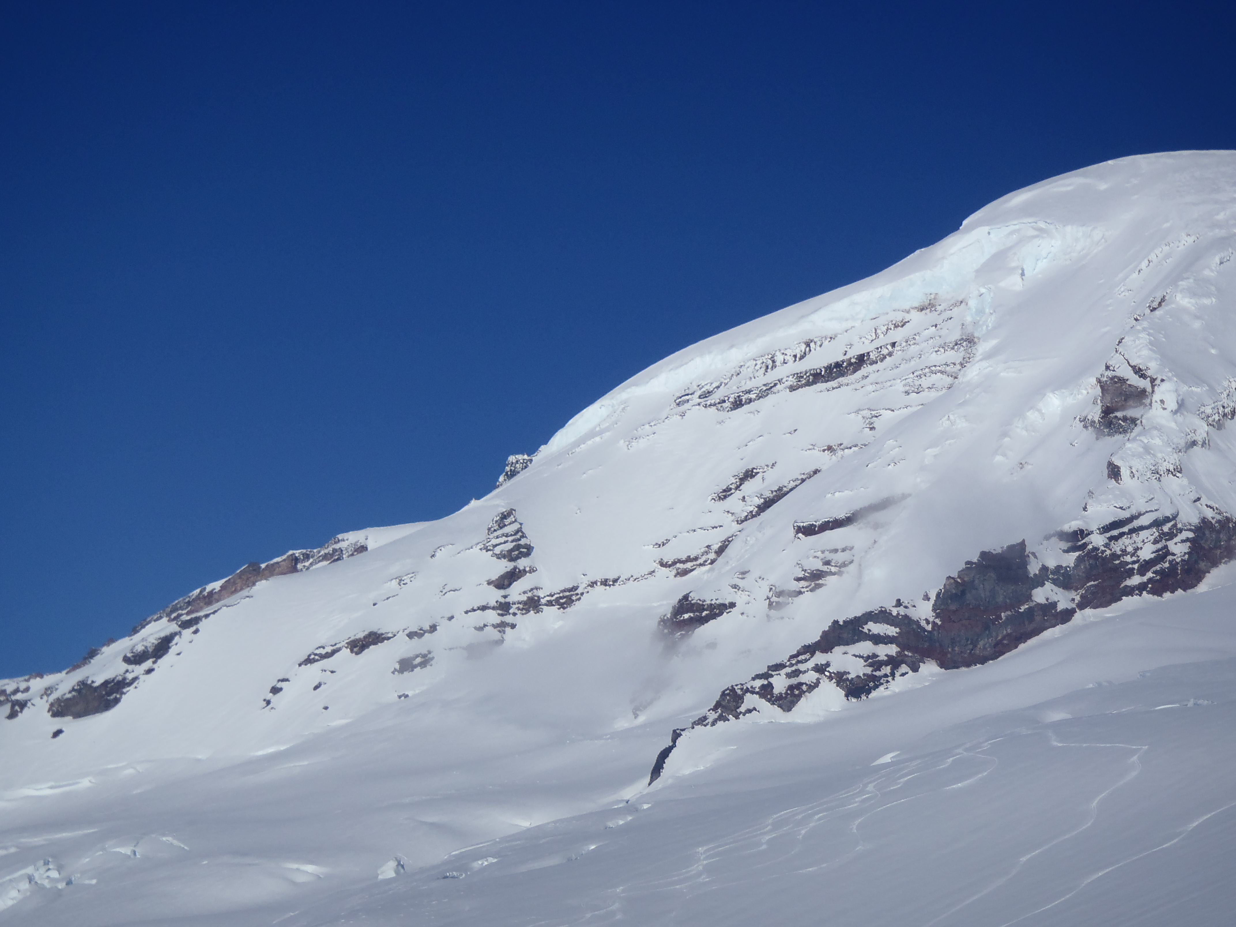
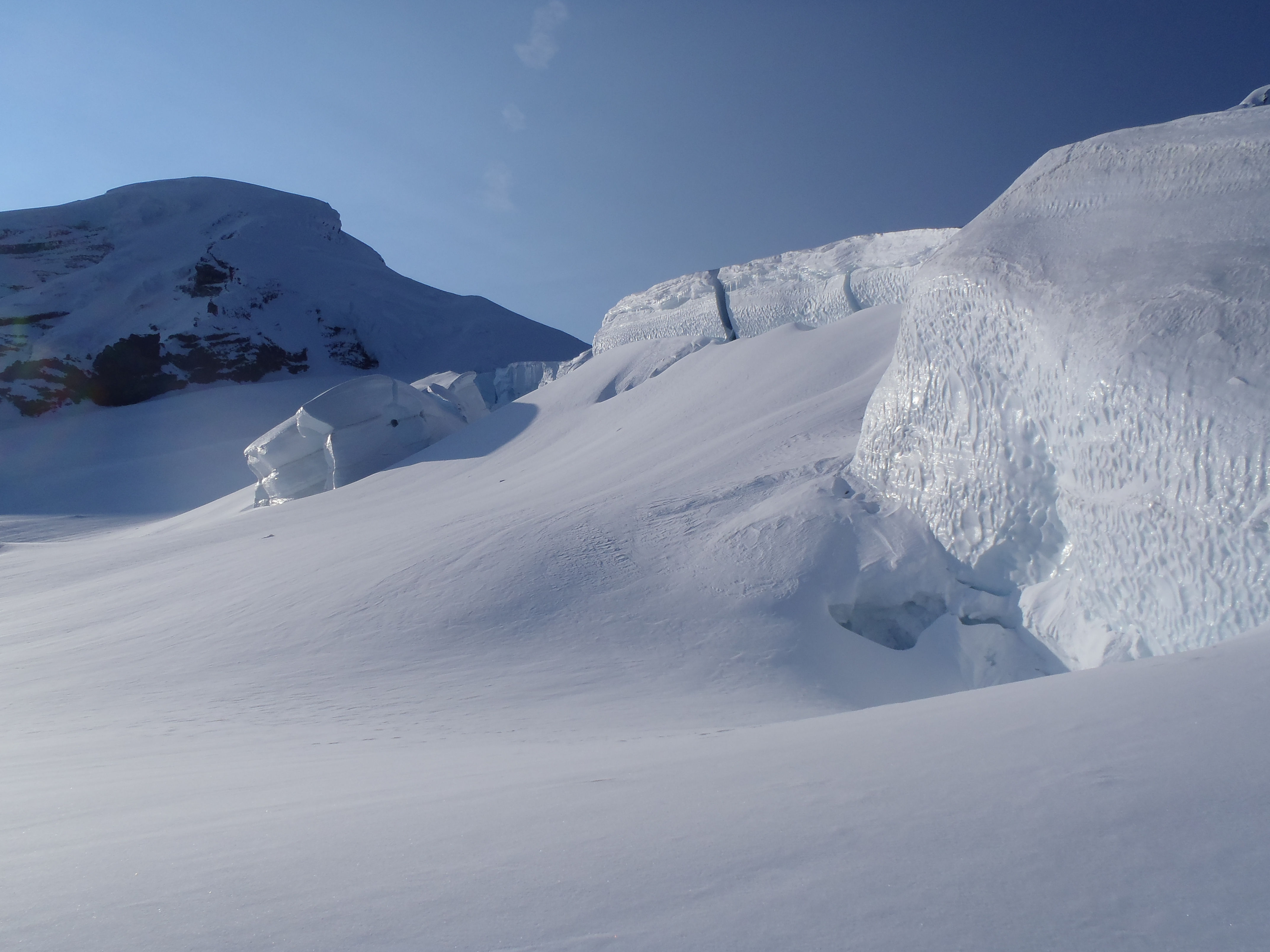
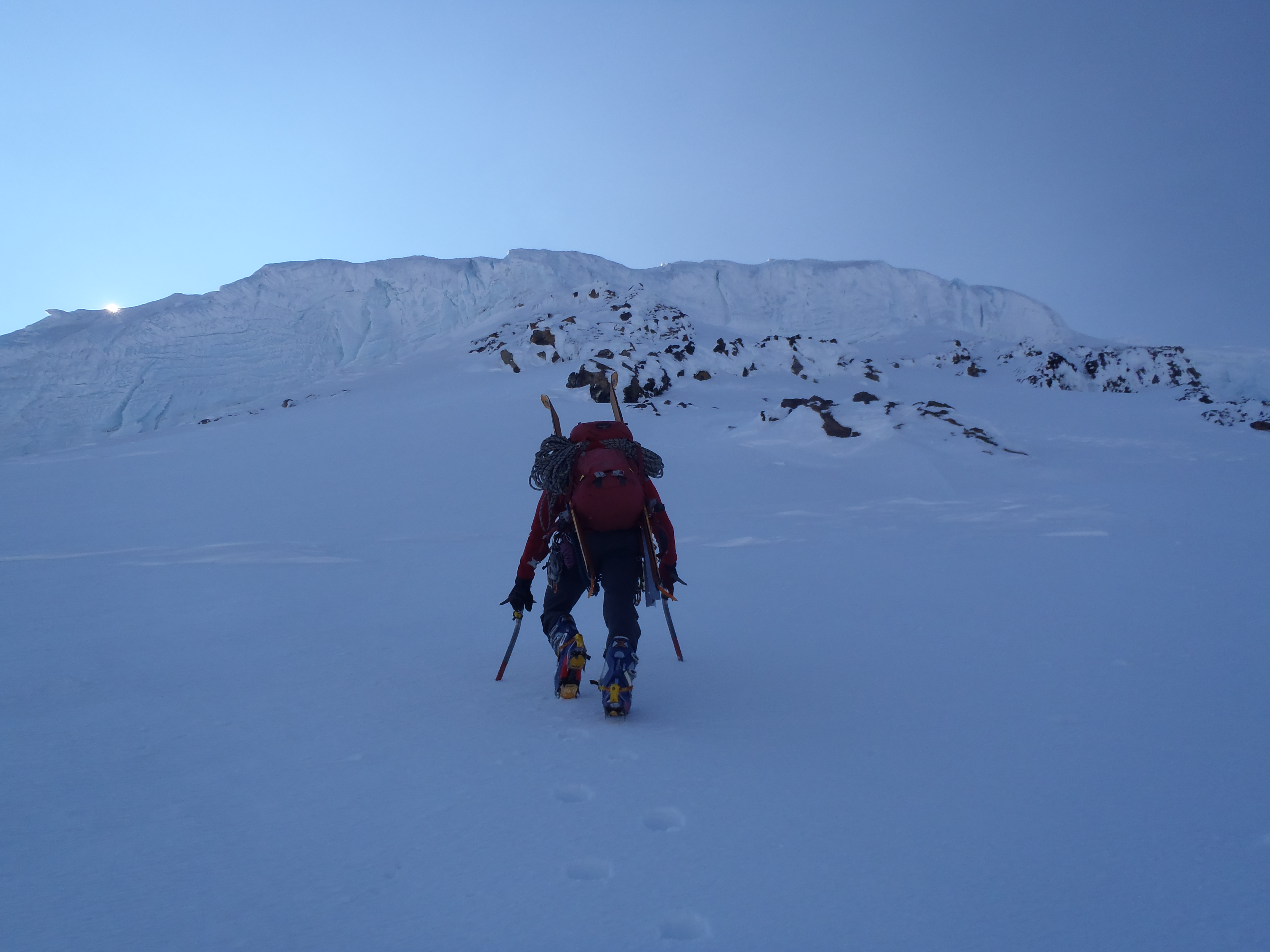
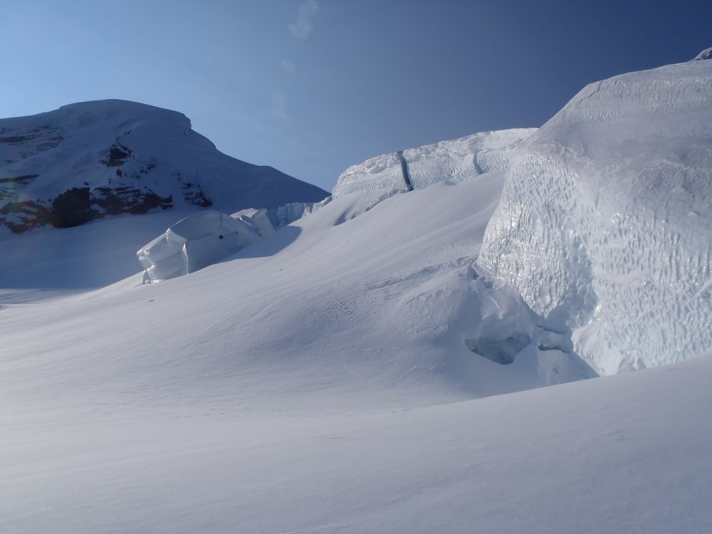
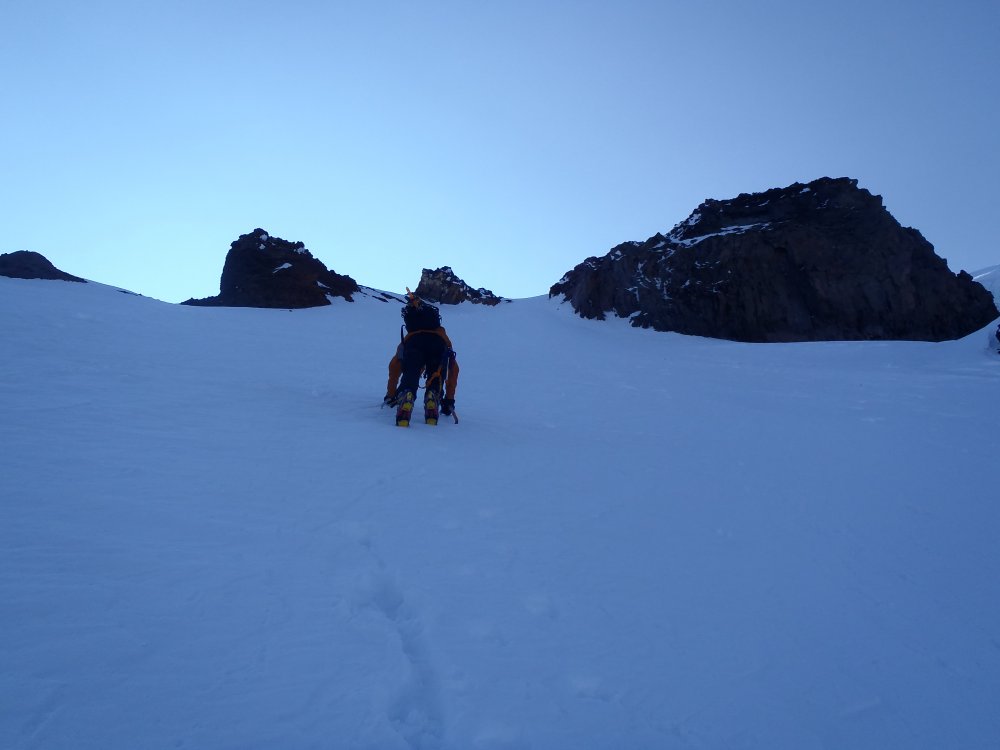
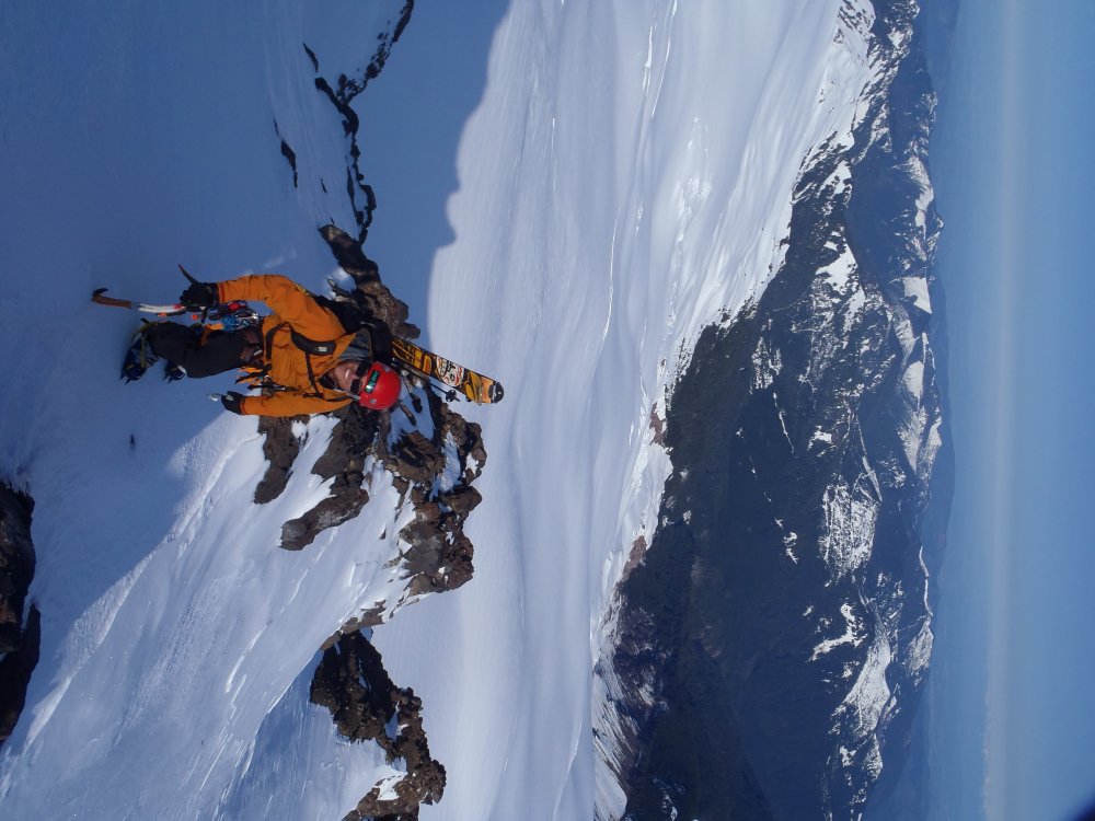
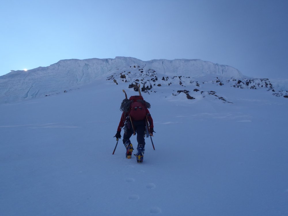
Trip: Mount Baker - North Ridge, Ski descent of CD Date: 5/18/2011 Trip Report: Seeing a great looking weather window for Wednesday and Thursday, my buddy Jon and I headed for the North ridge of Baker, with the intent of climbing the route, and skiing down the coleman-deming. We drove to about 2 miles from the TH, but with a 4x4 you could get to within about a mile...from the restrooms at the TH we headed up the grouse creek drainage, and up heliotrope. It was super hot out, but the snow stayed nice for skinning. We set camp around 7,200 feet on the western edge of the coleman. In the morning we left camp around 7 AM, and headed across the coleman, under nice sunshine! We found the coleman to be really filled in, but there were some big gapers, kinda spooky. We opted for the left option to gain the north ridge, due to looking at the giant slope on the right looking suspicious for avy threats. We had excellent styrofoam snow for cramponing up to gain the ridge. From the crest we made quick work to the base of the ice cliff up the 60ish degree snow slopes. Once at the ice cliff we found difficult climbing due to LARGE amounts of rime ice covering the actual glacier ice. Bring your broom! We spent a lot of time cleaning the iceand trying to find clean spots for screws. Once down to the actual glacier ice, it was super cold and hard, it took several whacks with the tool to get a decent placement... But after a bit of wallowing, we made it up the cliff, which was about 50 feet vertical on the line we took. From here we ditched the rope again and headed up the steep snow once again to the base of the seracs. After himming and hawing we opted to go left around the seracs, and found some big exposure over a gaping crevasse, so we threw on the rope and sunk a picket, that probably would not have held a fall, but we just gave each other the "don't fall here look". After this is was smooth slogging to the summit cone. We basked in the warm sun, ate lots of candy bars, snapped some photos, and strapped the boards on and sredded down the coleman deming back to the car! Overall a great day! However, carrying skis on the North Ridge, and climbing it in ski boots makes it a bit more challenging, but totally worth it for the ride down! Photos to follow....for some reason I can't upload them... Gear Notes: 3-4 ice screws depending on your line up the ice. 2-3 pickets if you want a running belay on the steep snow. We opted against this and went with the ol, don't fall technique. Approach Notes: head up behind the outhouses at TH....

-
Yeah, I agree, super awesome route, Fun, not all that difficult, and amazing scenery! I wasn't sure if it would be warm enough for shorts when I left the quah, but turns out it was. So I just turned my pants into make shift shorts! Pretty epic look, you know its business time when the pants get rolled up!
-
Trip: Liberty Bell - Beckey Route Date: 9/30/2010 Trip Report: With the weather forecast looking great for the next few days myself and a buddy were itching to get out and do something. We set our sights on something in the North Cascades, and eventually settled on the Beckey route up Liberty Bell, as neither of us had ever been up there in our past wanderings. We set off from Issaquah around 8:30 Thursday morning and headed for Washington Pass, after what seemed like an eternity of driving we made it to the Blue Lake trail head around 12. We quickly packed our bags, and hit the trail with a couple great topos from the Beckey guide book, ha! After less than an hours walk on a great trail we headed up the obvious climbers trail on our left, quickly the trail ascends some talus/boulder fields and goes right up the "gulley" between Concord Tower and the Southwest side of the Bell. We began looking for a "ledge" on our left, which was supposed to be the start of our route. After a few minutes of poking around we found the little ledge and headed up. The first pitch was nice, there is a couple of options, there is a nice little tunnel (5.6), which we decided to take. If you don't feel like the tunnel, it can easily be climbed over, with one step across move. From here, there is a nice belay ledge, and the route turns climbers left, and goes up a nice chimney feature for about 80-100 feet, with one interesting move over a chalk stone. Once up the chimney the terrain mellows out for the third pitch. The route wanders up some mellow 4th, to low 5th class slabs/flakes. Near the top of the third pitch there is one smear move, with a nice hand hold in a crack, but it is a bit of a reach with the left hand over to the next decent hold, once up this we headed climber right around a buttressy feature ona nice little ledge. We pitched out one more section of fairly mellow terrain over some ledges/slabs, and one 10 foot smooth slab move once over this we un-roped, and scurried to the summit for the unbelievable views, and some token summit shots, snacks and few minutes of relaxation. We had the entire trail, route, and summit to ourselves! We felt incredibly fortunate to have such a popular route all to ourselves on an amazing day! This is a fun, moderate route, in stunning terrain! After about 20 minutes on the summit we scurried back down to our rope, scrambled down to the first rappel station, which is reached by going back to the top of the 4th pitch, and downclimbing/scrambling to the climbers left toward a ledge system with small trees, from here, go back right, and down a little ways, and you should see the nice bolts and chain! We only had one 60m rope, so rapped down to the second station, which is at a tree, and a nice ledge, also with bolts and a chain. After two quick raps, we were back to the "notch"/"gulley" between Concord and the Bell. First Pitch, popping out of the "tunnel", second photo, is second pitch, third photo is a view of Concord and lexington towers, and N/S Early Winter Spires in the background. And lastly the token summit shot! Approach Notes: Follow Blue Lake trail for about a mile and a quarter, turn left at obvious climbers path, with a small cairn. Follow this path up and trending left. Trail takes you into the choss/scree filled 2nd/3rd class gulley. Once at the top of the gulley, look to your left and slightly down hill for the small ledge system, the up up and away you go!