

highhatt
-
Posts
26 -
Joined
-
Last visited
Content Type
Profiles
Forums
Events
Posts posted by highhatt
-
-
Always good to see somone posting for the Olympics!
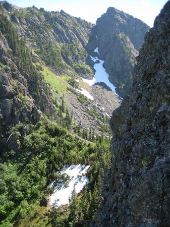
I love the views of the blue, it always amazes me how remote that area is.
-
Nice! I have been wanting to climb that route for some time now.
Those rats in the Olys will defintely attack! I tried the blinking light thing last time but it didn't work for me either.
-
Great trip report!
This was the first trad climb ever for my friend and I over 10 years ago and we almost killed ourselves. I didn't relaize there was so many established lines up there.
-
 Question - How many choice Olympic holds did you decide to "toss" and chose another.
I took us to the end to figur out John was taking some of the rocks home in his pack!
-
In retrospect could you have found a scramble route up Adelaide? I'd love to traverse from Baldy to Surprise Basin but I'm not looking to rope up.
I seem to remember that if you wanted to lose a bunch of elevation you could get on snow and get around to the other side for a scramble up the main route. Guys, correct me if I am remembering that wrong. Some of those ridges blur together in the memory already!
-
It was an amazing trip guys!
Thanks again for the great company and for taking the spicy leads you two!
Glad to have had such amazing weather and climbing!
Here are where I threw up some of my pictures. I put Tylers pictures on here too.
http://picasaweb.google.com/highhatt/20100723NeedlesTravese#
http://picasaweb.google.com/highhatt/20100724NeedlesTravese#
http://picasaweb.google.com/highhatt/20100725NeedlesTravese#
-
sastrugi-ed out?
As long as you hit it early enough. By the time I got to it, it was a slush pile that probably would have been fine without the extra 50lbs slinging around on my back.
-
It was a nice day! We must have summited a little before you. We left camp around 11pm on Saturday. I would agree that the route was defintely in and direct. Tried to board down the inter but first time for me with a big pack and really soft snow. It could have been better. In case you didn't know the father daugther team did make it back to camp as we were leaving. Glad to see them make back safely after watching them all day.
-
This is one of my favorite mountains in the Olympics!
I got turned around the first time I climbed too. Easy to do.
But hey, that is part of the adventure, right!
-
Always love Washington even if it does get crowded sometimes.
Did you guys climb the snow ramp at the top or straight up the rock from the ridge?
I was up there the weekend before helping with the college climbing class and watched Suprise Col let loose with a pretty good sized wet slide in the afternoon that would have taken anyone out on the climb.
Defintely have to be careful as all this snow in the Oly's warms up.
-
I never get tired of that view from the ridge!
-
Gotta love the Olympics!
I like the top shot!
-
What swhack would that be?

Take your pick, either climb we did on that mountain was probably the best Olympic schwacking I have done!
-
I found my camera so here are some of my pictures.
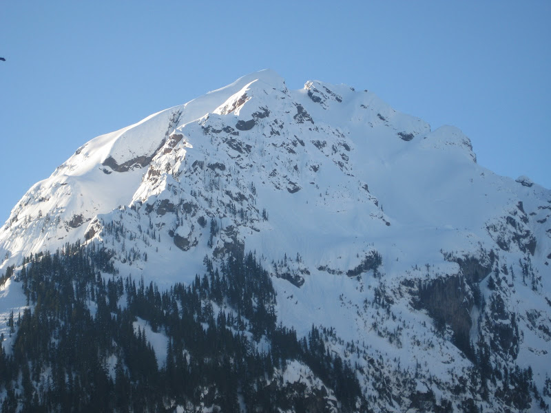
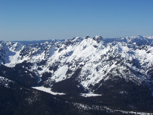
Here is a close up on Washington
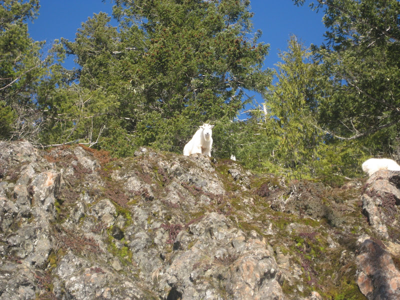
Goats staring us down.
Kevin in the upper basin.
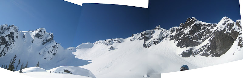
Pershing upper basin panarama. I want to try more of these and this one wasn't planned so it turned out funky.
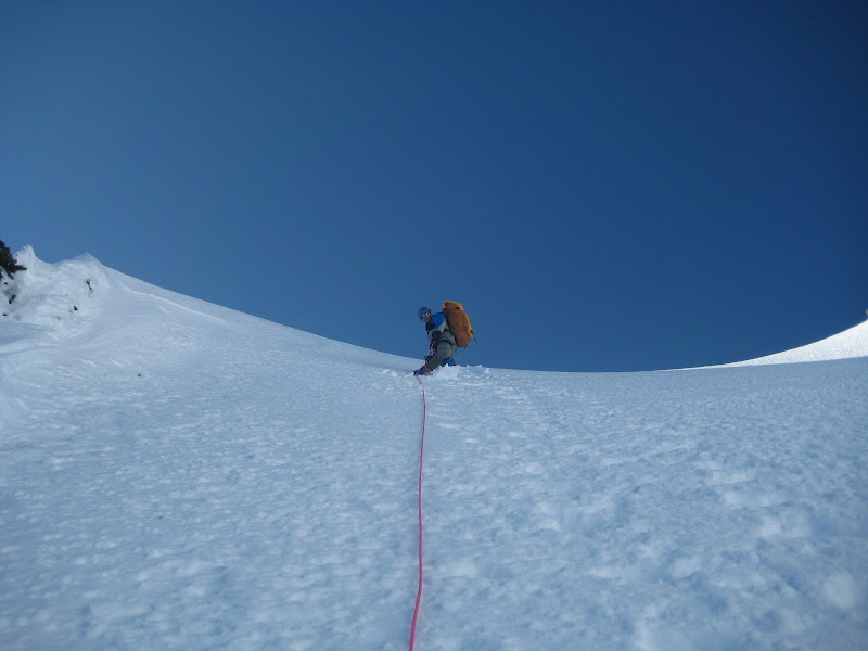
Kevin at the top of the col.
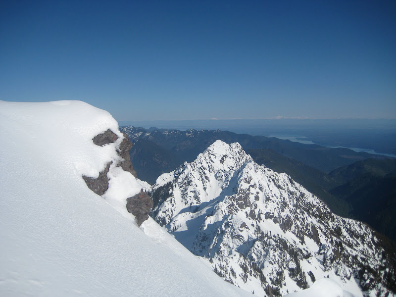
From just below the summit, Jefferson (Thorson). I am still trying to forget that bushwhack! Summit of Pershing in the foreground.
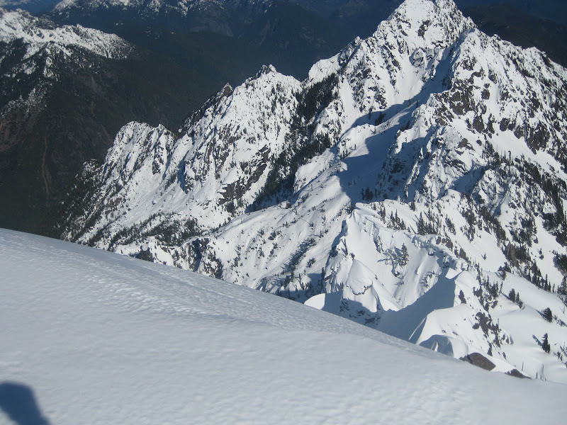
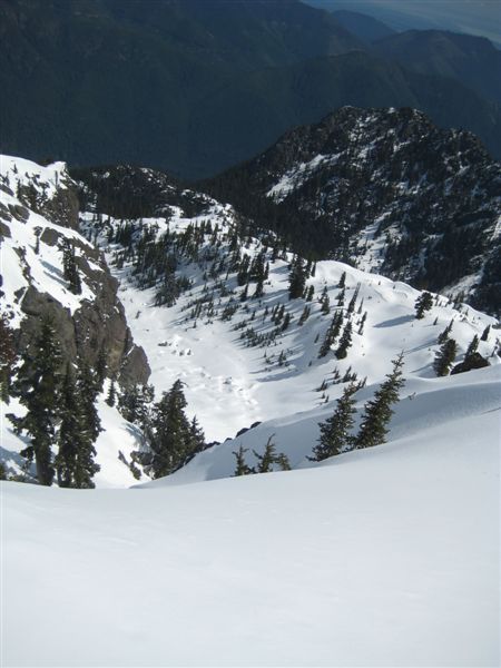
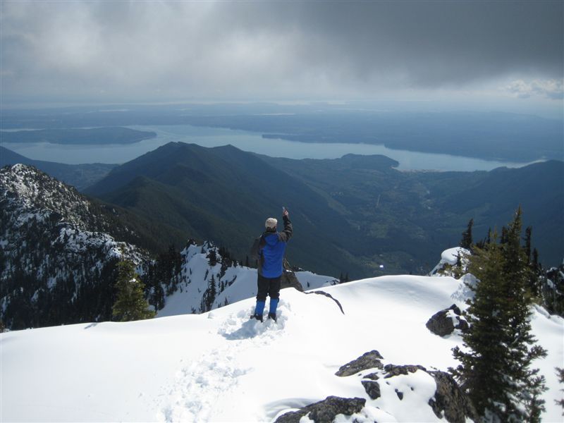
Looking down off the summit.
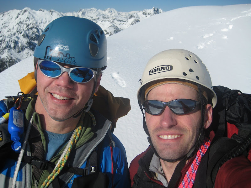
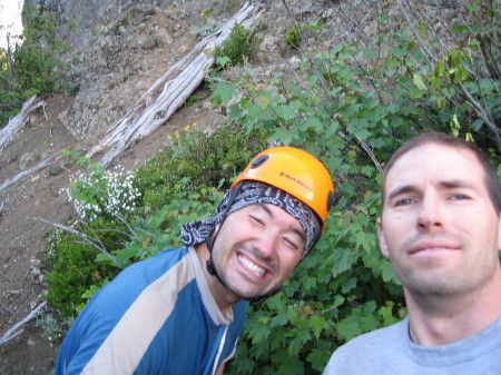
Kevin and I on top.
-
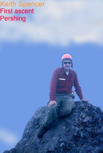
Roger shared this picture with me so I thought I would post it here. Keith Spencer was in the first accent party for Route 1 in 1966. Hope you are reading this Ketih! It must have been awesome to be the first up so many of the Olympic peaks!
-
Trip: Mount Pershing - Route 7, mostly
Date: 2/21/2010
Trip Report:
We missed out on the Col Bob trip John posted earlier because of some things that came up, but we didn't want to waste such an amazing weekend!
So we ended up taking a run up Pershing. Without knowing whether we could actually get to the start of the climb we left Bremerton around 4am and found no snow on the drive in and Jeferson lakes area is toatlly accesable in February! Crazy!
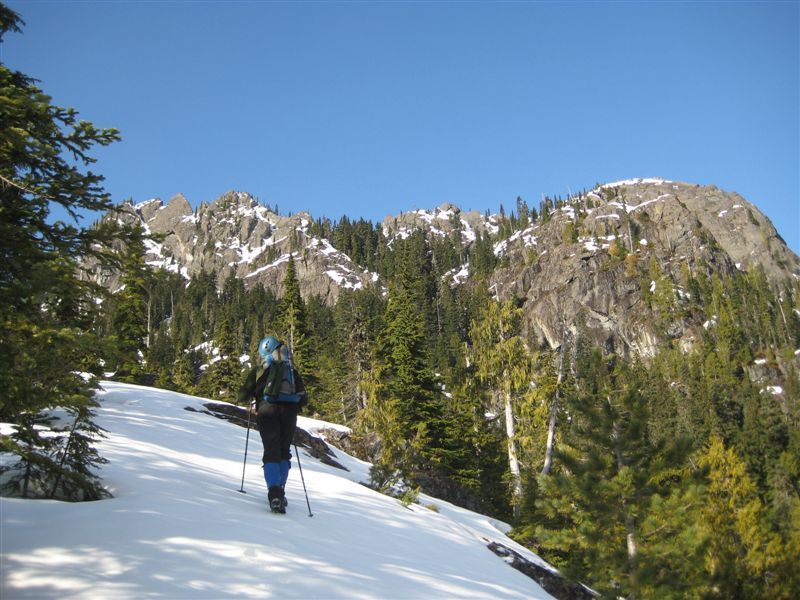
We hiked up the way trail which is well flaged. It takes some of the fun out of route finding and I am not a big fan of the marking.
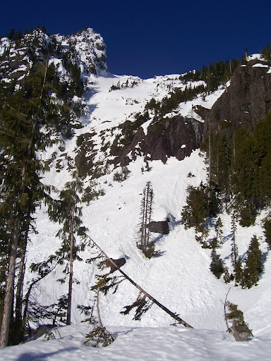
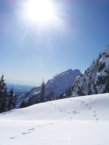
I think these are the "vegated slabs" from route 7. On the way down we came down a gulley to the right of the slabs and this was defintely the way we should have also come up, at least in the snow.
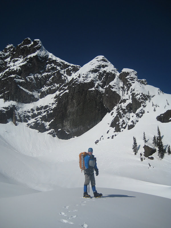
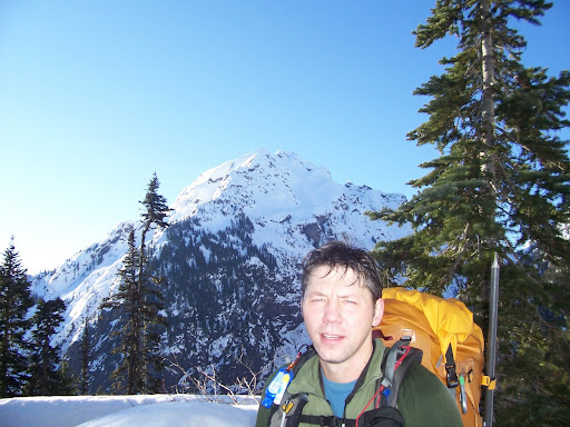
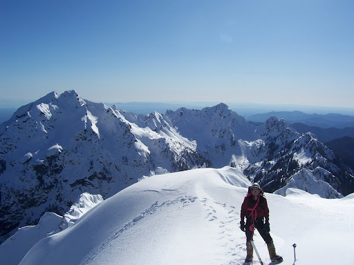
Kevin with Washington in the background.
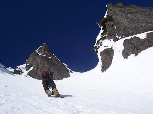
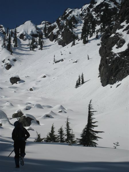
We tried the East ridge after hitting the basin and got turned around because of the cornices and bad snow conditions. After walking further up into the basin we decided to try out the direct snow finger to the summit. The snow was much more solid here and even required some step chopping up higher.
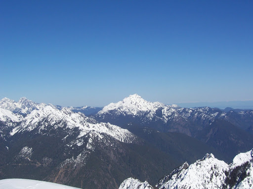
From the summit looking back on Washington.
The Brothers in the distance
Mildred and the Sawtooths.
Thanks for the pictures Kevin!
I will post some of mine when I get them downloaded.
Gear Notes:
Crampons, pickets, bring it all, but leave the snowshoes!
Approach Notes:
The flagging gremlins have marked the trail all the way to the "vegatated slabs". No snow until almost 4000'!
-
Nice guys! I am still bummed I missed out on this one. Gotta love sitting there staring at the sun disappearing into the ocean.
-
Hey Guys! Glad to see you made it out! Looks like an awesome trip. I like the kayak approach!
Mandy just had the baby Sunday morning so we are just hanging around this weekend with the newest climbing addition.
-
Well guys its good to see you at least got out!
I will let you know how the postholing goes Wednesday!
-
We passed you around 2:30pm as we were heading up trying to beat the weather. Made it back to camp around 8pm. A couple of other teams ended up following us up also trying get in before the rain came. Weather ended up hitting camp around 10pm.
Glad to see you made it down safely after a long slog.
-
Trip: Mount Jupiter - NE Side
Date: 4/28/2009
Trip Report:
Well I haven't seen an Olympic bush whack in awhile so I thought I should post this.
We took off work thursday to enjoy the good weather and try a route up Jupiter that isn't used that much. It also gave us a chance to use the Hood Canal Bridge for the last time before closing for 6 weeks.
Left Poulsbo at 3am and arrived at the end of FR-012 around 4:30. The road is blocked about a half mile up. I thought taking the Mtn bikes was good idea until we saw the extent the FS went to in "reclaiming" the road. Ditched the bikes after a half mile of mostly pushing and continued to the end of 012 ~2 miles. It ends around 1200 feet up the side of Jupiter.
Bush wacked till we made it to the lakes around 3600 feet. From there hiked on snow up the drainage from the NE side to the summit. About 4 inches of new snow from a couple of days ago, great conditions.
On the summit by 11 and back to the car before 3.
Gorgeous day, great company, gotta love the Olympics!
Approaching Jupiter Lakes
Final Approach to Mount Jupiter
Looking Back Down Towards the Dose where we started.
Checking out the view. The summer route comes up the ridge to the left of Kevin.
Gear Notes:
Ice Ax
Approach Notes:
Head up the Dose and take the bridge across to FR-012
-
That's a cute necklace Kevin, you should give it to your wombat!
Nice climb guys, sorry you didn't get any nicer weather.
-
Hey guys sorry it took so long for me to get some more pitcures out there. I will just throw out a few more, it looks like Randy has covered the bases pretty well.
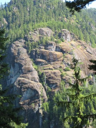
Picture of the Hamma Hamma climbing wall seem from the approach.
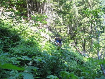
Randy starting the Schwak!
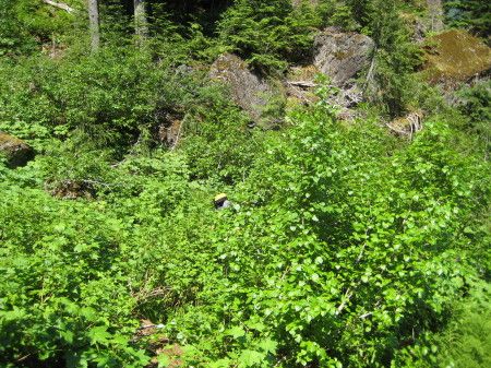
Continuation of the Schwak!
Jefferson from the first belay.
Randy and I after another epic climb.
Even those pictures don't do that Schwak justice. Make sure you bring some heavy gloves if you want to repeat. Better yet don't go unless the gullys are choked with snow!
-
It was an awesome weekend! Thanks again for the invite guys.
[TR] Olympics - Various - August 21-28 - Hamma-Hamma to Dosi 8/21/2011
in Olympic Peninsula
Posted
The rock was decent once we made the ridge proper and took pro, pretty chossy on the ramps though. That could all be bypassed by traversing the steep snow. Flypaper was still doable but the gulley route on the other side was closer to camp and Tony had been up multiple times before and knew the route well. The eel was quite filled in and we did cross it from Anderson over to West peak. The route down Kevin, Jim and I headed up Echo Col and down which has a better runout for a fall than flypaper.
Great write up John and awesome pictures as usual! I had great time hanging out with friends new and old!