


Peter Way
-
Posts
86 -
Joined
-
Last visited
-
Days Won
2
Content Type
Profiles
Forums
Events
Posts posted by Peter Way
-
-
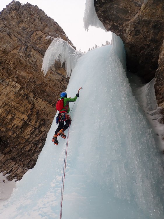
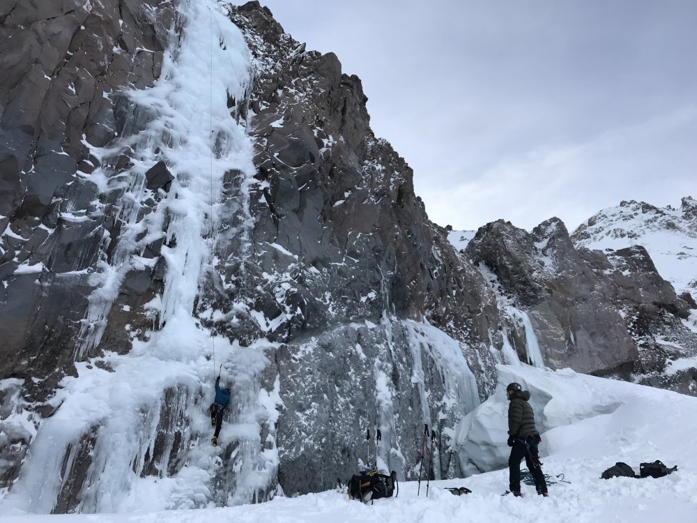
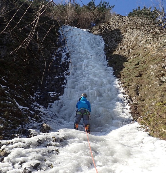
Climbed the Cooper 30 and some fun mixed on Sunday. It's still fat and happy.
-
On 3/4/2019 at 5:53 PM, ggres335 said:
Where is this "gully"? Rainier area?
Nisqually bridge. Half way between Longmier and Paradise. We also climbed 2 lines right at the start of road to Ricksecker Point. One was thin and un-protectable the other fat and vertical at the top. You have to rap in and climb out. Park where the road is closed and rap over the edge right there.
-
Very well done. Some people sit on site for a month trying pull that one off.
-
 1
1
-
-
"Mikey's Gully" thin, but in. "Mikey Likes It" not quite touching down. We didn't look at Narada Falls.
-
Take dried potato, spices and butter to add to your freeze dried meals. Put twice as much water in the meal as it says, let it sit a while then add some stuff to amp it up. Take dried fruit and sugar to add to your breakfast cereal.
Take the food that you know you will like to eat. Take the best chocolate you can buy (Toblerone) instead of M&Ms. It may cost you more but you wont regret it.
-
Just got back form a month in Banff. Climbing in the Polar Vortex was kind of brutal.
-
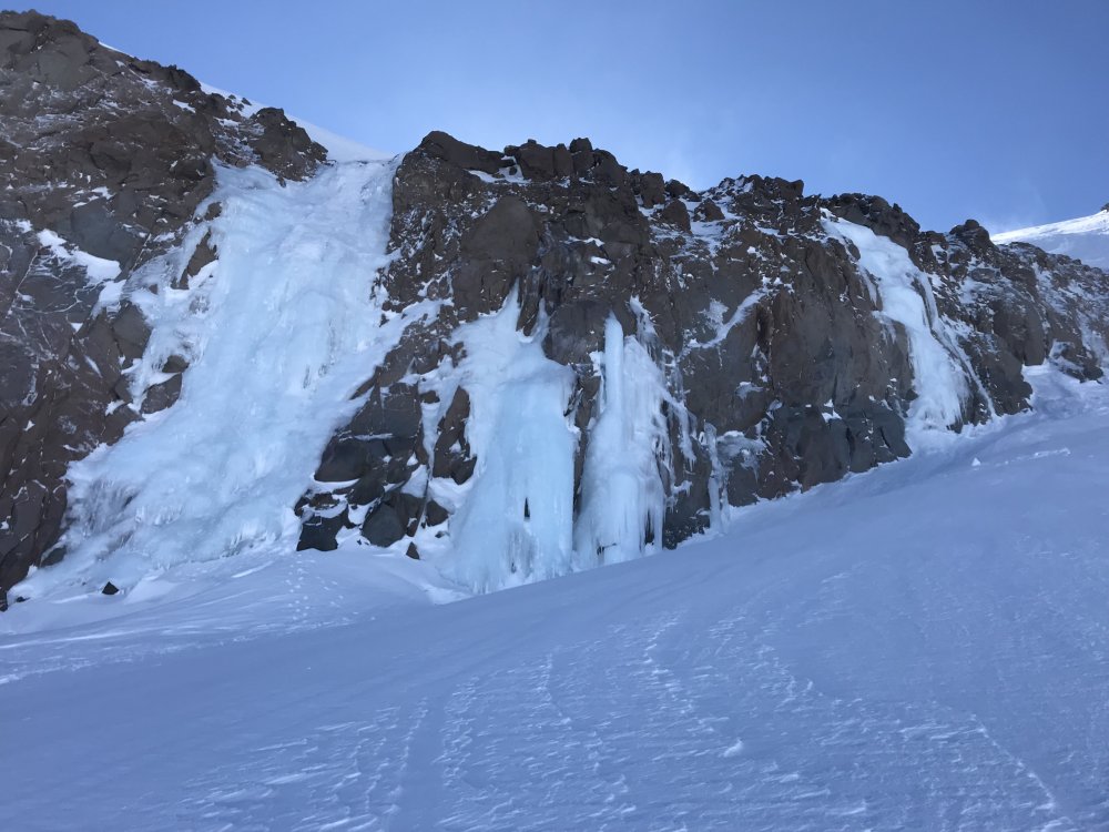
Still plenty of ice on the Eliot. 2 more lines have formed up right next to the Cooper 30, and some mixed as well.
Had fun up there today.
-
Leaving Portland for Banff tomorrow. Will be there 4 weeks. Don't have anyone lined up to climb with Jan 26th to Feb 1st. yippieway@gmail.com if your interested.
-
1
-
-
Cooper 30 is in good shape. 4 of us climbed it today.
-
2
-
-
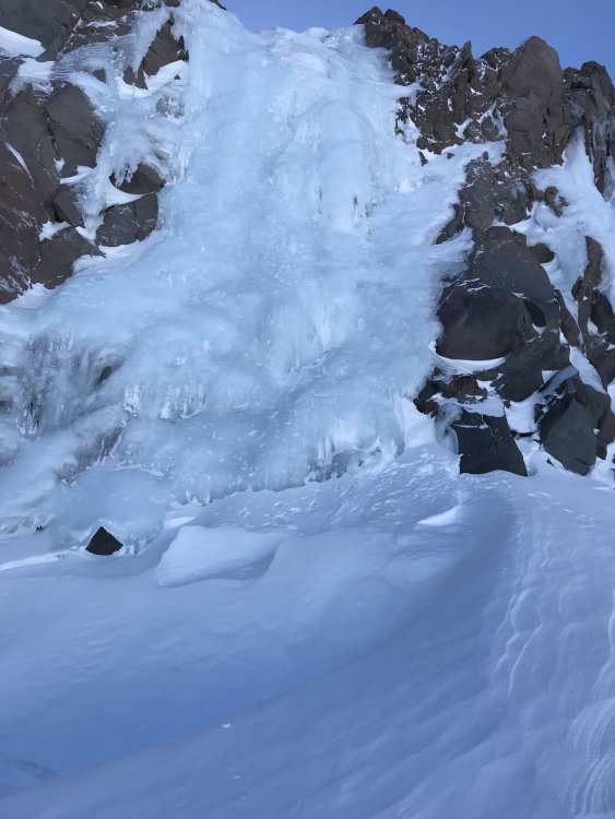
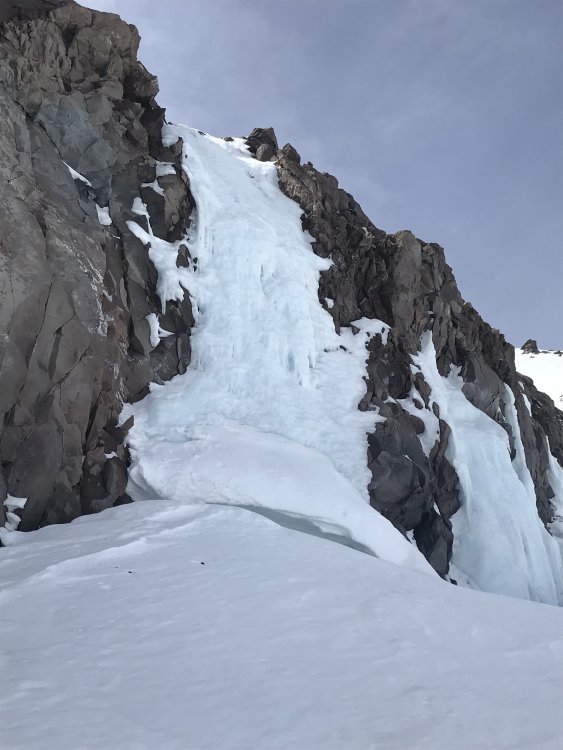
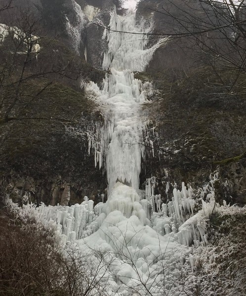
This climb is called "The Cooper 30" It's 30 meters tall and hangs off Cooper Spur above the Eastern side of the Eliot Glacier at 8000 feet elevation. It forms early, I've climbed it in mid November. And it lasts late, this year I climbed it in May. Where else can you go locally and find water ice that lasts 6 months of the year? Some years there's a whole mess of other ice handing up there too. Head in from "Tilly Jane" trail head 5 plus miles. In the summer when the road is open you can drive all the way up to "Cloud Cap"
-
How to Climb ice in Oregon in May
Step 1) Refer to, How to climb ice in Oregon in March.
Step 2) Do that, because the ice is still there.
Its bleached and sugary on the surface, and may not last too much longer. So go get it now, cause, where else ya gunna go find water ice in May.
-
1
-
-
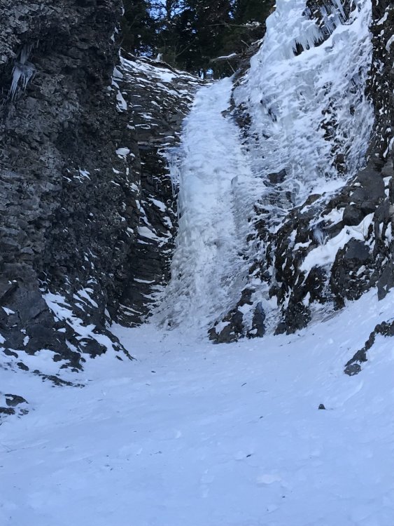
How To Climb ice in Oregon in March
Step 1) Drive to the Tilly Jane trailhead
Step 2) Hike / skin to 8,000 feet on the Eliot Glacier
Step 3) Look to your left
Step 4) Climb it
-
3
-
-
Went back up onto the Eliot Glacier yesterday. The ice is still in good shape.
Got me thinking however. I've not seen or heard this climb named anywhere. I've no doubt this thing has been climbed many times, cause, if your hiking up the Eliot, well there it is in full view. It's at 8000 feet and forms up early most years. So I came up with a name for it. I'd like to call it "The Cooper 30" Cause it's 30m tall hangs off Cooper Spur.
If anyone knows of it being named previously please speak up.

-
1
-
 1
1
-
-
This is what is to be had on the Eliot right now.
Have at it.
.thumb.JPG.8d647c321954b75f08779b694c65e34a.JPG)
-
1
-
-
Dont be afraid of Canada
The whole point of ice climbing is that its cold
-
Couple More Wind Walker picks
-
Location:
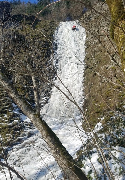
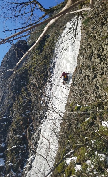
Cape Horn Columbia Gorge.
Take Cape Horn road, off Hwy 14, to the end (gate). Continue walking down the road (this is a private drive way) to the rail line. Follow the rail line west, down stream, (this is BNSF private property). Approximately 100 yards short of the rail tunnel, the climb can be found on a cliff band 50 yards up and above the rail.
Route:
50m WI4
The first 10 meters lays back a bit, then sustained WI4 to the top. The ice ends in frozen brush. 5 meters through the brush to a rap tree.
The water weeps out of the tree line above the cliff and is not associated with a major drainage.
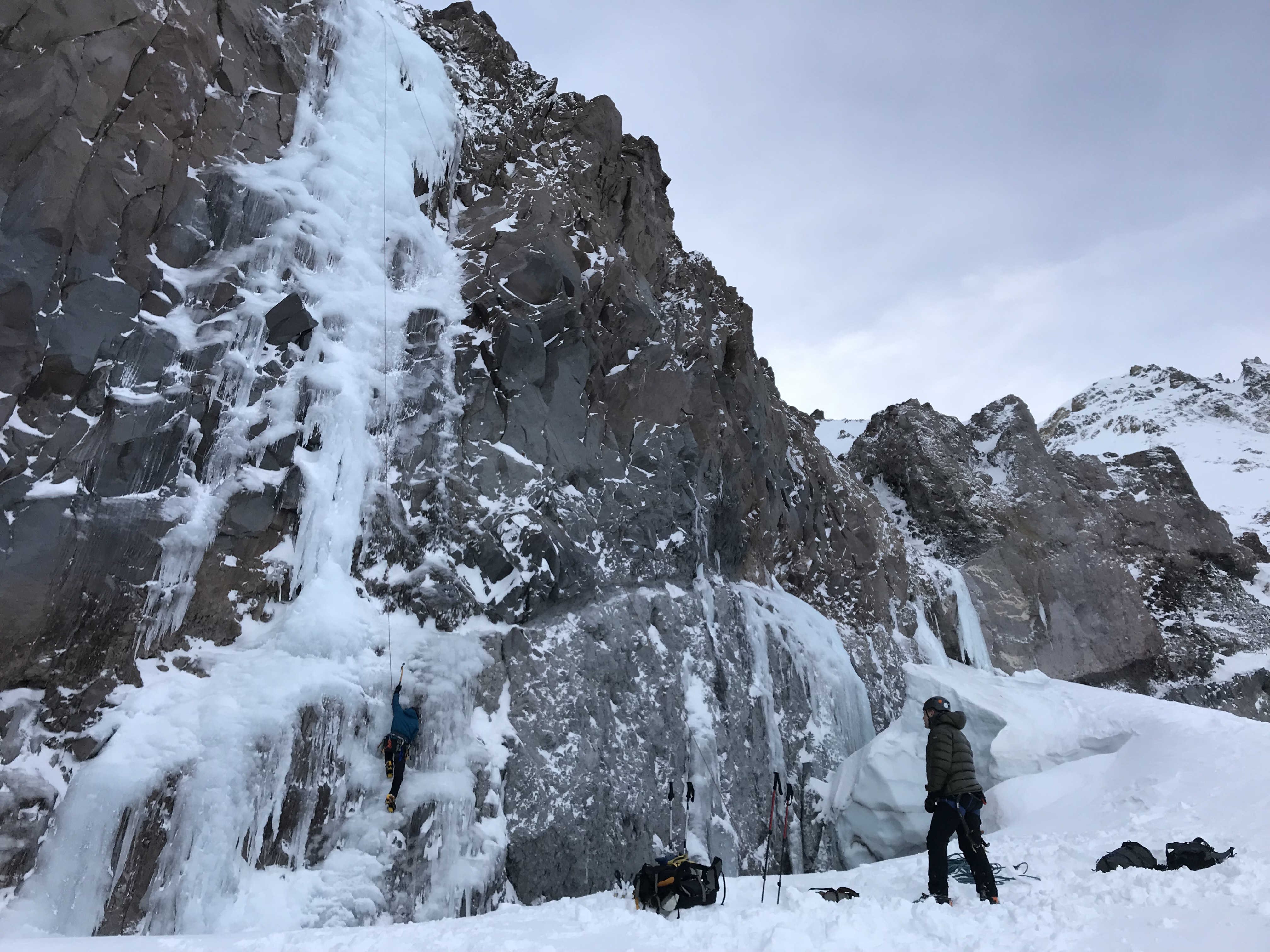
This climb was repeated today by Yeman, Andreu, Tohper and Jeff.
The name Wind Walker seemed appropriate given the 60mph wind gusts we were climbing in.
The Gorge ice right now is in better shape than most people can remember.
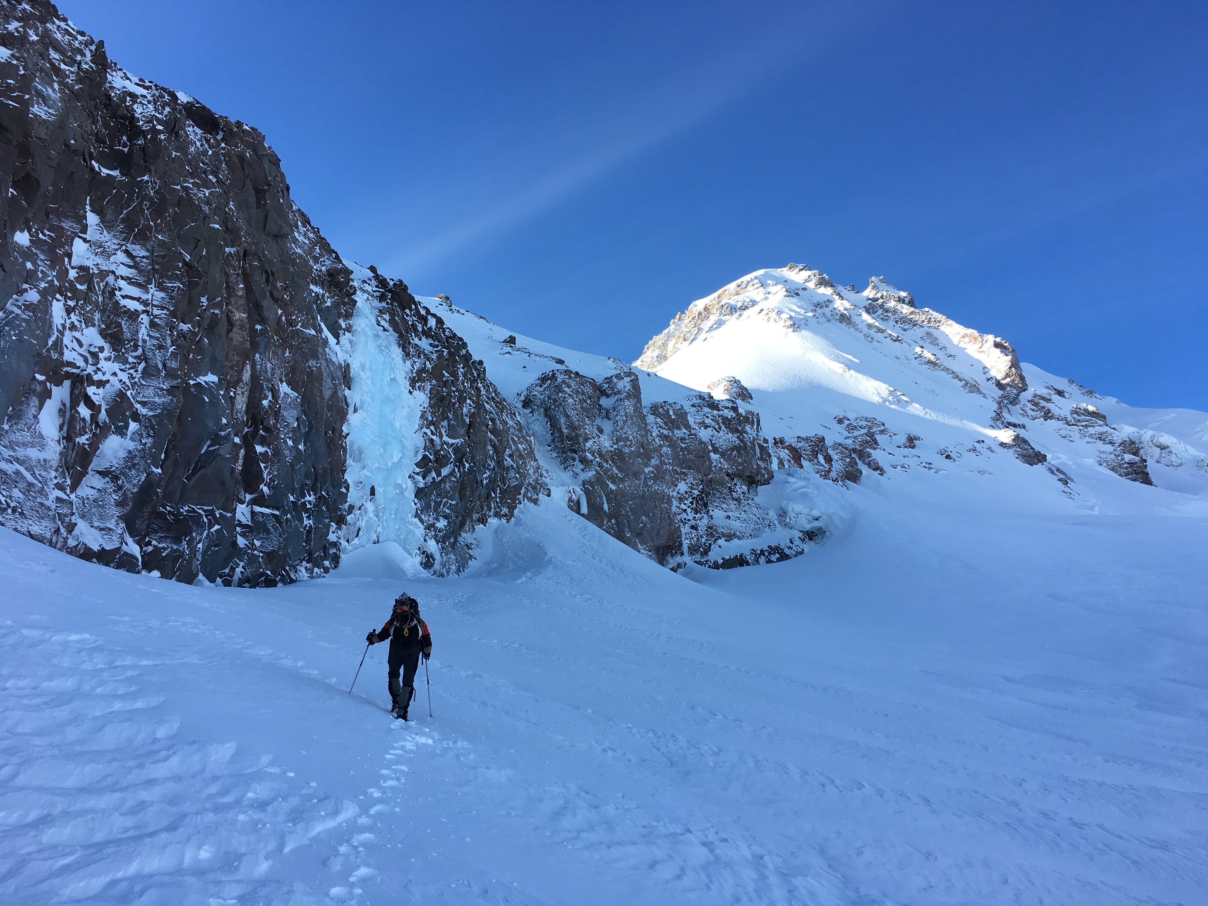
Yeman and I also climbed Nancy's Run today, in awesome shape.
Tomorrow may its last day.
Peter
-
On Sunday YeMan and I climbed the first pitch of Gathering Storm (which actually looked in good shape) and bailed cause WE go the shit bombed out of us.
Sorry bout you car man. Someone should blow tweekers up.
-
Unless I can find someone bent on a full 2 weeks in Canada I will more than likely end up in Bozeman and Cody. Still a bunch of vertical I'd like to do in both
-
I have to be back at work Feb 13th so I think the ice fest is out
-
I have Jan28 to Feb12 off work
I don't really have a plan but look to climb as much as possible in that time
Montana, Cody, Canada ??
PM me
-
Falling in a crevasse is a serious business. When it happened to us while descending the Muldrow, it took two of us to stop the one that went in.
One climber trying to stop another needs quick response and perfect form.
Keep it safe.
-
Seriously cool photos Marlin. Nice work.
-
I wonder if any of them bothered to check the weather forecast before going up there. Last weeks forecast screamed out "don't go up there"


.JPG.08460d3706e76e8154958860384bb7a9.JPG)
WA Ice Conditions 2020-21
in Ice Climbing Forum
Posted
Cooper30 is thin but good to go. Have at it.