leadmade
-
Posts
17 -
Joined
-
Last visited
Content Type
Profiles
Forums
Events
Everything posted by leadmade
-
haha!!!
-
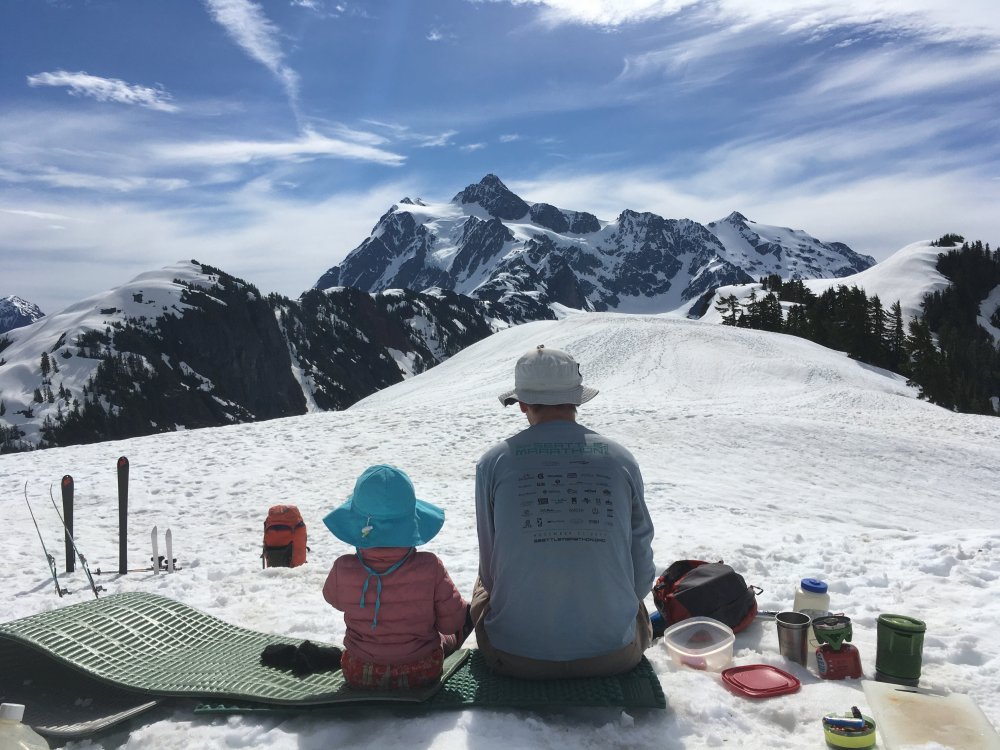
took our 2 year old up to Artist point and camped for 3 days over memorial day weekend. her blue sippy cup fell out of our crampon pockets on our ski -sled down. long shot but if you picked it up, we'd love to connect and come get it. Thank you!!!

-
[TR] TR: Mt Prophet - SE ridge up, SW rib down 6/19/2017
leadmade replied to leadmade's topic in North Cascades
with the photos showing here http://plaigar.blogspot.com/2017/06/mt-prophet.html -
Trip: TR: Mt Prophet - SE ridge up, SW rib down Date: 6/19/2017 Trip Report: Mt Prophet has long been on our to-do list. 3 feet of new snow last Thursday changed our original volcano plan to let us tackle this rarely visited summit. We enjoyed 12 miles of hike into 39 mile creek camp. day 2, we headed up the southeast ridge. a little bit of brush in the bottom but got better once we reach the 5000ft notch. snow started around the 5000ft level which made traveling easier. [img:left]https://www.amazon.com/photos/share/6kCjAMI9C5pqJLzdmkb0oVg66Xr9PP2Qx6y55fjHDuP[/img] we followed the ridge up and found tracks of some company. [img:right]https://www.amazon.com/photos/share/QIUM3qTKD5M2ztxSUXhTsTzlCy3N09btSXJA4p7spzK[/img] with the exception of one spot, it was a simple and straightforward scramble. Here is a shot of the little spice we got [img:right]https://www.amazon.com/photos/share/xT0YDeiT6NlzvgTm1KnMxqhAjiX66UjkUrlGFRVU3om[/img] a low cloud ceiling all day, we see the foothills of the pickets and got a few glimpse of some peaks from our tent during the evening. a few sparse rain drop as we got into the tent and call it a night. the next day, we woke up to beautiful weather with the entire pickets range in clear view. [img:right]https://www.amazon.com/photos/share/1gGi5WFAhNQKtaLwFr6eURX9KtQNtRvjowHtZdq0Fh5[/img] we also see the first view of our objective for the first time we cross the magnificent valley for the last 1000ft to the summit we love finding the summit register placed here by Fay Pullen in 2014. the summit register indicates that the peak gets about one visit a year. we're still signing in on page 1. The big beaver trail was wonderful with big old growth cedars. here is a map of our trip Gear Notes: Crampons, Ice Axe Approach Notes: bug juice is a must at this time. approach shoes were very nice for the 12 miles from hwy 20 to 39 mile creek camp. exit was 16 miles from Luna camp back to hwy 20. if you want to splurge, you can get a boat ride and save yourself 6 miles of hiking each way
-
I lost my Black Diamond Ice axe 65cm on my traverse back from Icy peak. I found my ice axe had detached from my pack when i got back to camp. let me know if you find it. Thank you!
-
on 6/27 Saturday afternoon, I left our Katadyn Hiker Pro water filter out at Wing lake (Black Peak by Rainy Pass) as we camped 30 feet away from the edge of the lake. the filter was taken away including the filter bag. would like to get the water filter back. please private message.
-
Trip: Glacier Peak - 8/17-19/2012 - South route - Cool Glacier Date: 8/17/2012 Trip Report: TR with pictures and map http://plaigar.blogspot.com/2012/08/glacier-peak-817-292012.html The road is opened to the TH to Glacier Peak. It had been closed for years before making this a 5-day adventure, it opened for 2 months 2 years ago when Peter tagged the summit and I missed it. Seeing that the road is open again, I wasn't going to wait for another time again. Peter wasn't going to join as he wanted to ski it the next time he goes. I posted it as a basic trip 6 days before the trip date and wonder if I'd be going alone (sob sob), turns out a few others shared the same interest. I was delighted to see a few familiar names on the roster. Peter decided that a day in the mountain trumps a day in the salt mine and decided to join at the 11th hour. On Friday morning, 10 of us met up and gave it a go. Day 1 Forecast was for a heat wave, so we started early. 4:30a meet up at a P&R, off and moving from the Sauk River North Fork TH at 7:30a. We took 2 hours for the 5.5 miles to Mackinow shelter. a quick break and off up the 3000 ft up for the next 3 miles. Reached White Pass before noon. the trail got hot at the end and the tail of the group got the heat treatment. Long break with lunch at White Pass. met a PCT hiker who's been out since 4/29 and heading towards the Canada border. We are moving at 2:30p, after some blister management, following the foam creek trail to its end. We headed up hill over the crest into the White Chuck Glacier basin where we got the first view of our objective. We dropped down to a nice heather basin at 6500ft with running water and settled for the evening at 4pm. Day 2 - summit day Anticipating another hot day, the group got moving at 5a. Mike's feet were chewed out by his boots on the approach so he's staying in camp for the battle with the marmots. 9 of us headed up. Where the maps indicate as the White Chuck glacier, it is a deep basin with the glacier completely missing. we dropped into the basin and found mud that sucks your boots in all the way up over the ankle if you don't move fast. so the game of frogger begins, the trick is to jump from rock to rock and never be on the mud. We reached Glacier Gap at 6:40a with the view of Glacier peak greeting us with the sunrise. We took a quick break for sunscreen and sunglass and off we go again. From Glacier gap, you can see about the entire south route, it is a hike on the ridge with a path. We roped up for the Cool glacier and put crampons on. Other than some exposed blue ice, there wasn't any open cravasses. The glacier section was short, we ditch our ropes, ice axes and crampons after the glacier portion and scrambled up the last part of the summit block in light packs. View from the summit was awesome, it was warm and calm, many of us didn't even pull our jackets on. we stayed on the summit to our hearts content, Noam shared fresh cherries as summit treats. We took summit naps and soaked up the view. This is the last unclimbed Washington volcano for me and a few in the group, it was satisfying to tag it in such grace. Day 3 - Camp to TH We started early again at 6a at a more relaxed pace. i wondered if we should be sleeping in on our last day but catching the sunrise view of Glacier peak (top picture on the blog post) and White pass basin was worth waking up early. Temperature was pleasant and we were soaking in the view. We took a break at White pass, then another one at Mackinow Shelter. For the most part we kept a steady and relax pace, stopping only for Huckleberries, Blueberries, Timbleberries and Salmonberries We reached the TH around 12:30p and high fives all around for an awesome outing tagging a big volcano! Gear Notes: 3 30M glacier rope 3 pickets (1 for each rope) - did not use 1 Shovel for the group - did not use crampons ice axe helmet standard glacier set up bug juice - bugs were not too bad Approach Notes: Moving time for 33 miles and 10,000ft elevation gain Day 1 - 6.5 hours in total excluding breaks. 2 hours TH to Mackinow Shelter. +3 hours to White Pass. +1.5 hours to Camp at 6500 ft meadow Day 2 - 5 hours and 40 min Camp to summit including breaks. 1 hour 40 min to Glacier Gap, 4 hours Glacier Gap to summit. 2 hours on the summit. 3 hours summit to Camp Day 3 - 6 hours camp to TH
-
Trip: Bailey Range with Mount Olympus Date: 8/20/2011 Trip Report: We started the 8-day trip at Sol Duc, traversed the Bailey Range from Cat Peak to Mt Ferry, then turned West after Bear Pass to enter Queets Basin. We ascended Humes glacier to Camp Pan, reached the summit of East, Middle and West Peak of Mt Olympus and exited via the Hoh River trail. We camped on dried ground every night, no camping on snow. Other than the dry camp at Bruce’s Roost (day 1) and Snow Dome (day 7) where we melted water, we had running water at camp all other nights. Map of the route Day 1) Sol Duc TH to High Divide ~ 4 hours Start early because you have to drive to the Hoh to stash cars, then drive back to the Sol Duc trail head to begin. Go up the Sol duc trail to Bruce’s Roost. You’re on the High divide with a view of Mt Olympus and Bailey Range. Downside is that there is no running water. For a slightly shorter day and running water in camp, camp at Heart lake or Sol Duck Park, both might be hard to reserve on the weekends. Day 2) High Divide to Mt Carrie Basin Since the Bruce’s Roost camp turned out to be dry, and we were a bit low on water, we decided to start hiking without breakfast and stop at the first available water source. We found a nice pond just next to the trail after 0.5 mile where we had breakfast and filled up on water. Turned out this was the last available water source for a long while, so it was good that we filled up there. We followed the good trail to its’ official end by the “catwalk”. The trail ends in a very steep gully with cliffs on the far side - it was pretty obvious. We found the trail that climbs steeply directly up to the ridge top pretty much at the saddle between Cat Peak and Mount Carrie. We were initially hoping to scramble Cat Peak, but it soon turned obvious that it was quite a bit behind us and it didn’t seem like it would be worthwhile to scramble along the ridge all the way back. Instead we had a snack and enjoyed the view from where we were. We proceeded to scramble onwards along the crest of the Catwalk, mostly class 2-3. There are game trails with more exposure but there are always options with less. After the catwalk, it is a traverse along beautiful alpine meadows, the climber trail here is good and easy to follow. Amazing view of Mt Olympus and the Hoh river valley. We camped at the flat grassy bench (5,000ft elevation) between two water falls, below and probably a bit east of Mount Carrie. it is mid-way between Mt Carrie and Stephen’s peak on the map. We took an afternoon nap then set up camp. Peter and I opted to scramble Mt. Carrie. We ascended about 1000ft up the meadow, which turned steeper and became class 4 loose rocks. We decided to stop as clouds were coming in. We sat down and watch the cloud coming and going, and in another 30 min later the clouds dissipated. Captured some nice pictures. In retrospect, we realize we should have scrambled Mt Carrie via the West Ridge (reference Jeff Smoot). Day 3) Mt Carrie Basin to Lake Billy Everett It rained during our trip, and even though this was the shortest day on the itinerary the wetness made it rough. From camp, we continued following the trail traversing the south slopes of Mount Carrie. We found ourselves losing the trail in places here, but mostly it was easy to follow. We lost the trail just before the distinct spur ridge separating the Cream Lake basin and the slopes west of it. To cross the spur ridge, we gained a few hundred feet from where we lost the trail, and crossed the ridge around 5500 feet. The now hard rain had us seeking shelter in the protection of a group of trees. From here we stayed between 5000 and 5500 feet until we had passed Lower Cream Lake, and were right above Cream Lake. We descended into the basin. We saw elk in the rain in the meadows which was magical. The basin is a bit marshy, and though there are plenty of flat spots may not make the finest campsites, though you probably would see lots of wildlife. In addition to the elk, there was a lot of bear scat here. Given the rain, the bushwhack and the abundance of animal scat, it felt remote. To exit the basin we bushwhacked up towards Upper Cream Lake via a short ridge, then a stream bed which deposited us in meadow land. We found a distinct trail through the heather, and we followed it towards Lake Billy Everett where we set up camp in the rain. We had a nap in the tents to wait out the rain, but it continued through the evening. As dinnertime came along, Peter and I waited for a dry period, then hurried over to Jenn’s wonderful tarp tent where we cooked and had dinner. After dinner we waited for another dry period and hurried back to our own tent and continued the nap. Morale was not high given the rain. (Coming back from the trip, we checked the weather history - 3 inches of rain in Forks that day!) The partly snow covered meadow land looked incredibly inhospitable in the rain and clouds. Day 4) Lake Billy Everett to Queets Basin This is the Bailey Range Traverse day. We stayed on the ridge and walked the range from Mt Ferry to Bear Pass. We dropped packs and scrambled to the summit of Mt Ferry, a joyful little side trip that took 30 min up, it was worth it just to feel your legs without the large pack for a little bit. We could see all the major volcanoes. Amazing panoramic view the entire way. we had lunch after Lone Tree Pass, then marveled at the rugged ridge along the way. refilled water off a large melting patch of snow and reached Bear Pass in high spirit. From Bear Pass, we were treated with our first view of Queets basin, a pristine and beautiful basin that is prime for large wild life viewing. Most of the basin was still snow covered and a few nice water fall along the way. we spotted a flat treed area in the far end of the Basin and decided that to be our campsite for the day. We went further than planned for the day but we know the next day was to be a rough day so it felt good that we had a head-start. We saw a bear running up Bear Pass as we refilled water prior to dinner. Day 5) Queets Basin to Camp Pan The OMG describes the beginning of this day in excruciating detail with way points, but without a GPS (which we had none) we found the step-by-step description somewhat difficult to follow. In general, we were supposed to follow game trails from our camp at 4200 feet below cliff bands, up to the gentle basin at 5000 feet. Unfortunately we did not find the game trails, and ended up bushwhacking through alder, blueberries and steep forest up to that same basin. It was rough going, at times both arms and legs were all tangoed in the thick vegetation, i felt like going through an initiation for the Olympic mountains. It turned out ok, though it was a lot of work and a rude awakening way to warm up for the day. (The upper basin 4800 ft would make a spectacular camp.) Once at the upper basin, it was time to lose elevation down to the “river” crossing. OMG indicates there should be a distinct game trail, but we kept losing the faint game trail. It again turned out ok (while brushy) even without the trail, and the crossing of the “river” was uneventful since it was completely snow covered. The headwall at the terminus of the Humes glacier initially looked intimidating, and we studied it from below while having lunch and filling up water. Turns out it is easily ascended on the left via some ledges, and we reach the Humes Glacier. We roped up for the glacier and enjoyed the quick progress towards Blizzard Pass - the relatively obvious gap in the skyline. A few hairline crevasses on the glacier, and a moderately steep snowfinger for the final climb up to the pass, it took about an hour from roping up at the bottom of the Humes glacier to Blizzard Pass. Arriving at the pass was an incredible experience - what a view of the Olympus massif! Very impressive. We truly savored our evening at Camp Pan, relaxing and taking pictures and were treated to a red and pink sunset to boot. Day 6) Camp Pan, to Olympus Summits to Snow Dome We woke up to blue bird weather, not a cloud in the sky. Sun didn’t reach Camp Pan in the morning but the temp was plenty warm. We packed up, put crampons on and descended from Camp Pan on steep snow. Good snow consistency for crampons and we made quick progress. With the crevasses opening up on the glacier, we stayed to the left of the glacier, which kept us in the shade for the 45 min or so. A few crevasses to go around or hop over but nothing major to note. We got to the flats by the East Peak 2 hours after leaving camp. We dropped packs and made the easy and straight forward ascent via the East slope to the summit. Snow brought us most of the way up, then about 5 min of class 3 rock scramble to the East Peak summit @11a. We had perfect visibility, with Mt Rainier, Mt Adams, Mt St Helens and Mt Baker all visible, so were Vancouver Island and the Strait of Juan de Fuca. This peak can use a new summit register. We’re the first party to sign the summit register in 2011. There were 3 entries for 2010 and many familiar names. A quick break on the summit for photos and food, we hop back to our packs in high spirit, we hiked towards the Middle summit. We stayed to the left side of the snowfield then scrambled up class 3/4 rocks to the summit. There was more exposure than the East Peak and rock is a little rotten. We reached the summit at noon and watched 5 climbers ascending the West summit. the Middle summit can also use a new summit register. a quick break, snacks and a round of photos. We set up a quick hand line for the descent due to loose rock and exposure. We got onto the Blue glacier and traversed over to the West summit to join the yak-track. We had some rock gear with us, and chose to do the northwest side which was turned out to be low-5th class for 15 meters. Nice climb. Summit views were similar to the previous two summits, but the summit register was more well used and in better shape. Had more good food on the summit, and a rest. We chose to camp at Snow Dome which turned out to be a great camp. Found some nice spots just above the research station with a view of Mt Olympus and Mt Tom. We cooked dinner in camp and brought it up to the top of Panic Peak to enjoy the view at sunset. Highly recommended to go up there - it gives a great perspective of the Hoh valley, Mt Tom and Olympus. I believe we finished our daily brownies this day for the after dinner snack. Day 7) Snow Dome to Olympic Guard Station From the Snow Dome, we got onto the track down the Blue Glacier. Marveled at the Blue Glacier Ice fall and hop across crevasses. [photo of blue glacier icefall] We met a group of 3 on the trail and they were the first people we spoke to in 6 days. Glacier meadow was more forest than the name suggested. We took a long swim at Elk Lake and had lunch. We also met the ranger who was checking permits. She kindly suggested that we look to camp at the Gravel Bar when we reach the Olympus Guard Station. There is a small sign for the Gravel Bar by the group campsite. Nice breeze took away the bugs and we had a good view of the 1978 fire. Filter water from the clear creek, not the heavily silty Hoh River. Day 8) Olympic Guard Station to Hoh Rain Forest TH 4 hours 9.1 miles 500ft elevation loss Started at 9a, at the car by 1p. We stopped for lunch at an Authentic Mexican food place at Forks and rounded up a perfect adventure with a cheer. Note: - 9 day permit for the 8-day trip plan plus a rain day. first day and last day are the only campsites with quota (seven lakes basin, sol duc park, glacier meadow) - The usual bail plan is via Dodger Point and the Elwha river Trail and Olympic Hot springs road. Note that the Olympic Hot Springs road and Whiskey Bend road are closed for the Elwha Dam removal. So bailing would involve longer than usual road walking. Maps: Custom Correct 133s Mt. Olympus and Seven Lakes Basin maps show the entire traverse between them Green trail 134 Mt Olympus Green trail 166 Mt Christie References: The Climbers’ Guide to the Olympics for detail descriptions, good sketch maps, GPS way points Jeff Smoot for Mt Carrie Scramble Group Gear: · 30M Glacier rope · Light rock rack 4 med to large nuts and 2 hexes, slings · Stove · Fuel (brought 3 large 22oz. only used 1) · 1 picket · Water filter Personal Technical gear: · Crampons · Helmet · Harness and glacier set up · Ice axe
-
reply with camera description and the route you lost it on.
-
that's me. i sent you a PM. thanks so much
-
Have anyone gone into the Monte Cristo / Glacier Basin area recently? I'm wondering how far you can bike in and when snow starts. thanks for any info
-
[TR] Appleton-Everett-Boulder Peaks Plus Traverse
leadmade replied to iluka's topic in Olympic Peninsula
adding a map, Redline is our route -
[TR] Appleton-Everett-Boulder Peaks Plus Traverse
leadmade replied to iluka's topic in Olympic Peninsula
we thought of potentially stopping at the hot springs on the way out. but on the hike out, we met probably 30 people hiking into the hot spring so no, we decided against it.. -
One more note - we didn't find a summit register. If you plan to head up to snowfield peak, the summit can use a new summit register. Snowfield peak is definitely worthwhile outing.
-
Forbidden - anyone went up there this weekend?
leadmade replied to leadmade's topic in North Cascades
Thank so much for the beta! Yesman, was the West Ridge crowded? how many people did you see on the route? -
I'm interested in beta on the west ridge and road condition. please share if you have been up there this year. thanks so much!
-
No bushwhacking involved that day, most of the way is on a ridge and we got the trail before we get down to the tree/bush line. The trail down is in good shape. It has many switchbacks and pretty dense bush on each side. We posted photos here http://picasaweb.google.com/leadmade/MtHowardMastiff