


Panos
-
Posts
124 -
Joined
-
Last visited
Content Type
Profiles
Forums
Events
Posts posted by Panos
-
-
Hello folks,
Lots of snow up on Rainier and solstice long days...
Perhaps a good time to try Liberty Ridge. Yet, it is
understood that avi conditions may not be the best.
What do you think the approach might be ?
Are people already going up and down the
popular routes via Muir ?
Any advice welcome.
Ibex
-
It seems you are right folks.
During the day the North orientation of
the face would help for cooler temperatures
but one also needs (more importantly) cold
nights to get ice. It is not going to be
freezy even at night above 7000 feet!
Too much southerly air...
But you never know before you go there.
P.
-
I wonder how the conditions on this climb
may be this coming Saturday (04/12).
Any clues ? More or less ice you
think ?
-
Awesome effort. Great congratulations for giving a lesson to the Dragon. If next weekend weather is okay I am going up there too.
-
.
We are thinking of going as early as possible in the season so that to take advantage of the snow pack.
-
Thank you very much gentlemen.
The route I am thinking of trying does not go lower than 7,200 feet (lower Curtis Ridge at North) and it goes at an average altitude of approximately 9,000 feet. Therefore it saves the traveler from a lot of up and down (climbing less than 8,000 vertical feet total) while at the same time it keeps the distance traveled considerably shorter (conservative calculation less than 30 miles). As you suggest Lowell, all depends on weather and snow conditions... and of course on going light enough.
The RMI ski party included Robert Allison, Charles Day, George Westbrook and Gary Vogt and was led by guides George Dunn and Dan Mann. Their trip, from May 13-18, began at Paradise, climbed to Camp Muir, crossed Ingraham Flats, then descended the Emmons Glacier and crossed to Camp Schurman. The dropped onto Winthrop Glacier, circled around the mountain to Curtis Ridge and the Carbon Glacier, then climbed to Observation Rock, where they had cached a supply of food and fuel. They descended from Ptarmigan Ridge and circled to Puyallup Glacier. On their fifth day, they crossed Tahoma Glacier in a whiteout, then decided to shorten the trip (originally planned to end at Paradise) by hiking out the Kautz Creek trail on the sixth day.This is pretty much the route that I drew simply by looking at the map of the mountain. I believe this orbit is possible in three days starting and ending at Panorama Point. 1st day: Panorama Point to the west side of Winthrop Glacier at 8,000. 2nd day: continuing to Puyallup Cleaver at 8,800. 3rd day crossing the south side of the mountain between 8,000 and 8,400 (rock sections likely) and descending the Nisqually Glacier to Panorama Point. Perhaps some of the terrain I propose crossing will be too crevassed to be safely navigated in the summer months and will have more rock sections than a skier would ever like (from Success Cleaver to Wilson Glacier).
-
.
... but most parties attempt it in early summer. Why is not March good or better? One would assume that traveling on the numerous glaciers would be more straight forward before the crevasses open their mounths...
By taking a good look at the map it seems to me that the lowest point can be at 7200 (Curtis Ridge crossing) and the highest at 10200 (Camp Muir). The East side of the mountain can be skied quite high at 10100 and the South side by staying near 8000. There are two major climbs: (i) Paradise (5600) to Camp Muir (10200) and (ii) lower Curtis Ridge (7200) to upper Ptarmigan Ridge (9200). Following this path the steepest parts seem to be the crossings of the upper Ptarmigan Ridge (9200) and lower Sunset Ridge (8500). Following my calculations even these slopes are not steeper than 30-35 degrees. The whole thing I guess can be done in 3 days.
I suppose the major difficulties would be route finding and avoiding the probable crevasse fall.
In days of clear weather and low avalanche danger this orbit must be something awesome.
-
.
A friend of mine and I consider attempting circumnavigating Rainier on skis in late March. Weather permitting, how would such an attempt work so early in the season? Can anyone give an estimate about the optimum average altitude, the total altitude gain, the length of the orbit in miles and the possible main obstacles ? What about the technical difficulty of the most challenging sections ?
Any informative references welcome.
-
Nice pictures.
Well done

-
Great congratulations to you guys.
Thanks for your response.
-
Kevin and I saw only one climber going up TC very high at 06:10PM. It looked like he/she was soloing but it is likely that there was a belayer hiden somewhere lower. It was getting dark and misty at that point and we wonder whether this guy will find his/her way down easily.
Later in the night (at about 04:00AM) we saw ADE's tent next to the river and we thought that it was probably the soloist who was taking some rest.
I believe everybody is down safe.
-
Trip: Dragontail - The white poo of the Dragon
Date: 2/24/2008
Trip Report:
This trip was such a disappointment! Exited about the recently reported good conditions up on Dragontail NF we hiked up there on Saturday afternoon in good weather hoping that tomorrow weather will stay like this:
Alas... right after we set our bivis it started snowing up there. The infamous Dragon throwing up his white poo all night. At about 2AM all of our optimism was gone. Here is Mr Dude showing his appreciation to the weather ...
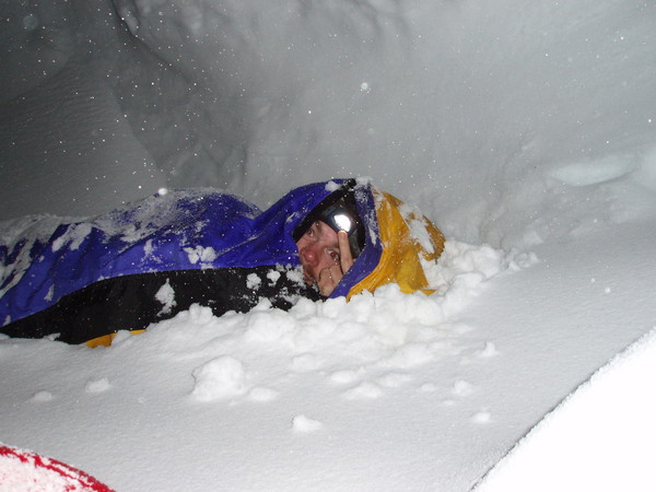
Because new snow was accumulating quickly we decided to reverse our steps. FYI: there were already 15cm of fresh snow and it certainly kept snowing all night. We left the lake at 2:30AM.
Returning up there as soon as possible and giving this Dragon the lesson he deserves is now a commitment.
.
-
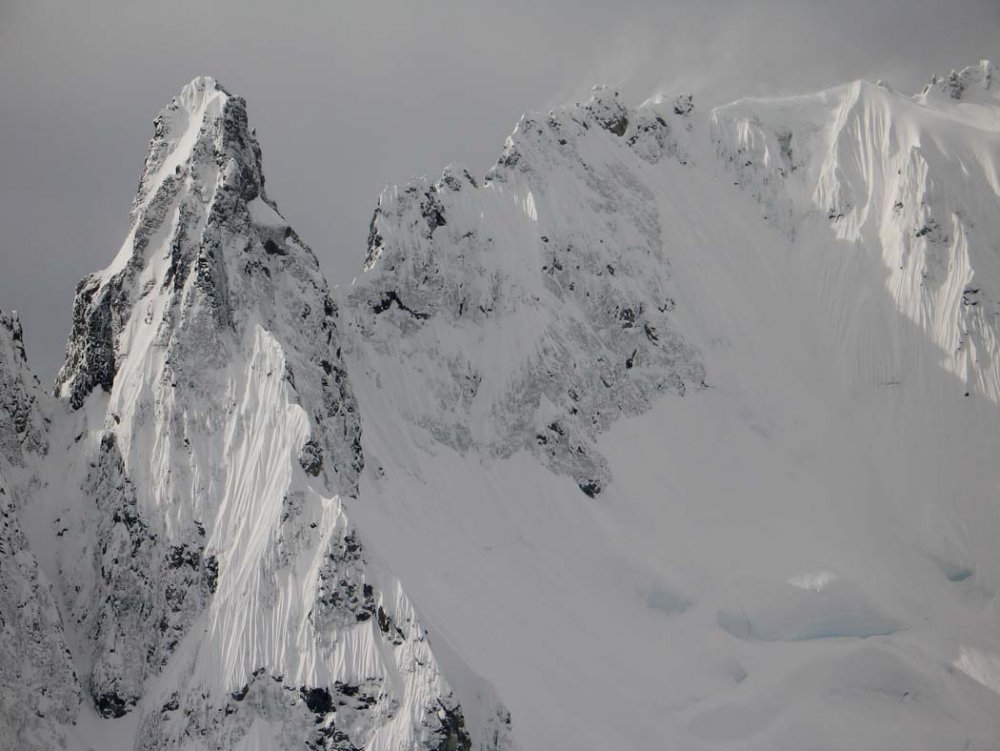
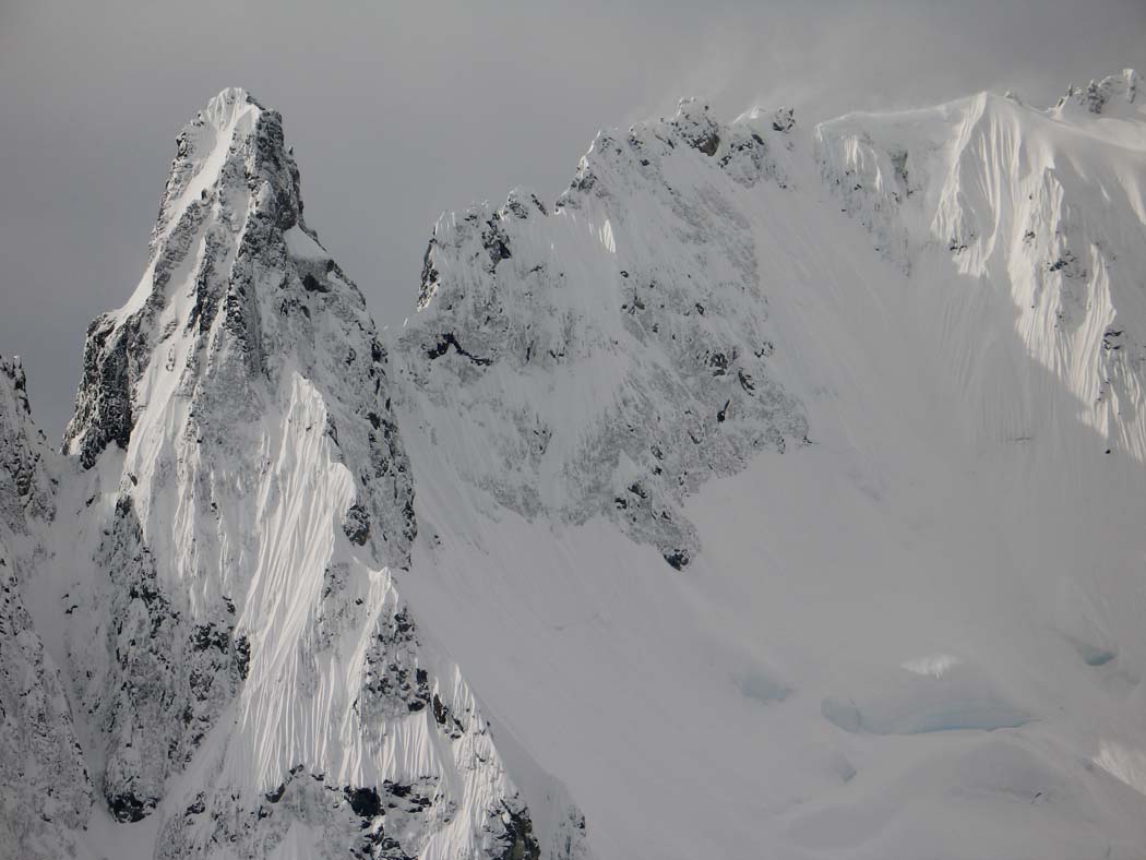
Conditions up there were superb at the steep parts (>50deg) not facing the sun. Instead the south slopes looked quite unstable and that is why we turned back from climbing the Shuksan summit pyramid (South face). The Hourglass was formed really nicely. I am sorry I do not have a photo handy. It had two sections of greenish ice and a snow slope in the middle. Large cornices at the top right but a safer and easier exit to the top left. It looked like a WI4 to me.
I would be keen on hiking up there light (one 60m rope, 6-8 ice screews, 1 snow-picket, bivy gear) on Saturday and climbing it early on Sunday morning, then return staight to the car. The Winnies Slide was very safe last Sunday - soft snow though - that means going up from the car to the base of the climb would be an effort of at least 5-6 hours. I am happy to do the steps ;o)
Call 2-zero-6-seven-six-6-zero-913
-
.
Yeah man, nice photos!
Here are some more that feature you:
http://picasaweb.google.com/Doribex/Shuksan
When the weather turns better again I would
like to go up there and climb something more
technical - perhaps one of these awesome lines
we kept staring at.
.
-
.
Thank you gentlemen.
As advised I will go and ask Jim Nelson because in the Selected Climbs as well as in McLane's book it seems that in February 1983 the four climbers did the Beckey-Schmidtke route (something that does not seem to fit with the description above). Perhaps they followed the couloir higher and near the notch they traversed right to the prominent couloir that joints the Beckey-Schmidtke route.
-
.
From AAJ 1984, p161:
"Nooksack Tower, Winter Ascent. Well, “the Devil had fallen,” but not the Demon. Nooksack Tower awaited a winter ascent. Dan Cauthom and Bob Crawford had attempted it the previous winter. Seven stormy days inside their tent was the reward. However, their ordeal was not over when they got down. A rather large bill awaited them for services rendered, or not rendered. It depends on your point of view. Personally, we feel that winter climbing in the Cascades is justified, and we resent persons in the Bellingham Mountain Rescue Unit who advised the sherrif’s department that it is not. In early February 1983 it Lewis, Tim Wilson and we two set out to give it a try. The approach went well, and in two days we reached 6500 feet across from the Tower. From our camp, Nooksack Tower plastered in winter snow looked very impressive indeed. What was it that Fred Beckey said ? “Mammoth rock tower, one of the most difficult summits.” We retired to the tent to talk about which route to try, deciding on the easiest one possible, up the gully. At five A.M. we set off across the glacier with the weather looking good for at least one more day. We reached the base of the tower shortly after daybreak. The gully was straightforward and by eleven A.M. we were standing in the sun eating lunch at the base of the tower’s east ridge. Two pitches of steep rock climbing (difficult to protect) were the crux of the climb. Above, another snow gully led to the summit with one final rock pitch. On top, in the sun once again, there was just enough room for the four of us. A spectacular place to spend the night, complete with views of the northern lights. In the morning we watched little wisps of clouds forming around the higher peaks. The high-pressure system was breaking down, but it had lasted long enough to give us some memorable experiences. GREG COLLUM and JIM NELSON."
Is this a description of a winter ascent of the Beckey-Schmidtke route as reported in McLane's guide book? It must be. Then, please help me understand where exactly on-route were these four climbers "standing in the sun" at 11am? Where is the "base of the tower's east ridge" if not at the top of the couloir (notch)? I was looking for some information on winter ascents and now I am more confused than before...
Also see, AAJ 1947, p.436:
"Nooksack Tower: First Ascent. Nooksack Tower (8500 ft.) is a very prominent upthrust on the E. ridge of Mt. Shuksan, somewhat, resembling in position the Aig. Noire de Peteret on Mont Blanc. The climb has repulsed attempts since 1939. On 5 July 1946 Fred Beckey and Clifford Schmidtke left camp (3OCO ft.) on the N. fork of the Nooksack River and by a previously reconnoitered route reached the bergschrund at the foot of the final N. face (6500 ft.) at 10.30 A.M. Scbmidtke worked over the bergschrund, and Beckey kicked steps 800 ft. up a 50” ice couloir on the N. face. Snow conditions were dangerous, and occasional rock falls harassed the party. The climbers then worked westward into a hidden rock trough and donned tennis shoes. The final 1200 ft. involved fourth-class climbing along the north arete. Care and continual belaying were necessary. One safety piton was used. The pair reached the summit at 3.30 P.M. and then had an uneventful descent, rappelling from pitons placed in the rock wall at the flank of the couloir. They reached camp in the valley at 10 P.M. F.B."
and AAJ 1982, p153:
"Nooksack Tower, Northeast Couloir and East Ridge. On May 30Chuck
Gerson and I made this climb in one long day (18 hours) from our camp on the ridge above Price Lake (5800 feet). Our route continued up the ice ribbon where the main couloir narrows down, and the original route traverses right. We had one good pitch of ice before the angle eased off and then it was snow the rest of the way to the notch. From the notch there were probably eight pitches on rock. The rock was quite reasonable except for one pitch on the south face. The descent found us rappeling down fantastic ice gullies on the 1946 route. Here was the ice we had hoped to find on our route. About 10 rappels put us back in the main couloir, which we climbed down by head-lamp. (IV 5.7.) JIM NELSON."
-
Hi folks,
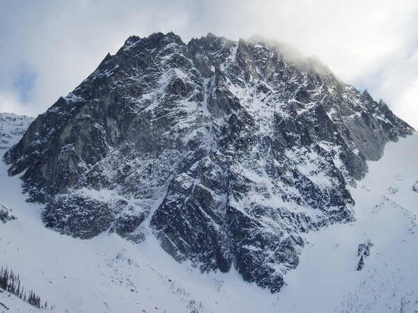
Has anybody here in the forum climbed the Hourglass ice route? I was up there yesterday with a friend (Aaron Zabriskie) descending from Shuksan and we saw this sweet route of green ice. What is the rating of this route? To me it looked equivalent to a good WI4 (80m/snow-slope/50m) with plenty of exposure to big cornices at the top and right. In March or April it would be a nice early morning speed climb. Anybody interested in climbing it this season?
.
-
Folks,
The forecast for the weekend looks very promising.
Anybody interested in climbing a mountain this weekend ?
If it is cold enough I would like trying Index NF (requires low temperatures)
otherwise we can go for something less commiting like Shuksan NF
or even to get some altitude up on Baker or even Rainier.
PM me or call Panos at: 2-zero-six-76-six-091-three.
-
Remember I am in for that too

-
There are experienced friends who would happily take me to break trail after I have learned how to ski down in one piece.
-
Wise advice.
-
First of all I tried to make clear that I have another set up for the ski areas. Also, do not be fooled Al_Pine, the UW climbing club is sending us notifications about the occasional events. After all I am a member with them.
Mainly, I wanted to know whether the geometry (size and shape) and design of the Tacoras or Kailas are suitable for my backcounry needs as a progressing intermediate.
-
I am 6'1'' tall, weight 178 pounds, intermediate progressing skier and I am looking to get a pair of skis solely for the backcountry.
What about the Atomic Kailas (185cm) with randonee dynafit bindings?
Another pair of skis somebody has suggested to me are the Atomic Tacora (more slim though):
Atomic TacoraSidecut: 119:80:105
Lengths: 163,172,181,190
MSRP: $490
Closeout: $249.95
Any other inexpensive suggestions ?
Thanks
-
No longer the biggest fish in the tele pond, the Atomic Teledaddy - taken from the alpine mold of the Atomic Sugardaddy - is one great floatation device. Reworked with a softer (more telemark-friendly) flex, and the addition of the 153cm model, the TD is one of the best all around super-fat skis. Other new additions to the TD are a reinforcement in the binding mount area to deter from screws ripping, and a hot new cosmetic. This ski is a fantastic charger at anywhere from short to long radius turns, and the addition of a new fiberglass weave over the core helps to soften the ski longitudinally.
Ideal usage: The Teledaddy was built for the steep and deep, but it's beta-styled edge grip will will allow the skier to perform at a high level all over the mountain. Whether digging powder trenches , blasting through crud, mank and windpack, or ripping groomers - the Atomic Teledaddy is an extremely versatile all mountain fat ski which caters to those upper end abilities.
Liberty Ridge - Access and Descent
in Mount Rainier NP
Posted
Thanks for the informative links, guys.
As one would imagine the crevasses are not
open wide. Of course there are always great
dangers on this route.