


PaulO
-
Posts
134 -
Joined
-
Last visited
Content Type
Profiles
Forums
Events
Posts posted by PaulO
-
-
-
Co-worker reports a friend at the scene texts the news is not good.
-
-
JD. Nice job on a late summit!
-
Hopefully you got the headlamp back...was that you who asked me if I had found one?
-
Did go, left T-line @ 2:30am. Snow was perfect, almost got to hogsback without crampons. Old Chute was firm with (in places) a lot of loose stuff from the rime falling off and the folks kicking things down but not too bad. The approach to the other way to top out and miss the narrow ridge looked sketchy so I went on up the old chute to the ridge. It was fine. A short 6 - 8 foot section a bit narrower but certainly still wide enough. I go a few pictures of it on FB.
-
Going up tonight solo and taking Karl's advice. Old chute to the bypass (fairly easy chute past the ridge)and miss the worst of both

might look at the ridge on the way down.
-
Used to wallow up the trail in the powder over our heads when I was younger but never saw anyone ice climbing up there.
-
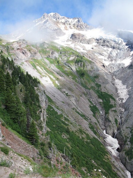
Under 'scenic' pic's...
-
Cold, bad wind chill...
Saturday: Sunny, with a high near 32. West wind between 11 and 20 mph, with gusts as high as 29 mph.
Saturday Night: Partly cloudy, with a low around 20. West wind around 11 mph.
Sunday: Mostly sunny, with a high near 34. West wind around 8 mph.
Sunday Night: Partly cloudy, with a low around 22.
-
No idea but there sure was purdy colors in Jeff Park area a week ago
-
Yokum 9/6 near end of hiking trail

-
-
-
Prepare for cold and snow. May want to reschedule? Weather system 8K snow level predicted by Saturday am.
-
Awesome job

-
If you stay on the main route there is a nice trail up to maybe 8000 feet after that you will be on the snow / glacier off and on. I take an ax as there is some glacier travel and, depending on where you cross, often small crevasses. If there is much snow/ice left on the short steeper stretch on the upper ridge I have wished I had my crampons there. It is not a technical climb, a notch above walking up the South Sister... just be careful and have fun!
-
Sorry I don't have any report but I am interested in what you find as I am planning a trip that way in 2 or 3 weeks. Please post. This is one summit I have hit about every year since the early 70's. Last year I was shocked by the huge amount of snow gone from the upper mountain which eliminated a lot of the easy trek up to the ridge. Still not that difficult.
-
Especially not with 15K freszing level....
-
When I went up mid May I too was shocked by the sheer number of guys who just whipped it out in broad daylight to take a piss right in the midst of all of the fellow climbers. No etiquette required any longer. Any idiot can be amongst the horde. It was just plain gross.
-
McKenzie Pass Highway Opens June 30
BEND -- The McKenzie Pass Highway (OR 242) will officially open to all traffic at noon on Wednesday, June 30. The highway has been closed due to winter snows.
Motorists driving on this curvy road need to be aware of bicyclists and pedestrians on the roadway and take proper precautions. Vehicles longer than 35 feet are prohibited from using the highway.
.The first route over the McKenzie Pass, known as Craig's McKenzie Salt Springs/Deschutes Wagon Road, was completed in 1872. This toll road connected the Willamette Valley with Camp Polk, near what is now Sisters. The charge was $2 for a wagon drawn by two horses, $2.50 for a wagon with four horses, $1 for a man on a horse and 10 cents each for loose cattle and horses.
Modern construction techniques allowed crews to rebuild the road in the 1920s. At that time, the McKenzie Pass Highway was built and the former wagon route was abandoned, except in places where the new highway followed the same path.
In 1936 the Clear Lake-Belknap Springs section of OR 126 was completed, giving motorists a new, straighter, year-round alternative for travel between the Willamette Valley and Central Oregon.
The McKenzie Pass Highway became a seasonal scenic highway in 1962 with the completion of the Clear Lake-Belknap Springs section of OR 126. Even during its tenure as the main route between the southern Willamette Valley and Central Oregon, the narrow, twisting roadway and high elevation (5,325 feet) made the highway too difficult to maintain and keep clear during the winter months.
##ODOT##
-
Thank you. Change looks doubtful. Darn global warming anyways

-
Great Adventure. I've been up there in some nasty weather a few times over the years but never ended up on the wrong mountain (yet)
Mitochondria100, Jim or whomever else has been in the area lately: My wife and I and whatever of the kids are not working then have had a 6 day trip to the Chamber Lakes area from Pole Cr. scheduled for the week of the 4th of July. Looking at Mito's great pictures it looks like there is still pretty solid snowpack there and with no real hot weather forecast to melt it out much in the next week I am starting to think we may want to change plans. How much snow is still on the trail? Any idea how much is around the lakes and if it looked like there were melted out areas? Creeks along the way accessable for water I suppose? Is the South Ridge of the Middle Sister melted out? Thanks for any info!!!
-
One of my favorite areas. Could be an FA on the route?

Obsidian Limited Entry Area / Middle Sister
in Oregon Cascades
Posted
I see McKenzie Pass opened Monday. Has anyone been on the trail in to the Obsidian Area and/or up the west side of the Middle Sister recently? Curious how deep the snow is on the trail,campsite availability at the meadow, etc. I want to take my grandson and friends in before permits expire. Thx!