


spotly
-
Posts
867 -
Joined
-
Last visited
Content Type
Profiles
Forums
Events
Everything posted by spotly
-
Same here. My friend CARL tends to "coil" his rope in much the same way. I'm always the fool to do the first rap
-
Anyone been up through the Pearly Gates in the last few days? How's the route? How about the snow conditions on the old crater variation? Thanks.
-
As a seller of climbing goods, they suck. For some of my other outdoor needs, they used to be great! They get worse every year. I haven't. And as they get worse each year I reflect on the reasons why and this one comes to the forefront.
-
"Photo of the year"....not "Photo of yesteryear"
-
[TR] Bugaboos - WR Pigeon, NE Ridge Bugaboo 8/15/2010
spotly replied to Lisa_D's topic in British Columbia/Canada
I was just going through my Bugaboo guide the other day so this is good timing for some motivation. I'm not a fan of steep snow either and that col has been the one thing that's kept me at a distance. A friend of mine who has been up it many times wants to do the Kain Route with me next year. He promised not to tell anyone about me wimpering my way up and down the snow as long as I don't let it out if he cries loudly on the rock..lol. Nicely written TR and great pictures. By the way, the pictures for your Stuart North Ridge climb aren't showing up any more! -
The bear picture is genuine. I went up today to see for myself and sure enough. Right next to the ski slope too. When I got back to Mead I found this in my dog house but couldn't find the new pup anywhere.
-
[TR] Dragontail Peak - Serpentine Arete 10/3/2010
spotly replied to bgratias's topic in Alpine Lakes
Very nice. What's the snow like getting to the first pitch this time of year? -
Heal quickly. I'm looking forward to seeing all of those new TRs and pictures you take once you're over this glitch.
-
Maybe a rodent ran off with them? I dropped a leather shoe (with an expensive insert..ugh!) outside the car on a very lonely stretch of road a ways back. It took just a short bit to connect that quiet thunk with my missing shoe but by the time we got back to that exact spot, the shoe was gone. We figured a rodent or coyote ran off with it. Just thinkin out loud.
-
Very rarely and for boiling water/dehydrated meals only.
-
I've read several folks say they change these out every few years or so. I've found that mine last about 3 years before they're so tattered that I start losing confidence in them. Seems like a nice cam but would you consider this a 'con'?
-
Are the slings on these cams basically the same as the light 8mm Mammuts?
-
Keith - best pictures I've seen of the route so far. And just plain nice pictures too! When the snow if off, I'm guessing heading up from the lake rather than traversing over is the better/faster way to go. Were you tempted to snag East Peak while you were there? It's a quick little climb from the notch.
-
Nice work and great description on the approach and route. Probably stiffer than I'll lead but good to know that someone is out there cleaning things up
-
Marshmallows are so easy to pierce. More time in the gym might have prevented this accident.
-
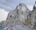
There's a nice slab with crack at marker 99. It's in the windy, burned out section of highway and just a few hundred feet uphill from the pavement. Looks like the crack has been 'used' and is maybe two pitches(?). Anyone here played on it on their way through the area? Wish I would have gotten a pic - sorry.
-
Nice TR and some excellent shots of the route. I recall the gully being some of the funner climbing on the route - 3rd and 4th class forever and ever and ever....
-
X2
-
[TR] Mt. Sir Donald - NW Ridge 8/13/2010
spotly replied to spotly's topic in British Columbia/Canada
Thanks. But to be honest I don't think we gave it the effort we should have. I have dates set already for next year though -
Trip: Mt. Sir Donald (attempt)- NW Ridge Date: 8/13/2010 Trip Report: We went up and gave Mt. Sir Donald a try over the weekend. Through a combination of factors, which we've all four gained some learning from, we didn't make the summit and wound up bailing at the west face rappels. The climbing was solid and sustained and the exposure was awesome. Dave and I made it to the raps in three long pitches of simulclimbing. It was too cold for me to switch to rock shoes but my Exum Ridge Runners did excellent. As much as I hate loose crap, the 4th class ledge scrambling at the bottom of raps didn't seem all that bad. Already have plans to get up there next year and get it done. If the upper section is as fun as the lower, I can see why it's one of the classics. Approach. Ledge to col. Climbing. Not climbing. Afternoon delight. Approach Notes: Tww short snow fingers to cross.
-
Hey Joe, if you go, take a look at the east face on your way down. There were a couple of pretty neat lines there - one slabby and another that followed a nice crack to a ledge then corners and ramps to the top. Looked like you could get maybe 2 or 3 solid pitches out of them.
-
The rock is fantastic and since you don't stress too much about the gear, you'd find the whole thing enjoyable I'm sure. Just don't come back rubbing salt in my wounds by talking all 5.2 and such
-
I've thrown the bivy bag out at the Blue Lake trailhead a few times and with wax earplugs slept fine. The Cutthroat TH is a quieter option though. I've also hauled the bivy sack up when doing a few days climbing.
-
[TR] Mount Stuart - Complete North Ridge 7/26/2010
spotly replied to Peter McCorkell's topic in Alpine Lakes
Gotta love a perfect trip. That's a great shot of the lie-back. -
Trip: Myrtles Turtle - North Face Date: 8/7/2010 Trip Report: On the map, Myrtle's Turtle is the 6482' bump just east of Two Mouth Lakes. The first time I saw it was during a hike several years ago. It's a huge granite dome that dominates the Slide Creek drainage near Bonners Ferry. I rushed home with my large photos and eagerly drew out what appeared to be an obvious route up the face. When the new North Idaho climbing book came out, it listed the same route that I'd been thinking about as a 5.5 with 6 to 7 pitches of slabby goodness on excellent granite. I got even more stoked and was real happy when a few of my friends agreed to give it a shot with me. Last night I thought I'd never think of climbing that thing again but with a few hours of sleep comes some clarity so I thought I'd share what we found on the route. I don't think it gets climbed much so I'll add some beta as best as I can remember. I picked Brian up at 4, Toby at 4:15 then met Pete at Hayden at 5. We took my Tundra (and glad I did) and were soon speeding towards Bonners Ferry. Just before crossing the Kootenai River at the north end of town, we took a left onto Riverside Street, following the narrow paved road for a dozen miles or so until coming to the Kootenai National Wildlife Refuge headquarters. Just past that, the road crossed over Myrtle Creek and in another 1.3 miles we took the dirt road that cut back left and followed it for maybe 12 miles to the Tow Mouth Lakes Trailhead where the North Face of Myrtles Turtle dominated the head of the drainage. We continued past the Two Mouth Lakes Trailhead for roughly another 1.5 miles to road 2409, which is signed for the Harrison Lake trailhead. The directions in the newer North Idaho climbing guide are accurate. We followed road 2409 to the right for a mile to where there was an obvious wide spot on the right. 50 feet further up the road we found what looked like a well-worn path that descended to Myrtle Creek but the avi gully we needed to be in was clearly visible back down the road several hundred yards so we decided not to waste any time with the trail and took a direct bushwhack from the road to the creek at the base of the gully. It was a hundred yards of thick brush hiding boulders and criss-crossed with logs. The last few yards to creek were steep and required vegetable belays. We were soaked but the sky was clear so at least we'd dry out. From the south side of the creek we wandered through a grassy area towards the rocky streambed in the center of the gully. Before long the alder began to thicken so we did a rising traverse through thick brush to the right side of the gully. From there, we stayed next to the tree line all the way up - it was steep and brushy in spots but a far better option than sticking to the stream bed. The tree line eventually gave way to a rocky ridge. Had we paid more attention to the guide book directions, we would have traversed right through the upper section of the trees to the bottom of the NE slabs. Instead, we continued up the ridge a few hundred feet before concluding that the slabs to the west were way to steep to safely cross from so high up. Since the ridge would be our descent route, we decided to gear up there and hang the packs on a dead tree, continuing on with the much lighter summit bags. We descended back to the bottom of the NE slabs and followed them towards the North face. I found the rock more pleasurable than the dirt so stuck to that as the bottom edge of the slabs curved upwards to a ridge. We checked out each gully we came to until eventually finding one that would obviously take us to the base of the Norh Face. The gully was 50 feet of third class. We could see the large apron - it's left edge being the start of the route. I teamed up with Toby and Brian with Pete. Toby and I took off first and tried to follow the route description as best as possible but it didn't take too long to realize how differently people see things. The description only vaguely matched what we were seeing but the natural line was obvious enough to keep me on track and every now and then I'd spy some feature that was mentioned. I kept to the crack forming the left side of the apron, stepping onto the slab to the right to get past the first small roof before getting back into the crack. Pro was sparse but the climbing was easy and before too long I was out of rope so set up an anchor and brought up Toby. As we reracked, I tried to spy a way up the second pitch, there were a series of corners just a few feet left of the apron and I hopped into the first one. This was the crux pitch so I stuck in gear when I could but by the time the rope ran out, I had only been able to place 3 or 4 pieces. Most of the cracks were filled with dirt or flaring to the point of being hopeless. Other than one 15' section, the climbing was very easy though. Toby excavated a few spots for Brian on his way up. At this point, we were expecting a large ledge system to start out the third pitch but all we could see were more corners. These were less vertical and did curve to the right so we assumed they could pass for ledges in someone else's world. And I think the term "large" must have been referring to the system and not to any particular ledge because they were all fairly narrow. Again, pro was sparse but this section was mainly 4th to 5.0 with a few short moves a bit stiffer. I managed to sling a few Junipers and get in a few nuts for these two pitches. As I belayed up Toby, I could see the "U" shaped feature we were looking for roughly 100 feet or so above me. I started up the fifth pitch and ran into a steep slab that had me stumped. I'm sure the large juniper that I eventually used will be traumatized for awhile. I groped my way up its branches then dug in and wrapped it with a sling - best placement of the day. Standing on the trunk of the juniper I was able to reach a ledge above the slab. I needed to work left on the ledge but the rope drag from the juniper was kicking my buttock so I found a small crack to build an anchor then brought Toby up the short section. From the ledge to the "U" in the roof above was very pleasant climbing and pro was abundant. I got in several pieces before the roof then rigged up two sold cams just below the "U", expecting a little runout beyond that. Poking my head over the roof, I could se a huge slab that steepened and ran on for a long ways with no discernable features. It looked very neat and I was excited to bust the move over the roof and get on it. The guide book says to dance up this section but break dancing was what came to mind. It was grippy granite and ran about 5.6 but after 50 feet and still no gear, I was beginning to lose my desire to be there. You know how fear can make your body physically shut down…lock up? That's where I was going a few times. I actually had to tell myself to relax several times to push that aside before continuing. It was only 5.6ish but being so far out and wandering blank granite above that big face was intimidating and exhilarating at the same time. The term "Crowning moment of awesomeness" came to mind.....later and from the safety of an anally bomber anchor. I eventually found a small crack that took my new little black tricam and gave me enough security to step over a steeper section, reaching a crack that took some large gear. Why stop at 3 pieces?! I could have held an elephant with that anchor : I brought up Toby and Brian and Pete who had tied into our rope. Brian started up the last blank section and found a few spots for gear but it too was rather run out. Another 30 feet of 3rd class scrambling and we reached the summit and some more coolness in the form of a soccer field sized rock garden, complete with mini rock tarns (mostly dried up) and rocks that were so out of place at the top of a dome. We ate and organized the gear then headed east to find a descent route. Seeing the gully just right of the east face after the descent, I think we could have easily done one or two raps there for a speedier return to the ridge but we missed that gully somehow and rapped down climbers left of the face instead. The traverse below the east face and back to the packs was fast and easy. We gathered our packs then headed down the slope to the truck. Halfway there, a storm rolled in and soaked us to the bone. It was late by the time we got on the road so we decided to stop at an eatery in downtown Bonners Ferry for some buffalo burgers and a beer. I can't recall the name of the place but I think it started with a "G" and is one block off of highway 95. Excellent burgers! Anyhoo, sorry for the long TR but I wanted to make sure to include enough details in case anyone else wanted to get on this thing. There's no beta on the web and while the guide book is technically correct in its description, it seemed vague enough that I hope the extra details are useful. Also, I'm sure a more confident climber would have thought little about that runout slab but the four of us were in agreement that it was scary enough we wouldn't want to do it again. That said, there is one very thin fissure about 20' up the slab that would probably take a pin if someone were inclined. If so, do us all a favor and leave it there for the next chicken-shit that has to whine his way up it. East Face of Myrtles Turtle. Crossing Myrtle Creek. North Idaho Bushwhacking. Crossing the NE slabs. Looking at The Apron from base of North Face. Below the North Face. First Pitch. Brian and Pete on the second pitch Third Pitch Top of Fourth Pitch - Juniper Anchor Top of Sixth Pitch Pete on the 6th Pitch Pete on the 6th Pitch Brian at the anchor on the 6th pitch Brian heading up the last (7th) pitch Brian heading up the last (7th) pitch Last 30 feet of 3rd class to the summit Big Summit Summit Rock Garden Looking for a descent option Crossing under the east face End of a long bushwhack through soaked alder and a nice rain storm Gear Notes: The 3 larger C3s that I have were very handy. Singles to 2" and some long runners. Approach Notes: 2 hours. No trail - just fun bushwahcking.