


fgw
-
Posts
530 -
Joined
-
Last visited
Content Type
Profiles
Forums
Events
Posts posted by fgw
-
-
JayB - nothing really special insurance-wise. Have the AAC membership that I think comes with some benefits & keep the mazamas membership which also apparently has something...maybe it's time for me to look at that fine print.
-
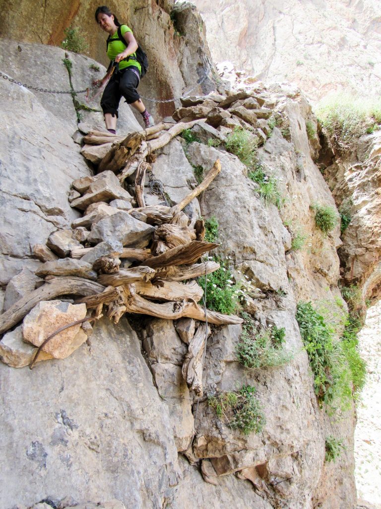
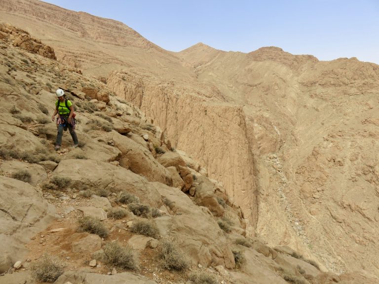
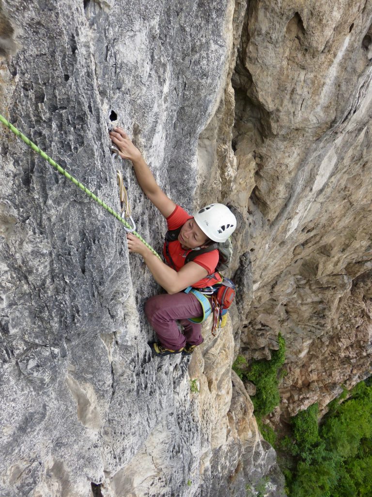
thanks gents. About the Duiwelskloof, never got a photo of the wall Lucifer is on but it's deeper in the canyons than what's shown in approach pics. Most of the multi-pitch trad lines apparently get climbed once/decade nowadays - Rocklands bouldering & sport climbing absorb almost all Cape Town climbers. Only found out about it by stumbling onto Ross's website. Turns out those things (multipitch trad FAs) are published in a S.A. Mountain Club journal - hard copies only. 3-4 hrs in the heat felt like hard approaches but really not that much compared to a good schwack in the cascades.
-
 2
2
-
-
Trip: Morocco, South Africa - multiple
Trip Date: 12/30/2017
Trip Report:Africa Sampler
Got a chance to do two Africa climbing trips this past year: two weeks in Morocco in May and two weeks in South Africa over Christmas. Polar opposites and not just in their location on the continent; the climbing in the two places could not have been any more different: bolted cracks vs. trad protected faces; well-traveled limestone vs. overgrown sandstone; easy approaches vs. steep bushwhacks; lots of climbers vs. none; sweet tea vs. booze.
In Morocco, we checked out Taghia (pretty place but the really stunning lines were too hard for us) and Todra (less dramatic but with more moderates); in South Africa, we stuck to the Western Cape Province. We knew that Morocco had big walls with long climbs but were surprised to find 500 meter tall faces in the Western Cape. Morocco was easily self-organized. South Africa would’ve been as well until I stumbled onto a website describing some long traditional climbs in places I’ve never heard of. Ended up hiring the admin of that site and longtime local climber, Ross, to be our “fixer” – take us to those obscure gems but let us climb them on our own.
Both places represent the easier shade of Africa travel – no coup d'etats, no jihadists. Though a community Facebook page called “Snakes Of South Africa” – where the good folks share their serpent run-ins – had us paranoid to the point of buying “snake gaiters”. People do get bitten and some die every summer in SA, particularly in rural areas. No mambas in Western Cape but almost everything else on the list.
More spray and more photos on our site.South Africa
Some Pics:
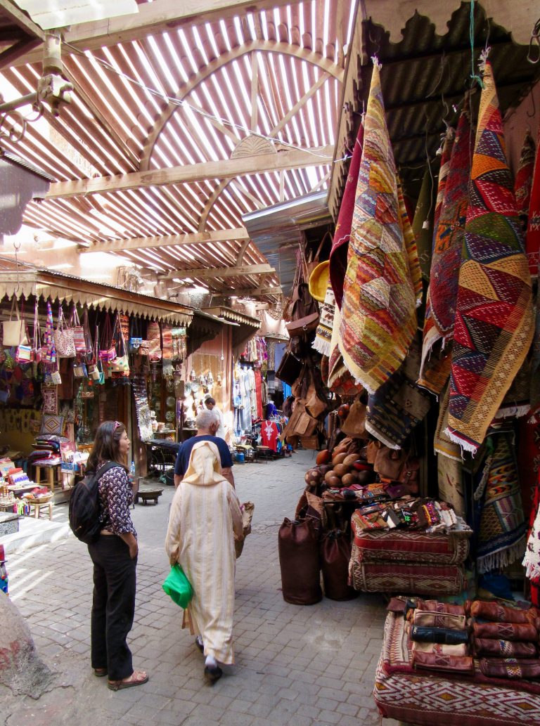
Arriving in Marrakesh: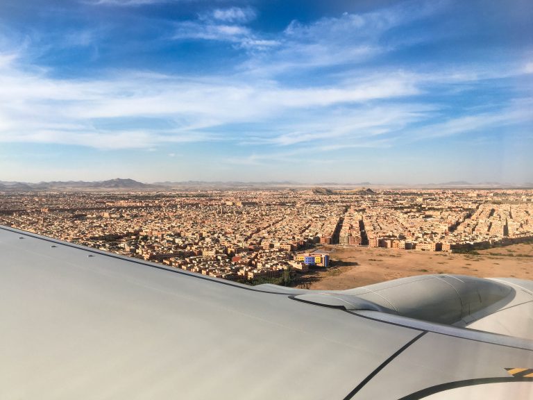
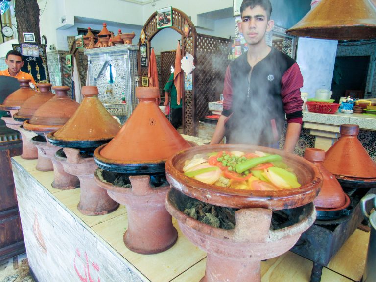
Roadside eatery. Key beta: bring Tabasco sauce (family sized bottle is best).
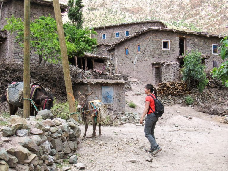
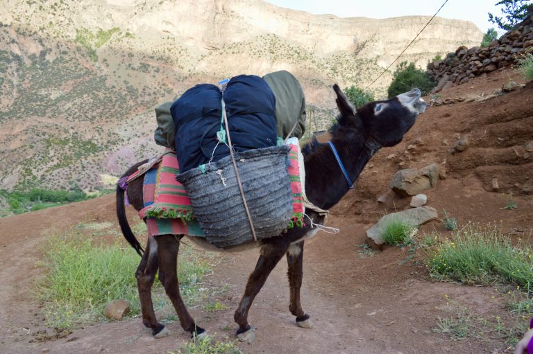
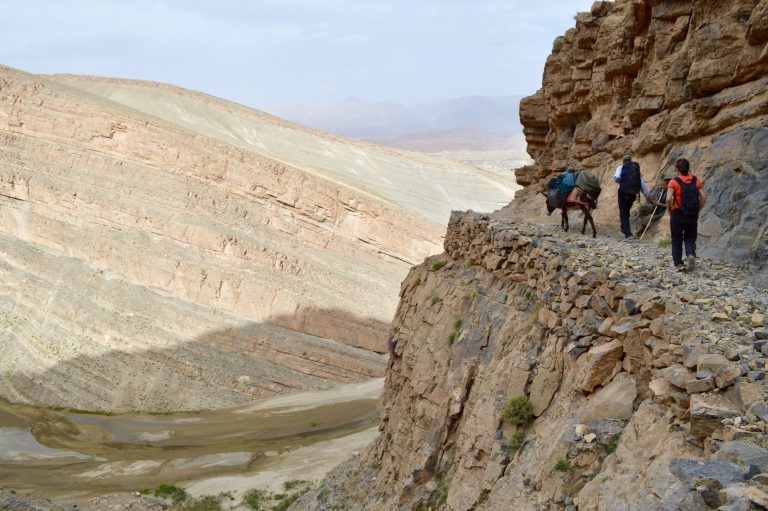
From Marrakesh, you drive 3ish hours into the Atlas Mountains where the road ends in the village of Zaouia Ahansal. From here, you hike 2 hours into the village of Taghia while a donkey carries your gear.
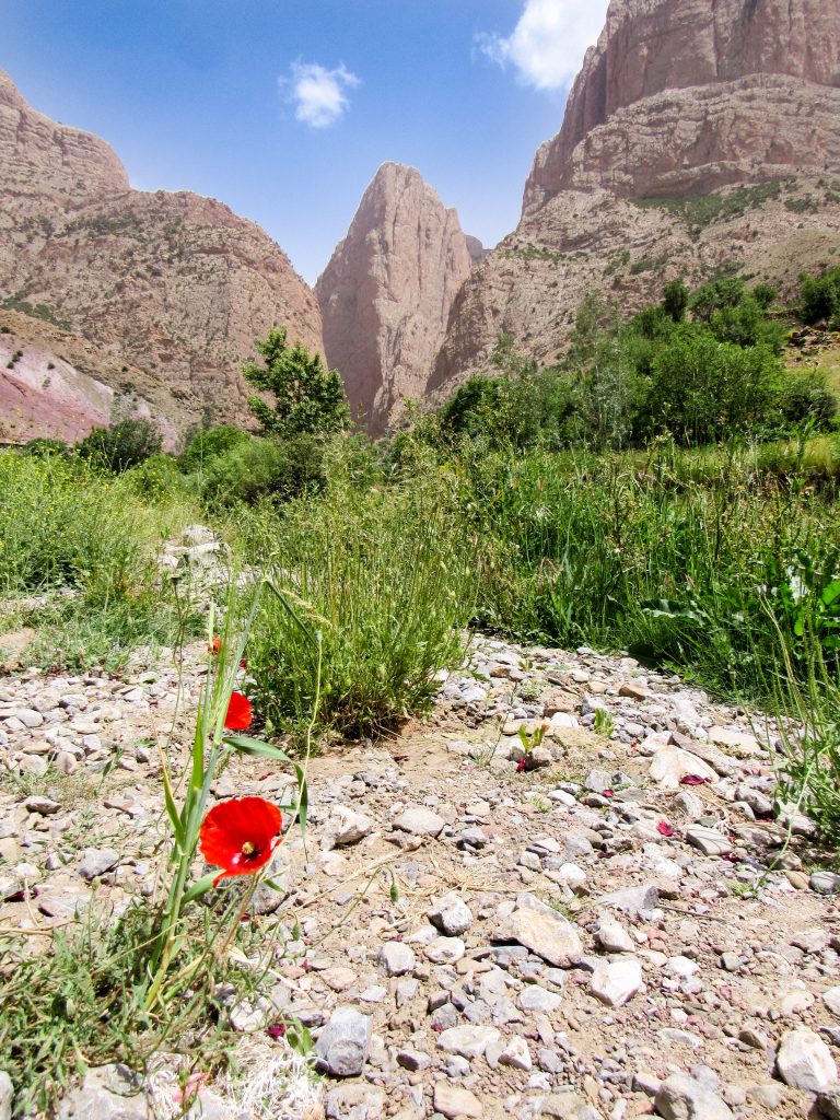
First views of the climbing.
Hiking through Taghia village to the climbing.
Next day we climbed what is probably the easiest route there (6 pitch, 6a+) called La Reve d’Aicha.
Looking up at Paroi des Sources (left) and Taoujdad.
Did the first 4 (of 8) pitches of this l’Allumeur Du Reve Berbere route. Bailed off as it was baking in the sun and already plenty hard for us.
Berber bridges.
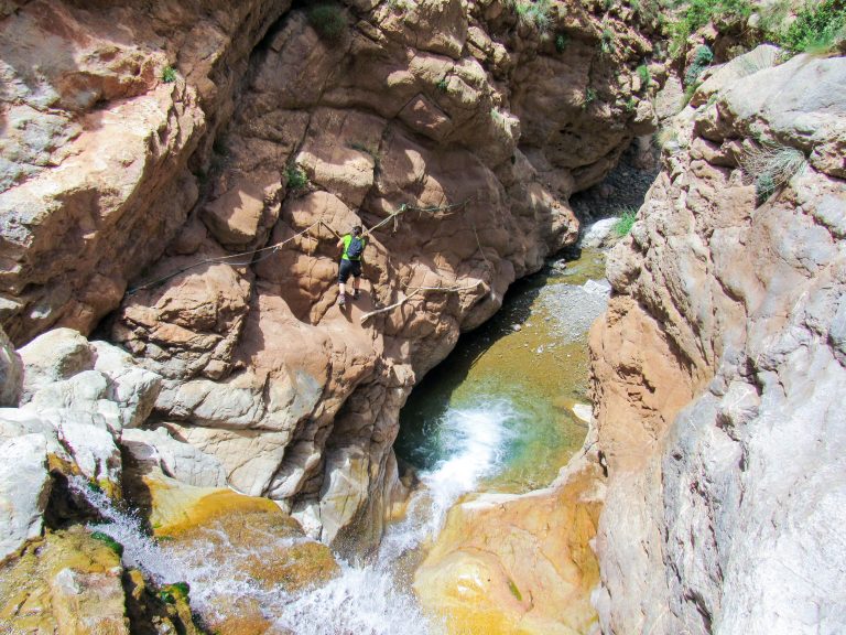
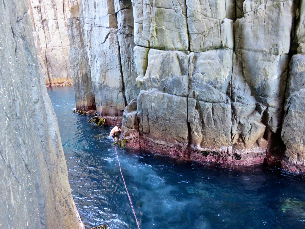
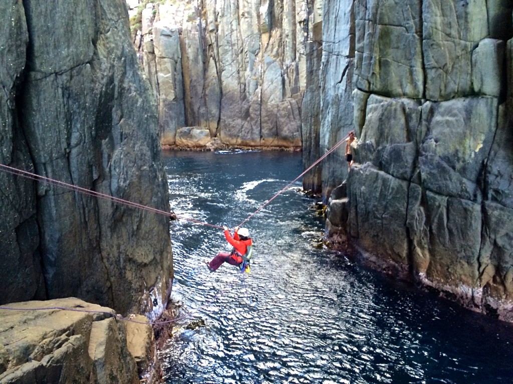
Some light canyoneering on a rest day.
Views of Taoujdad.
An 8 pitch line called El Geonauta on Taoujdad.
Which features some spelunking.
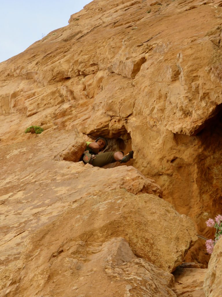
Arriving on the summit of Taoujdad
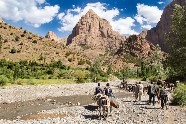
Weren’t super thrilled with climbing in Taghia (hard) and so we decided to relocate to Todra Gorge. Apparently the scenic way to do this is to hike across the Atlas Mountains (35+km or about 12ish hours) which then puts you within a 2hr taxi ride of Todra. This unlucky donkey got to carry our junk on this little hike.
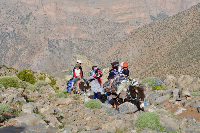
A Berber family doing their own high mountain crossing.
I woke up feeling sick the morning of the hike and so was dragging ass behind the donkey, his owner, and Shirley…have not suffered like that in a while.
Village of Oussikis on the far side of the hike…Alhamdulillah!!
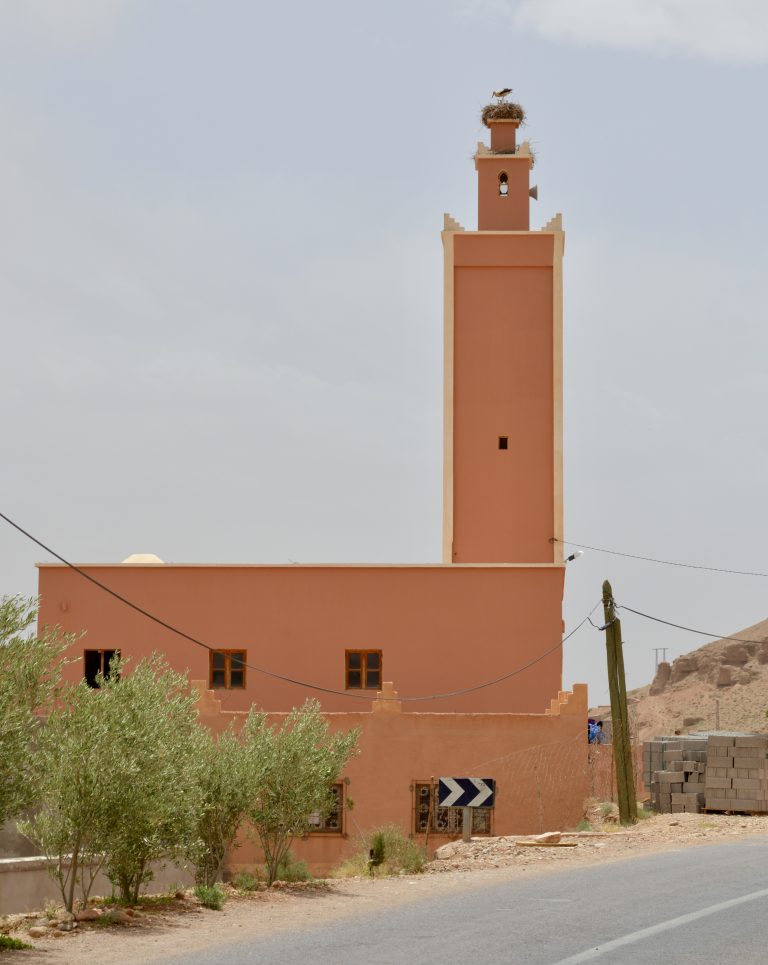
Storks nesting atop a minaret of a mosque was a common sight.
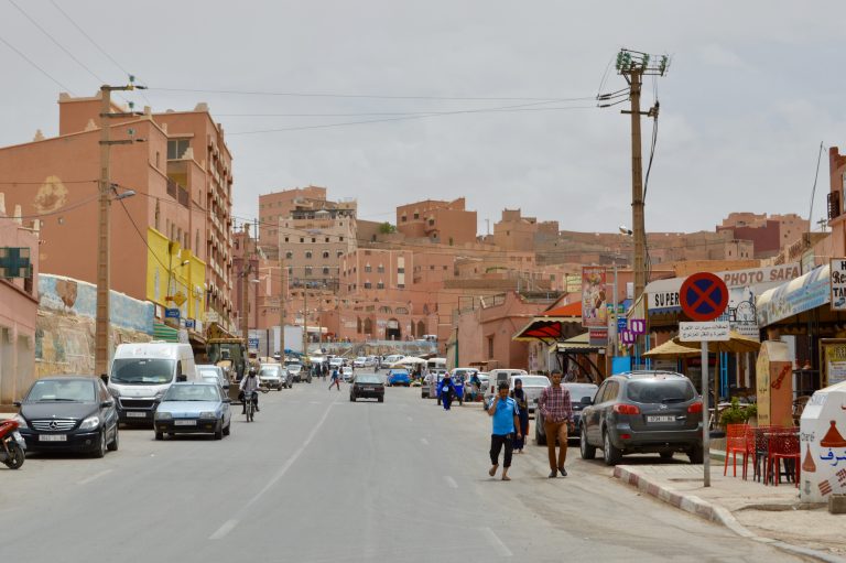
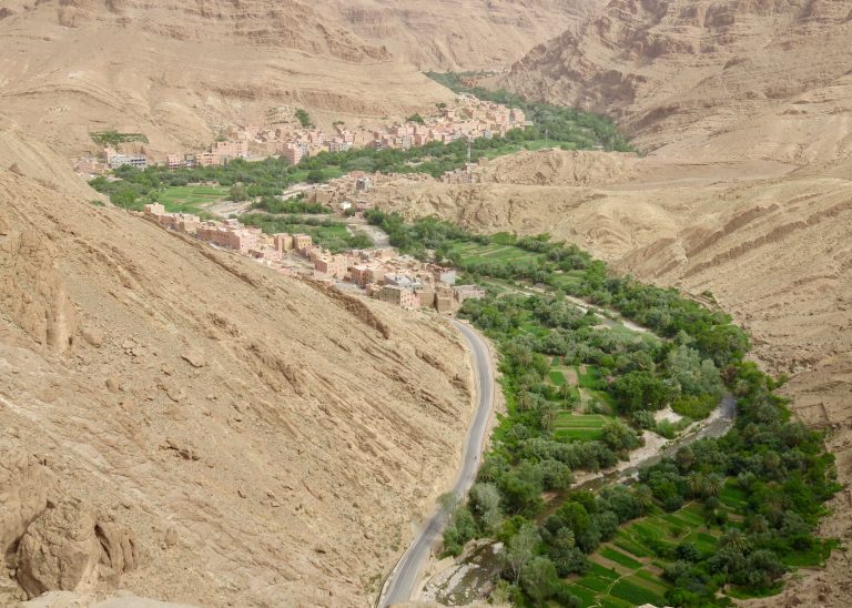
Town of Boumalne on the drive to Todra.
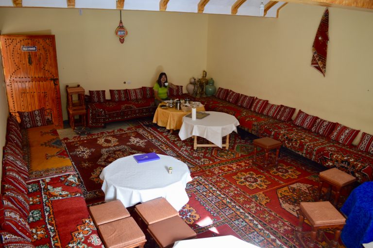
We stayed in a guest house outside the gorge in Todra. The owner’s son is a climber and actively putting up new routes. But we were the only guests.
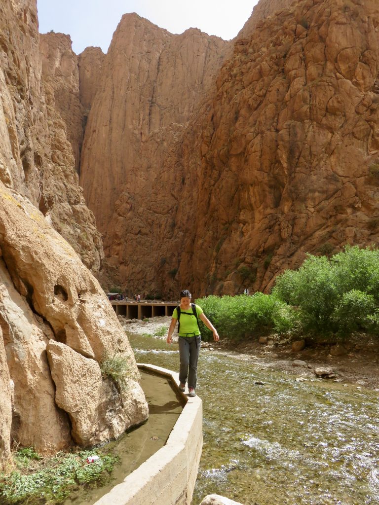
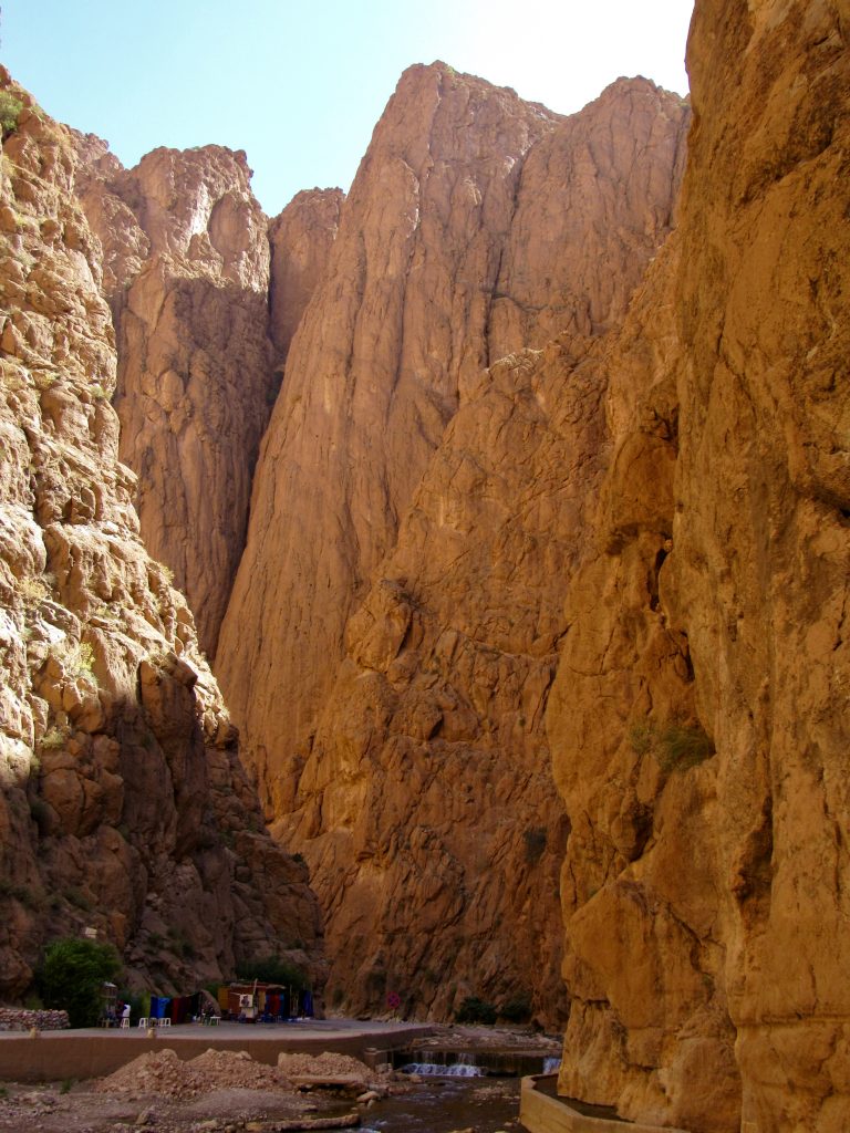
An aqueduct at the mouth of Todra Gorge.
Starting up a route called Tiwira, 6 pitch 6a+.
Some views.
Hiking off.
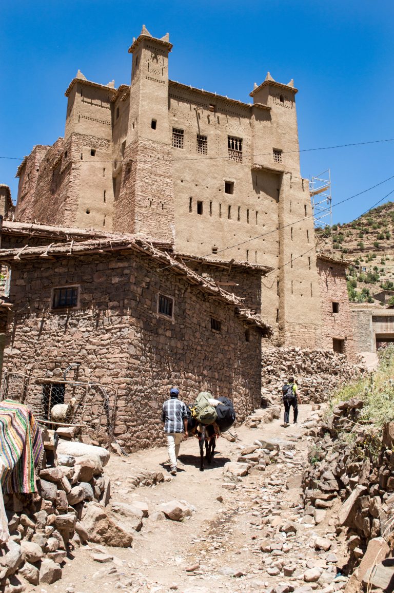
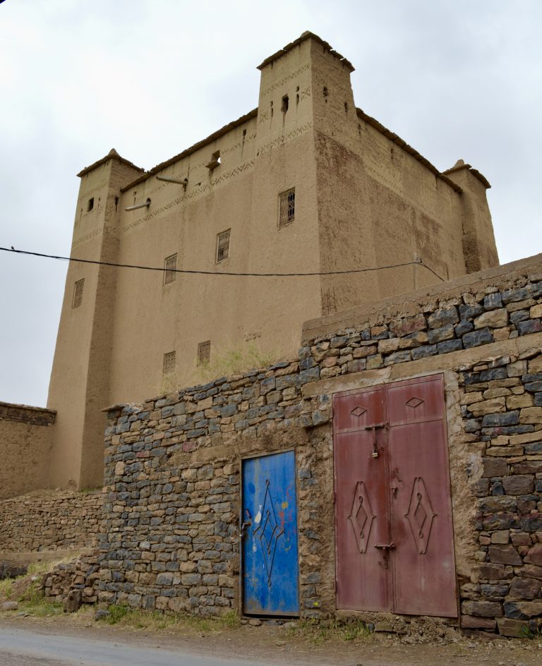
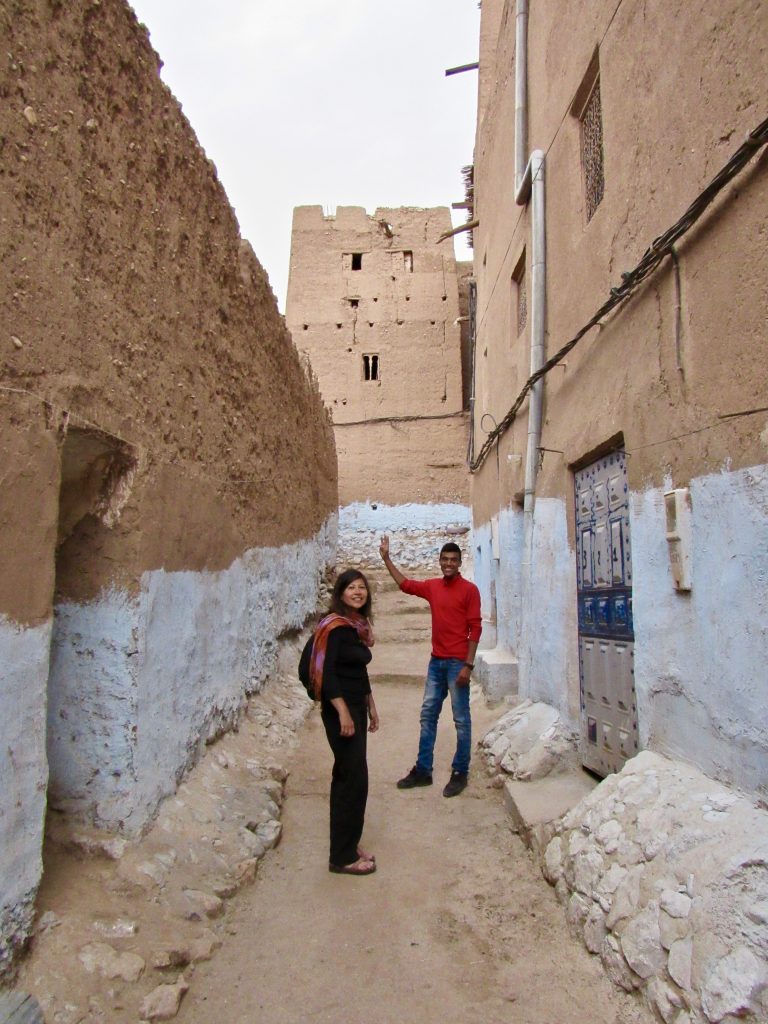
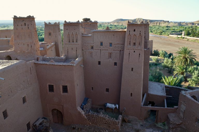
Checking out the local Kasbah.
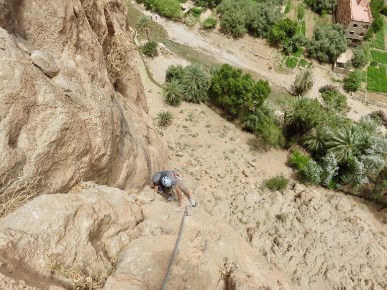
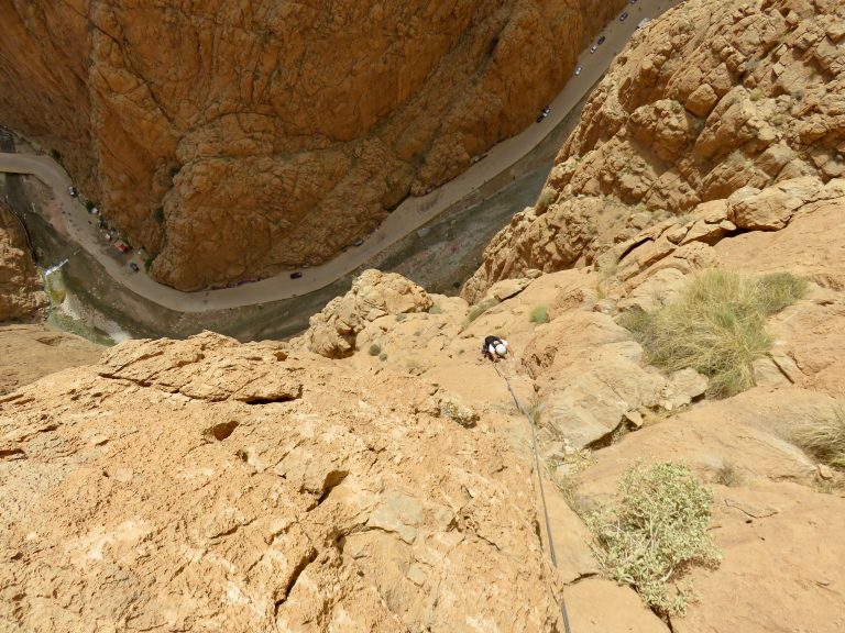
Voie Abert climbs this pillar inside the gorge in about 8 or 10 pitches (6a+).
High on the route.
A large and old Kasbah Ait Benhaddou near the city of Ouarzazate.
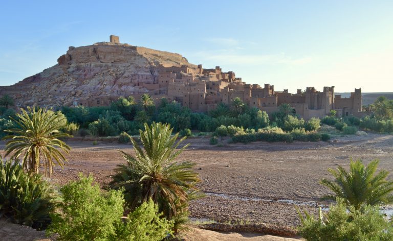
More Kasbah sights.
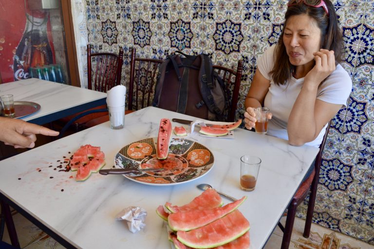
At a roadside café.
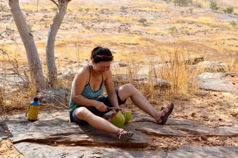
Maybe I cannot onsight Taghia’s 6b+, but I can sure put away watermelon like a mother…
Souk in Marrakesh.
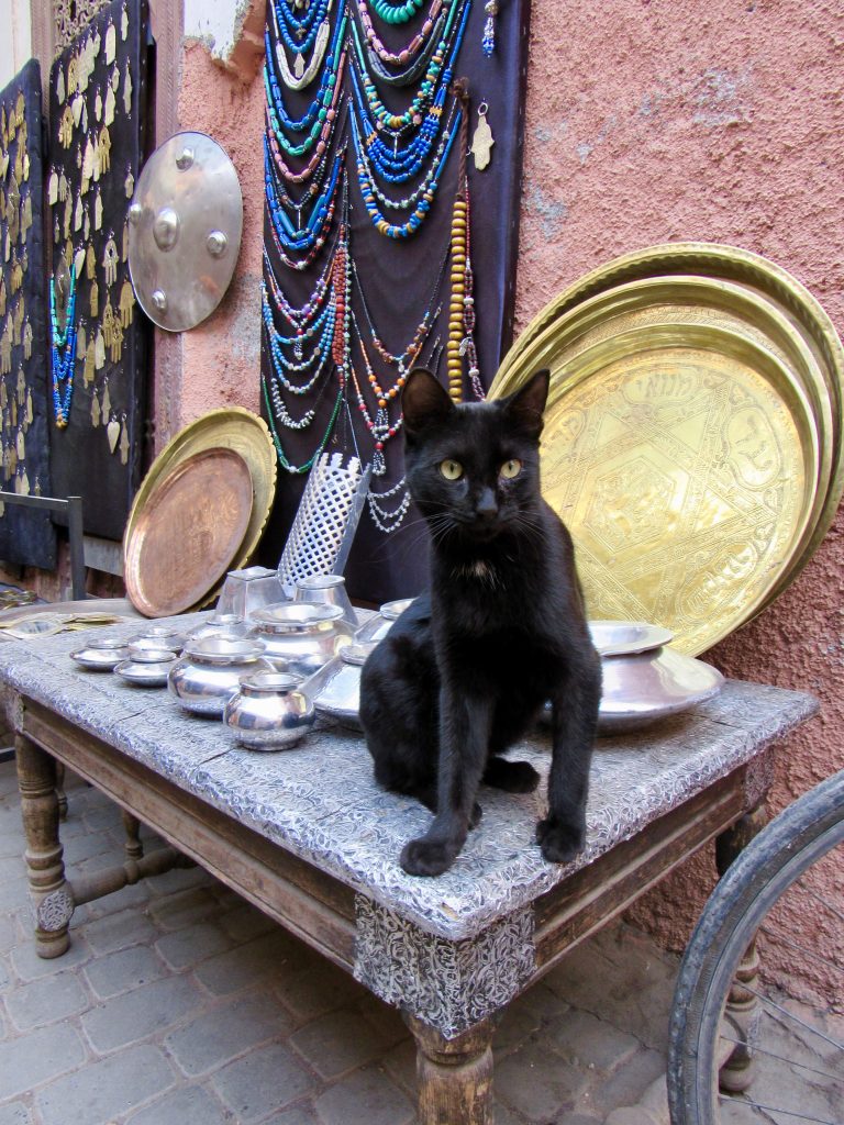
Cat selling gold in the souk.
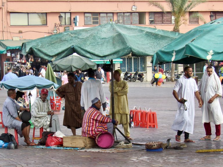
Animal abuse at the Jamaa el Fna square in Marrakesh.
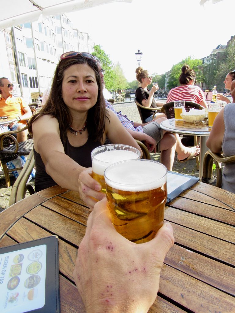
Welcoming alcohol back in our lives during an overnight layover in Amsterdam.
Amsterdam.
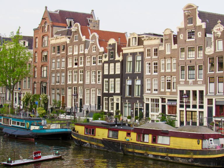
And Amsterdam (man, those black shoes totally clash with the outfit).
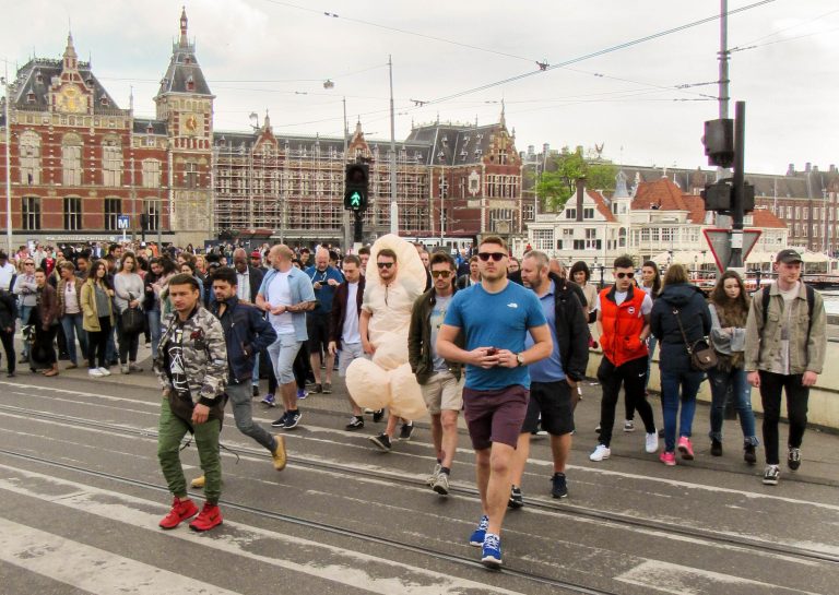
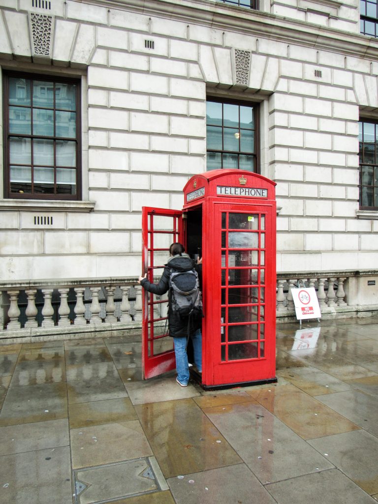
Shirley looking for a toilet during a long layover in London on the way to Cape Town.
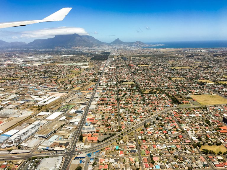
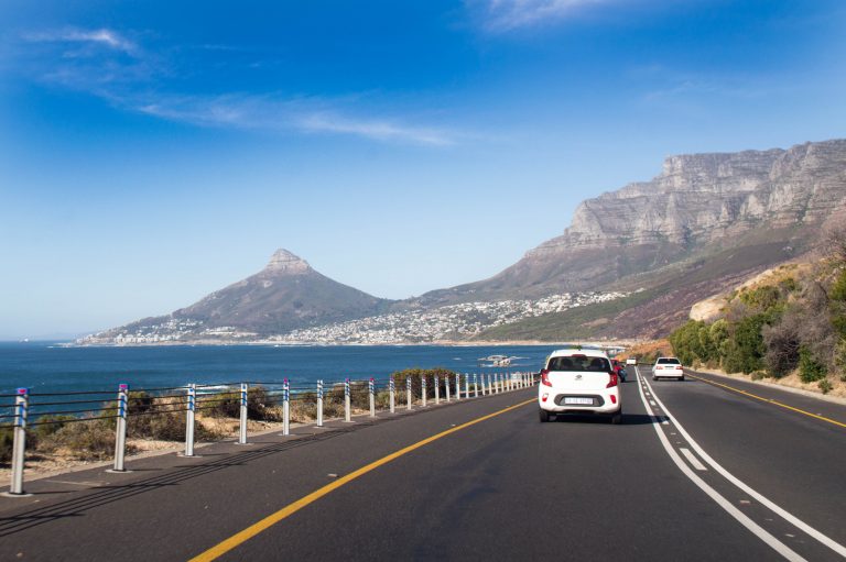
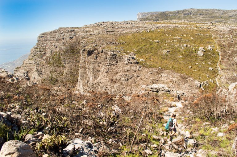
Arriving in Cape Town with Table Mountain in background:
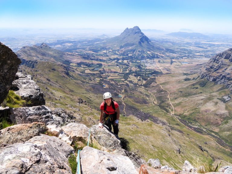
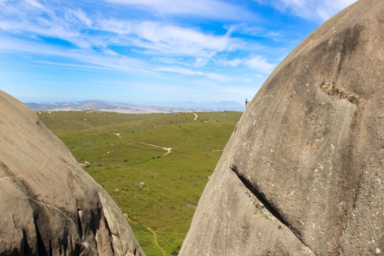
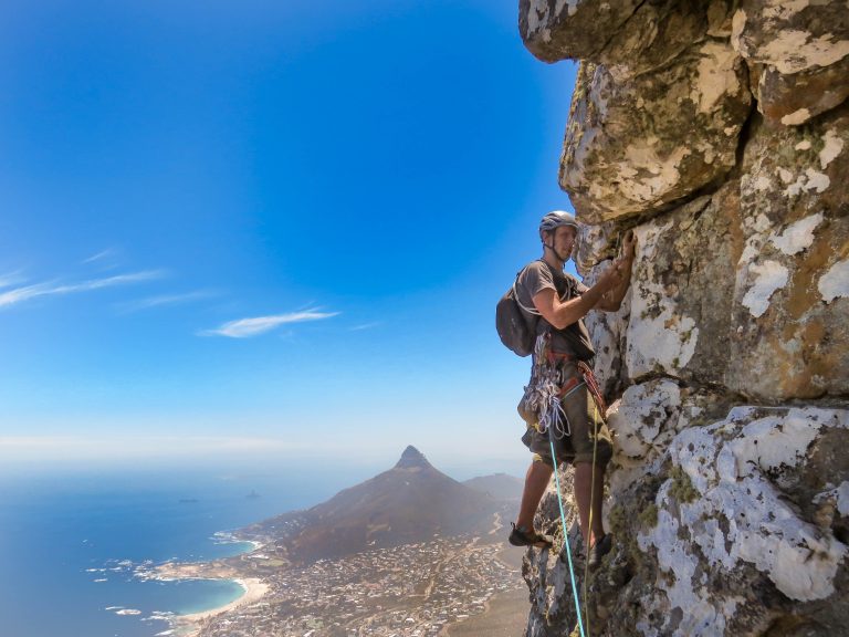
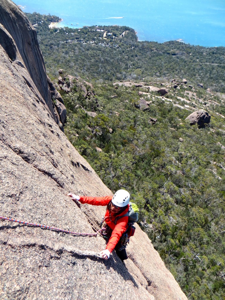
Final portion of a 3h approach to a route called Mooloo Face the following day – prow of the buttress visible at the head of the gully. 20+ pitches per description but easily linked into <10.

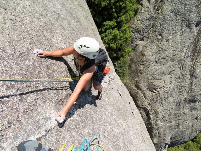
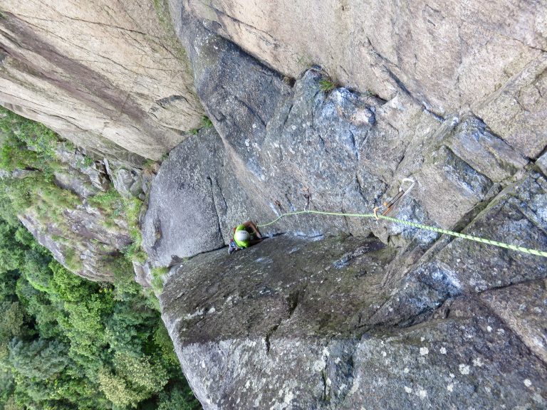
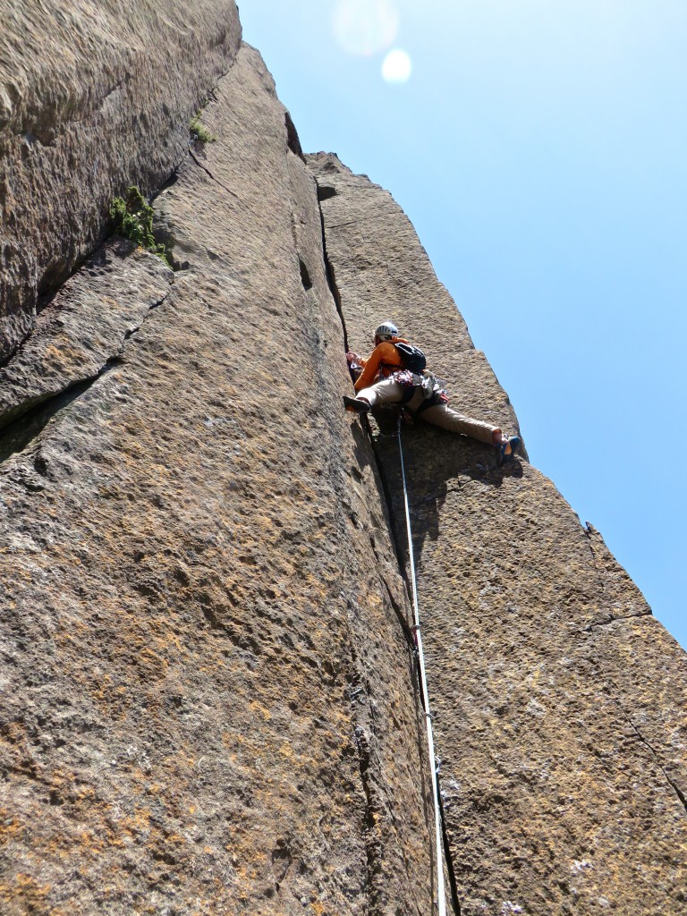
Stretching our 70 meter cords and linking the first handful of pitches. I’m near the top & Shirley is belaying below. Photo by our “fixer” Ross.
Arriving on top.
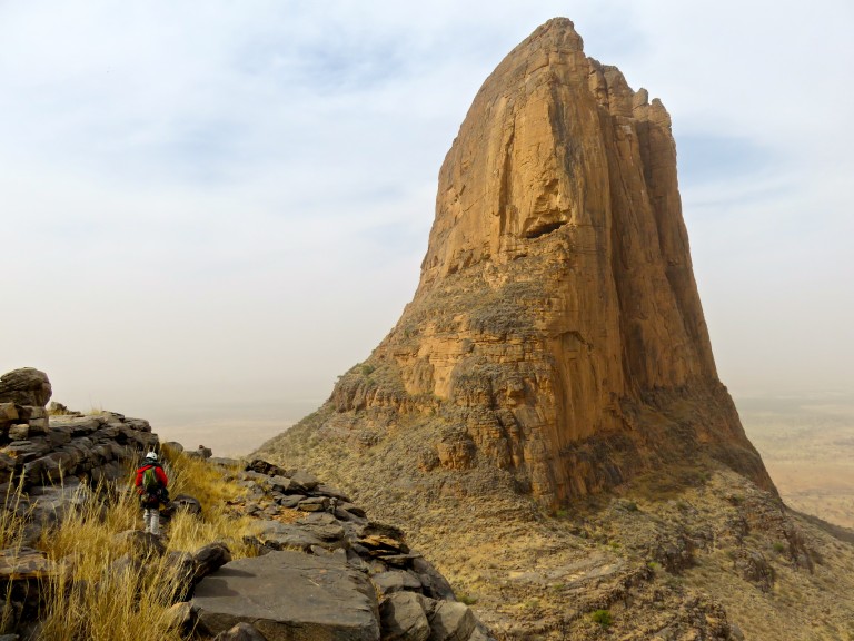
Jonkershoek Twins (home of Mooloo Face).
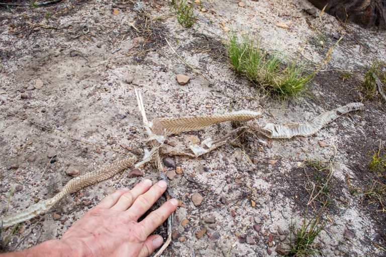
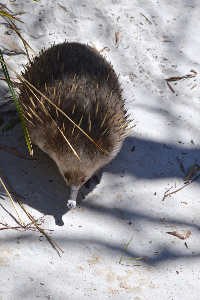
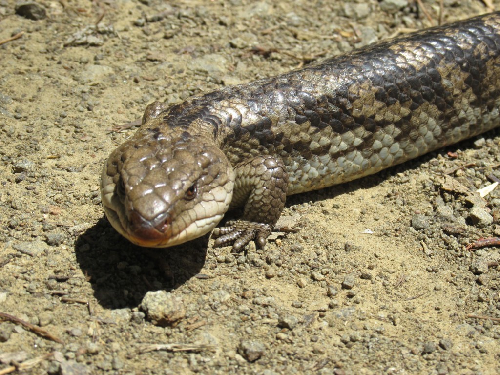
Freshly shed Cape cobra skin seen on approach.
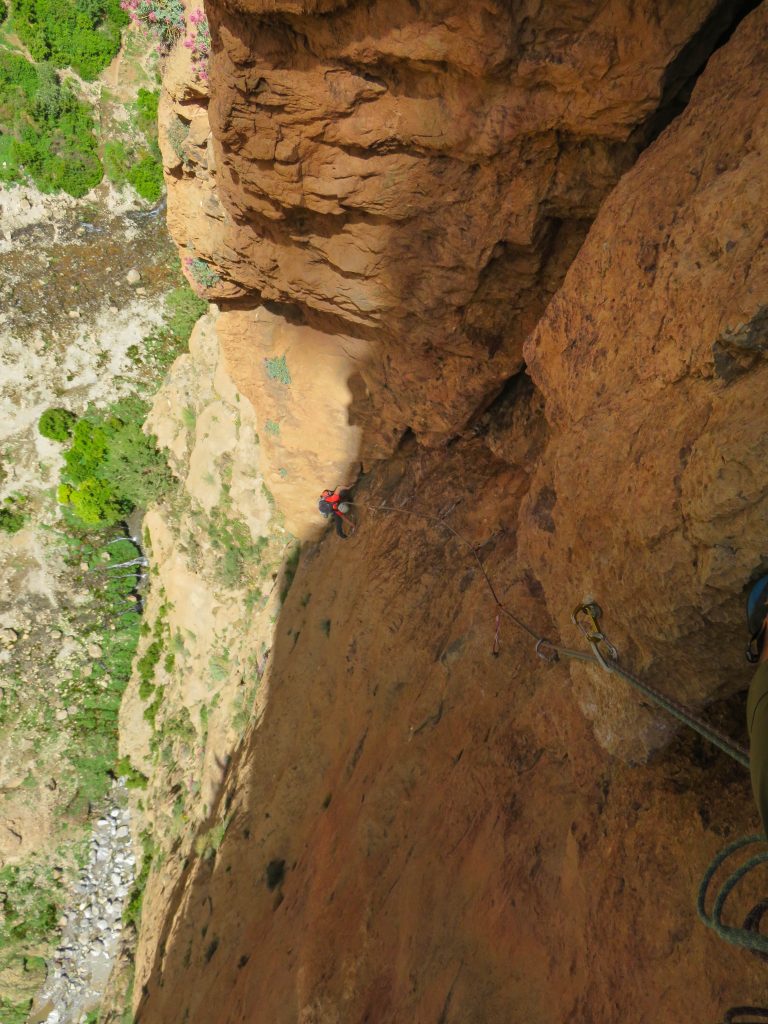
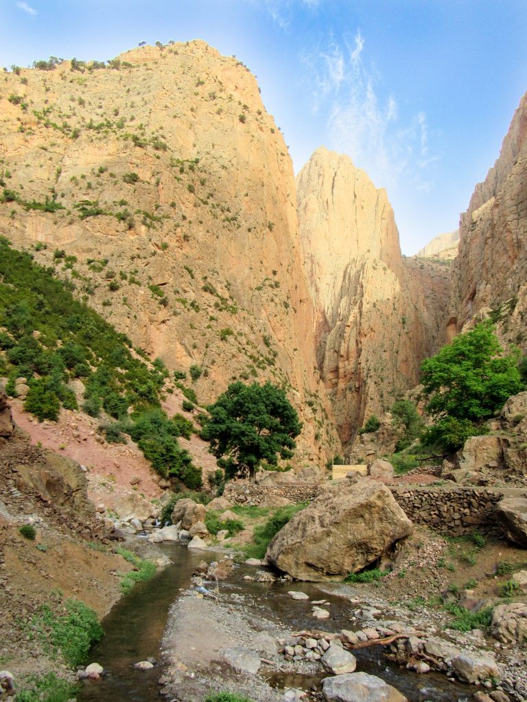
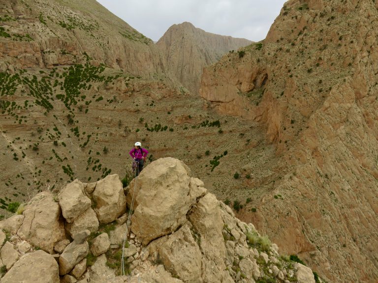
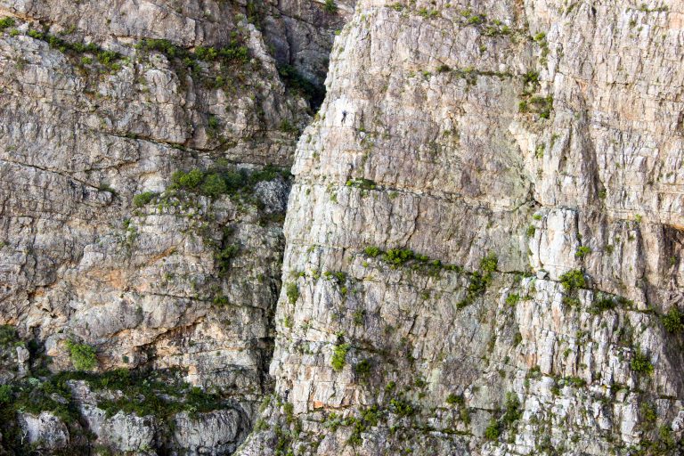
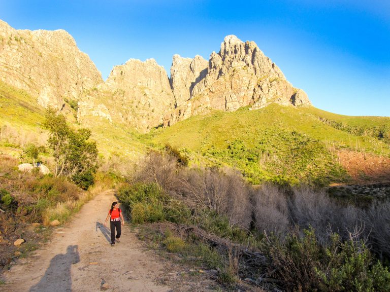
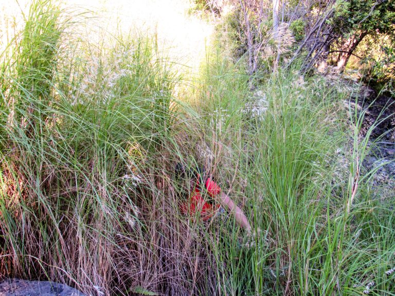
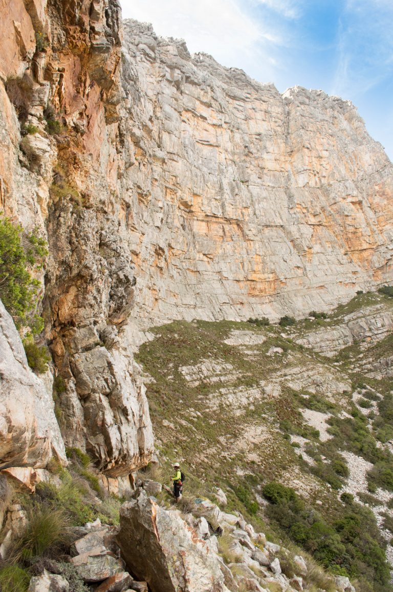
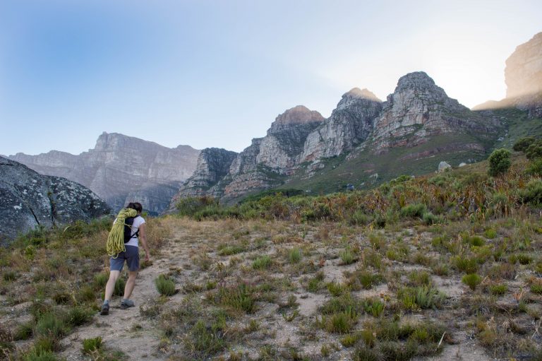
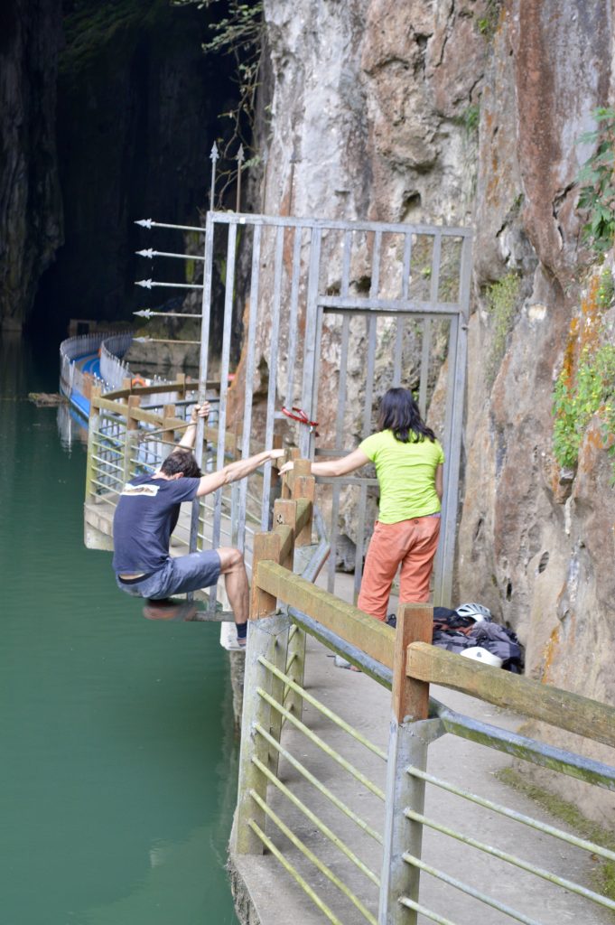
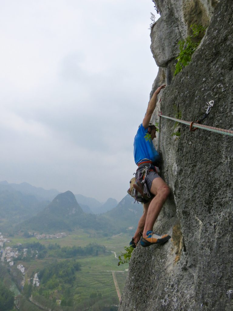
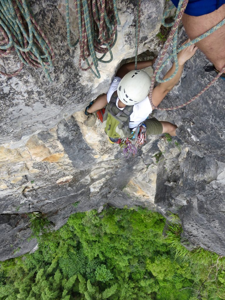
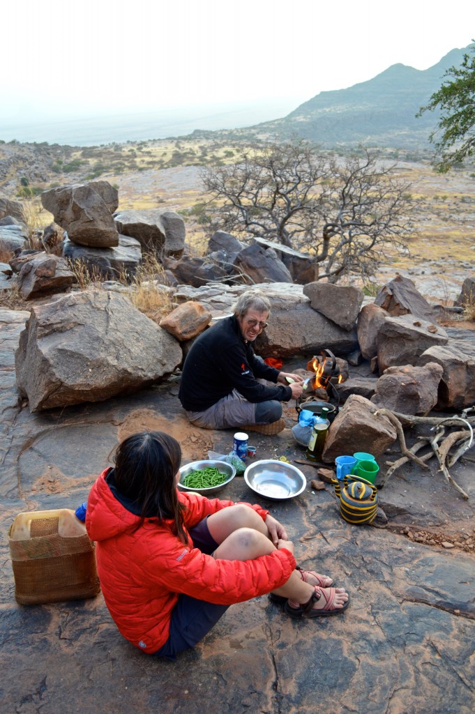
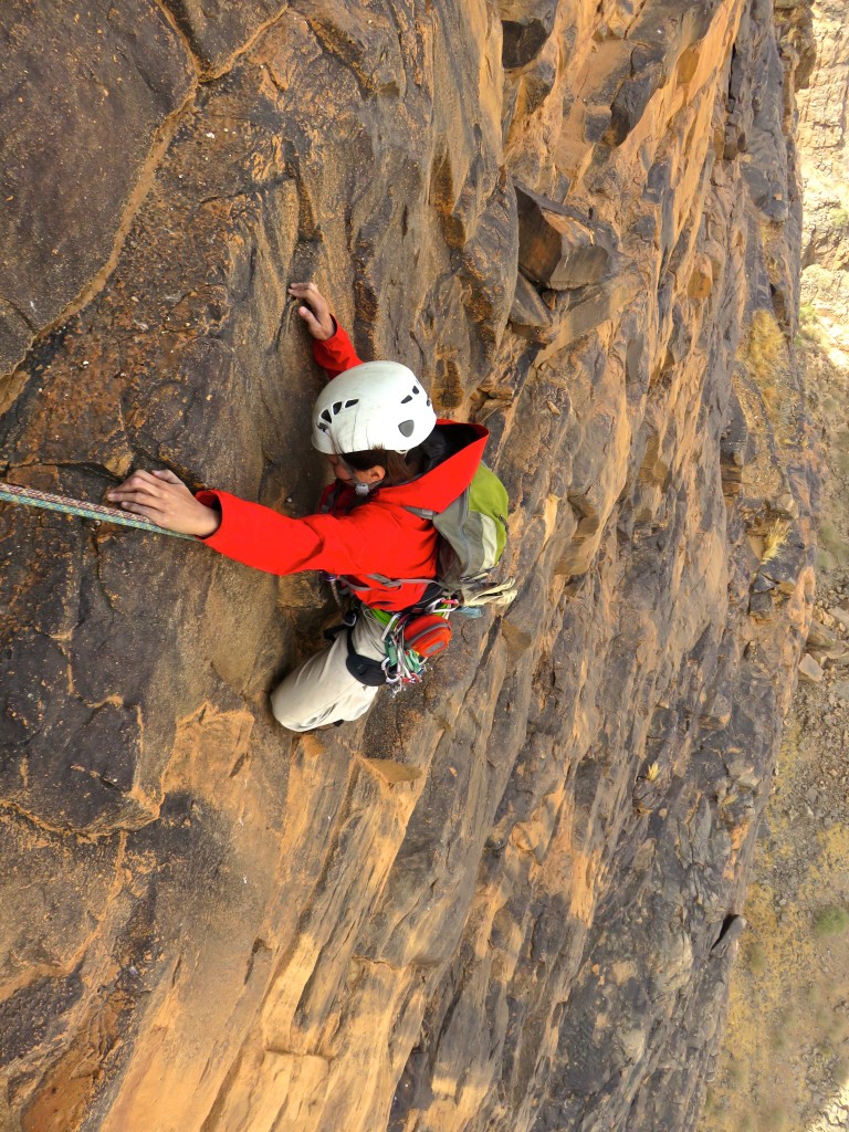
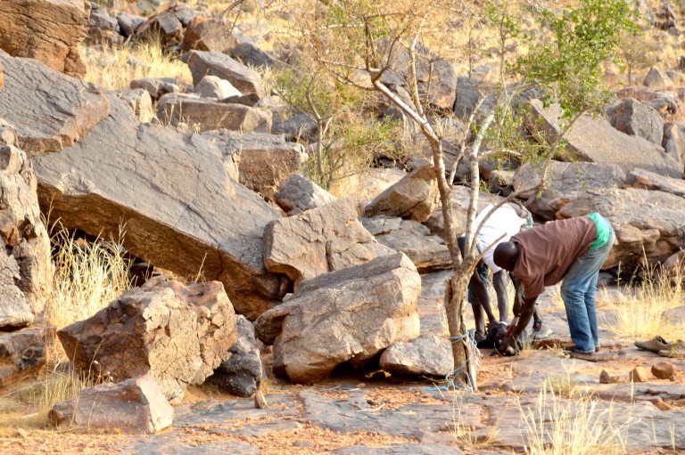
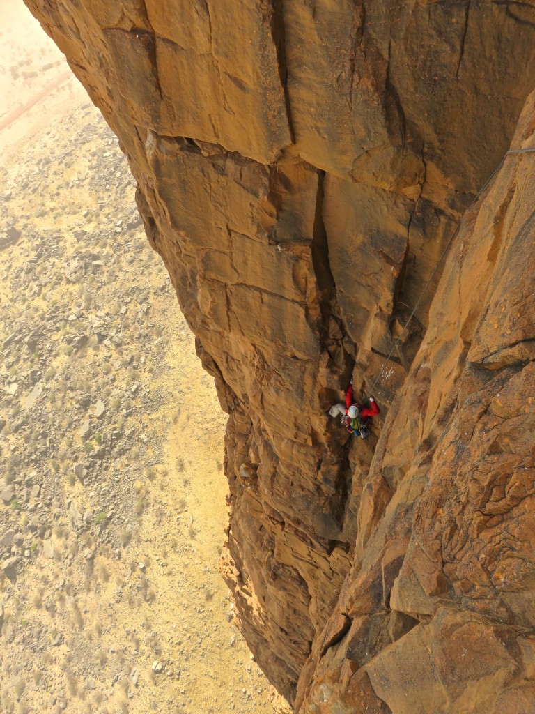
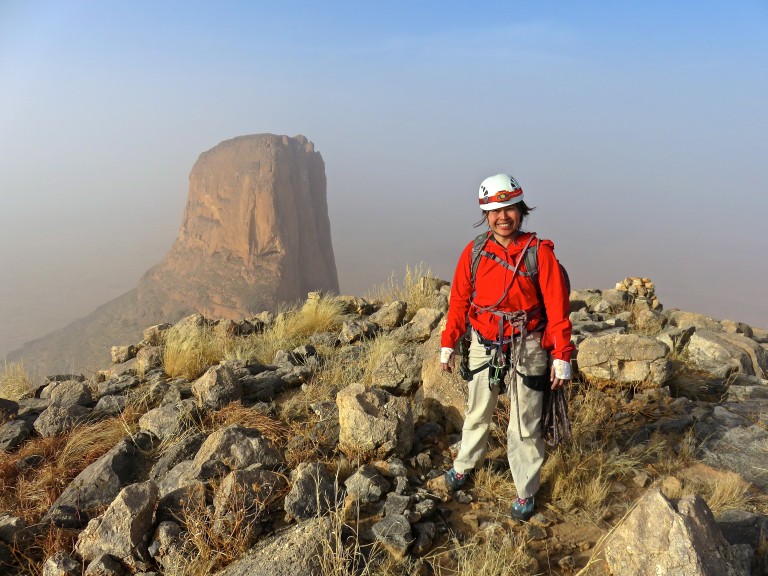
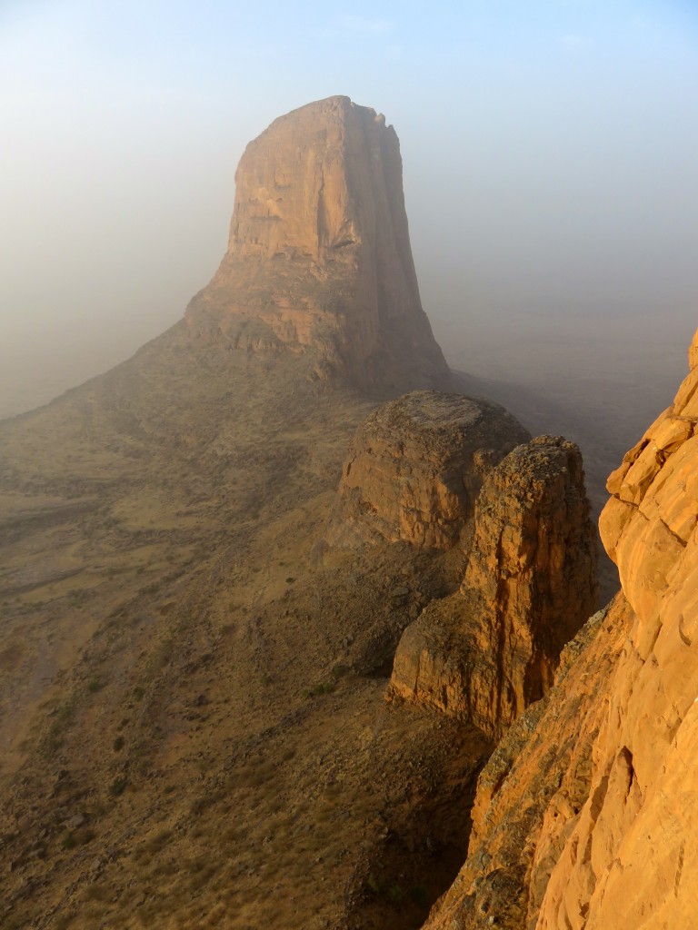
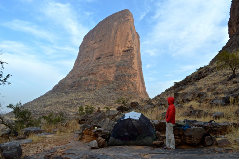
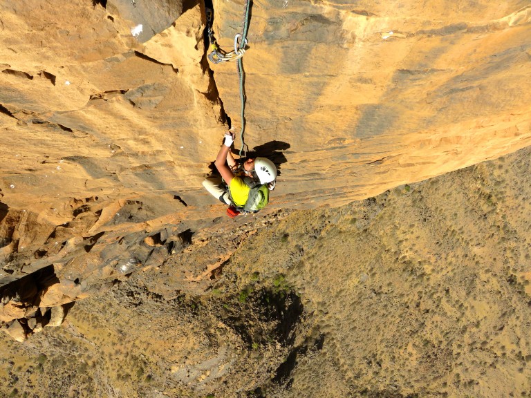
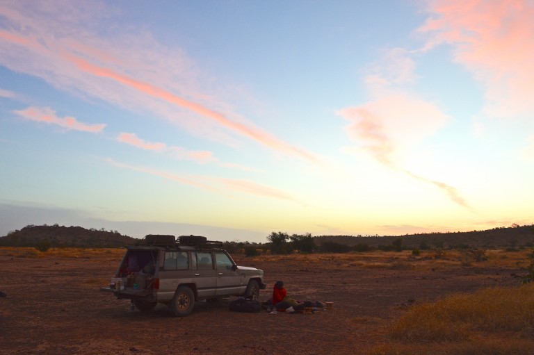
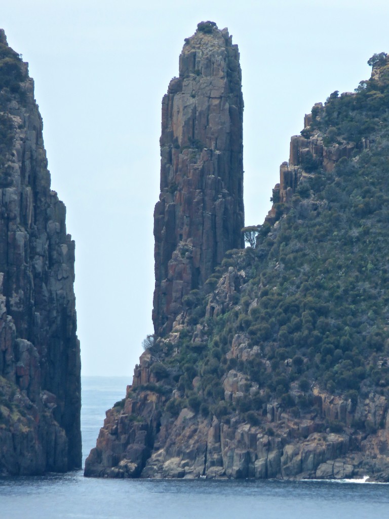
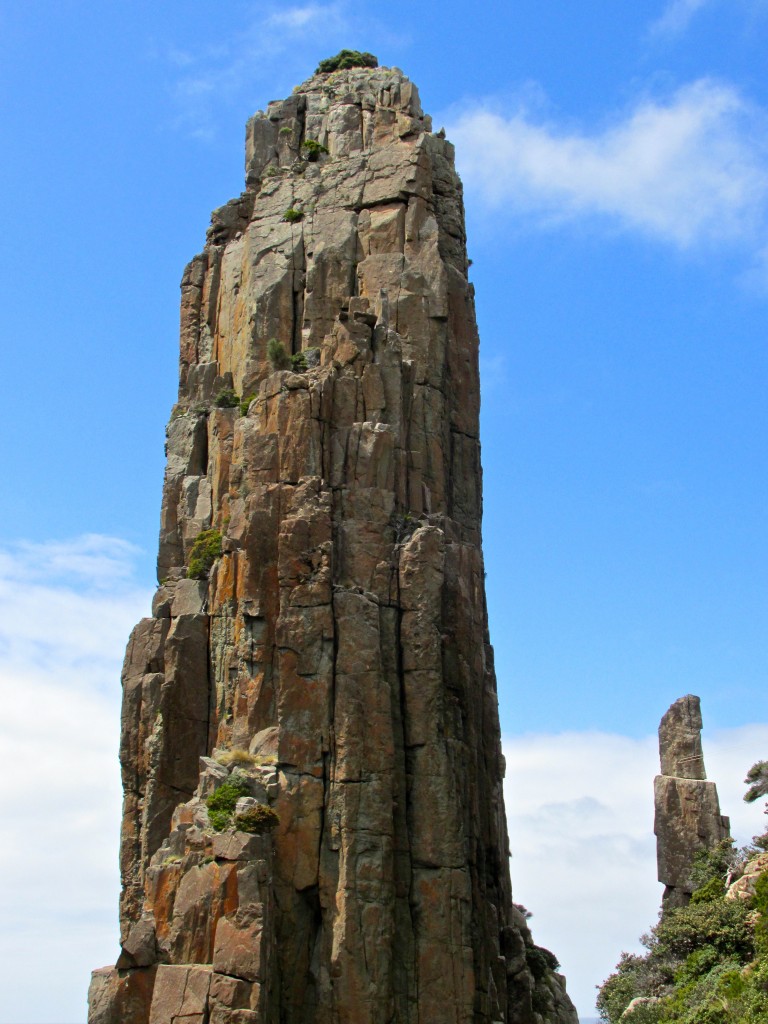
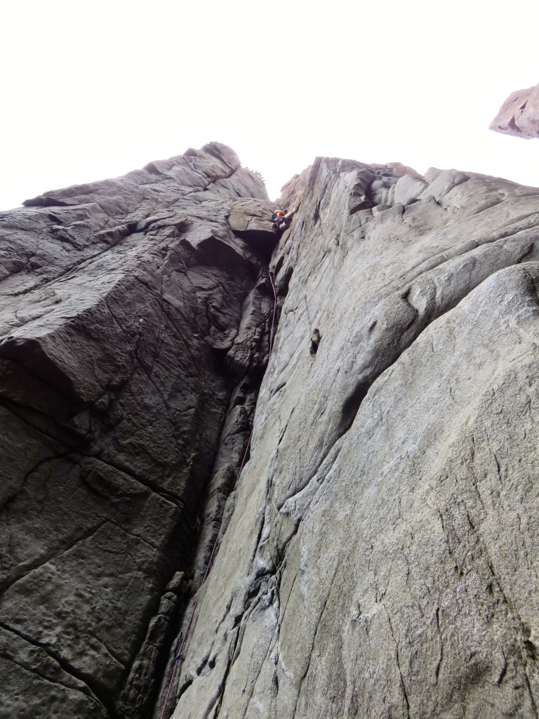
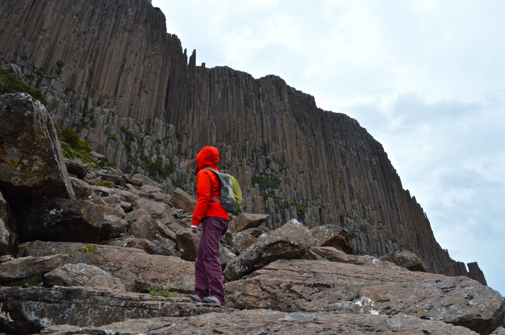
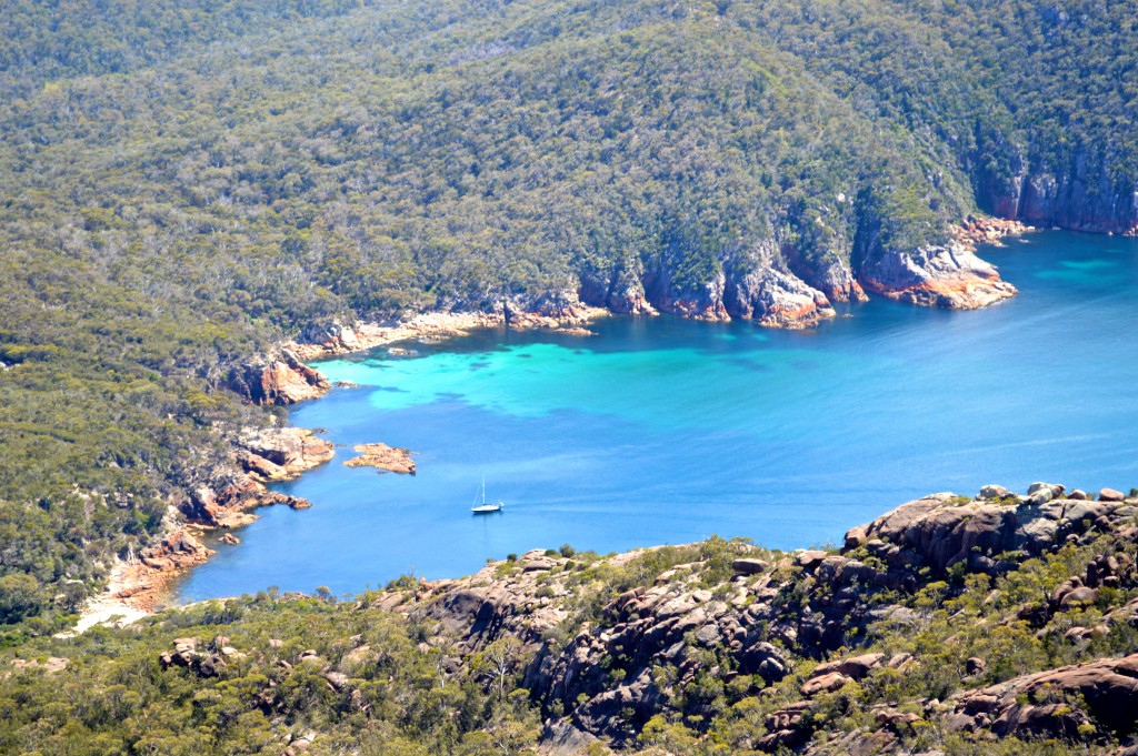
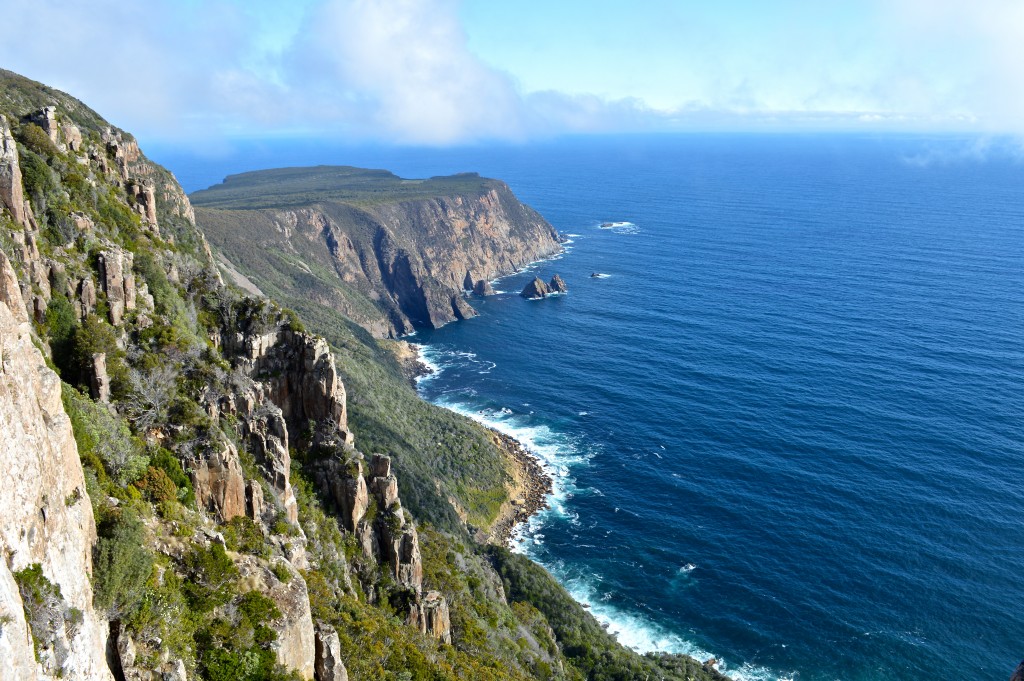
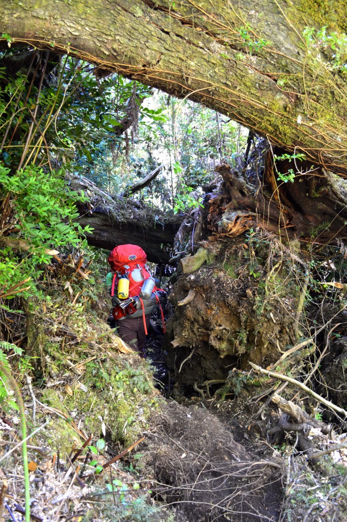
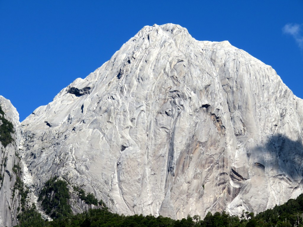
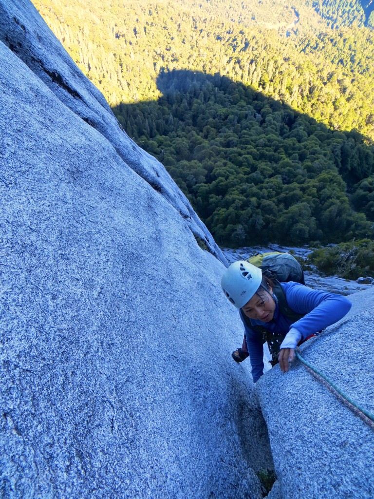
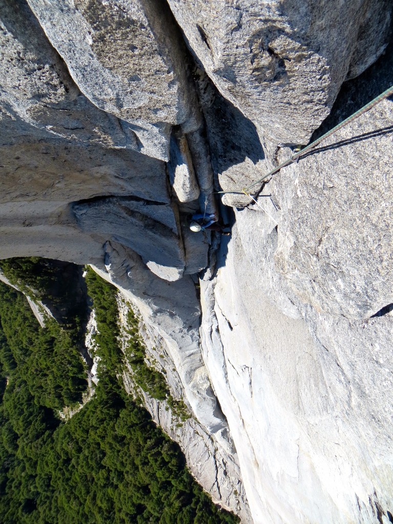
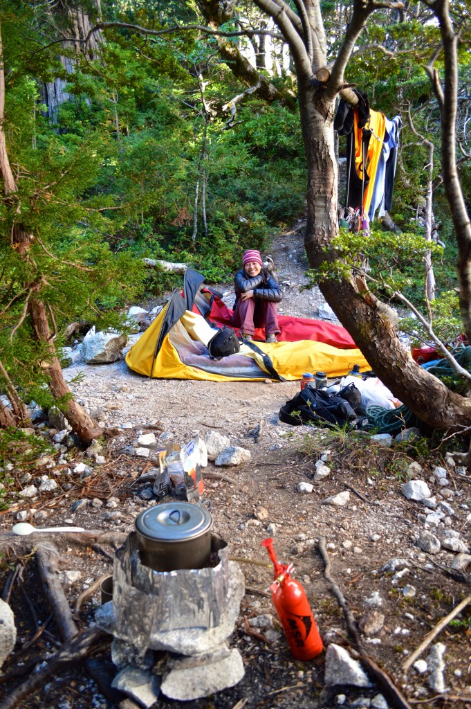
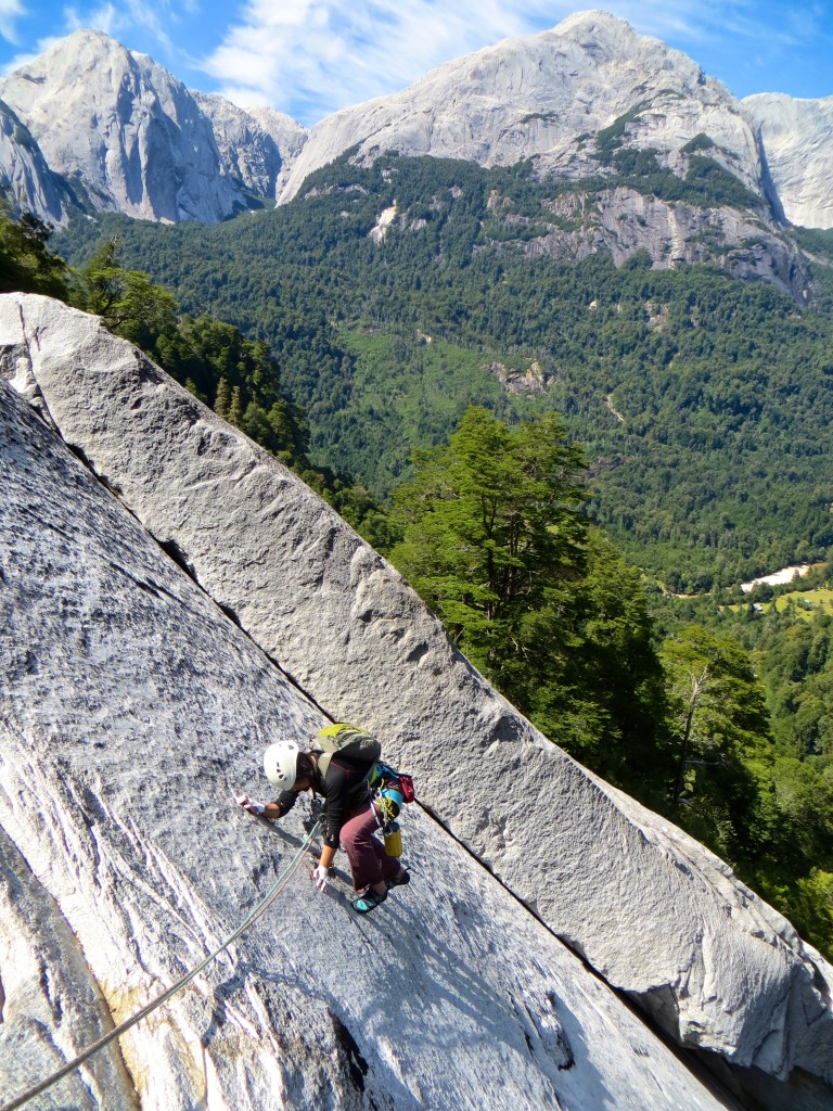
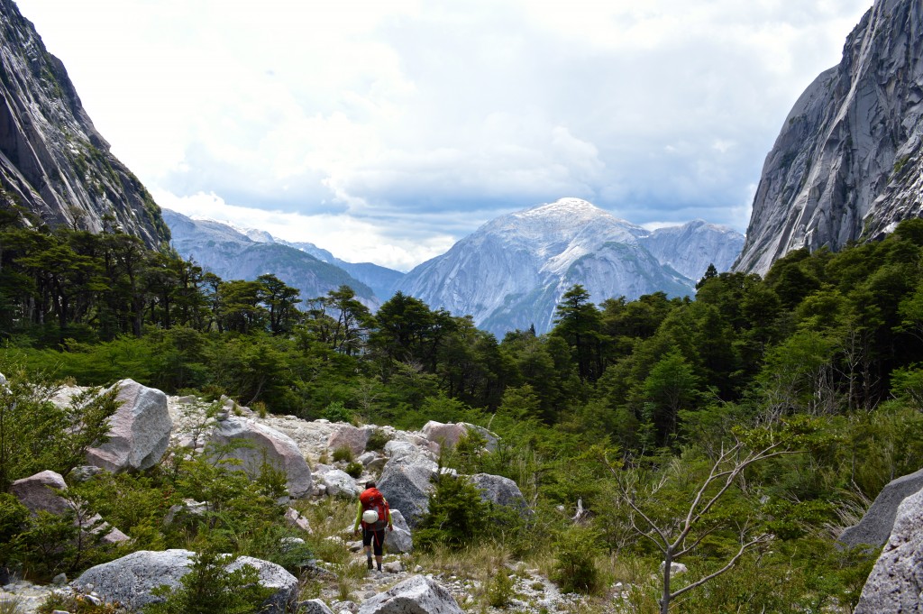
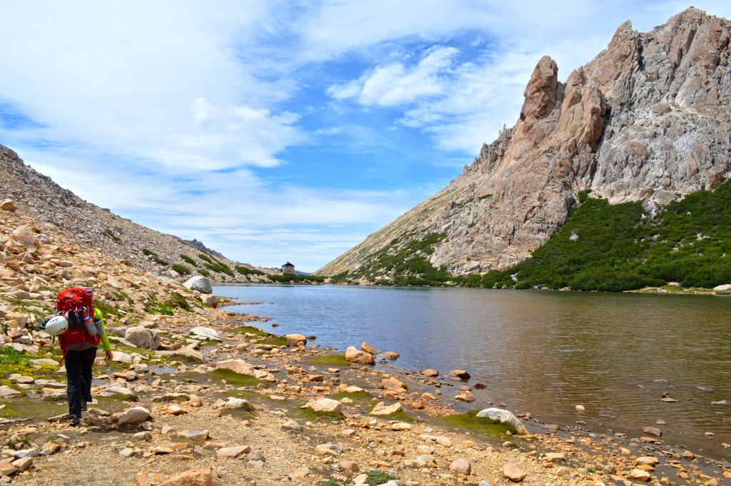
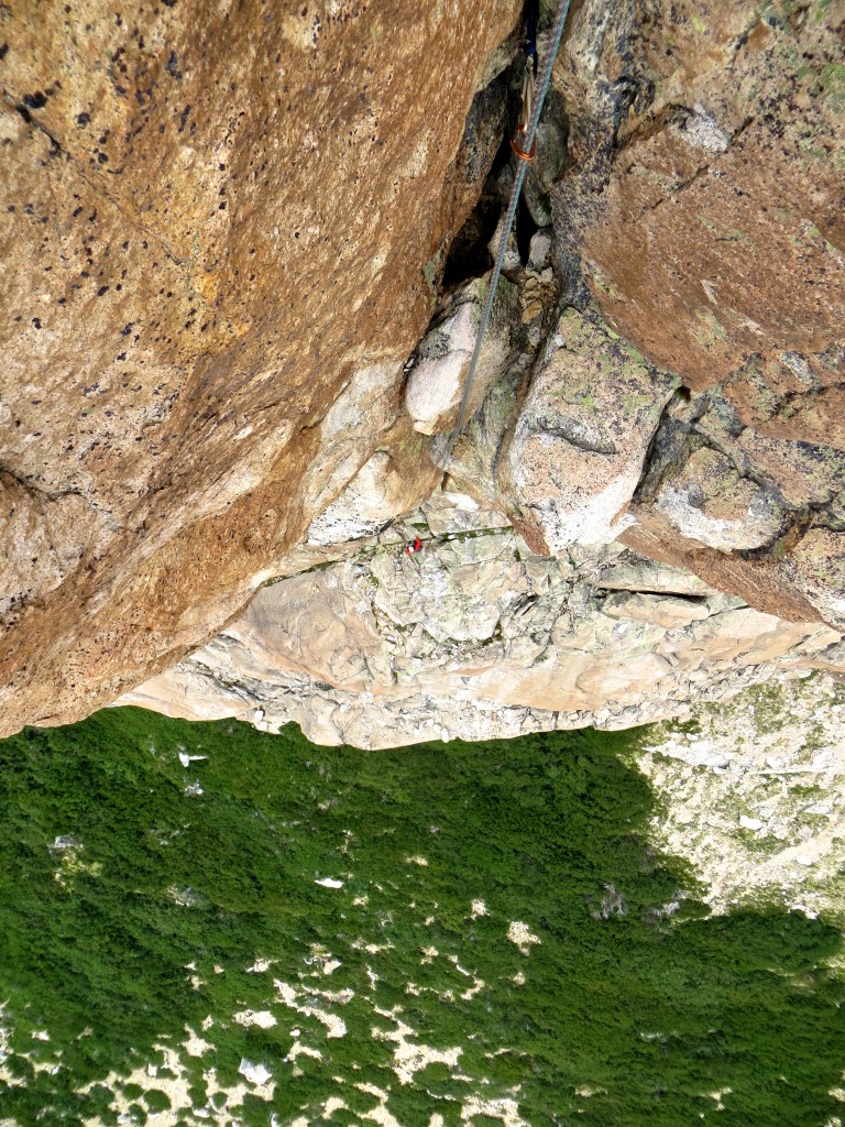
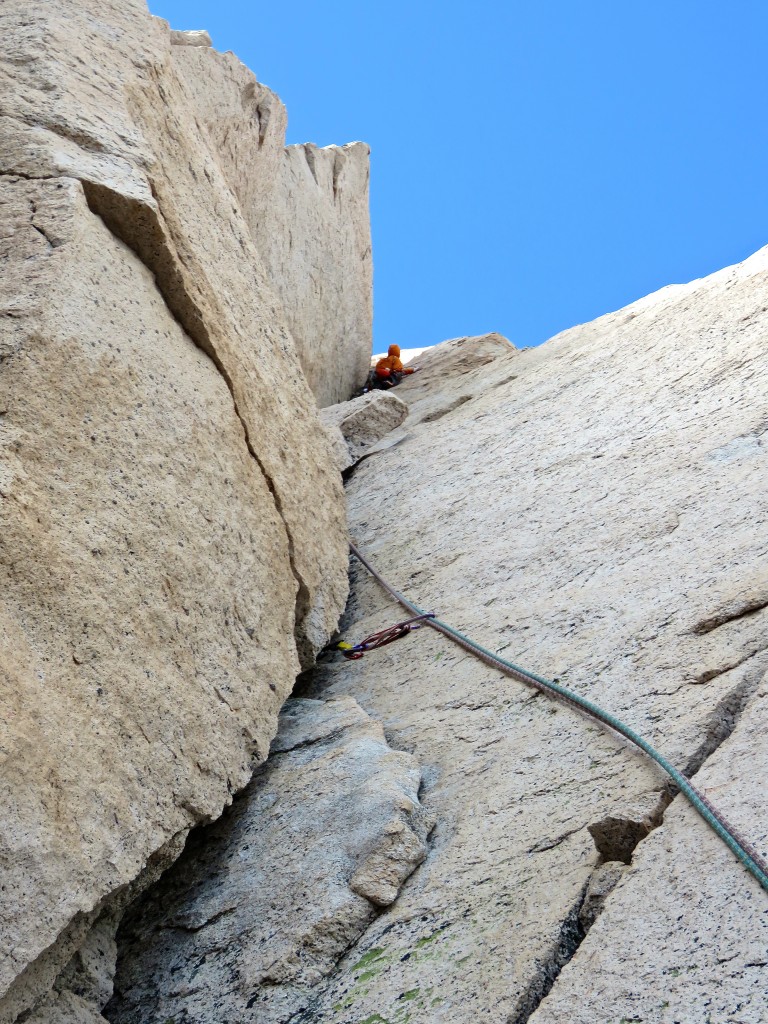
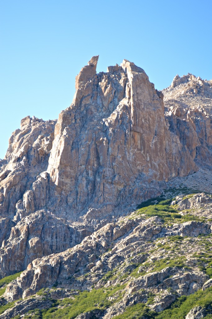
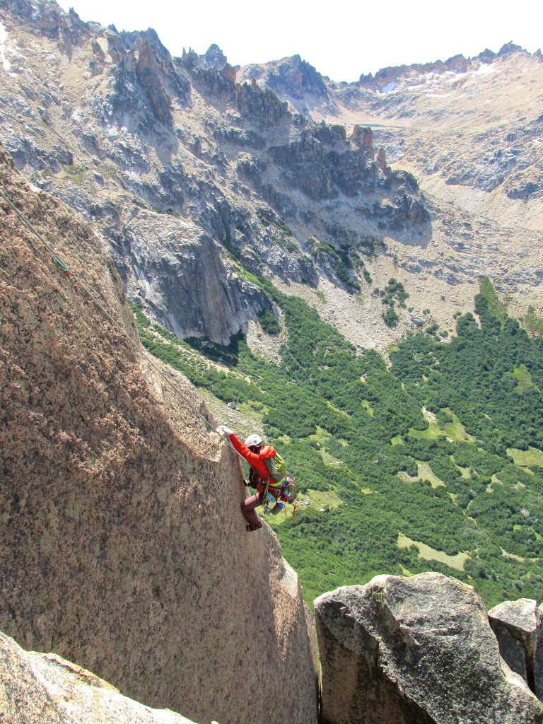
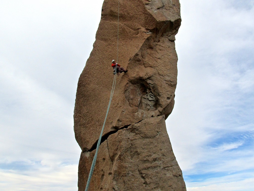
Hiking into Duiwelskloof with 500 meter walls towering above. We’d spend two nights there and climb a long (18 pitch) route called Lucifer the following day.
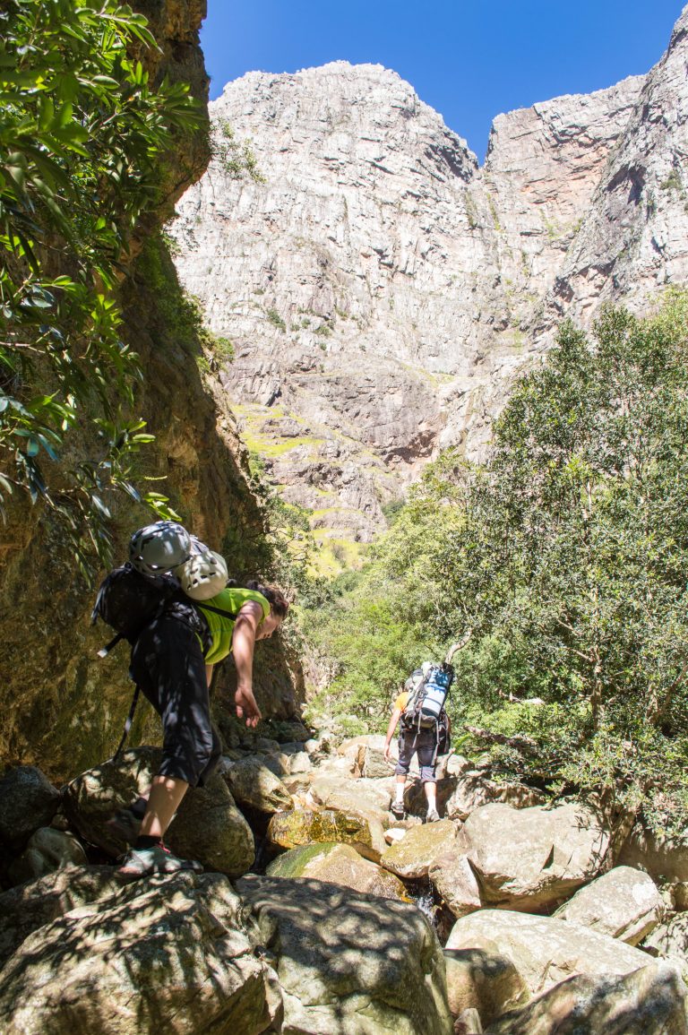
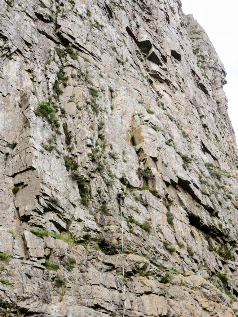
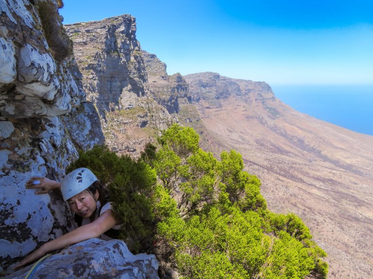
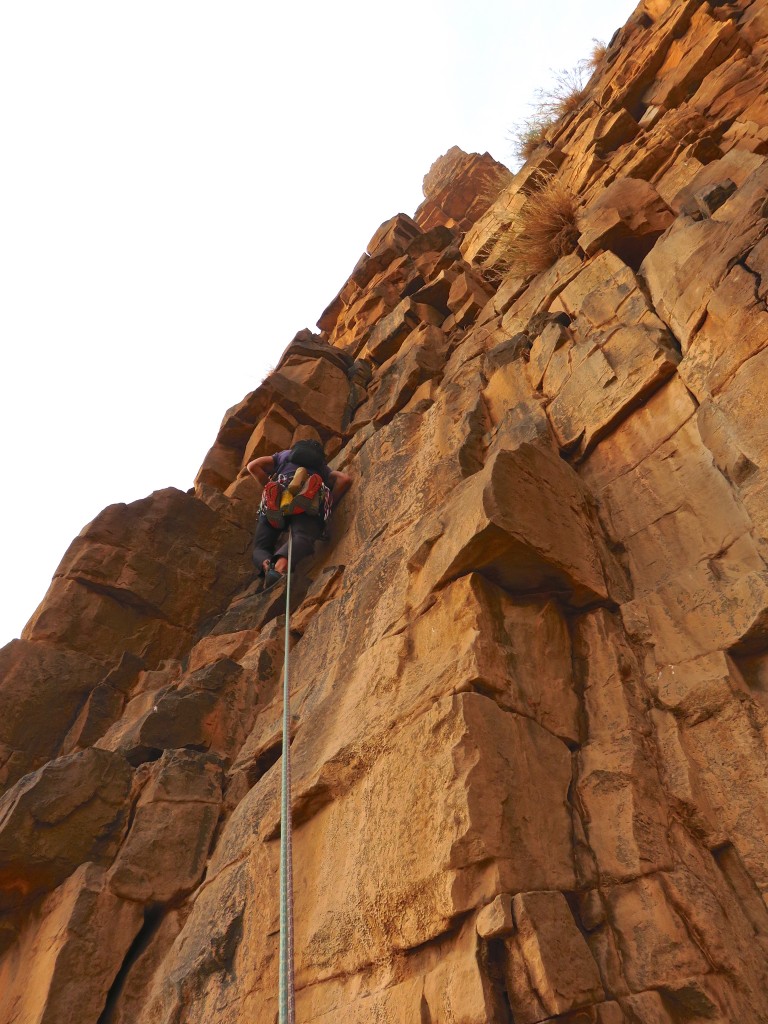
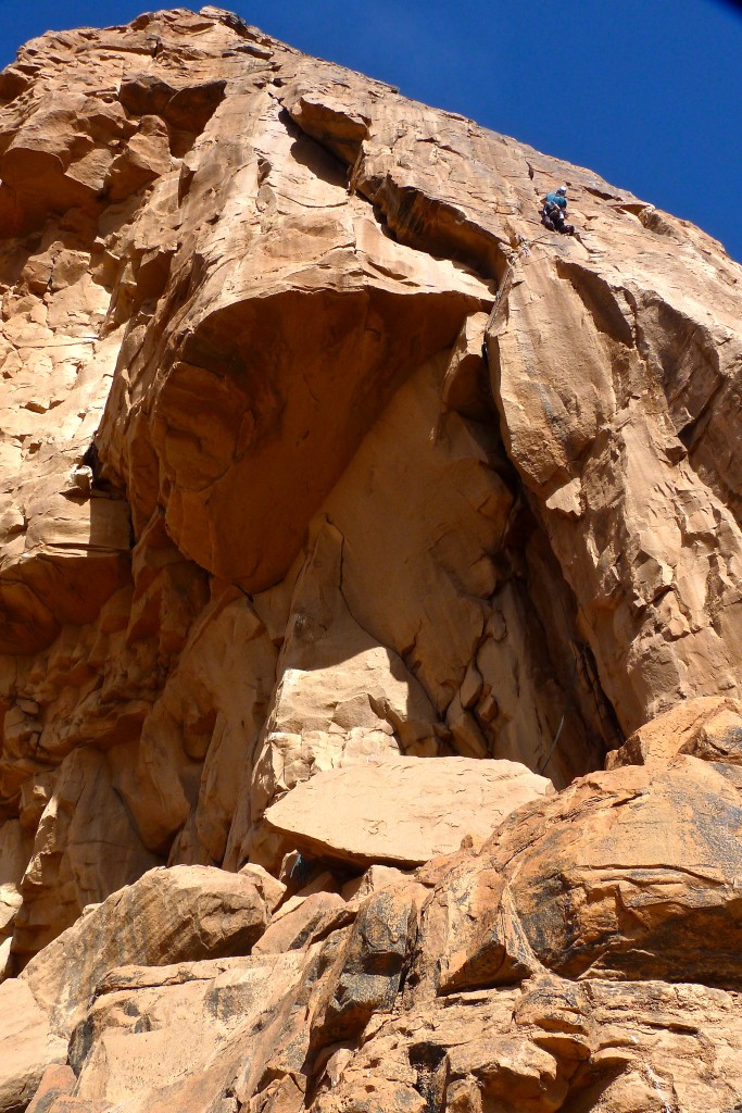
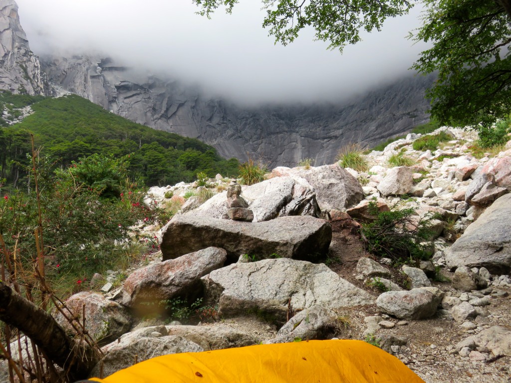
Low on Lucifer the following morning.
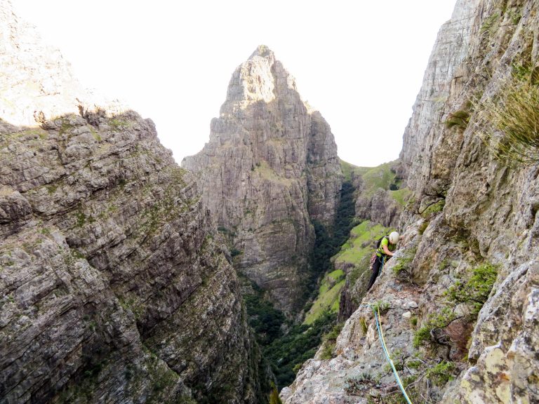
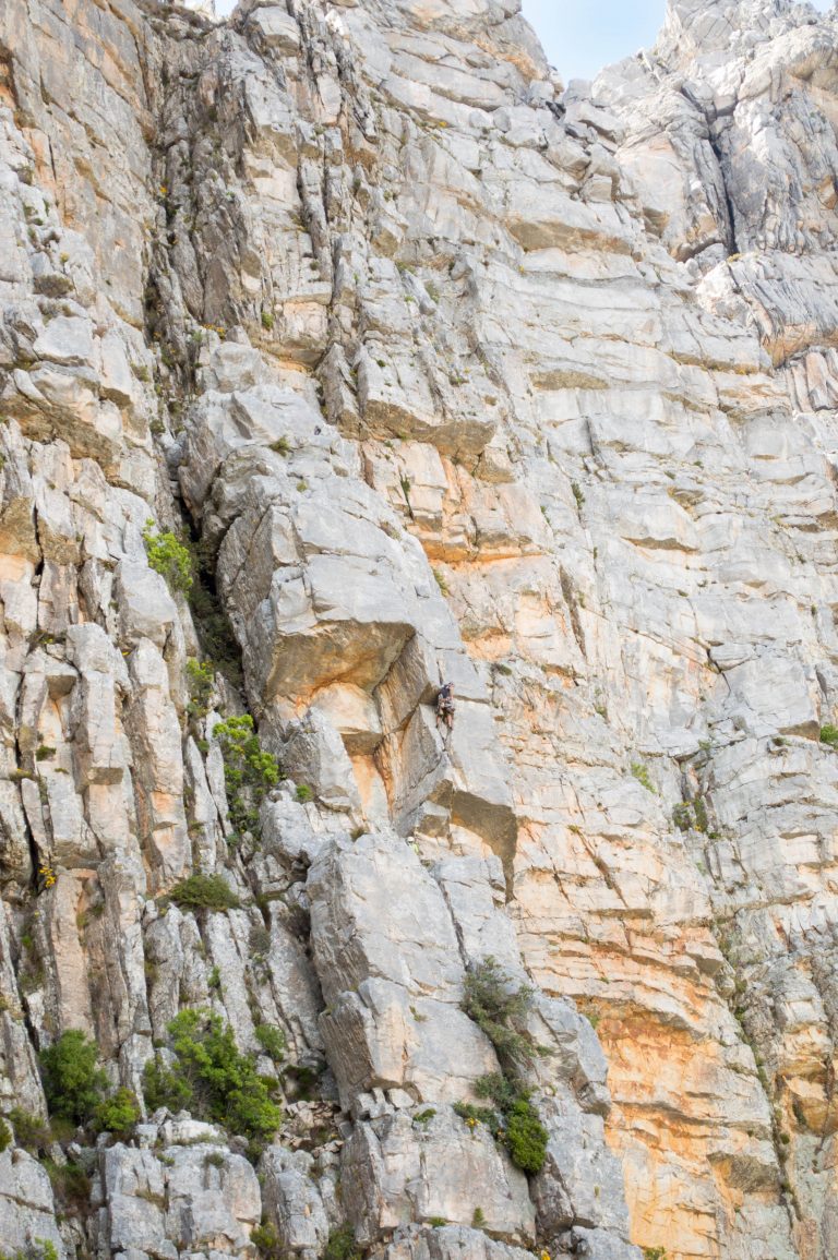
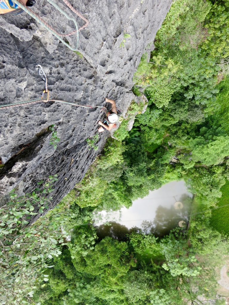
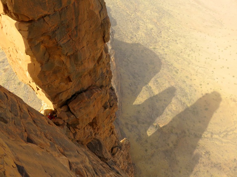
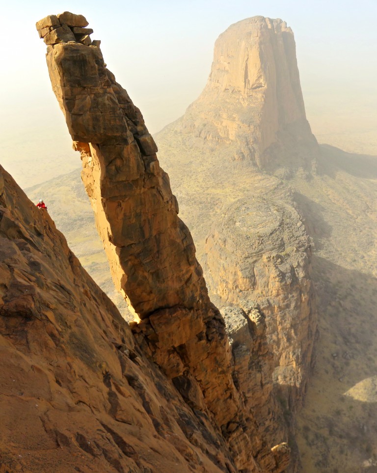
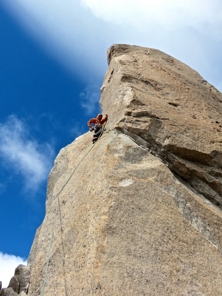
Shirley on Lucifer with Devil’s Tooth in the background.
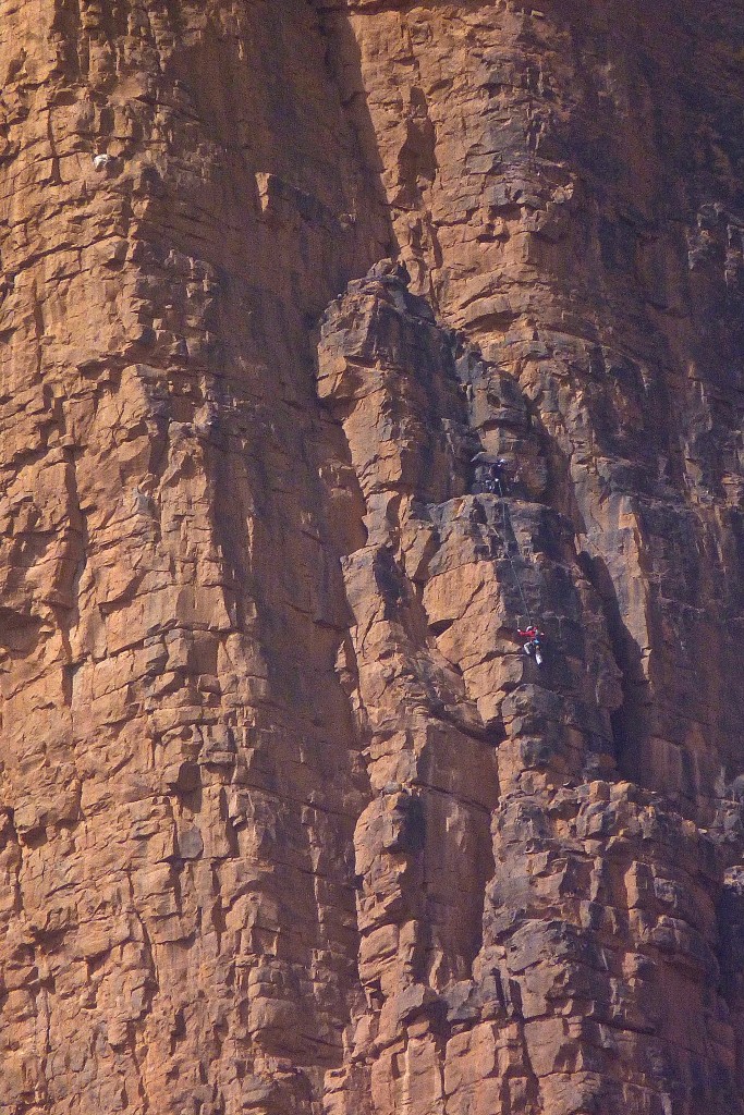
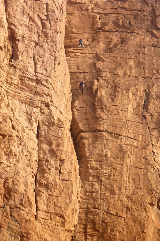
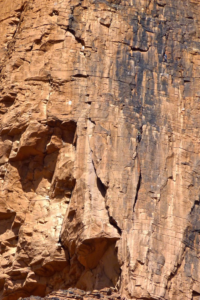
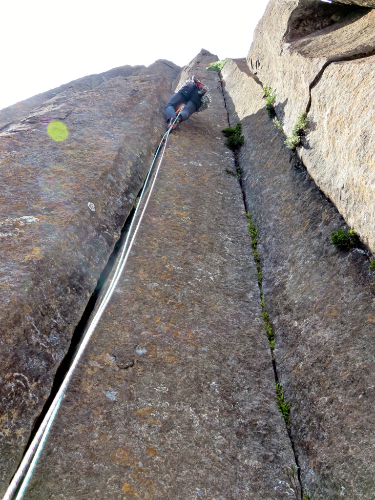
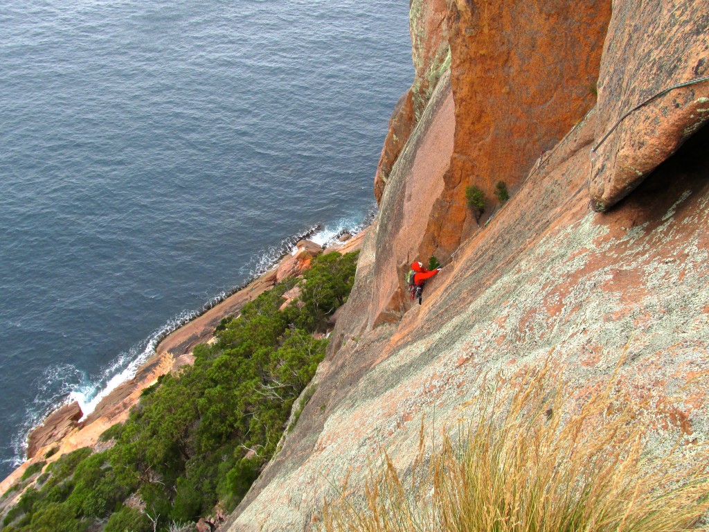
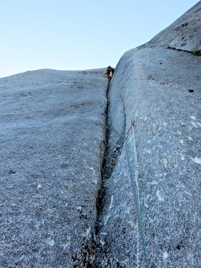
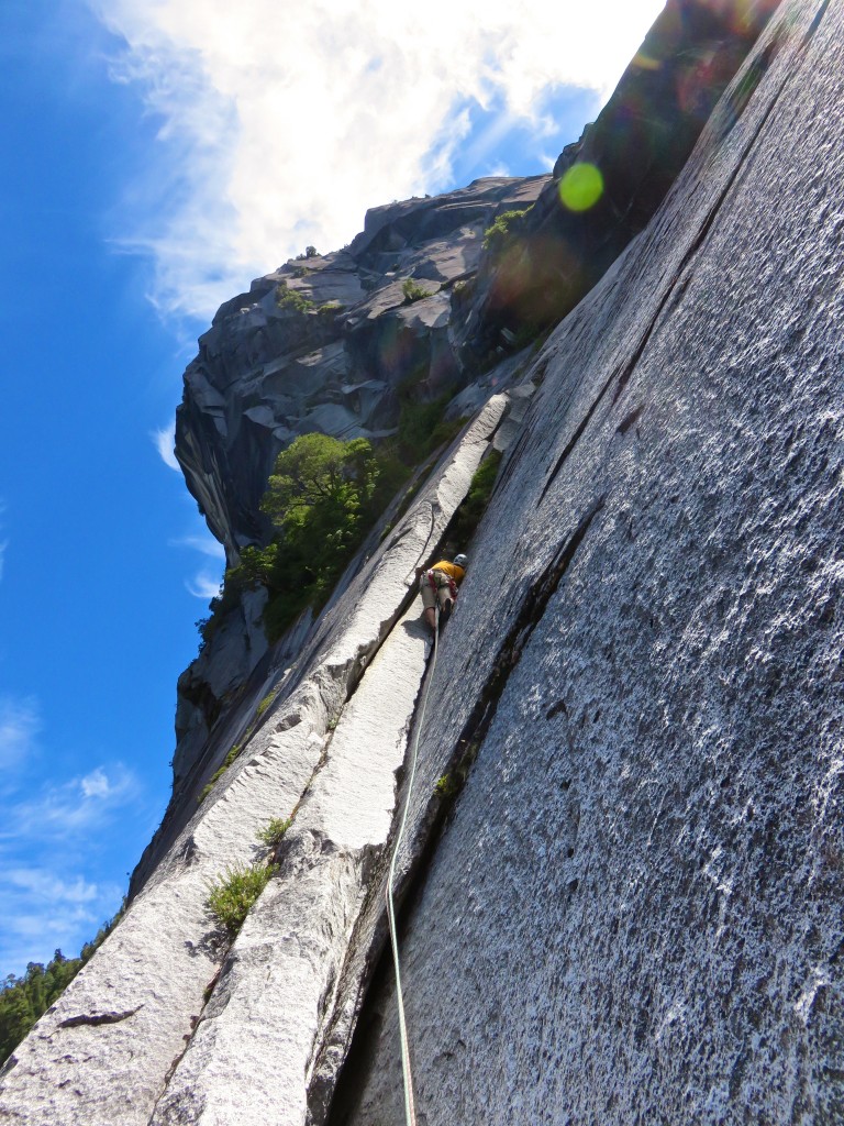
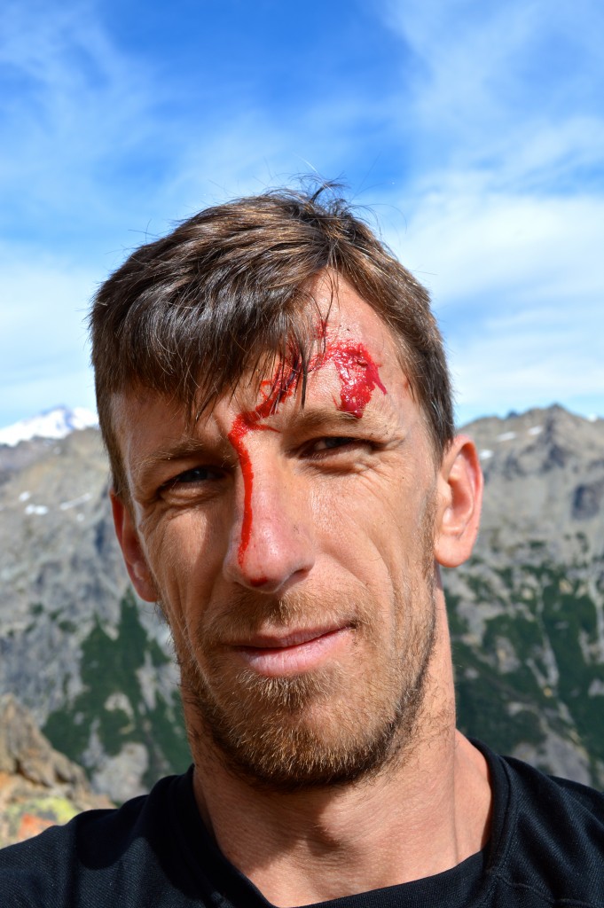
Crux of Lucifer. Note the 2 micro cam belay anchor. Very trad: ~500 meters of climbing and only fixed shit we saw were 2 ancient pins (2 more than on Mooloo).
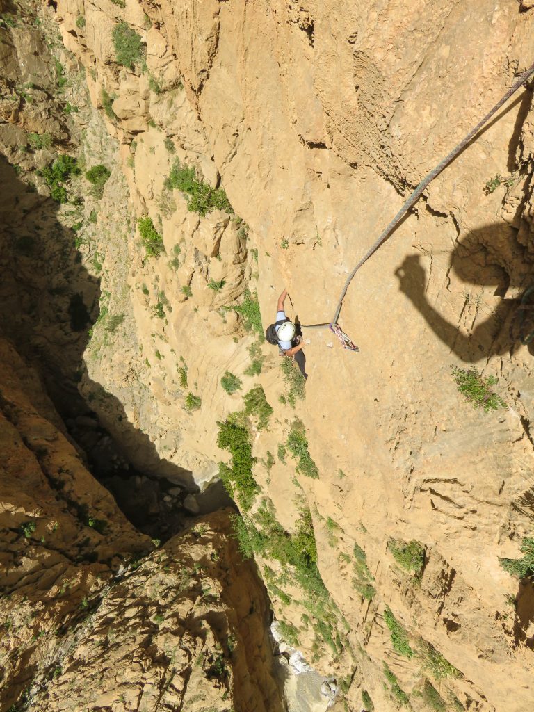
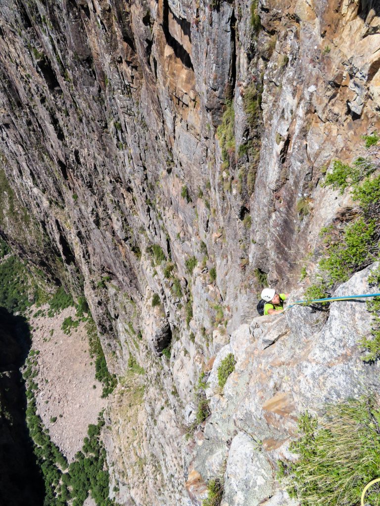
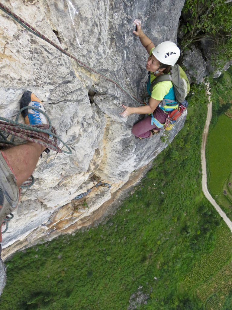
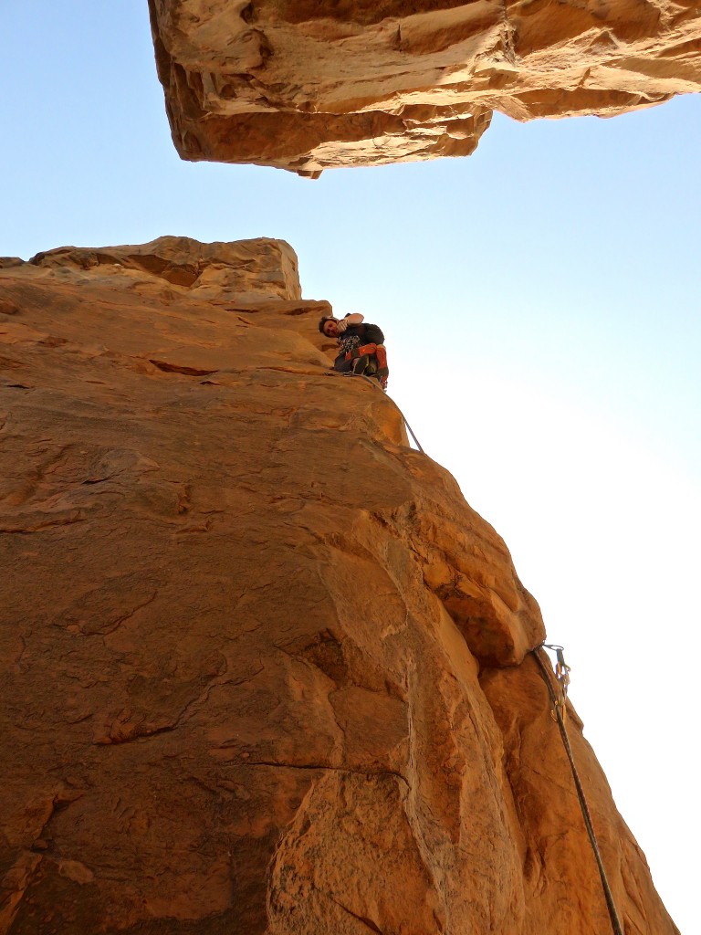
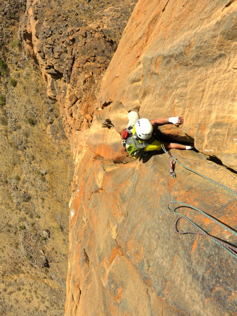
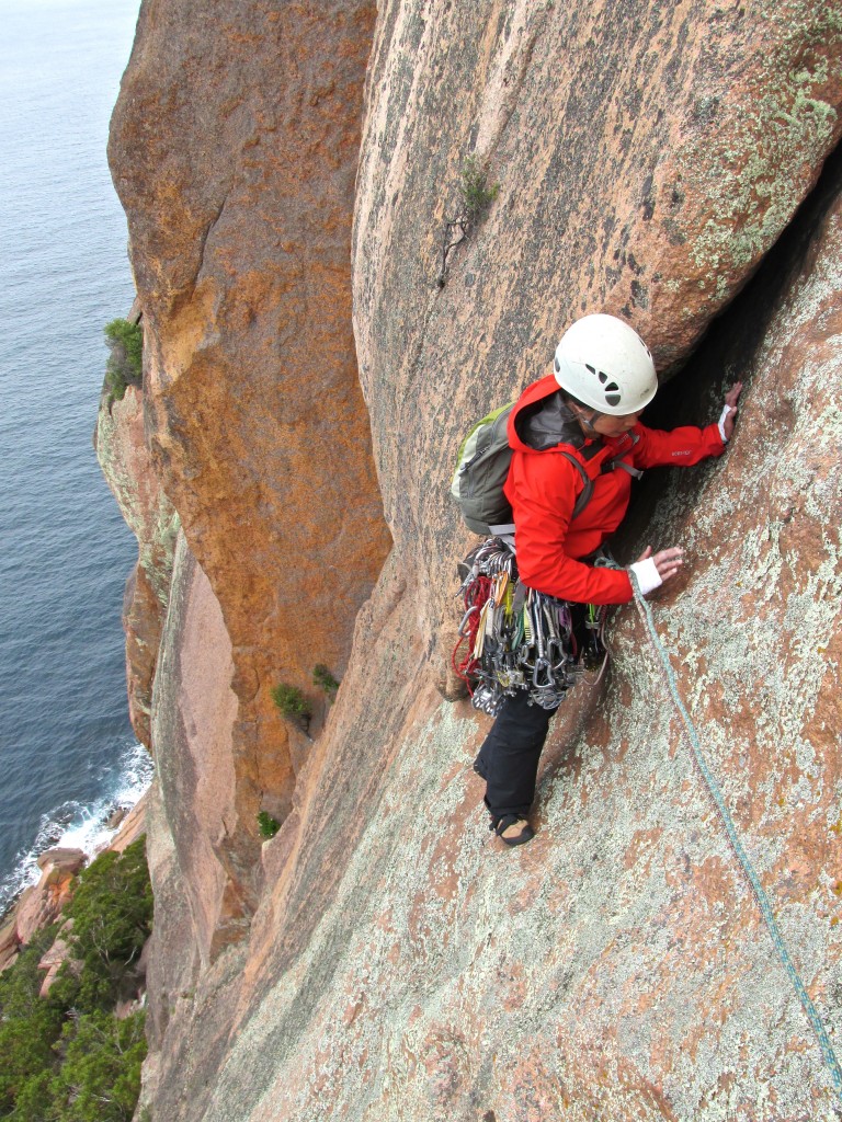
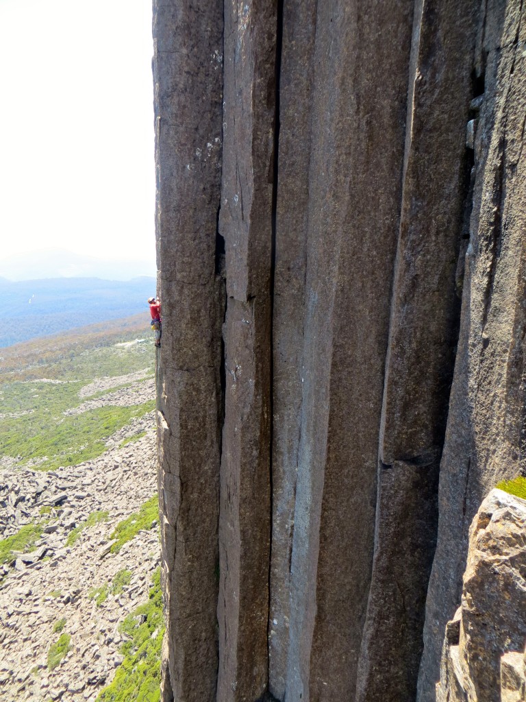
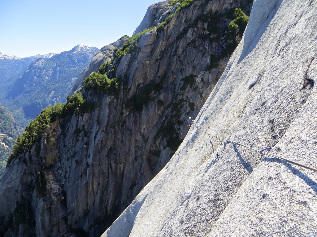
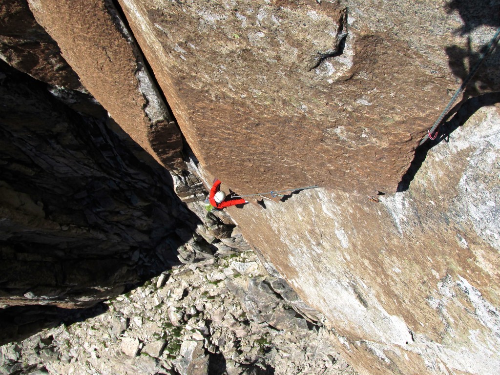
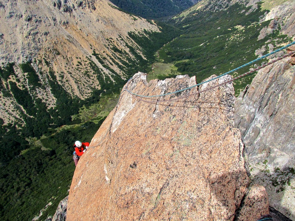
Money traverse pitch high on Lucifer.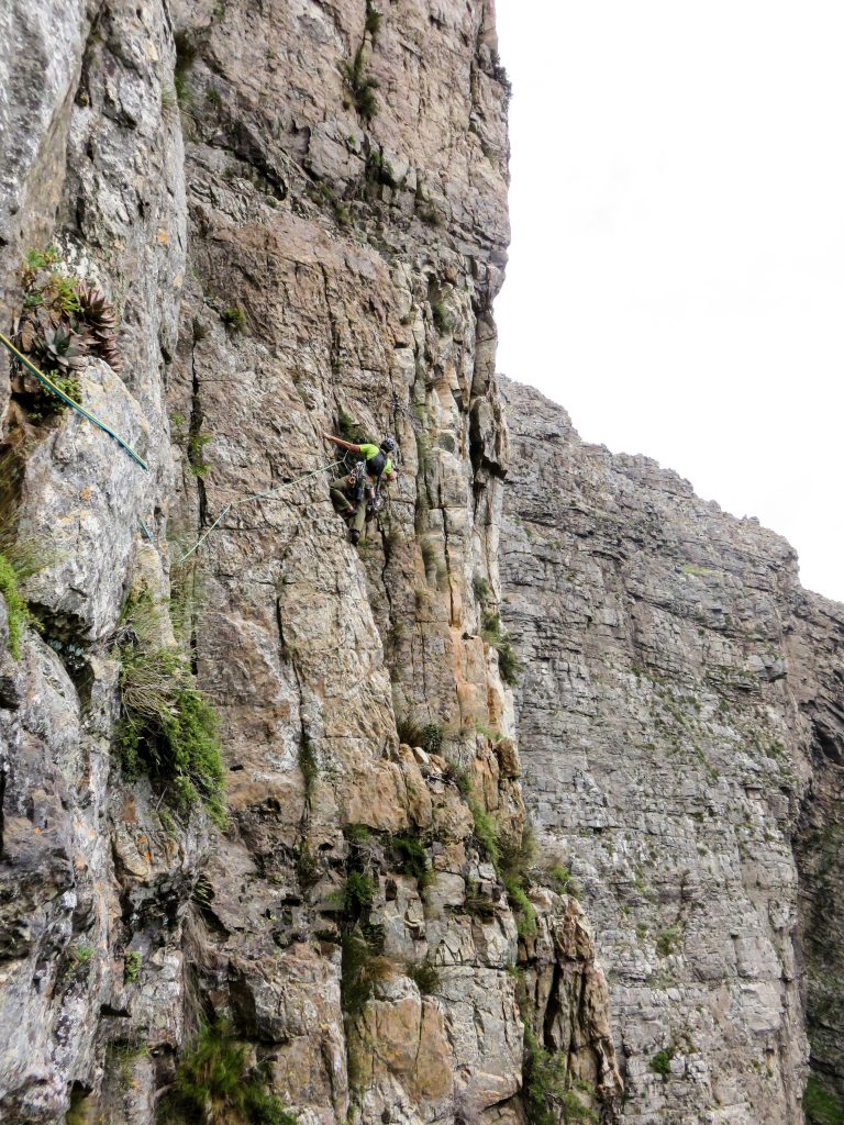
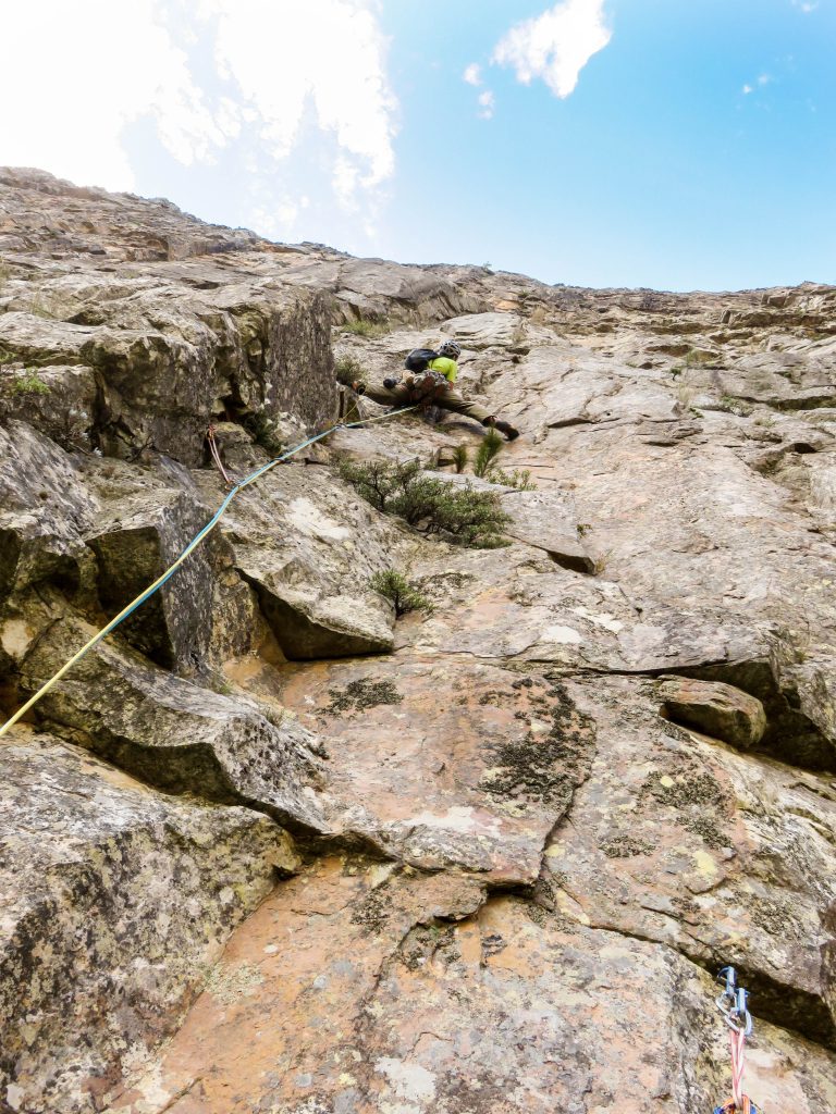
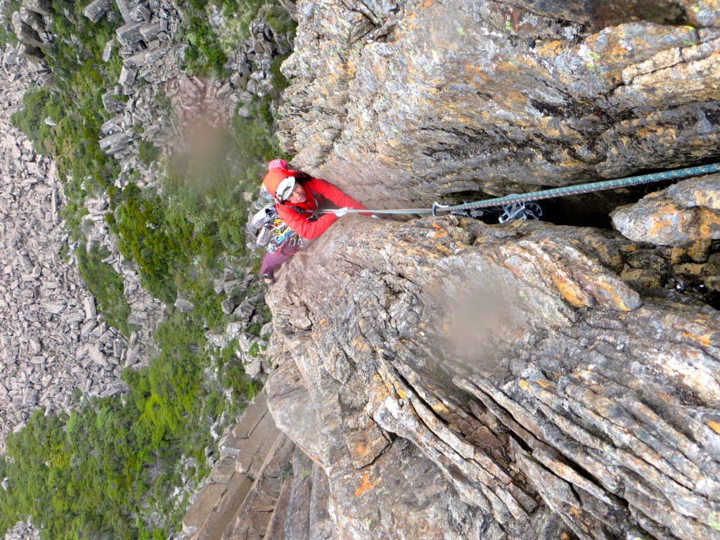
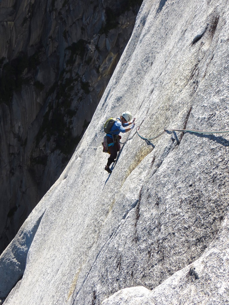
Shirley on the upper third.
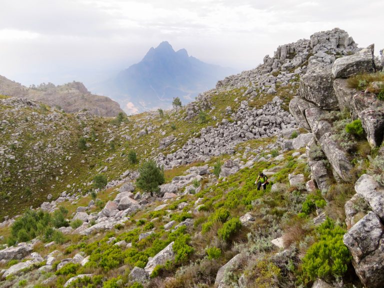
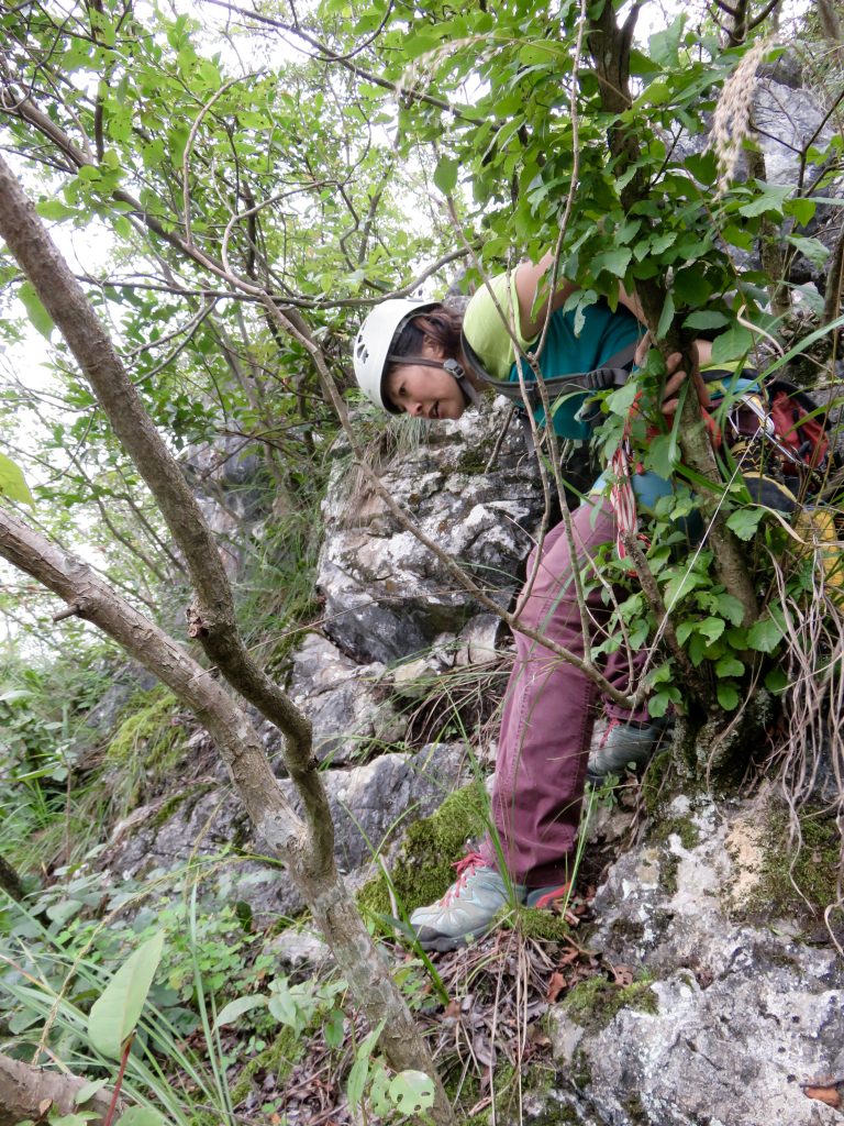
Hike off from the top was loooong but scenic. Kind of like Resolution Arete but with more time spent on top of the wall traversing rolling summits to access the descent gully.
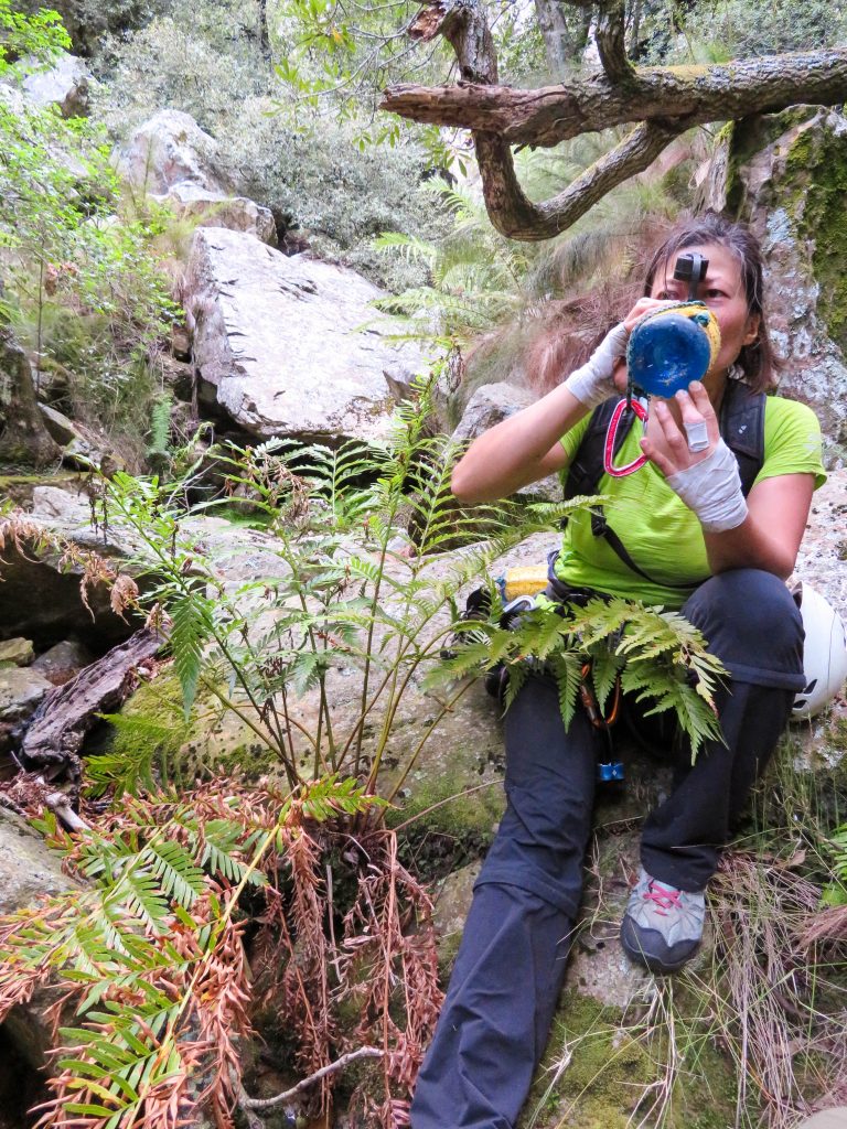
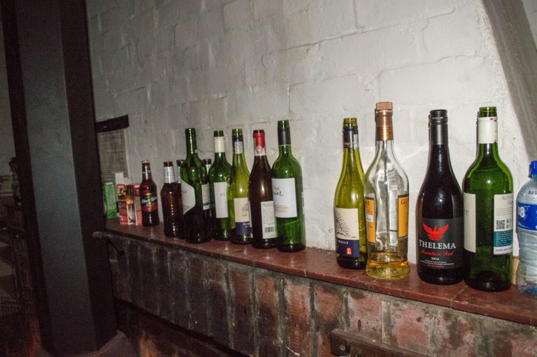
Ready for a beer.
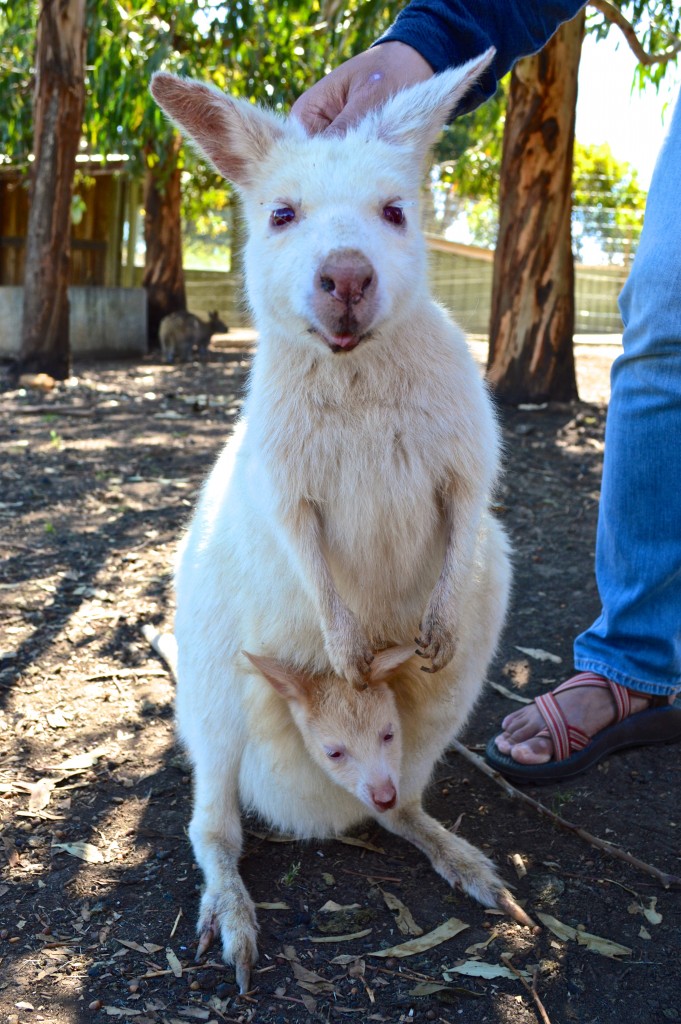
Snakes were never far from our minds.
Did a bit of sightseeing during a 2 day break over Christmas. African penguin at Boulders Beach.
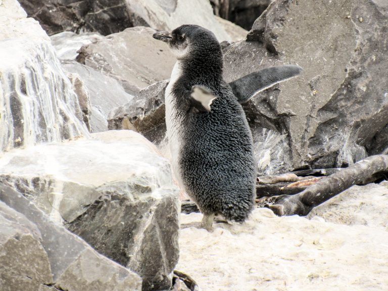
Table Mountain from Cape Town.
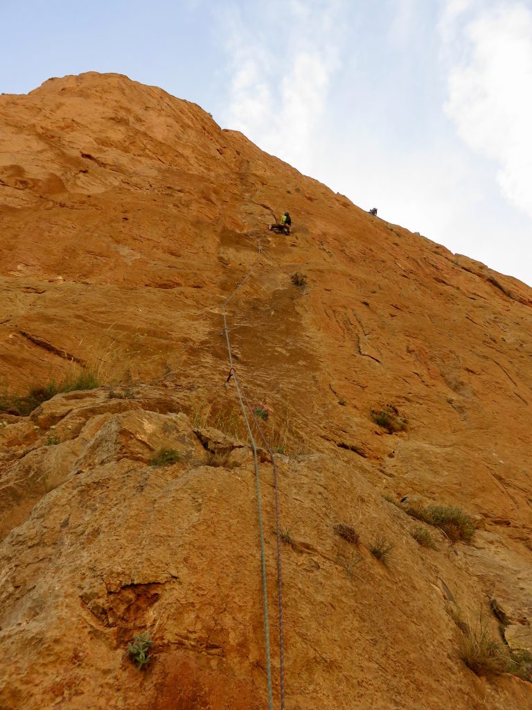
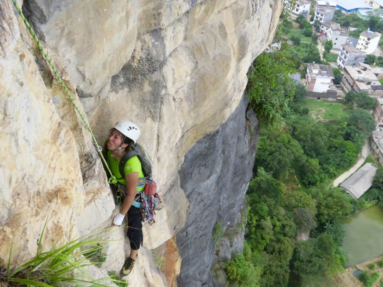
Some cragging at a place called Paarl Rocks – a collection of large granite domes sitting on top of a large hill. This is an area classic called Sands Of Time (4 pitches and about 5.9).
Shirley and I on pitch 3. Photo by Ross.
Did 2 routes in this here Yellowwood Amphitheater of Du Toits Kloof Mountains.
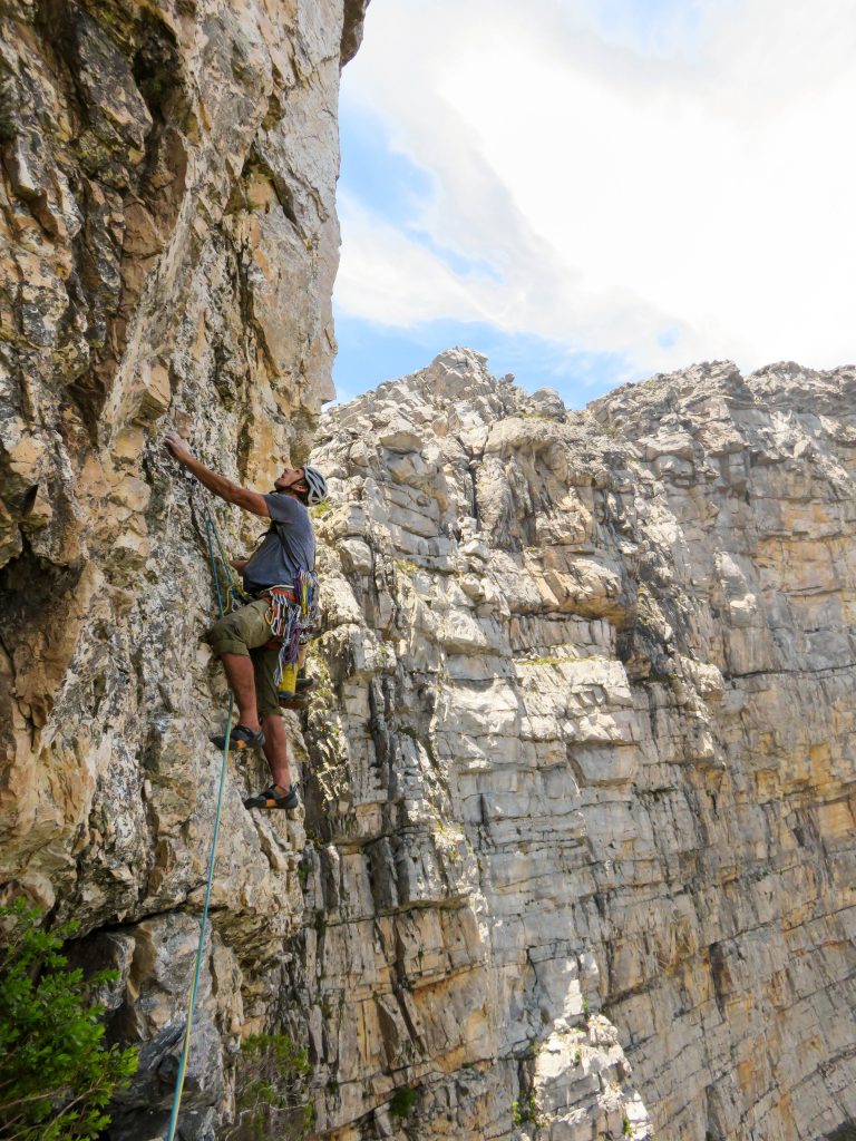
Crux of a route called Lekker Time. Photo from the base by Ross.
One more from Lekker Time (Afrikaans for Good Time).
Four evening’s worth of sending.
For the final climb, we hiked up to one of the Apostles (buttresses) of Table Mountain to climb Slangooli Frontal route. Morning approach.
Ho-hum climbing mostly but with great views.
A bit of vertical bushwhacking.
The scenic hike down.
Cape Town sights.
Gear Notes:
Bring Tabasco esp. for Morocco. No trad in Morocco (where we went); Mostly trad in Western Cape.
Approach Notes:
A mixed bag.-
 1
1
-
 5
5
-
-
Those views from high on Inti sure are nice!
-
thanks guys.
I'd guess it's mostly humidity & cloudiness. Think both places are far enough from huge population centers that it's not smog & the sun did come out in Yangshuo eventually.
-
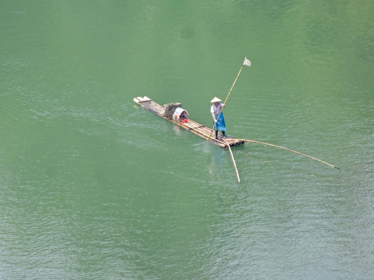
Trip: Southern China Sampler - Multiple
Date: 9/4/2016
Trip Report:
Southern China Sampler Two weeks and three locations across southern China covering a wide spectrum of settings. From the very rural Getu, to the very touristy Yangshuo, and including urban cragging in Hong Kong. Noodles, dumplings, dim sum and a touch of multi-pitch climbing on steep and sharp limestone surrounded by post-card perfect Chinese landscapes. For more text filler, a couple short video "haikus" and many more photos, check out our webpage: http://chossclimbers.com/testing/china/
Photo highlights are below.
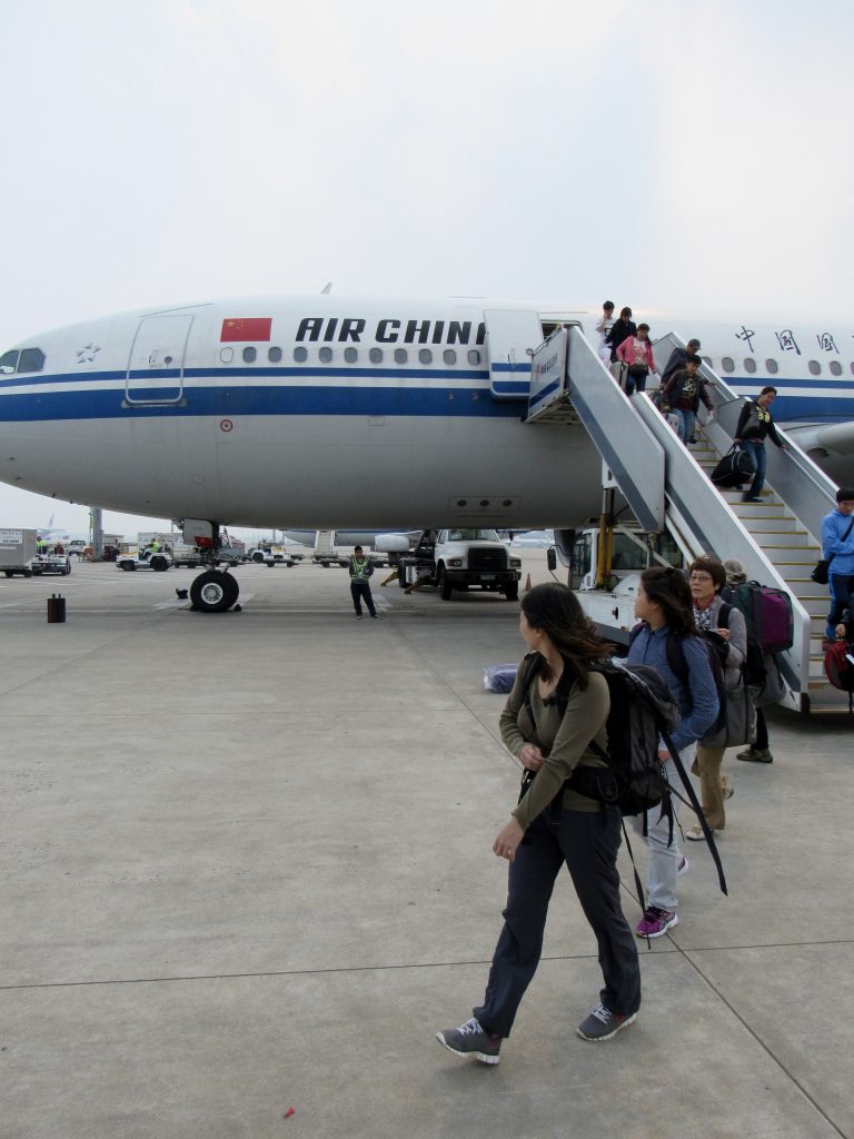
Beijing - too bad the layover was only 4 hours:
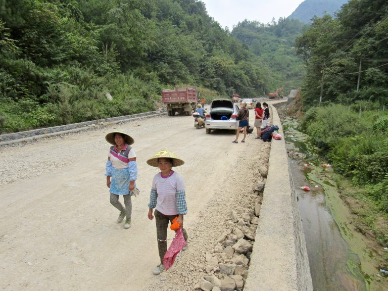
Road hazards on the drive to Getu:
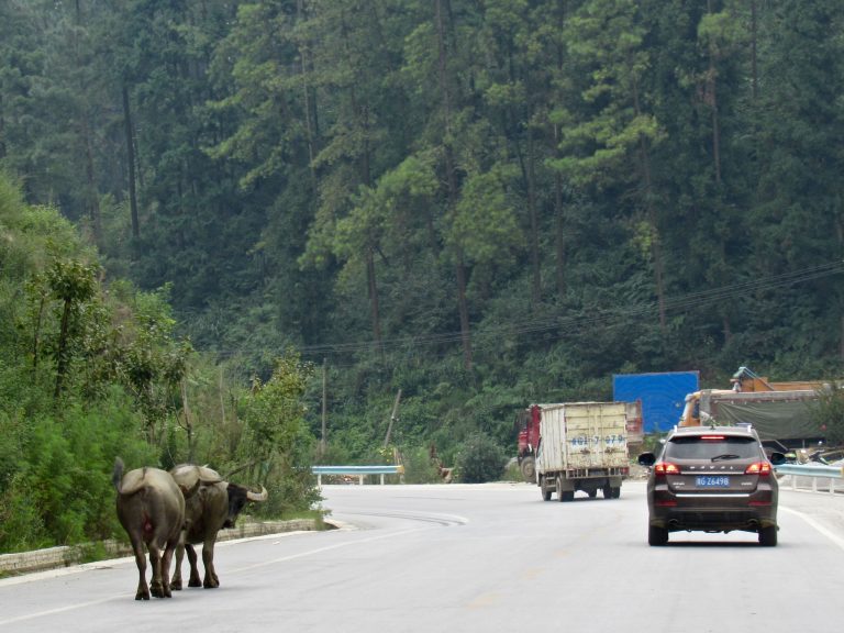
Tire blow-out (not giving a shit seemed to be the name of the driving game):
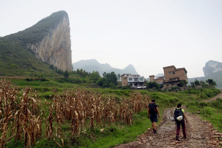
The now famous Getu - nothing easy on those formations.
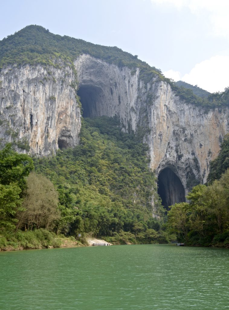
Except for a shitty, wet and flared chimney to off-width pitch inside the Great Arch. 4-star setting, no-star climbing. Photo by our "local enabler" Ola:
Lower Arch from the inside:
Also did some deep water soloing that day (photo by Ola):
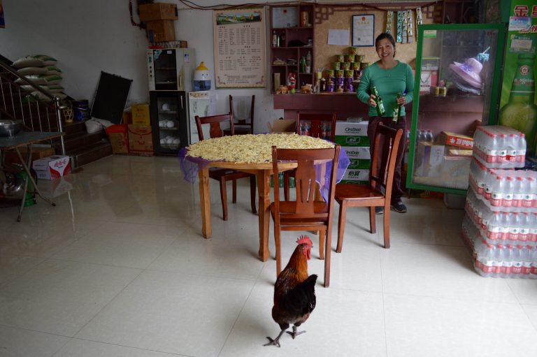
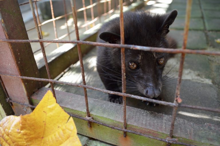
Our four afternoons/evenings in Getu were spent trying to get the water in our room turned on, drinking shitty beer, and playing with local wildlife:
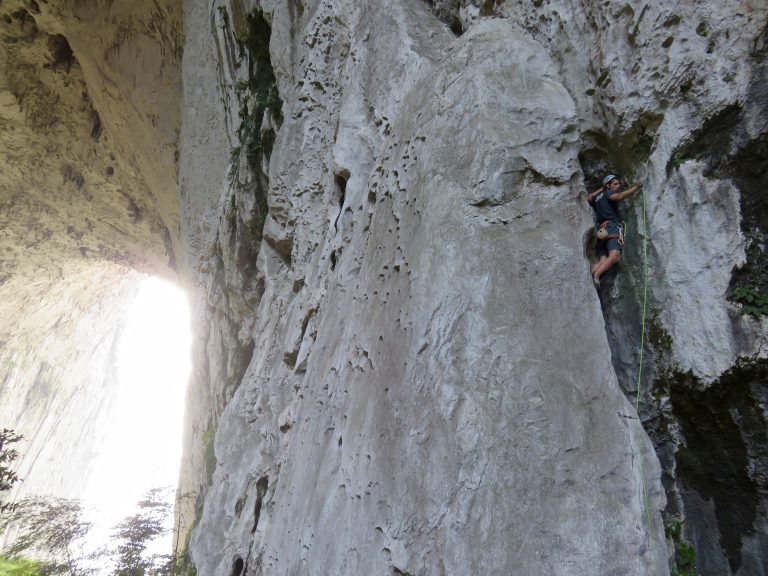
In the next couple days we climbed all the "easy" multi-pitch routes (all 3) in the area. The best one was a 7 pitch, 6b line called "Golden Boy" on the amazing SE face of Pussa Yan mountain:
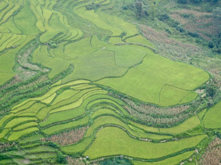
Hazy views were enhanced by the presence of rice paddies:
Steep and thuggish climbing that we normally try to avoid (in other words, hard for us):
Shirley near the top:
Steep bushwhack on the descent:
In addition to some loose rock (airmailed one the size of a dresser from near the top), there were other hazards. Some pissed off local wildlife on the approach:
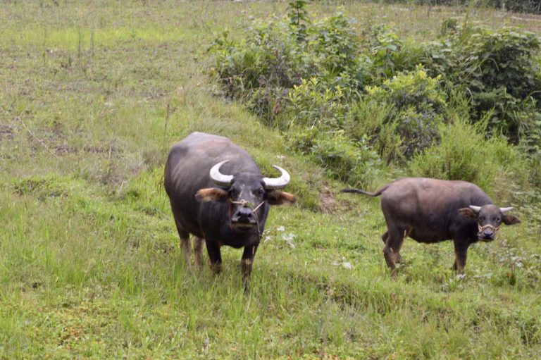
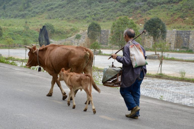
A farmer taking his cattle and bird for a walk in Getu:
Besides bad beer, local vodka and a pool table were the other post-climb entertainment options in Getu:
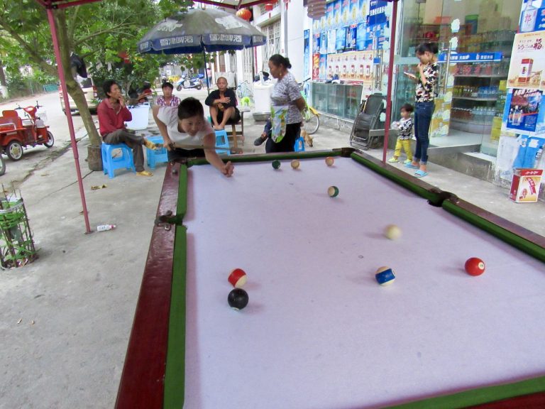
Always the gentleman:
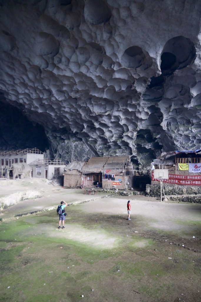
On a rainy day, we hiked into the mountains to see a cave village:
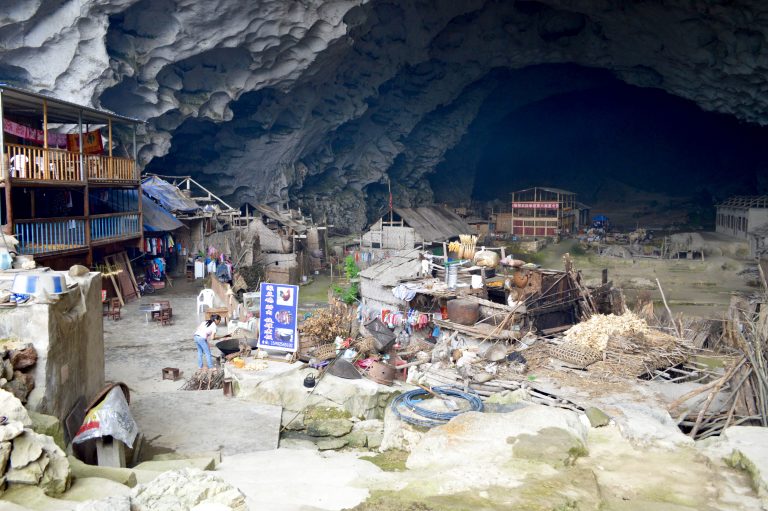
Complete with a basketball court:
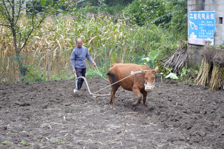
A farmer tilling his small patch of land with the aid of a cow:
Clean Heel route:
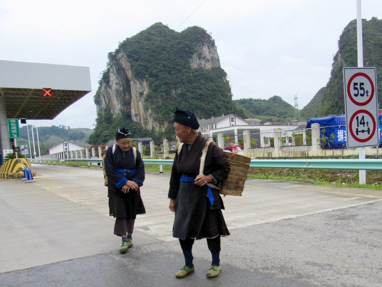
Miao women dressed in their traditional garbs at a highway toll plaza in a town called Ziyun:
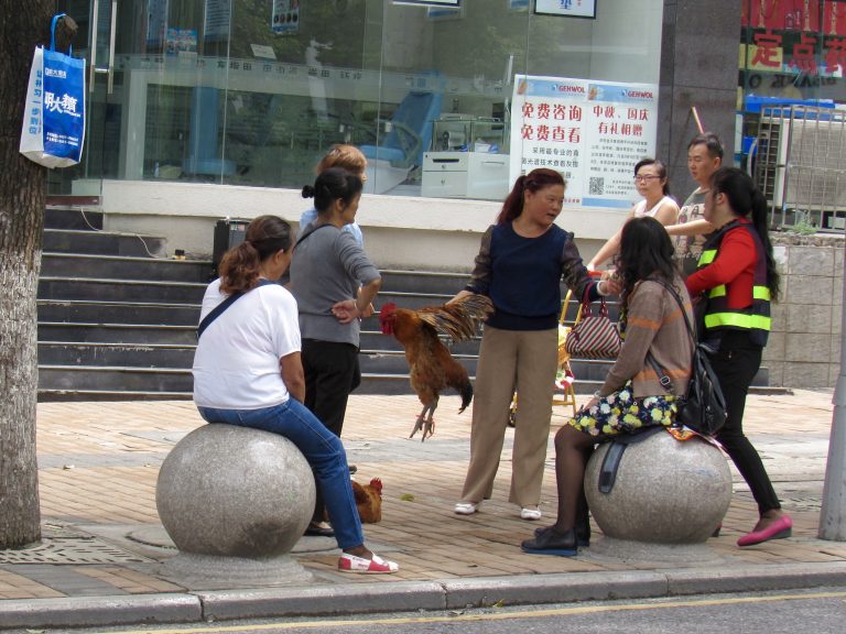
Women sitting on balls listening to a monologue delivered by a woman holding a cock. Guiyang.
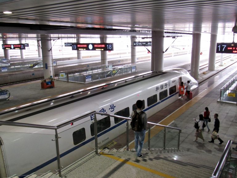
High speed rail link between Guiyang (near Getu) and Guilin (near Yangshuo)...480km in <2 hrs:
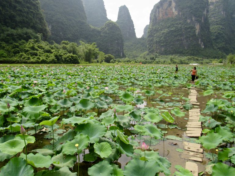
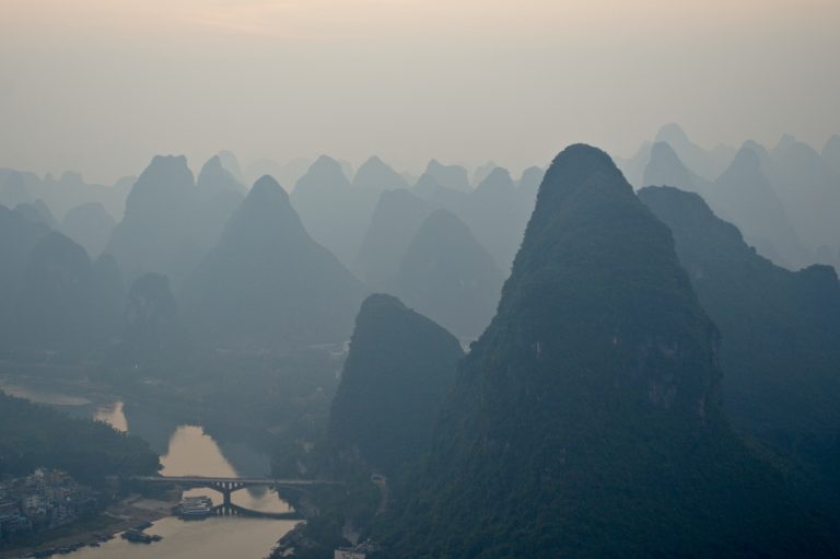
From the rural, we moved on to the touristy (Yangshuo):
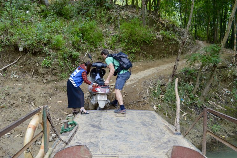
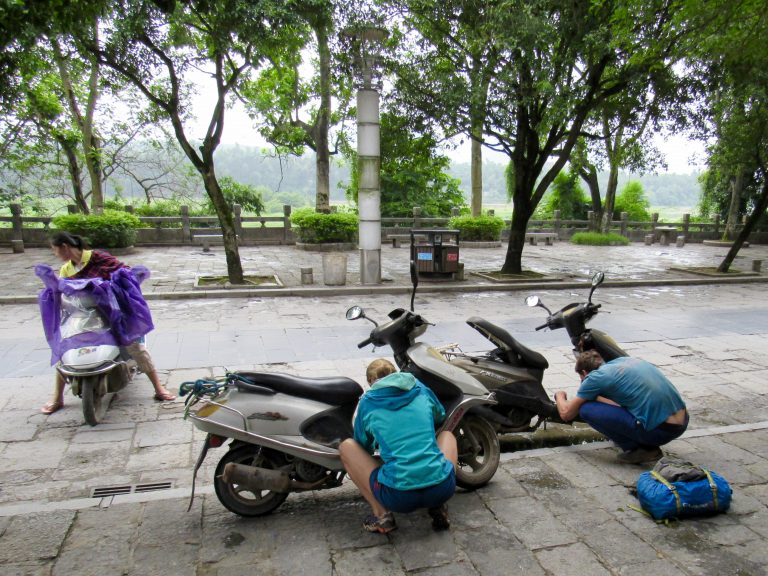
Our days would start with some decent coffee and a session of trying to get the scooters to start:
More steep limestone climbs. This is 5 pitches up Grandfathered In:
Pretty black colored limestone on Happy New Year route (and a couple sweat drops on the lens):
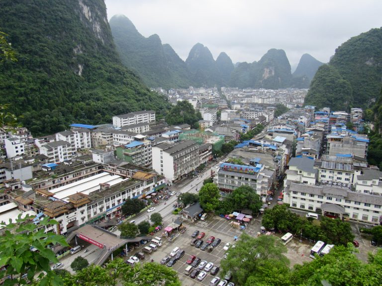
Despite being touristy, Yangshuo is chockfull of natural beauty:
Shirley loving the steep limestone climbing in the sauna (this actually was the one trad line we climbed on the trip):
A fisherman on the Yu Long River:
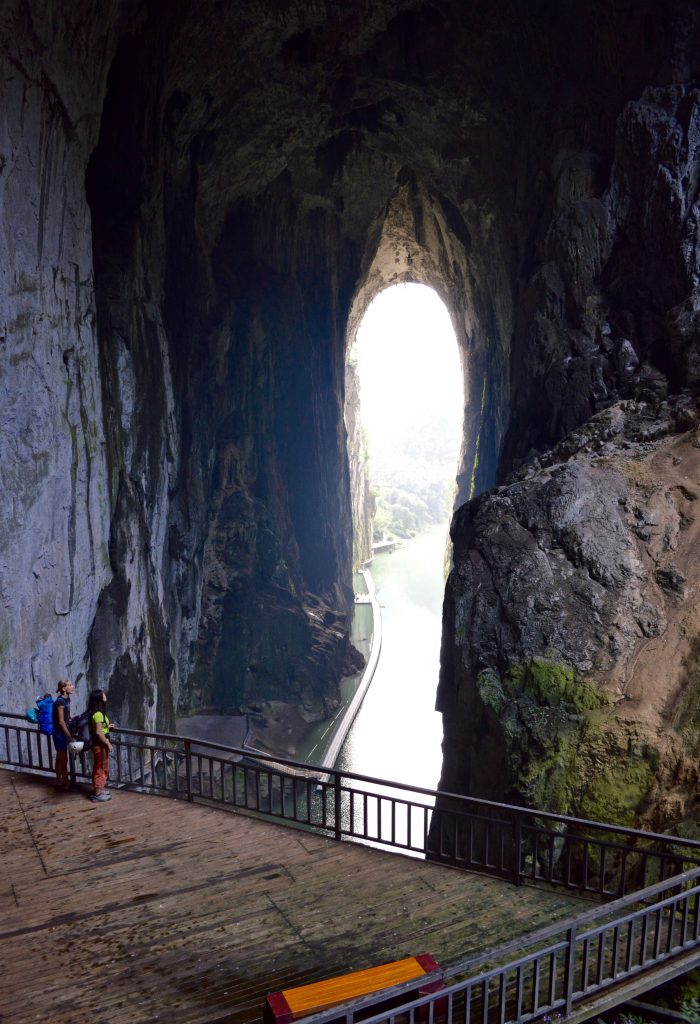
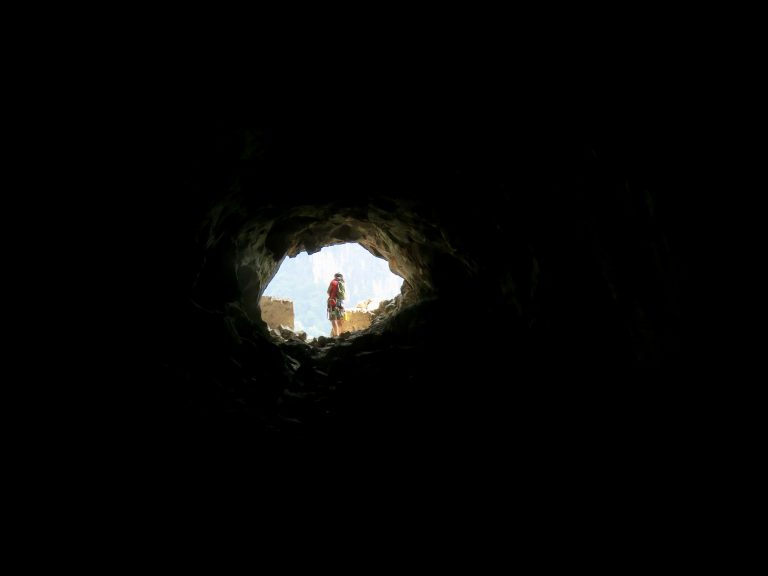
One of the climbs involved a 50 meter free air rap off a karst summit, followed by a 50 meter tunnel through the karst and some more rappelling...kind of unique:
Yangshuo at sunrise:
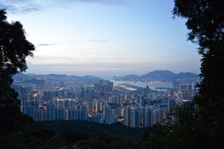
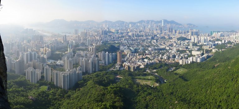
Then we moved on to Hong Kong where we had an 18 hour layover and so we prearranged to be taken out to Lion Rock for a quick multi-pitch climb. Alpine start with Hong Kong below:
Gweilo to Wards Grooves - about 5 short pitches on some nice if a bit greasy granite (humid environment):
The views were spectacular in a unique sort of way. Not wilderness but the dim sum was to die for.
On the hike down:
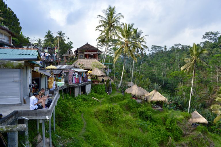
From there it was off to Bali, Indonesia for a couple days of touristy beach time a.k.a. mostly boredom.
Bali:
Robbery in progress at a temple:
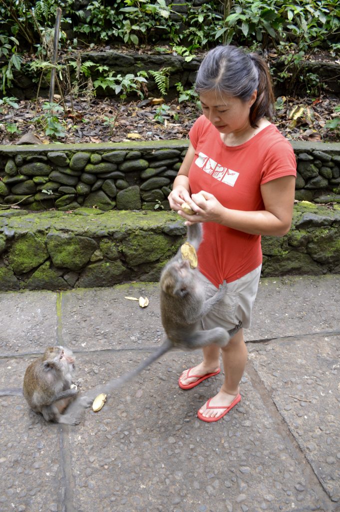
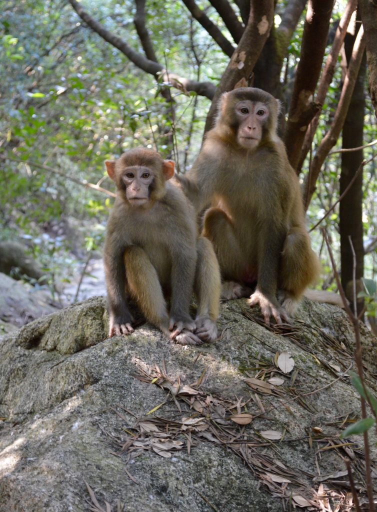
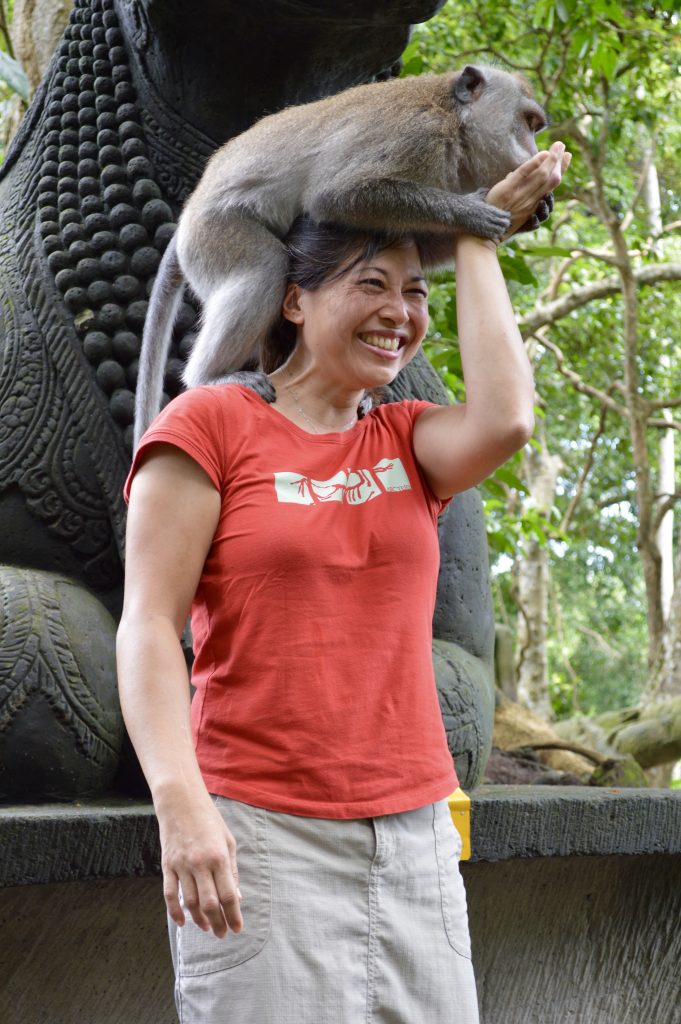
The monkeys there are not what you'd call "shy":
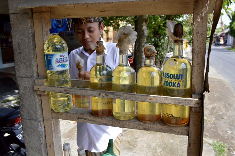
Molotov cocktails for sale:
The secret ingredient of Luwak coffee:
And then it was time to go home. The only unplanned bivy on this trip:
Gear Notes:
Mandarin language skills.
-
When we tried the route in '06 (did 3 pitches before bailing), I recall the first bolt on pitch 1 being way up there. When we came back in '12 & finished the route there was no more stress on P1...guessing those first 2 bolts that were missing might've been a retro-bolt job. Best multipitch in Oregon.
-
man that looks fun - thanks! you walk off? which direction?
-
Nice TRs and photos.
You really didn't like that guidebook?
We thought it was pretty accurate for the most part.
-
Nice!
How's the trail head access? Can it be done in a high(ish) clearance 2wd?
-
That's a sweet bivy. Always wanted to try that route. Nice to get some input on the finishing slab too. Thanks for the TR.
-
Yep, that makes me wanna travel, although sounds a bit nerve wracking through there. Kind of like when we were the first Americans in the Kara Su in Kyrgyzstan after Tommy and Beth were kidnapped. At least I knew some of the language and stuff there.
Did you know to move on before the word spread at the village market, or was it just a prudent hunch?
Nothing specific - just a prudent hunch (we did plan on moving around before the trip & actually stayed at Main de Fatma longer than initially planned).
-
-
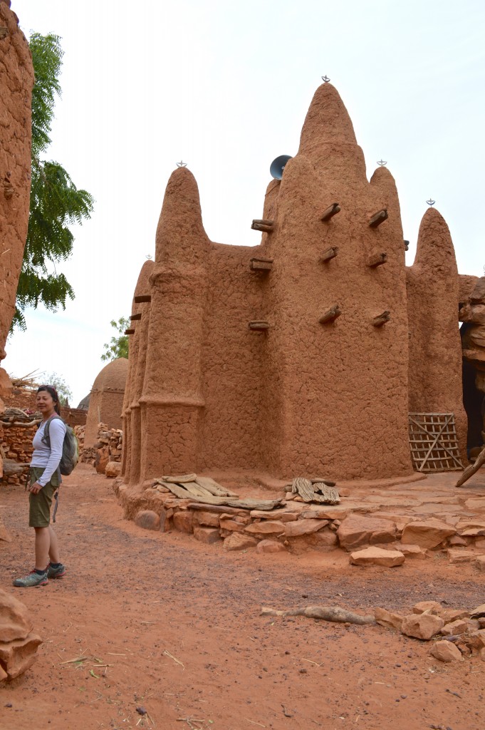
Thanks D. Yes, I think they found pottery on Kaga Tondo (others?). Which blows my mind considering some of those towers are 5.8-5.10- by easiest of lines (the phallic one on the far left is 7a min…don’t think they found pottery on that one).
-
Thank you very much gents!
-
Thanks for the positive feedback guys. Really an amazing place and we're hoping it'll continue to stabilize and improve over the next couple years (the local culture seems incompatible with fundamentalist religiosity). New route potential is quite literally endless - tens of kilometers of 2000' walls and countless towers. Rock type lends itself to moderate free climbing from what little we've seen.
-
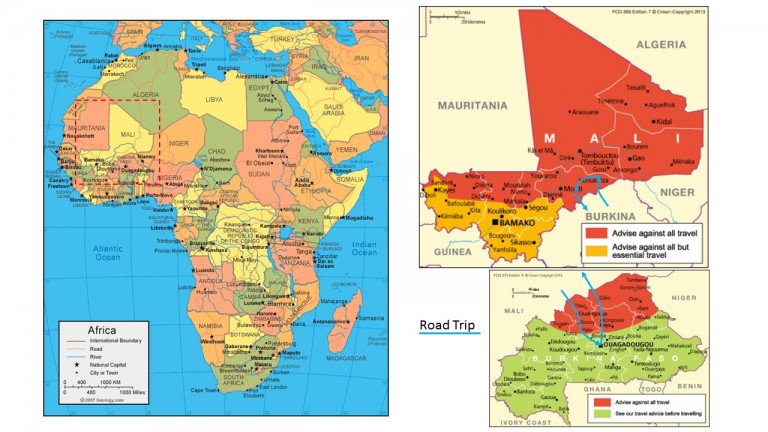
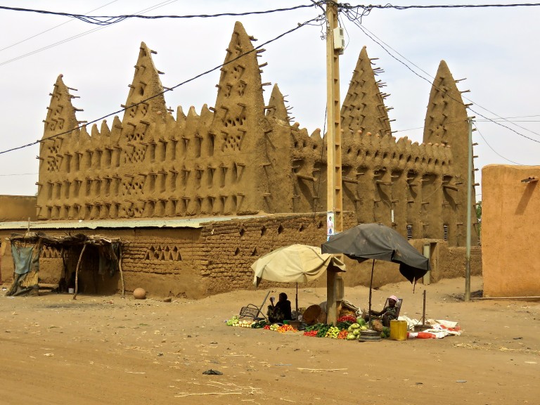
Trip: Desert Towers (Of Mali) - Multiple
Date: 1/25/2016
Trip Report:
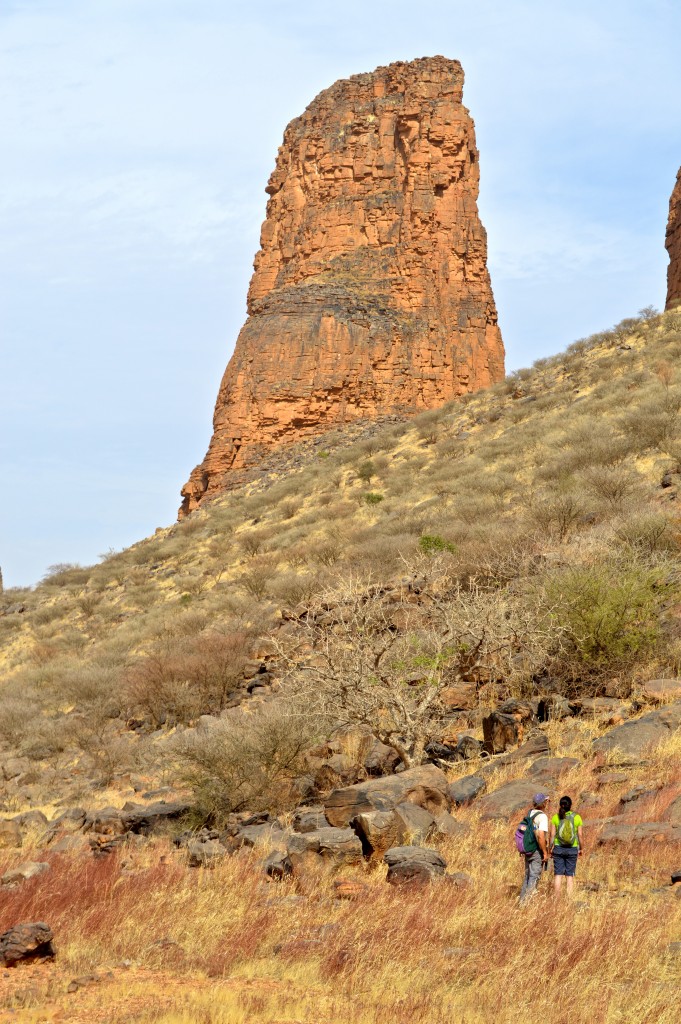
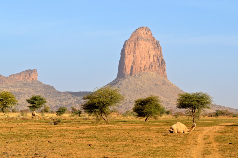
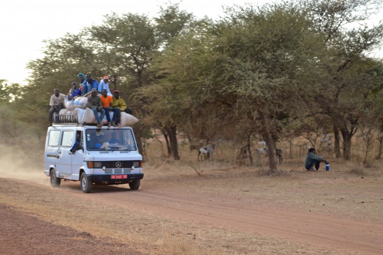
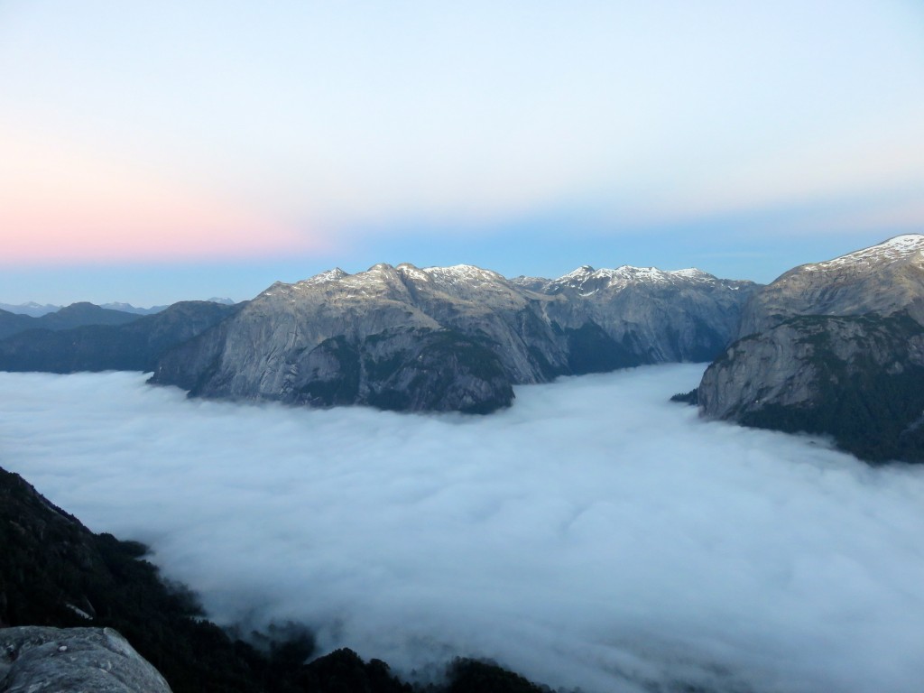
A nearly two and half week road trip through central Mali in Africa – about 70% climbing and the rest sightseeing. We flew into and out of Ouagadougou in the neighboring Burkina Faso and were driven around by our enabler Salvador – the godfather of climbing in Mali. This trip has been in the making for the last 5 years with multiple delays (civil war and Islamic insurgency) and cancellations (Ebola). Mali and especially its Hand Of Fatima (Main De Fatma) region used to be a hotspot for mostly European climbers up until about 2010 when the war started. Other than a single Canadian climber – who visited a year earlier and climbed two routes before doing a bit of jail time and being ejected from the region by the Malian gendarmerie – we were the proverbial canaries in a coalmine. Zero other climbers of course and zero tourists of any kind for the entire duration in Mali. Only outsiders we saw were two UN (or some NGO) workers hiding out in the same “auberge” where we spent the night. This is the trip that had it all for us – adventure (tinge of fear), fantastic new cultures and of course world class climbing on 600 meter tall towers on the best sandstone we’ve ever tasted.
More photos (& short videos) can be seen on our website, http://chossclimbers.com/testing/mali/ , as well as some verbose ramblings. Enjoy!
Looks like a “go”:
Light is right…Right….
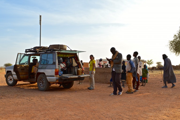
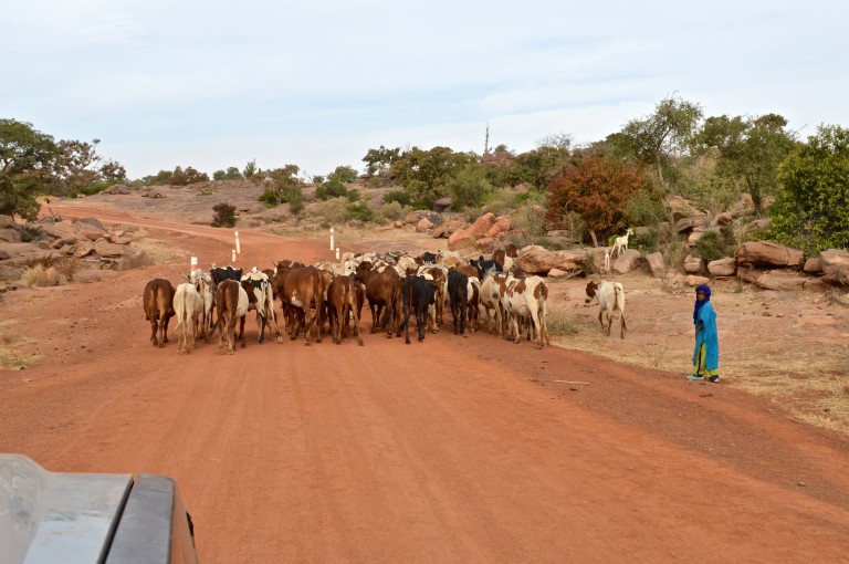
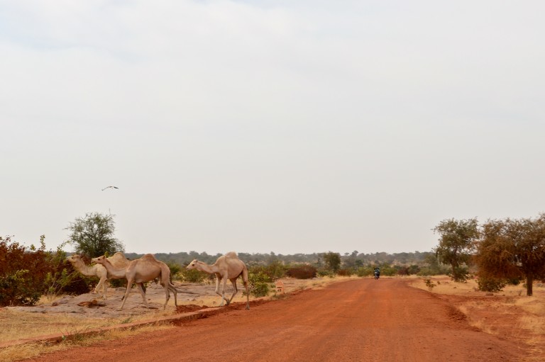
Burkina to Mali – about a day and change of driving…”paved” to dirt roads to no-roads at all. Border was non-existent where we entered...or exited for that matter. In fact, other than 2 or 3 military checkpoints inside Mali, we were there for 2.5 wks & don't have a stamp in our passports to show for it (a shame):
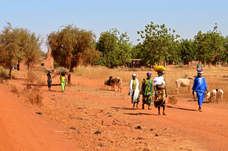
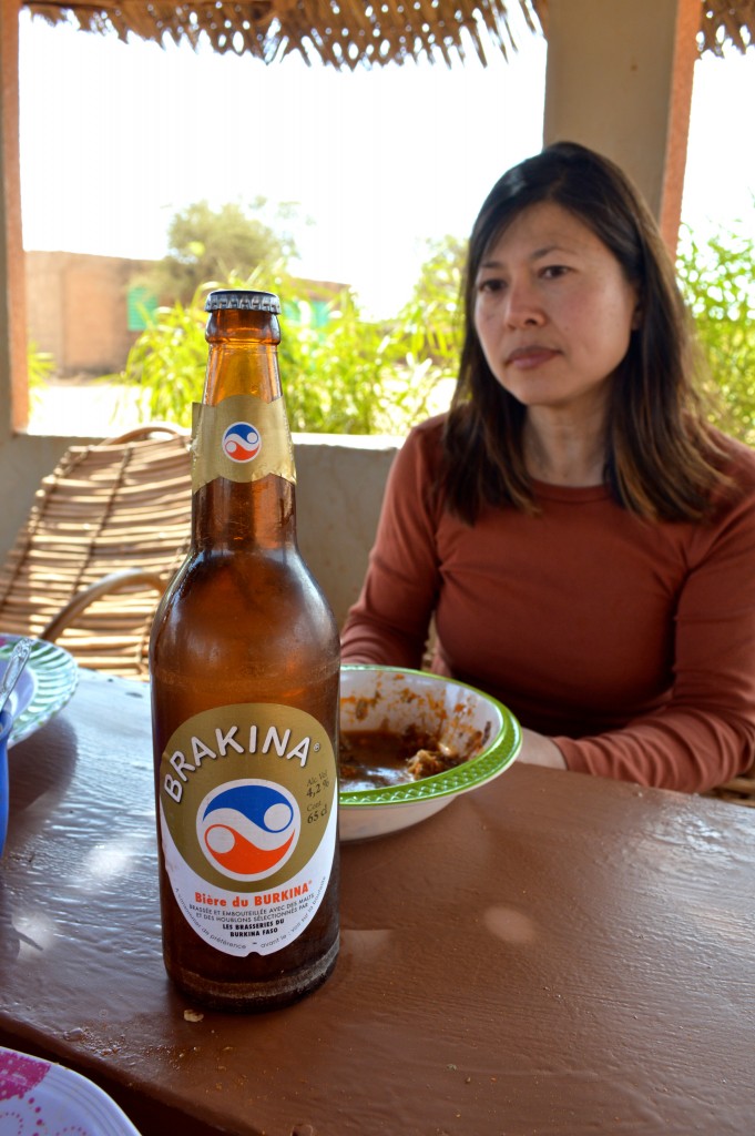
Last beer for almost 2 wks. Djibo, Burkina Faso - now on to Mali:
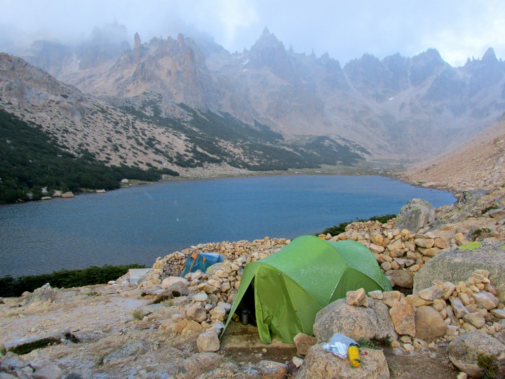
Our first night in Mali was spent camped out in the middle of a village. In fact, other than 8 days camping out in the backcountry of Main De Fatma, we always sought the safety of a village for our bivys:
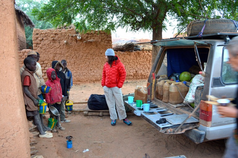
Packing up:
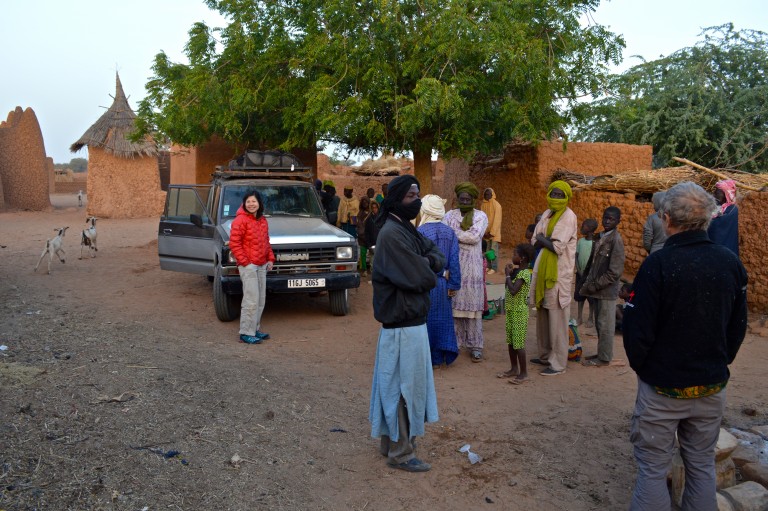
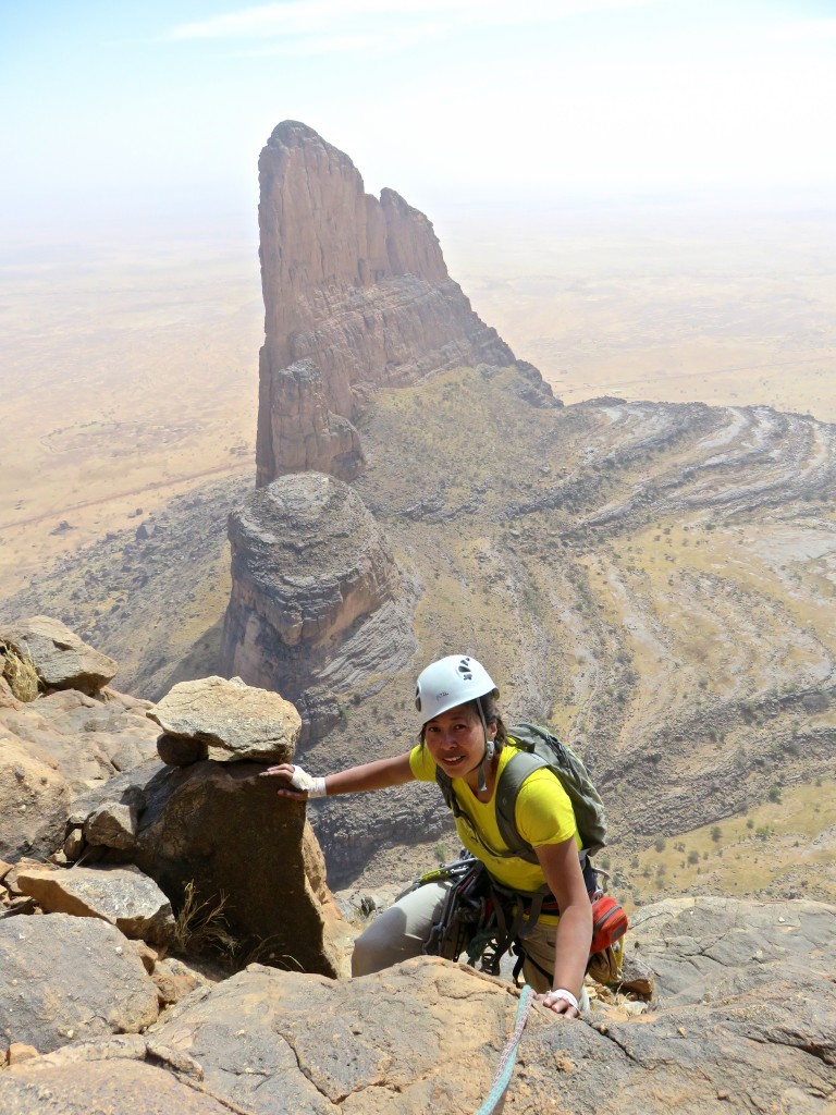
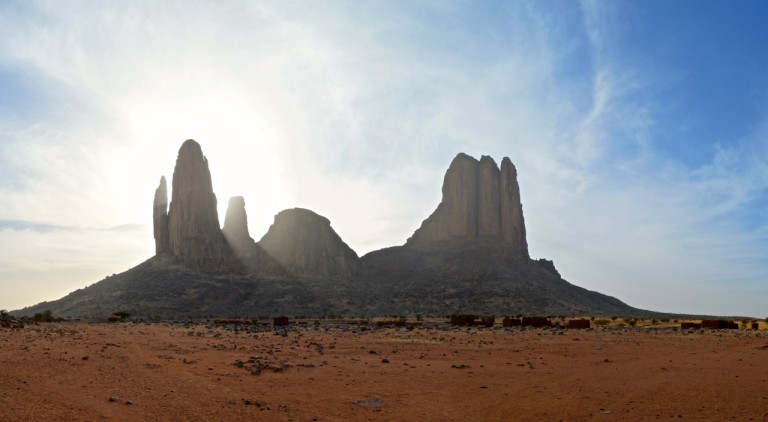
First sighting of Main De Fatma emerging from the dust of the Sahel like some ghost ship:
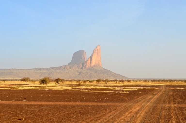
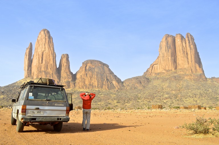
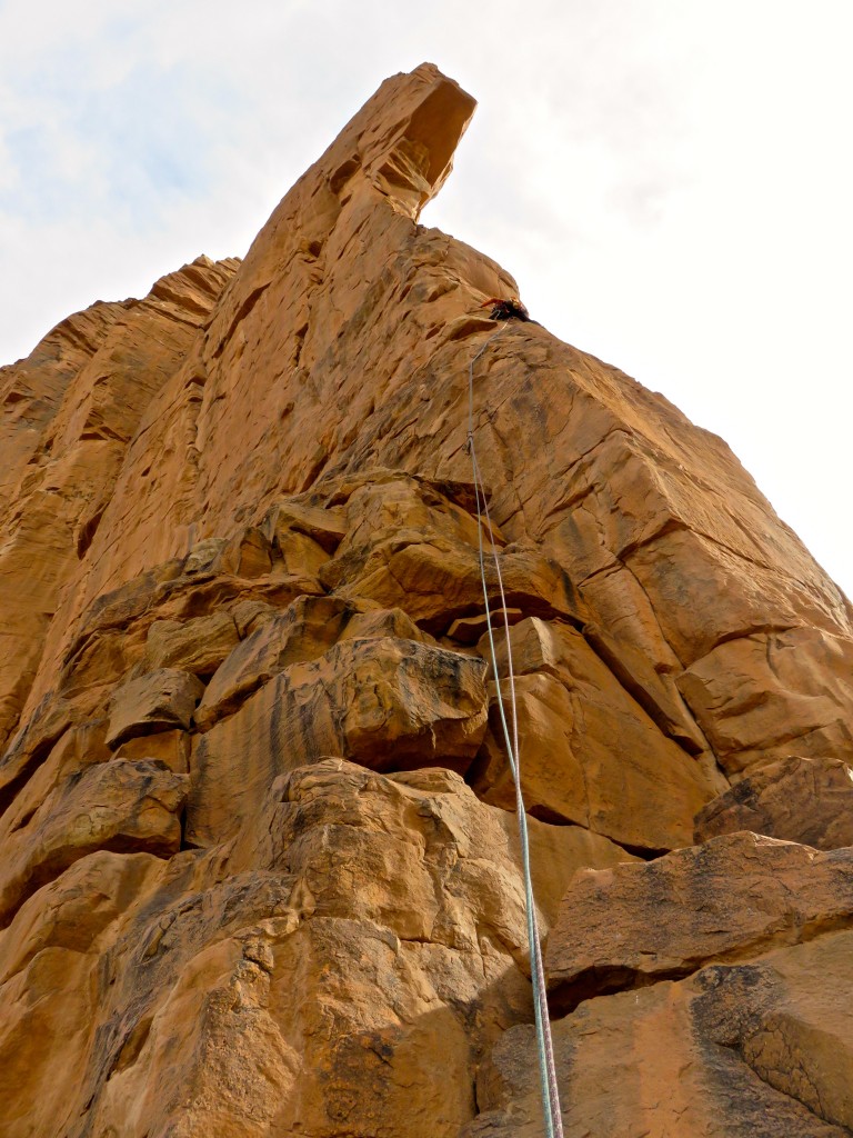
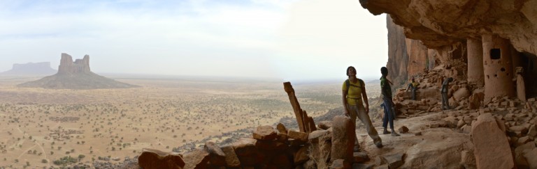
Minds blown – the two principle “fingers” of The Hand are 600-650 meters tall:
Packing up for our 8 day stay in the backcountry of Main De Fatma. Salvador arranged porters for the ~1 hr hike up…apparently, neither the gendarmes nor the jihadistas like to hike that far:
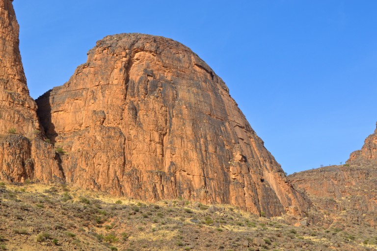
Our warm-up climb was on this stubby “little” thing (280 meters) called Wamderdou:
For the next 7 or 8 days, Salvador ran the camp and did most of the cooking (he also came along as a second on two short climbs). He also shot some cool long range photos of us on the climbs. Backcountry camp life:
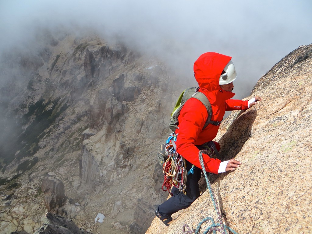
Next day we had our climbing failure of the outing – we did the first 2 pitches of Vuelva Usted Manana (French 6b A0; but it starts with a 4 pitch “approach”) but the perpetual Harmattan wind made the spectacular bolt ladder pretty f…ing hard reach-wise for Shirley (spinning):
Leading pitch 1:
View from pitch 2:
And so we bailed – that’s 35 meters of twins suspended horizontally:
Some more routes including this nice La Raison (French 5+):
Hiking along the summit of Wamderdou with Suri Tondo visible:
And the Normal (French 5) route on Wamgel Debridou:
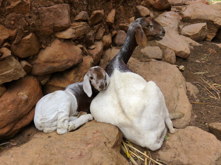
For Christmas Eve dinner, Salvador’s men brought in a goat, slaughtered it and we had some of the freshest, free-range, organic meat you can imagine:
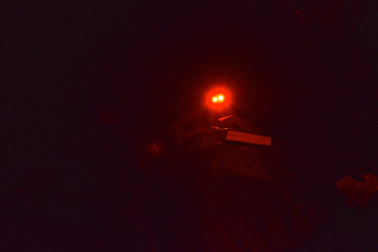
Evenings in our camp were low key affairs – mostly red LEDs…no need to attract attention:
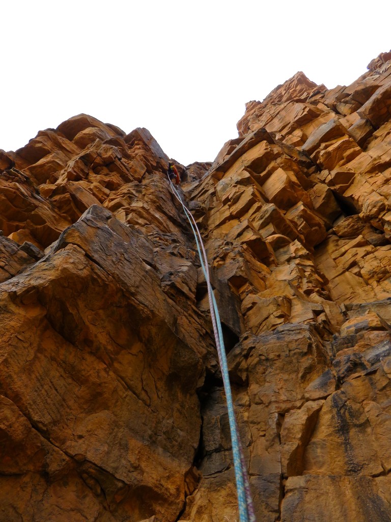
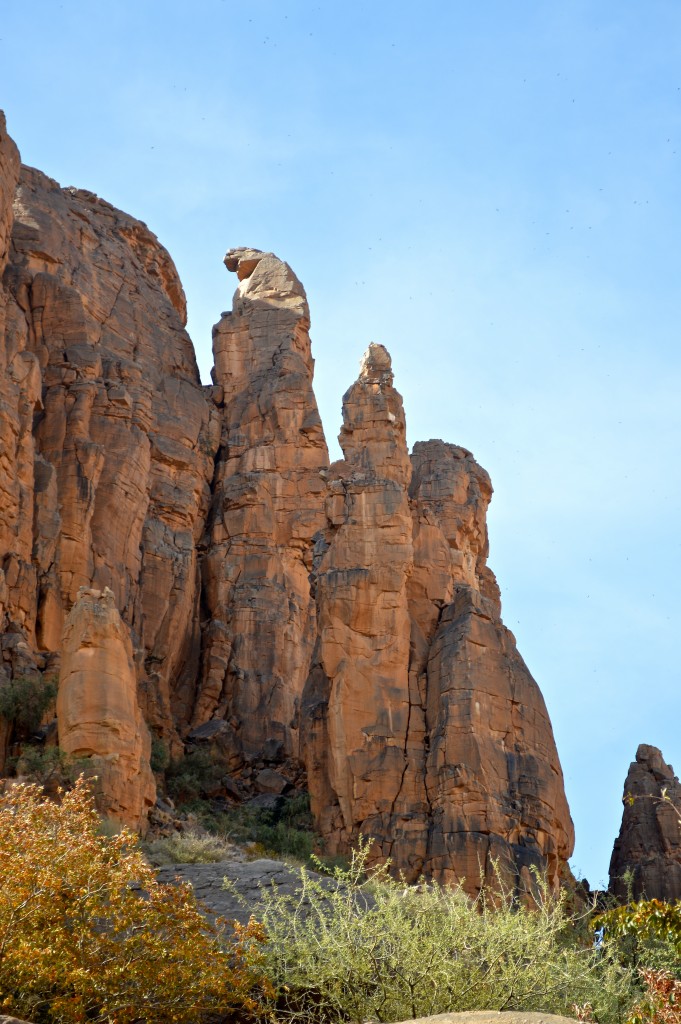
After about 4 or 5 days of hurricane force winds, thing started becoming calm and we went for our main goal of the trip, the spectacular 15 pitch 6a+ North Ridge on Kaga Tondo.
View of the upper half of North Ridge of Kaga Tondo – 600 meters of moderate climbing nirvana:

Pitch 2:
Pitch 8 – long range shot taken by Salvador:
Pitch 9:
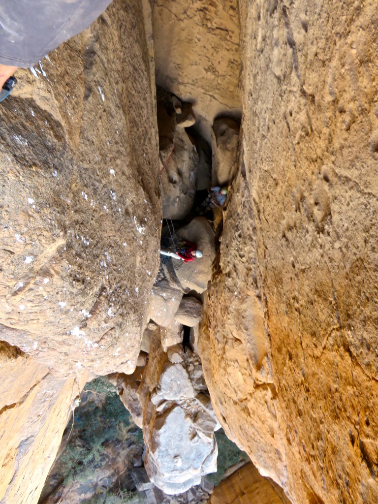
Pitch 13:
More pitch 13:
This is the Second Gendarme. In the background is the other big formation of the cluster, called Suri Tondo. Shirley starting the traverse of pitch 13:
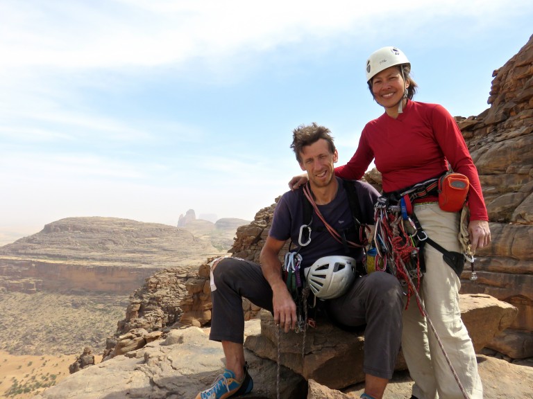
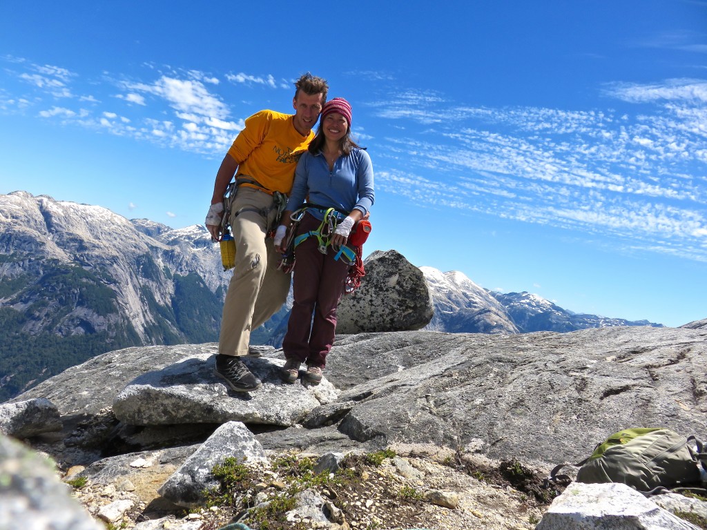
One happy camper on the summit of Kaga Tondo:
A somewhat stressful series of long rappels…a few stuck ropes nearby. Fortunately for us, the prevailing wind direction proved favorable. Some of the long range photos of us taken from camp by Salvador:
Views from the descent. The fact that we got back to camp with daylight to spare is a tribute to the hyper-accurate route topo that Salvador drew us and not our “climbing prowess”:
Shirley tearing into one of our celebratory watermelons like there’s no tomorrow…which technically there might not be.
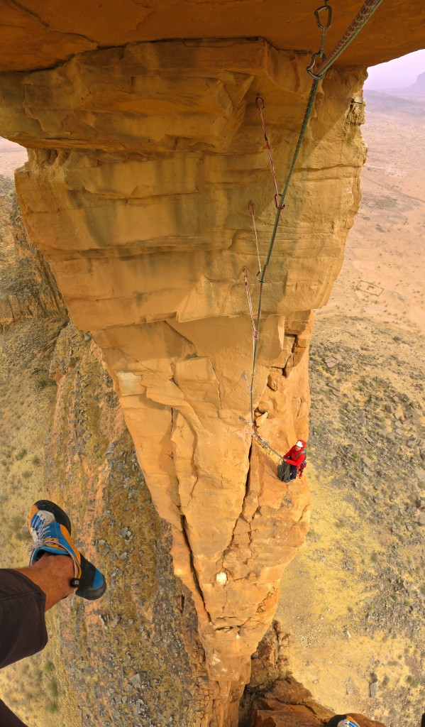
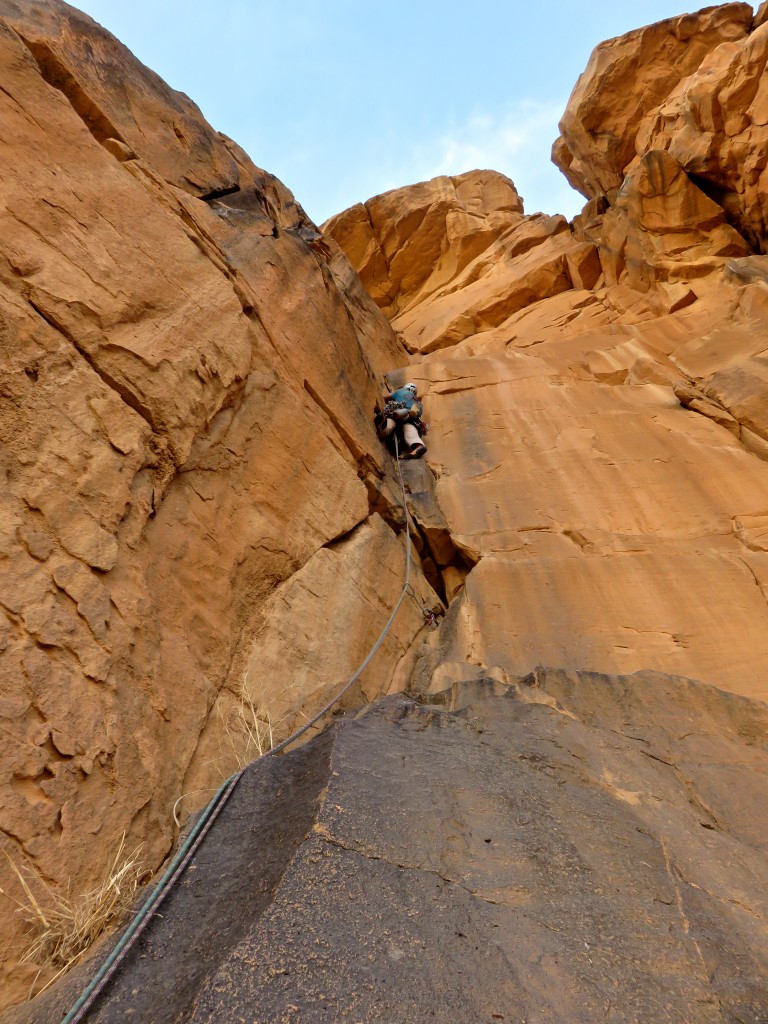
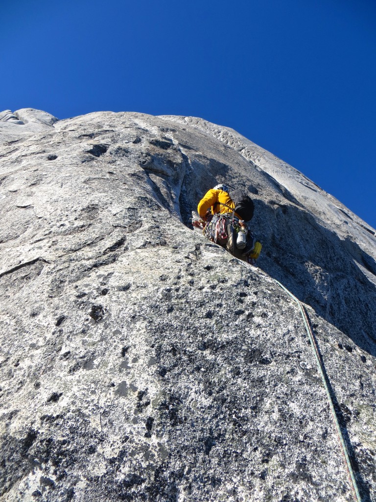
After a rest day, we climbed the excellent Voie Guy Abert on Suri Tondo – just right of the prow of this thing that has been dominating our world from camp for a week:
Pitch 1 has a section of 7a or A0 – rest of the climbing does not exceed 6b. Leading pitch 1, photo by Salvador:
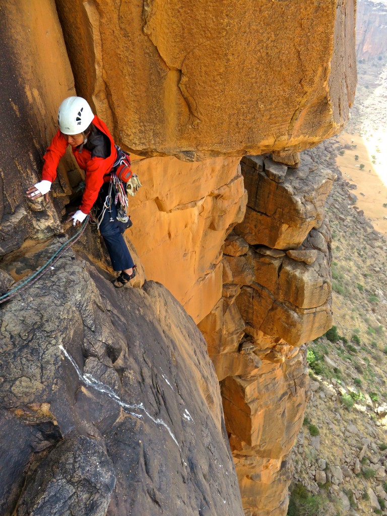
Shirley on pitch 2 – only wideness on the route. Rest of it was exquisite hand and finger cracks:
Shirley climbing pitch 3 – photo by Salvador:
Hand crack fun on pitch 6 (?):
Topping out on Suri Tondo:
After that we left the area on the day of the 2nd weekly market in the village below…before word of our presence spread through the region. One last looksee:
Quick fill up of water jugs at the village well and we’re out:
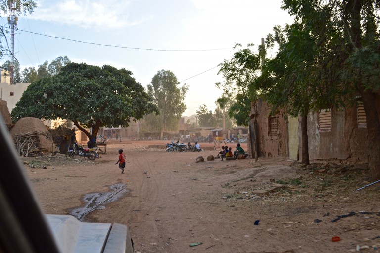
The next few days were spent driving out to a few different formations to climb, spending nights in the safety of villages, and taking in the sights:
We climbed this guy at center of photo called Aiguille Panoramix:
Chimneys and more chimneys – Salvador joined us as a second:
Cool summit though:
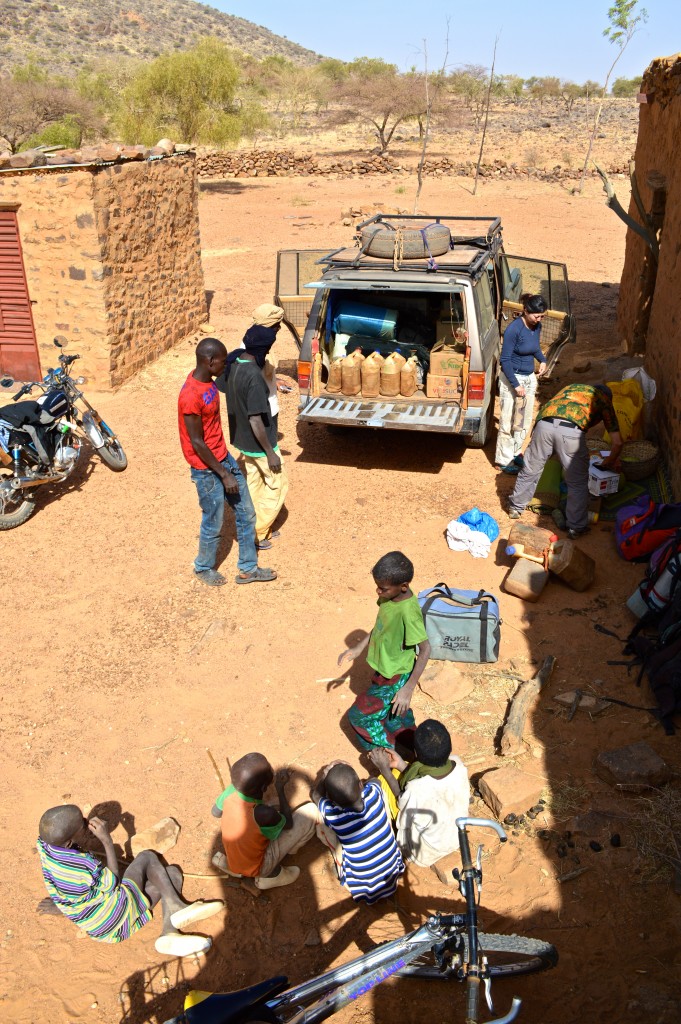
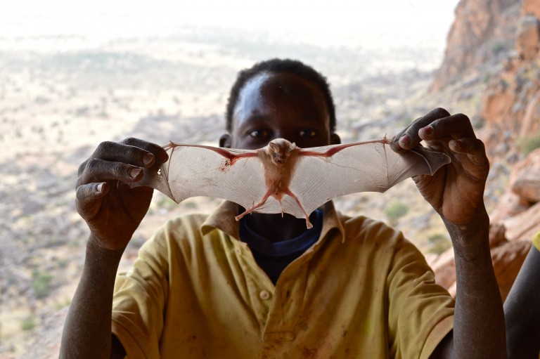
Explored some old villages. Here a local kid is about to dispatch a bat…it’s what happens when kids grow up without television:
Same cliff-side village (abandoned) with the Youna-Inde Massif in the background:
We slept in villages – this meant freshly killed chickens for dinner and a big audience of mostly kids at all times. Here’s the morning show called “breakfast”:
Women in a mountain-top village of Boni-Koyo:
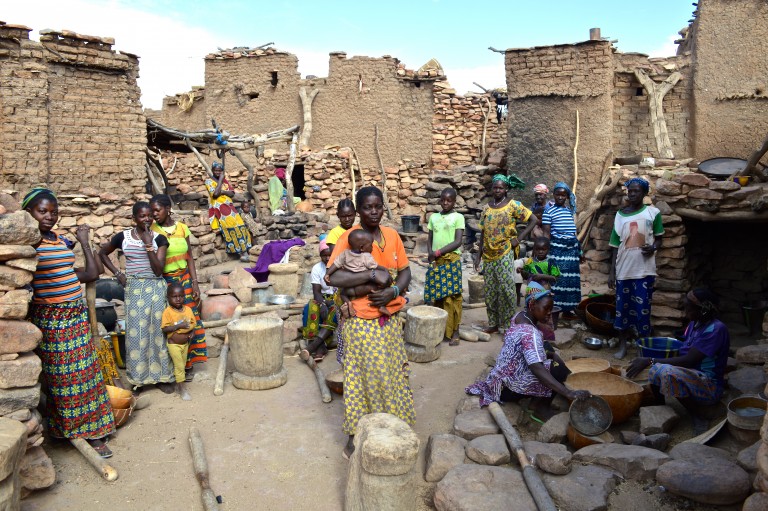
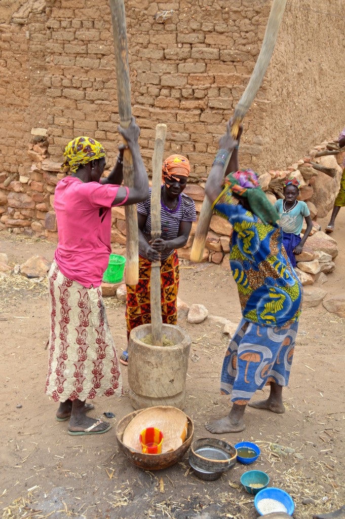
Pounding millet:
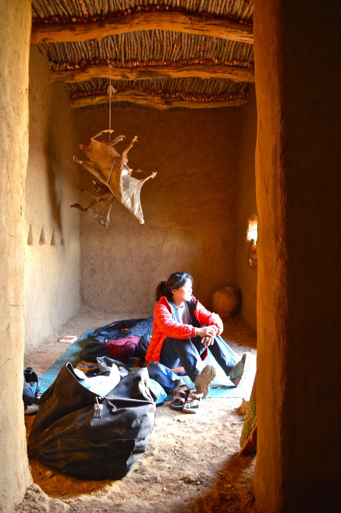
In some places, the people would offer us the use of an unoccupied house. I could care less about mice running over me at night but then I kept thinking of all the possible snakes that might follow them in (no doors):
We climbed an 8-pitch line called La Fiesta De Los Fetiches – mostly crack climbing:
Very aesthetic if tinged by a touch of nervousness as it overlooks the main road (we avoided main roads for the most part):
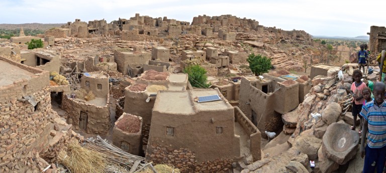
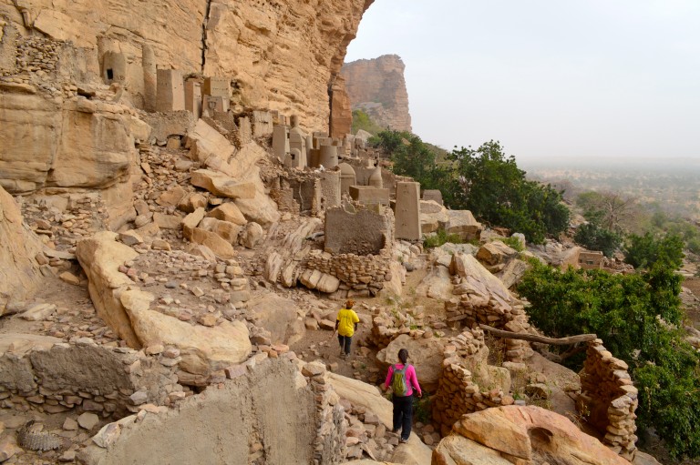
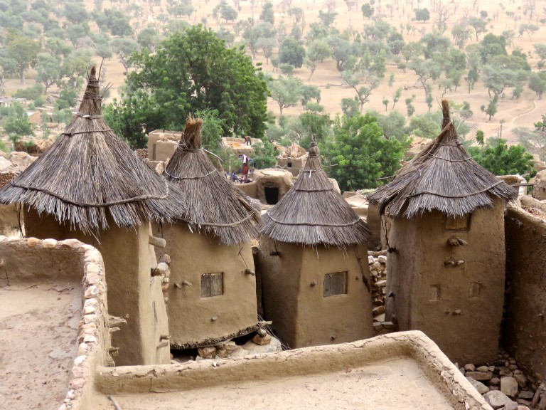
After that we hit the road and went for some sightseeing in the Dogon Country a couple hundred kilometers away. Roadside sights:
We spent a night in the town of Douentza which apparently saw heavy fighting & aerial bombardment campaign during the French effort to drive out the Islamists (circa 2013):
On the drive to the Dogon Lands:
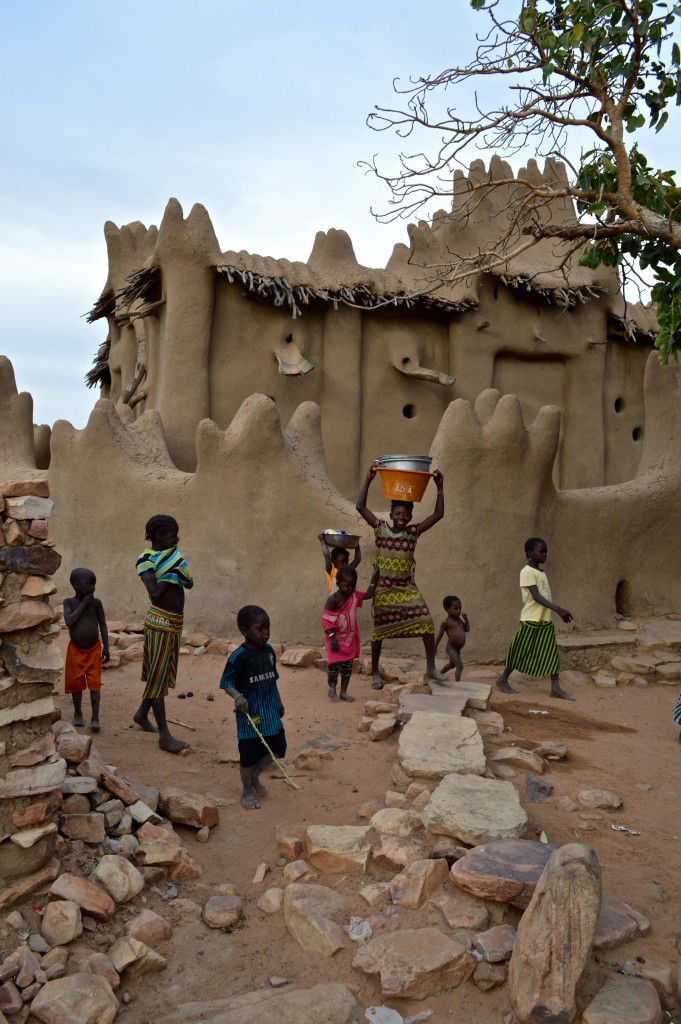
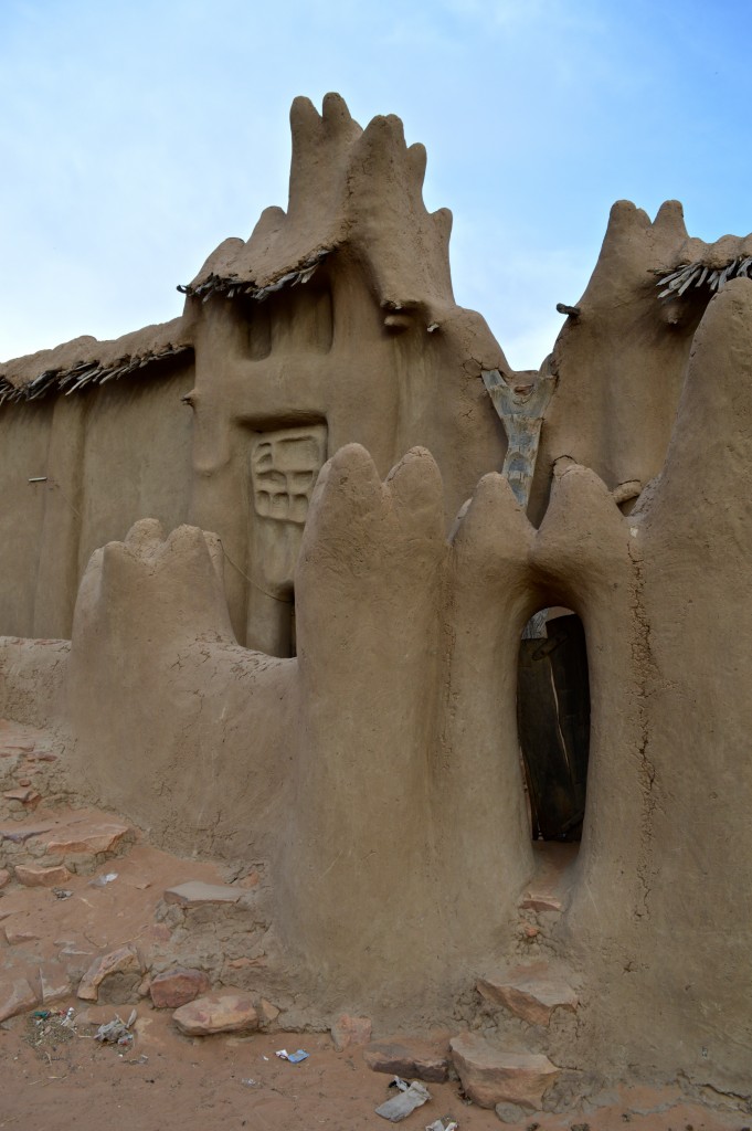
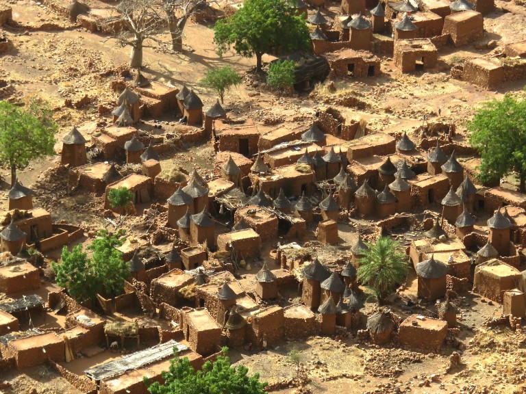
Next 5 days were spent hiking tens of kilometers through Dogon villages. Here’s the first one and its mosque:
Village of Dyongono with its Medieval-castle-like architecture:
And the beautiful mosque in the village of Nando:
Flowing lines:
Dogon Country is perfectly safe – we slept on the plateau next to the car:
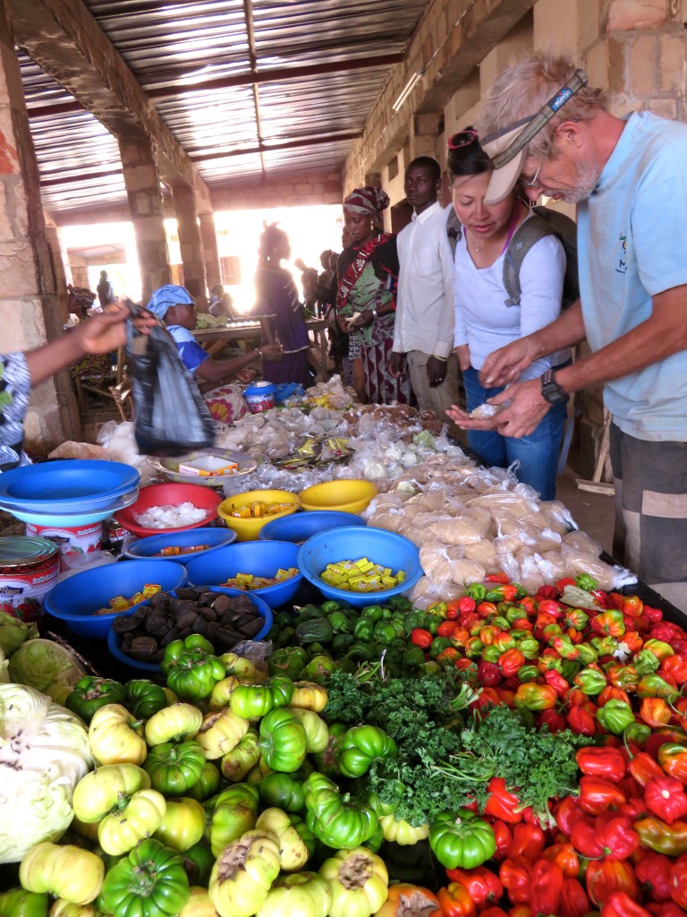
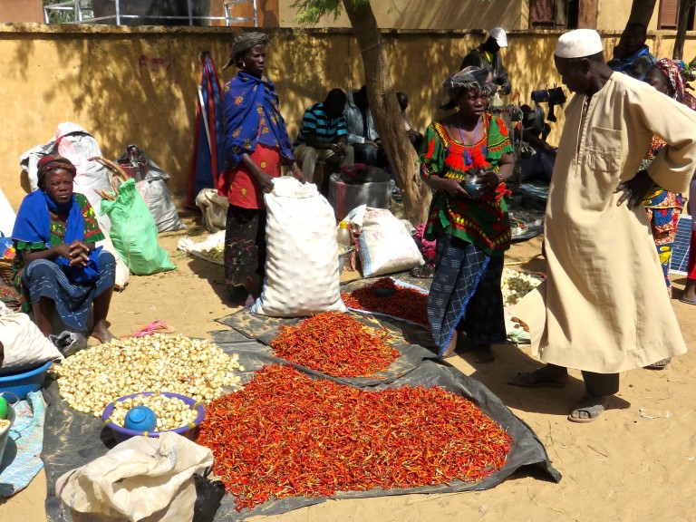
We checked out a dozen Malian village markets. Shirley and Salvador shopping for some dried onions – a specialty of the Dogon lands – that somehow ended up in our checked bags:
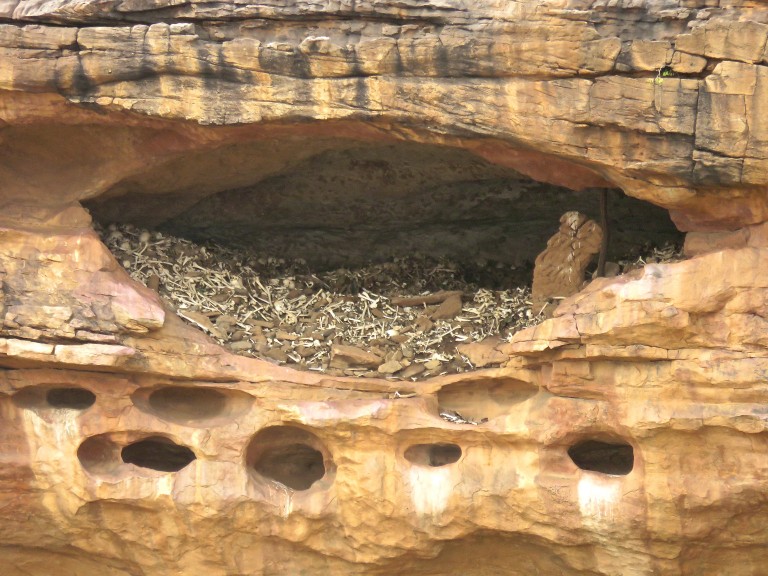
The Dogon place their dead in Cliffside caves like this one (this one is old but the tradition is ongoing):
Embarking on a 25km hike through villages with our local Dogon guide Emmanuelle:
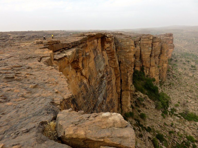
Villages of the Dogon Escarpment:
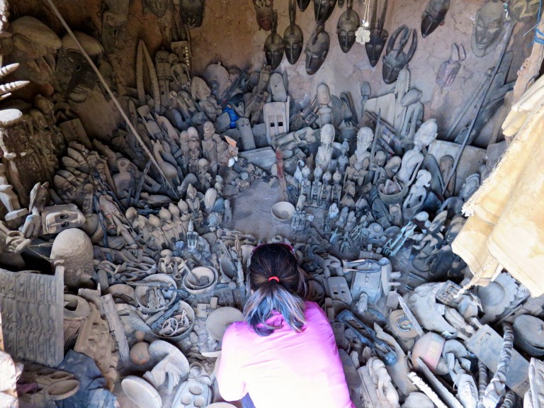
Arts and crafts…did I mention zero tourists?
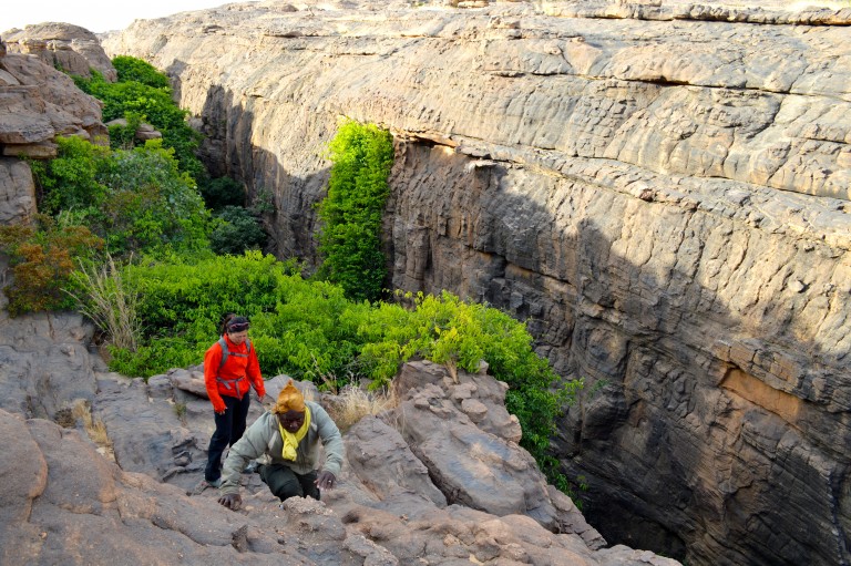
Hiking along the Dogon Escarpment:
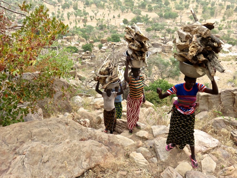
Women carrying 25kg bundles of firewood up a trail that borders 3rd class in sections:
Millet storage units:
Delicious! I especially like the bbqed heart and liver:
More Dogon villages:
More Malian markets:
An impressive mosque in the border town of Koro some 40km away from the Burkina border…we stopped for all of 5 seconds to snap this photo and did not linger:
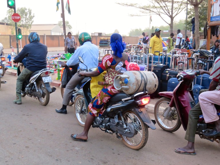
Back in Ouagadougou for our flights home…just a typical scene: mother, child, and a mid-sized tank of propane:
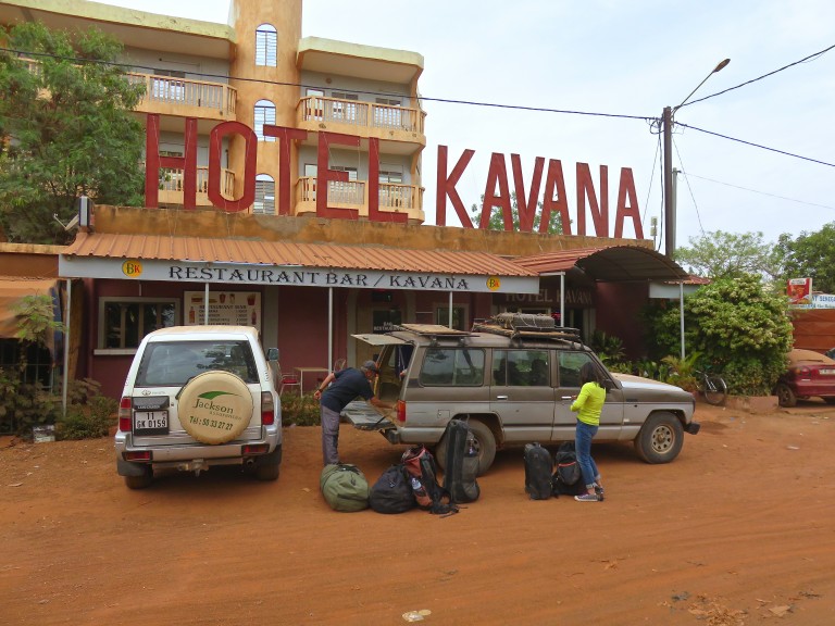
That’s it folks – time to go back home. Packing up in front of our hotel (not Splendid but pretty excellent) in Ouaga. Thank you Salvador!
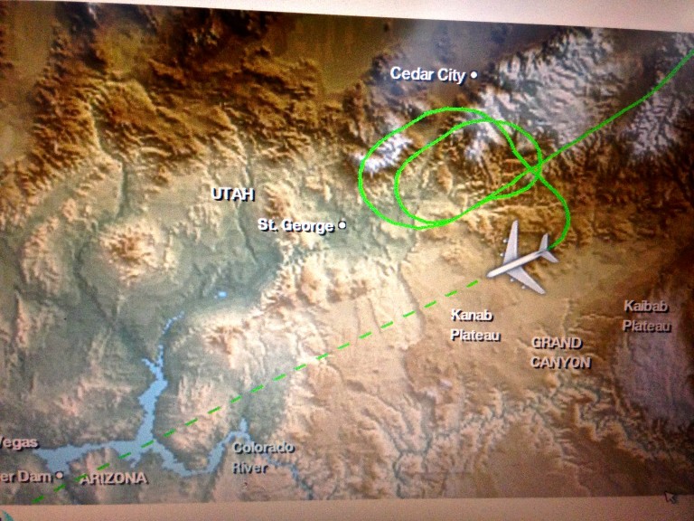
The most nerve-wracking part of the trip – flying over the third world…I mean is elder Hyrum at the Salt Lake center high or drunk?
Approach Notes:
Salvador.
-
That shot from the rv park makes it look like leaning tower. Great stuff.
-
very nice & (most importantly) different. climbing above an angry sea is a different experience the first few times around...
-
Great photos Wayne! I remember getting to the pitch 1 anchors on Honeymoon & puking my brains out. Were looking at your write up last night & got plenty inspired for a desert trip.
-
Mike, think we met you a good decade ago in Smith – to this day we reminisce occasionally about that upstanding young gentleman who shared a big piece of his birthday cake (??) with us strangers at the base of red wall (I think)

PS thanks gents.
-
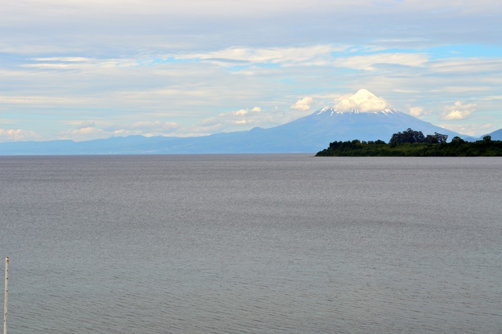
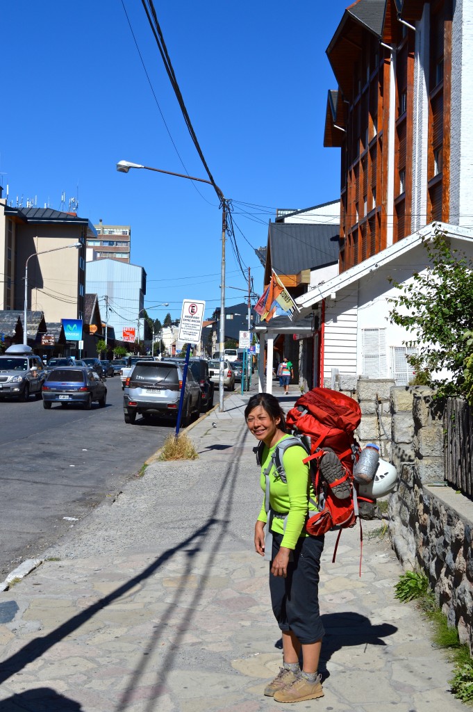
Thanks guys! As for planning, the three countries we visited all involve straightforward logistics (think western Europe-like). Other than airfares, everything else was done probably within a month of departure. For Australia, there’s no visa required. Tasmania is expensive – renting something where you can cook your own food is nice…long term camping would suck with the wet weather but of course is doable. East side of the island has reasonable weather; west side…in 3 weeks we never really got a window to try out some stuff there (& there’s plenty). Like US, rental car is essential. Free Tasmania climbing guidebook online. For Chile, no visa again. Declare all the food you’re bringing in incl. freeze dried (they seem paranoid & happy to fine you). The website run by Refugio Cochamo (cochamo.com) has all the logistics you’ll need outlined. Reserve a camp site, arrange a cab from Puerto Montt/Varas to TH, hire a horse to carry your stuff in etc... 10 day stay is probably minimum to get some climbing in – weather was pretty on/off. We bought bus tickets for the Puerto Montt-Bariloche connection in US – cheap, easy, comfortable. Don’t forget to prepay your “reciprocity fee” before entering Argentina. Bariloche to TH is a quick city bus ride. Camping in Frey near the Refugio is free but you pay for using their shared kitchen. You can also buy food & wine/beer from them & they don’t seem to run out. Renting a car for the S. America leg seemed pointless & looked like a pain in the ass if you’re crossing the border. That’s it I think – if you have something more specific, shoot me a note.
PS have not been to any of those countries before.
-
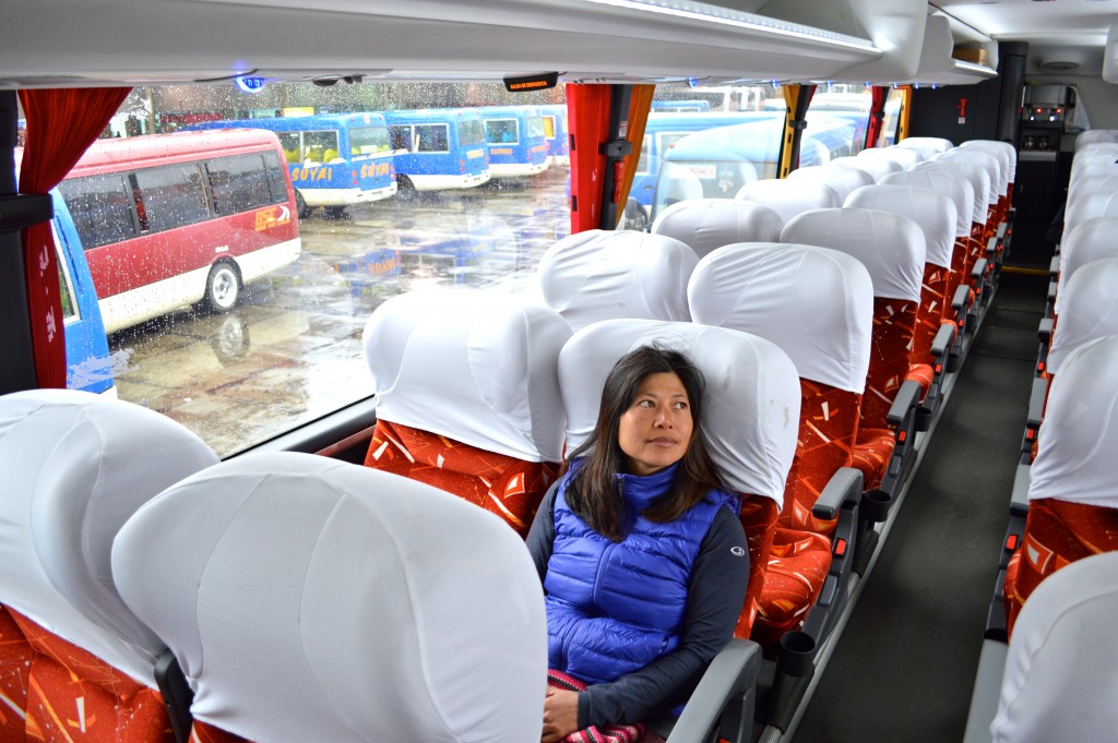
Trip: Southern Hemisphere Sampler - A Mixed Bag Of Stuff
Date: 3/1/2015
Trip Report:
A 7-week stretch away from work and climbing a somewhat random sampling of Southern Hemisphere’s crags. We started in the lush, rainy but beautiful Tasmania where the things we ticked were not large but very unique (sea stacks) and quite memorable (snakes). The upside of climbing in the “developed” parts of the world is that bits of nature are sometimes actually preserved. We then moved on to South America via a weeklong stopover at home which included a day of climbing in Joshua Tree. In Chile, we spent about 12 days in Cochamo Valley. On balance, we had a decent stretch of weather: a 3 days of sun, 2 days of rain pattern. Multiple days of sunshine are pretty essential there as the approaches are significant and the routes are long (& formations seep for a day after a good downpour). But a good day in Cochamo really bumps up the pitch count. We’d go back. From Chile, we bused over to Argentina’s Frey, home of mid-sized granite spire climbing. Funny how from afar things look like Shiprock at Smith but are actually composed of clean, solid, brown granite for the most part. Had excellent weather… on day one. This was then followed by 5 days of cold temps and high and sustained winds. The climbing was very good – even with numb hands and fingers: crisp cracks and friendly faces. However, we’d check out other places before heading back to Frey though.
Here's more: http://chossclimbers.com/collections/southern-hemisphere-sampler/
Some Pics:
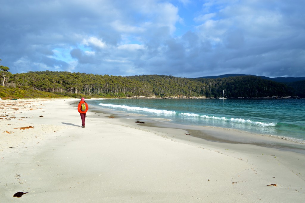
Light is right! Shirley and our 202 lbs of gear waiting at the rental car counter in Hobart:
Welcome to Australia. Cute...
…and tasty:
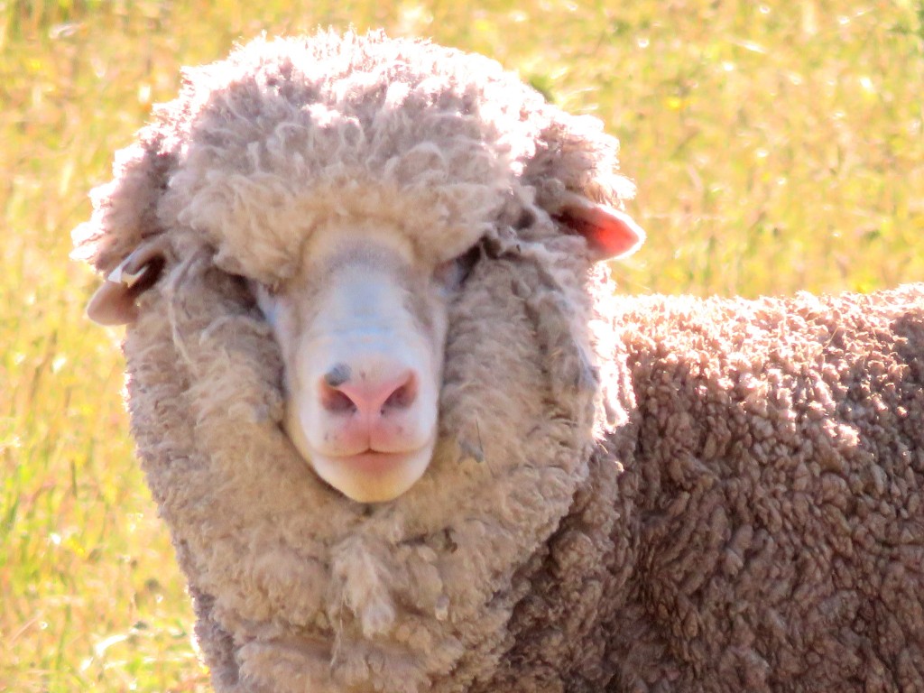
Tasmania…if you're into sheep…book your tickets now:
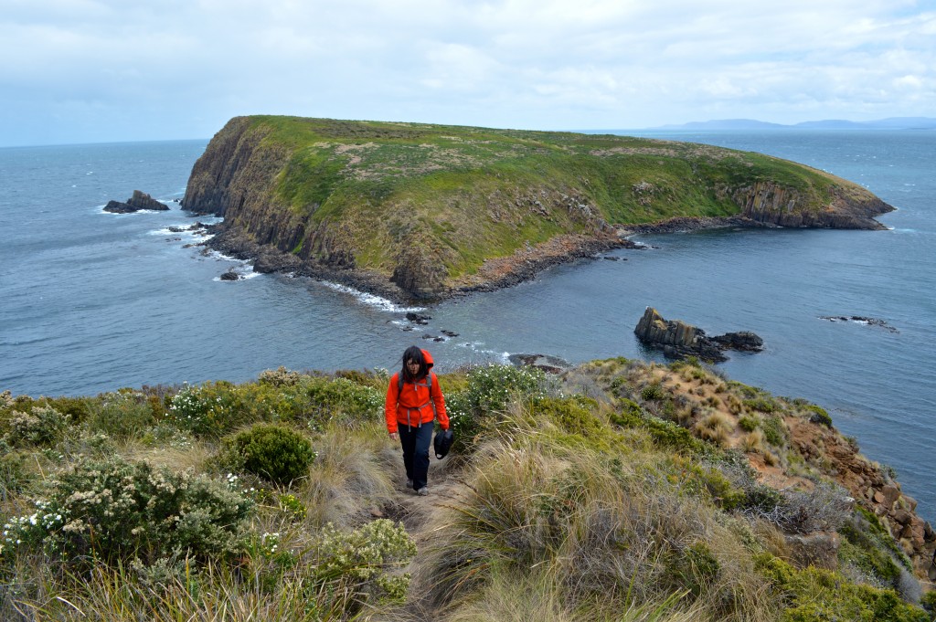
Tasman NP - approach to The Moai stack:
One minute we're merrily hiking along an overgrown booth path...
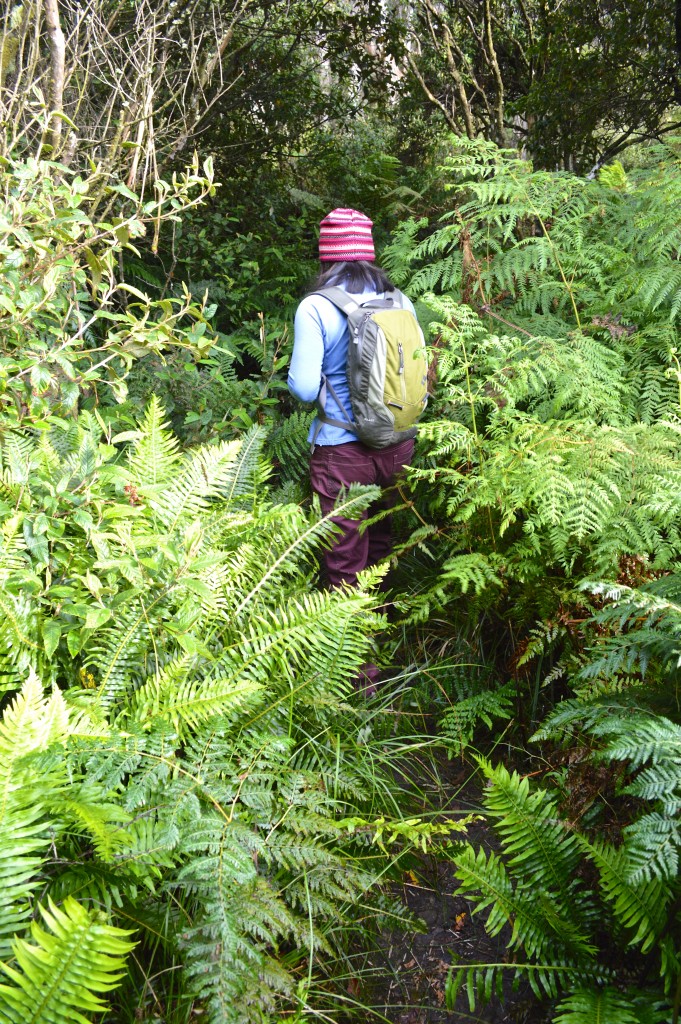
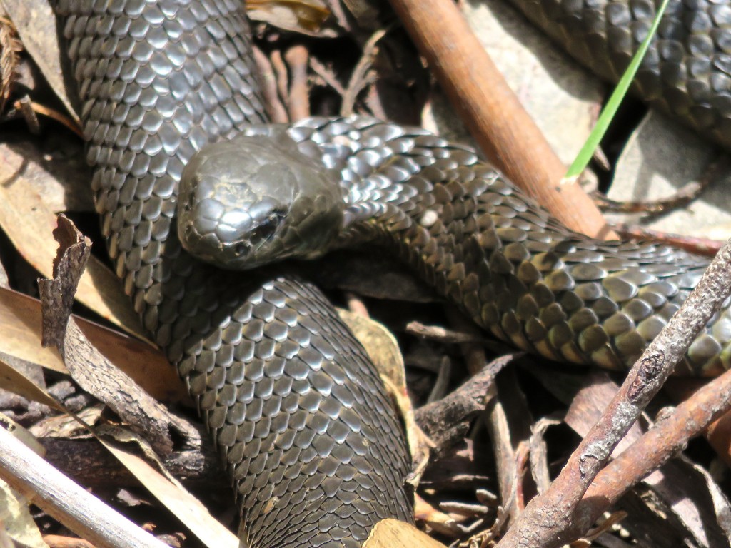
…and then we run into some tiger snakes:
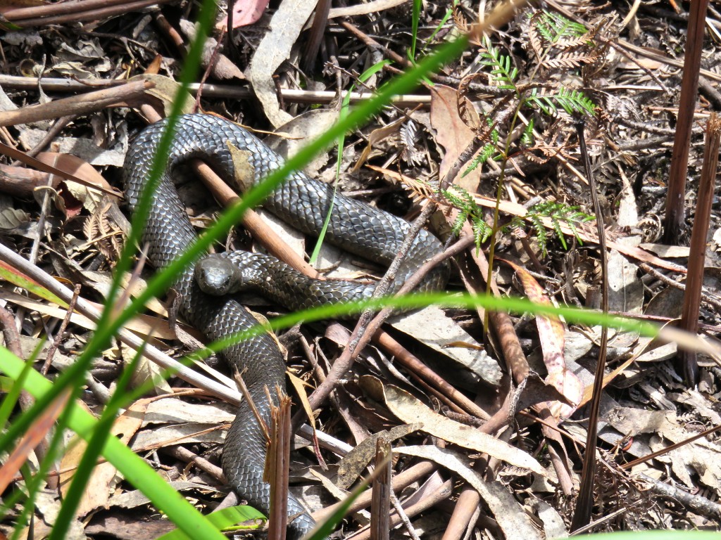
Same guy:
Anyway, back to The Moai:
Pitch 2 of Sacred Space:
Couple of pitches are required to get back to the trail:
Mount Wellington is a sub-urban crag - not big but we hit some alpine conditions on our first trip there. This here Battle Cruiser route:
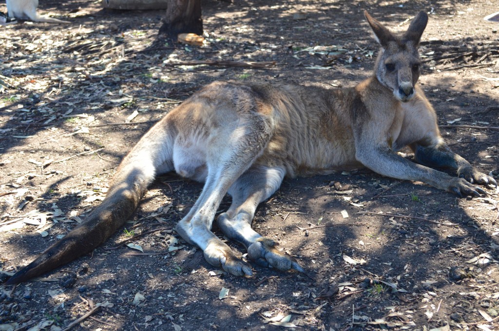
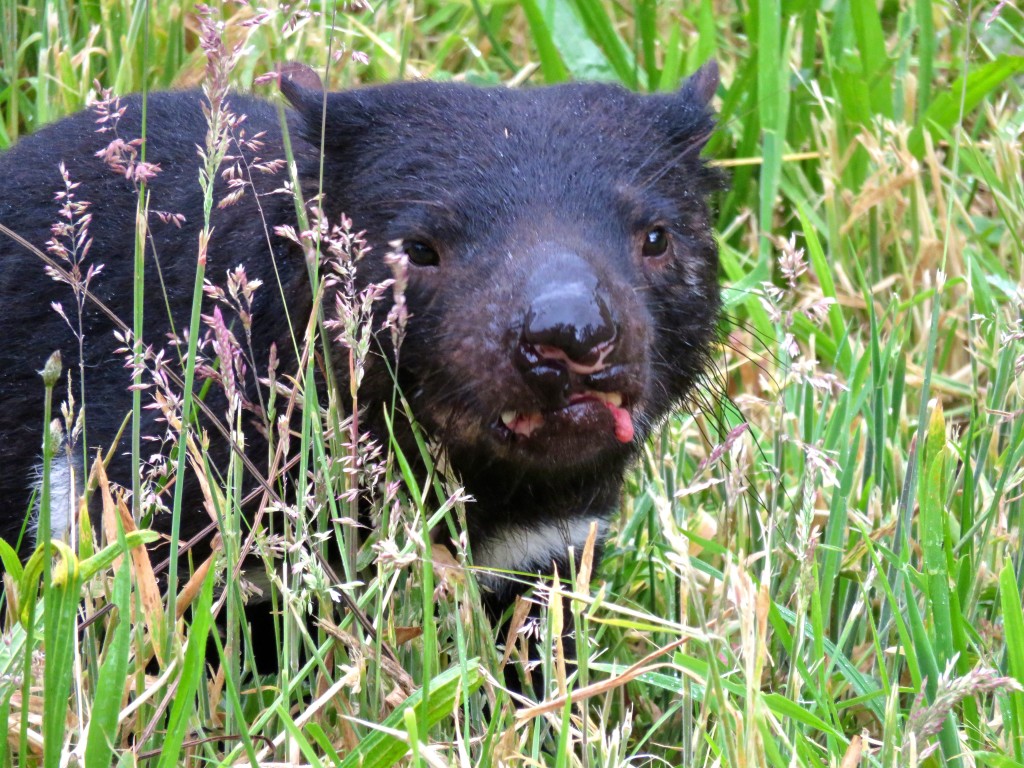
Tasmanian Devil (in a sanctuary):
Brunny Island cragging (attempt):
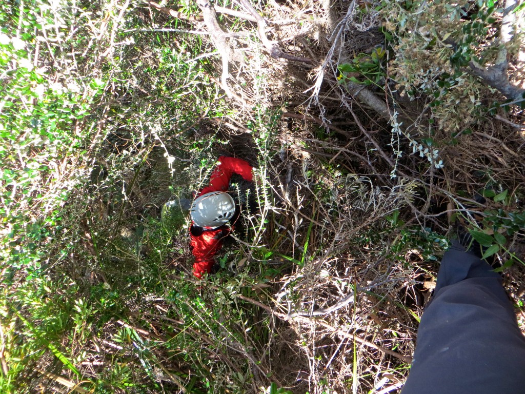
A bit of bush diving down a gully on Brunny Island off the southern coast of Tassie…how about those tiger snakes...
One day, Shirley made me a ...
…sandwich:

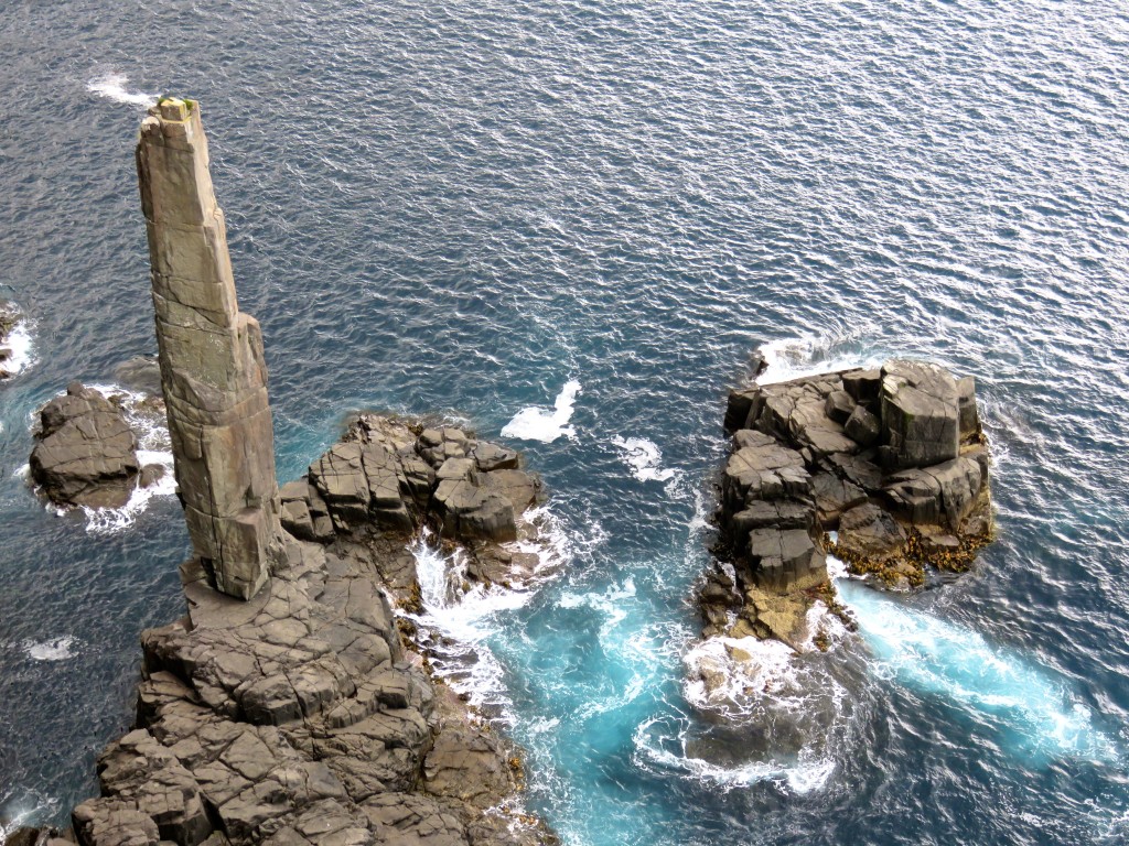
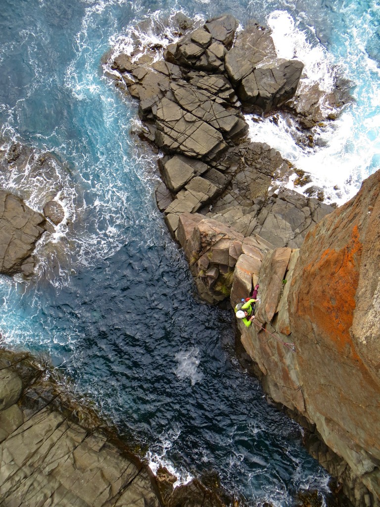
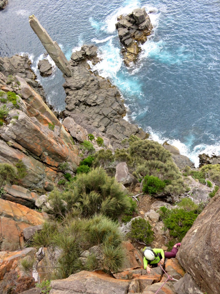
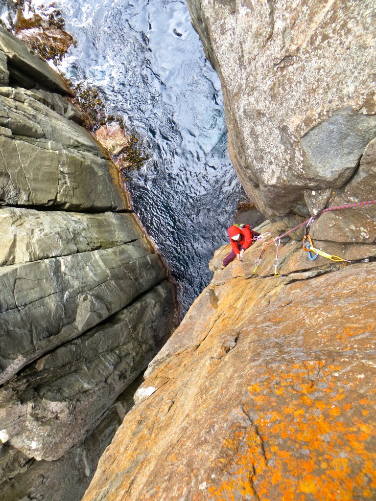
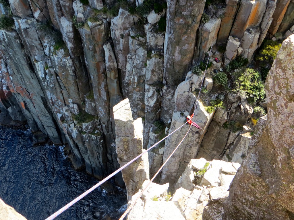
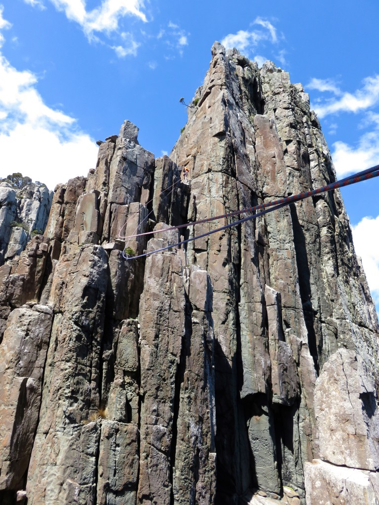
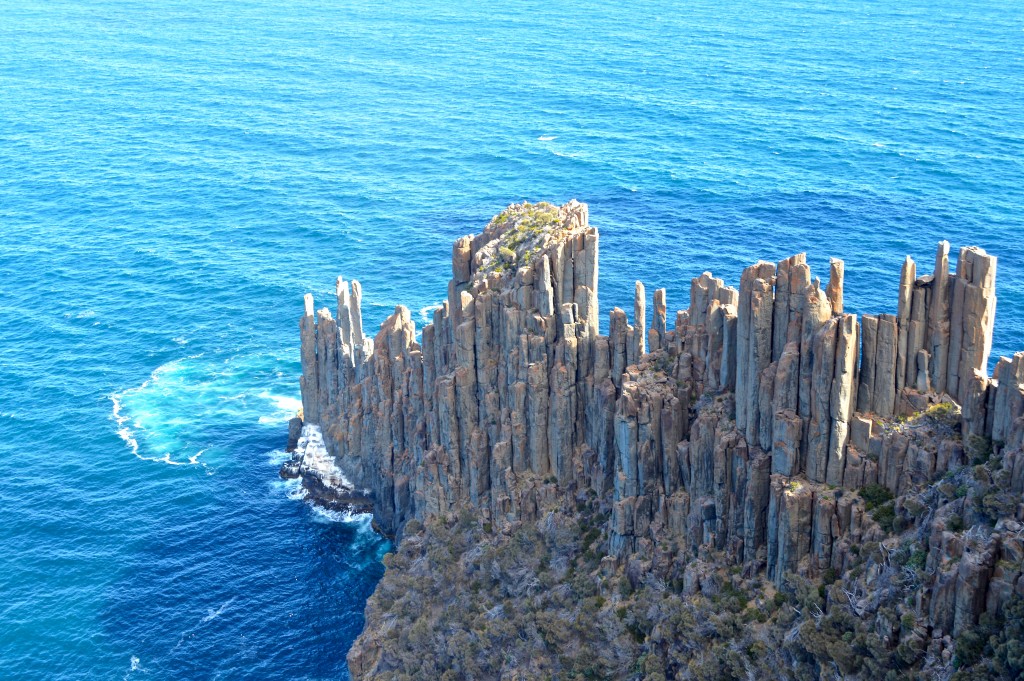
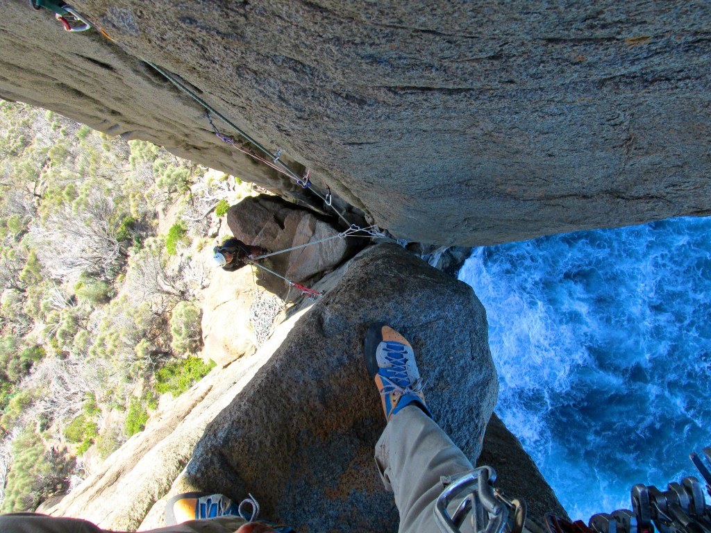
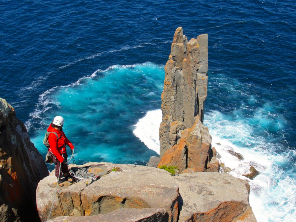
Fueled up by the Australian chocolate, went back for a sea stack. Candlestick is Totem Pole's big, awkward cousin (~110 meters):
Bigger but easier than the Tote (we know…we tried). You fix a rope, rap 60 meters into the "notch of doom" and then...
What makes The Stick special is its first pitch: a 10 meter long swim through some less than warm, surging water…why it nearly cost me a pair of undies…the whole rap in & swim through the freeeeezing water was pretty fucking intimidating to us:
Whoever draws the longer straw gets there in style (photo credit: Caroline Viner):
The book makes the Normal Route sound like some grassy 5.8 gully…imagine our surprise when we found vertical-to-gently-overhaning finger to fist cracks:
Shirley on pitch 1:
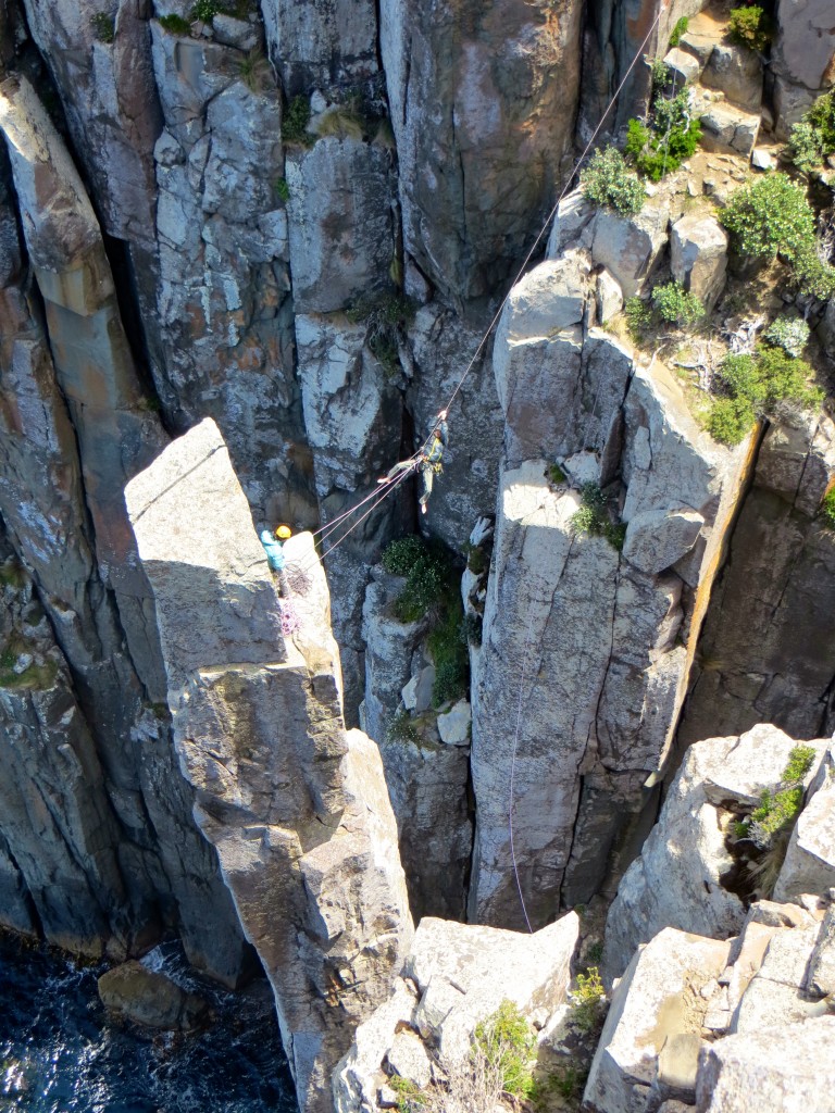
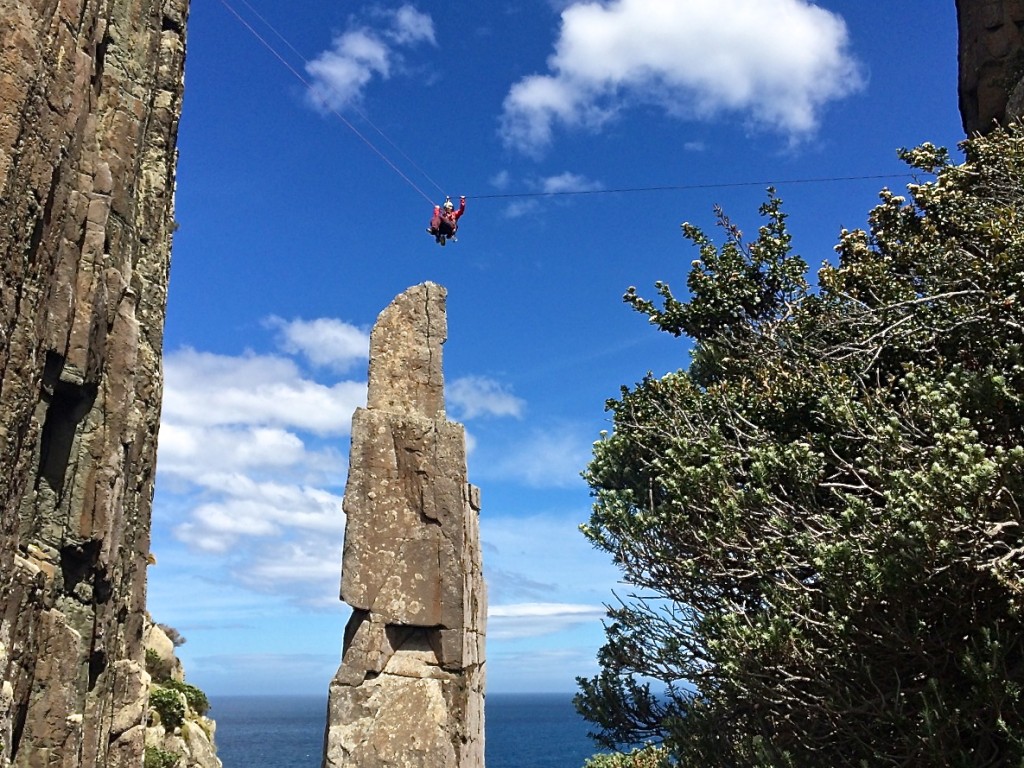
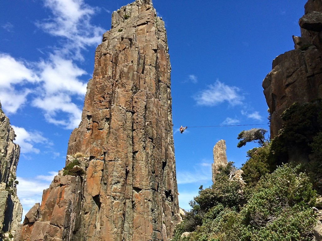
Got some OK views of the Totem Pole from up high. Allowed for some photos to be exchanged with the Tote team…maybe they got the short end of the stick photo-wise…anyway, here they are returning to the mainland via a nice tyrolean:
Summit of the Candlestick:
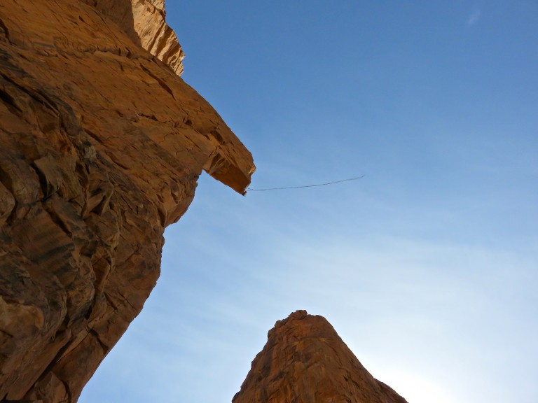
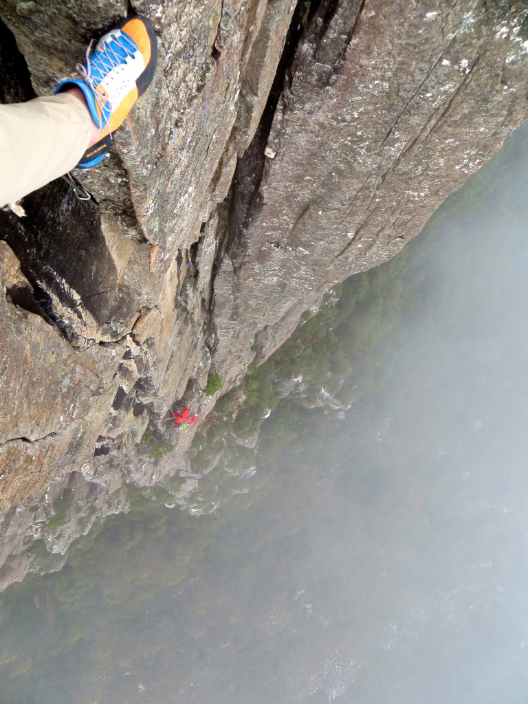
Then it was time for the ~45 meter tyrolean (of which ~15 meters come from the vertical contribution). Shirley went first comfortably lowered on a 2nd rope:
Shirley flying high over The Tote on the tyrolean (photo credit: Caroline Viner):
Then it was my turn & w/o a 3rd rope, I was looking at a pretty quick return to the mainland…had to get a bit McGyver and still nearly shit myself. Did I mention that it was windy?
On the traverse (again, thanks to Caroline for the photo):
After a rest day (mental recovery), drove up to Ben Lomond NP for some crack climbing. Stuff up to 200 meters tall though on day one we had shitty weather and stuck to a 2 pitch line.
Splitter, multi-pitch crack routes - pretty stellar:
By the time Shirley topped out (edge of Ben Lomond Plateau), winds were gusting up to 100km/h and it was drizzling sideways:
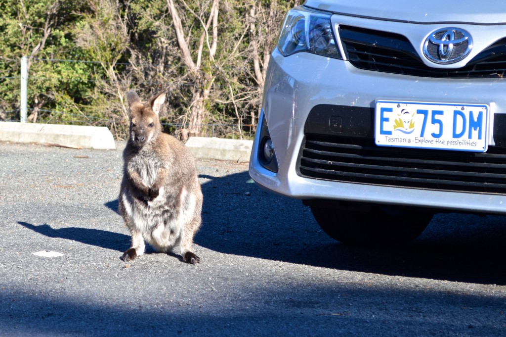
We also went to Freycinet NP - granite domes with multi pitch lines on them …many above the sea. Here's a wallaby hanging out in the TH parking lot:
Sleepy Bay in Freycinet NP:
RH Negative - a 4-pitch 5.9ish line:
Stud City route:
They grayish stuff is lichen…Shirley's foot is about to blow on the final traverse:
A Tassie porcupine:
A two-headed, albino wallaby at a petting farm:
Went back to Ben Lomong and climbed the 5-pitch Laendler (Australian 20 or 5.10+). Like Smith's Lower Gorge but 600+ feet tall:
Unknown party next door to us…look at those cracks:
More wildlife:
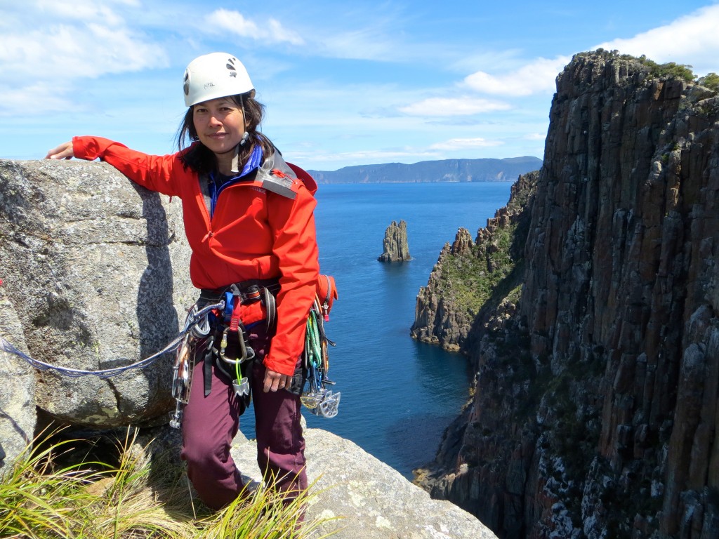
Went to Cape Raoul and climbed The Wedding Cake formation (on a ridge jutting out into the sea).
The "ridge":
Here's view from mid-way up pitch 2:
A spectacular place with a seal colony below:
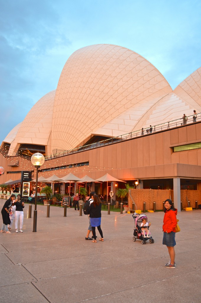
On the way home, had a day-long layover in Sydney. Did the usual tourist things:
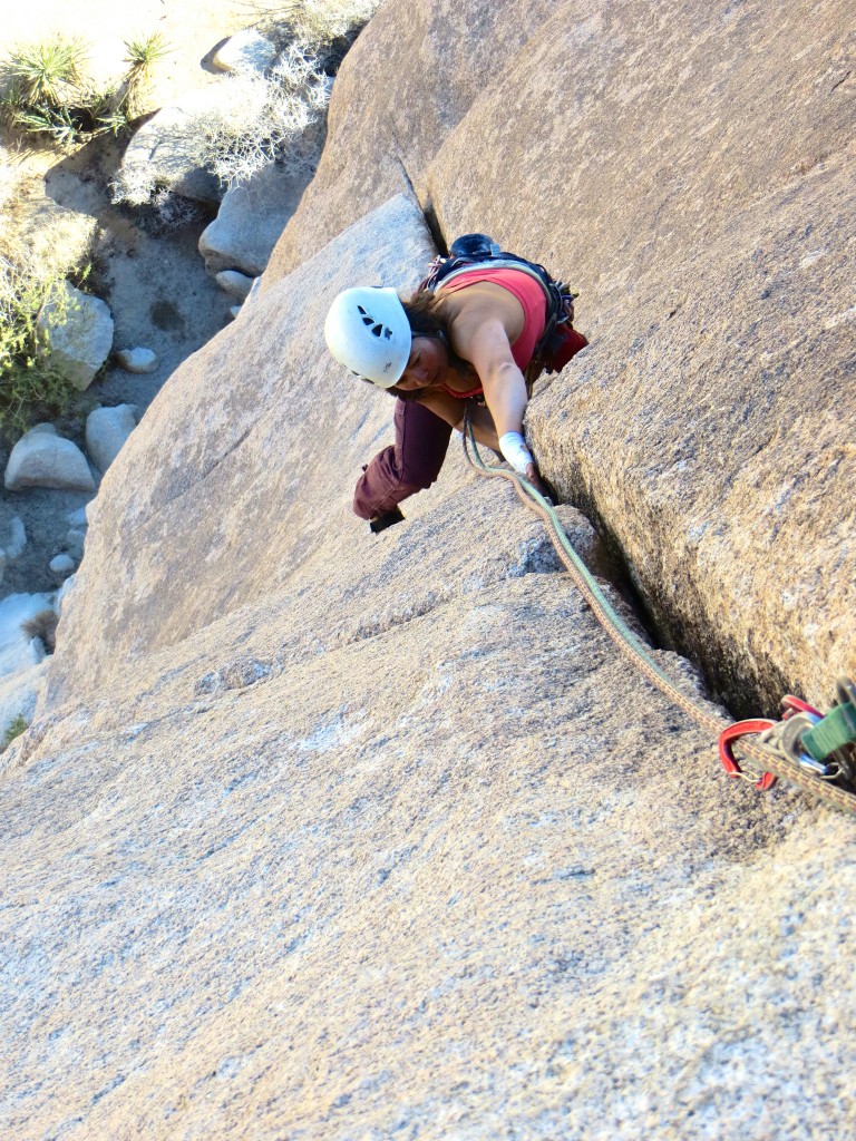
Had to be home for about a week but there was a work-related trip to SoCal & we squeezed in a day at J-Tree. Here's Shirley on Apparition:
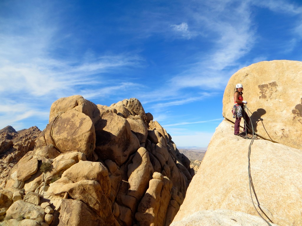
And atop Scareway on Dos Equis Wall:
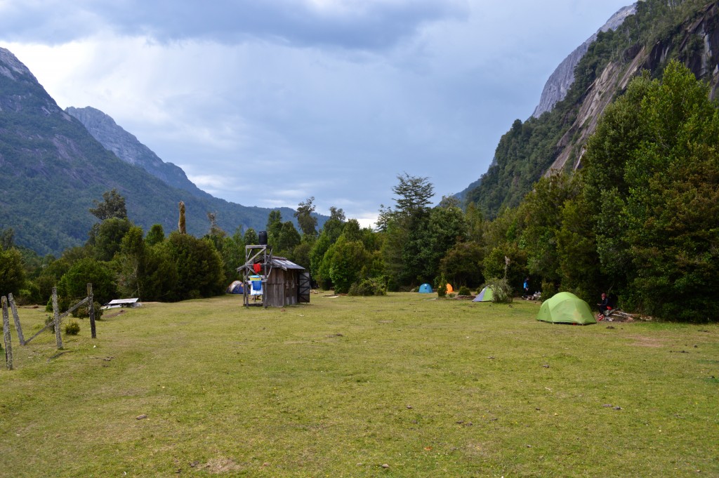
We then went to Chile, specifically Cochamo Valley. First stop was the tourist trap town of Puerto Varas:
Shirley starting the ~13km hike into Cochamo Valley. Don't let the pack fool you...
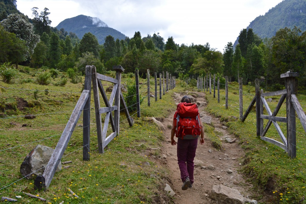
…most of our stuff got a ride on one of Fabian's horses:
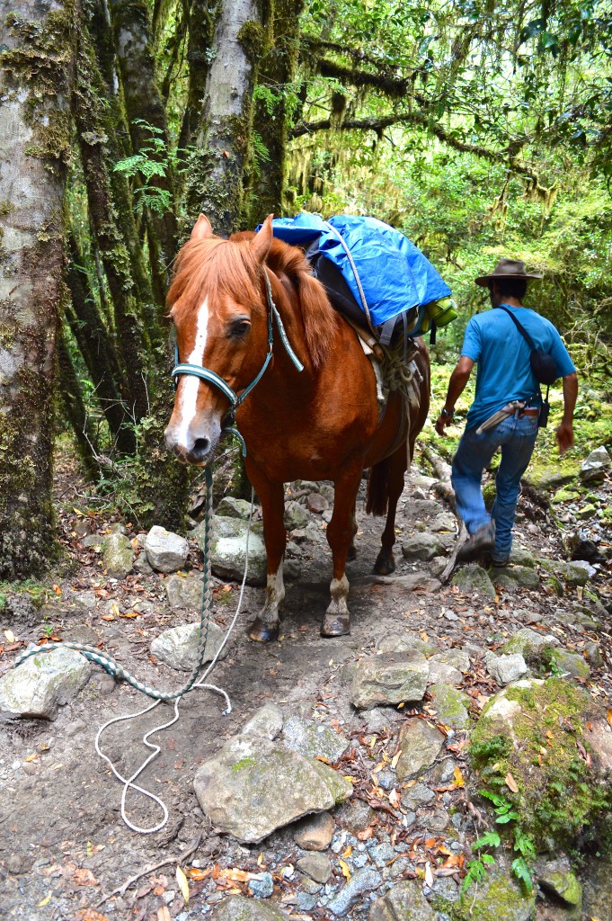
You hike ~12km on a muddy trail through a dense forest...
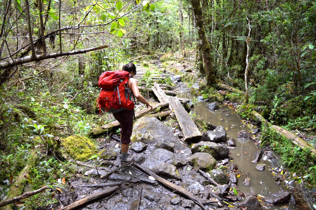
…and then the vegetation opens up and your mind is blown:
Comfy (showers) camping on the valley floor:
Our first climb was something 20 minutes outside of the camp - a 2-pitch 10b called Apnea. I could've sworn we were in Squamish:
Except the river crossings were cooler:
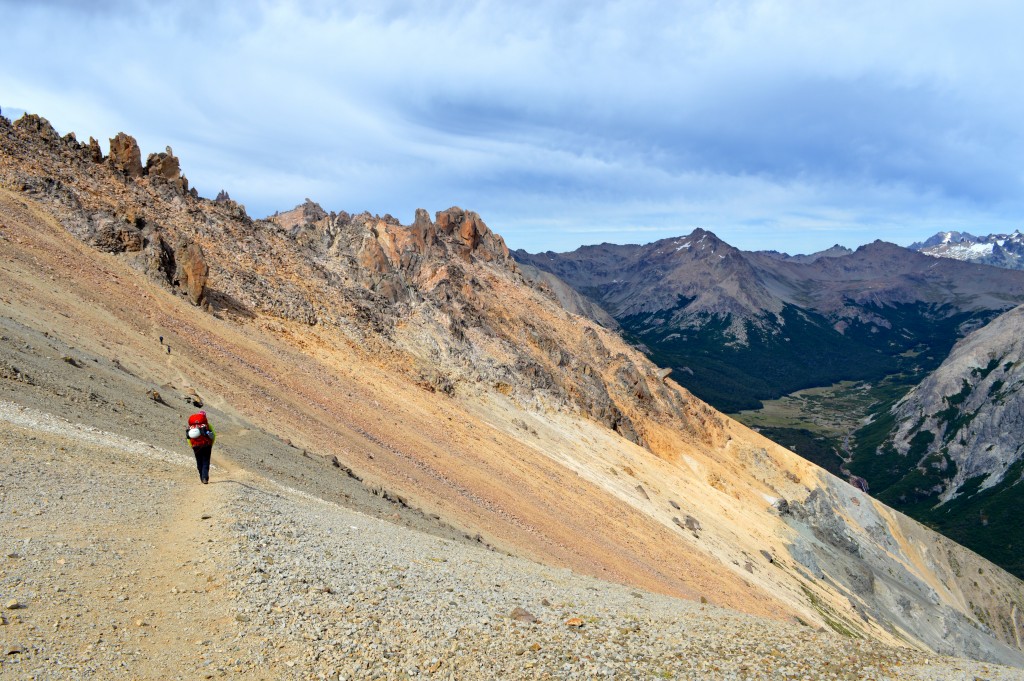
Hiking up to Valley Trinidad (2+ hrs from base camp):
… with this goal in mind:
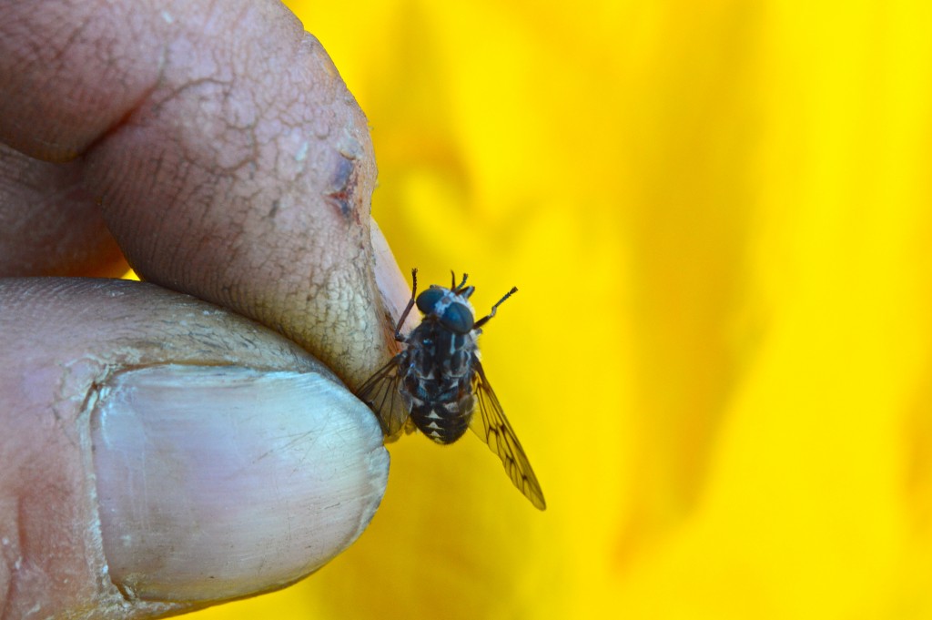
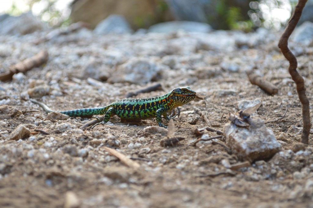
We had a big goal and so spent the evening in upper camp making sacrificial tabano offerings...
to a local lizard god:
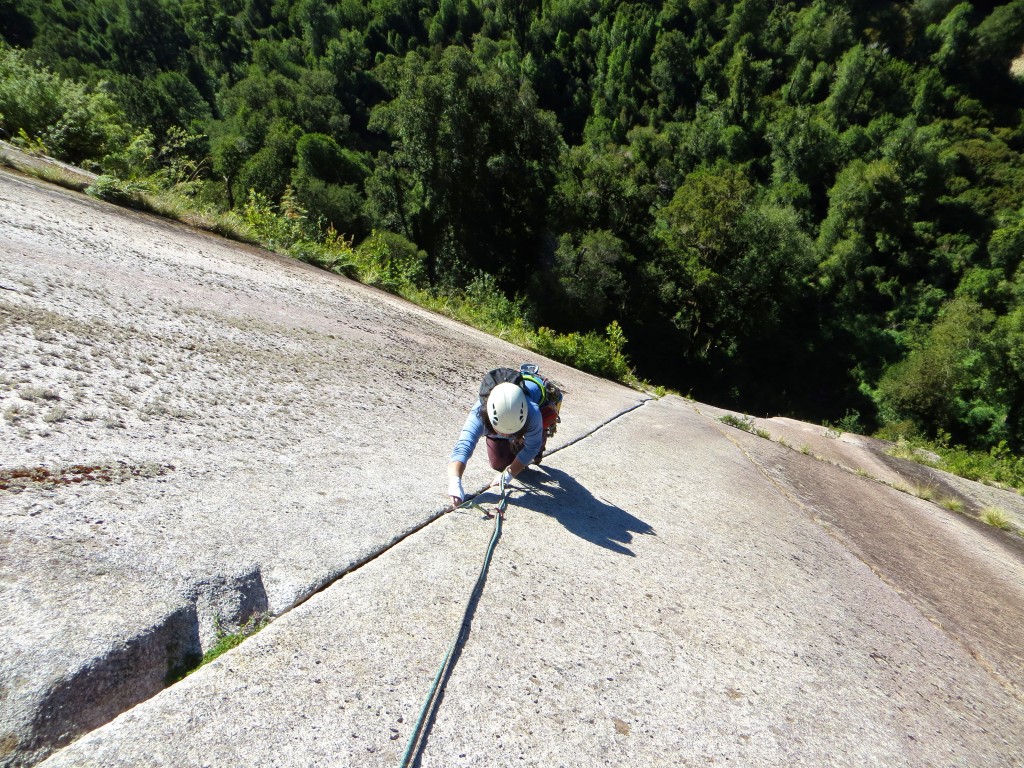
Starting up the 20 pitch Bienvenidos a mi Insomnio:

Long pitches (950 meters in 20 pitches…) and many of them at or near our limit
Grooves and pretty hard granite faces:
Pitch 8 though seemed to be in a league of its own - a 35 meter traverse:
Both the leader and the 2nd get an equivalent experience:
Some nice climbing on pitch 10ish:
We reached bivy ledges on pitch 13 and though it was only 4:30ish, we were pretty fried and had some bivy gear with us. Anyway, the morning views were worth it:
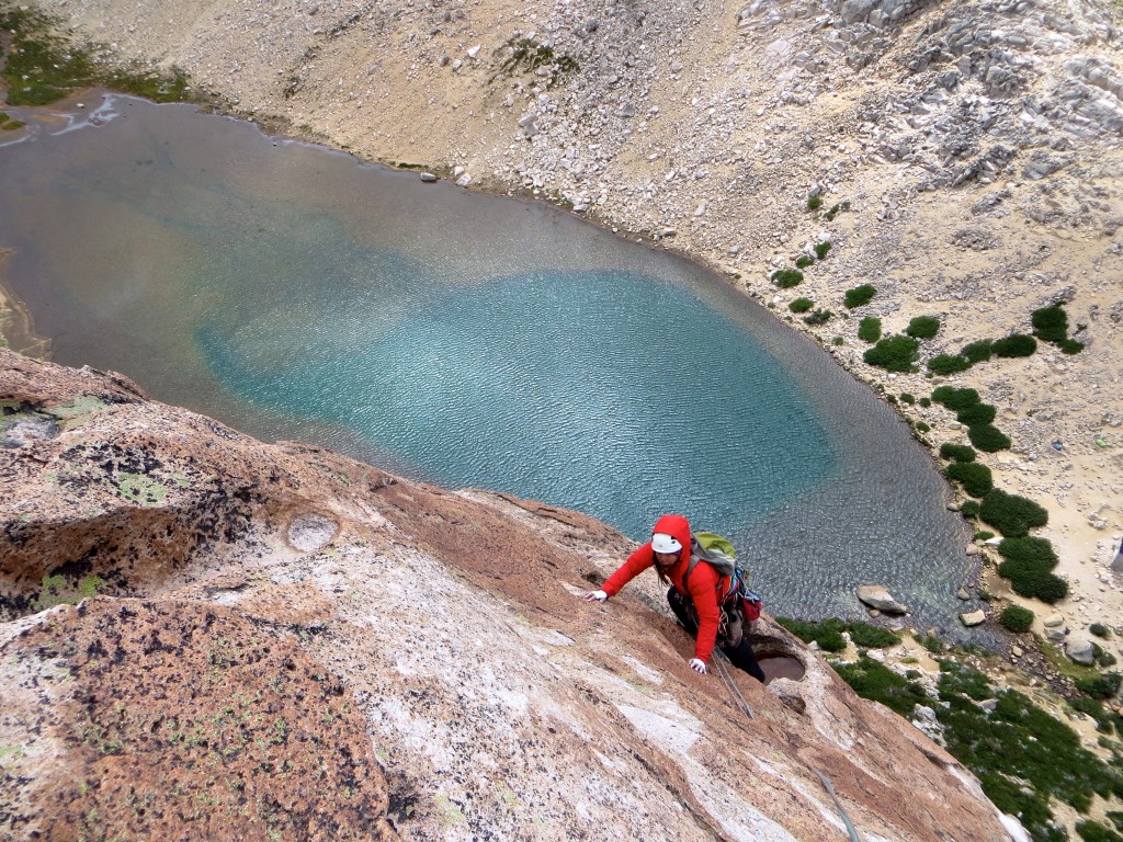
A nice 10b tips crack on day 2:
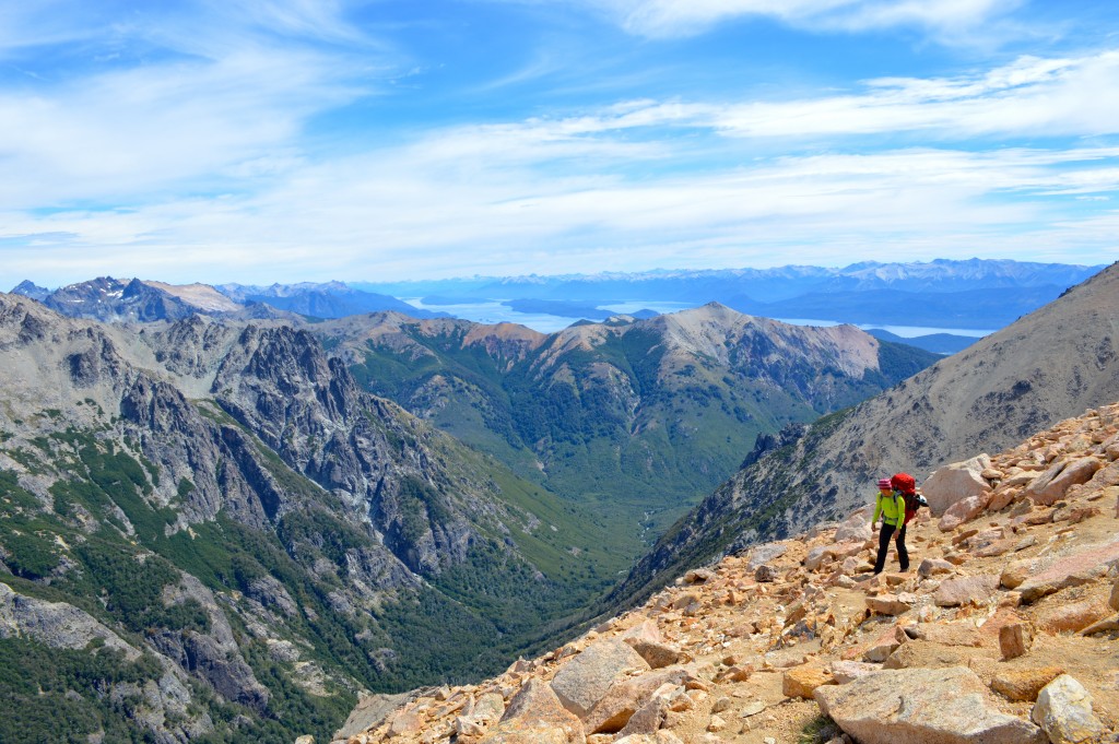
We were pretty happy to be done and on the summit of Cerro Trinidad:
Back in our upper camp:
Later we also climbed an 8-pitch line called Camp Farm - mix of nice cracks and slabs:
Camp Farm:
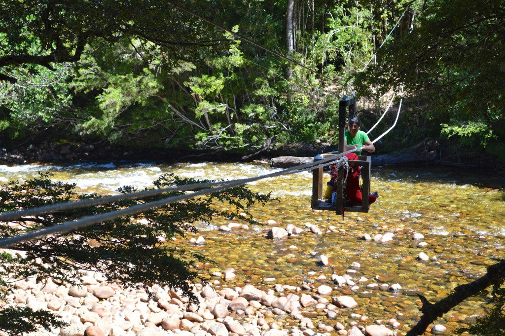
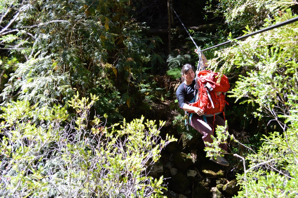
The hike out involved some fun (fixed) tyrolean over a small river:
We were hoping to get a route in the Anfiteatro done before leaving:
But ended up getting hosed instead - nothing like a night of rain in the body bags…I mean bivy sacks:
Anyway, our 12 days came to an end. We hiked out and had a half day in Puerto Montt:
Yeah right kid:
Chile time was over & we took a bus over to Bariloche in Argentina. Miles more comfy than flying:
Bariloche and Frey from the bus:

Next day we took a ski lift and started a bouldery hike to Refugio Frey (alternative is a good trail but with all the elevation gain):
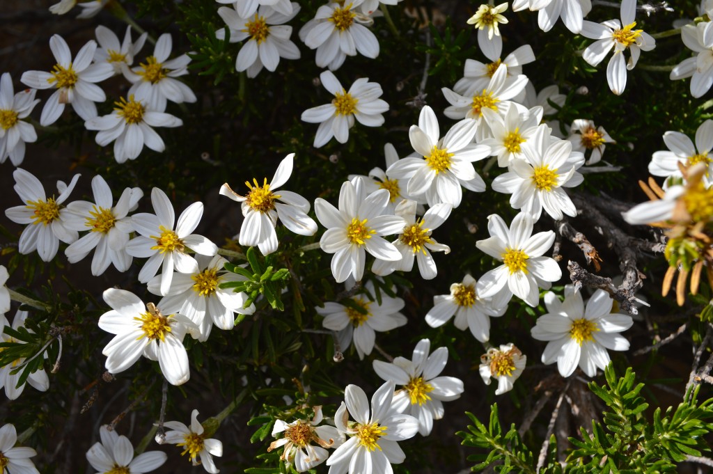
Pretty views...
Pretty flowers:
Next thing I know, my ~80lbs pack is driving my face into a boulder
We finally reached the place in 3 (??) hours:
That afternoon we climbed the Lost Fingers route (3 pitches, 6b) - here's some unknown climbers on the beautiful last pitch:
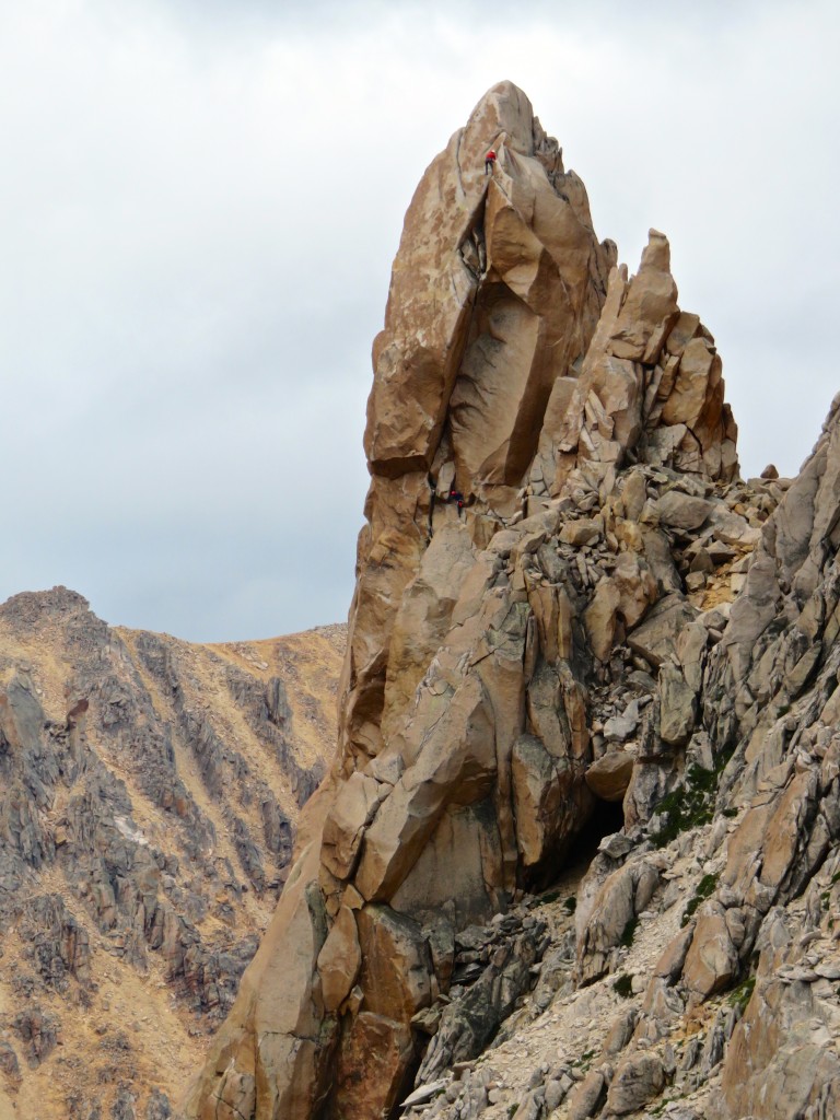
Leading the beautiful last pitch:
The weather turned cold and very windy for the next 5 days and so we shivered our way up some routes. Del Techo (5 pitches, 6a):
If it wasn't blowing, it was dusting:
Went back to Aguja Frey over the camp & climbed the very nice Sifuentes-Weber route with Monti Finish:
Torre Principal:
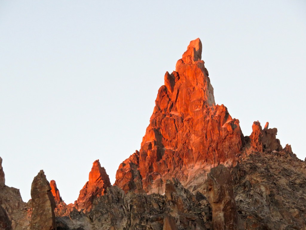
Chocolate Liquido on Torre Principal:
All routes converge with the Normal route for the spectacular final pitch to the summit of Torre Principal:
Shirley arriving on the summit:
The Refugio had decently cheap wine for sale - it helped with the hours of waiting out shitty weather:
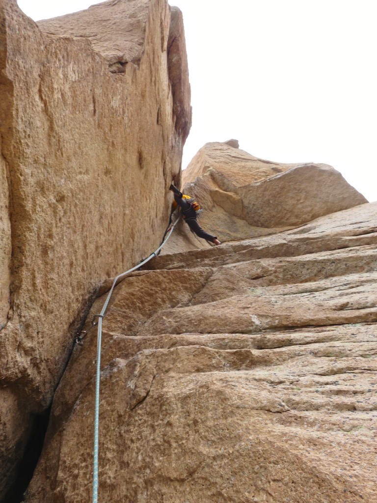
On our final day, the weather finally became decent & we climbed the 7 pitch (6b+) Objetivo Luna route on El Cohete Lunar formation:
Spectacular pitch 1 flake:
Pitch 5:
Pitch 6:
Rapping off the nice summit:
Hiked out the following day & had a day to kill in Bariloche before our trip to Chile & then home:
Sights of Bariloche:
Tons of homeless dogs in both Bariloche & Puerto Montt…yet, no obvious dog shit in public spaces in either town…a mystery for sure.
-
Shocking and very sad to read about. Exchanged many emails with Tyler over the years (mostly it was me asking him about some cool looking obscurity that he’s put up or cleaned up) and ran into him a few times. Always seemed very enthusiastic and willing to share beta. Sincerest condolences to his family and friends.
[TR] Morocco, South Africa - multiple 12/30/2017
in The rest of the US and International.
Posted
“Visited Spitzkoppe while in Namibia last year. Hard climbing on sparsely protected slabs for the most part.”
Yeah, we did more backing off/bailing than climbing in that place – runouts and exfoliating granite (& most routes were too hard). Regret not trying the standard route to the summit – supposedly a pretty good adventure.
That place in Morocco looks cool. There’s another new (?) area being developed up north apparently (bolted, multi-pitch); either Assemouk or Rif on this page:
http://www.christian-ravier.com/toporaviermaroc.html
If you enjoyed climbing above quiet, traditional villages (w. calls to prayer), try to check out Wadi Rum in Jordan if you haven't already. Long trad routes.