


timmy_t
-
Posts
151 -
Joined
-
Last visited
Content Type
Profiles
Forums
Events
Posts posted by timmy_t
-
-
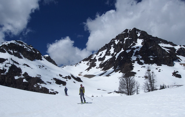
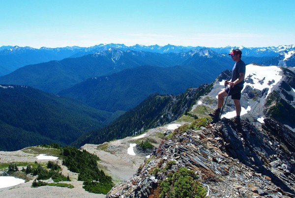
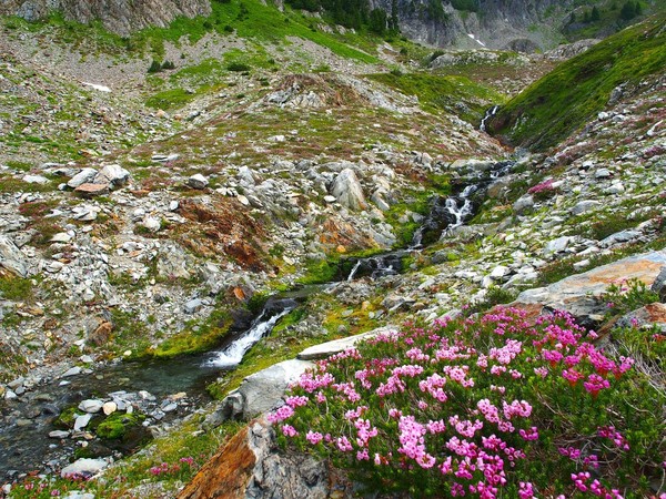
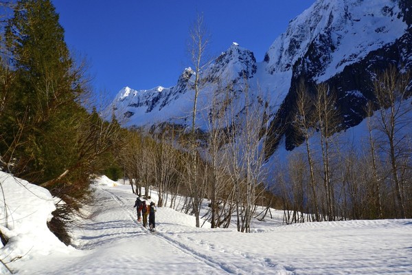
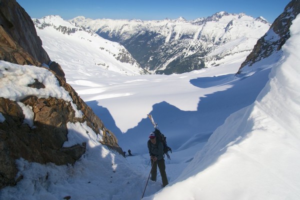
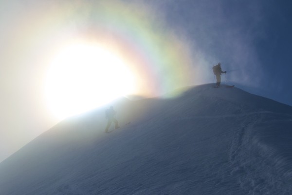
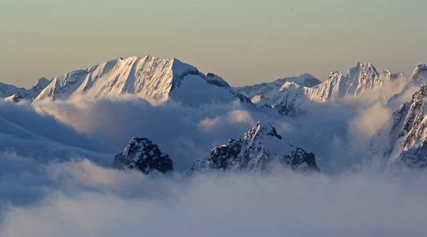
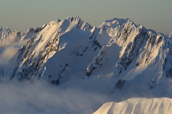
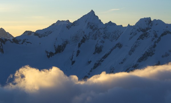
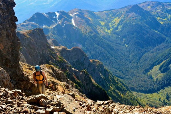
So the word is that the normal rock route finish on Olympus (which I have climbed) is blocked by a 15’ wide, 40’ deep bergschrund as of a couple weeks ago already. ONP website says “Most parties are attempting Eastern Ledge Route to summit”, but I can’t find any good info on what this entails.
Does anybody out there have any beta on this, or has anybody climbed it? What’s the descent like? Etc. I hope to head up there in a week...
Thanks!
-
 1
1
-
-
Thanks for posting, bro! I'll get on that route with you yet...
-
Going earlier in the season definitely makes for easier travel for almost the entire route (minus the Bachelor bushwhack). Part of the reason we went this late was so that White Rock Lakes would be mostly melted out, because the lakes are so much prettier when you can actually see them. Obviously this all depends on the snowpack for a given year, but June is a great month to ski the route, and late July is good for easier hiking snow travel.
-
JasonG,
The peak list originally included Mixup, Magic, Hurry-Up, and Le Conte. The first three we skipped because of weather, and the last we skipped because of time (and/or general laziness).
This was my fourth traverse but the other guys were all on their first. I had climbed all 4 peaks that we did on this trip before. Dome is a must-climb; German Helmet and Spire are the closest fun, easy alpine rock climbs on the route; and Old Guard is a much more fun scramble than Sentinel... that was the rationale. I'd really like to take a side trip of Hoch Joch Spitz and also climb Formidable on a future trip.
-
Trip: The Ptarmigan Traverse - North to South (with 4 summits)
Date: 8/25/2017
Trip Report:
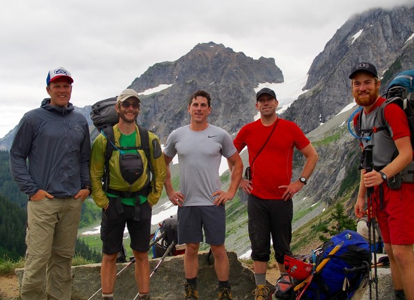
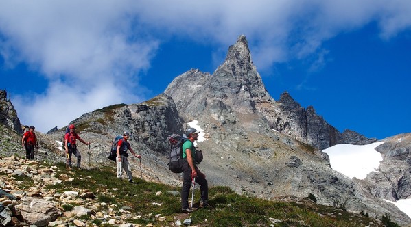
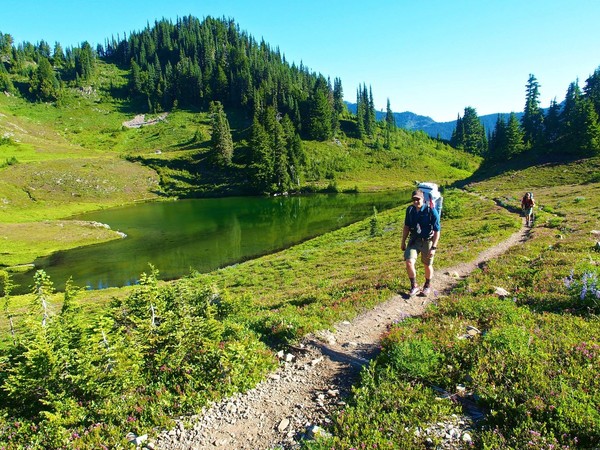
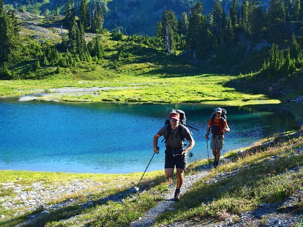
A few friends and I hiked the Ptarmigan Traverse over six days (August 25-30), and we were able to climb Old Guard, German Helmet, Spire Point, and Dome Peak along the way.
The first day to Kool Aid Lake was cloudy and windy; lots of traffic, of course, to Cascade Pass.
We hiked up the Cache Glacier, and the route to Cache Col was on easy snow right up to the col (we stayed right, whereas I've usually gone all the way left to the wall).
We slept in and waited until the clouds started to clear around Formidable.
Since Magic and Hurry-Up Peaks were engulfed in clouds, we elected to skip the climbs and head south.
The snow brought us easily into the moat, which we traversed a bit and then climbed dirty rock about 40' up to Red Ledge. Once we gained the ledge it was an easy trail across.
The clouds continued to melt away as we hiked, and after the second morning we had perfect skies until smoke rolled in a bit on the fifth day.
Here's Josh and the Middle Cascade Glacier under Formidable
Cool lighting as we ascend the Middle Cascade Glacier
Ascending the Middle Cascade Glacier; we elected to stay climber's left and do it unroped, and there were no snow bridges or noteworthy crevasses on this section.
Brennan crosses the top of the Middle Cascade Glacier with Johannesburg looming in the background
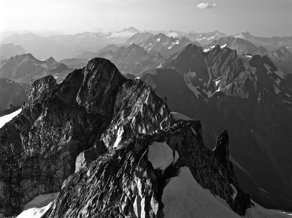
After a lunch stop we passed through Spider-Formidable Col; you can see Old Guard and Sentinel Peaks and the Le Conte Glacier (above Le Conte Lake) through the col
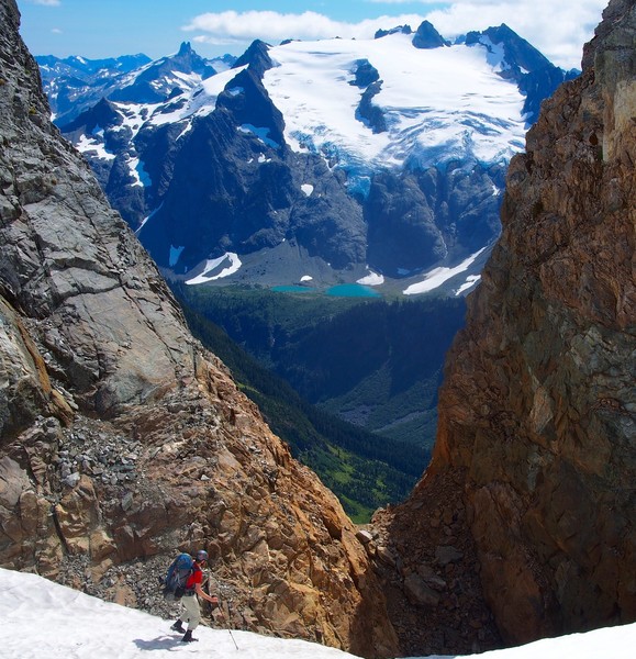
Two Italian climbers we had met at Kool Aid Lake told us that the snow on the south side of the col was very hard and steep, but by the time we descended it was plenty soft. It is steeper than it looks in the photo though.
We traversed around the basin underneath Formidable
And dropped down to lovely Yang Yang Lakes, where we jumped in and camped for the night. The water was not warm.
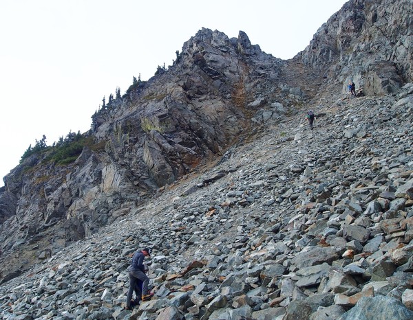
The next morning we located the shitty talus gully to bring us up under Le Conte (wear helmets, yikes!)
Heading toward Le Conte Mountain
Leo and Mt Formidable
We dropped down under Le Conte and headed toward the impressive Le Conte Glacier
More Le Conte cracks

There were several rock bands to cross toward the bottom, which I'd never seen on my previous trips through this area.
We finally roped up once past the last rock band, and there was a very icy section with some steep snow. Leo's crampon broke so we had an interesting improvisation with an axe and a whippet for about 50', but after that it was easy glacier travel up to the Sentinel saddle.
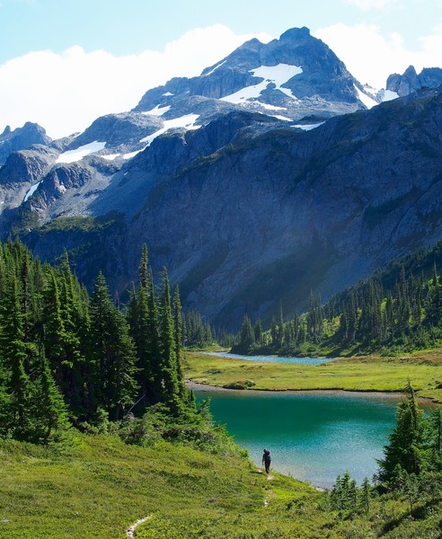
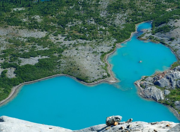
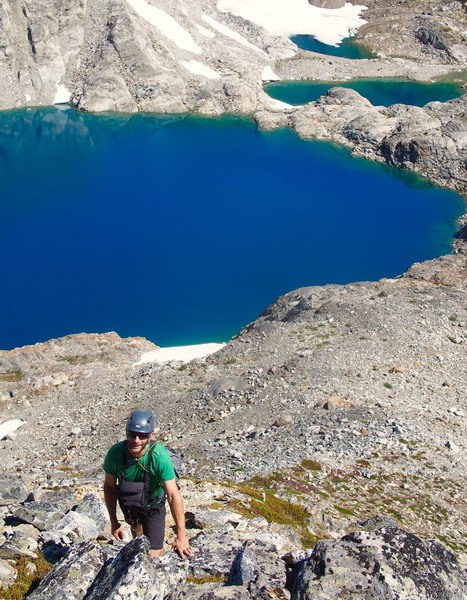
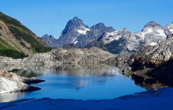
Looking far down toward Le Conte Lake; it really is that color
After lunch we headed up to climb Old Guard
It's a fun scramble with a bit of loose rock down low (the usual snow finger start was melted away)
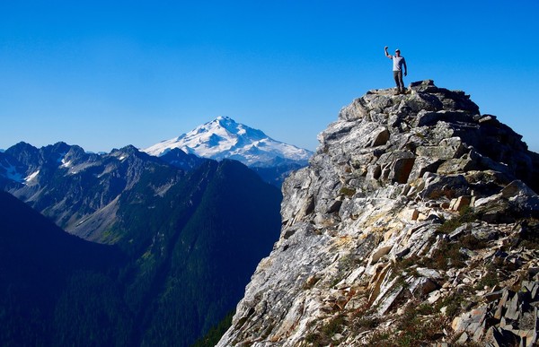
There's a great view of Dome Peak from the summit of Old Guard
Here it is again
Brennan descends Old Guard, with the South Cascade Lake far below
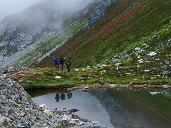
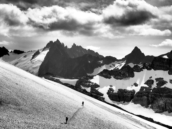
We dropped through the Sentinel Saddle to find nice little tidepools of water in the rocks; then we traversed on easy snow for a few minutes. You can see the Spire Point ridge on the horizon, which is more impressive in black and white.
Then intermittent rock and snow for awhile
Josh crosses the top of the South Cascade Glacier toward Lizard Pass
Brennan and Leo checked out the giant stakes planted in the snow on the South Cascade
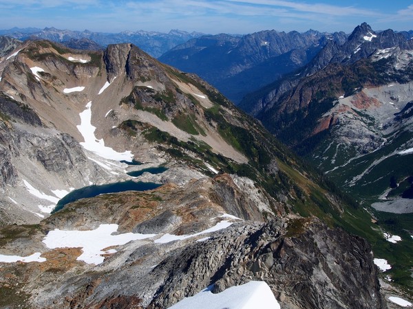
Then we had an annoying downclimb on very loose rock to White Rock Lakes. The view of Dome Peak from the Lakes is always unbelievable.
Tobiah improvises a jacket

These were the only goats we saw on the trip, although we did see tracks a few feet below the summit of Dome
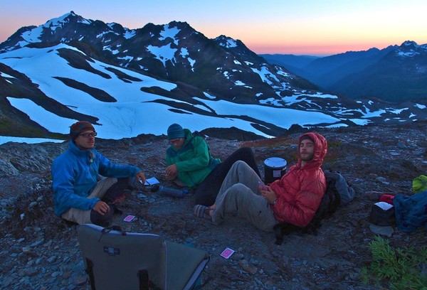
Sunset on Gunsight
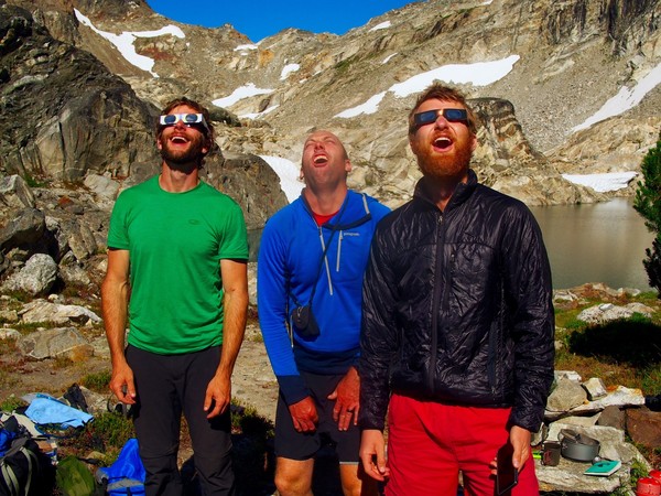
Leo welcomes the day. We built in a free day on Day 4, as I had always wanted to stay an extra night at White Rock Lakes. (I forgot to switch from the "sunset" filter mode on my camera so the next two photos feature some very red skin...)
Fortunately Brennan and Tobiah remembered to bring eclipse glasses so it was a great spot to watch the eclipse... for most of us.
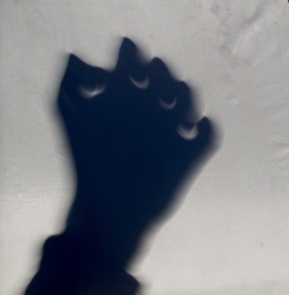
Tobiah is making a pinhole with his fist here, and you can see the little crescent eclipse moons in the shadow.
After the eclipse, three of us headed up to climb German Helmet
Rock shoes on
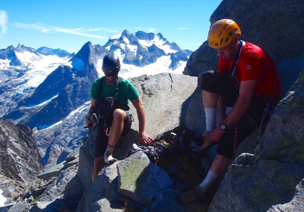
On top of German Helmet. This is a fun little climb.
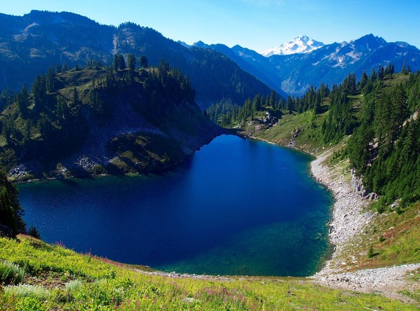
White Rock Lakes from the top of German Helmet
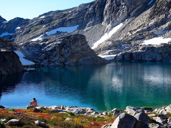
Agnes Mountain and the largest of the White Rock Lakes
We took a dip before dinner
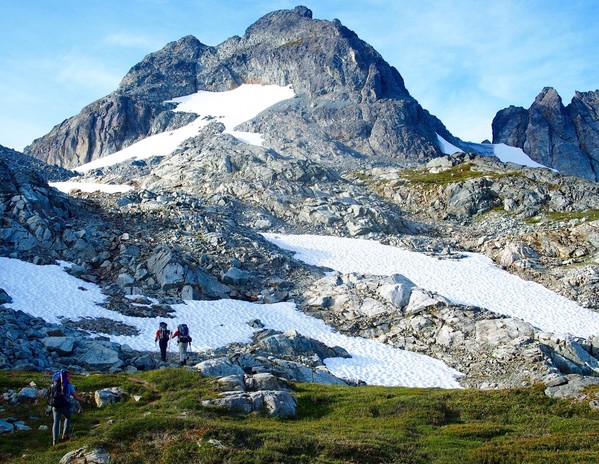
Dome Peak
The next morning we dropped down beneath the lakes, then gained the Spire Glacier to head up to Spire Col
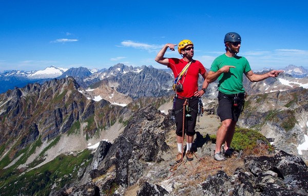
We climbed Spire Point
Then went back to Spire Pass for lunch (photo by Josh)
The plan was to traverse under the south side of the ridge to head up Dome Peak, but with most of the snow gone it didn't look very fun
So we dropped down to Itswoot Ridge
We hastily repacked full packs into daypacks and set out to climb Dome Peak in mid-afternoon
On top of Dome Peak
A view north toward the peaks around Cascade Pass, from whence we came
Leo drops down toward the saddle beneath Dome's summit
The dirty top of the Chickamin Glacier
Headed back to camp, trying to beat the sunset
We made it back to our Itswoot Ridge camp just before sunset
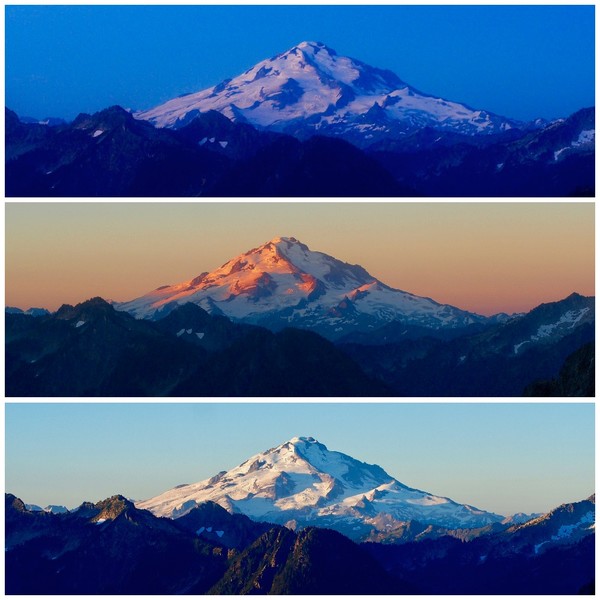
I took these three photos of Glacier Peak at sunrise, about ten minutes apart
The sixth day we headed out... but not before one last tough-guy pose from Leo
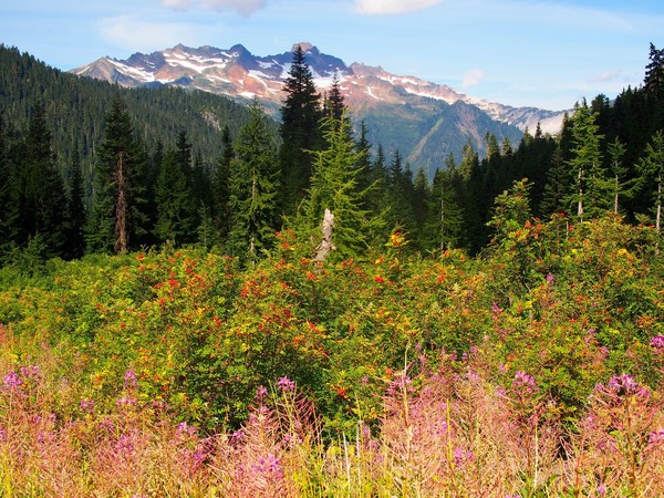
Fireweed
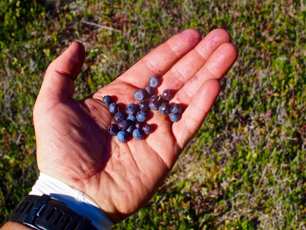
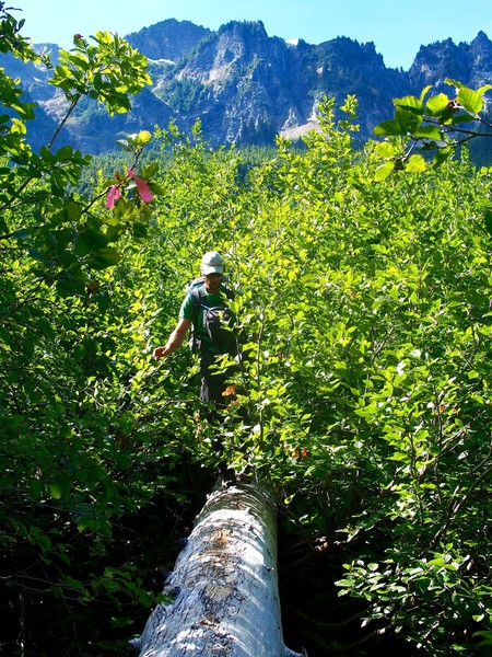
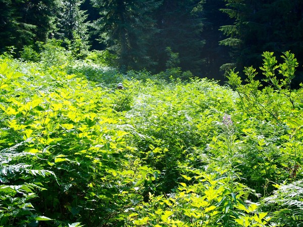
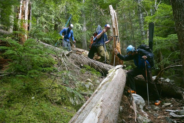
Blueberries aplenty on the way out made the bushwhack tolerable
Cub Lake
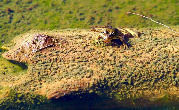
Wildlife! Frog on log.
Brennan gets the shot
One last alpine view along the Bachelor Creek trail before we dive into the bushes. Anybody know what peak this is?
Log crossing above Bachelor Creek. All five of us got multiple yellow jacket stings on the hike out.
The "trail". Bonus points for finding Brennan.
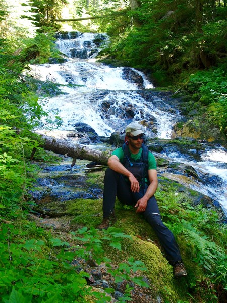
Waterfall break just above the confluence with Downey Creek, about three hours from the car.
Thanks for reading!
-
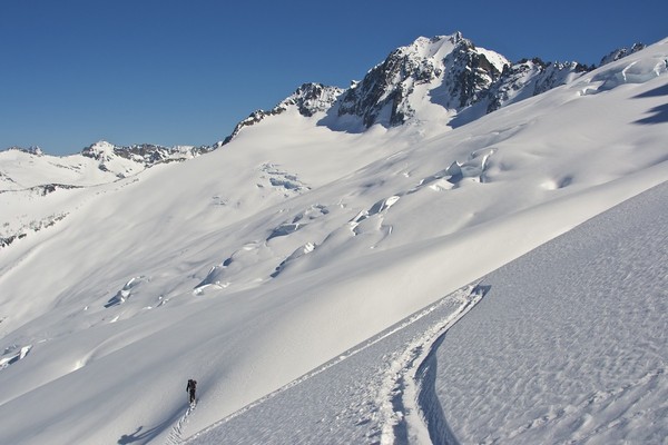
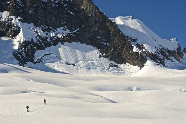
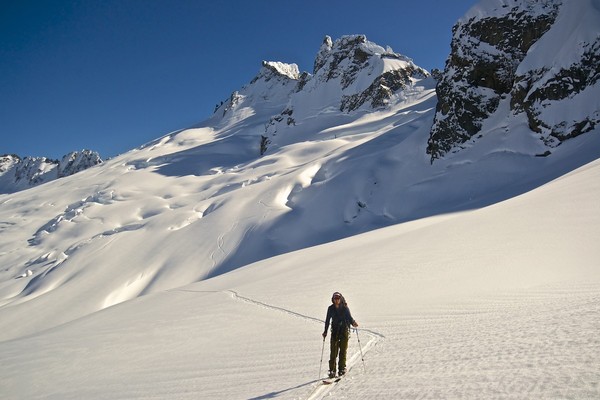
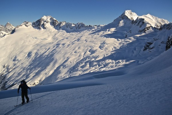
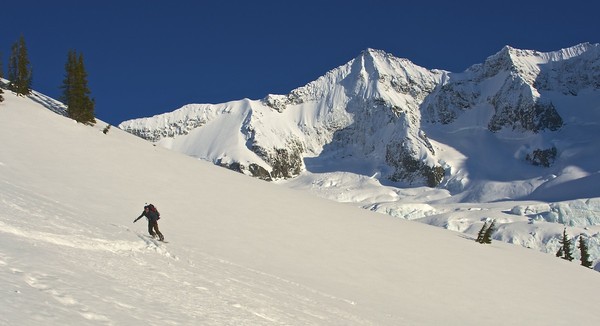
Trip: Black Peak - South Route (ski)
Date: 5/12/2016
Trip Report:
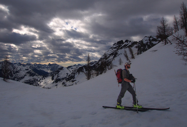
A couple friends and I took Thursday off to climb/ski Black Peak. 'Twas worth it.
Early morning light as we cross Lake Anne; the snow was firm and good for skinning.

The clouds kept the snow from slopping up on us.
Brennan makes his way across Wing Lake
North Cascades panorama
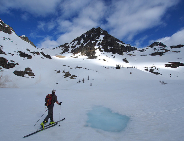
Summit of Black Peak with the peaks of the Cascade Pass area on the horizon
And now for the payoff... Brennan drops in from the saddle above Wing Lake
Skiing through a bit of debris toward Wing Lake
Black Peak
Skiing back across Lake Anne, with the peaks of the Liberty Bell group on the horizon (I think...)
The ski out from Lake Anne was ok, with a few combat turns in the trees, but we were able to keep skis on all the way back to the car at Rainy Pass.
Approach Notes:
All lakes are frozen, everything is snow except the last bit up from the saddle above Wing Lake which is 50/50 rock/snow.
-
Sent PM
-
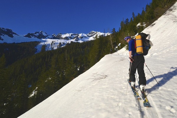
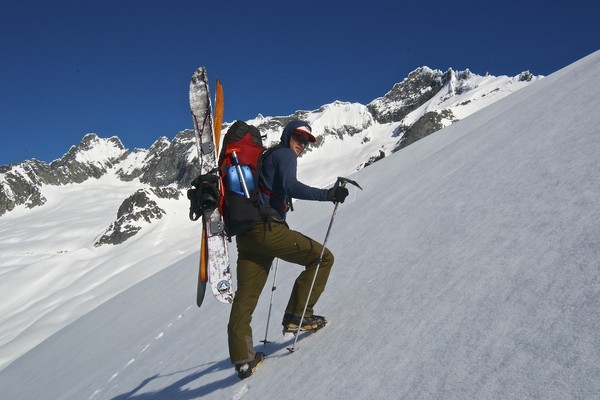
I took an Olympus (ha!, of course) OM-D E-M5 and a few good prime lenses.
-
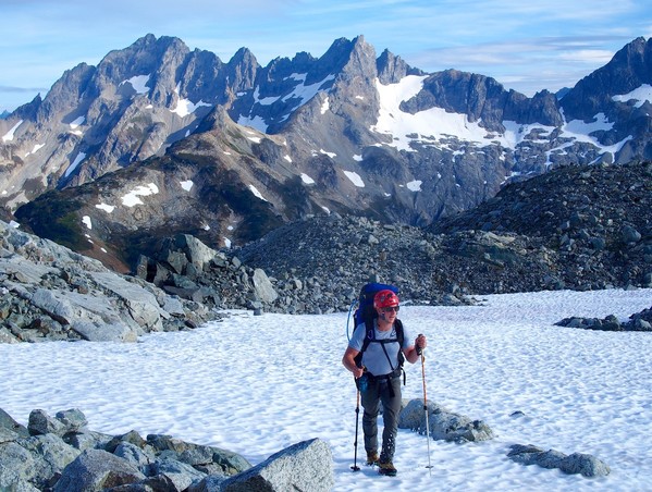
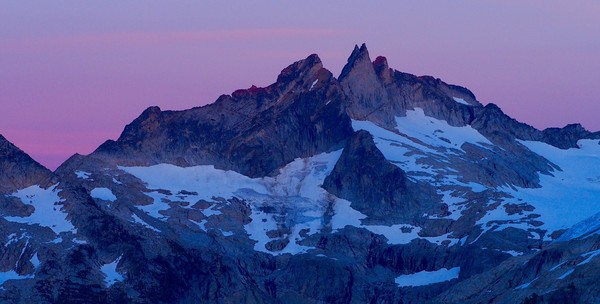
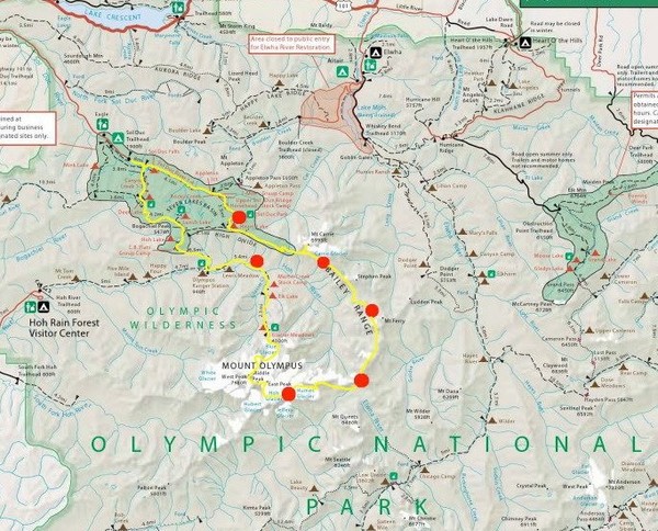
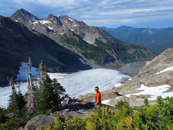
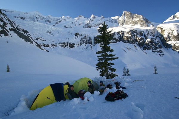
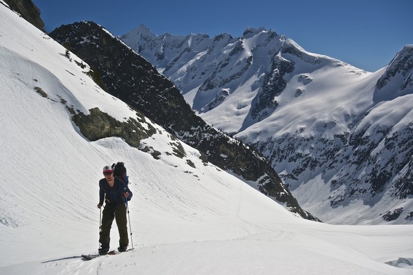
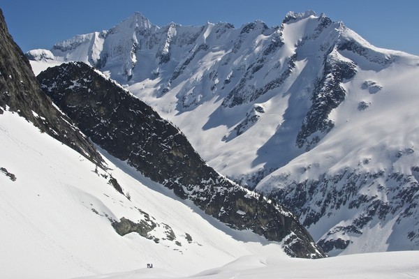
Trip: Olympic National Park - Bailey Range Traverse + Carrie, Pulitzer, Olympus
Date: 7/28 - 8/3/2014
Trip Report:
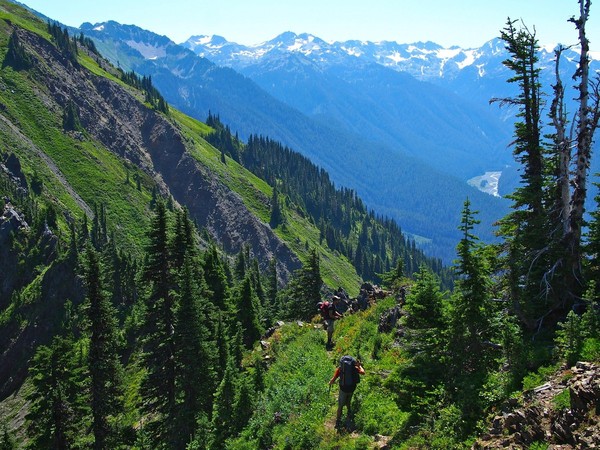
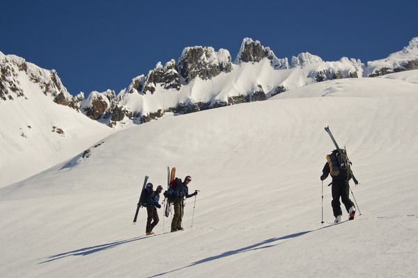
My brother and two friends and I hiked the Bailey Range traverse in Olympic National Park recently. We did a loop trip in 7 days, and we climbed Mts Carrie, Pulitzer, and all three summits of Olympus along the way. Instead of dropping a car at the Hoh River trailhead for the exit we climbed back up to the High Divide via the Hoh Lake trail, then hiked back to the Sol Duc trailhead to our car. This entailed an annoying 4200'+ of elevation gain on the last day but it was cool to make a loop out of the hike.
Here's our approximate route (in yellow) and camping spots (the red dots)
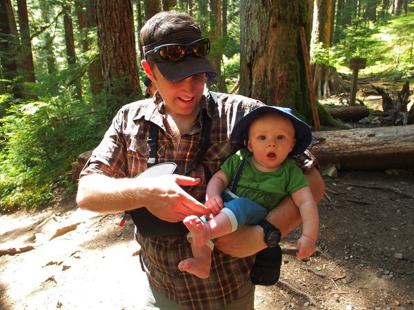
My wife and 6-month old son and my friend's wife hiked with us a bit beyond Sol Duc Falls to see us off.
We camped the first night at Sol Duc Park, as there were (predictably) no spots available anywhere on the High Divide, and we didn't leave early enough to make it to Boston Charlie's. Here we're passing Heart Lake just below the High Divide on the morning of day 2 of the trip.
Junction with the High Divide trail where it heads out toward the Bailey Range

Descending the Catwalk. It's funny that it has such notoriety, because there are many sketchier sections of trail over the next day or two -- steep, loose, unsavory gully crossings on both sides of 11 Bull Basin, for example.
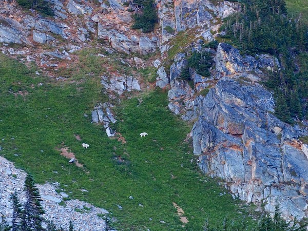
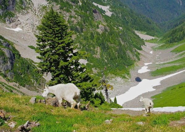
We saw a couple mountain goats during our lunch break at Boston Charlie's Camp
We missed the supposed way trail up Mt Carrie, but we dropped packs after traversing halfway around the peak and scrambled up to the summit. Here's the summit ridge, looking back toward the High Divide. Two of us followed the rocky ridge and two of us stayed low and crossed the snowfields.
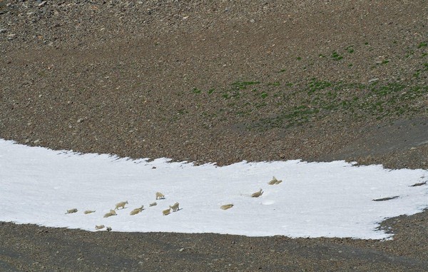
On the way down from the summit we saw a herd of mountain goats cooling off on a snow patch
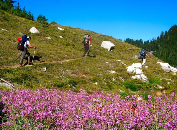
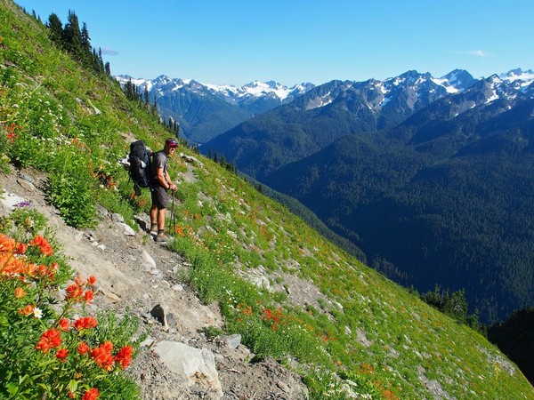
Much of the rest of the day was steep sidehilling through beautiful wildflower meadows
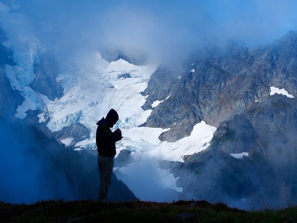
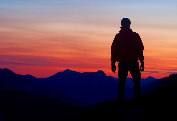
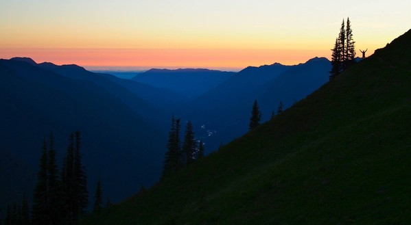
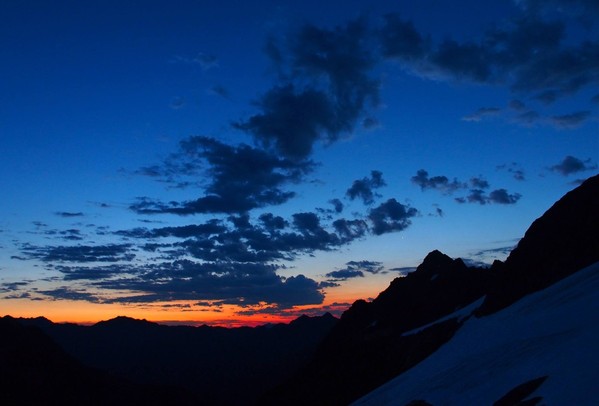
Here's sunset from our campsite in Eleven Bull Basin (notice the silhouetted guy in the top right). We could see down the Hoh to the Pacific, very cool
The third morning we had more steep sidehilling, more unfun gully crossings, and some steep downclimbing
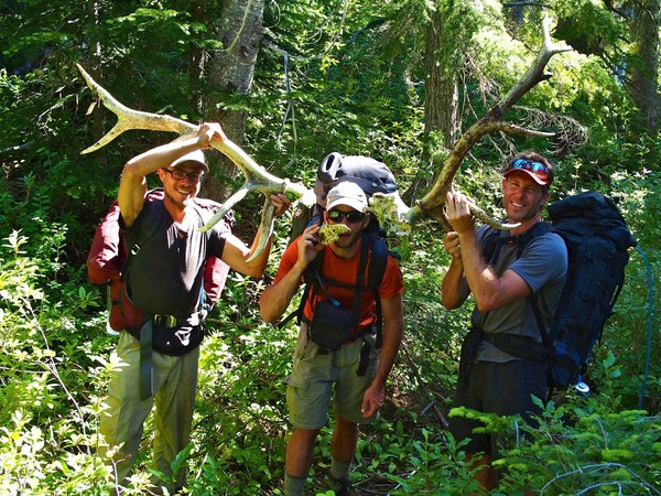
This was a tiring day. Even with maps, route descriptions, warnings, and GPS, we managed to drop into the Cream Lake Vortex. Next time we will definitely stay high, or possibly go around via the back side of Stephen Peak. We had lunch near the wide inflow to Cream Lake, and Kevin found these antlers near the lake
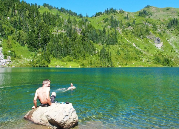
We took a very quick dip in Cream Lake; it was COLD!, wow
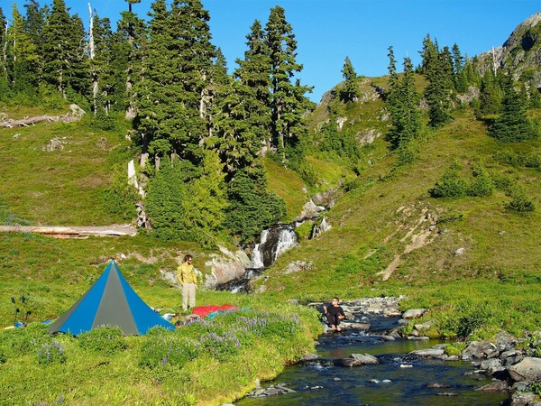
After skirting the lake and following a small stream we located the gully that led toward Ferry Basin and followed it up, then traversed right to a beautiful campsite near a waterfall that fed Lake Billy Everett. This was my second-favorite campsite of the trip (after the eventual Camp Pan). We saw a black bear near the lake, the second bear sighting of the trip.
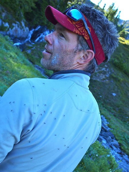
The mosquitoes at the lake were thick
So the next morning we fled the Lake Billy Everett scene
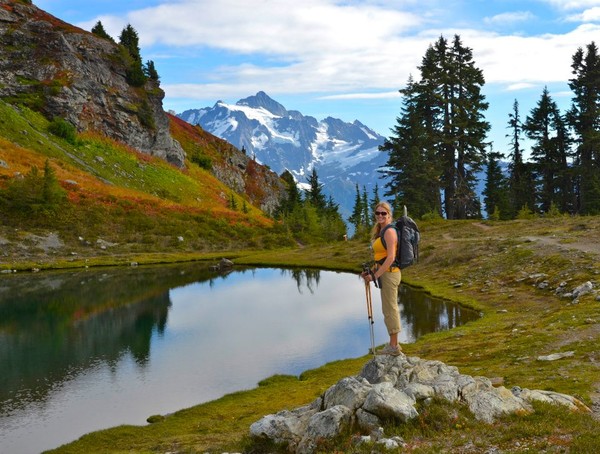
We climbed above the lake on easy benches toward Upper Ferry Basin. Here Brennan is hiking past a tarn beneath Mt Pulitzer. Just above this spot we ran into a party of two who were on a 12-day trip from Dosewallips to the Sol Duc, the only people we saw on the traverse besides a group camped at Boston Charlie's.
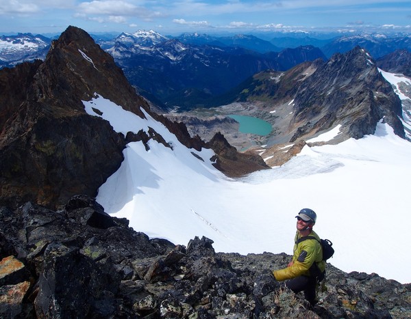
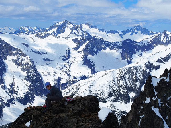
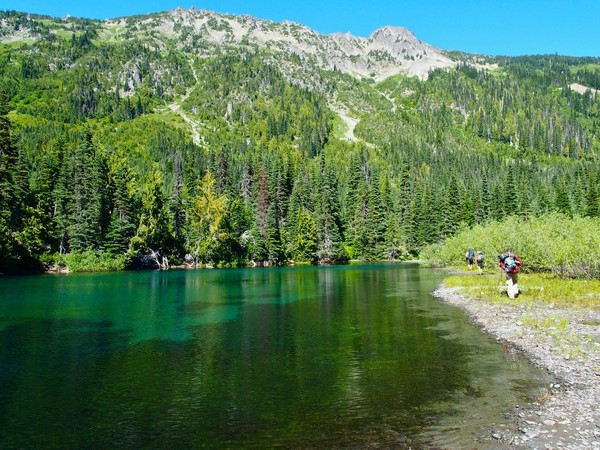
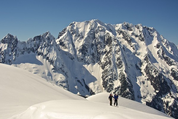
We dropped packs and scrambled up Mt Pulitzer. Here's Ferry Basin from the top, with Stephen Peak (above Cream Lake) in the background and Mt Carrie on the left
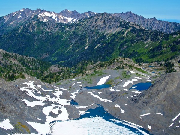
Near the Mt Pulitzer saddle, with Olympus in the background: we're trying to figure out where we came from, and where we should have gone, on the Cream Lake section
Kevin surveys the Goldie River Valley area from Mt Pulitzer
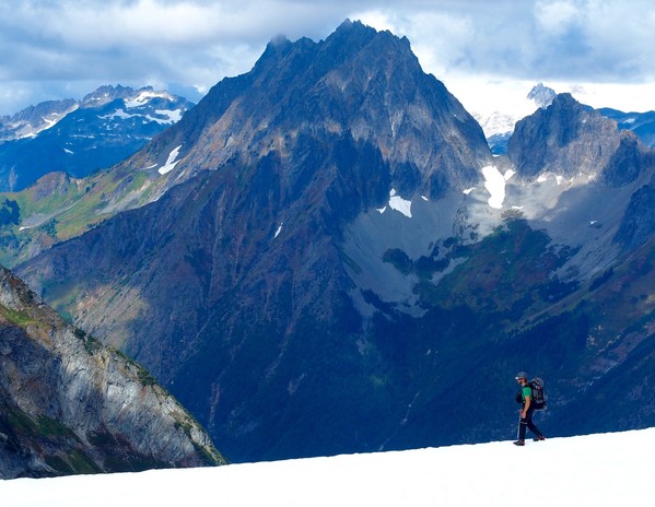
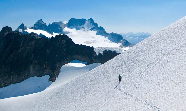
Most of day 4 was spent on easy up-and-down snow and rock travel along the spine of the Bailey Range, with amazing views in all directions
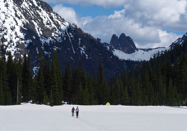
We made camp below Bear Pass and above Dodwell-Rixon Pass that night
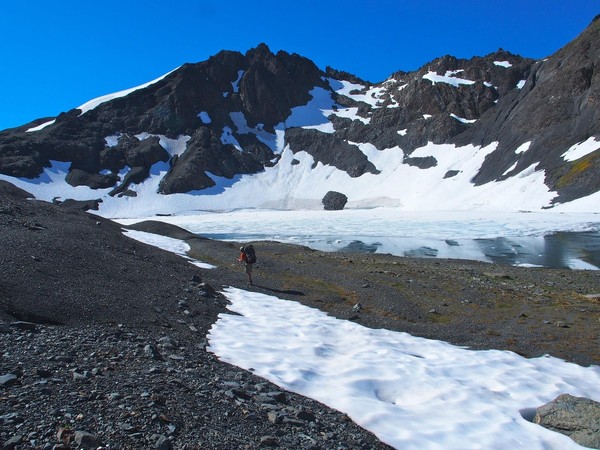
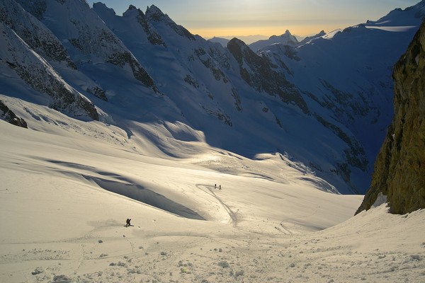
The next morning, day 5, we dropped into the Queets Basin
Once we started traversing beneath cliffs the route was very difficult to follow, and very bushwhacky. We were crawling on all fours beneath slide alder, then scrambling up a very steep wooded hillside trying to find our way to the Humes Glacier. I wonder if it's possible to stay low and follow the river up? At any rate, eventually we took a snack break in this "beautiful hidden basin" (guidebook description) before dropping to the headwall beneath the Humes
We had lunch here, at the Humes Glacier terminus
Then we climbed the right side of the Humes up to Blizzard Pass
And dropped 600 feet down to the spectacularly-situated Camp Pan
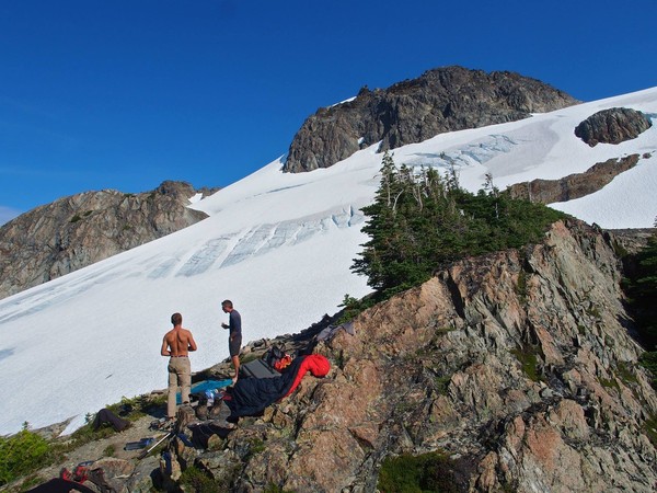
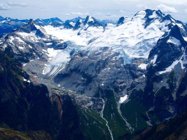
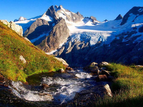
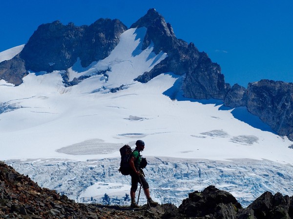
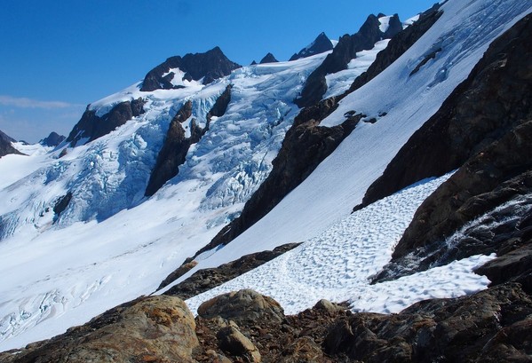
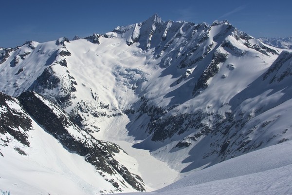
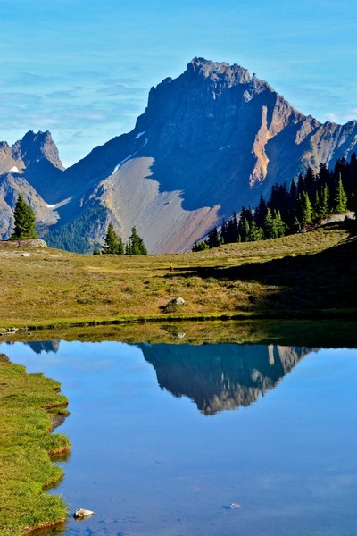
This is the Hoh Glacier from Camp Pan, and the headwaters of the Hoh River
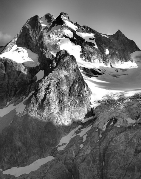
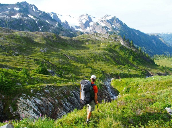
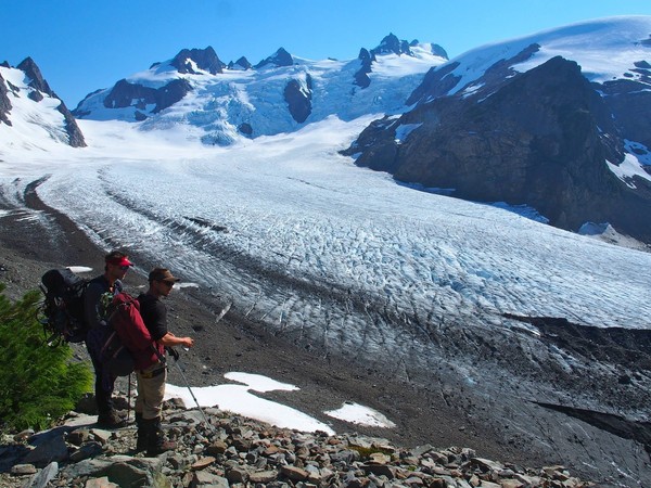
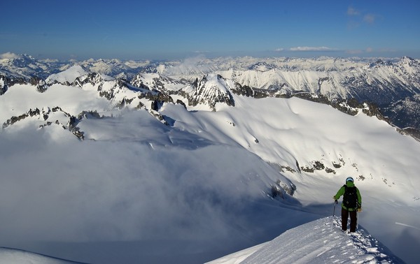
From Camp Pan Brennan looks up toward Mt Olympus with the Hoh Glacier below
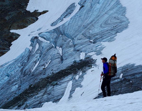
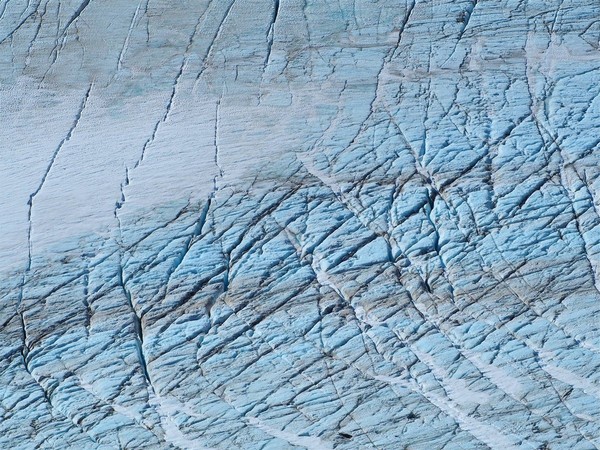
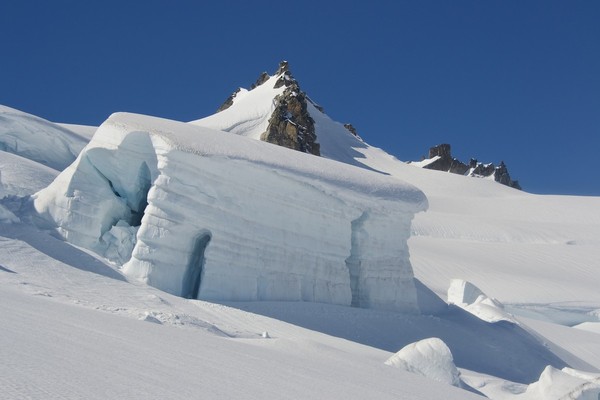
Hoh Glacier cracks
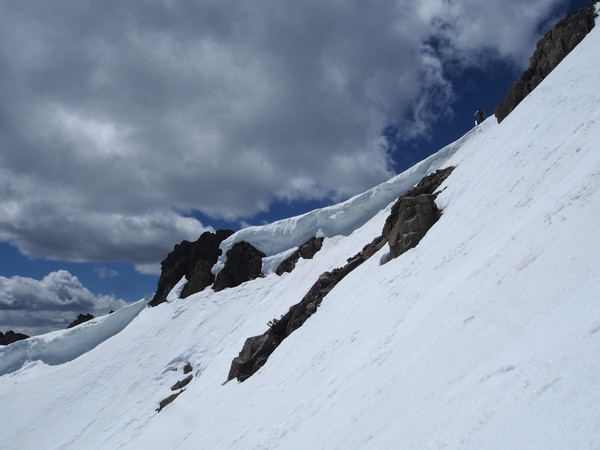
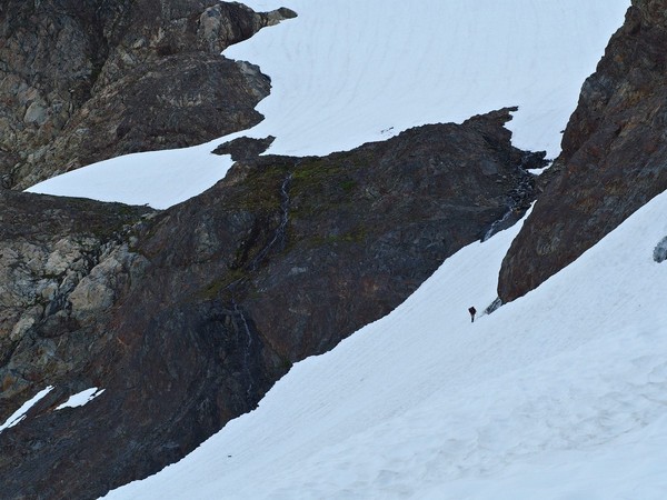
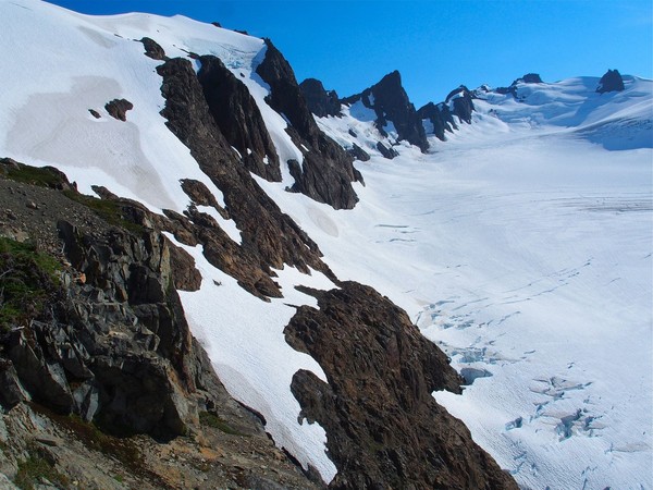
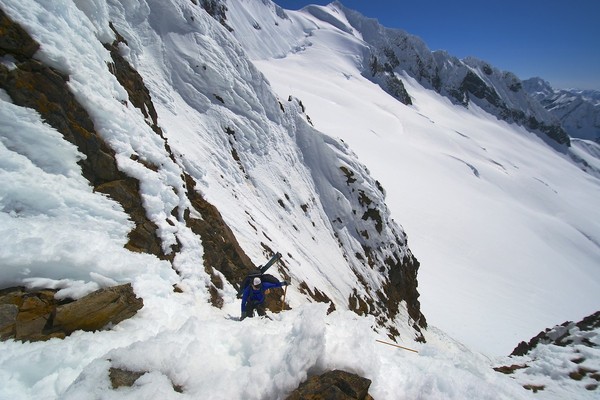
These snowy ledges are the descent route from Camp Pan down to the Hoh Glacier
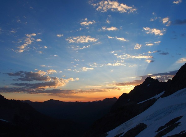
The next morning (day 6) we woke up @4:30am to this Camp Pan sunrise
The sunrise a few minutes later
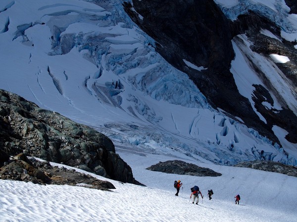
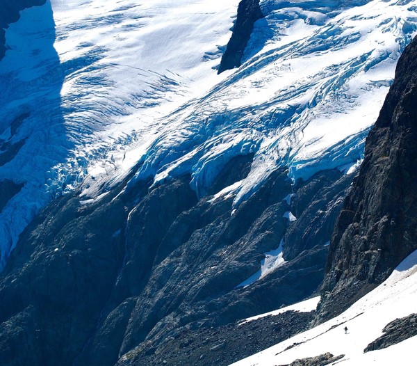
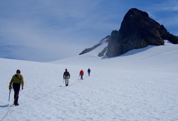
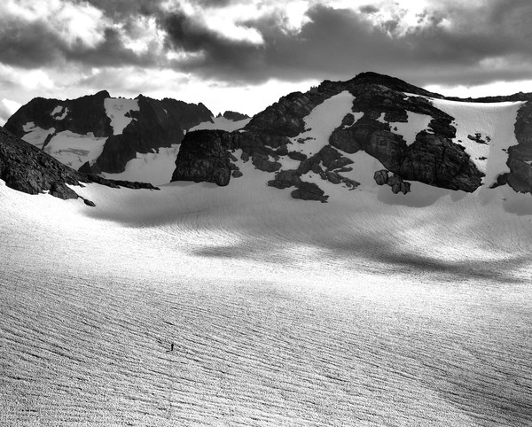
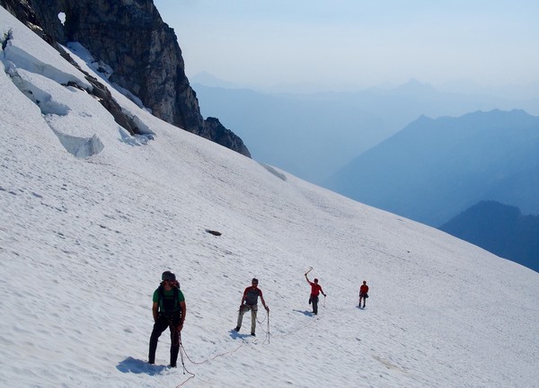
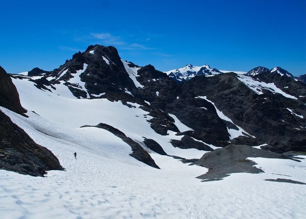
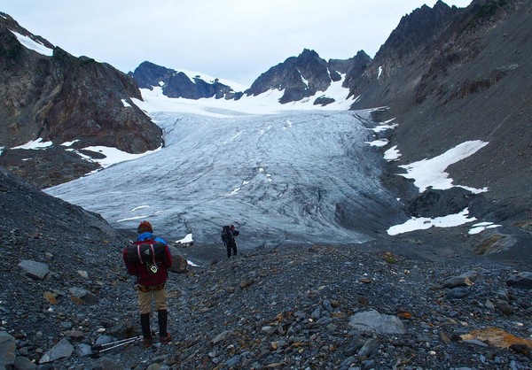
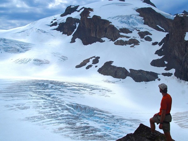
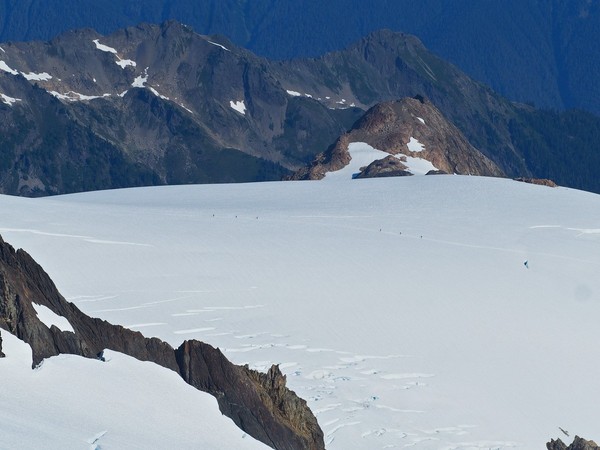
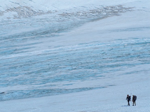
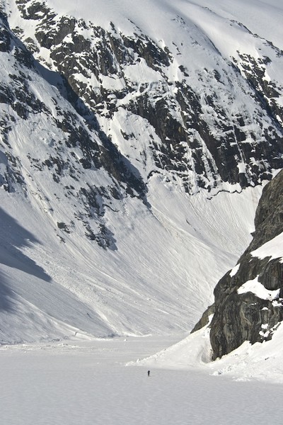
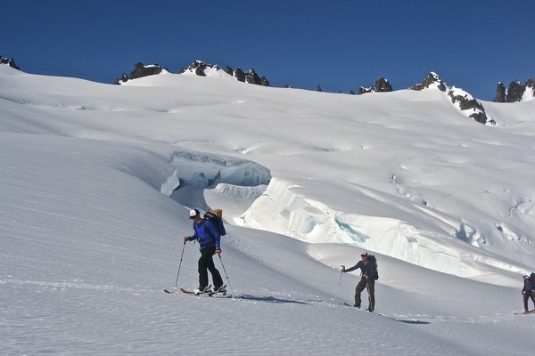
We roped up (finally) and headed out on the very gentle Hoh Glacier. After a little crevasse maze section we topped out on the Hoh Glacier near the Middle and East summits of Olympus
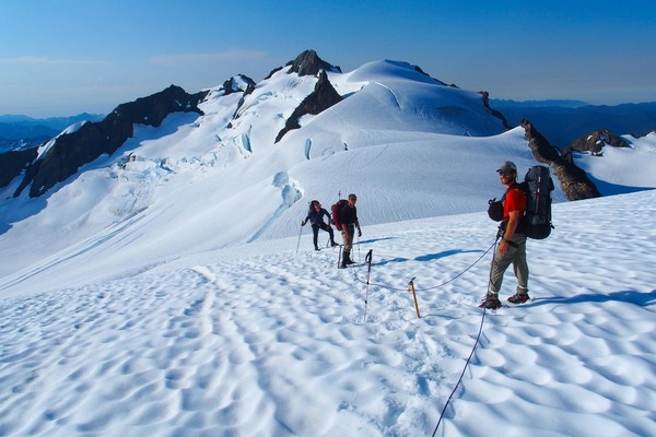
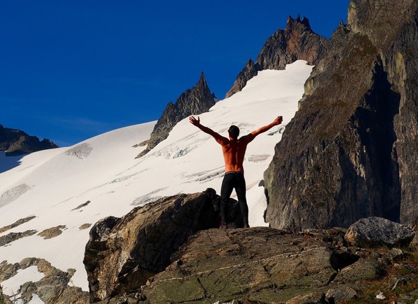
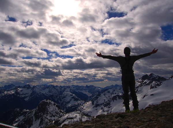
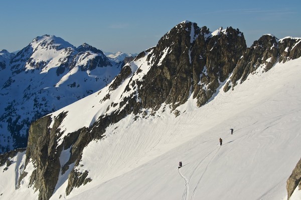
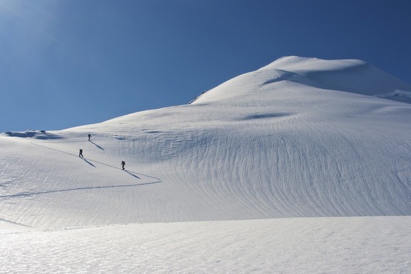
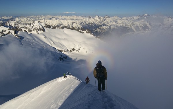
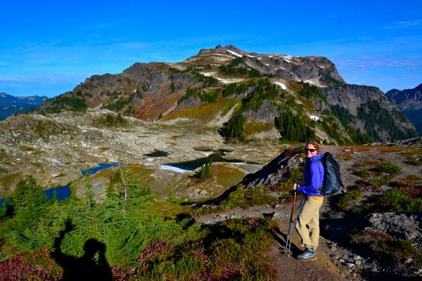
We dropped packs and scrambled up the East Peak of Mt Olympus (Erik is singing Pat Benatar's "Heartbreaker": "Your love is like a tidal wave", in case you were wondering)
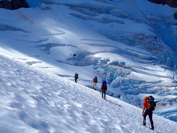
From the East Peak summit we saw these two 3-person rope teams on the Snow Dome far below
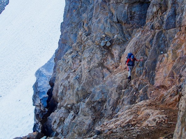
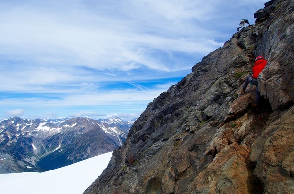
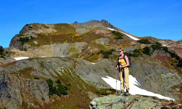
We hiked back down the loose rock and snow to our packs and made our way up and over the top of Mt Olympus' Middle Peak. The downclimb from this summit features very steep, very loose rock, and it was very unpleasant. We did it one at a time.
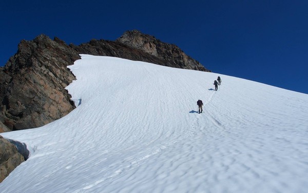
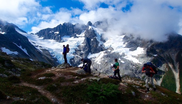
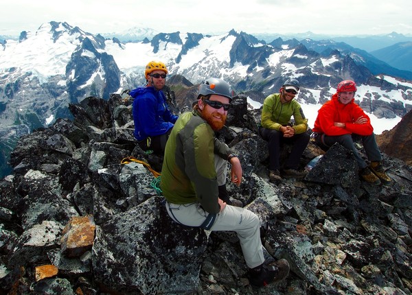
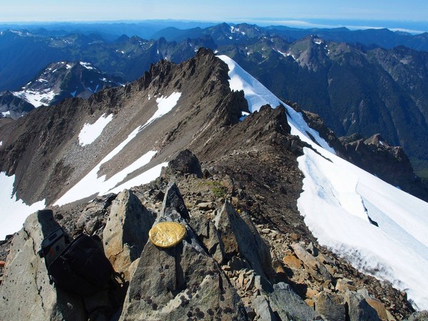
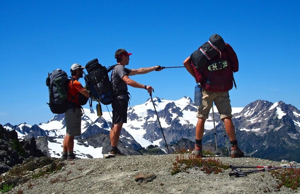
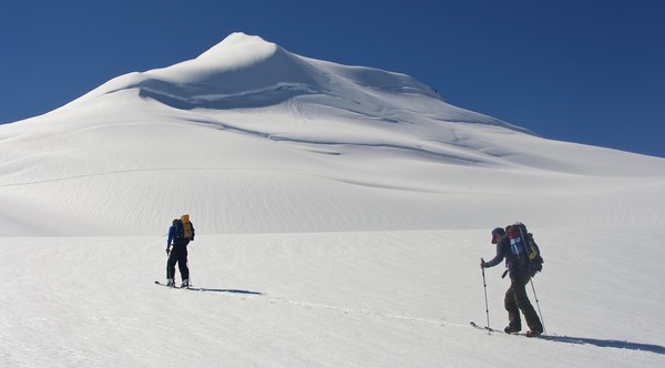
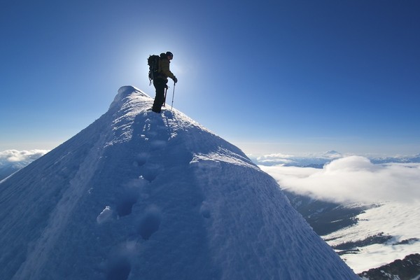
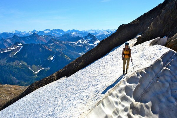
We stopped to melt snow on the upper Blue Glacier, then headed toward the true summit, the West Peak. The other 2 parties had arrived shortly before us so we had to wait our turn on the summit rocks.
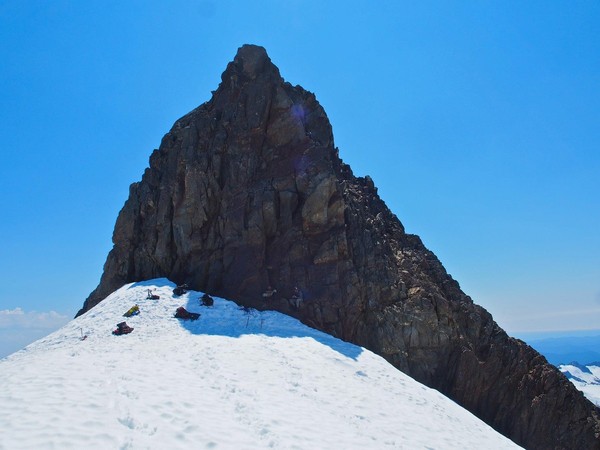
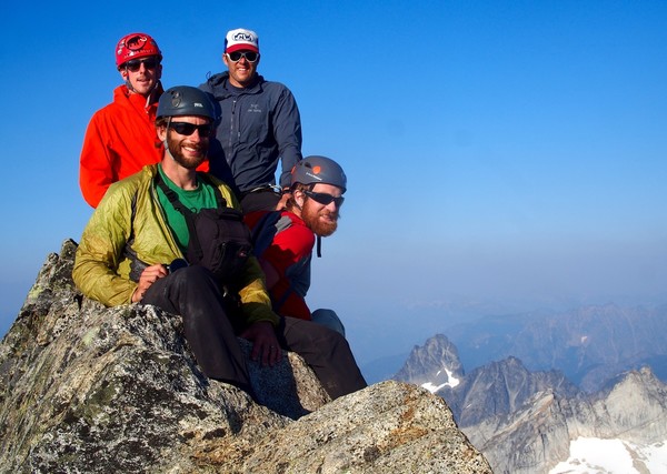
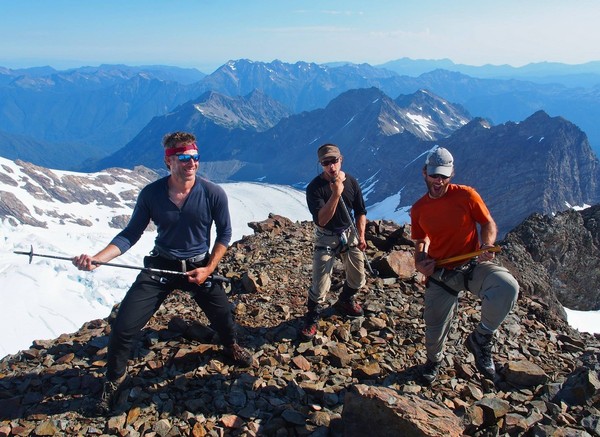
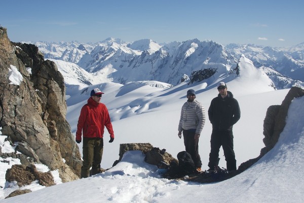
Brennan, Kevin, Tim, and Erik on the summit of Mt Olympus
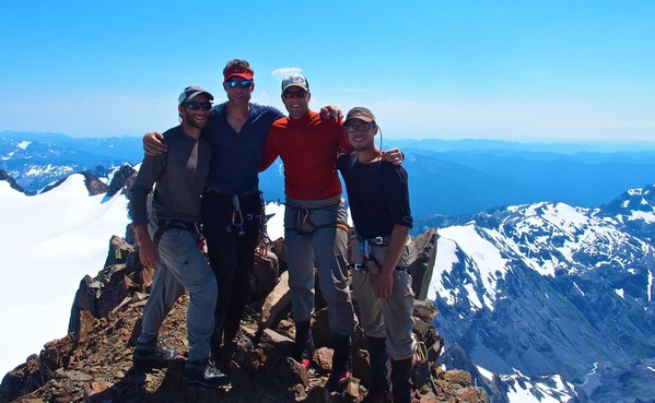
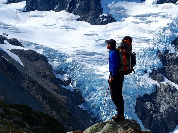
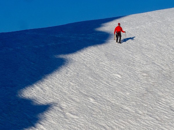
We still had a long way to descend but we enjoyed the perfect weather on the summit, and Erik brought along a summit orange which he shared. Here's the Blue Glacier's icefall on our descent from the Snow Dome
Crossing the Blue Glacier was strange, with moulins and noisy running water just beneath the surface of the ice
Finally back on real trail, at the moraine trail above Glacier Meadows
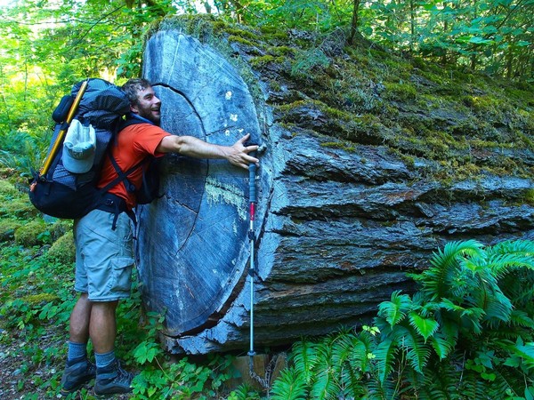
We dropped all the way to a small campsite on the Hoh River a couple miles above Lewis Meadow, reaching camp @8pm. The next morning (day 7) we turned right at the junction up to Hoh Lake, where Brennan hugged this tree.
4000' of climbing later we had lunch and a swim at Hoh Lake
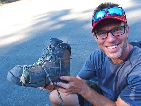
We crested the High Divide above Hoh Lake, then headed back into the forest and out to our car at the Sol Duc trailhead. The only casualty was Kev's hiking boot: the sole started separating from the boot on day 2, so we used some cord, sleeping pad repair glue, and duct tape to keep it together.
Thanks for reading!
-
Yeahhh, Brennan! Thanks for the TR!
-
-
I didn't even know about the Gilbert cabin, though I must have driven by it a hundred times over the years.
Same here. I happened to look up one day after getting back to the car from a trip in the Cascade Pass area and there it was, so obvious.
And I'm looking forward to the coffee table book on this trip that Jason had better get around to publishing!
-
I just read this on Jason Hummel's FB page. Holy shit, what a trip.
"Dream charging complete. Over 16 days, 60,000 vertical feet, 120 miles and a grand traverse of the Cascades is complete, something Cascade Mountains pioneer Lowell Skoog dubbed the 'American Alps Traverse'. A short story he wrote about his and others attempt to complete this adventure can be found here:
http://www.turns-all-year.com/skiing_snowboarding/trip_reports/index.php?topic=7640.0
For those familiar with the Cascade Mountains, Kyle Miller and I skied the Isolation Traverse, Ptarmigan Traverse, Extented Ptarmigan, Suiattle High Route into the Dakobeds and up and over Glacier Peak and out the Whitechuck River. I finished off the trip by running to the Mtn Loop Hwy and hitching rides back to my car.
Much, much more to come."
-
Don't know if somebody posted this already, but I just saw this sad article online:
Arizona Climber And His Dog Apparently Stung To Death By Bees
PHOENIX | Wed May 8, 2013 4:12pm EDT
(Reuters) - An Arizona climber has been found dead, dangling from a rope on a cliff face south of Tucson, after apparently being stung to death by bees, police said on Wednesday.
Steven Wallace Johnson, 55, a counselor with some 30 years experience hiking and climbing, headed into the mountains south of Tucson on Friday, Santa Cruz County Sheriff Tony Estrada said.
Johnson was reported missing on Monday by co-workers after he failed to show up for work. A Santa Cruz County Sheriff's Office search and rescue team found his body that afternoon, Estrada said. "He had been stung repeatedly and he was dangling there," he said.
"He was climbing the cliff and was about 70 feet up and still had about 80 feet to go, so he really didn't have anywhere to go when he was attacked by this swarm of bees," Estrada said.
He said Johnson's dog had also been attacked by bees and was found dead nearby.
The Pima County Medical Examiner's Office was conducting an autopsy to determine the cause of Johnson's death.
-
Looks like I just missed you guys on my hike. I thought I'd heard voices at one point, but attributed it to possible hallucinatory affects of a 12 mile snow shoe with a fairly full pack...
d
We ran into three guys on snowshoes with giant packs coming down the road when we were still at the cars (@ MP 17), that wasn't you?
-
woooooo! 1/2 your photo limks are broken, but the half that work are awesome.
Weird, it works for me on two different computers, and I shrunk them down pretty good. If anybody else notices broken that the photos don't load please let me know and I'll try to fix it. Maybe I just posted too many photos.
-
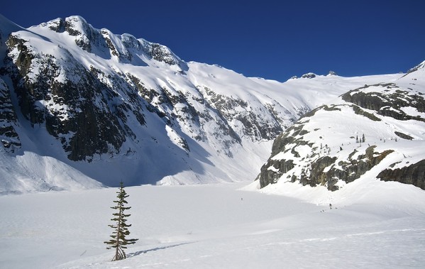
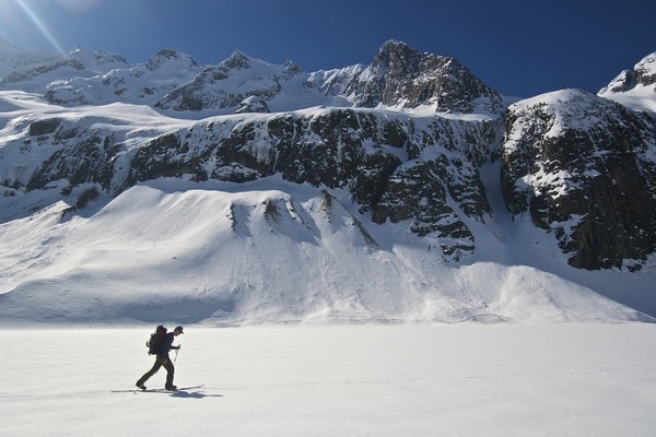
Trip: Forbidden Tour - with Eldorado summit
Date: 4/2/2013
Trip Report:
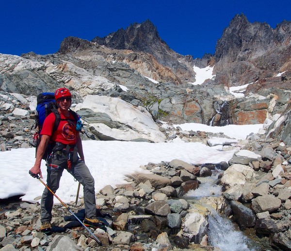
Three friends and I jumped on a last-minute trip around Forbidden after seeing the perfect weather forecast for the Easter weekend. We spent four days in the backcountry doing the Forbidden Tour: we skinned up to Boston Basin, climbed up and over Sharkfin Col, traversed the Boston Glacier up and over the North Ridge of Forbidden, skiied down to Moraine Lake, then skinned up the Inspiration Glacier to Eldorado (which we climbed), and finally we skiied/hiked back down to the Cascade River Road. Other than some clouds and really bad snow on the last day coming down from Eldorado we had perfect weather and an amazing trip.
We had brought a chainsaw after reading about a tree across the Cascade River Road but the guys who climbed/skied Spider beat us to it, so we were able to drive all the way to a bit past MP 17 after digging the 4Runner out a couple of times in the dip by the bridge just past the Mineral Park campground. On the way back it was an easy drive, as lots of snow had melted, so you should be able to get to MP 17 comfortably. There's a brief patch of no snow on the road after you park, and then it's continuous and pretty deep all the way to the gate at the Eldorado TH at MP 20.
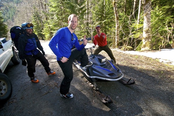
Travis brought his road sled and ferried our packs up to the gate @ MP 21 (before the big switchback), then came back to tow us the last mile to the Eldorado gate at MP 20 (as we had already skinned 2 miles). We dropped the sled here so we wouldn't have to hike back up the road to get it on the way out.
The weather was perfect but we got a really late start, leaving the car @3:15pm
We followed the sled track of the guys who climbed/skied Spider (I think), and we were impressed they got it over the gate at MP 21.
Mark skinning toward Boston Basin
We camped @ 5500' in Boston Basin, arriving just before dark. The next morning we watched the moon dip behind Johannesburg, and it was so clear you could make out craters with the telephoto lens.
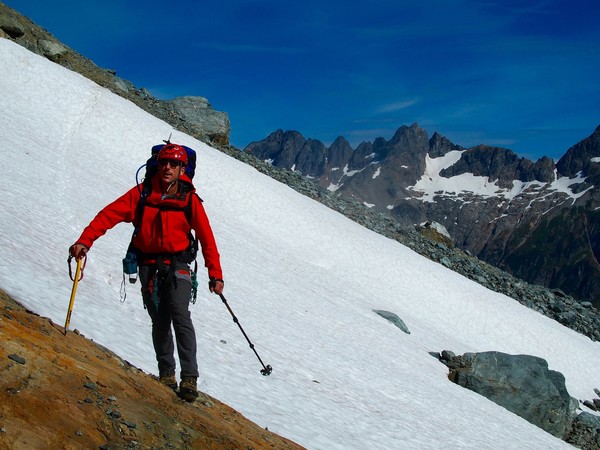
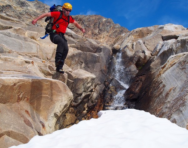
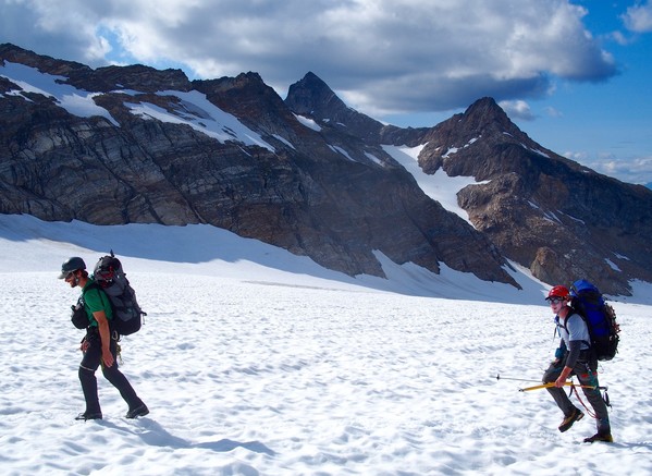
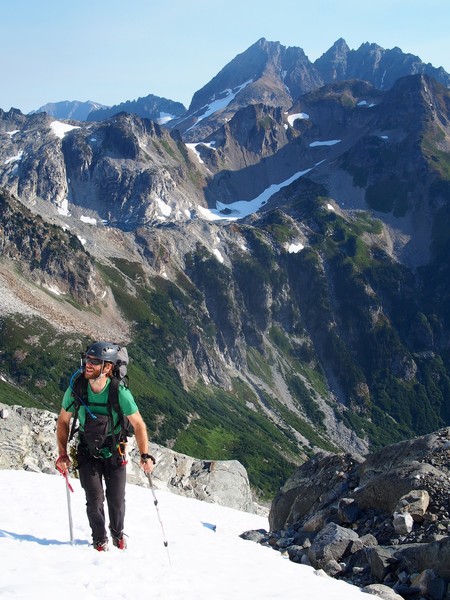
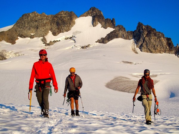
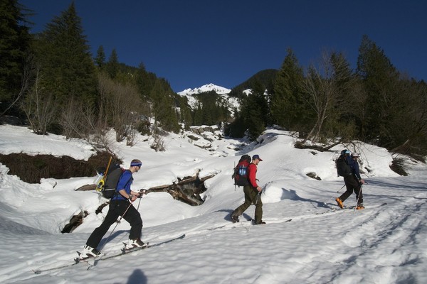
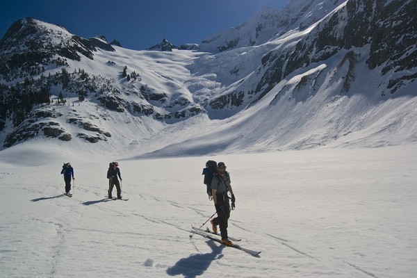
Had an very unalpine start, which turned out to be a theme of the trip. Here Travis skins under Forbidden Peak.
And here's Derrick after switching to crampons. We had to forgo skins for about 1000' (ski crampons would have been nice), but it was an easy boot pack to where the angle lessens above the moraine.
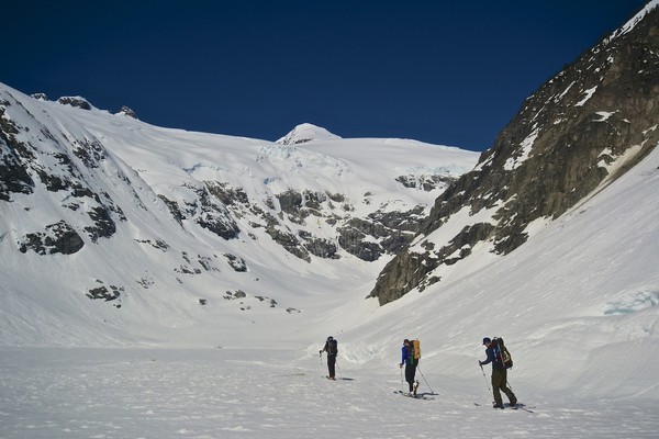
Heading up the Quien Sabe toward Sharkfin
Johannesburg towers across the valley
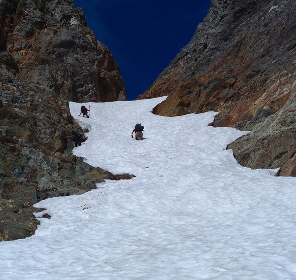
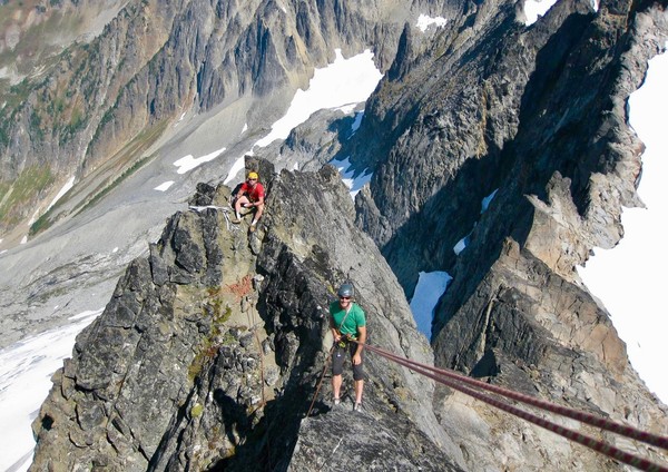
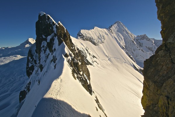
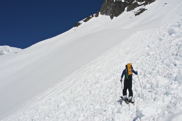
The climb up Sharkfin Col was fun, with one spicy bit of unconsolidated snow over steep rock about 3/4 of the way up.
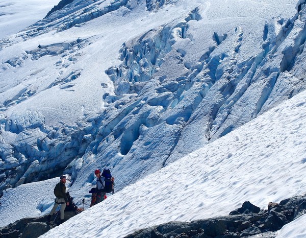
We took two 30m ropes for the rappel onto the Boston Glacier, and that was enough to get us right above the bergshrund, which we jumped over. We probably could have downclimbed it if we had to but the ropes were nice to have along.
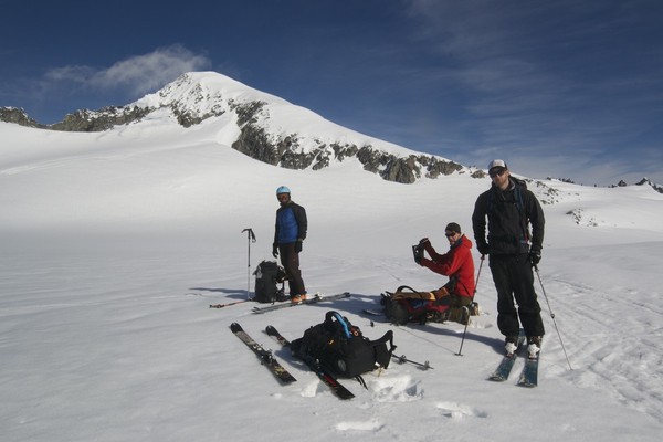
After eating lunch at the bergshrund we skied @ 1000' down and across the Boston Glacier. You can see our trail down from Sharkfin Col in the background, just up and right of Mark.
Here Travis and Mark are chasing Derrick on the ski down the Boston Glacier
Crossing the Boston Glacier
The north face of Buckner
Skinning under Forbidden's North Ridge
Boston Peak and Sharkfin Tower
High on the Boston Glacier, almost to the crossing of the North Ridge
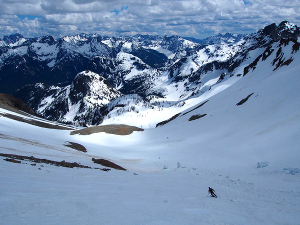
We got antsy and went left too soon, so we ended up rappelling off a horn down a steep gully while crossing the North Ridge. But at least we got this great view of the North Ridge and north face ski route on Forbidden.
And now for the suuuper fun 3000+ ski descent down to Moraine Lake!
First we traversed right to where we should have come over the saddle in the first place
Then we made turns down the Forbidden Glacier
Derrick snowboarding below Forbidden's north face
It was warm enough that we found dripping water coming from the rocks a couple hundred feet above the lake, which saved a bunch of time melting snow but it didn't bode well for the avy conditions the next morning. We dug out a nice spot and camped on a knoll near Moraine Lake. (That's Mt Torment in the background)
The next morning we crossed the frozen Moraine Lake. Travis is the little blip on the lake just to the left of the cliffs on the right side of the photo.
Derrick crossing Moraine Lake below Mt Torment
Travis skins across Moraine Lake
The Forbidden Glacier is in the background here
Heading toward the Inspiration Glacier, with Eldorado poking up in the top center of the photo. It was sooo beautiful down in the Moraine Lake basin, just a phenomenal place to tour through.
It warmed up quickly and we heard/saw lots of small slides coming down all around the Moraine Lake basin as we made our way up. There's nothing like skinning through fresh avy debris.
Derrick gains some elevation
We stopped for lunch once we got to a bench above the cliffy area, then continued on a very direct, pleasant route up the Inspiration toward Eldorado. The boys are in the bottom left-center of the photo.
Inspiration Glacier ice
Perfect weather as we look back at Forbidden and Torment towering above the Moraine Lake basin
There was one easily-crossed crevassed section on the skin up
Almost to the base of Eldorado. We came across the skin track here of the recent skiers who did the Isolation Traverse, which you can see as a faint line just above Mark (the skier in front).
We set up camp on the rocky shoulder just below Eldorado; not a bad place to spend a night.
After resting we skinned up the East Ridge of Eldorado to just below the summit
Time to take the skis off and boot up
Mark kicking steps toward Eldorado's summit
After enjoying the view from the top we headed back to our skis
Time to ski down to camp
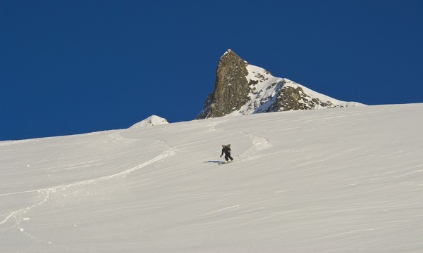
Mark links a couple of nice powder turns on the flanks of Eldorado
The third night was cold and windy and the clouds blew in around sunset, but sunrise the fourth morning was beautiful and clear.
Looking up at our turns on Eldorado at sunrise
Glacier Peak
Spider and Formidable behind Cascade Peak
Formidable and Dome Peak behind Johannesburg
Buckner, Forbidden, and Boston peaks and morning clouds
Derrick crosses the last flat spot on the Inspiration in front of Point 7733 before the 5000'+ drop to the Cascade River Road
One final look at Eldorado before skiing into the clouds. The ski down to the saddle crossing was terrible, but it improved once over the saddle and down the boulder basin to the trees.
And what North Cascades ski trip would be complete without a forest hike? Thanks for reading the TR!
Gear Notes:
A 30m rope or two and a whippet and you're good to go. And thanks to the American Alpine Institute in Bellingham for the splitboard rental!
Approach Notes:
Cascade River Road is drivable to @ MP 17, then snowmobile-able to either MP 21 or to the road's end at MP 23 depending on if you can get over or under the gate. The skin up into Boston Basin is straightforward. If you're heading to Eldorado the most difficult part is just after crossing the river (finding the trail + lots of postholing); once a hundred feet above the river the trail is easy to follow almost to the boulder field (which is all deep snow).
-
I was just up there last week. There were some cars parked at Mineral Park campground (@ MP 15) where the snow started in earnest, but we made tracks down the dip and continued another 2.5 miles to where it was pretty much continuous. We had to briefly dig out the 4Runner three times but it was pretty easy. So you can probably drive a little ways past MP 17 now. After that there's a brief spot with no snow, and then it's continuous for the rest of the way up. We took a snowmobile so we had one brief spot of road riding. It looks like it's gonna be awhile before the road is clear to the Eldo TH. The gate at the Eldo TH (MP 20) is easy to take a sled around, but the next one is about half-buried so you'd have to go over it, or dig a ways down. The guys who climbed/skied Spider (see the recent trip report) were able to take a sled all the way to Cascade Pass.
We had taken a chainsaw but the Spider guys beat us to it, so other than a bit of tree debris that you can drive over the road is in really good shape. We did the Forbidden Tour, so we skinned up into Boston Basin and came out the trail down from Eldorado. Let me know if you need beta on any of this area; I'm going to post a TR in a few minutes.

-
Nope, ours was orange, but we saw that one. Perhaps they headed up in the Eldorado direction.
That was our ride. We did the Forbidden Tour, and I'm going to post a TR as soon as I get these @#$%& photos to upload. We brought a chainsaw too, but you beat us to it. We were able to drive to MP 17 after digging out the 4Runner briefly 3 times in that little dip right after Mineral Park campground, and I couldn't believe how much snow had melted after only 4 days. For SURE it's easy to drive to MP 17 now. Strong work getting the sled over the gate at MP 21!
-
FRIEH - DOM!!!!!!!
[video:youtube]
-
If you haven't sold the WM sleeping back I'm interested...
Tim
(360) 424-5238
-
Trip: Tomyhoi Peak - Southeast Ridge
Date: 9/30/2012
Trip Report:
I hiked/climbed Tomyhoi Peak this past Sunday with my wife. This is a beautiful hike (especially this time of year) through the Yellow Aster Butte area and up an easy ridge to a nice class 3/4 scramble finish that is steep enough to make you feel like you're actually climbing something.
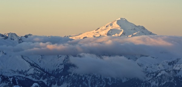
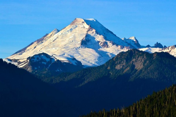
Here's Mt Baker in the morning
It was a beautiful morning; the fall colors are starting to appear
This is Tomyhoi Peak above the Yellow Aster Butte area. The very obvious trail takes you all the way to the top of the Tomyhoi Glacier.
American Border Peak reflected in a tarn in the Yellow Aster Butte area
The trail drops steeply a couple of hundred feet here
There is a very short section of snow travel (from the rock to where I'm standing taking the photo) and an easy step out of the moat to get back on the rock.
Then a nice trail high above the valley.
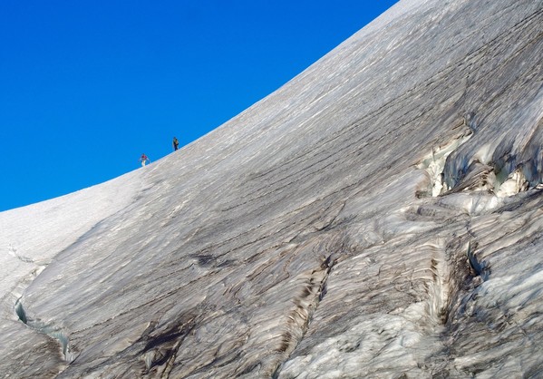
After dropping steeply another couple of hundred feet you climb this face to a short trail to the summit. It's not as steep as it looks, but it was steeper than I'd remembered from last time. There are 3 climbers on the face in this photo but I think it's too small to see them (bonus points if you can find them)
This is the top of the previous photo's class 3 scramble, where you find an easy short trail around the back of the wall and up to the top
And here's the summit ridge, where we met the three climbers (who were ultra runners)
On top of Tomyhoi Peak (7451')
Canadian Border Peak, American Border Peak, and Mount Larrabee from the top
Fall colors and Mt Baker on the way down
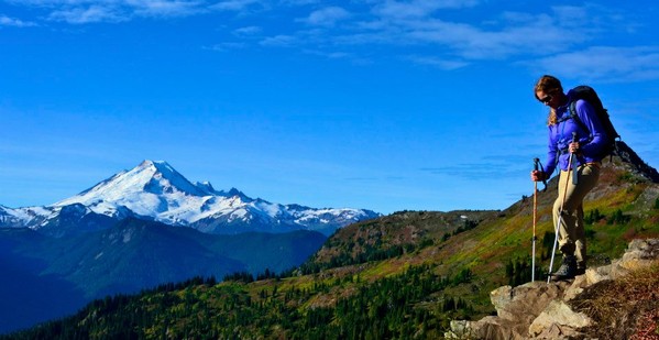
And a parting shot of Shuksan from the Yellow Aster Butte area
With all the ups and downs it's a good @5000' elevation gain hike.
-
Wow, thanks for the TR!
-
I know; plus you get another 10% back for your dividend since it's not a sale item, which would make it something like 46% off.
Olympus “Eastern Ledge Route” info request
in Olympic Peninsula
Posted
Wow thanks, super helpful! And glad you’re ok.
Speaking of accidents, I have a friend in Vermont (who used to be a climbing partner of mine when he lived in Washington), and he called me earlier this week to say one of his Vermont friends was hiking the Bailey Range last week, and her dad slipped and fell to his death on the route. Have you heard news on this? I can’t find anything about it online.