


Chriznitch
-
Posts
477 -
Joined
-
Last visited
Content Type
Profiles
Forums
Events
Posts posted by Chriznitch
-
-
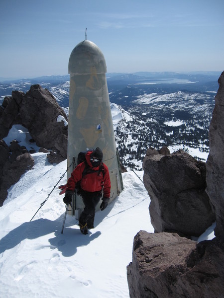
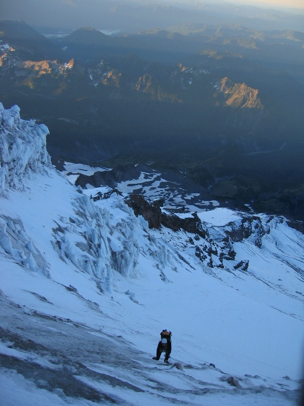
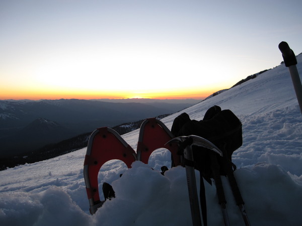
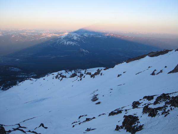
money shot, Lassen Peak
-
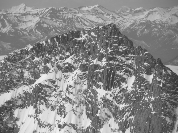
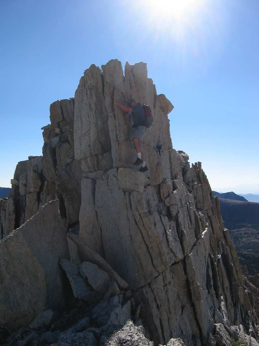
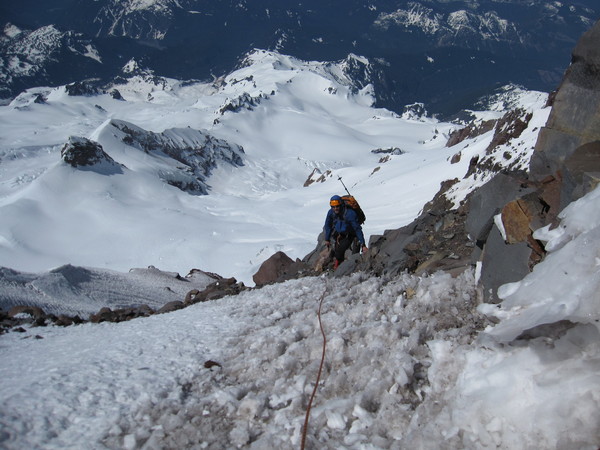
Matt at the crux move, Oct 2012.
-
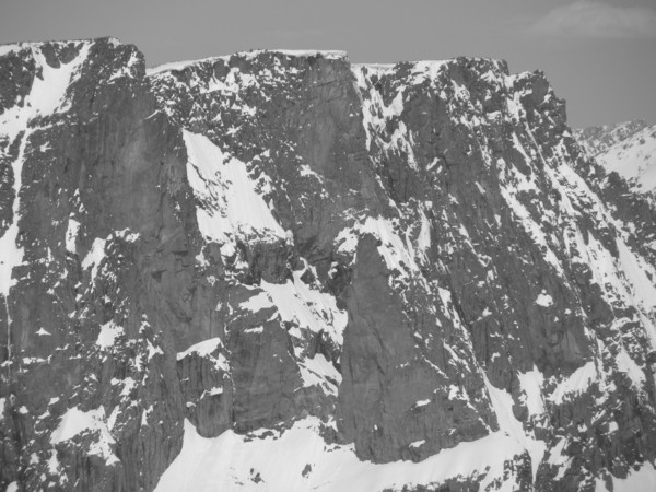
Matt at the crux. Lone Rock, northern Sierra Nevada, CA.
-
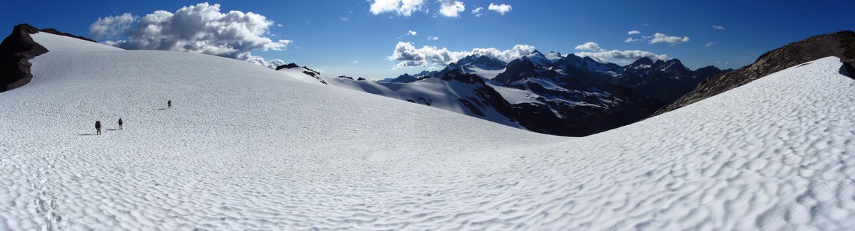
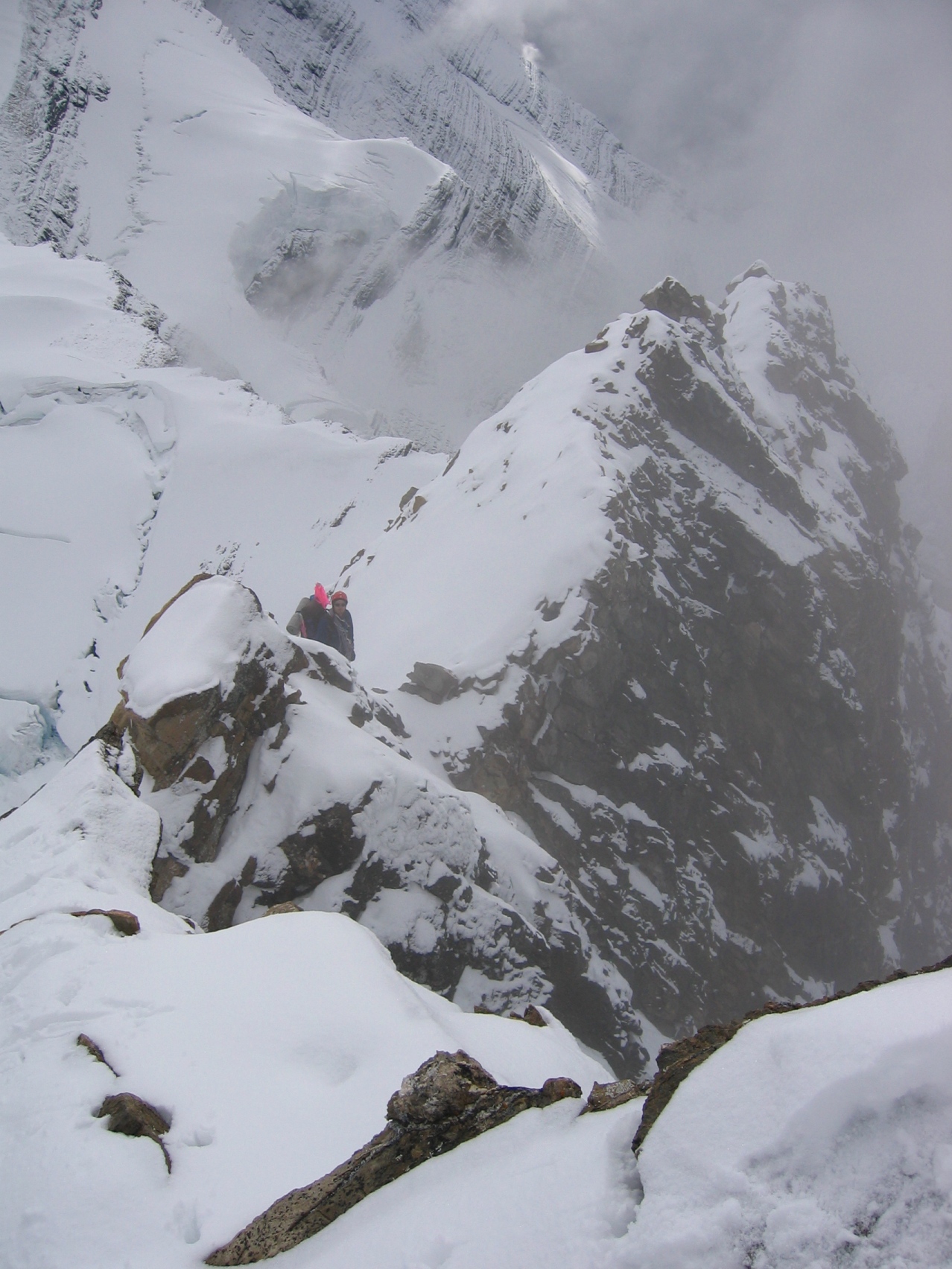
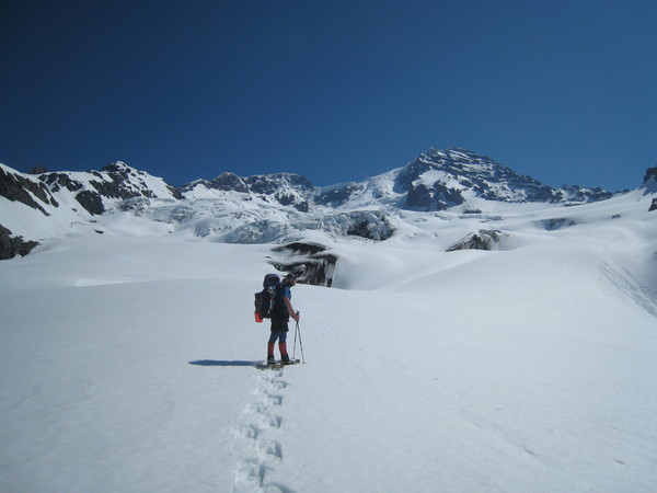
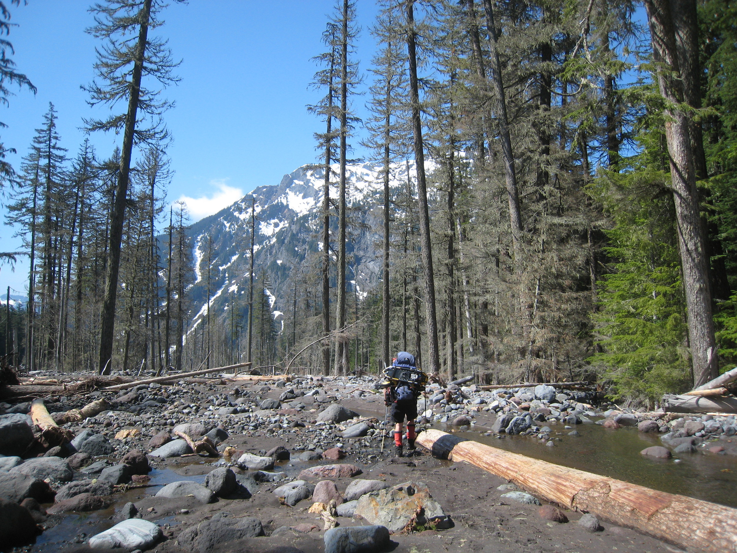
Crossing Bear Pass Glacier, Olympic Mountains, WA.
-
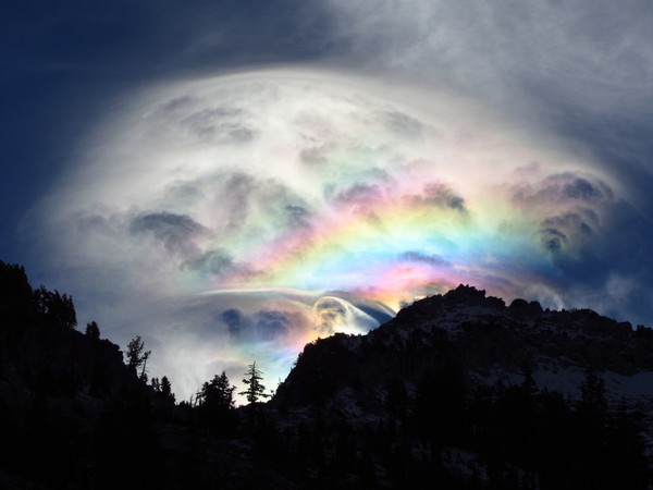
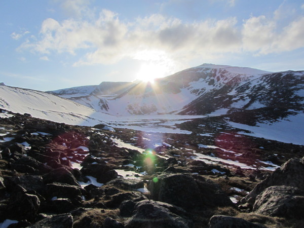
Wild light whips over Caesar Peak in the Trinity Alps, CA.
-
Dave contacted me through this site back in November 2012, asking about my experience with the Polish Direct route. Sorry to hear the bad news...

-
Trip: Mt Rearguard - SE Slopes via Hellroaring Plateau
Date: 5/12/2012
Trip Report:
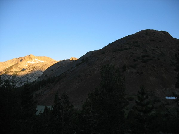
I had to work in Montana in May, so I headed out a couple days early with a plan to do some exploring in the Beartooth Mountains. As the trip neared, my first day in the area was looking like rain, but it was followed by awesome weather. So I hung out in Red Lodge for a day, and the next morning headed out for Hellroaring Plateau. I took a low-standard Forest Service road up as far as I could travel before hitting impassable snow, and parked. It turned out this was near the Hellroaring Creek crossing, which is the main drainage for the many lakes in the center of the plateau. I scrambled up 1000'+ to the top of the plateau, and worked my way over towards Sliderock Lake and Mt Rearguard. I found a nice bivy site with an amazing view, and studied which route up Rearguard I should aim for the following morning.
sunset over Mt Rearguard
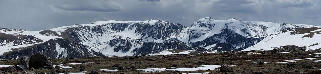
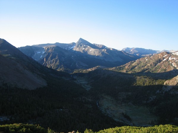
I settled on the tallus and snow slopes along the east side of Sliderock Lake and up the east side of the mountain. The night in the high teens was a little chilly, as I only had my 40 deg sleeping bag, all that would fit in my checked airplane luggage. But soon I awoke from a solid sleep to glaring sun - morning had come quick. My route was pretty easy up the peak, and in about 2.5 hrs from camp I was on top of the summit plateau. From here there were awesome views of Peak 11977', Spirit Mountain, and Beartooth Mountain - the namesake of the range. The actual Bears Tooth, the impressive pinnacle on the east ridge of Beartooth Mountain, was neat to see.
Peak 11977'
Beartooth Mtn & da Bears Tooth
Pk 11977', Spirit Mtn, Beartooth Mtn
I worked my way back to camp and then descended a different route back to the car. I ended up finding a high, snowed-in trailhead around 9800'; this would be a great and convenient late summer access point. Below this spot the road was a bit of an adventure to follow, and in a few sections I had to use my ice axe as the steep mountain road was totally snowed over.
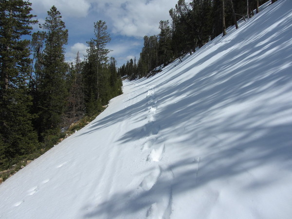
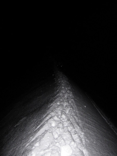
snowy road
After a few miles I made it back to my car, completing a fun 14-mile solo loop tour of Hellroaring Plateau, a 12k peak, and a small piece of the Beartooth Mountains.
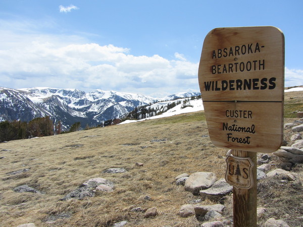
wilderness sign found on the way down
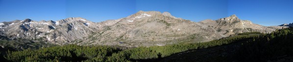
looking south at Beartooth Plateau
Gear Notes:
ice axe, crampons, bivy gear, camera
Approach Notes:
from US 212, drive Forest Road 421 to FR 3004 to Hellroaring Creek; scramble up Hellroaring Plateau & head west towards Mt Rearguard
-
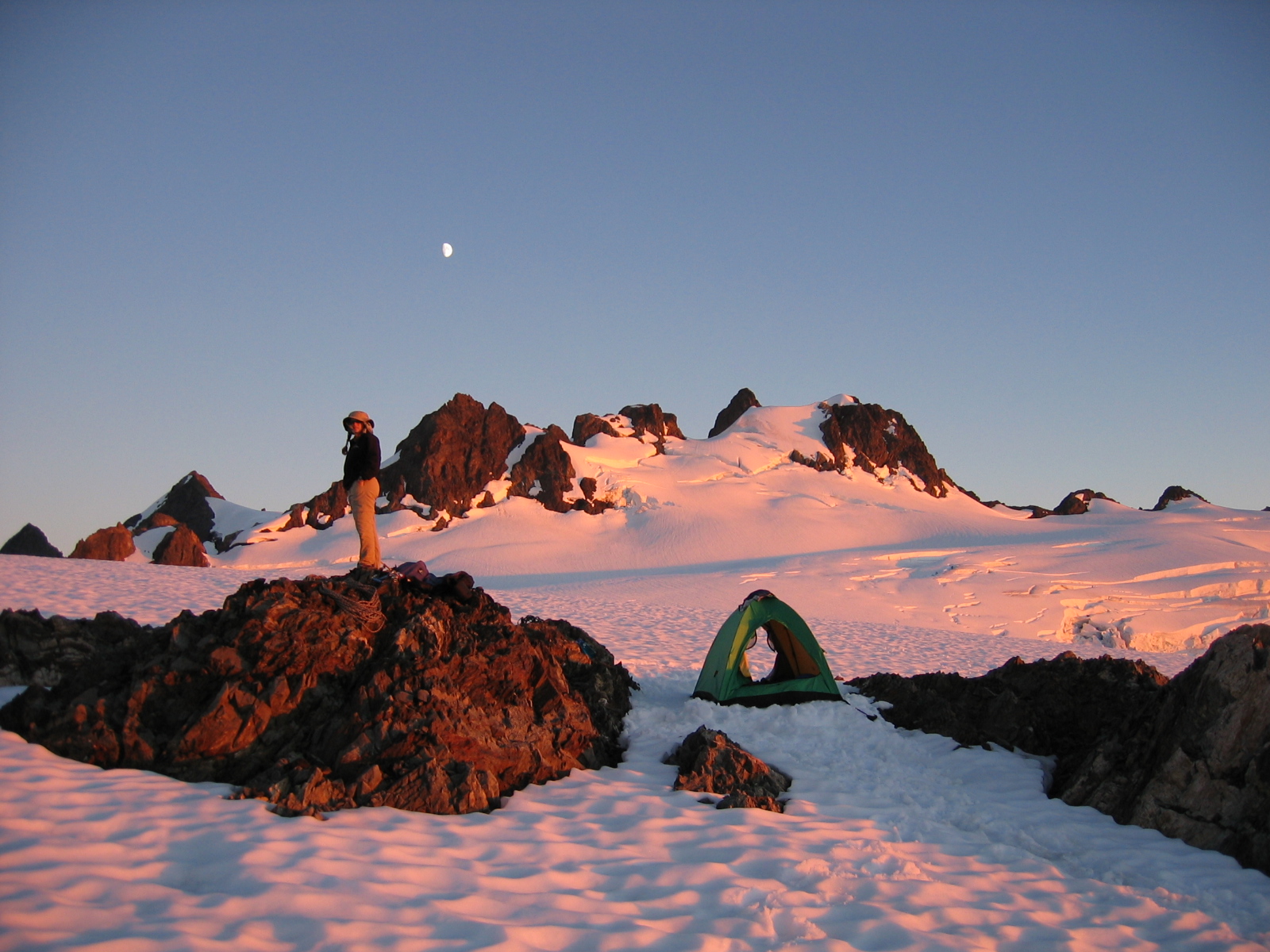
Scenic - camp on Mt Olympus
Alpine - Mark on Robson's east ridge
Bouldering - Randy on Mt Conness, East Ridge
Ice - Nate on Kautz Glacier ice chute, Mt Rainier
Humor - self portrait from North Sister summit
-
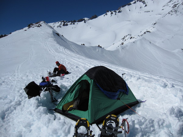
Side note: if you were up at camp Muir on the night of May 28th and stayed in a green Hilleberg tent, you're welcome. You should have asked someone before picking up a random tent on the ground and staying in it. Gear is not a free for all.
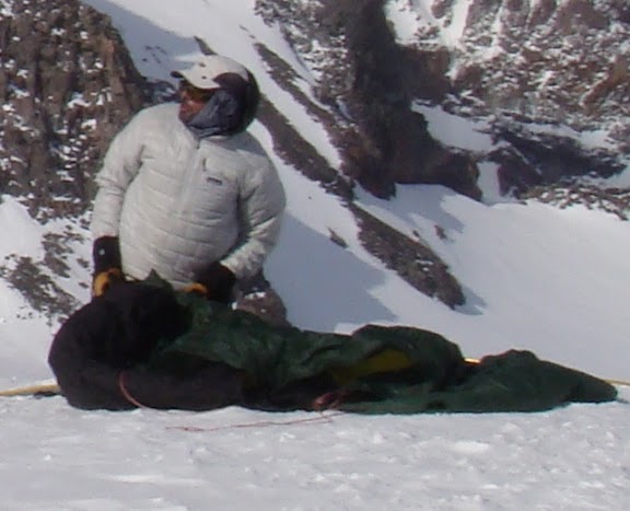
Everyone else; don't leave your tent unattended or this will happen. This is the only known photo of the mystery tent squatter
I can't say with certainty, but I think I recognize the tent squatter:

-
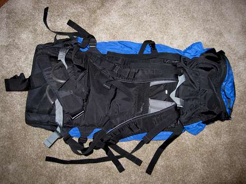
I have a CCW Chaos pack for sale. Size large. Gear racking loops, removable bivy pad, crampon pouch.
With my long torso it never quite fit right, so it's still in good shape and a good deal:
I'm looking for $150 obo
It has only been on 3 trips.
Here's some more info: http://www.coldcoldworldpacks.com/chaos.htm
Here are a couple pics. Pm me if interested!
[img:center]http://www.summitpost.org/images/medium/613532.JPG[/img]
[img:center]http://www.summitpost.org/images/medium/613533.JPG[/img]
-
it's not corvallis, but it's home


-
hey Ryan,
I thought I noticed a couple new S-turns near our tent when we got back down, but wasn't sure if I was hallucinating due to overheating. Yeah, that ice avalanche was pretty impressive. Make sure to grab that large photo from my gallery with you guys next to the 'lanche!
-
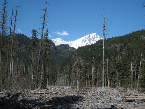
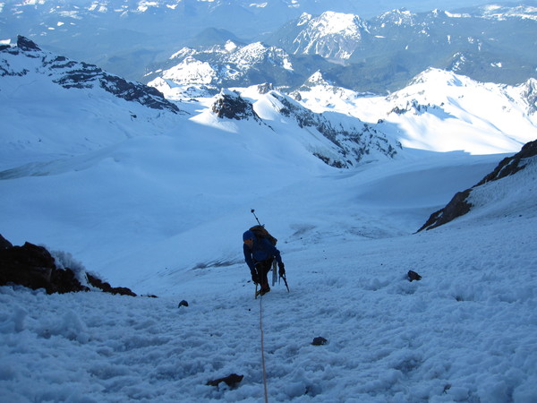
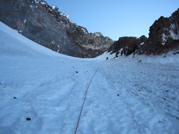
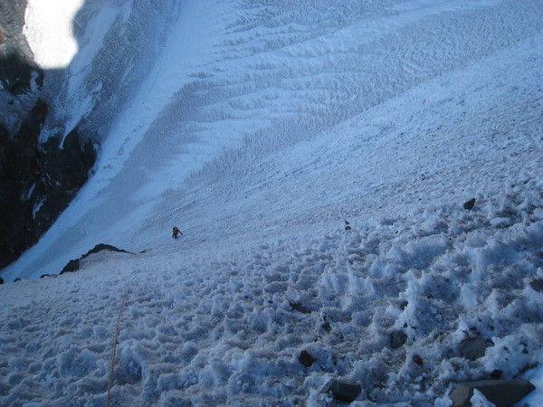
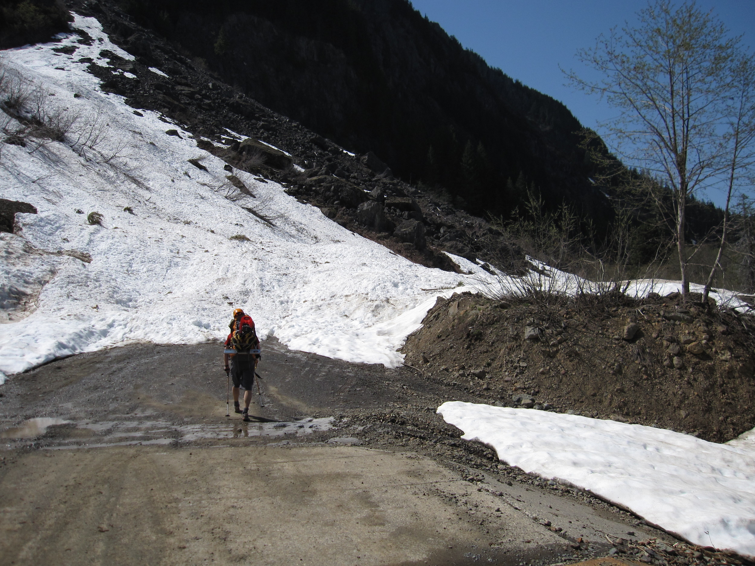
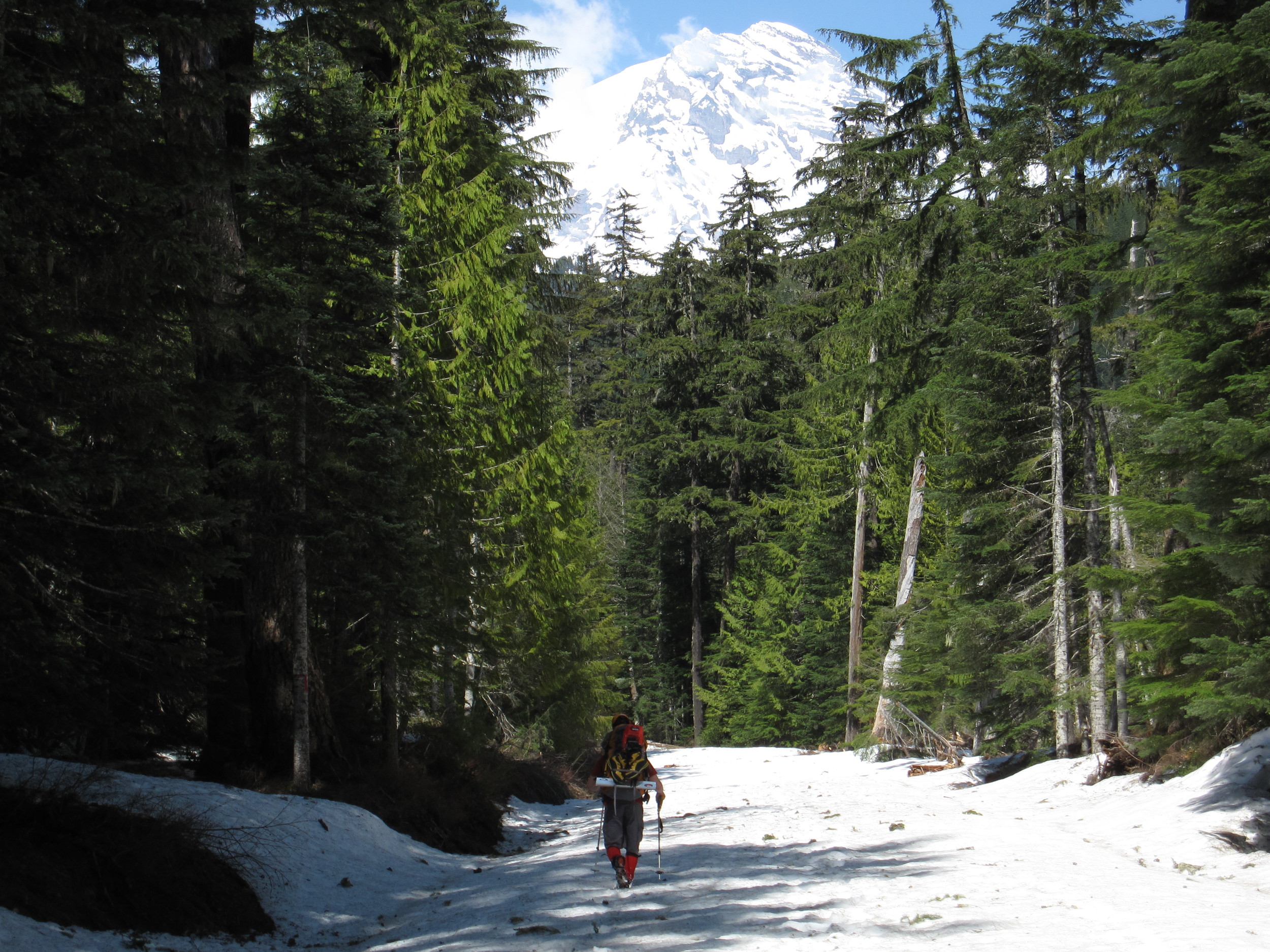
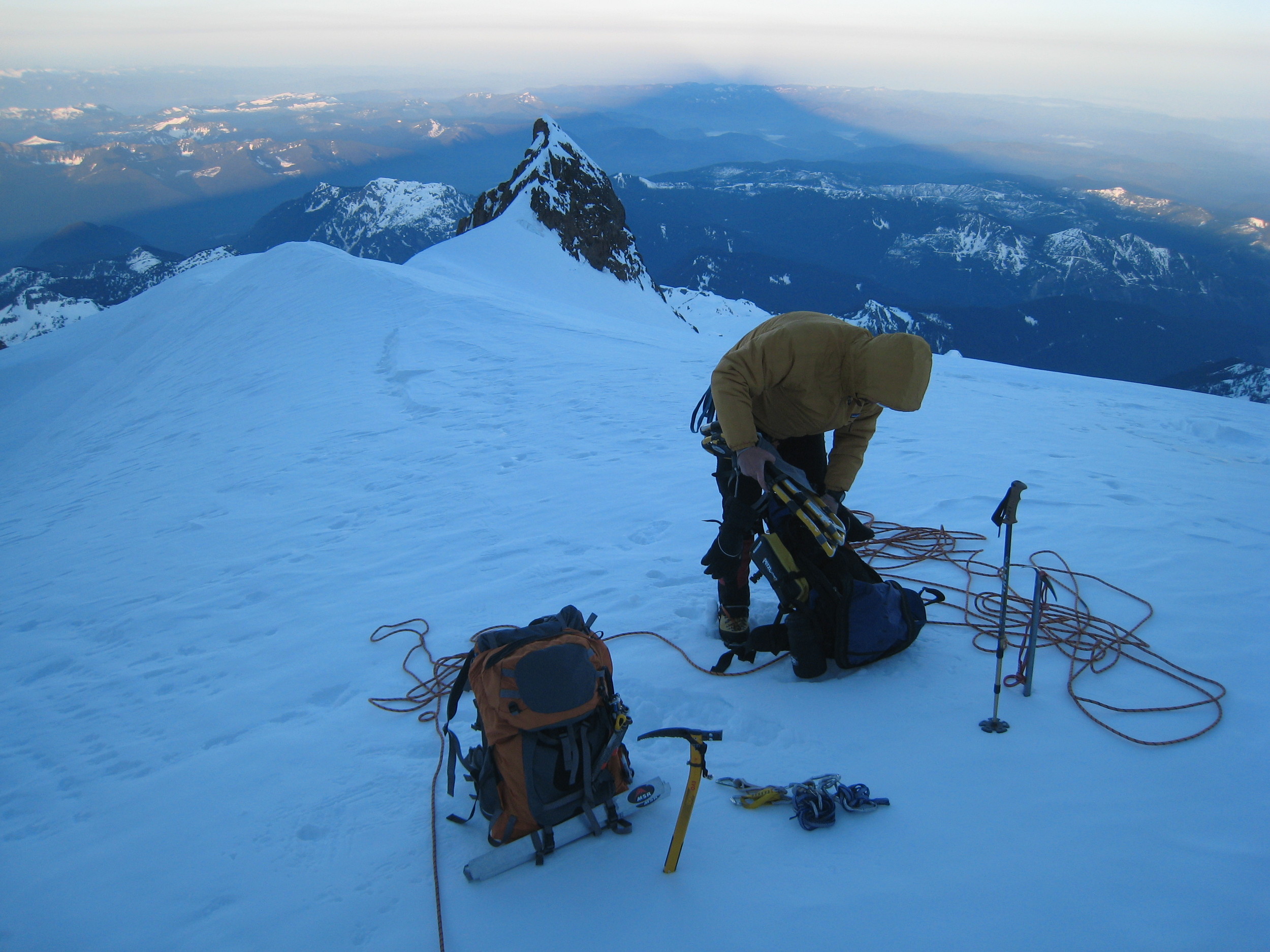
Trip: Mt Rainier - Sunset Ampitheater Headwall Couloir
Date: 5/22/09-5/25/09
Trip Report:
It seems every Memorial Day weekend, my friend Nate (sweatinoutliquor) and I talk about heading to Rainier. The last time everything fell in place (weather, travel, work, etc) was in 2005.
As the 2009 holiday neared, we began discussing route options. We eventually narrowed the research to the westside of the mountain, as the remoteness was an attraction. Reading Gauthier's book, the Sunset Theater couloir sounded great, and having been first climbed in 2000 made it sound even more interesting. I began monitoring the weather about a week before, and was impressed that the forecast continued to improve with each day. 0% chance of precip in MRNP? Awesome! This year was going to work out.
I headed out of norCal on Thursday afternoon, and met up with Nate in Oregon. We took off the next day after an excellent breakfast that included lots of locally raised bacon. We arrived at the park after surprisingly efficient I-5 travel through Portland and south WA, checking in for permits at Longmire. Unfortunately, we were told that the Westside Road was closed, which meant that we would have another 3 miles of approach added to the trip. Starting at 2100', that also meant that we would have a hefty elevation gain of 12000' to make the top

We gave ourselves 4 days for the route: 2 days for approach, 1 for summit day, and 1 for the descent back to the truck. This worked out well. The actual couloir was in great shape, with mostly good step kicking snow and alpine ice. Icefall and rockfall was minimal until the sun warmed the ampitheater, although I still took a couple hits to the helmet. Snow conditions on the Tahoma Glacier were good in the morning but POOR in the afternoon (unless skiing). On the descent from the summit plateau practically every step balled up in our crampons. This made the straightforward downclimb a bit tedious, all while baking in the sun. I postholed into a crevasse only a few feet from our tent through nearly 4 feet of snow, not ideal.
So, here is a photo-journal of the trip. I must warn you: there are a lot of photos. It was hard to narrow down the selection. You can click on most photos to see a larger version. Half the photos courtesy of sweatinoutliquor.
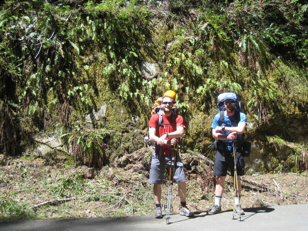
prepped and ready to hit the road (literally)
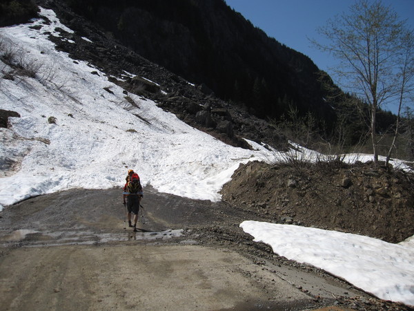
Nate nearing the washed out portion of the Westside Road
flood-killed trees along Tahoma Creek

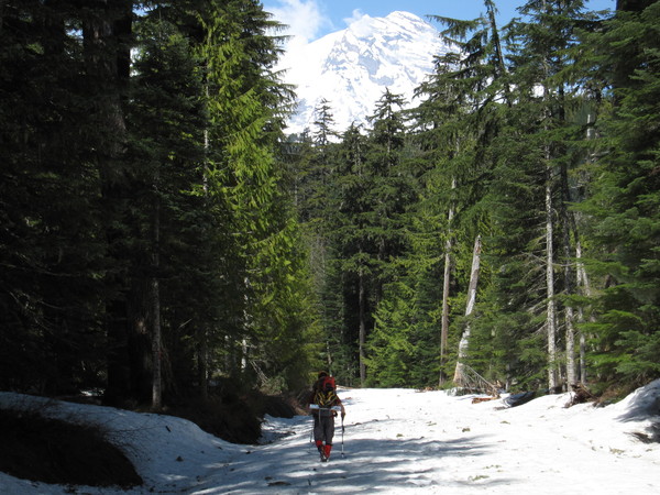
hiking trail sign @ Round Pass
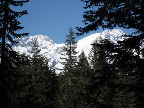
slowly getting closer to the route, with the Sunset Ampitheater couloir visible in between the trees on the left
traversing along Emerald Ridge. The Ridge narrows significantly as you near the Tahoma Glacier.
nearing the end of Emerald Ridge, looking up towards the route. The Tahoma Glacier provided us a direct route to high camp, so we opted to avoid Puyallup Cleaver (left skyline).
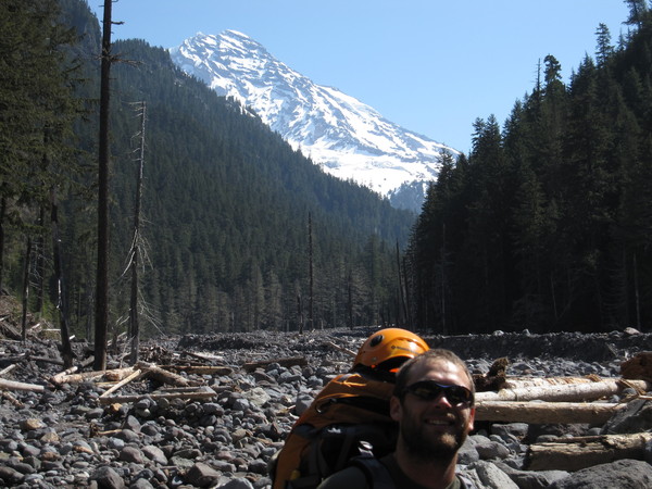
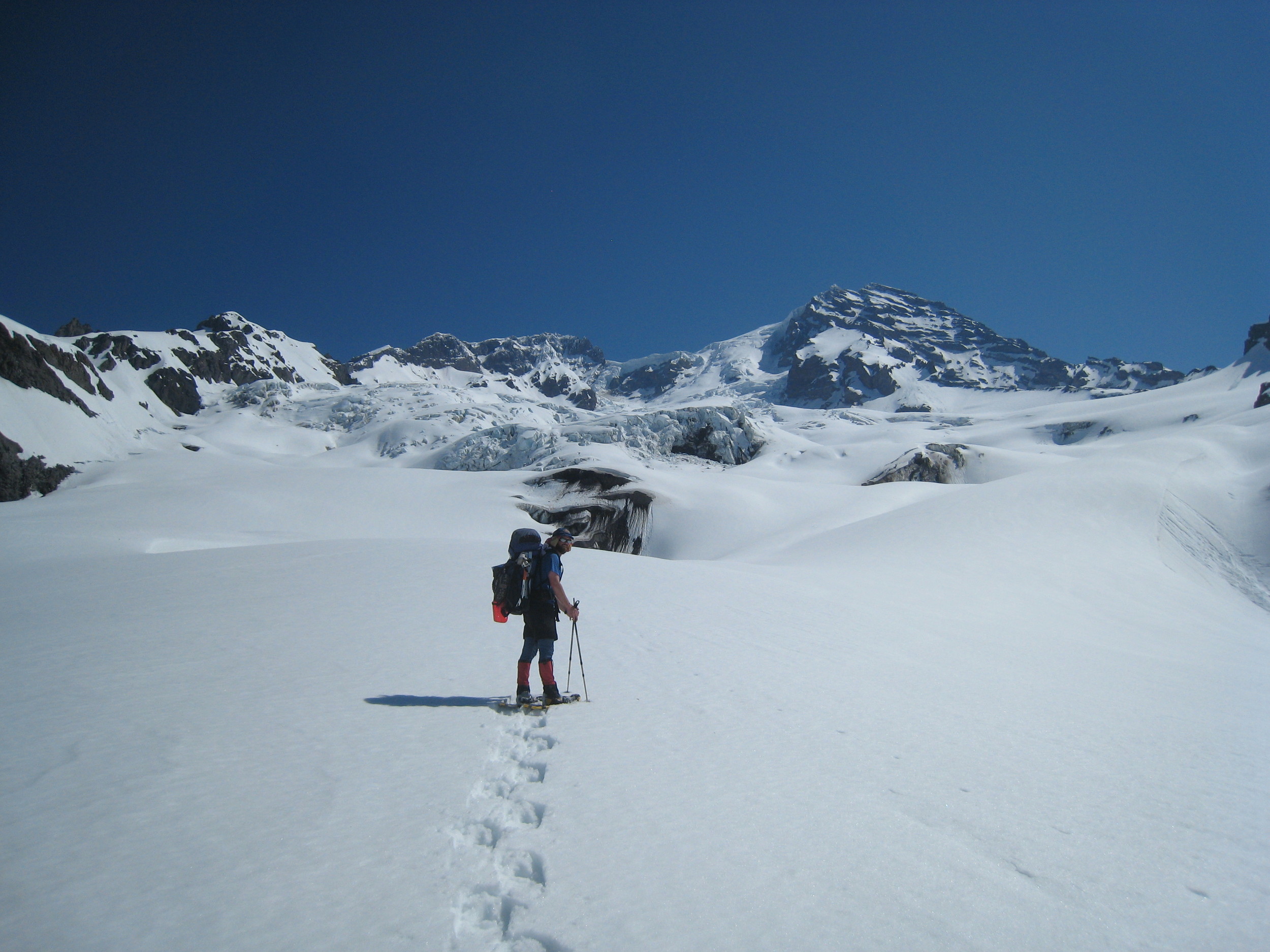
Chris on the approach up the Tahoma Glacier. By this point it was starting to get warm on the glacier.

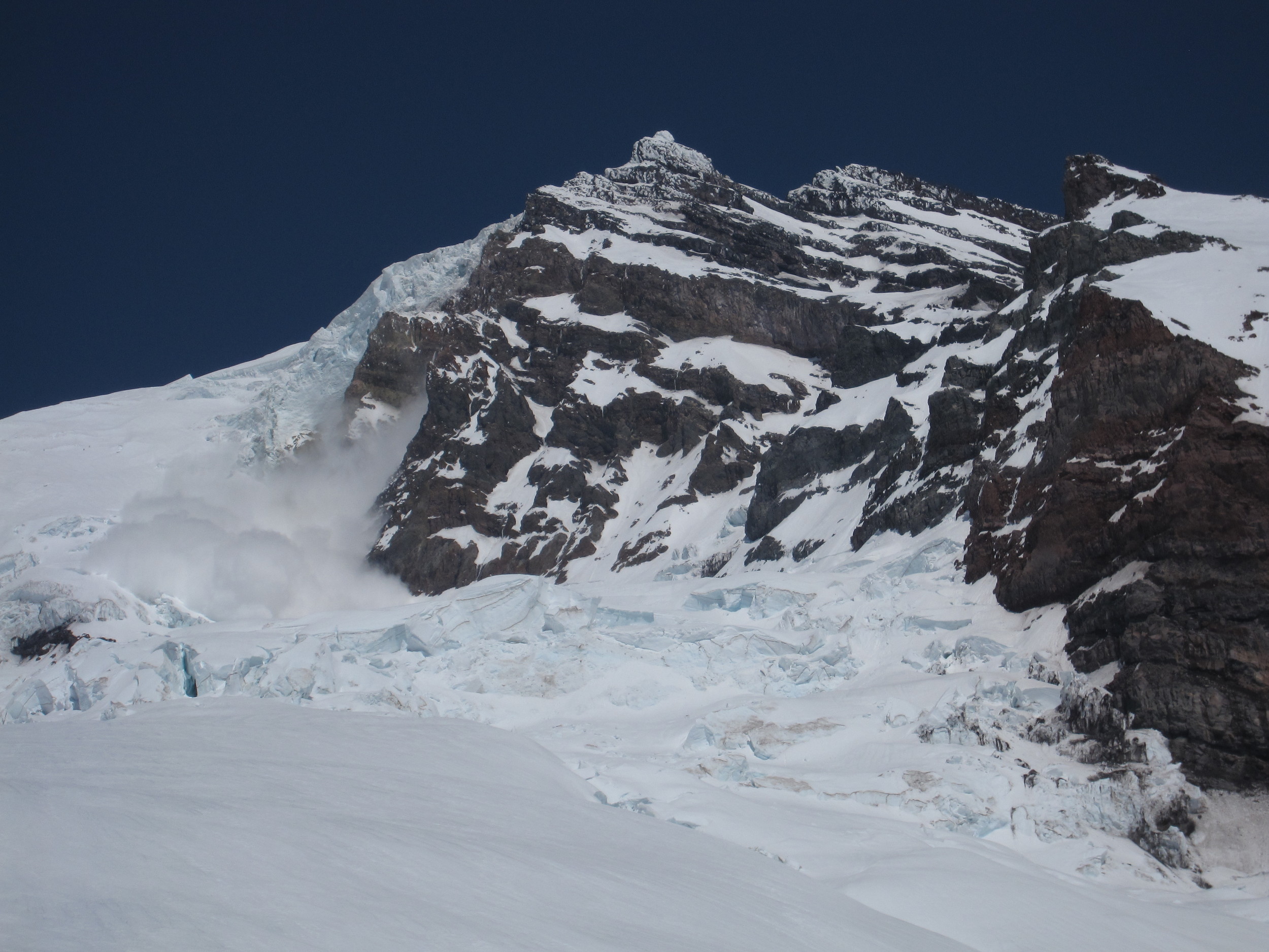
Afternoon avalanche on the Tahoma Glacier, caused by an ice serac breaking off from the obvious ice cliff. In the large version of the photo, you can observe the 2 skiers ascending the Tahoma Glacier route, with the powderblast nearing them.
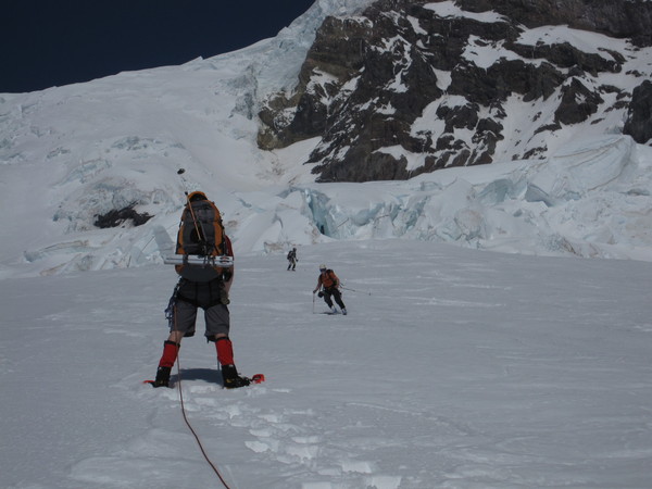
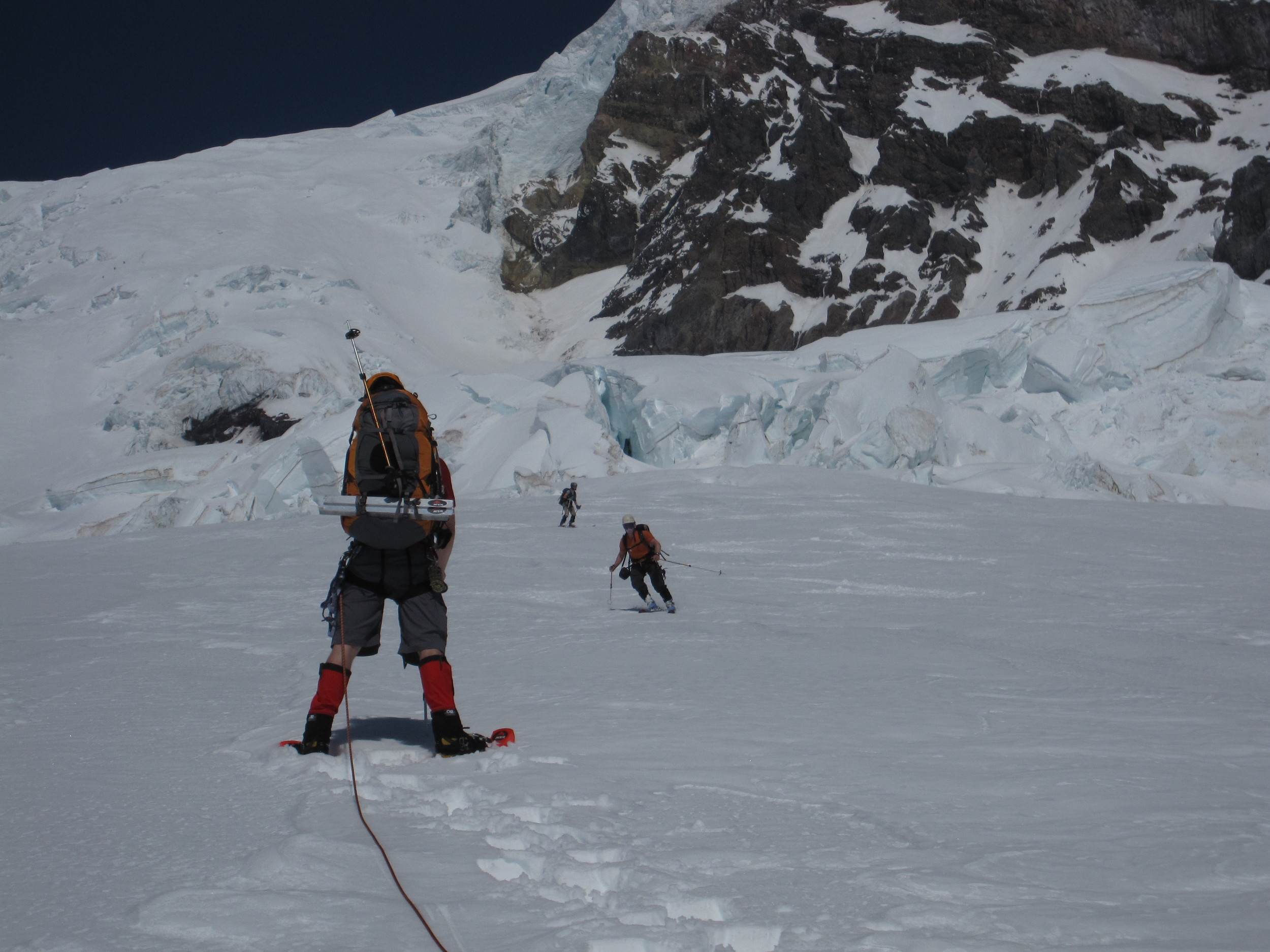
Skiers descending the Tahoma Glacier towards Nate. They chose to ski down immediately after the avalanche.
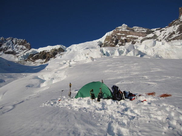
High camp on the Tahoma Glacier. The Tahoma Glacier and Tahoma Sickle routes are visible in the background.
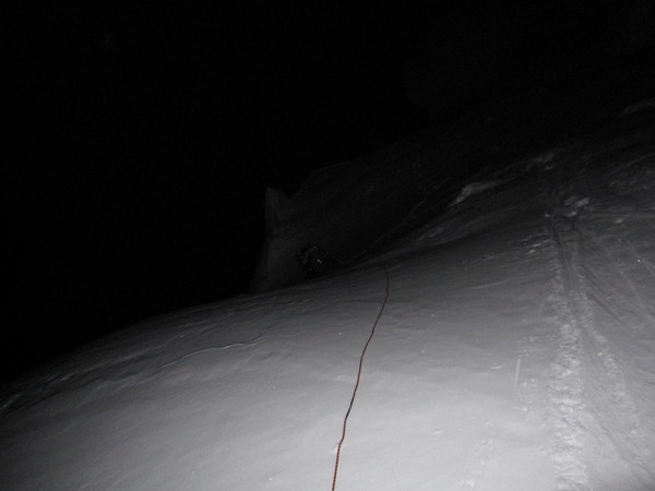
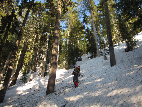
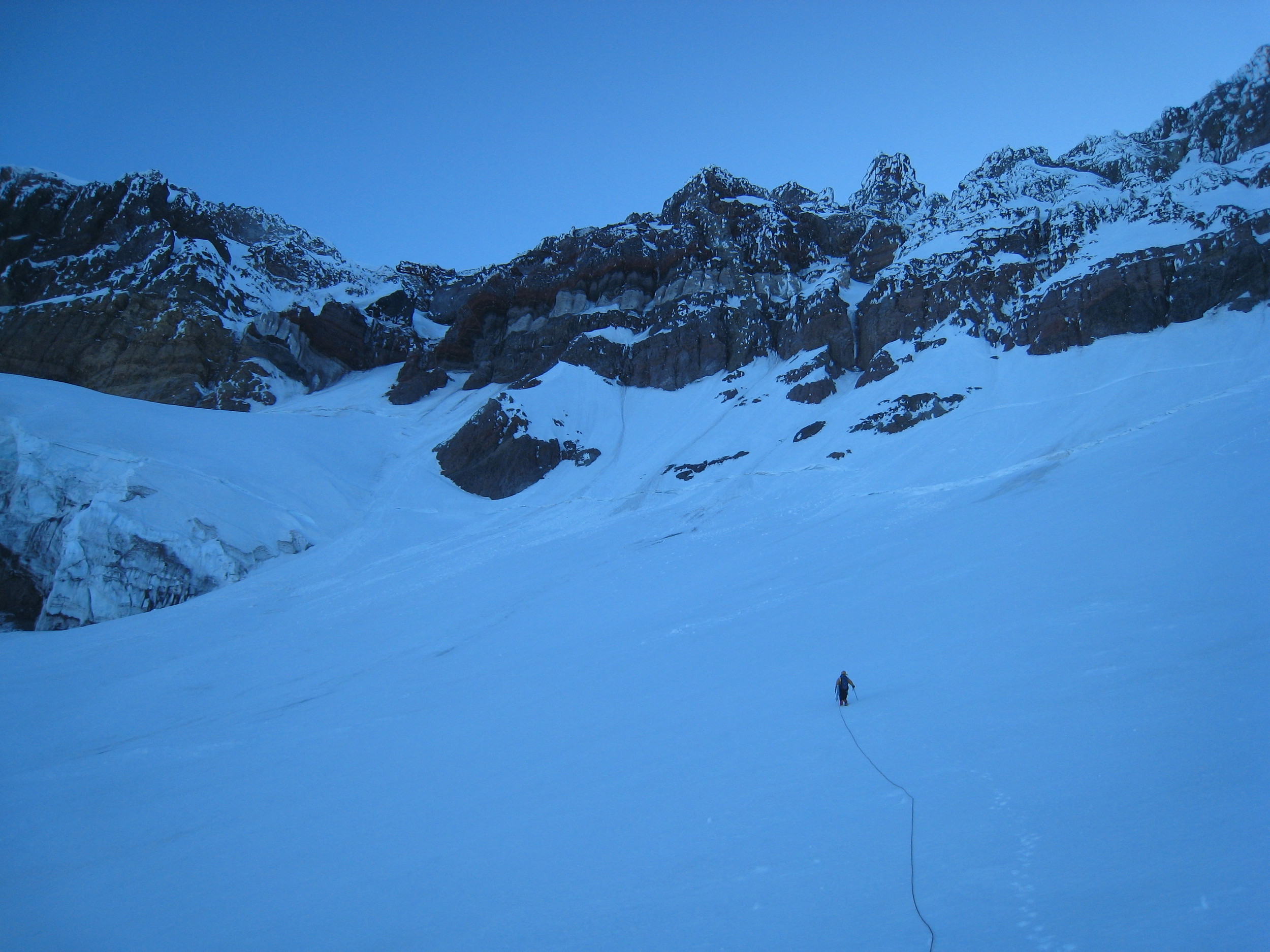
Nate dropping down a step in the Tahoma Glacier, after an alpine start @ 0215.
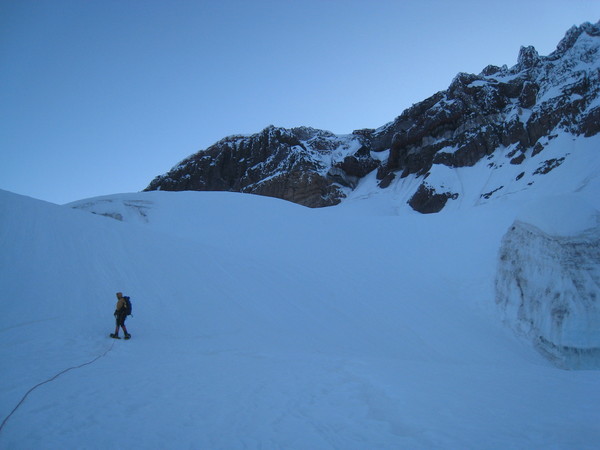
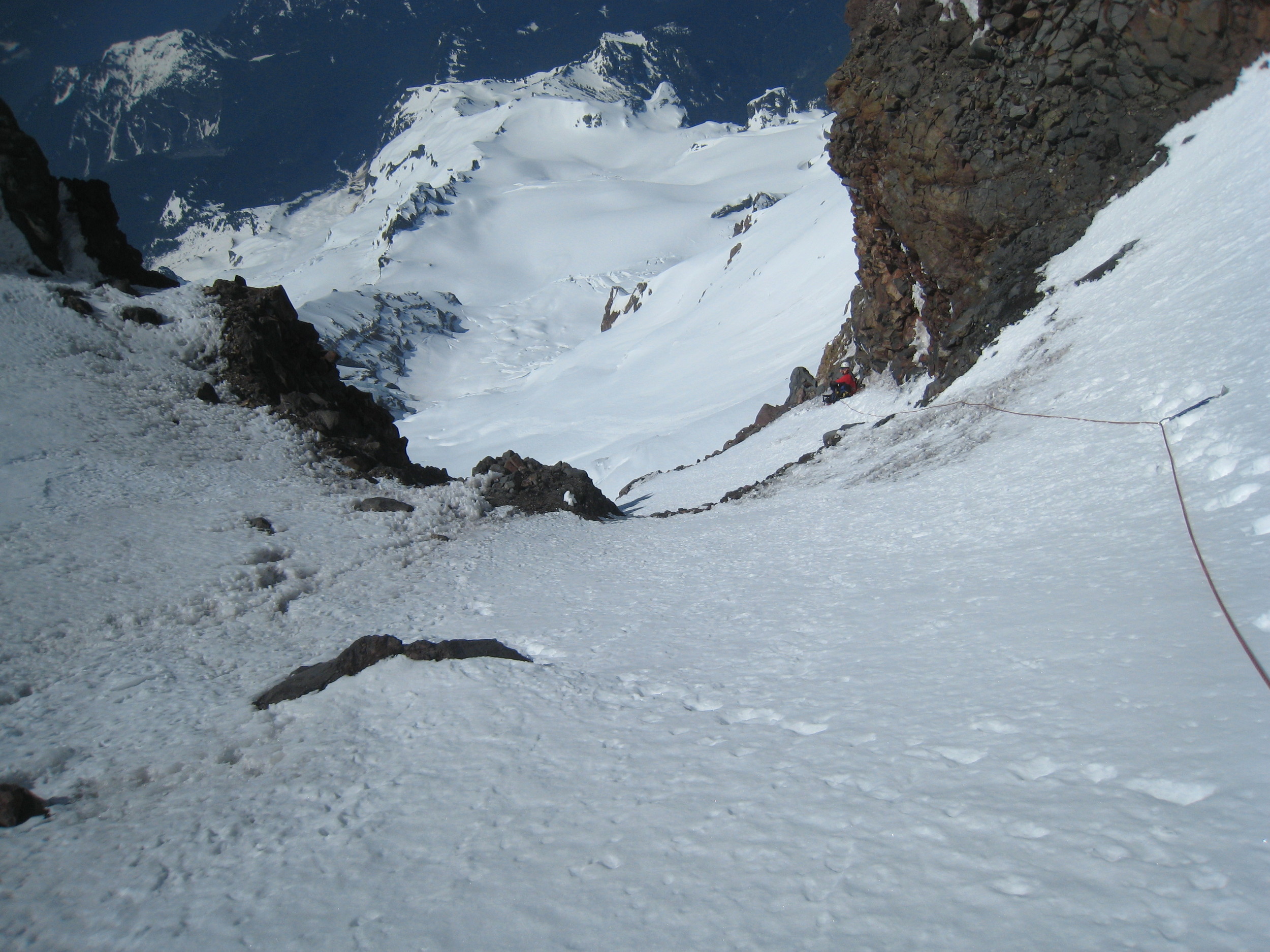
Chris approaching the Sunset Ampitheater and the entrance to the couloir.

Packing up the snowshoes and gearing up for the couloir climb.

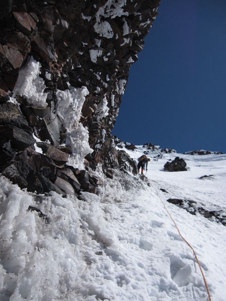
Nate entering the couloir. St Andrews Rock in the background.
Nate climbing the steepening lower portion of the couloir.
Chris nearing the right-hand turn in the gully.
Nate finishing up the rockband section.
Nate heading towards the top of the route and Sunset Ridge.
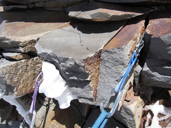
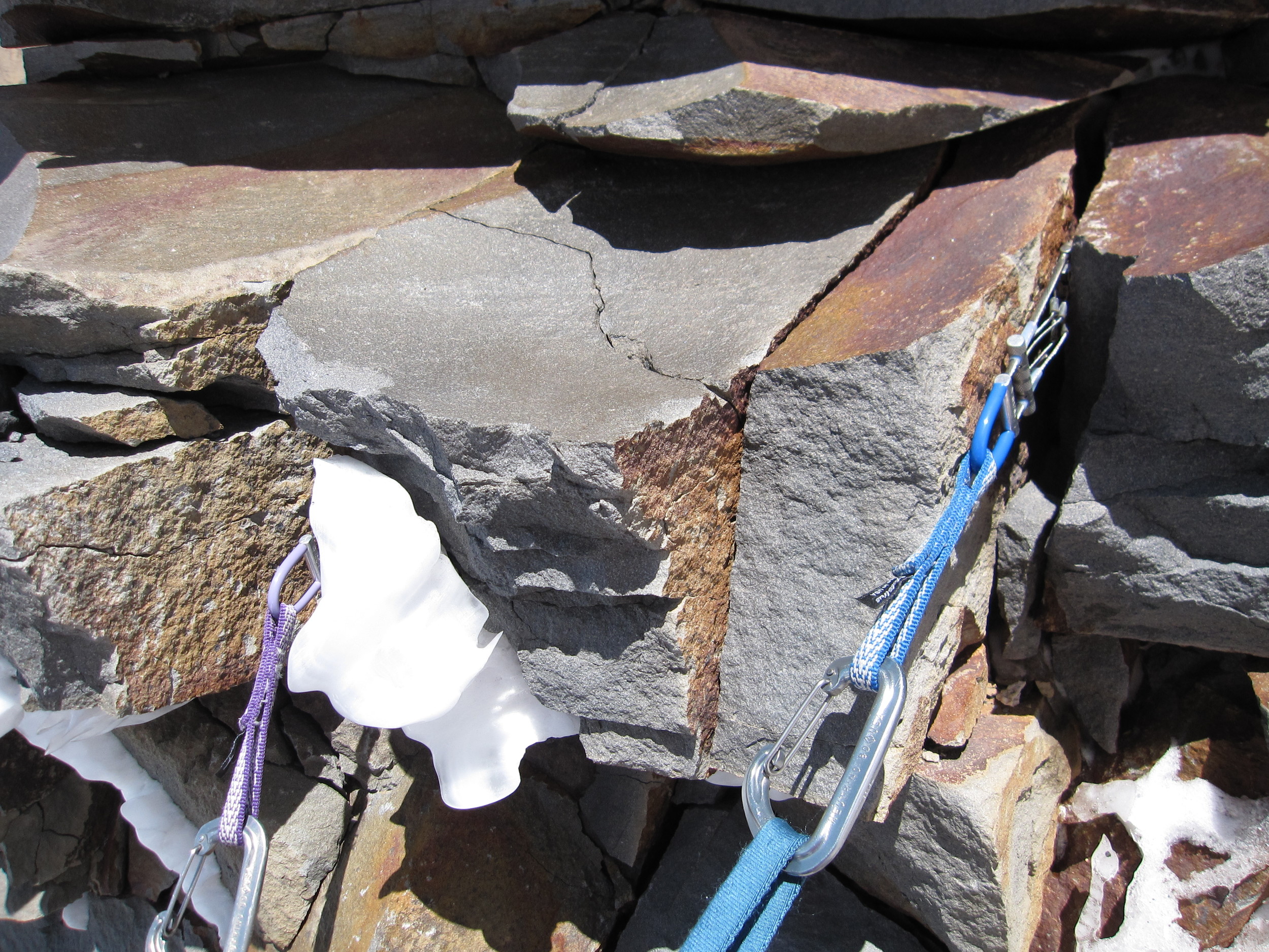
a bomber Cascades belay anchor
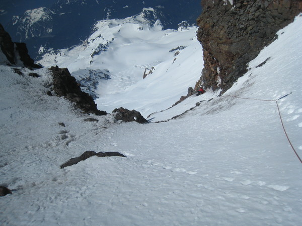
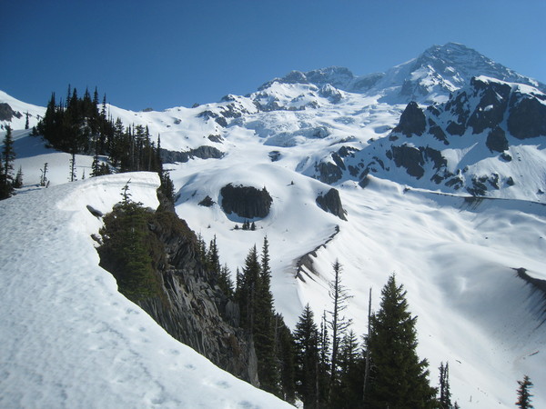
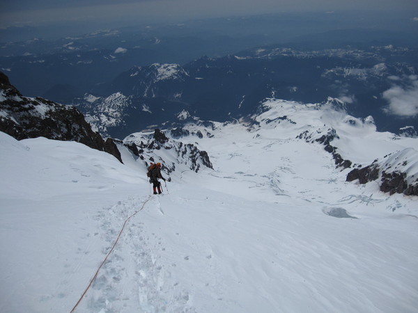
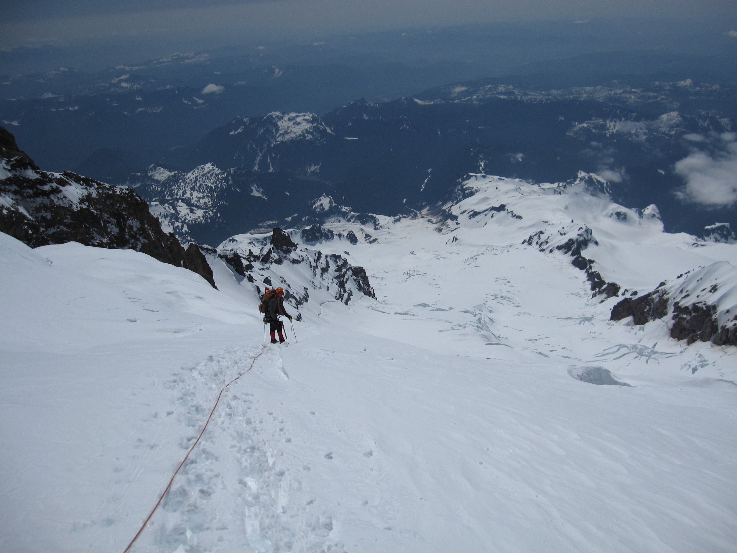
looking back at Chris and the Puyallup Glacier below
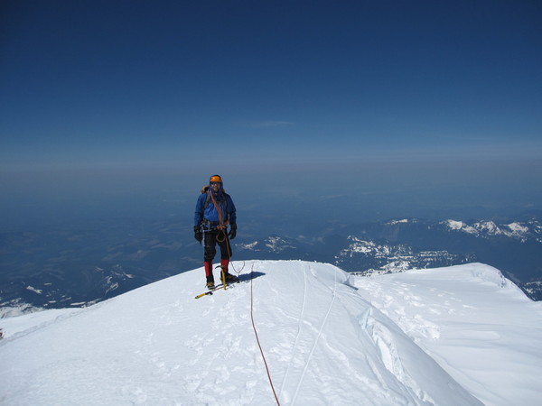
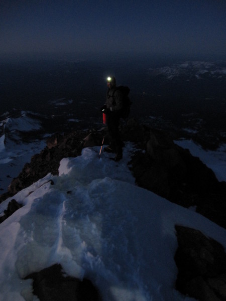
topping out on Liberty Cap
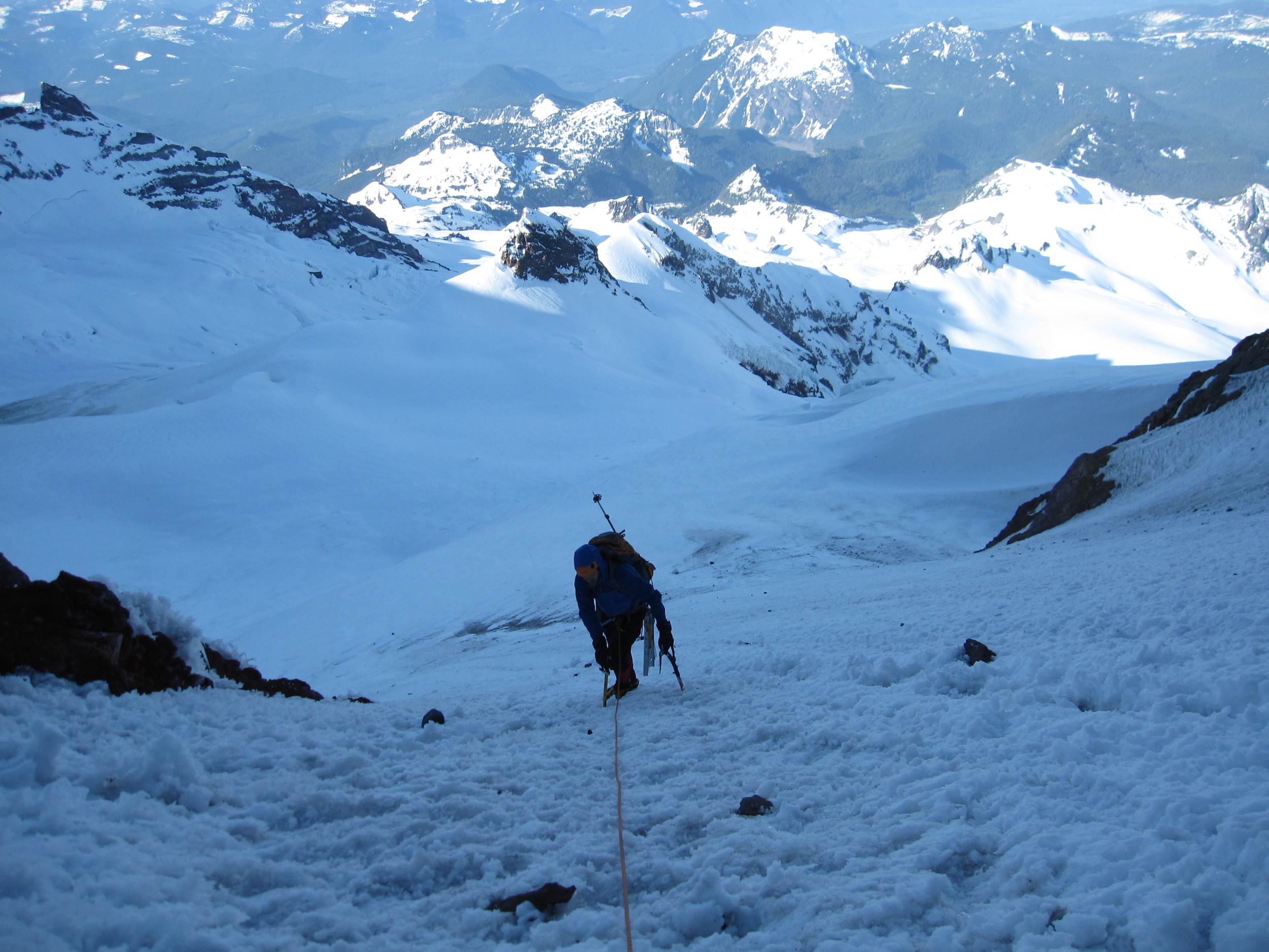
Nate getting ready to drop down onto the Tahoma Glacier, descent back to high camp. This ended up being the most brutal portion of the climb, as the afternoon sun made this section a true oven. The previous day, we watched a group climb this route in the heat of late afternoon with full packs. The tent is one of the specks below.

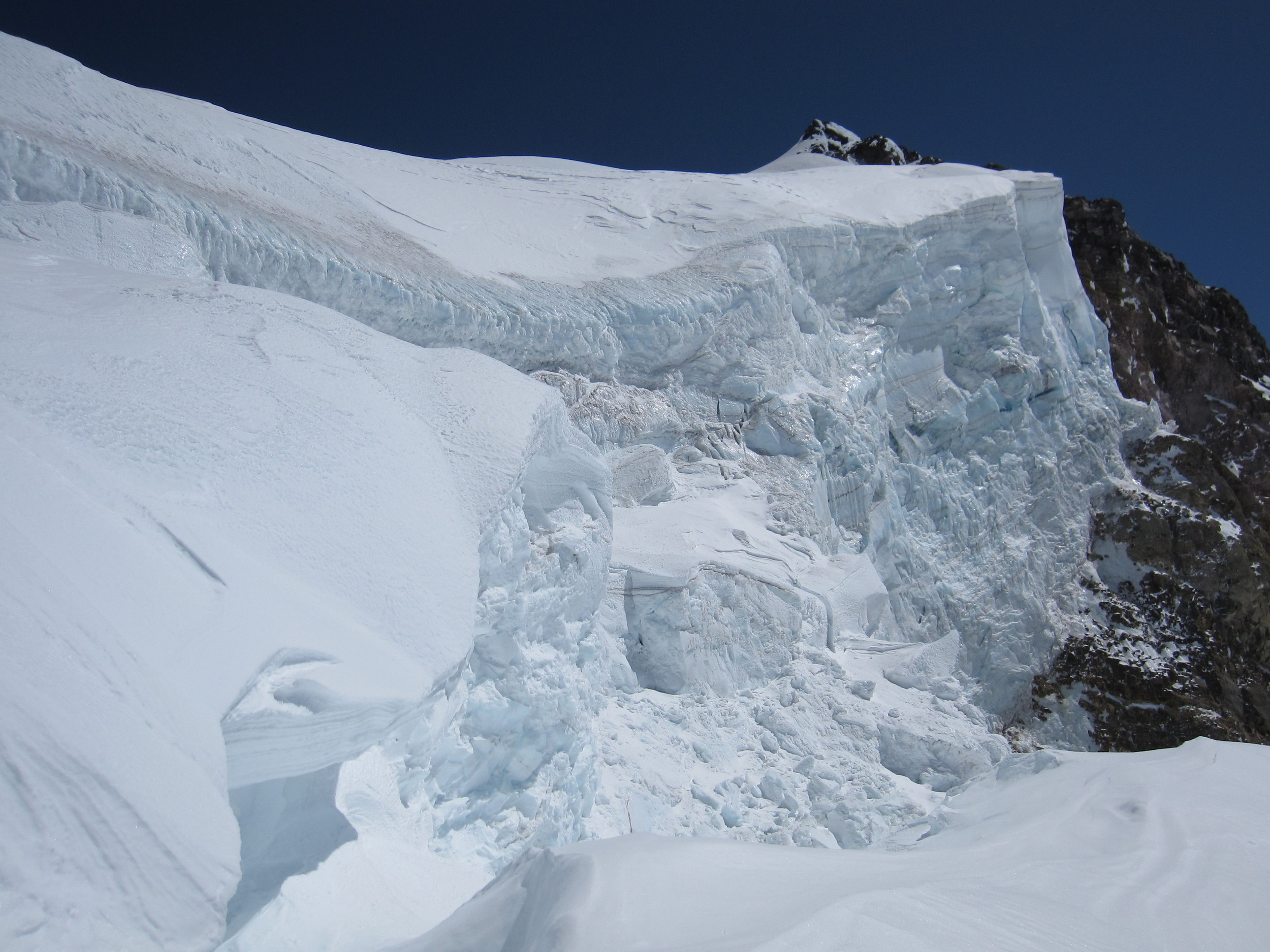
Tahoma Glacier ice cliff

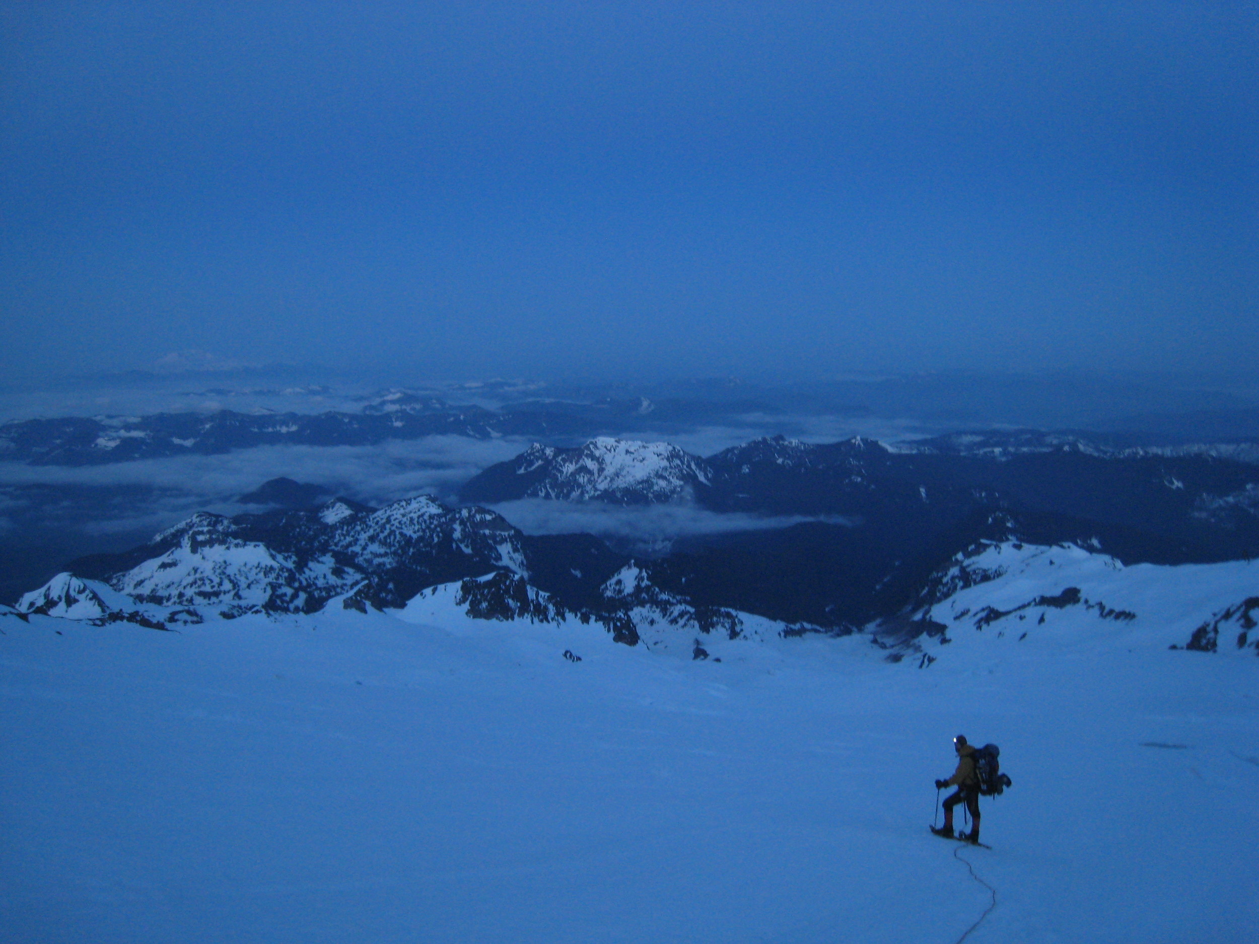
Descending the Tahoma Glacier from high camp, early Memorial Day 2009.
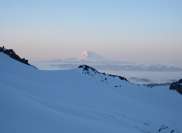
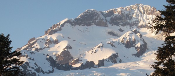
sunrise on Mt Adams, during the descent from high camp
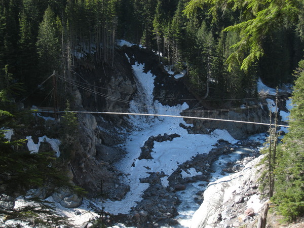
Wonderland Trail suspension bridge over Tahoma Creek
Nate descending the Tahoma Creek trail

Hiking the washed out portion of the Tahoma Creek trail, nearing the junction with Westside Road.
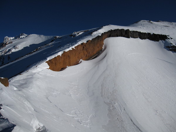
Sunset Ampitheater. The couloir is the obvious weakness through the rocks.
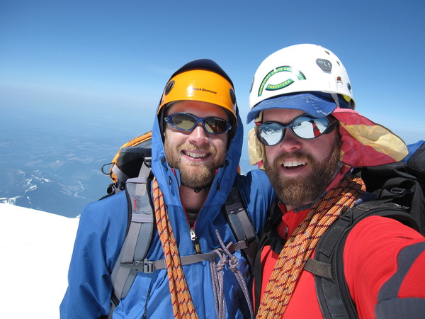
Thanks buddy for another great Rainier trip!
Gear Notes:
5 pickets, couple pieces of rock pro, 60m halfrope, ice axe, ice tool, running belays & munter hitches (frozen rope was not working with our belay devices), glacier rescue gear, snowshoes, tennies for the 3 miles of clear road beyond the gate, wicked homemade trail mix with beer nuts
Approach Notes:
We used the Emerald Ridge approach, and then took a pretty direct line up the Tahoma Glacier to high camp and the St Andrews saddle. From our viewpoint this was much easier and quicker than trying to ascend Puyallup Cleaver all the way to St Andrews rock. We used the Wonderland Trail and Tahoma Creek trail during the descent – in hindsight this was much more efficient. Tahoma Ck trail is in pretty good shape except for the 1/2 mile washed out at the junction with the Westside Road.
-
nice pics. I remember seeing you guys. We heard about the missing lady on Sunday from some snowmobilers, funny how common sense seems to evade some folks.
Greg, with this heat I wouldn't expect Casaval to be in good shape by Memorial Day. But some are saying that this will be a cooler summer...
-
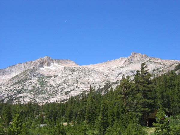
Trip: Mt Shasta - Green Butte Ridge to upper Sargents Ridge
Date: 4/18/09 to 4/19/2009
Trip Report:
Last weekend my buddy Chad and I climbed Shasta via Green Butte Ridge. This is the main ridge on the east side of Avalanche Gulch. The forecast was good all week, and seemed to get even better as the weekend arrived - awesome!
Because our base camp destination was only at 9500', the approach day was easy. We slept in and had a good breakfast, which paid off later. The hike up Green Butte took about 2.5 hours, and from there we set up camp and watched people hike up the Gulch and snowmobilers play in the old ski bowl.
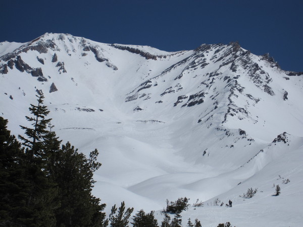
Green Butte Ridge, Avalanche Gulch, and Casaval Ridge (right to left)
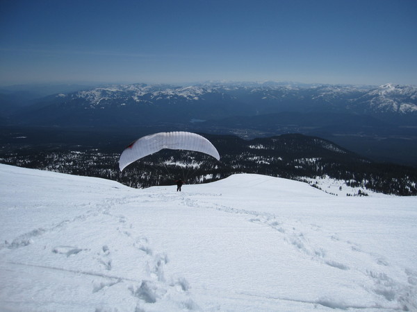
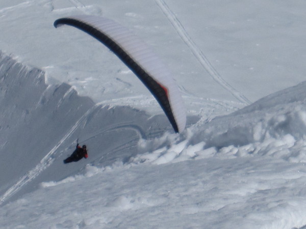
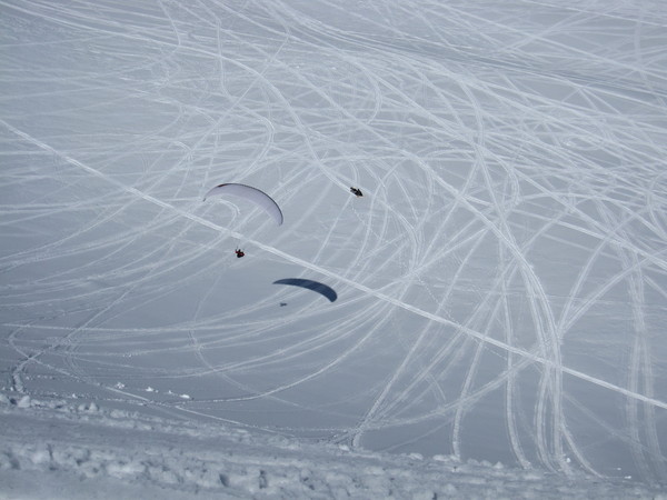
One guy even paraglided off the ridge, but had to opt for the east side due to wind.
Although we were perched right atop the ridge, where winds typically are harsh on Shasta, only light breezes occassionally blew through. Incredibly calm for this location.
We headed off early in the morning, around 0215, and climbed a good portion of GBR in the dark. Most of this was quick snowclimbing, with some occassional rocks mixed in.

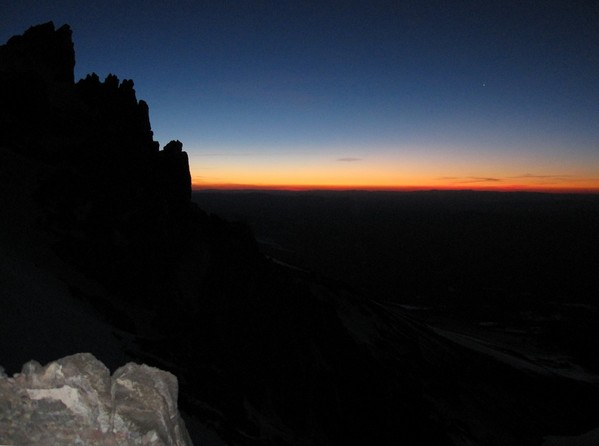
As we neared the convergence with Sargents Ridge, the first light of the day began to creep over the horizon.
We enjoyed the last cool temperatures before the sun finally hit us and started to heat up the mountain.
We traversed past a few pinnacles, then easily around Thumb Rock, tying into the AG route at Red Banks.
We made good time up to the summit from here, topping out around 0930. A group was just leaving the summit, so we enjoyed some peace on top before the rest of the days summitteers arrived.
We had decided on the ascent that we would opt to descend AG, since there were was some frozen rock scrambling on the climb that would likely be less glued in the warmth of the day. This worked out well, despite moving through the oven that is Avalanche Gulch. A couple layers of sunscreen were not enough against this bowl of bright heat.
We made a downward traverse beginning at Lake Helen and tied back into Green Butte Ridge at approximatly 10000'. This was a safe and easy way to get back to our camp, avoiding the majority of difficulties on the ridge above.
Positives: this is a fun scrambling route that has less traffic than AG or Casaval Ridge. Great views into the Mud Ck canyon and of lower Sargents Ridge. Green Butte offers a quick base camp approach with good perch to check out the action in AG and Casaval Ridge.
Negatives: directly below Green Butte is open to snowmobilers, so expect some 2-stroke fumes and noise during the weekends.
Gear Notes:
crampons, ice axe, sunscreen
we also used snowshoes to descend from camp back to the truck, as it was warm and slushy
Approach Notes:
head from Bunny Flat straight for Green Butte, visible from the parking lot
-
hey, I was up on Sargents (actually Green Butte Ridge) and watched a group of 2 climb up from AG to Casaval late Saturday afternoon. I was thinking, huh, that's interesting. Was that you 111?
Hell of a weekend on the mountain eh?!
-
-
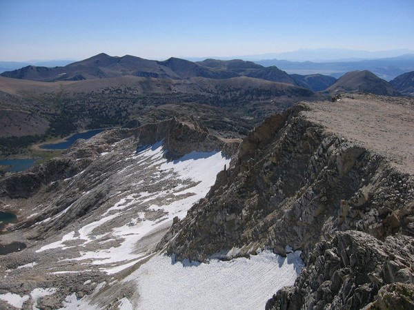
Trip: Mt Conness - East Ridge from Saddlebag Lake
Date: 7/26/2008
Trip Report:
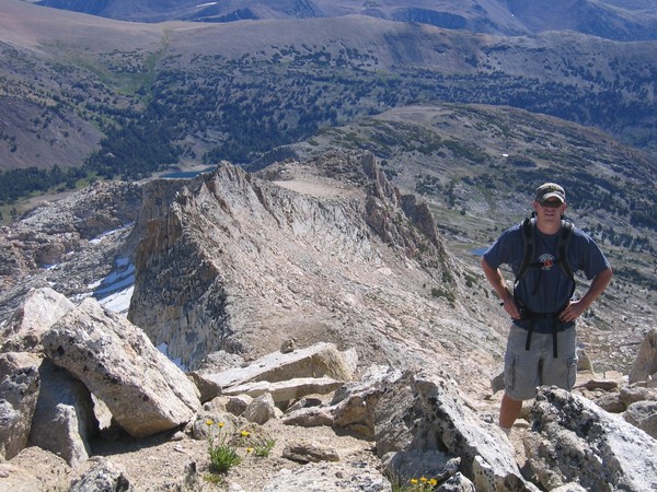
On Saturday we climbed the complete east ridge of Mt Conness (myself and friends Randy and Ken). We found this route to offer various terrain, with some class 1 through class 4 stuff. It is a scenic climb with not too much vertical gain and can be done in 1/2 day. Since we had to head to Ken's bachelor party later that day, it was a good choice.
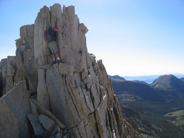
RJ Secor rates the east ridge a class 3. We found that following the top of the ridge over the pinnacles would involve some class 5 terrain, but most of the difficulties can be avoided on the south side. We ended up taking on some of the challenges.
On the top we met Karl from New York, who was out on a peak-bagging extravaganza.
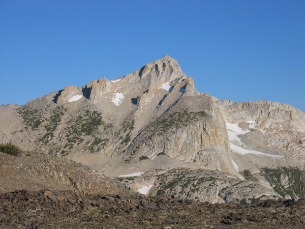
looking up at the east ridge from Saddlebag Lake
Mt Dana
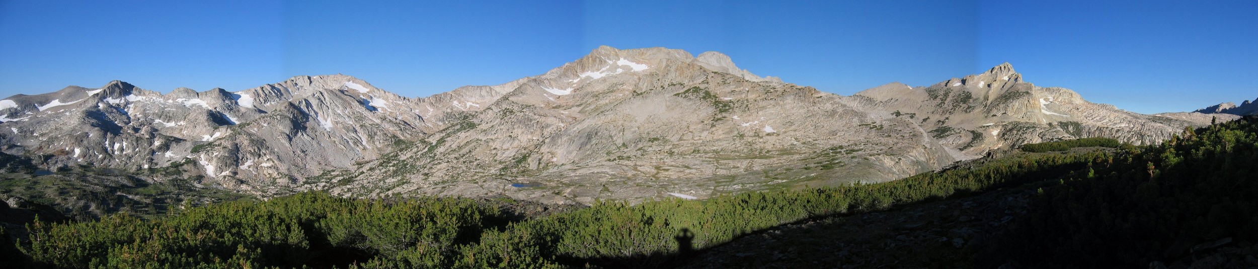
panorama, east side of Conness
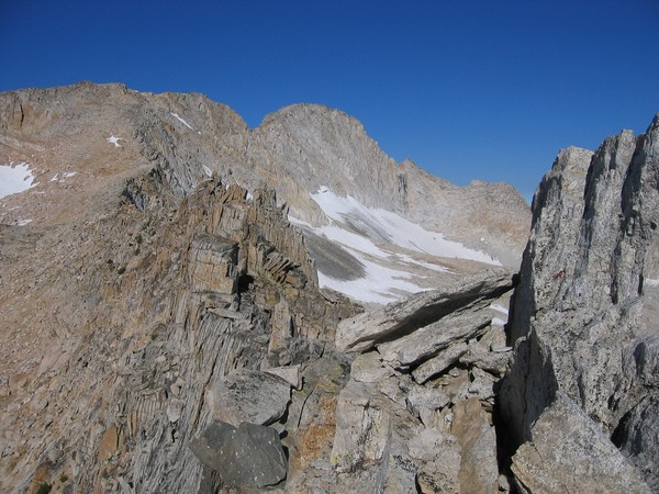
cruising on class 1 terrain after gaining the ridge
the beautiful SE aspect of North Peak
the fun part of the ridge
Ken chilling on the ridge
Randy on a pinnacle

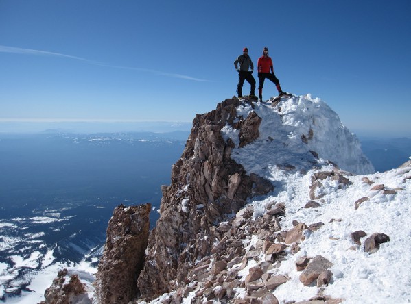
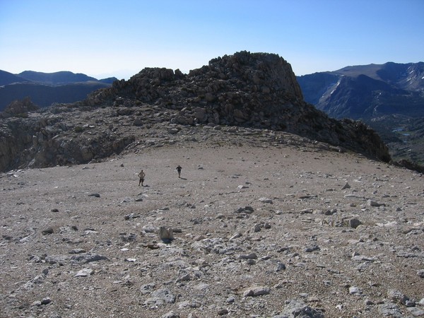
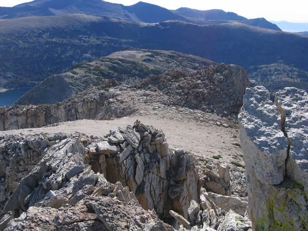
final summit from the plateau
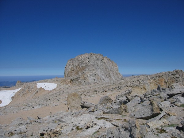
Randy with the east ridge below
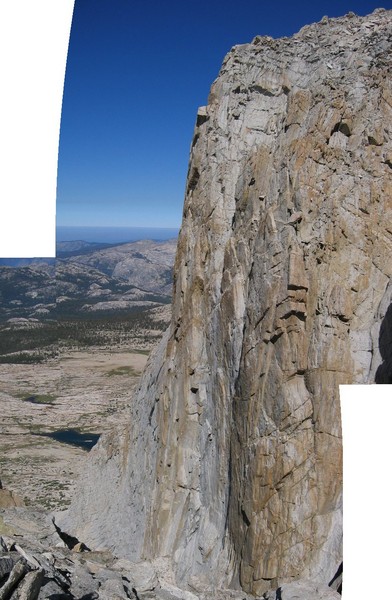
SW face
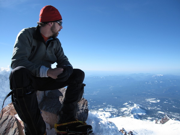
hanging out on the summit
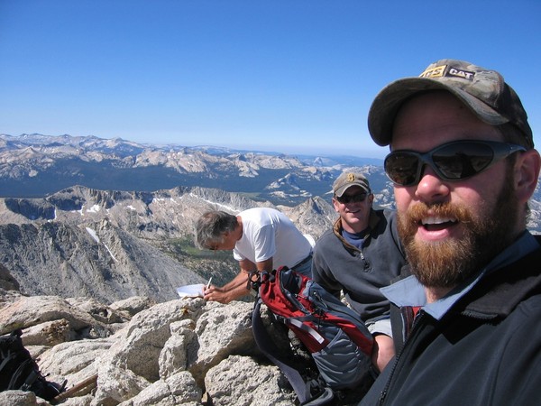
looking back down the east ridge from the summit
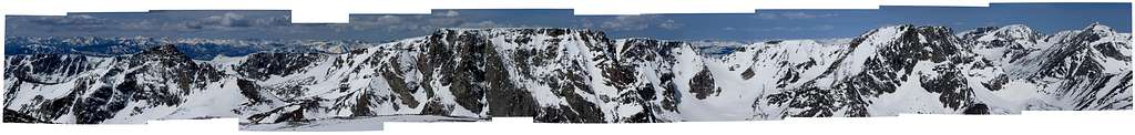
summit panorama

heading to the car and peeking back up at the east ridge
Gear Notes:
tennies, gallon of water, sunscreen
Approach Notes:
park at the end of the road, cross the dam, and head up
-
cool--thanks for sharing. That is a great route and worth the effort. I think I used the 'around the mountain trail' when we climbed it, but I do remember some steep traversing like you encountered on the approach.
-
pretty cool pics!

Once I spent a night locked behind one of those access gates...but there is something special about that risk.
-
nice work, looks impressive
-
Norman Clyde
-
yeah, plan to leave the snowshoes. There were a few portions where I was postholing but they should be minimal in 2 weeks.
-
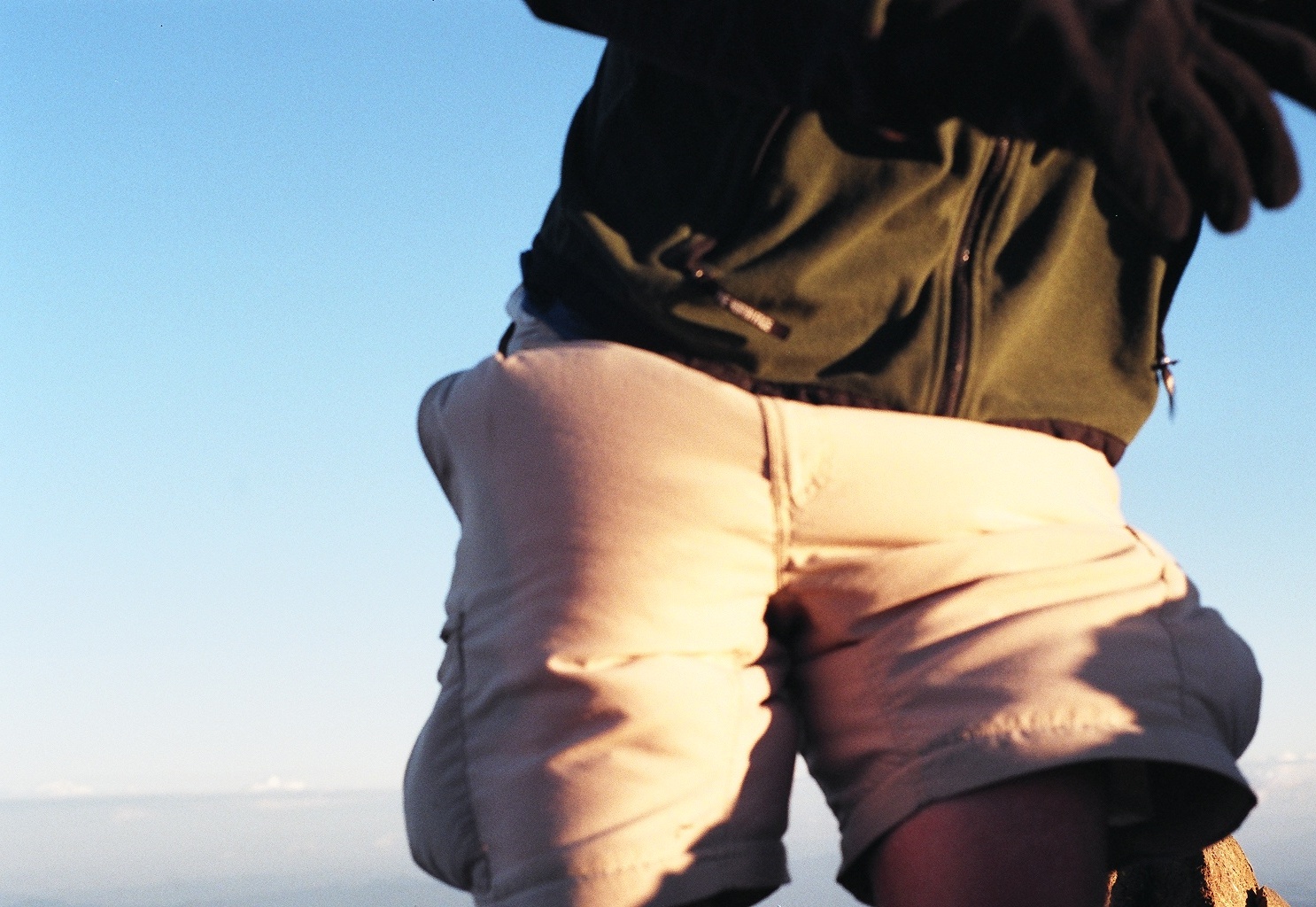
sorry about that, they didn't teach us pooping until day 4


AAI Video Category 2013 Photo Submission Thread
in Climber's Board
Posted
Bailey Traverse 2012 (12.5 min slideshow with photos and video clips)
[video:youtube]QK85Gw0CDuk