


scottk
-
Posts
68 -
Joined
-
Last visited
Content Type
Profiles
Forums
Events
Posts posted by scottk
-
-
I lost a BD skin skiing down from Colchuck col Sunday night. Probably a few hundred yards above the trail where I took a fall in the avy debris. Beers await the lucky finder.
-
Has anyone climbed the east gully route on Argonaut? Many reports of rappelling into the gully but I can't find any reports of climbing out of the gully to the northeast facing upper snowfield. Here's what Summit Post says:
"East Gully - A prominent 45 to 50 degree snow gully accessed from the basin just southeast of the ridgeline connecting Colchuck and Argonaut. A single dihedral pitch offers access to the summit ridge. Best in early season. II 5.6"
We're interested in a ski approach from Colchuck Col and the East Gully seems like the most logical route fro this direction. Seems odd that there are no reports of this route...
-
Trip: Mount Olympus - Blue Glacier, North Ridge
Date: 8/2/2015
Trip Report:
The plan was a combined climbing and backpacking trip, with 5 people interested in climbing and 2 interested in just backpacking. From what we heard from the Ranger station, many parties are turning around without summiting, for various reasons. Based on these reports, two of the climbers decided sleeping in and a mellow hike up to the moraine for a view of the Blue Glacier was preferred.
Wes, Eric and I decided to try our luck at the summit. We started from Elk Lake at 3 am and started across the Blue Glacier around 5 am. Crossing the lower Blue Glacier was easier than it looked from the lateral moraine. Although the glacier looked fractured, it was mostly hummocky with the occasional fracture and was pretty easy to cross. It was fascinating to cross an icy glacier with rushing water and deep blue pools of water.
The slope up to Snow Dome was free of snow and was a class 2 and 3 slabby scramble with a couple streams that were great for replenishing water. Getting up the flanks of Snow Dome requires a couple hundred feet of steep (40 degrees) snow and some short (10 feet) sections of glacier ice. The ice was a little sketchy with soft boots and aluminum crampons but went easily. We crossed Snow Dome and went above the open bergschrund to access Crystal Pass.
Climbing up the Blue Glacier towards the false summit involved weaving around a few crevasses but the snow bridges were broad and comfortable. We scrambled the loose rock to the base of the summit rock, ate lunch, and climbed the short section of steep snow to the base of the North Ridge.
There were no moat issues and the 5.4 rock climb up the North Ridge was enjoyable, although our 60 m twin rope folded in half didn't quite reach the upper belay station. In retrospect, we should have simul-climbed for about 20 ft before setting up the belay. Instead, we set up a makeshift belay station on the bench below the real belay station and everyone scrambled to the summit from there.
After checking out the smoke to the south and the views to the north we headed down the route we climbed. With rope stretch, we were able to reach the base of the summit rock in one rappel. The rest of the down climb was generally pleasant and easy, with the exception of the short icy sections getting off Snow Dome. As the snow melts off the flank of snow dome and these ice sections get longer, I would want to be equipped with stiffer boots, steel crampons, and perhaps an ice tool.
-
Wow, what an adventure. Congratulations!
-
I had to Google "tumpline". I've never seen one in action but it looks like an interesting way to take some of the load off the shoulders.
-
I would just like to mention that this was one of my top 2 or 3 trips of all time. Great partners and some great county.
-
I have used a Marmot 15 degree bag for years with good success except for the 3-pound weight. With this in mind I'm in the market for a lighter summer bag. I rented a rented FF Vireo for 5 nights last week at elevations of 5-7K most nights. I wanted to try before buying due to the minimalist design (no zipper or hood). I wore a medium weight down jacket (FF hyperion) and a fairly thin hat. It probably got down to the high 30's most nights and I was not in either a tent or a bivy sack. I was actually a bit warm in the legs and a fairly cold in the body so you would probably want to pair it with a heavier down jacket (FF recommends the helios or heavier) and warmer headgear. The tent or bivy sack might have solved the cold issues at these temps but probably wouldn't provide enough warmth once you get below freezing, which often happens in early summer and early fall. The 16 oz weight is great but I missed not having a zipper to let my legs cool during the beginning of the night when it was warm. If I were to buy one I'd add a couple oz of down and a down hood, which would get the weight up to about 20 oz. The FF Merlin (rated to 30 degrees) weights 24 oz and I think the zipper and build-in hood is worth the extra 4 oz. This experience with the Vireo indicated that a 40 degree bag is not warm enough for most of the stuff that I do. I really don't sleep well when I'm cold.
-
Tahoma glacier route is a great next step up that doesn't require ice tools. Some steep snow in places but generally comfortable with just an axe. Probably too broken up in August, so you might want to want until next June or early July. It can be lonely over there, which is one of its great attributes.
-
I was up there late last summer with no issues. I've been up the Boston Basin/Sahale area three times this year and noticed as early as May that the Quien Sabe was particularly broken up. I think this year is unusual.
-
Sweet. I second JasonG, staying on top of the ridge works best for the traverse over to the Boston Glacier. The ledges may be shorter but they are definitely more stressful in terms of loose rock.
-
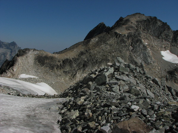
Thanks for a great trip Andy. I was pleasantly surprised by the open forest travel on this route and the last 300 feet on the summit block are fun scrambling. This is an excellent alternative route late in a dry year when the Silver Star glacier is down to ice and crevassed. That being said, based on our view from the col showing good snow coverage on the glacier and my previous experience skiing the Silver Star glacier, I would vote for the Burgundy Col/Silver Star Glacier route as the more alpine and scenic route.
I was also intrigued by this route as a ski trip. I looked down the south gully last April after coming up from the Silver Star basin and couldn't see what happened after the rollover. Now that I’ve climbed it it’s pretty clear that this would be a fun ski in the right conditions. In addition, it’s less vertical than starting from Silver Star Creek.
I should mention that climbing from the col at 8,600 to the summit is not a trivial task in April. After about 20 minutes of thrashing through light powdery sugar snow that was chest deep in places and gaining about 30 ft in elevation, I gave up on a summit bid last April. It was still a worthy day just for the ski from the col.
-
The mileage on the White River Trail sounds high. I'm pretty sure it's under 45 miles. Also, reports are that it's very overgrown after the turn off to Boulder Pass (at 5 miles). My memory of recent trip reports is that everyone has headed up Lightning Creek so it's unclear what the trail is like from Lightning Creek to White Pass.
Last year we came out the Indian Creek trail which is the official Pacific Crest route now and is in fairly decent shape.
-
My condolances to the friends, family and co-workers of the climbing ranger. This has been a very sad year for the staff at the Park and I hope they know how much we appreciate their willingness to put their lives on the line to protect/rescue the public in general and the climbers in particular. I haven't seen much in the way of "facts" on this accident but I would hope that we will reserve judgement on the four climbers that got in trouble. No matter what their decision making process I'm sure that they are grieving right now for the lost Ranger. Let's keep in mind that the press and public will be reading what you have to say on this topic.
-
Coverage was great and snow was nice proto-corn on both Asgard and Colchuck glacier last weekend. The ski down from Colchuck lake was a bitch due to low coverage, but probably normal for this time of year. Road should be open soon.
-
Great trip! I'm impressed with the photogenic quality of your pooch.
-
We were up there a couple weeks ago. Crevasse hazard is low on the Eldo and Inspiration glaciers until you cross the east ridge on Eldorado Peak. After that you will encounter more open crevasses and I think crevasse rescue gear is recommended.
-
Skiers need soft snow.
-
Anyone interested in trying to hit Cosho, Kimtah, Katsuk, and Mesahshie this weekend? I'd prefer the south side traverse going in and out Easy Pass. Needs to be someone comfortable with lots of Class 3 and 4 loose rock. I'm having trouble getting any of my usual climbing partners interested and I'd rather not do a solo trip.
Scott
-
Thanks for writing it up Nod. Memerable trip improved with great partners!
Scott
-
If you lost something send me the description and we can work out an arrangement.
Scott
-
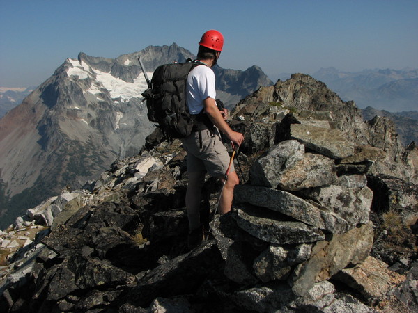
Andy, thanks for the great climb. I enjoyed this climb with its pleasant approach, nice scenary, and 300 feet of Class 3/4 scrambling on decent rock.
Klenke, thanks for your helpful analysis regarding which summit is higher. I would like to propose another piece of evidence based on comparison of the north summit with the mountain in the background. As you can see in the photo below, there's a prominate mountain in the background (just right of the north summit) that is approximately 500 ft higher than a straight line between the south and north summits of Greenwood. If someone can identify the summit in the background (which appears to be somewhere in the Pasaten, or maybe the north end of the Sawtooths) we can compare the elevation of this mountain with Greenwood's elevation of 8415. If the mountain is less than about 8,500 feet tall then I think this is more proof that the north summit is lower than the south summit.
[quote=iluka
BTW, I'd like to compliment dsweld on his excellant route description at: http://www.summitpost.org/mountain/rock/379457/dumbell-mountain.html
-
Nice report. Challanging approaches mean you get the route all to yourself, even on a sunny day in July.
-
You won't have any trouble finding a place to throw out a tent at either Cold Springs or Morrison Creek that time of year (depending on how far you can get up the road). The camping is primitive and unregulated as far as I know.
-
Here's how we went in a few years ago: Head up the Westside Road as far as you can (if it's open). If it's not open plan on an extra three miles. Then hike up Tahoma Creek. There was flagging to follow a couple of years ago that was helpful since the trail is mostly washed out. Of course, you'll probably be in snow this time of year. Continue up the trail at the base of Emerald Ridge to a pass at 5600 ft. From there you head cross country up the ridge to the northeast and gain the Tahoma Glacier about 6,000 ft. It was a long day up to 9,000 ft even without snow when we did it.
Flotation will likely be required.
[TR] Sinister Peak - NW Face/W Ridge 7/3/2017
in North Cascades
Posted
We were hanging out on Itswoot Ridge when you came back through. Thanks to you and all the other parties that put in a nice boot track over to Sinister and back.
We were rather surprised by the crowds. I'm hoping it's just one weekend a year that this occurs since it's an attractive destination for a 4-day weekend in early July. Given the recent reports of bergschrund issues on Sinister, it's a pretty narrow climbing window. Hopefully, they never get serious about maintaining the Bachelor Creek trail. Otherwise, this area is going to look pretty over-used in a few years.
Too bad about the nasty note. Approach shoes, poles, garbage? Seems like a good working assumption that you left behind a few items to pick up on the way out.